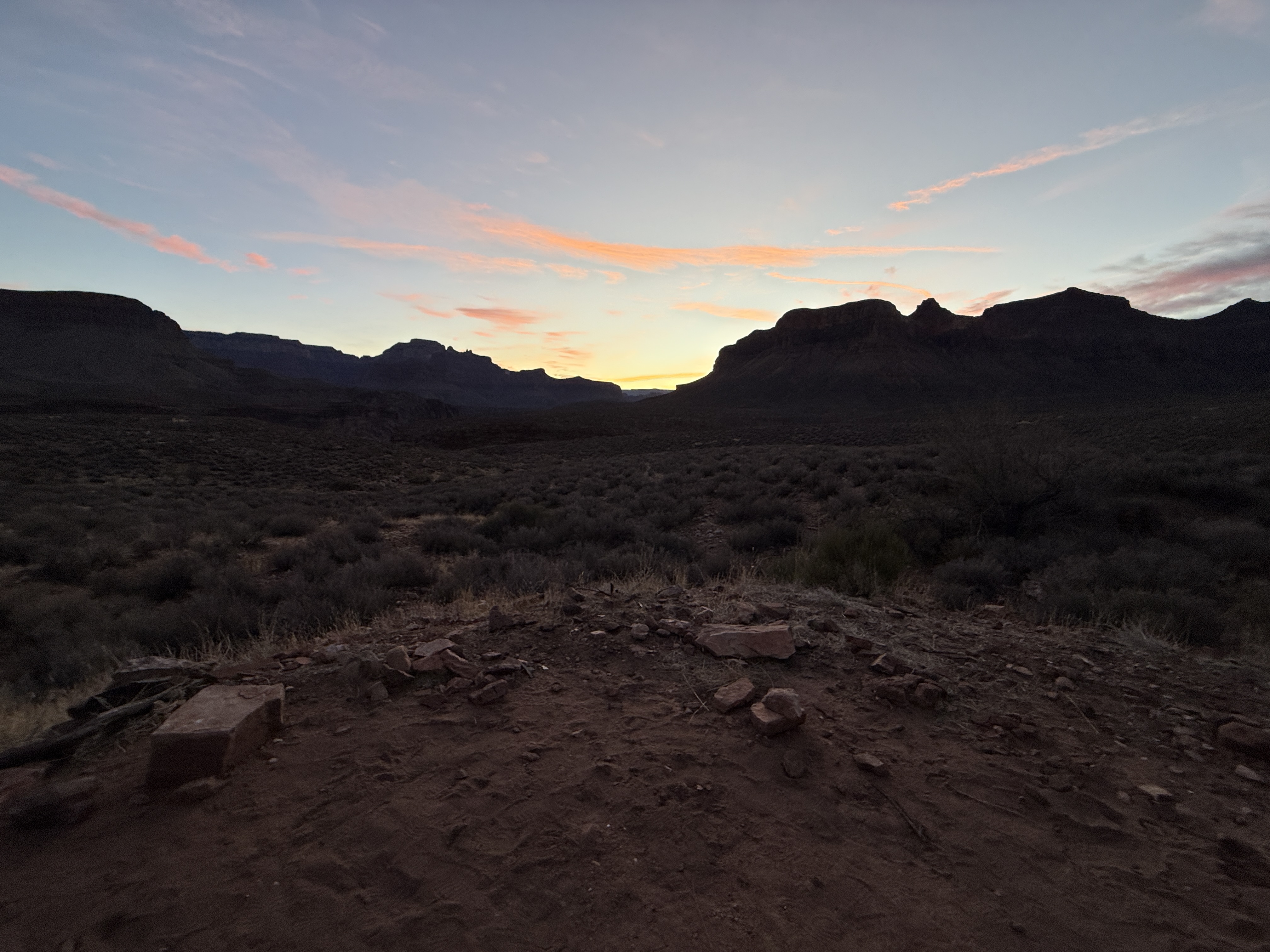
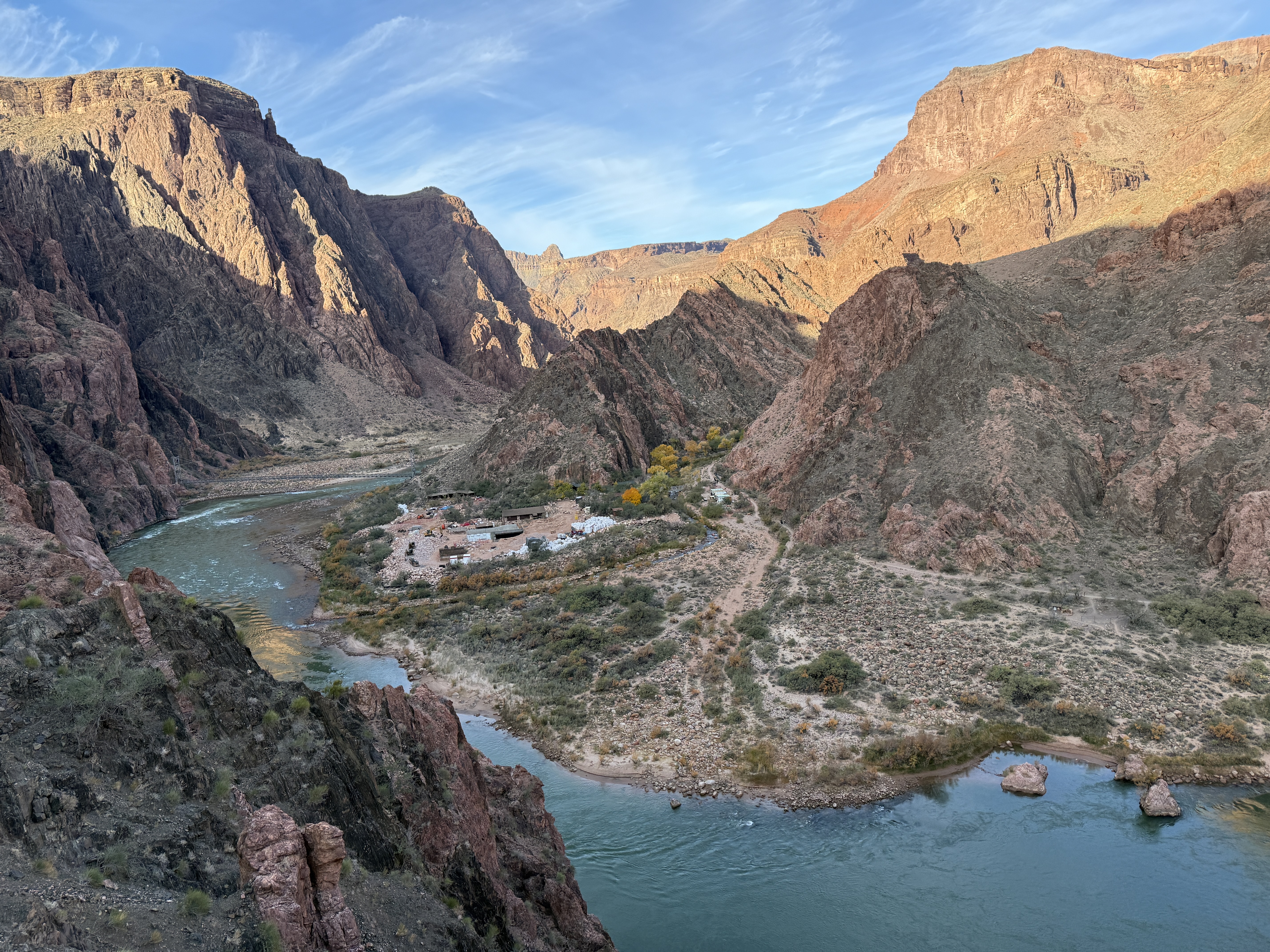
Kalalau Trail: A Hiker’s Redemption Journey

January 26-29, 2025

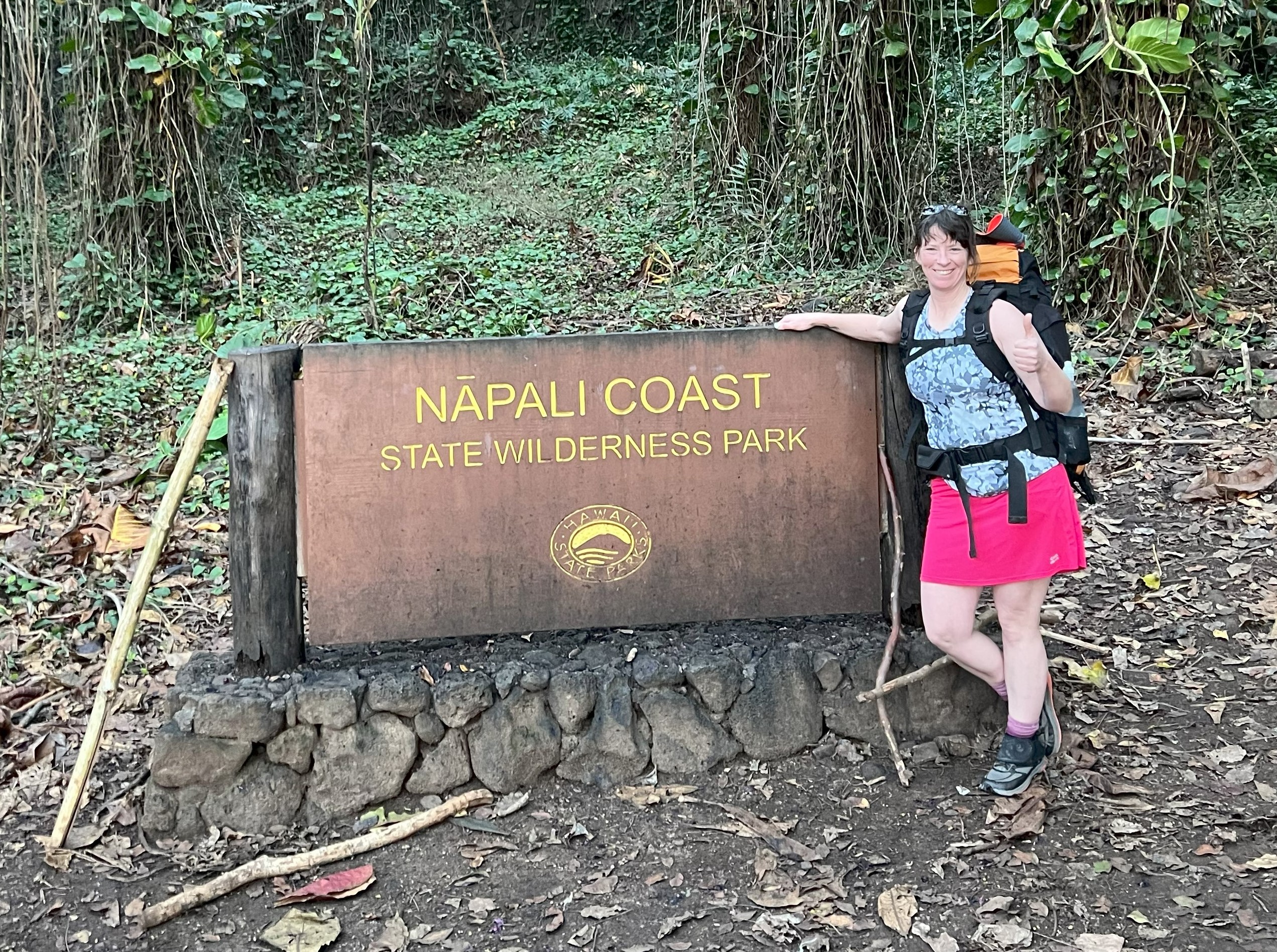
NaPali Coast, Kauai, HI

Mileage: 23 miles Out and Back
Elevation Gain: ~6500′
Permits: Wiki Permits

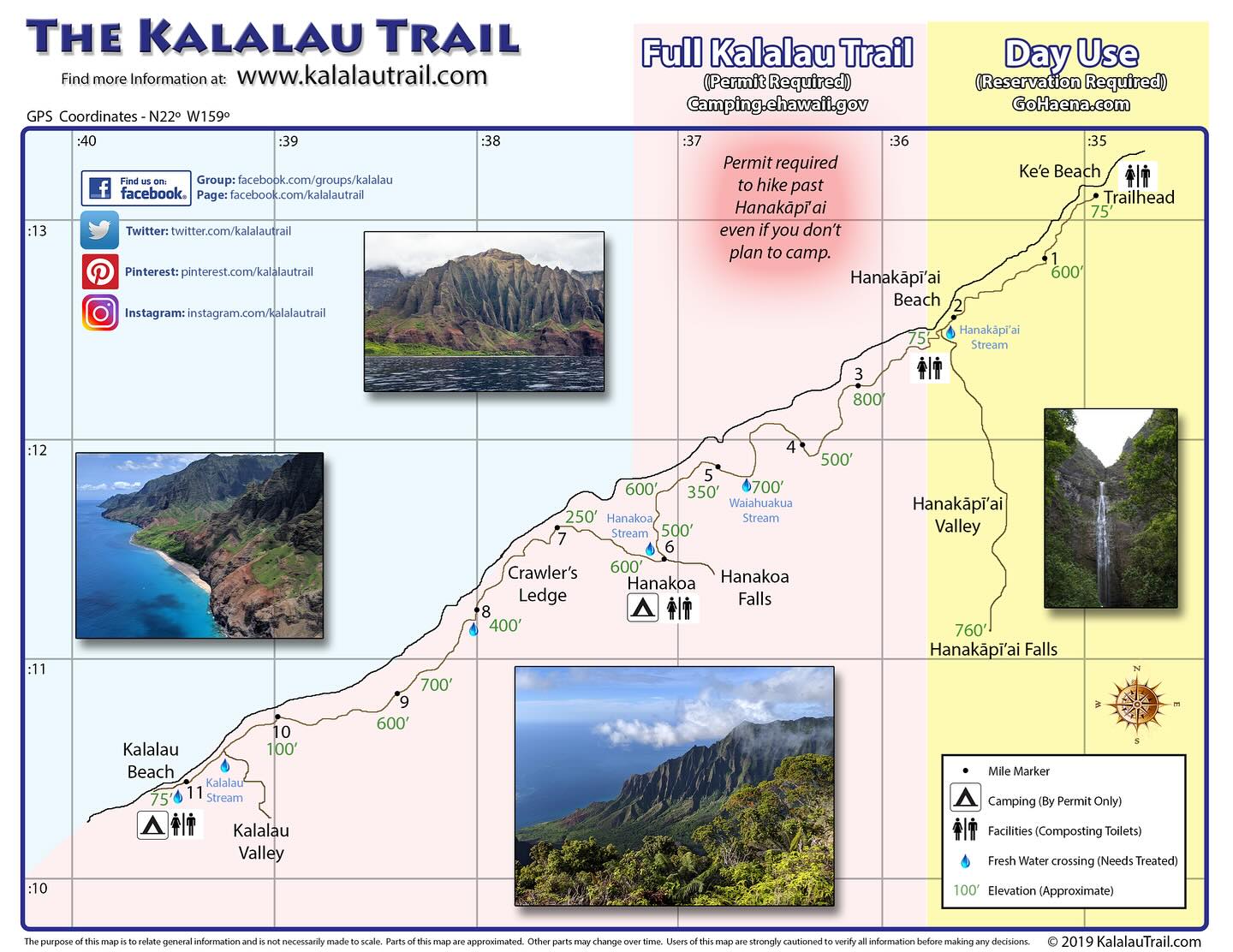
Rated by Backpacker Magazine as one the most dangerous hikes in the US and often considered one of the top 20 most dangerous hikes in the world, the Kalalau Trail is not for the faint of heart.

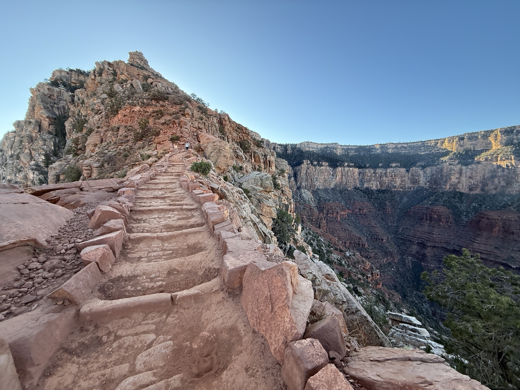
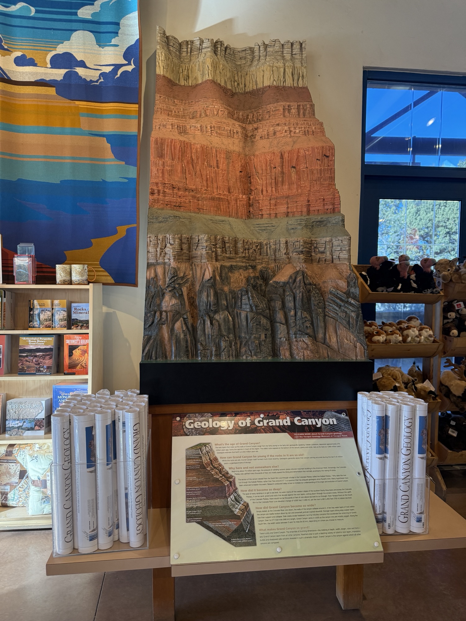
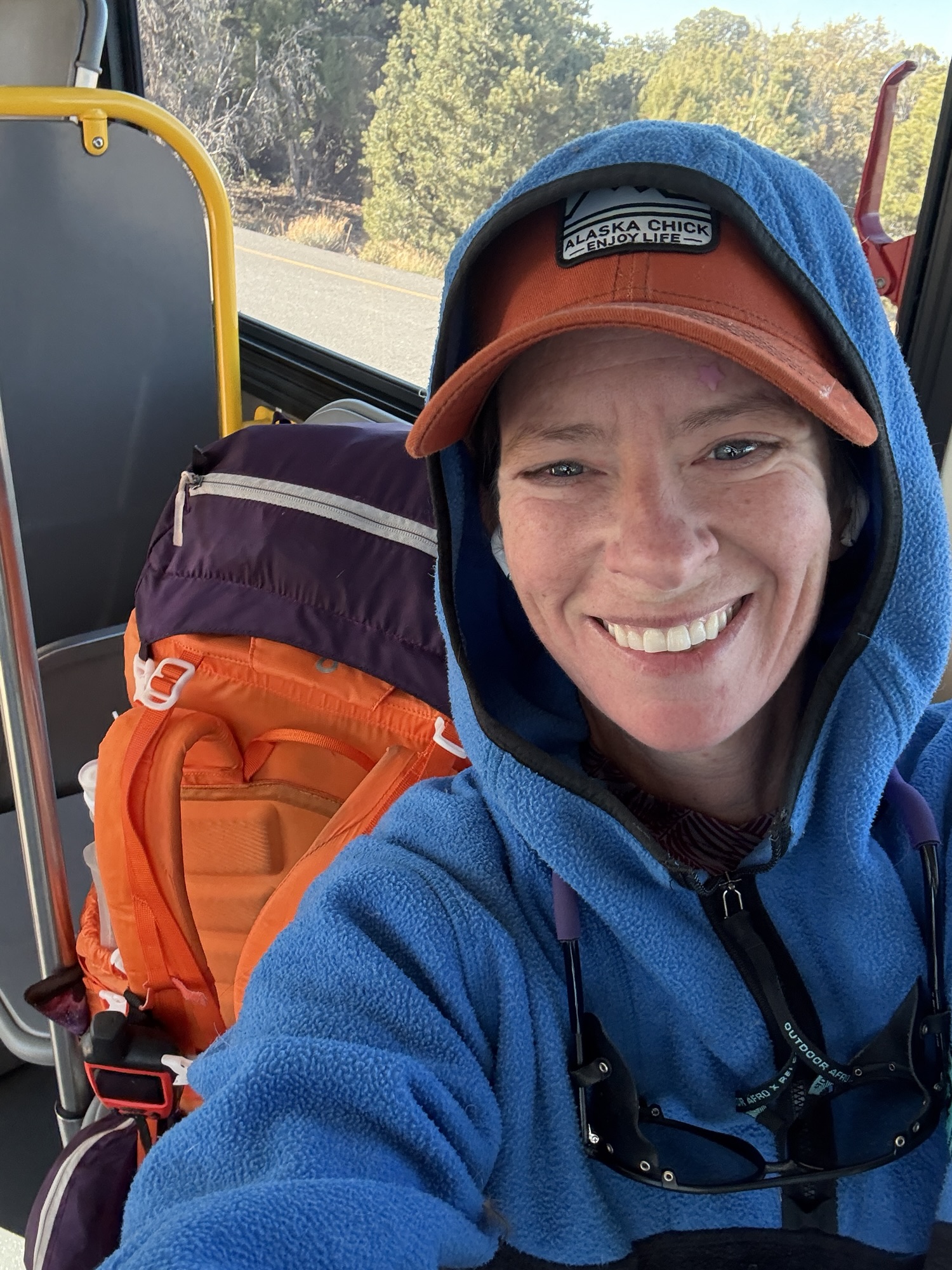
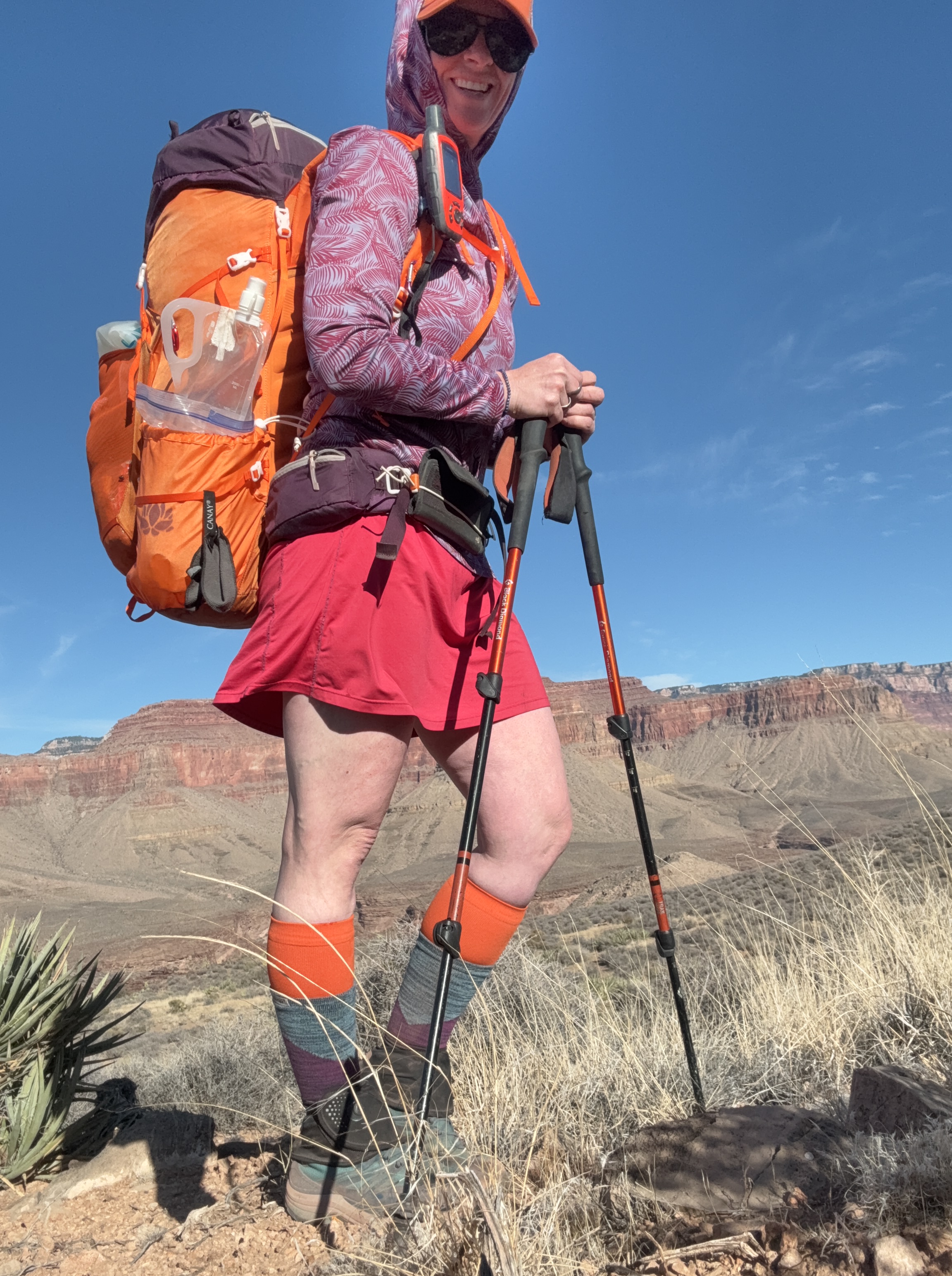
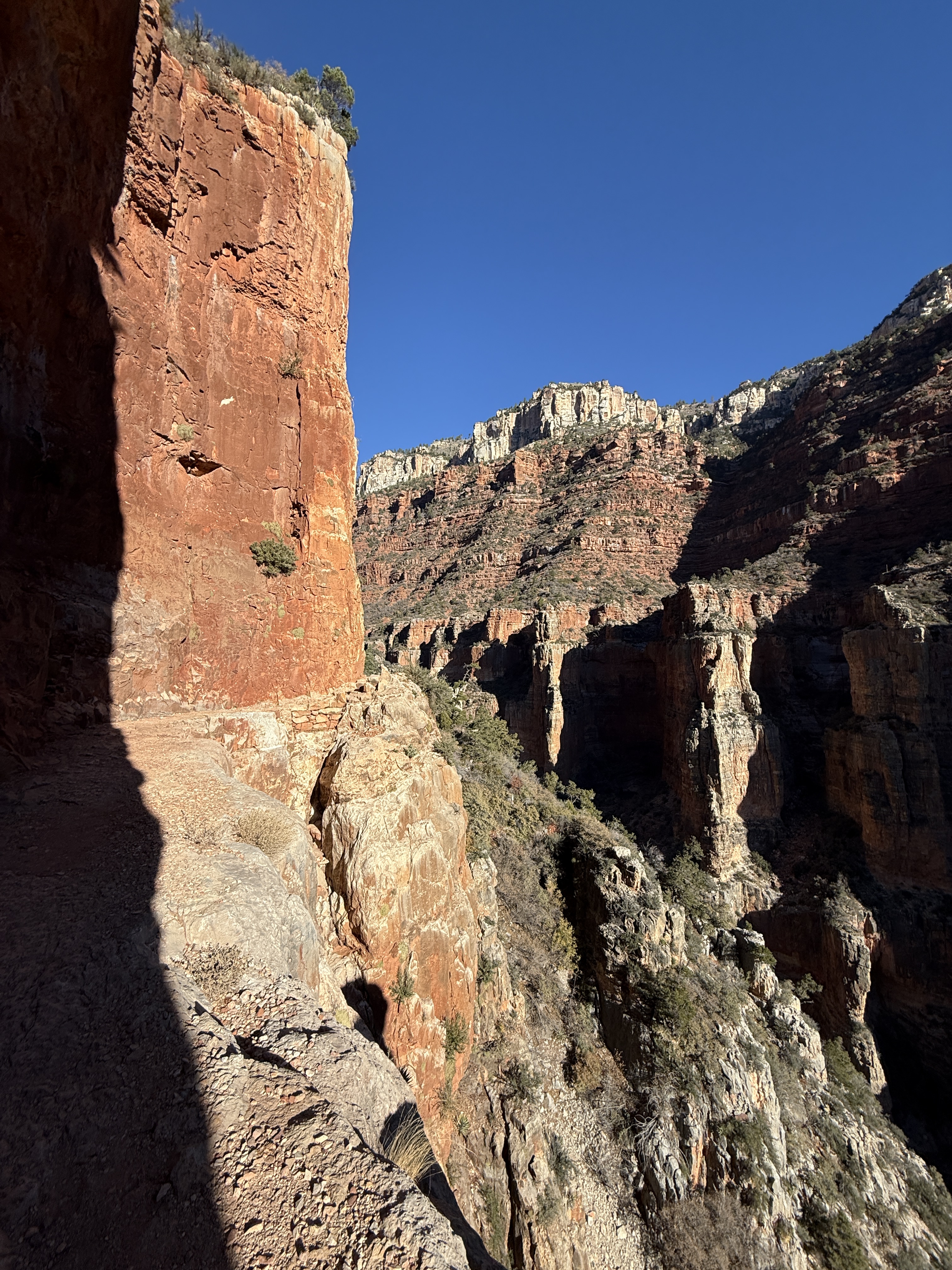
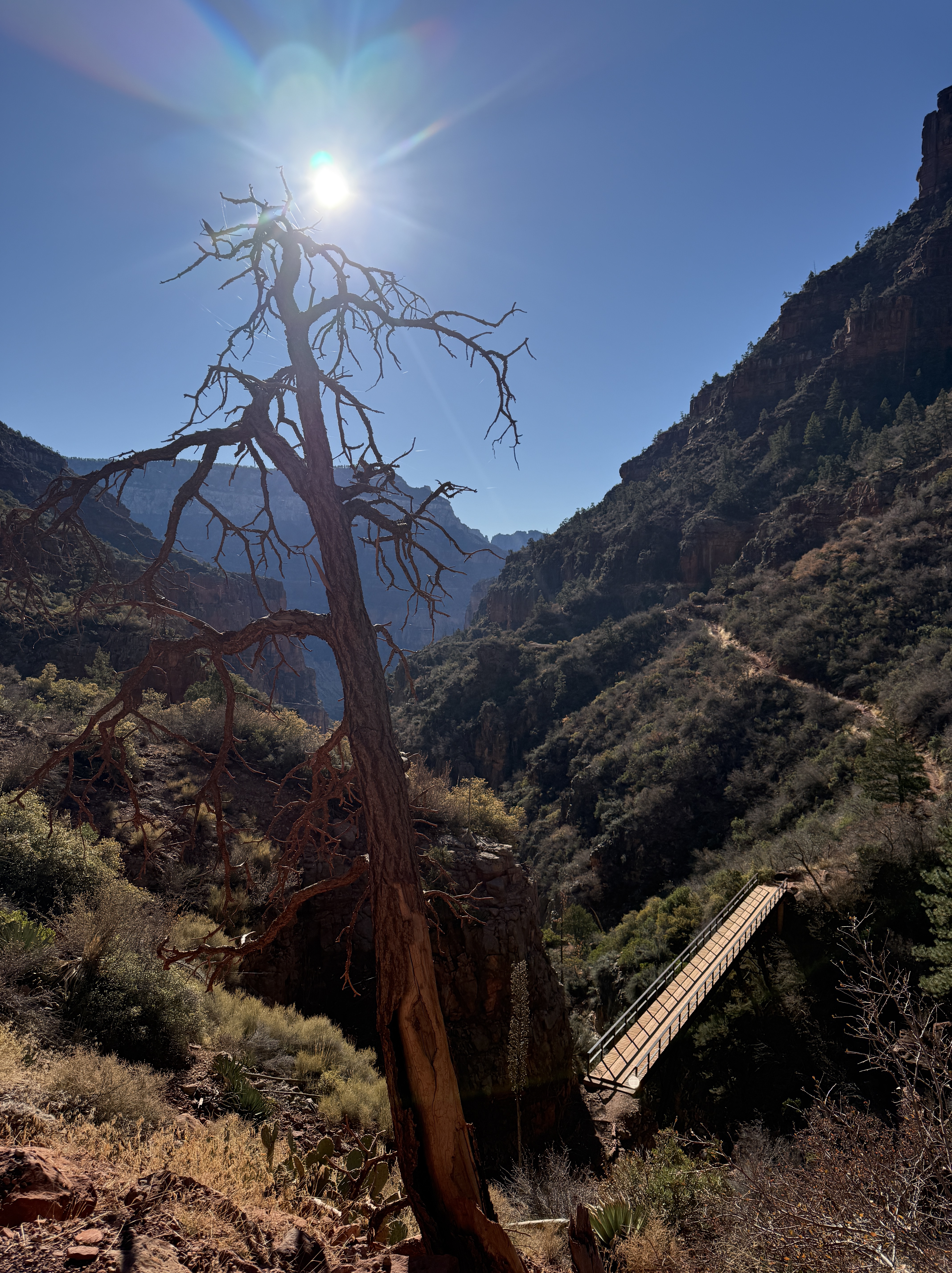
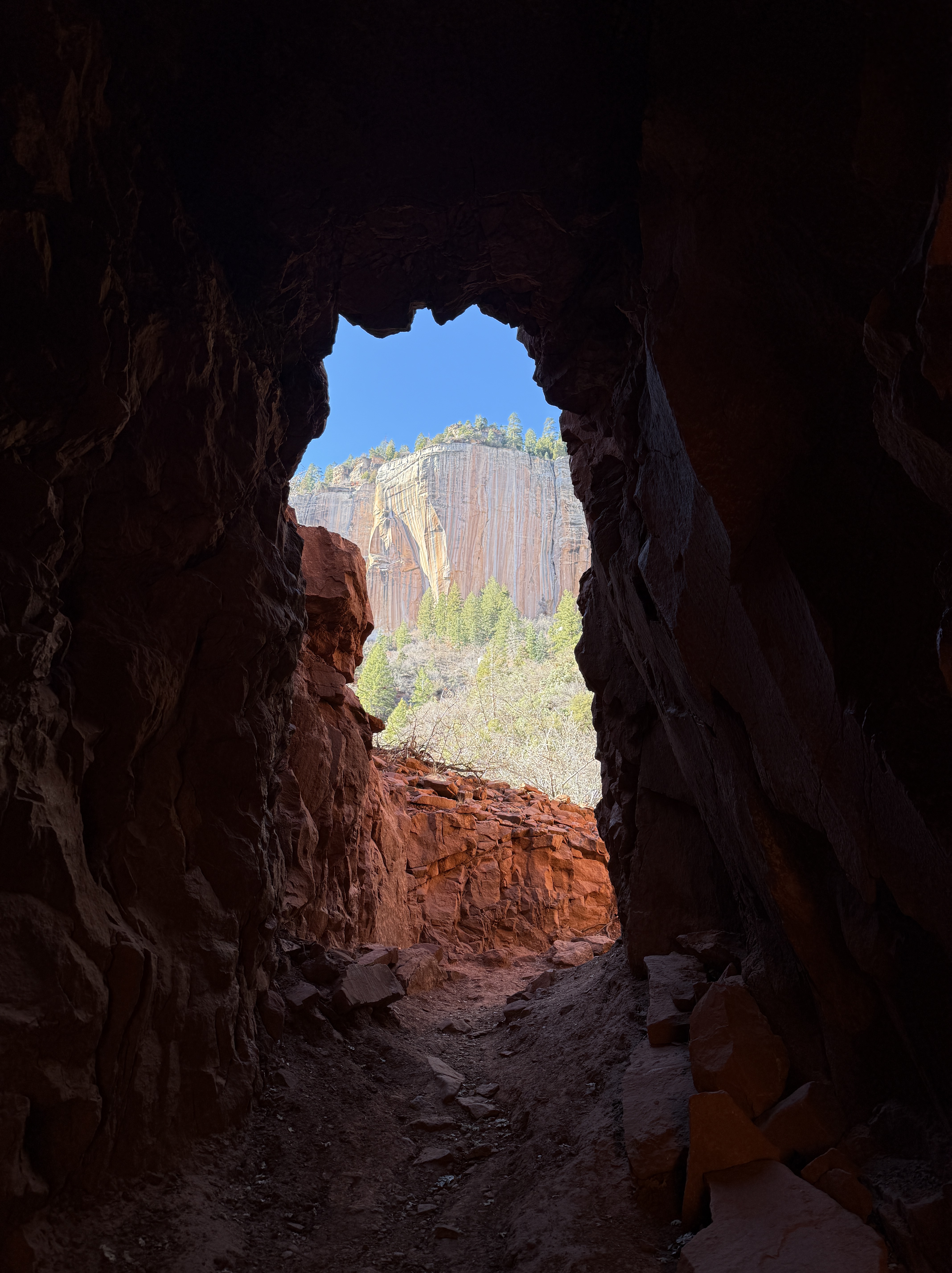
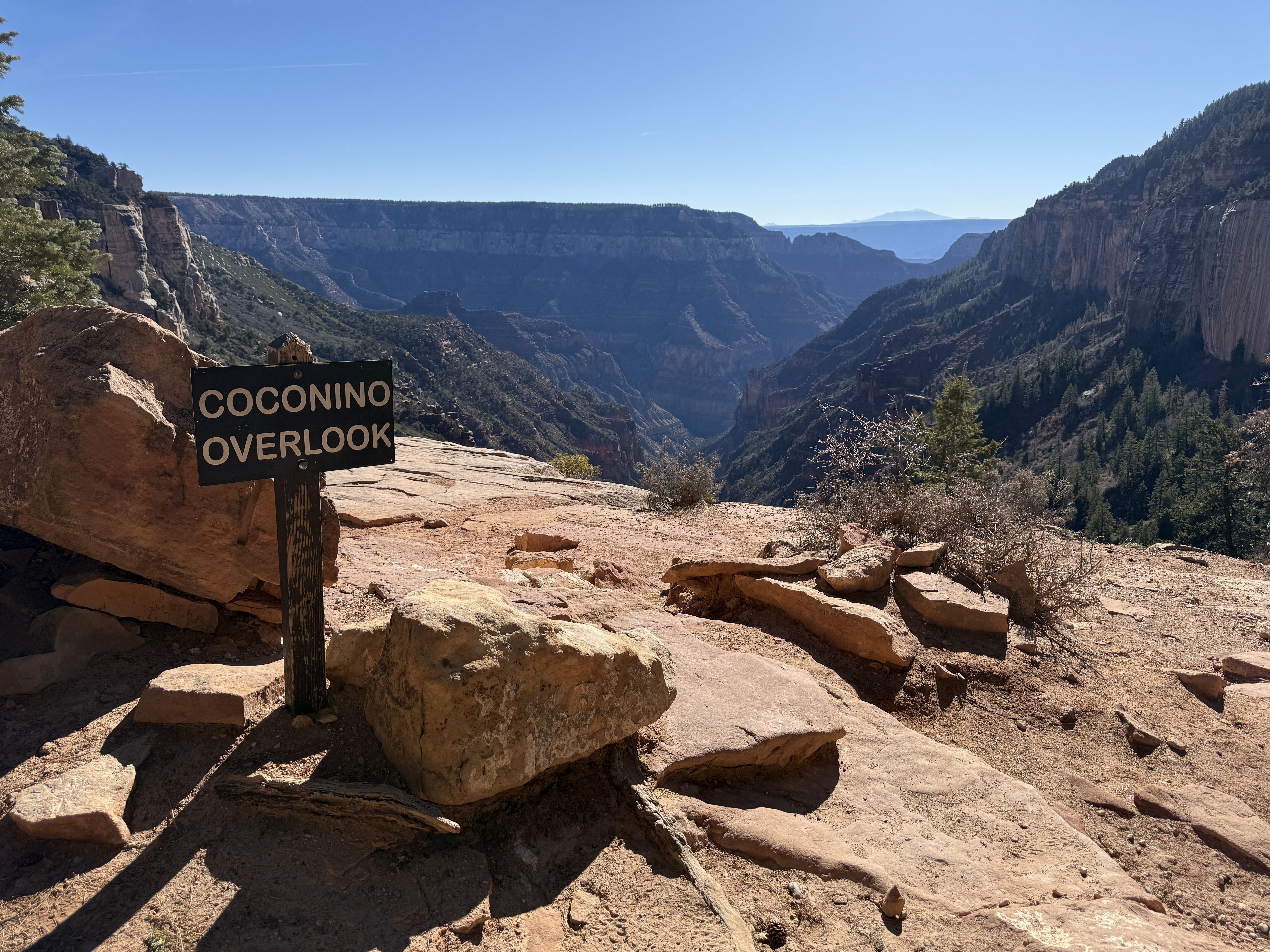
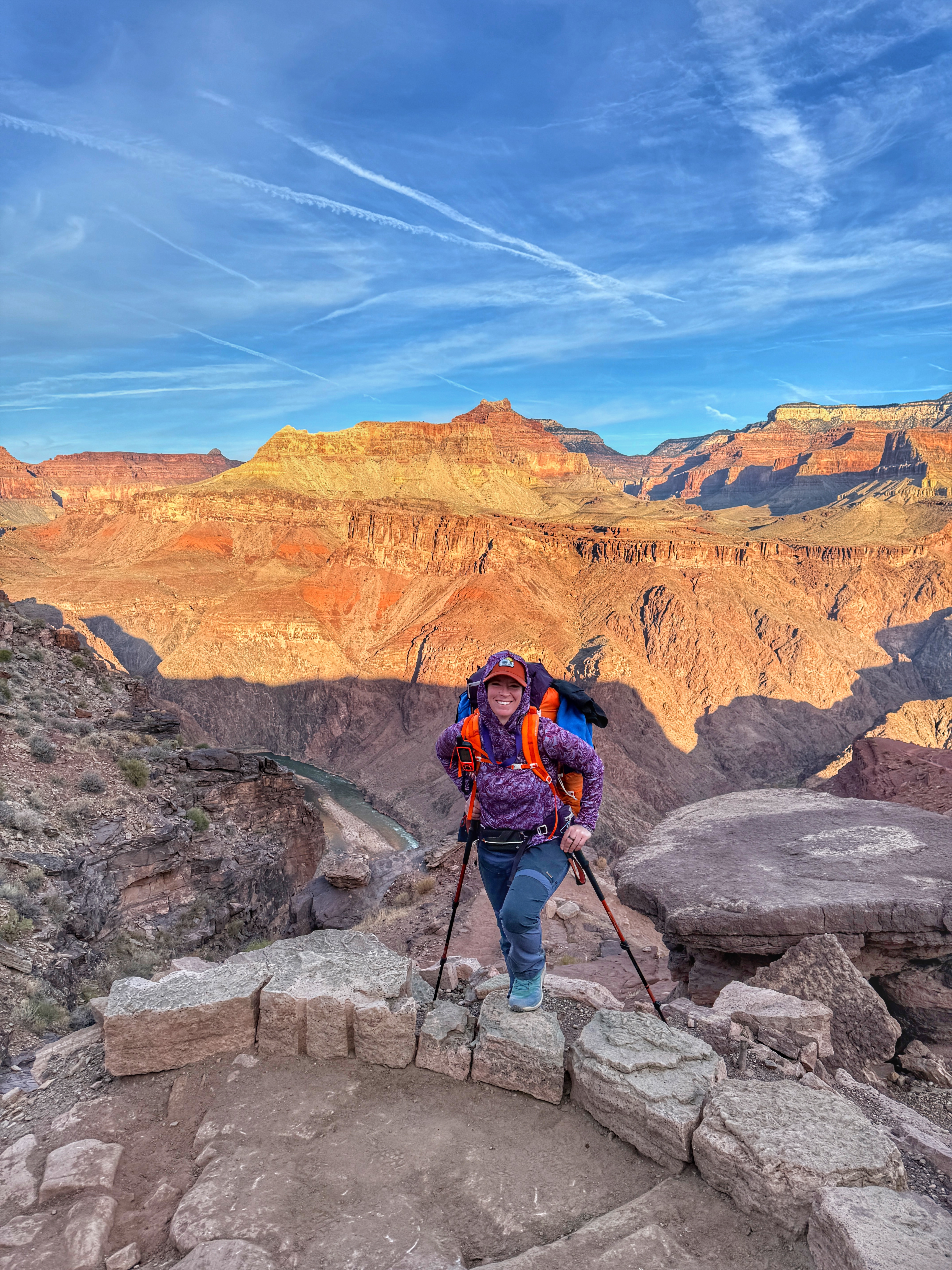
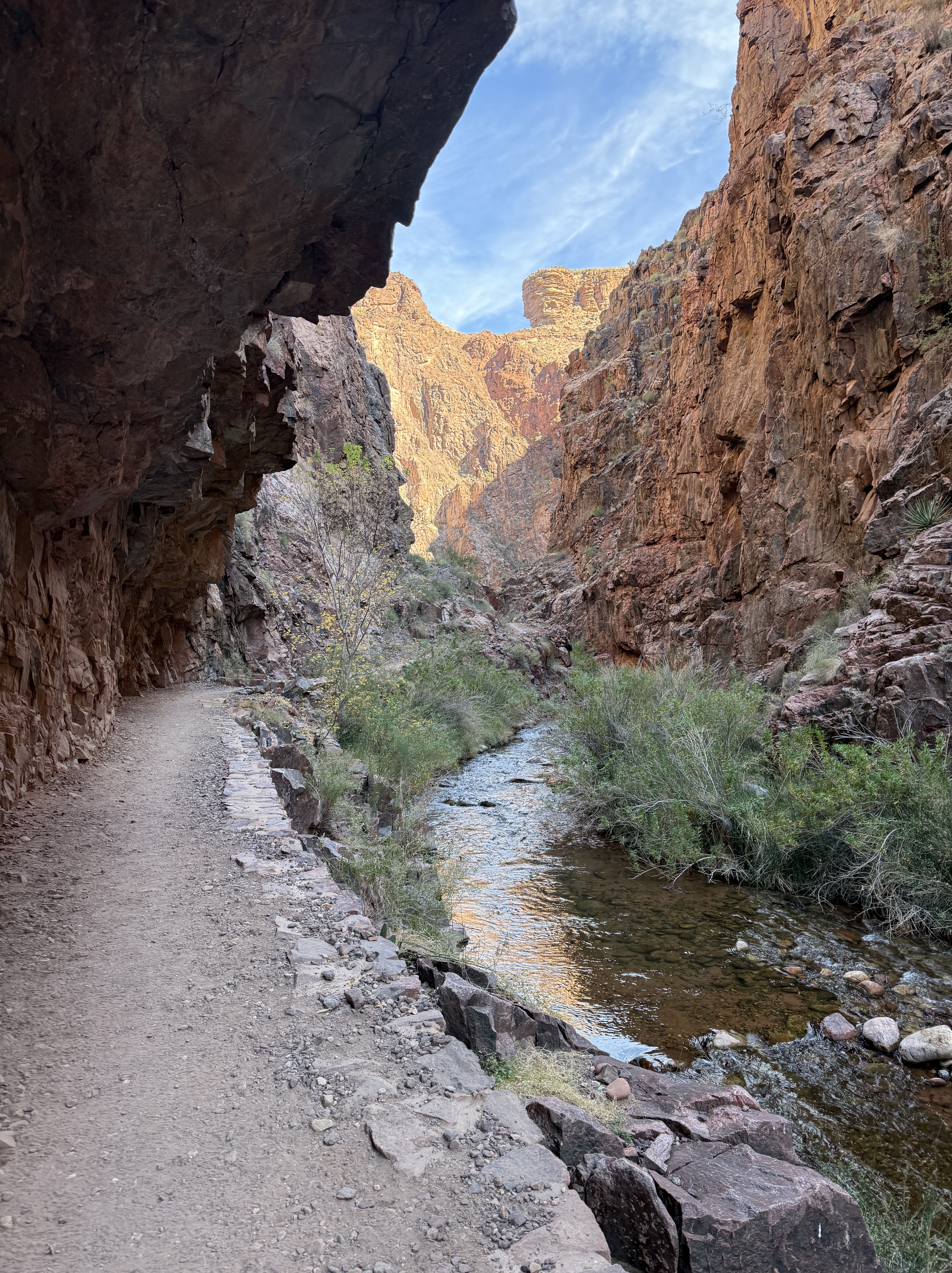
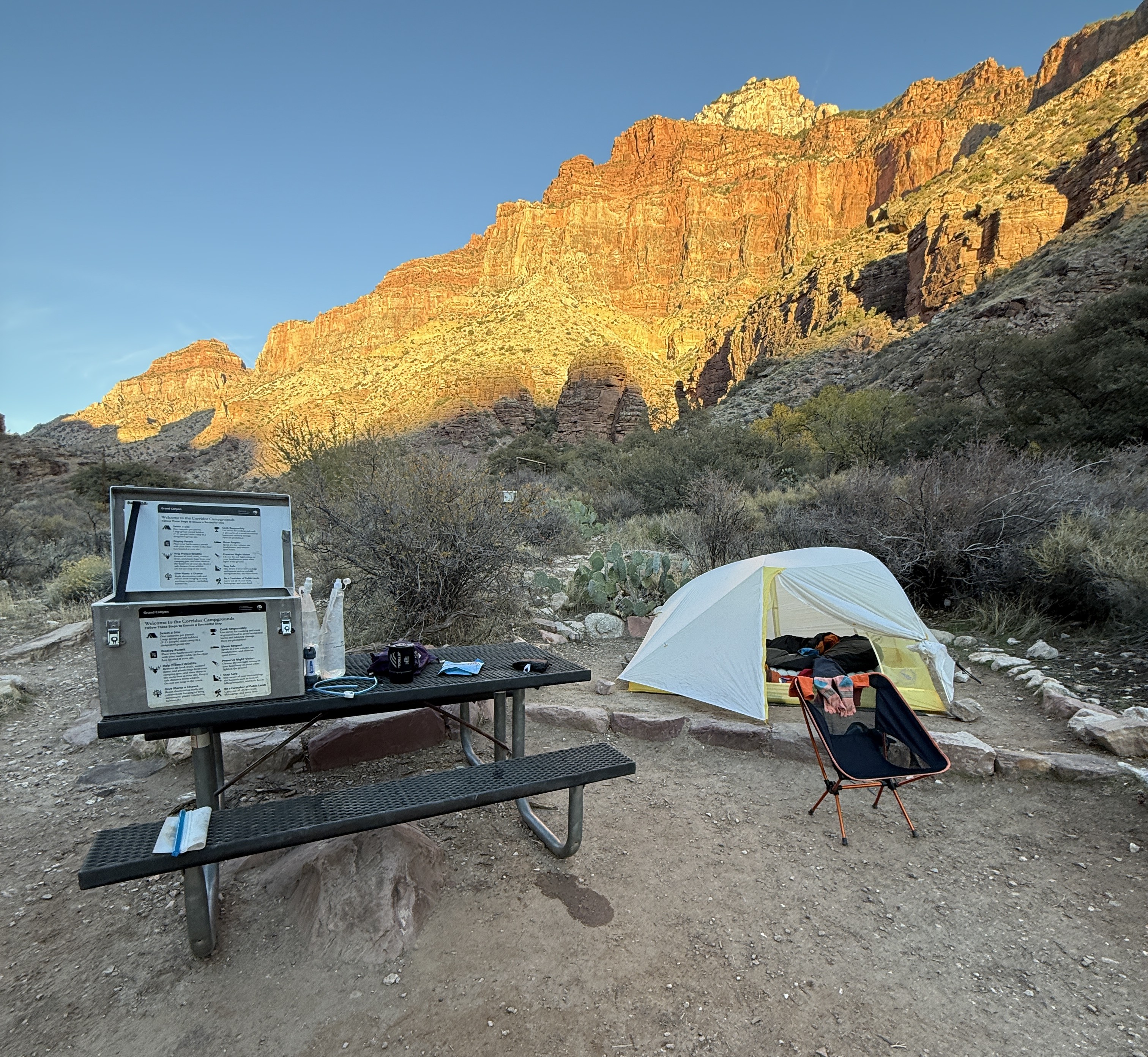
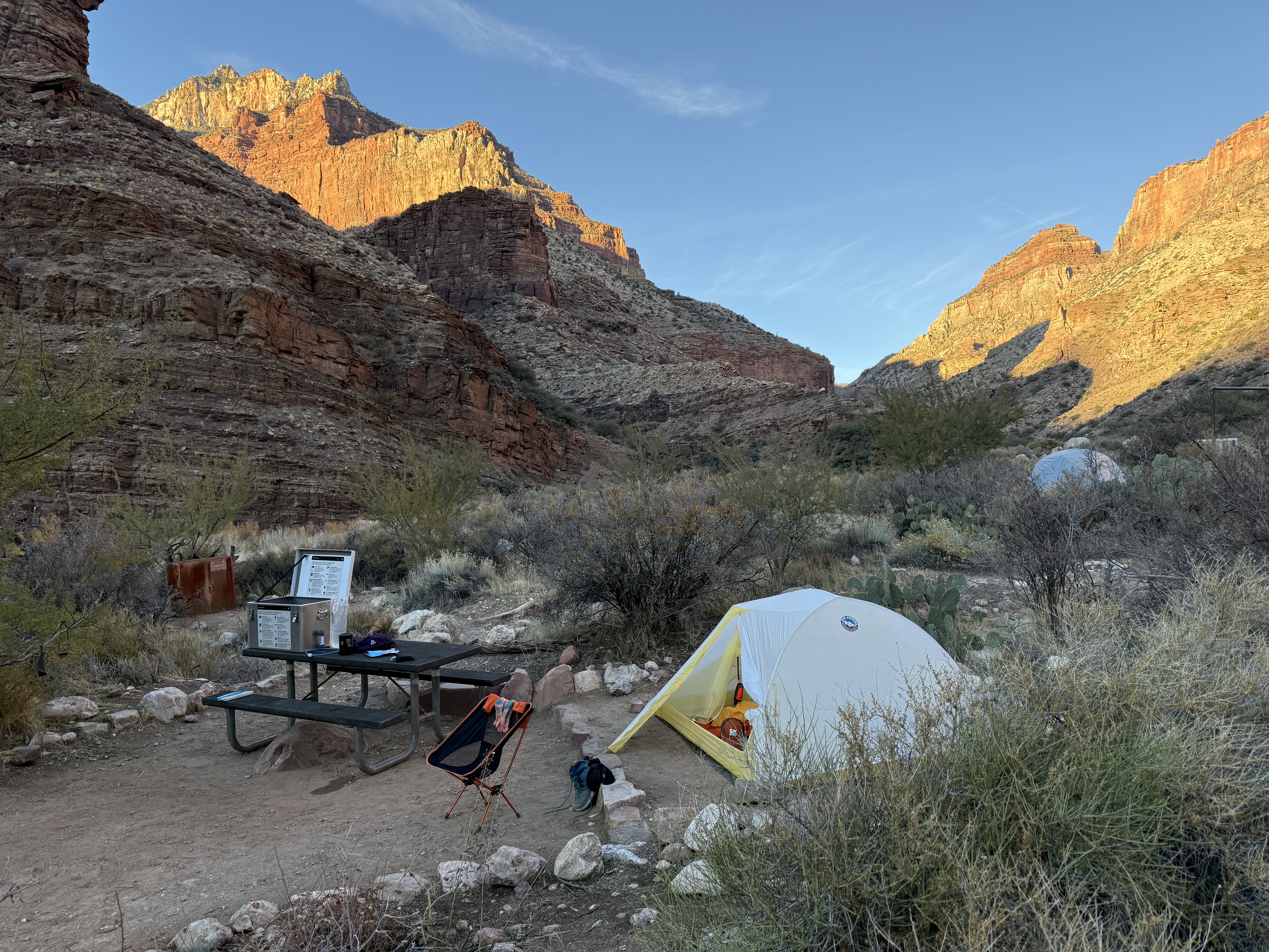
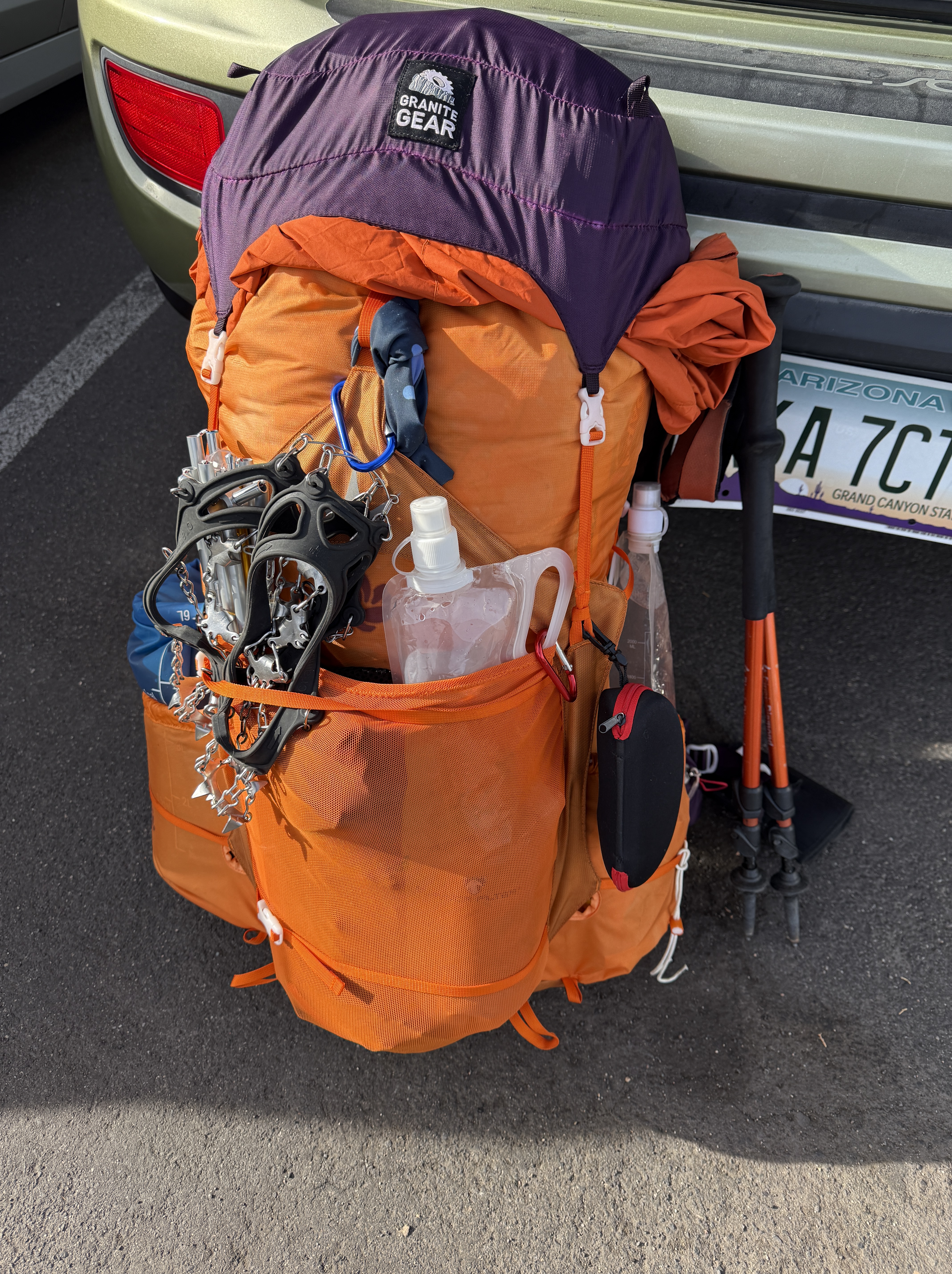
This January (2025) I went back for my second trip along the rugged NaPali Coast. It was an impulse decision after returning from my solo Grand Canyon Rim-Rim-Rim trip… I just couldn’t bear not having another trip to look forward to and felt confident enough to revisit a place that I had once feared.

January 2023

I first experienced this trail in January of 2023 when I was still suffering from vertigo and had an extreme discomfort with heights. I watched all of the videos and read all of the trip reports, most of which mention the notorious Crawler’s Ledge, a narrow rock path, bordered on one side by a rock wall and the other side by a precipitous 200′ drop to the ocean. I didn’t believe the hype. I had bagged some of the tallest peaks in my local mountain range. No way it could be any worse. But I was wrong.

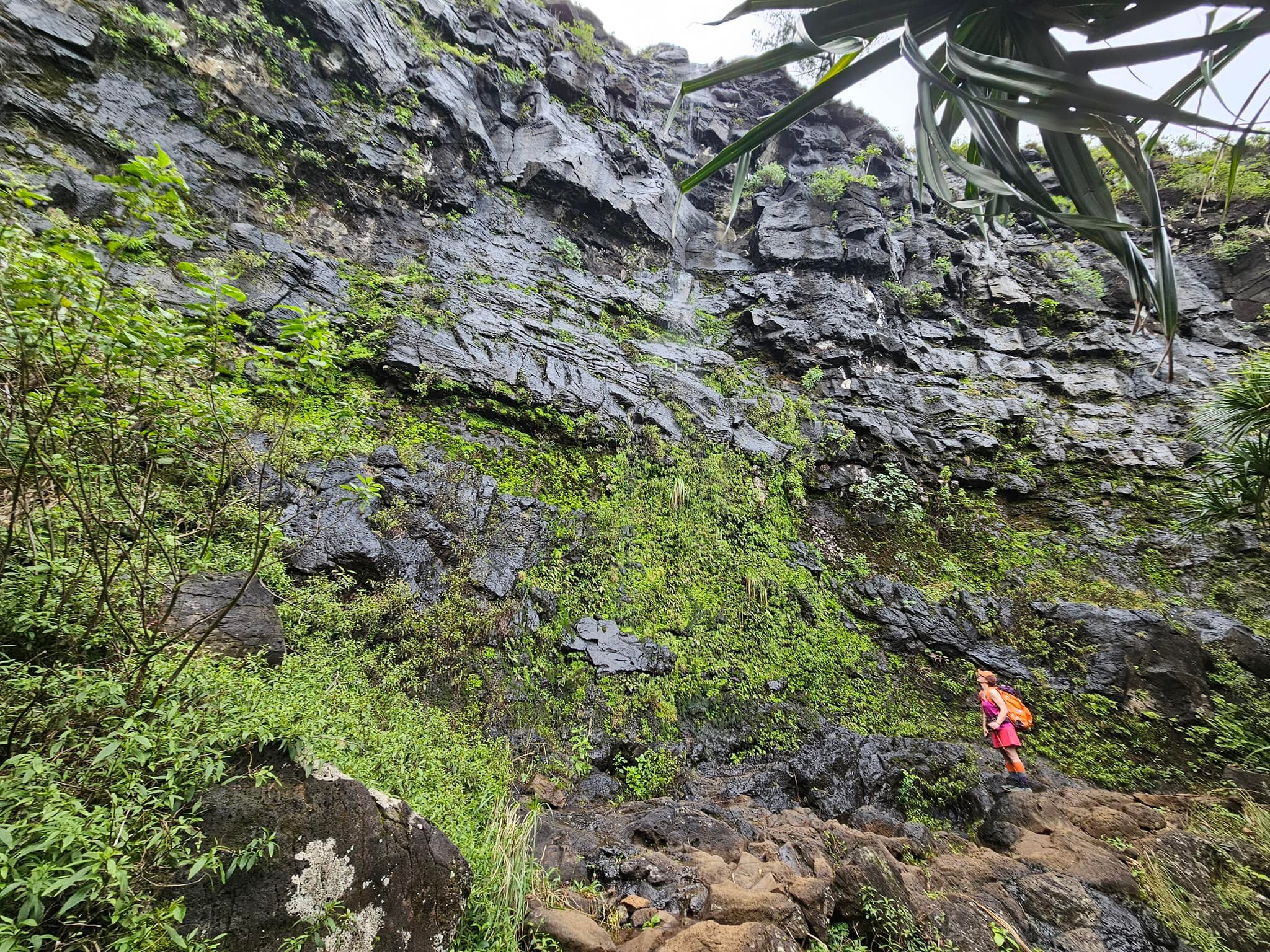
That trip was terrifying, and I didn’t have any idea that there were so many more possible dangers than the relentless, vertigo inducing cliffside trekking. I still felt excited for what was to come as I dropped my pack in the woods on the far side of Hanakapi’ai Stream and hiked the 4 miles round trip to the Falls. It was a gorgeous location, with a cold yet refreshing pool beneath the Falls. It didn’t take me long to get back to my pack and onward along the coast.

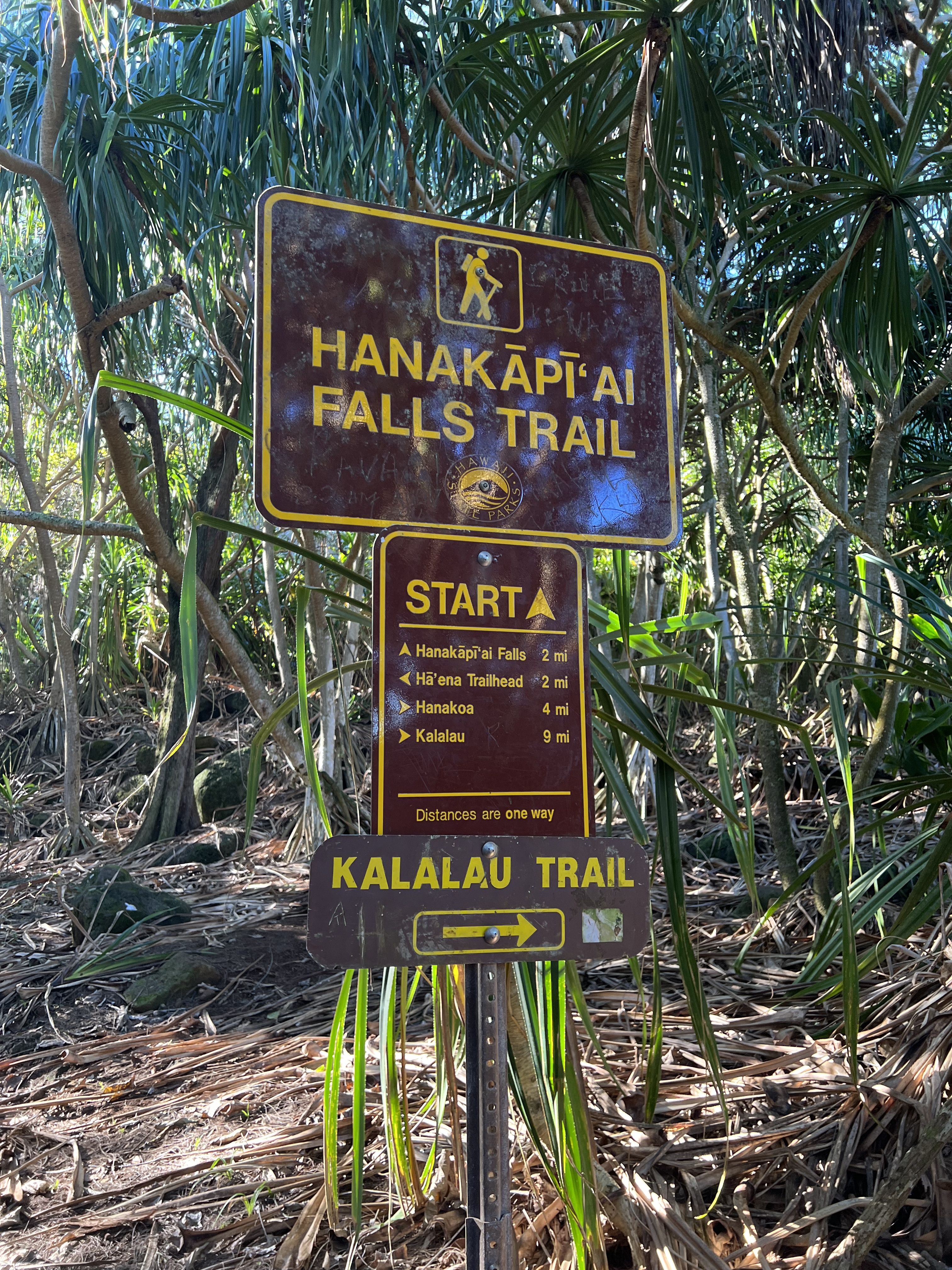
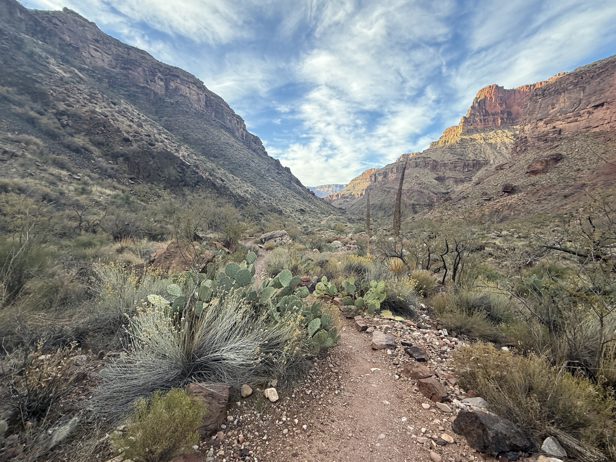
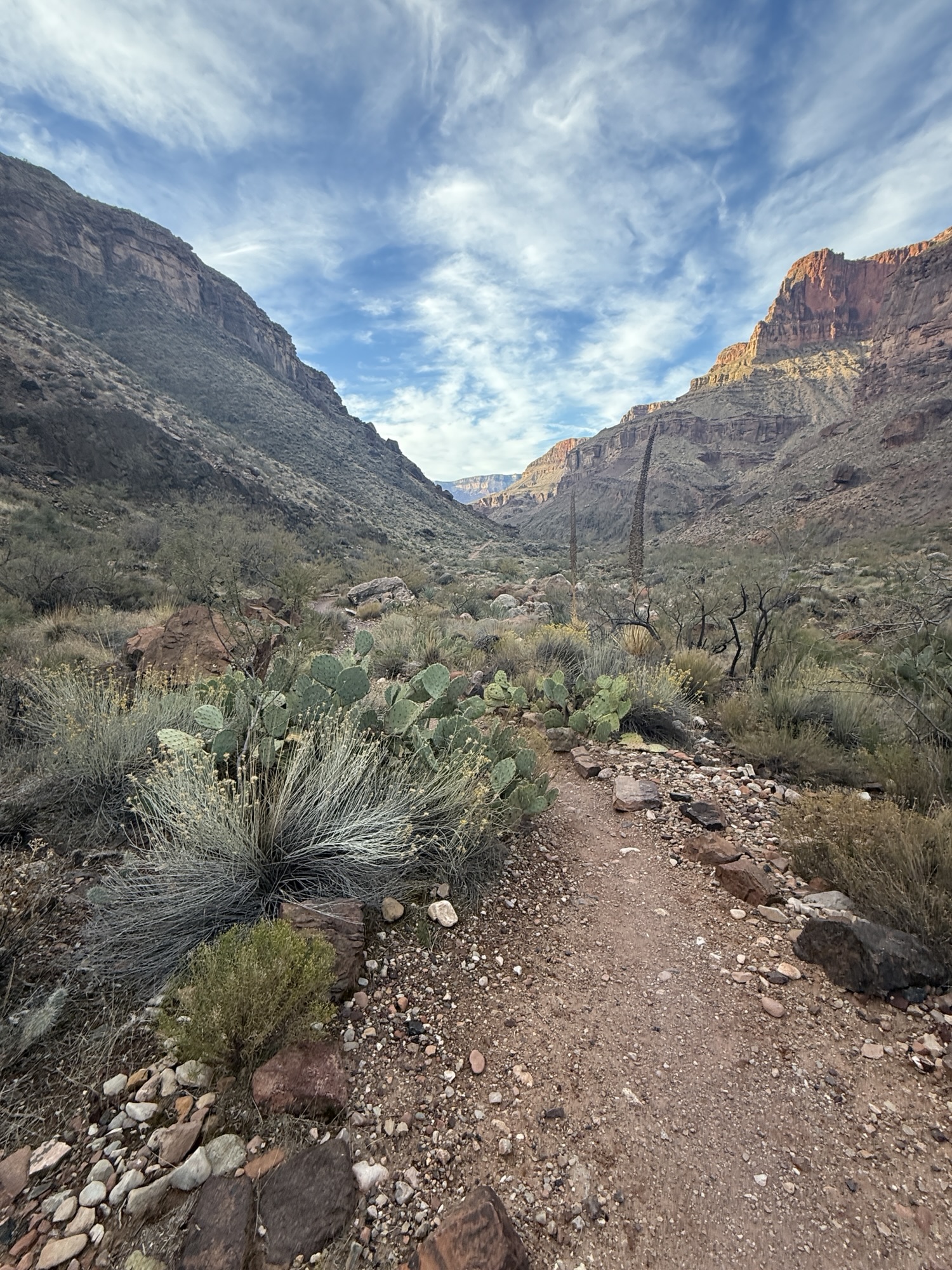
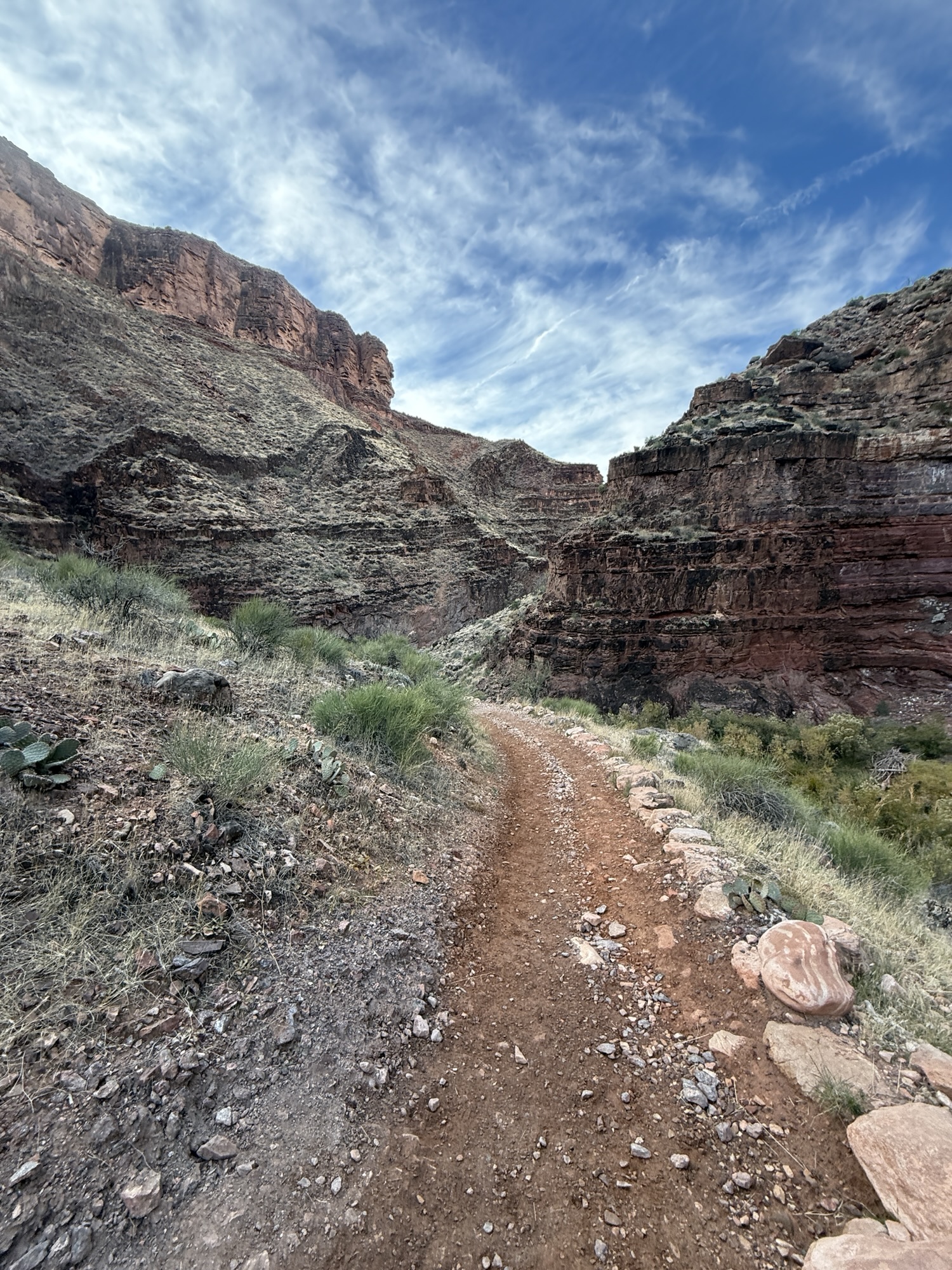
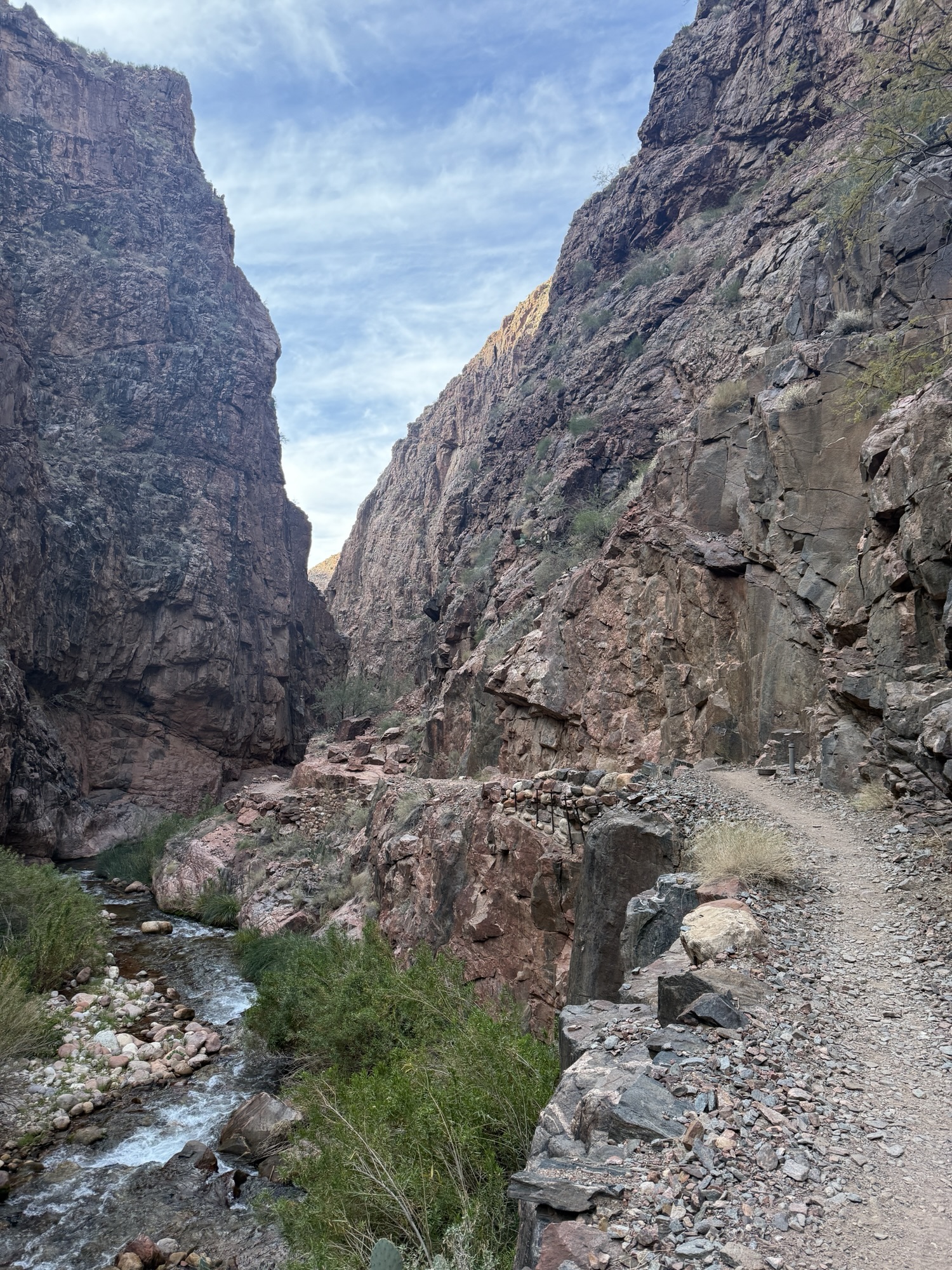
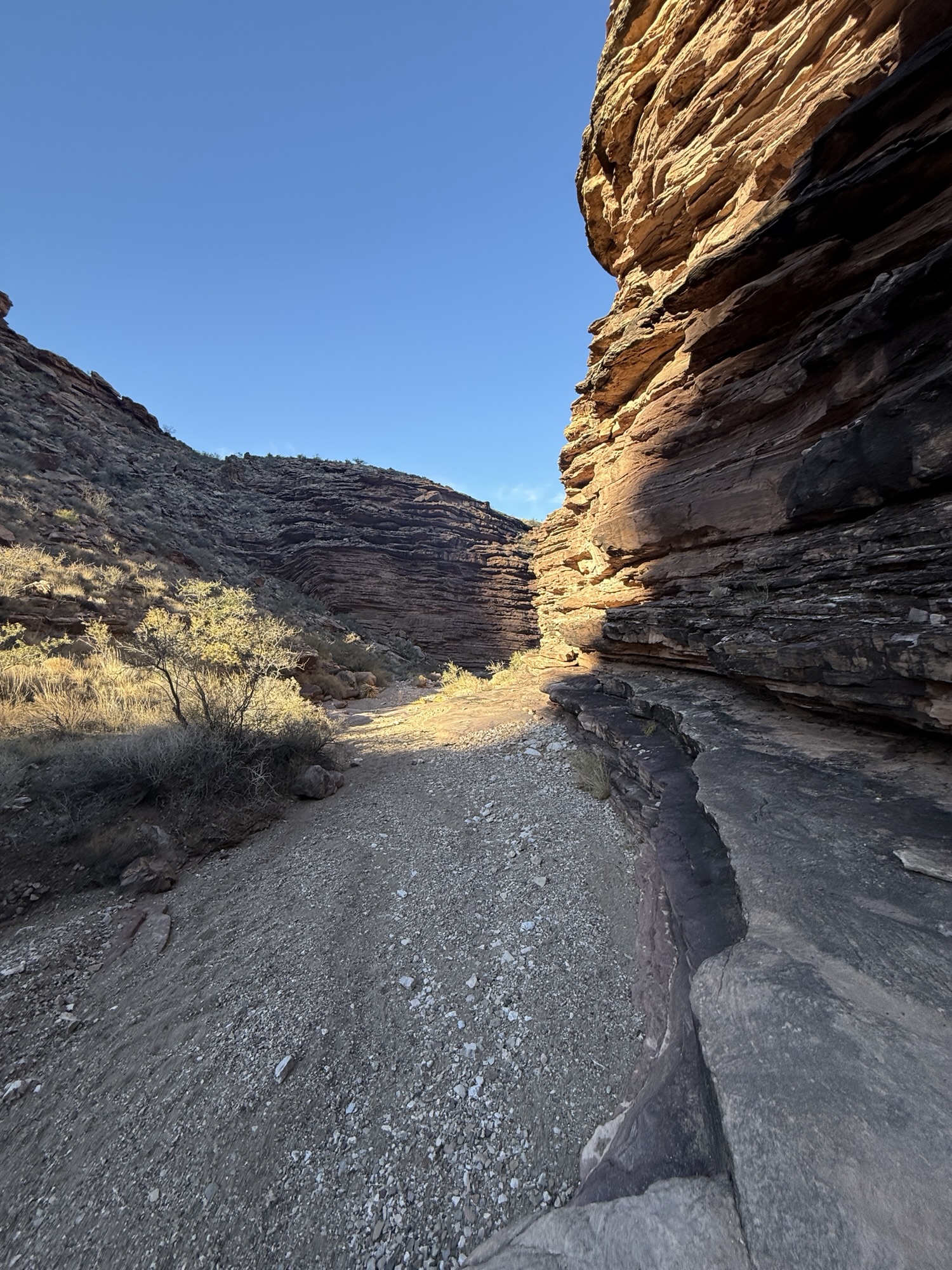
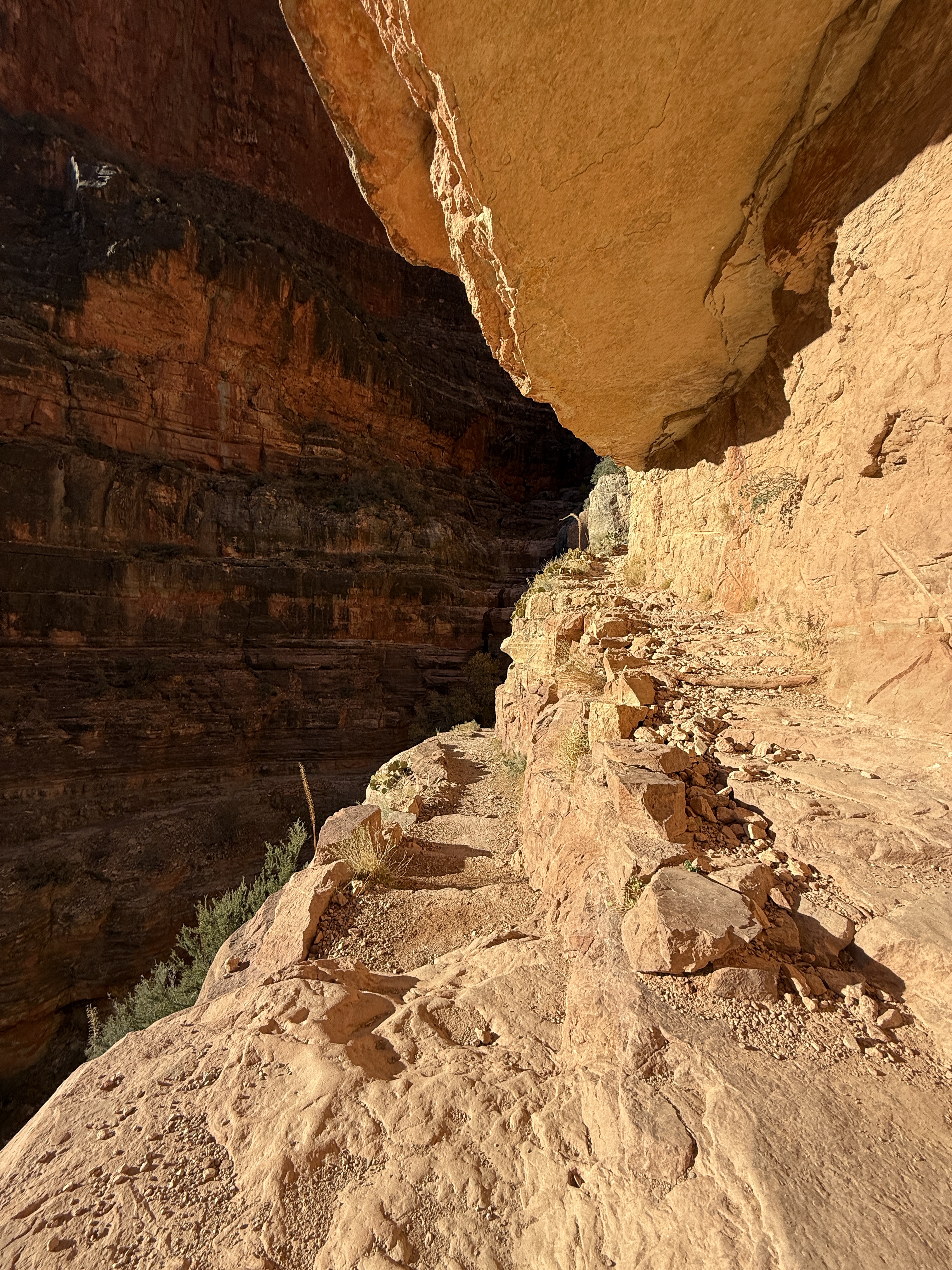
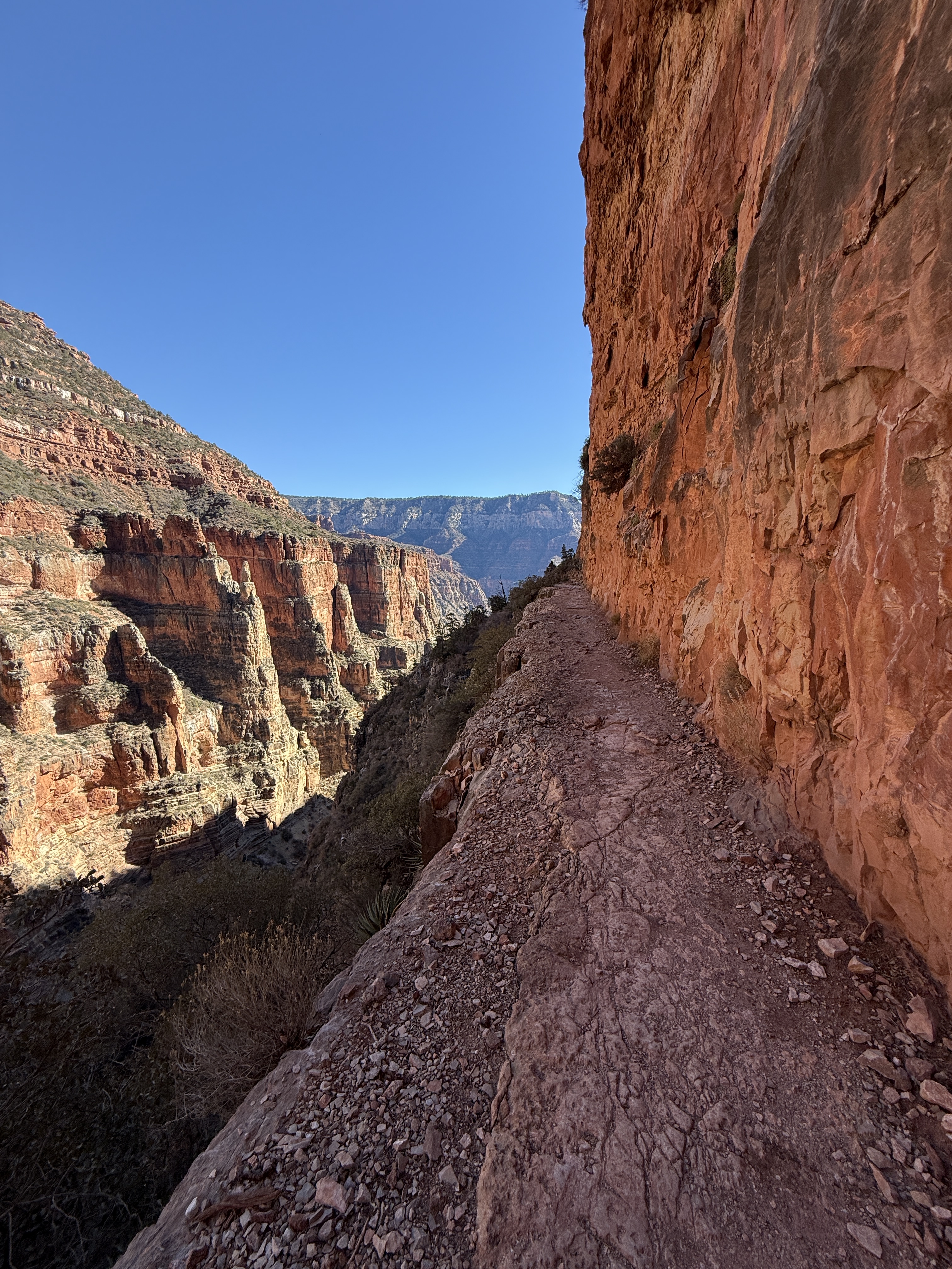
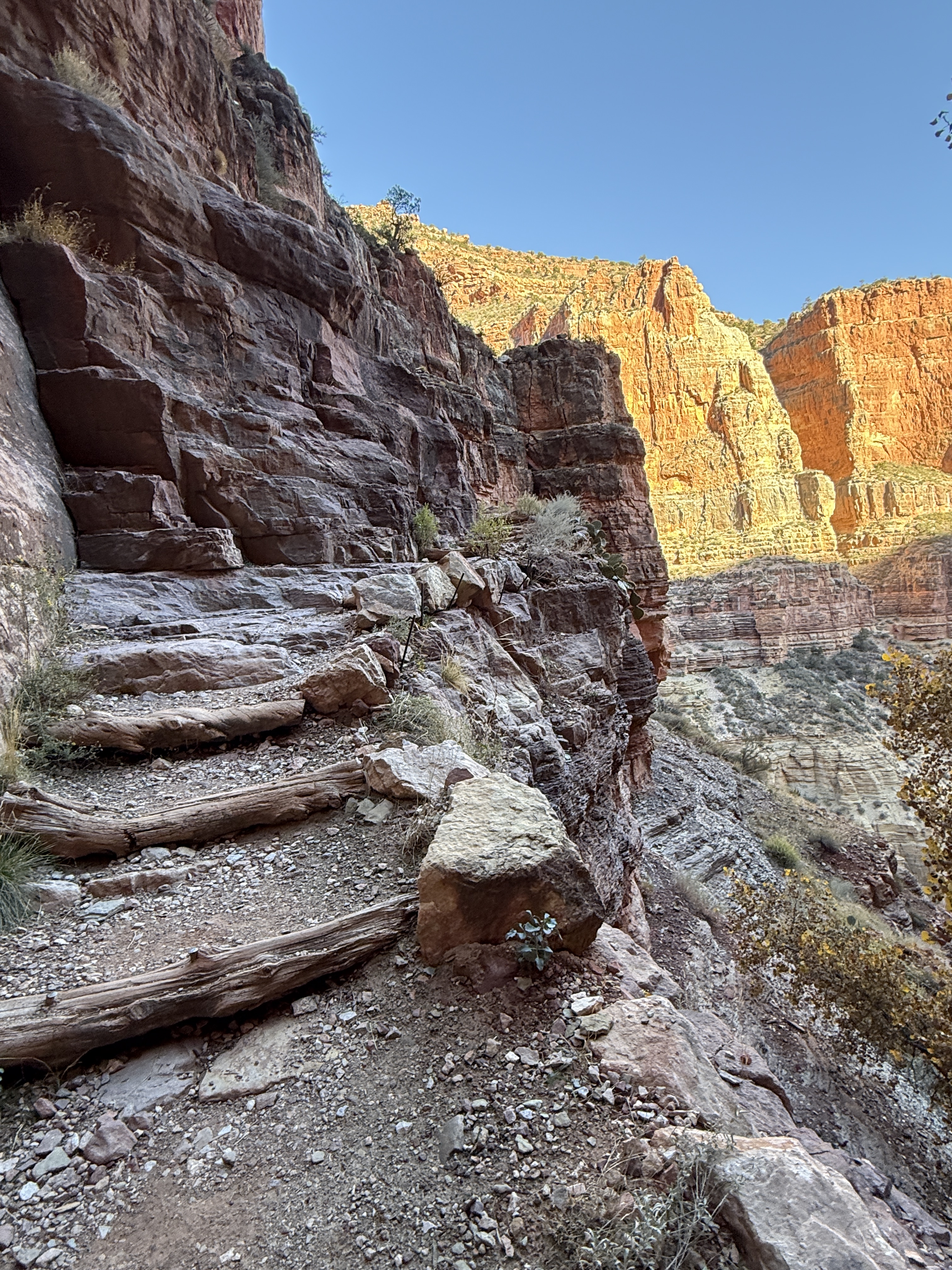
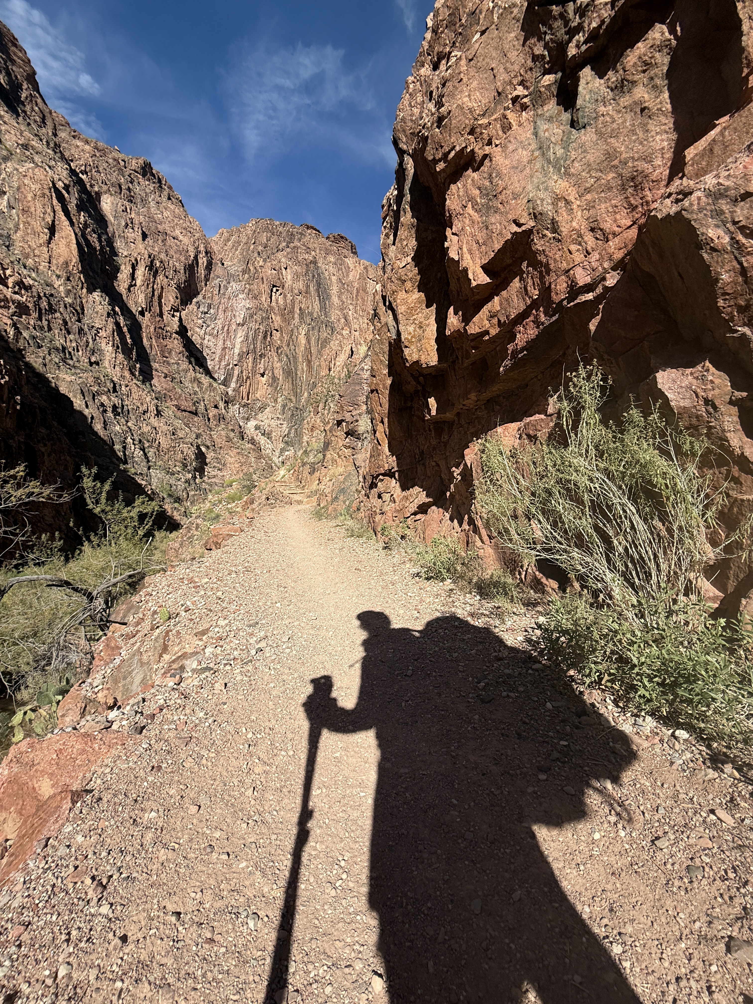
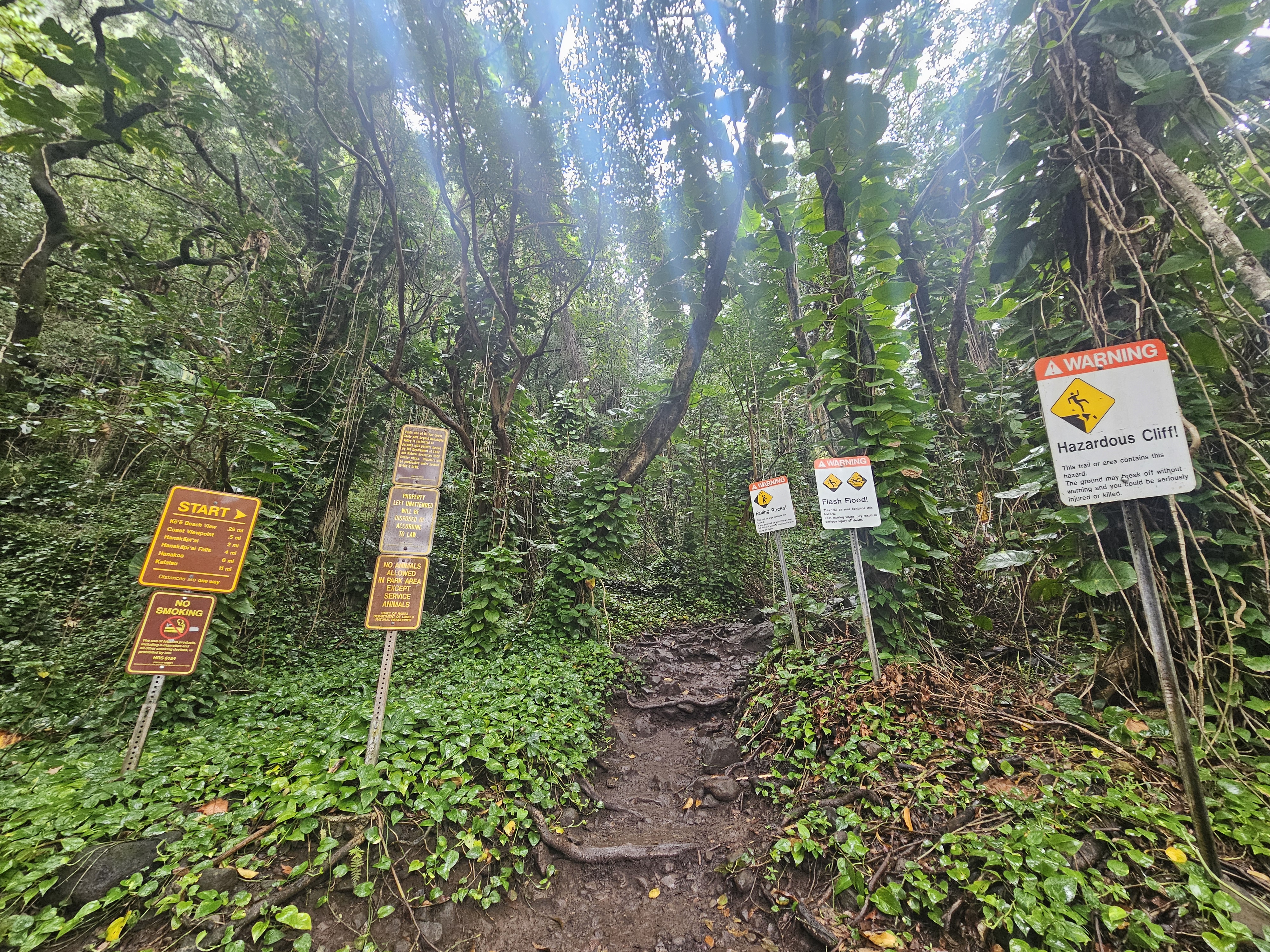
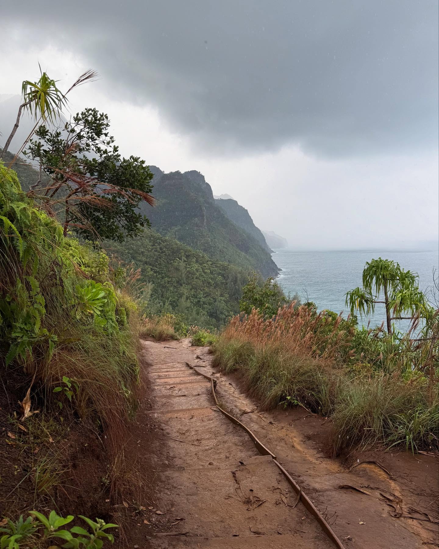
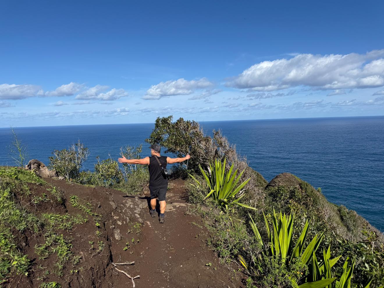
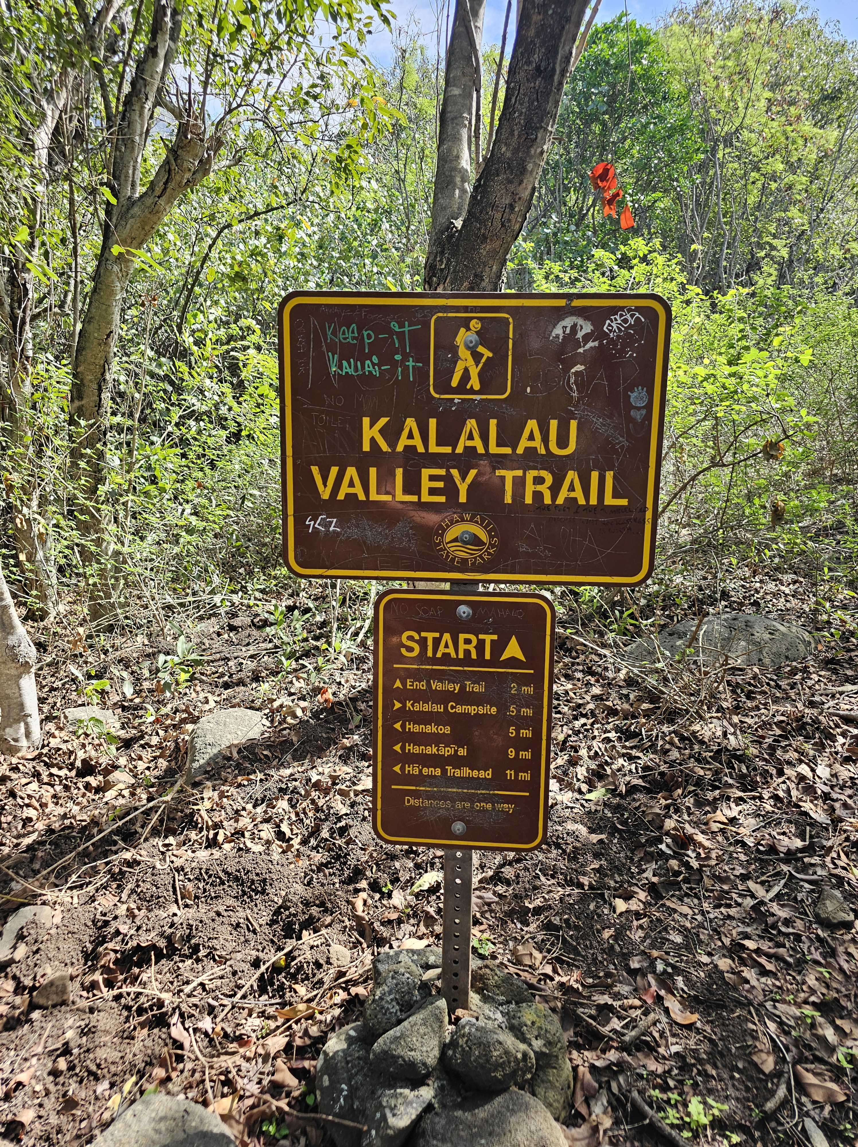
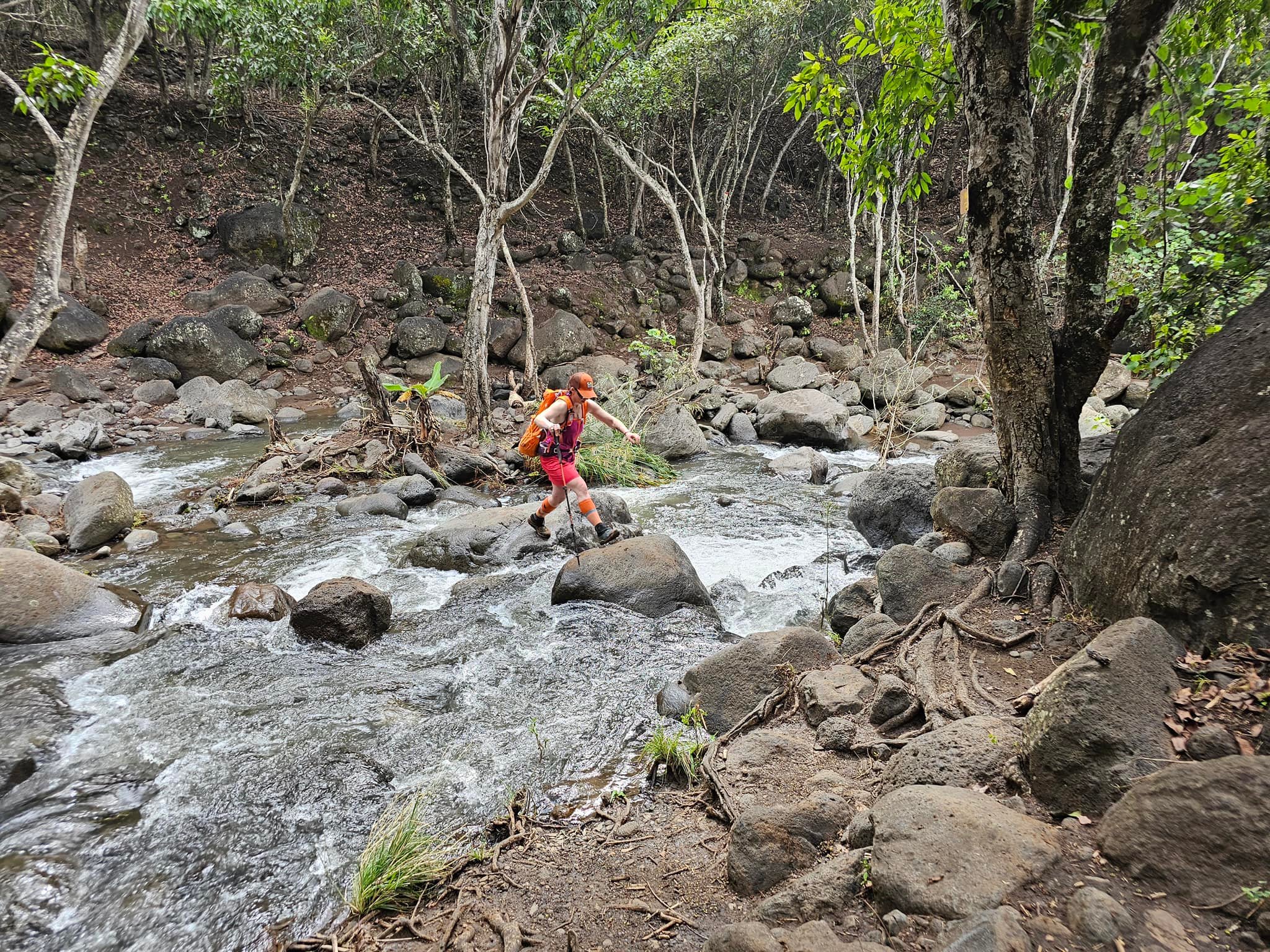
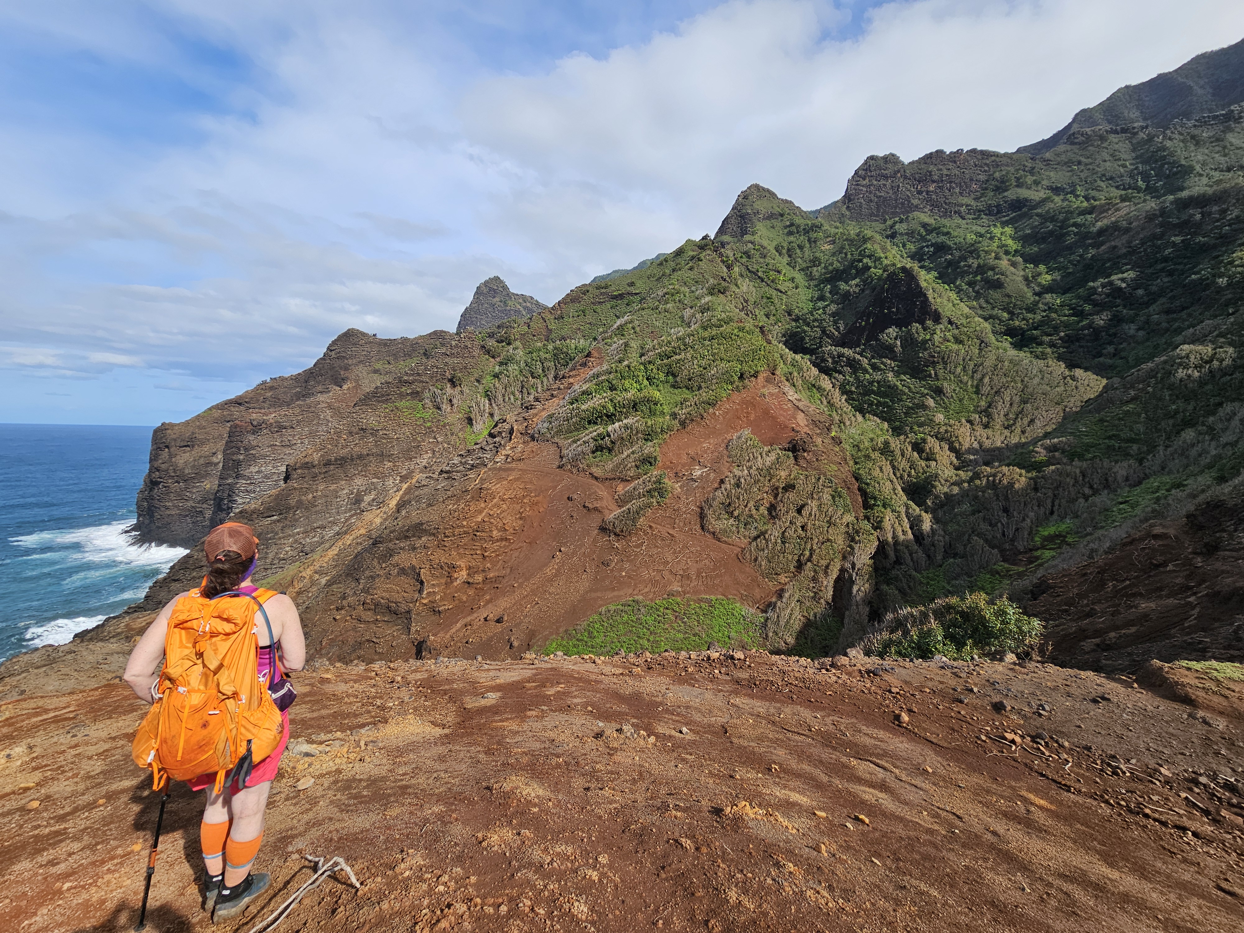
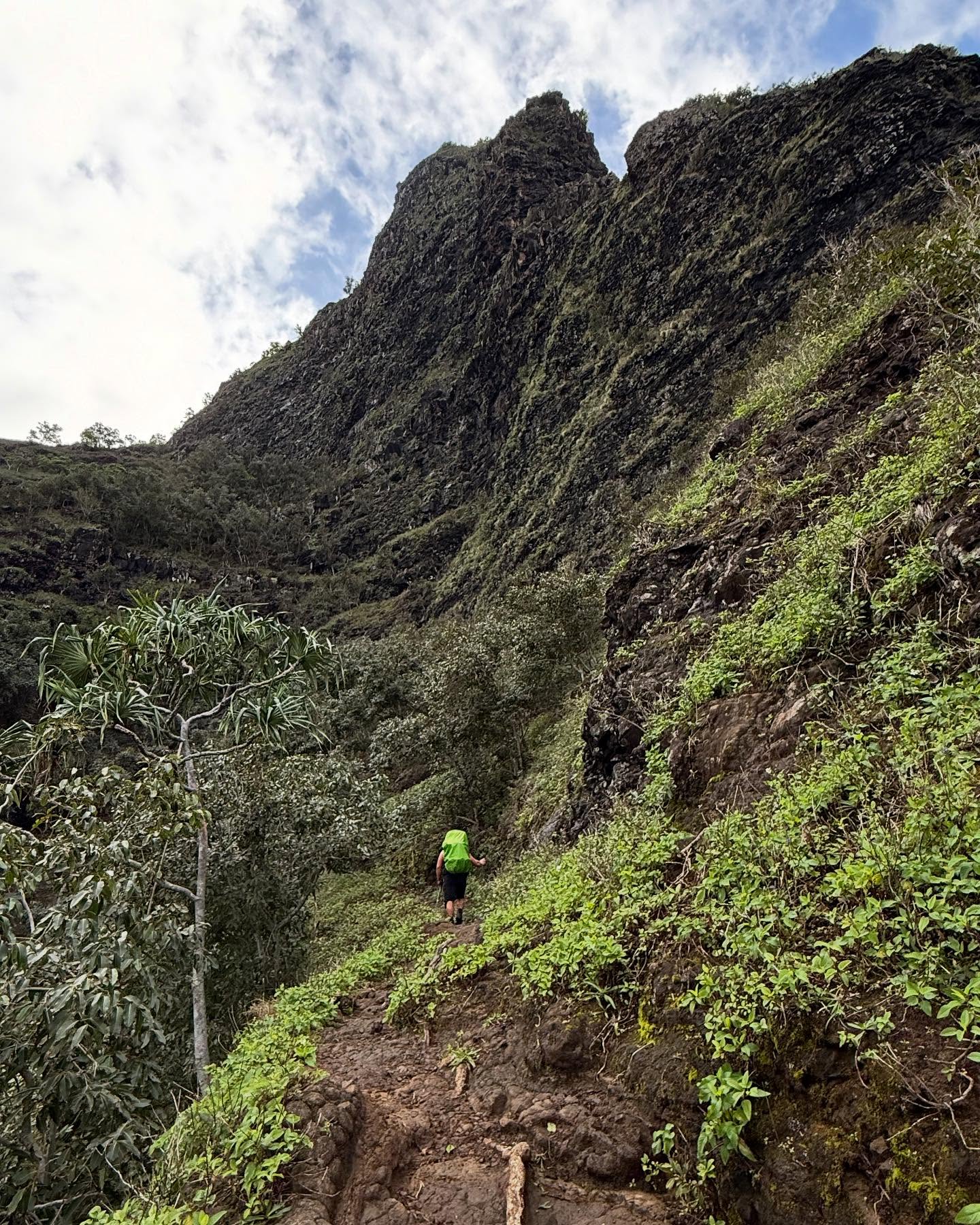
After crossing Hanakapi’ai Stream at mile 2.4 (the mile markers start at Ke’e Beach trailhead, ~.4 miles from where you are actually dropped off), the trail becomes more of a footpath, transitioning from the relatively wide, protected, and well-trekked trail, to a narrow and sometimes washed-out path with frequent sections of high exposure. I knew that if I fell it was possible that no one would ever know what happened to me, since I made the rookie mistake of taking on this trail as a solo traveler. I look back now and realize how unwise that choice was.

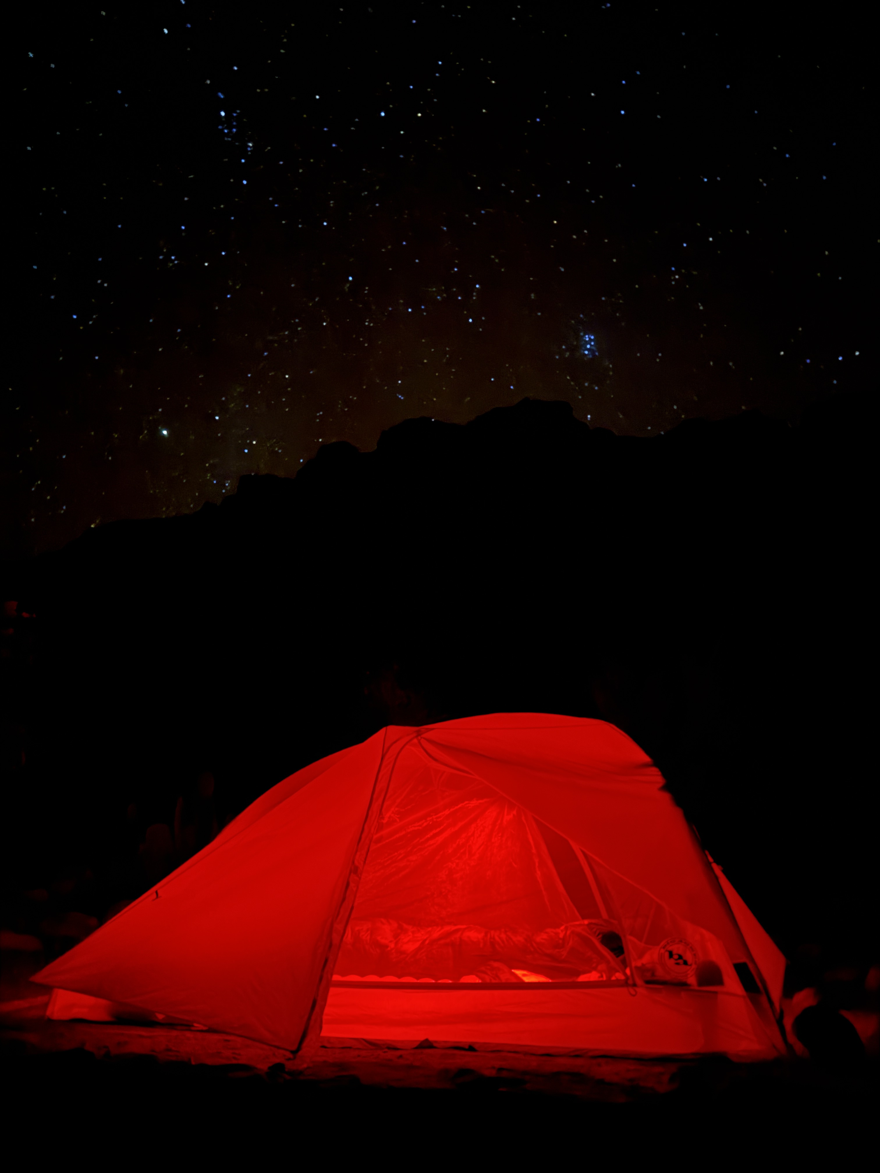
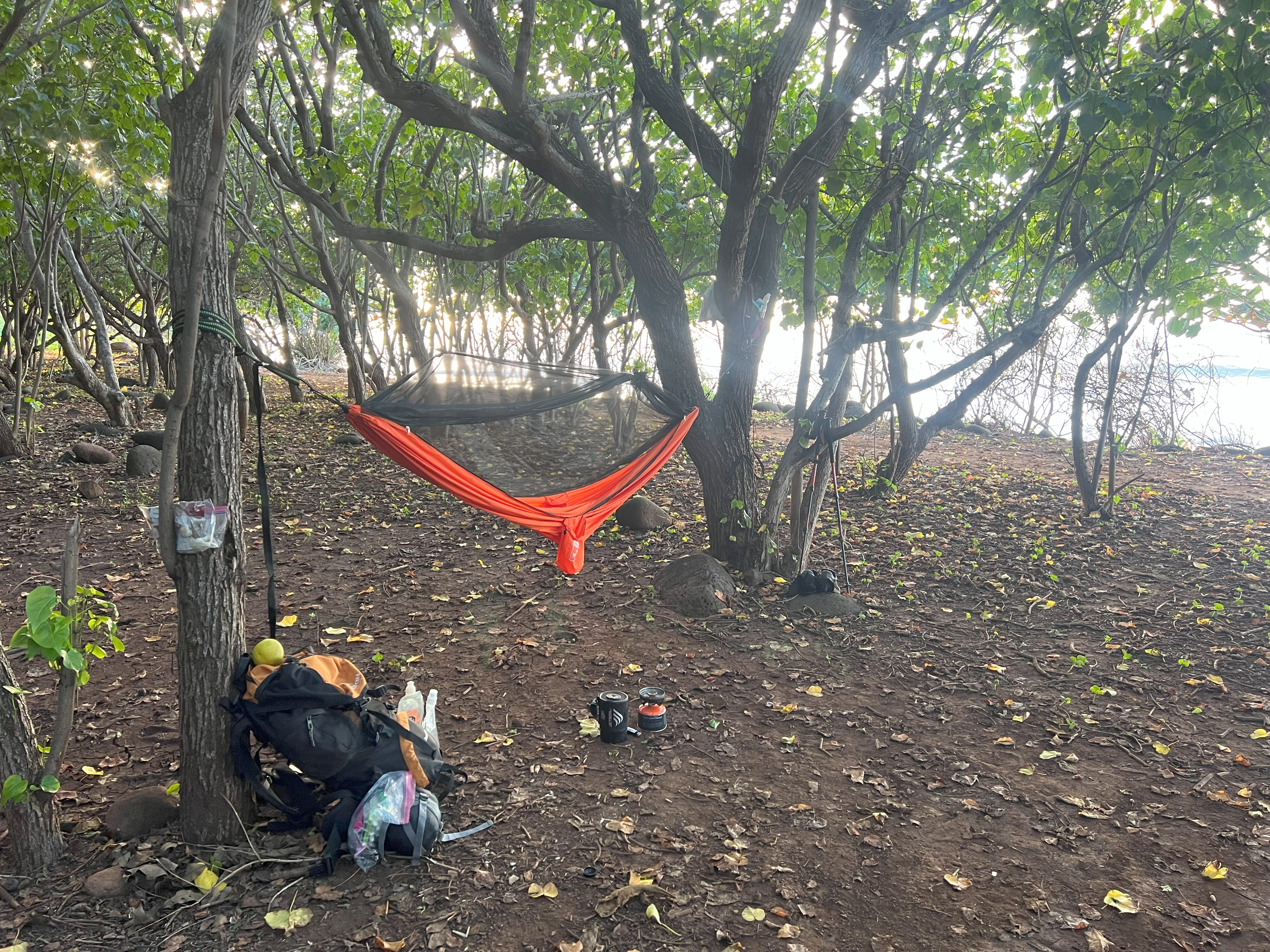
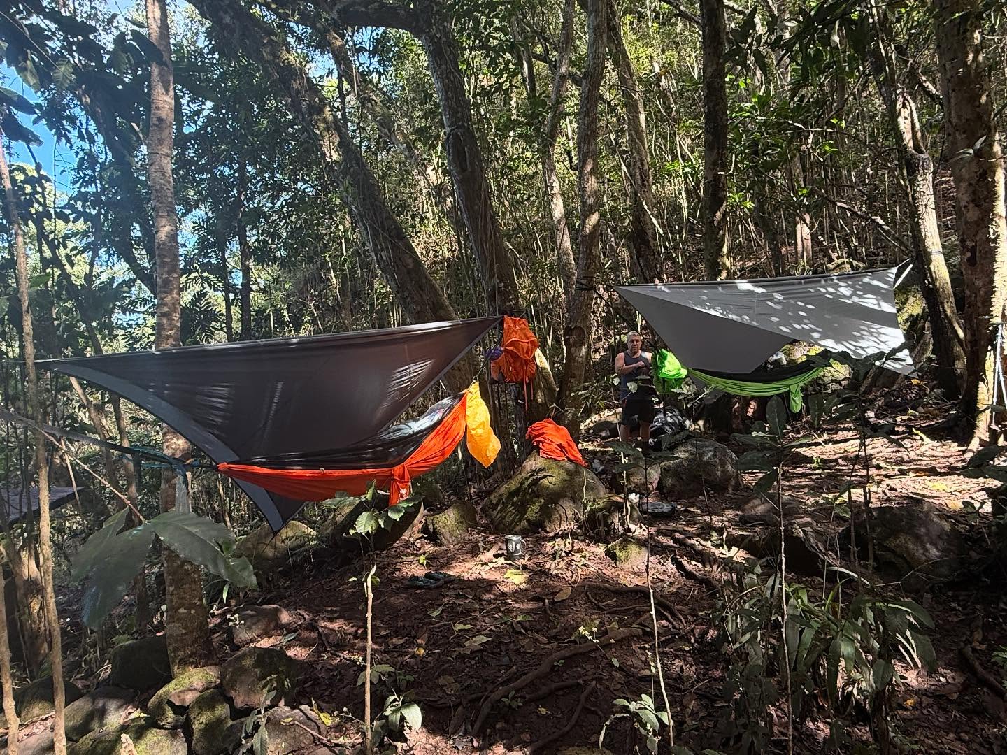
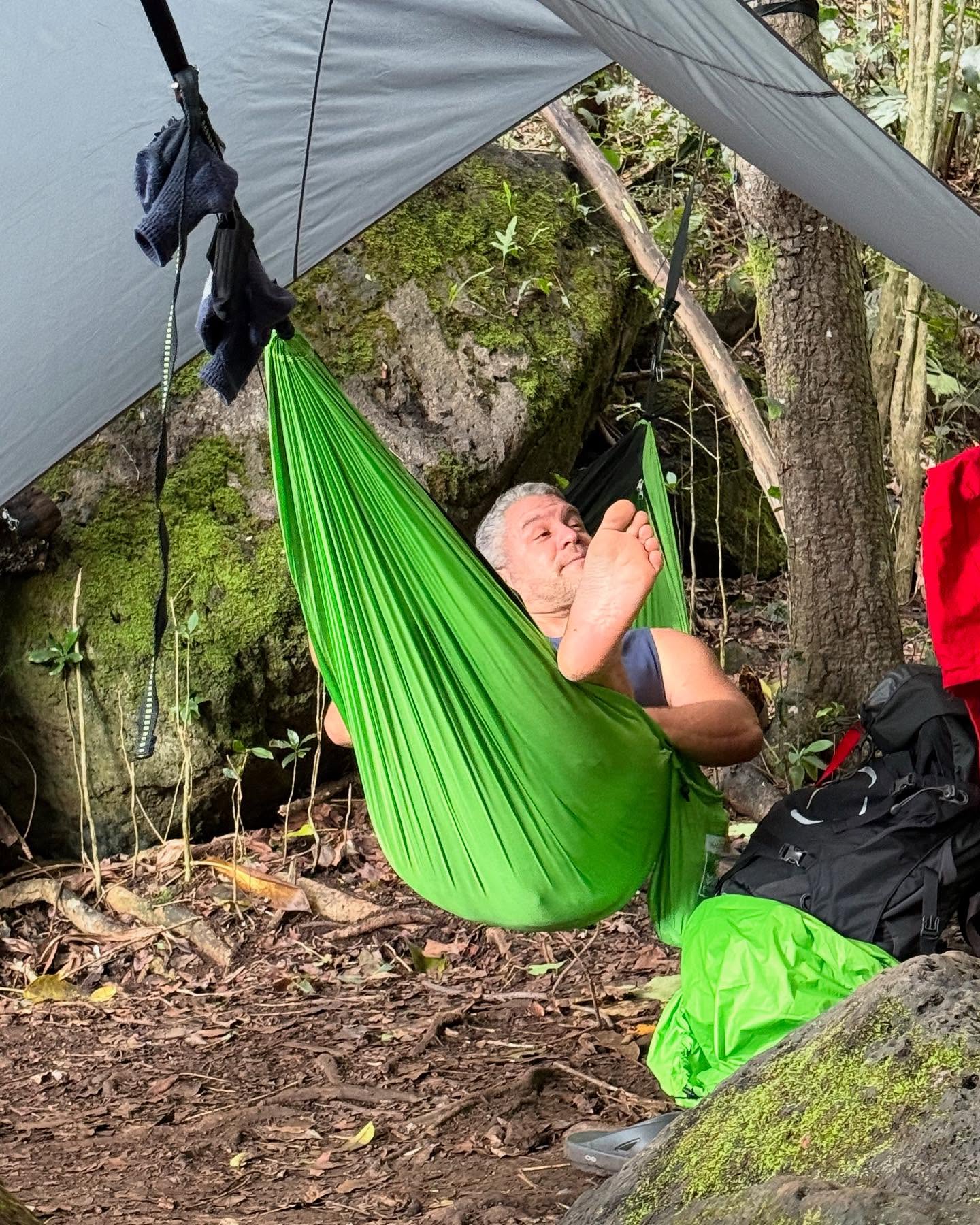
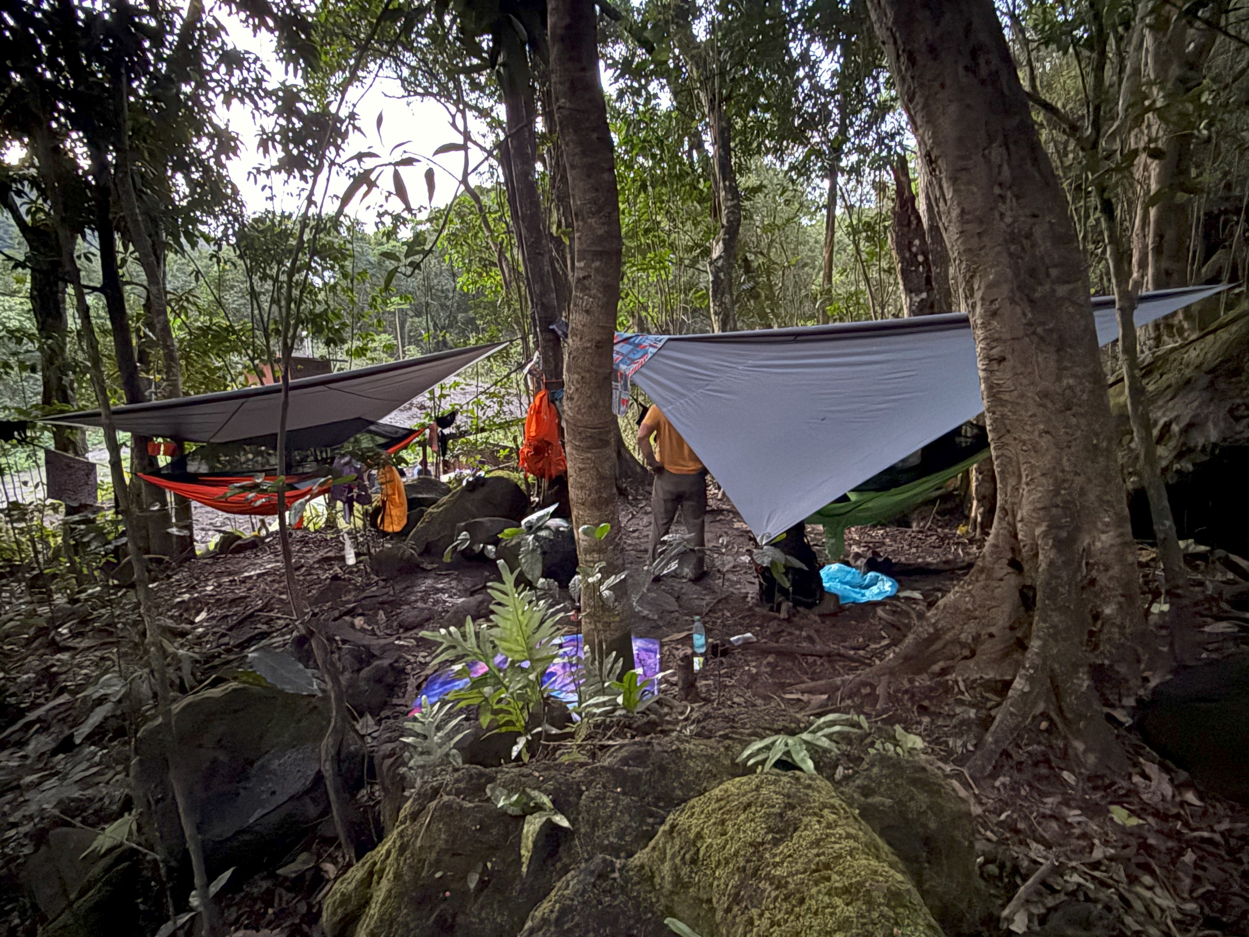
I camped at Hanakoa for a night at mile 6.4, having hiked more than 10 miles already, and hoping to shake off some of the stress from the vertigo and the building fear of the upcoming Crawler’s Ledge. I set up my Hammock and slept as much as I could, with the wild pigs squealing not far off, and my mind racing about what was to come.

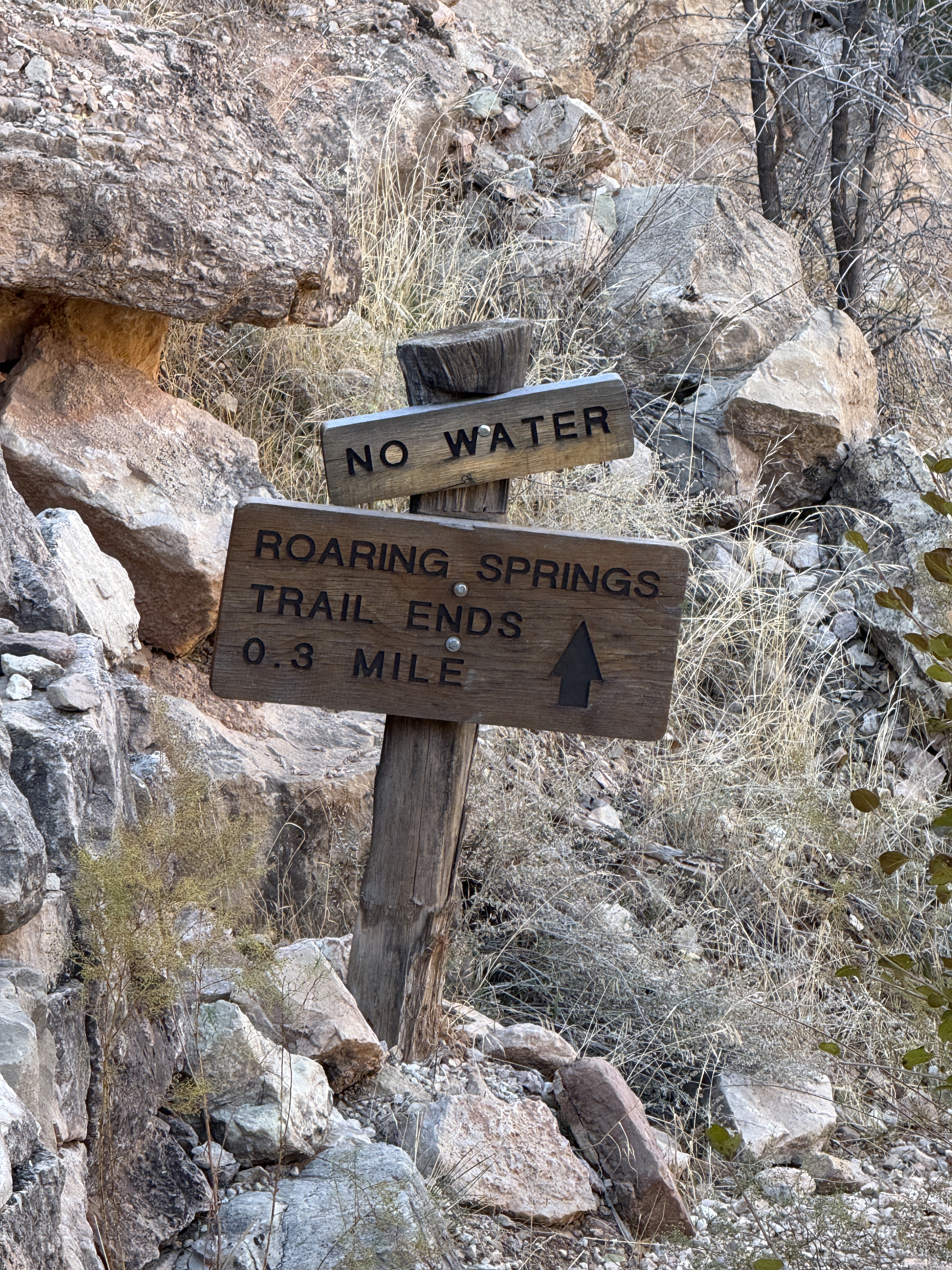
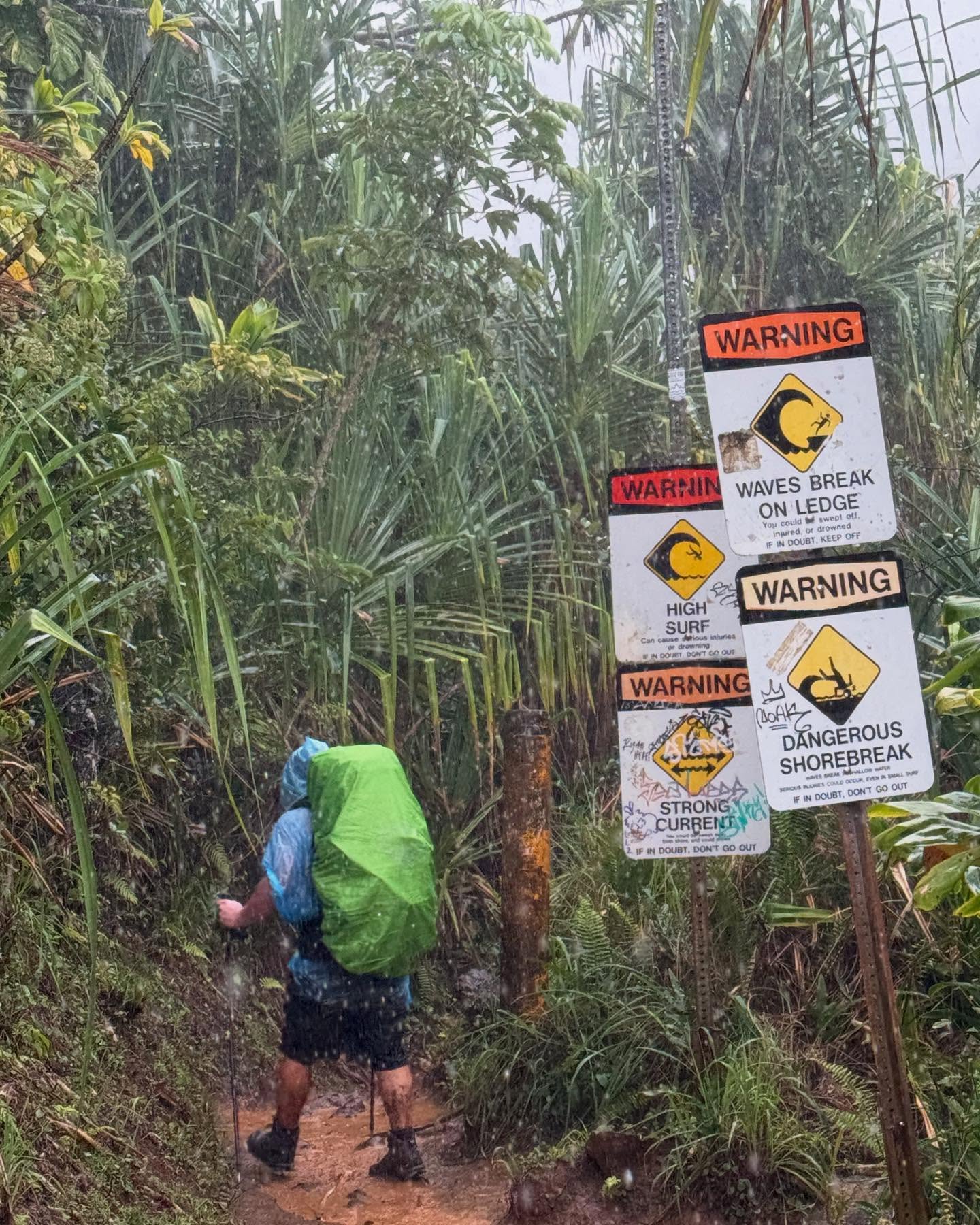
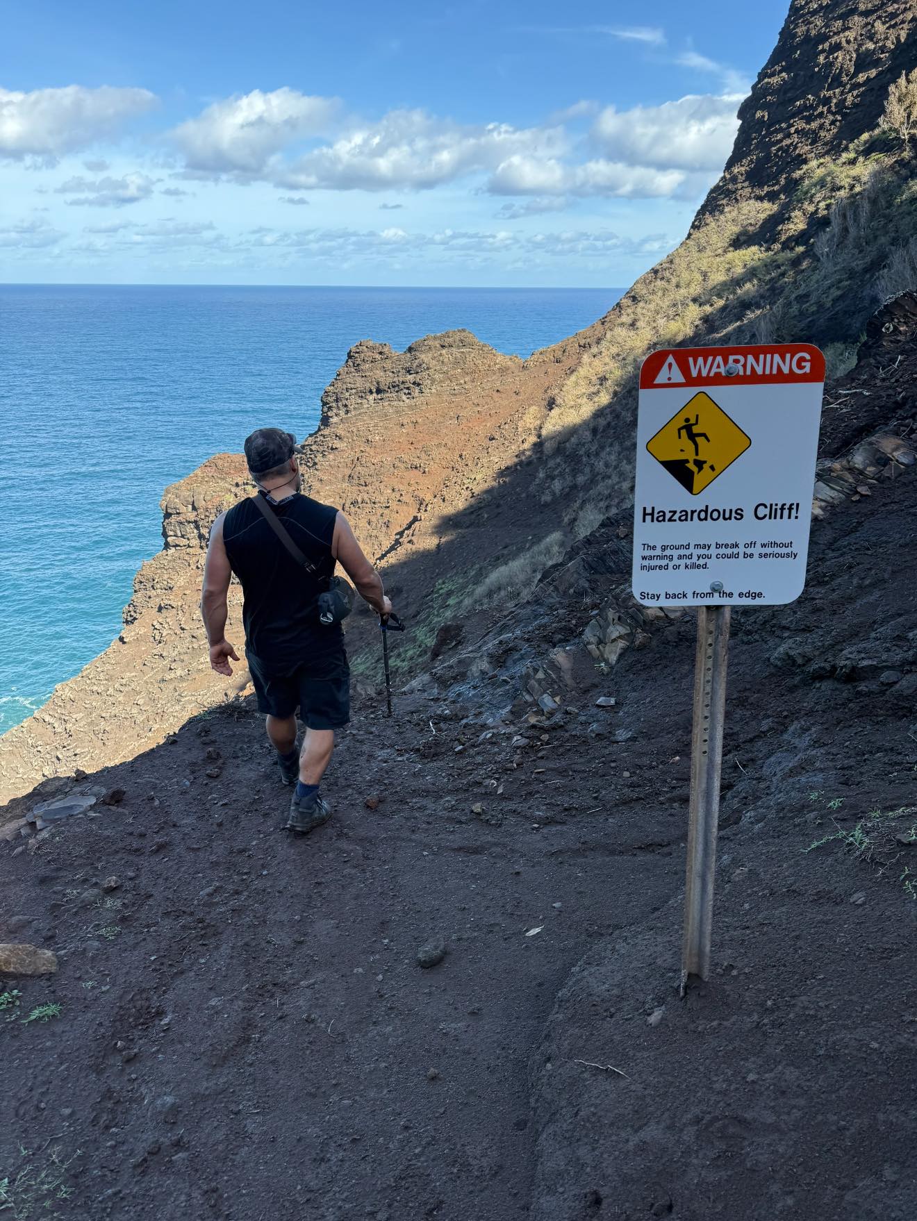
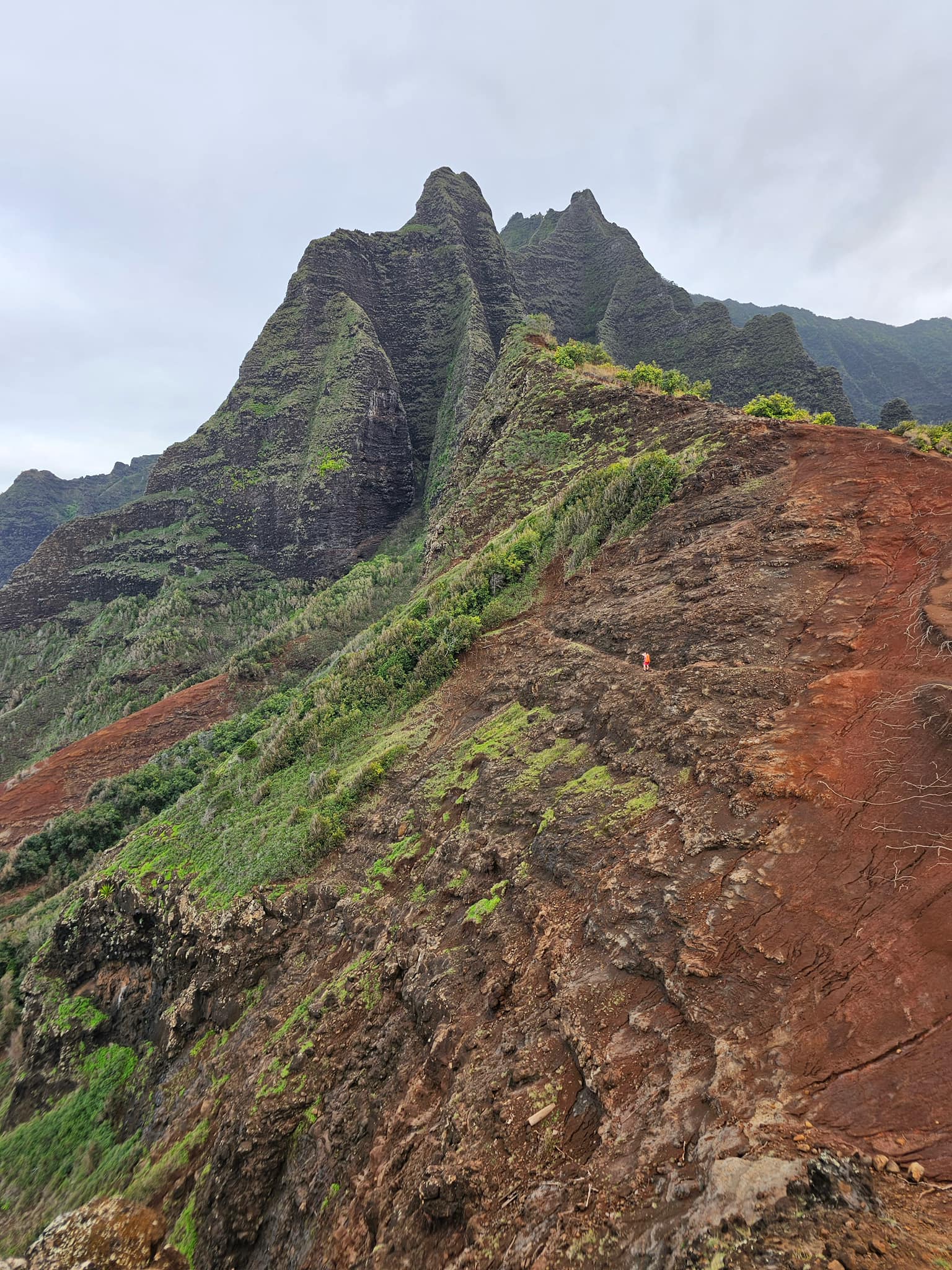
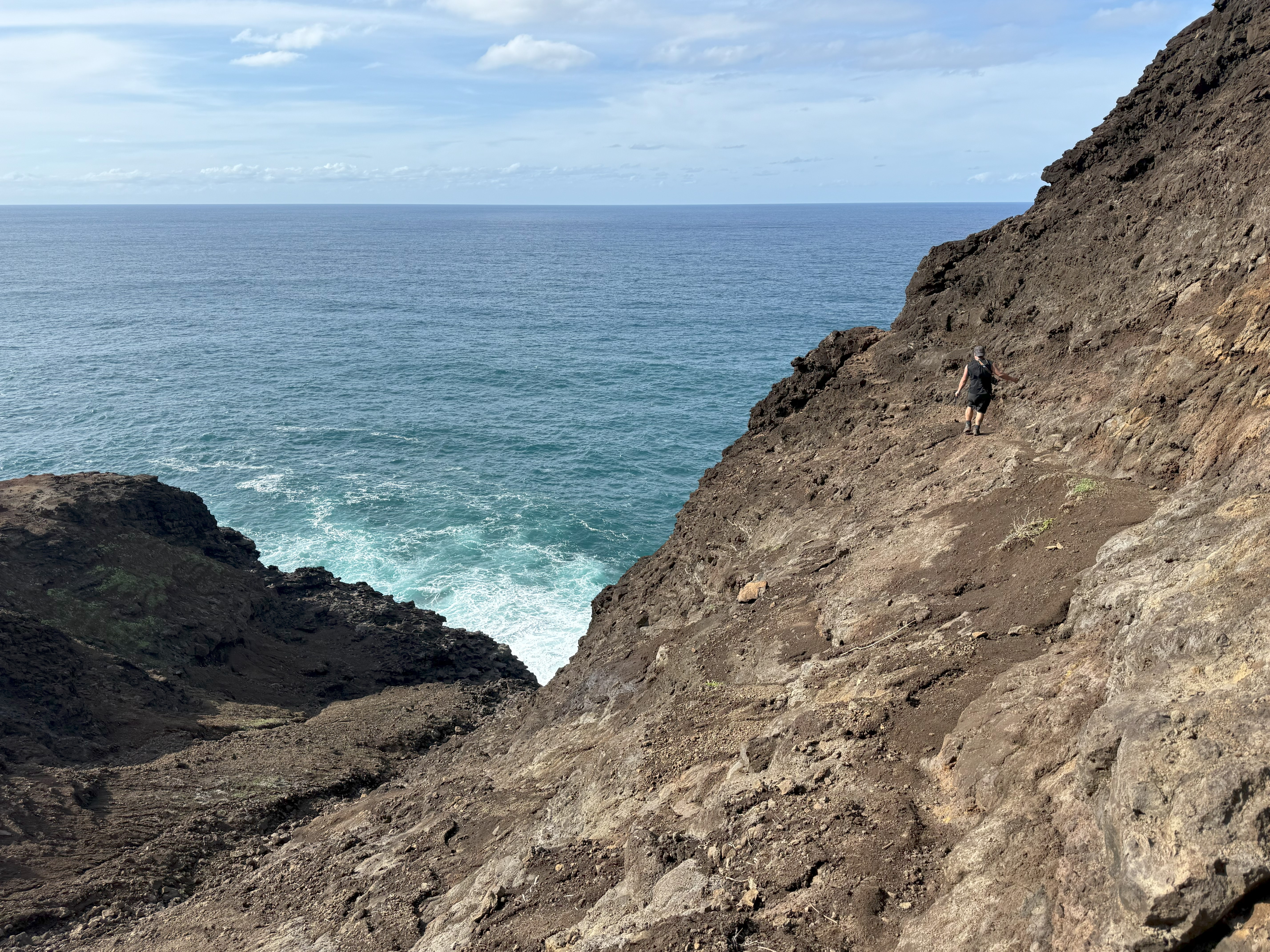
The following morning, I set out, not willing to turn back over fear. At this point I had met another solo hiker, and we traveled together. Not far beyond Hanakoa, I turned the corner and there it was. Crawler’s Ledge. I was so much worse than I had imagined, or, more likely, I had just driven myself irrational. A sign with a warning showing a person falling off a cliff did not help. I set off down the switchbacks and around the point where the exposure is the most severe. It was a breezy day, and I could feel the ocean spray on my back as I shuffled along, with my hands glued to the rock wall. I balked for only a moment before I moved quickly forward just to get to safer ground.

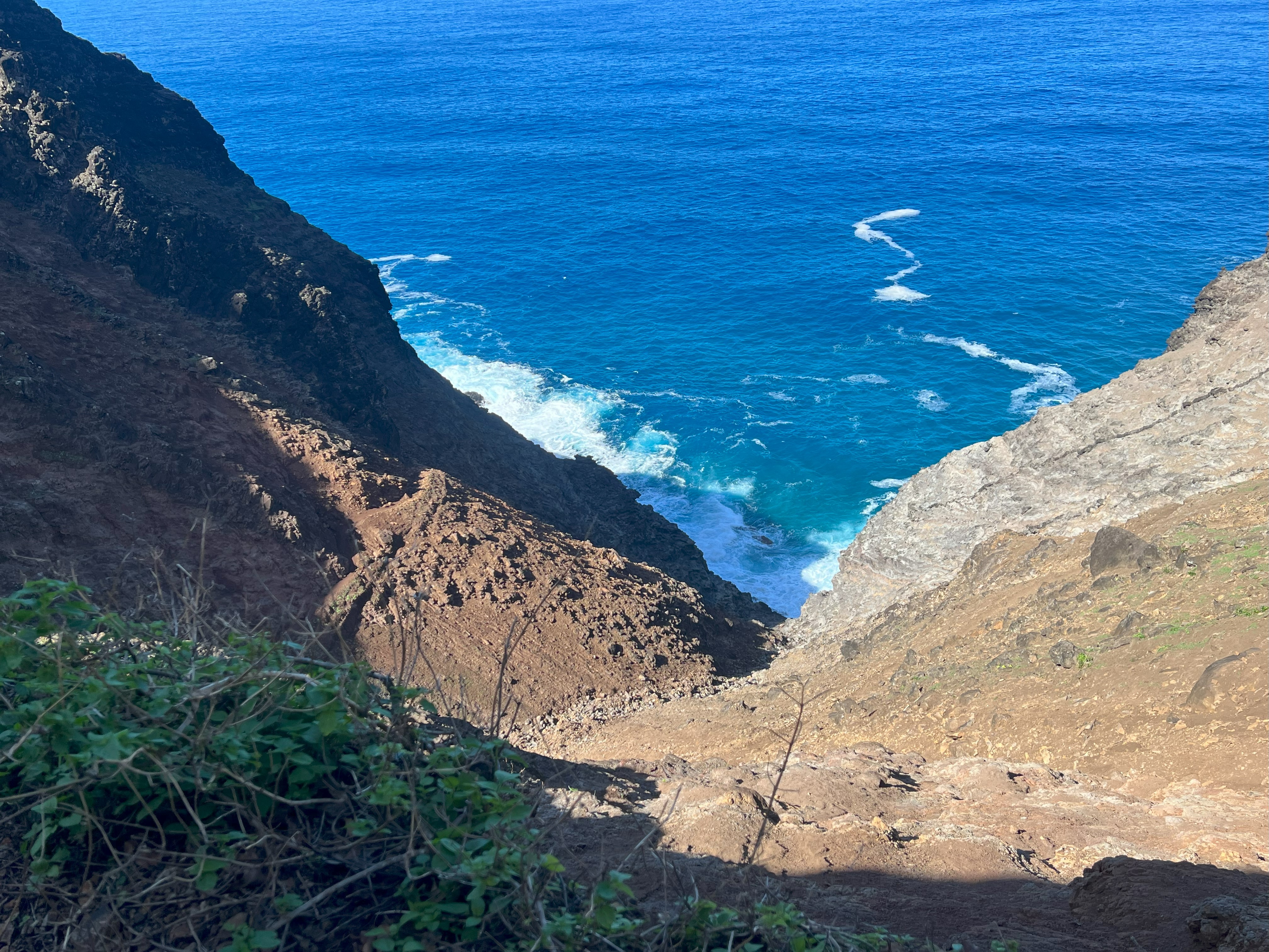
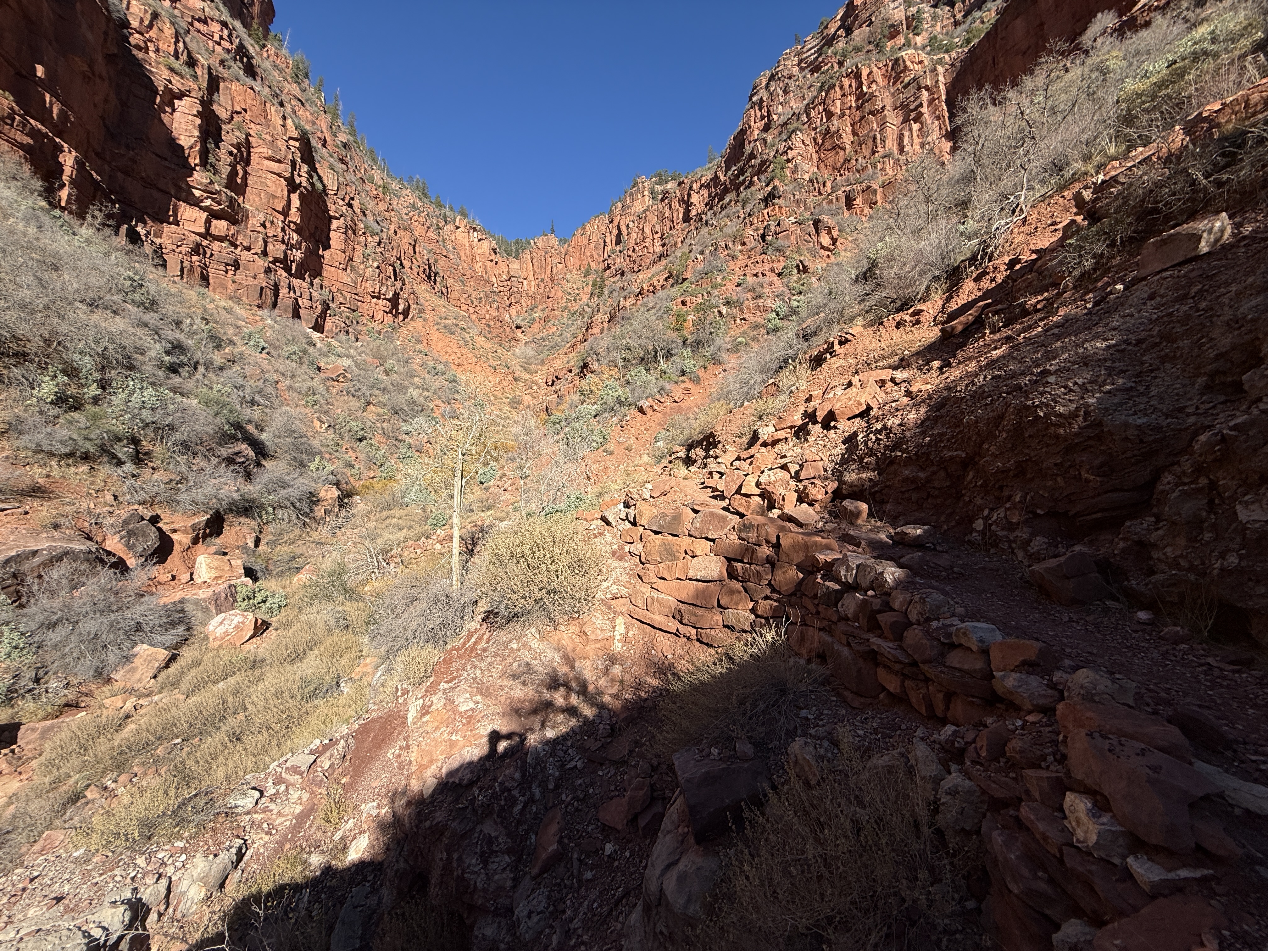
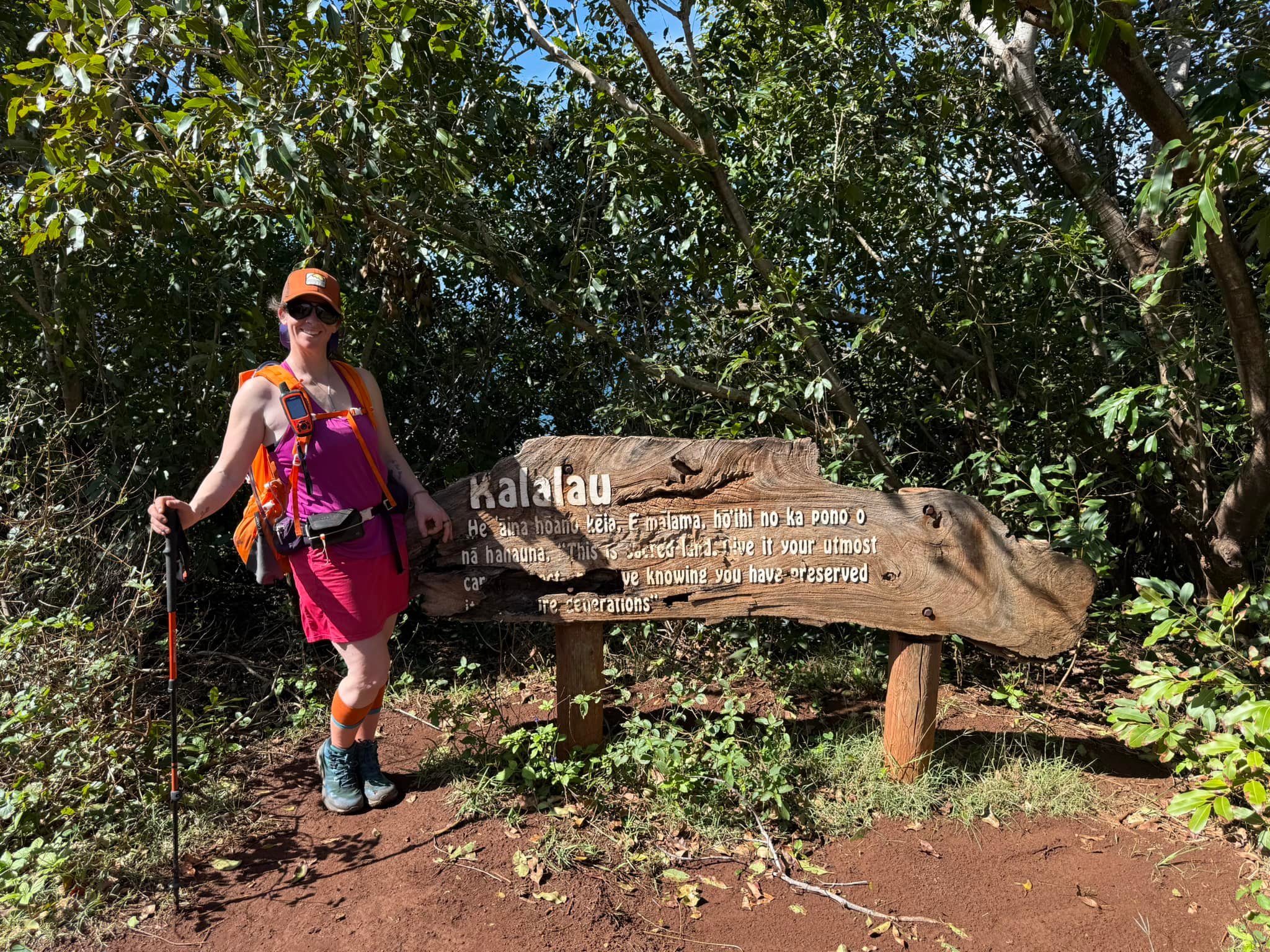
As soon as I reached the other side, I realized I eventually had to go back the same way. I wanted to cry, but moving forward, I was too busy trying to keep myself from losing it… the exposure and washouts became more than dizzying, they felt unbearable. I knew I had fucked up. I knew this was beyond my limits. Just when I thought to myself that I couldn’t take it anymore, I came to a crumbling “Kalalau Valley” sign, the “Red Dirt Hill” ramp leading down to Kalalau Stream and, a mile later, the beach. I was crying tears of relief and also of fear about the return.

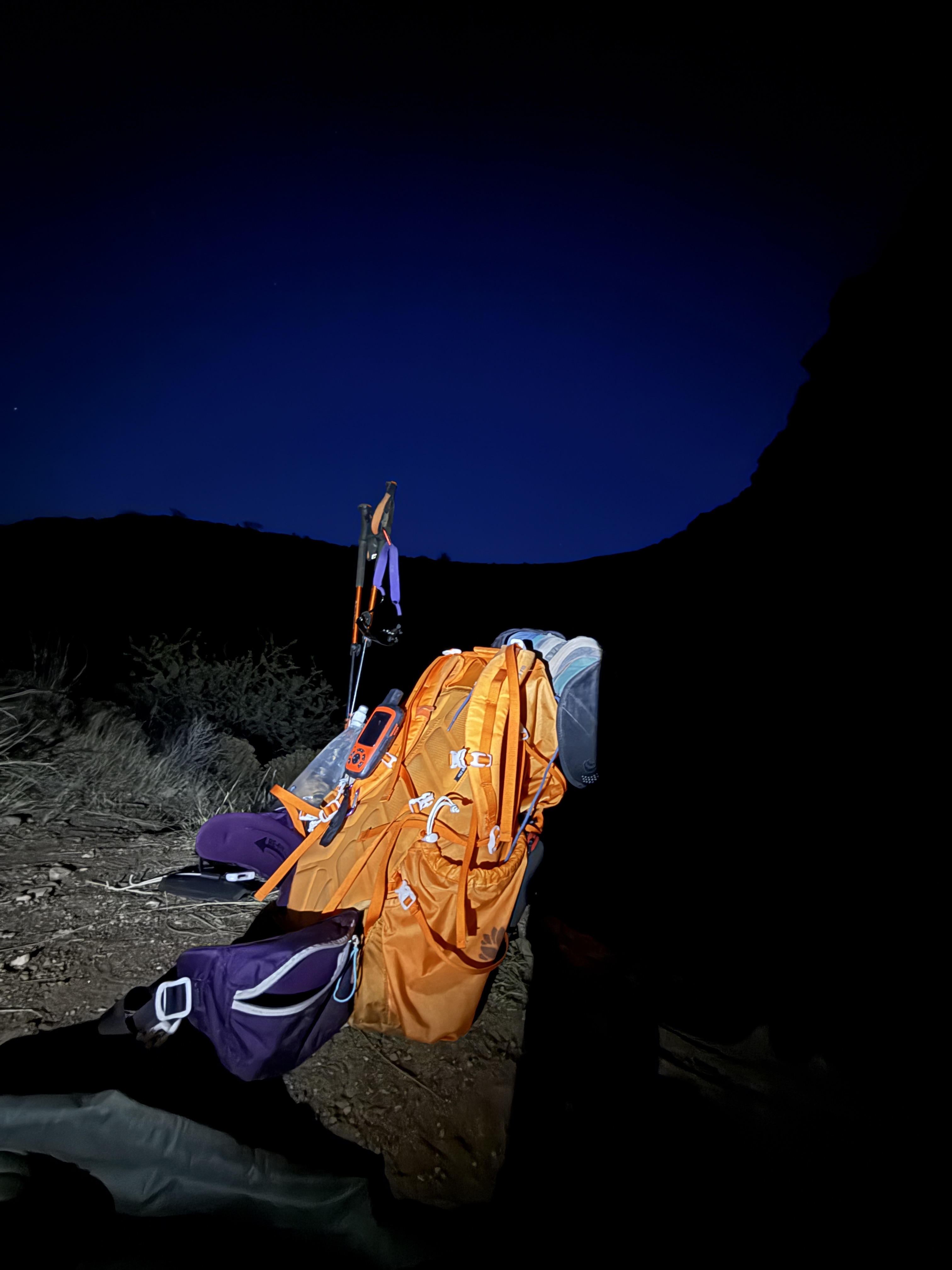
I found a nice spot in the trees just past the camping area border and set up my hammock, got water from the waterfall, and made dinner. I checked the weather with my InReach, and it wasn’t great… the rain was supposed to move in the following evening. Like the exposure, trip reports and trail descriptions warn of the dangers of rain, and I wasn’t willing to brush this warning aside. Walking along those ledges in the rain was unthinkable.

The ocean was so loud, and my stress level was so high that I knew I had to get out of there the following day. Although I was disappointed that I wasn’t going to be able to explore Kalalau Valley, I knew it was the right choice. I would make my way back to Hanakoa, salvage one of the nights I sacrificed, and hike out the next day.

The next morning, I woke, packed and headed out with a couple from Montana who had also made the hard decision to leave early because of the forecast. I felt a little better knowing that if I fell off a cliff, these folks would at least be able to share my fate with my family. From Kalalau to Crawler’s was a blur; I don’t remember much and must have been in state of survival mode, but I do remember the husband taking my pack and bringing it across Crawler’s so I could travel the narrow precipice unimpeded.

We made it safely to Hanakoa and the couple continued on to the trailhead. I later found out that both of their headlamps had failed, and they had to walk the last couple of miles in the dark. I camped alone in the jungle, but I had no fear. My evening tea had a message that struck a chord, and I had made it back beyond the worst of the trail. I slept like the dead, even as a steady, light rain developed and continued into the morning.

Walking back from Hanakoa to the trailhead was uneventful, although it was lightly raining for the first couple of miles. I felt accomplished having made it out and back but also ruminated on the embarrassment of having my pack carried for me and for showing weakness. I held onto these regrets for years, always saying I would never, ever go back there.

January 2025

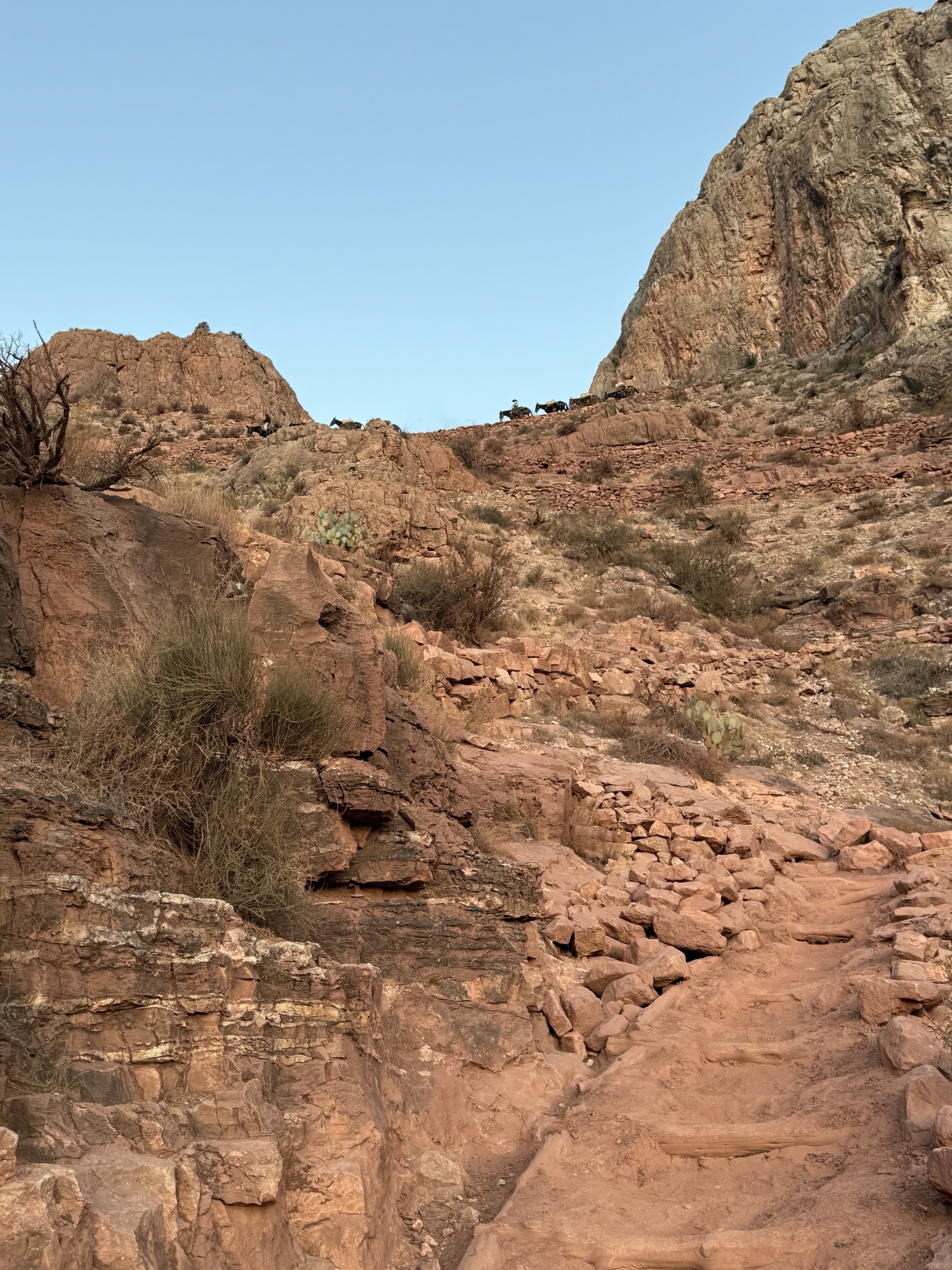
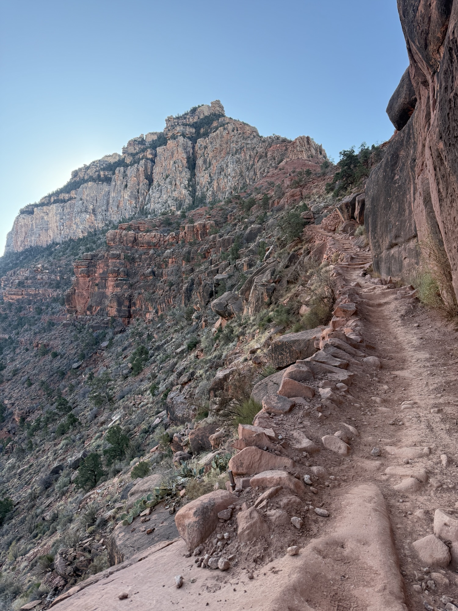
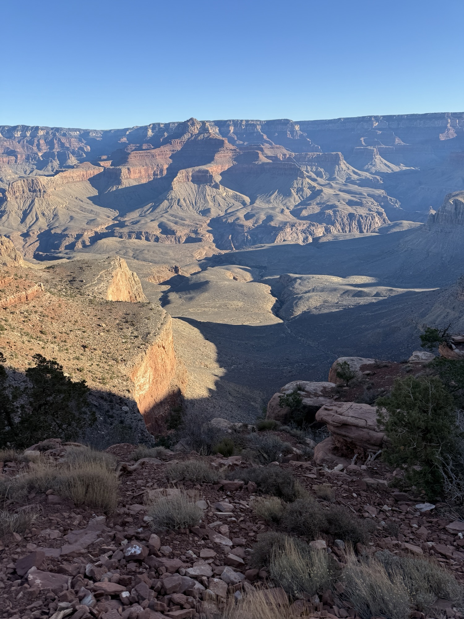
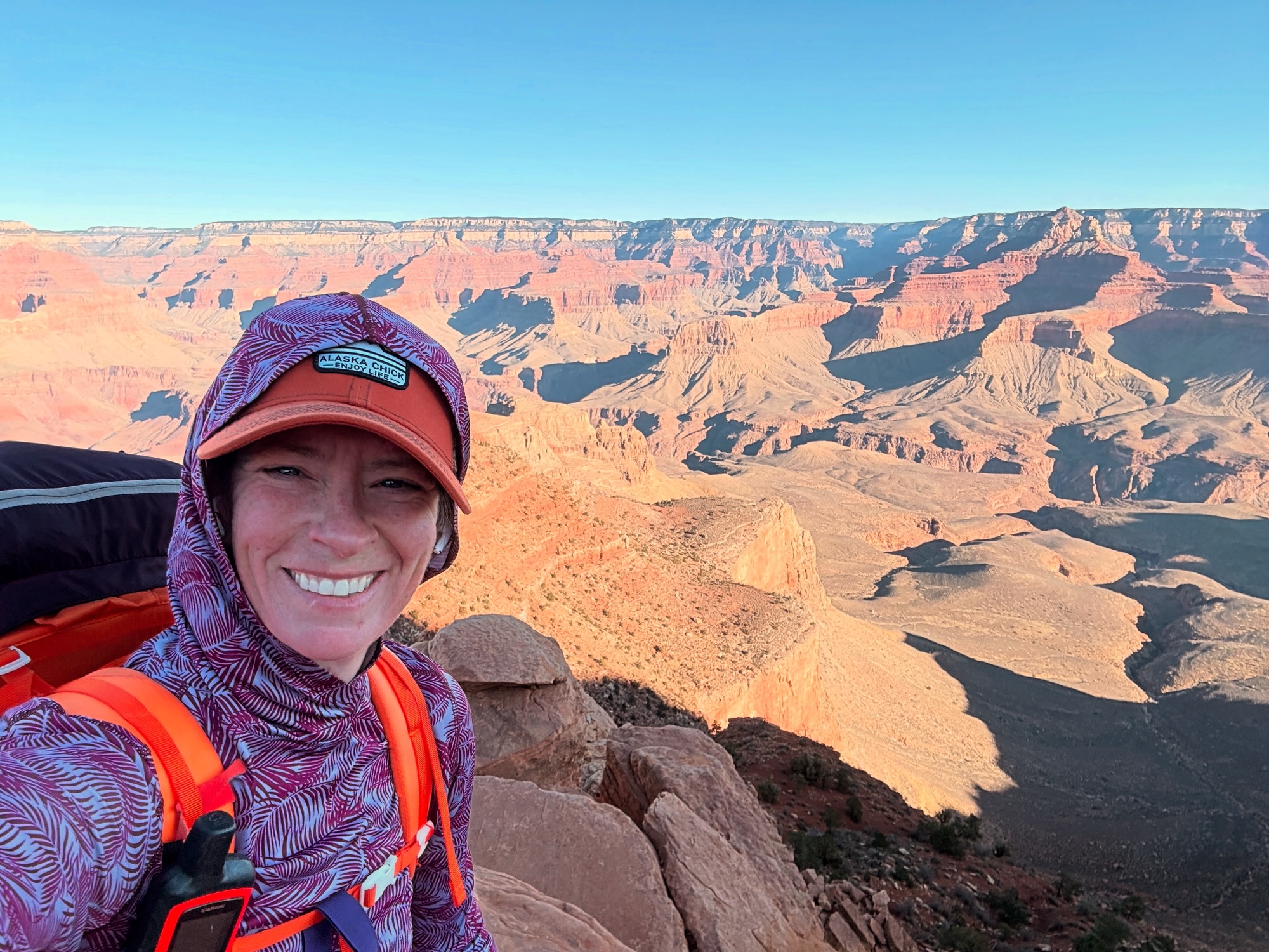
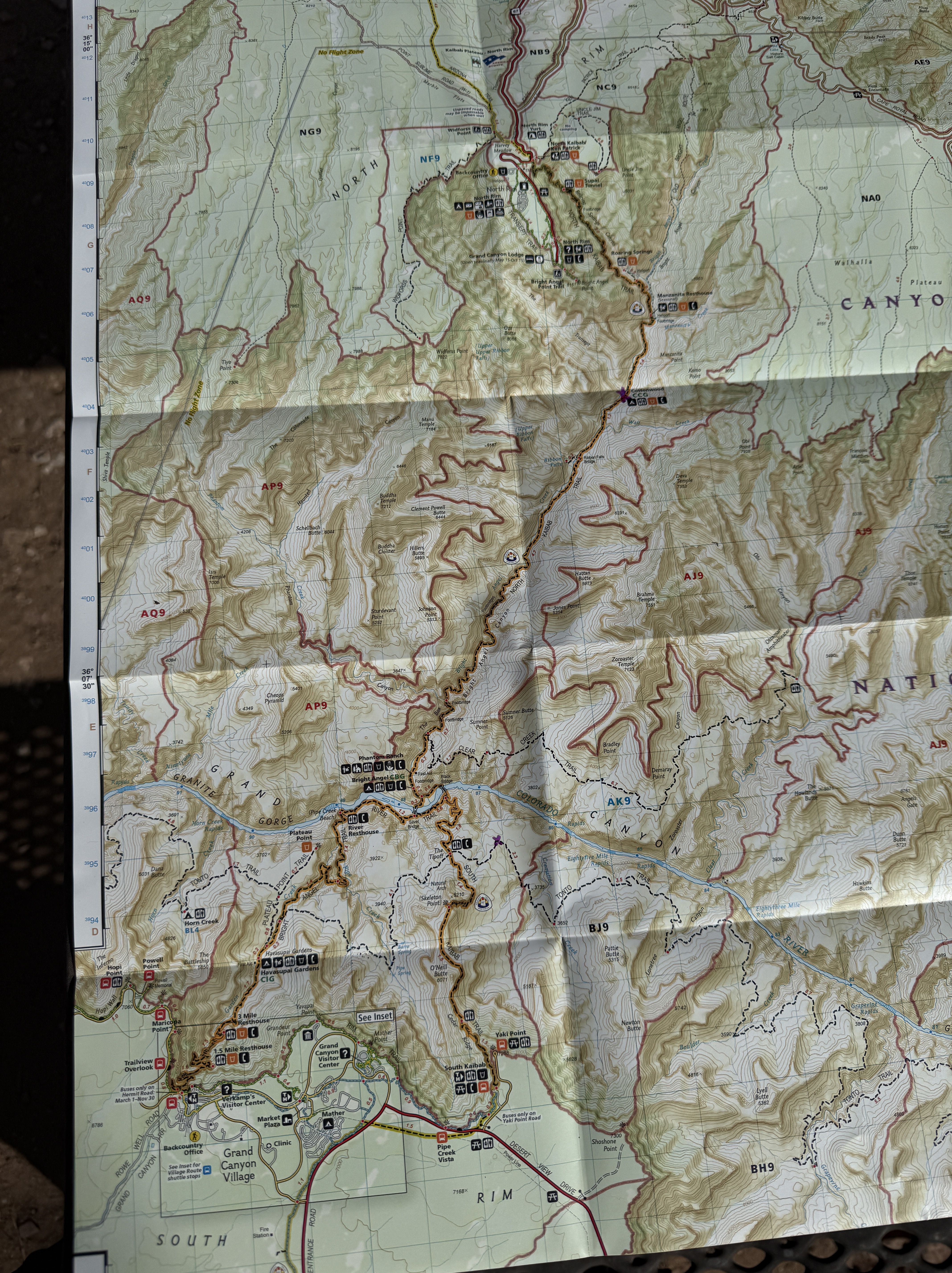
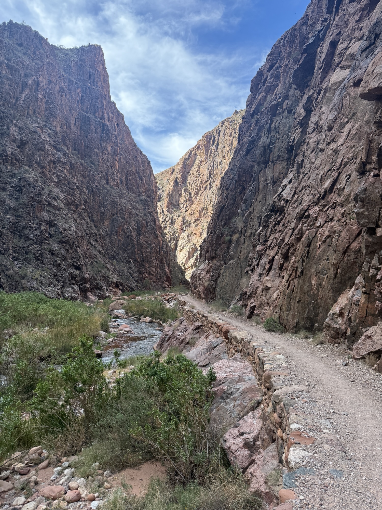
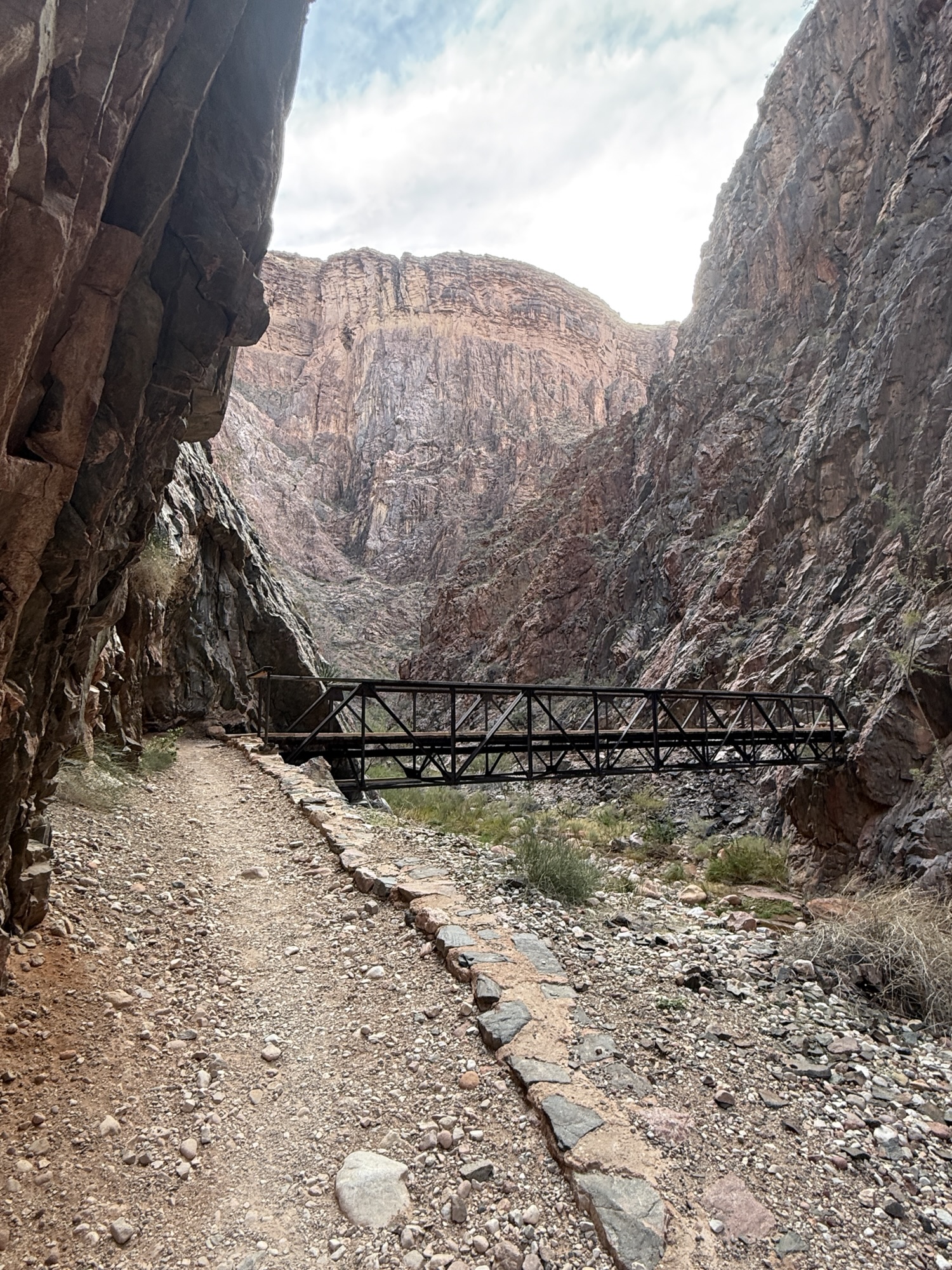
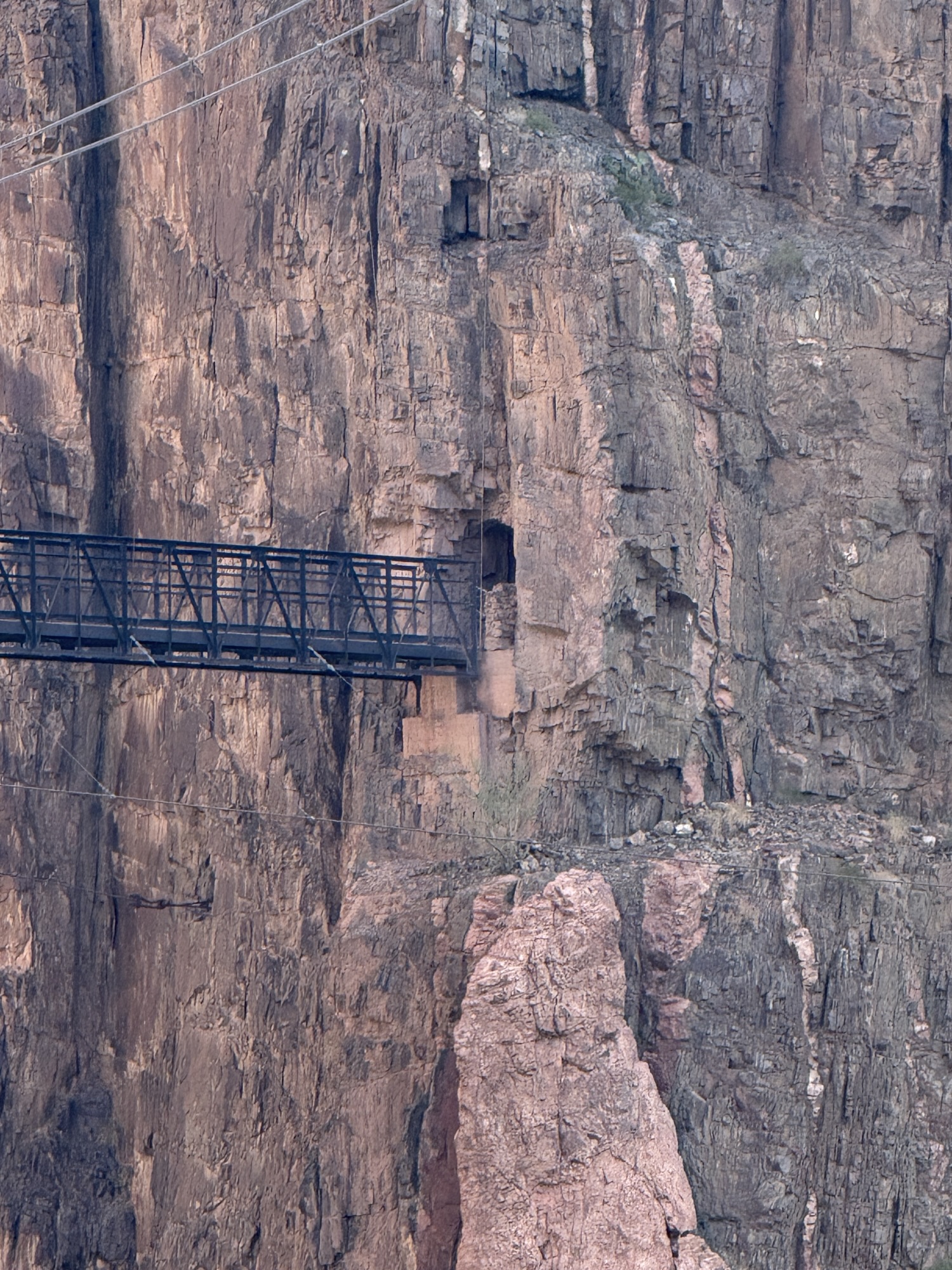
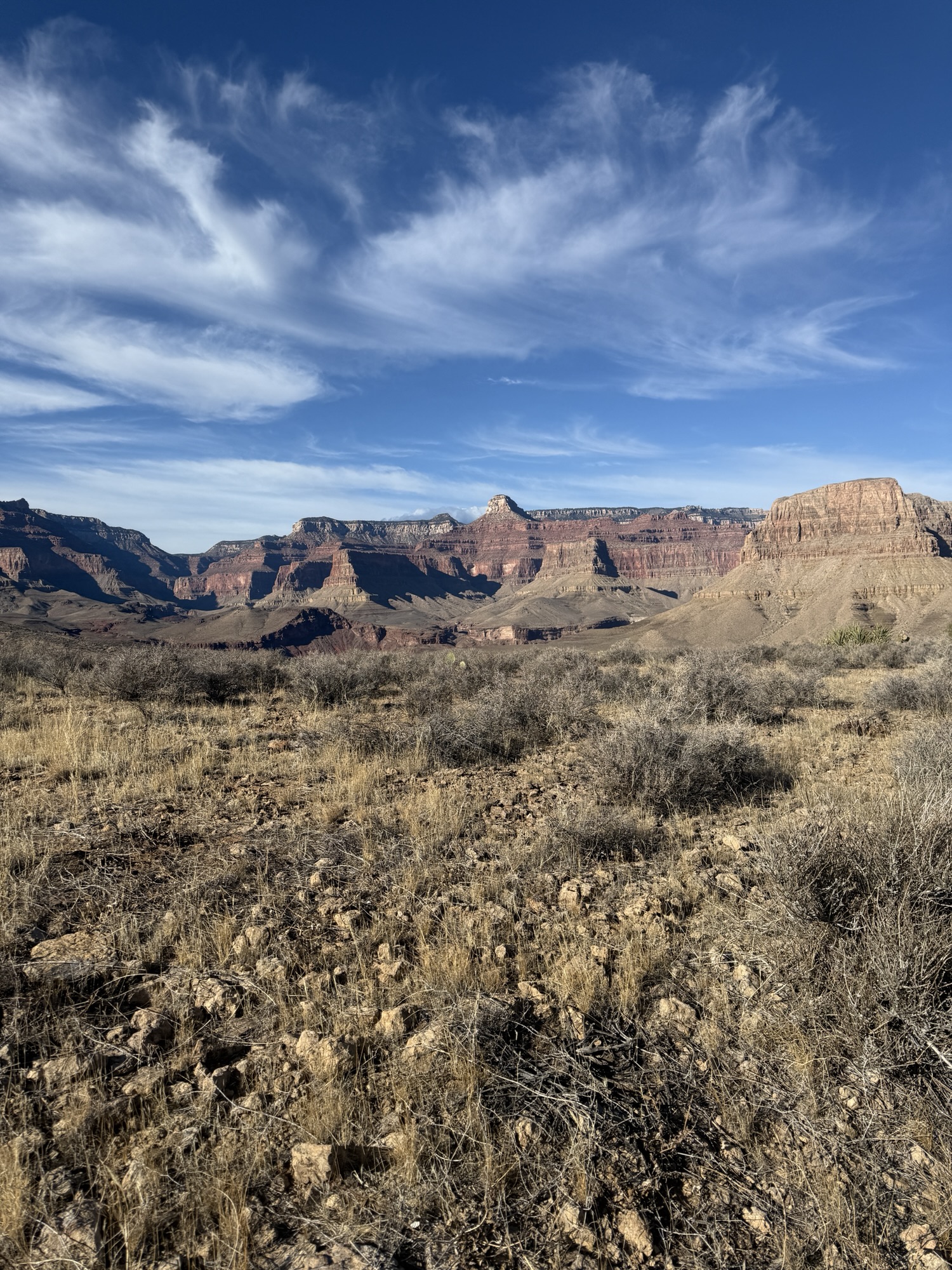
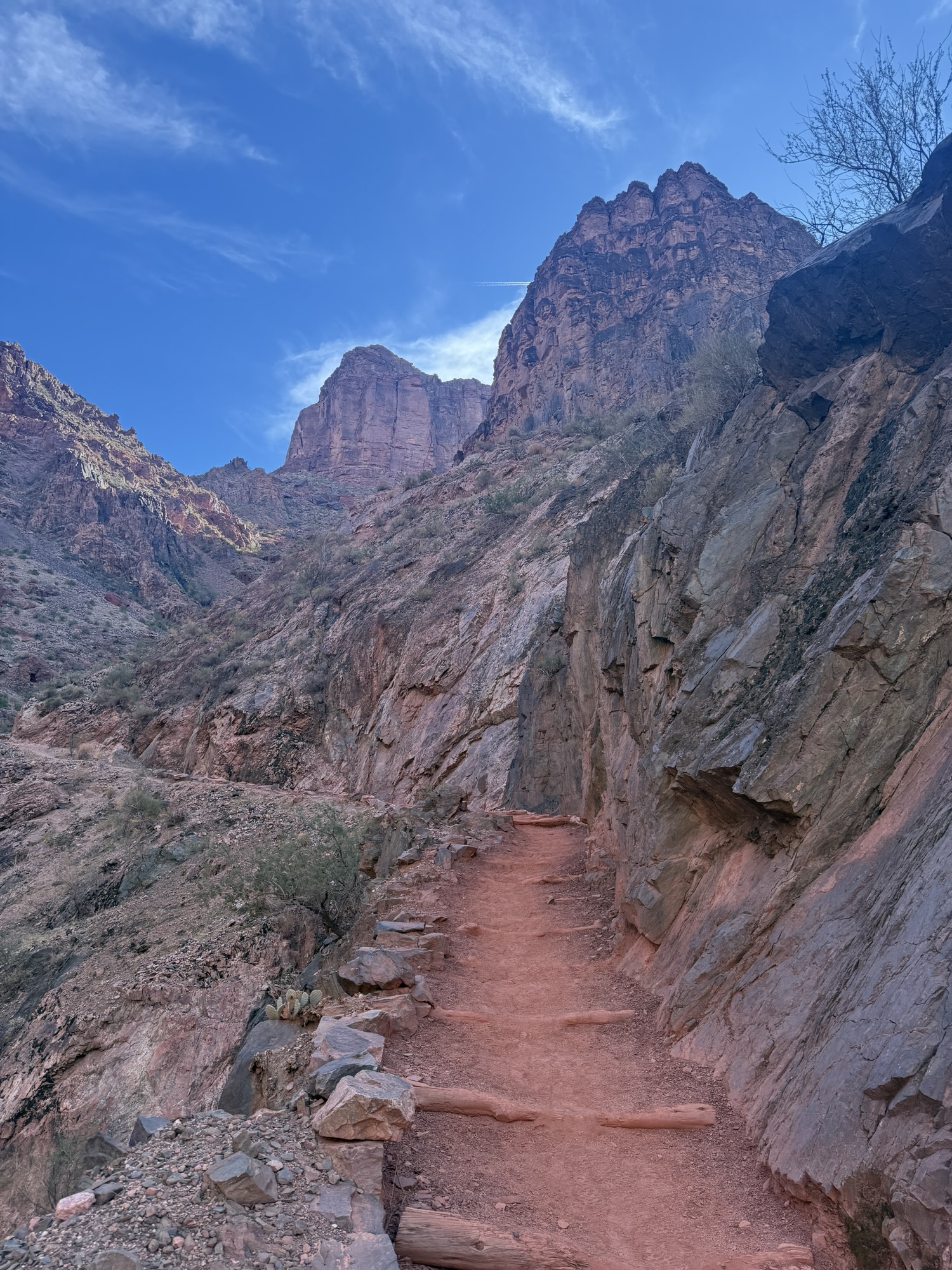
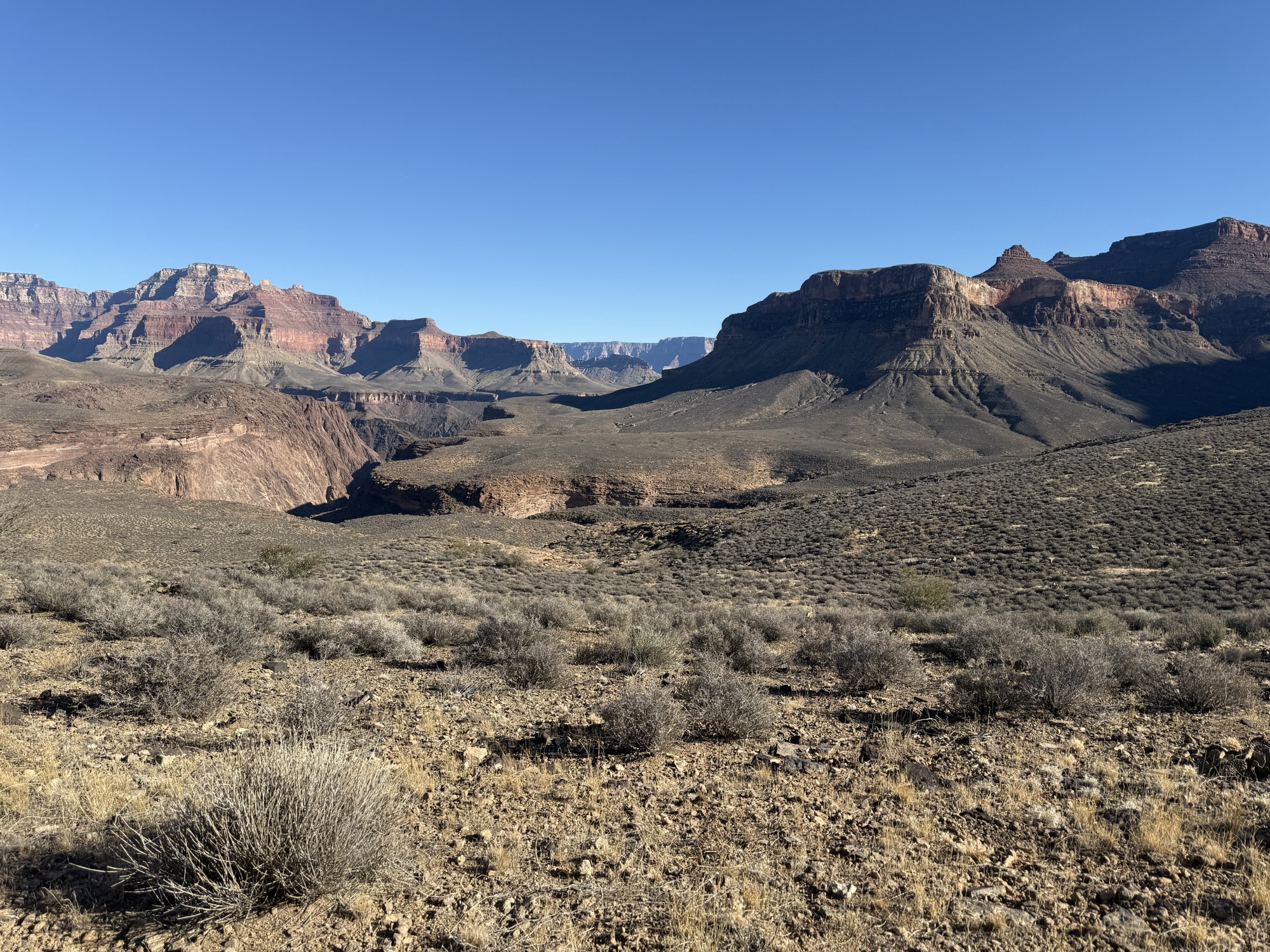
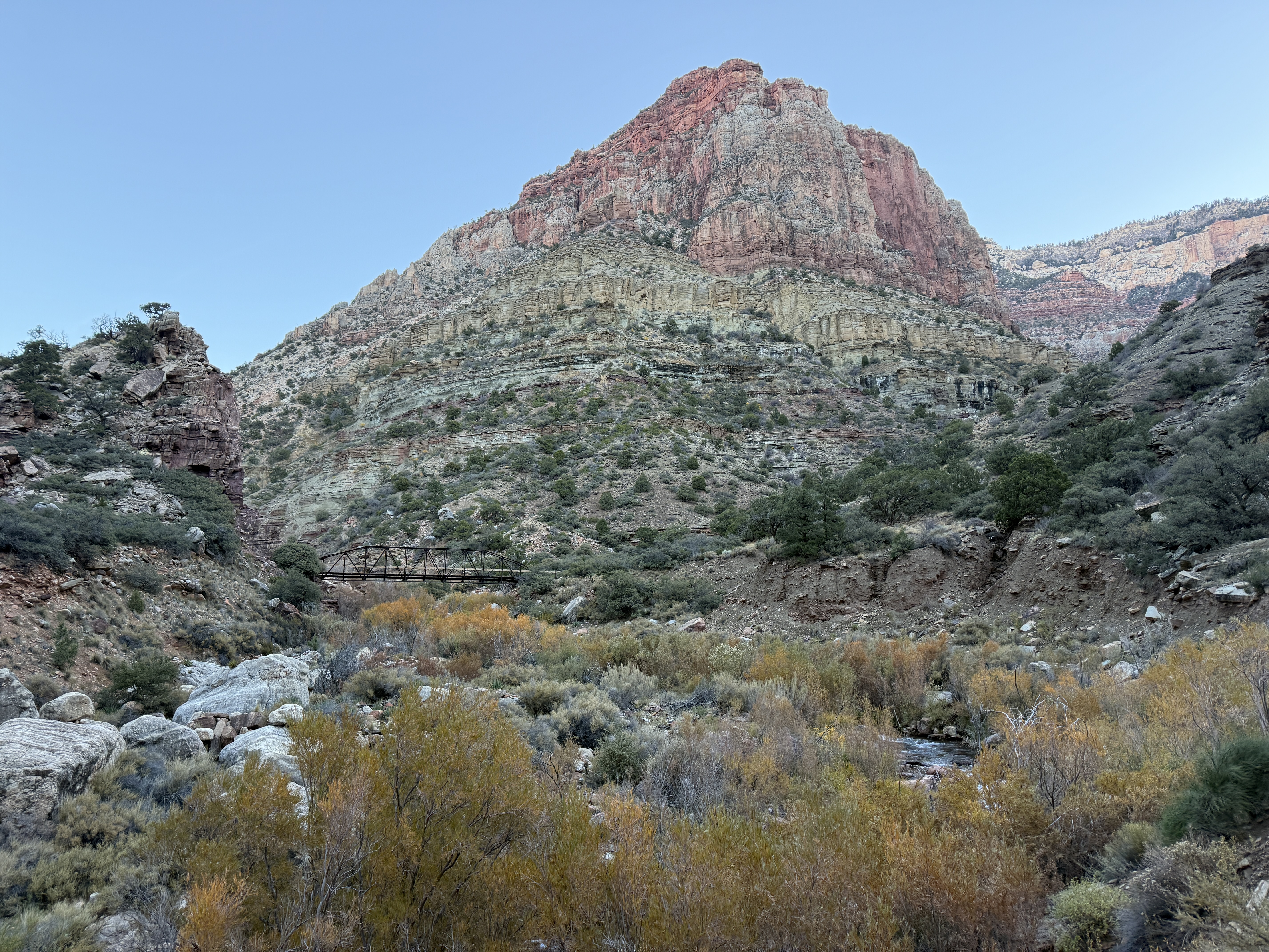
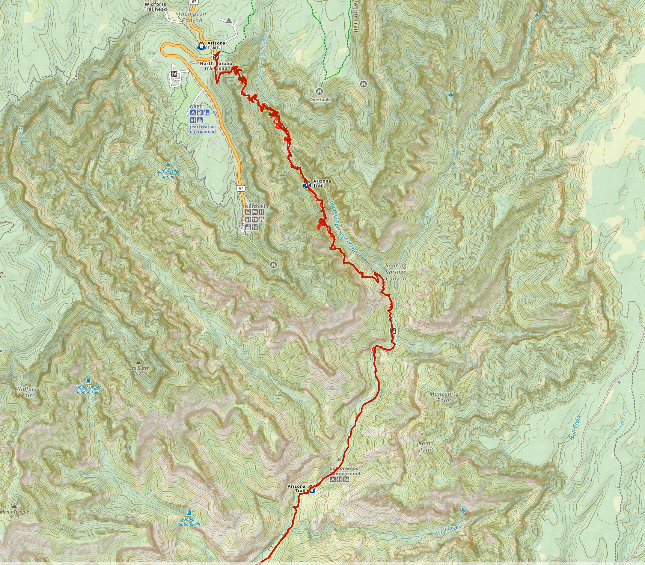
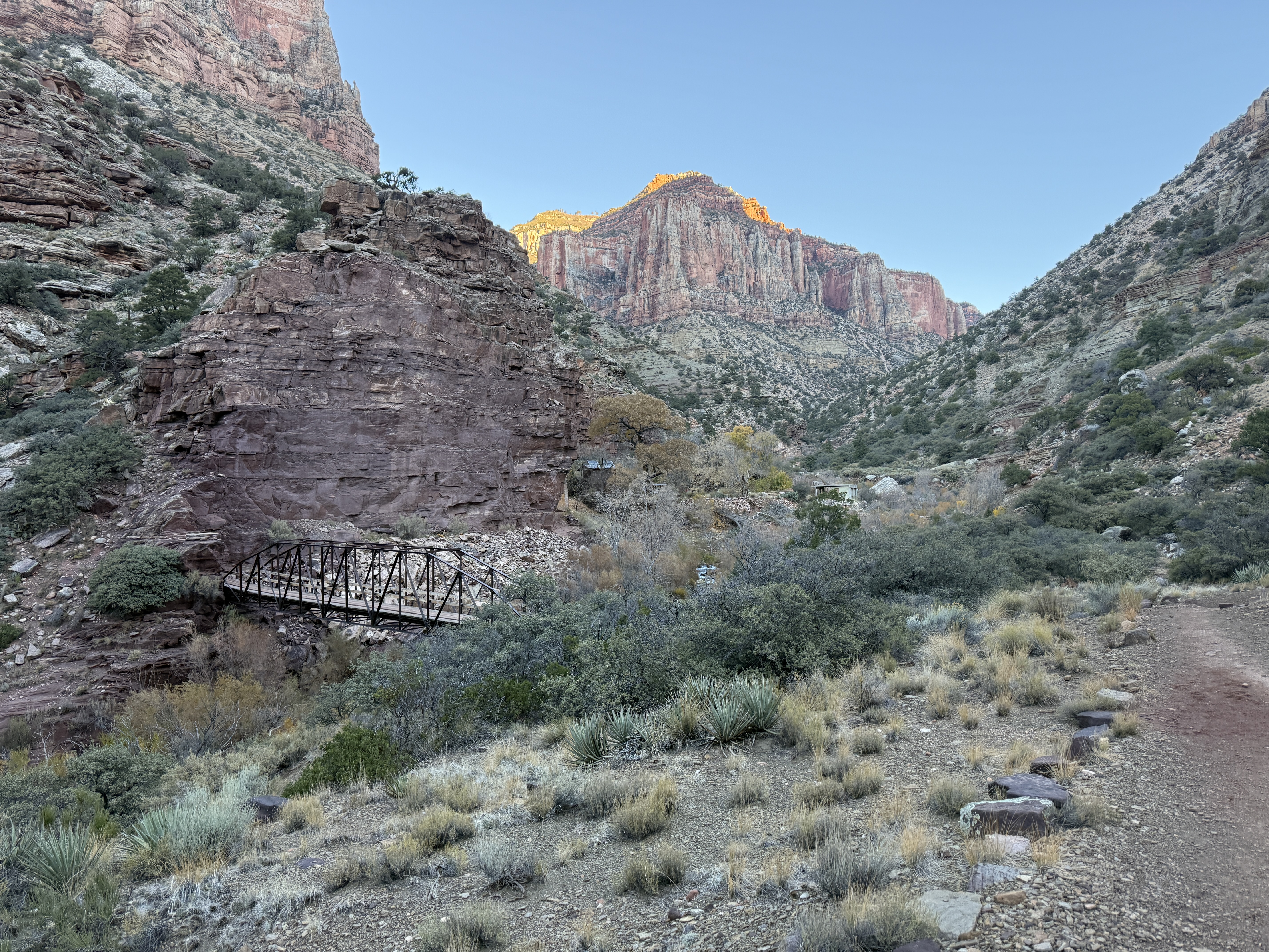
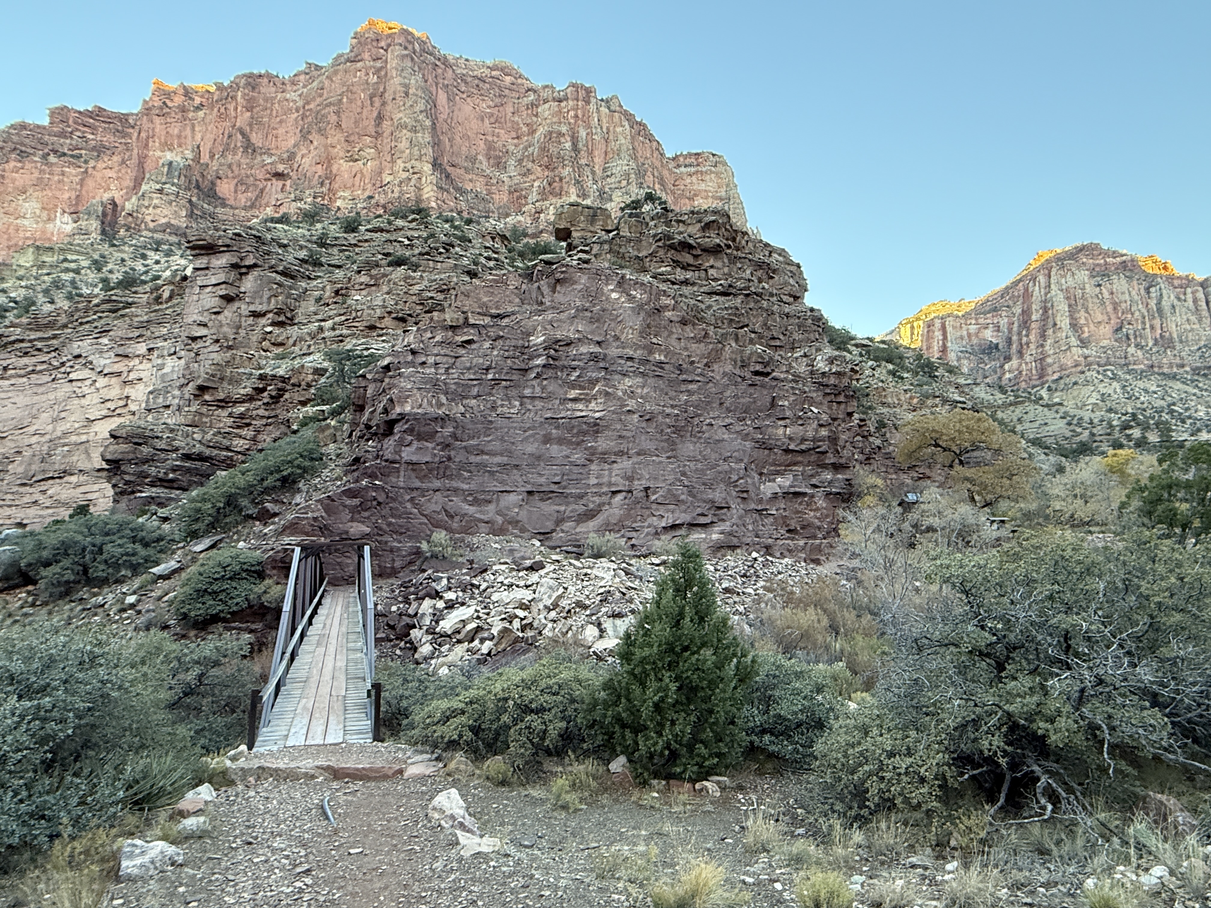
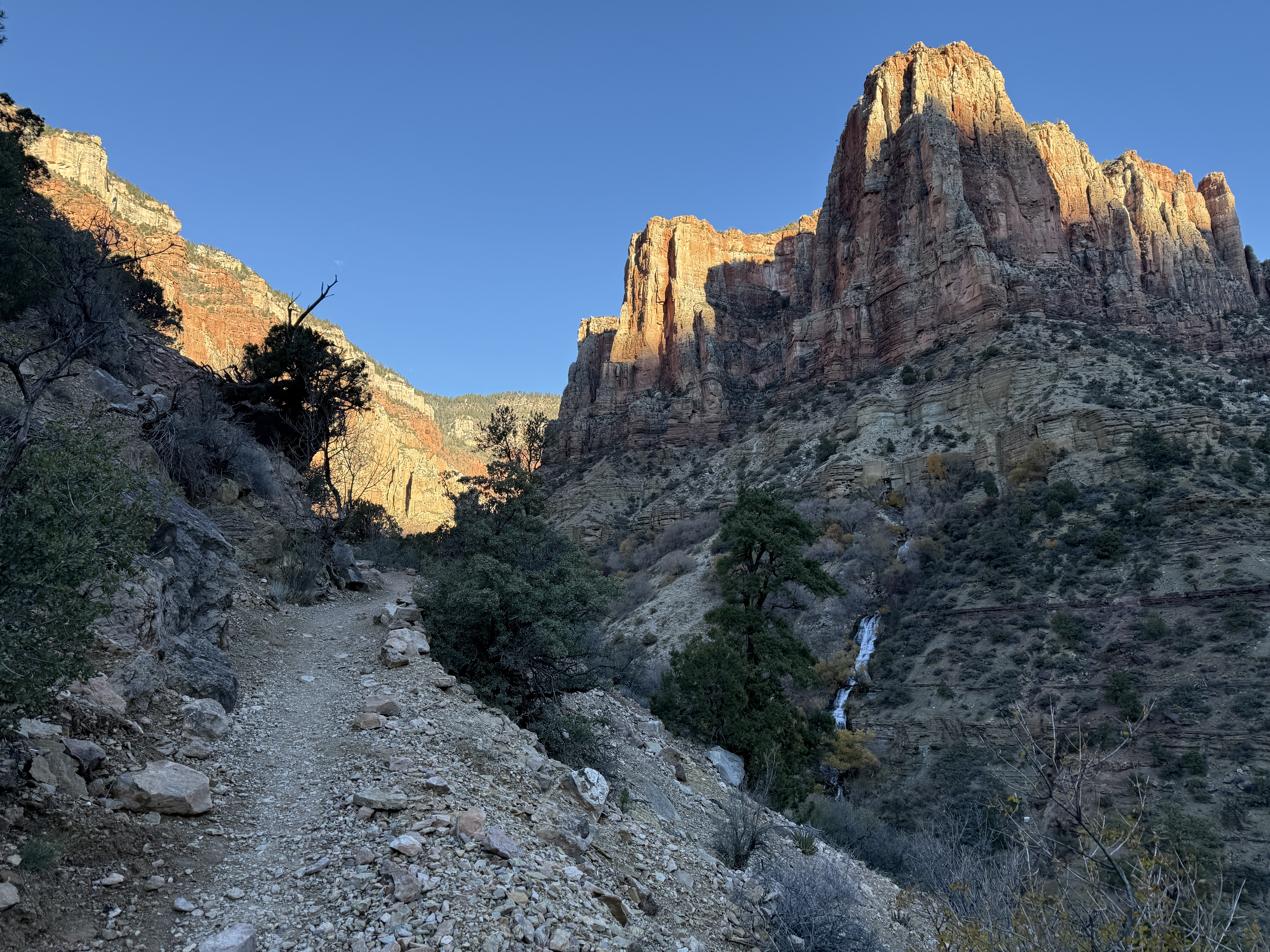
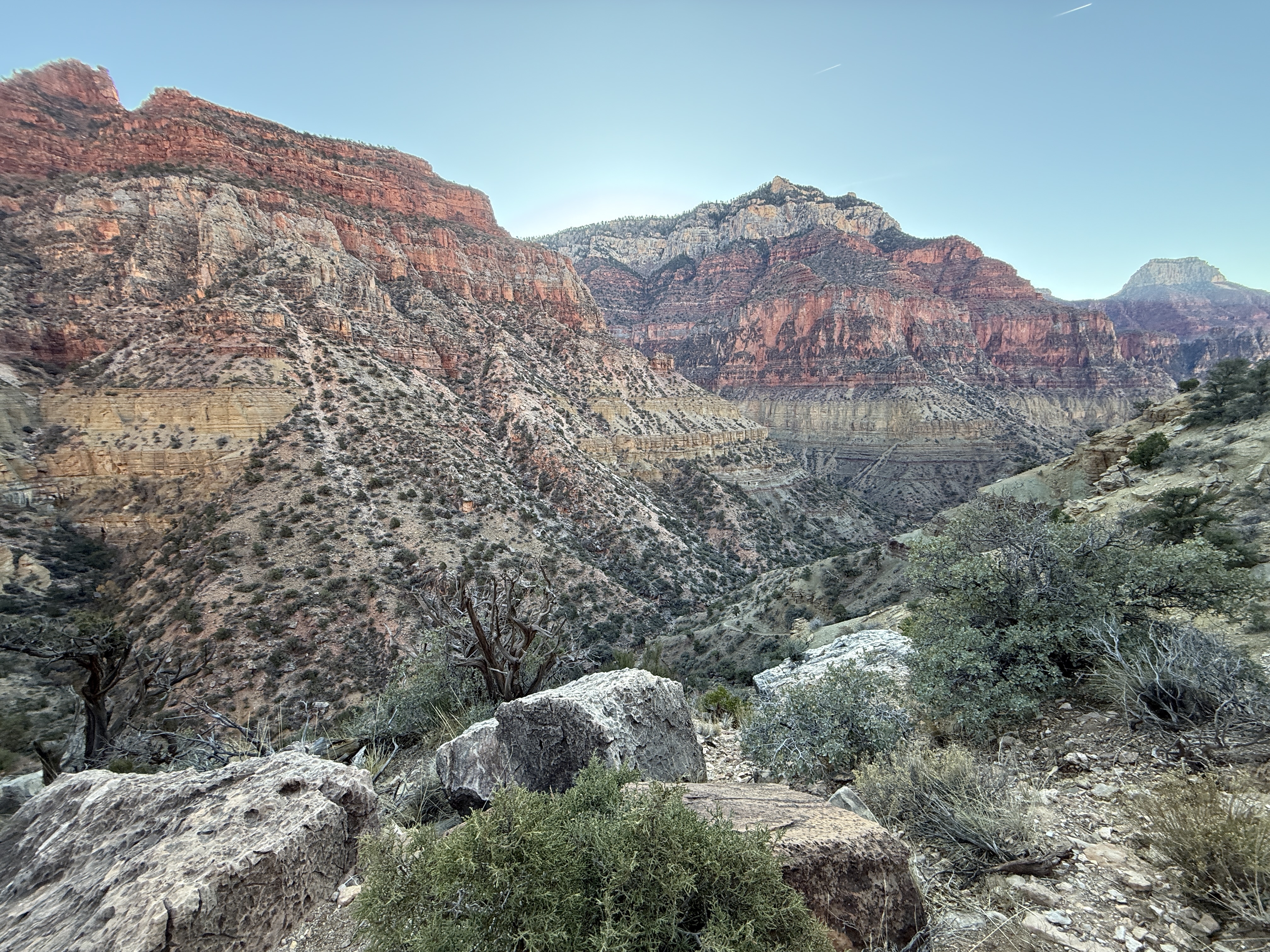
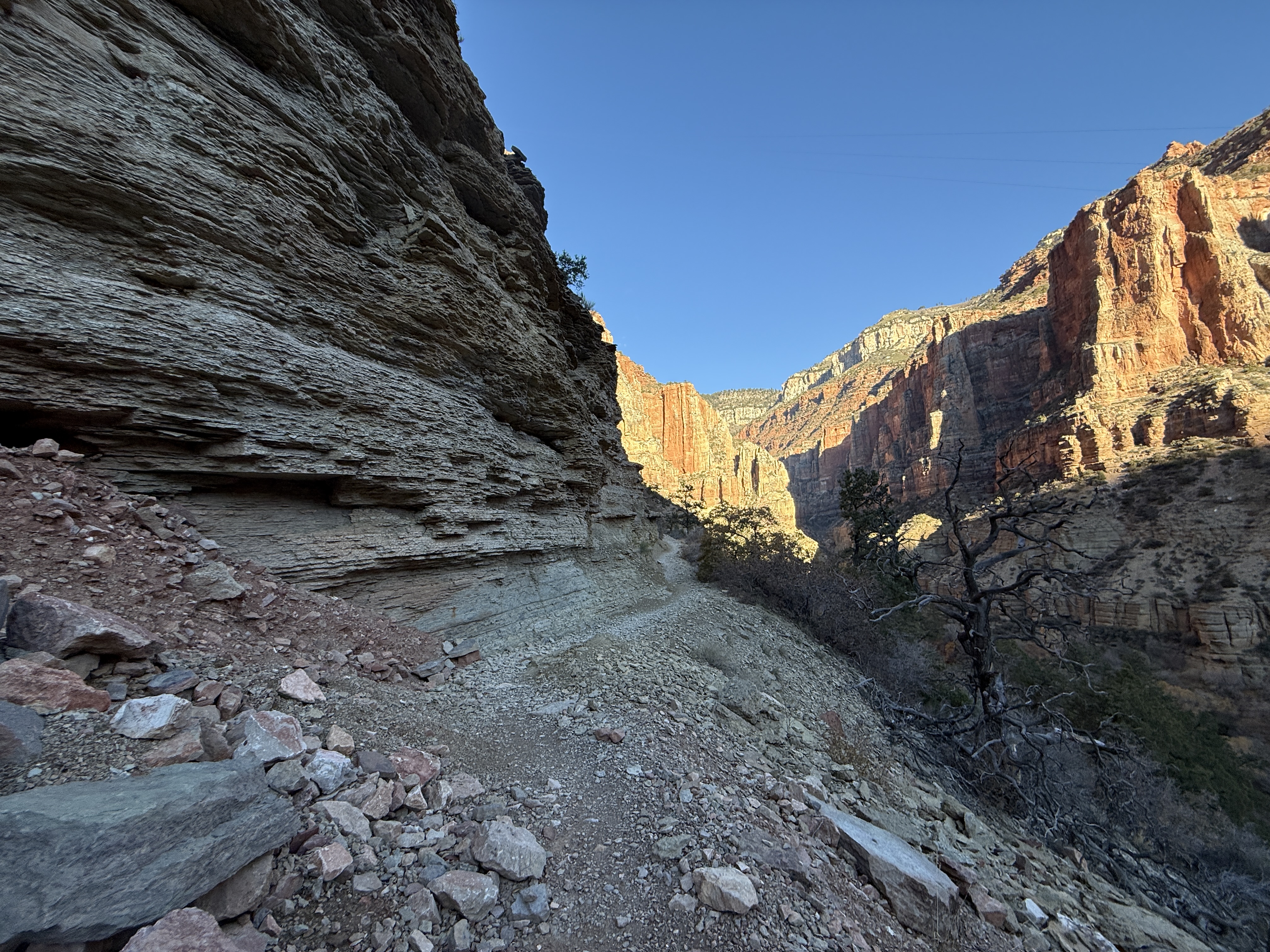
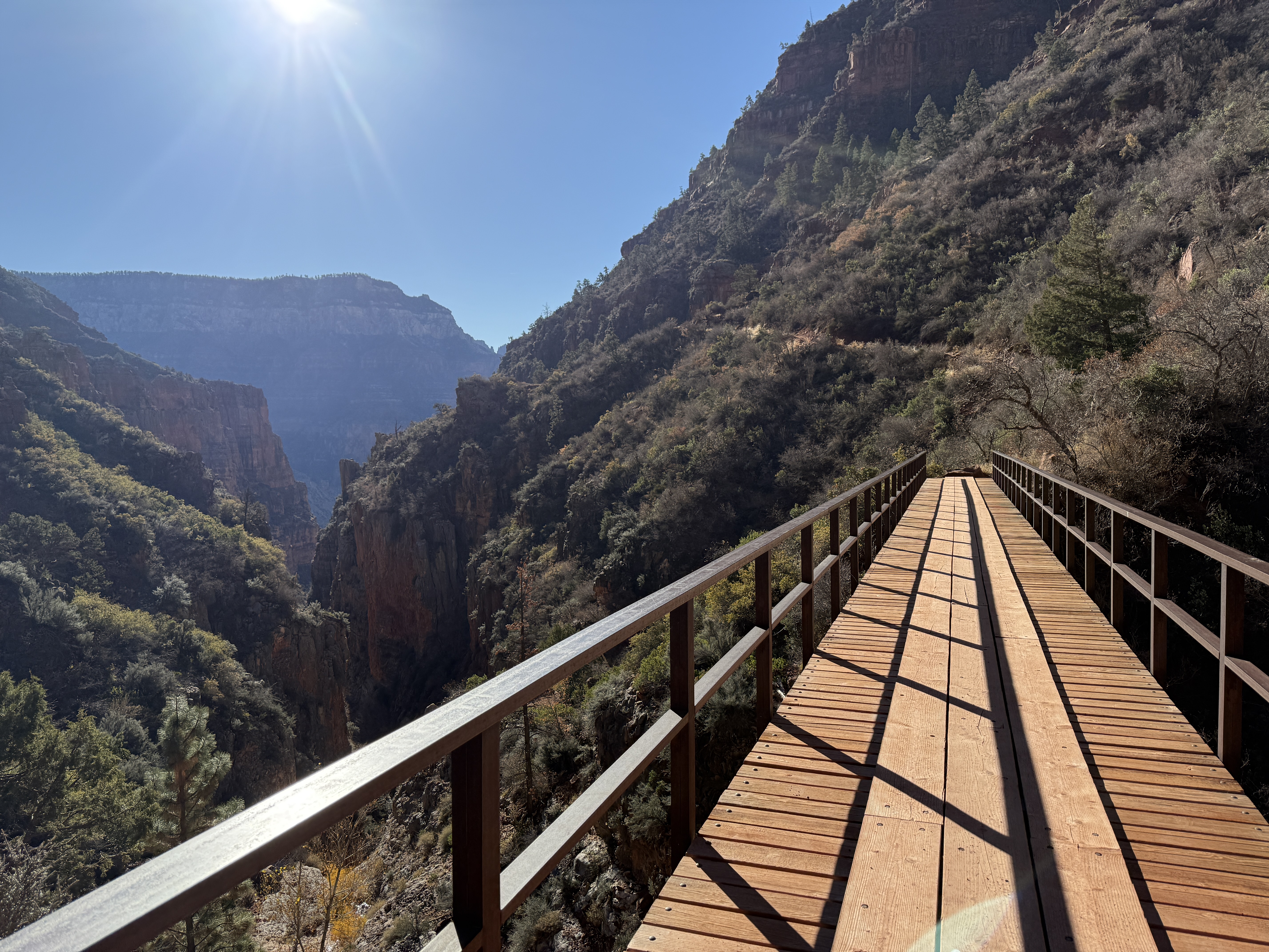
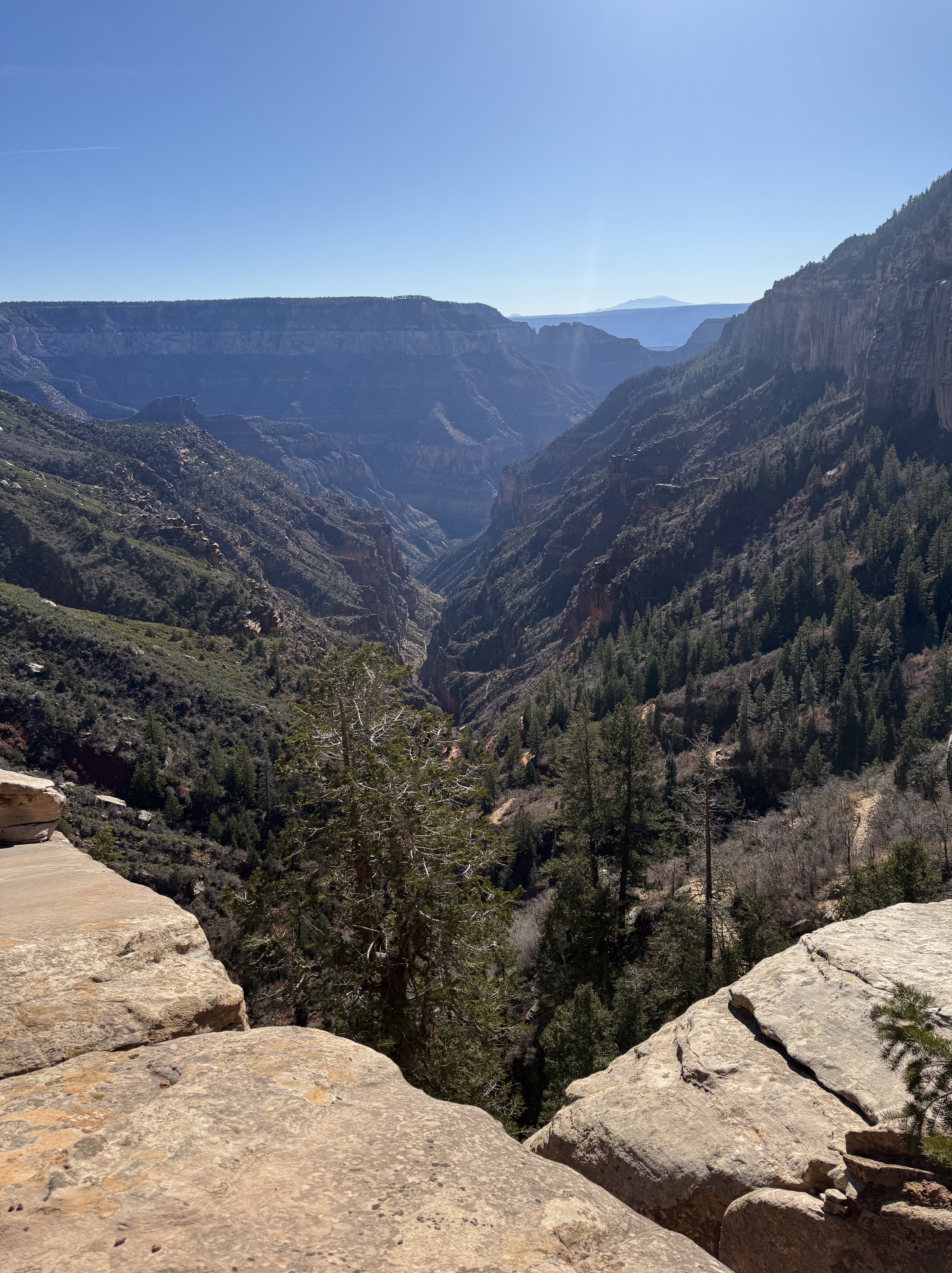
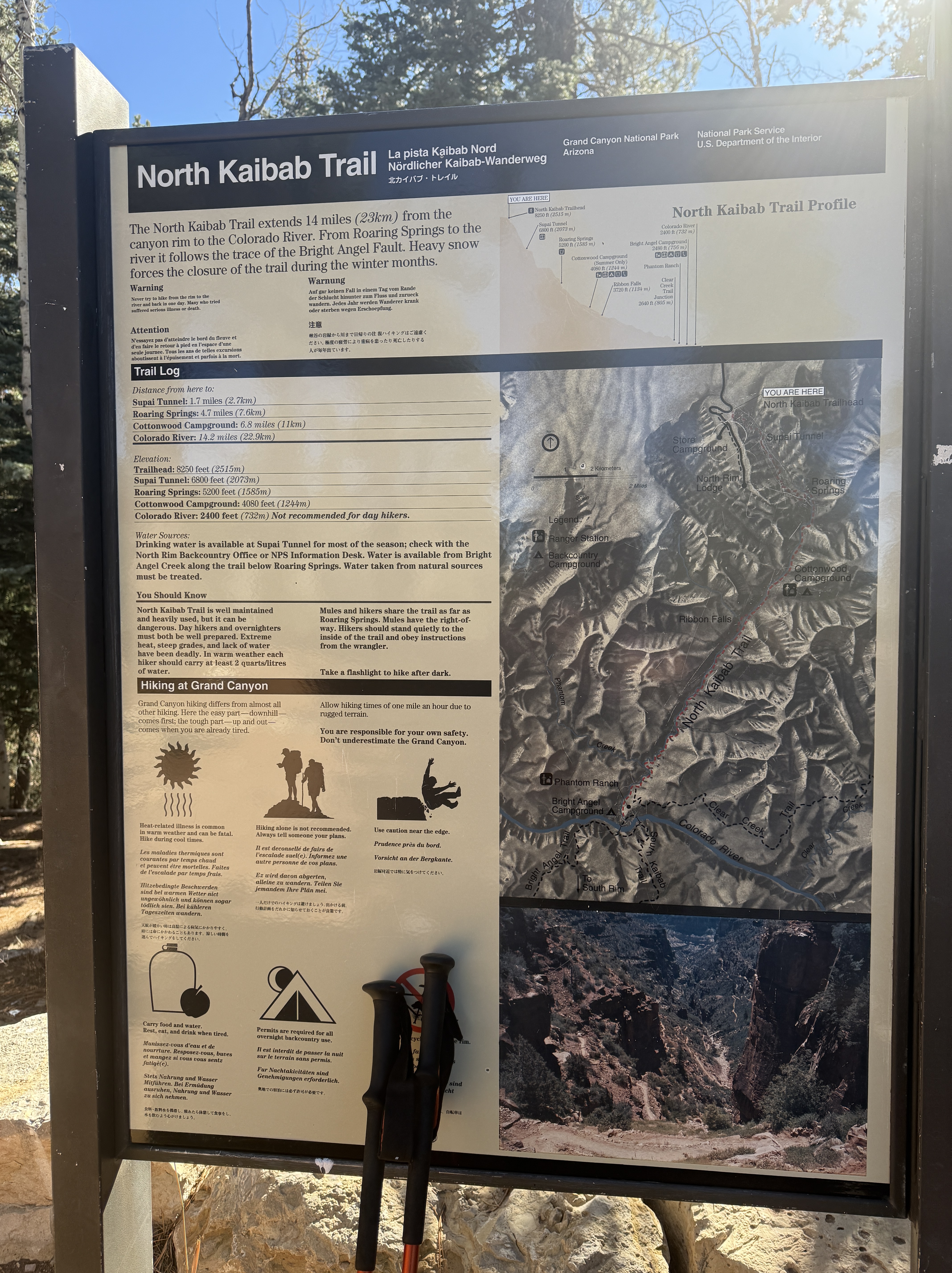
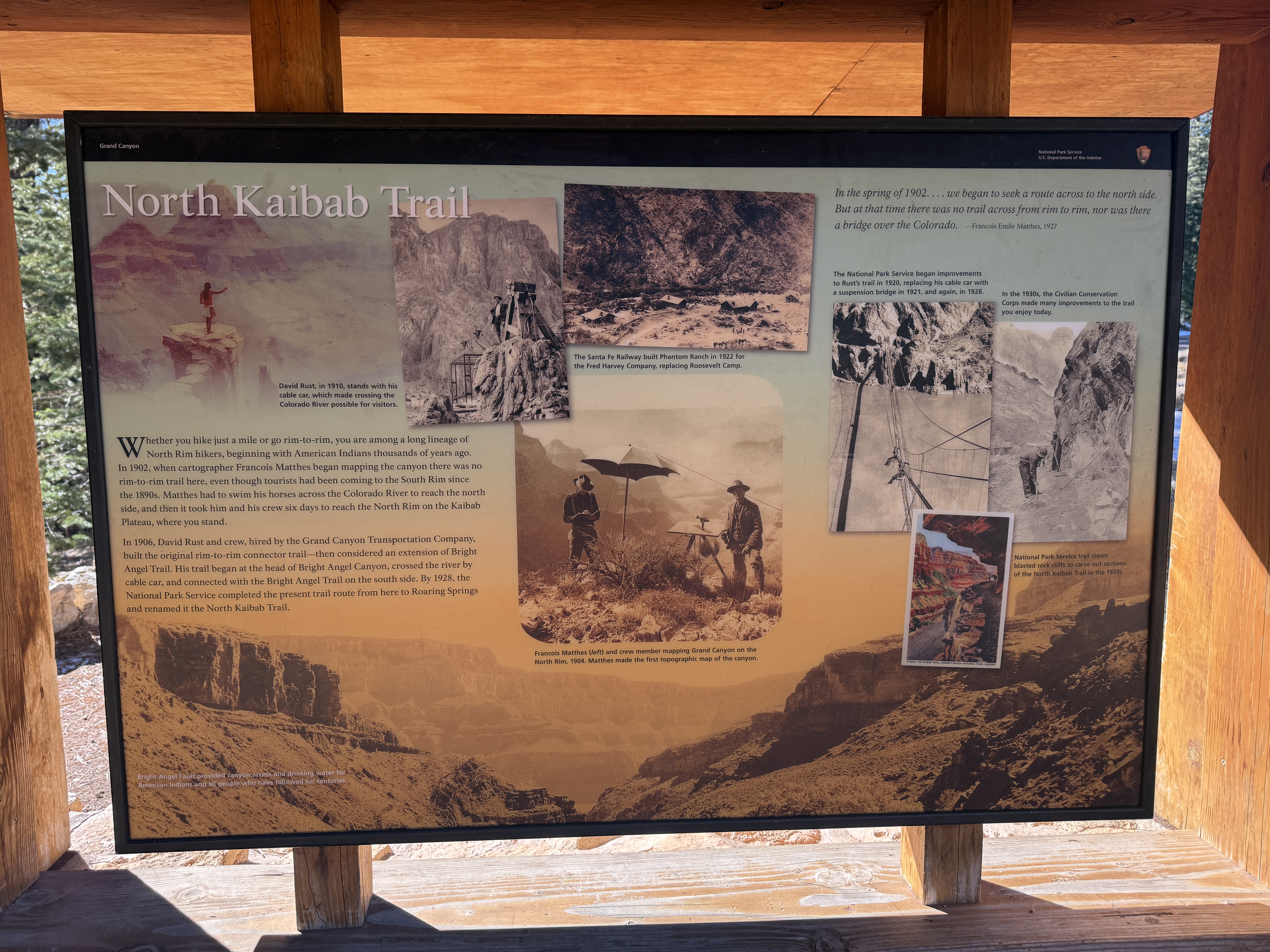
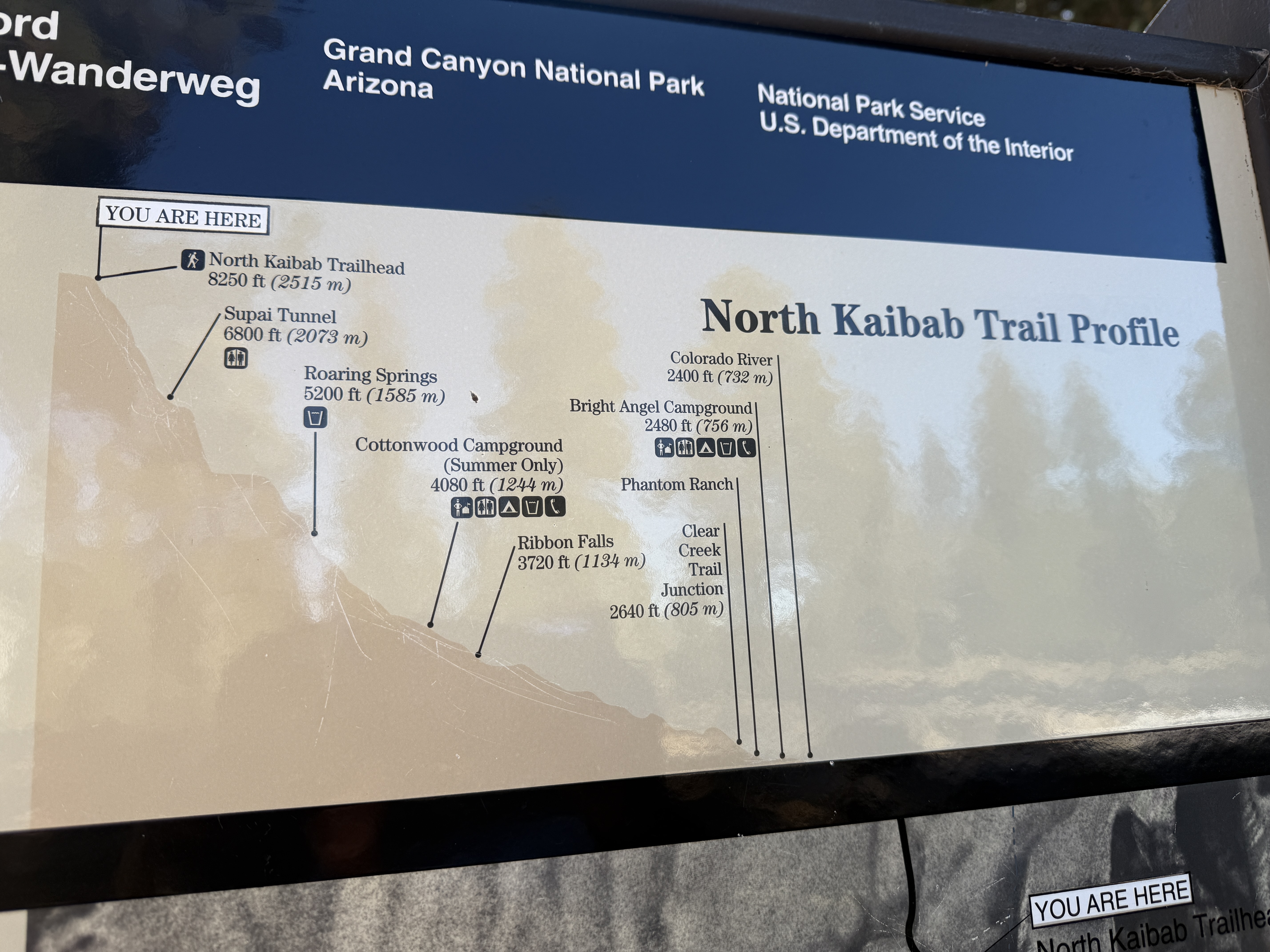
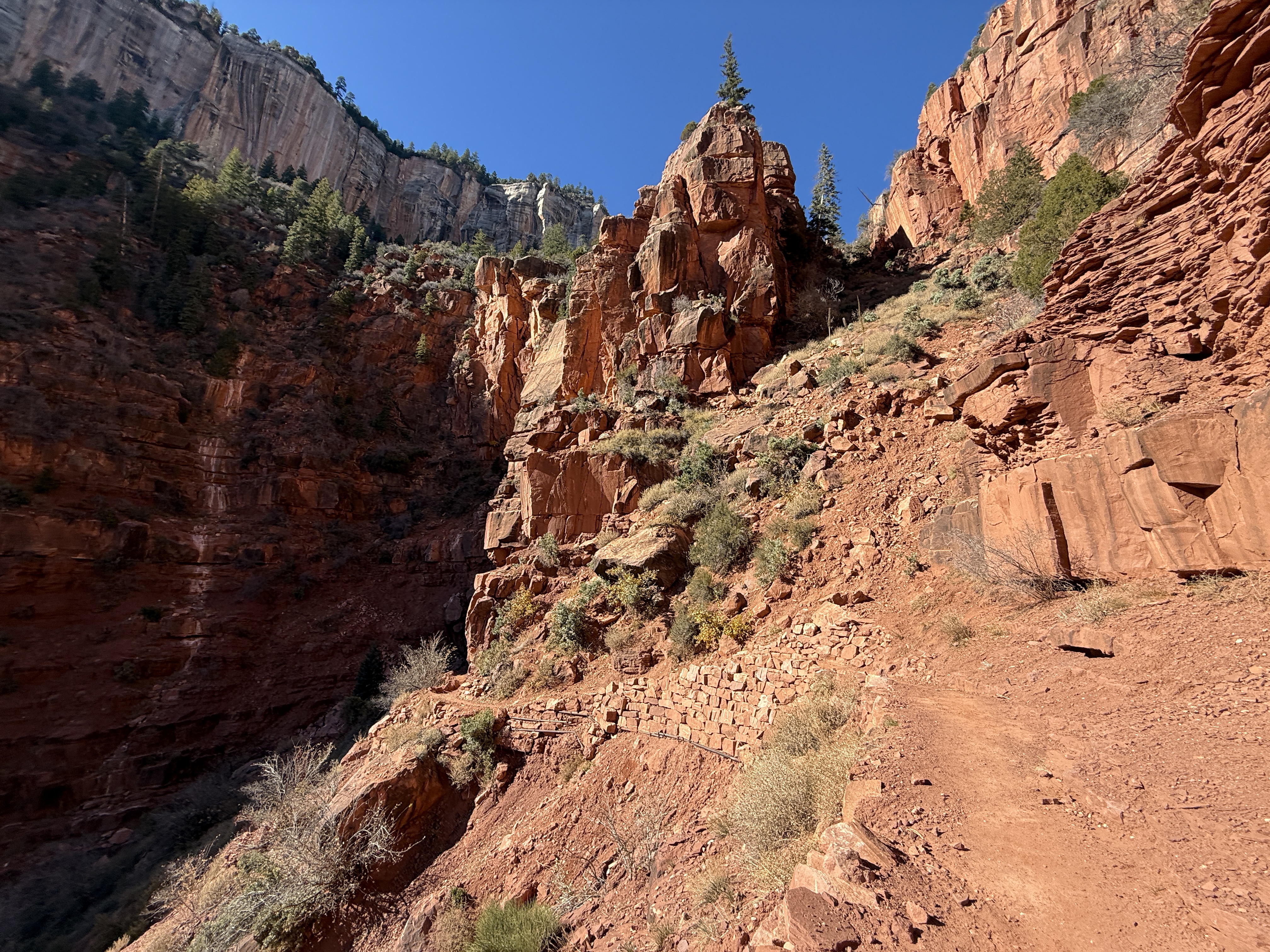
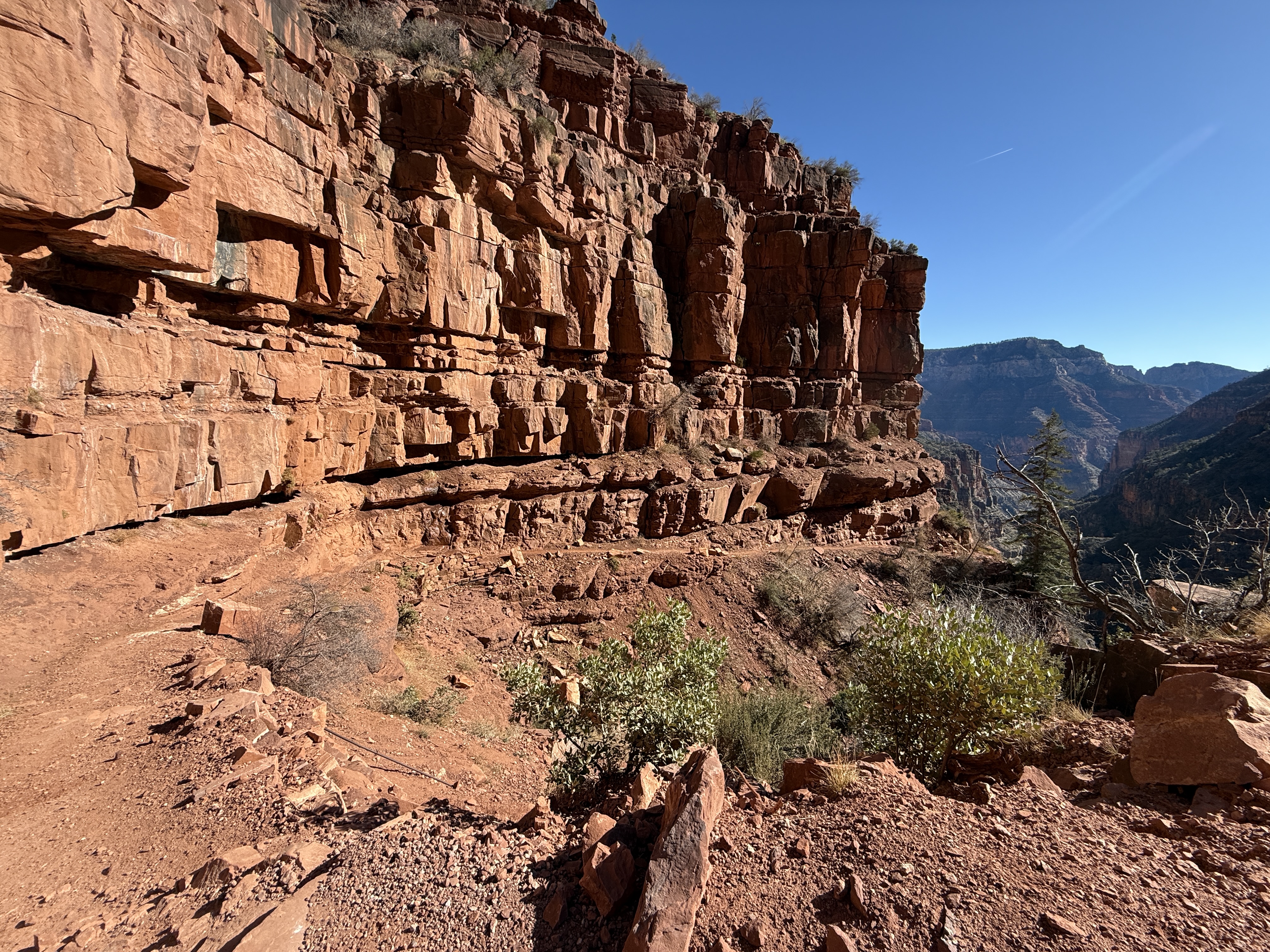
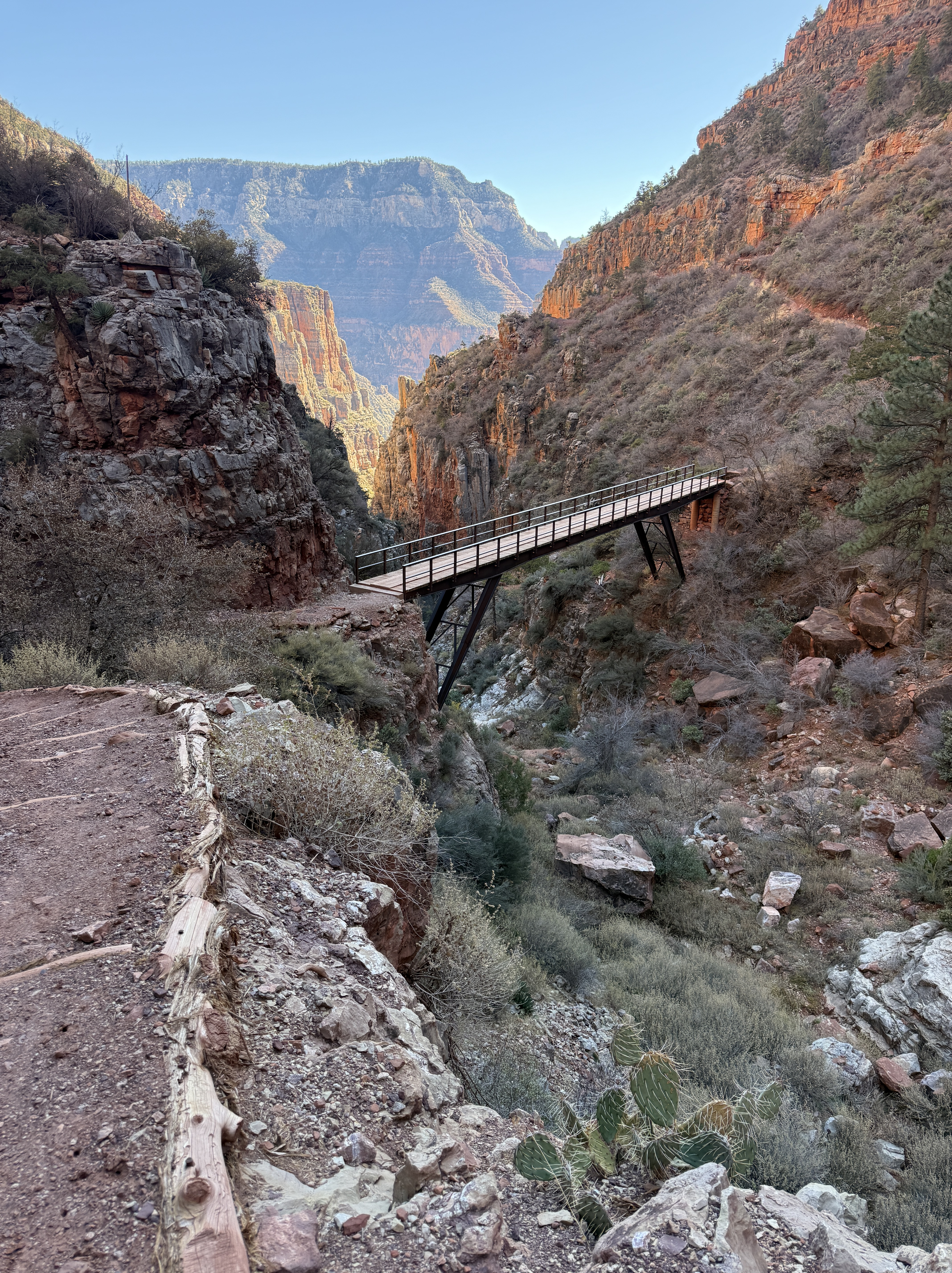
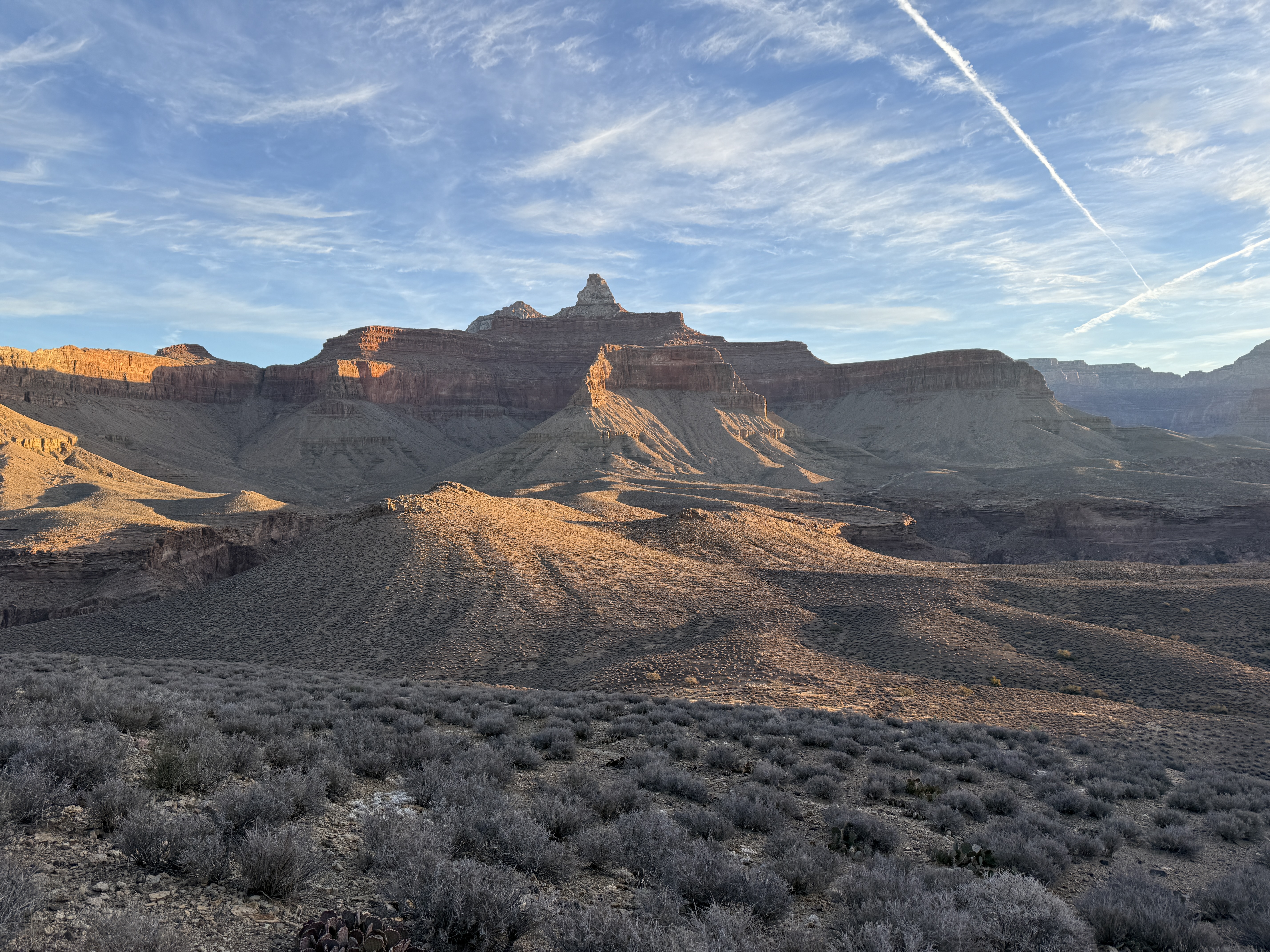
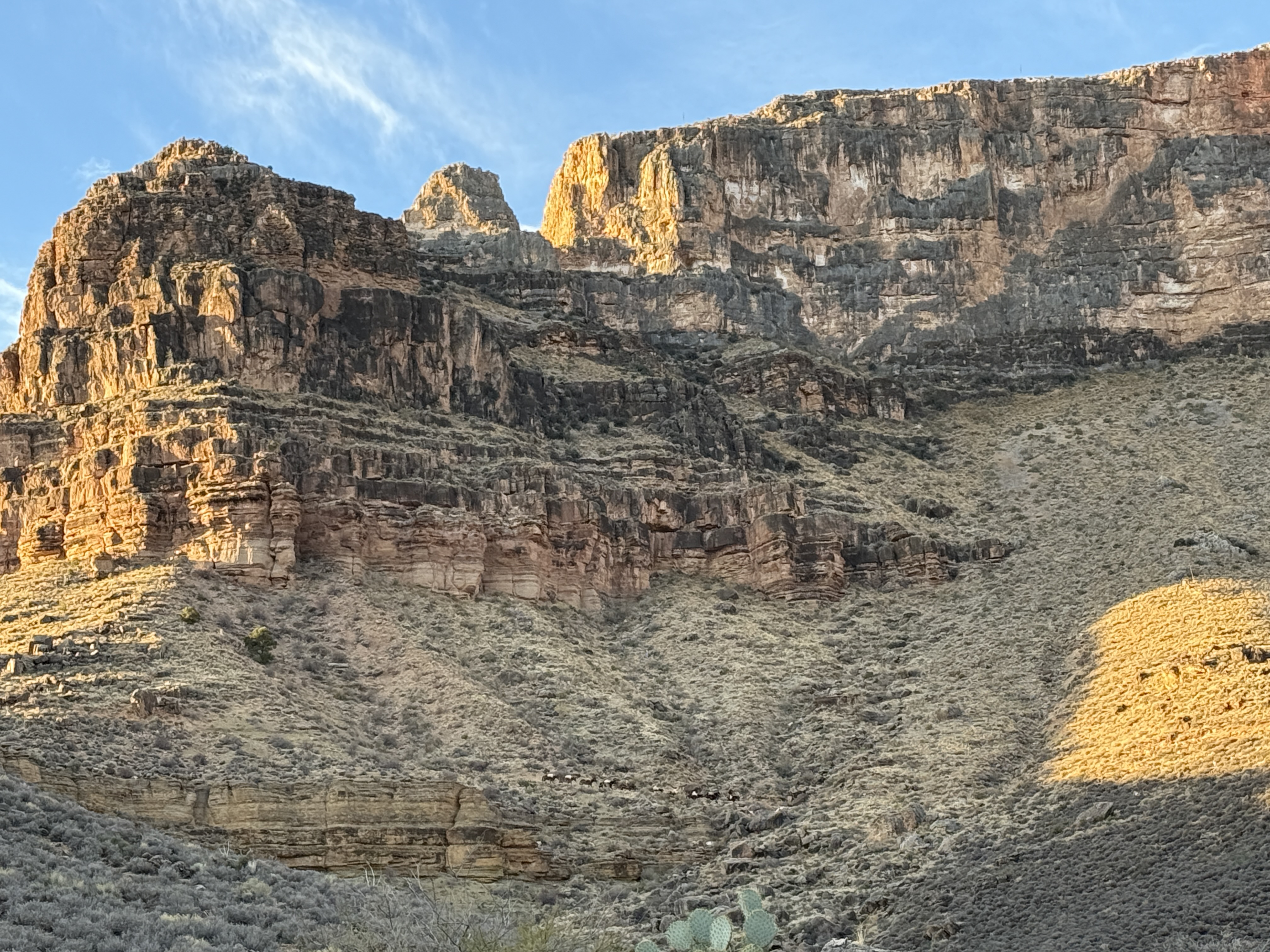
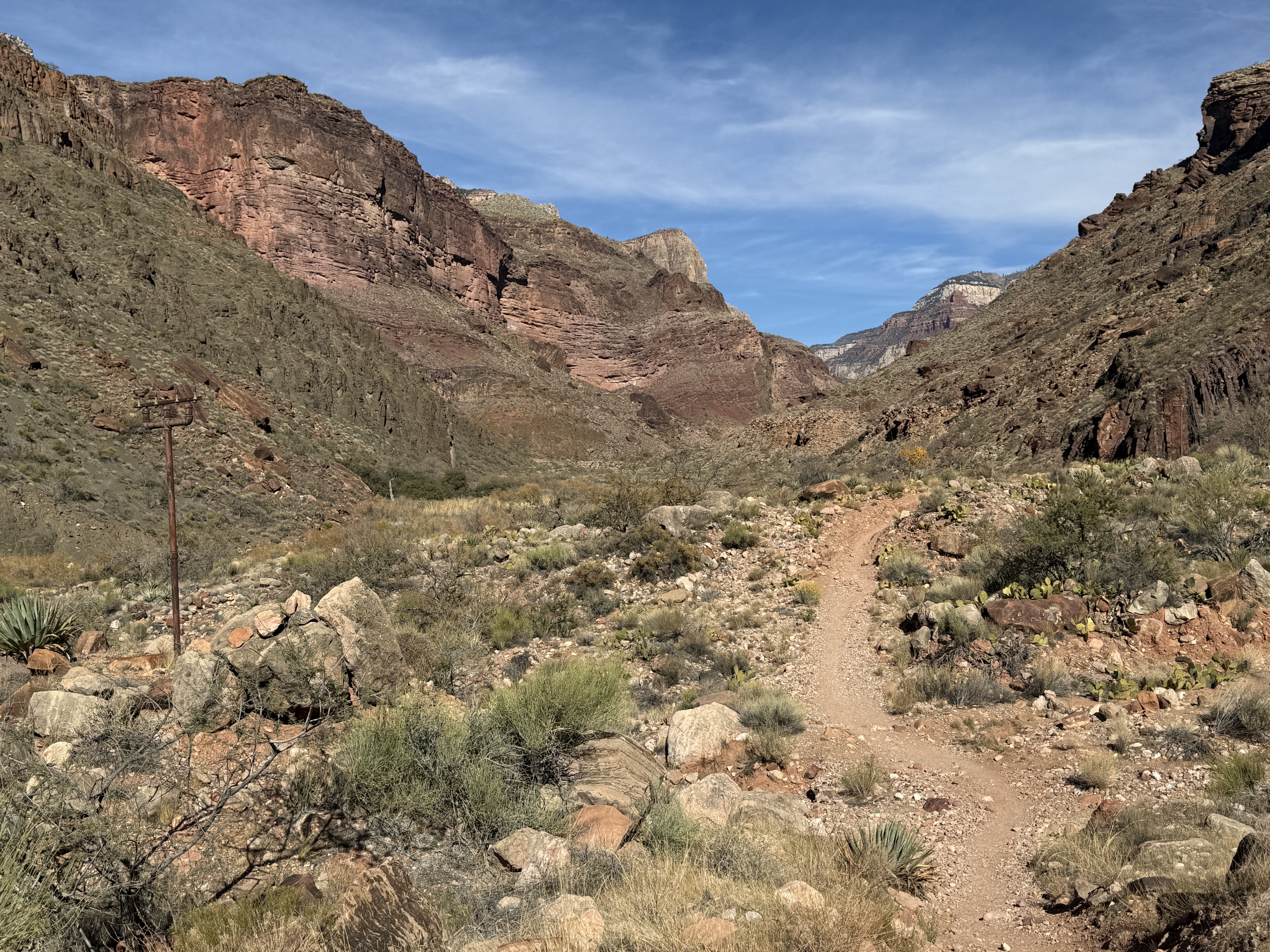
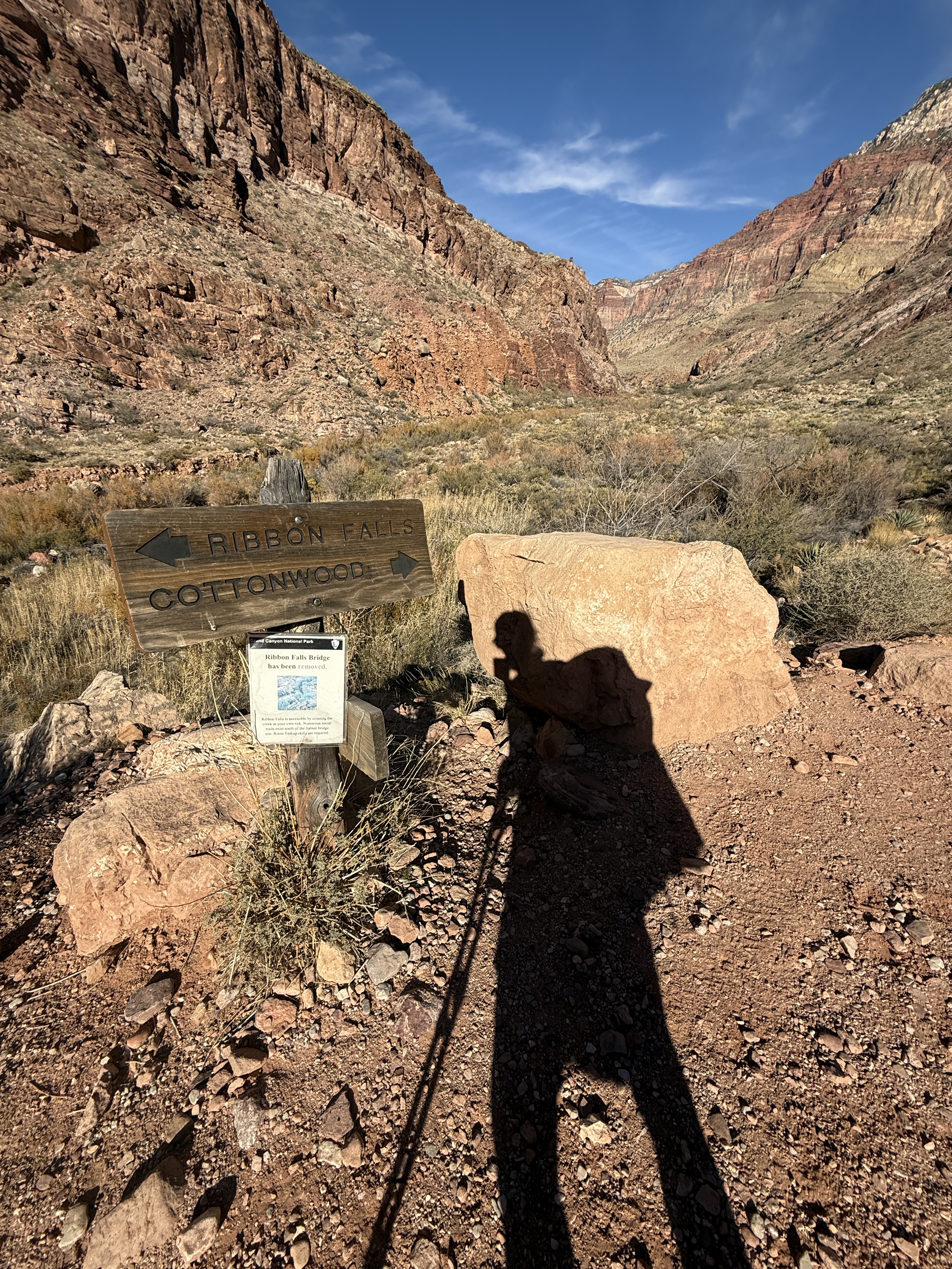
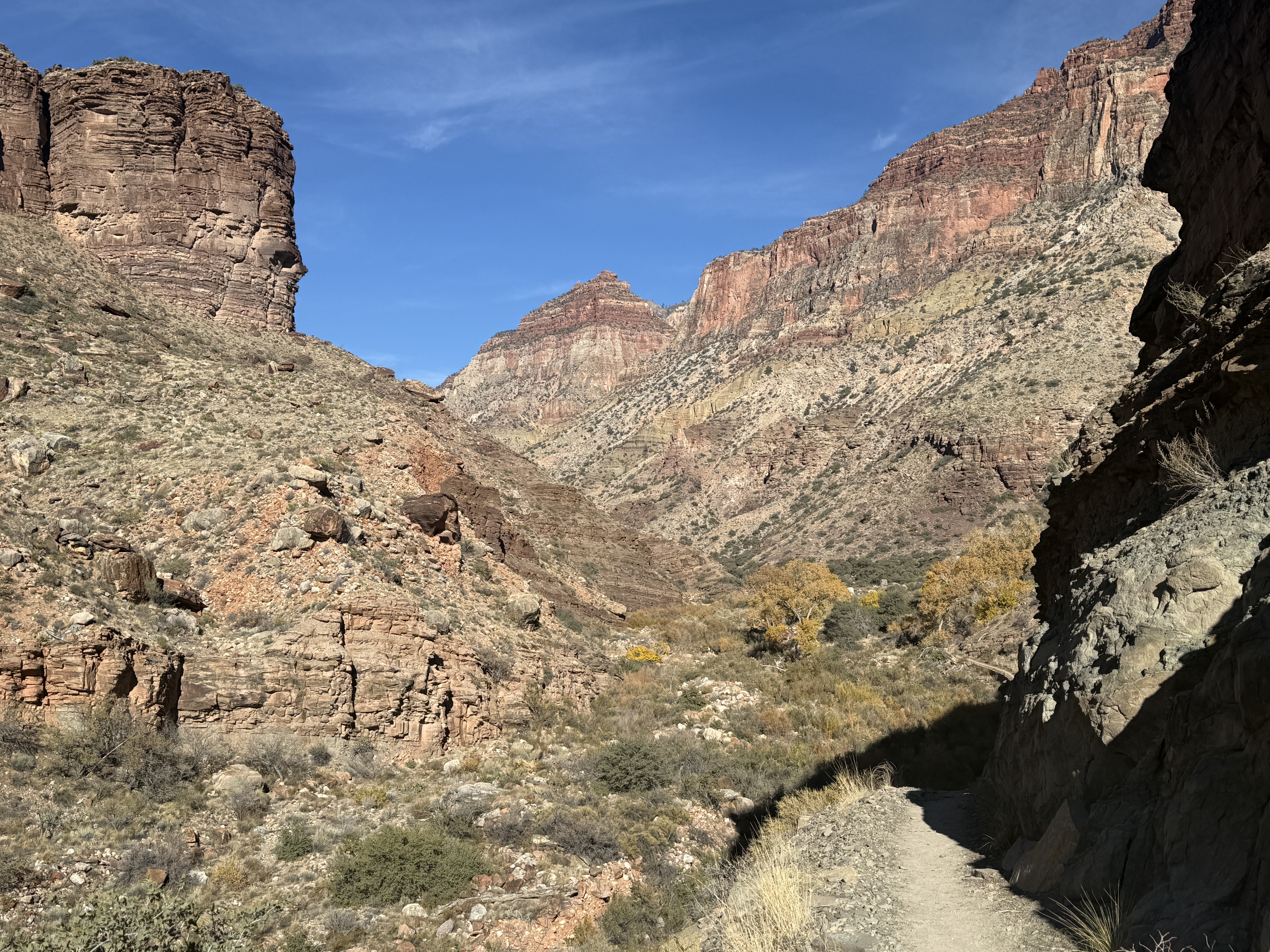
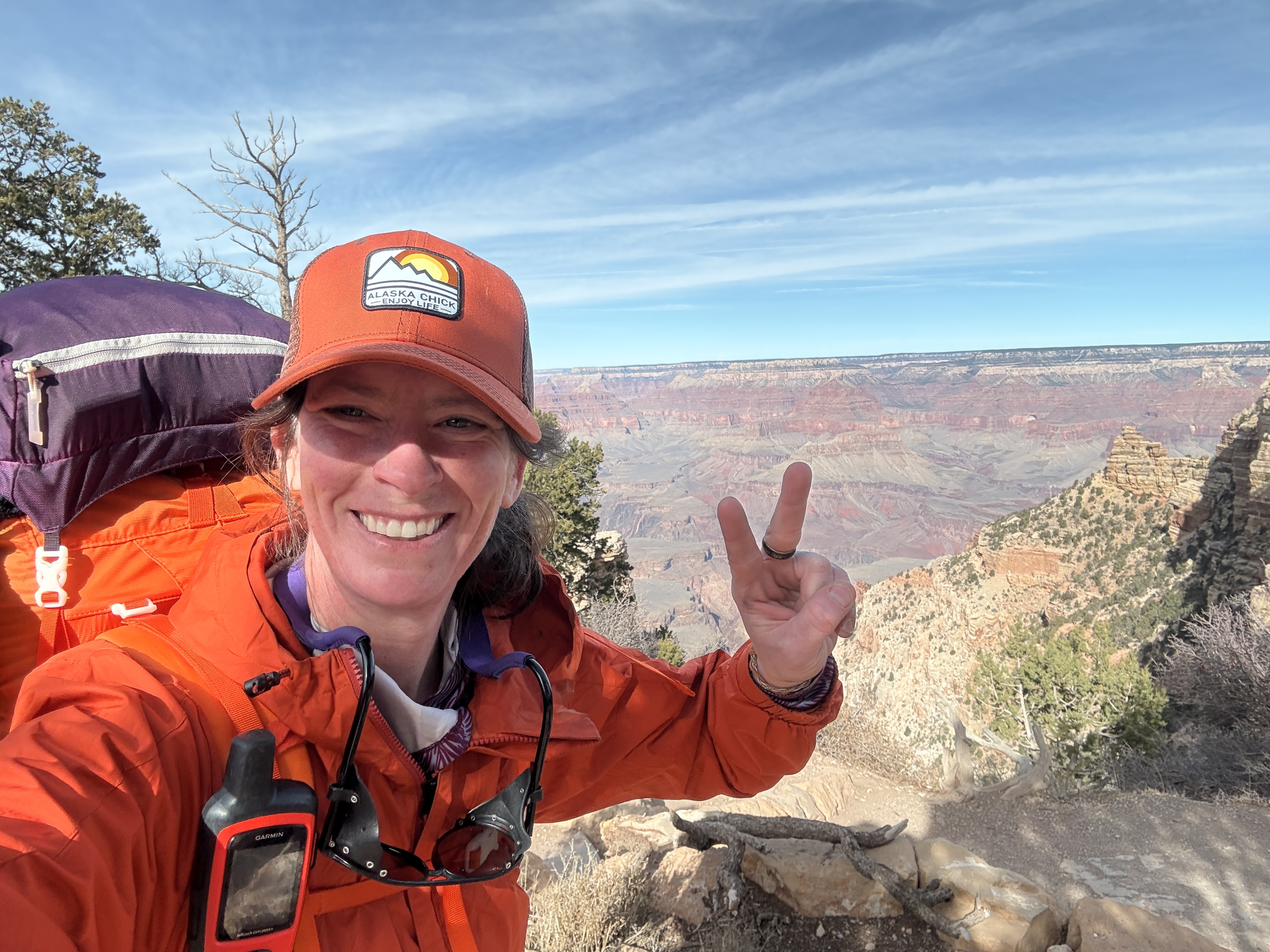
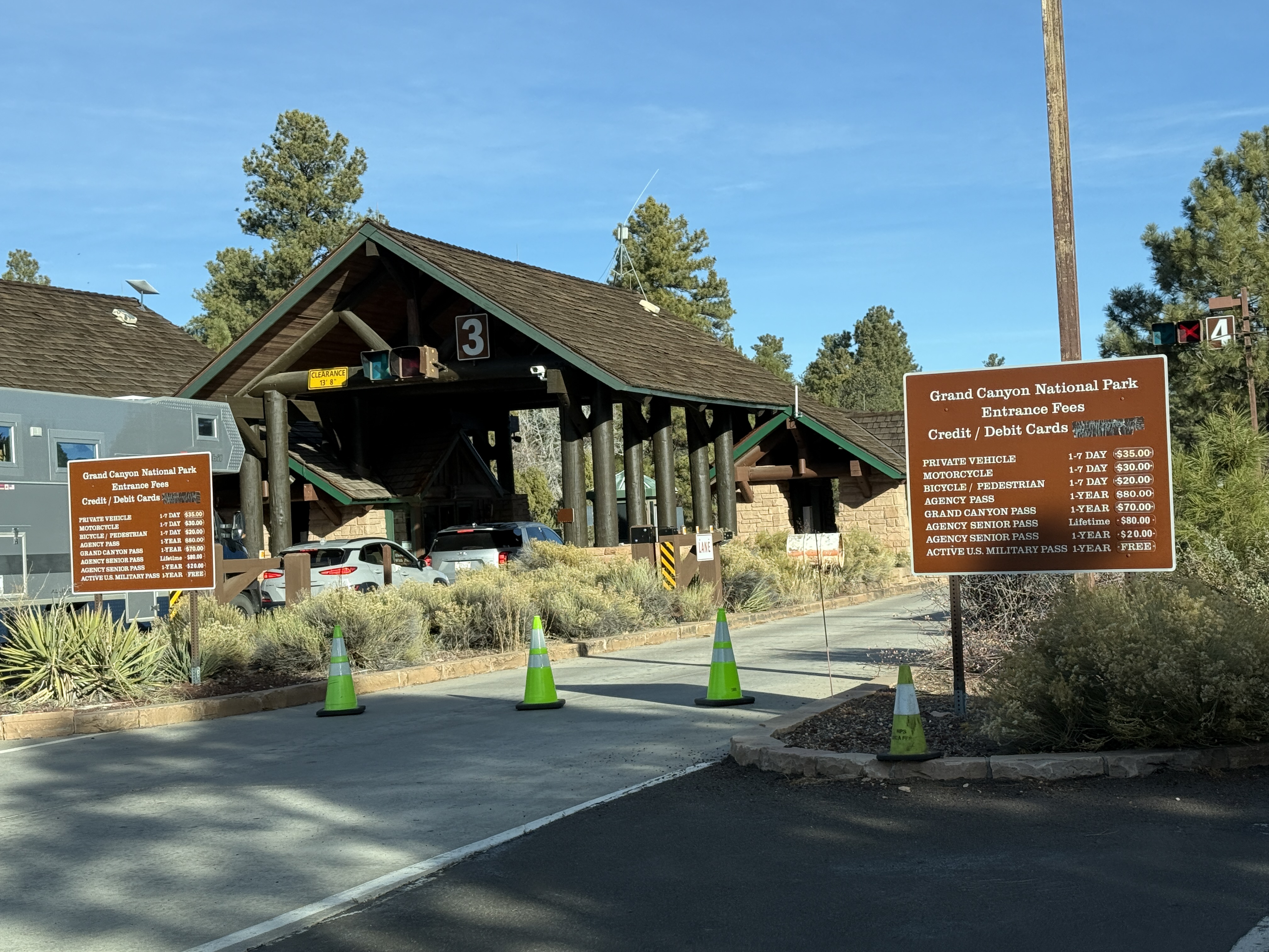
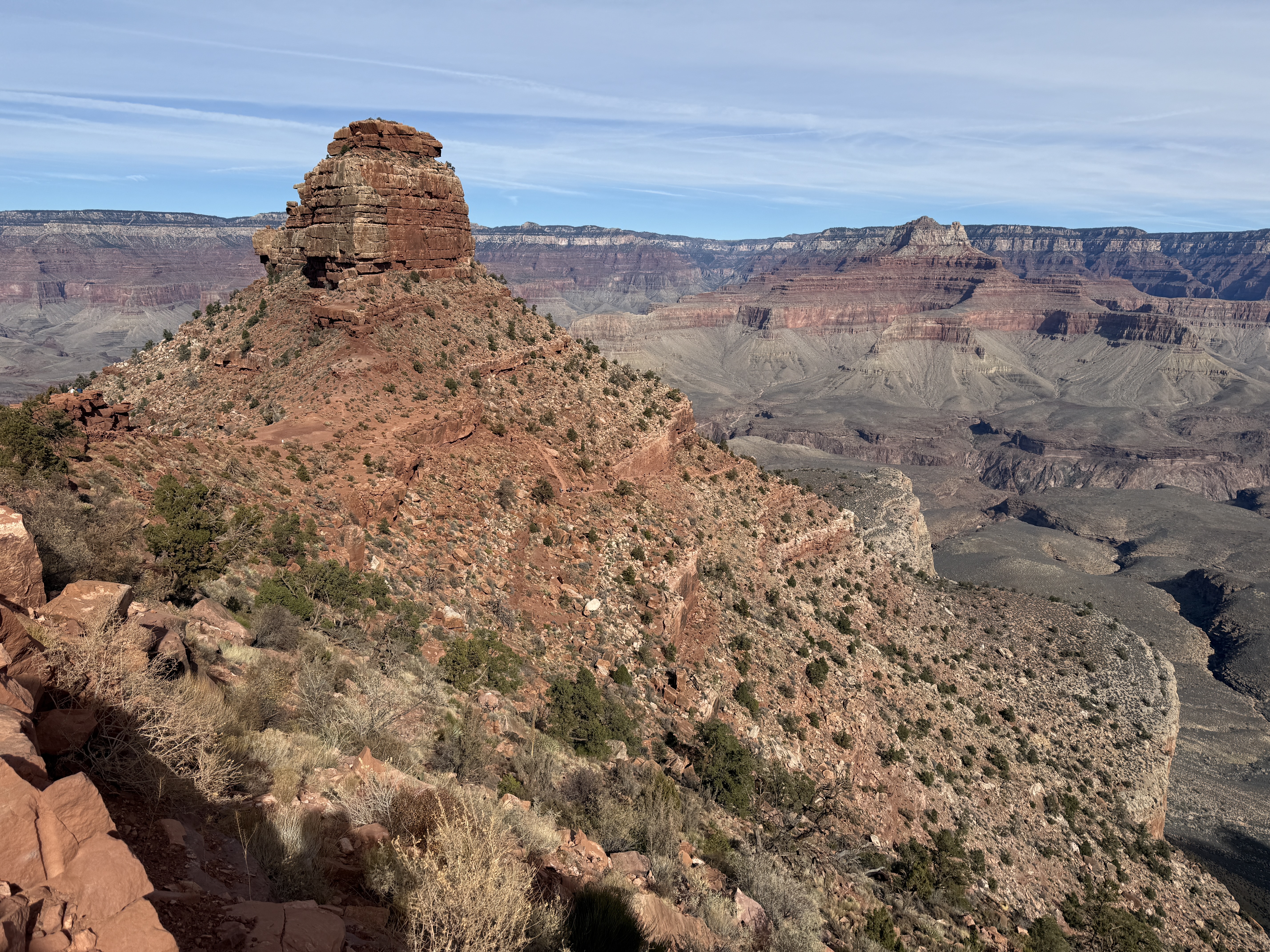
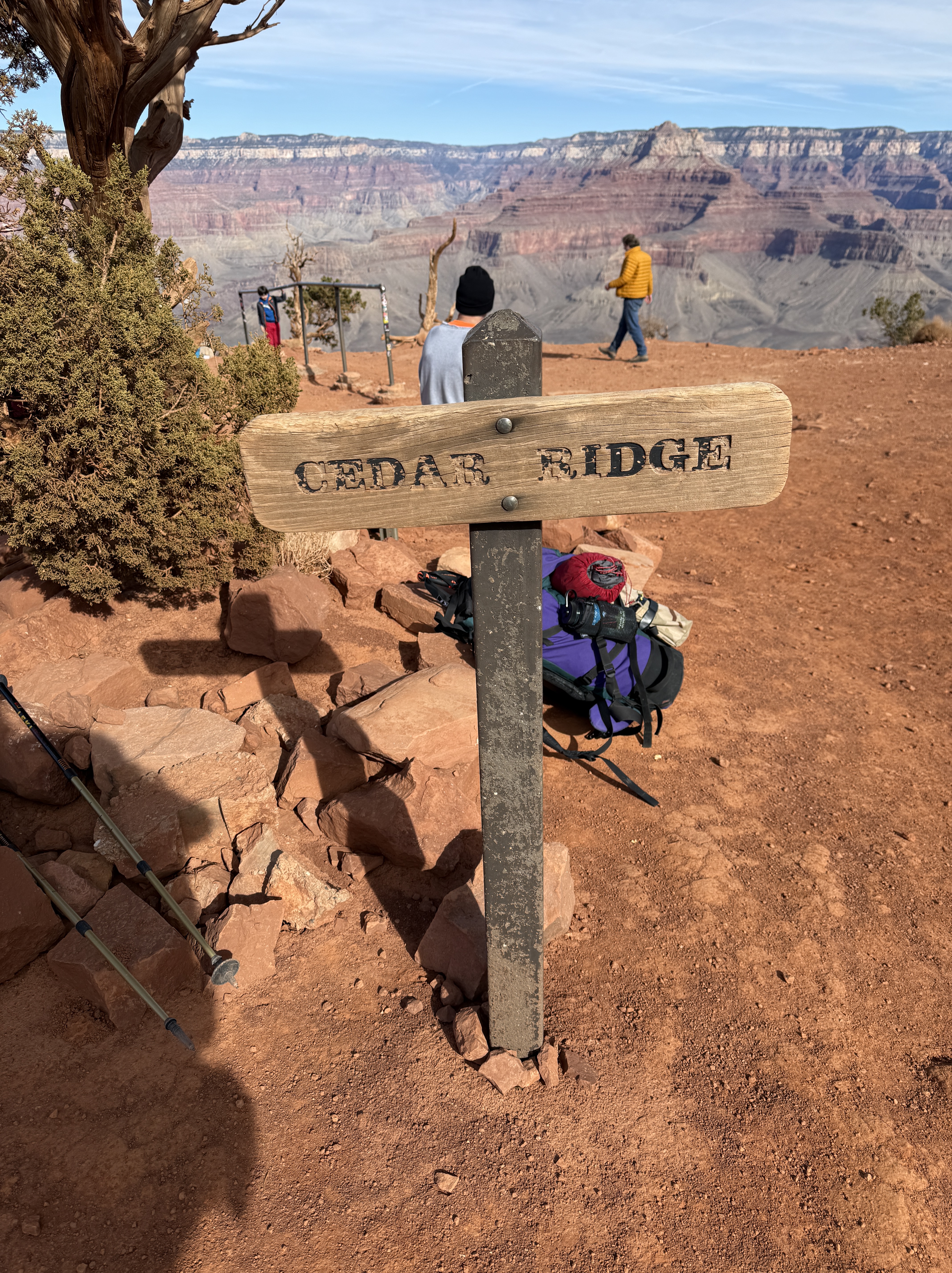
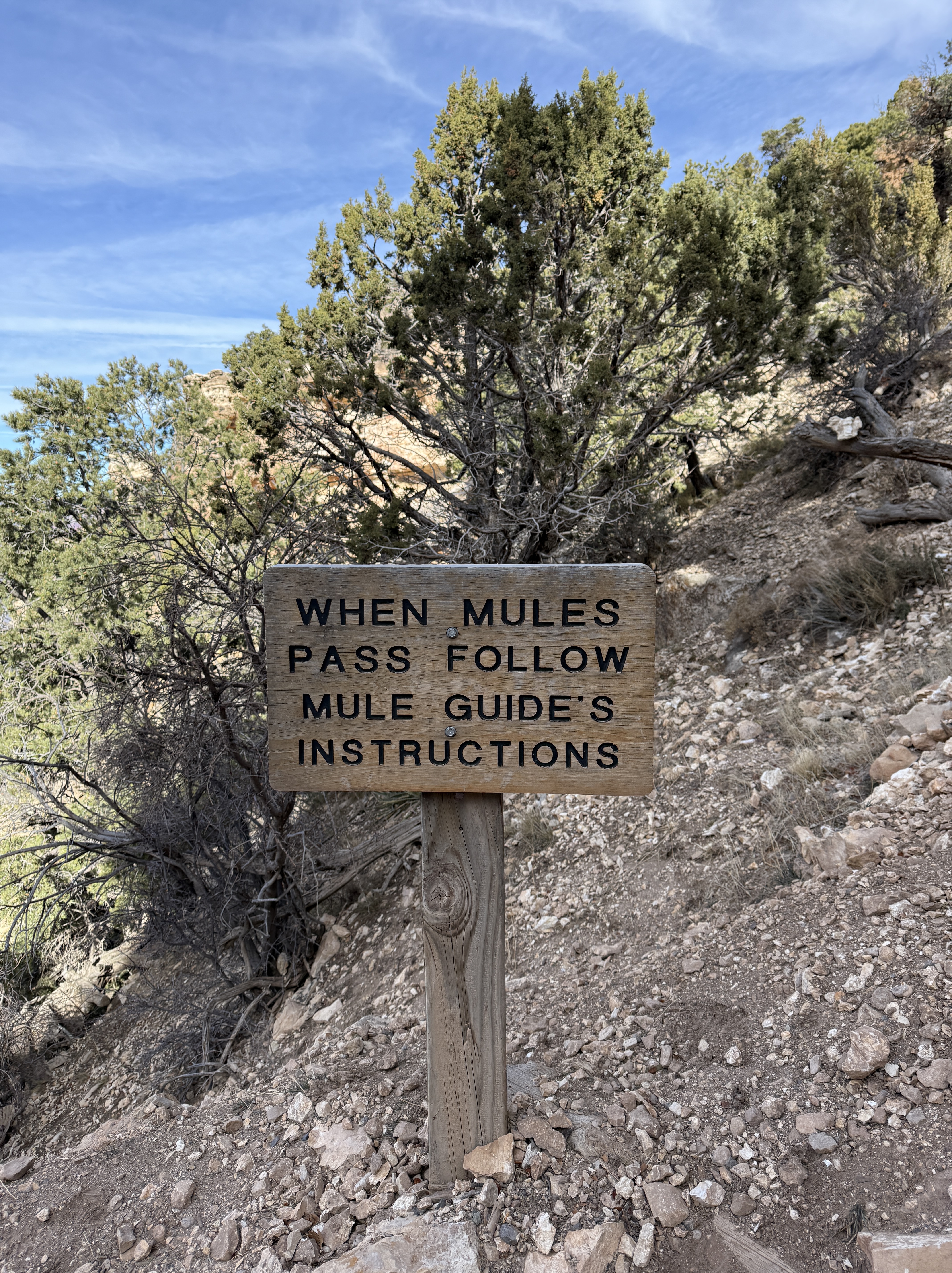
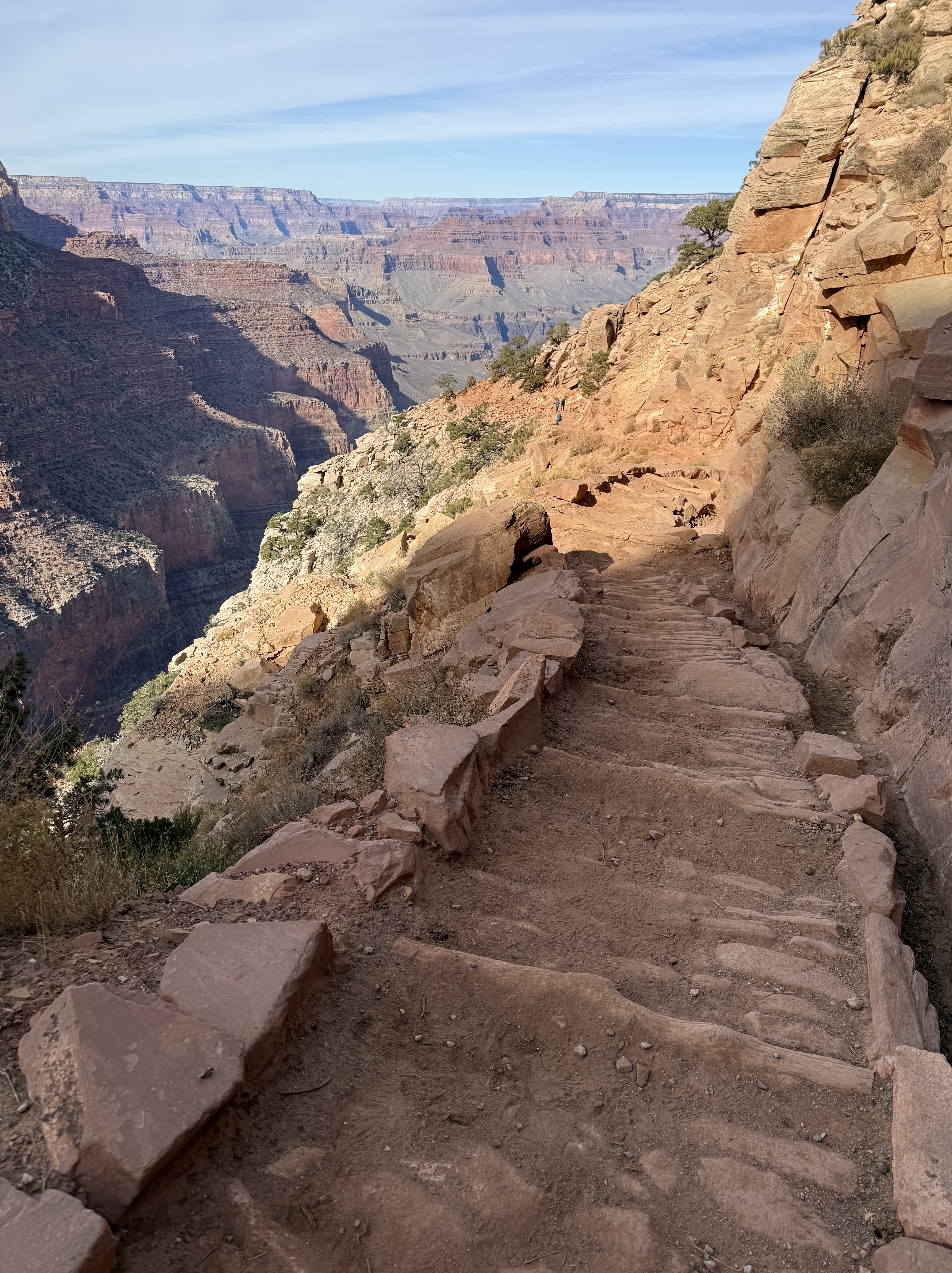
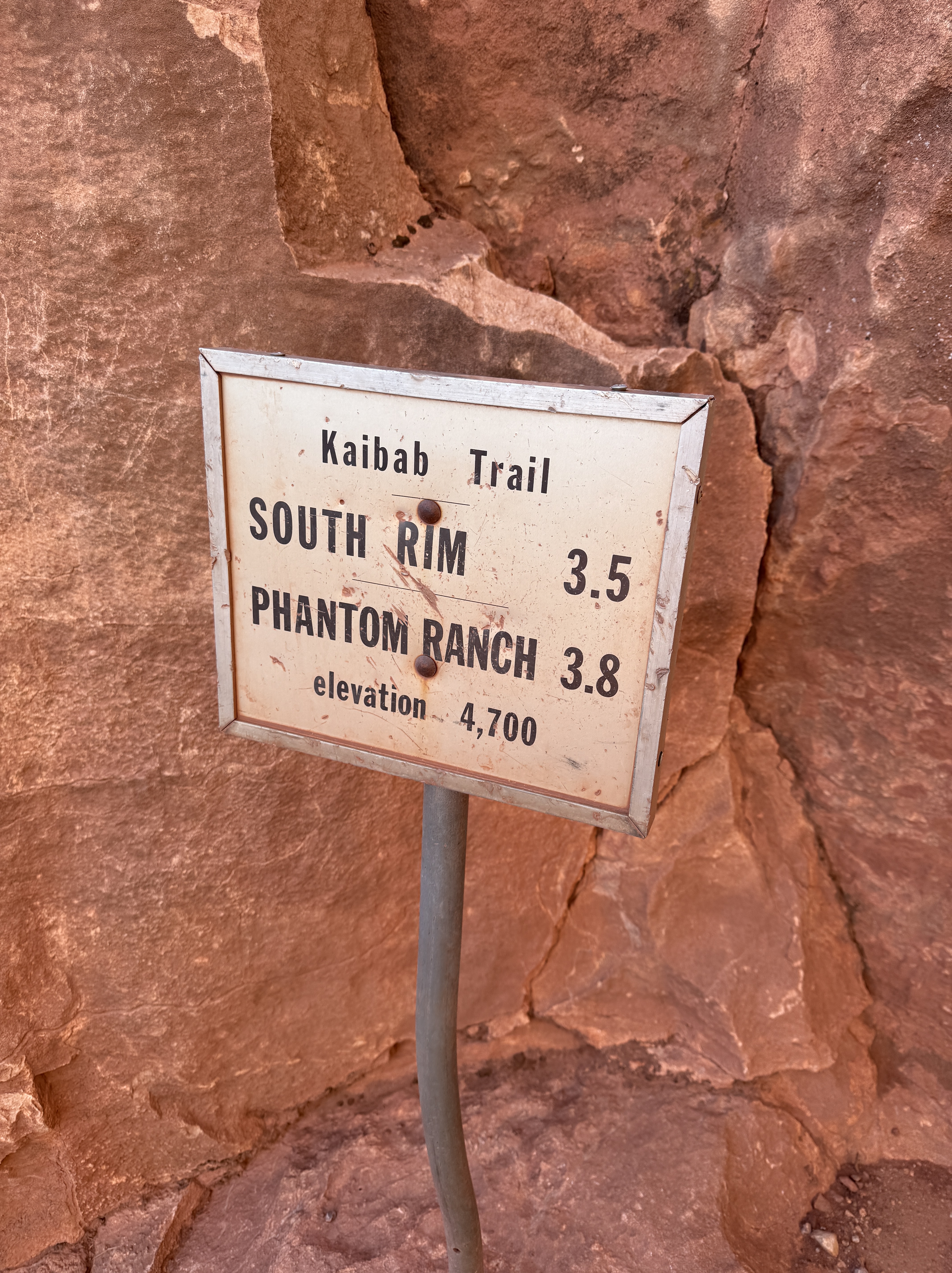
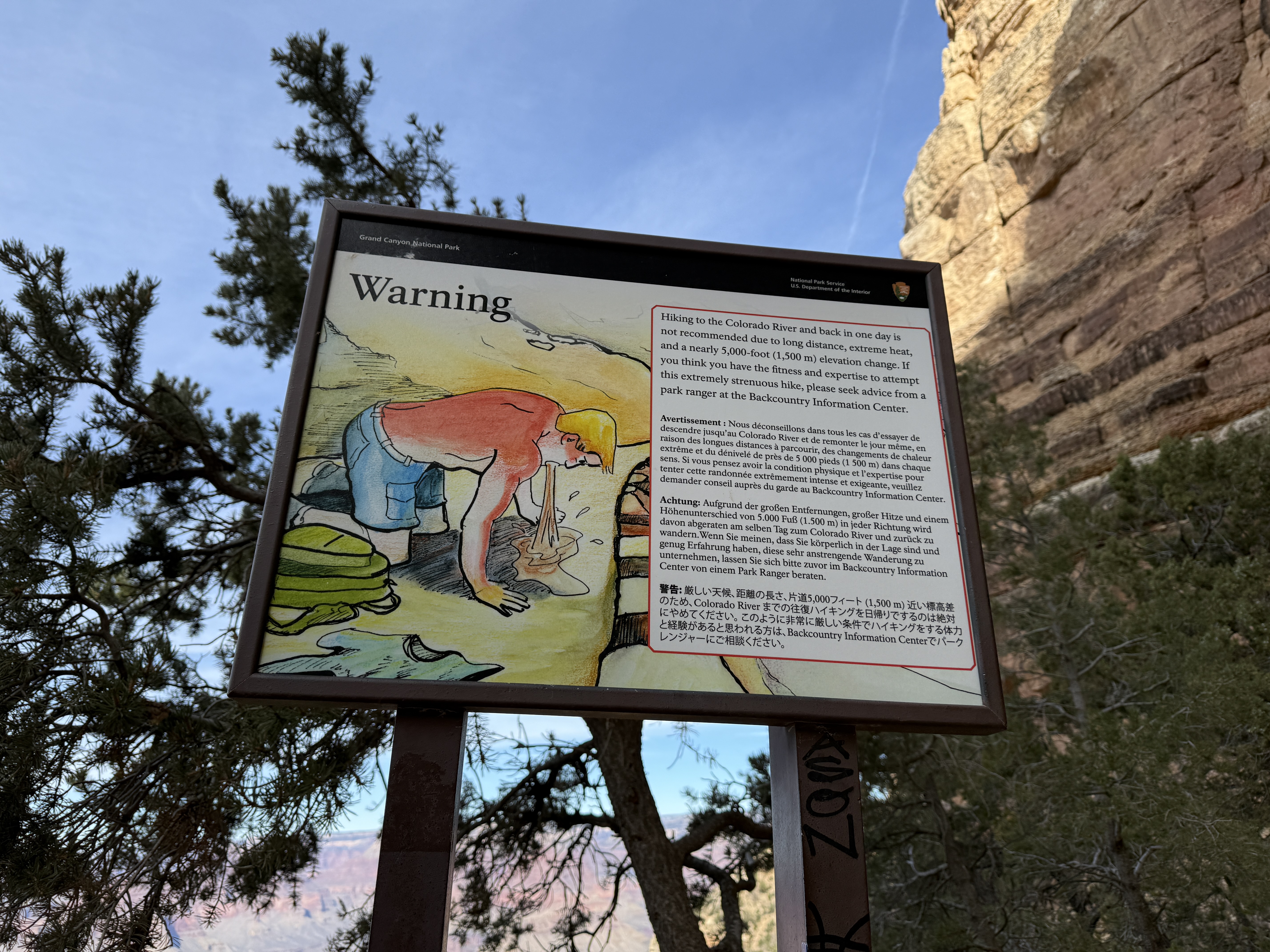
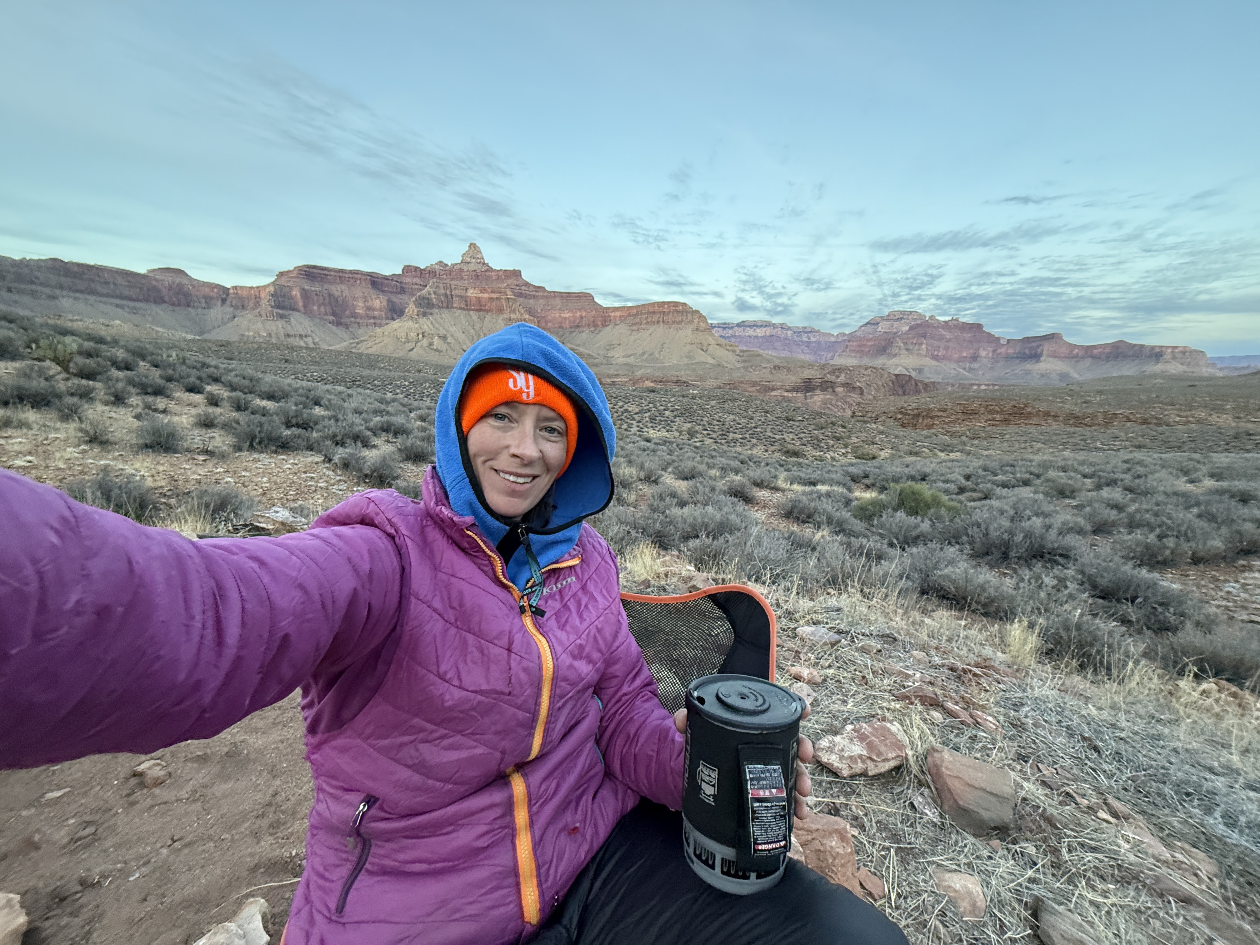
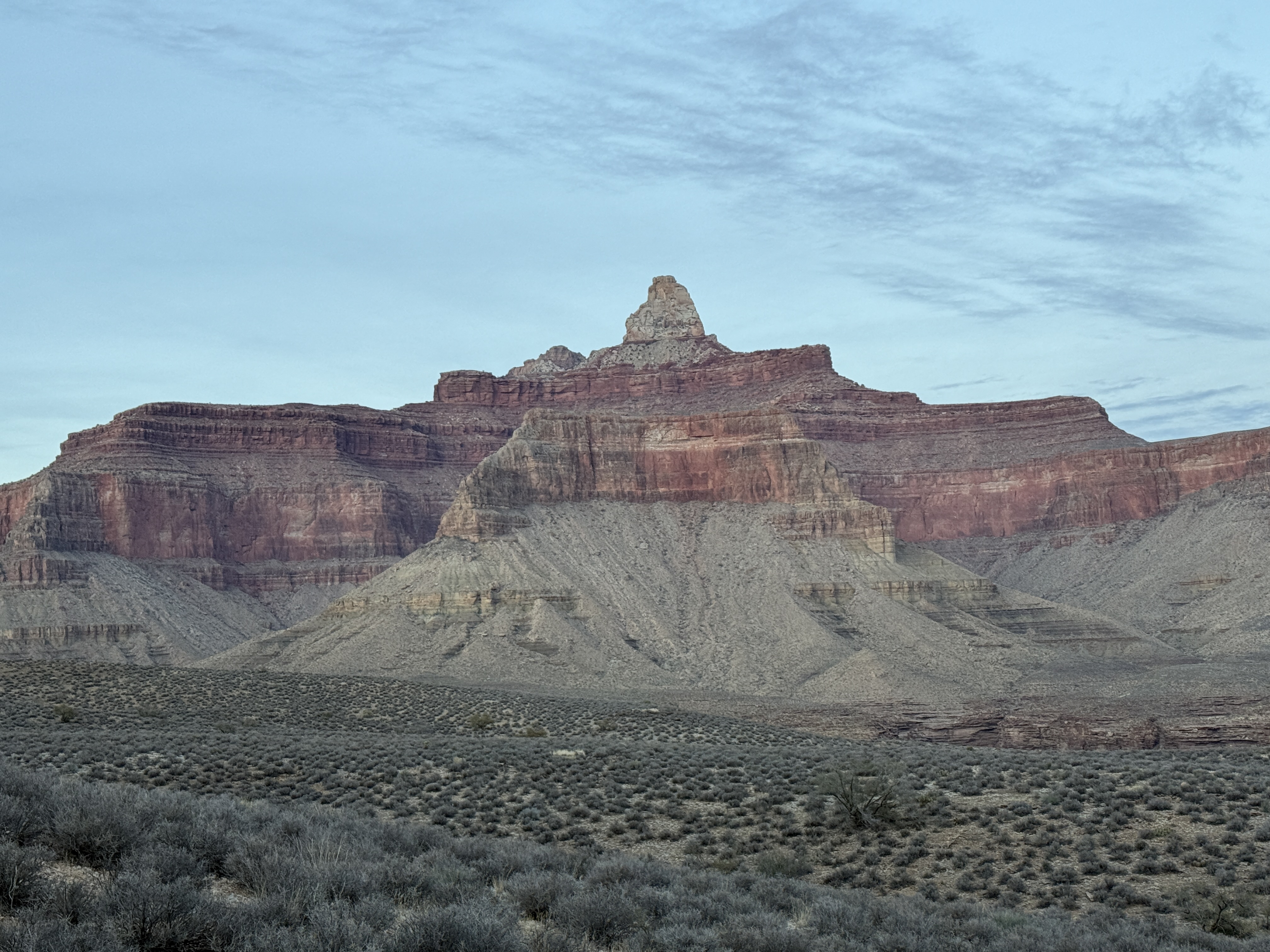
…Until December of 2024. After an extremely successful and fulfilling trip to solo trek the Grand Canyon Rim-Rim-Rim, knew I was ready to redeem myself. Although the trail was much more well maintained, the high exposure of the north rim trail in GCNP was a test of my vertigo and fear of heights. I had quit drinking in February of 2023 and was pushing myself on my local peakbagging outings to explore more challenging and exposed terrain. It all paid off. The vertigo wasn’t rearing its ugly head anymore and I found the GC North Kaibab Trail to be thrilling in a way that brought me extreme joy.

It was time to go back to Kalalau. But this time I was going with a healthy respect for the trail… and a hiking buddy. No more solo Kalalau for me, thank you very much! Less than a week after my return from Arizona, I texted Jason and asked him if he would like to join me for a return trip to Kalalau. He said something about wanting to spend money on new skis, but I cut him off and reminded him how much he regretted turning me down to join me in GCNP. He relented and we spent the next hour making plans and booking flights.

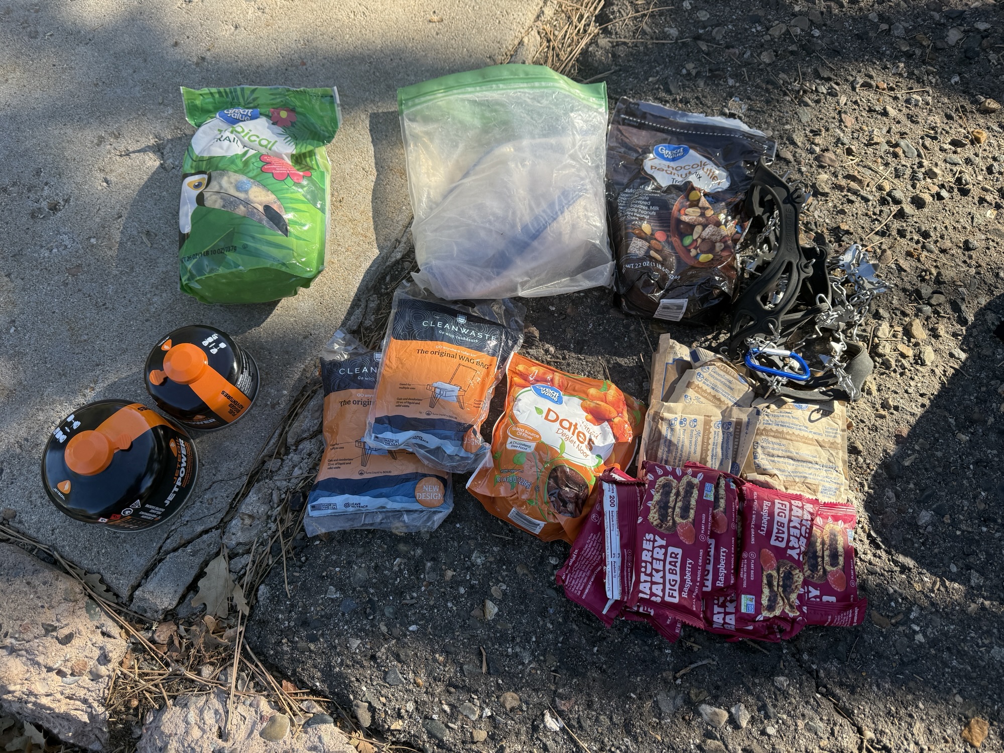
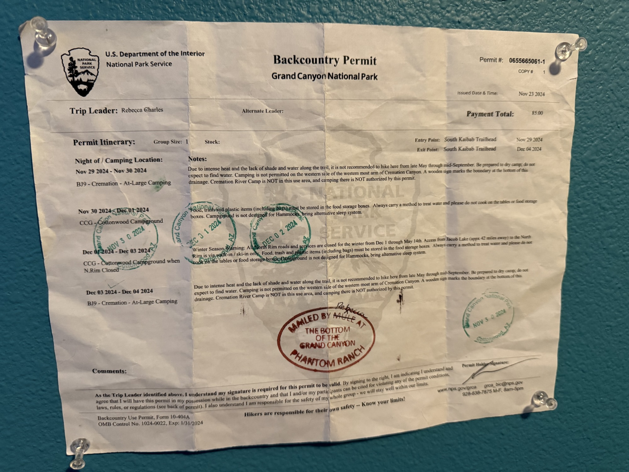
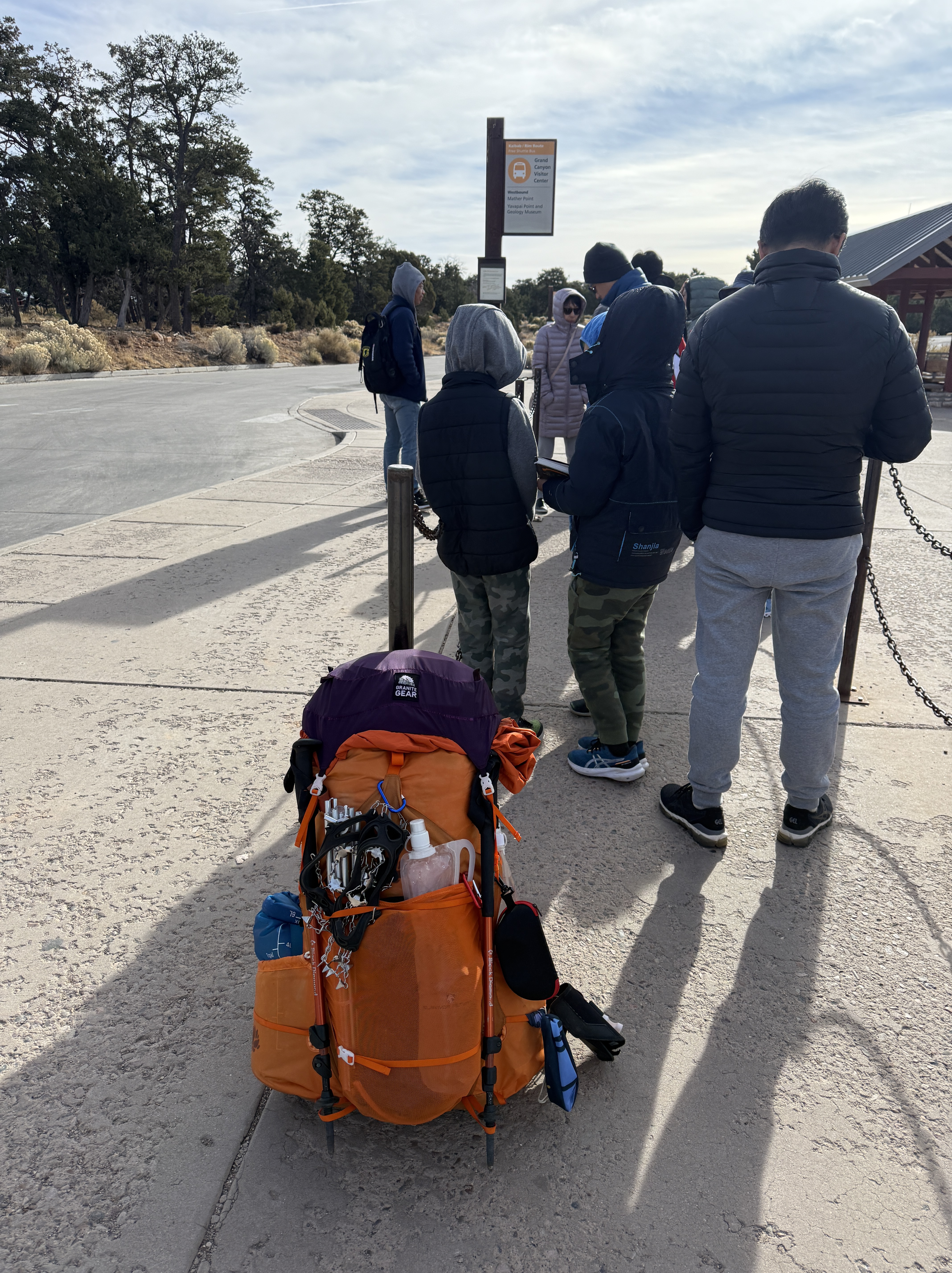
I went to the permitting website and opted for 3 nights, which would give us some flexibility if we had any delays, as January is the rainy season. I’ve seen many a trip report of people who regret not having booked extra time and took risks of crossing swollen streams to catch flights. Some never even get on the trail because there is an emergency closure for the one or two nights they have a permit. January tends to still have permits available as little as a month out because of the likelihood of heavy rains and flash flooding. Most people opt for spring thru fall trekking along the NaPali Coast to ensure more stable weather patterns, so permits for these peak months will often be gone within minutes after they open.

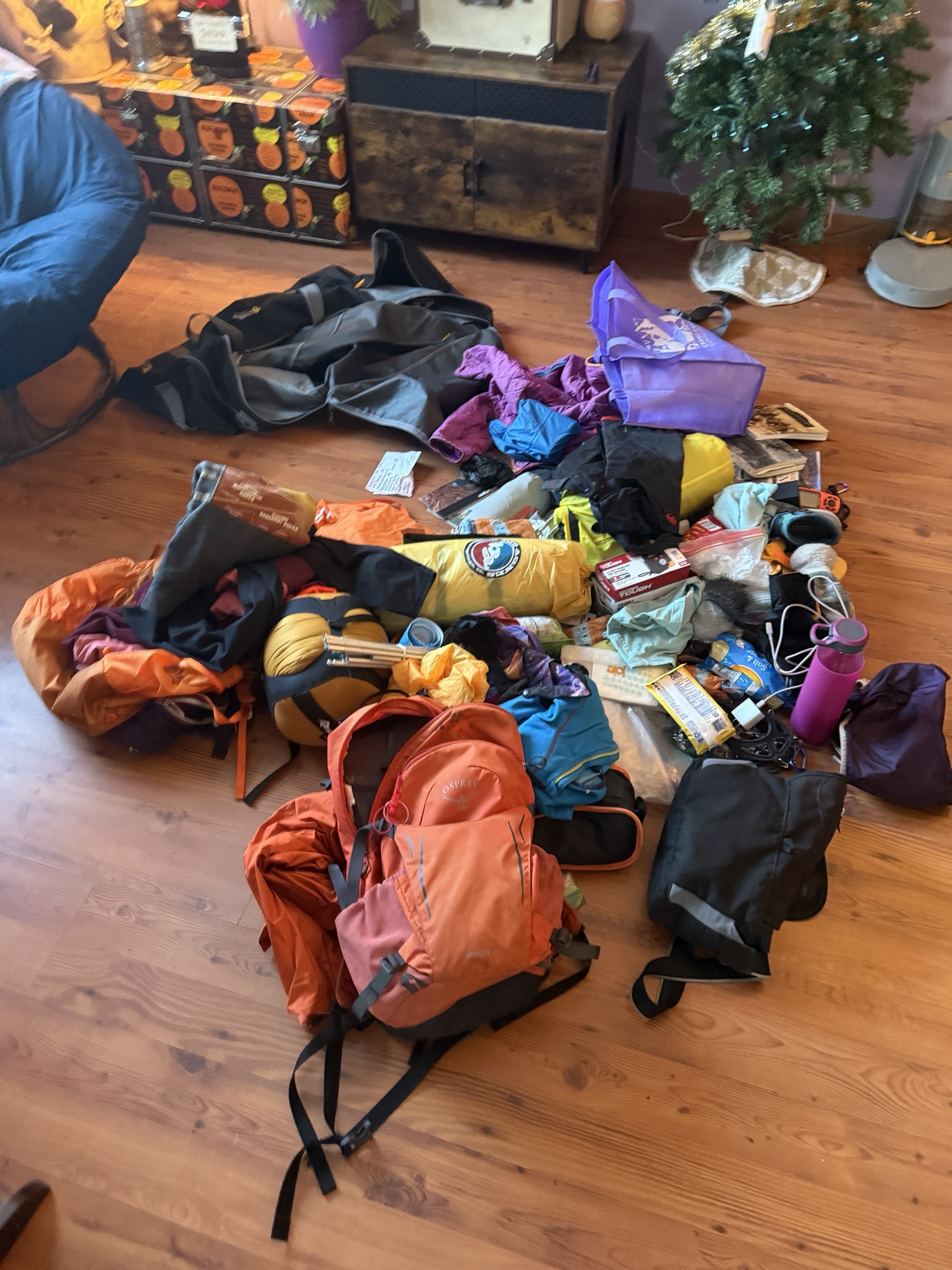
I came up with a basic itinerary to fly in mid-day on the 26th, hike the 6.4 miles to Hanakoa, on the 27th we would hike the 5 miles to Kalalau Beach, camp two nights and hike the 11.4 miles back out on the 29th before flying out at 11pm. This would give us the opportunity to explore the Kalalau Valley for a day, an experience that I missed out on in 2023 because of my rush to beat the weather.

I brainstormed all of the contingency plans, knowing that Hanakoa is available for camping “1-night camping (each way),” which offers a safety net in case of bad weather or other issues that may arise.

As the weather forecast began to include the dates of our trip, it wasn’t looking great. I was obsessed. Refreshing the weather app every hour to see it change from sun to rain to sun to rain, although the trend was showing that the rain may win out over the sun. I poured over recent trip reports of people risking their lives to get across streams that were running dangerously high due to the relentless rain. The trail had even been closed for few days by Hawaii State Parks, who deemed it too dangerous for travel due to severe flash flooding and landslides.

Day 1

We boarded our plane early morning on January 26, not quite sure if we would even be able to start the trail, let alone finish it. I was feeling nervous about the weather and the possibility we could be thwarted to get to the beach, but completely comfortable about being on the trail and the exposure that had terrified me only two years earlier.

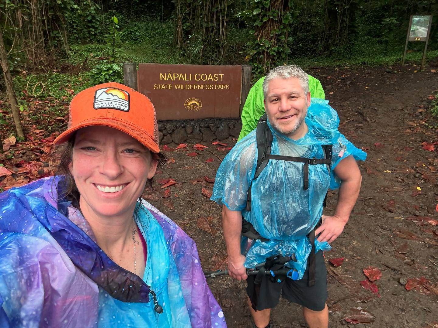
When we arrived in Kauai early afternoon that day, we immediately changed into our hiking clothes and packed our backpacks, as we were getting a ride directly to the trailhead to start our trek out the NaPali Coast. I had booked a ride service with Kevin Schwoebel, who also provides stove fuel, luggage storage, and other services for hikers. He picked us up from the airport, where it was gorgeous and sunny, but that didn’t last long.

We traveled for an hour along the east coast, wrapping up to the north shore of Kauai. It became darker, more ominous, the closer we got, and rain began to fall, but we were optimistic that it would clear up or at least rain only lightly. We couldn’t have been more wrong.

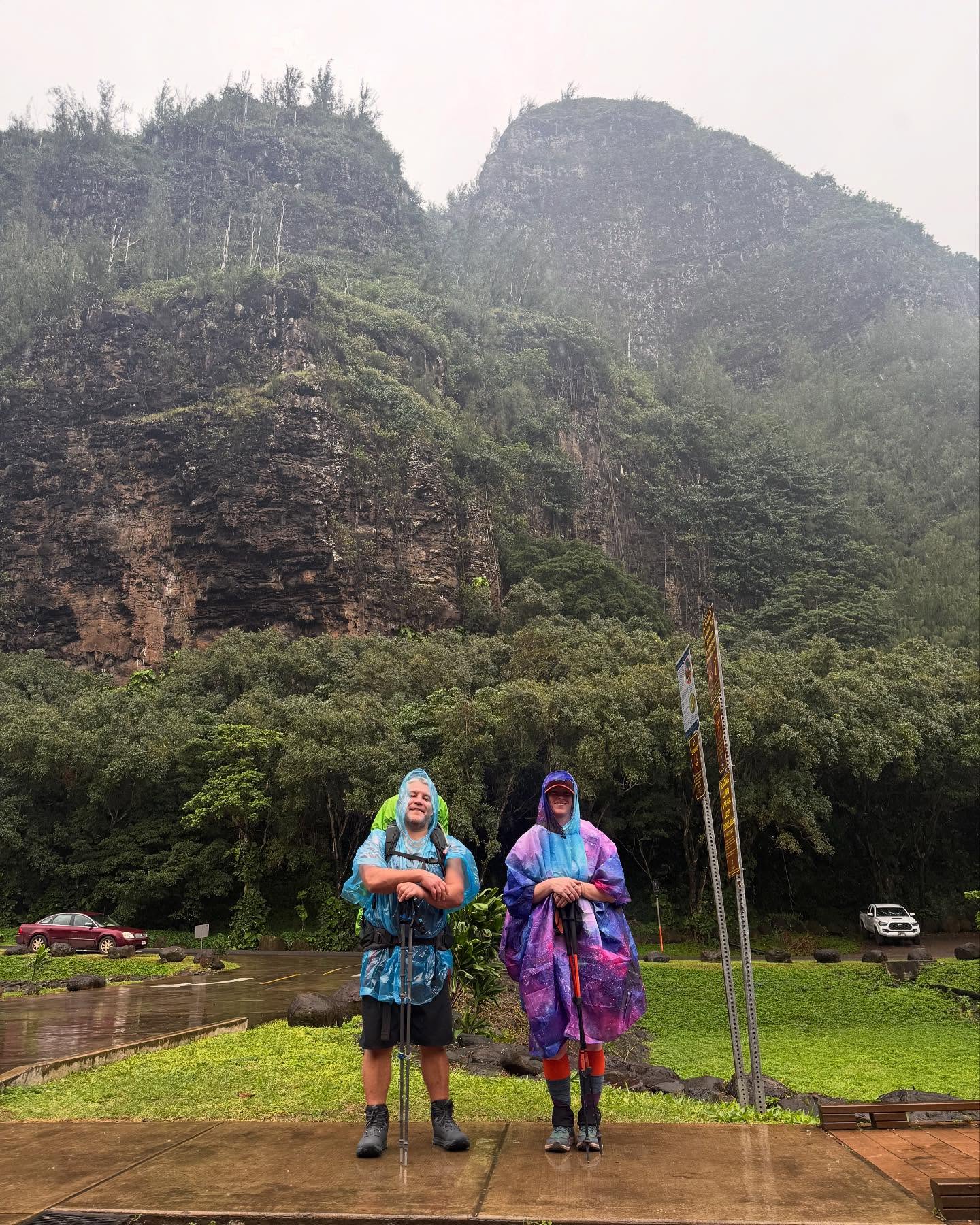
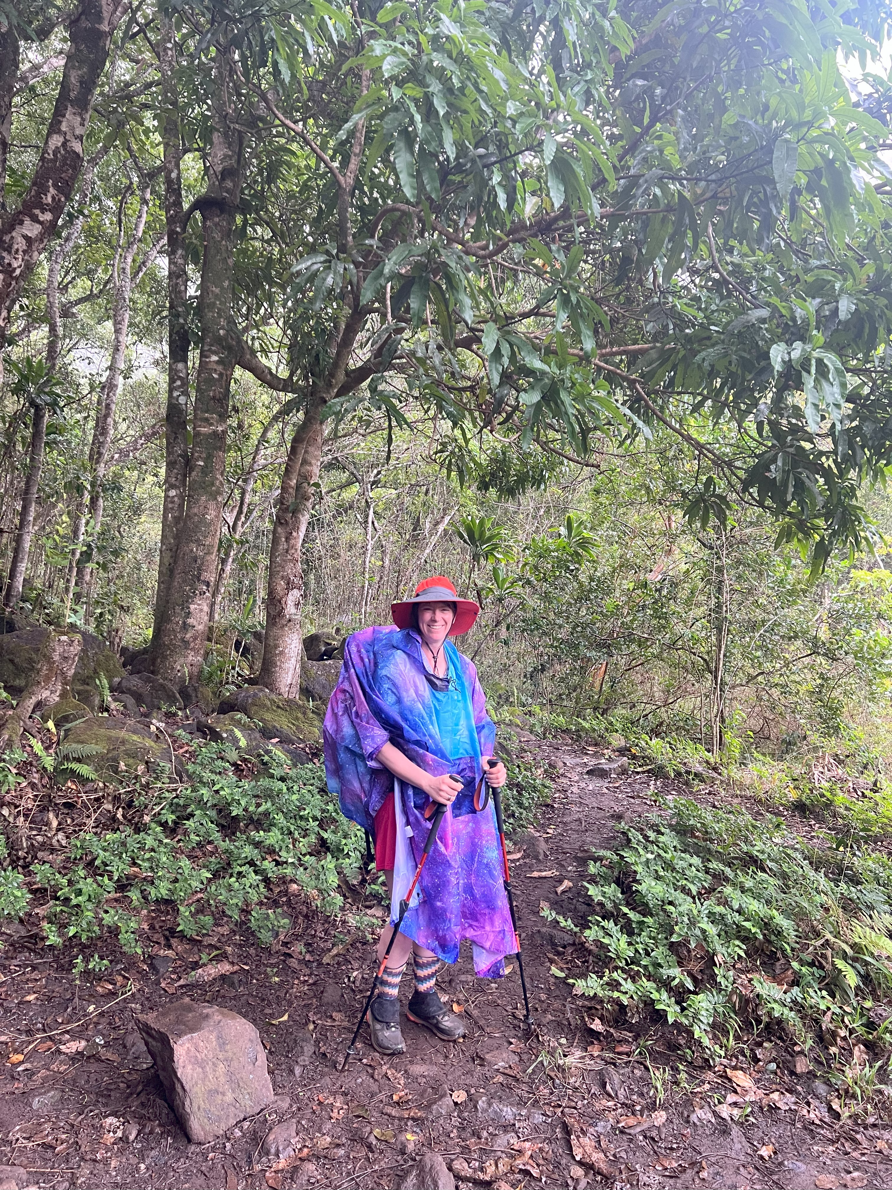
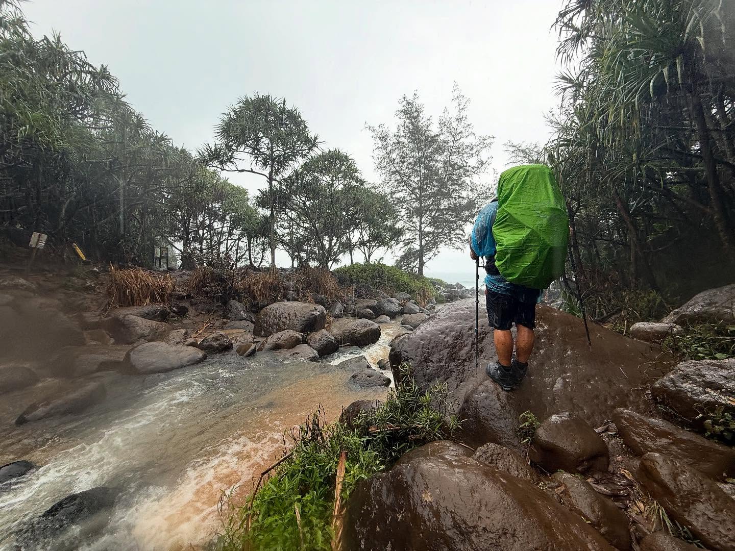
We donned our ponchos and as we started out towards Hanakapi’ai, it began to rain steadily, the wind starting to pick up. A normally busy section of trail, typically packed with day hikers, the first two miles were eerily quiet. We were relieved to see that Hanakapi’ai Stream was passable, although it was starting to have a tinge of muddy water from flash flooding above us. We crossed without getting our feet wet (not that it would matter soon) and turned around to see that the stream level had already risen and what was mostly clear just a few minutes before was now chocolate milk brown.

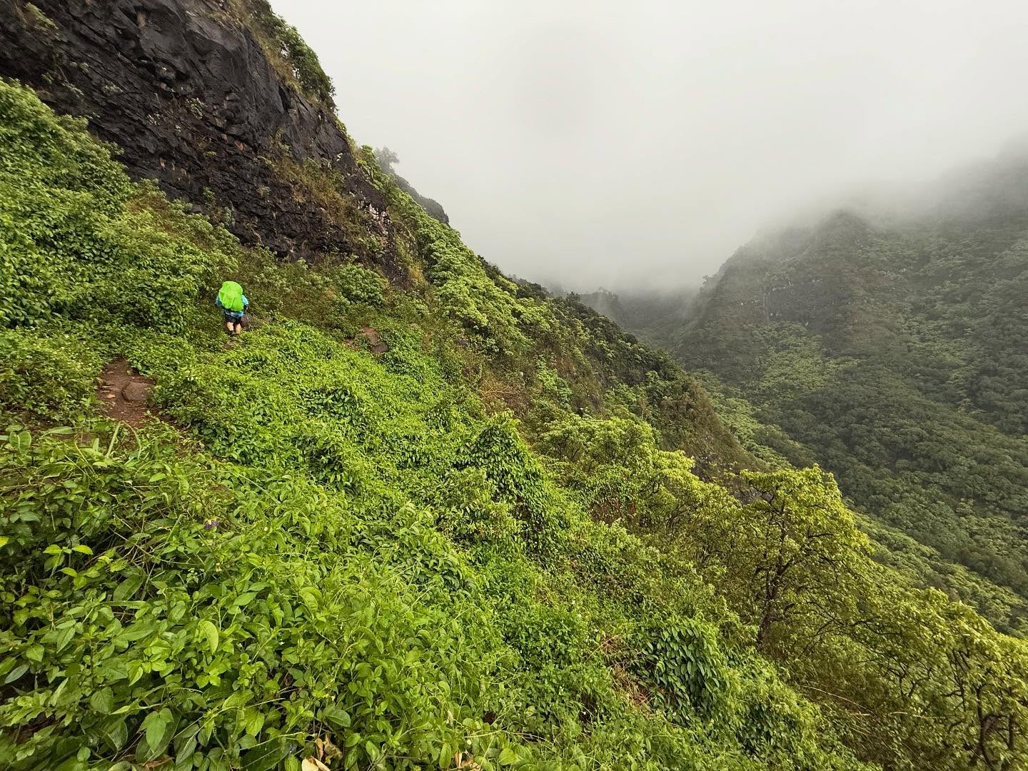
We forged on and were relieved when the rain became a bit lighter, although that didn’t last. Before long we were in a full-on monsoon; it was raining sideways and blowing somewhat fierce, as we picked our way along the Palis. I gave up trying to keep my feet dry and just kept moving forward along exposed sections of trail with greasy mud threatening to steal your footing. Amazingly, I felt great! This time I felt ready and was not at all uncomfortable with the dizzying heights.

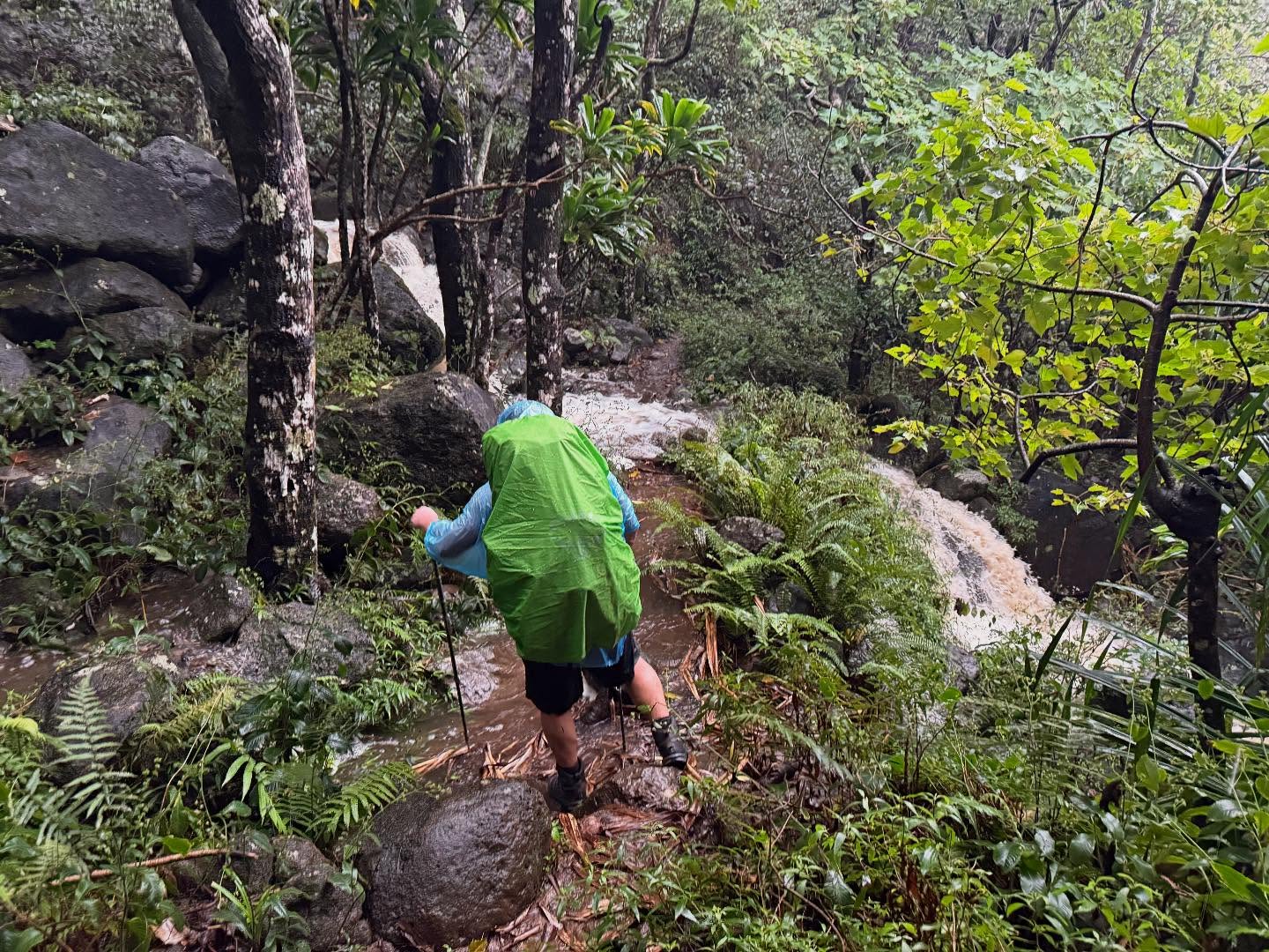
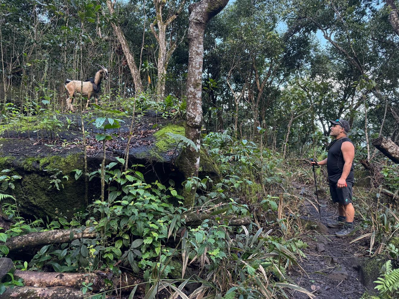
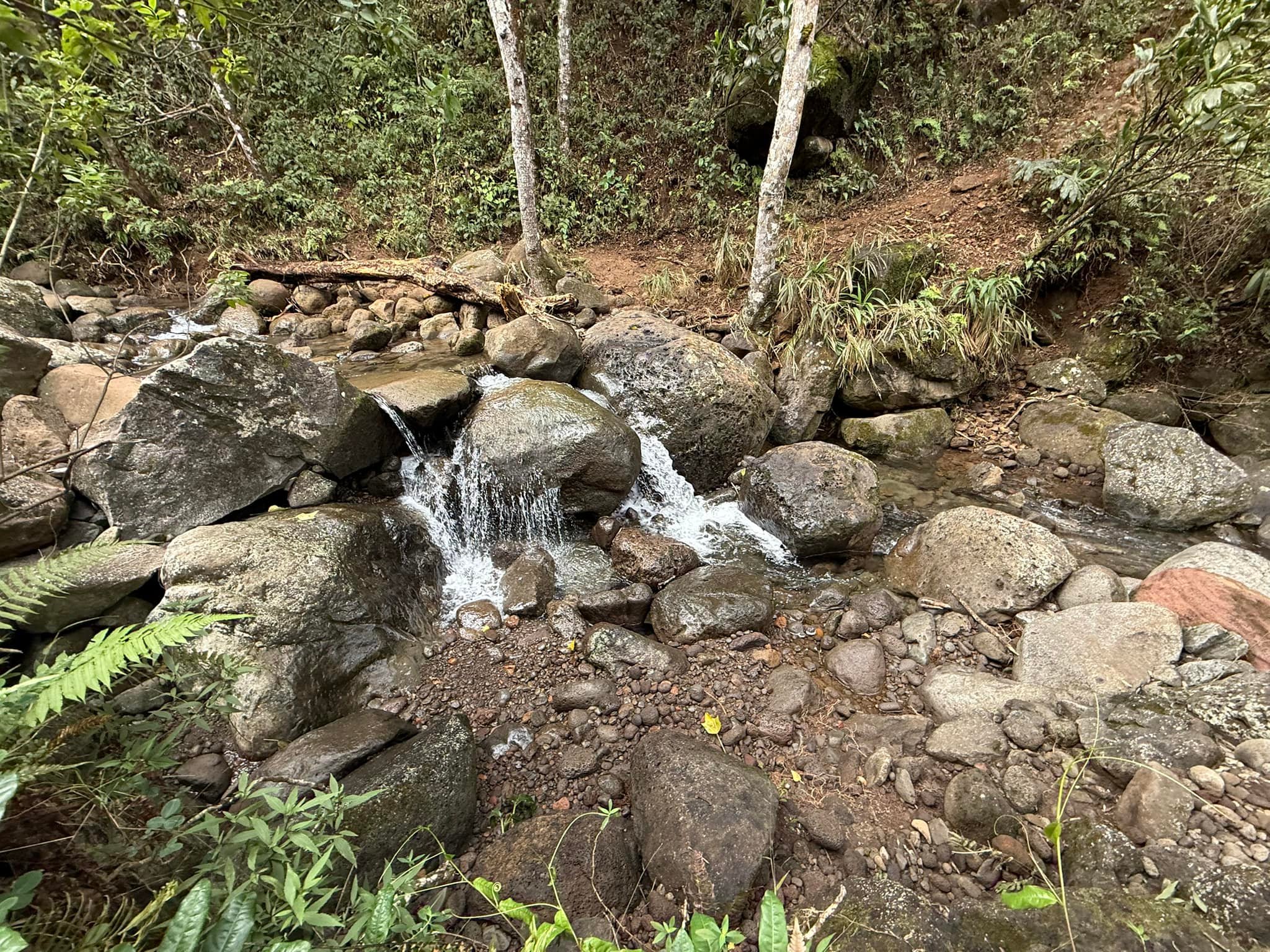
Although it was flowing at a rate that was far more than its typical trickle, we were able to find a way across Ho’olulu stream by rock jumping. It was becoming incredibly obvious that if we had started any later, Hanakapi’ai Stream would have been impassable. At this point we only had one more valley to traverse before reaching our campsite at Hanakoa. A few times we were startled by wild pigs, but they wanted nothing to do with us and ran off into the jungle.

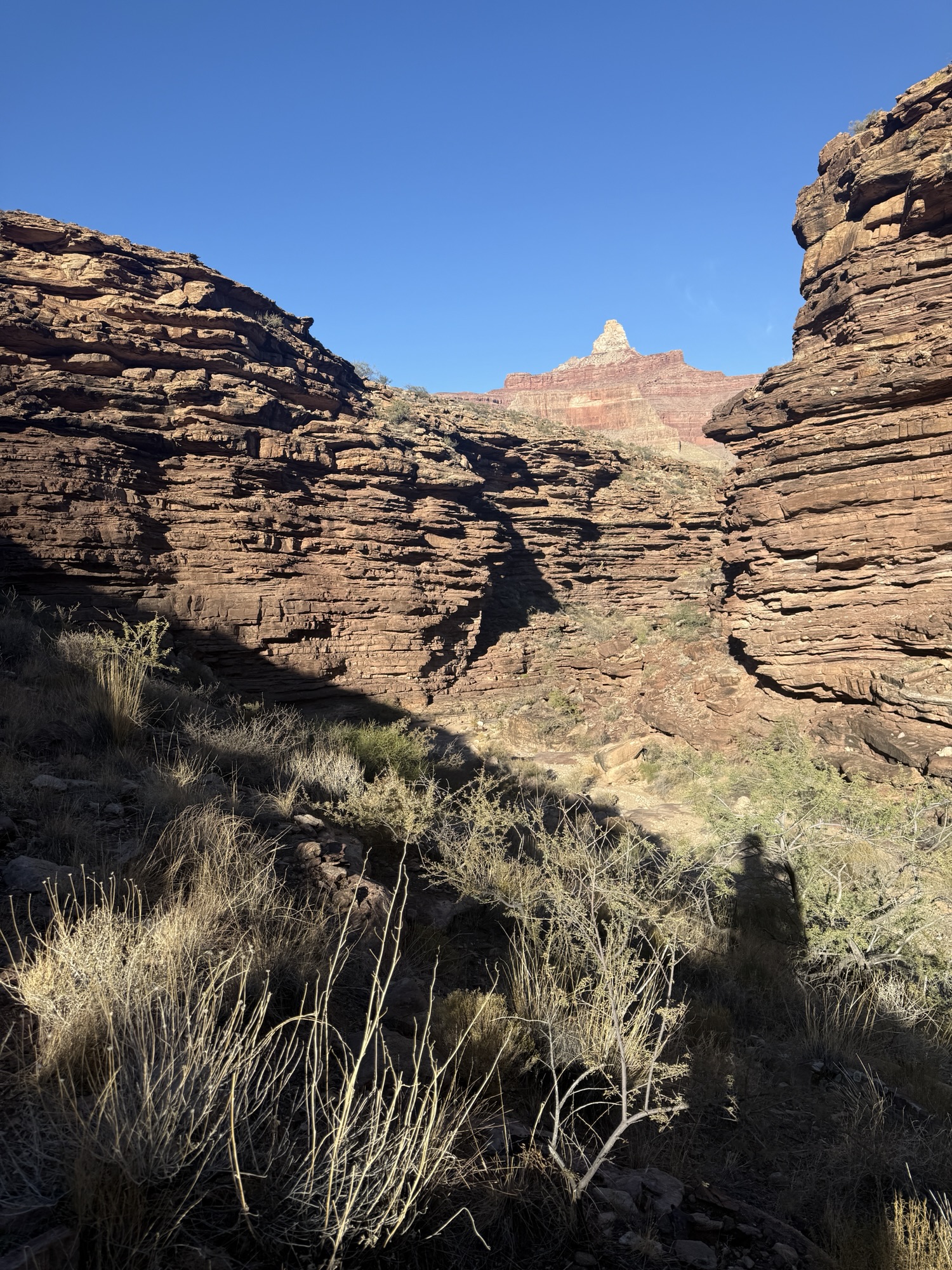
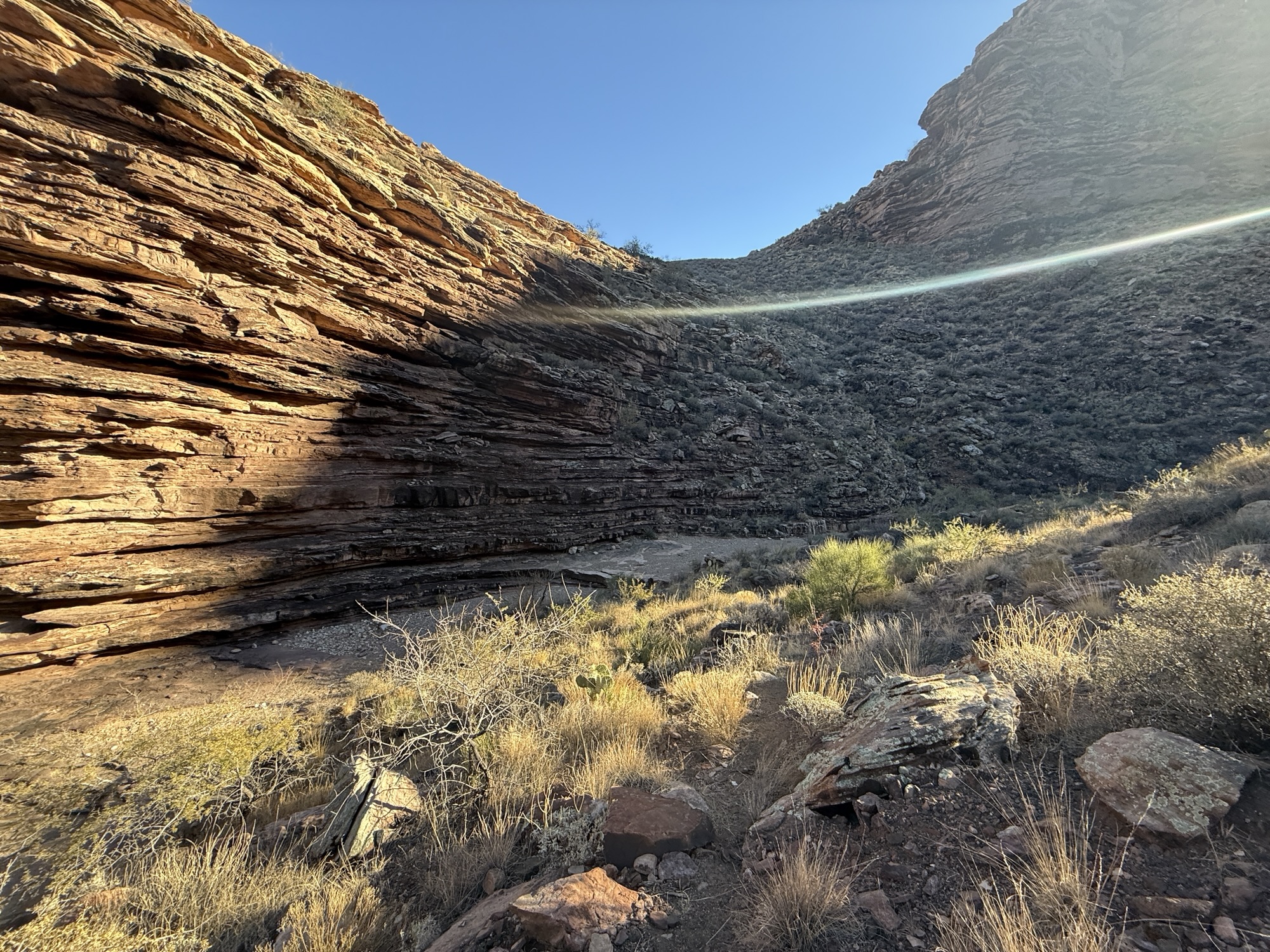
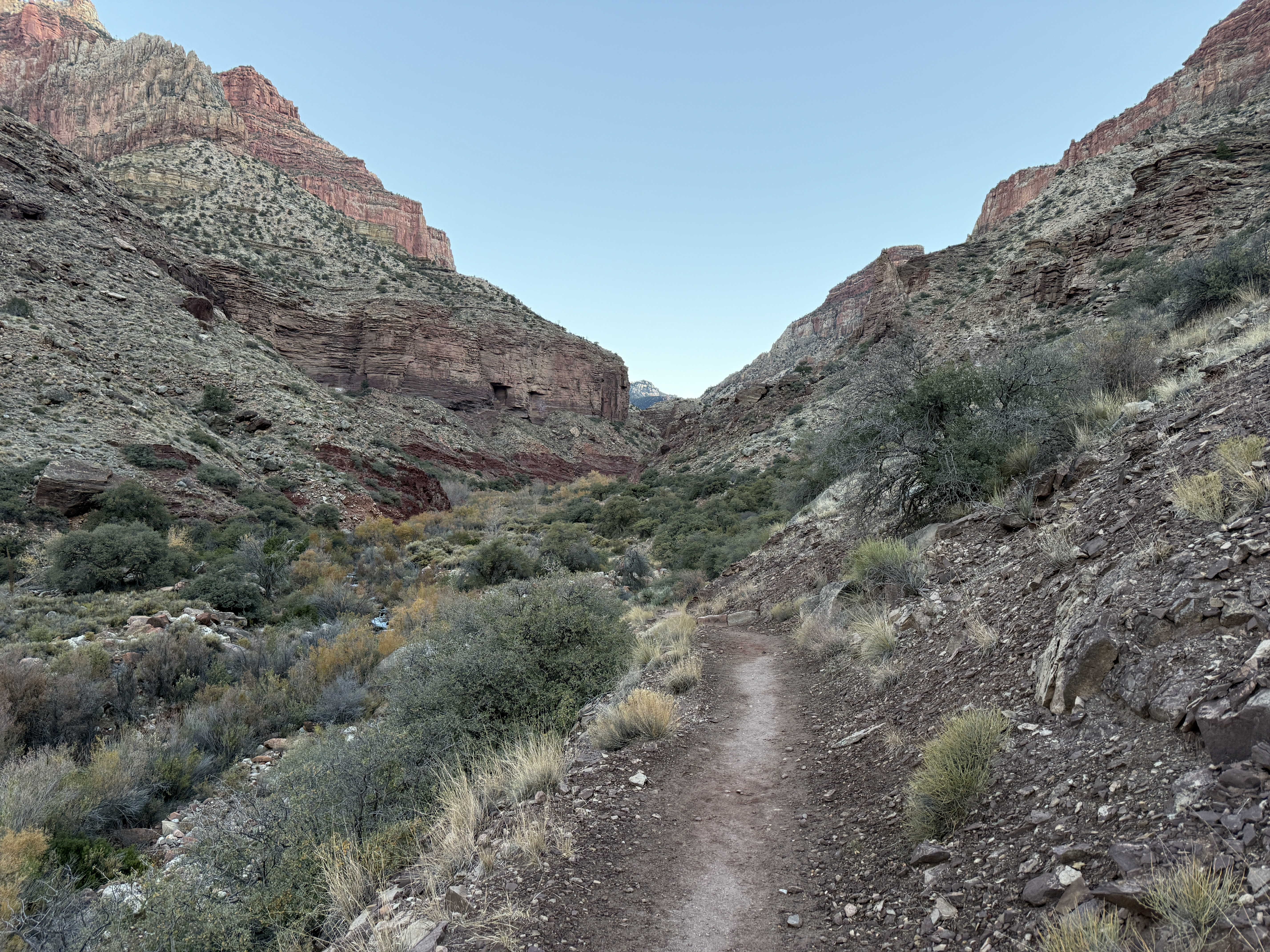
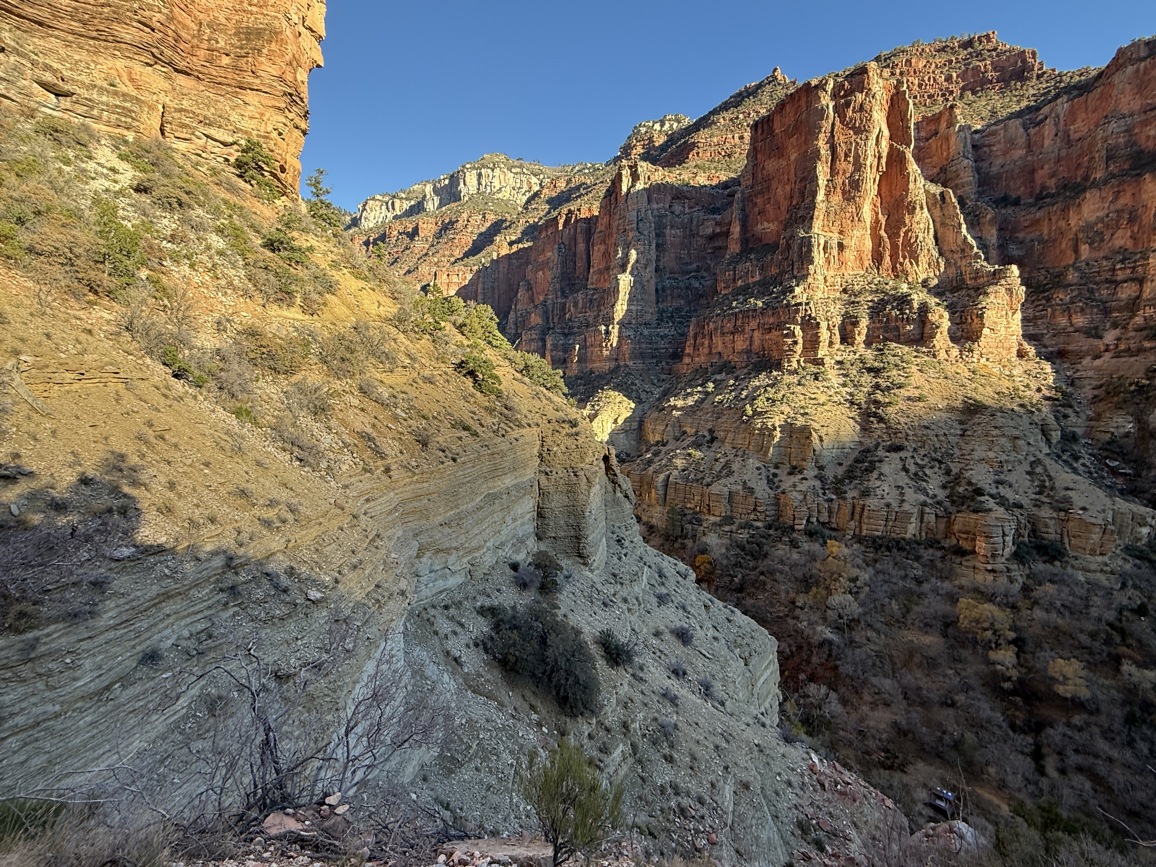
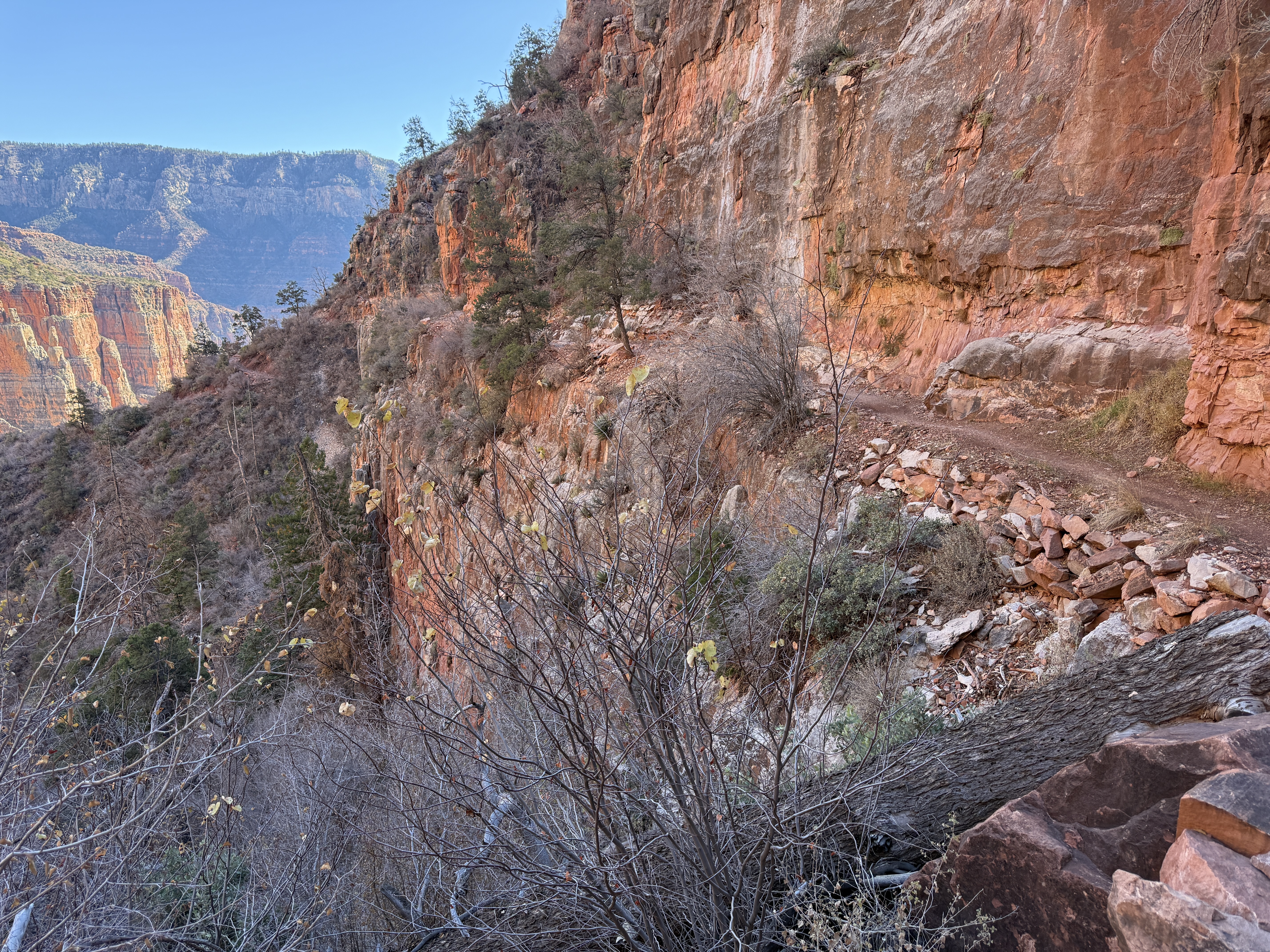
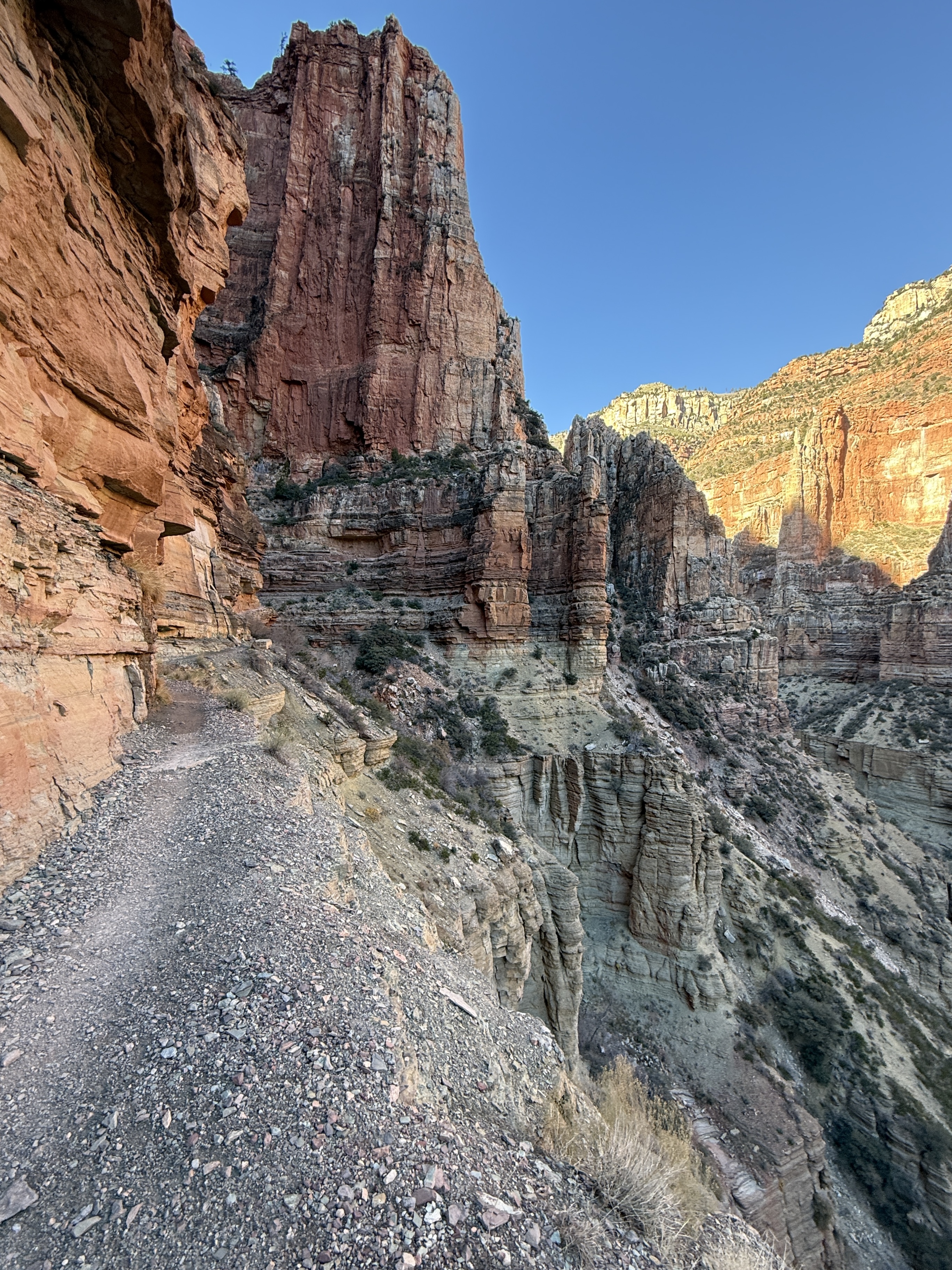
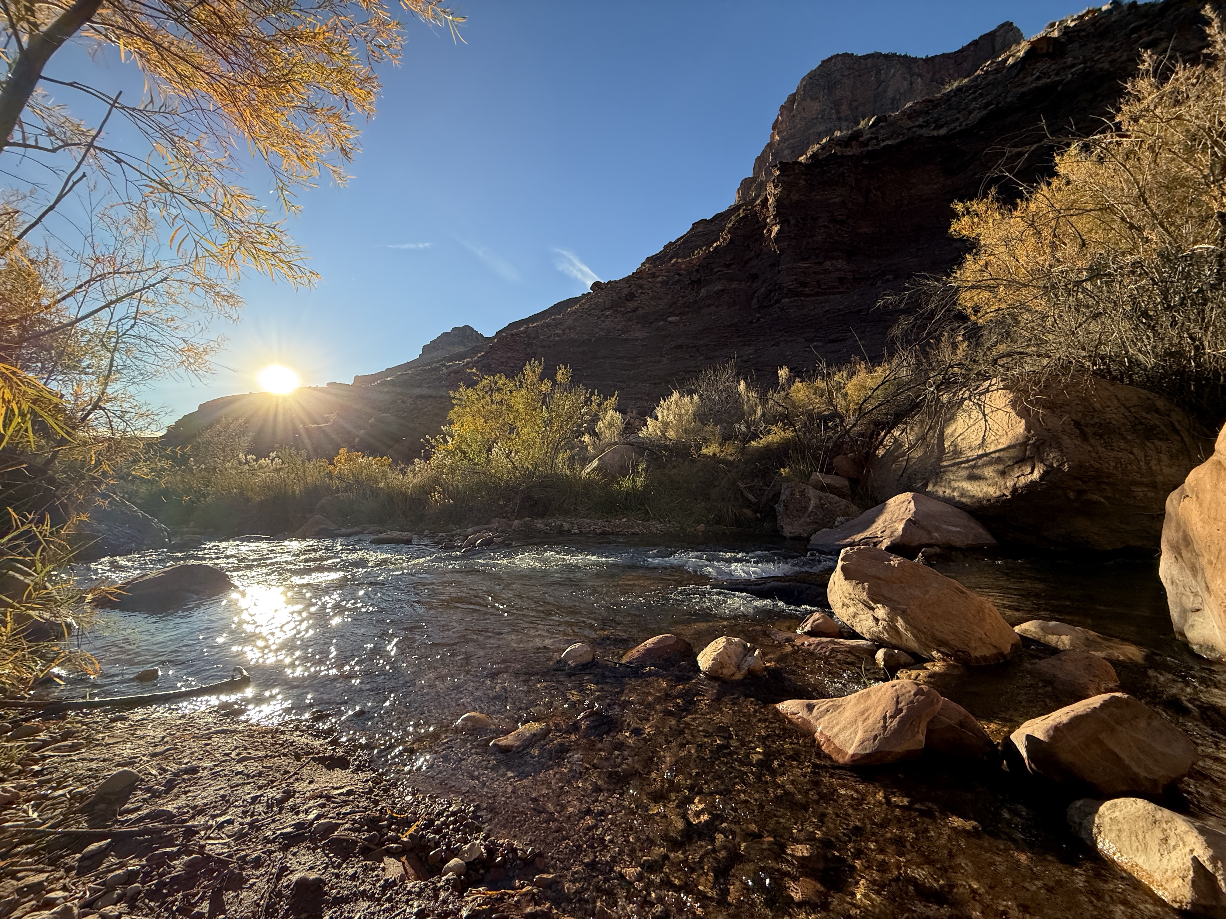
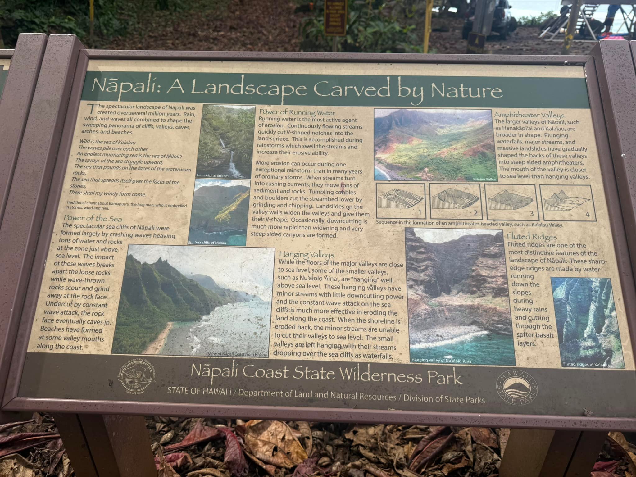
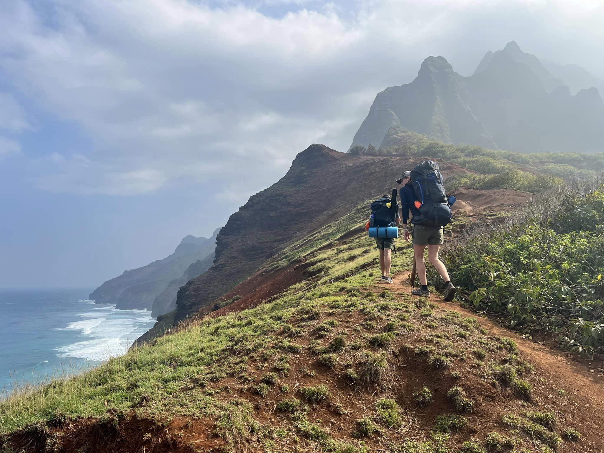
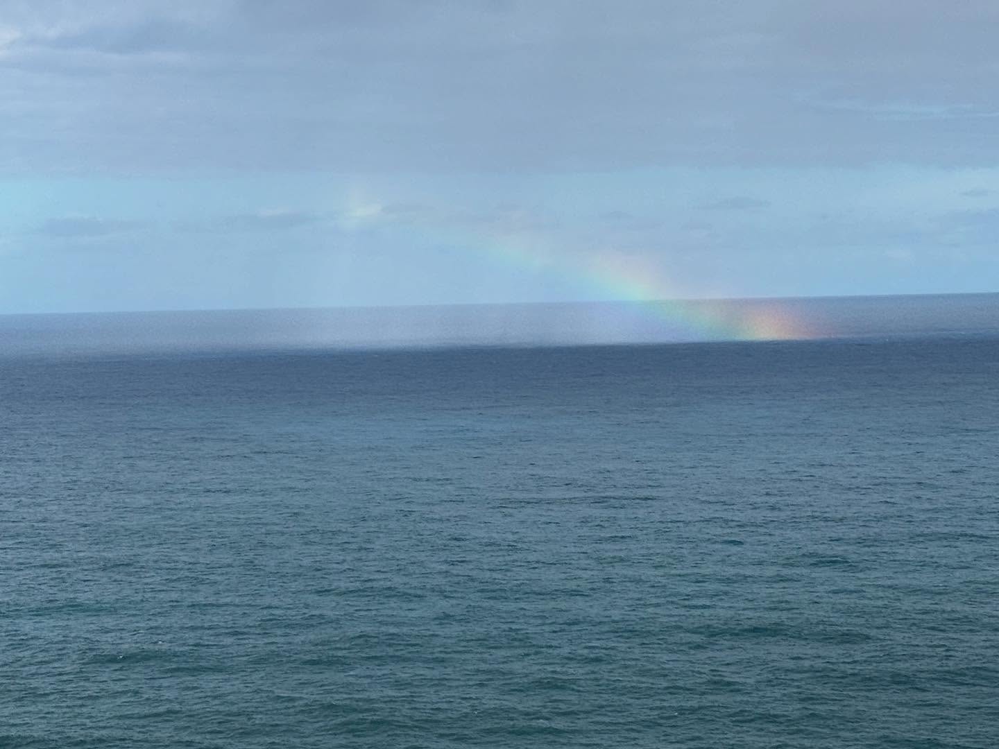
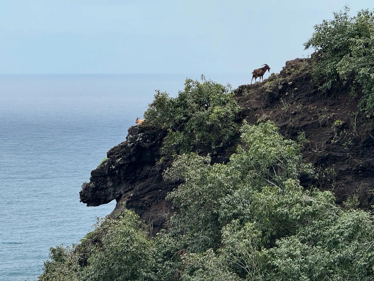
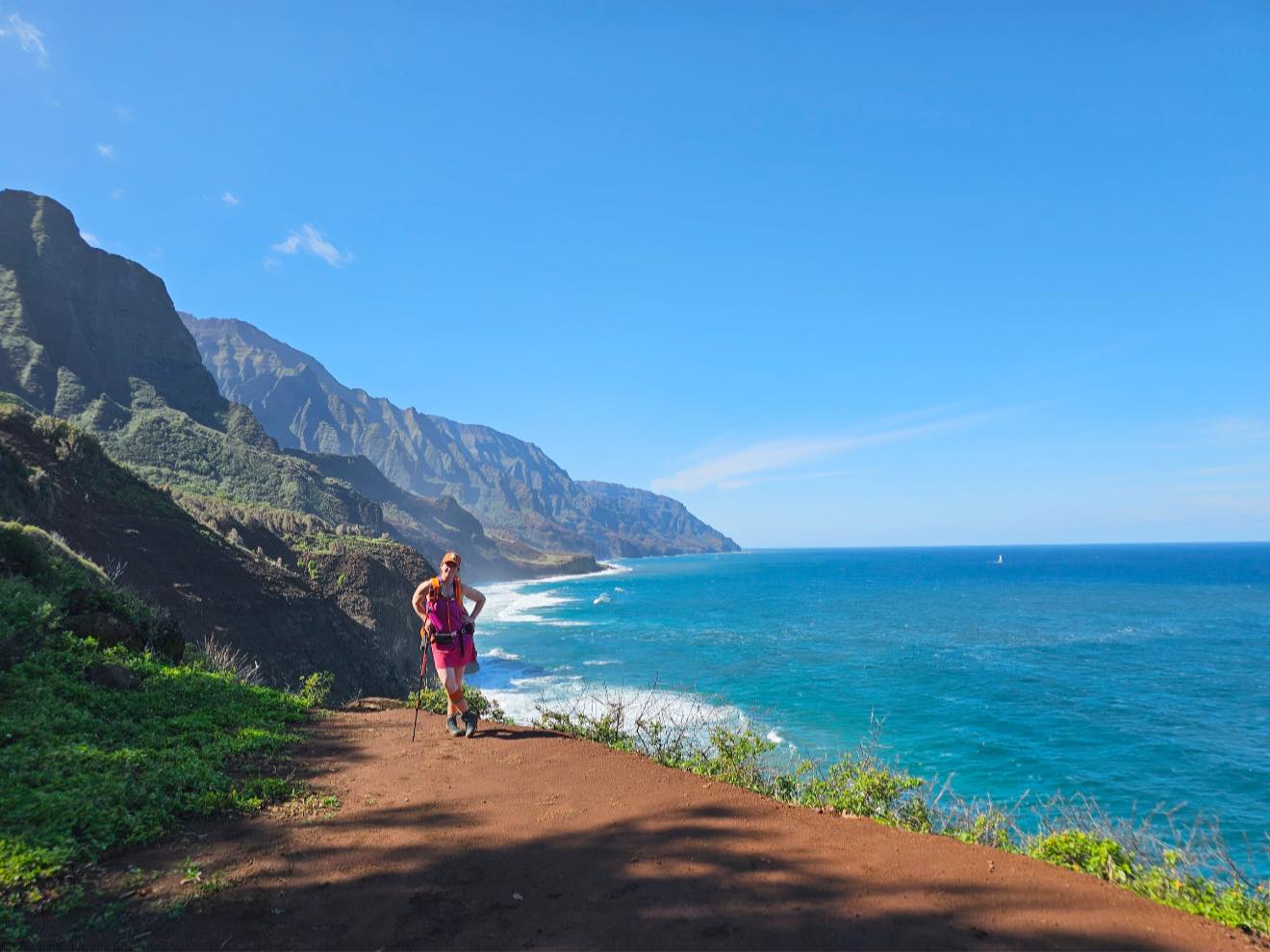
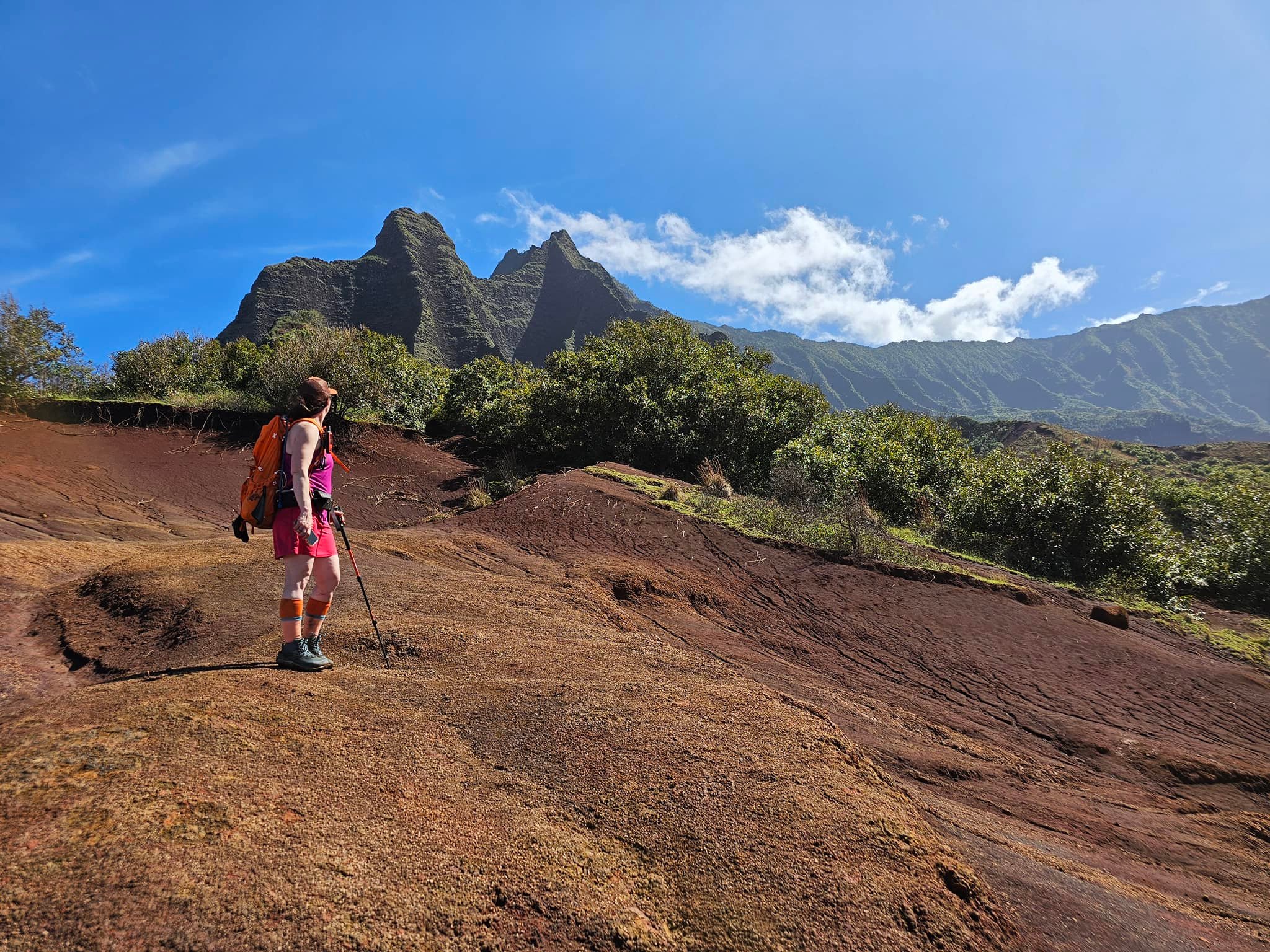
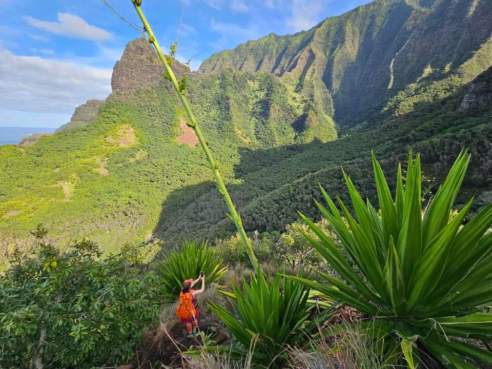
As we rounded the corner from the coastline and into Waihukua Valley, I realized I had never noticed how beautiful this spot was, even in a downpour. Needle-like palis rise vertically along the rim of the valley and the lush greenery was welcome change from the bland colors of a snowless Alaskan winter. We relaxed a little knowing we were close. But Kalalau has way of reminding you to stay on guard…

Monsoon on the Kalalau Trail
Flash Flood at Waihuakua Stream

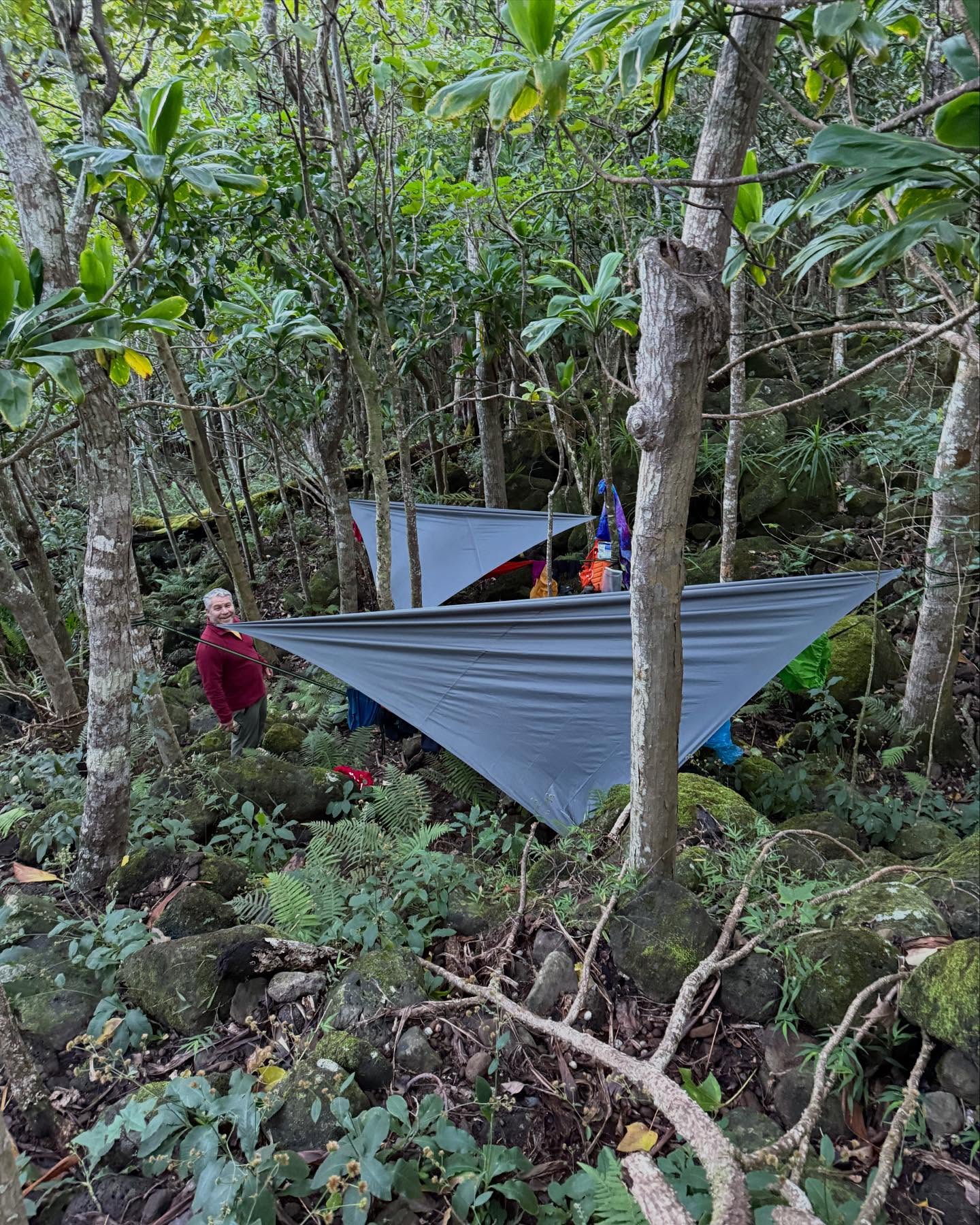
We approached Waiahuakua Stream and realized that we would be risking our lives if we attempted to cross. We were less than a mile and half from Hanakoa, but we weren’t getting any further tonight. And we sure weren’t getting back across Hanakapi’ai. Although permits are only good for camping at Hanakoa or Kalalau, I knew it was wiser to stop and wait as opposed to losing our lives, and I was sure that HI State Parks would agree. As darkness began to fall, we hustled to find a good spot to set up our hammocks, and after a half hour of stumbling frustrated and wet around in the jungle, we were finally set up and climbing into our cocoons.

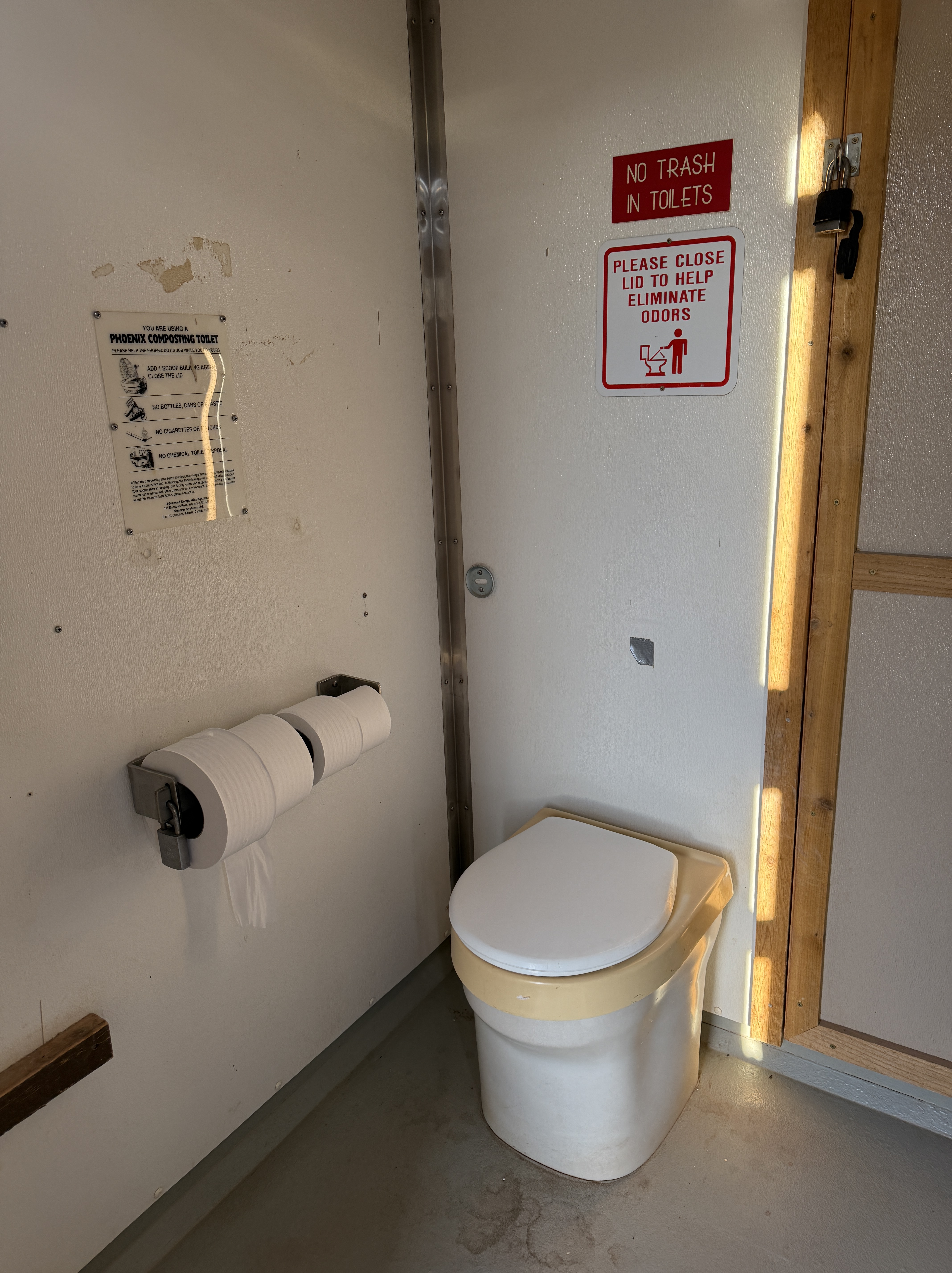
Not long after we settled in, a couple came by in trail running gear. They had managed to cross the Waiahuakua, but said it was waist deep and still rising. We exchanged some pleasantries, as much as we could in a torrential downpour and howling wind, and they moved on, focused on getting back to shelter. We later heard that they were unable to cross the Hanakapi’ai and spent the night in the composting toilet **(the second time in two treks that I had experience with discovering folks had slept in a composting toilet)**.

Amazingly my gear stayed dry on the hike out with just a rain fly and my poncho draped over my pack, although I should have used a contractor trash bag to line it because I think I just got lucky. I struggled to make dinner under my rainfly but stayed true to my routine and even had a cup of coffee as Jason and I attempted to communicate by screaming over the wind and rain.

I felt bad bringing him out here. I didn’t think he was impressed. But surprisingly, I was having a blast. Nothing like being tested by Mother Nature to know what you are capable of. Honestly, I was very pleased with our progress in some awful conditions. I slept soundly through the monsoon.

Day 2

The next morning, we woke to a completely different atmosphere, windless with sun poking through the trees. I hustled down to the stream to see if we could cross and continue on. Surprisingly, it well below its previous night’s levels and easily crossable!

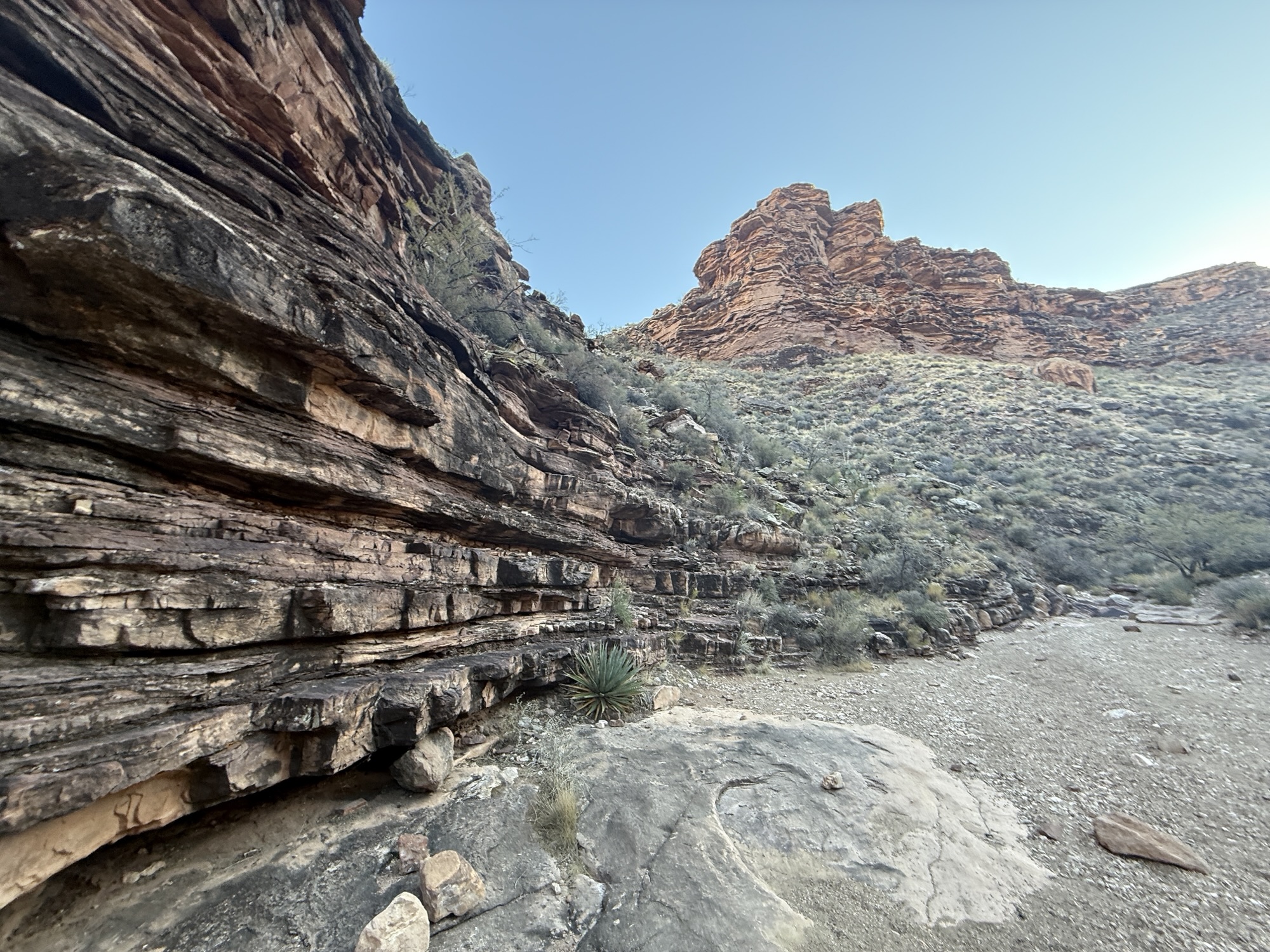
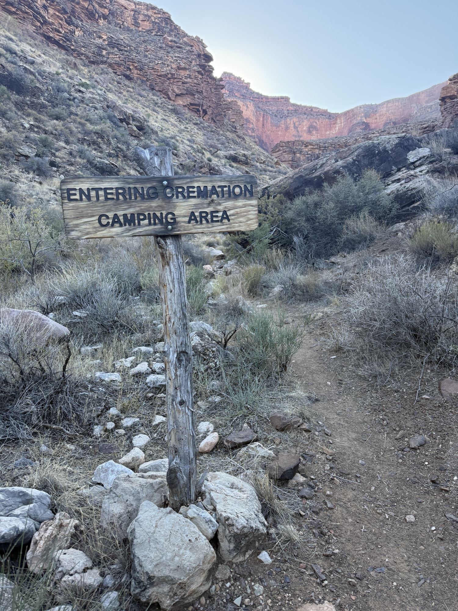
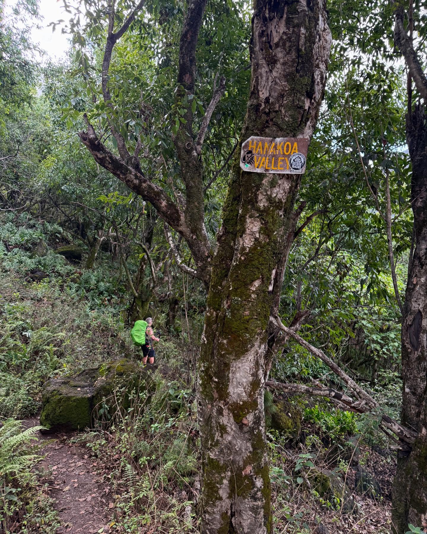
I ran back up and reported to Jason. We packed up and continued on, a quick hike around one last Pali and into Hanakoa Valley, where we came upon the camping area, just beyond the mile 6 marker, complete with a composing toilet and sheltered picnic table.

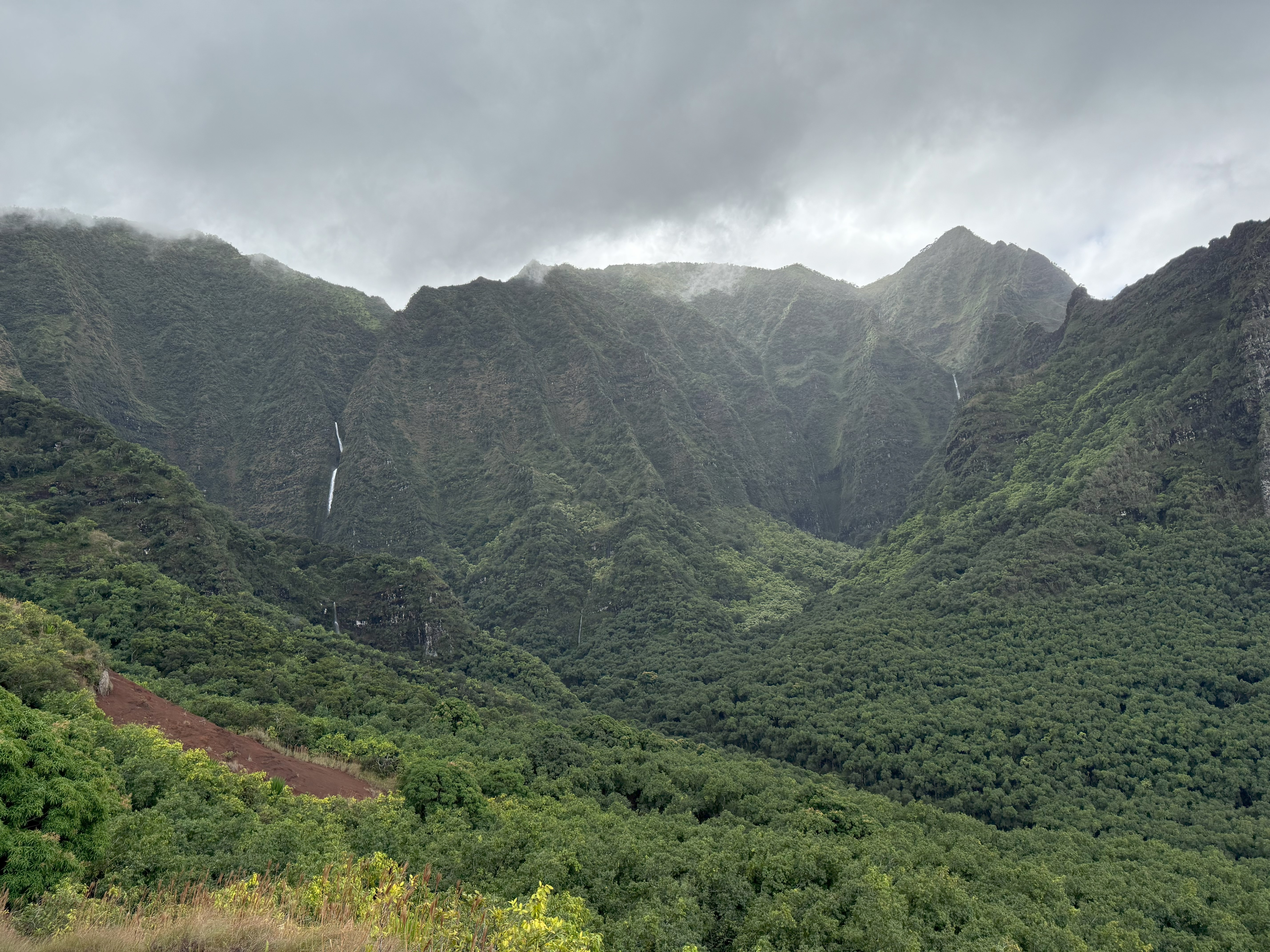
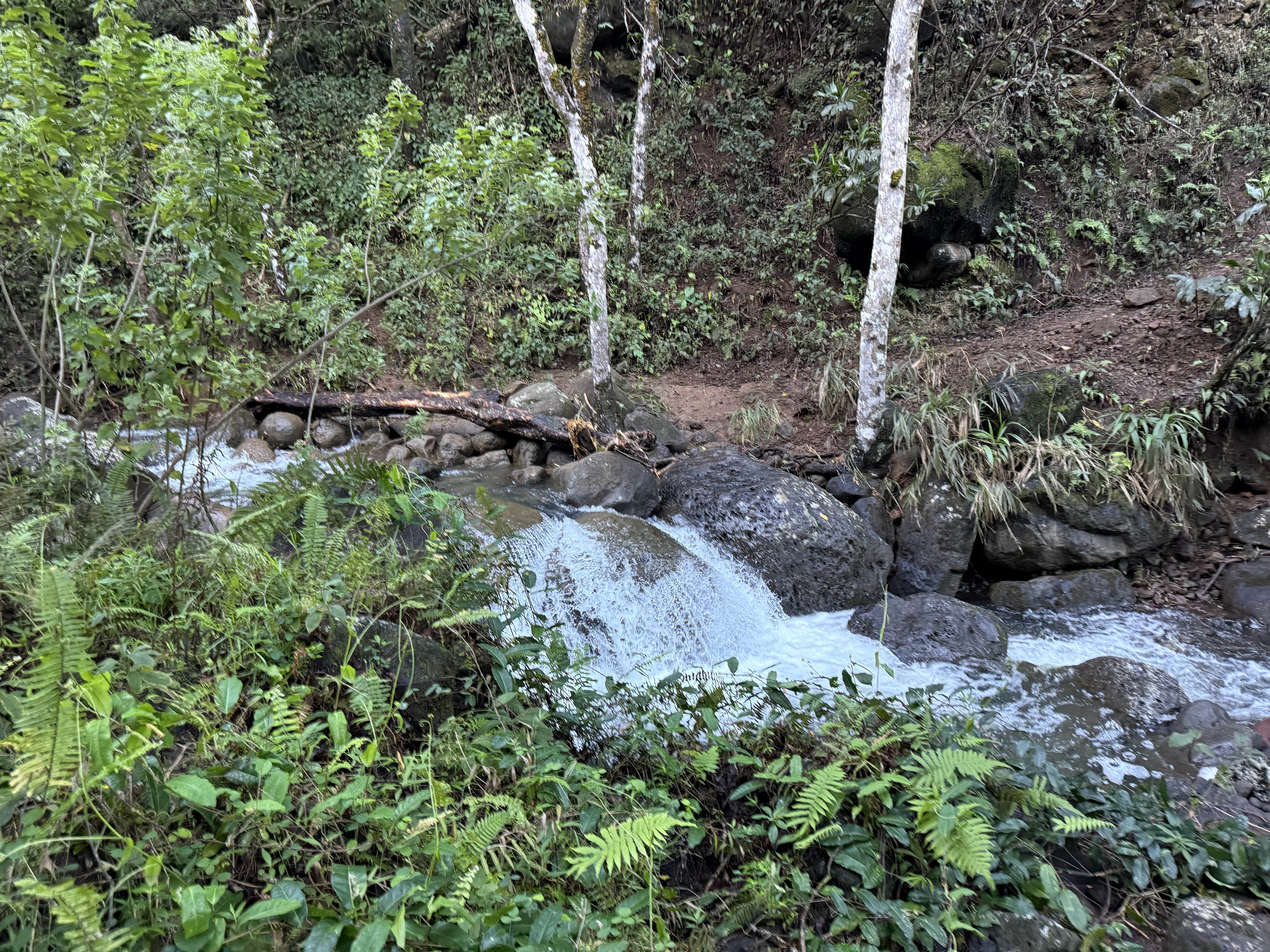
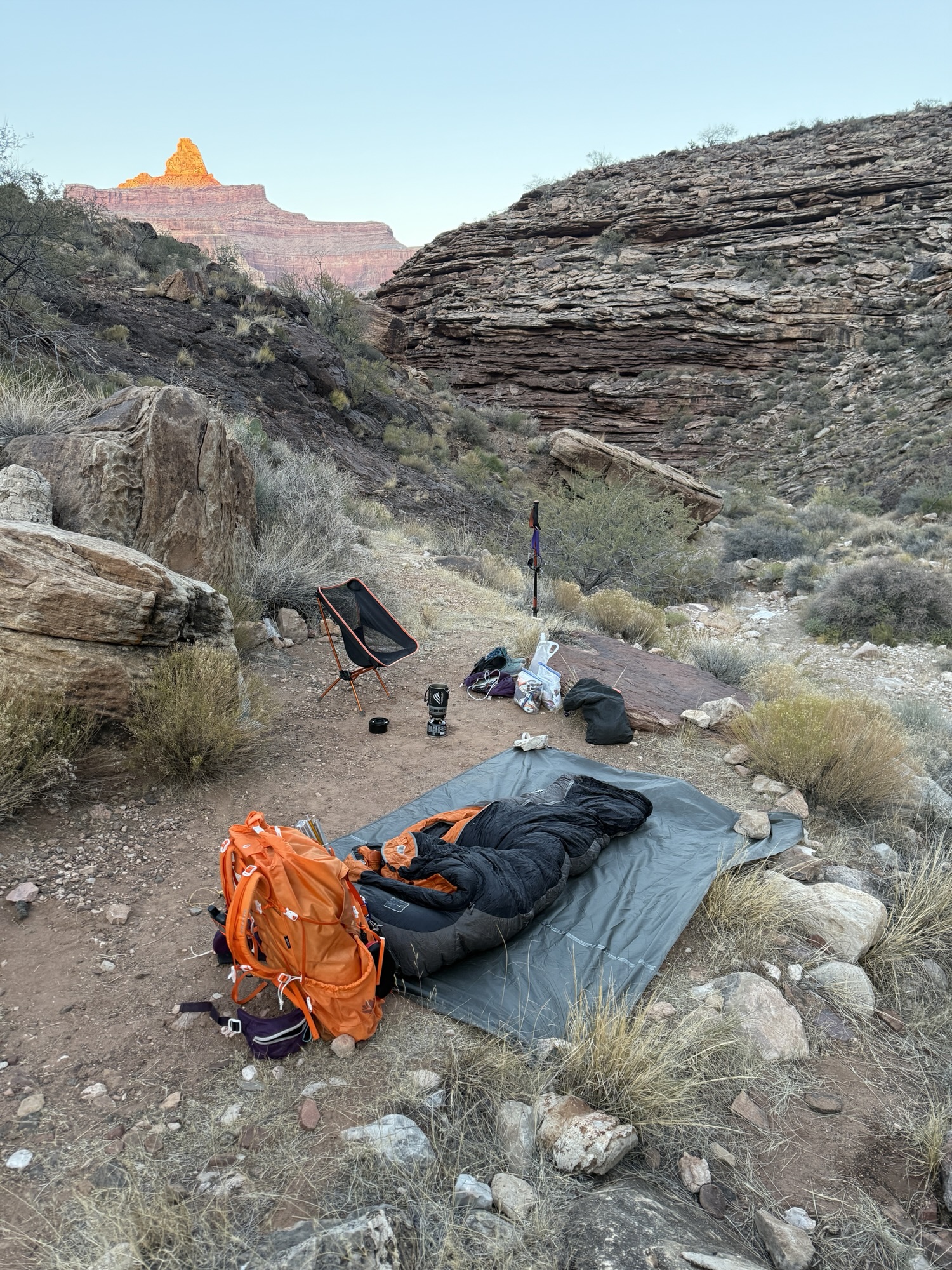
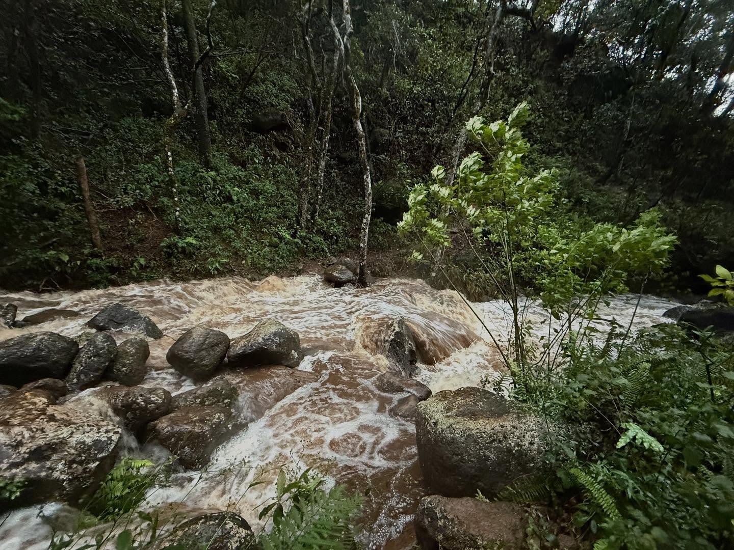
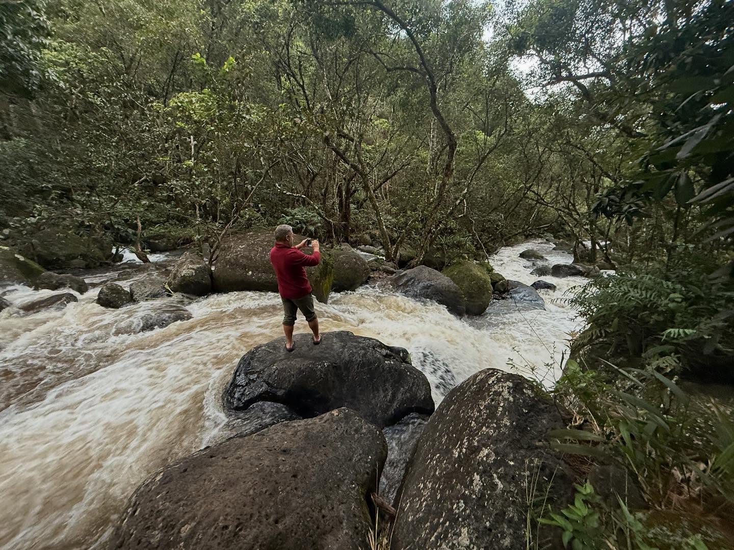
We stopped to regroup, dry out and have something to eat before heading out to Kalalau Beach, but first we reconned Hanakoa Stream, which was found could be easily crossed. As we ate and had coffee, laying our wet clothes and shoes out to dry, we noticed that it had been raining up in the mountains and the waterfalls were very pronounced.

We walked back down to Hanakoa Stream to check on the water levels and were shocked to find that the stream had risen by more than 3′ in less than two hours! Once again, we were halted because of a flash flood, and once again we knew we weren’t willing to risk our lives for a trail. We set up camp and enjoyed the day, playing cards and coming to terms with the fact that it was very likely we weren’t going to make it to Kalalau, especially as the forecast was not looking much better for our last permitted day.

As we wrapped up dinner and got into our hammocks, it started to once again downpour and we lost any hope we had of continuing on.

Day 3

We again woke to beautiful weather, and incredibly, the stream levels were back down to baseline. As we ate breakfast, we talked about our hike back out to the trailhead and about sitting by a pool for our last night and day in Kauai. Not what we had planned, but it would do. Honestly, I was a little relieved but also bummed out. I didn’t feel like I got my redemption.

Then Jason proposed we out and back day hike to Kalalau. The weather was fantastic, we hadn’t heard back from our ride about picking us up a day early, and technically we could stay at Hanakoa for another night since our nights were bookending our hike out to Kalalau Beach. Although the intention of the 1 night each way Hanakoa rule probably wasn’t meant to be interpreted this way, we felt like it was legitimate enough of a situation to justify the decision.

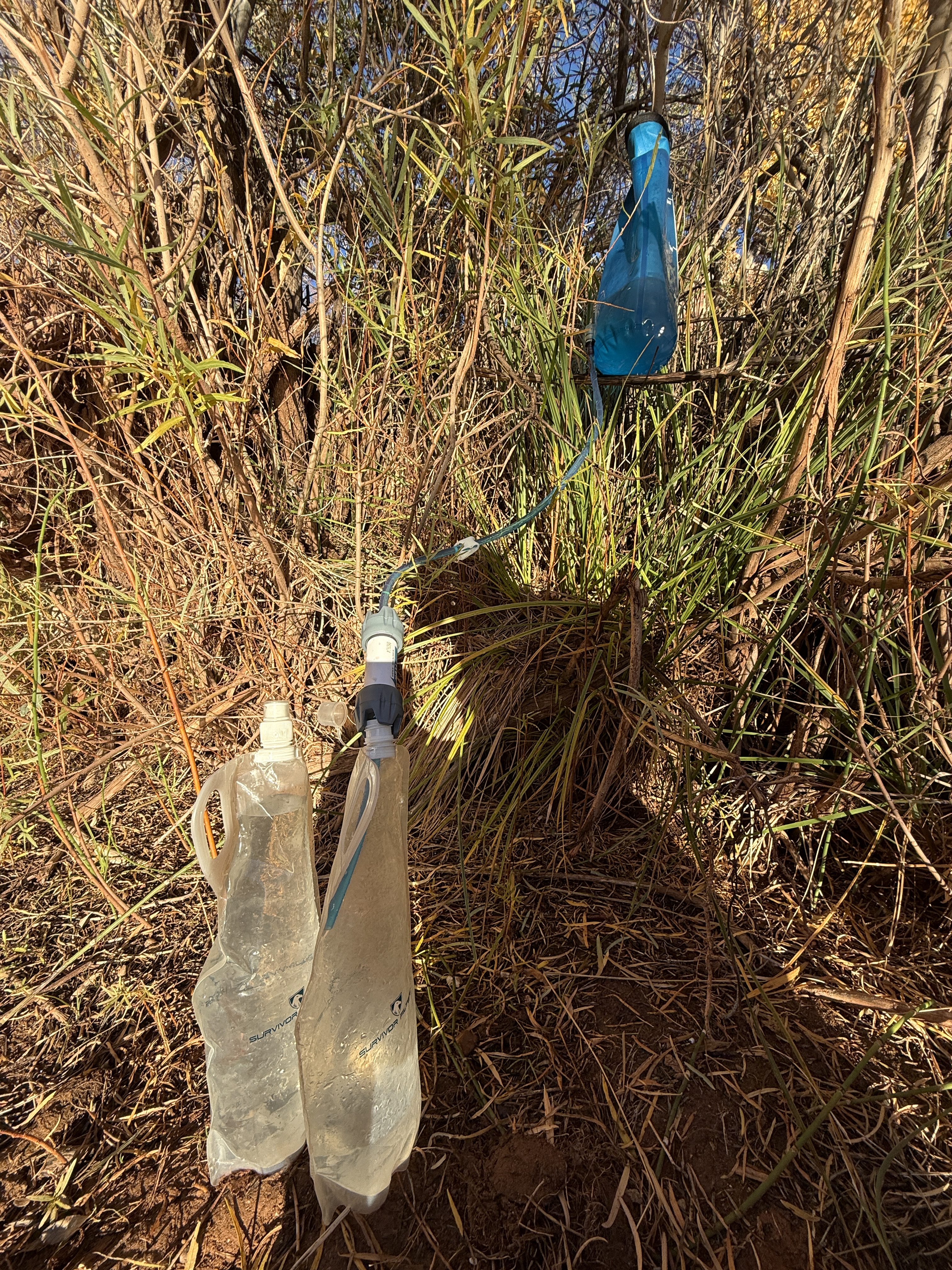
We transitioned from our leisurely pace to loading a day pack for the 10 mile out and back. A stove, a water filter system, some food, and a couple of sleeping bags were stuffed into Jason’s pack. Enough for an overnight on the far side of Hanakoa Stream just in case we were stuck on the other side upon our return. We were now well aware of how quickly things can change out here and made sure we considered all of the contingency plans and just in cases.

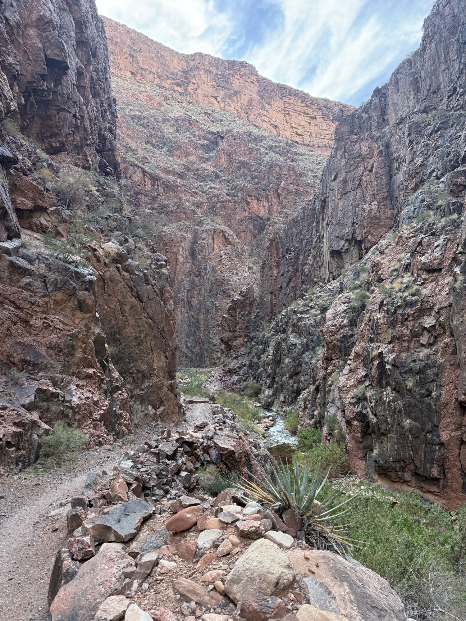
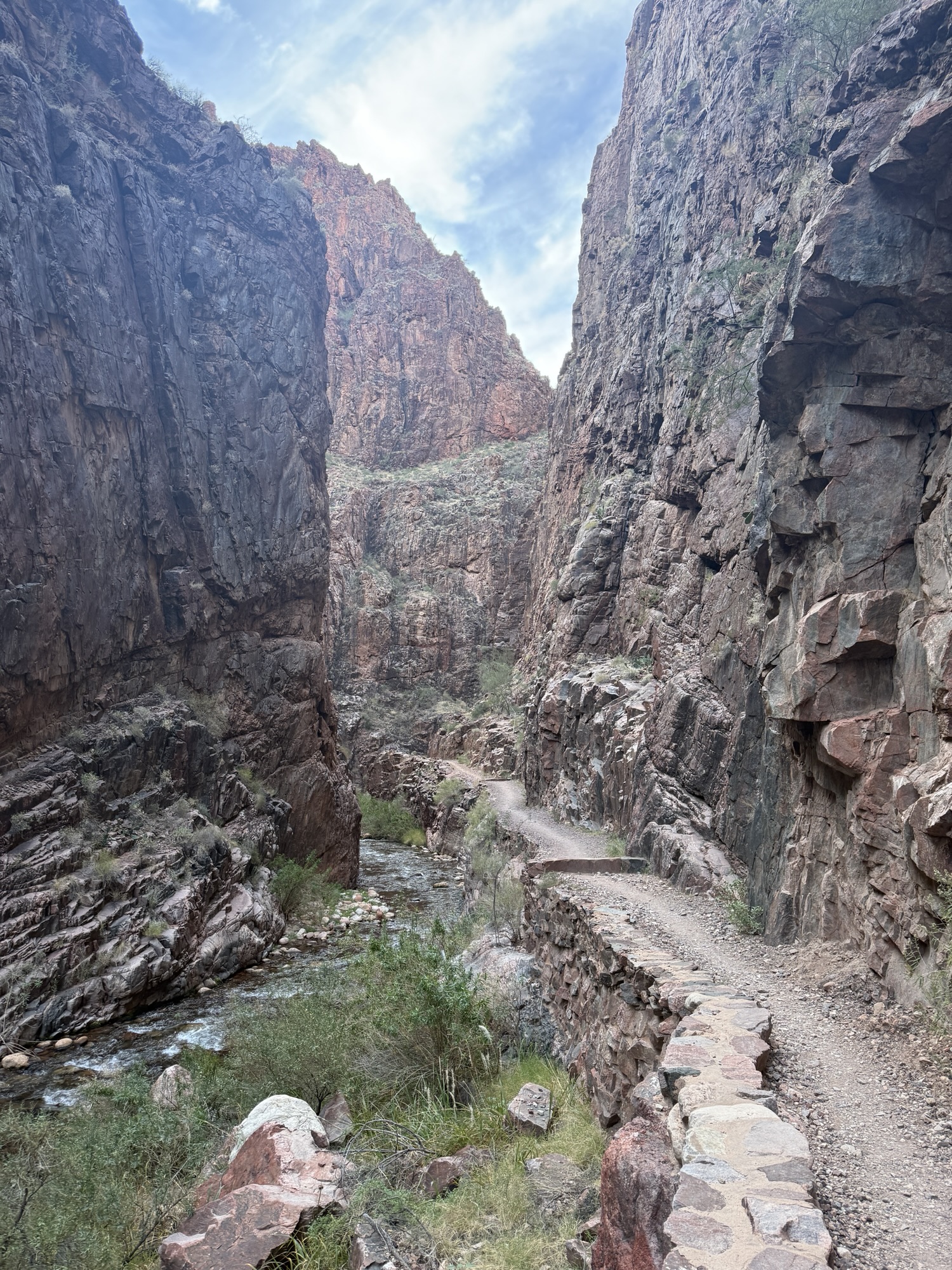
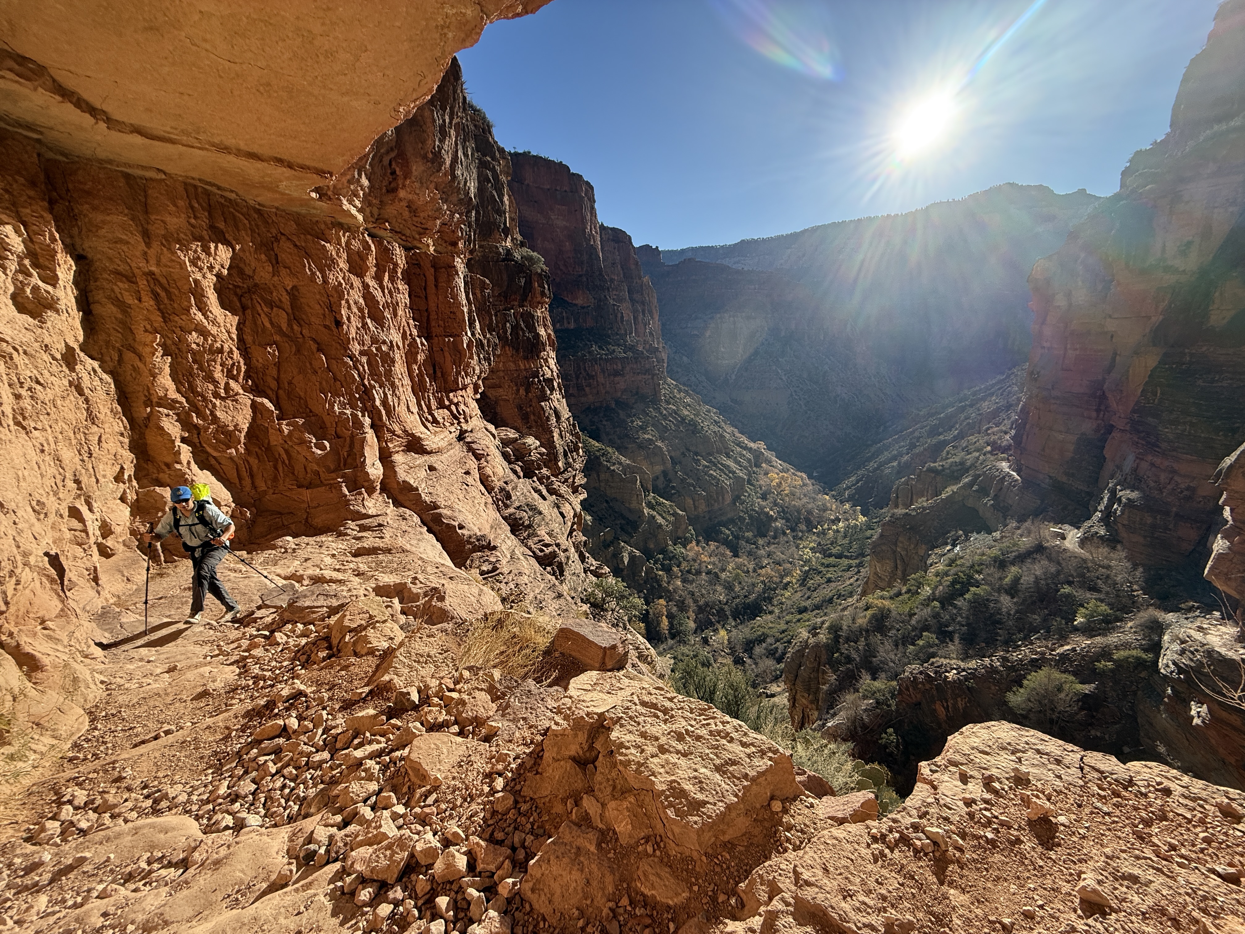
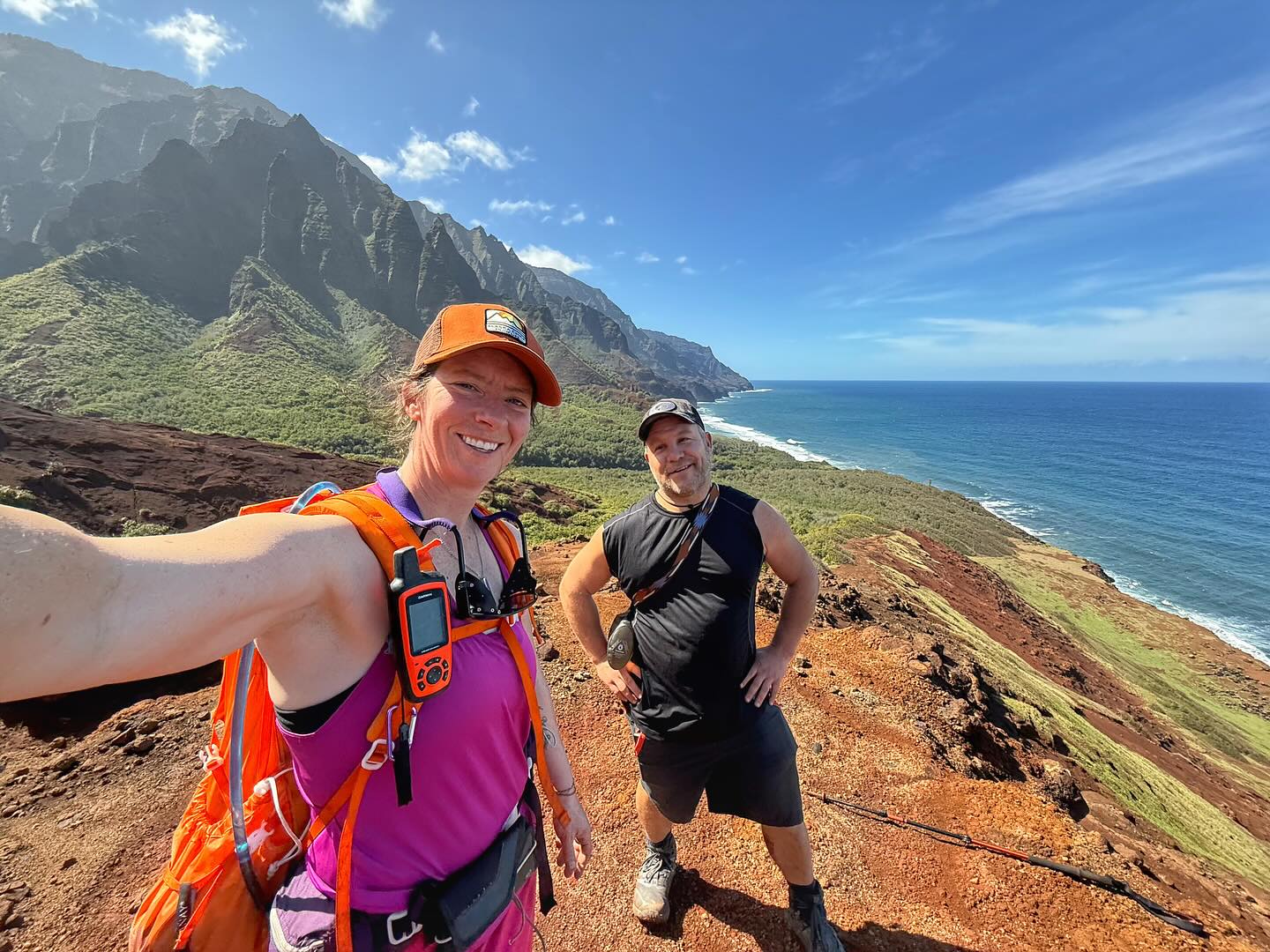
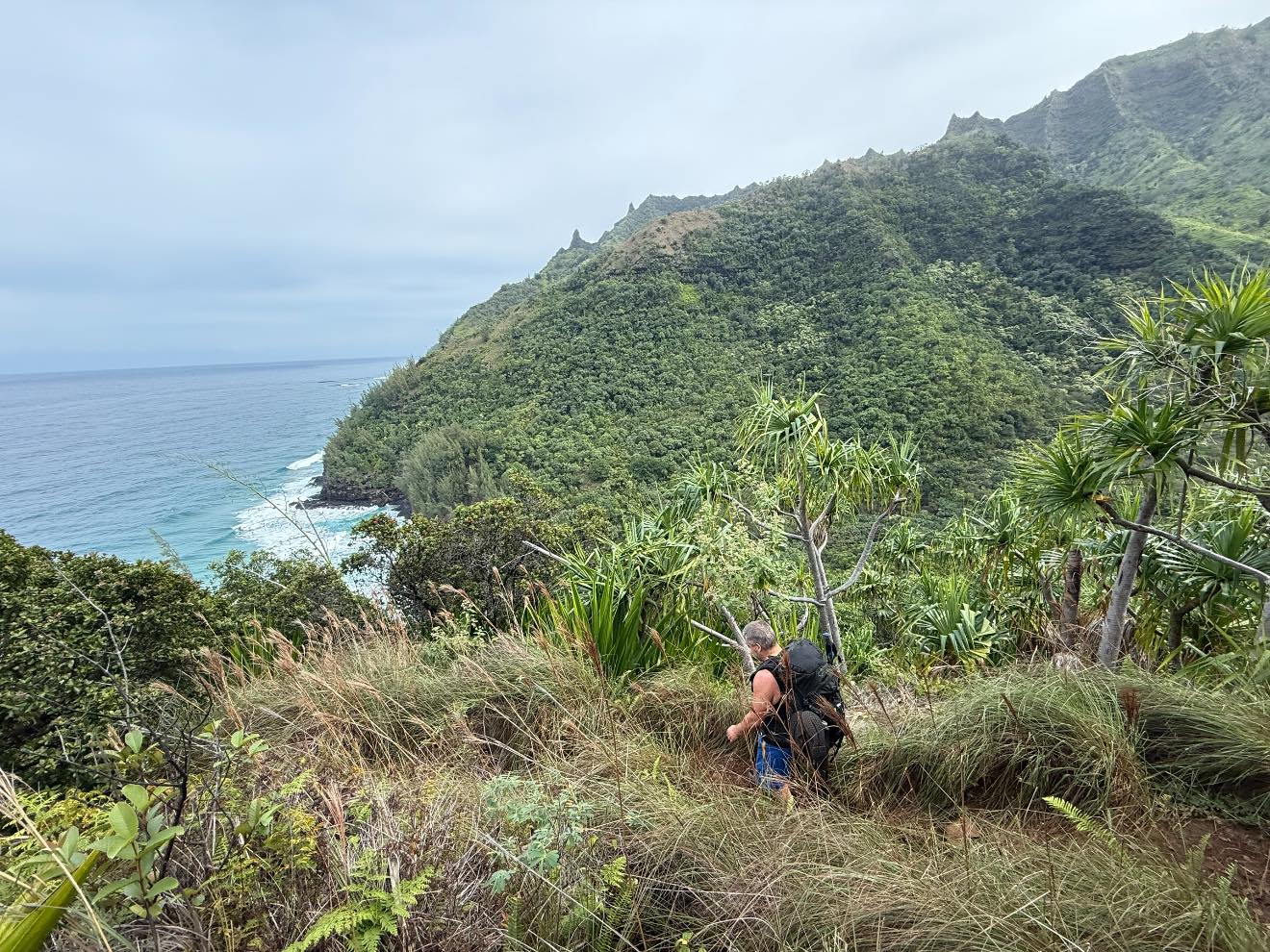
After easily crossing Hanakoa and stashing Jason’s pack in the jungle, we struck out towards Kalalau Beach. We climbed up out of the valley, towards the coast and in no time we were at the sign with the guy falling off a cliff. I had butterflies but was excited to revisit this place with a clear mind. It didn’t look nearly as bad as I remembered it.

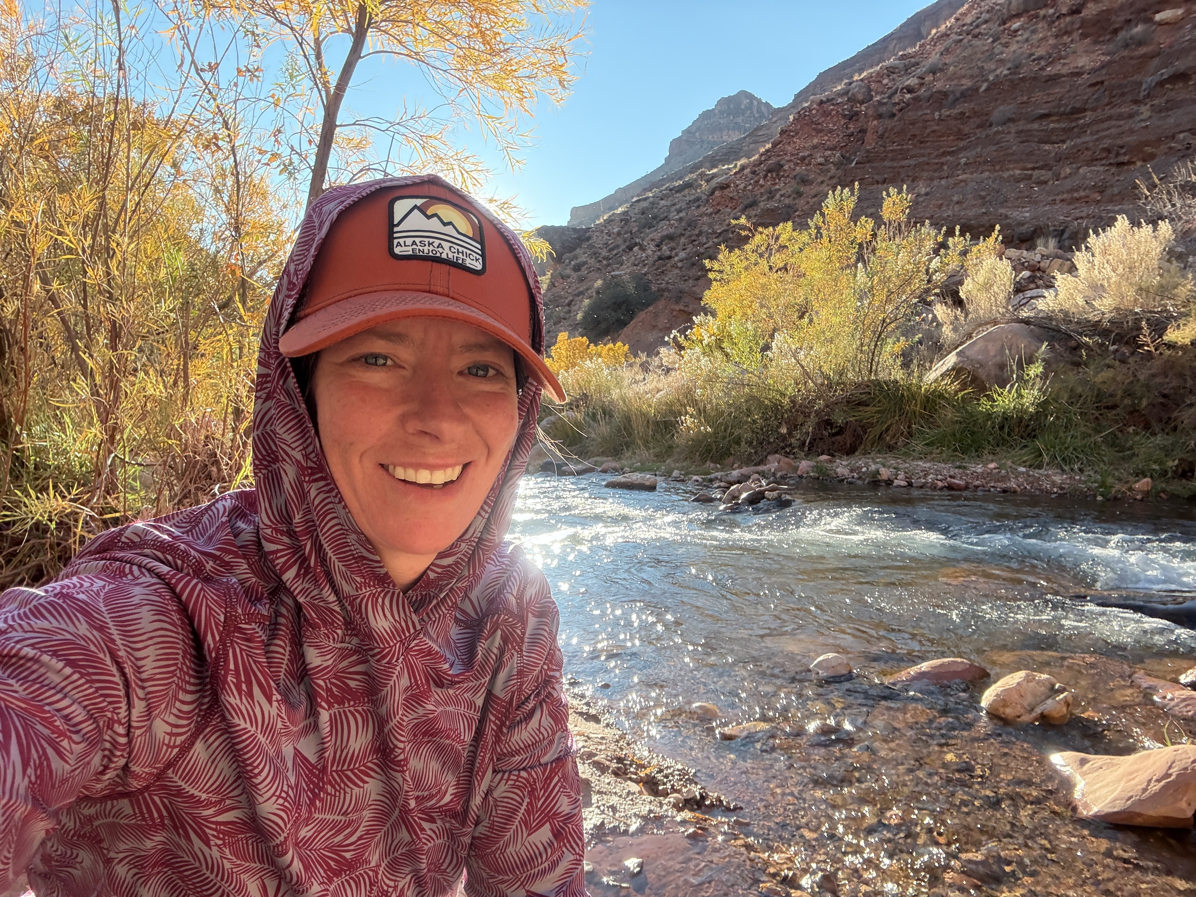
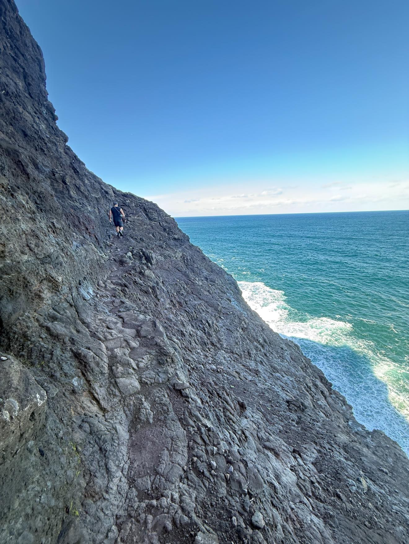
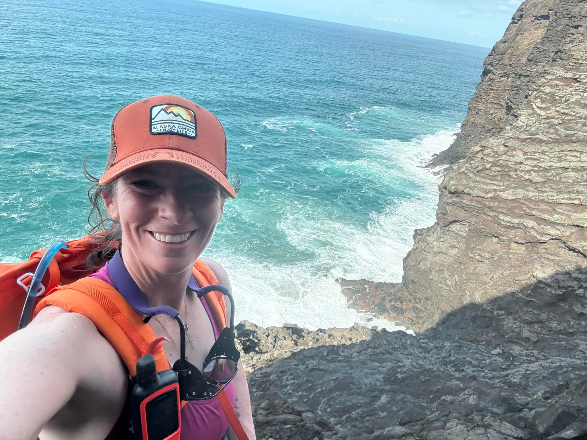
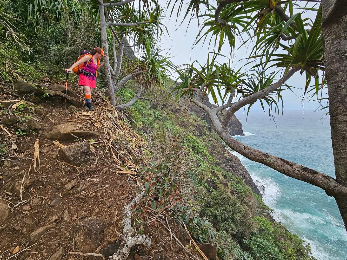
We descended the switchbacks to the ledge and followed the narrow rock path out and around the point. No problem! It felt so much less exposed than I previously recalled, and the rock offered excellent footing. I even filmed most of the way with my phone in one hand, although I put it away before the narrowest section. I stopped mid-way and took in the view and snapped a selfie. I had earned this. I wanted to spend more time on the ledge, to really absorb the gravity of overcoming my fear, but we had a beach to get to, so we moved on.

Crossing Crawler’s Ledge

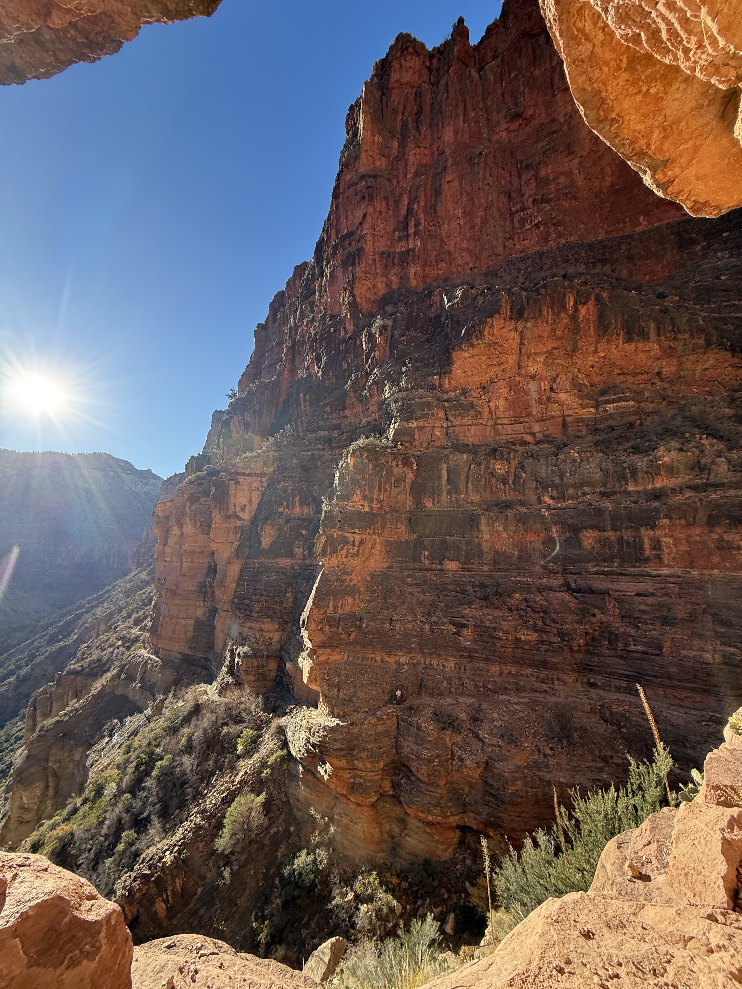
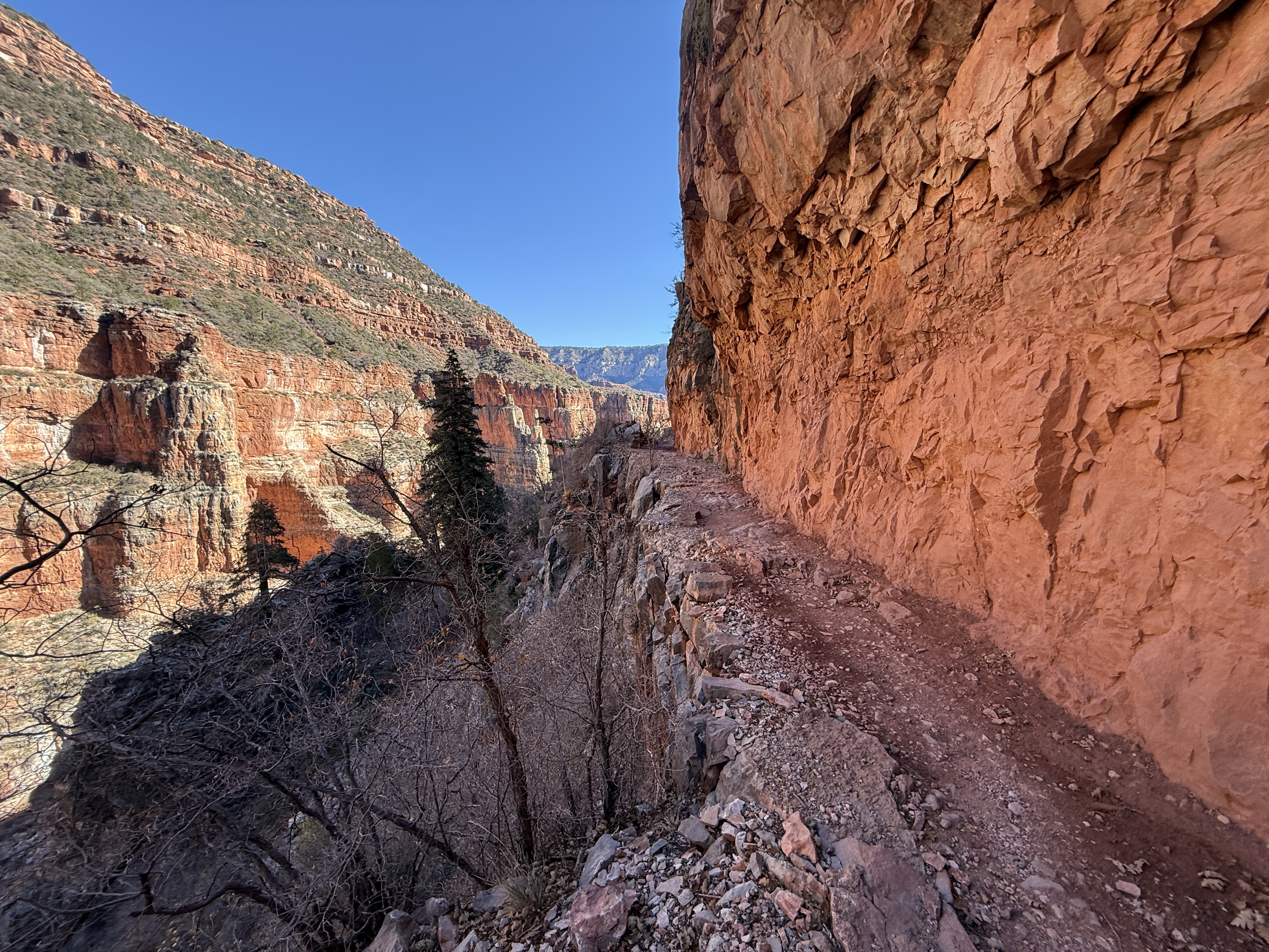
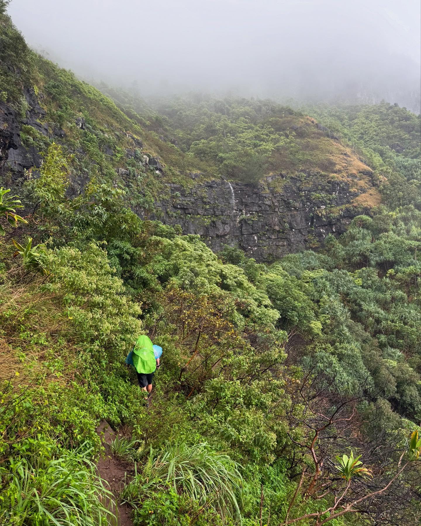
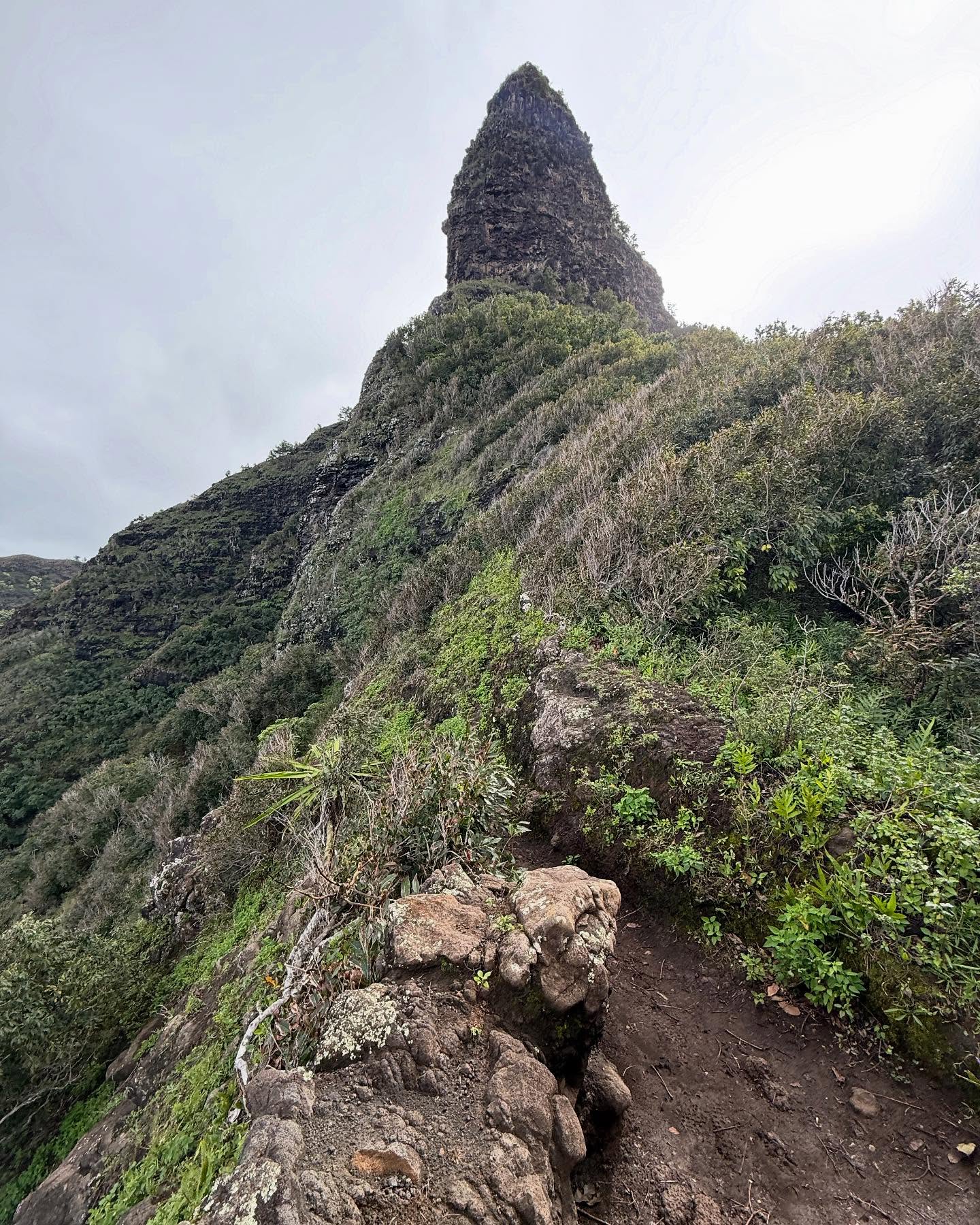
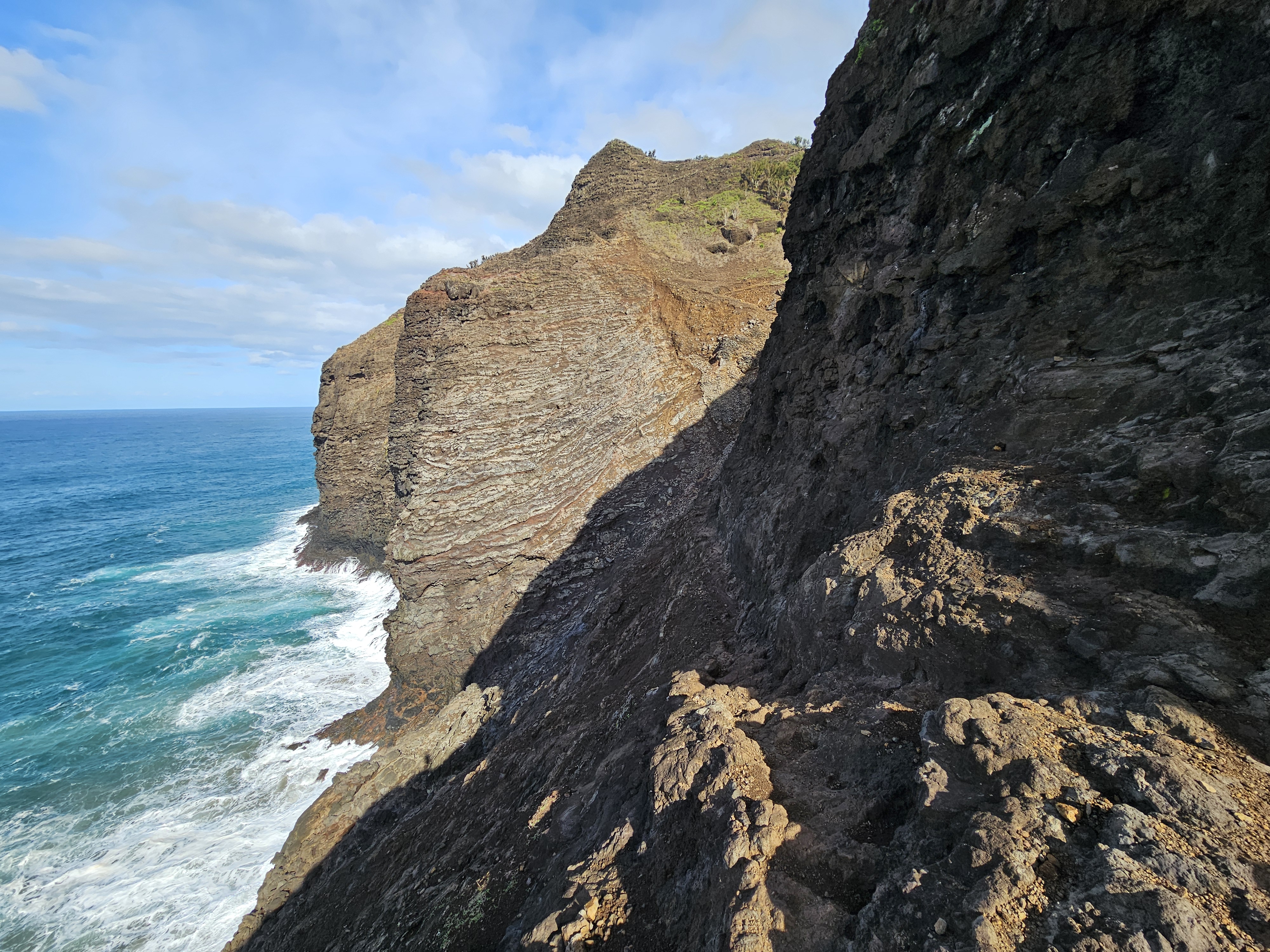
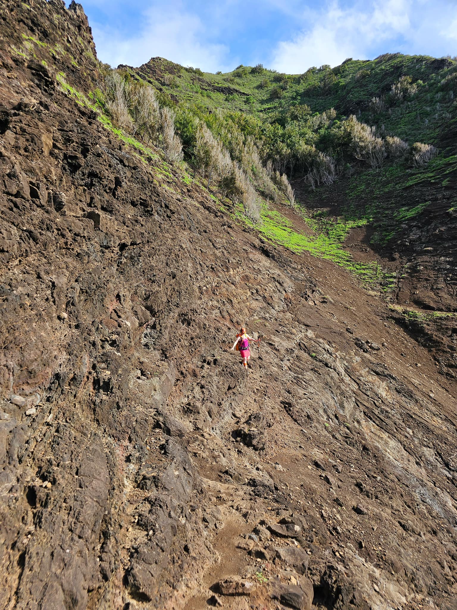
Not far after Crawler’s Ledge, we came to a small nook along the Palis that shows evidence of frequent landslides, loose material and rock strewn down to the ocean. It didn’t have the same angle as it did in 2023 and appeared to be an easy traverse. Jason moved forward as I put away my phone and suddenly a roar from the mountainside snapped us to attention.

I screamed “LANDSLIDE!” as Jason ran back towards me, narrowly missing being hit by enormous boulders and landslide debris. If he had been hit by the landslide, he would have been swept down towards the ocean, likely not a survivable event. I thought back to my solo hike along this section in 2023 when I was oblivious to this danger. I may have even had airpods in. I again realized how stupid I was.

We took a moment to catch our breath, and I was sure we were going to turn back. That was too close… but Jason, was insistent we had avoided the worst of it, so we listened for a while for any additional debris coming down. When we were sure the saturated land had all let go, we ran across the slide debris to the safety of the far side. Looking back and up, we could see where the slide had originated, about 150′ above us, a wide swath of vegetation and hillside just gone. We forged ahead.

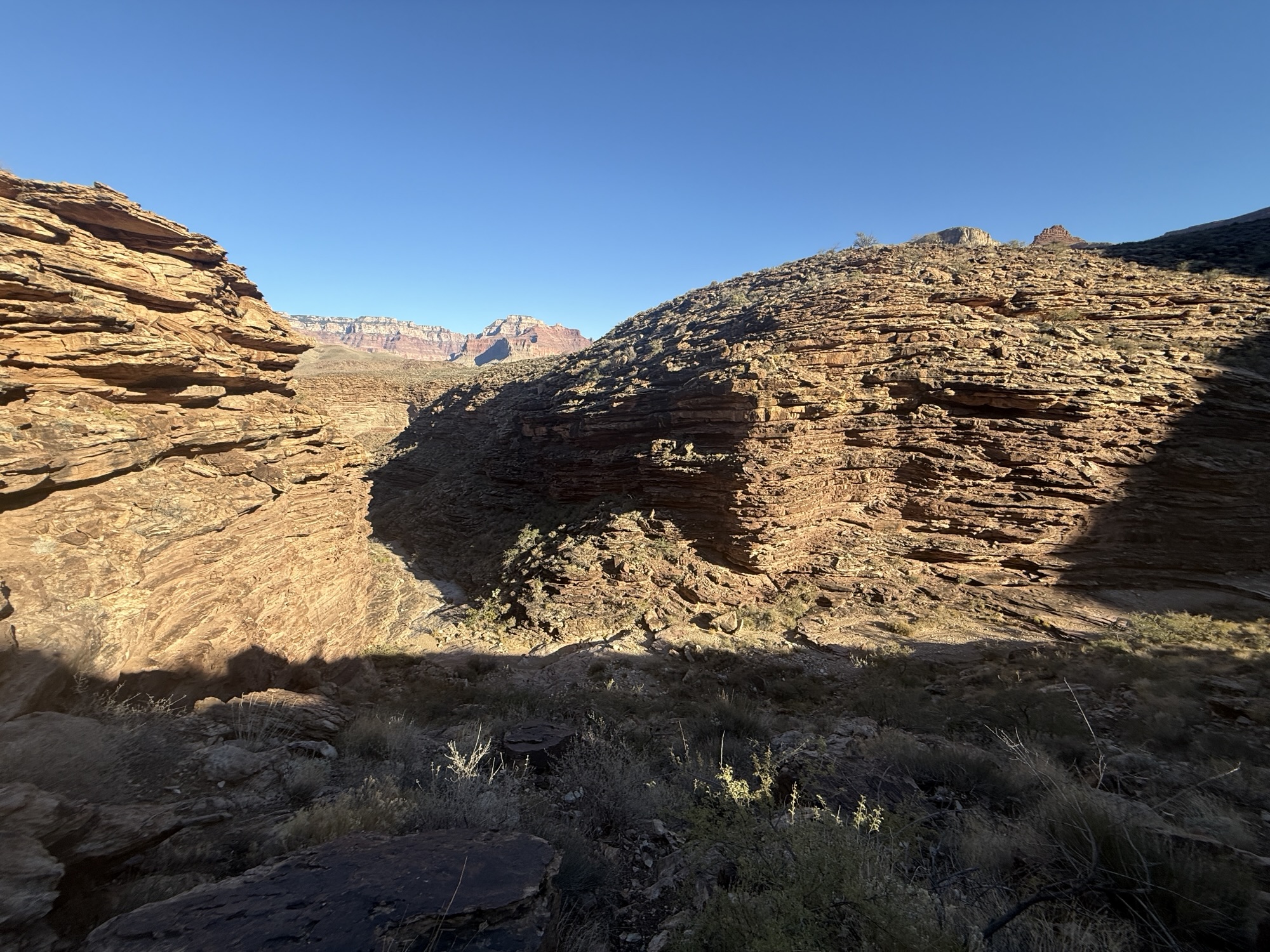
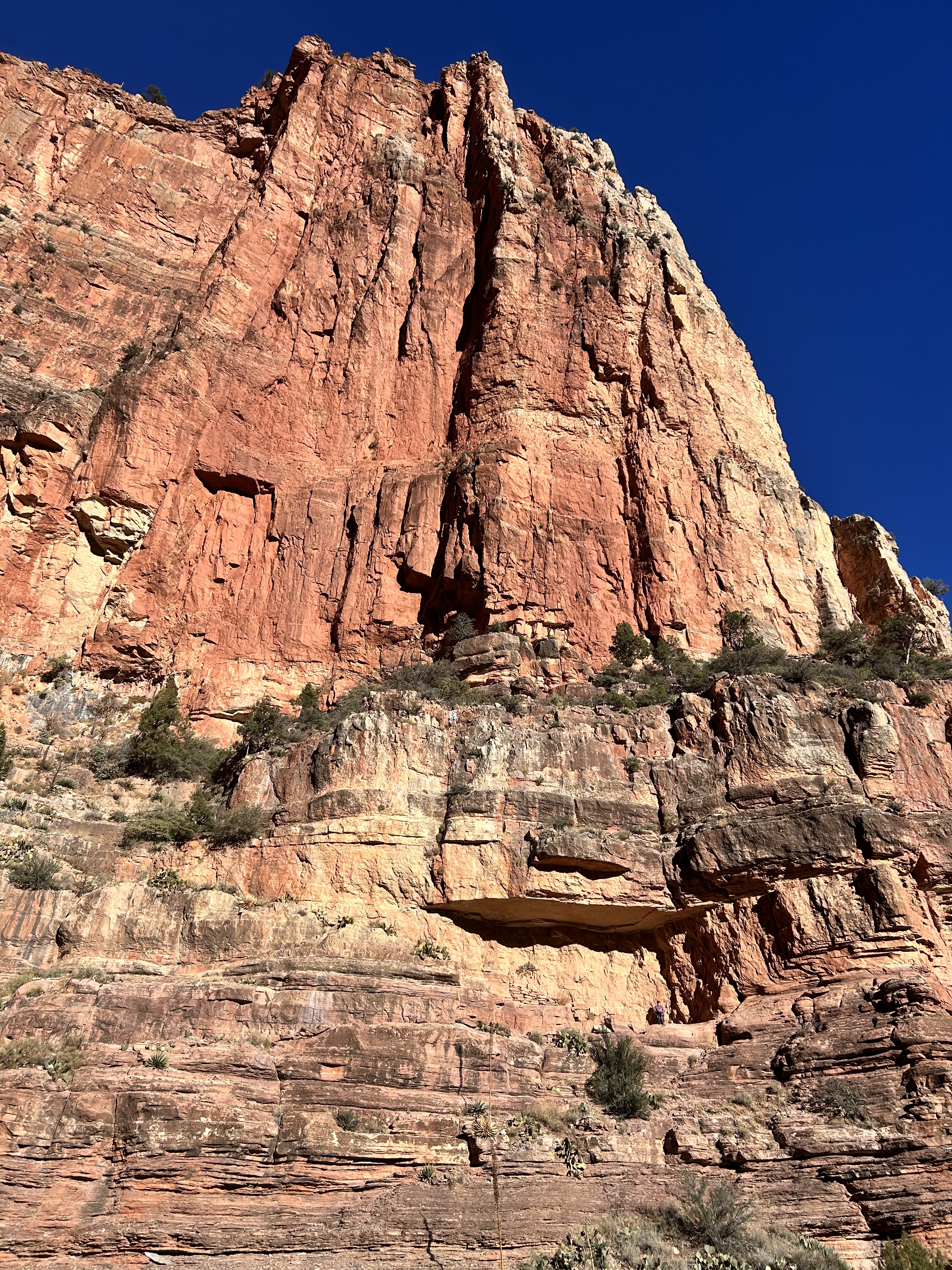
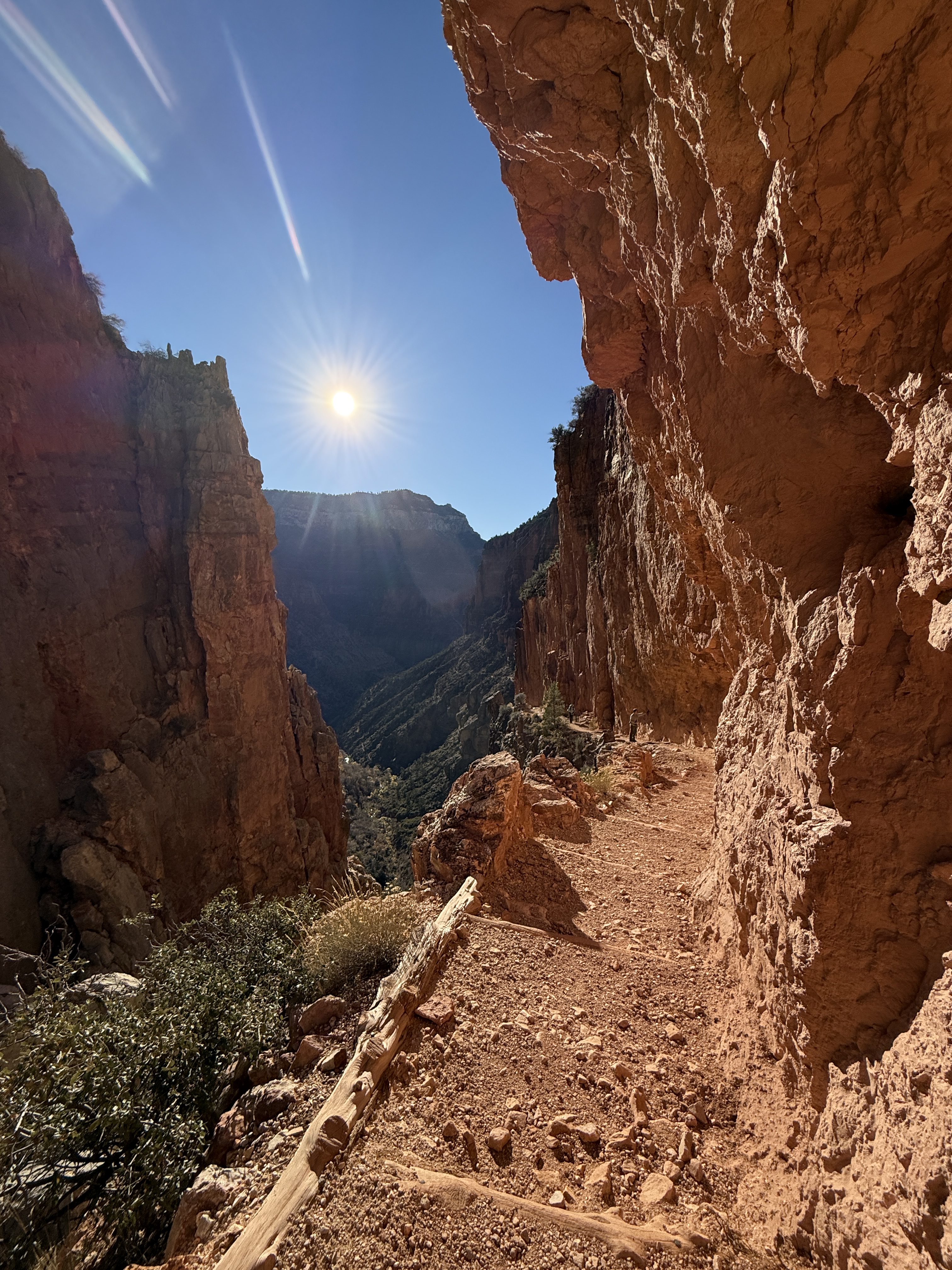
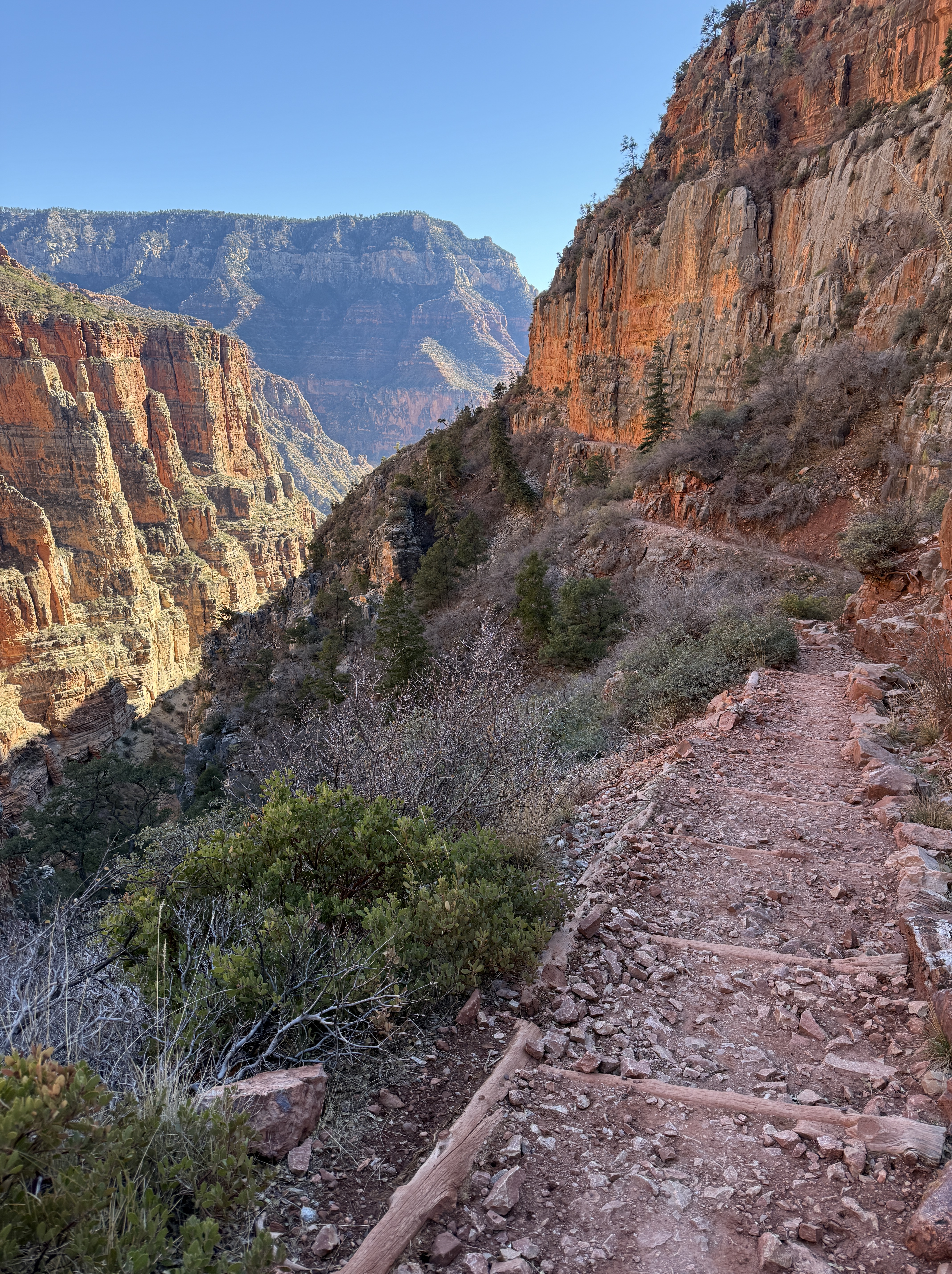
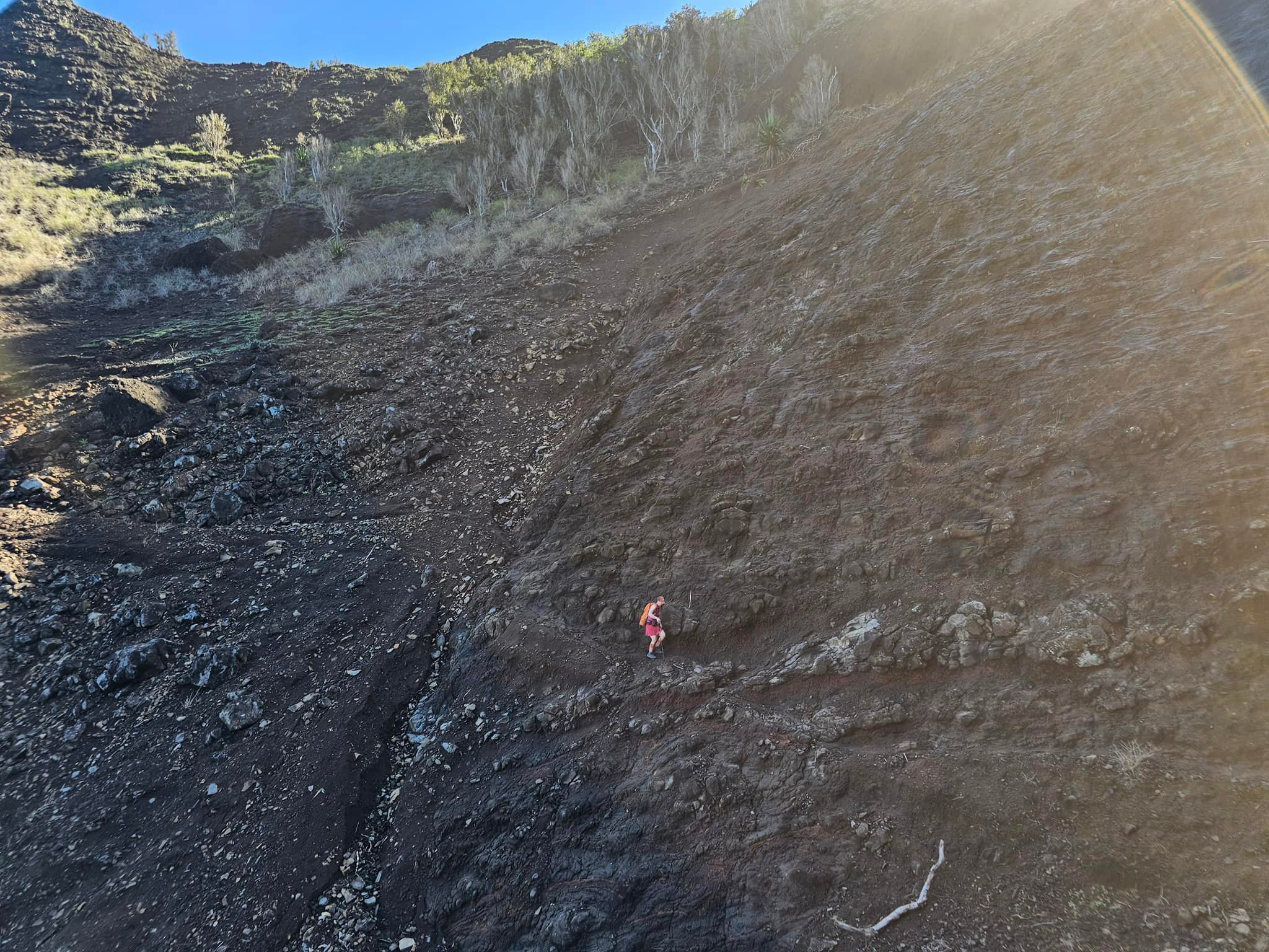
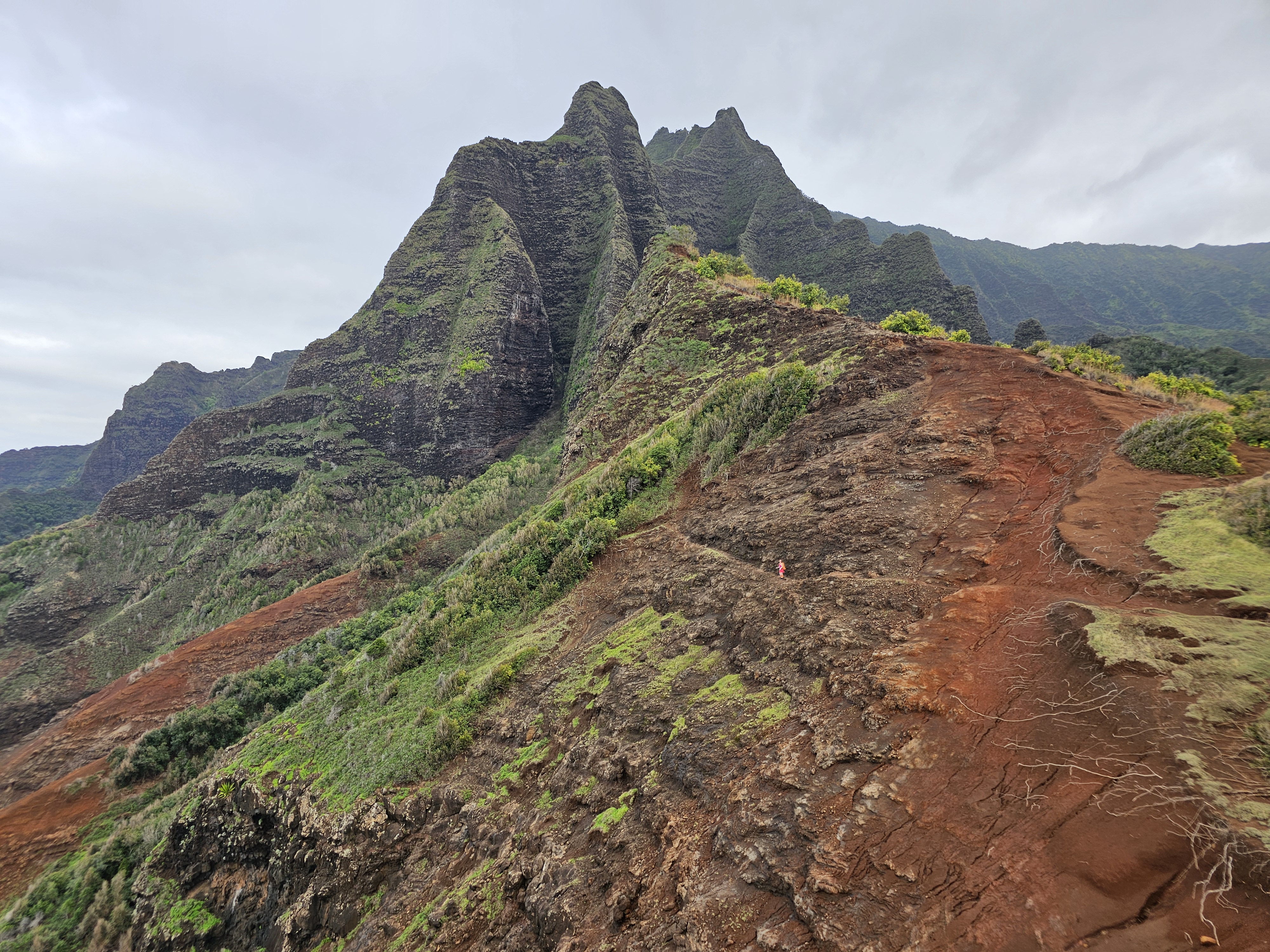
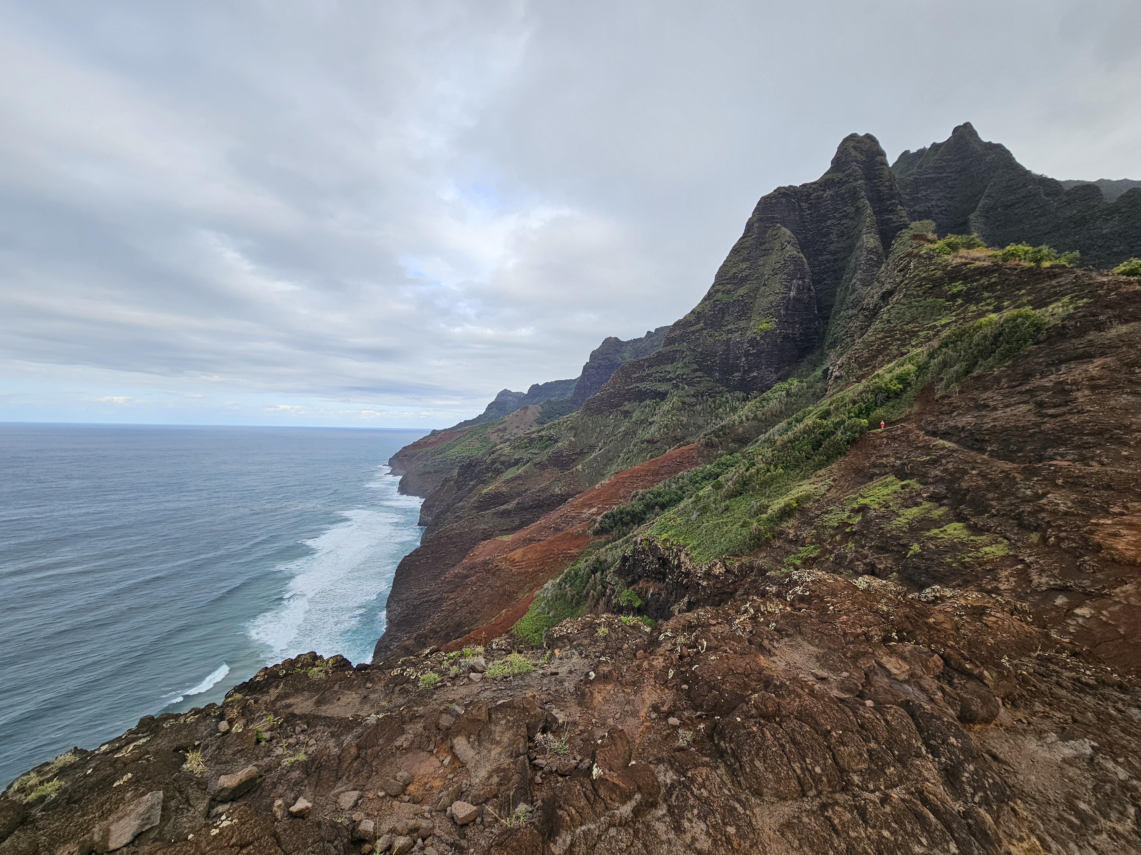
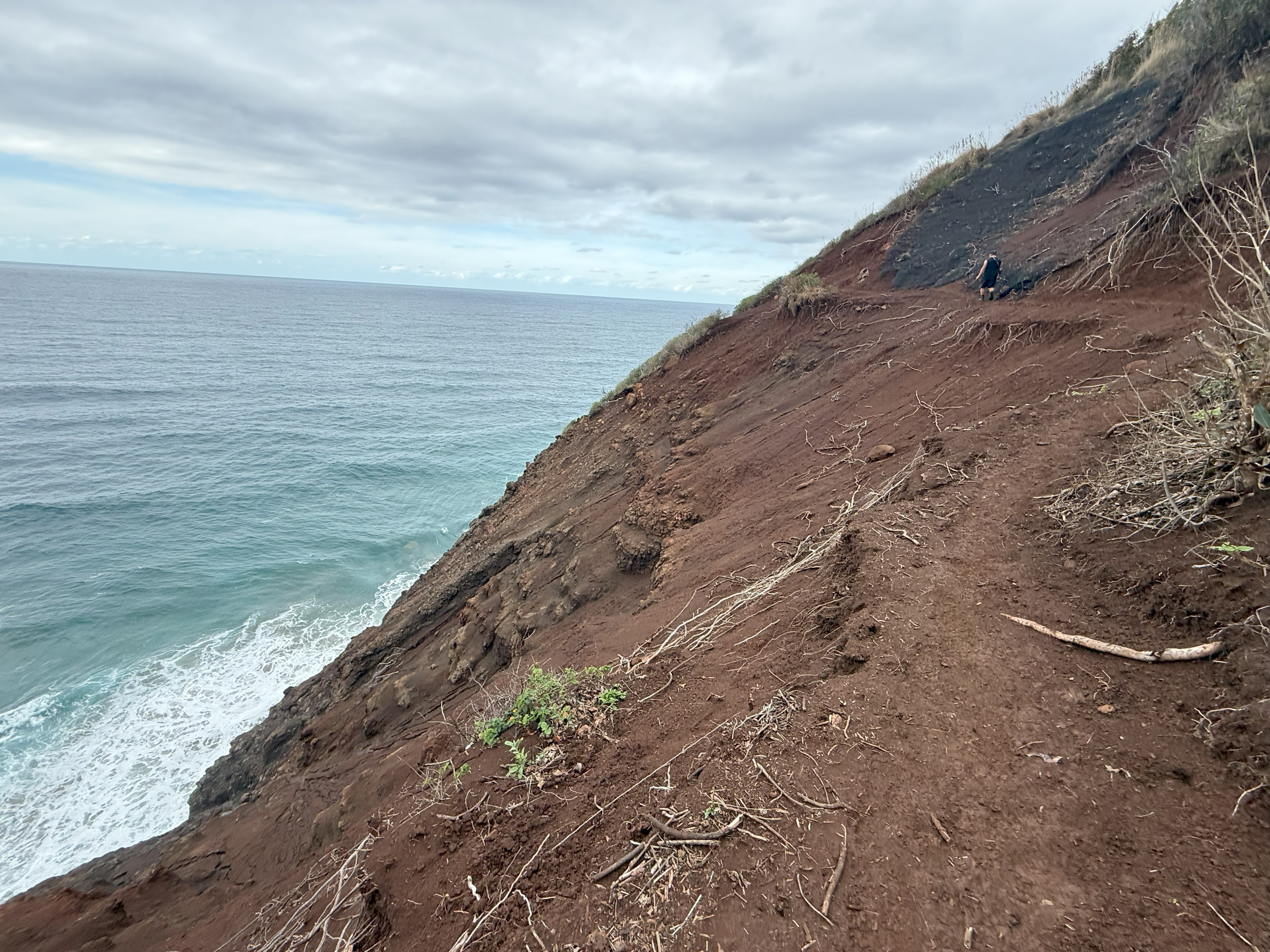
The next couple of miles skirted along the coast, many areas washed away from the recent heavy rains, leaving whole sides of the trail just wide enough to walk on, with a dropoff of hundreds of feet to the ocean. We continued to keep an eye and an ear above us for any more dreaded landslides and we made our way quickly across these obvious danger zones. I realized then that Crawler’s Ledge was probably one of the safest parts of the trail.

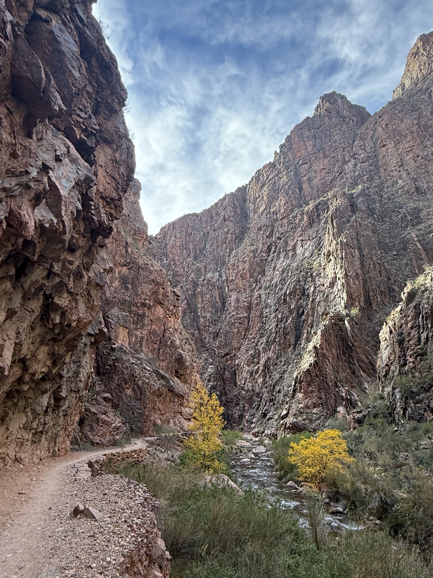
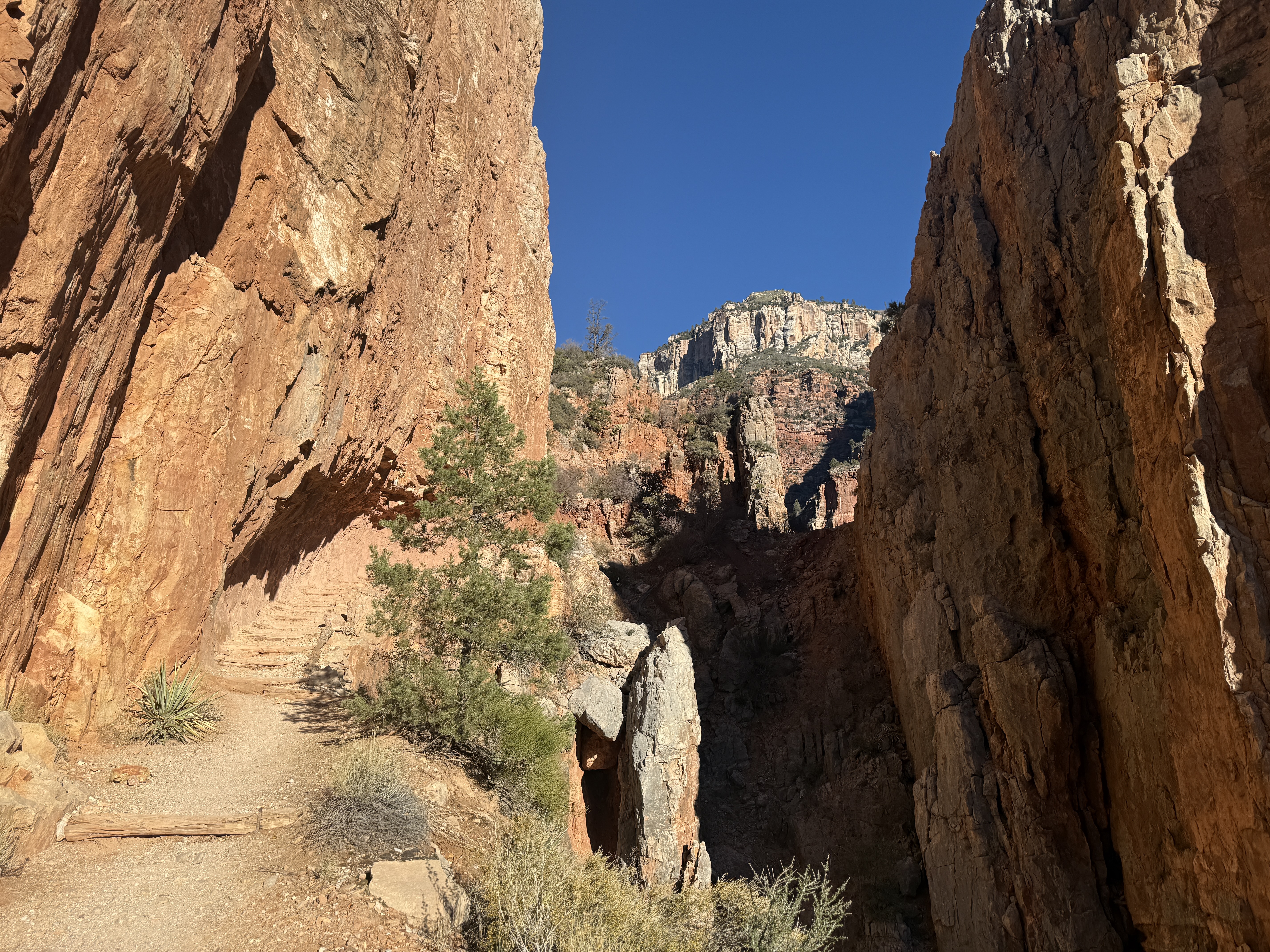
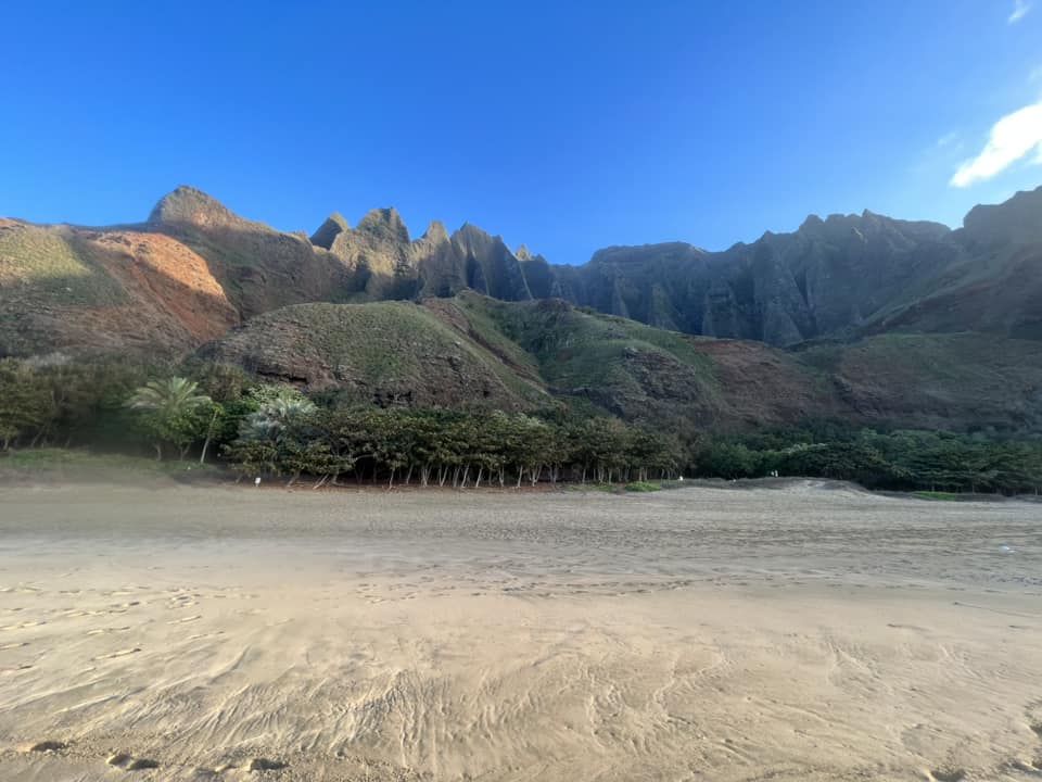
I still felt confident, with no bouts of vertigo, as we approached the old wooden Kalalau Valley sign. We had made it to the Red Dirt Hill and beyond most of the dangers. Descending the gradual 400′ to Kalalau Stream, we both breathed a sigh of relief and chuckled. We had made it.

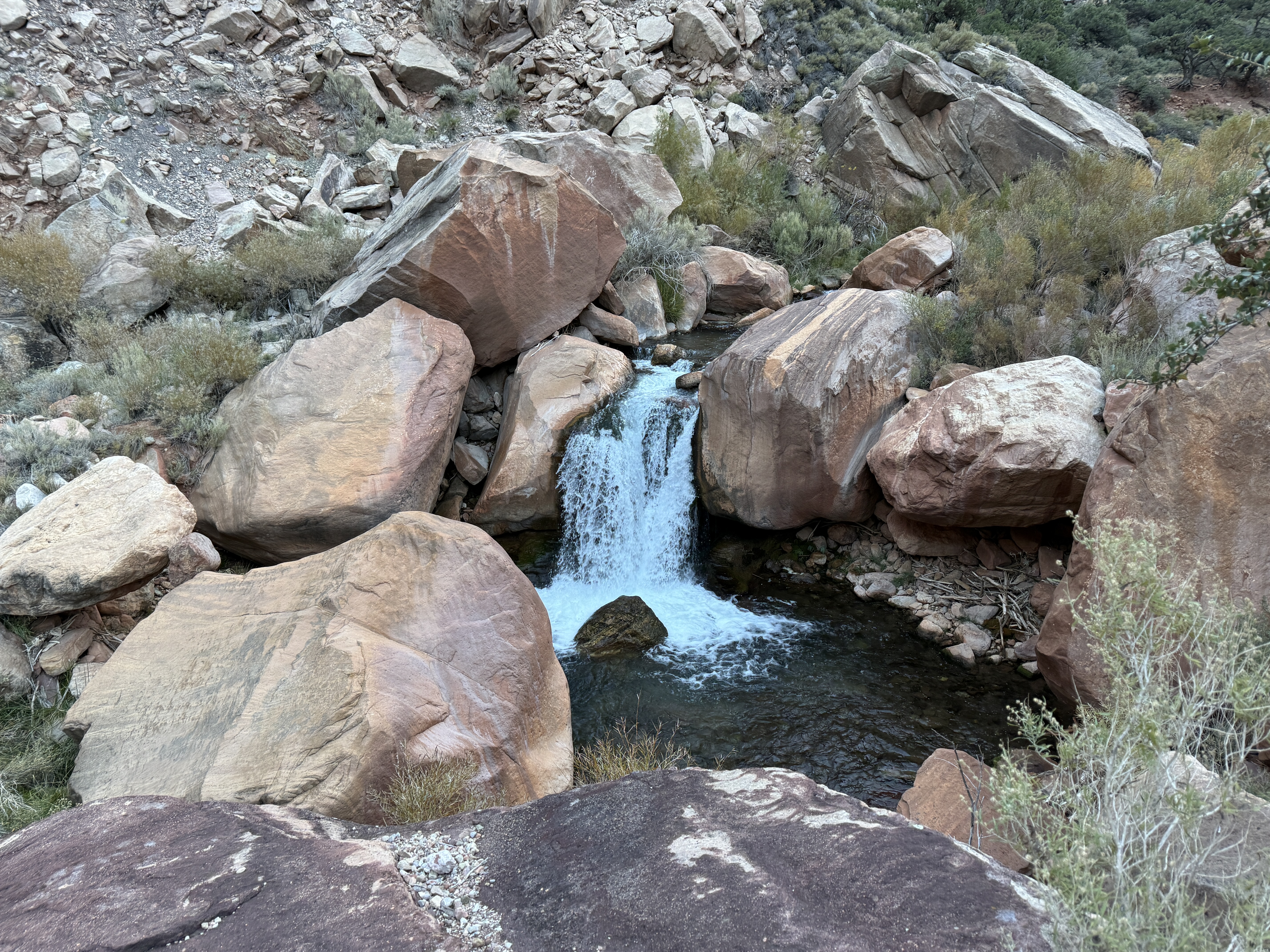
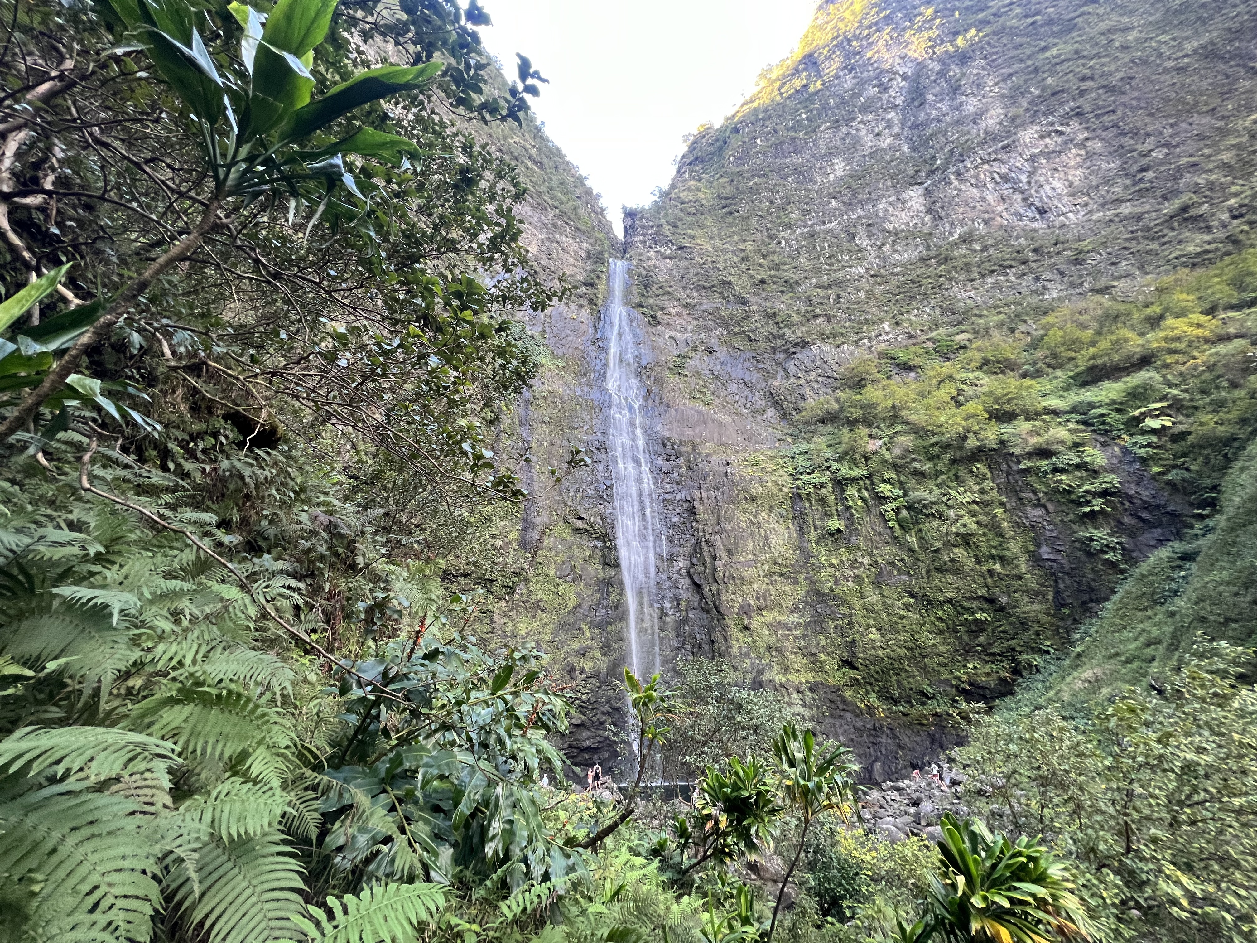
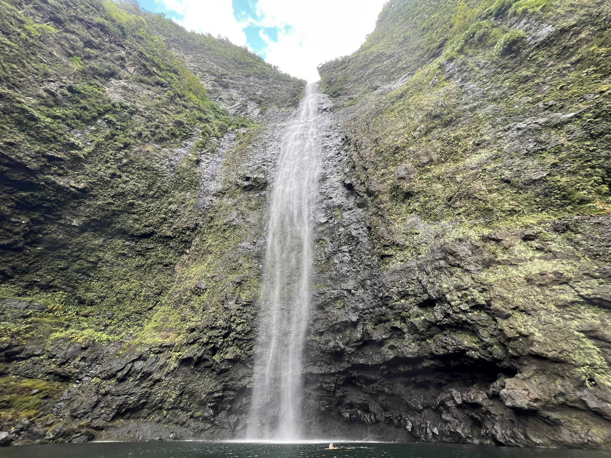
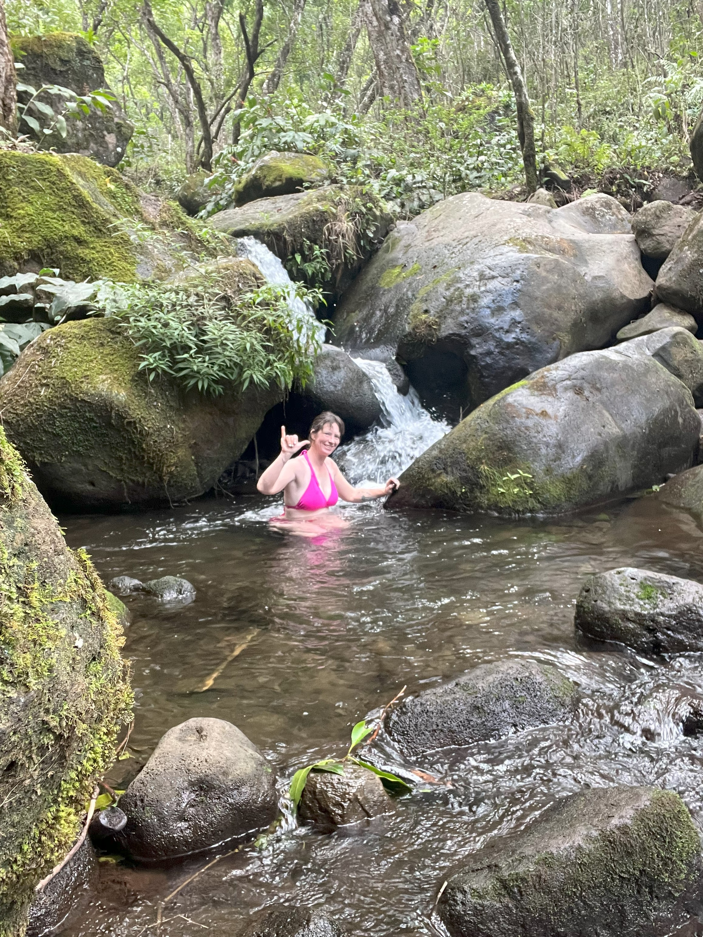
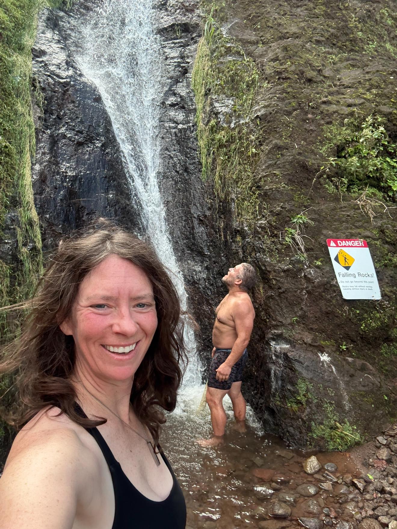
Jason found a great rock hop route across the stream and we were soon at the boundary of the Kalalau camping area. I found the campsite from my 2023 trip and then caught up to Jason at the waterfall, where we showered with the help of a pvc tube that had been cut to direct the water away from the vertical rock wall into a stream of water that would beat any shower’s water pressure.

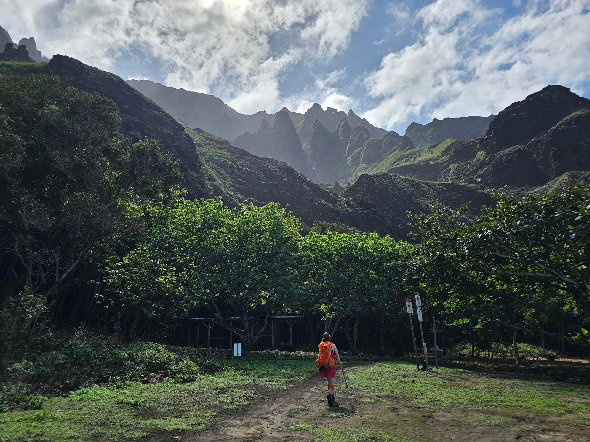
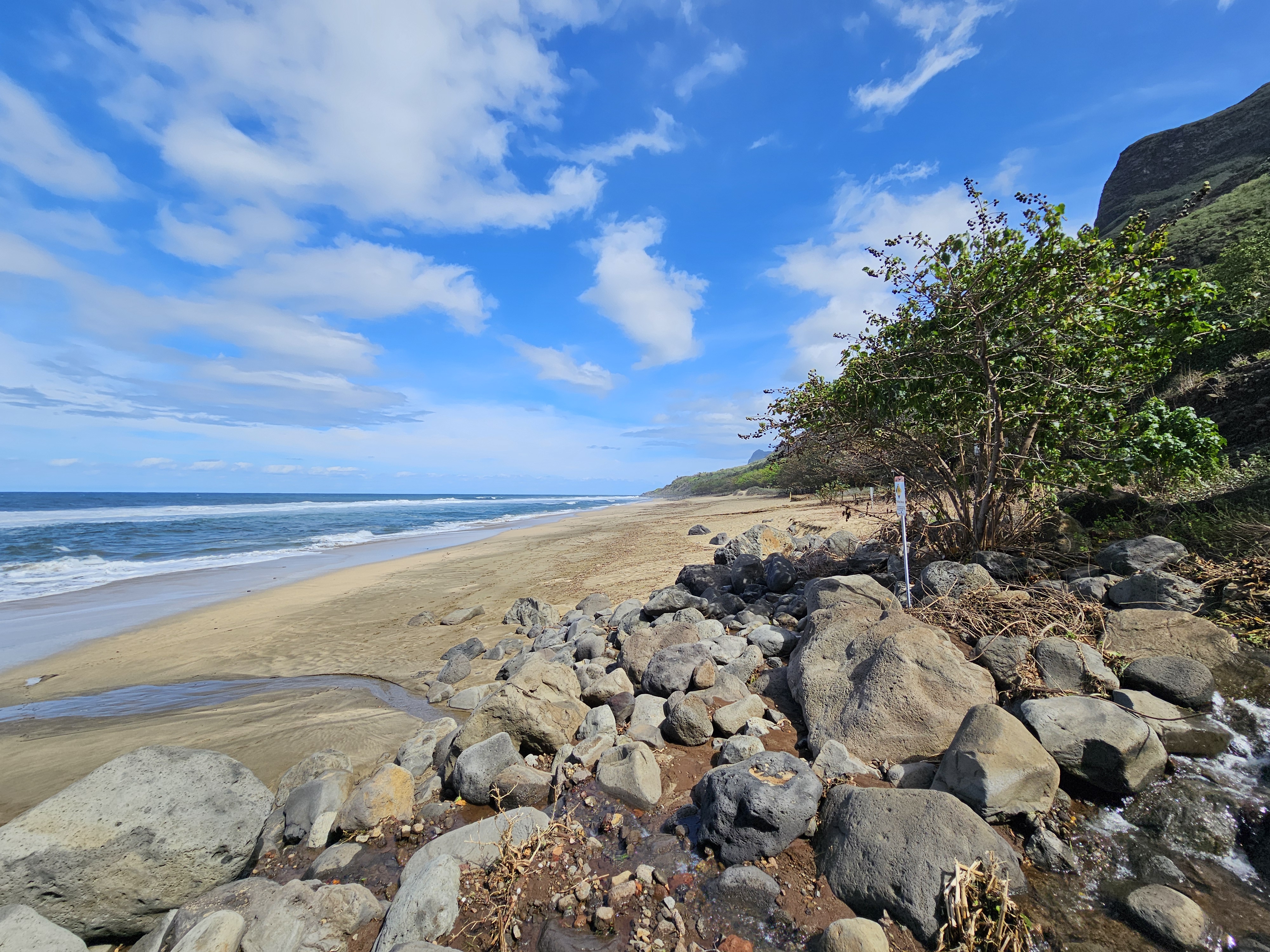
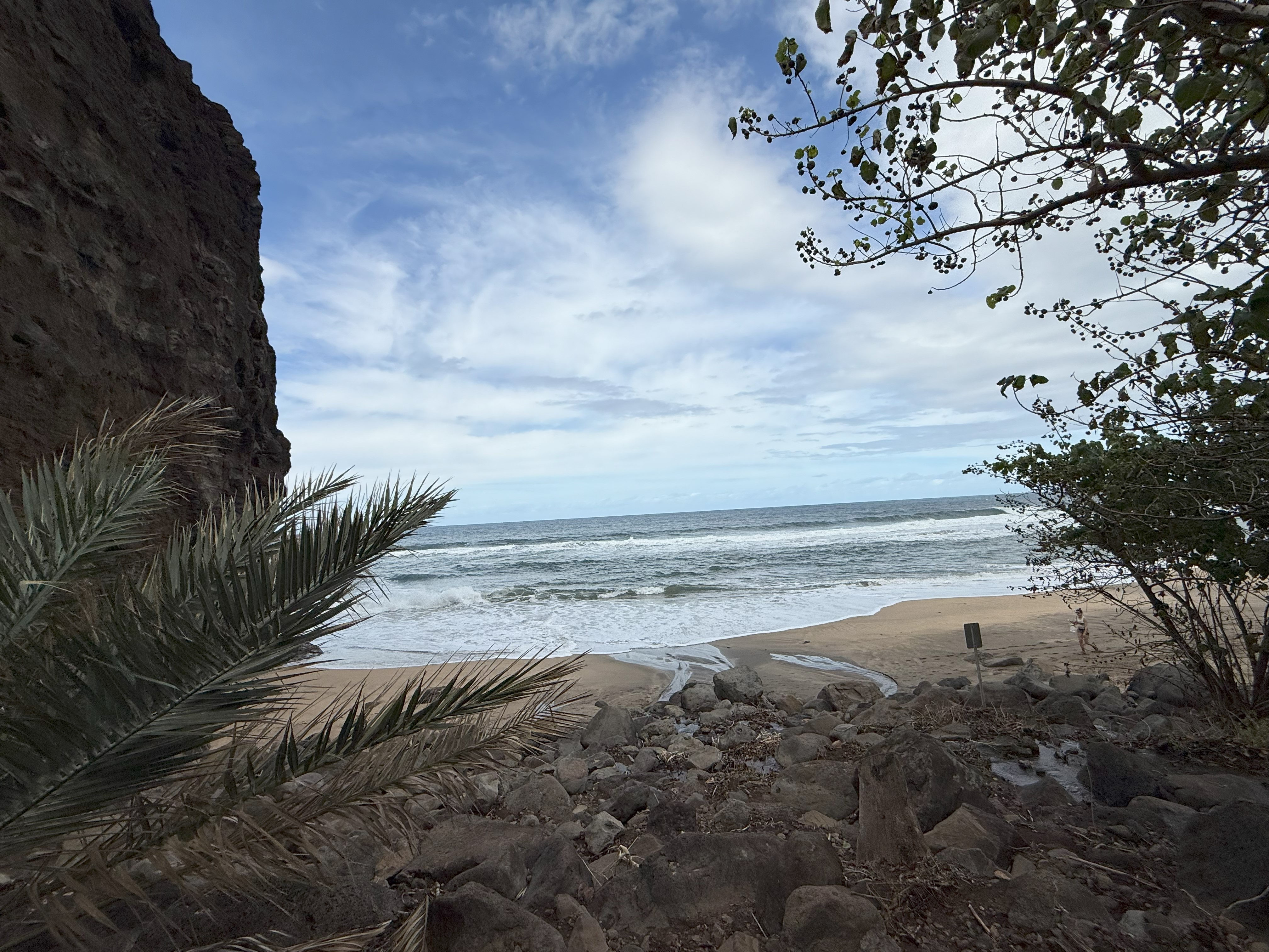
Rejuvenated, we made our way down to the beach, walking along in the sand, but not taking any chances with the large winter swells to risk swimming in the ocean. I spent some time reflecting on the past couple of years and on how thrilled I was to be back, although disappointed to not have the opportunity to trek out Kalalau Valley.

I didn’t have time to fret about that missed opportunity for too long though; after taking plenty of pictures and videos, I could tell Jason was antsy to get moving on the 5 mile hike back to Hanakoa, so we donned our sneakers and headed back the way we had come.

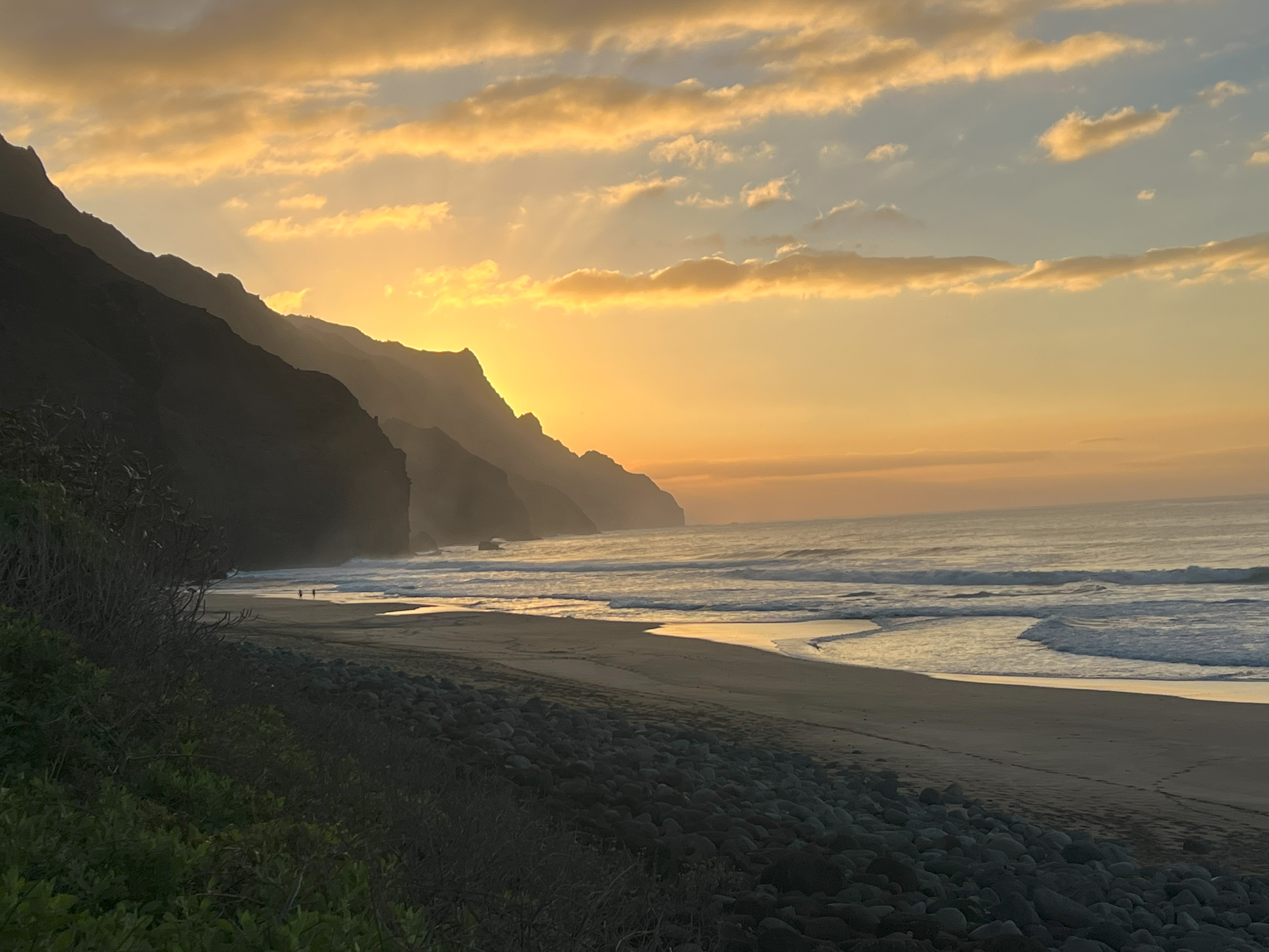
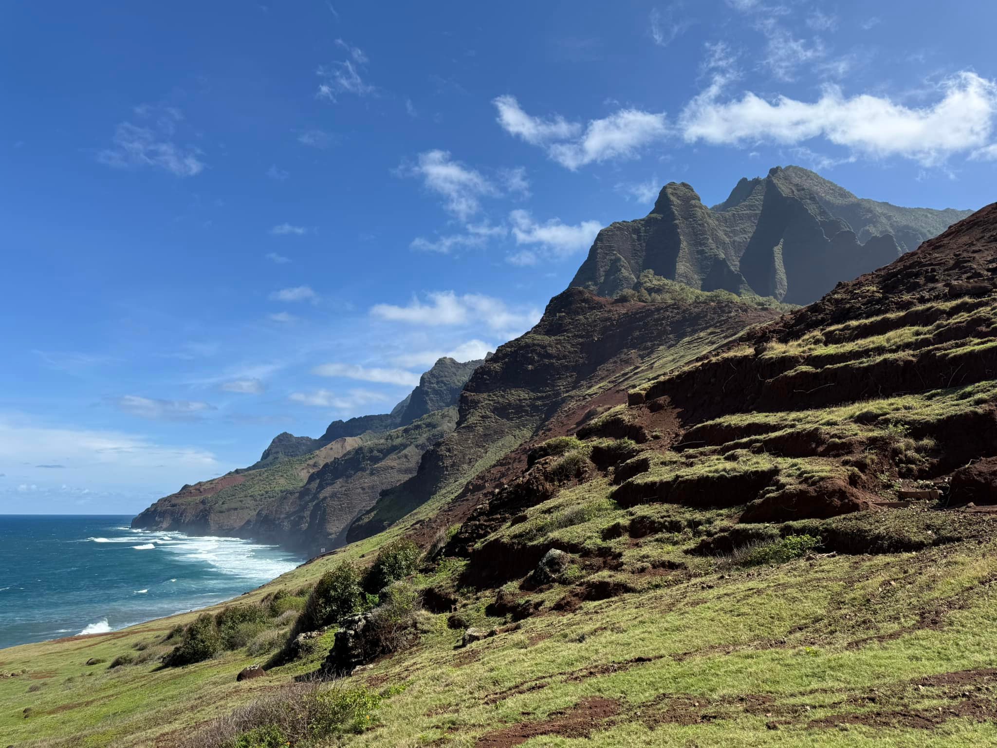
The return was uneventful. A hot, sunny day had allowed the land to dry out and firm up, leaving great footing and plenty of opportunities for taking in the incredible views. It was one of those days where the greens of the vegetation are blindingly brilliant, and the color of the ocean from high above was a vibrant teal.

Arriving back in Hanakoa with plenty of time to make dinner and relax, we crossed the still low stream, stripped off our hiking gear and went for a swim. It was ice cold and refreshing. It felt good to be clean and safe, but even better, I slept that night knowing I had attained redemption that I didn’t know I would ever get.

Day 4

The morning of the 29th we took our time breaking camp, knowing we had until late afternoon to hike the 6.5 miles back to the trailhead to meet our ride. Thankfully the forecast was wrong, and it was another day with pleasant weather. We marveled over how nice the dry trail was, reminiscing about the monsoon and marveling at our unhinged stubbornness for navigating these Palis in such conditions.

We waved to boats whose occupants watched us, hundreds of feet above them walking on a sheer cliff, and I wondered what it would be like to see it from that perspective. I spent quite a bit of that time thinking about a summer kayak trip to Kalalau to finally get the opportunity to explore the Valley that had stayed just out of reach.

Besides some minor rockfall that we were able to sprint past, the walk back to Hanakapi’ai was enjoyable, although we did have some concerns for those heading out toward Kalalau, since the forecast hinted that the weather would be much worse than what we experienced. (The trail was, in fact, closed the night we came out due to flash flooding and landslide dangers).

Crossing Hanakapi’ai, I was too excited to worry about not getting my feet wet, wading through the water to the “day hiker” side of the stream. We came across a man who had slipped and fallen on the rocks and after a doctor evaluated him, I used my InReach SOS button for the first time in 5 years.

The trail completely disintegrated for the last two miles, a muddy mess from the masses of hikers that obtain day permits to walk the 2.4 miles out to the stream. We struggled with the sudden transition to busy sidewalk from the desolate and sparsely populated trails beyond the day hiker turn around point. Frustration grew as we weaved our way through the throngs of people while simultaneously trying to keep our footing.

We made it back to the trailhead with a mixture of relief, pride and longing to still be walking along those cliffs that two years earlier had broken me down to nothing but now felt like an old friend.

We heated up water for instant coffee and ate the last of our food, excited for a hot shower and a meal from a restaurant. Our ride showed up not long after our agreed meeting time of 4pm and brought us to shower at Lydgate Beach Park. Don’t do this. An unhoused person was blocking the entry to the men’s bathroom, and no other people were around, so Jason and I both showered in the pressure washer stream of ice water in the open-air showers of the women’s side. It was a rude awakening after longing for a hot shower, but I can say that I was completely exfoliated by the firehose jet of the shower head, even if it was hypothermia inducing.

We found our way to dinner at Monico’s, a Mexican restaurant in Kapa’a. Five stars, 100% recommend. By 9pm we were back at the airport, repacking our bags and navigating in a somewhat dreamlike state through agricultural inspection, bag check and security. Our plane took off on time, barely missing the incoming storm, and I settled in for a long flight, satisfied that I had accomplished something that would finally allow me to remember this place with excitement, joy and peace.

Just The Tips:

  1. Permits open 90 days out and often sell out quickly. There is no lottery, it is first come, first serve.
  2. Hammocks are preferred for this trail. There are ample places to set one up at both Hanakoa and Kalalau. Hanakoa does not offer many tent camping options, but there are a few spots clear enough to pitch one.
  3. Nights at Hanakoa can get chilly. I used a 40-degree bag in 2023 and was cold. My 30-degree bag was perfect. Remember that if you are hammock camping, you may get more chilled because of the airflow beneath you.
  4. Be prepared for a change of plans, especially in the winter. Consider booking 3-4 nights in case of inclement weather or emergency.
  5. As someone who made this mistake, Do Not attempt this trail alone. There are too many opportunities to completely disappear, whether it be due to landslides, a fall, a flash flood or a number of other possible demises.
  6. Keep your eyes and ears open along the trail! Don’t wear earbud or headphones. Listen for landslides and rockfall.
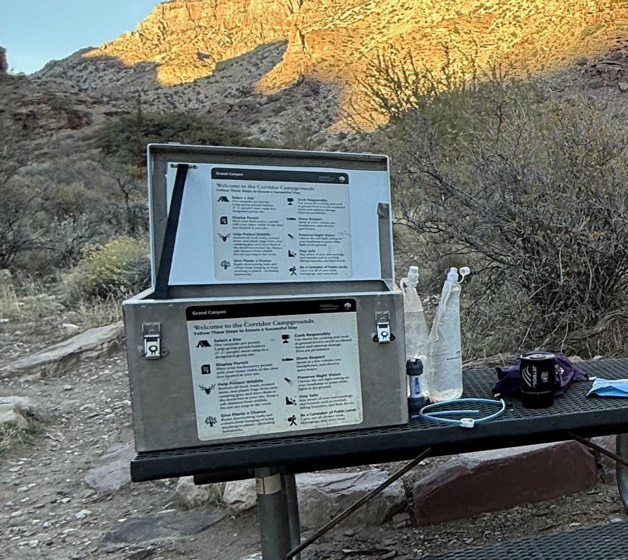
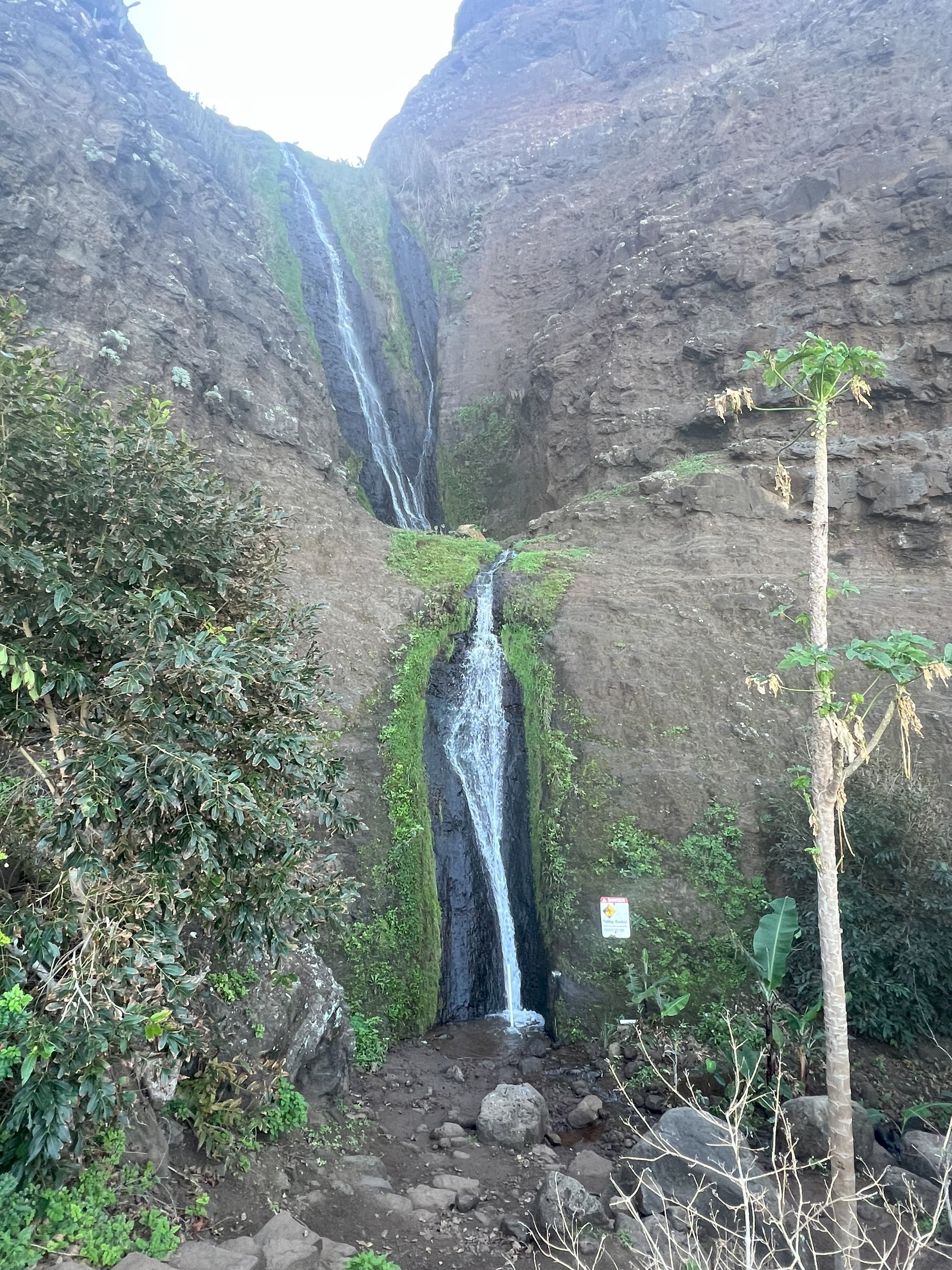
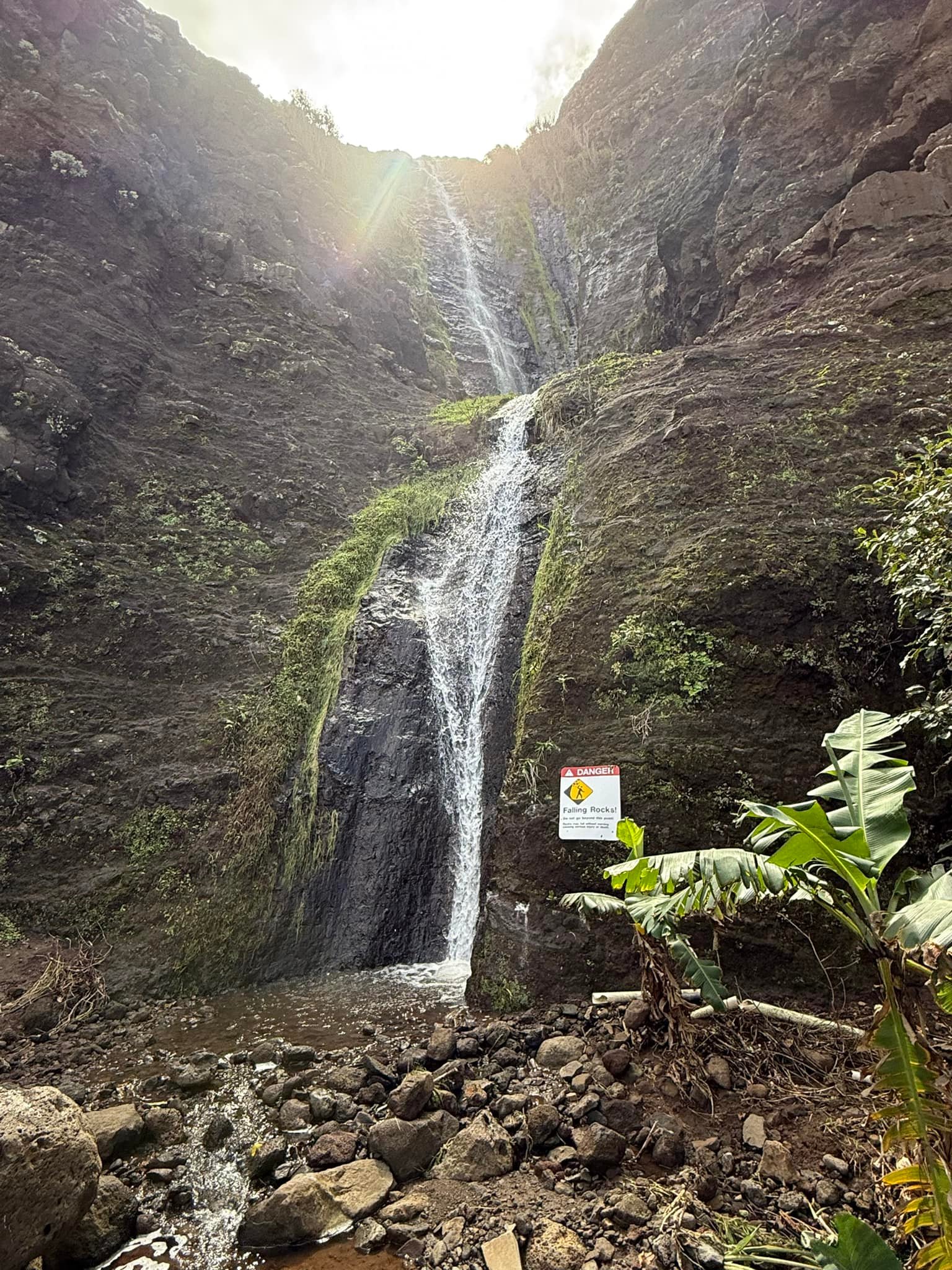
  7. Use Hanakoa on the way out and/or on the return. This is much underutilized site, but it offers a relaxing location and the amenities of a composting toilet, and the opportunity for a side trip up a spur to Hankoa Falls. There are sites on both sides of the stream.
  8. Use good judgment crossing swollen streams. Stop and wait if it appears that the streams are flooded. The conditions can change quickly, and you may not have to wait long. It is not worth risking your life. Most people who perish on this trail don’t fall off cliffs, they drown in flash floods or while swimming at the beaches in the winter when the surf is rough.
  9. If you are afraid of heights, consider a day trip up to Hanakapi’ai Falls instead of going out to Kalalau. This trail will not be enjoyable if you are terrified the entire time. The exposure is relentless and some areas are only narrow enough to put one foot in front of the other
  10. Pack out what you pack in! This area is sacred to the Hawaiian people, so please show respect.
  11. Enjoy!

Kalalau AllTrails Link:

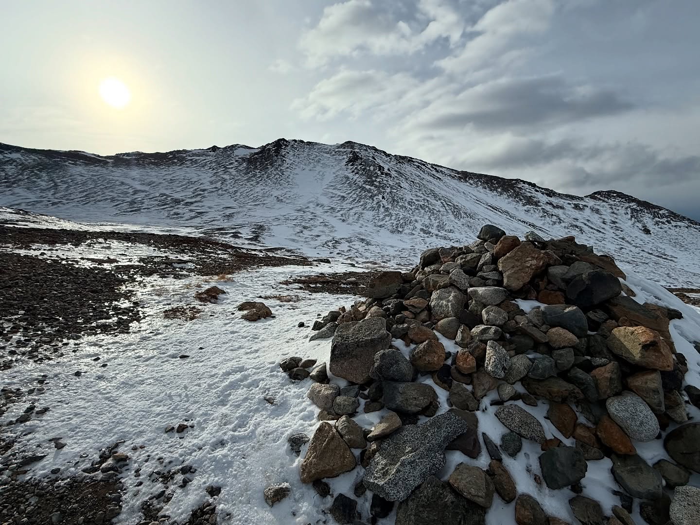
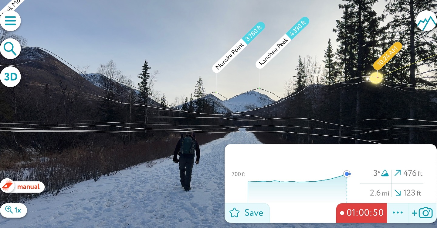
Where the Clouds Parted: A Knoya, Kanchee and Nunaka Ridge Walk

May 31, 2025 Knoya: 4600′ – FR #17 Kanchee: 4393′ – FR #20 Nunaka point: 3780′ Mileage: ~14 Miles Elevation Gain: ~5000′ The summer wasn’t summering, and I was suffering from a bout of springtime depression that only sunshine and warm weather could cure. I dragged myself to the Klutina Trailhead to meet Jason. We…

Chasing the Wind: A Long-Awaited Victory on Peak 1216 and Ship Creek Hill

April 26, 2025 Peak 1216 AKA 3990: 3990′ Ship Creek Hill: 3842′ (chugach Front Range Peak #24) Mileage: 15 Miles Elevation Gain: 5,700′ The majority of the Southcentral Alaska winter of 2024-25 was uncharacteristically warm and relatively snow free, but here we were in April, with record breaking snowfall around Anchorage. The ridges and peaks…

Alone in the Grand Canyon: Returning to the Rim and Civilization

Day 6 – Cremation Canyon To South Kaibab Trailhead

6.5 Miles, +3600′

December 4, 2024

The choice to cowboy camp under the stars was a great one. I wasn’t bothered by any wildlife, and I was able to wake up every once in a while, to see how the night sky had spun. By 530am I was packed and moving in the dark. All of my hiking had been in the day and this morning afforded me the opportunity to have some introspective moments uninterrupted by awe inspiring views. Being an Alaskan, I was comfortable in the dark with just a headlamp, and had no trouble navigating through the scrub brush.

I thought about how the last five days had been good for my soul, and how I had never had an experience that quite rivaled this one. I felt completely at ease the entire time, not once questioning my abilities or why I was there. Not one bit of anxiety or fear.

The early start would give me plenty of time to ascend back to my starting point at the Kaibab Trailhead on the South Rim, get a shower, do laundry and then make it back to Phoenix in time for my flight early the next morning. I would be sleeping on my Nemo pad tonight, but instead of being under the stars, I would be in an airport.

I made it the two miles to Tip Off in an hour and I had officially succeeded in not having to use any wag bags. One day I would hike the 95-mile Tonto Trail, and I wouldn’t be so lucky. There would be limited facilities on that trip. I saw headlamp lights and heard talking coming from the neighboring stall. I thought maybe the guys had a rough day and ended up sheltering in the bathroom. It didn’t make any sense, but it also didn’t make any sense that people were already here at 630 in the morning, not to mention sharing a bathroom.

I knocked and an Asian man opened the door, he was sitting on the floor, and a woman behind him. They didn’t speak much English, but I signed asking if they had food and water and were ok. The man nodded and smiled. They didn’t seem in distress, so I kept moving. My best guess is they had reservations at Phantom Ranch but hadn’t gotten the notification of the closure due to a waterline break. I would wager they hiked all the way down to the Ranch and then couldn’t make it back up to the South Rim, either from fatigue or discomfort with the dark.

I began climbing up the South Kaibab Trail, starting to see some color where the sun would be rising. The sky soon became golden, and I watched a pack train descending above me. We crossed paths at a sign that said we were at 4,700’ and 3.5 miles from the South Rim. I moved slowly, wanting to really savor this beautiful, quiet morning in the Canyon.

Just below Skeleton Point, the trail switches back and forth on itself, with an expansive view to the east. I stopped and watched the sun rise over the canyon walls, one of the most beautiful sights I had ever seen, and it hit me. I would soon be out of the Canyon. It was almost over.

I wasn’t ready. I wanted to see this sunrise every day forever. I wanted to cowboy camp under the stars. I wanted to walk every trail and explore every canyon. I couldn’t help but tear up, and soon I was crying both with joy for the gifts I was given by The Canyon but also in mourning for the end of my trip. To this day when I think of that moment I get choked up, and I think that will continue to happen for the rest of my existence on this Earth.

Although the sun was up, it was still in the 50s, perfect temperature for walking up the last 2000′ to the rim. Three or so miles to go. I had wished it was 30. Ascending up past Skeleton Point, I eventually ran into the first day hikers around Cedar Point. I looked down into Cremation with a familiarity of this space… a far cry from when I first entered The Canyon with no concept of what was where or what to expect. Now I could identify the Tonto Trail and Cremation; Way in the distance I could see the canyon where I had traveled through The Box and along Bright Angel Creek. I could see where the North Kaibab Trail curves up to the northwest, past Roaring Springs, I could see the Kaibab sandstone sitting atop the many rock layers below.

I turned away from The Canyon and focused on the trail under my feet. I didn’t want to cry again. Past Ooh-Ahh Point, I was 3/4 of a mile and less than 800′ from the trailhead. It was now 930am and I could see the throngs of day hikers starting to descend the switchbacks over the quarter mile from The Rim.

About 30 steps from the top, a nice older man struck up a conversation with me, intrigued about my solo trip, asking about what I did and what I saw. The conversation somehow transitioned to me being from Alaska and working as an engineer. This man, who had by now introduced himself as Dennis, asked if I had ever been to Gates of the Arctic, and although I hadn’t I told him I wanted to go.

He said he hadn’t been up there since the 70s, when he was working as an engineer on the builiding of the Alaska oil pipeline. My grandfather’s protege and best friend had been the project manager on that project, so, a shot in the dark, I asked if he knew Mr. Moolin. He repied with, “Frank P Moolin?!?!?” and my jaw dropped. Yes Frank P Moolin. Turned out Dennis had been his right hand man for the project. Frank died not long after the project was completed and Dennis lost touch with the family.

The irony of meeting an old family connection was incredible and it didn’t escape either of us. If I had left 5 minutes earlier that morning, I would have already been at the trailhead, and we never would have crossed paths. I departed by saying, “Serendipity is 100% real,” and Dennis replied in agreement. We wished each other well and parted ways, shocked that this interaction had just happened. Thousands of miles from either of our homes, we met just below of the rim of the Grand Canyon and spoke of people now long gone. It was just the perfect end to a perfect trip.

I took my last few steps up to the South Rim and realized how proud I was of myself for achieving yet another major goal. I had left my saddness behind and was now thrilled with my accomplishment, but ready for a real shower and laundry. The shuttle took us out to Yaki Point for a view, but I sat in my seat, not wanting to have my last look be from a tourist viewing point. I had seen more than 99.999% of the annual 5 million visitors would ever see. I felt complete.

Disembarking from of the shuttle, I went immediately into the Grand Canyon Conservancy shop, dropped my now not so heavy pack in the corner, and spent an hour or more collecting interesting GC history books, a t-shirt for my daughter, and a hoodie that says, “Erosion happens,” with a graphic of all of the layers on the back. I picked out the perfect postcards for my mom, myself and my daughter and was told there was a post office right near the showers/laundromat.

I donned my pack for the last time on this trip, juggling a very full bag of memorabilia and books, and walked the short distance back to my rental Kia Soul, ready for the terrifying drive back down I17 to Phoenix.

In Grand Canyon Village, I stopped by the post office and general store, buying junk food, a giant sandwich, and a magnet that says, “I hiked the Grand Canyon Rim to Rim to Rim.” The showers and laundry were nearby, and after getting clean and throwing in a load, I headed down to the Backcountry Info Office to drop off my gas cylinders that still had some life, as well as my waterproof matches. Anything that can’t go on an airplane and may be helpful to other hikers can be left here with the Ranger to redistribute.

Laundry done, I organized all of my stuff, took one last look at this beautiful place and then drove away without looking back, afraid I would start crying again. I couldn’t resist stopping in Tuyasan at the Starbucks for a real cup of coffee. The drive was uneventful, pulling over every so often to check my tire pressure and stretch my quickly stiffening legs, as I descended towards the city and the heat of Phoenix. A rainbow over the desert was once last surprise before the sun set and I pulled into Sky Harbor Airport.

I dragged my giant duffel bag to the train and then to the AK Airlines check in kiosks. My flight wasn’t until the following morning so I inflated my Nemo pad, put on my headphones and drifted in and out of sleep until 430am when I could finally check in and go through security. I fell asleep on the plane knowing that I had just had one of the most memorable journeys of my life and would be back again the following November, no questions asked.


Total Trip Mileage: 50 Miles
Total Trip Elevation Gain: ~12,000′
5 Nights / 6 Days
Permits: GC NP Website

Rim To Rim To Rim AllTrails Link:

Just The Tips:

  1. Instead of flying into Phoenix, opt to fly into Flagstaff. I’ll be doing that next time instead of making the 3 hour drive each way.
  2. If you are flying in, pre order your stove fuel and other supplies online from Sportsman’s Warehouse in Phoenix or Flagstaff. I found this to be quick and easy.
  3. Be aware that your tracking devices and phone may not be able to get a satellite connection in some of the narrow canyons. Tracking may get wonky, as the vertical walls can cause a location ping, hundreds of feet above or below you.
  4. Permitting for the Grand Canyon can be confusing. It is best to apply for the lottery, which opens based on the month of travel and is available for application on the 16th of the month, in the 5th month prior to your trip. For example, a September Trip lottery application period would open April 16. See this article for more information about getting your Grand Canyon permit.
  5. Give yourself more than one night at Cottonwood Campground to allow for a side trip to Chimik’yana’kya Deya’ (Ribbon Falls) or a day hike to the North Rim, plus a rest day. I found 3 nights at Cottonwood to be perfect.
  6. If hiking rim to rim to rim in the winter, know that there are no services at and no access to the North Rim. You will be one of the few people in the area, far from help. Bring hiking poles and microspikes in case of snow. Evaluate your abilities and comfort with heights honestly before traveling this stretch of trail.
  7. Carry plenty of water and a water filtration system. Don’t drink unfiltered water. It can contain bacteria even if it looks clean. Be sure to dry out your filter when you get home.
  8. Get to the park early. The entrance gets extremely backed up with traffic beginning mid-morning.

Alone in the Grand Canyon: Cowboy Camping Under the Stars

Day 5 – Cottonwood To Cremation canyon

12 Miles, -2000′, +1600′

December 3, 2024

I started the day by packing up my sleeping bag, pad and inflatable pillow while thinking about how my choice of sleeping gear had been perfect so far. I’ve had the same sleeping bag for over a decade, an absolute workhorse. I use my REI -20 down bag for all seasons in Alaska (except for maybe July). It gets regular washes and tumble drys, probably against the care instructions, which is likely why it continues to spring small holes, allowing feathers to find themselves free, often leading to what I’ve dubbed a “tent snowstorm.” Anyway, it’s a great bag and probably has many hundreds of nights of use… I bought it second hand in 2013.

My sleeping pad was new purchase, and this was its maiden voyage. I wouldn’t usually take the risk of bringing new gear on a trip of this length, but I brought a patch kit just in case. The Nemo Tensor all season wide is the greatest thing that has ever happened to my camping. Lightweight and super warm, this side sleeper is sleeping great!

I collected my tent items by the door to make everything easy to pack then made up some oatmeal and coffee. I still had so much food. Multitasking is one of my fortes, so I was fed and packed up within an hour, starting out of camp up towards the guys’ spot to drop off my filtration system. I wouldn’t be needing it for the last two days, as there is running water at Phantom Ranch and nothing to filter after that. Once again, I would just have to haul enough for that night and the next day. No big deal. By now I basically a pack mule myself!

Slowly descending to “The Box,” I followed the curves of the canyon, which eventually spit me out at Phantom Ranch. It was a cool morning, great for walking downhill quickly, and I saw I had made the 7.2 mile, -2000′ descent in just a few hours. Pretty good after a 13-mile day prior; I wasn’t even a little bit sore.

Phantom Ranch was still closed, but I was able to fill up my water bottles, now the repaired one springing a pinhole leak at the bottom. I set it into a gallon Ziplock bag and hoped for the best. I was sure I’d have at least a liter left, and with my other two-liter bottle, full, I would be fine. I’d learned it wasn’t summer desert hot this time of the year, so I decided the nearly two gallons I had carried down on day 1 was a bit excessive. I stamped my permit with the “Mailed by Mule” stamp that people put on their postcards and then crossed out mule and wrote “Rebecca.” I would have to settle to send the postcards from the South Rim.

Crossing the Colorado River on the Kaibab Suspension Bridge, “The Black Bridge,” I spent some time to really admire the engineering and design, before entering the 105′ long tunnel and out the other side. I had less than 4 miles and +1800′ to go for the day, most of the climbing on the way up to Tip Off on the Tonto Plateau. I felt extraordinarily strong and made it up to Tip Off in just over an hour. I was, as we say in the snowmachining world, hauling the mail.

I took a left, due east, on the Tonto Trail, once again in the wide scrub brush and cactus covered shelf, 1600′ above the Colorado River. The miles were still going by quickly, and before I knew it, I was at the little rock outcropping I had camped at on night one. I decided to press on, energized and curious to see what was around the next corner.

I dropped down into a mini canyon that had the most interesting, layered rock. I had seen an almost perfect marine fossil before I had descended down to this streambed. I started to climb up the other side and turned back to take another look at this geological wonder.

There it was. The sign. I had been 2/10 of a mile short the first night, a stone’s throw away. I spotted a perfect little clearing, out the flash flood zone, but still down in this protected canyon. I didn’t even bother to set up my tent. There wasn’t enough traffic here to draw in the mouse population, so I was going to take tonight to cowboy camp under the stars. By 330pm I was making dinner and coffee, marveling at this cozy spot far, far away from people and responsibilities.

All of sudden a movement caught my attention. It was a massive mule deer buck coming down the trail I had not long ago started up. He didn’t seem to mind my presence, and ambled down the hill, seeming to have a slight limp and scar on his rear haunch. This 10-point beauty moved past my camp, although I didn’t notice if he continued down the canyon or along the Tonto Trail. I wondered where the closest water was.

In a state of continuous awe, I sat in my camp chair drinking coffee and examining every layer of the canyon’s walls. I thought about how many years this spot had been at the bottom of the ocean. Then I saw an odd shape. It didn’t fit in. I walked across the canyon and up the slope to where I was even with my camp. It was an old shoe. I knew it looked wrong. Something had torn it to shreds. I was going to assume mice. I carried it back over and added it to my very full gallon Ziplock bag of trash.

By 6pm it was dark and I was in my sleeping bag, pad laid down over my tent footprint, and I swore I had never been more comfortable in my life. I was warm, although there was a light breeze coming from the North. I watched the stars for hours, the Milky Way and constellations spinning above me. Next year I would definitely be bringing a tripod… no one can keep a phone still enough for a ten second exposure.

My last night in the canyon was bittersweet perfection.

Rim To Rim To Rim AllTrails Link:

Just The Tips:

  1. Instead of flying into Phoenix, opt to fly into Flagstaff. I’ll be doing that next time instead of making the 3 hour drive each way.
  2. If you are flying in, pre order your stove fuel and other supplies online from Sportsman’s Warehouse in Phoenix or Flagstaff. I found this to be quick and easy.
  3. Be aware that your tracking devices and phone may not be able to get a satellite connection in some of the narrow canyons. Tracking may get wonky, as the vertical walls can cause a location ping, hundreds of feet above or below you.
  4. Permitting for the Grand Canyon can be confusing. It is best to apply for the lottery, which opens based on the month of travel and is available for application on the 16th of the month, in the 5th month prior to your trip. For example, a September Trip lottery application period would open April 16. See this article for more information about getting your Grand Canyon permit.
  5. Give yourself more than one night at Cottonwood Campground to allow for a side trip to Chimik’yana’kya Deya’ (Ribbon Falls) or a day hike to the North Rim, plus a rest day. I found 3 nights at Cottonwood to be perfect.
  6. If hiking rim to rim to rim in the winter, know that there are no services at and no access to the North Rim. You will be one of the few people in the area, far from help. Bring hiking poles and microspikes in case of snow. Evaluate your abilities and comfort with heights honestly before traveling this stretch of trail.
  7. Carry plenty of water and a water filtration system. Don’t drink unfiltered water. It can contain bacteria even if it looks clean. Be sure to dry out your filter when you get home.
  8. Get to the park early. The entrance gets extremely backed up with traffic beginning mid morning.


Misty Miles and Mountain Birds: A Storm King Scramble to Mitty Peak

April 20, 2025 Olympic NAtional Park, WA Mitty Peak 2674′ Mileage: 4.4 Miles RT Elevation Gain: 2400′ After 25 years, I finally had the opportunity to fly down to Seattle from Alaska to see one of my favorite bands of all time, Phish. I can’t travel without checking out a new hike, so I also…

Beyond Bird Point and Into Technicolor Solitude: Bird Ridge Overlook

September 7, 2024 Mileage: 13.5 Miles Elevation Gain: ~6700′ BRO (4625′) Chugach 120 #98 Bird PT (3505′) CHugach 120 #120 Permits: CSP Parking Fee The 2024 Alaska State Fair had come and gone, a sure sign that the dark winter was going to be closing in soon. Even though it was another rainy summer and…

Alone in the Grand Canyon: Trekking Canyon Walls to the North Rim

Day 4 – Cottonwood Camp To North Rim and Back

13 Miles, +4000′, -2000′

December 2, 2024

It was a nice feeling to get out of bed and be able to walk normally again. I rose early, very excited for the day ahead, and quickly consumed my oatmeal and coffee. I knew the mice would come around while I was gone, so I packed everything from my tent into my backpack and hung it from the metal post in my campsite. Opening the doors to my tent so as not to find holes chewed upon my return, I was confident I critter proofed everything before donning my fanny pack and heading to the North Rim!

I passed by the other campsites, many of them devoid of people and gear, except for the last site before exiting the boundary of the campground. It was only 730am, so I assumed they were probably still sleeping. The sun would not reach the bottom of the canyon for a couple more hours. Passing by more old telegraph poles and a beautiful little waterfall, the trail continues, as it did before Cottonwood Camp, to wind along Bright Angel Creek, gaining 700 feet over the next mile and a half.

Surprisingly, I ran into a handful of people, and they explained to me that they lived at Manzanita Ranger Station for two weeks at a time and were the ones doing the fish studies below Cottonwood Camp. They made the daily trek to their work site and then would hike out to the South Rim for their time off. It reminded me of my wildland firefighting days, living and working in the remote wilderness for weeks at a time.

About a half an hour after leaving camp, I came upon a stout truss bridge that crossed from east to west over Bright Angel Creek. It is here that I would leave the pre-1928 trail, AKA “Old Bright Angel Trail”, that continued up to the rim along Bright Angel Creek. This historic trail was deemed too hazardous and ill-maintained to become the main hiking and pack mule route in the National Parks Service’s bid to bring more tourists into the Canyon, and the North Kaibab Trail that we know now was constructed in the winter months between 1926 and 1928. It was maintained and improved by the CCC in the 1930s. The efforts expended were well worth it; the North Kaibab trail is one the most incredibly engineered and well-maintained trails in the world.

Manzanita Ranger Station was just past the bridge, offering hikers a place to rest, a composting toilet, and, during the tourist season, running potable water and a Ranger to answer all of your burning questions. I stopped to take photos of a herd of mule deer that were mulling around and was surprised when I looked up and saw two young men taking a break. We struck up a conversation and I learned that they were the people camped at the last site at Cottonwood, apparently having gotten up and moving before me and not, in fact, still asleep in their tent. They had the same intention as I did, to hike the 13 miles and +4,000′ to the North Rim as a day hike, although one of them had a knee that was giving him trouble.

We traveled along together, passing Roaring Springs, the main water source for the Grand Canyon corridor and South Rim. This giant waterfall sprouts from the middle of the canyon wall, spilling hundreds of feet to feed the Transcanyon Waterline. The waterline runs down to the Colorado River and once the head pressure dissipates on the Tonto Plateau at Havasupai Gardens, it is pumped to the top of the South Rim; an amazing feat of engineering that was completed in the 1960s. The much-needed upgrades that were happening during and after my trip, throughout the winter of 24/25, would hopefully eliminate the constant need to repair the aging pipes and offset the high cost to do so, much of the pipe only being accessible by helicopter, foot, or mule.

We climbed out of the bottom of the canyon and onto the face of the canyon walls, and although the trail is wide and flat with excellent footing, anyone with a fear of heights would be nervous about walking along this path with a vertical wall on one side and a fatal fall drop-off on the other. As we rounded a corner, we tried to decipher exactly where the trail was. It looked like sheer cliff face with no chance of a path existing there, until we looked very closely and saw a rectangle shaped excavation in the wall. That had to be the trail, and I got butterflies just looking at it!

I ran up to the cut, noticing the dizzying drop to my right, while one of the guys stayed on the other side so we could take pictures of each other, tiny flies on a gigantic wall. I waved and hustled on alone; I would run into them on the way back and we could exchange photos then. The trail continued rise above the canyon floor, getting a bit narrower and more exposed, at some points nearly 1,000 feet above the bottom of Roaring Springs Canyon. The pictures really do speak for themselves. I was having the time of my life!

A mile beyond the rectangle cut, the canyon narrows, its floor rising up to meet the trail, and a beautiful little foot bridge spans the now only 50-foot-deep gap. A trail runner passed me heading to the North Rim. He had started at the South Rim early that morning and planned to get back before dark. It was only 10am and he had a little more than 20 miles to go, but he looked strong and was making good progress.

The trail past the bridge transitions to rock wall retained switchbacks, climbing up towards the beautiful, vertical striped stone of the Kaibab Formation and into the tree line. After passing through Supai Tunnel and past Supai Rest Area, another space with composting toilets and potable water (on during the tourist season), I was within a couple of miles of the top of the North Rim. Like the trail runner, I, too, was making excellent time. Especially for already haven taken 250 photos and videos, LOL!

The red dirt of the Coconino Sandstone was a brilliant ochre in the sun, soon melting into the browns of the Toroweap Formation and the greens of the now prolific pine trees. A few more switchbacks and I was at the Coconino Overlook, only 500 feet below the North Rim. I could see the tallest mountain in Arizona in the distance, snowcovered and hulking, reminiscent of some of my favorite Chugach mountains, with a ridgeline that goes on for miles. I would absolutely have to come back and hike Humphrey’s Peak. The trail runner had made good time to the top and was on his way back down. I wished him luck on his journey and went our separate ways.

Now in the trees, the Canyon was hidden from view; I quickly made my way past one tiny patch of snow in the shade and signage warning the southbound hikers to give way to mules. I had brought microspikes with me just in case there was ice and snow but left them at Cottonwood after reports from southbound hikers that the trail was mostly clear. I realized I was at 8,000’ but felt incredible; no side effects from being more than mile and a half above sea level. I felt unstoppable!

There were informational kiosks now in sight and within minutes I was having a snack and reading all I could about the history of the construction of the North Kaibab Trail, having reached the North Rim.

A dusting of snow covered the ground and there were no vehicles to be seen. The North Rim roads had shut down on December 1, so it was literally a ghost town. I was alone, but definitely not lonely. This had already been a day to remember, I might wager to say one of the best I had ever experienced… and I was only halfway there. I sent InReach messages to the friends and family I had promised to keep updated, now that I was out of the canyon and had excellent satellite connection, then quickly headed back down the trail, eager for more of those incredible views and butterfly inducing sections of trail.

Not even two dozen steps down from rim, I ran into the guys, the troublesome knee loosened up, but still causing slow progress. We chatted about how their water filter system was moldy, an unfortunate side effect of not completely drying out the filter fabric after every trip, and since I wouldn’t need my filtration system once I left Cottonwood the next morning, I would drop it off with them tonight after filling all of my containers. They could mail it back to me once they got home. We agreed to meet up that evening and I once again started down into the canyon, jogging a moderate pace.

The nicest part about this 4000′ gain is that it never seems too steep, a fairly gradual slope rising just over 600′ per mile, a far cry from some of the uphill slogs I’ve done on my home mountains. I made steady progress on the way back, even while taking another 200 photos and videos to add to the hundreds I had already snapped that day. I wanted to document every step of this incredible journey.

Past the sheer cliffs, past the rectangle cut, past Roaring Springs and more mule deer at Manzanita, past the stout bridge and the abandoned telegraph poles, I jogged into camp at 315pm, a sub-8-hour, 13-mile round trip. Not bad for a 44-year-old woman who couldn’t walk the day before. Besides the biologists at the very beginning of the day, I had only encountered 5 people on the trail (there was a woman who passed me earlier in the day, though I can’t quite recall when or where and never saw her return down into the Canyon).

I was high on adrenaline, incredulous that I was done with that glorious section of trail, probably my favorite trail that I had ever traveled. A visit to the creek for a soap free bath and a top off on my filtered water was followed by dinner, I can’t remember if it was Chili Mac or a Ramen Bomb, and coffee. I patched a hole I found in the floor of my tent then took a walk up to the guys’ campsite, but they still hadn’t made it back. I was ready to settle in, so I would swing by in the morning and drop off the filtration system for them.

I sat with my chair facing down Bright Angel canyon, looking towards the South Rim, and watched the sun drop behind the canyon wall. The mice had apparently learned that I wasn’t the one and had not caused me any trouble since the first night, affording me the opportunity to sit outside and marvel at the stars. As they say, “Half the Park is after dark!”

Tomorrow I would head back the way I came, descending to the Colorado River, back up to Tip Off, on the Tonto Plateau, and then back out to Cremation Canyon. Another 12-mile day, but the pack would be a little lighter than the first trip over this ground. I had been eating non-stop and could travel light on water until Phantom Ranch.

My last night at Cottonwood Camp and my last night on the north side of the Colorado River, for this trip at least. I was too pumped up to sleep, so I went through some of the day’s photos, reminiscing about a time not too far gone. I finally fell asleep, grateful for an unforgettable day.

Rim To Rim To Rim AllTrails Link:

Just The Tips:

  1. Instead of flying into Phoenix, opt to fly into Flagstaff. I’ll be doing that next time instead of making the 3 hour drive each way.
  2. If you are flying in, pre order your stove fuel and other supplies online from Sportsman’s Warehouse in Phoenix or Flagstaff. I found this to be quick and easy.
  3. Be aware that your tracking devices and phone may not be able to get a satellite connection in some of the narrow canyons. Tracking may get wonky, as the vertical walls can cause a location ping, hundreds of feet above or below you.
  4. Permitting for the Grand Canyon can be confusing. It is best to apply for the lottery, which opens based on the month of travel and is available for application on the 16th of the month, in the 5th month prior to your trip. For example, a September Trip lottery application period would open April 16. See this article for more information about getting your Grand Canyon permit.
  5. Give yourself more than one night at Cottonwood Campground to allow for a side trip to Chimik’yana’kya Deya’ (Ribbon Falls) or a day hike to the North Rim, plus a rest day. I found 3 nights at Cottonwood to be perfect.
  6. If hiking rim to rim to rim in the winter, know that there are no services at and no access to the North Rim. You will be one of the few people in the area, far from help. Bring hiking poles and microspikes in case of snow. Evaluate your abilities and comfort with heights honestly before traveling this stretch of trail.
  7. Carry plenty of water and a water filtration system. Don’t drink unfiltered water. It can contain bacteria even if it looks clean. Be sure to dry out your filter when you get home.
  8. Get to the park early. The entrance gets extremely backed up with traffic beginning mid-morning.

Alone in the Grand Canyon: Rest Day

Day 3 – Rest Day

December 1, 2024

It became apparent immediately after I woke up that I would be taking a rest day and saving my day hike to the North Rim for tomorrow. I unzipped my tent and tried to stand. The overpacking had finally caught up to me. My legs were locked up, despite taking magnesium, electrolytes and staying hydrated. I crawled over to the picnic table and collected my supplies for morning coffee and breakfast. I would need to eat all day to get my load to something within reason for the last half of my trip.

I spent time stretching and enjoying the scenery, eating as much as I could physically handle. Tinkering around camp, I pulled off my rain fly and lifted the footprint of my tent to dry out the little moisture that had accumulated. I have a habit of scouring my campsites for micro trash, tiny pieces of garbage that are easily missed by even the tidiest of campers. Whenever camping at established campsites, I always encourage my friends to spend 15 minutes focusing on looking for bits of garbage and it never fails that we end up with a good-sized pile.

I rummaged in my med kit for anything that may be helpful in repairing my busted water bottle and in making a temporary 0-ring for my water filter bladder. I ended up twisting up some medical tape and wrapping it around where the o-ring would be. I plugged in the hose and it worked! The water bottle was a more difficult matter. I wasn’t terribly worried since the crack was on the top, but I would need to use this to carry a full 2L of water for when I camped at Cremation Canyon on the way out. The medical tape again came in handy, with a waterproof bandage for good measure.

I made a good dent in my book before deciding to head down to the creek for more water. My legs were finally working, although you’d think I was an elderly woman and not someone who could backpack across the Grand Canyon and back. My walk was more of a shuffle, made worse by the fact that I was wearing thin soled slippers. I was too tired to put on real shoes for the short walk.

After dinner and an incredible sunset, I settled into my tent early to get rest before my 13-mile, +4000′ round trip hike the next day to see this canyon from the North Rim. I didn’t hear any mice running over my tent while in my deep sleep.

Rim To Rim To Rim AllTrails Link:

Just The Tips:

  1. Instead of flying into Phoenix, opt to fly into Flagstaff. I’ll be doing that next time instead of making the 3 hour drive each way.
  2. If you are flying in, pre order your stove fuel and other supplies online from Sportsman’s Warehouse in Phoenix or Flagstaff. I found this to be quick and easy.
  3. Be aware that your tracking devices and phone may not be able to get a satellite connection in some of the narrow canyons. Tracking may get wonky, as the vertical walls can cause a location ping, hundreds of feet above or below you.
  4. Permitting for the Grand Canyon can be confusing. It is best to apply for the lottery, which opens based on the month of travel and is available for application on the 16th of the month, in the 5th month prior to your trip. For example, a September Trip lottery application period would open April 16. See this article for more information about getting your Grand Canyon permit.
  5. Give yourself more than one night at Cottonwood Campground to allow for a side trip to Chimik’yana’kya Deya’ (Ribbon Falls) or a day hike to the North Rim, plus a rest day. I found 3 nights at Cottonwood to be perfect.
  6. If hiking rim to rim to rim in the winter, know that there are no services at and no access to the North Rim. You will be one of the few people in the area, far from help. Bring hiking poles and microspikes in case of snow. Evaluate your abilities and comfort with heights honestly before traveling this stretch of trail.
  7. Carry plenty of water and a water filtration system. Don’t drink unfiltered water. It can contain bacteria even if it looks clean. Be sure to dry out your filter when you get home.
  8. Get to the park early. The entrance gets extremely backed up with traffic beginning mid-morning.

Alone in the Grand Canyon: Crossing the Colorado

Day 2 – Cremation to Cottonwood Camp

12 Miles, -1600′, +2000′

November 30, 2024

I woke before the daylight, rested and excited to see what was to come. As the pink clouds signaled the rising of the sun, I made some coffee and oatmeal and ate and drank as I broke down camp. There are no bathroom facilities in this remote area so I carried wag bags, but decided I could make it the almost two miles back to Tip Off, where there is a composting toilet. If not, I would have to carry the used wag bag for the next 5 days. I could hold it. I poured out some of my excess water, knowing that I could refill in about 5 miles at Phantom Ranch, and my legs were very happy about that!

Surprisingly, I felt strong, and I made excellent time back to Tip Off. The mule pack train got an early start and was making their way down to the Tonto Plateau, before continuing on with supplies for Phantom Ranch. After a quick use of the facilities, I looked up towards the South Kaibab trail; I could see the day hikers who had a goal of reaching Phantom Ranch starting to make their way down, so I hustled ahead to avoid as many people as possible.

The trail from Tip Off down to the Colorado River is a well-engineered path, descending from 4000′ to 2400′ at the Colorado River. I probably took twice as long as I should have on my way down to the “Black Bridge,” stopping every few steps to get another picture or video. My mind was blown. The ochre-colored dirt was a beautiful contrast to the blue green tone of the Colorado River and the yellow of the Cottonwood trees at Phantom Ranch.

I was descending into the depths of the second largest canyon in the world to a river that I had known many years ago when I was just a teenager whitewater rafting from Moab to Lake Powell. I could feel it welcoming me like a friend long missed. The winding path brought me to the opening of a tunnel, the entrance framed with stacked stones; a portal to a civil engineering feat, the Kaibab Trail Suspension Bridge, AKA The Black Bridge.

Until this 440-foot-long bridge was built in 1928, crossing the Colorado here was treacherous, first requiring a boat, then in 1913 a cableway, and in 1920 a suspension bridge that was deemed unsafe due to lack of structural stiffness. Being that there were no roads to access the site, all of the 122 tons of building materials for The Black Bridge were brought down 9 miles from the South Kaibab Trailhead, by human and mule, including the one ton, 550 long suspension cables that were carried by 42 single file walking Havasupai Tribesman.

The Silver Bridge, just downstream, was built in the late 1960s, connecting the Bright Angel Trail to Phantom Ranch. These are the only engineered crossings over the Colorado River for hundreds of miles. Unfortunately, this bridge was closed during my trip, but I’m looking forward to crossing it on my next visit.

Entering the dark tunnel, I continued on for 105′ before being spit out on The Black Bridge, 50-some-odd feet above the Mighty Colorado. After a little less than 4 miles of hiking, I was nearing the lowest elevation on my journey. Below me, whitewater rafting boats slowly glided along, coming to rest on the beach between the bridges. Many parties stop here for a break at Phantom Ranch, which offers everything from running potable water to a snack canteen to steak dinners and hearty breakfasts. I was looking forward to mailing a postcard via mule.

On the far side of the bridge, I looked back and marveled at the engineering wonder I had just crossed. As a civil engineer, I have great appreciation and respect for all who were involved in the construction of this bridge, listed as a National Historic Civil Engineering Landmark in 2019. I passed a plaque that spoke of the great feat and of the importance of the work. For many years, it had been the only bridge over the Colorado for 754 miles, from Moab, Utah to Needles, California.

Not far along, another engineering marvel is bordered with a wire cable and informational placards. Pueblo ruins, already abandoned and crumbling by the time John Wesley Powell led the first expedition along the length of the Colorado River in 1869, spoke of a time when the ancestral people farmed and harvested crops between the years of 1050-1140 AD. You can make out the 8 different rooms, including a Kiva, a ceremonial space for this community.

I pulled myself away from the history and sauntered on towards Phantom Ranch, now less than a mile away. Passing a pile of rocks adorned with horseshoe flowers, likely a monument to a well-loved mule, the scenery changed drastically, from brown desert to lush cottonwood forest. I could see Bright Angel Campground across the creek and knew I would have to come back one day and camp here.

I passed under a wooden sign welcoming me to Phantom Ranch. A small heard of mule deer surprised me. They were the first wildlife I had seen since I started off from the trailhead the day before. They were completely unbothered by me as I snapped some pictures and videos. The Phantom Ranch spread is beautiful, with modest buildings made of wood and stone, stained and painted in hues of browns and greens, matching the environment in a way that shows true respect for the place.

I found the canteen, but was sad to see it would be closed for the duration of my trip in the Canyon due to the waterline repair work and new breaks in the line. I was able to fill up my water bottle with fresh drinking water at a spigot outside the canteen and finished up my oatmeal that I had been too excited to eat before leaving camp that morning. A quick bathroom break at the facilities and a check of the weather forecast posted on a bulletin board, and I moved on. About a mile down the trail, a wooden sign warned me that there were no services on the north rim this time of the year and informed me that I had 6.4 miles to go to reach my home for the next three nights at Cottonwood Campground. I was now on the North Kaibab Trail.

The further I walked, the narrower the canyon walls became, rising up hundreds and even thousands of feet in vertical faces. It was in this section, often referred to as “The Box,” that I found my gps trackers and InReach were struggling to find satellite connection and were pinging high up on the walls, the connection unable to accurately locate me only a dozen or so feet horizontally, but hundreds of feet below the location it reported. I knew my data was fucked, so I turned off all my trackers except my InReach, to save battery, and used educated guesses to figure out how far I’d come and how far I had to go.

Navigation was not a problem here. The trail was built with great care, wide and well packed, with intermittent bridges and many rock retaining walls to offer a path over and around Bright Angel Creek. Telegraph poles, some still wearing their blue glass insulators, told much of the story of the Trans-Canyon Telegraph line. This communication system was built in 1924 then improved in 1935 by CCC workers, as were much of the north rim trail and facilities, and it allowed communication from the South Rim to the North Rim and everything in between.

Walking along the Vishnu Basement Rocks in The Box for about 4 miles, I was entranced by the geology I was observing. Millions and even billions of years of layers built up here before being sliced open by streams and rivers. I resolved to carry a geology guide for the area on my next trip, but for now I would just take it all in… and take a ton of pictures. I passed a few workers who had excavated around the Trans Canyon Waterline that runs under the trail, fixing one of the many breaches in the 50-year-old infrastructure. A $208 million dollar project is currently underway to upgrade the ancient system.

Eventually, the box canyon opened up into a wide Valley and I was in the sun again. The temperatures had been long sleeve sun shirt warm in the canyon, but now I was sure it was in the mid 60s. I stripped off a layer and changed into shorts. I looked back at where I had come from and realized that I was gaining quite a bit of elevation, now 30 or 40 feet above Bright Angel Creek at some points and maybe 1,000’ above the Colorado River. I passed a group of biologists who were doing fish studies and removing invasive species. I moved by silently, snapping a photo, but we would meet in a couple of days, further up the trail.

I decided to skip Chimik’yana’kya Dey’a (Ribbon Falls) for today, since I would be at Cottonwood for 3 nights, with one chill out day. I could make the mile or so walk back down to visit these sacred falls another time. The bridge to access this area had been removed, so it would be important for me to pick a good spot to cross the creek. I was getting tired after more than 11 miles for the day and didn’t have the bandwidth to experience such a special place. The Zuni consider Chimik’yana’kya Dey’a (Ribbon Falls) to be where they were created. I wanted to give it full attention and respect.

Just when I thought I couldn’t walk another step, there it was in the distance; a stand of Cottonwood trees and the faint sign of a structure I later discovered to be the Ranger Station. I mustered up the last of my energy and made it to the campground, spending a few minutes to find the perfect campsite. I unloaded my pack, noticing that I still have a terrible habit of packing way too much food. No wonder I was tired. I vowed to not let my years of living on little sustenance off the road system, and my tendency to boredom eat, influence me to overpack on my next trip.

Cottonwood Campground is probably one of my favorite campgrounds I have ever been in. Many of the sites have quite a bit of privacy, each one adorned with a picnic table and a critter box, a metal box with a locking lid, much like our bear bins in Alaska. I brought an Ursack, but it was nice to organize all of my food and odiferous items in the bin. There is a composting toilet nearby and even a spigot with potable water, although it was shut off for the winter.

My legs were becoming stiff, so I shuffled as quickly as I could to the creek to collect drinking water for the night. I use a large Sawyer filter in line with a water sack that I soon discovered had lost an o-ring where the hose clips into the bag. Although it was leaking everywhere and took longer than normal, I was able to fill up 4 liters of water and get back to camp before my legs completely locked up.

Slow moving, but happy to be there, I set up my tent and put everything away before cooking up some Chili Mac and coffee. The sun began to set behind the canyon walls, well before the actual sunset time, and I donned a hat, down pants and my puffy jacket. As I was pouring water into my Jetboil, I realized my well-loved collapsible water bottle had a break in the seal near the mouthpiece. Next time I would bring brand new ones instead of relying on my used and abused bottles.

Sitting in my camp chair, I truly appreciated the comfort, instead of suffering uncomfortably on the bench of the picnic table. It was worth the extra weight.

Fed and organized, I crawled, literally, into my tent to do some reading. The dark came quickly, and when I say dark, I mean dark! The Grand Canyon was designated a Dark Sky Park in 2016 after a massive project to replace more than 5,000 light fixtures in the park with dark skies compliant units. I opened my tent and leaned out, absolutely enraptured by the milky way and the uncountable number of stars. I had never seen a sky so dark! I could pick out satellites (ironic after my lack of sat service earlier in the day), Starlink arrays and even the ISS!

I could have laid out all night just looking up. Until something ran over the top of my tent!! I leapt back in, zipping the enclosure, headlamp now on, searching for what may be in my tent. I did a thorough search, including in my sleeping bag, and determined whatever it was, was still on the outside. I decided to continue with my book and leave the stargazing for another night, but not long after nature called. I crawled out of my tent (again, literally) and after heeding the call, looked up. I couldn’t resist trying to take some photos of the brilliant sky. I was standing very still in effort to use the long exposure setting on my iPhone when something ran up my leg! That’s it. I was done for the night.

When the lights went out and I had settled in, almost asleep, there came more scampering over my tent! More than one something was out there trying to terrorize me. I pulled out my phone just in time to get a video of one of the little harassers running over my tent in between the rain fly and the main screened in portion. I think they were Deer Mice, known in the Grand Canyon to have overrun campsites due to careless food storage practices by backpackers. After a while, the psh psh psh of mouse feet either stopped or I fell asleep. Either way, I was unbothered and slept hard.

Rim To Rim To Rim AllTrails Link:

Just The Tips:

  1. Instead of flying into Phoenix, opt to fly into Flagstaff. I’ll be doing that next time instead of making the 3 hour drive each way.
  2. If you are flying in, pre order your stove fuel and other supplies online from Sportsman’s Warehouse in Phoenix or Flagstaff. I found this to be quick and easy.
  3. Be aware that your tracking devices and phone may not be able to get a satellite connection in some of the narrow canyons. Tracking may get wonky, as the vertical walls can cause a location ping, hundreds of feet above or below you.
  4. Permitting for the Grand Canyon can be confusing. It is best to apply for the lottery, which opens based on the month of travel and is available for application on the 16th of the month, in the 5th month prior to your trip. For example, a September Trip lottery application period would open April 16. See this article for more information about getting your Grand Canyon permit.
  5. Give yourself more than one night at Cottonwood Campground to allow for a side trip to Chimik’yana’kya Deya’ (Ribbon Falls) or a day hike to the North Rim, plus a rest day. I found 3 nights at Cottonwood to be perfect.
  6. If hiking rim to rim to rim in the winter, know that there are no services at and no access to the North Rim. You will be one of the few people in the area, far from help. Bring hiking poles and microspikes in case of snow. Evaluate your abilities and comfort with heights honestly before traveling this stretch of trail.
  7. Carry plenty of water and a water filtration system. Don’t drink unfiltered water. It can contain bacteria even if it looks clean. Be sure to dry out your filter when you get home.
  8. Get to the park early. The entrance gets extremely backed up with traffic beginning mid-morning.

Alone in the Grand Canyon: Descending into History and Time

Day 1 – South Kaibab Trailhead to Cremation Canyon

6.5 Miles, -3600′

November 29, 2024

The day had finally come! I had arrived in Phoenix the afternoon prior, picked up my rental car and drove north. I left the 80-degree heat and arrived in Flagstaff 3 and 1/2 hours later. I was now at an elevation just under 8,000′ and it was a chilly 35 degrees. I stayed in one of the cleanest and most comfortable hotels I’d ever experienced, and wished I had brought my swimsuit so I could have used their indoor pool. I highly recommend the Best Western Pony Inn and Suites for an overnight in Flagstaff.

After a hearty breakfast at the hotel, I aired up my vehicle tires (the change in temperature and elevation created a low tire pressure warning) and headed an hour and a half north, a drive with incredible views and plenty of wildlife, including a few elk herds crossing the road. Arriving at the park gate mid-morning, the line was not too long, but it is wise to get there as early as possible to avoid the crowds, especially if you are visiting during the peak seasons.

I found a parking spot close to shuttle terminal and triple checked my pack. I located a fountain to fill up my water bottles and filter bladder. There were no water stations or sources between here and Cremation Canyon and then Phatom Ranch, so I had to carry enough water for all day, overnight and the next morning. I probably overdid it with hauling nearly two gallons, but better safe than sorry! I have a terrible paranoia about running out of water and carrying an extra 12 or so lbs. downhill wouldn’t be so bad.

I had everything I needed and was ready to go. The shuttles run on a regular schedule throughout the year. Click HERE to see the current shuttle schedule. I boarded the Orange Eastbound bus and disembarked at the South Kaibab Trailhead about 20 minutes later. It was time to hike!

I was in absolute awe. I had never visited the Grand Canyon before and now I was about to be one of the less than 1% of the 5 million annual visitors to travel below the rim; not to mention one of the tiny fraction of the 1% of people who traverse the canyon rim to rim to rim. I couldn’t contain my excitement and, even though my backpack was more than 50lbs, I jogged my way down the wide path, past throngs of day hikers and numerous overlooks where the views continued to get better and better.

Descending past Ooh-ahh Point, Cedar Ridge, and Skeleton Point, I eventually passed all of the day hikers and was traveling alone. The mule pack train was moving uphill on their daily afternoon trek from Phantom Ranch to the South Rim stables. These pack trains haul all of the supplies and refuse to and from the ranch at the bottom of the Canyon.

Before I knew it, I had descended the ~3200′ to Tip Off and the Tonto Trail Intersection. Tip off has a covered shelter and composting toilet, sitting about 1600′ above the Colorado River. The Tonto Plateau is a wide bench at 4000,’ on the south side of the Colorado, running east/west, and its namesake trail travels a total of 95 miles. It is here I would be turning to the east and traveling 2 miles to the BJ9 Cremation Canyon zone.

For the two miles I traveled, the Tonto trail winds through scrub brush and century plants, descending about 400′, with ample opportunity to find marine fossils and interesting rocks. After 4 and a half hours and 6.5 miles of trekking from the trailhead, with a backpack full of water (I hadn’t even made a dent in it), I was ready to find a spot to drop my pack and set up my camp chair. The adrenaline was wearing off and I was getting tired. I was ready for dinner and some coffee.

I knew I was looking for a sign that would delineate the Cremation Canyon area, but before I saw it, I came across an obvious campsite very close to the 2-mile mark on my gps. I figured I had just passed the sign on one of the little side trails that spur off of and back to the main trail through the brush. Maybe I was so tired that I had just walked right past it. This campsite had a really cool rock overhang and a view across the canyon toward Zoroaster Temple, a picturesque peak above Clear Creek. I decided I would stop here. (On the return trip I found that I had only been about .2 miles from the sign)

I set up my tent under the overhang, before having a vision of it collapsing on me during the night, and quickly moved out to the open area, away from the half cave. When my camp was organized and to my standards, I put on some warm clothes, sat in my camp chair and made myself a Ramen Bomb (ramen and powdered mashed potatoes) and some strong coffee. I silently took in the view and couldn’t have been any happier to be miles away from the nearest person. I watched the sun set and then settled into my tent, making it through only a handful of pages in my book before falling into a deep and restful sleep.

Rim To Rim To Rim AllTrails Link:

Just The Tips:

  1. Instead of flying into Phoenix, opt to fly into Flagstaff. I’ll be doing that next time instead of making the 3 hour drive each way.
  2. If you are flying in, pre order your stove fuel and other supplies online from Sportsman’s Warehouse in Phoenix or Flagstaff. I found this to be quick and easy.
  3. Be aware that your tracking devices and phone may not be able to get a satellite connection in some of the narrow canyons. Tracking may get wonky, as the vertical walls can cause a location ping, hundreds of feet above or below you.
  4. Permitting for the Grand Canyon can be confusing. It is best to apply for the lottery, which opens based on the month of travel and is available for application on the 16th of the month, in the 5th month prior to your trip. For example, a September Trip lottery application period would open April 16. See this article for more information about getting your Grand Canyon permit.
  5. Give yourself more than one night at Cottonwood Campground to allow for a side trip to Chimik’yana’kya Deya’ (Ribbon Falls) or a day hike to the North Rim, plus a rest day. I found 3 nights at Cottonwood to be perfect.
  6. If hiking rim to rim to rim in the winter, know that there are no services at and no access to the North Rim. You will be one of the few people in the area, far from help. Bring hiking poles and microspikes in case of snow. Evaluate your abilities and comfort with heights honestly before traveling this stretch of trail.
  7. Carry plenty of water and a water filtration system. Don’t drink unfiltered water. It can contain bacteria even if it looks clean. Be sure to dry out your filter when you get home.
  8. Get to the park early. The entrance gets extremely backed up with traffic beginning mid-morning.

Alone in the Grand Canyon: The Plan

Rim-Rim-Rim and Cremation Canyon

November 28-December 4, 2024

Planning and Preparation

I have gotten into the habit of traveling Outside of Alaska every winter for a backpacking trip, and this year the Grand Canyon was calling. It had been a long summer of work and, frankly, the rain was getting to me. The high desert sounded so appealing.

I had considered GCNP in the past, but didn’t have much experience with arid environments, although I was pleasantly surprised to learn that the rattlesnakes and scorpions hibernate for the winter. Game on.

I knew I wanted to do a rim-rim-rim trip after seeing a friend post some photos about their backpacking adventure a few years ago. The main corridor trails between the north and south rims are shaped like a “Y,” with the North Kaibab Trail splitting into the Bright Angel Trail and the South Kaibab Trail, just before crossing the Colorado River, heading towards the South Rim. Most of the Bright Angel Trail would be closed through the winter, as would Bright Angel Campground at the bottom of the canyon, on the north side of the river.

These closures would mean I would either have to hike a little over 14 miles on the first day, with an elevation loss of 4800′ to get to Phantom Ranch and a gain of more than 1,600 to then make it to Cottonwood Campground, or figure out another plan. Fourteen miles with a pack full of gear and food for 6 days didn’t sound like fun, so I called the Ranger Station to see if they had any suggestions.

The Grand Canyon backcountry is divided into use areas. Each use area has an overnight capacity based upon the size of the area, the number of suitable and available campsites, its ecological sensitivity, its management zoning, and its use history. Use areas range in size from several hundred acres to several thousand acres. Each zone is color coded to indicated difficulty (taking into account the terrain, remoteness and facilities available).

The Ranger suggested I spend a night on each end of my trip in Cremation Canyon, an area designated as “Primitive,” with dispersed camping and limited available permits. I would have to walk two miles east on the Tonto Trail to camp, then return over those same two miles to the main trail. This would add 8 miles overall, since I would be staying one night on the way out and one night on the way back. Breaking up the hike between Cottonwood and the South Kaibab Trailhead would allow me to spend a couple of my 5 nights in a rarely traveled area.

I’m not sure if it was because all of the closures had scared people away or because it was less busy time, but had no problem getting permits for the end of November/beginning of December, well after the mid-June lottery application period. The popular times for the main corridor trails are spring and fall, as the summer temps can make the canyon fatally hot. The reverse temperature inversion in the canyon means that the bottom can be 20 degrees warmer than the rim.

The North Rim access roads and facilities typically shut down after November 30, eliminating the chance of seeing any folks coming down from that side. It is important to mention that if you straddle this time period, the permit process is a little more involved, requiring booking the November and December dates at Cottonwood separately. See “Just the Tips” at the end of this trip report for specifics on GCNP permitting.

I settled on a 5-night itinerary:

Then it was a countdown to November!

Rim To Rim To Rim AllTrails Link:

Just The Tips:

  1. Instead of flying into Phoenix, opt to fly into Flagstaff. I’ll be doing that next time instead of making the 3 hour drive each way.
  2. If you are flying in, pre order your stove fuel and other supplies online from Sportsman’s Warehouse in Phoenix or Flagstaff. I found this to be quick and easy.
  3. Be aware that your tracking devices and phone may not be able to get a satellite connection in some of the narrow canyons. Tracking may get wonky, as the vertical walls can cause a location ping, hundreds of feet above or below you.
  4. Permitting for the Grand Canyon can be confusing. It is best to apply for the lottery, which opens based on the month of travel and is available for application on the 16th of the month, in the 5th month prior to your trip. For example, a September Trip lottery application period would open April 16. See this article for more information about getting your Grand Canyon permit.
  5. Give yourself more than one night at Cottonwood Campground to allow for a side trip to Chimik’yana’kya Deya’ (Ribbon Falls) or a day hike to the North Rim, plus a rest day. I found 3 nights at Cottonwood to be perfect.
  6. If hiking rim to rim to rim in the winter, know that there are no services at and no access to the North Rim. You will be one of the few people in the area, far from help. Bring hiking poles and microspikes in case of snow. Evaluate your abilities and comfort with heights honestly before traveling this stretch of trail.
  7. Carry plenty of water and a water filtration system. Don’t drink unfiltered water. It can contain bacteria even if it looks clean. Be sure to dry out your filter when you get home.
  8. Get to the park early. The entrance gets extremely backed up with traffic beginning mid-morning.

Recent Trip Reports:

Lost and Found on Rainbow Peak

March 31, 2025 Mileage: 6.2 Miles (Including Northeast Ridge to Unnamed Point) Elevation Gain: 3700′ Chugach 120 #118 Chugach Front Range #25 Summit Elevation: 3543′ Rainbow Peak is a fun, scrambly hike that starts at sea level and tops out at 3543.’ This one is big bang for your buck if you’re looking for an…

Brocken Spectres and Nike Missiles: Rendezvous Ridge → Muktuk Marston Loop

September 21, 2024 Mileage: 8 Miles Elevation Gain: 2592′ Peak 1112 (3648′) Little Teton (4006′) Peak 3891 (3891′) Permits: Arctic Valley PArking PAss or Membership Pass It’s now the end of March 2025, and as I start planning for this summer’s adventures, one of my top mellow day hikes is definitely the Rendezvous Ridge/Muktuk Marston…

Racing the Termination Dust: A Fall Ridge Walk from Lazy Mtn to Peak 4199

September 29, 2024 Mileage: 8.6 Miles Elevation Gain: 4815′ Lazy Mountain (3740′) Peak 4199 (4199′) Permits: Mat-SU Borough Parking Pass REquired at Lazy Trailhead It was the second to last day of September, and the weather was holding out for one more low ridge traverse, though the termination dust had crept down close to the…

Wolverine and Rusty Point: Hanging out with the Dalls Sheep

March 1, 2025

Mileage: 10.2 Miles
Elevation Gain: 4000′
Chugach 120 #100
Chugach Front Range #18
Summit Elevation: 4491′ & 3480′

With the snow this winter being a bust, Jason and I decided to continue to up the mileage and elevation gain in preparation for a summer of big goals. I had yet to traverse the ridge between Wolverine and Rusty Point, so we decided to fill in that gap. The prospect heights parking lot was surprisingly empty for a Saturday, even mid-morning when we started up at 1030am.

The massive bowl created between Wolverine and Rusty Point is a fixture view from Anchorage, Wolverine’s high point easily visible from just about anywhere in town. The approach is a long one, even without adding in the ridge to Rusty Point; round trip to Wolverine is 9 miles with a 3500′ elevation gain. During the summer, you can easily drop down the backside of the northwest ridge and connect Near Point and Long Lake Trail. You could do the same on the southwest ridge, dropping to Williwaw Lakes Trail. The east ridge is accessible from the summit and leads all the way to Mt Elliot, but this segment is reported to have some scrambling and infamous crumbling Chugach Choss. I have to yet to travel this ridge, but it is definitely on the list!

The first two miles wind along the South Fork of Campbell Creek, sometimes glaciated, but mostly packed snow. At the intersection with Near Point Trail and Basher Trailhead, there is a wooden post with signage directing Wolverine hikers to take a hard right.

For mile and a quarter, the trail climbs 1,400′ out of the trees and up into alder country, this section notorious for holding punchy and/or crusty, icy snow. Microspikes come in handy on this stretch. Aiming for a low center ridge, this section of trail is relentless uphill and feels like the hardest part of the whole climb. The snow was like walking in mashed potatoes, hard to get a flat footing and a bit greasy, but the effort is worth it. We crested the low center ridge, rocky and windblown. A giant rock cairn welcomes you to the mountain.

We took a short break, eating and drinking, before following the low ridge to the east, eventually ascending 1,100′ over a mile to the summit ridge. Windblown and relatively snow free, the ascent here was easier than our earlier uphill walk, and we made good time to the summit ridge. By now there was quite a bit of traffic on the route, as many trail Anchorage trail runners use this mountain for regular training trips, and one of the parties descending warned us of a collection of Dall’s Sheep not too far ahead. To avoid any conflict, I put Goose on a leash, and we continued on along the summit ridge, now only 400′ above us.

Sure enough, one then two sheep appeared on a high point on the ridge, inquisitive and unbothered by our presence. One was clean and bright white, while the other appeared to have just woken from a long winter’s nap, hair disheveled and discolored. The summit was so close, although a couple of lingering snow patches remained.

The snow conditions variable, either icy or punchy, I still hadn’t put on my spikes and mentioned to Jason I was going to do so for the last stretch, but it was too late… my feet slipped out from under me and went face first to the snow, my 2-liter water bottle slipping out of my pack side pouch. I watched in horror as the majority of my water started sliding down the icy slope. I usually clip it in but hadn’t this time. How could I be so careless! I held hope it would stop on a grass patch, but I wasn’t so lucky… I watch the water bottle skitter 1,000 feet down. No chance of recovering it today with the icy snow in the chute, but I promised myself to return and retrieve it in the near future.

My frustration quickly turned to excitement as we crested the last snow patch and up to the summit of Wolverine. Views for days!!!!

Wolverine has some of the best views from the front range of the Chugach Mountains, including almost the entire Long Lake to Williwaw traverse. Near Point, Snow Hawk, Kanchee, Knoya, Tikishla, West and East Tanaina, Koktoya, Williwaw, The Ramp, Hidden and O’Malley create a horseshoe around Wolverine and the east ridge to Mt Elliot. I reminisced about the ones I had climbed already and daydreamed about the ones I still had on my list. Although it was variably cloudy skies with patches of blue, we could identify peaks far in distance, beyond the Front Range.

We had been relatively protected from the wind until we reached the summit, but upon summitting, the full force of 20-30mph gusts hit us from the South. We snapped some photos, added a layer and promptly headed down towards Rusty Point along the Southwest ridge. The walking was outstanding, with very little snow to navigate. I was shocked to not even find a faint boot path, although there were some old footprints in the small snow patches here and there.

Although it seems like the backside of this ridge falls precipitously, it is actually very safe walking. From easy tundra walking to some very easy, low-exposure scrambling, this ridge is a pleasant 1.5 mile walk to Rusty Point. Overall, from Wolverine, we gained about 600′ of elevation, never once feeling the leg burn of the earlier ascent. Every rock outcropping we navigated around or over brought us to another herd of sheep, some with large rams directing their families away from us, some watching us inquisitively, some totally disinterested in our presence.

It didn’t take long to get to Rusty Point from Wolverine, and I wished that this ridge was longer, but the wind was starting to be a nuisance, so we decided it was time to complete this lollipop loop. We dropped down between Rusty’s two high points, a steep, snowy and icy face, Jason always quicker on the downhill made good time. I took my time navigating the slope, zigging and zagging along the ice until I found some good snow to plunge step directly down the hill. Before we knew it, we were on the center ridge again, looking back up at our most recent mountain accomplishment.

Connecting back to our ascent route, we made great time to the parking lot, where we determined that we had attained just over 4,000′ of elevation gain in 10.2 miles. Definitely a day to remember.

Just The Tips:

  1. Parking is usually available at Prospect Heights. Do not leave valuables in your vehicle.
  2. No permits are required for this area, but an Alaska State Parks parking pass is required for trailhead parking.
  3. Be Bear Aware. Carry bear spray. Bear bells are a nuisance to other hikers and have been deemed less effective than talking.
  4. Give wildlife a wide berth. Harassing wildlife is against the law. Sheep and moose can be aggressive. Sheep and goats are known to purposely kick rocks down onto hikers and moose will charge if provoked… sometime when not provoked.
  5. Wolverine is frequented by hikers throughout the year, but the area can still be prone to avalanches in the right conditions. Check the local avalanche forecasts before heading out.
  6. In the winter and spring, microspikes are highly recommended. The snow can be icy and dangerous on some of the steeper sections. A slip probably wouldn’t be fatal, but you could potentially slide for a long way and be injured.
  7. If you are unfamiliar with the area, it is good practice to download tracks and follow them. The trail system through here is expansive and it would be very easy to take a wrong turn.

Wolverine AllTrails and Peakbagger Links:

Sometimes you have to go with Plan C

February 26, 2025

Failed attempt on Nunanka and Kanchee
Successful Snow Hawk Summit
Mileage: 12.3 Miles
Elevation Gain: 3309′
Chugach Front Range #27
Summit Elevation: 3245′
Permitting: JBer REcAccess Website

Jason and I had lofty goals after seeing how little snow was up on McHugh and the neighboring mountains. We foolishly assumed this lack of snow was typical of the entire front range area and made a plan to bag Nunaka Point and Kanchee with a possibility for including Knoya and completing the whole cirque. Our Plan B included finding our way across Snow Hawk Valley to climb Ship Creek Peak.

We decided to take the Bulldog Trail to the new military road that winds up along the south side of Snow Hawk Peak. I had called the authorities on JBER and made sure it was ok to use the road, as it had been closed to foot traffic the previous summer; I was assured that it was no problem, as there was no training or work on the road happening this winter. I recommend calling the contact on RecAccess if you want to verify what is open or have any other questions about recreating on base. The officer was extremely friendly and very helpful.

Most of this area is on base, so it is very important to log into the JBER RecAccess Website to verify that the area you plan to travel is open, as they sometime will have live fire training or paratrooper jumps that could make traveling in those areas extremely dangerous. You must sign in and out of all areas and must check out by 11pm. There is no camping or overnight travel permitted. There is a $10 annual fee for backcountry recreators, and a 5-minute training video followed up with a short quiz. Failure to comply could result in prosecution or banishment from base property.

Once we were signed in, we left the Klutina parking lot, a little chilly at 25F, and headed out to the Bulldog Trail, a military training road. About a mile and a half later, we intersected with the Snow Hawk Peak fire road. Here you will find a gate and an unplowed road with plenty of foot travel through the ankle-deep snow. On a high snow year, this could be a very fun road ski.

After some gradual uphill walking, it gets steep in sections, particularly on the backside of Snow Hawk, where the road takes hard left to the northeast. As we crested the hill, the road became a slog fest with snow up to our knees. We opted to not struggle on further towards Ship Creek Hill, especially since the gulleys looked like they held quite a bit of snow, a no go without snowshoes or skis.

We turned our attention to our original goal, Nunaka and Kanchee. The ridge looked doable, with tundra and blueberry shrubs poking through thin snow, but upon first attempt to cross the low spot between the road and the ridge, we found waist deep snow, with no promise it would get any better soon.

It didn’t take us long to settle upon a Snow Hawk summit instead. There isn’t really a footpath… it’s a choose your own adventure type of mountain, where you just pick your way up the broad hillside to the summit. We scoped a line that looked like it had minimal snow and started up. It really became apparently how much snow was still back in this area when we encountered a hillside of crusty, untrustworthy snow. Some was stable enough to support our weight, but more often than not, we would suddenly break through, ankles and knees surprised even when our minds knew what was coming.

Eventually we made it the 800′ up from where we left the road and summited Snow Hawk Peak. We had traveled more than 7 miles and ascended 3000′. Pretty good hiking for February. The views from this underrated mountain are epic… The Chugach in a panorama behind us and Anchorage, the Alaska Range and the Talkeetna Mountains out front. We sat and ate lunch, enjoyed calm winds a nice break.

We decided to head down a ridge to the Southwest that would bring us back to the road, descending 1300′ in just over half a mile through brush, grass and jumbled deadfall. It was steep and very frustrating for me, but running into a treed porcupine was quite a treat!

We reached the road and made great time back to the trailhead. All in all, this approach is a couple of miles longer than parking at Stuckagain Heights and going over and back via The Dome, but having done that before, this cuts off the muddy bushwhacking through the Valley between the Dome and Snow Hawk Road.

It was bummer that our 3 main objectives weren’t attainable, but we were able to recon for some summer climbs and Snow Hawk has amazing views, so it wasn’t a complete bust of a day. The double digits miles and increasing elevation gain means we are well on our way to being in shape for some big traverses and peaks this summer!

Happy Trekking!

Just The Tips:

  1. Make sure to register on the JBER RecAccess website to obtain permits on days that the recreation areas are open. Open and Closed status can change without prior notice so be sure to check the map on the morning of your activity.
  2. All users must be signed out by 11pm. There is no camping on JBER land.
  3. Be Bear Aware. These areas are less traveled than other Front Range peaks and the wildlife is abundant. Carry bear spray and be bear aware.

Snow HAwk AllTrails and Peakbagger Links: