
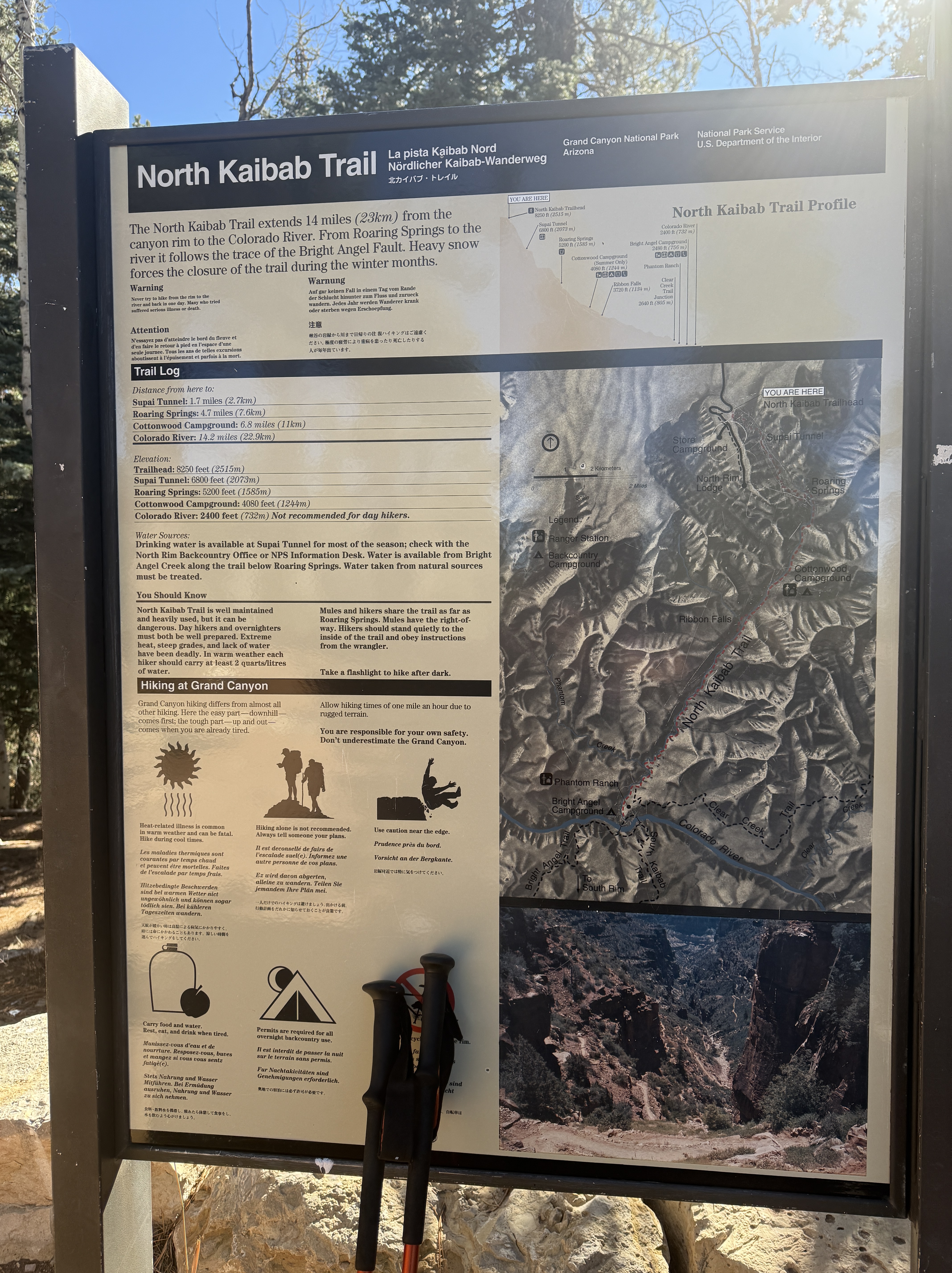
Day 4 – Cottonwood Camp To North Rim and Back
13 Miles, +4000′, -2000′
December 2, 2024
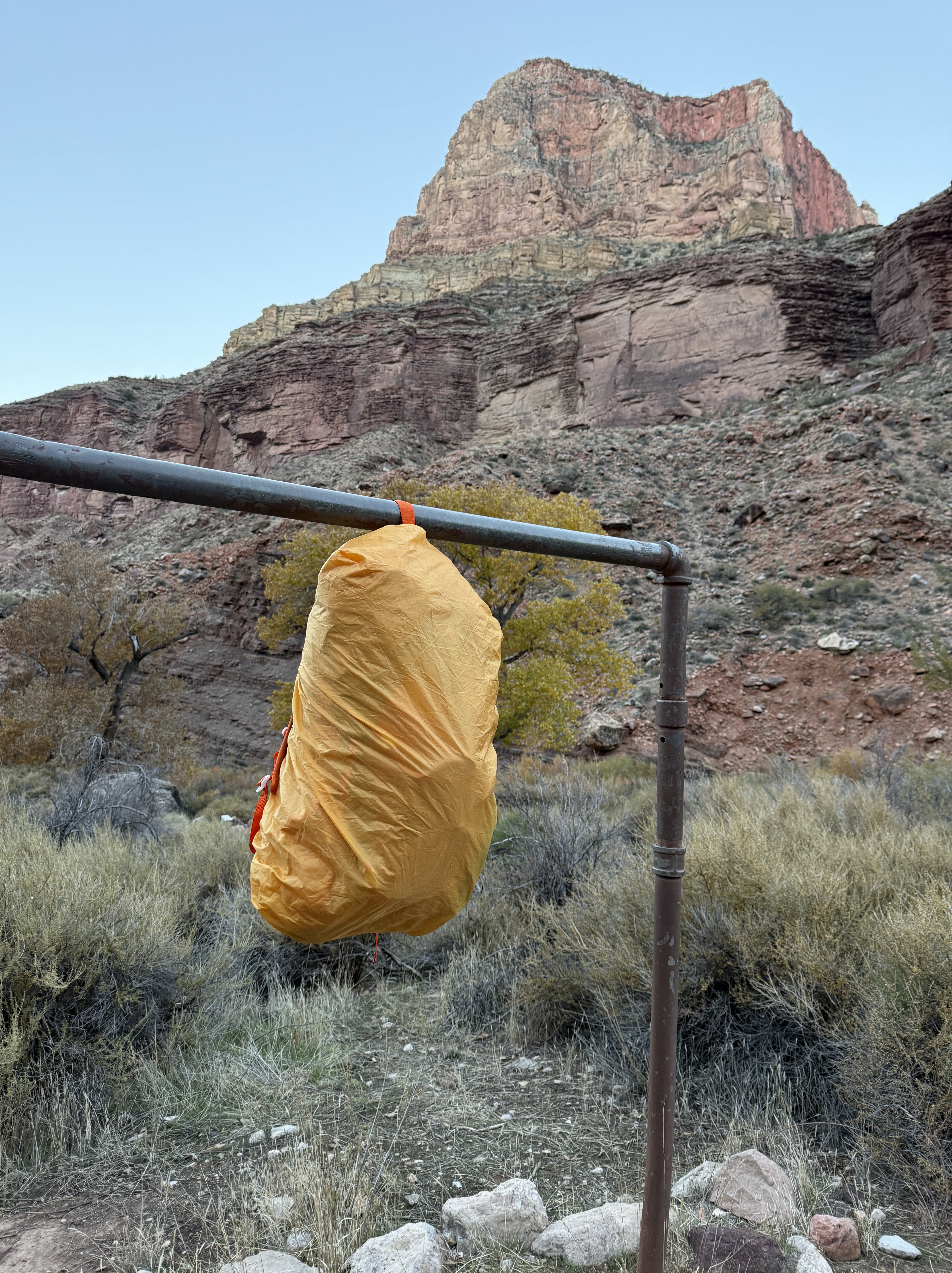
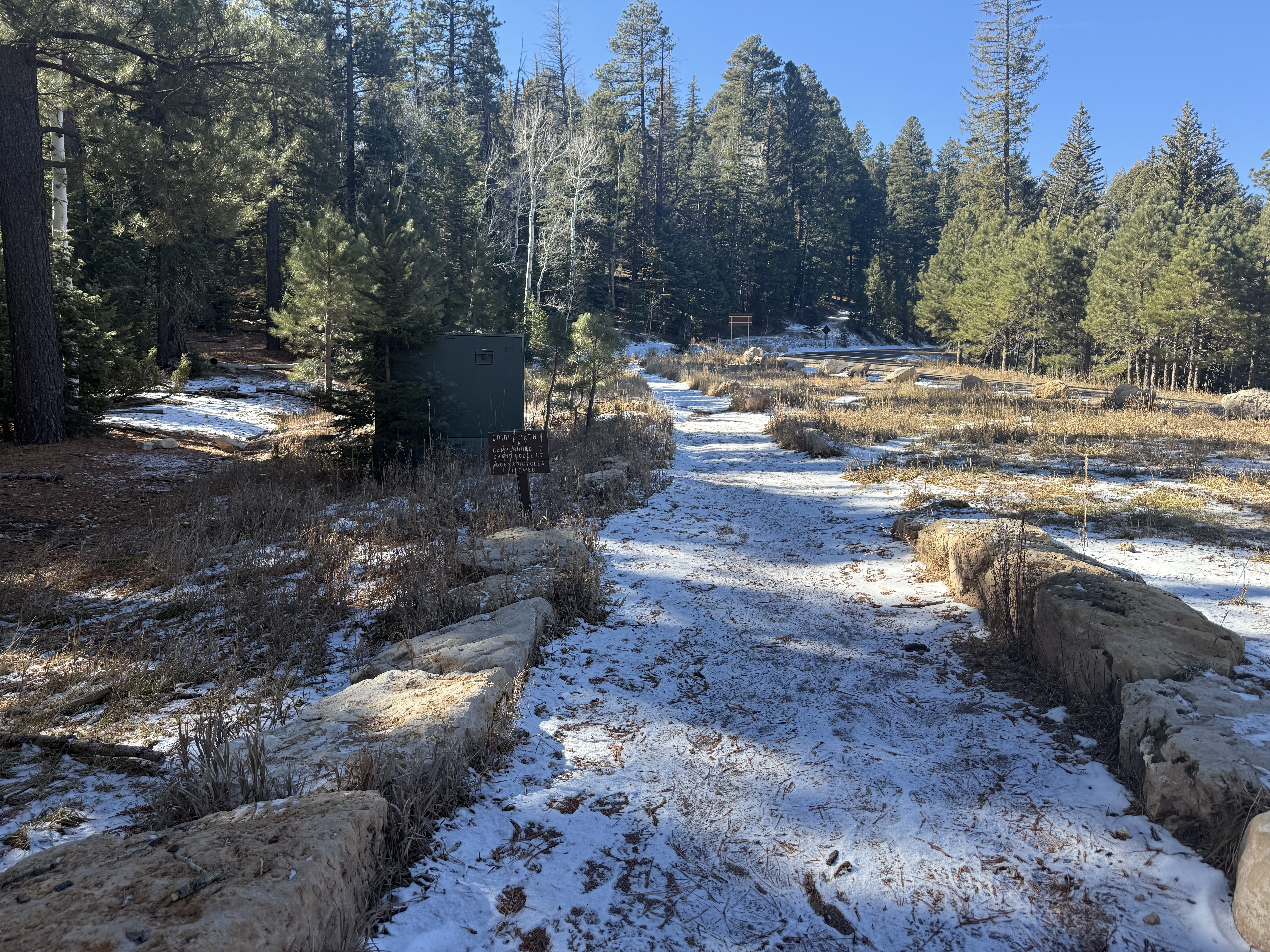
It was a nice feeling to get out of bed and be able to walk normally again. I rose early, very excited for the day ahead, and quickly consumed my oatmeal and coffee. I knew the mice would come around while I was gone, so I packed everything from my tent into my backpack and hung it from the metal post in my campsite. Opening the doors to my tent so as not to find holes chewed upon my return, I was confident I critter proofed everything before donning my fanny pack and heading to the North Rim!
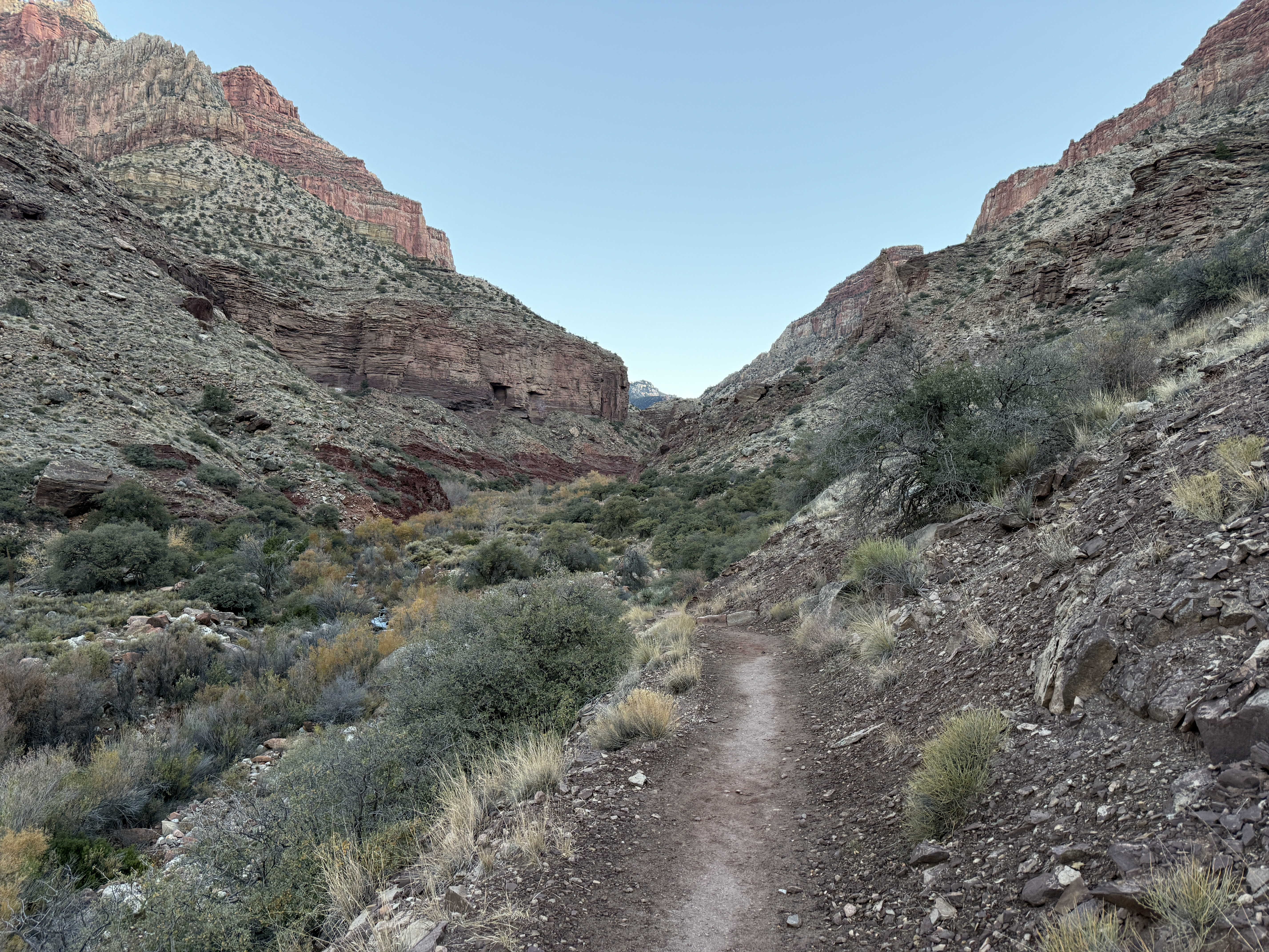
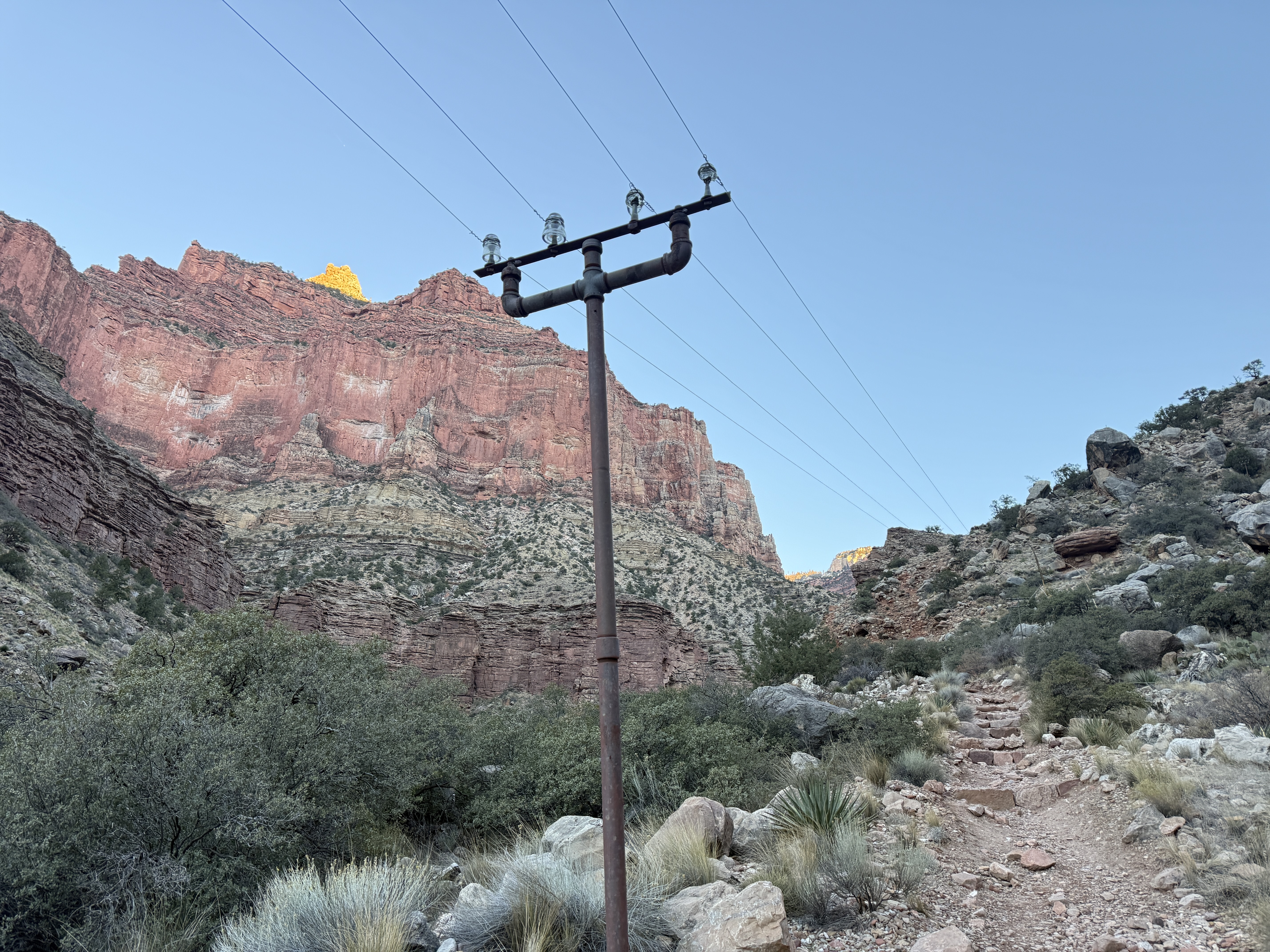
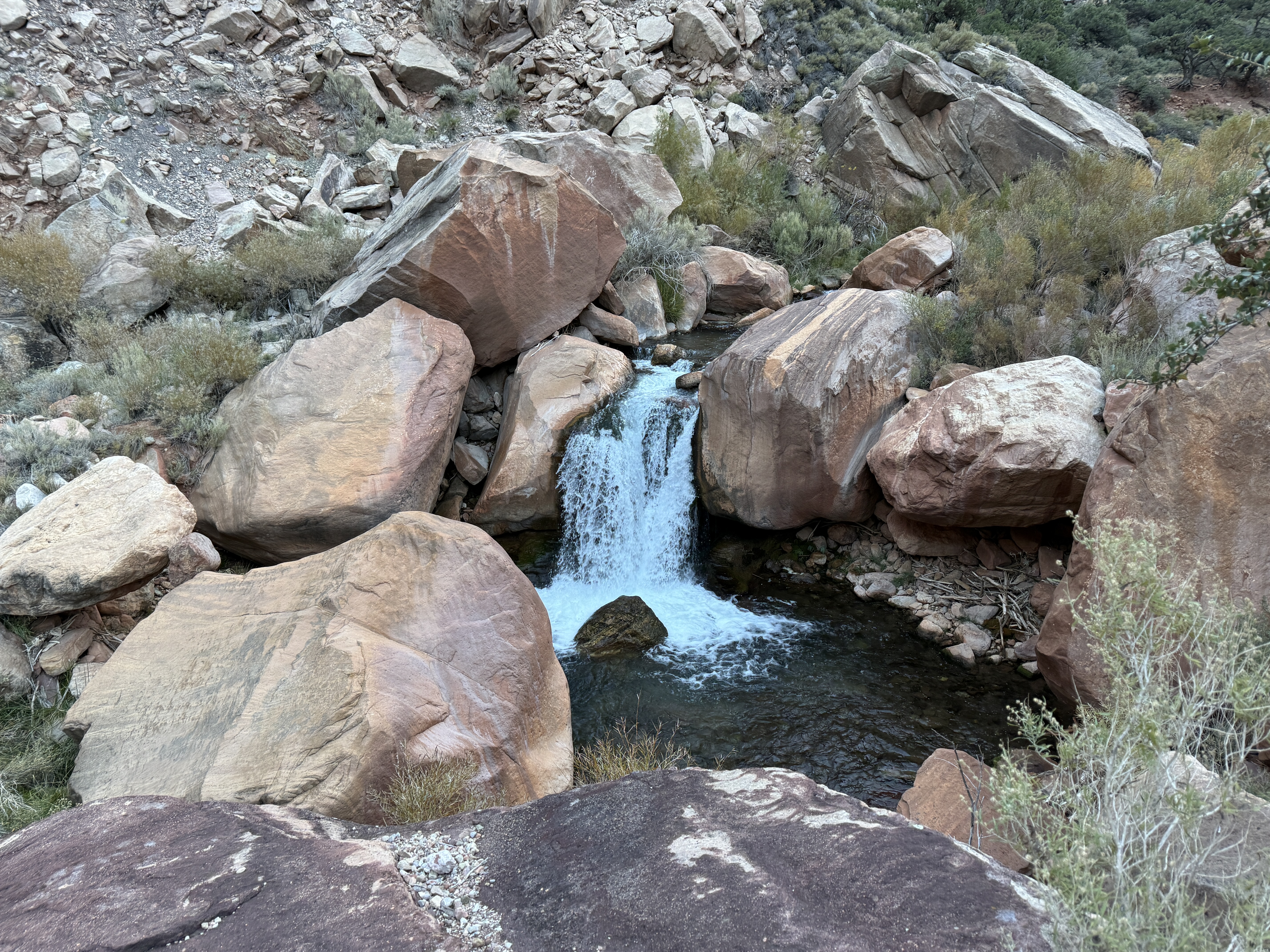
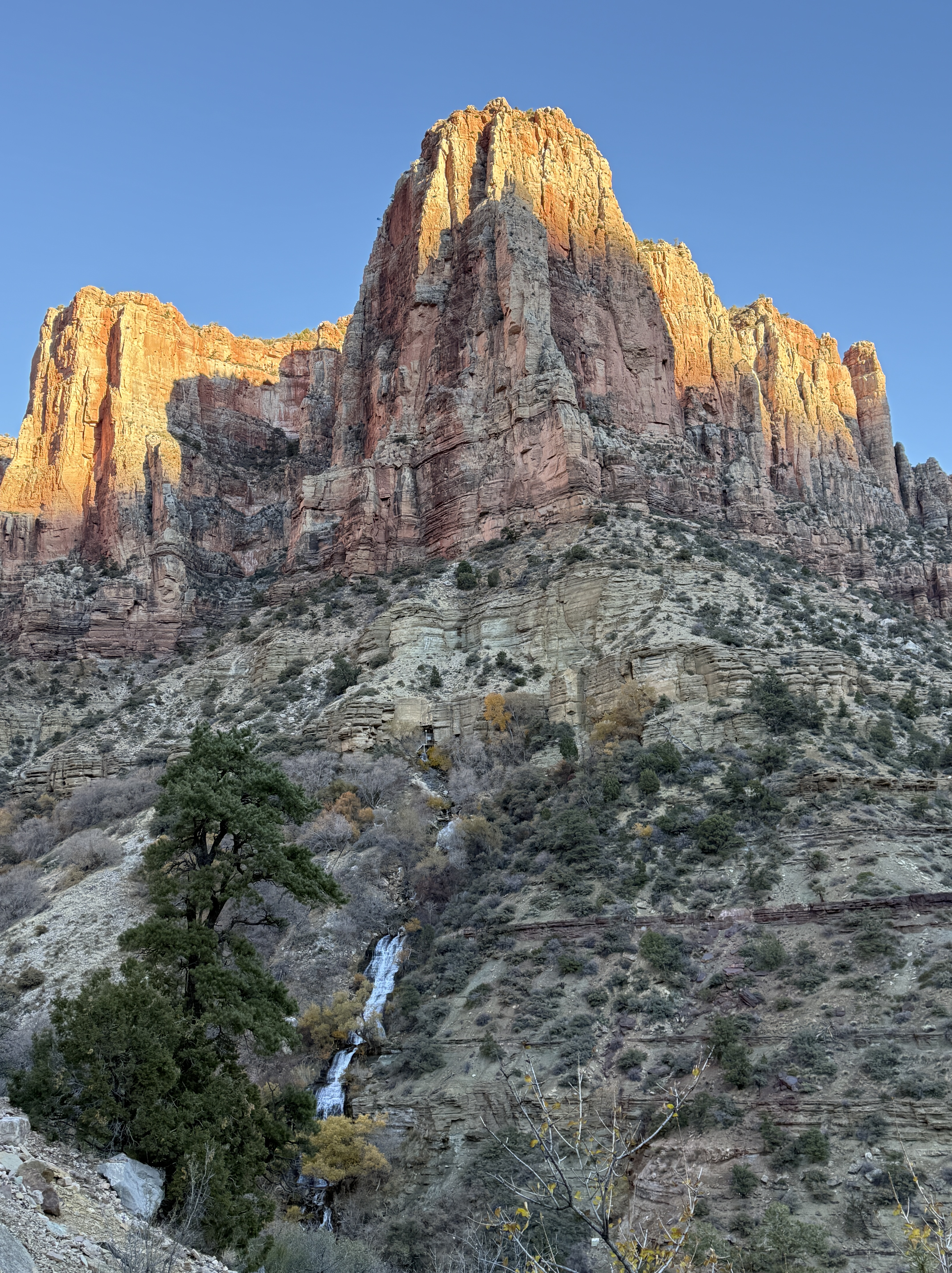
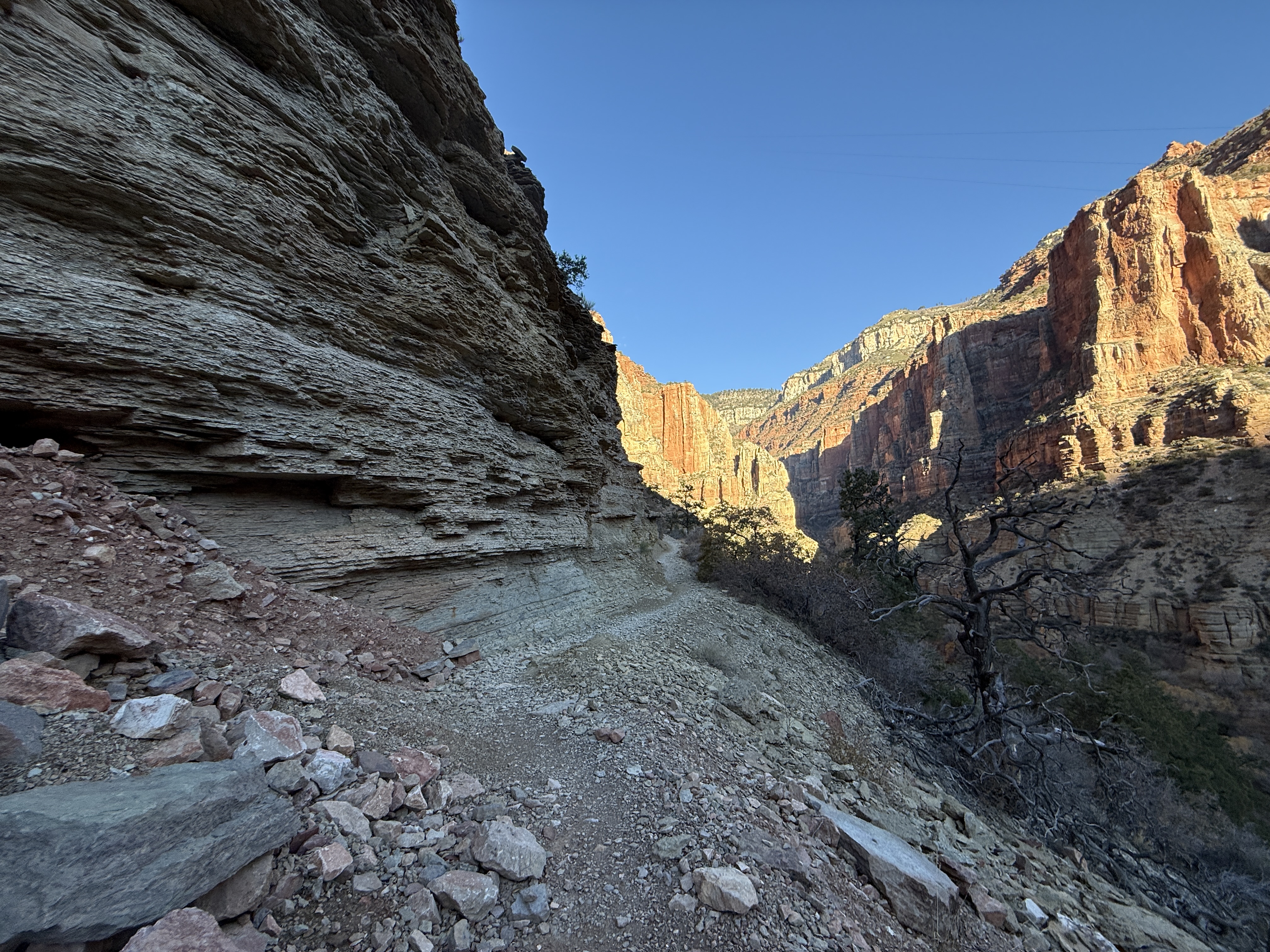
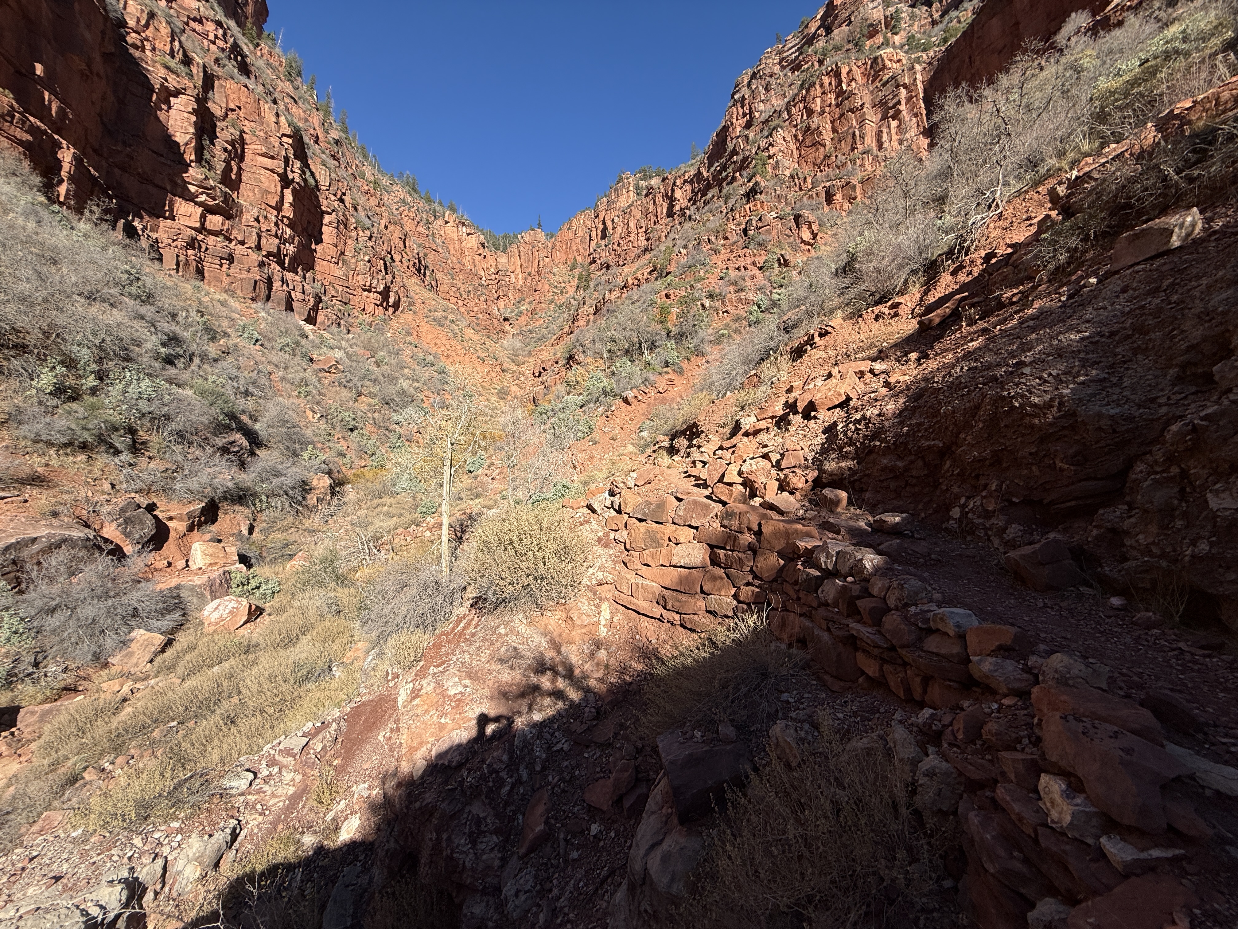
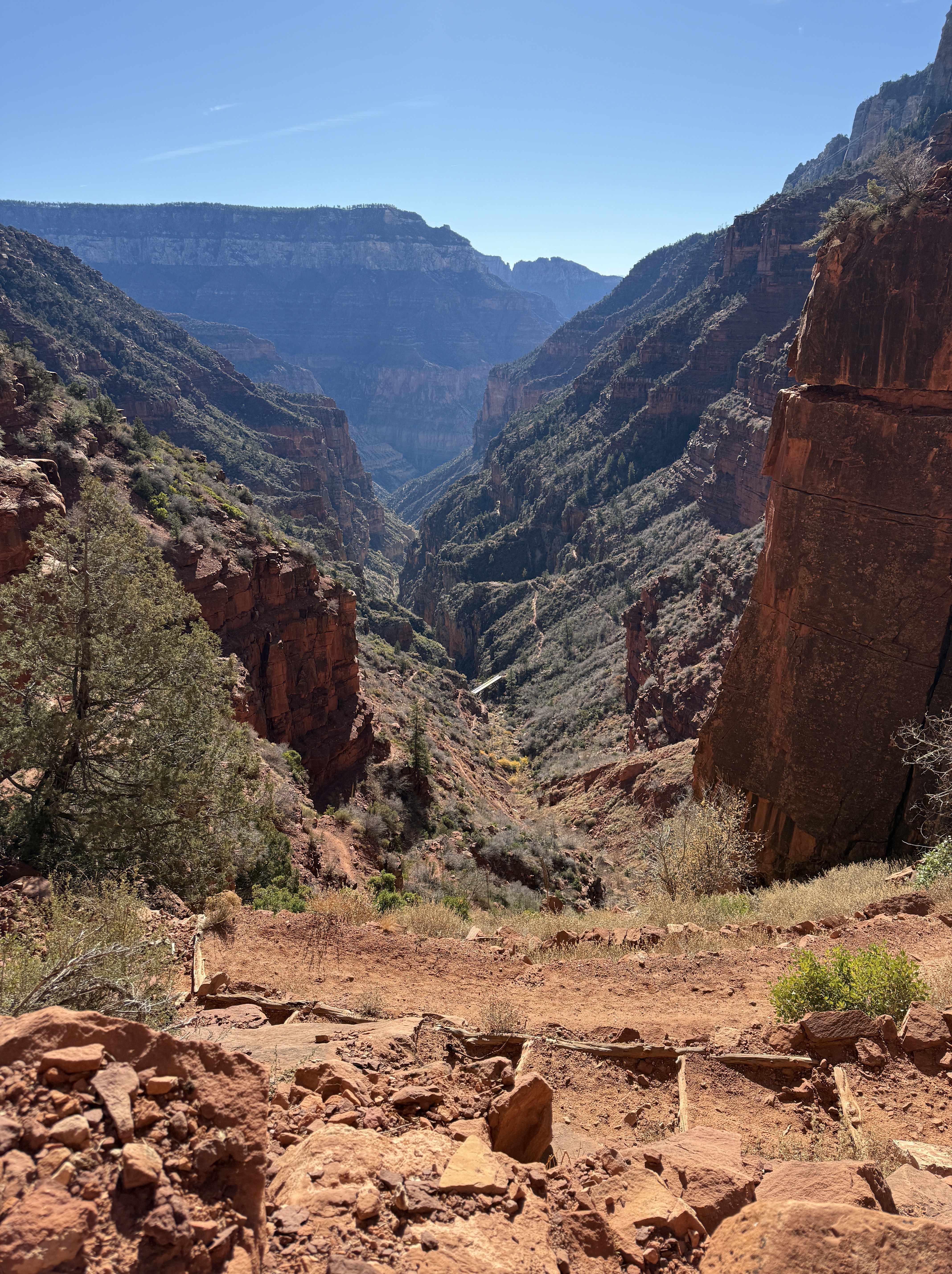
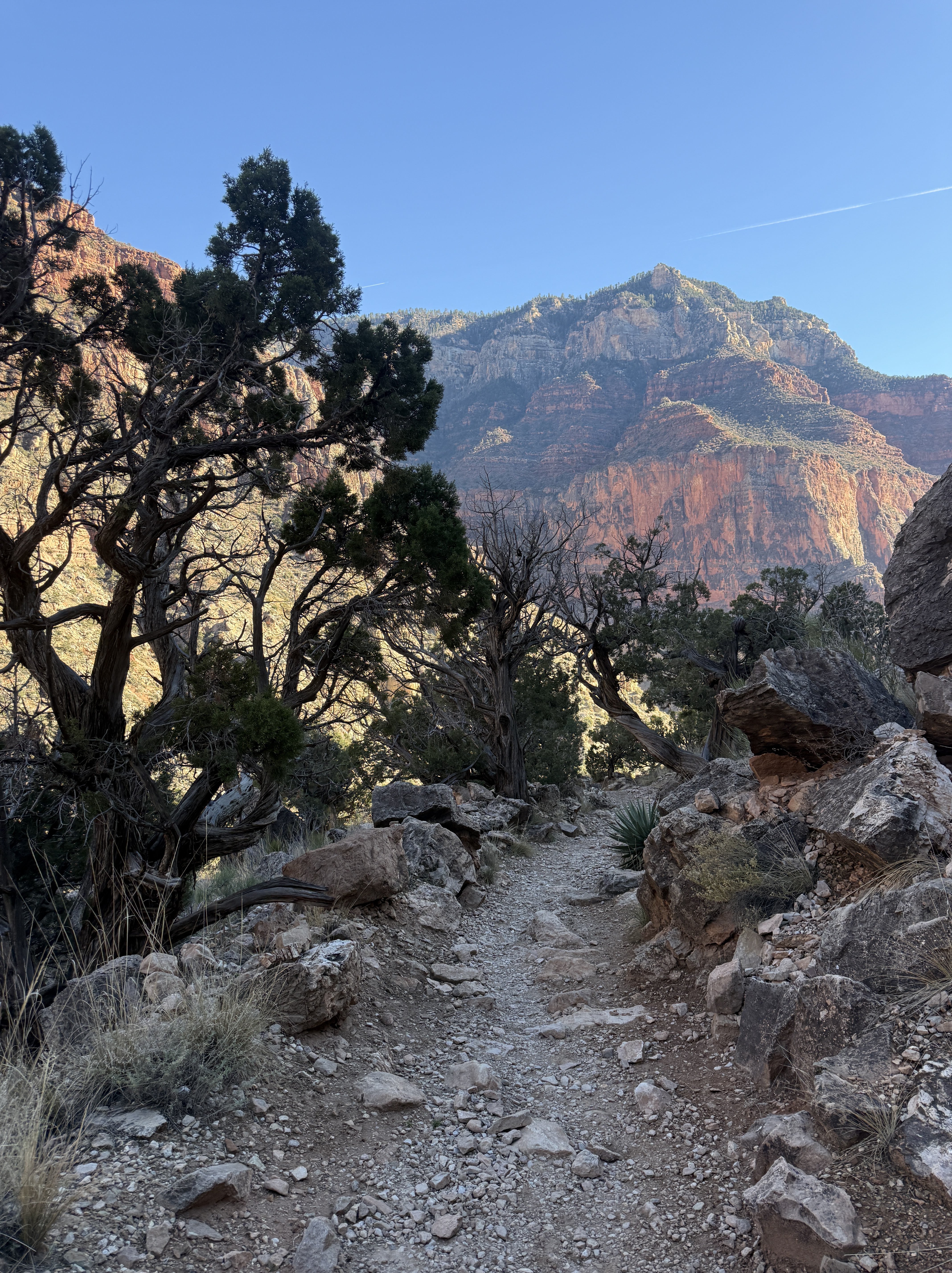
I passed by the other campsites, many of them devoid of people and gear, except for the last site before exiting the boundary of the campground. It was only 730am, so I assumed they were probably still sleeping. The sun would not reach the bottom of the canyon for a couple more hours. Passing by more old telegraph poles and a beautiful little waterfall, the trail continues, as it did before Cottonwood Camp, to wind along Bright Angel Creek, gaining 700 feet over the next mile and a half.

Surprisingly, I ran into a handful of people, and they explained to me that they lived at Manzanita Ranger Station for two weeks at a time and were the ones doing the fish studies below Cottonwood Camp. They made the daily trek to their work site and then would hike out to the South Rim for their time off. It reminded me of my wildland firefighting days, living and working in the remote wilderness for weeks at a time.
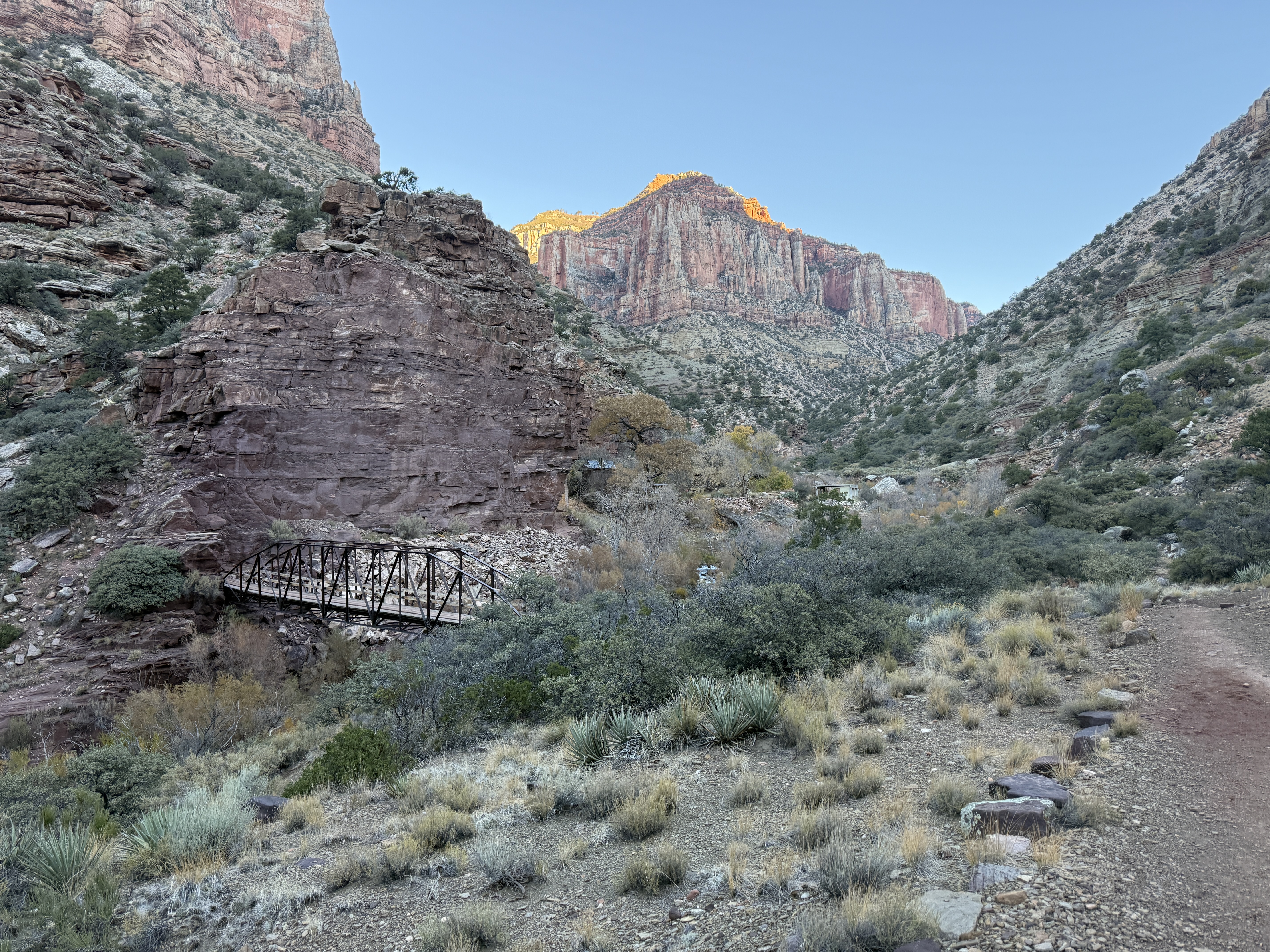
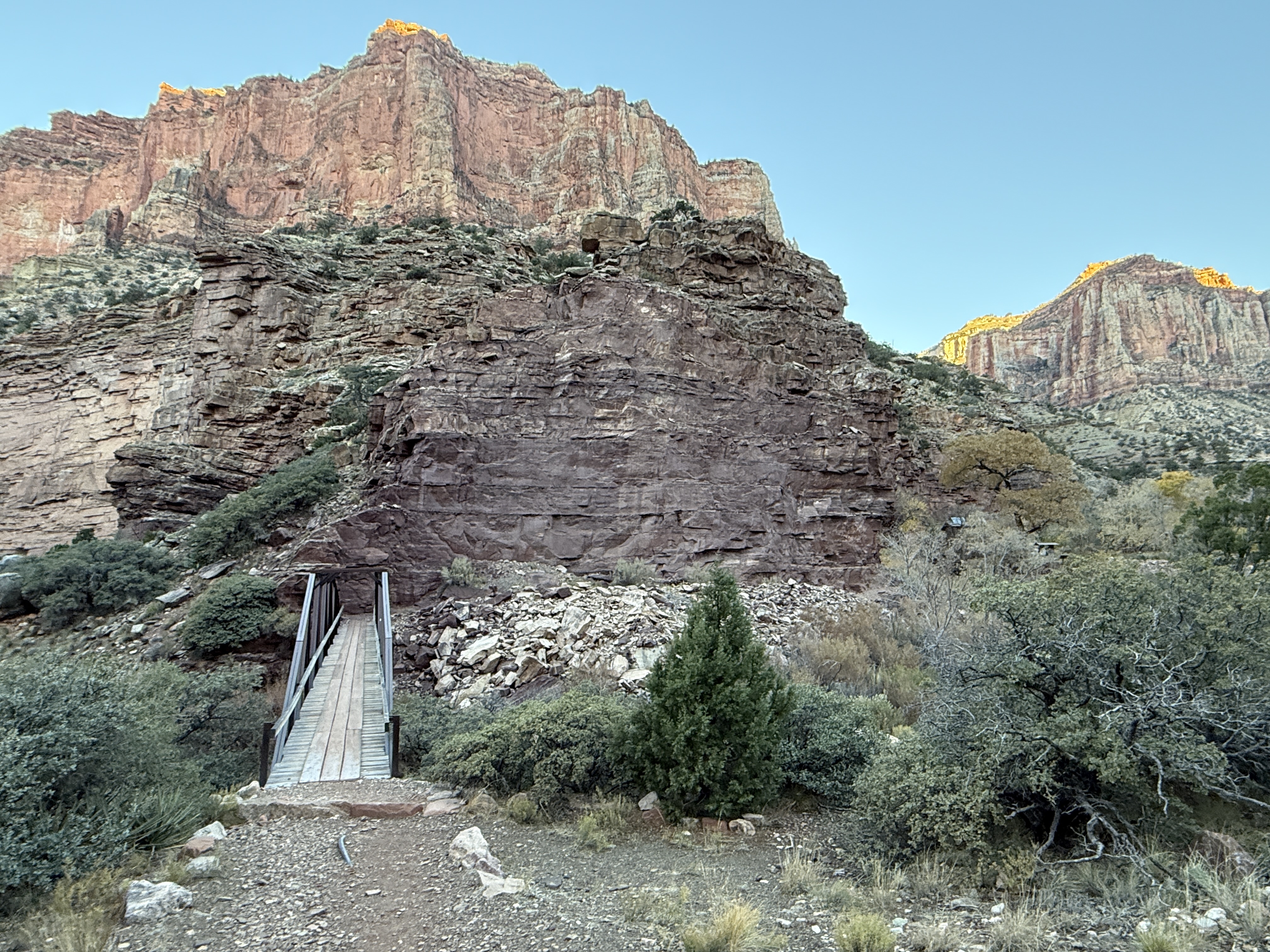
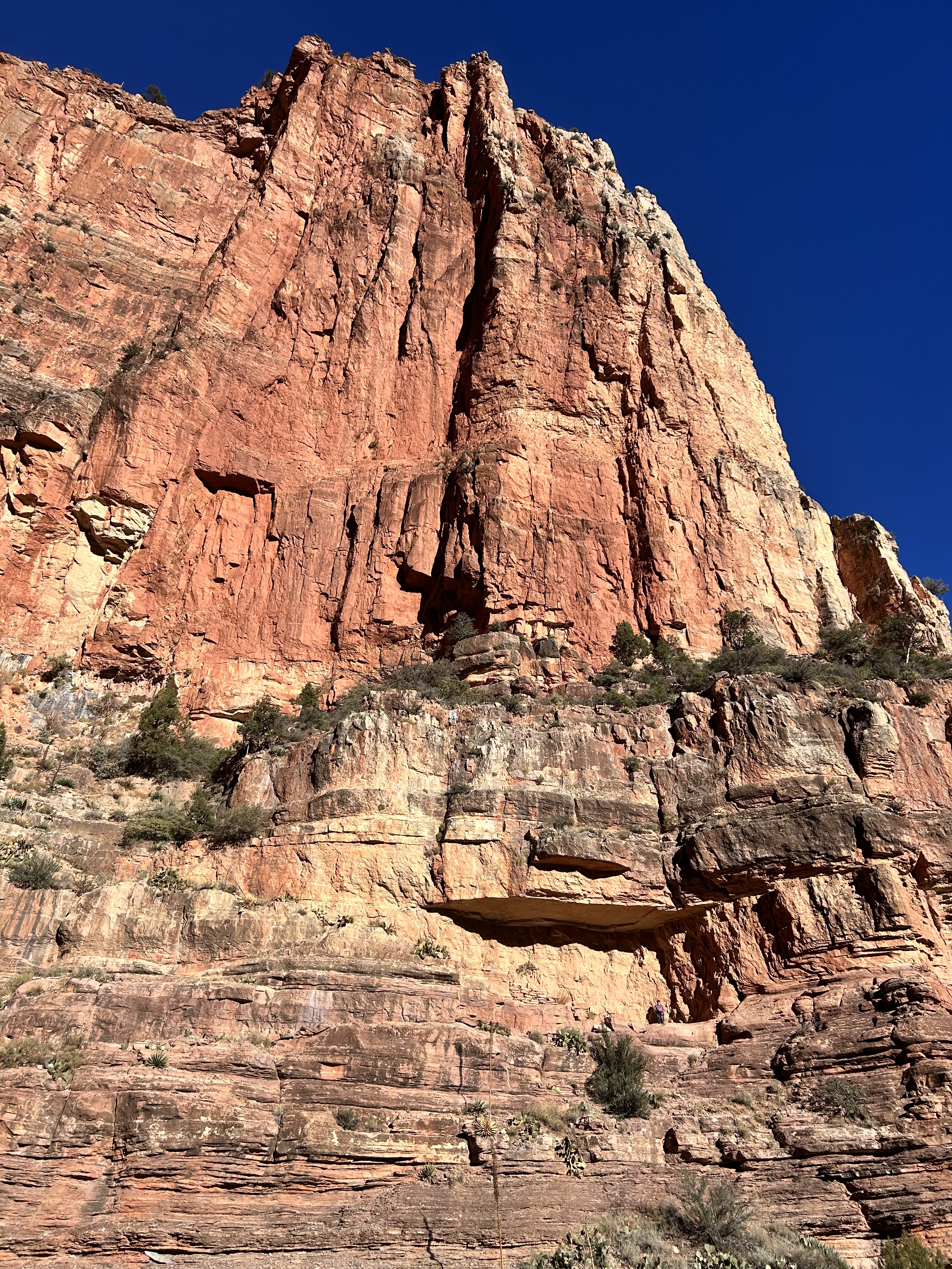
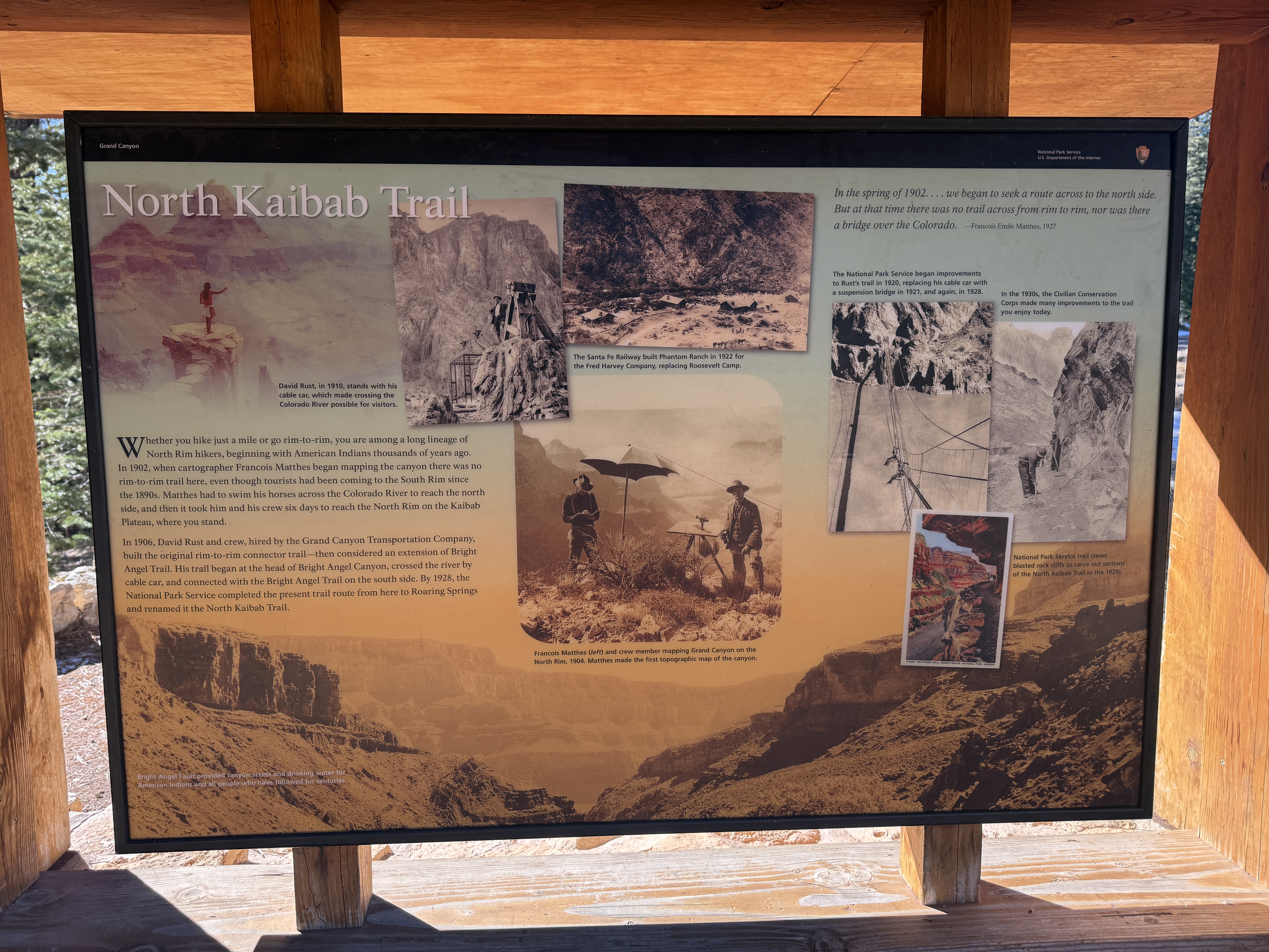
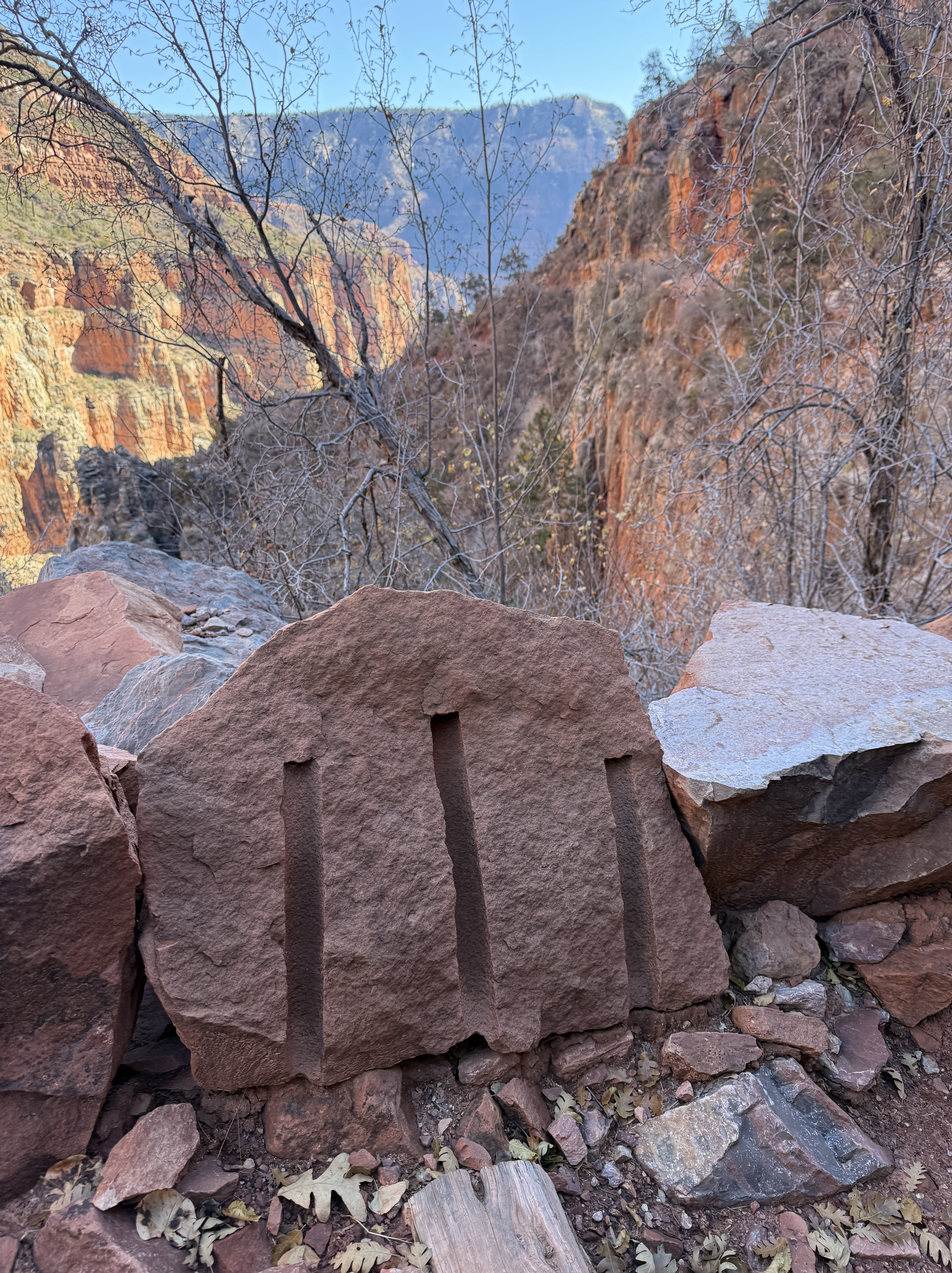
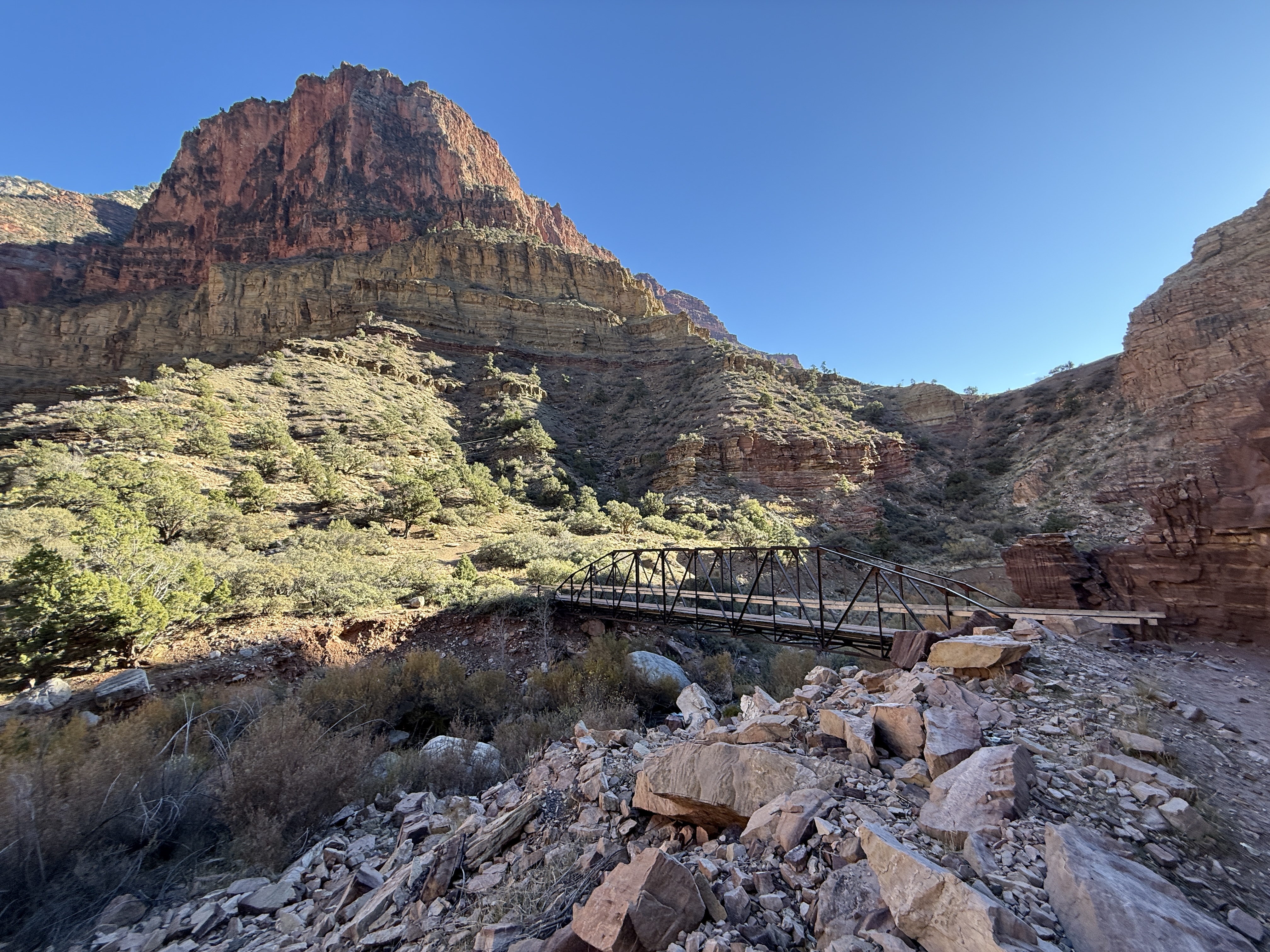
About a half an hour after leaving camp, I came upon a stout truss bridge that crossed from east to west over Bright Angel Creek. It is here that I would leave the pre-1928 trail, AKA “Old Bright Angel Trail”, that continued up to the rim along Bright Angel Creek. This historic trail was deemed too hazardous and ill-maintained to become the main hiking and pack mule route in the National Parks Service’s bid to bring more tourists into the Canyon, and the North Kaibab Trail that we know now was constructed in the winter months between 1926 and 1928. It was maintained and improved by the CCC in the 1930s. The efforts expended were well worth it; the North Kaibab trail is one the most incredibly engineered and well-maintained trails in the world.
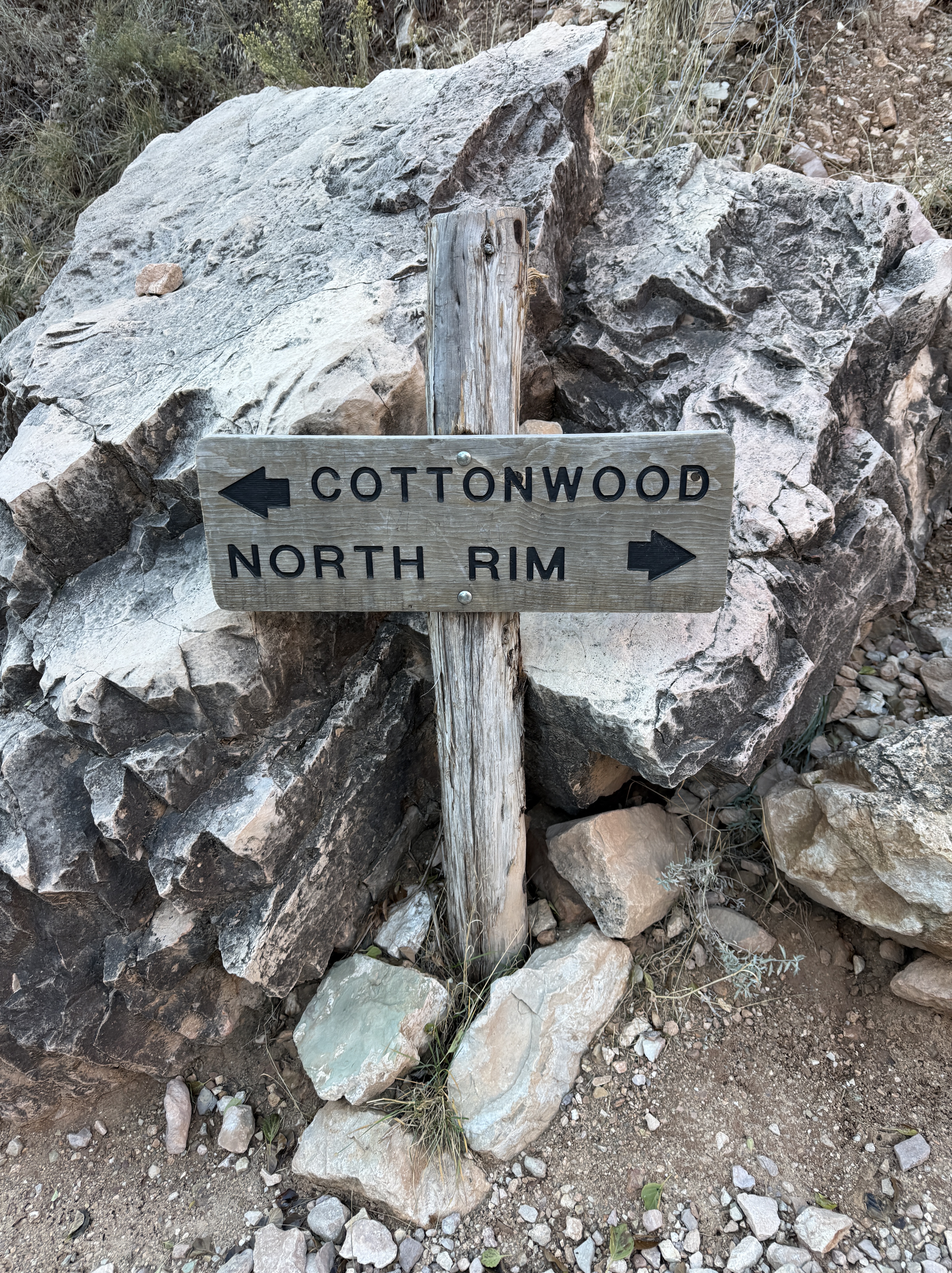
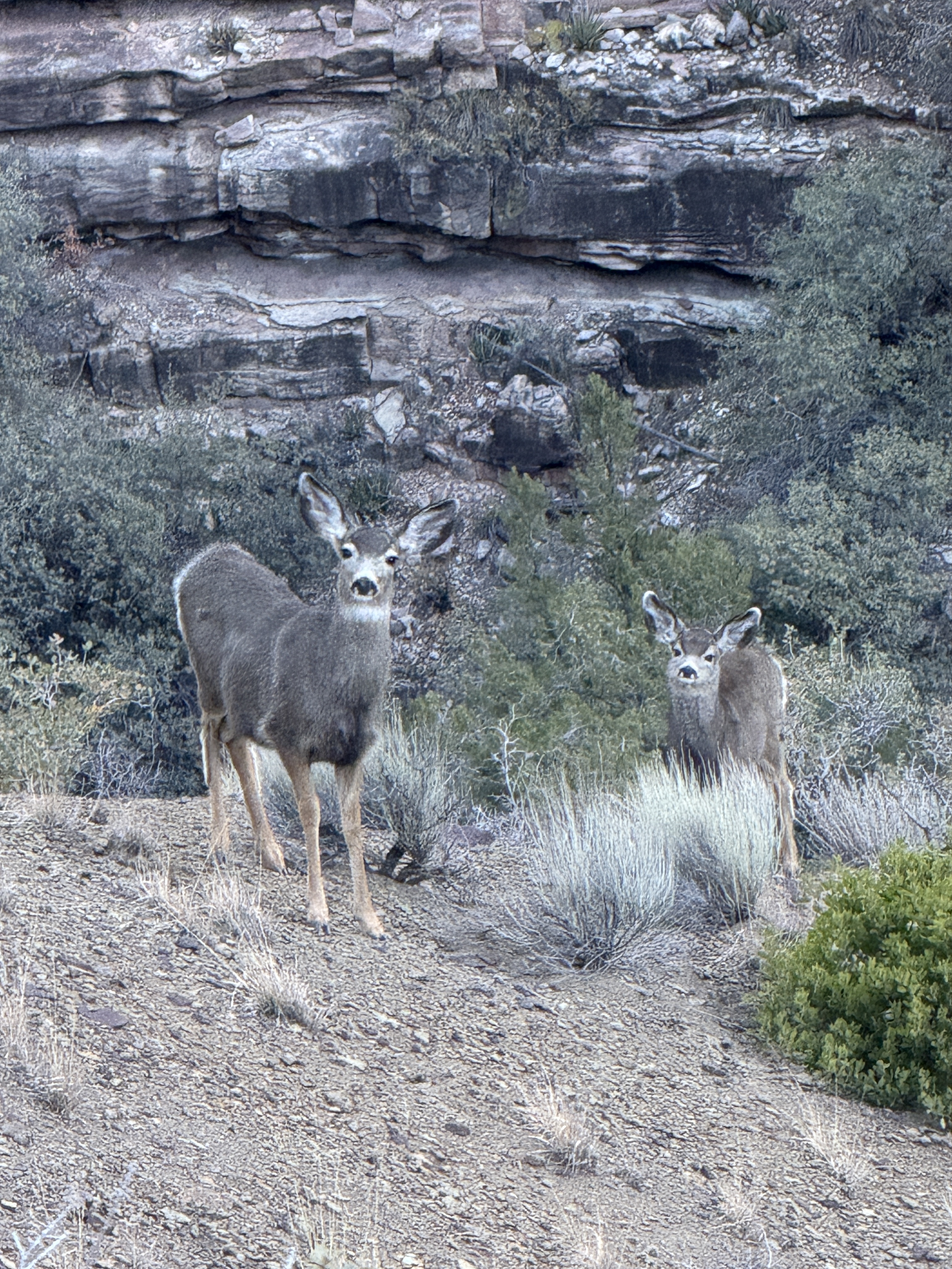
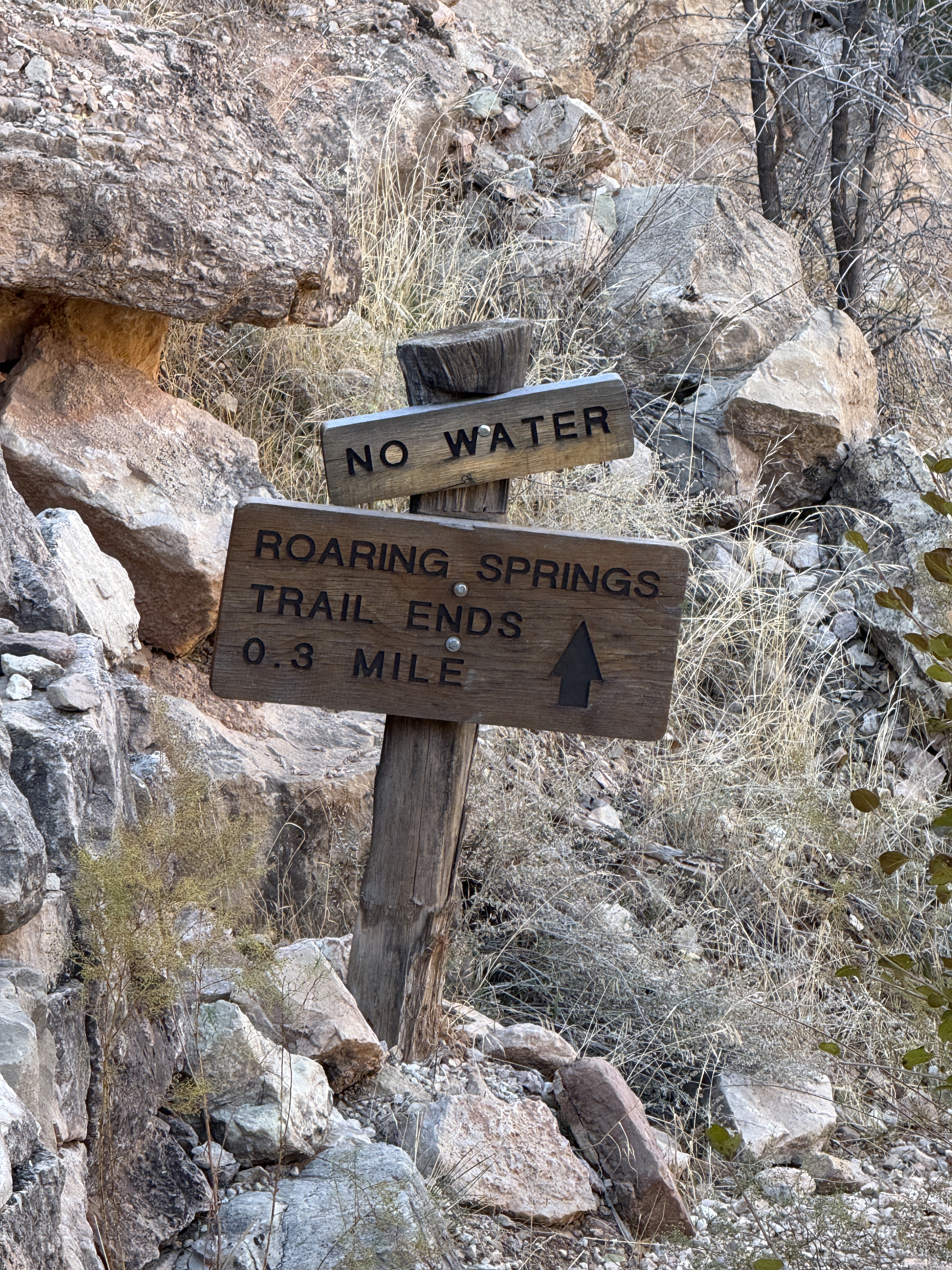
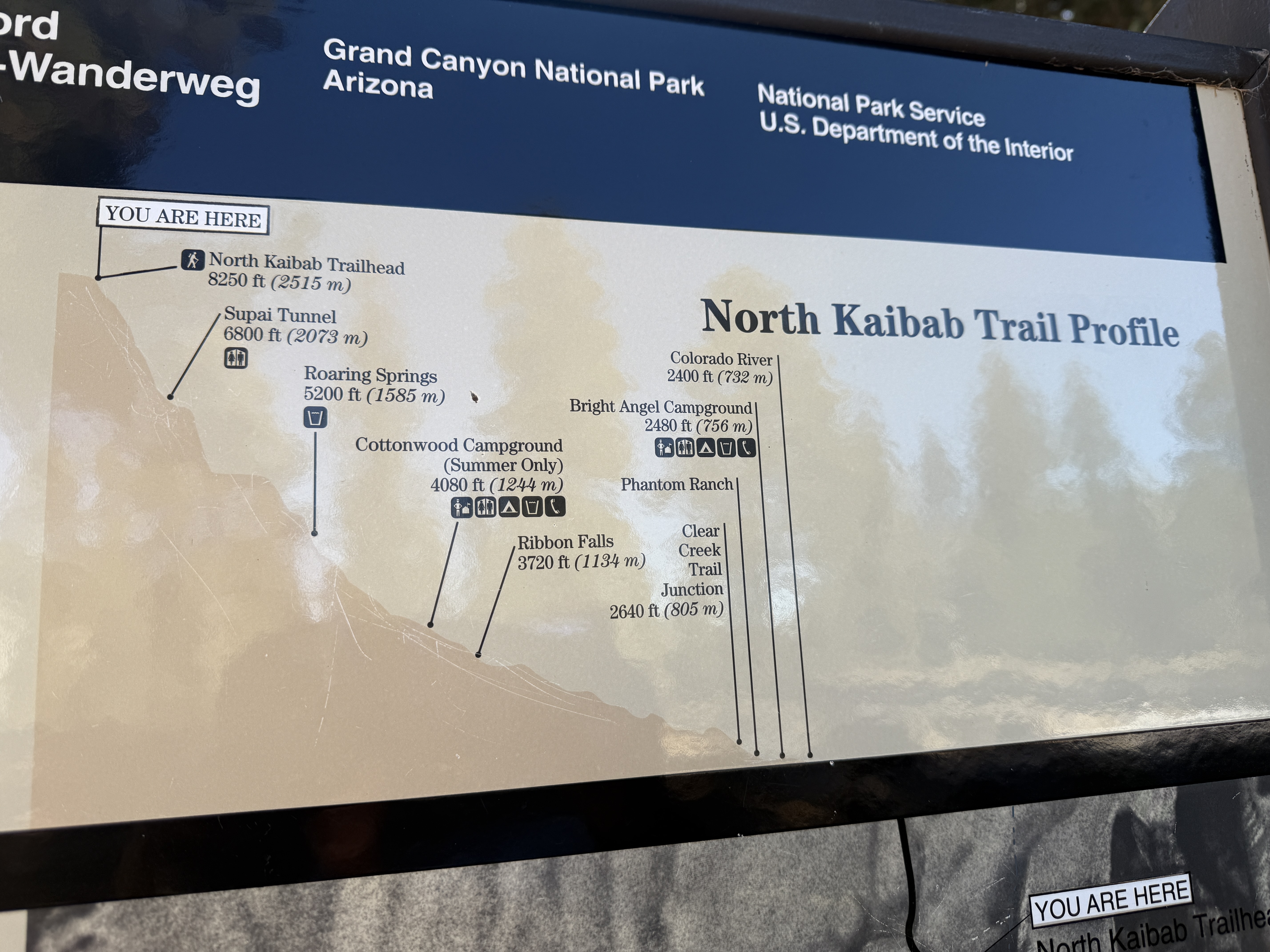
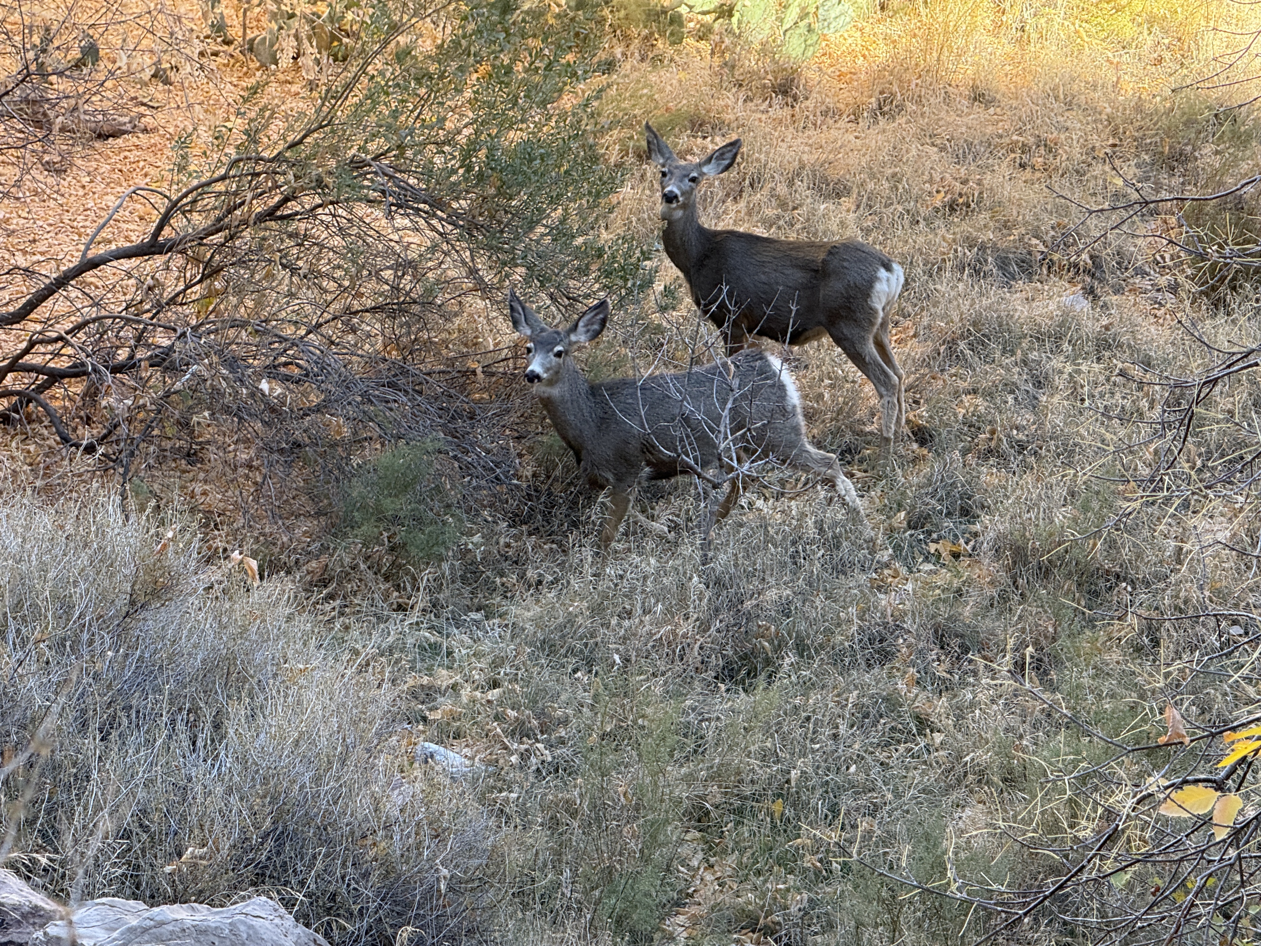
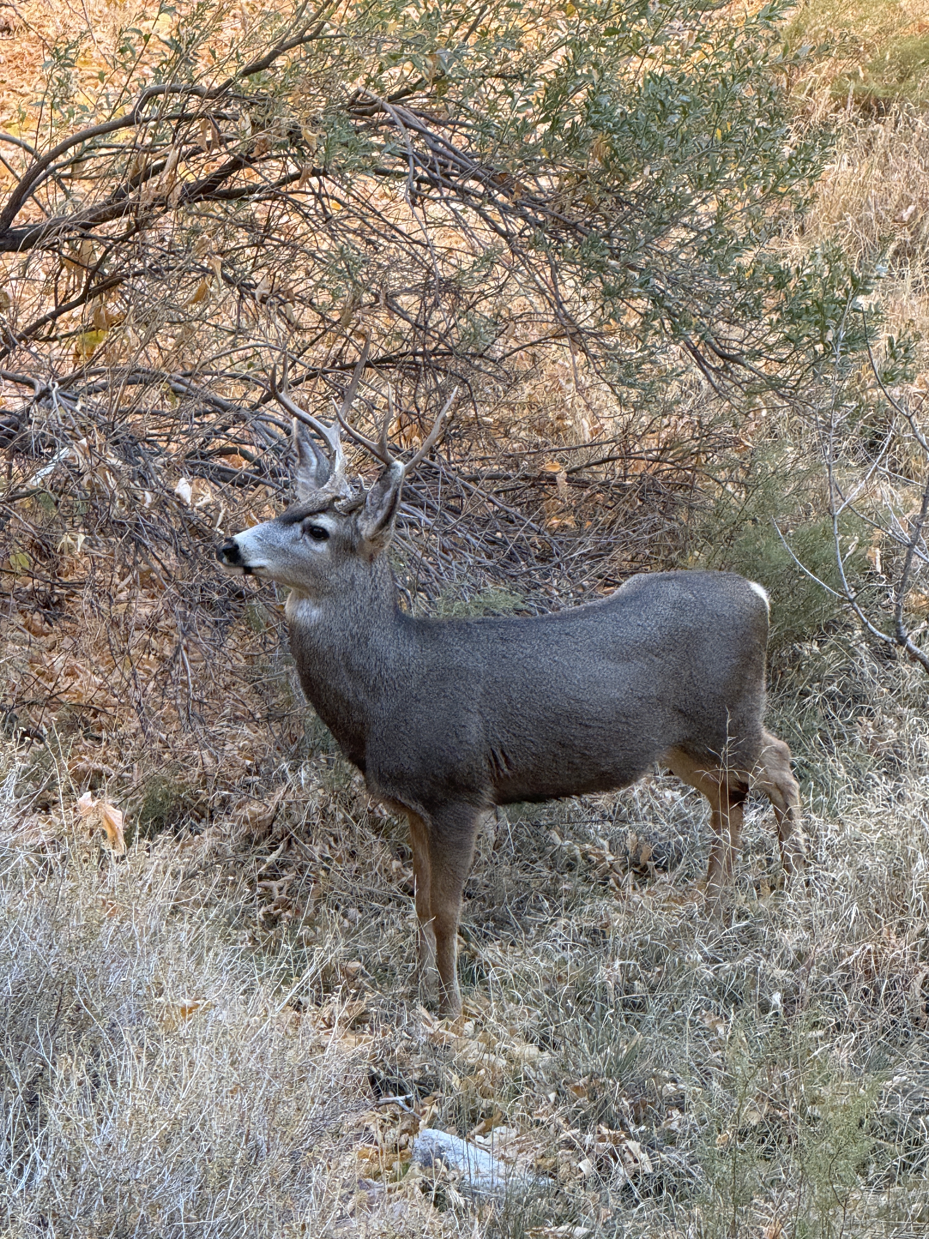
Manzanita Ranger Station was just past the bridge, offering hikers a place to rest, a composting toilet, and, during the tourist season, running potable water and a Ranger to answer all of your burning questions. I stopped to take photos of a herd of mule deer that were mulling around and was surprised when I looked up and saw two young men taking a break. We struck up a conversation and I learned that they were the people camped at the last site at Cottonwood, apparently having gotten up and moving before me and not, in fact, still asleep in their tent. They had the same intention as I did, to hike the 13 miles and +4,000′ to the North Rim as a day hike, although one of them had a knee that was giving him trouble.
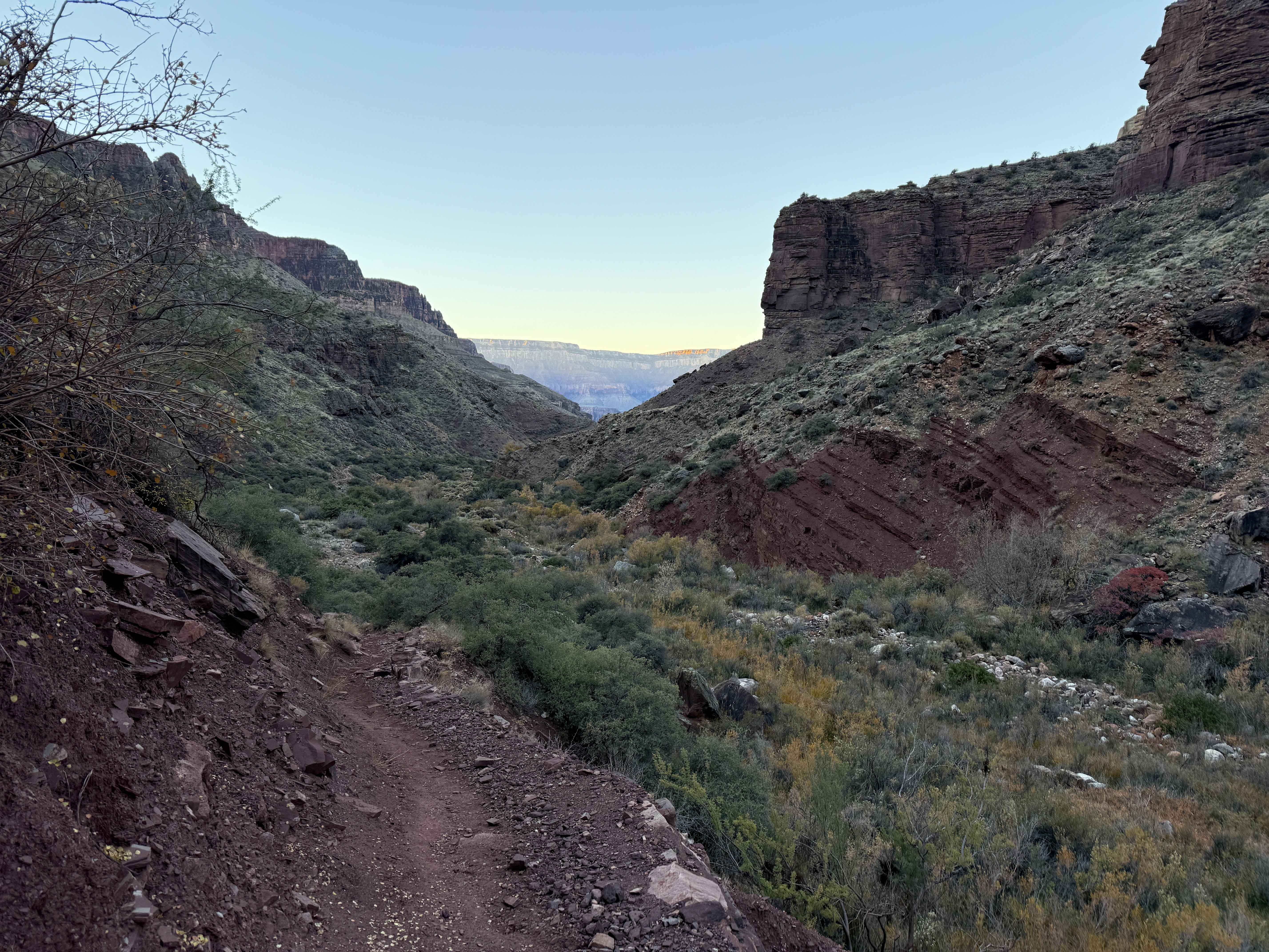
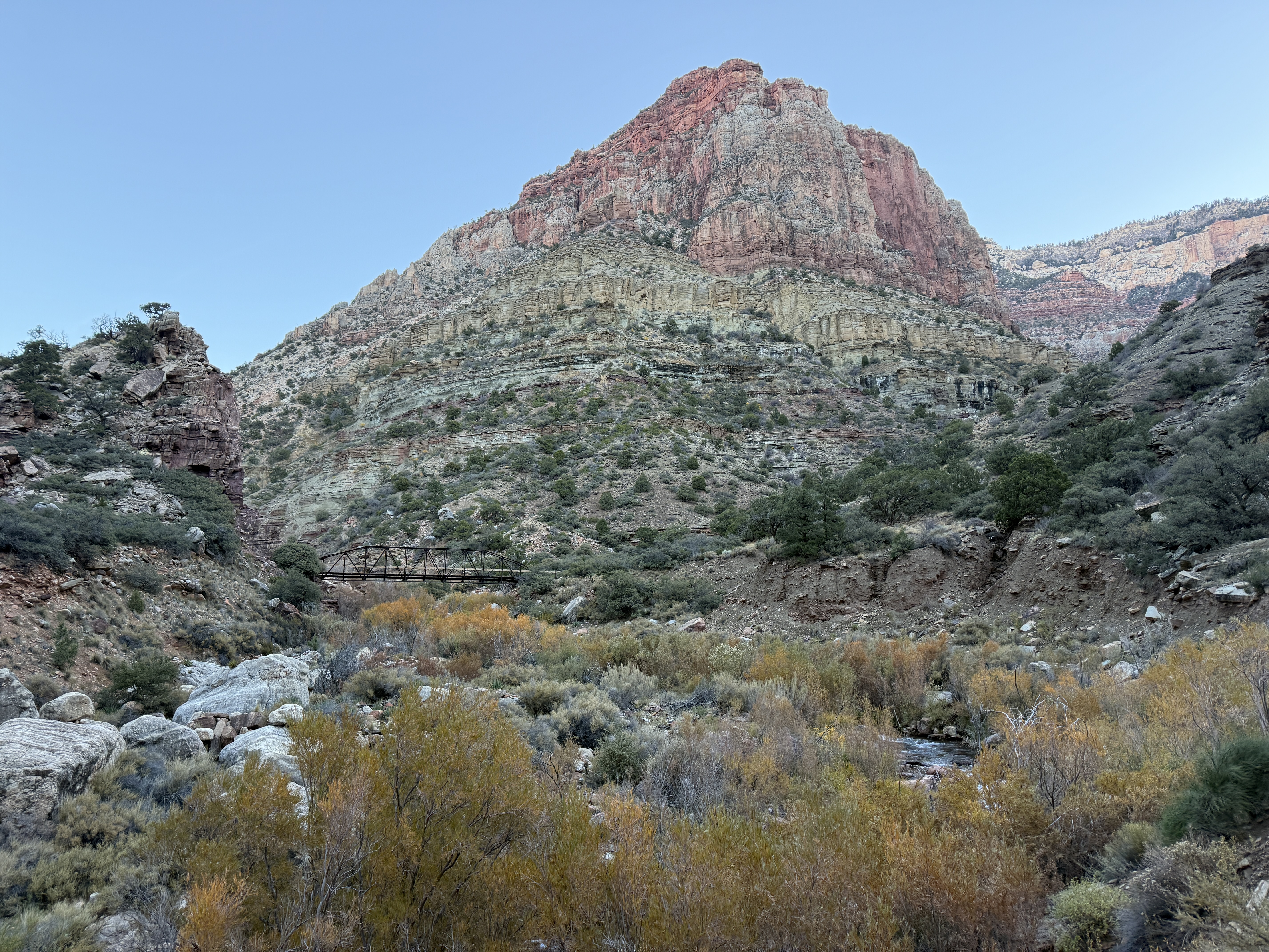
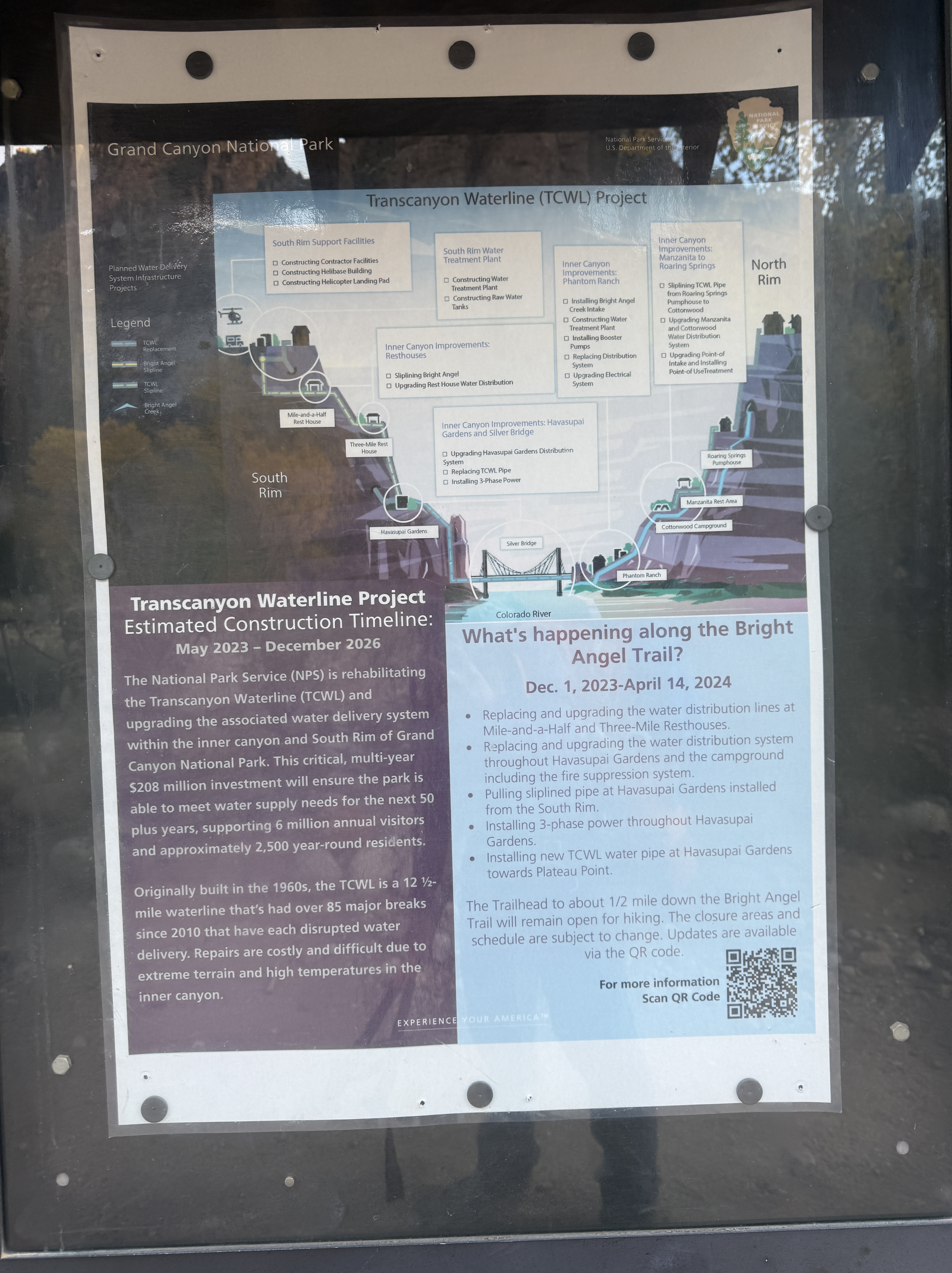
We traveled along together, passing Roaring Springs, the main water source for the Grand Canyon corridor and South Rim. This giant waterfall sprouts from the middle of the canyon wall, spilling hundreds of feet to feed the Transcanyon Waterline. The waterline runs down to the Colorado River and once the head pressure dissipates on the Tonto Plateau at Havasupai Gardens, it is pumped to the top of the South Rim; an amazing feat of engineering that was completed in the 1960s. The much-needed upgrades that were happening during and after my trip, throughout the winter of 24/25, would hopefully eliminate the constant need to repair the aging pipes and offset the high cost to do so, much of the pipe only being accessible by helicopter, foot, or mule.
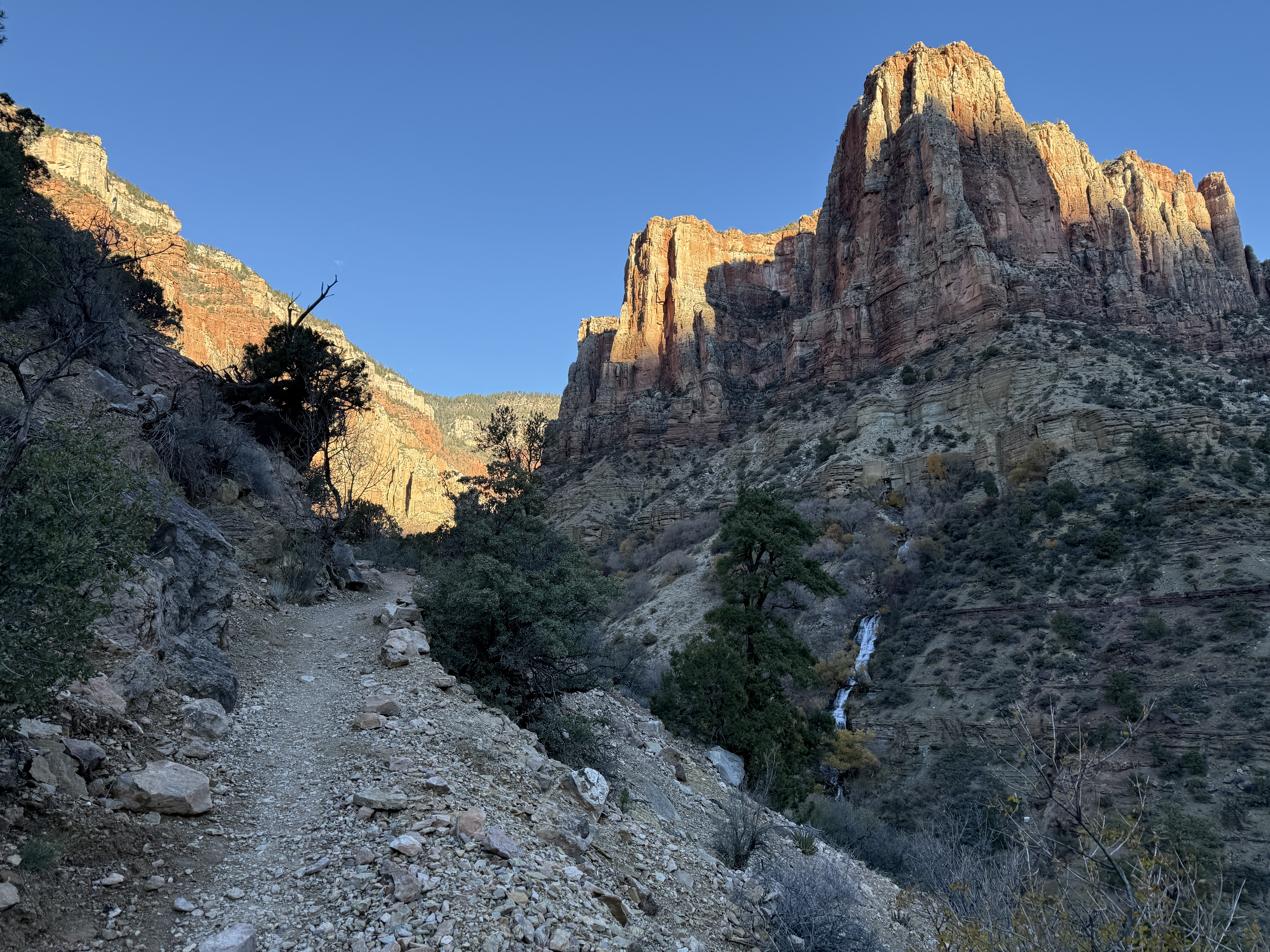
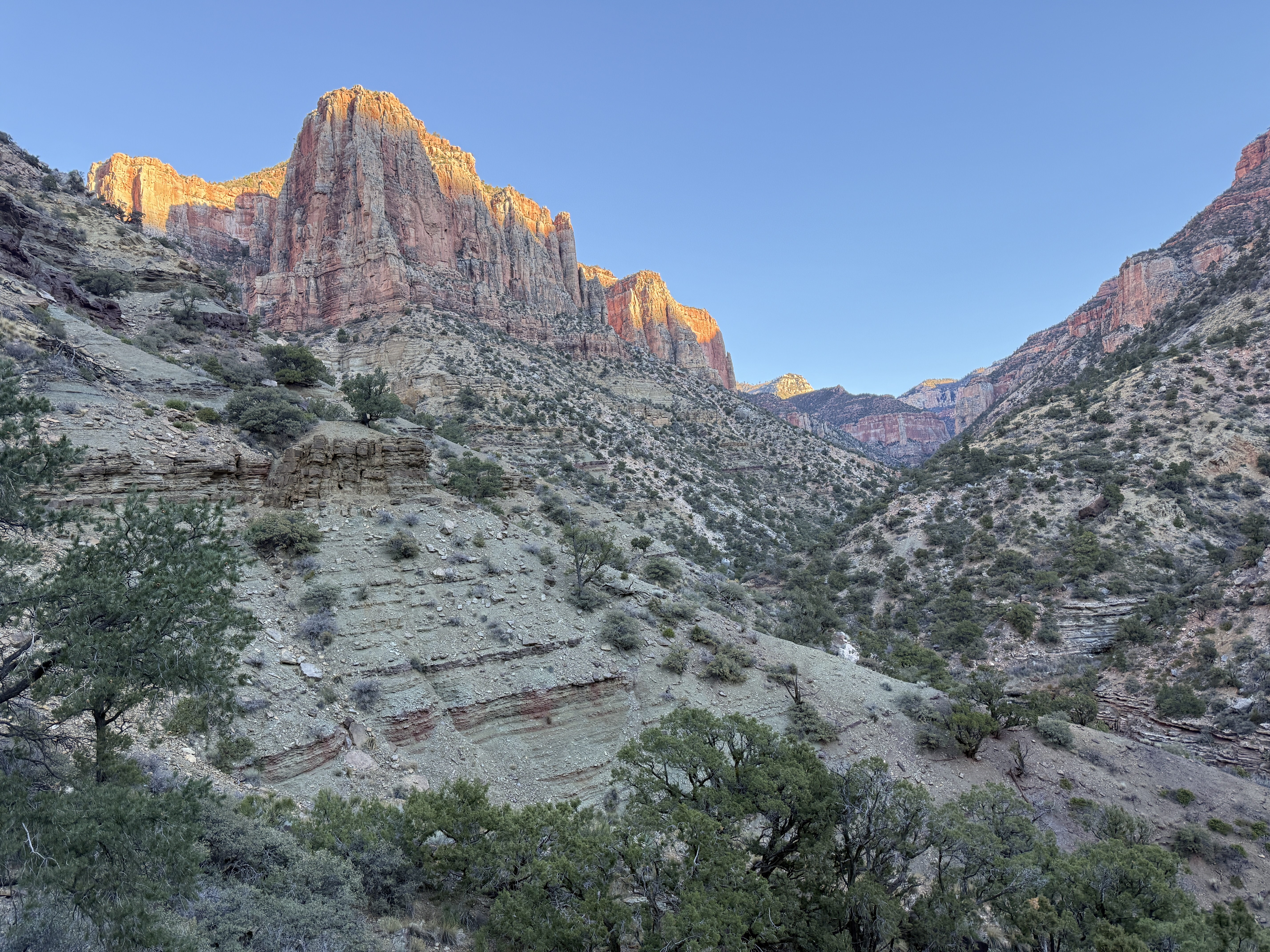
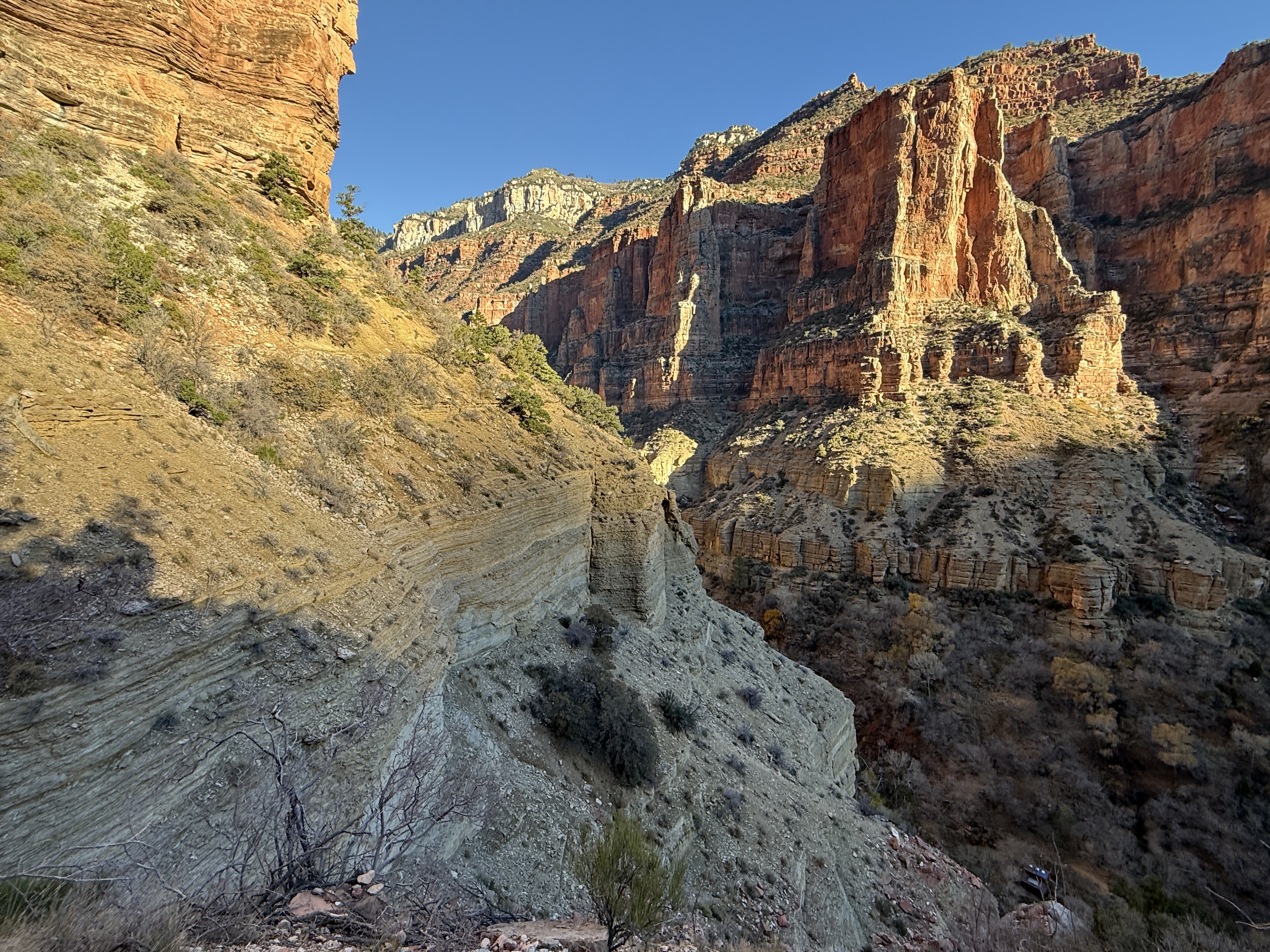
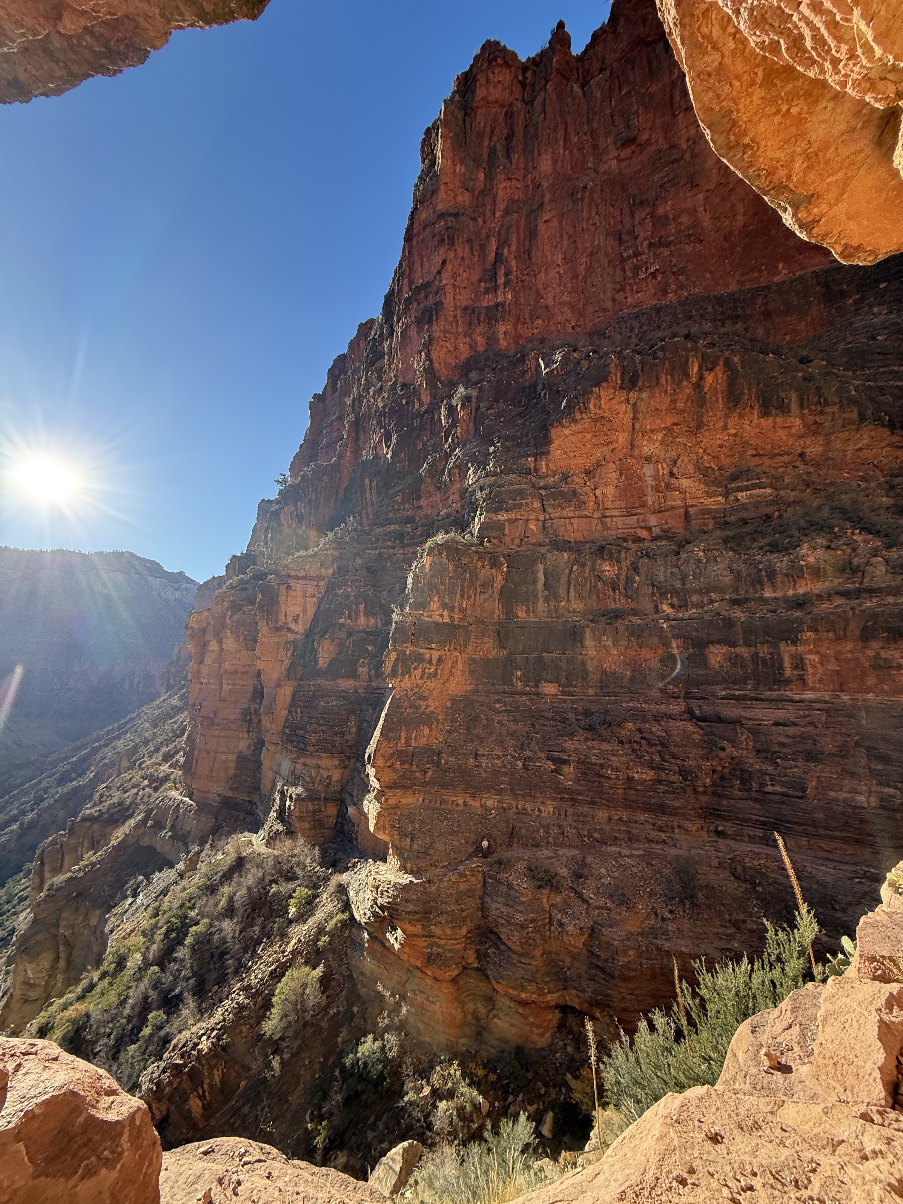
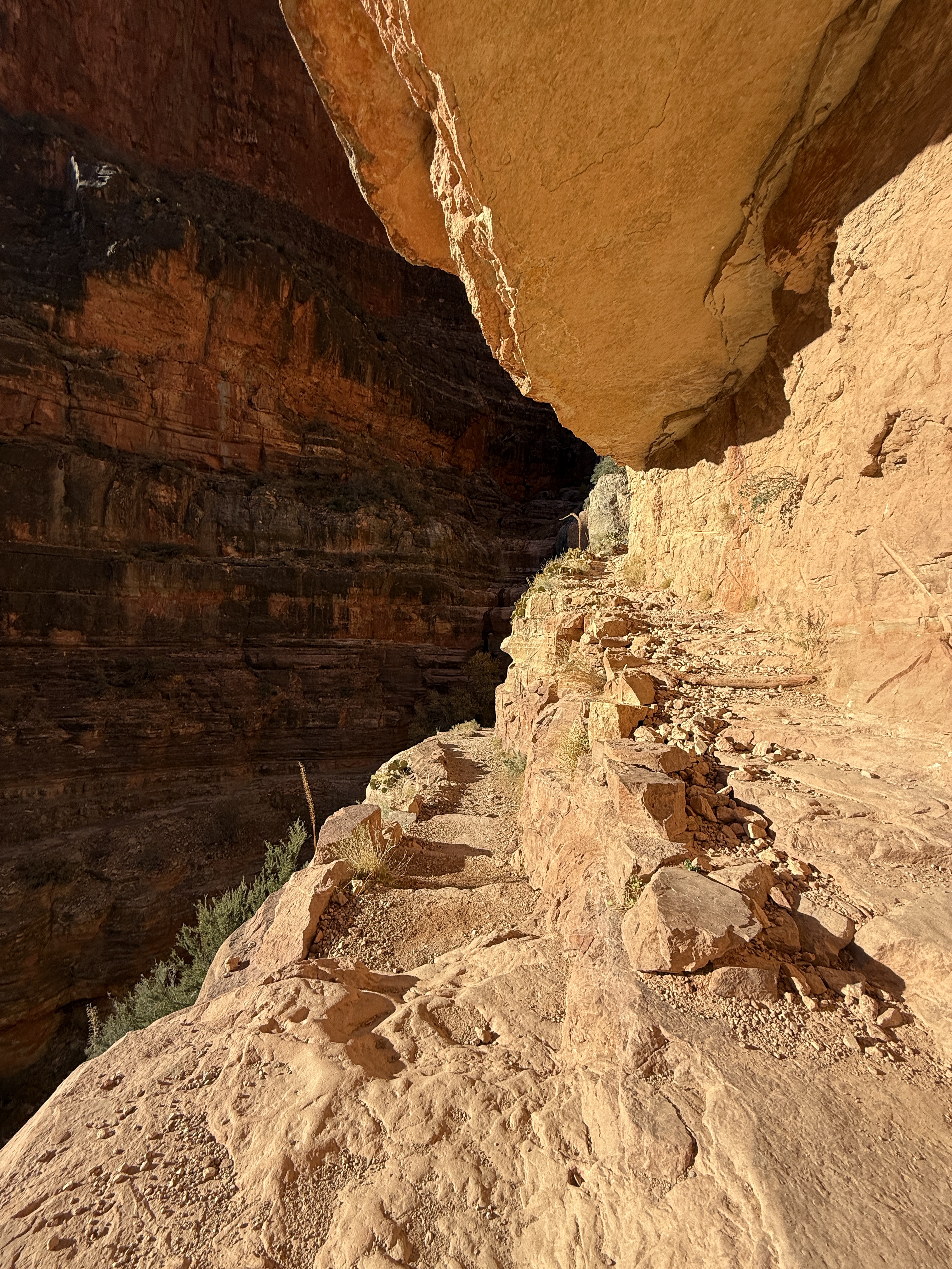
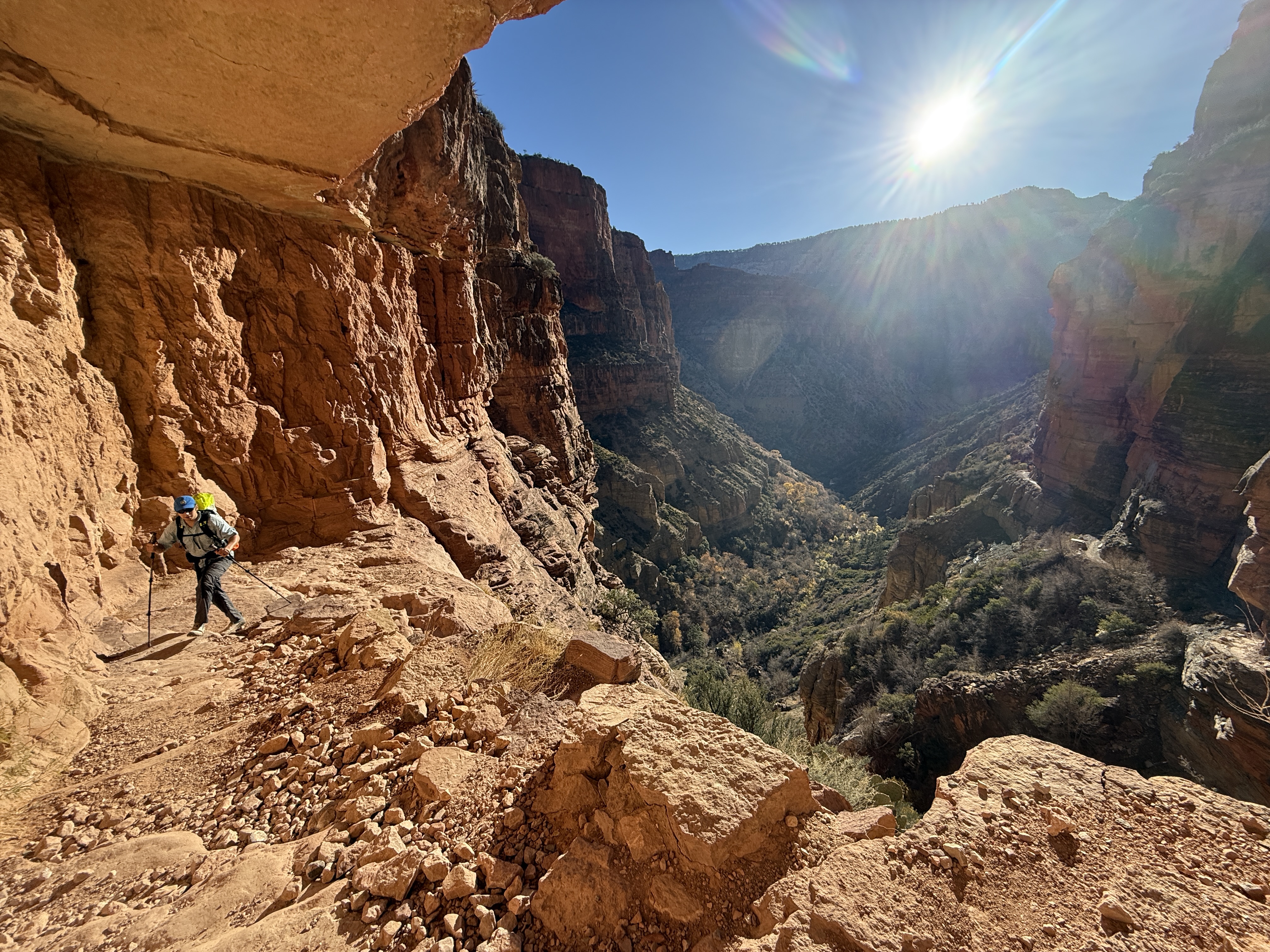
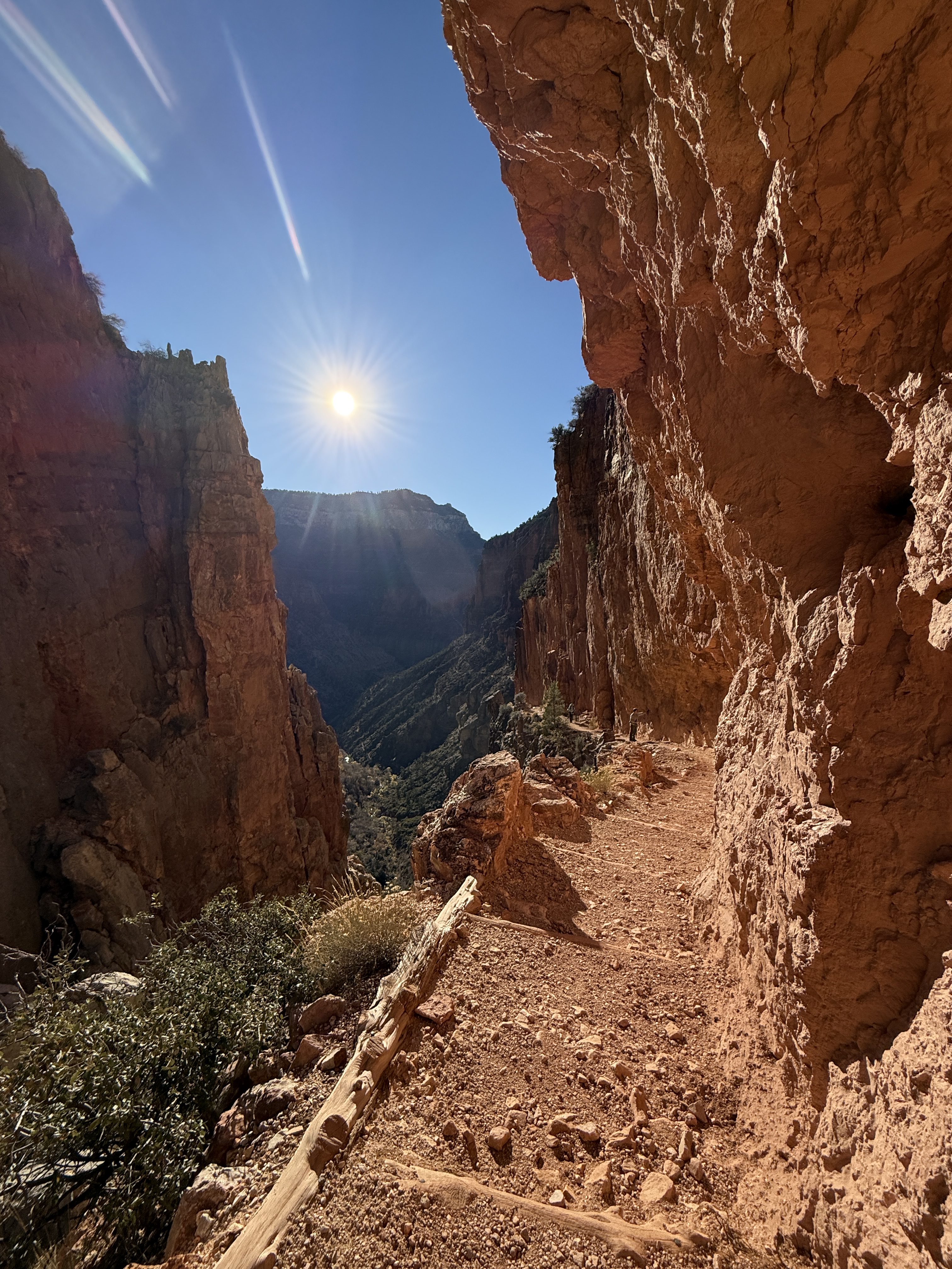
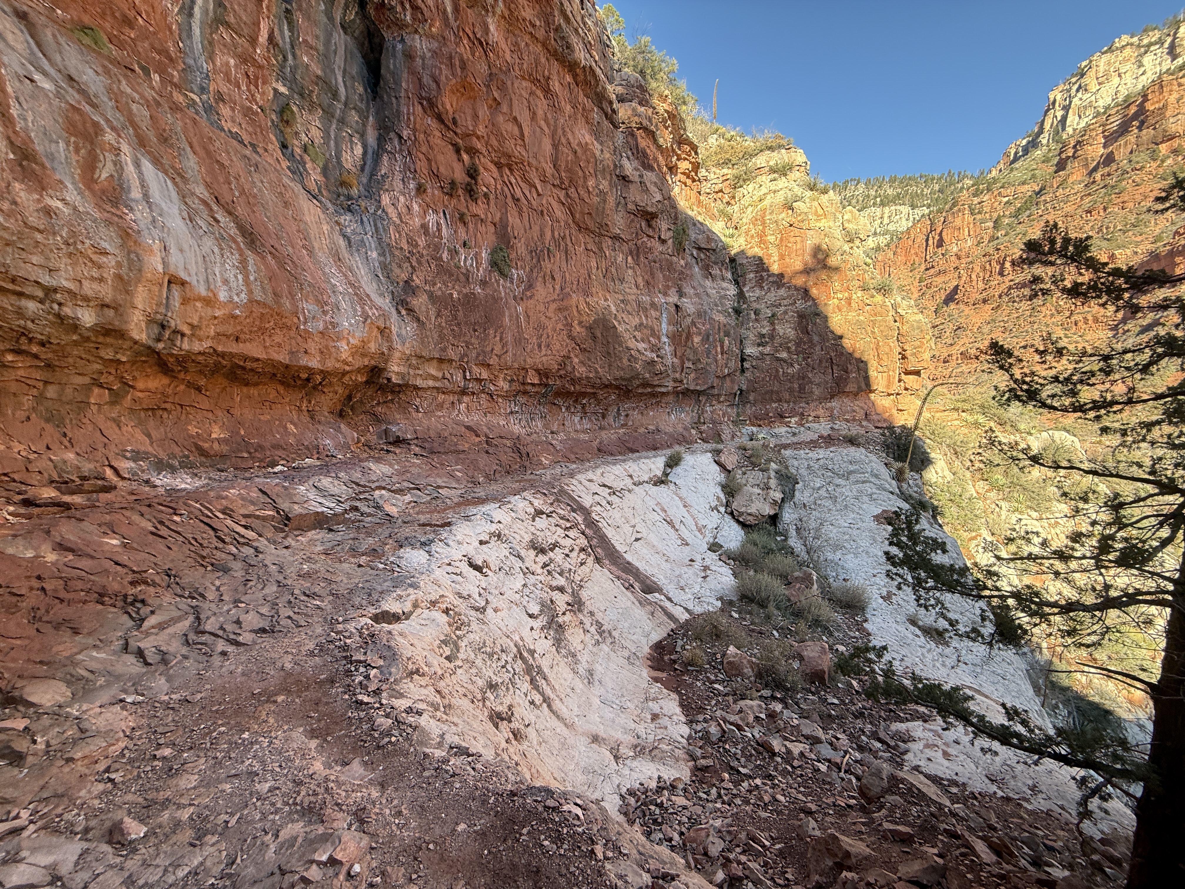
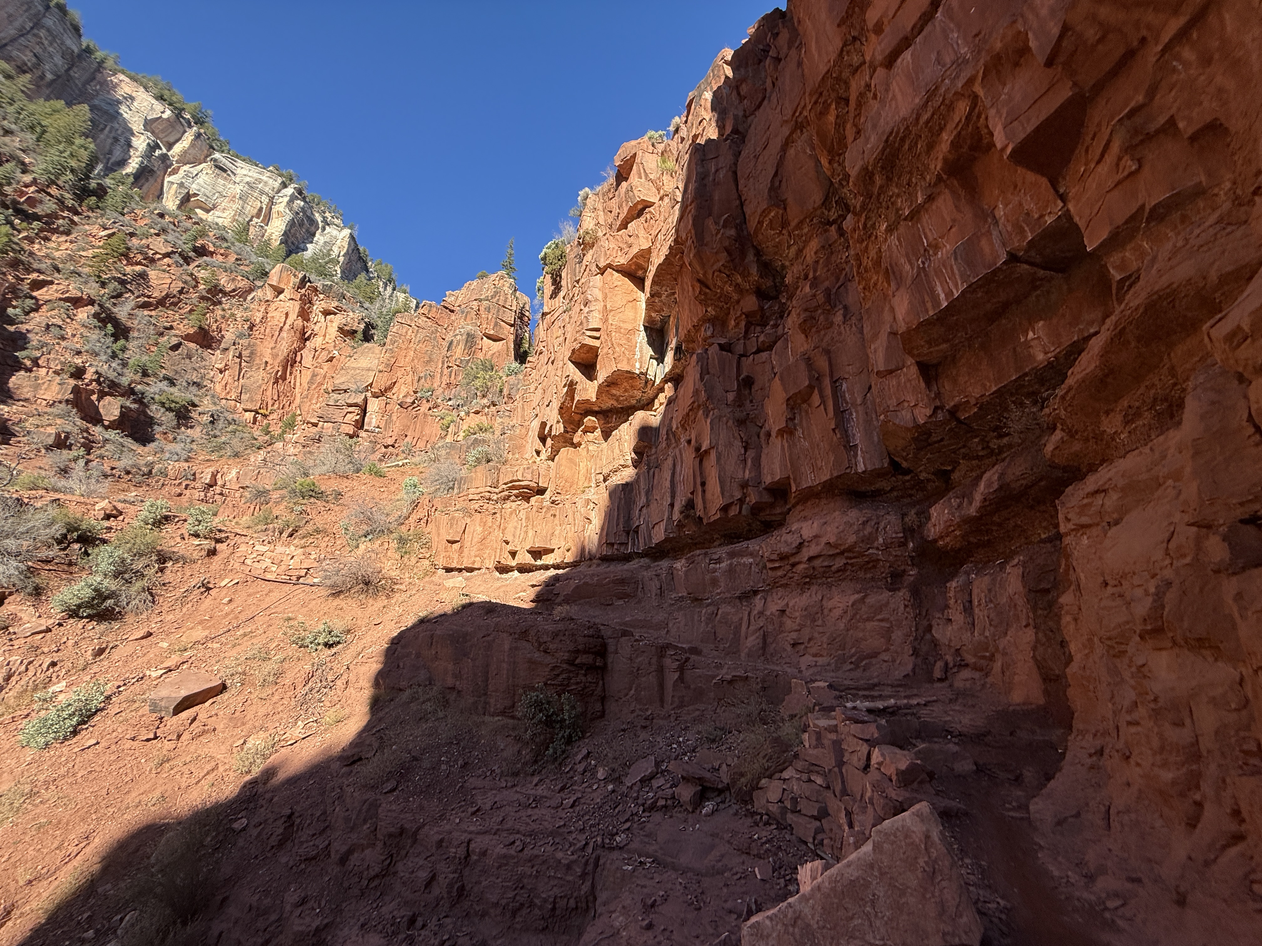
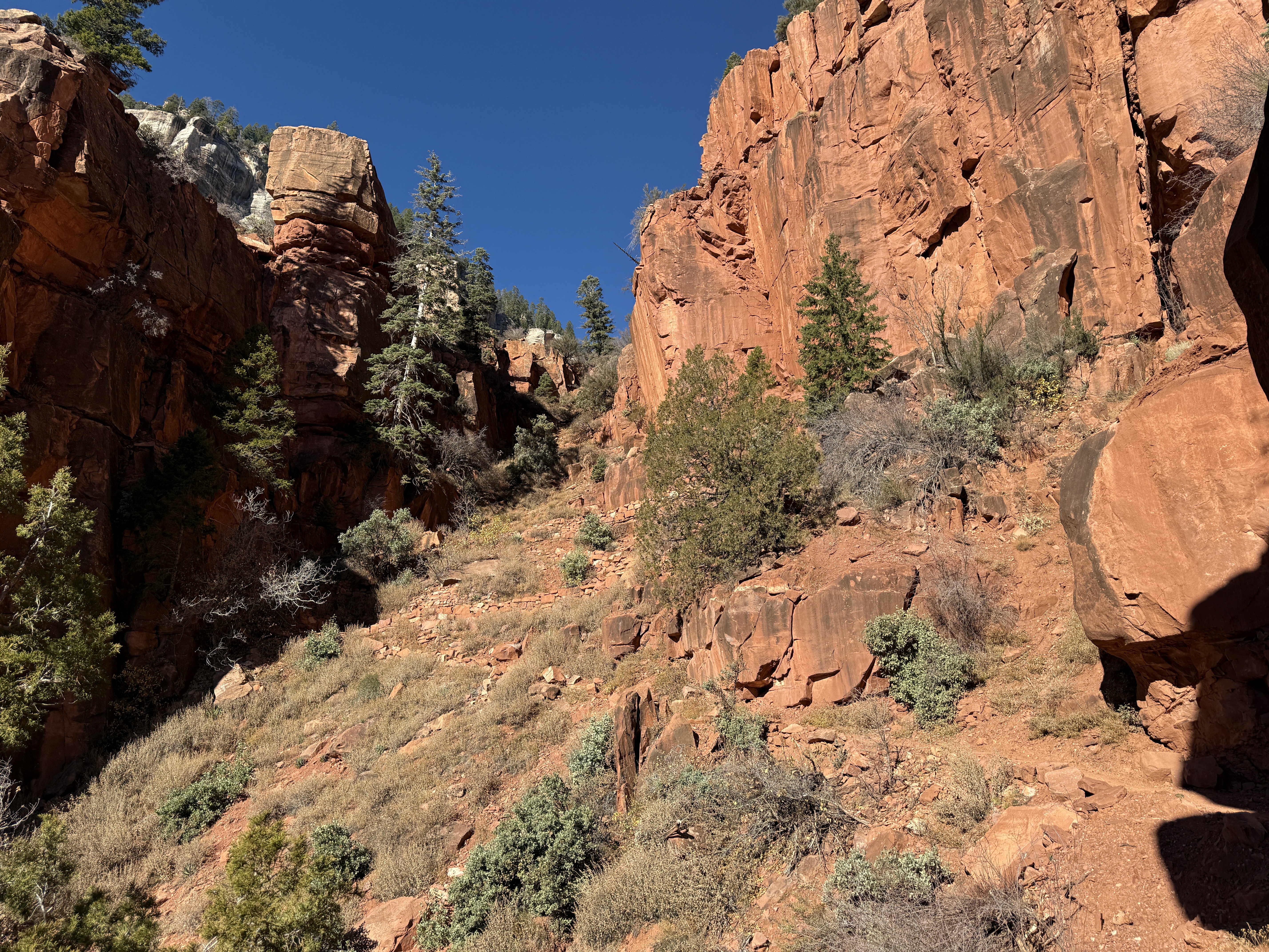
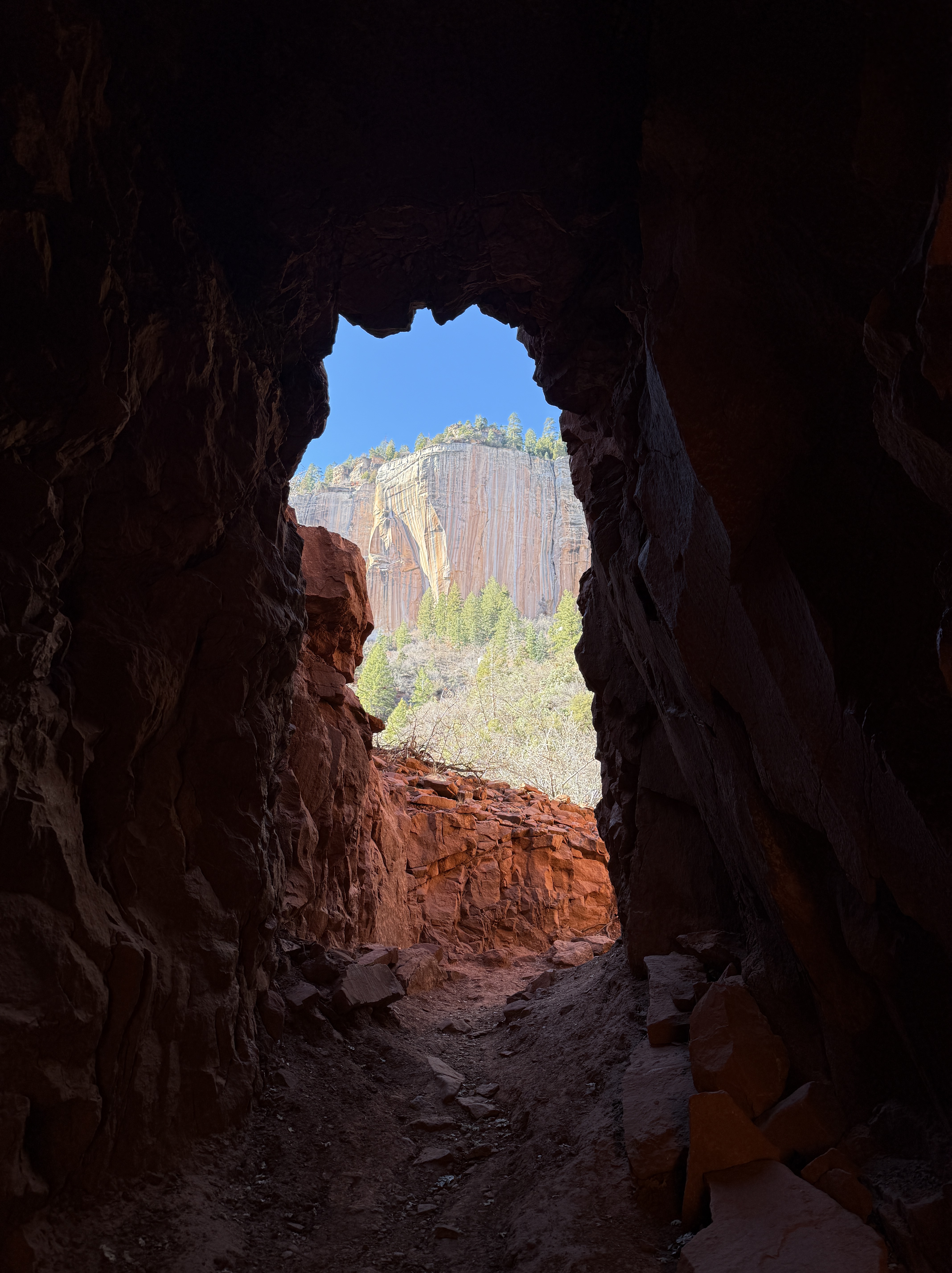
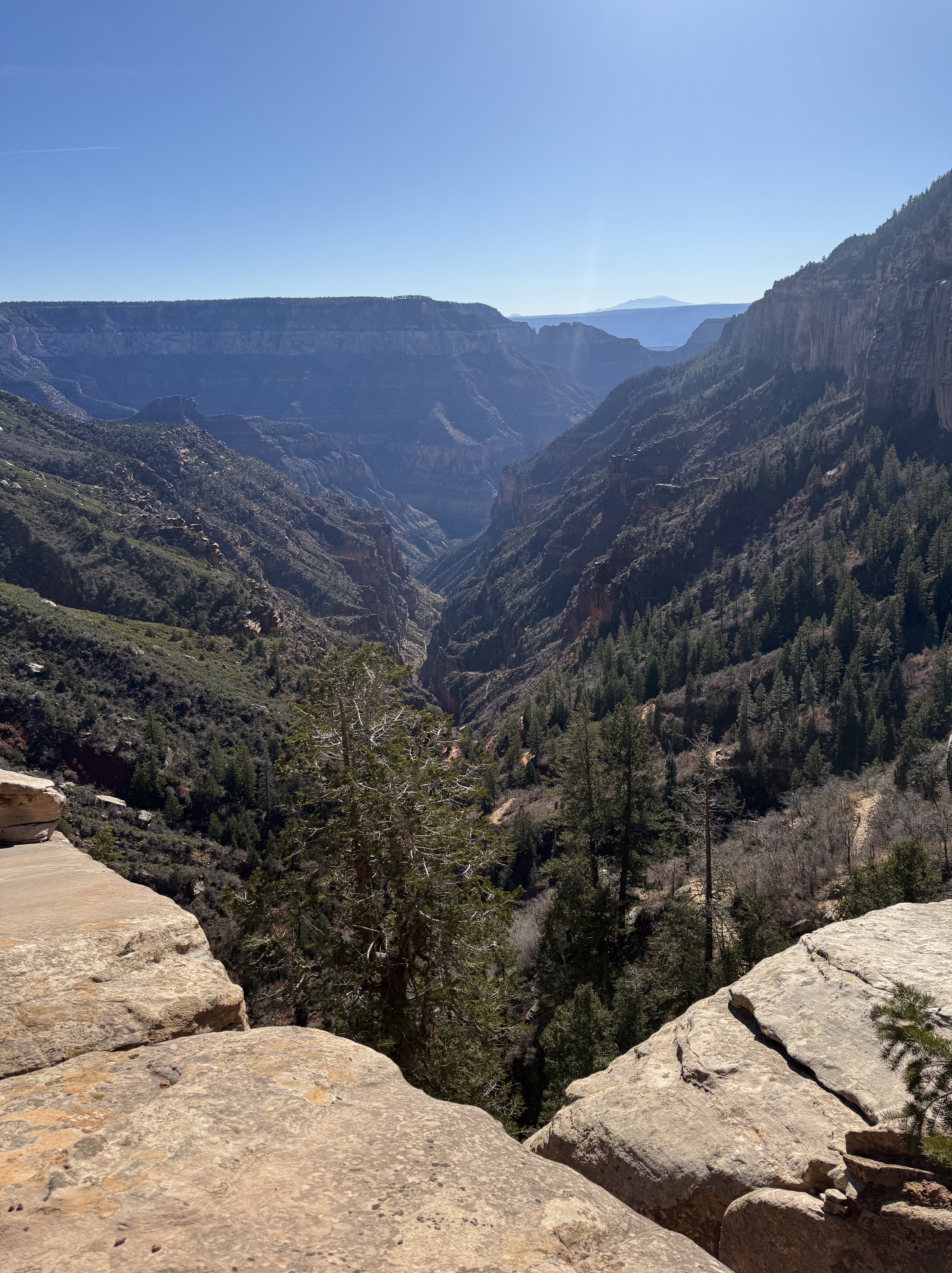
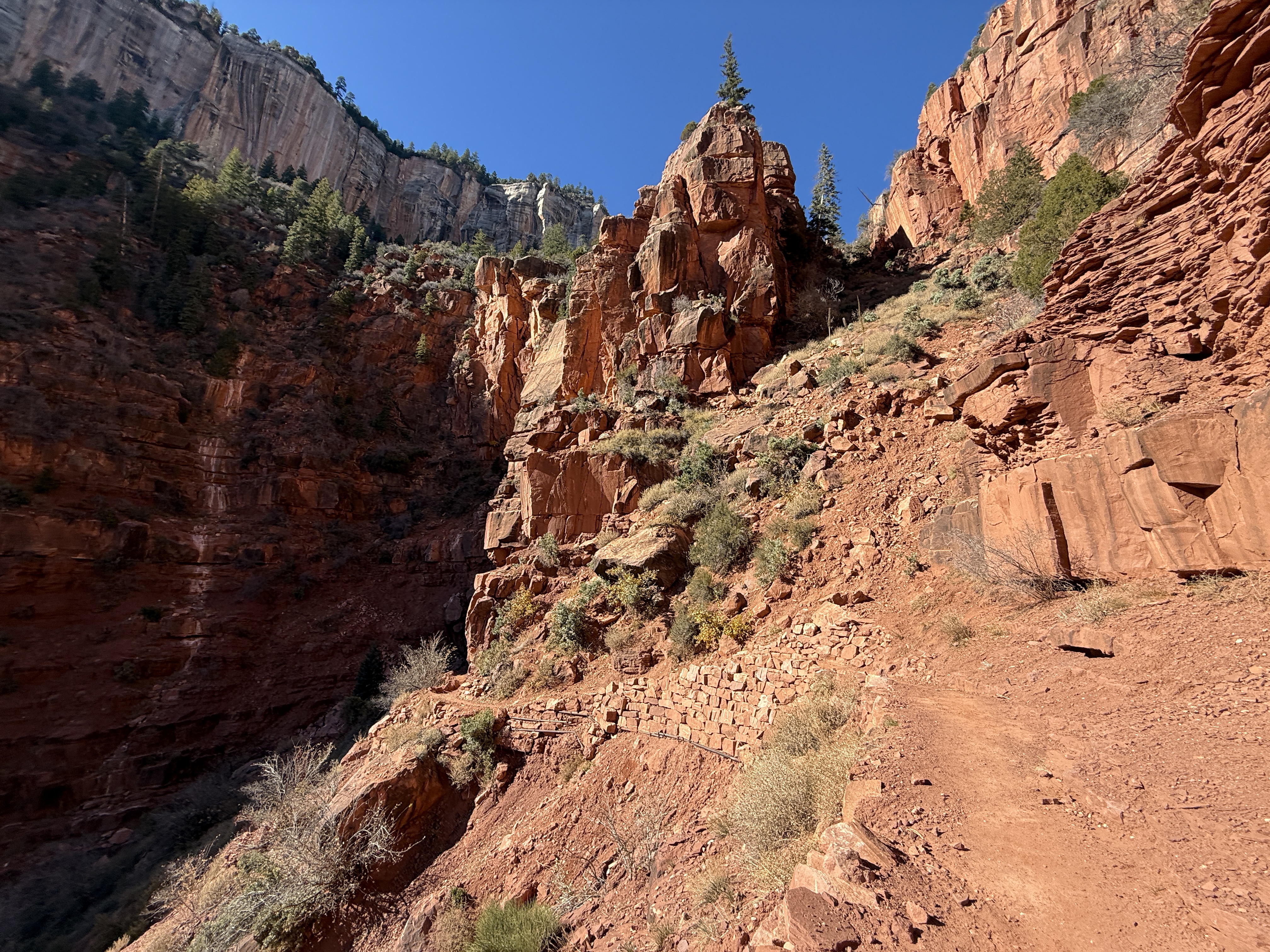
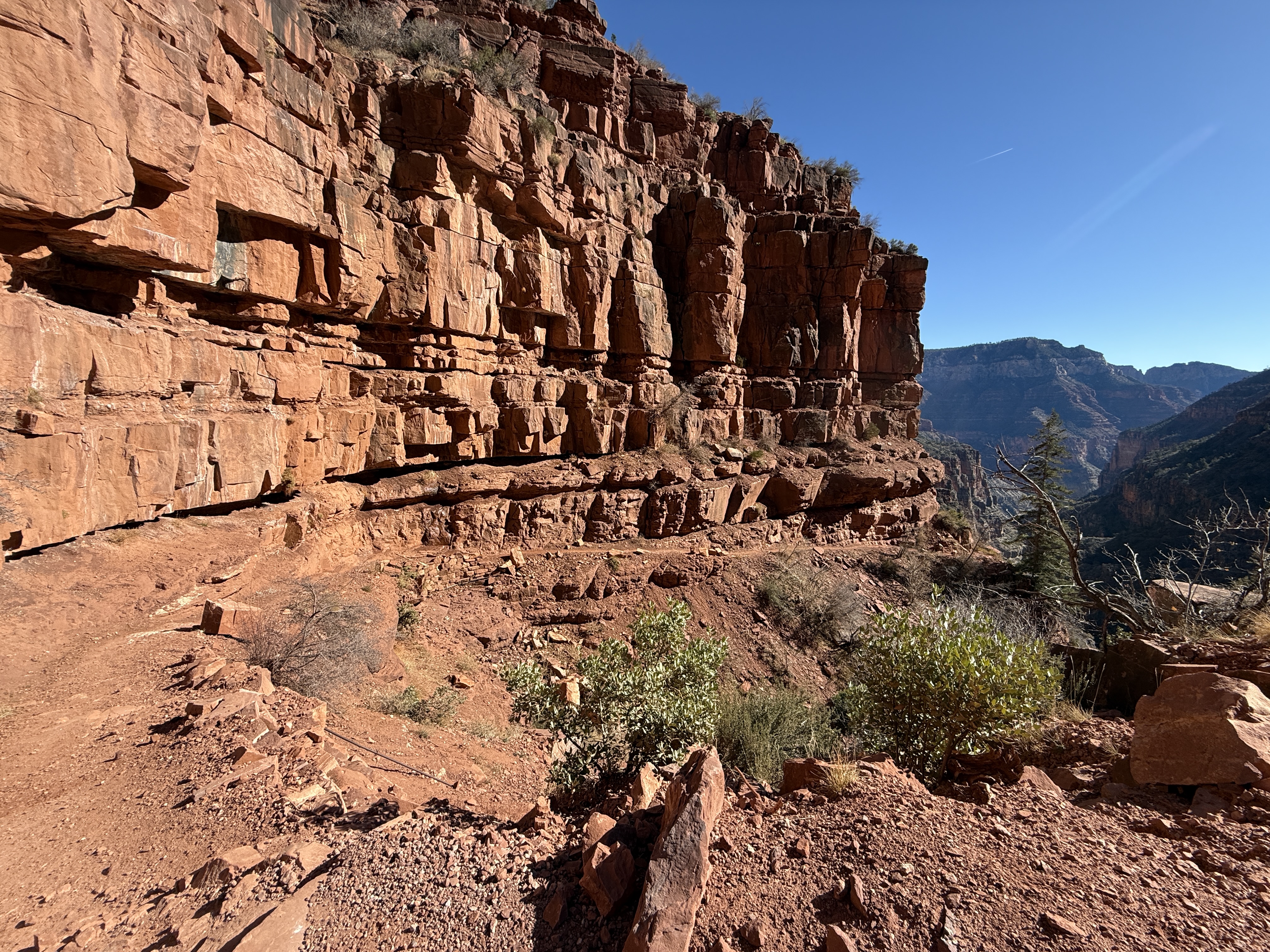
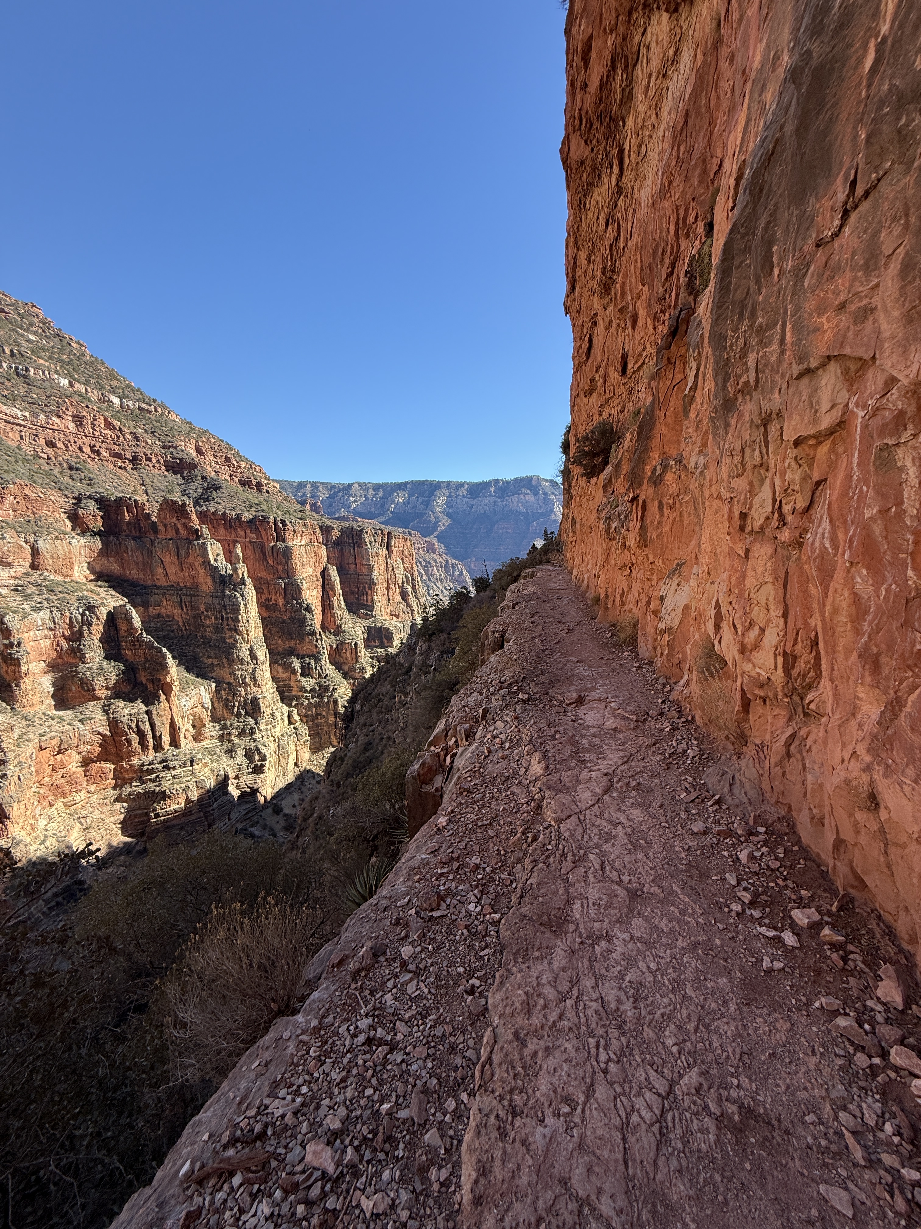
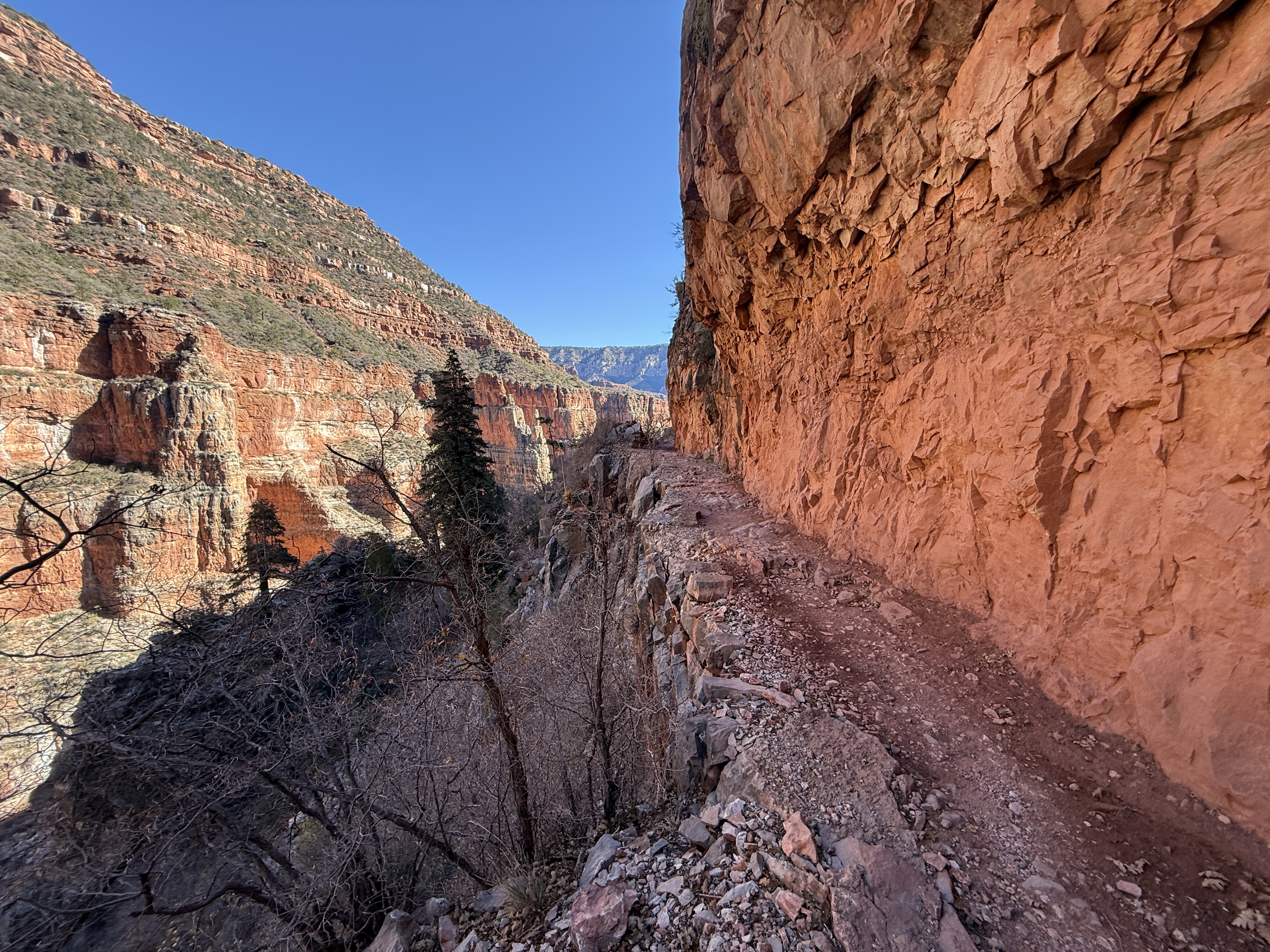
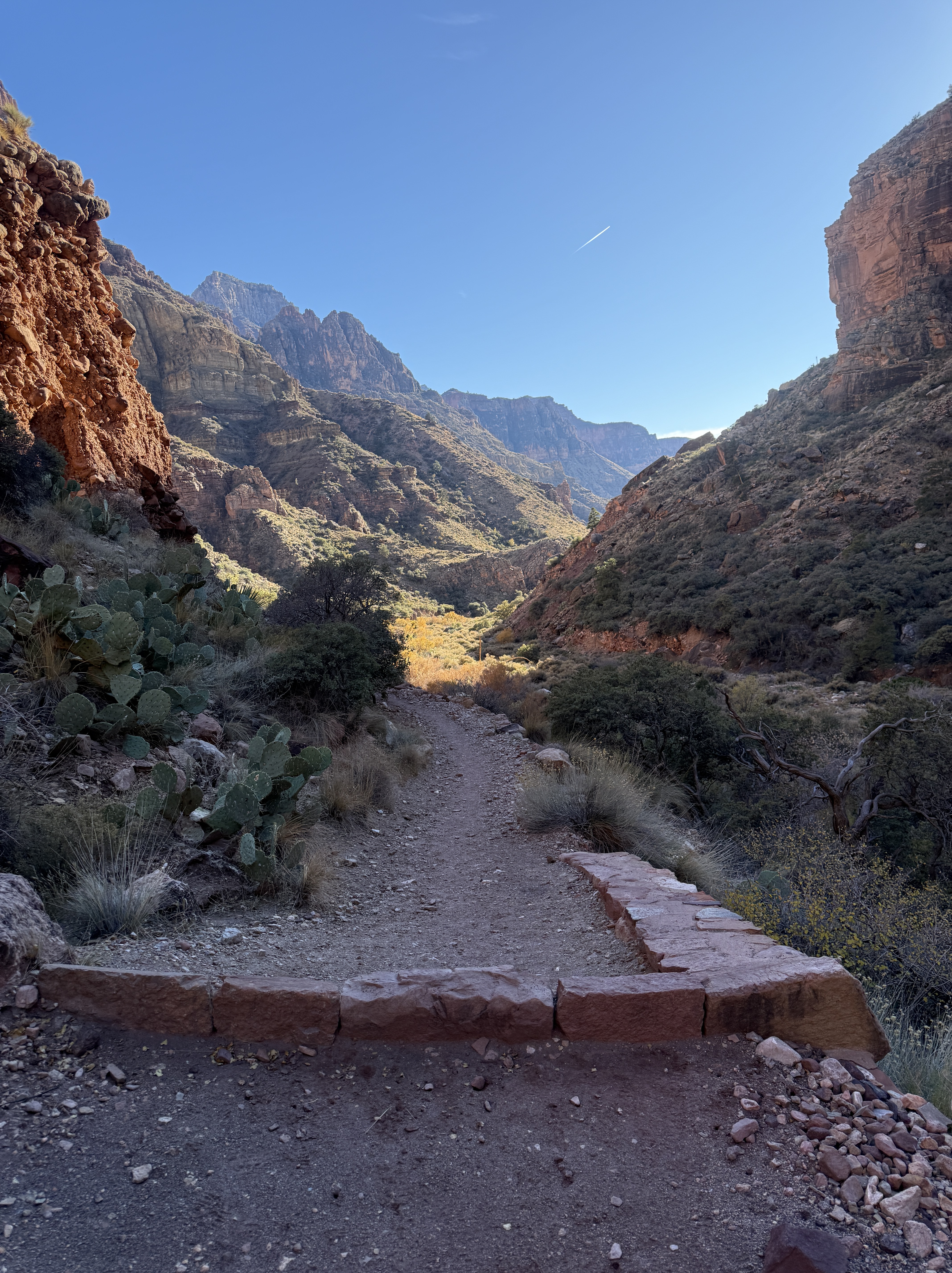
We climbed out of the bottom of the canyon and onto the face of the canyon walls, and although the trail is wide and flat with excellent footing, anyone with a fear of heights would be nervous about walking along this path with a vertical wall on one side and a fatal fall drop-off on the other. As we rounded a corner, we tried to decipher exactly where the trail was. It looked like sheer cliff face with no chance of a path existing there, until we looked very closely and saw a rectangle shaped excavation in the wall. That had to be the trail, and I got butterflies just looking at it!
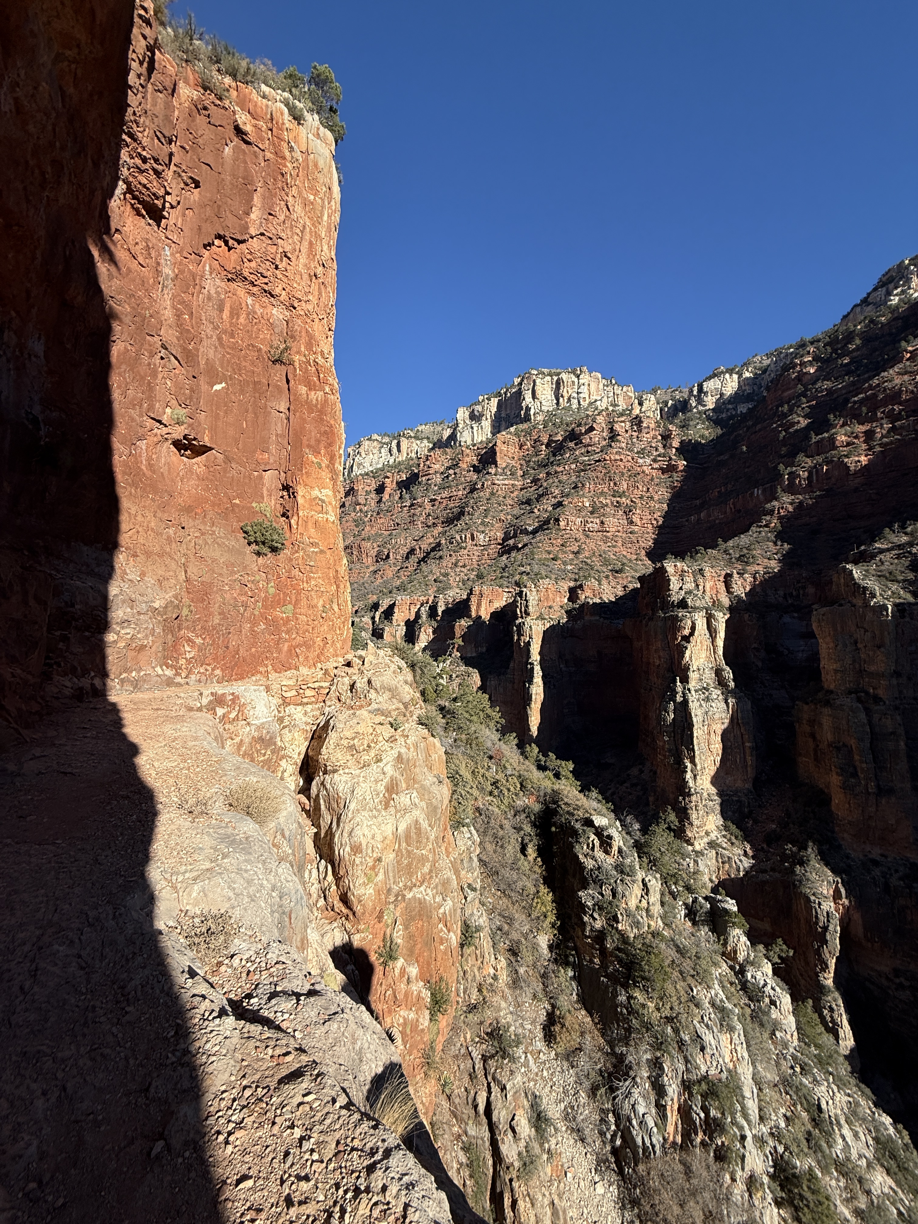
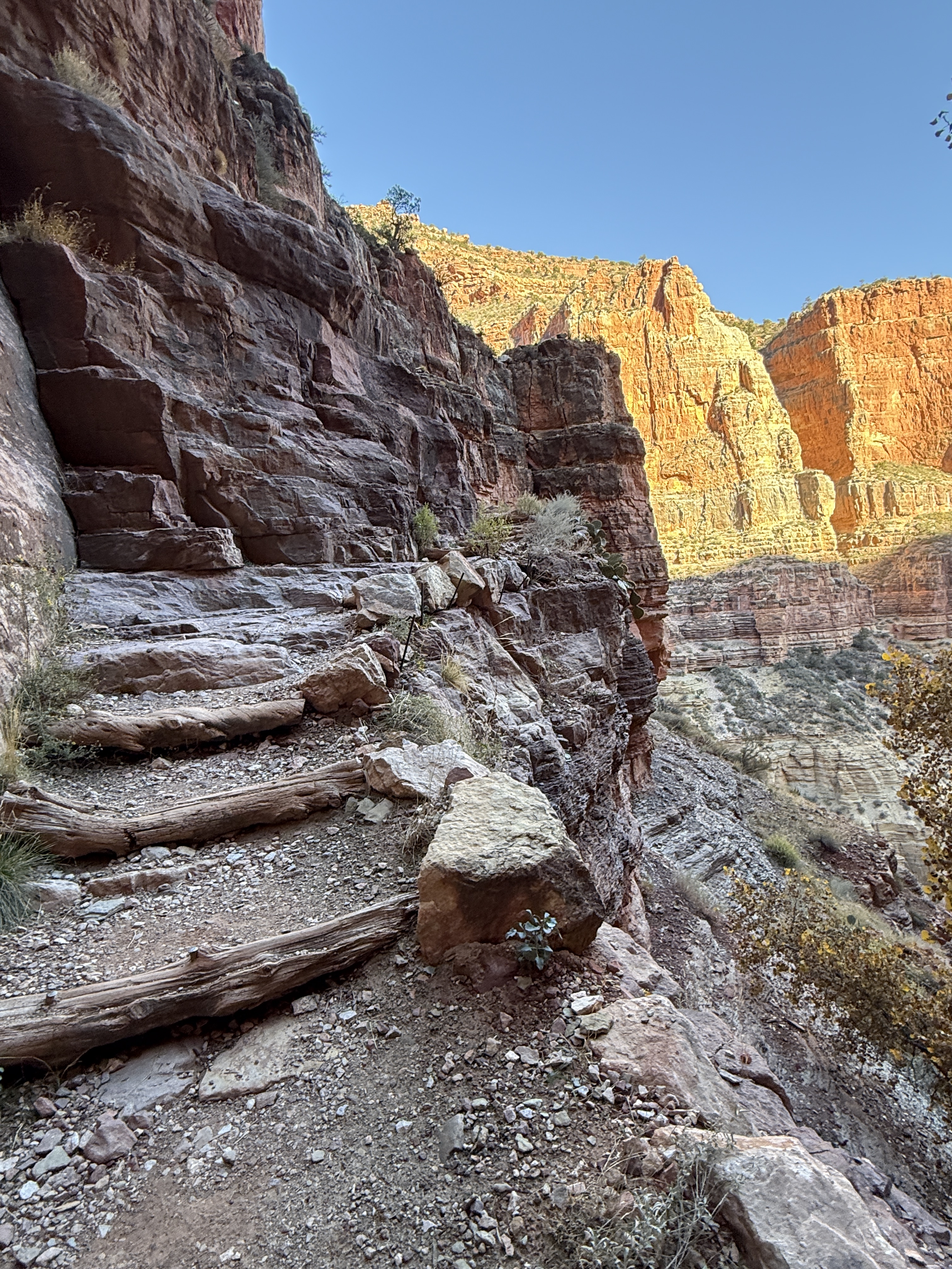
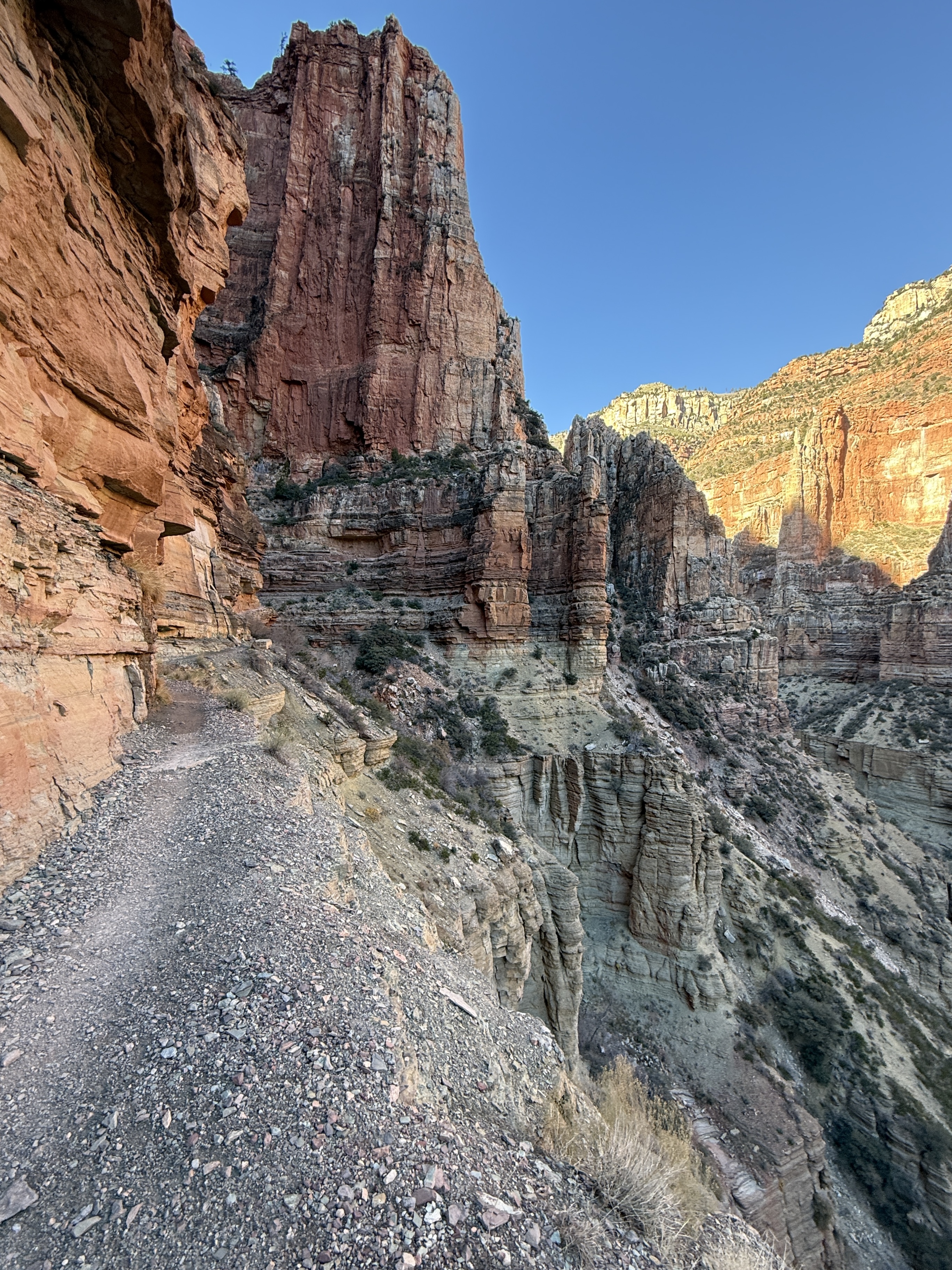
I ran up to the cut, noticing the dizzying drop to my right, while one of the guys stayed on the other side so we could take pictures of each other, tiny flies on a gigantic wall. I waved and hustled on alone; I would run into them on the way back and we could exchange photos then. The trail continued rise above the canyon floor, getting a bit narrower and more exposed, at some points nearly 1,000 feet above the bottom of Roaring Springs Canyon. The pictures really do speak for themselves. I was having the time of my life!
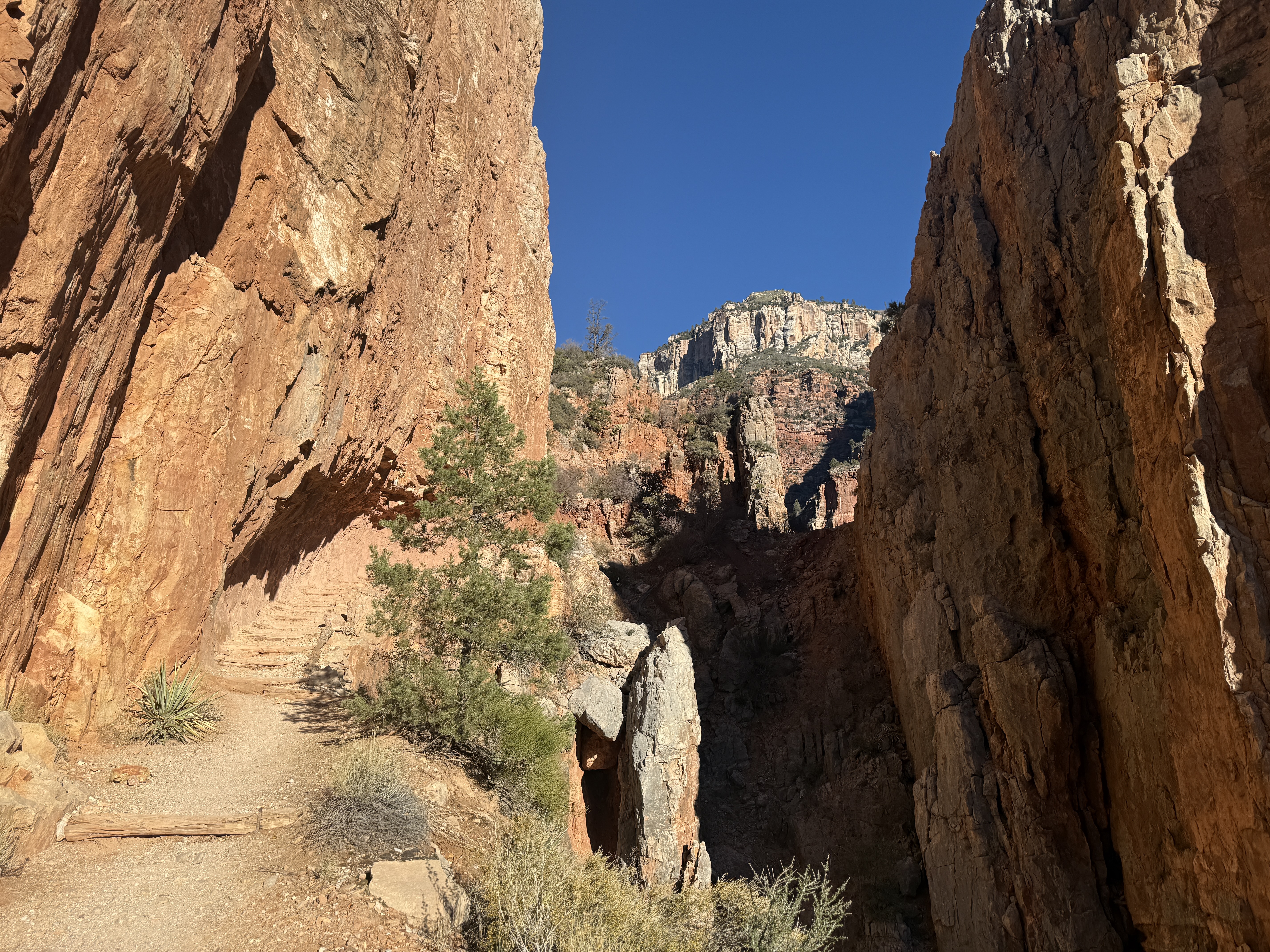

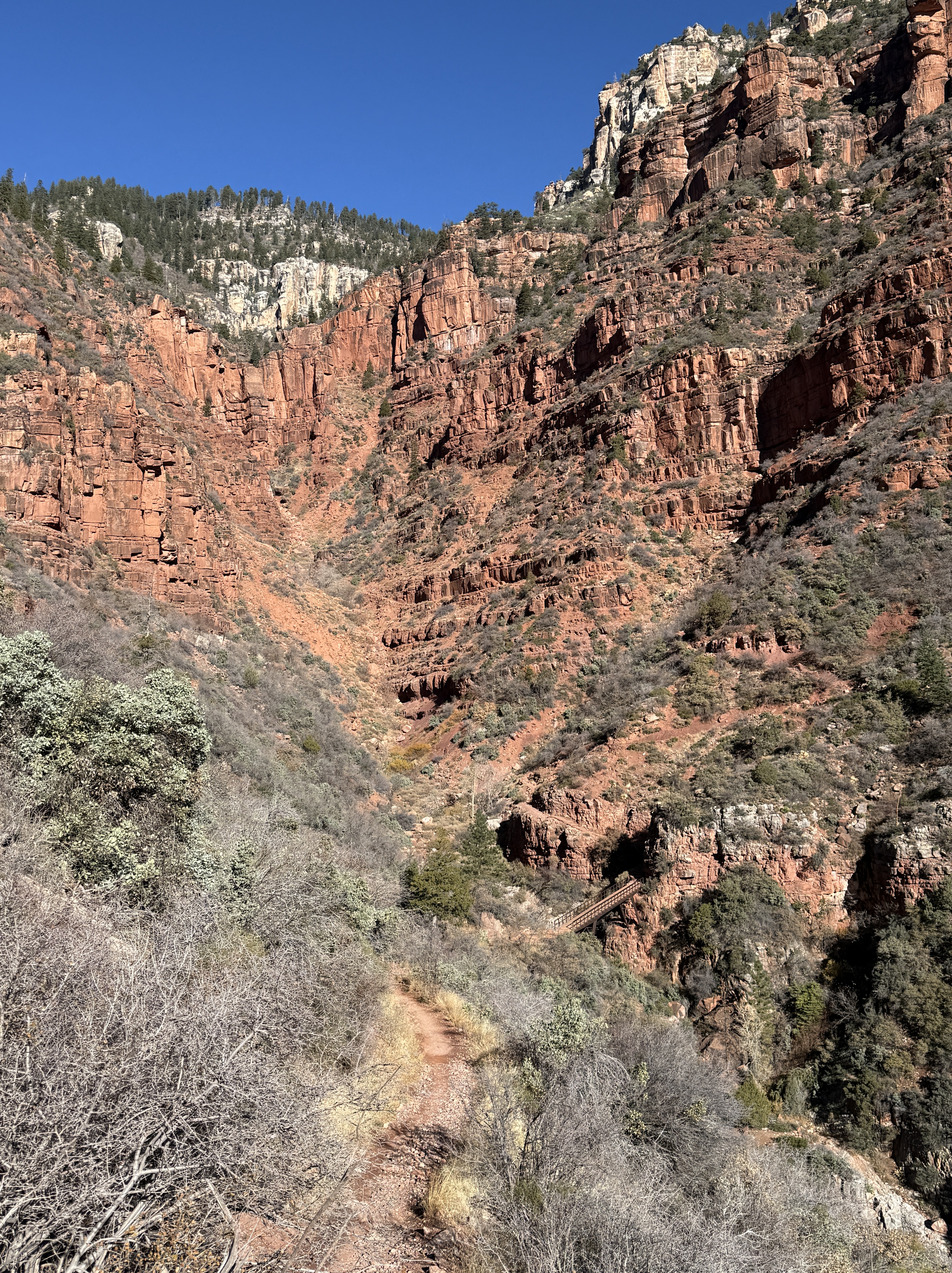
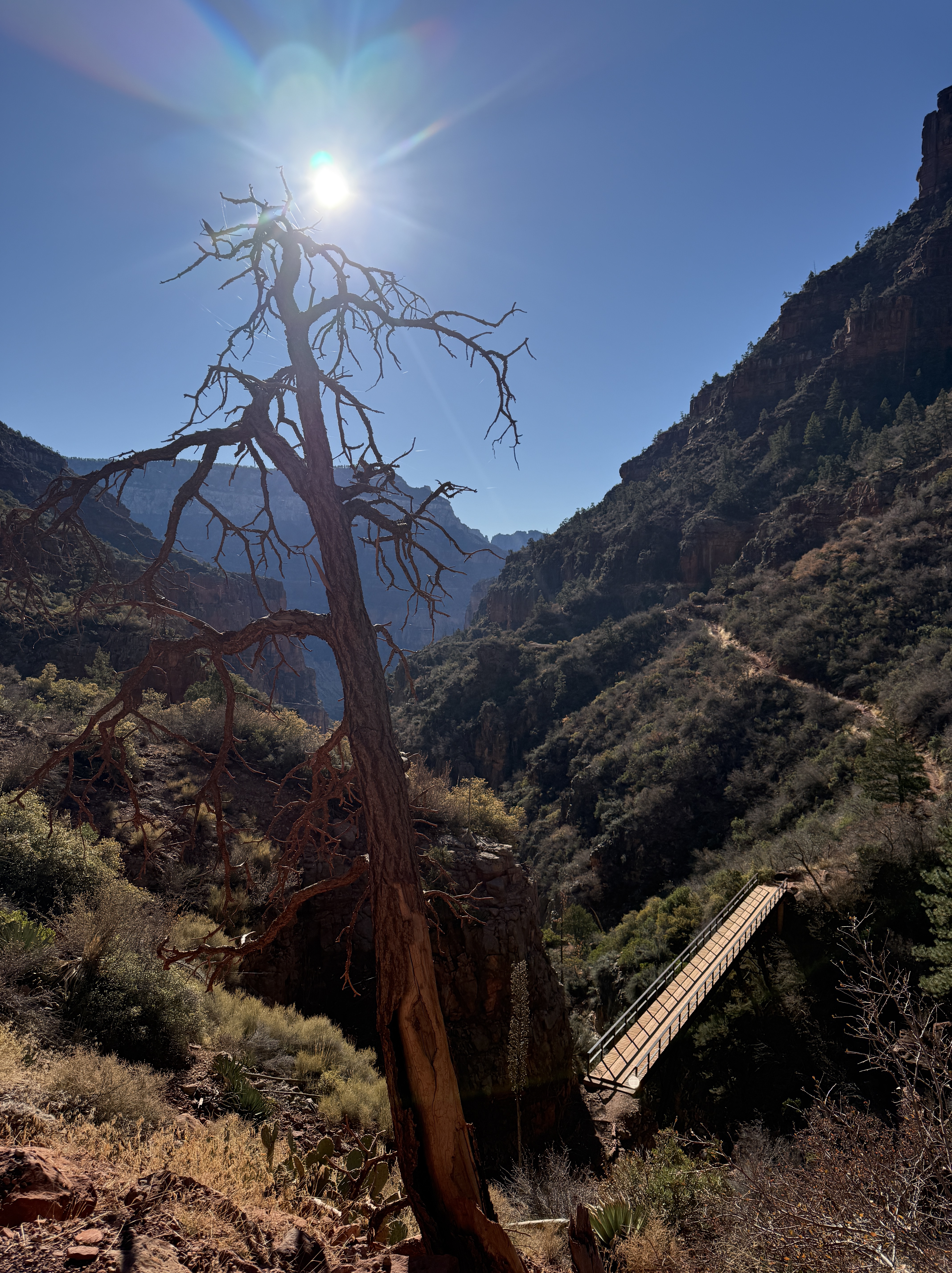
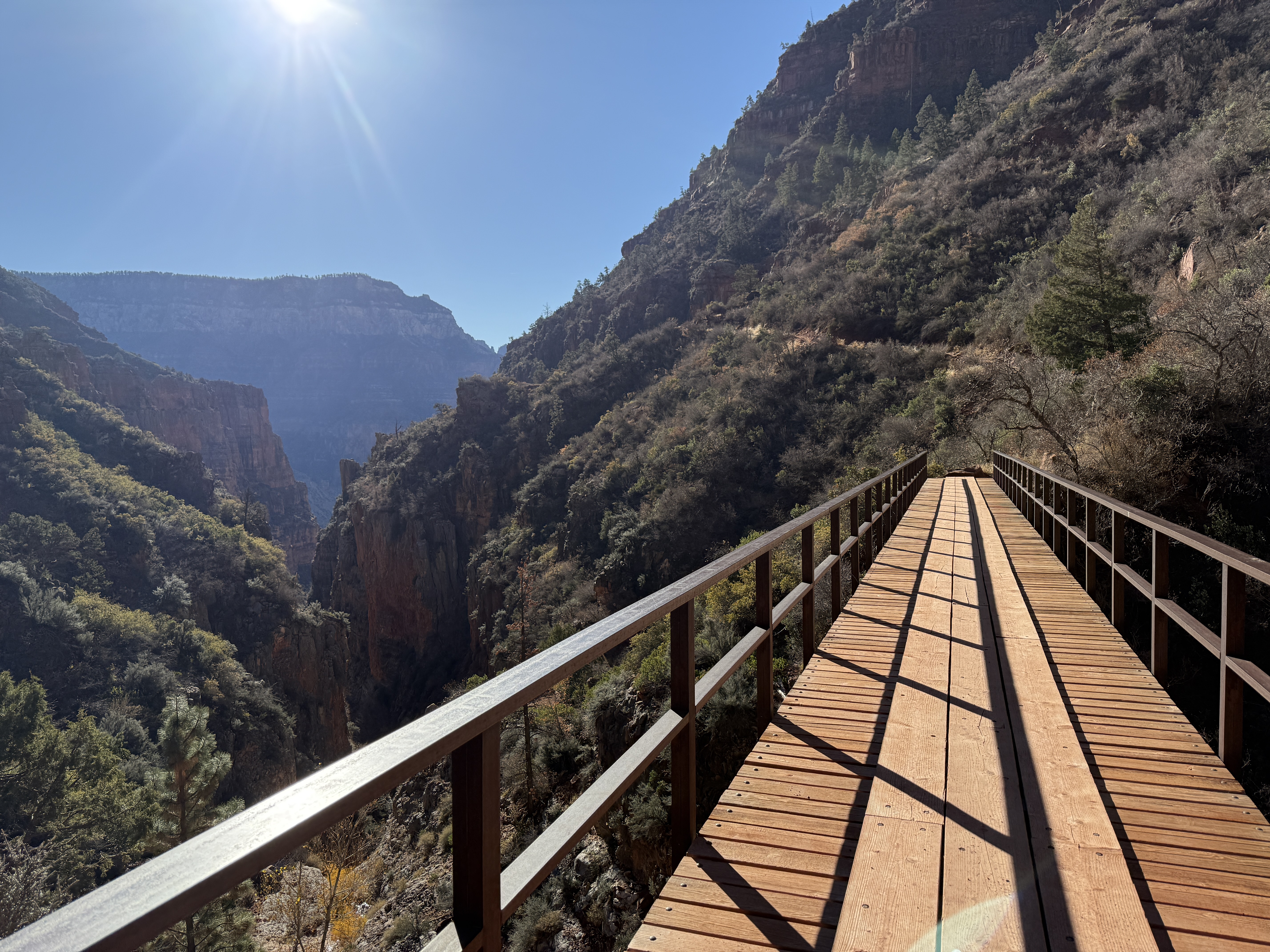
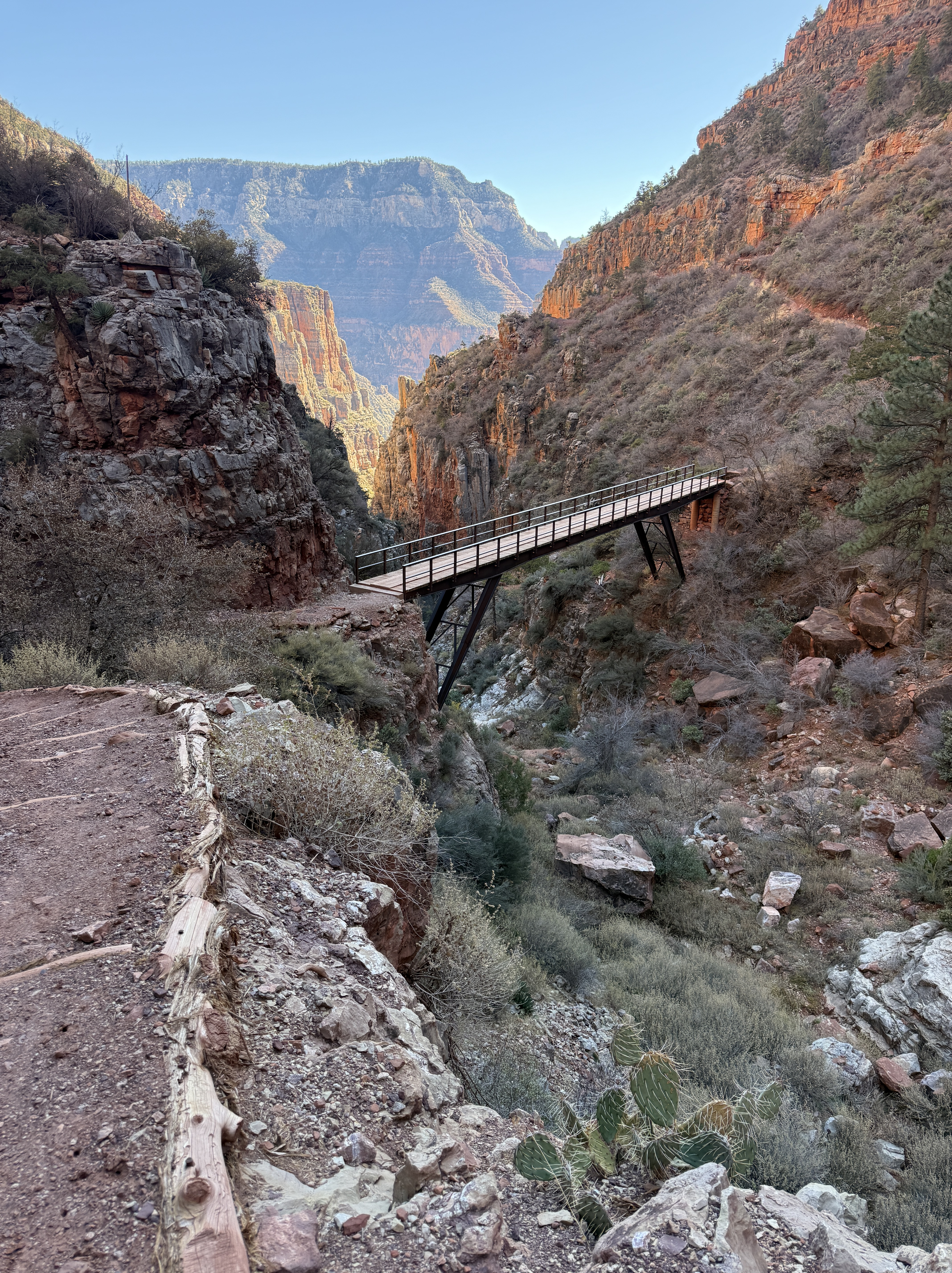
A mile beyond the rectangle cut, the canyon narrows, its floor rising up to meet the trail, and a beautiful little foot bridge spans the now only 50-foot-deep gap. A trail runner passed me heading to the North Rim. He had started at the South Rim early that morning and planned to get back before dark. It was only 10am and he had a little more than 20 miles to go, but he looked strong and was making good progress.
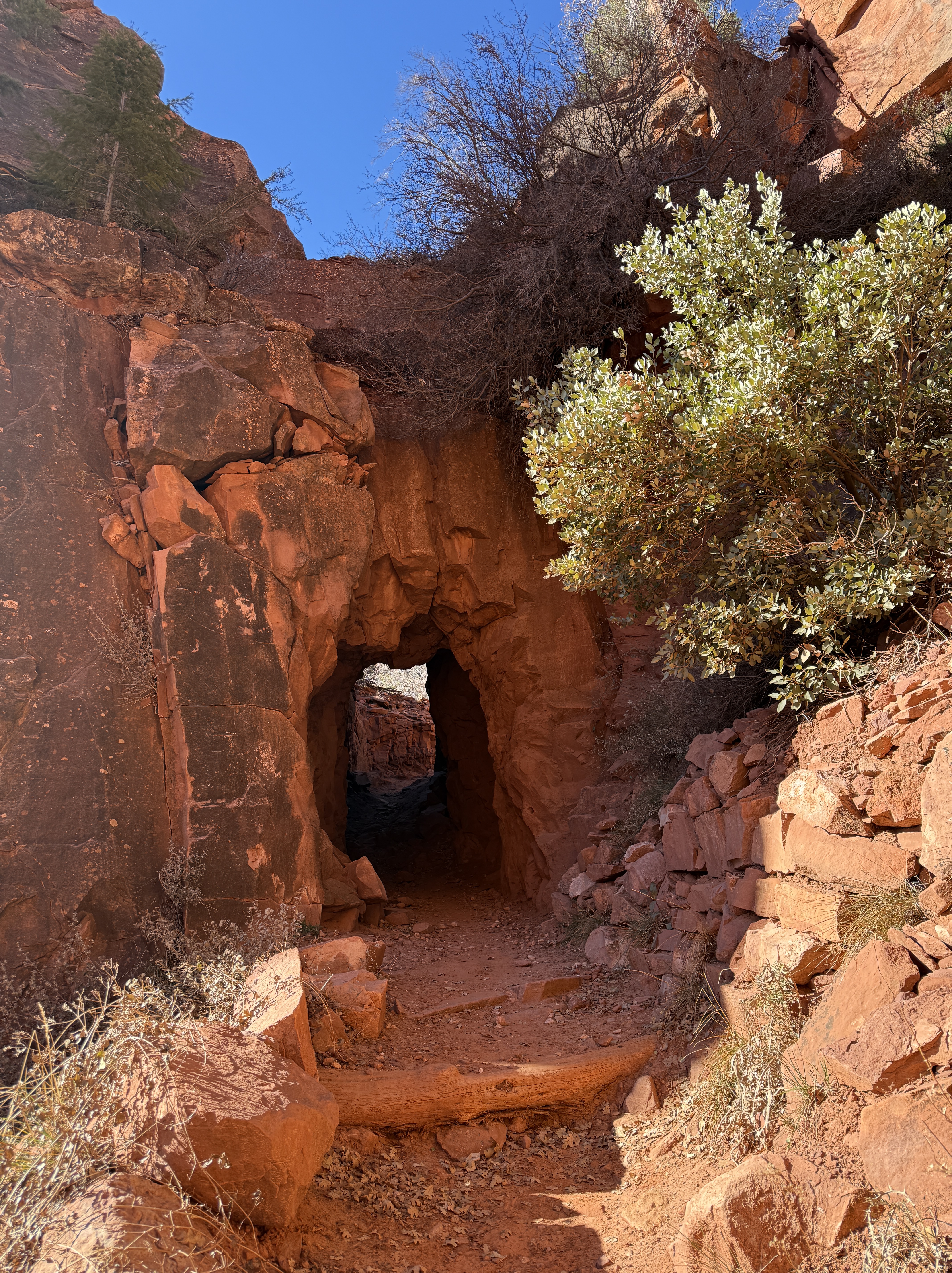
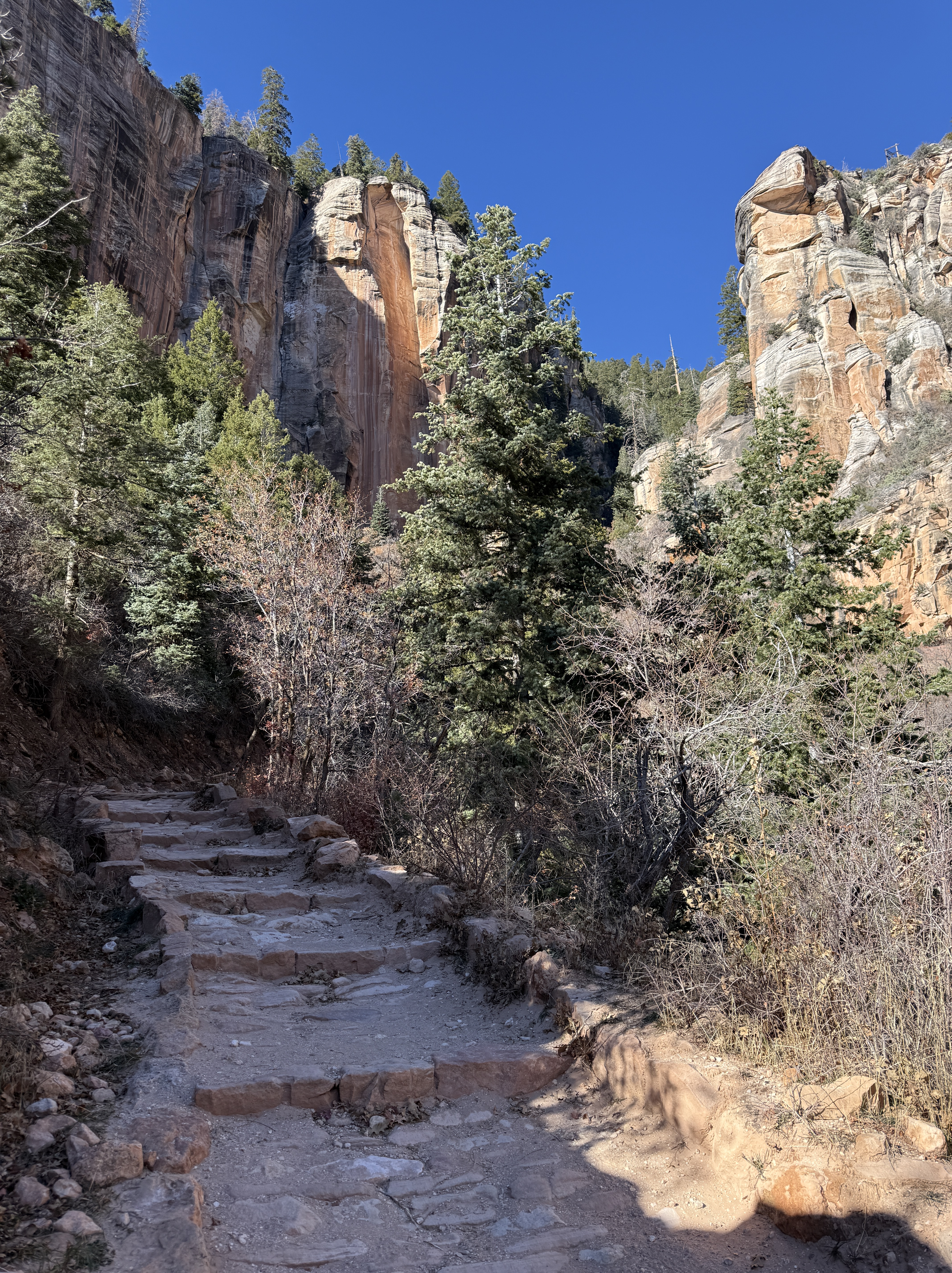
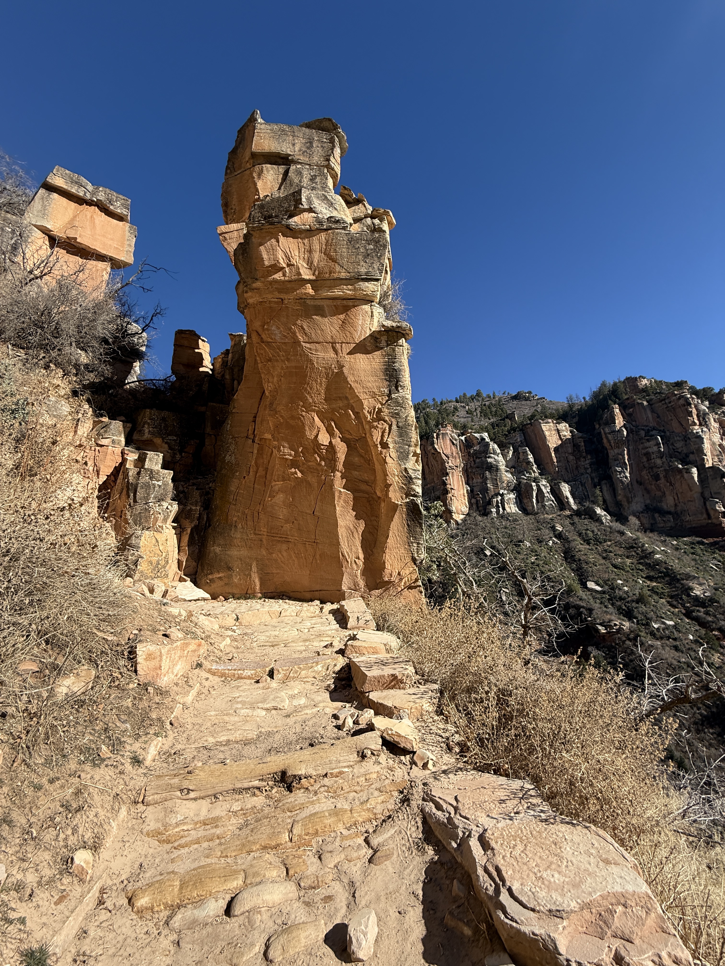
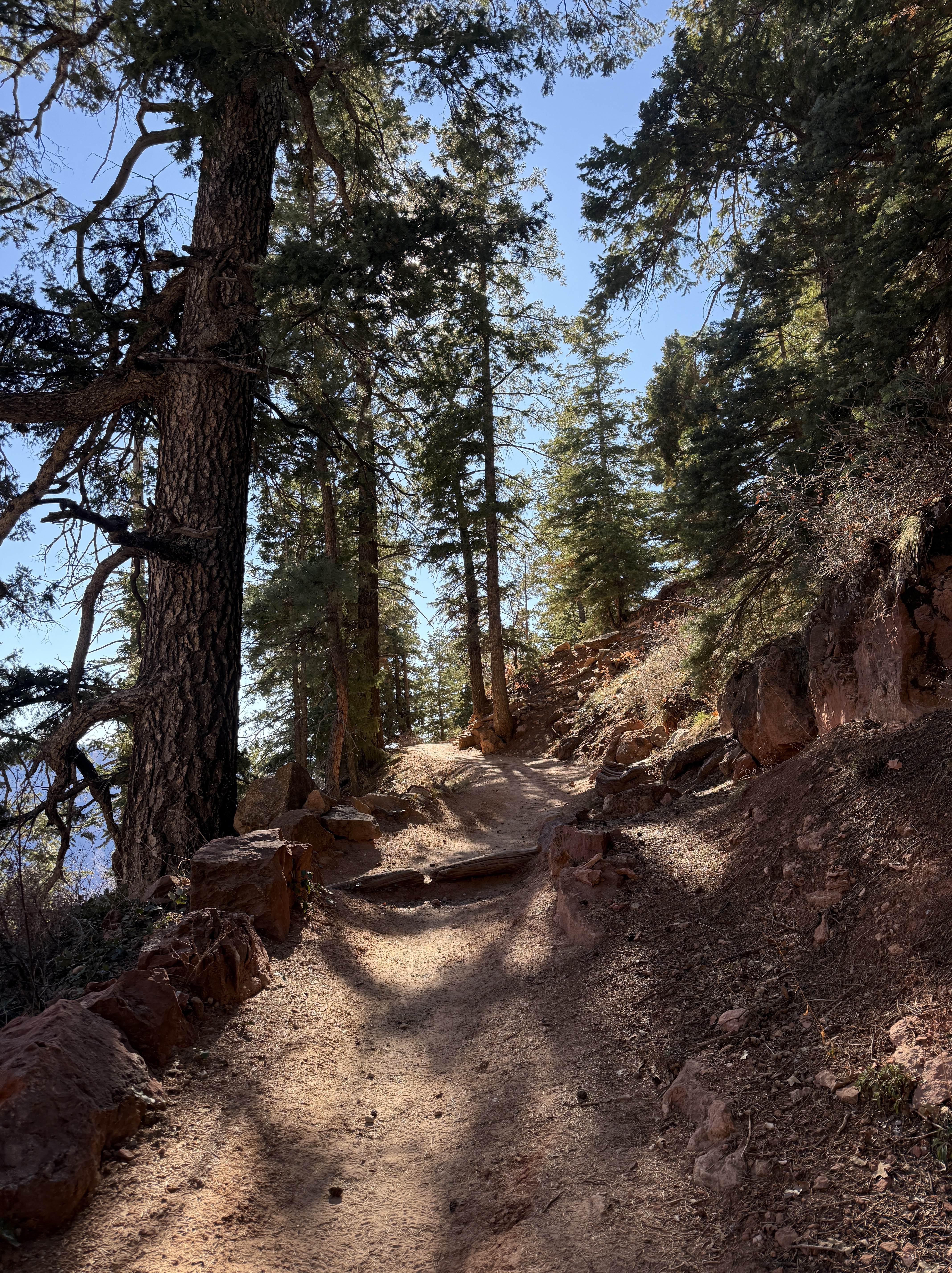
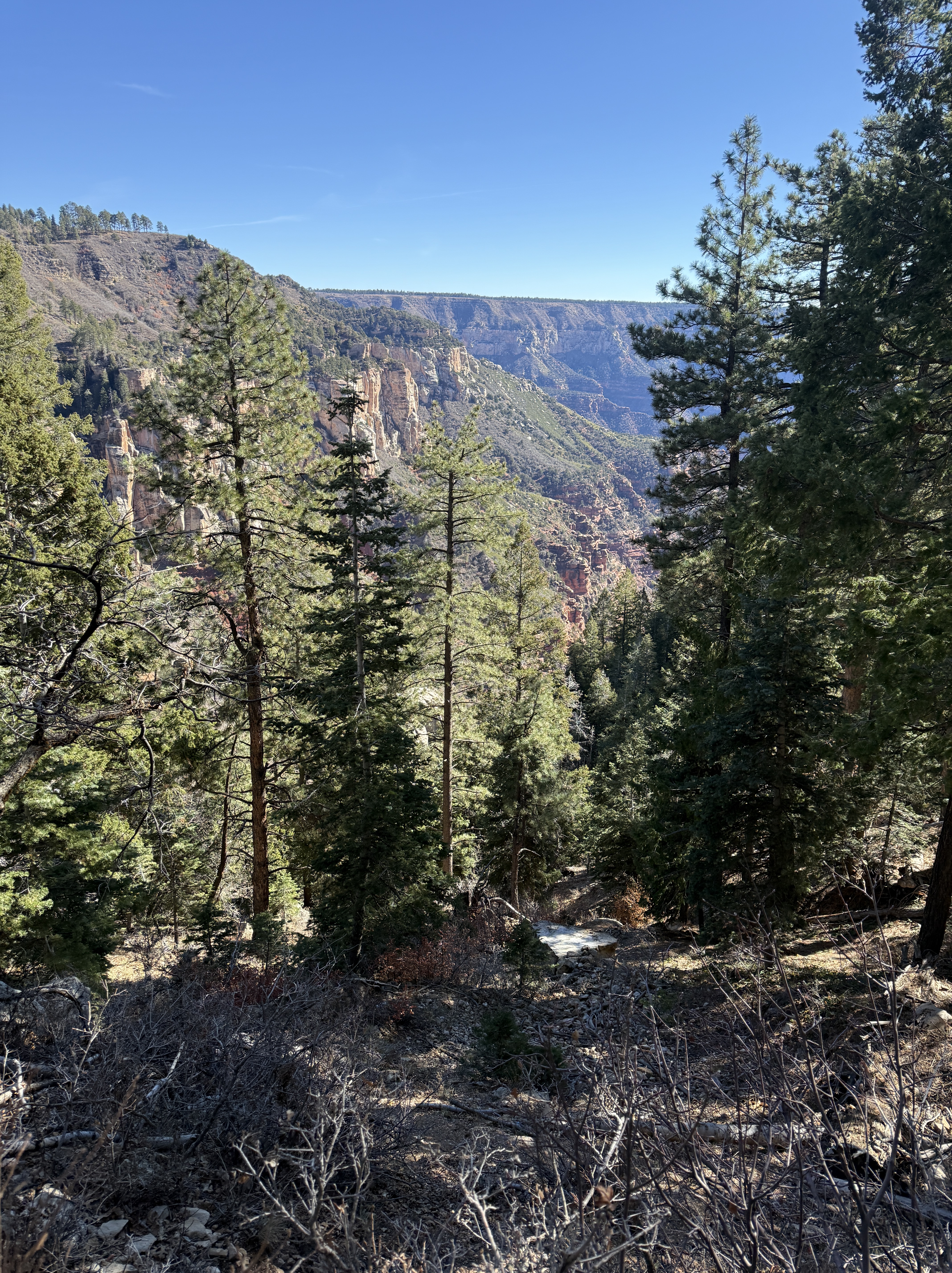
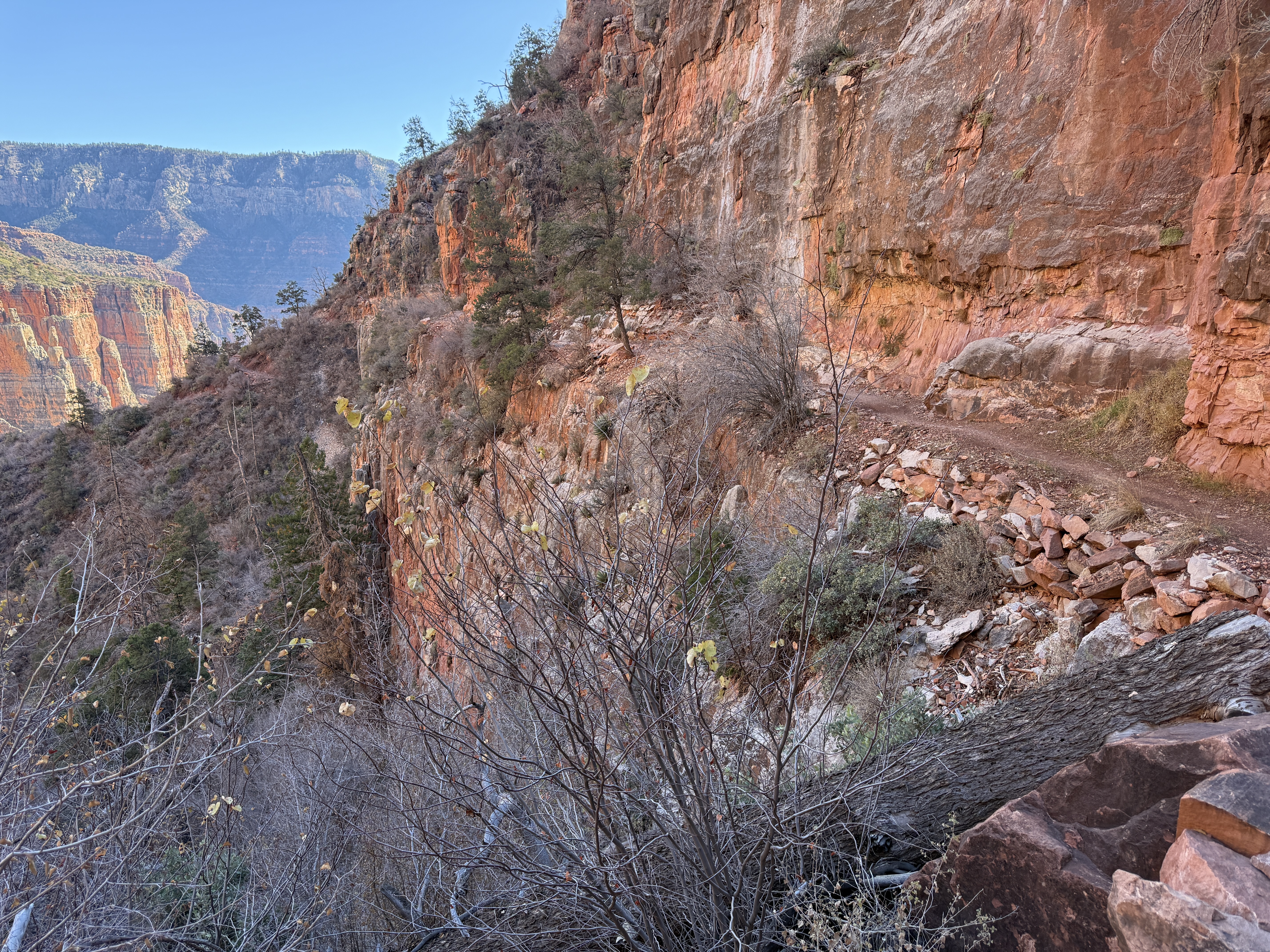
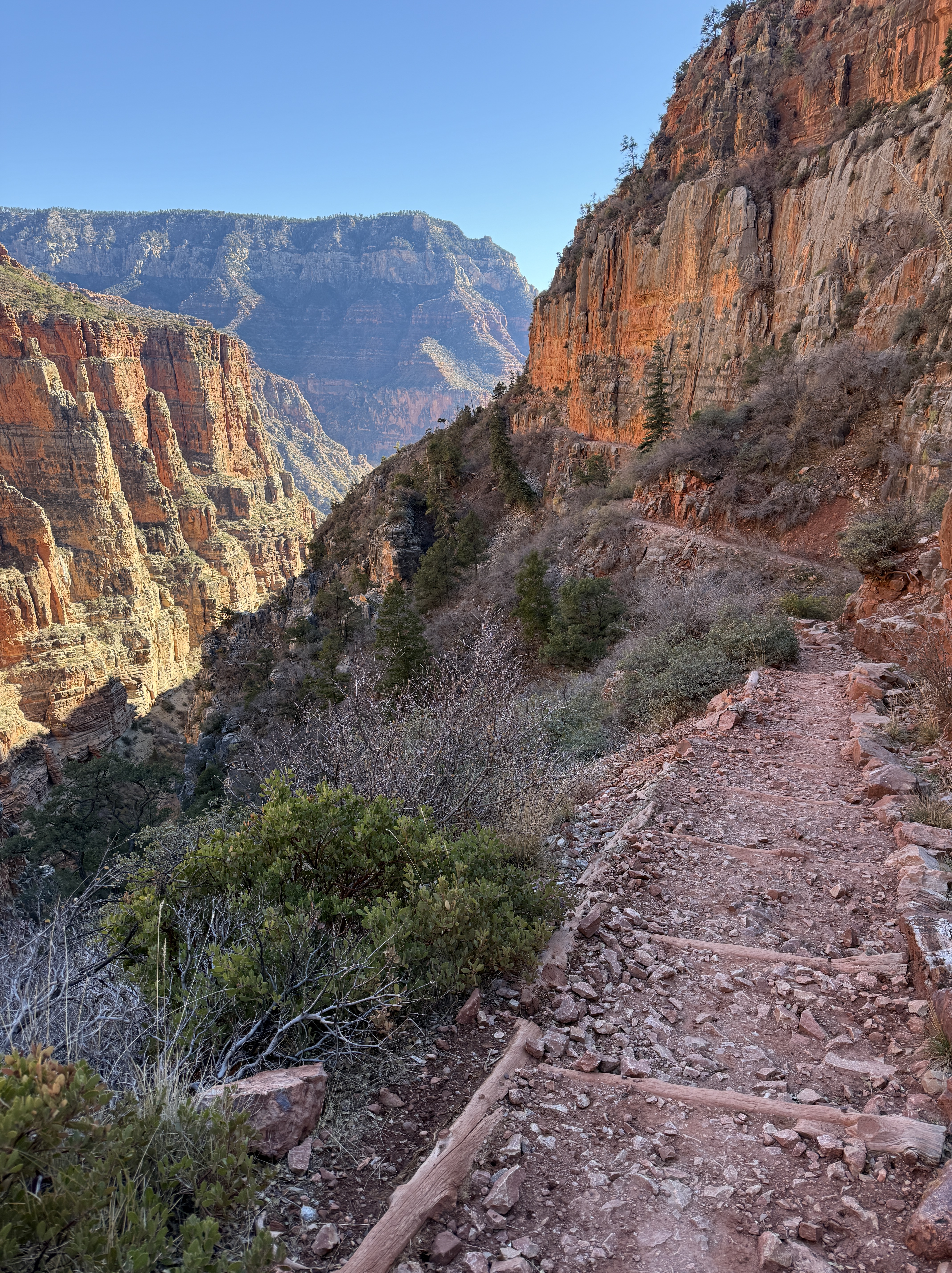
The trail past the bridge transitions to rock wall retained switchbacks, climbing up towards the beautiful, vertical striped stone of the Kaibab Formation and into the tree line. After passing through Supai Tunnel and past Supai Rest Area, another space with composting toilets and potable water (on during the tourist season), I was within a couple of miles of the top of the North Rim. Like the trail runner, I, too, was making excellent time. Especially for already haven taken 250 photos and videos, LOL!
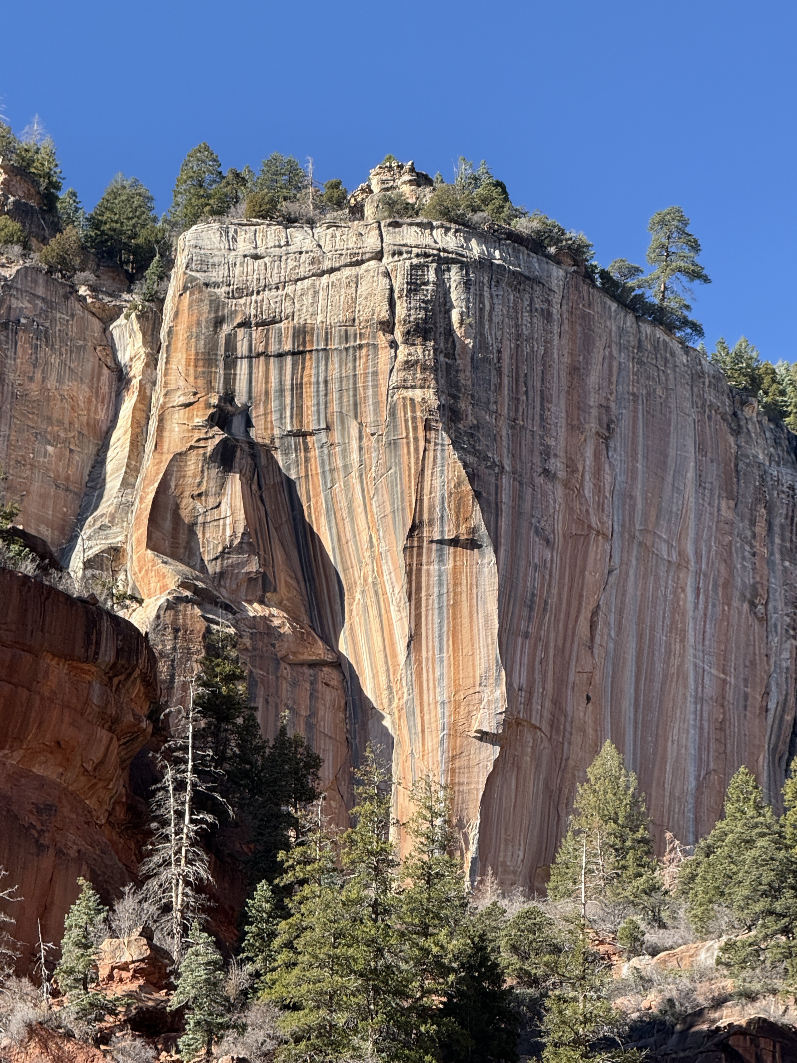
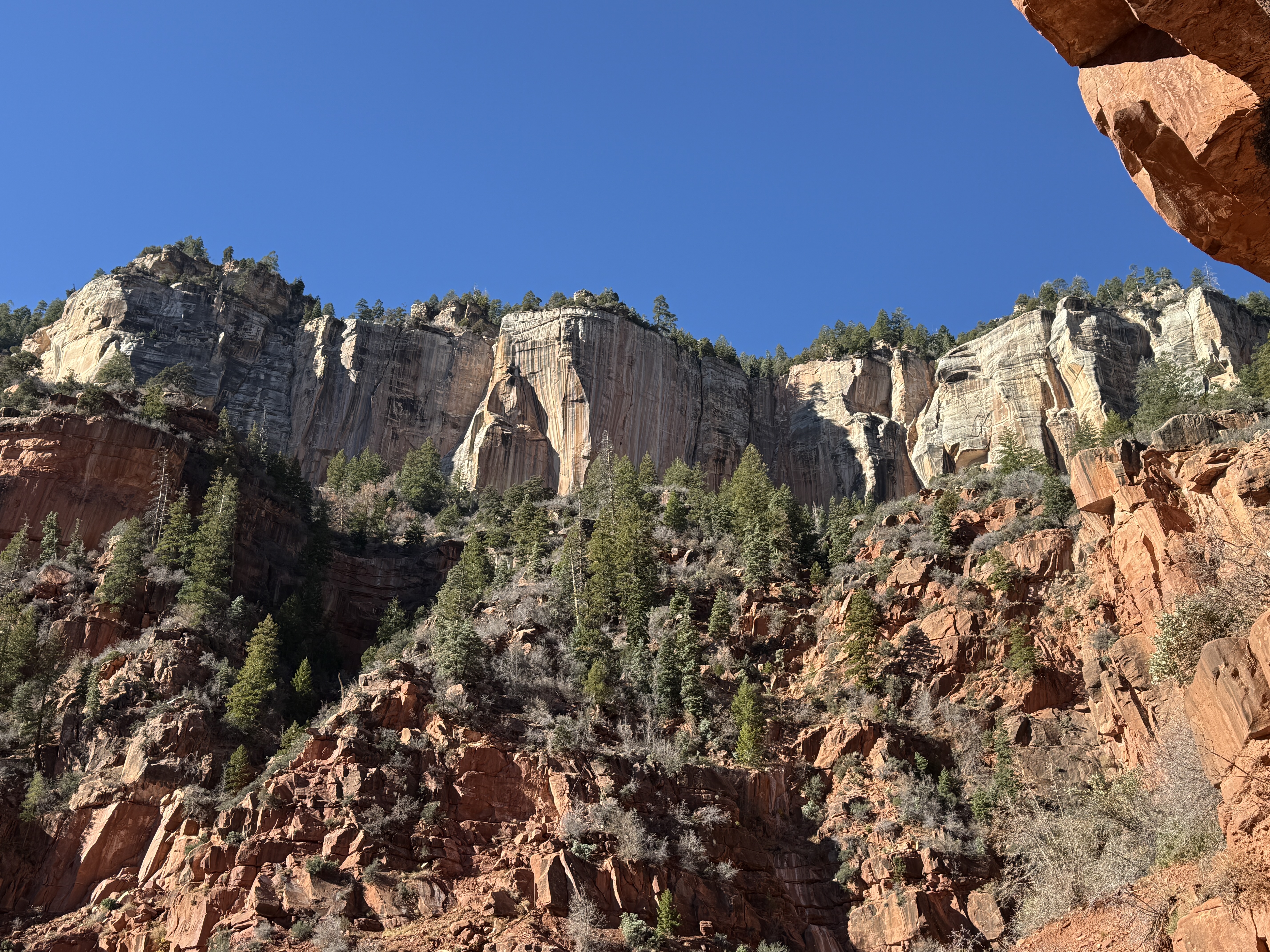
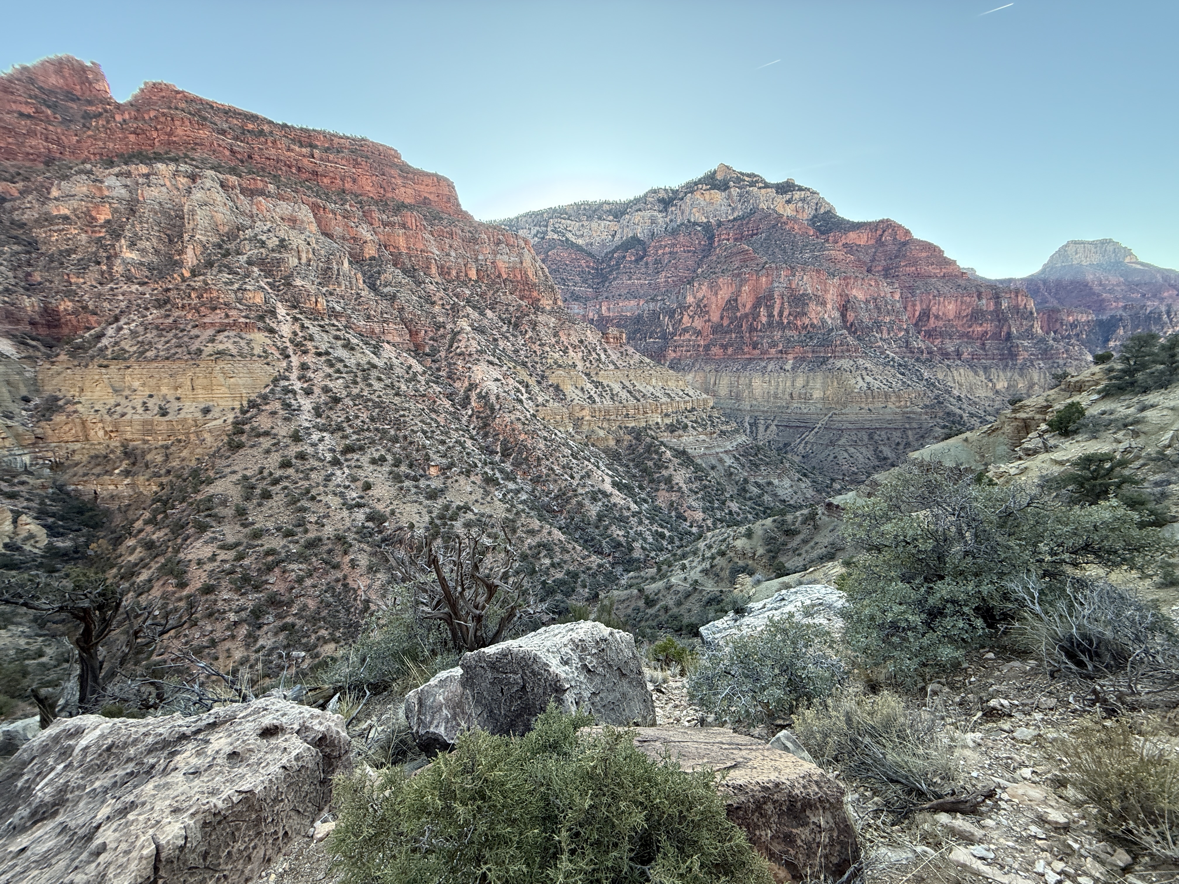
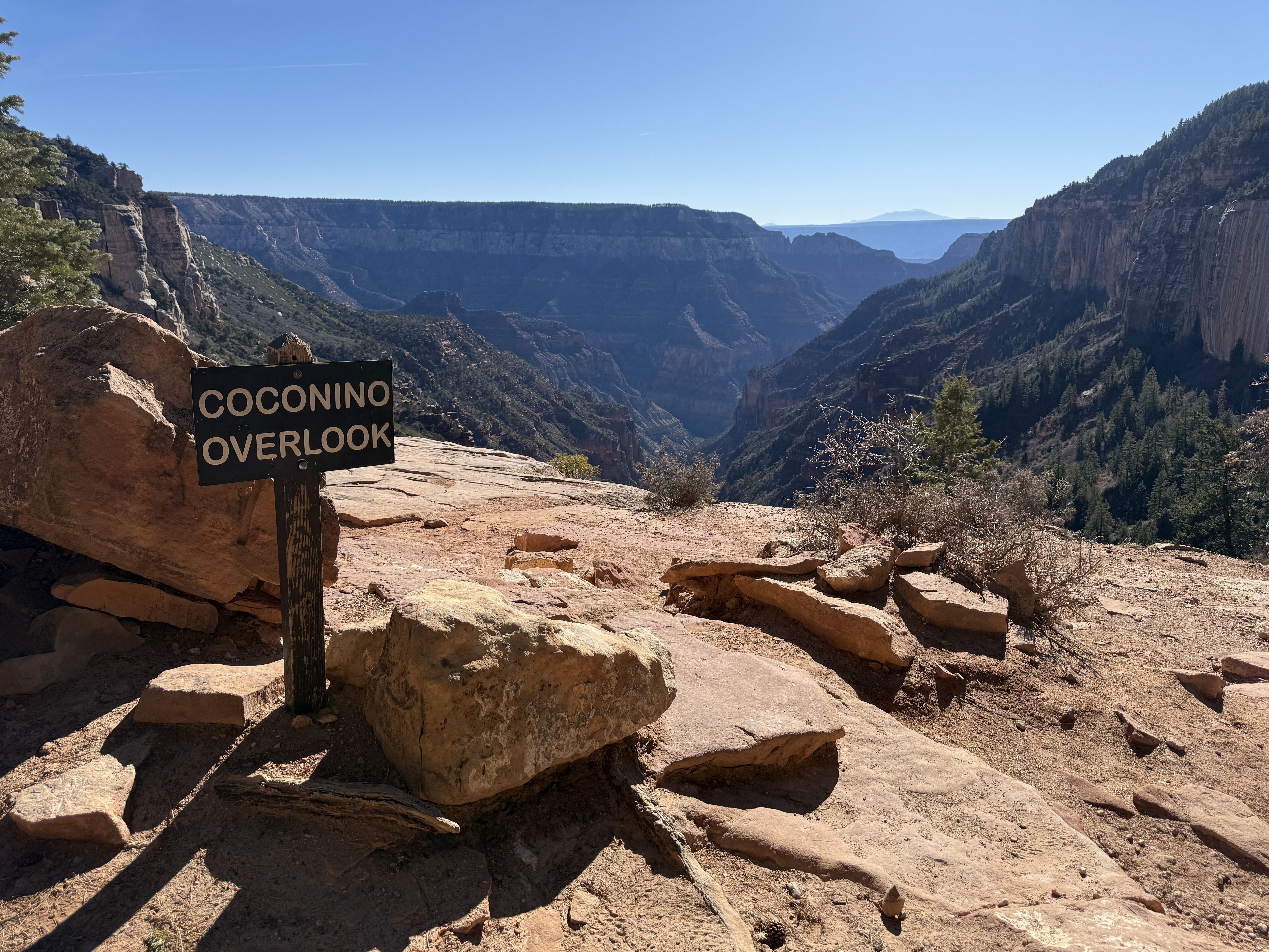
The red dirt of the Coconino Sandstone was a brilliant ochre in the sun, soon melting into the browns of the Toroweap Formation and the greens of the now prolific pine trees. A few more switchbacks and I was at the Coconino Overlook, only 500 feet below the North Rim. I could see the tallest mountain in Arizona in the distance, snowcovered and hulking, reminiscent of some of my favorite Chugach mountains, with a ridgeline that goes on for miles. I would absolutely have to come back and hike Humphrey’s Peak. The trail runner had made good time to the top and was on his way back down. I wished him luck on his journey and went our separate ways.
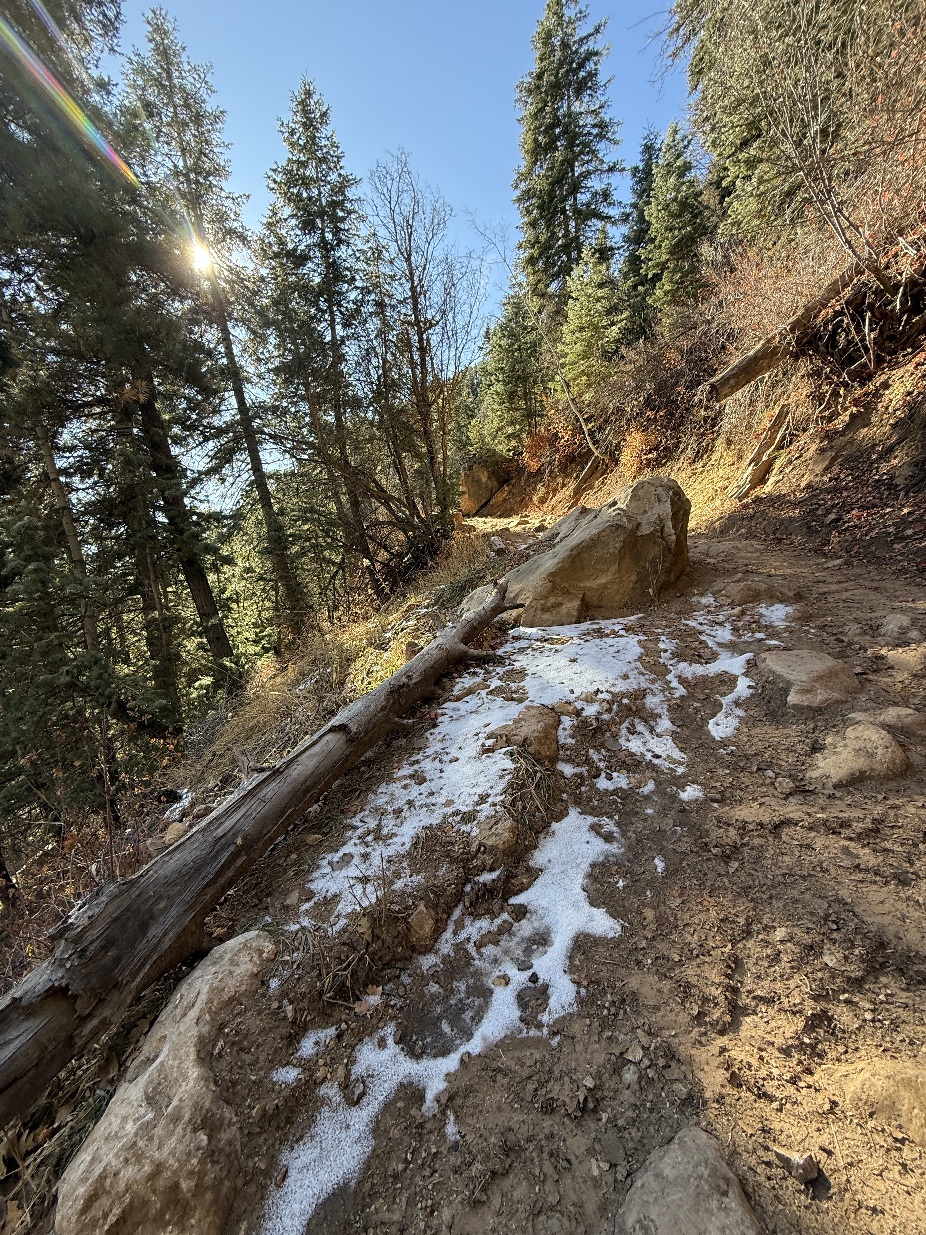
Now in the trees, the Canyon was hidden from view; I quickly made my way past one tiny patch of snow in the shade and signage warning the southbound hikers to give way to mules. I had brought microspikes with me just in case there was ice and snow but left them at Cottonwood after reports from southbound hikers that the trail was mostly clear. I realized I was at 8,000’ but felt incredible; no side effects from being more than mile and a half above sea level. I felt unstoppable!
There were informational kiosks now in sight and within minutes I was having a snack and reading all I could about the history of the construction of the North Kaibab Trail, having reached the North Rim.
A dusting of snow covered the ground and there were no vehicles to be seen. The North Rim roads had shut down on December 1, so it was literally a ghost town. I was alone, but definitely not lonely. This had already been a day to remember, I might wager to say one of the best I had ever experienced… and I was only halfway there. I sent InReach messages to the friends and family I had promised to keep updated, now that I was out of the canyon and had excellent satellite connection, then quickly headed back down the trail, eager for more of those incredible views and butterfly inducing sections of trail.
Not even two dozen steps down from rim, I ran into the guys, the troublesome knee loosened up, but still causing slow progress. We chatted about how their water filter system was moldy, an unfortunate side effect of not completely drying out the filter fabric after every trip, and since I wouldn’t need my filtration system once I left Cottonwood the next morning, I would drop it off with them tonight after filling all of my containers. They could mail it back to me once they got home. We agreed to meet up that evening and I once again started down into the canyon, jogging a moderate pace.
The nicest part about this 4000′ gain is that it never seems too steep, a fairly gradual slope rising just over 600′ per mile, a far cry from some of the uphill slogs I’ve done on my home mountains. I made steady progress on the way back, even while taking another 200 photos and videos to add to the hundreds I had already snapped that day. I wanted to document every step of this incredible journey.
Past the sheer cliffs, past the rectangle cut, past Roaring Springs and more mule deer at Manzanita, past the stout bridge and the abandoned telegraph poles, I jogged into camp at 315pm, a sub-8-hour, 13-mile round trip. Not bad for a 44-year-old woman who couldn’t walk the day before. Besides the biologists at the very beginning of the day, I had only encountered 5 people on the trail (there was a woman who passed me earlier in the day, though I can’t quite recall when or where and never saw her return down into the Canyon).
I was high on adrenaline, incredulous that I was done with that glorious section of trail, probably my favorite trail that I had ever traveled. A visit to the creek for a soap free bath and a top off on my filtered water was followed by dinner, I can’t remember if it was Chili Mac or a Ramen Bomb, and coffee. I patched a hole I found in the floor of my tent then took a walk up to the guys’ campsite, but they still hadn’t made it back. I was ready to settle in, so I would swing by in the morning and drop off the filtration system for them.
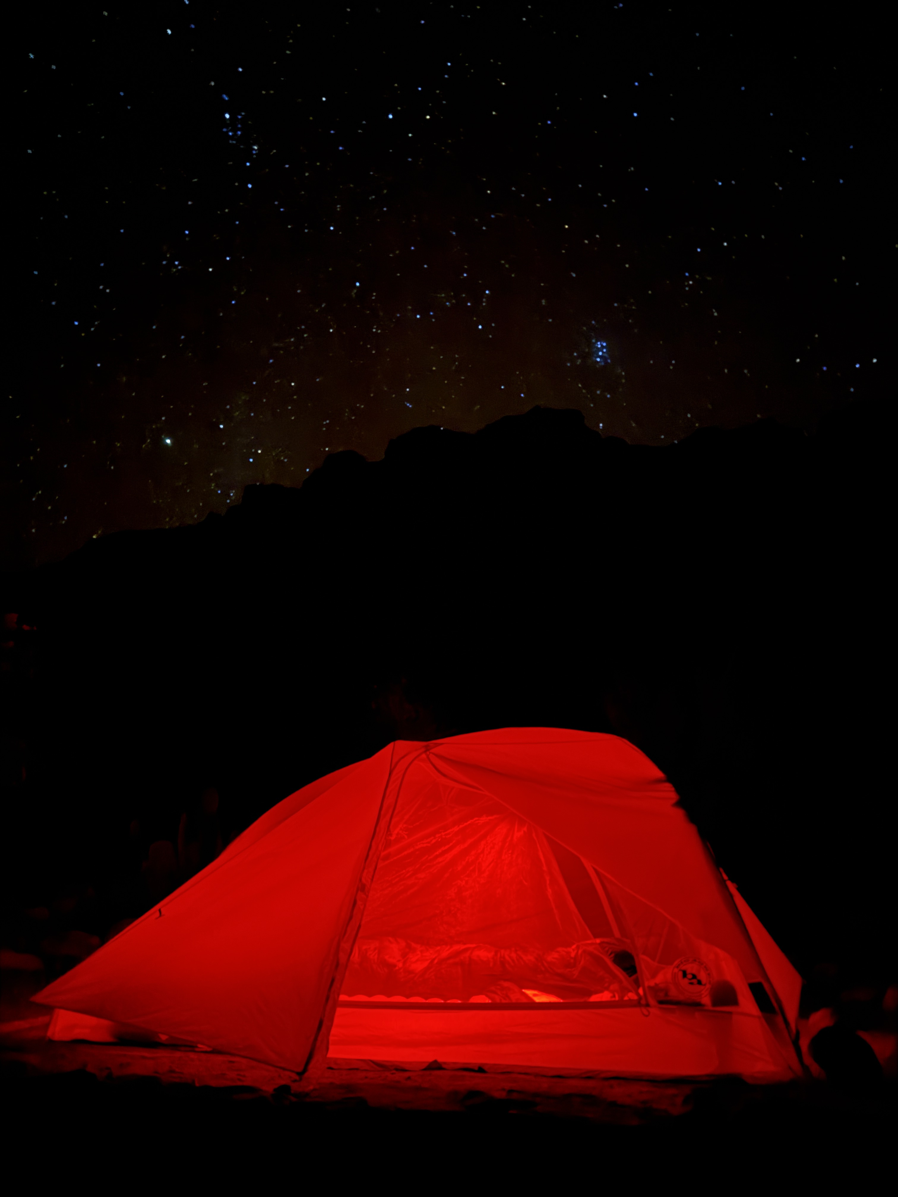
I sat with my chair facing down Bright Angel canyon, looking towards the South Rim, and watched the sun drop behind the canyon wall. The mice had apparently learned that I wasn’t the one and had not caused me any trouble since the first night, affording me the opportunity to sit outside and marvel at the stars. As they say, “Half the Park is after dark!”
Tomorrow I would head back the way I came, descending to the Colorado River, back up to Tip Off, on the Tonto Plateau, and then back out to Cremation Canyon. Another 12-mile day, but the pack would be a little lighter than the first trip over this ground. I had been eating non-stop and could travel light on water until Phantom Ranch.
My last night at Cottonwood Camp and my last night on the north side of the Colorado River, for this trip at least. I was too pumped up to sleep, so I went through some of the day’s photos, reminiscing about a time not too far gone. I finally fell asleep, grateful for an unforgettable day.
Rim To Rim To Rim AllTrails Link:

Just The Tips:
- Instead of flying into Phoenix, opt to fly into Flagstaff. I’ll be doing that next time instead of making the 3 hour drive each way.
- If you are flying in, pre order your stove fuel and other supplies online from Sportsman’s Warehouse in Phoenix or Flagstaff. I found this to be quick and easy.
- Be aware that your tracking devices and phone may not be able to get a satellite connection in some of the narrow canyons. Tracking may get wonky, as the vertical walls can cause a location ping, hundreds of feet above or below you.
- Permitting for the Grand Canyon can be confusing. It is best to apply for the lottery, which opens based on the month of travel and is available for application on the 16th of the month, in the 5th month prior to your trip. For example, a September Trip lottery application period would open April 16. See this article for more information about getting your Grand Canyon permit.
- Give yourself more than one night at Cottonwood Campground to allow for a side trip to Chimik’yana’kya Deya’ (Ribbon Falls) or a day hike to the North Rim, plus a rest day. I found 3 nights at Cottonwood to be perfect.
- If hiking rim to rim to rim in the winter, know that there are no services at and no access to the North Rim. You will be one of the few people in the area, far from help. Bring hiking poles and microspikes in case of snow. Evaluate your abilities and comfort with heights honestly before traveling this stretch of trail.
- Carry plenty of water and a water filtration system. Don’t drink unfiltered water. It can contain bacteria even if it looks clean. Be sure to dry out your filter when you get home.
- Get to the park early. The entrance gets extremely backed up with traffic beginning mid-morning.

2 thoughts on “Alone in the Grand Canyon: Trekking Canyon Walls to the North Rim”