
Day 2 – Cremation to Cottonwood Camp
12 Miles, -1600′, +2000′
November 30, 2024
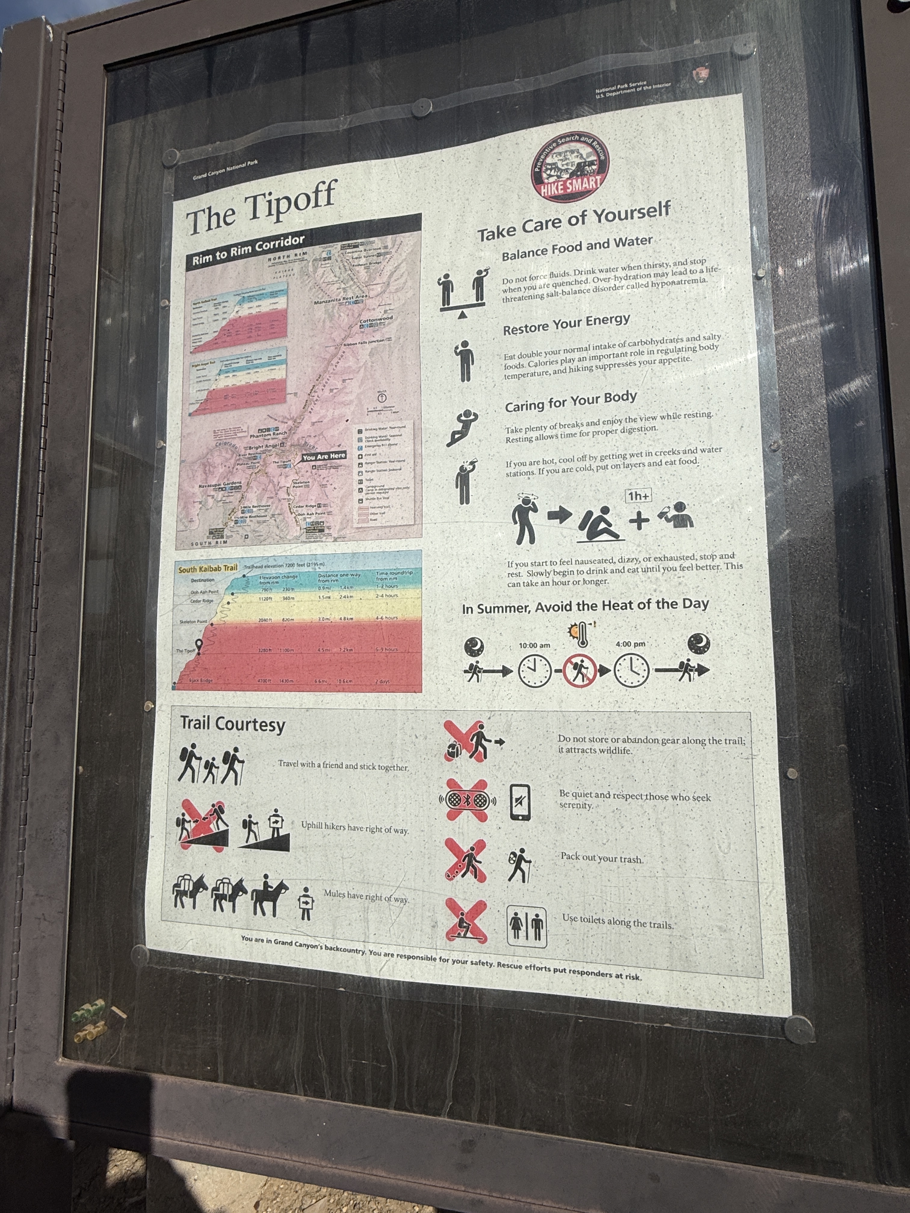
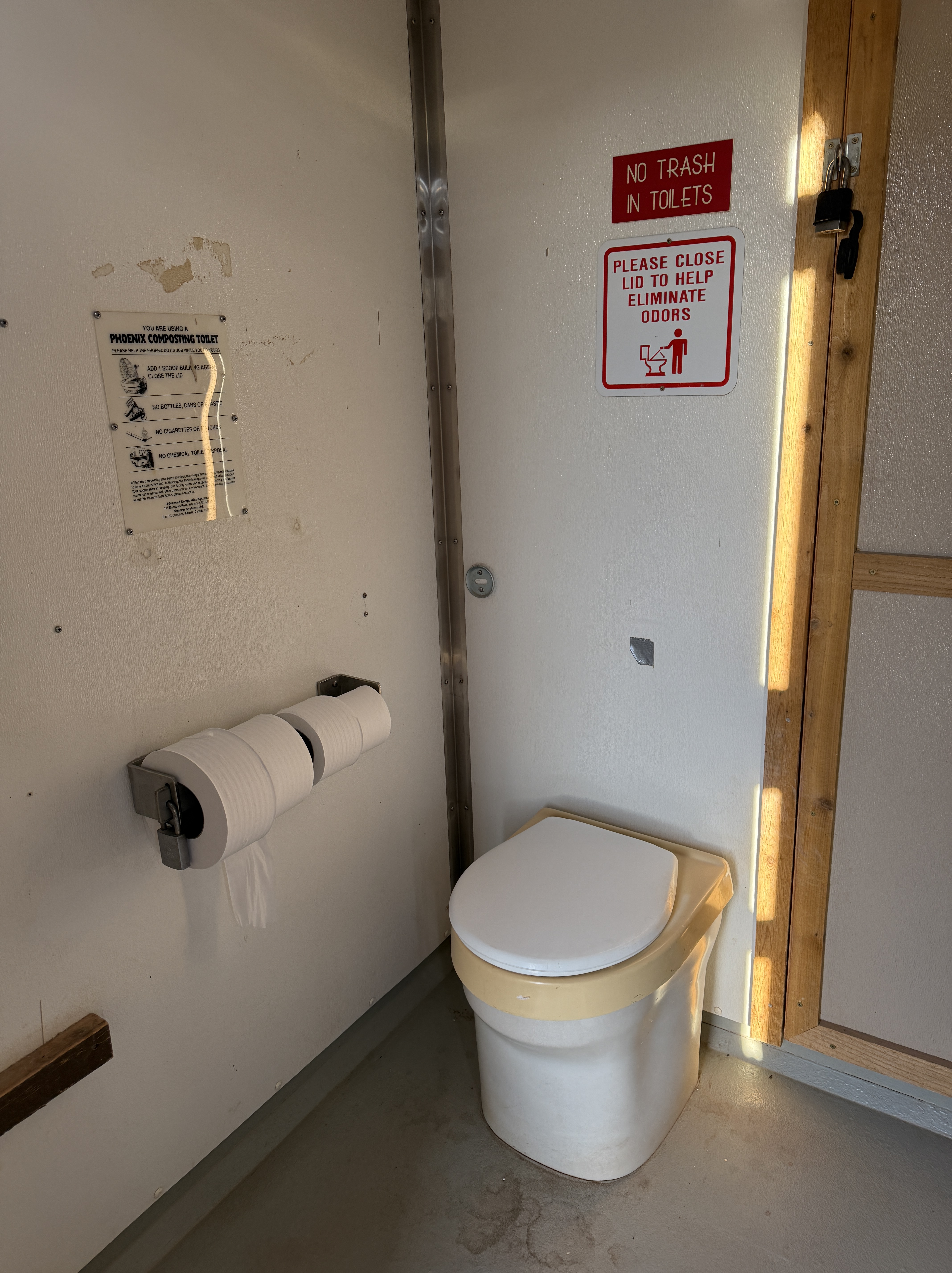
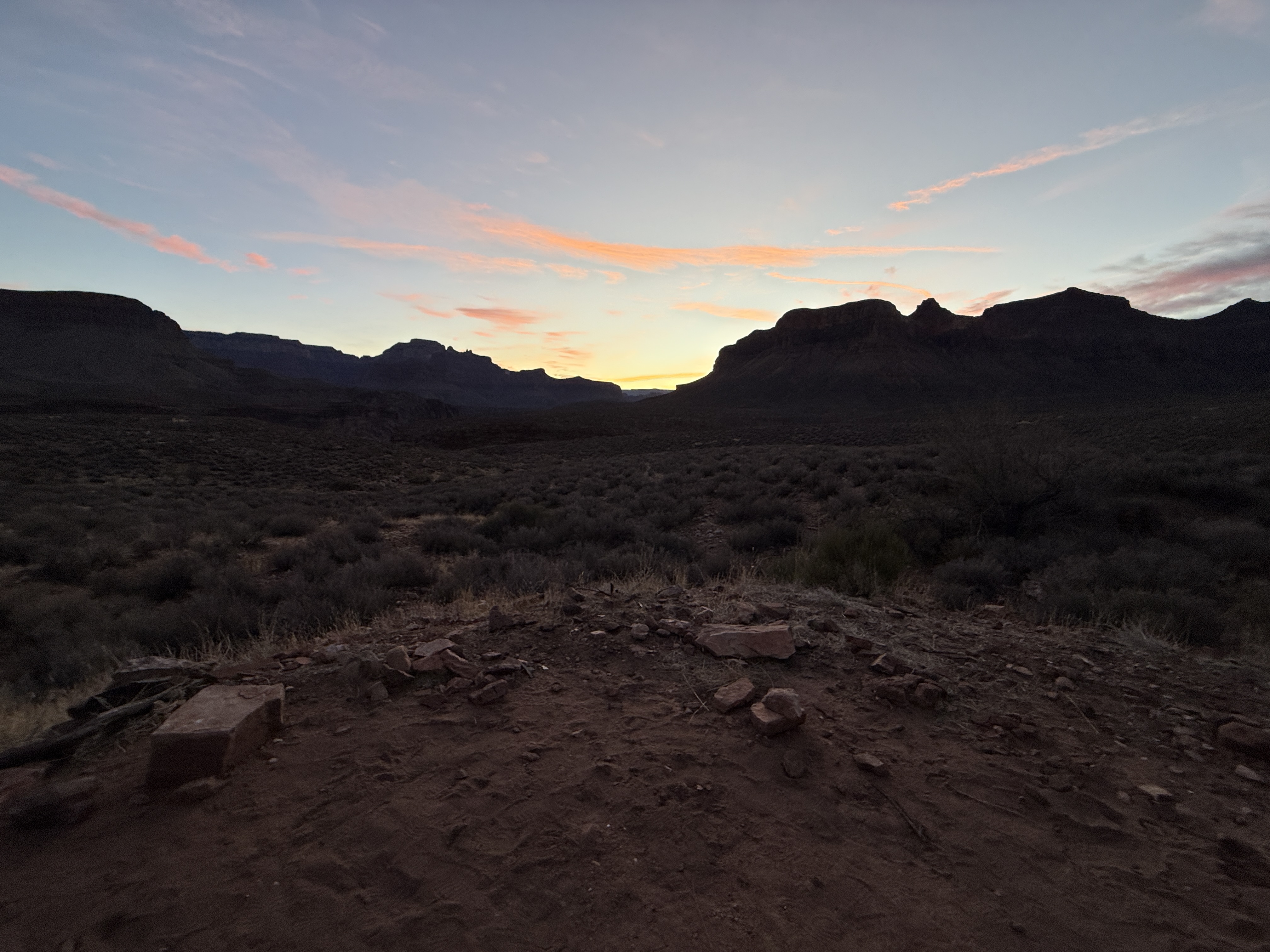
I woke before the daylight, rested and excited to see what was to come. As the pink clouds signaled the rising of the sun, I made some coffee and oatmeal and ate and drank as I broke down camp. There are no bathroom facilities in this remote area so I carried wag bags, but decided I could make it the almost two miles back to Tip Off, where there is a composting toilet. If not, I would have to carry the used wag bag for the next 5 days. I could hold it. I poured out some of my excess water, knowing that I could refill in about 5 miles at Phantom Ranch, and my legs were very happy about that!
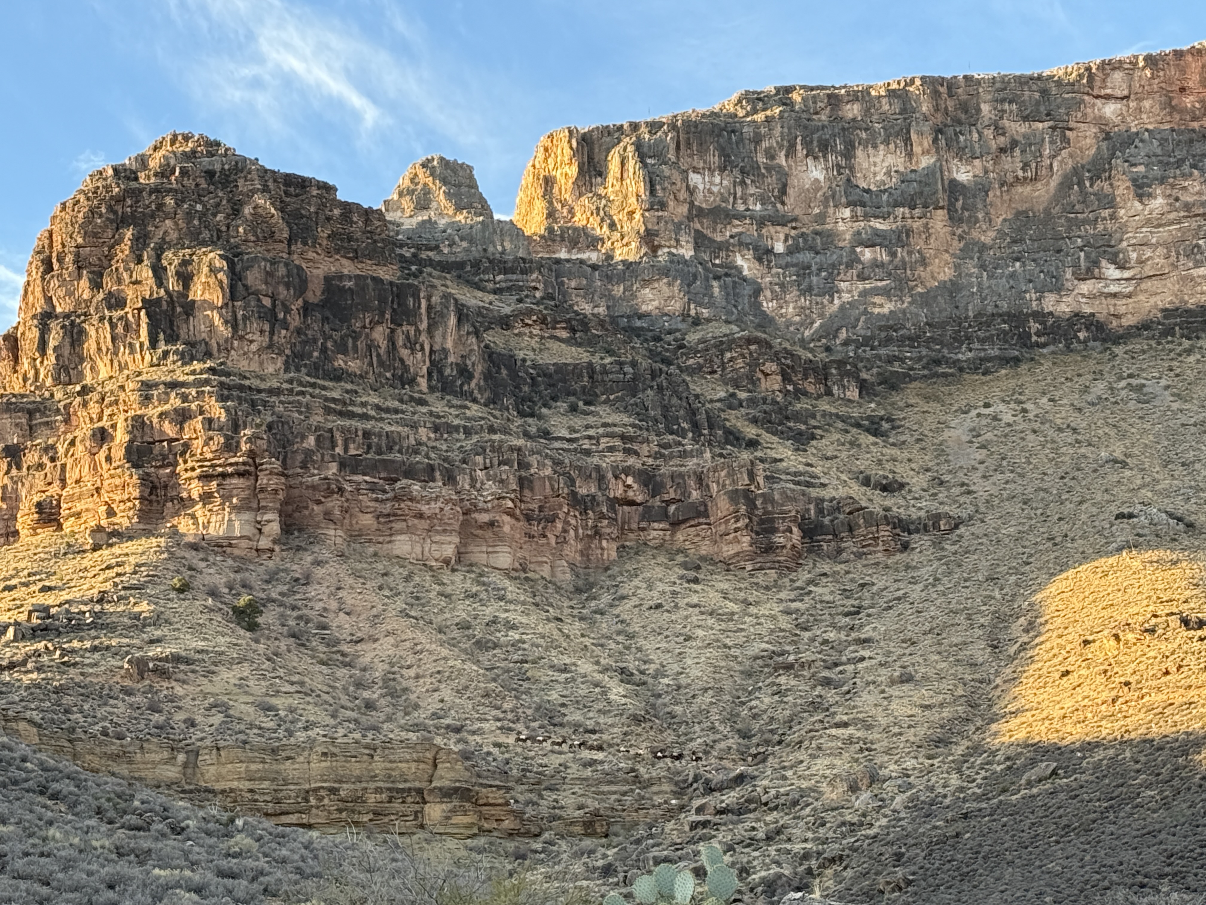
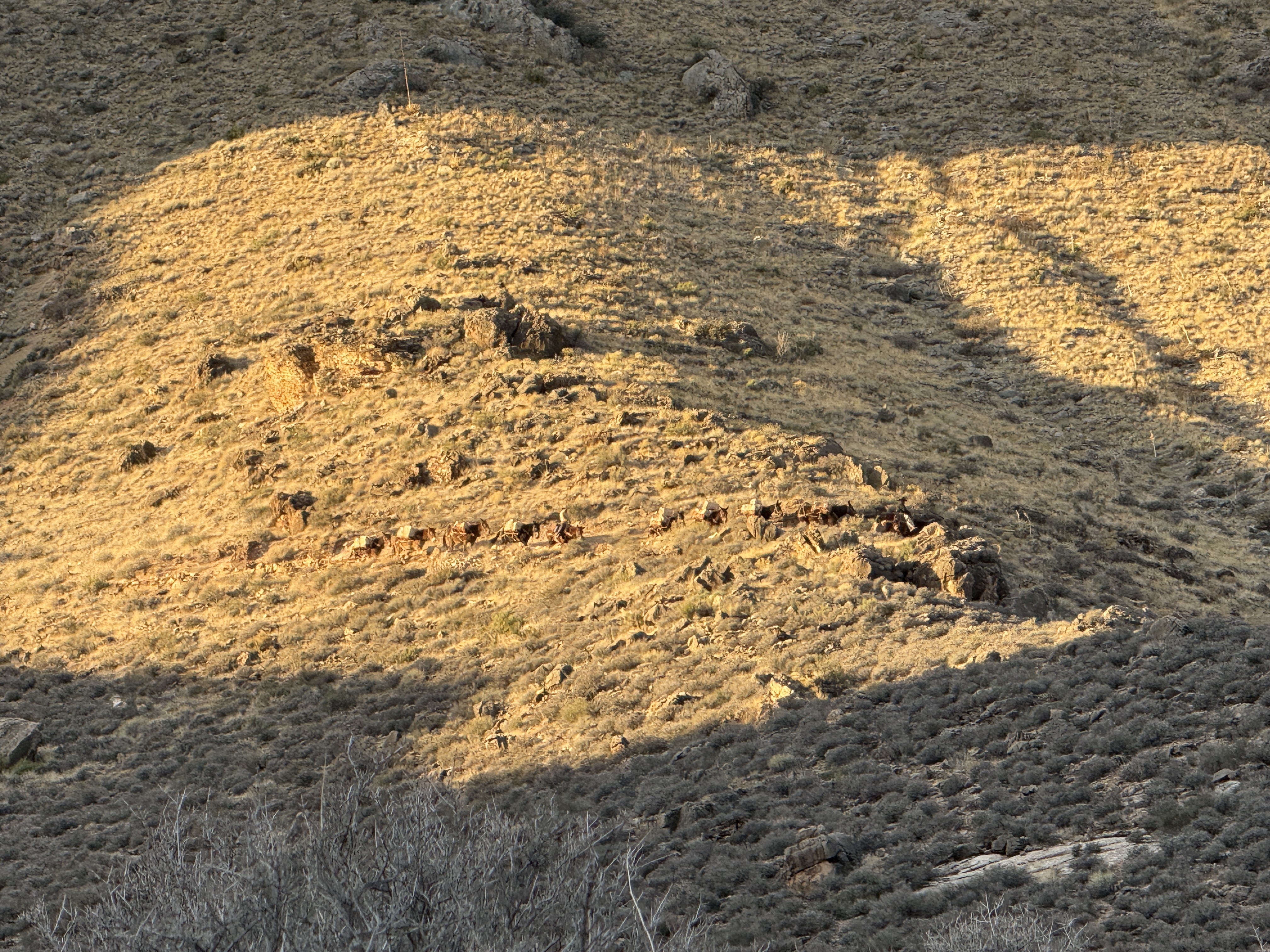
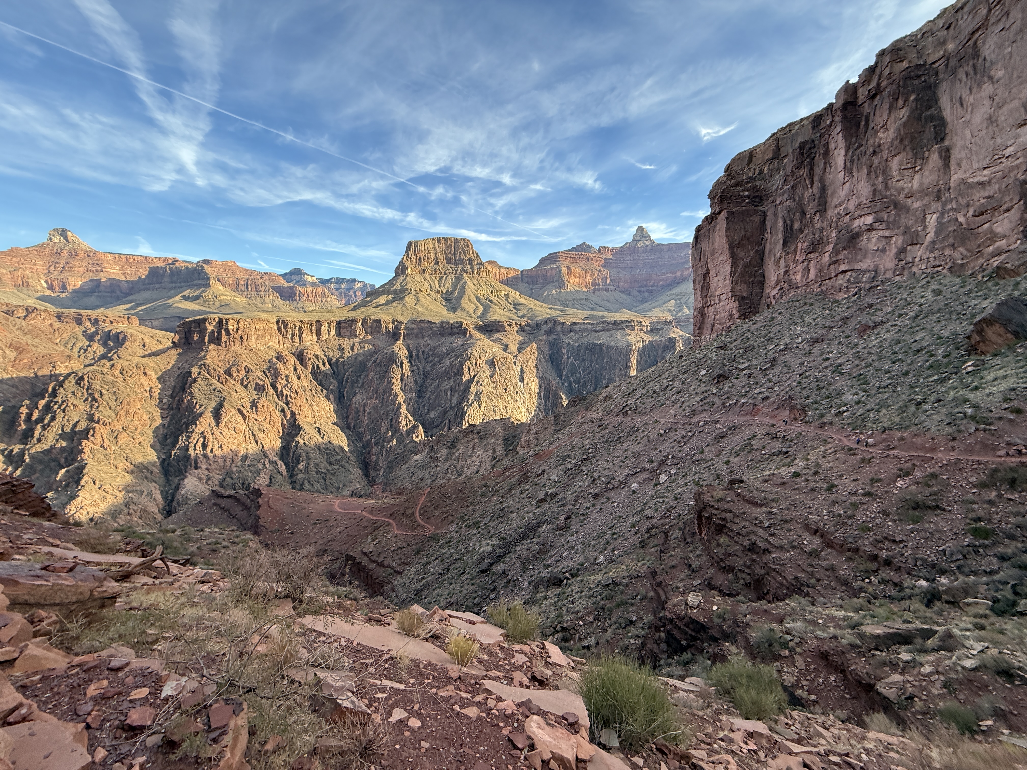
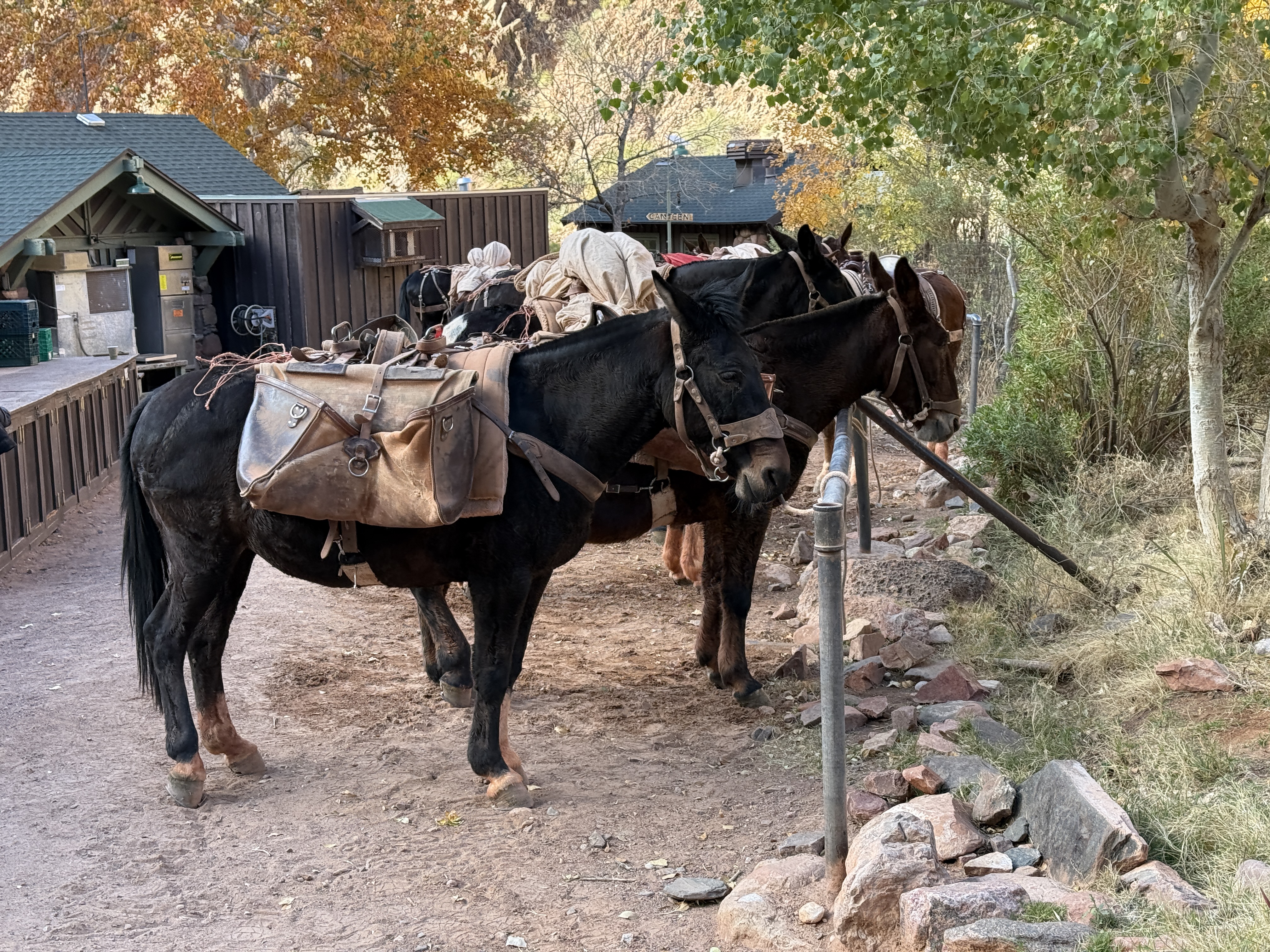
Surprisingly, I felt strong, and I made excellent time back to Tip Off. The mule pack train got an early start and was making their way down to the Tonto Plateau, before continuing on with supplies for Phantom Ranch. After a quick use of the facilities, I looked up towards the South Kaibab trail; I could see the day hikers who had a goal of reaching Phantom Ranch starting to make their way down, so I hustled ahead to avoid as many people as possible.
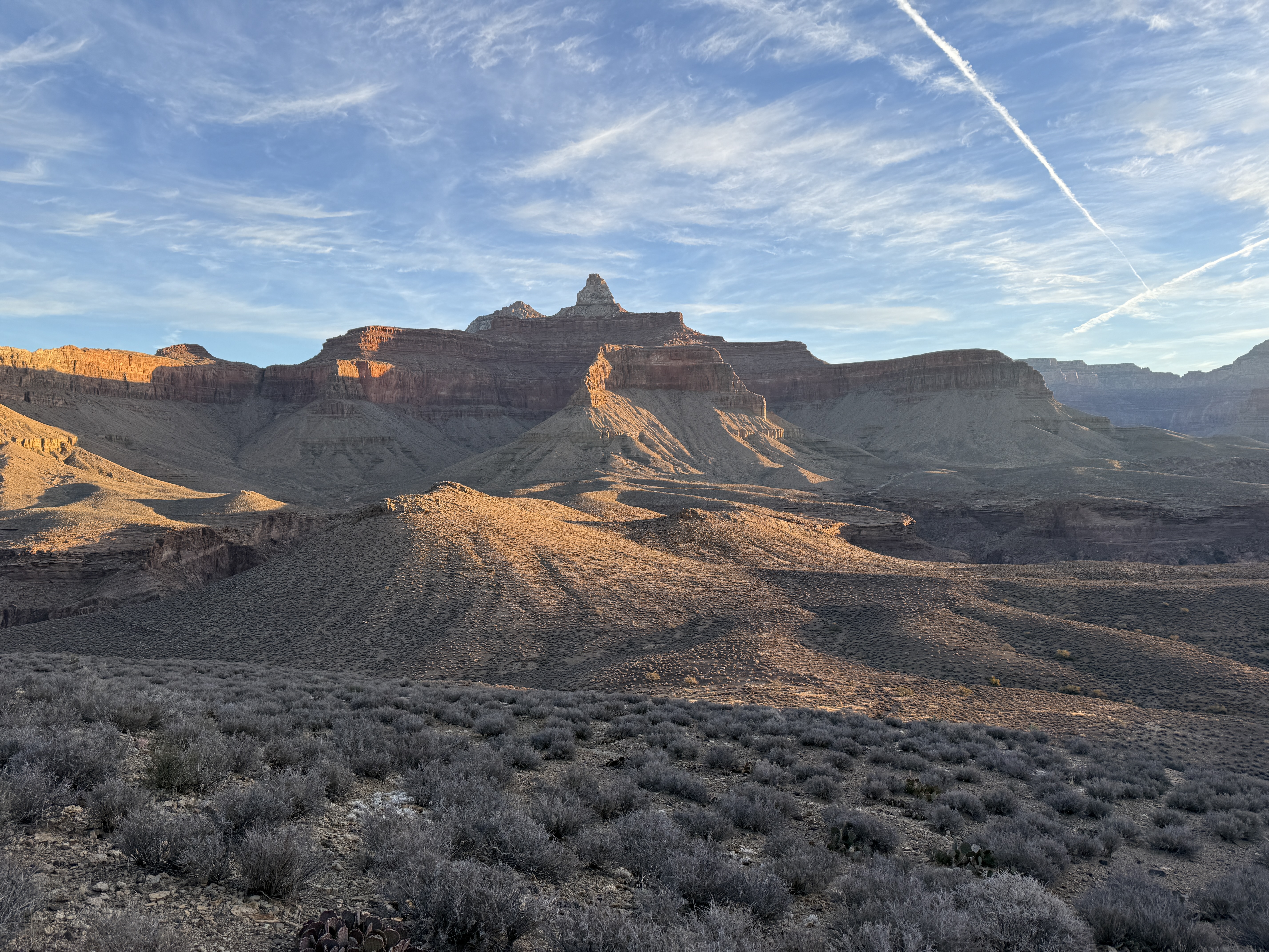
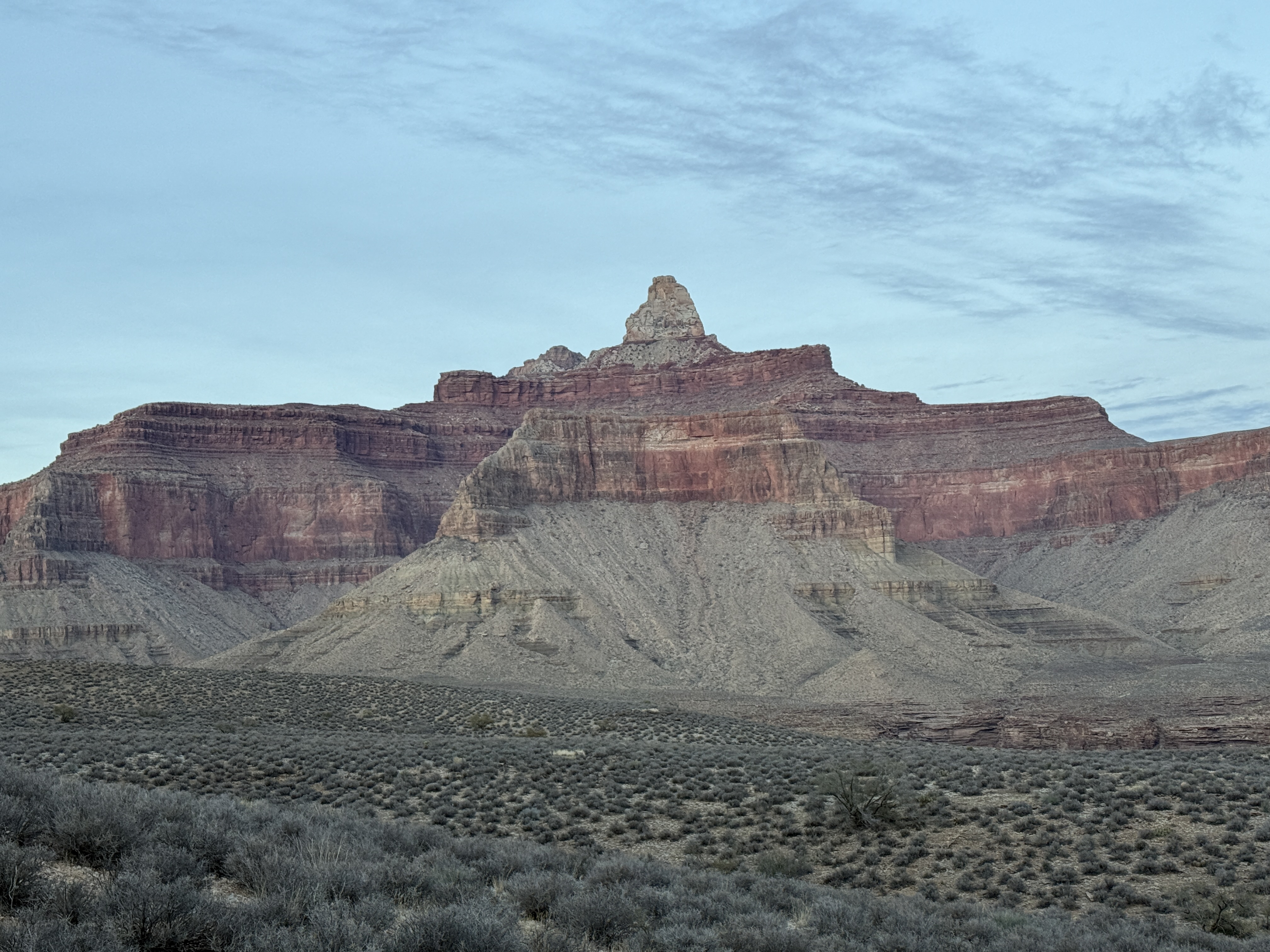
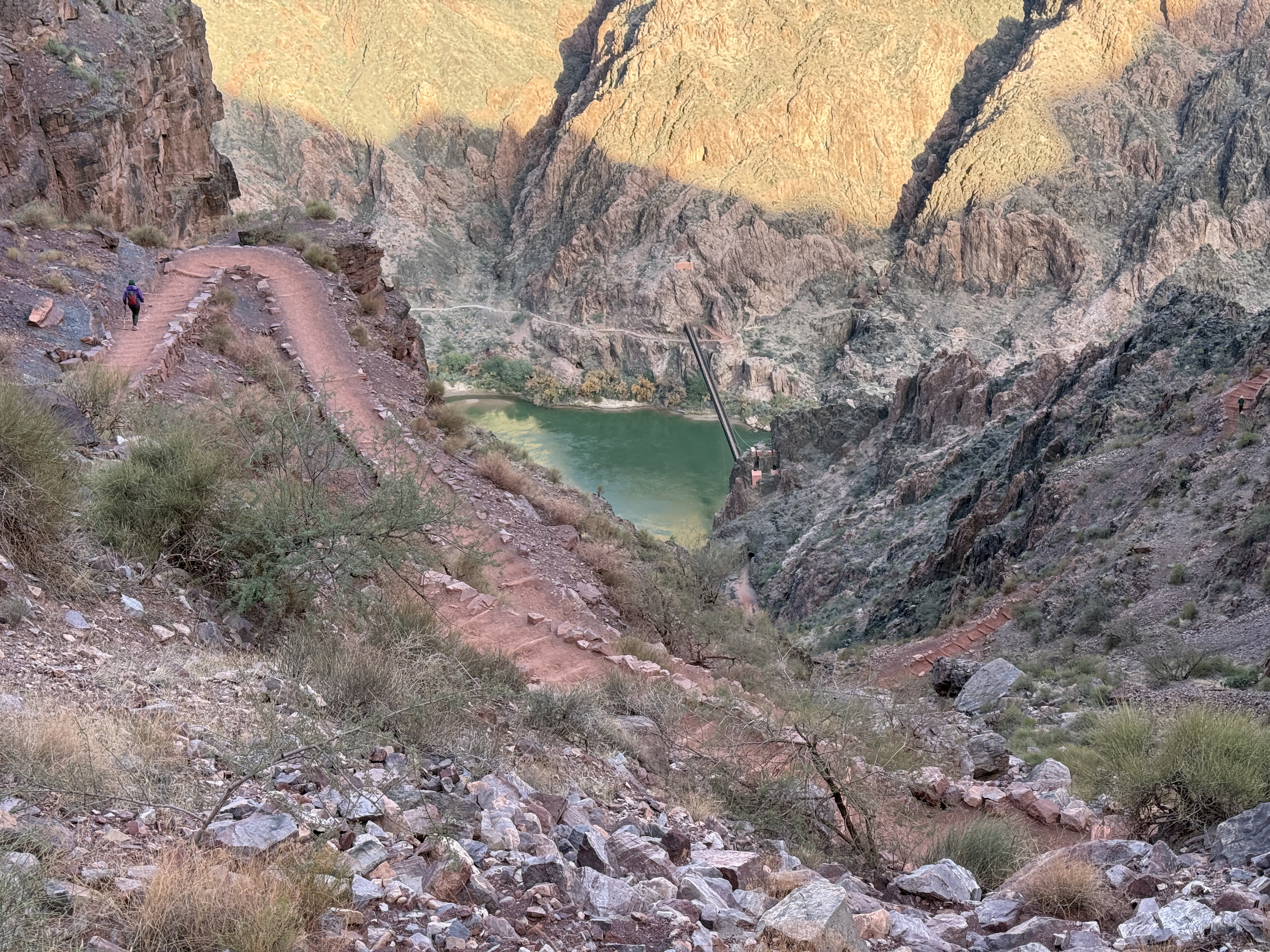
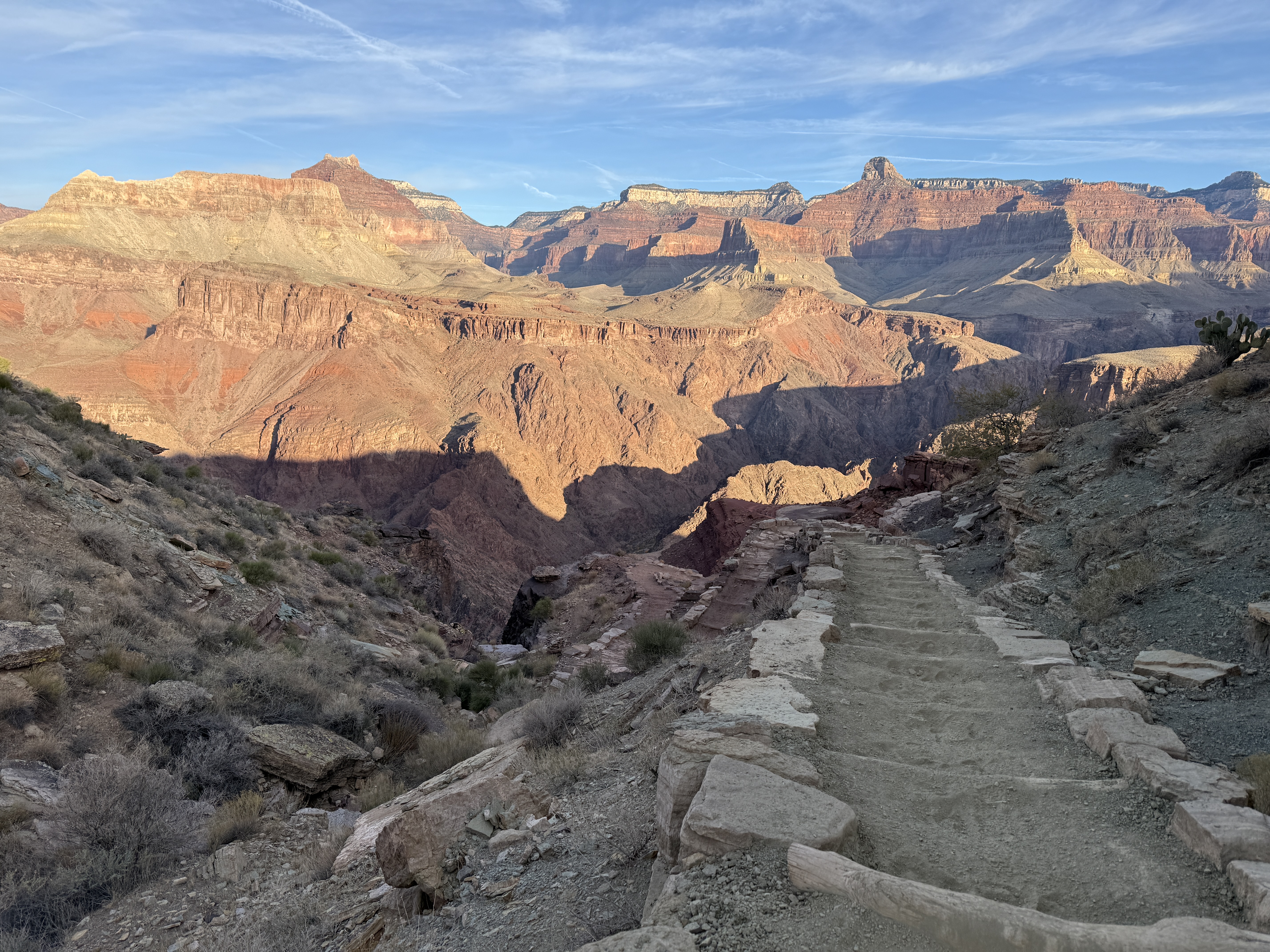
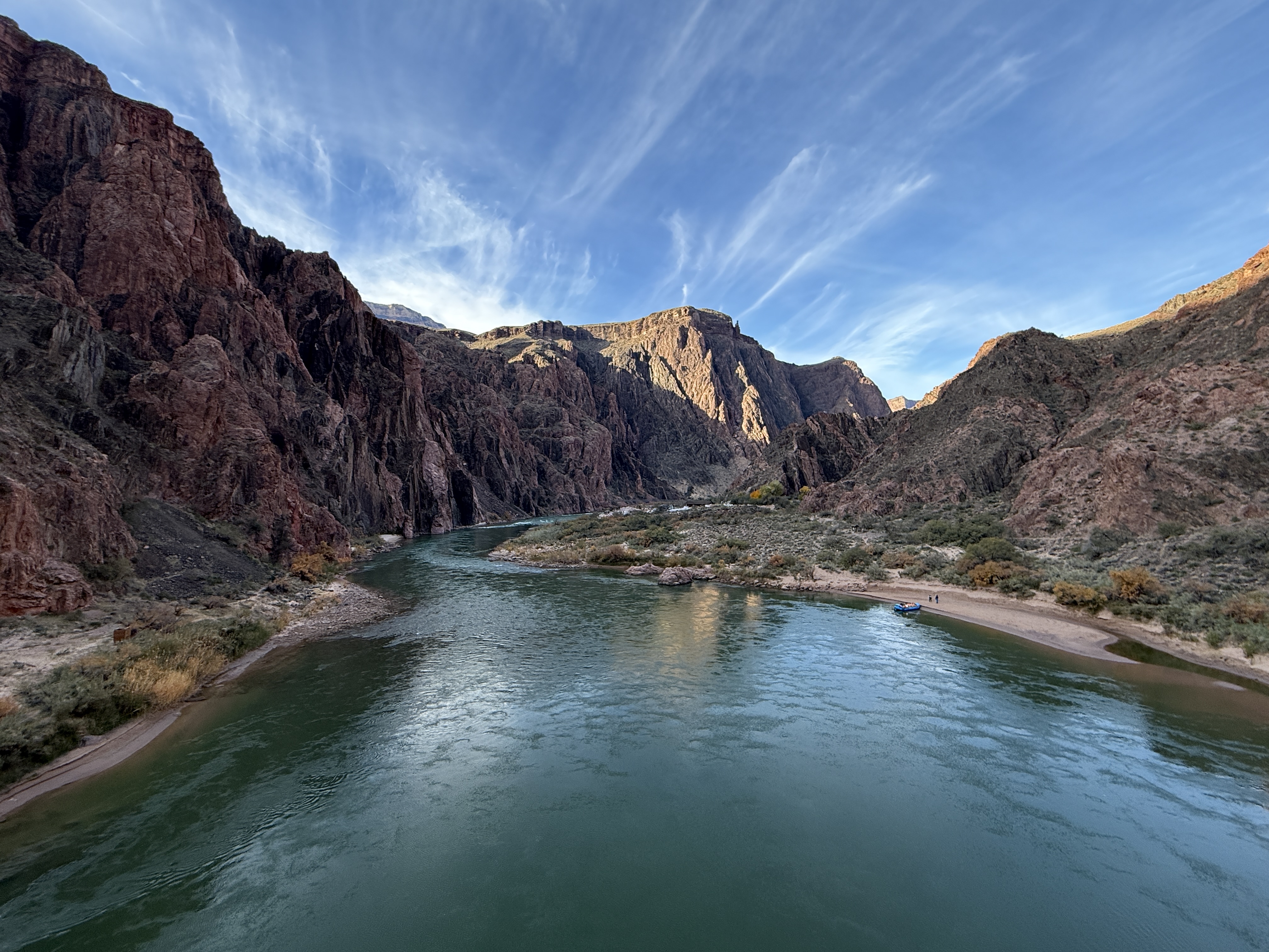
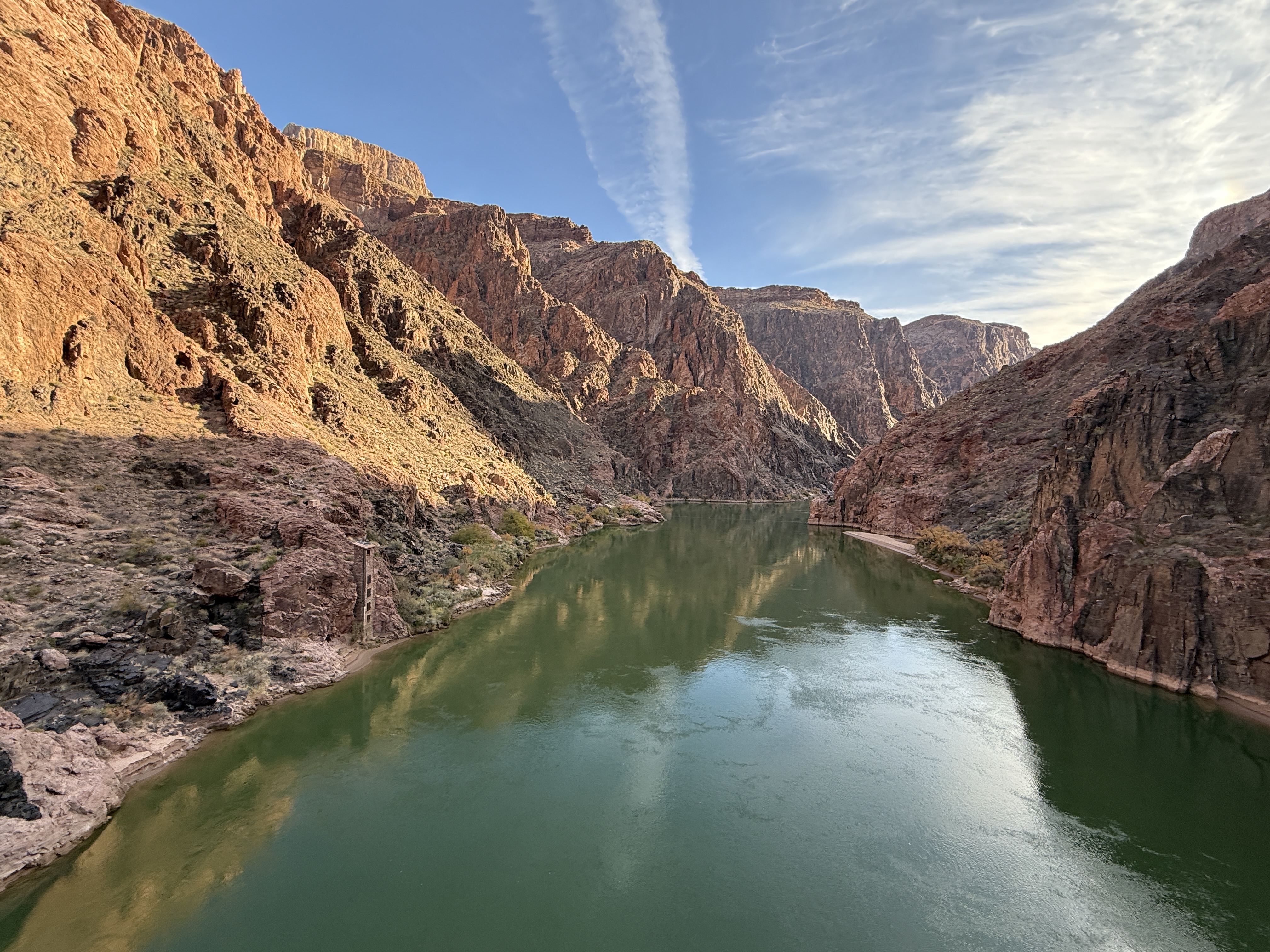
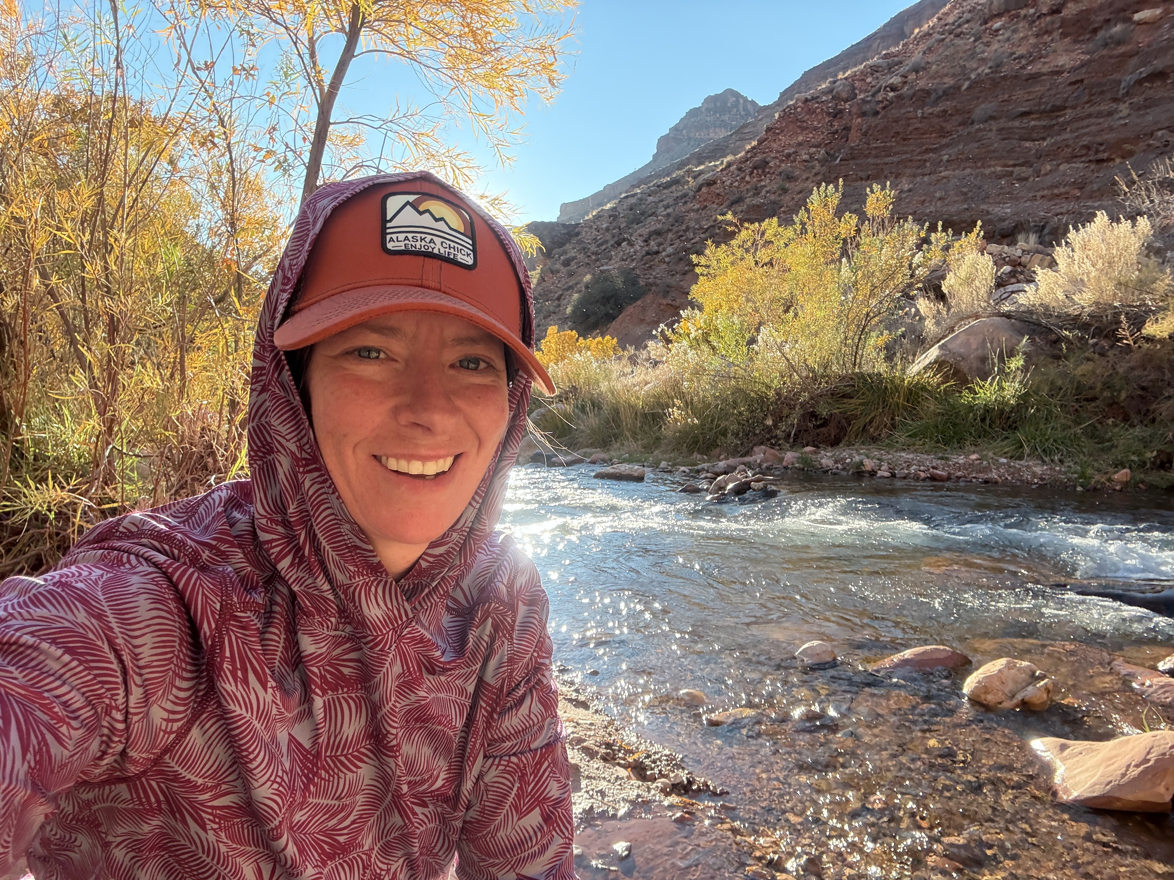
The trail from Tip Off down to the Colorado River is a well-engineered path, descending from 4000′ to 2400′ at the Colorado River. I probably took twice as long as I should have on my way down to the “Black Bridge,” stopping every few steps to get another picture or video. My mind was blown. The ochre-colored dirt was a beautiful contrast to the blue green tone of the Colorado River and the yellow of the Cottonwood trees at Phantom Ranch.
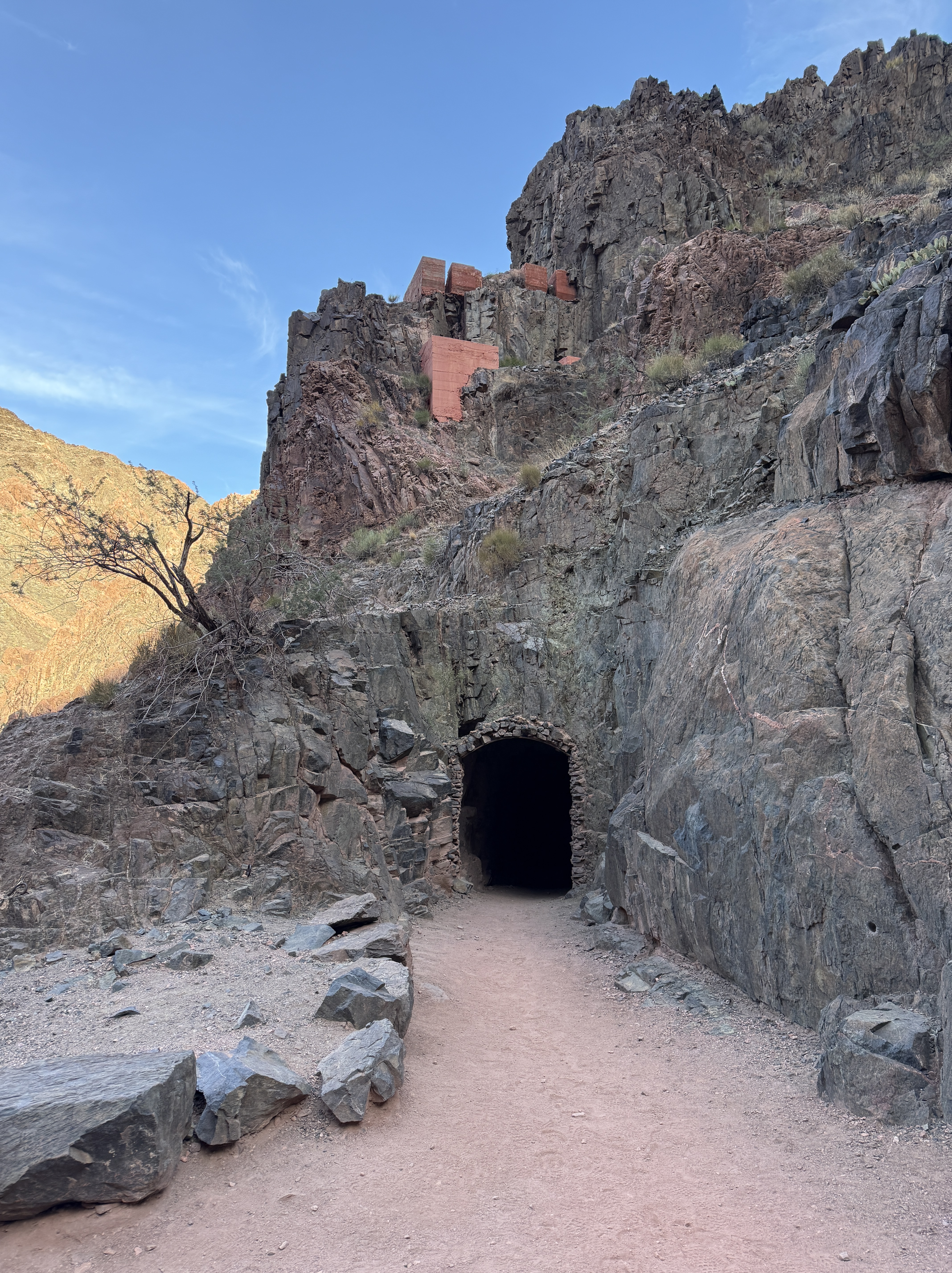
I was descending into the depths of the second largest canyon in the world to a river that I had known many years ago when I was just a teenager whitewater rafting from Moab to Lake Powell. I could feel it welcoming me like a friend long missed. The winding path brought me to the opening of a tunnel, the entrance framed with stacked stones; a portal to a civil engineering feat, the Kaibab Trail Suspension Bridge, AKA The Black Bridge.

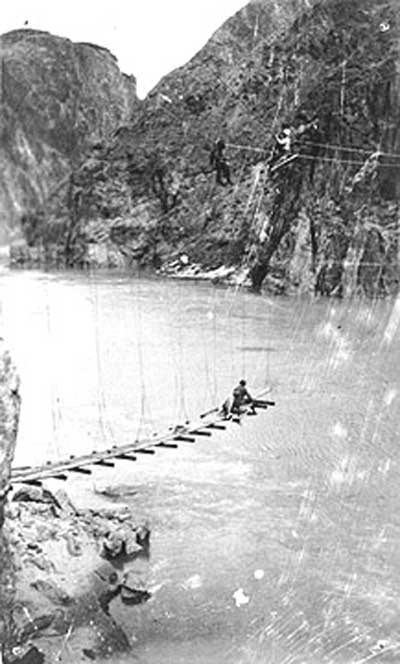
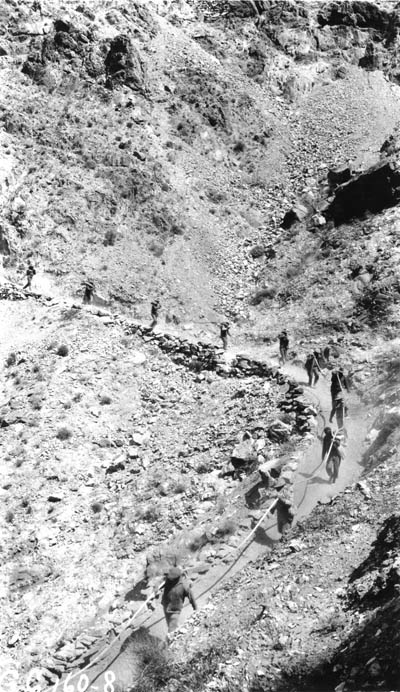
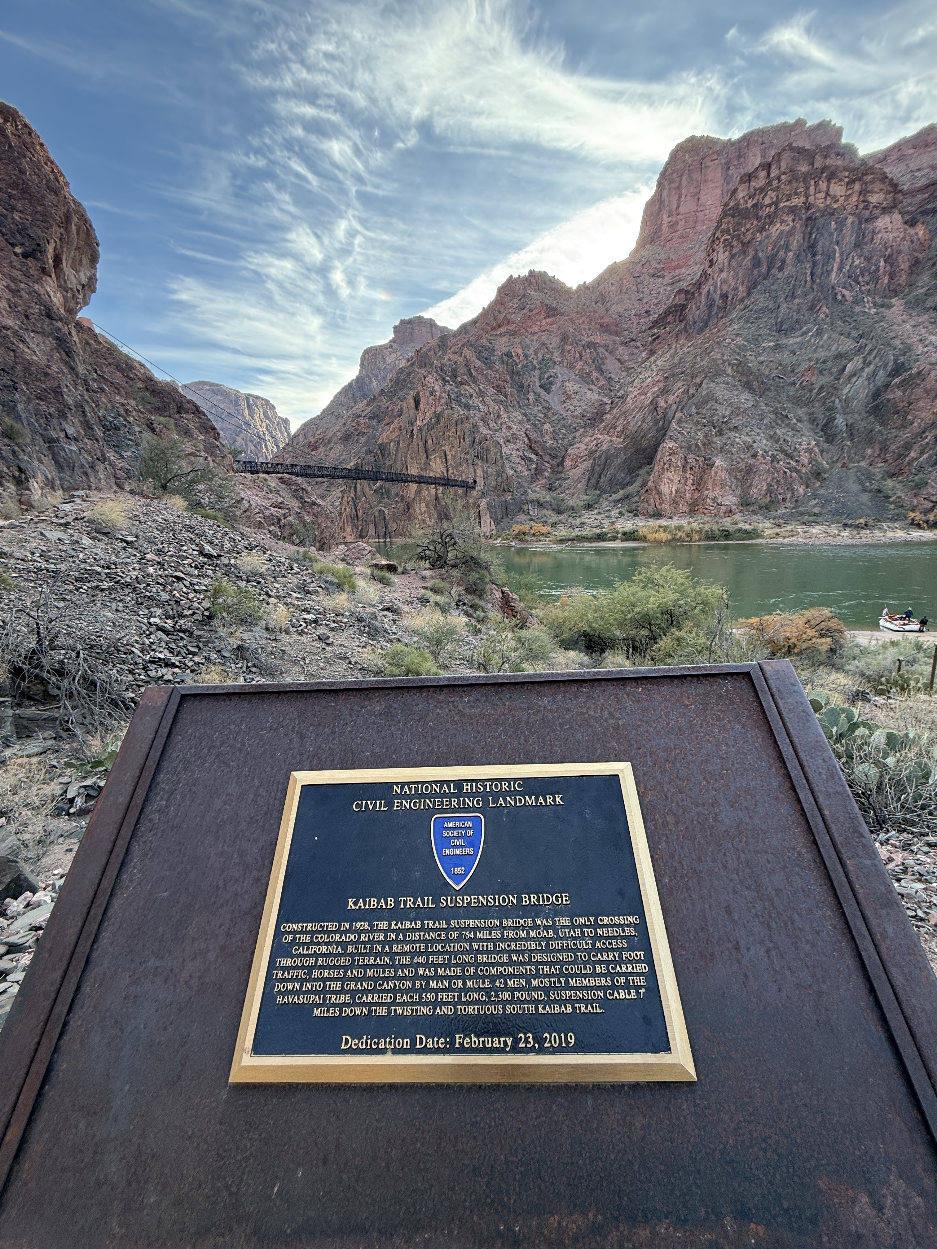
Until this 440-foot-long bridge was built in 1928, crossing the Colorado here was treacherous, first requiring a boat, then in 1913 a cableway, and in 1920 a suspension bridge that was deemed unsafe due to lack of structural stiffness. Being that there were no roads to access the site, all of the 122 tons of building materials for The Black Bridge were brought down 9 miles from the South Kaibab Trailhead, by human and mule, including the one ton, 550 long suspension cables that were carried by 42 single file walking Havasupai Tribesman.

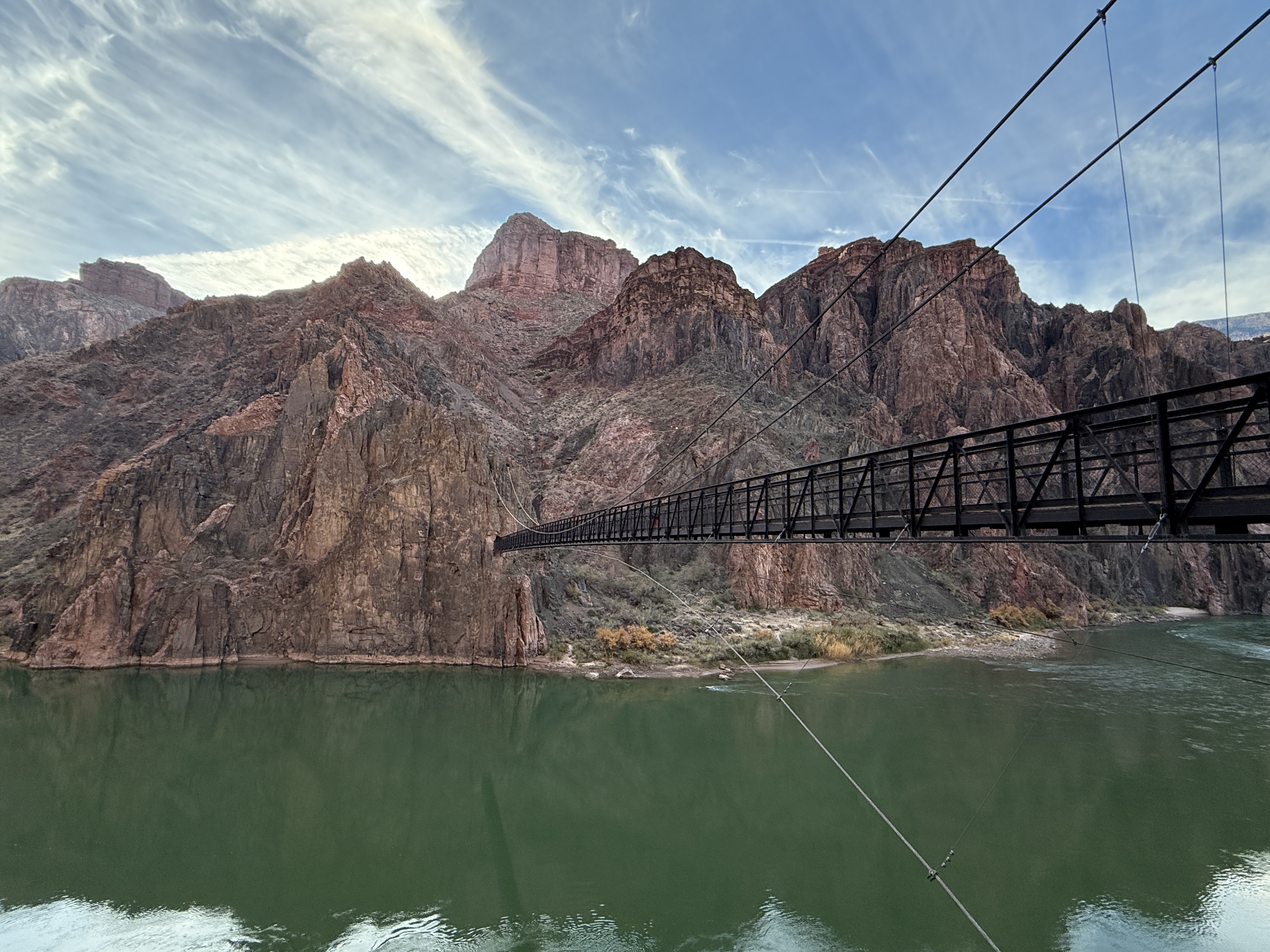
The Silver Bridge, just downstream, was built in the late 1960s, connecting the Bright Angel Trail to Phantom Ranch. These are the only engineered crossings over the Colorado River for hundreds of miles. Unfortunately, this bridge was closed during my trip, but I’m looking forward to crossing it on my next visit.
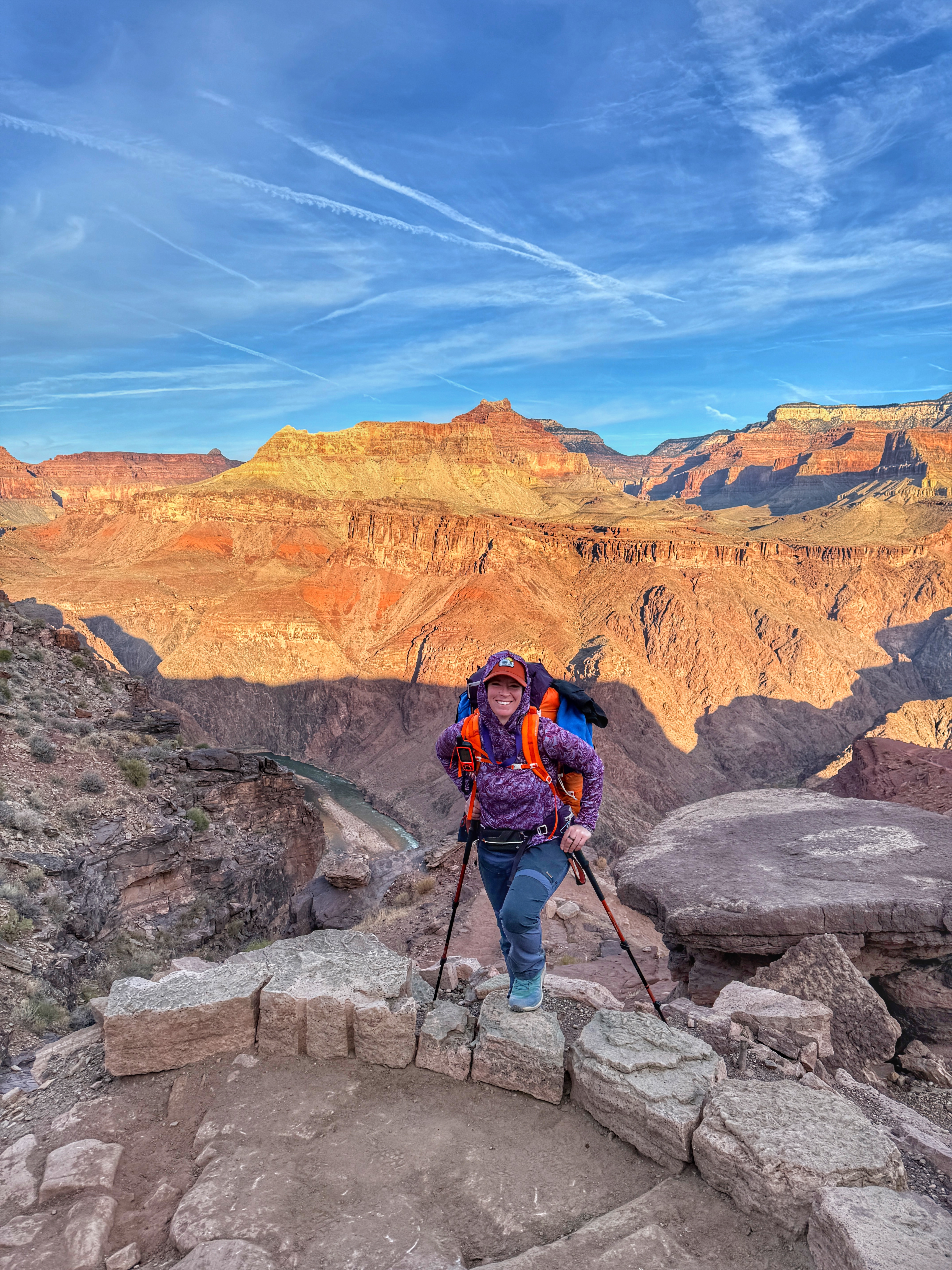
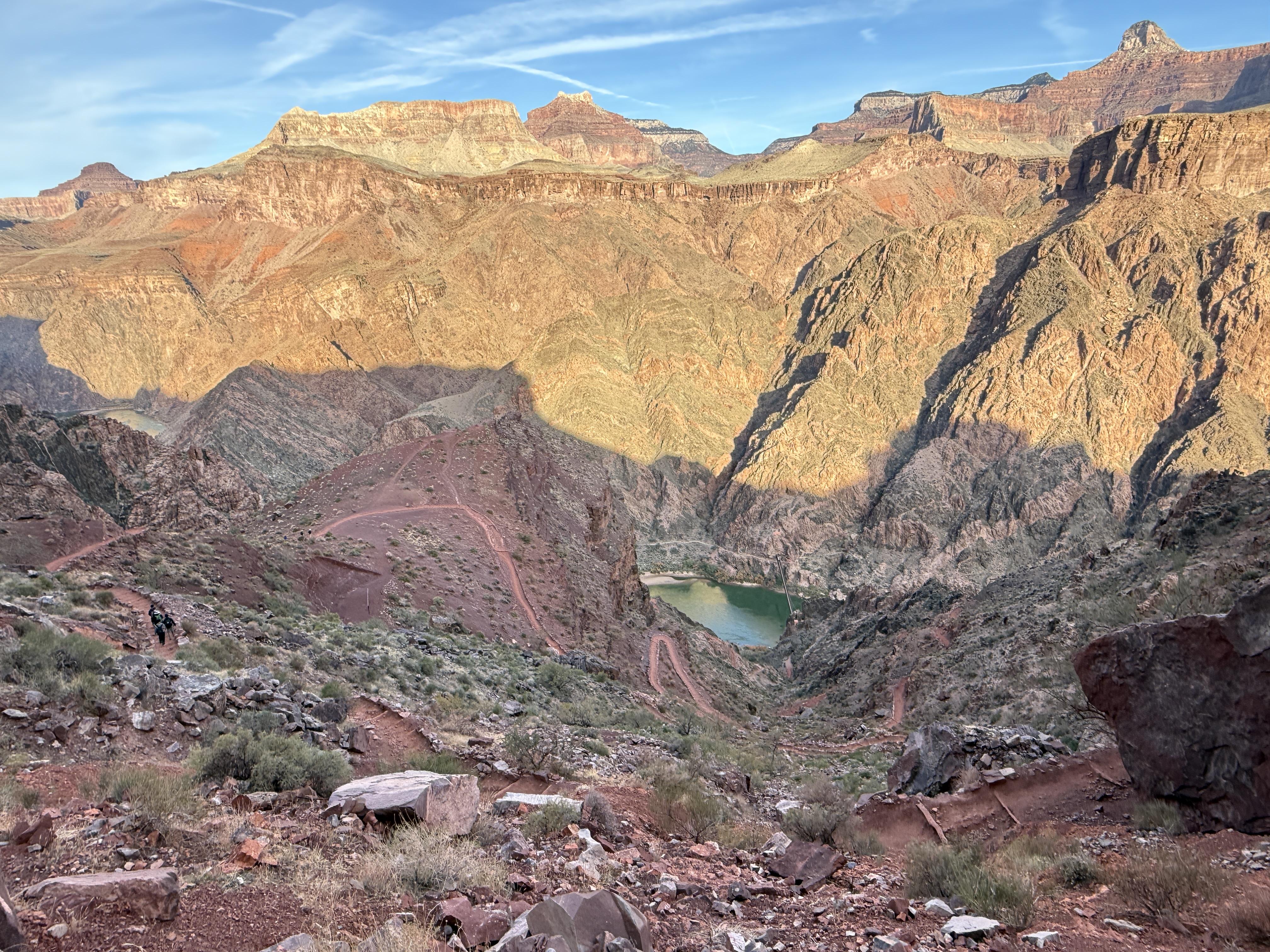
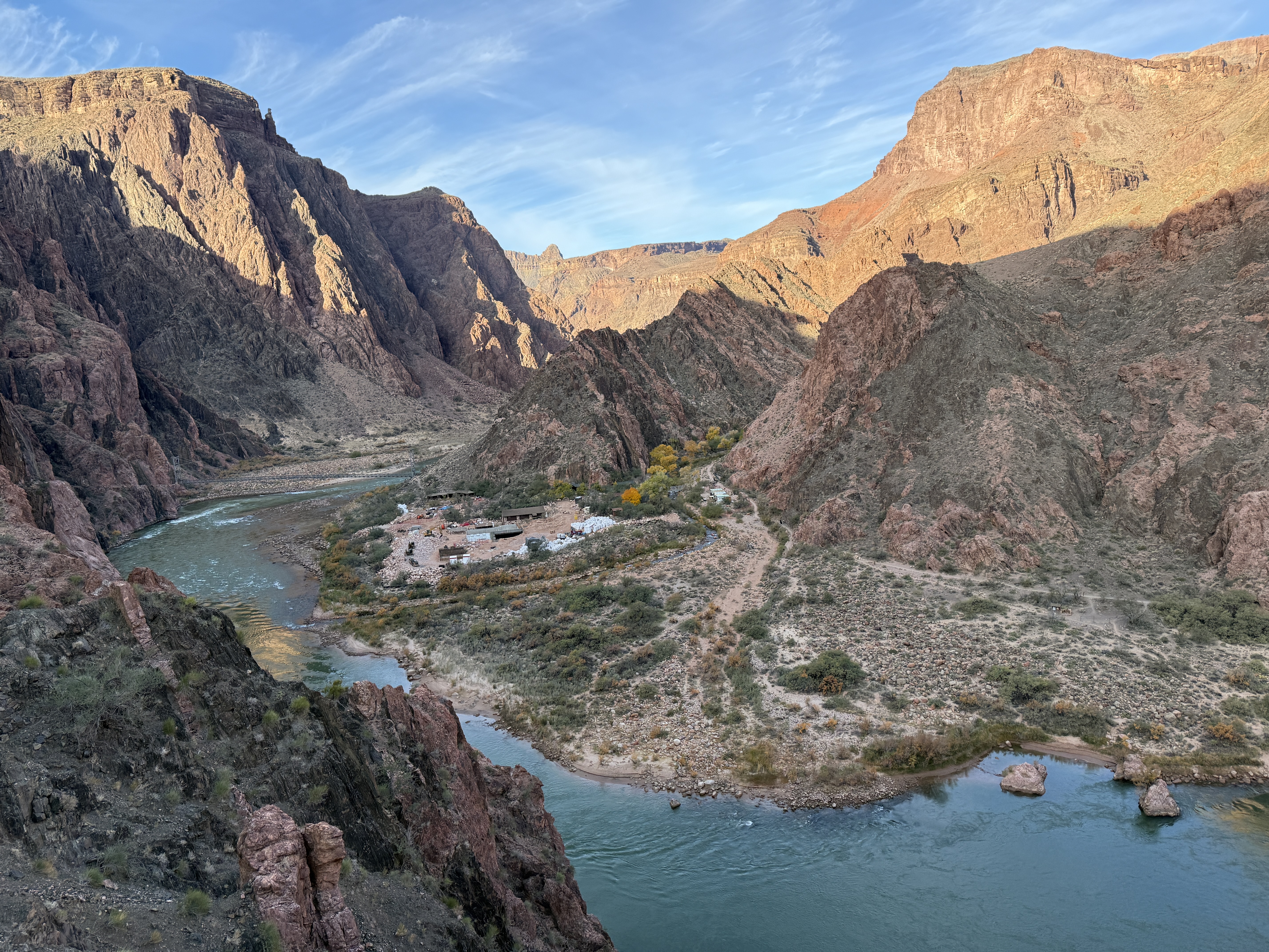
Entering the dark tunnel, I continued on for 105′ before being spit out on The Black Bridge, 50-some-odd feet above the Mighty Colorado. After a little less than 4 miles of hiking, I was nearing the lowest elevation on my journey. Below me, whitewater rafting boats slowly glided along, coming to rest on the beach between the bridges. Many parties stop here for a break at Phantom Ranch, which offers everything from running potable water to a snack canteen to steak dinners and hearty breakfasts. I was looking forward to mailing a postcard via mule.
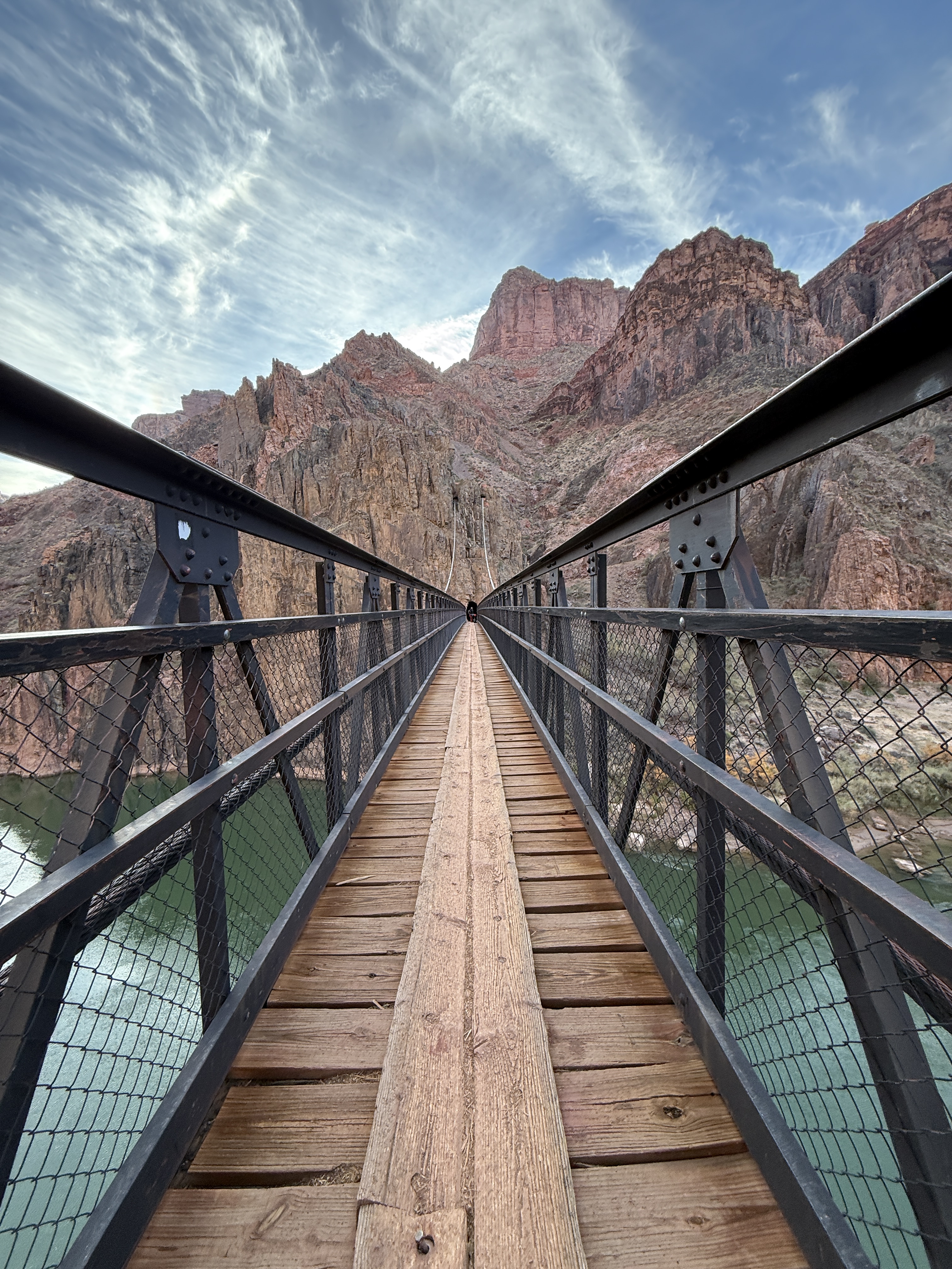
On the far side of the bridge, I looked back and marveled at the engineering wonder I had just crossed. As a civil engineer, I have great appreciation and respect for all who were involved in the construction of this bridge, listed as a National Historic Civil Engineering Landmark in 2019. I passed a plaque that spoke of the great feat and of the importance of the work. For many years, it had been the only bridge over the Colorado for 754 miles, from Moab, Utah to Needles, California.
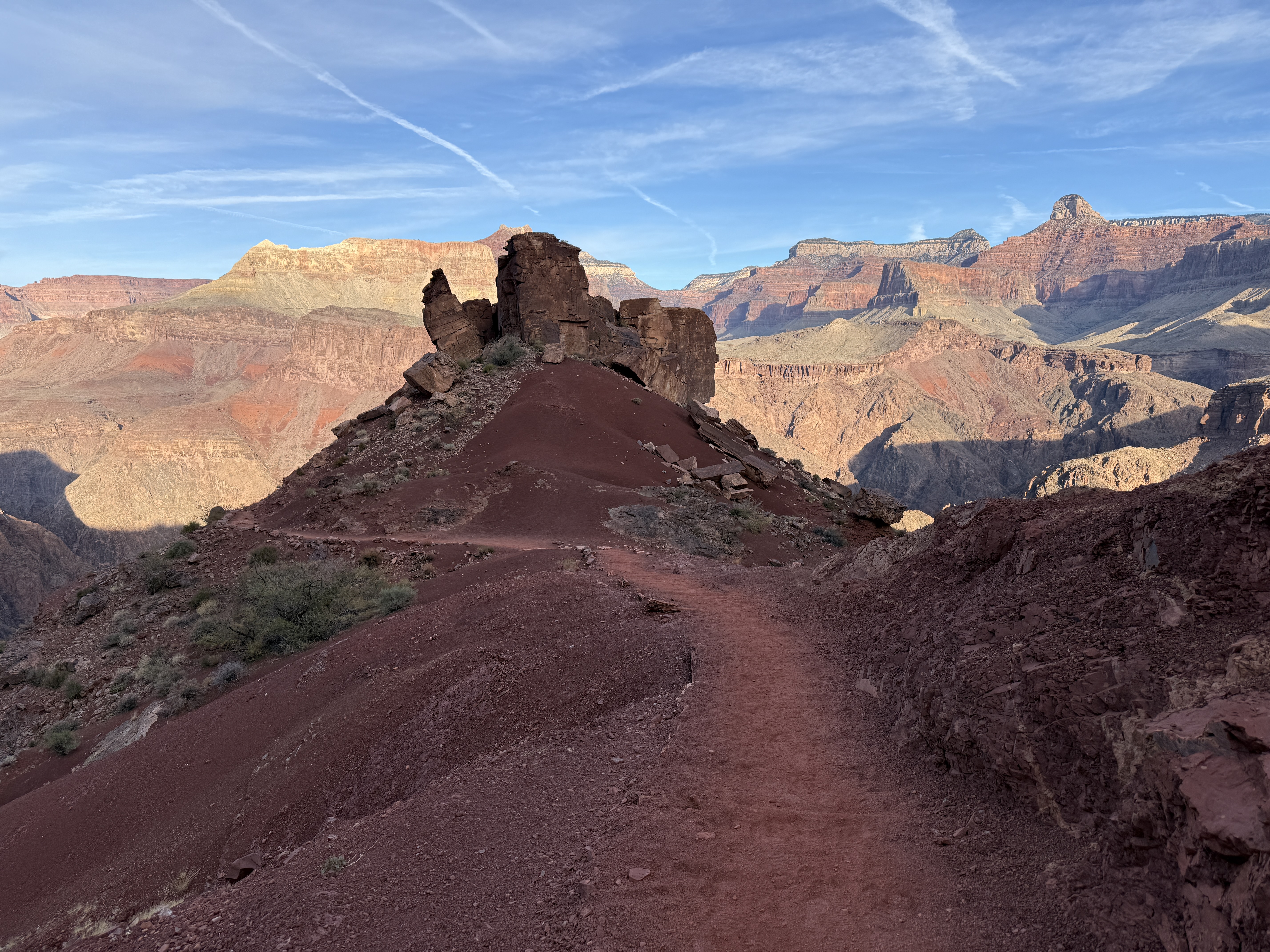
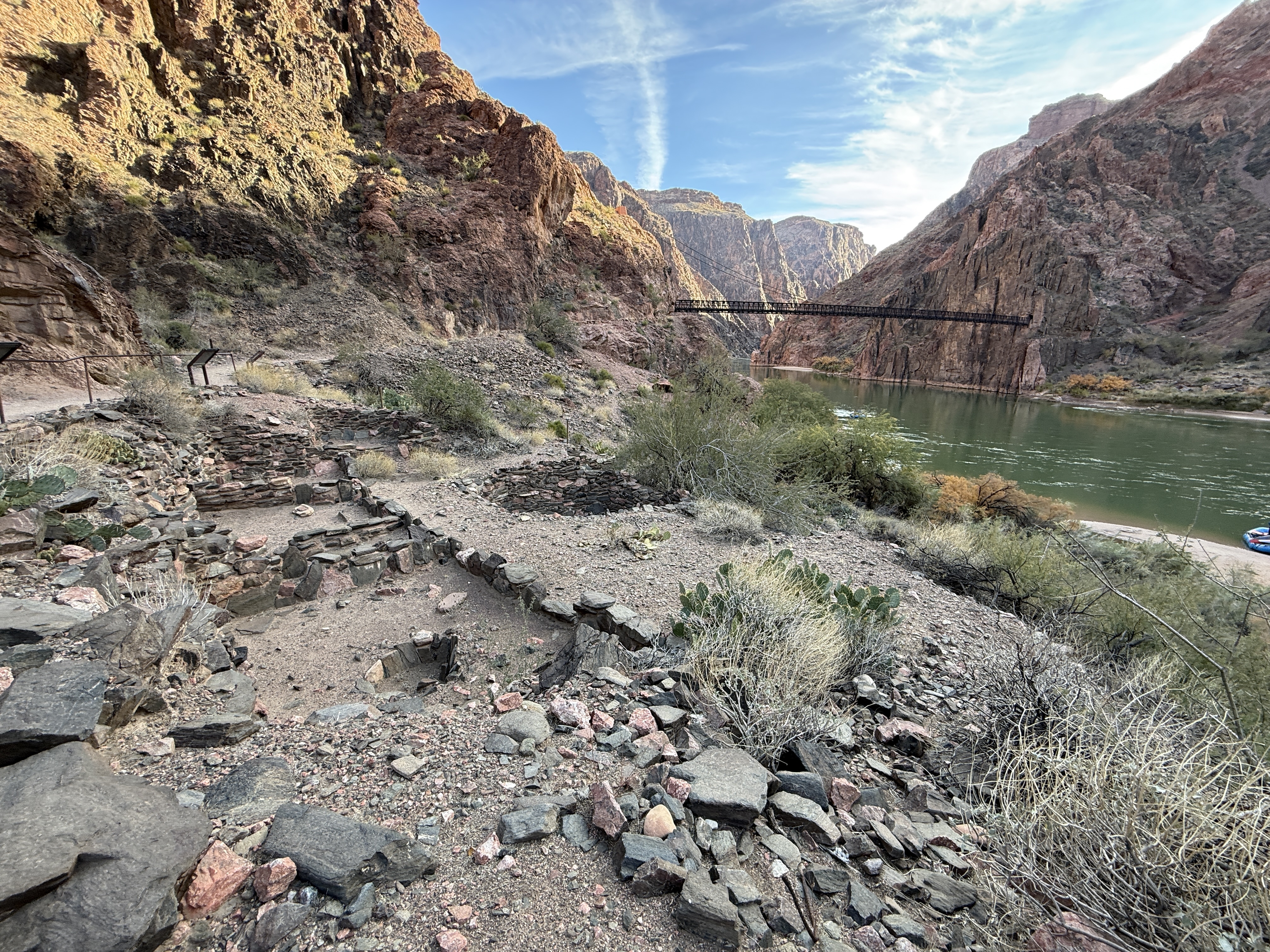
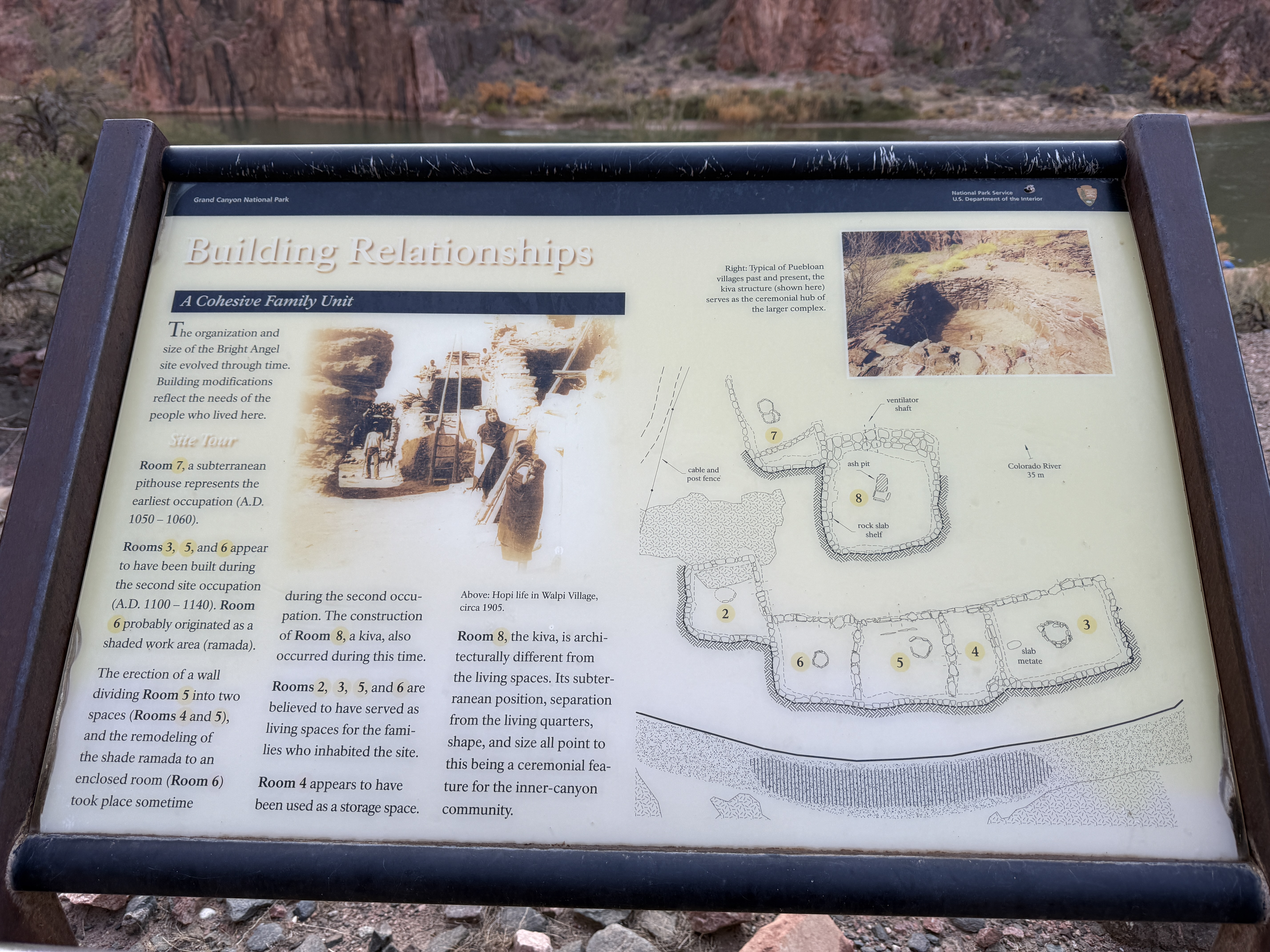
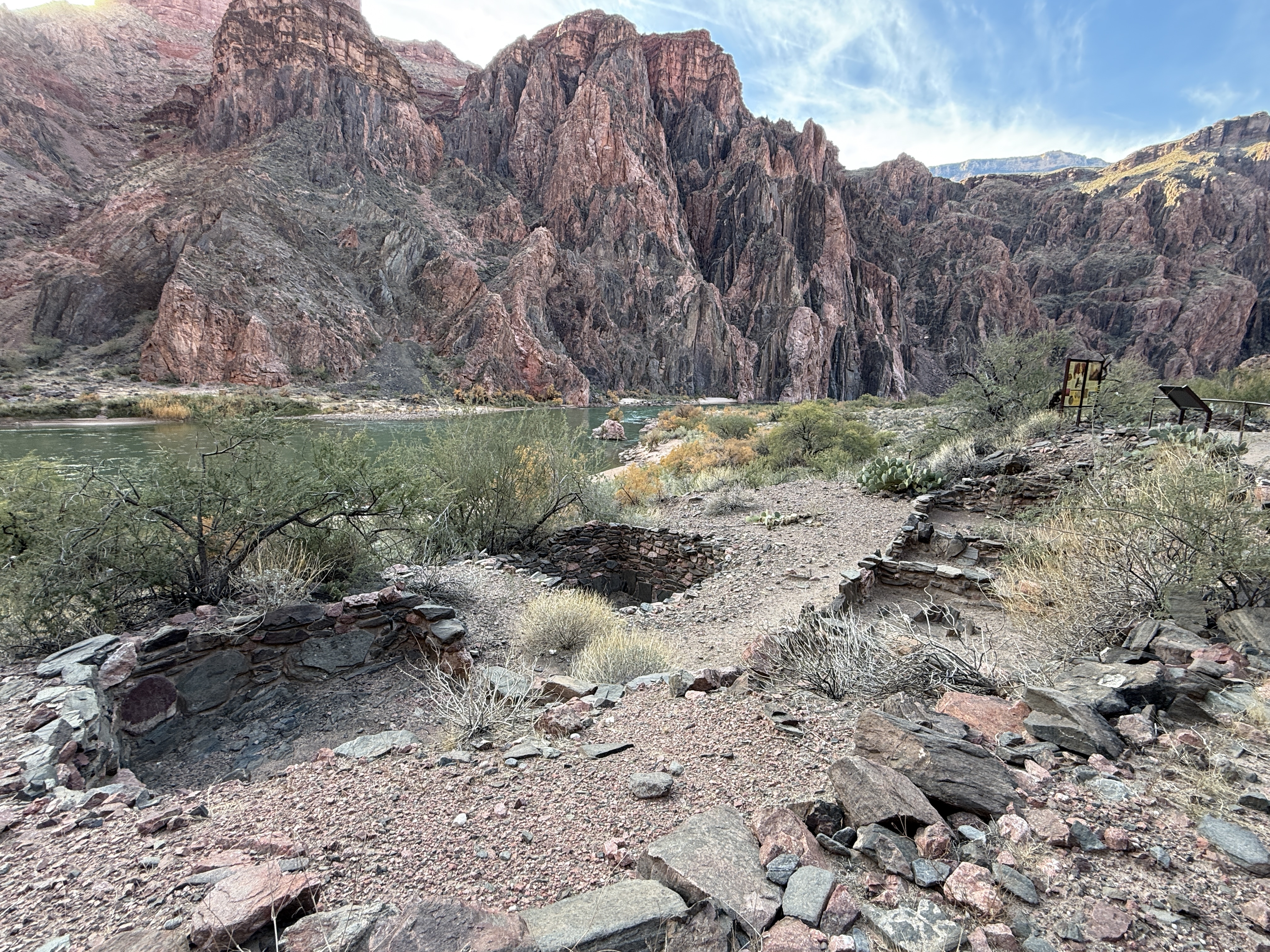
Not far along, another engineering marvel is bordered with a wire cable and informational placards. Pueblo ruins, already abandoned and crumbling by the time John Wesley Powell led the first expedition along the length of the Colorado River in 1869, spoke of a time when the ancestral people farmed and harvested crops between the years of 1050-1140 AD. You can make out the 8 different rooms, including a Kiva, a ceremonial space for this community.
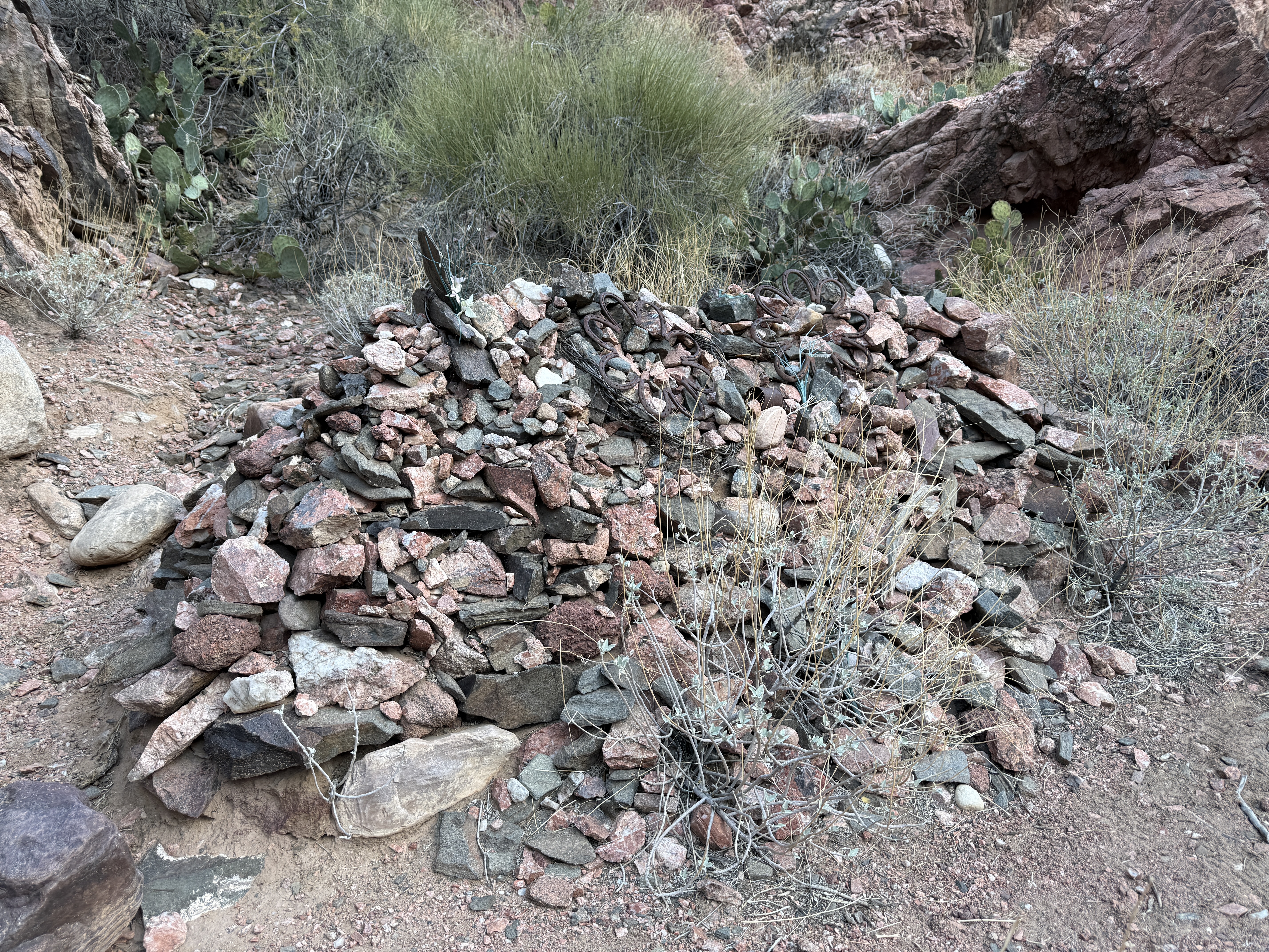
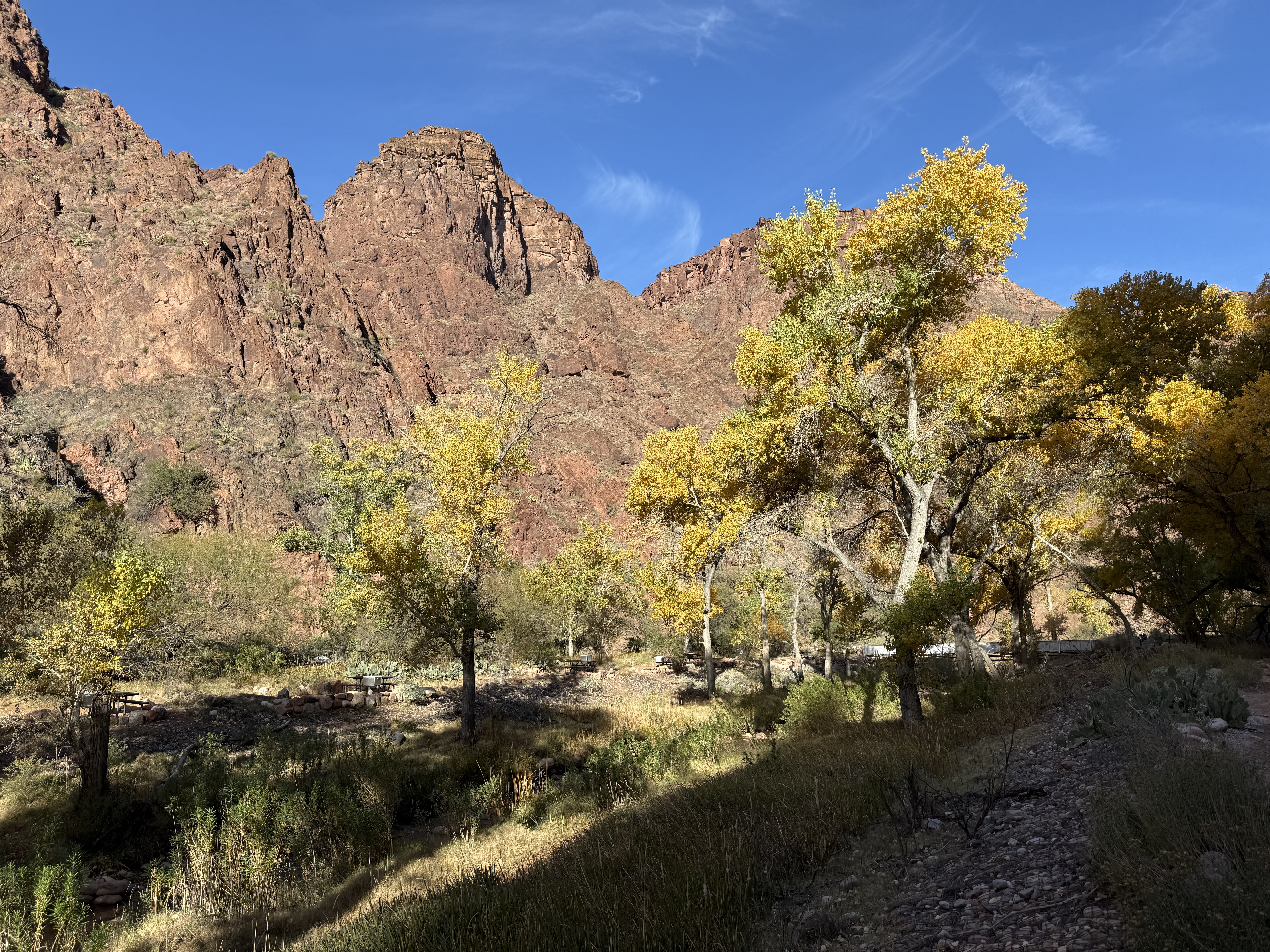
I pulled myself away from the history and sauntered on towards Phantom Ranch, now less than a mile away. Passing a pile of rocks adorned with horseshoe flowers, likely a monument to a well-loved mule, the scenery changed drastically, from brown desert to lush cottonwood forest. I could see Bright Angel Campground across the creek and knew I would have to come back one day and camp here.
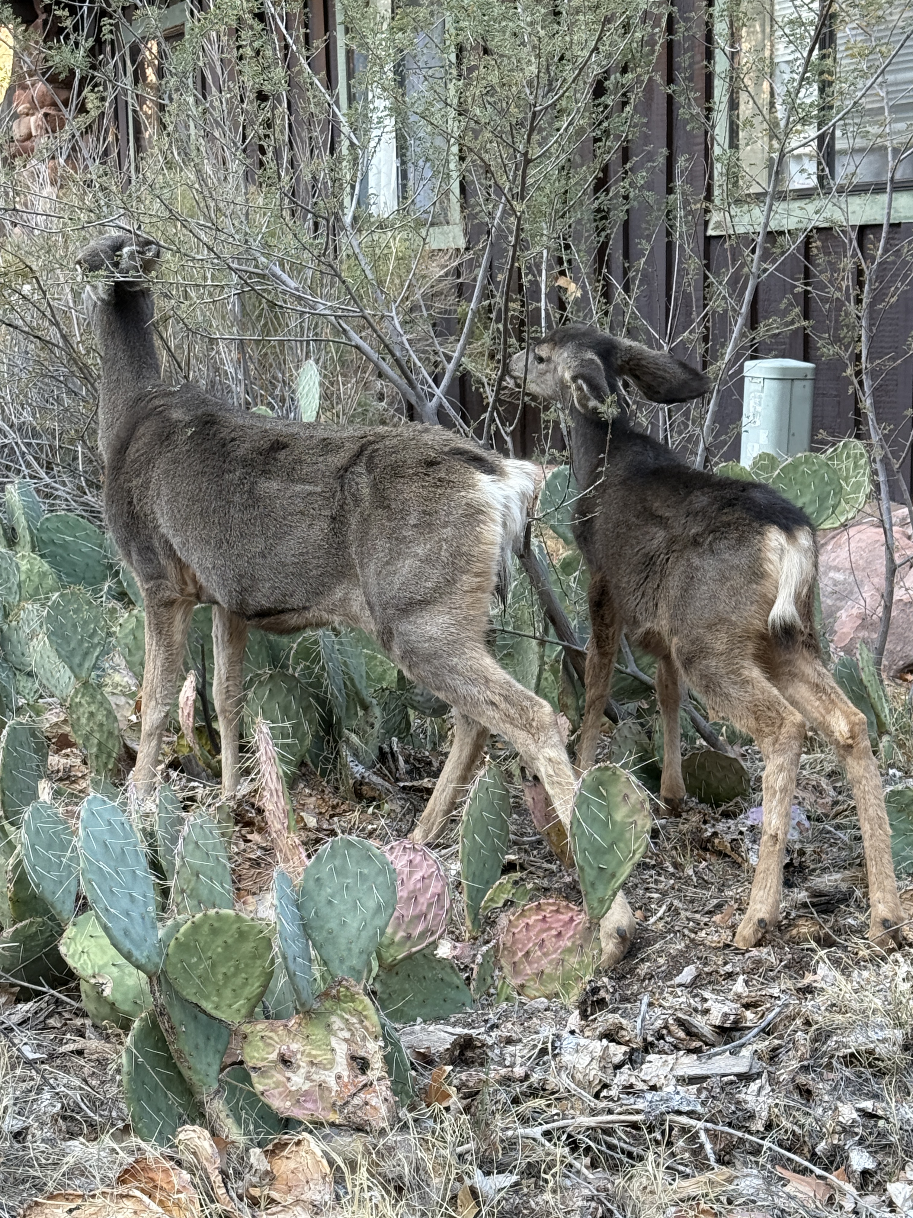
I passed under a wooden sign welcoming me to Phantom Ranch. A small heard of mule deer surprised me. They were the first wildlife I had seen since I started off from the trailhead the day before. They were completely unbothered by me as I snapped some pictures and videos. The Phantom Ranch spread is beautiful, with modest buildings made of wood and stone, stained and painted in hues of browns and greens, matching the environment in a way that shows true respect for the place.
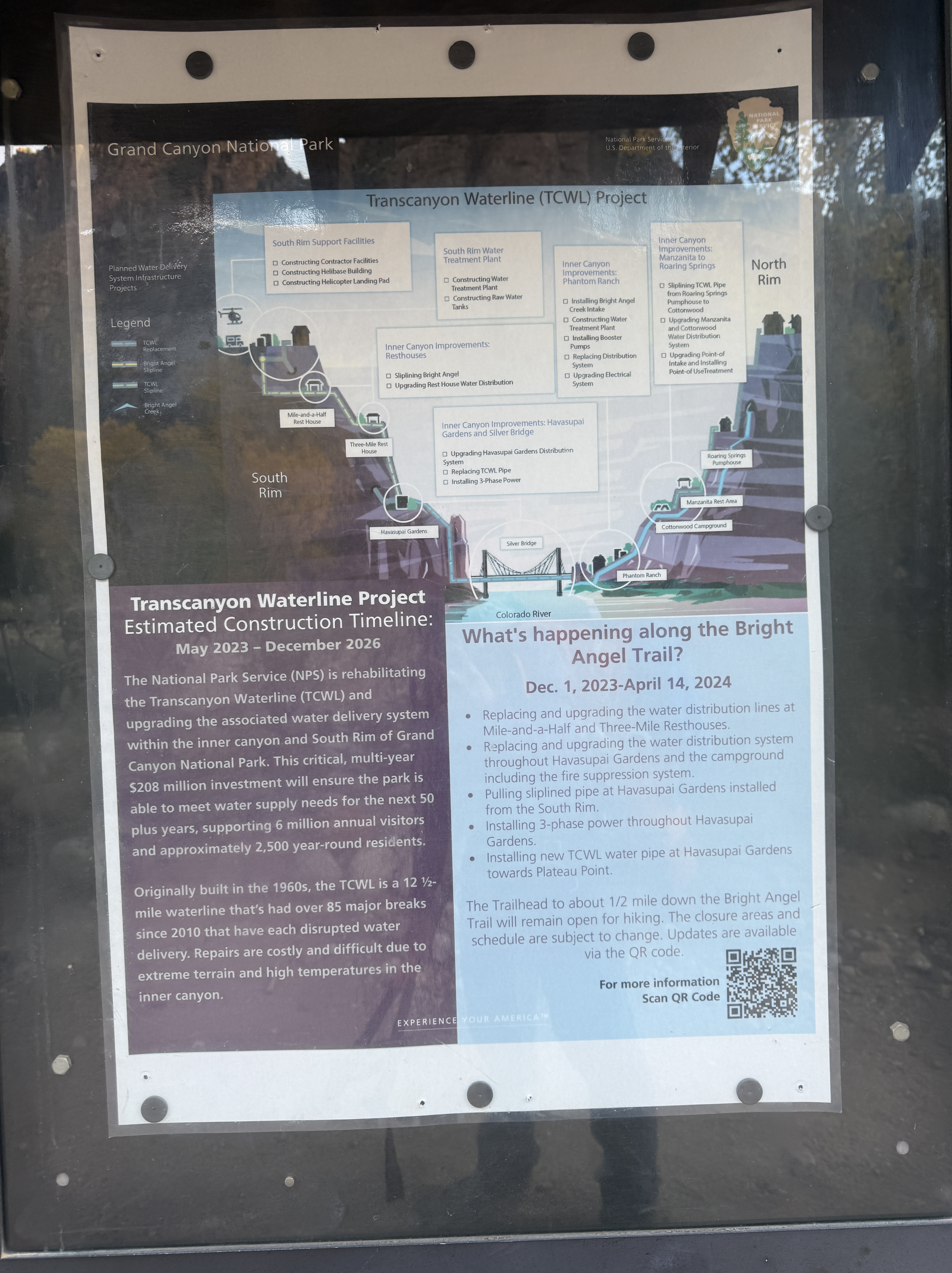
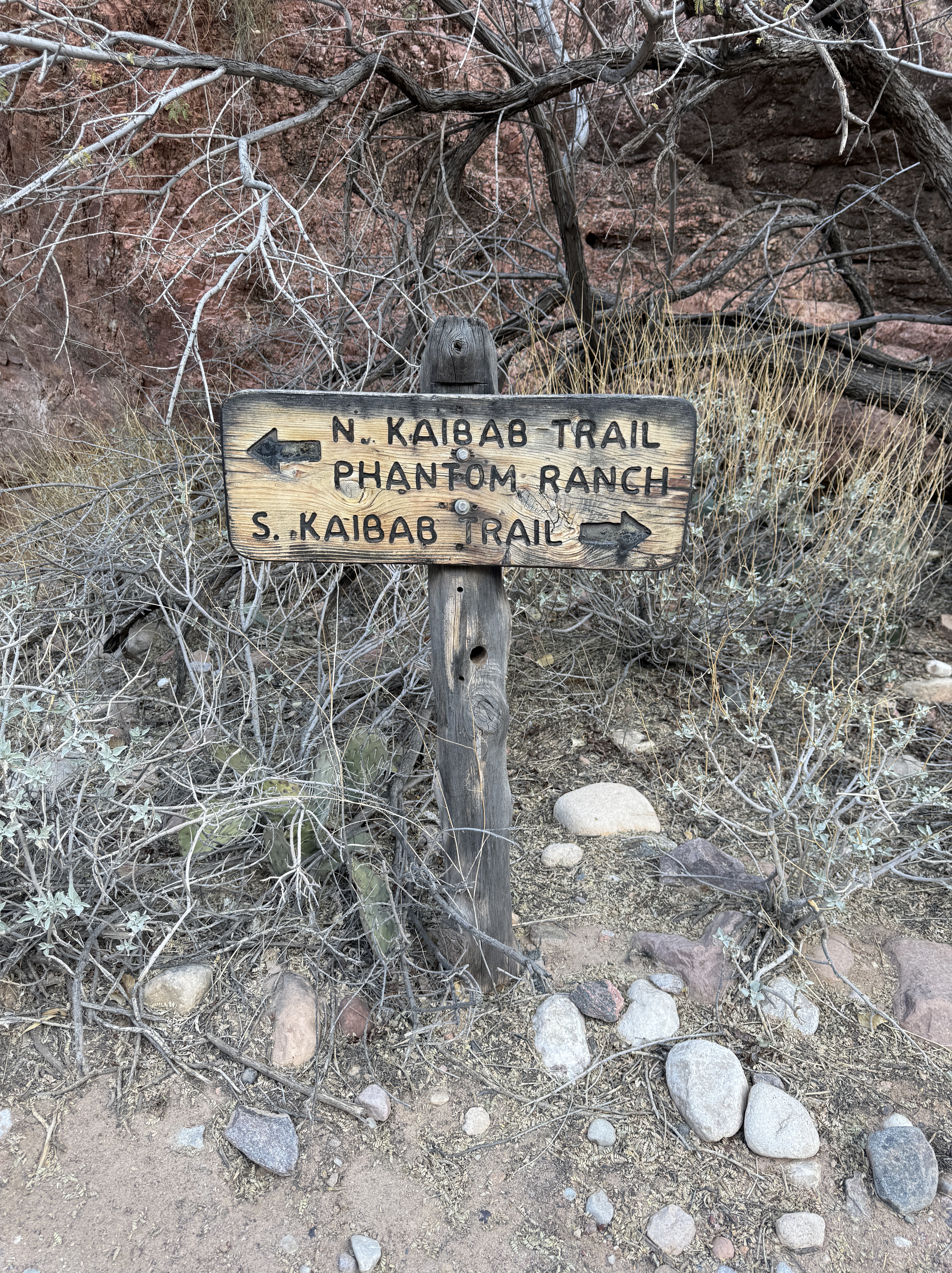
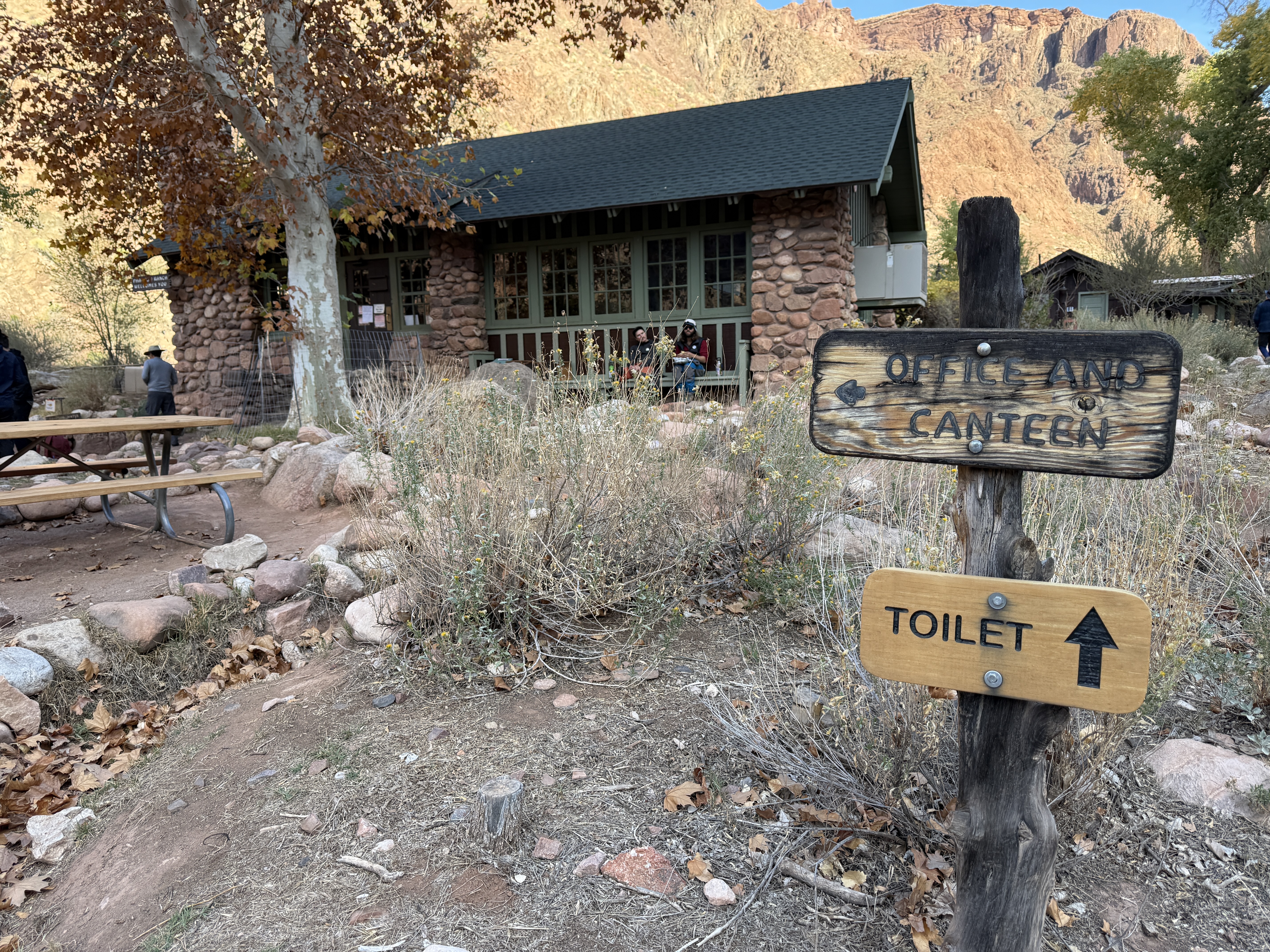
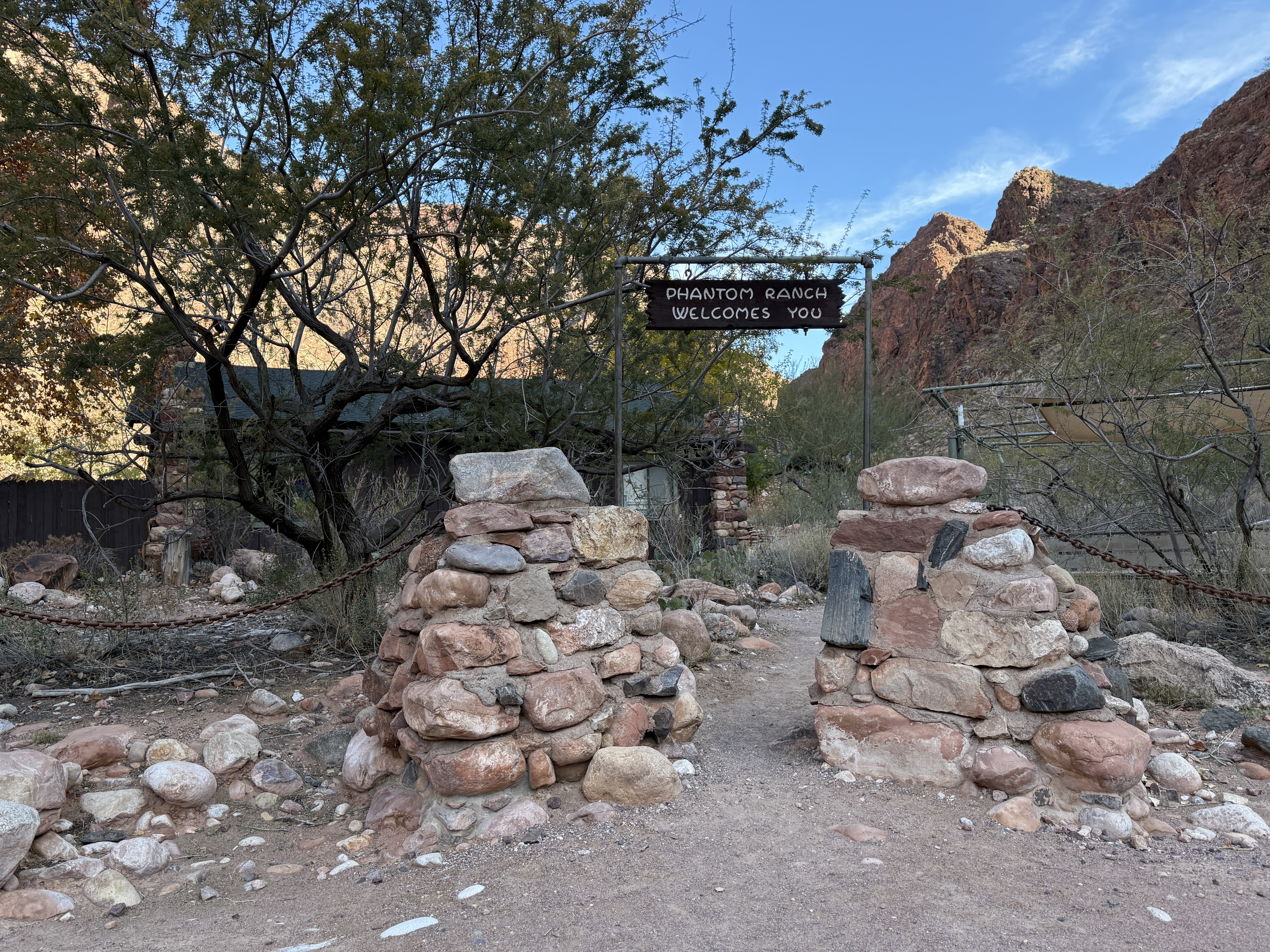
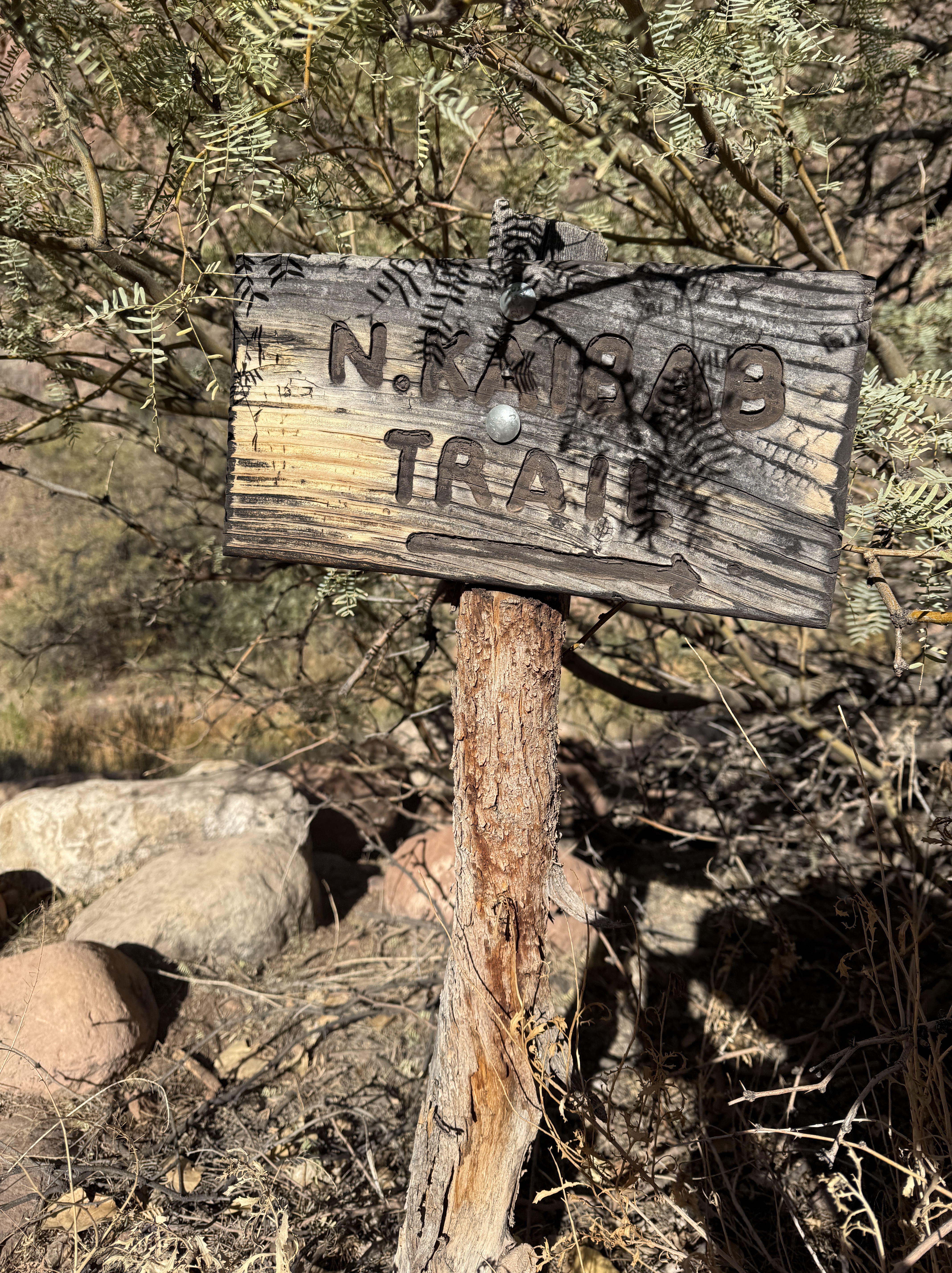
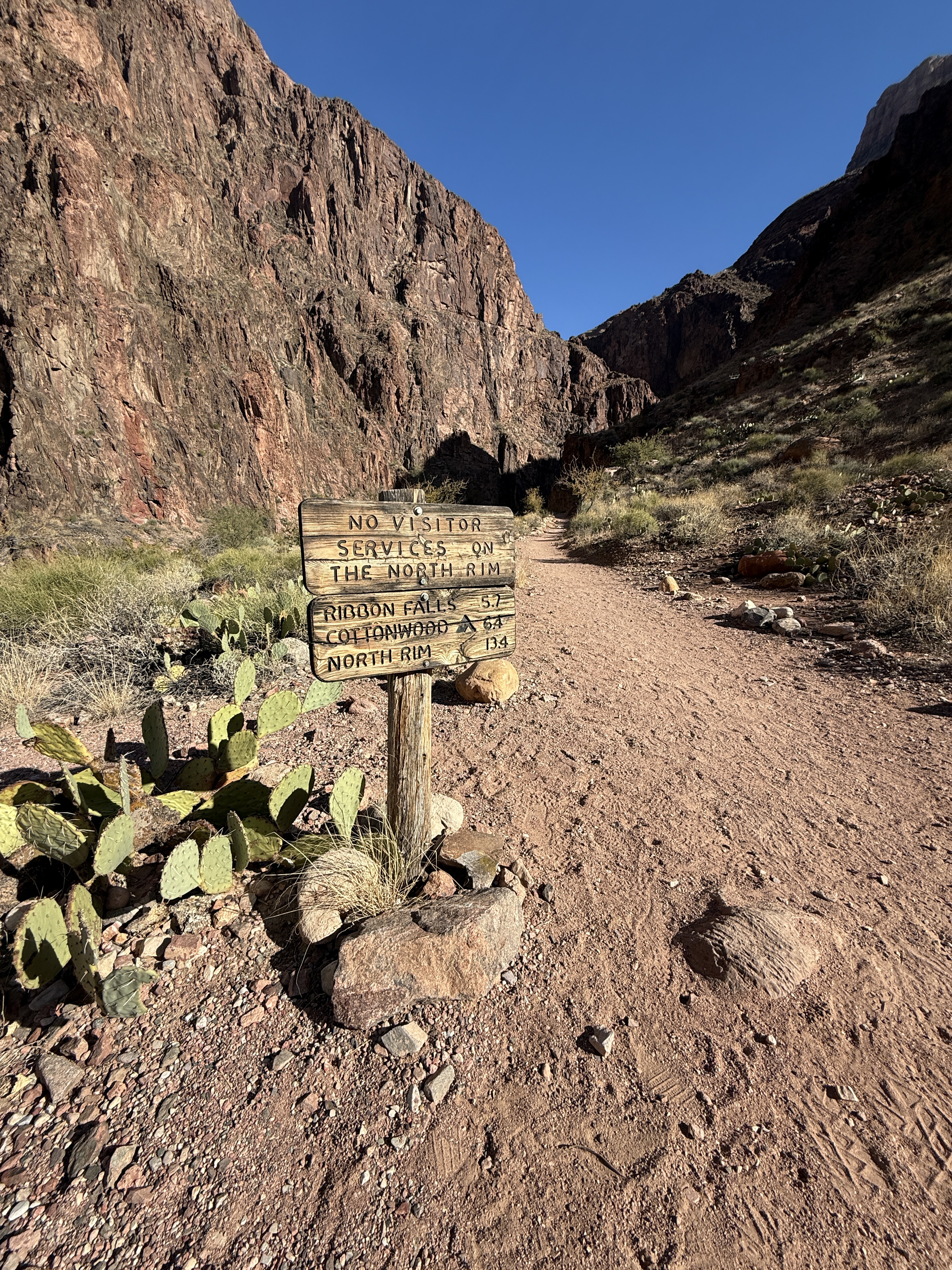
I found the canteen, but was sad to see it would be closed for the duration of my trip in the Canyon due to the waterline repair work and new breaks in the line. I was able to fill up my water bottle with fresh drinking water at a spigot outside the canteen and finished up my oatmeal that I had been too excited to eat before leaving camp that morning. A quick bathroom break at the facilities and a check of the weather forecast posted on a bulletin board, and I moved on. About a mile down the trail, a wooden sign warned me that there were no services on the north rim this time of the year and informed me that I had 6.4 miles to go to reach my home for the next three nights at Cottonwood Campground. I was now on the North Kaibab Trail.
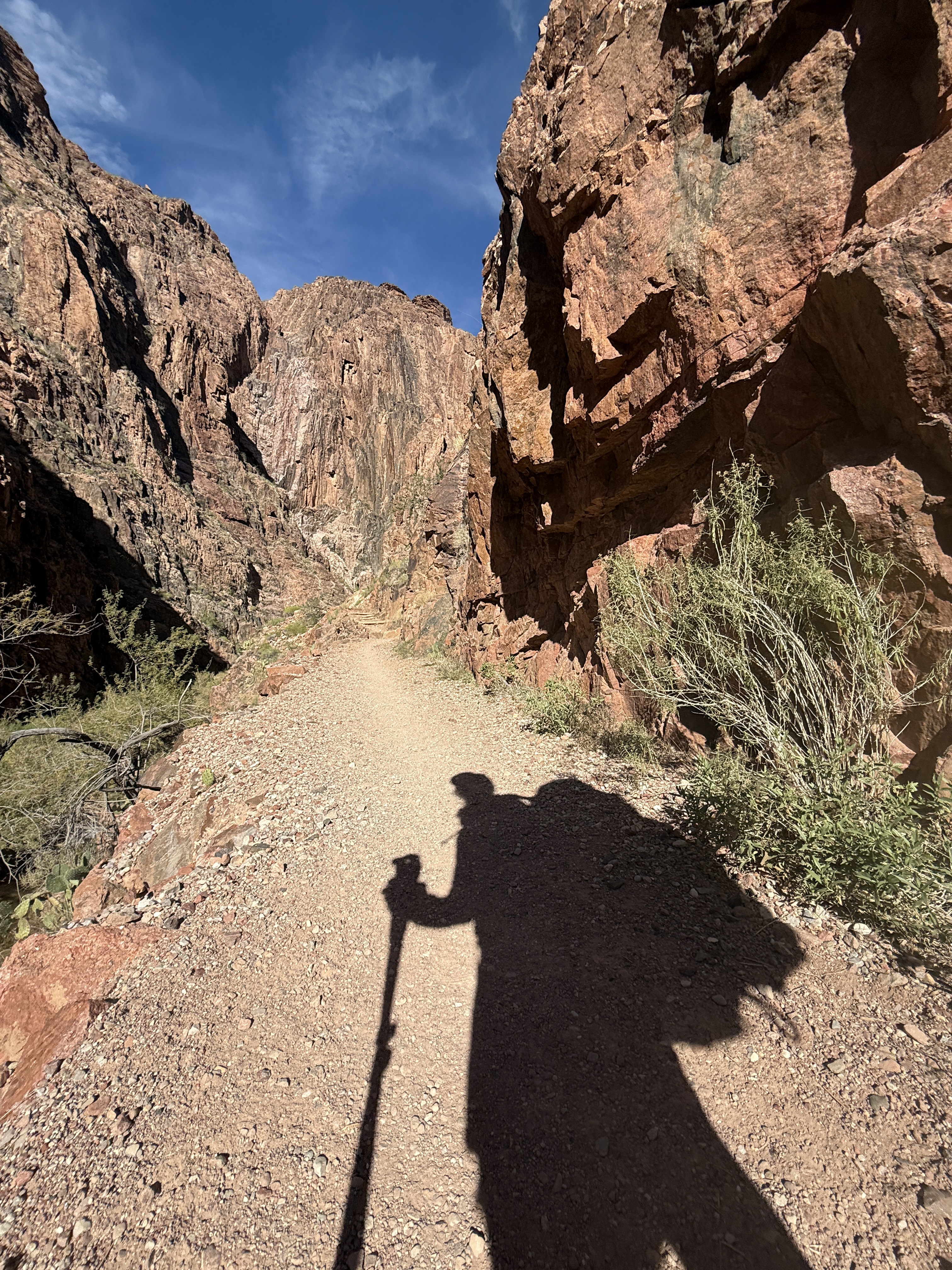
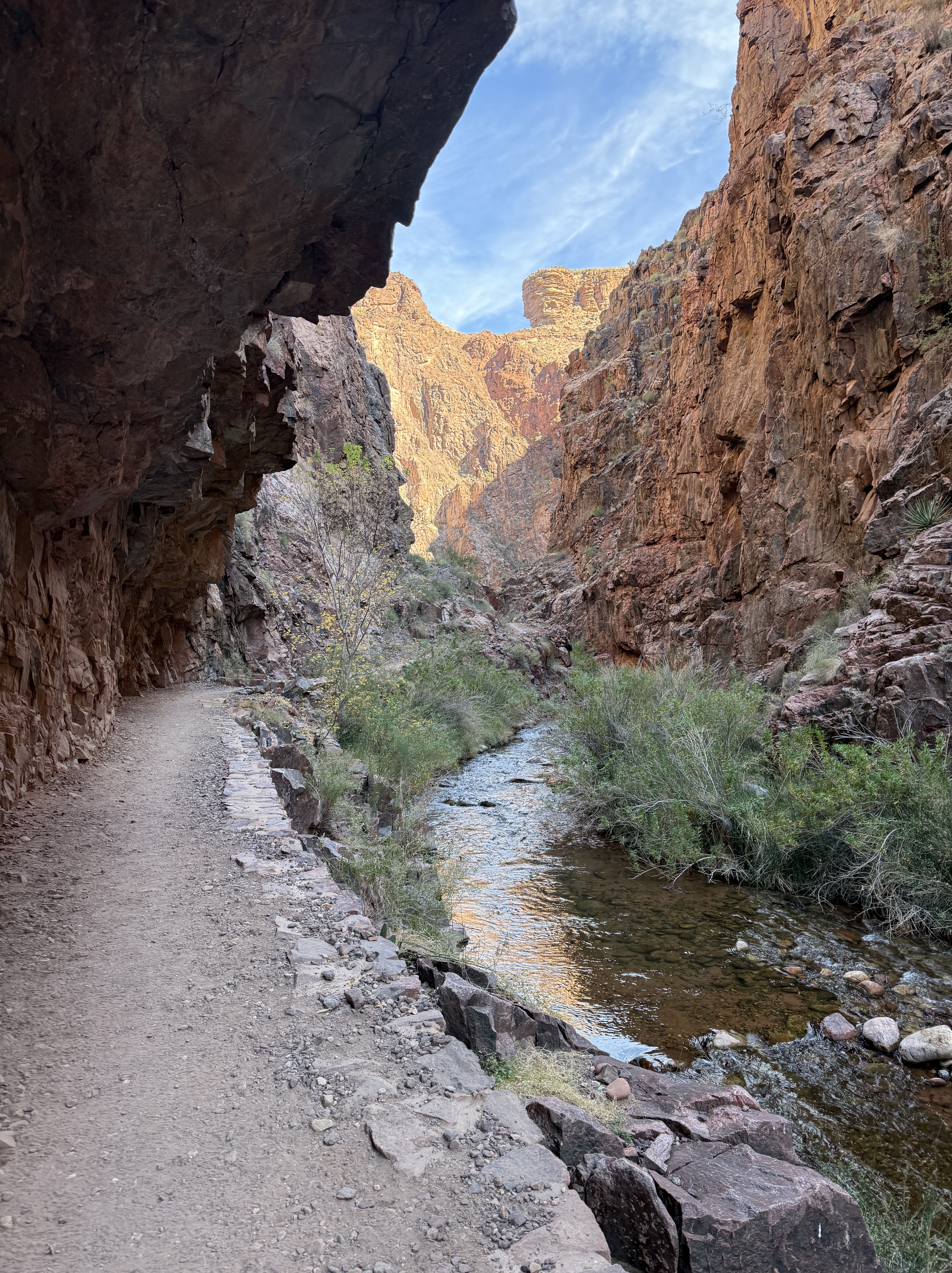
The further I walked, the narrower the canyon walls became, rising up hundreds and even thousands of feet in vertical faces. It was in this section, often referred to as “The Box,” that I found my gps trackers and InReach were struggling to find satellite connection and were pinging high up on the walls, the connection unable to accurately locate me only a dozen or so feet horizontally, but hundreds of feet below the location it reported. I knew my data was fucked, so I turned off all my trackers except my InReach, to save battery, and used educated guesses to figure out how far I’d come and how far I had to go.

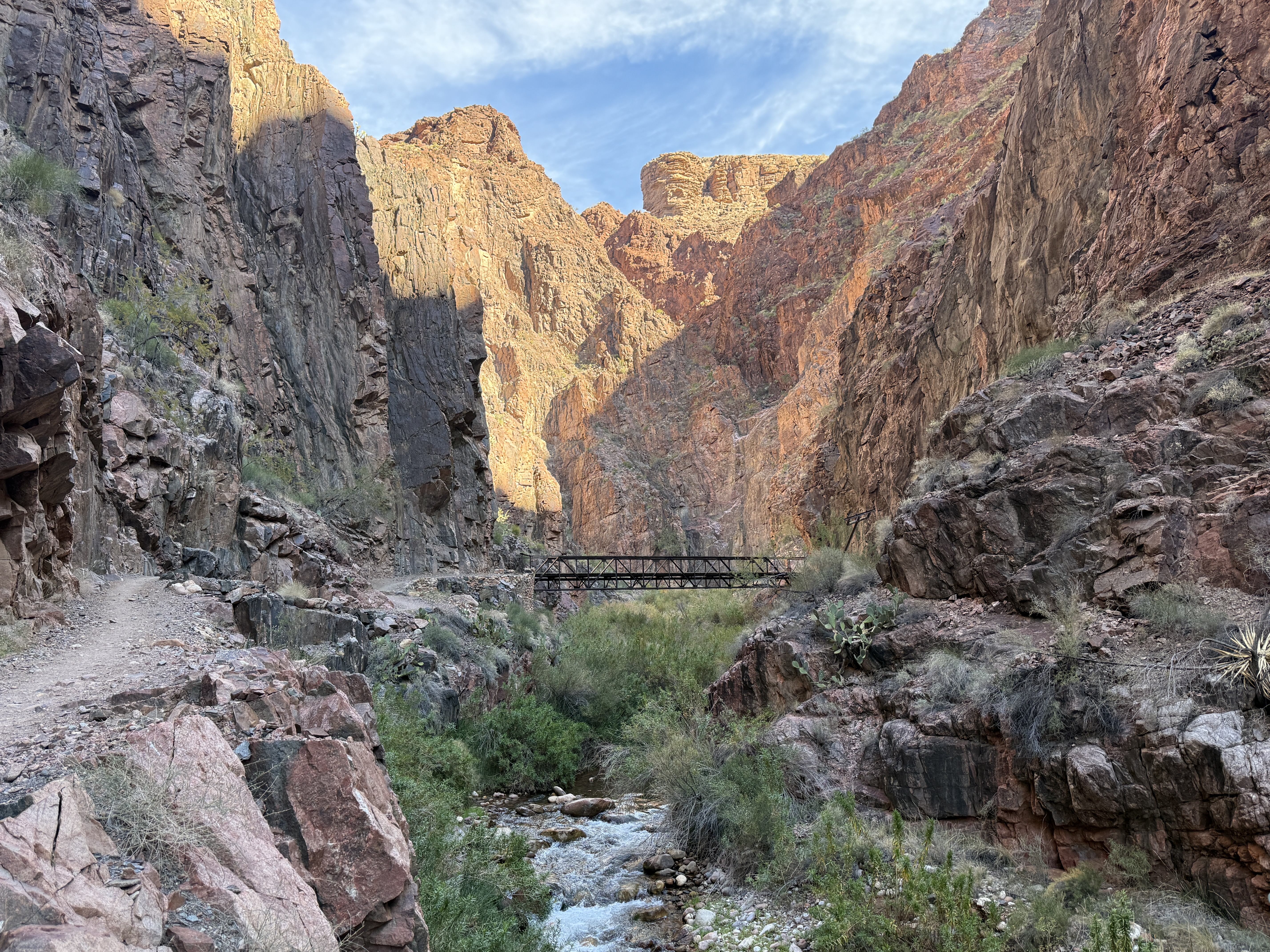
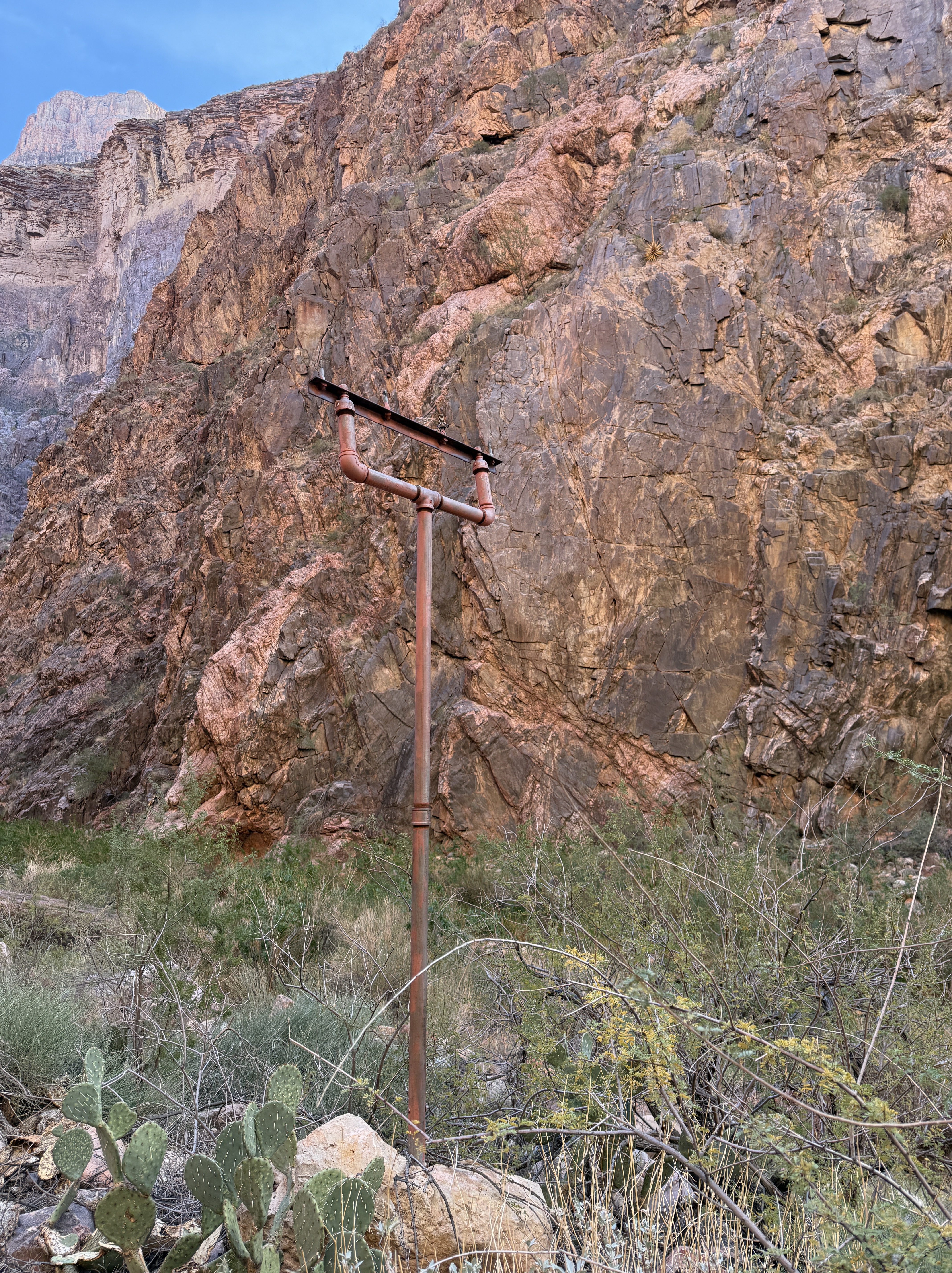

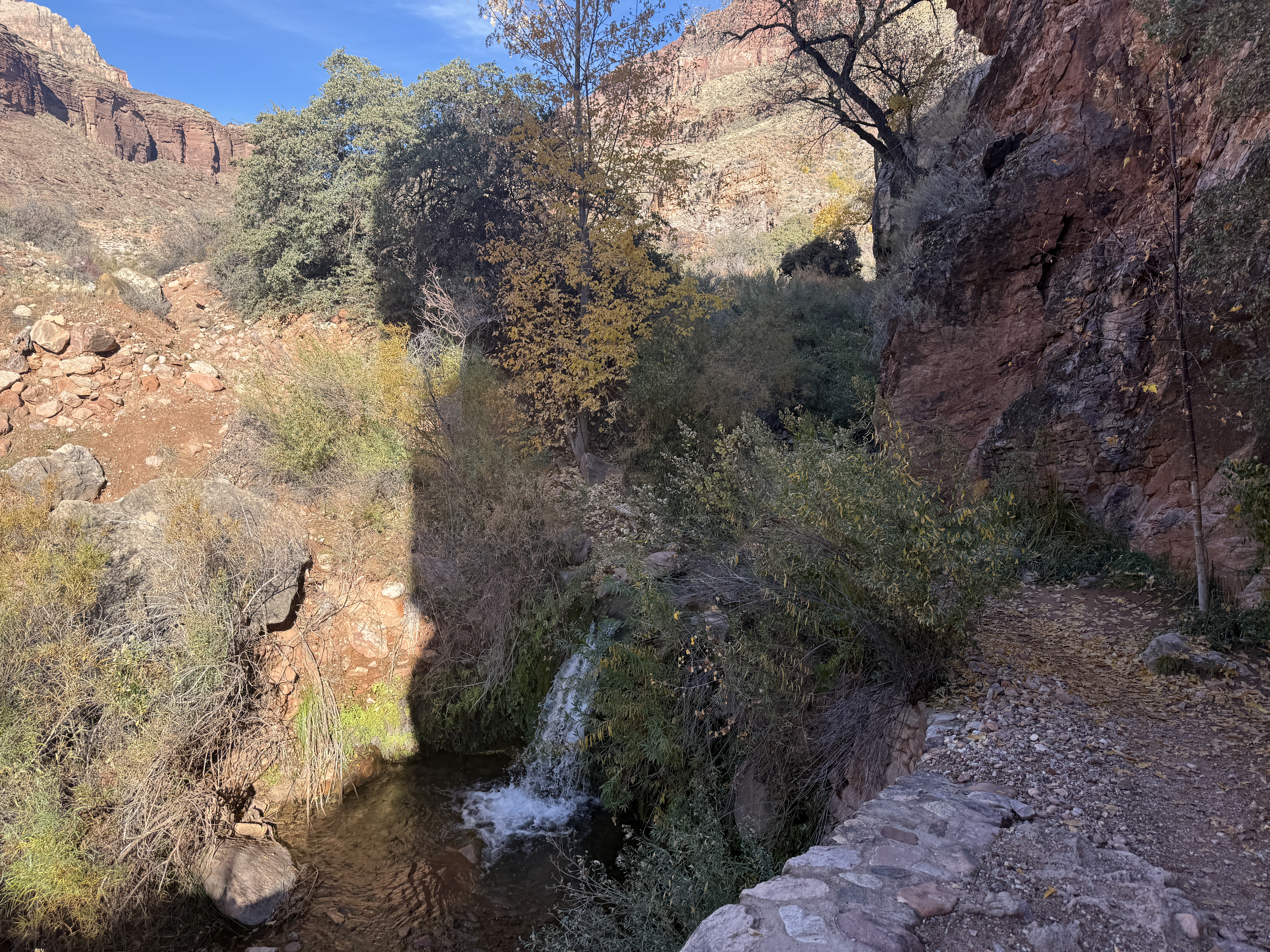
Navigation was not a problem here. The trail was built with great care, wide and well packed, with intermittent bridges and many rock retaining walls to offer a path over and around Bright Angel Creek. Telegraph poles, some still wearing their blue glass insulators, told much of the story of the Trans-Canyon Telegraph line. This communication system was built in 1924 then improved in 1935 by CCC workers, as were much of the north rim trail and facilities, and it allowed communication from the South Rim to the North Rim and everything in between.
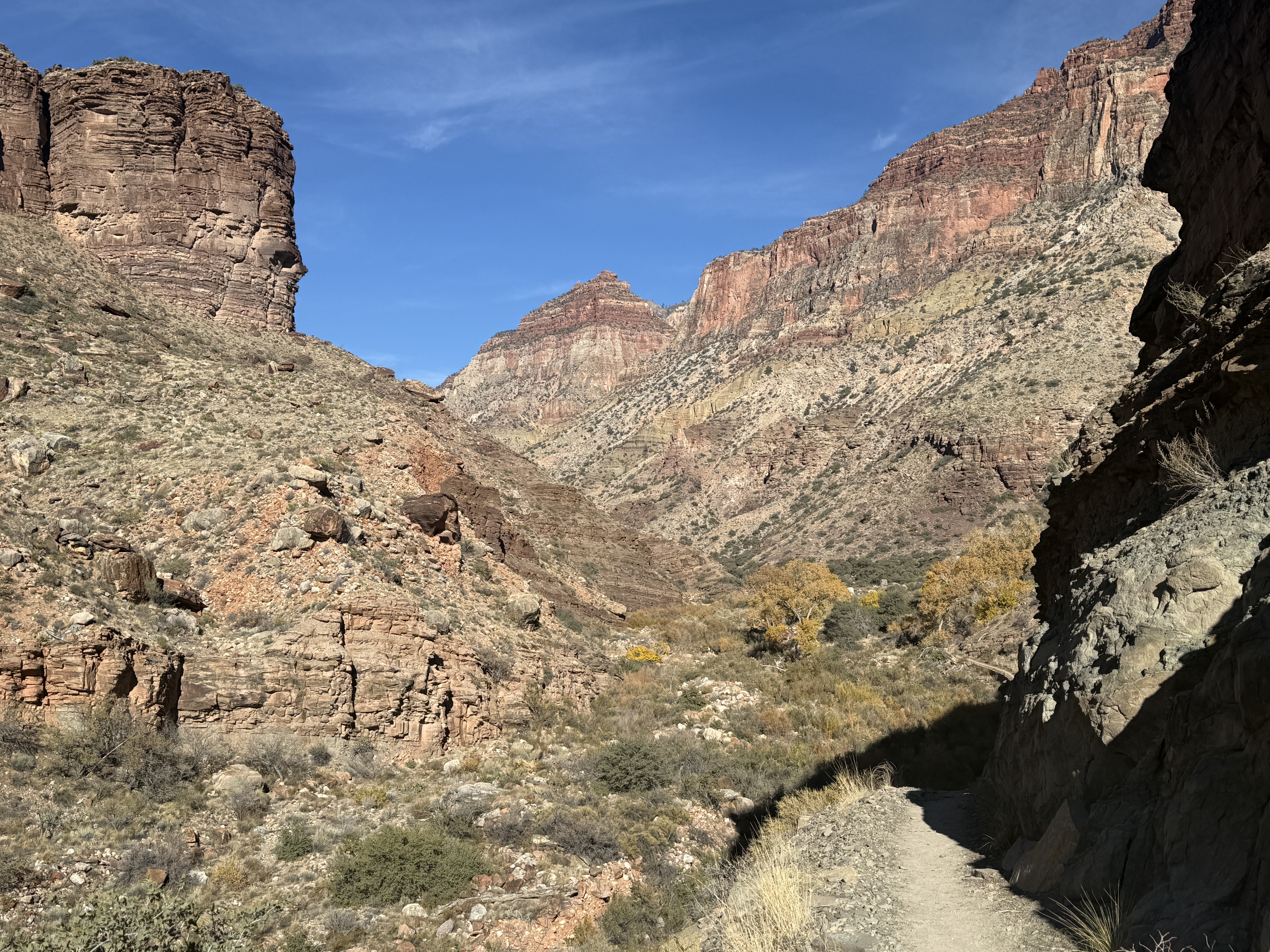
Walking along the Vishnu Basement Rocks in The Box for about 4 miles, I was entranced by the geology I was observing. Millions and even billions of years of layers built up here before being sliced open by streams and rivers. I resolved to carry a geology guide for the area on my next trip, but for now I would just take it all in… and take a ton of pictures. I passed a few workers who had excavated around the Trans Canyon Waterline that runs under the trail, fixing one of the many breaches in the 50-year-old infrastructure. A $208 million dollar project is currently underway to upgrade the ancient system.
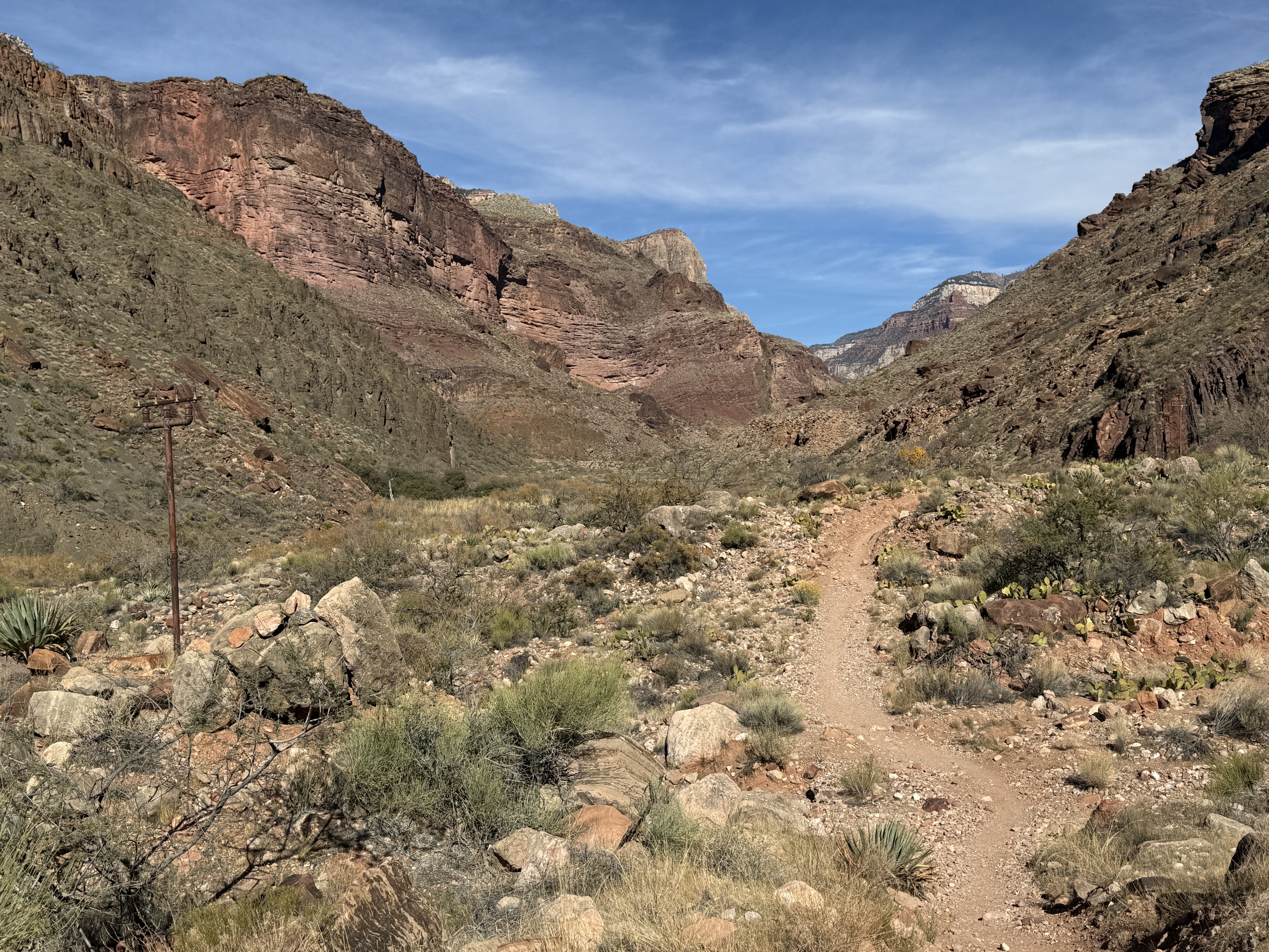
Eventually, the box canyon opened up into a wide Valley and I was in the sun again. The temperatures had been long sleeve sun shirt warm in the canyon, but now I was sure it was in the mid 60s. I stripped off a layer and changed into shorts. I looked back at where I had come from and realized that I was gaining quite a bit of elevation, now 30 or 40 feet above Bright Angel Creek at some points and maybe 1,000’ above the Colorado River. I passed a group of biologists who were doing fish studies and removing invasive species. I moved by silently, snapping a photo, but we would meet in a couple of days, further up the trail.
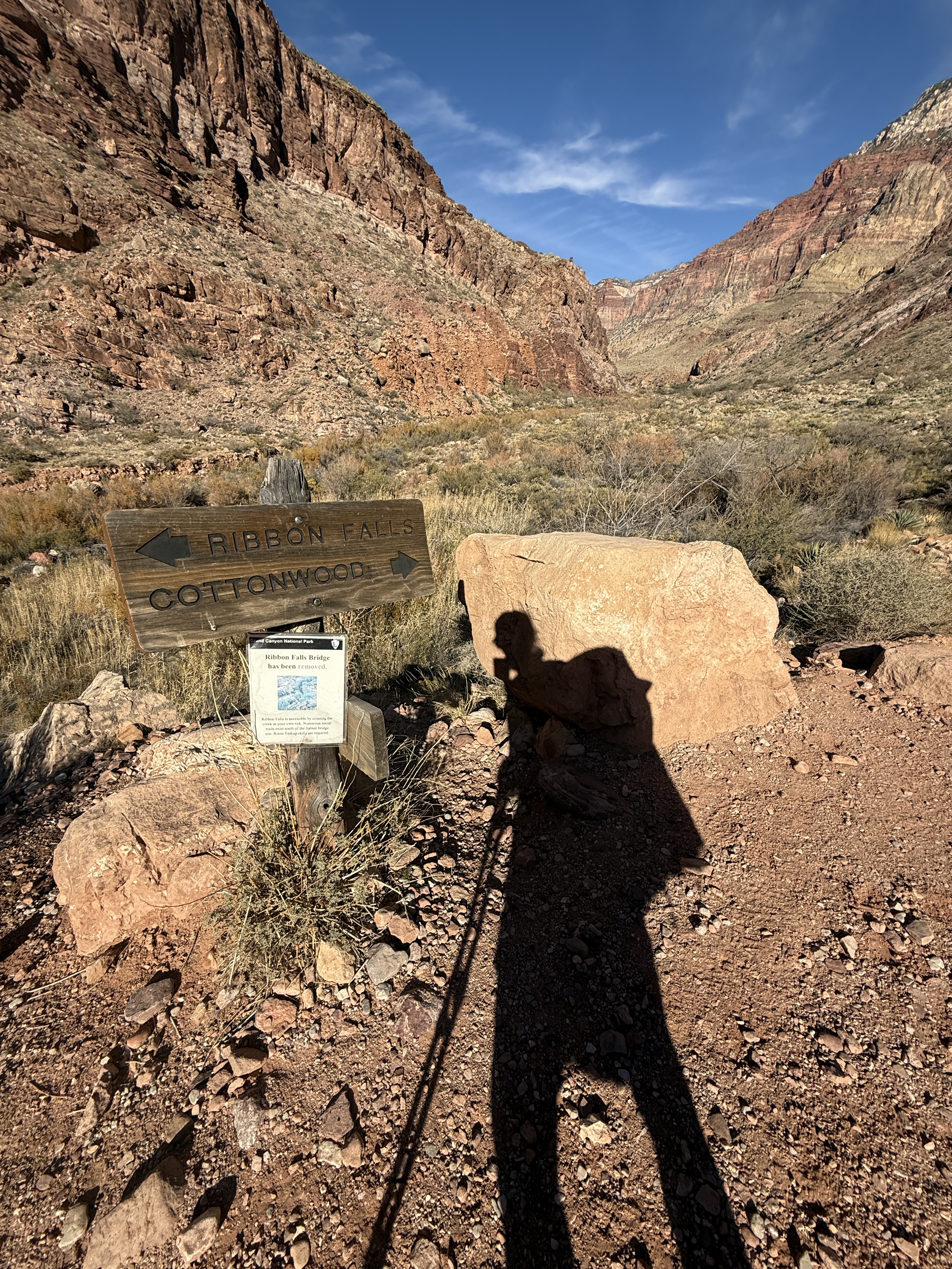
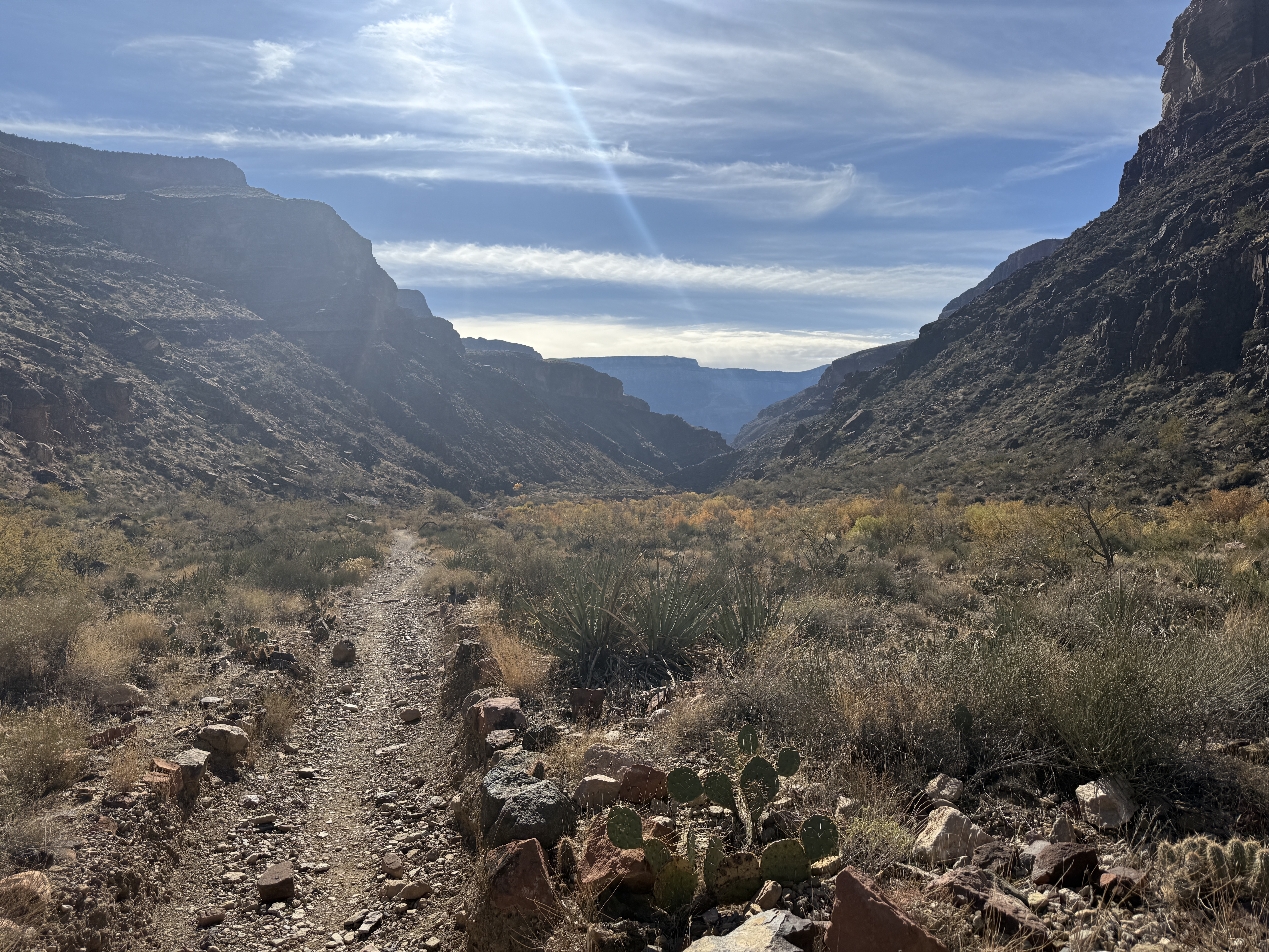
I decided to skip Chimik’yana’kya Dey’a (Ribbon Falls) for today, since I would be at Cottonwood for 3 nights, with one chill out day. I could make the mile or so walk back down to visit these sacred falls another time. The bridge to access this area had been removed, so it would be important for me to pick a good spot to cross the creek. I was getting tired after more than 11 miles for the day and didn’t have the bandwidth to experience such a special place. The Zuni consider Chimik’yana’kya Dey’a (Ribbon Falls) to be where they were created. I wanted to give it full attention and respect.
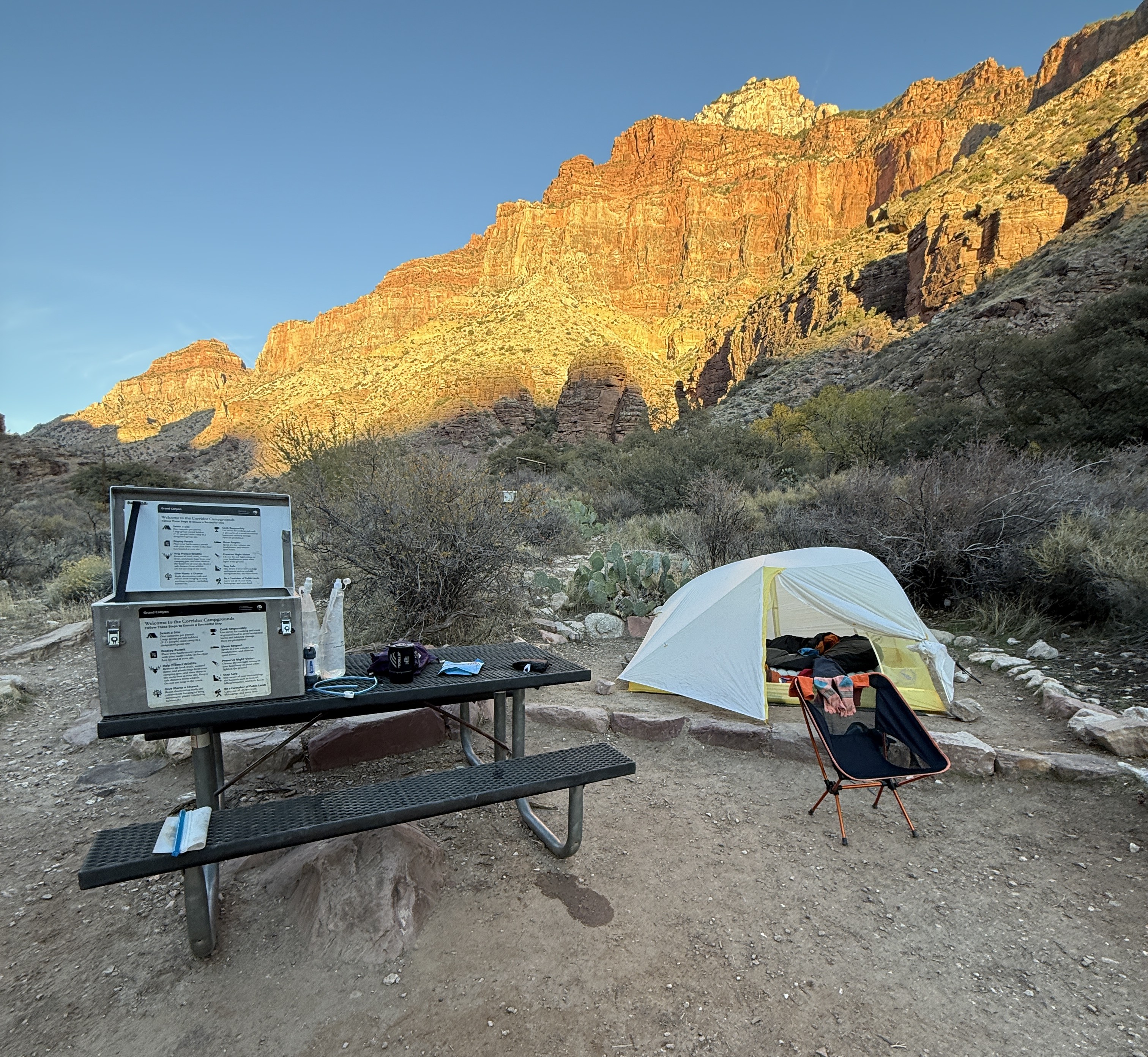
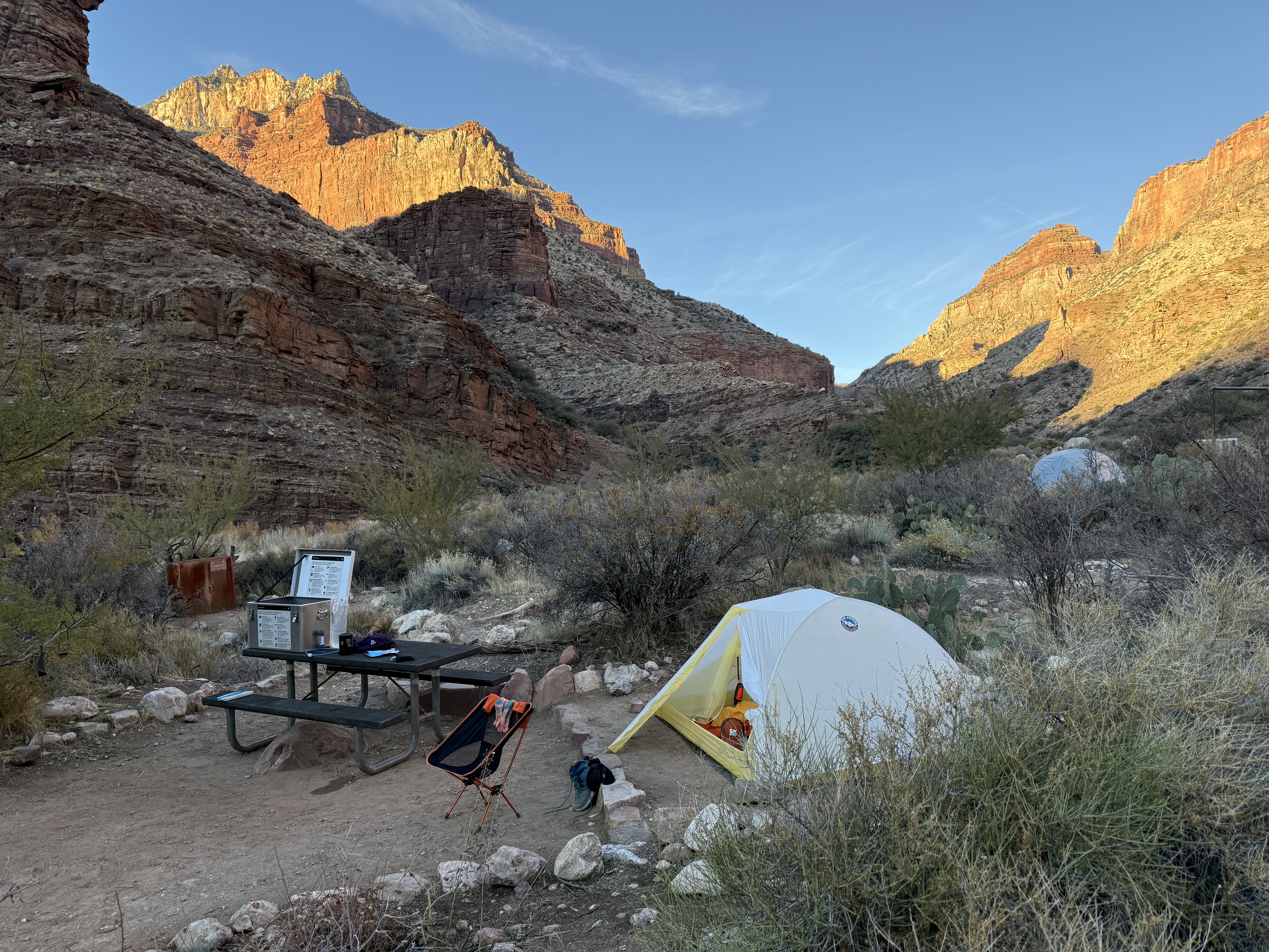
Just when I thought I couldn’t walk another step, there it was in the distance; a stand of Cottonwood trees and the faint sign of a structure I later discovered to be the Ranger Station. I mustered up the last of my energy and made it to the campground, spending a few minutes to find the perfect campsite. I unloaded my pack, noticing that I still have a terrible habit of packing way too much food. No wonder I was tired. I vowed to not let my years of living on little sustenance off the road system, and my tendency to boredom eat, influence me to overpack on my next trip.
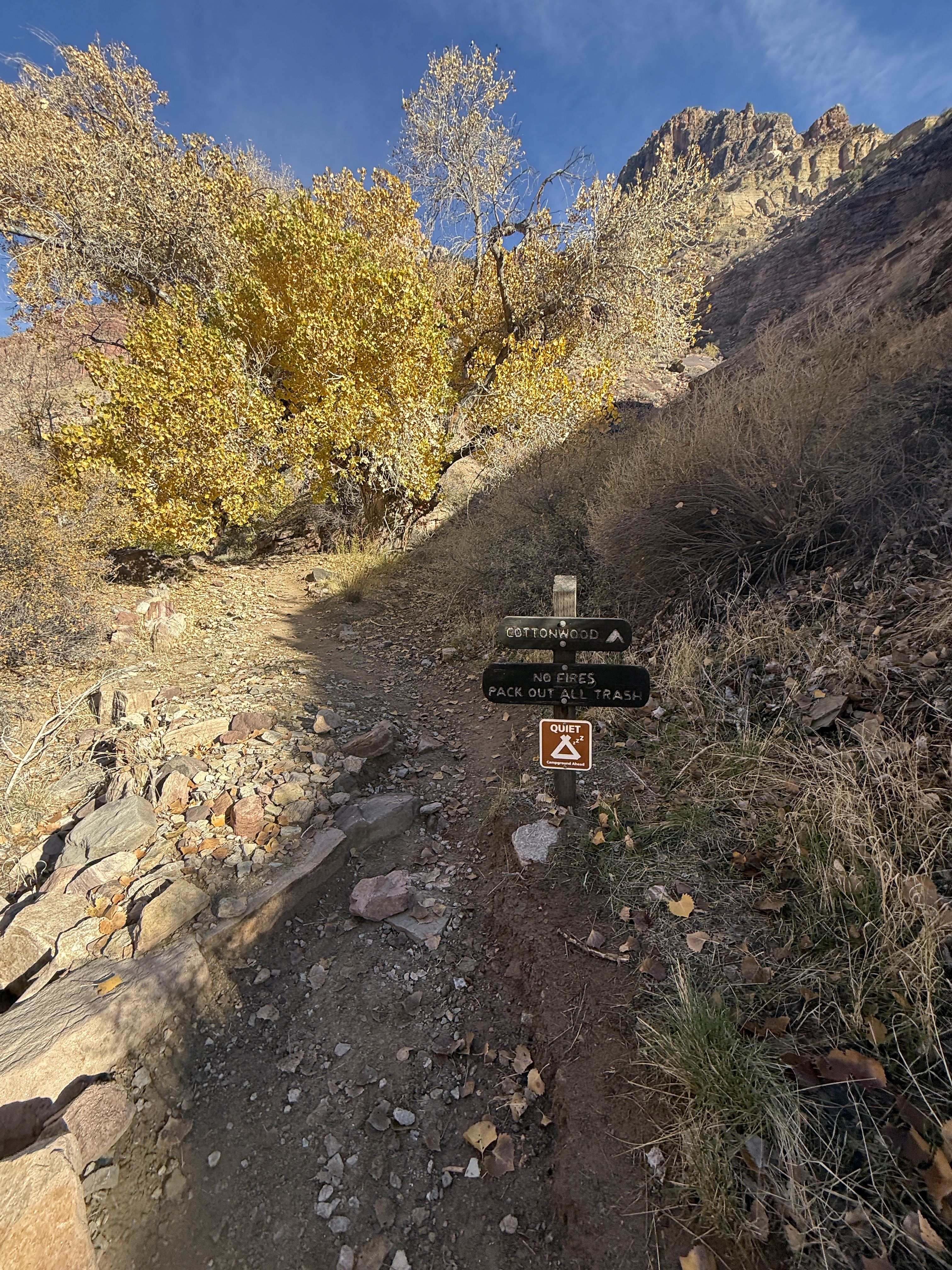

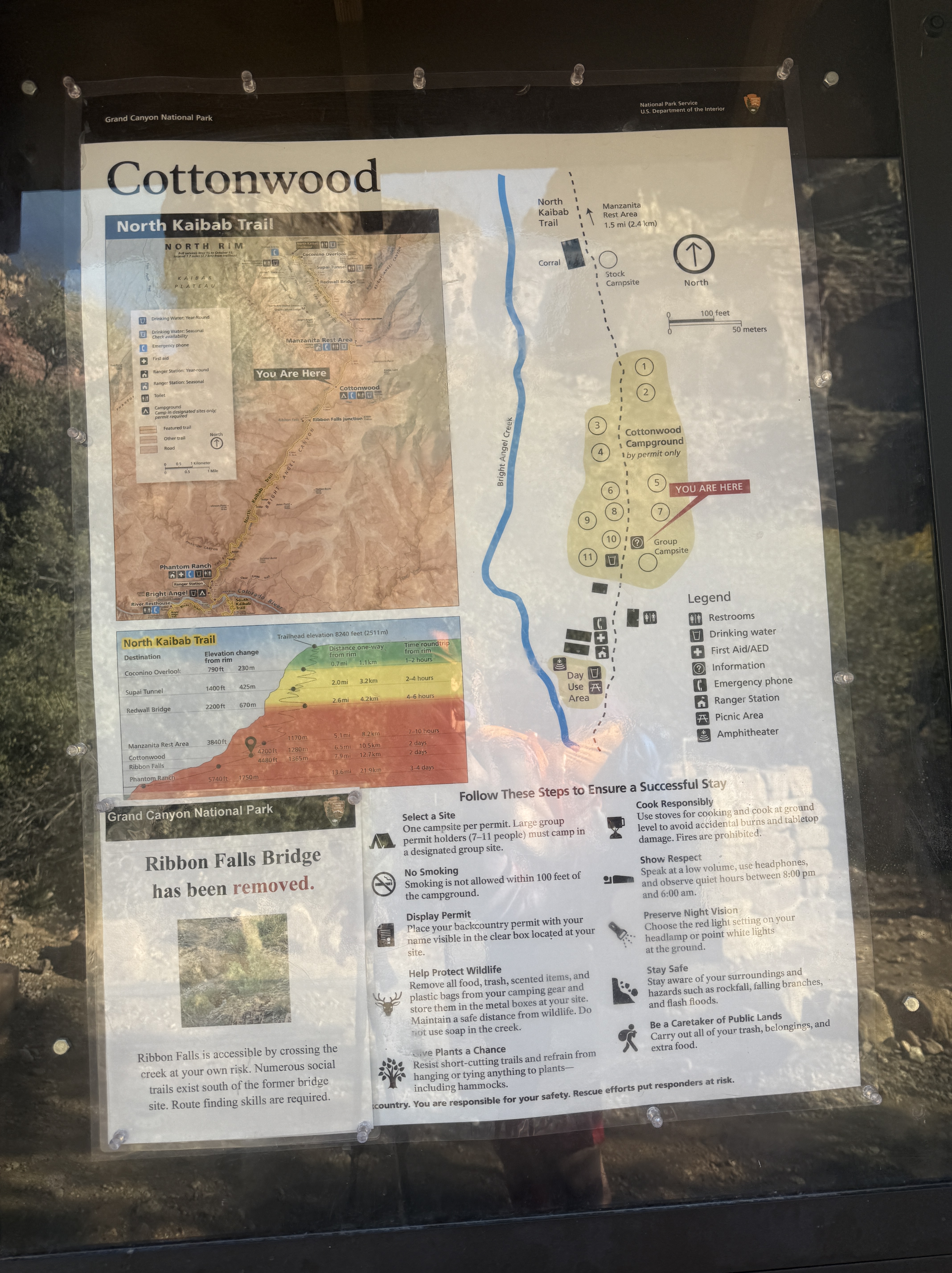
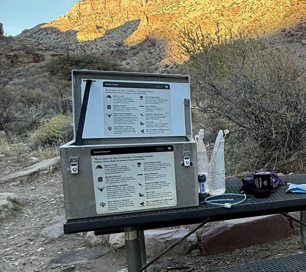
Cottonwood Campground is probably one of my favorite campgrounds I have ever been in. Many of the sites have quite a bit of privacy, each one adorned with a picnic table and a critter box, a metal box with a locking lid, much like our bear bins in Alaska. I brought an Ursack, but it was nice to organize all of my food and odiferous items in the bin. There is a composting toilet nearby and even a spigot with potable water, although it was shut off for the winter.
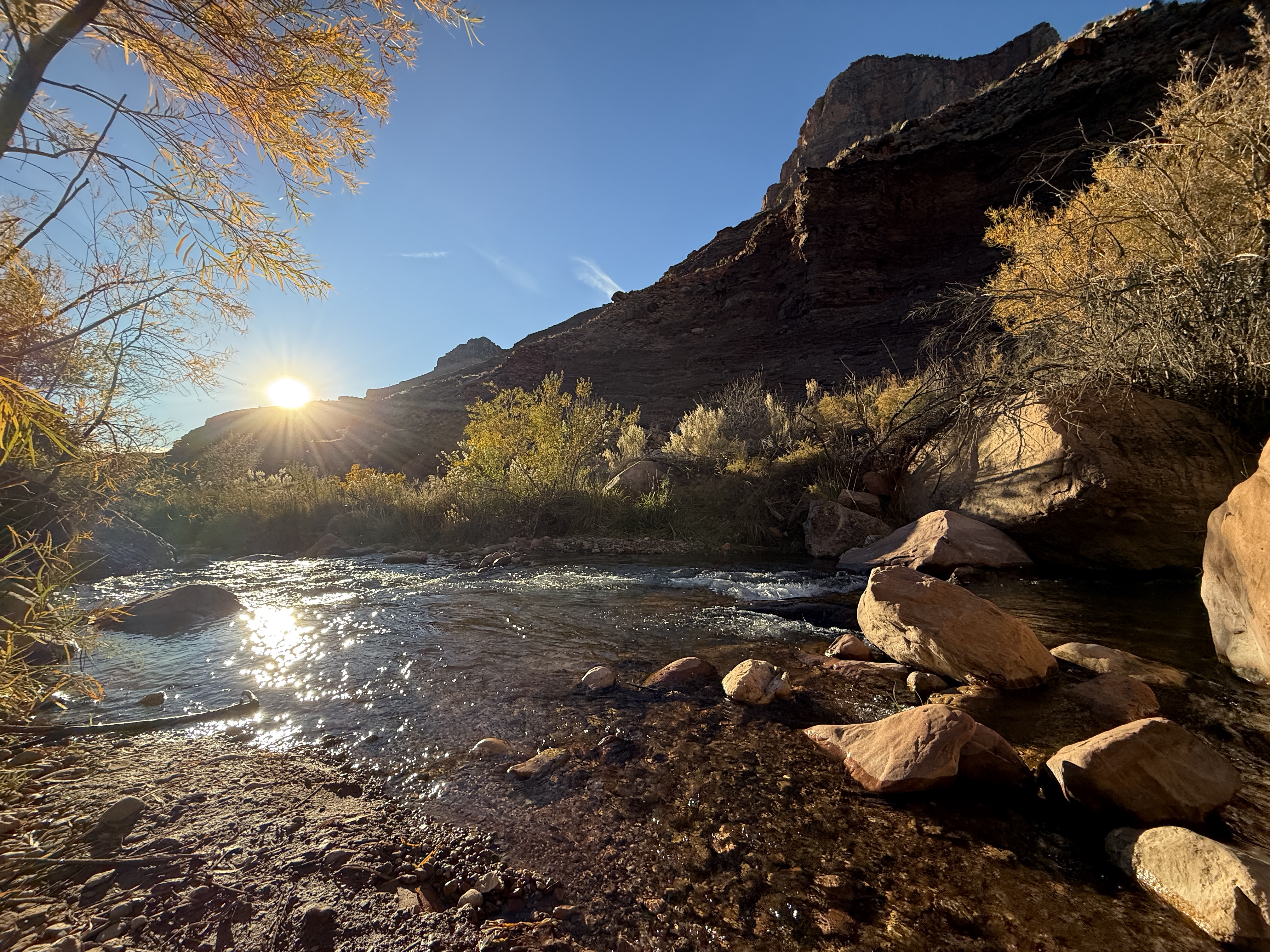
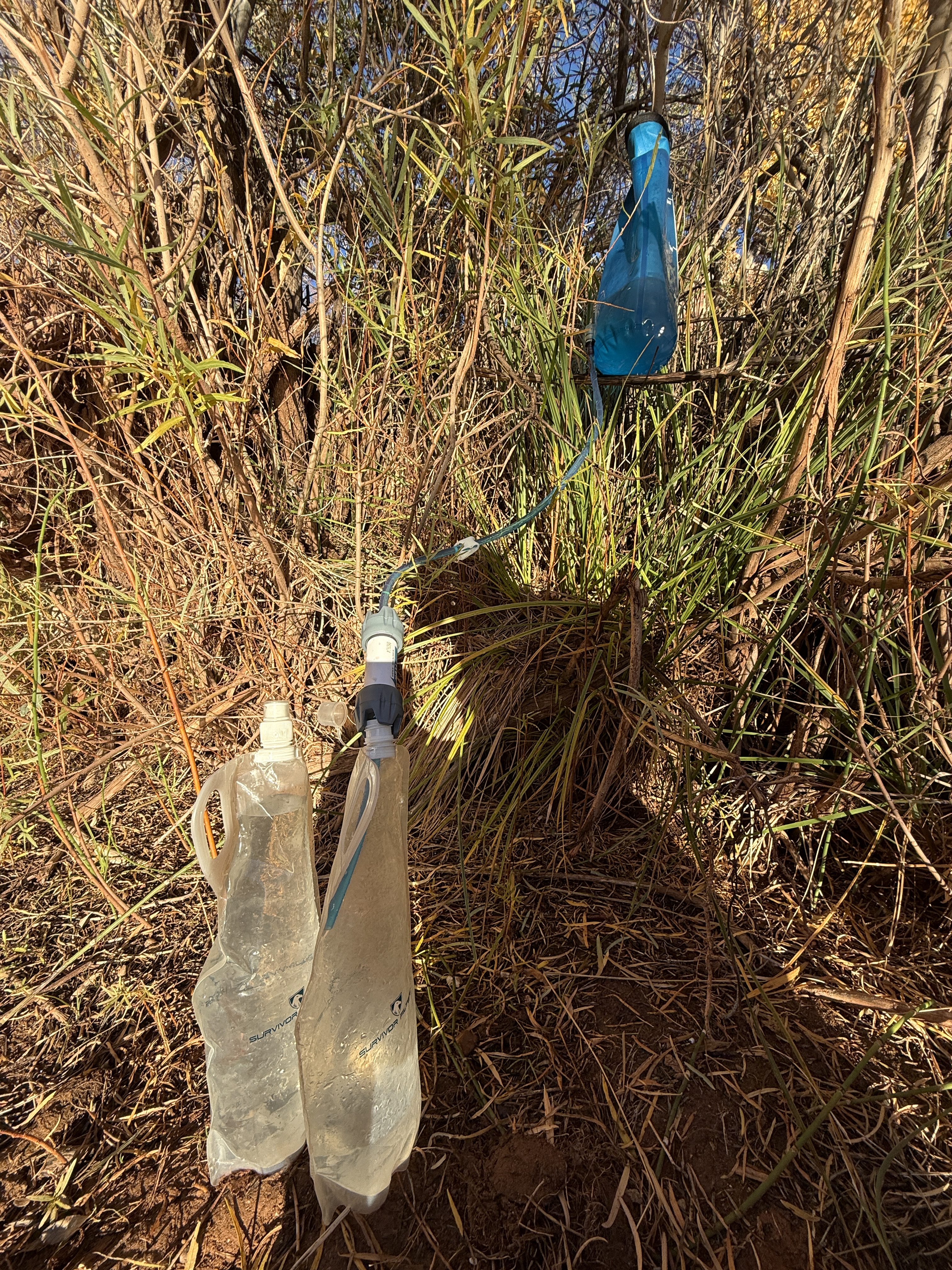
My legs were becoming stiff, so I shuffled as quickly as I could to the creek to collect drinking water for the night. I use a large Sawyer filter in line with a water sack that I soon discovered had lost an o-ring where the hose clips into the bag. Although it was leaking everywhere and took longer than normal, I was able to fill up 4 liters of water and get back to camp before my legs completely locked up.
Slow moving, but happy to be there, I set up my tent and put everything away before cooking up some Chili Mac and coffee. The sun began to set behind the canyon walls, well before the actual sunset time, and I donned a hat, down pants and my puffy jacket. As I was pouring water into my Jetboil, I realized my well-loved collapsible water bottle had a break in the seal near the mouthpiece. Next time I would bring brand new ones instead of relying on my used and abused bottles.
Sitting in my camp chair, I truly appreciated the comfort, instead of suffering uncomfortably on the bench of the picnic table. It was worth the extra weight.
Fed and organized, I crawled, literally, into my tent to do some reading. The dark came quickly, and when I say dark, I mean dark! The Grand Canyon was designated a Dark Sky Park in 2016 after a massive project to replace more than 5,000 light fixtures in the park with dark skies compliant units. I opened my tent and leaned out, absolutely enraptured by the milky way and the uncountable number of stars. I had never seen a sky so dark! I could pick out satellites (ironic after my lack of sat service earlier in the day), Starlink arrays and even the ISS!
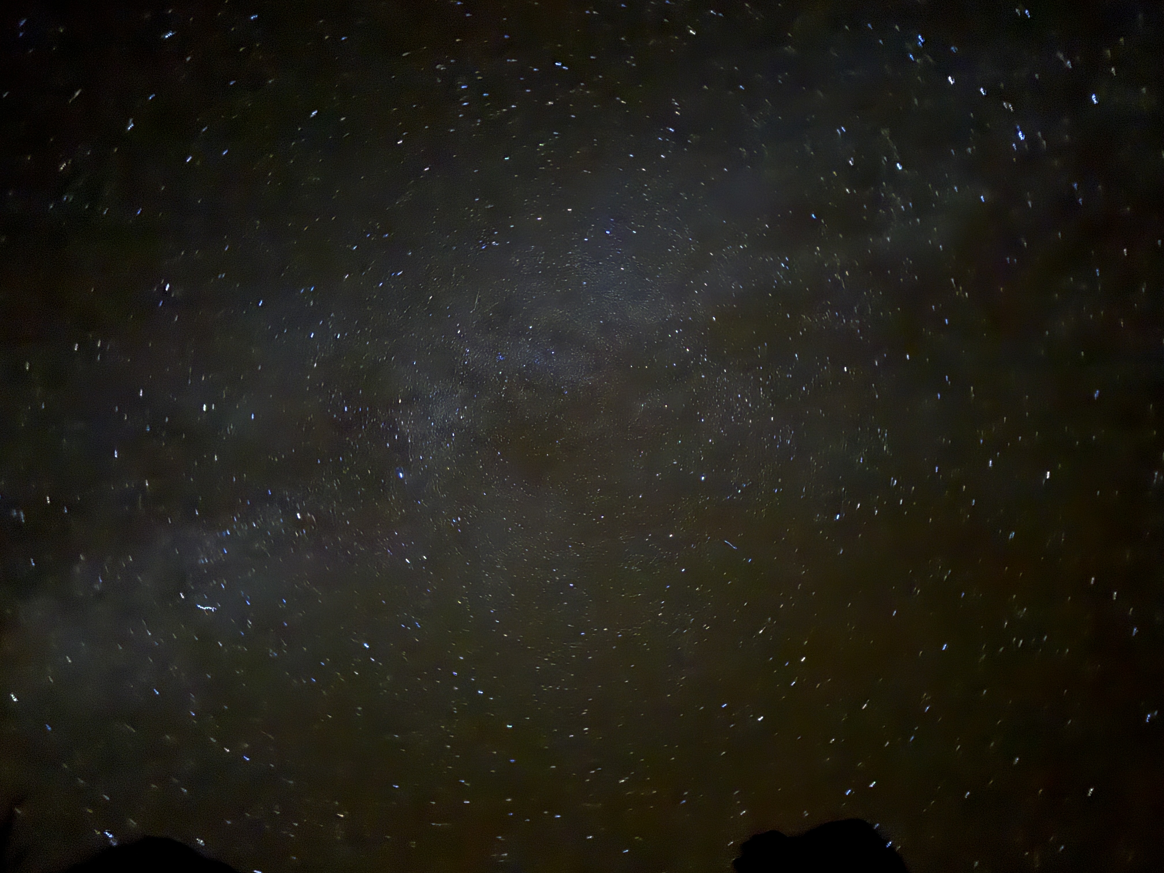
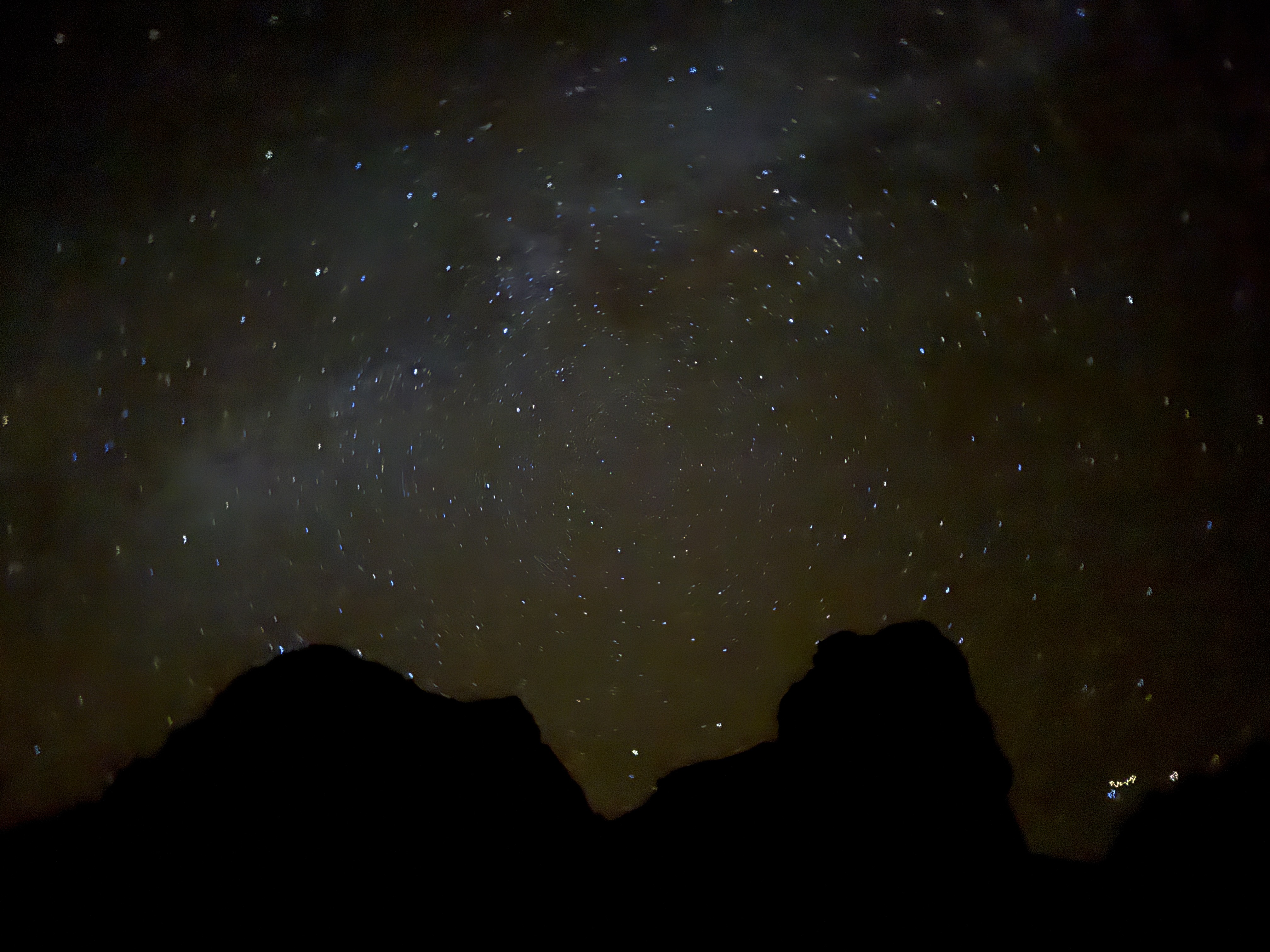
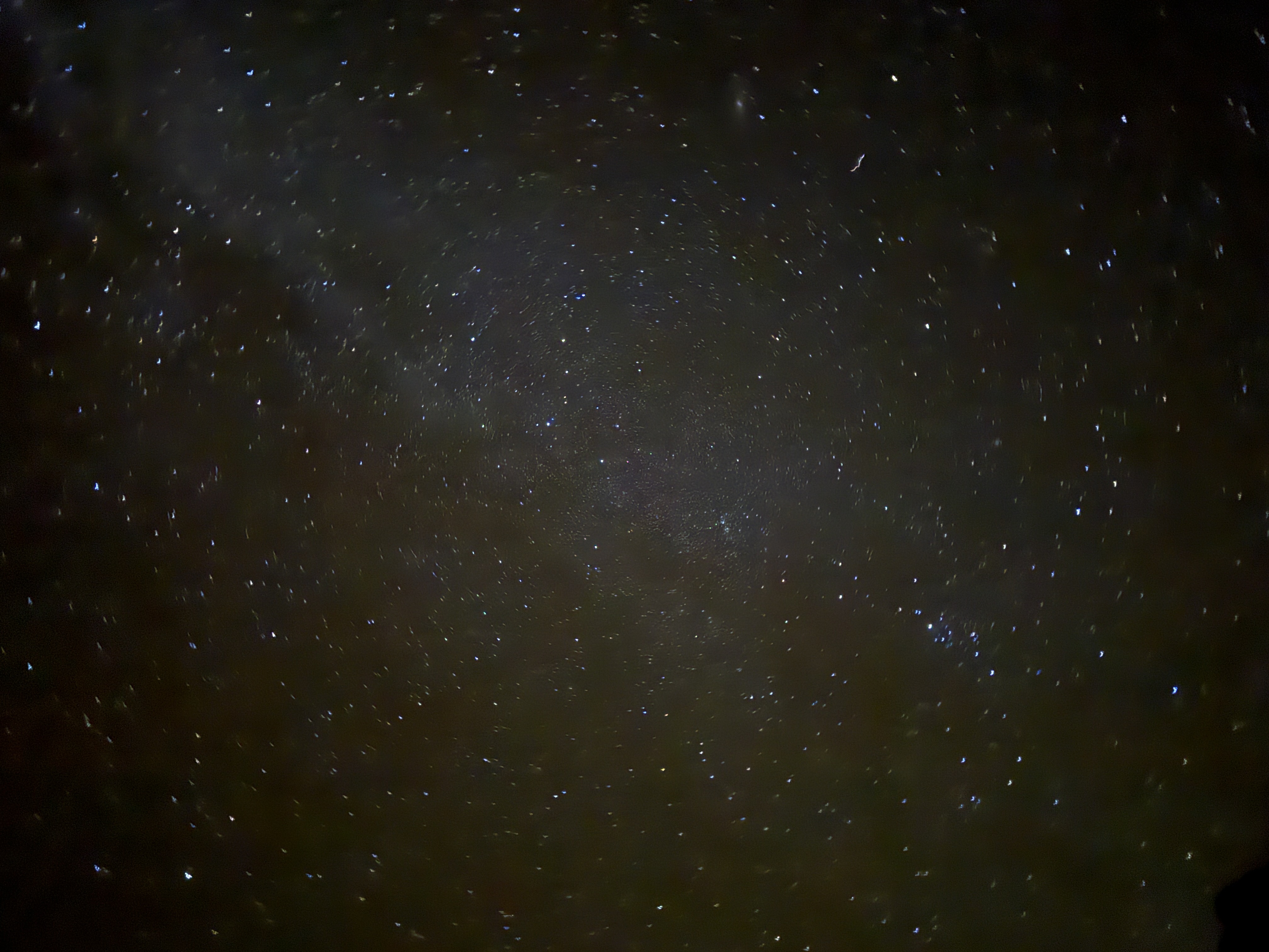
I could have laid out all night just looking up. Until something ran over the top of my tent!! I leapt back in, zipping the enclosure, headlamp now on, searching for what may be in my tent. I did a thorough search, including in my sleeping bag, and determined whatever it was, was still on the outside. I decided to continue with my book and leave the stargazing for another night, but not long after nature called. I crawled out of my tent (again, literally) and after heeding the call, looked up. I couldn’t resist trying to take some photos of the brilliant sky. I was standing very still in effort to use the long exposure setting on my iPhone when something ran up my leg! That’s it. I was done for the night.
When the lights went out and I had settled in, almost asleep, there came more scampering over my tent! More than one something was out there trying to terrorize me. I pulled out my phone just in time to get a video of one of the little harassers running over my tent in between the rain fly and the main screened in portion. I think they were Deer Mice, known in the Grand Canyon to have overrun campsites due to careless food storage practices by backpackers. After a while, the psh psh psh of mouse feet either stopped or I fell asleep. Either way, I was unbothered and slept hard.
Rim To Rim To Rim AllTrails Link:
Just The Tips:
- Instead of flying into Phoenix, opt to fly into Flagstaff. I’ll be doing that next time instead of making the 3 hour drive each way.
- If you are flying in, pre order your stove fuel and other supplies online from Sportsman’s Warehouse in Phoenix or Flagstaff. I found this to be quick and easy.
- Be aware that your tracking devices and phone may not be able to get a satellite connection in some of the narrow canyons. Tracking may get wonky, as the vertical walls can cause a location ping, hundreds of feet above or below you.
- Permitting for the Grand Canyon can be confusing. It is best to apply for the lottery, which opens based on the month of travel and is available for application on the 16th of the month, in the 5th month prior to your trip. For example, a September Trip lottery application period would open April 16. See this article for more information about getting your Grand Canyon permit.
- Give yourself more than one night at Cottonwood Campground to allow for a side trip to Chimik’yana’kya Deya’ (Ribbon Falls) or a day hike to the North Rim, plus a rest day. I found 3 nights at Cottonwood to be perfect.
- If hiking rim to rim to rim in the winter, know that there are no services at and no access to the North Rim. You will be one of the few people in the area, far from help. Bring hiking poles and microspikes in case of snow. Evaluate your abilities and comfort with heights honestly before traveling this stretch of trail.
- Carry plenty of water and a water filtration system. Don’t drink unfiltered water. It can contain bacteria even if it looks clean. Be sure to dry out your filter when you get home.
- Get to the park early. The entrance gets extremely backed up with traffic beginning mid-morning.

2 thoughts on “Alone in the Grand Canyon: Crossing the Colorado”