
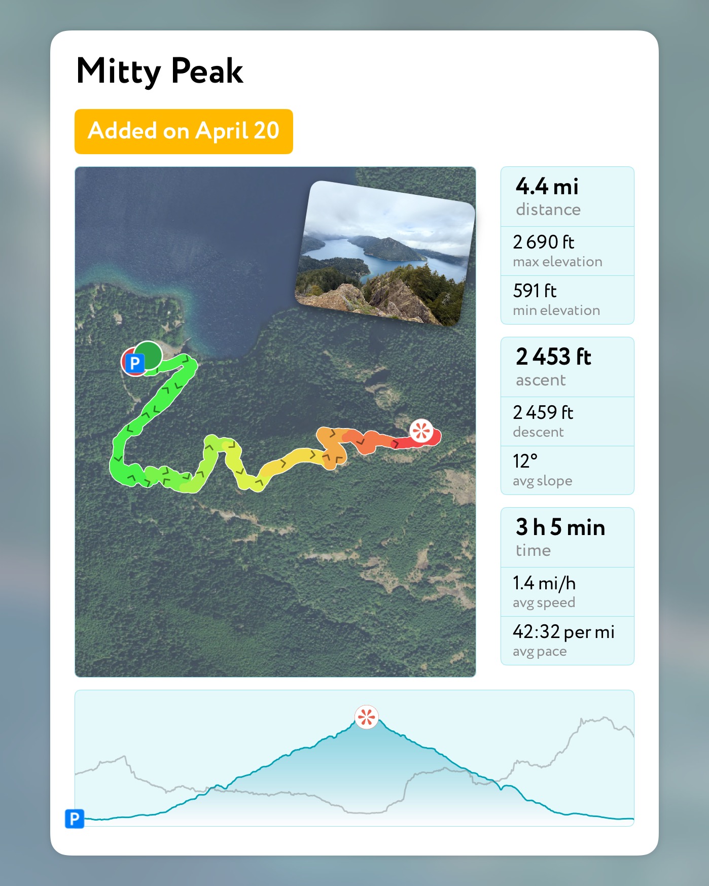
April 20, 2025
Olympic NAtional Park, WA
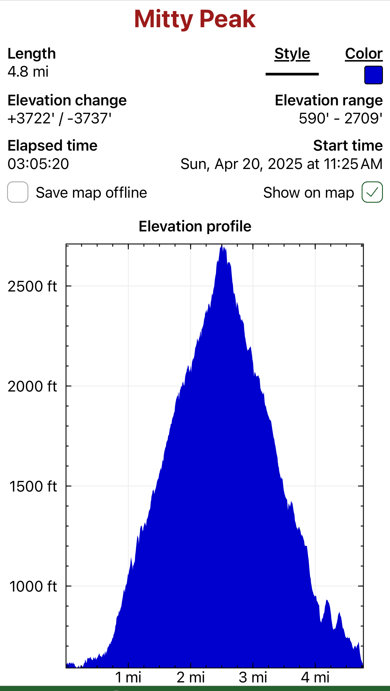
Mitty Peak 2674′
Mileage: 4.4 Miles RT
Elevation Gain: 2400′
After 25 years, I finally had the opportunity to fly down to Seattle from Alaska to see one of my favorite bands of all time, Phish. I can’t travel without checking out a new hike, so I also planned a quick foray into Olympic National Park to climb Mitty Peak.
My legs and back were feeling all of my 45 years after dancing like a maniac for 4 hours straight on Saturday night, but I was bound and determined to summit the namesake of my favorite movie character, Walter Mitty. I woke early Sunday morning and made the 2.5-hour drive from my hotel in Seattle.


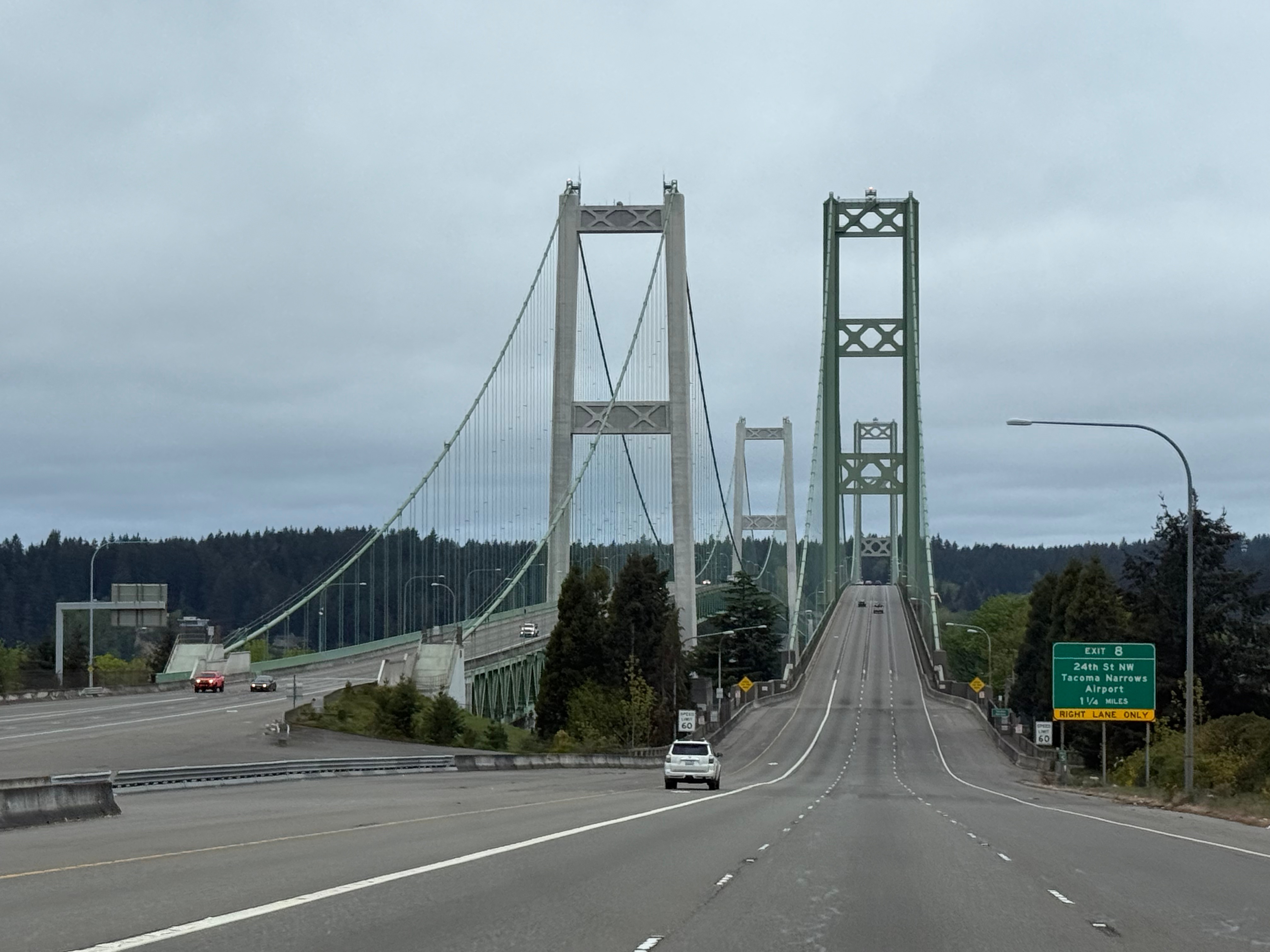
Typical of the Pacific Northwest, the weather changed by the minute as I turned north on the Olympic Peninsula. Sun, then rain… rinse and repeat. As I pulled into the Mt Storm King parking lot, I realized I had missed the ranger station but was pleasantly surprised to see I could pay for my pass with a QR code posted at the trailhead.
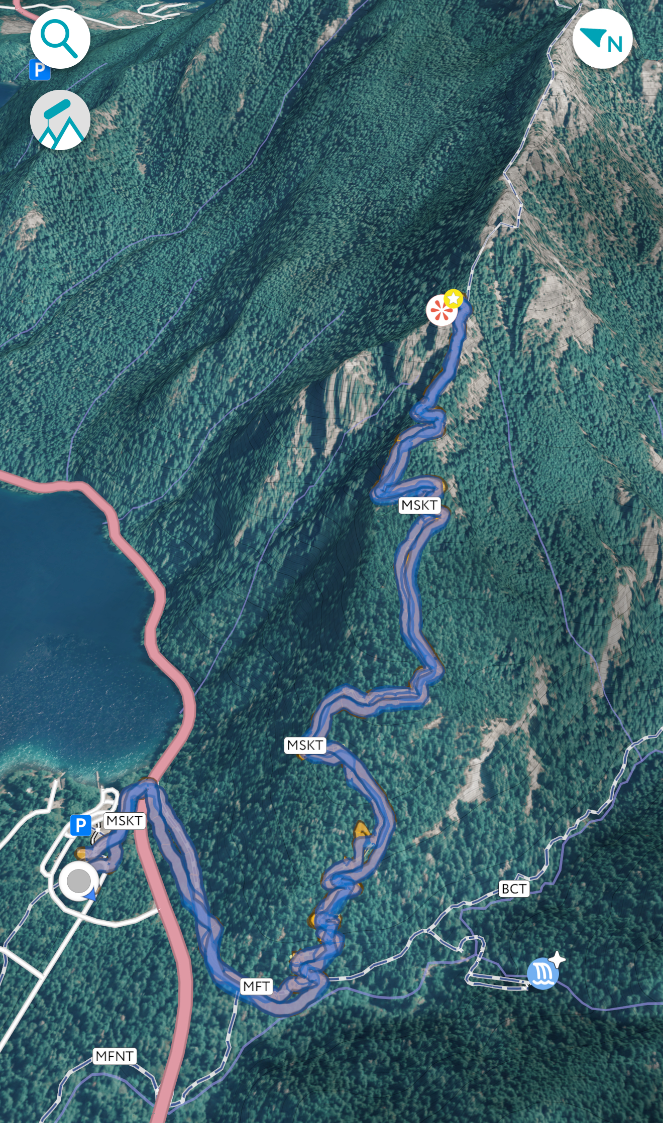
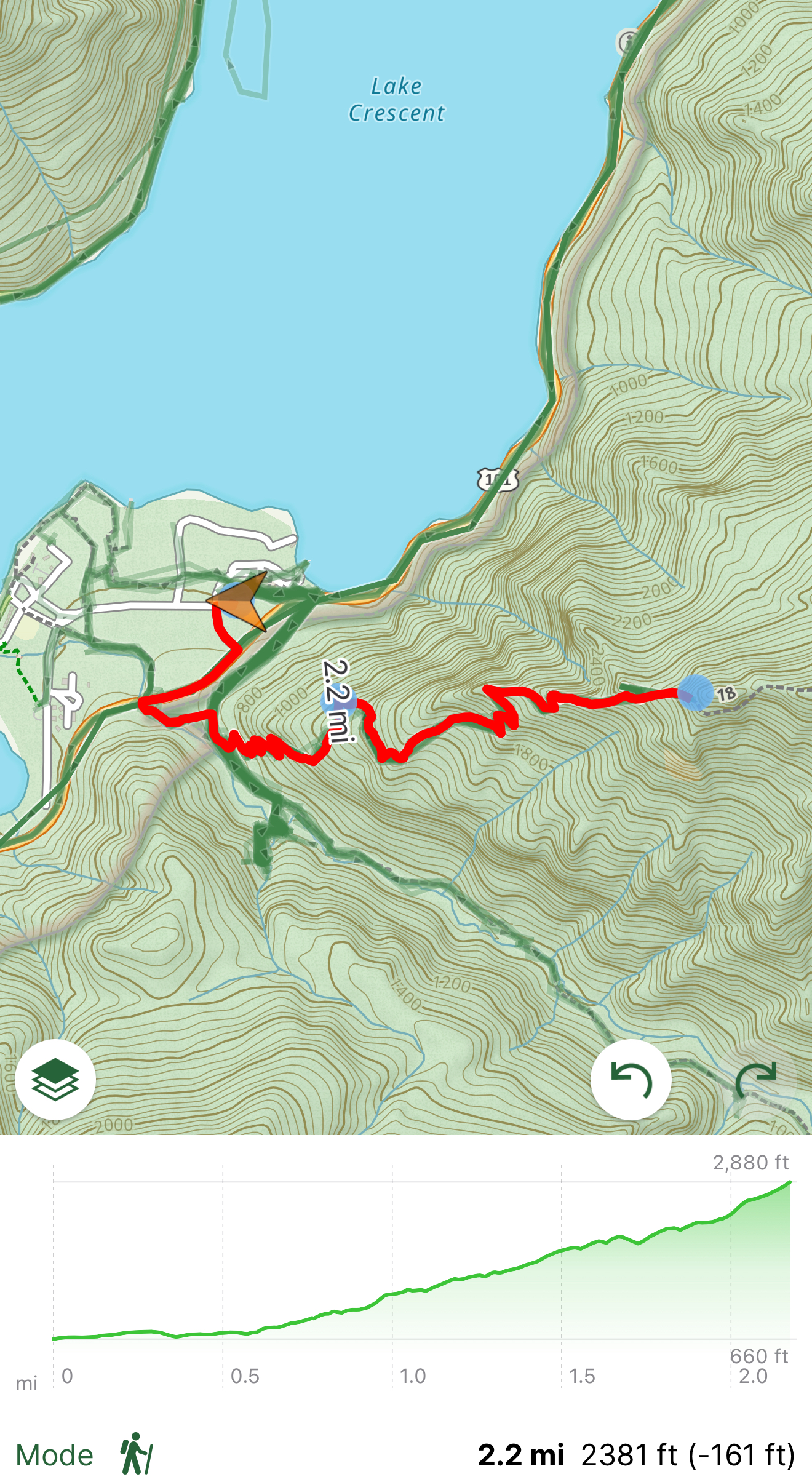
My $30 now securely in the hands of the National Park Service, I swung my pack onto my back and started off up the trail. The trailhead skirts past the now closed ranger station and into a tunnel under the road, although I didn’t see this, so I jumped the guardrail and linked up with the trail on the other side of the road.
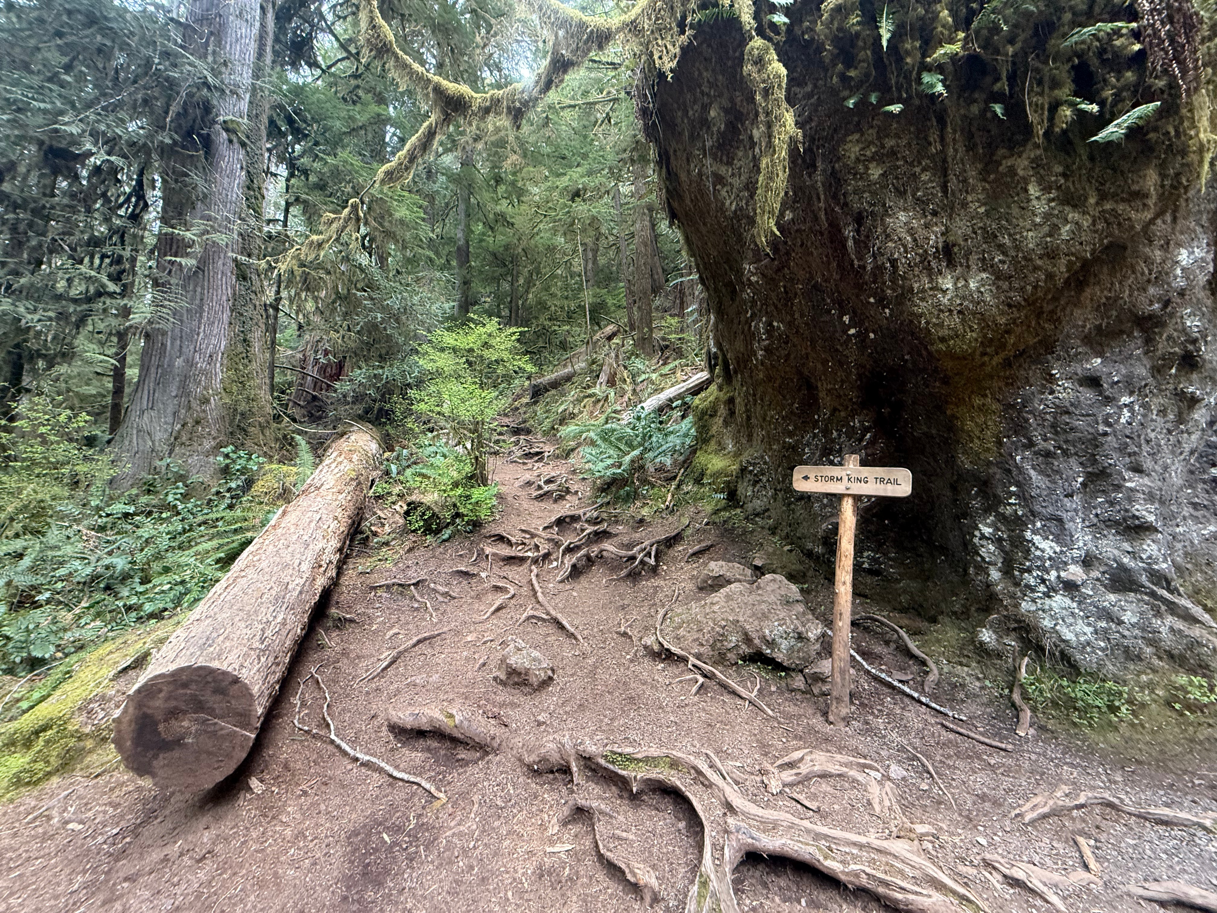
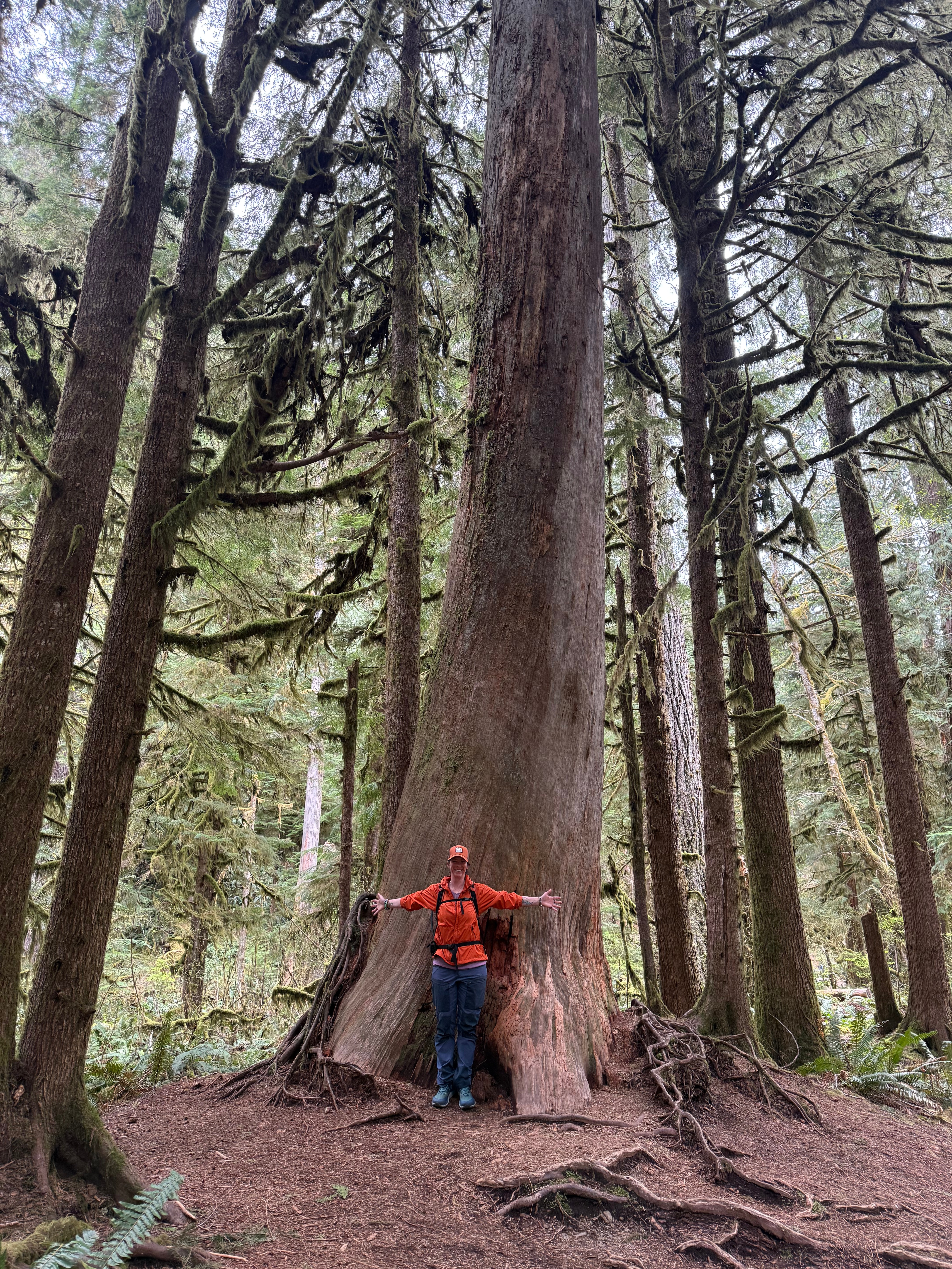
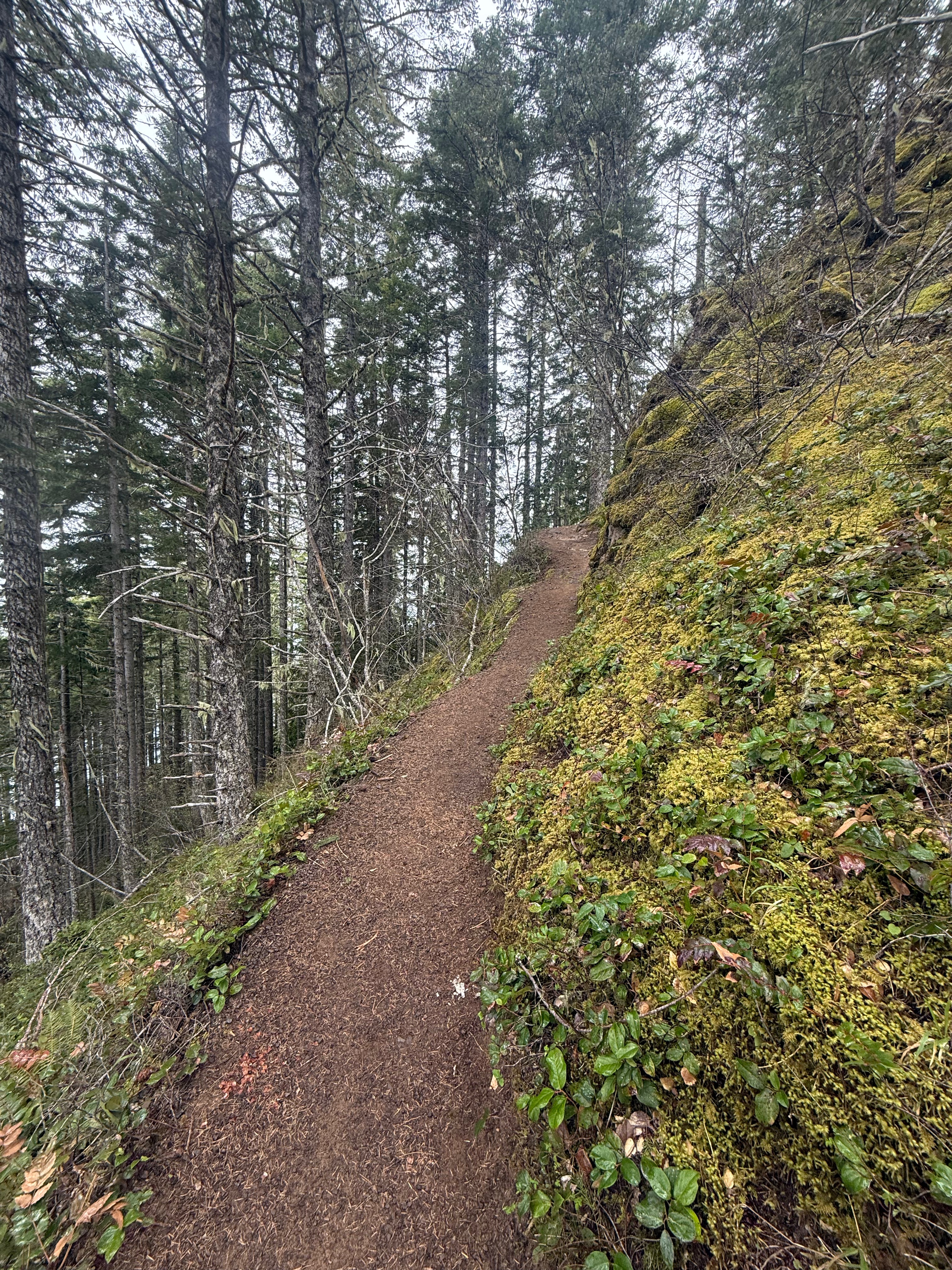
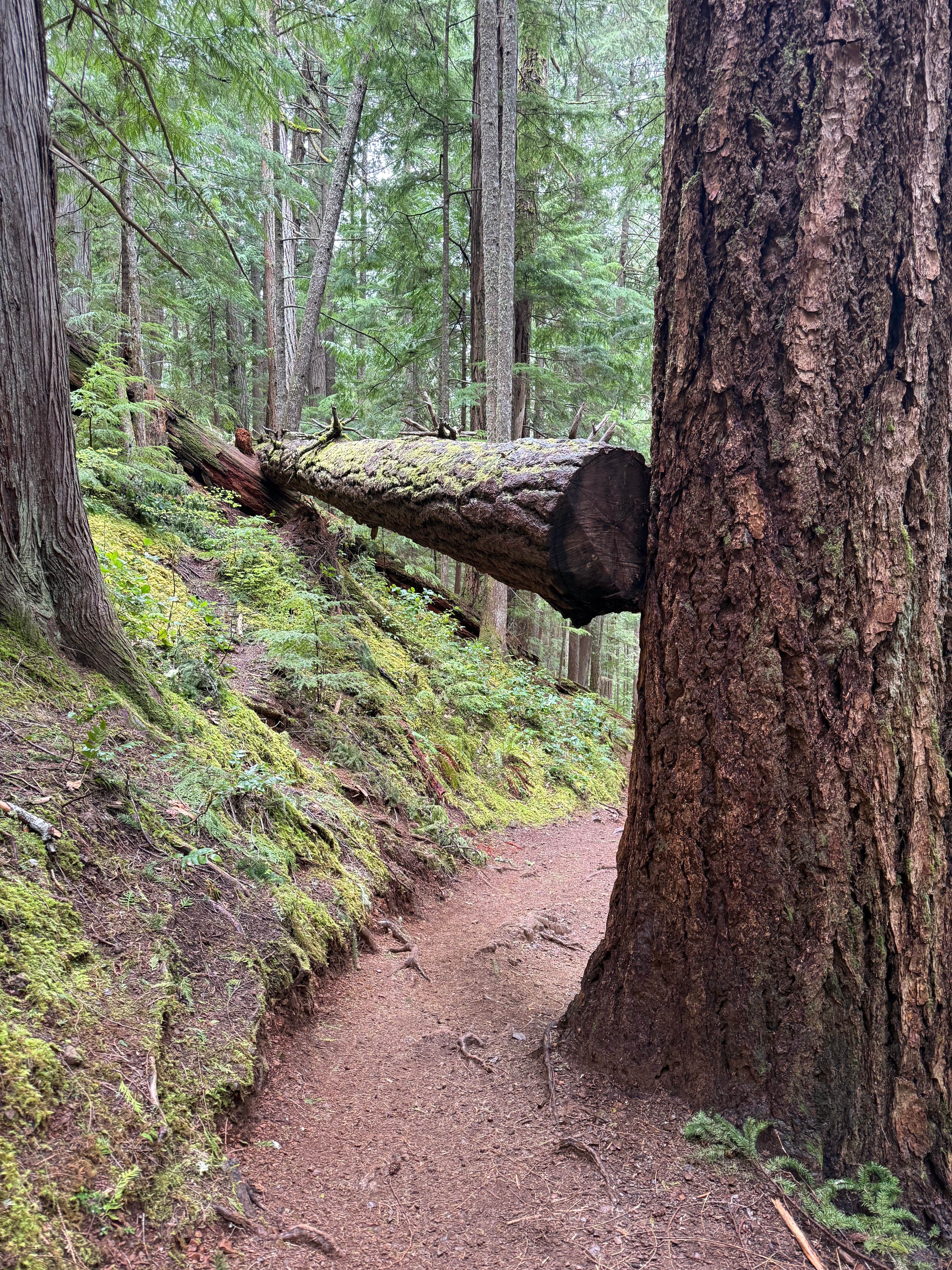
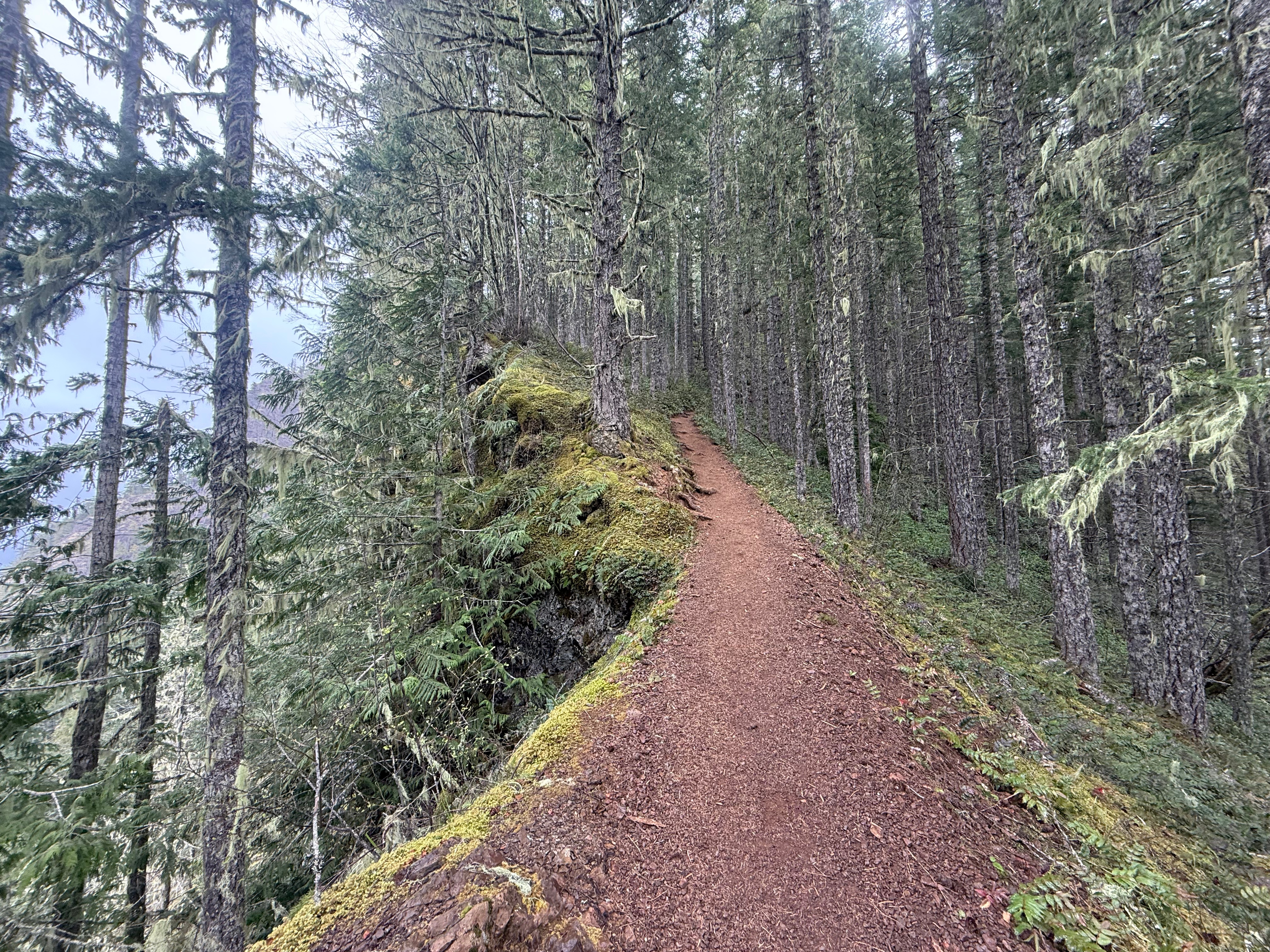
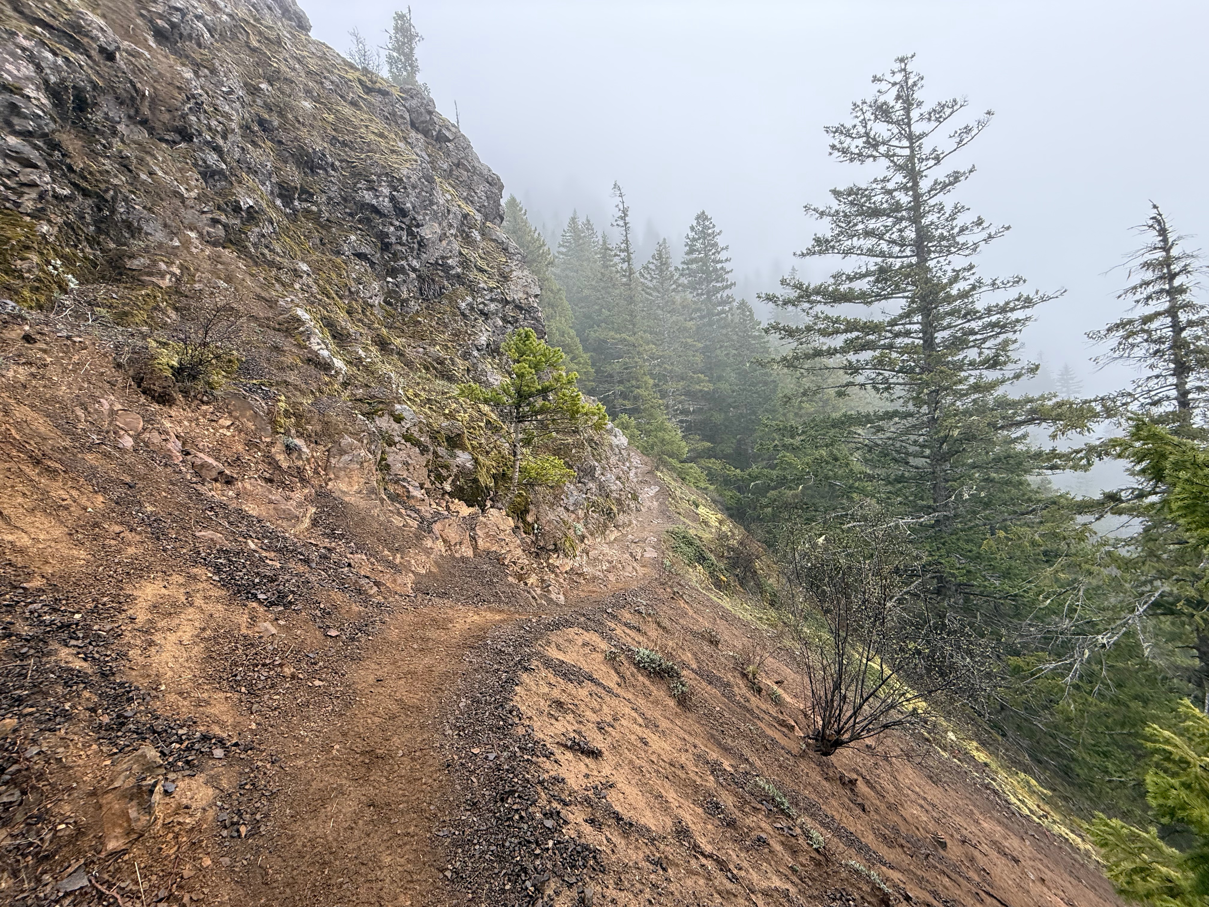
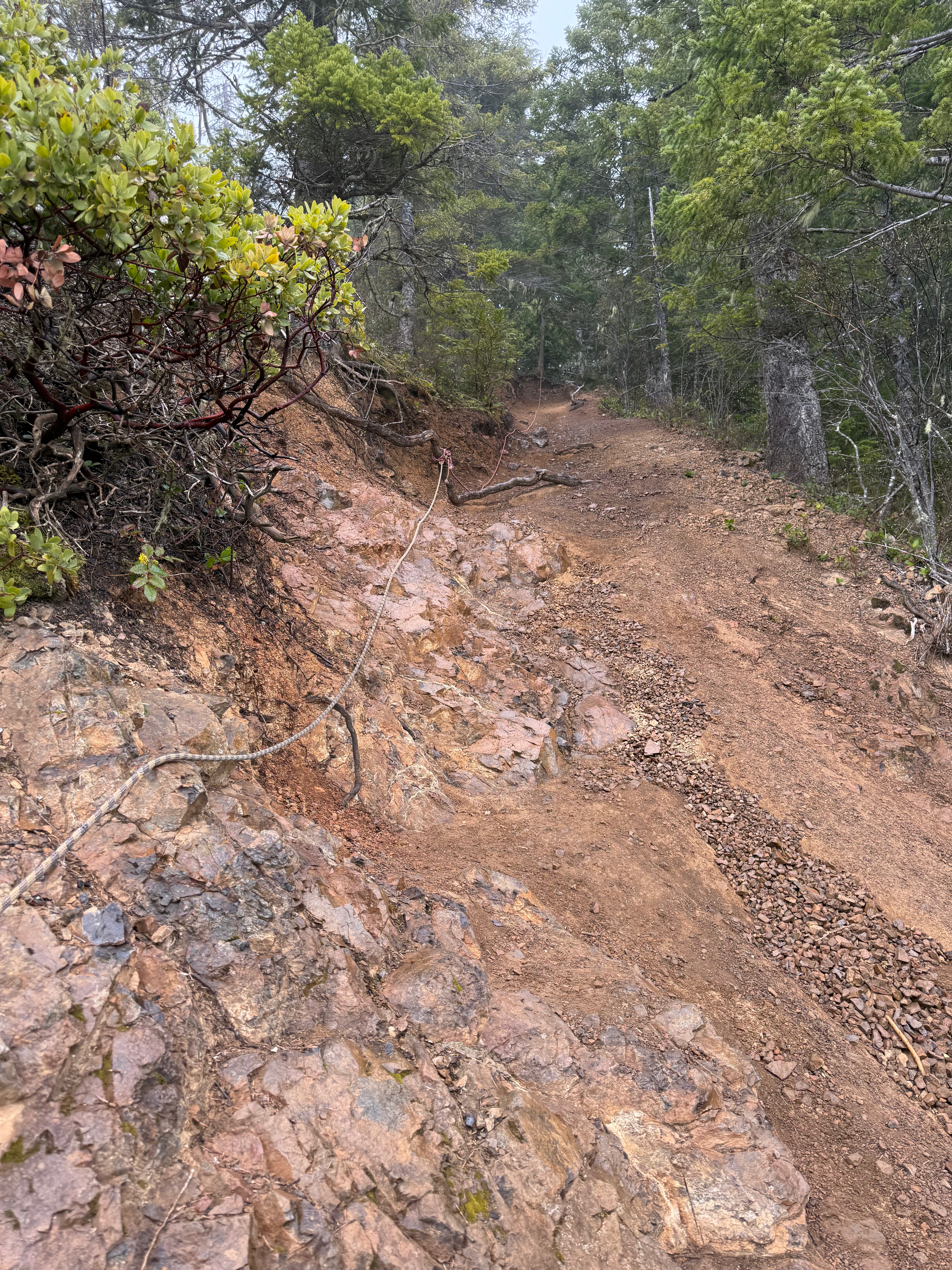
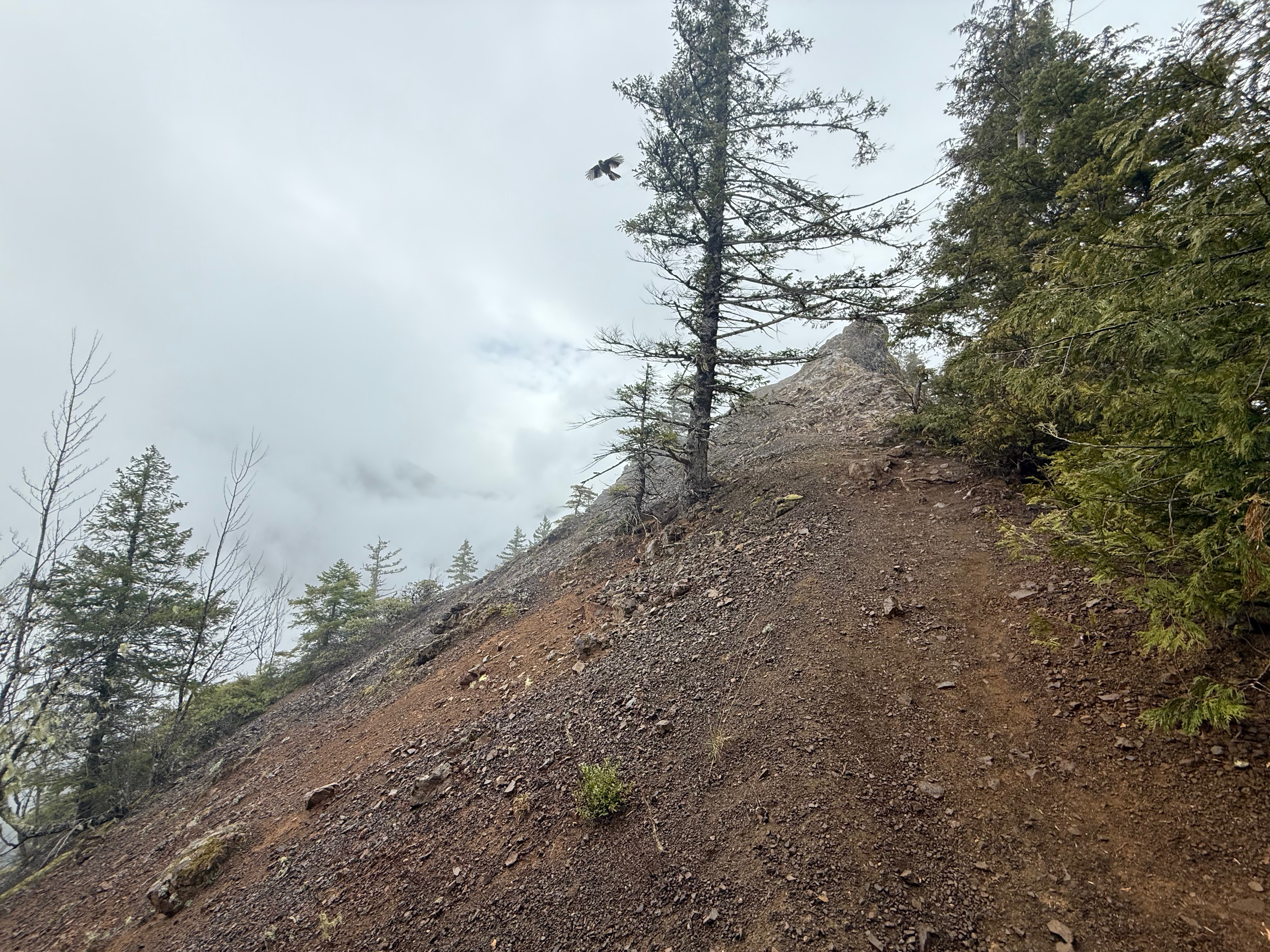
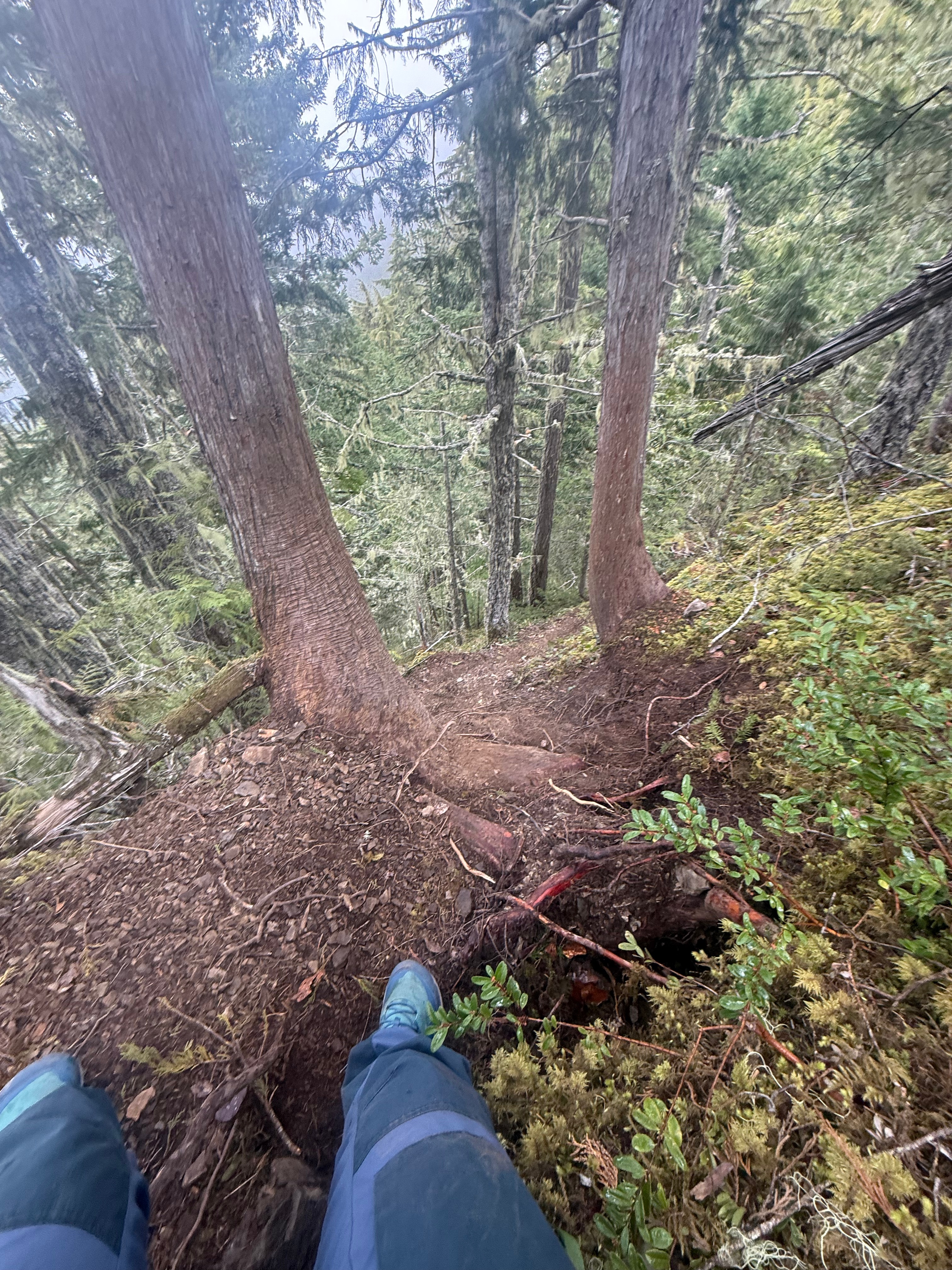
The flat path felt nice on my tired legs, and I looked up in awe at the incredible size of the Firs and Cedars. Not long down the trail, I came to the turnoff for the Mt Storm King Trail, a small wooden sign pointing the way. It was time to go UP!
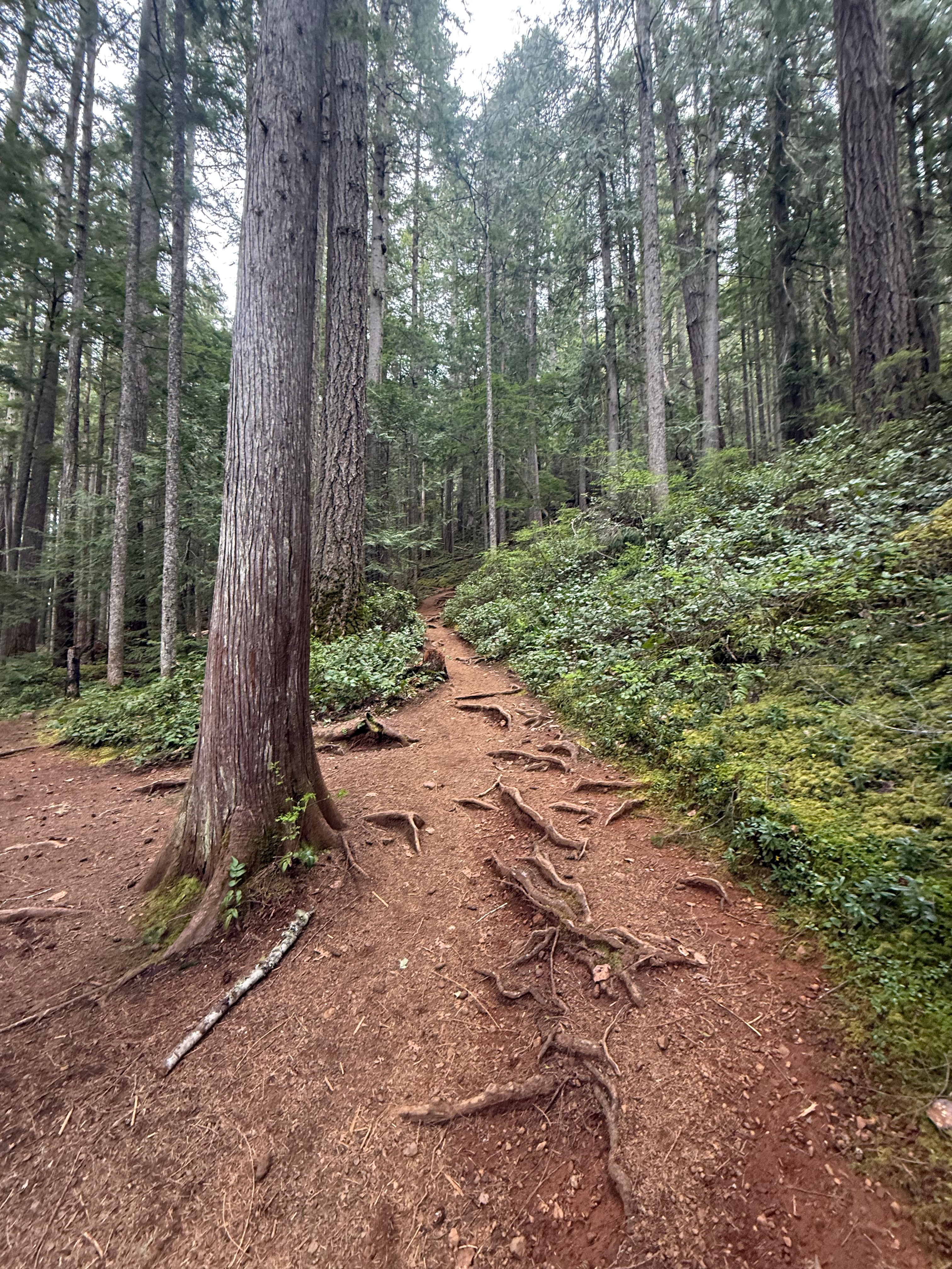
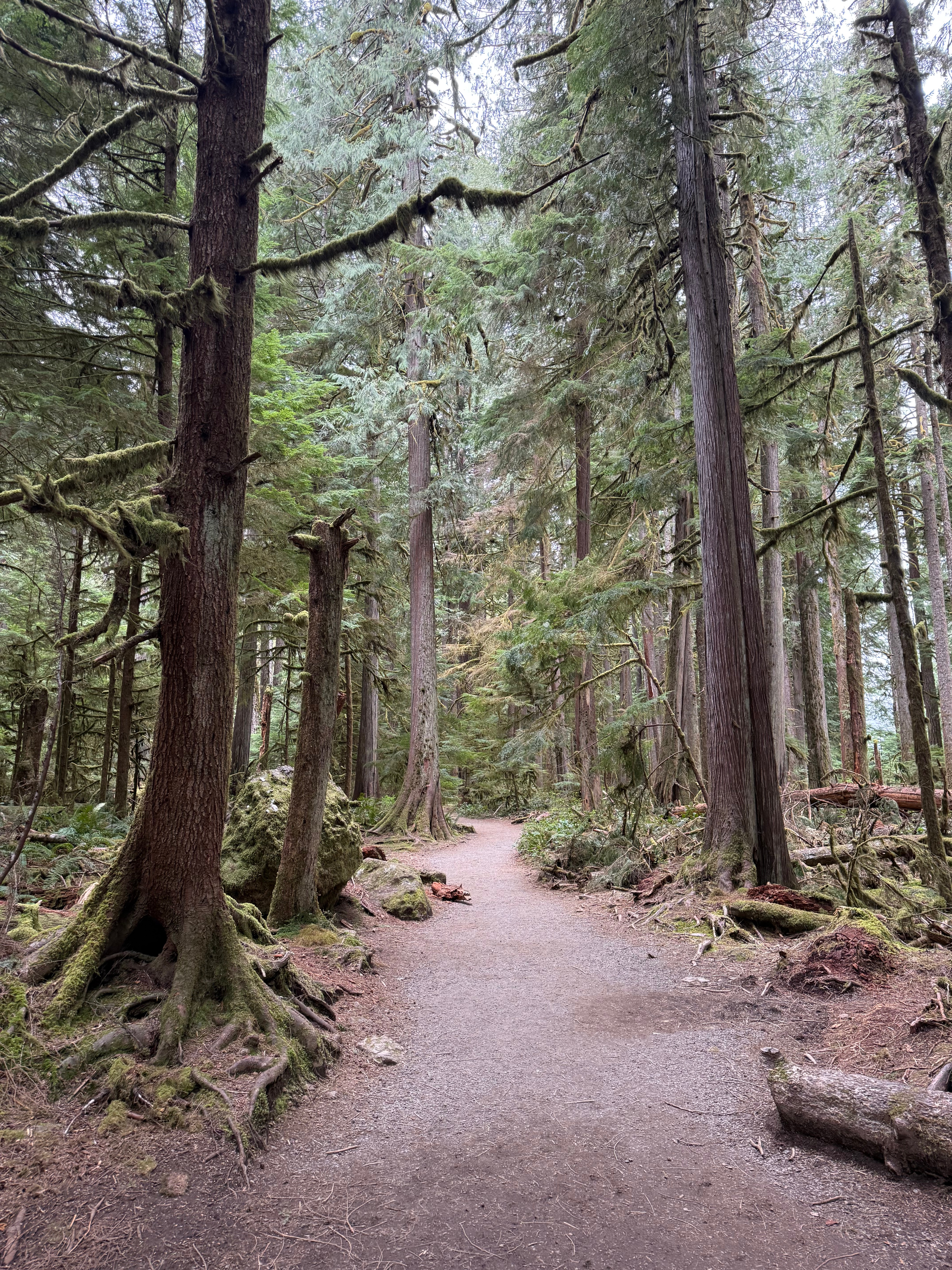
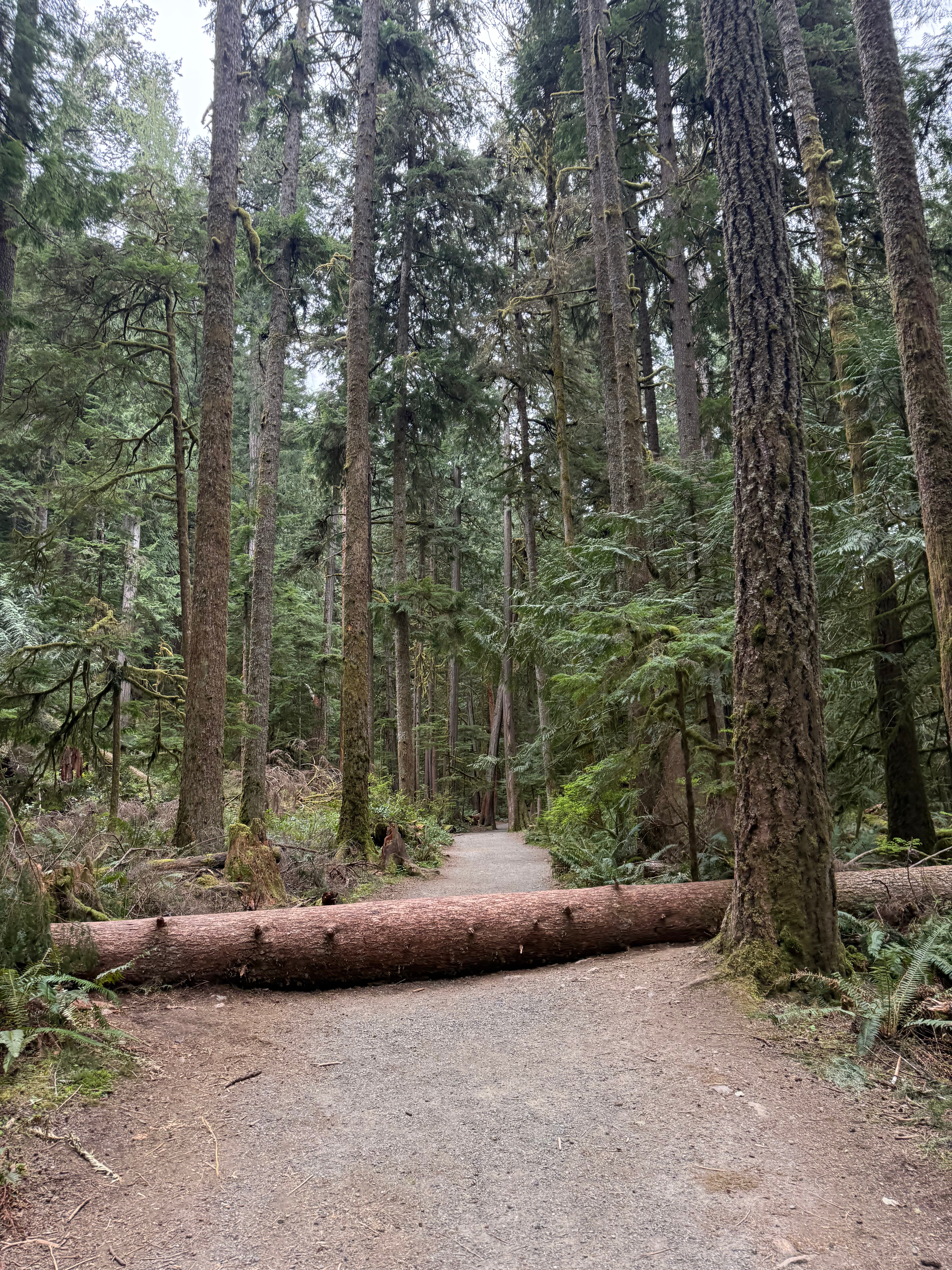
I was pretty beat after a long night, but the switchbacks on the east ridge made the climbing less strenuous, but still physically challenging. The rain came and went, and the sun was not interested in making an appearance, but I happily trudged on in the damp mist.
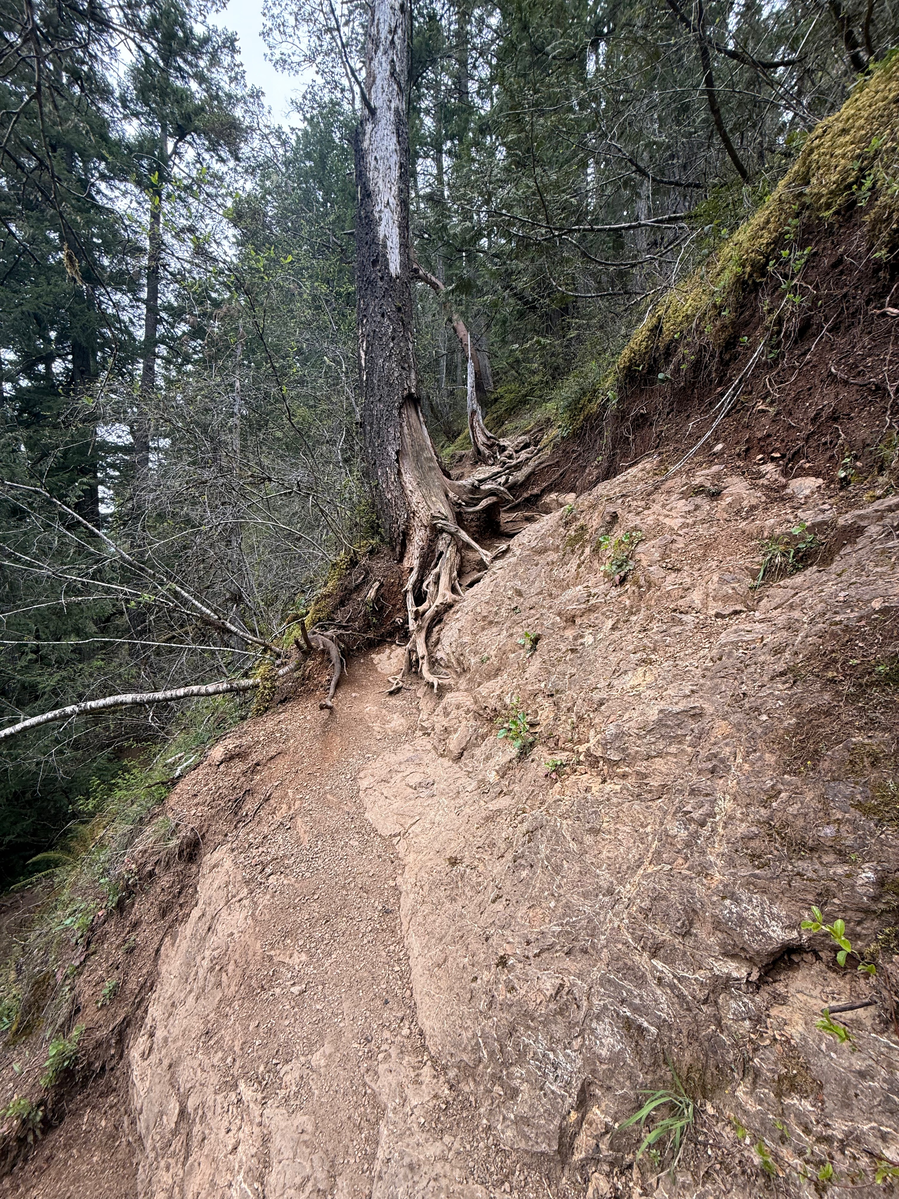


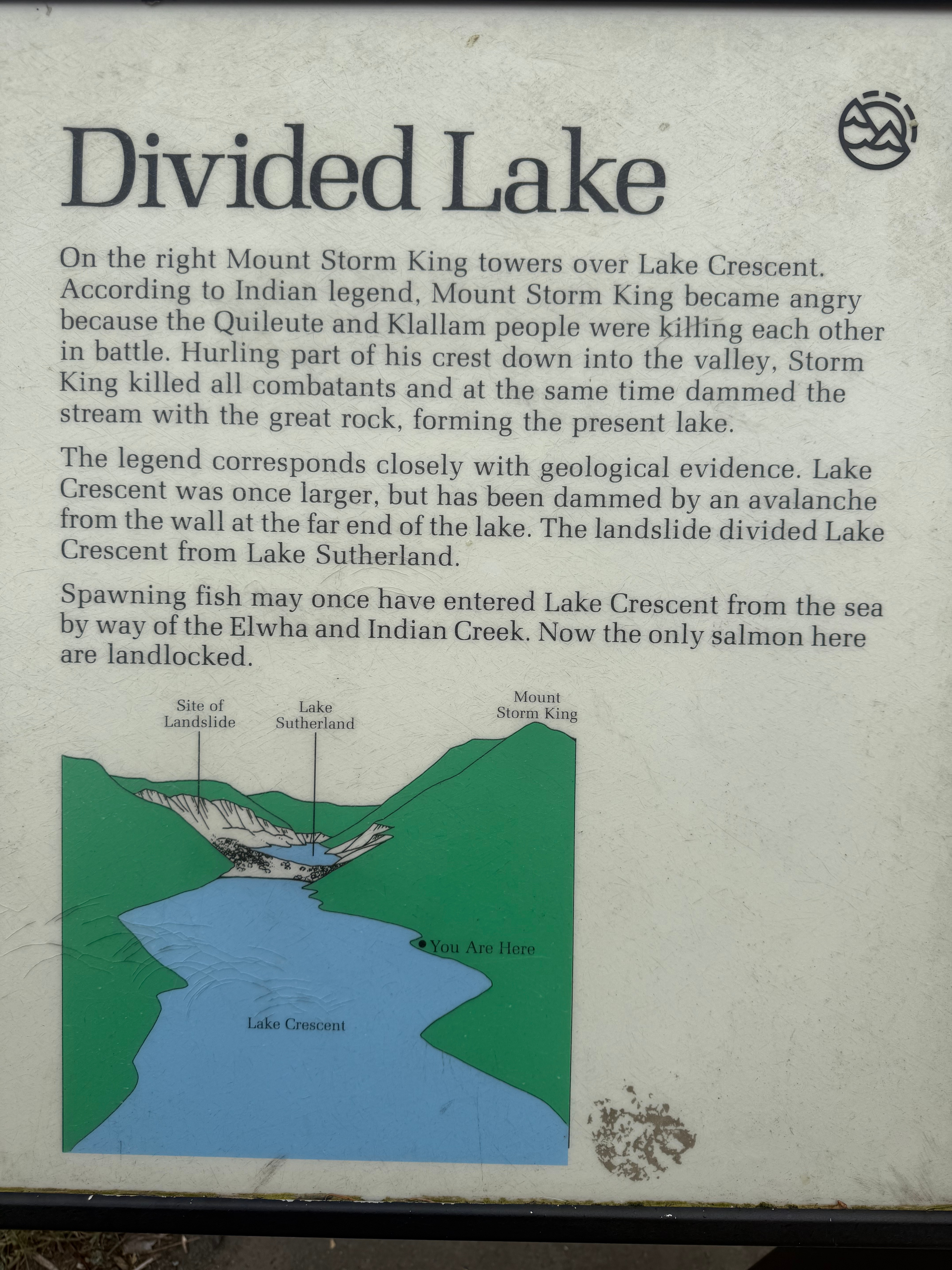
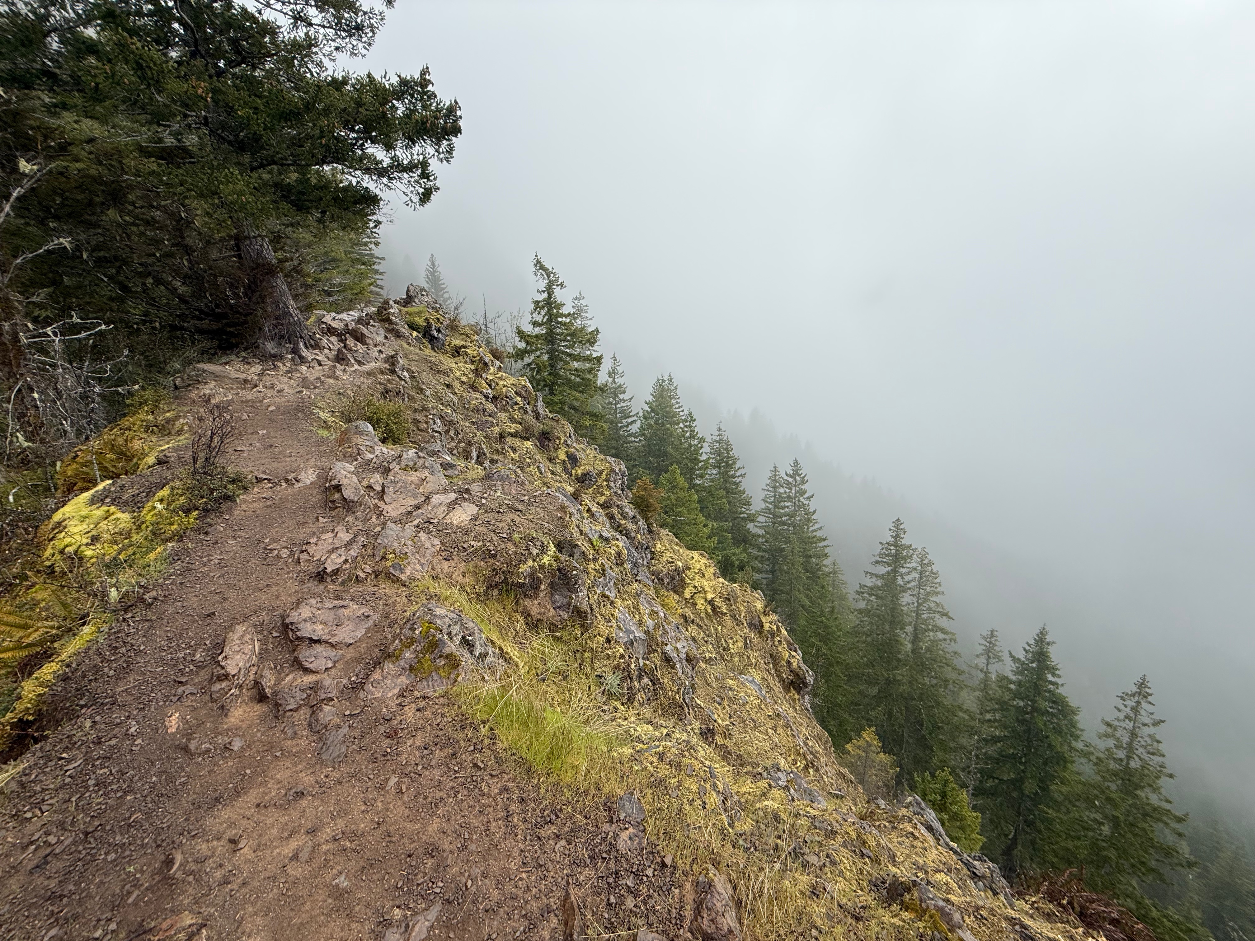
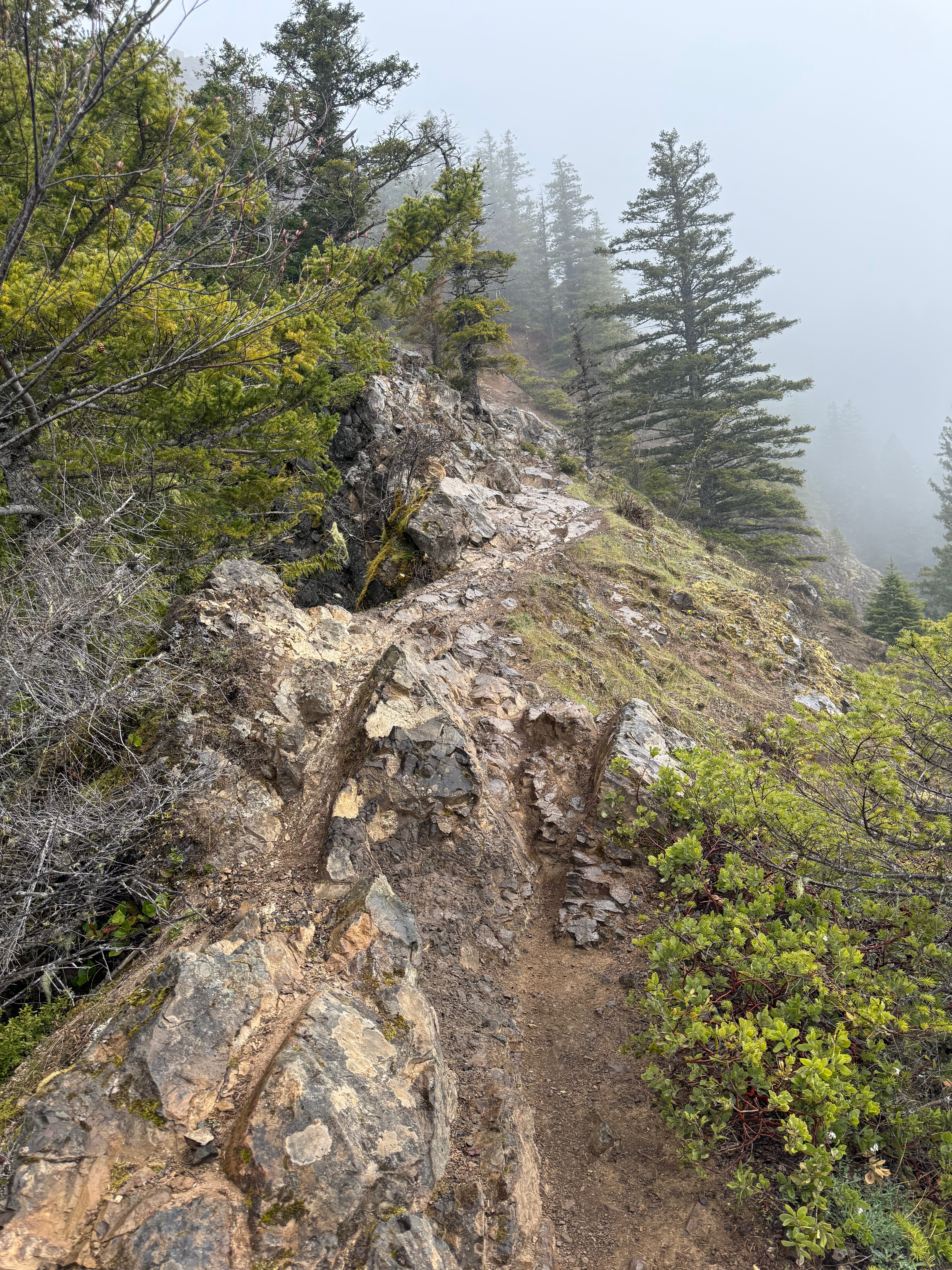
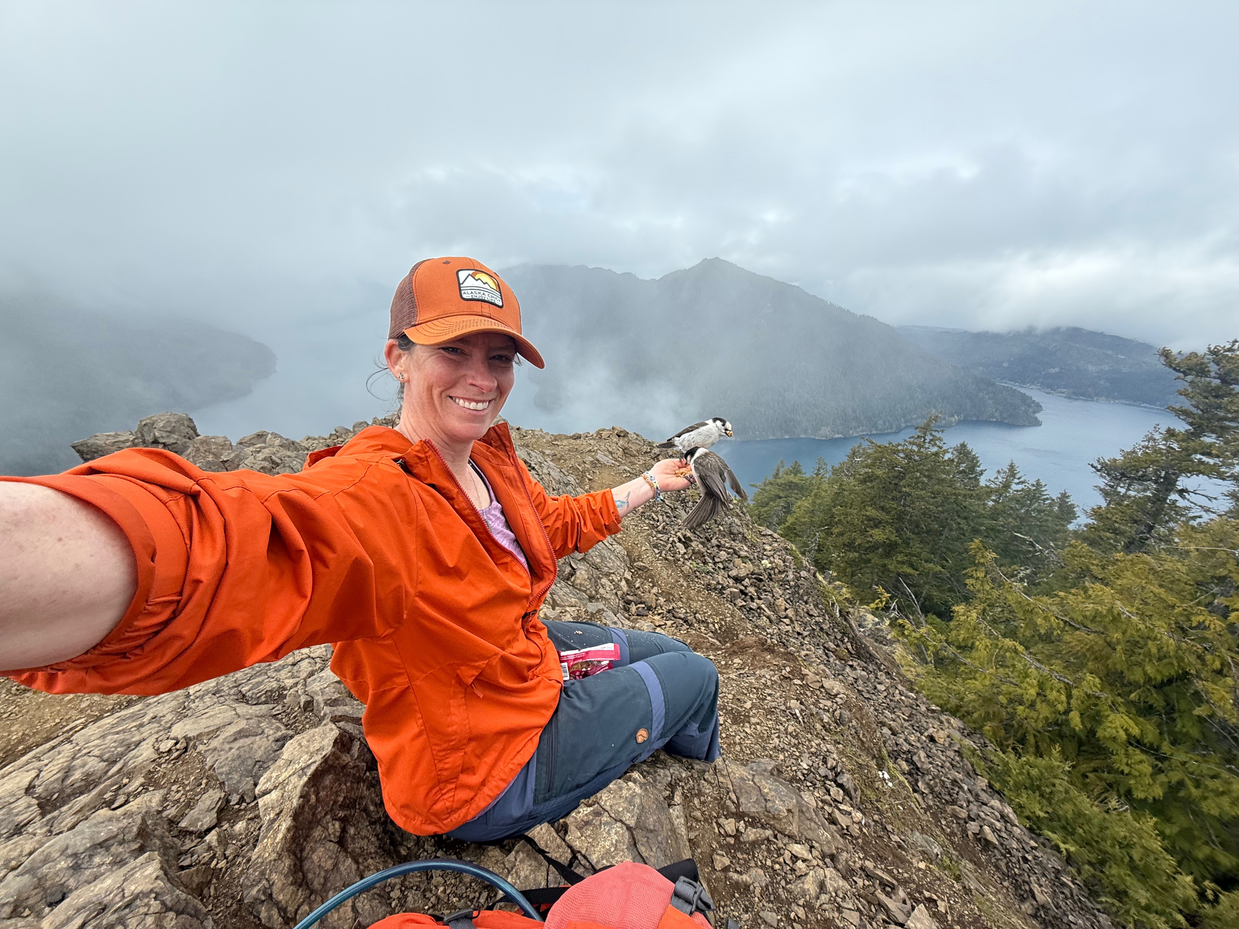
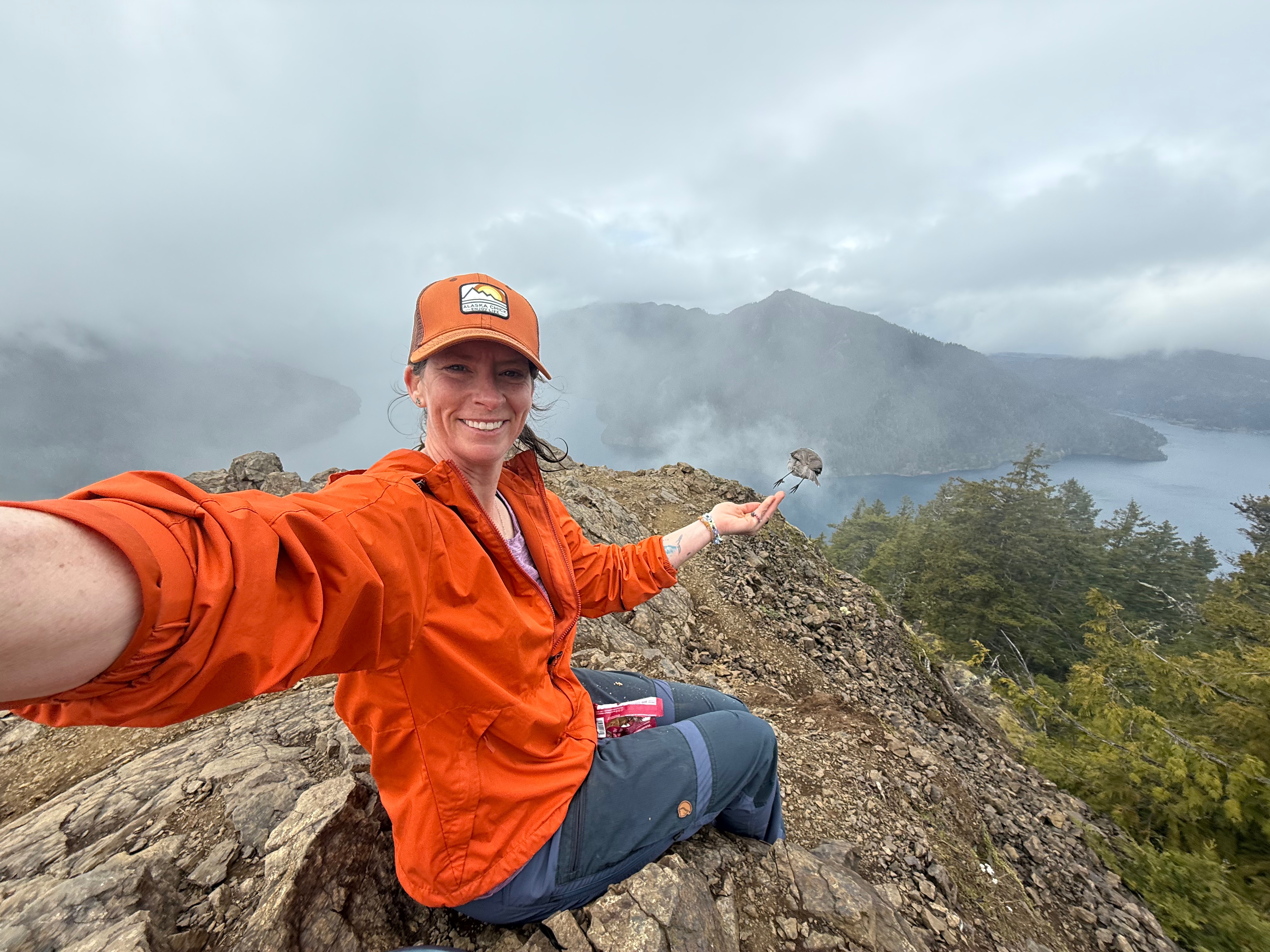
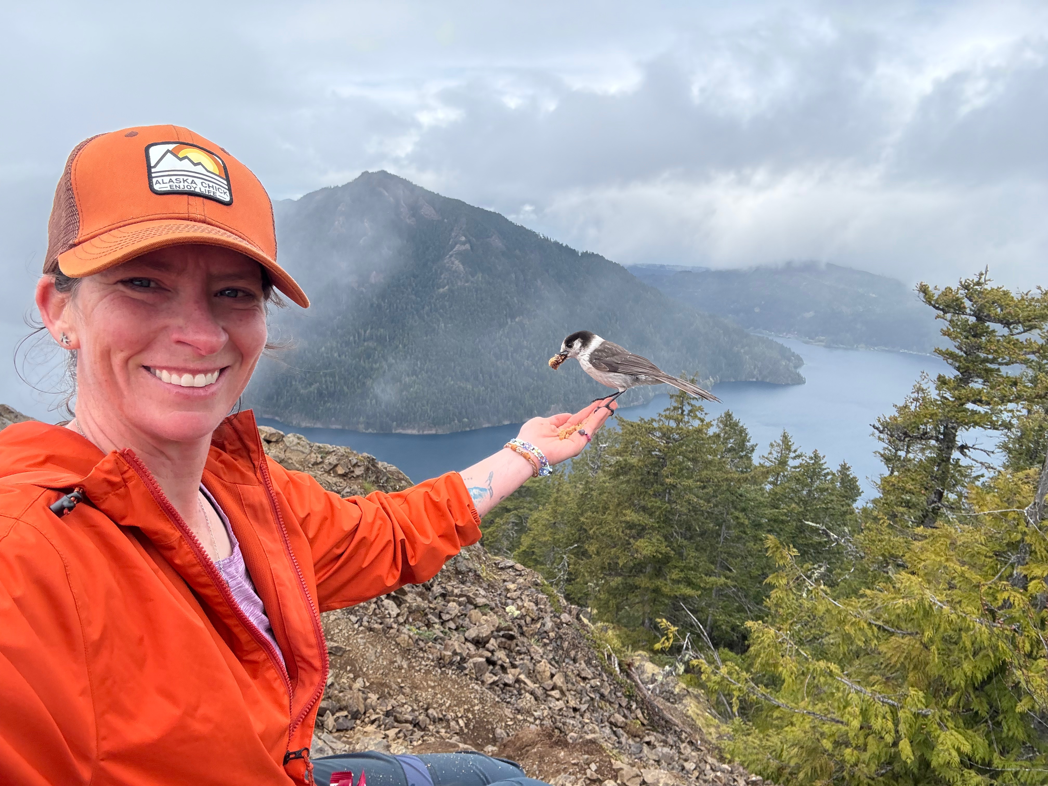
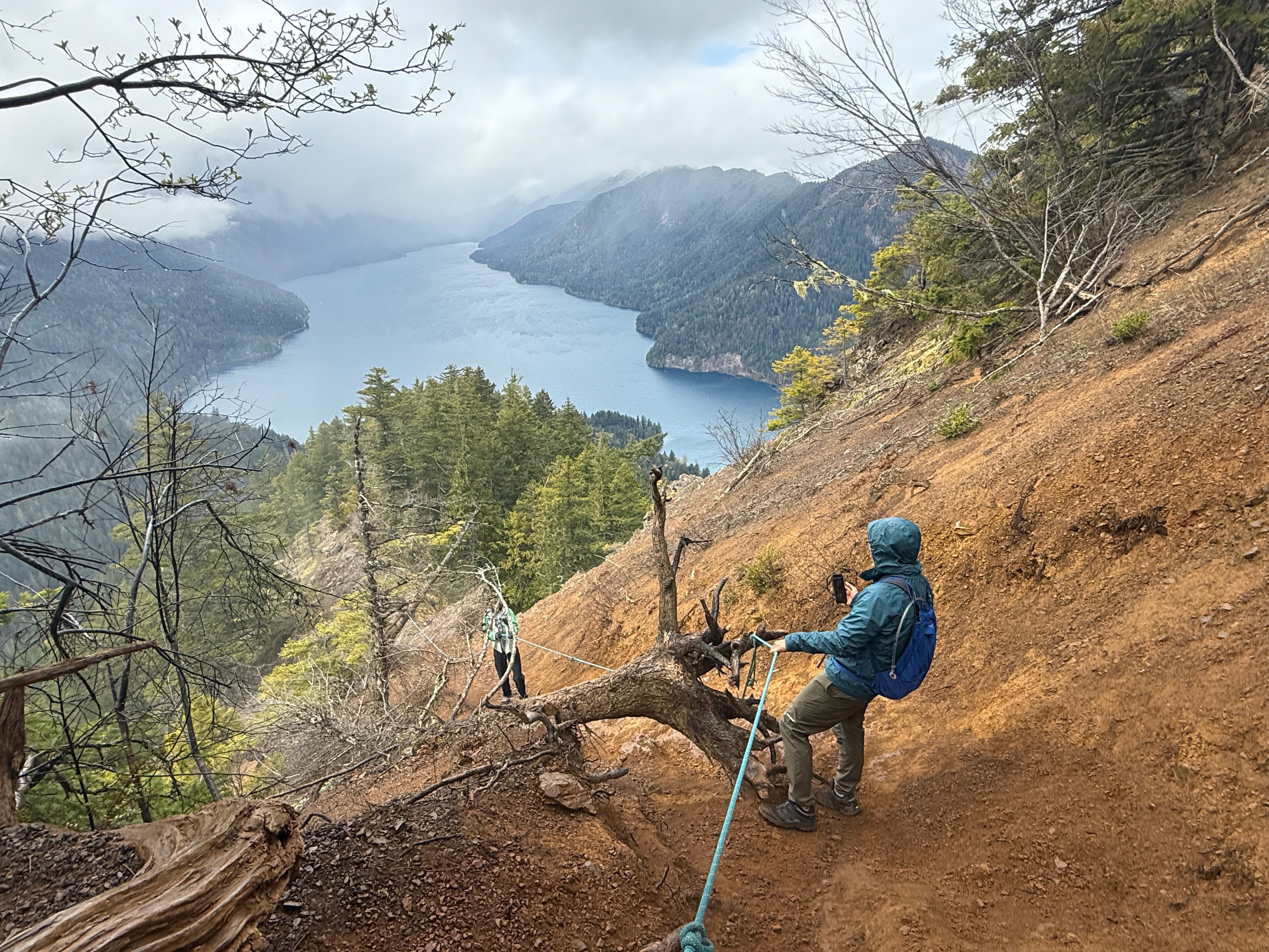
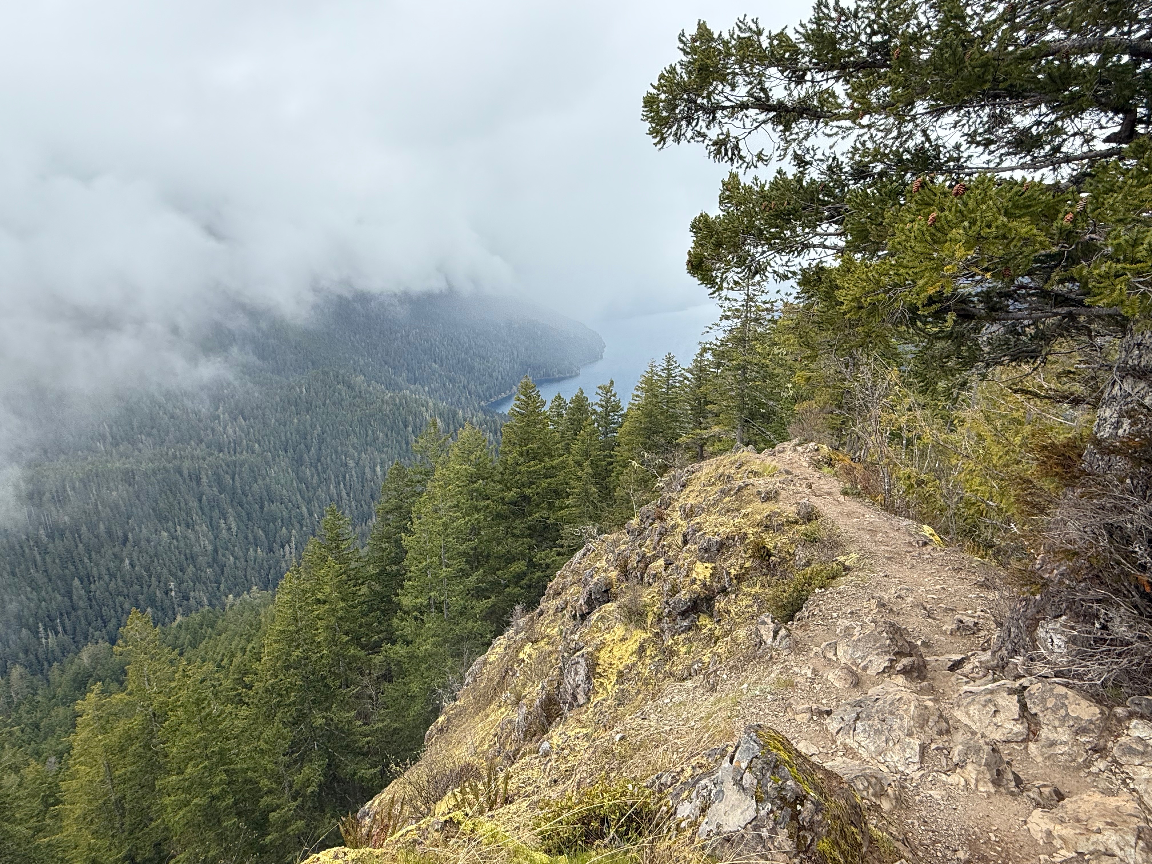
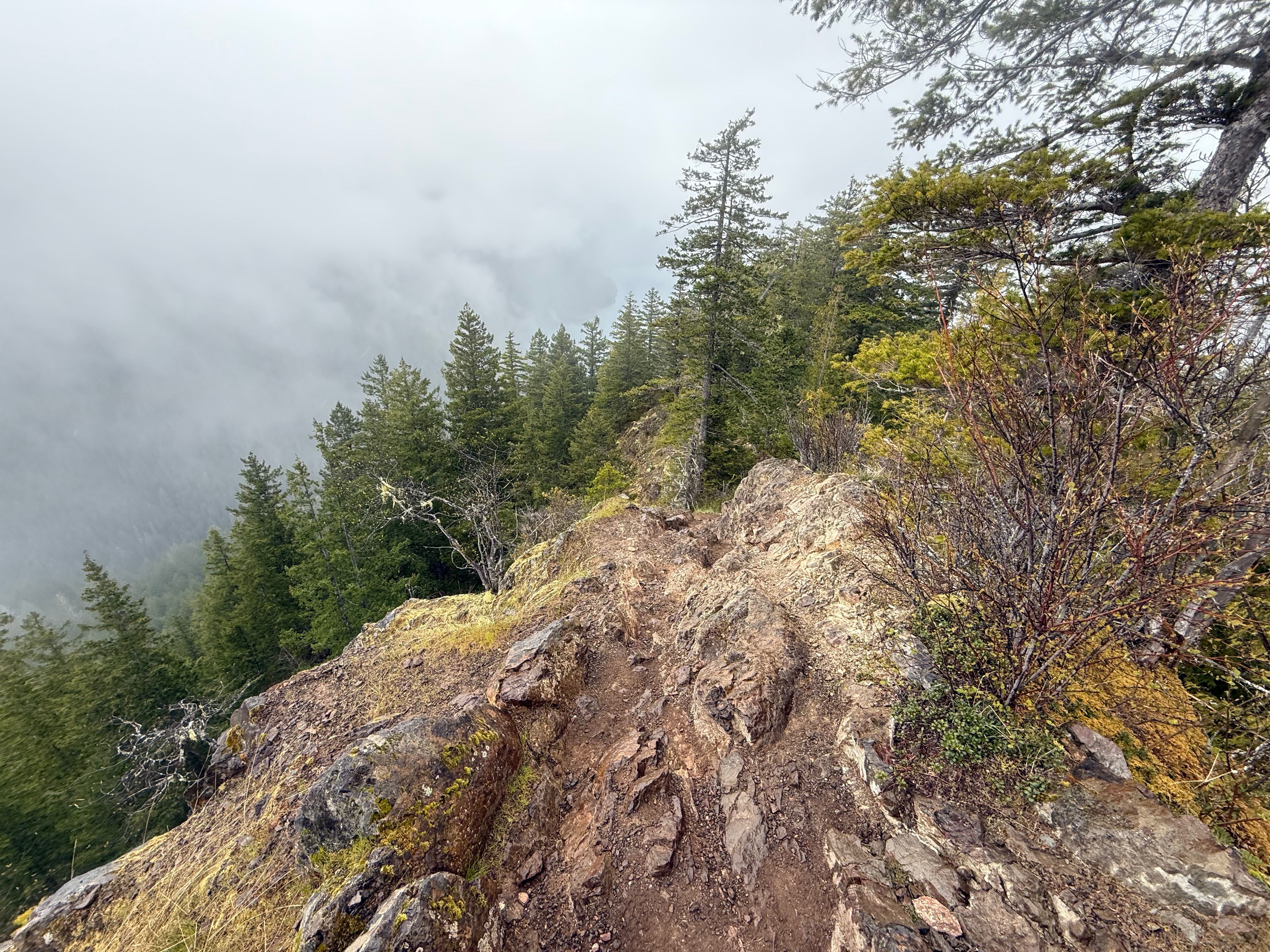
Eventually the trees thinned and Crescent Lake came into view, though the thick clouds still veiled the surrounding mountains. A sign denoting the end of the maintained trail, nailed to a tree, gave me hope that I was close to the final steep ascent to the summit. Gray Jays, opportunistic and brave birds, began to follow me, knowing there would be hand fed treats on the summit.
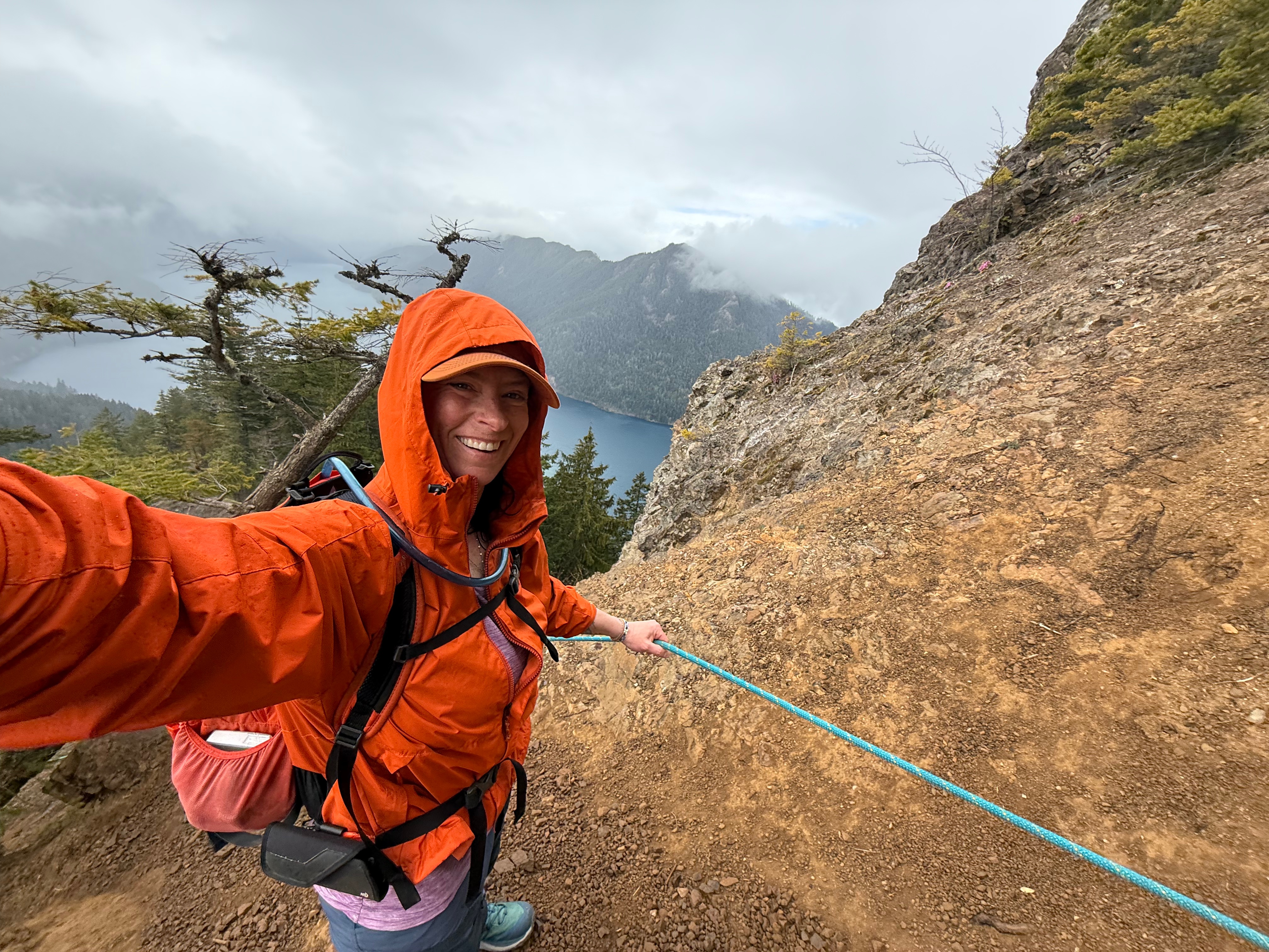
I carefully picked my way along a ridge with some significant exposure and up short, rocky chutes. The rain was making everything slippery and a fall in some of the areas could be fatal, so I walked carefully and with great care.

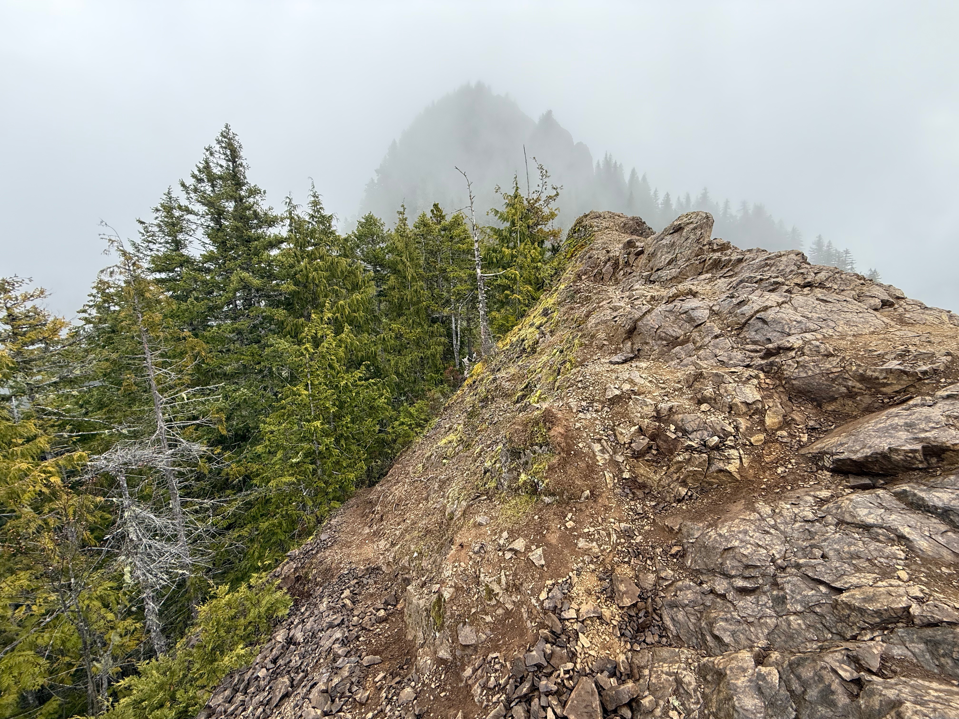
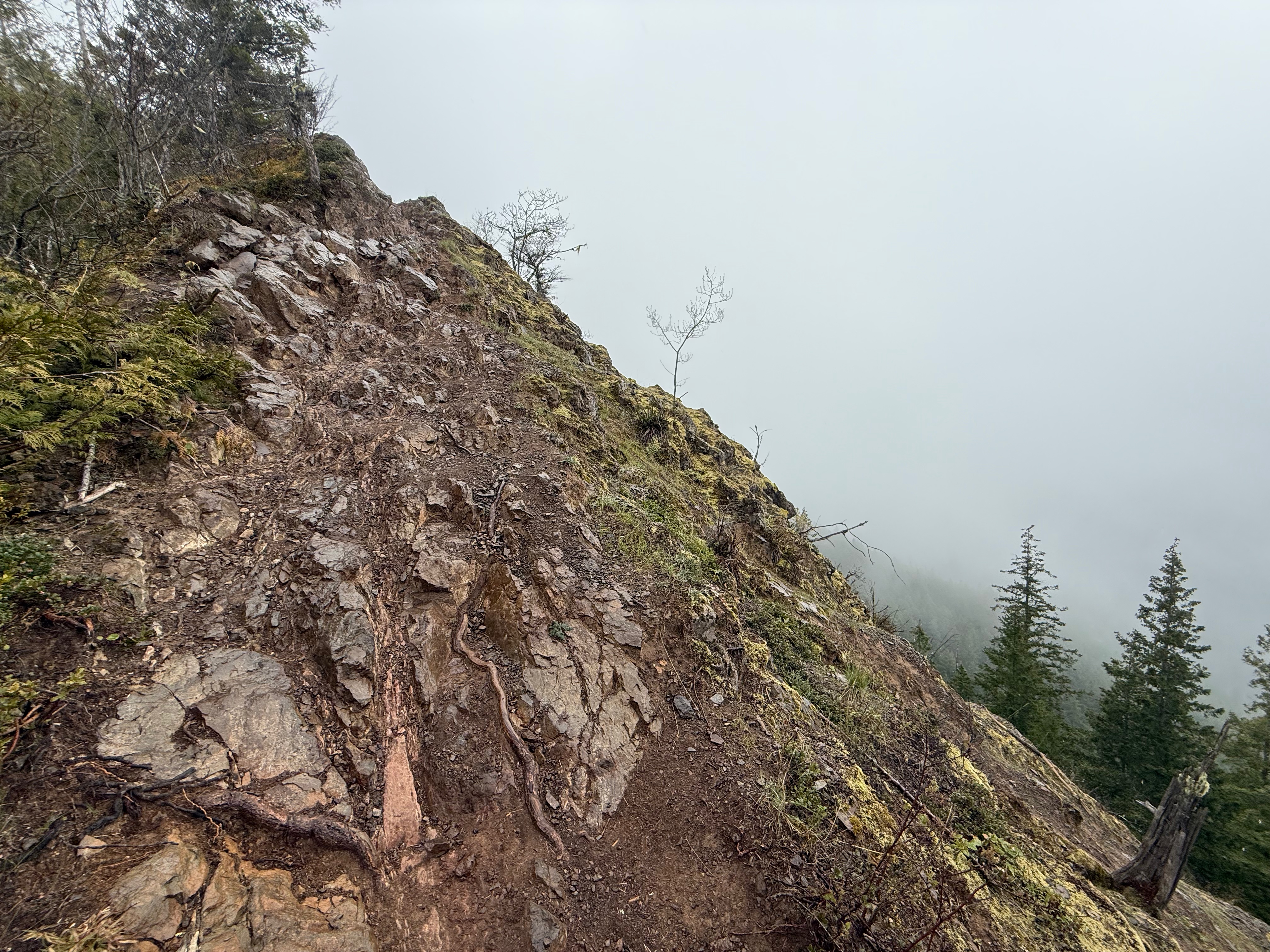
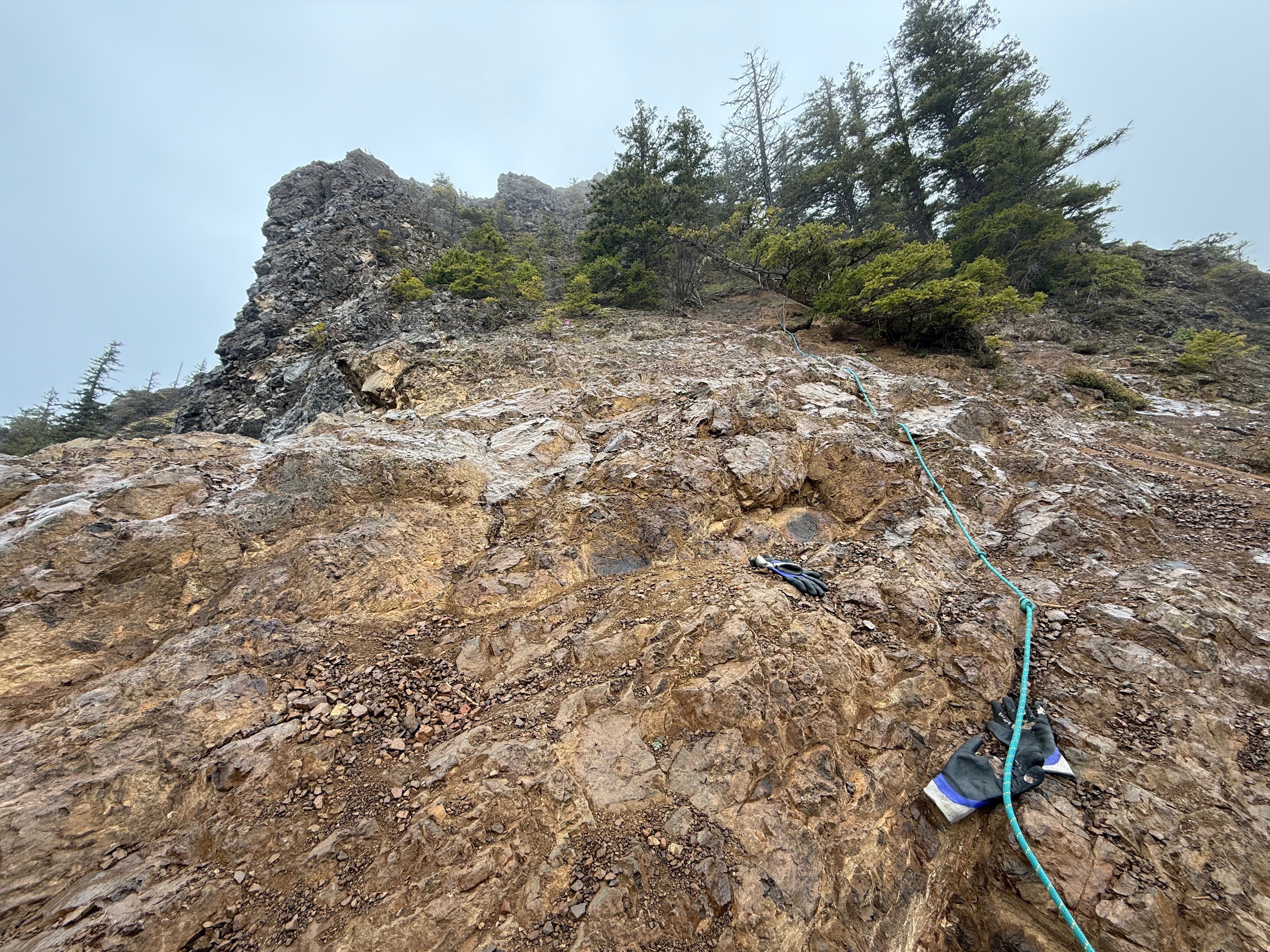
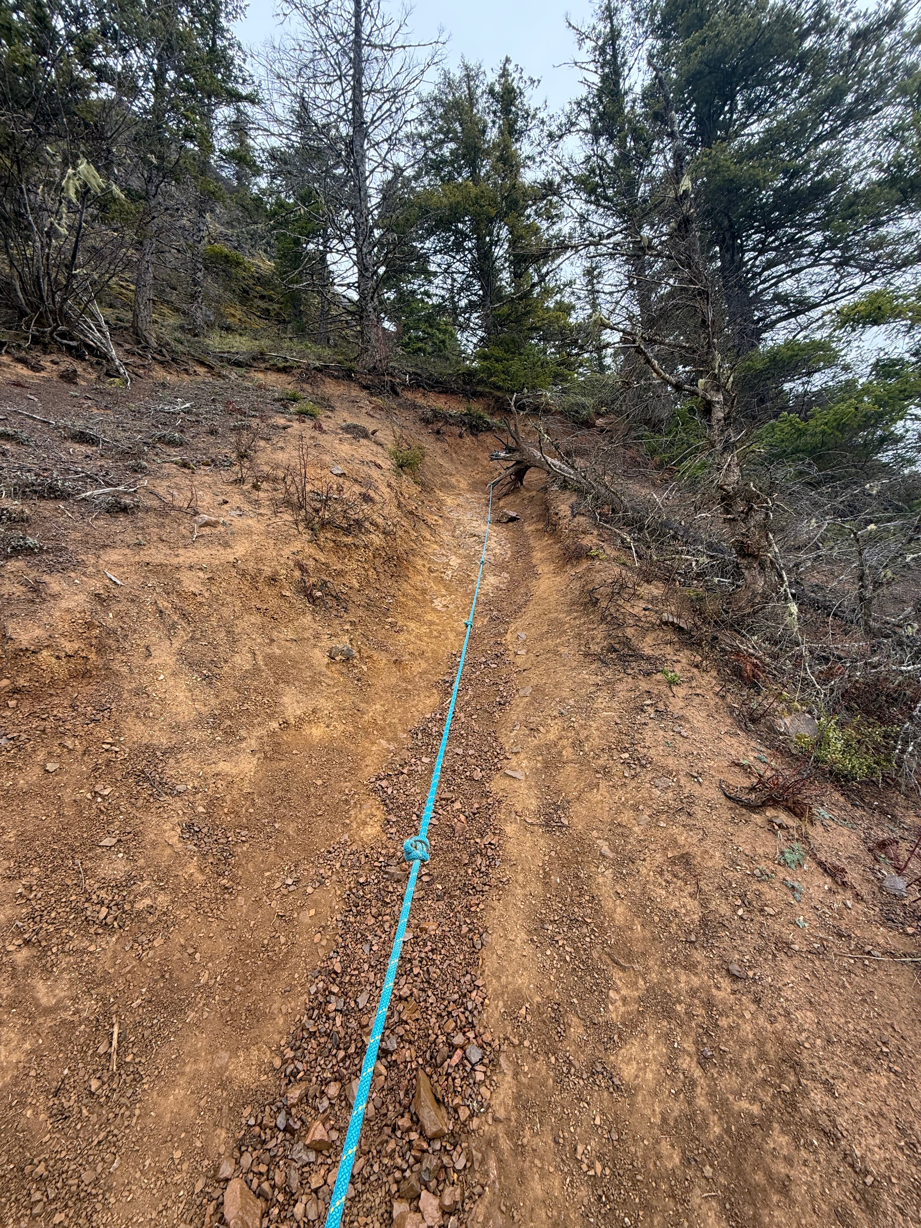
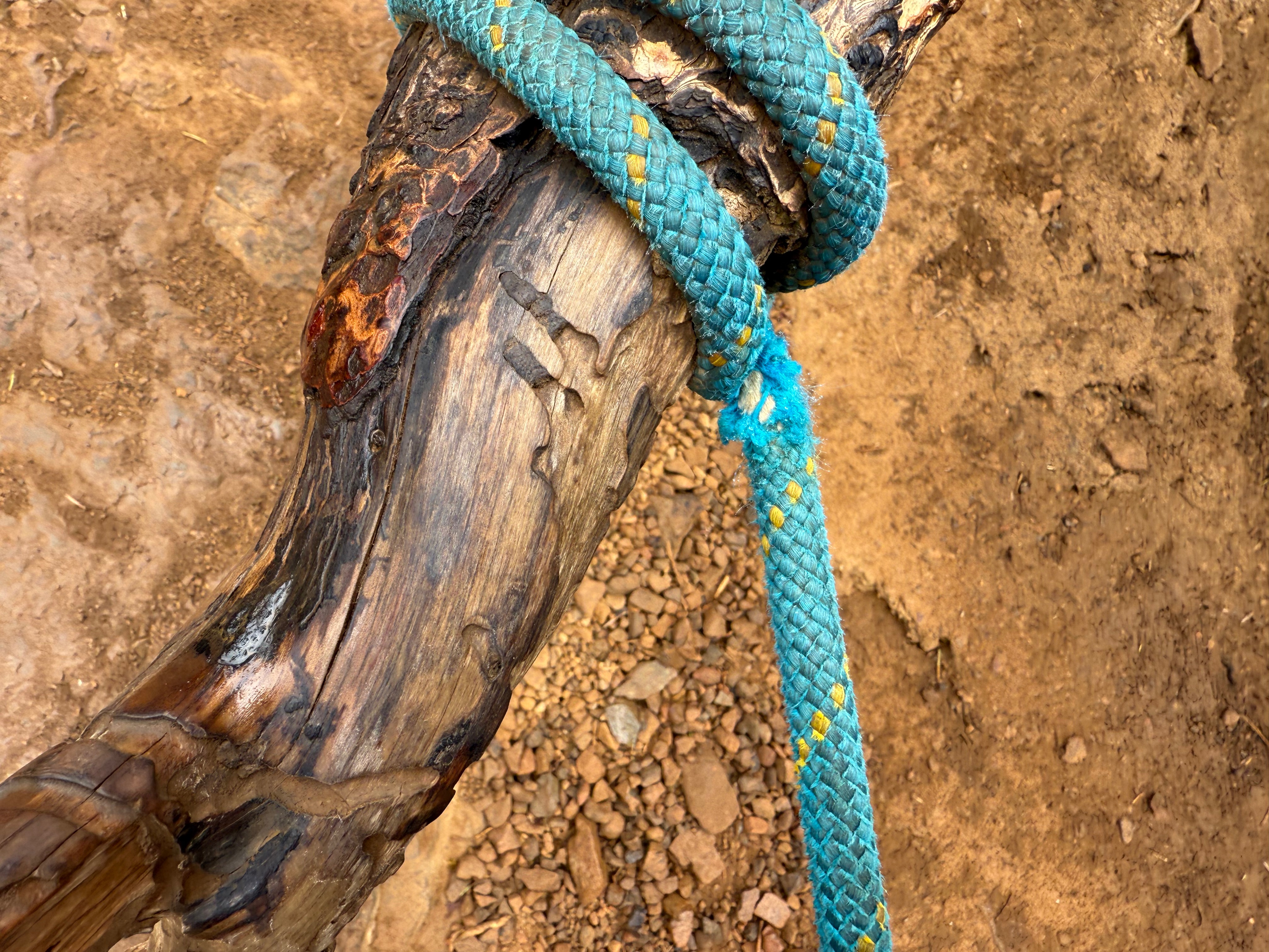
Soon the summit block was in sight, a high point devoid of vegetation and with nearly vertical faces dropping precipitously. A rope dangled down to assist in negotiating the final stretch to the peak, though I soon found it was actually a series of ropes leading around to the west side of the summit block. I hesitated to trust the janky, old ropes and opted to free climb up the slopes. I felt good about my decision to avoid the fixed lines when I saw that one of them had rubbed on its anchor to the point where it was fraying.


As I stood at the bottom of the last 20′ scramble, I hesitated. Starting up, I realized it was high consequence exposure and scurried back down to flat ground. I made a decision to call my hike there and head back down, but I didn’t feel right about it, so I turned back towards the peak, shut off my mind and scrambled up to the summit.


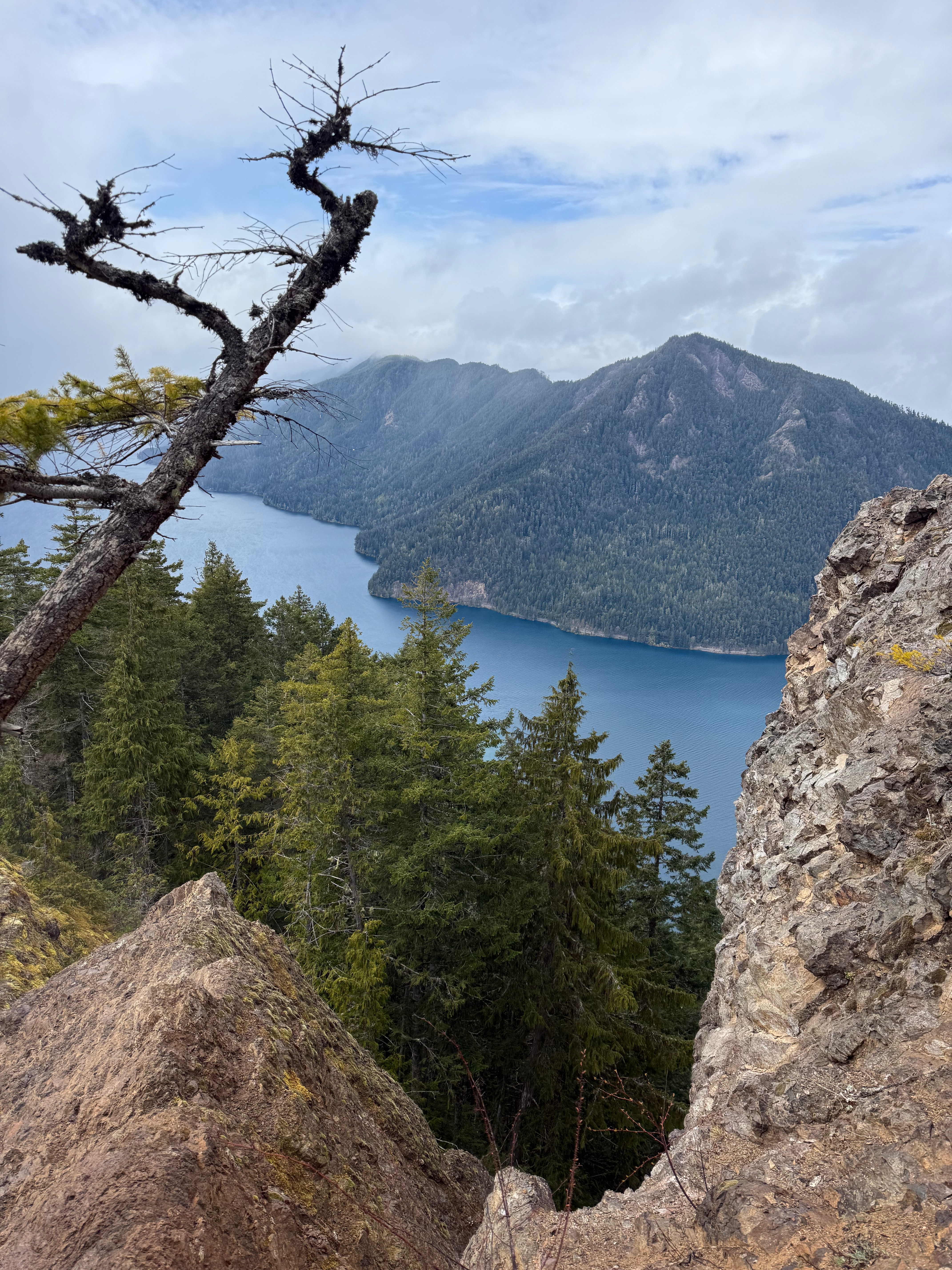
I breathed a sigh of relief before taking in the incredible view of Crescent Lake, suddenly ceilinged by patchy, blue skies and a rain free sky. I couldn’t have timed it any better. After taking some photos, the birds could wait no longer. No sooner had I opened a granola bar and held out my hand than the Gray Jays were circling and landing on me for a meal. One even landed on my phone as I filmed the scenery.
All of a sudden, I started to cry. My emotions were so big after a short 24 hours of healing music and hiking. I felt so at peace and so happy. I was exactly where I was meant to be and felt all of the gratitude.
Although I could have stayed longer, the weather started to move back in and the birds were bored of me, since I didn’t have any more food. I took in the view one more time and turned toward a faint footpath that skirts the summit to its north. I figured it would be easier than downclimbing the wet, steep, rocky summit block, but it definitely was not. Although it was in the trees and had roots for handholds, it was steeper than the front side and a fall would be just as serious here as there.
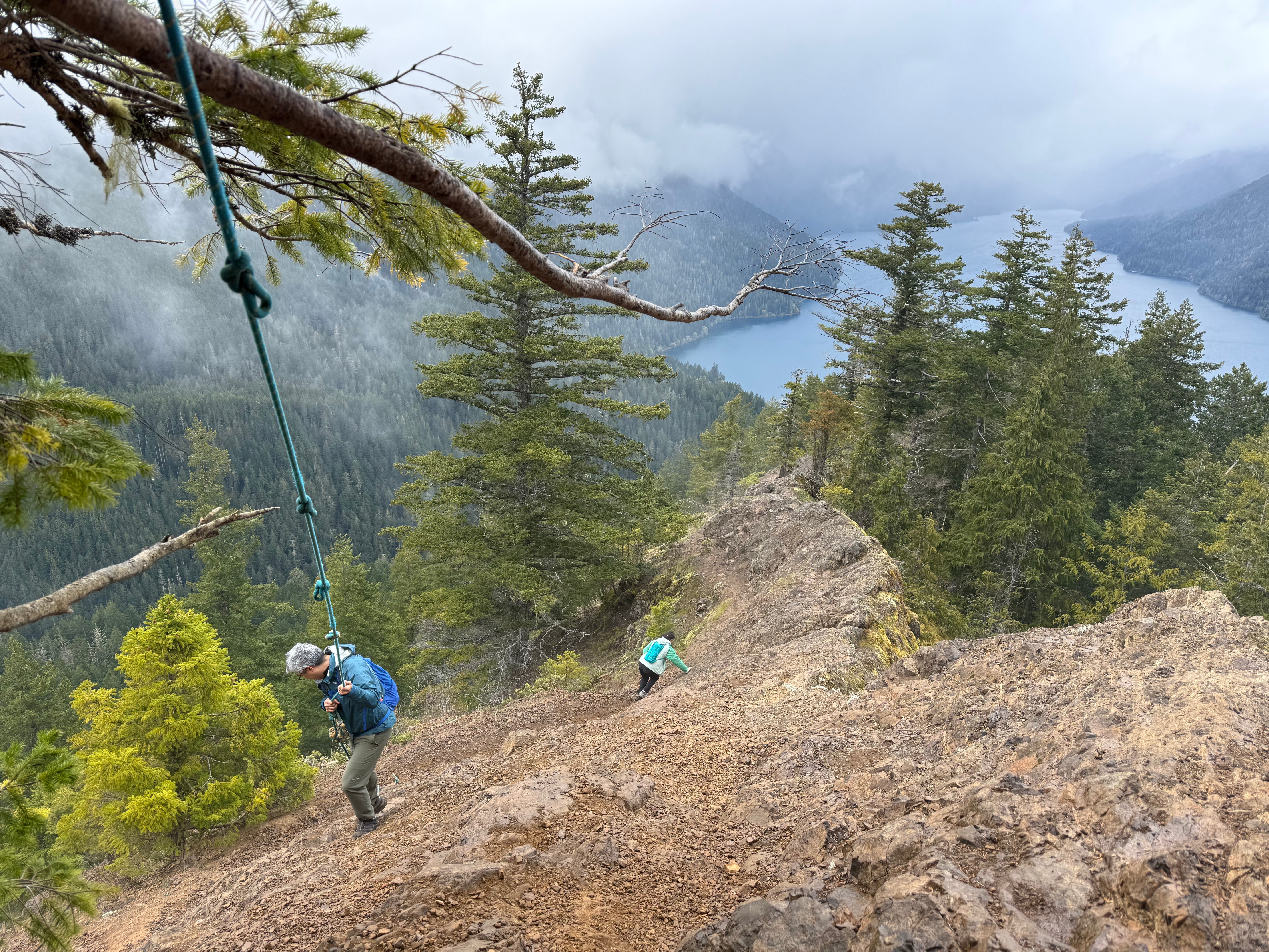


I made it to the bottom of the block safely, but muddier, and started back down the roped section. My confidence in full bloom, and I walked without the assistance of the ropes until I slipped on the ball bearing like rocks. I saw a steep drop below and hoped I would stop sliding before I went off the ledge. My hand instinctively reached out and I was able to grab the rope, stopping my potentially lethal fall. Needless to say, I used the ropes for the rest of the way down to make sure I didn’t make the same mistake.

I descended quickly to the forested section of trail in the pouring rain and began jogging down the switchbacks to the parking lot. I only half an hour, I was back at my rental car and changing into dry clothes. I turned up the heat and drove off with memories of an incredible experience in Olympic National Park.
Mitty Peak AllTrails & Peakbagger Links:


Just the Tips:
- This trail has significant and high consequence exposure at the summit of Mitty Peak. Use caution all the time and remember it is more difficult to climb down than up.
- Many resources list this hike as “Mt Storm King” but the actual summit of Mt Storm King is miles further up the ridge. The overlook is listed as Mitty Peak by the USGS.
- Leave No Trace and pick up any trash you see on the trails. The limited staffing at the National Parks makes it almost impossible to keep everything clean unless we all pitch in.
- There is a $30 fee to enter the National Park. This fee is good for 7 days. Consider an America The Beautiful Pass if you plan to travel to more National Parks in the same year. There is a QR code posted at trailheads to pay the fee without stopping into the ranger station.
Recent Trip REports:
Where the Clouds Parted: A Knoya, Kanchee and Nunaka Ridge Walk
May 31, 2025 Knoya: 4600′ – FR #17 Kanchee: 4393′ – FR #20 Nunaka point: 3780′ Mileage: ~14 Miles Elevation Gain: ~5000′ The summer wasn’t summering, and I was suffering from a bout of springtime depression that only sunshine and warm weather could cure. I dragged myself to the Klutina Trailhead to meet Jason. We…
Pedals, Peaks and Thunderstorms: Bike and Hike Mount Margaret in Denali National Park
May 25, 2025 Mount MArgaret: 5069′ Denali NAtional PArk Mileage: 4.6 Mile Bike/4.6 Mile Hike/4.6 Mile Bike Elevation Gain: 2,750′ This year’s annual mother/daughter camping trip in Denali National Park looked a little different from our normal stay at Riley Creek Campground. The Labor Day prior, we decided our next trip would be to Savage…
Chasing the Wind: A Long-Awaited Victory on Peak 1216 and Ship Creek Hill
April 26, 2025 Peak 1216 AKA 3990: 3990′ Ship Creek Hill: 3842′ (chugach Front Range Peak #24) Mileage: 15 Miles Elevation Gain: 5,700′ The majority of the Southcentral Alaska winter of 2024-25 was uncharacteristically warm and relatively snow free, but here we were in April, with record breaking snowfall around Anchorage. The ridges and peaks…
