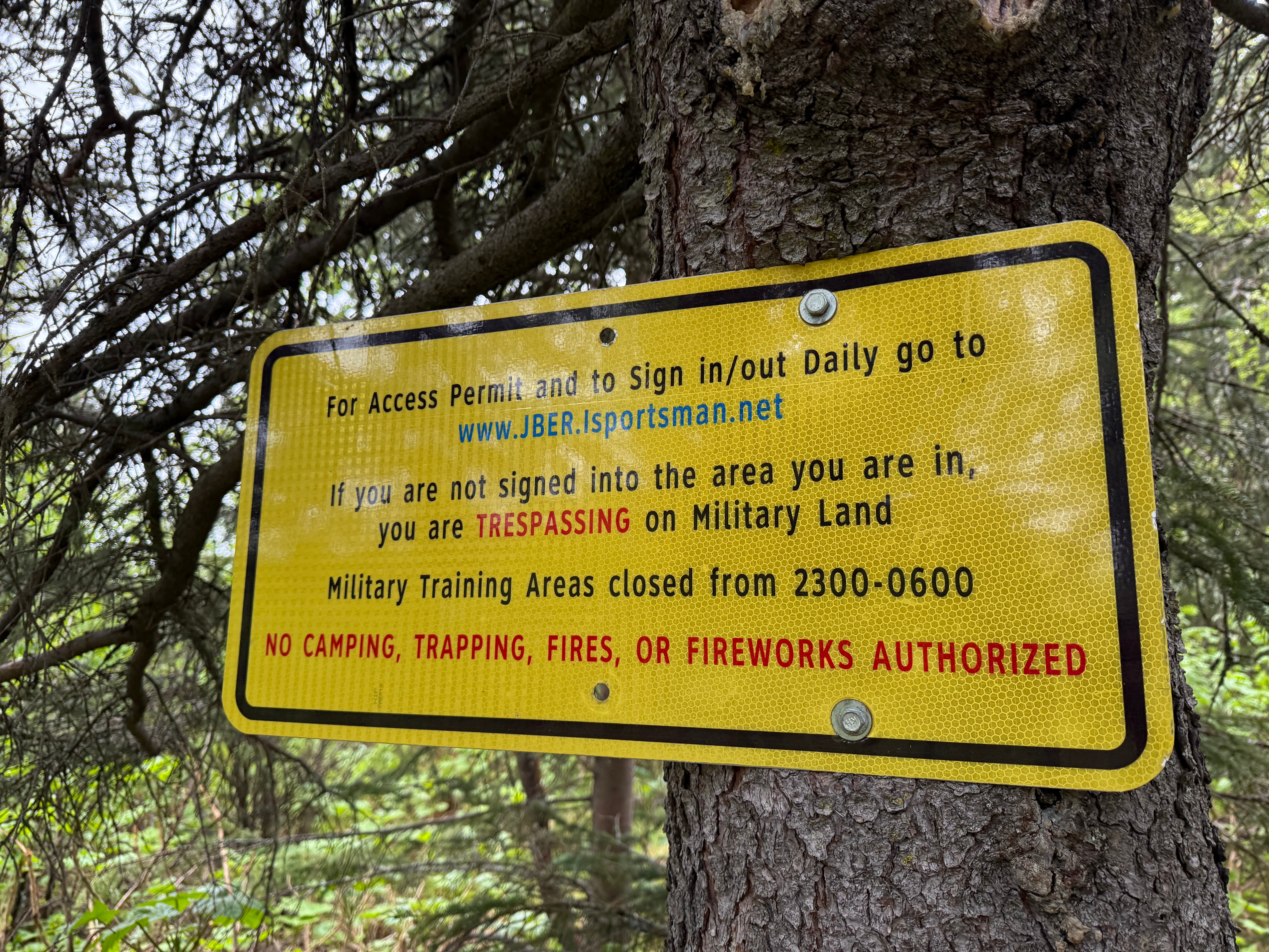
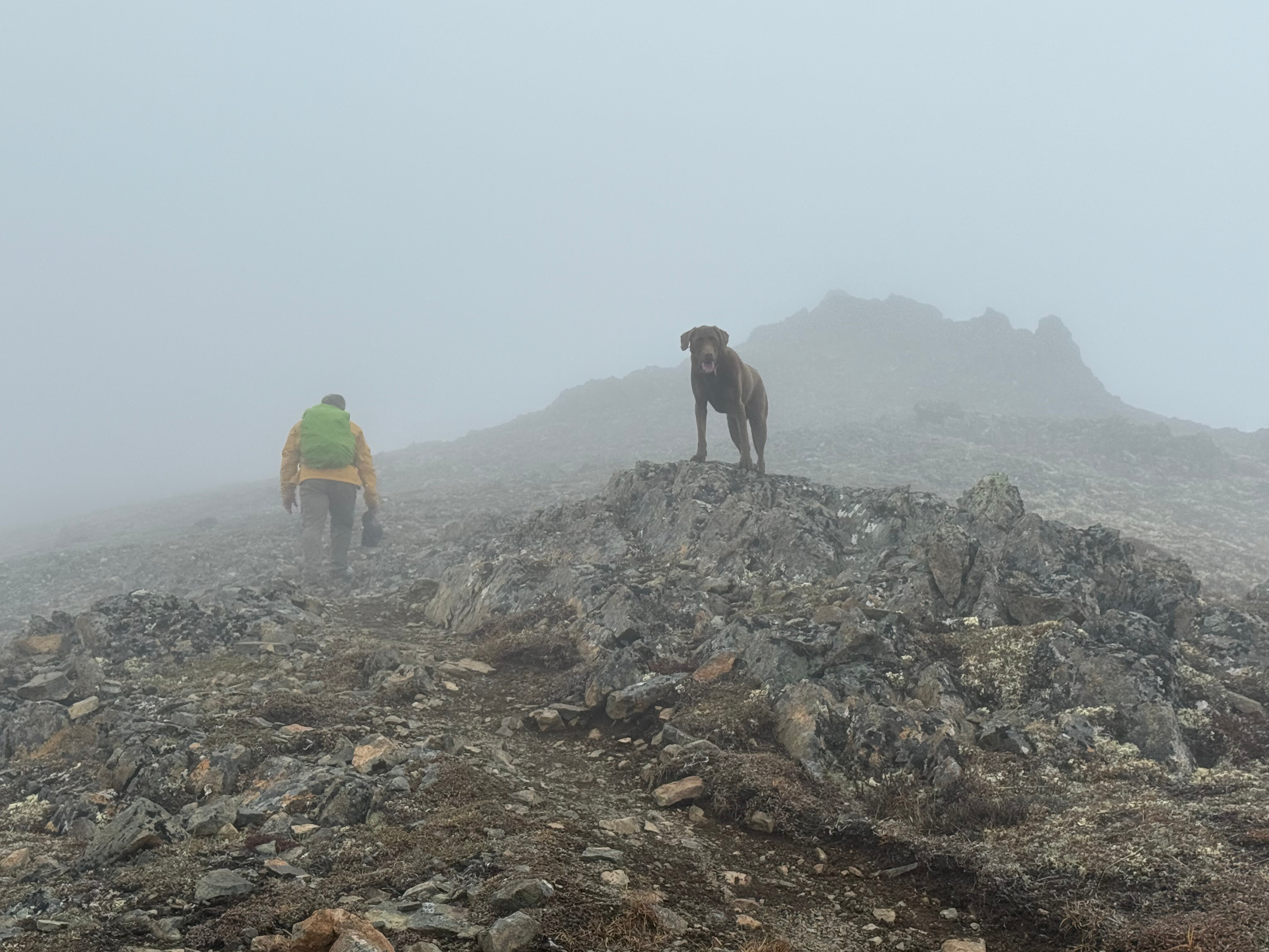
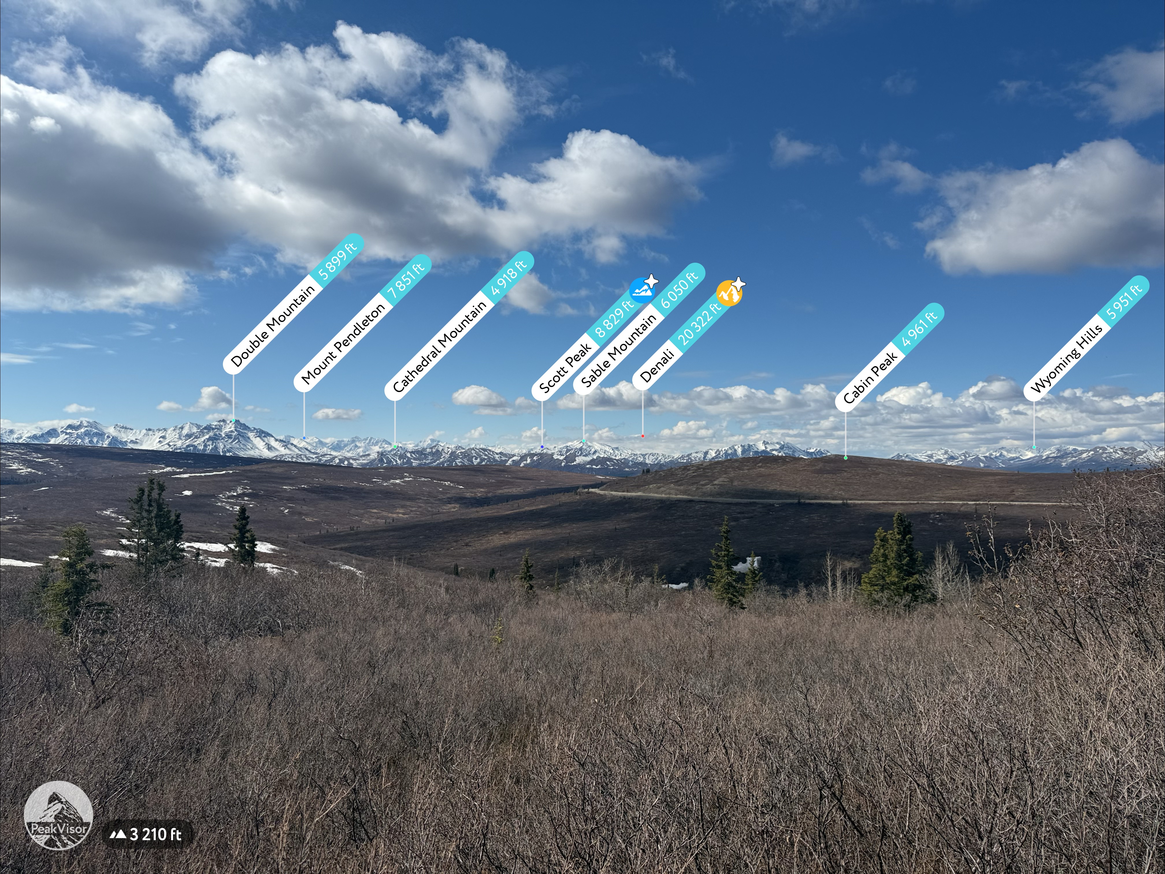
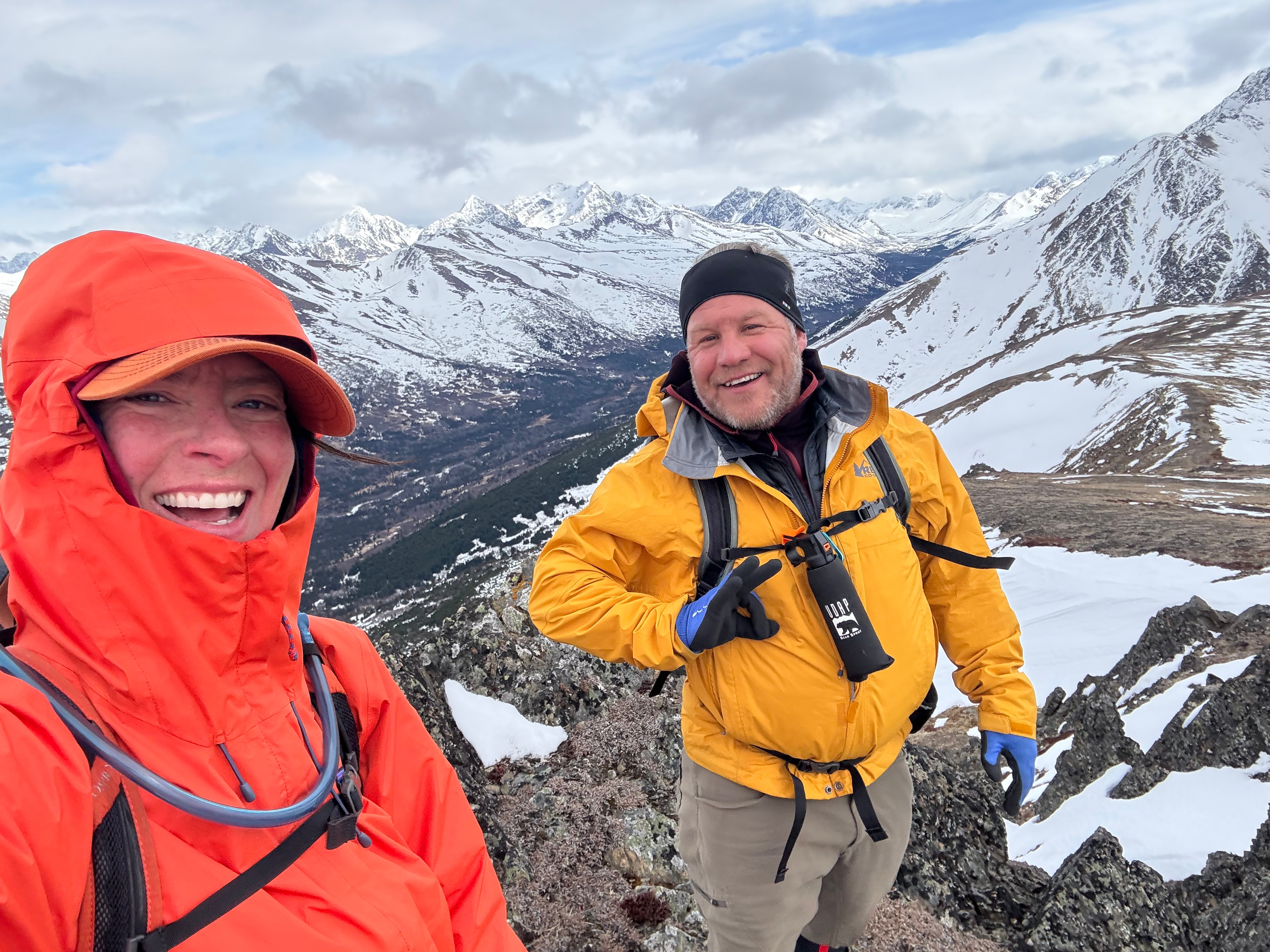
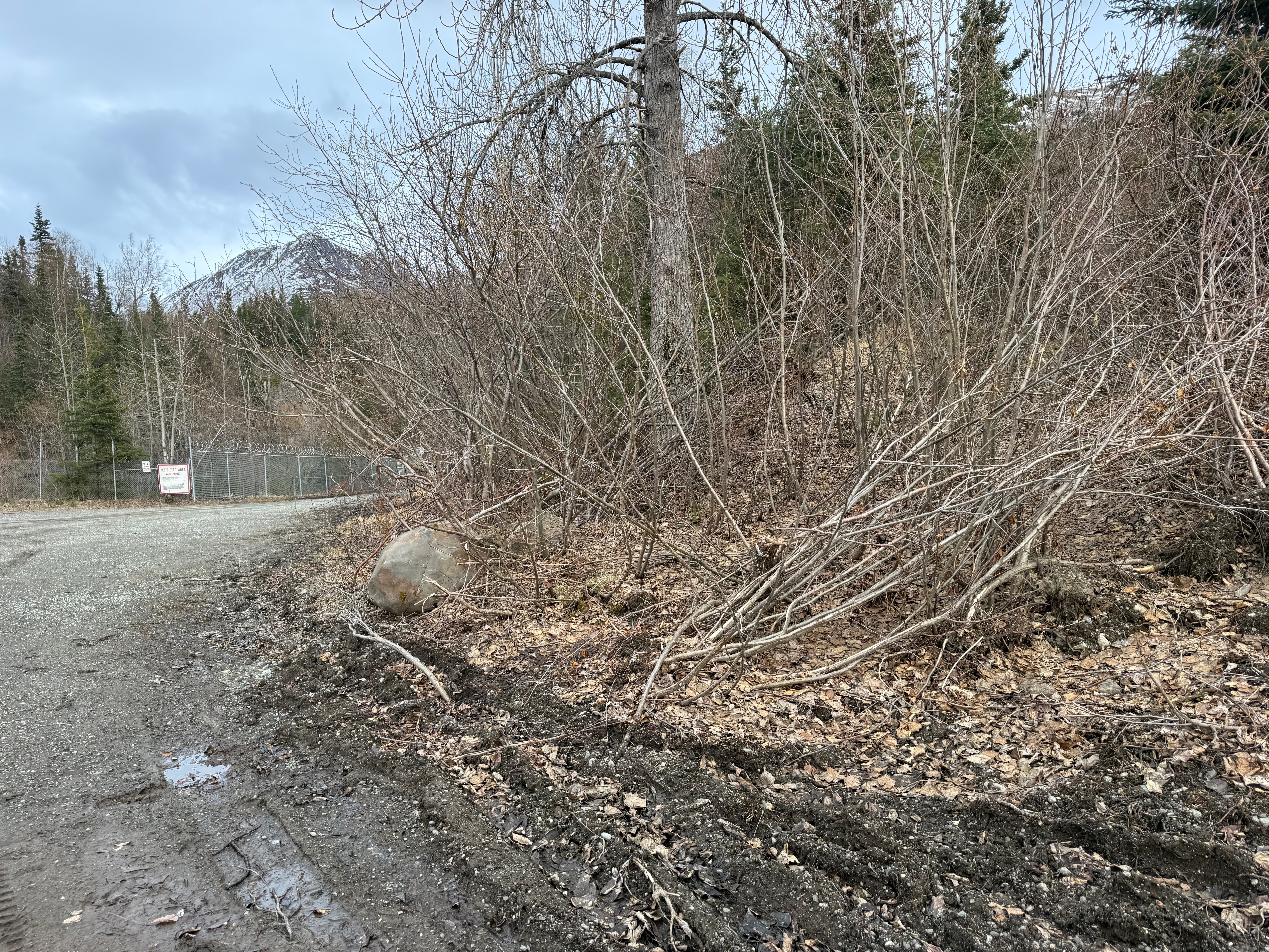
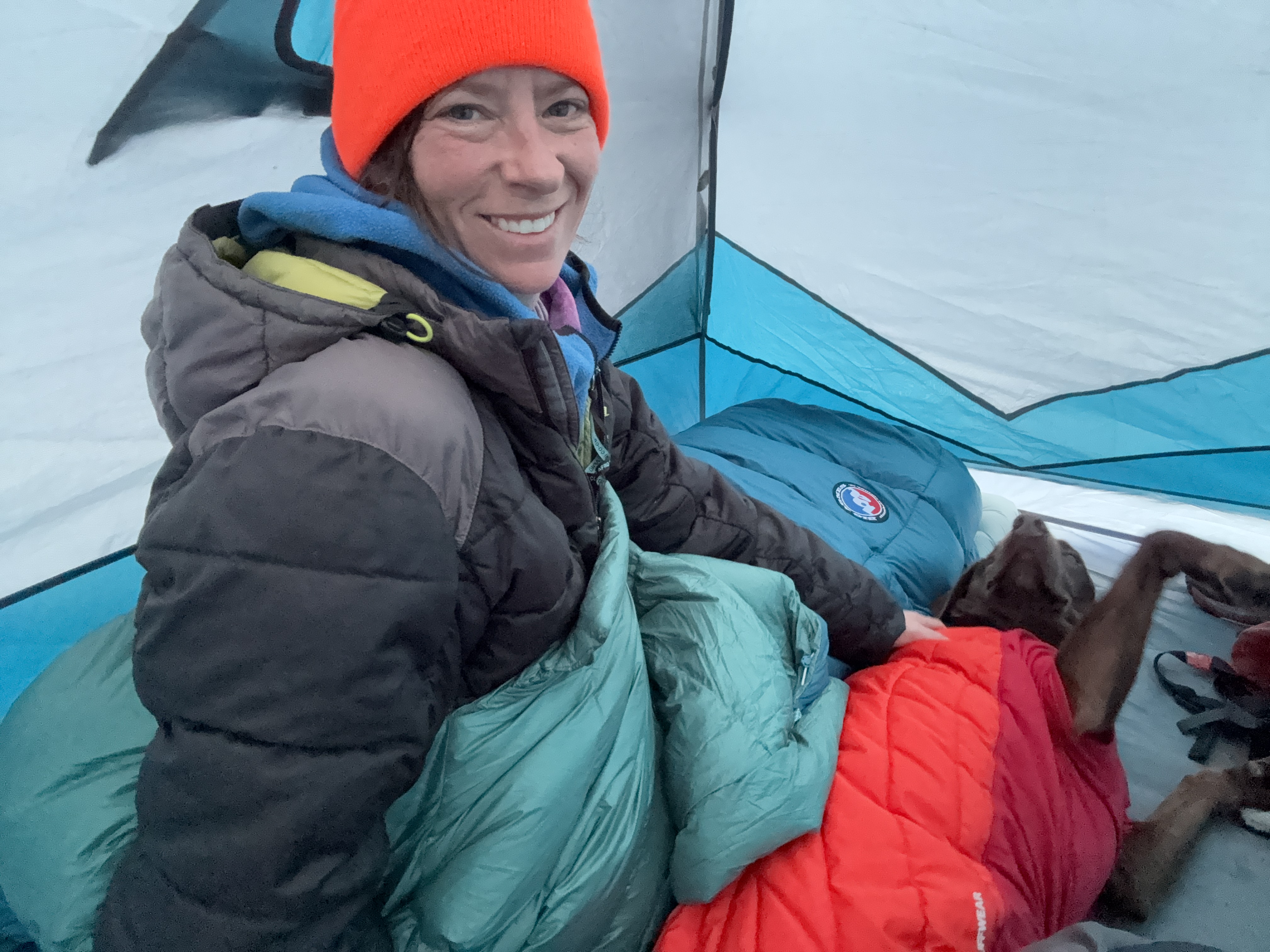
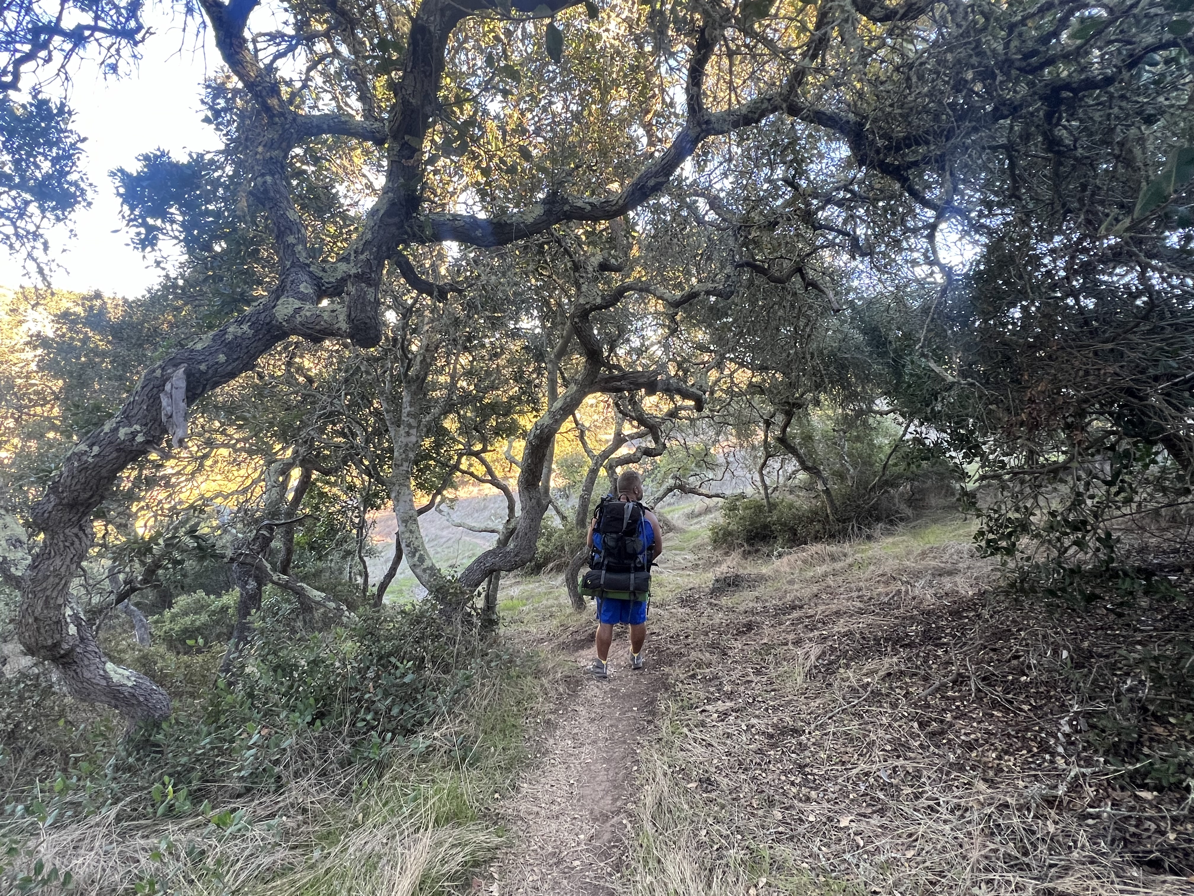
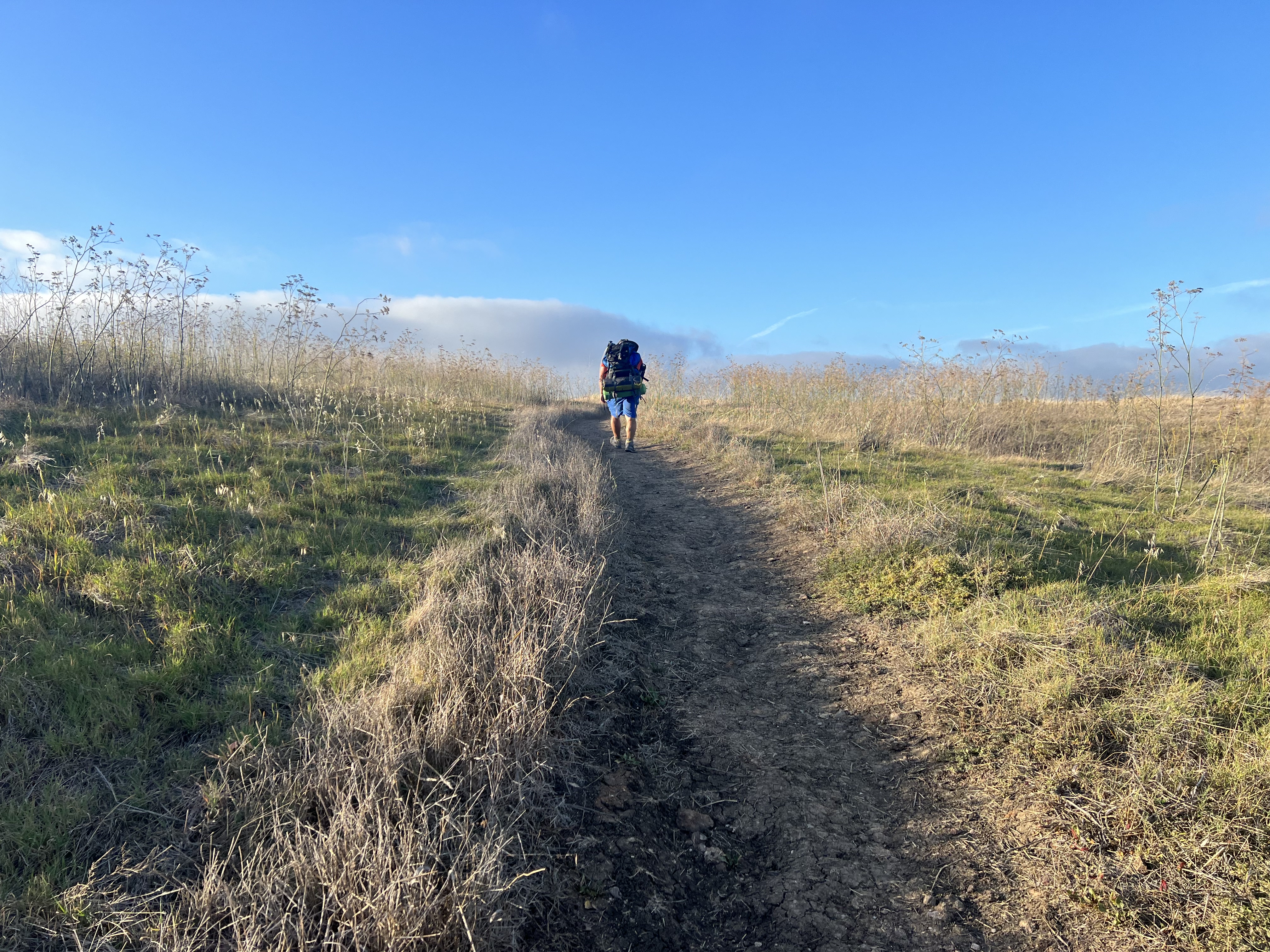
The summer wasn’t summering, and I was suffering from a bout of springtime depression that only sunshine and warm weather could cure. I dragged myself to the Klutina Trailhead to meet Jason. We left one vehicle there and carpooled up to our starting point at Stuckagain Heights—neither of us particularly excited to hike in the fog and rain. After a bit of complaining, we checked in on the JBER RecAccess website for the areas we’d be hiking and set off toward The Dome.
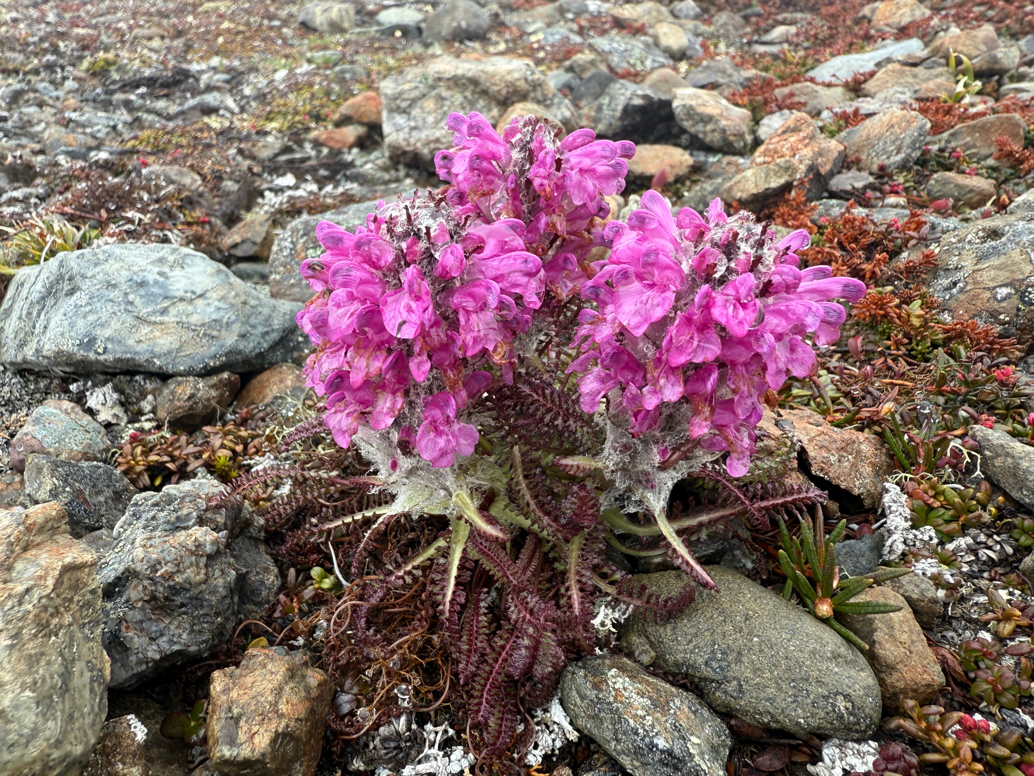
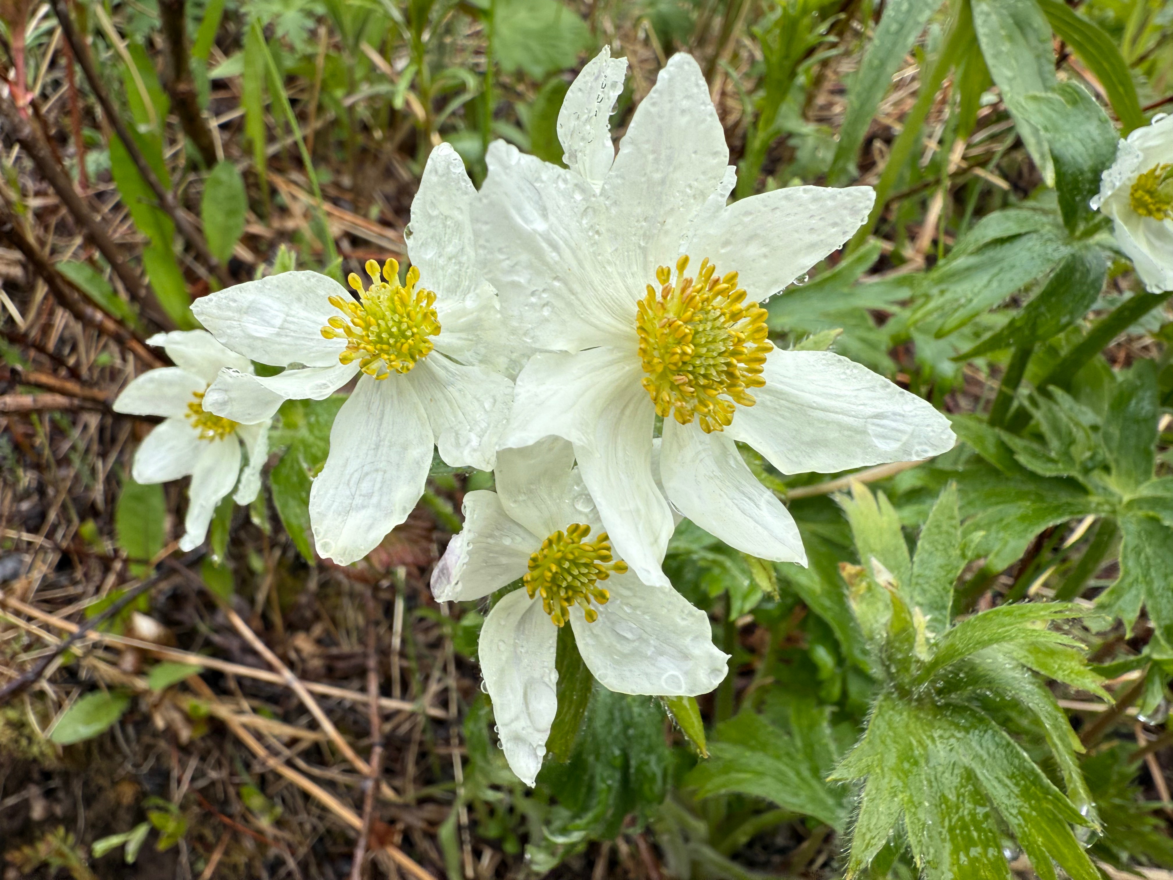
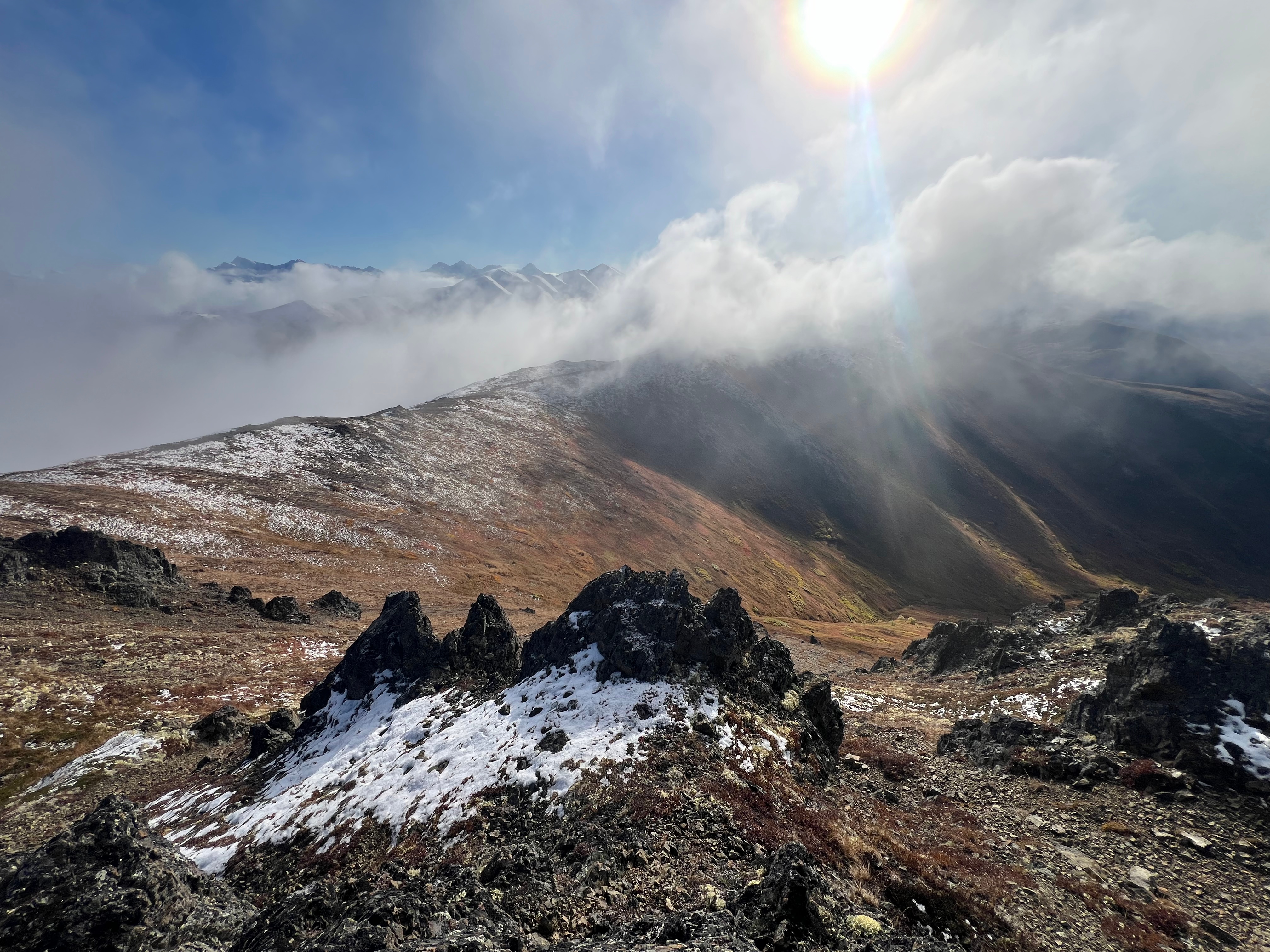
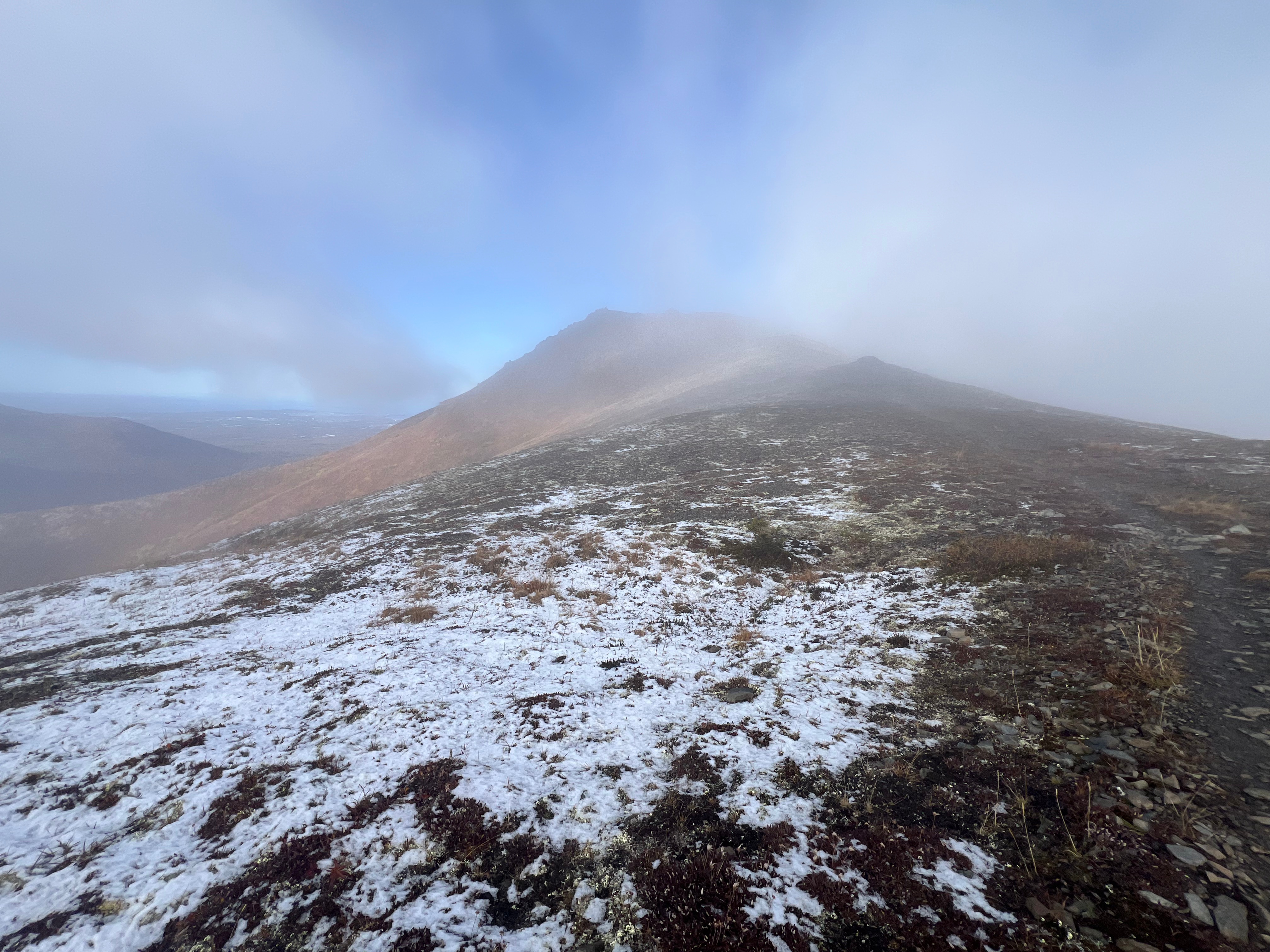
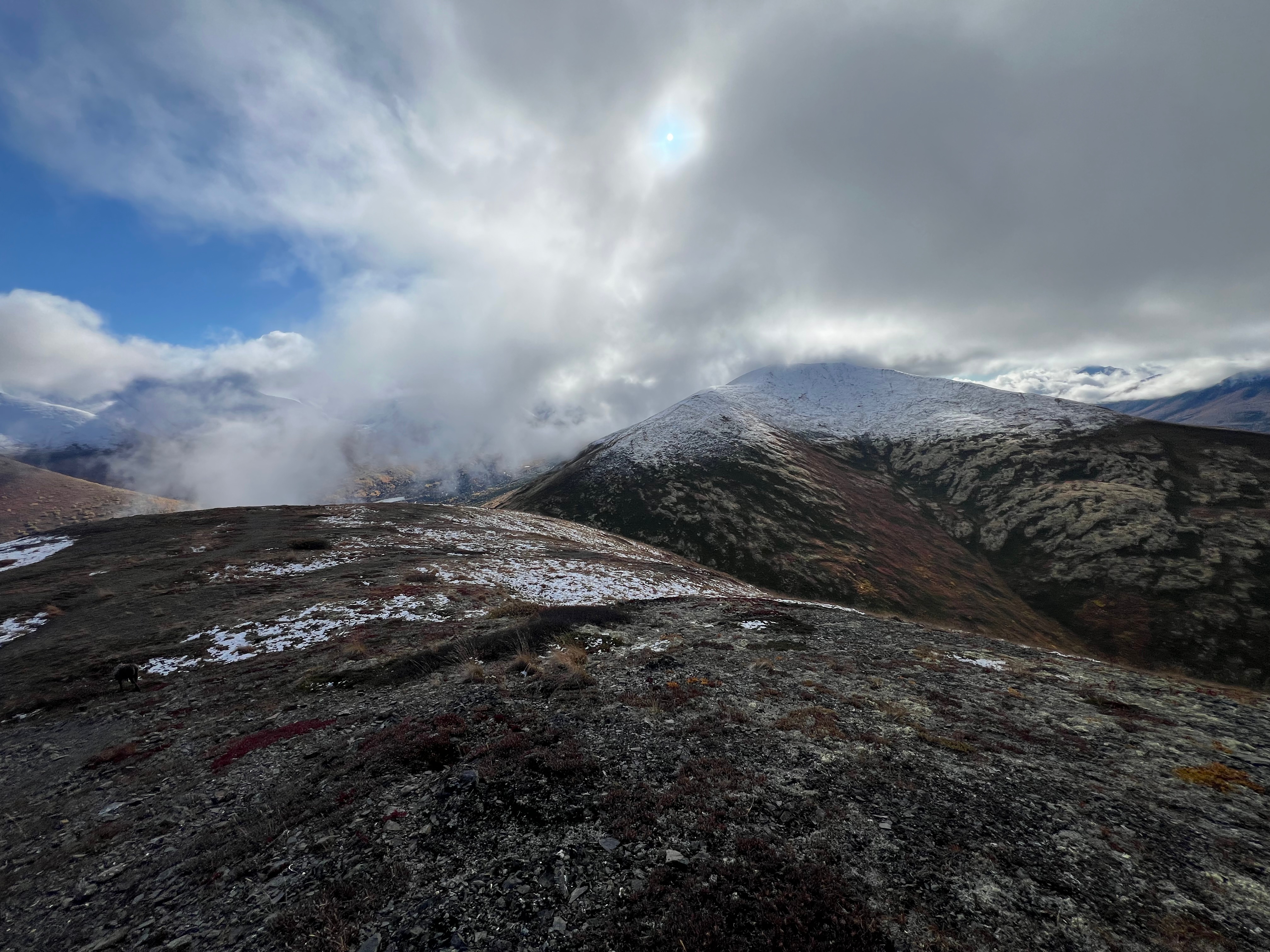
Within two miles, we had already passed a variety of freshly blossomed wildflowers and the Long Lake Trail. Not long after that, we were above the treeline and deep in the fog. As we trudged along in our respective gloomy stupors, craving warmth and sunlight, little glimpses of blue sky would peek out from behind the thick clouds, offering slivers of hope.
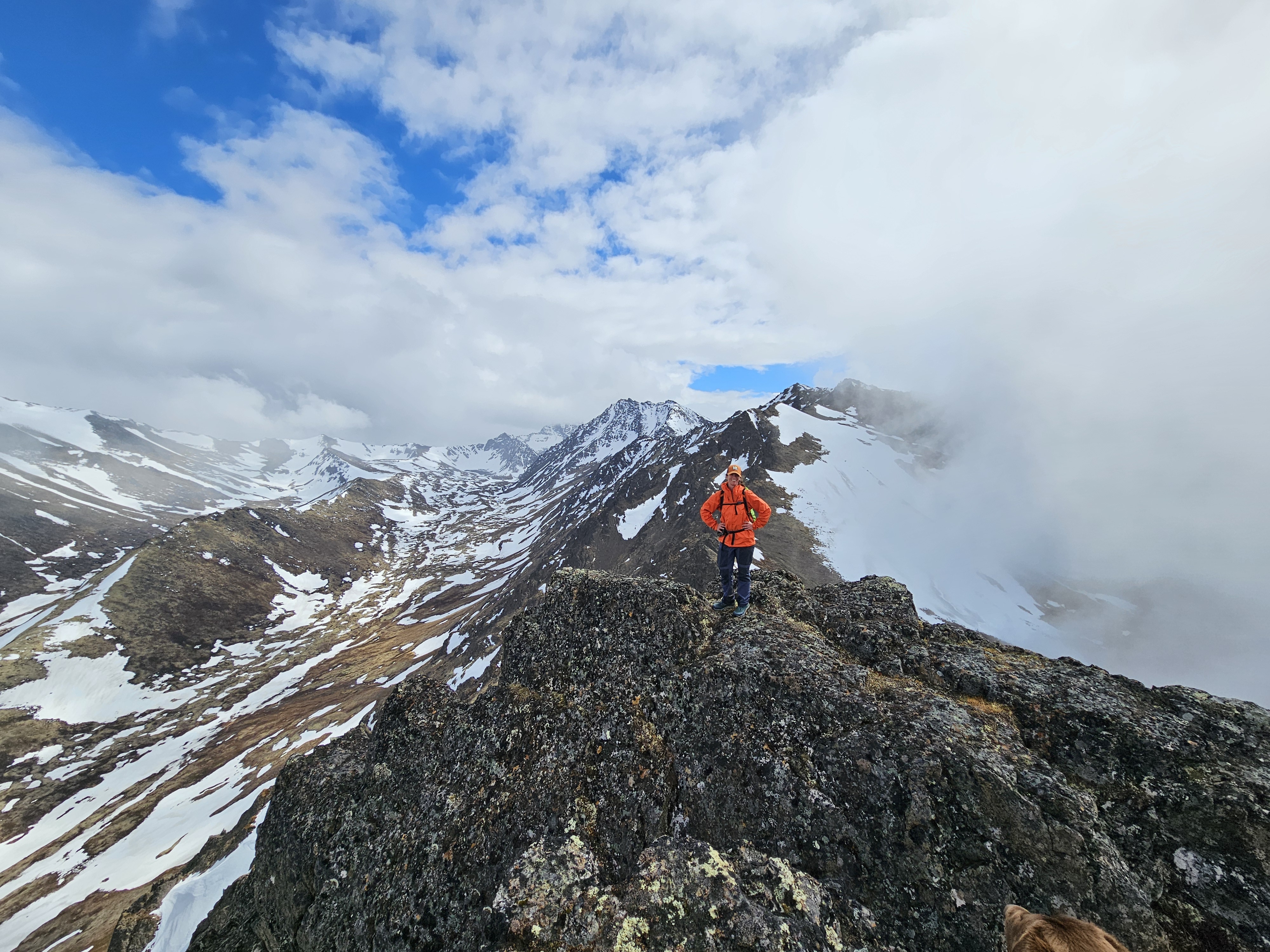
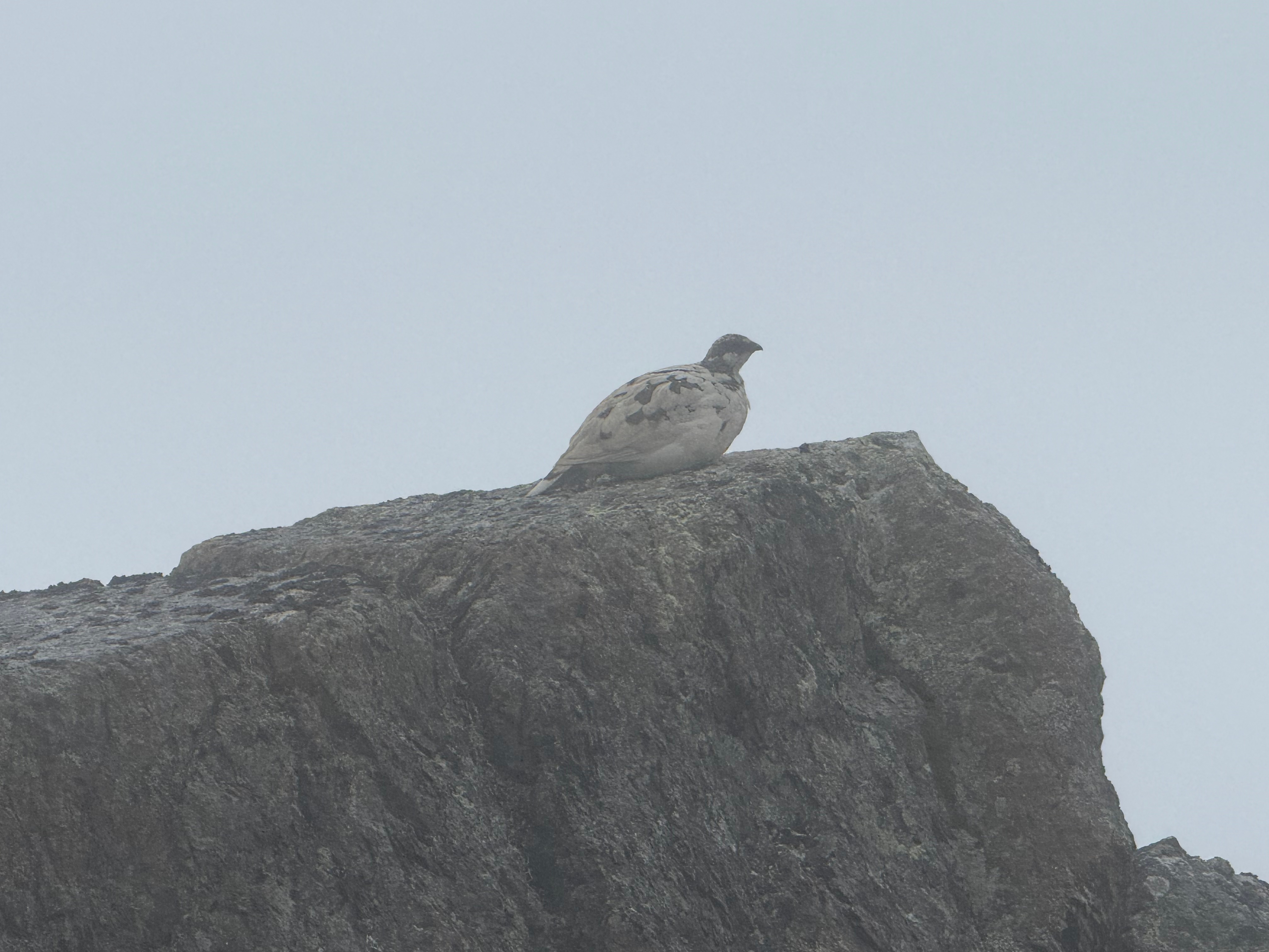
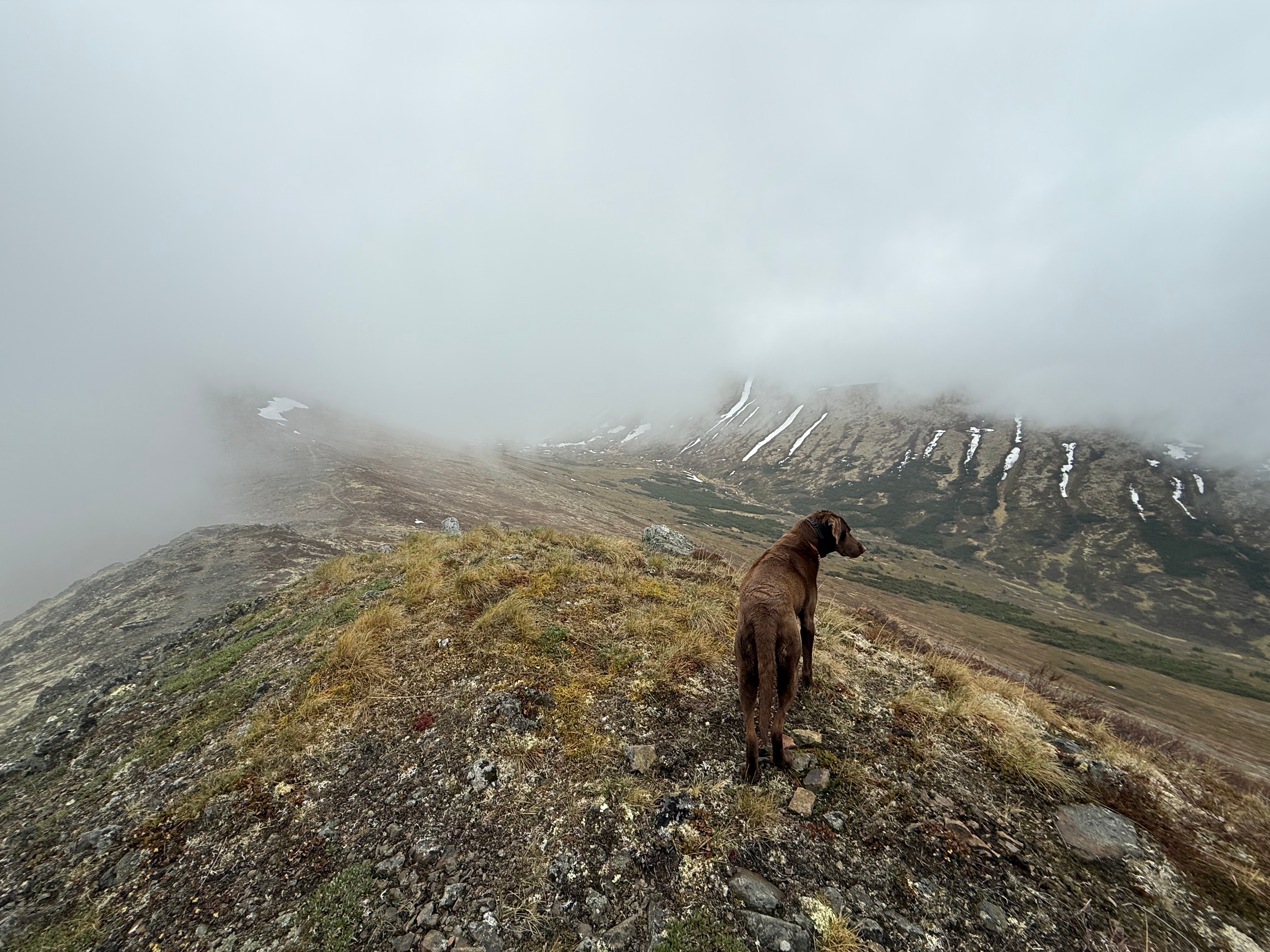
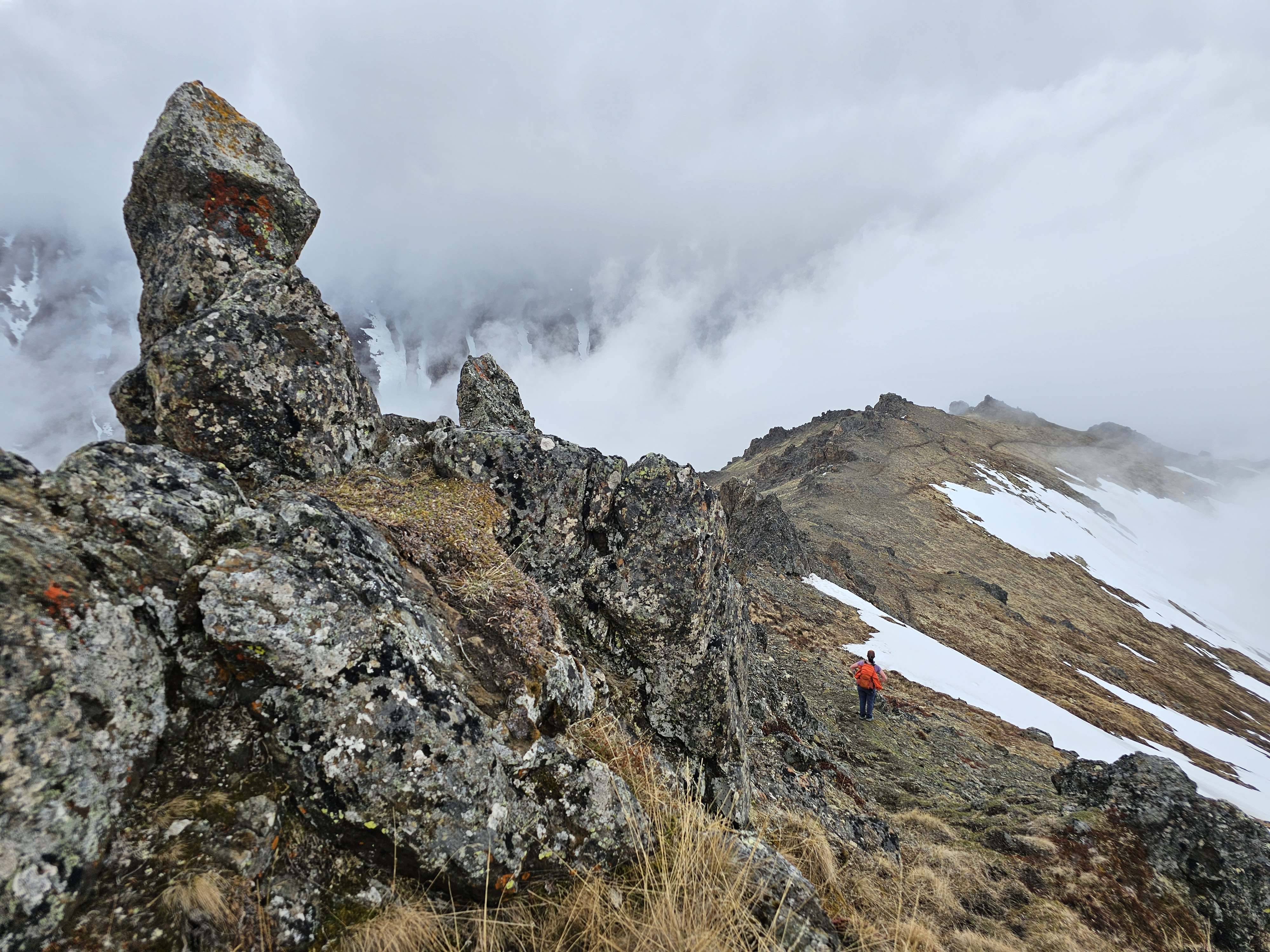
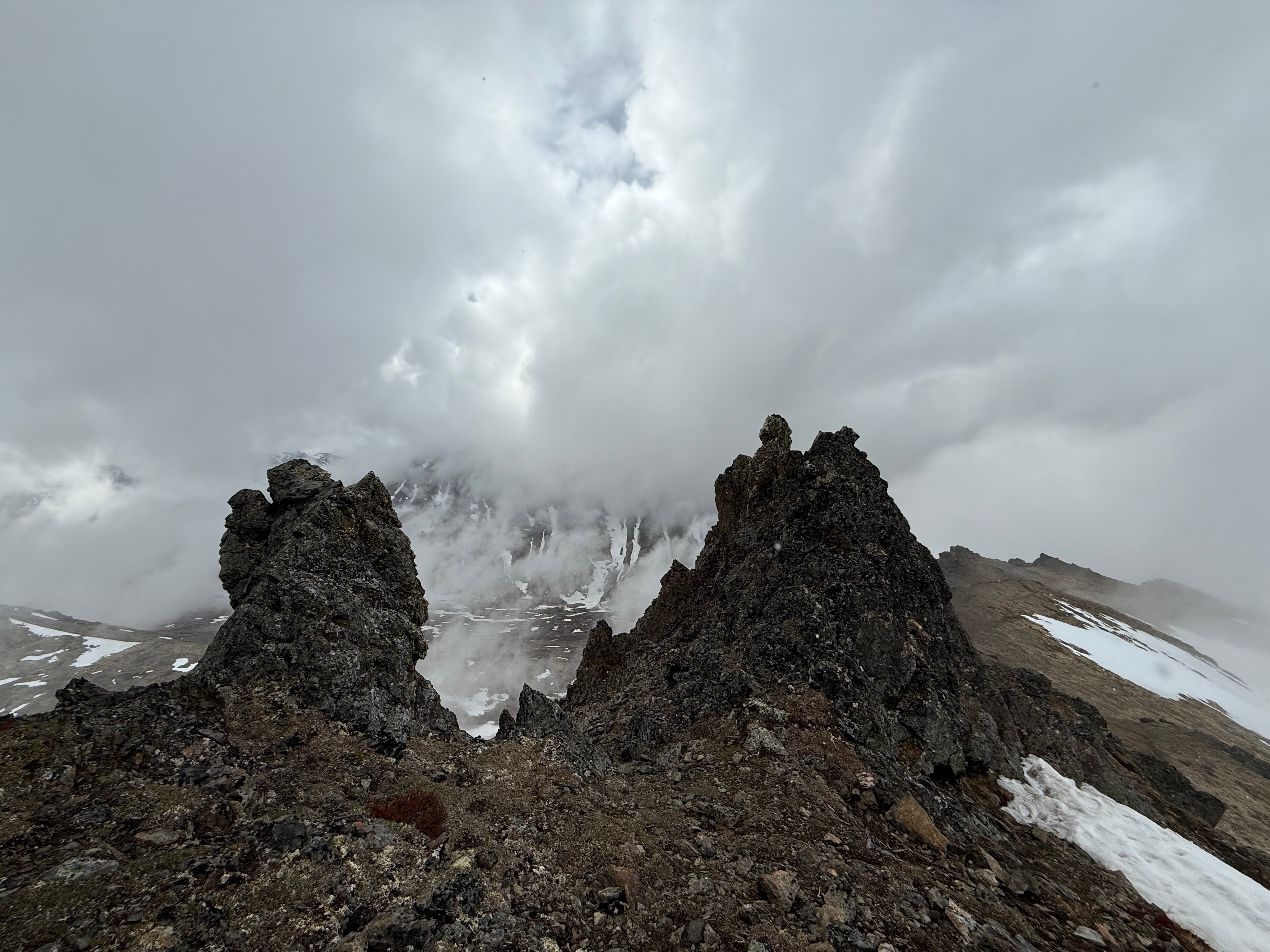
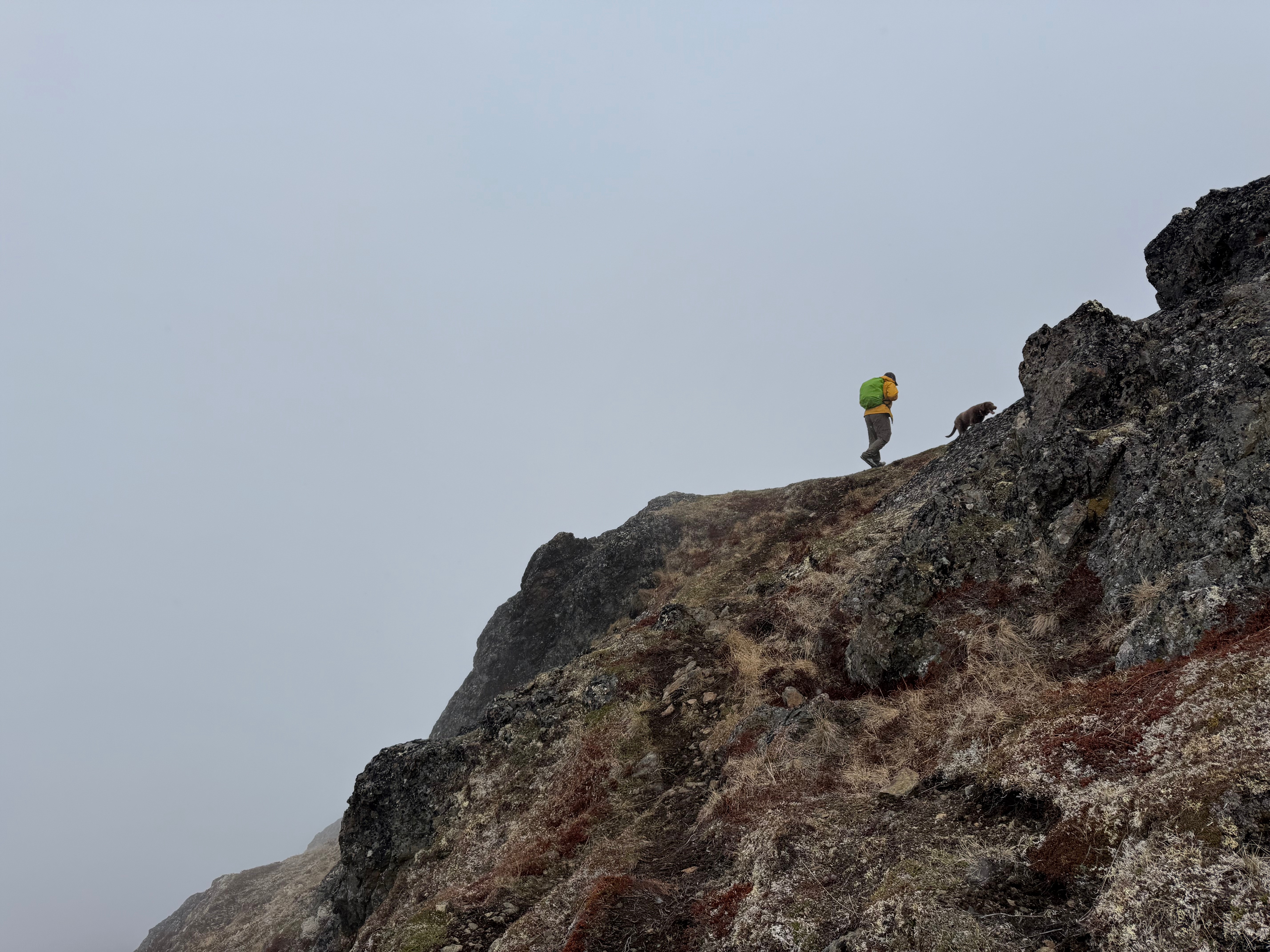
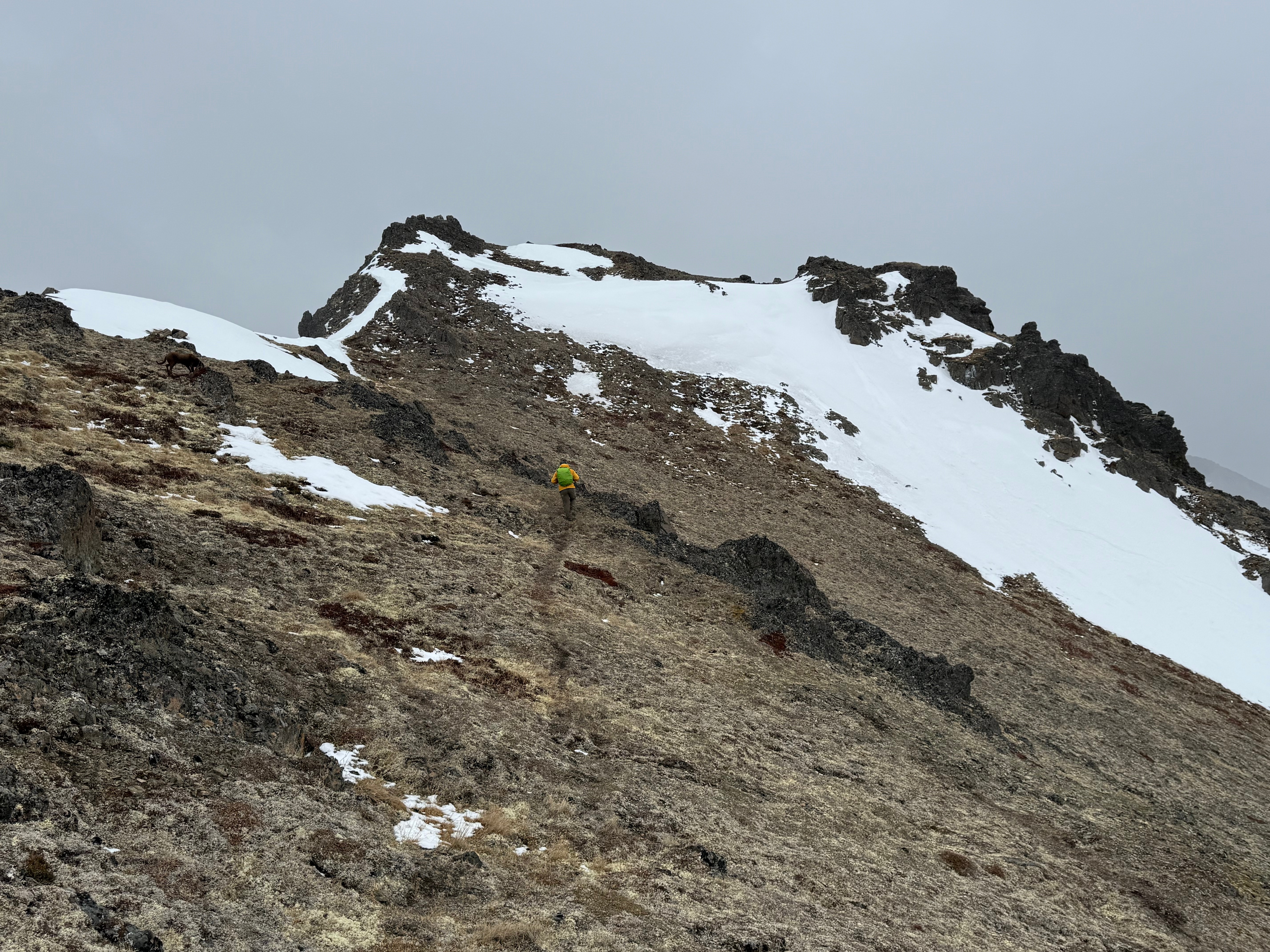
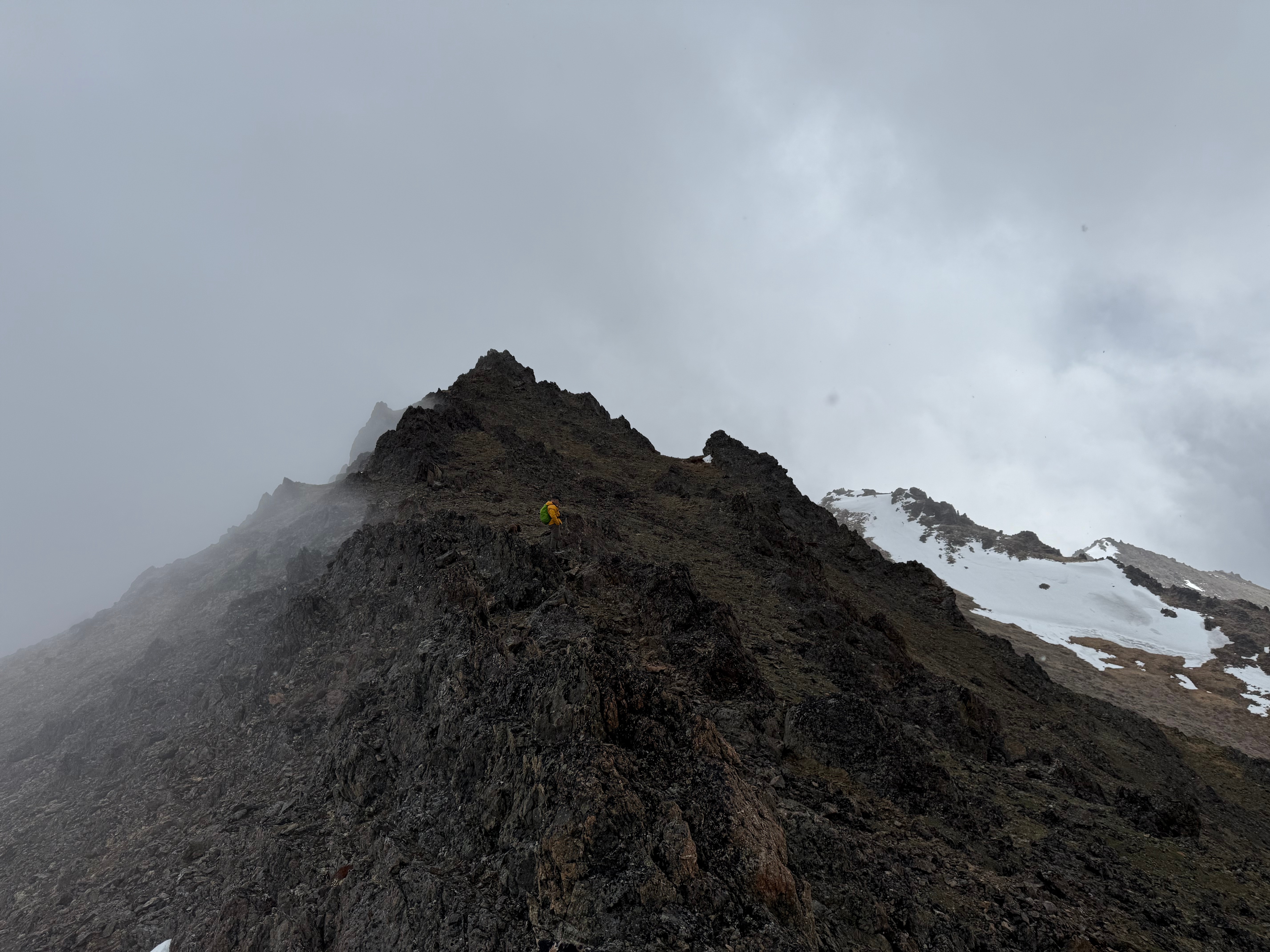
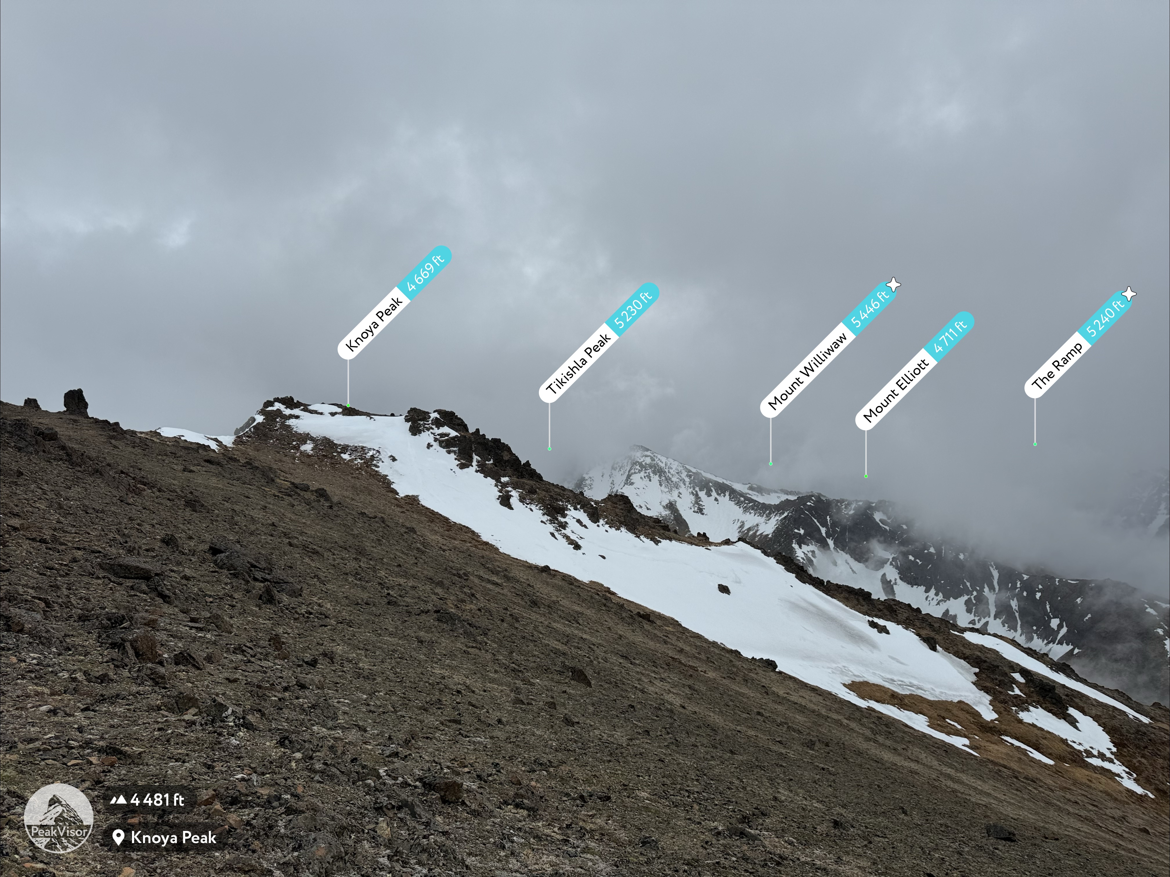
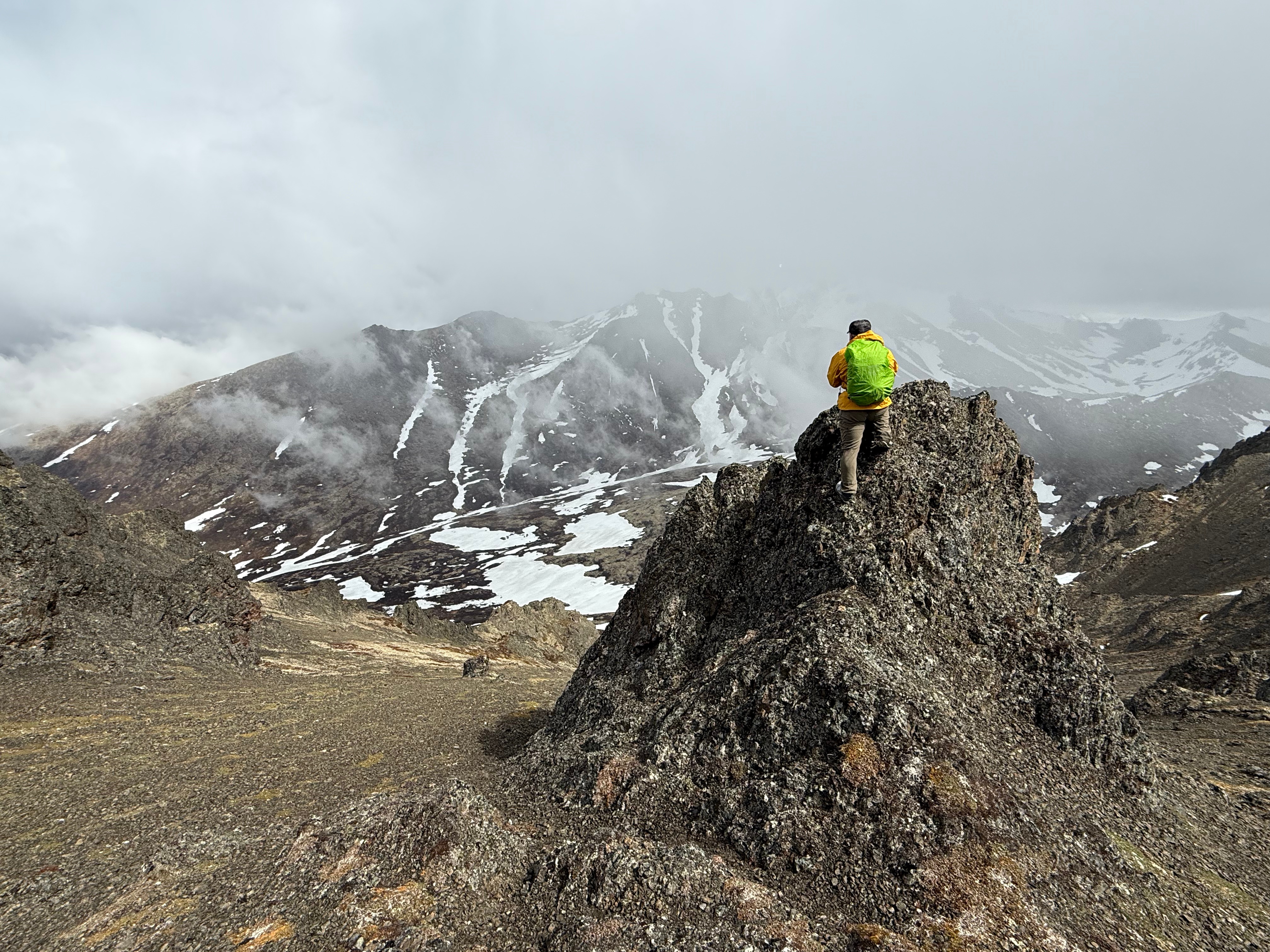
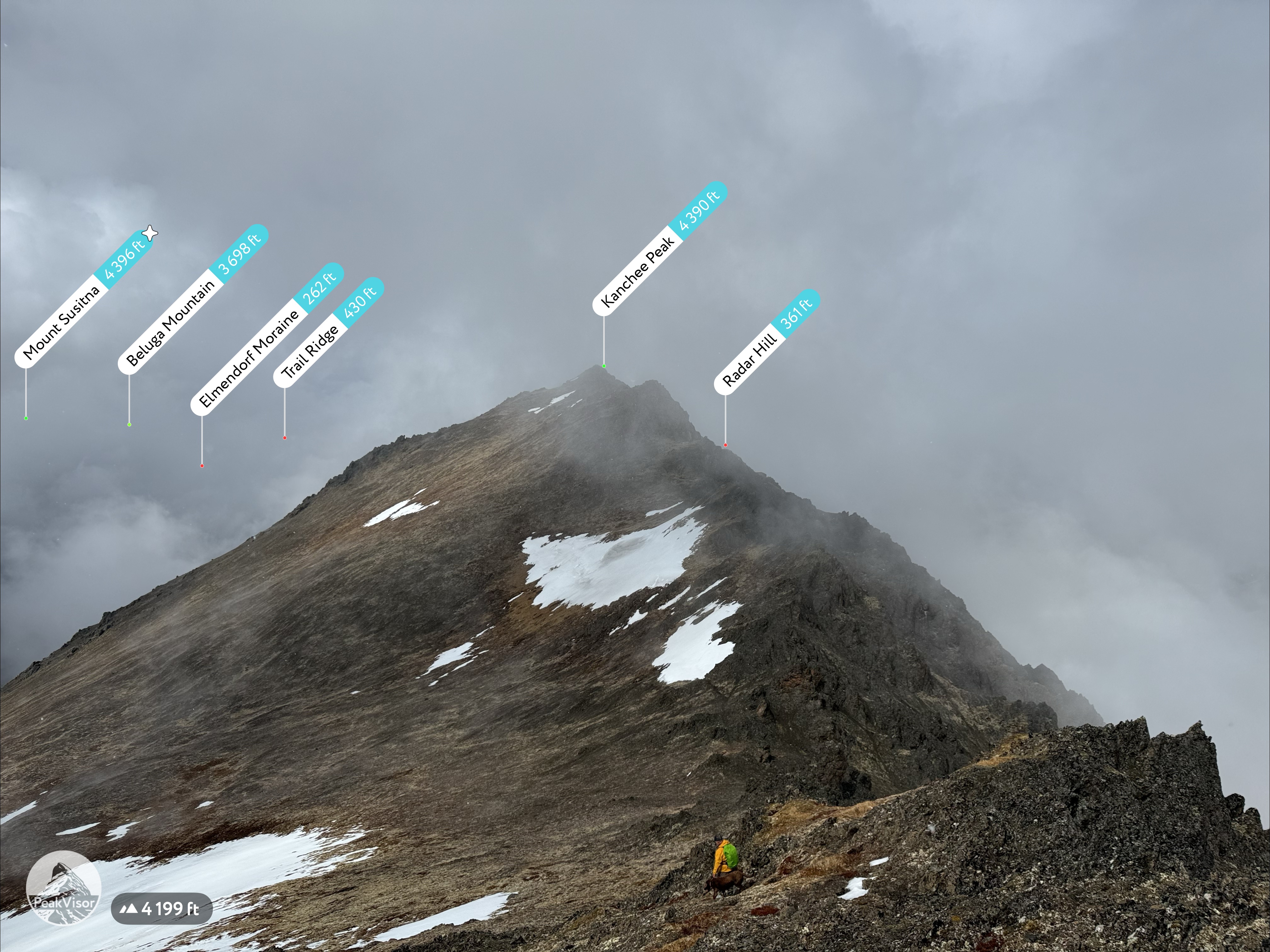
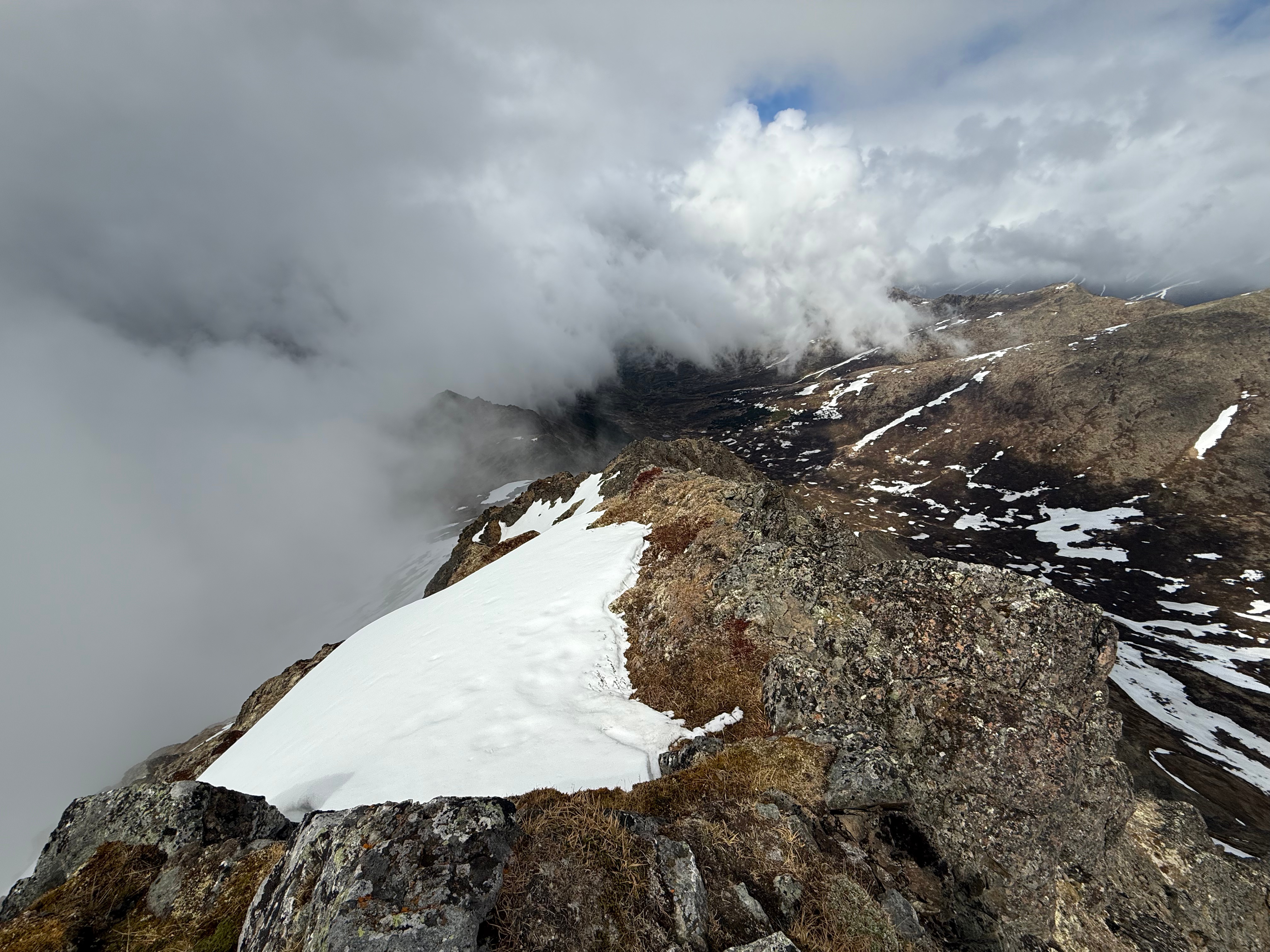
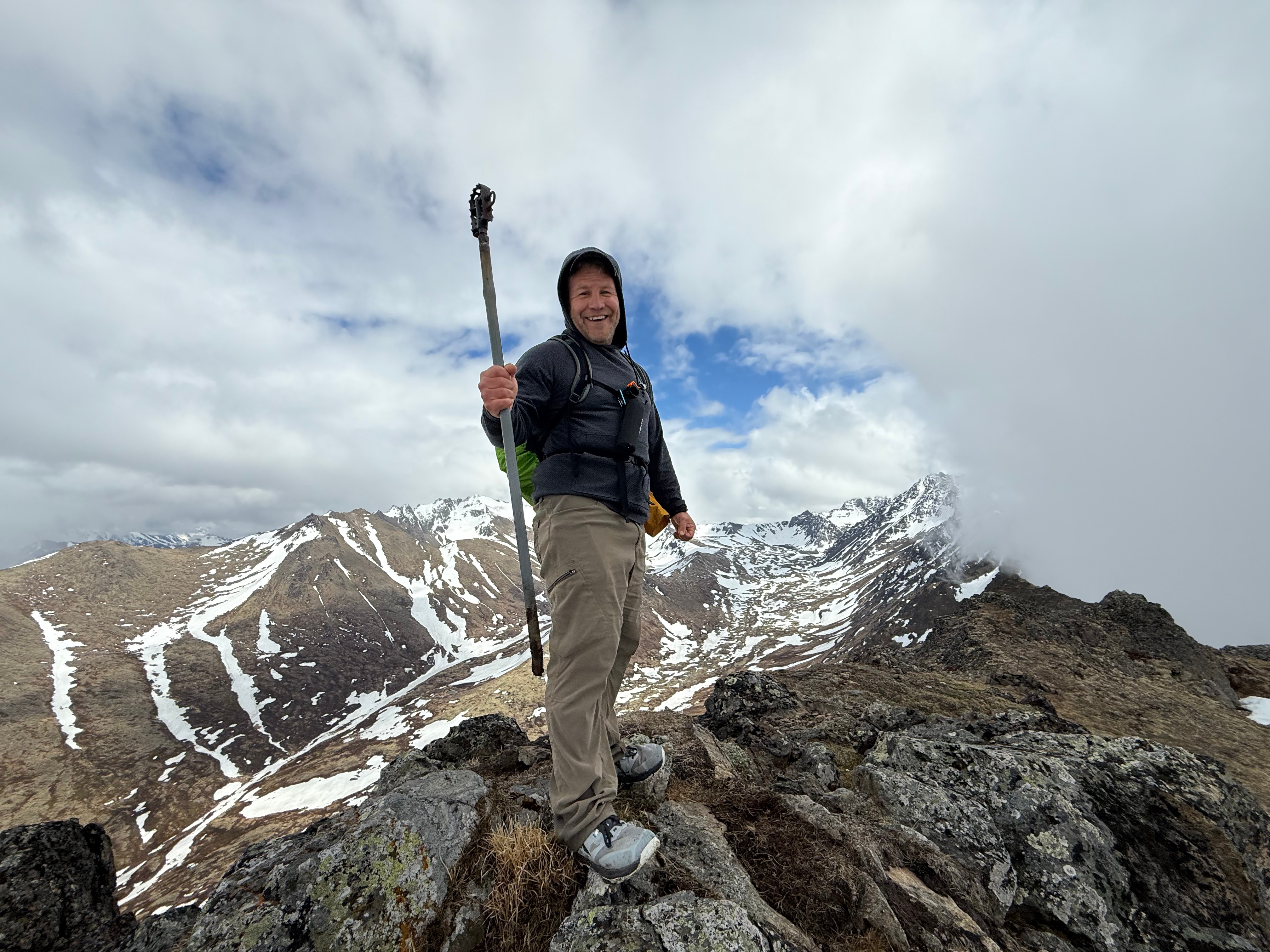
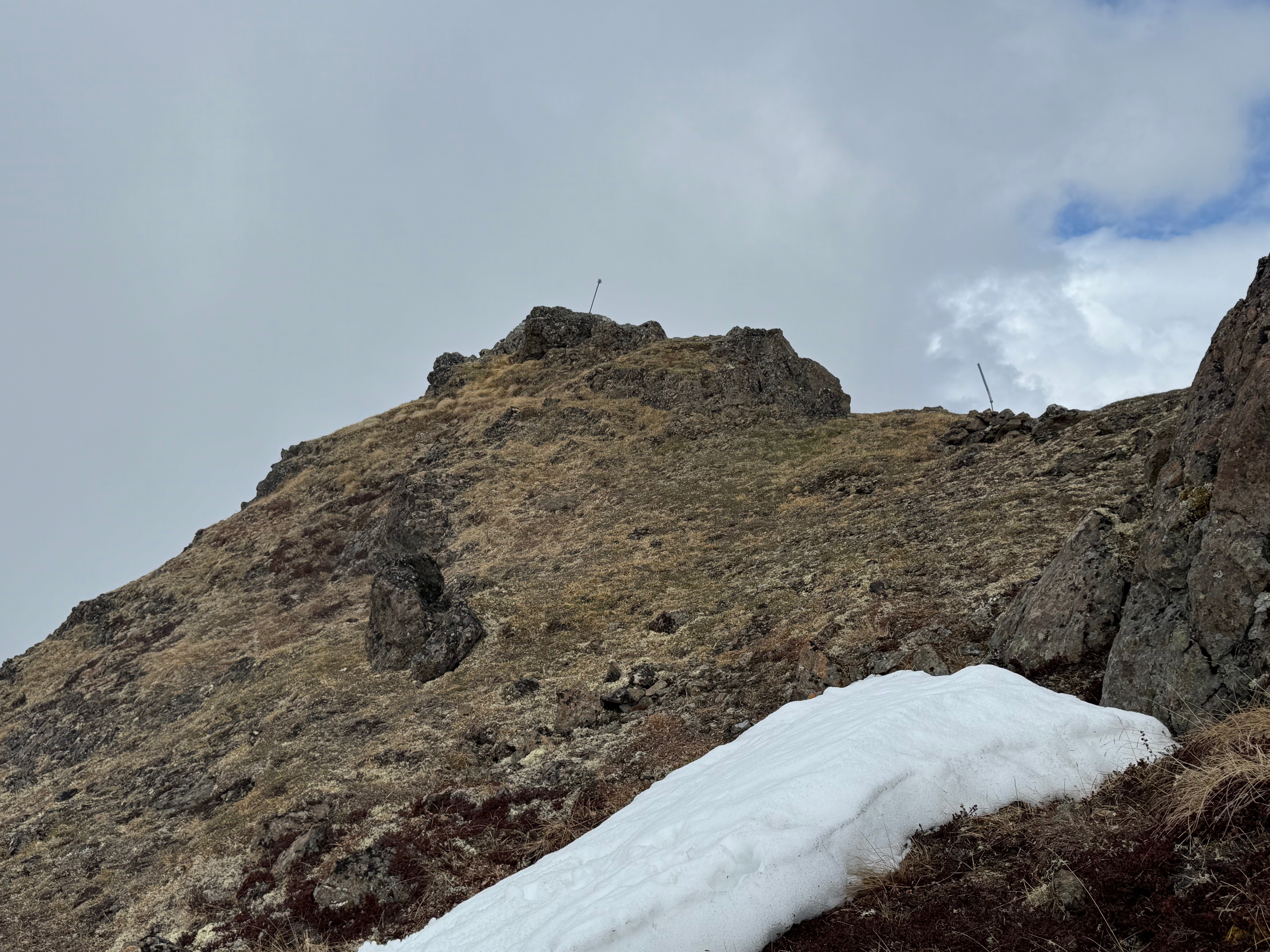
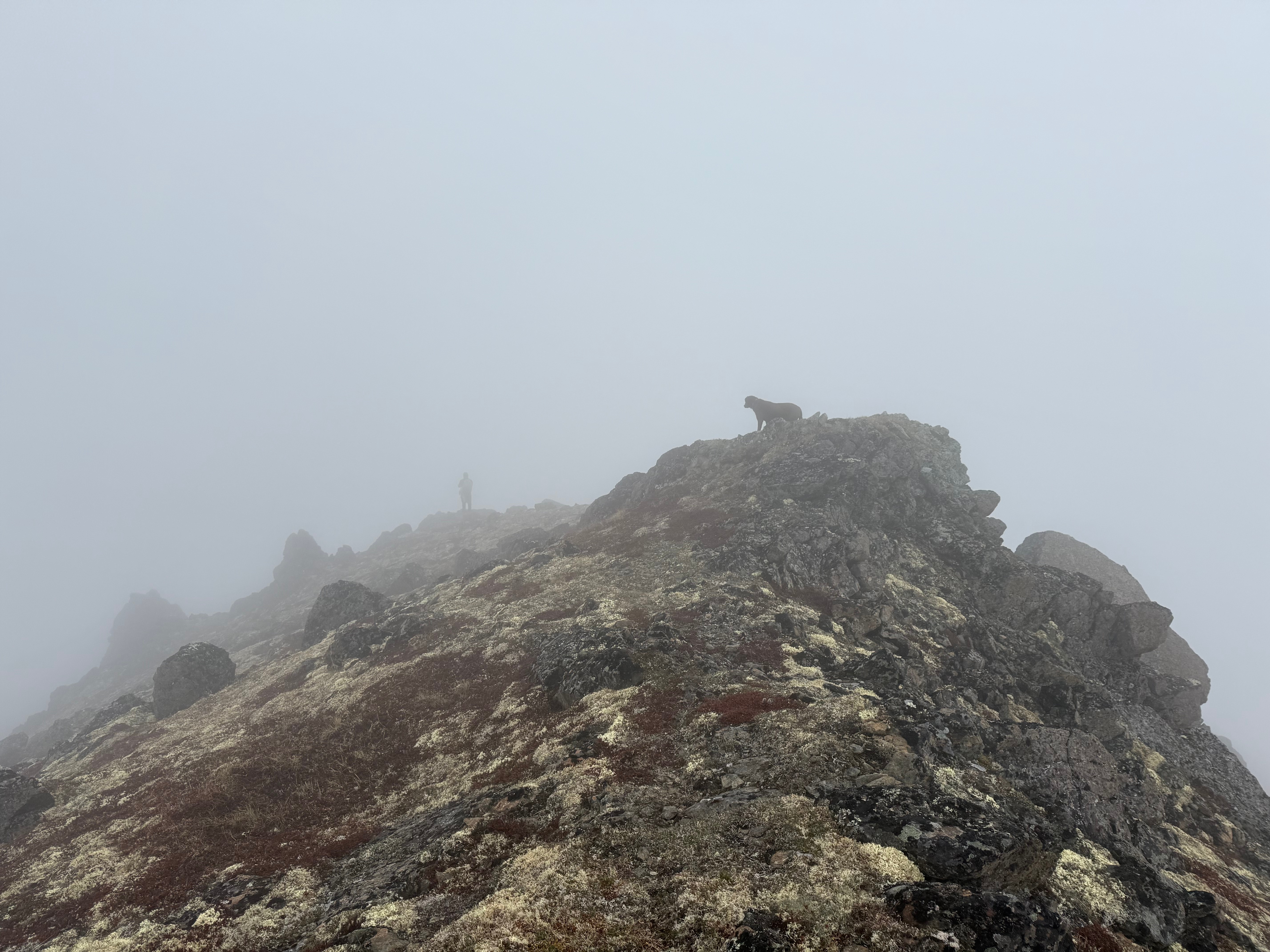
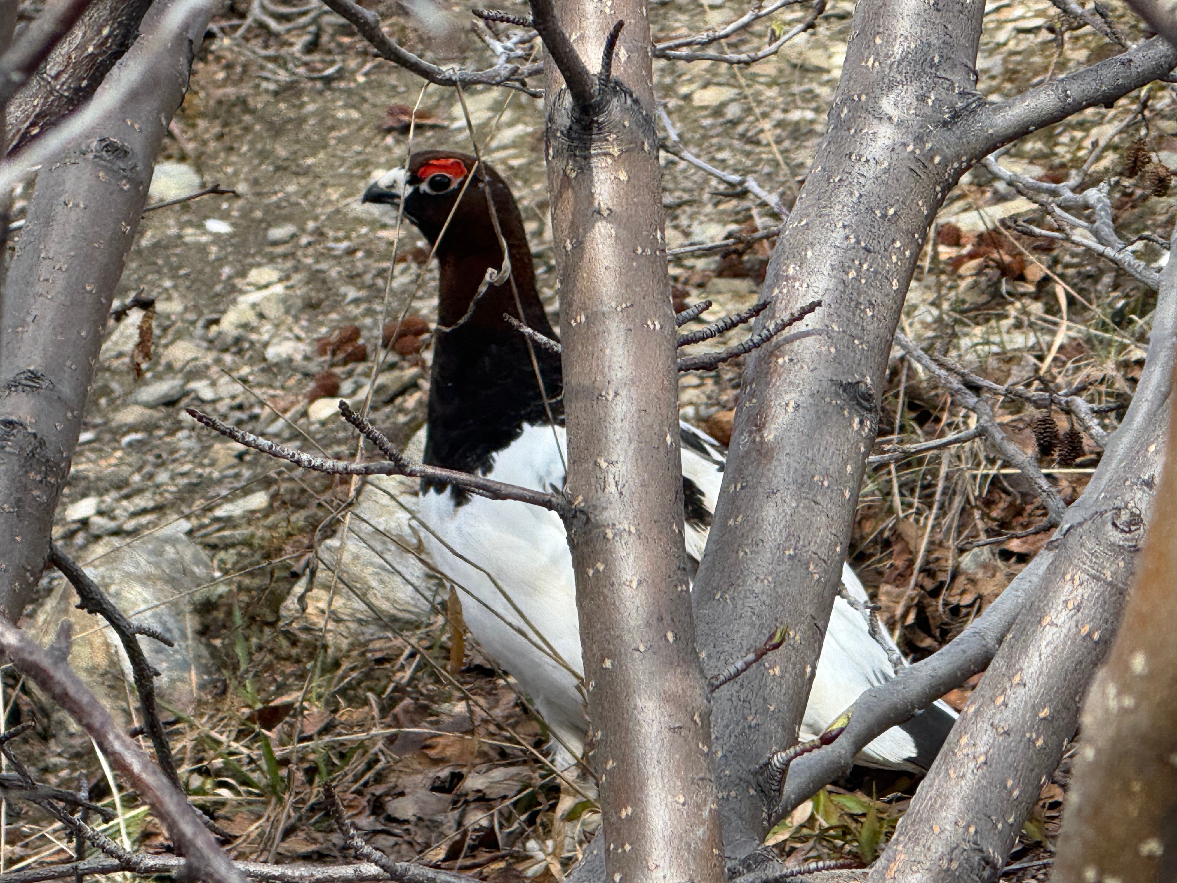
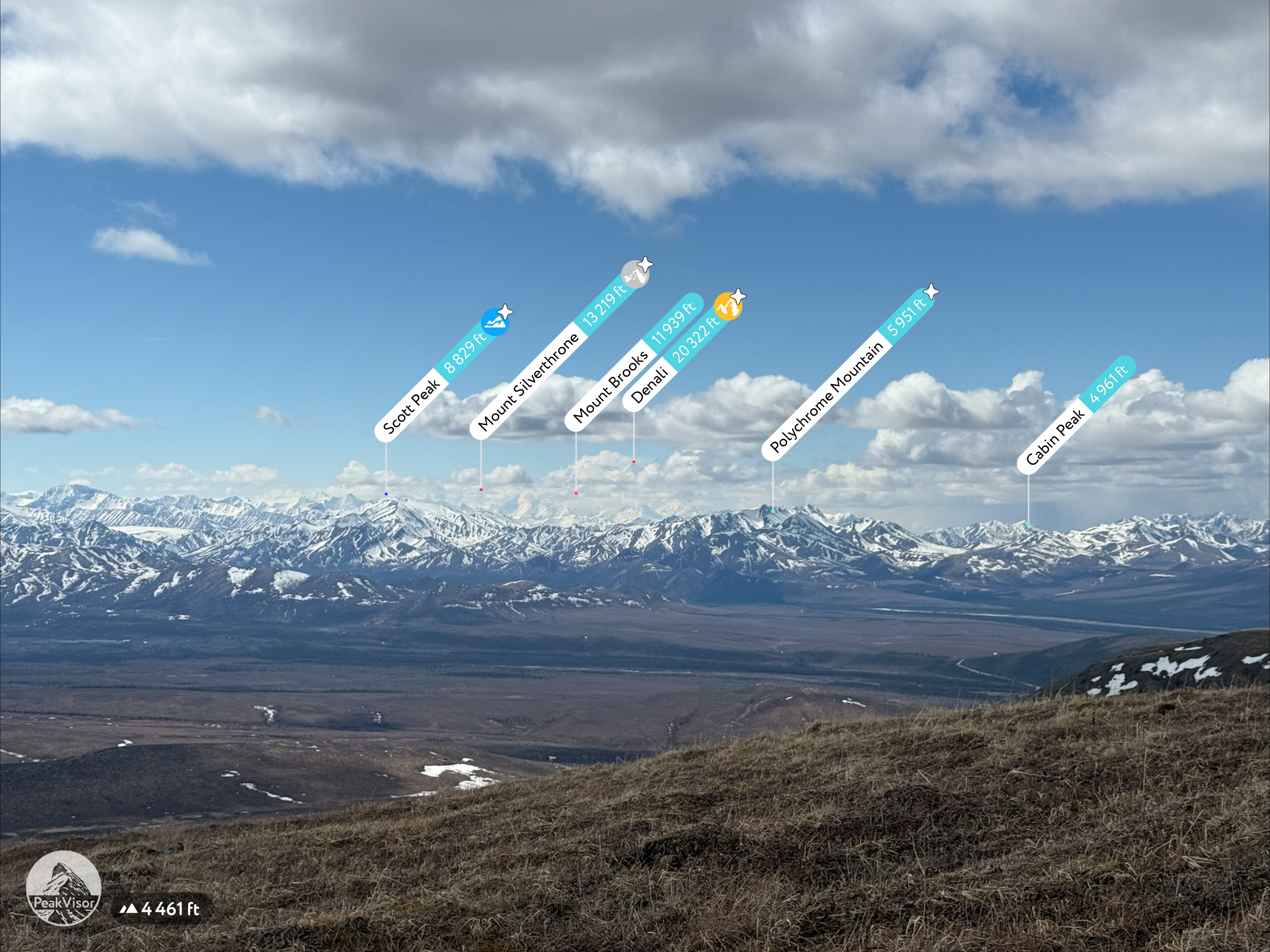
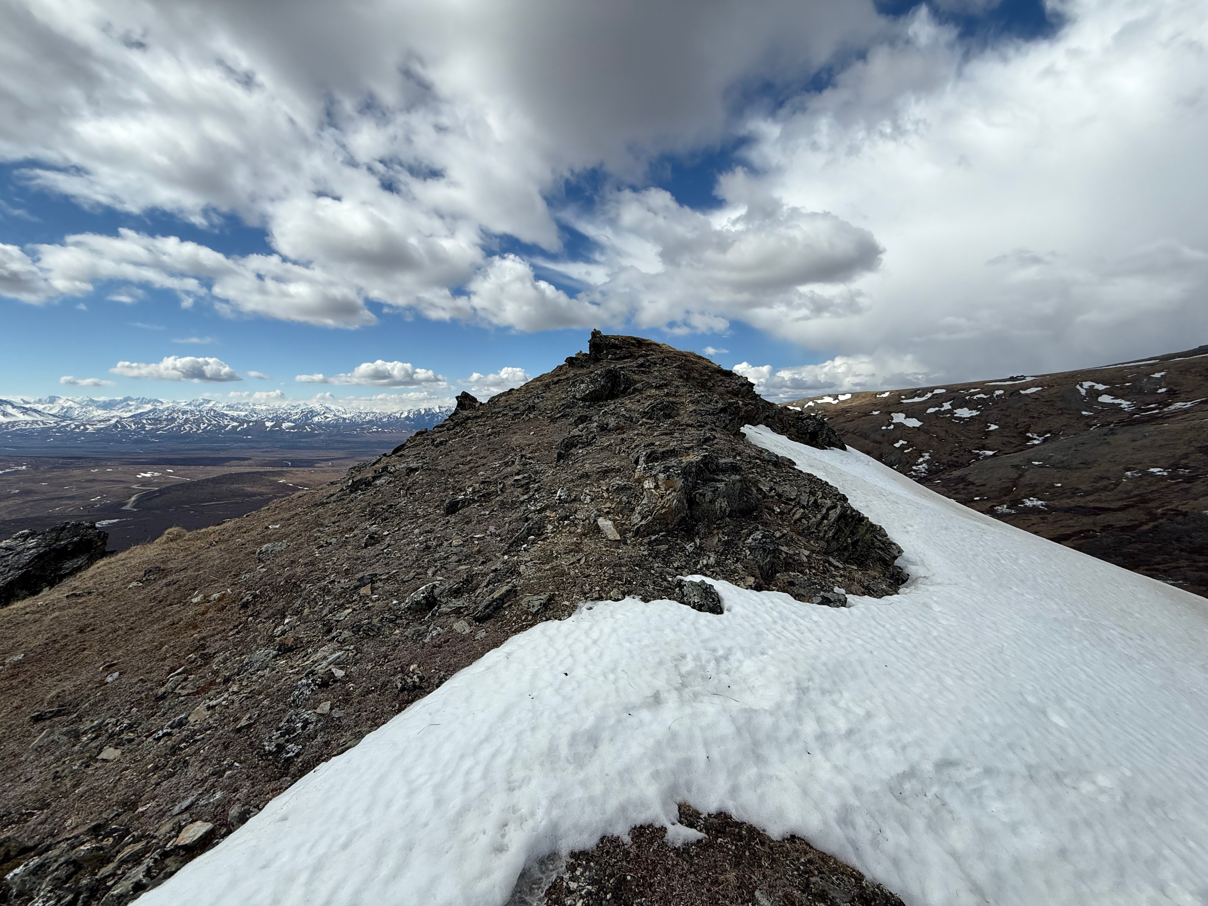
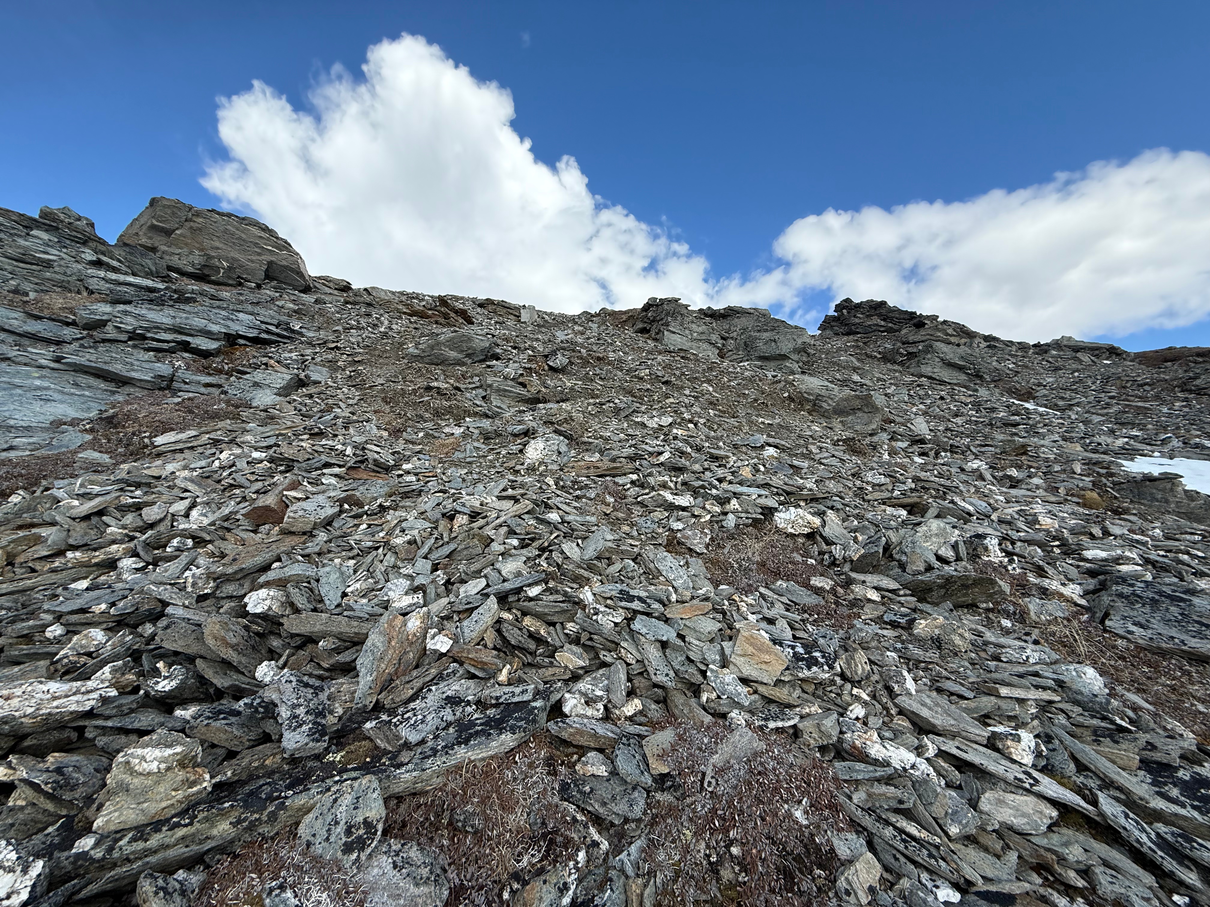
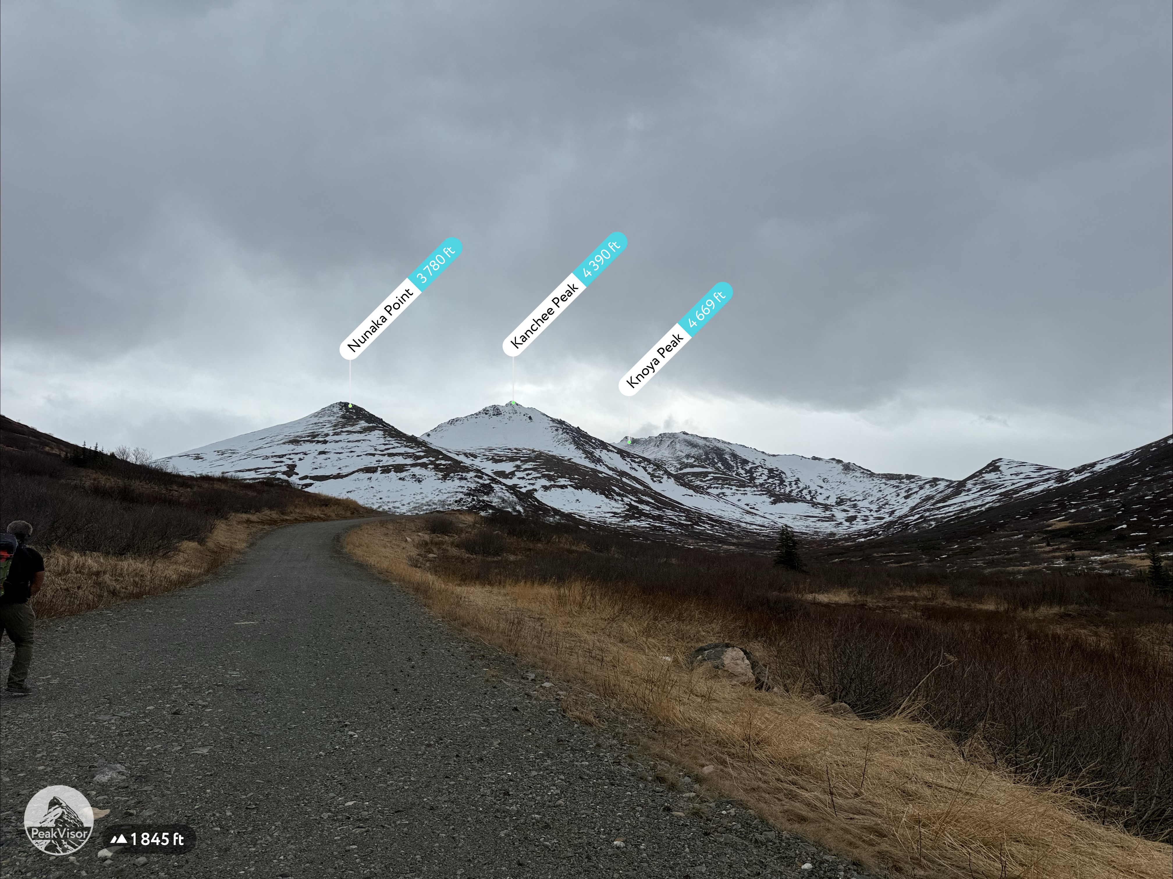
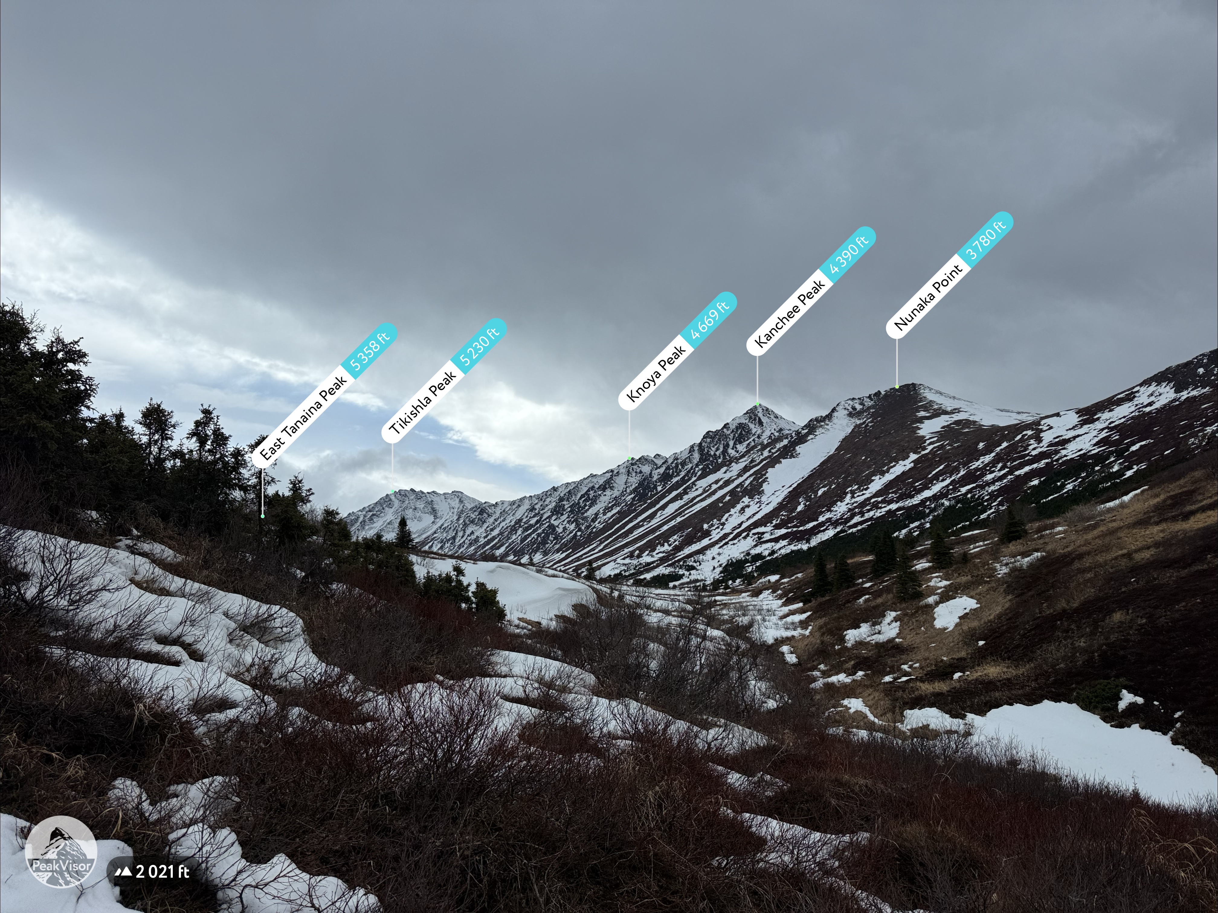
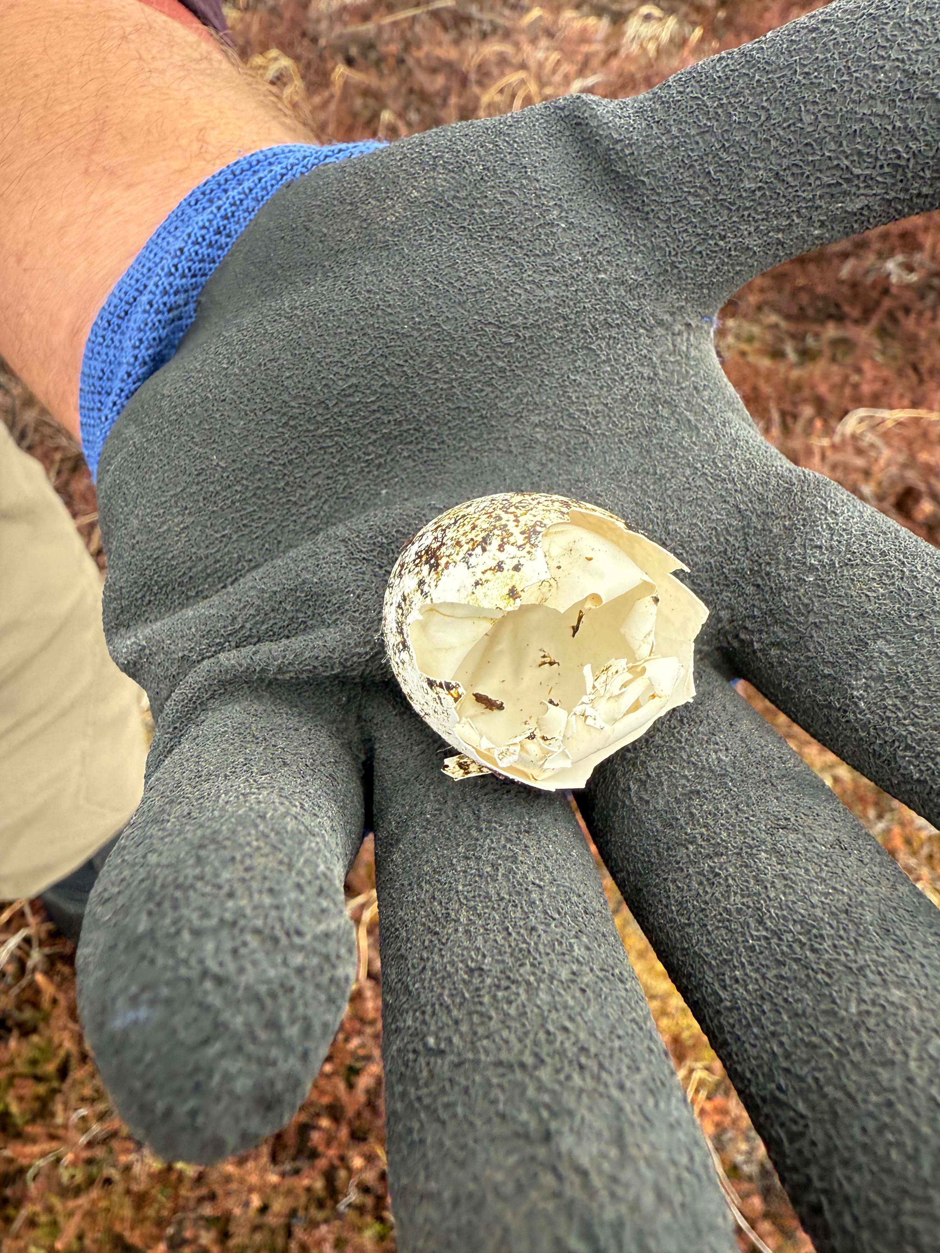
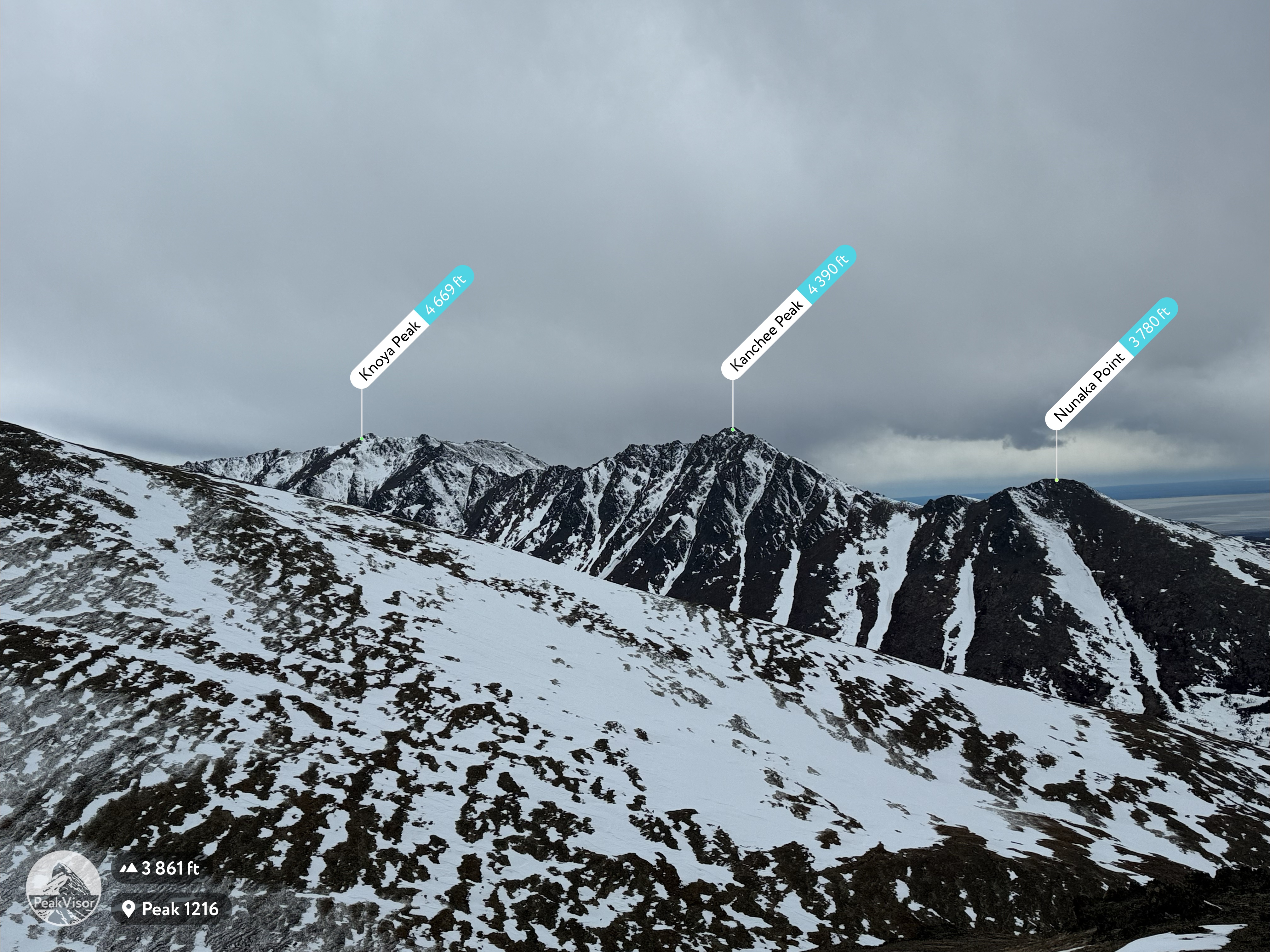
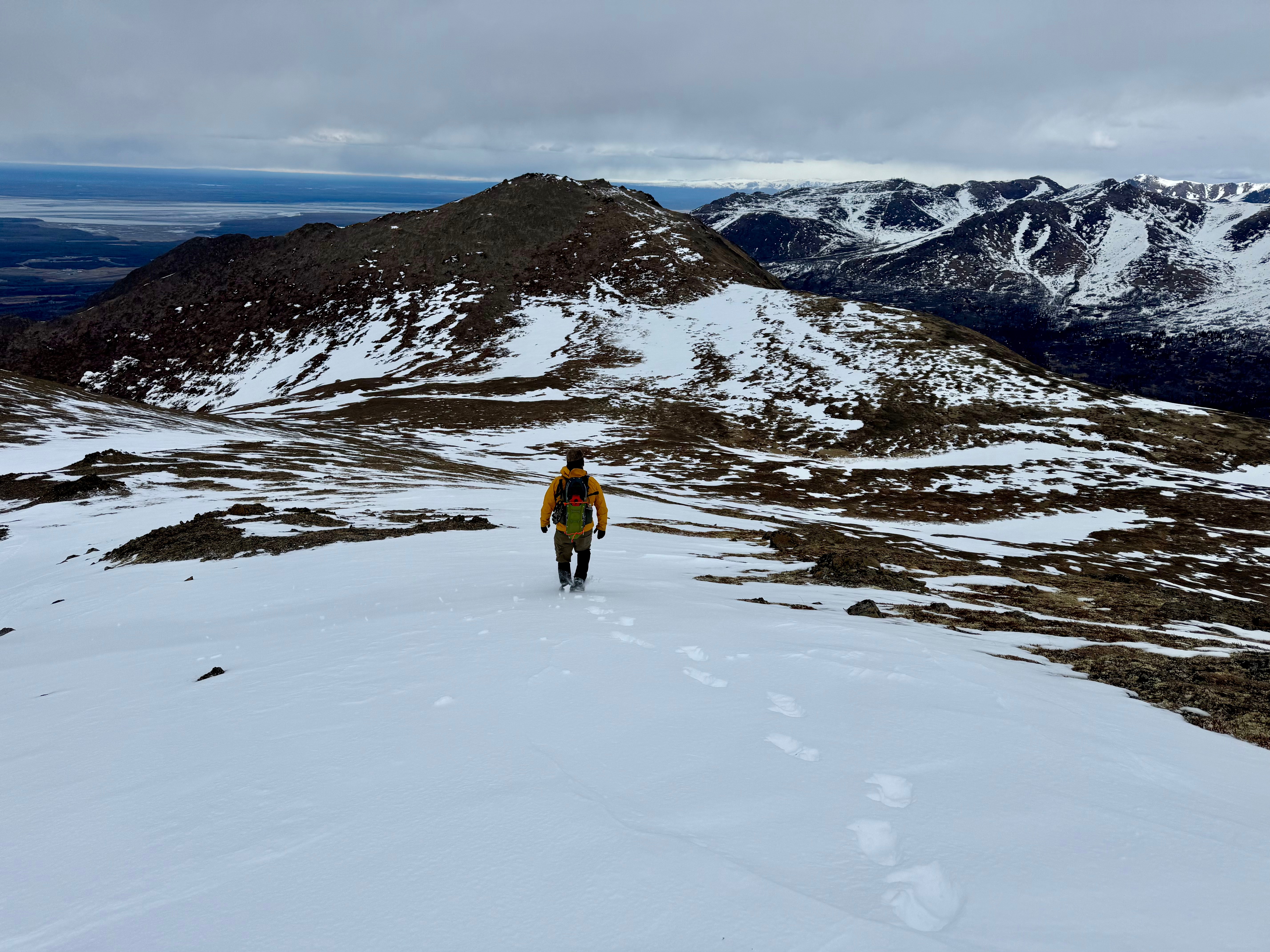
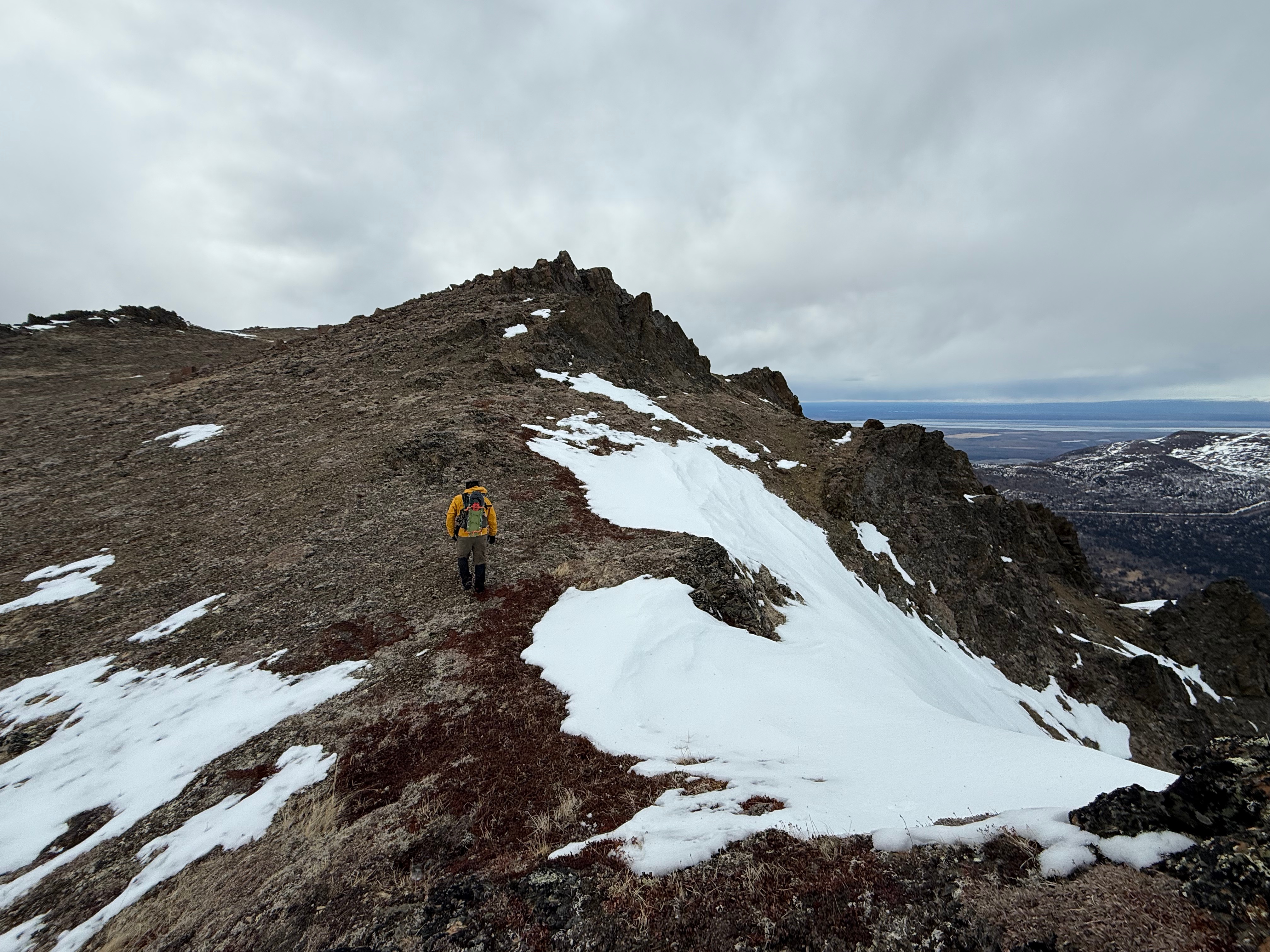
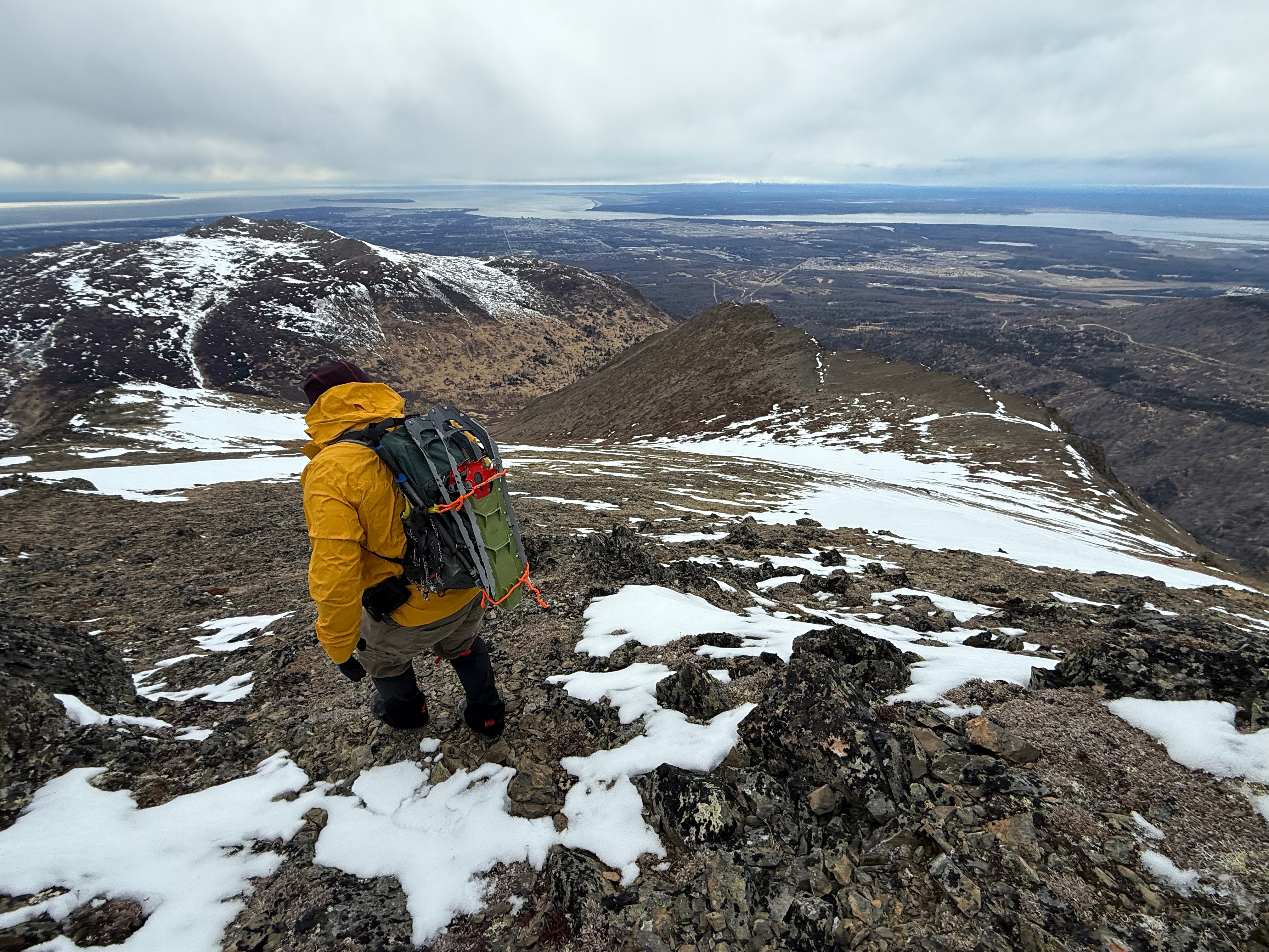
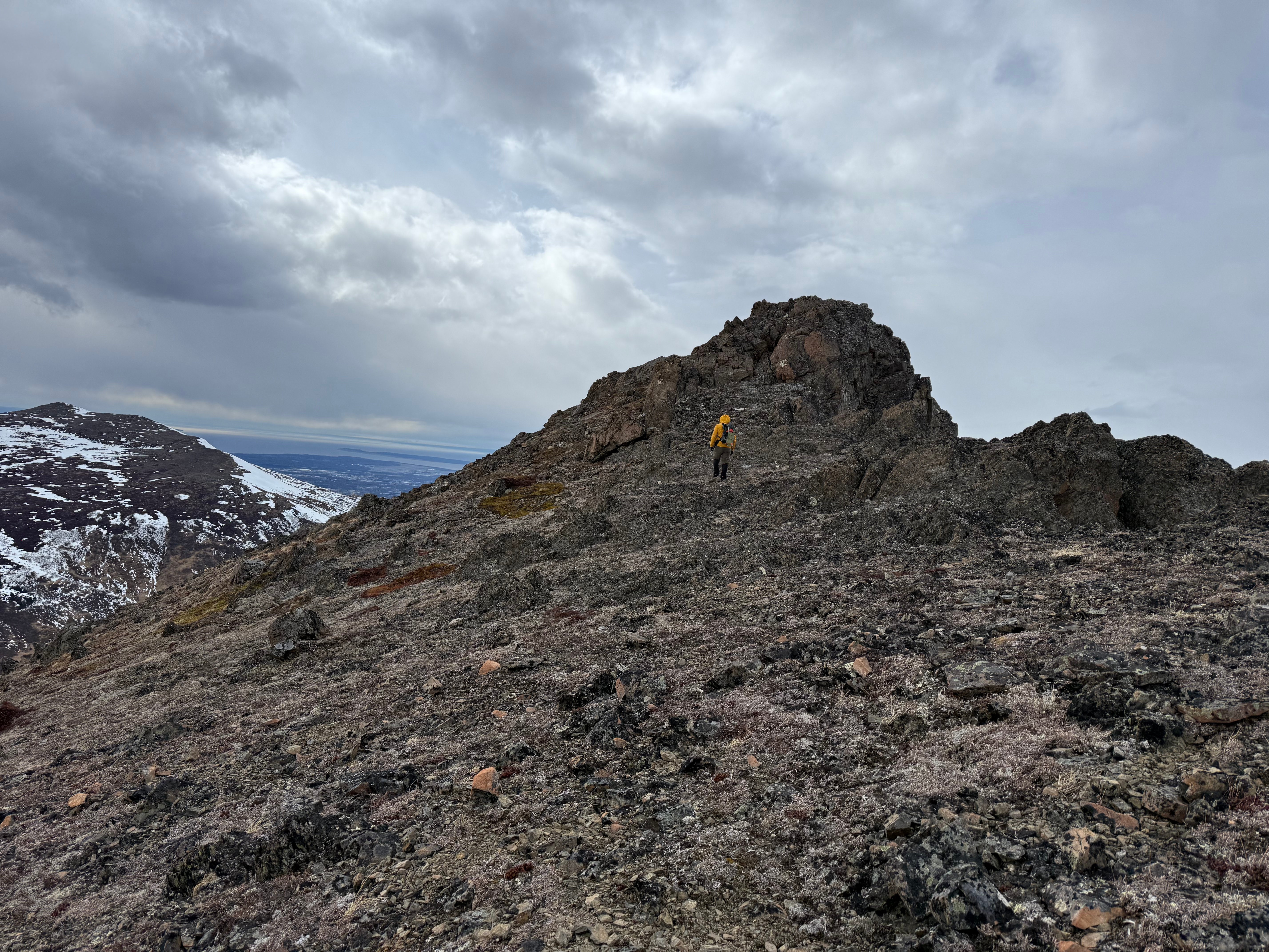
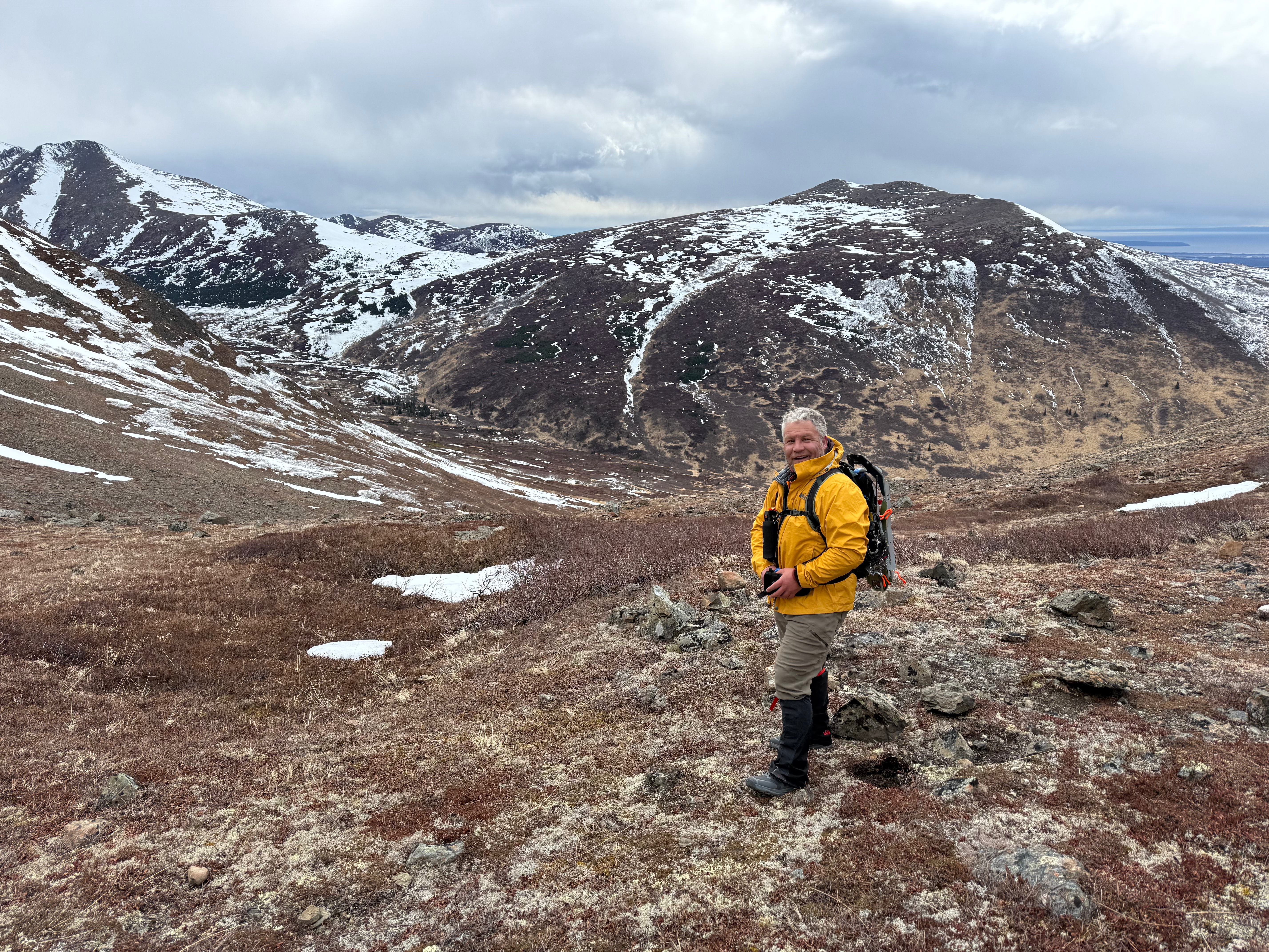
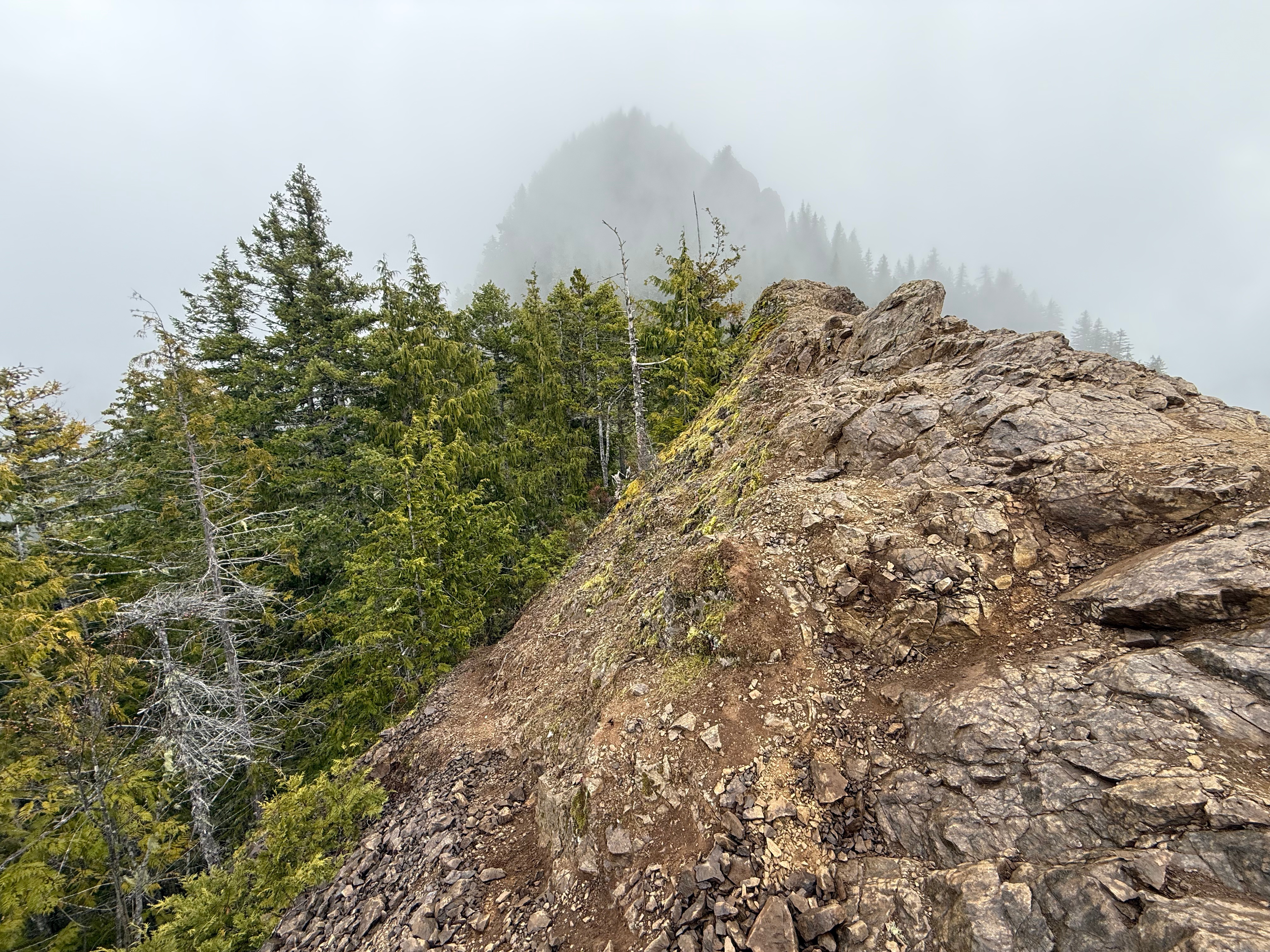
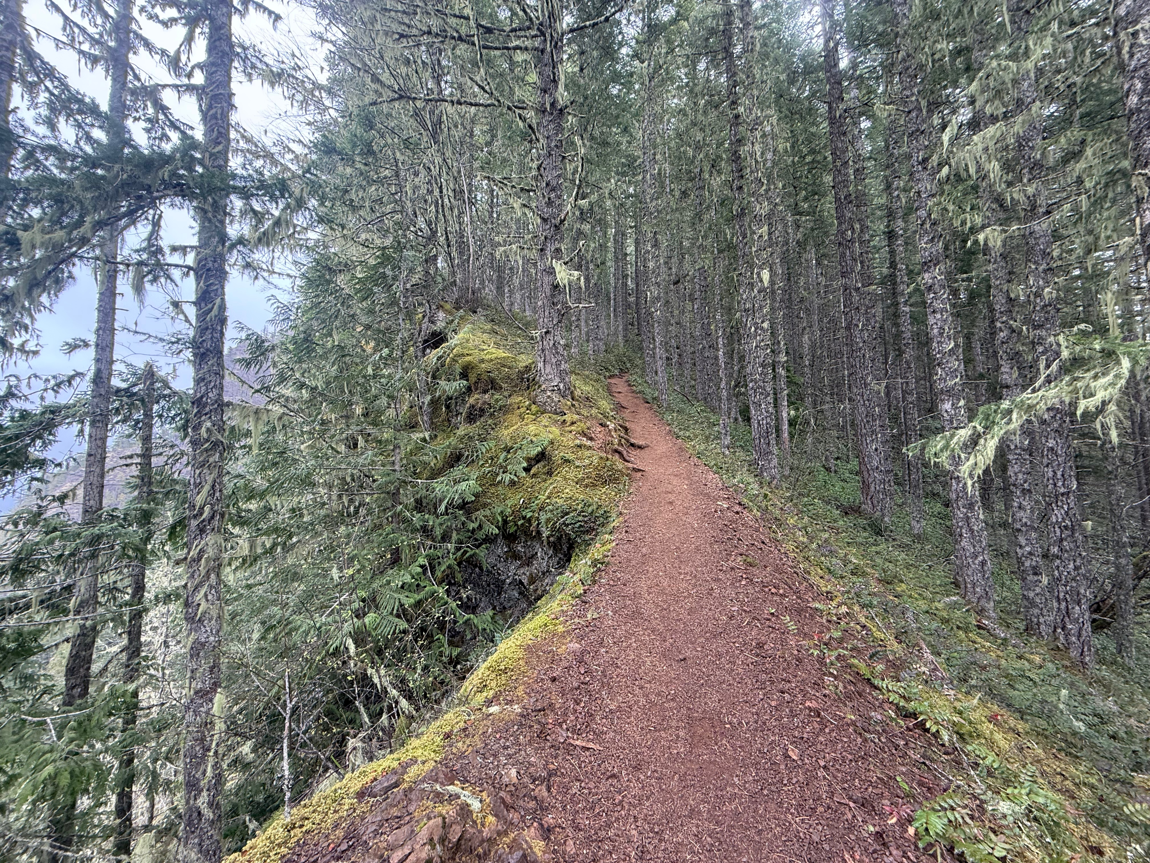
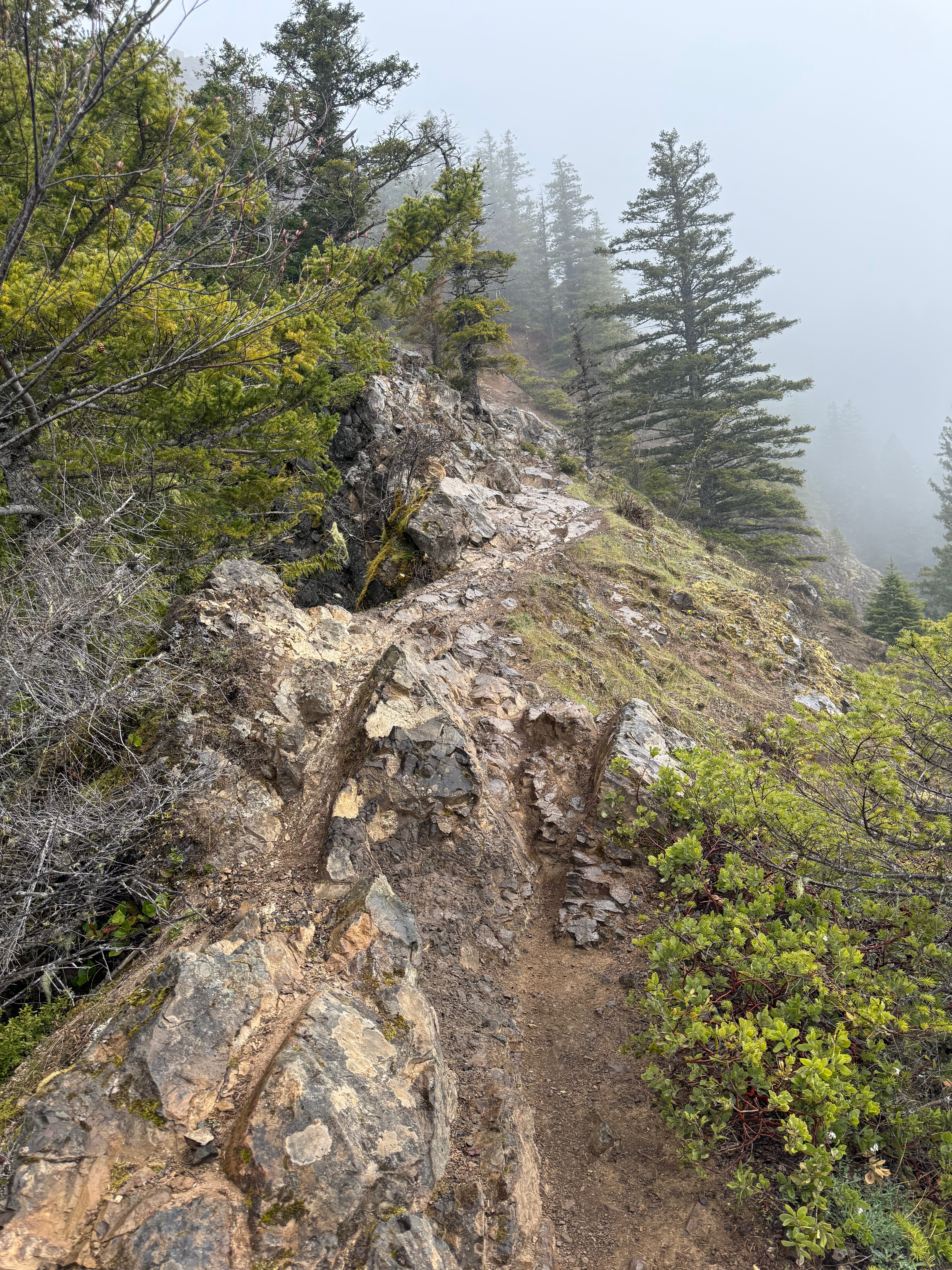
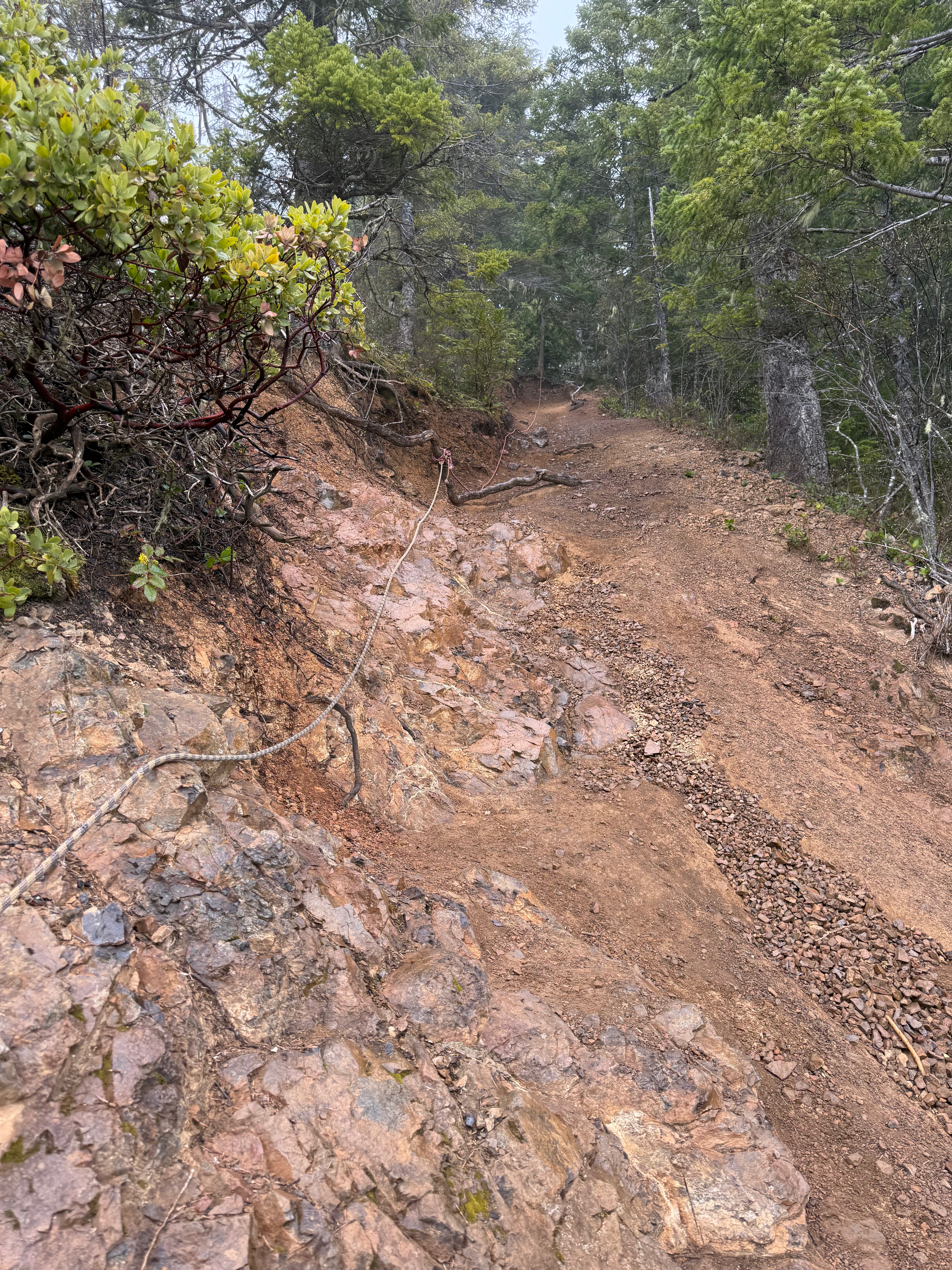
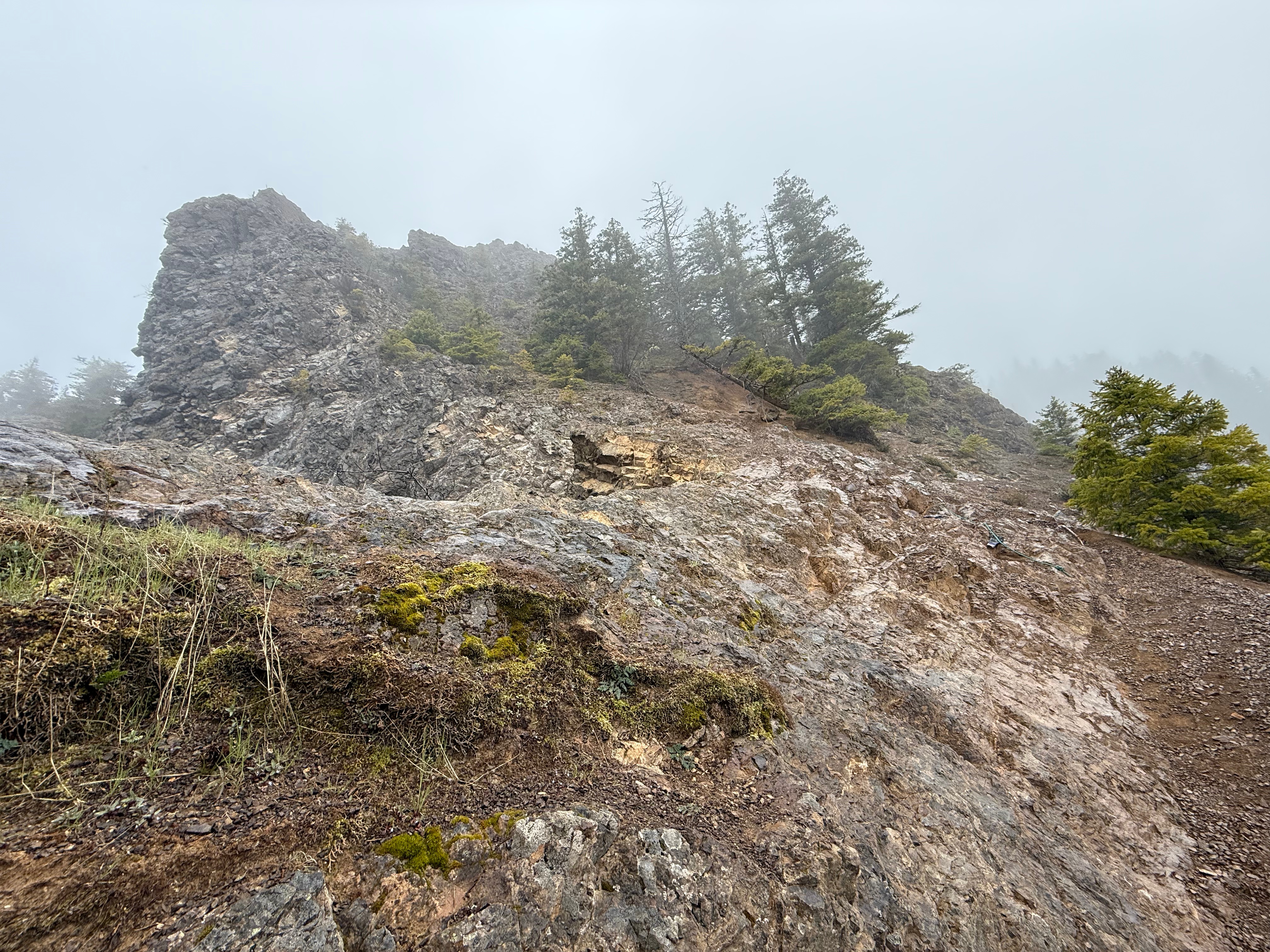
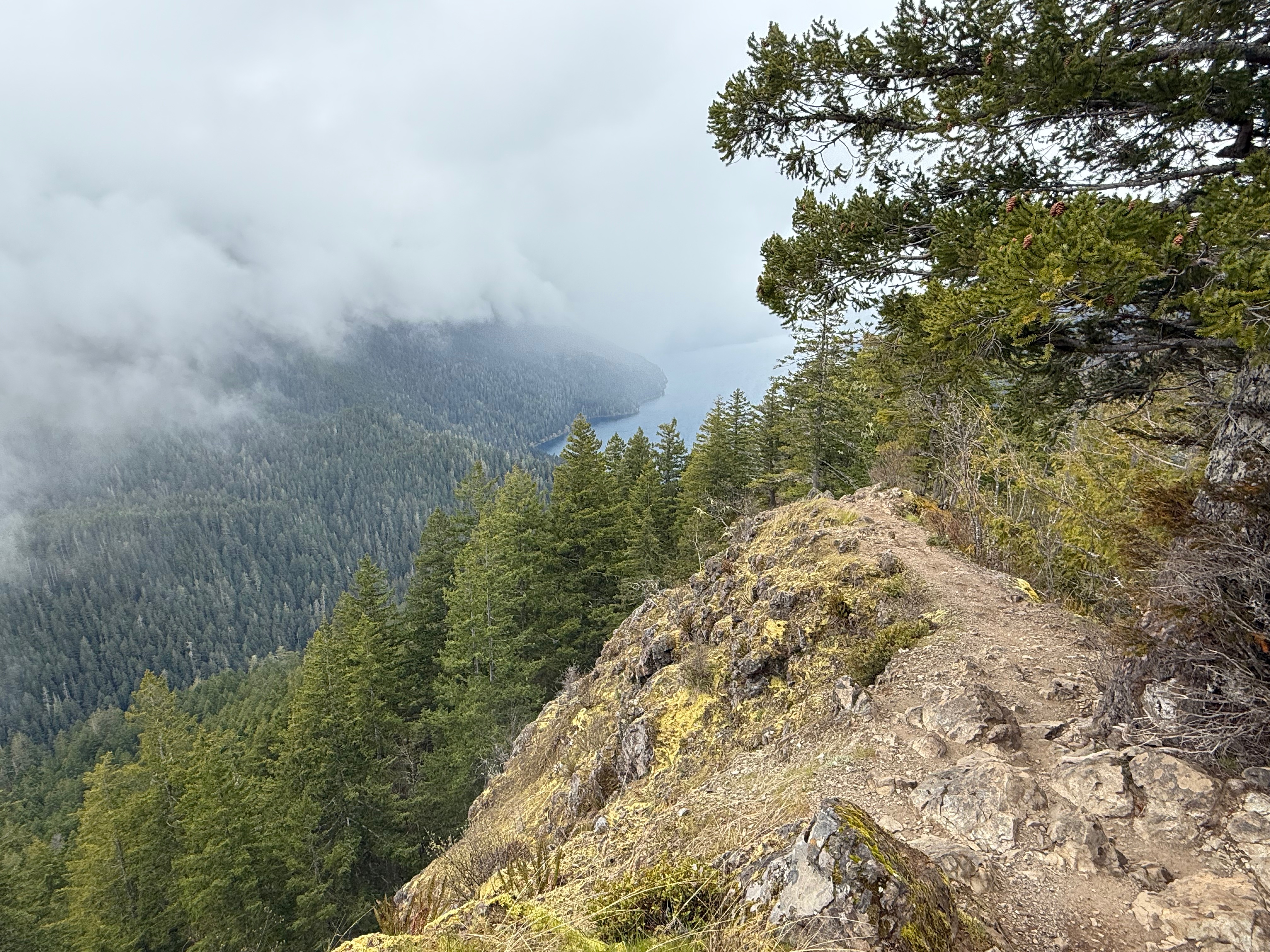
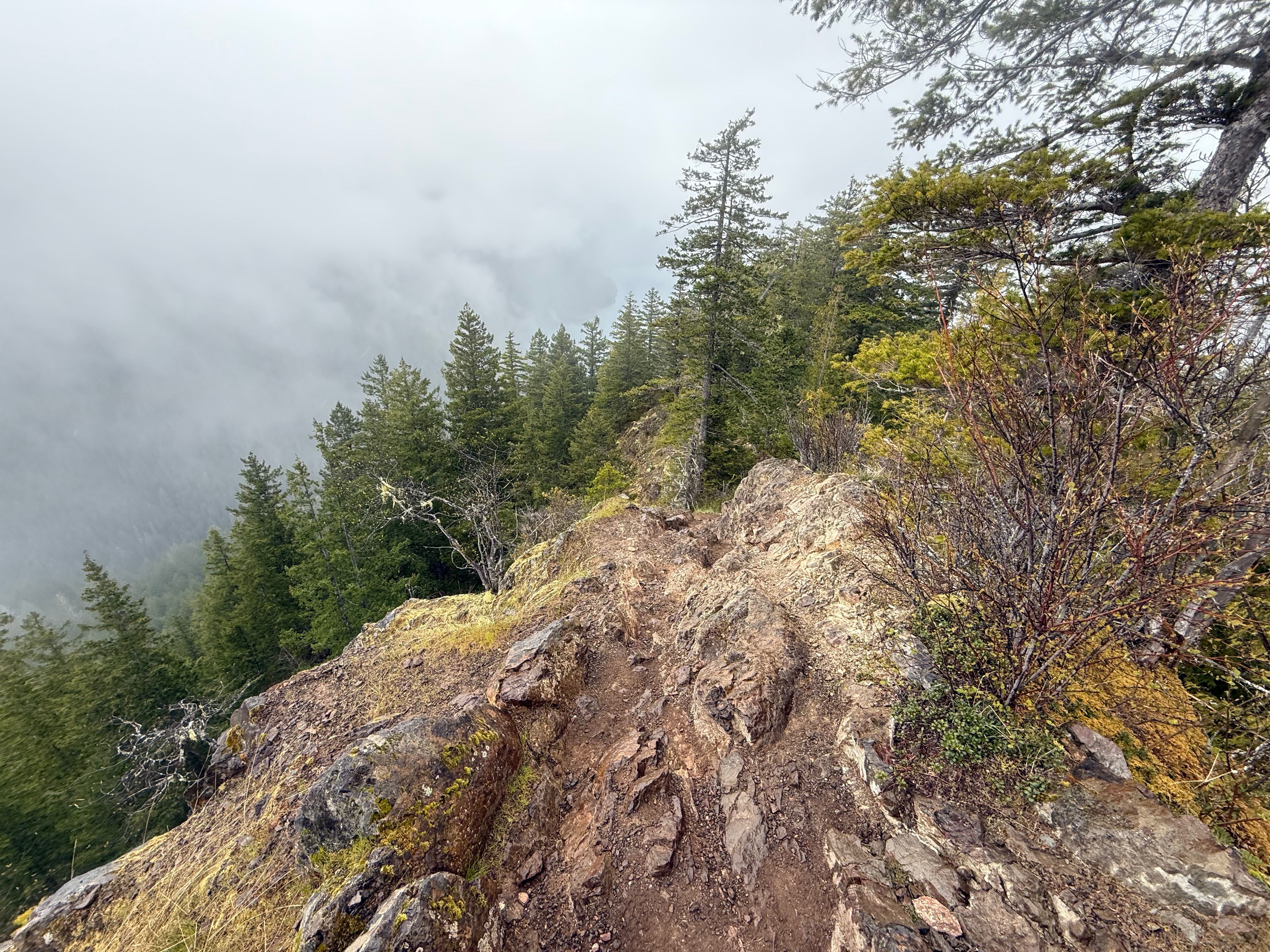
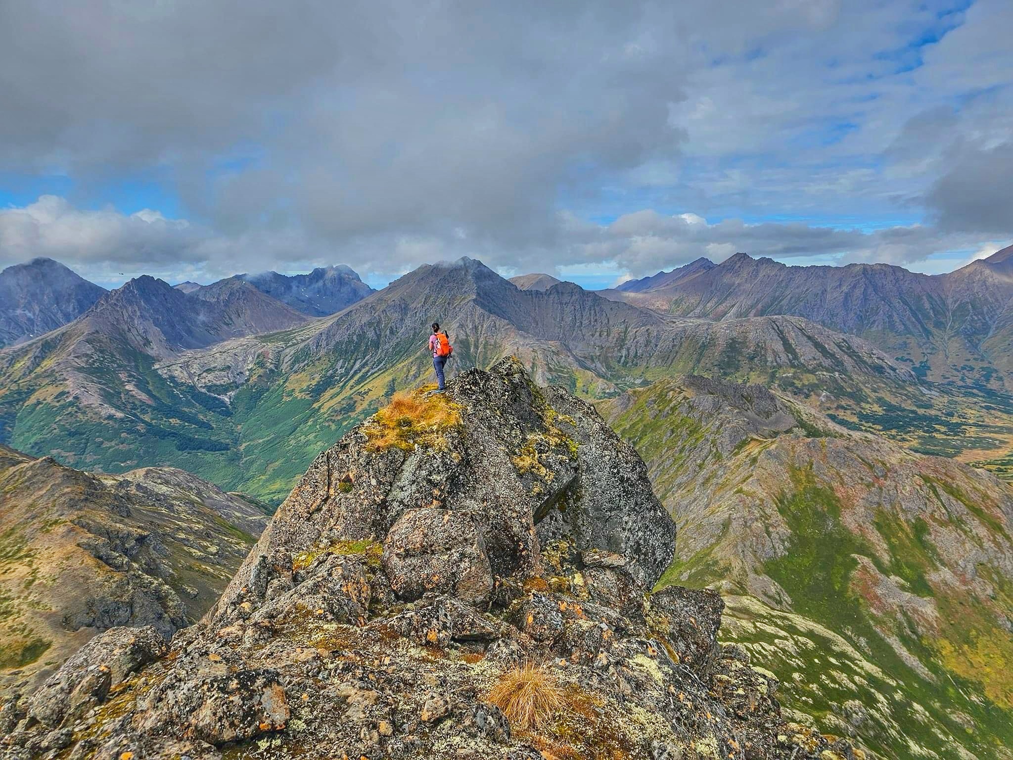
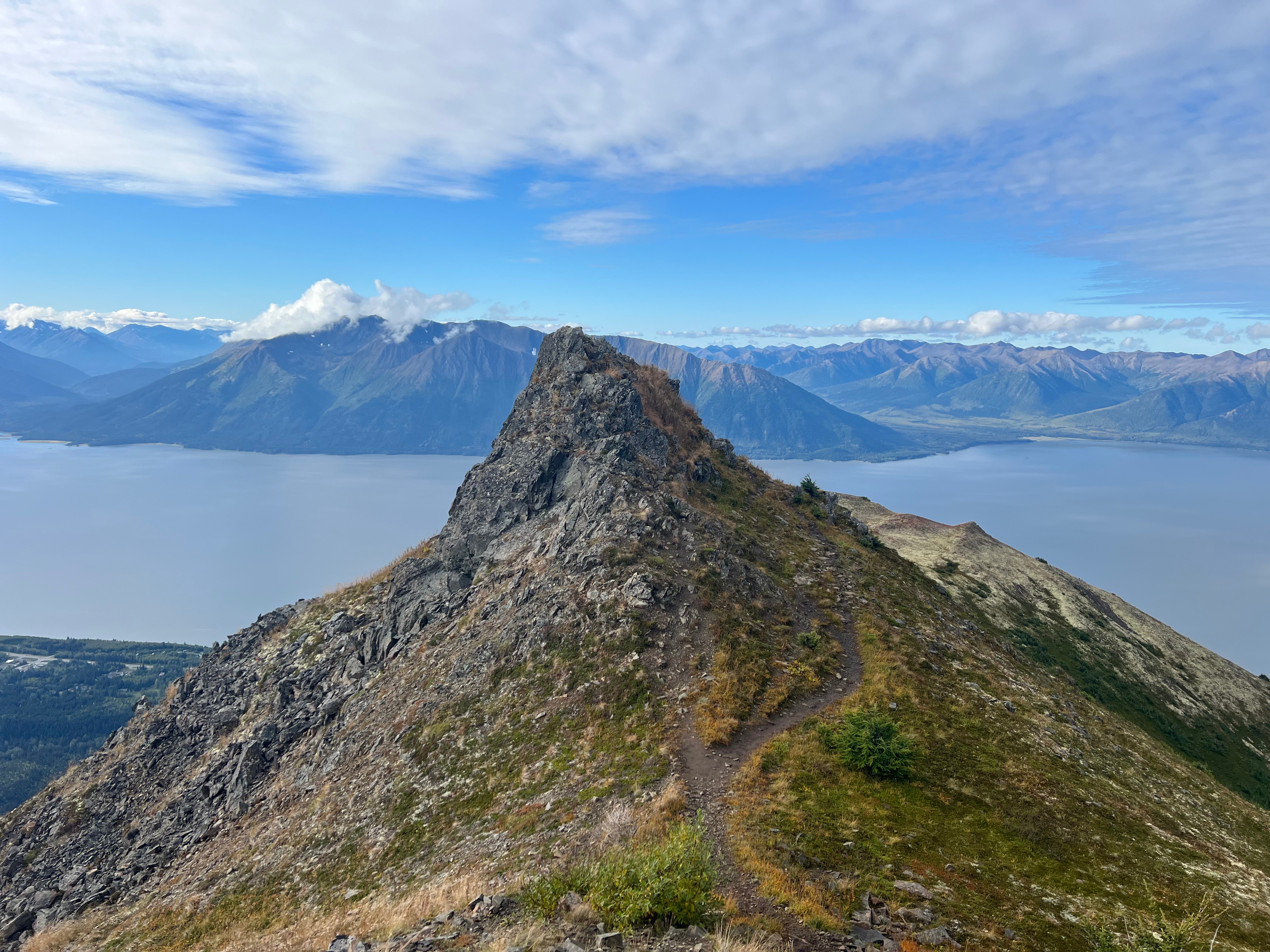
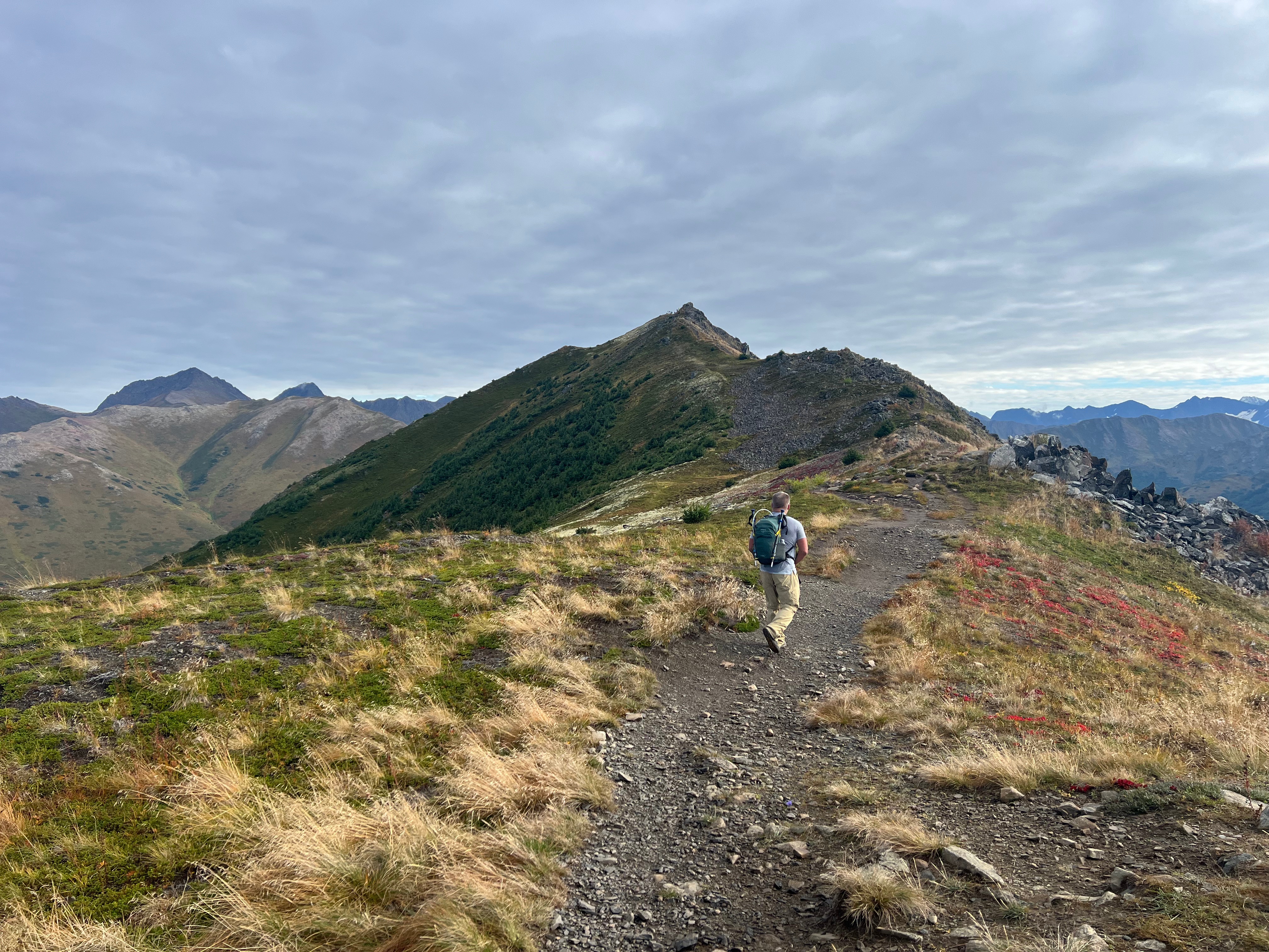
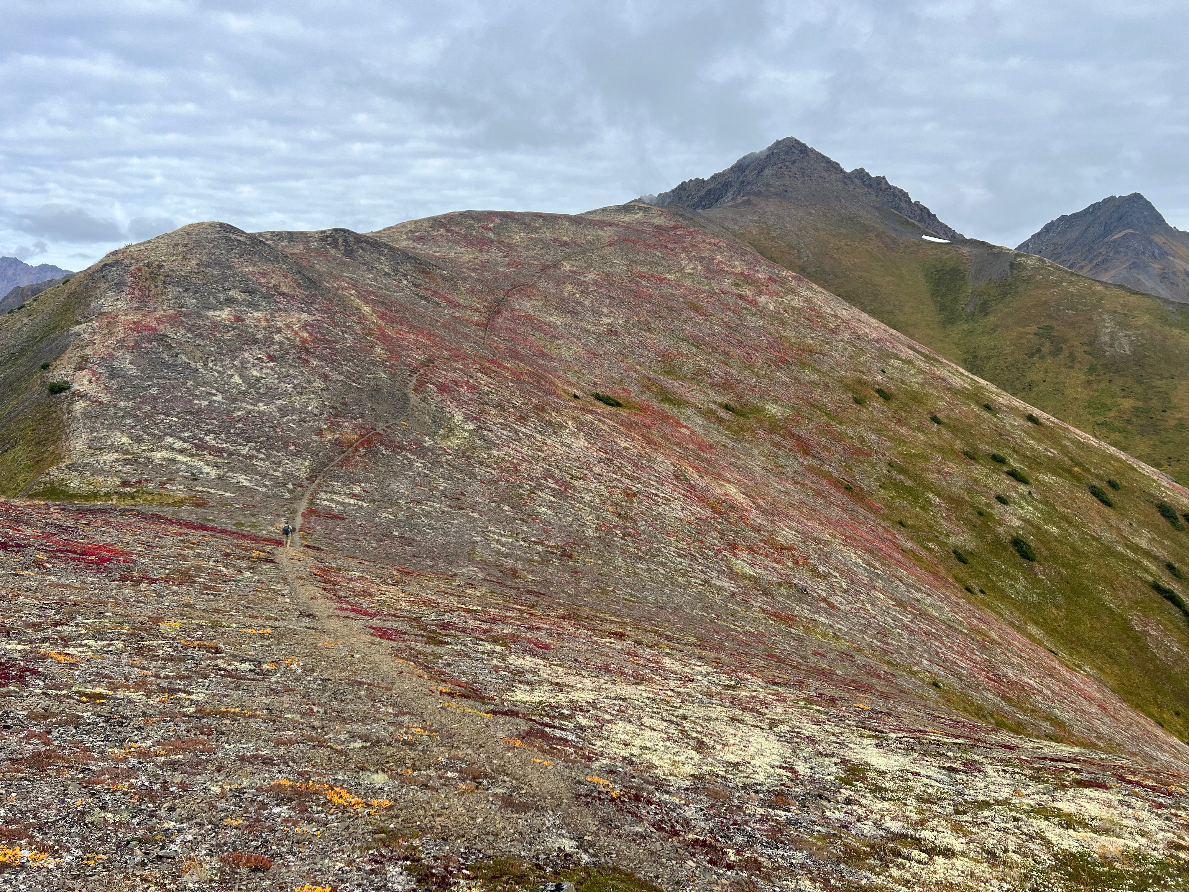
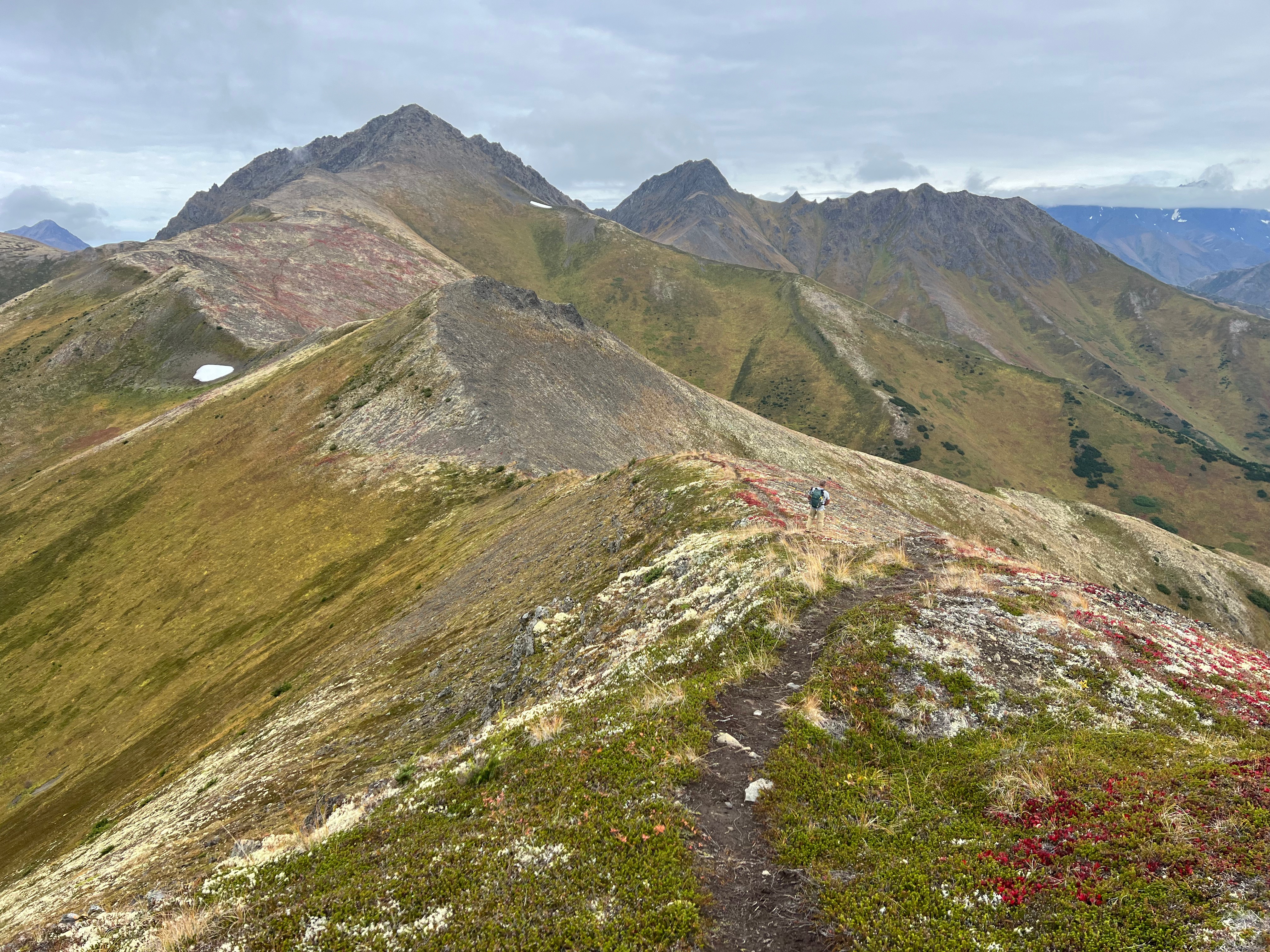
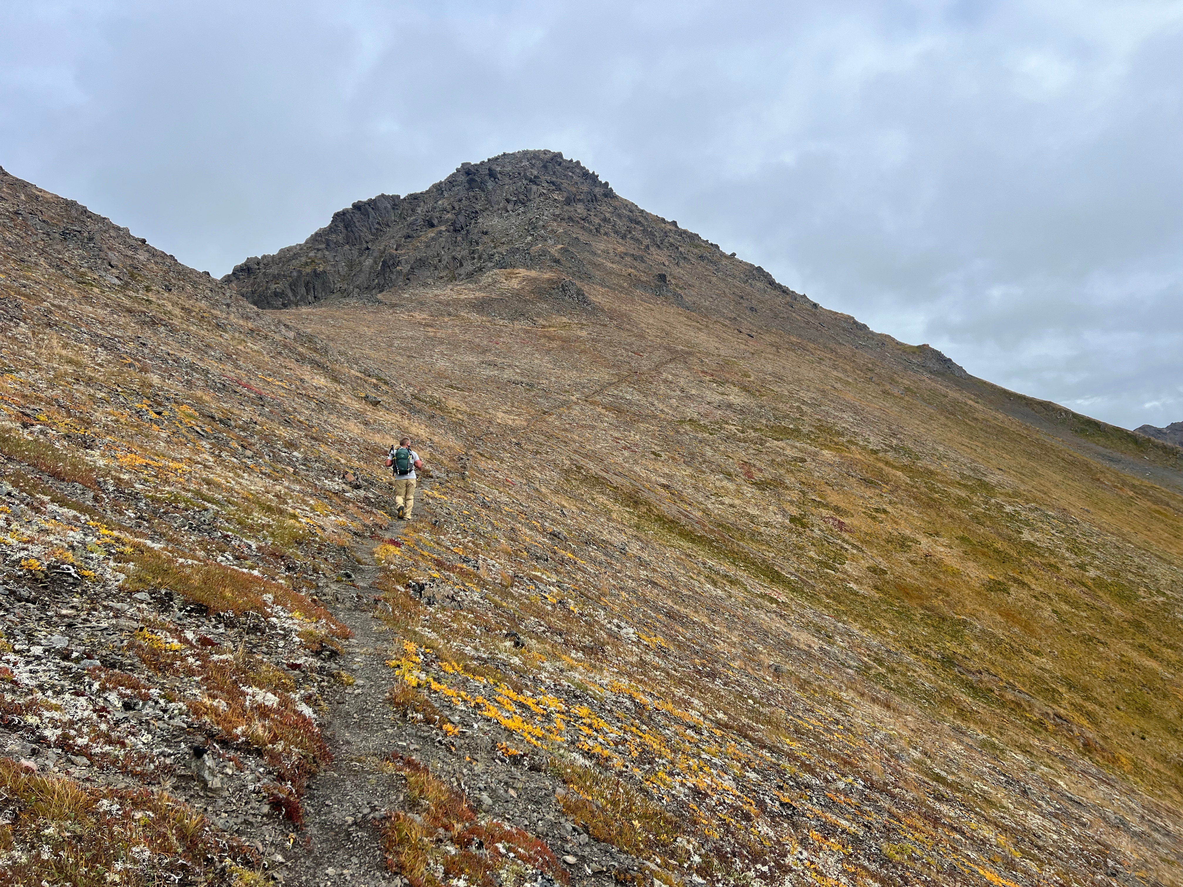
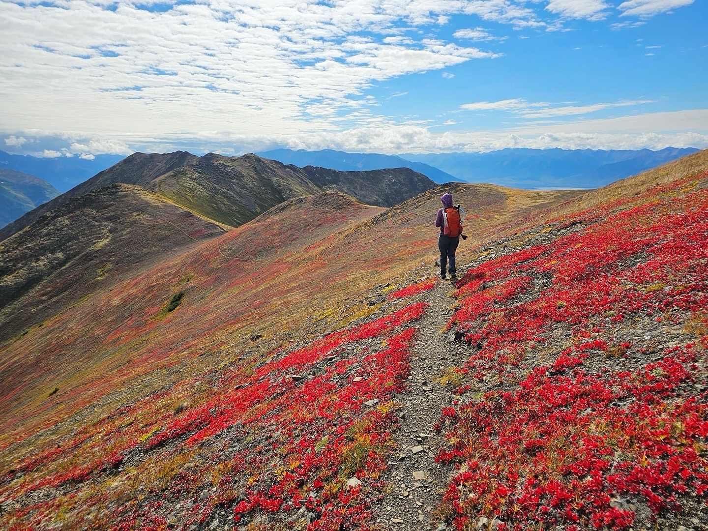
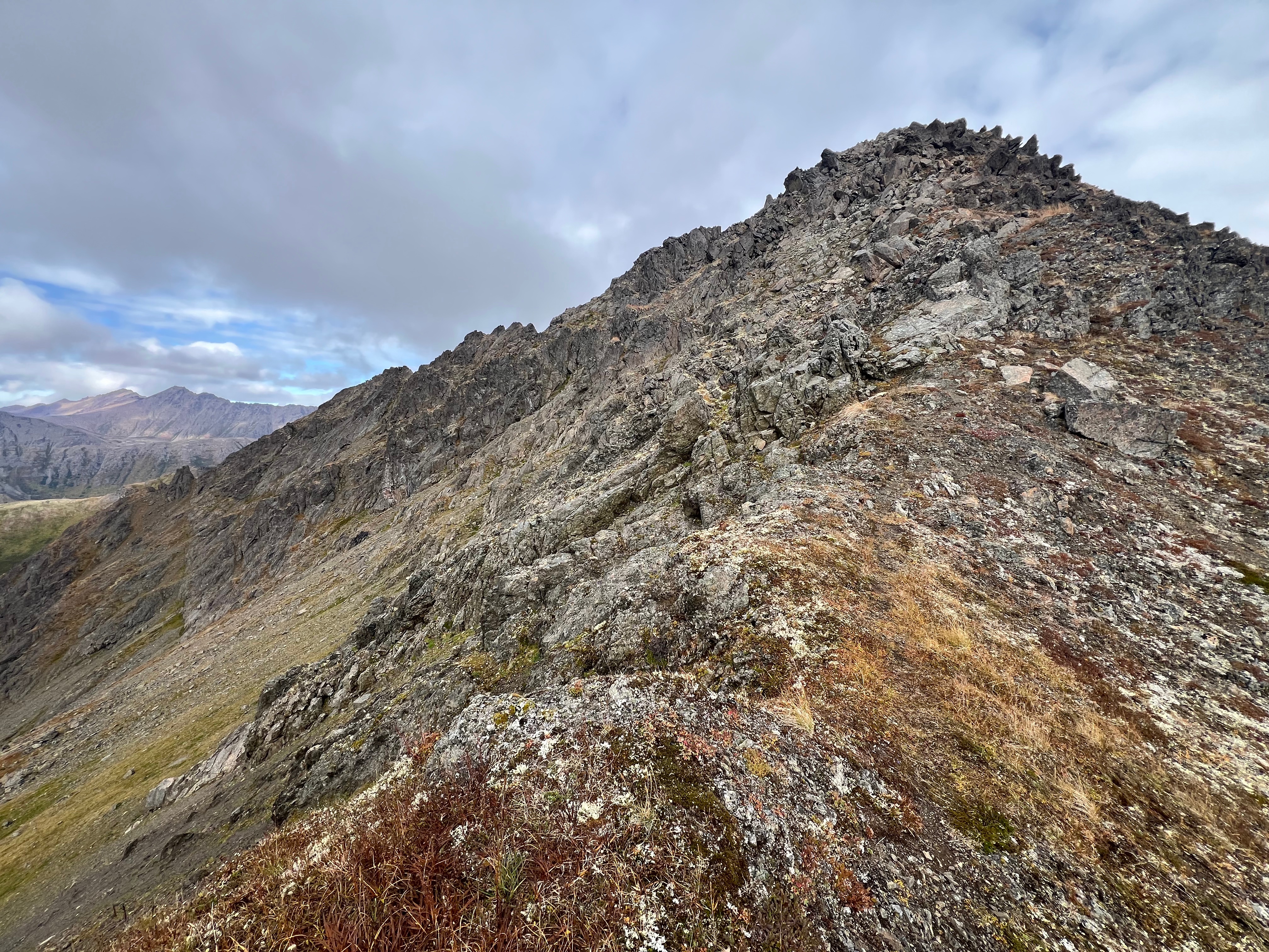
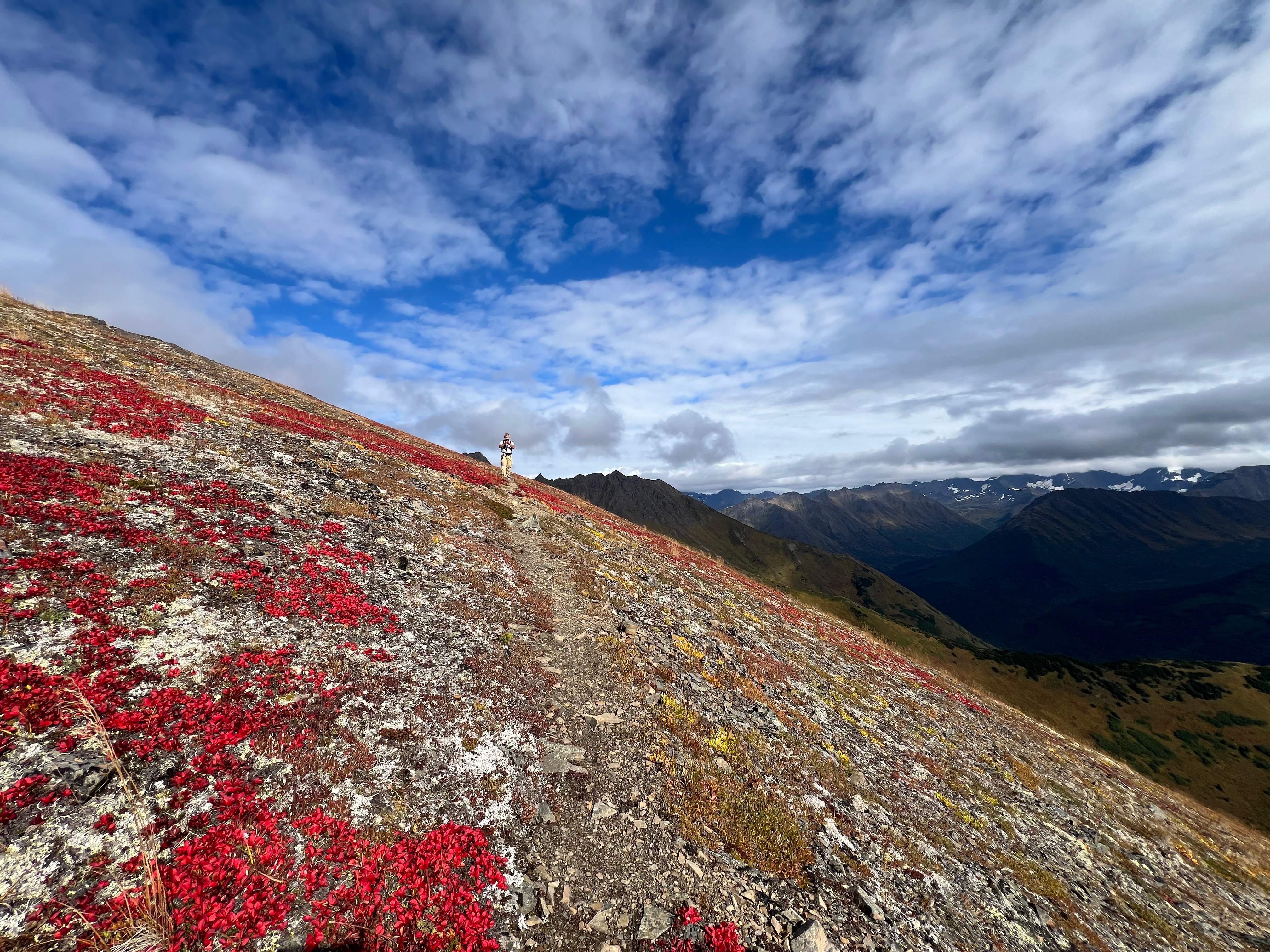
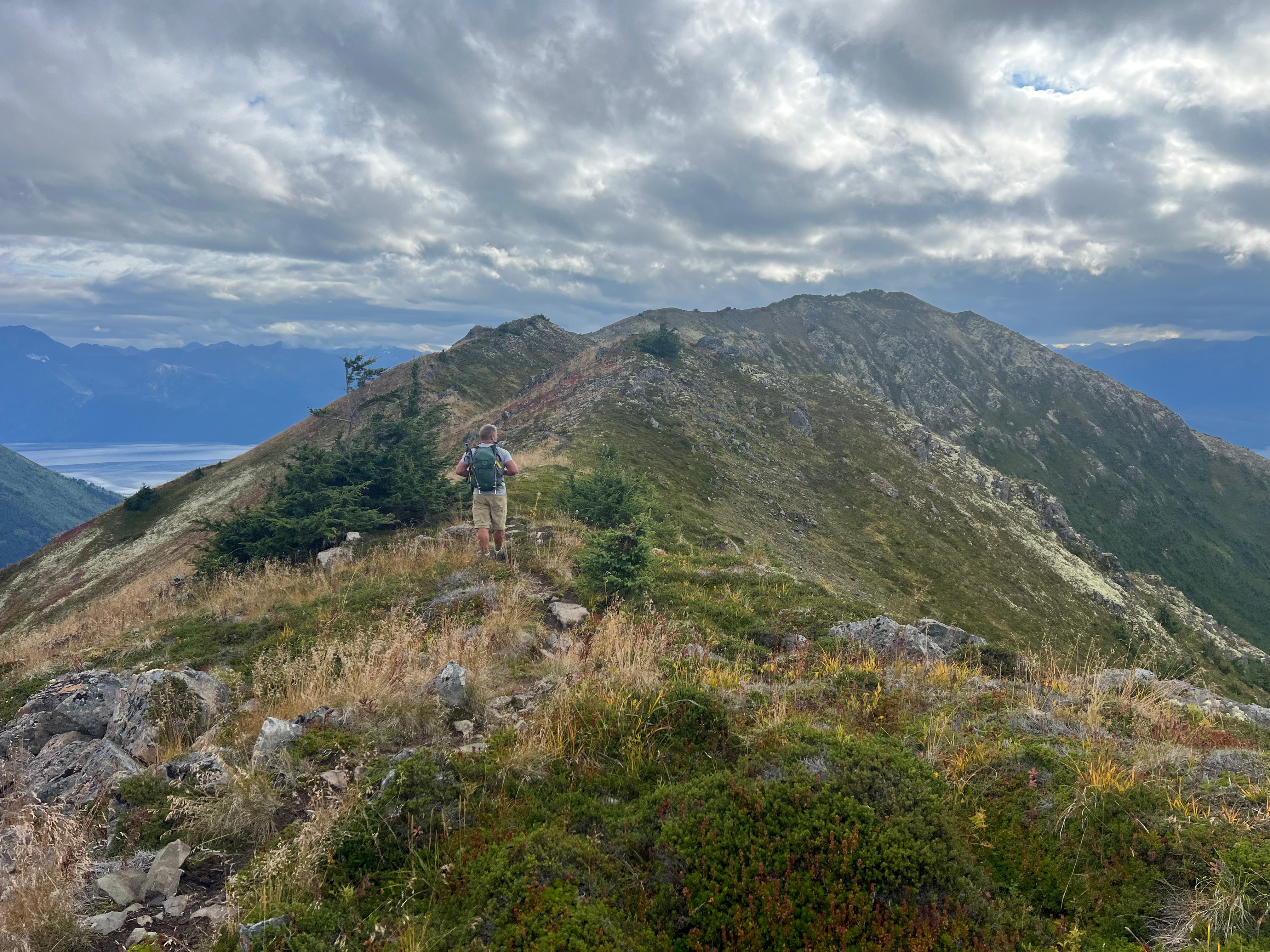
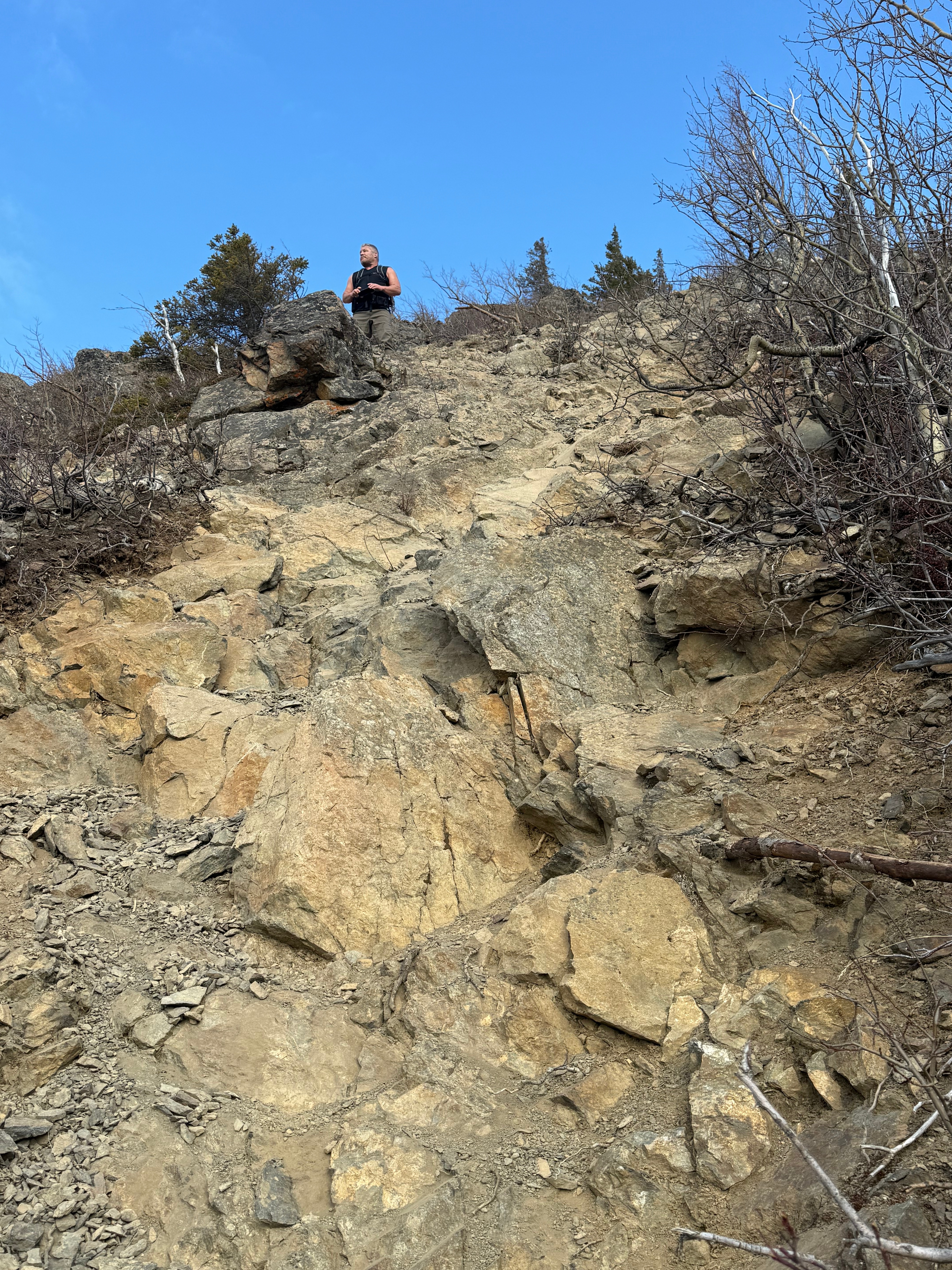
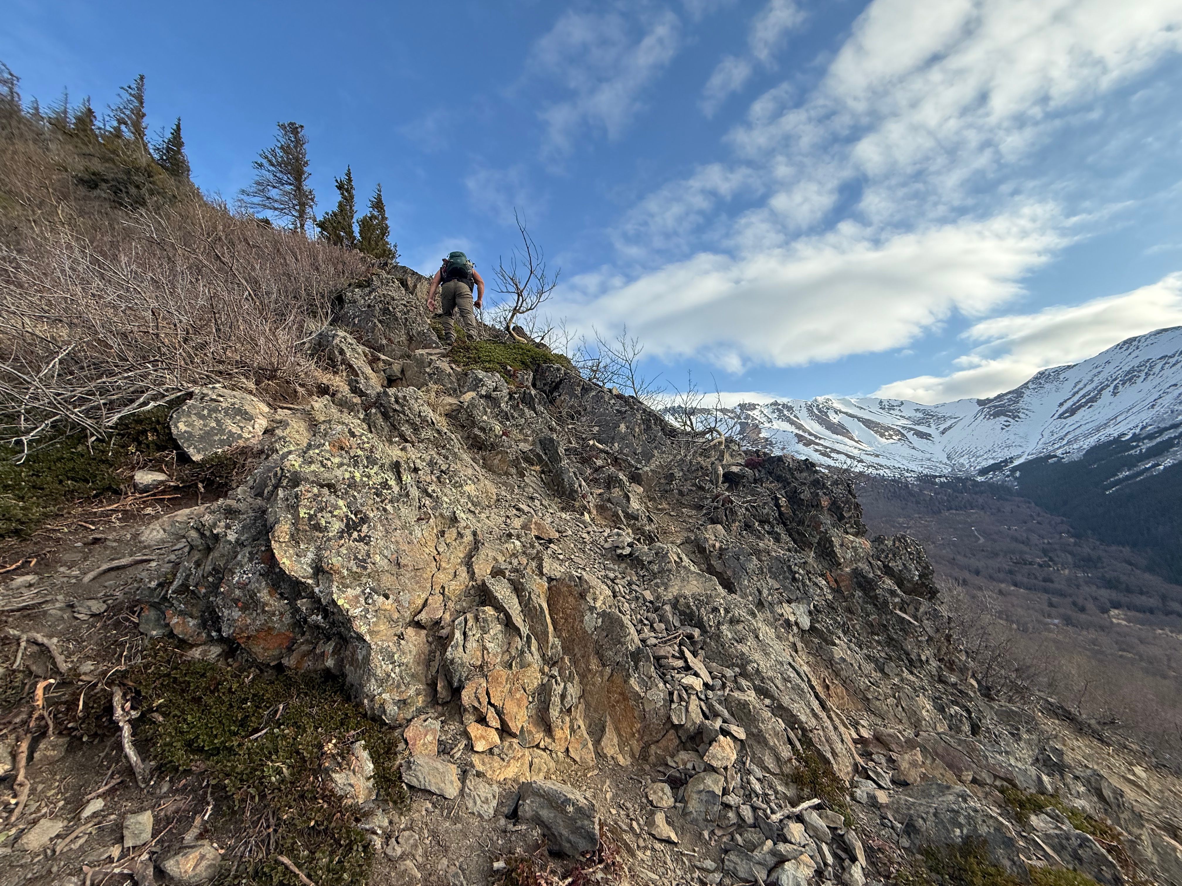
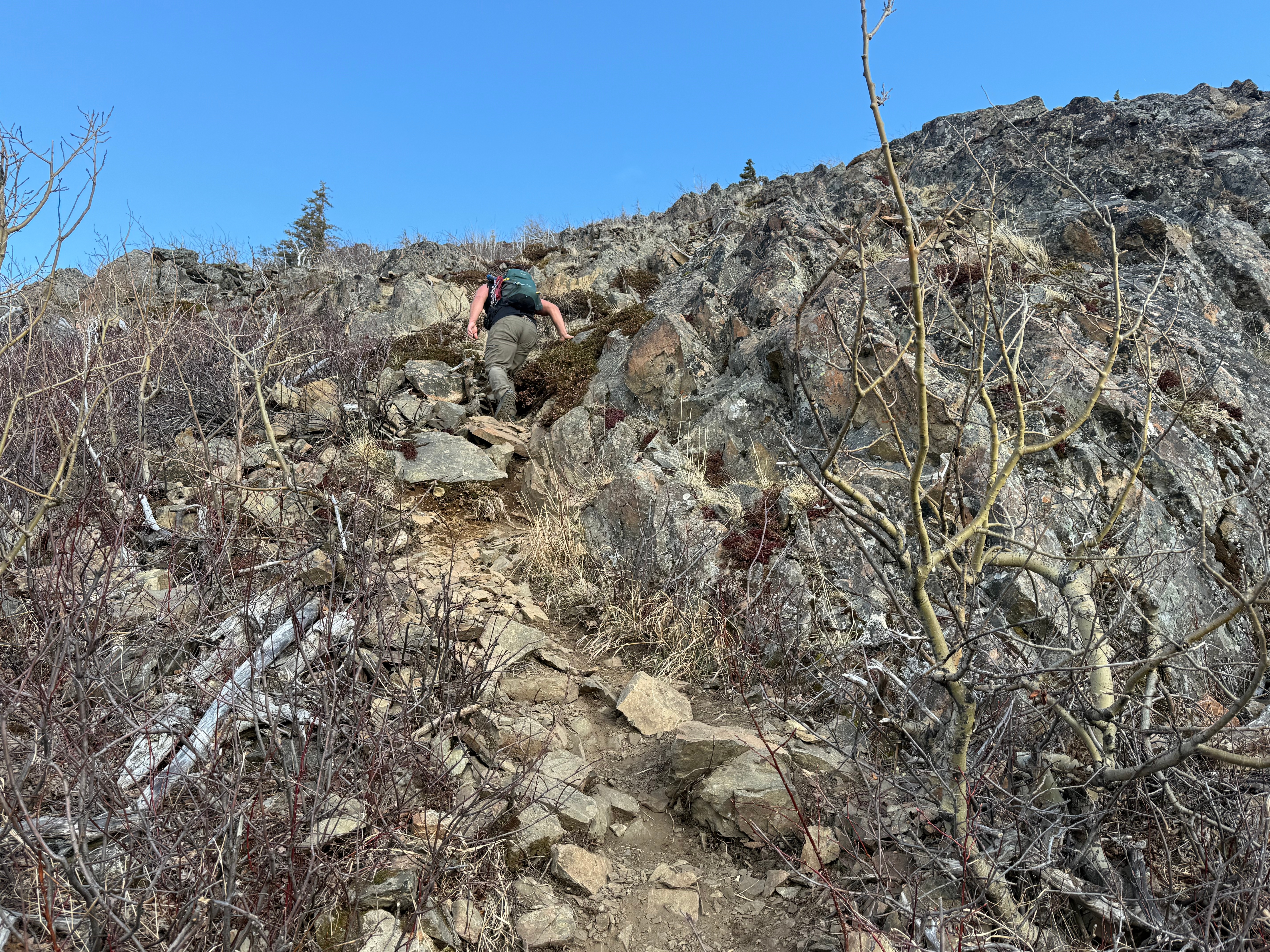
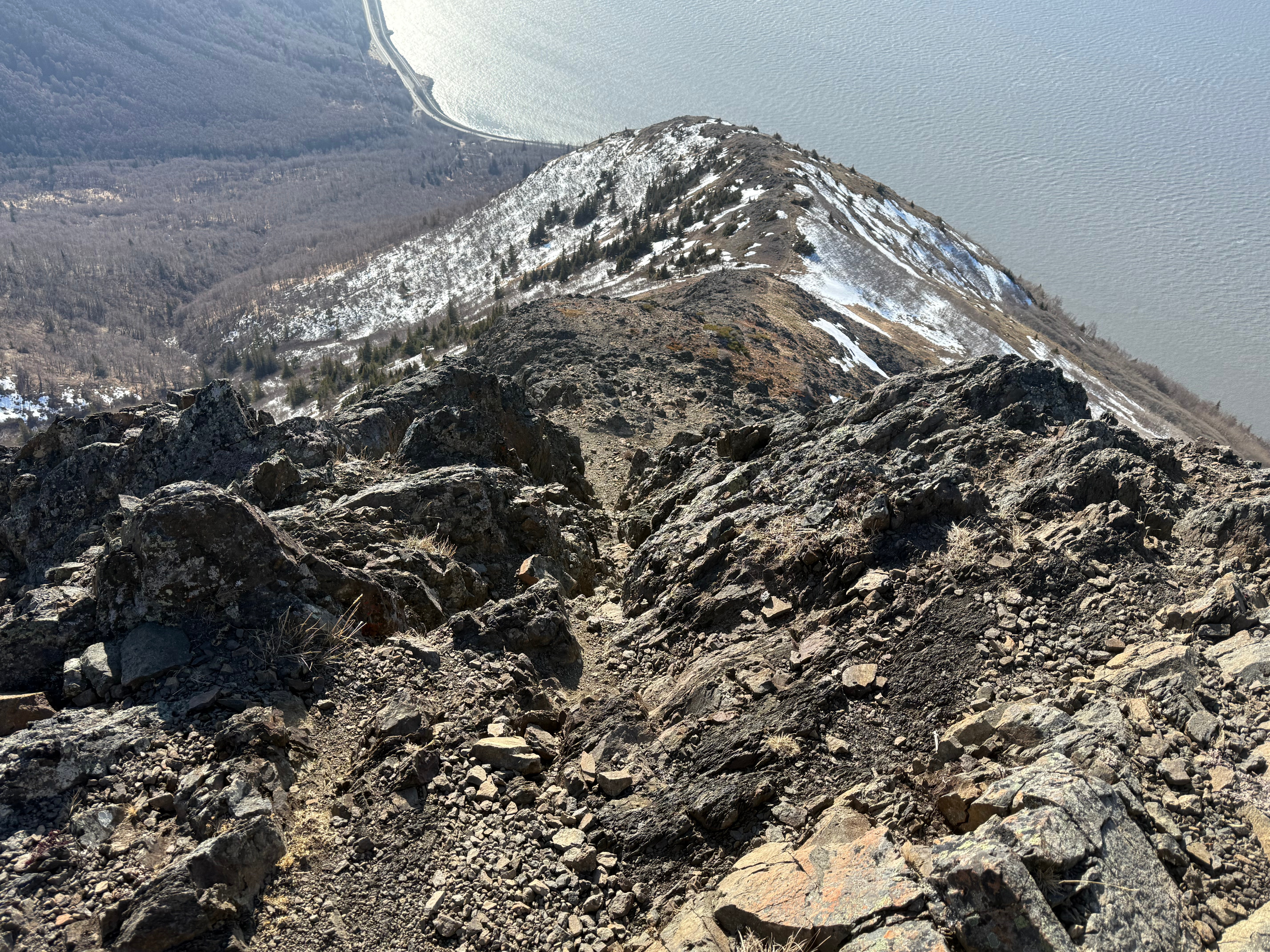
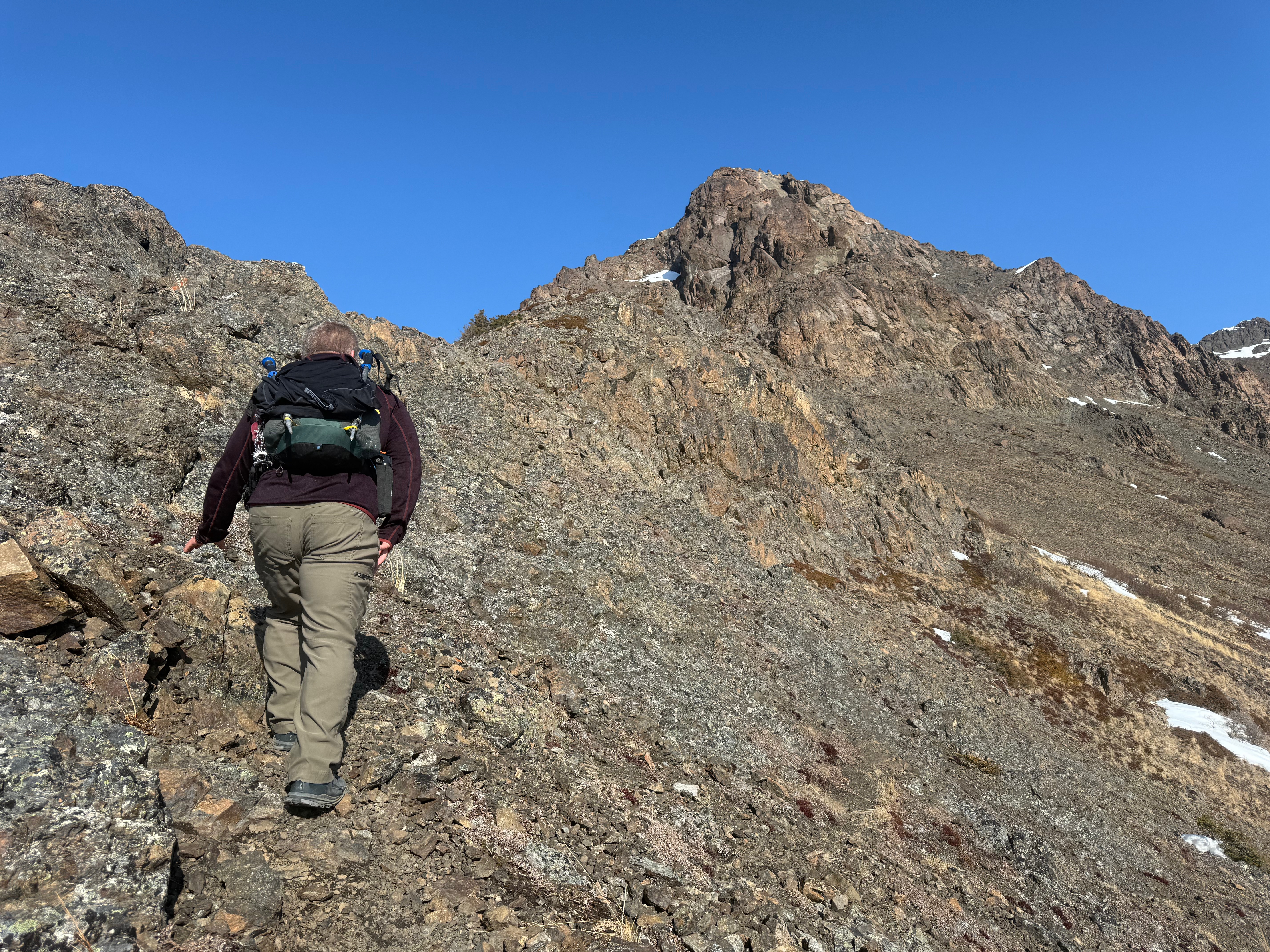
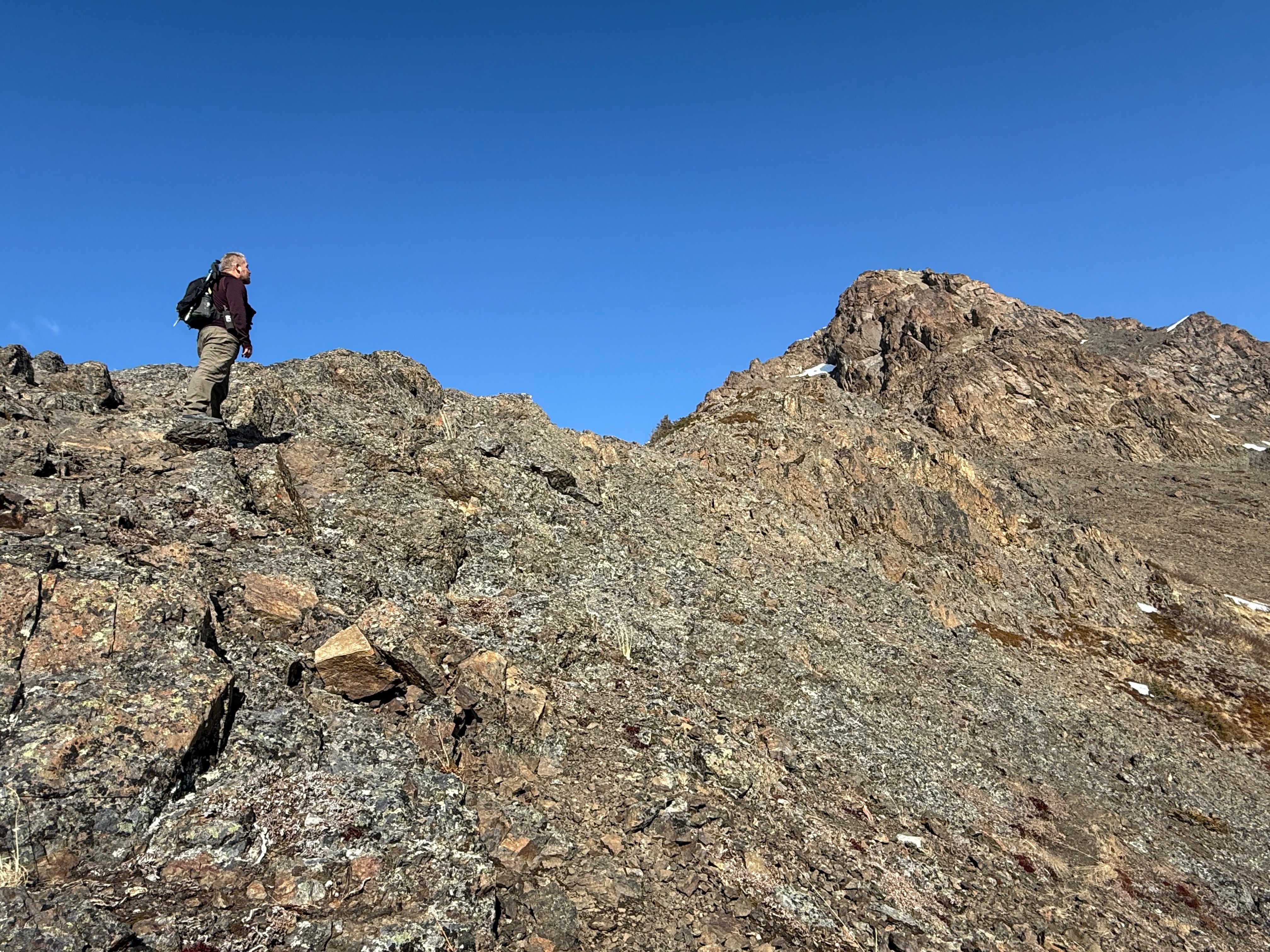
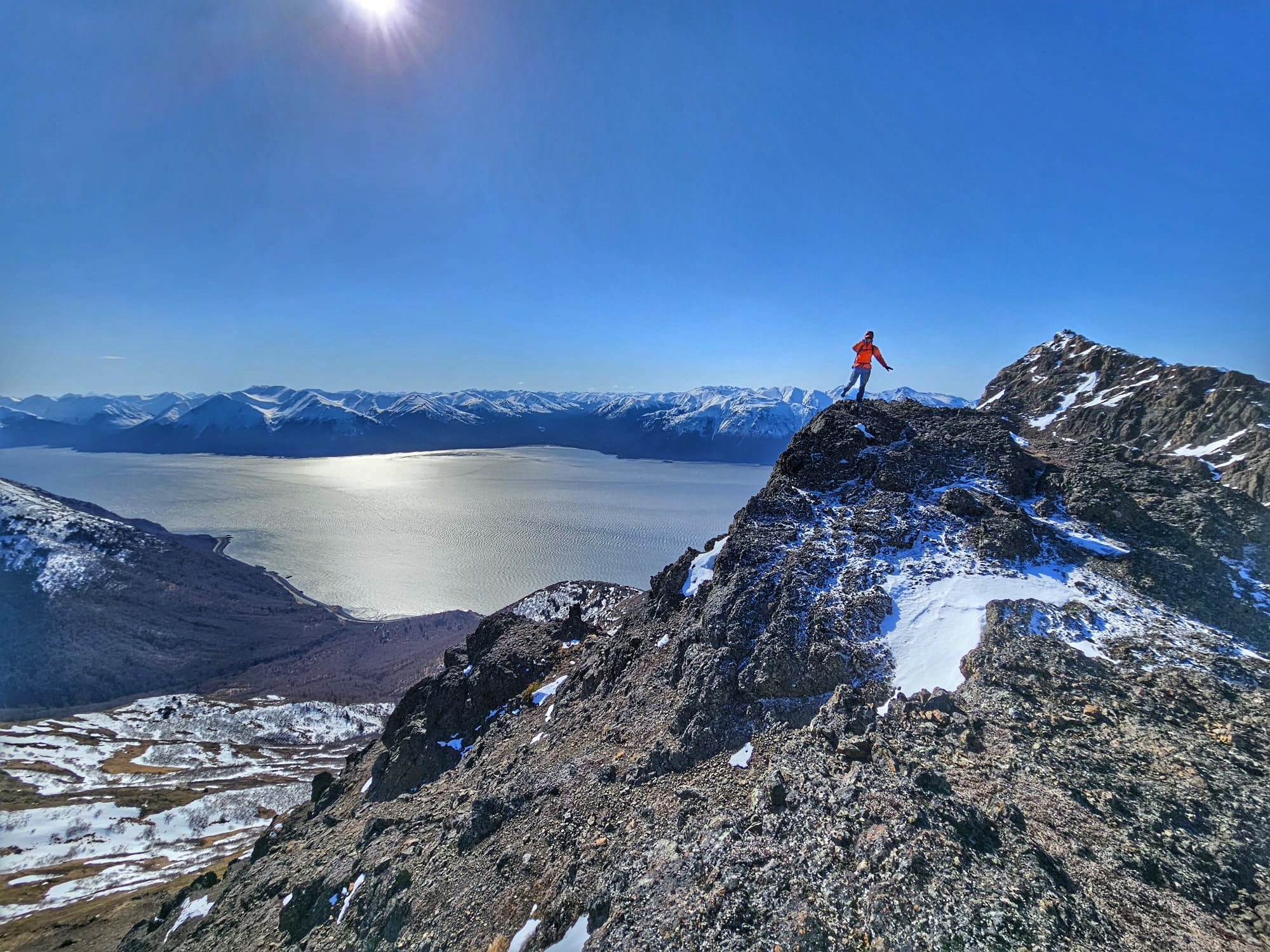
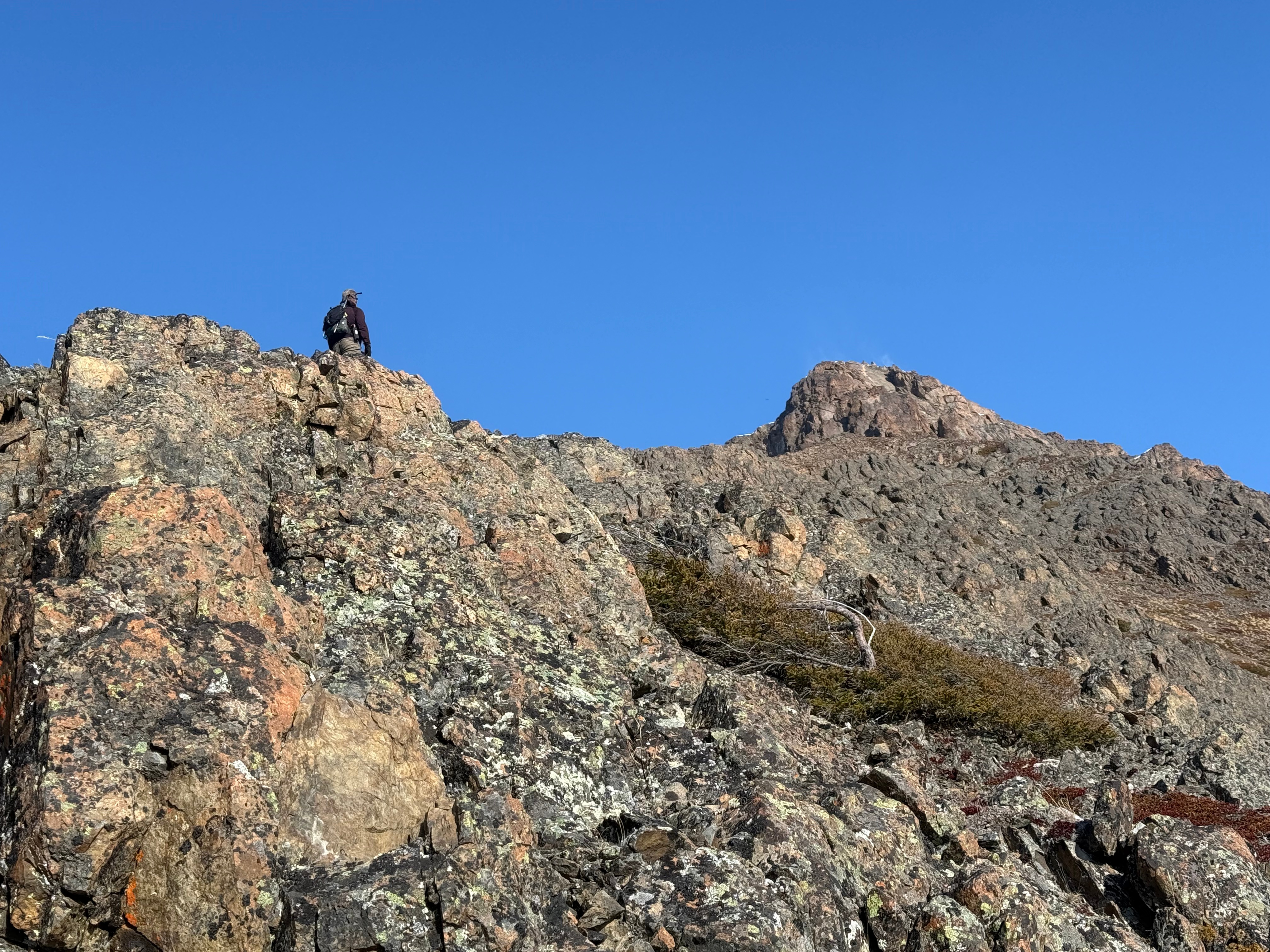
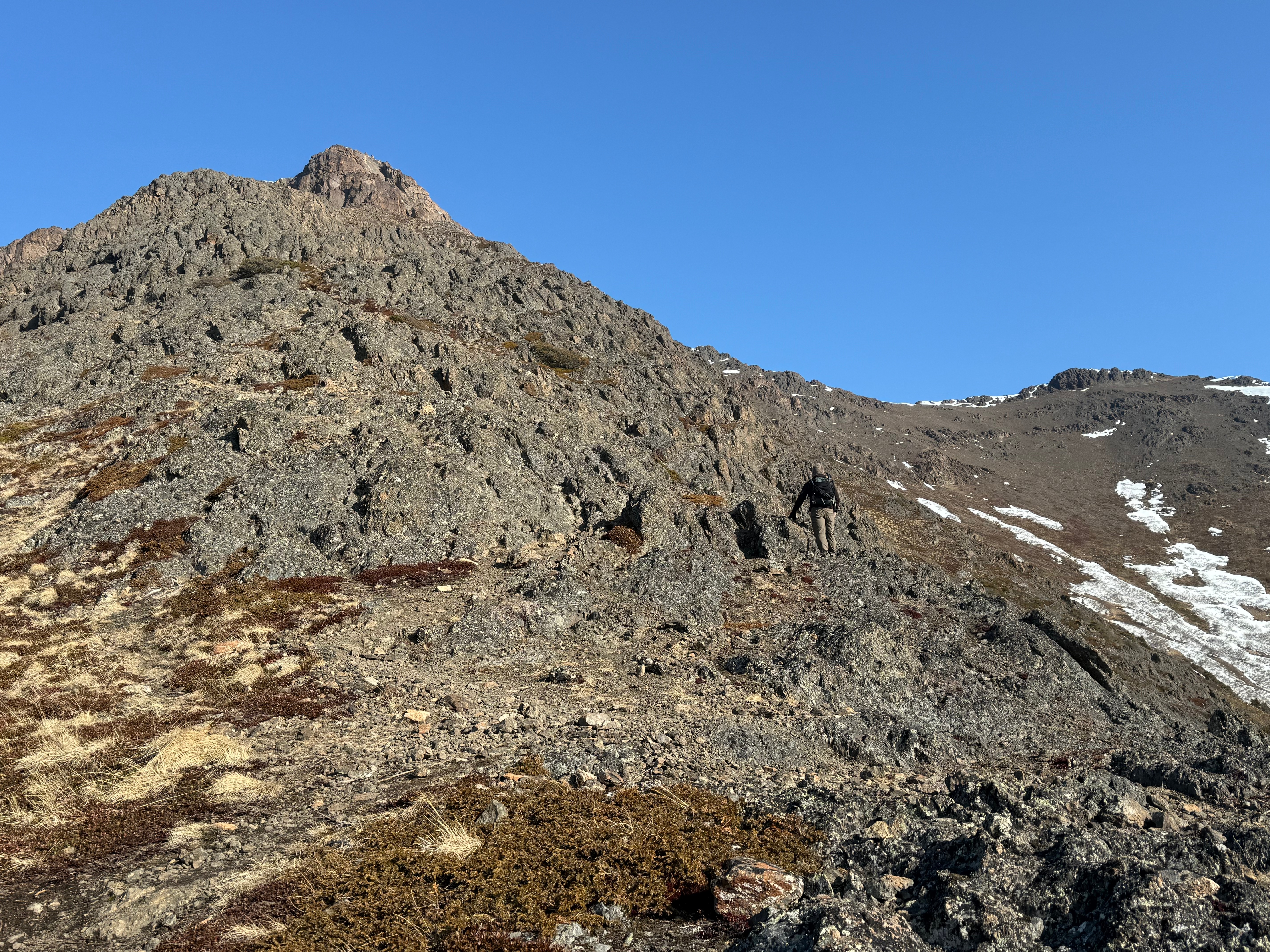
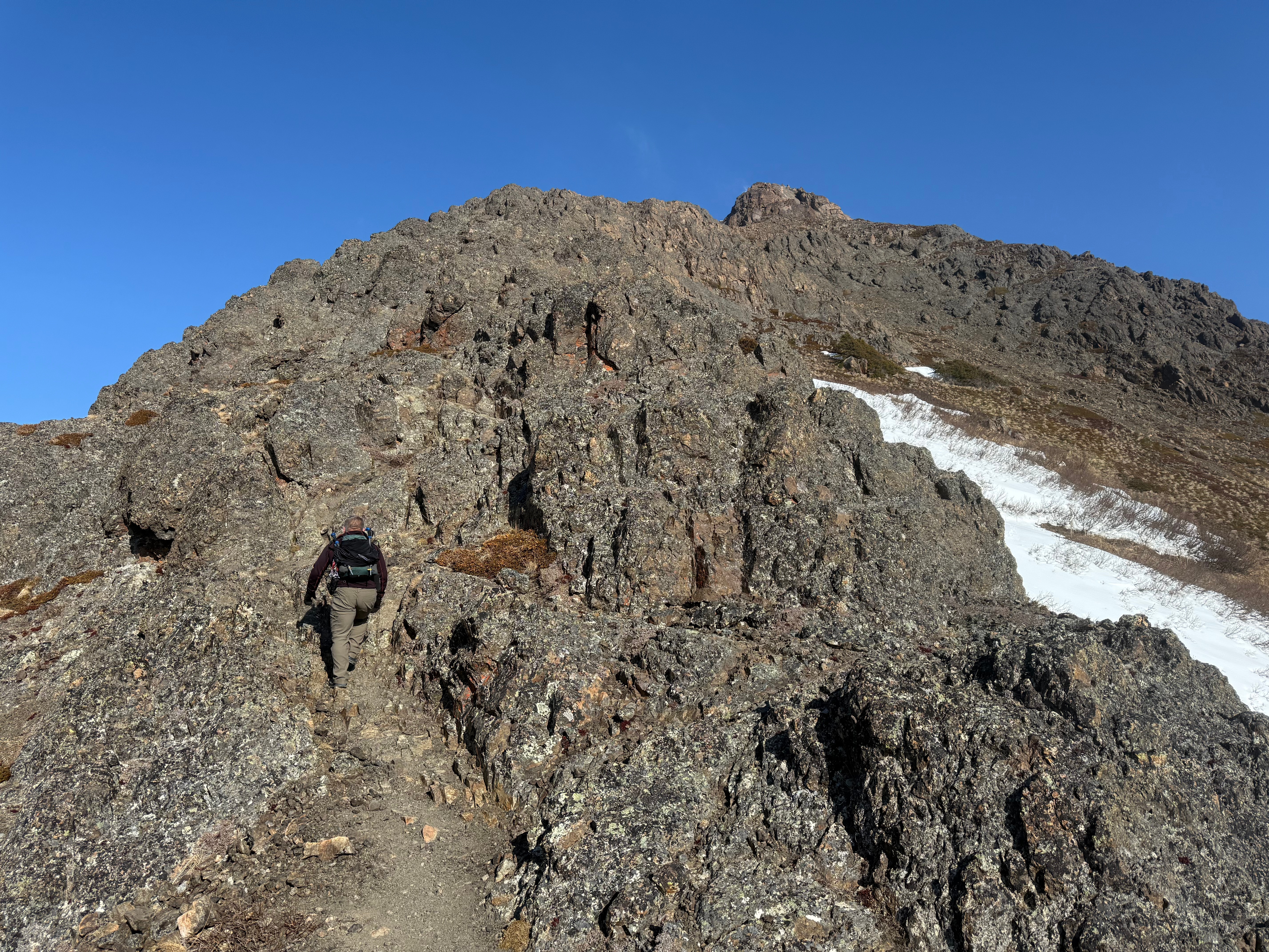
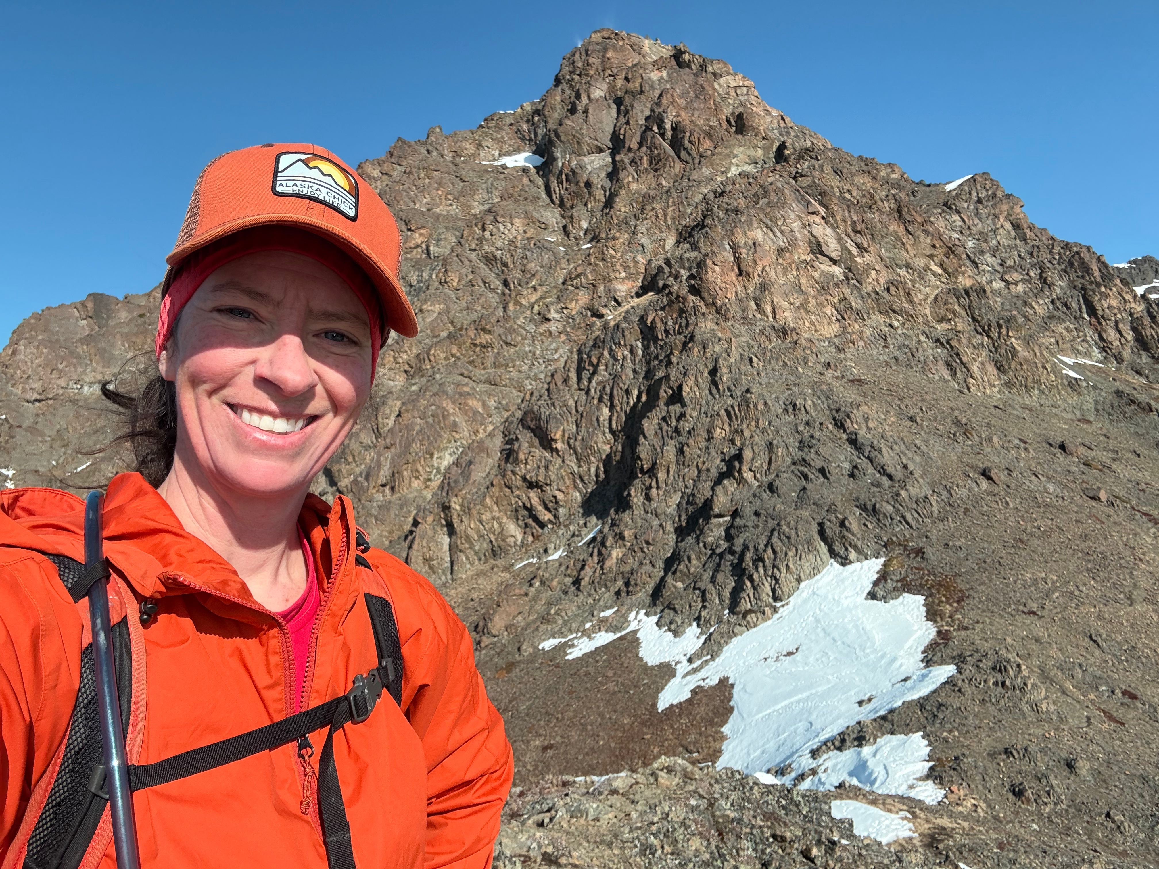
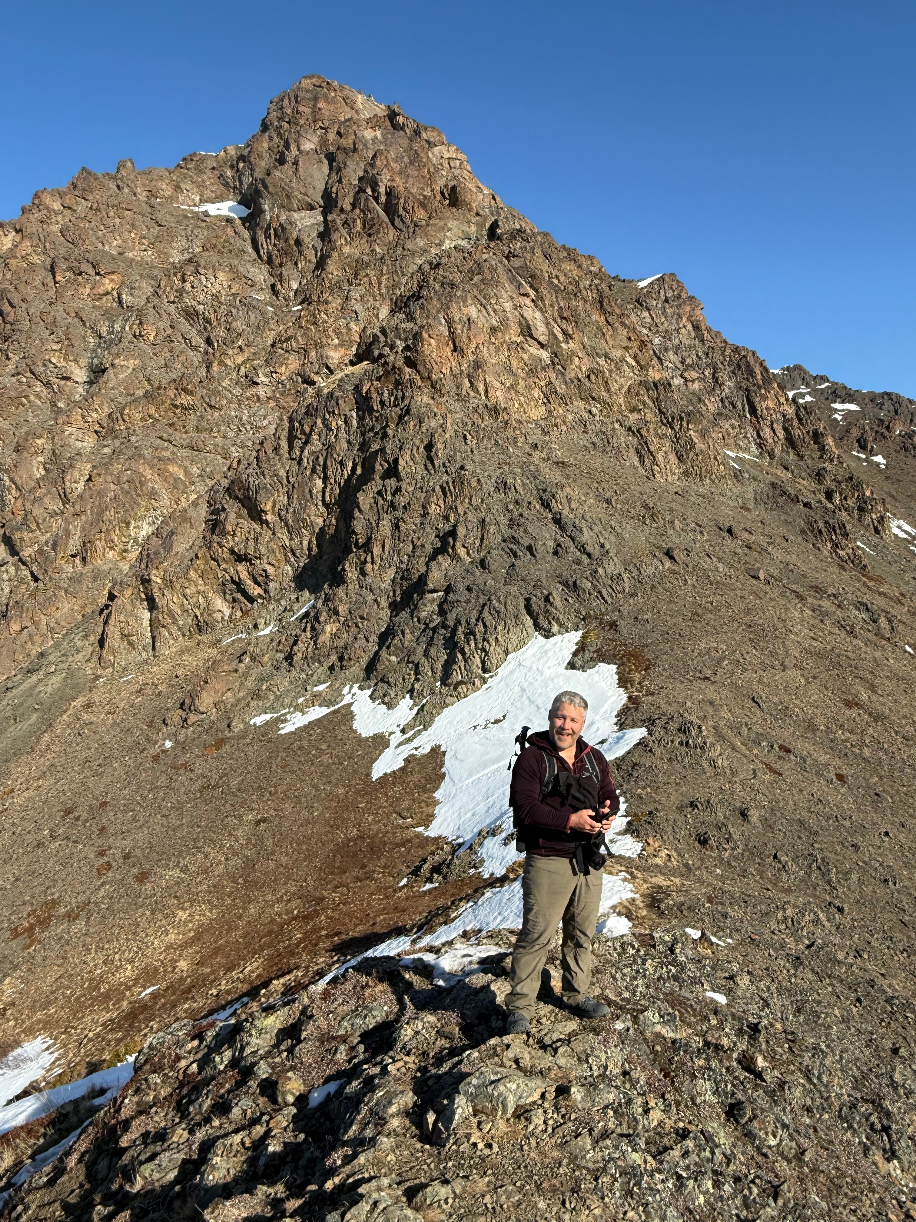
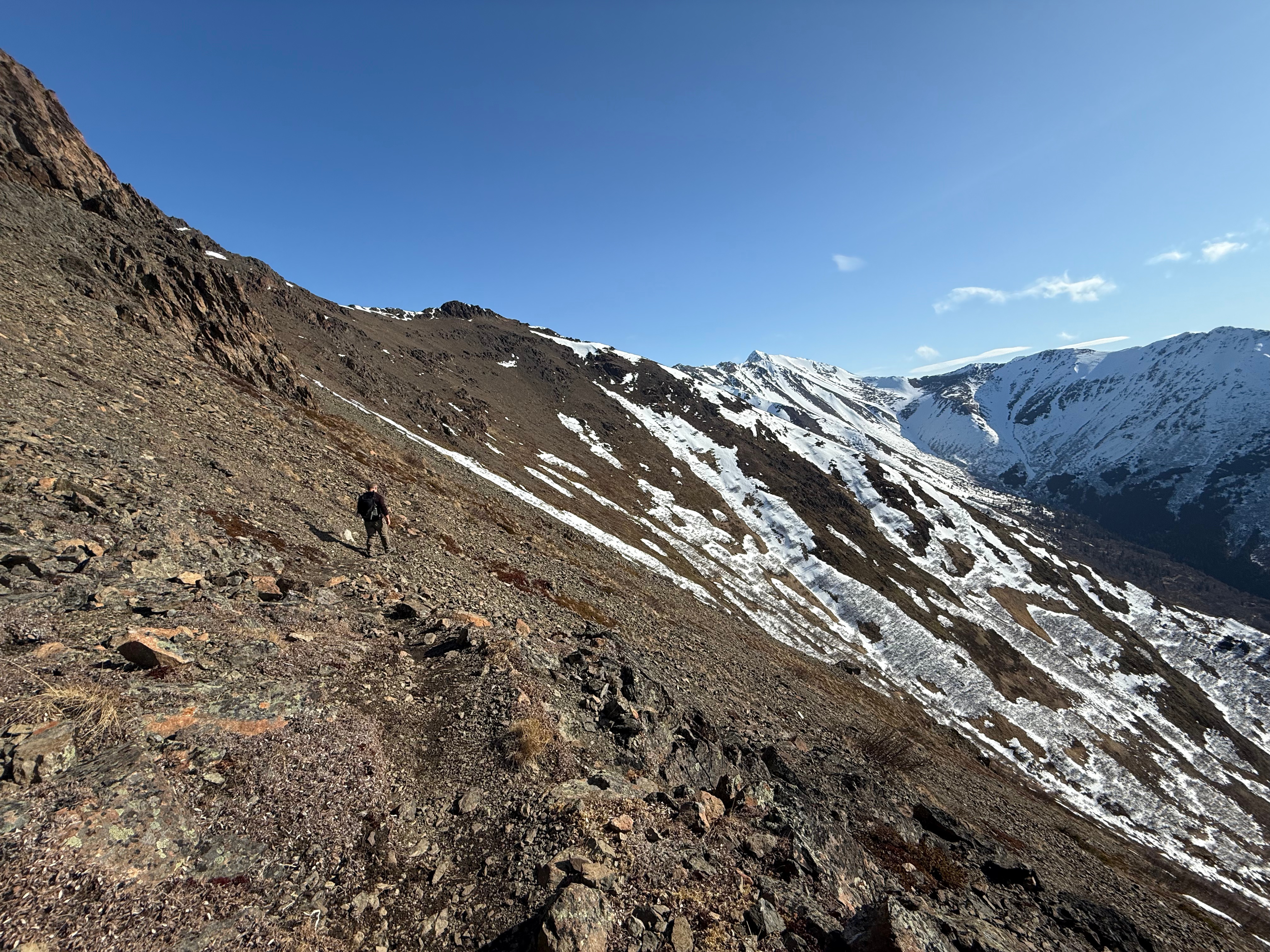
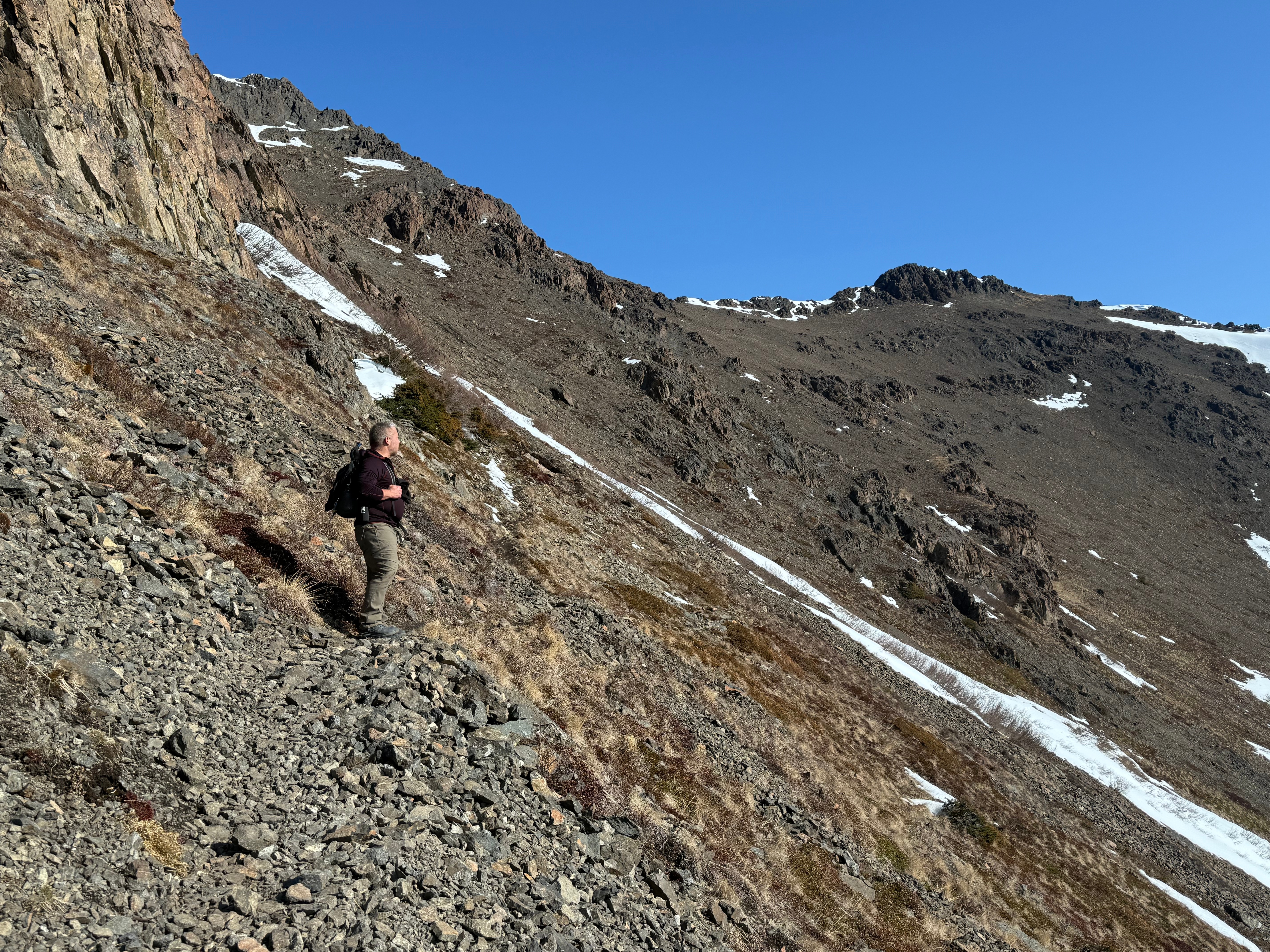
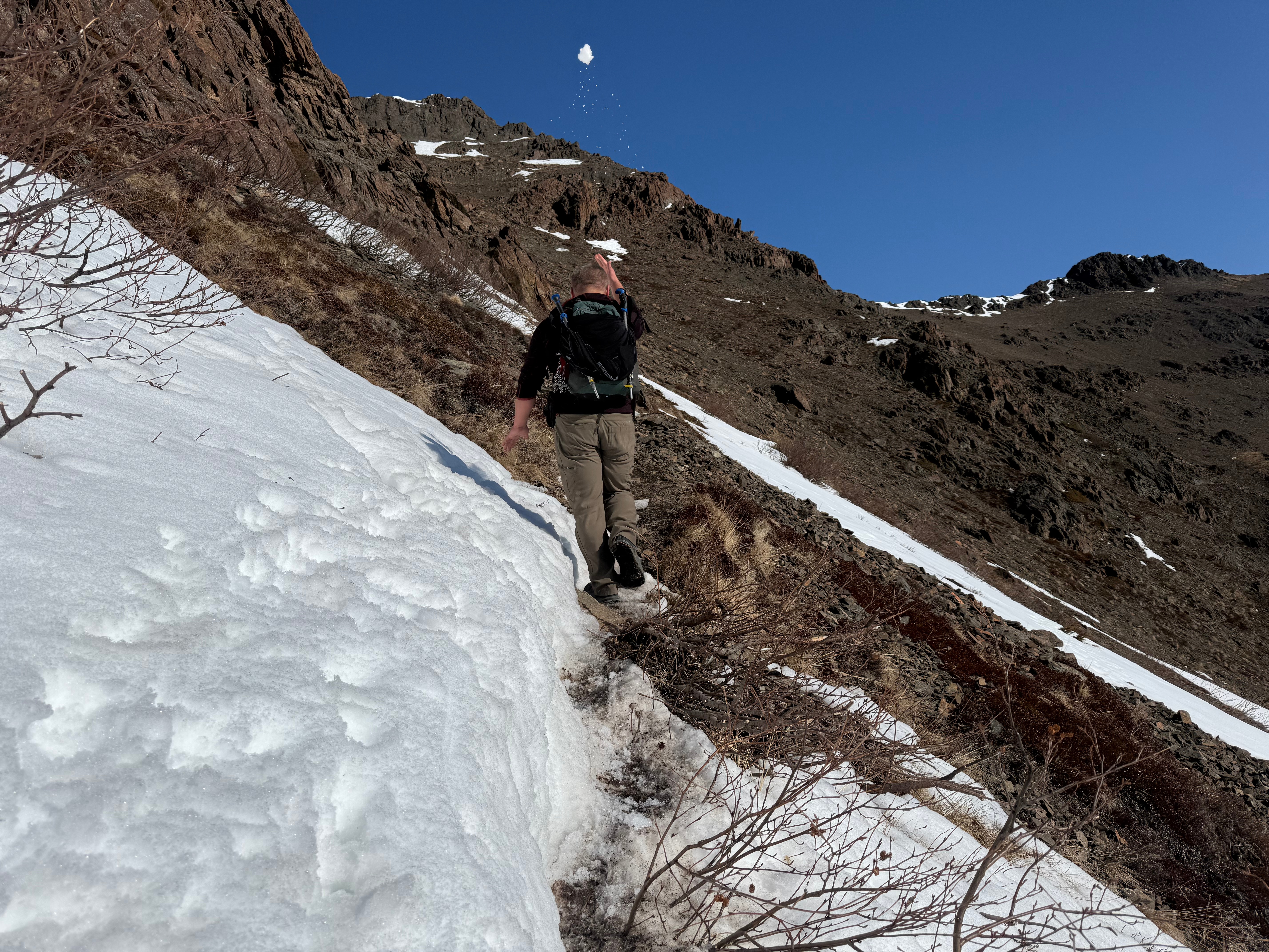
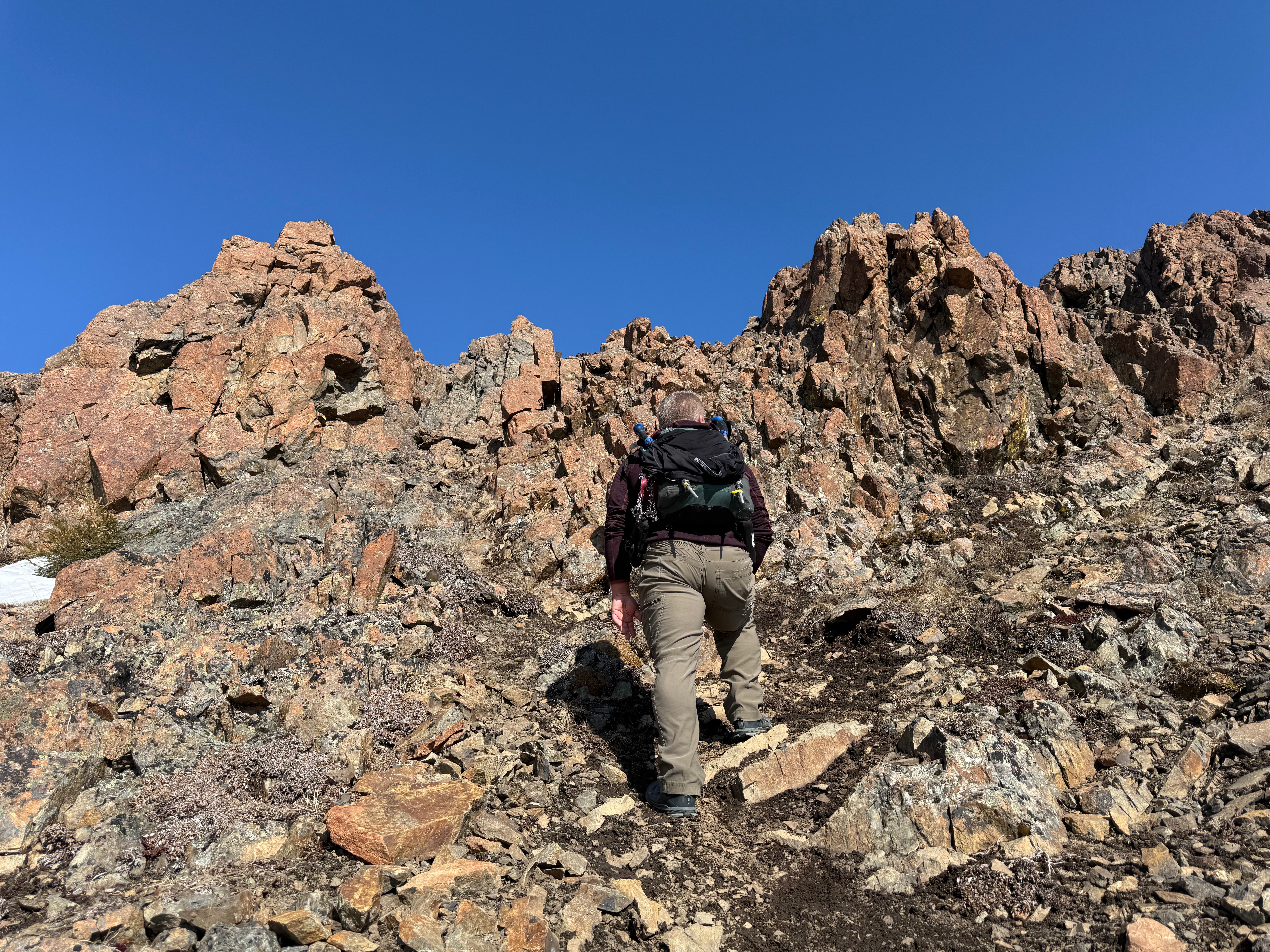
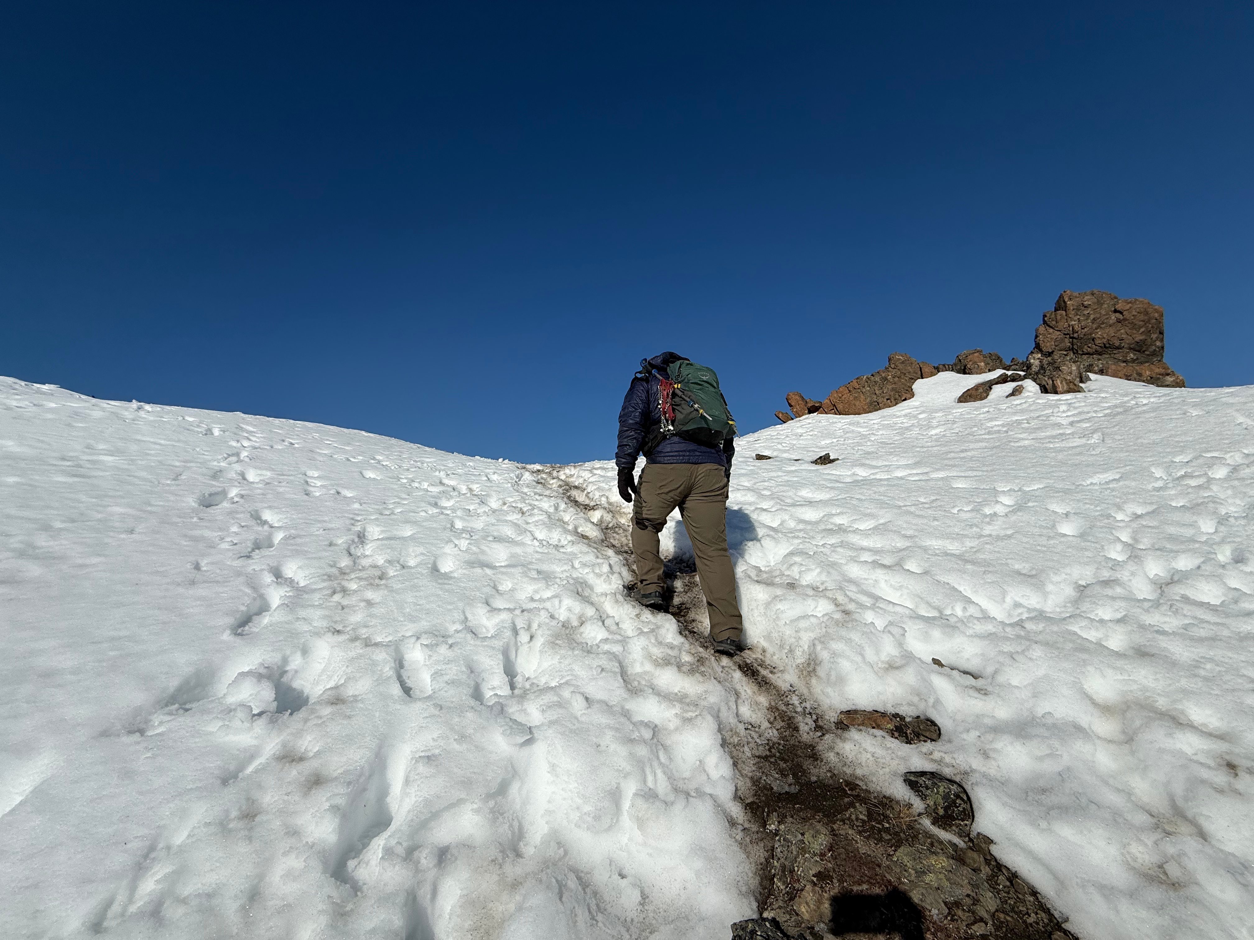
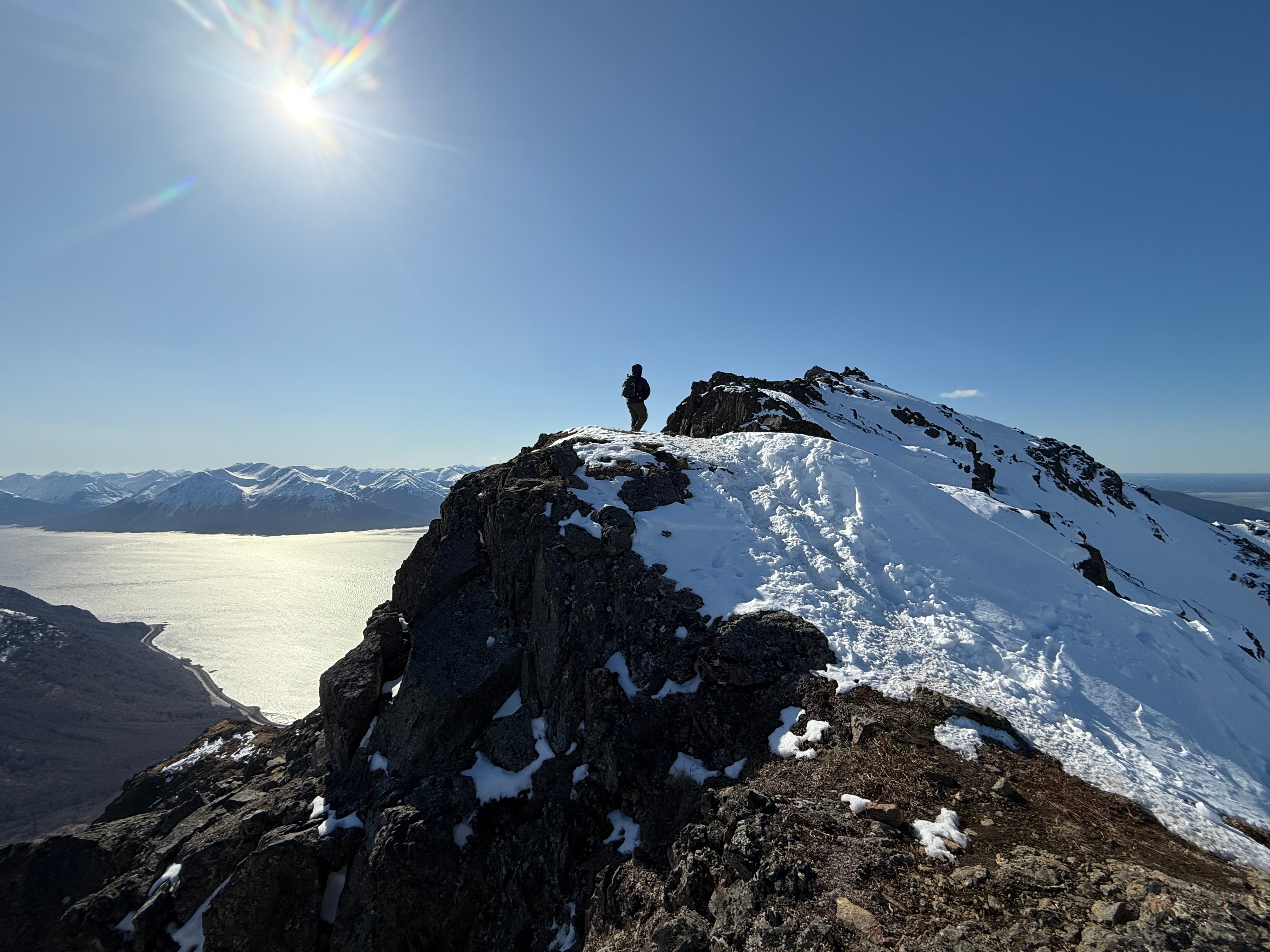
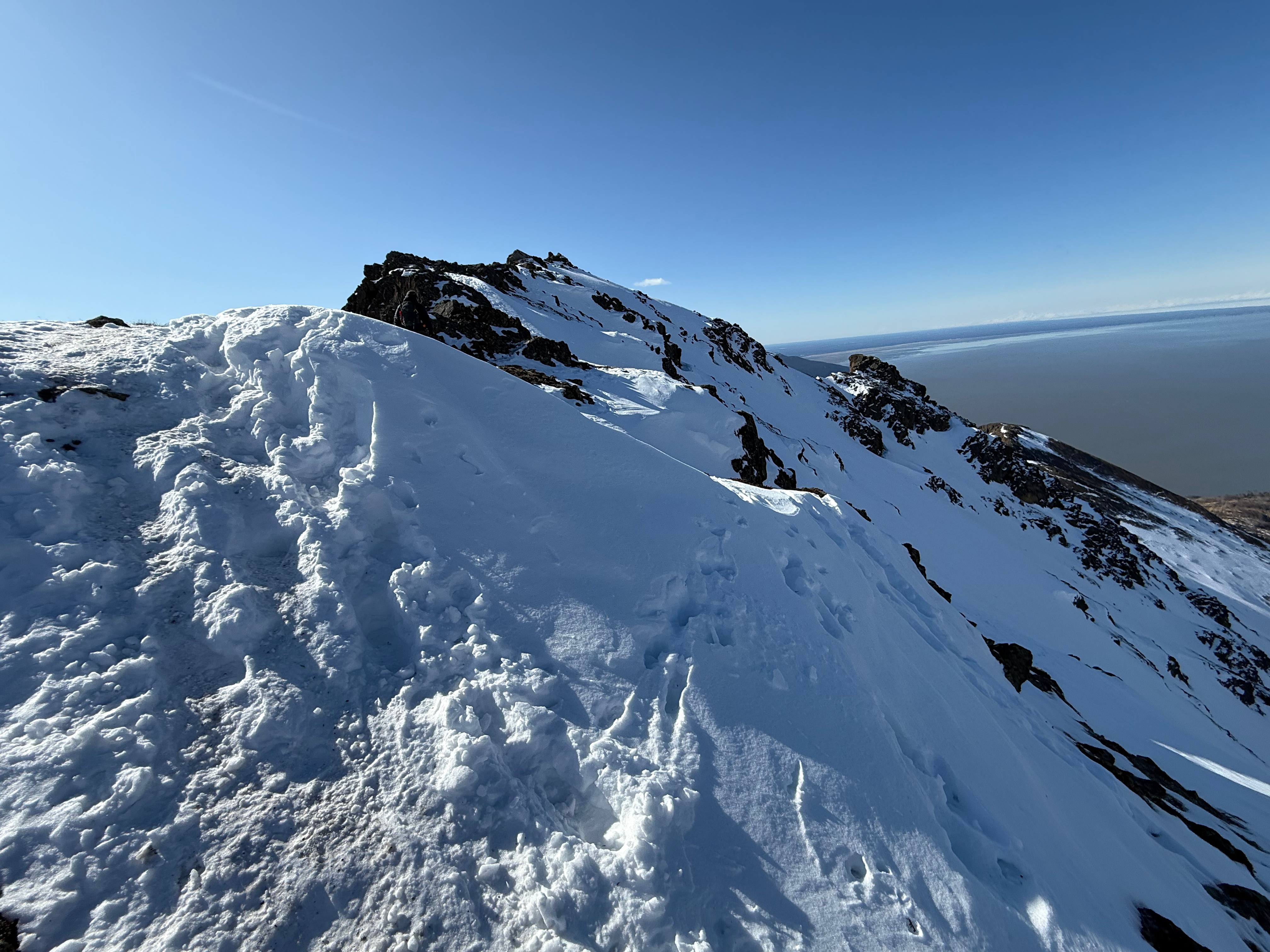
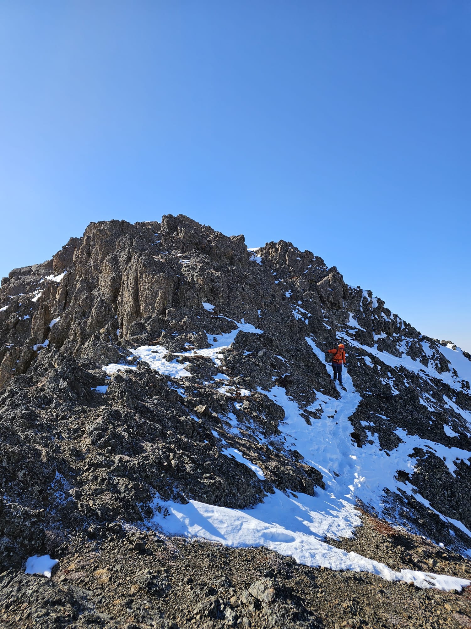
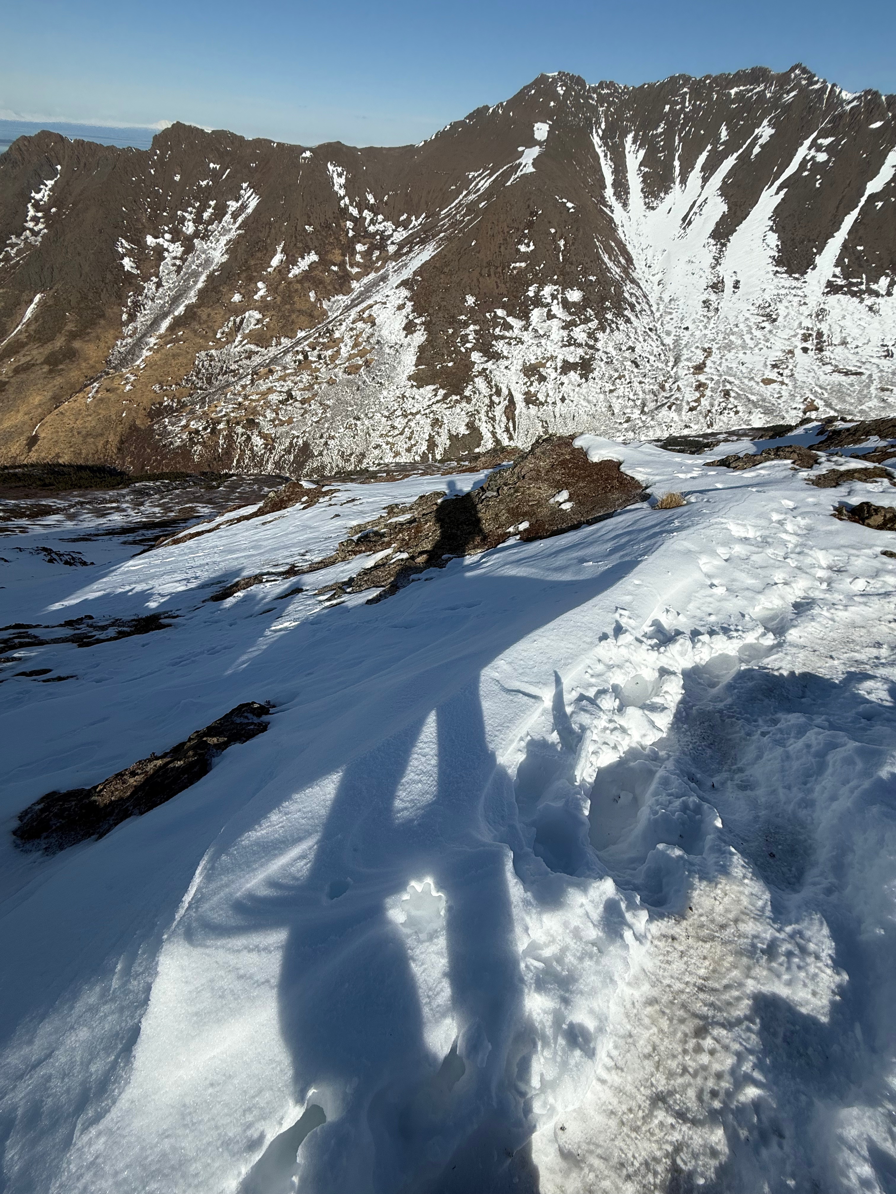
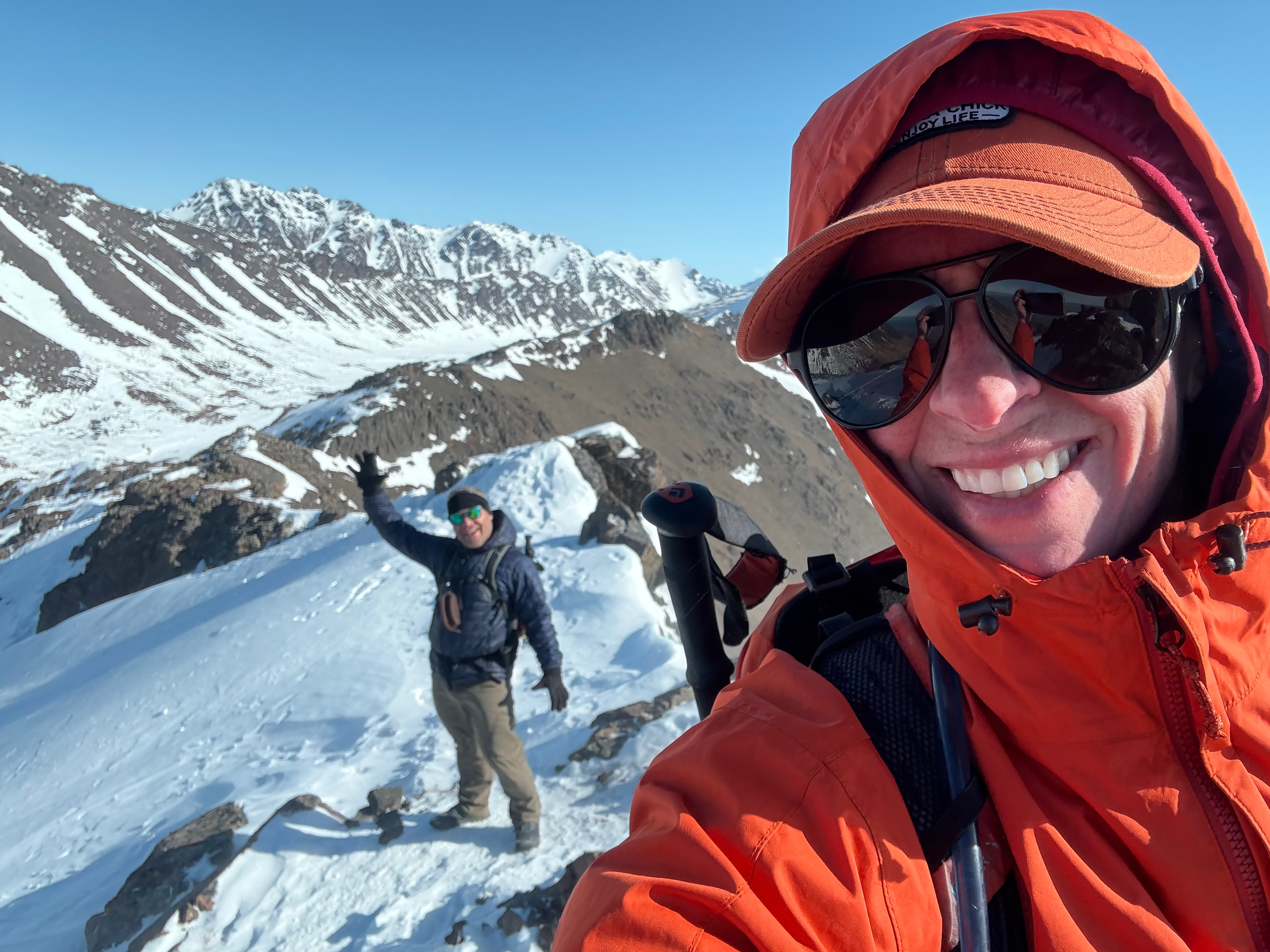
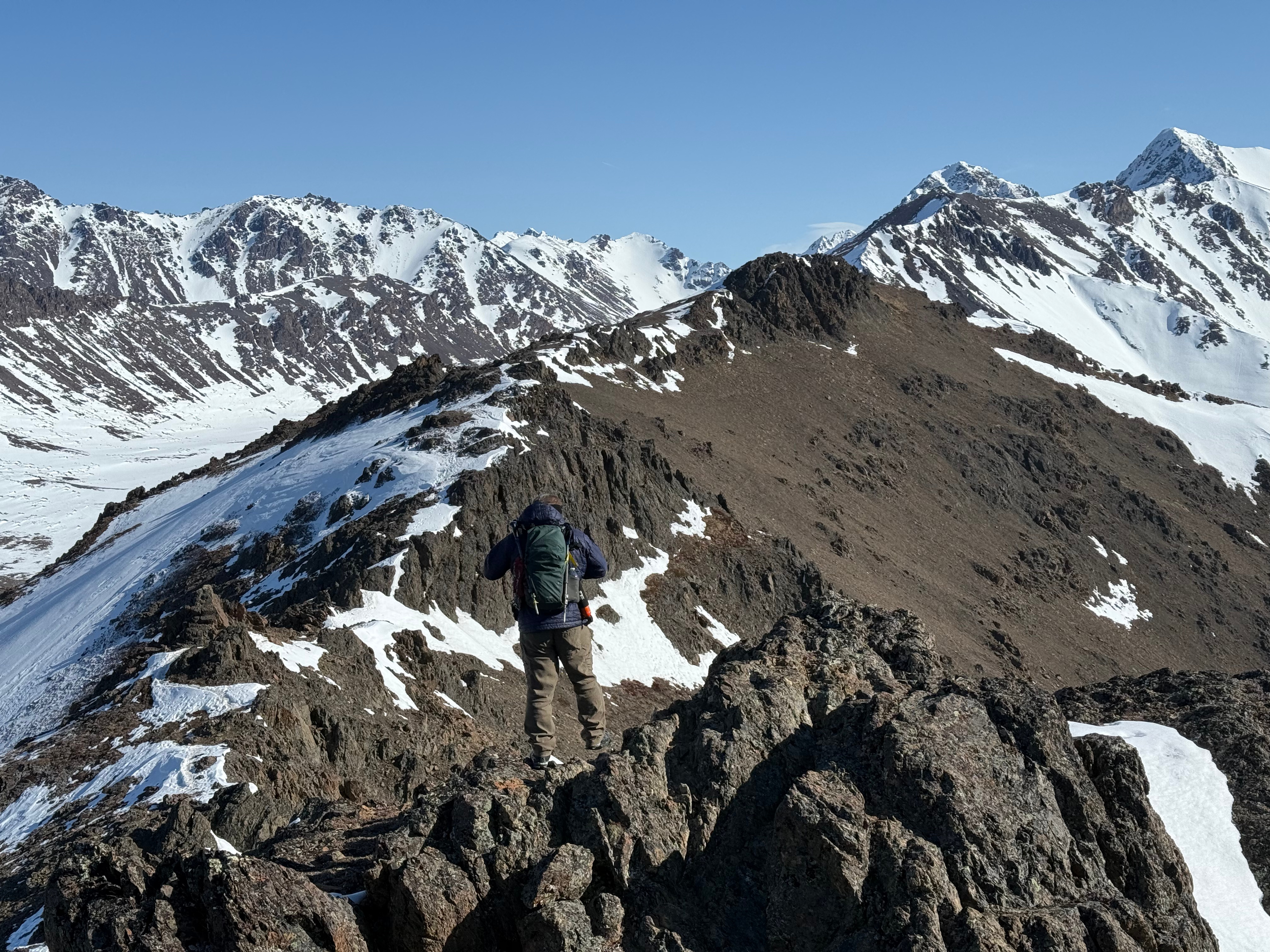
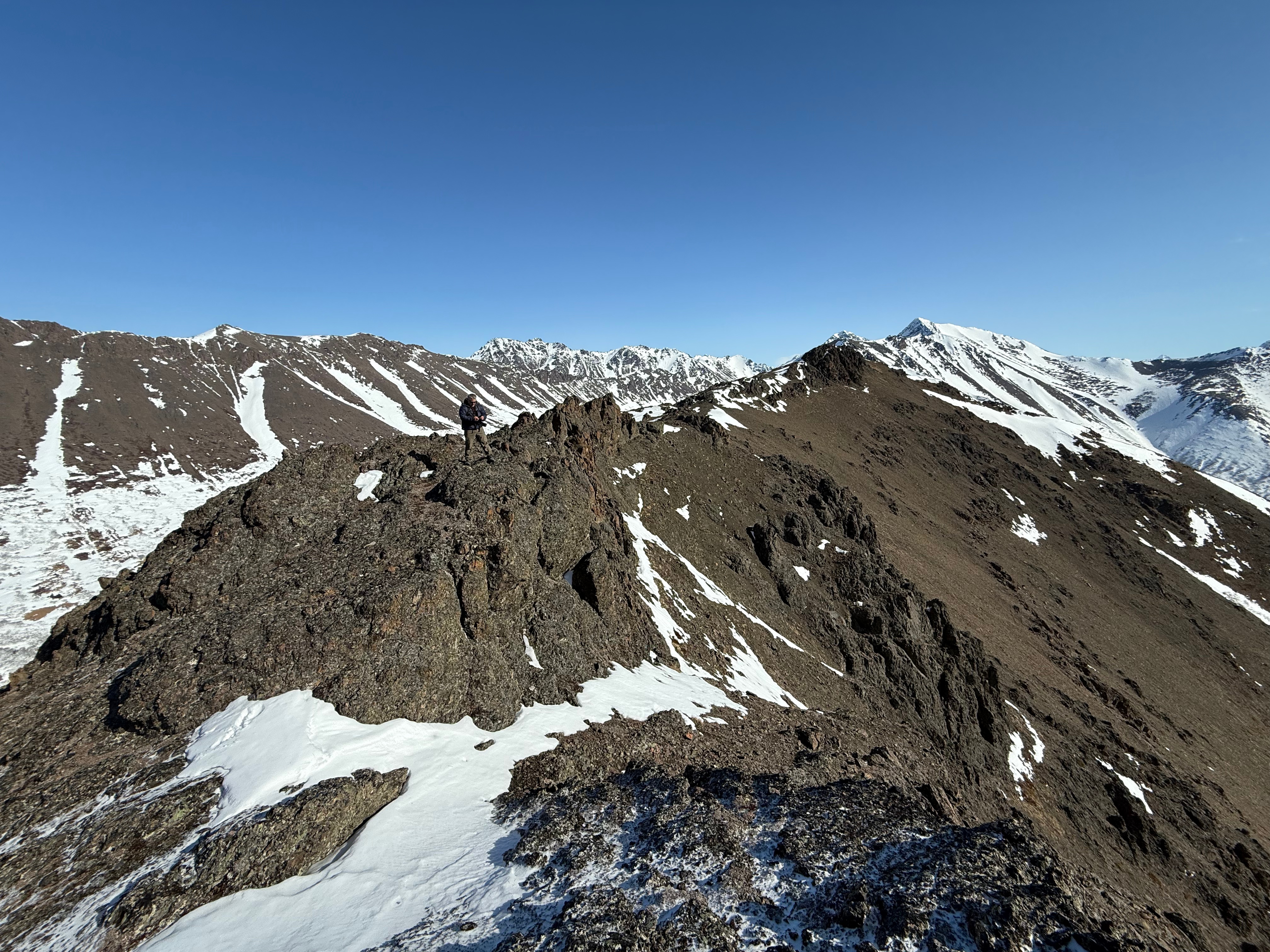
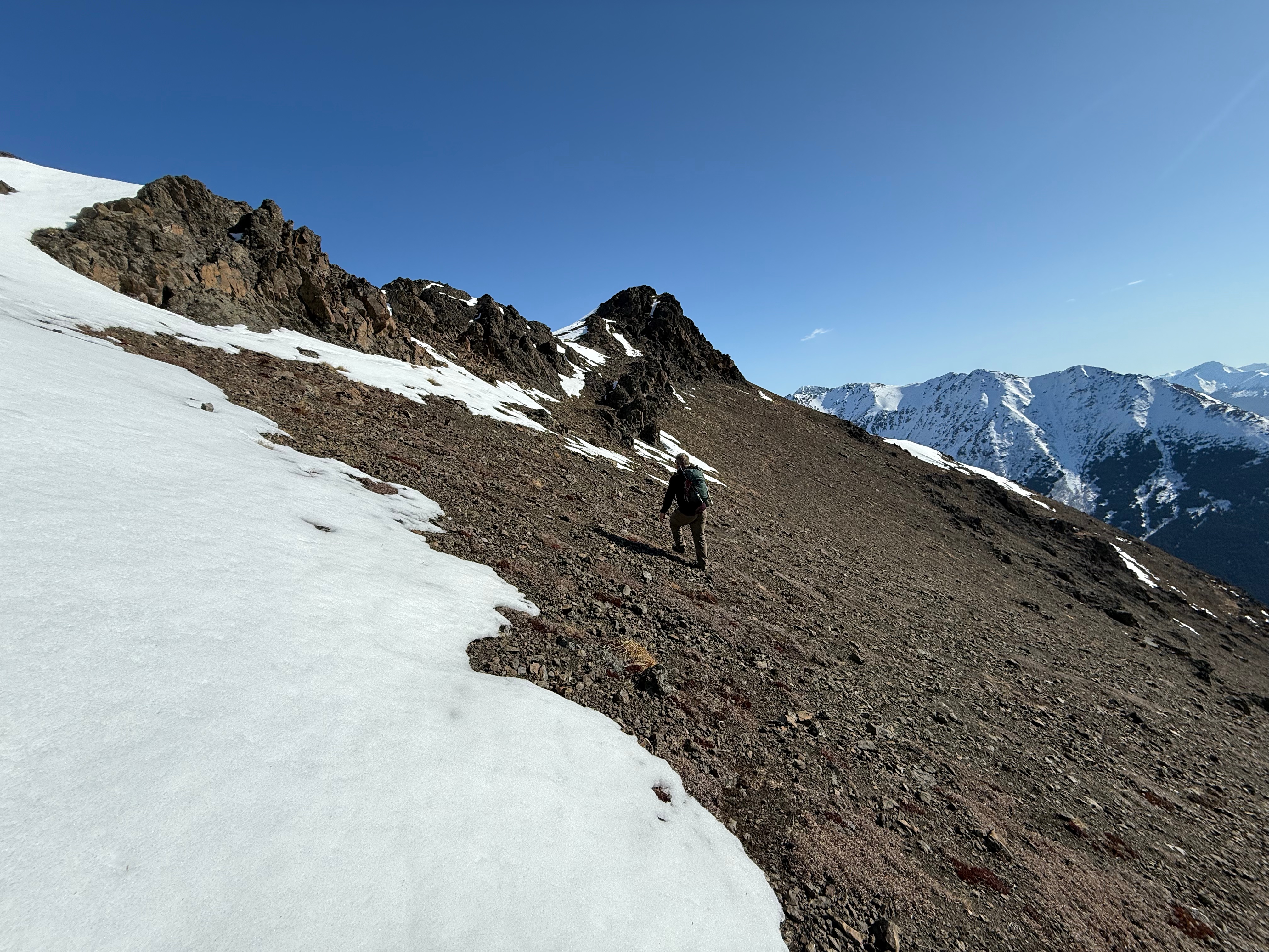
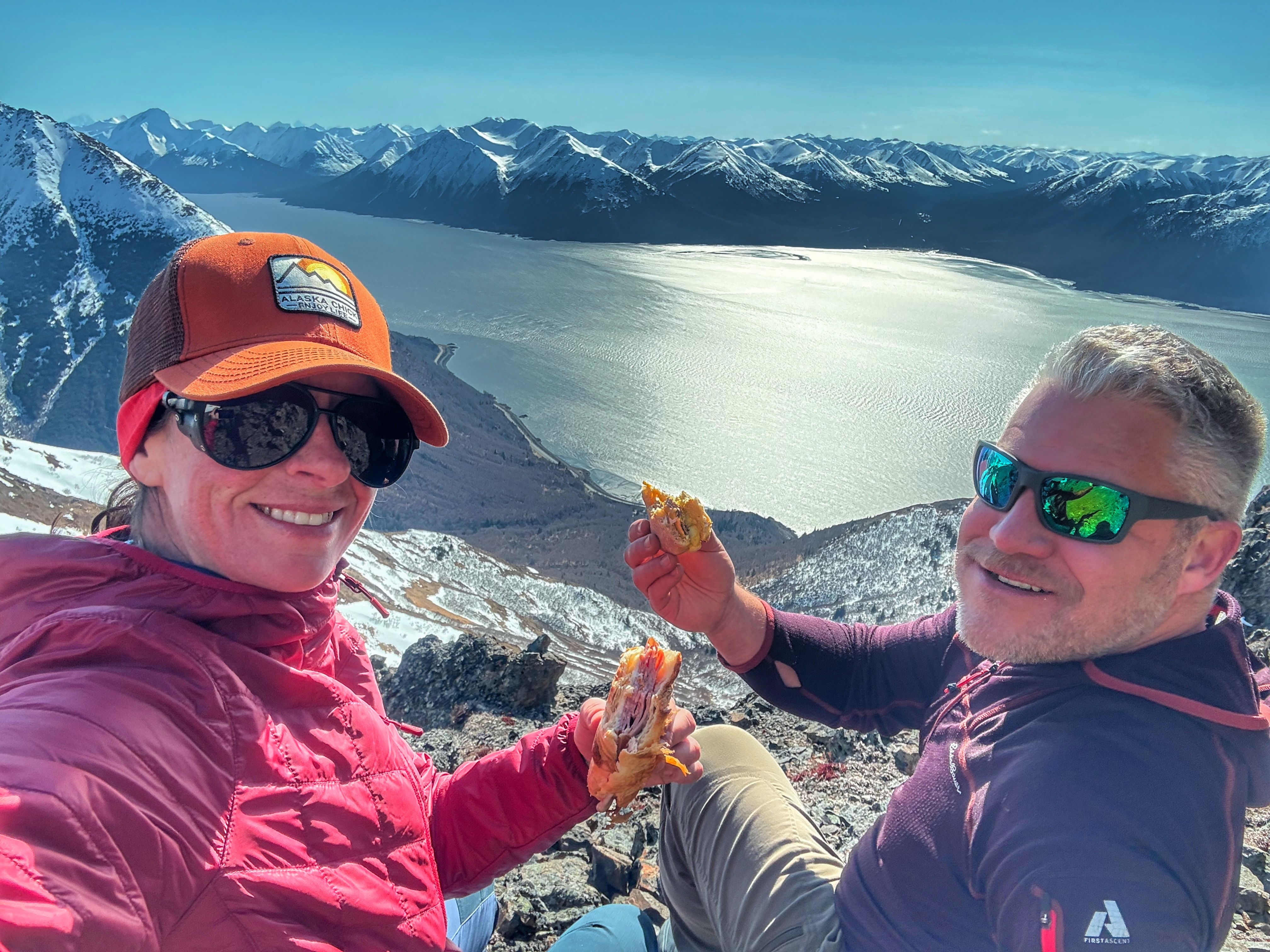
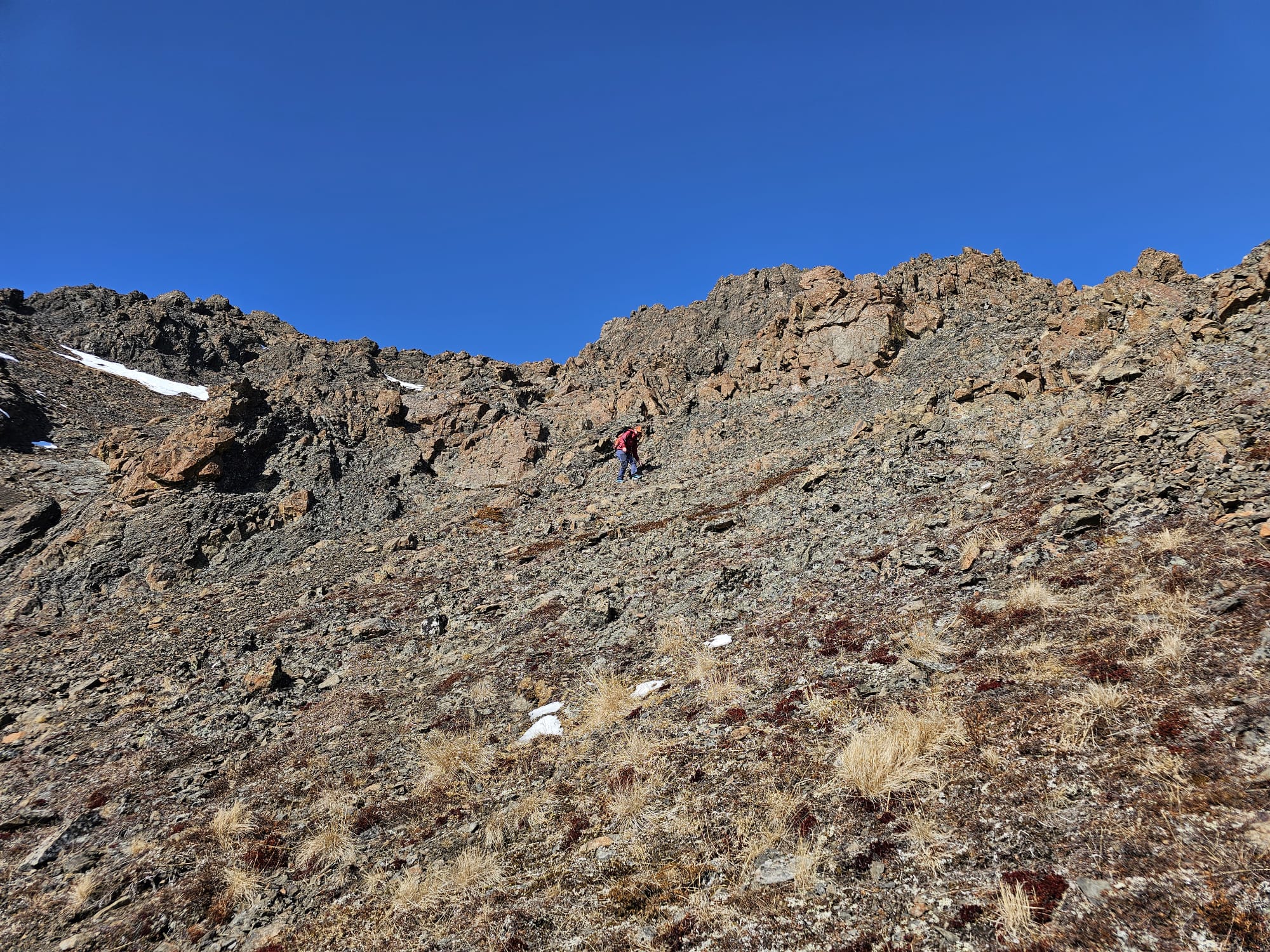
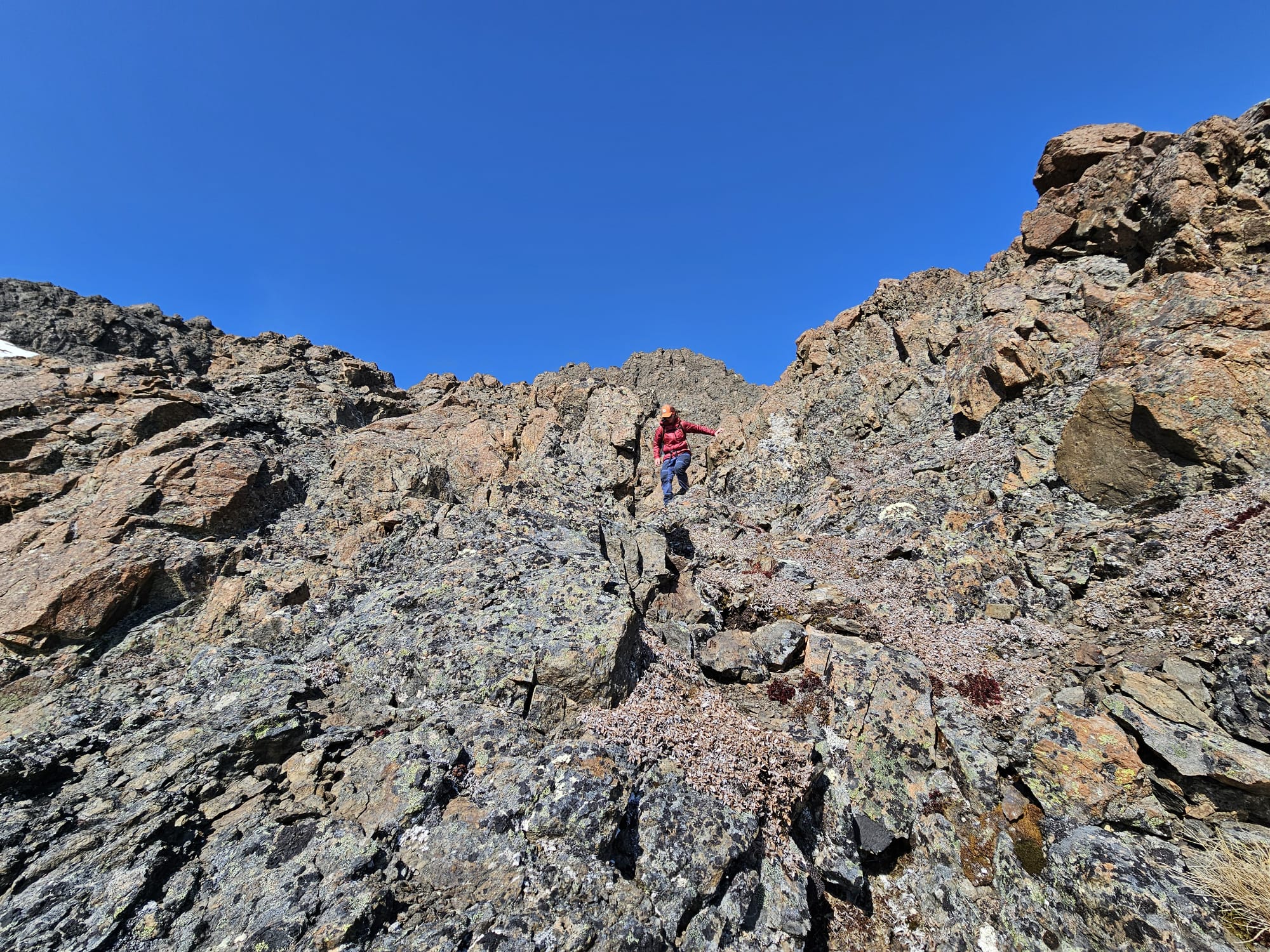
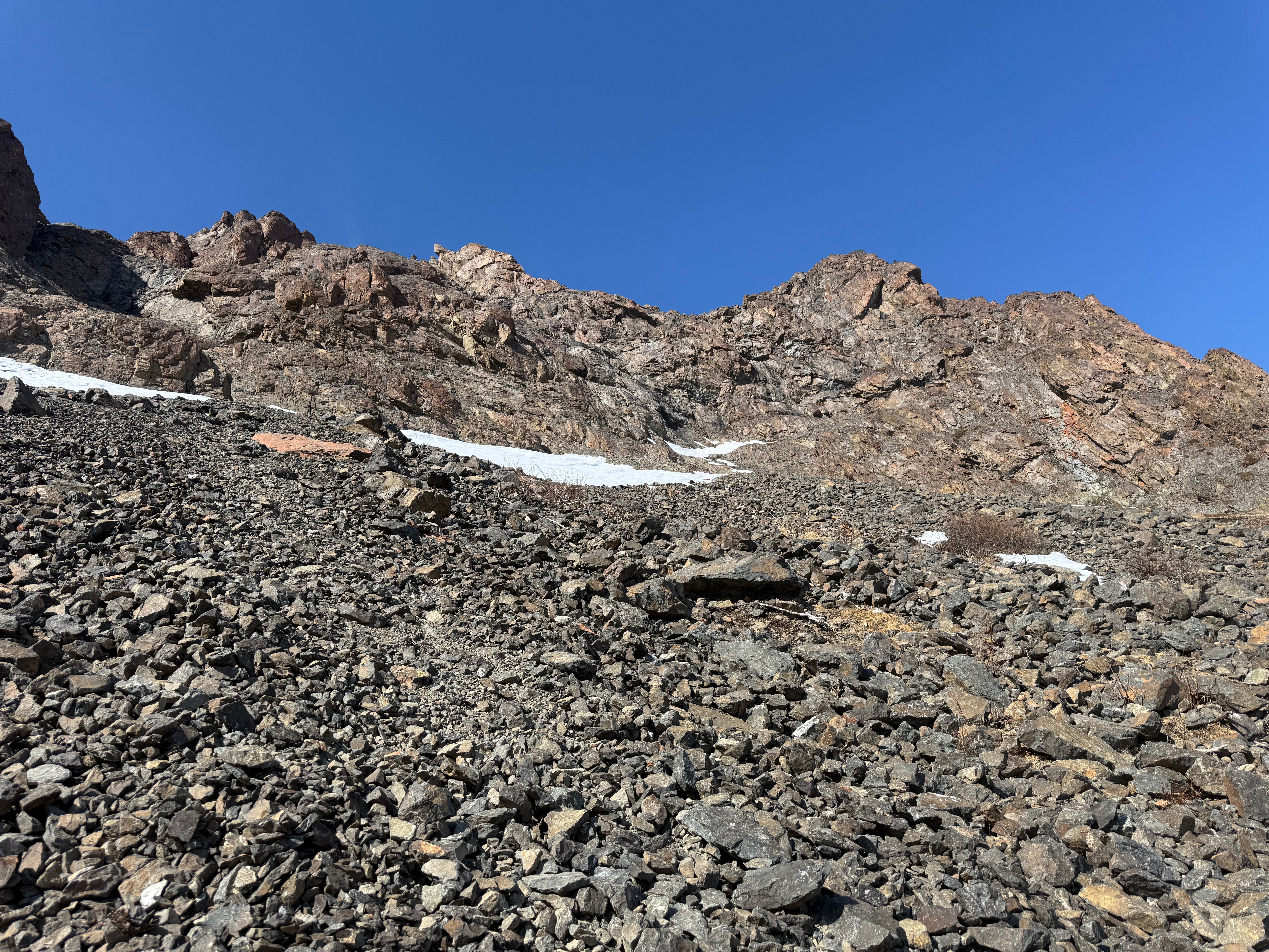
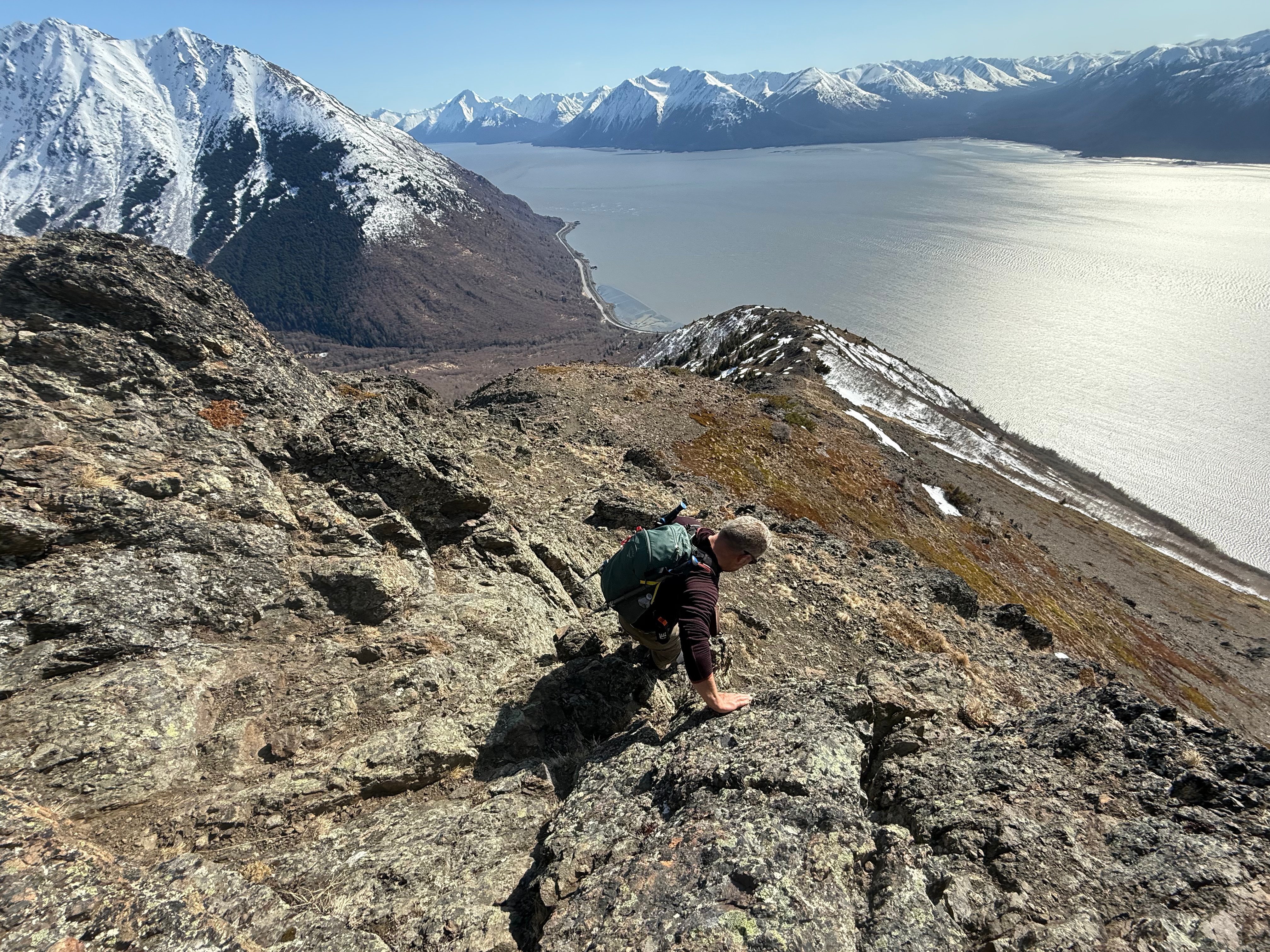
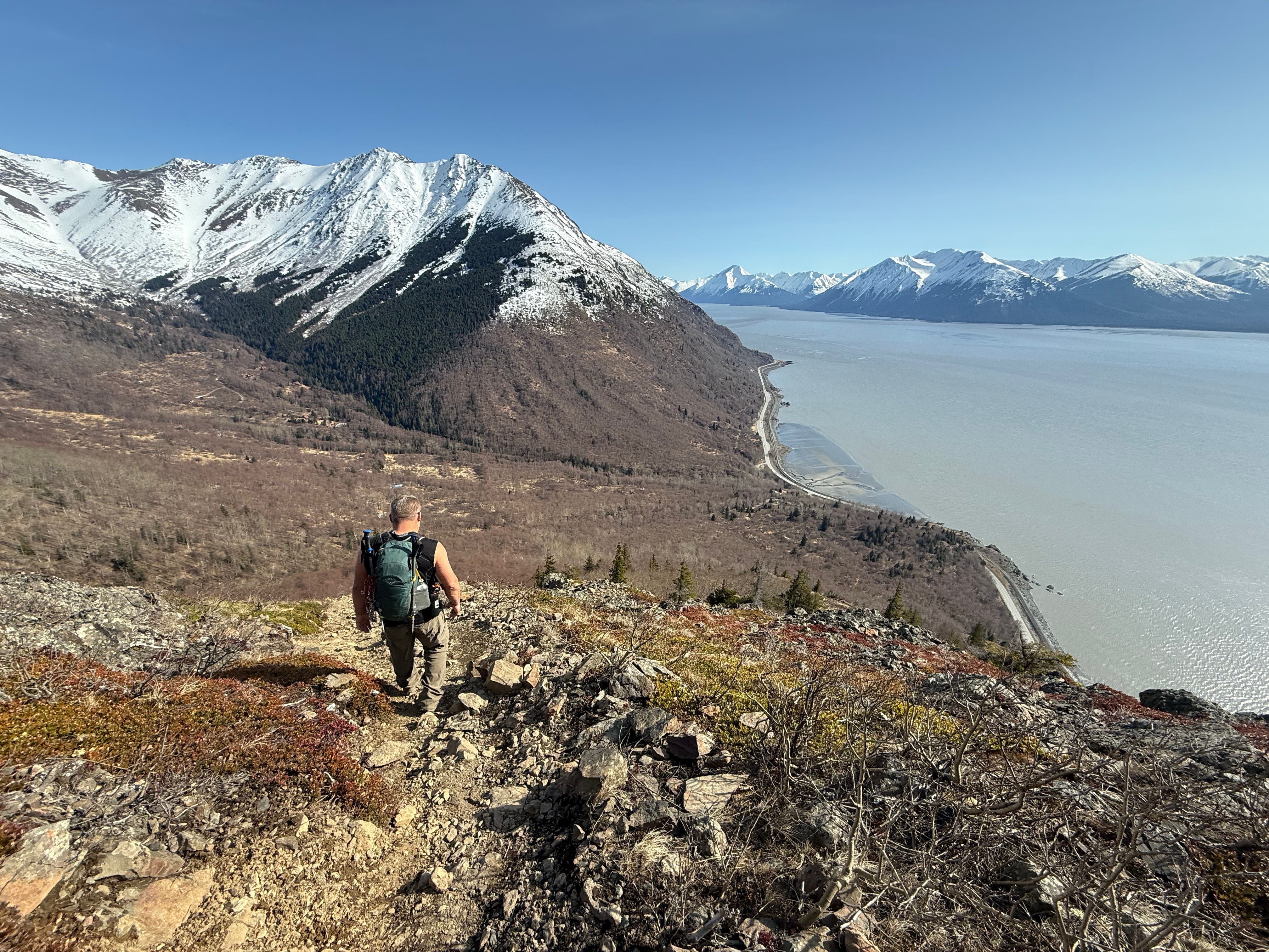
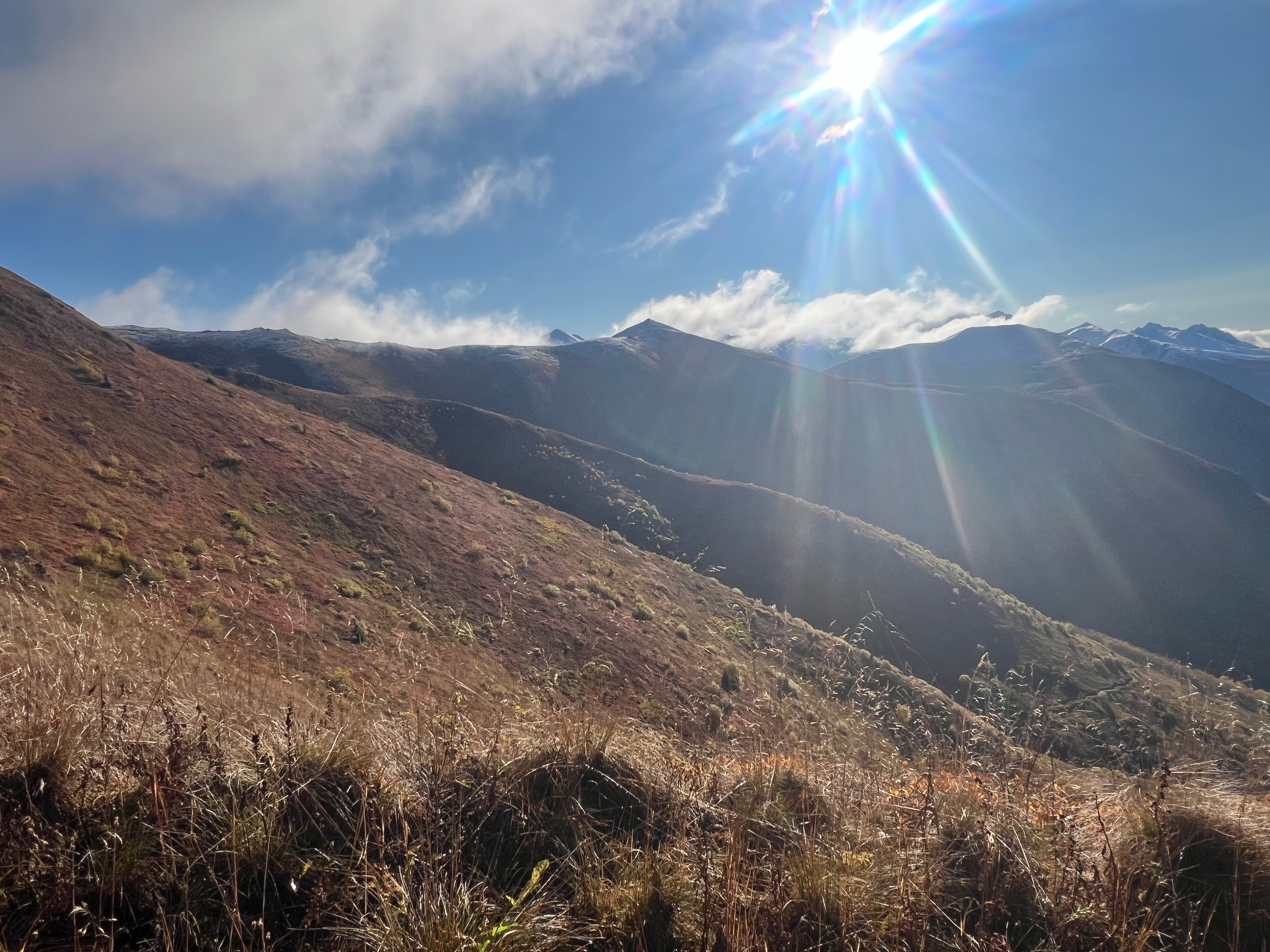
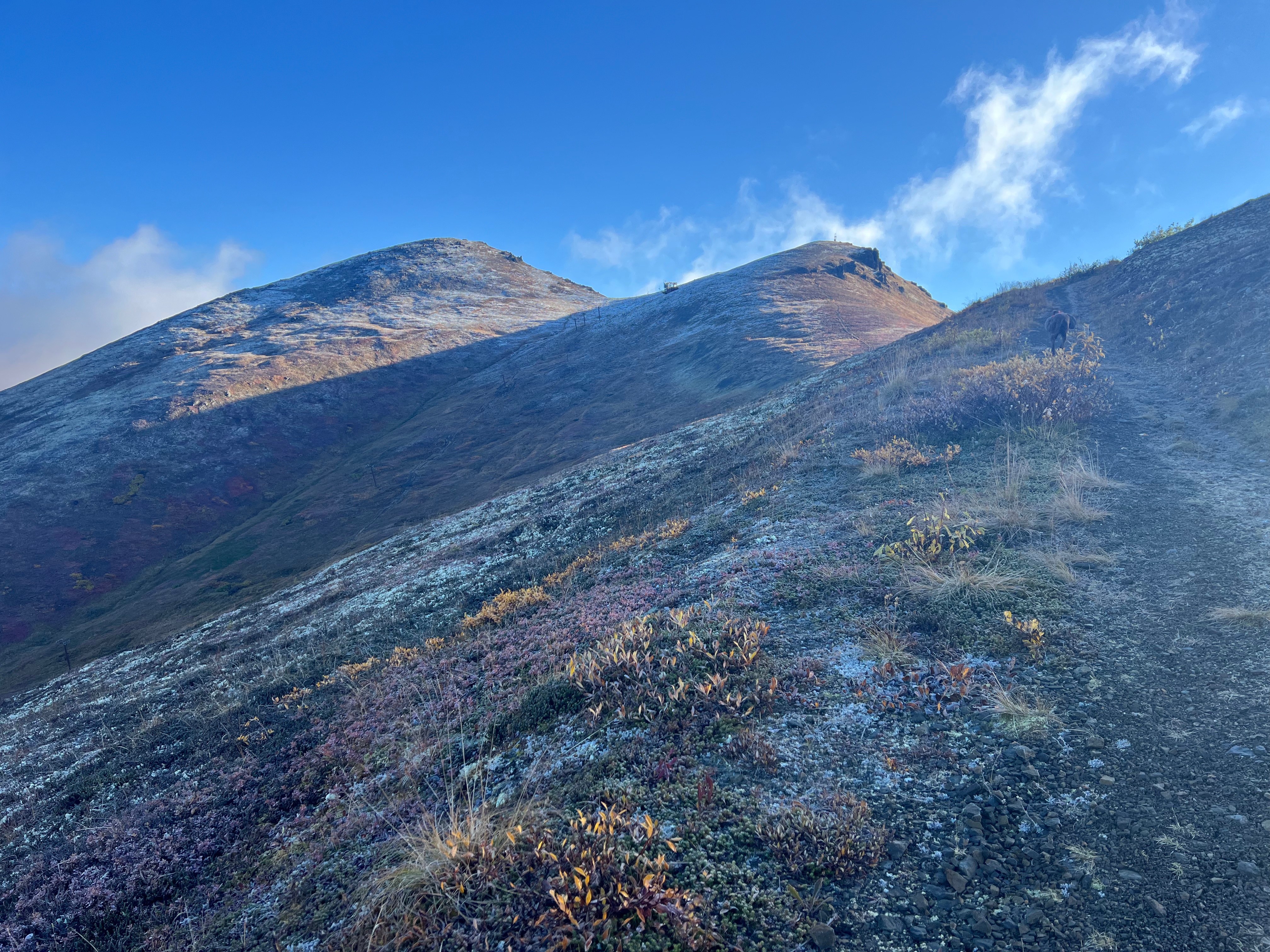
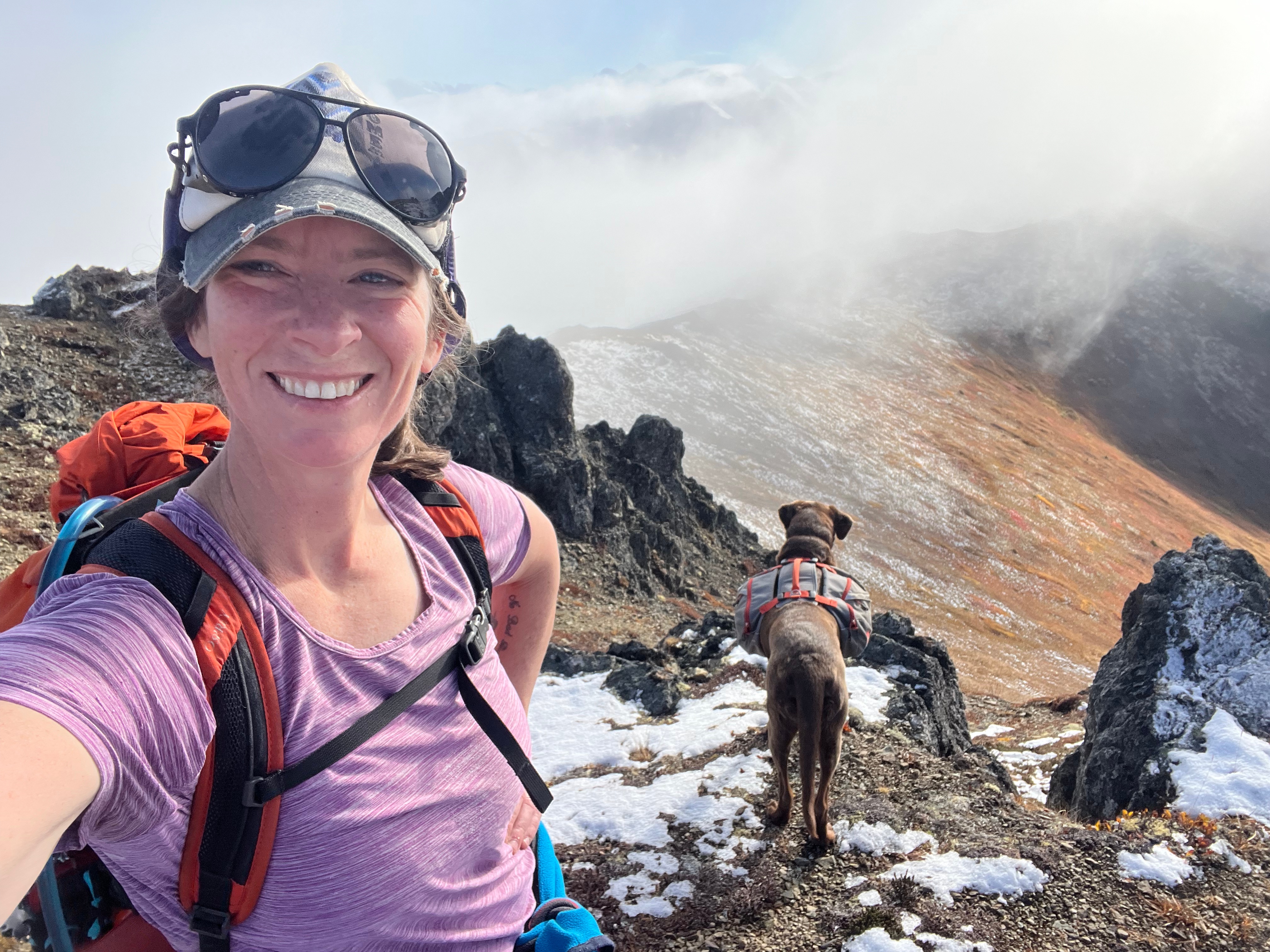
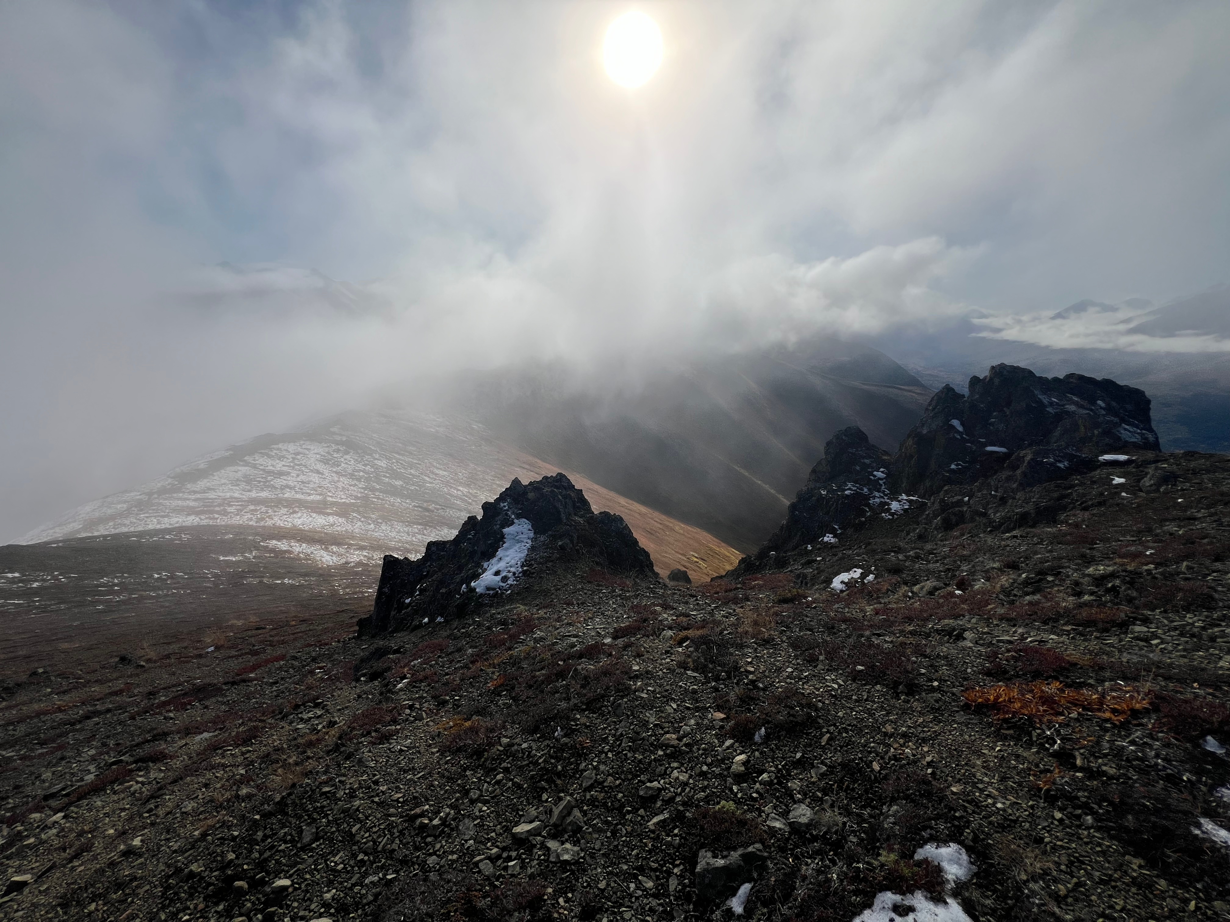
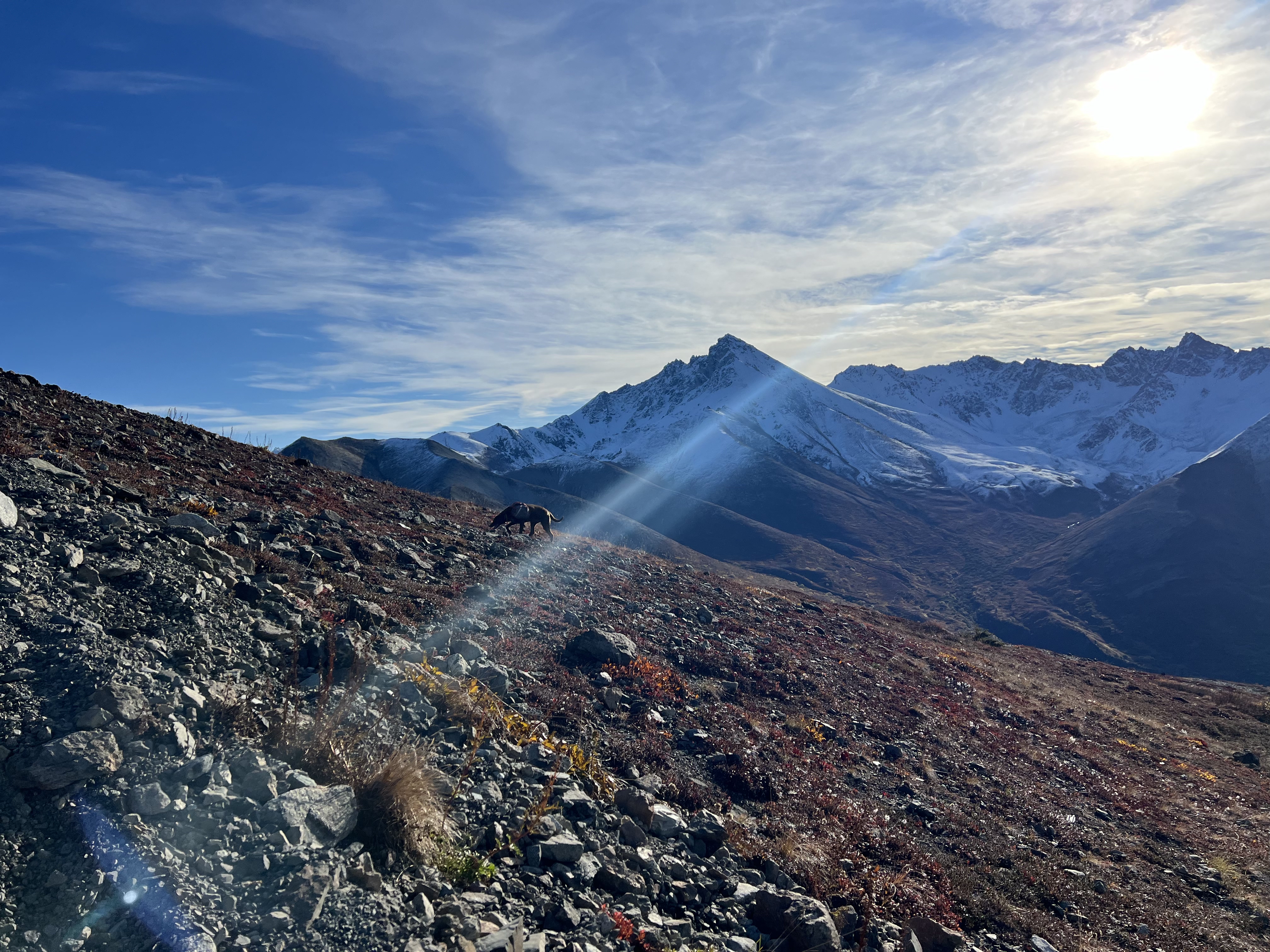
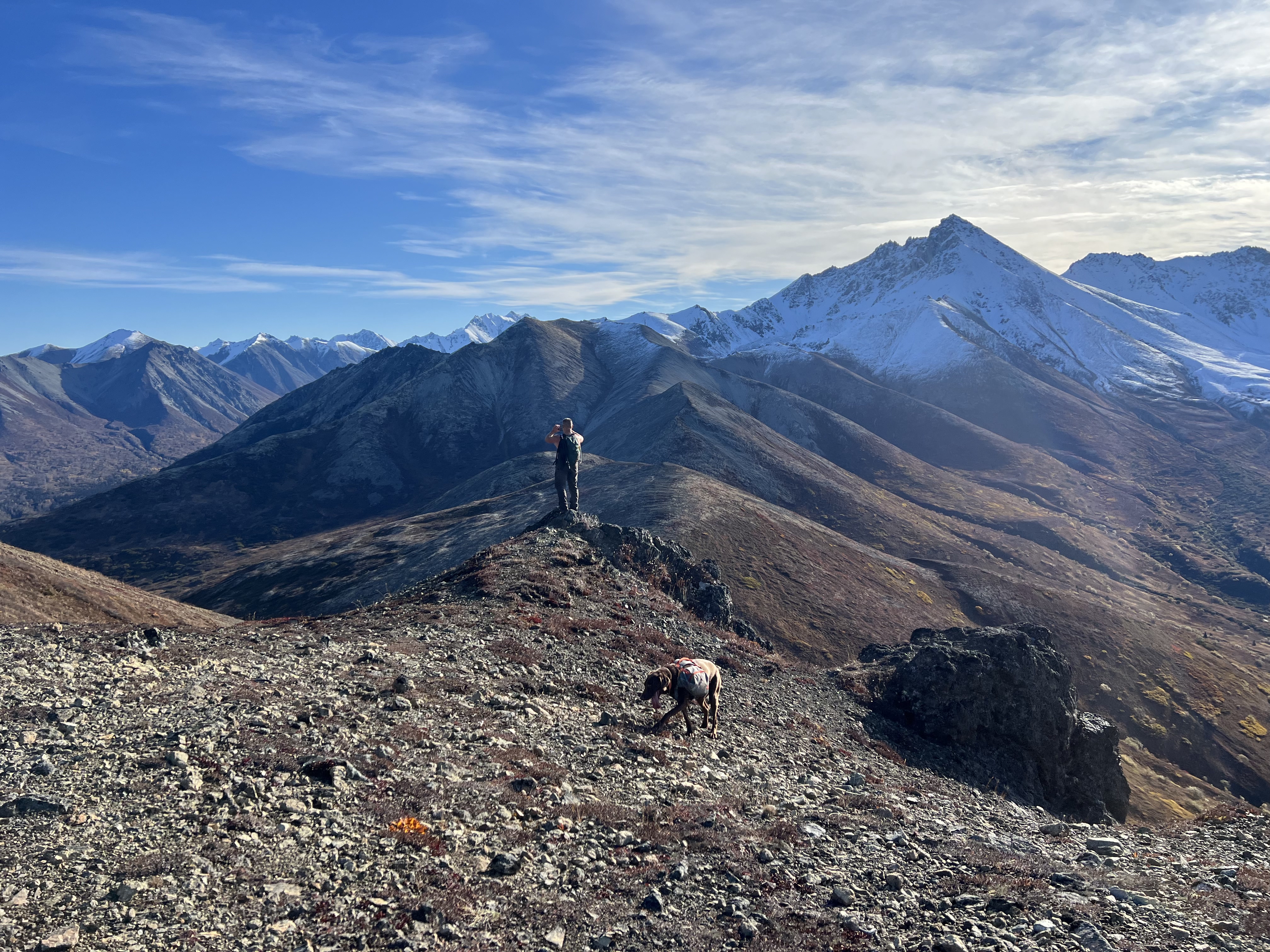
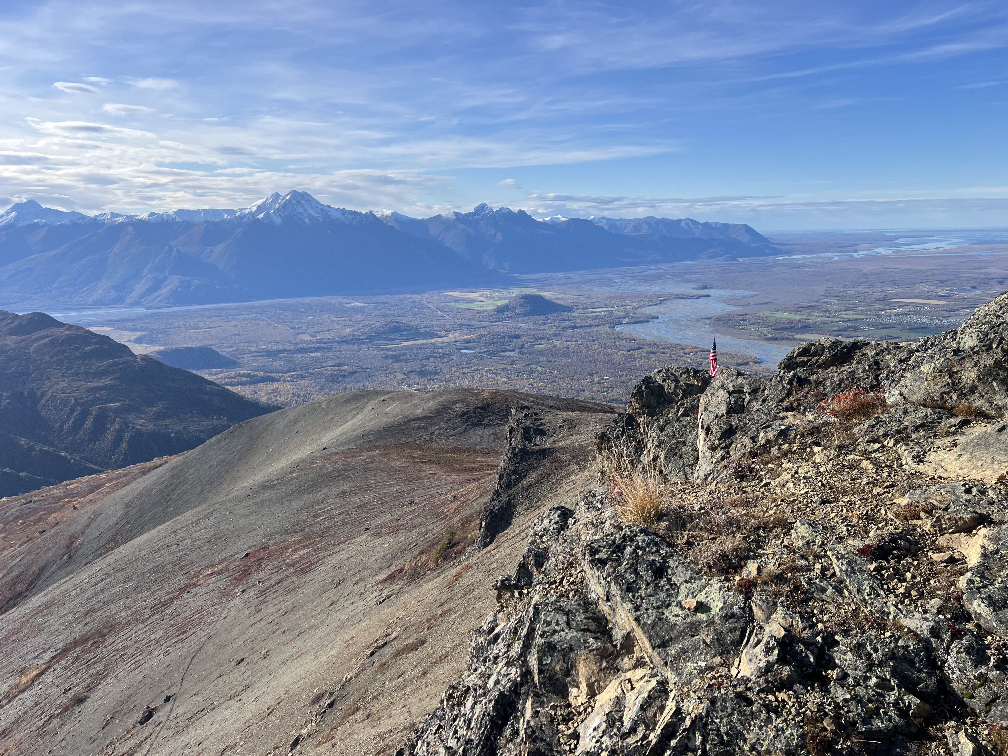
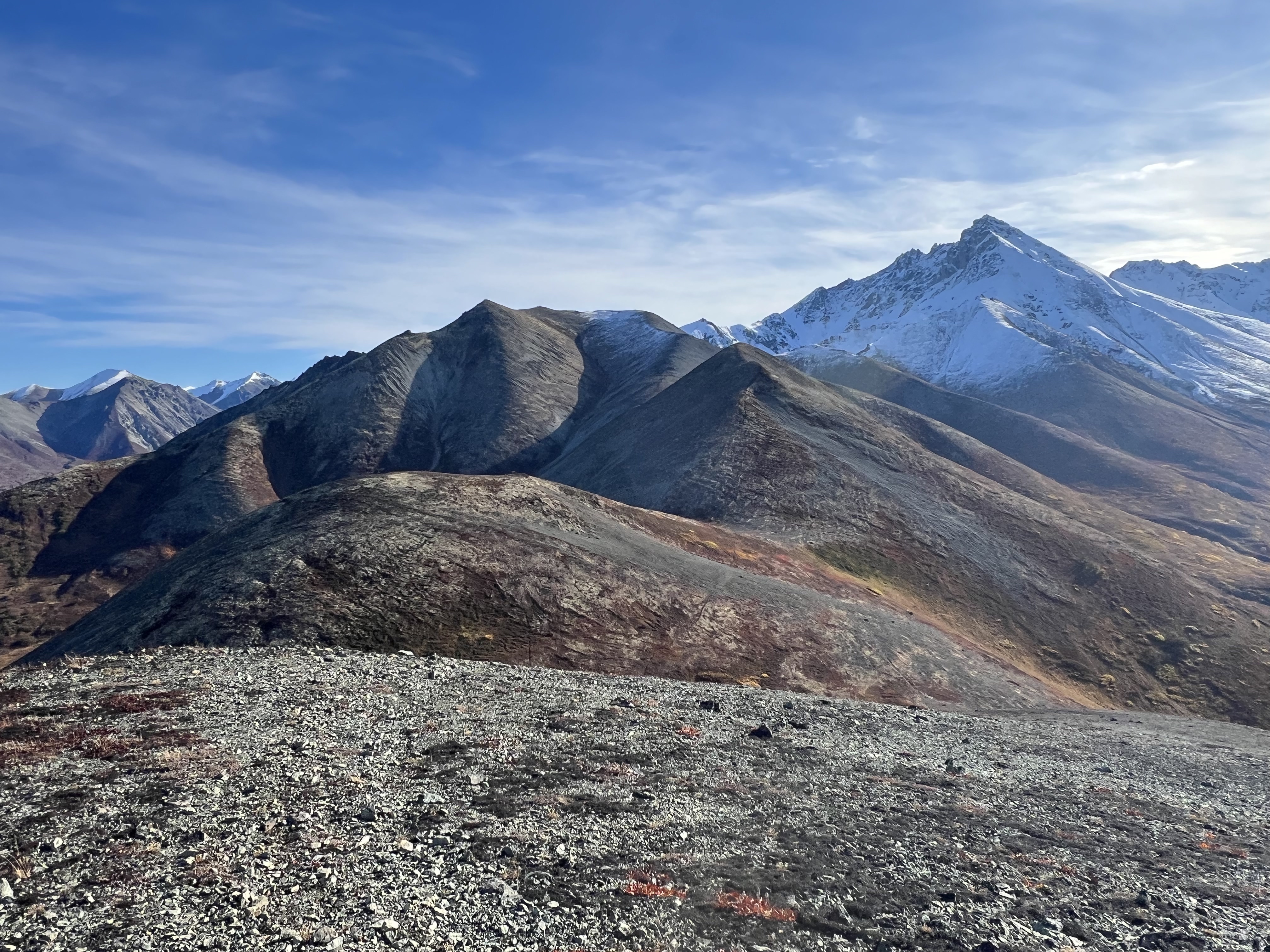
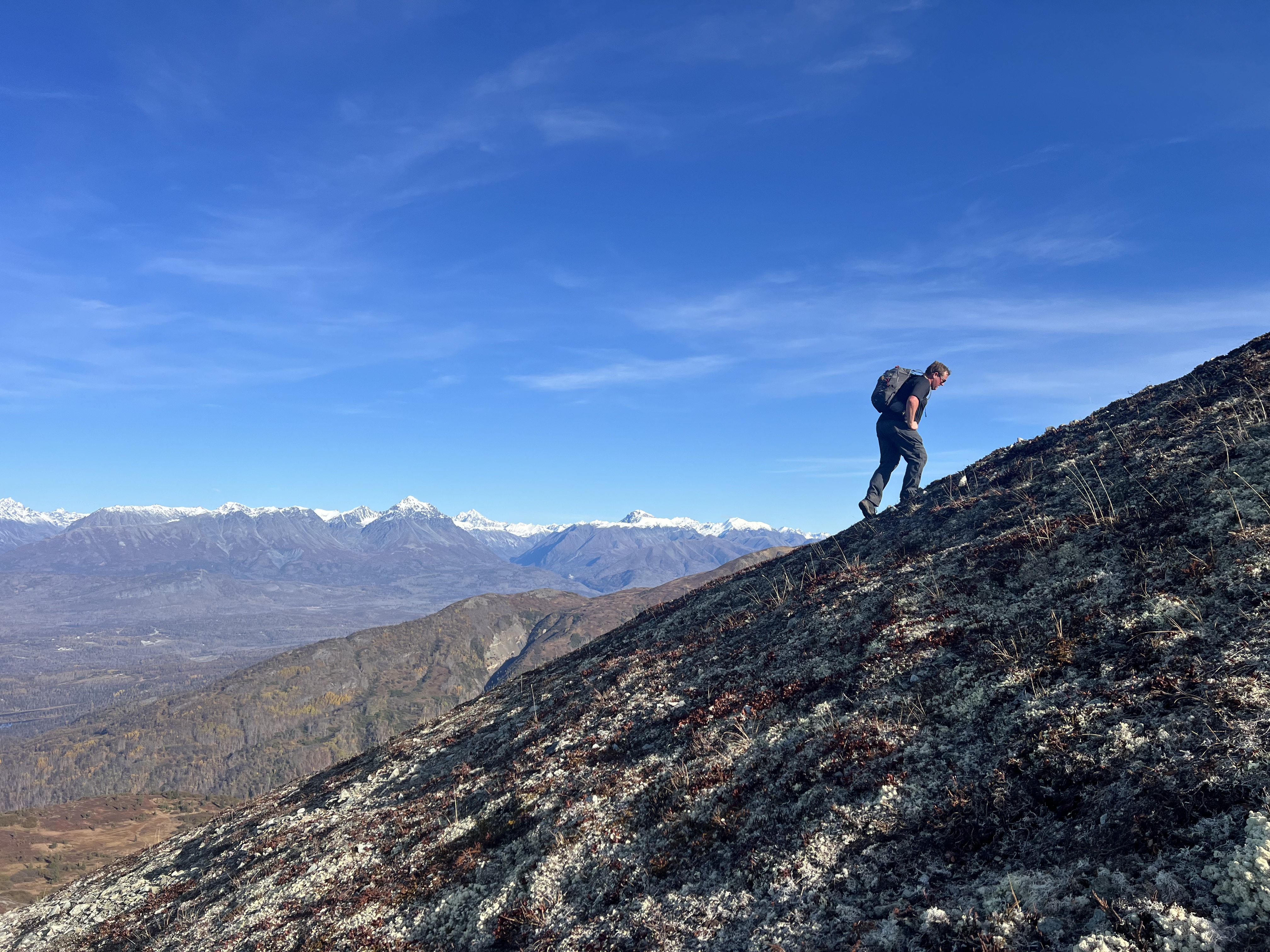
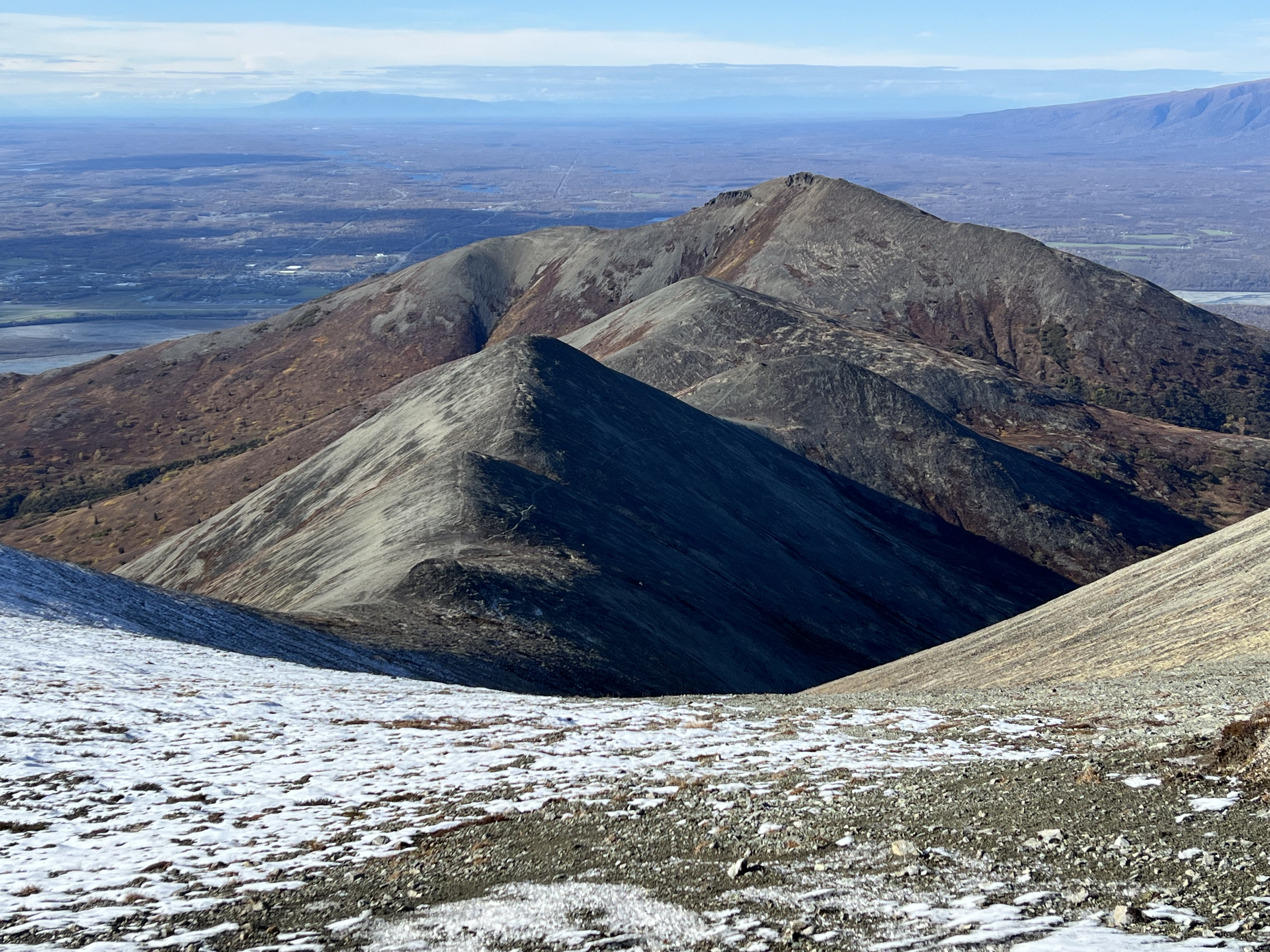
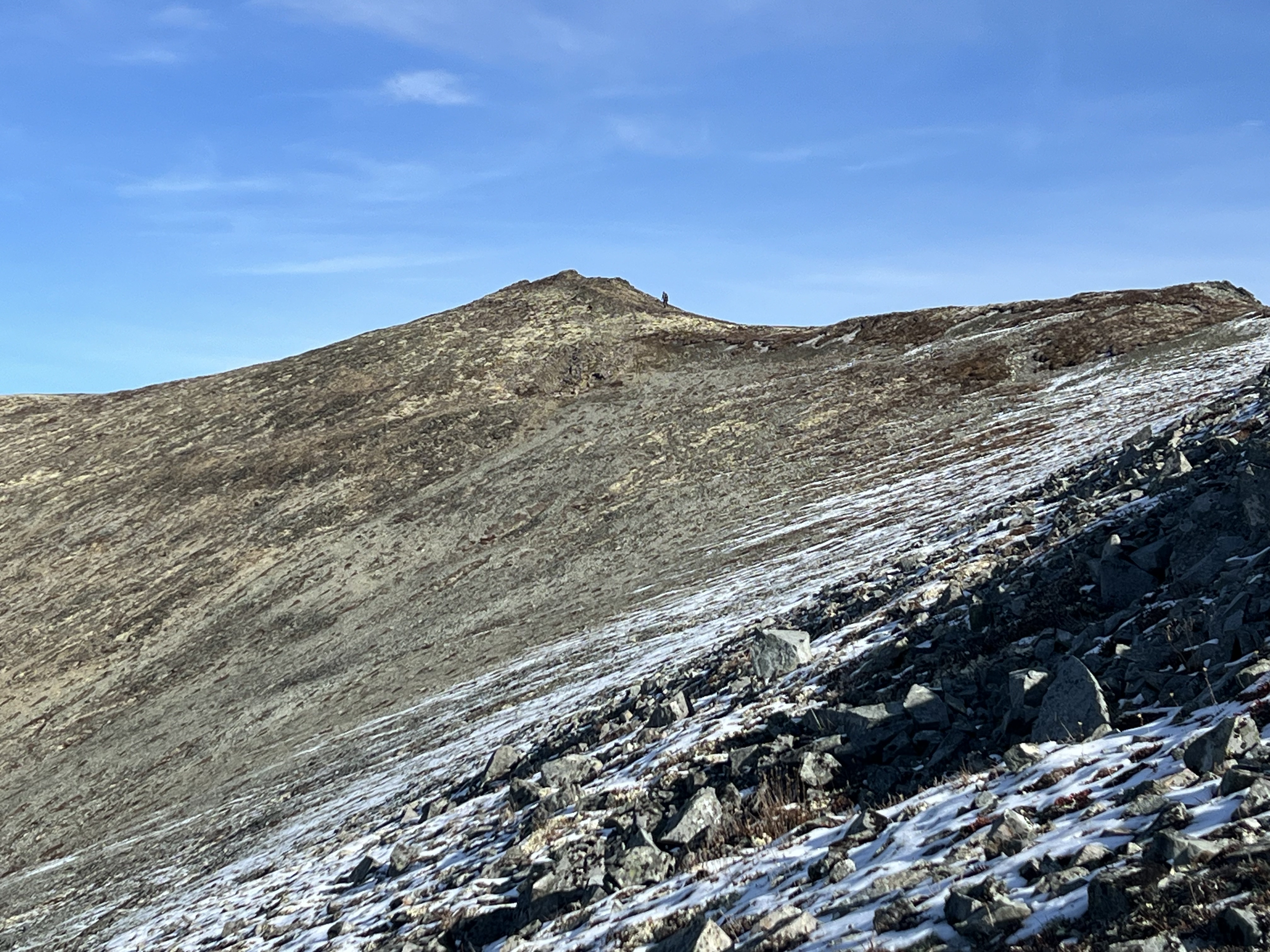
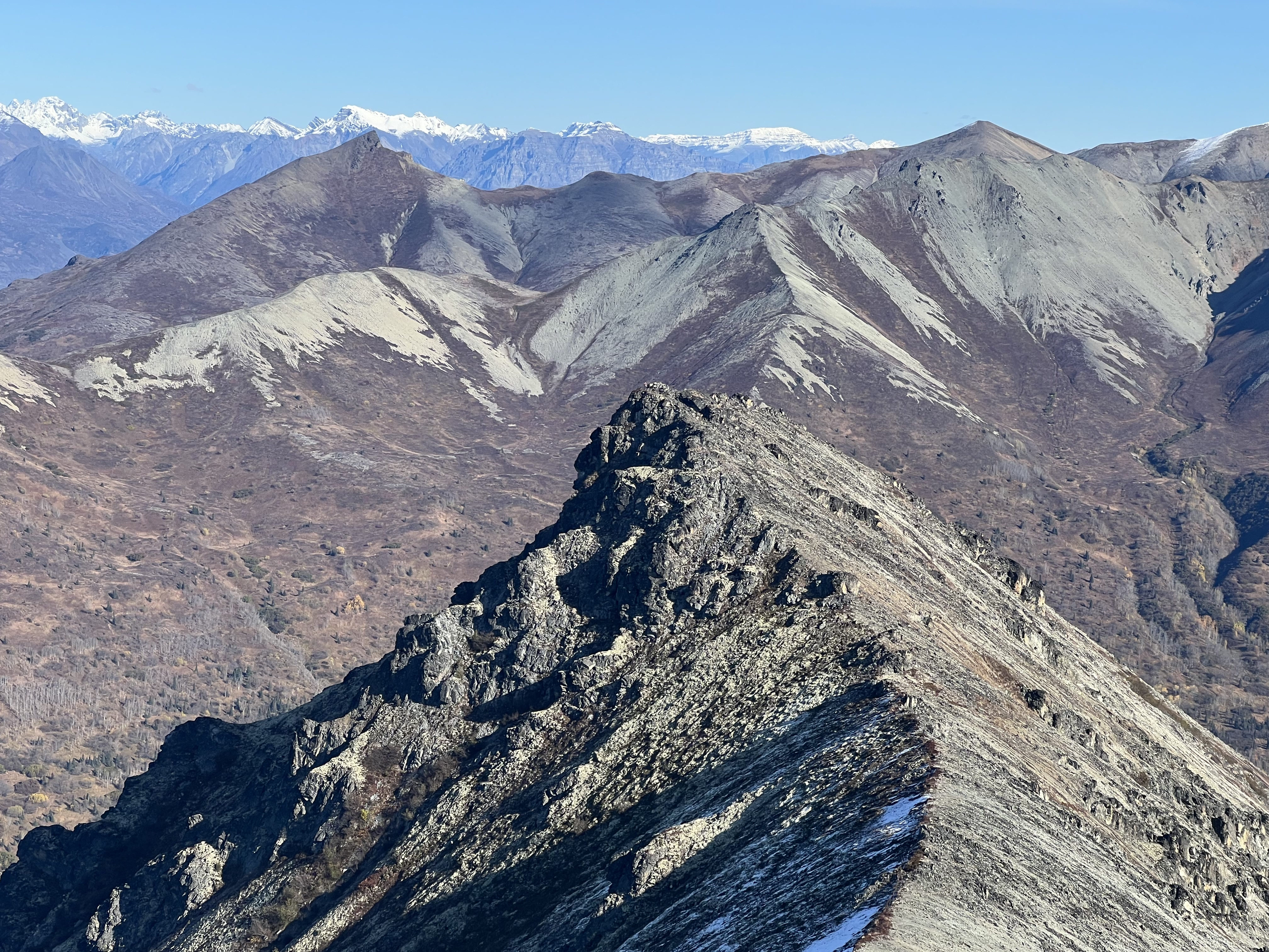
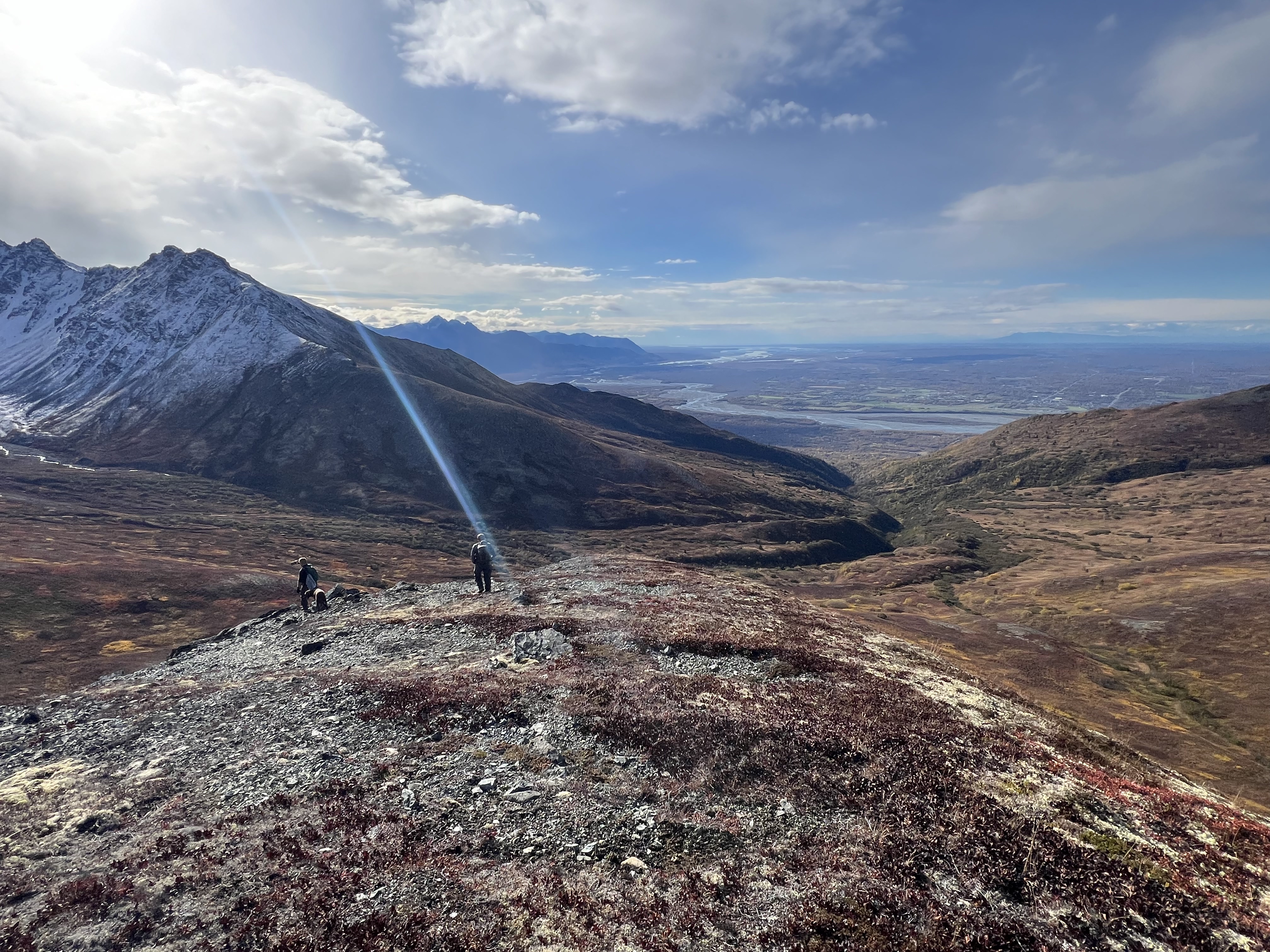
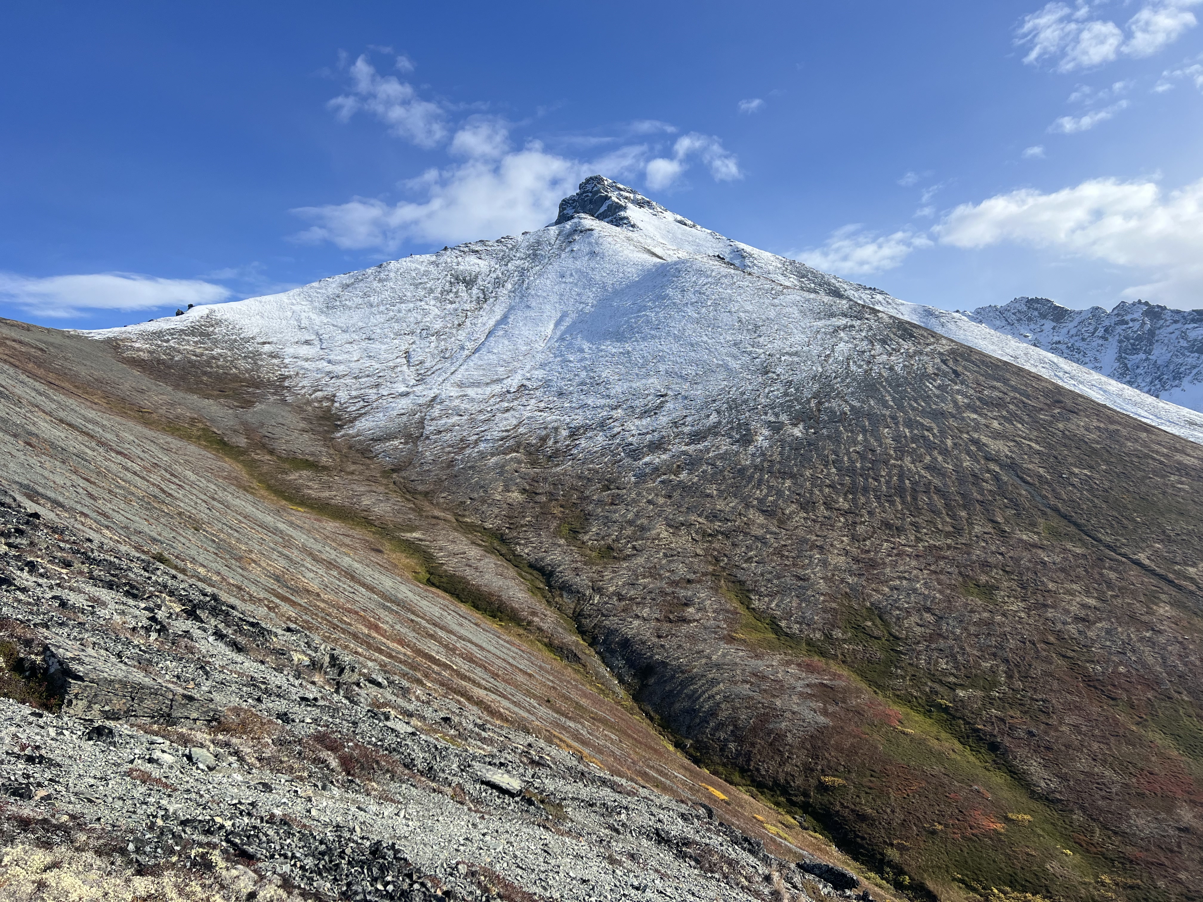
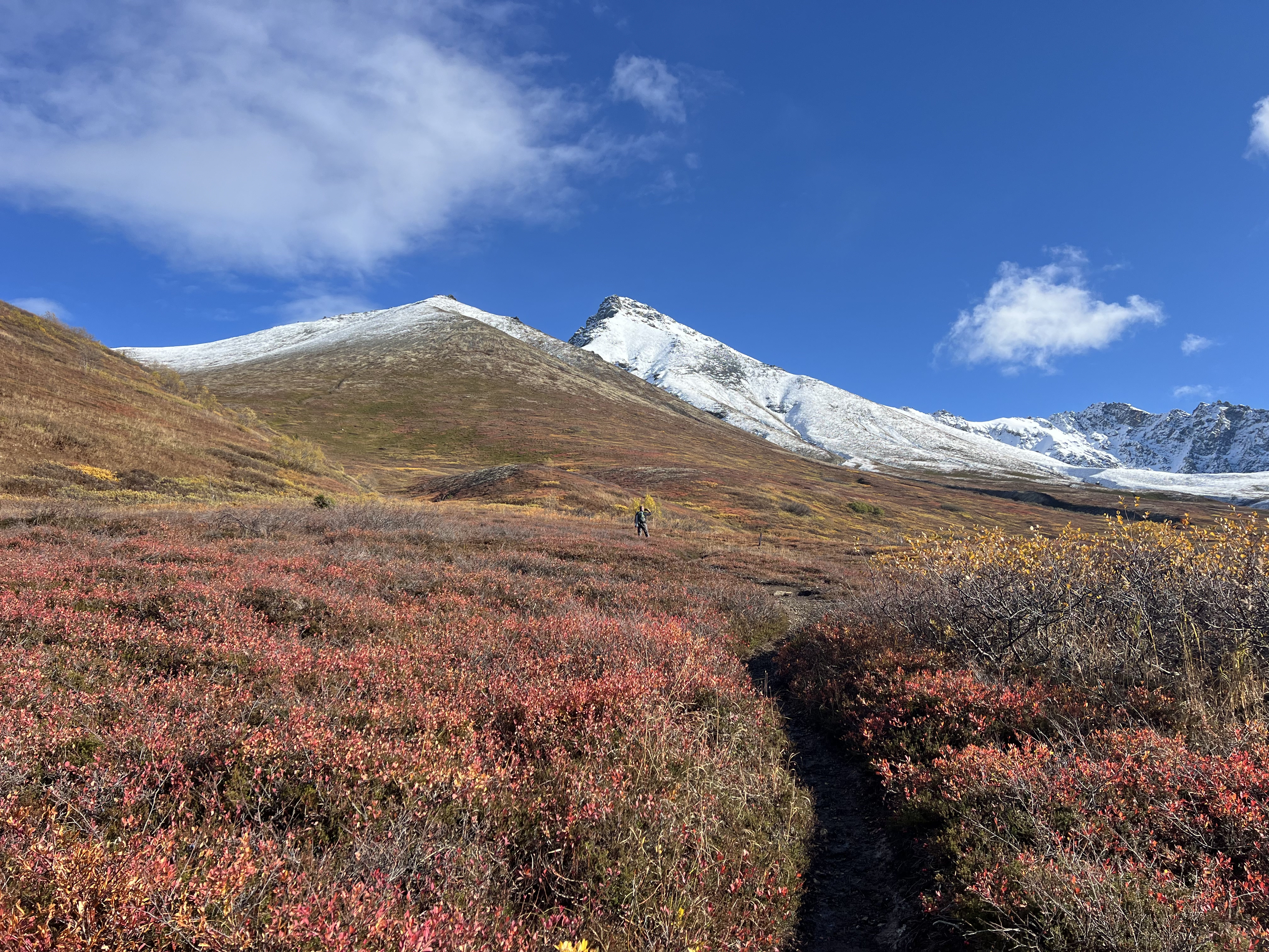
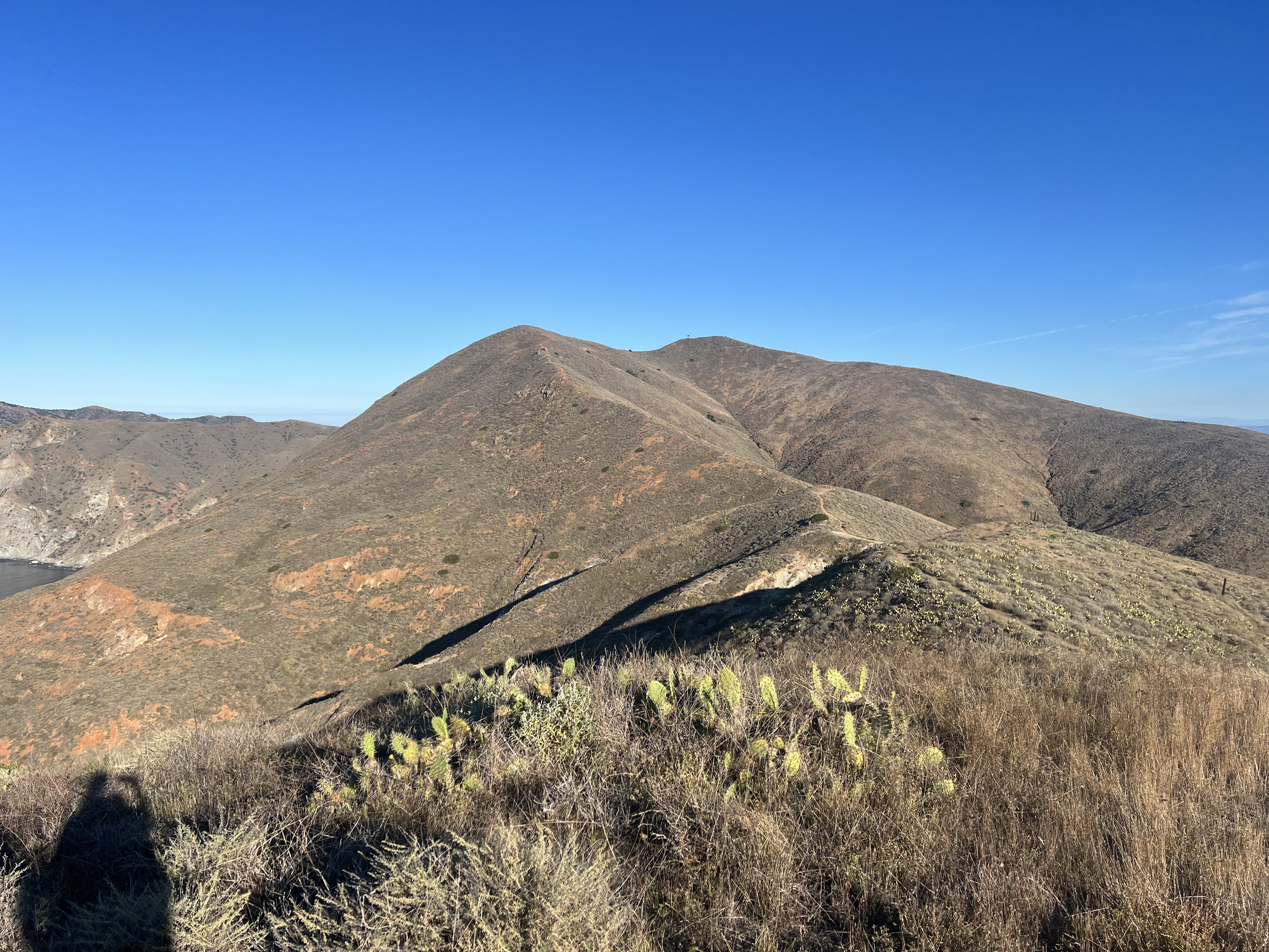
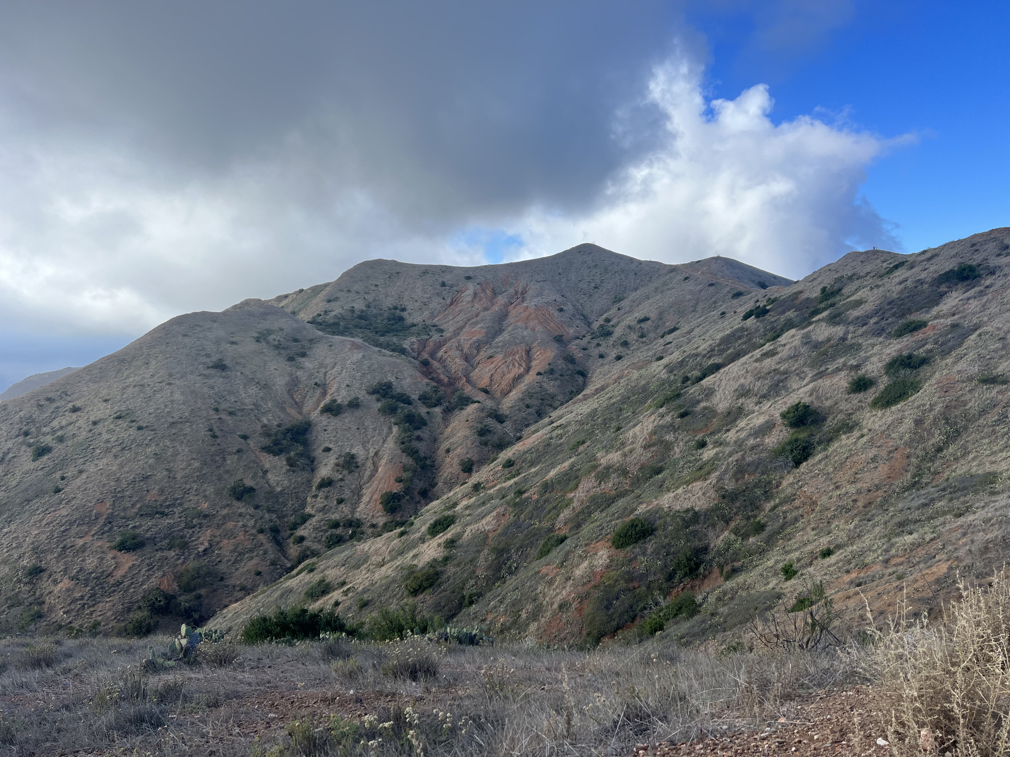
A solitary ptarmigan perched on a boulder welcomed us to the top of The Dome, where we paused for a quick bite before continuing up the ridge toward Knoya. The low ceiling of clouds persisted as we ascended the jagged ridge. From a distance, the ridgeline looks deceptively daunting, but once you’re on it, the walking is fairly straightforward with no scrambling required.
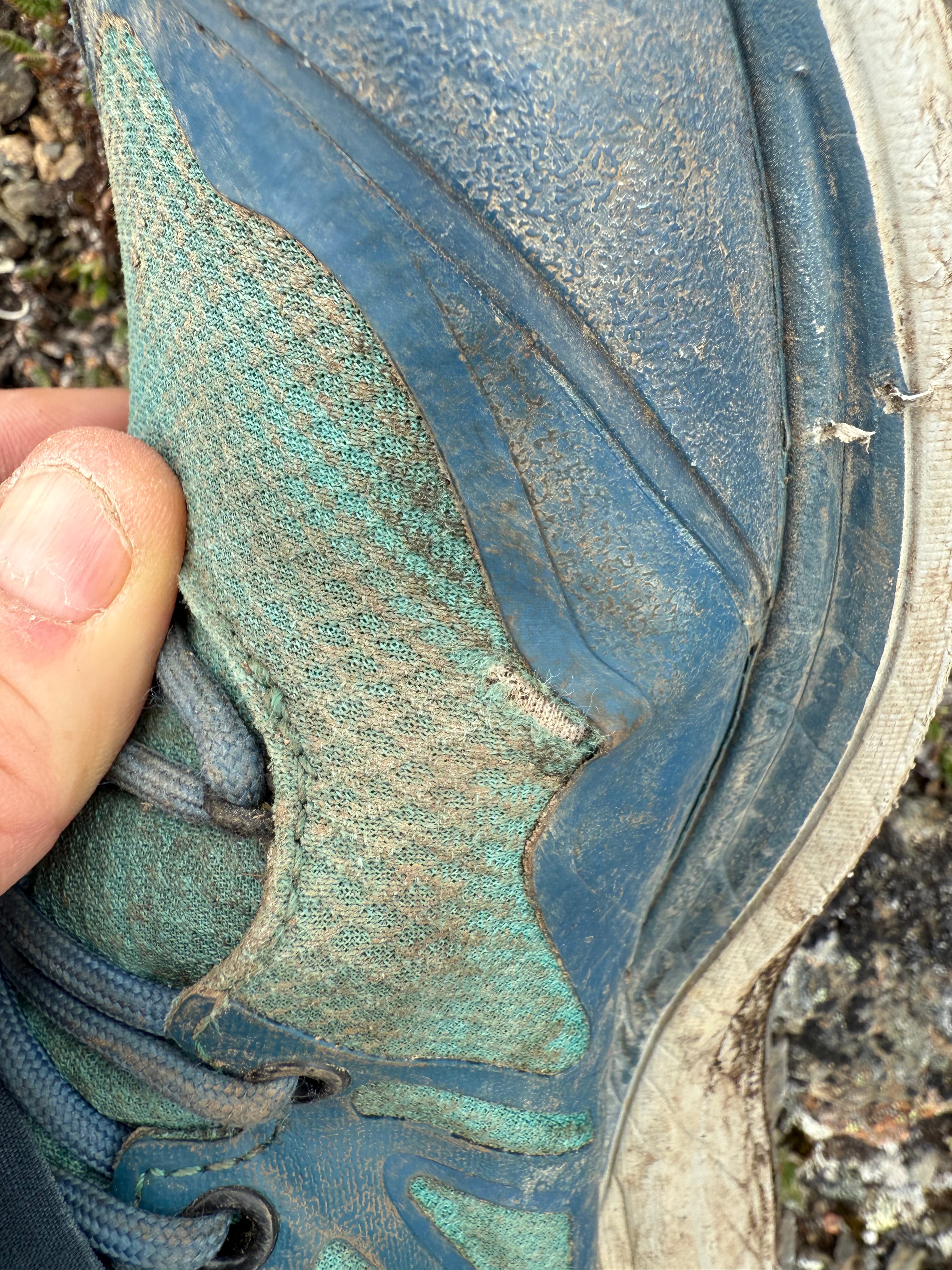
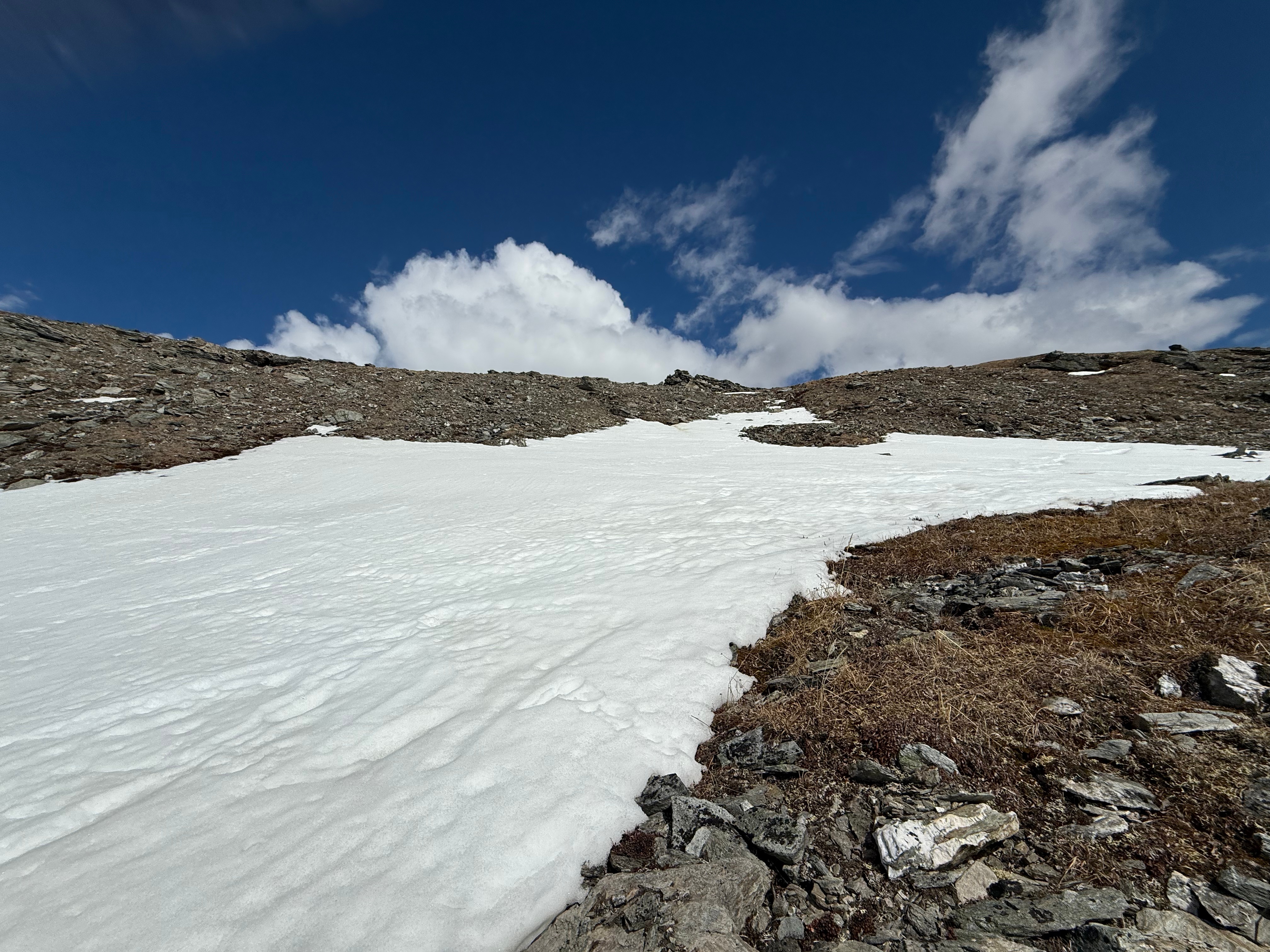
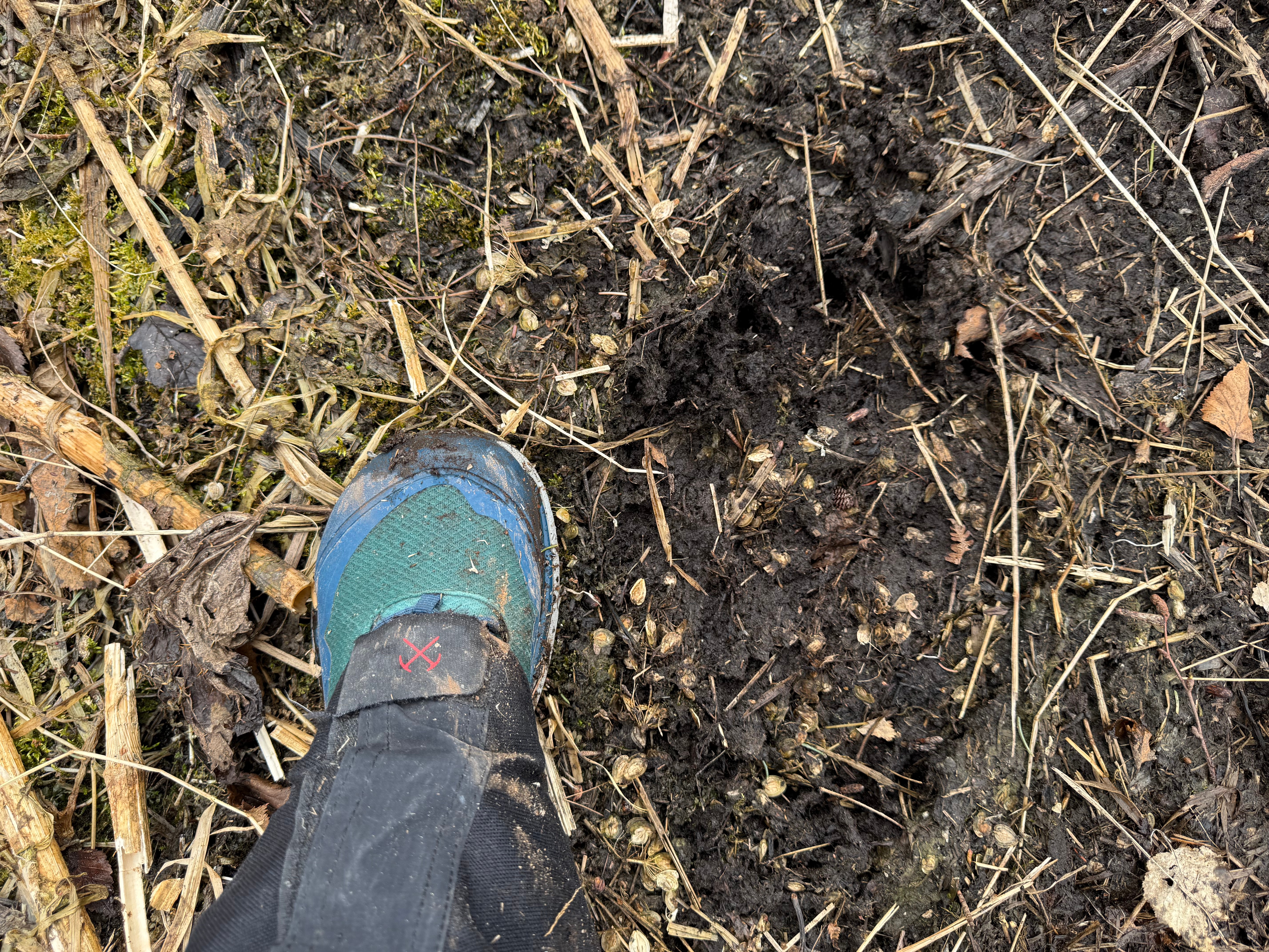
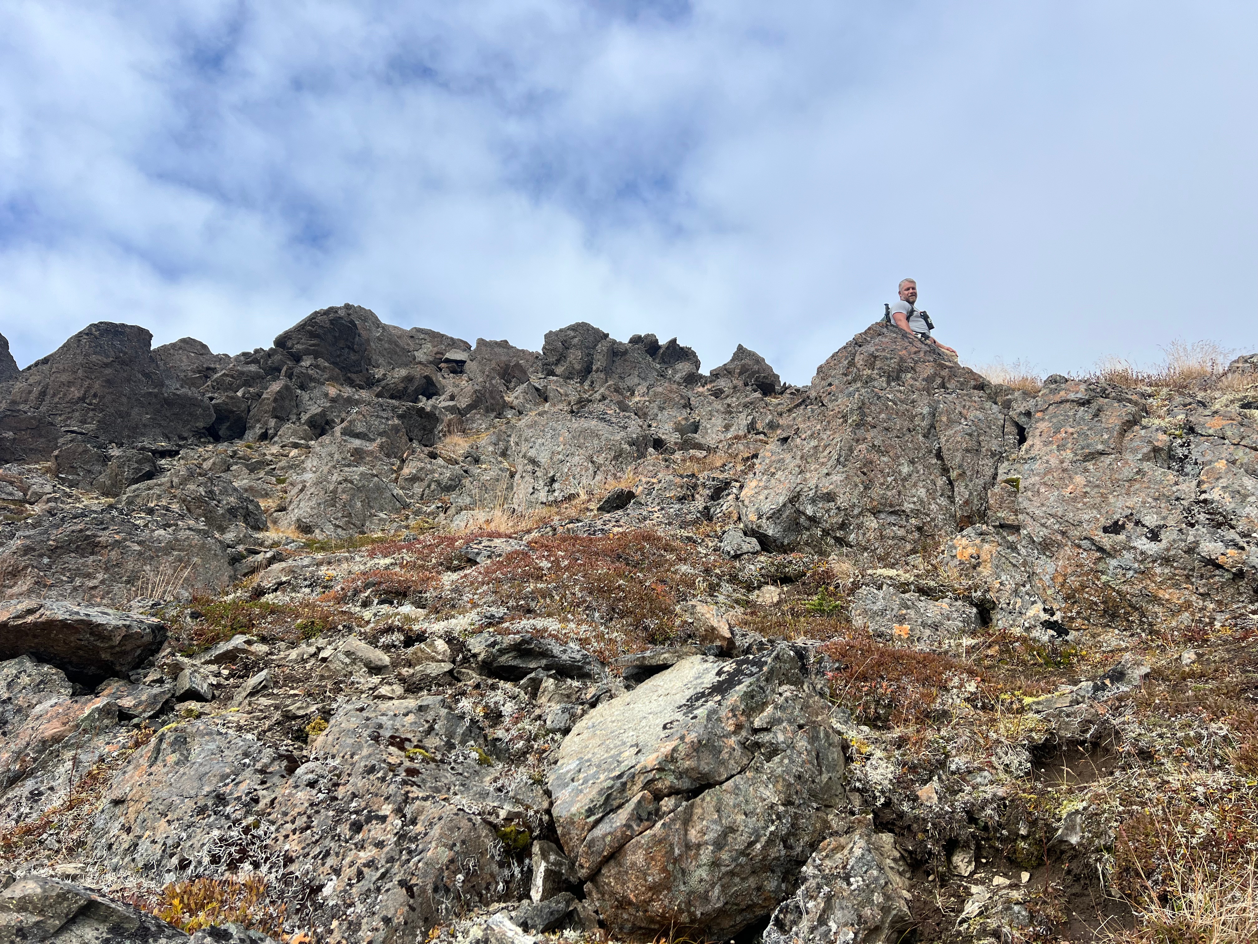
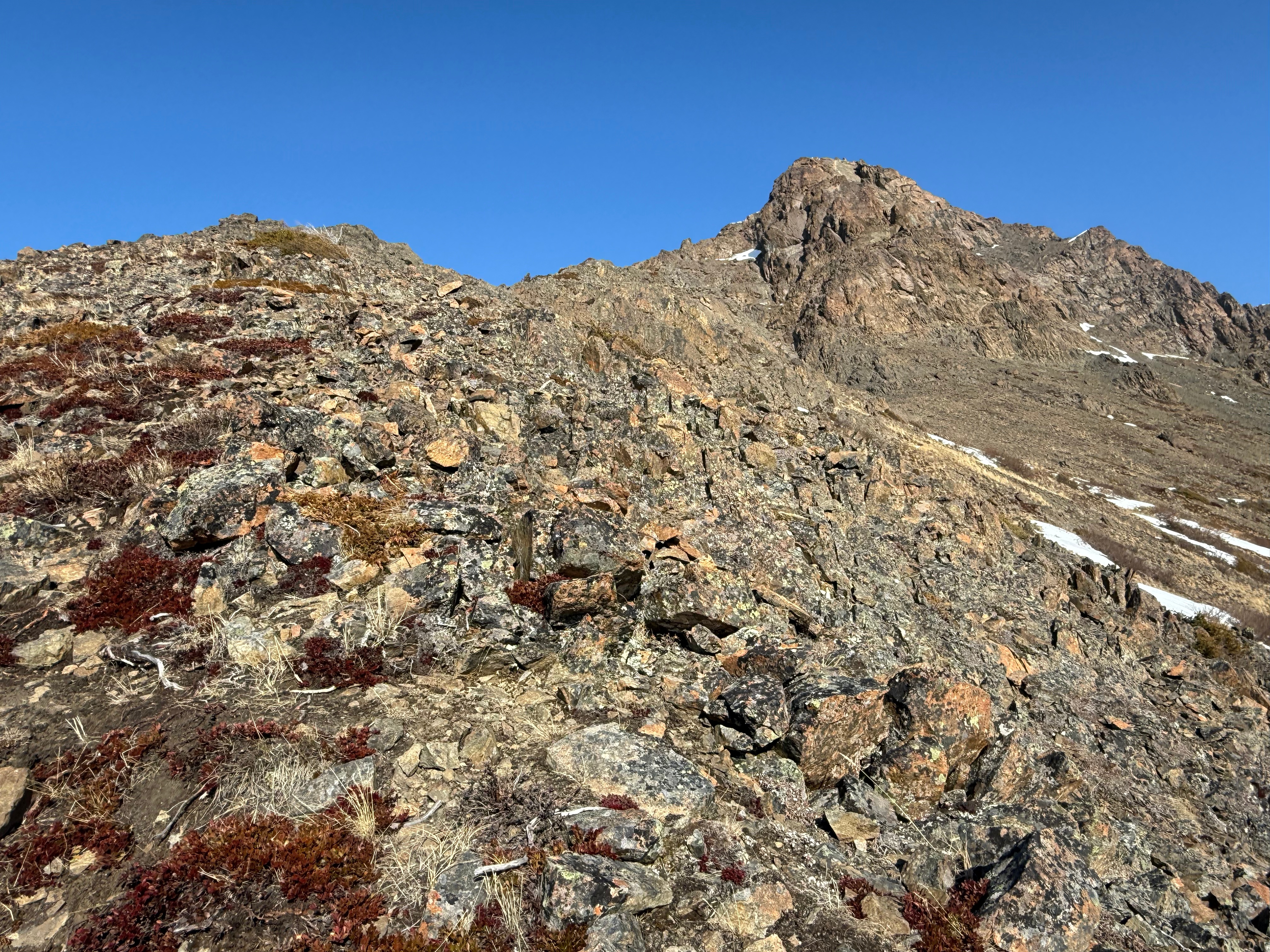
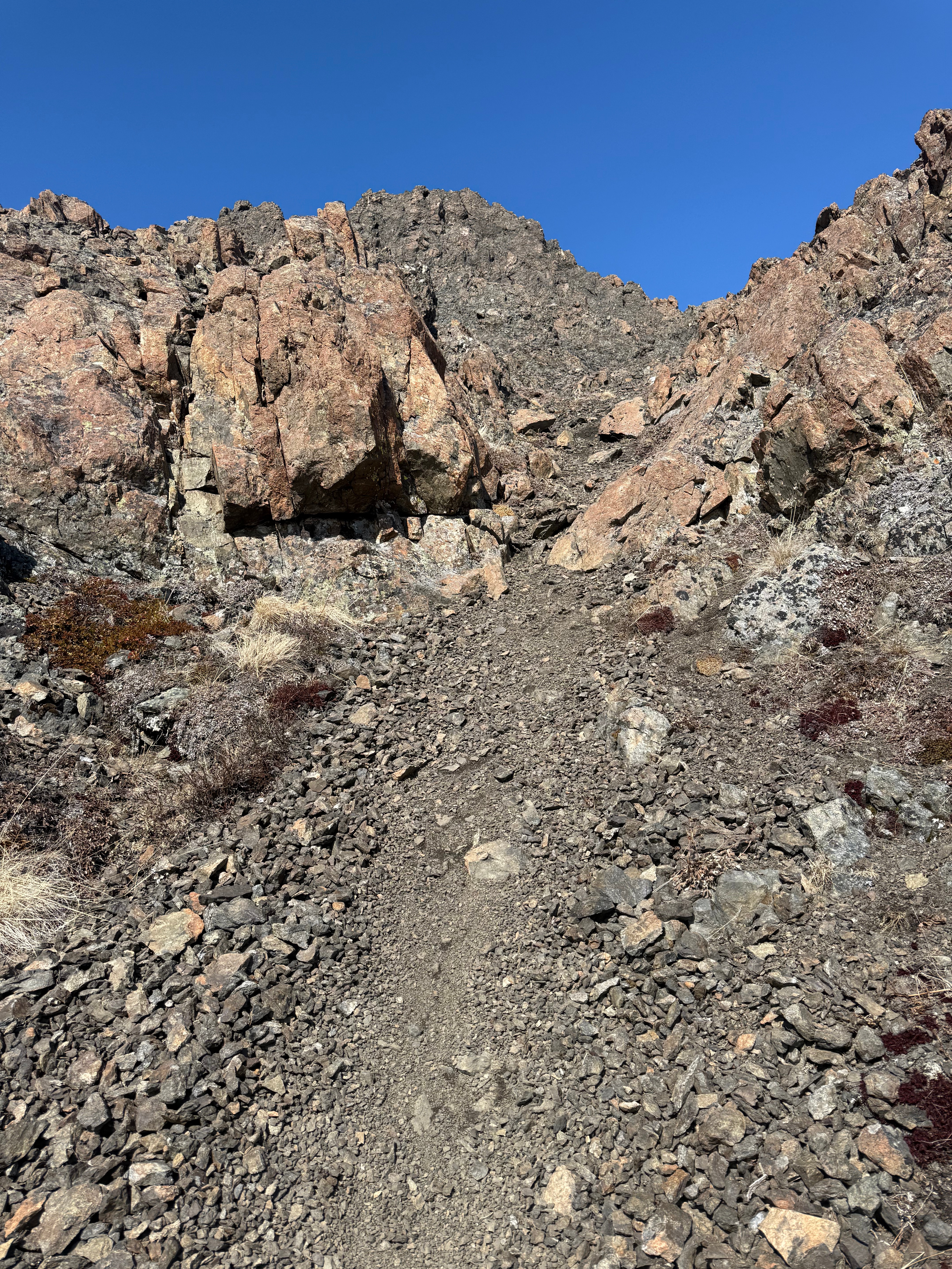
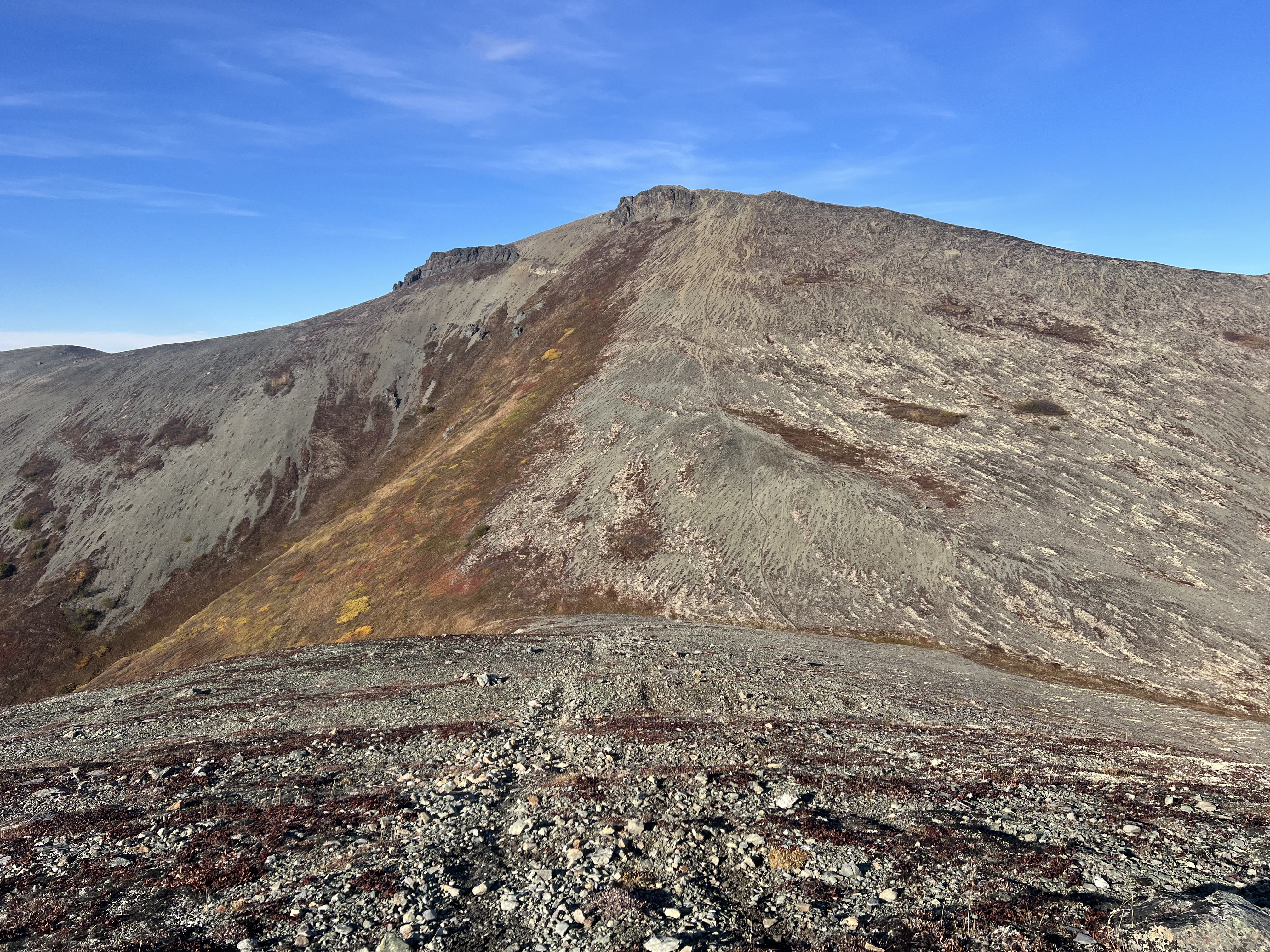
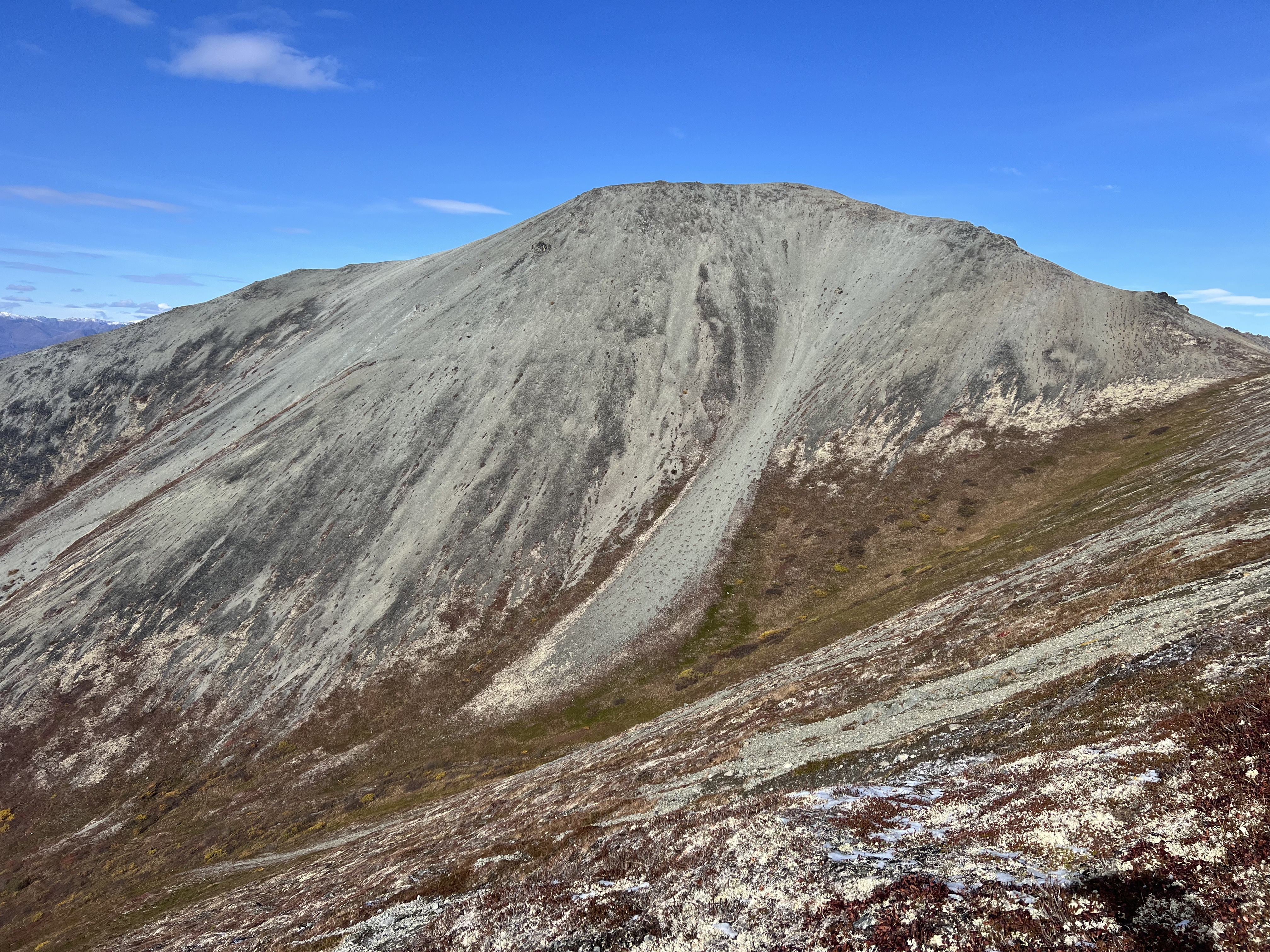
The true summit of Knoya is tucked away from the main ridgeline, so as we approached what seemed to be the peak at around mile 4.8, we veered just south of the intersection of the ridges leading to The Dome and Kanchee, traversing the south-facing slopes. There’s little risk here, aside from the jagged rocks—one of which managed to slice through my shoe when I misstepped. Thankfully, my Topos took the damage and my foot was fine.
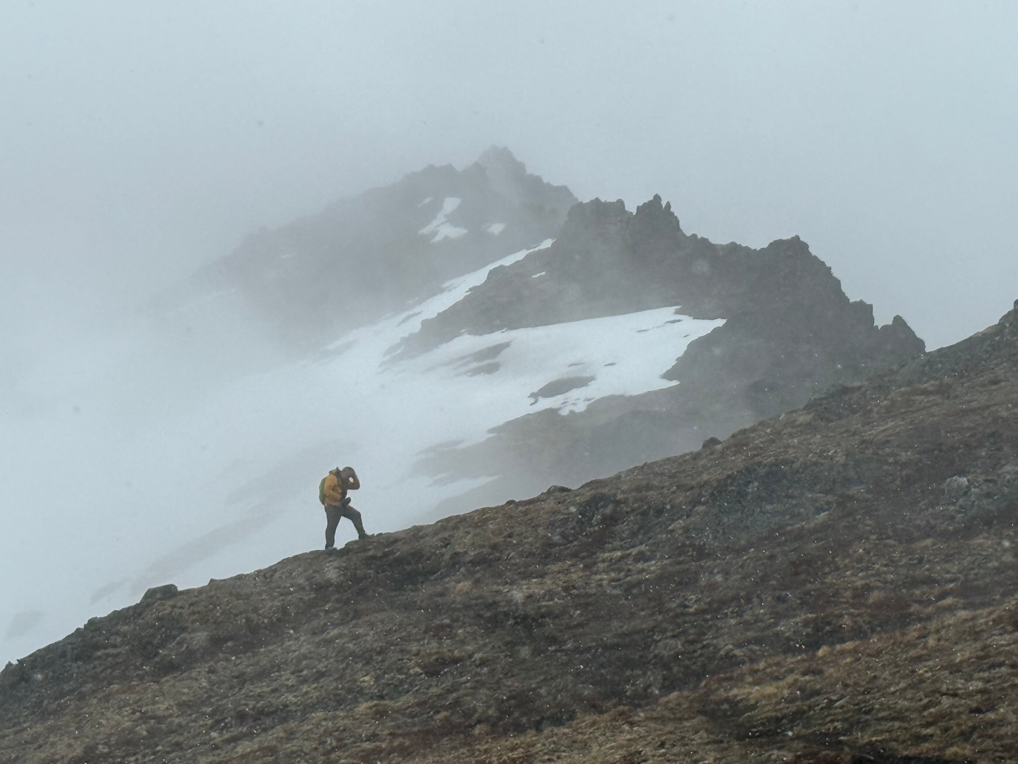
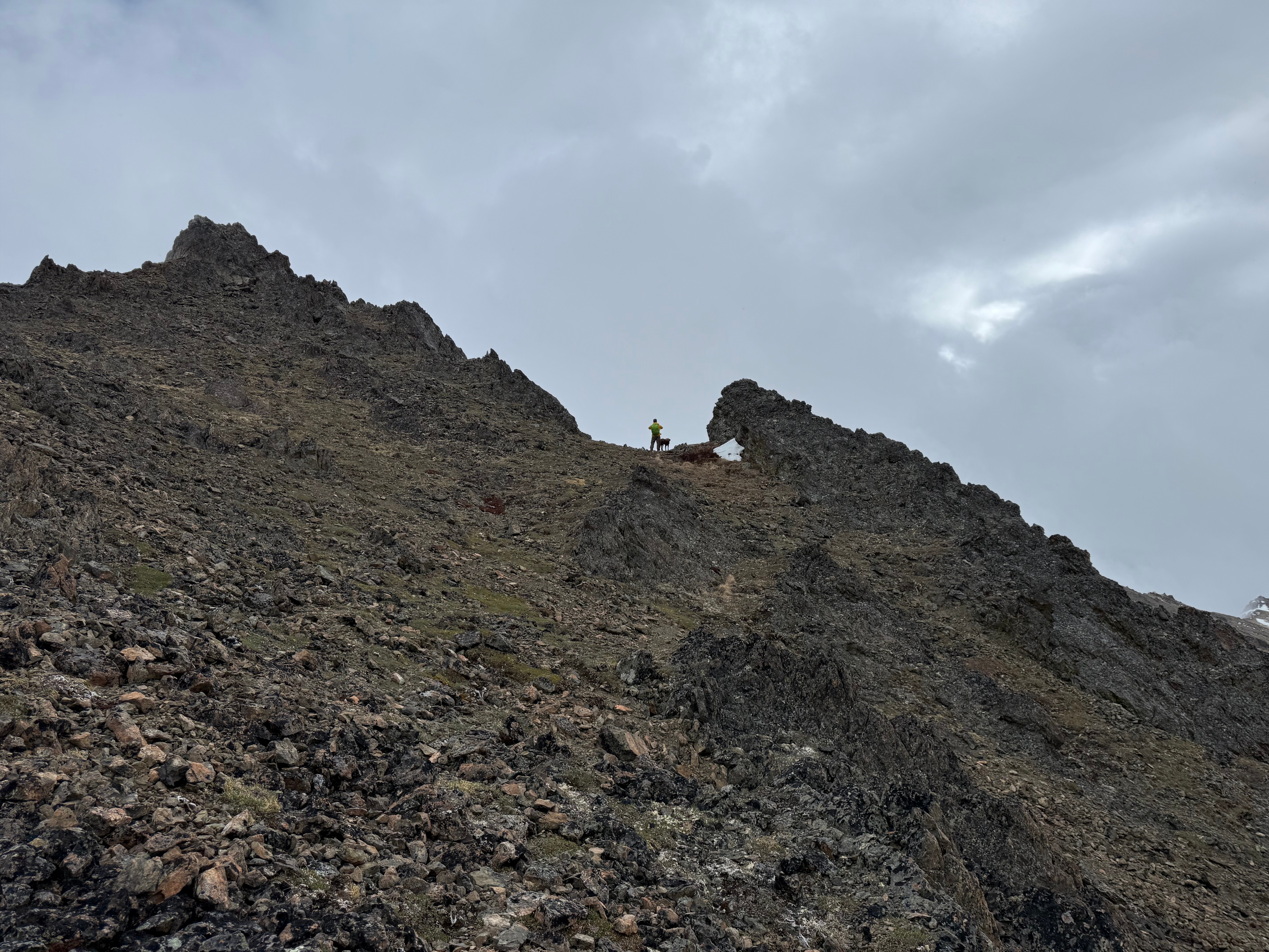
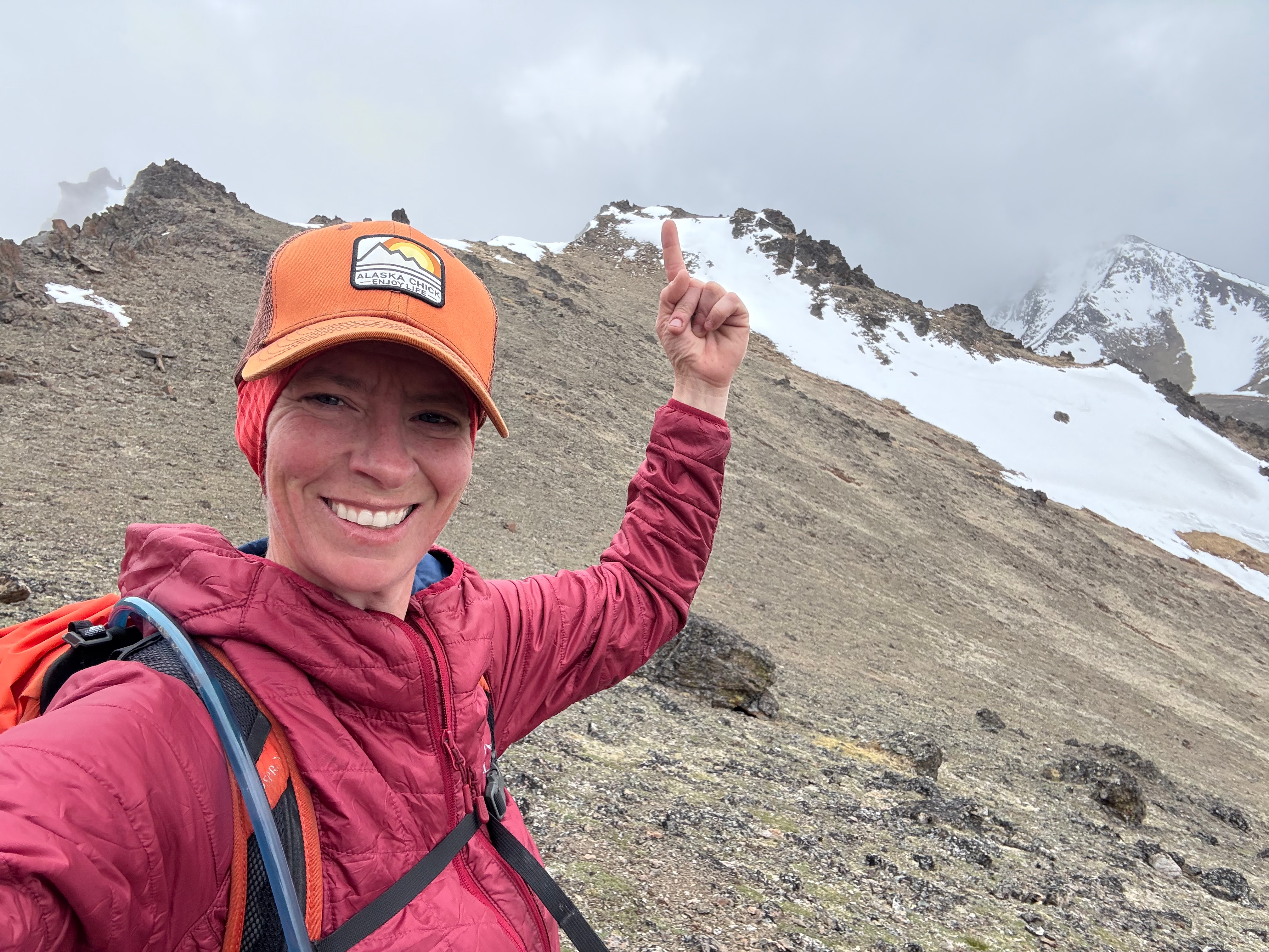
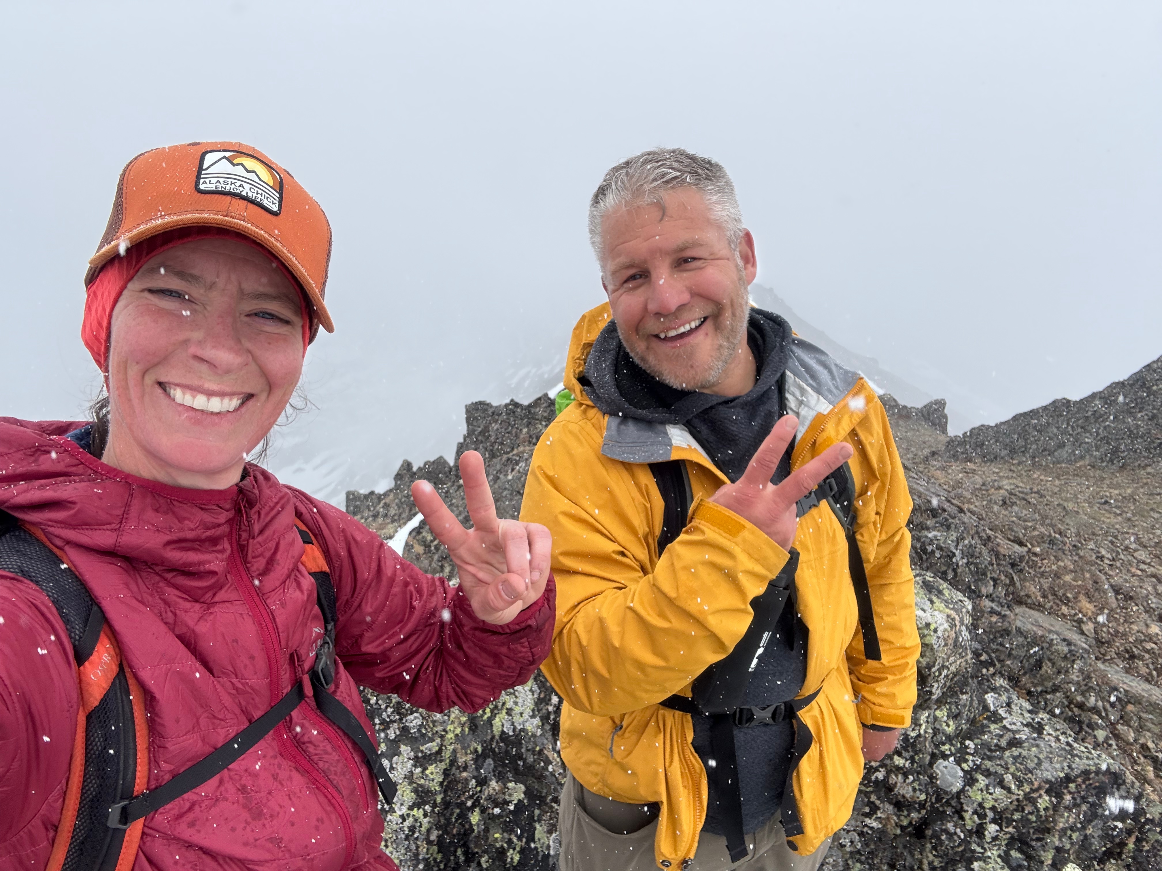
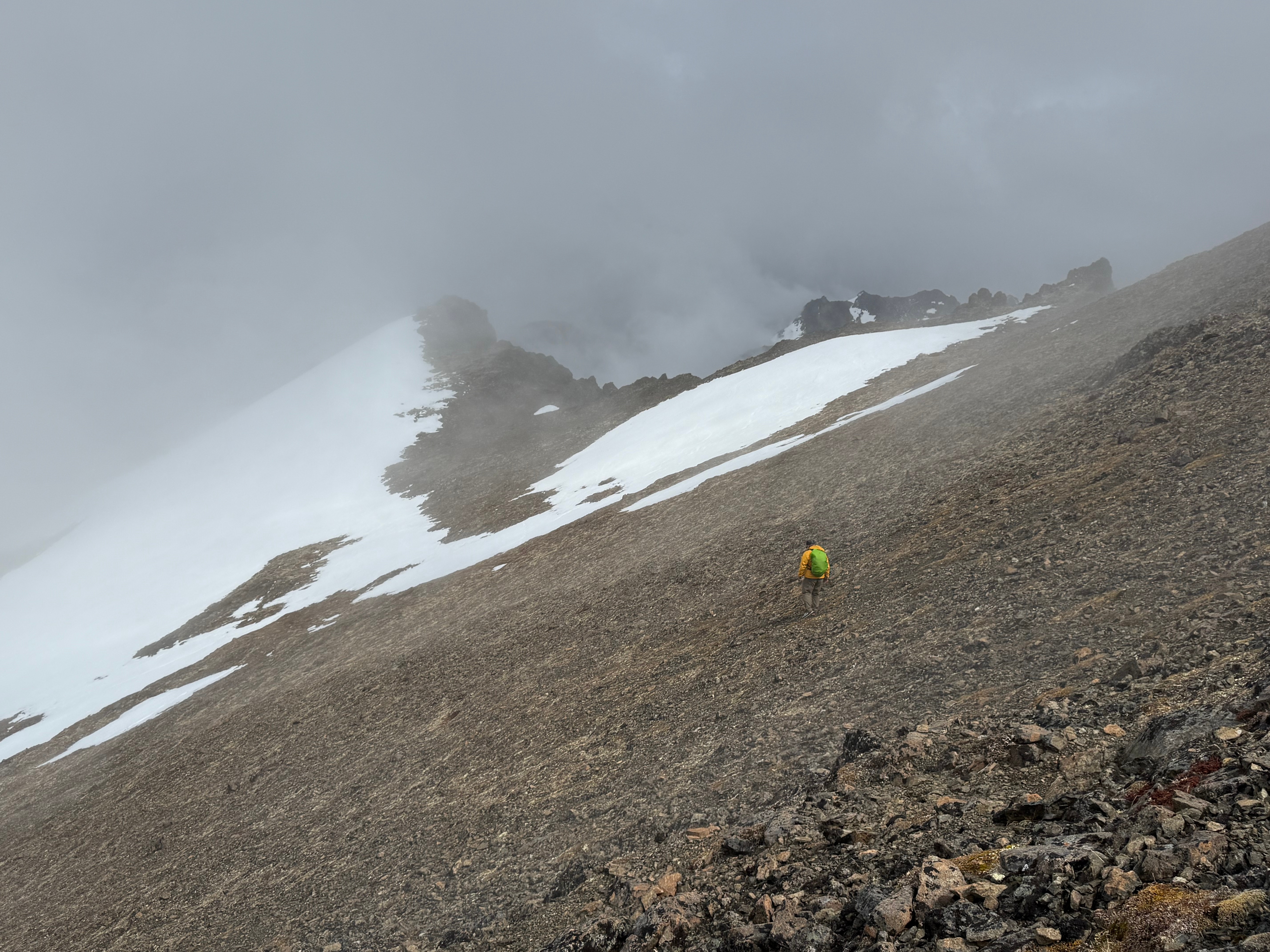
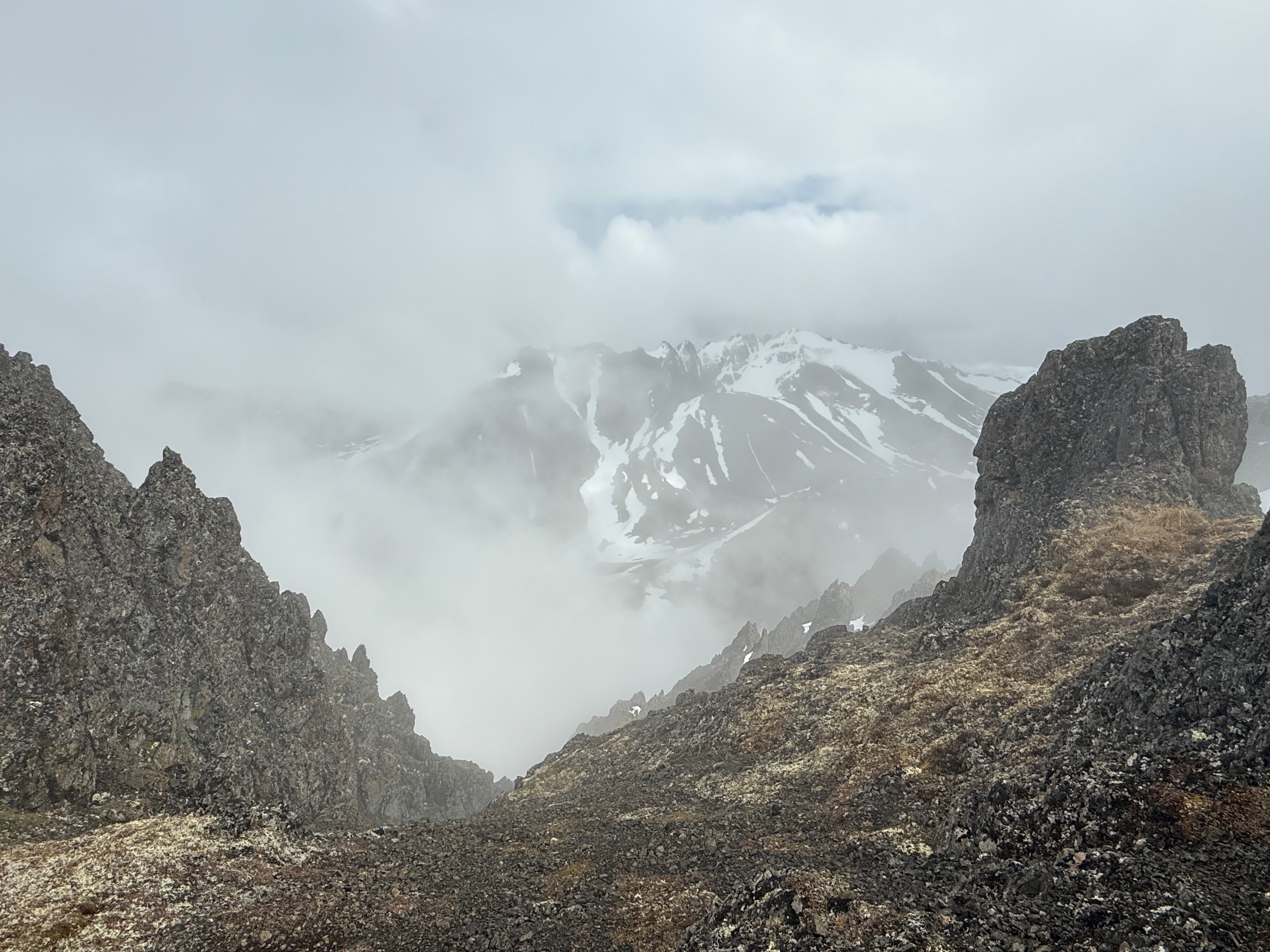
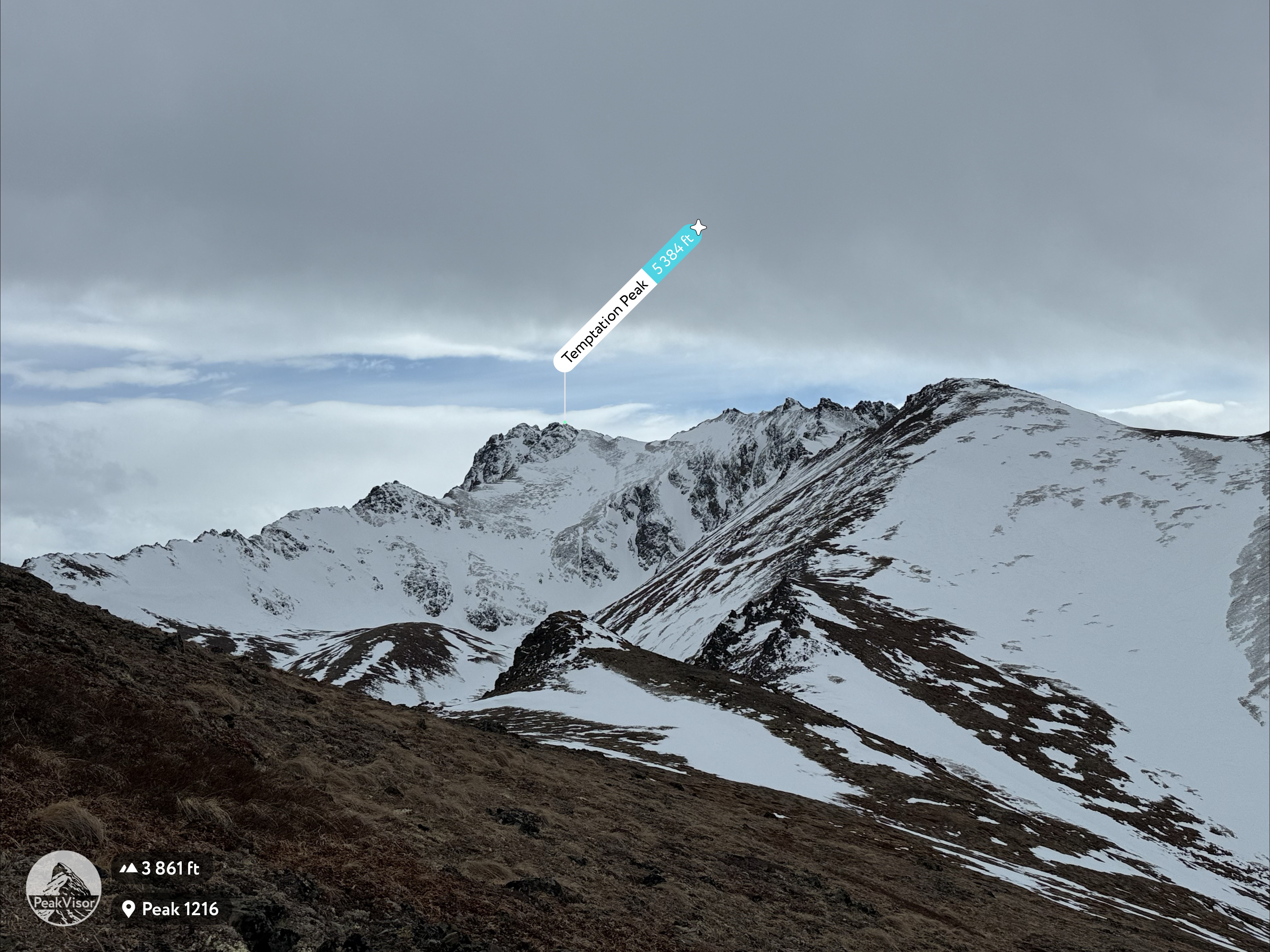
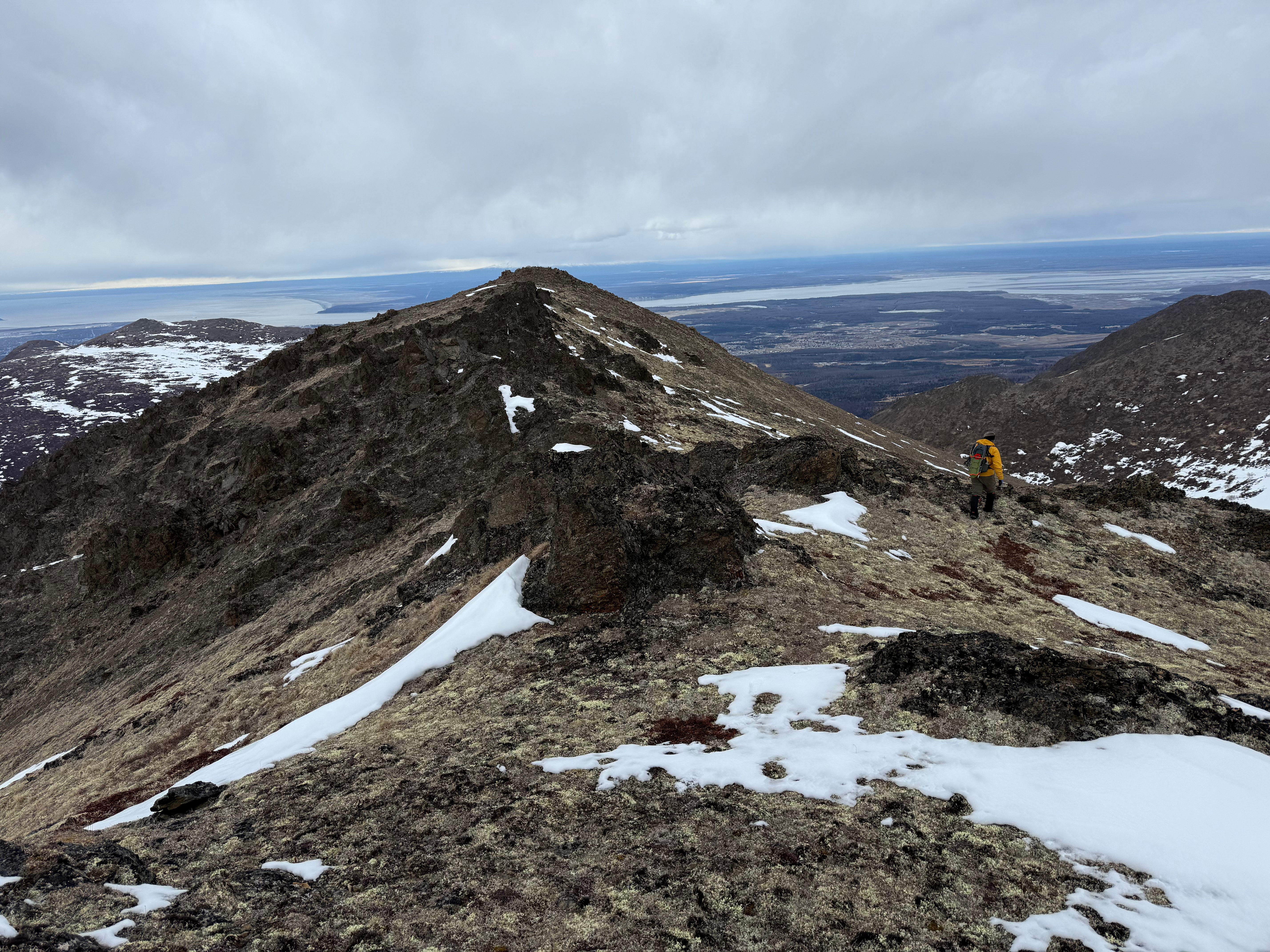
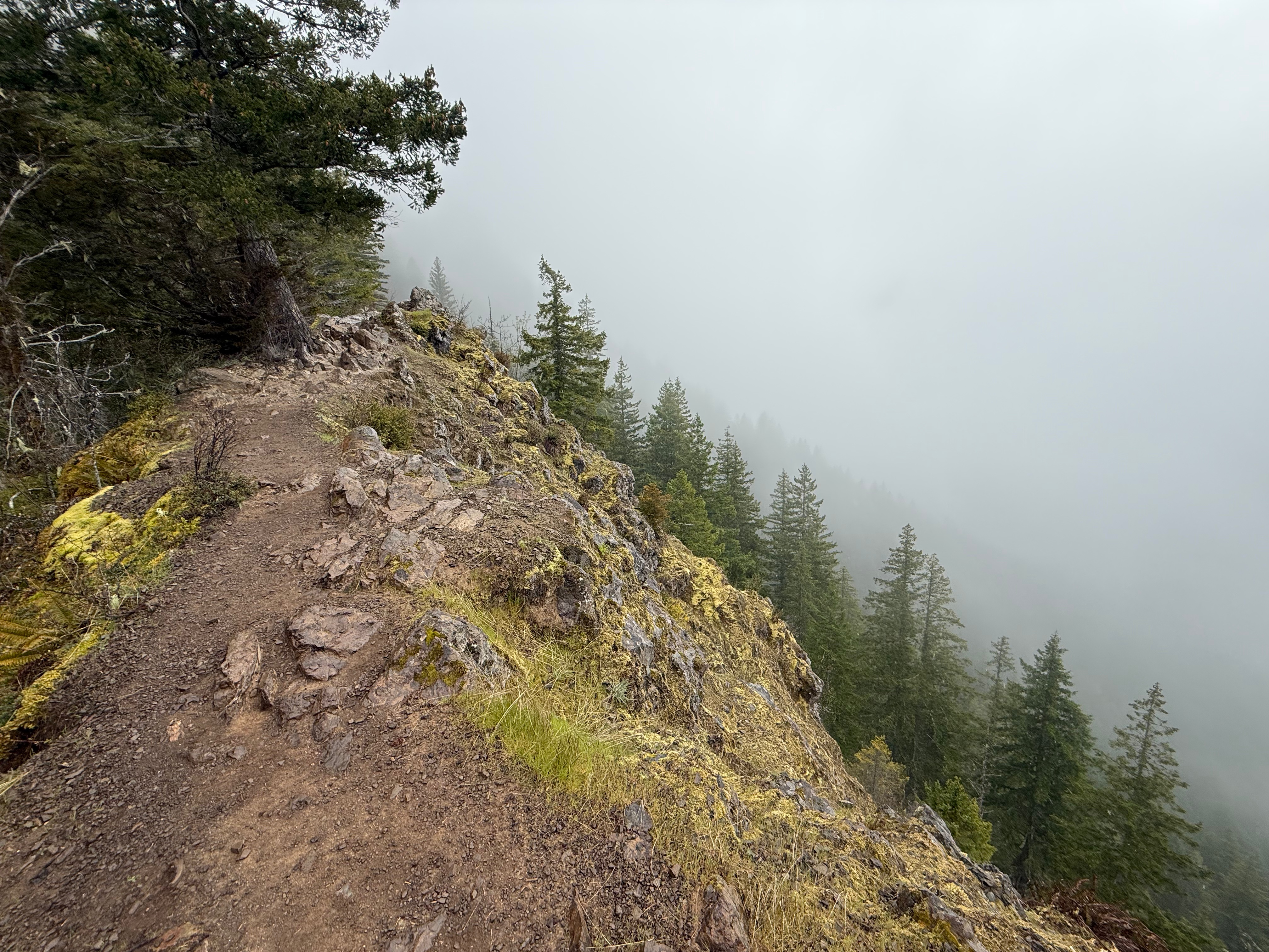
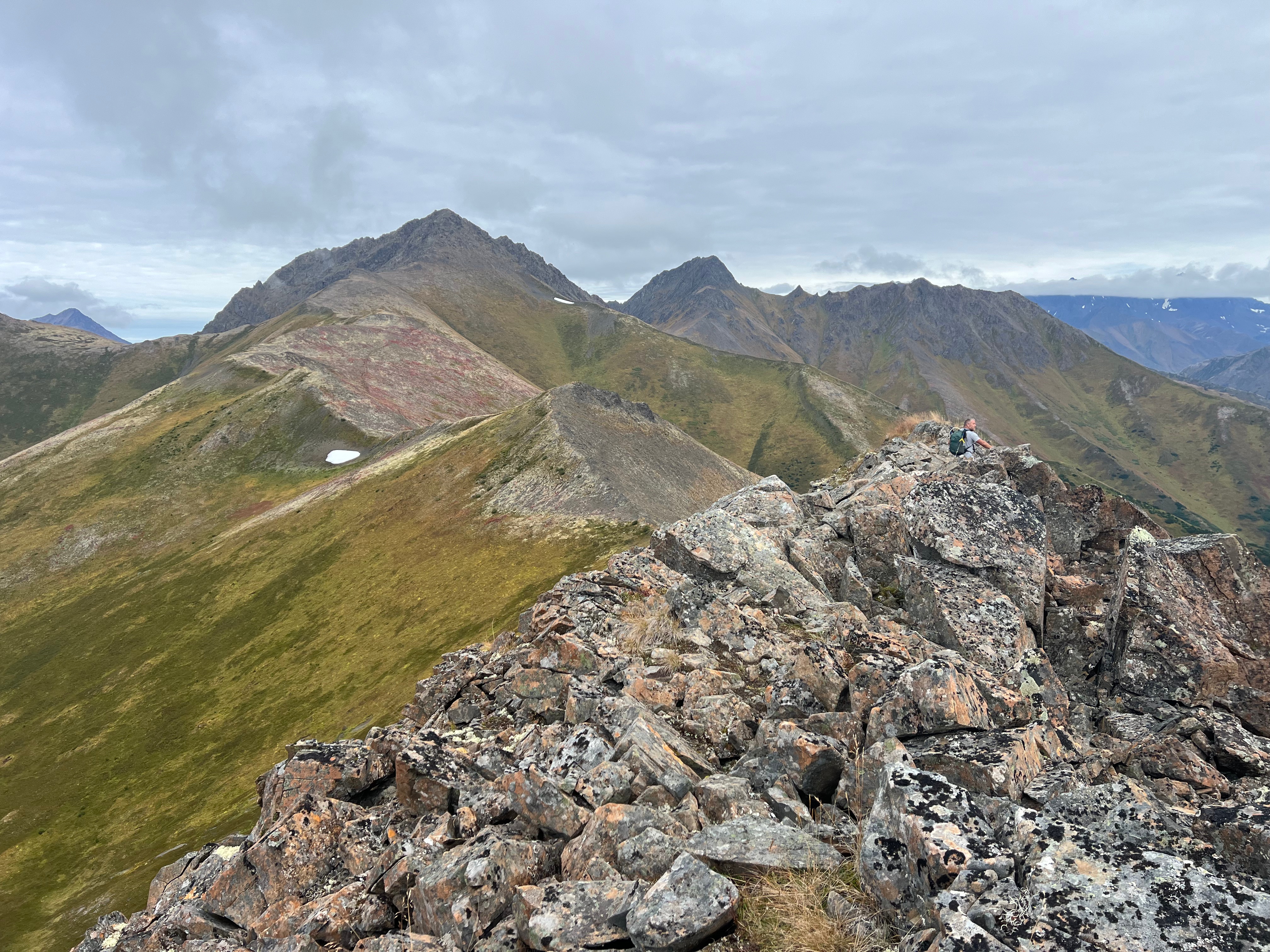
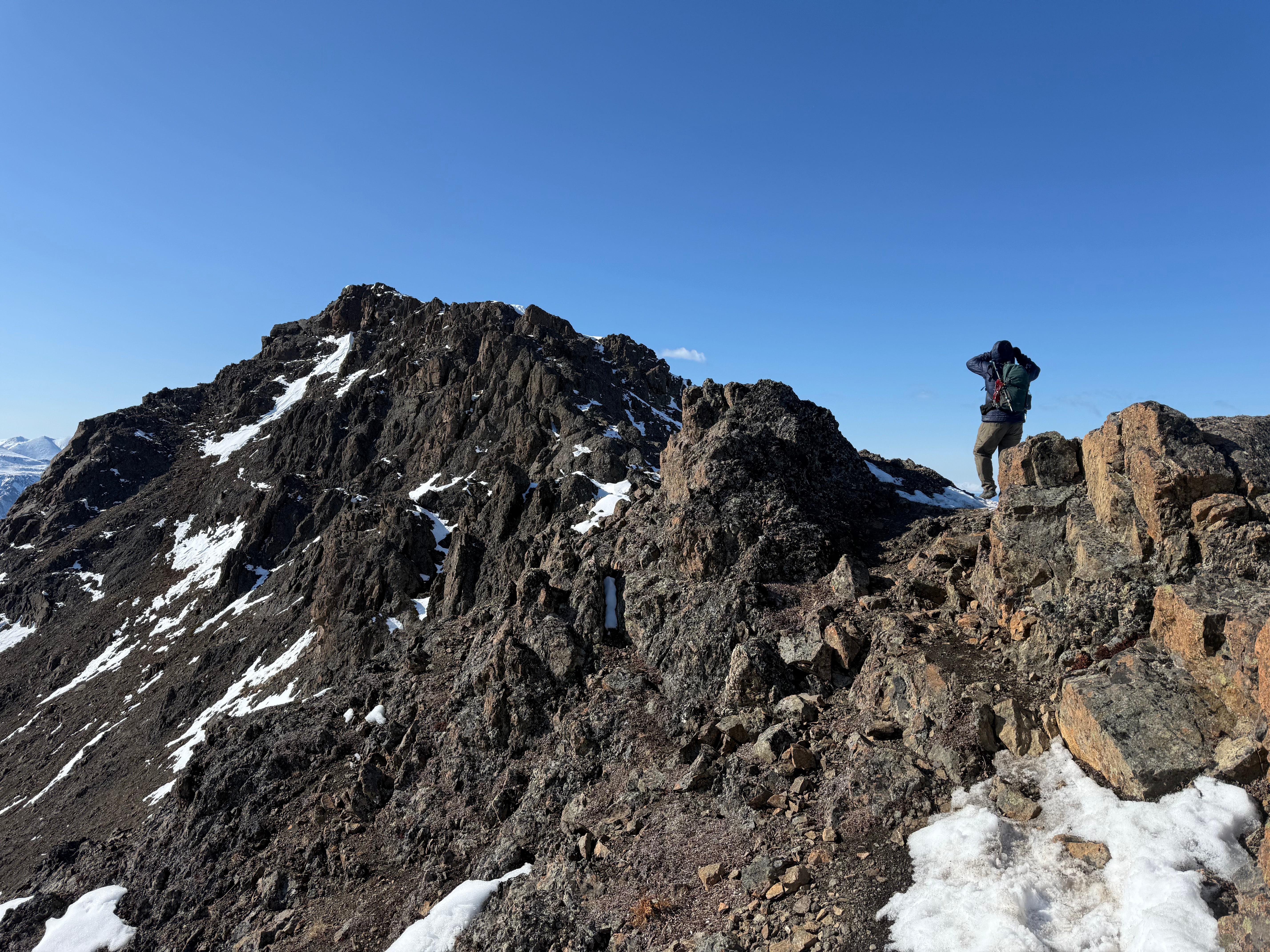
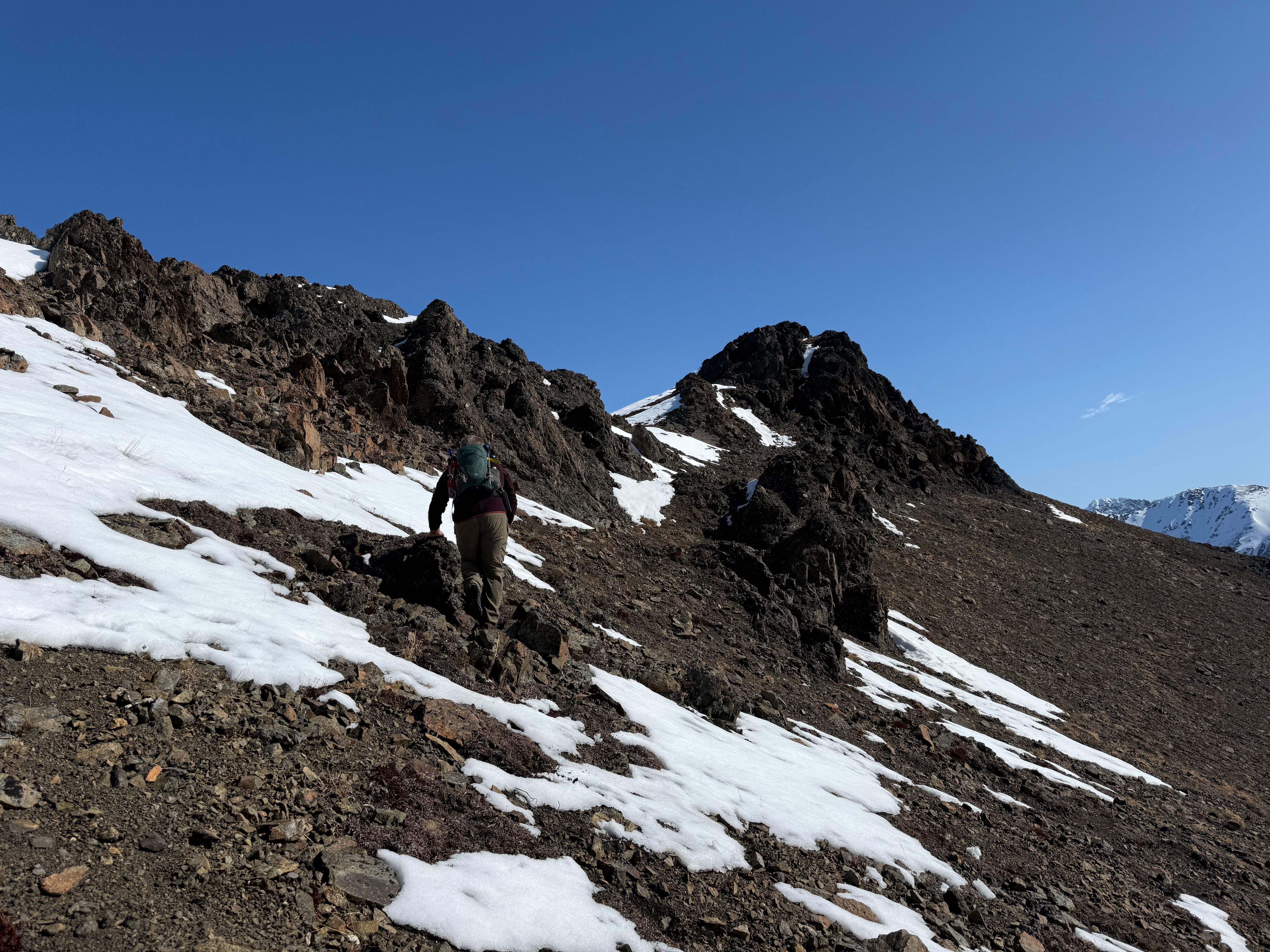
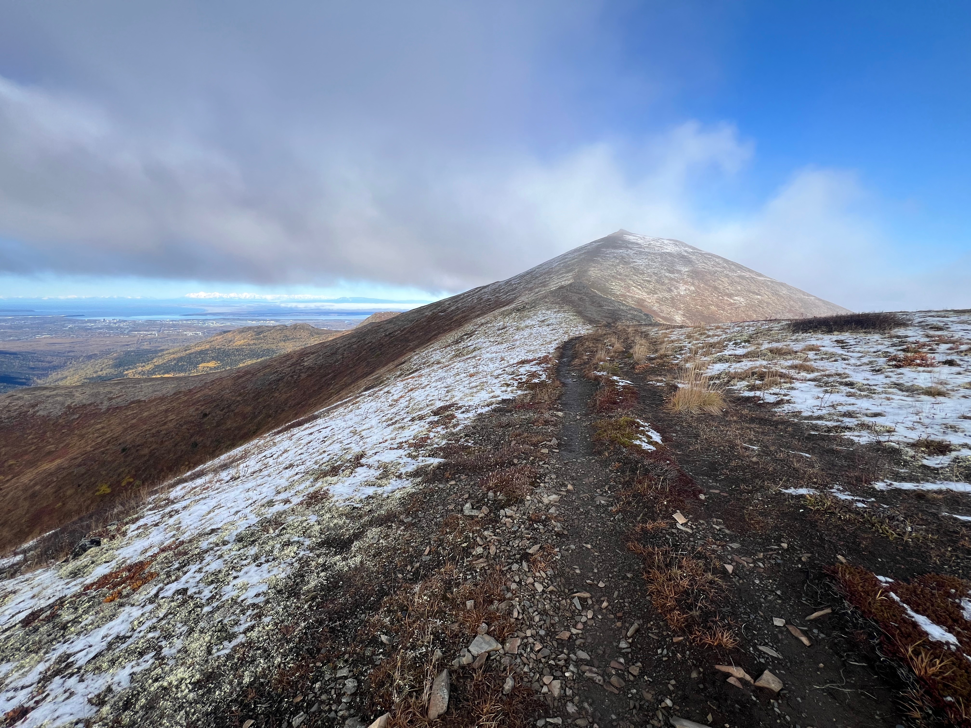
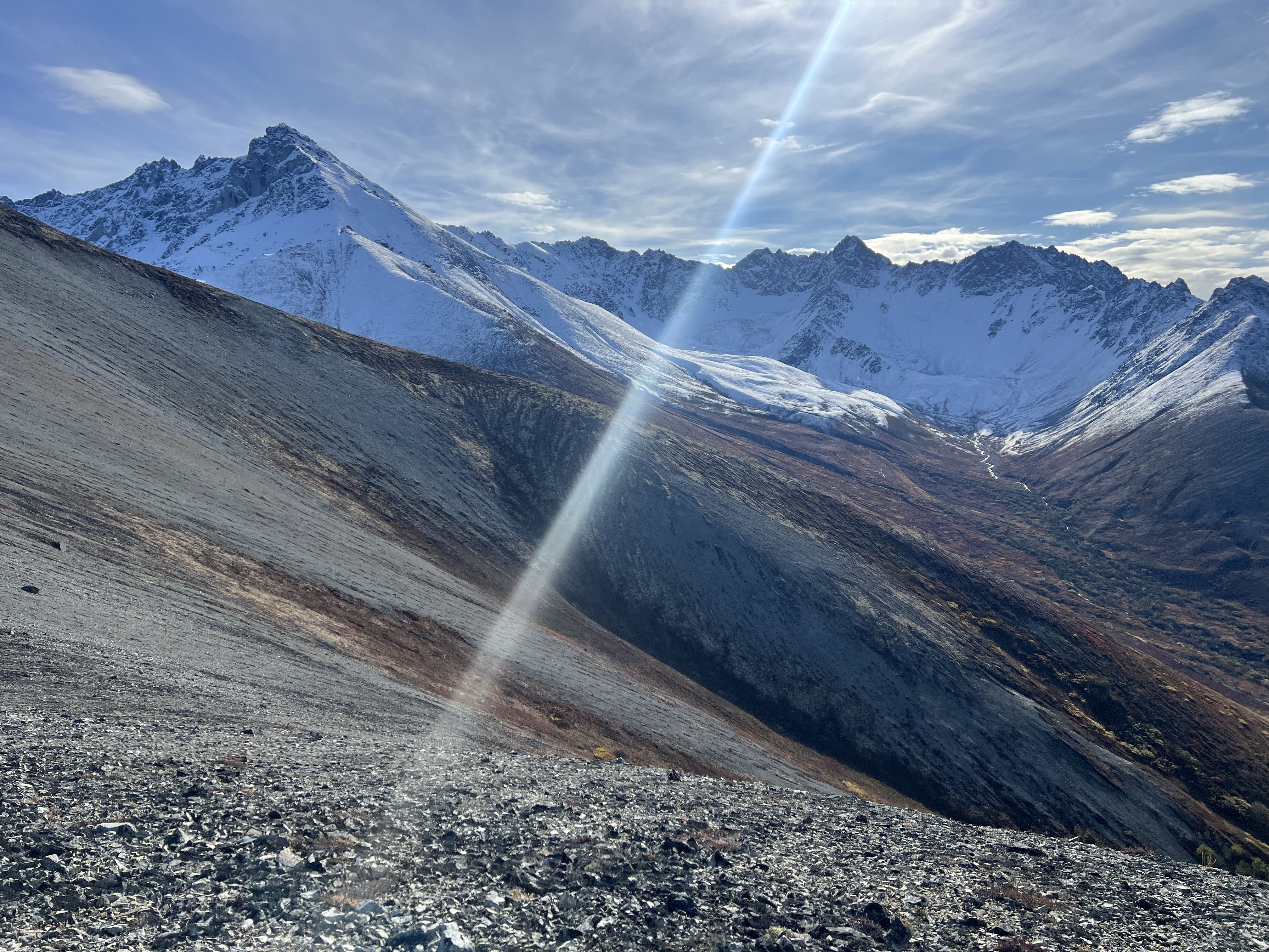
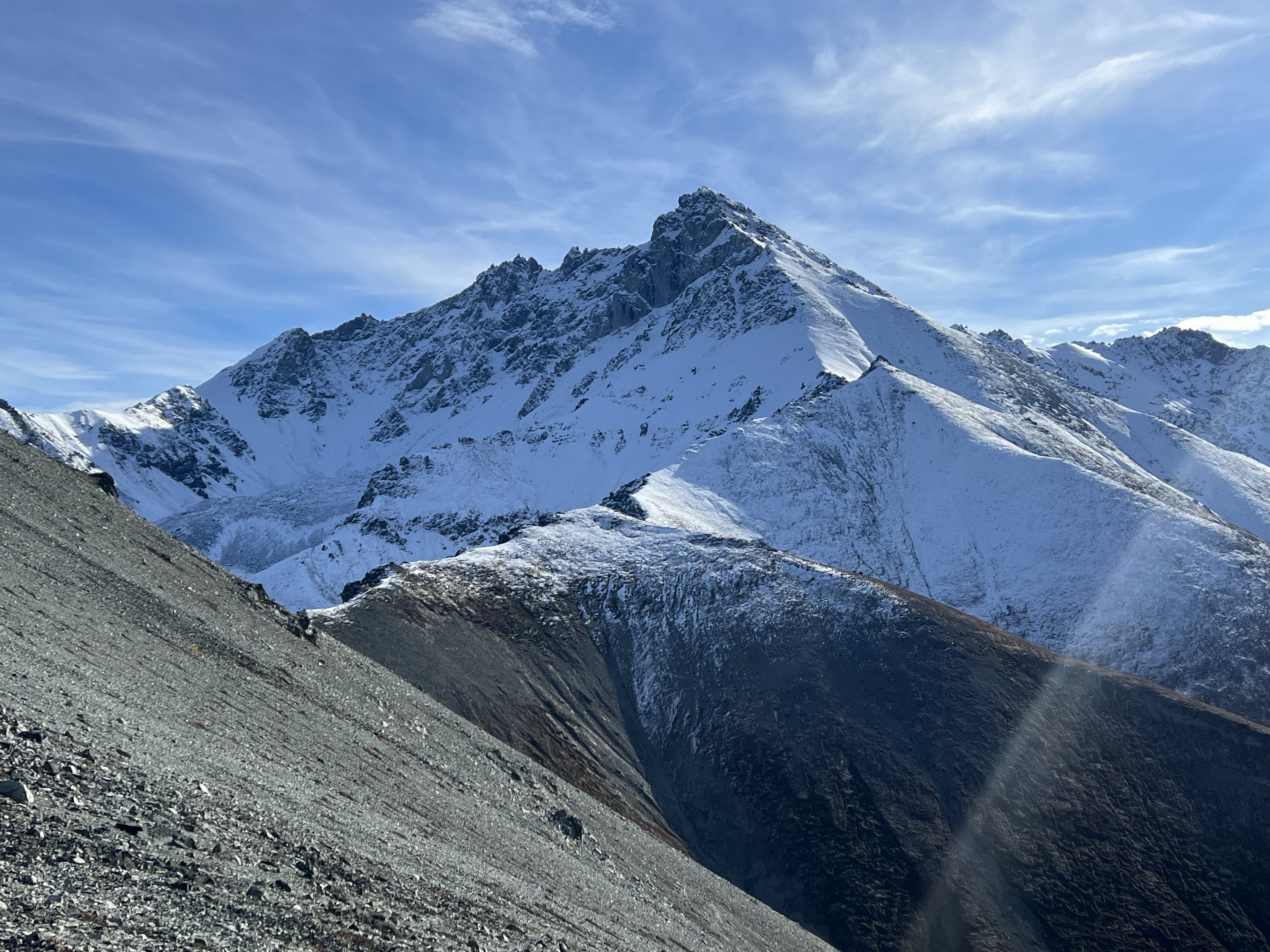
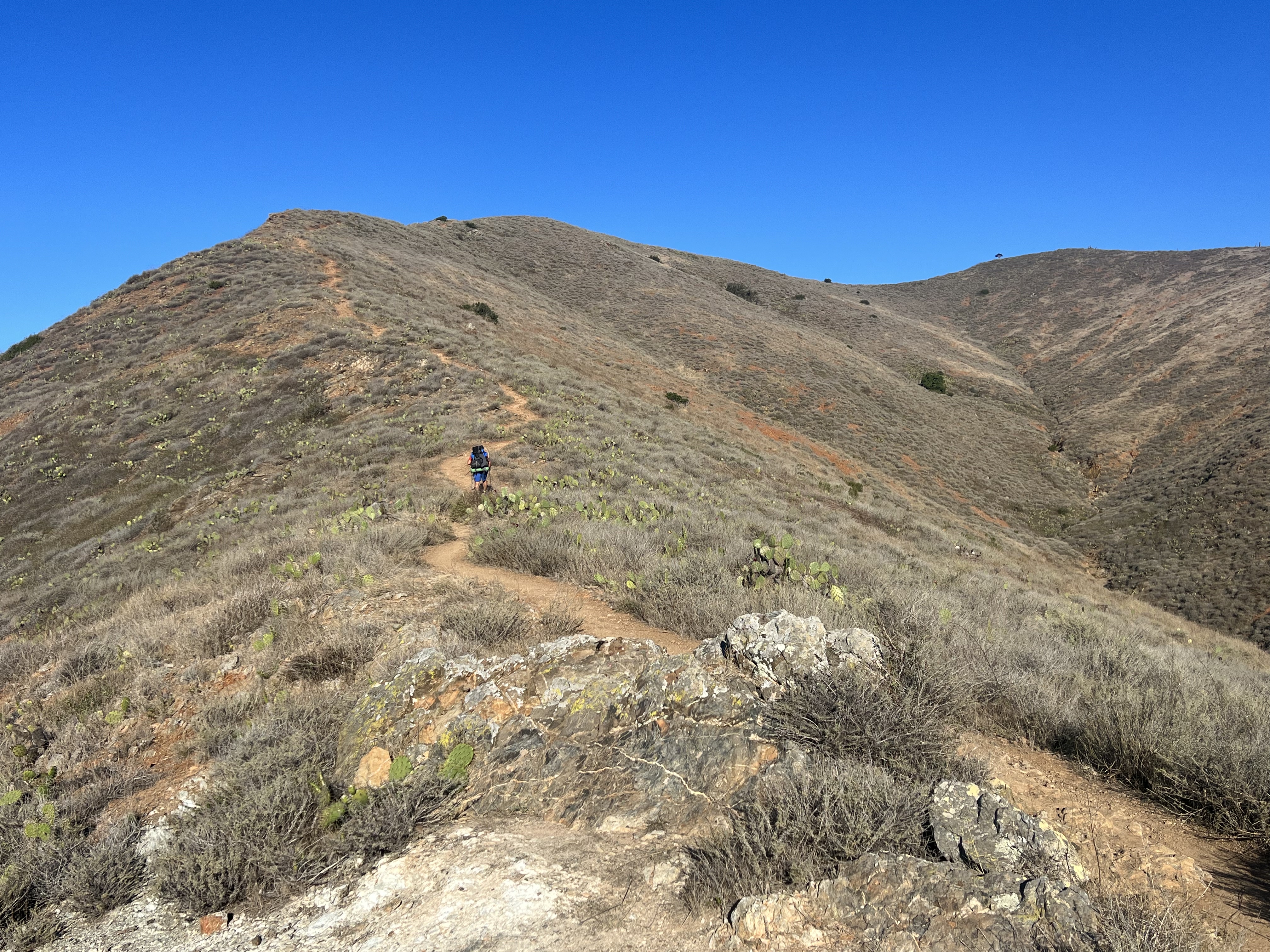
Knoya’s actual summit came into view less than a quarter mile to the east, at the far end of the south-facing slope. Tikishla and the surrounding peaks were still hidden in clouds, and as we stepped onto the summit, it began to snow—typical for late May or early June, and far more tolerable than the rain we’d started in.
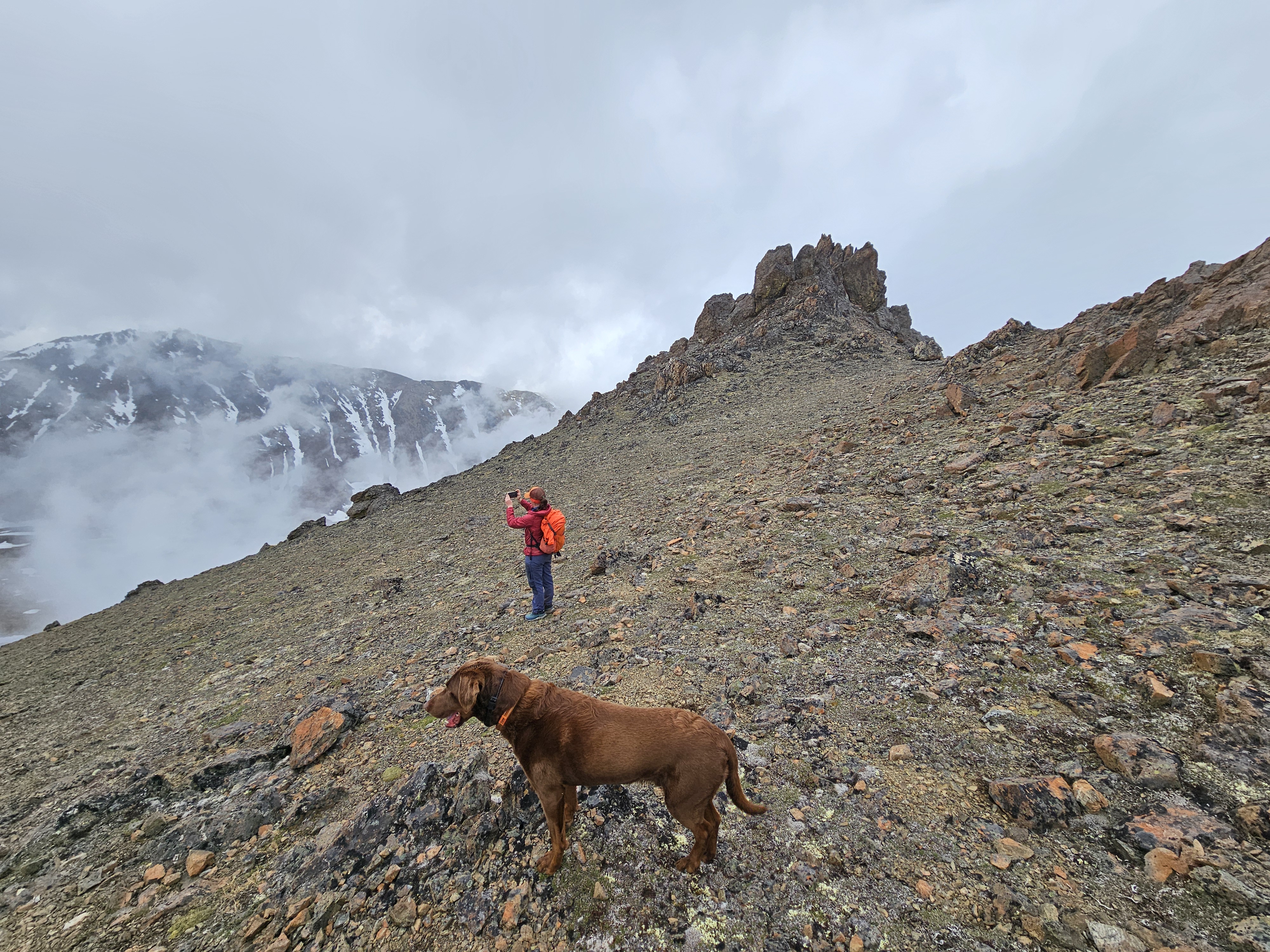
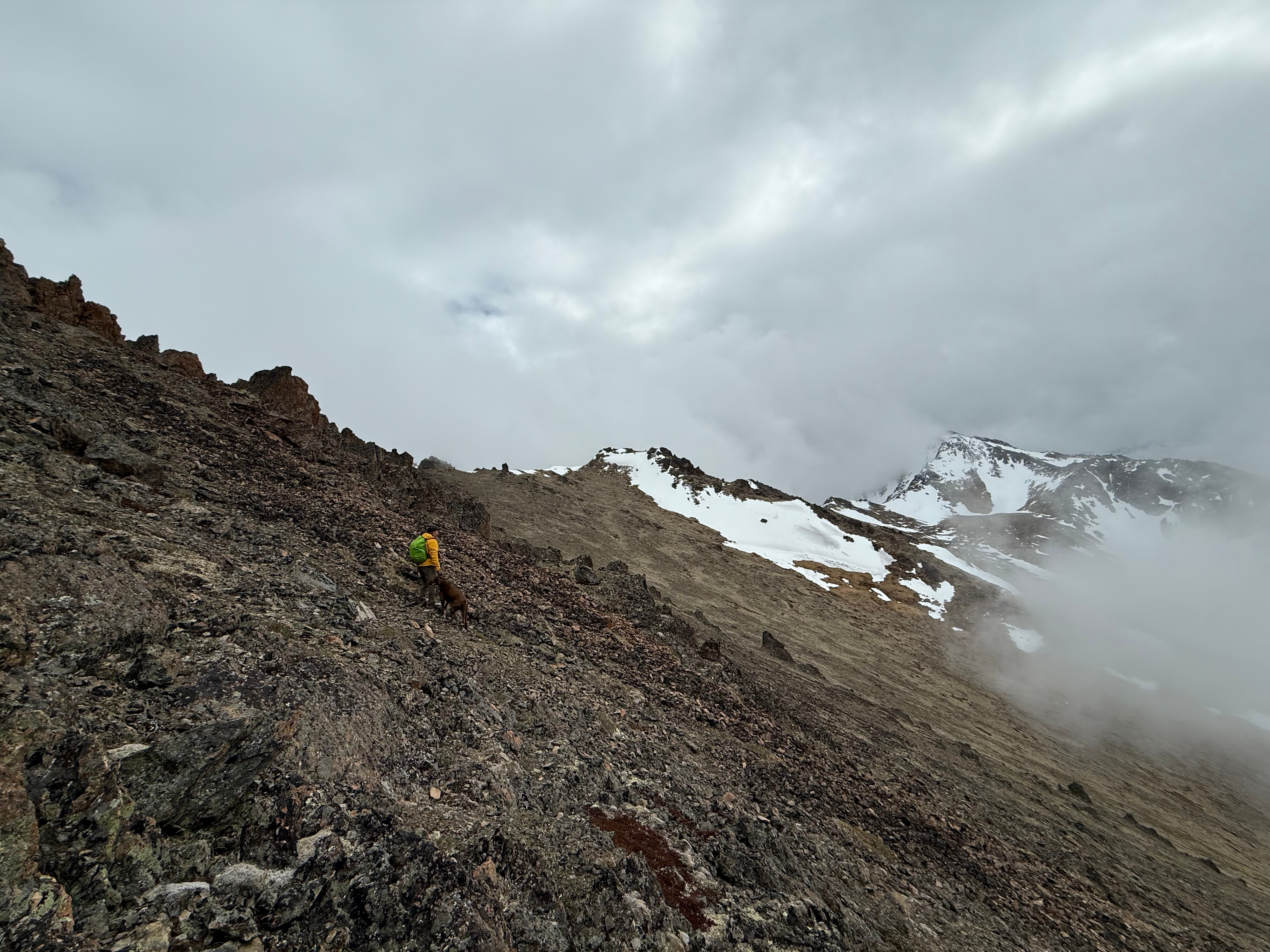
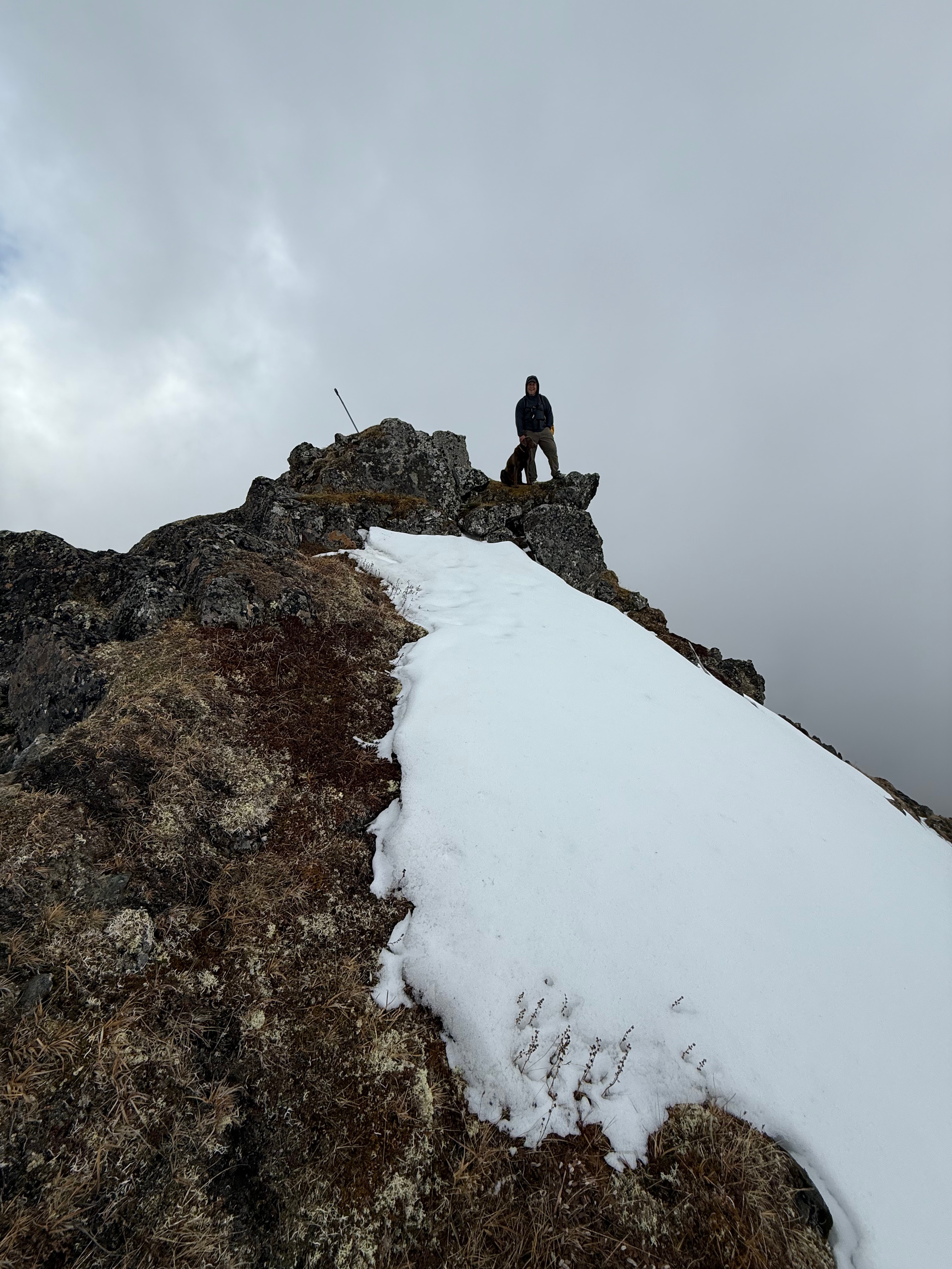
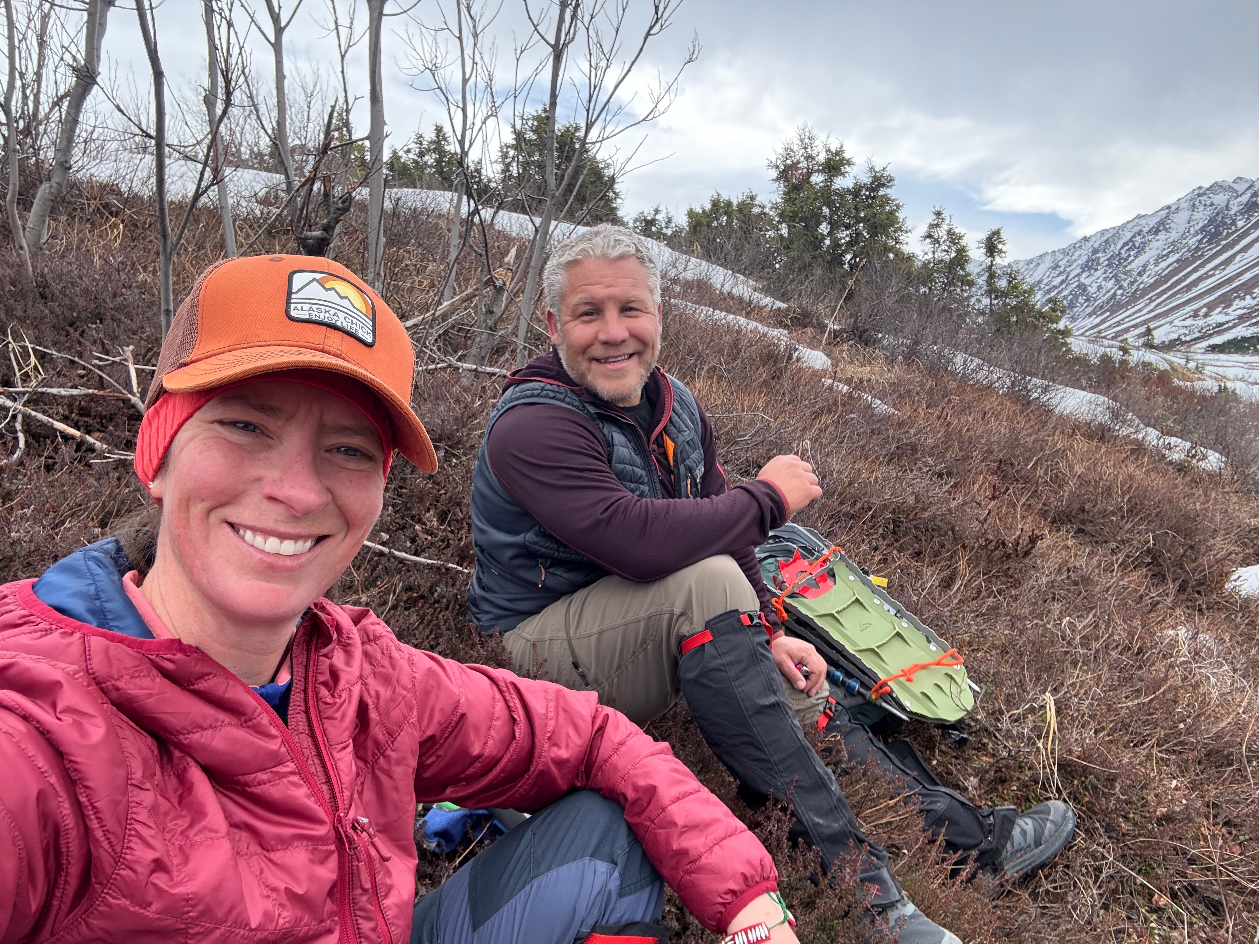
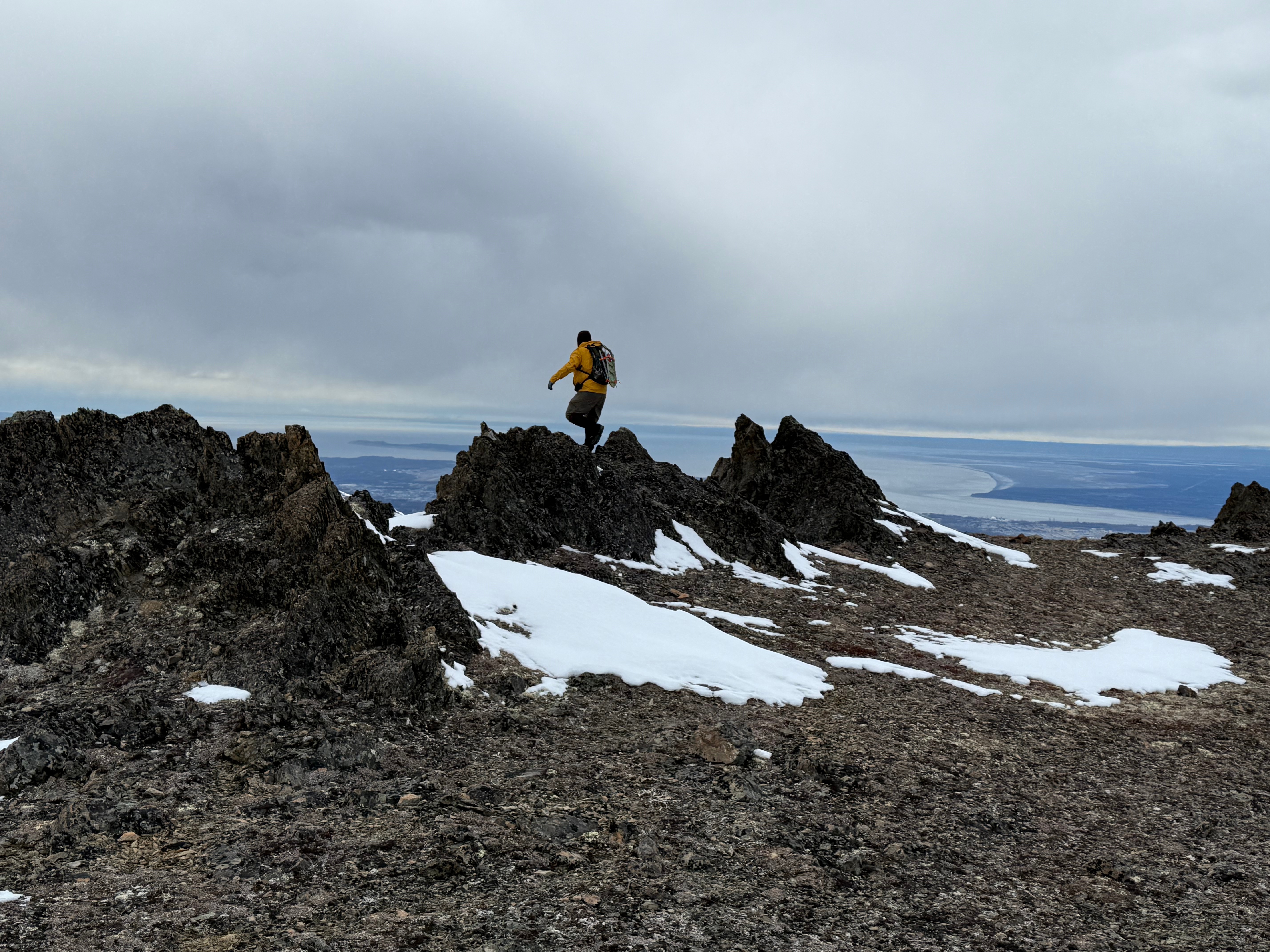
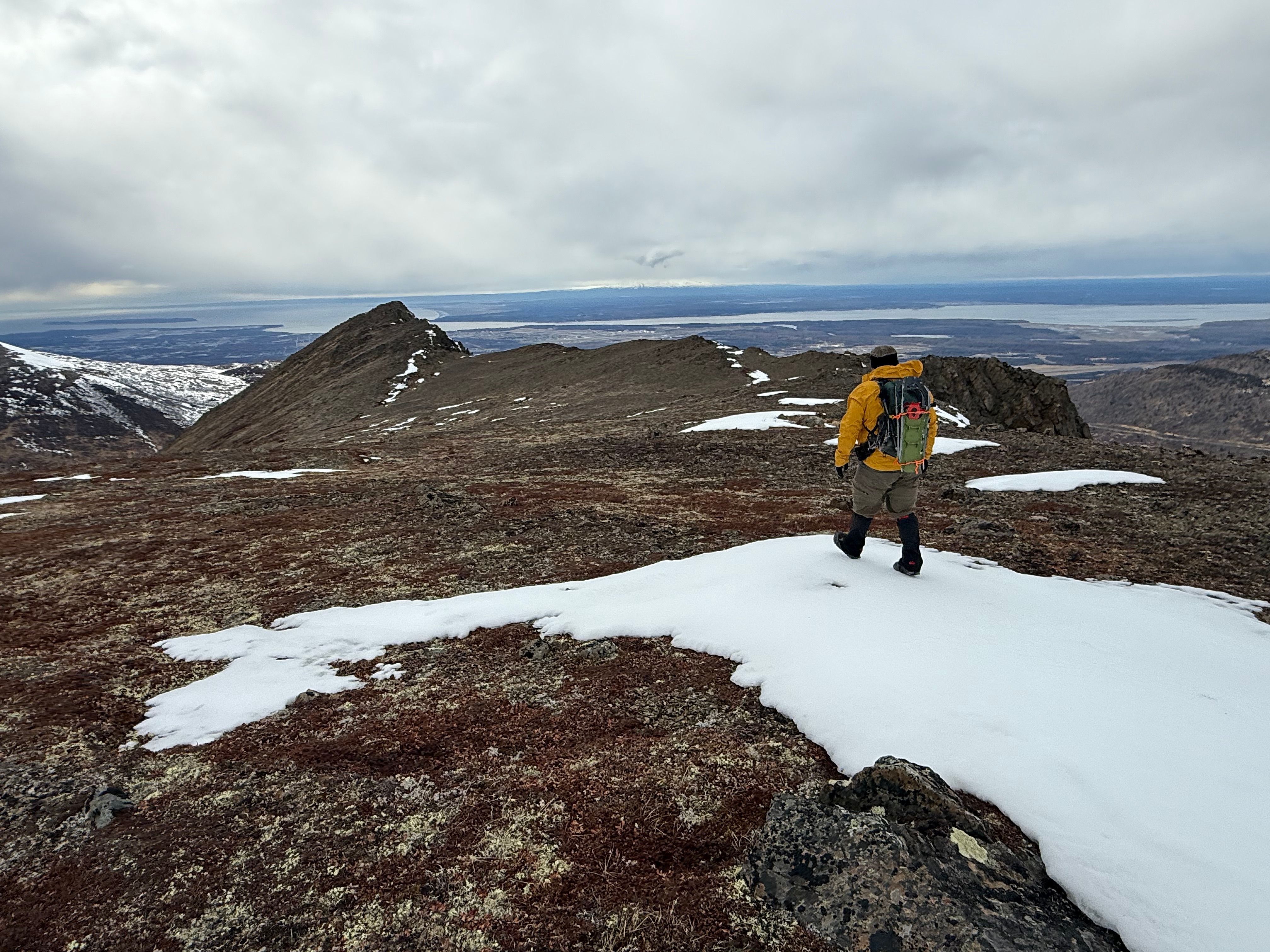
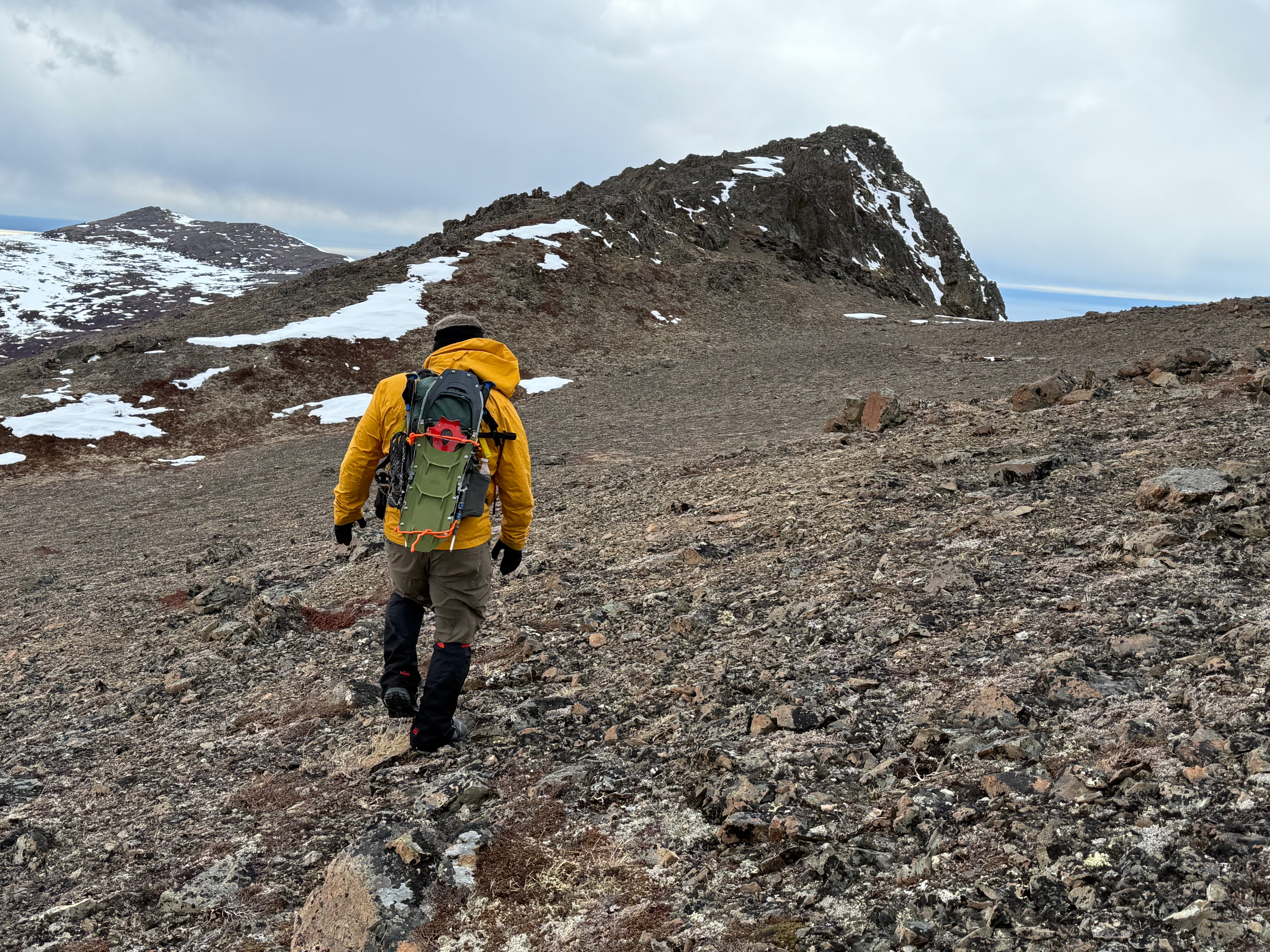
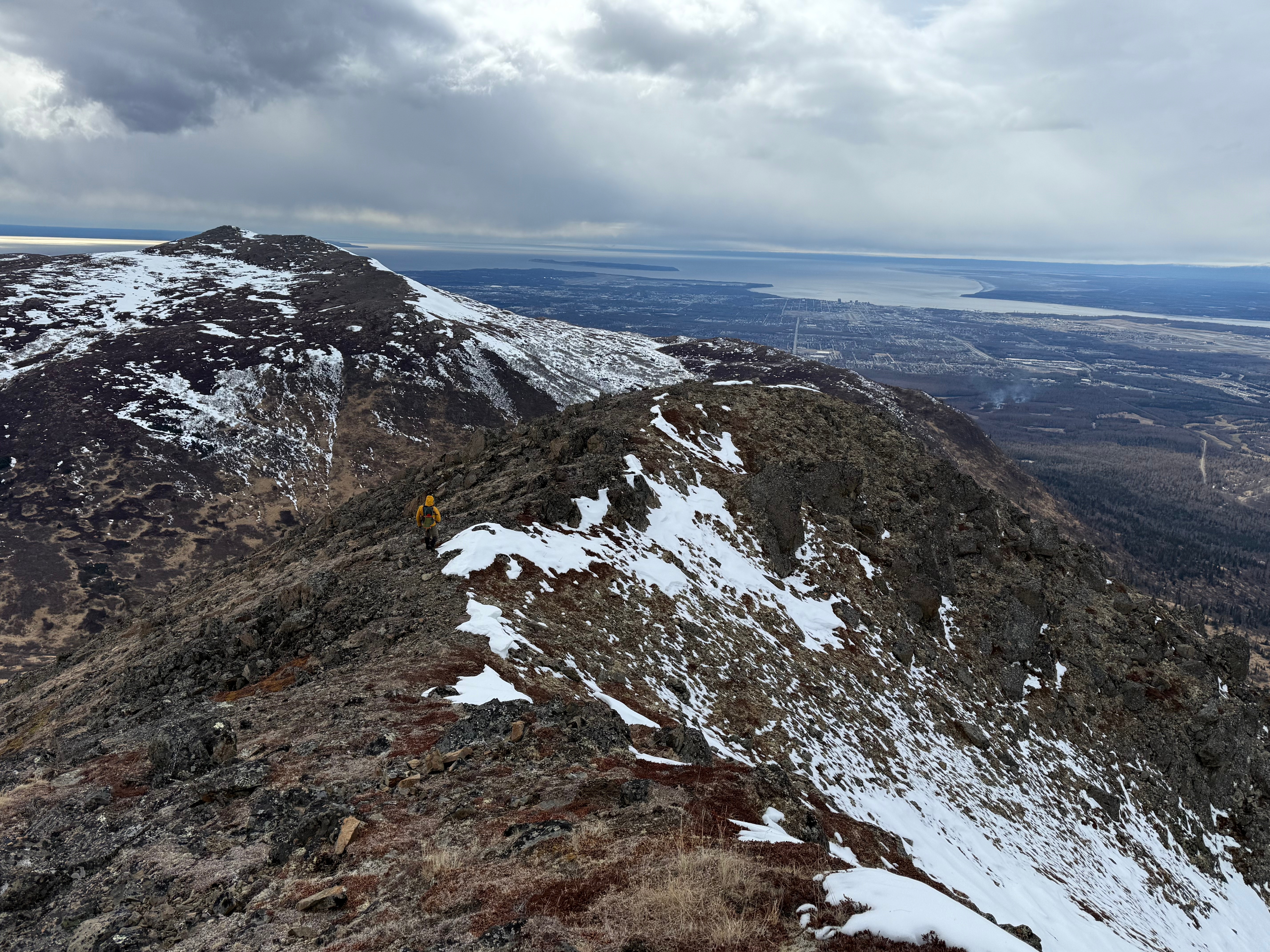
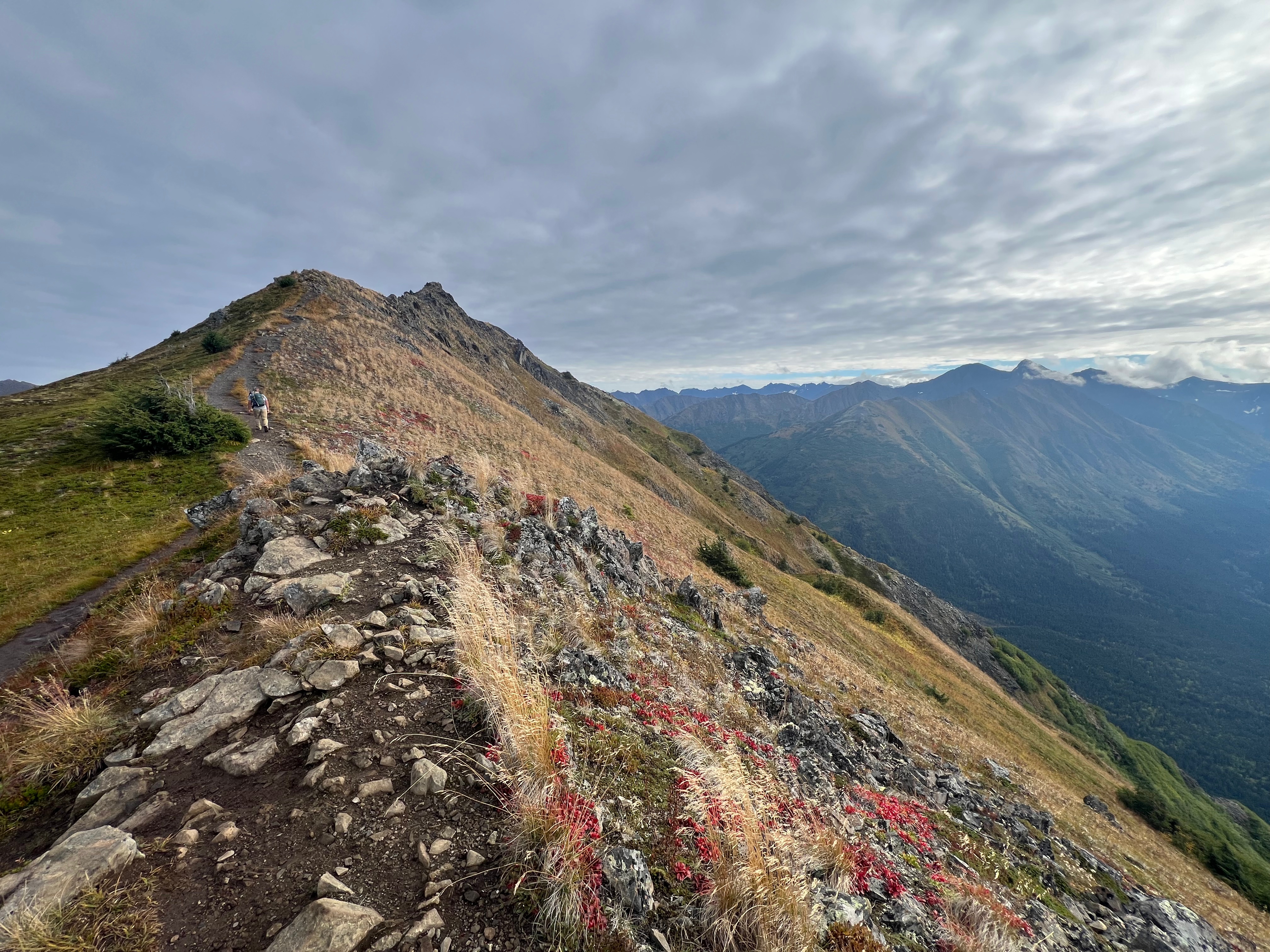
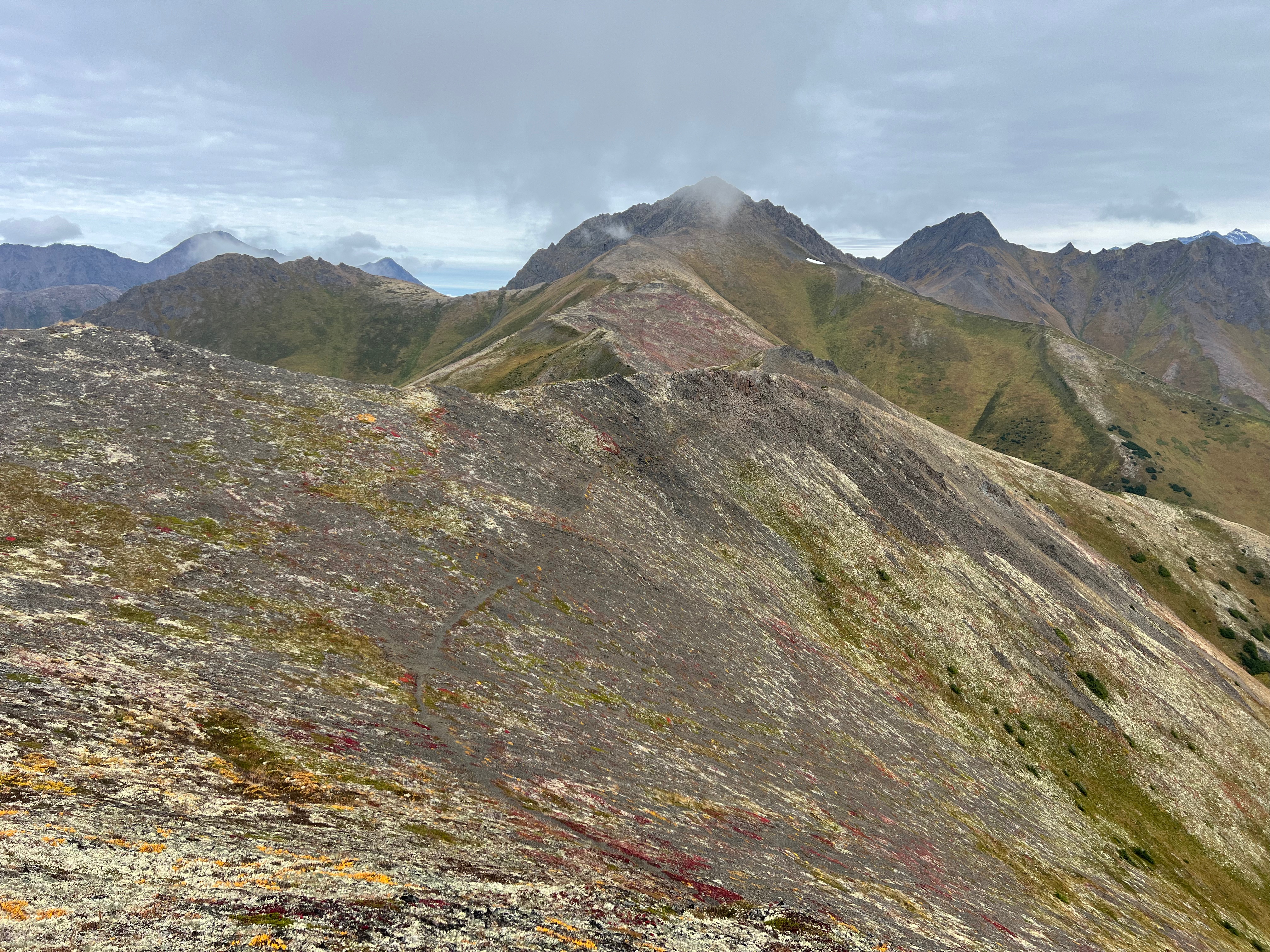
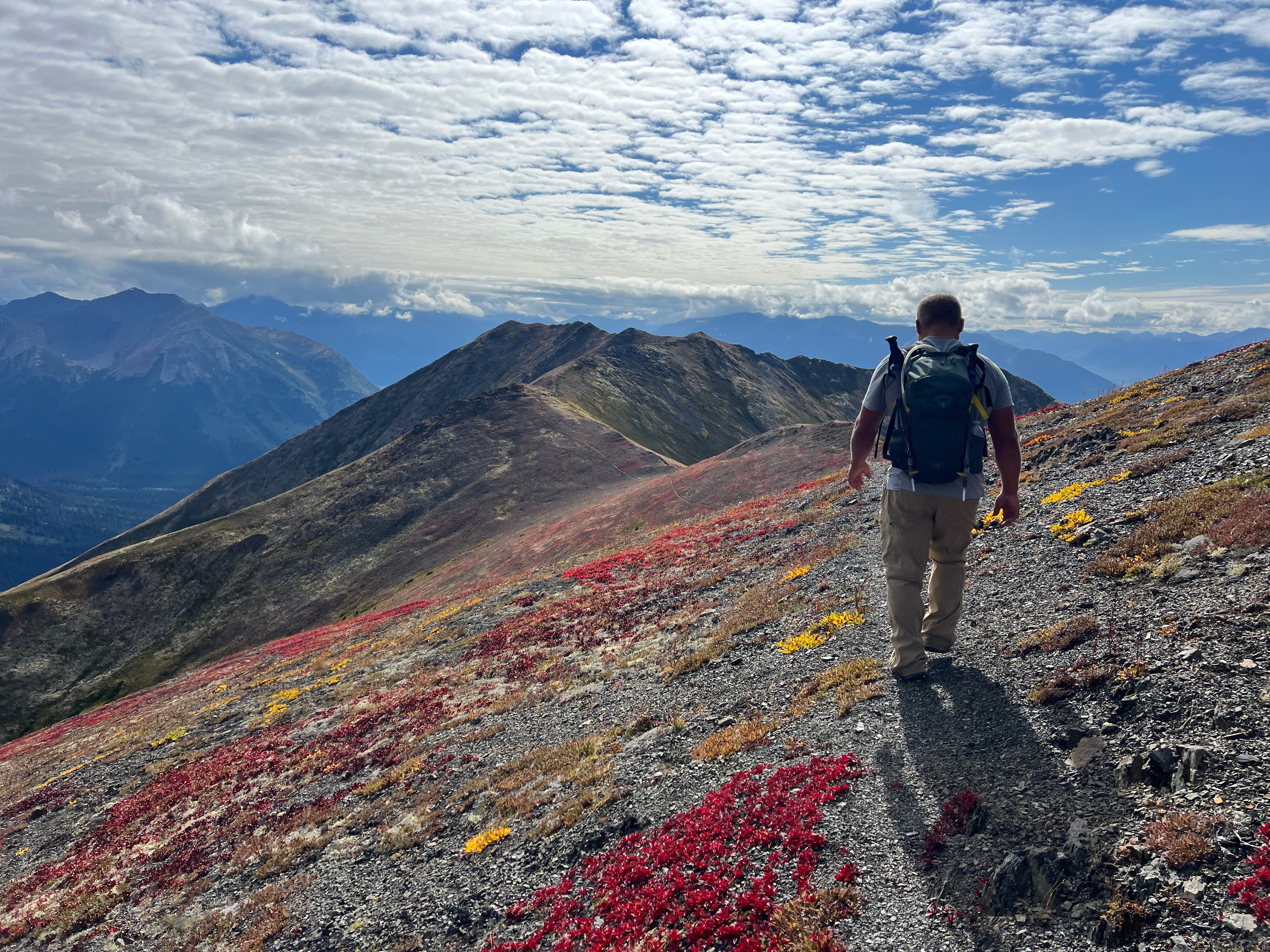
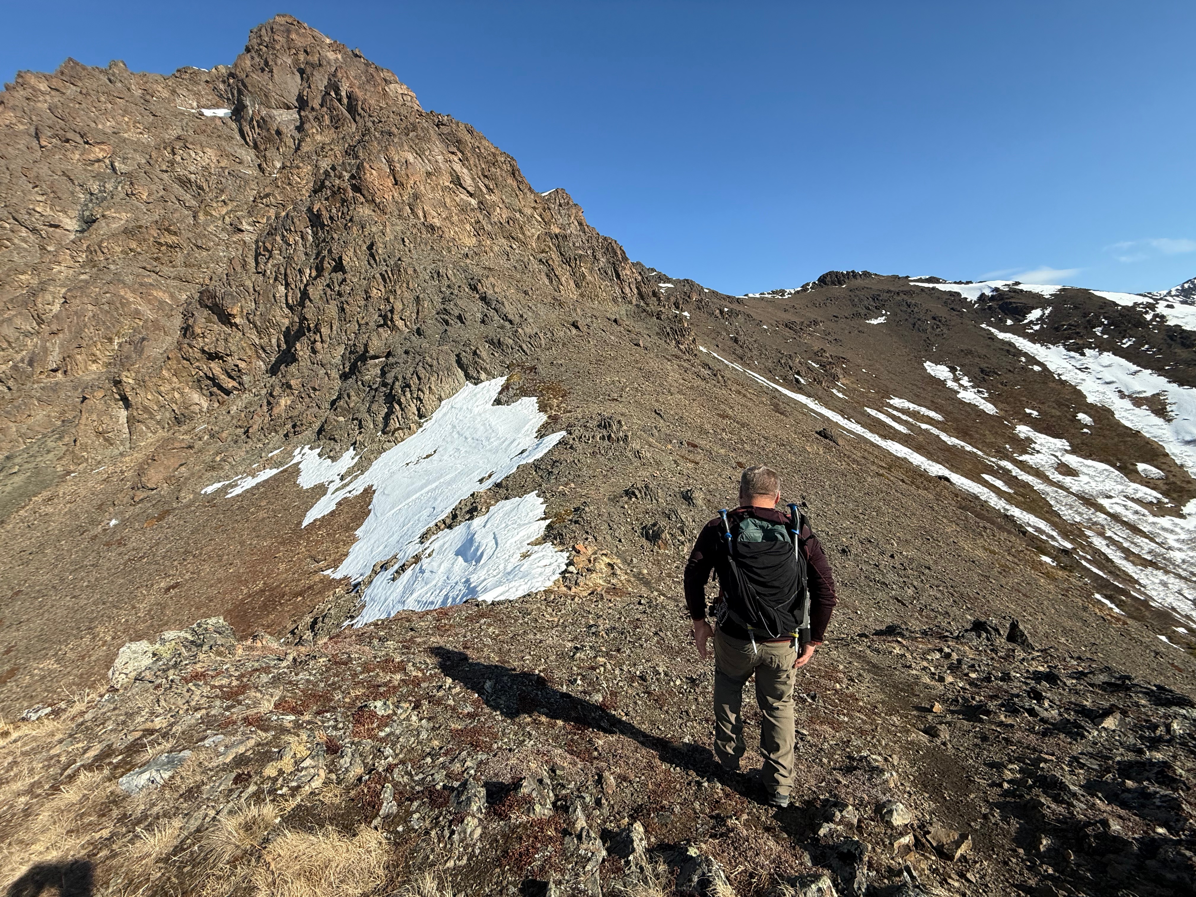
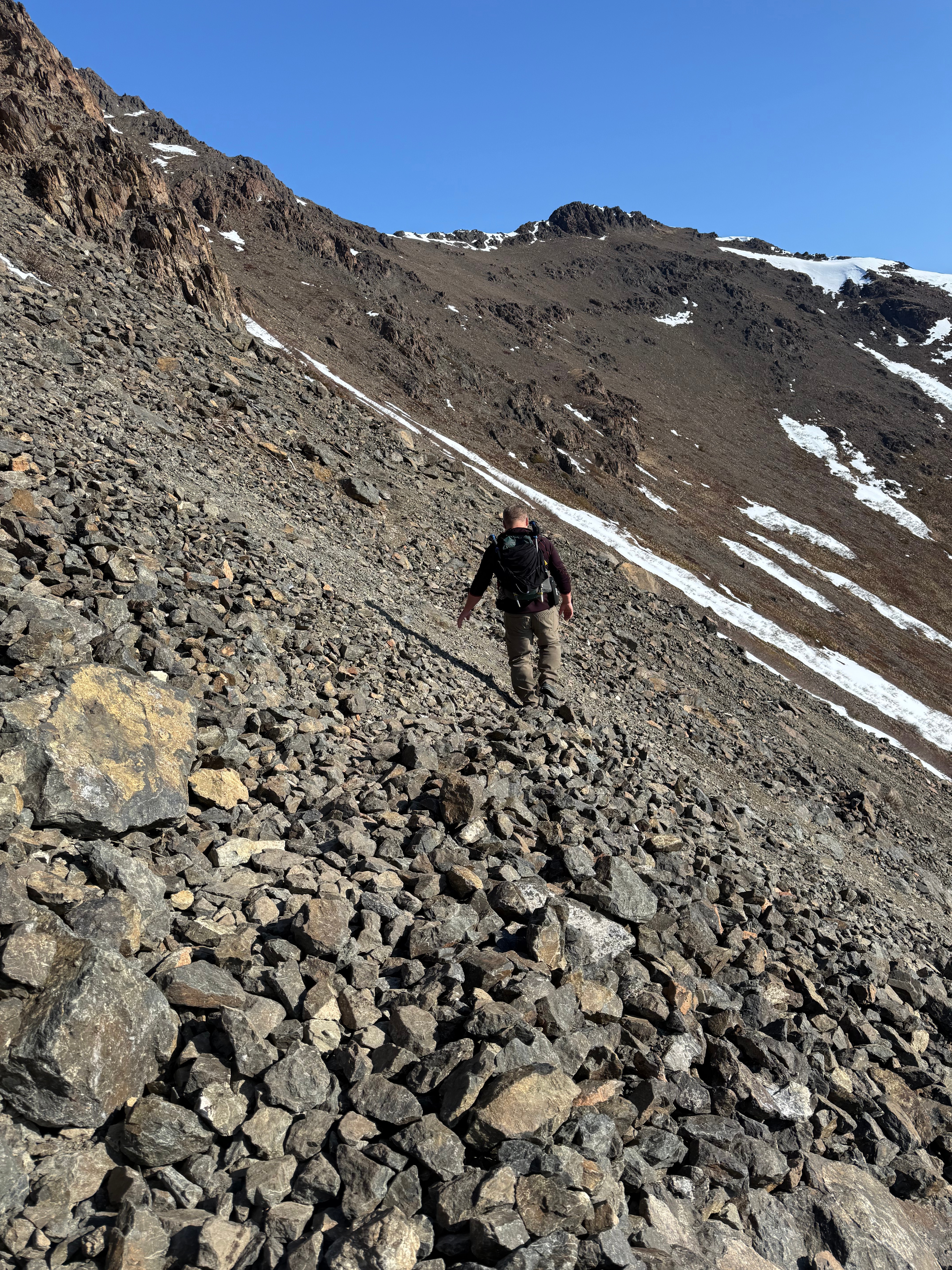
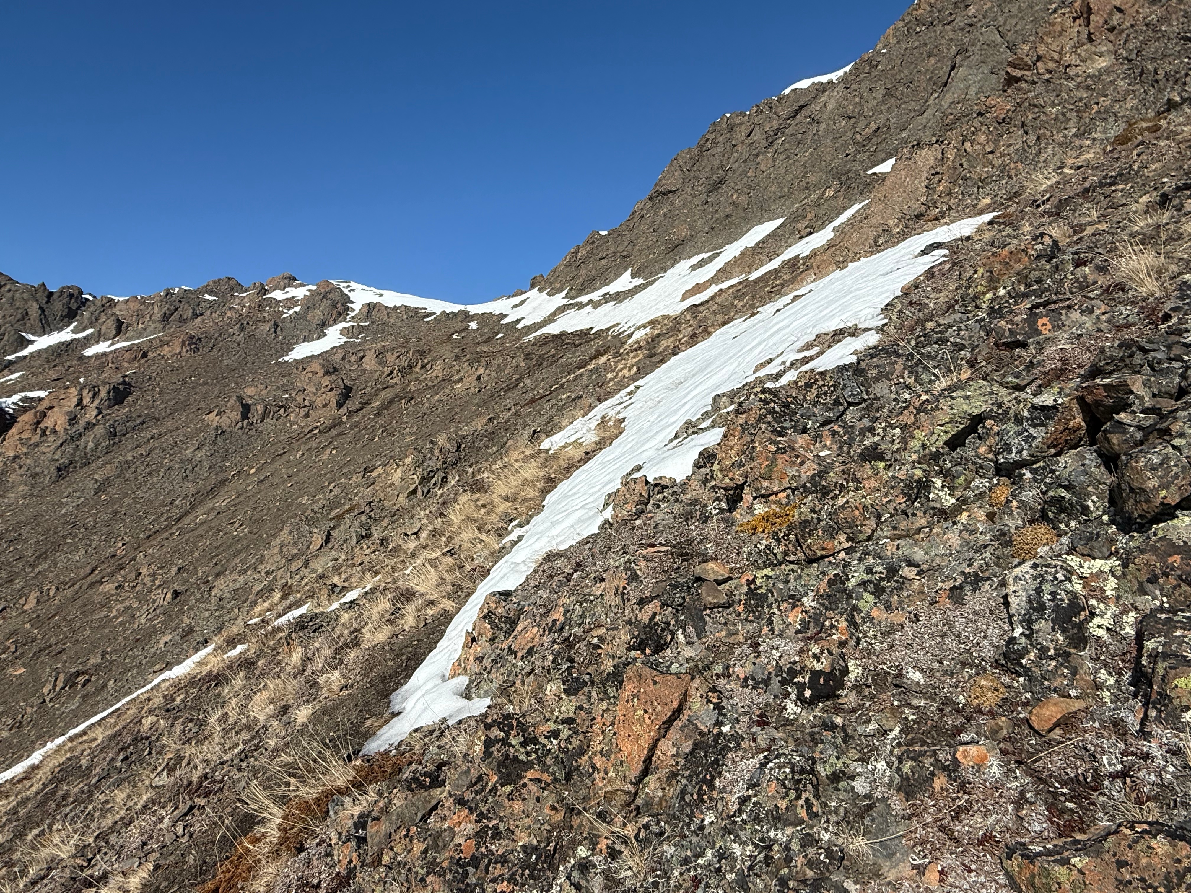
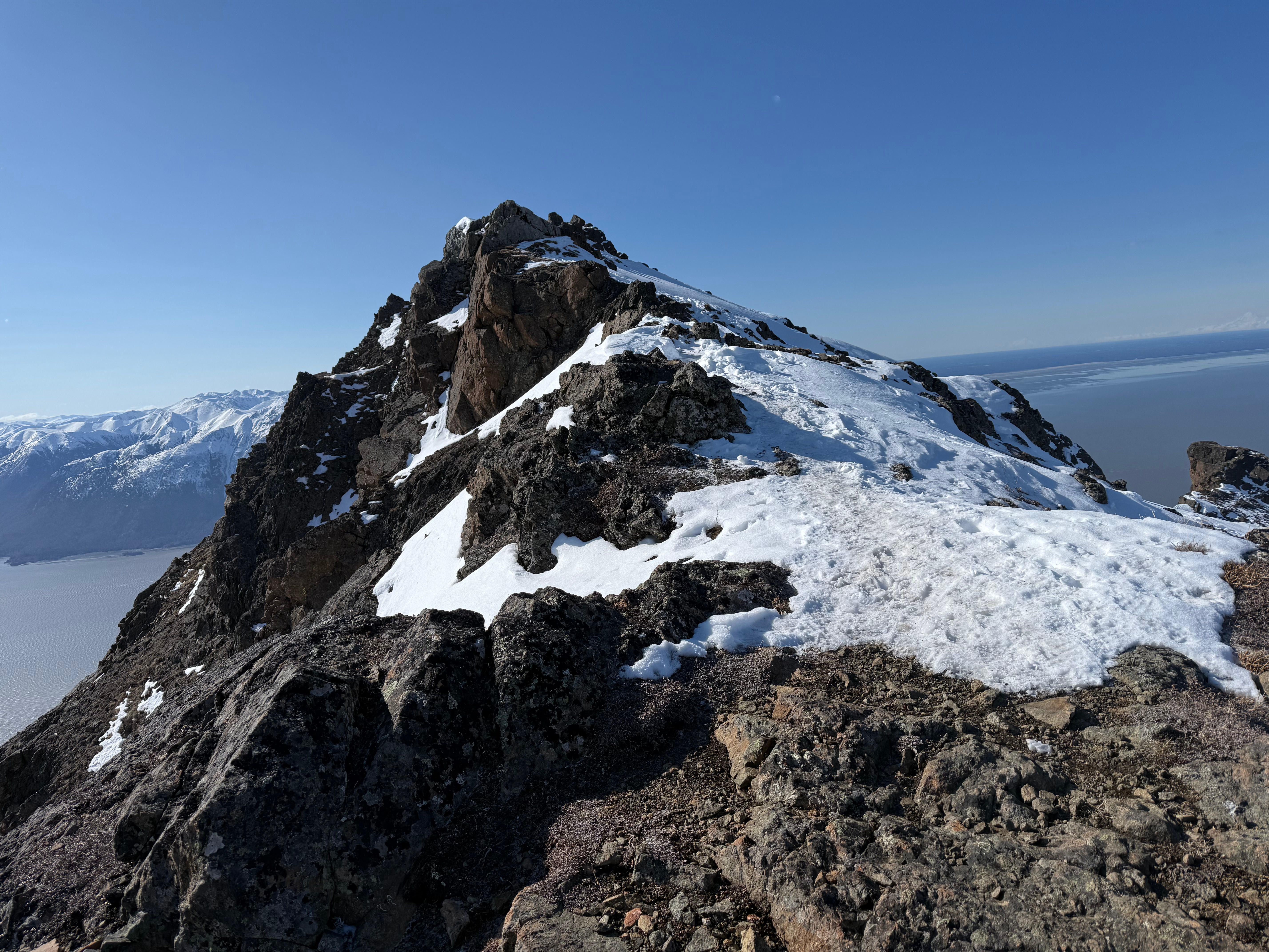
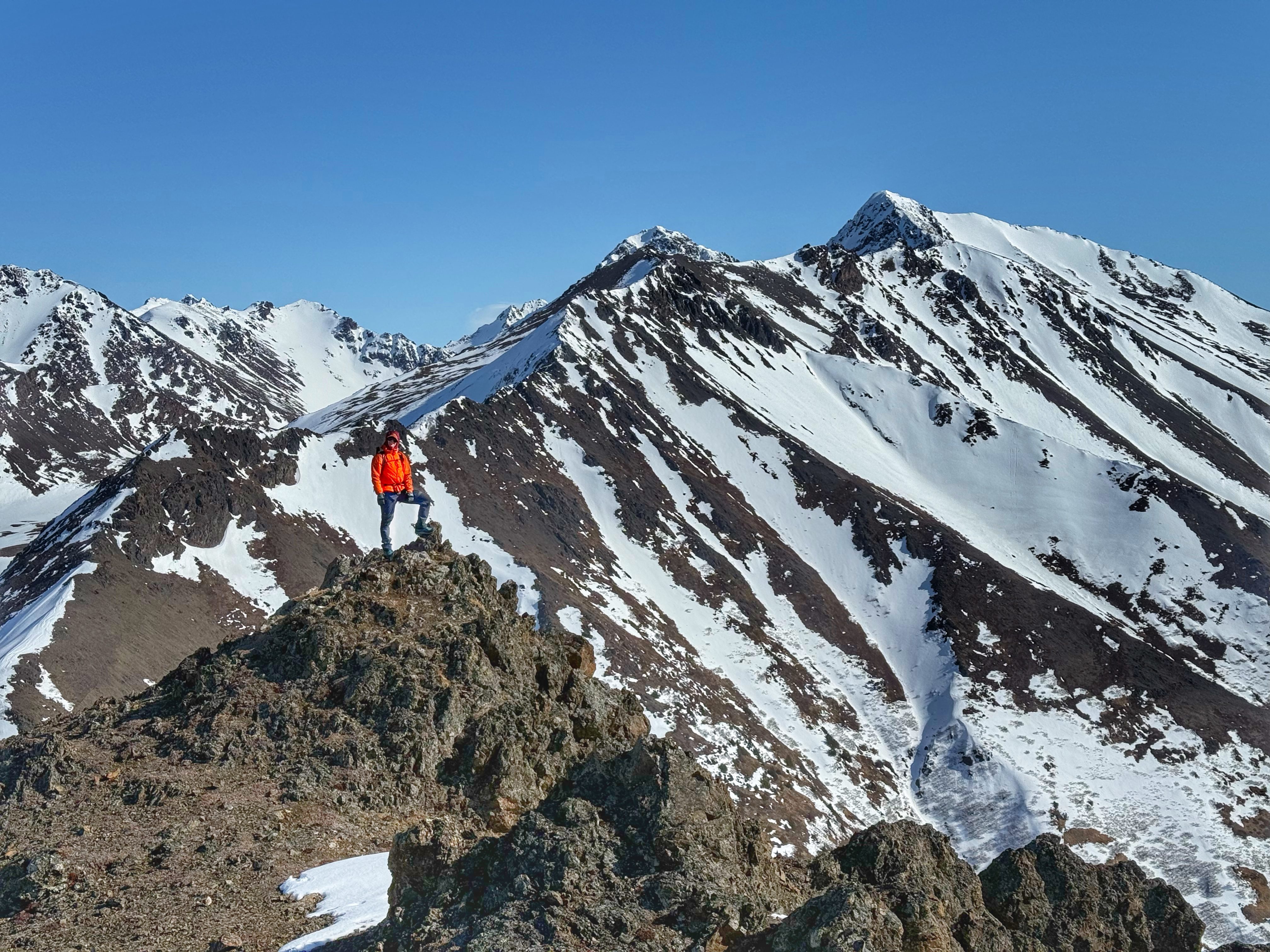
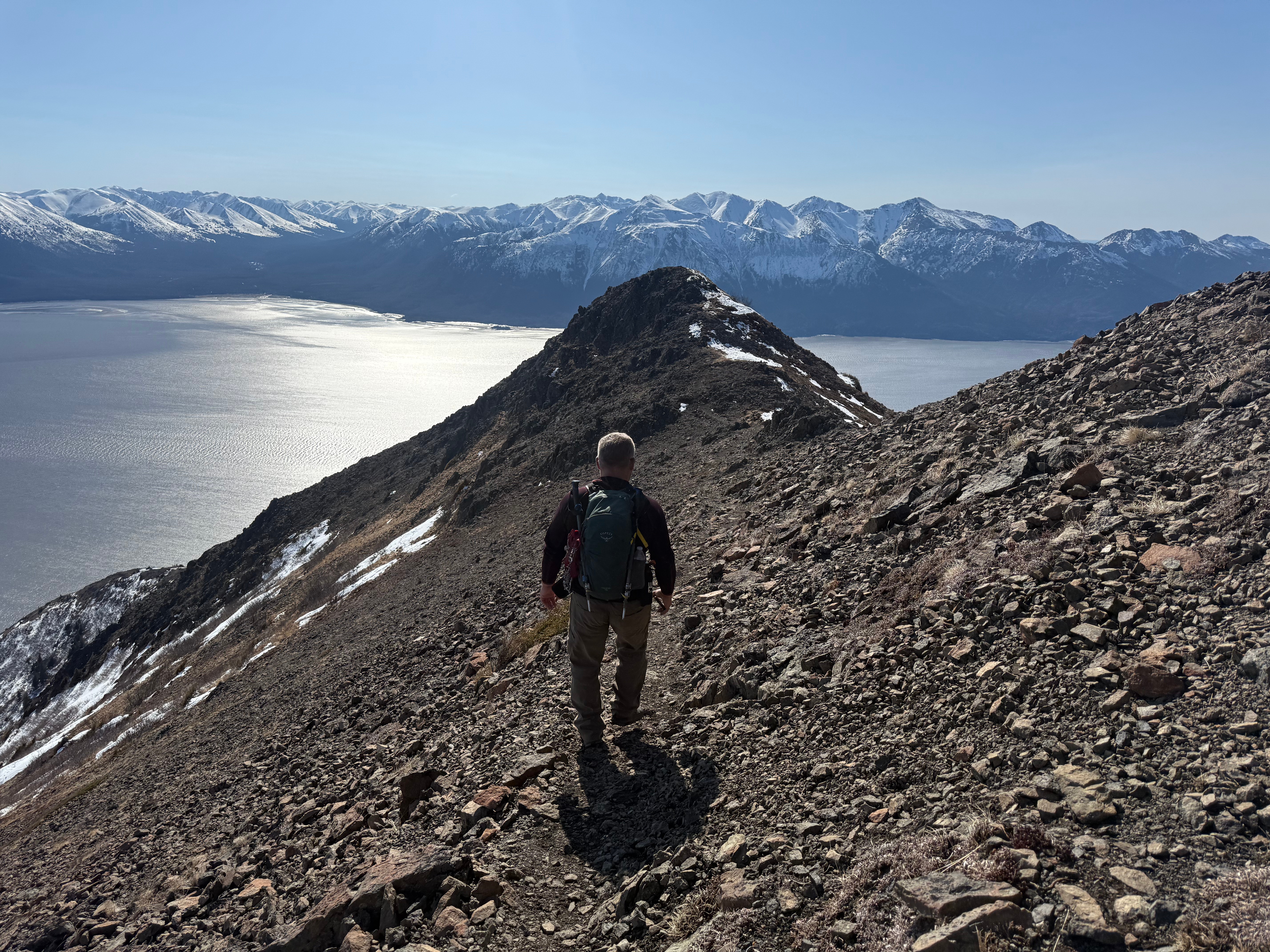
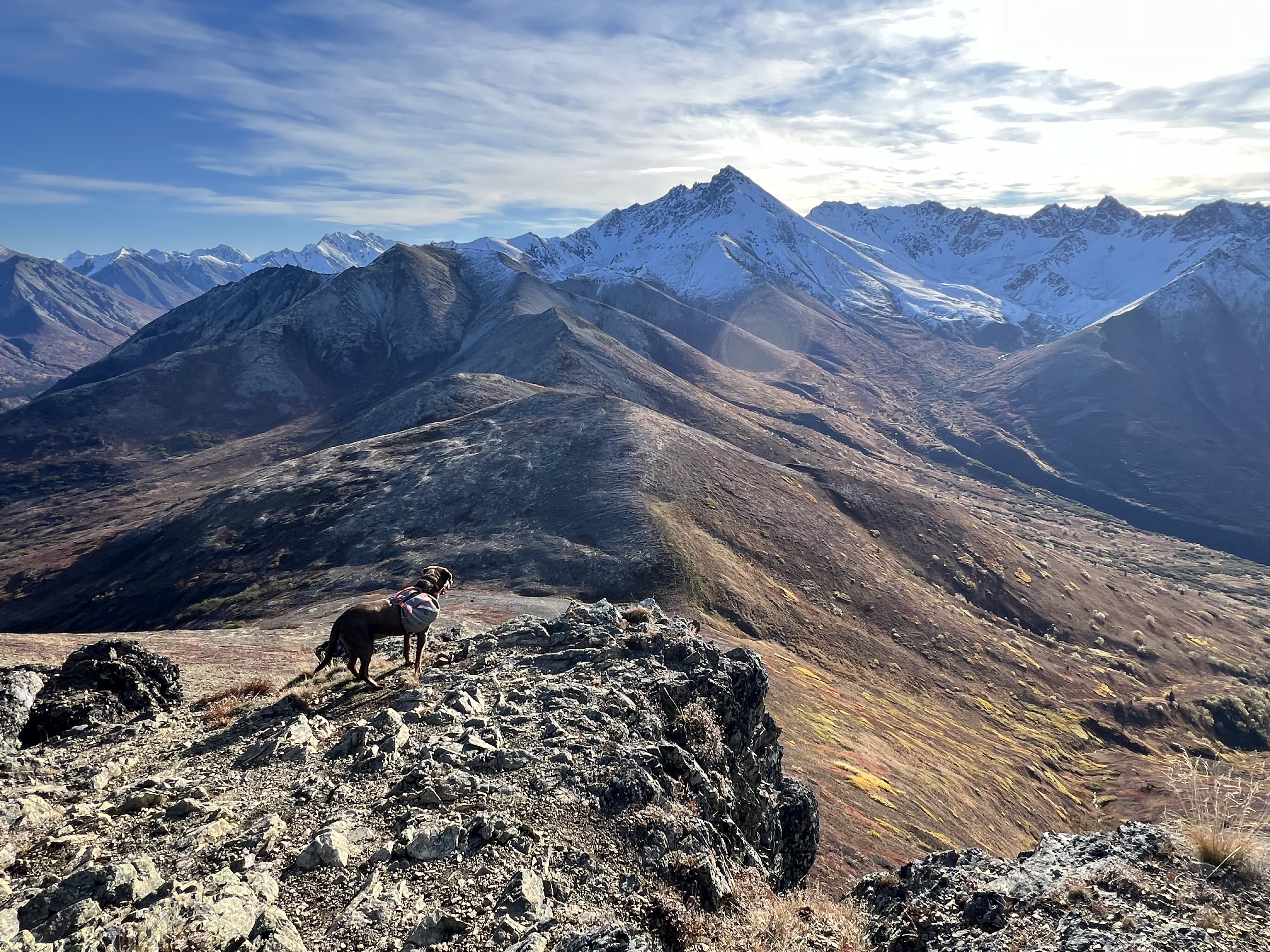
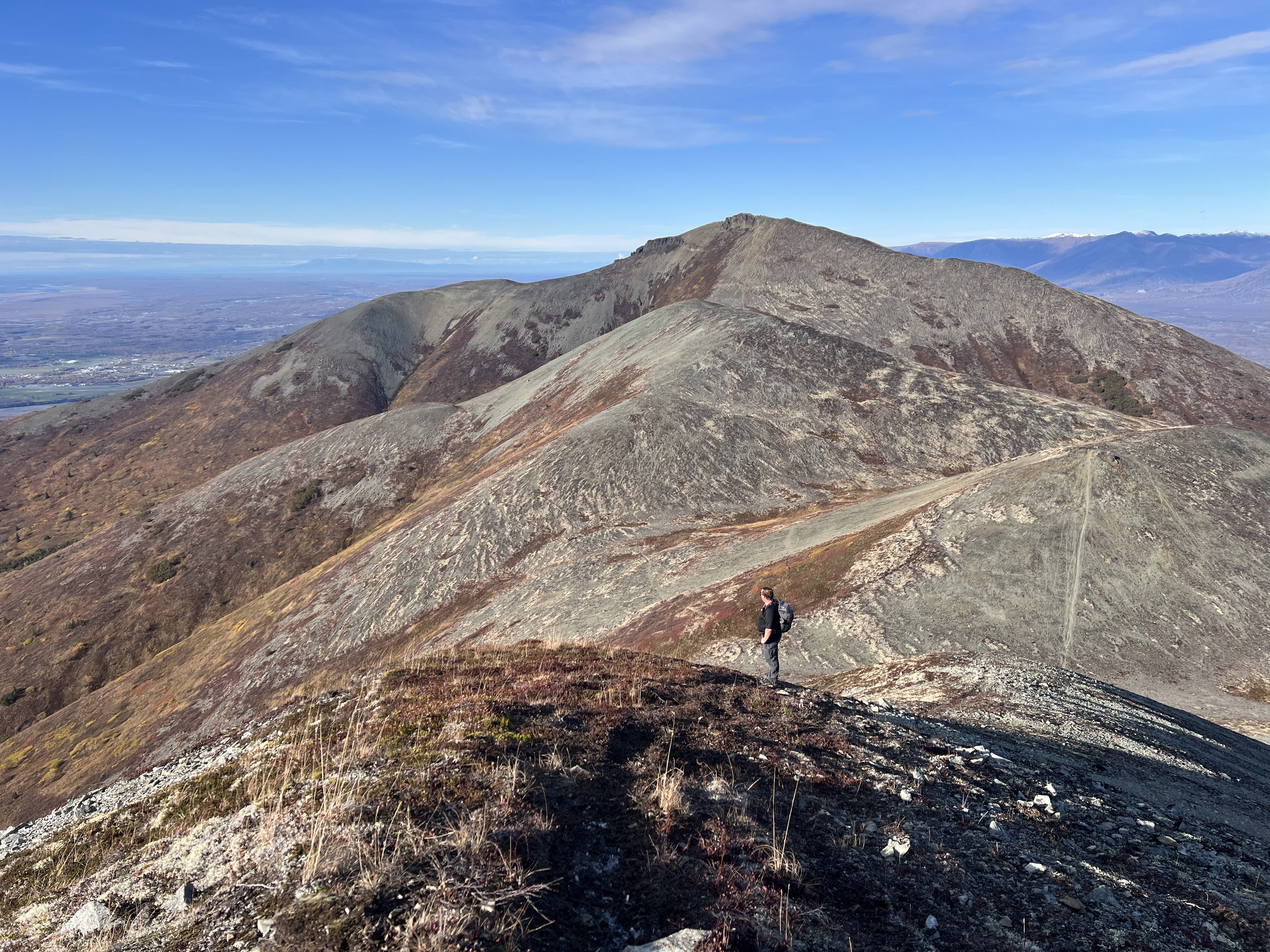
We snapped a few summit photos and turned northwest toward our next goal: Kanchee Peak. While many GPX tracks on Gaia and Peakbagger show a direct ridge route to Kanchee, we chose to retrace our steps about a quarter mile and follow a less exposed, less scrambly path along the north slope of Knoya’s false summit. The snow stopped suddenly, but the clouds lingered.
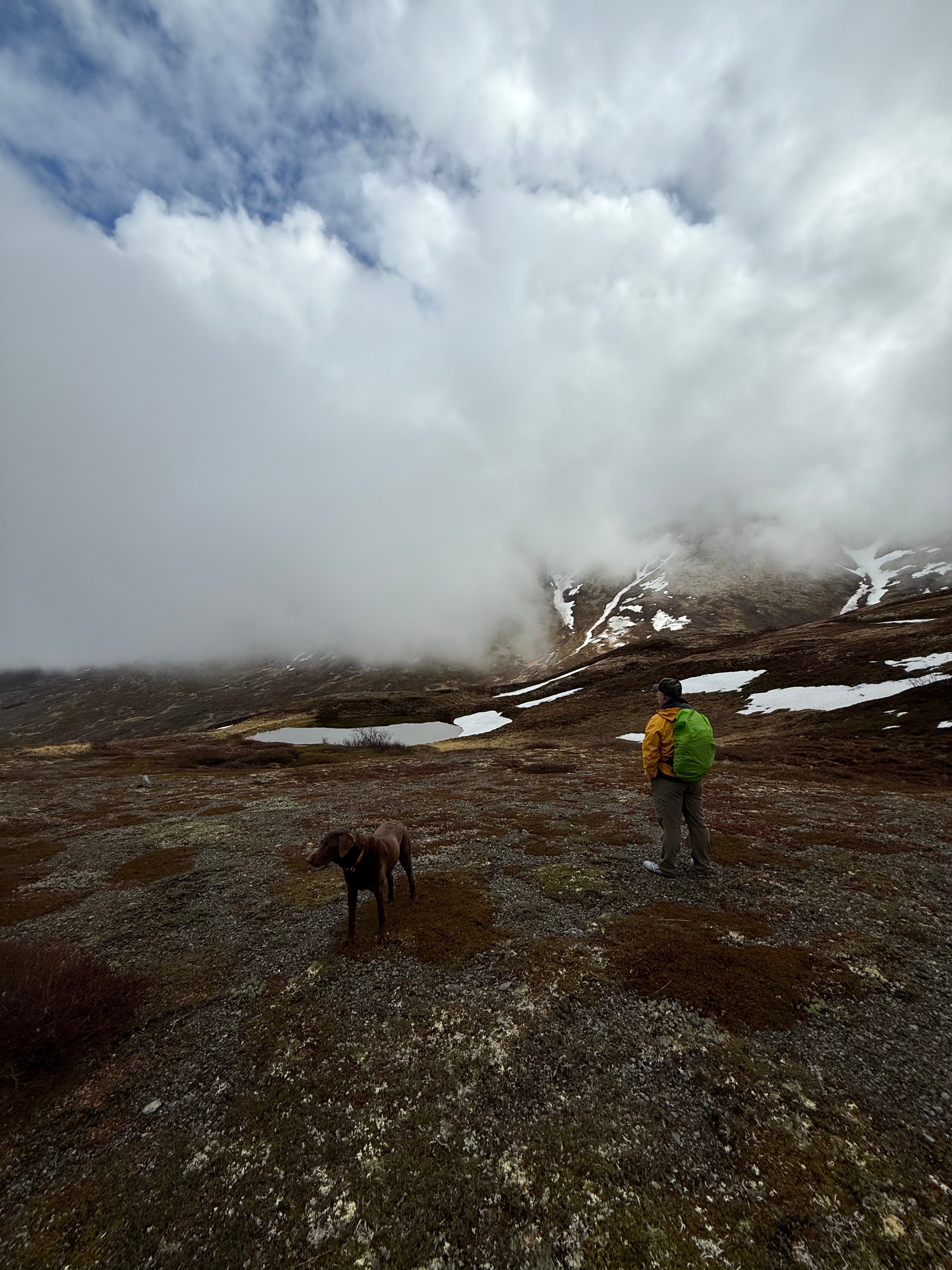
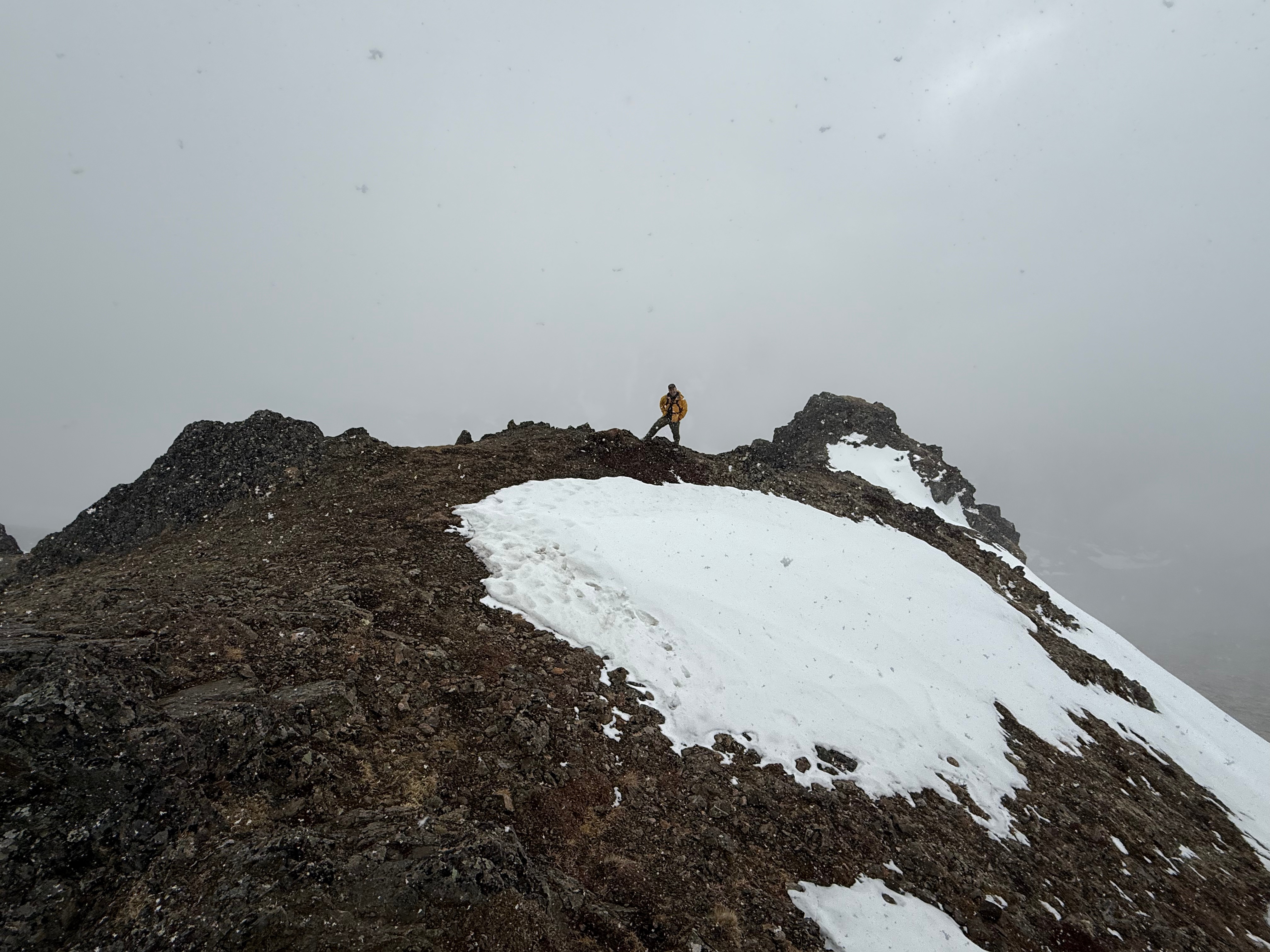
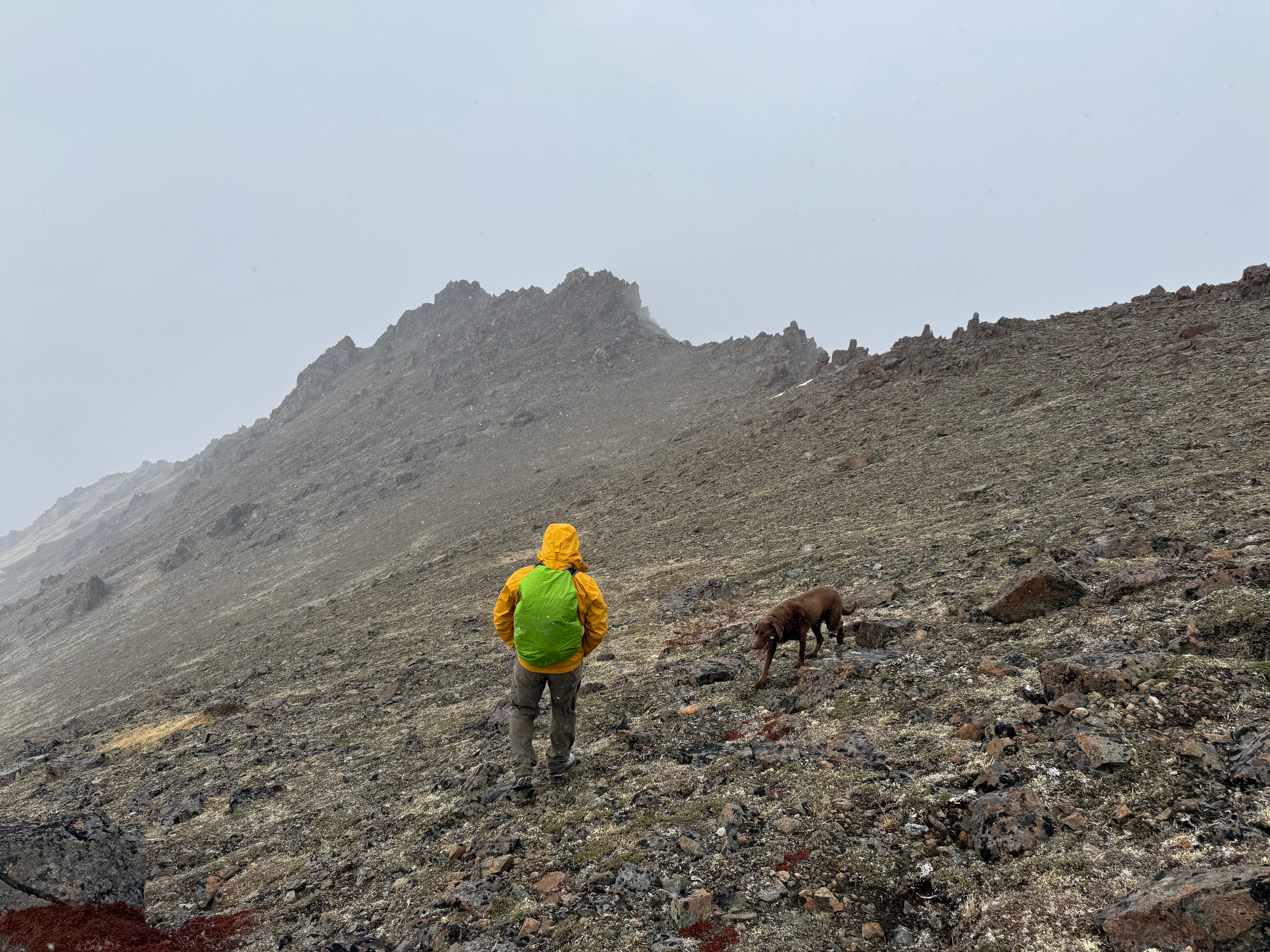
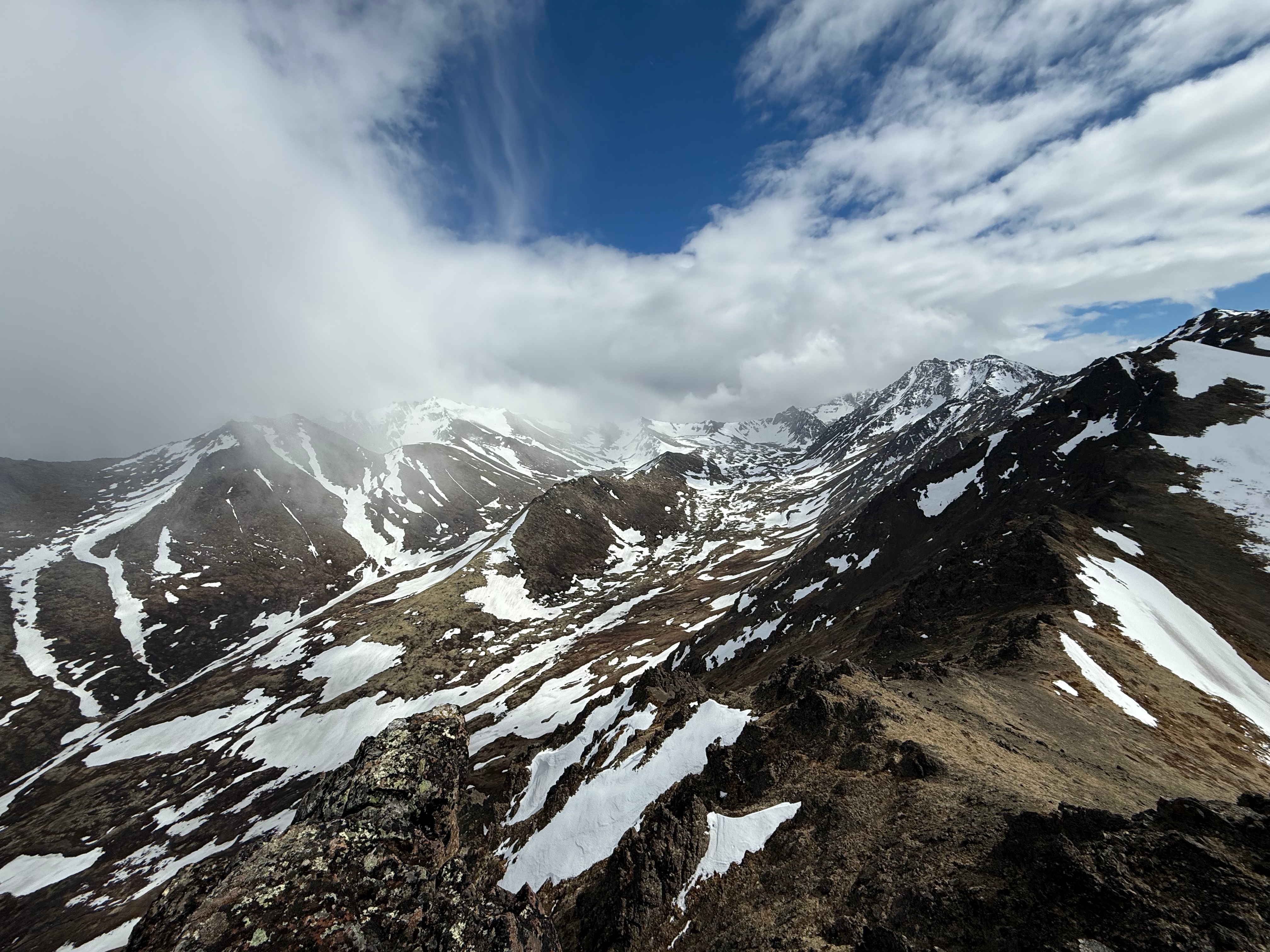
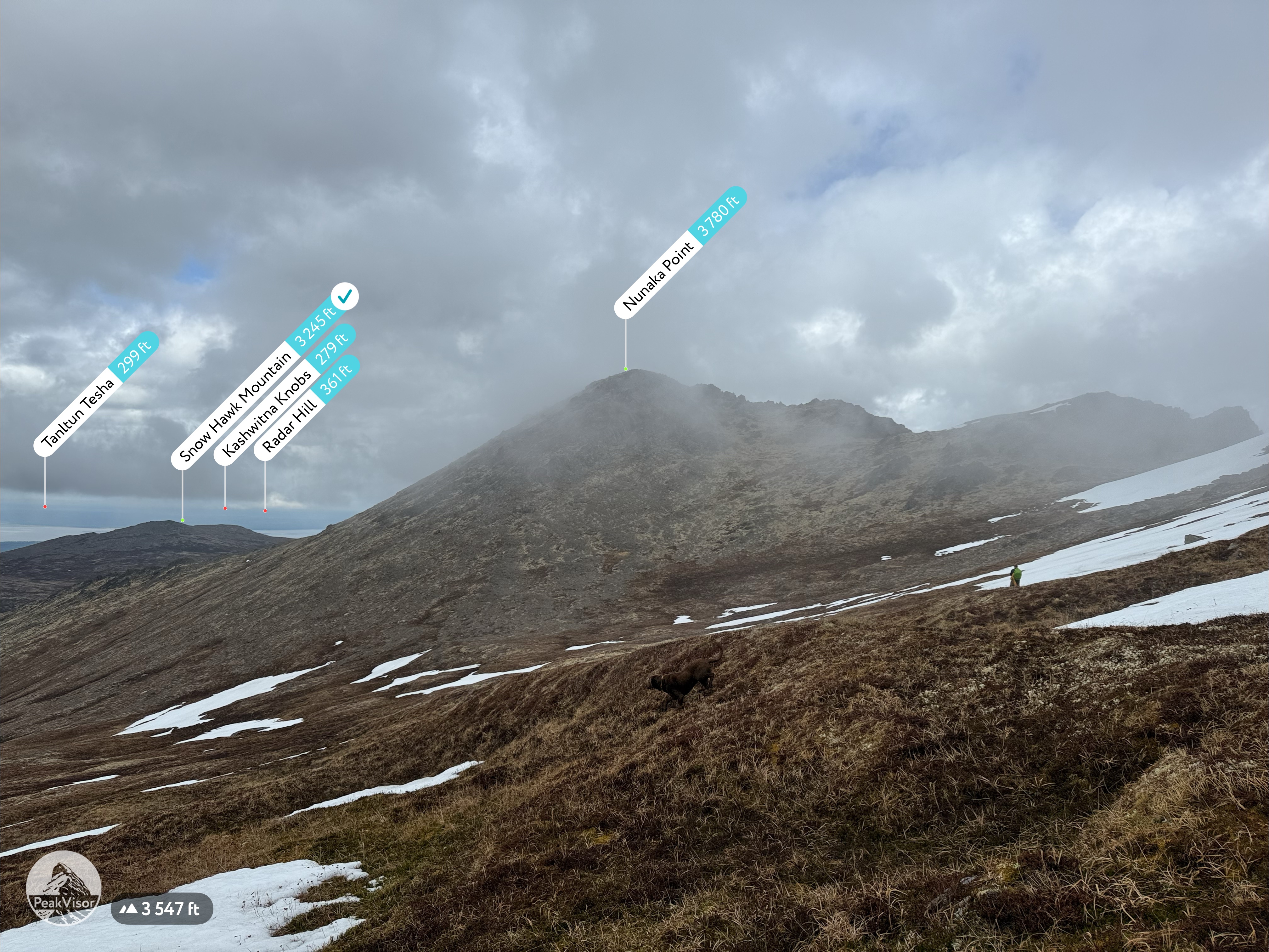
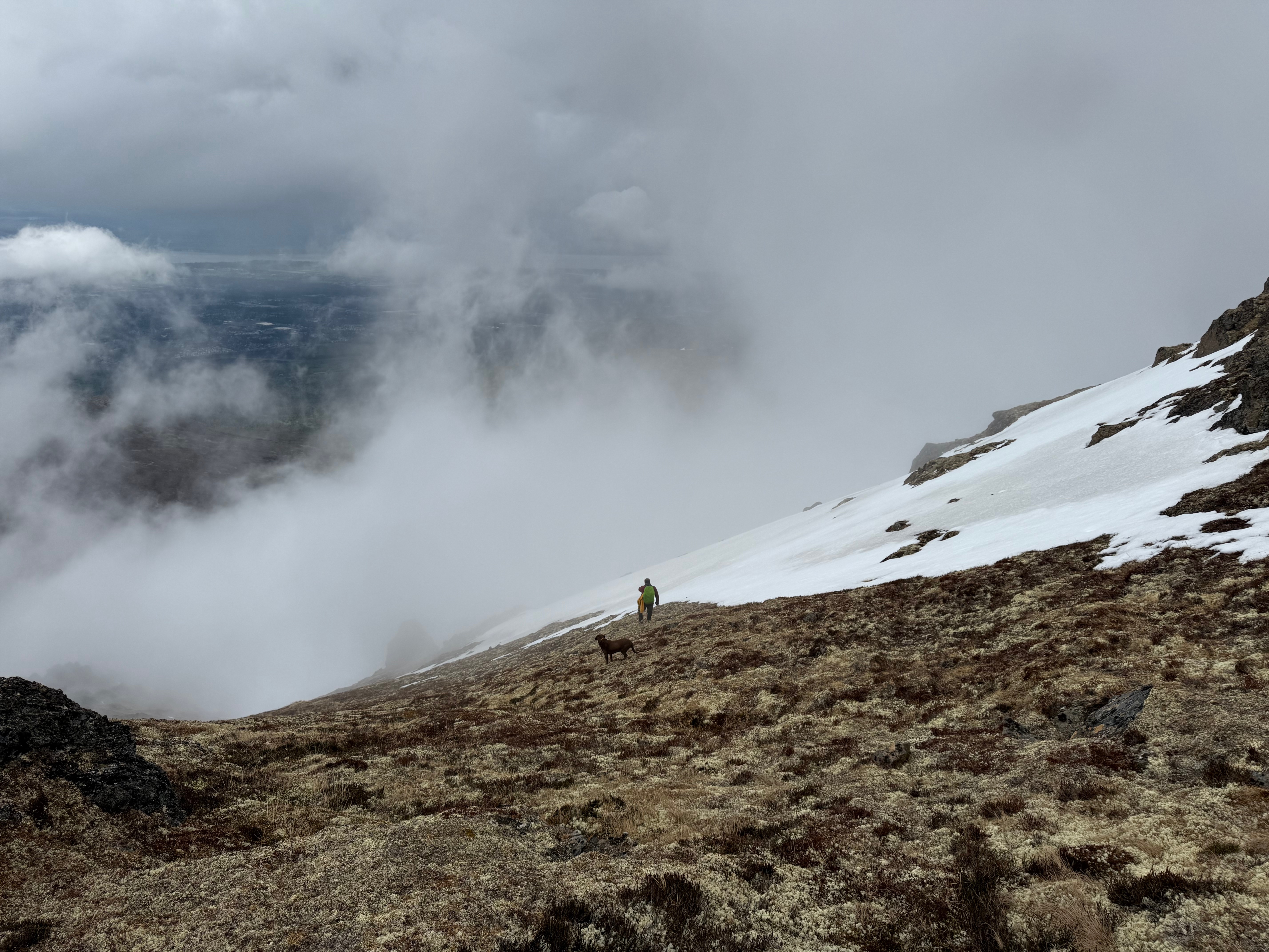
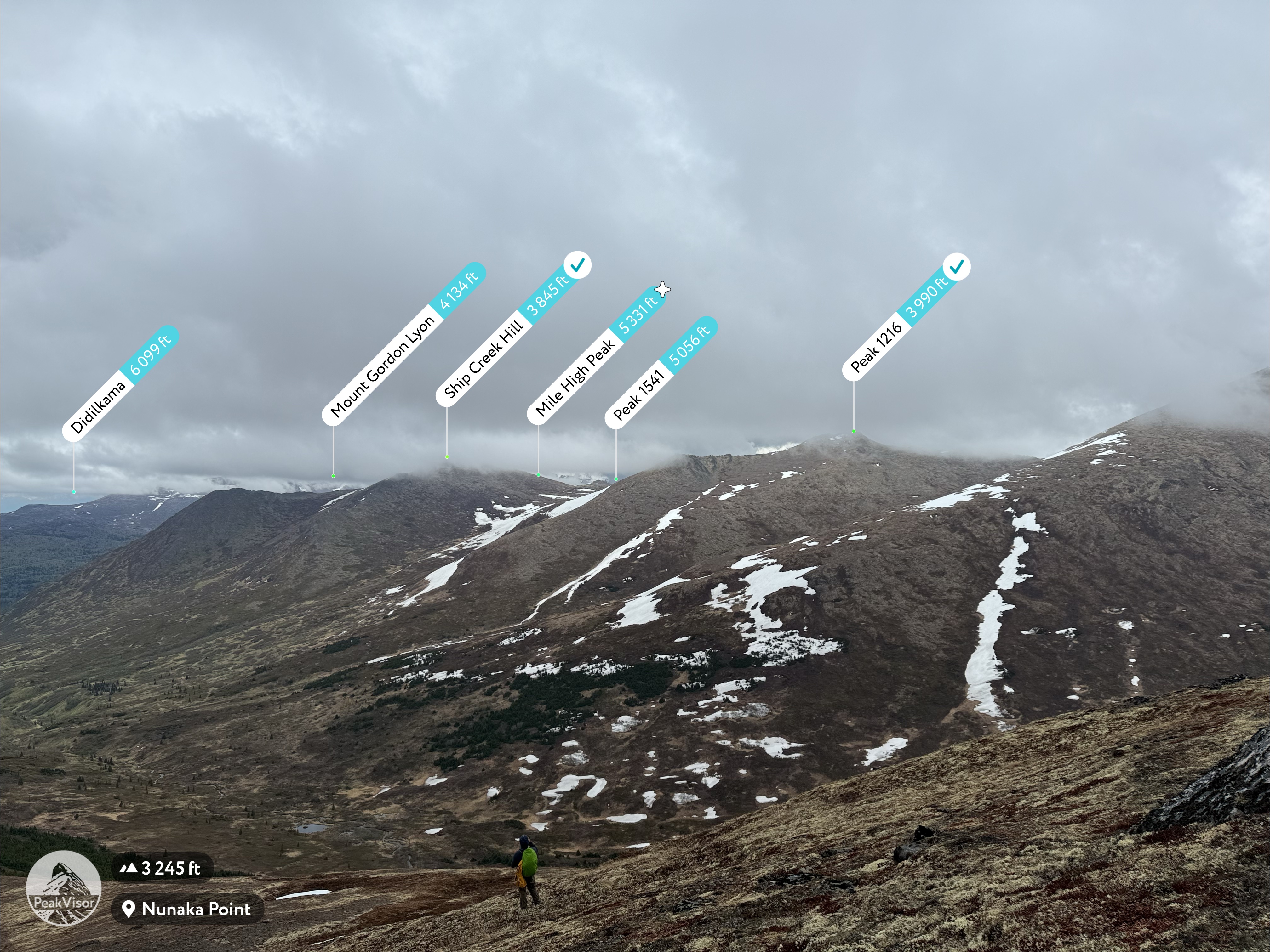
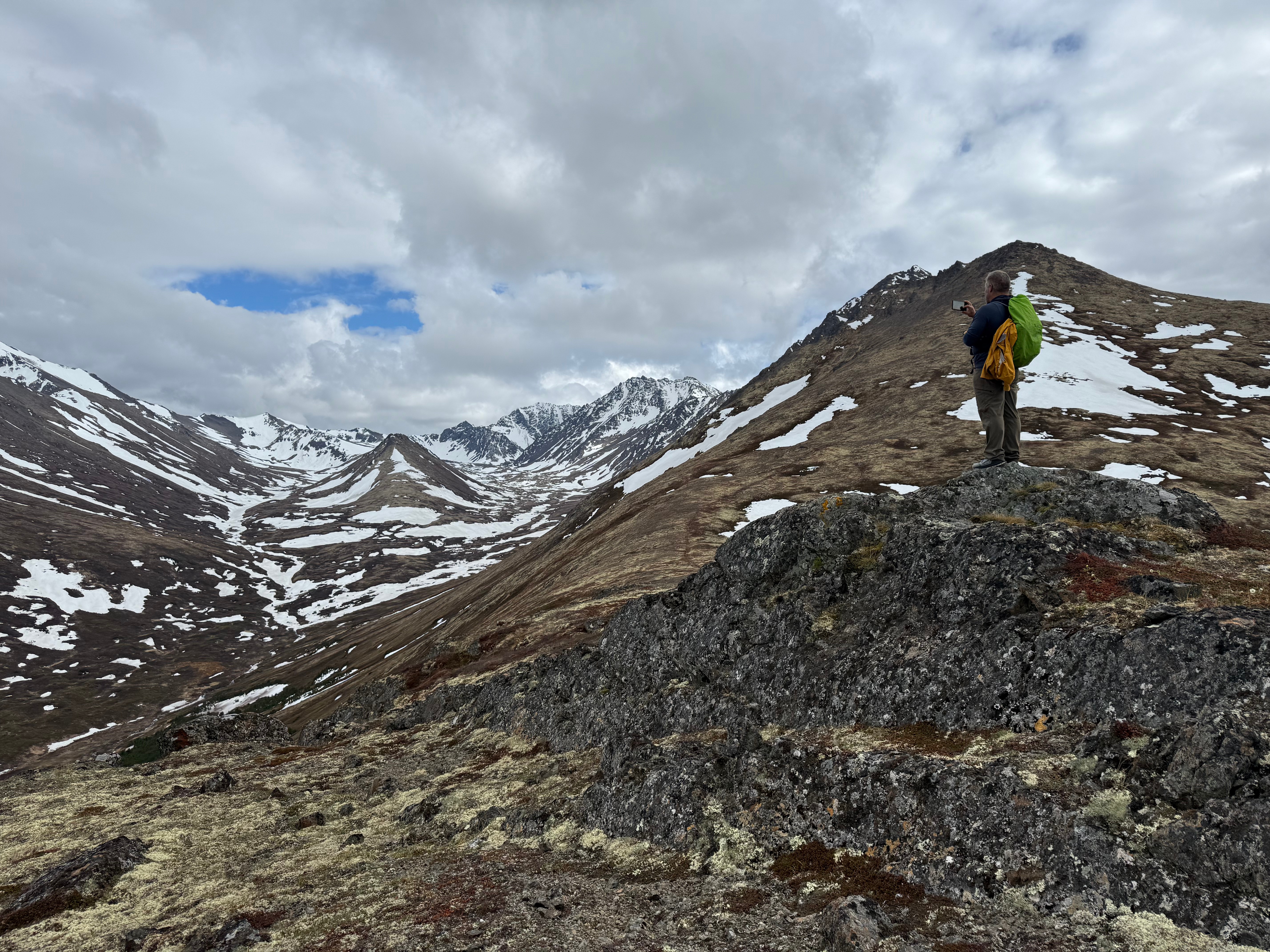
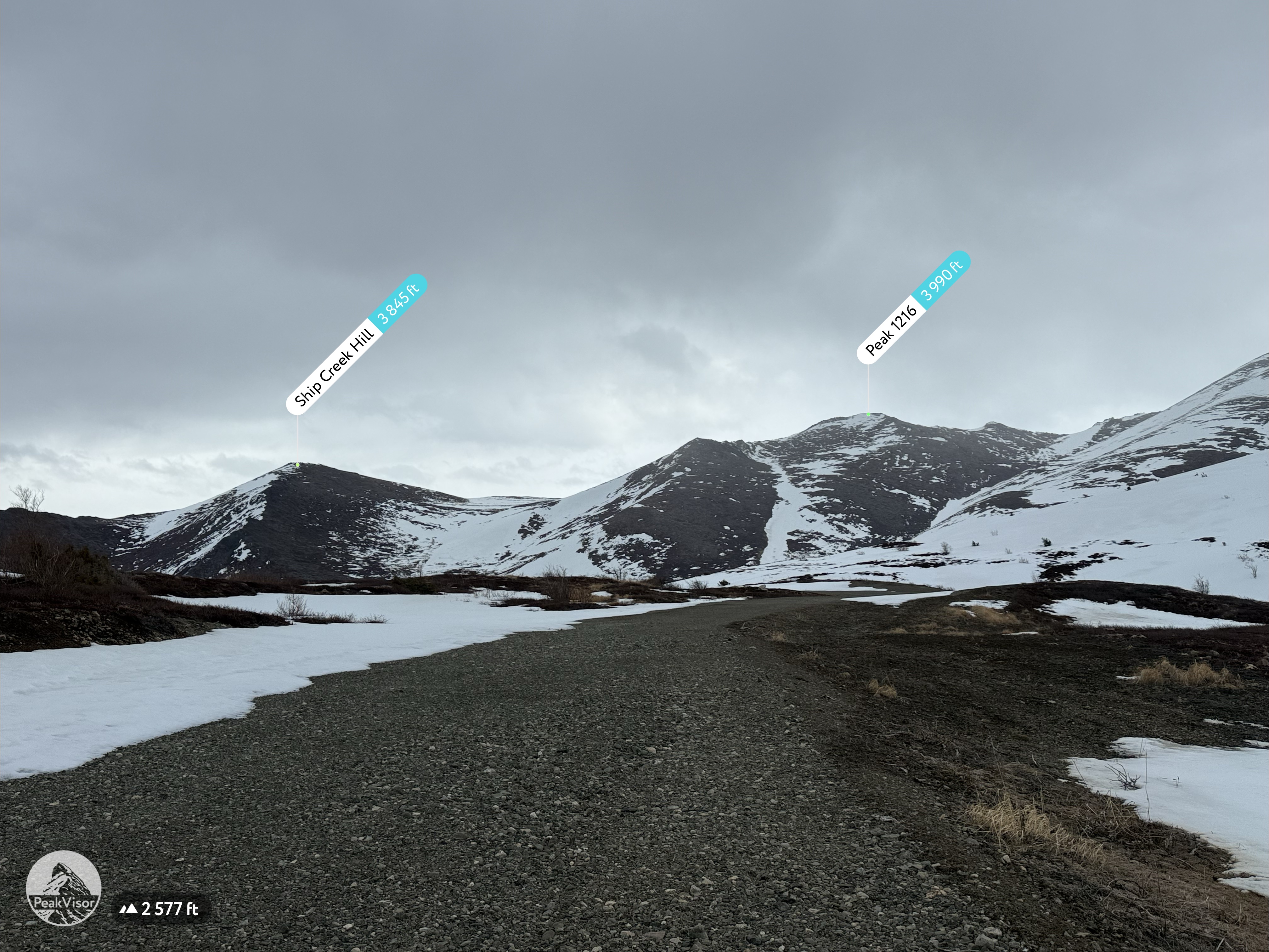
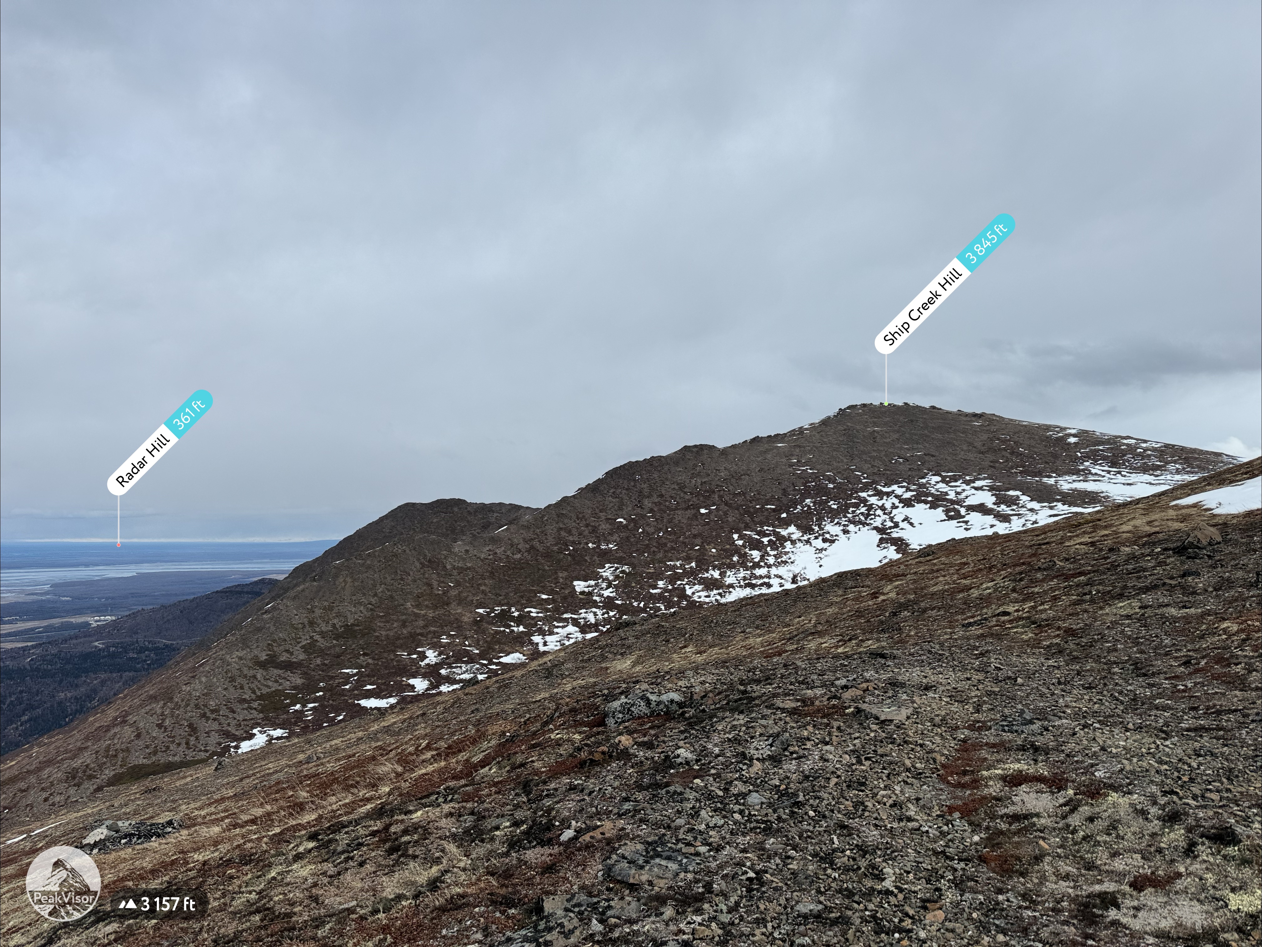
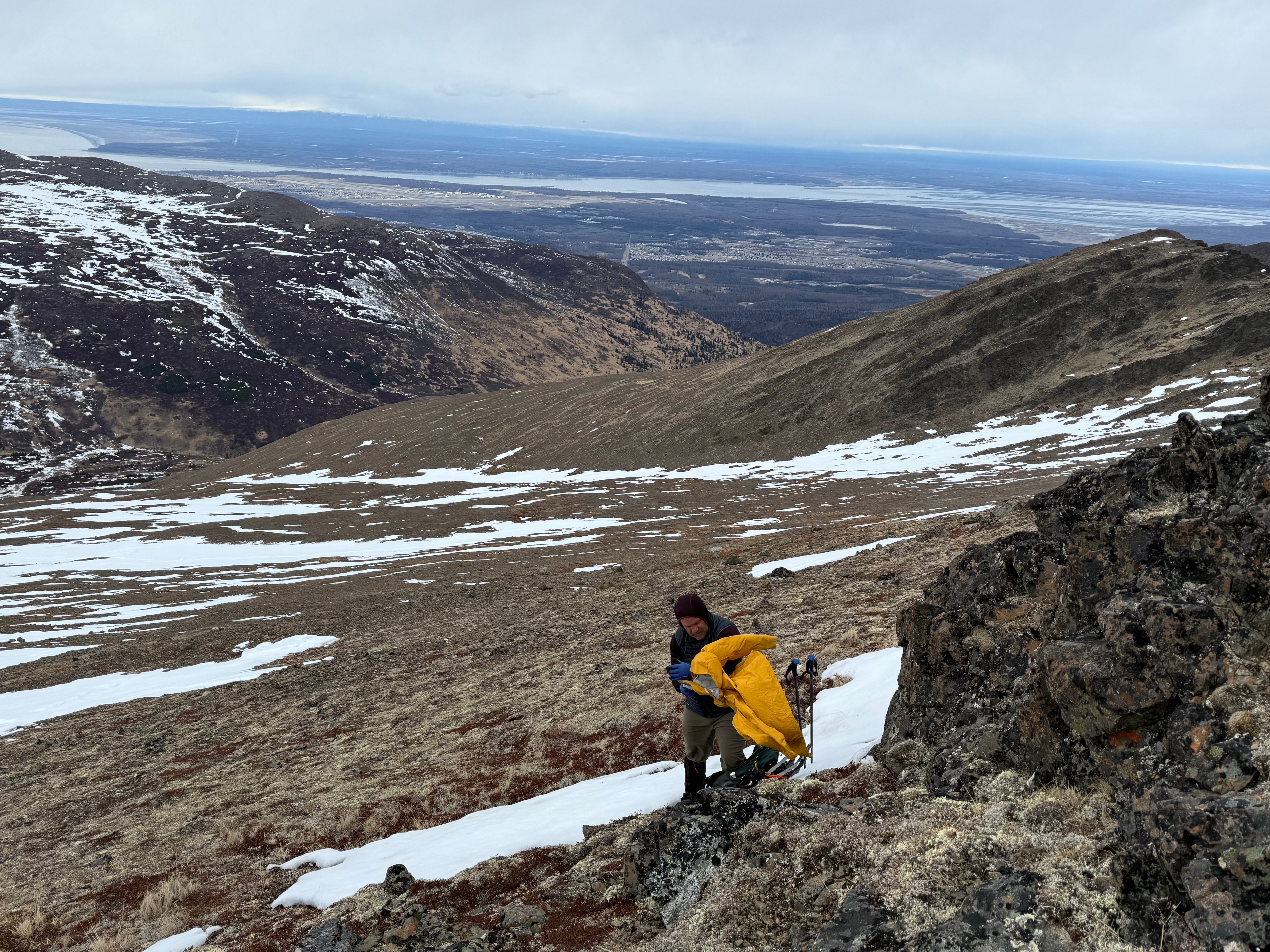
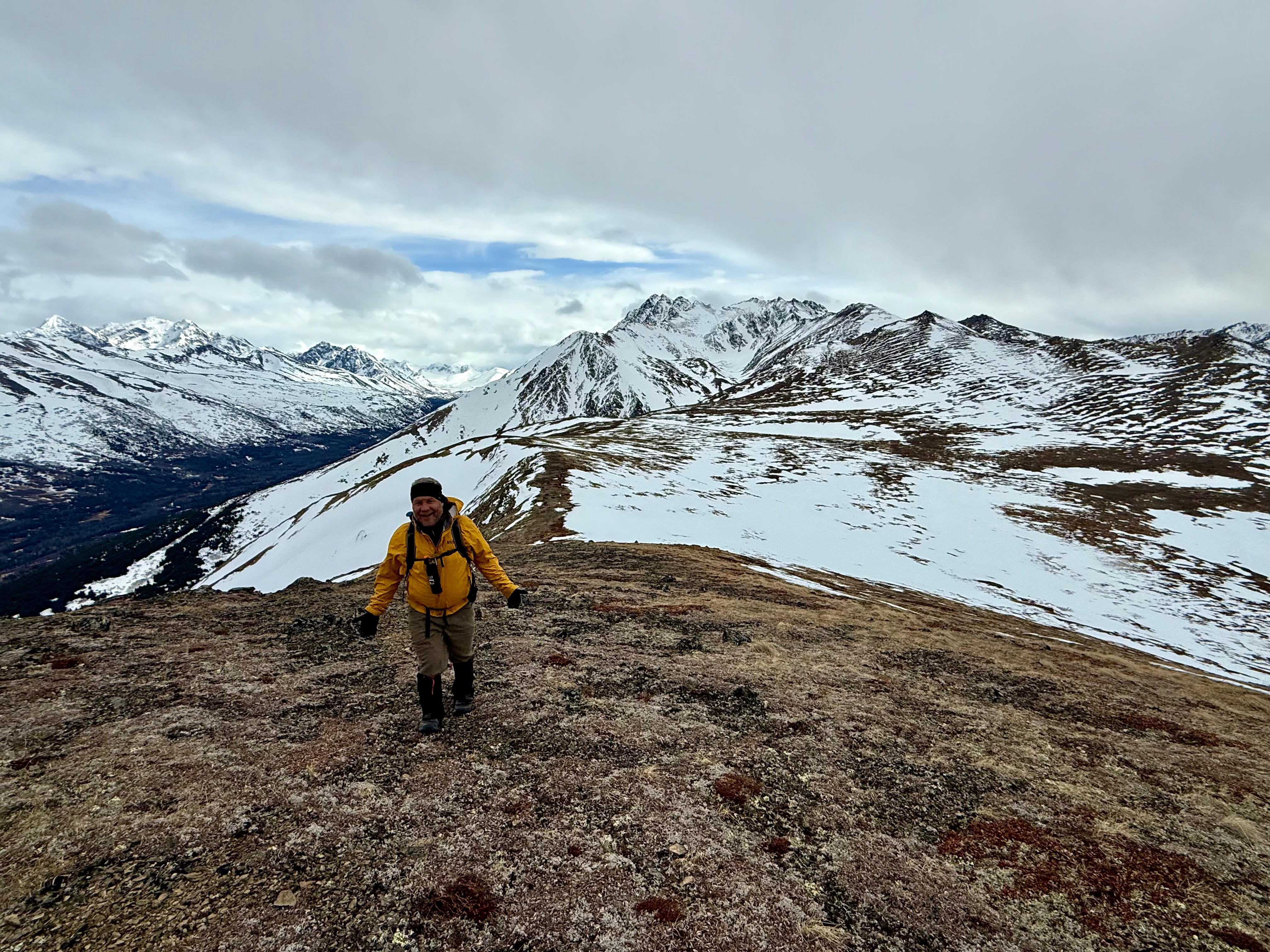
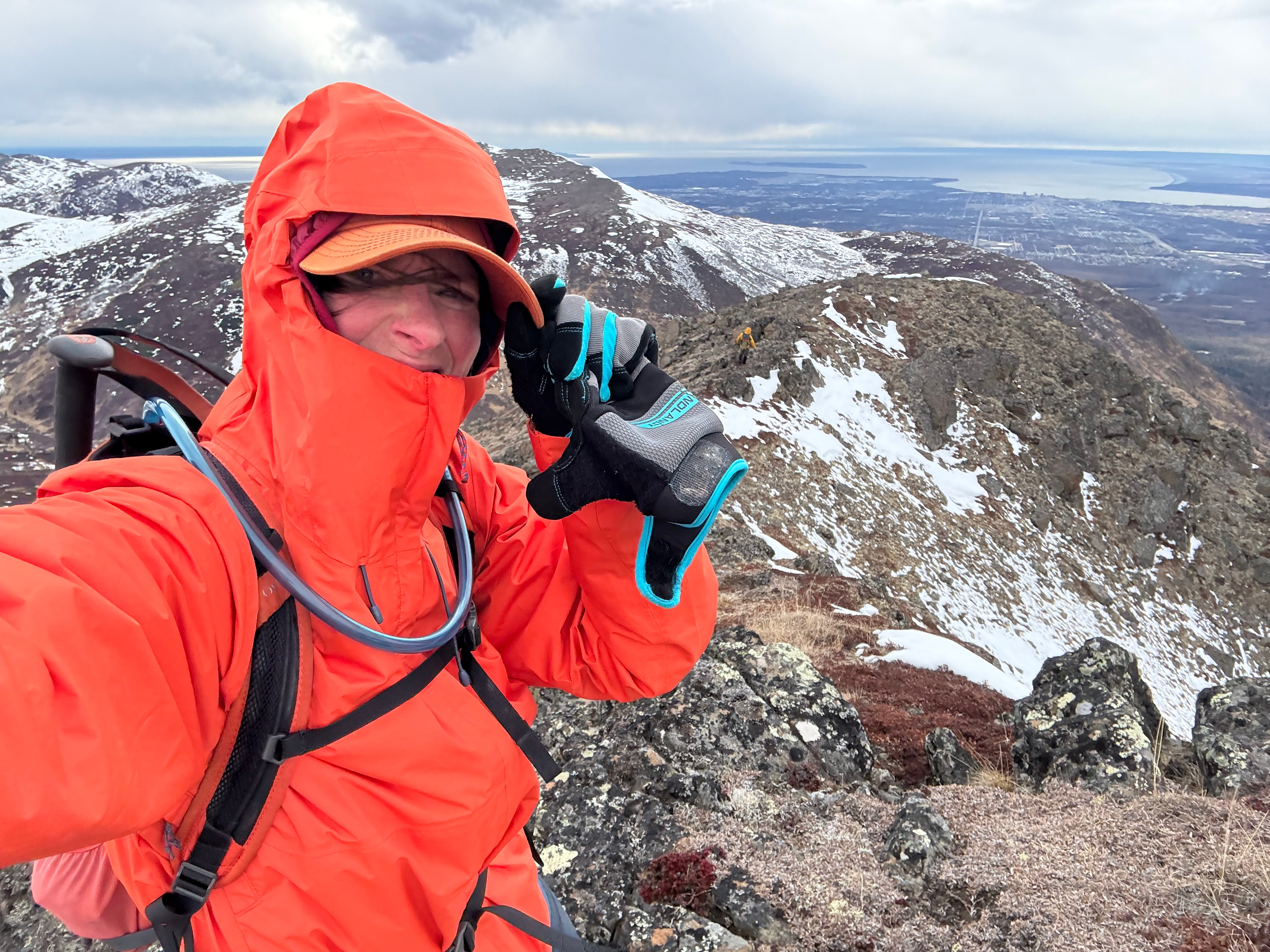
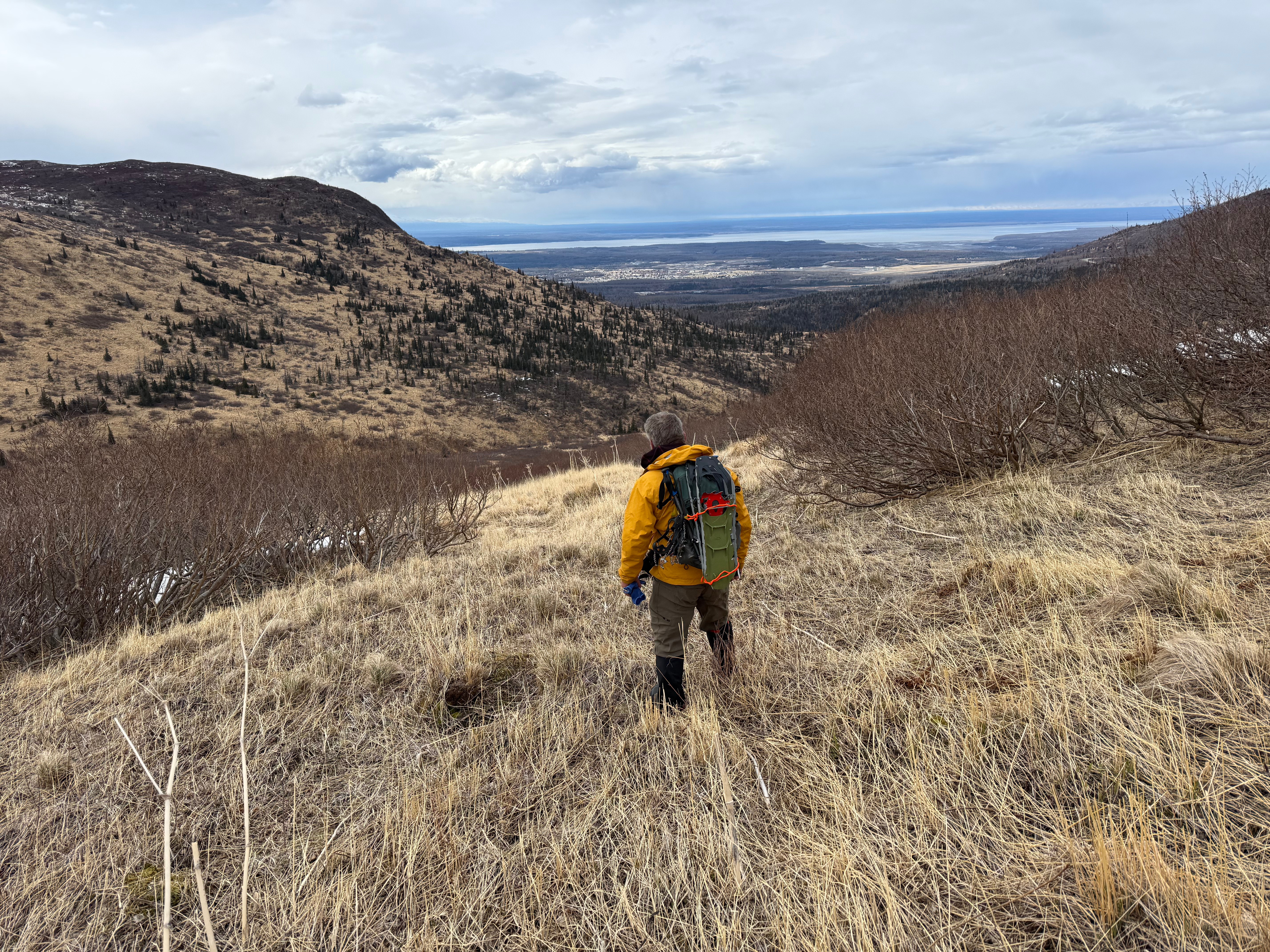
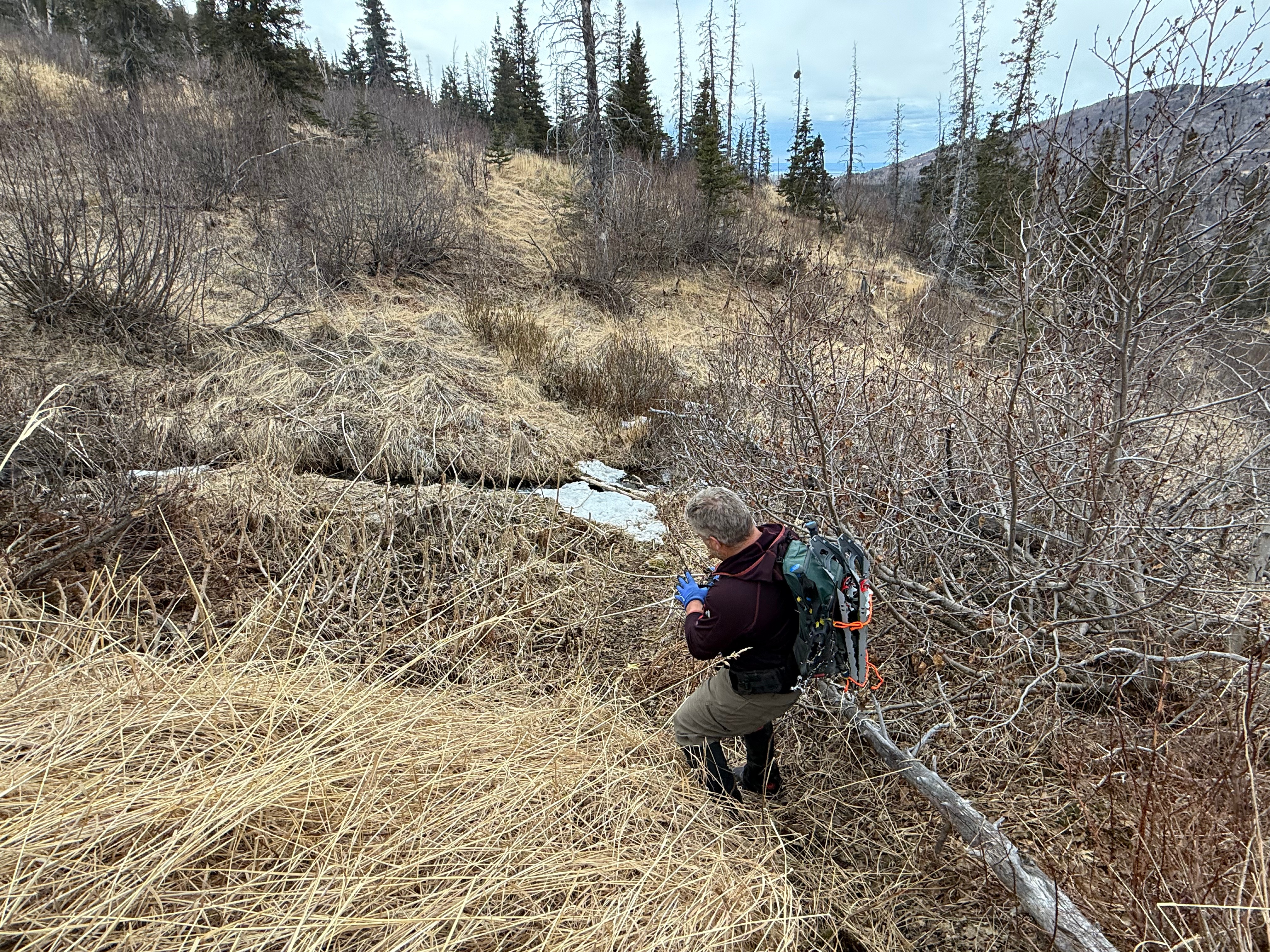
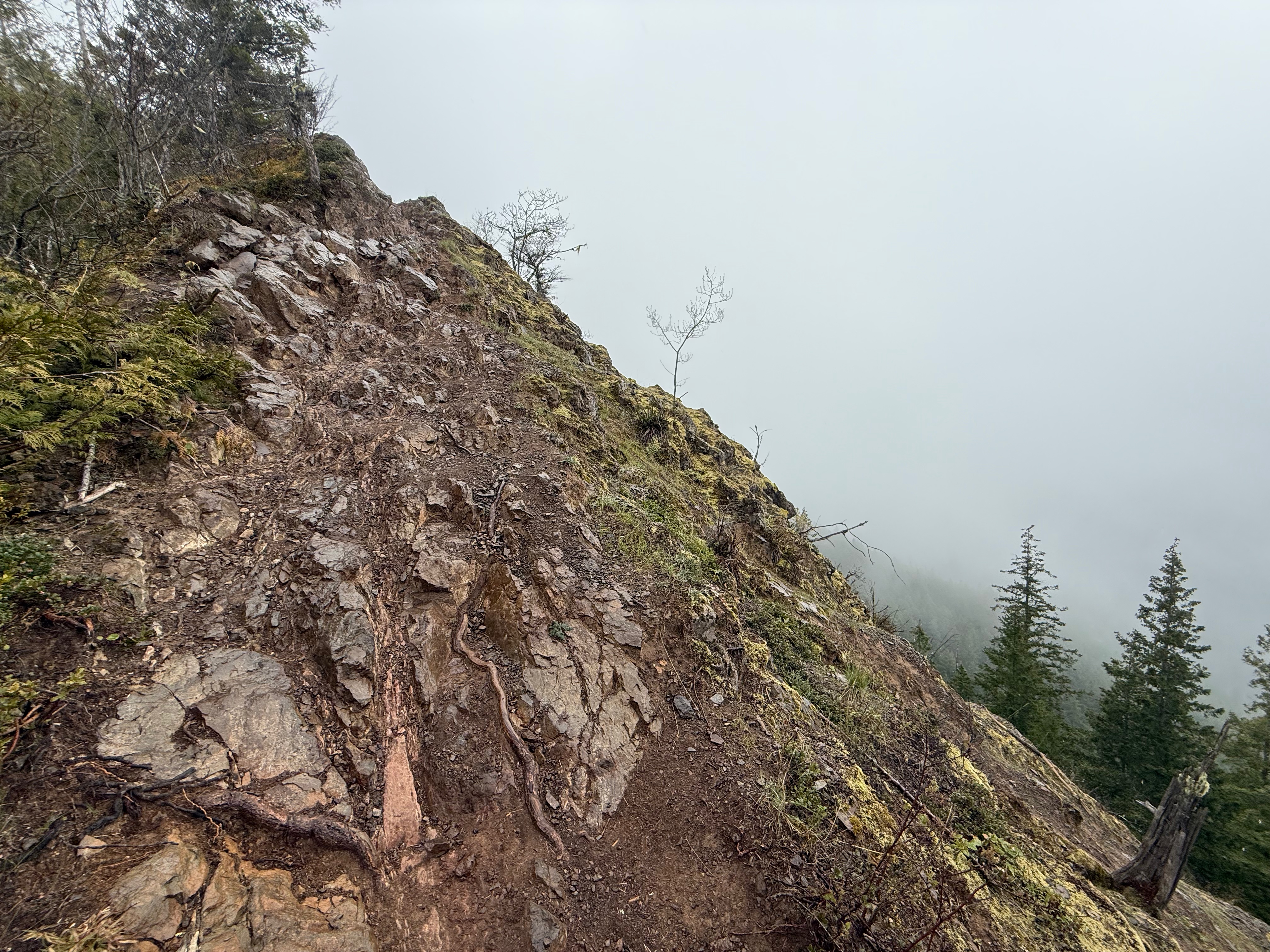
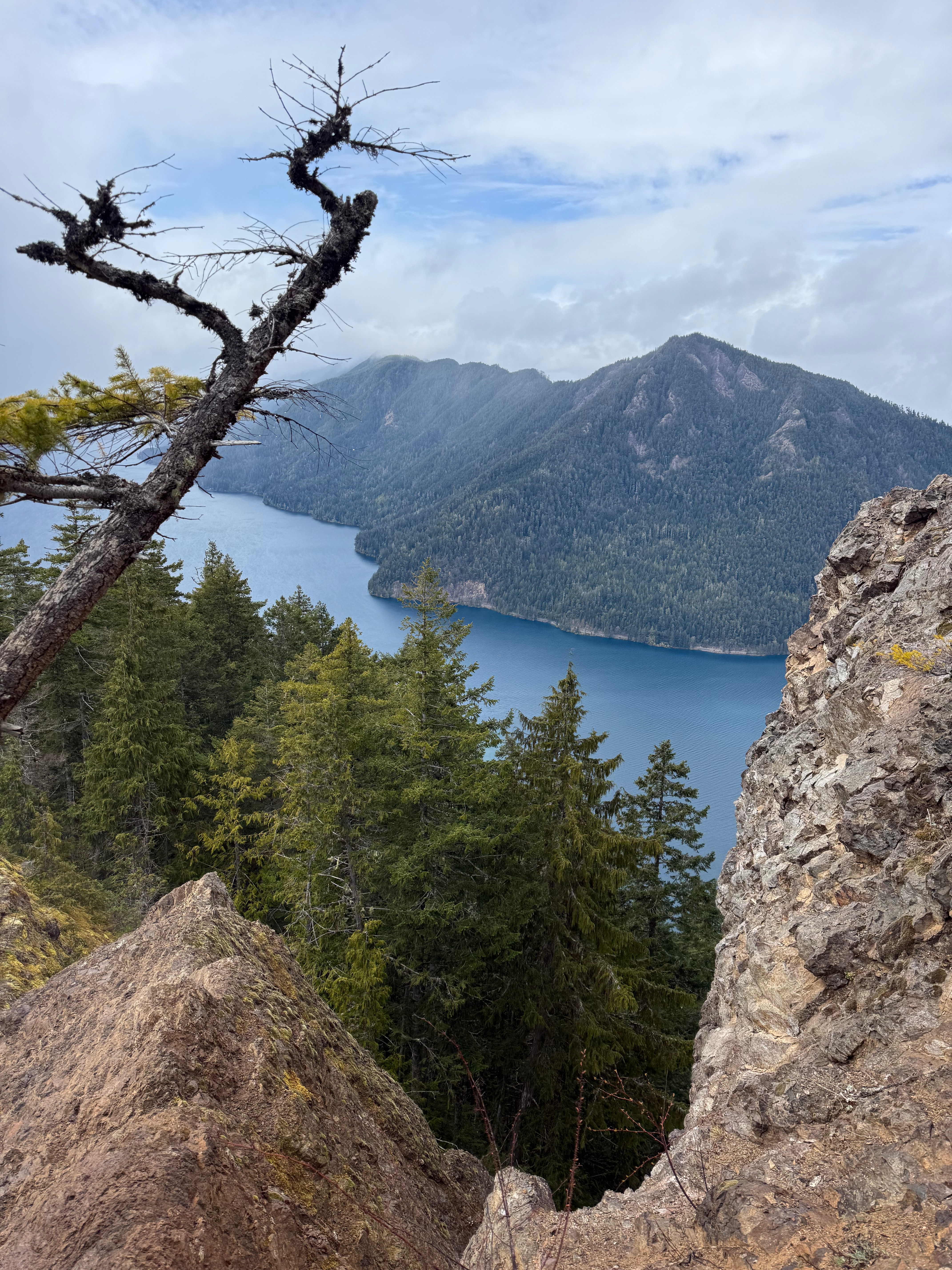
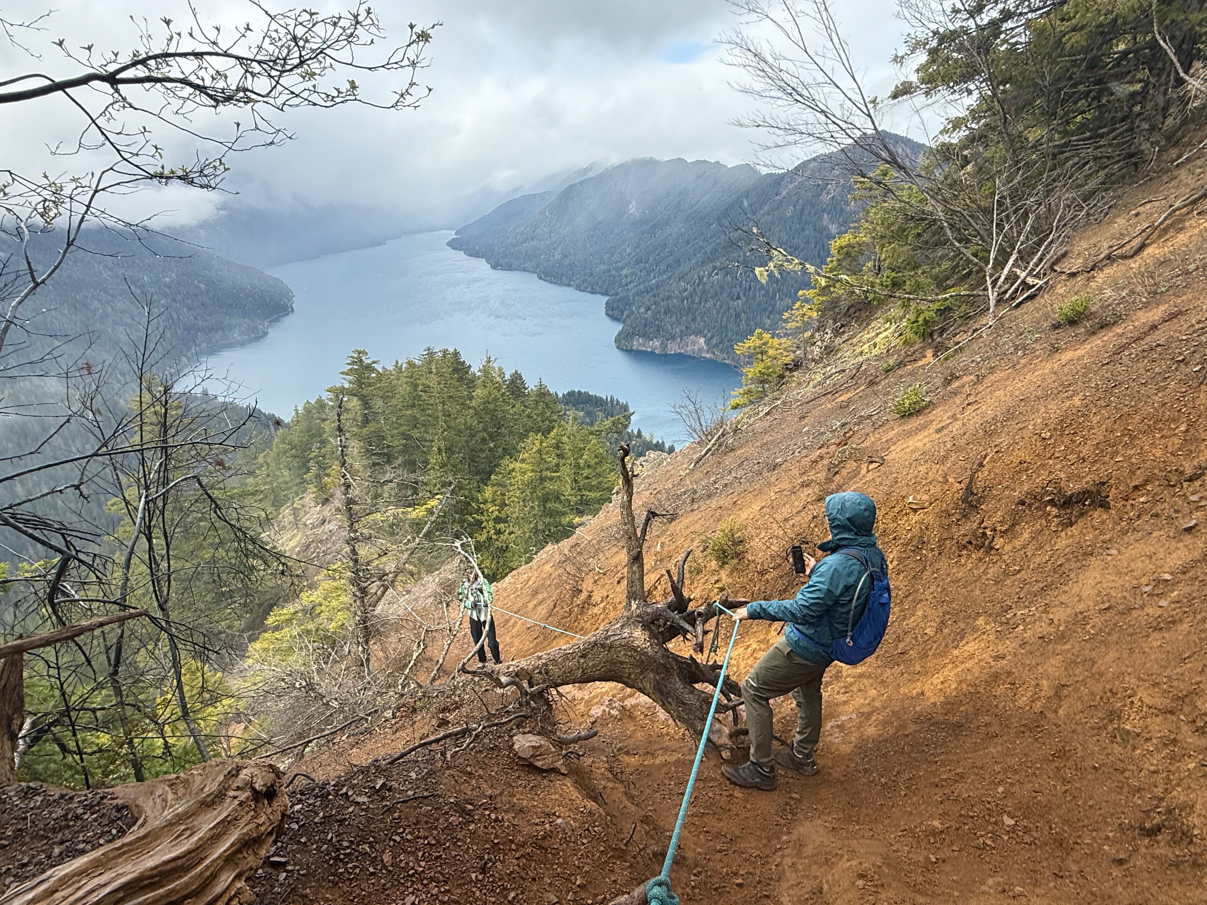
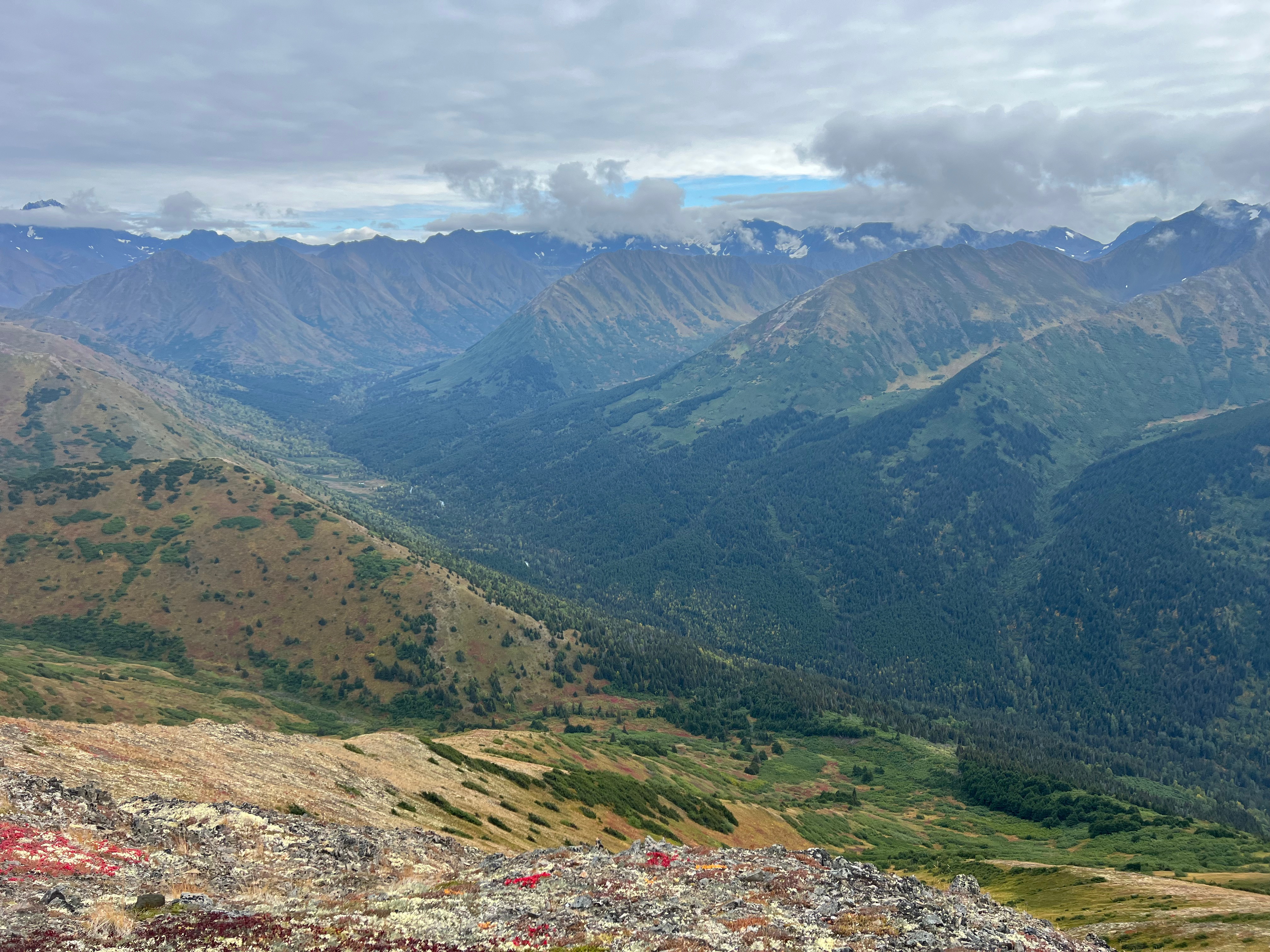
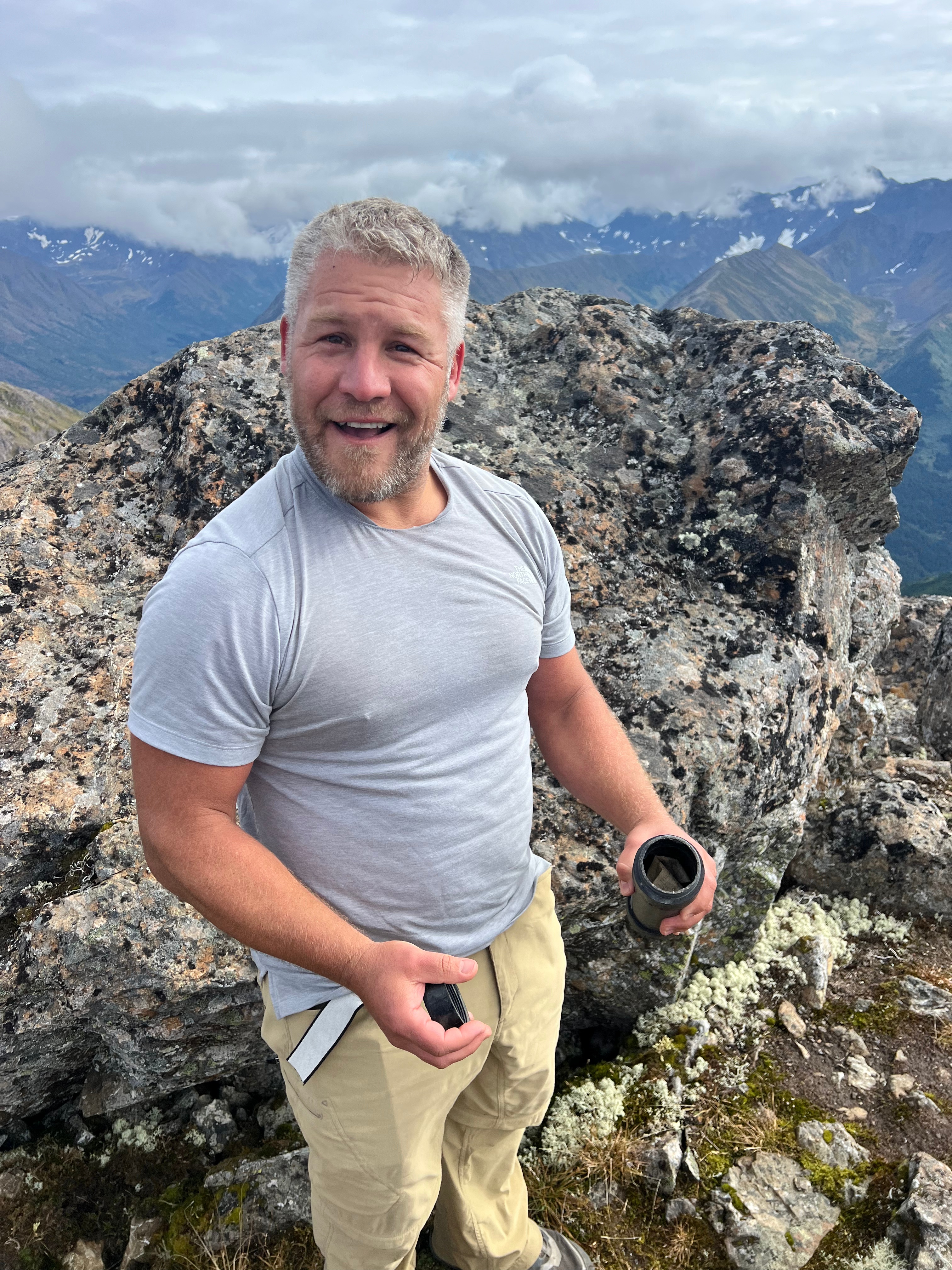
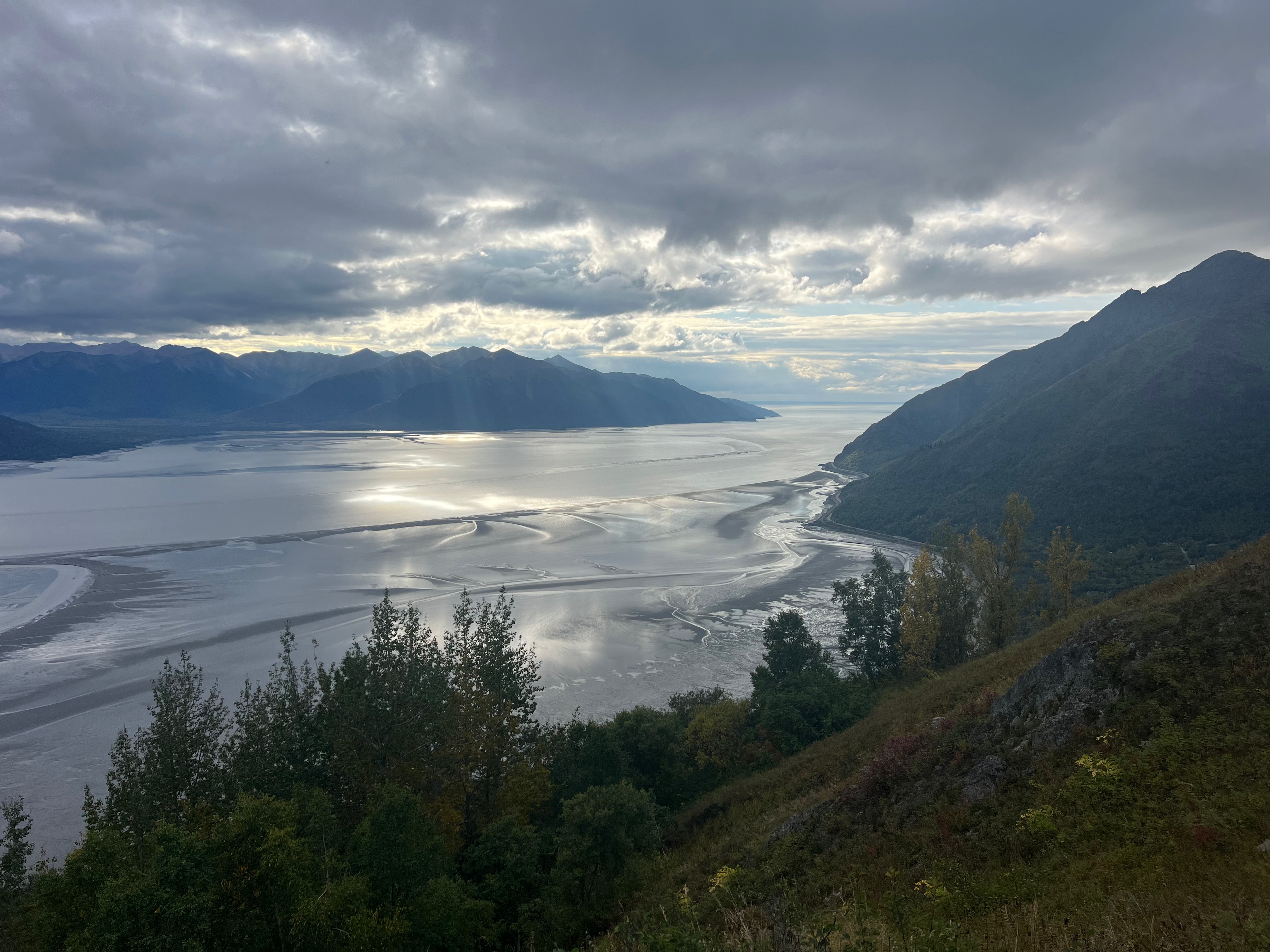
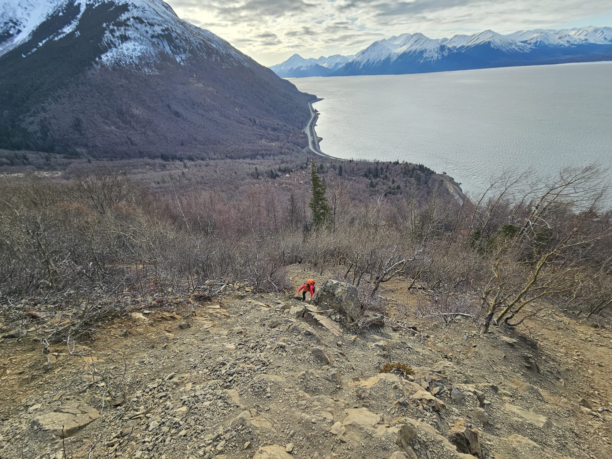
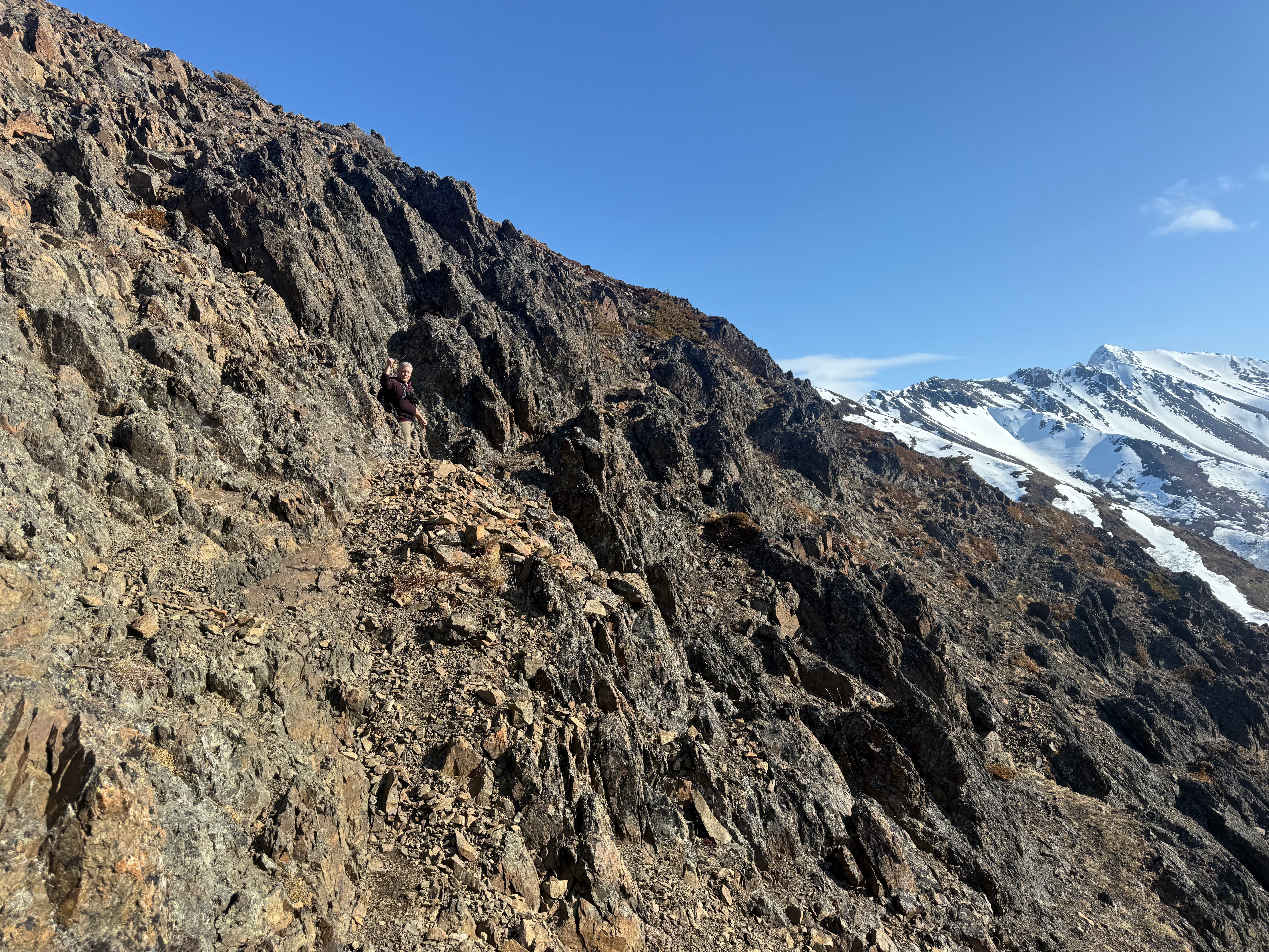
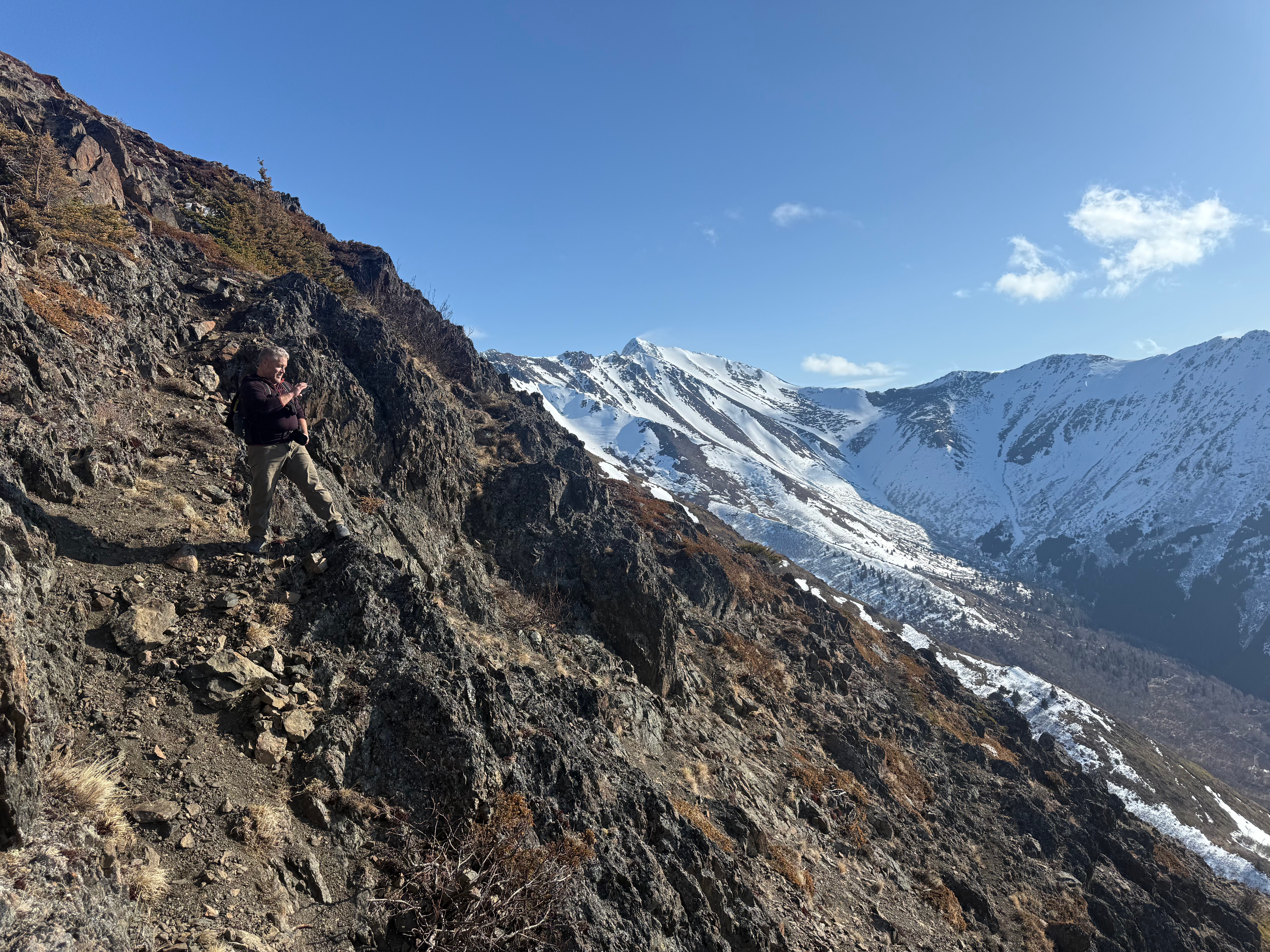
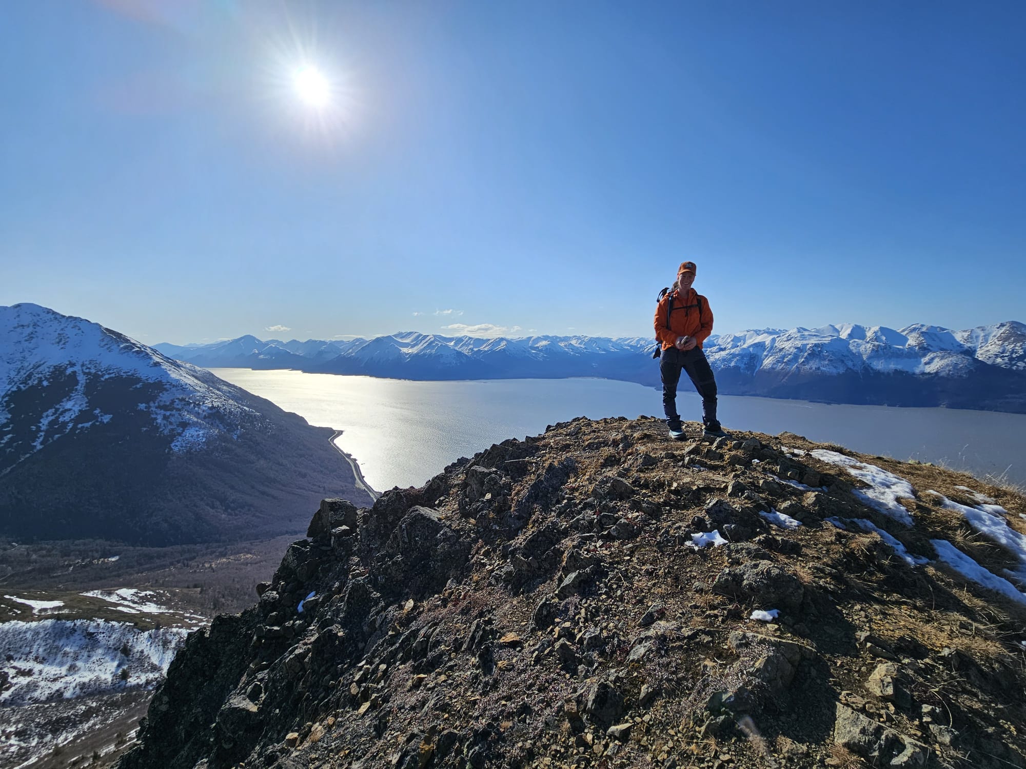
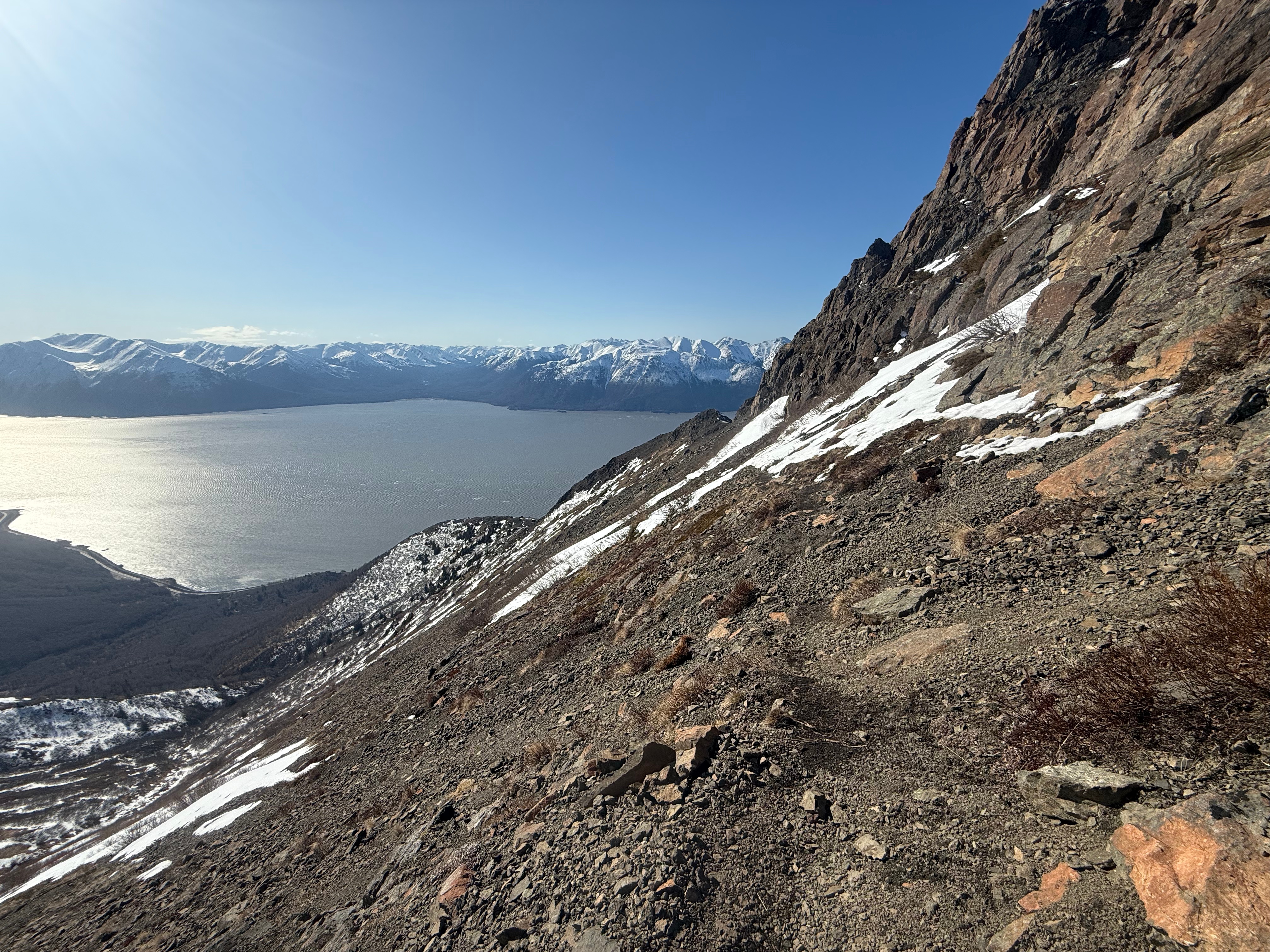
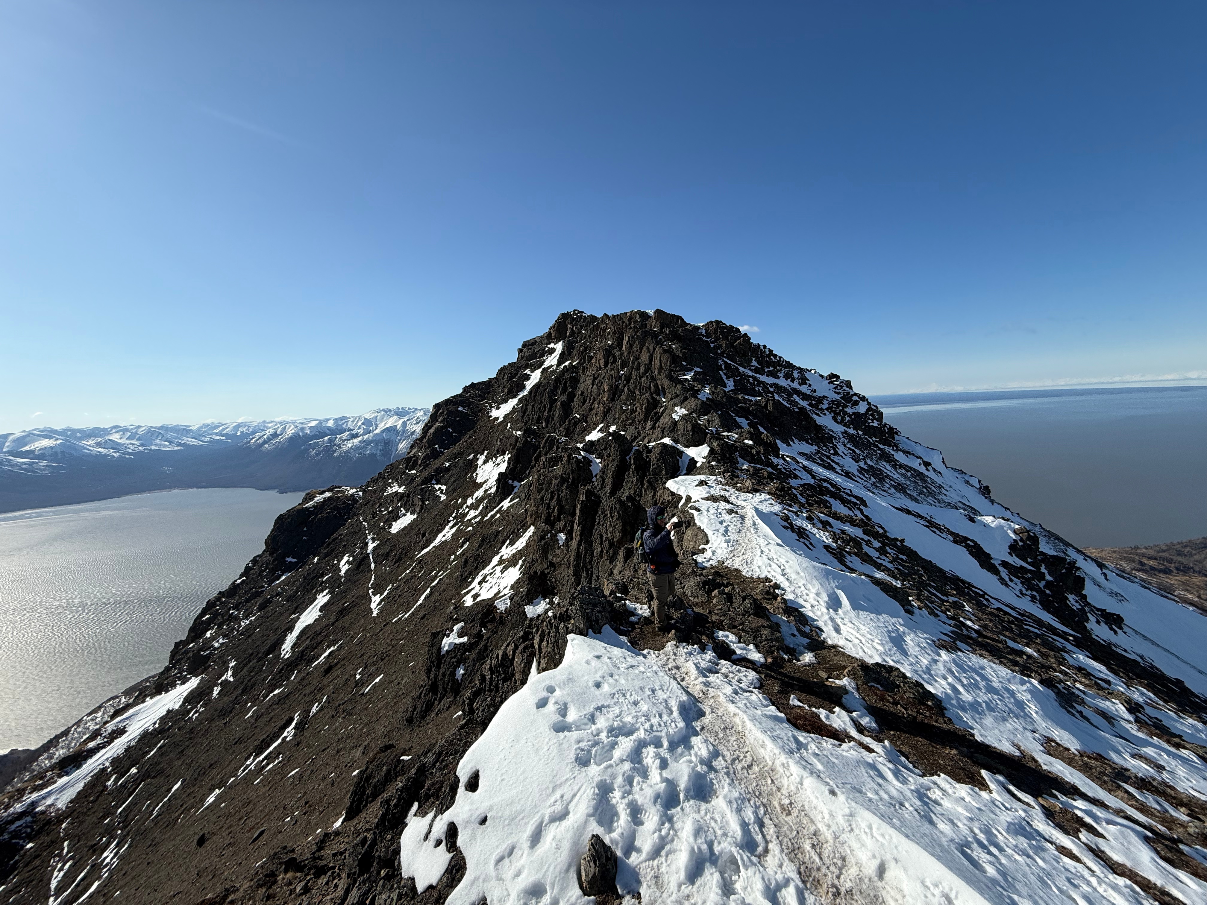
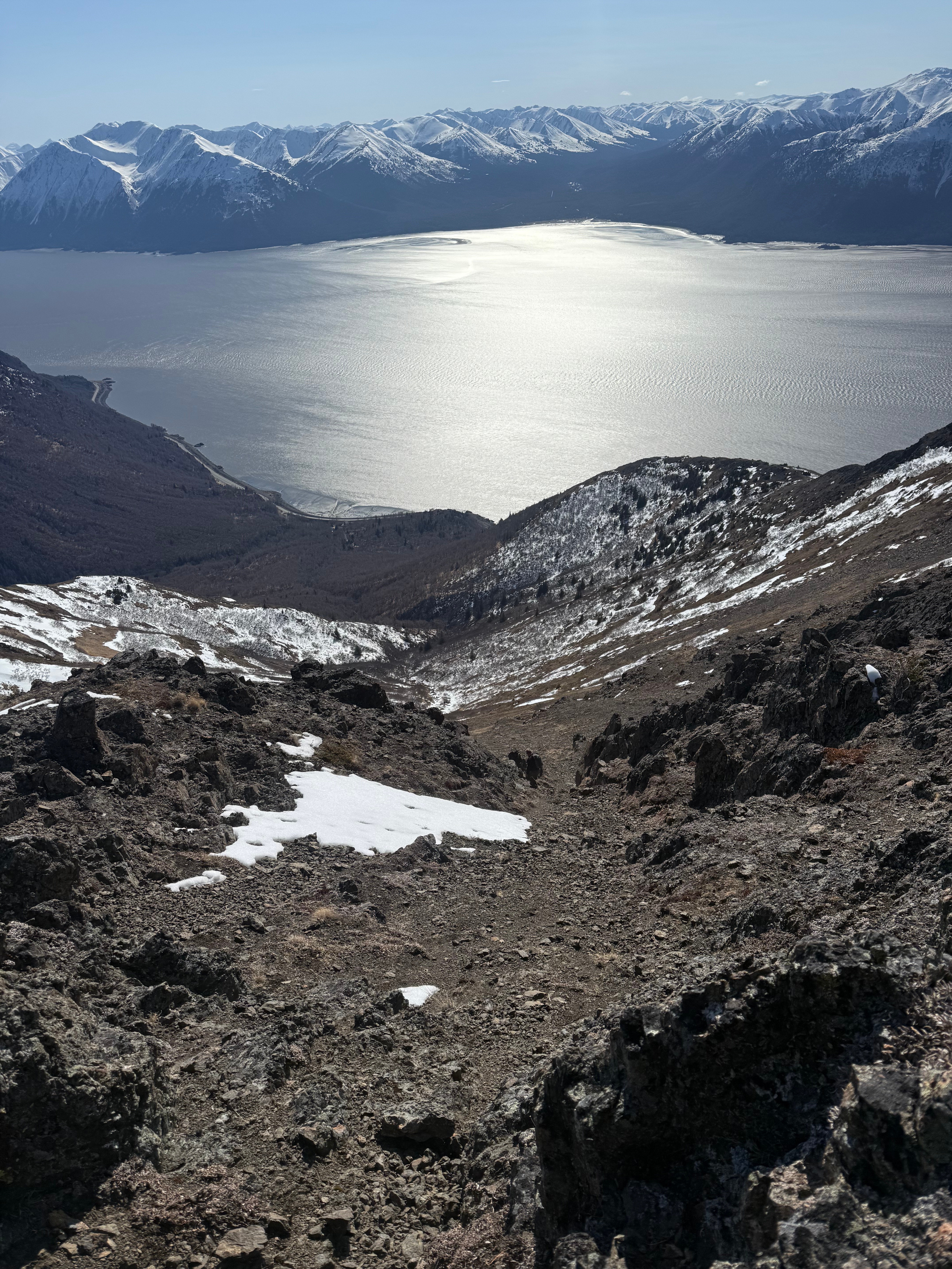
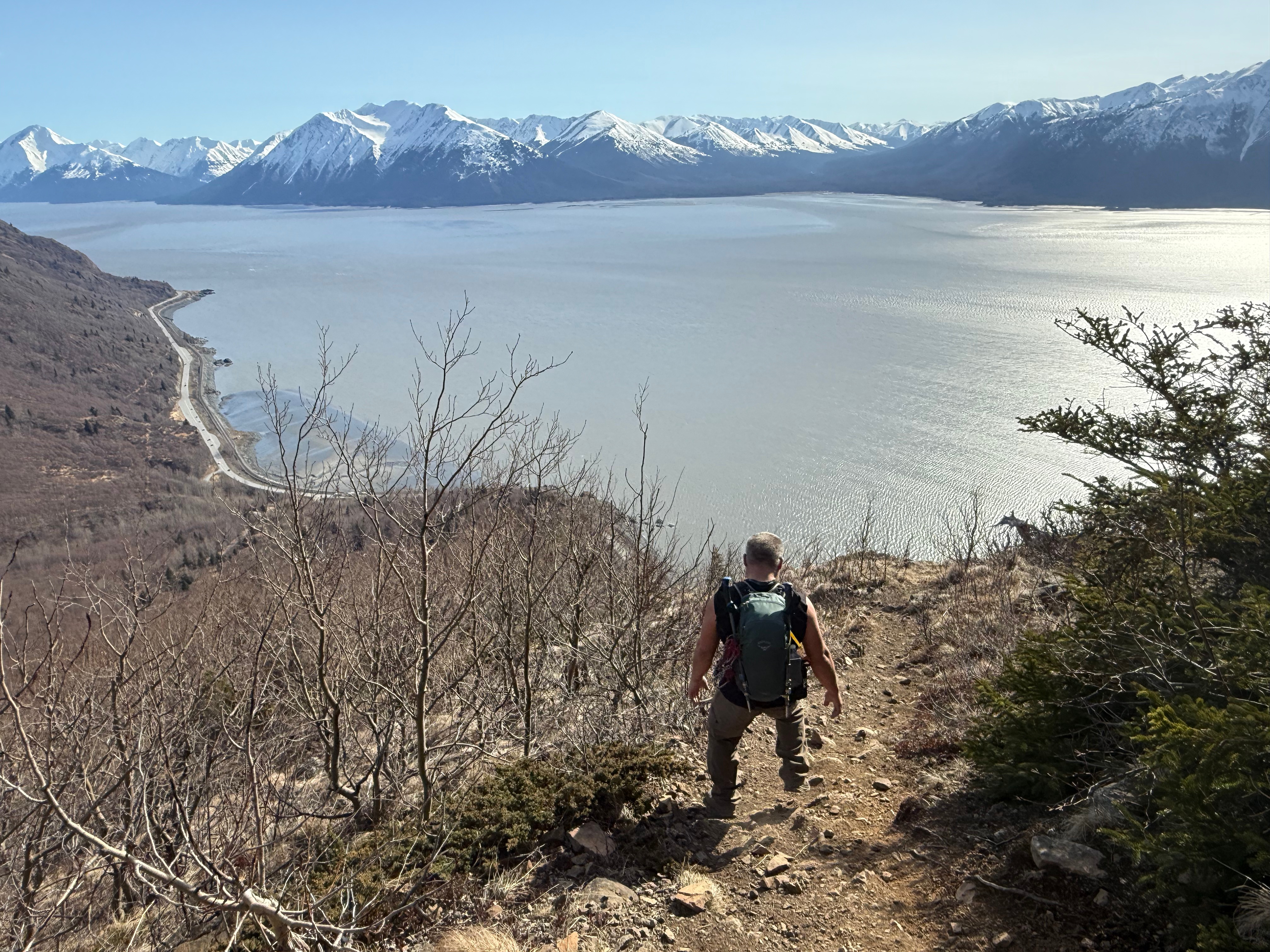
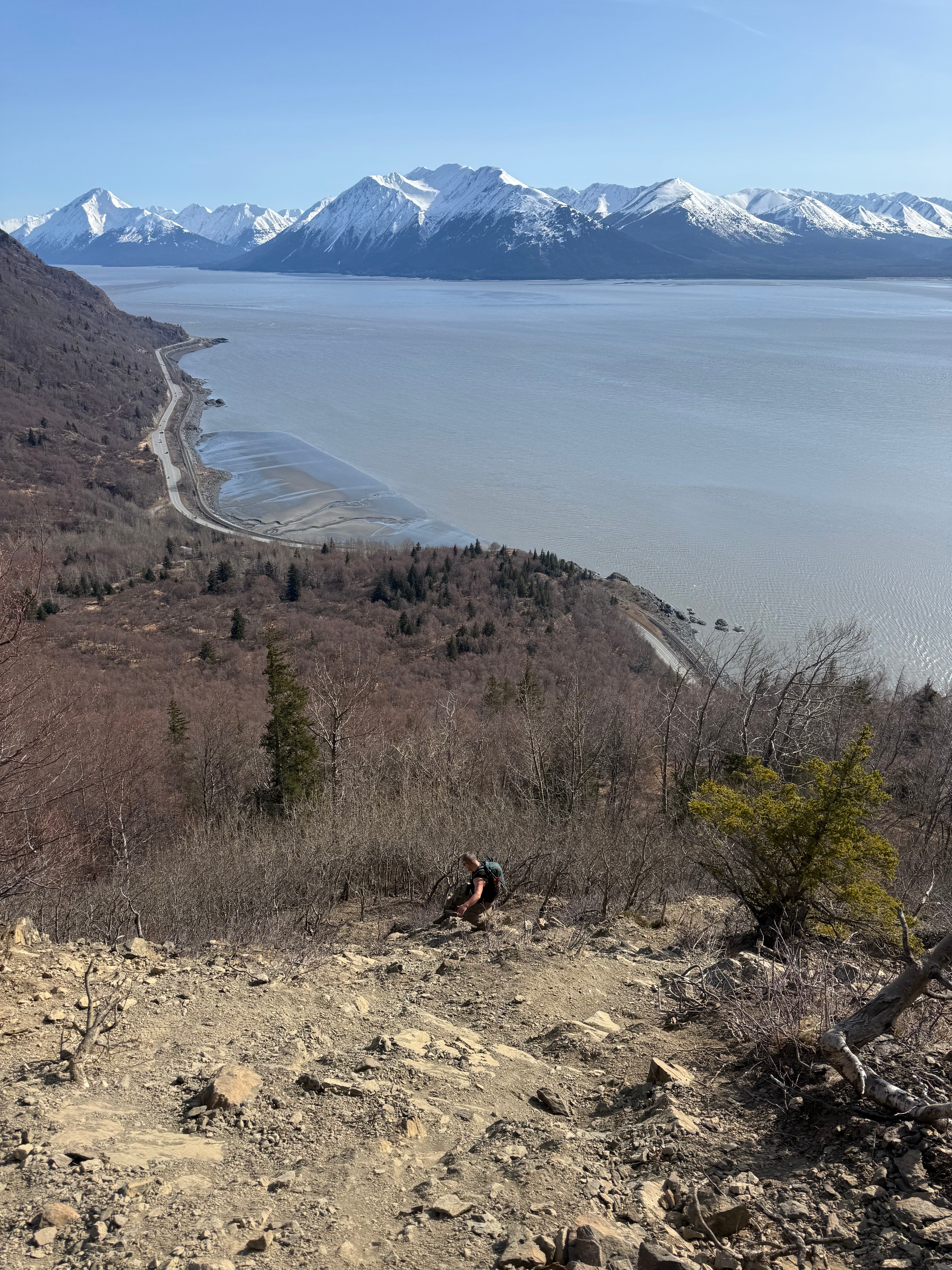
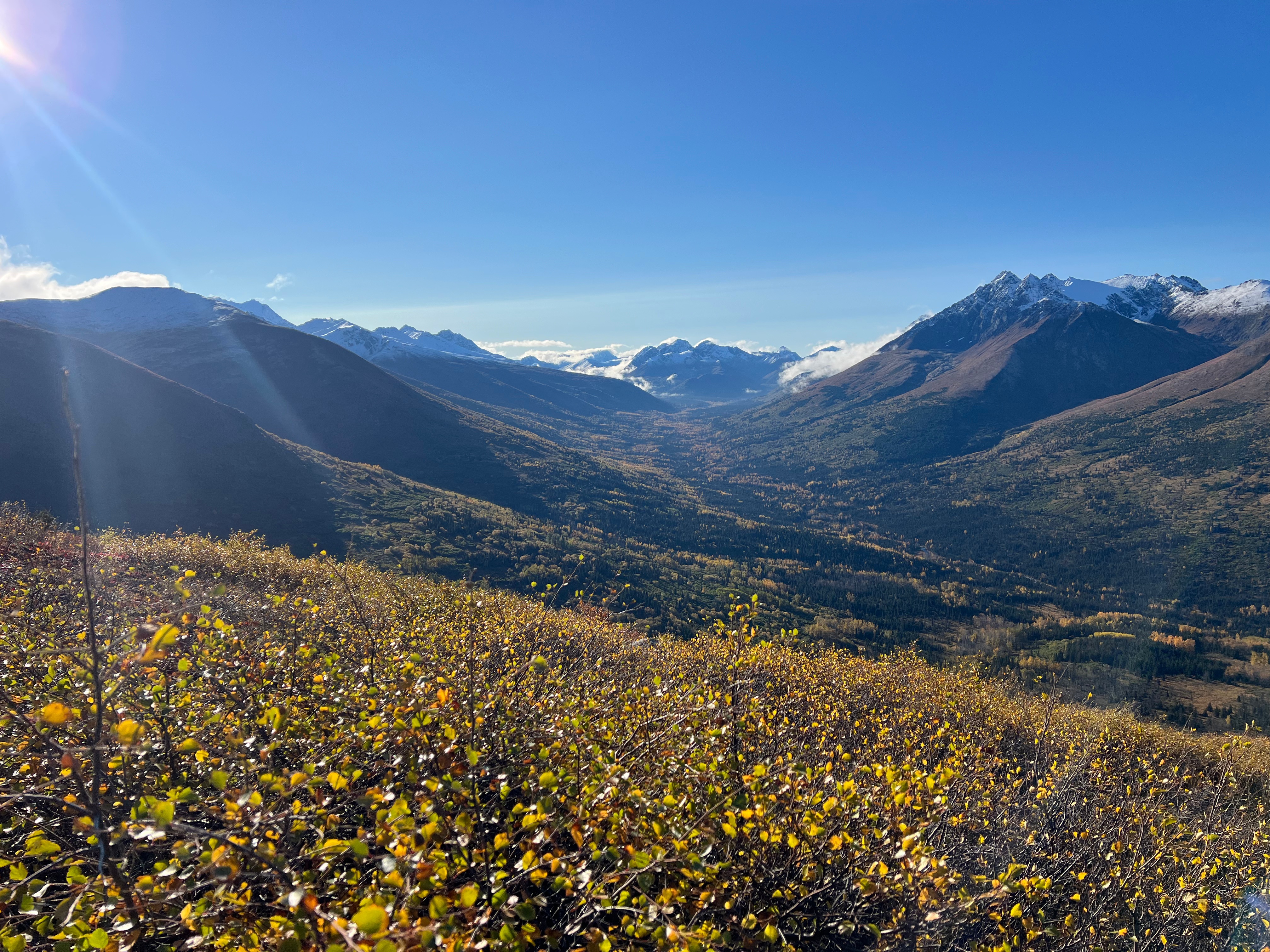
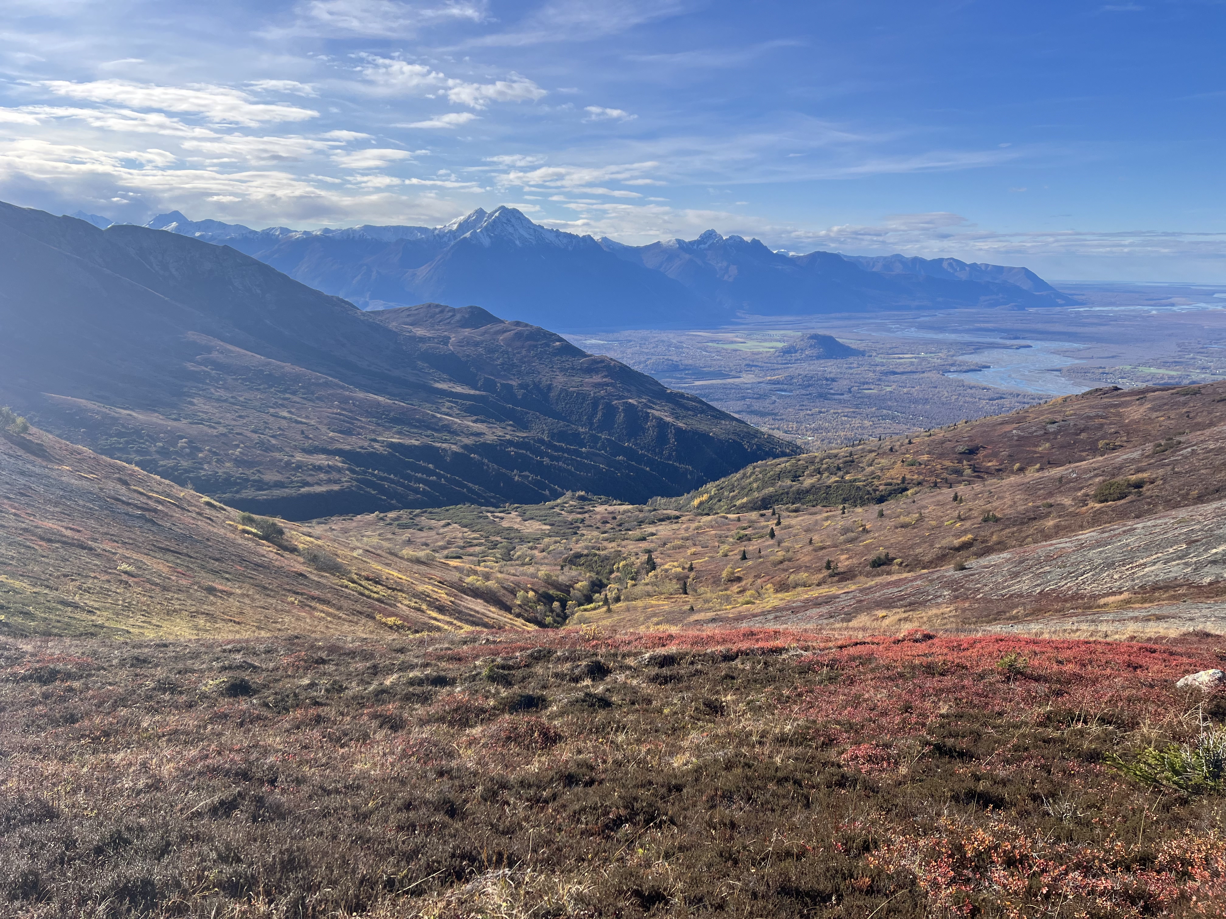
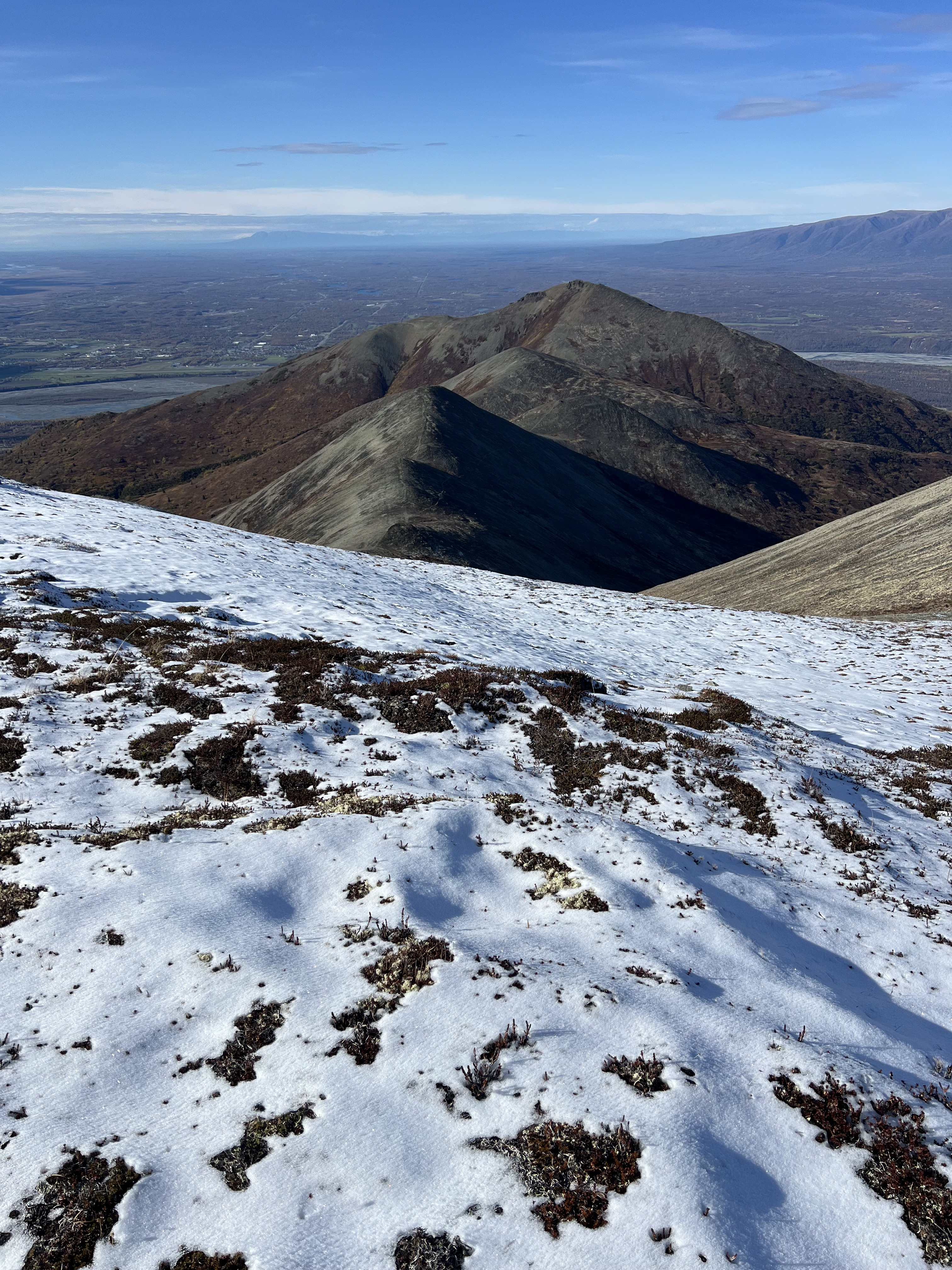
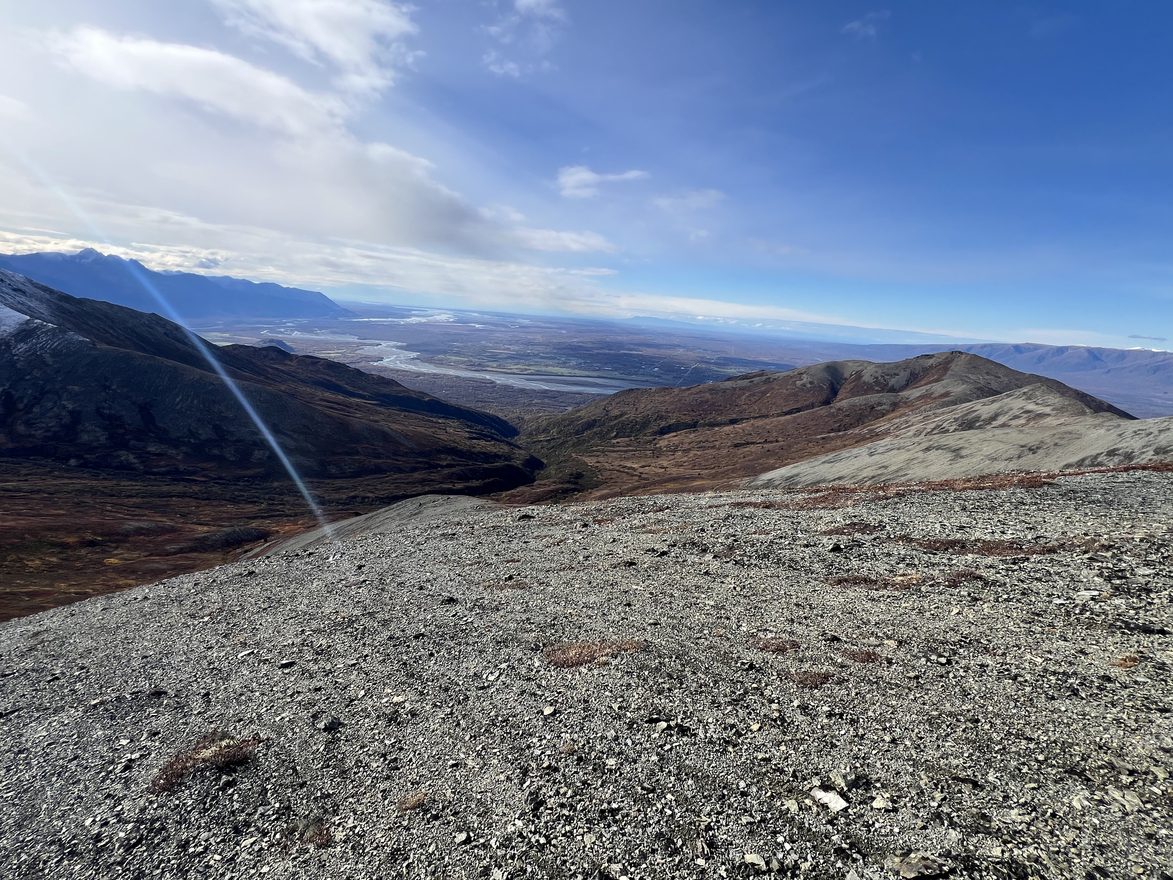
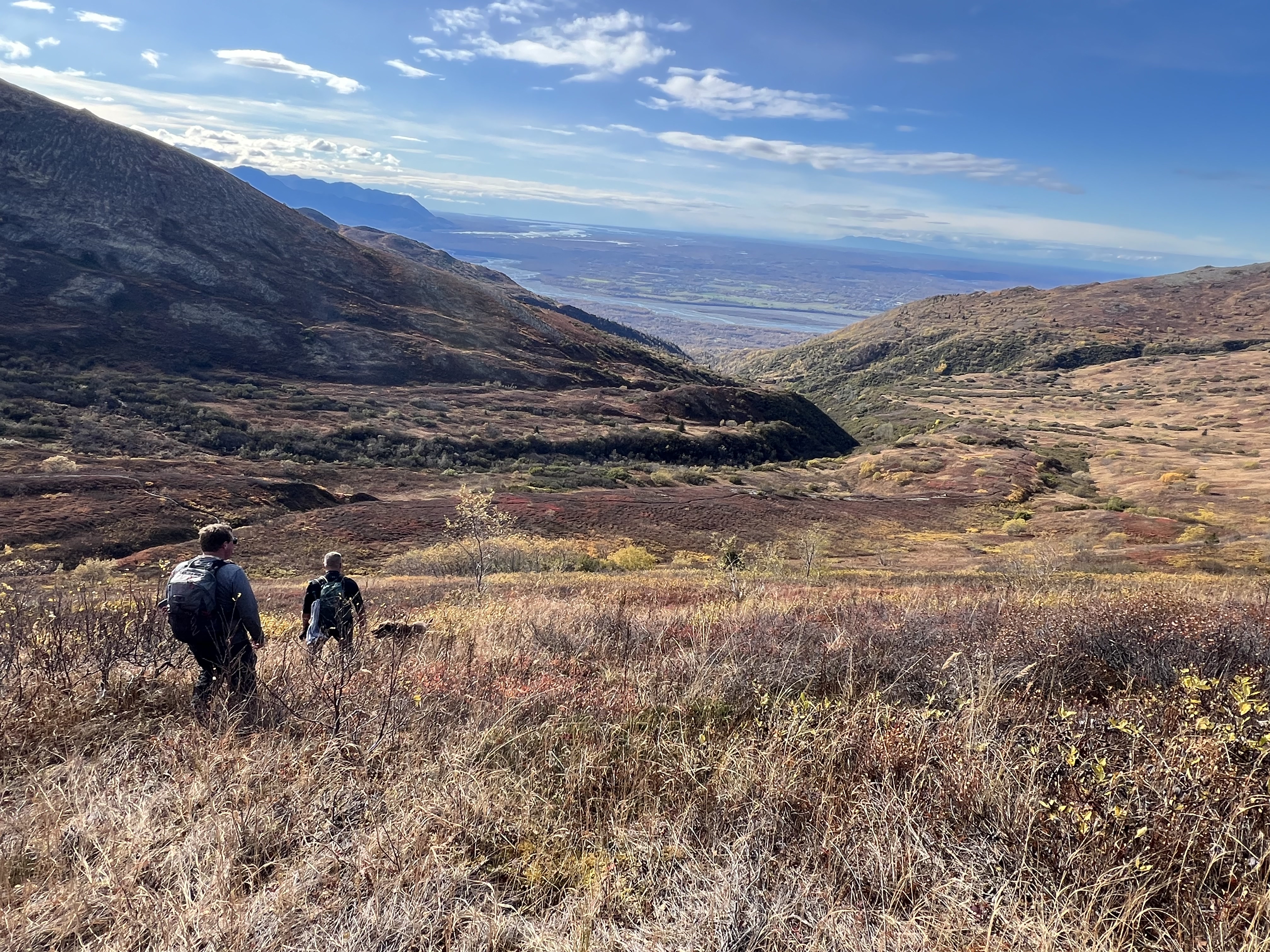
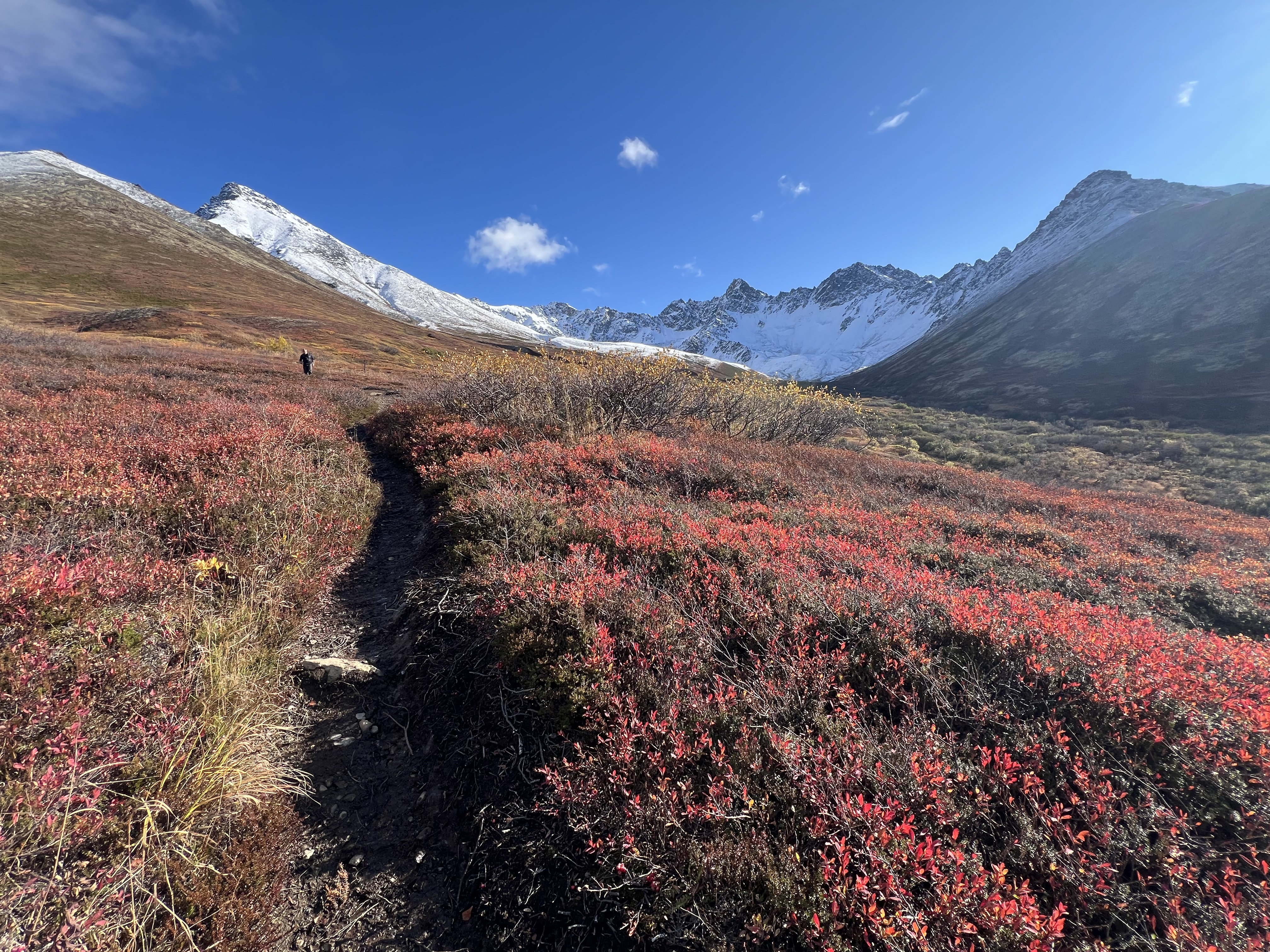
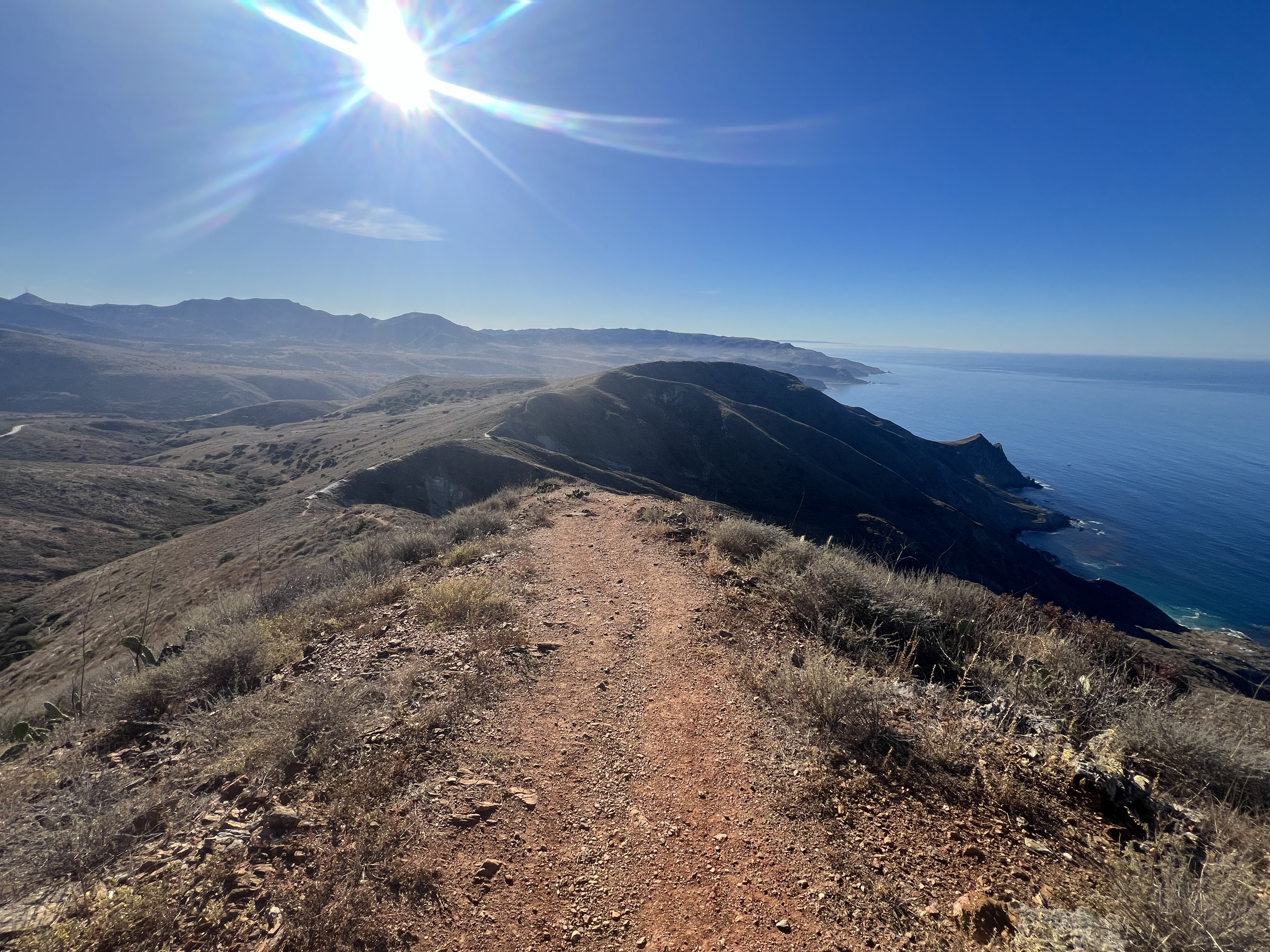
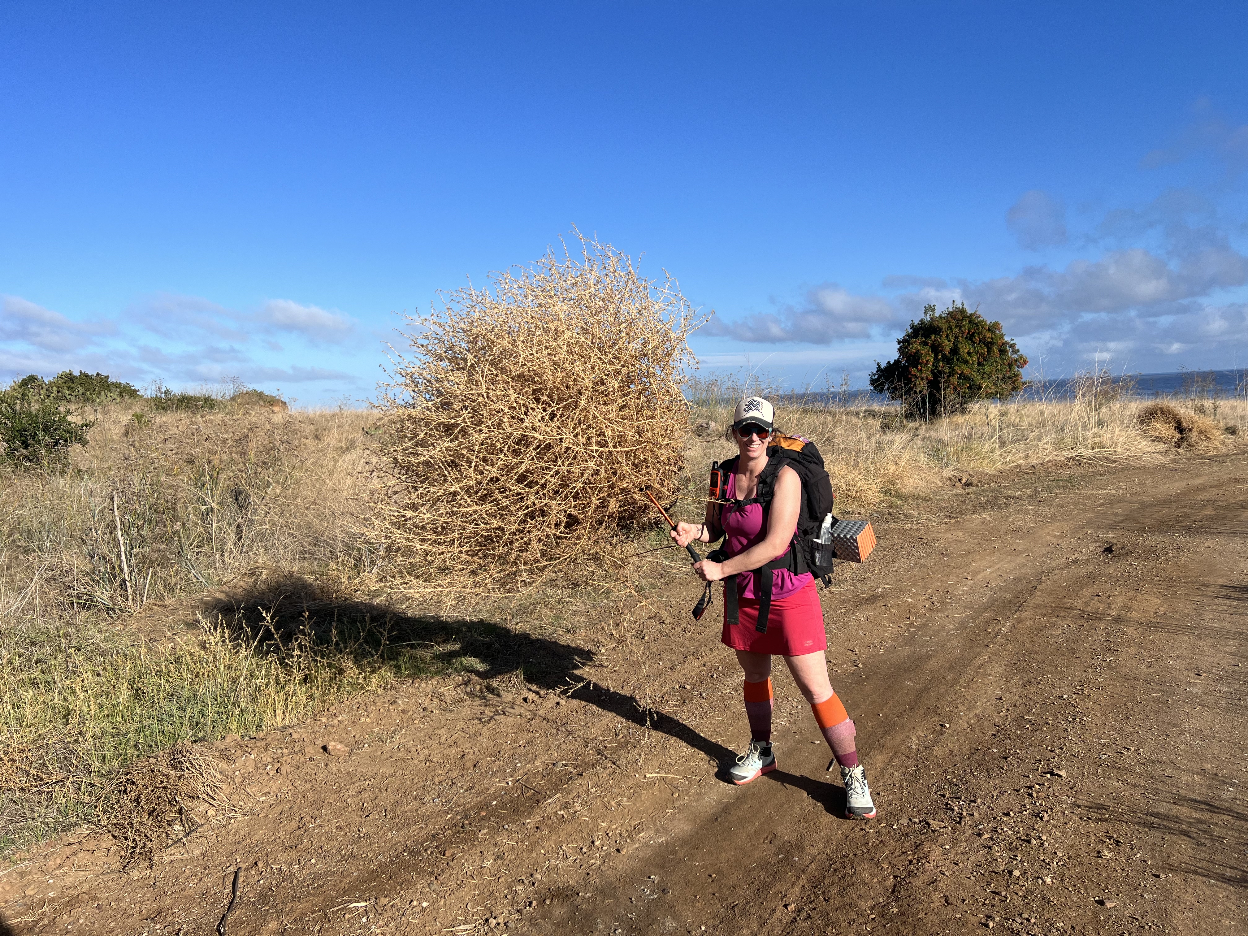
While walking the ridge toward Kanchee, I stopped to add snow to my water bladder—2 liters wouldn’t cut it for a 15-mile hike. I took a long swig of ice-cold water just as one final snow squall passed over us. We climbed over a small rock outcropping, and then the sky began to brighten. A patch of blue appeared, and the clouds below us rose, revealing all of Snow Hawk Valley. Peaks 1216 and Ship Creek Hill came into view, sparking fond memories of our recent hike there in gale-force winds.
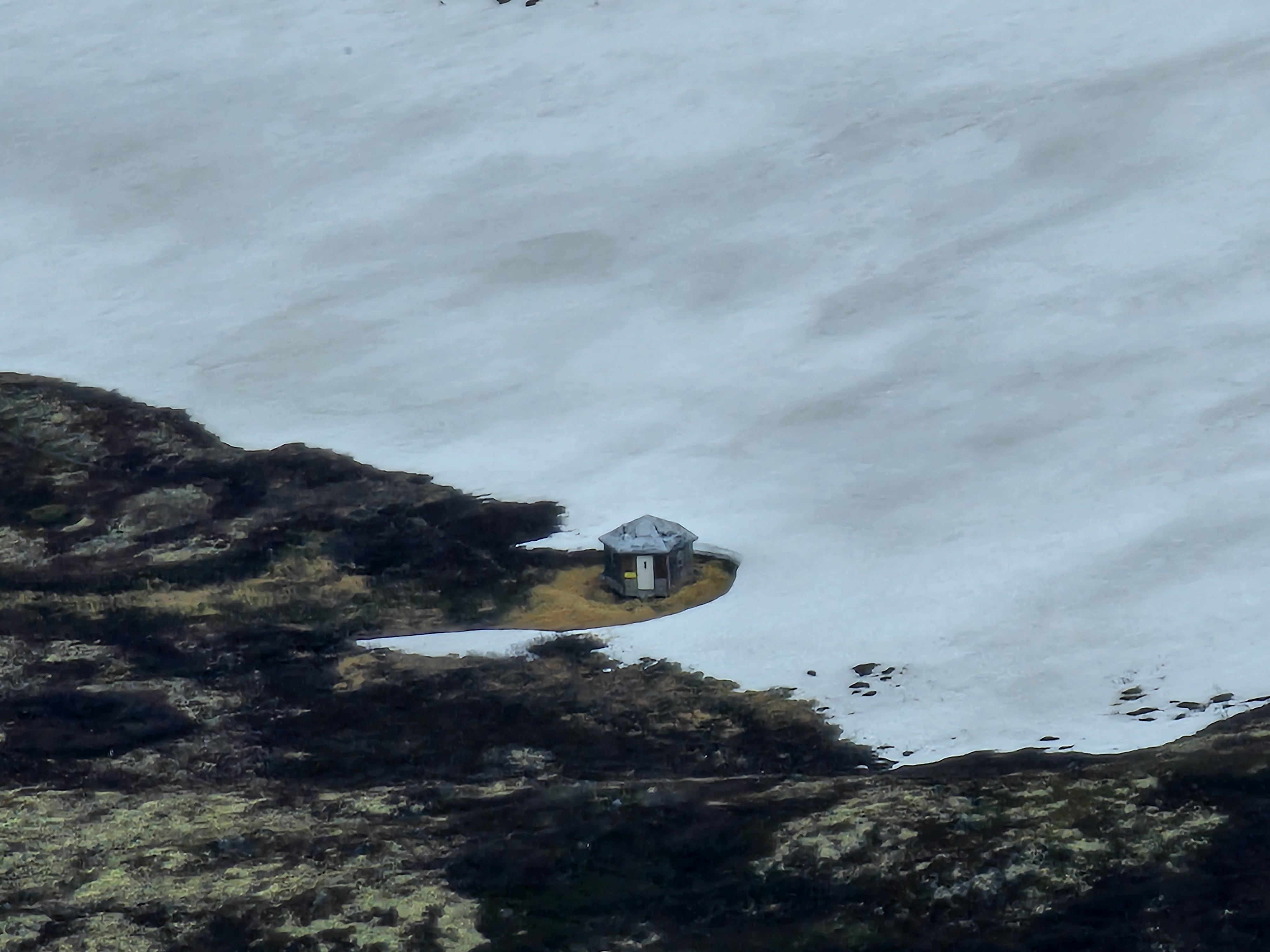
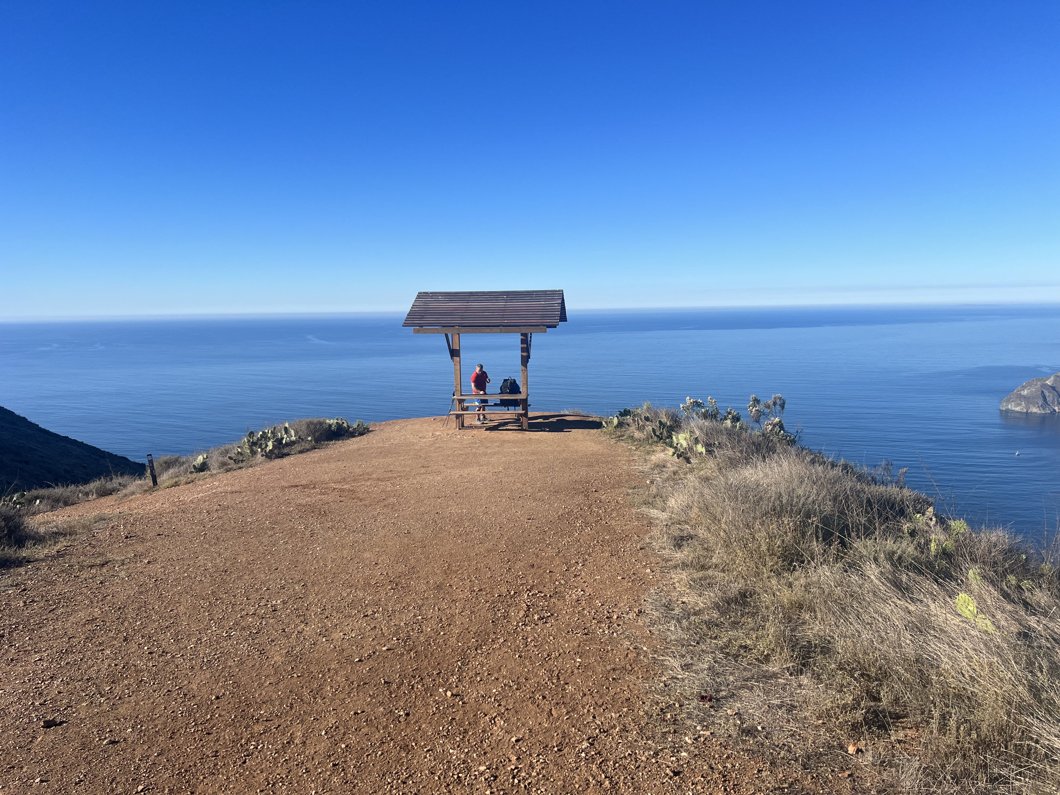
The sky continued to open up, and the little blue patch grew. We spotted a small cabin down in Snow Hawk Valley. I’ve heard of people using it, but since it’s on JBER land where overnight stays aren’t permitted, I haven’t found any official resources explaining how to legally use the shelter. I wouldn’t recommend attempting an overnight trip there without written permission from JBER officials—you don’t want to lose access to military land hikes.
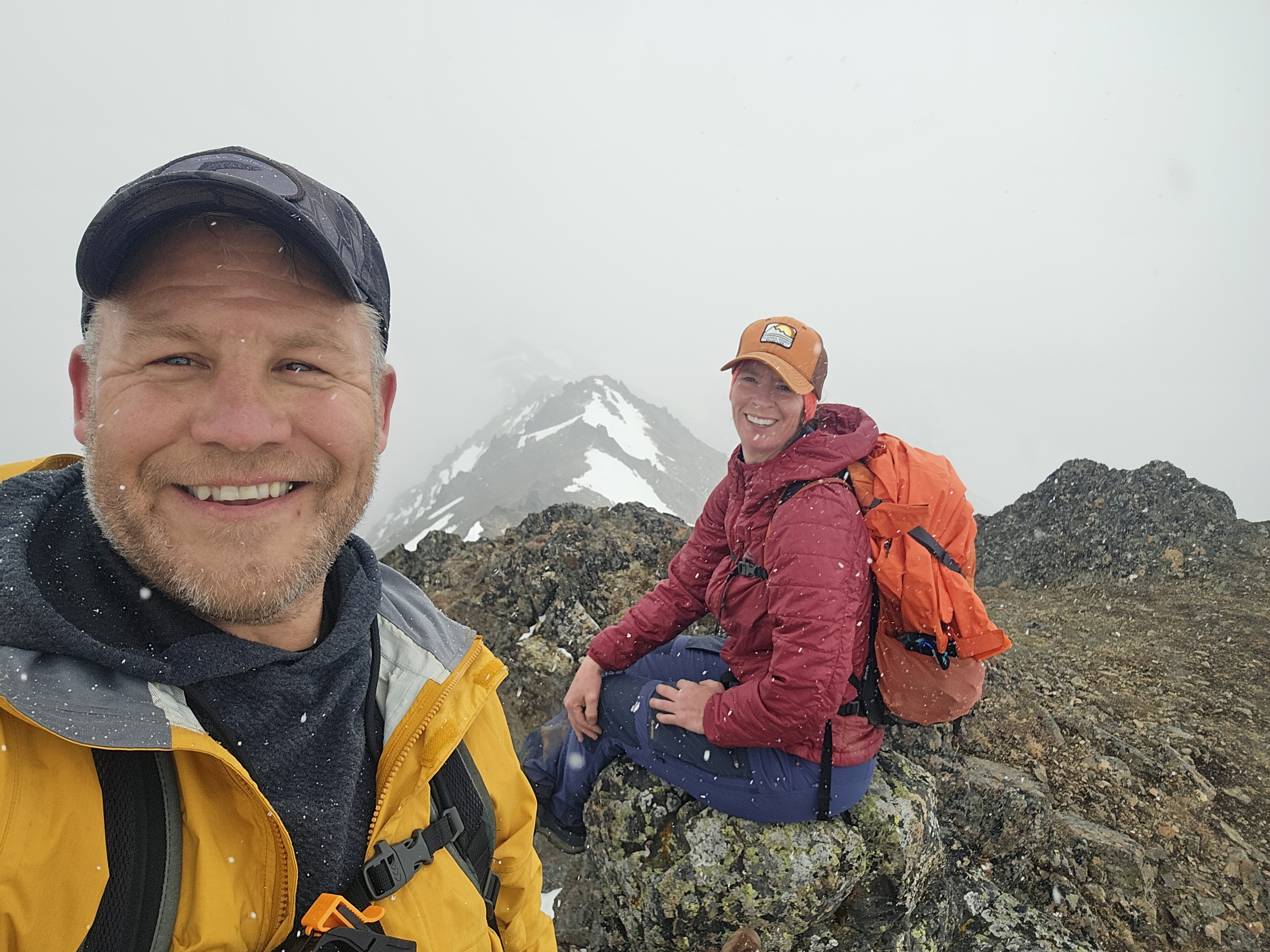
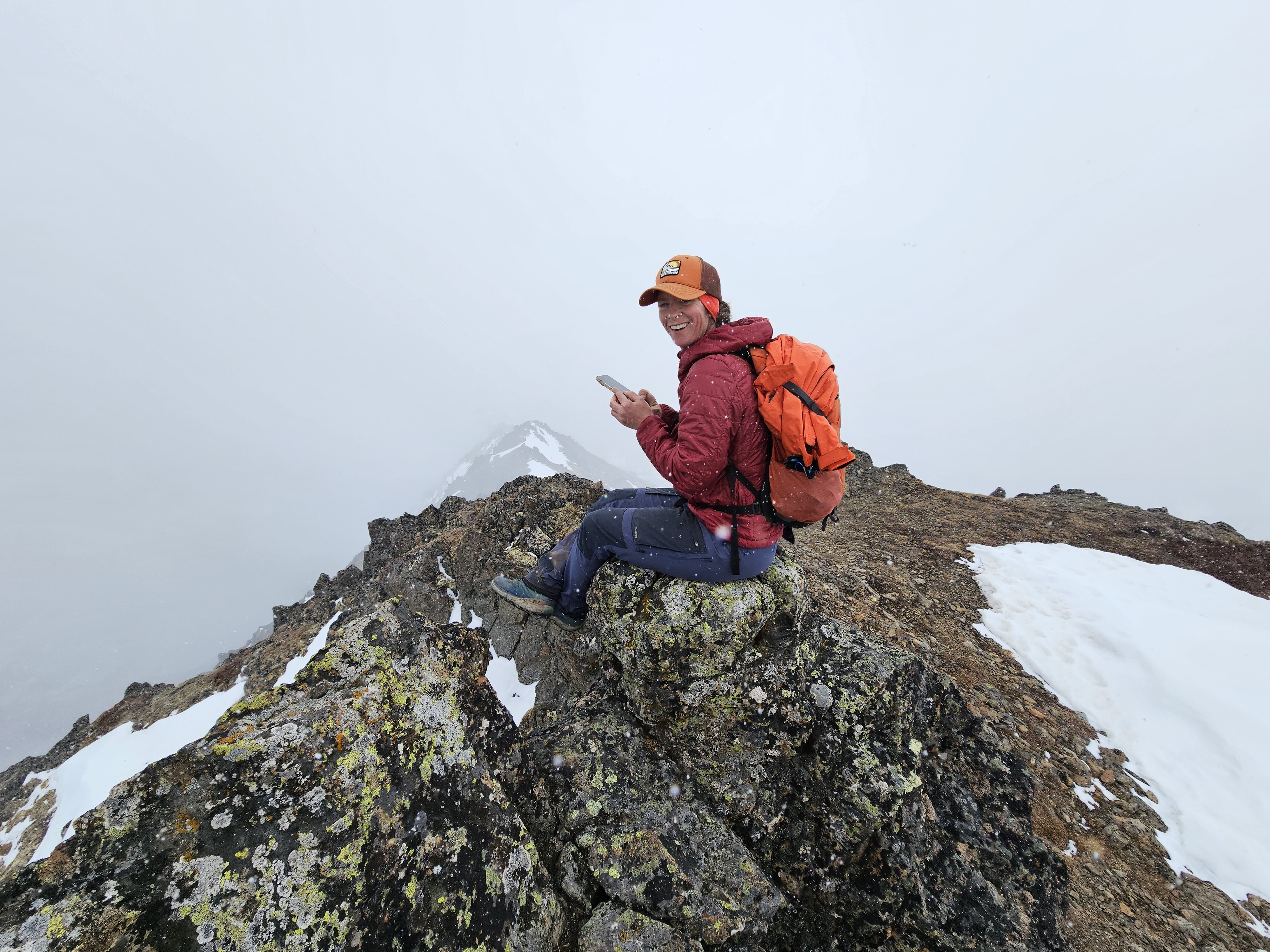
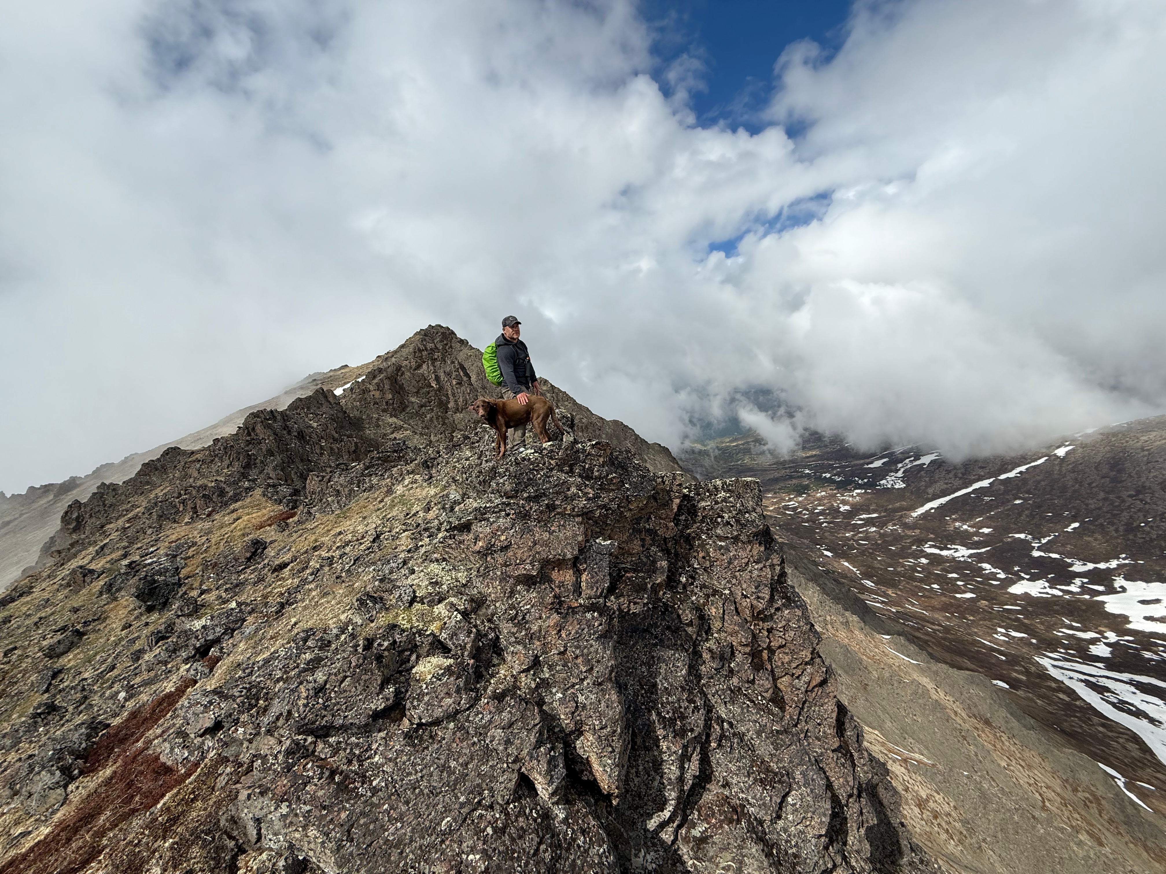
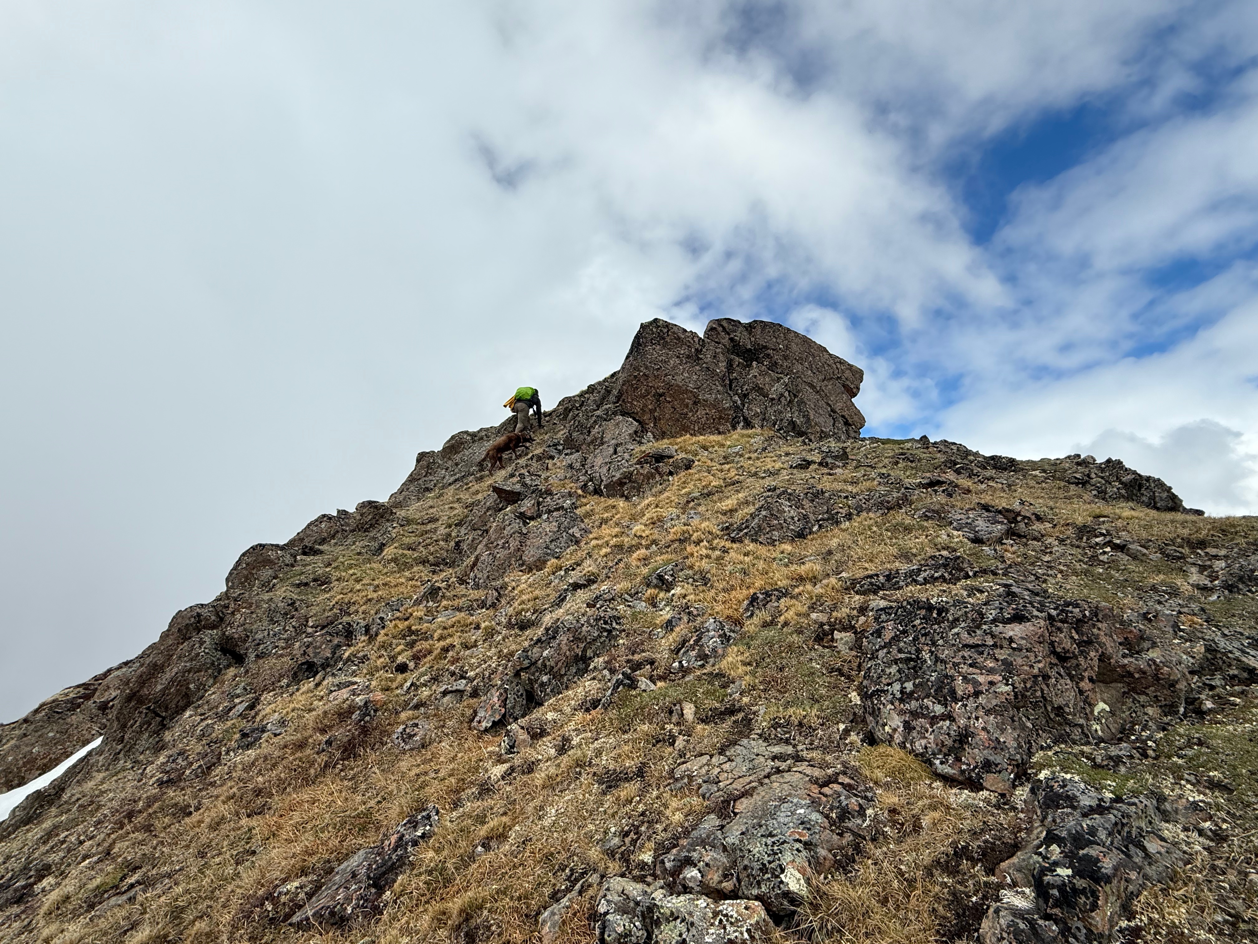
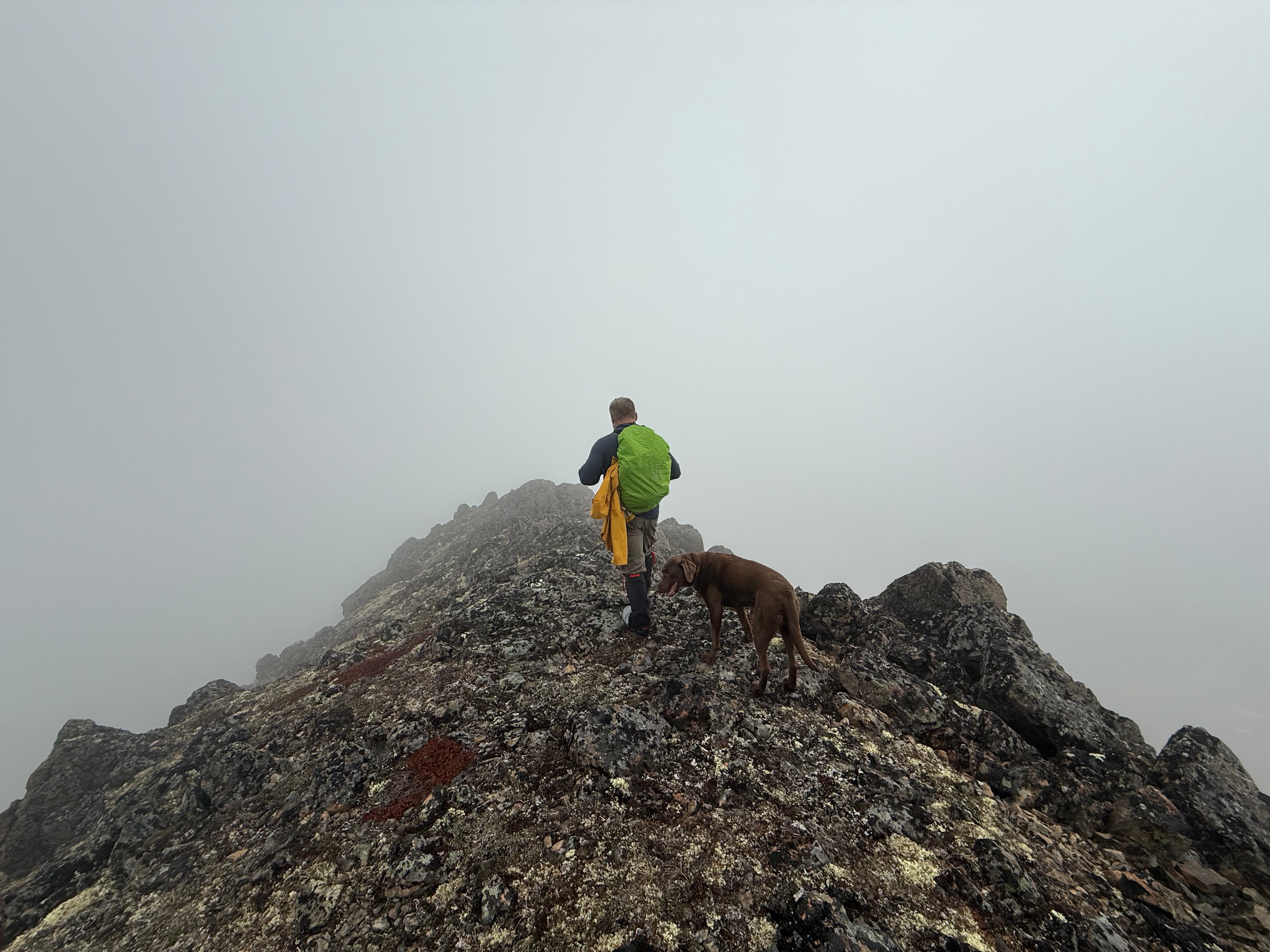
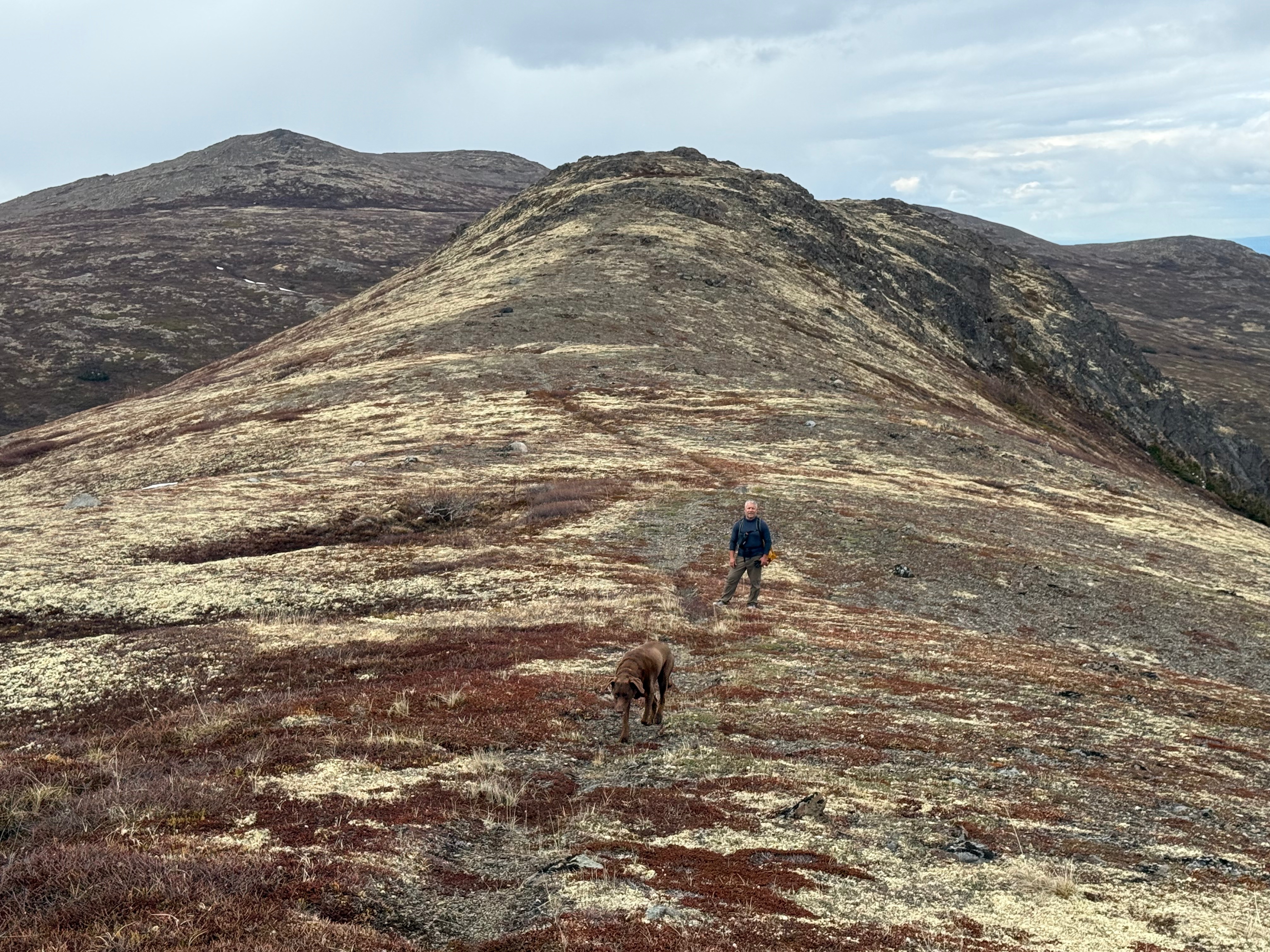
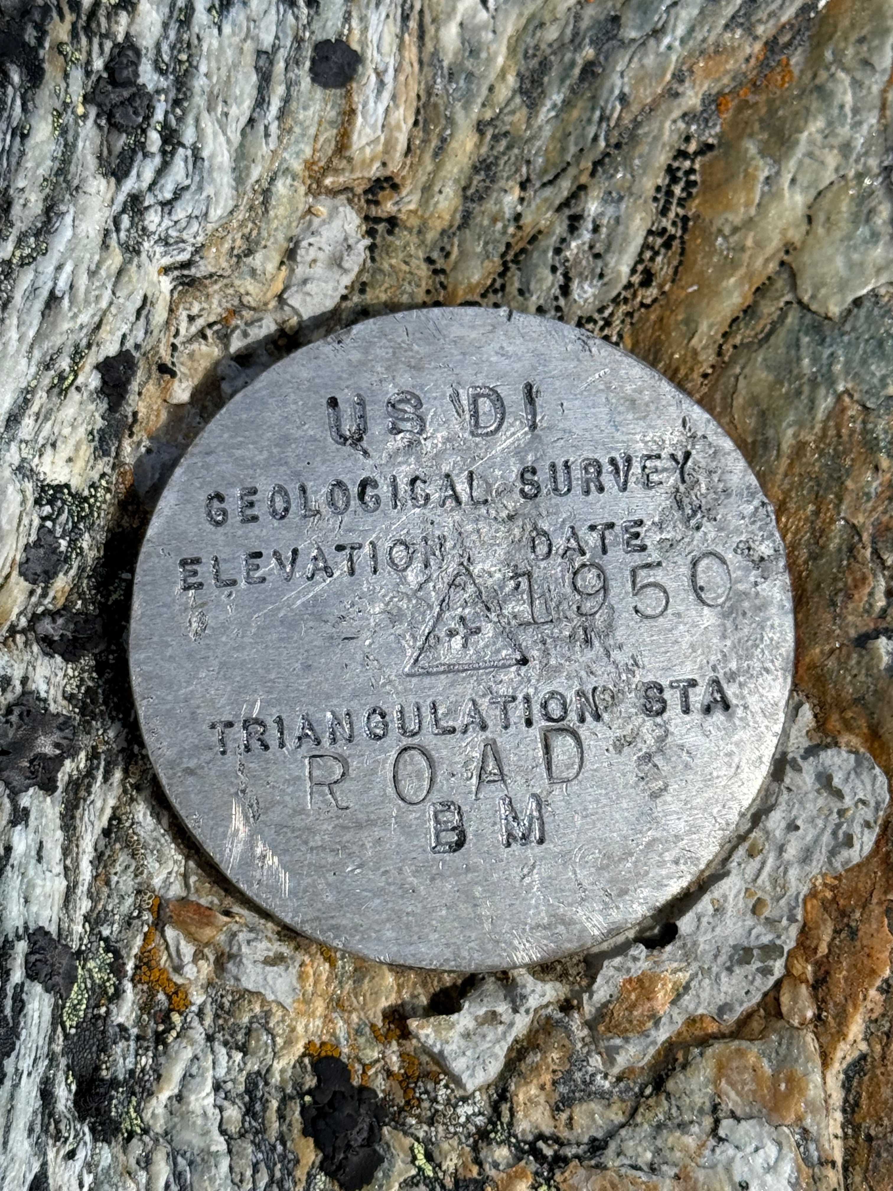
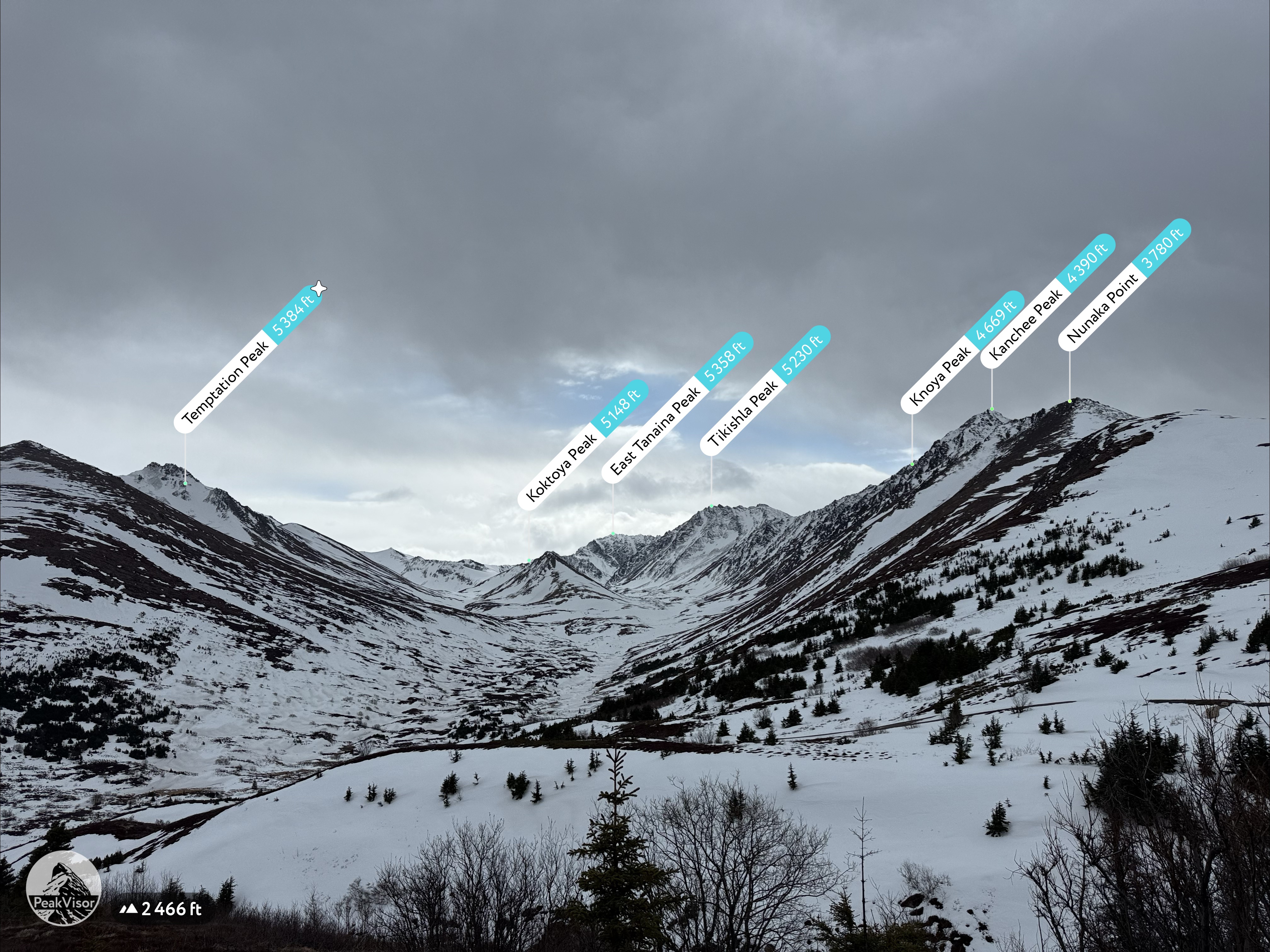
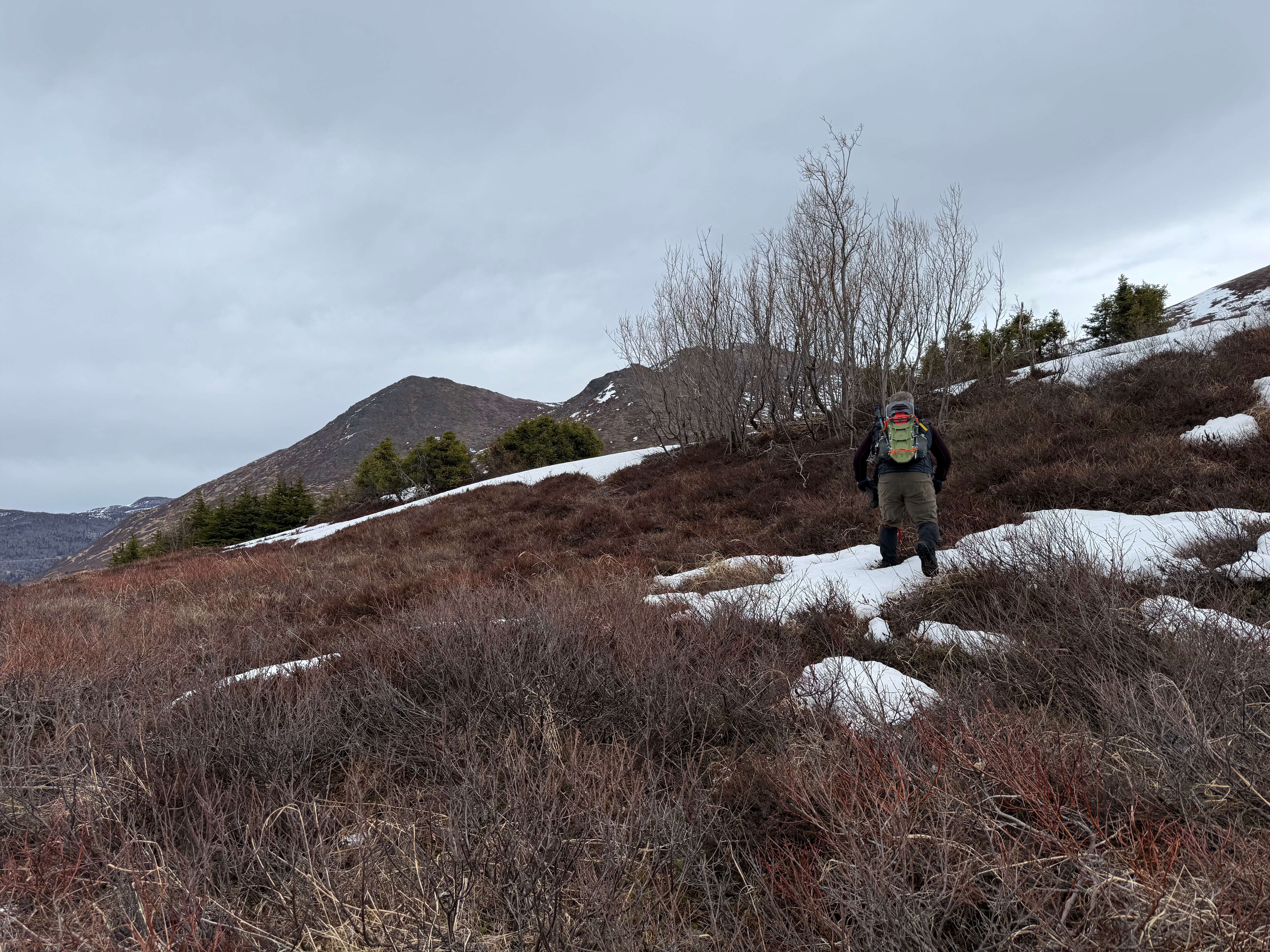
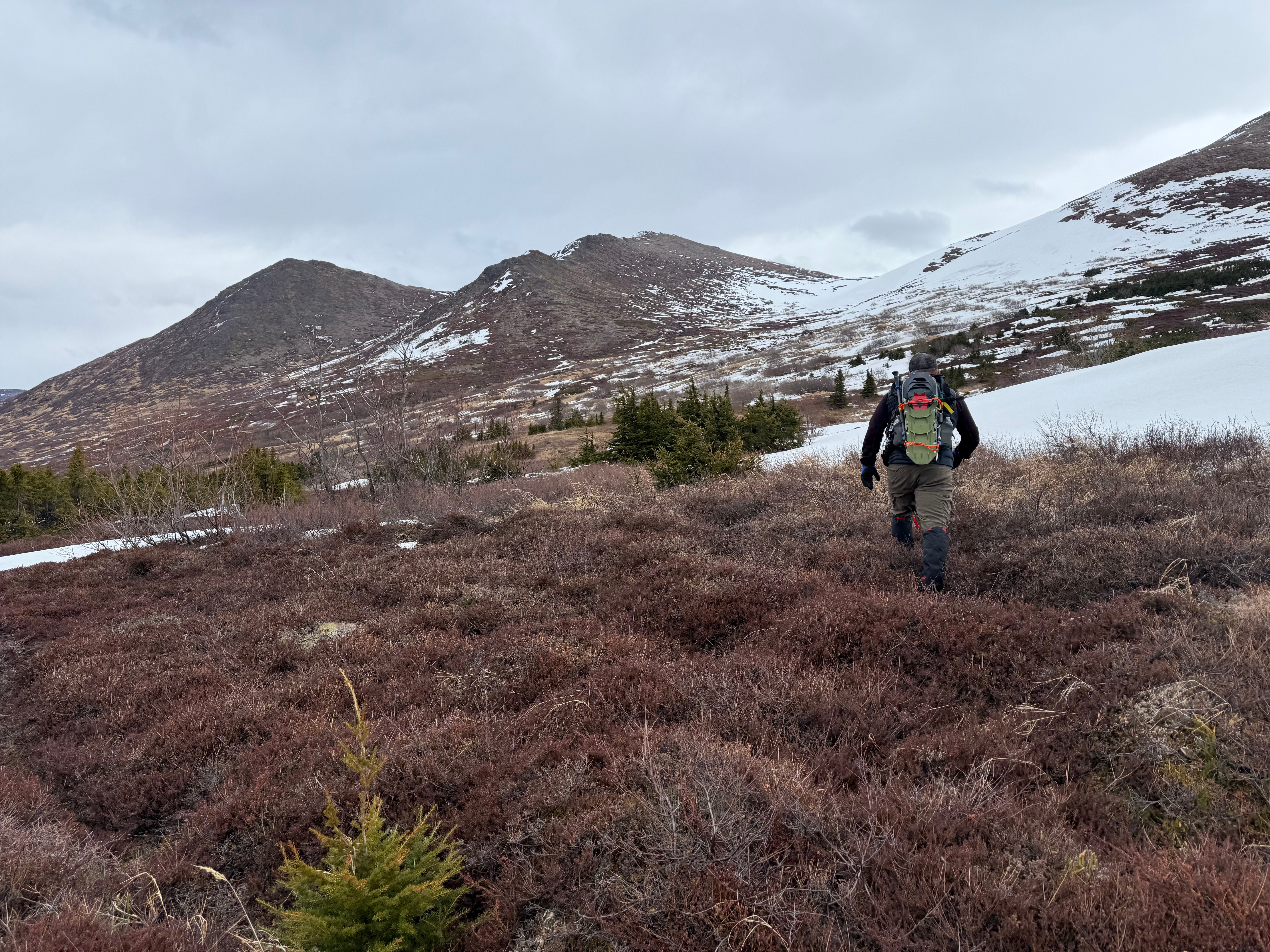
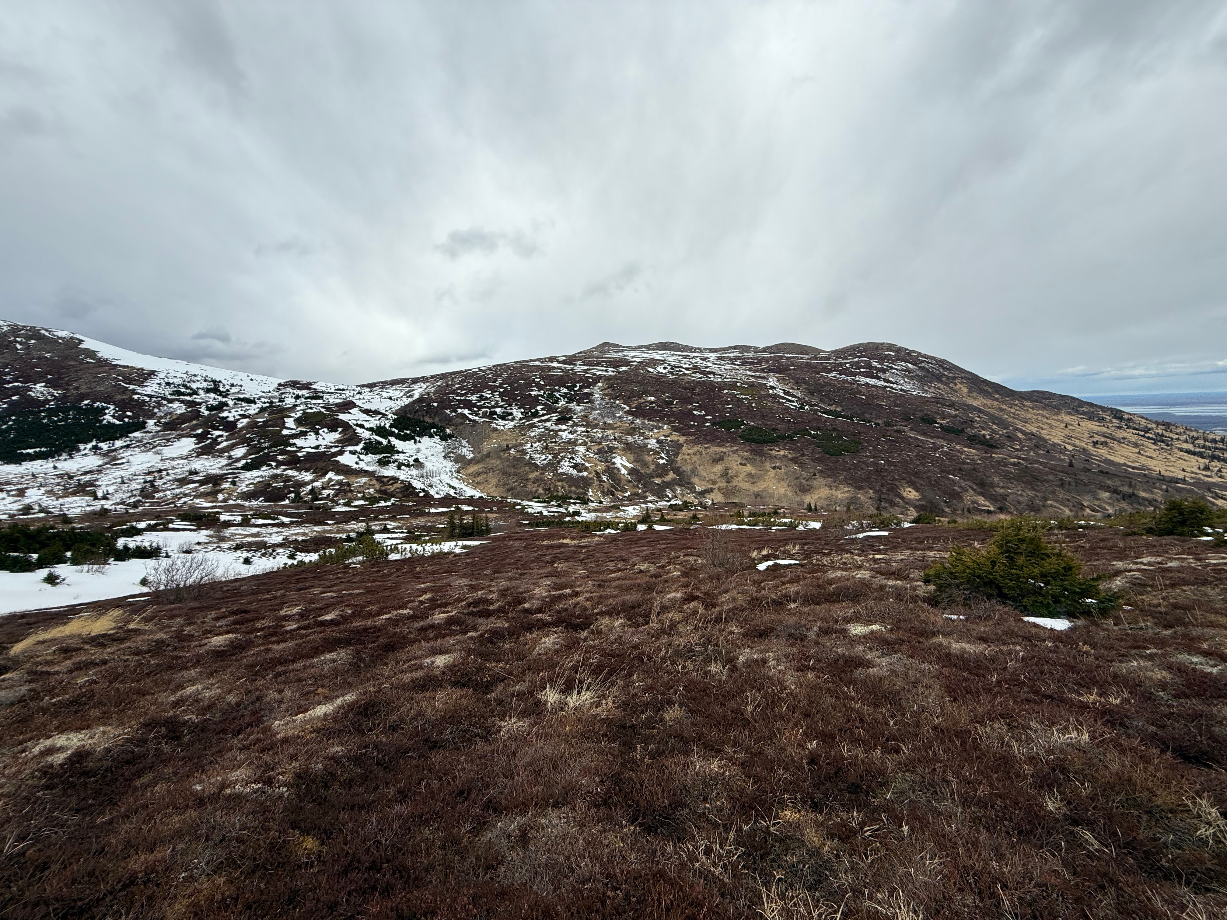
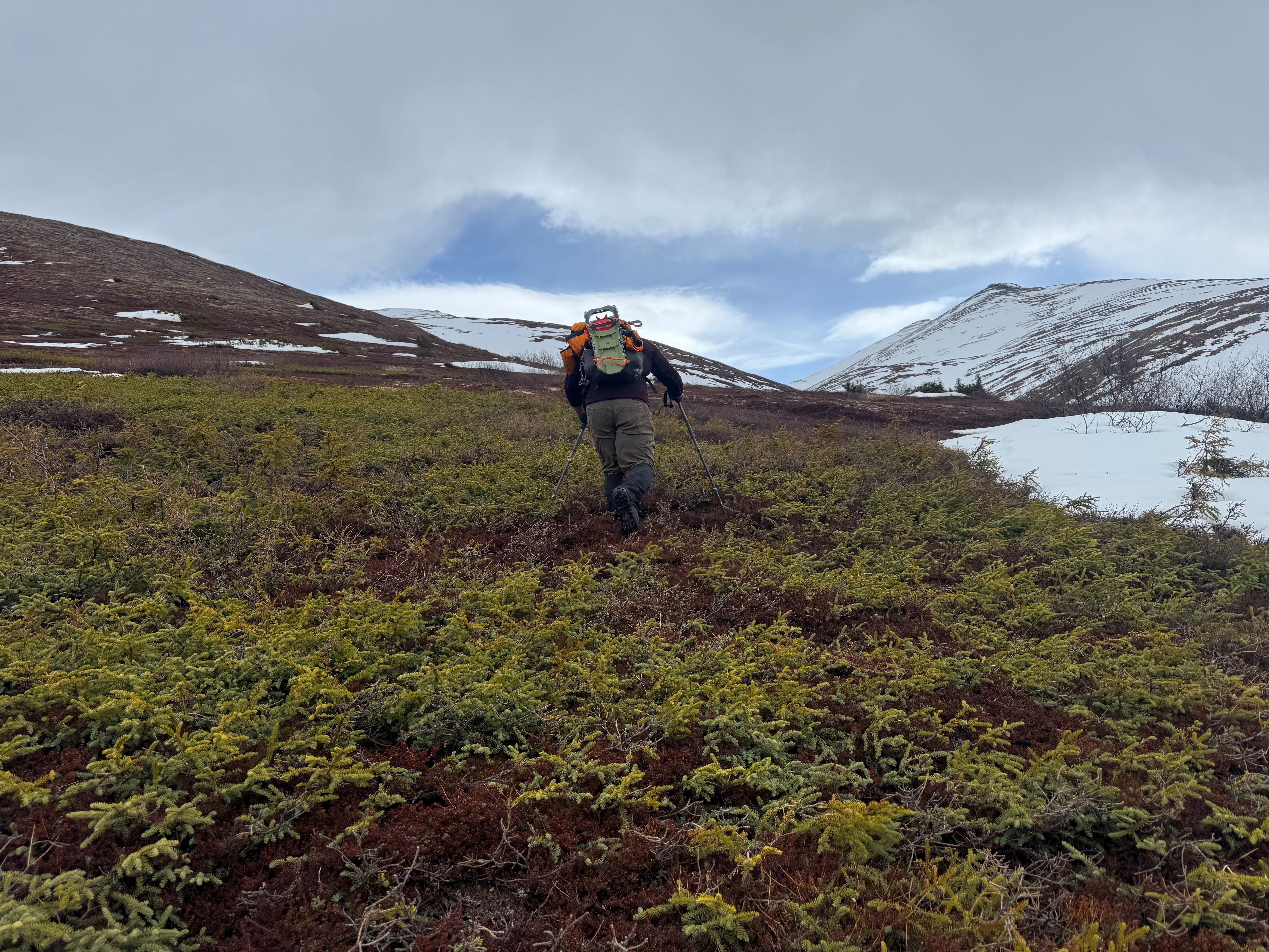
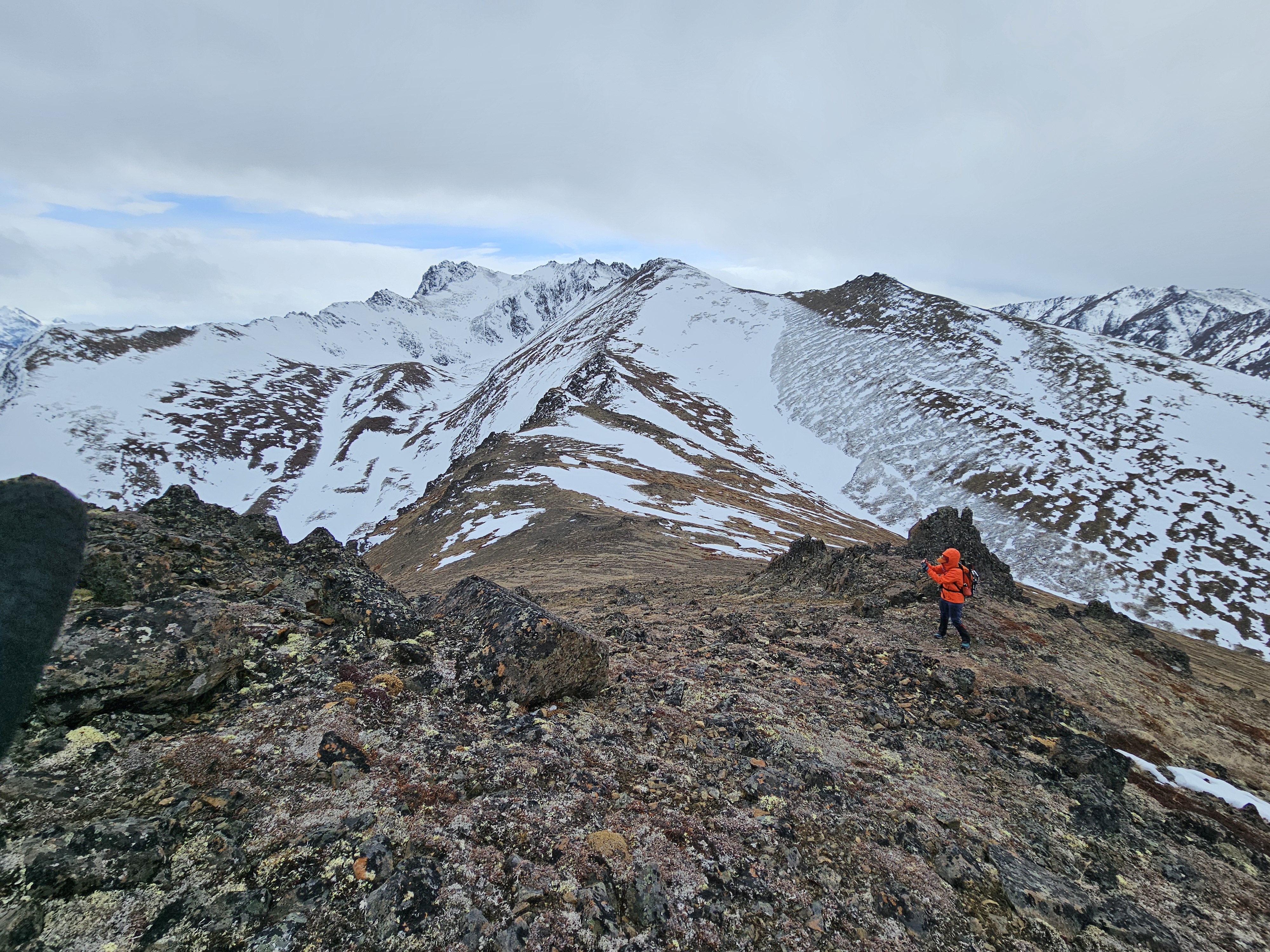
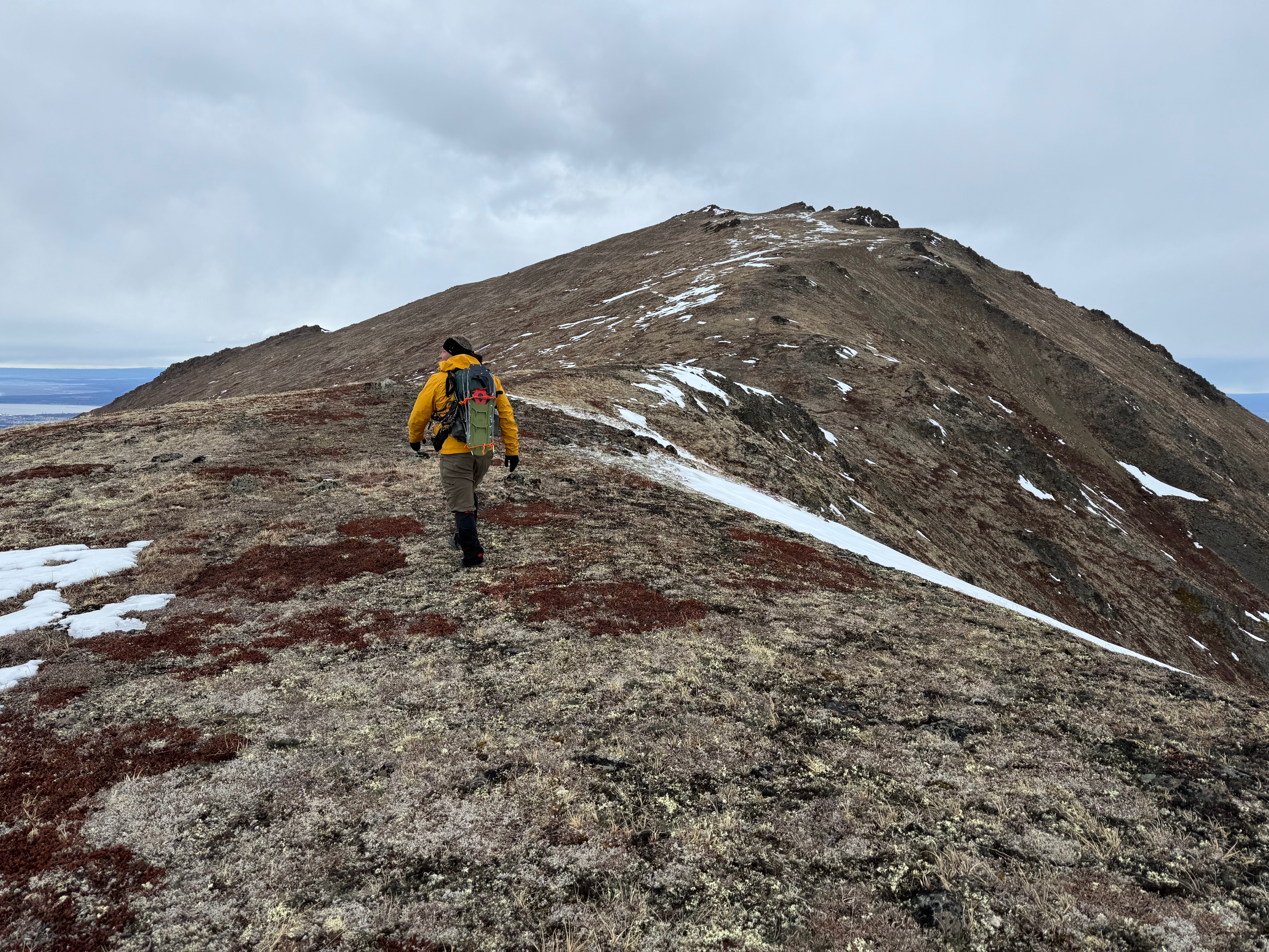
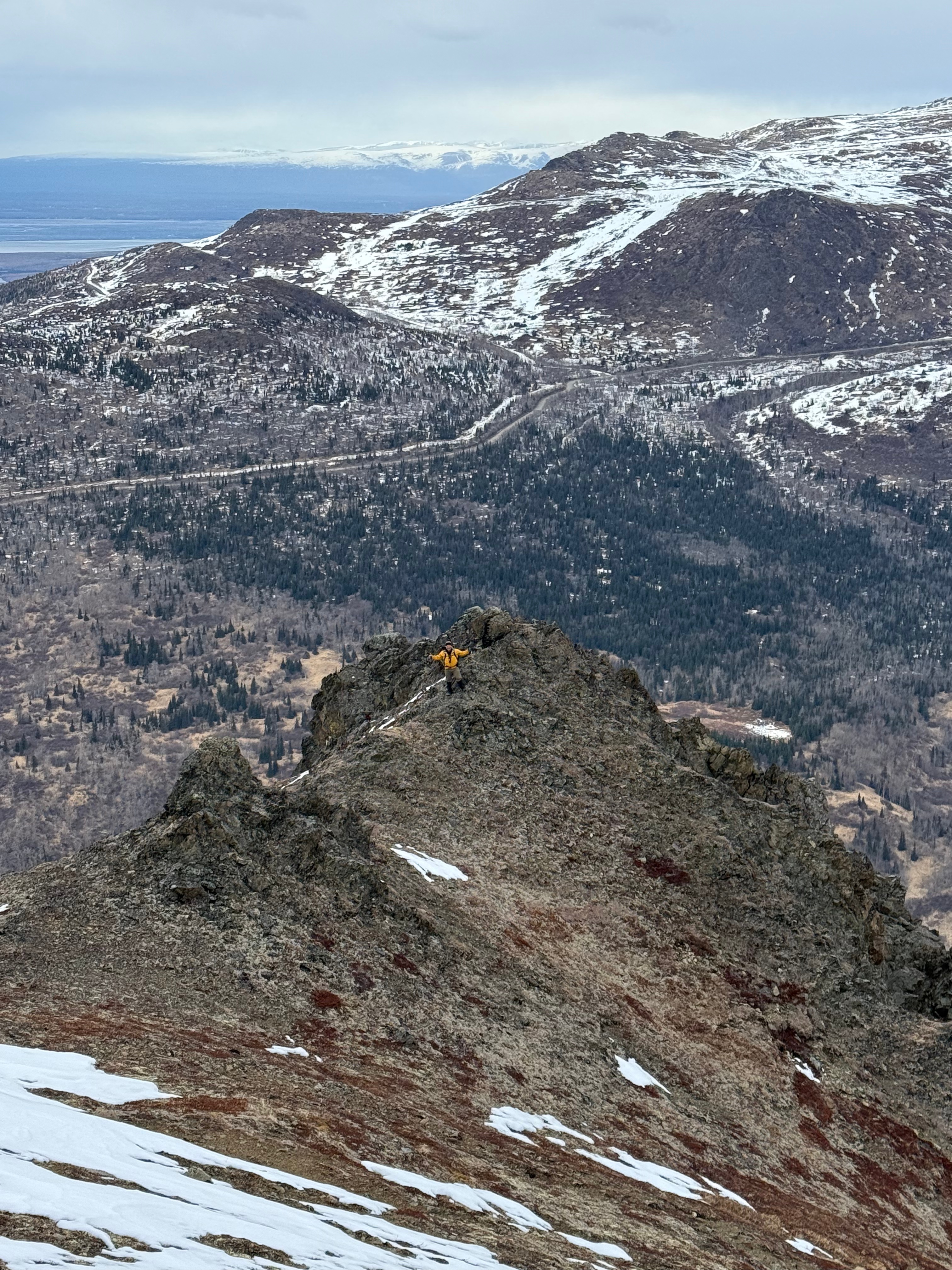
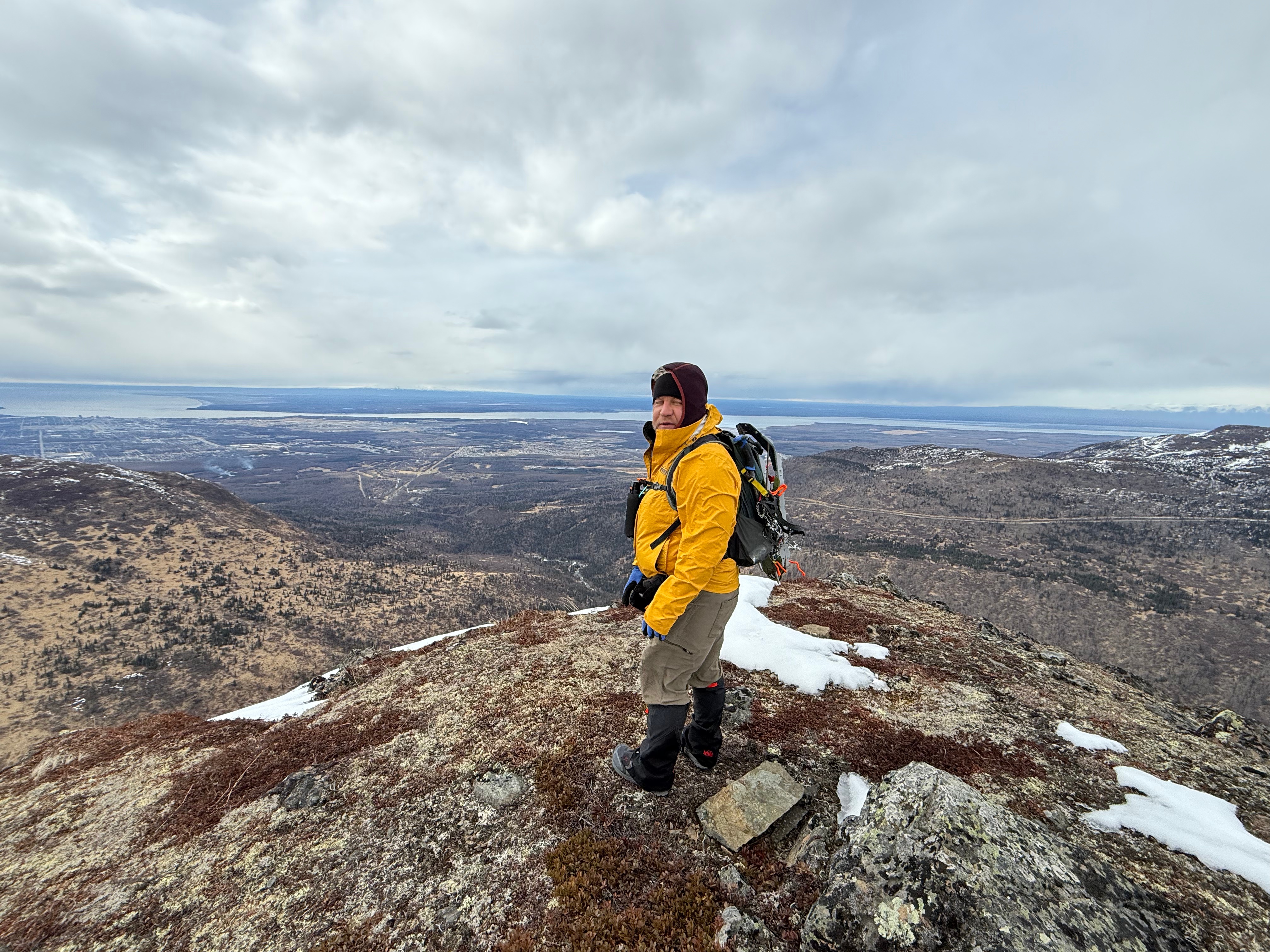
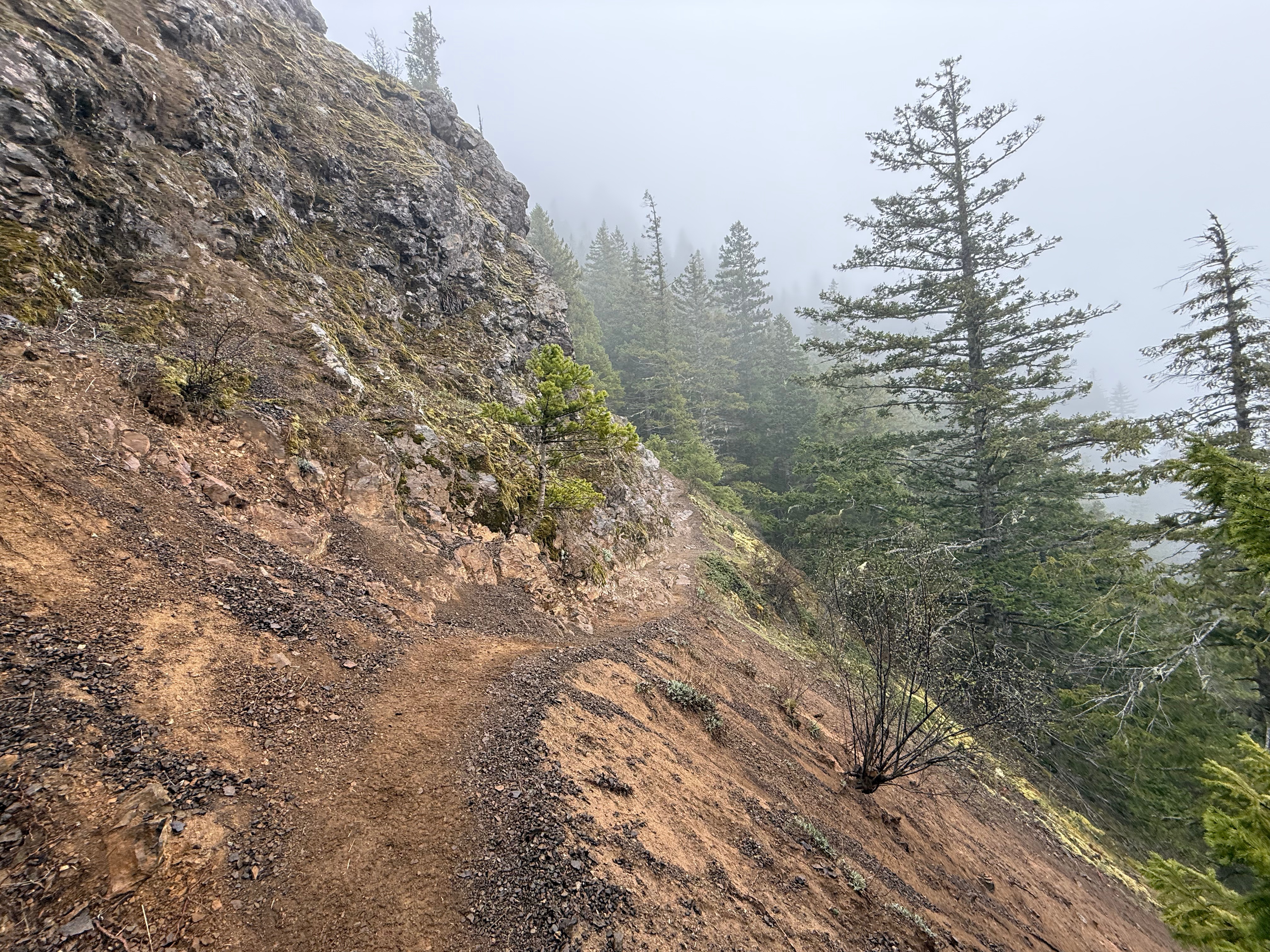
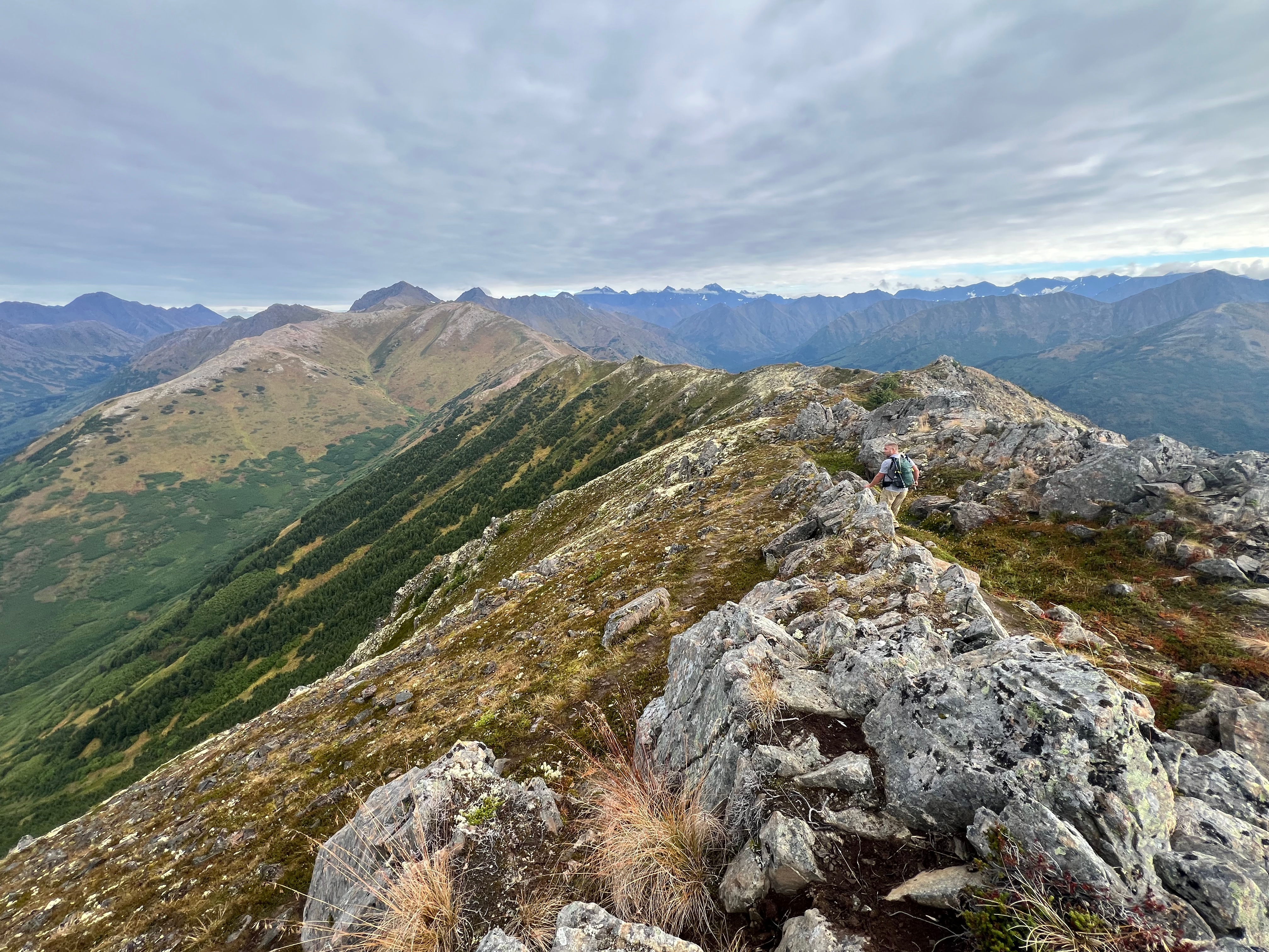
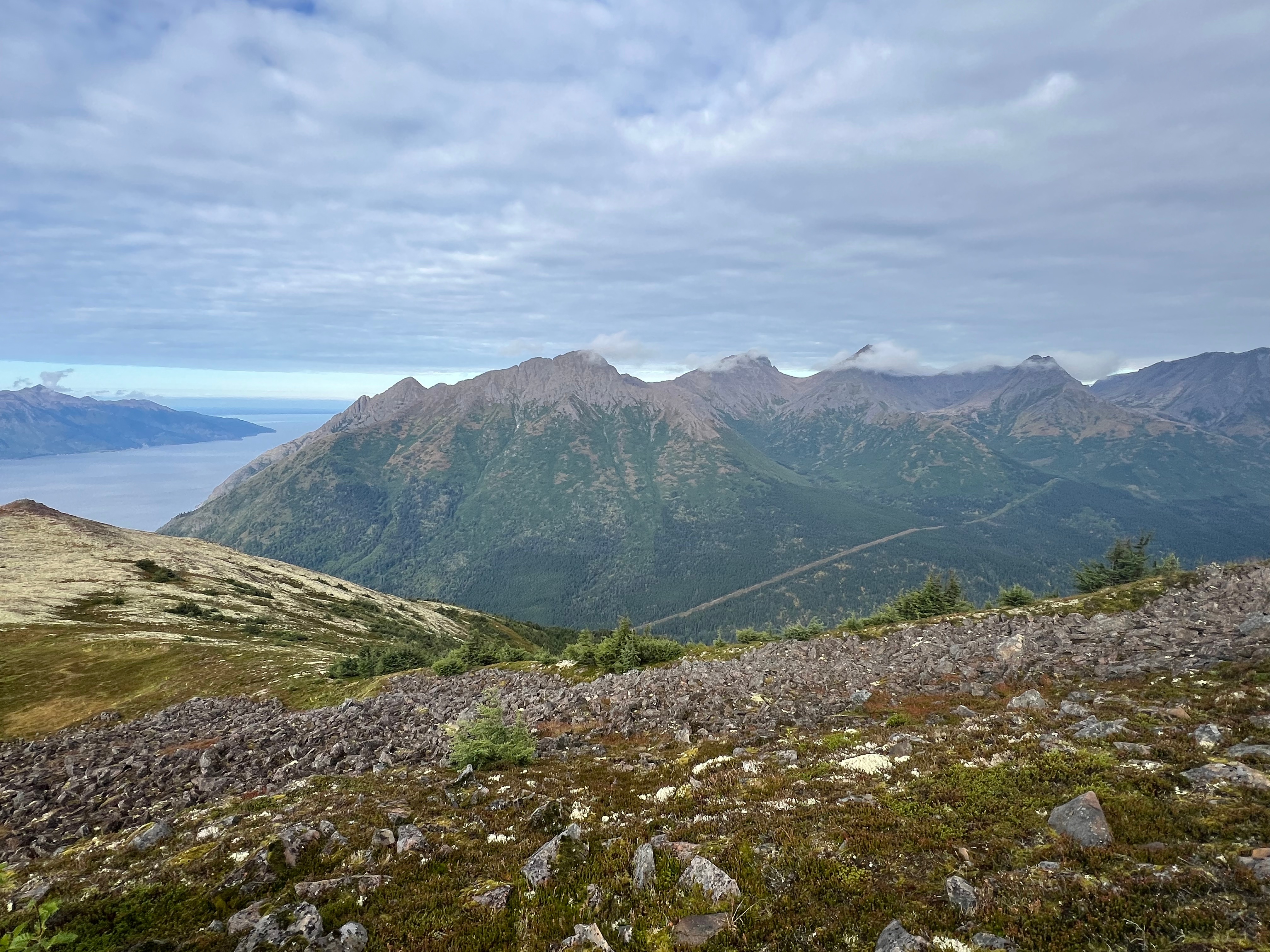
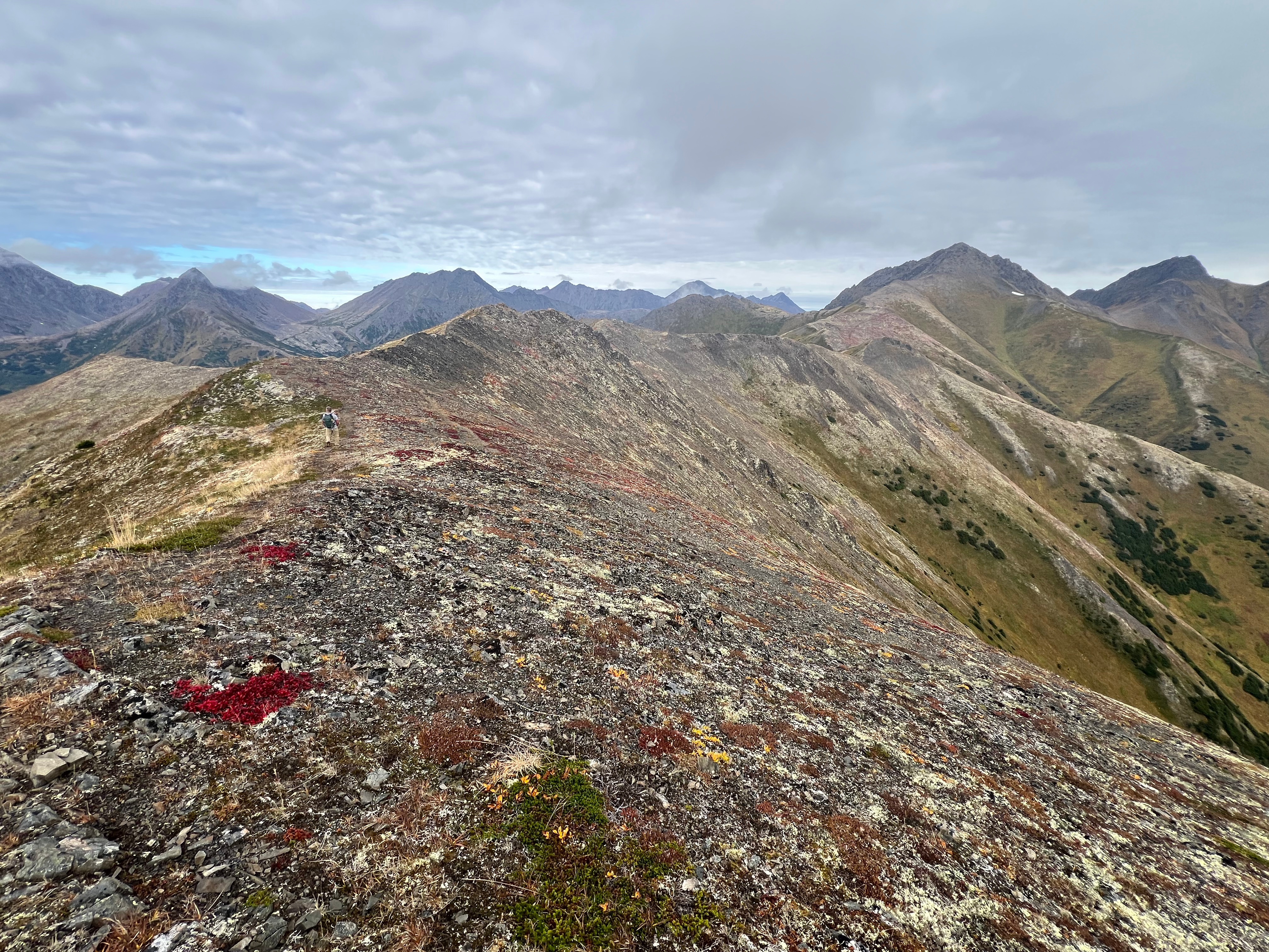
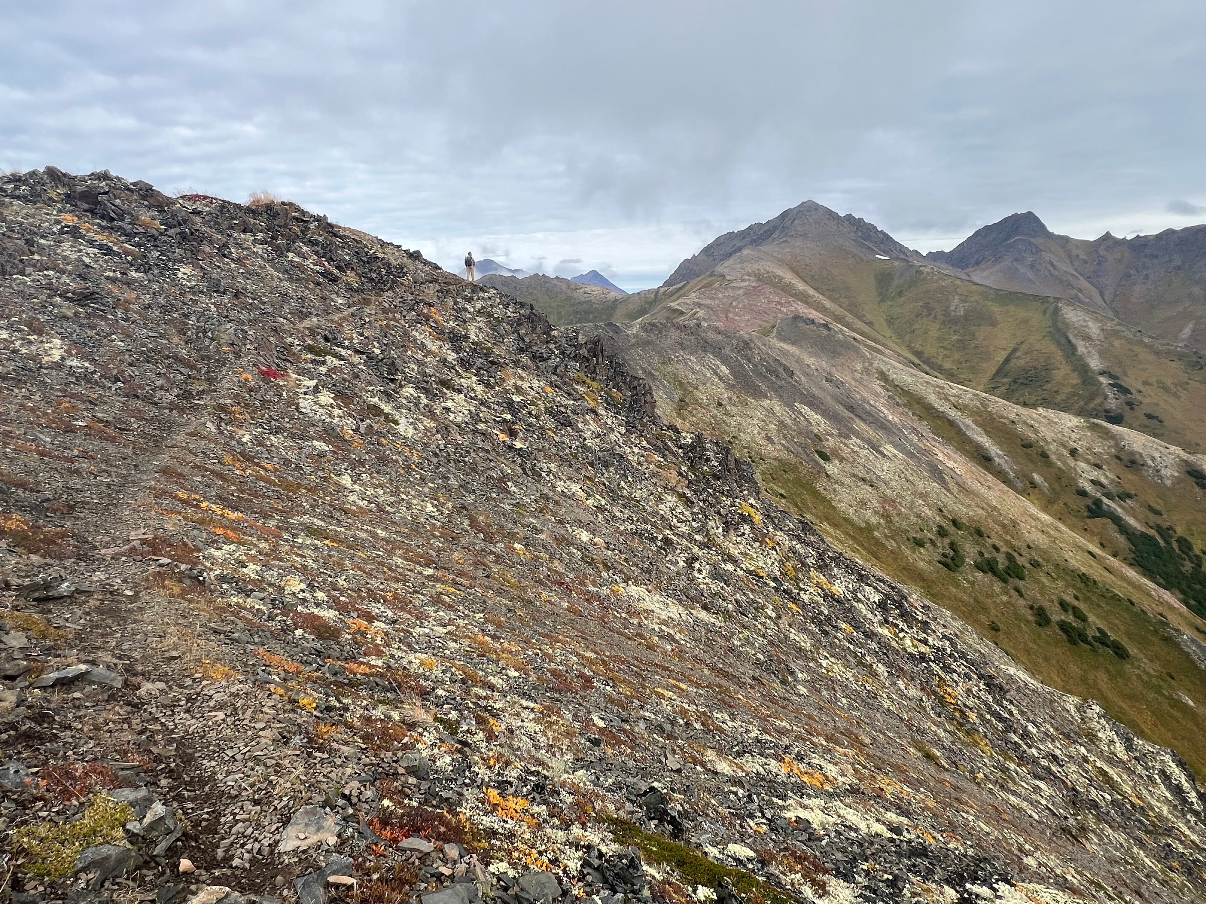
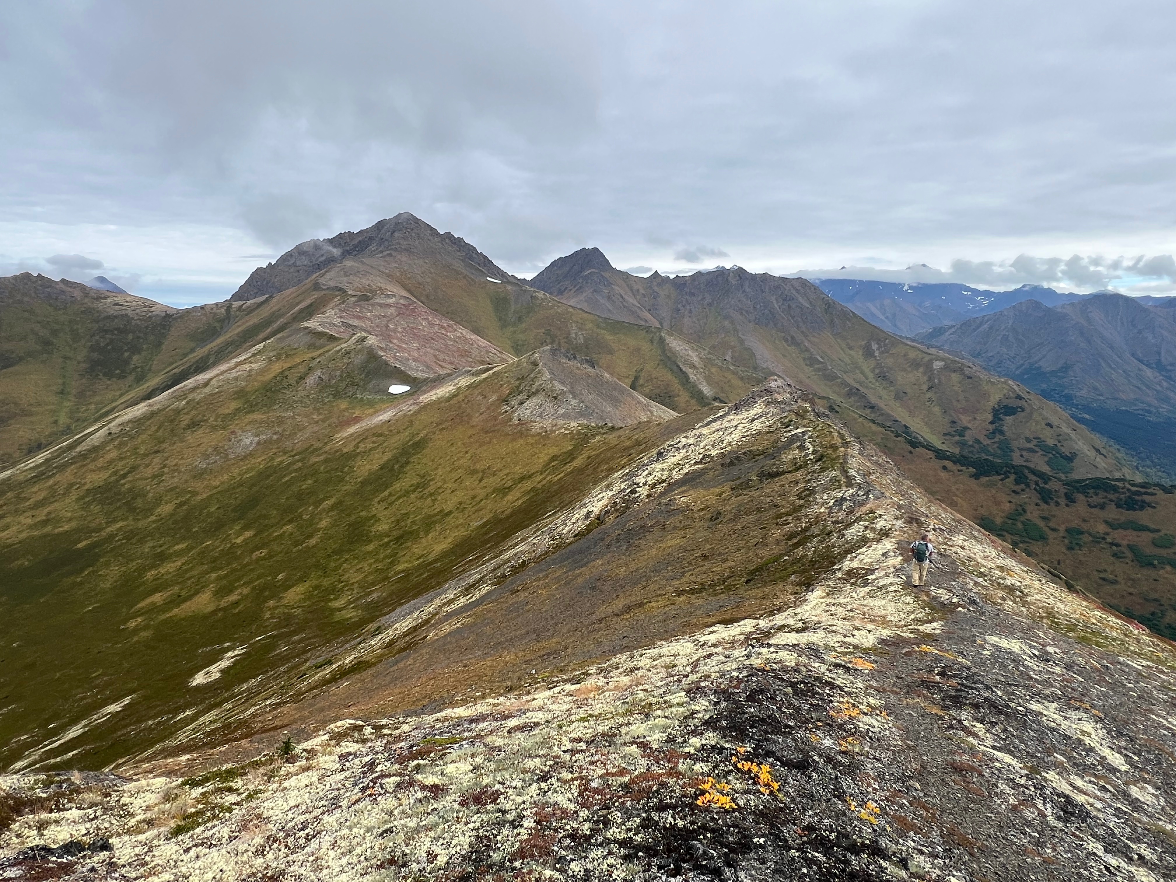
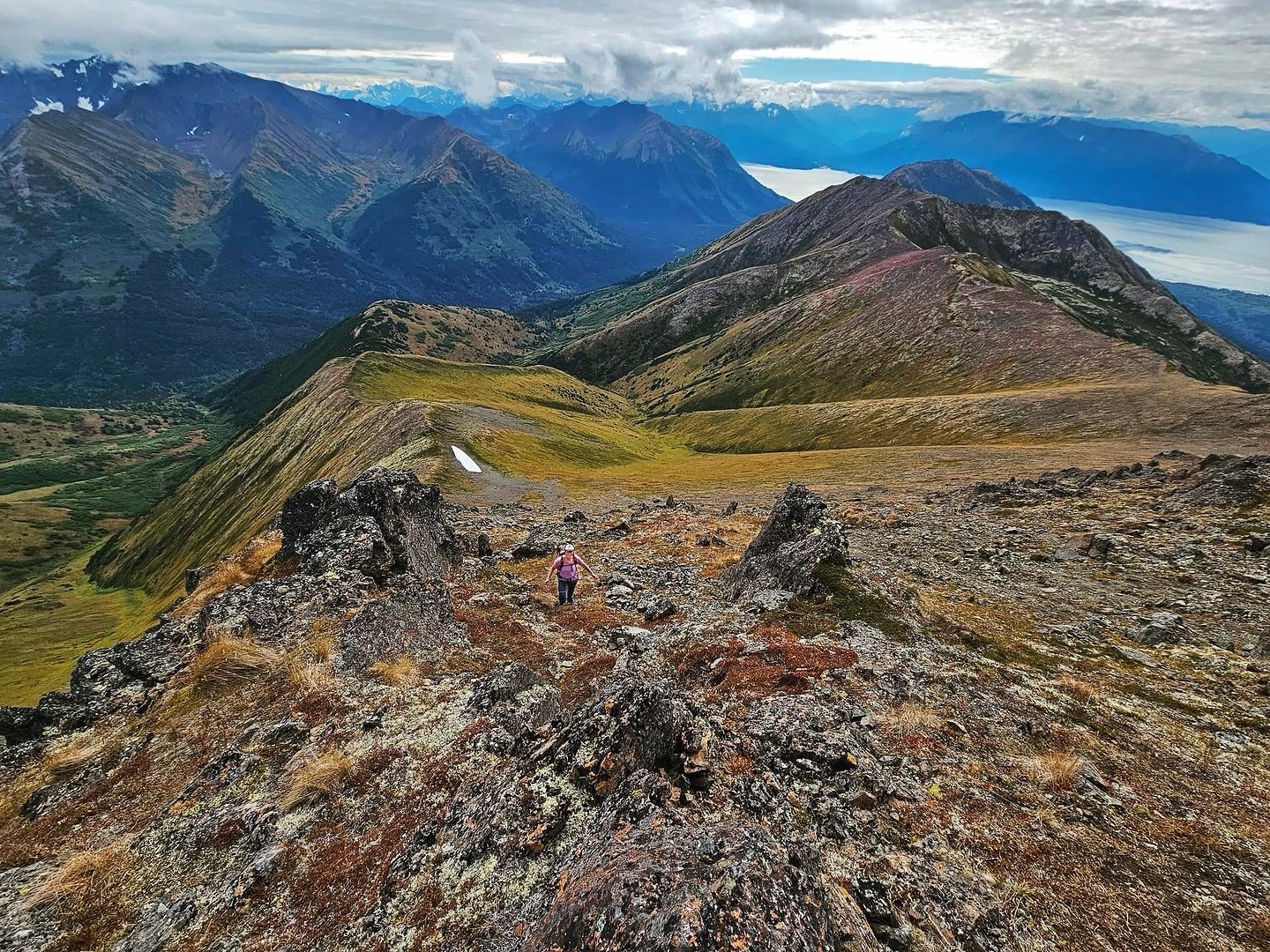
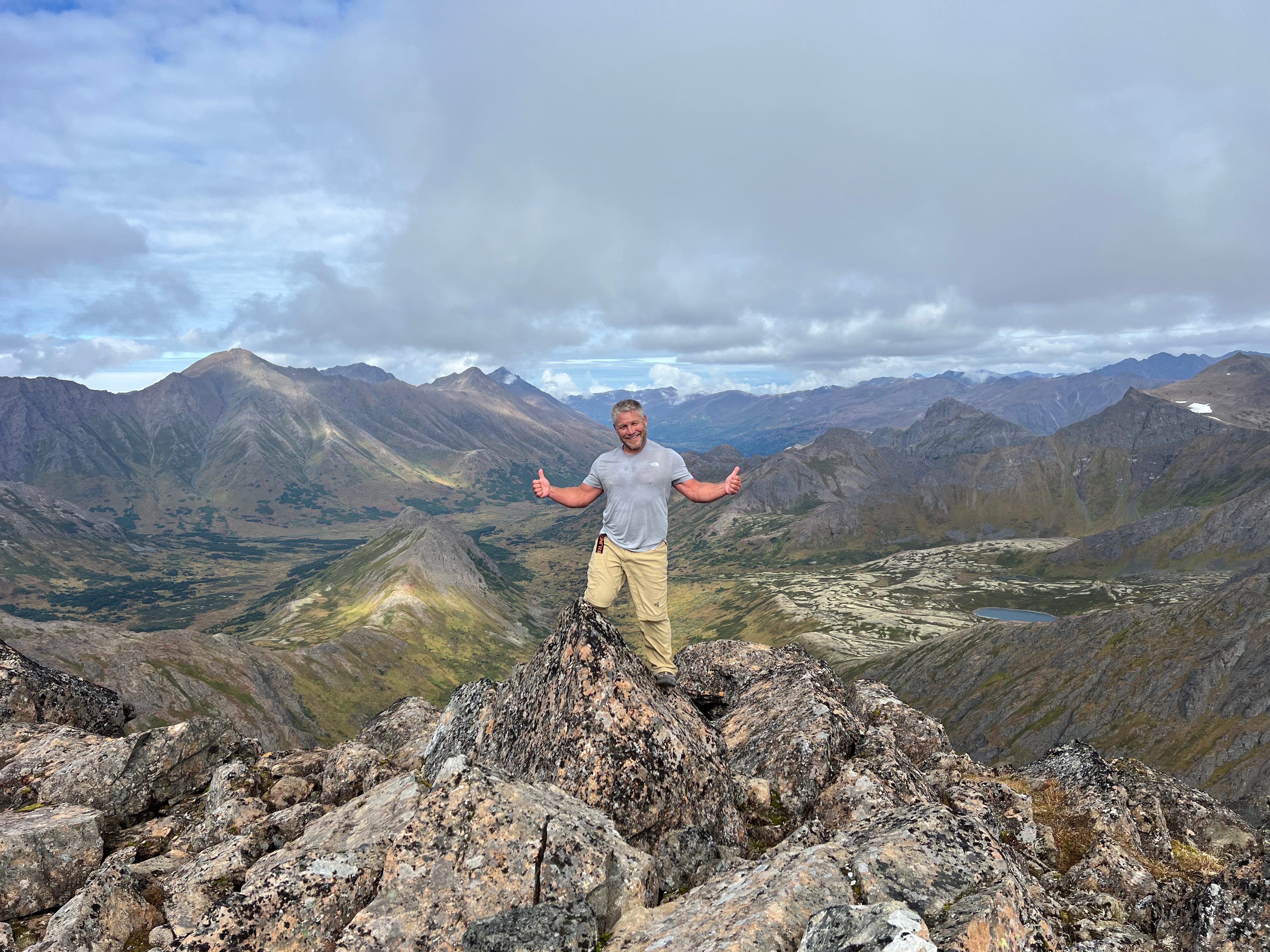
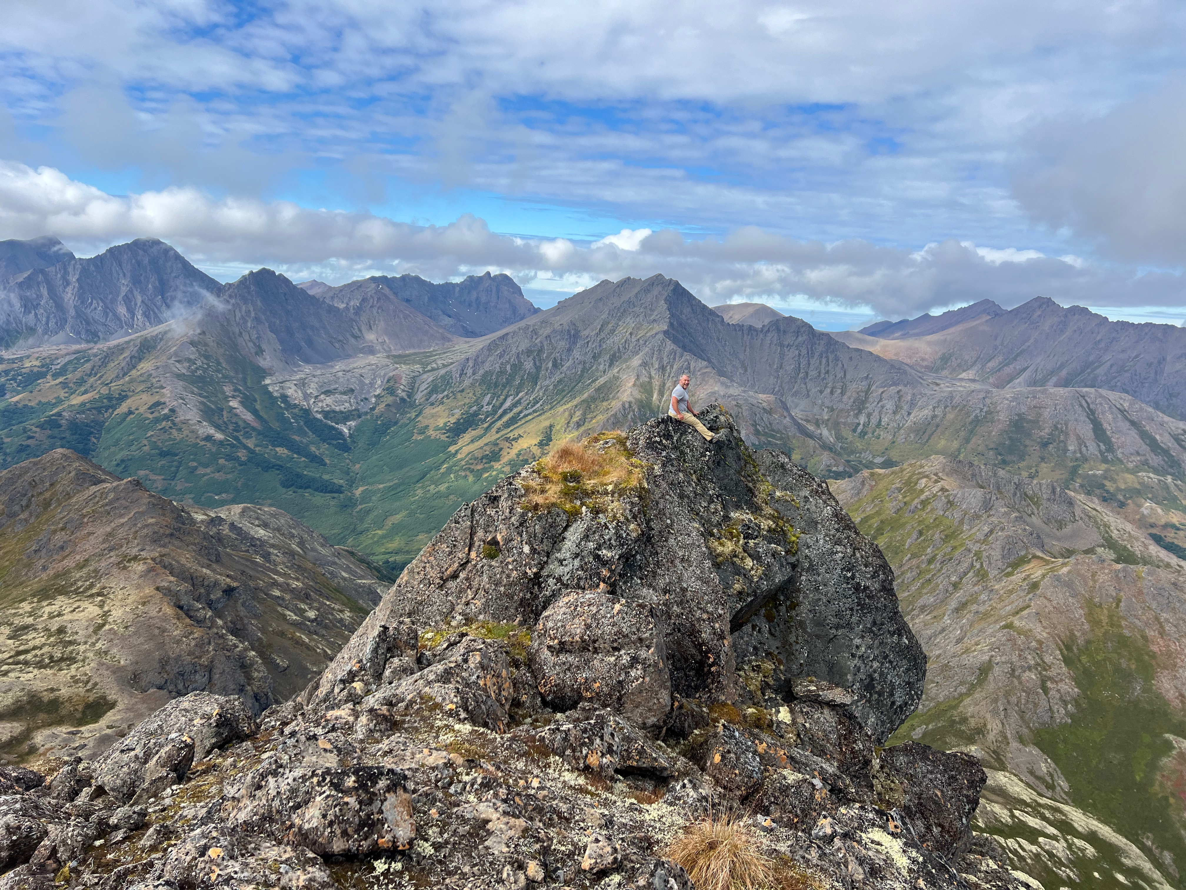
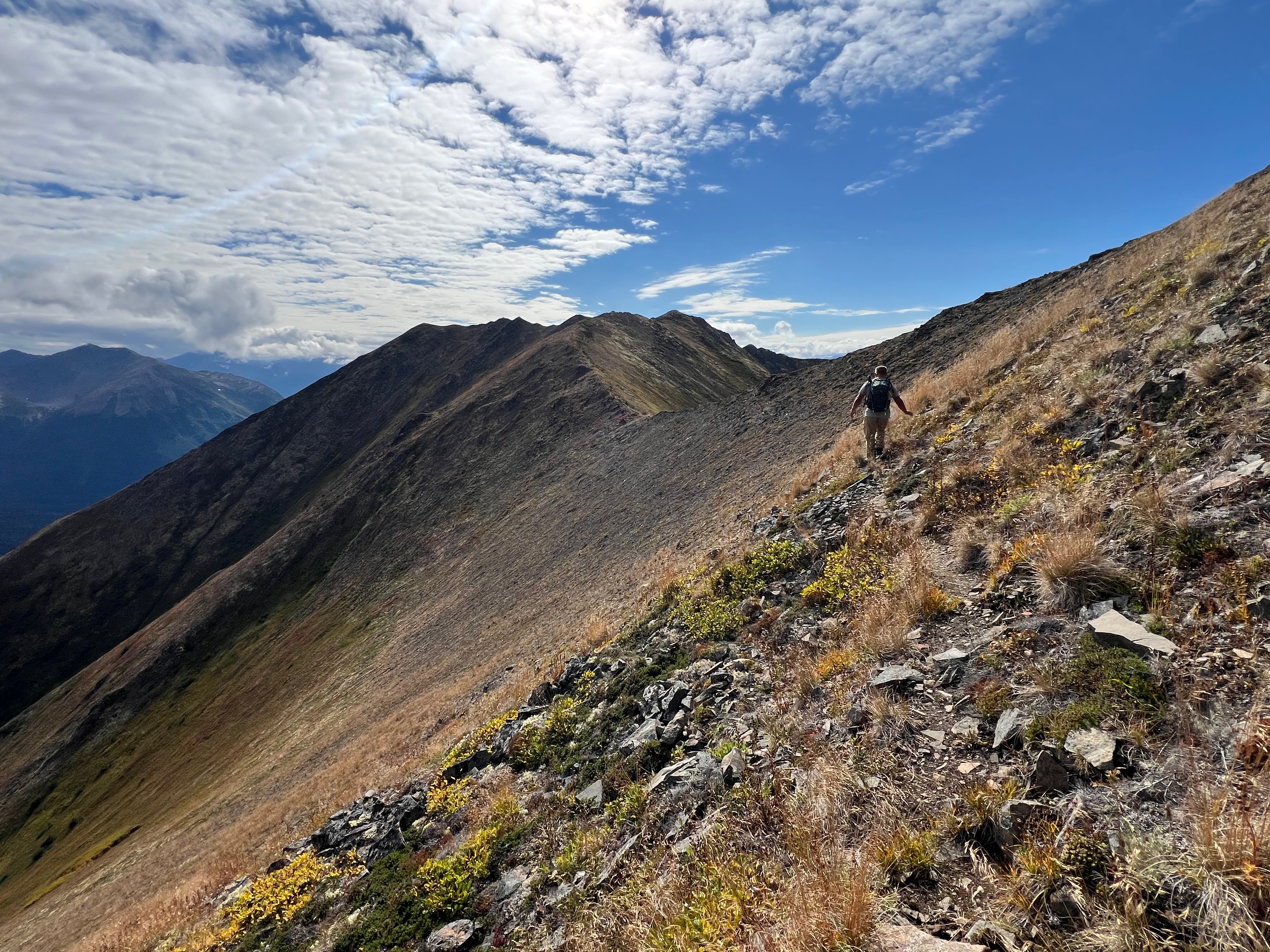
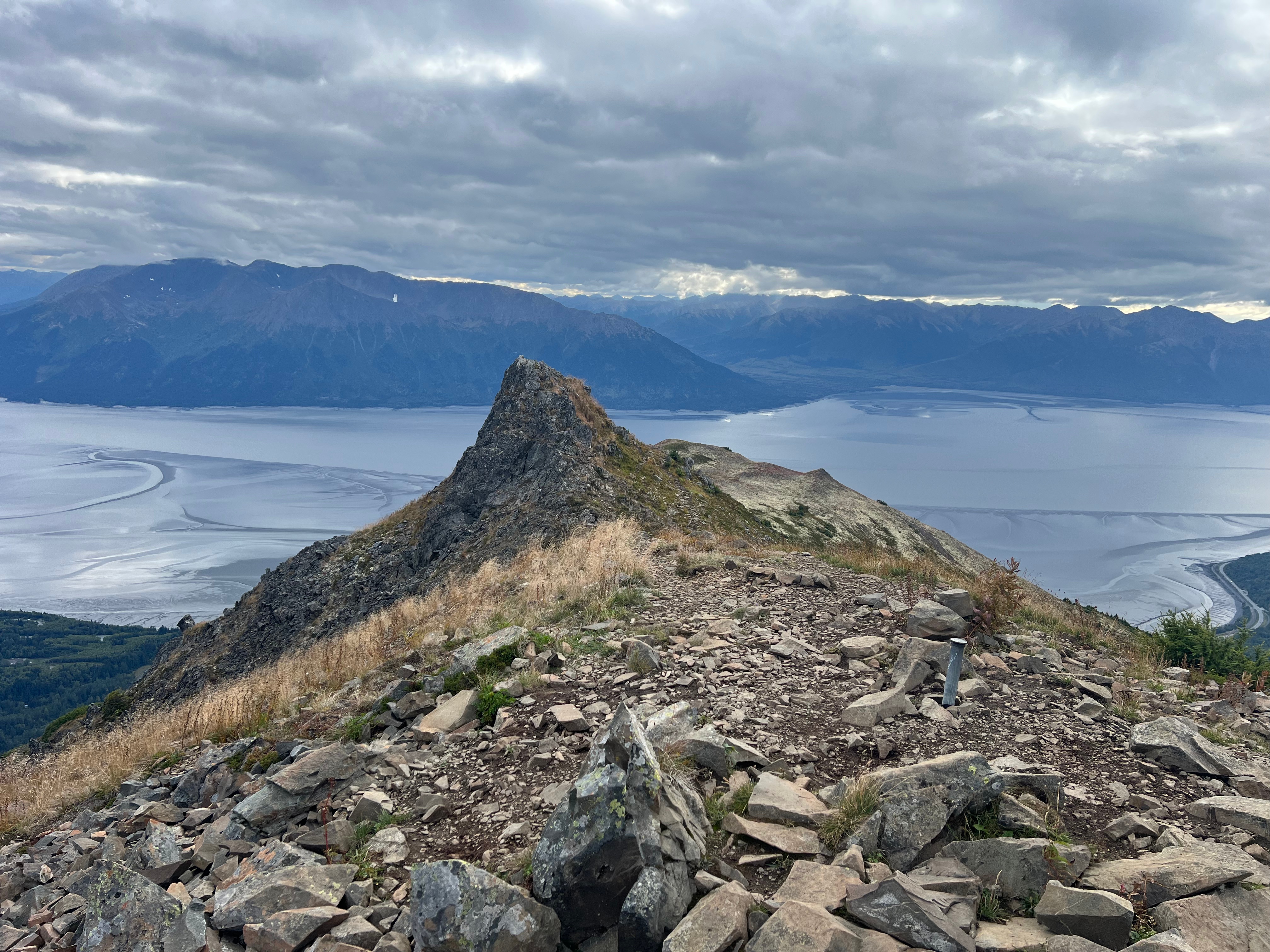
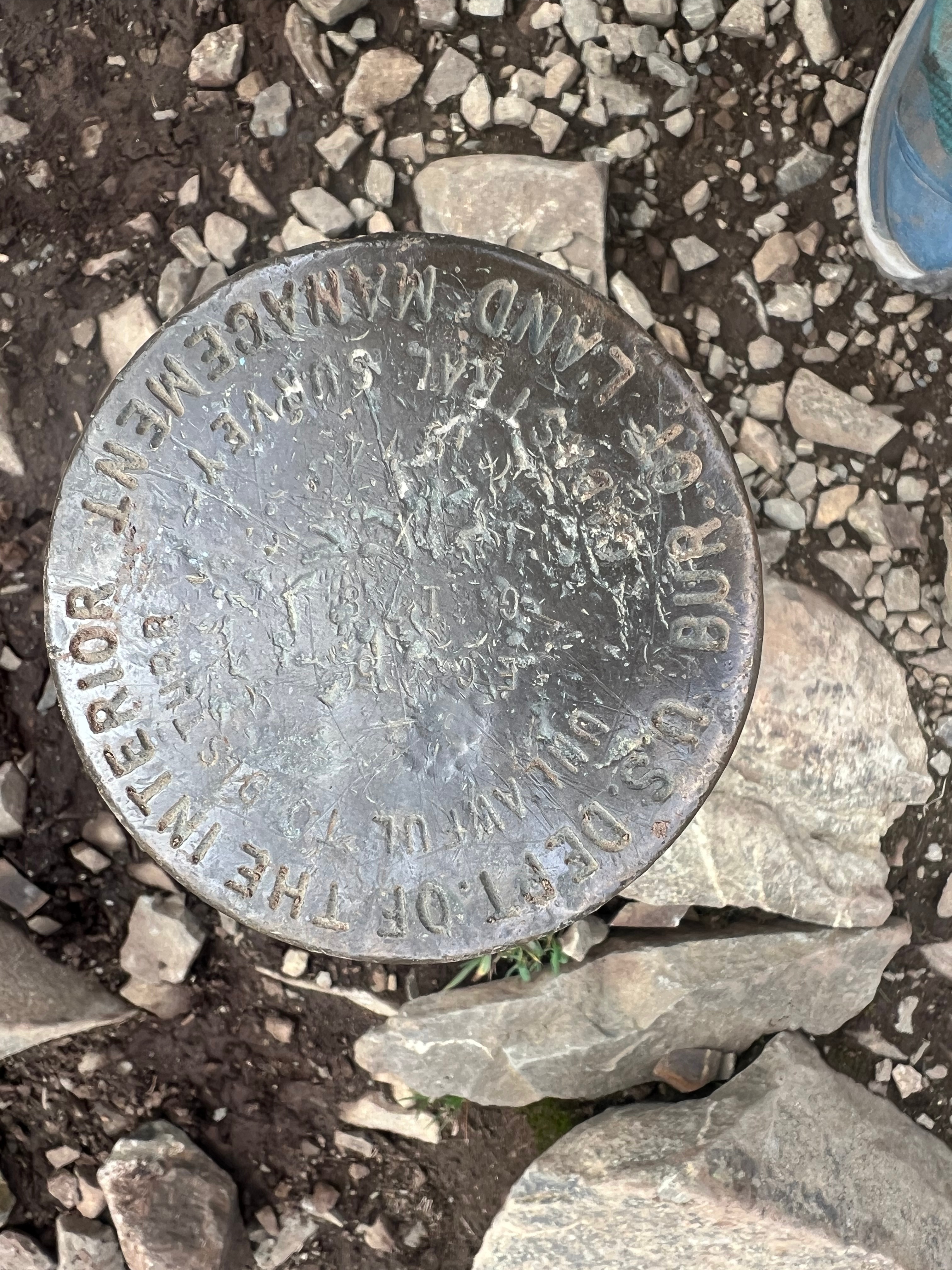
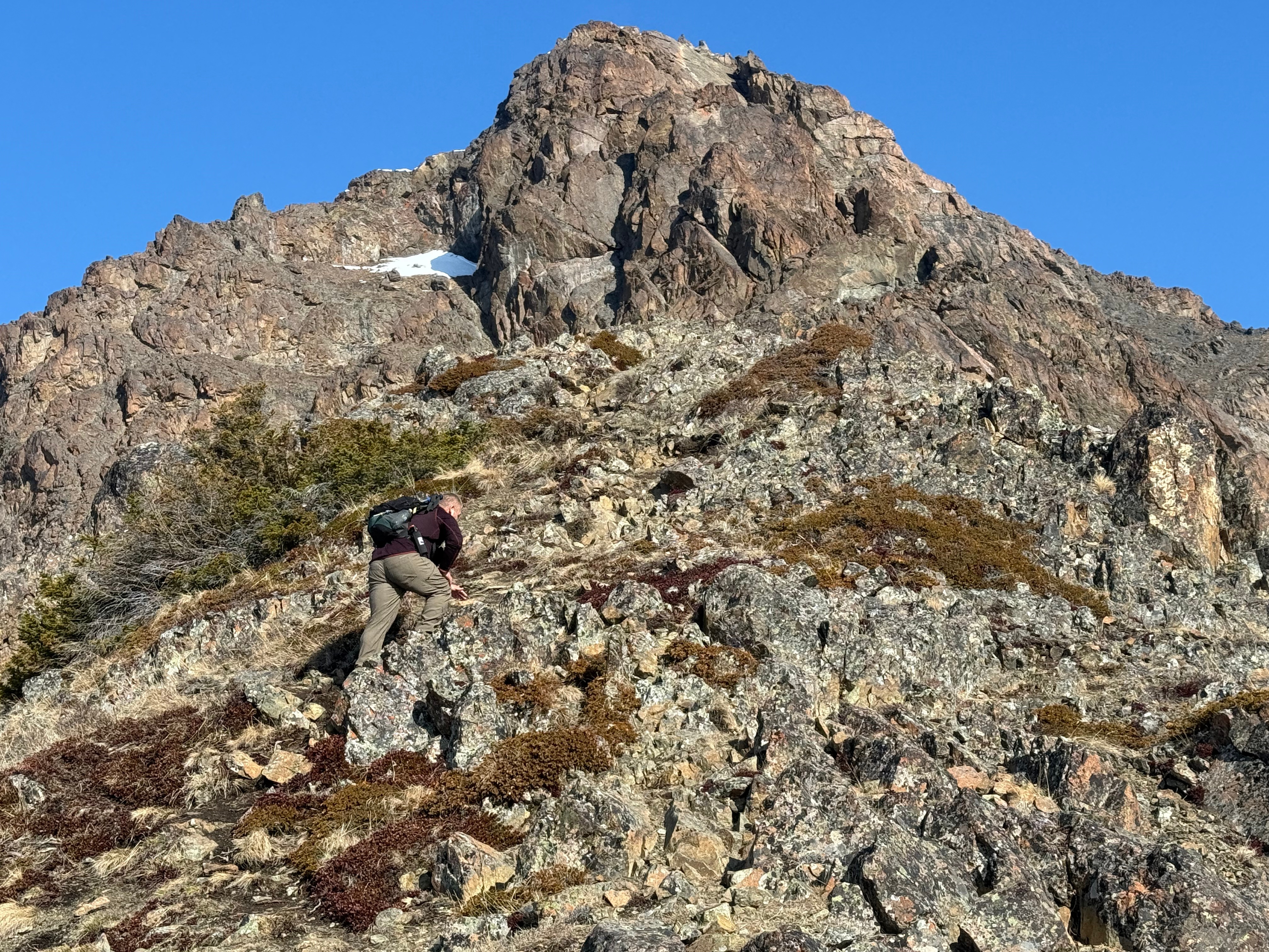
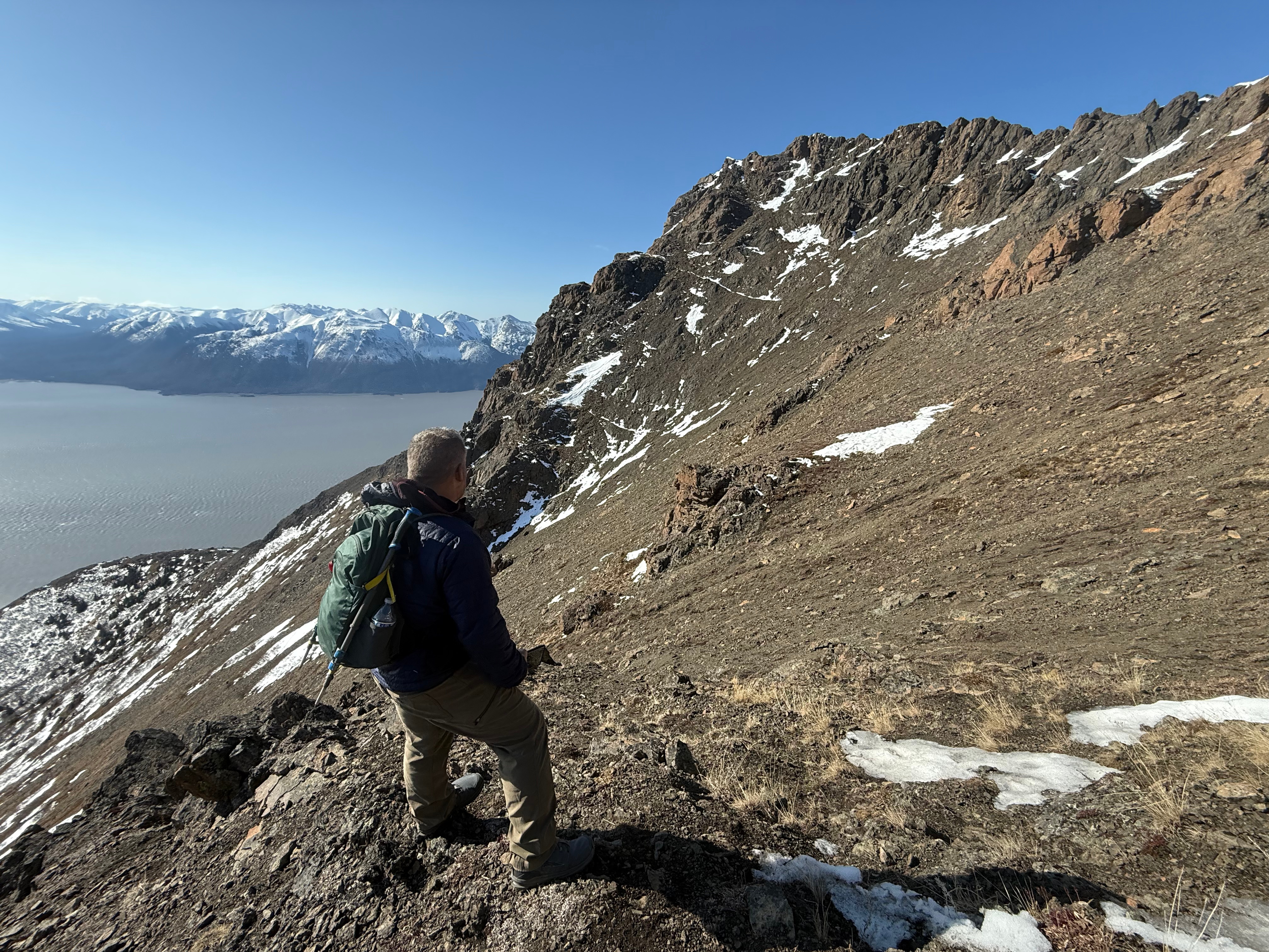
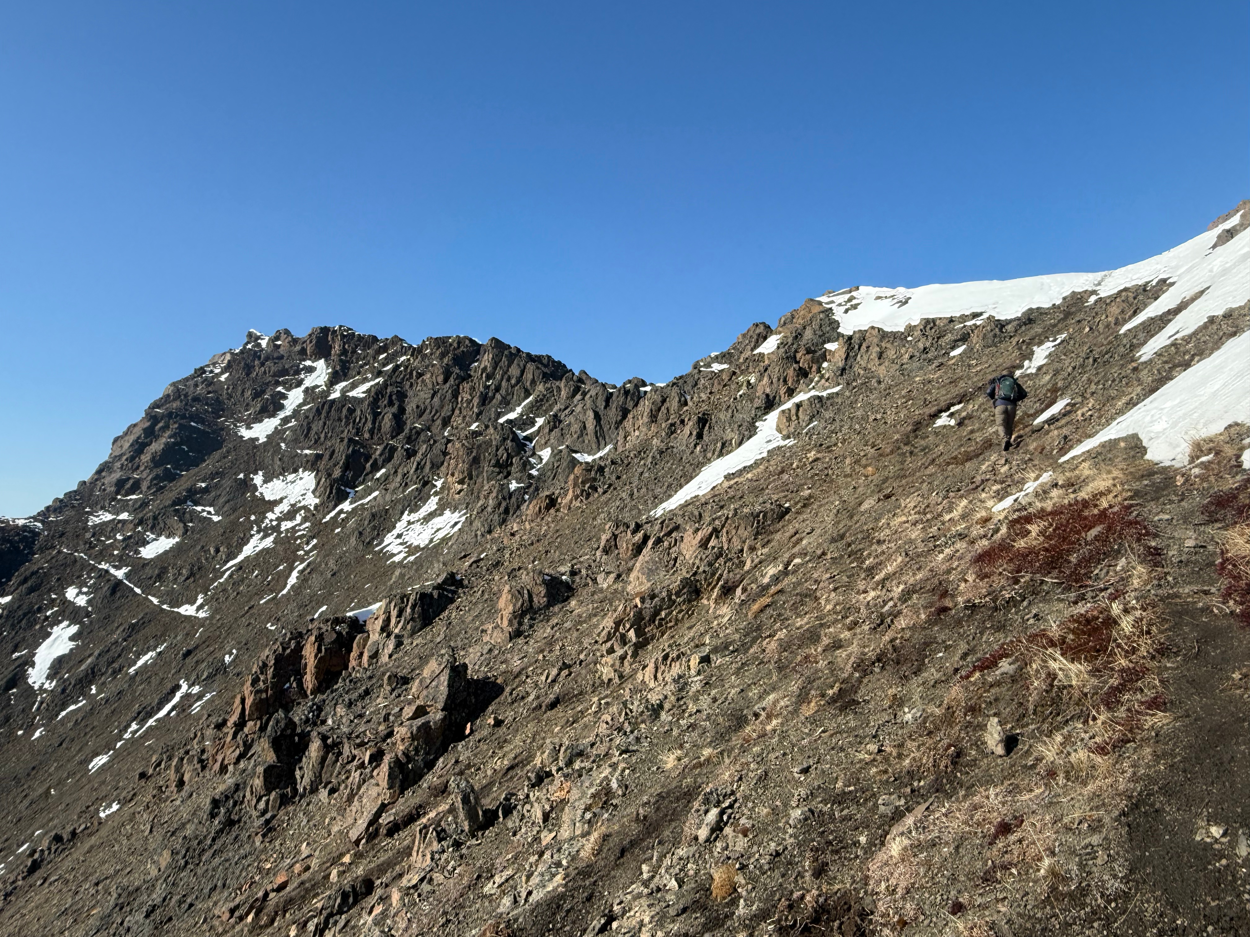
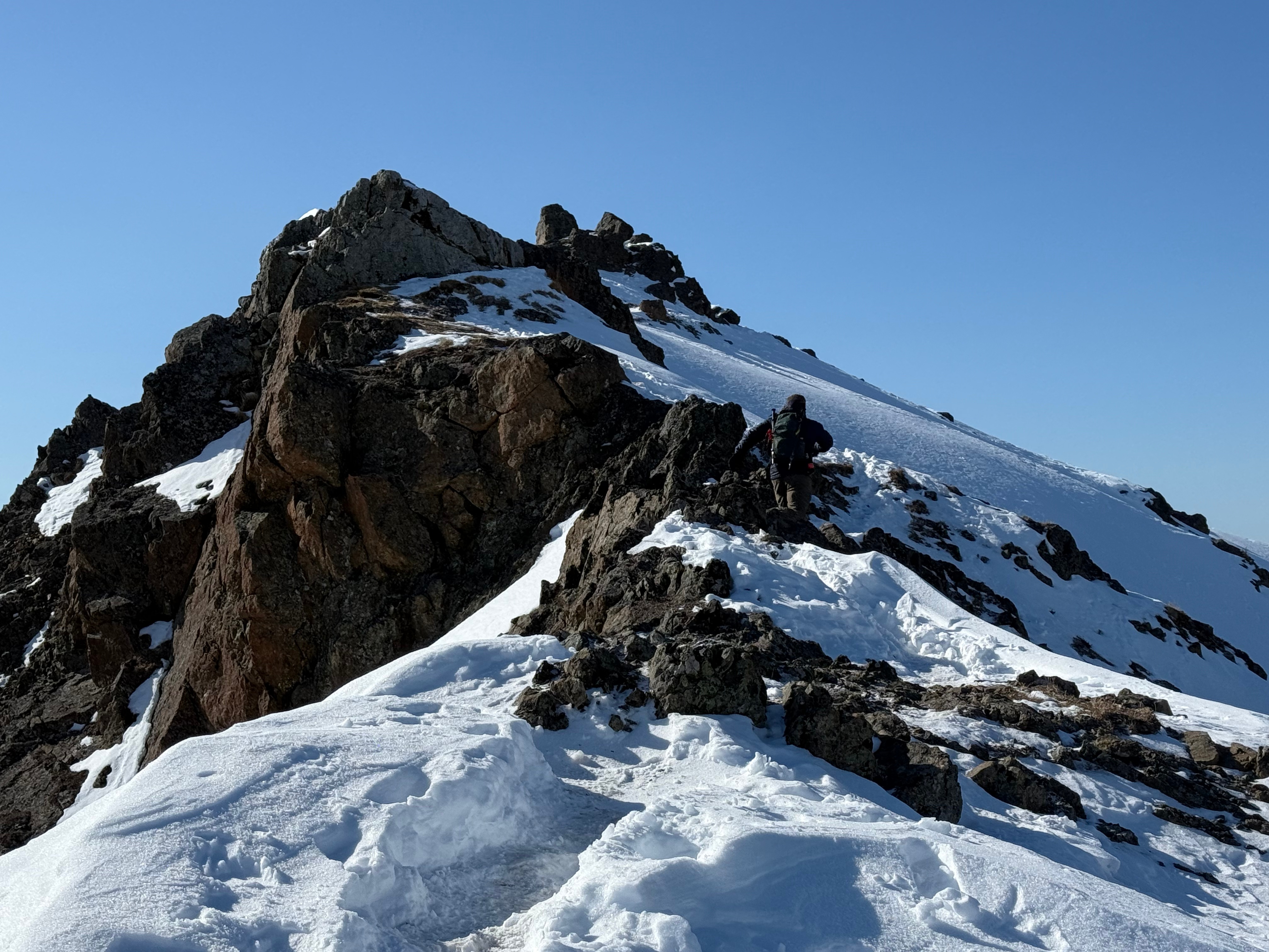
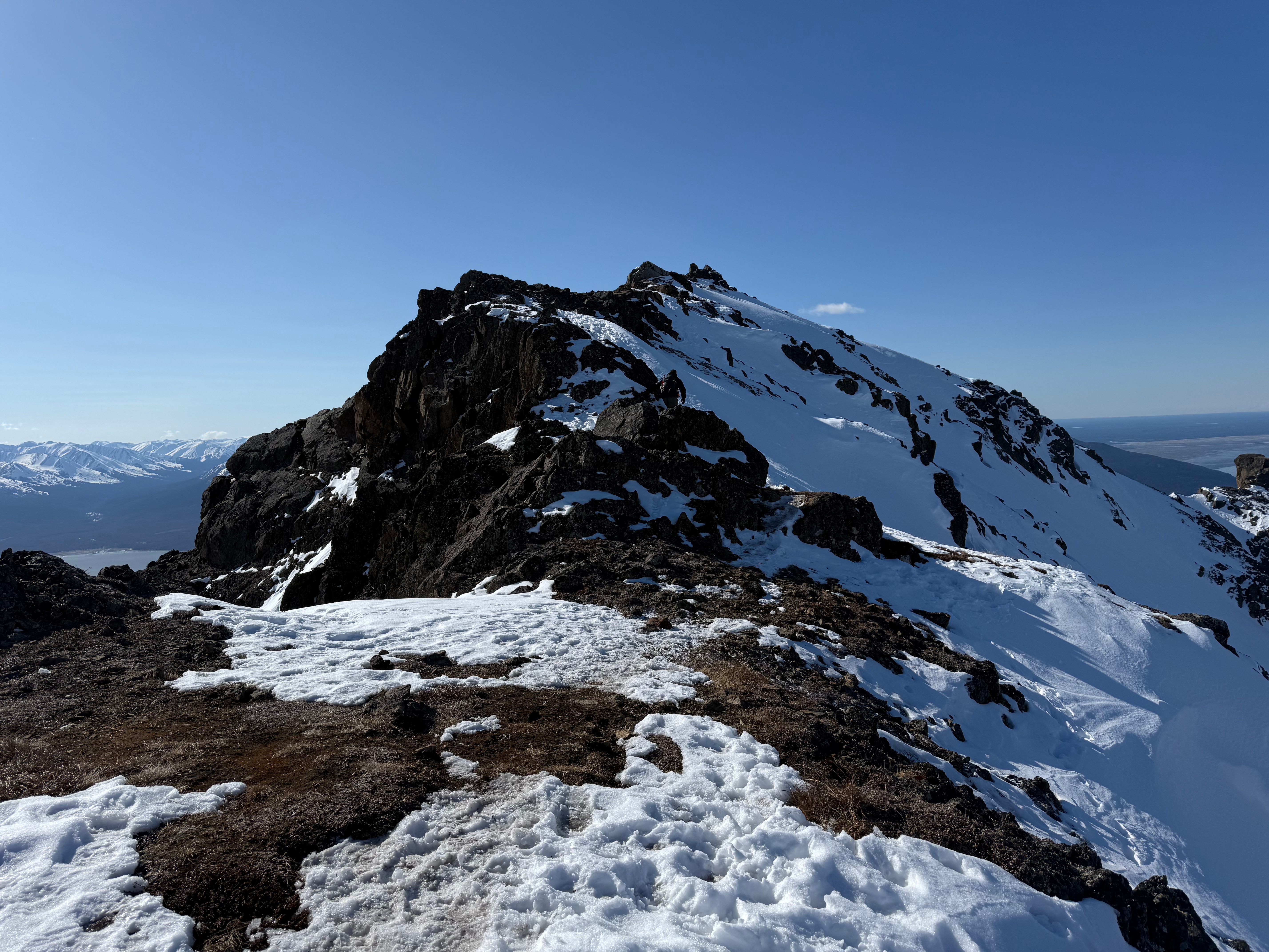
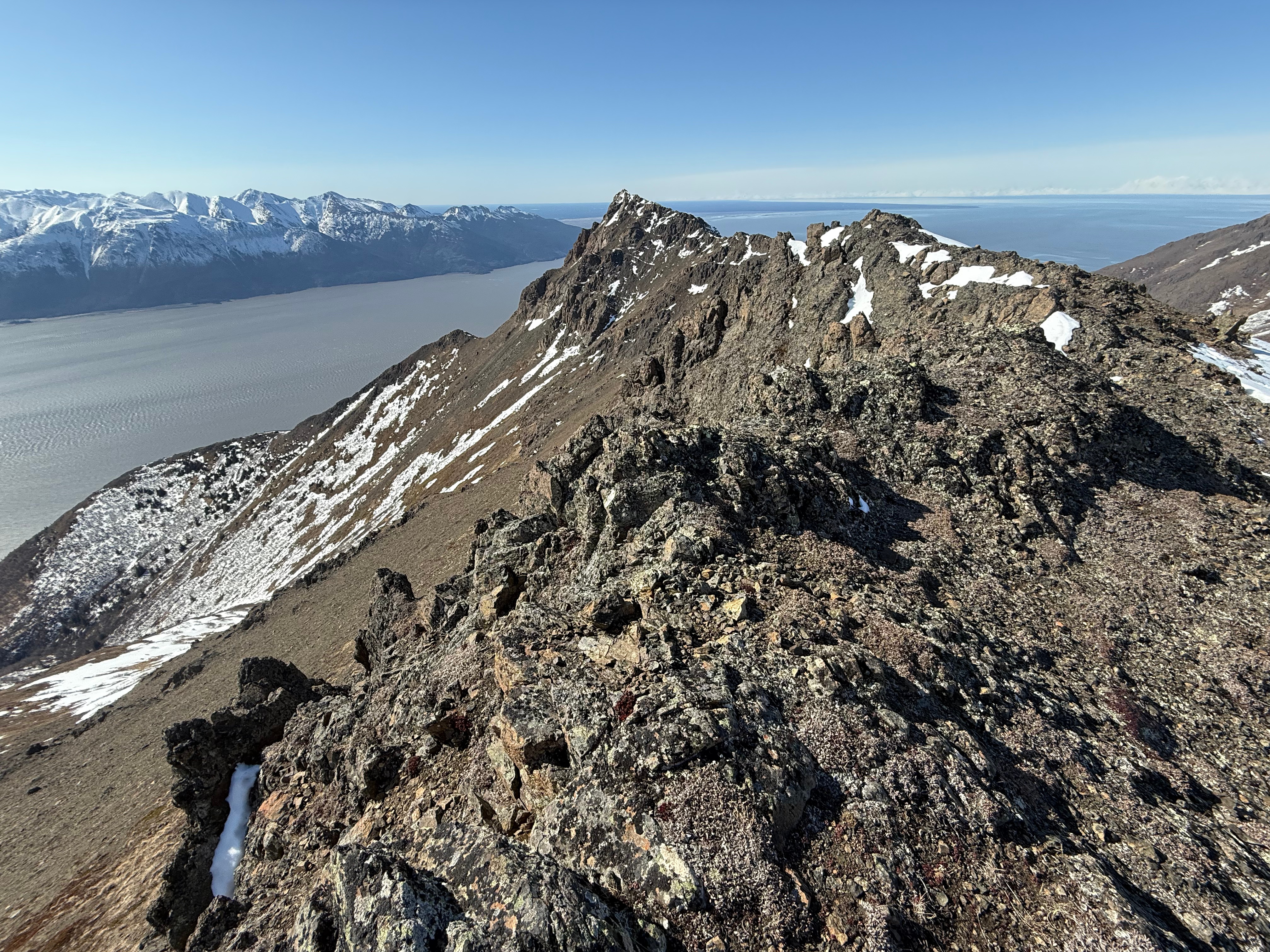
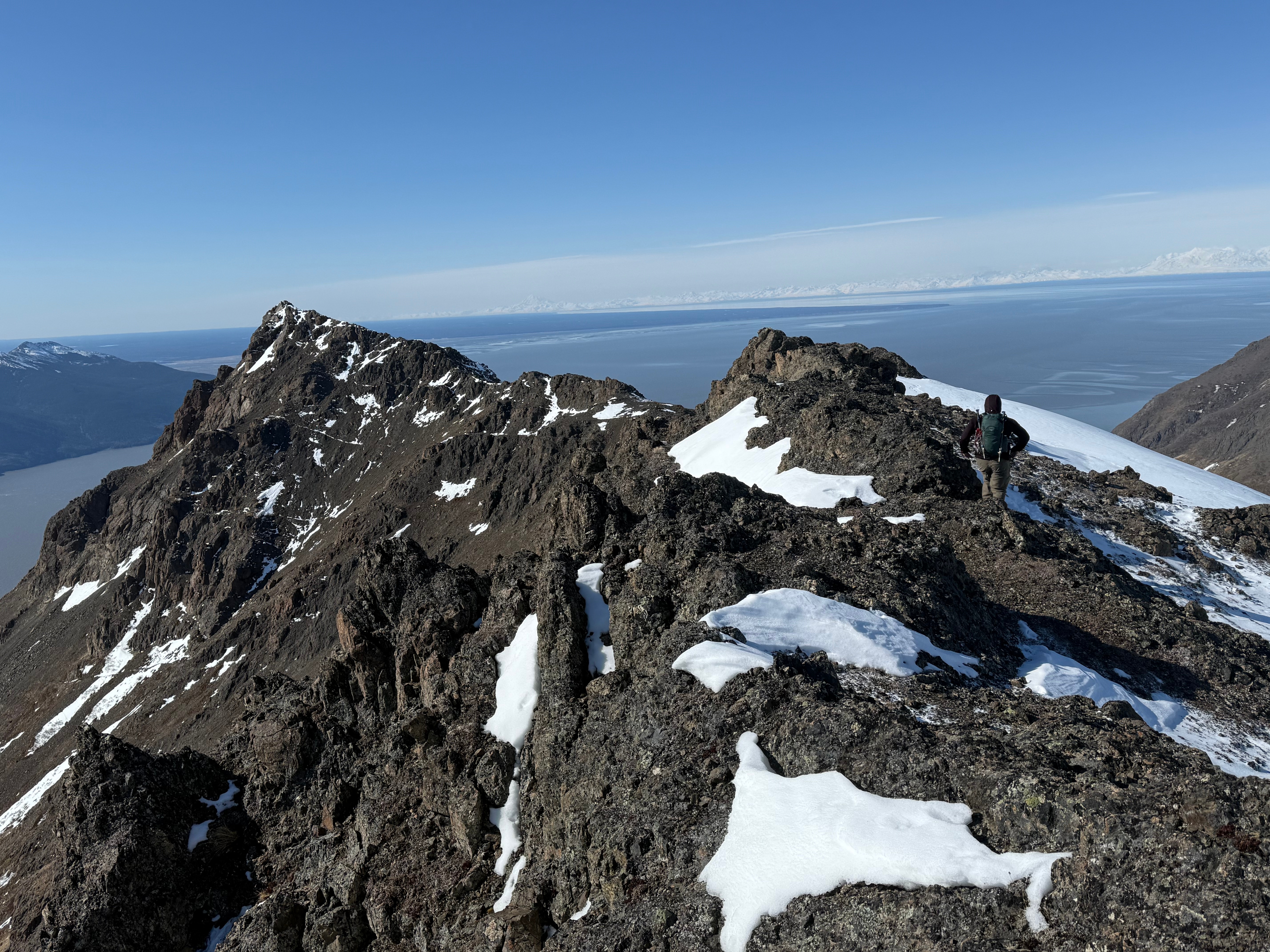
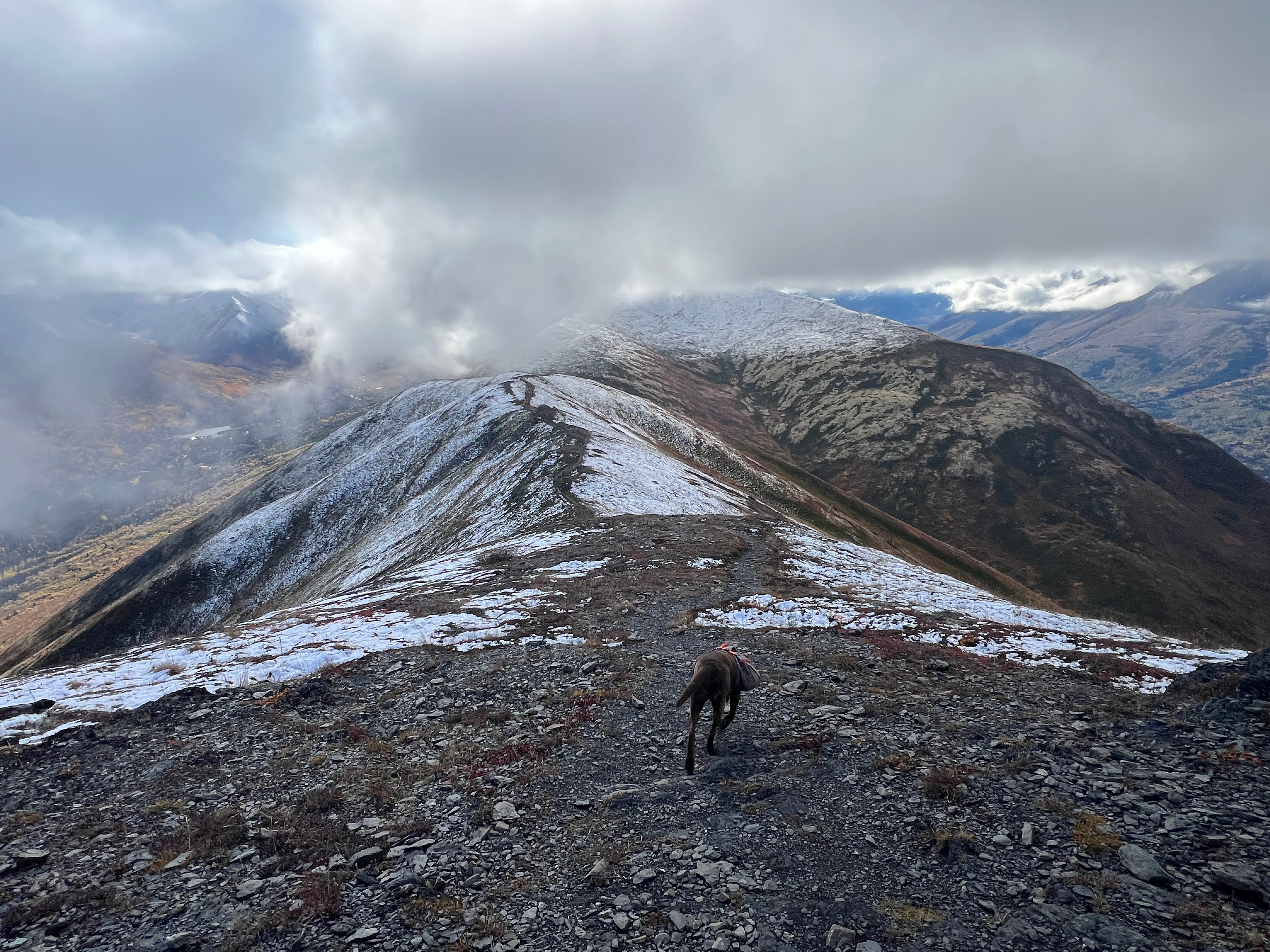
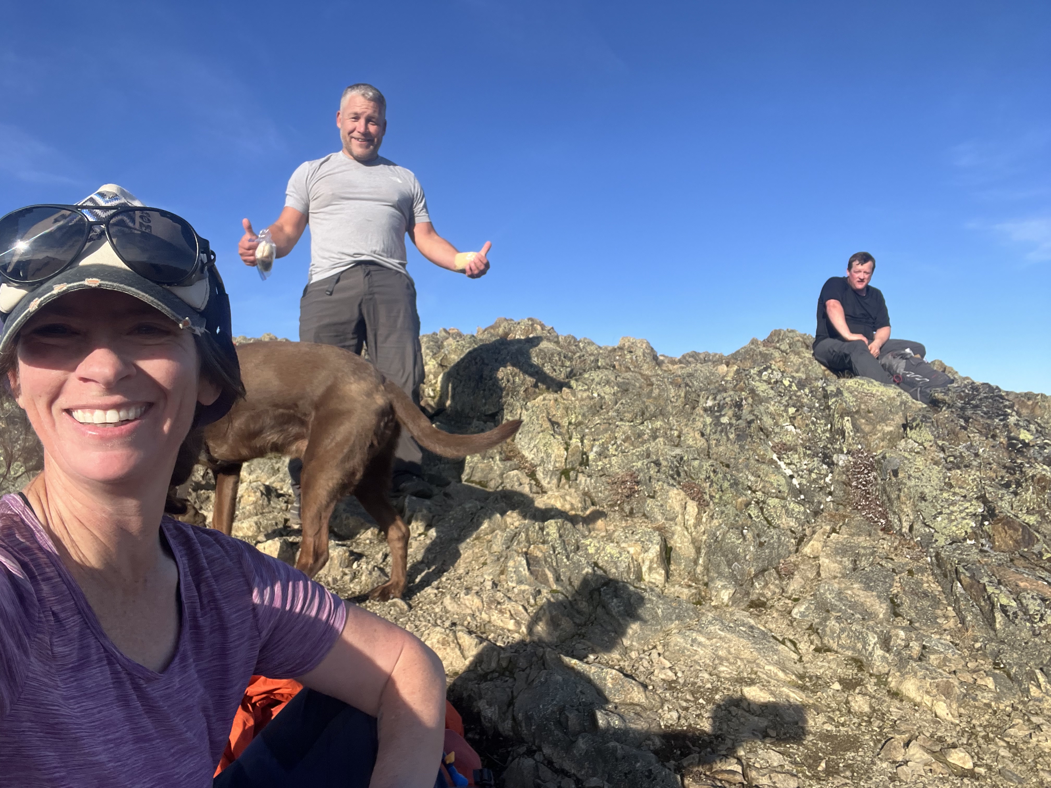
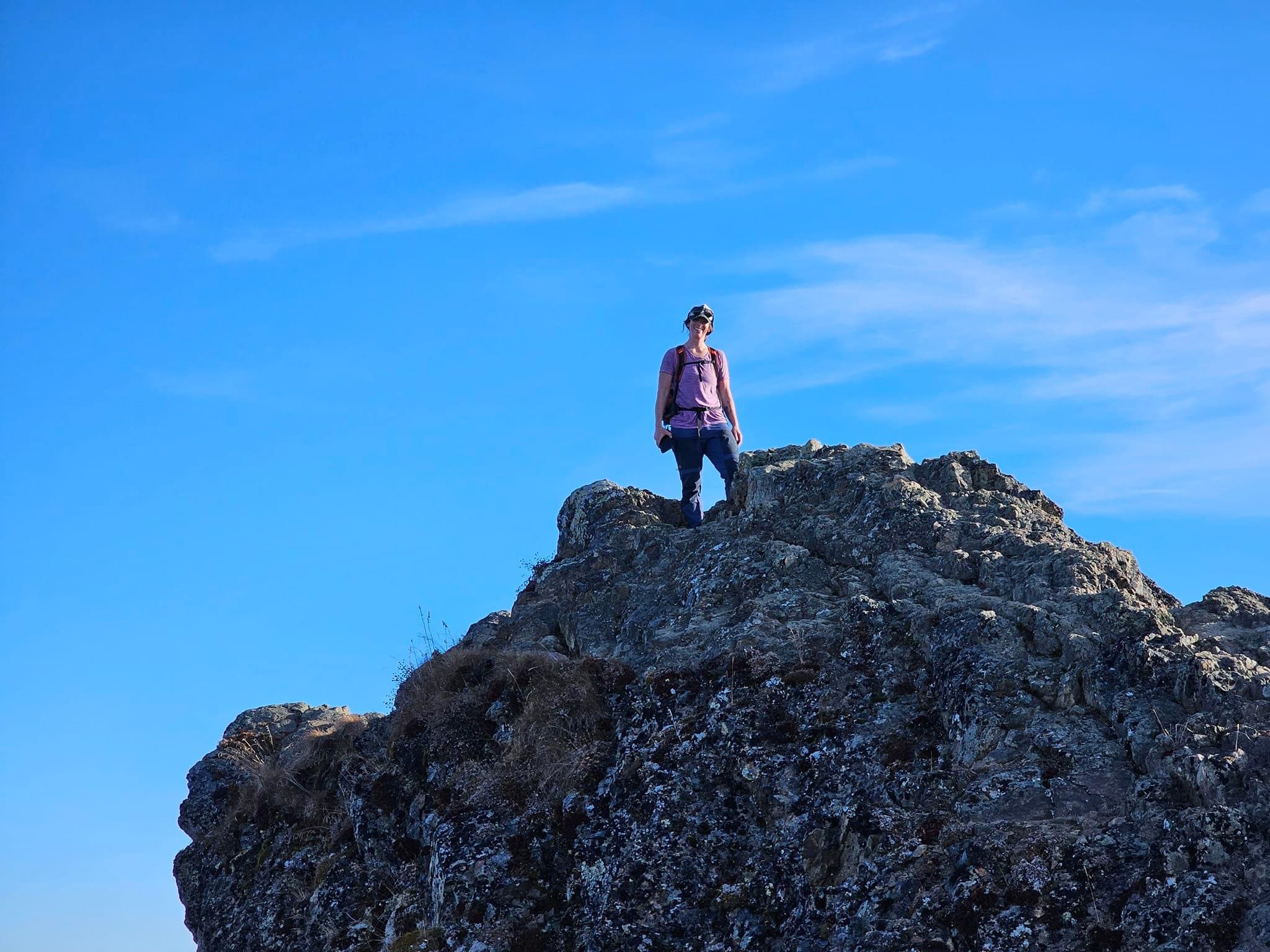
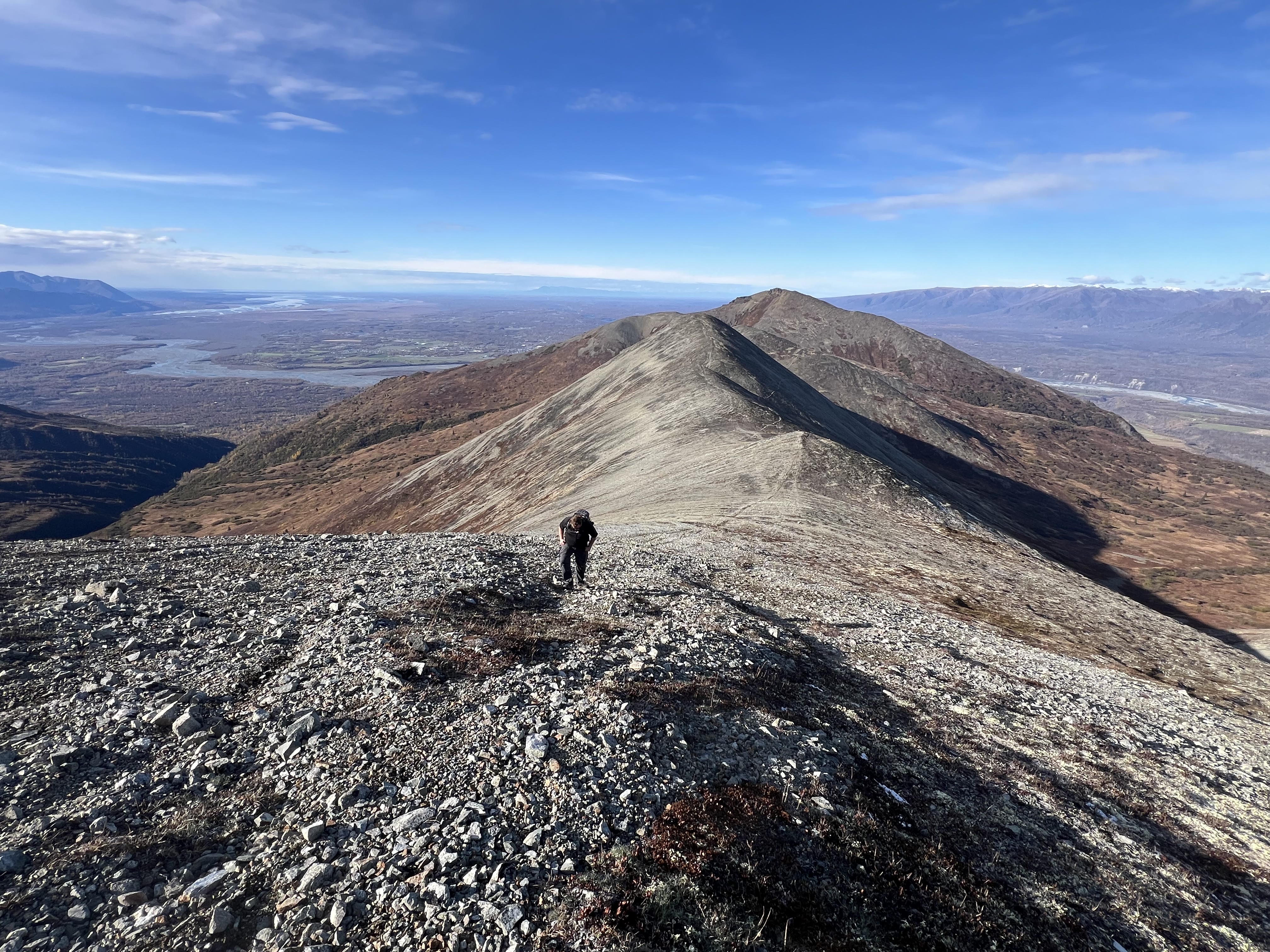
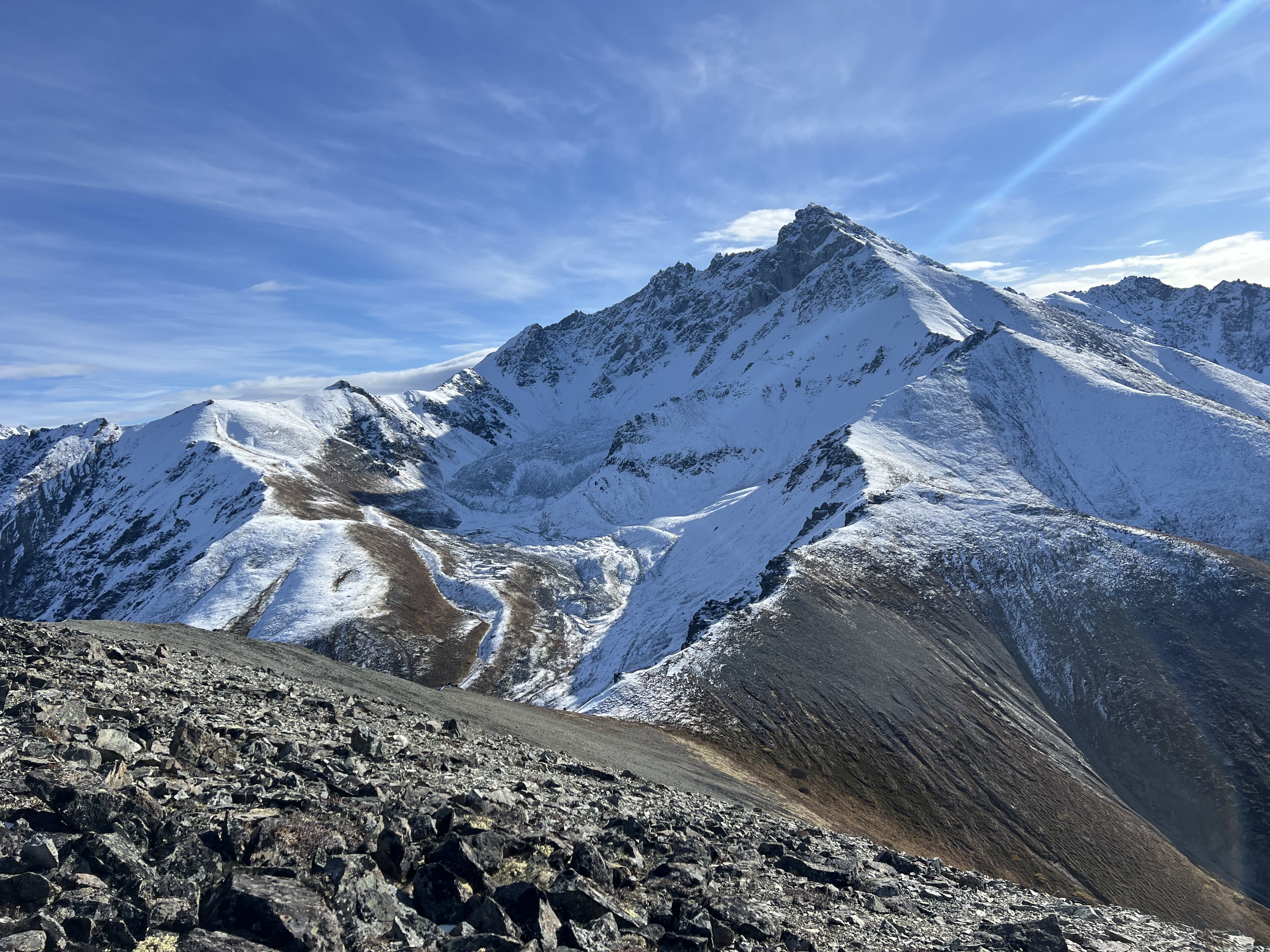
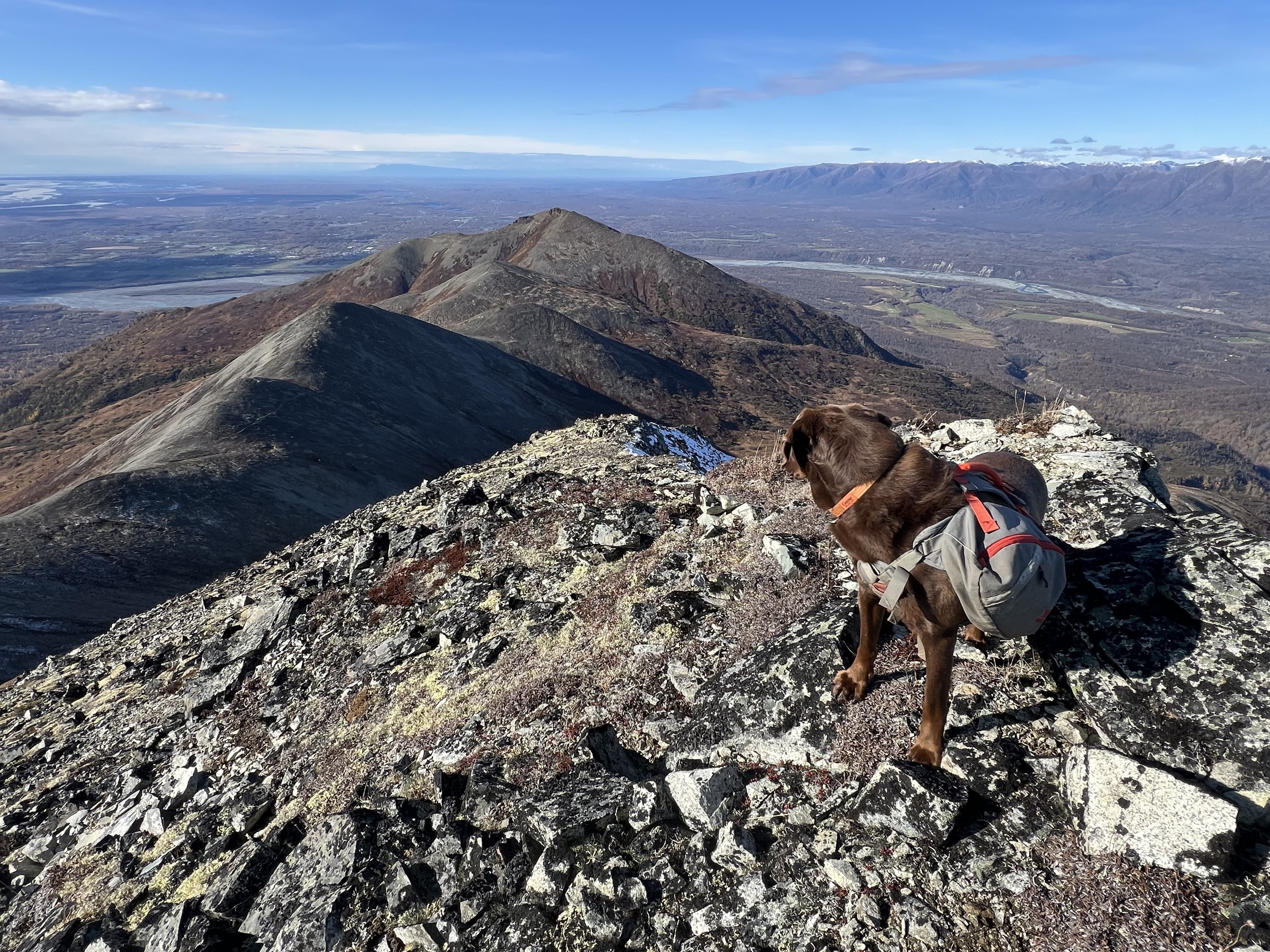
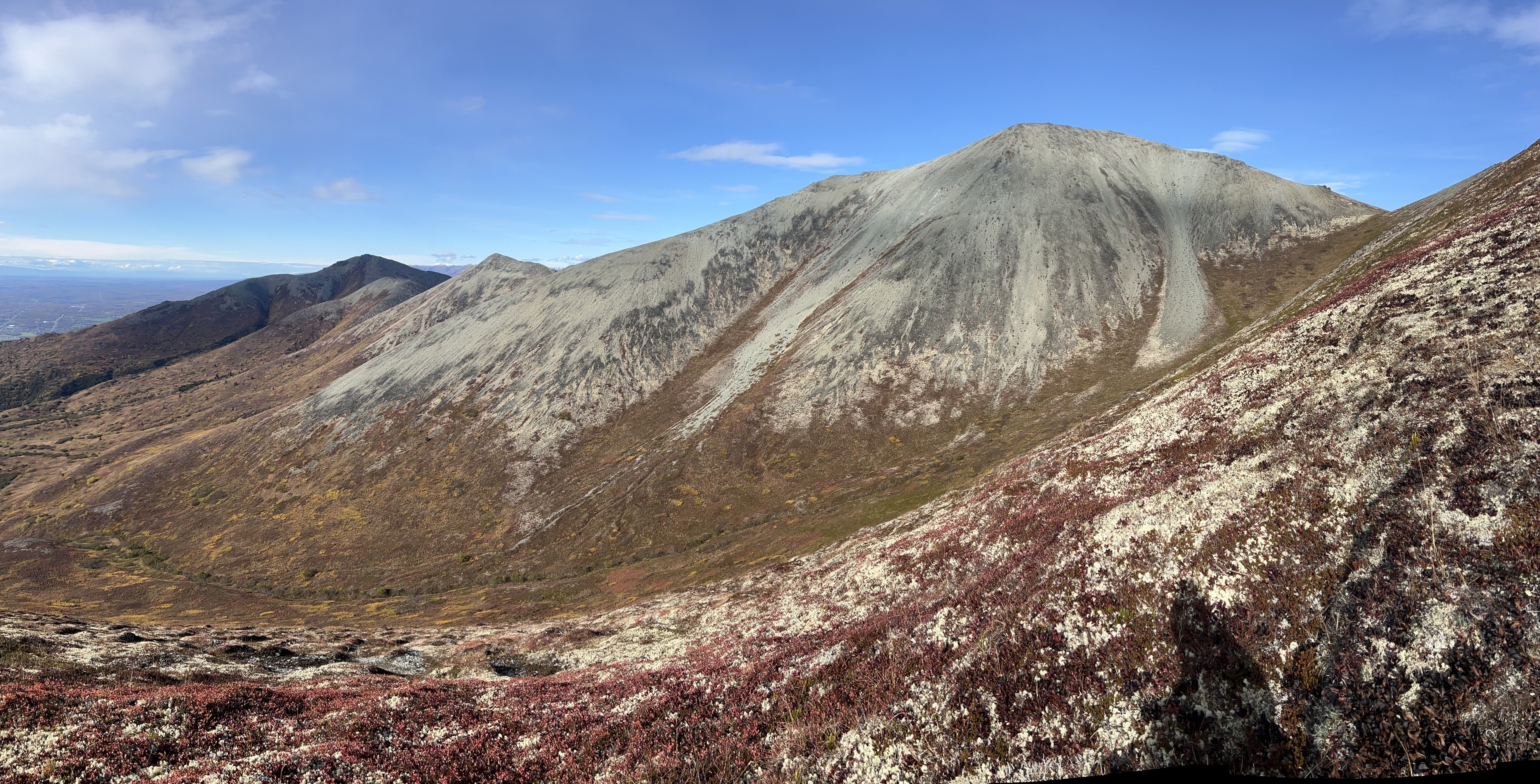
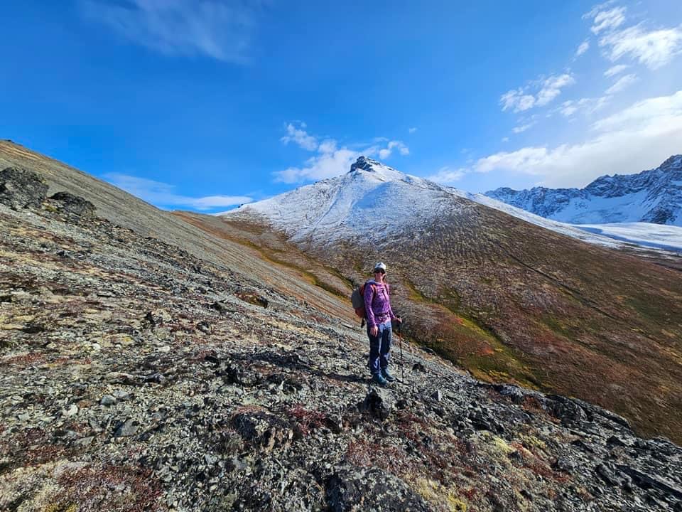
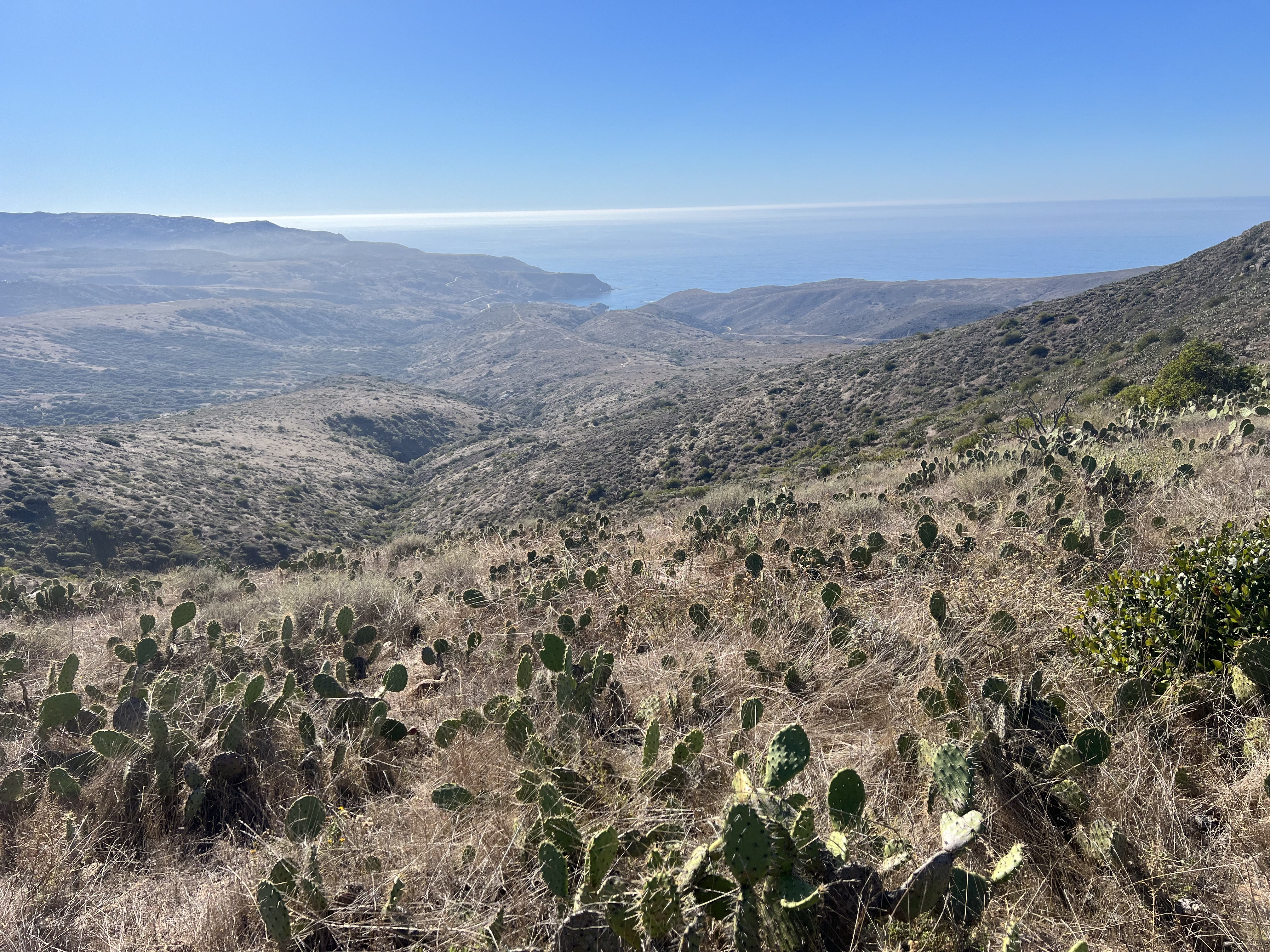
Kanchee’s grassy slopes made for an easy climb, and so far, we hadn’t faced any real challenges along the ridge. As the sky continued to clear, we reached the summit of our third peak of the day. The views into Snow Hawk Valley were magnificent—Temptation, Tikishla, and Knoya were now fully visible. Our crappy moods were finally cured. Although there were a couple of odd markers at the top, we didn’t find a summit register.
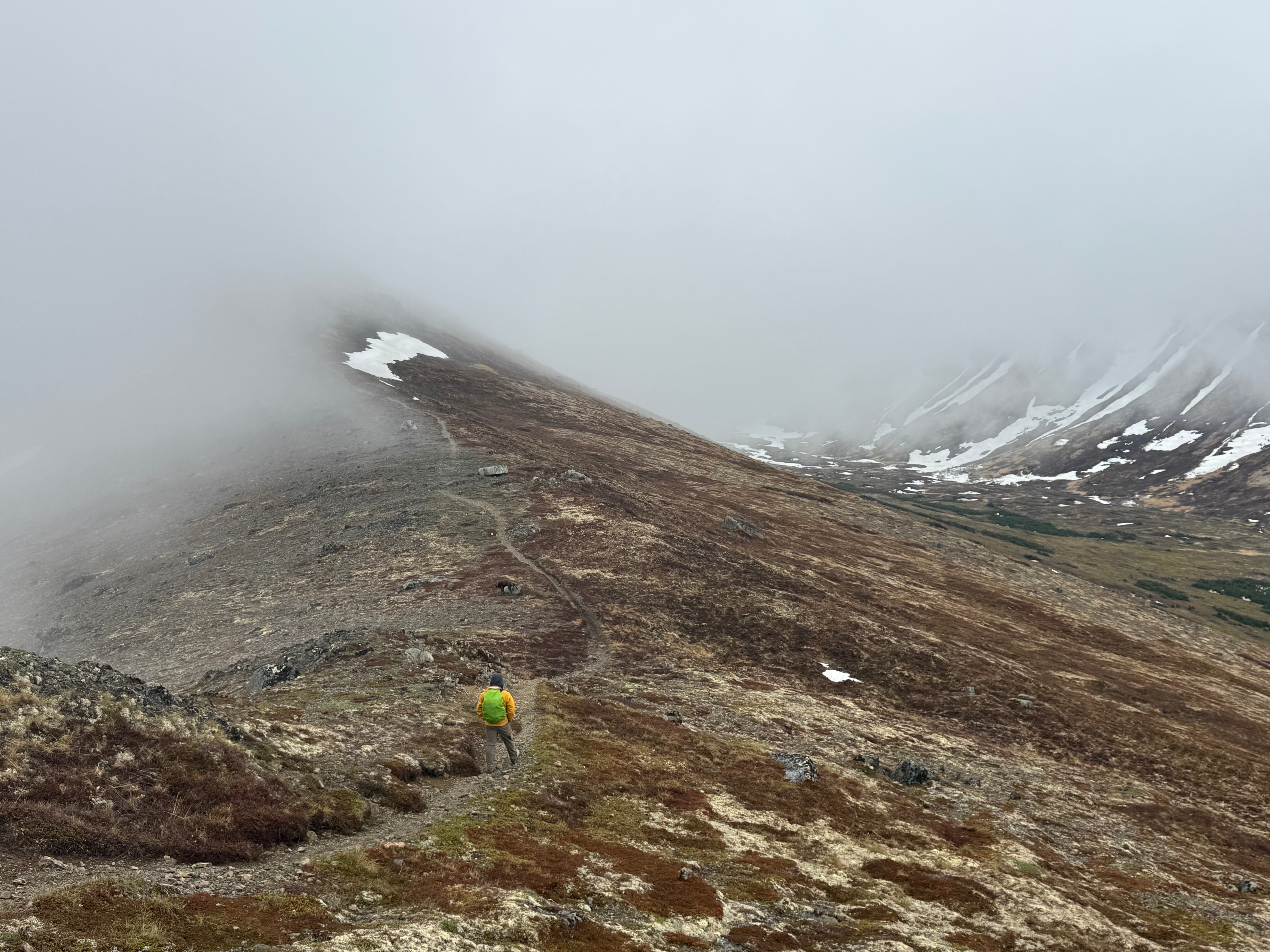
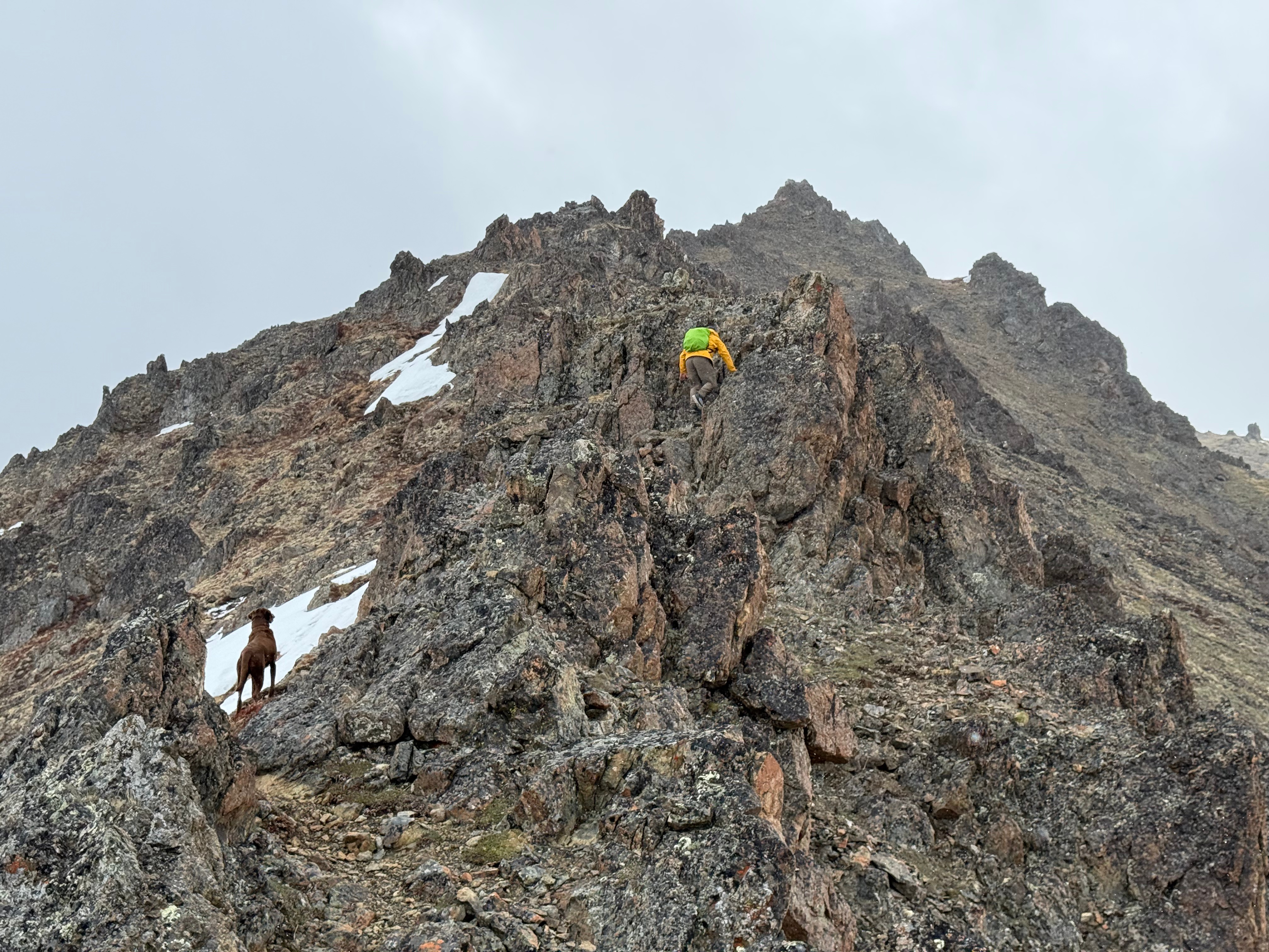
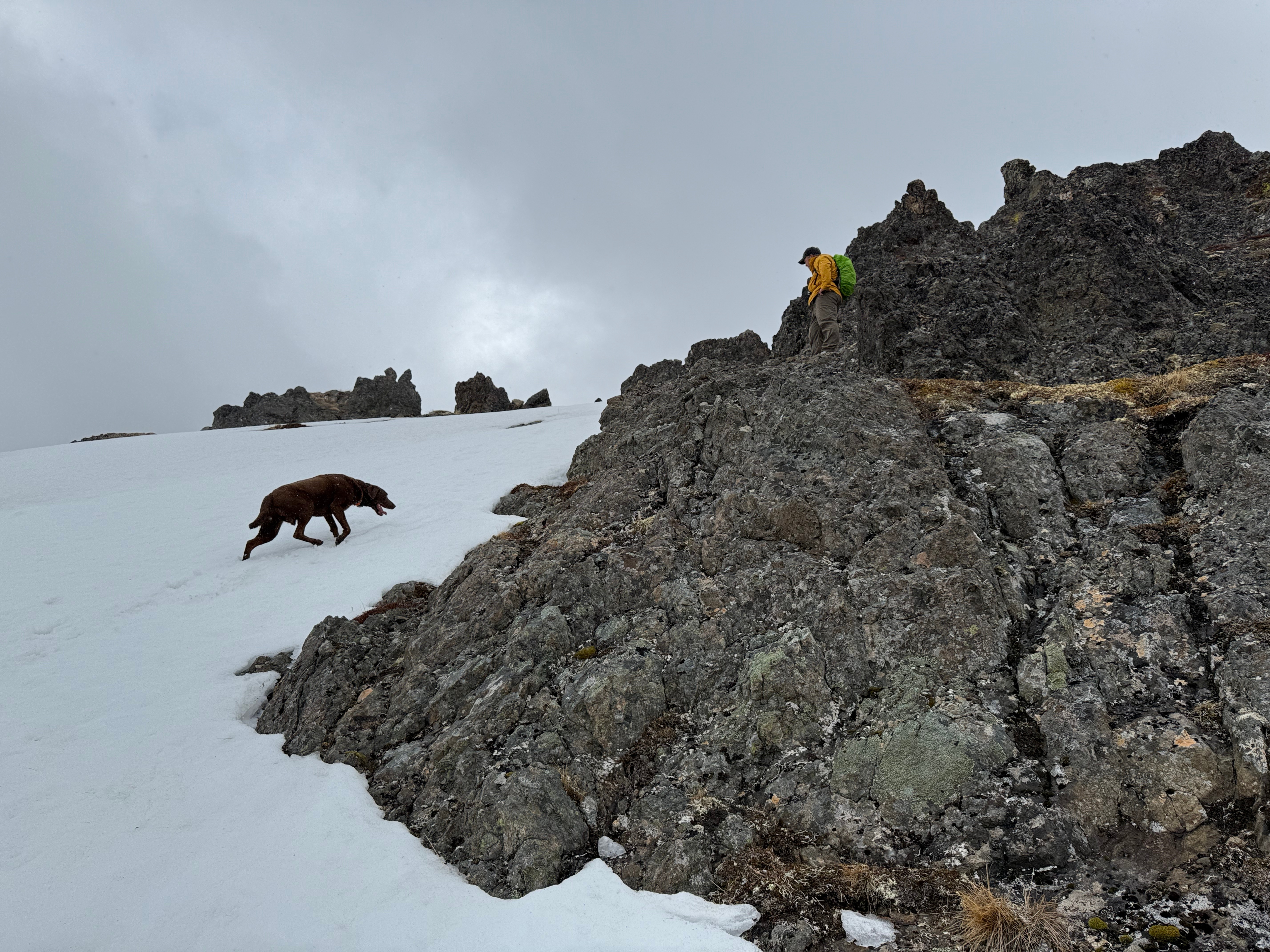
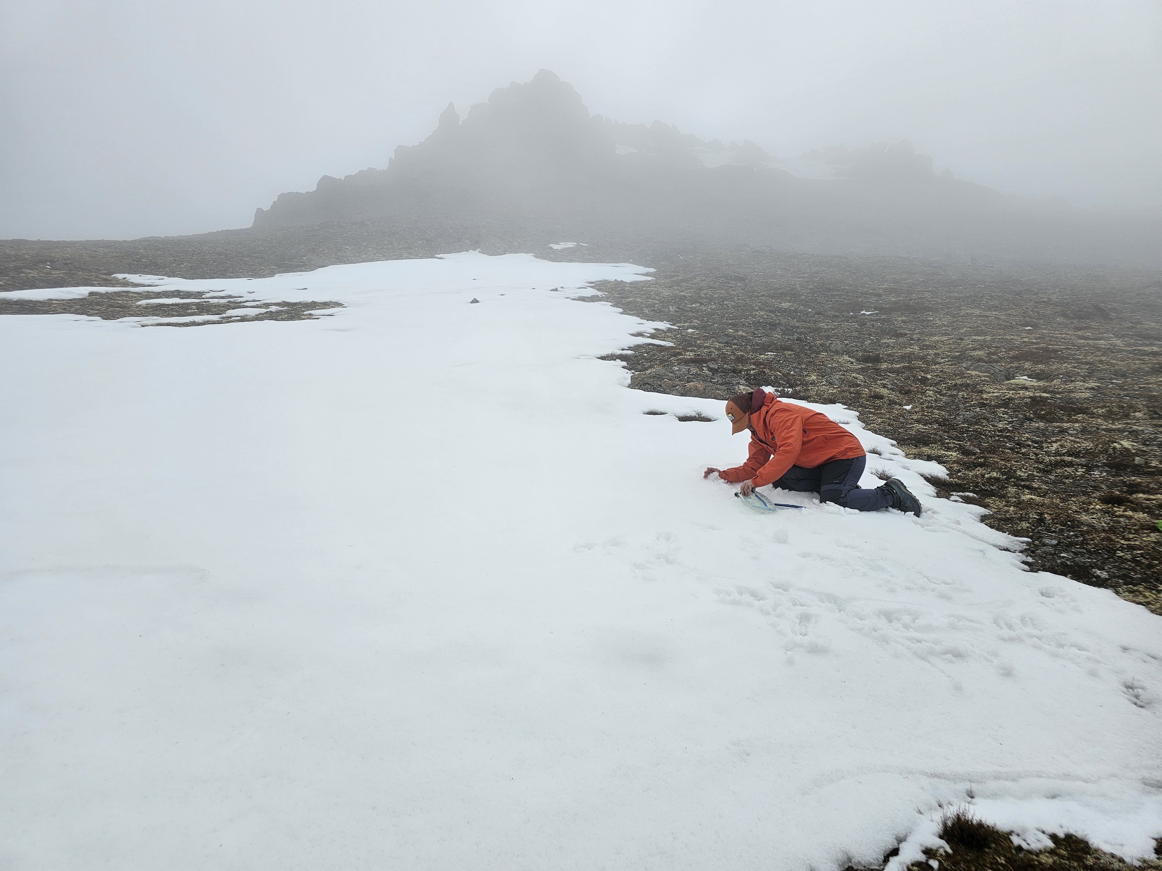
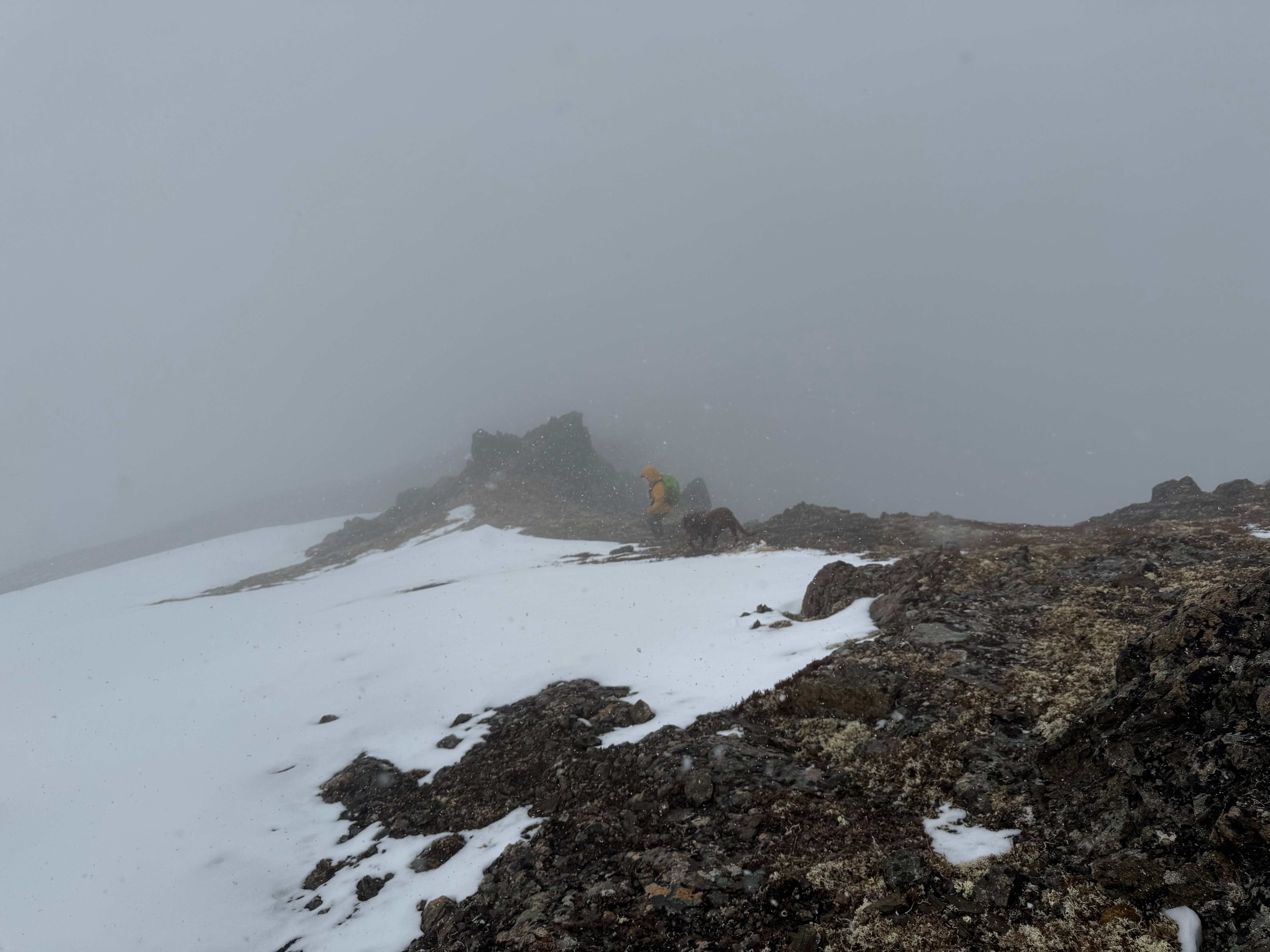
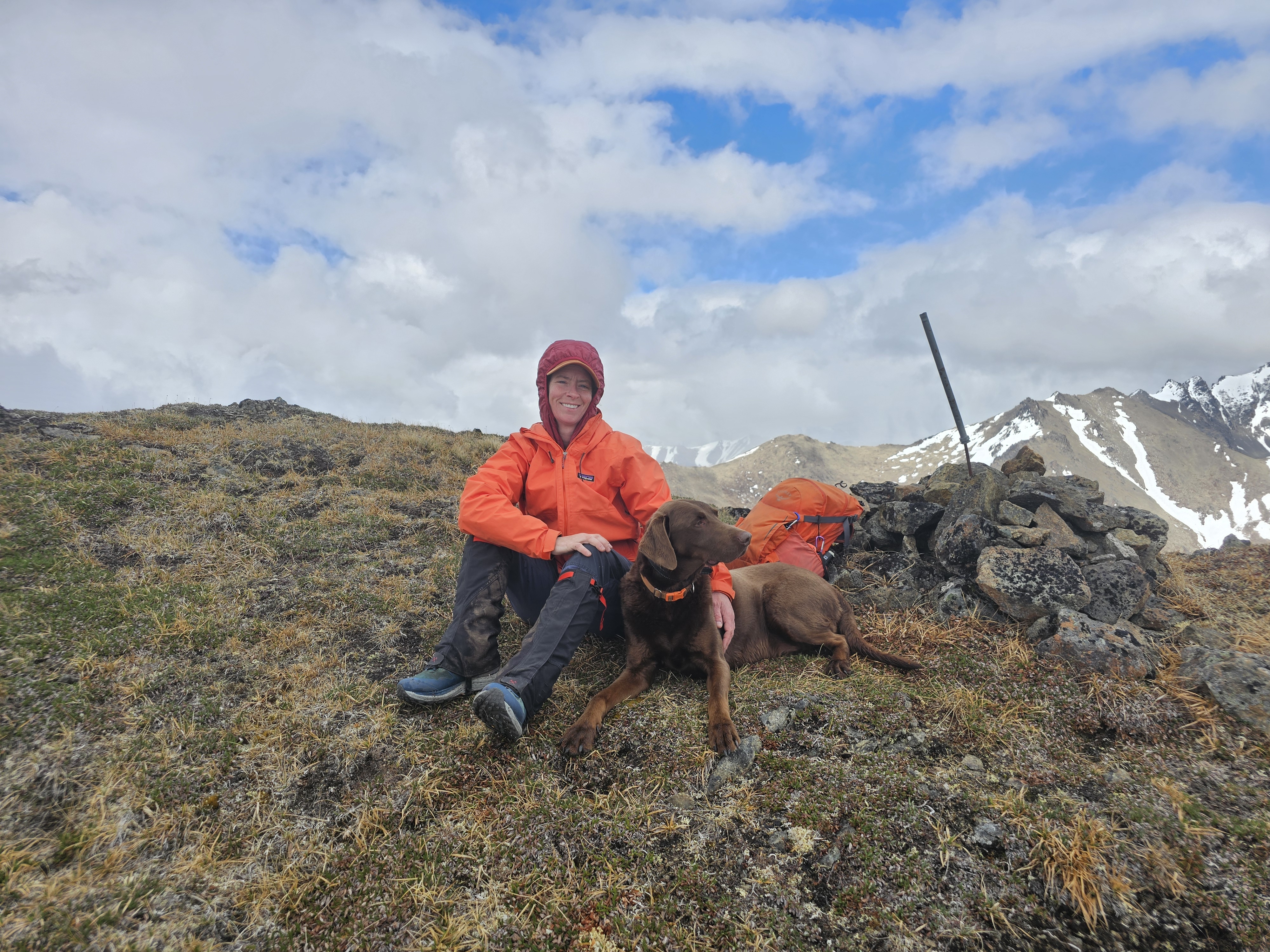
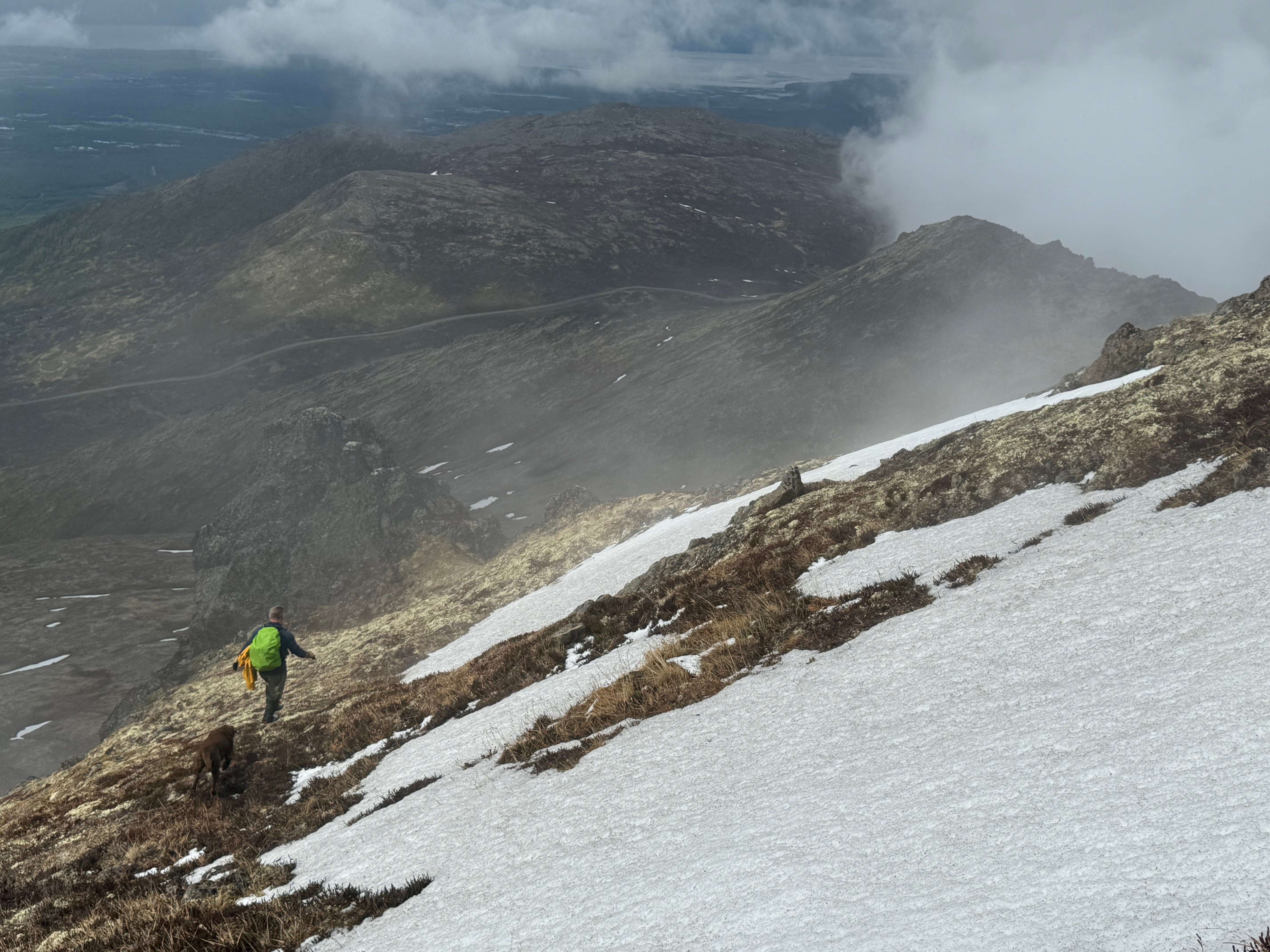
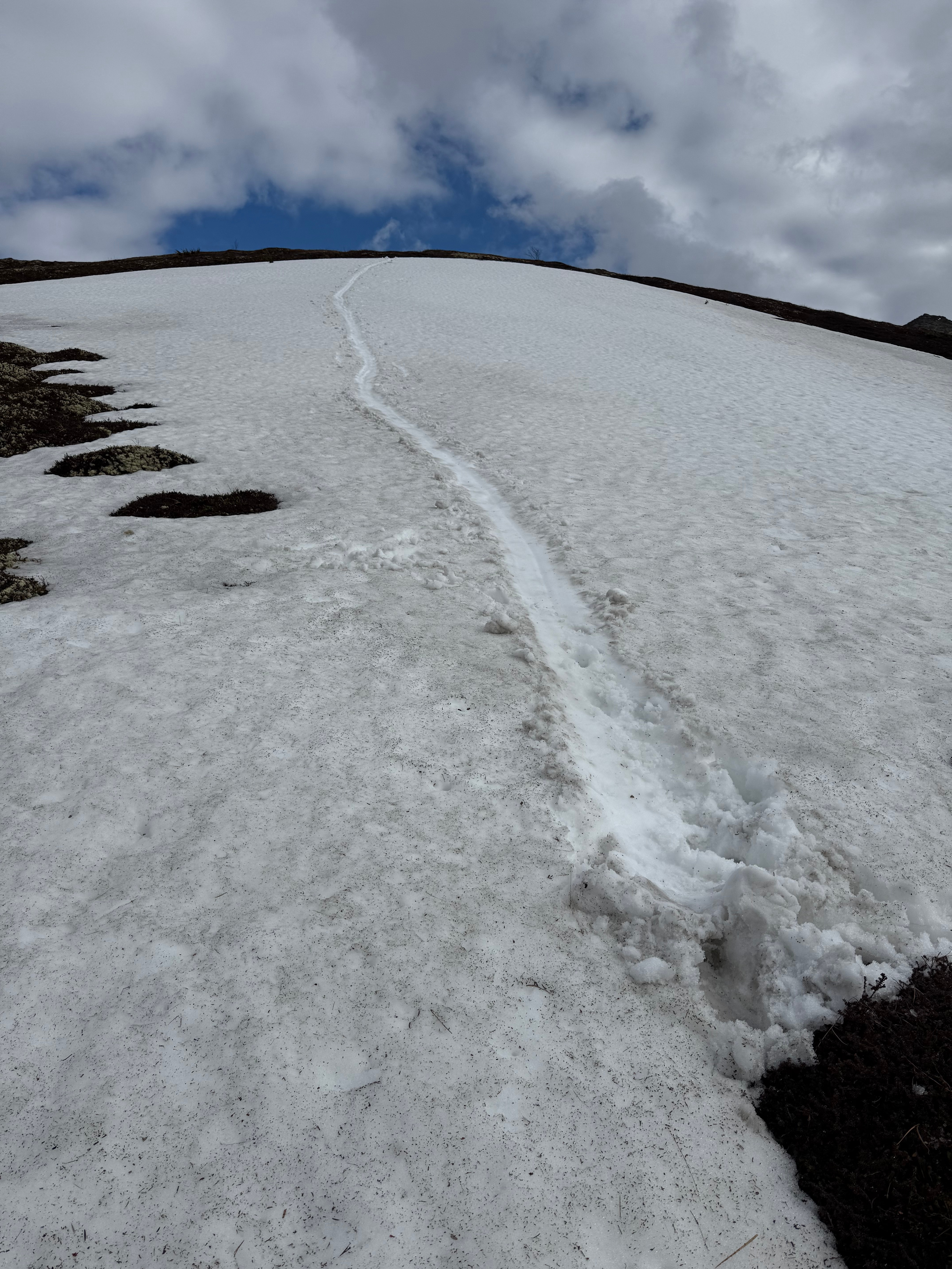
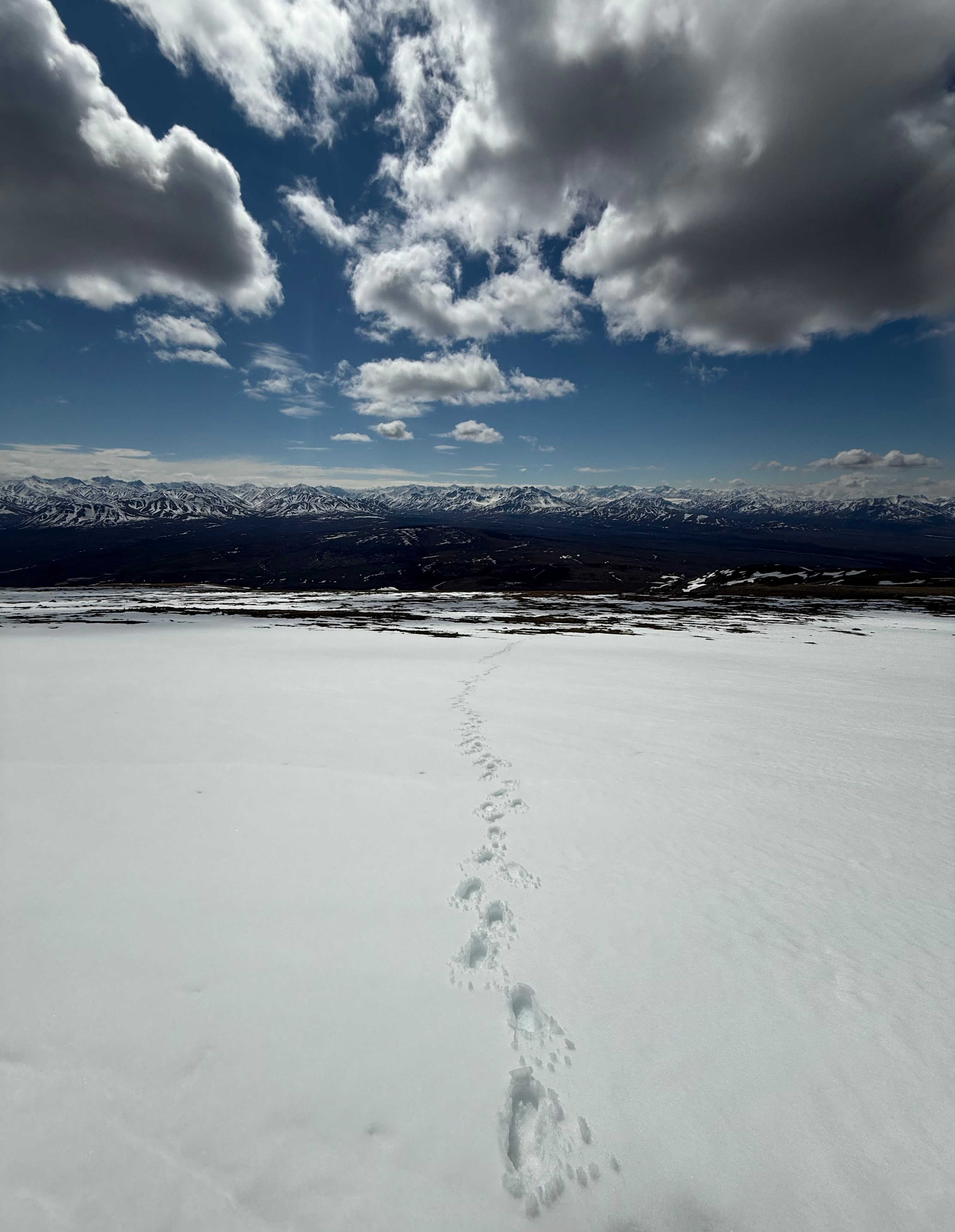
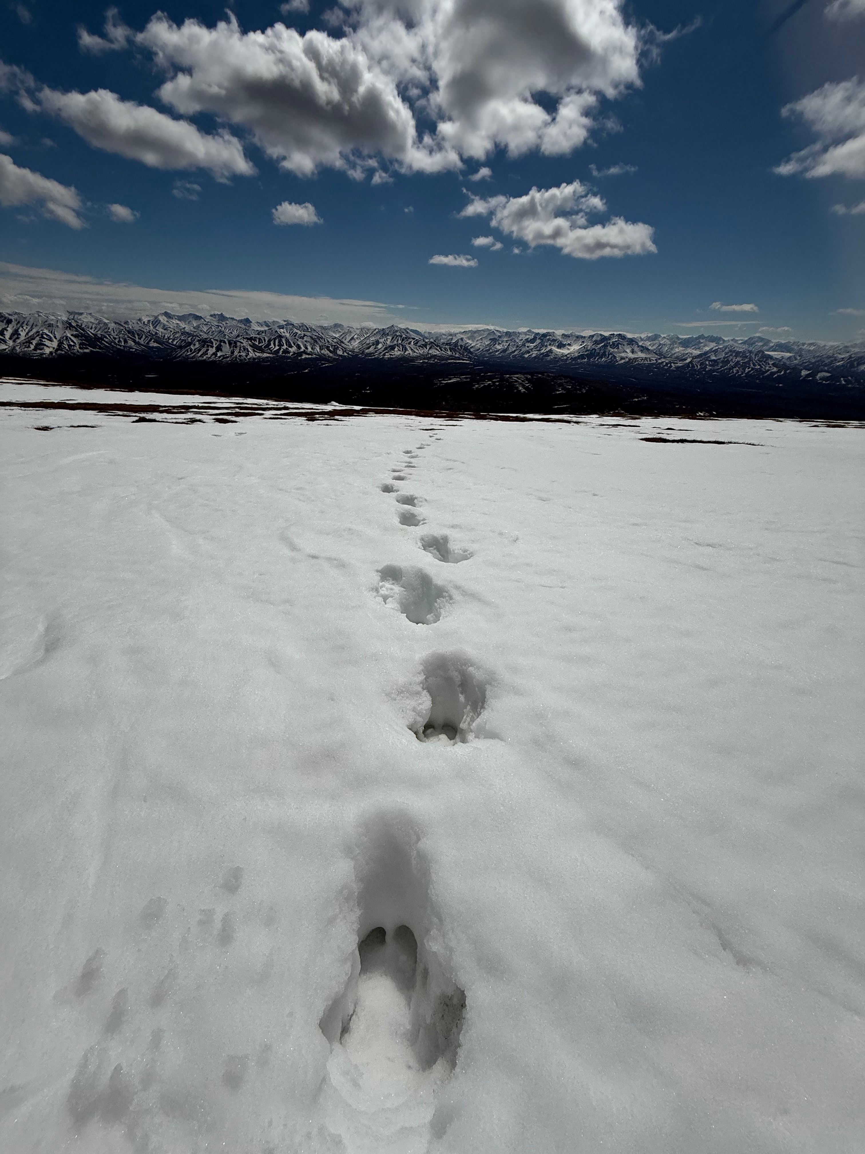
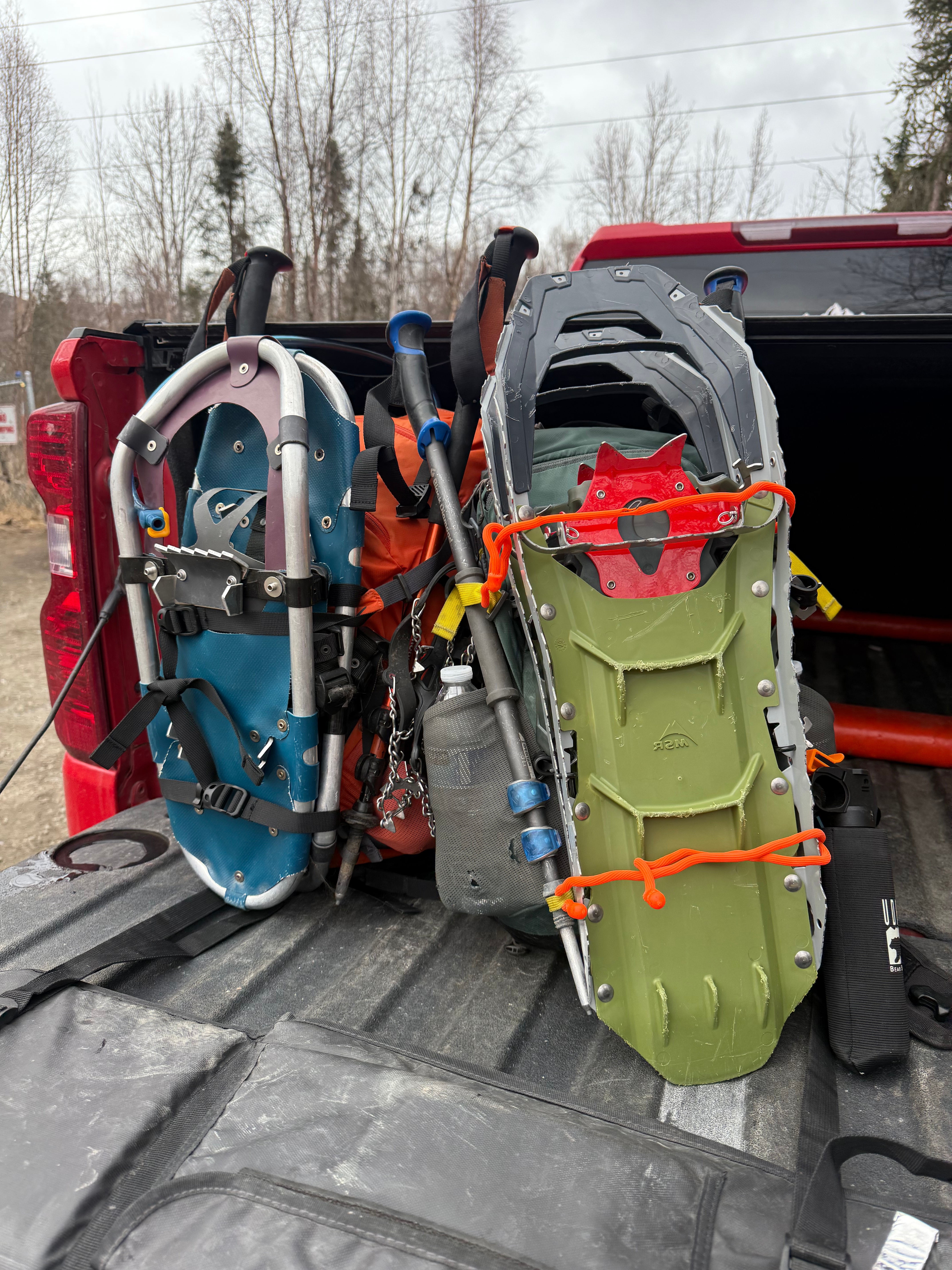
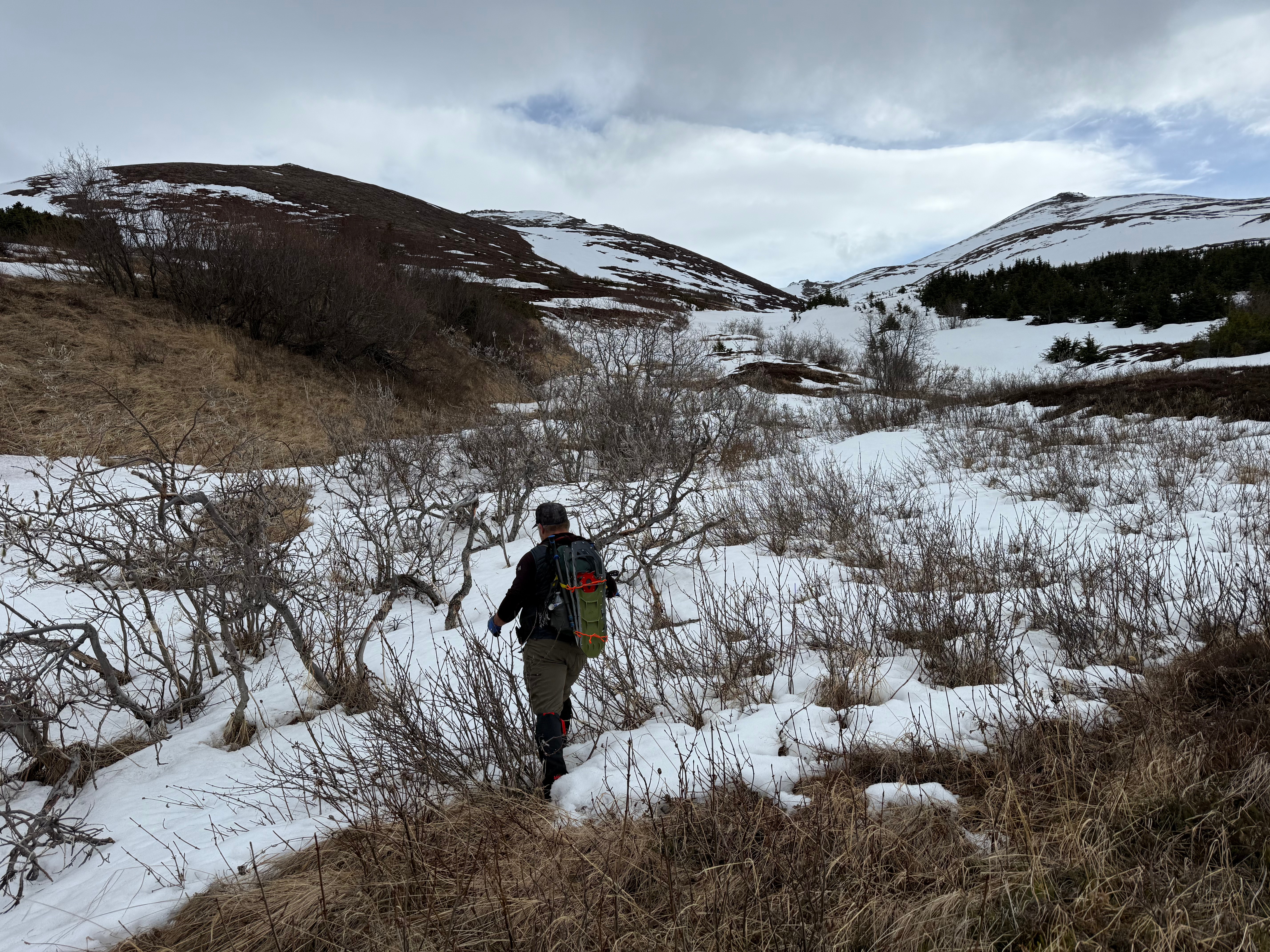
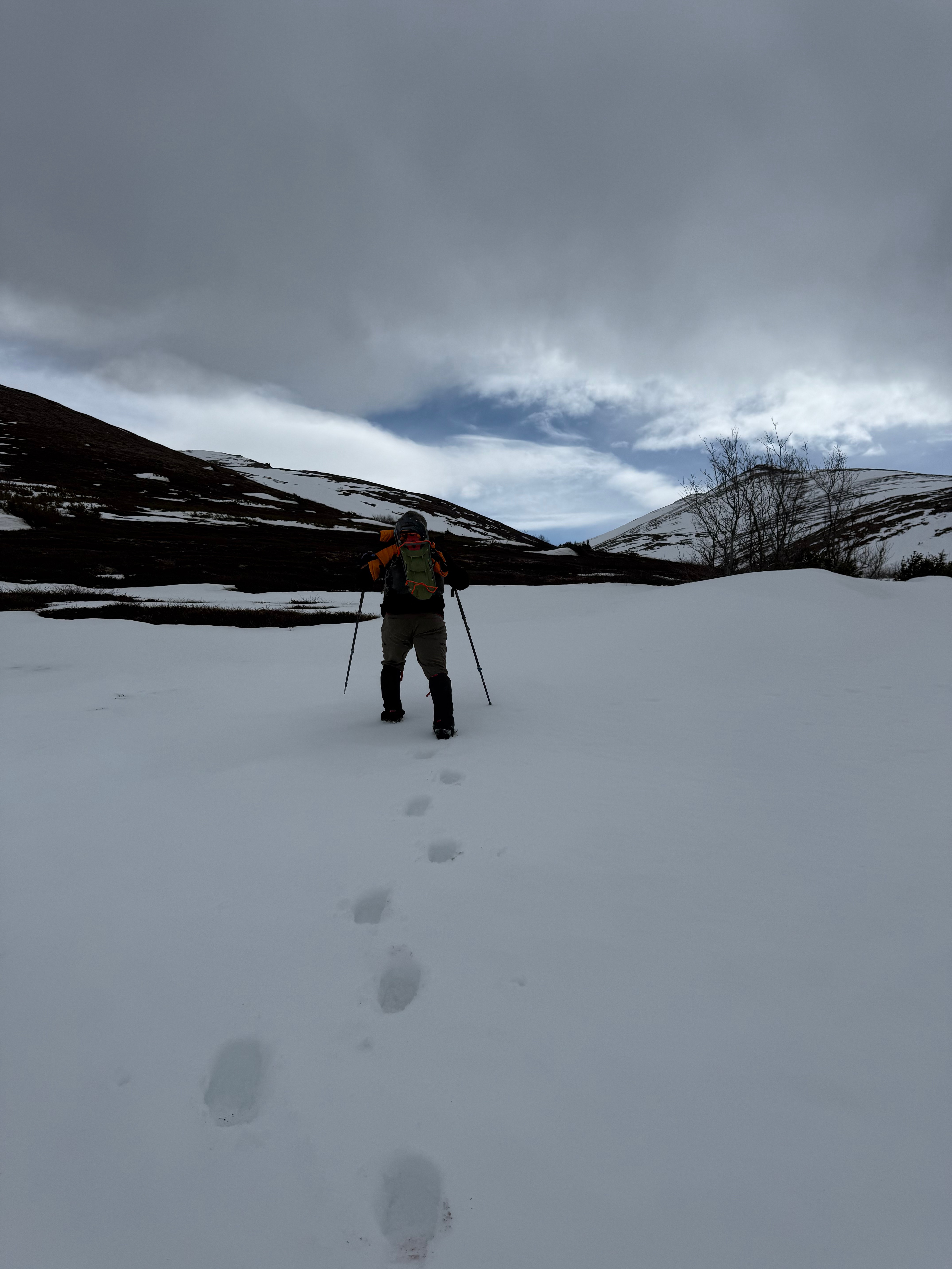
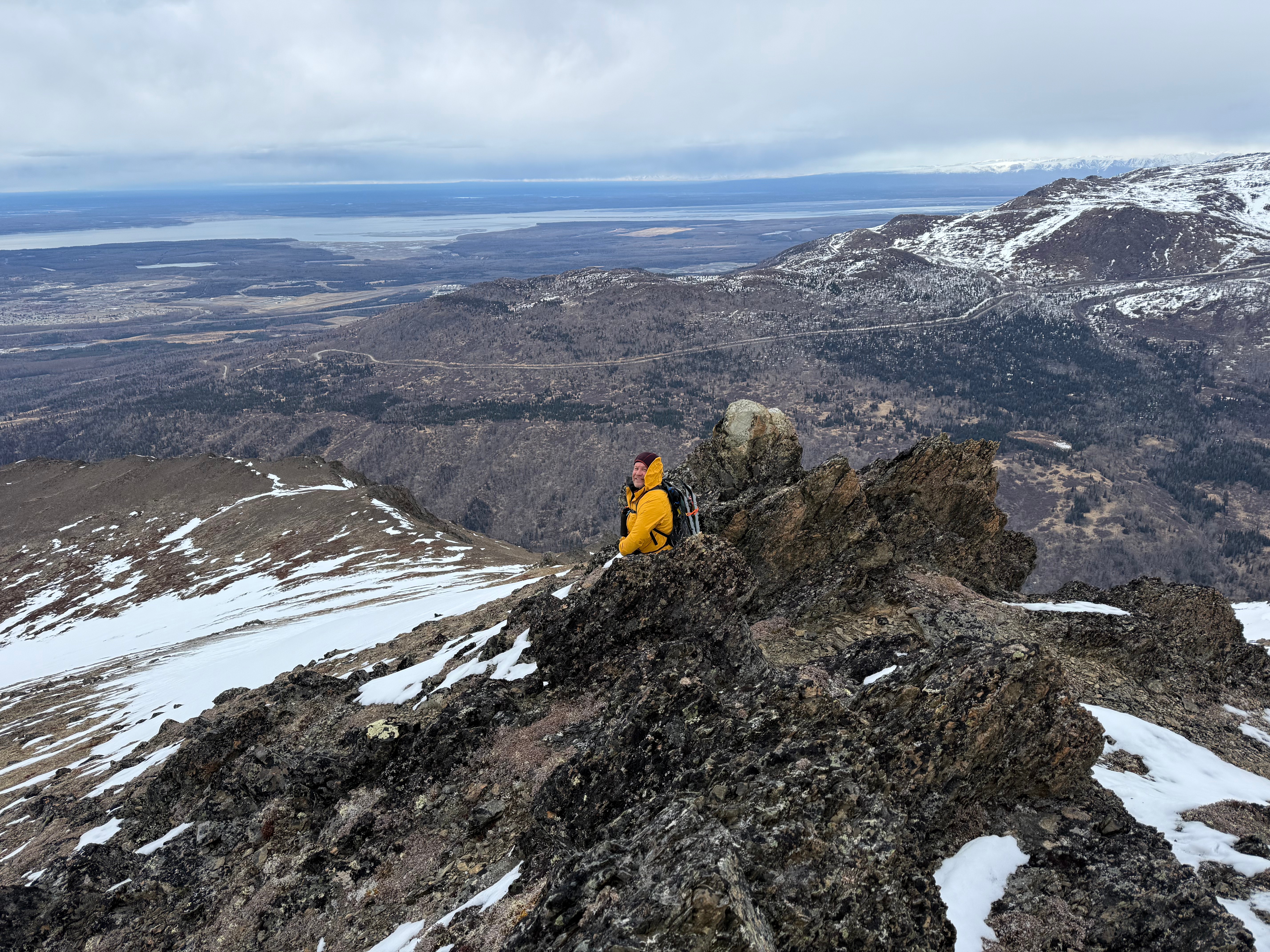
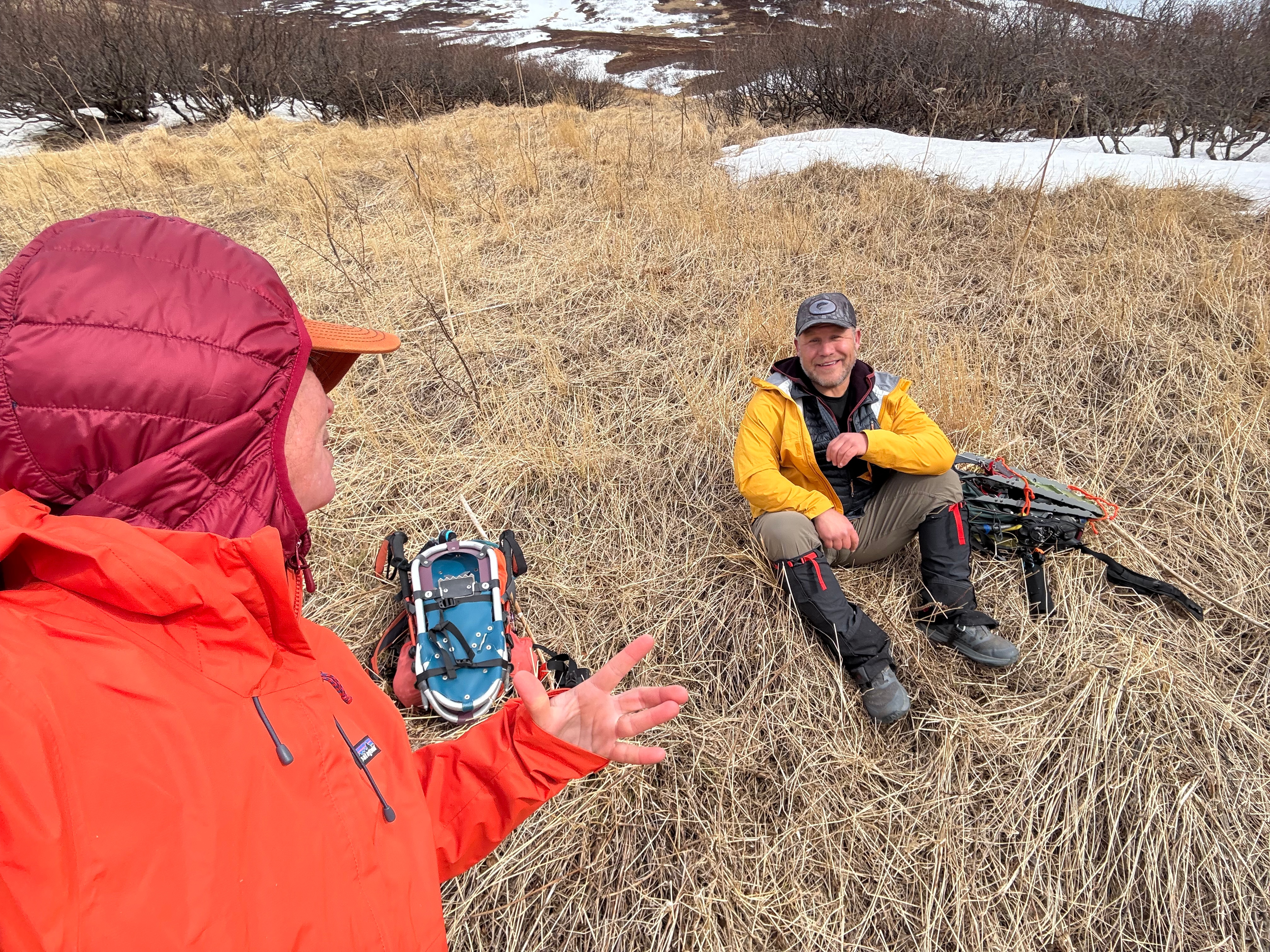
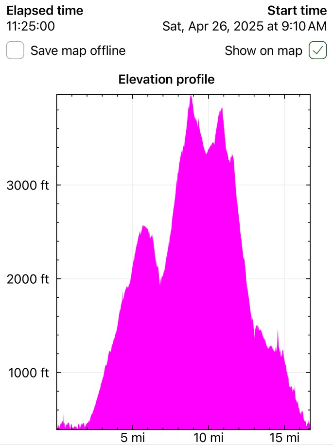
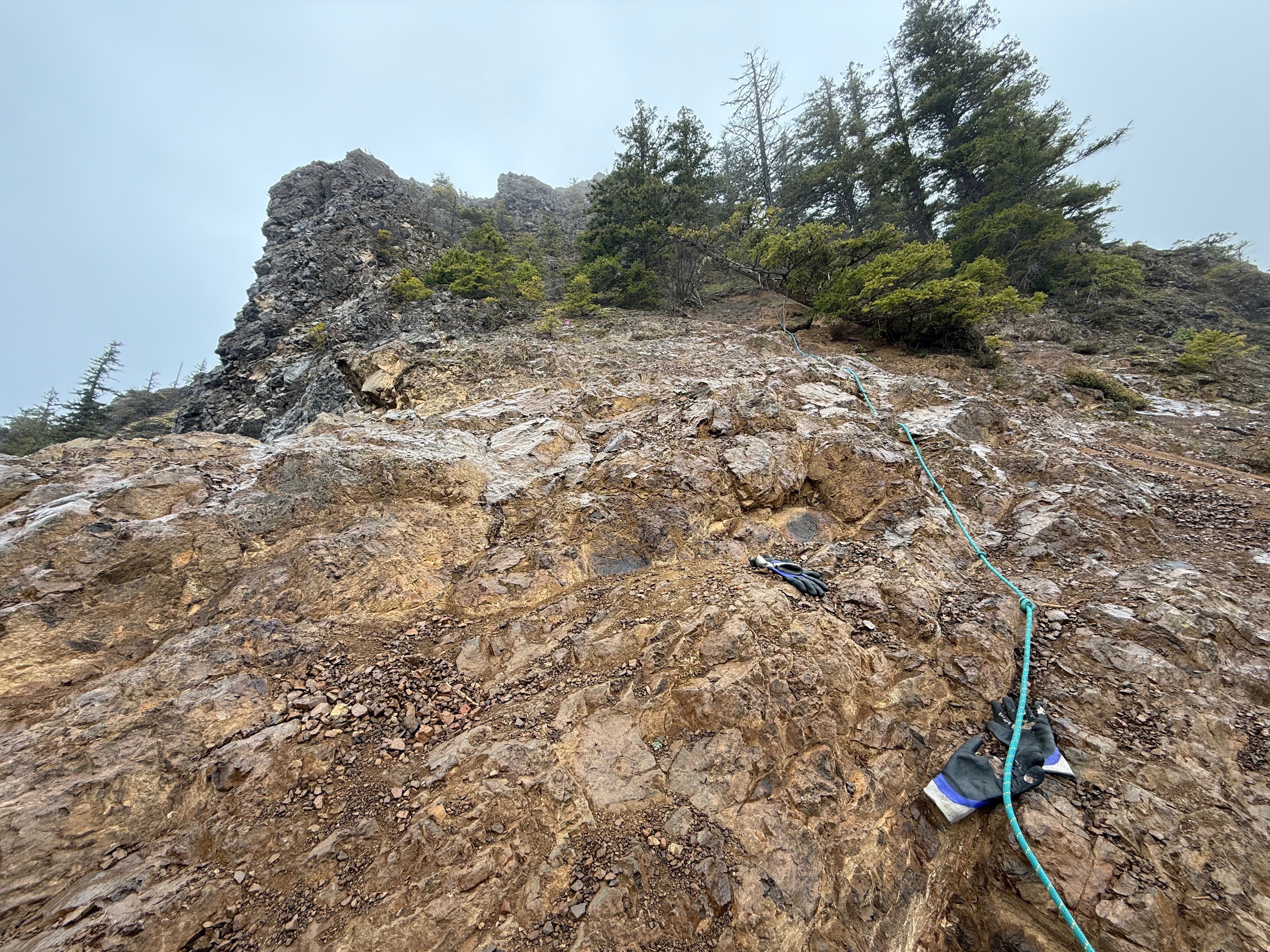
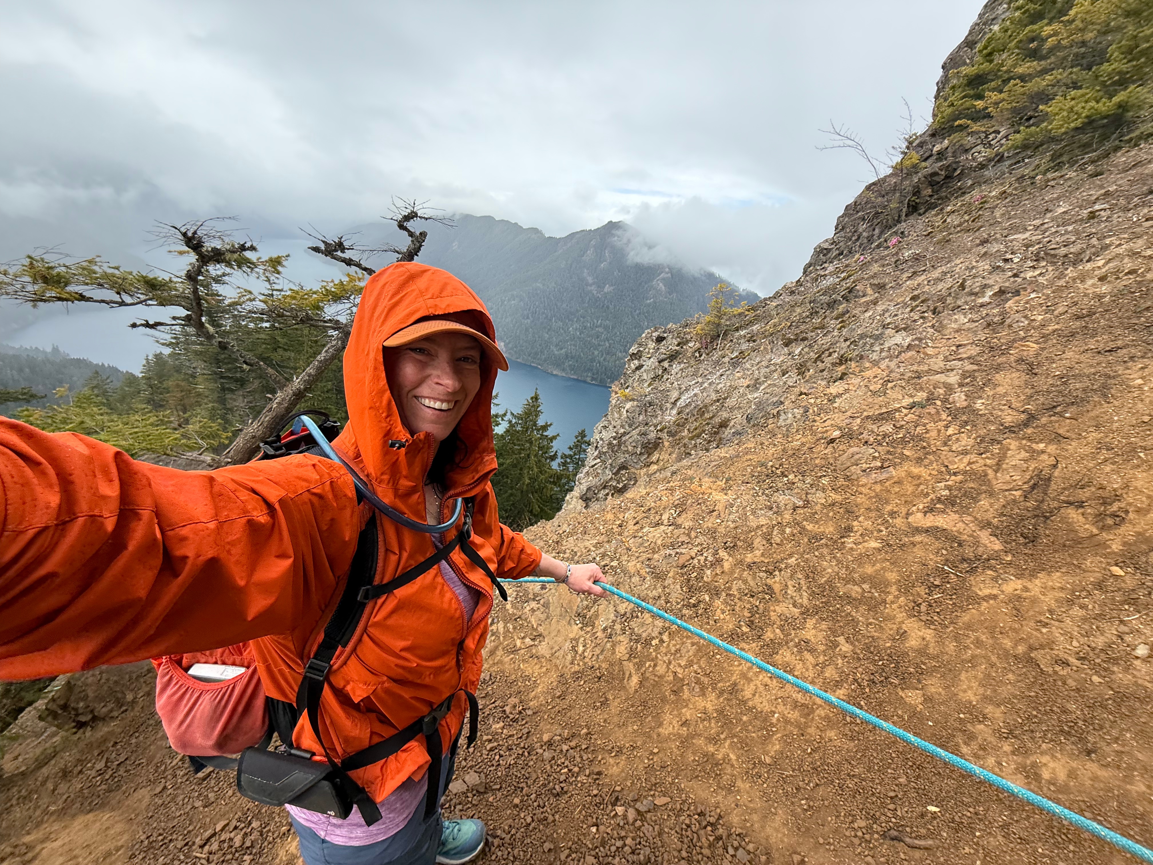
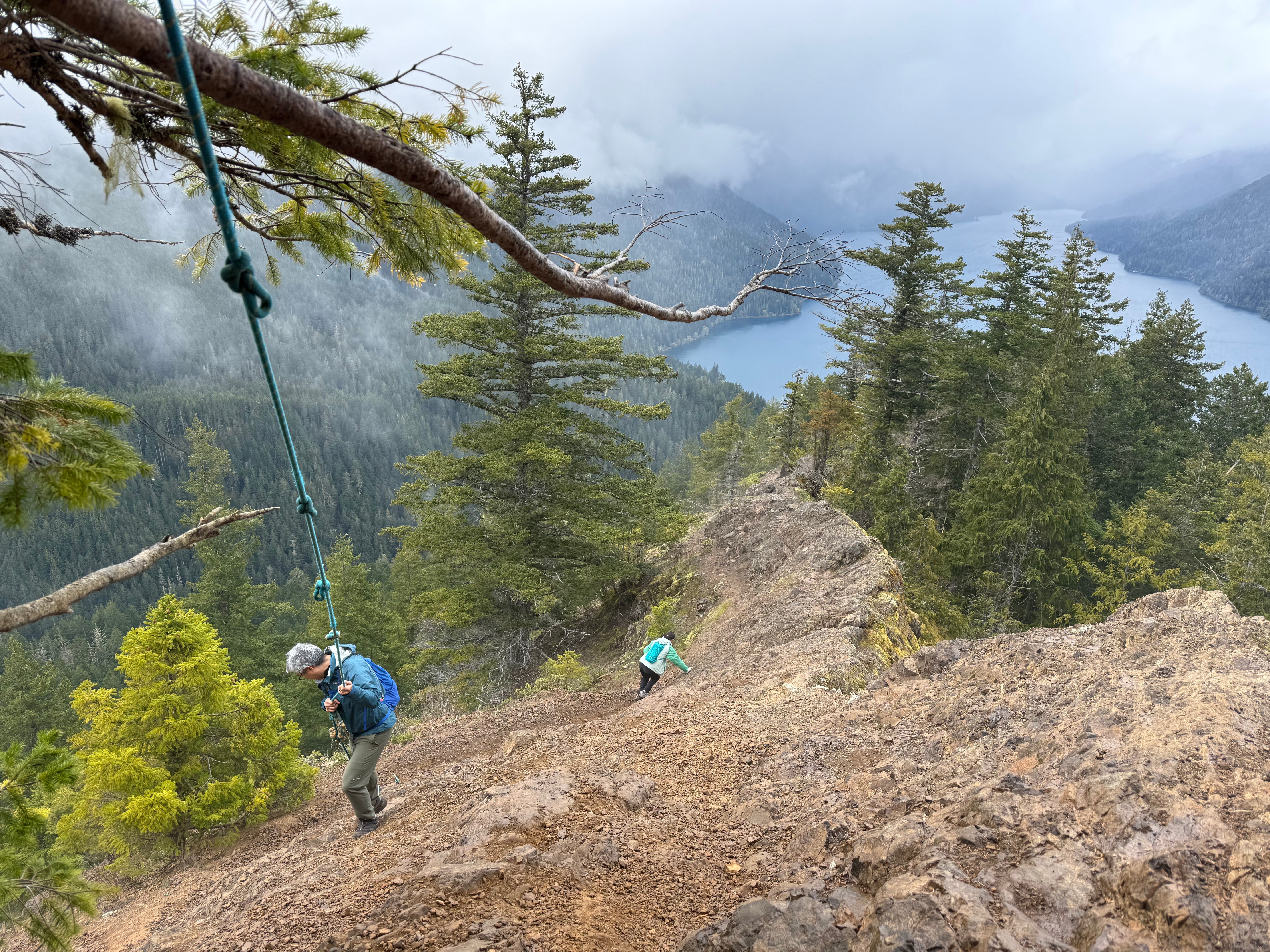
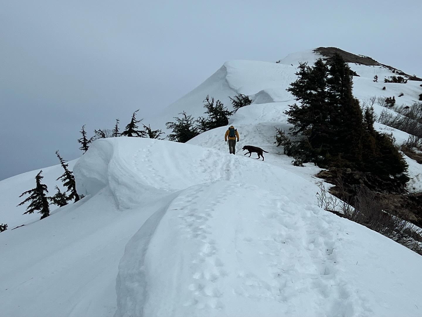
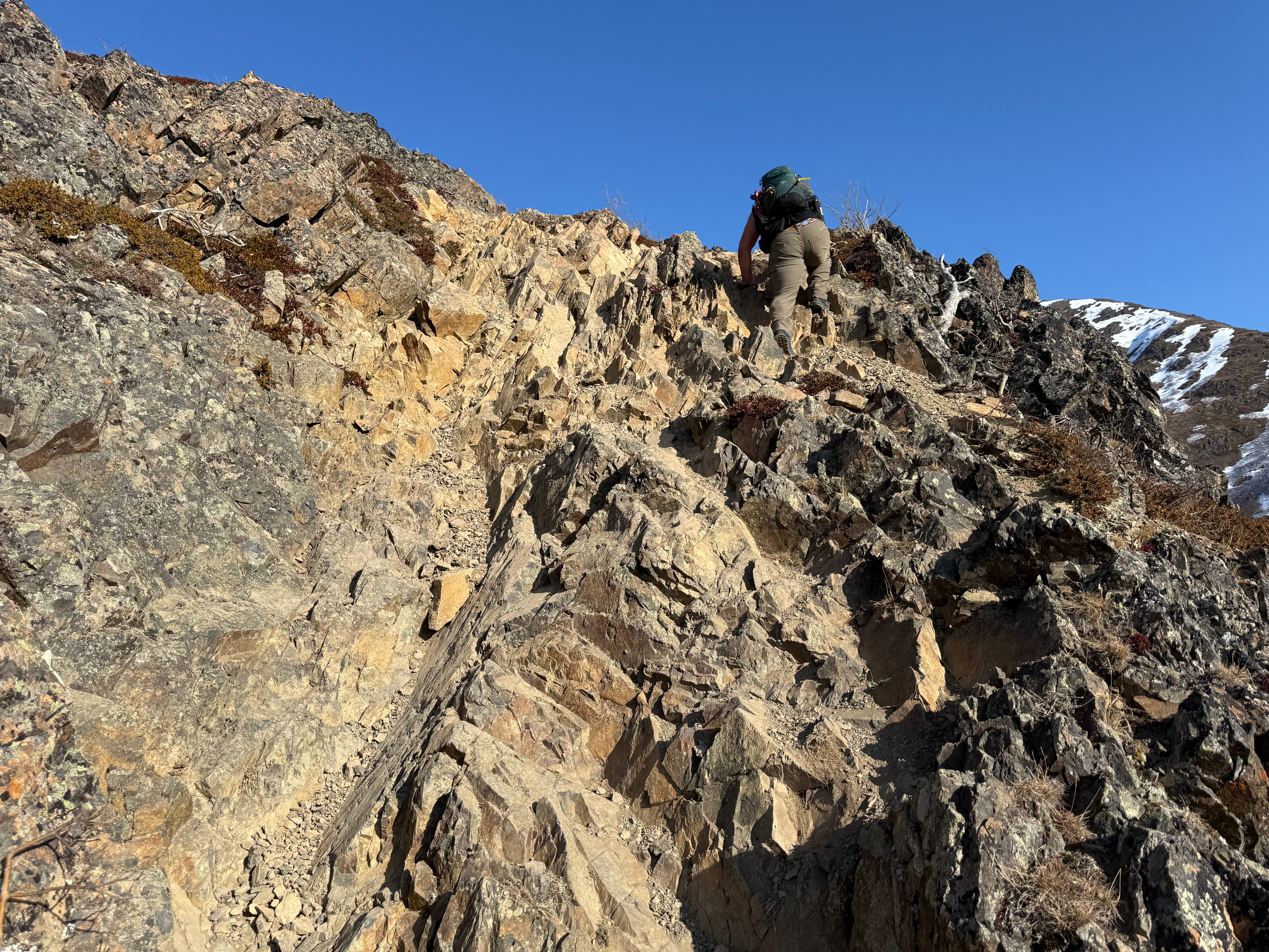
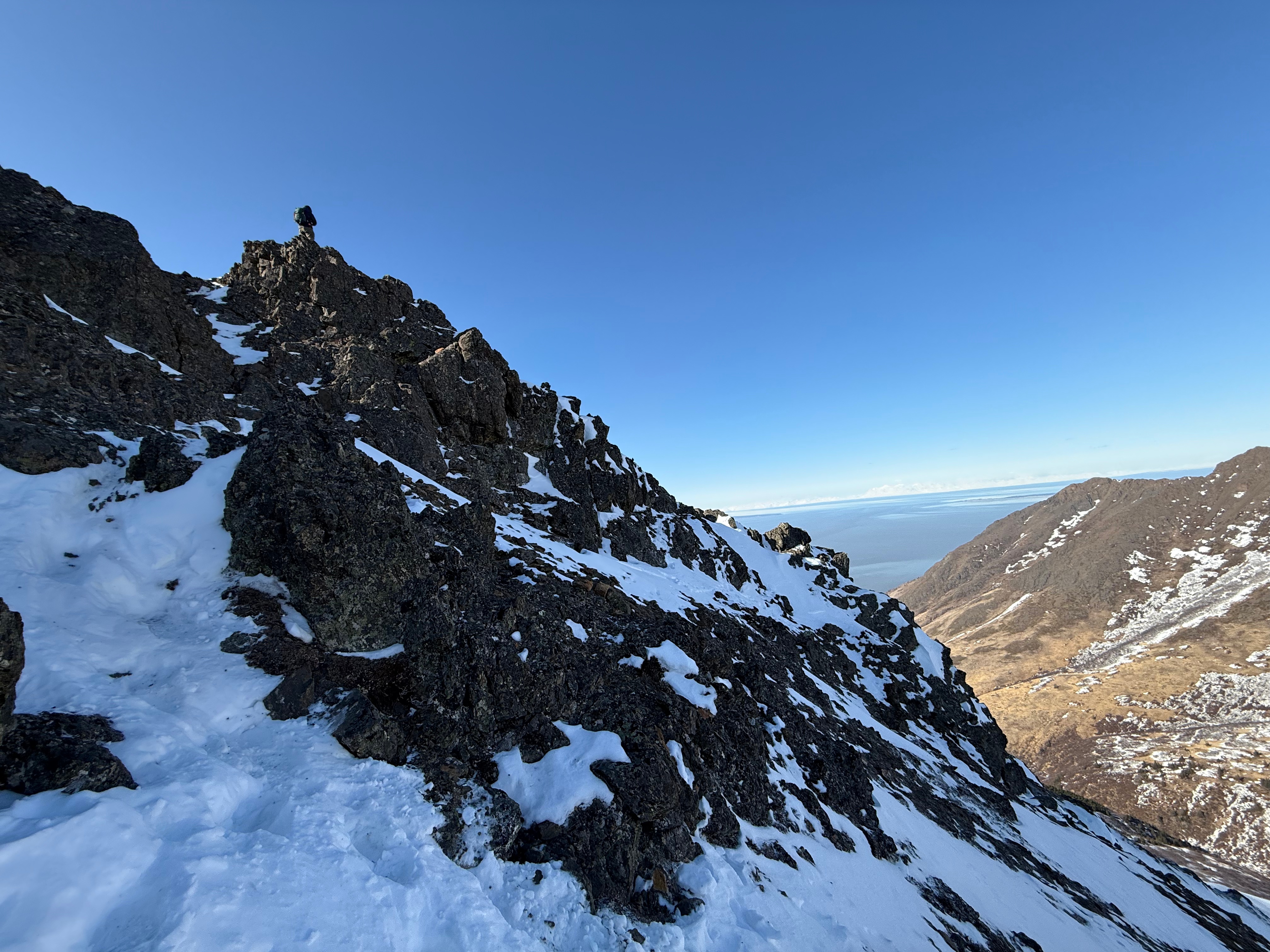
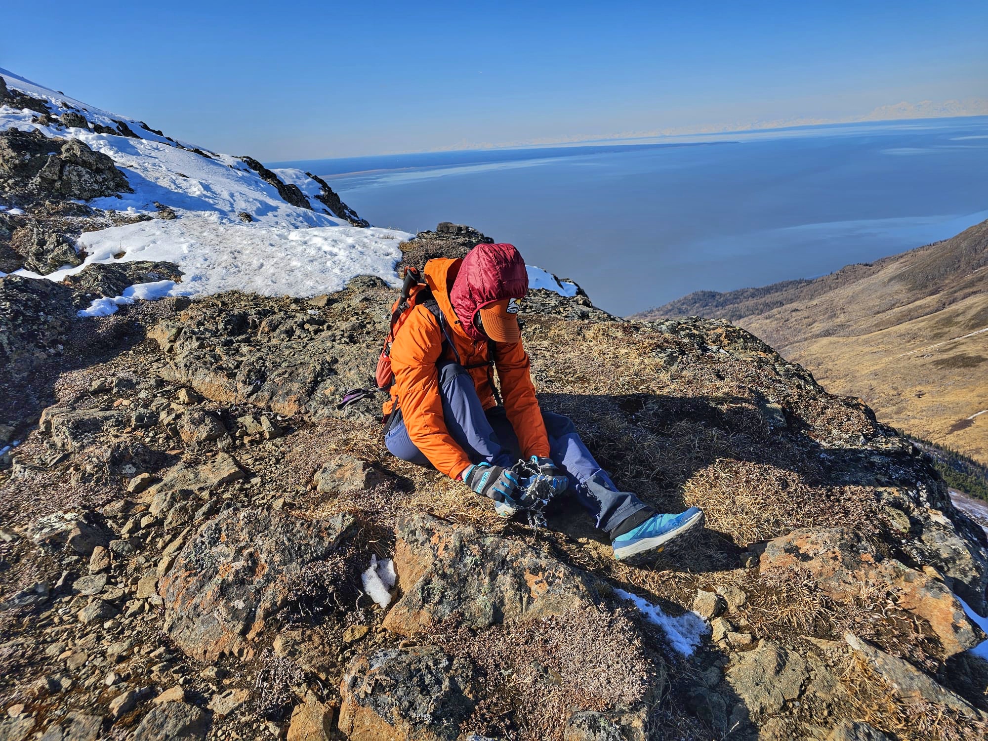
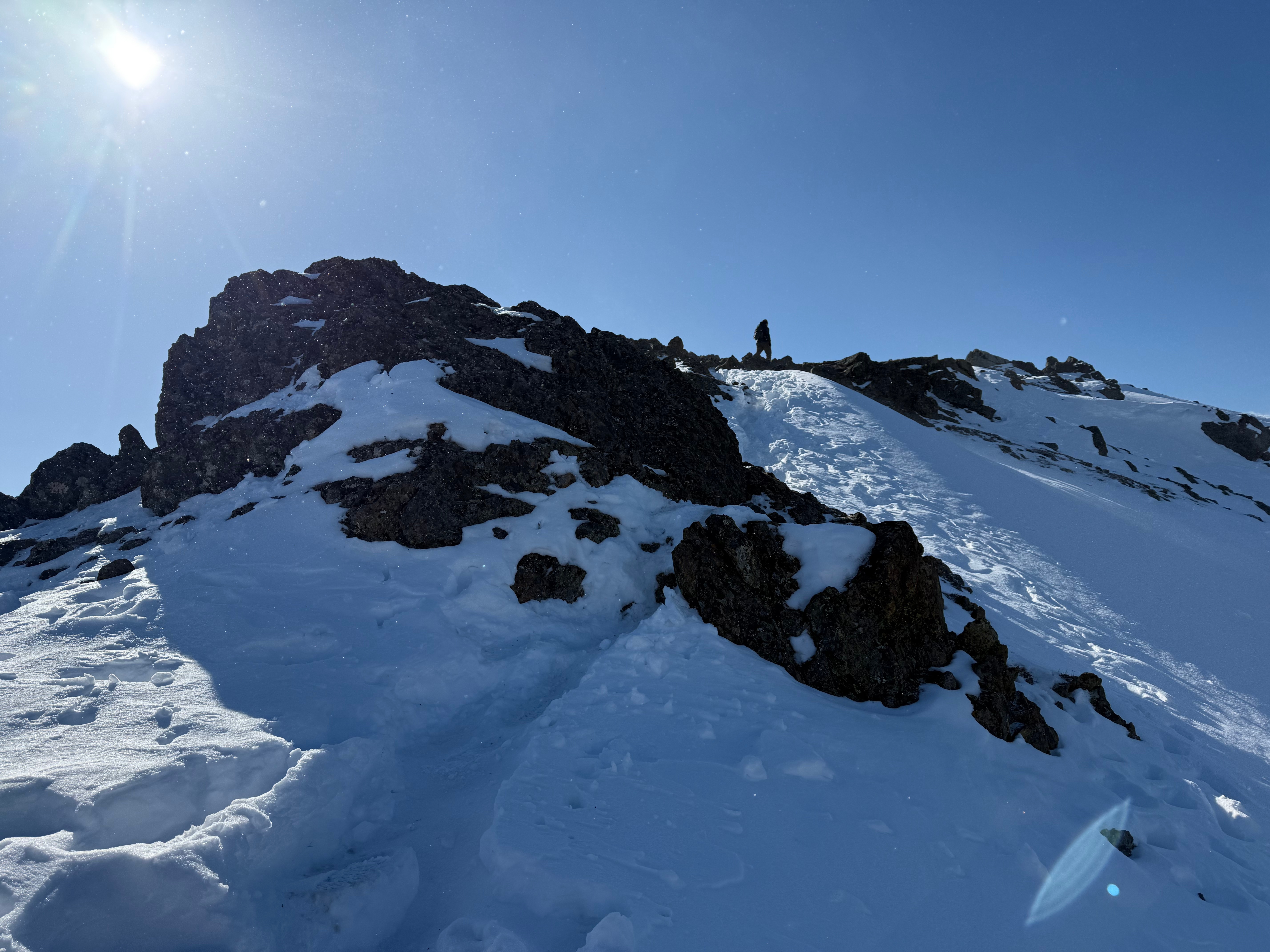
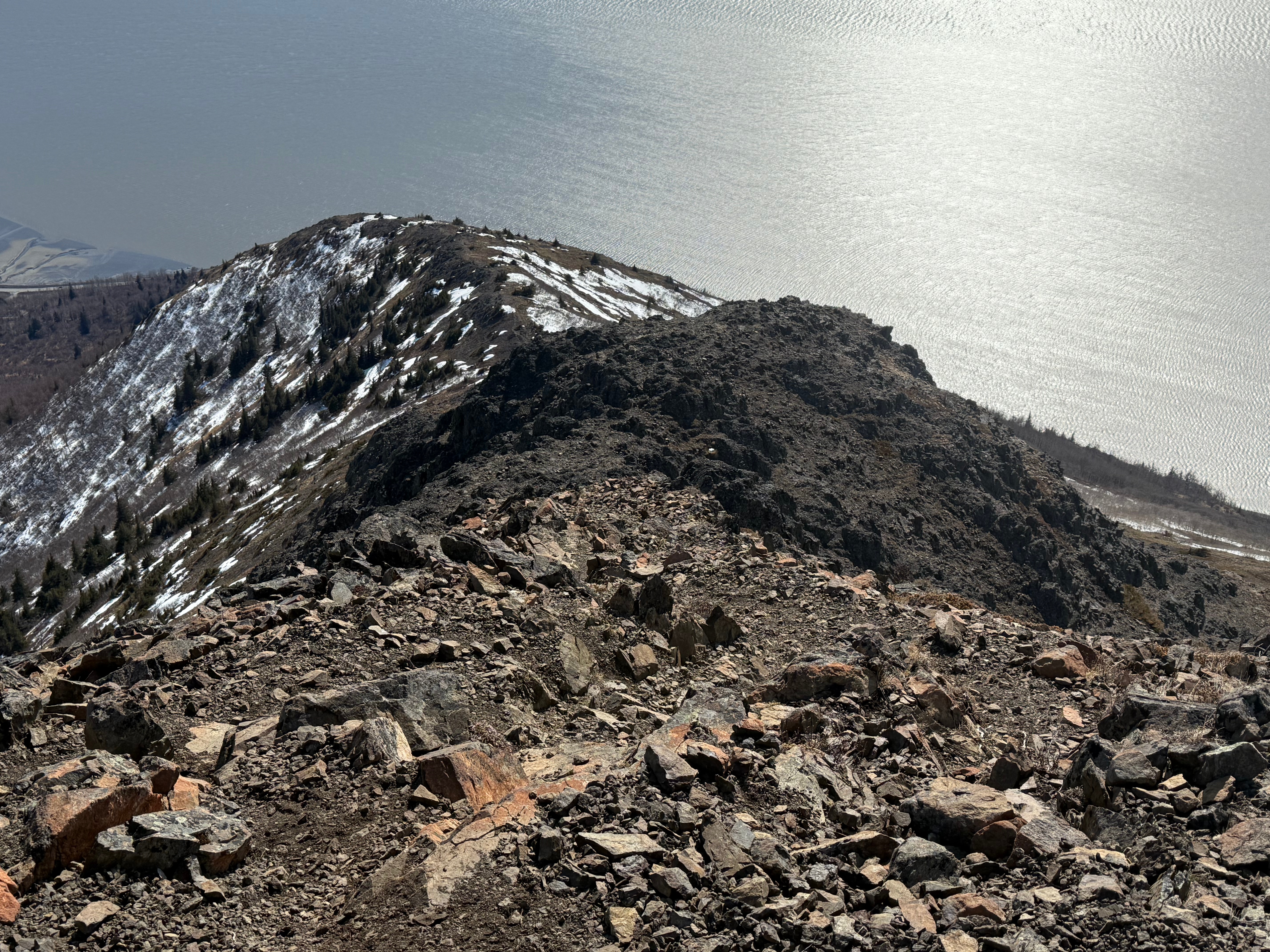
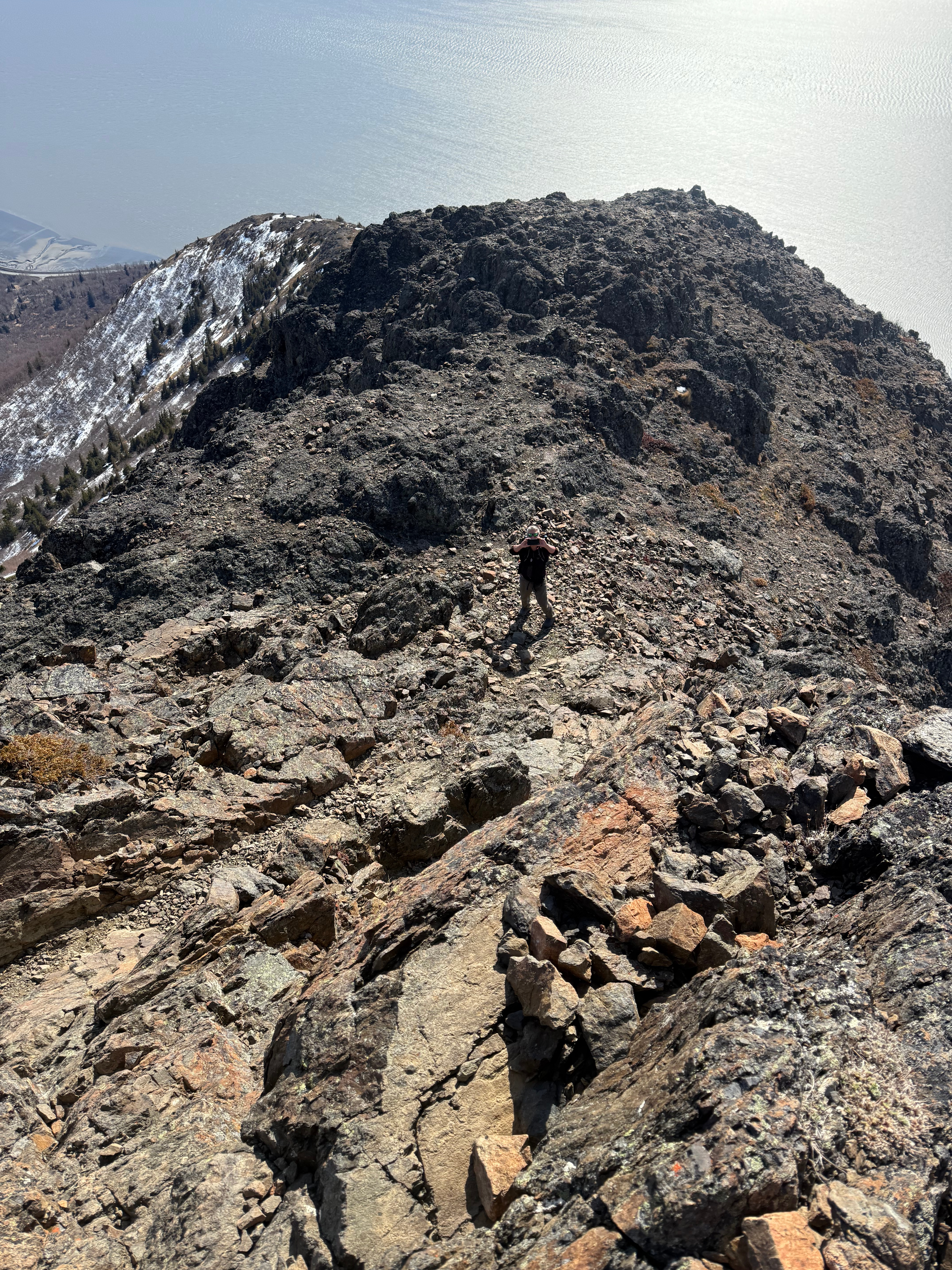
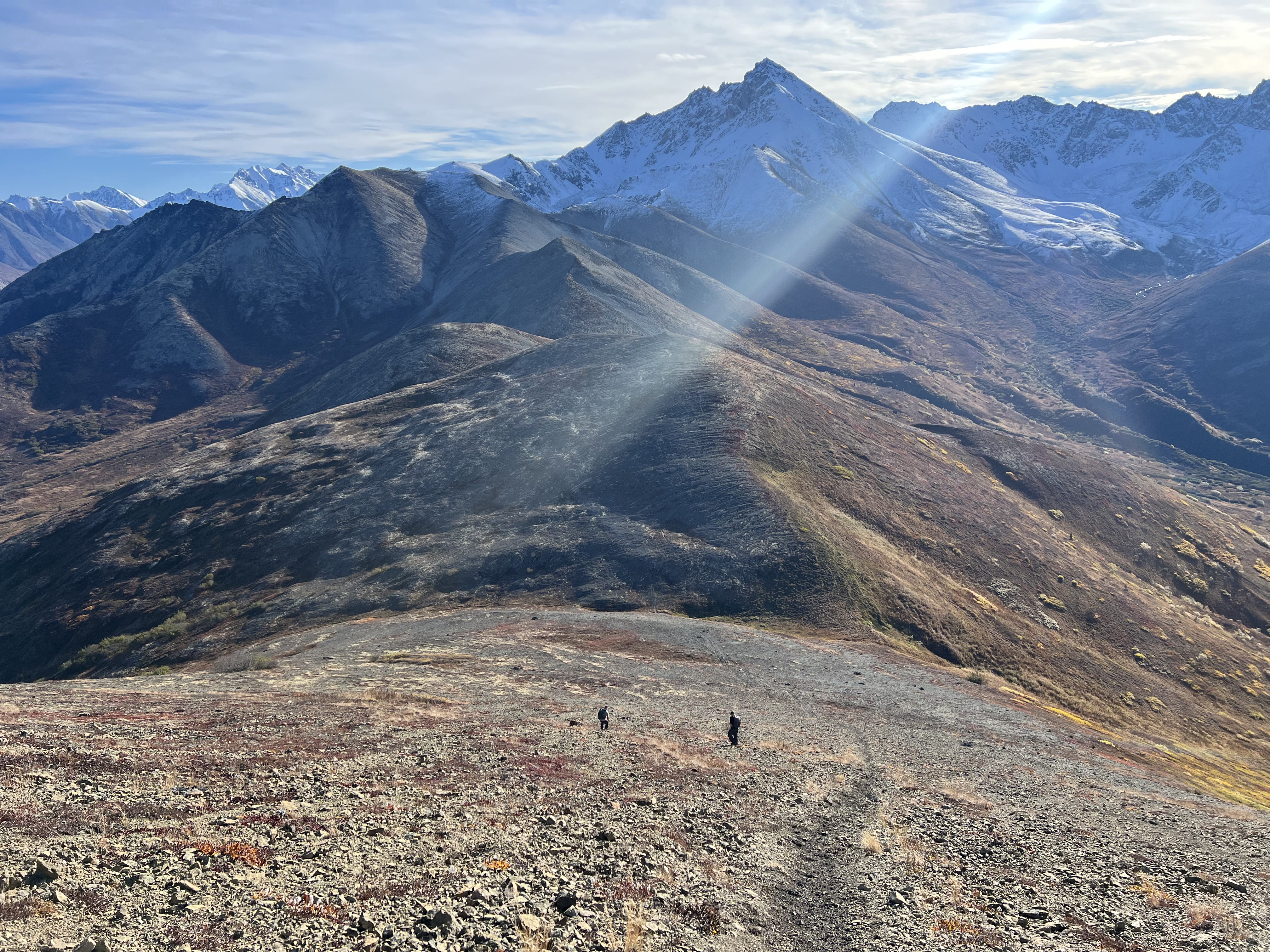
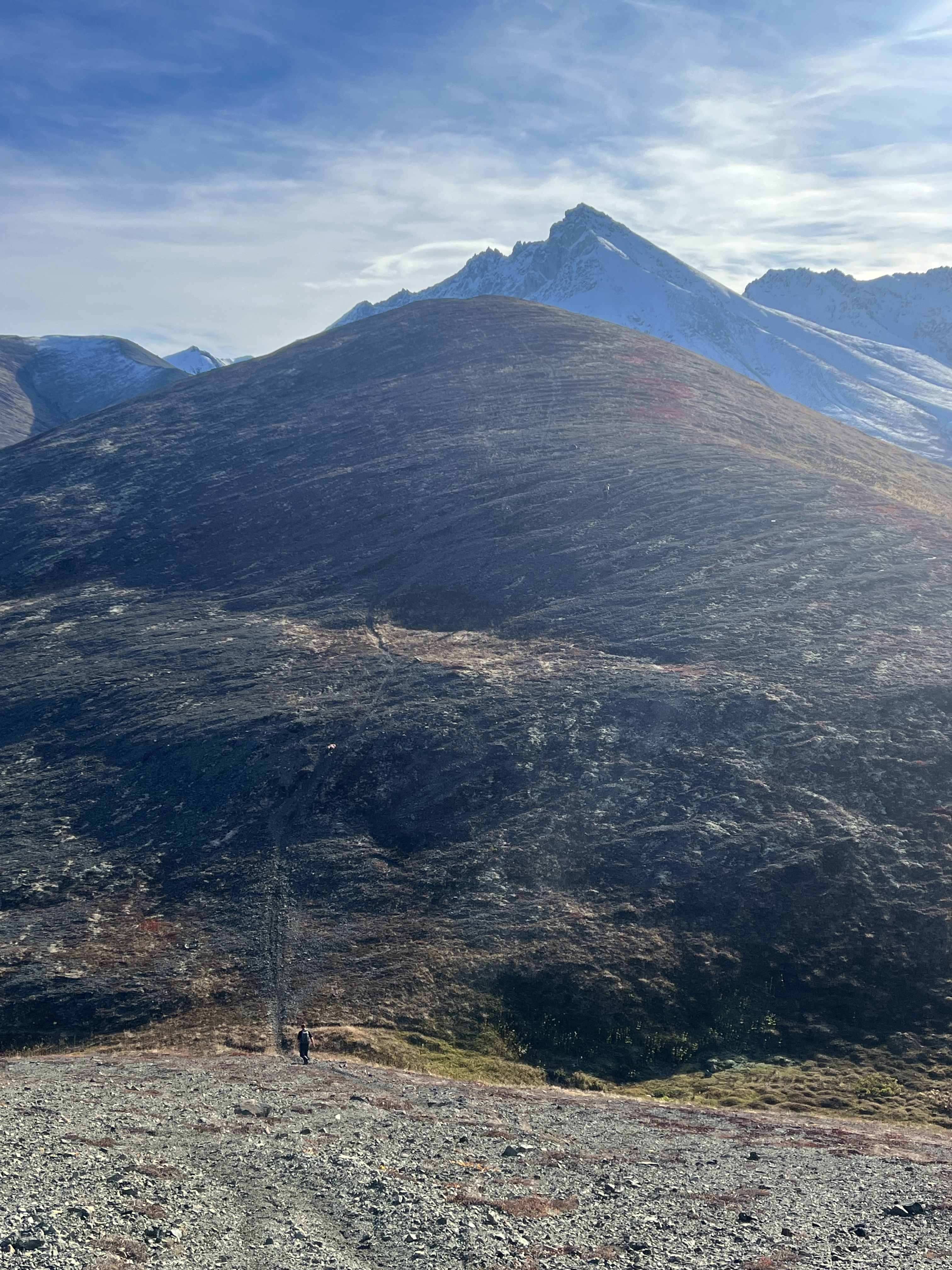
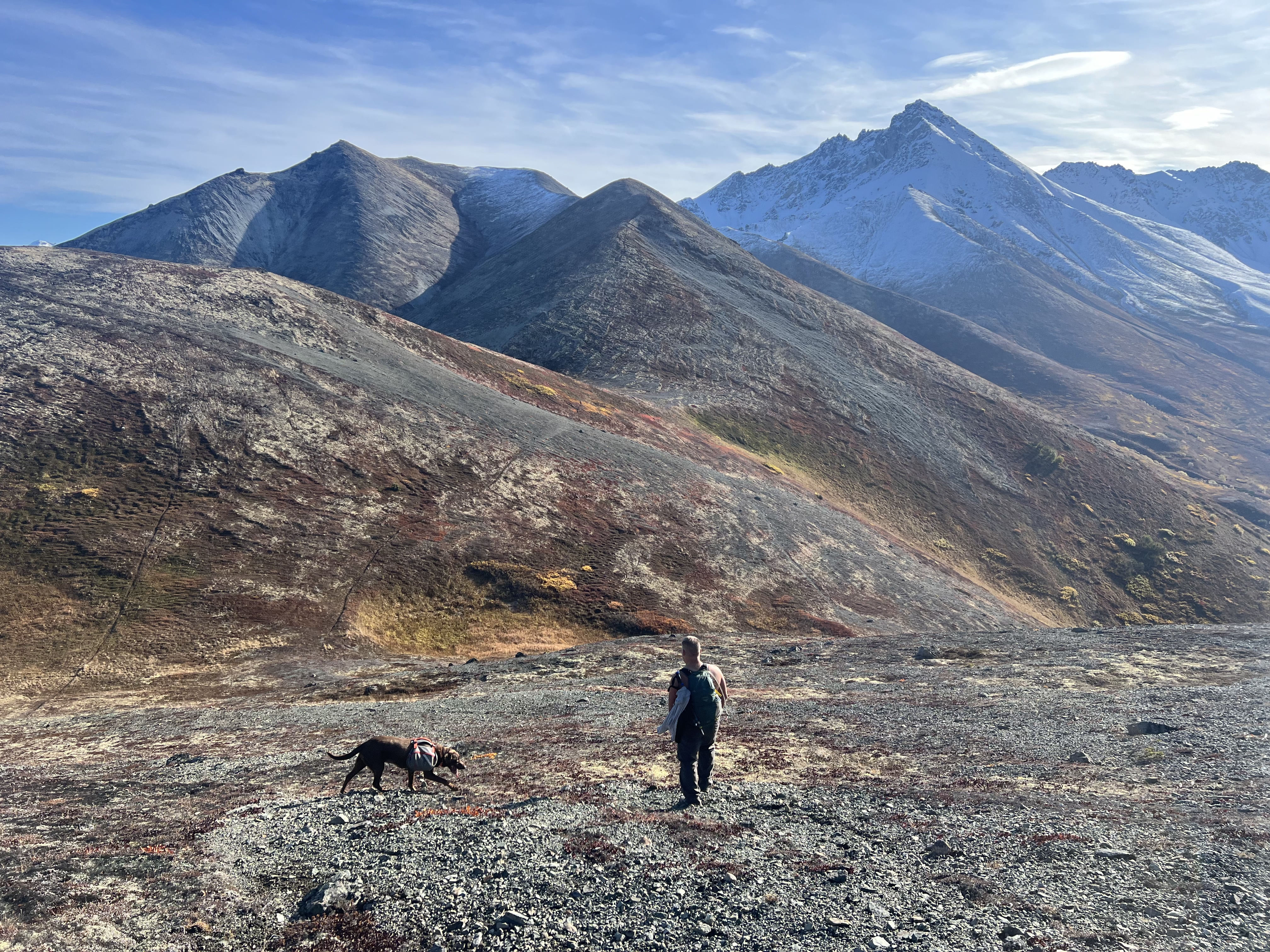
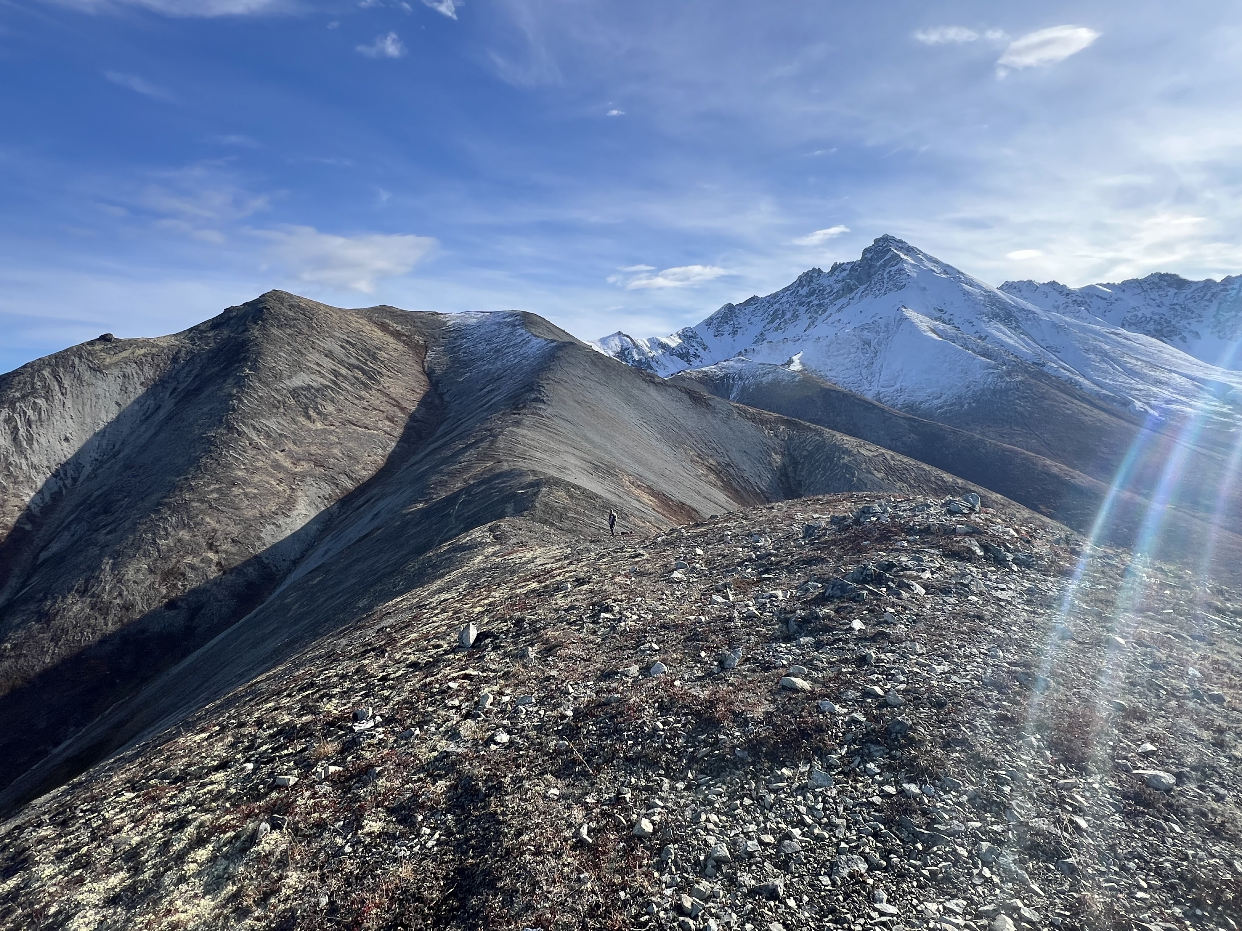
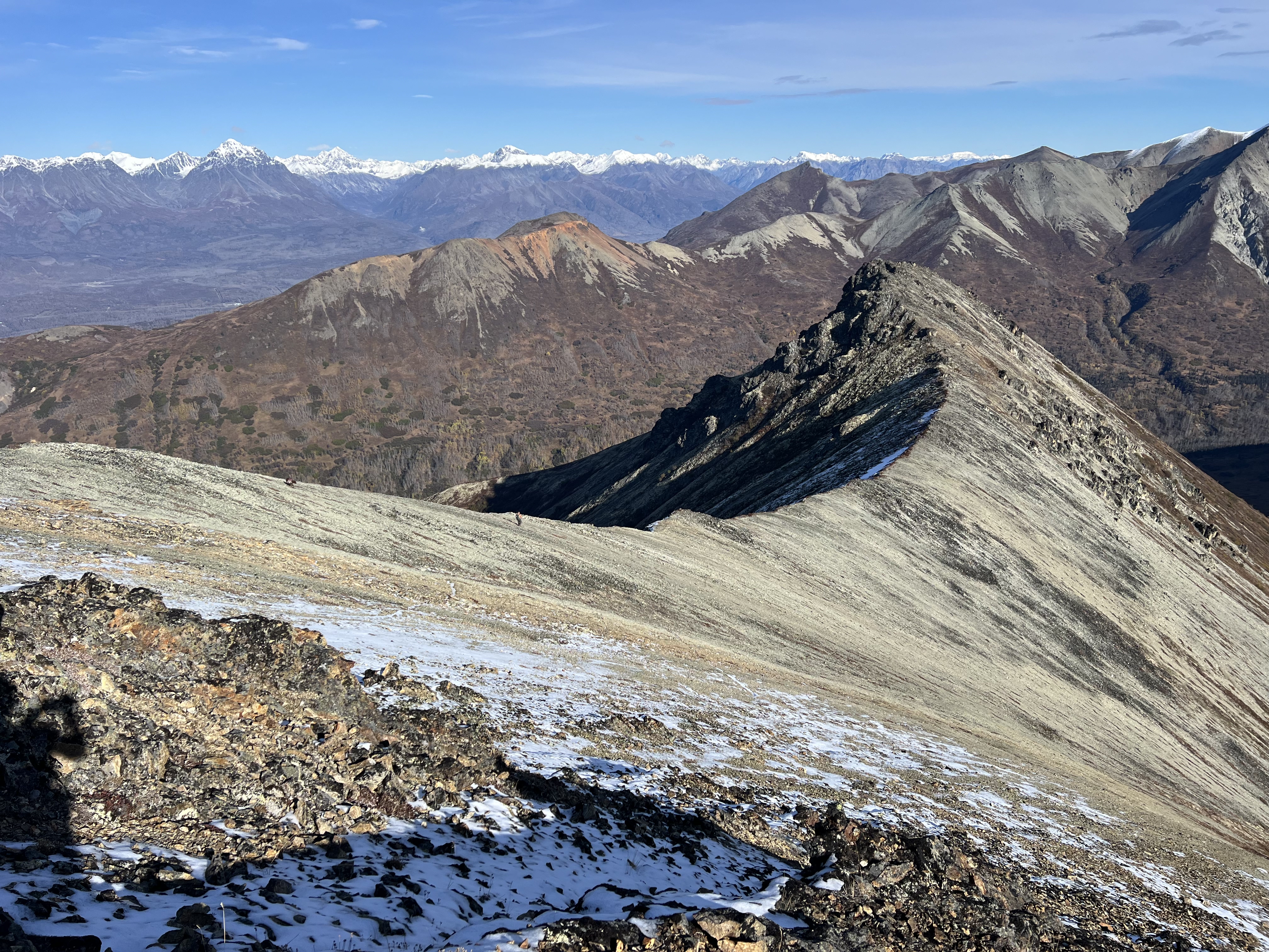
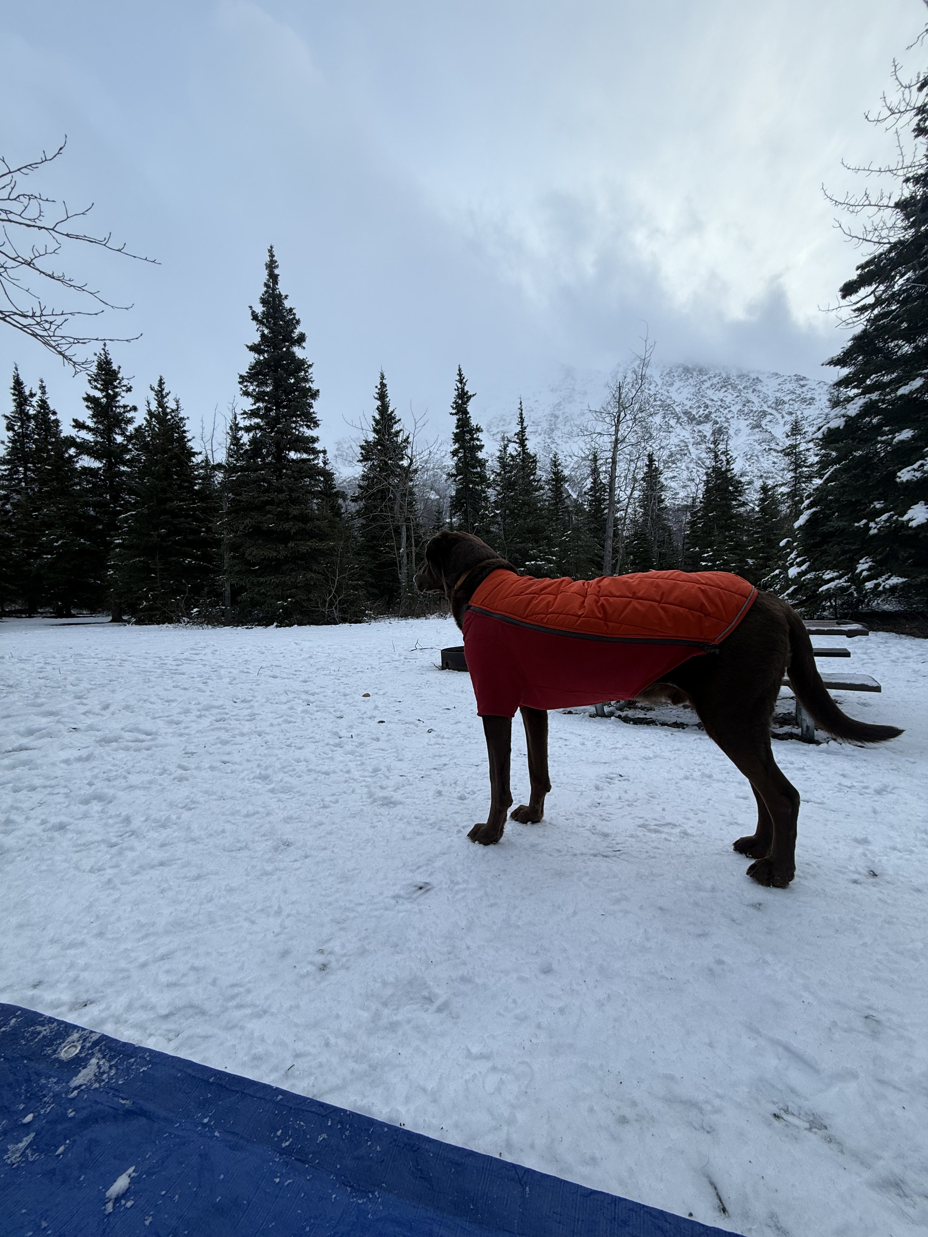
Now six miles in, with three summits and over 4,000 feet of gain behind us, we paused to put on our tall gaiters. Deep snow clung to the ridgeline and northwest face of Kanchee. I voiced concern about the ridge route due to unconsolidated snow and a sheer drop-off to the east (I’m always irrationally paranoid that my dog might leap off a cliff), so we descended via Kanchee’s west ridge to a point where crossing the snowfield felt safer.
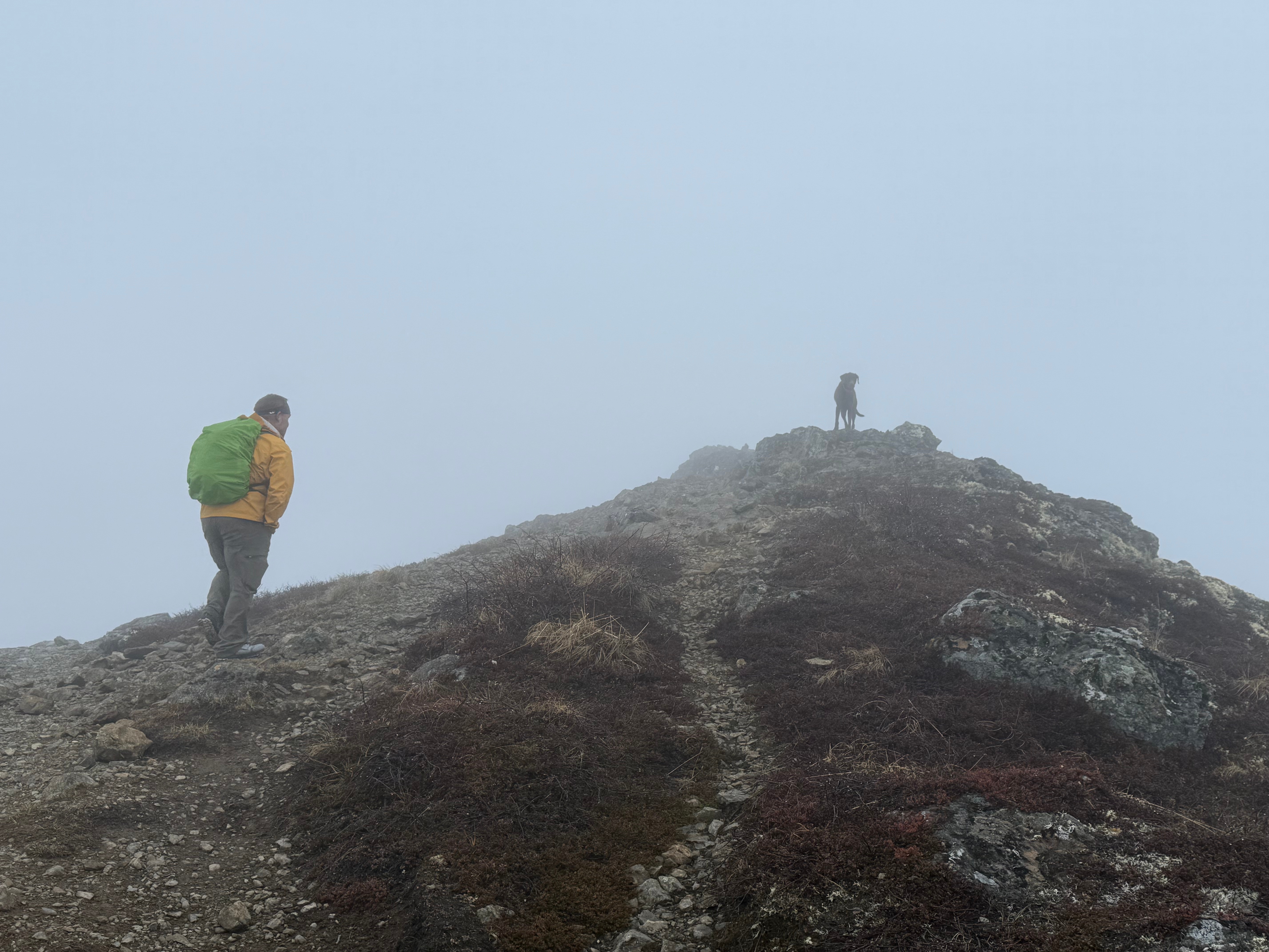
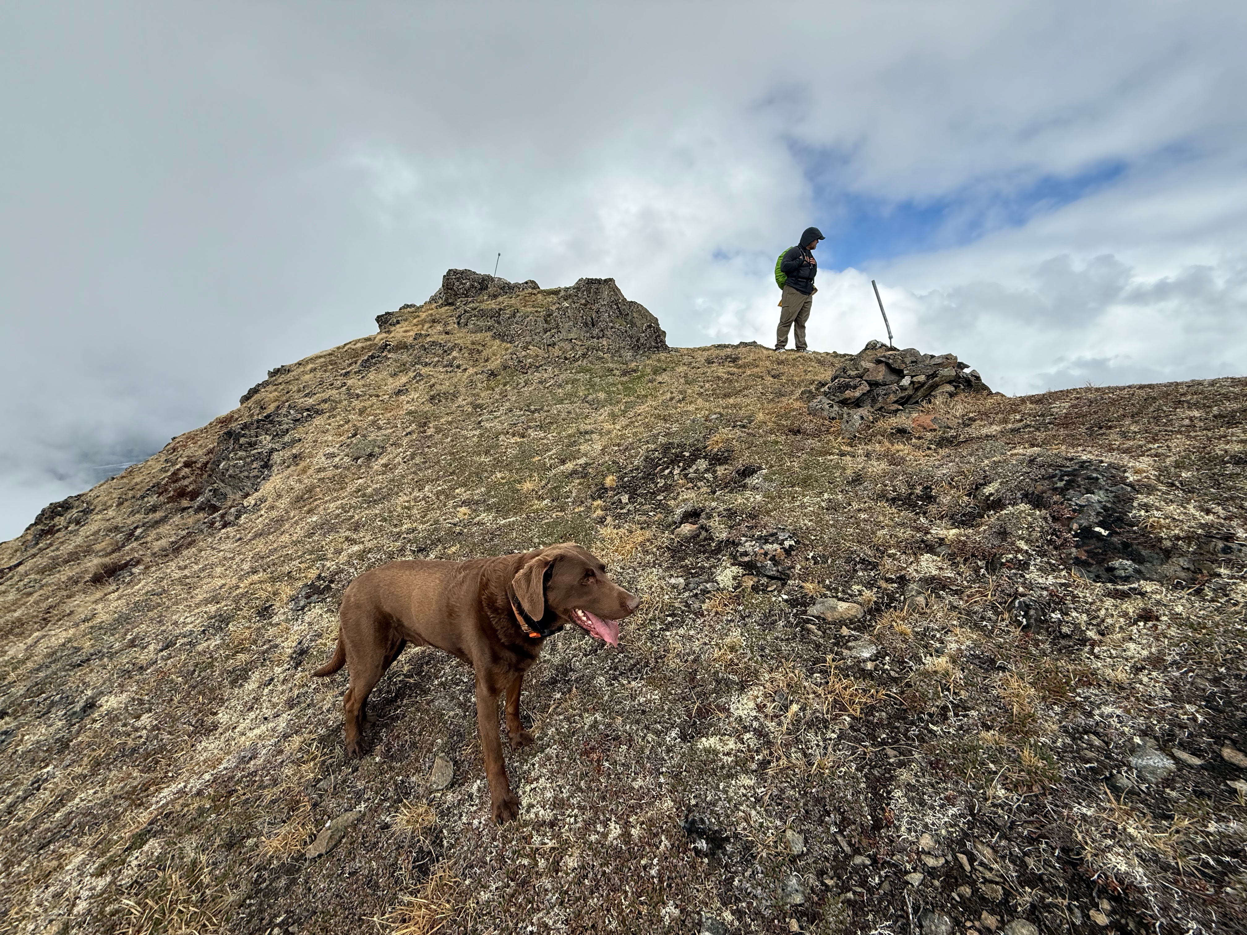
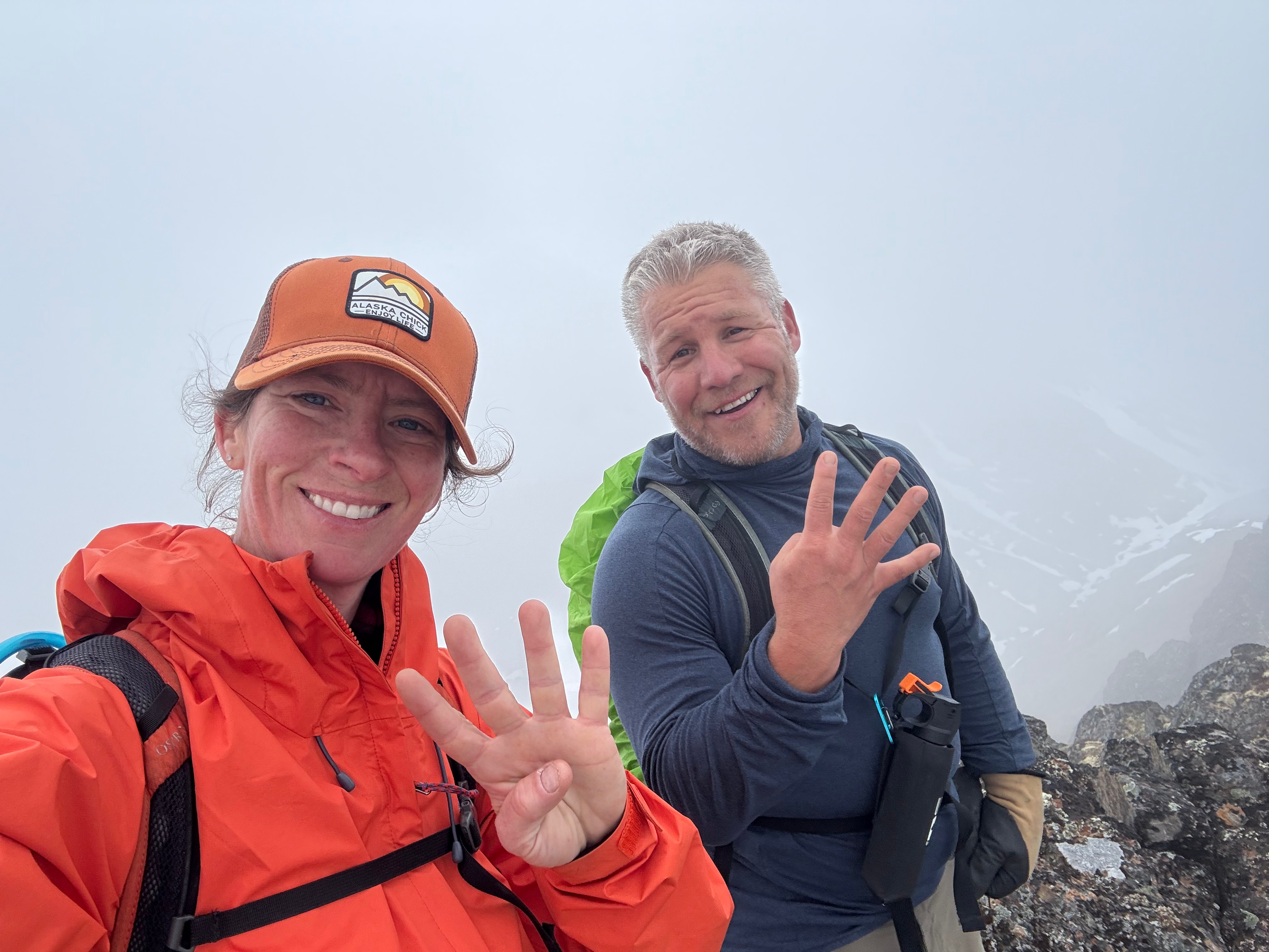
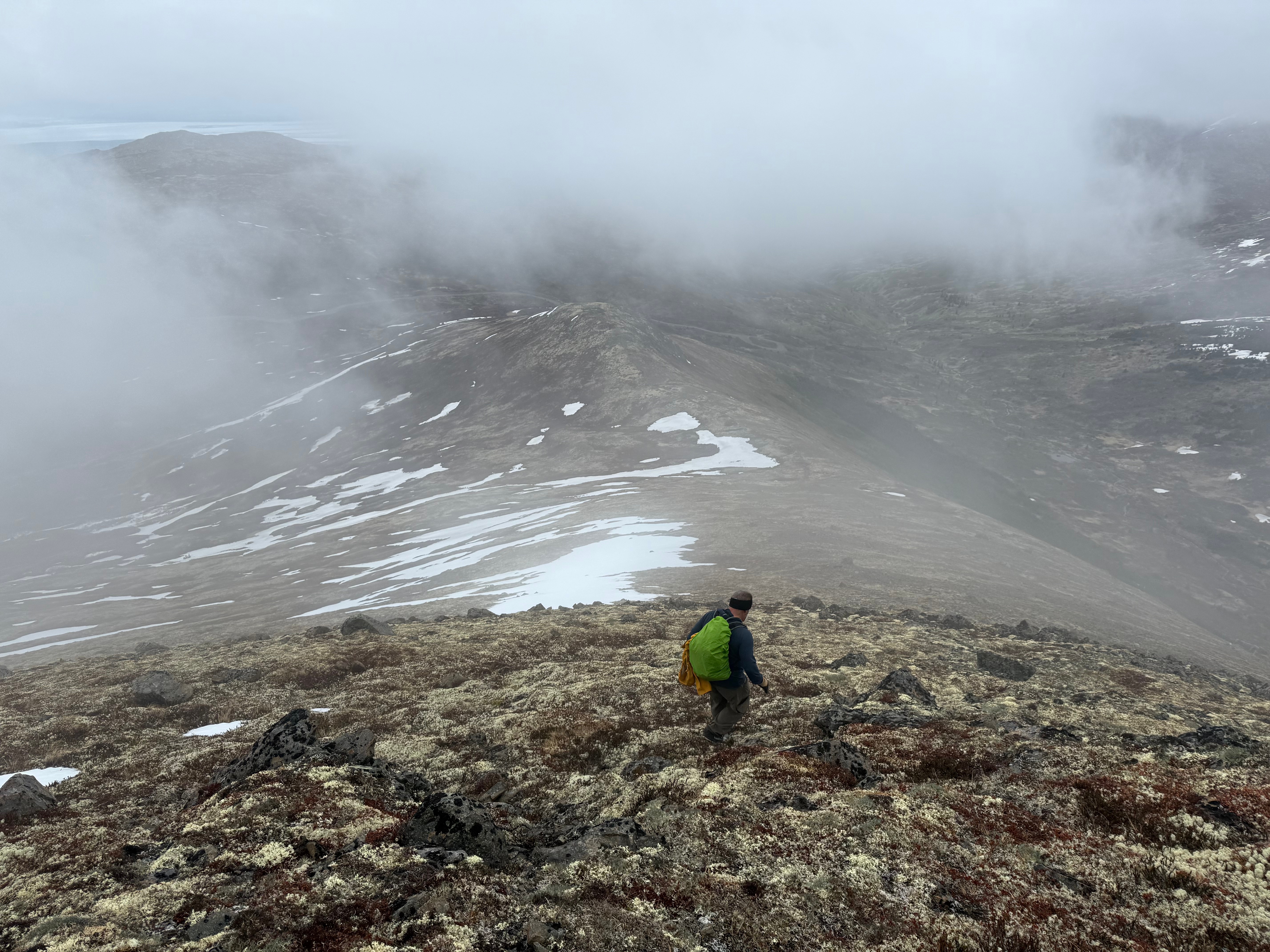
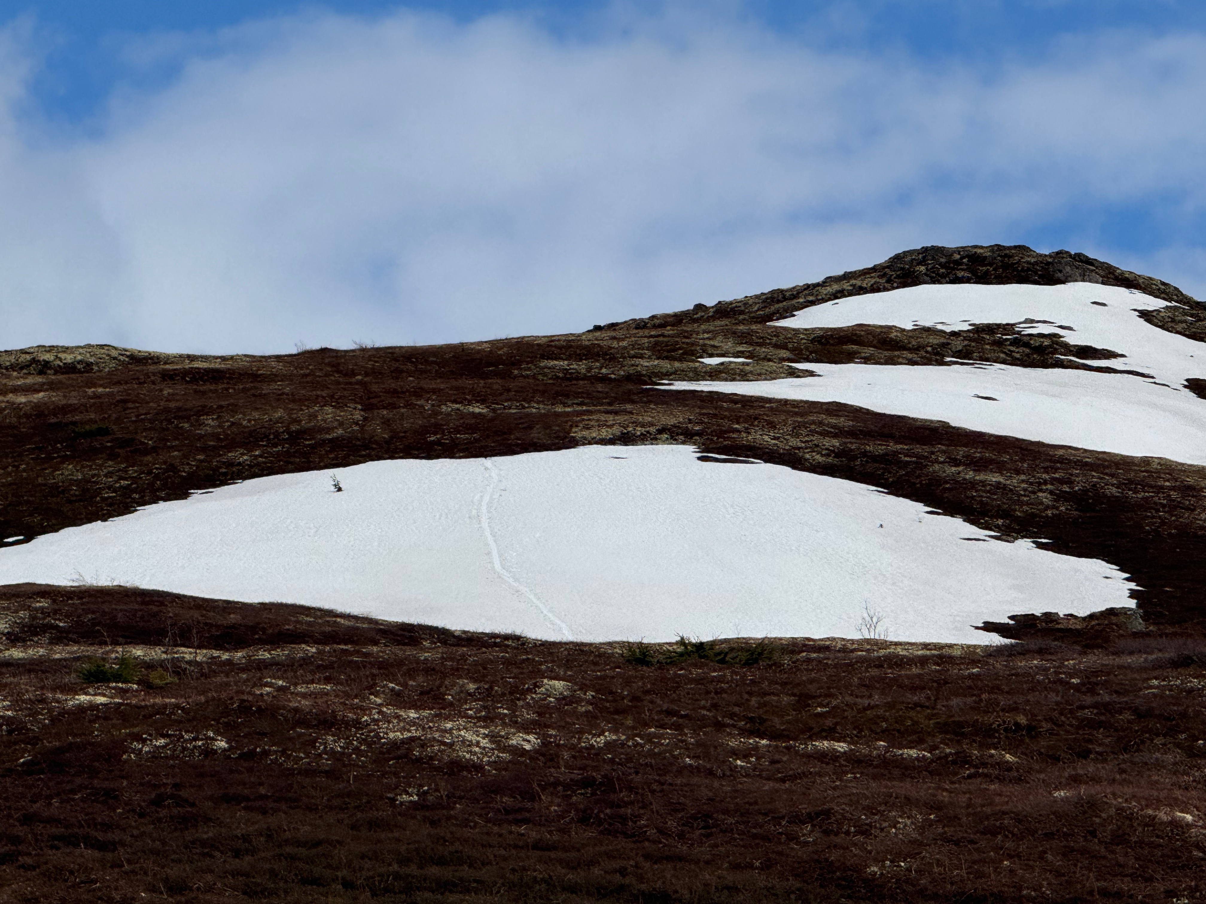
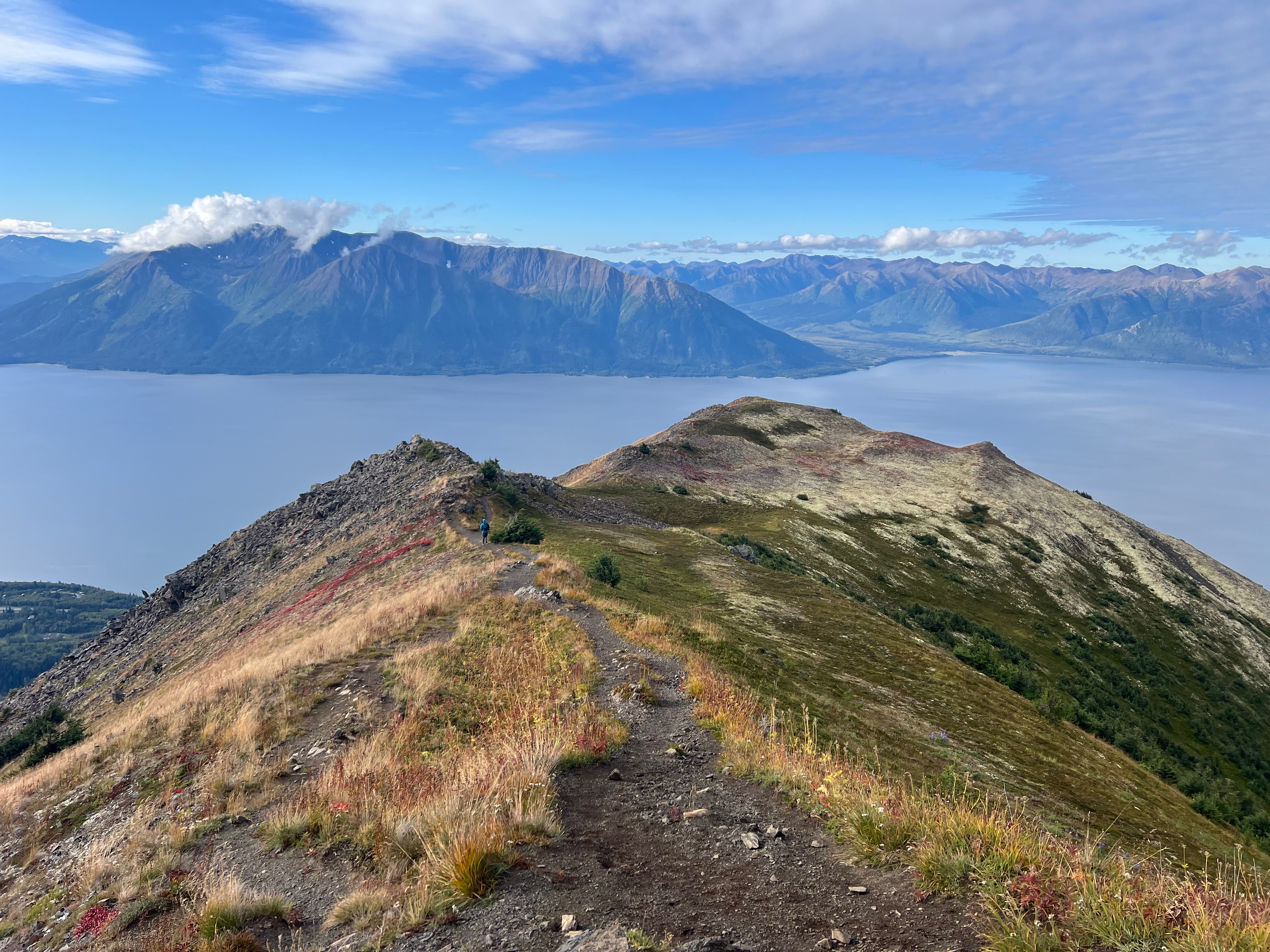
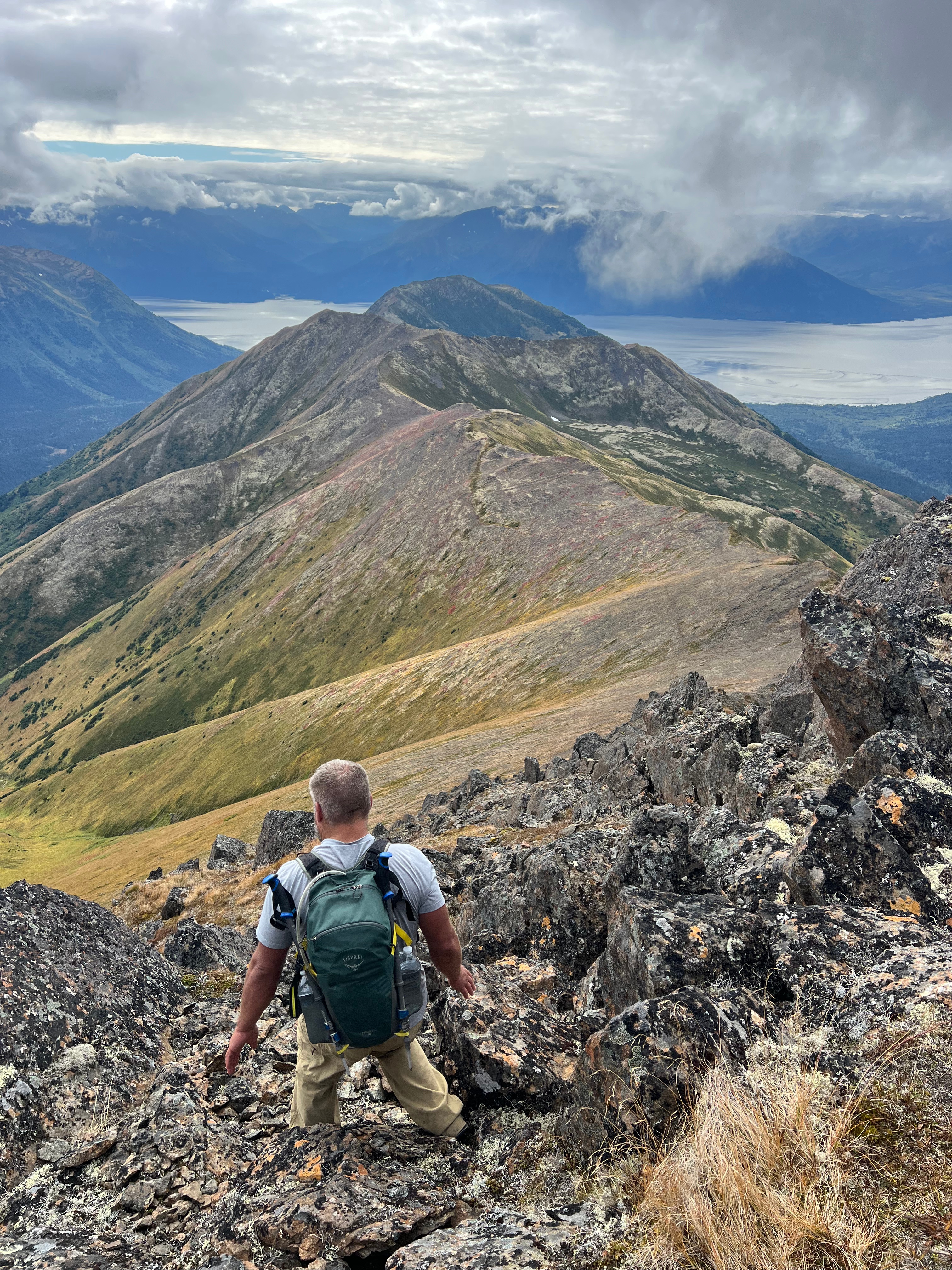
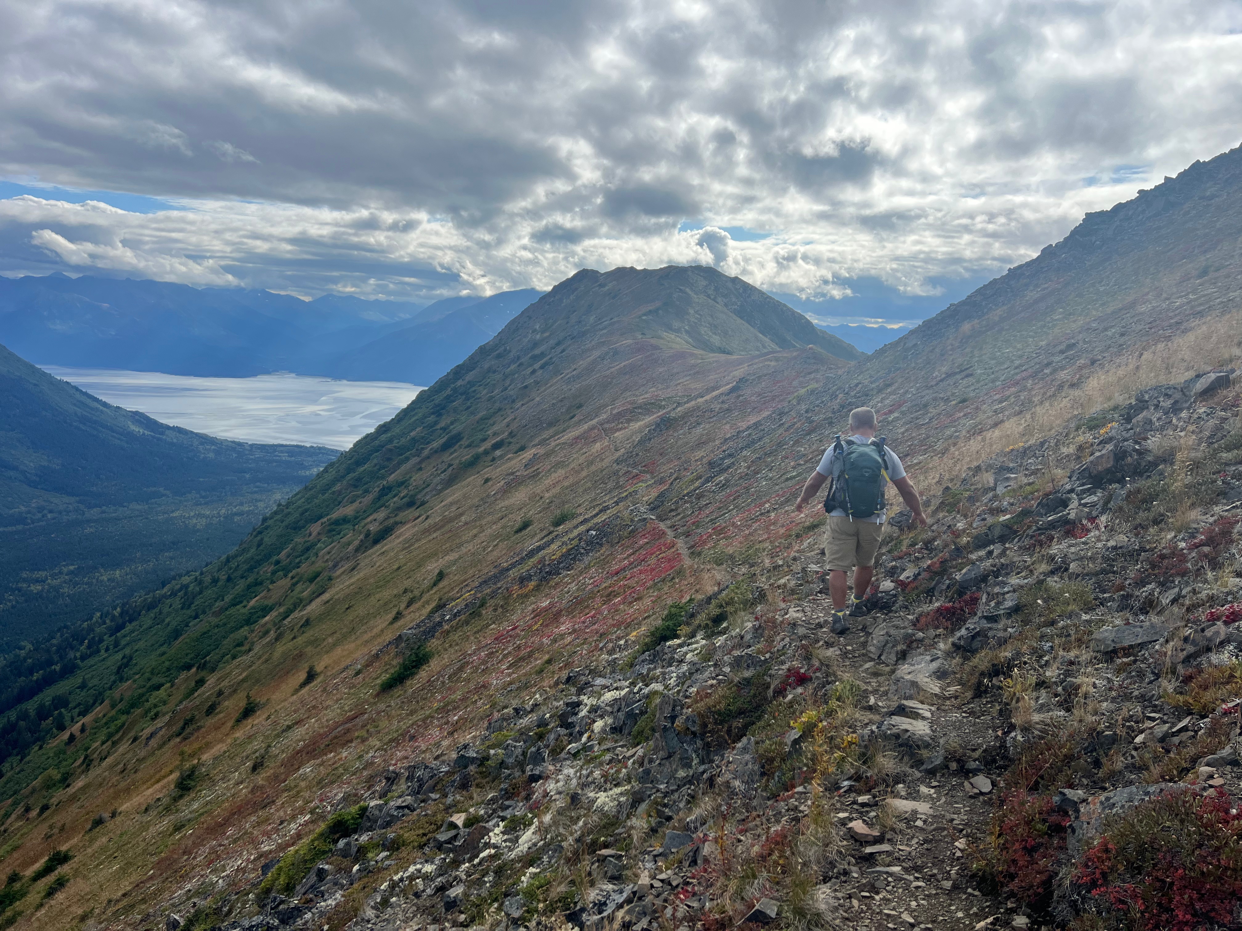
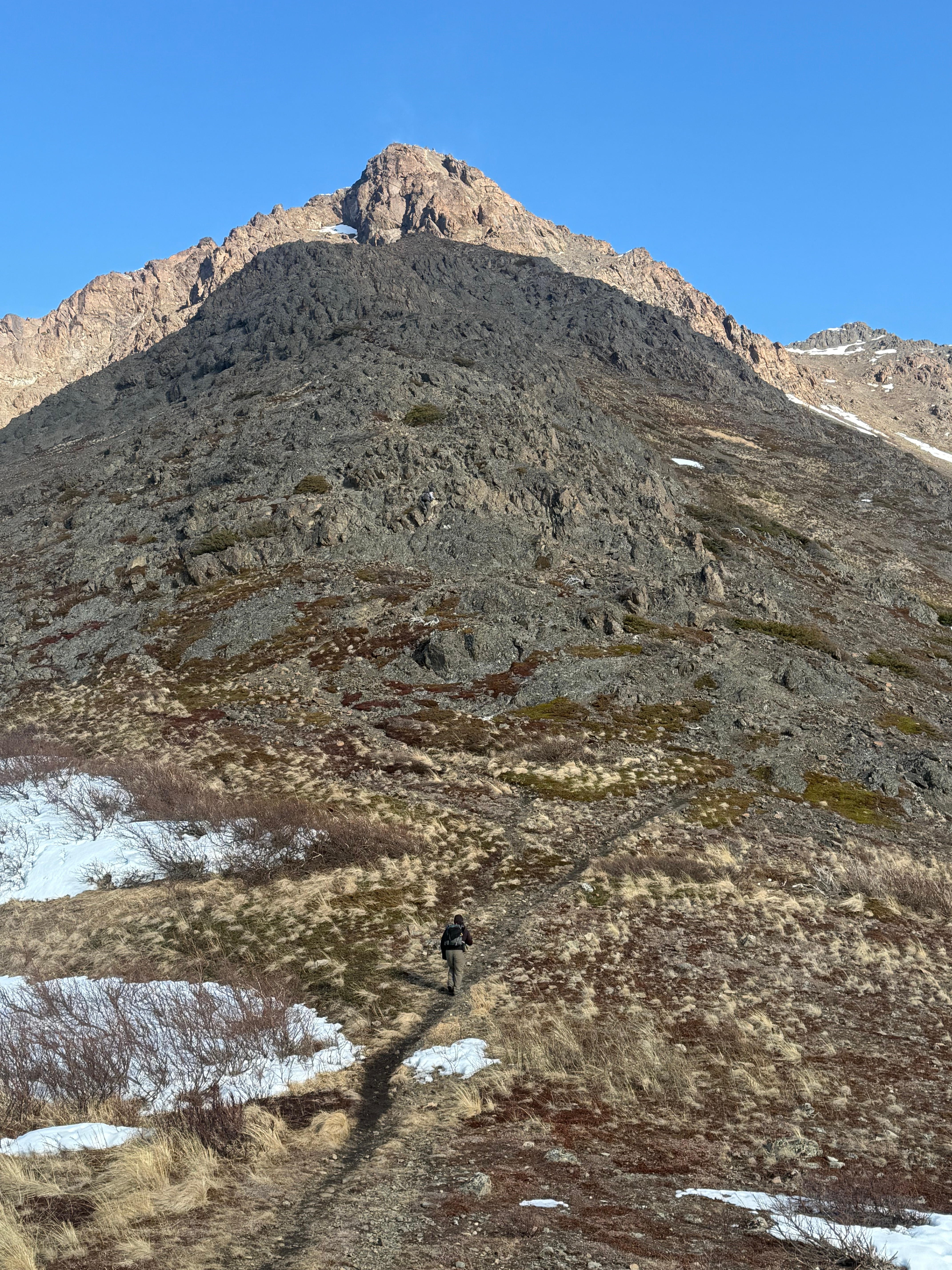
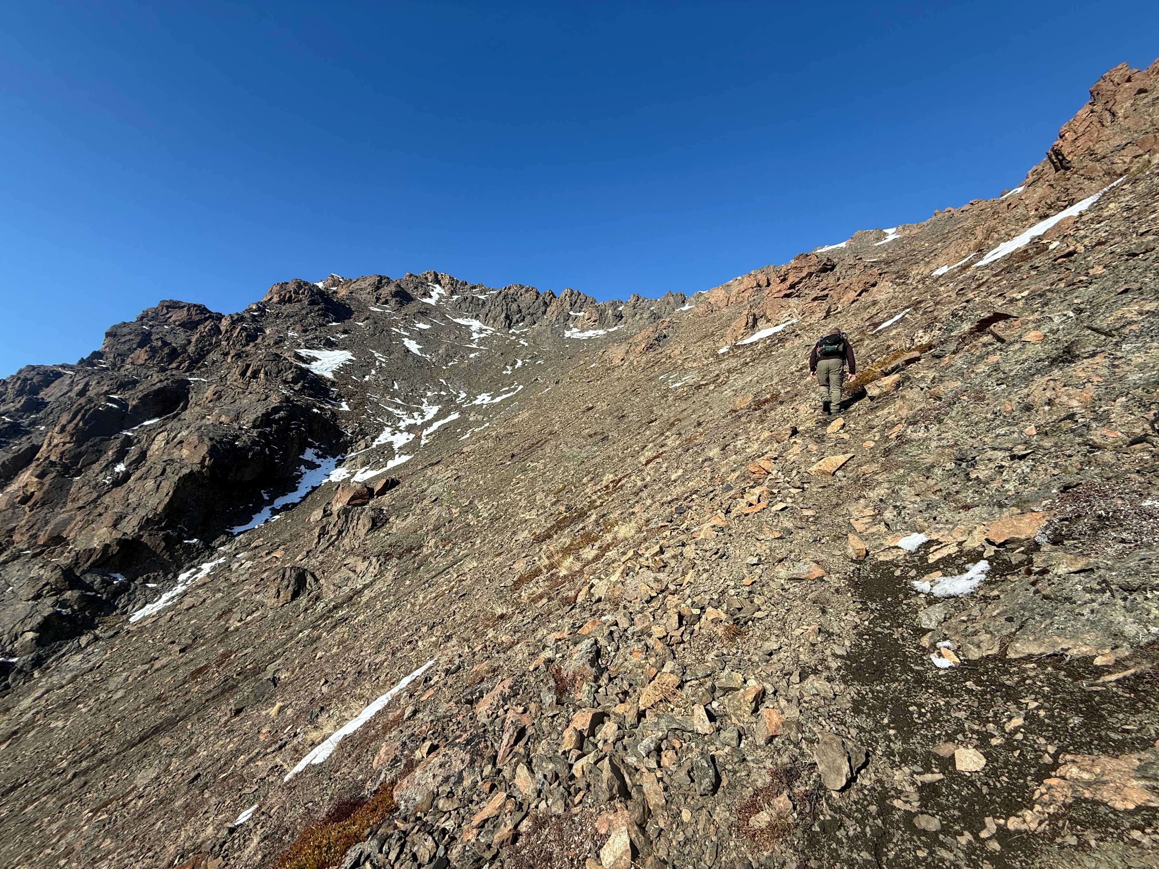
Even 700 feet below the summit, we were still postholing through knee-deep snow. I eventually chose to slide down the final few patches to the base of Nunaka. Two hundred feet above us stood the summit of Nunaka, the last peak in the ridgeline series—seven miles into our hike now. The clouds returned as we walked up the grassy slopes, and by the time we reached the top, the views had vanished again.
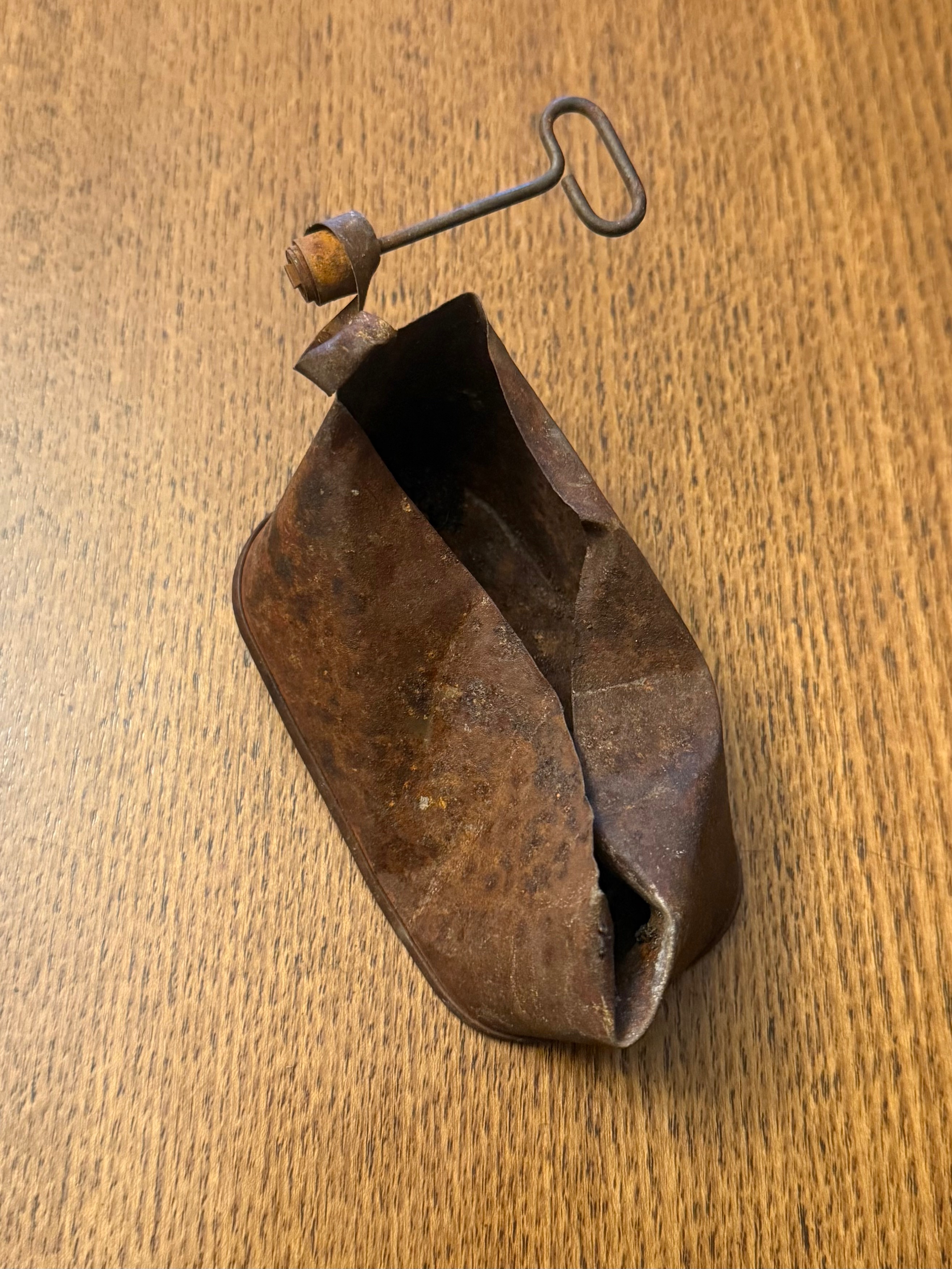
One last summit selfie, and then we descended the ridge toward Snow Hawk Road. It was an uneventful descent—except for Jason finding a nice pocketknife and me discovering a great snow slide.
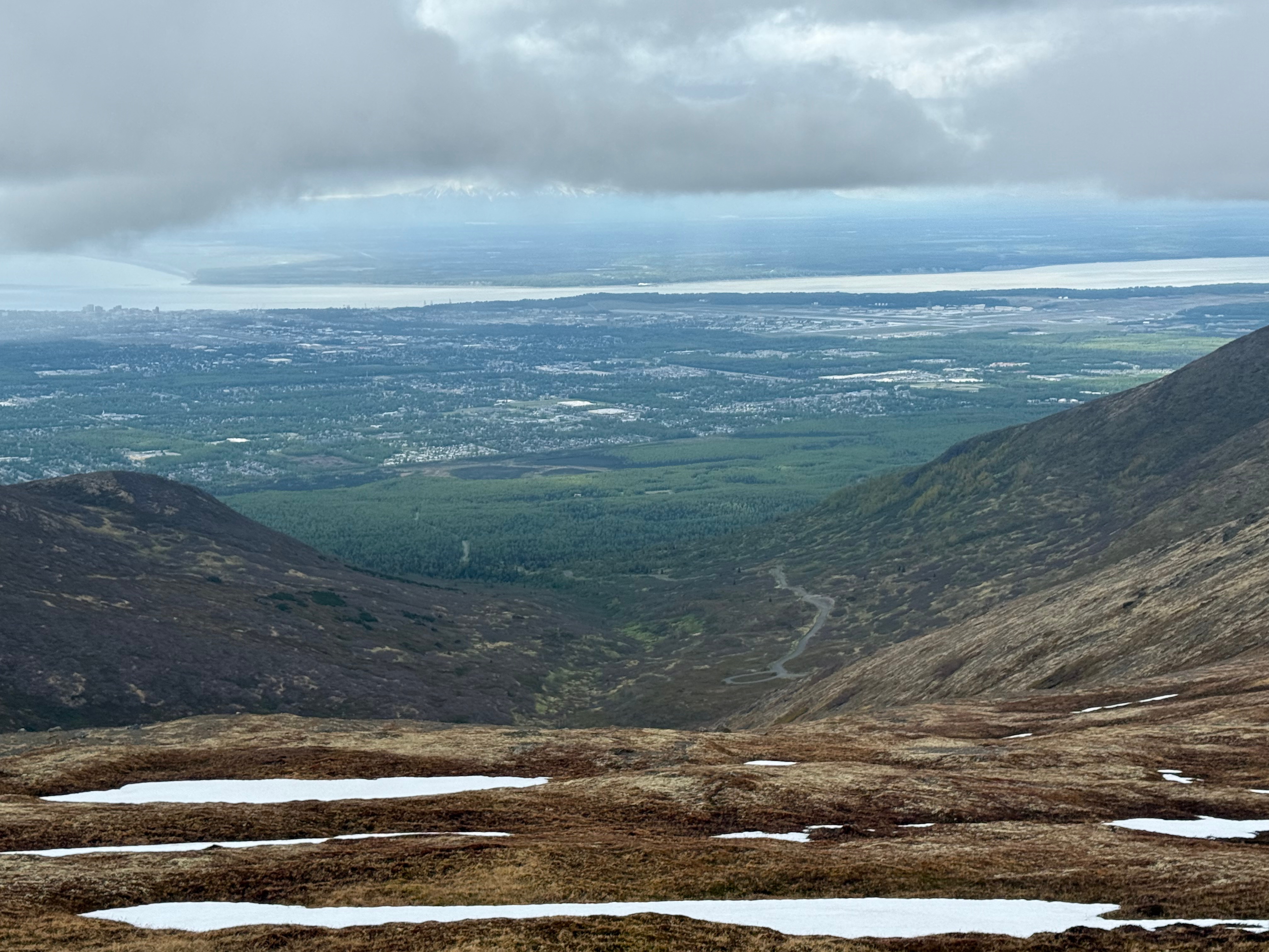
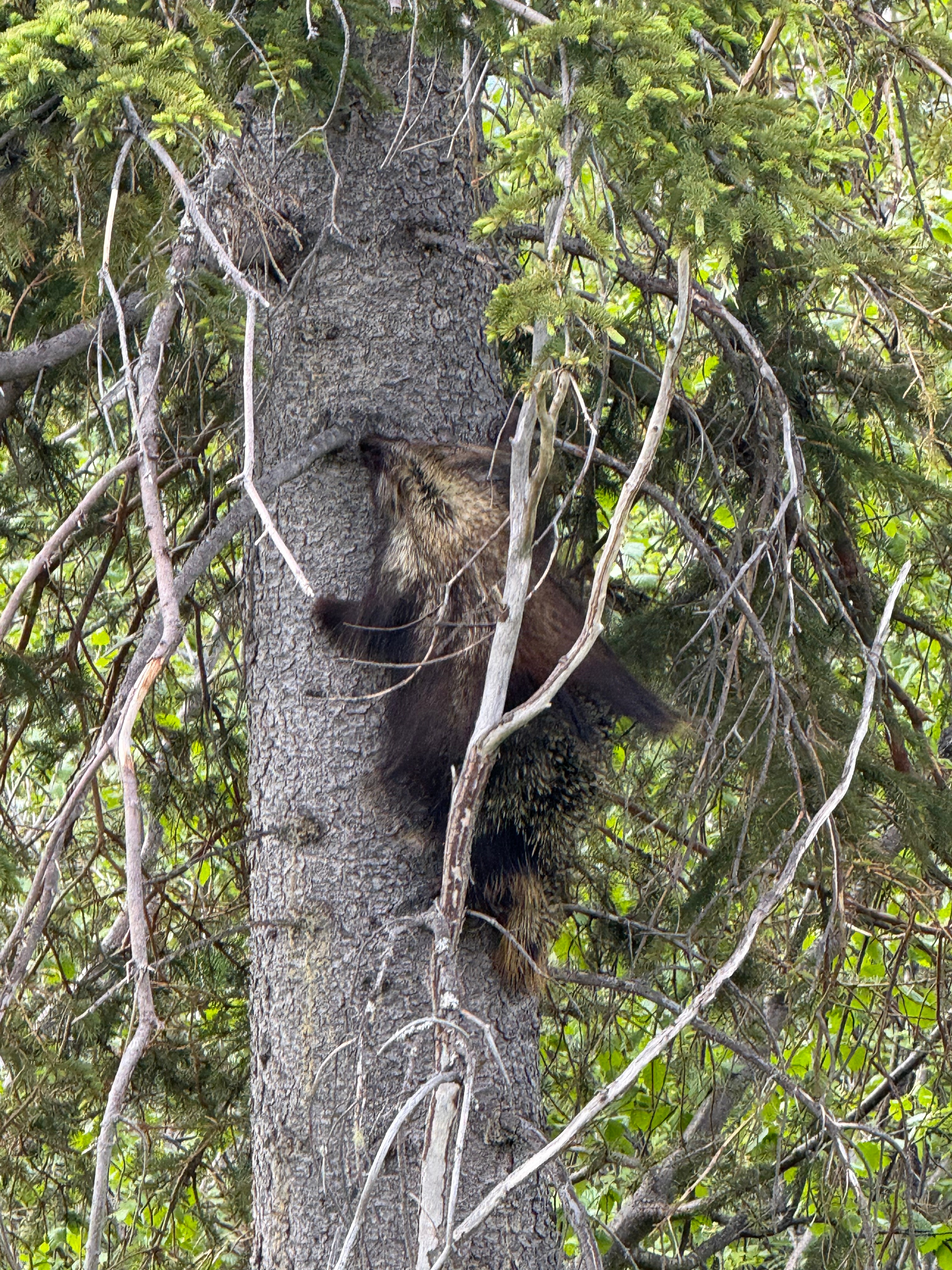
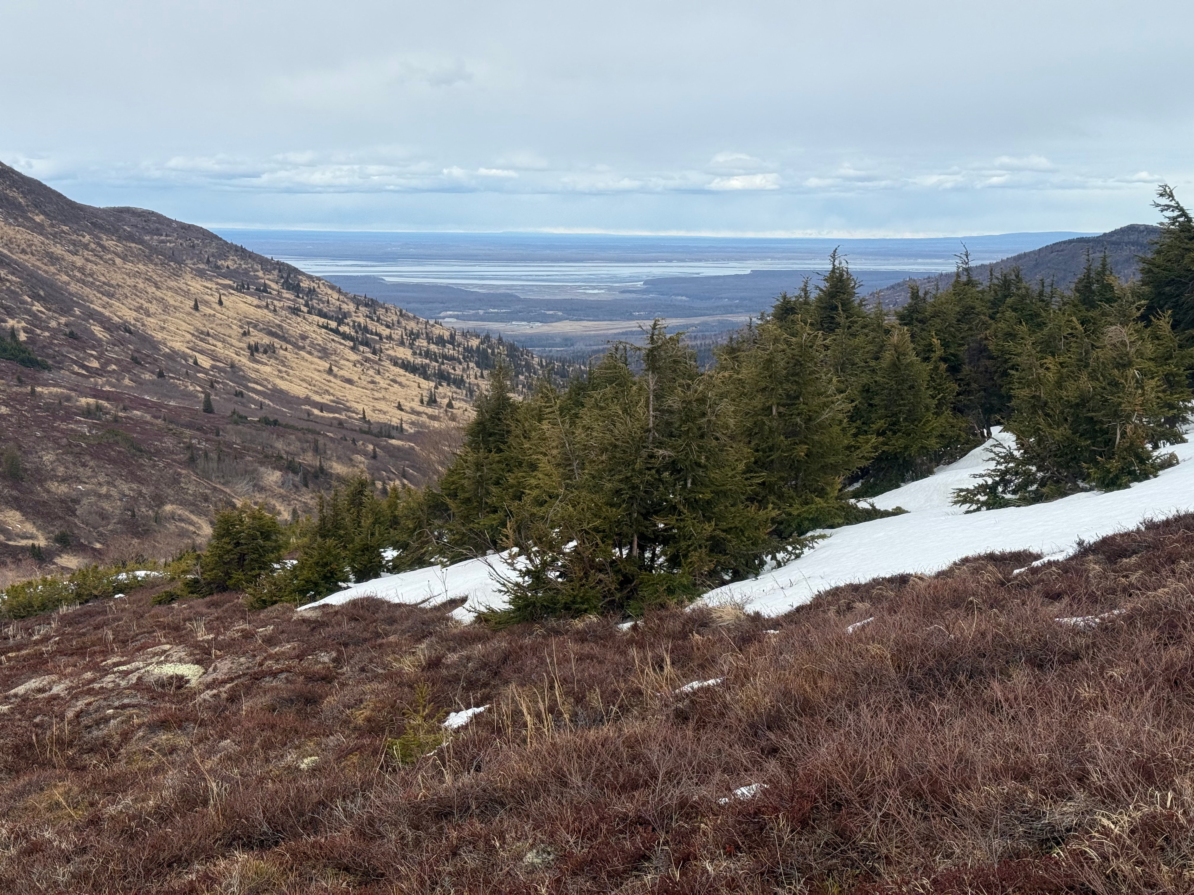
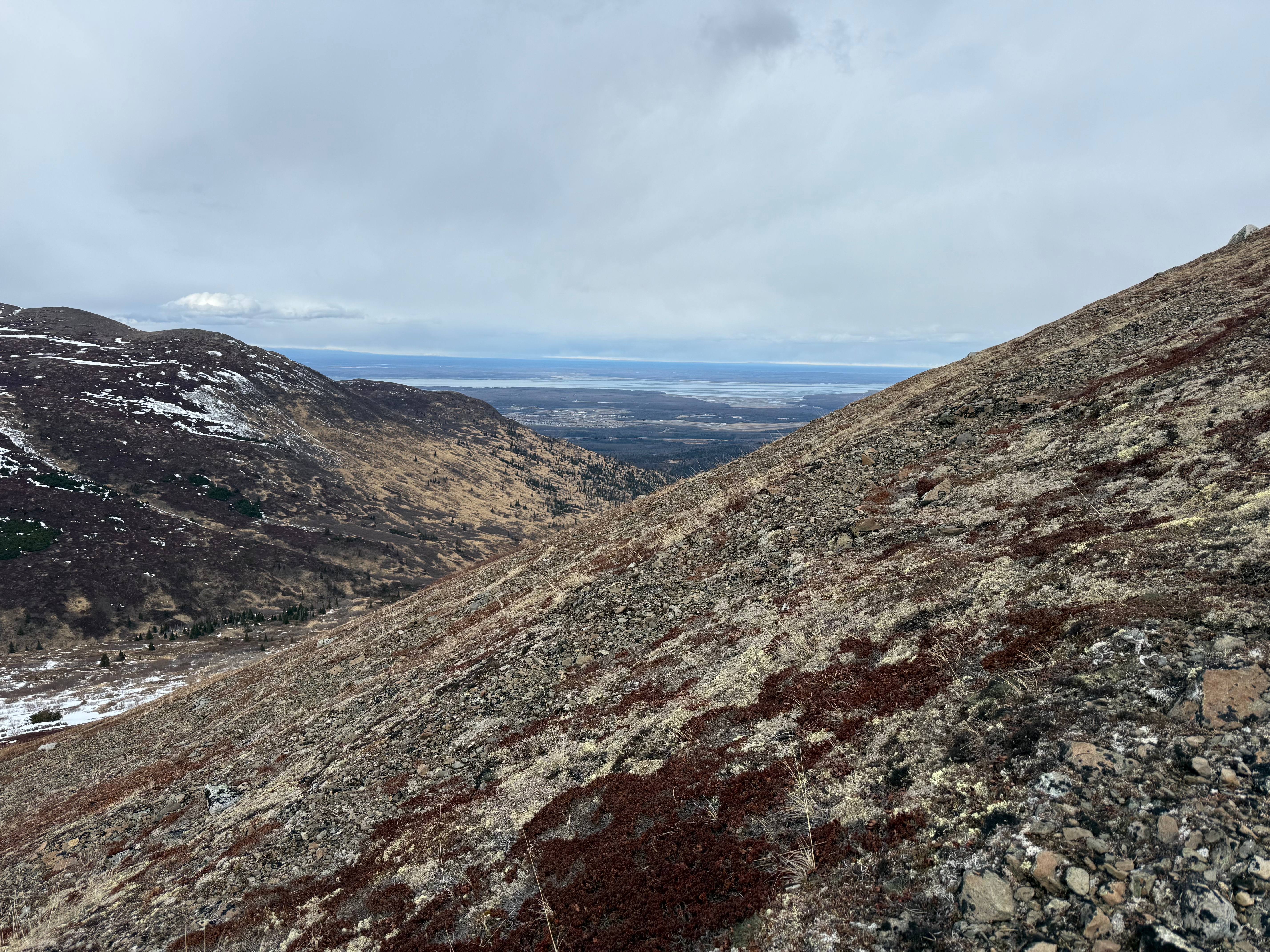
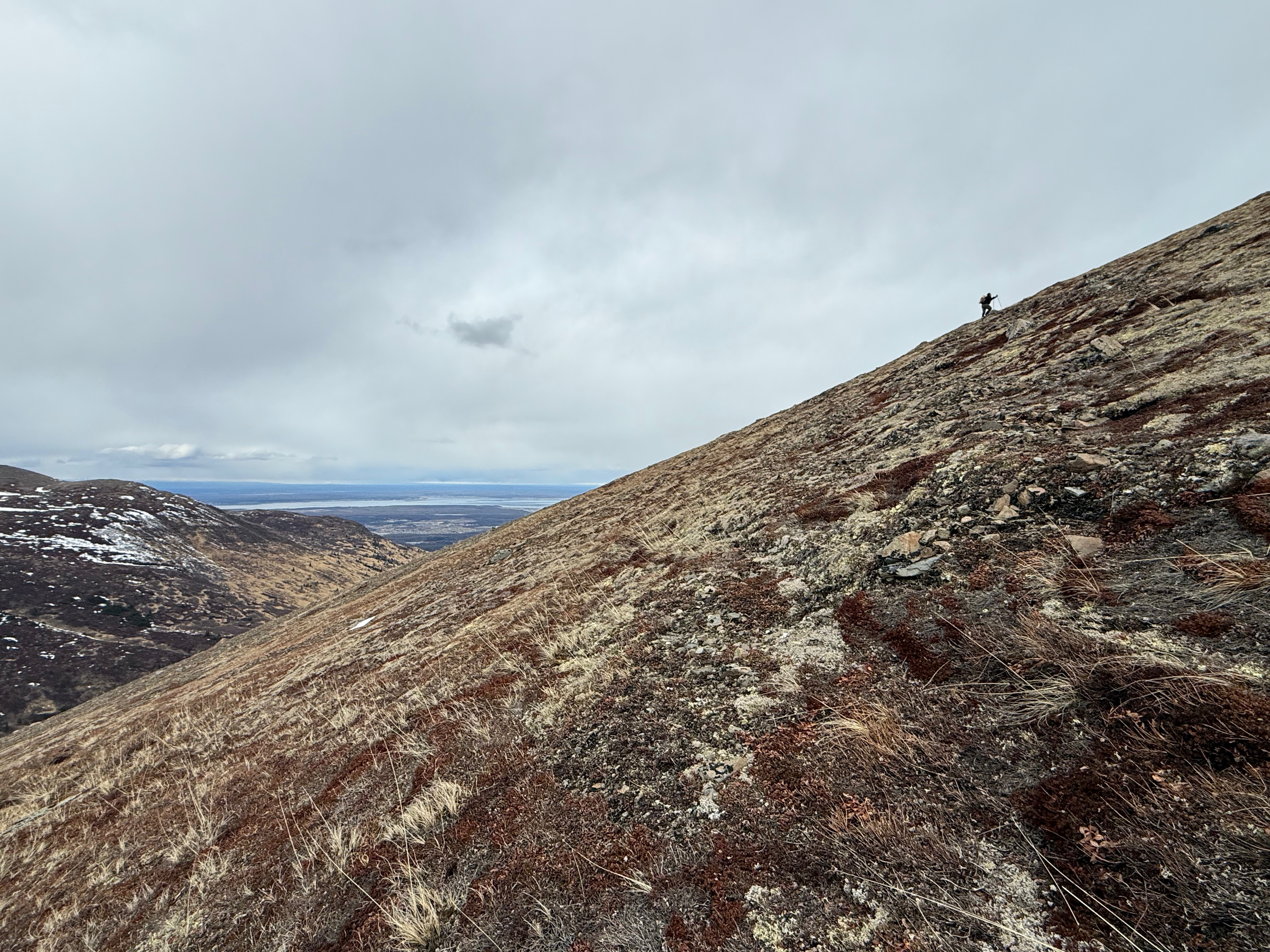
We were on the road within an hour, heading toward the Bulldog Trail and back to the Klutina Trailhead, only stopping to watch a good-sized porcupine climb a tree. The lower we got, the sunnier and hotter it became—a fine reward for a day that had started so dreary.
I took one last look back at the ridgeline I’d long wanted to hike, filled with that deeply satisfying feeling of truly knowing a place.
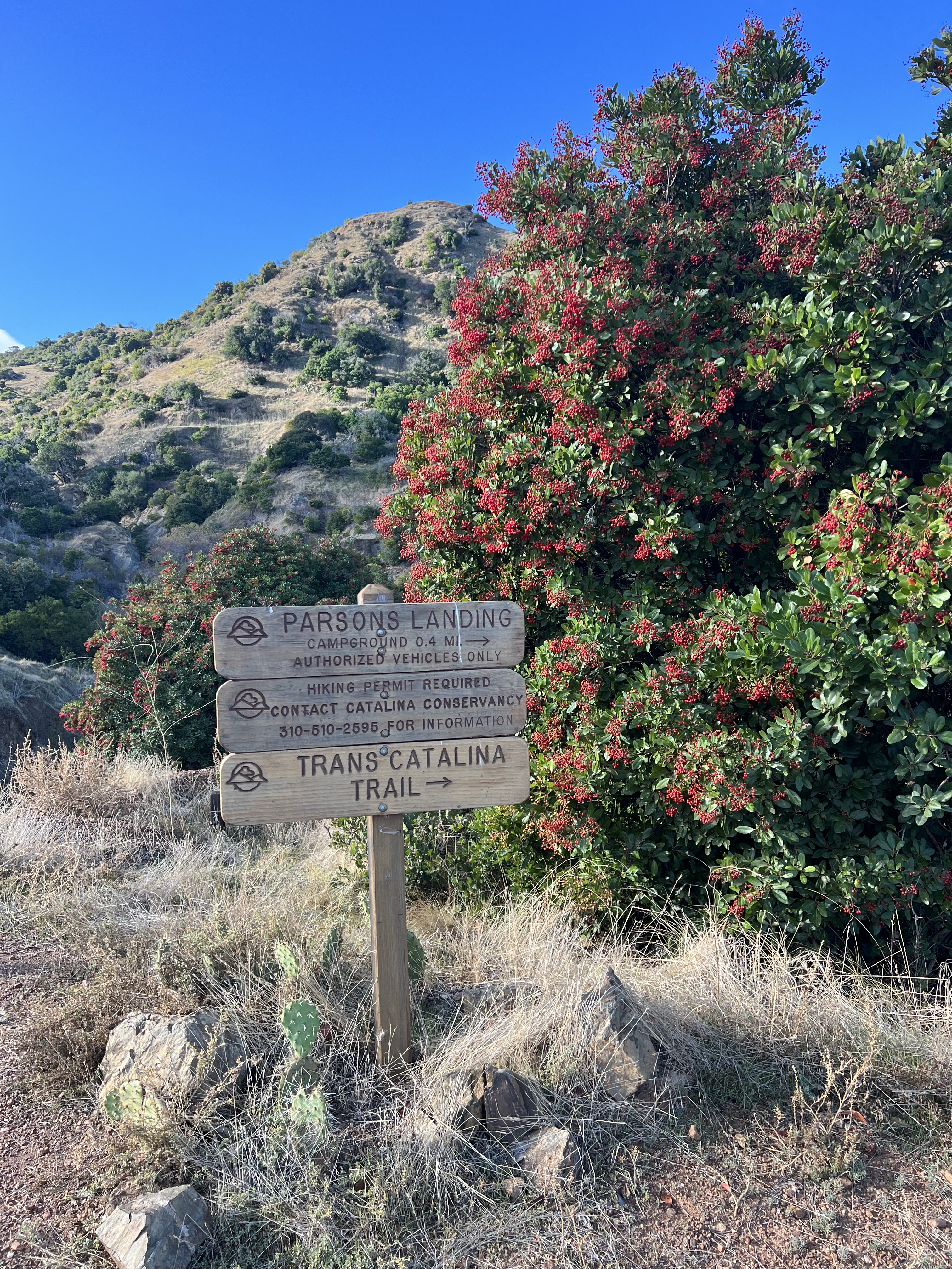
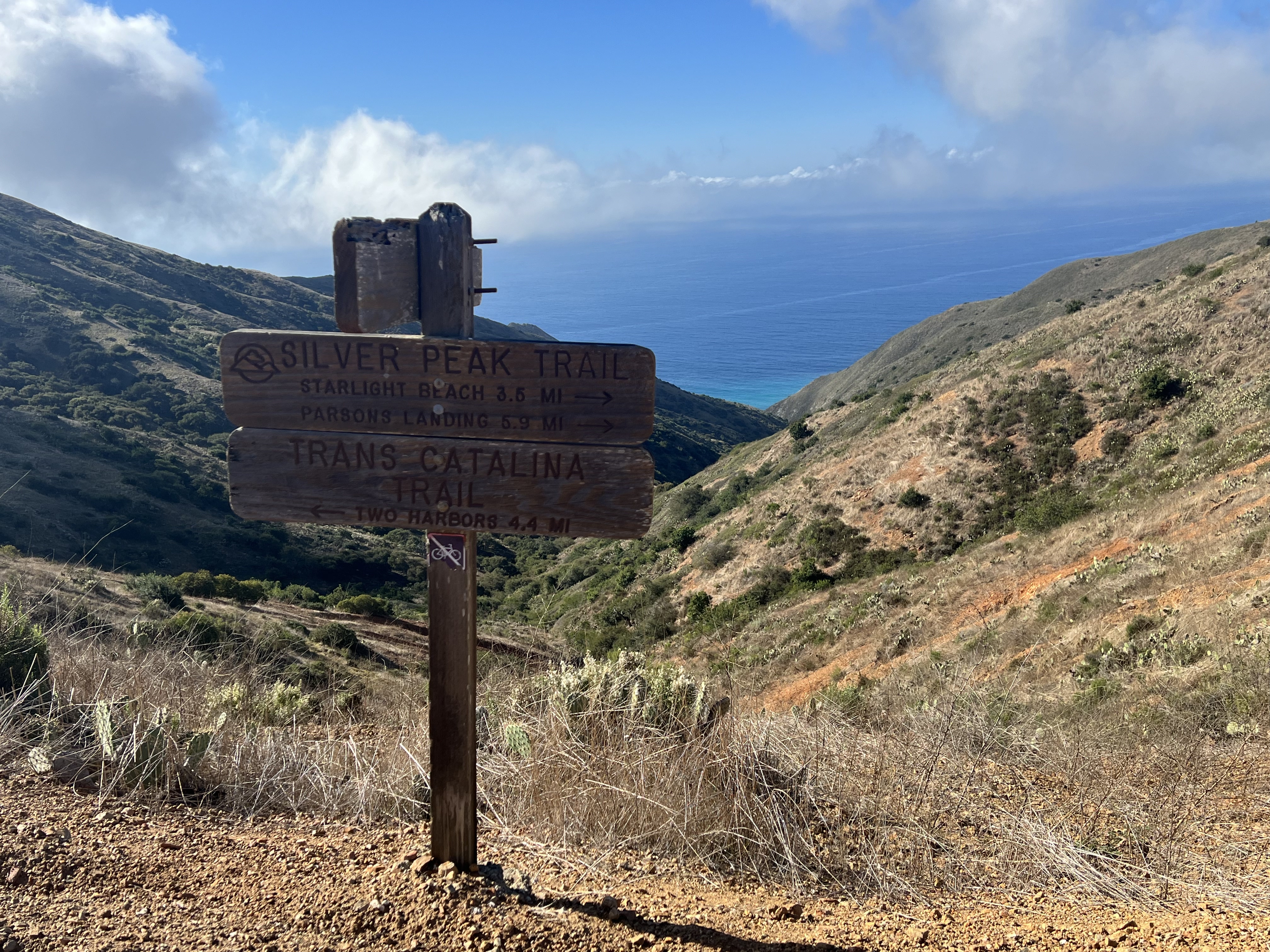
The Dome, Knoya, Kanchee, Nunaka Point Peakbagger Links:
There is very little exposure on this ridge walk, but the weather can change quickly. Be prepared.
Be bear aware.
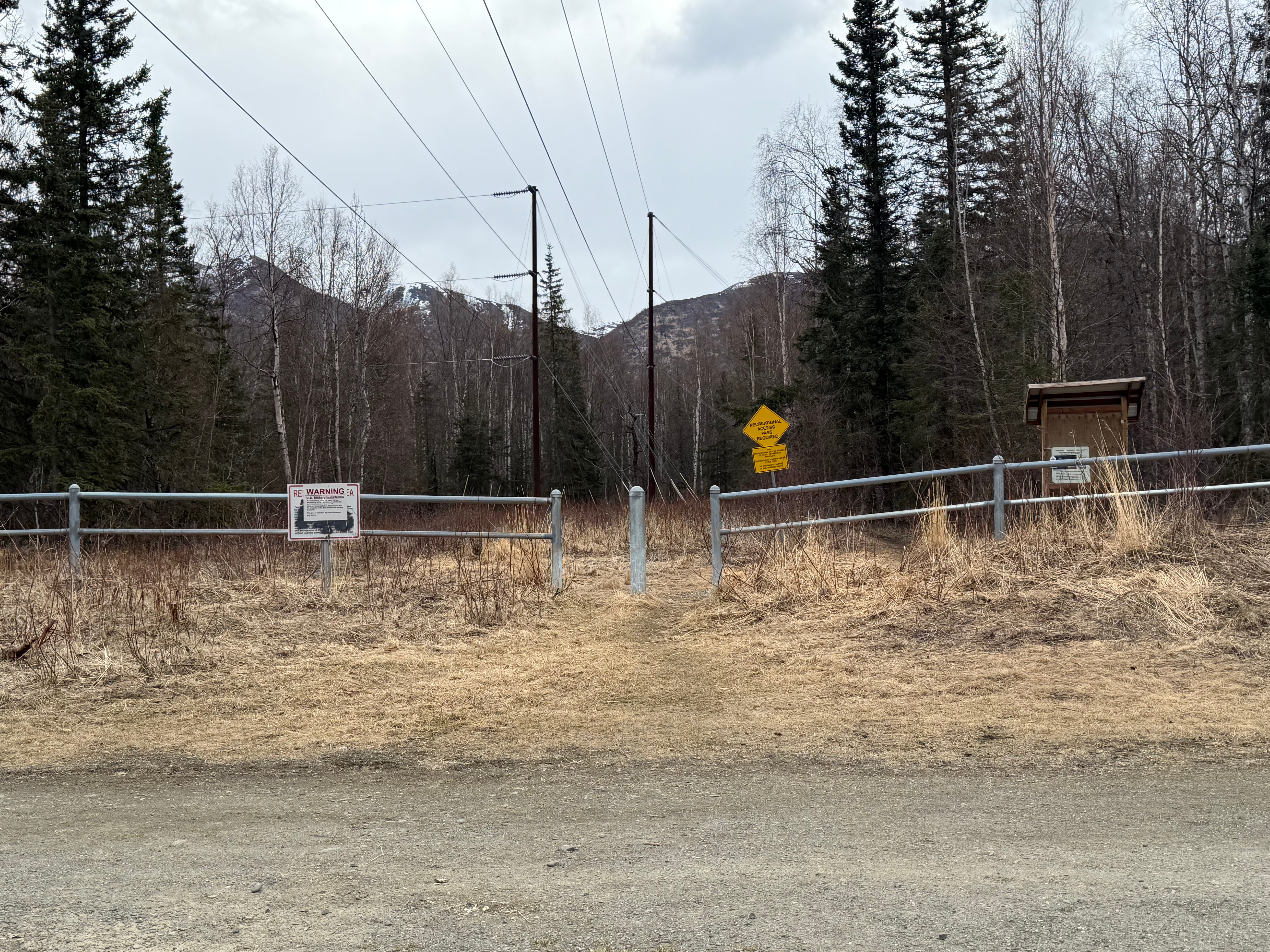
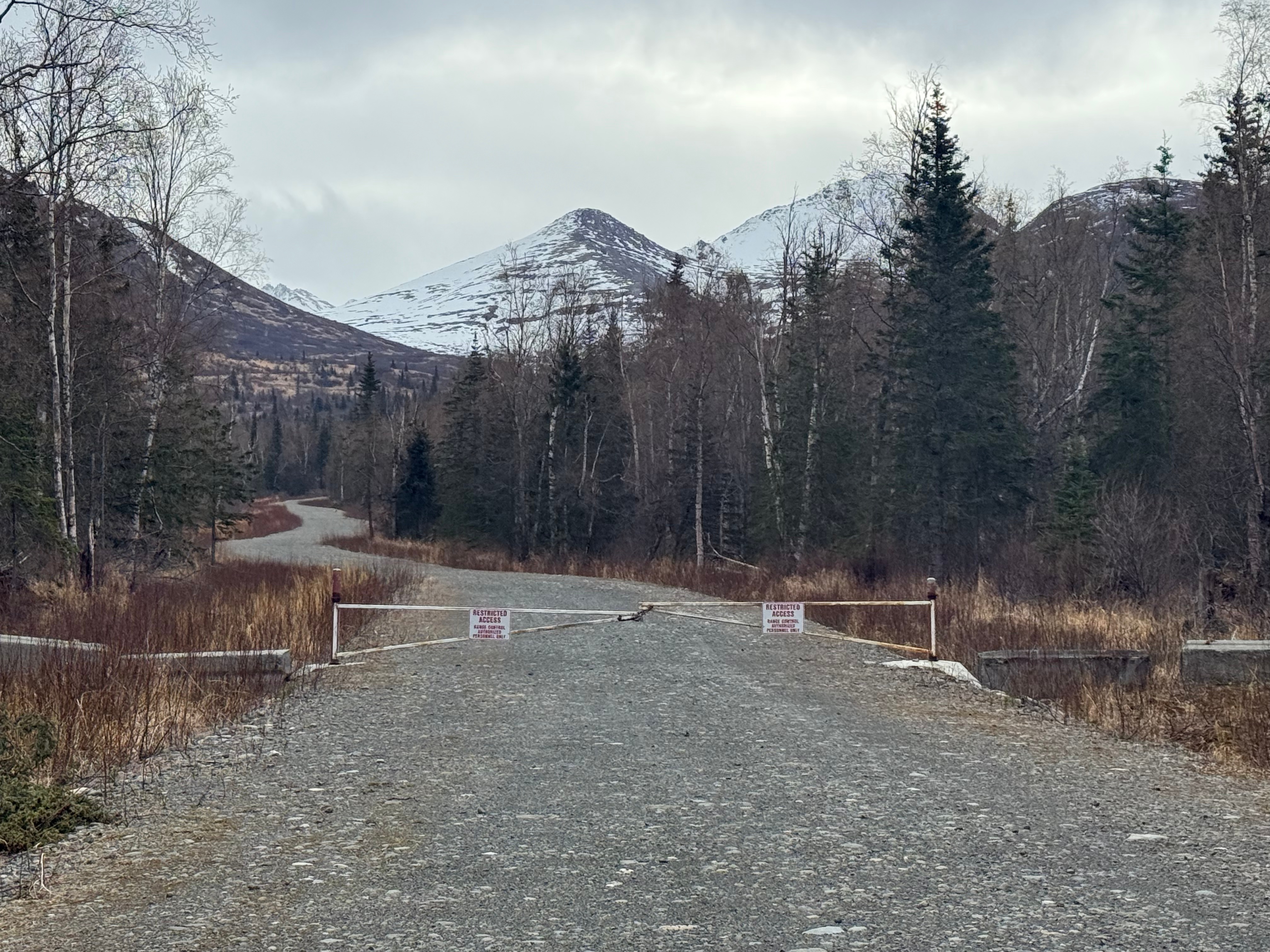
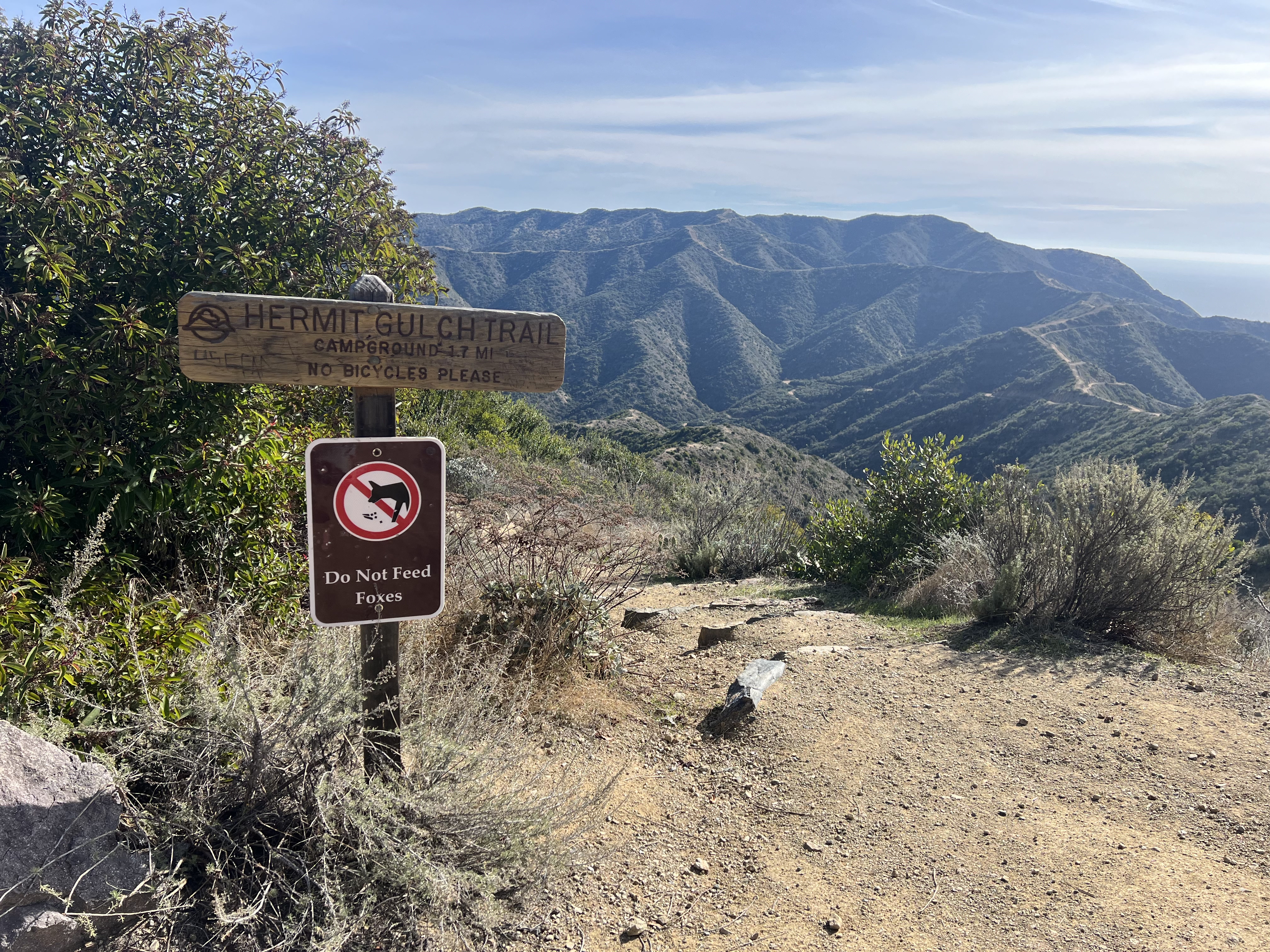
Sign into JBER RecAccess before entering military land. Sign into all areas you plan to access. No overnights are permitted. These areas are closed between 11pm and 6am.
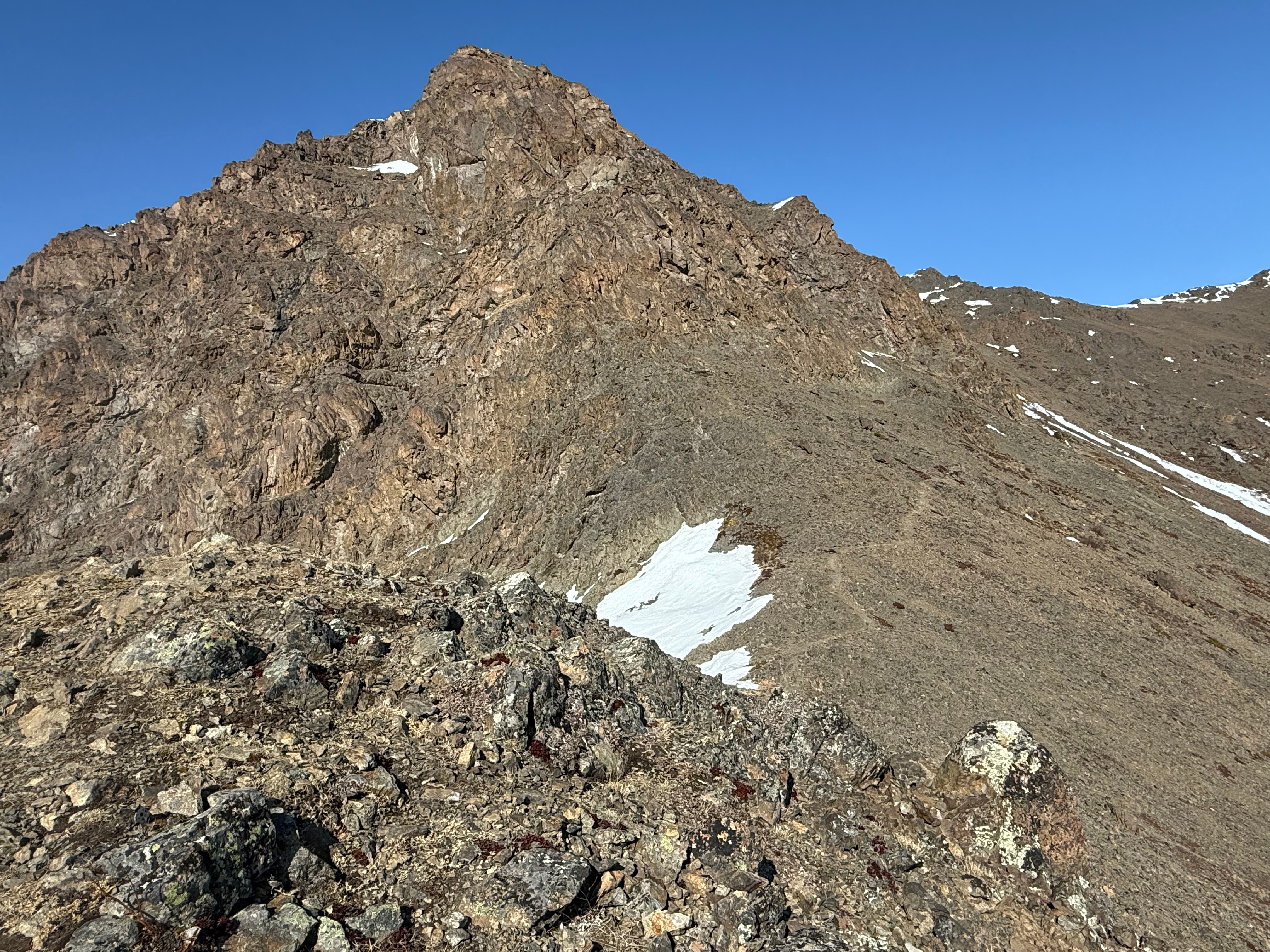
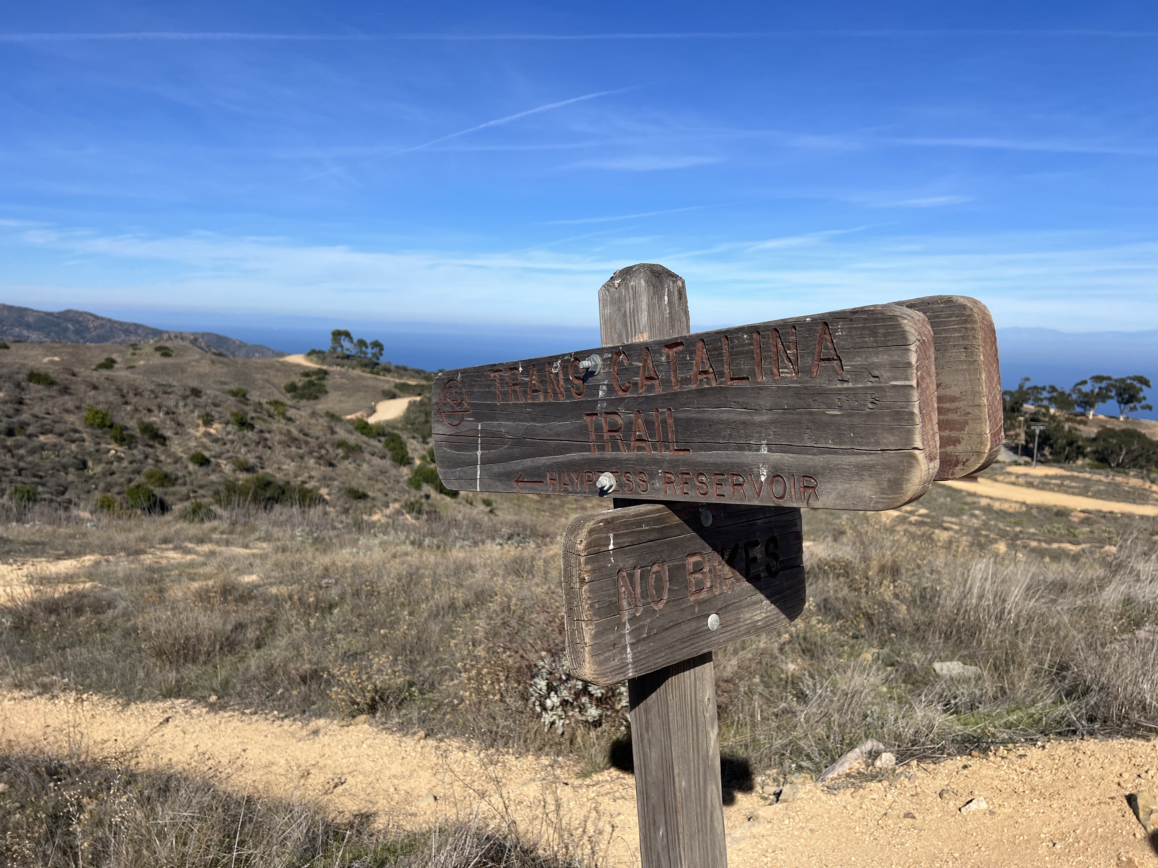
Knoya’s peak is set back from the U-shaped ridge, heading towards Tikishla. Don’t make the mistake of thinking you’re at the top when you are less than a quarter mile shy of the true summit.
Parking at Klutina and Stuckagain are limited. Get there early to grab a spot and respect the neighborhoods by not parking like an asshole and by carpooling, if possible.
May 31, 2025 Knoya: 4600′ – FR #17 Kanchee: 4393′ – FR #20 Nunaka point: 3780′ Mileage: ~14 Miles Elevation Gain: ~5000′ The summer wasn’t summering, and I was suffering from a bout of springtime depression that only sunshine and warm weather could cure. I dragged myself to the Klutina Trailhead to meet Jason. We…
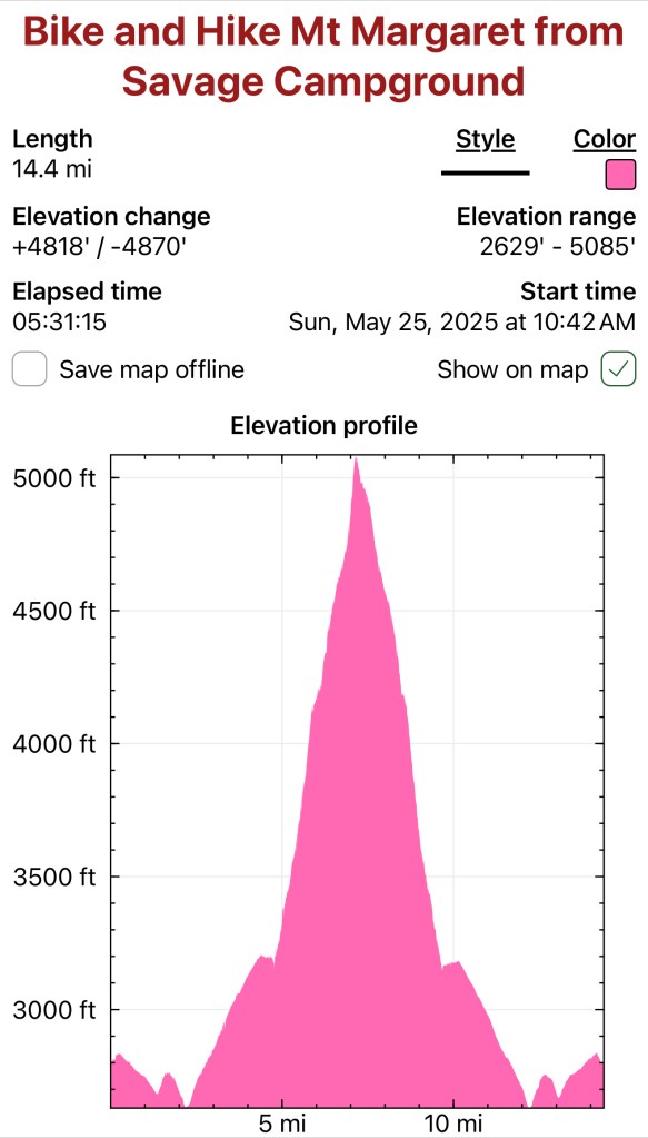
May 25, 2025 Mount MArgaret: 5069′ Denali NAtional PArk Mileage: 4.6 Mile Bike/4.6 Mile Hike/4.6 Mile Bike Elevation Gain: 2,750′ This year’s annual mother/daughter camping trip in Denali National Park looked a little different from our normal stay at Riley Creek Campground. The Labor Day prior, we decided our next trip would be to Savage…
April 26, 2025 Peak 1216 AKA 3990: 3990′ Ship Creek Hill: 3842′ (chugach Front Range Peak #24) Mileage: 15 Miles Elevation Gain: 5,700′ The majority of the Southcentral Alaska winter of 2024-25 was uncharacteristically warm and relatively snow free, but here we were in April, with record breaking snowfall around Anchorage. The ridges and peaks…
Mileage: 4.6 Mile Bike/4.6 Mile Hike/4.6 Mile Bike
Elevation Gain: 2,750′
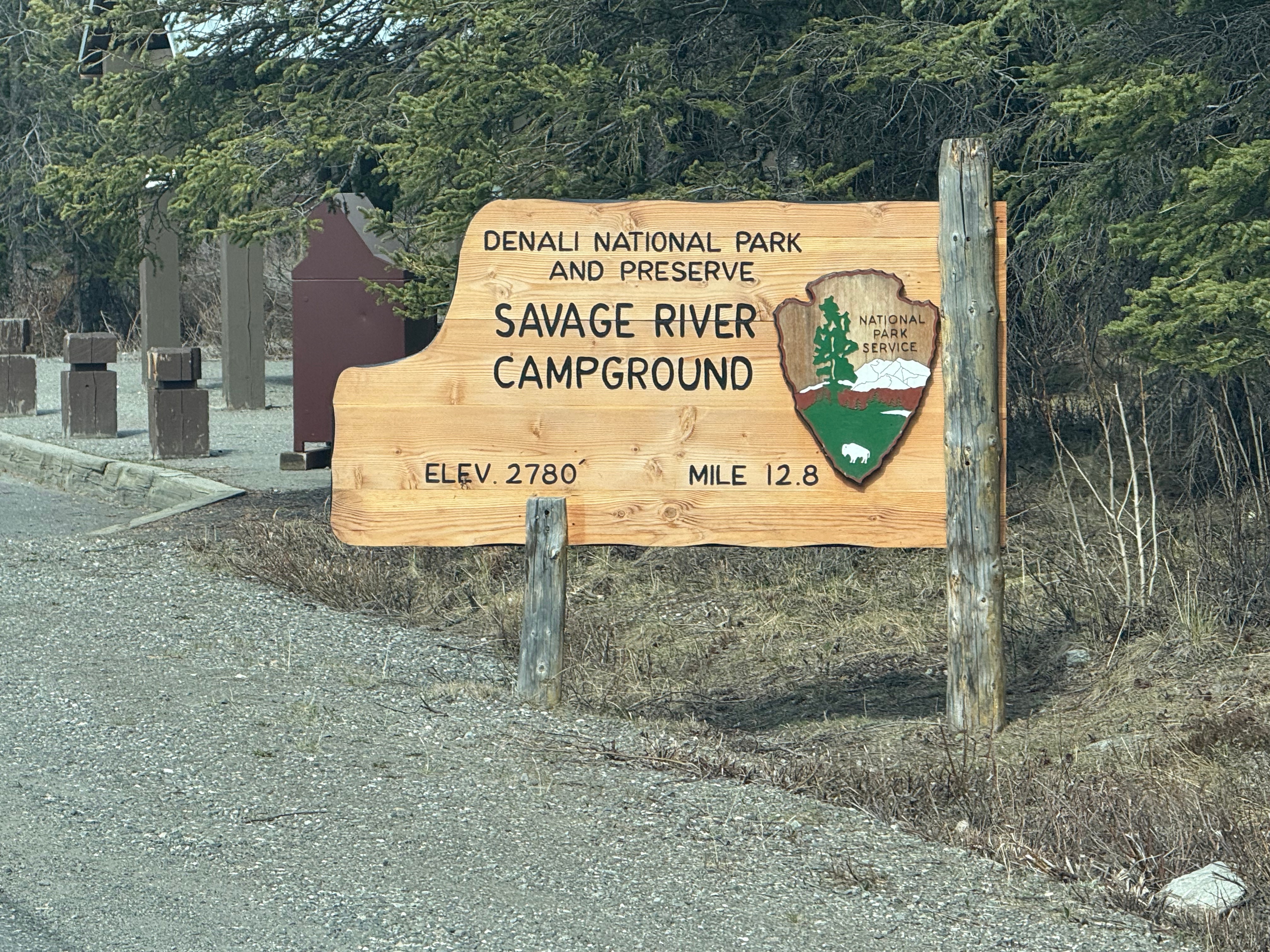
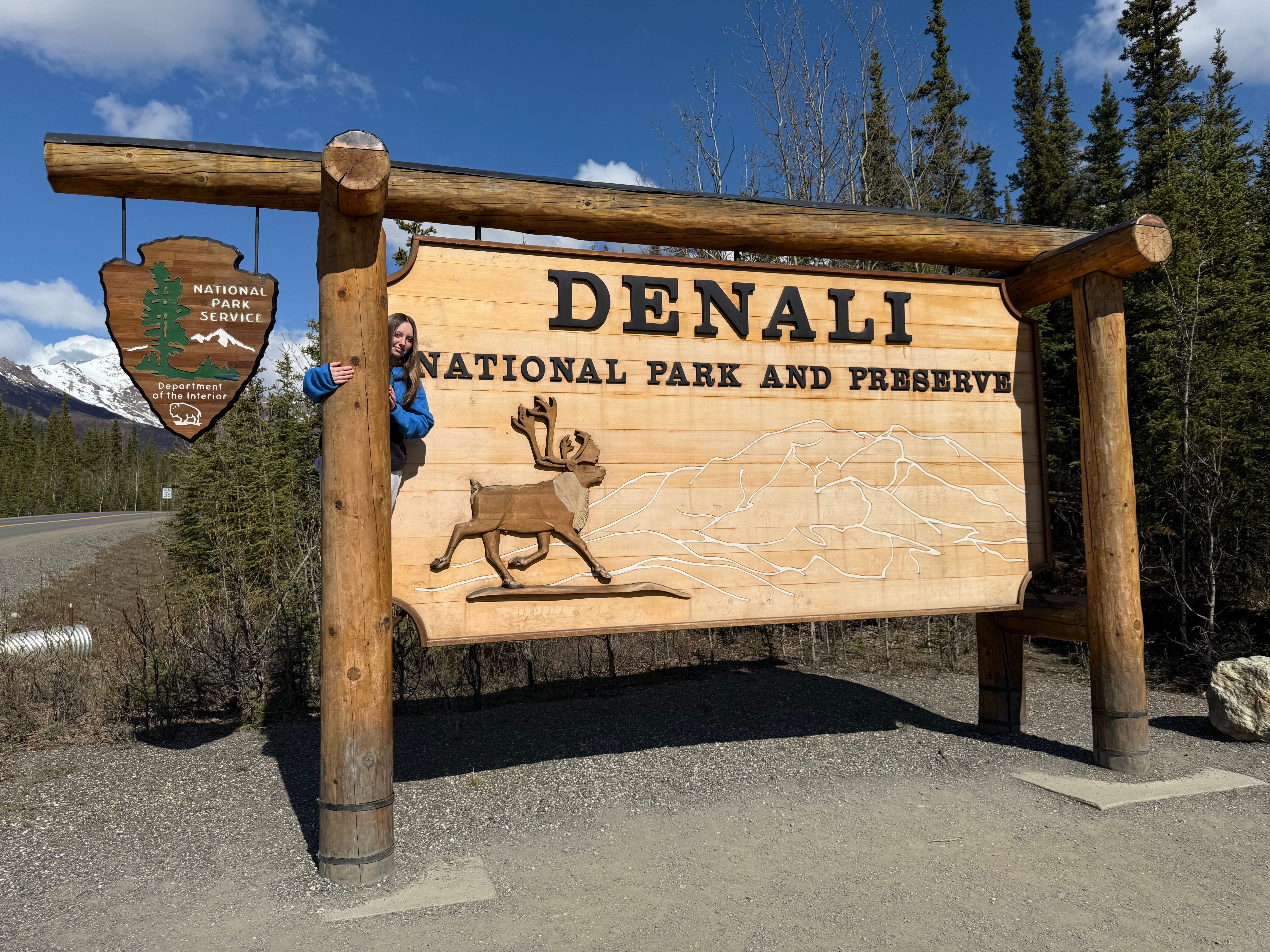
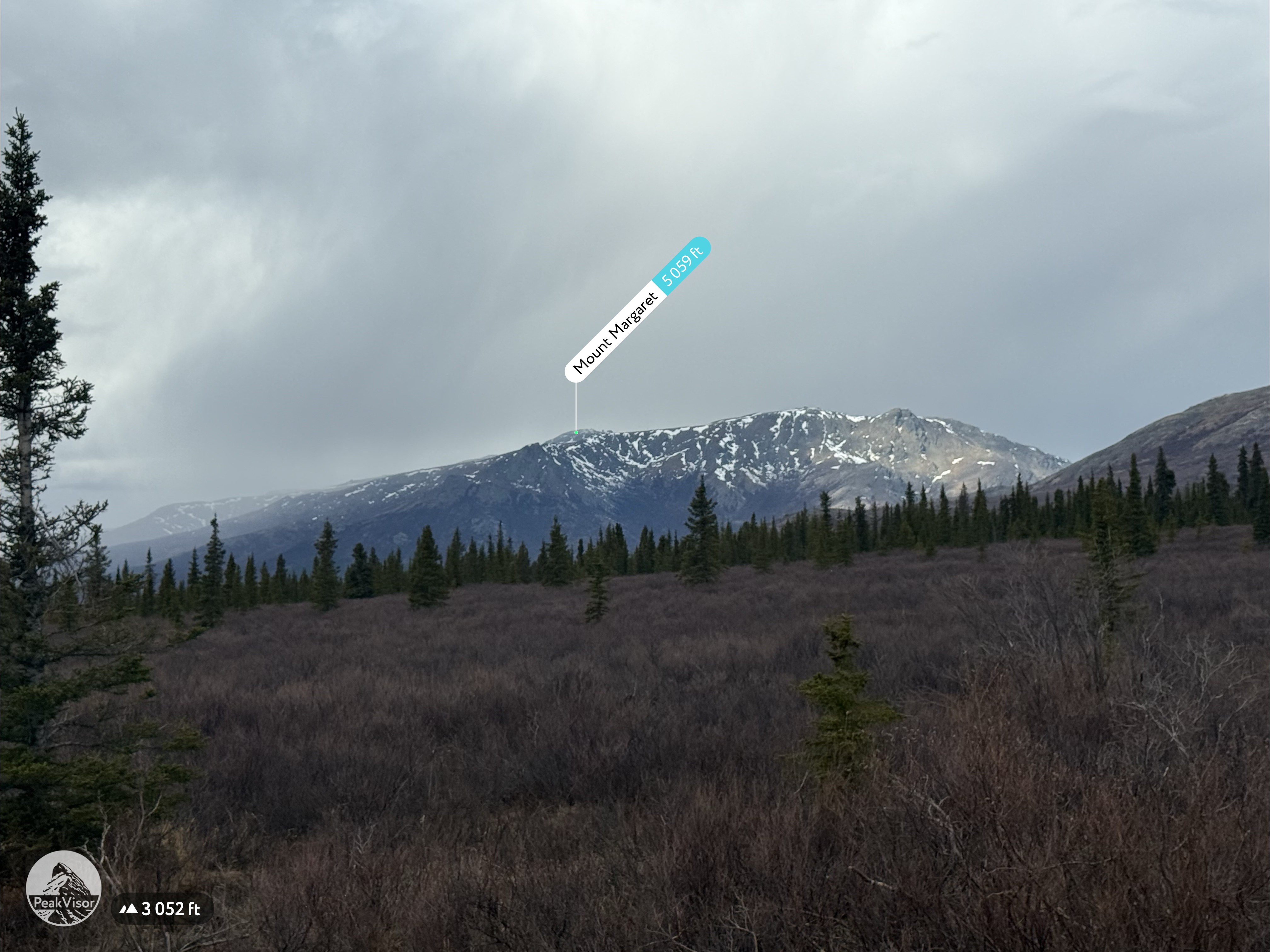
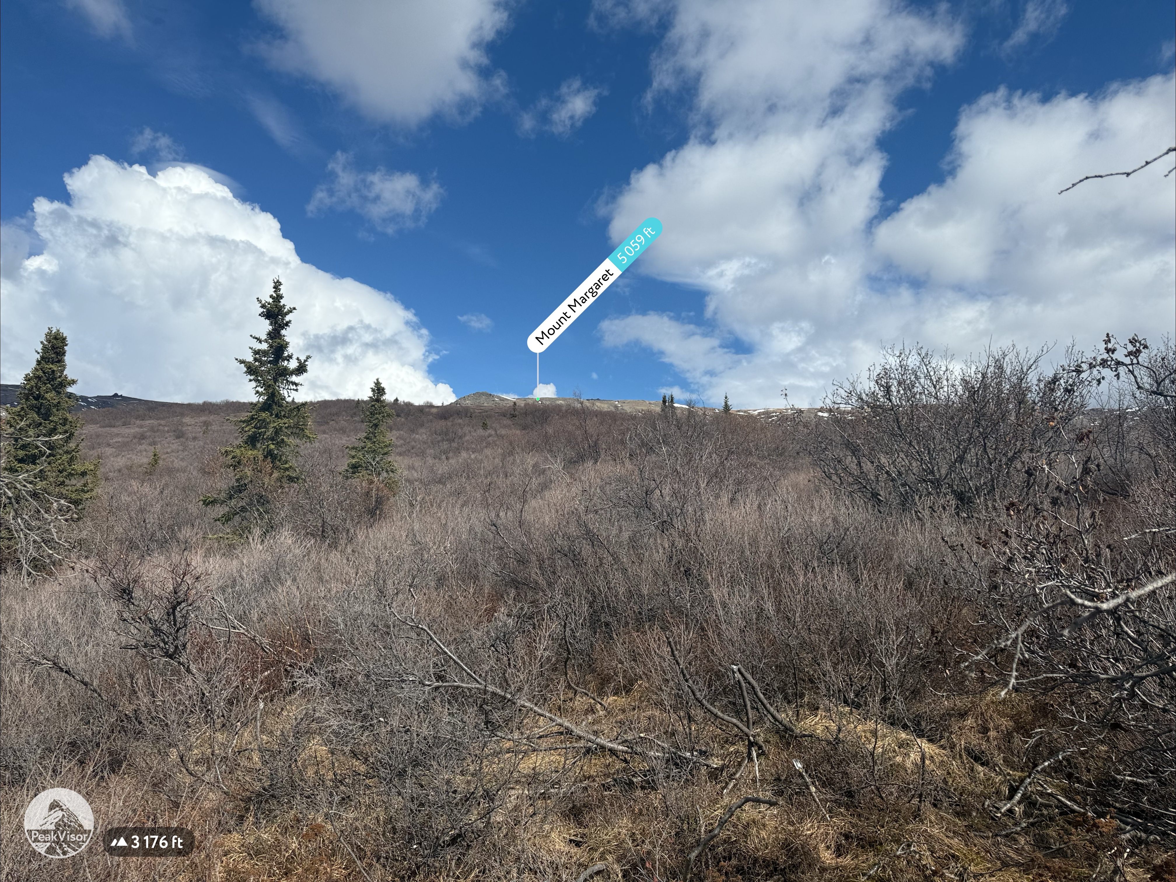
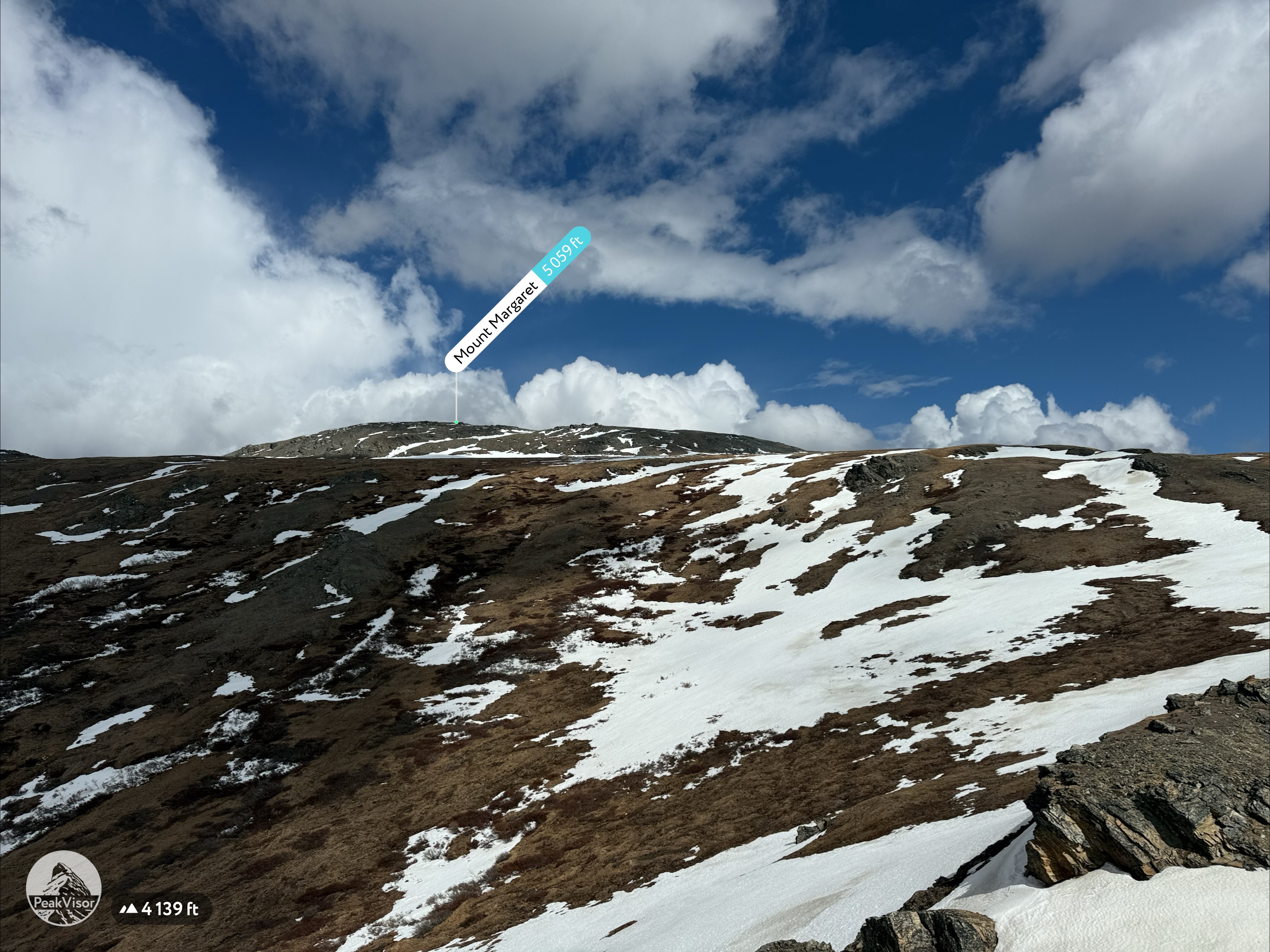
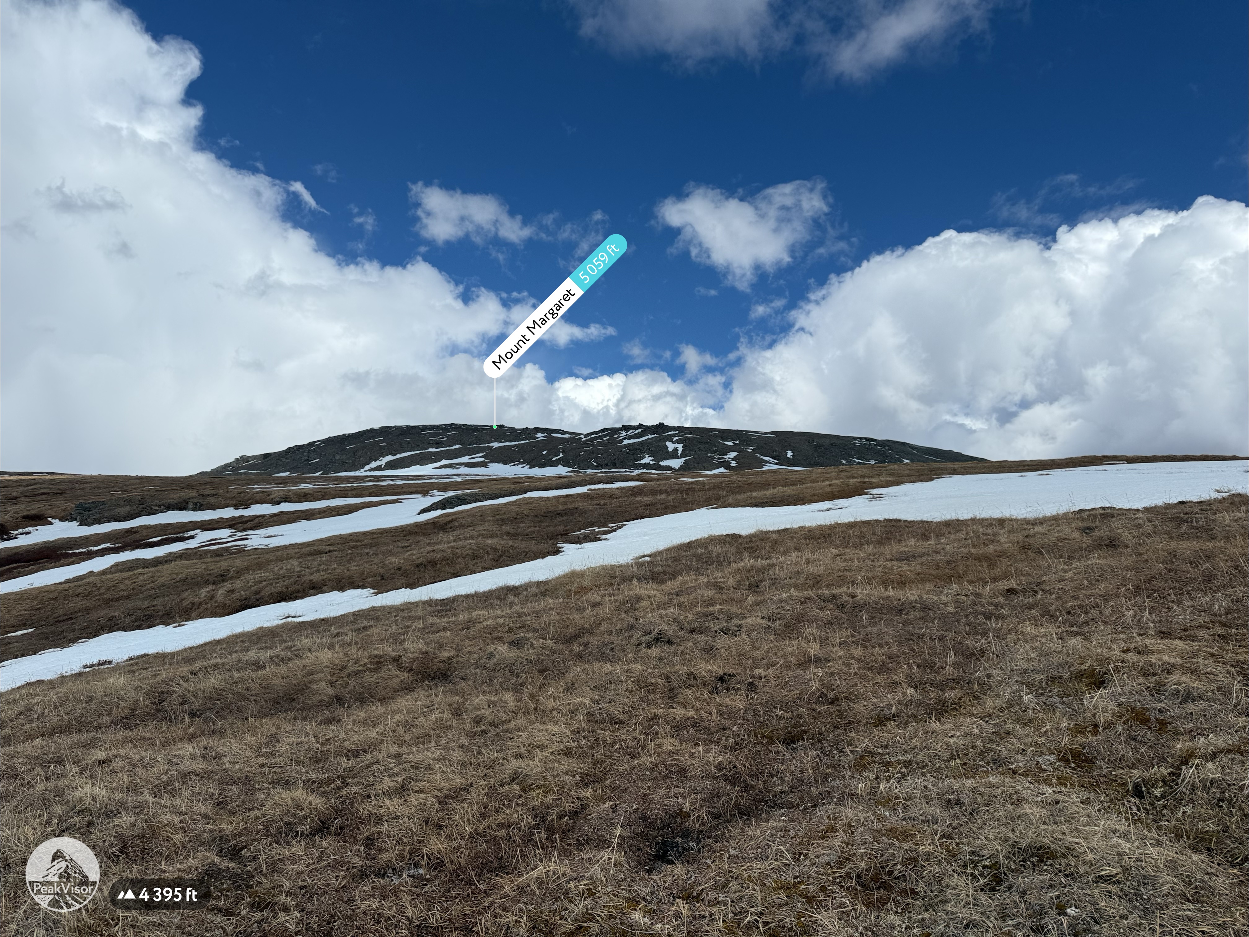
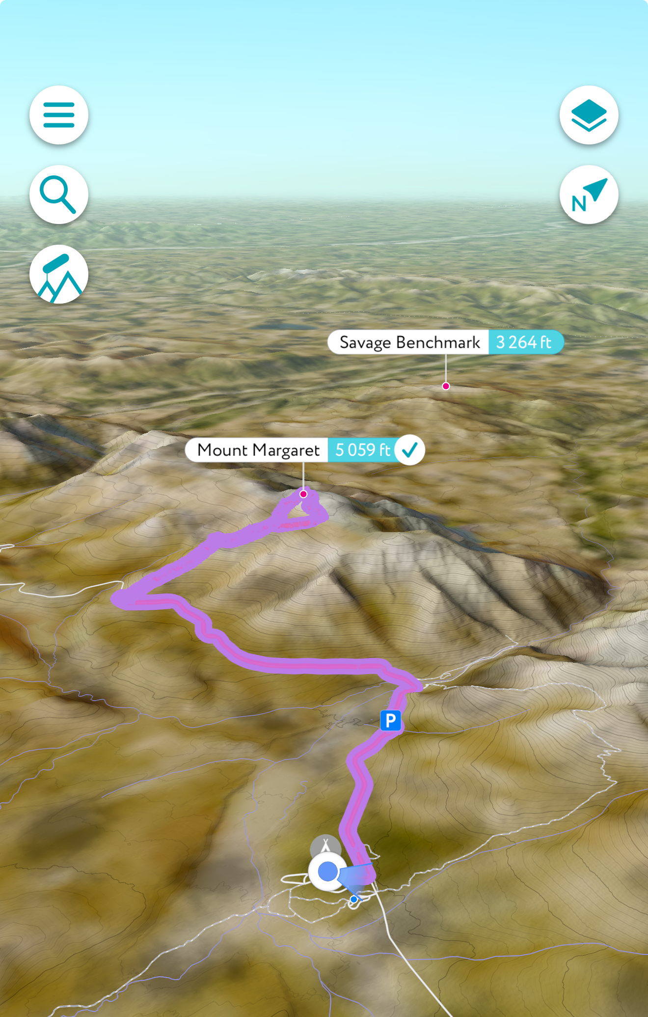
This year’s annual mother/daughter camping trip in Denali National Park looked a little different from our normal stay at Riley Creek Campground. The Labor Day prior, we decided our next trip would be to Savage River Campground, 13 miles up the Park Road from the Parks Highway. This was a great opportunity for me to take a day to bike and hike Mount Margaret, a broad mountain just beyond the Savage River.
I had been eyeballing this summit since our first trip in 2019. In 2020 I was still ignorant to doing route research and made an attempt from the east, via the Savage River Loop Trail, with my 9-year-old in tow. The 40+ mph winds were so strong she could barely stand up, so we turned around, and although we didn’t make it even close to the top, we did have the amazing experience of finding ourselves within a stone’s throw to two big, handsome Dalls sheep. A fine consolation prize.
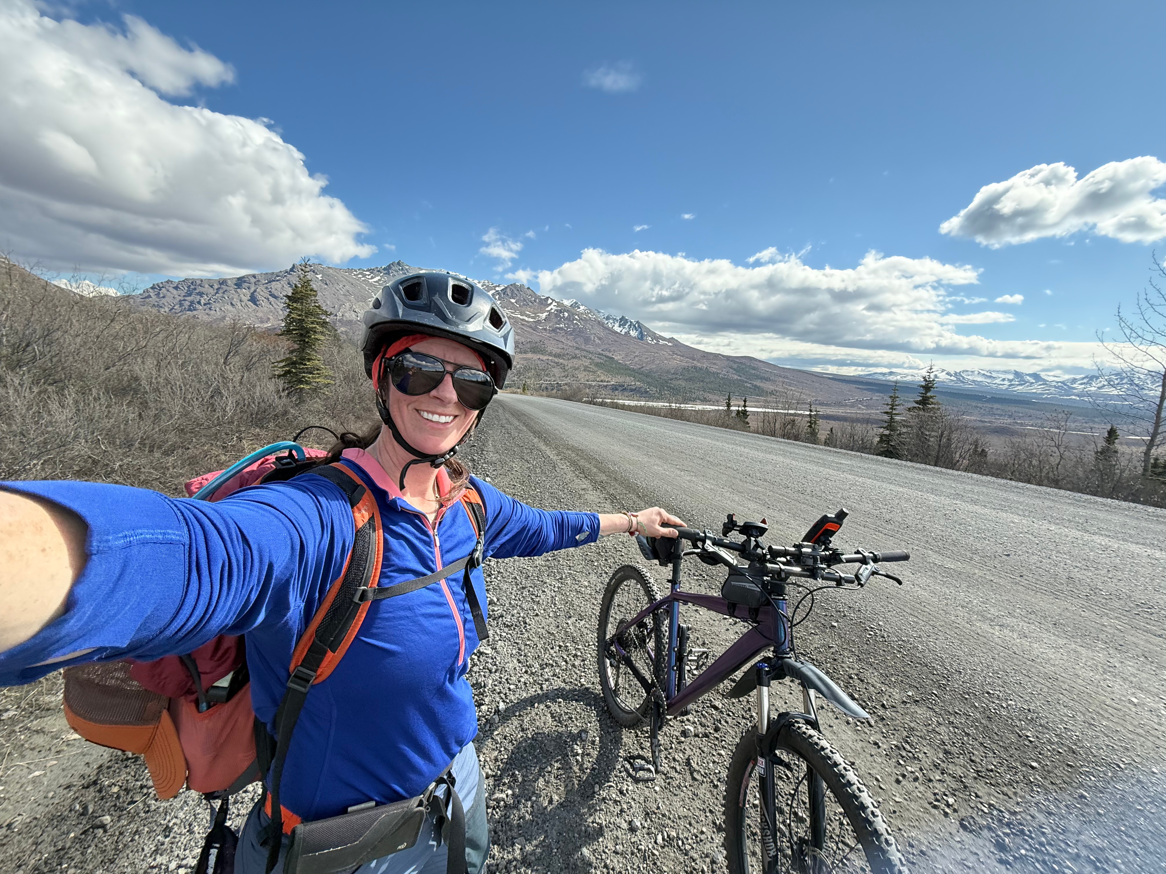
The weather all weekend was decent, but I waited for the day with the least chance of thunderstorms to head out on my adventure. After looking back at the photos of my first steps on Mount Margaret six years prior, I am sure the off-trail route from the east would have gone, but this time I decided to approach from the south, giving me the opportunity for a nearly 15-mile RT bike and hike.
It was one of those overcast mornings that has potential to turn into a really nice day, so I ate breakfast and set off before 11am on my bike, headed west into the park. Not even ten minutes into my ride, I saw one of the tour busses stopped with its hazards flashing; a sign that there was wildlife nearby. Sure enough, three caribou were grazing along the Savage River, to the south of the road.
Two miles from Savage River Campground and the Savage River bridge where the road closes to public traffic and to go any further you must be human powered (bike or hike) or ride one of the park busses (during the winter you can ski and mush dogs, as well). This was where, almost 5 years ago, my daughter and I turned off the Park Road for our first attempt on Mount Margaret. This time I was by myself; my now 14-year-old wise to my claims that it would be “fun” and “not too hard.”
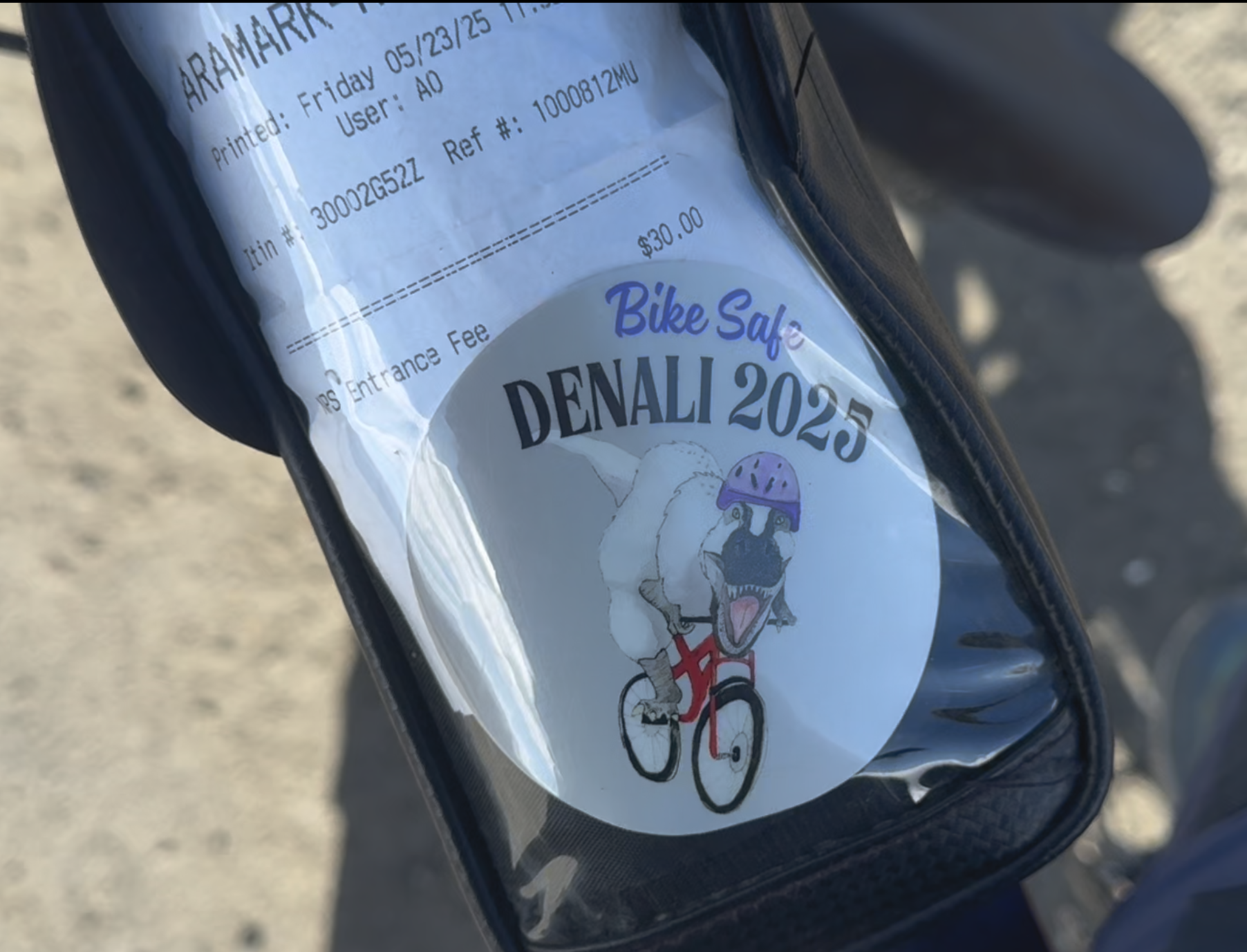
I stopped at the Ranger Station and the Park Rangers made sure that I had paid my entry fee and that I was familiar with protocols for allowing the busses to pass, as well as making sure I had bear spray with me. They asked if I had ever used it before and I assured them that it had been effective in the few times I had used it in my 21 years in Alaska. I advised them that I would be hiking Mt Margaret and if anyone reported a bike abandoned on the north side of the road near there, it was just me and I would be back down in a few hours. They gave me a Denali Bike Safety Sticker to show they had done their spiel, and I was off!
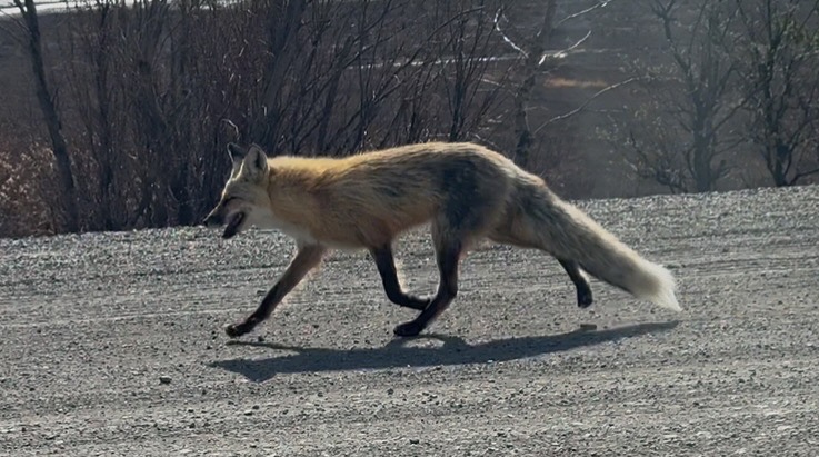
But not for long. As I began pedaling uphill, away from the Ranger station, I noticed two park busses moving very slowly towards me with their hazards on. I saw something small and furry in front of them, also moving towards me, and for a second I thought it might be small bear… I jumped off my bike and grabbed my bear spray from the side pocket of my pack before realizing it was just a beautiful red fox. It trotted right past me, the buses slowly rolling behind, and, looking into the windows, I felt immense gratitude that there wasn’t a pane of glass between me and Mr. (or Mrs.) Fox.
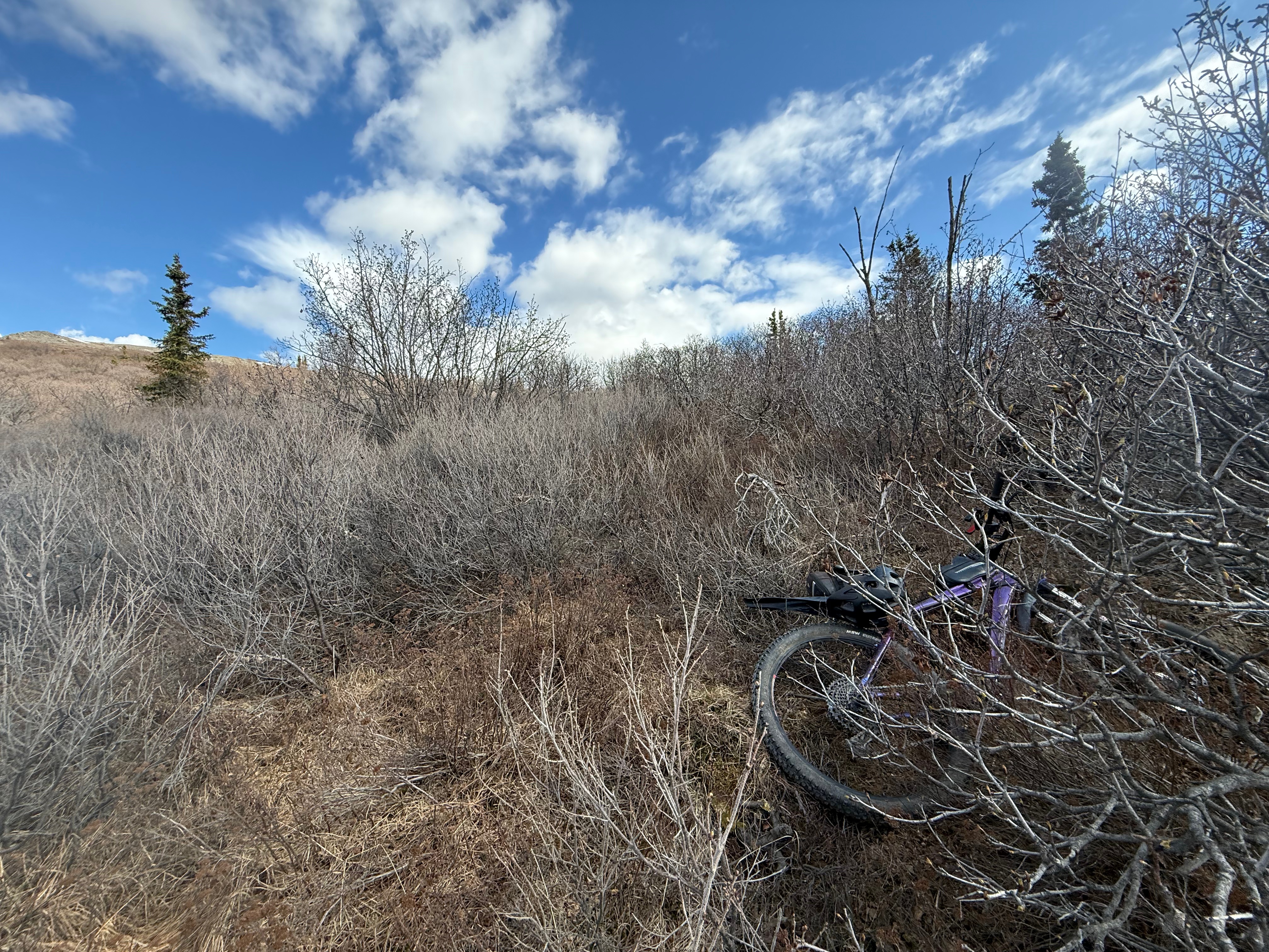
I continued, now warm from the sun and the effort to ascend the 600 feet to where I would stash my bike and start my hike. I passed by an overlook where busloads of tourists were using the bathroom and taking a break from sitting in the bus to stretch their legs. I opted to avoid people and marked my territory in the woods right around the corner where I stashed my bike.
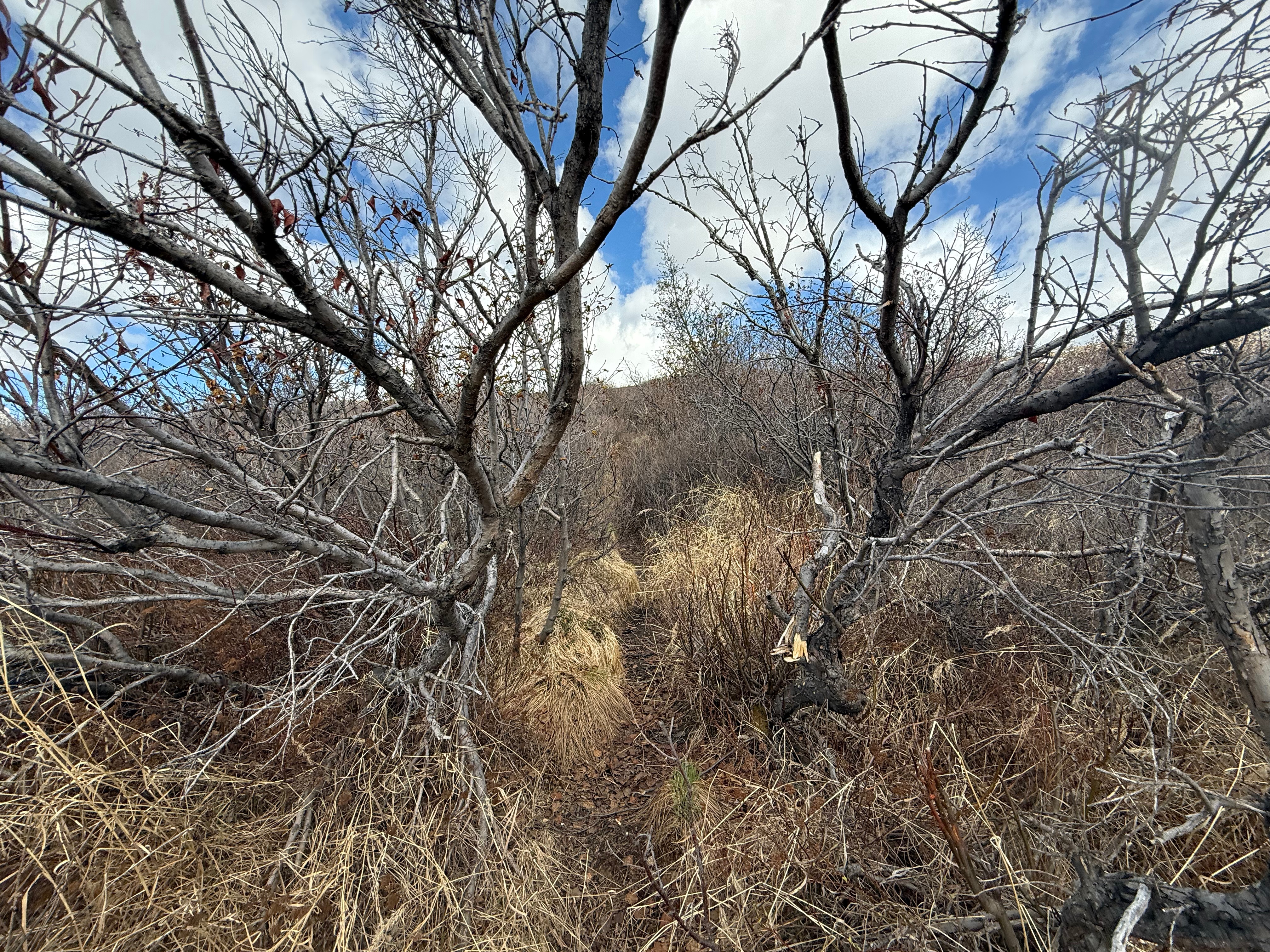
I didn’t see any trailhead, and hadn’t expected to, so I dragged my bike through the alders as far as I could off the road, hiding it as much as possible as the Rangers had asked of me. Having firsthand experience, I knew bears have a penchant for chewing on rubber and plastic, and I took a last look at my bike and helmet with a wish that they would be in one piece when I returned. Turning uphill, I started bushwhacking through the tangled and leafless branches.
Just when I was getting annoyed with the lack of bootpath (about 30’ in), I stumbled onto a path! It looked like my great day was getting even better when it became obvious that the path would lead me right to where I wanted to go… up one of the south ridges. I was passing by the last of the brush, when two ptarmigans, a female in her brown plumage, and a black-headed male still wearing most of his white suit. They made their ga-ga-ga-ga-ga-ga clucking sounds, I’d assume pairing up for the season.
Now that I was above treelined, I took out my Three Bears Special walkie talkie and hoped that it would reach my “base camp,” about 4 or 5 miles away, as the crow flies. The reply from my daughter was a monotone and apathetic response to my excitement over my ascension on such a beautiful day.
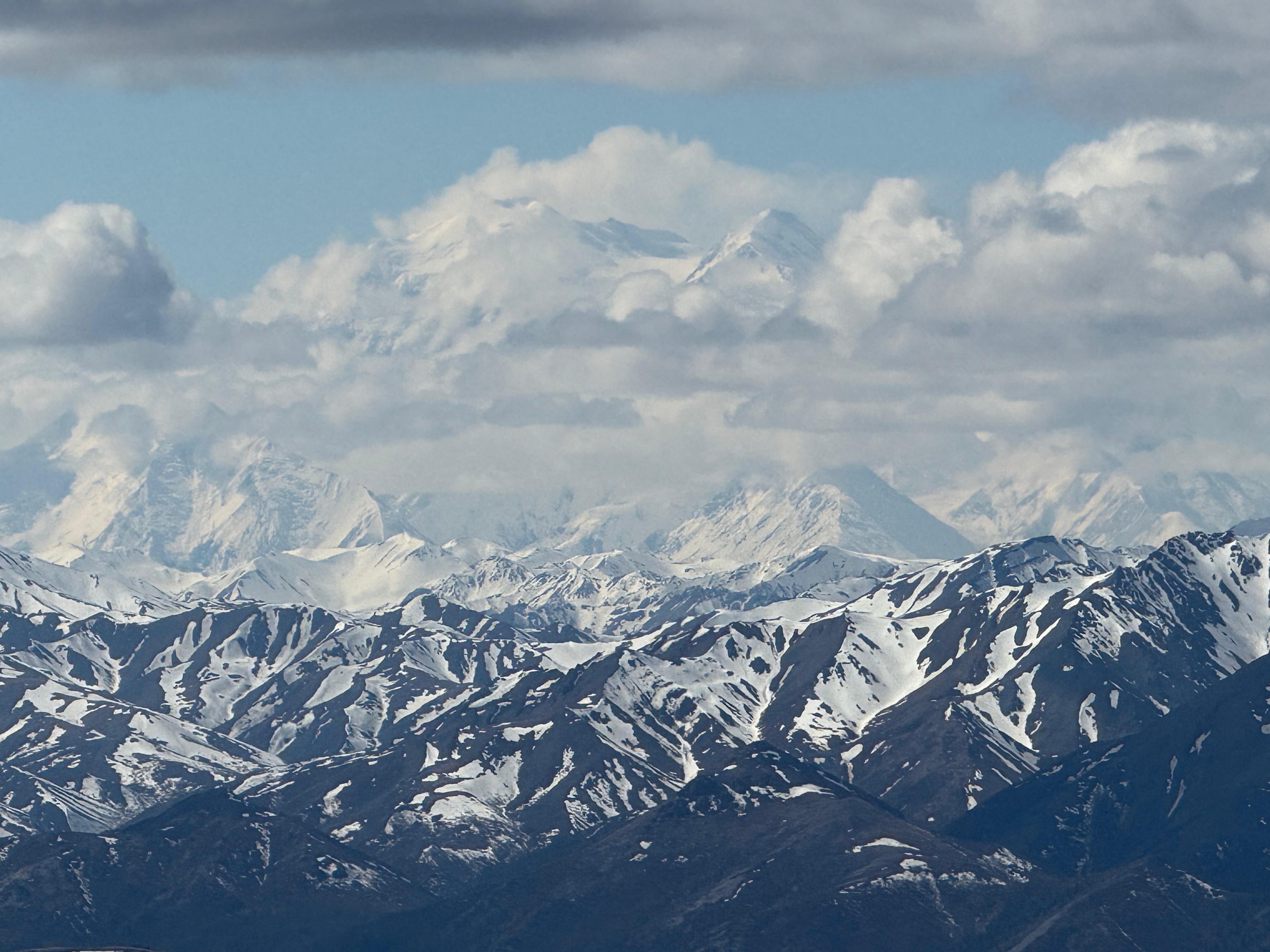
I noticed that Denali was peeking out from the clouds, towering above the foothills below.
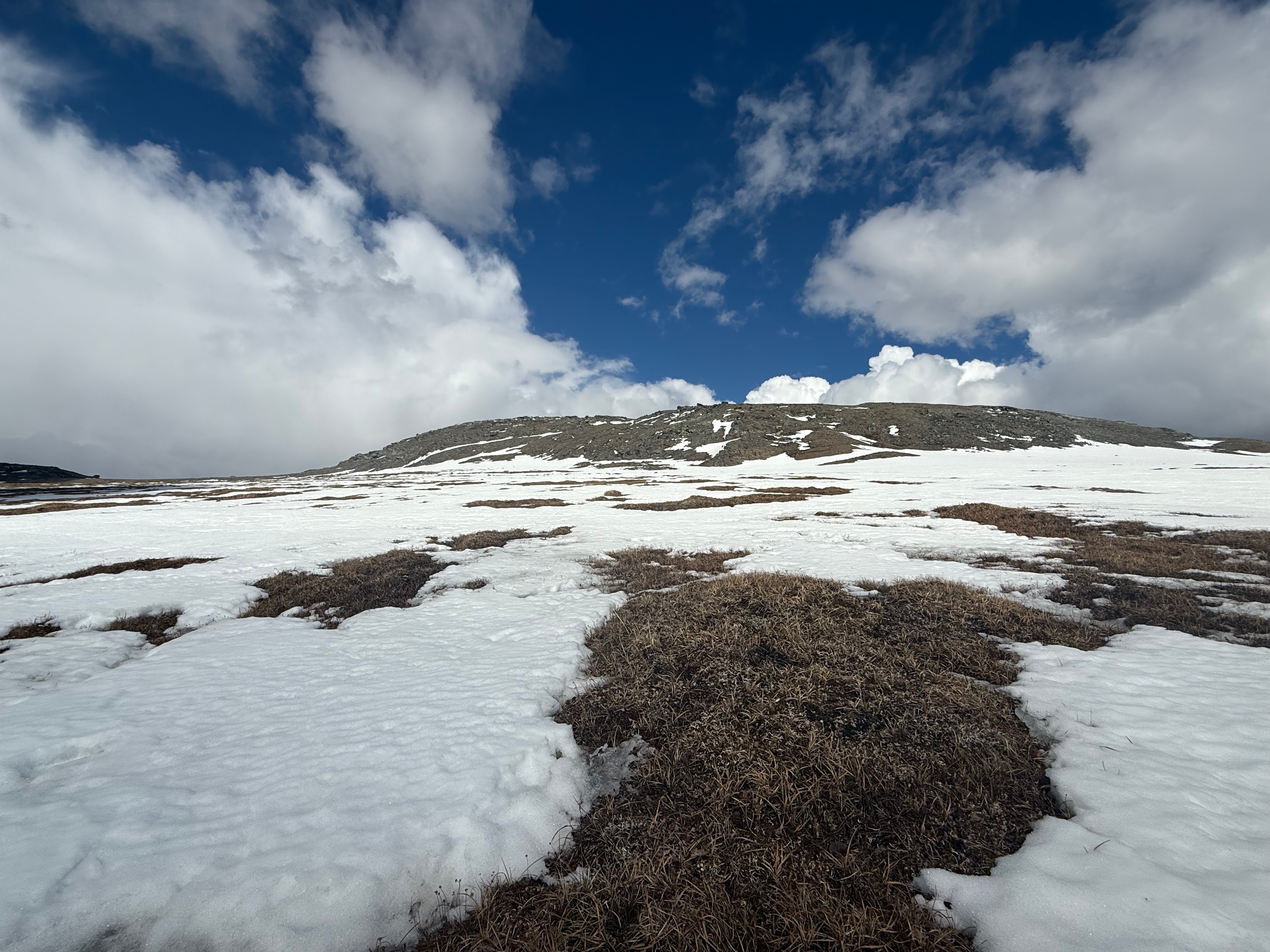
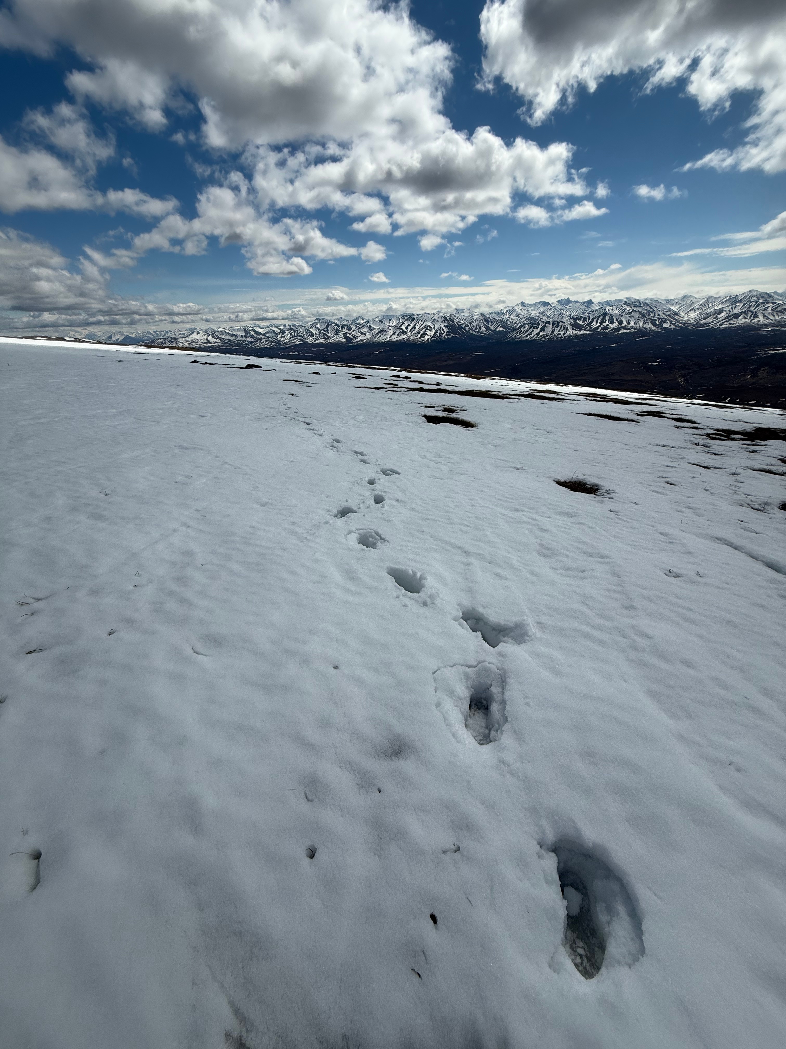
The bootpath continued on, up a gradual slope to an overlook, past patches of snow growing in size and frequency. I had hiked 1.5 miles from just over 3100’ on the Park Road to 4500’ where I came to a wide plateau covered in white. From any perspective below this point, it was not obvious that this half mile wide tableland exists. At first the snow was patchy, so I pressed on in a direct line towards the base of the summit, the trail having disappeared into the marshy grass. The wind had begun to pick up and I needed my warm jacket.
The snow patches became wider and more frequent, and I began postholing thigh or crotch deep. I looked to the west and the east to see if it would be worth my time to retreat and circumnavigate the snow, but I was on a mission now and had no time to waste. There were ominous clouds all around, some forming into thunderheads, although I remained bathed in sunshine besides the infrequent passing of a cloud in front of the radiating sunshine. I knew my time to safely retreat without getting struck by lightning was shrinking, so I pressed on as fast as I could, opting to crawl for the last 100 yards.
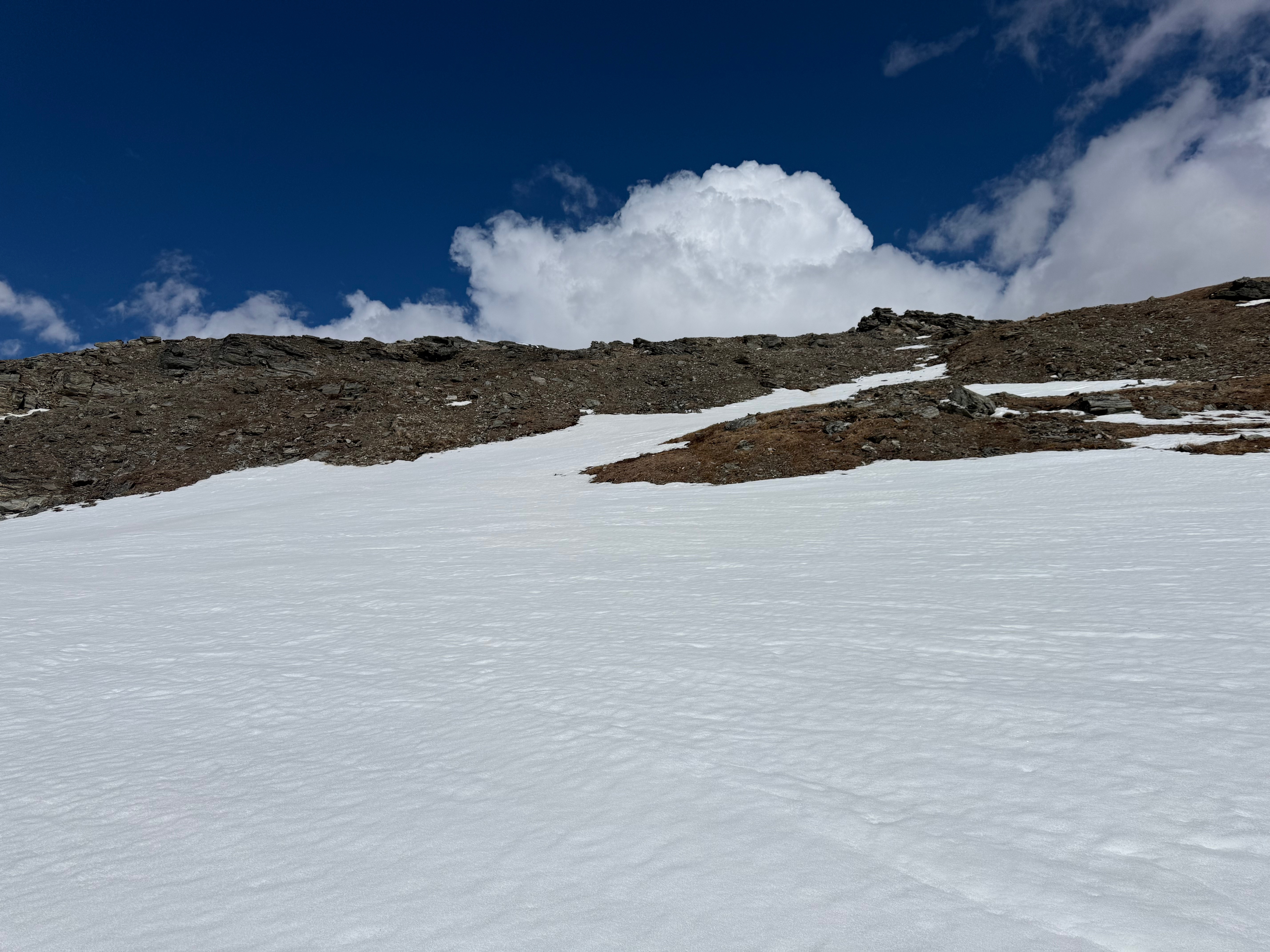
My feet firmly back on the alpine tundra, I walked up a steep mini draw that, after only a short distance, brought me right to the summit block. As I crested to the top of Mount Margaret, I gasped in awe at the flat-bottomed cumulonimbus clouds releasing shafts of rain called, “virga,” precipitation that falls from clouds as rain, but evaporates before it hits the ground. The dry air of Interior Alaska was drinking all of the moisture before the ground got even a drop.
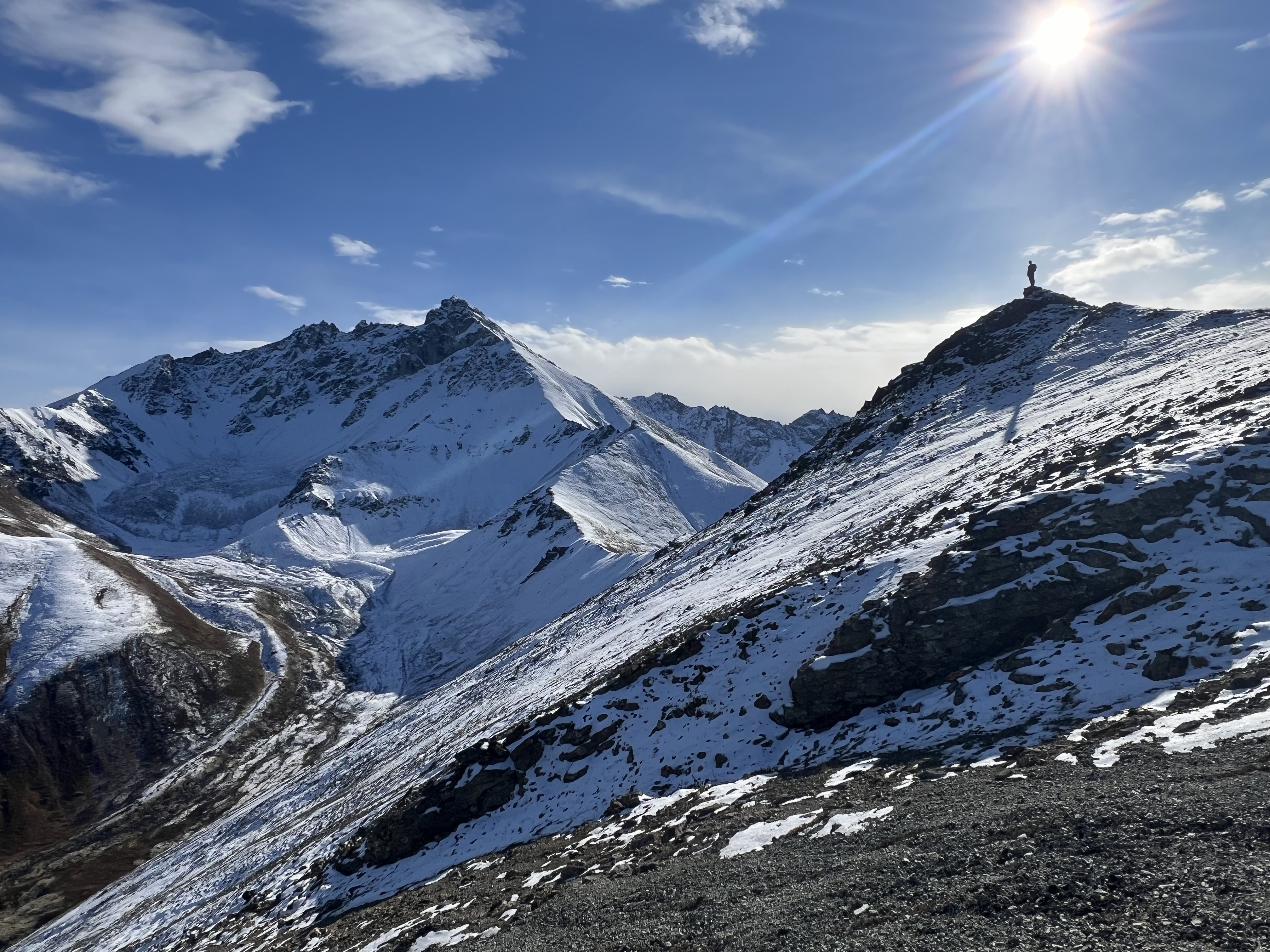
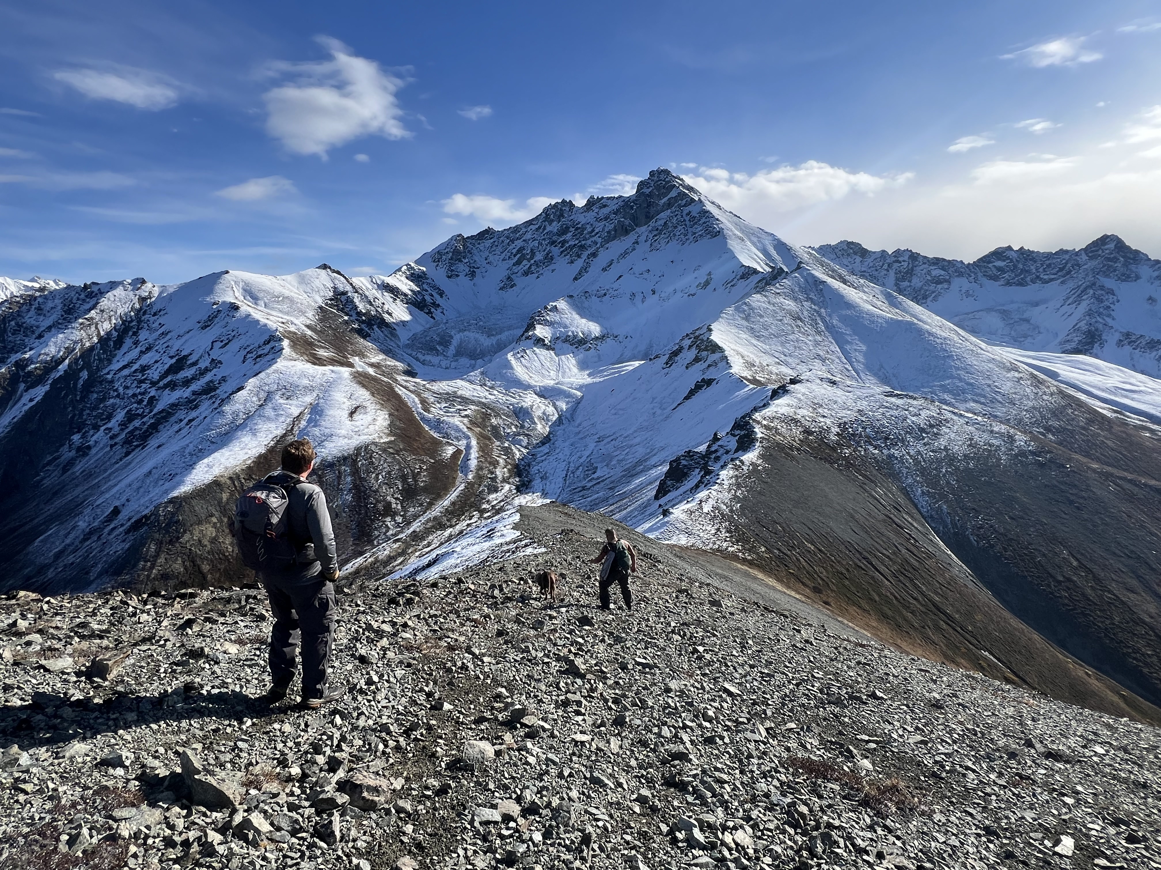
Mount Margaret has a long fin of a summit ridge, the summit proper being a natural pile of jagged rocks. I hopped up on it and scanned the horizon for 360 degrees to take in the view before snapping a couple dozen photos and videos to save the memory of an incredible summit day. As I radioed my “base camp,” I spotted two people approaching the summit from the southeast and although I was disappointed to not be the only person on the mountain that day, I was excited to get a perfect summit photo that wouldn’t have been possible without their help!
We chatted for a few minutes about their backpacking trip; they had come from Savage River and were continuing towards Mt Wright in the west. Although I wanted to ask if they had approached via the same route my daughter and I had attempted in 2020, the clouds were building, and I wanted to try to get back to camp before a deluge came down. It was possible that none of us could afford to lose the time to a drawn-out conversation. Plus, the wind was not letting up and I was ready to descend towards dinner.
I snapped a few pictures for them and then headed down the mountain, this time following the southeast summit ridge. I figured it would add a little bit of distance, but I would avoid the majority of the snow, saving me time. I already had soaked feet, but have never been too bothered by that. I sloshed along across the plateau and quickly met up with the trail I had ascended.
A little over two miles later, at 330pm, on the dot, I broke out from the alders and onto the Park Road, having followed the trail all the way down. Now that I knew where it was, I noticed the hidden entry, but I could see how I missed it. I walked about 20 yards west on the road and then into the shrubs where my bike was hidden. I was relieved when I saw that nothing had decided to take a taste of my tires or anything else I had stashed.
The 3 miles back to Savage River Bridge was cruiser as I clocked along at 25+ mph, trying not to ride my brakes knowing I had already waited too long to change my pads. Two more miles up a gradual incline brought me back to Savage River Campground.
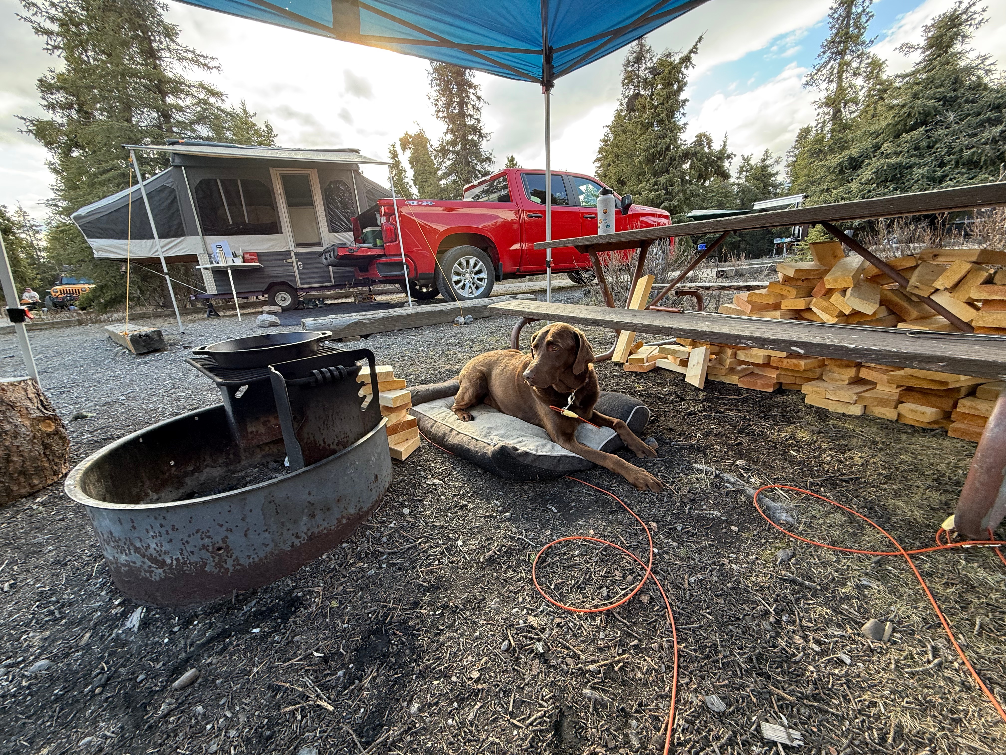
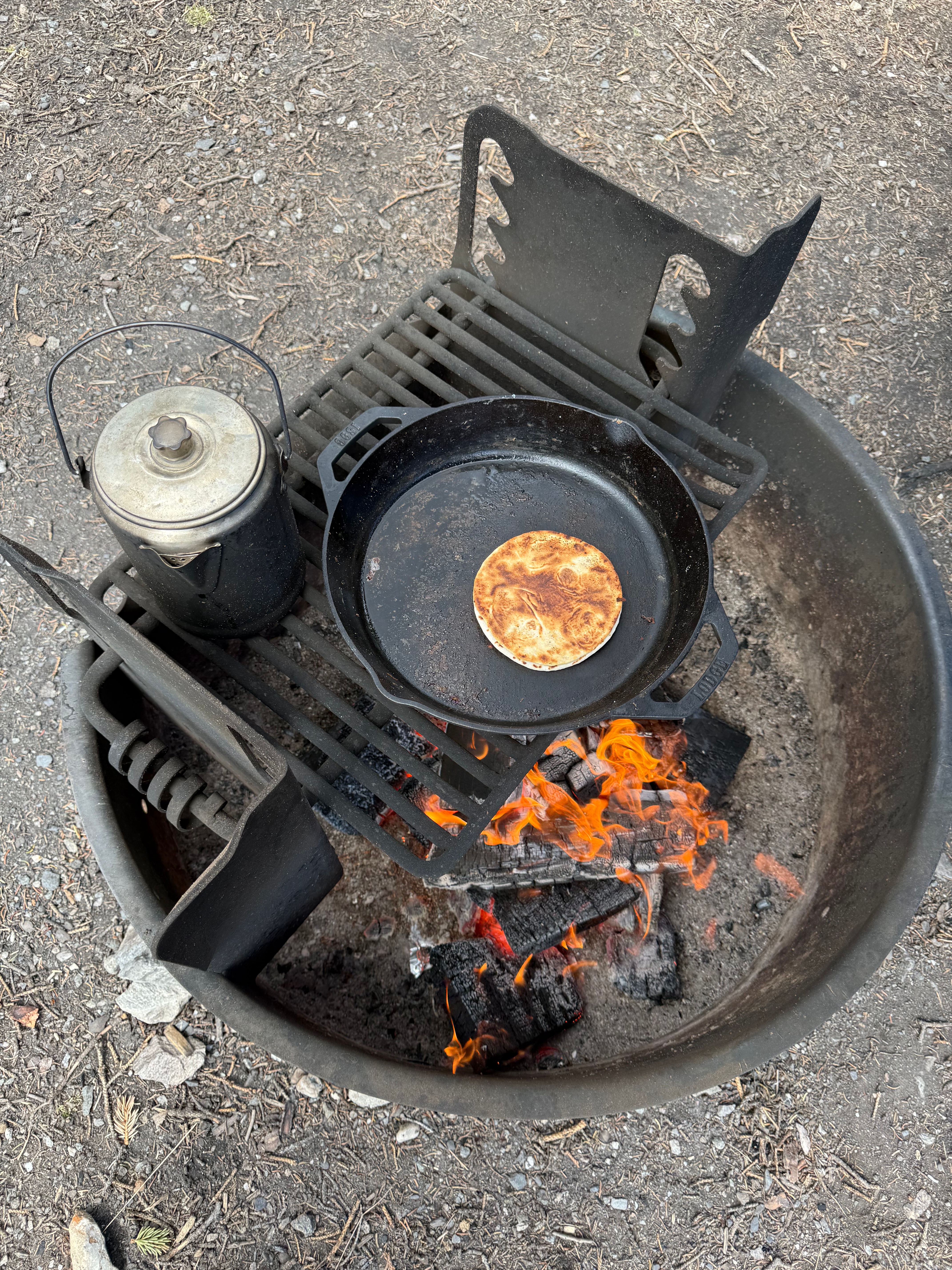
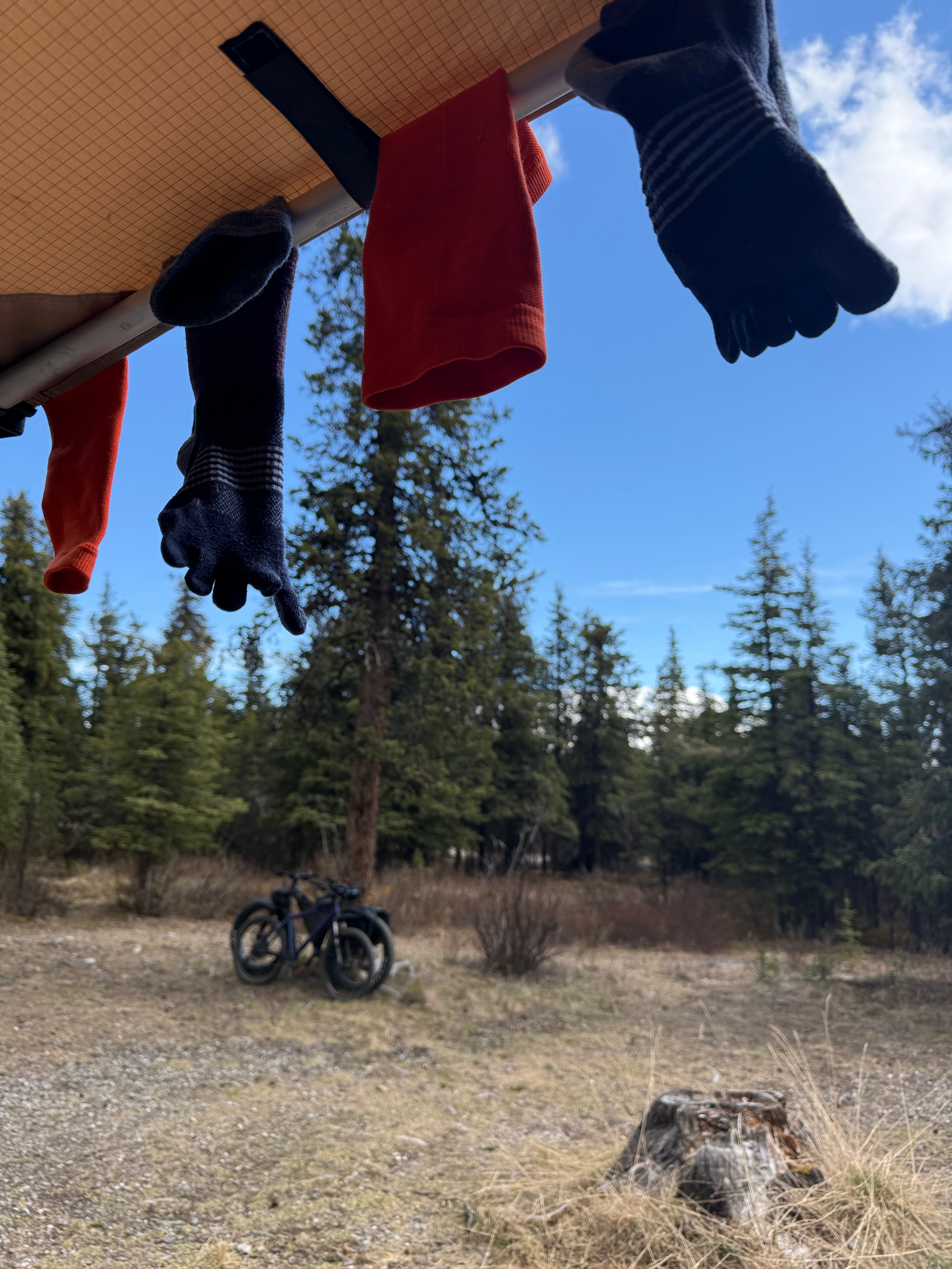
Before long, my wet socks and shoes were hanging up to dry and I was eating quesadillas made by K in a cast iron pan over the open flame of our firepit.
Energized by the beauty and solitude of the day, I began packing up our camp while it was sunny, the forecast being not so great for the following morning (our departure day). The sun stayed out long after I crawled into my nook of the camper and poured over maps to figure out what my next Denali adventure would be.
Make sure you pay your Park entry fee. The best way to take care of this fee is to stop at Riley Creek Mercantile on the way into the Park.
In most circumstances, you cannot drive beyond mile 15 on the Park Road. To go beyond the gate, you can take a tour bus, flag stop bus, bike or hike. You can also drive beyond the gate if you have reservations at the campgrounds beyond Savage River.
Be bear aware. Always carry bear spray or other bear protection while traveling by foot or bike in DNP.
Do not harass wildlife. Respect the serene environment. Don’t approach or feed animals and leave the Bluetooth speaker at home.
Parking is available at Savage River at Mile 15, but it is a small parking lot that fills up quickly.
Unlike many other national parks, off-trail travel is allowed in DNP. Choose your own adventure!
Dogs are not allowed to travel off of the Park Road and must always be on a leash 6′ long or shorter.
April 20, 2025 Olympic NAtional Park, WA Mitty Peak 2674′ Mileage: 4.4 Miles RT Elevation Gain: 2400′ After 25 years, I finally had the opportunity to fly down to Seattle from Alaska to see one of my favorite bands of all time, Phish. I can’t travel without checking out a new hike, so I also…
April 15, 2025 Snutnadzeni Point: 3140′ Total Mileage: 5.7 Miles Total Elevation Gain: 2,057′ Permits: AK StatE PArks Annual Parking Pass Just when we thought it was almost time to be back up in the big mountains, Mother Nature decided it was time for snow and wind. The ridges and peaks that had been close…
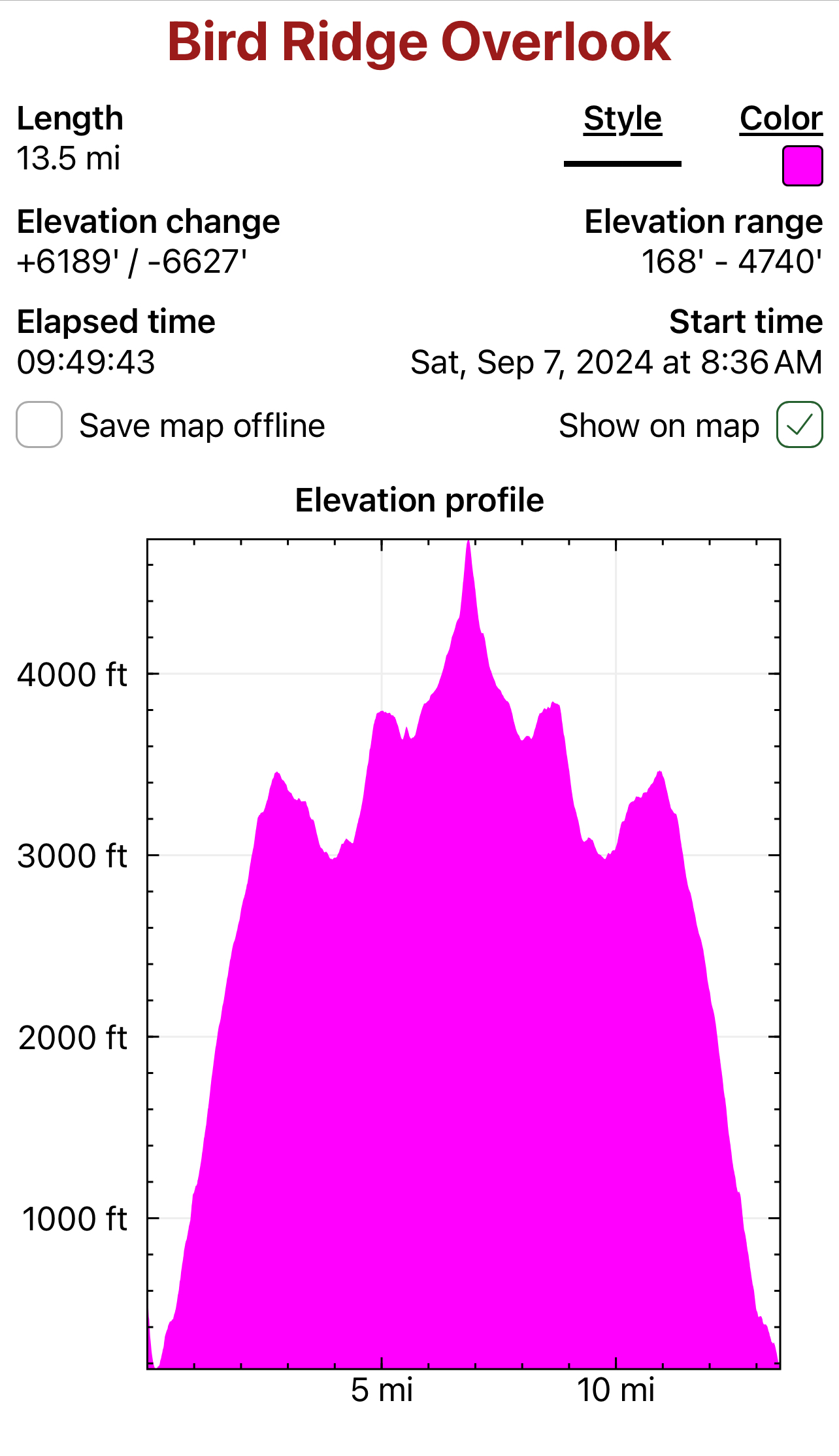
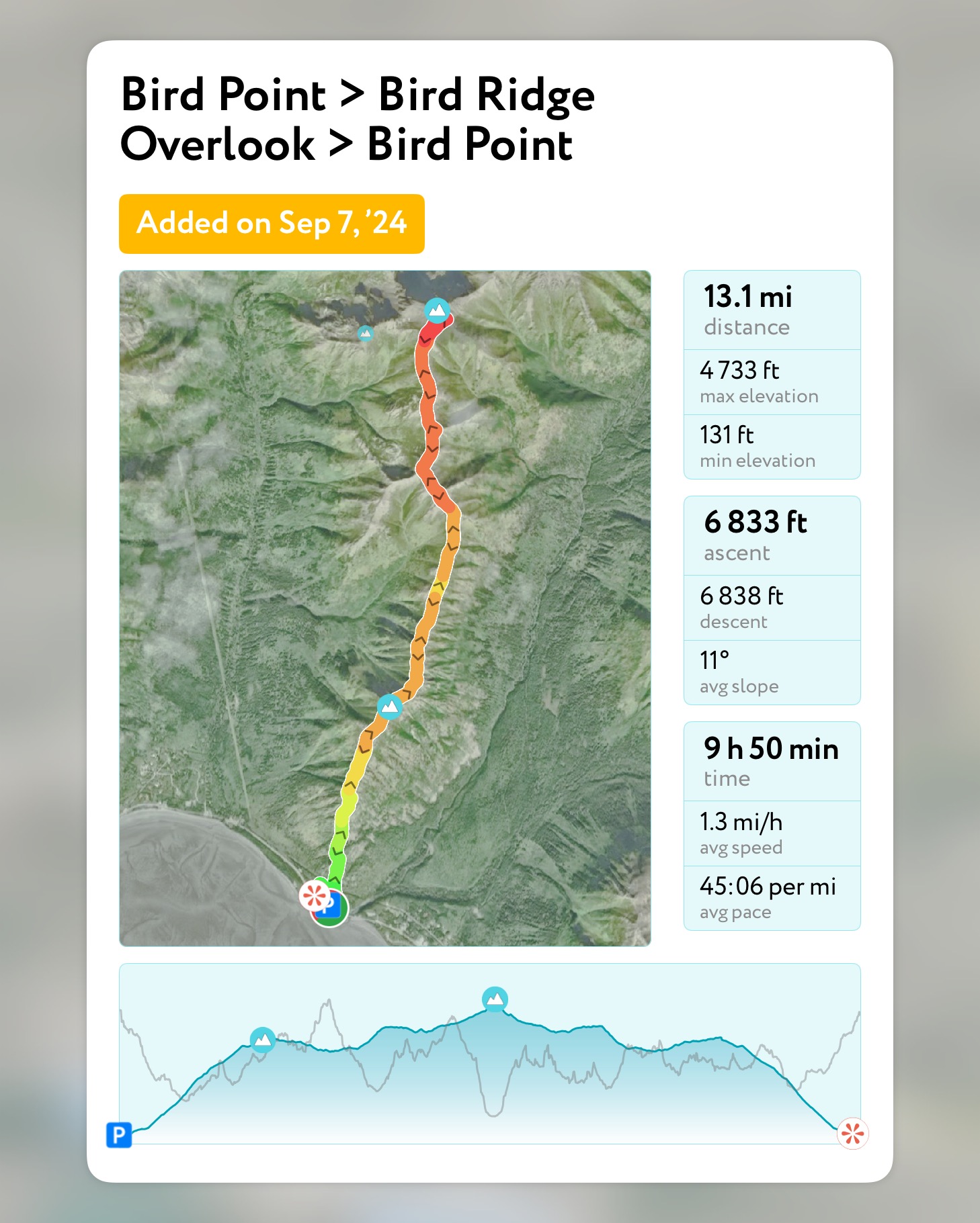
September 7, 2024 Mileage: 13.5 Miles Elevation Gain: ~6700′ BRO (4625′) Chugach 120 #98 Bird PT (3505′) CHugach 120 #120 Permits: CSP Parking Fee The 2024 Alaska State Fair had come and gone, a sure sign that the dark winter was going to be closing in soon. Even though it was another rainy summer and…
The majority of the Southcentral Alaska winter of 2024-25 was uncharacteristically warm and relatively snow free, but here we were in April, with record breaking snowfall around Anchorage. The ridges and peaks that were almost ready to be climbed were now blanketed in multiple feet of fresh snow. The avalanche danger had increased, and the Chugach turned into a hiker’s postholing hell.
My adventure partner, Jason, and I had made a handful of successful peakbagging forays since February, but had also experienced firsthand how challenging it was in the enduring winter weather of the mountains. We had postholed through waist deep snow, dealt with 30+ mph winds and trudged through multiple snow squalls.
We had some big traverse goals for the summer and needed to keep moving, even when the weather was continuing to fight us. The winds were forecasted to be gusty for the weekend, but we figured it couldn’t be any worse than when we climbed Rainbow Peak, just the month prior.
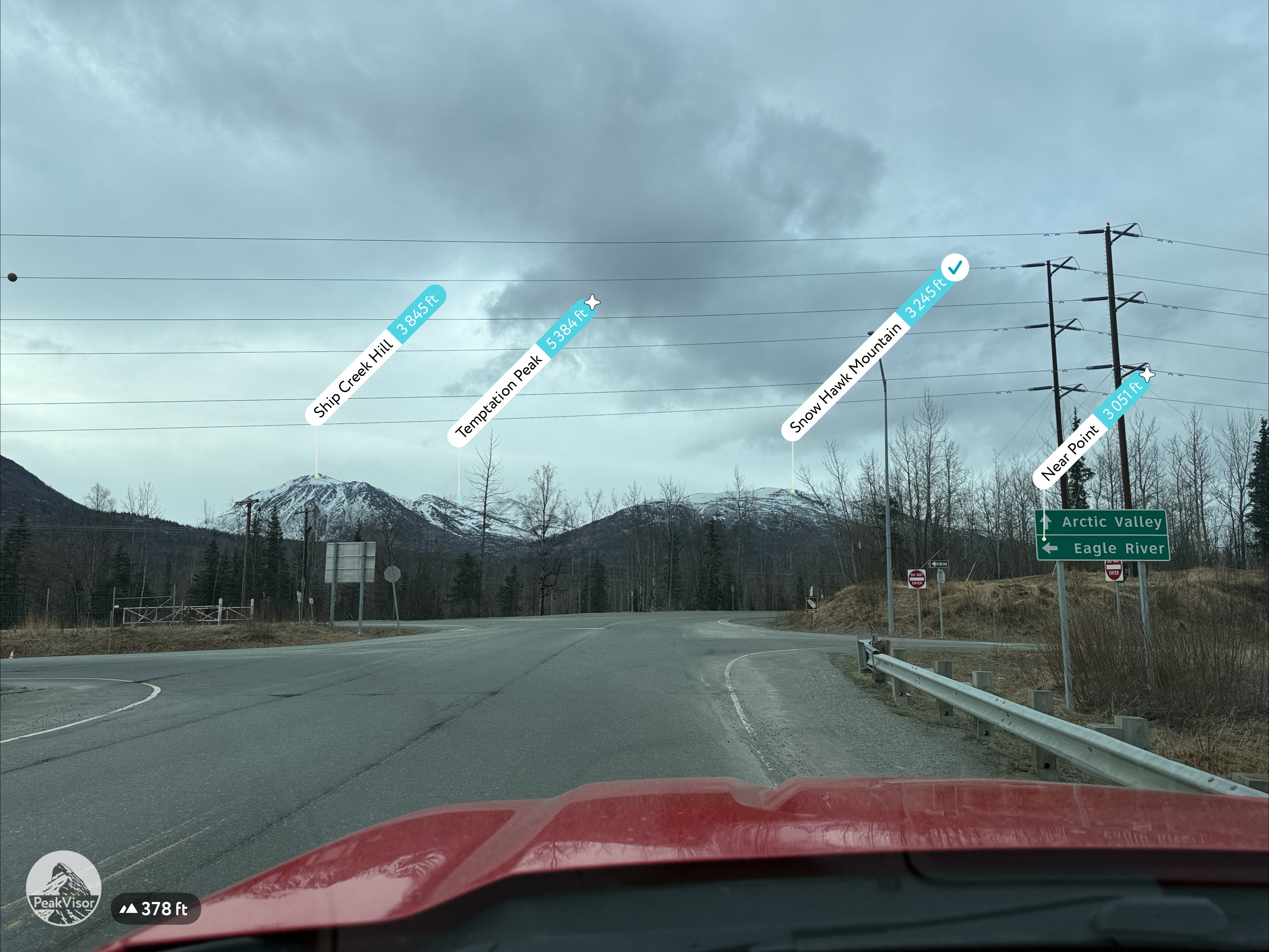
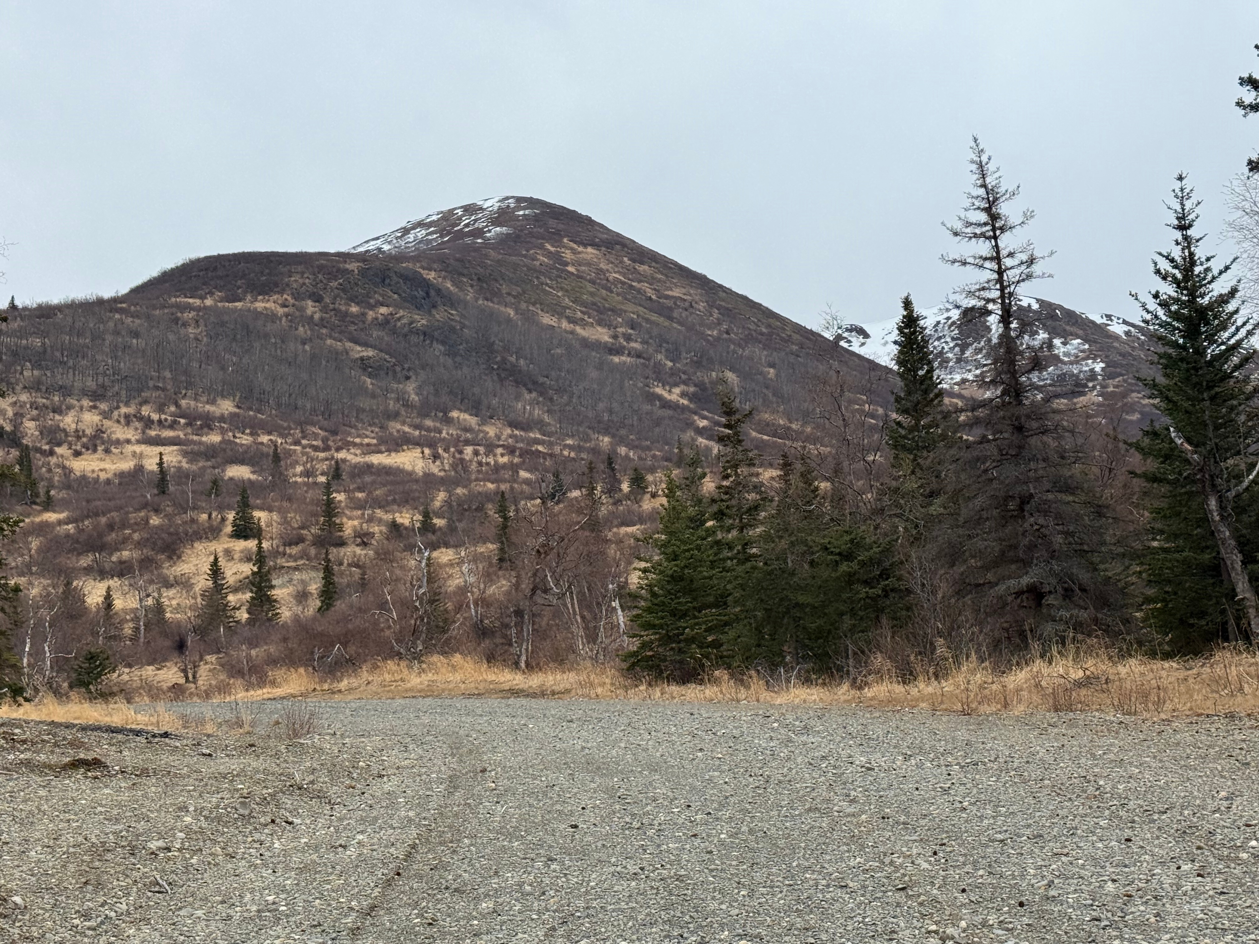
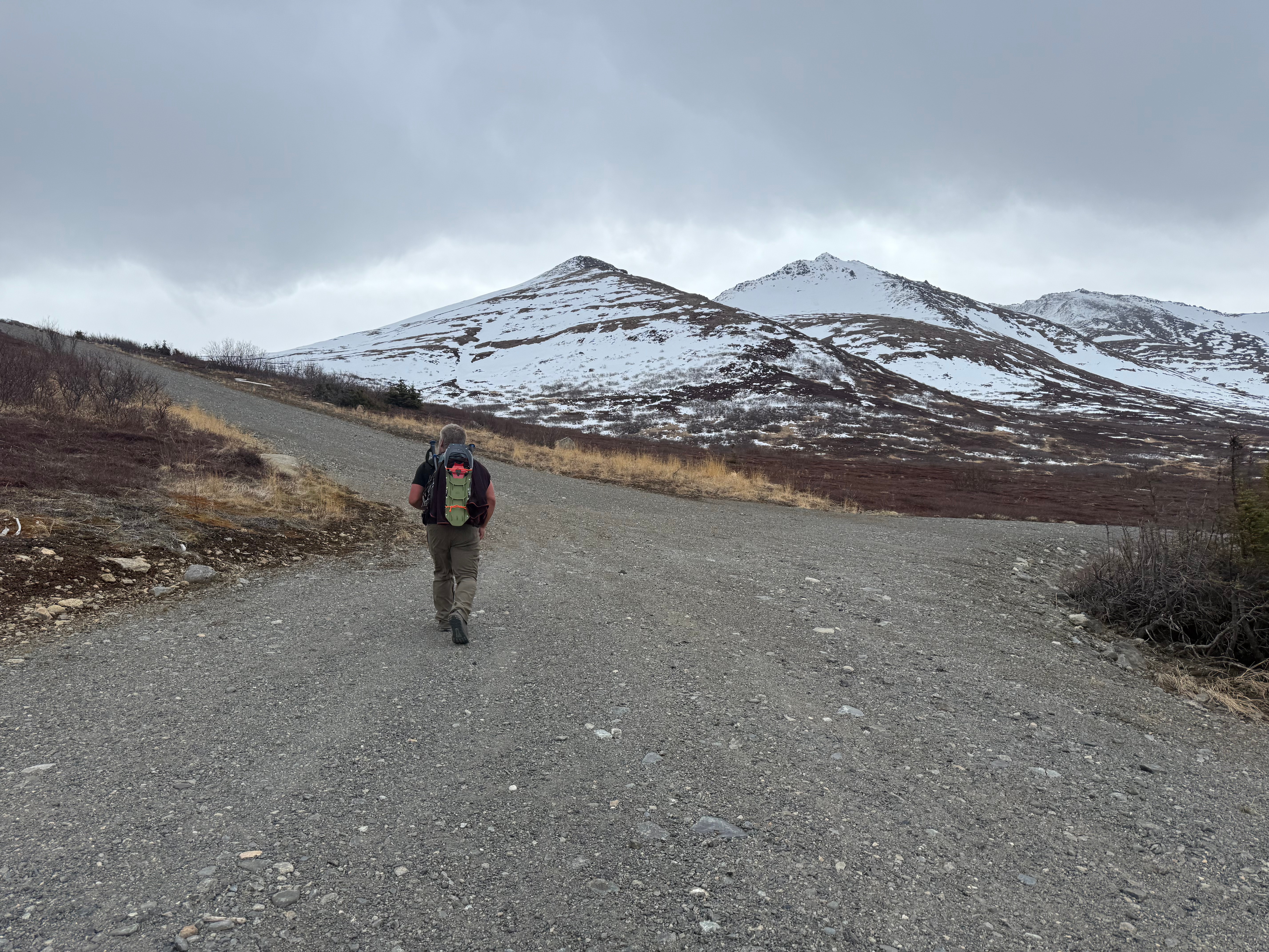
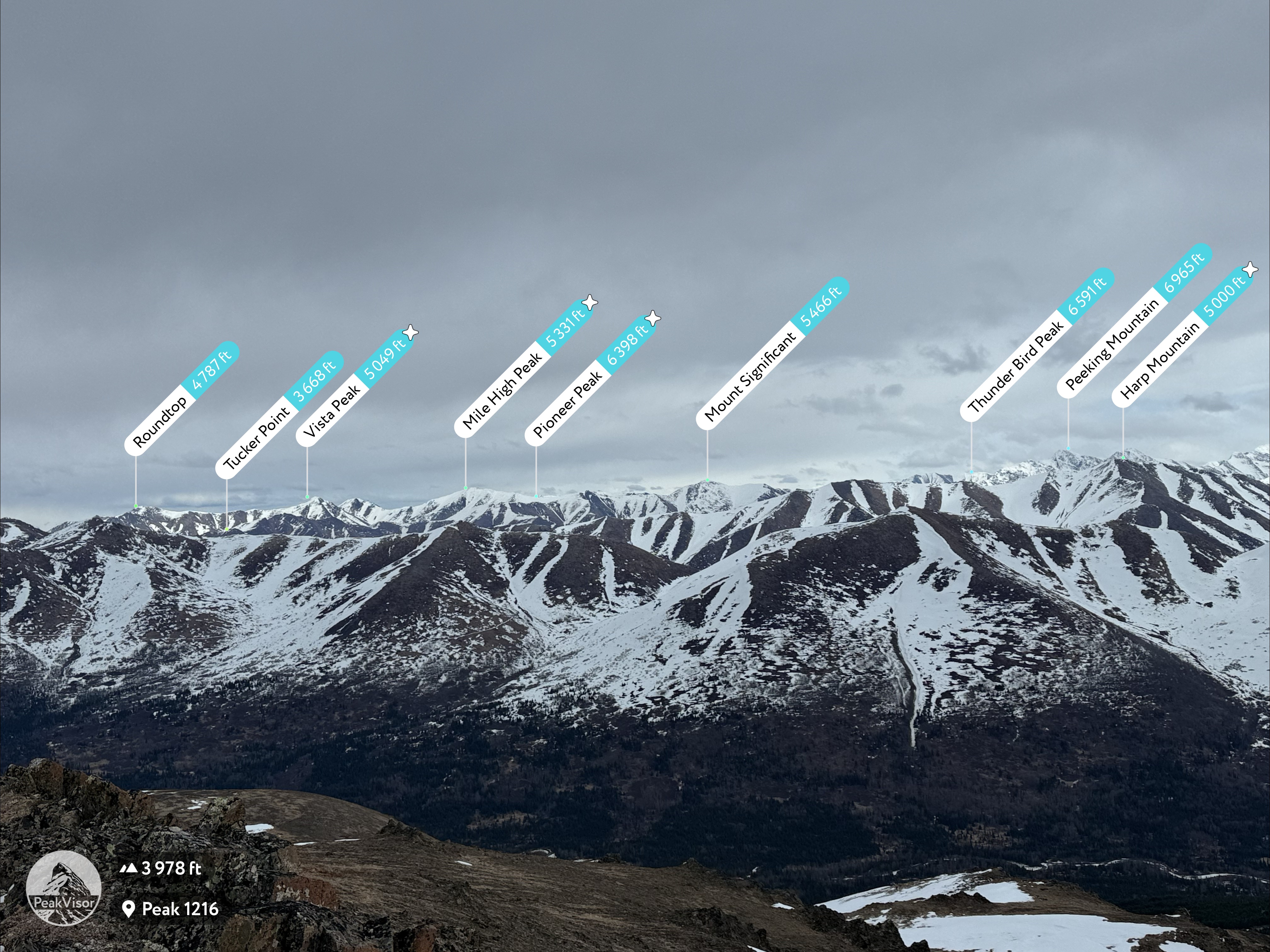
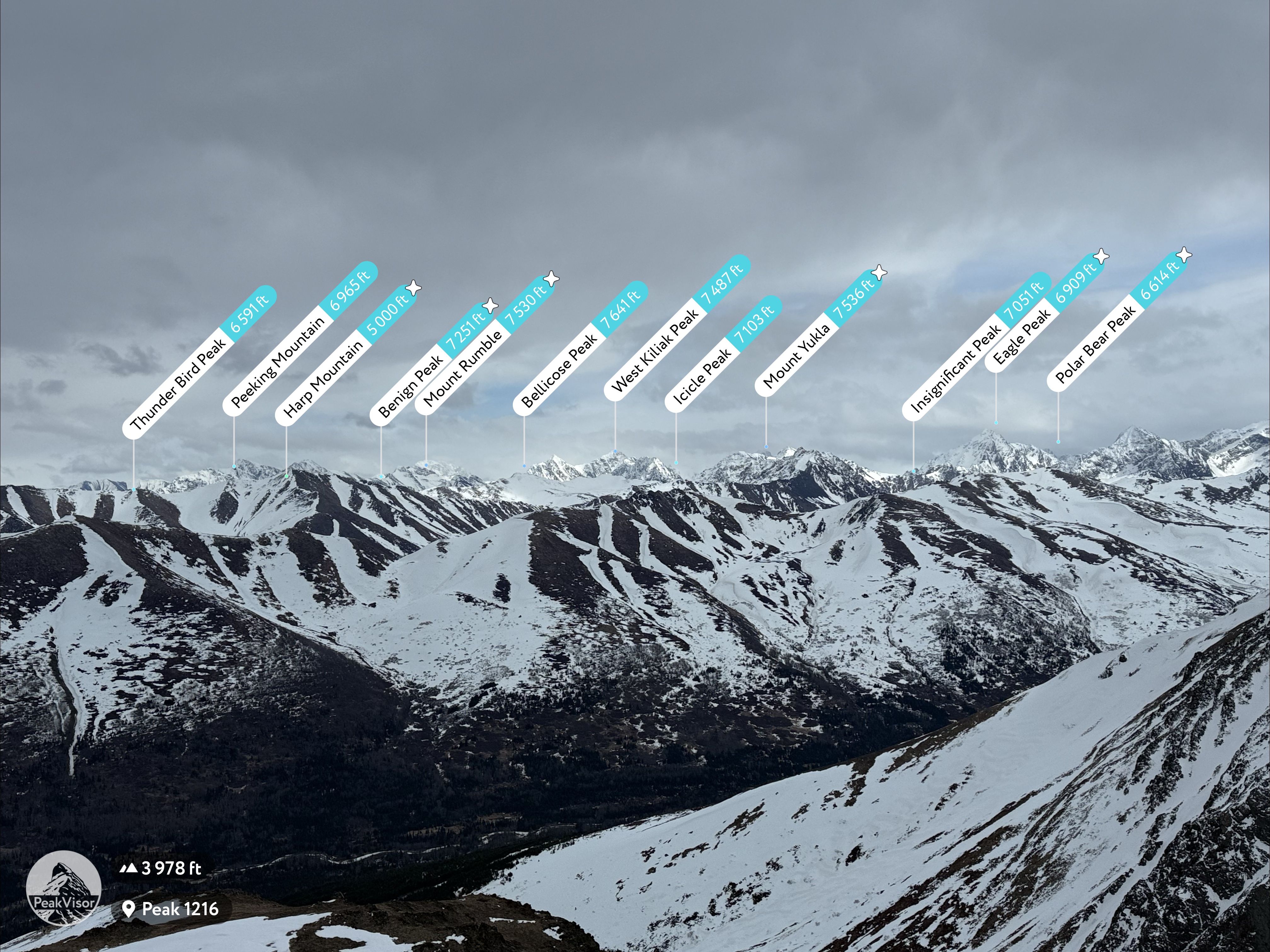
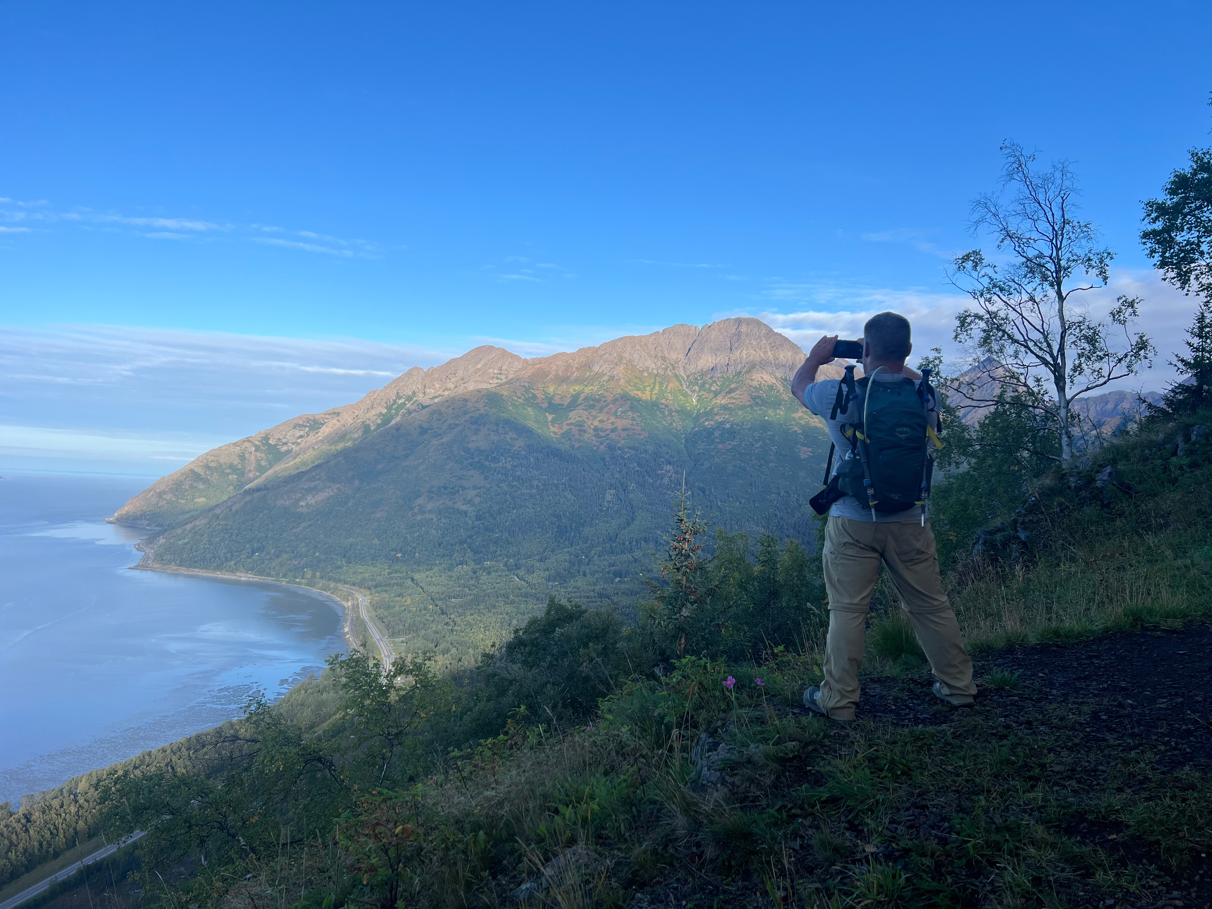
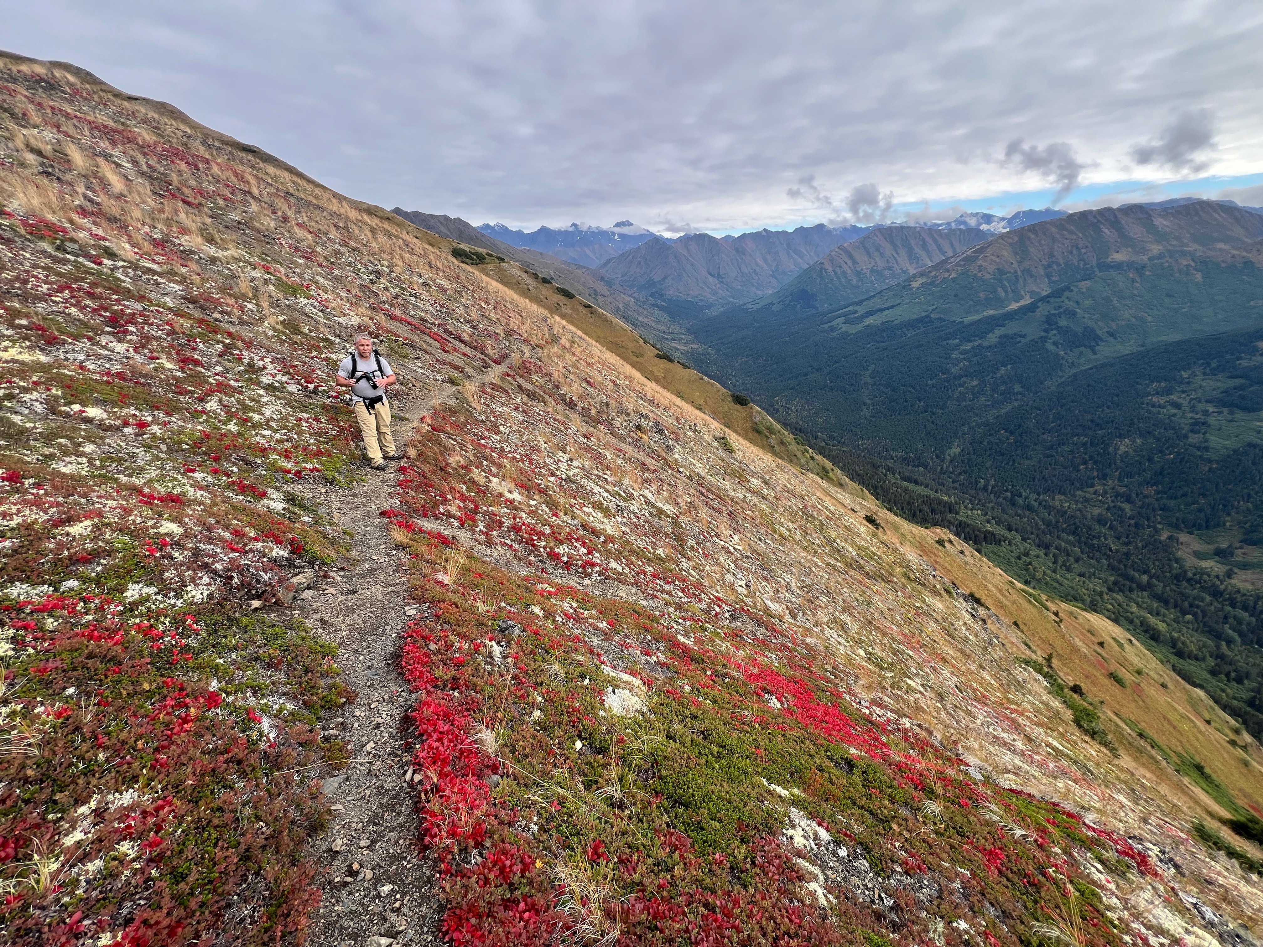
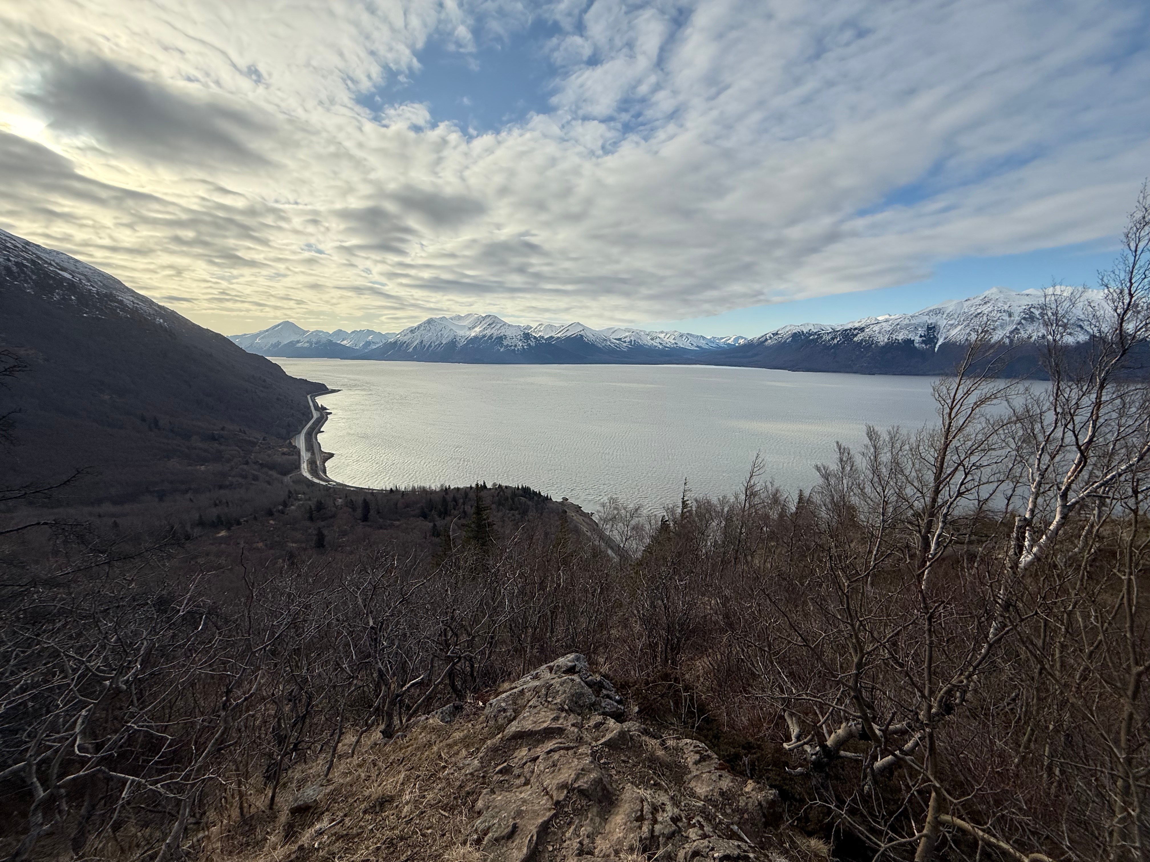
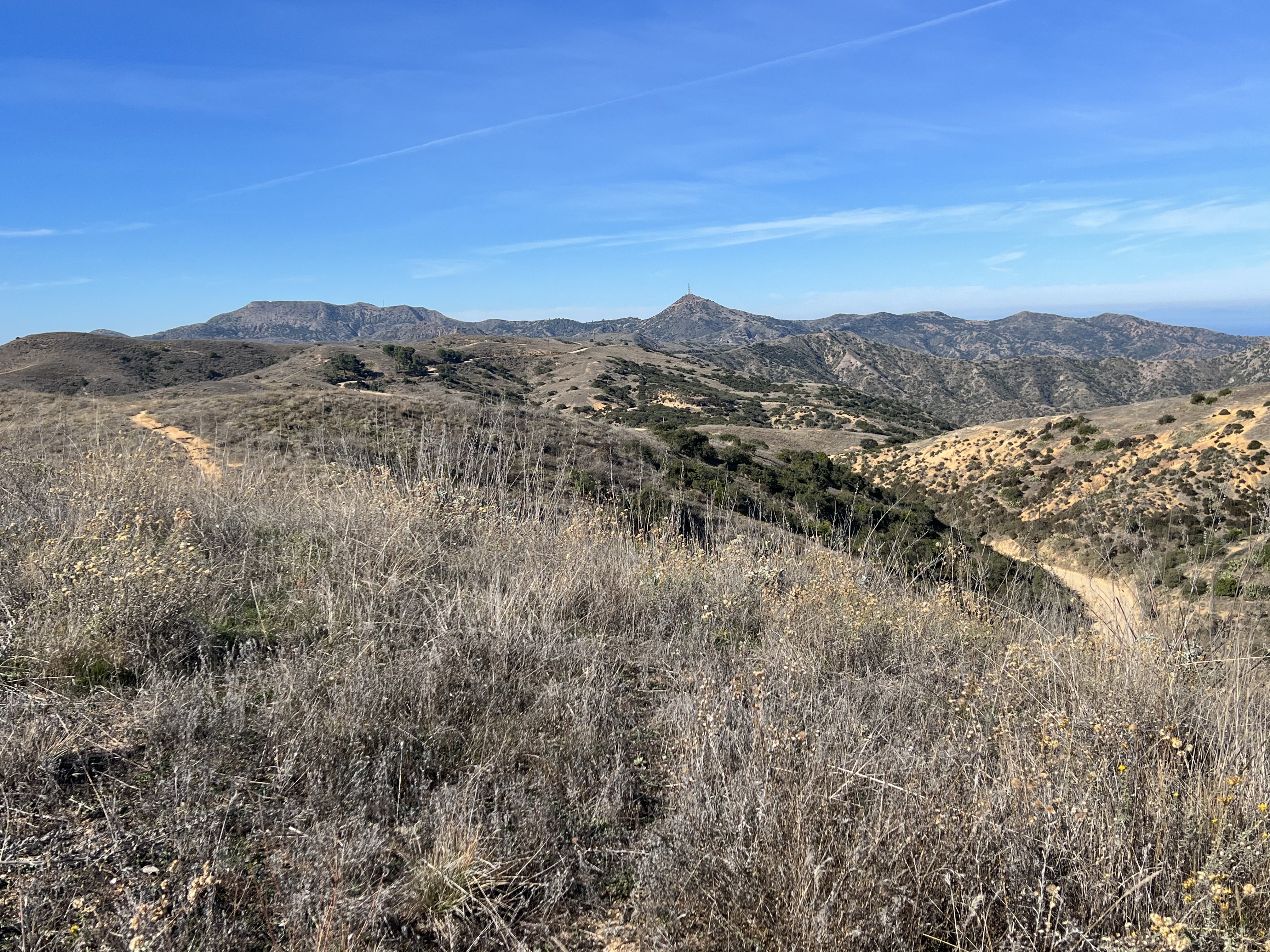
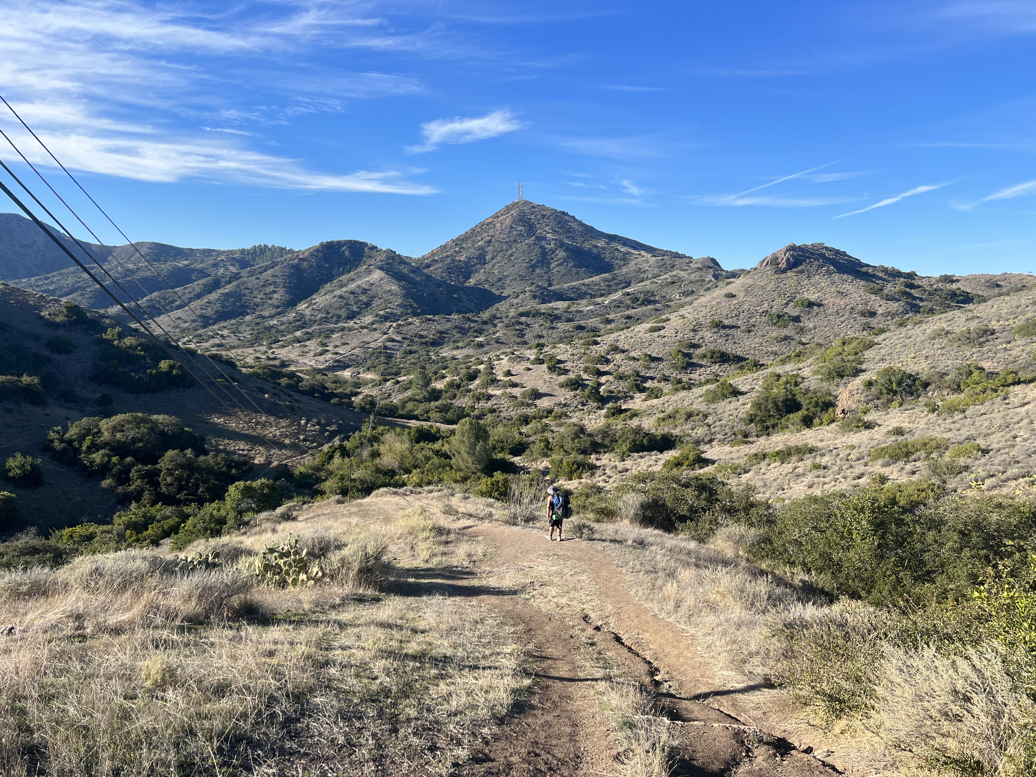
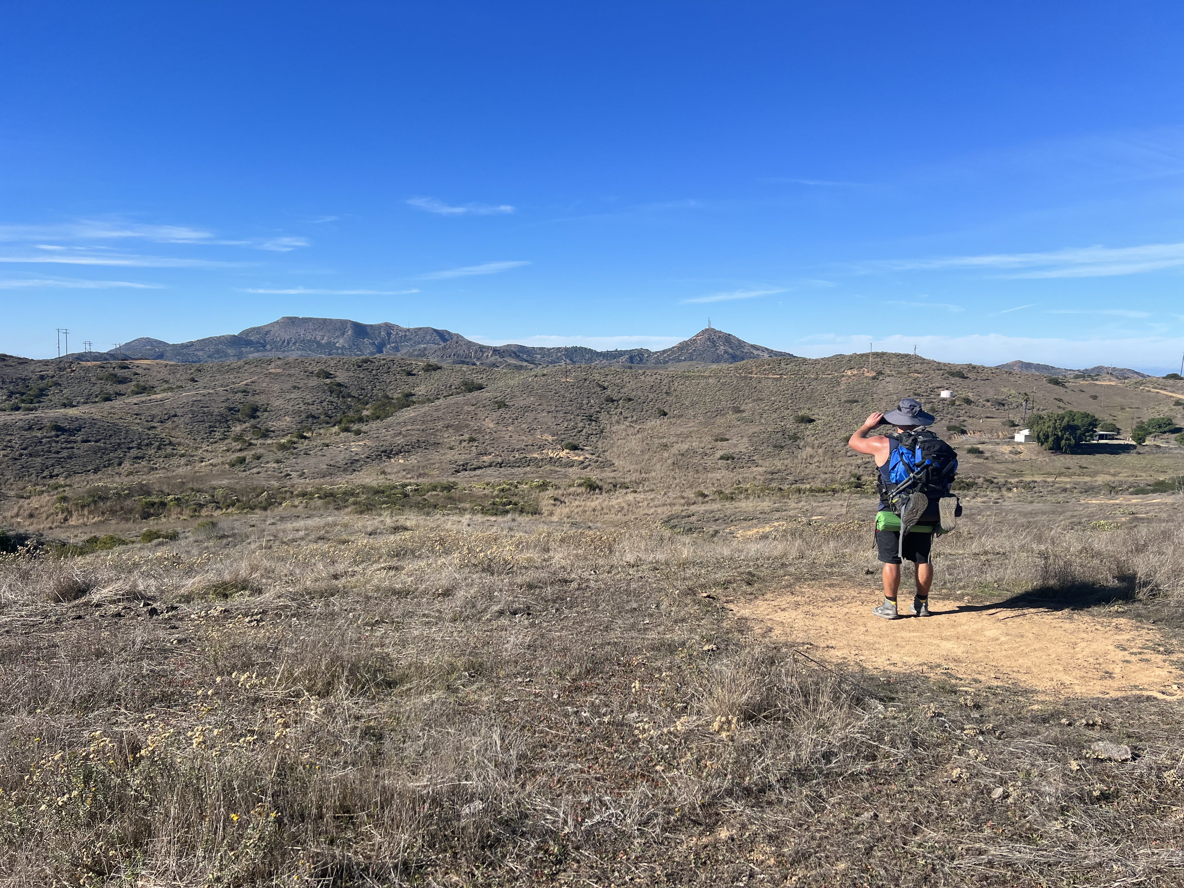
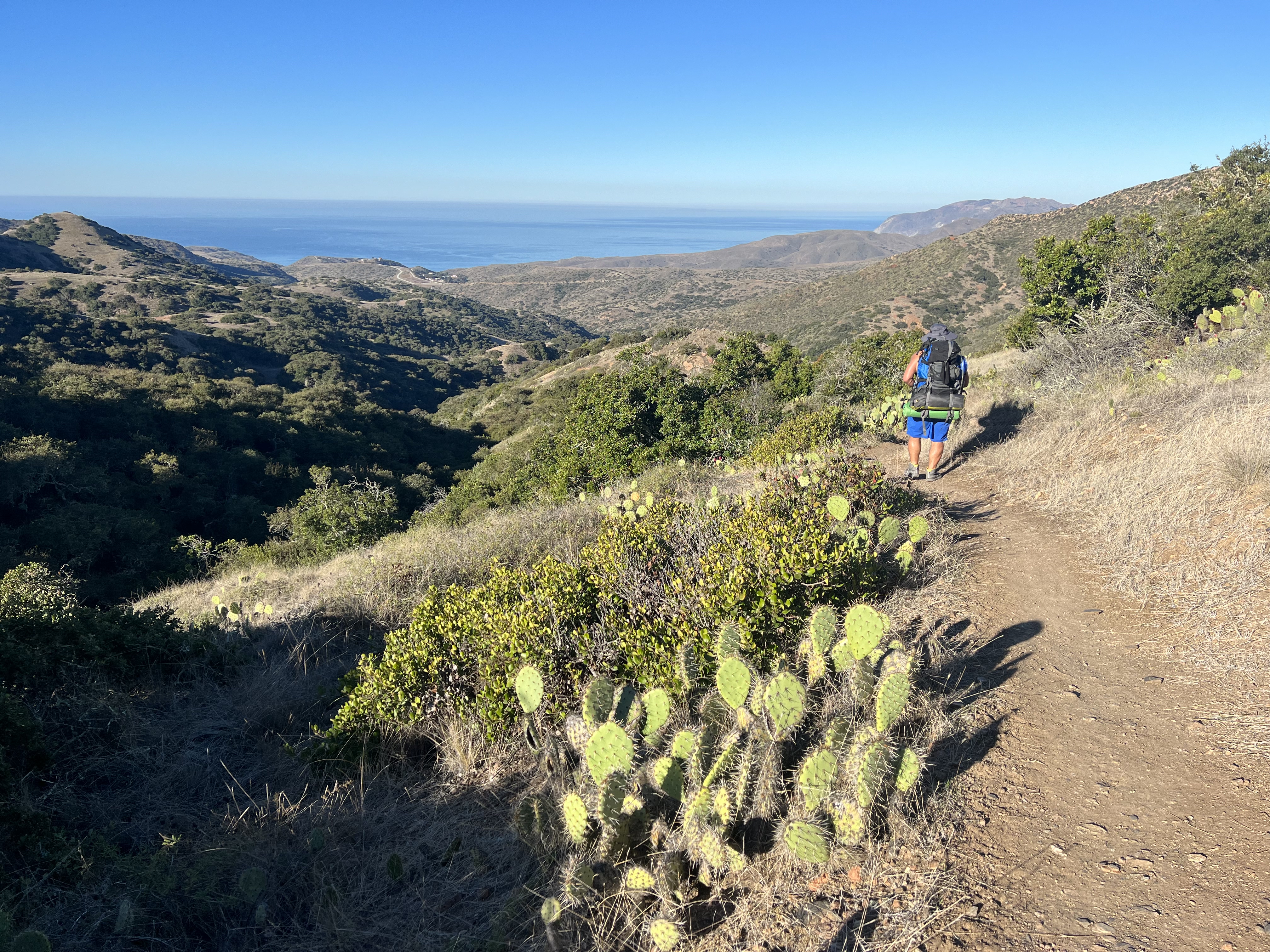
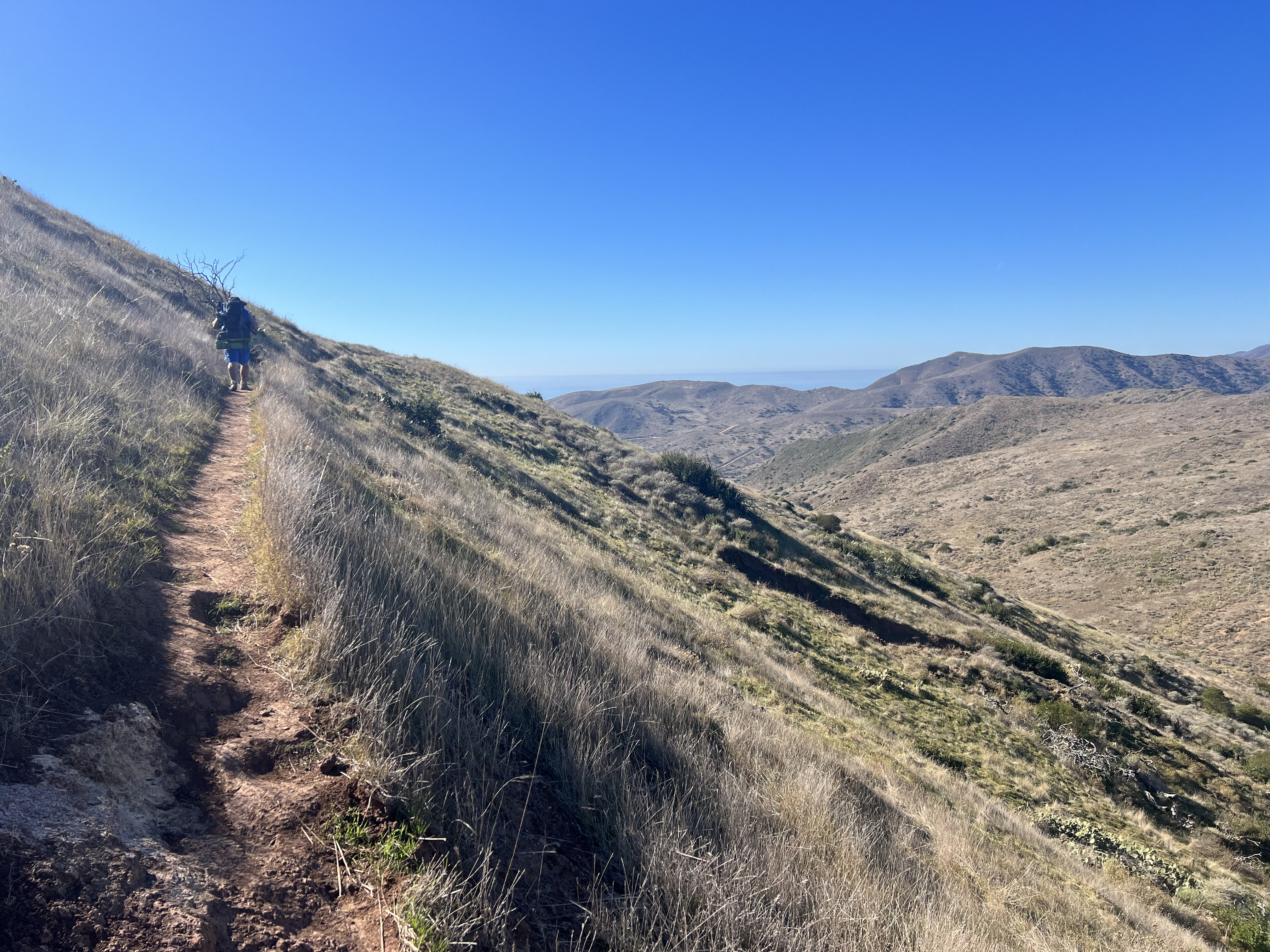
The only peak we hadn’t yet climbed that was not completely white just happened to be a mountain that had been obsessed with for the past couple of years. For some reason I was laser focused on marking Ship Creek Hill off my list… maybe because it is such a visible feature when driving north from Anchorage or maybe because I knew it was so rarely hiked due to a supposed schwackful trail up Snow Hawk Valley, or a long approach from The Dome or Snow Hawk Road.
Poor Jason never heard the end of it… when we were camped at Long Lake for my birthday (“we gotta do Ship Creek Hill”), when we were sitting out flash floods along the Kalalau Trail in Kauai (“I bet Ship Creek Hill would be fun”), and I think even as far back as when we walked the ridgeline from Triangle Peak to Mt Gordon Lyon (“There’s Ship Creek Hill. We have got to do that soon”).
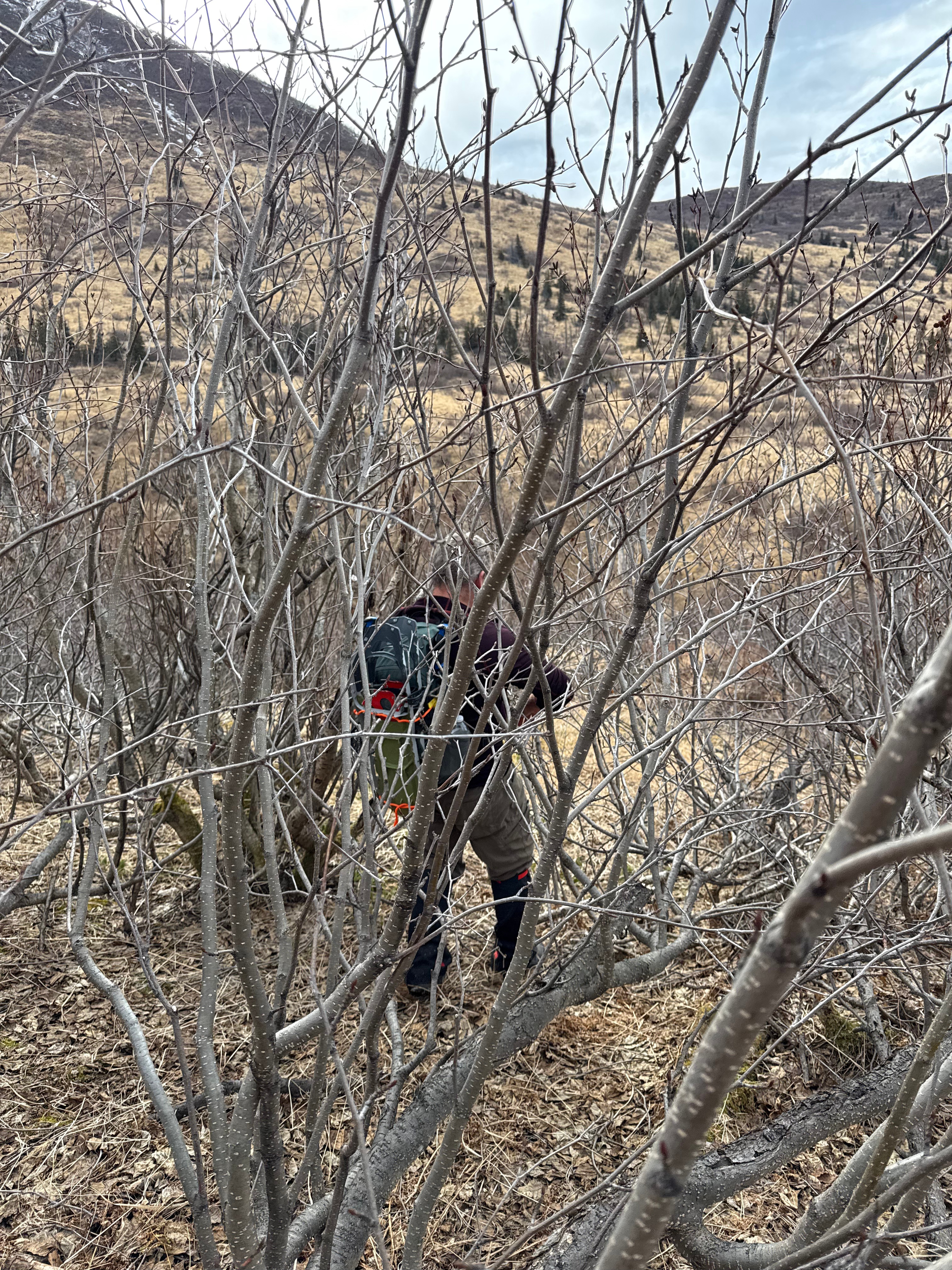
We had made a pact that this year we would get up there, but it would have to be before the buds popped on the trees, since we had experienced more than enough bushwhacking in the last couple weeks on our Snutnadzeni (Bear Pt) Traverse and on our route finding forays to figure out how to cross Thunder Bird Creek.
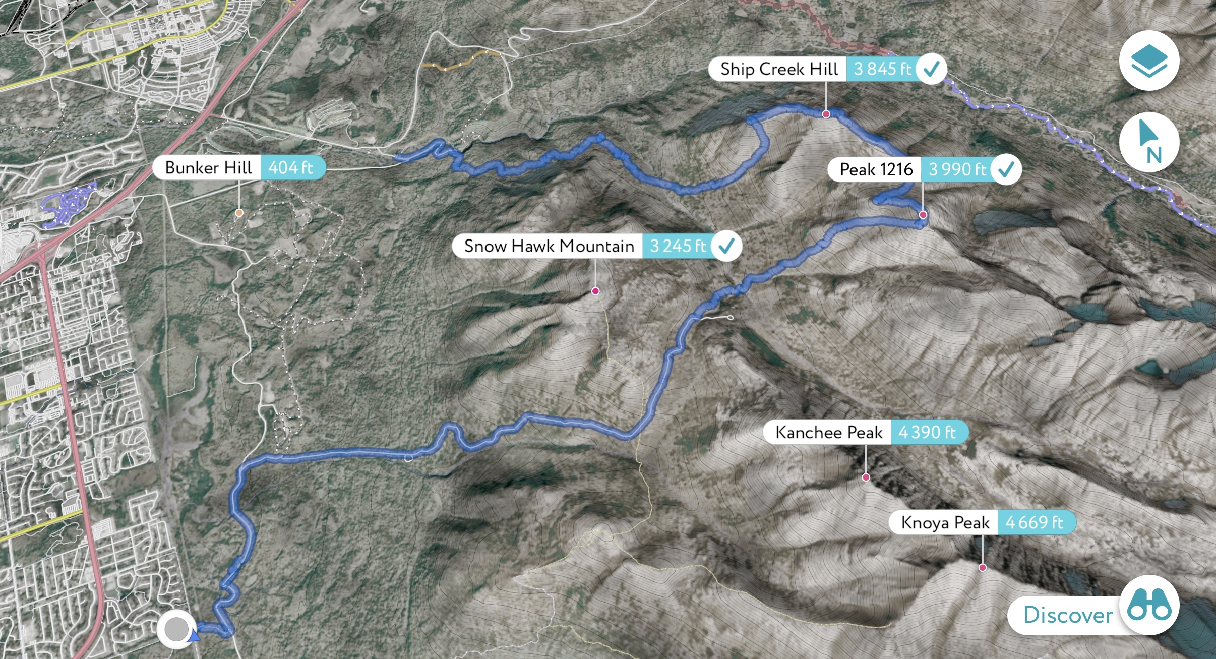
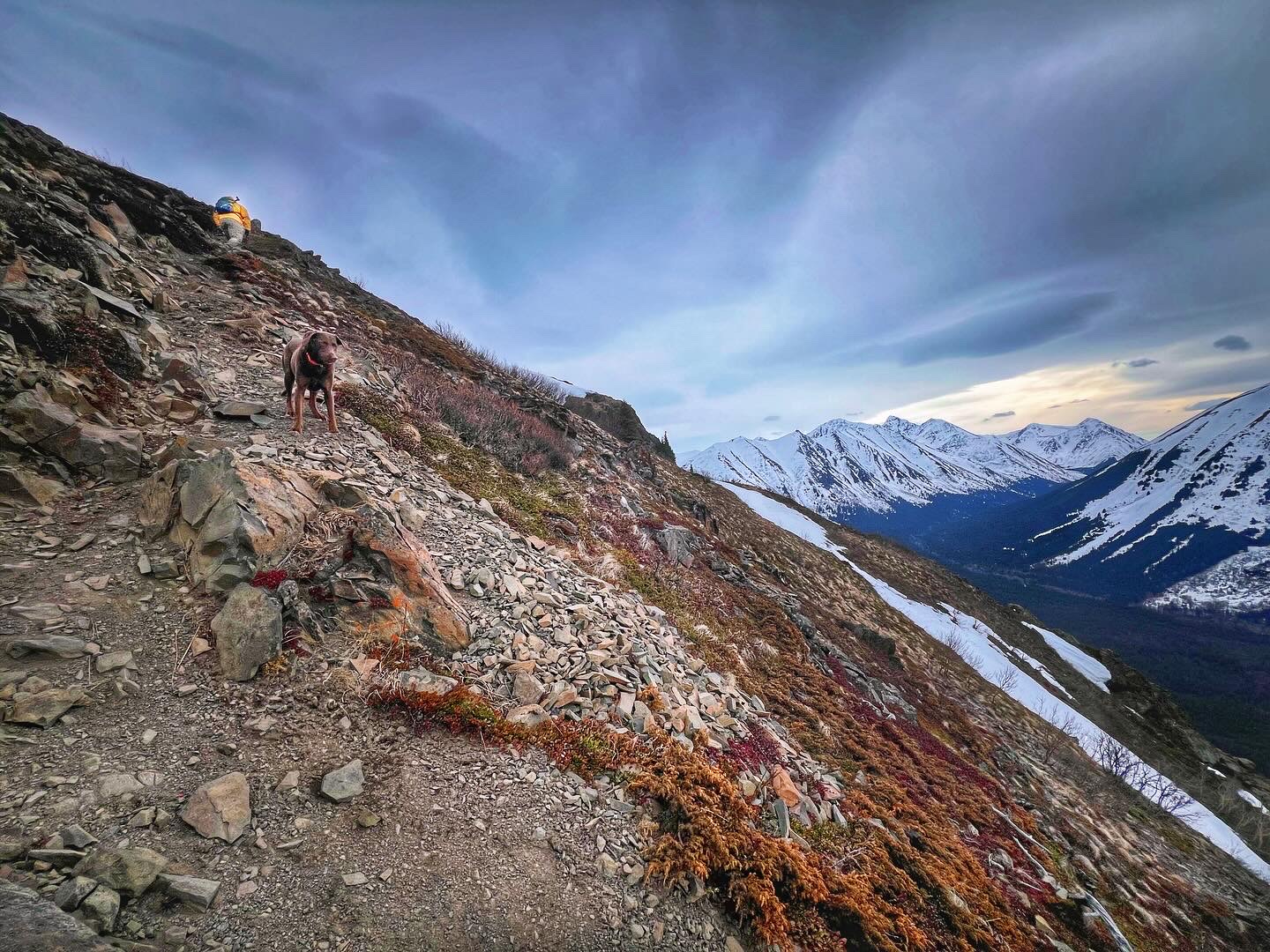
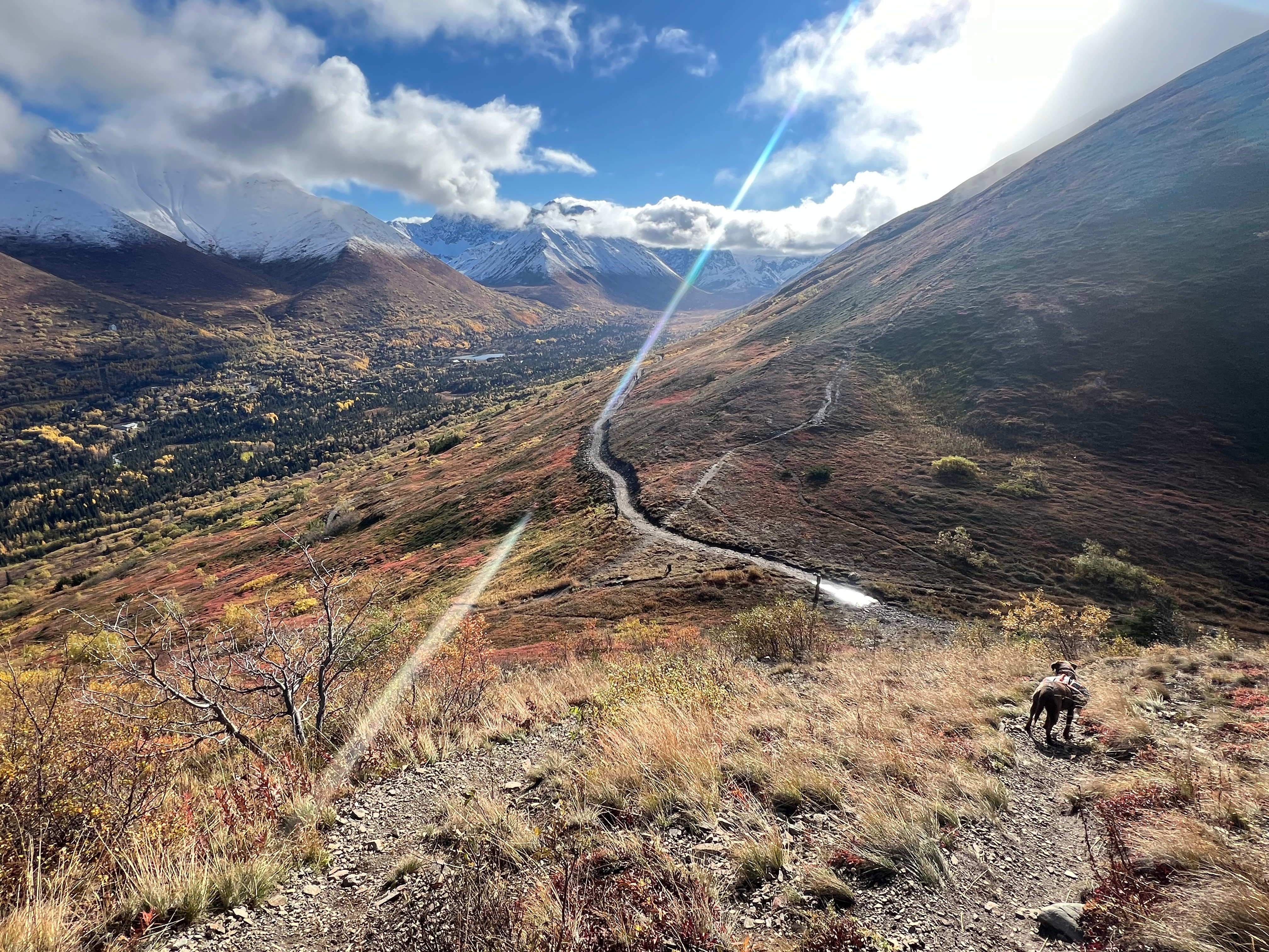
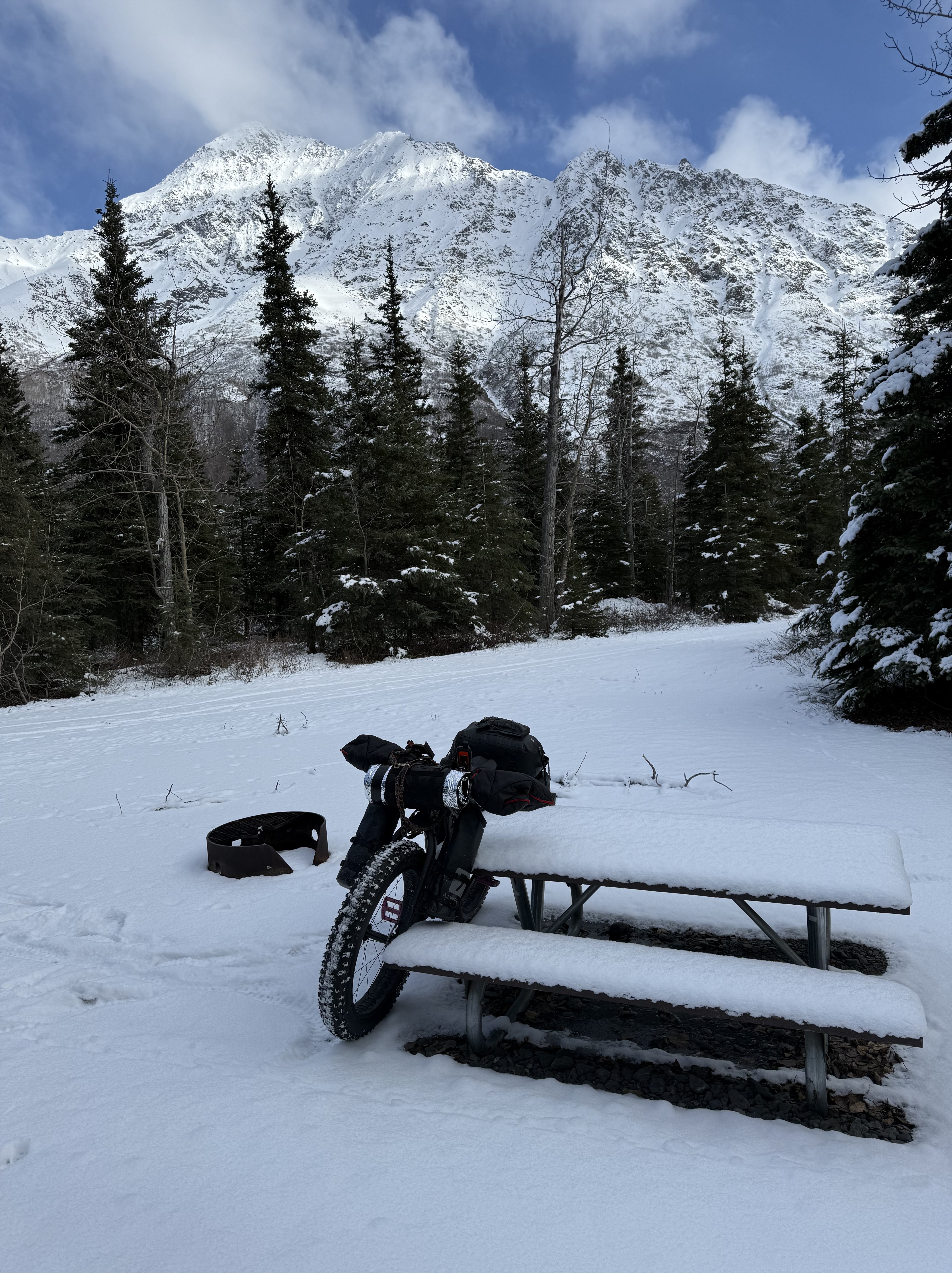
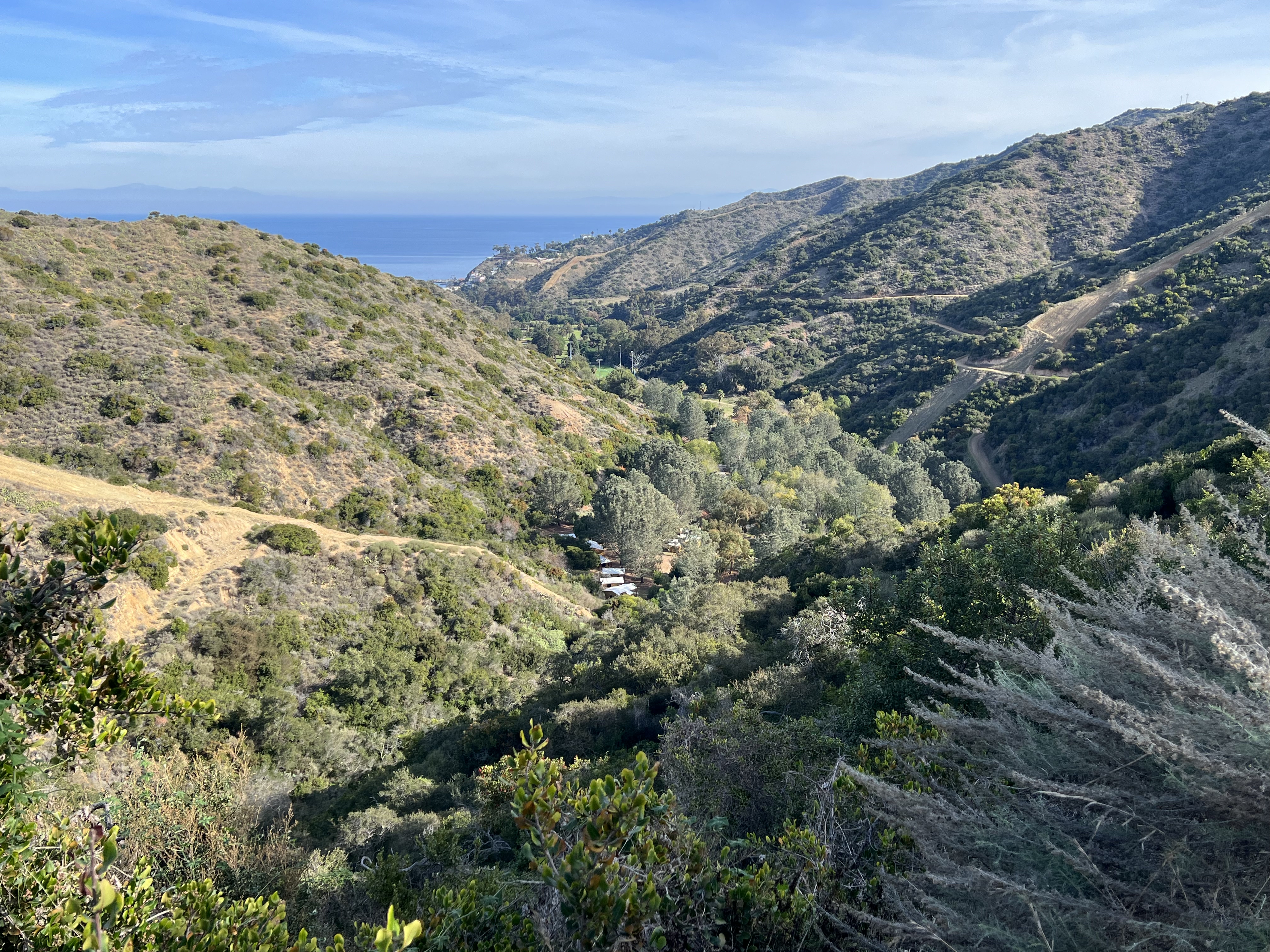
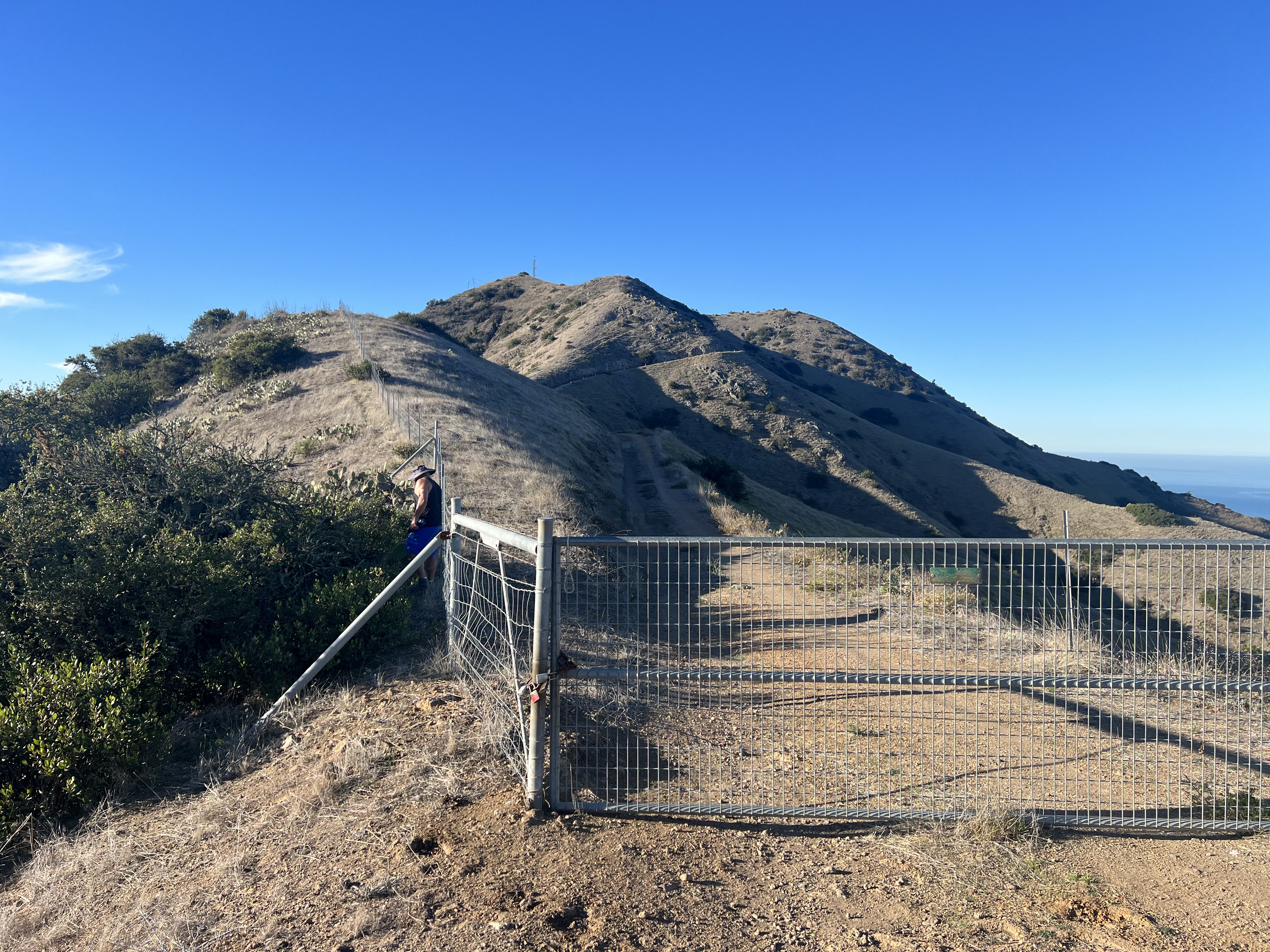
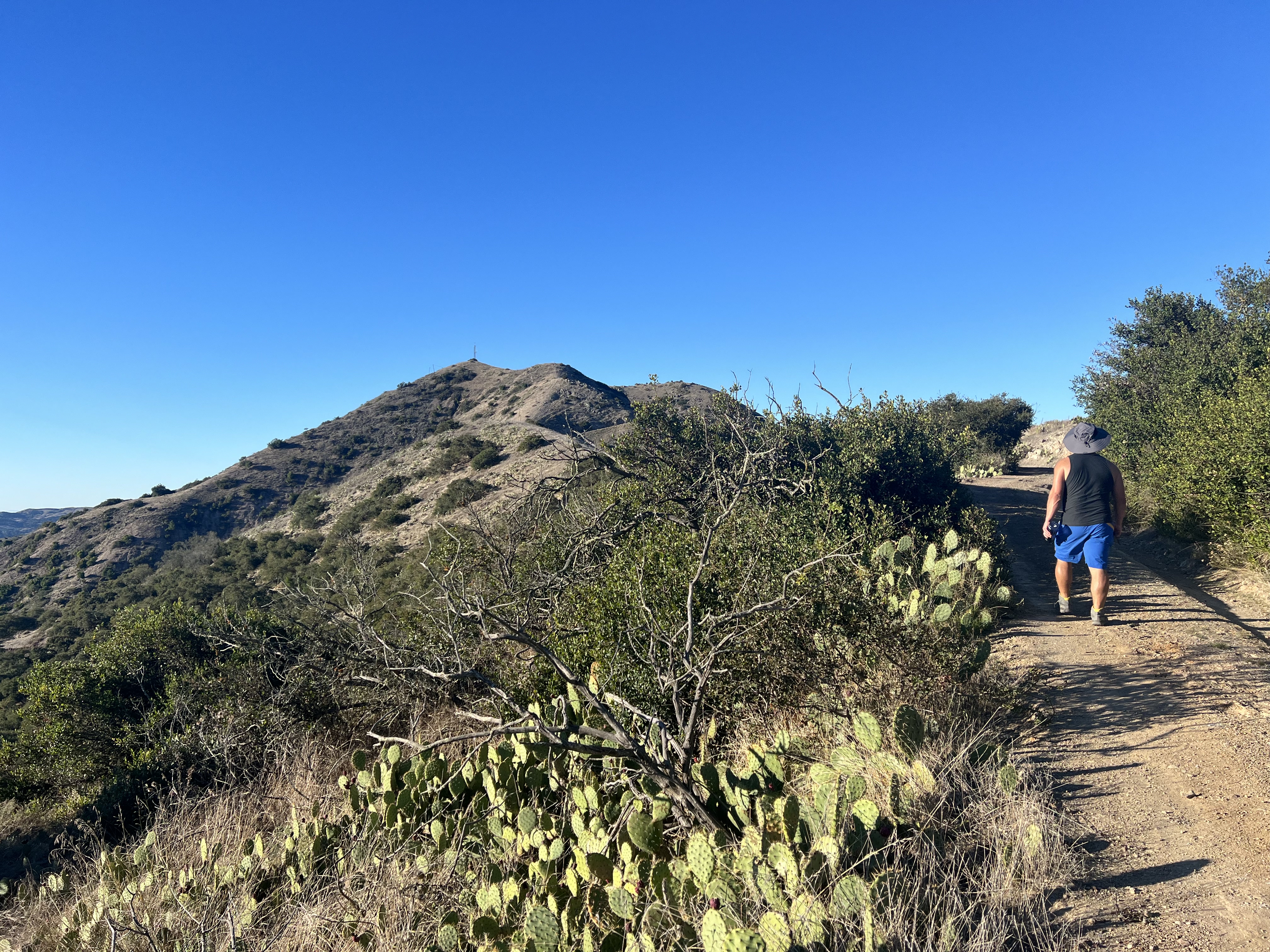
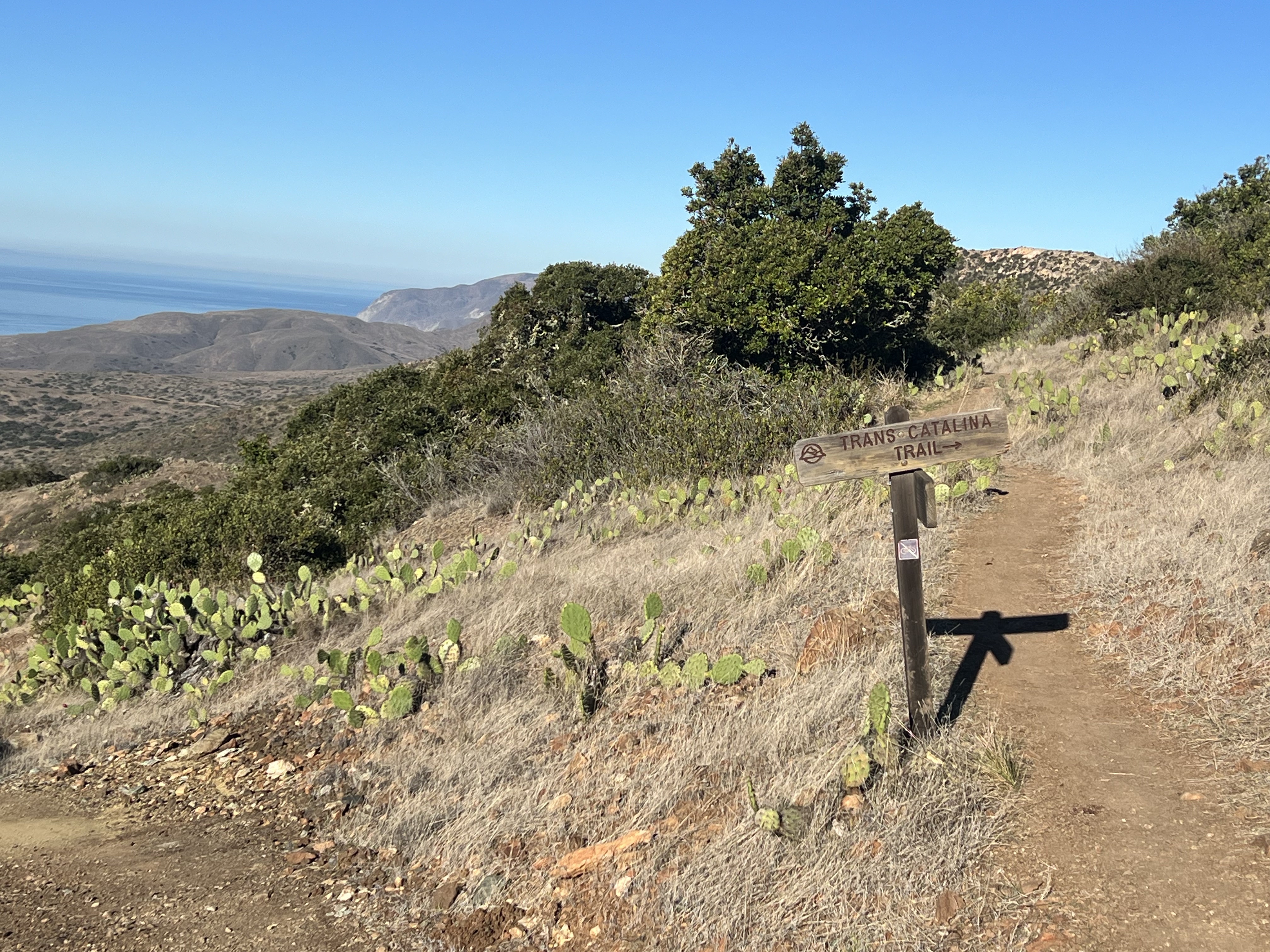
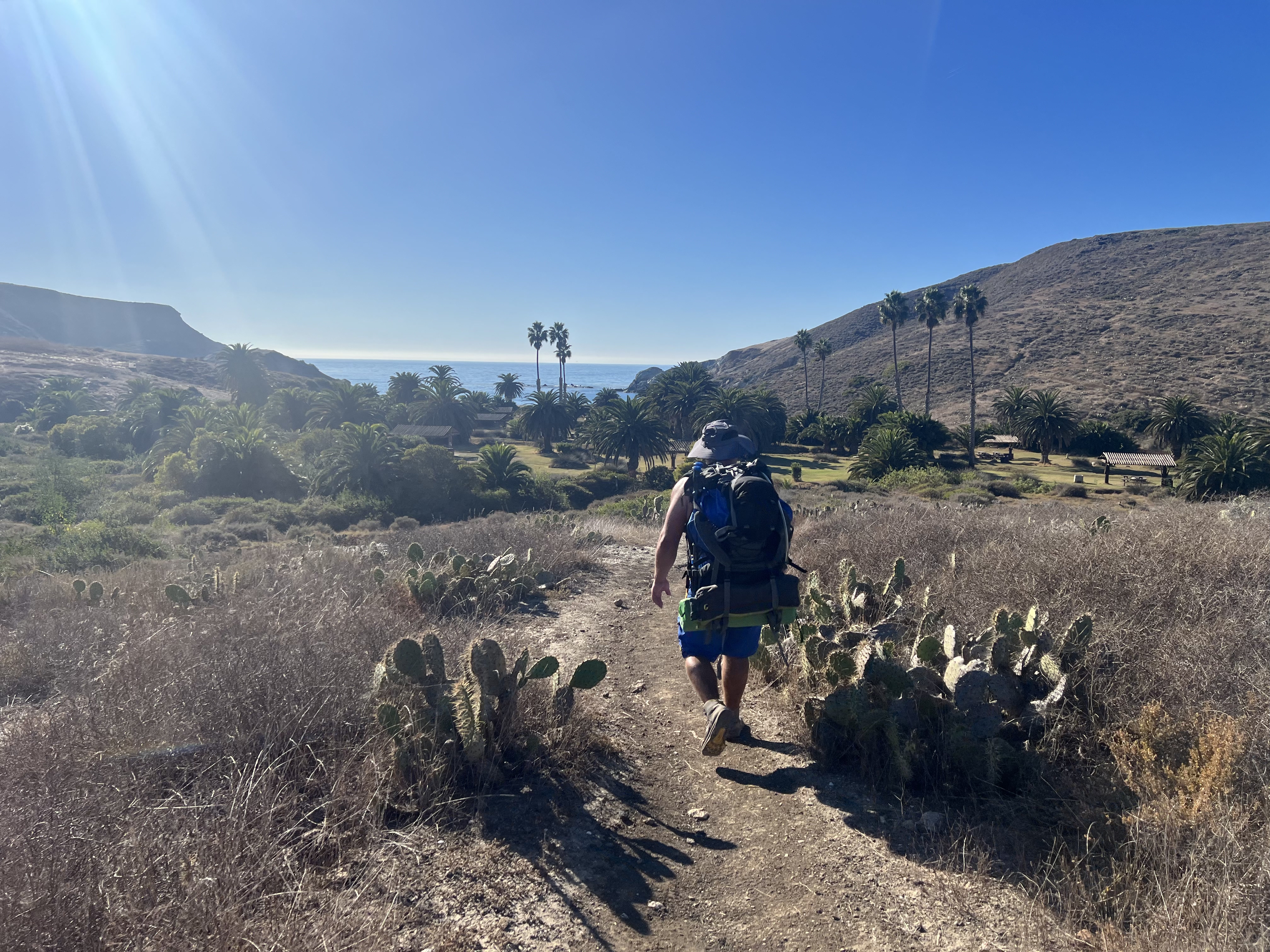
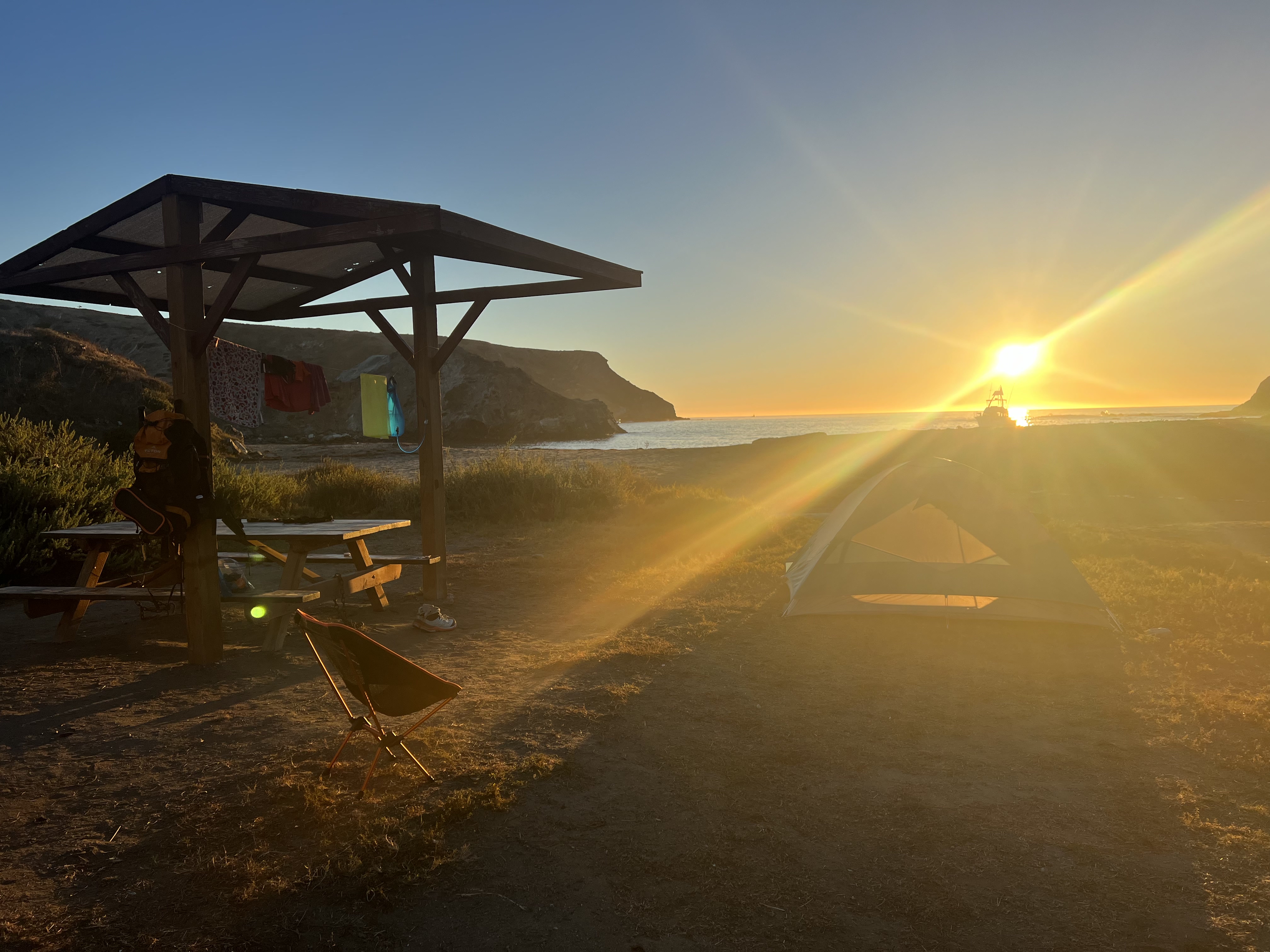
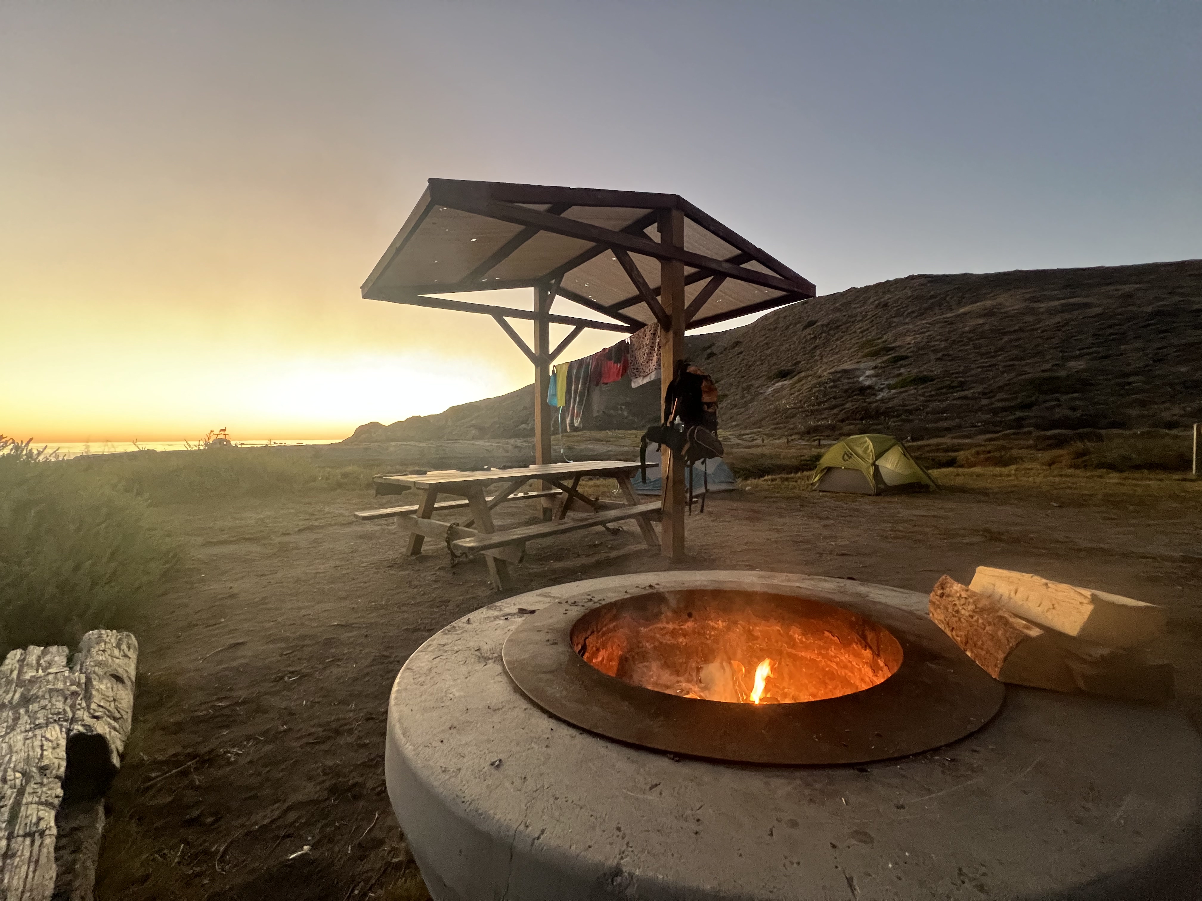
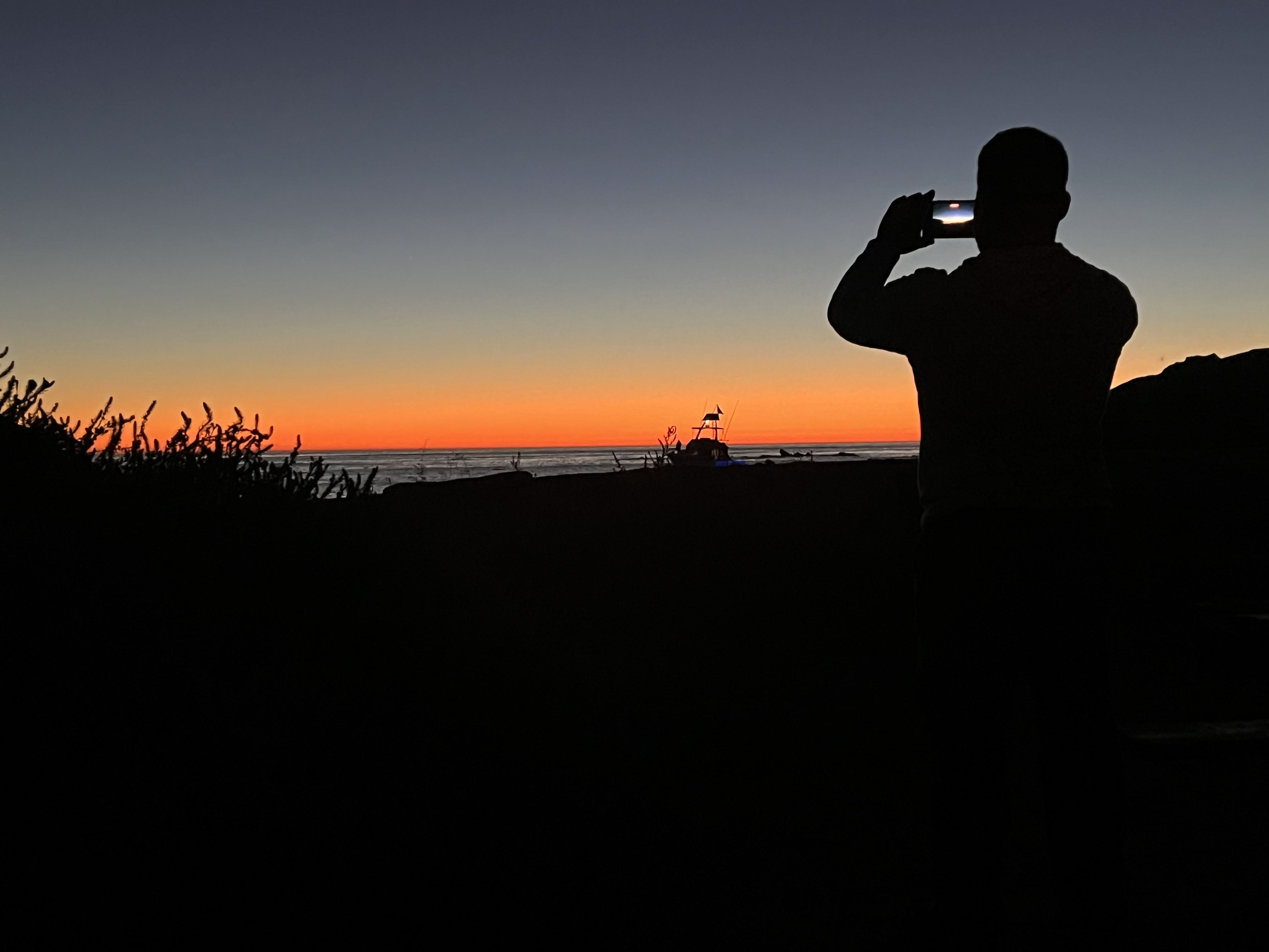
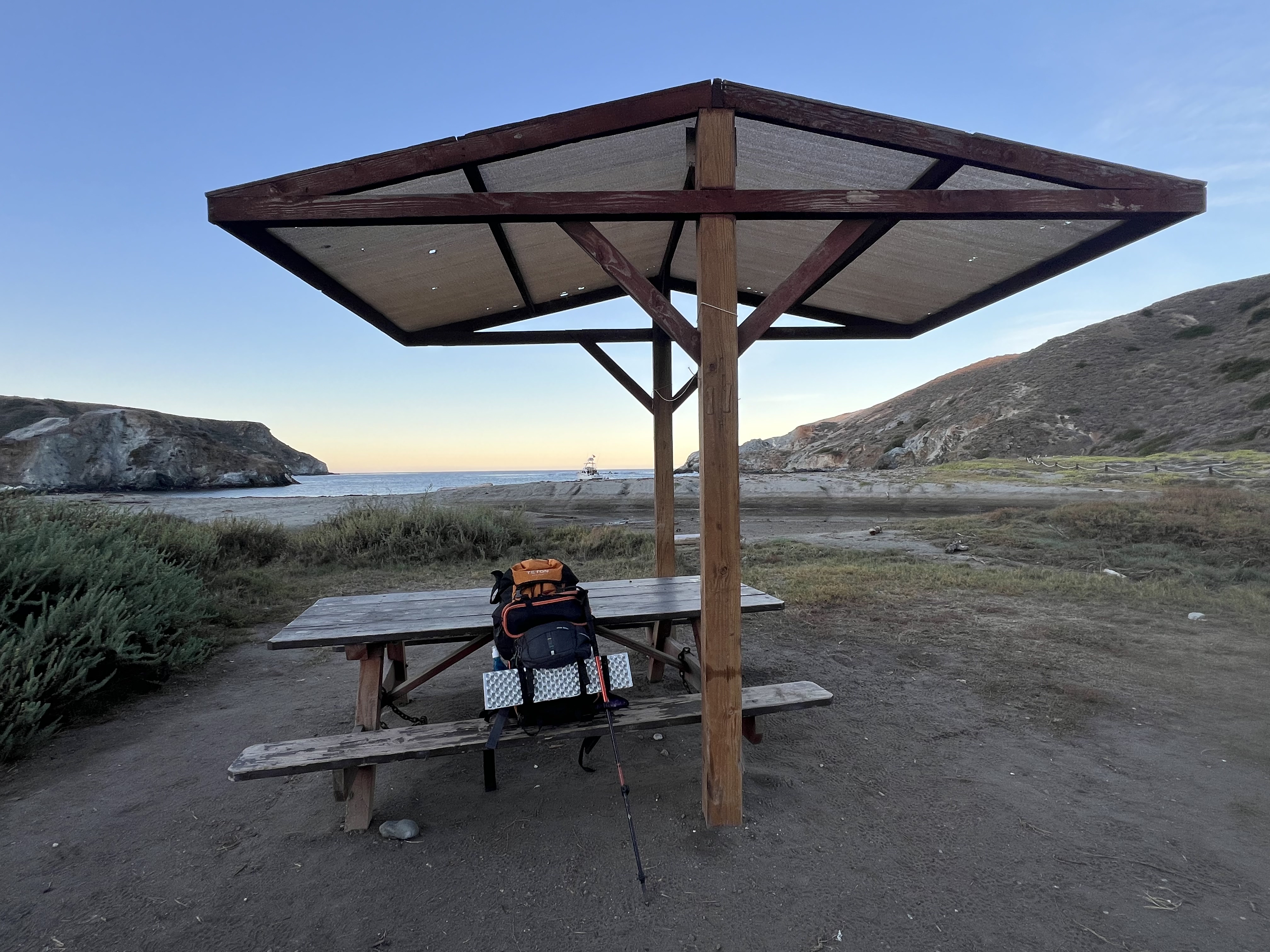
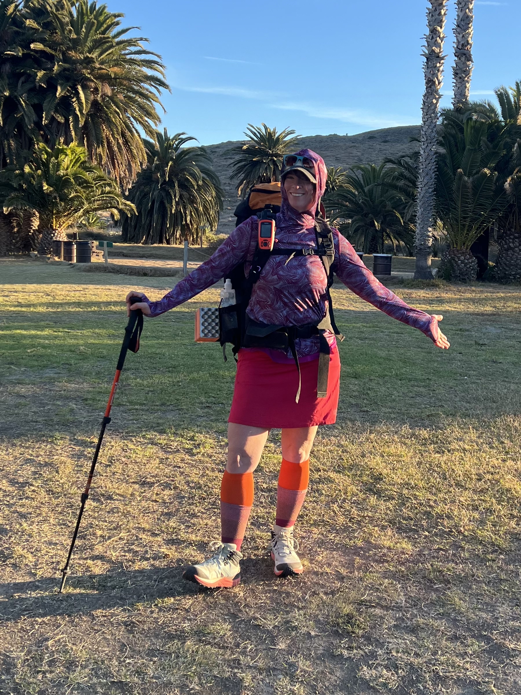
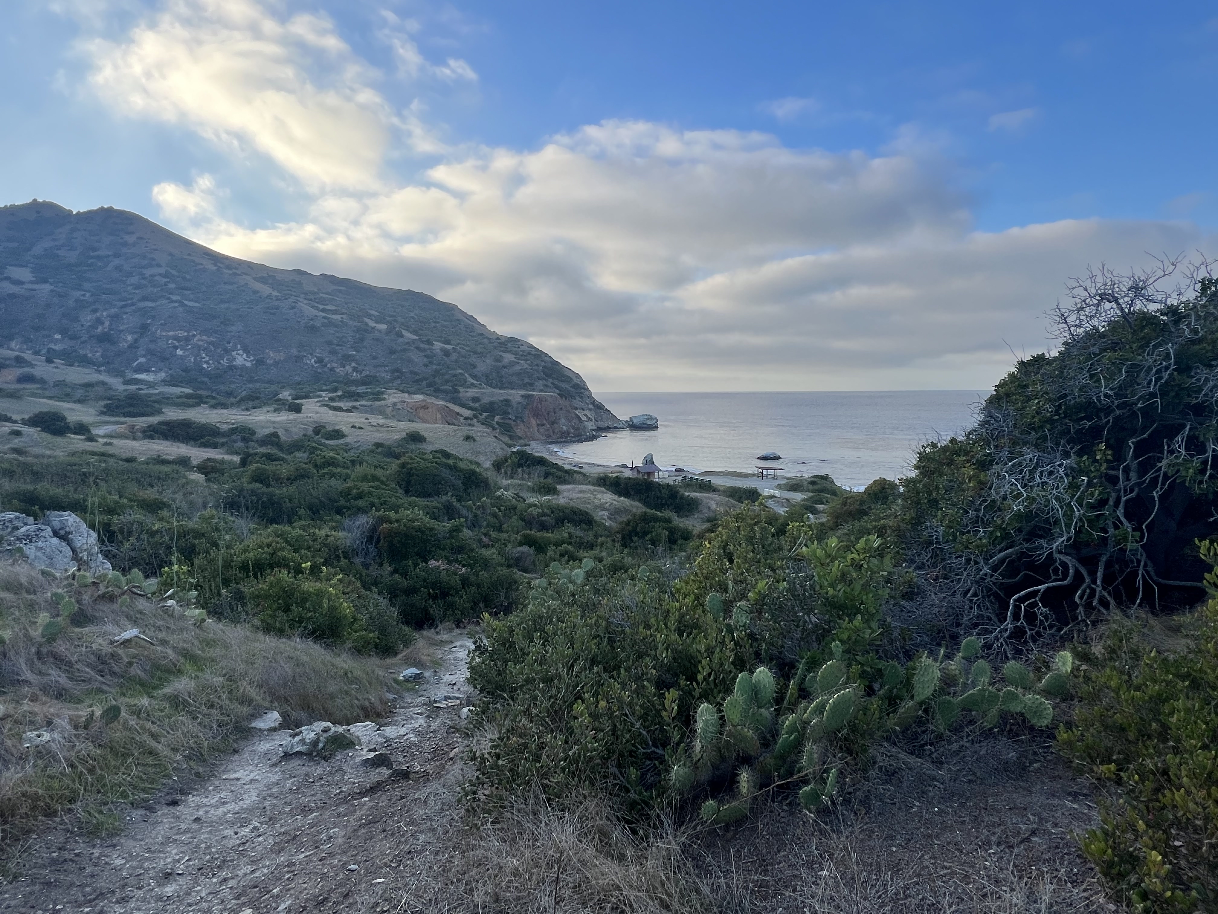
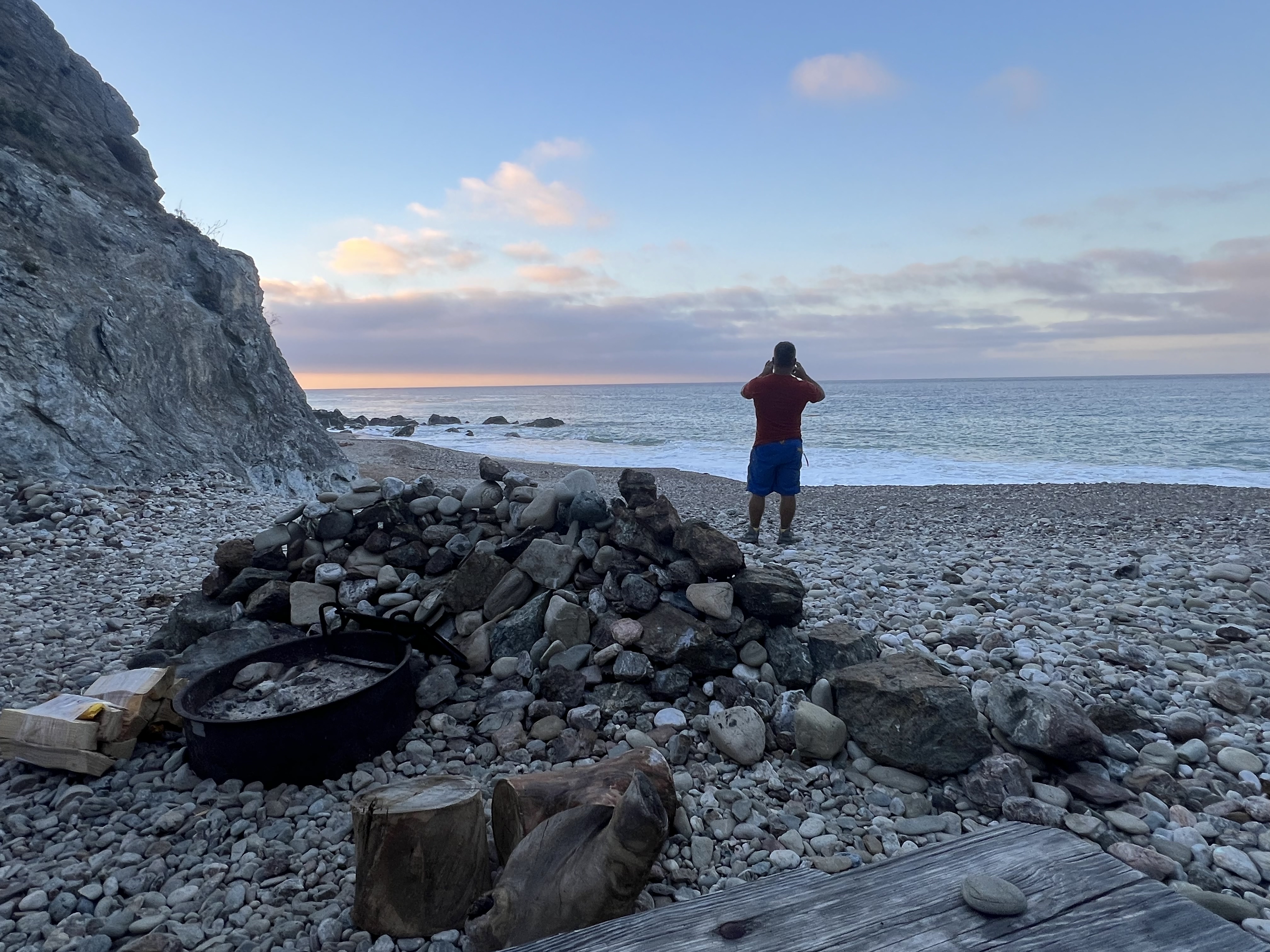
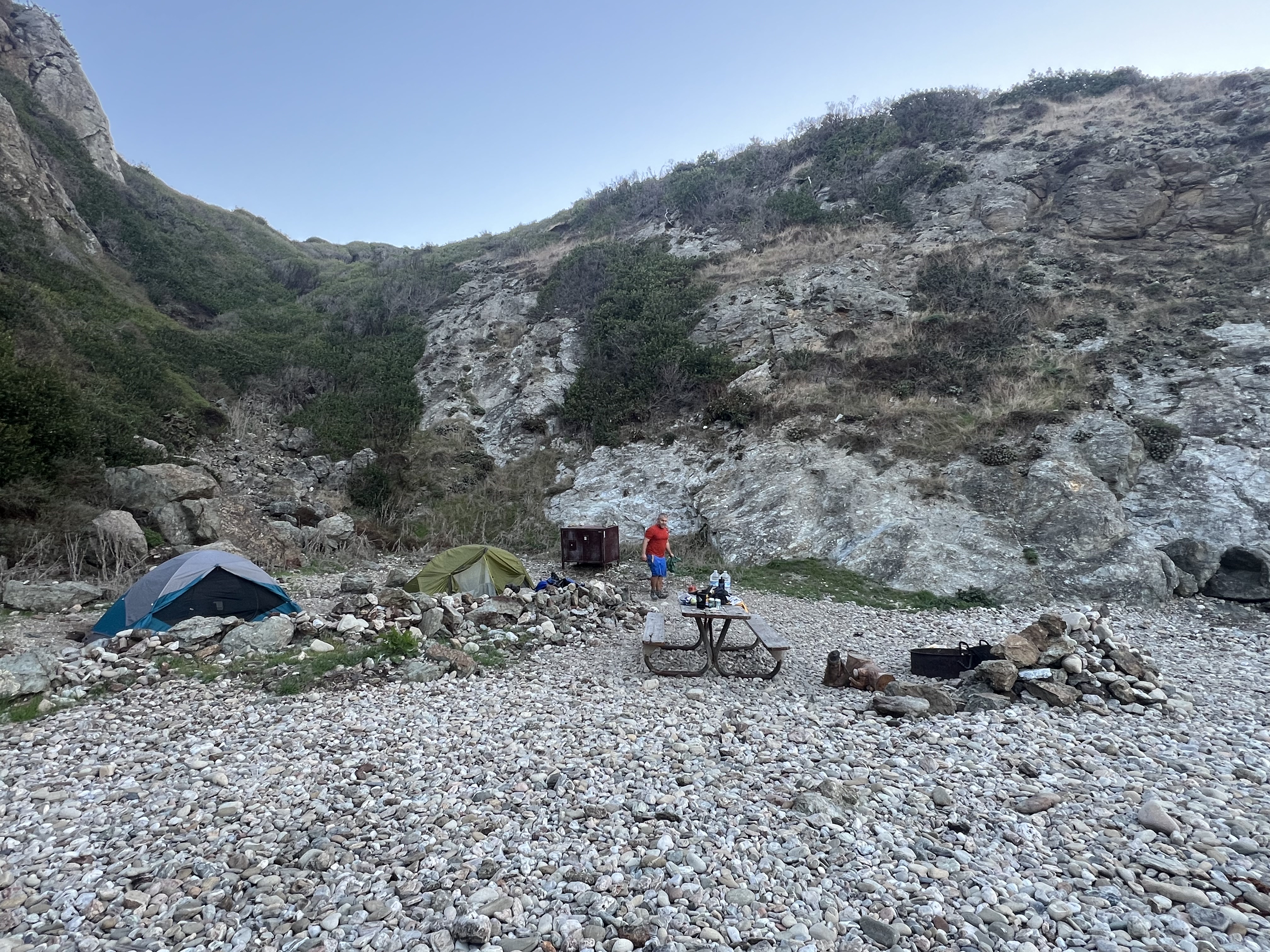
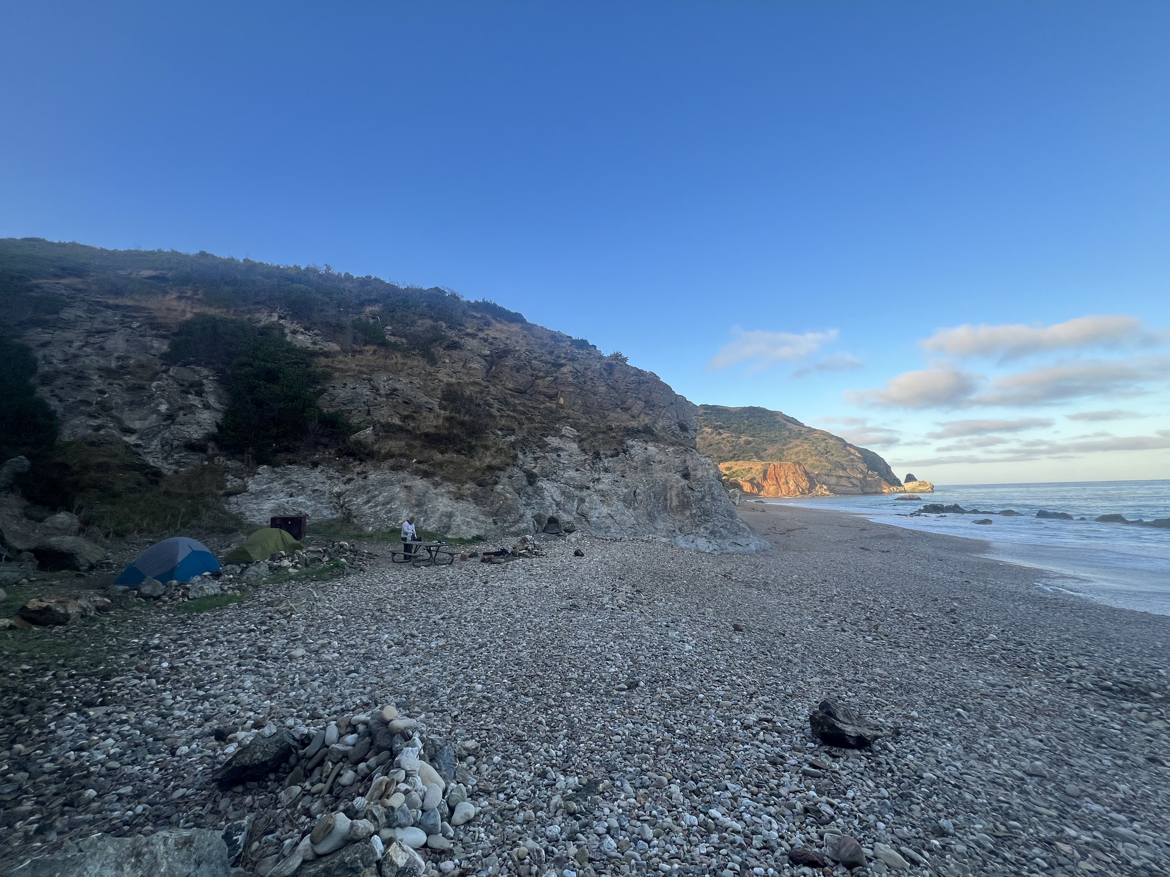
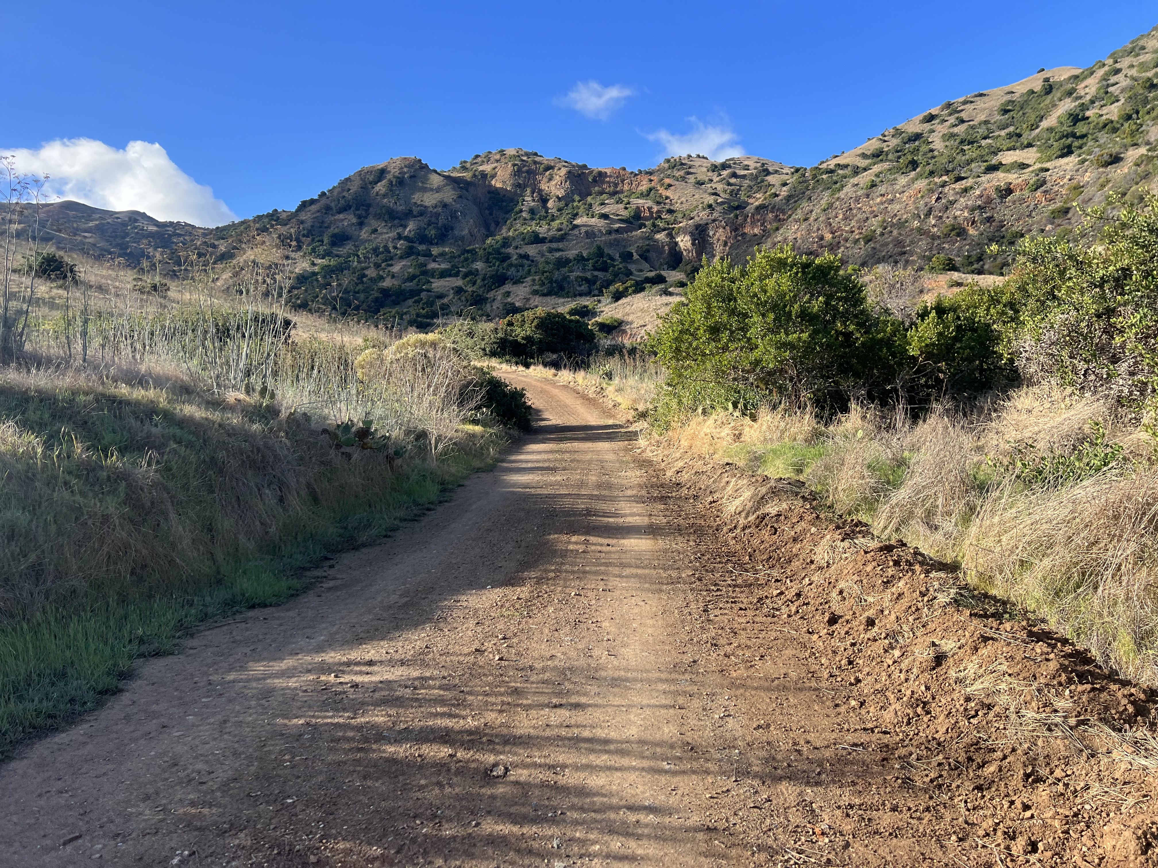
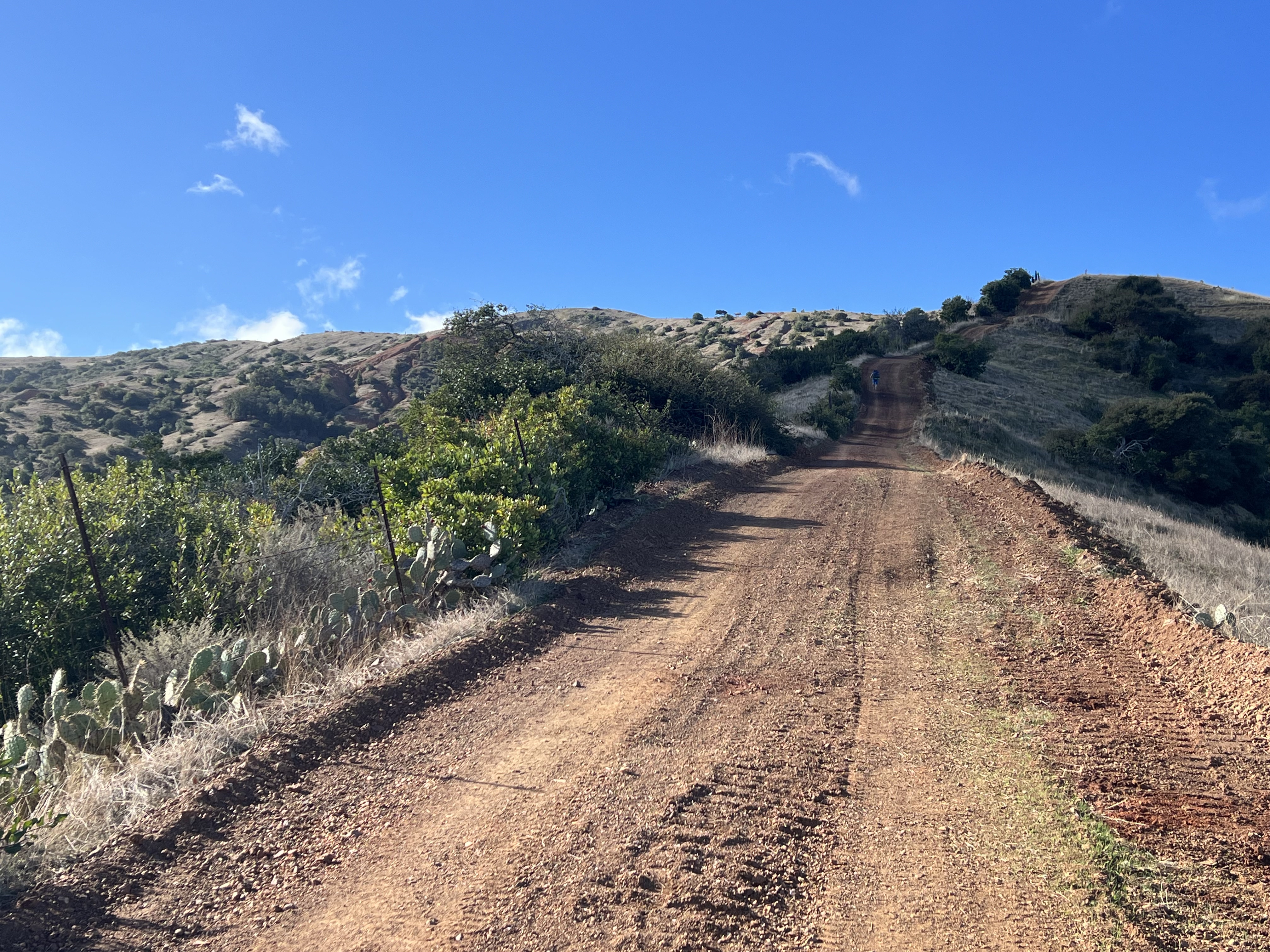
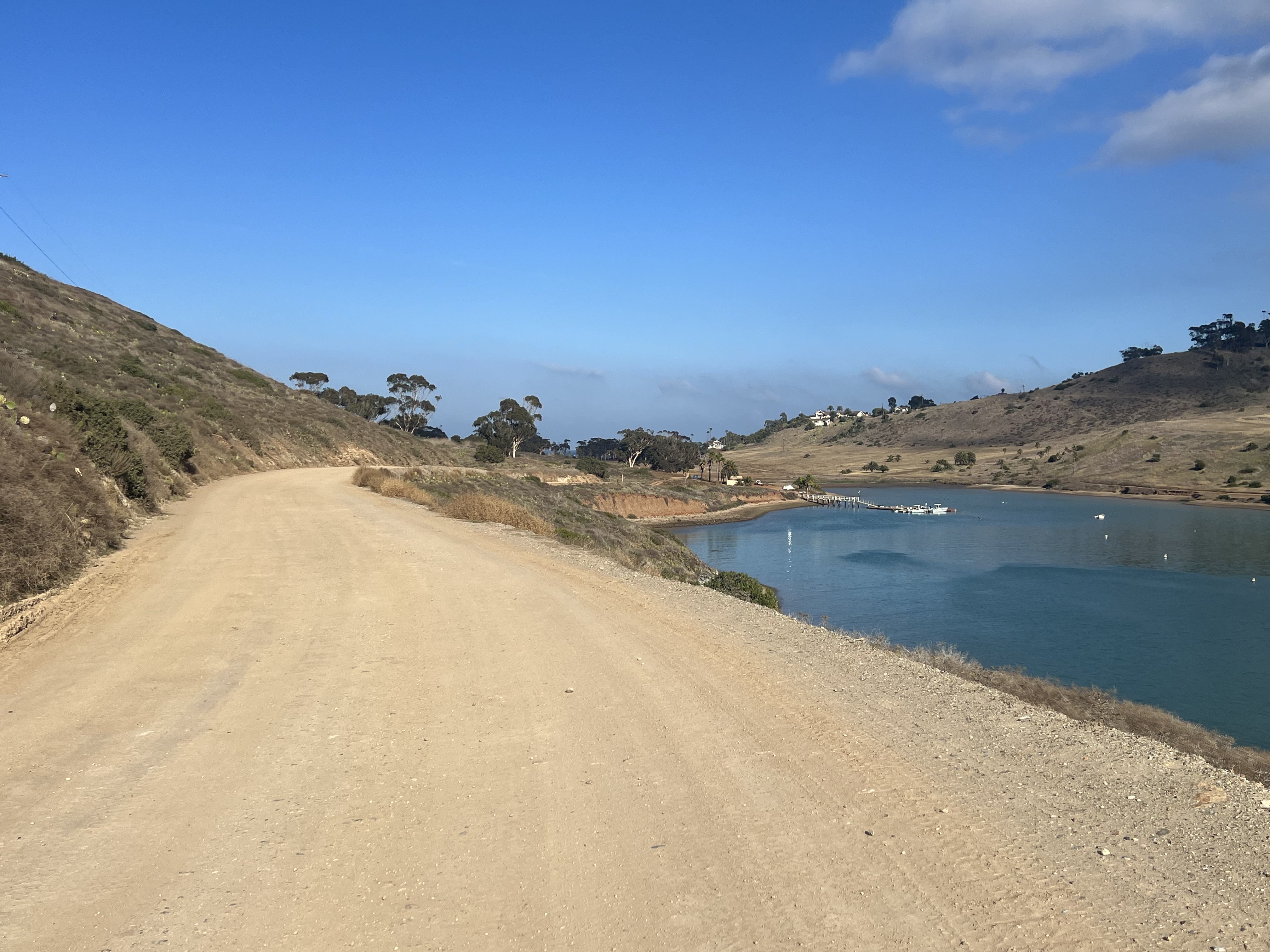
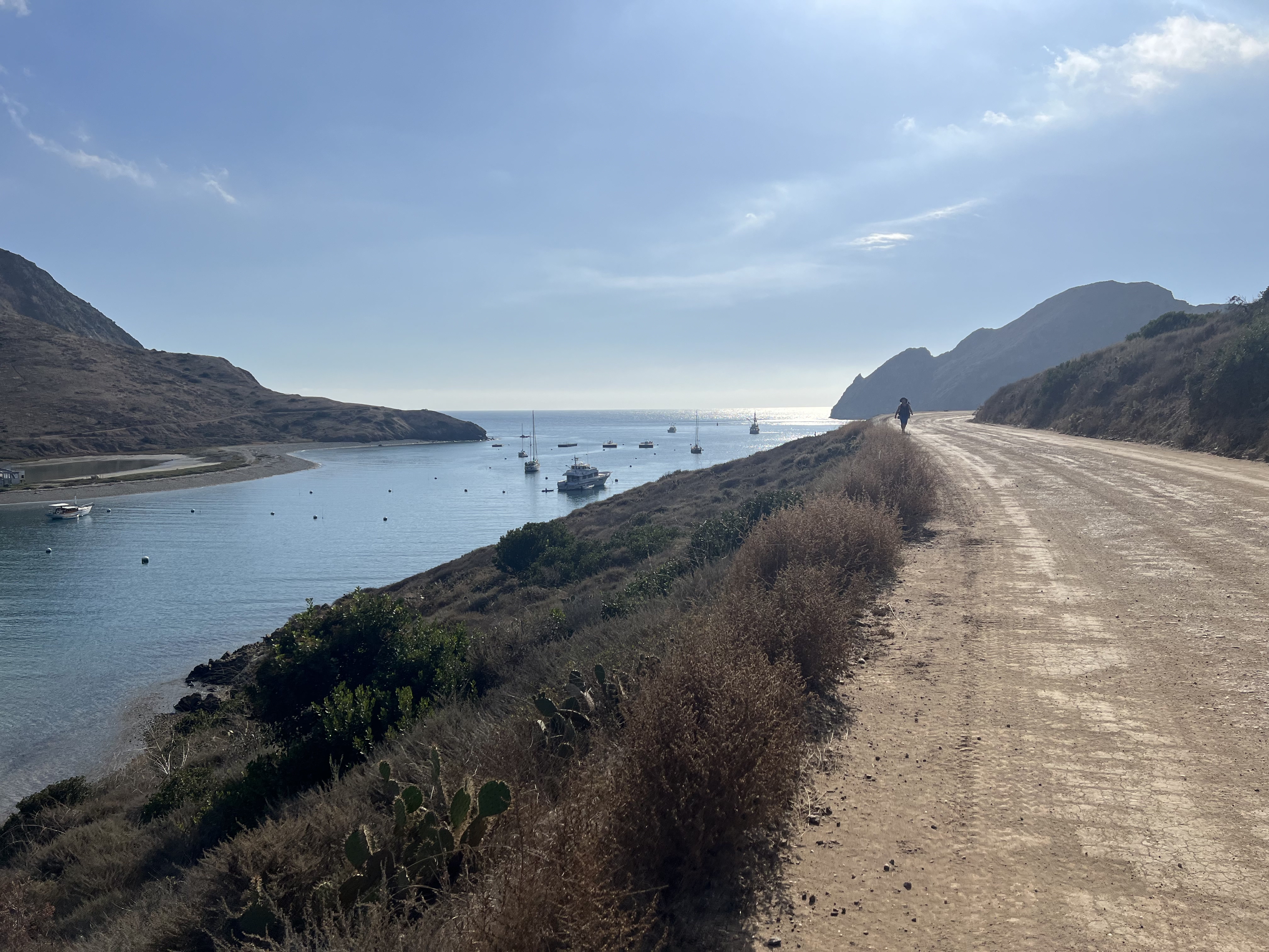
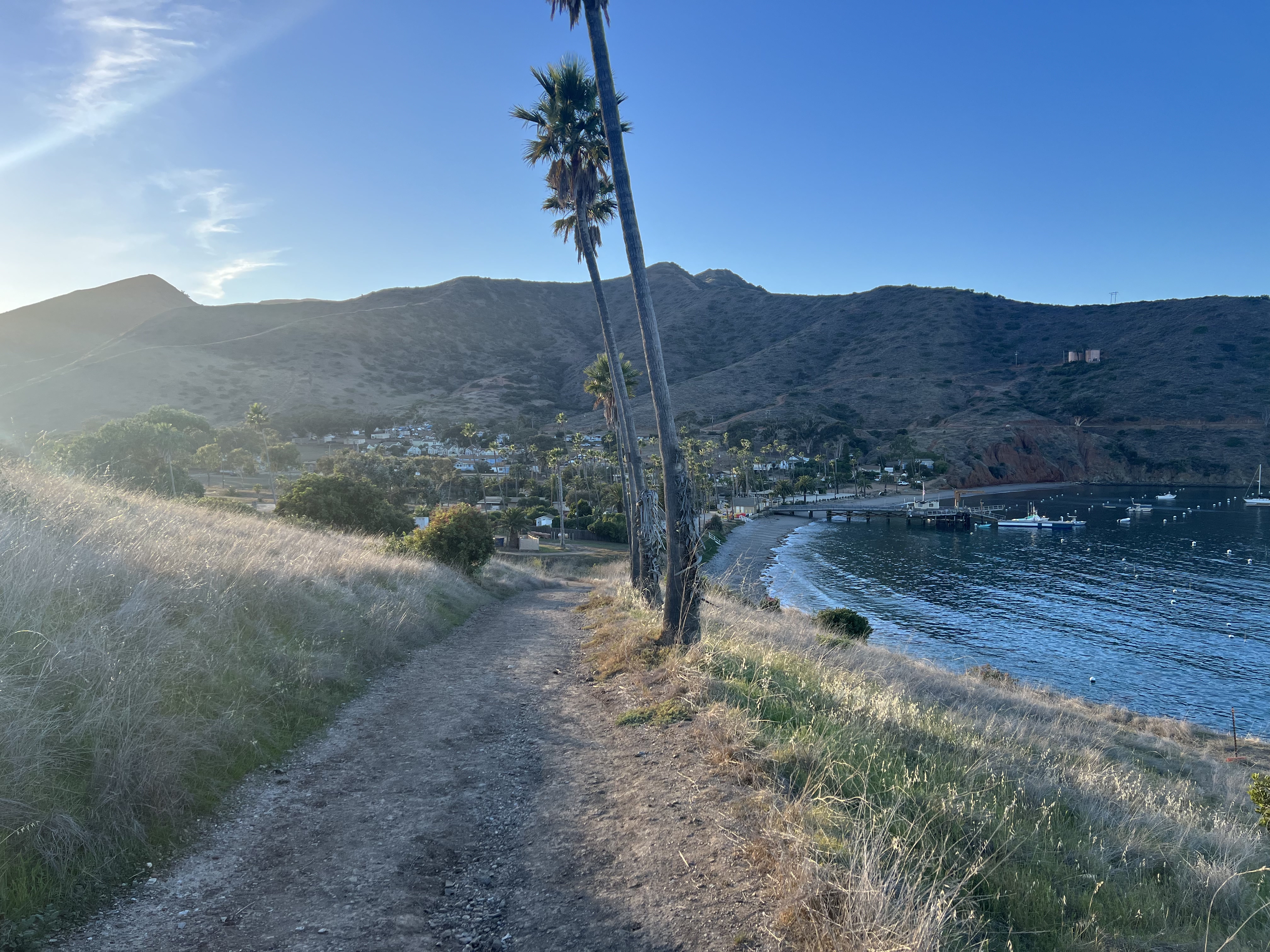
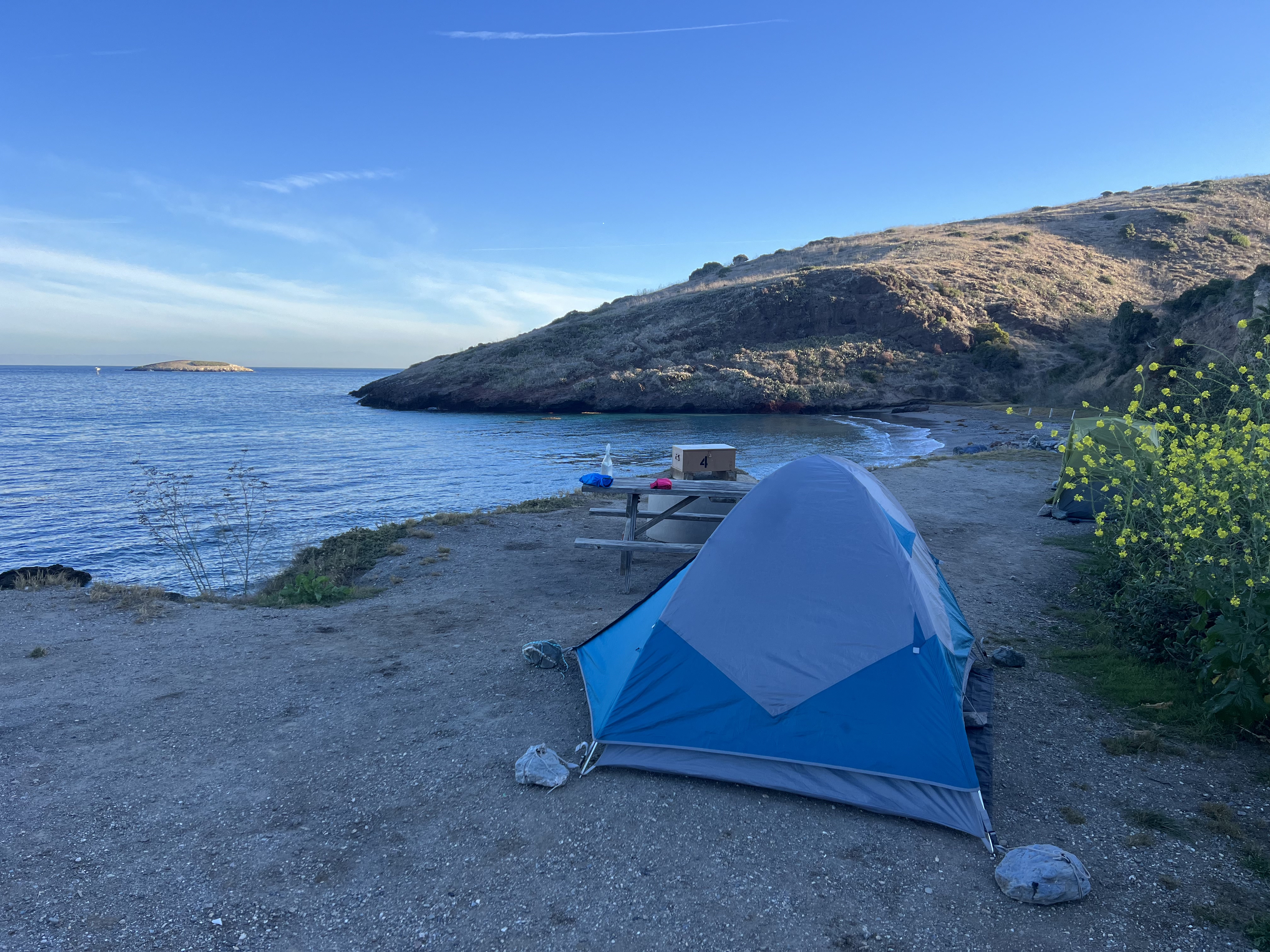
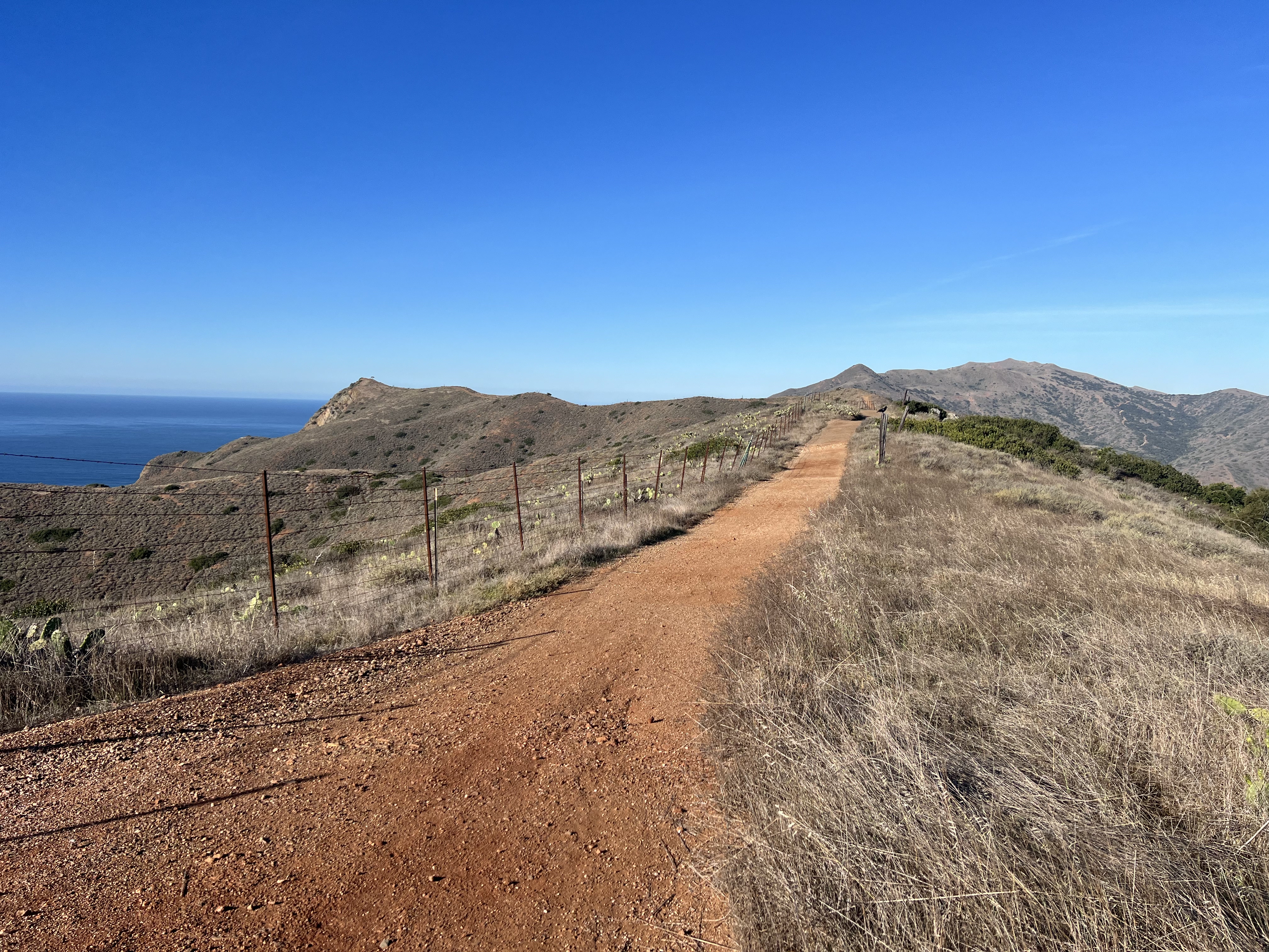
Snow Hawk Road was looking dry, the buds were just starting to appear, and we were on a mission to get in some substantial miles, so we decided to go for it the long way. We opted to go point to point, starting at Klutina Drive → Bulldog Trail → Snow Hawk Road → off trail across Snow Hawk Valley → up Peak 1216 → Ship Creek Hill → out via Snow Hawk Valley Trail.
We had been skunked on Nunaka Point and on our backup plan of crossing Snow Hawk Valley exactly two months prior (to the day) due to chest deep snow. That day we hiked up to Snow Hawk Moutain, which, for the second time in a year, became an enjoyable and pleasant backup plan. Nothing was going to stop us this time, and when we had finished shuttling vehicles to the two trailheads, we strapped snowshoes and knee-high gaiters onto our packs and proceeded with a no quit attitude. Today would be the last day that I would obsessively bring up Ship Creek Hill and my intense desire to stand on its summit for the first time.
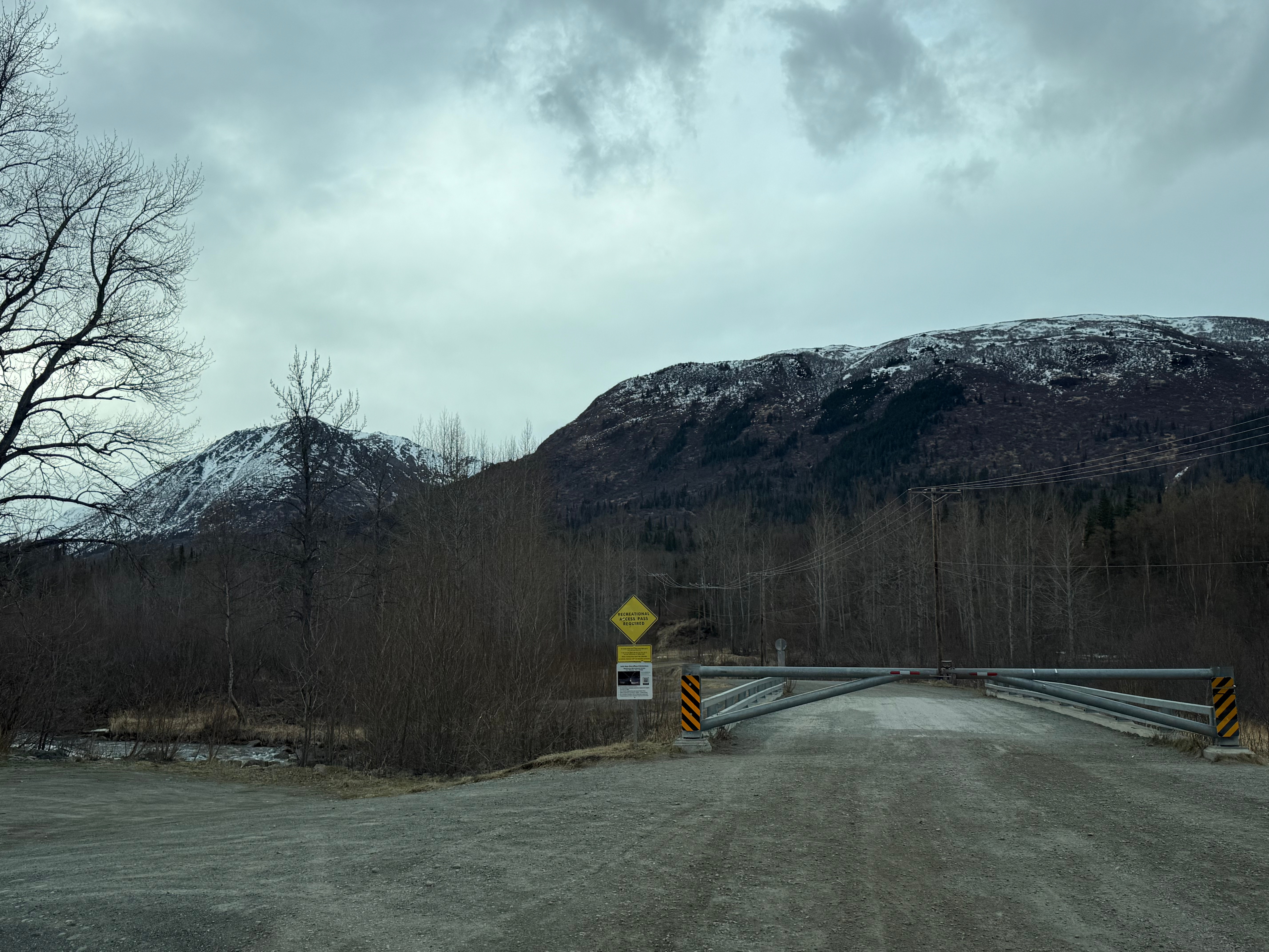
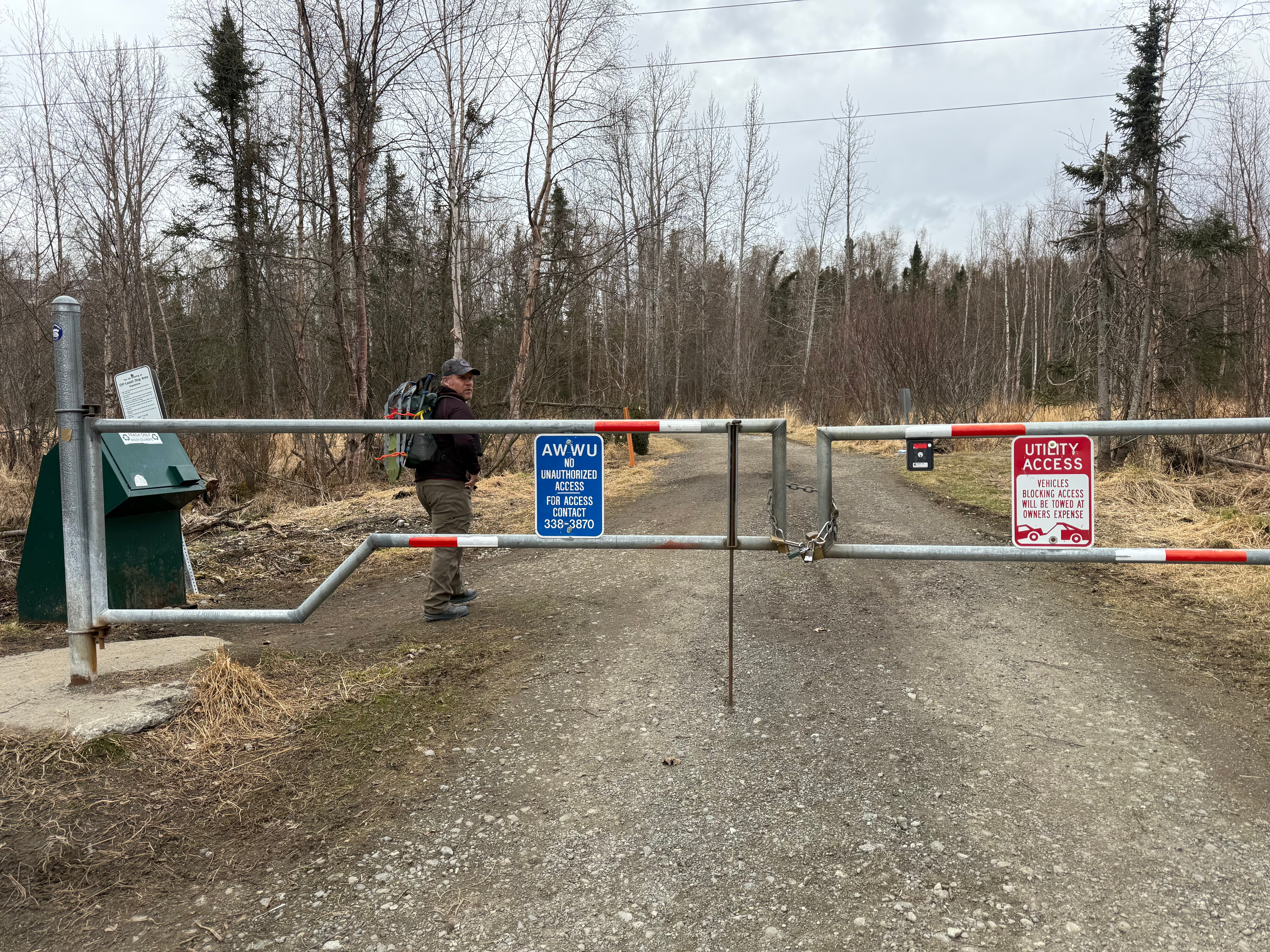
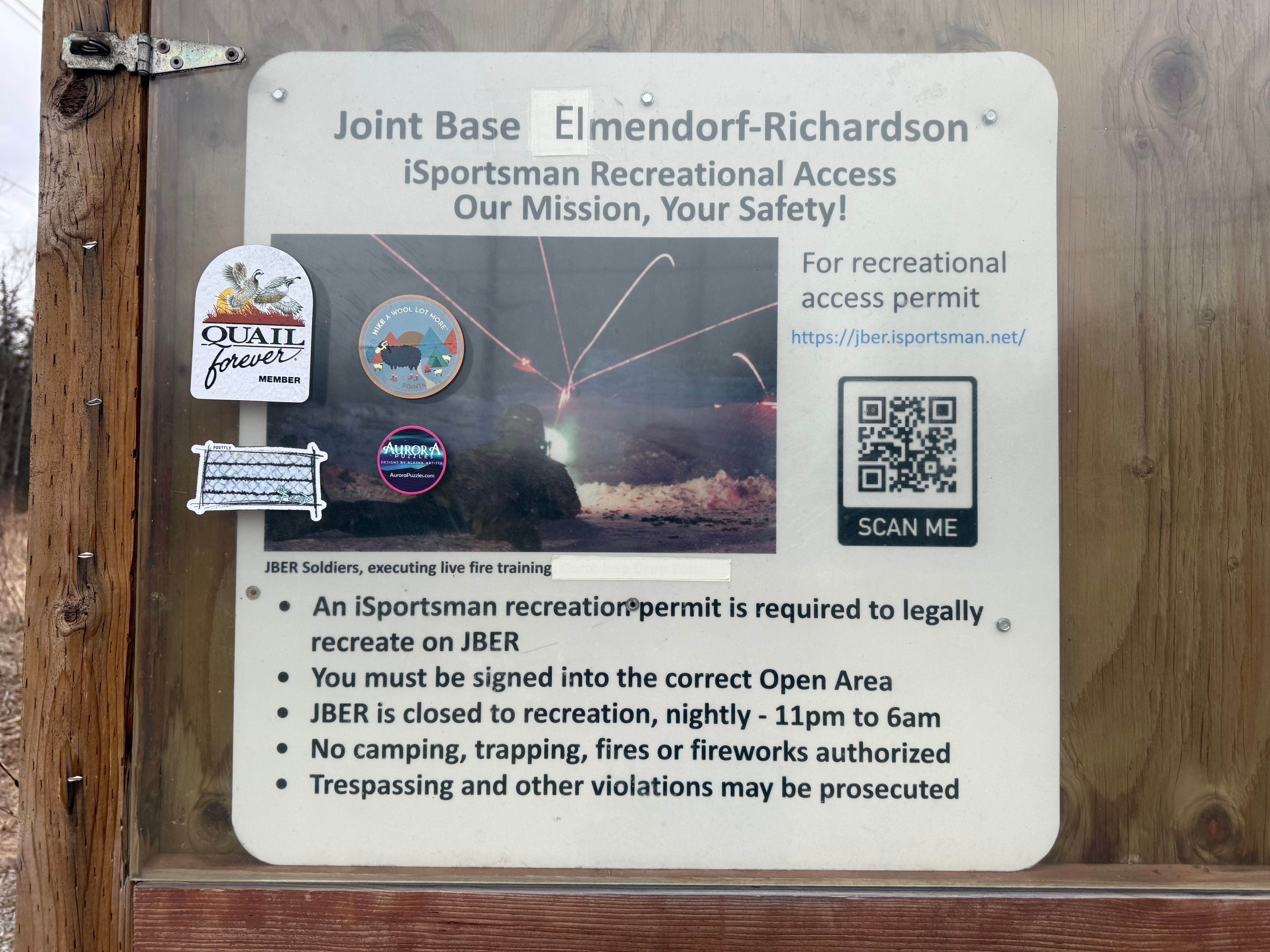
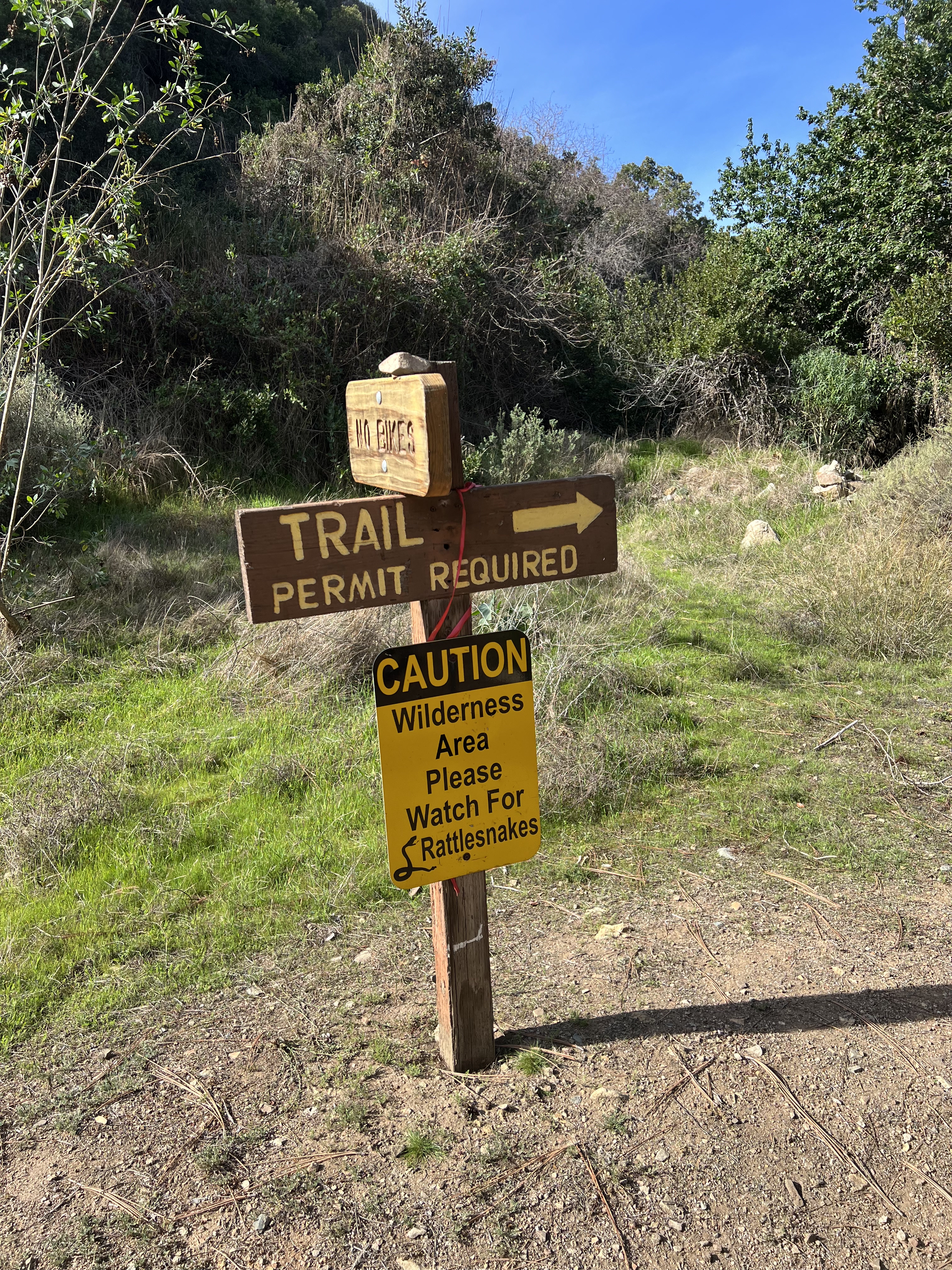
*I made sure we were checked into the correct open areas on JBERs RecAccess website (previously iSportsman). * The entirety of this hike is on military land and may be closed some or all days of the week for artillery or jump training. Not following this protocol or respecting the closures may result in severe injury, death, revocation of use privilege and/or prosecution for trespassing. There is no use allowed overnight (11pm-6am) so be sure to plan accordingly.
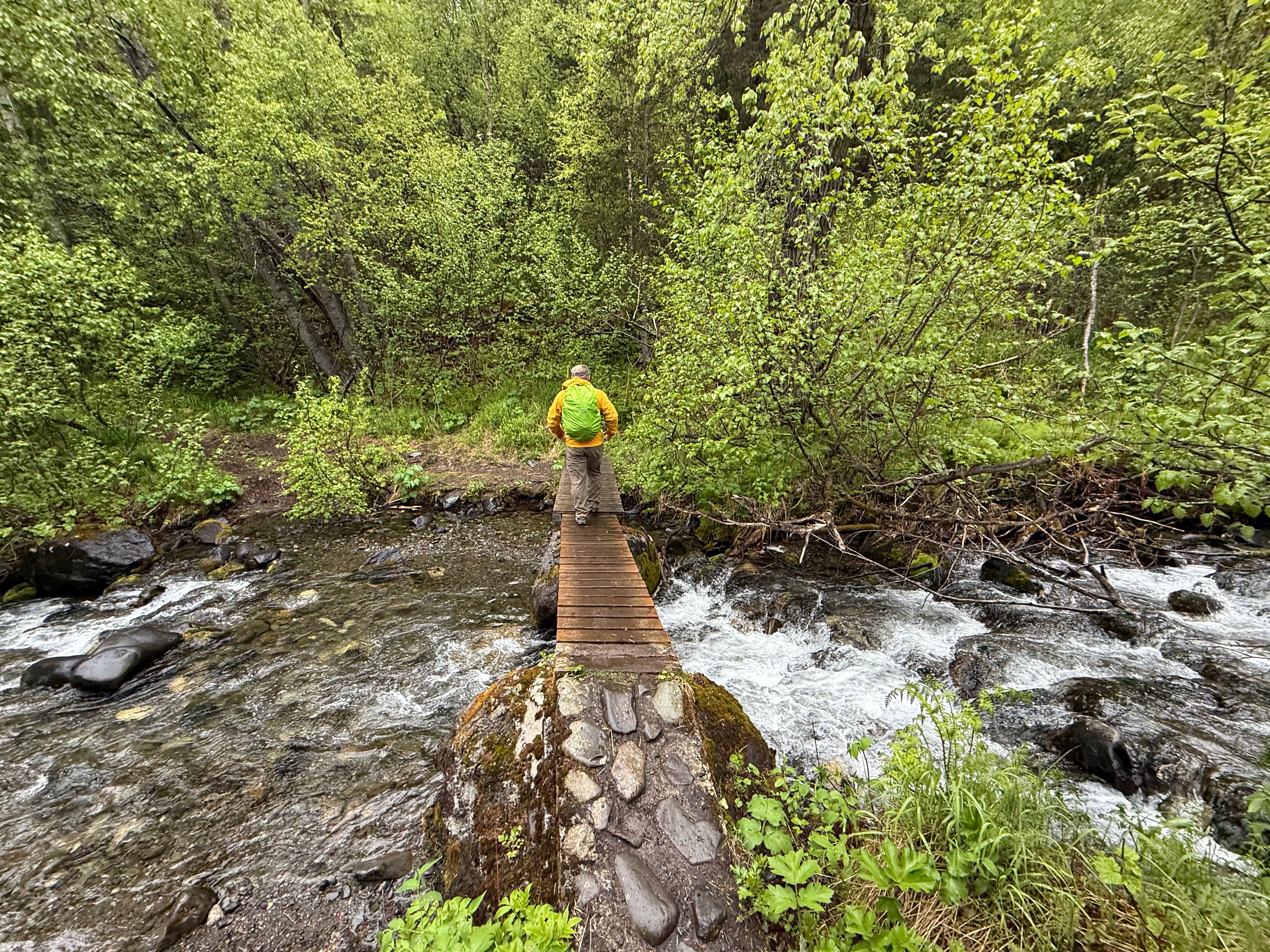
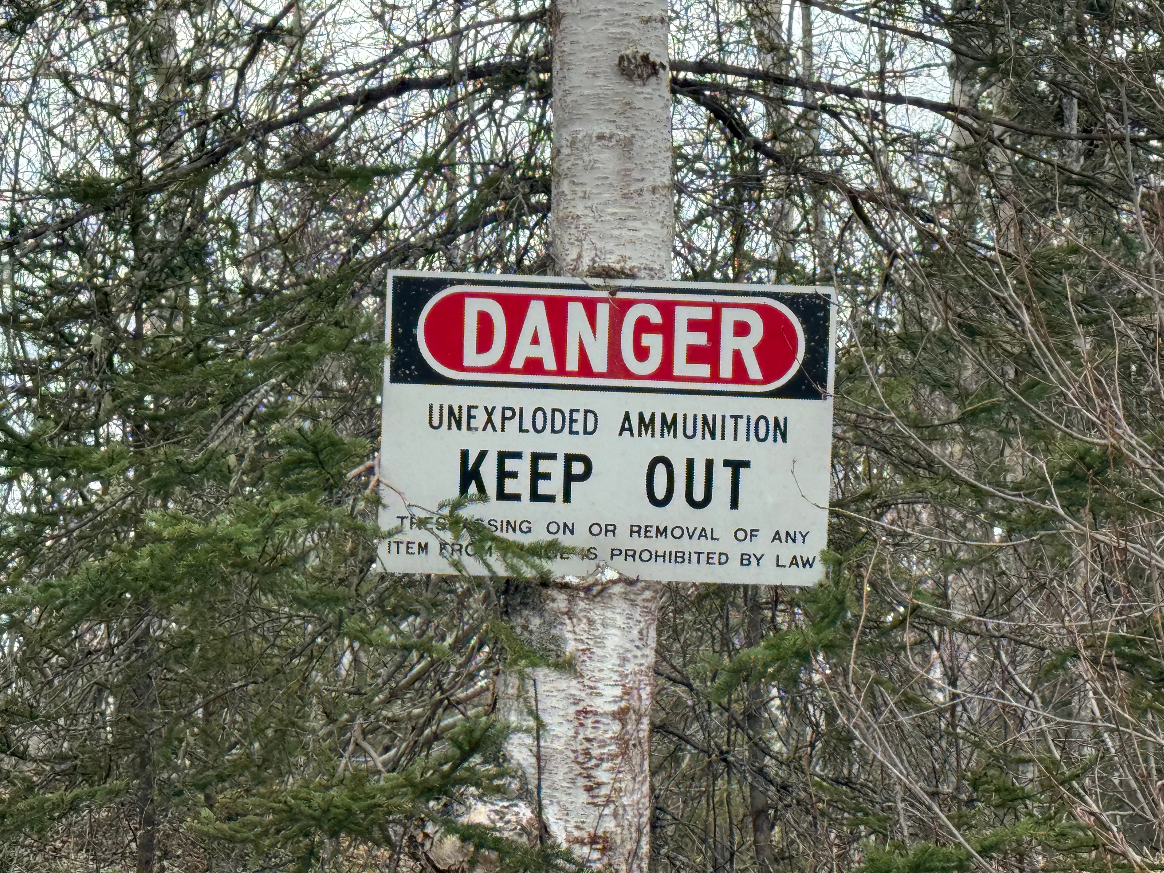
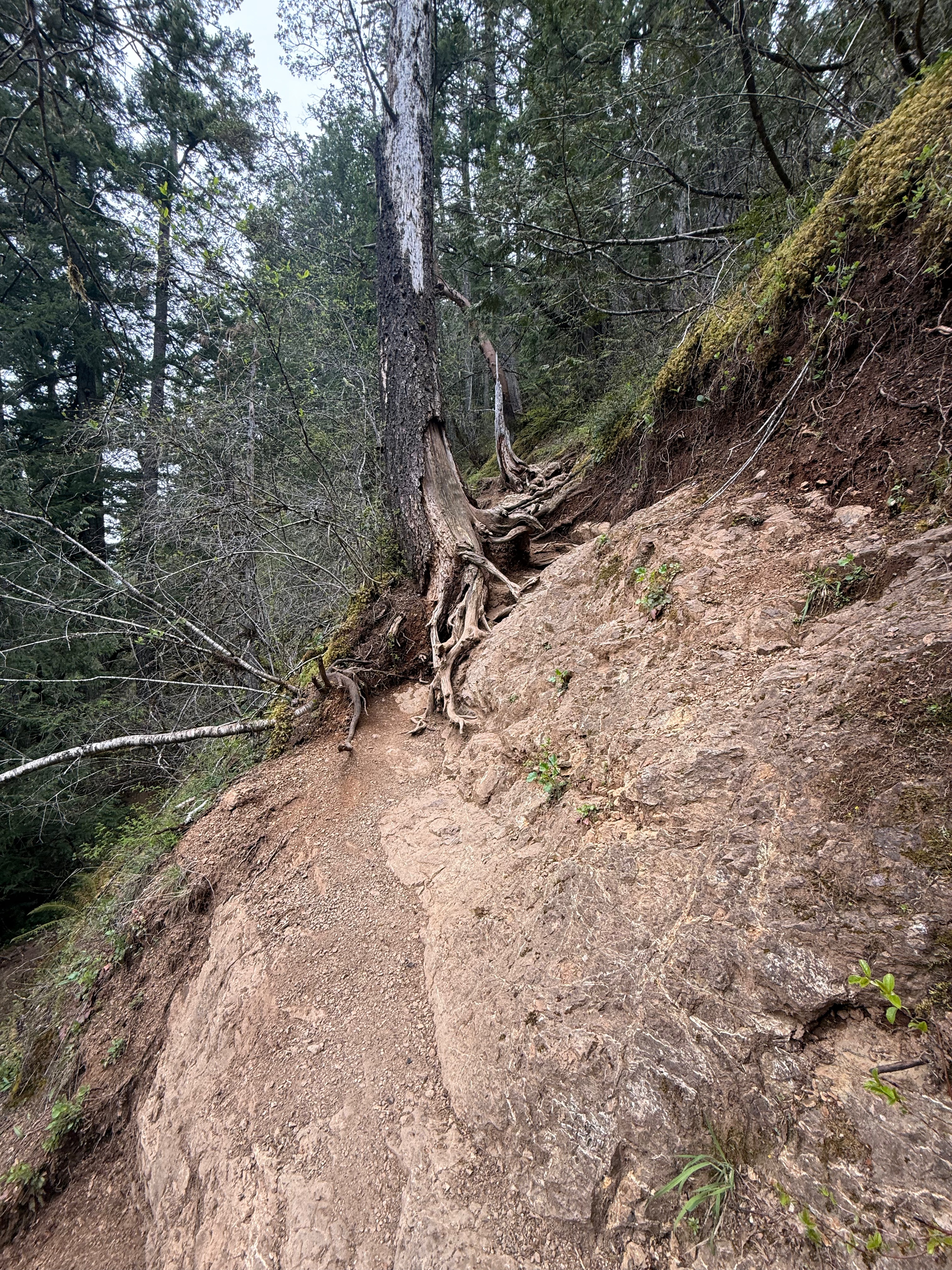
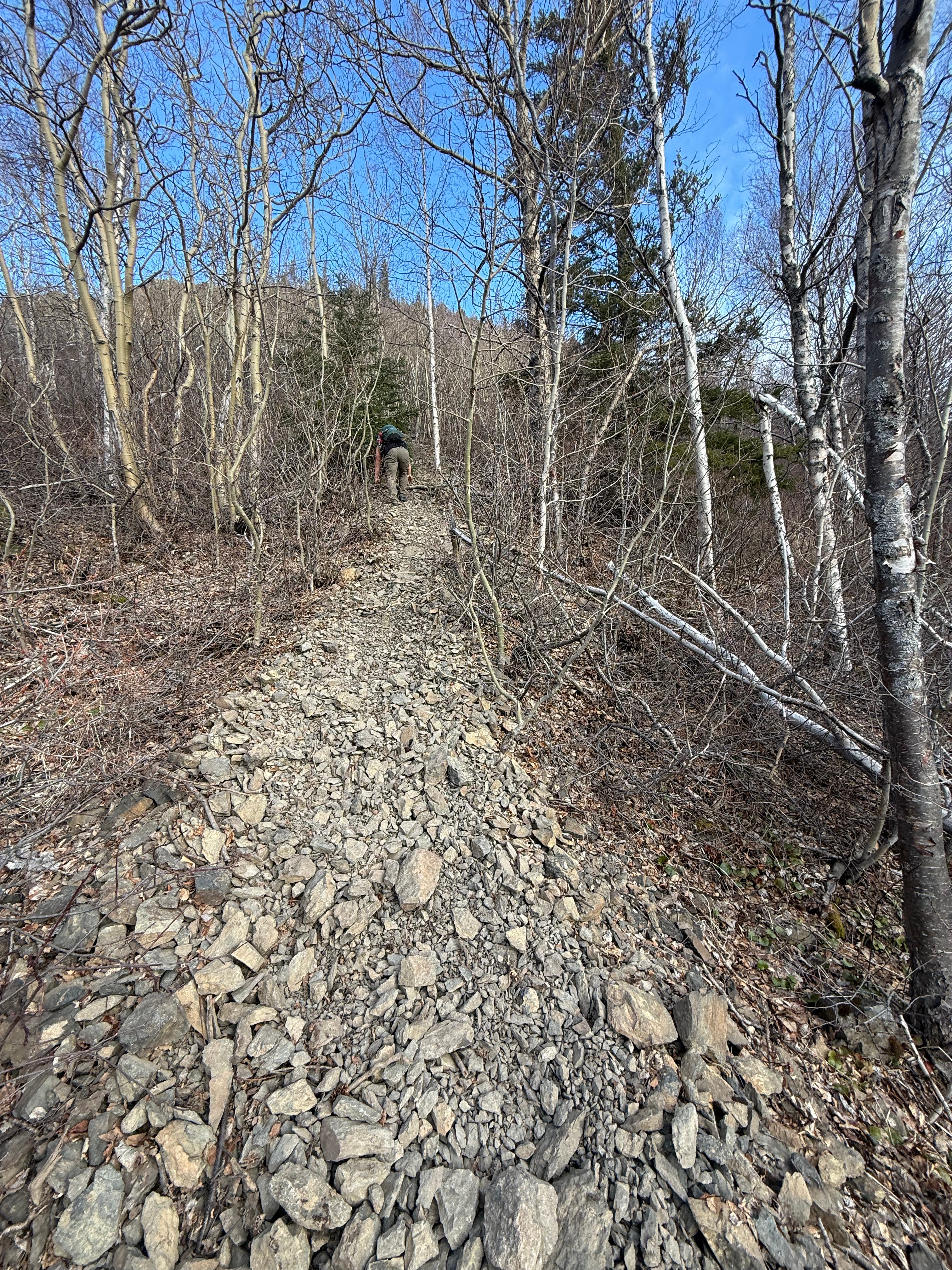
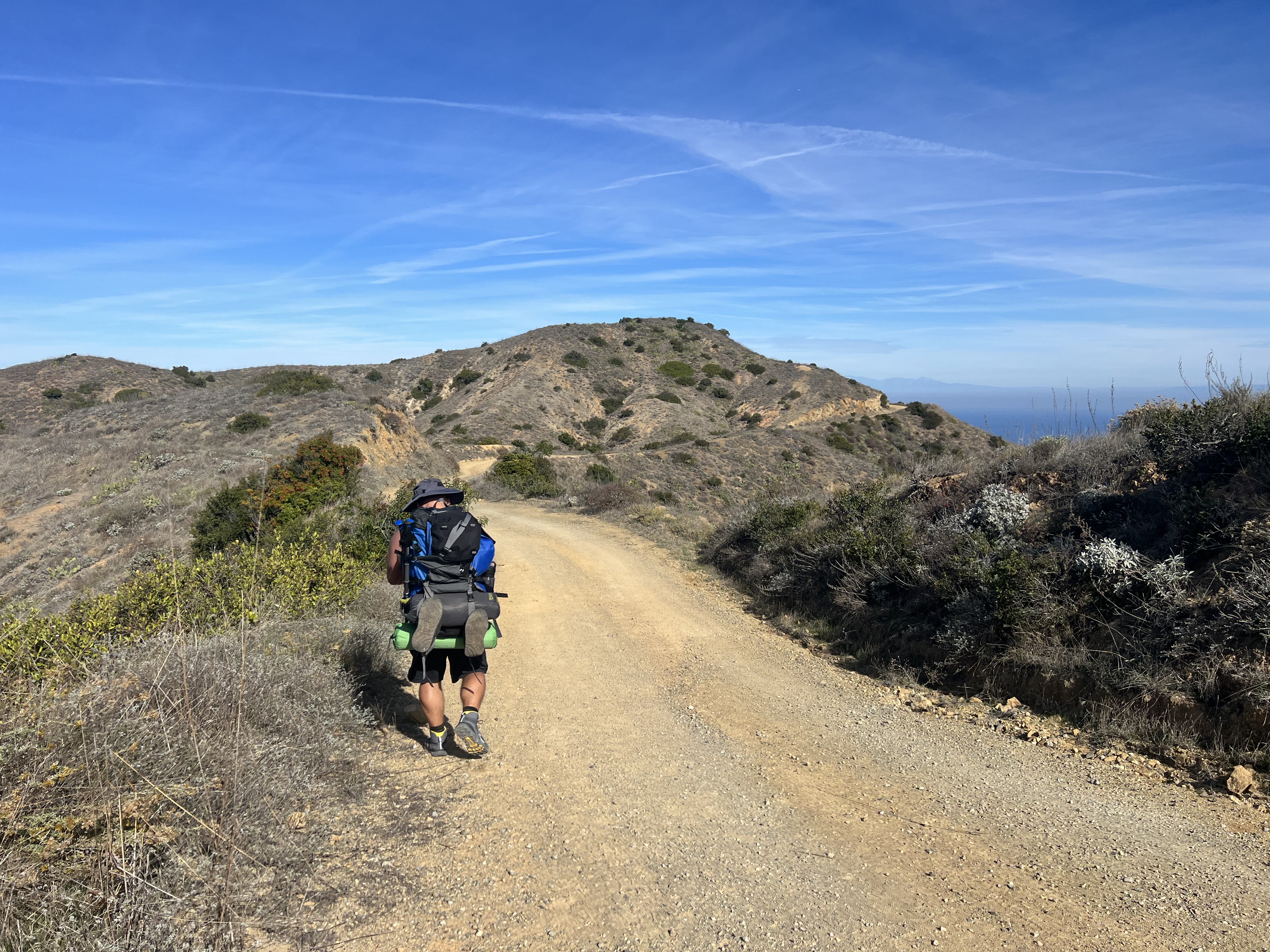
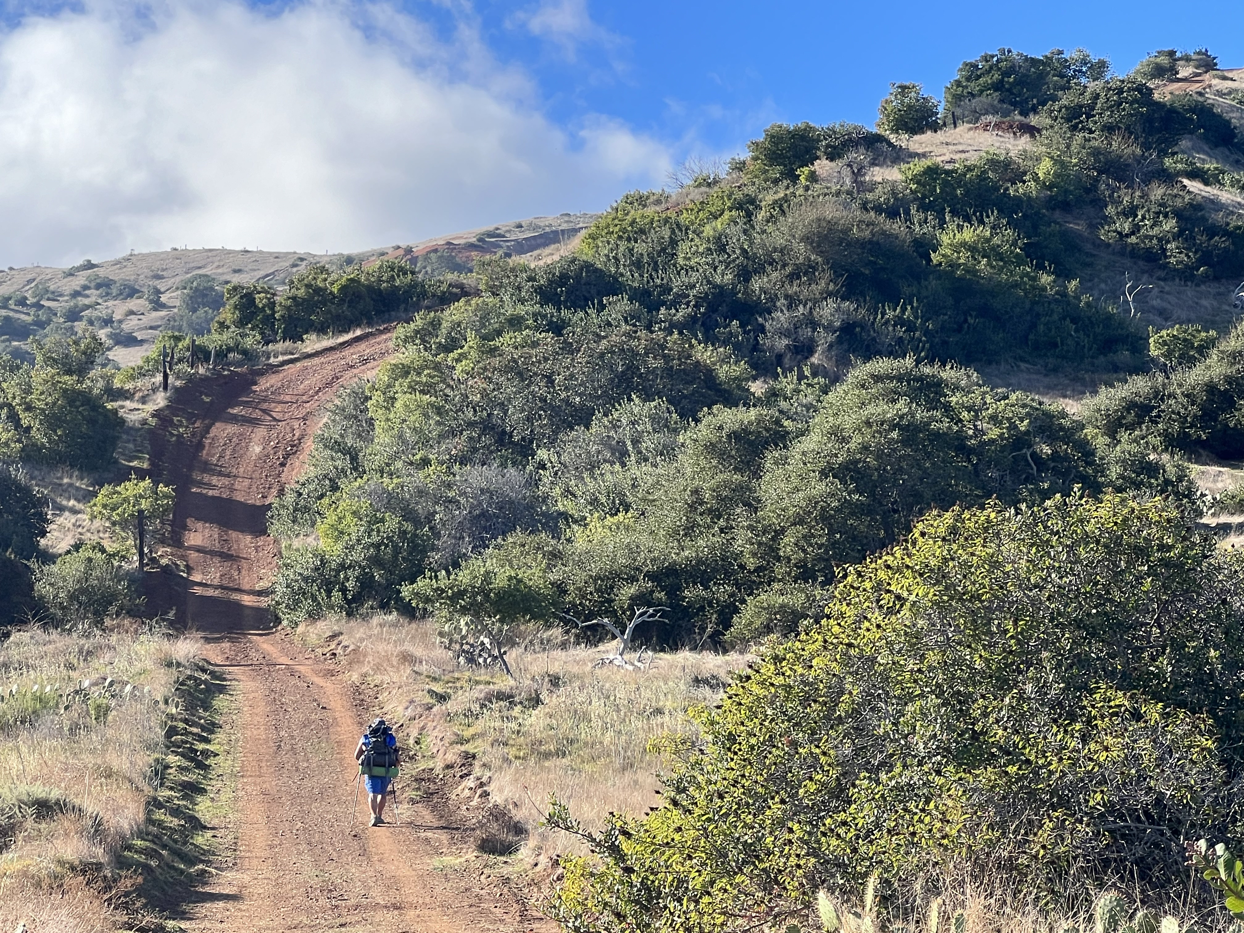
The Klutina Road trailhead is in a quiet neighborhood and no more than 2 vehicles fit in the designated parking zone. Please be respectful of neighbors and do not block the gate. We followed a narrow path for a little more than a quarter mile out to the Bulldog Trail where we turned left and followed it for about a mile and half. The Bulldog “Trail” is actually a wide road used by the military for access and training. Signs warning of unexploded ordinance warn of the danger of traveling off trail on military land.
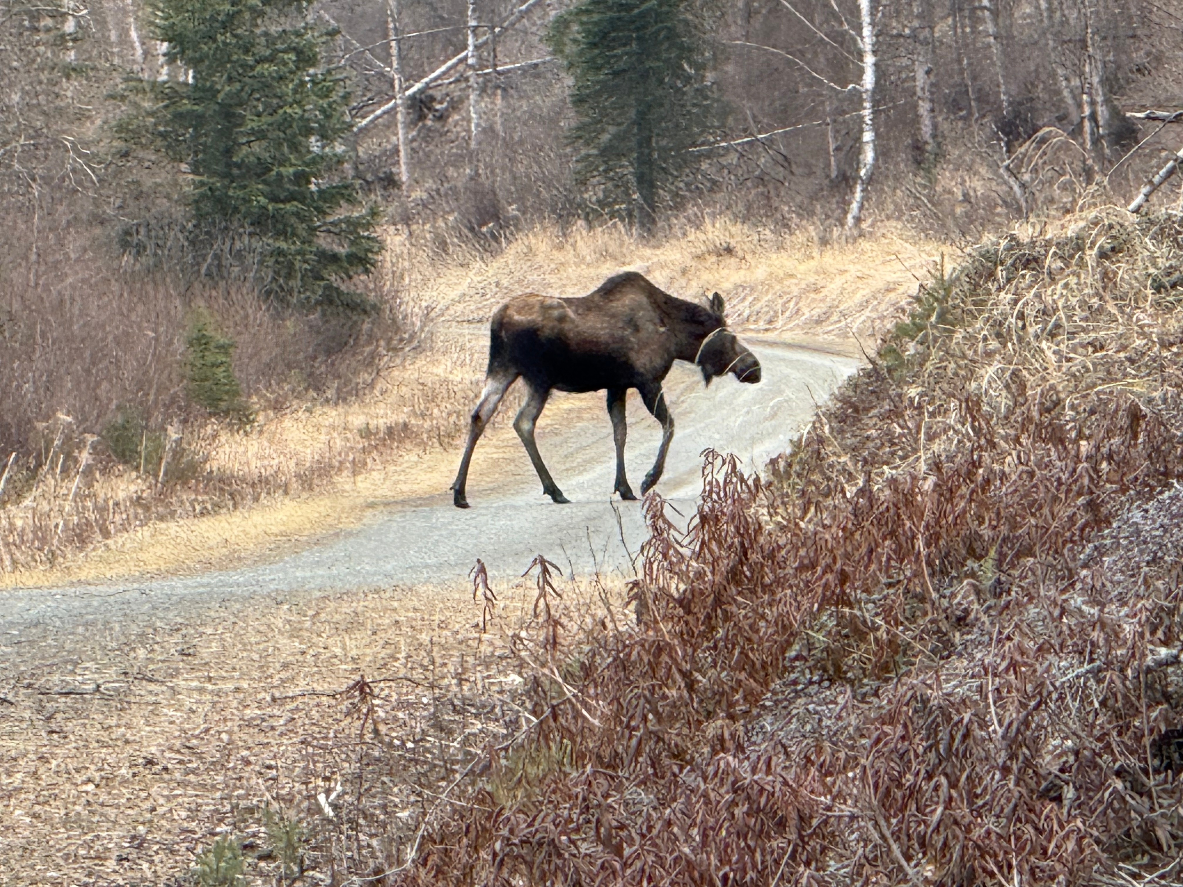
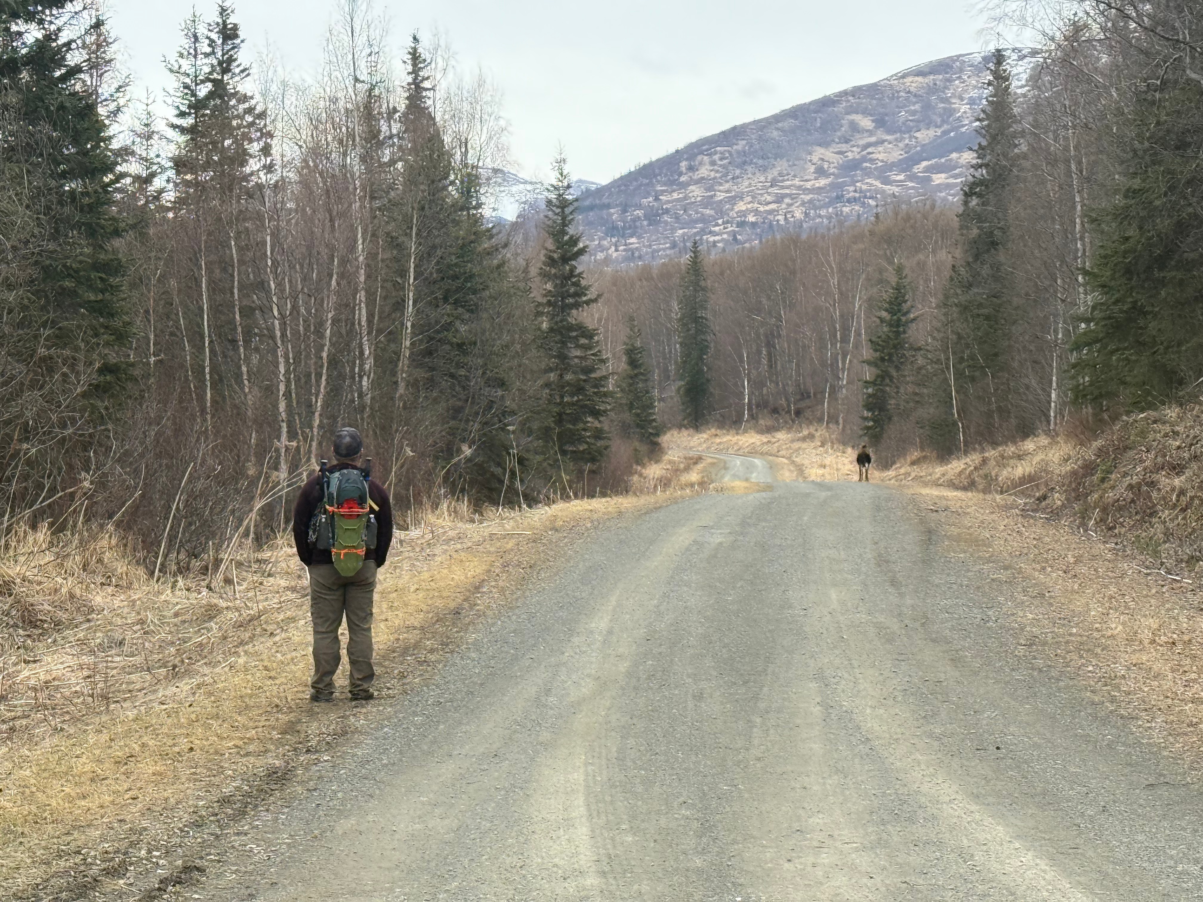
As luck would have it, we had to leave the road to avoid a not yet angry, but very large female moose. She didn’t chase us down and we weren’t blown up, so we took that as a good omen for the day.
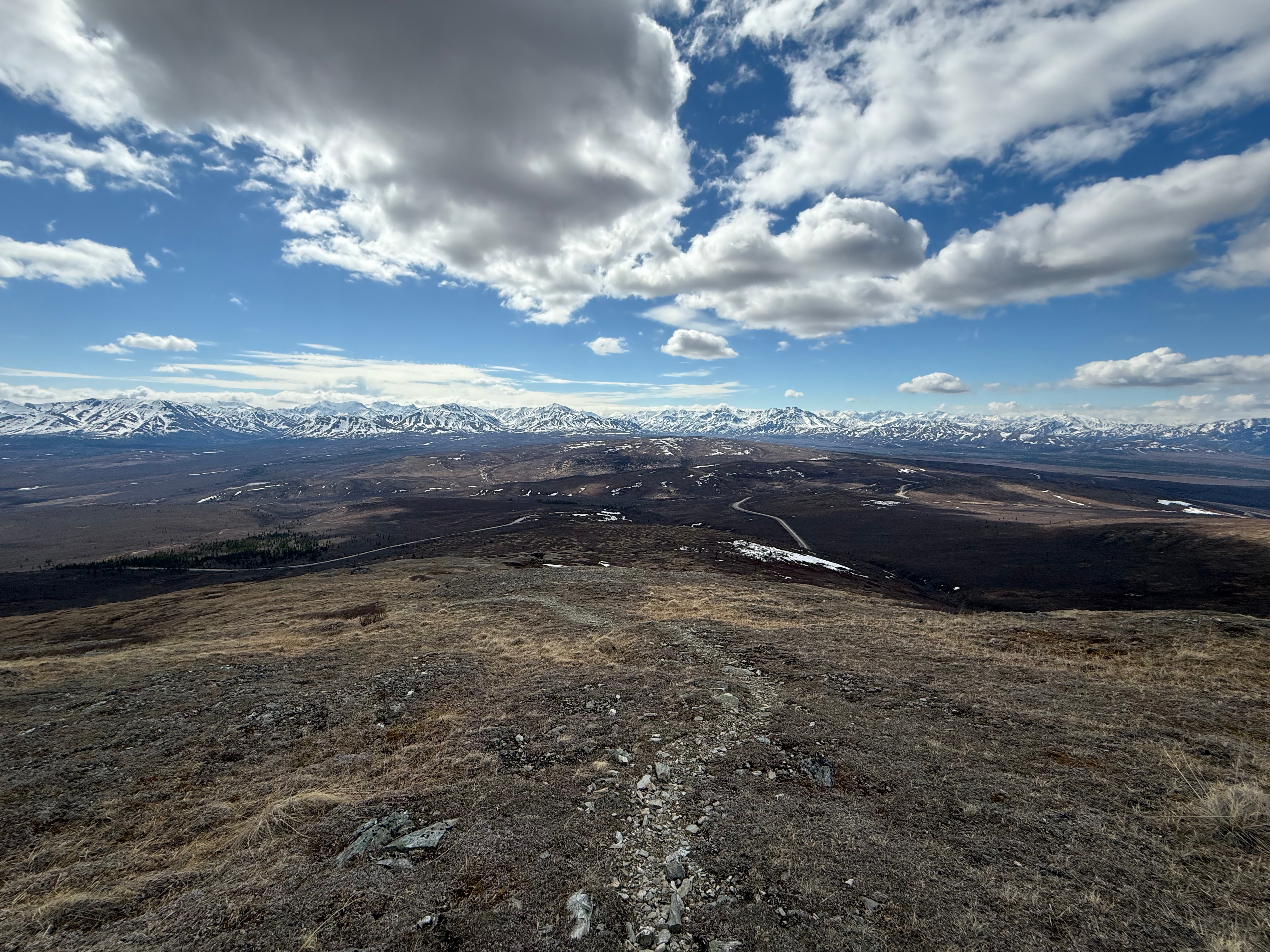
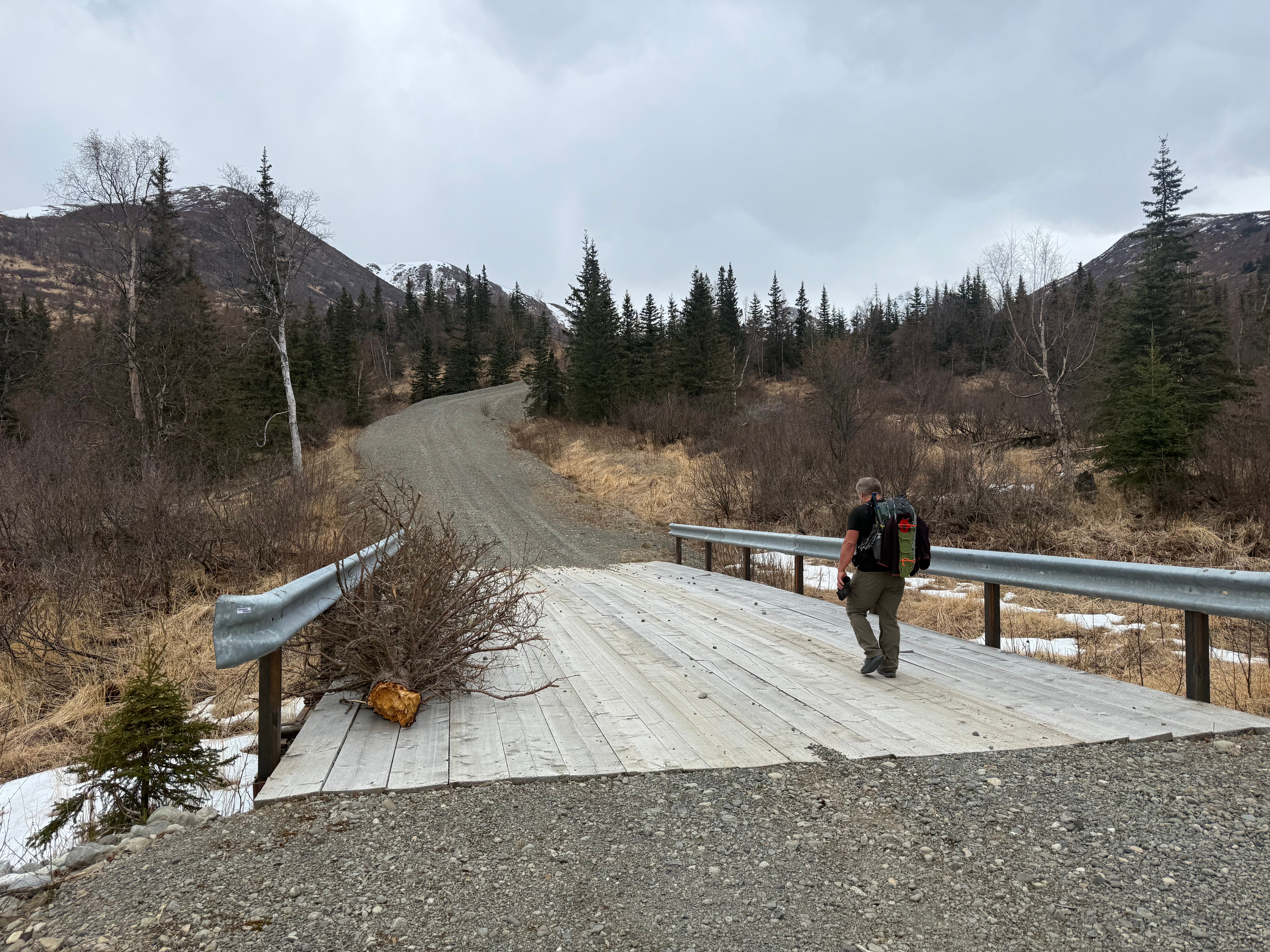
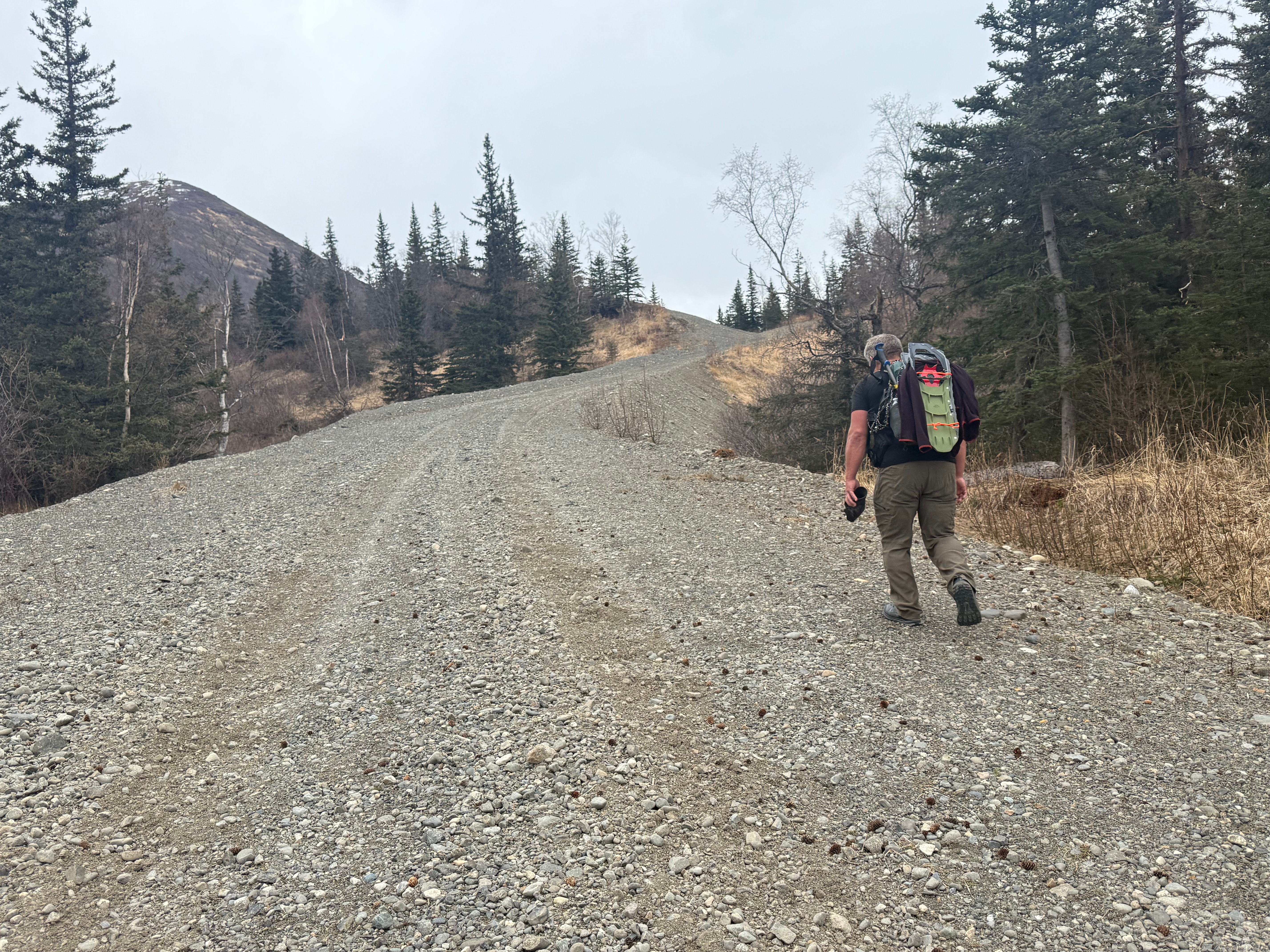
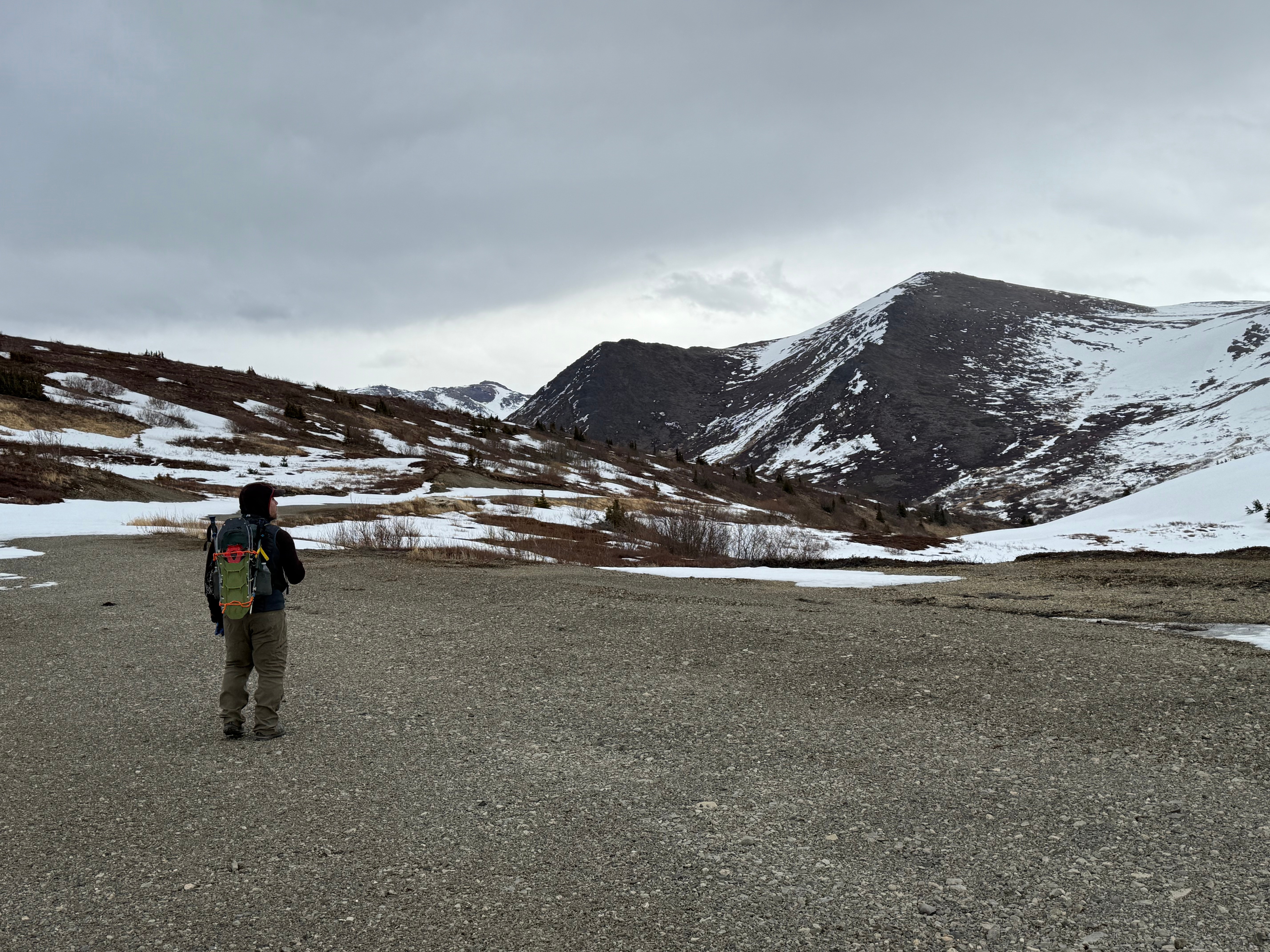
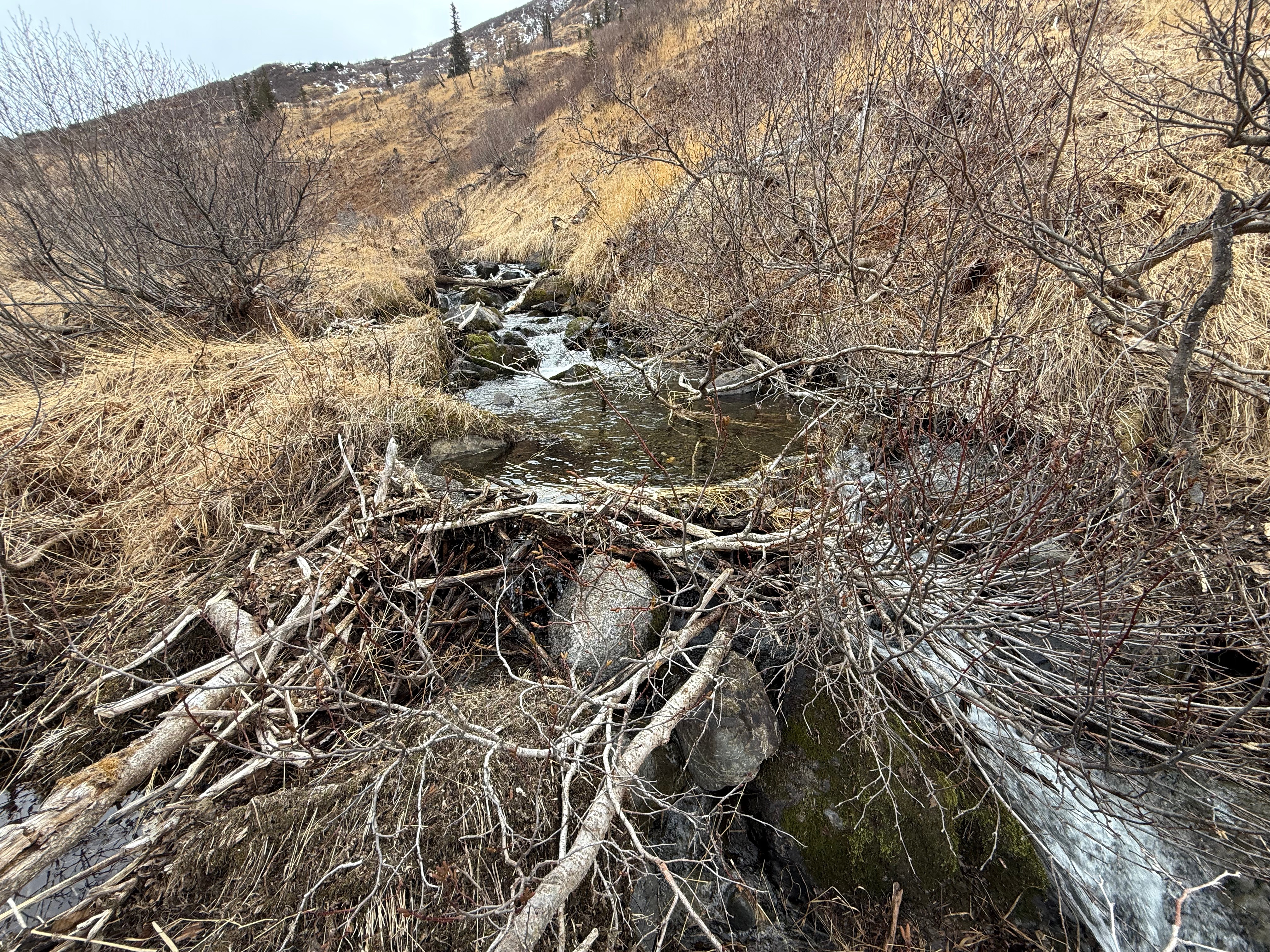
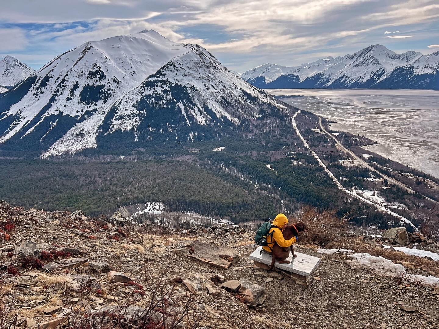
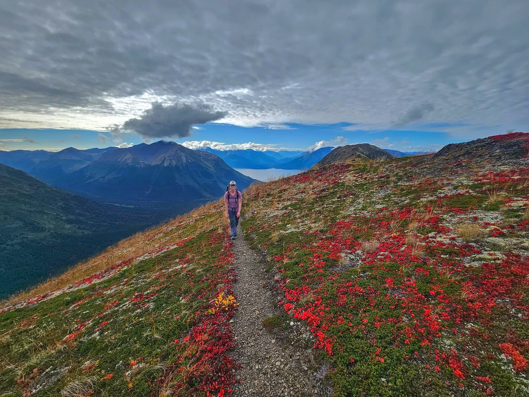
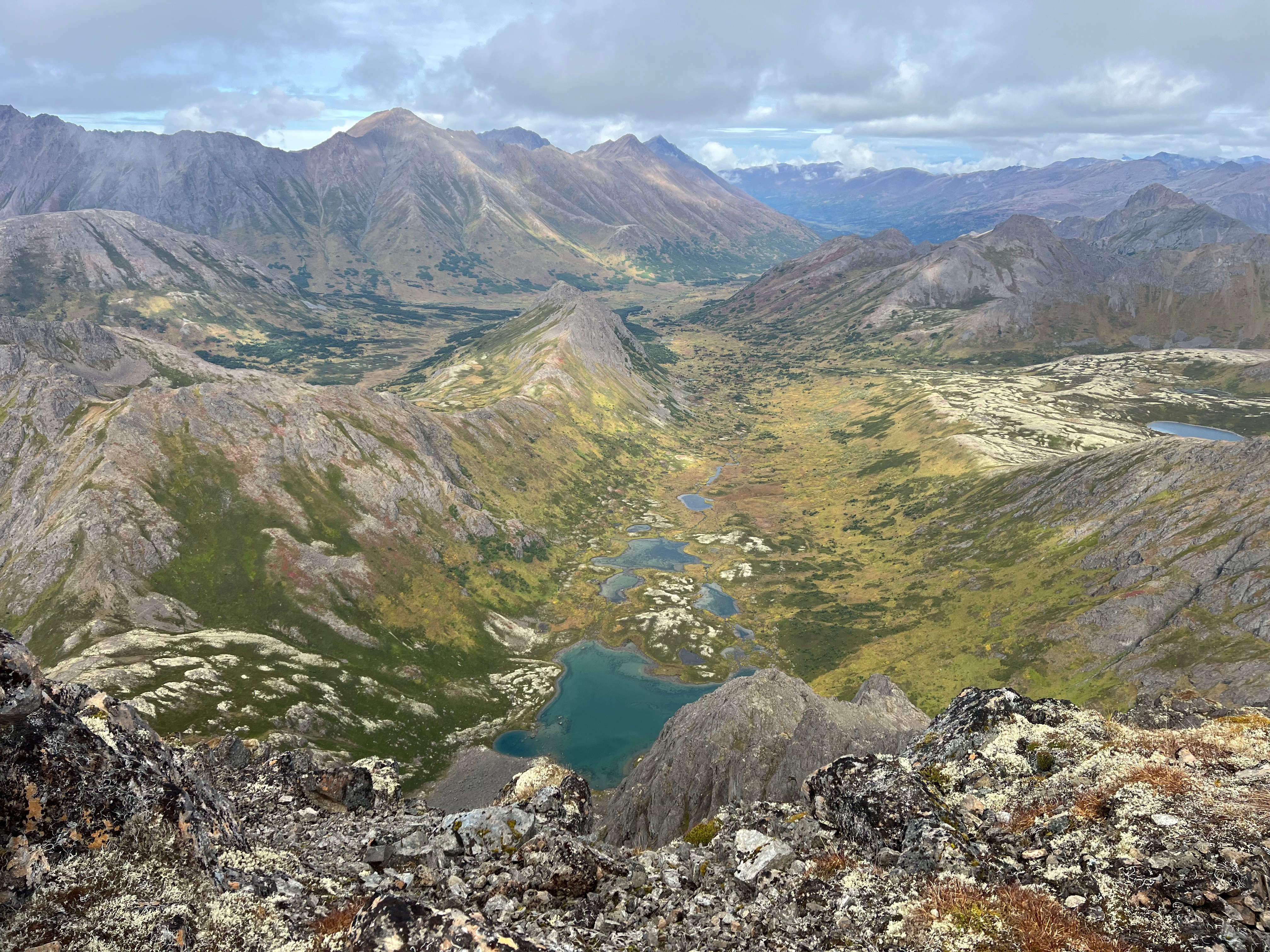
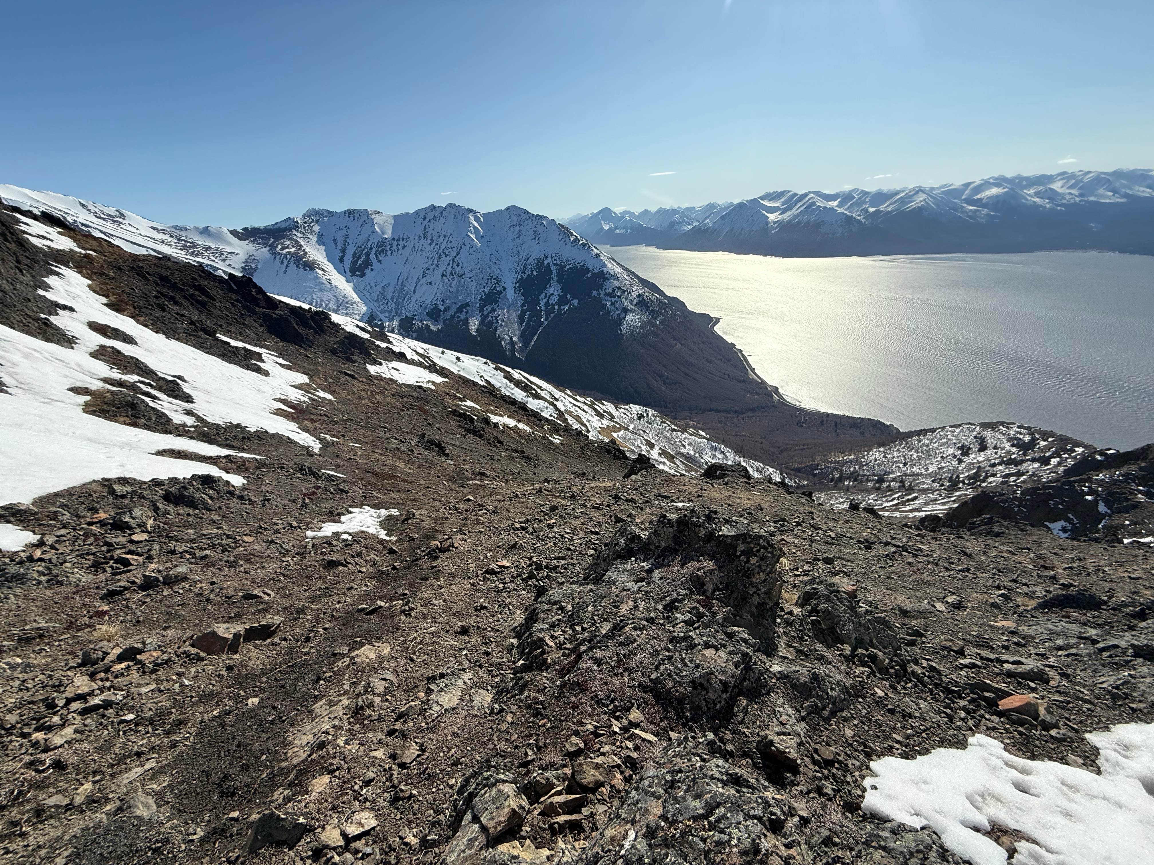
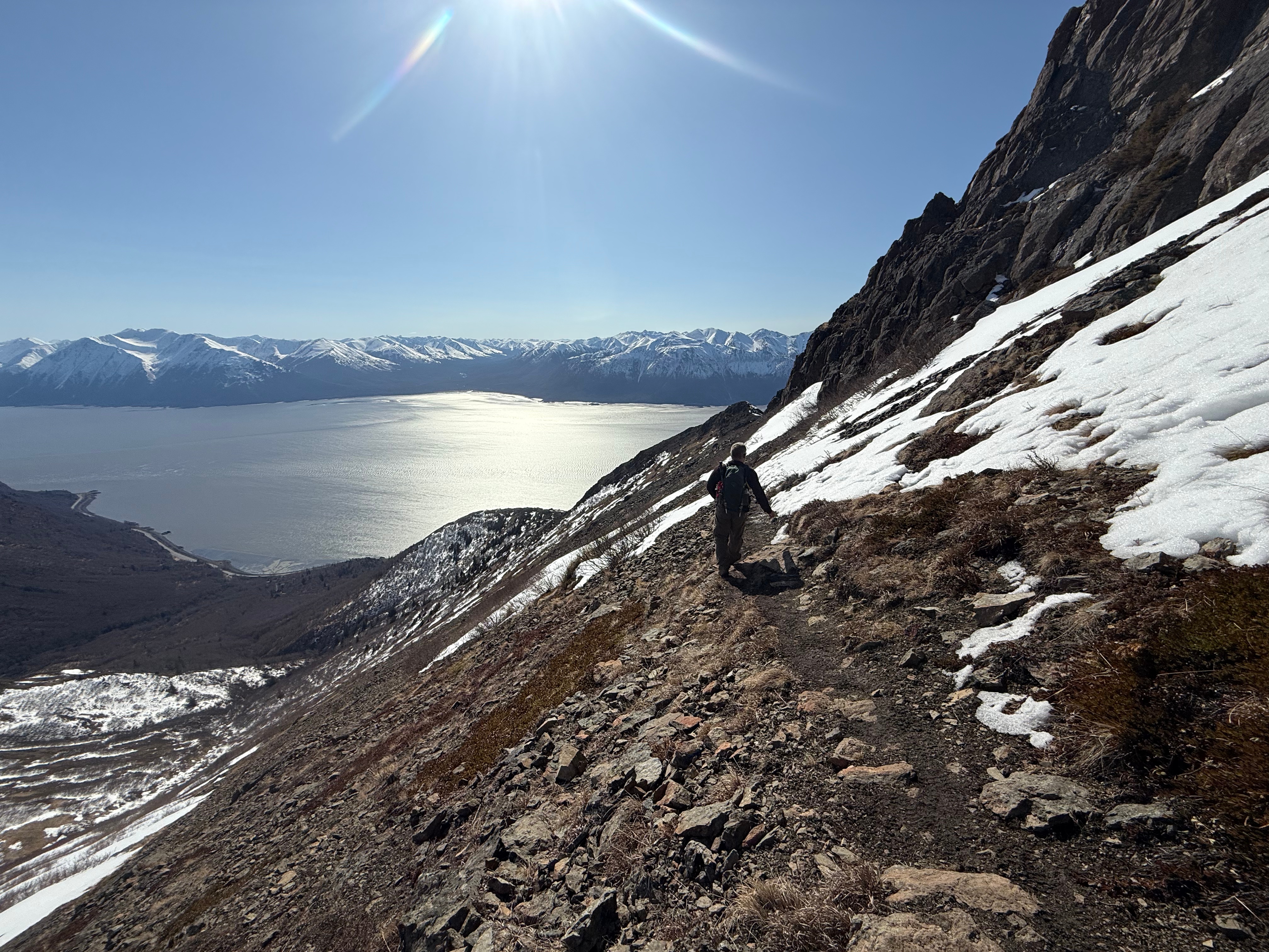
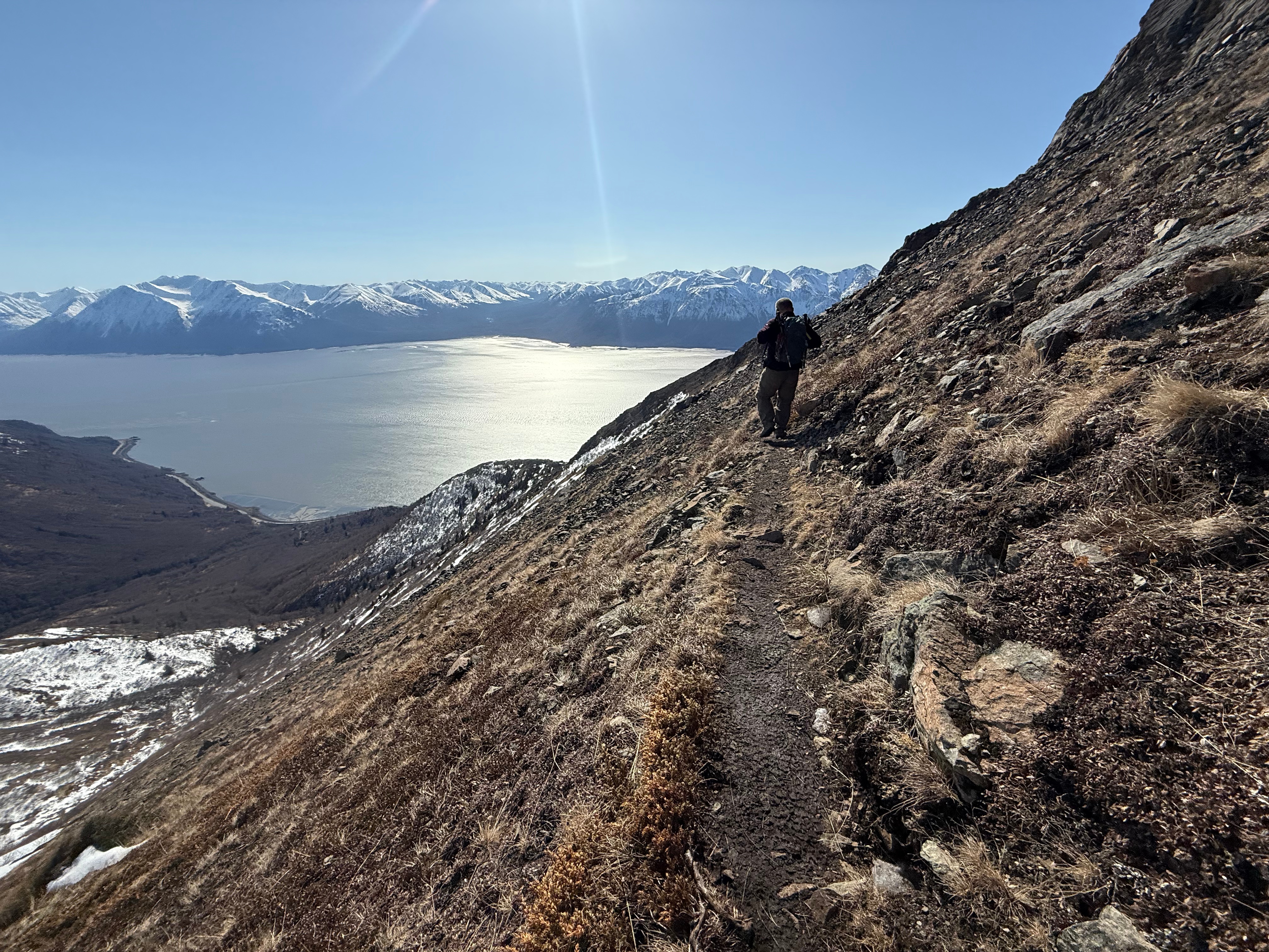
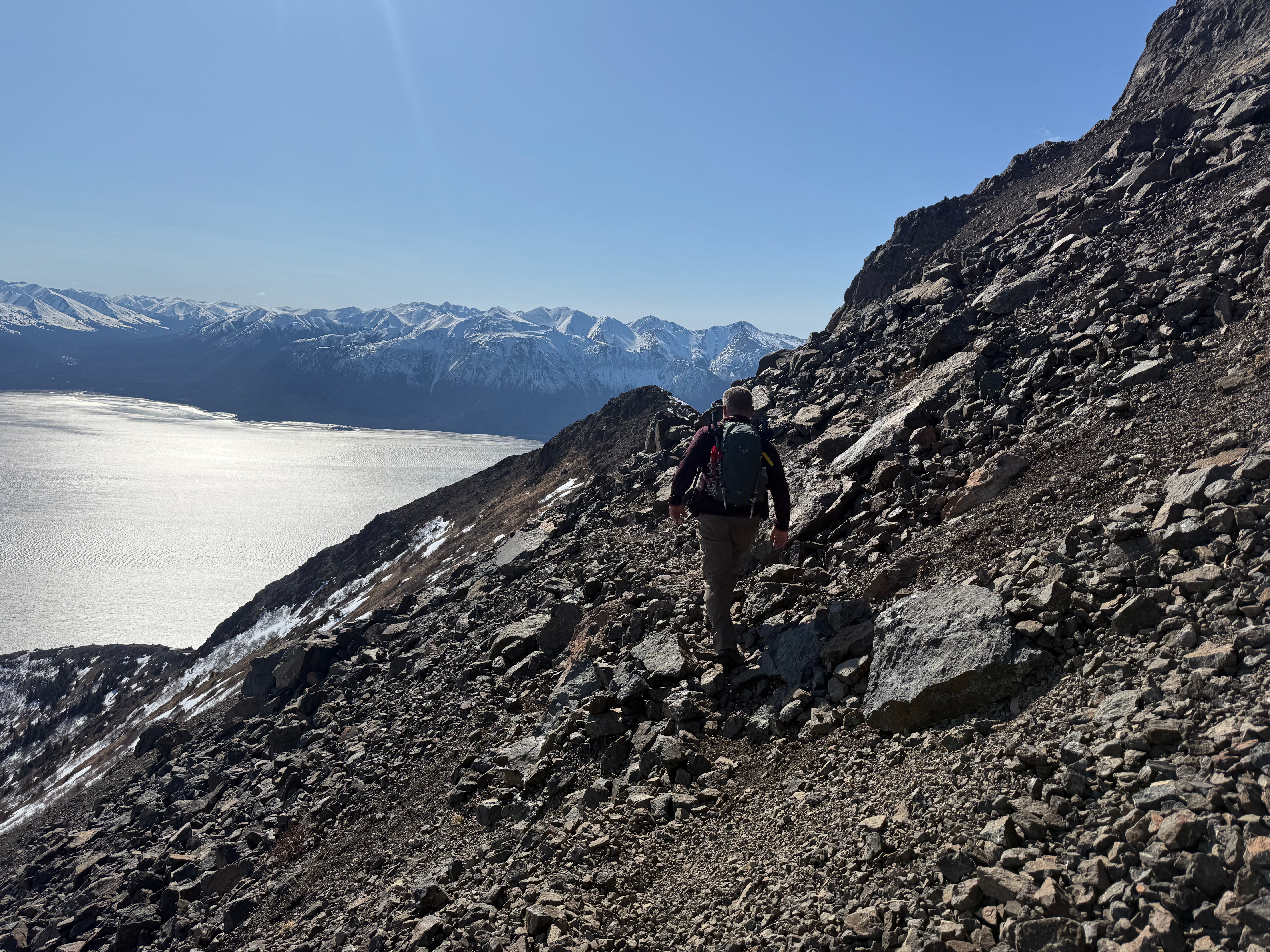
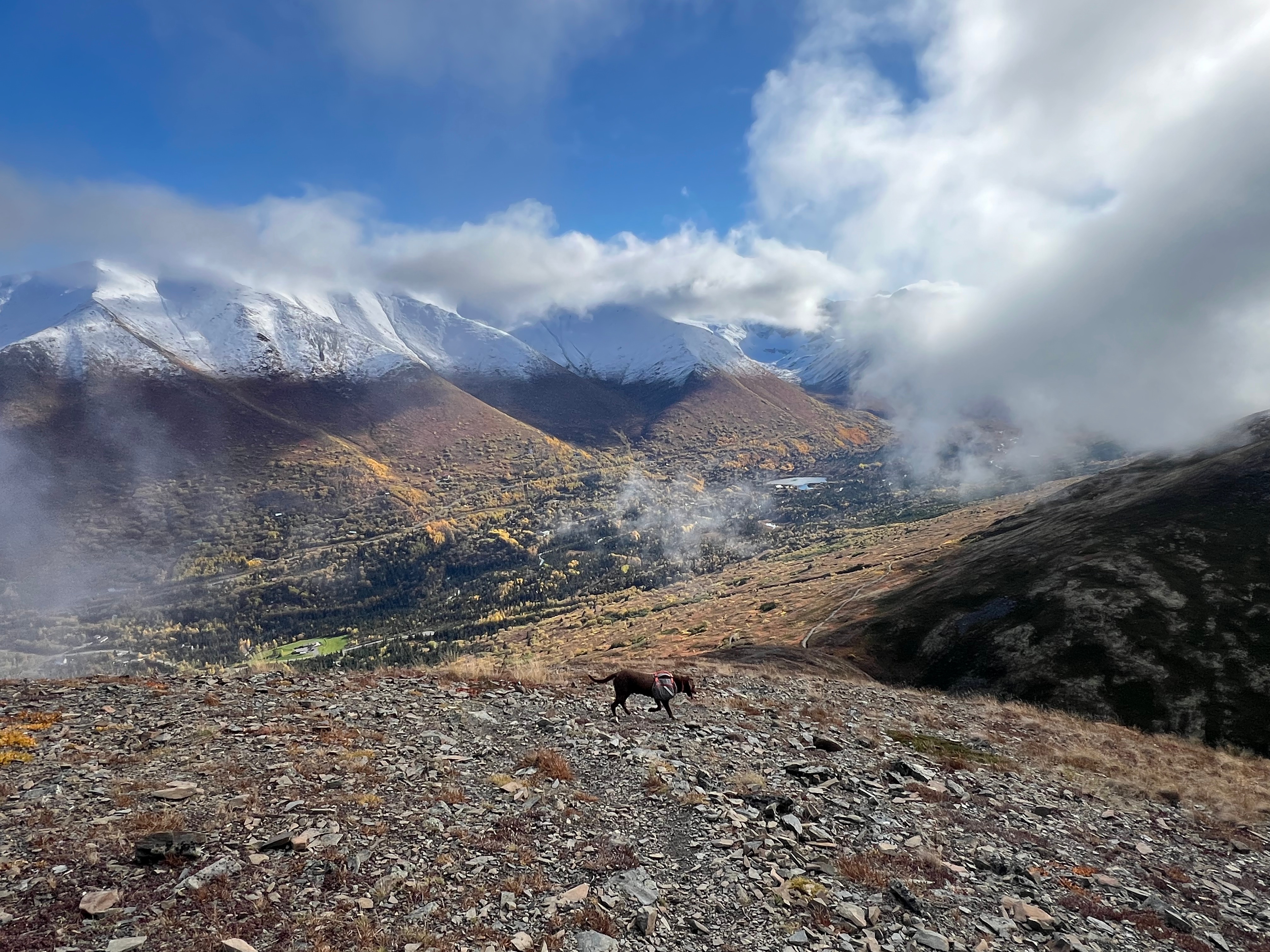
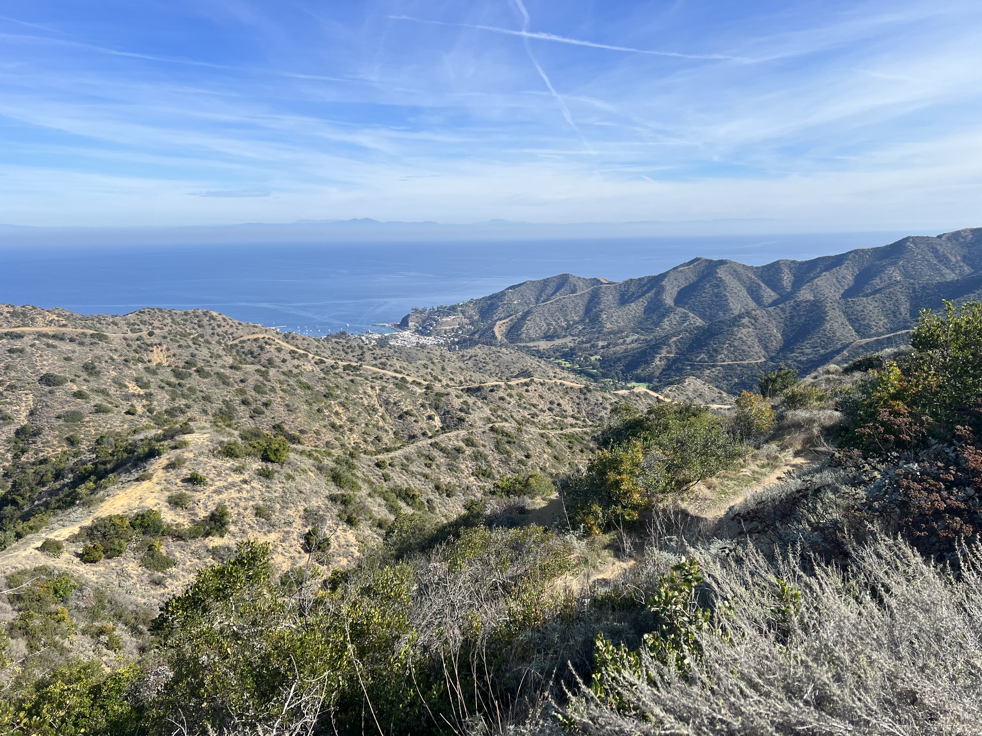
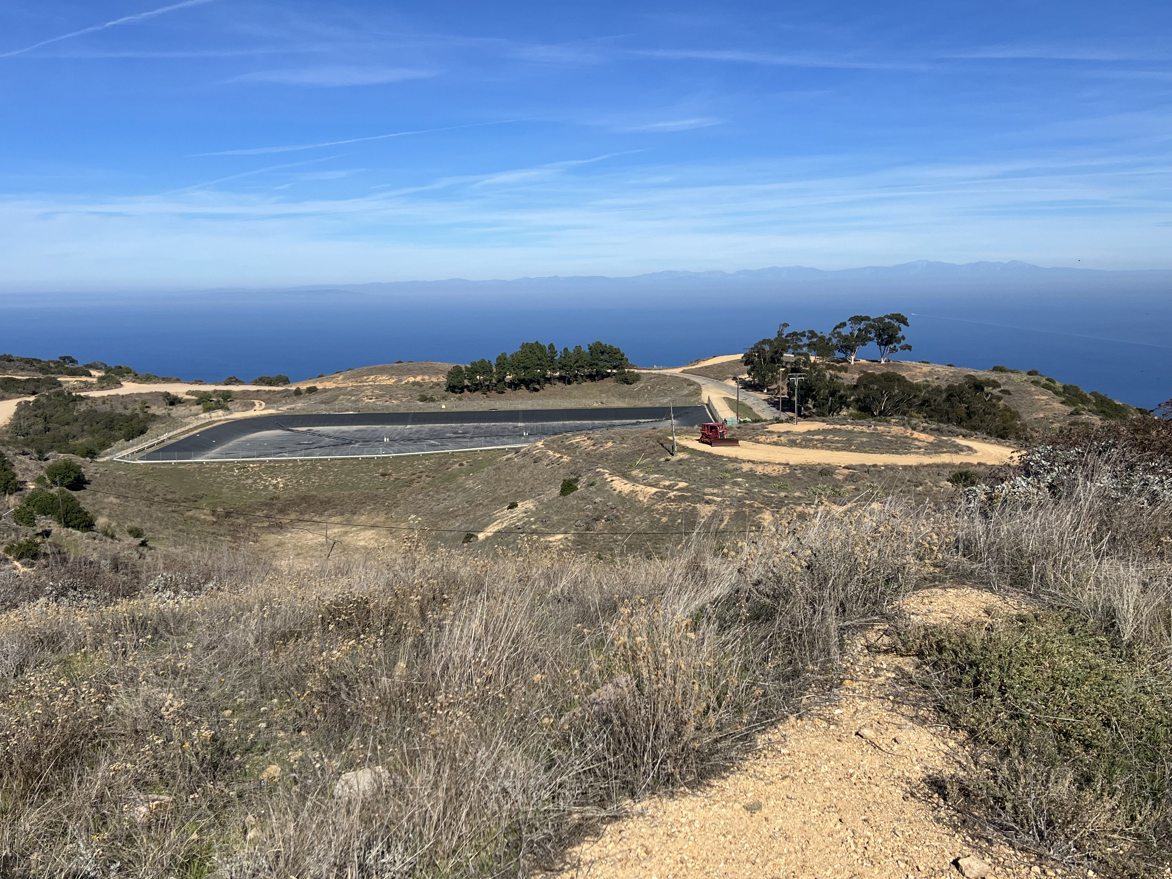
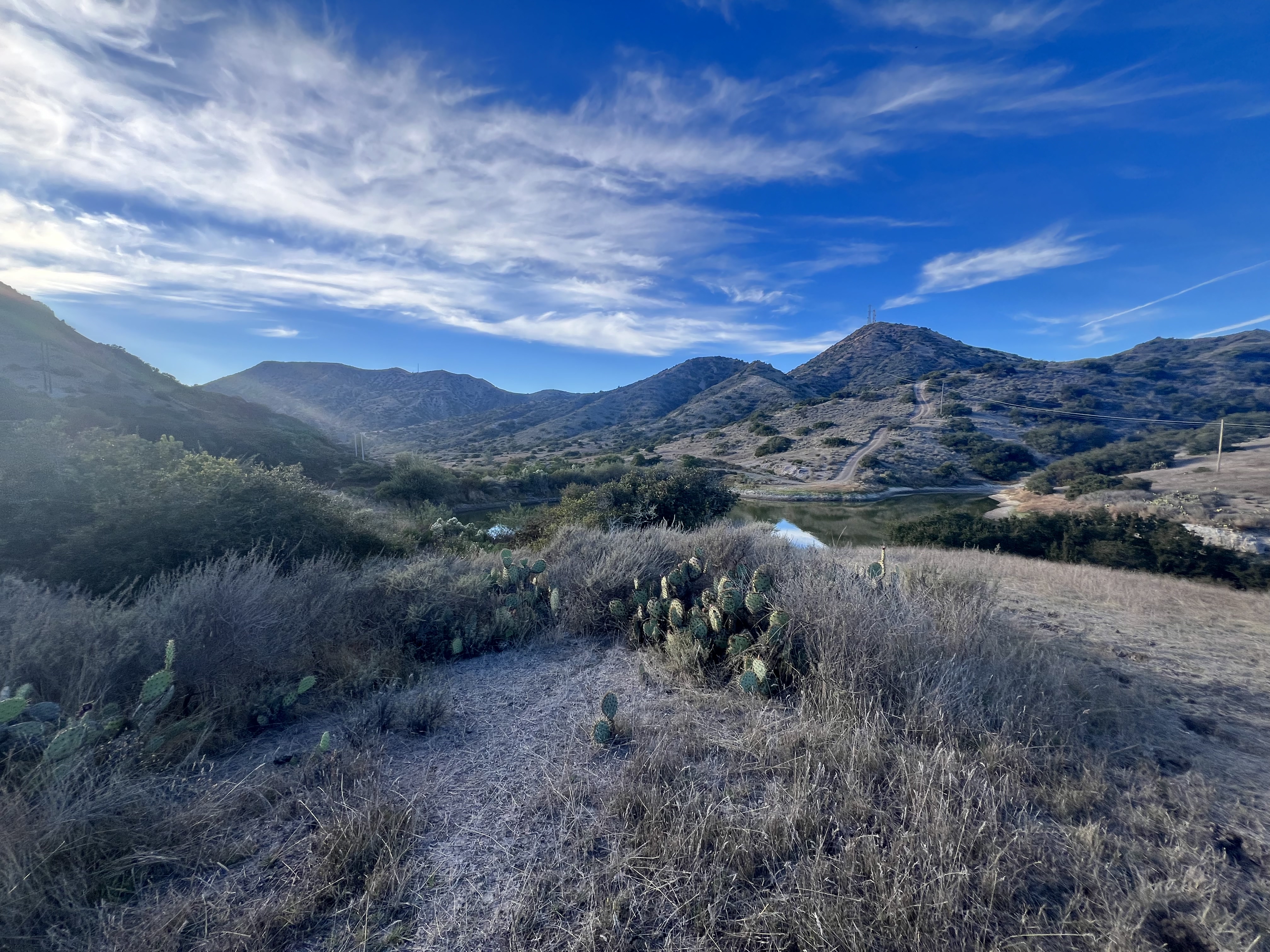
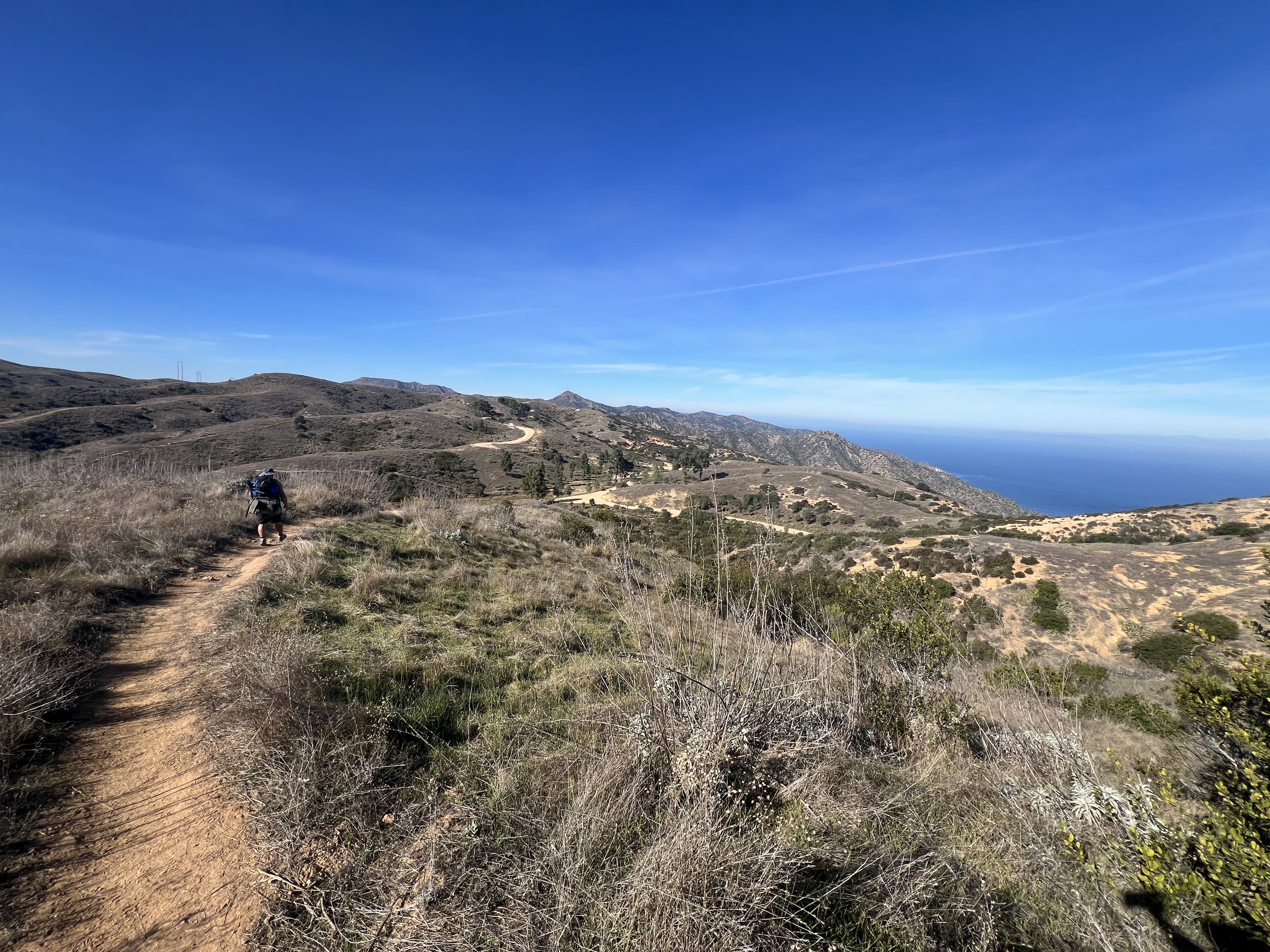
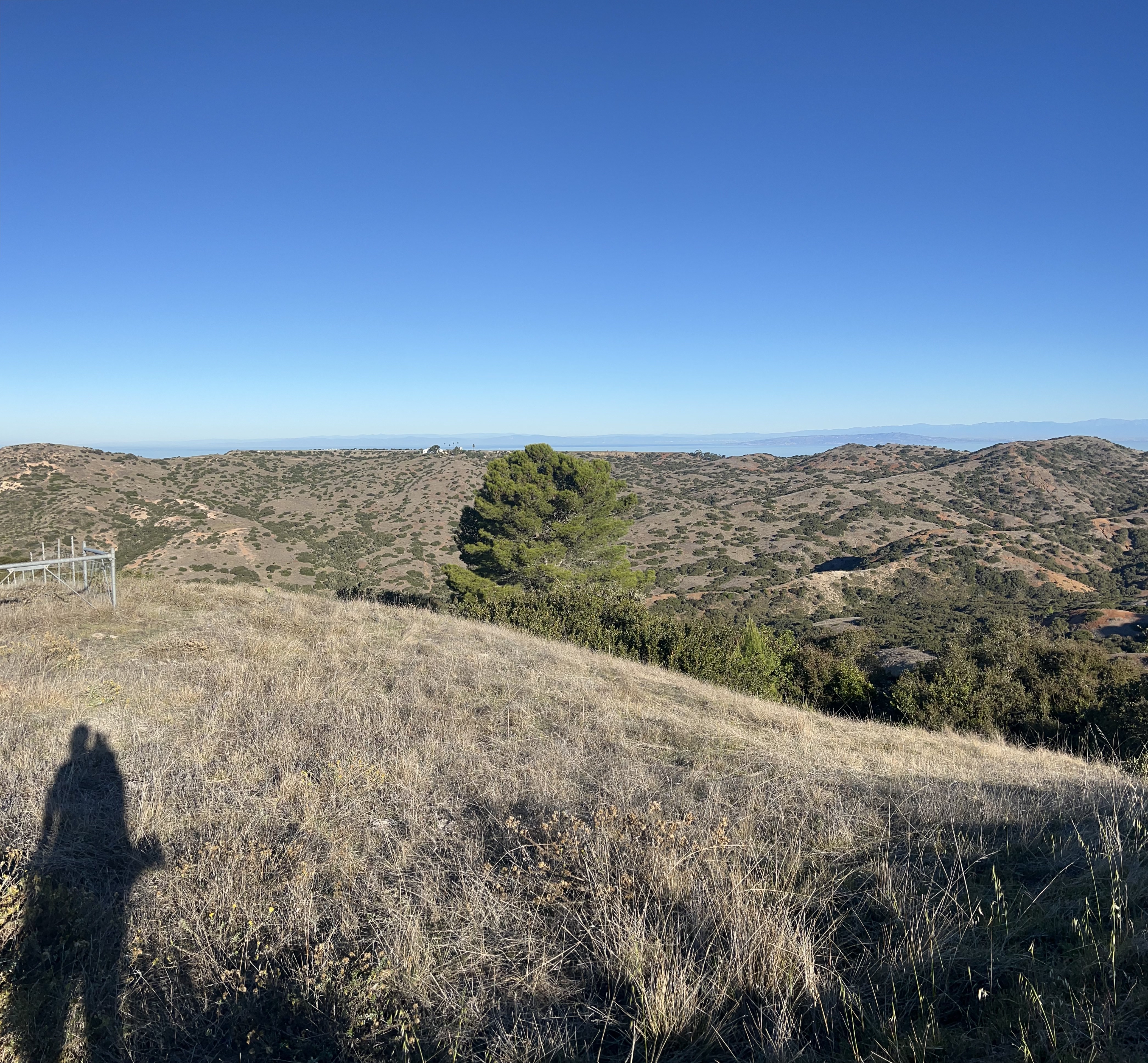
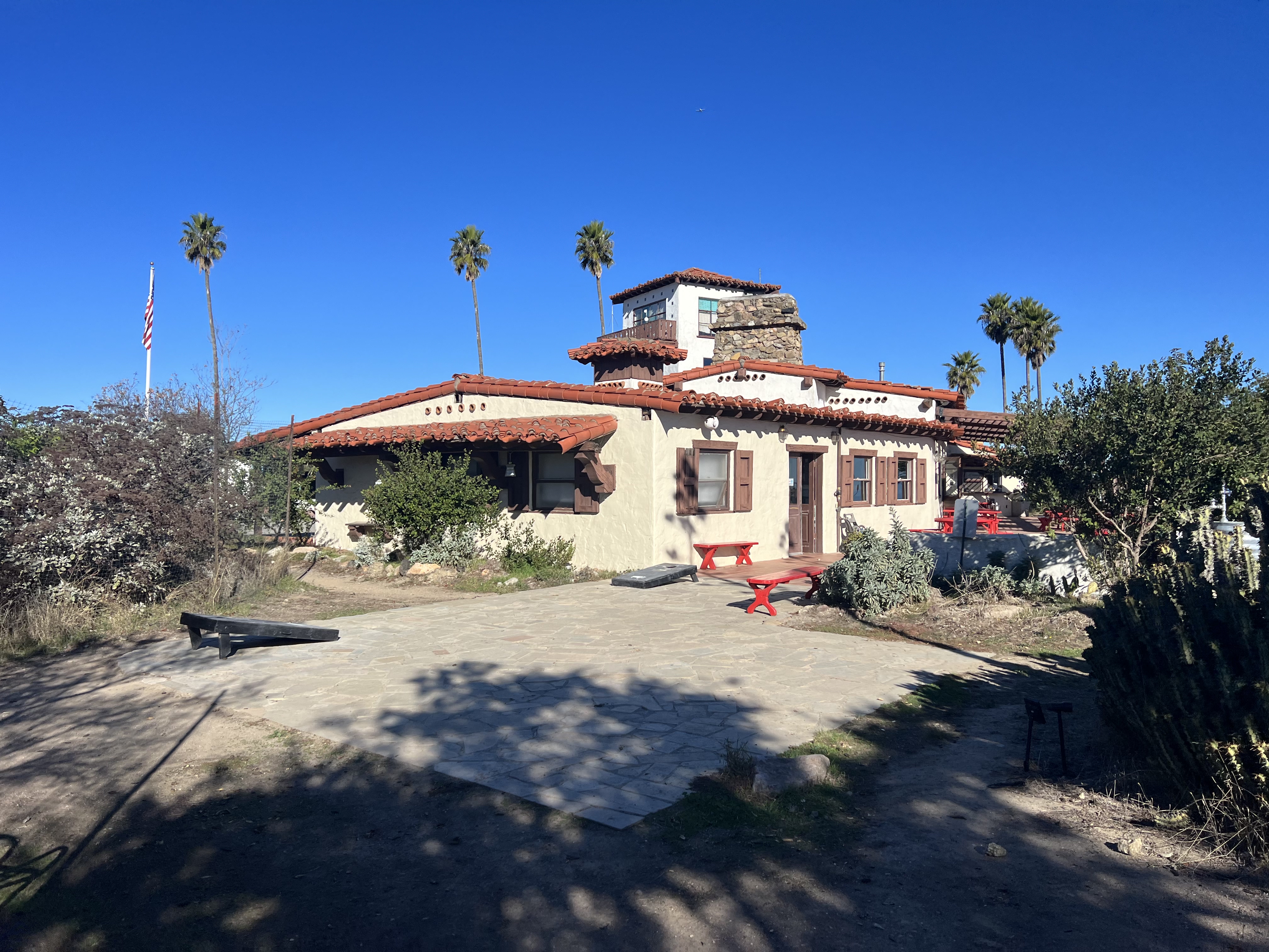
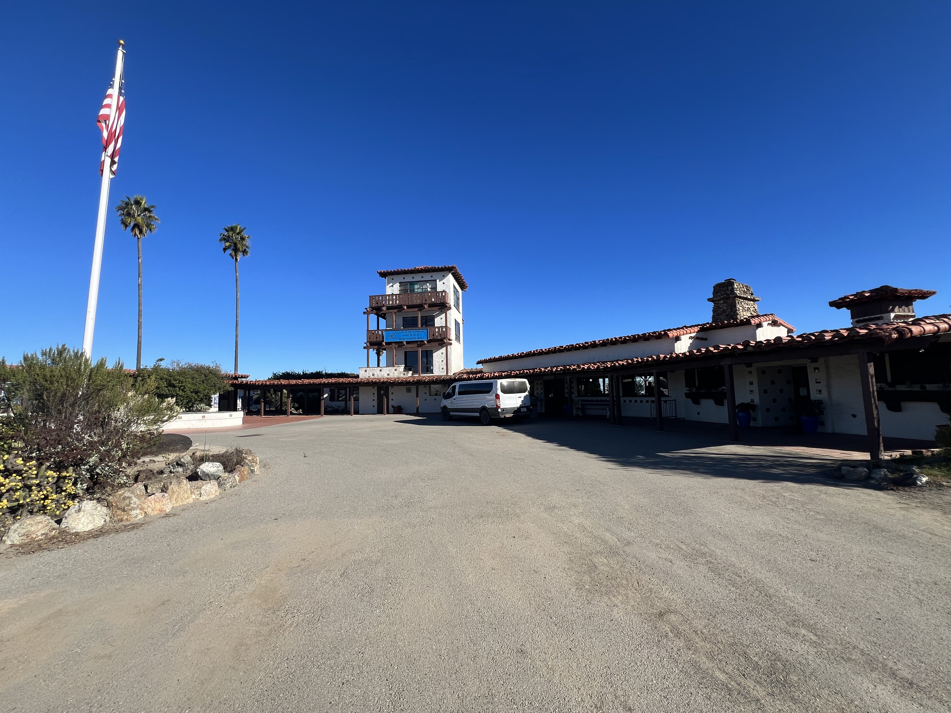
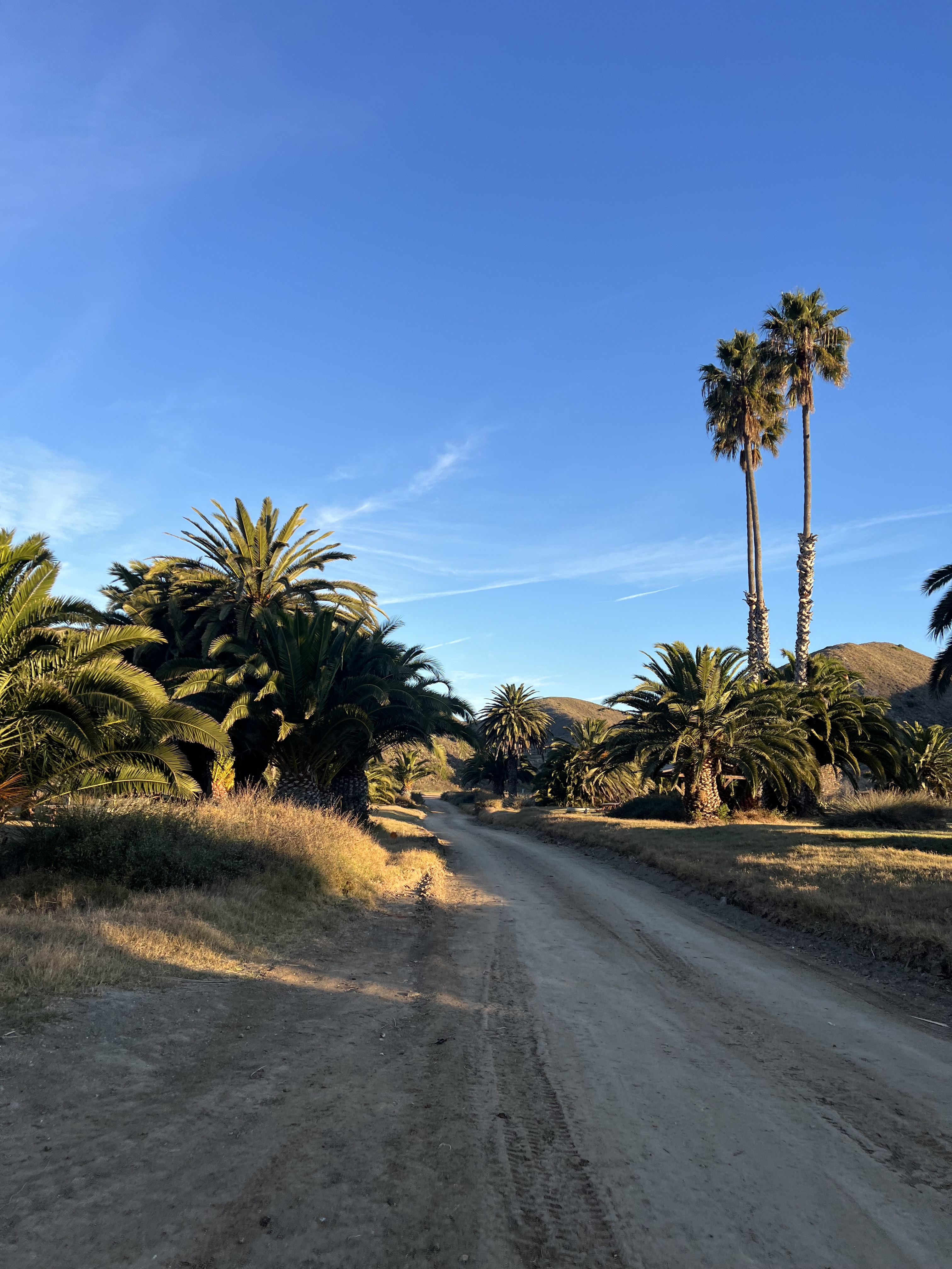
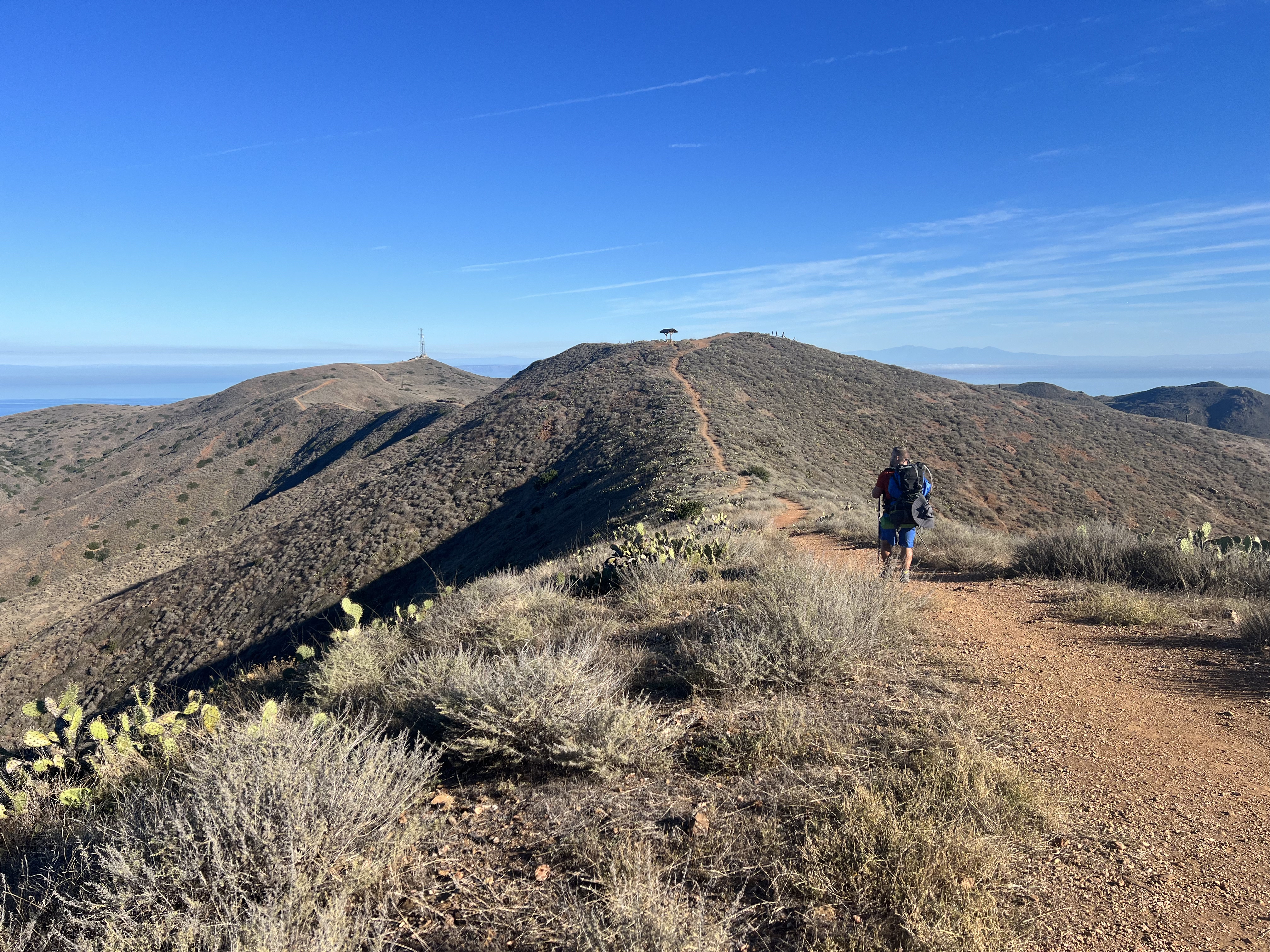
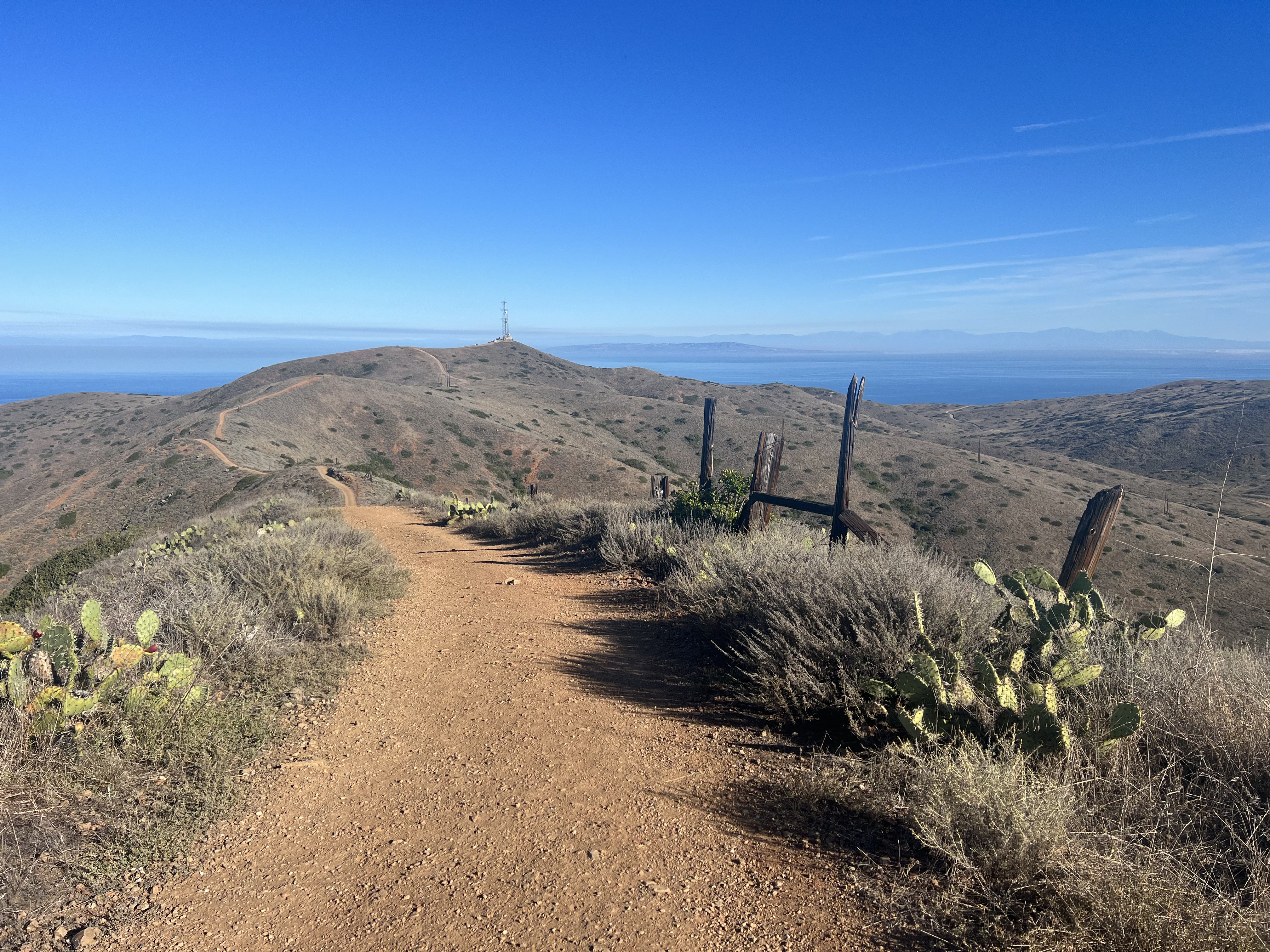
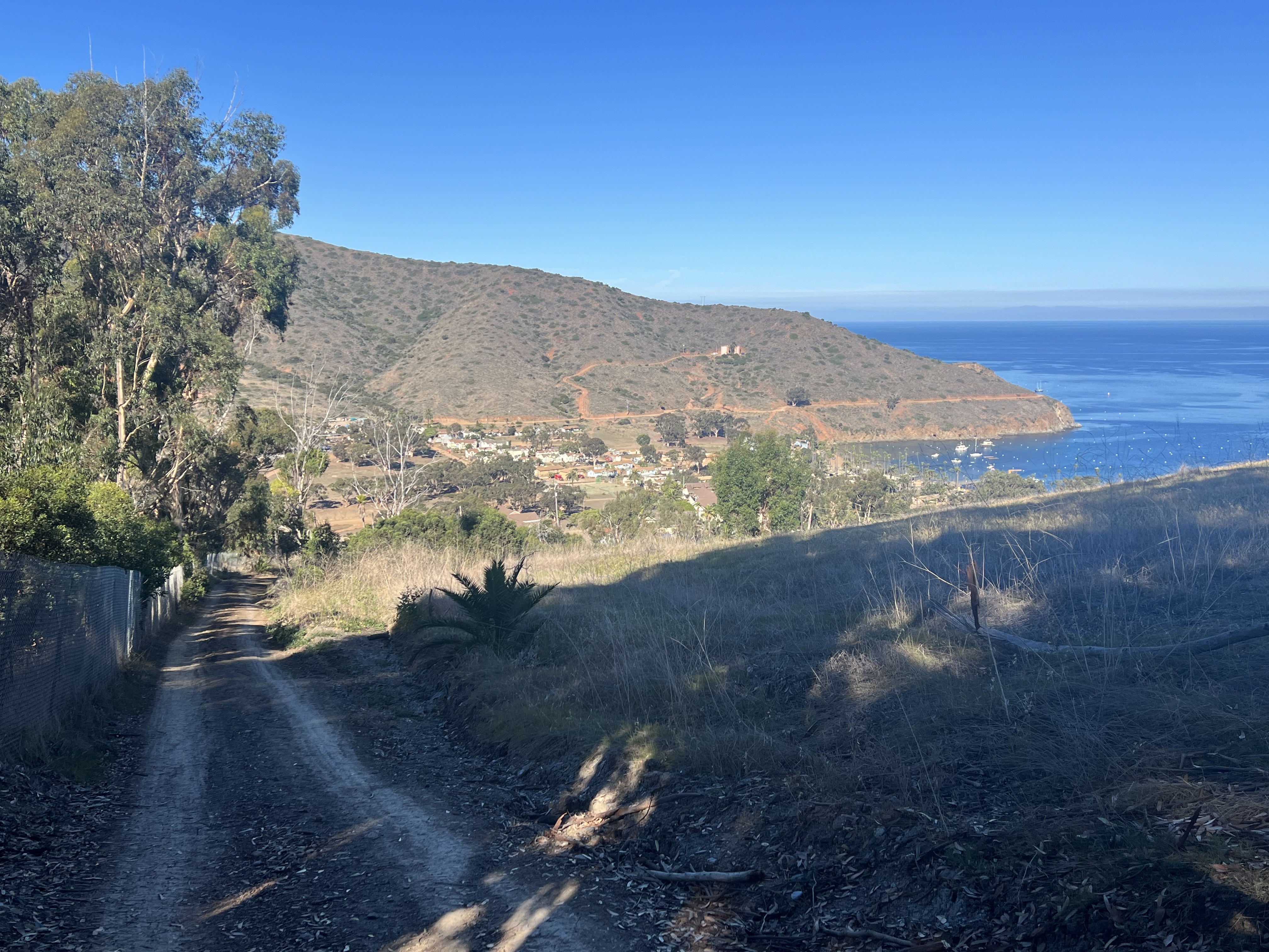
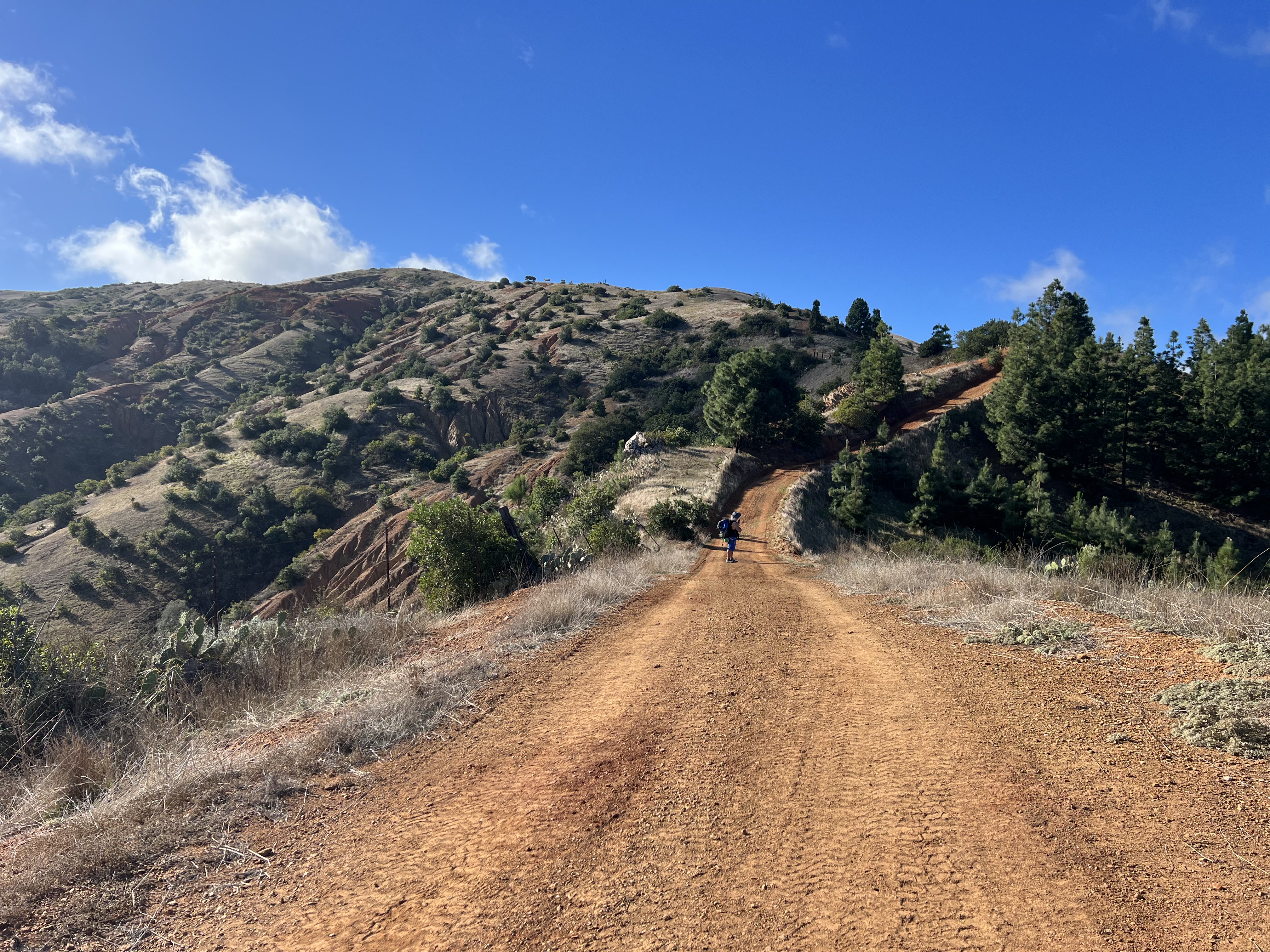
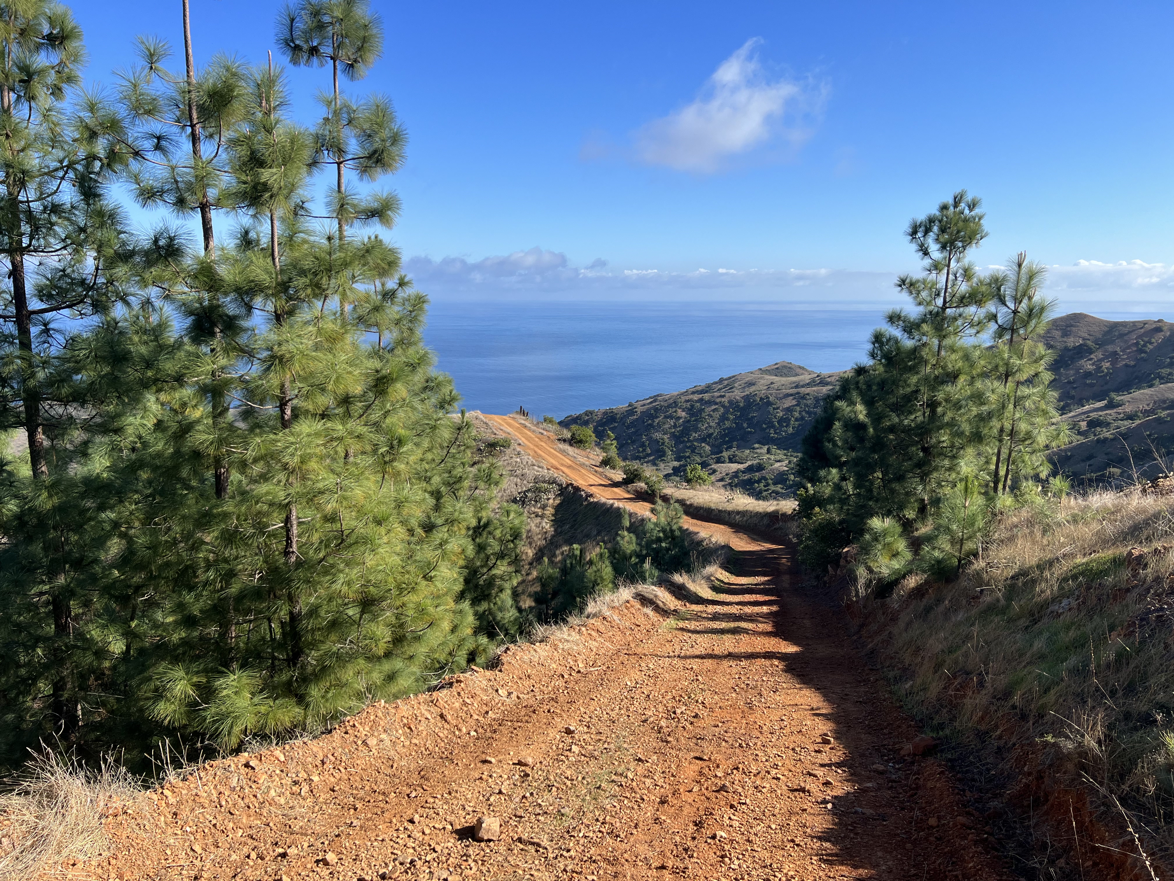
We came to the rudimentary roundabout and turned right, up the steep and winding Snow Hawk Road, which can be seen hugging the south side of Snow Hawk Mountain from the lowlands of the city of Anchorage. This road suddenly appeared on the mountainside back in 2020 and the access was restricted for years due to building and maintenance, but now, is a great alternative to climbing over The Dome to access the valley surrounded by Snow Hawk, Nunaka Point, Kanchee, Knoya and The Dome.
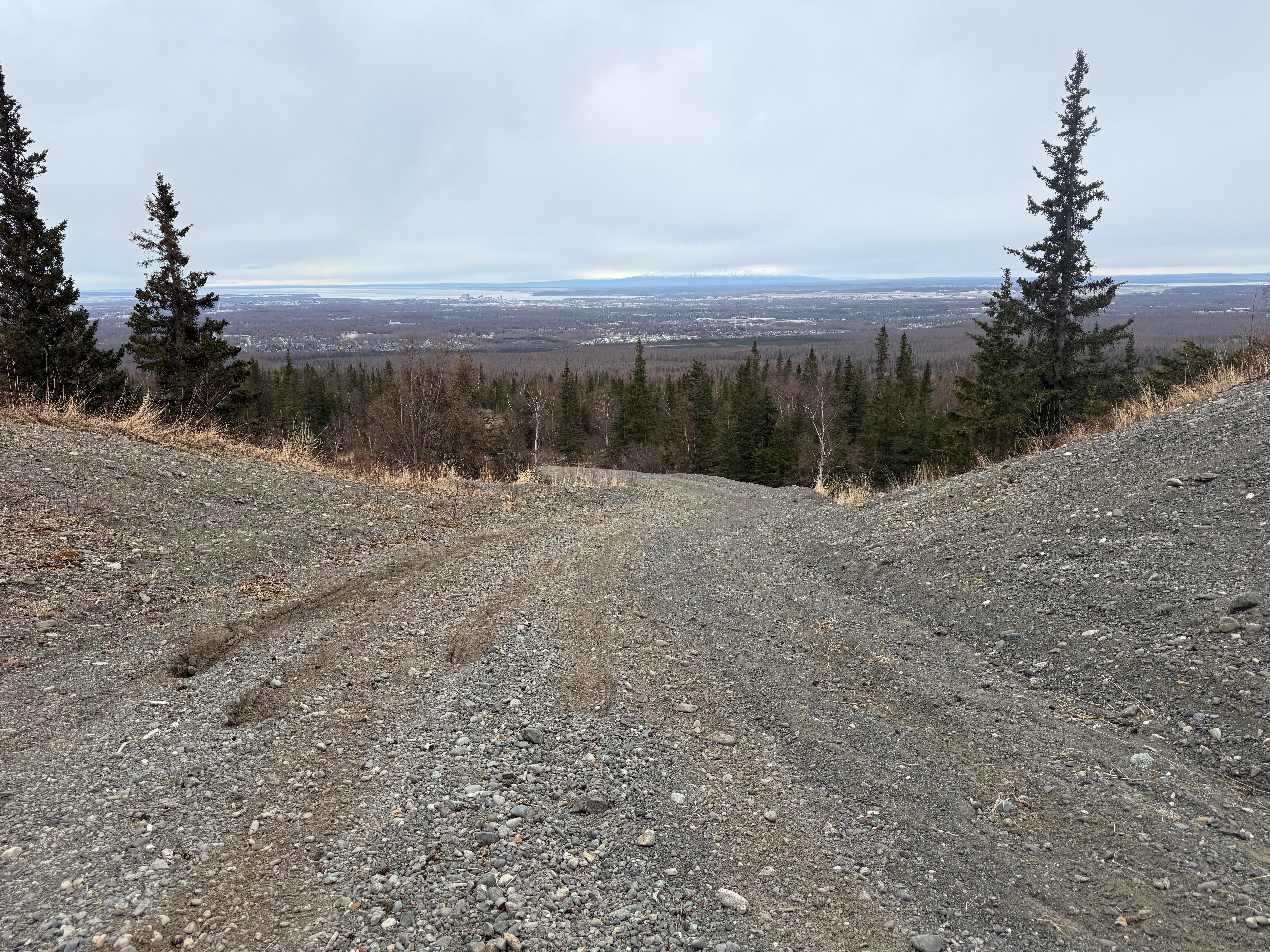
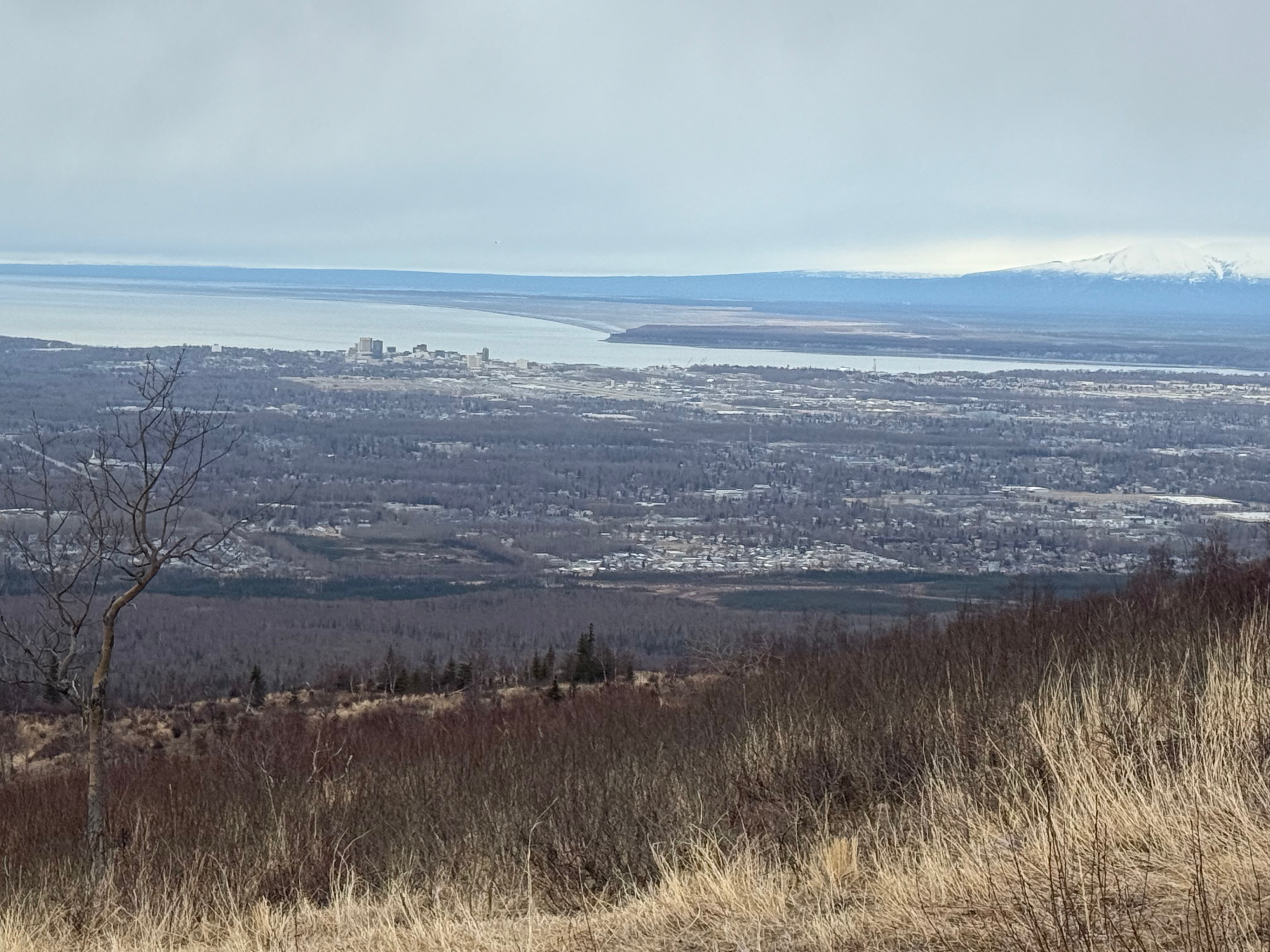
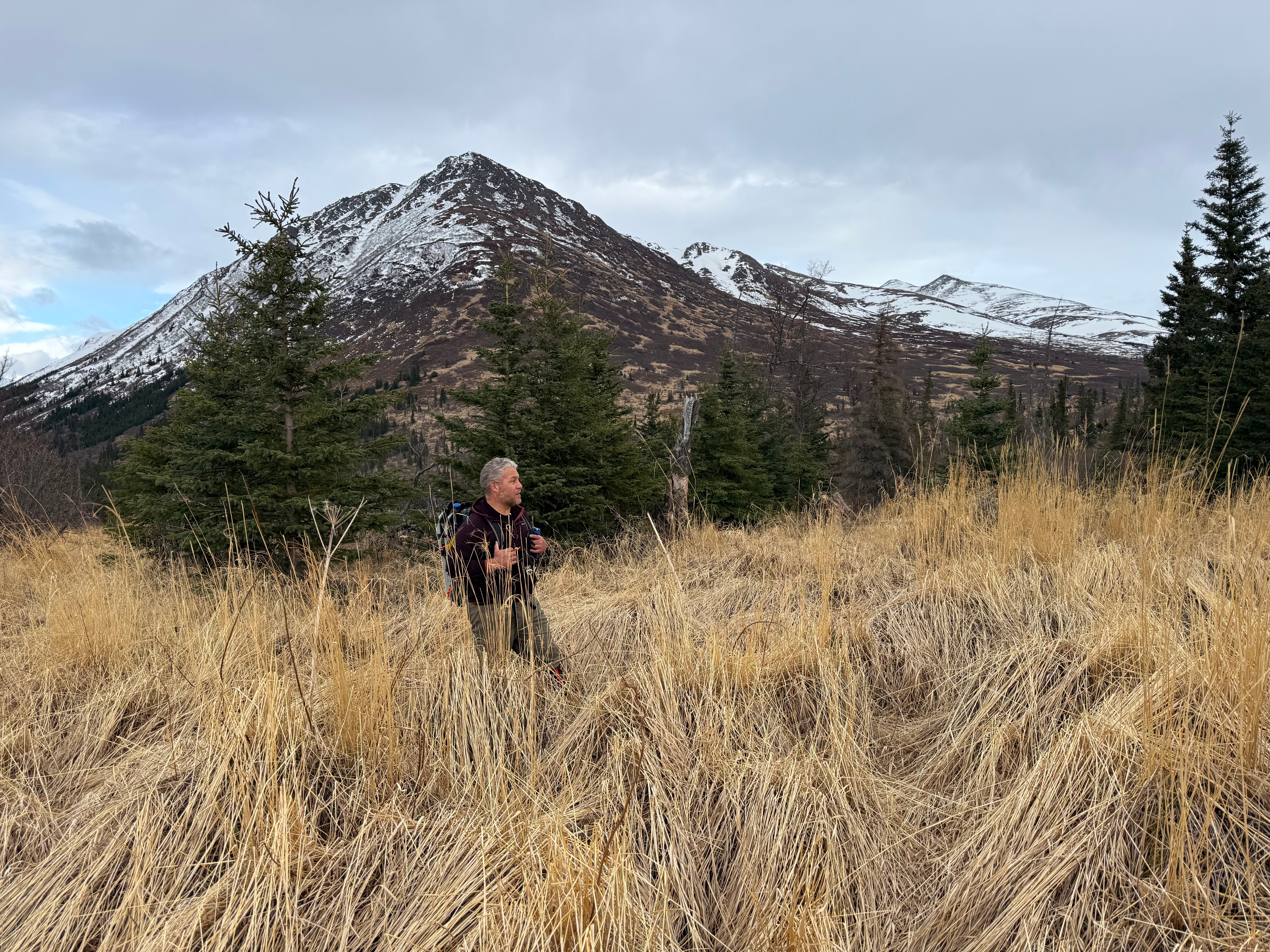
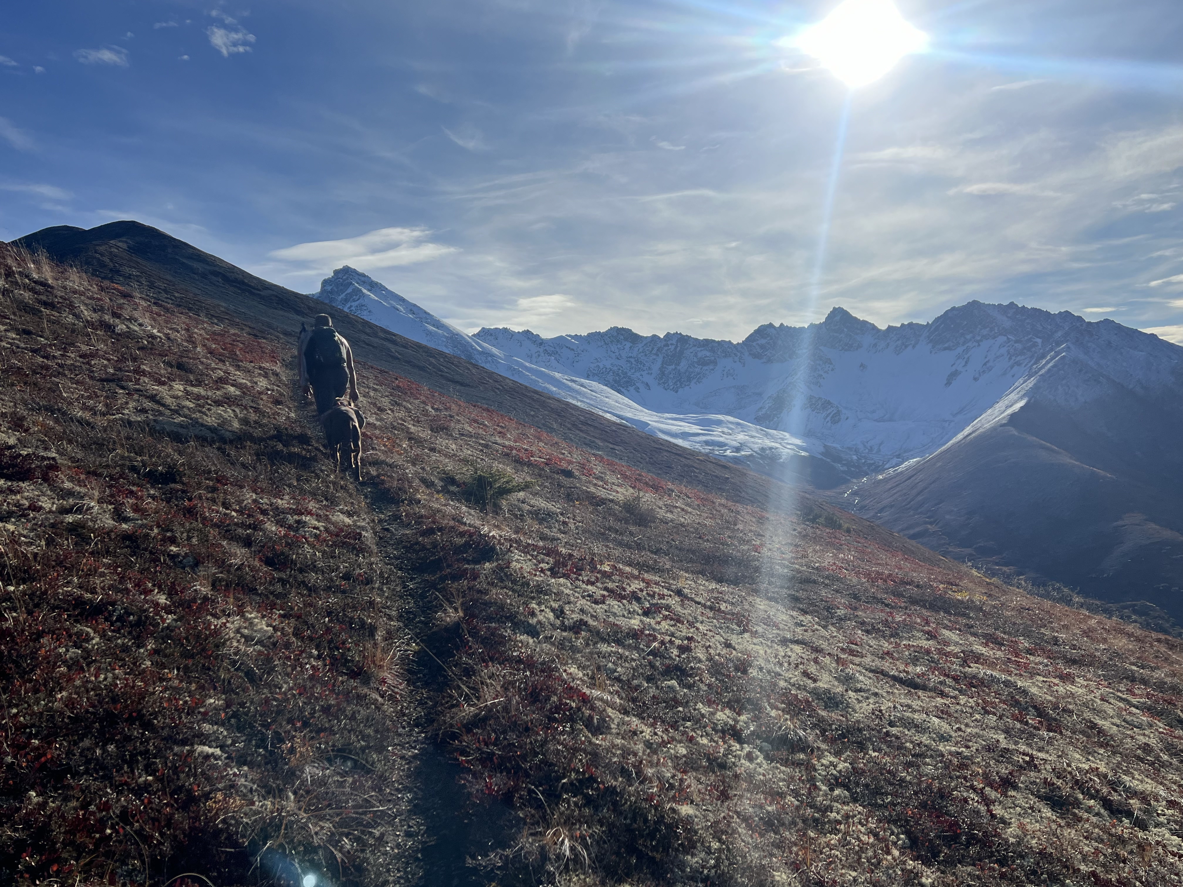
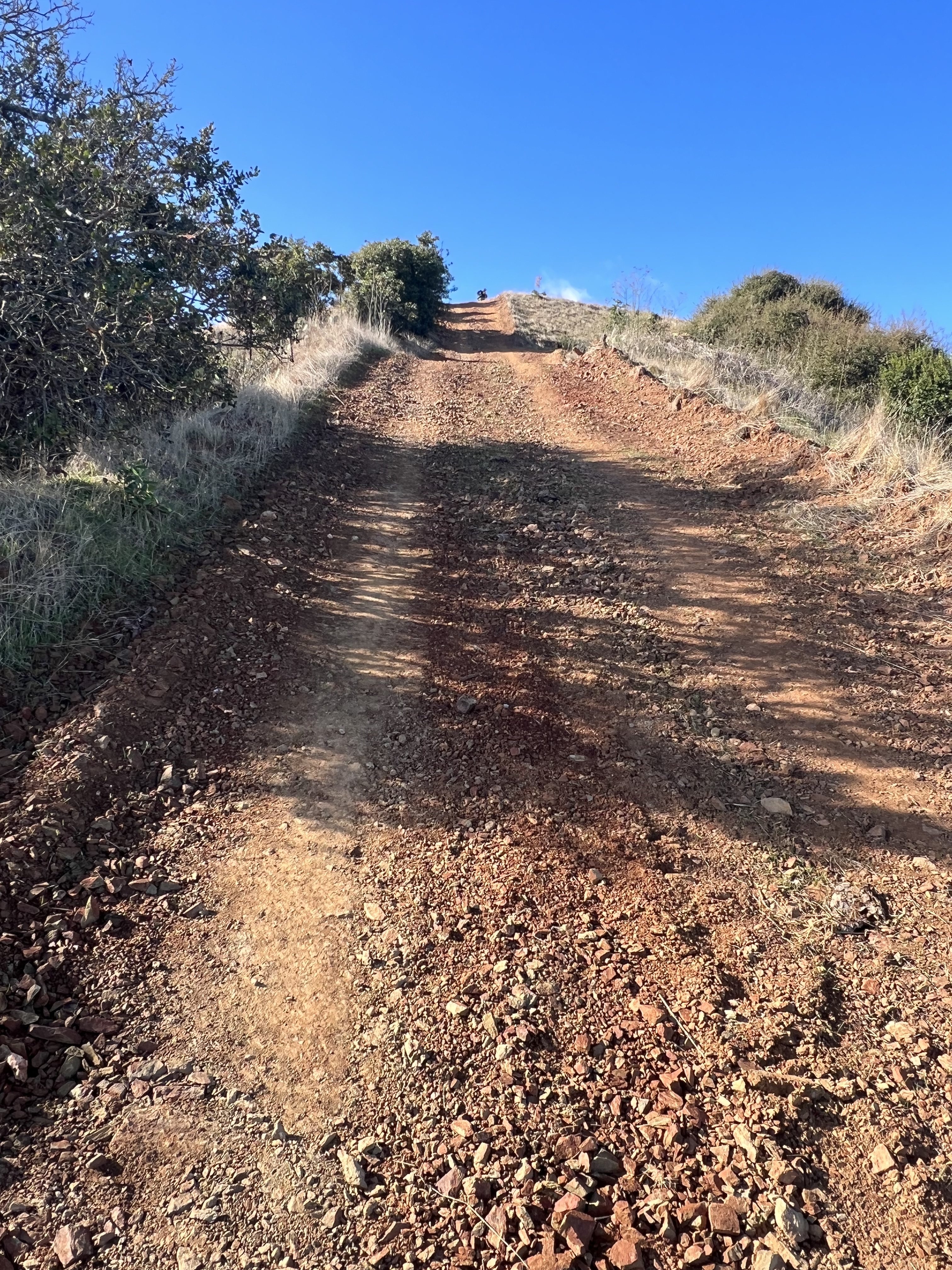
We trudged up the gravel road for a little more than 4 miles, ascending about 2300′ in the process. The tall buildings of downtown Anchorage were now only suitable for ants, and the small planes and helicopters (always helicopters… everywhere we go) were flying well below us. As it started to lightly snain, dozens of camouflaged ptarmigans made their gutteral, clucking courtship calls, sometimes visible as they flew toward a potential mate.
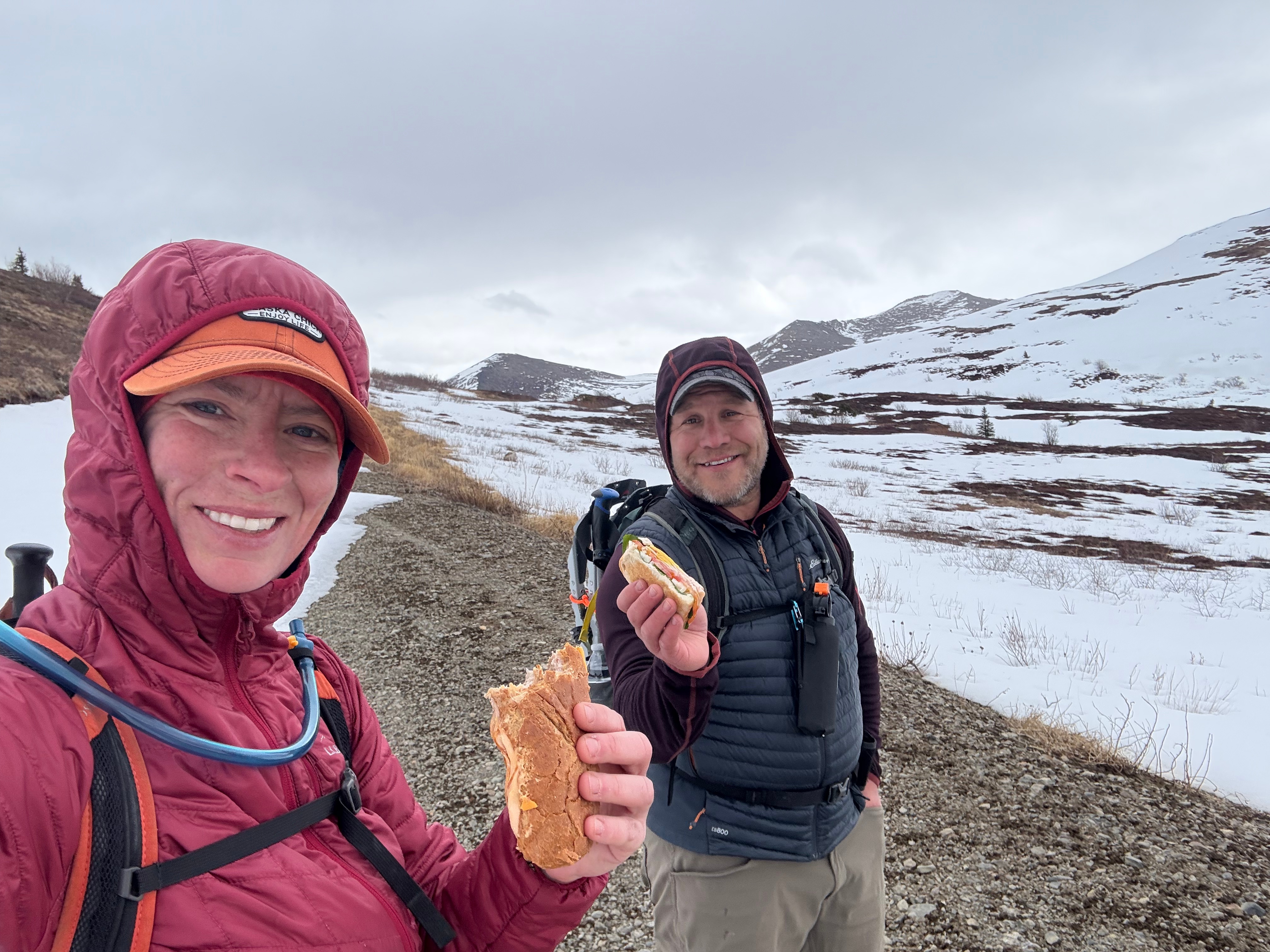
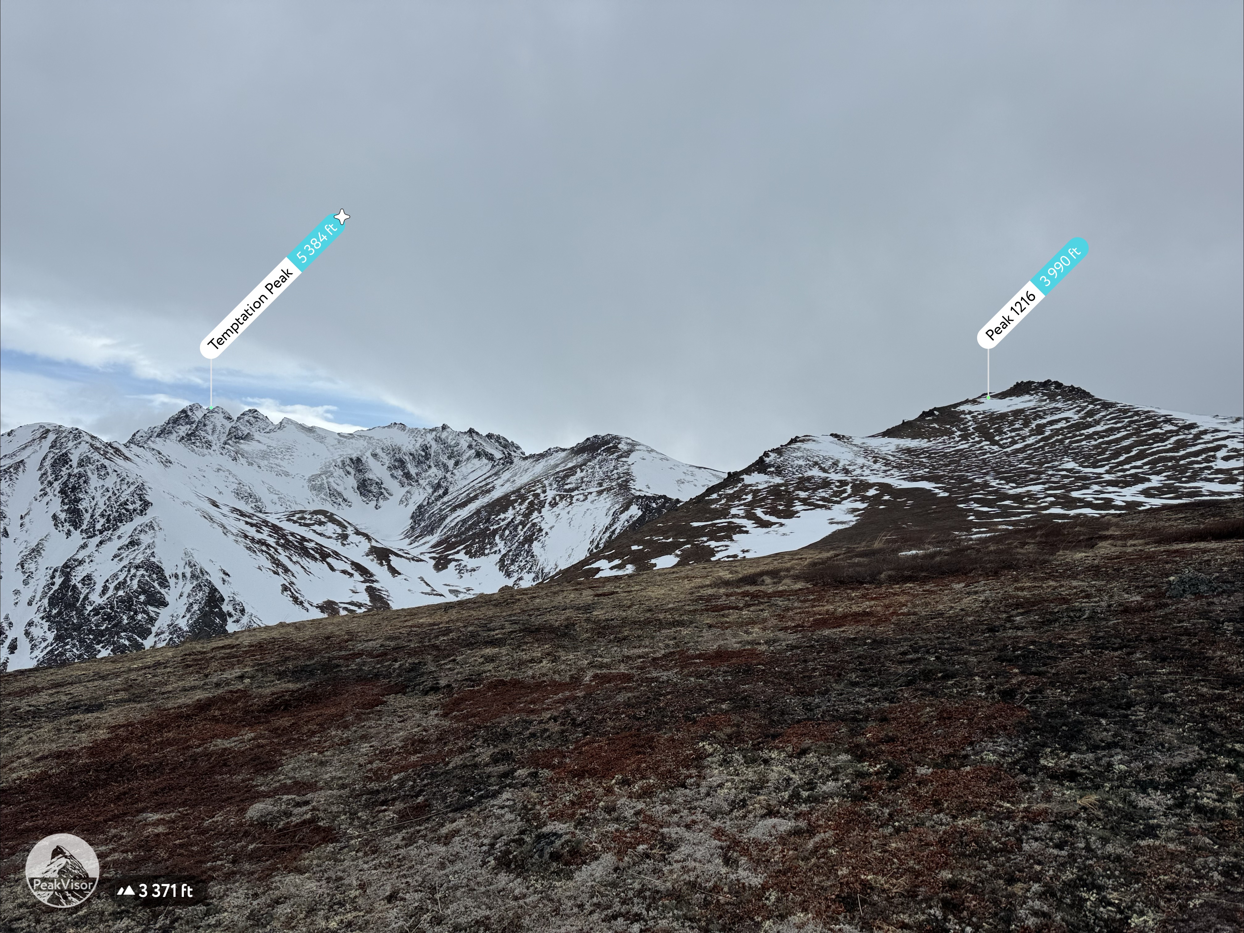
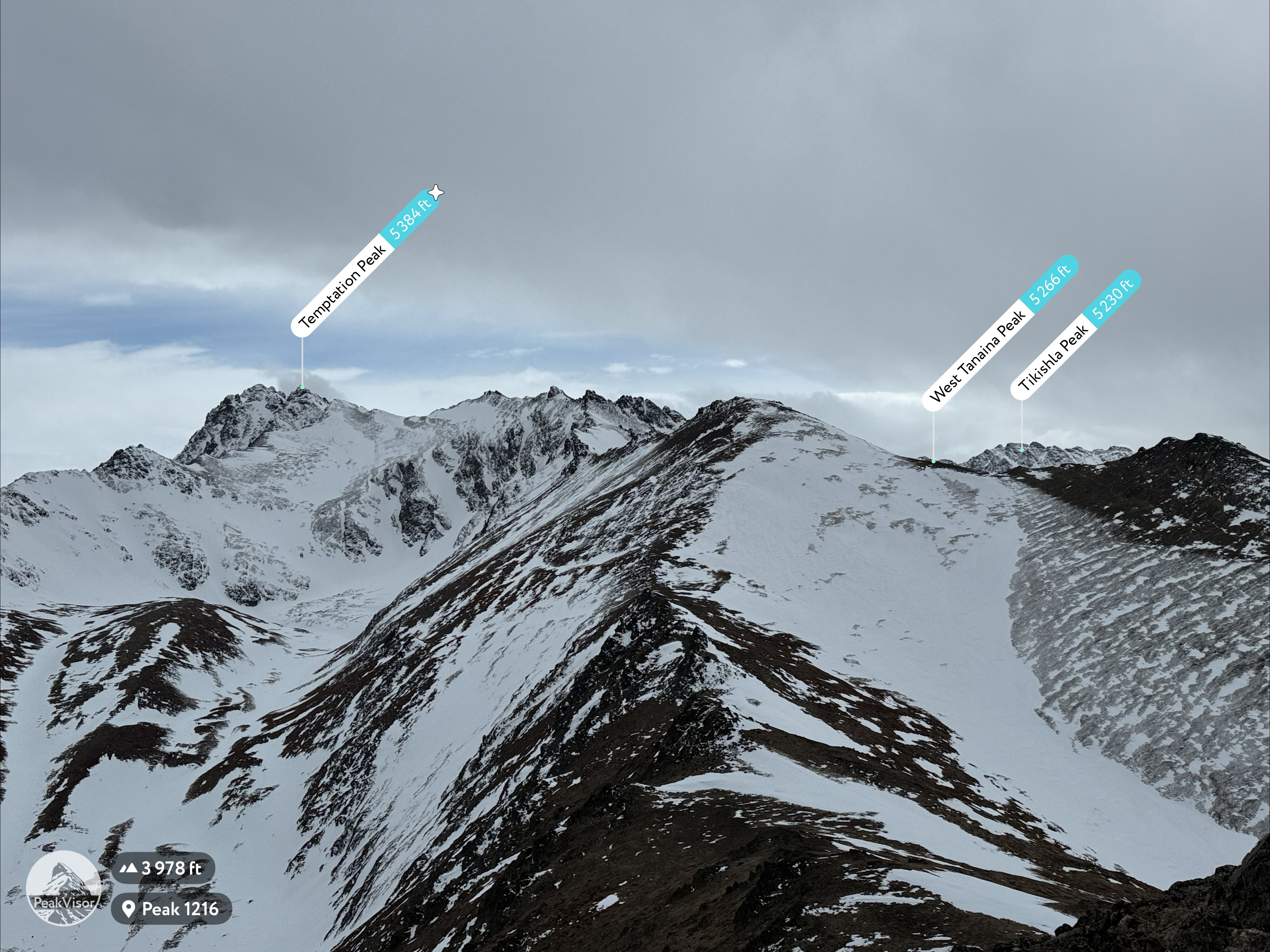
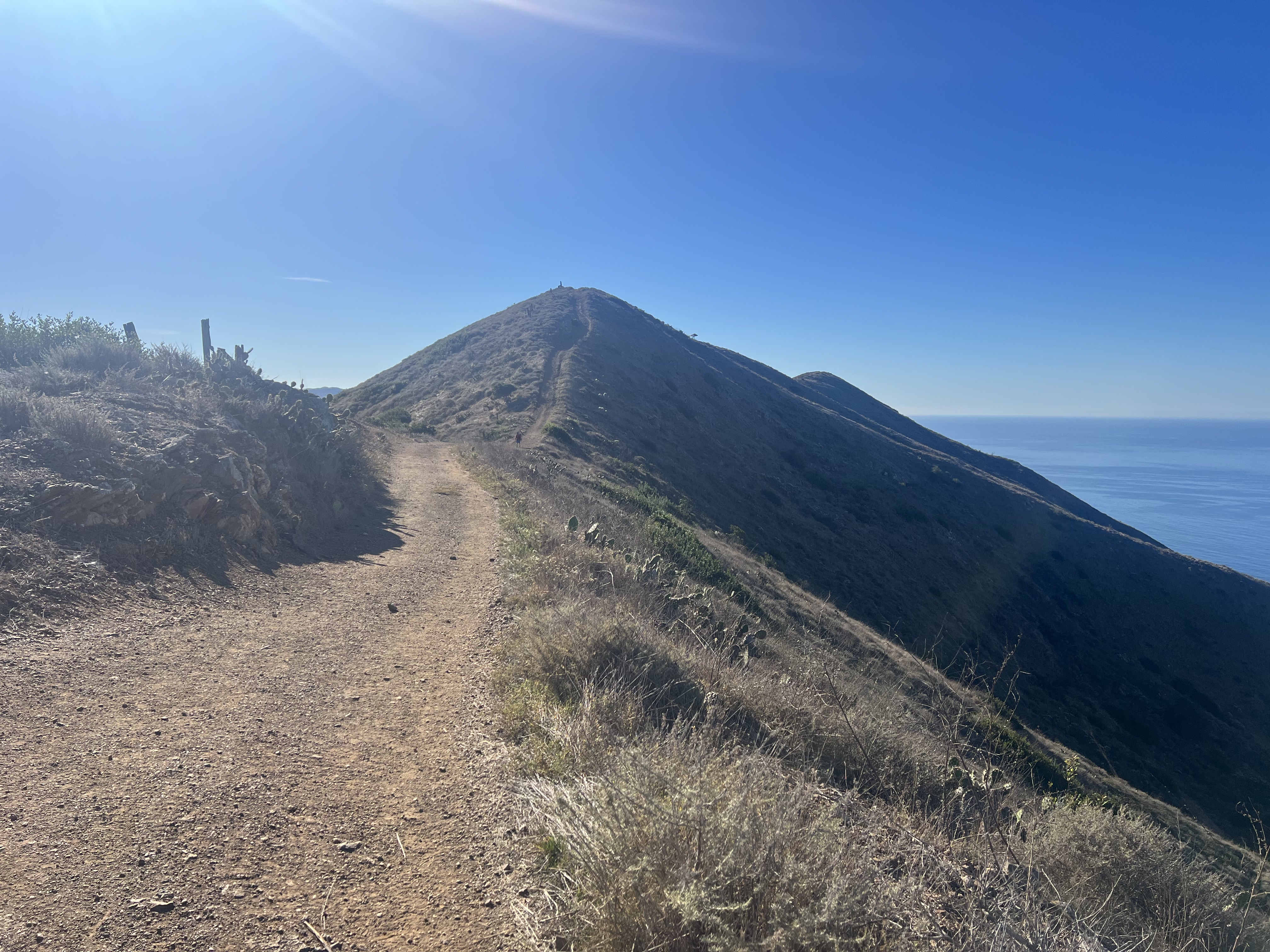
Rounding the corner on the back side of Snow Hawk Mountain, Ship Creek Hill and Peak 1216 came into view… and the wind appeared with them. We put on our warm gear, pulled out our sandwiches and pressed on, eager to see how much snow was still filling the valley between here and there. The wind continued to pick up… 20mph or more, a flashback to Rainbow, and we talked about skipping Peak 1216, quickly bagging SCH, and getting out of this wind sooner rather than later.
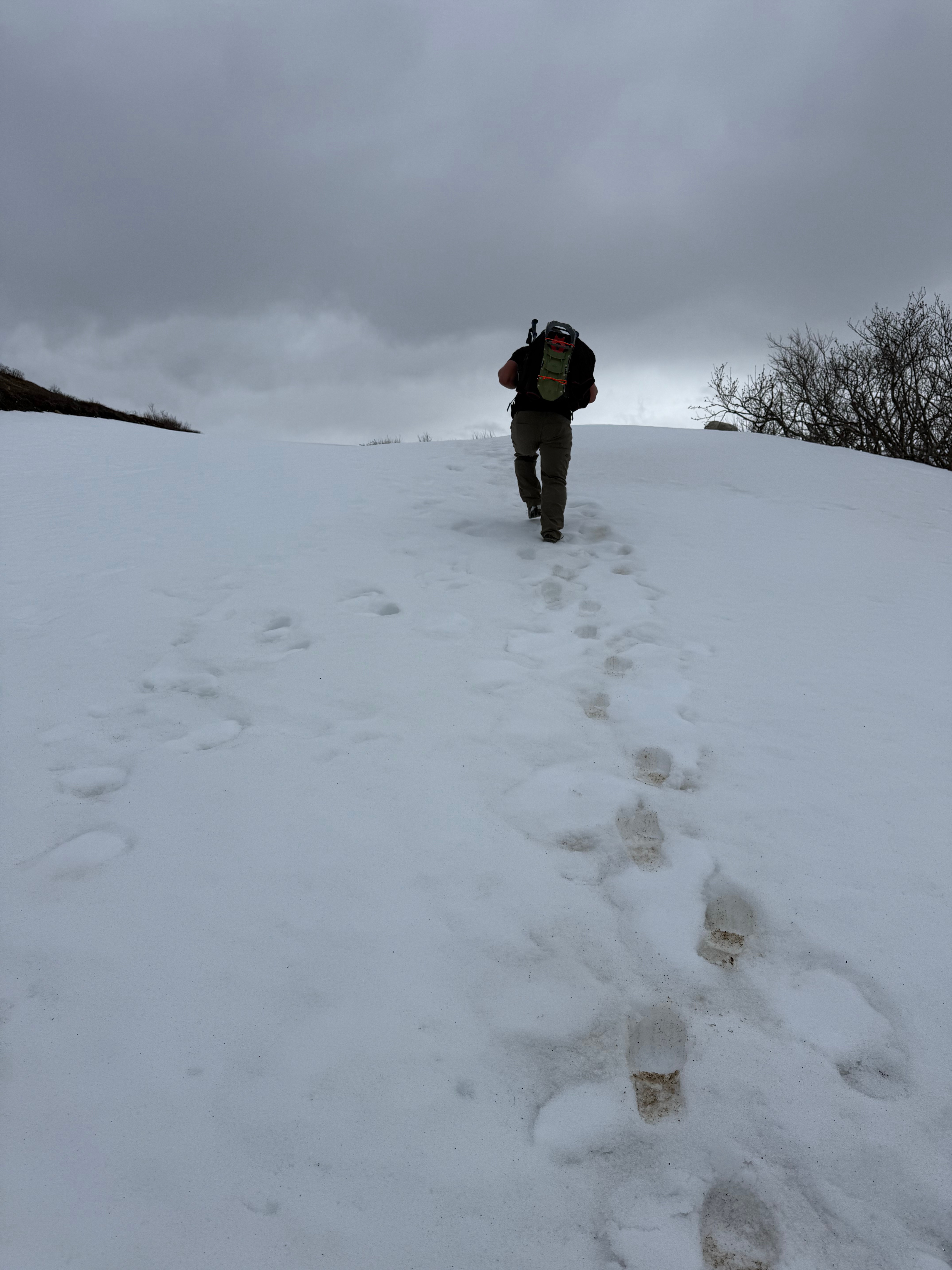
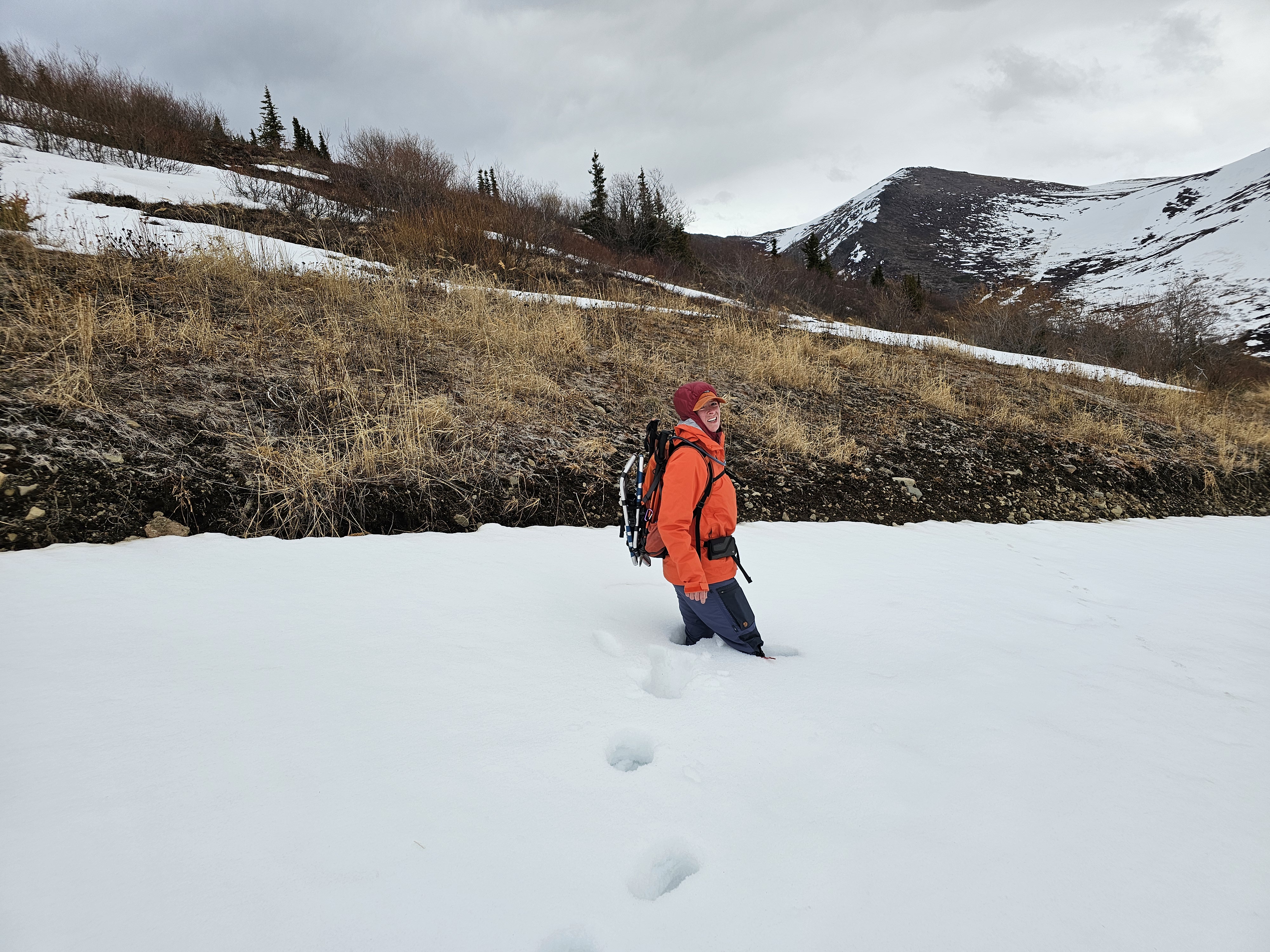
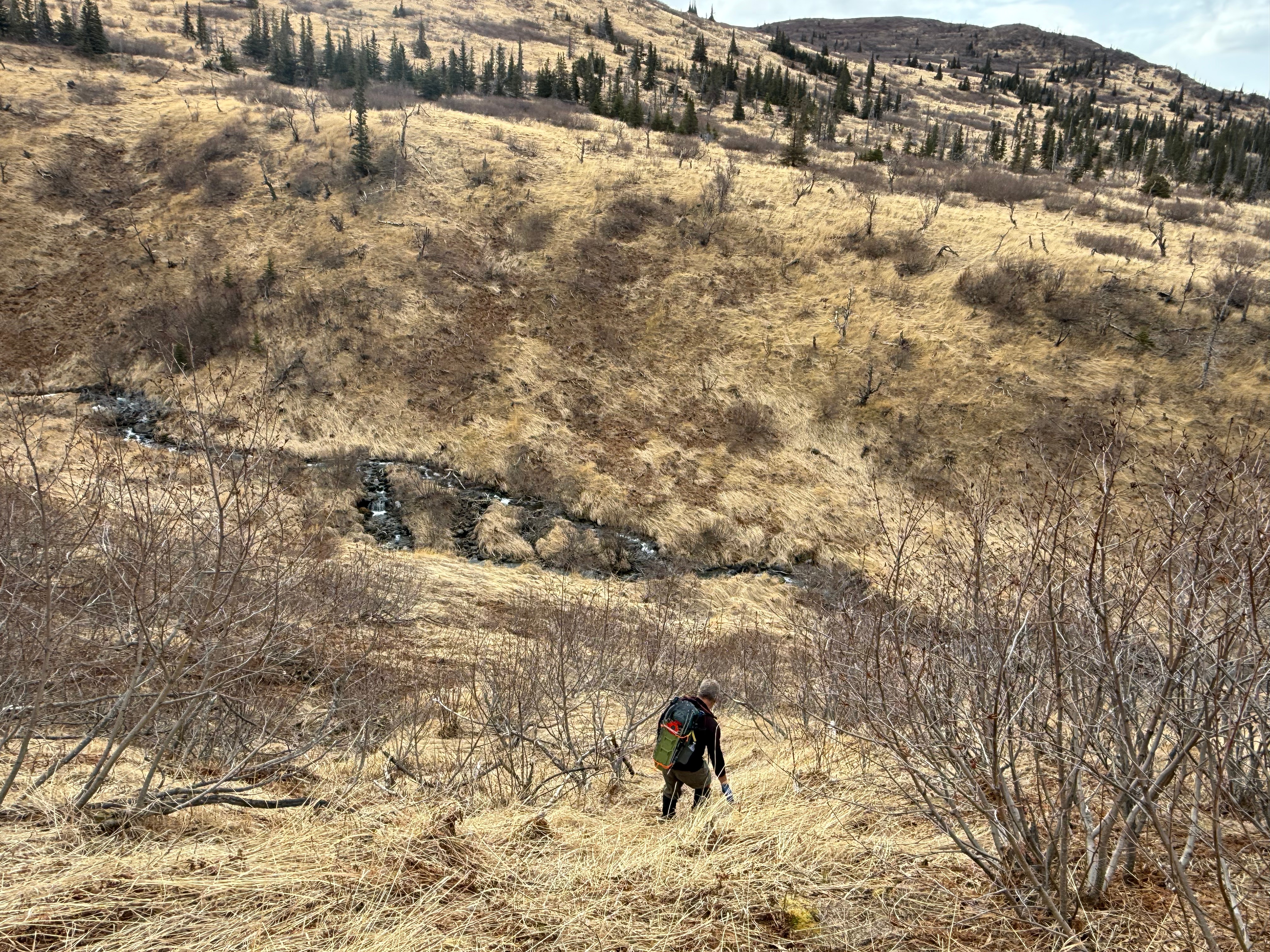
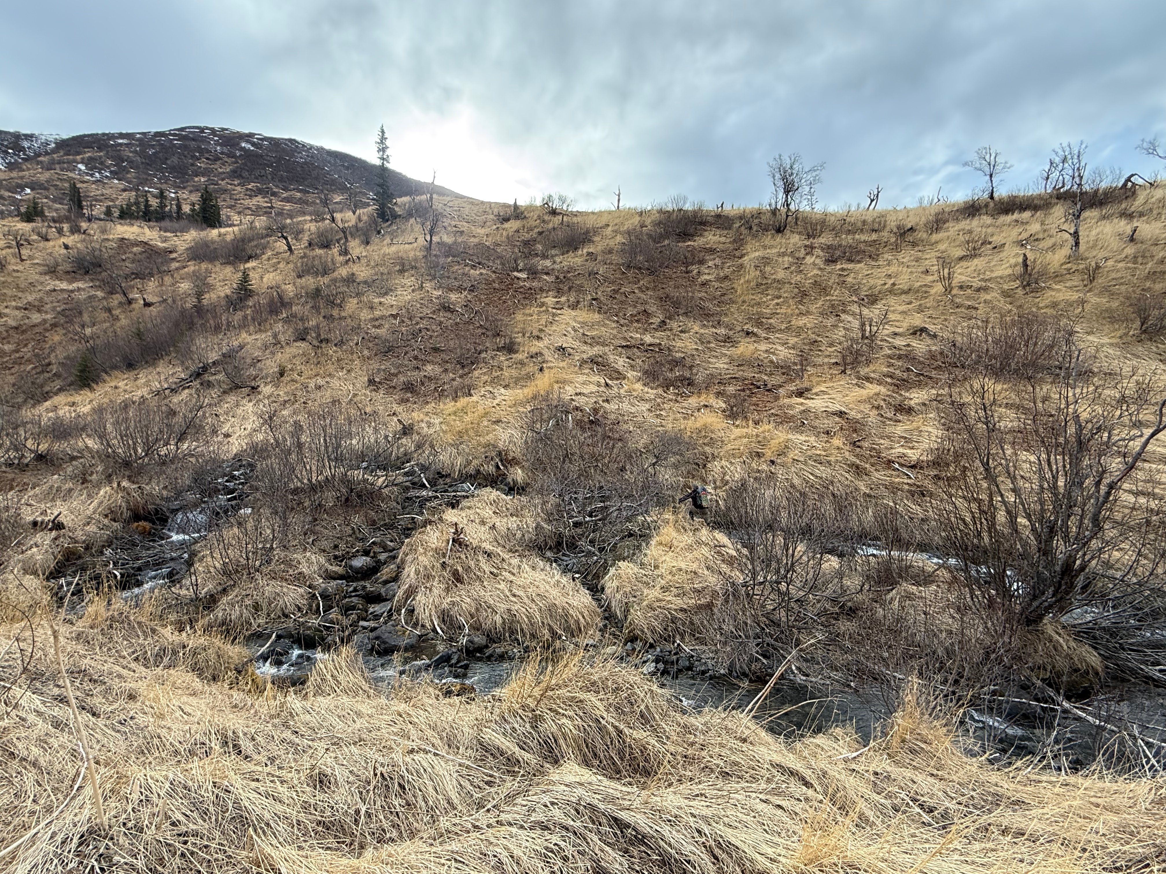
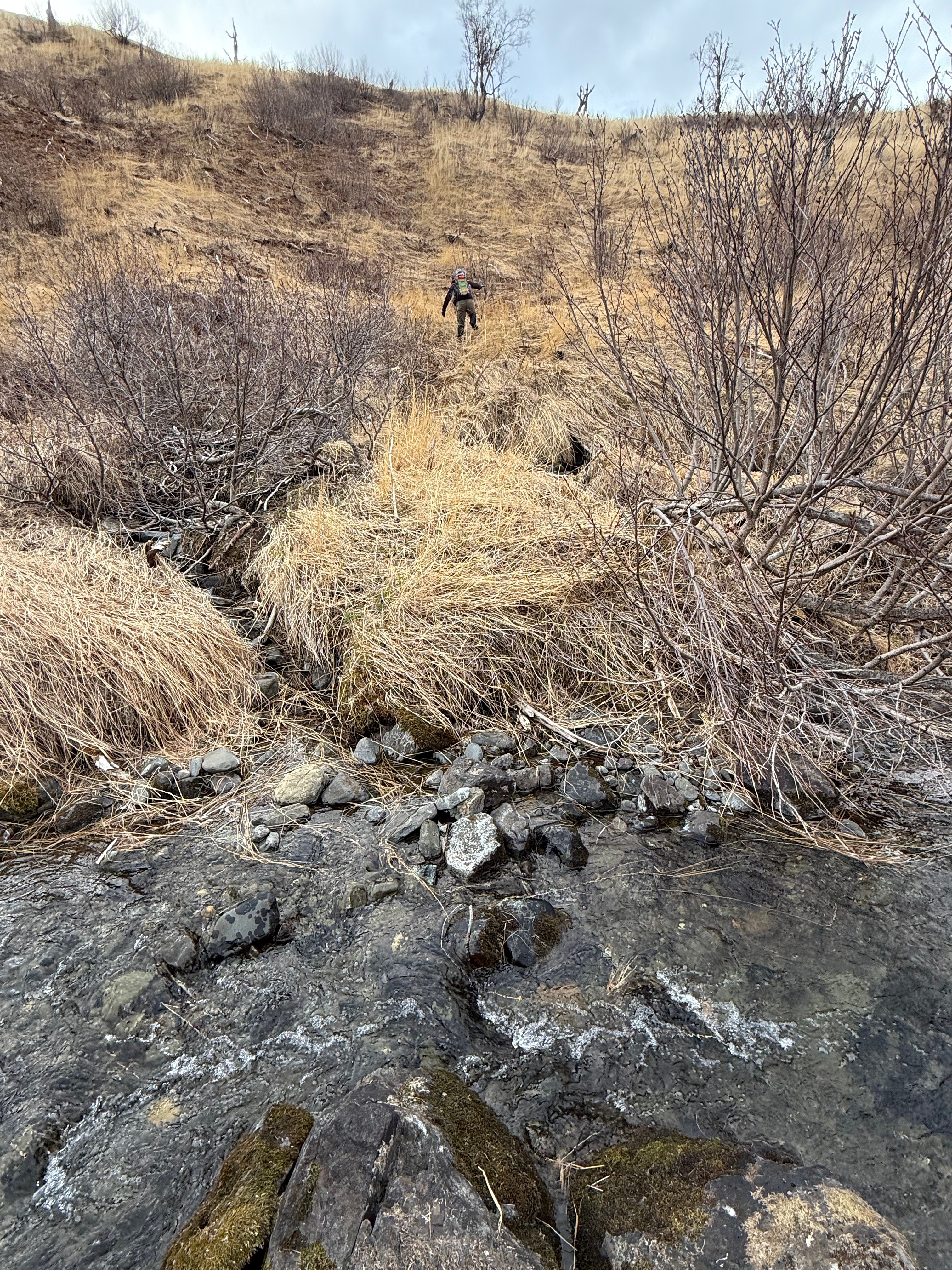
A short section of waist deep snow momentarily frustrated us, but the remainder of the walk down into Snow Hawk Valley turned out to be fairly pleasant.
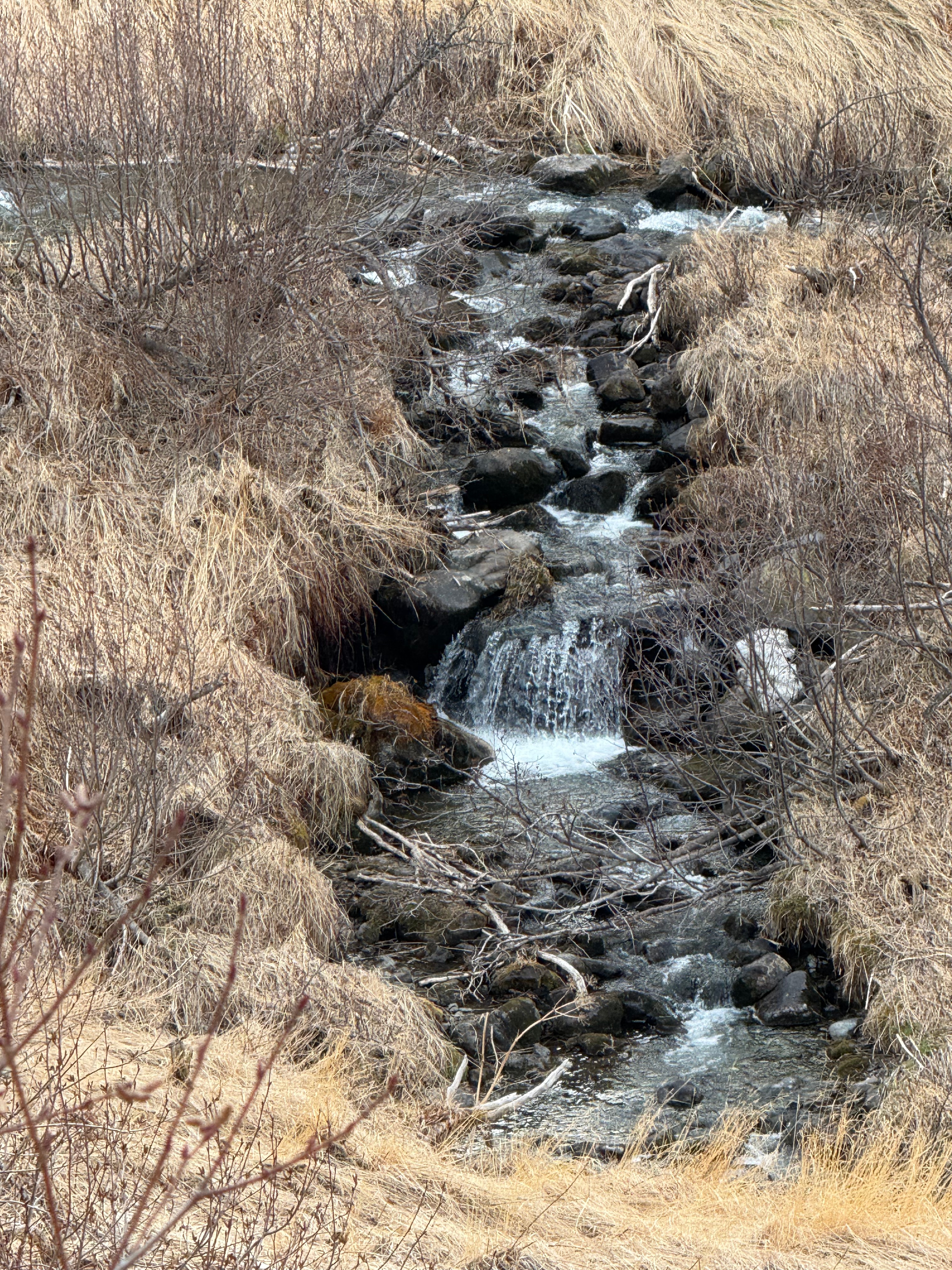
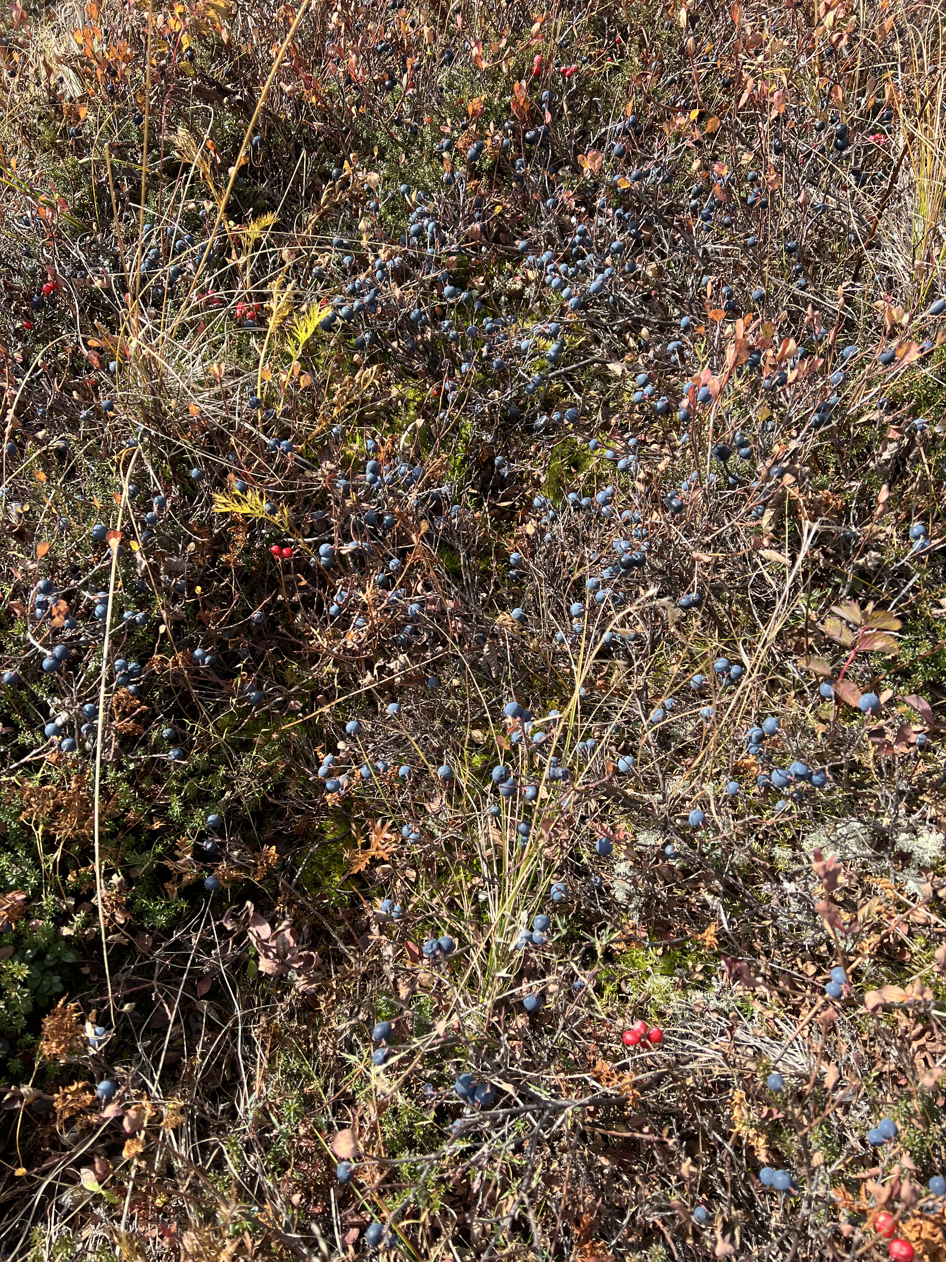
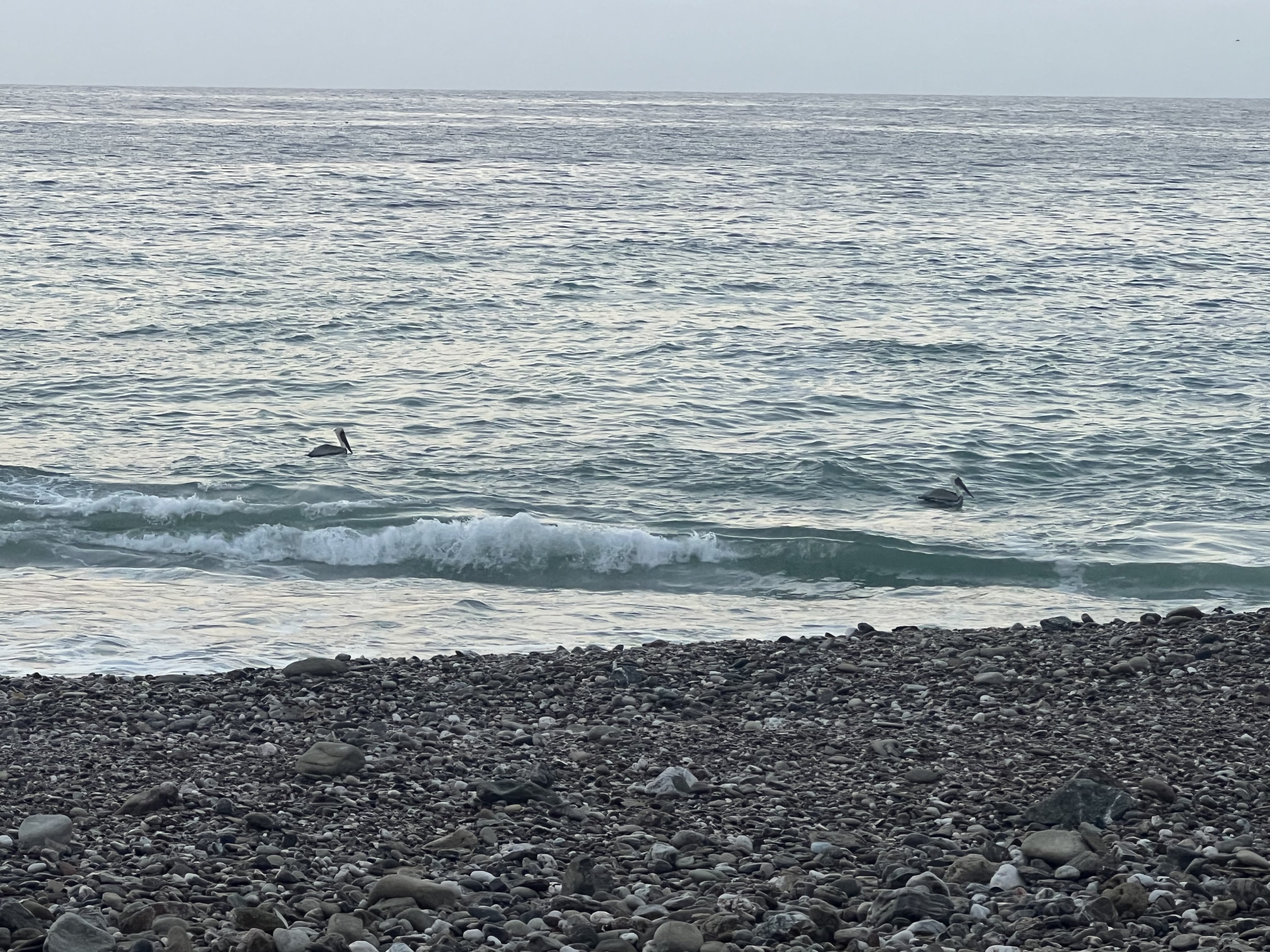
We picked our way down the grassy hill, finding more ptarmigan, some still delicious, overwintered, high bush cranberries and then Snow Hawk Creek, which was easily crossed with no wet feet. We were in the lee of the wind and opted for a sit-down break before heading up to what we were sure was going to be a gusty couple of hours.
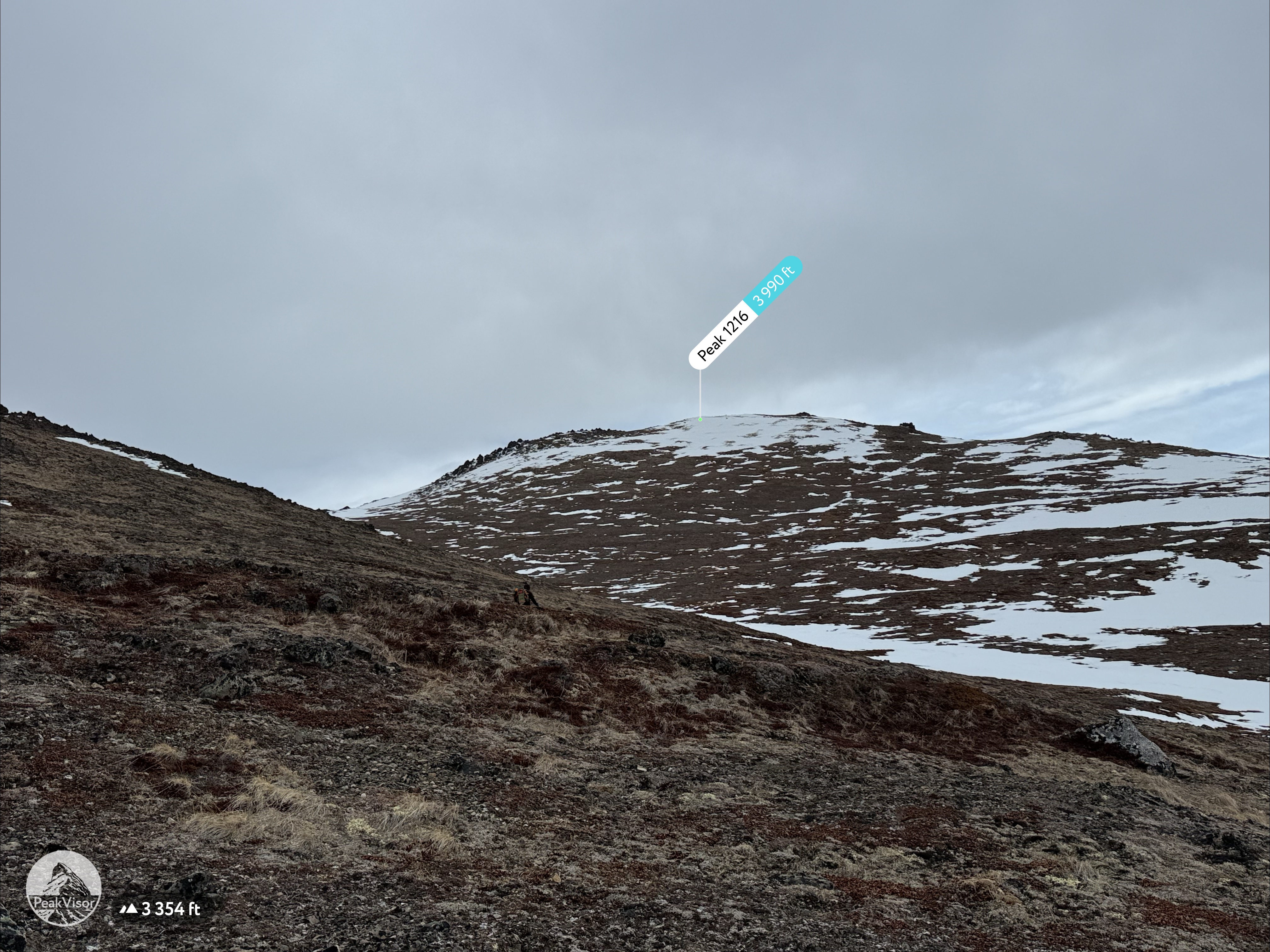
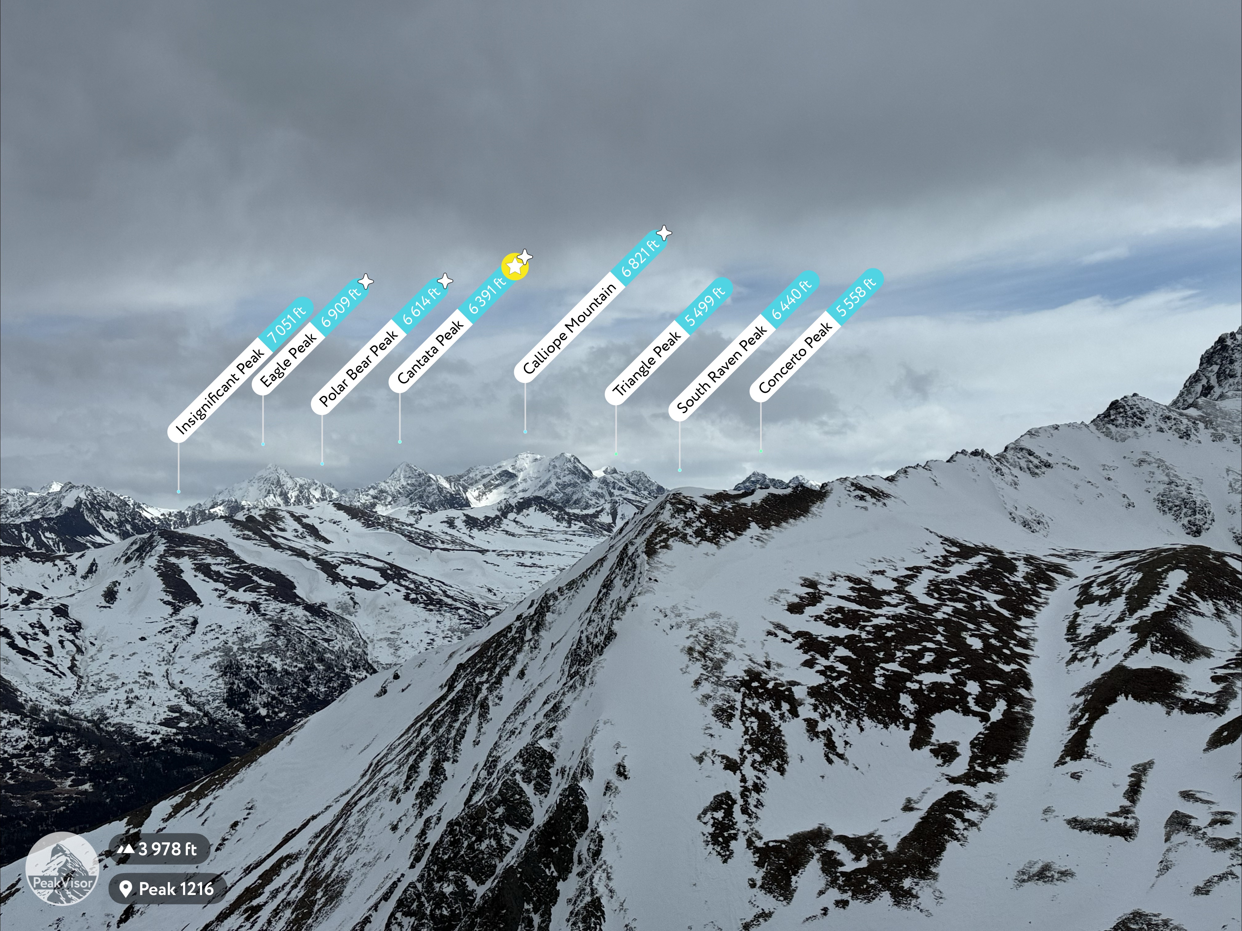
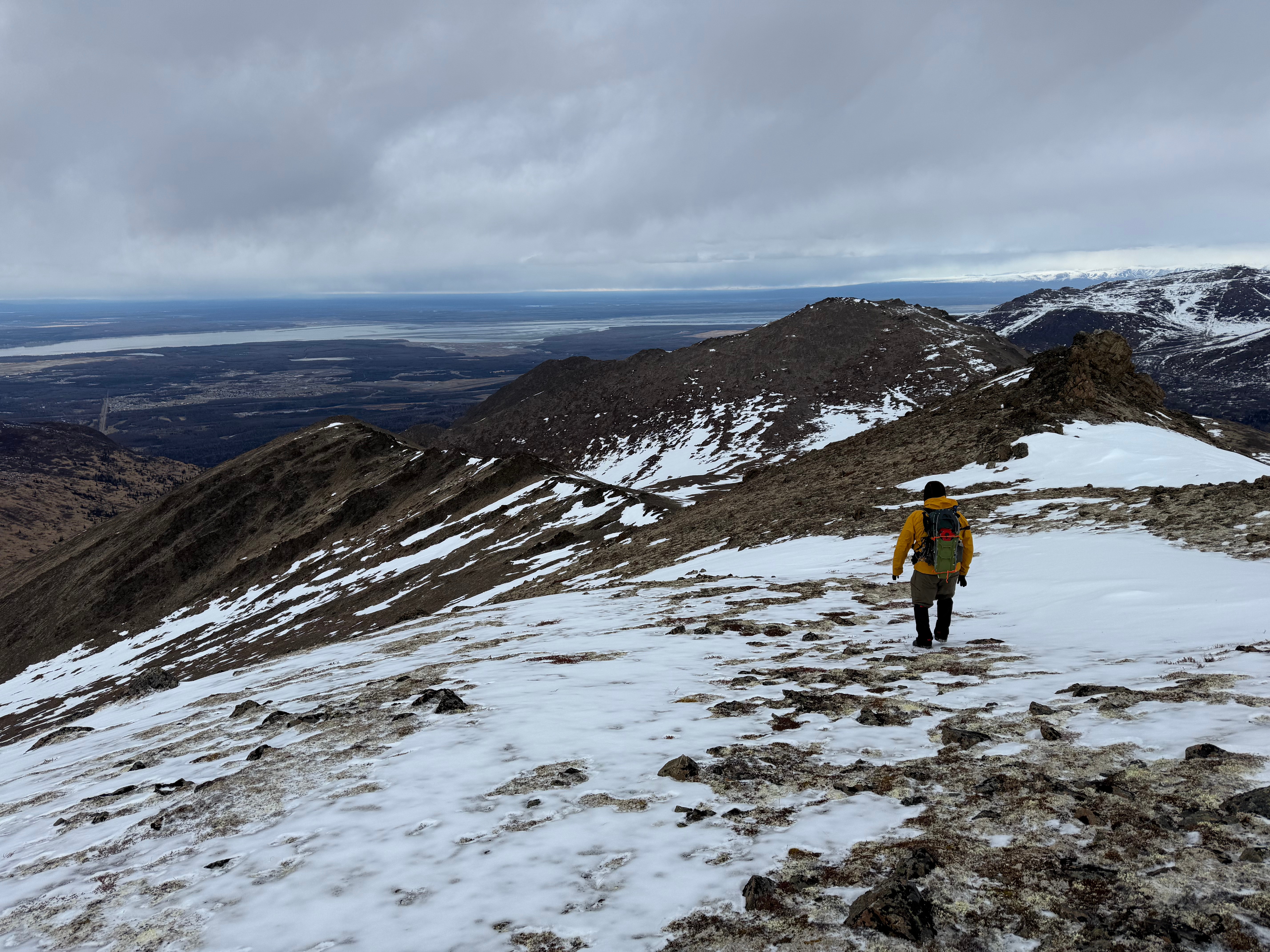
From here, Peak 1216 looked close and we decided it would be a travesty to not also tag the top of her. We had already traveled 6.5 miles and nearly 2400,’ but were feeling strong and were both excited to look down on Ship Creek Valley.
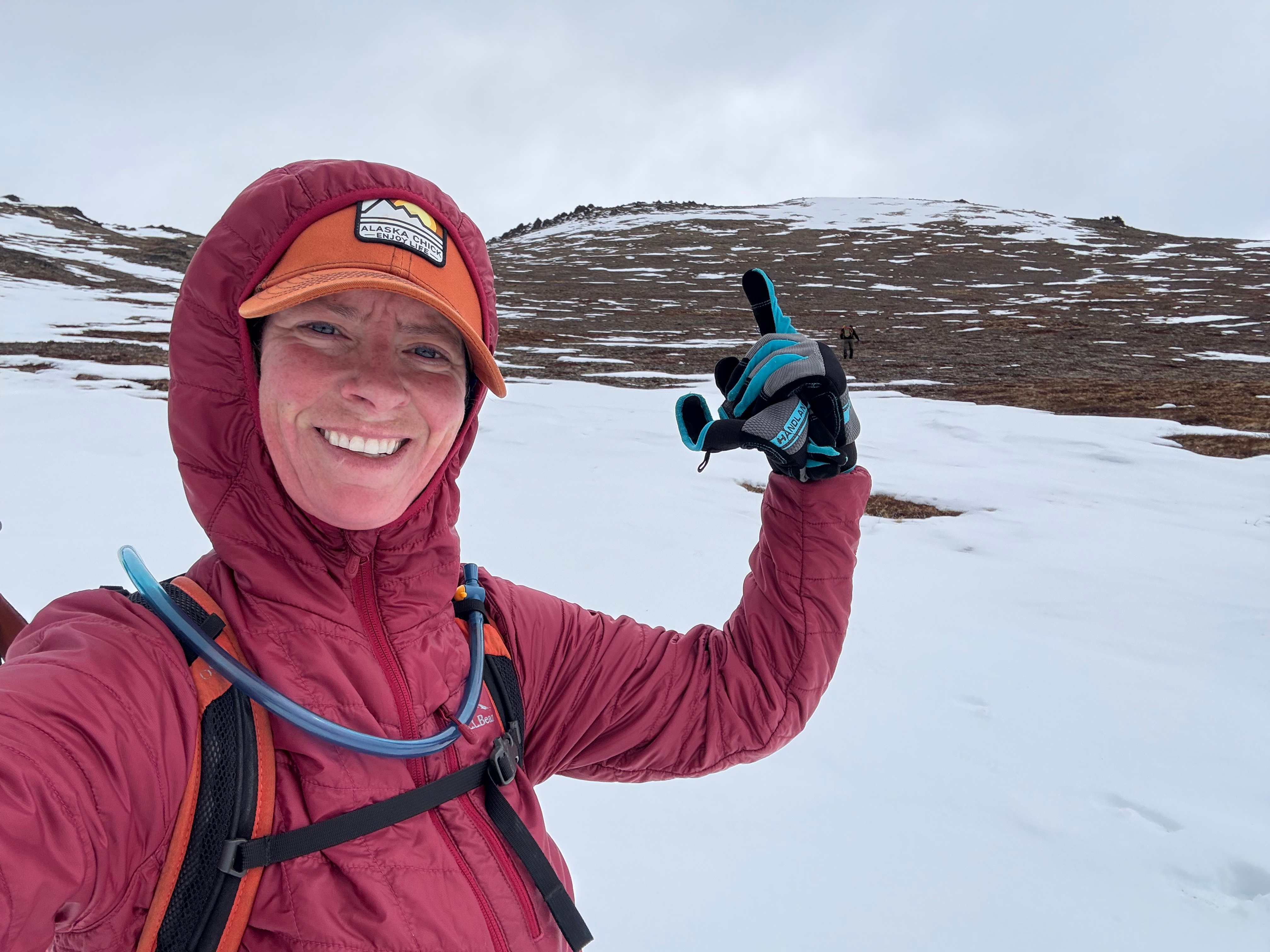
We ascended a mile and a half up grassy slopes dotted with patches of snow, low pine, and leafless trees. The wind returned, stronger than ever, and by the time we reached the rounded summit of Peak 1216, it was gusting more than 50mph. We were both thrilled to be there, but had a difficult time standing up, let alone taking in the view, so we got a couple of photos then hustled down the snow covered slope towards Ship Creek Hill.
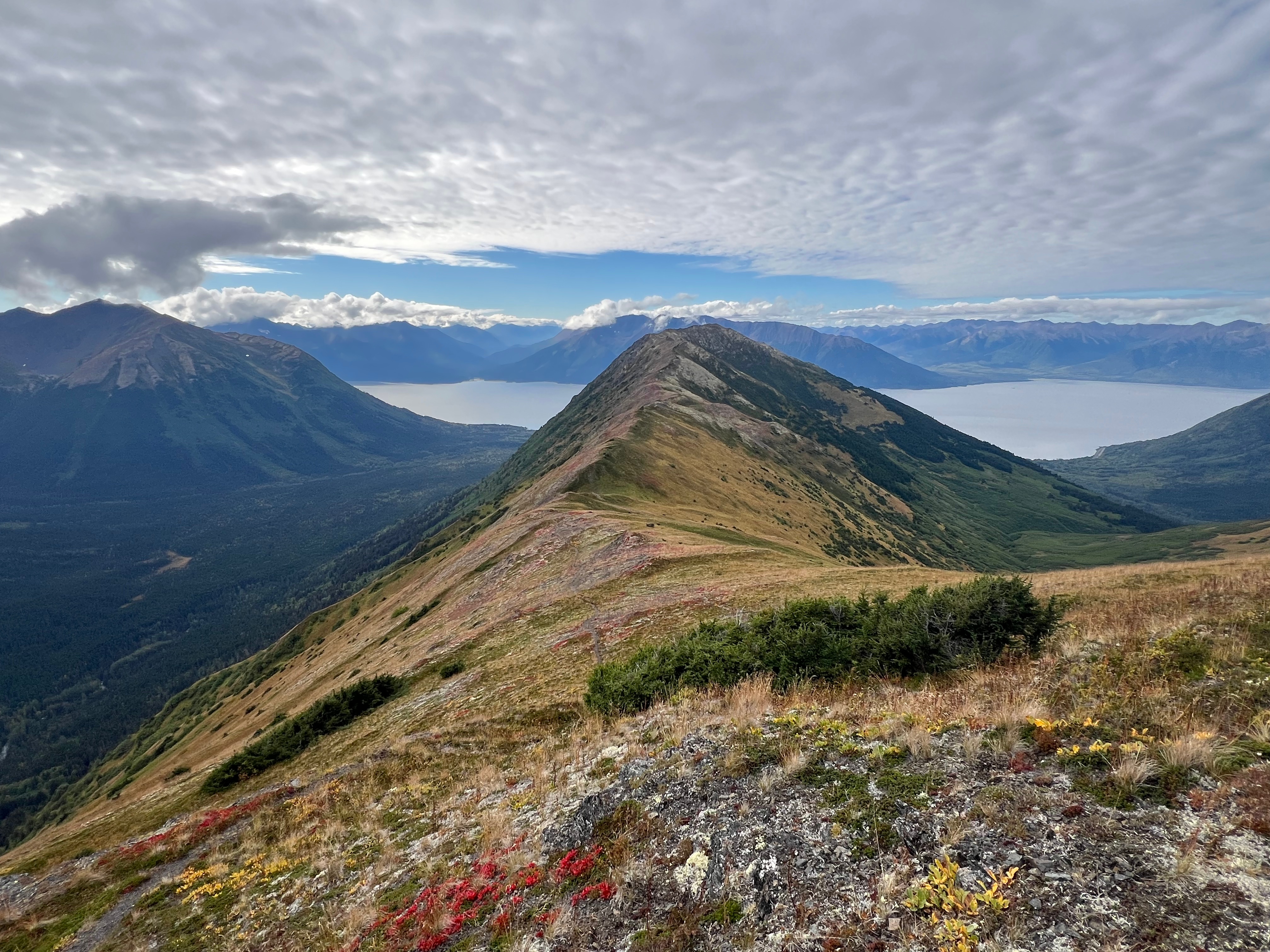
For a moment, we were protected from the wind and took a moment to look down on SC Valley and across the valley to the “our” ridge between Triangle and Arctic Valley. We had always been proud of connecting that entire ridge and now we were achieving another goal that felt just as good.
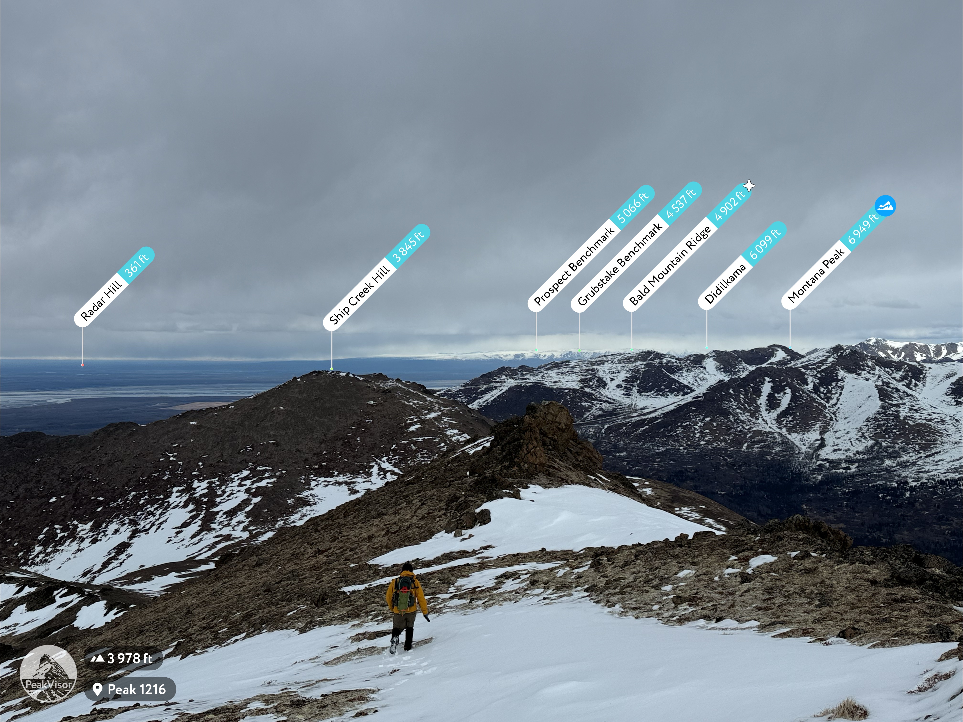
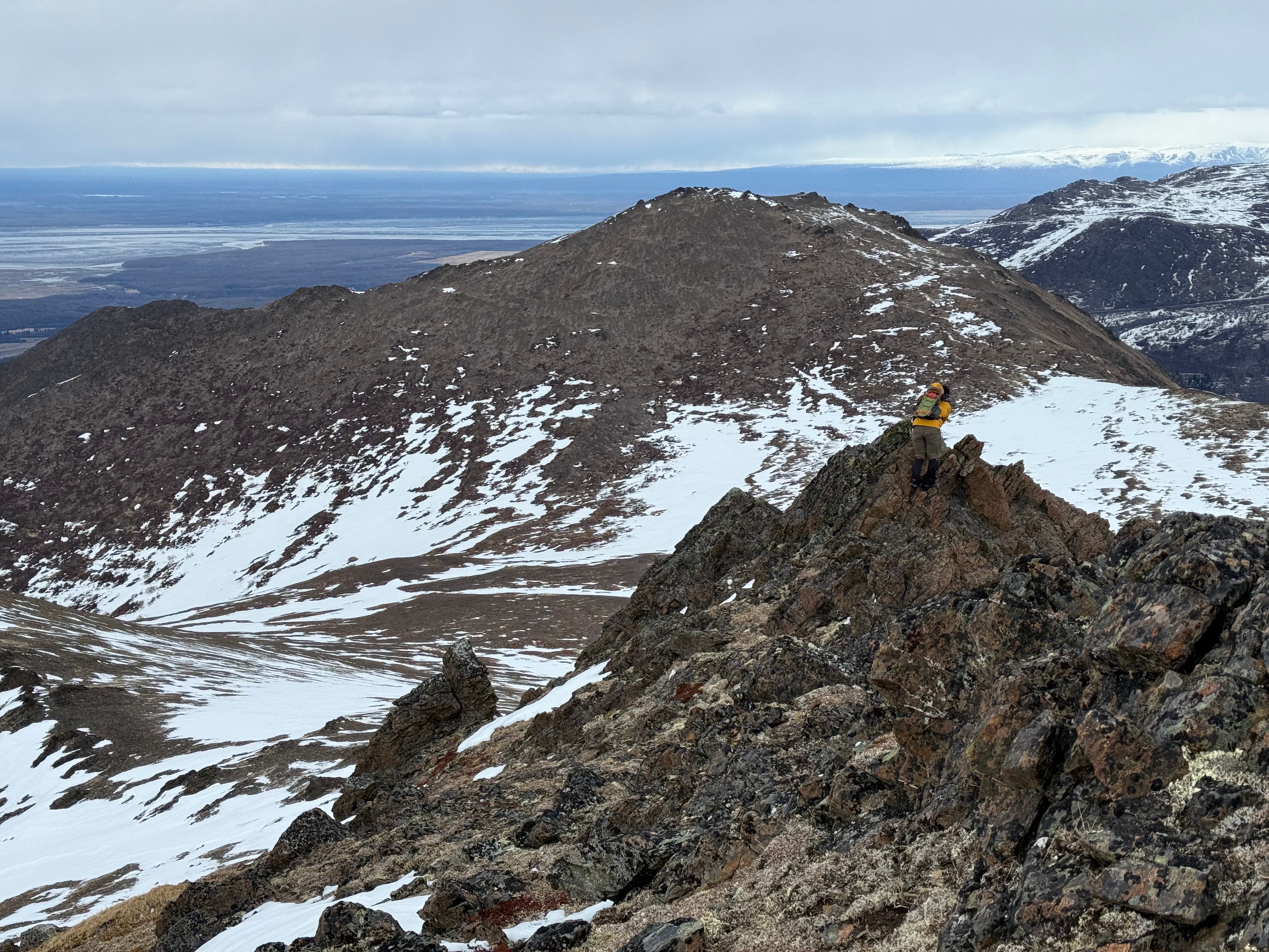
After quickly tagging the overlook point to the west of 1216, we continued towards SCH, walking along the broad, pathless ridge to what, from this perspective, looked like an anticlimactic mound. Arctic Valley road visible to my right, I climbed around on the myriad of mini summit blocks to ensure I had hit the actual high point.
The wind was not letting up and I was being blown off my feet, but we weren’t letting up either.
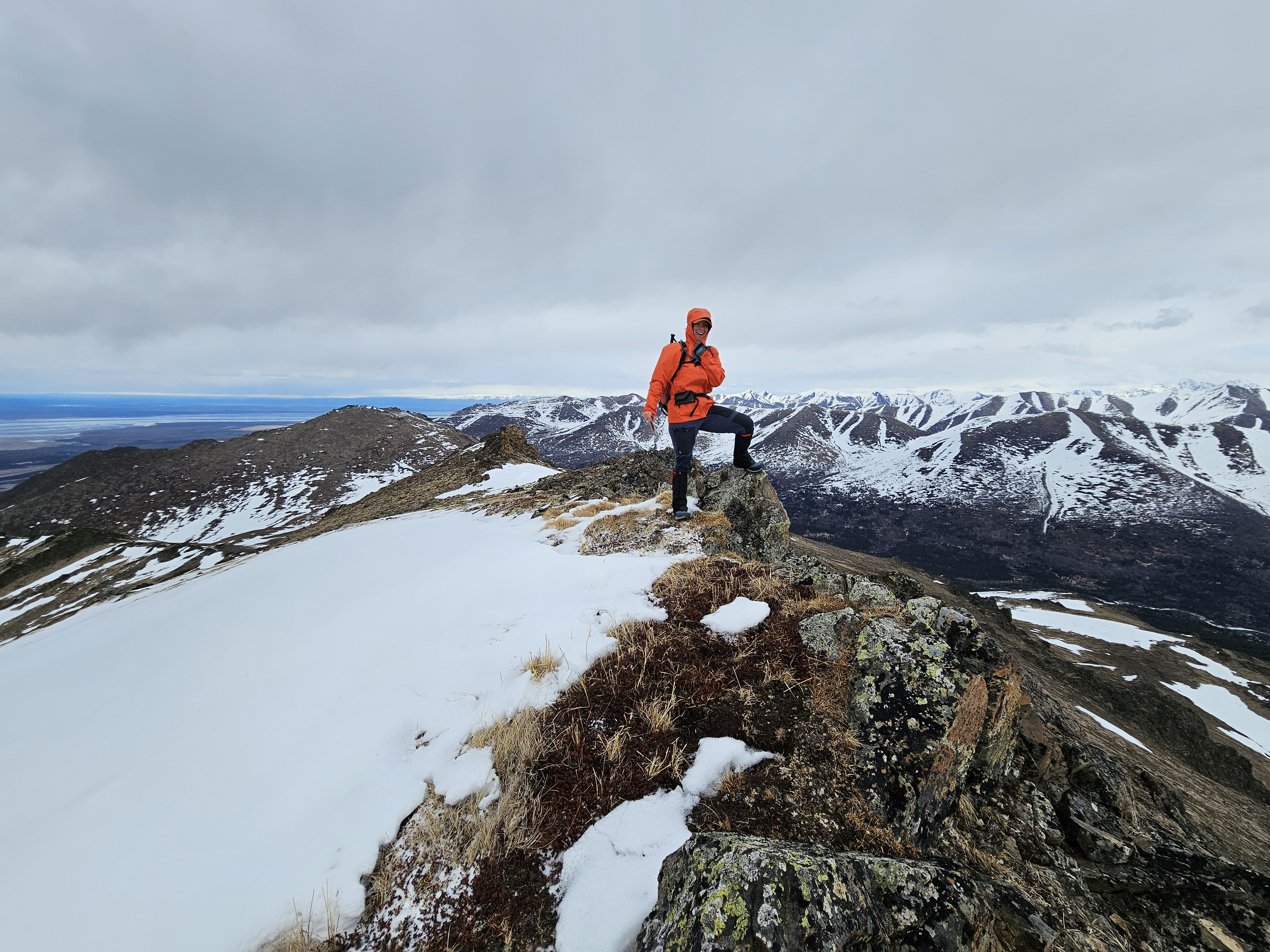
After bagging the two peaks, we aimed towards the last goal; a point at the far end of SC Hill’s western ridge. The weather was getting even worse and the wind was stronger than ever. After a moment of looking down on the Anchorage bowl, we both agreed it was time to get out of there and began descending directly down the steep, yet snow free, southern slope.
Now protected from the wind, tucked between the shoulders of SCH and 1216, we stopped for a snack break, now 11 miles into our day. As we rested, the sun began to burn through the clouds and although it never fully succeeded, the filtered rays warmed us up.
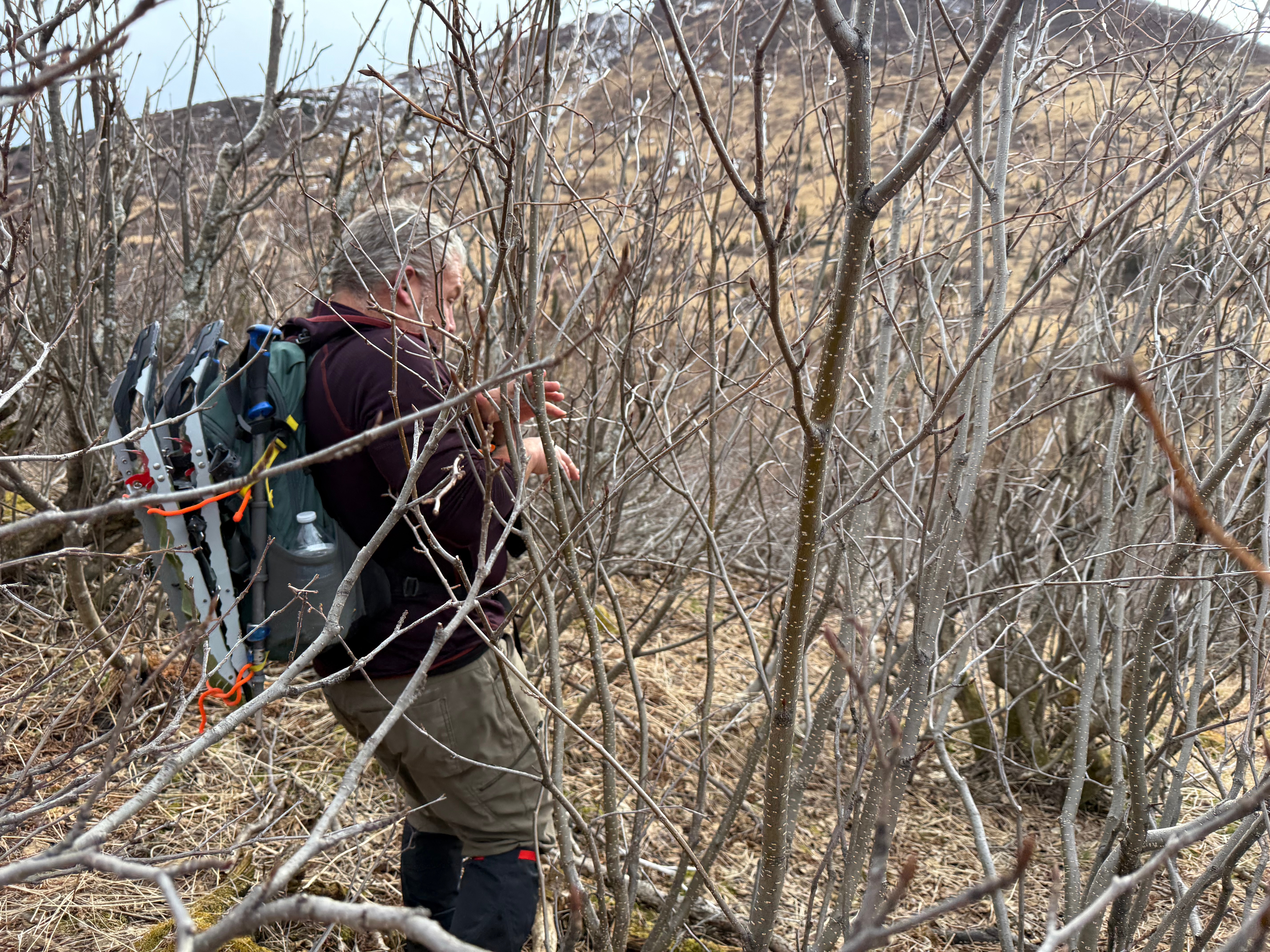
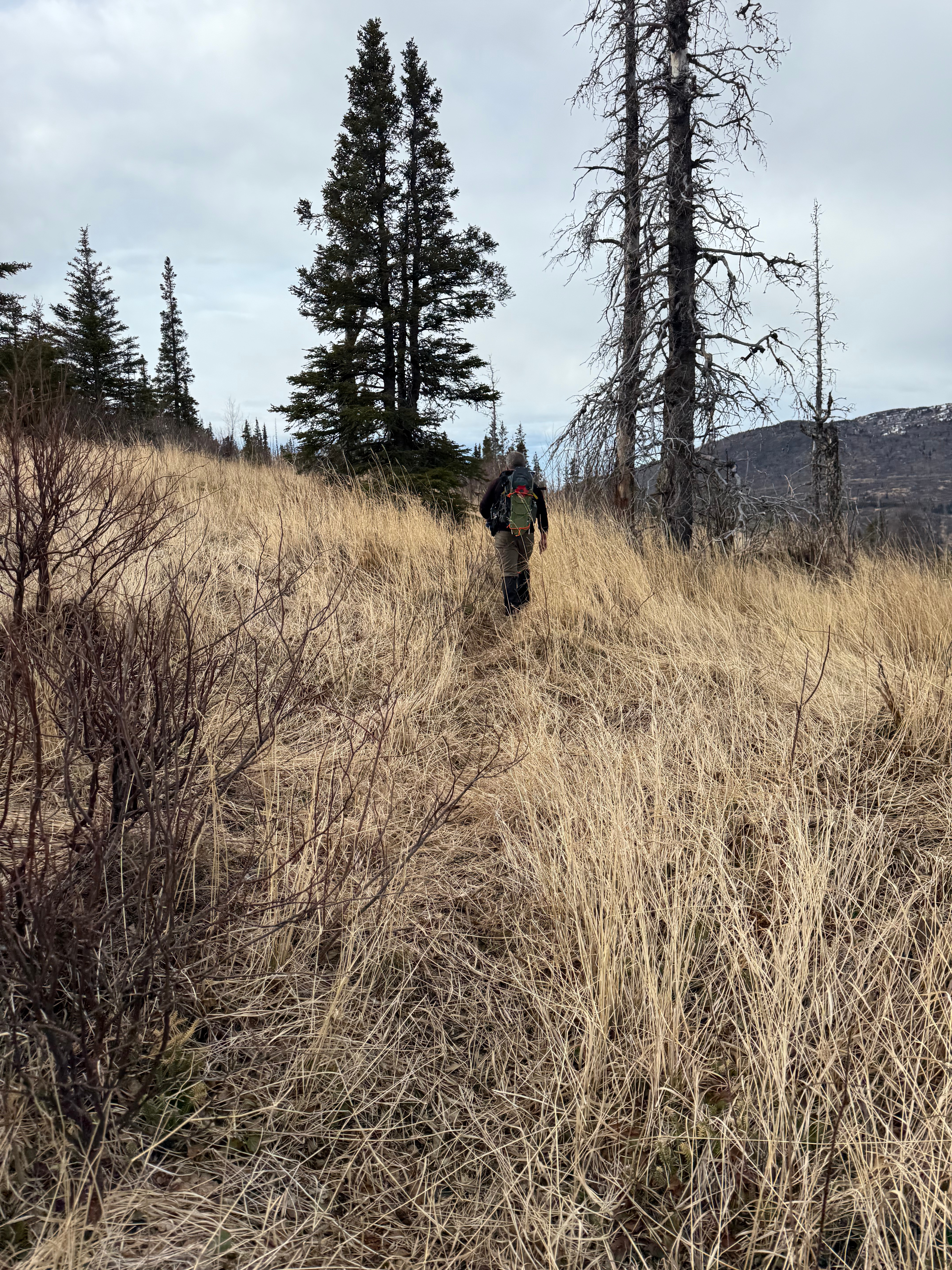
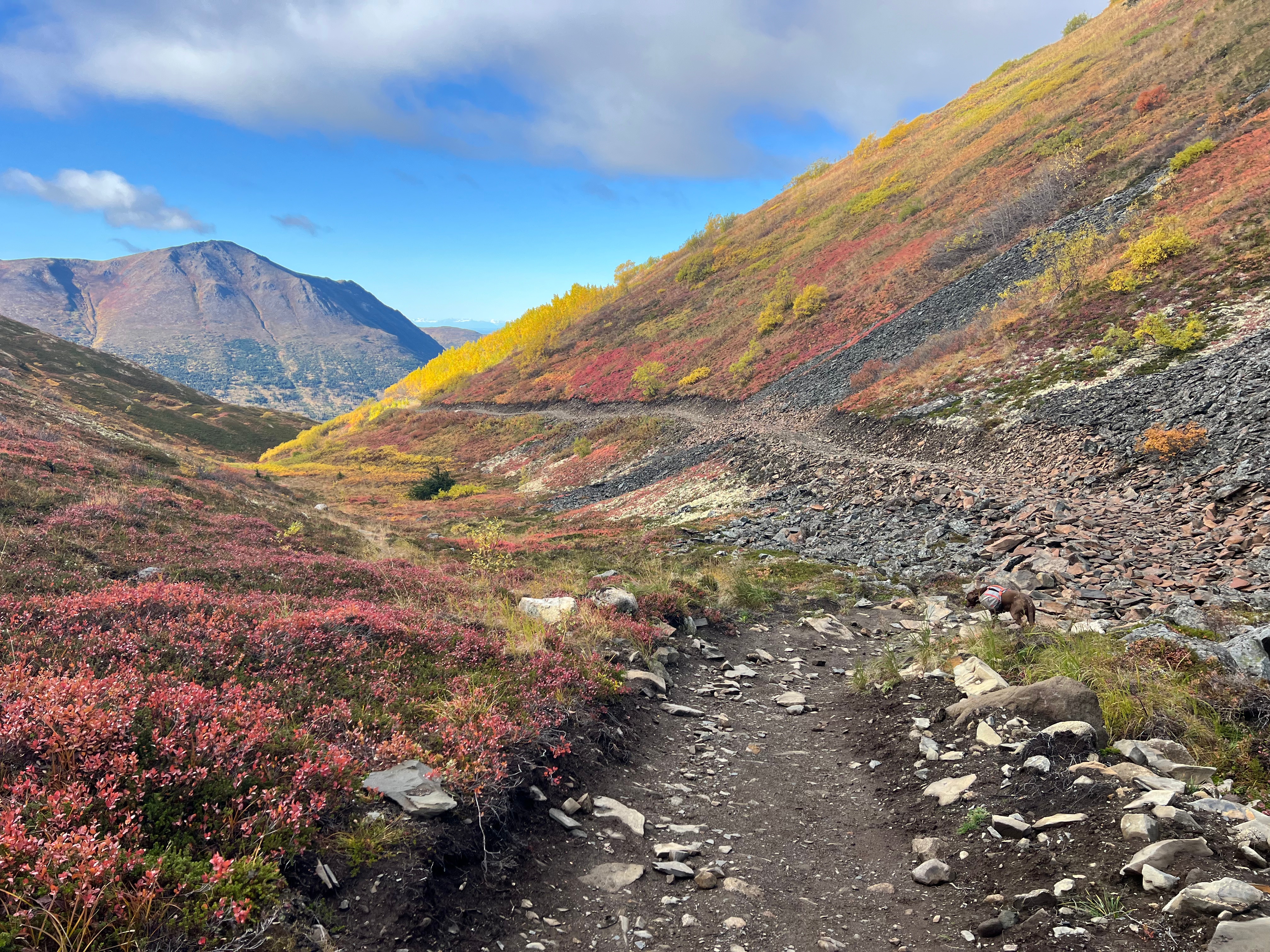
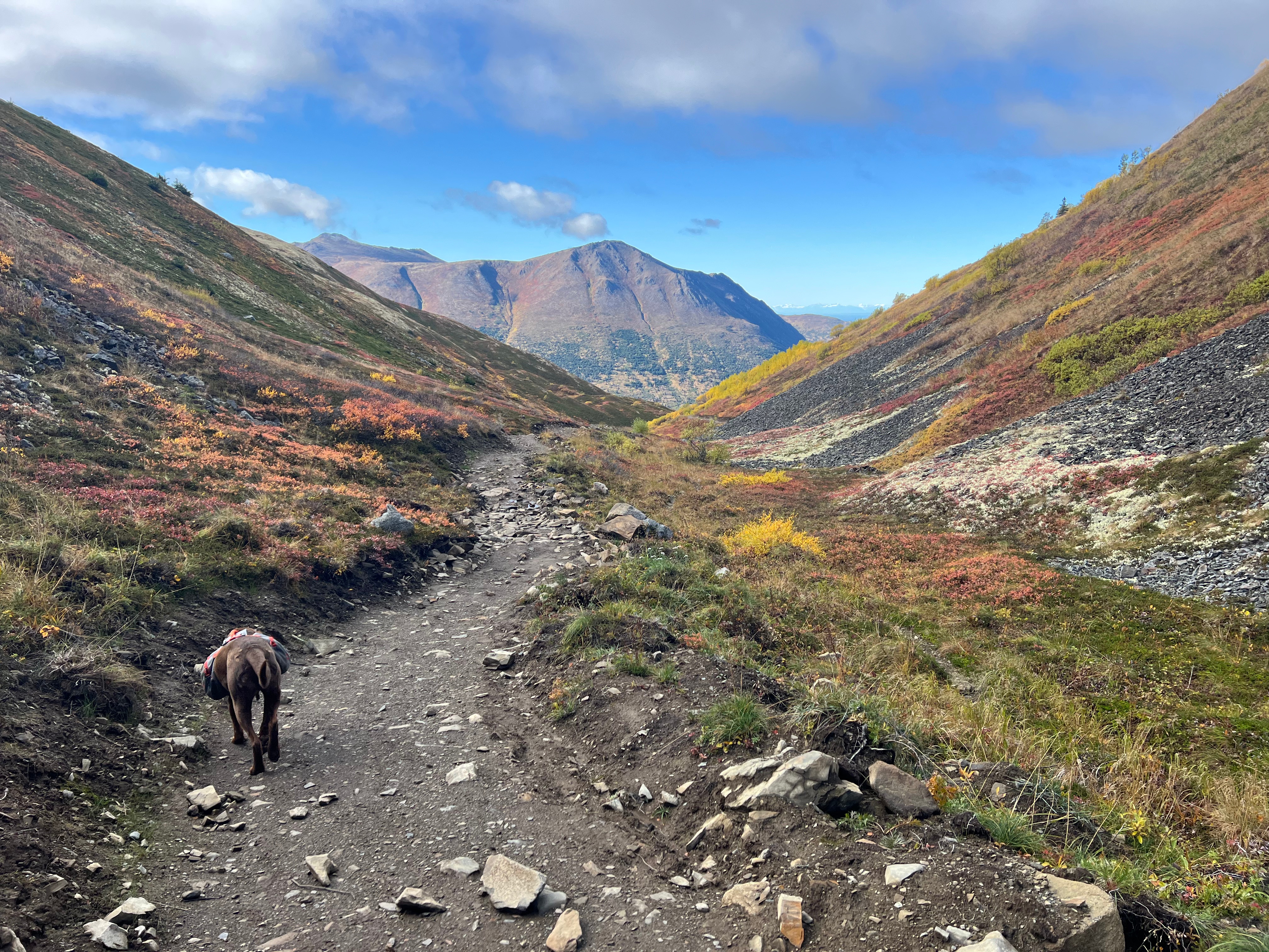
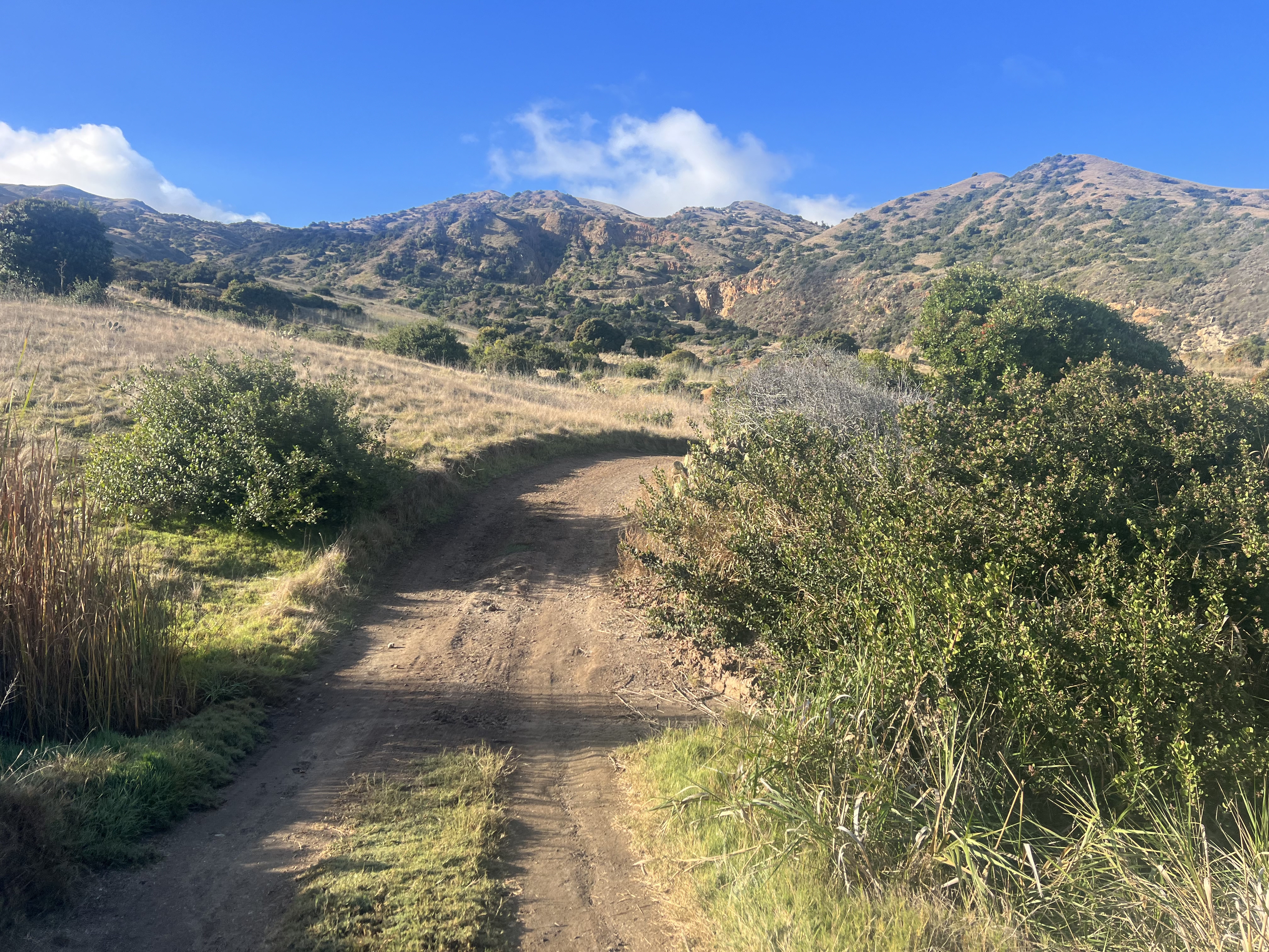
Knowing we still had what could be the most challenging section ahead, we packed up our gear and descended back down to the creek, a mile downstream from where we had crossed earlier in the day, and ascended a small, but steep, grassy slope. All I knew is that there was supposed to be some semblance of a trail, although very overgrown, that would lead us back to the Ship Creek bridge where Jason’s car was parked.
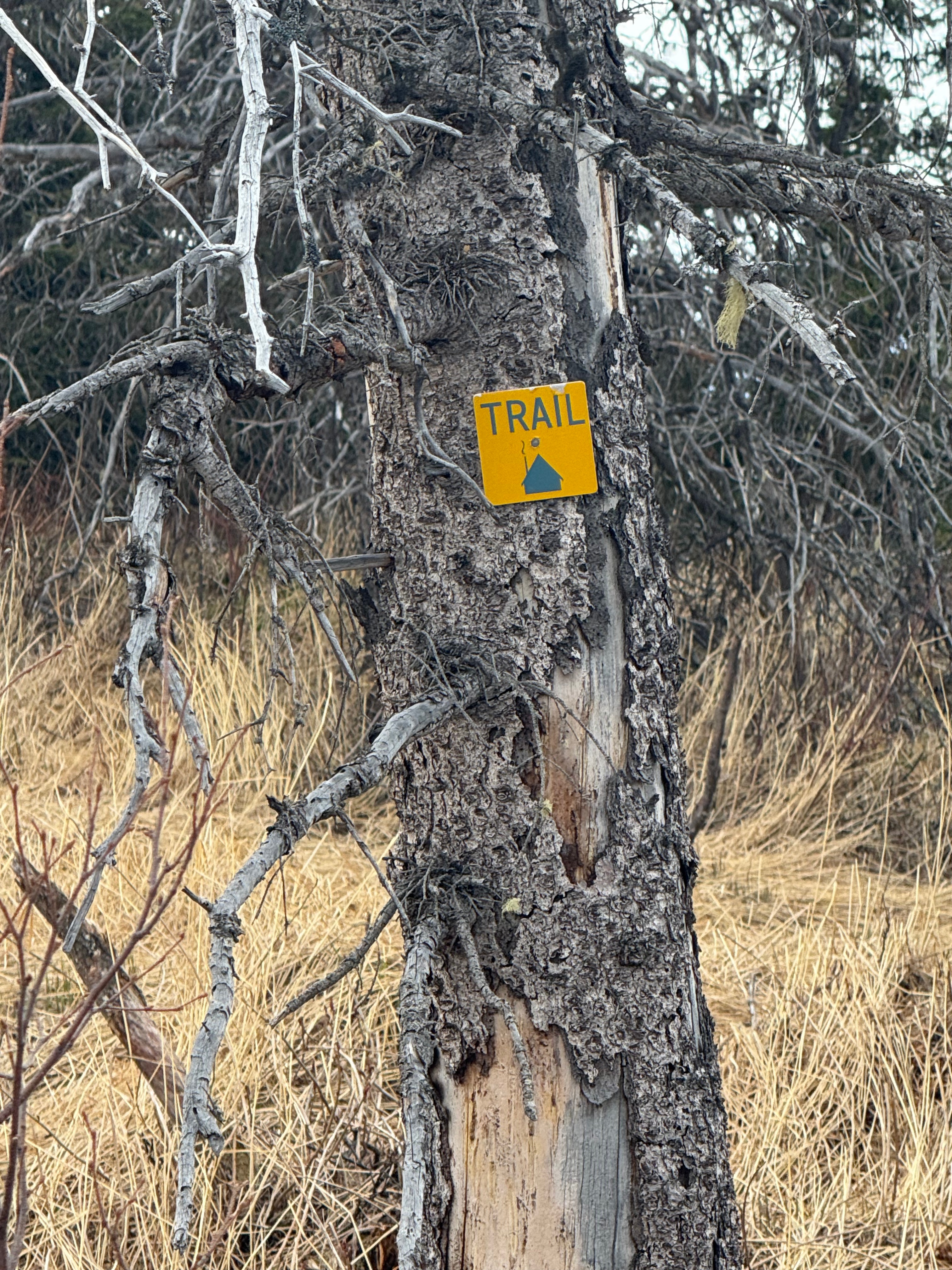
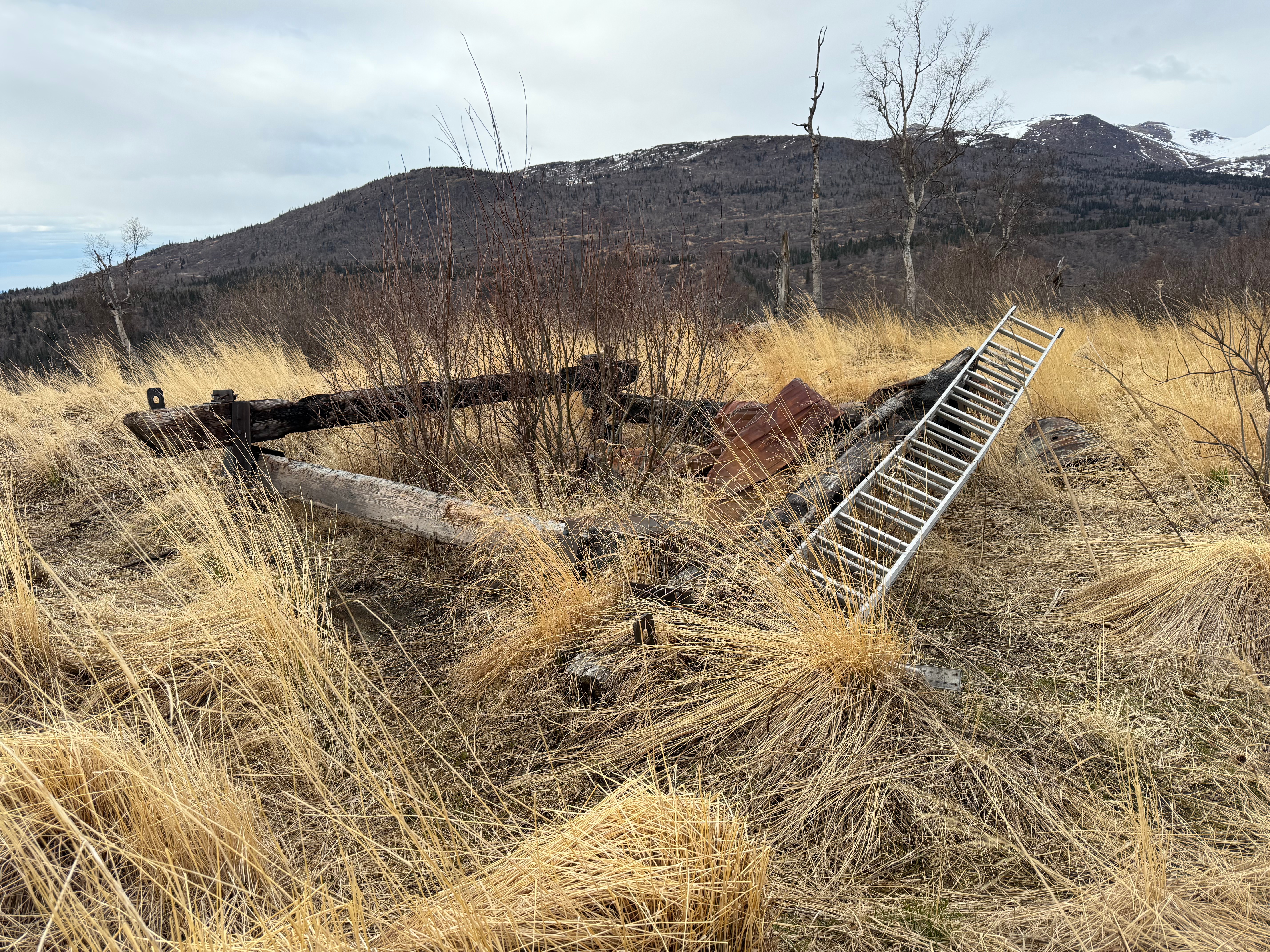
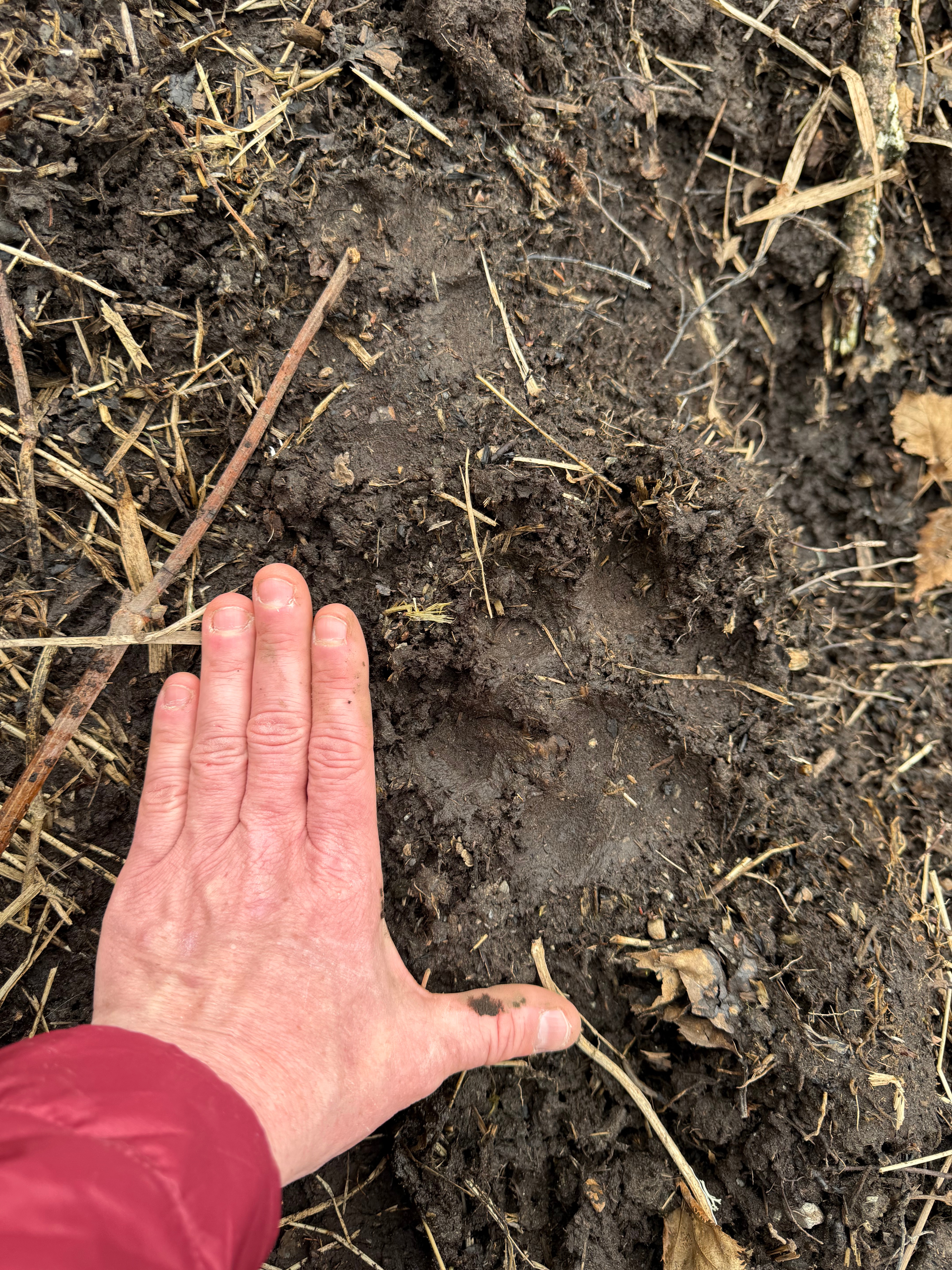
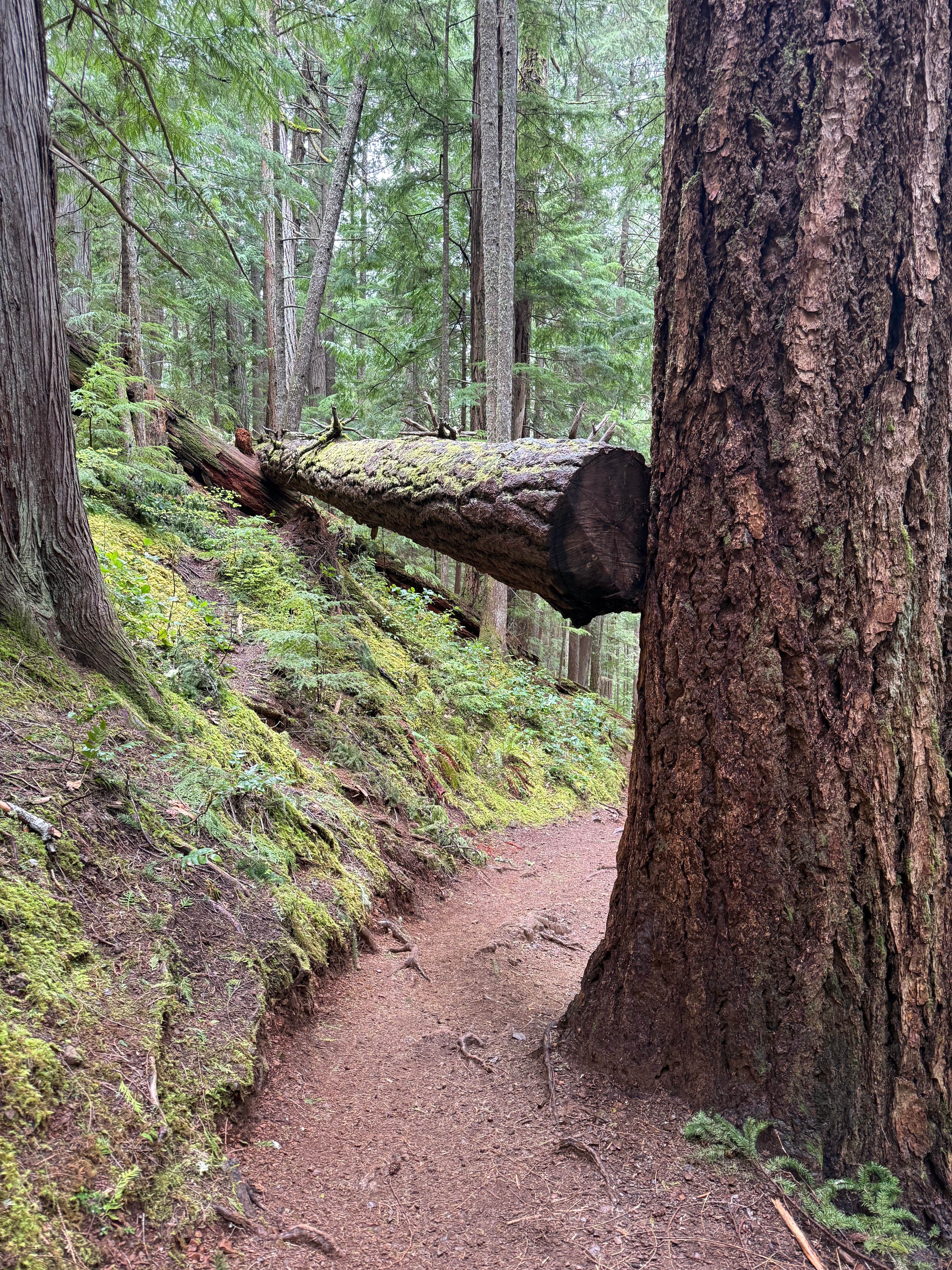
Snow Hawk Valley Trail is notorious for being overgrown and muddy, sometimes impossible to find, but our experience was quite the opposite. Very soon after reaching the top of the slope, Jason found a lightly worn footpath complete with trail markers. Although we had to climb over some deadfall and do some minor trail finding, it was a pleasant walk. We found an old, burned down cabin, and, in the small section of mud, the sizeable track of bears, wolf, coyote and moose.
The grass was laid down and dead and the leaves were not open; not even a bud in sight, and although I could imagine this trail being difficult to navigate in full bloom, it was nothing like the horror show that most people report. We weren’t lucky, we were smart to have planned to go before the leaves opened and I would recommend the same timing for anyone who wants to explore this area.
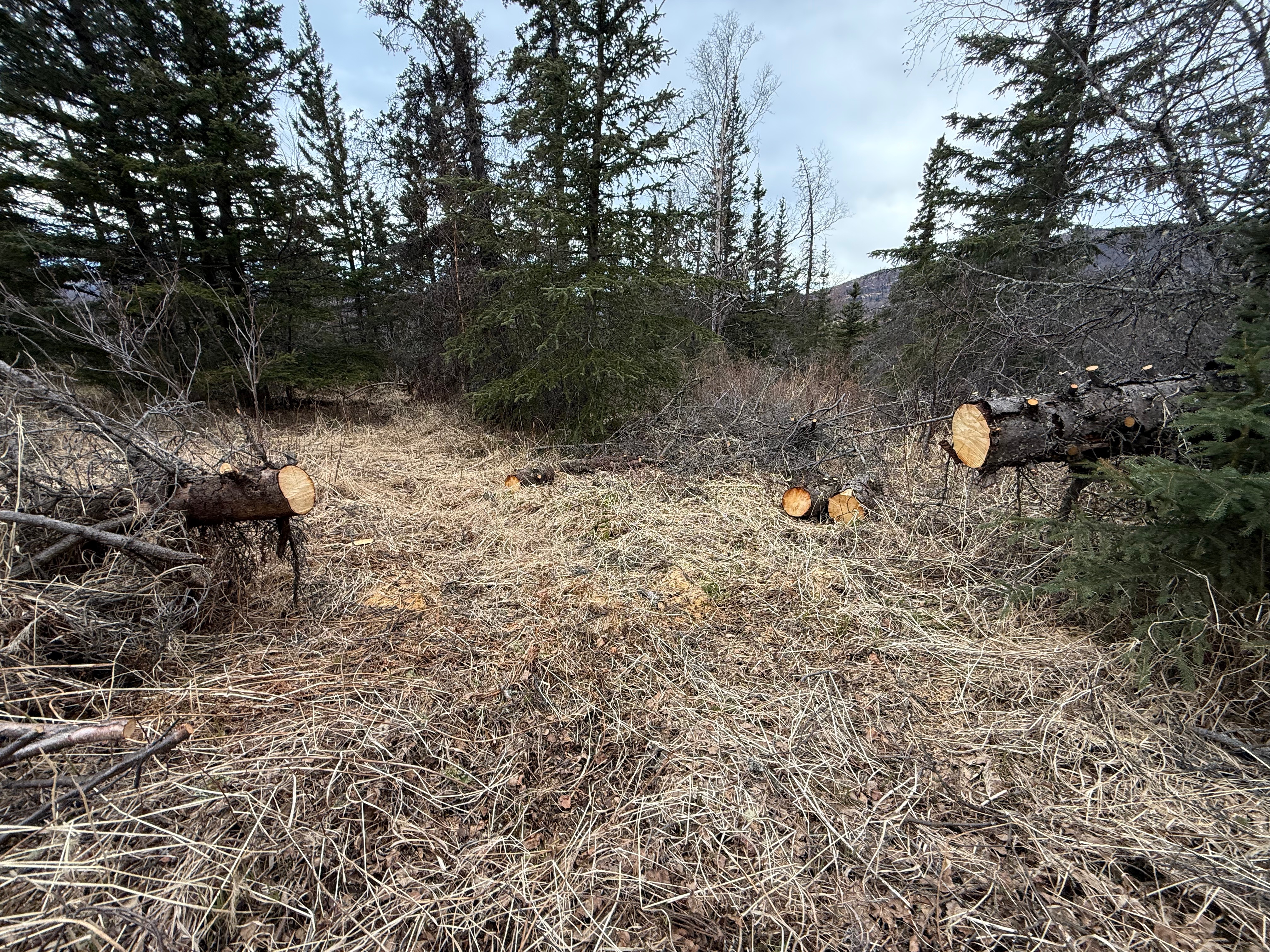
The last mile and a half were easy walking. Someone had come through with a chainsaw and cleared out the downed trees. Nearly 15 miles in, we were thrilled to not have to do anymore climbing or straddling. Suddenly, a chain link fence appeared meaning we were just above the Ship Creek Dam and, after a short bushwack through the alders, we were on Oilwell Road, only a mile from the parking lot.
Turning back for a look at SCH and the now obscured and camouflaged trailhead, I proudly acknowledged another goal met, and two more peaks climbed. Ship Creek bridge and then Jason’s car appeared like an oasis in the desert, and we sunk exhaustedly and victoriously into the car seats, already trying to decide what our next peak would be.
Make sure to check for open zones in JBER RecAccess. It is $10 annual for an account. Be sure to sign in before entering. Do not trespass or camp illegally or it could mean the end of access for those of us who respect the rules.
If you are going up or down Snow Hawk Valley Trail, do so early or late in the season. It is reportedly very difficult to navigate in the middle of the summer.
There is an insane amount of wildlife in this area. Carry bear spray and be bear/wolf/coyote/moose aware. Make lots of noise when traveling below tree line.
There is no camping in this area. All recreators must be off of JBER land between 11pm and 6am.
Do not touch anything that could possibly be military ordinance (bombs, shells, ammo, missiles, etc.). If you find anything that is potentially unexploded, report it to the JBER authorities.
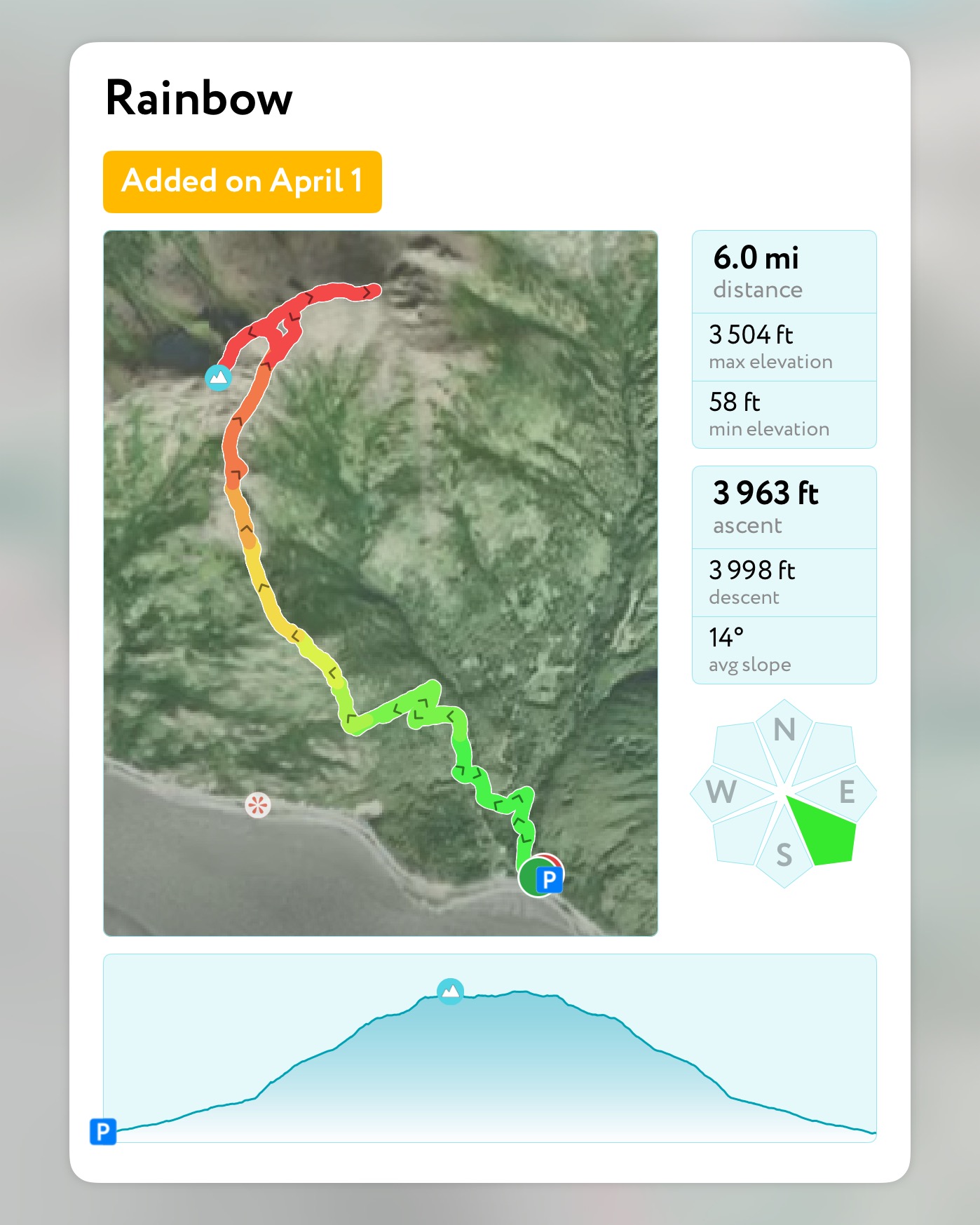
March 31, 2025 Mileage: 6.2 Miles (Including Northeast Ridge to Unnamed Point) Elevation Gain: 3700′ Chugach 120 #118 Chugach Front Range #25 Summit Elevation: 3543′ Rainbow Peak is a fun, scrambly hike that starts at sea level and tops out at 3543.’ This one is big bang for your buck if you’re looking for an…
September 21, 2024 Mileage: 8 Miles Elevation Gain: 2592′ Peak 1112 (3648′) Little Teton (4006′) Peak 3891 (3891′) Permits: Arctic Valley PArking PAss or Membership Pass It’s now the end of March 2025, and as I start planning for this summer’s adventures, one of my top mellow day hikes is definitely the Rendezvous Ridge/Muktuk Marston…
September 29, 2024 Mileage: 8.6 Miles Elevation Gain: 4815′ Lazy Mountain (3740′) Peak 4199 (4199′) Permits: Mat-SU Borough Parking Pass REquired at Lazy Trailhead It was the second to last day of September, and the weather was holding out for one more low ridge traverse, though the termination dust had crept down close to the…
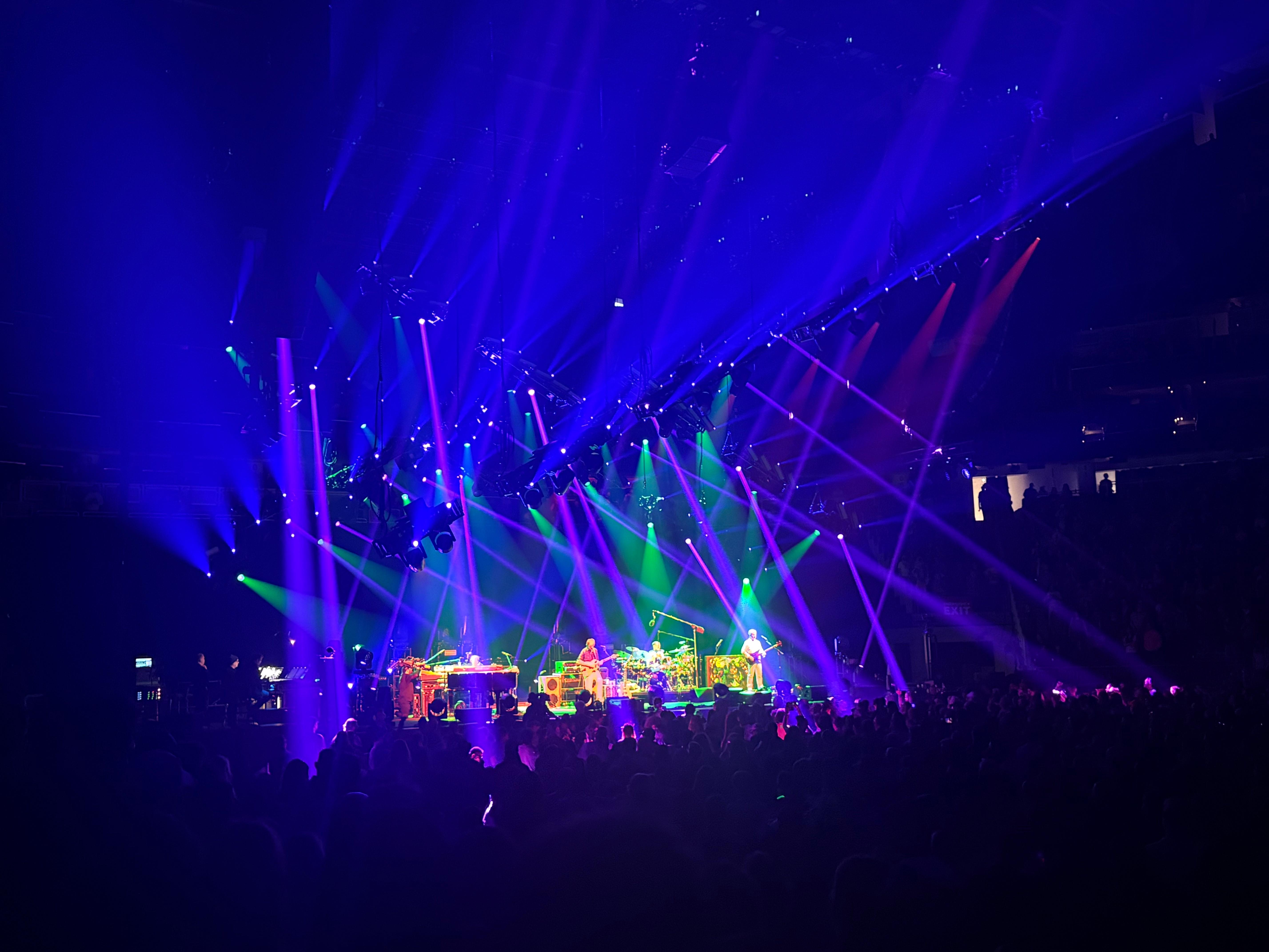
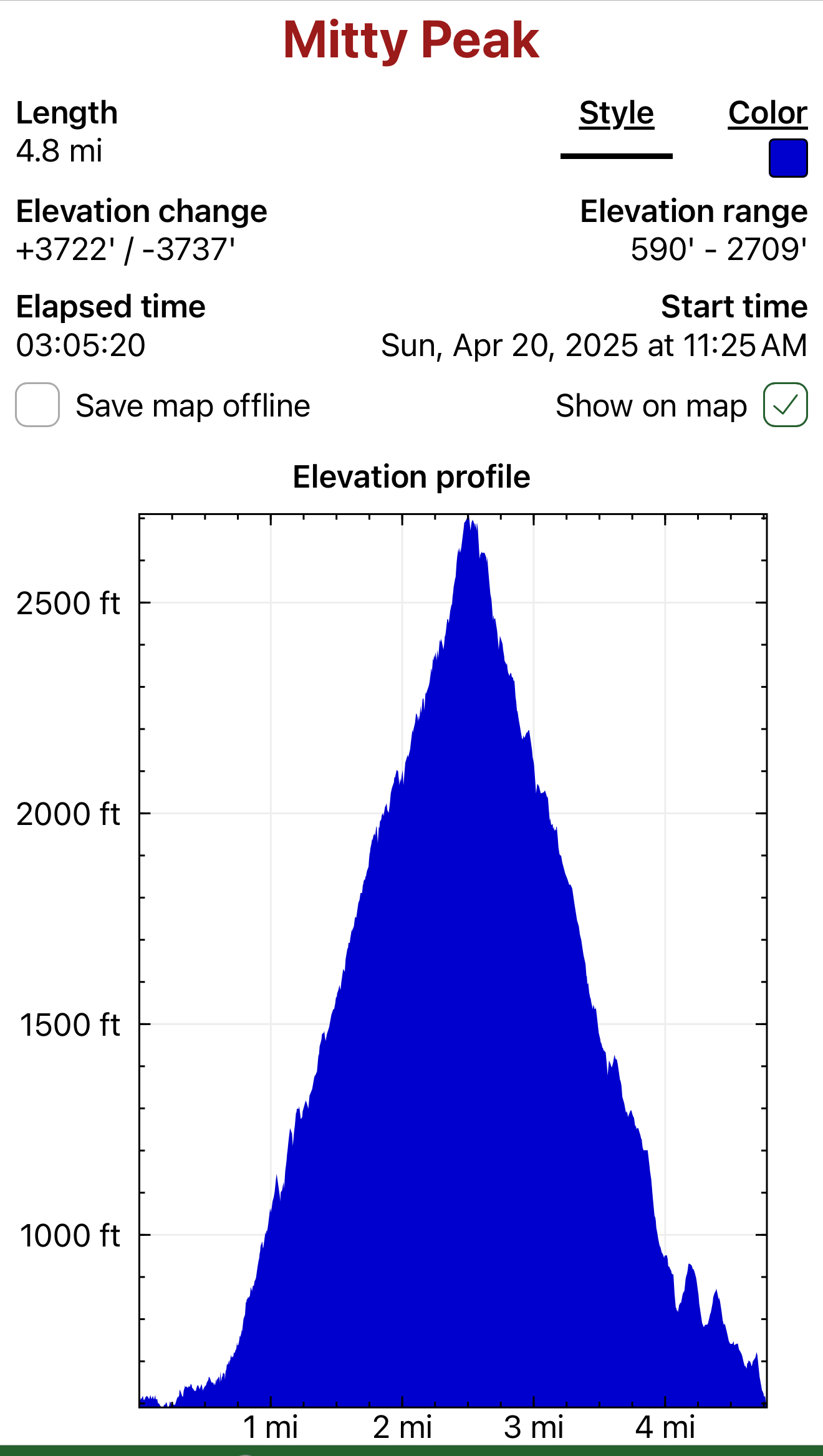
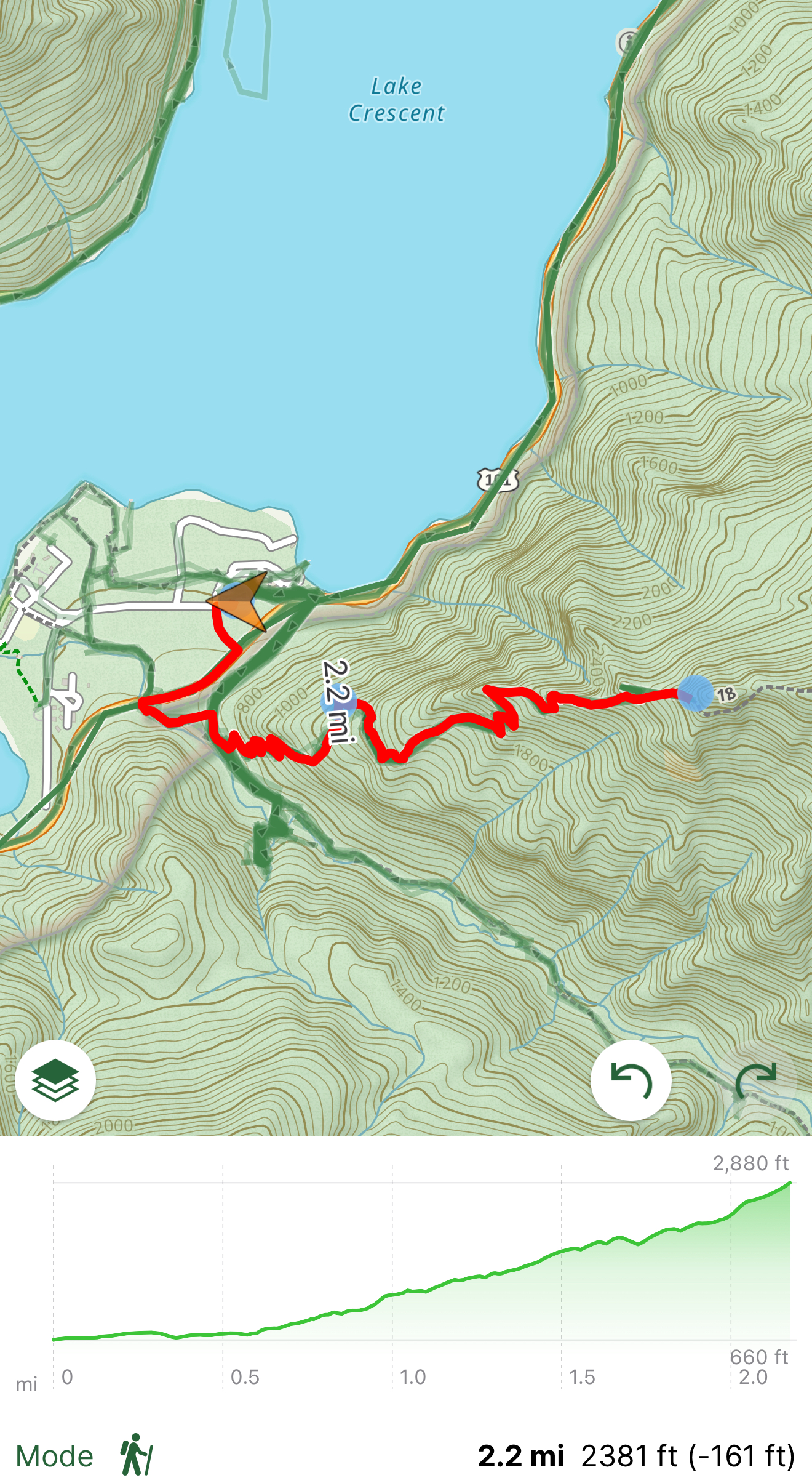
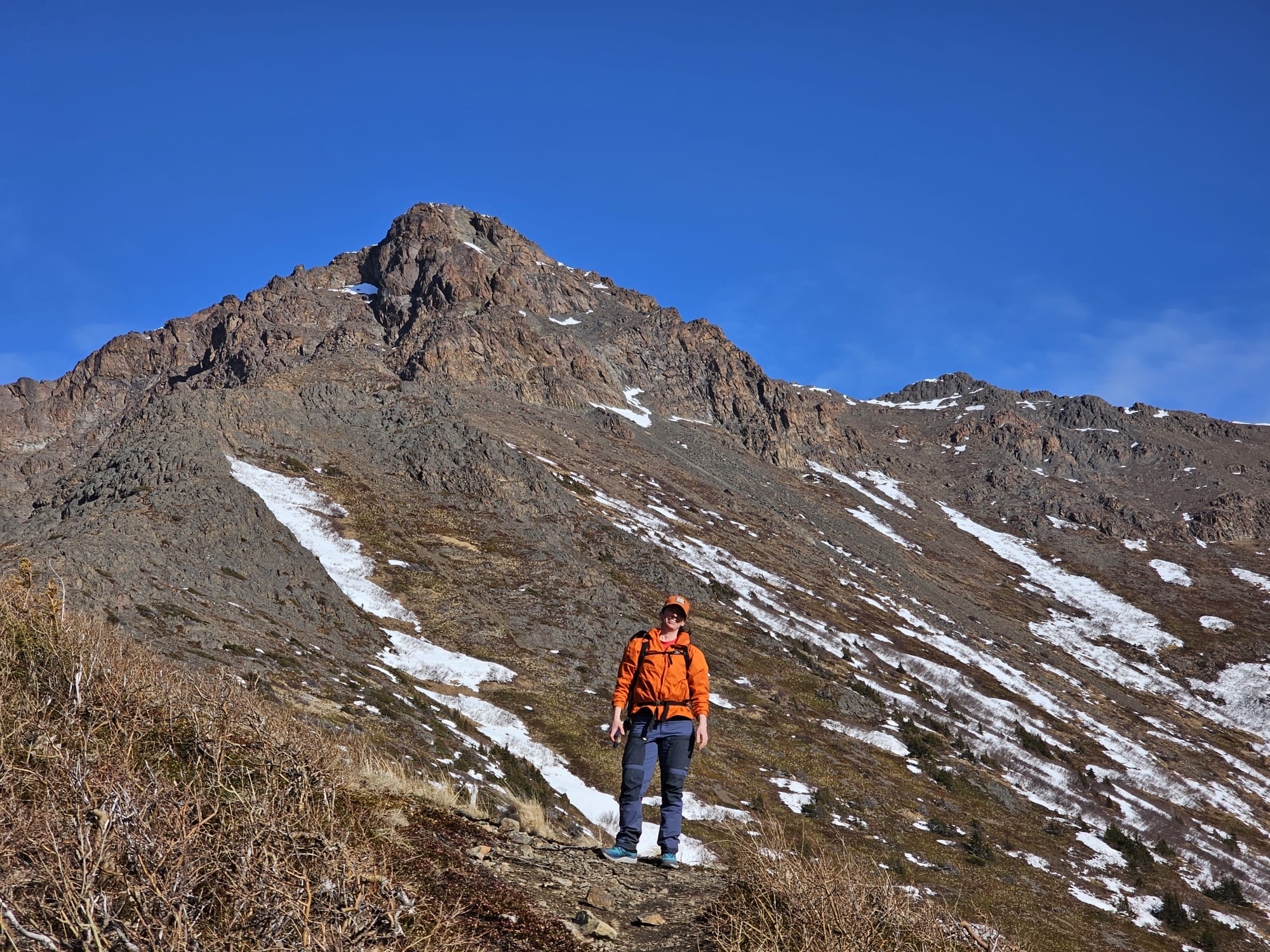
After 25 years, I finally had the opportunity to fly down to Seattle from Alaska to see one of my favorite bands of all time, Phish. I can’t travel without checking out a new hike, so I also planned a quick foray into Olympic National Park to climb Mitty Peak.
My legs and back were feeling all of my 45 years after dancing like a maniac for 4 hours straight on Saturday night, but I was bound and determined to summit the namesake of my favorite movie character, Walter Mitty. I woke early Sunday morning and made the 2.5-hour drive from my hotel in Seattle.
Typical of the Pacific Northwest, the weather changed by the minute as I turned north on the Olympic Peninsula. Sun, then rain… rinse and repeat. As I pulled into the Mt Storm King parking lot, I realized I had missed the ranger station but was pleasantly surprised to see I could pay for my pass with a QR code posted at the trailhead.
My $30 now securely in the hands of the National Park Service, I swung my pack onto my back and started off up the trail. The trailhead skirts past the now closed ranger station and into a tunnel under the road, although I didn’t see this, so I jumped the guardrail and linked up with the trail on the other side of the road.
The flat path felt nice on my tired legs, and I looked up in awe at the incredible size of the Firs and Cedars. Not long down the trail, I came to the turnoff for the Mt Storm King Trail, a small wooden sign pointing the way. It was time to go UP!
I was pretty beat after a long night, but the switchbacks on the east ridge made the climbing less strenuous, but still physically challenging. The rain came and went, and the sun was not interested in making an appearance, but I happily trudged on in the damp mist.
Eventually the trees thinned and Crescent Lake came into view, though the thick clouds still veiled the surrounding mountains. A sign denoting the end of the maintained trail, nailed to a tree, gave me hope that I was close to the final steep ascent to the summit. Gray Jays, opportunistic and brave birds, began to follow me, knowing there would be hand fed treats on the summit.
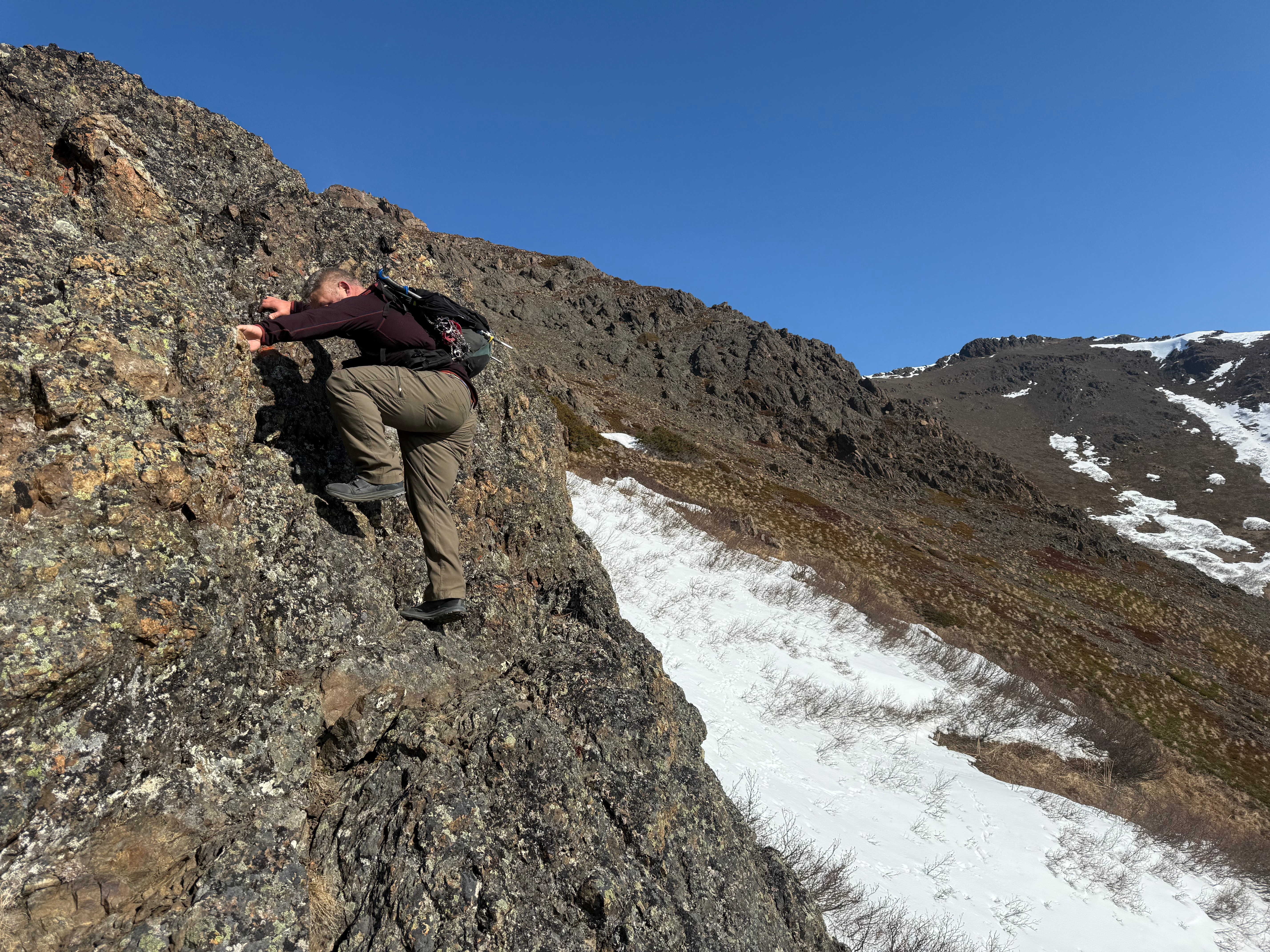
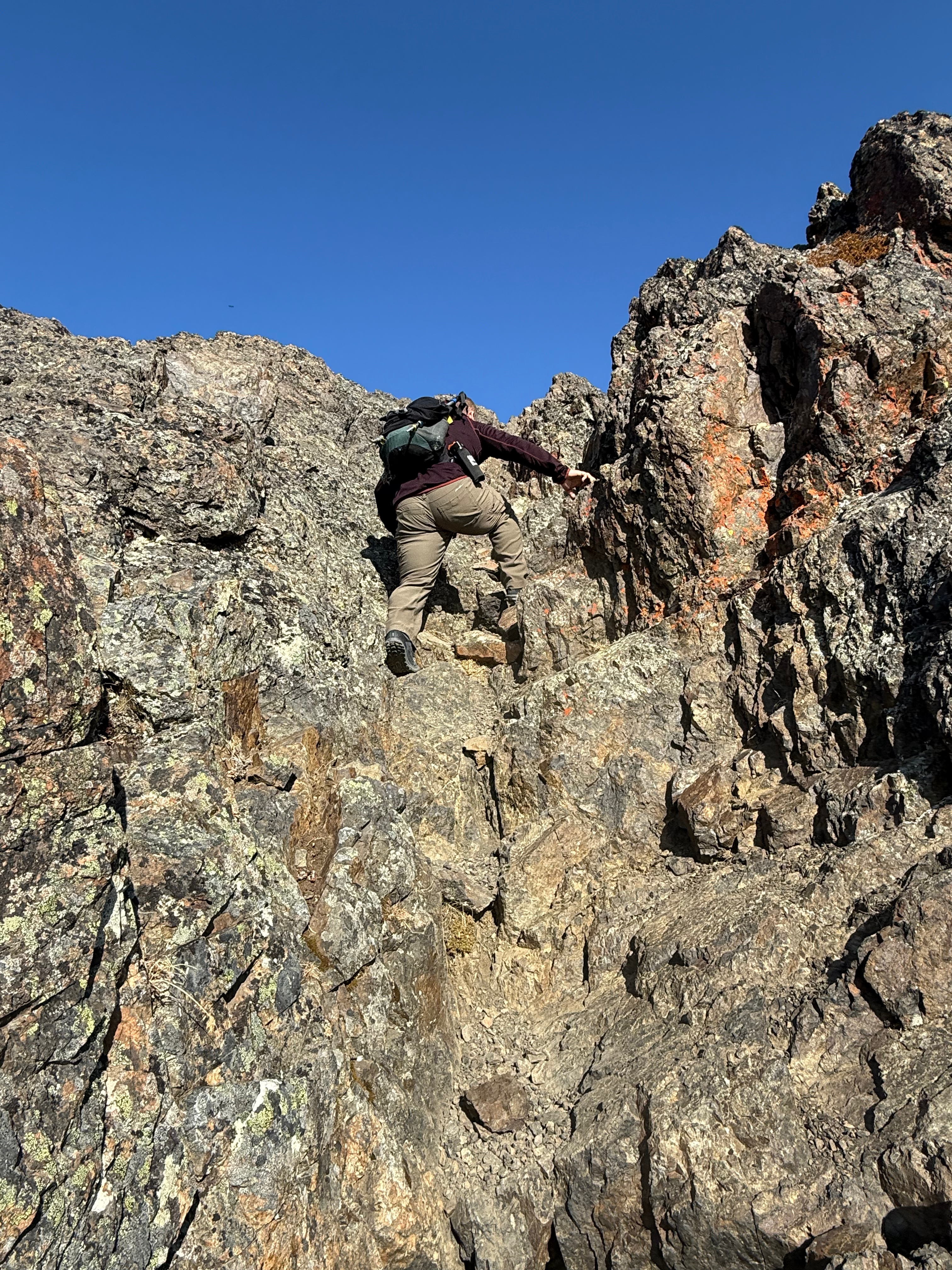
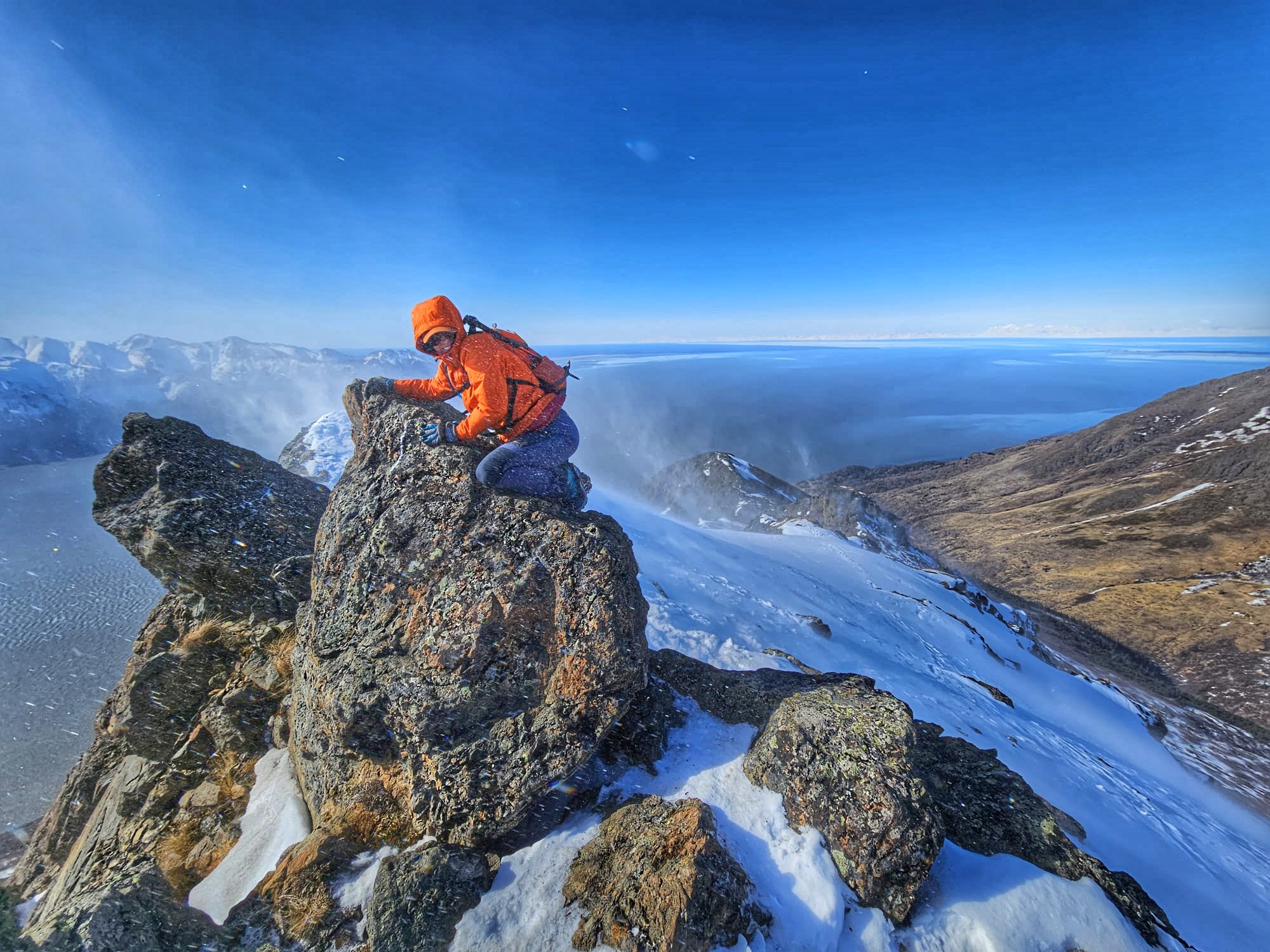
I carefully picked my way along a ridge with some significant exposure and up short, rocky chutes. The rain was making everything slippery and a fall in some of the areas could be fatal, so I walked carefully and with great care.
Soon the summit block was in sight, a high point devoid of vegetation and with nearly vertical faces dropping precipitously. A rope dangled down to assist in negotiating the final stretch to the peak, though I soon found it was actually a series of ropes leading around to the west side of the summit block. I hesitated to trust the janky, old ropes and opted to free climb up the slopes. I felt good about my decision to avoid the fixed lines when I saw that one of them had rubbed on its anchor to the point where it was fraying.
As I stood at the bottom of the last 20′ scramble, I hesitated. Starting up, I realized it was high consequence exposure and scurried back down to flat ground. I made a decision to call my hike there and head back down, but I didn’t feel right about it, so I turned back towards the peak, shut off my mind and scrambled up to the summit.
I breathed a sigh of relief before taking in the incredible view of Crescent Lake, suddenly ceilinged by patchy, blue skies and a rain free sky. I couldn’t have timed it any better. After taking some photos, the birds could wait no longer. No sooner had I opened a granola bar and held out my hand than the Gray Jays were circling and landing on me for a meal. One even landed on my phone as I filmed the scenery.
All of a sudden, I started to cry. My emotions were so big after a short 24 hours of healing music and hiking. I felt so at peace and so happy. I was exactly where I was meant to be and felt all of the gratitude.
Although I could have stayed longer, the weather started to move back in and the birds were bored of me, since I didn’t have any more food. I took in the view one more time and turned toward a faint footpath that skirts the summit to its north. I figured it would be easier than downclimbing the wet, steep, rocky summit block, but it definitely was not. Although it was in the trees and had roots for handholds, it was steeper than the front side and a fall would be just as serious here as there.
I made it to the bottom of the block safely, but muddier, and started back down the roped section. My confidence in full bloom, and I walked without the assistance of the ropes until I slipped on the ball bearing like rocks. I saw a steep drop below and hoped I would stop sliding before I went off the ledge. My hand instinctively reached out and I was able to grab the rope, stopping my potentially lethal fall. Needless to say, I used the ropes for the rest of the way down to make sure I didn’t make the same mistake.
I descended quickly to the forested section of trail in the pouring rain and began jogging down the switchbacks to the parking lot. I only half an hour, I was back at my rental car and changing into dry clothes. I turned up the heat and drove off with memories of an incredible experience in Olympic National Park.
This trail has significant and high consequence exposure at the summit of Mitty Peak. Use caution all the time and remember it is more difficult to climb down than up.
Many resources list this hike as “Mt Storm King” but the actual summit of Mt Storm King is miles further up the ridge. The overlook is listed as Mitty Peak by the USGS.
Leave No Trace and pick up any trash you see on the trails. The limited staffing at the National Parks makes it almost impossible to keep everything clean unless we all pitch in.
There is a $30 fee to enter the National Park. This fee is good for 7 days. Consider an America The Beautiful Pass if you plan to travel to more National Parks in the same year. There is a QR code posted at trailheads to pay the fee without stopping into the ranger station.
Eklutna Lake, Chugach State Park, Alaska March 8-9, 2025 Total Mileage: 17.6 Total Elevation Gain: ~1,000′ Permits: AK StatE PArks Annual Parking Pass The Plan I was going absolutely stir crazy. I hadn’t been camping since getting back from the Kalalau Trail at the end of January and I knew I was becoming unpleasant to…
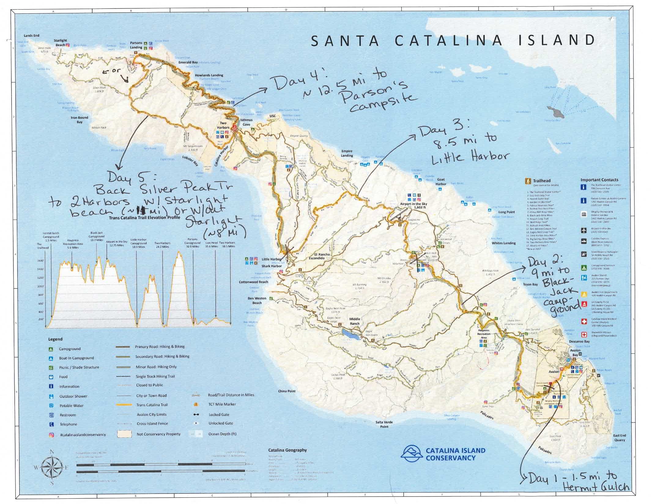
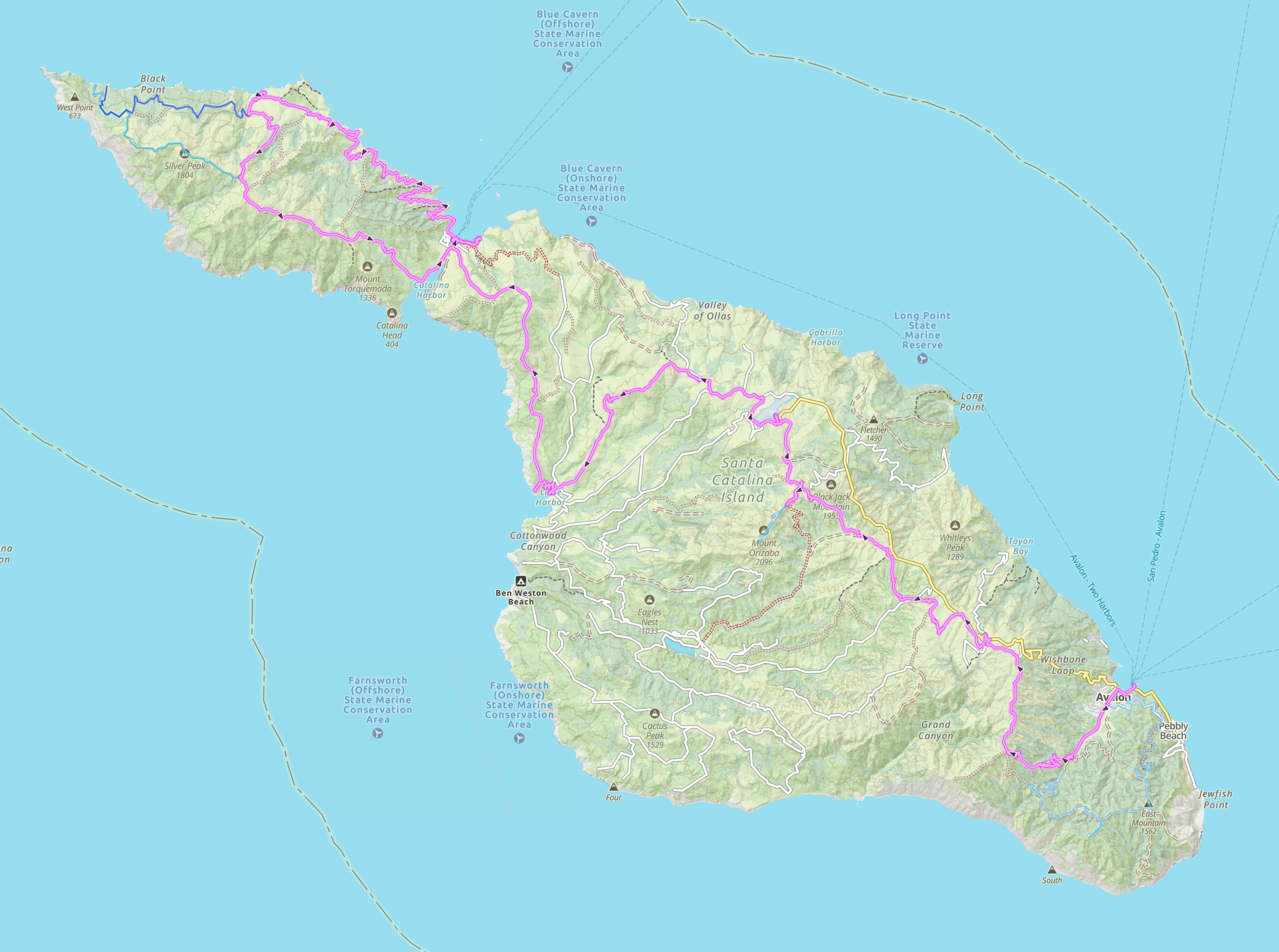
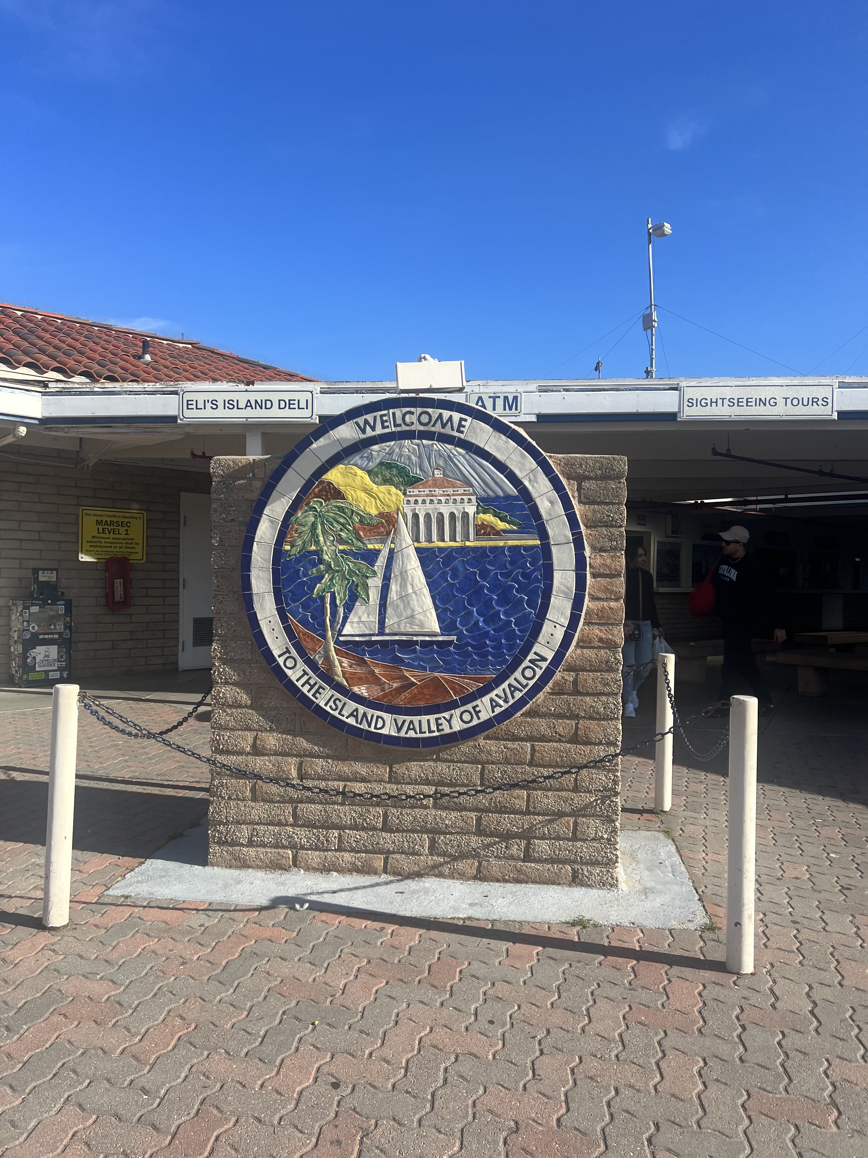
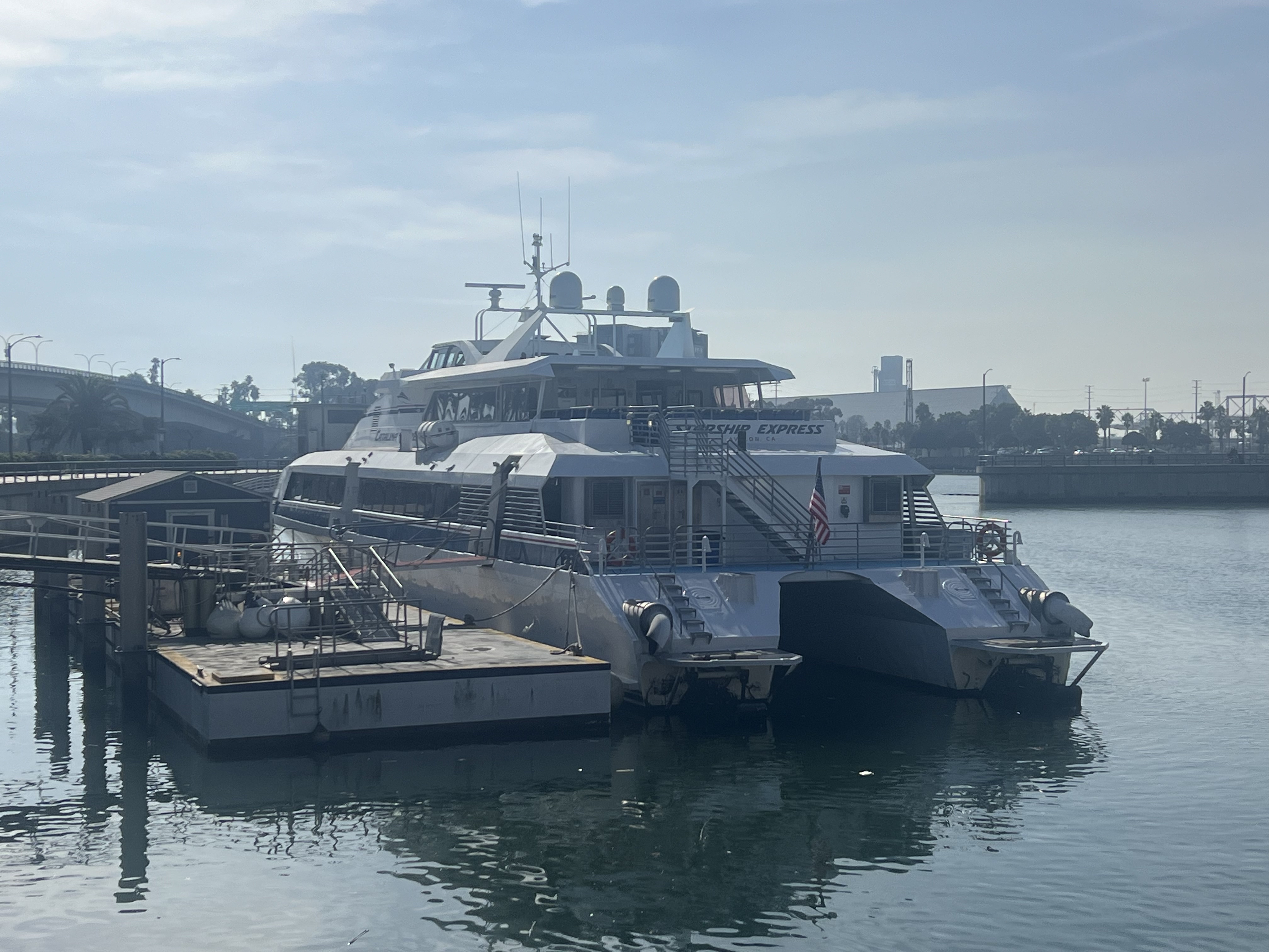
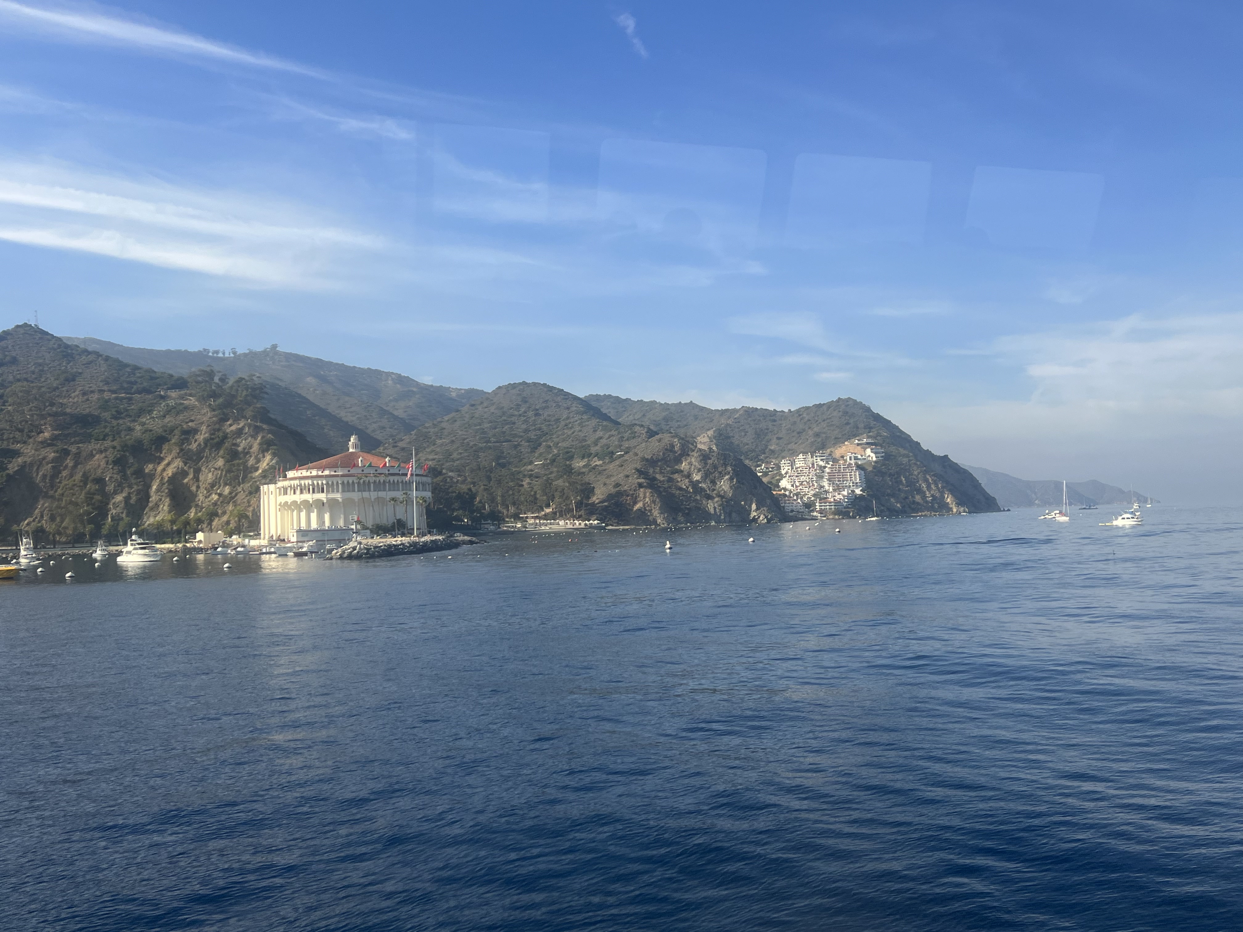
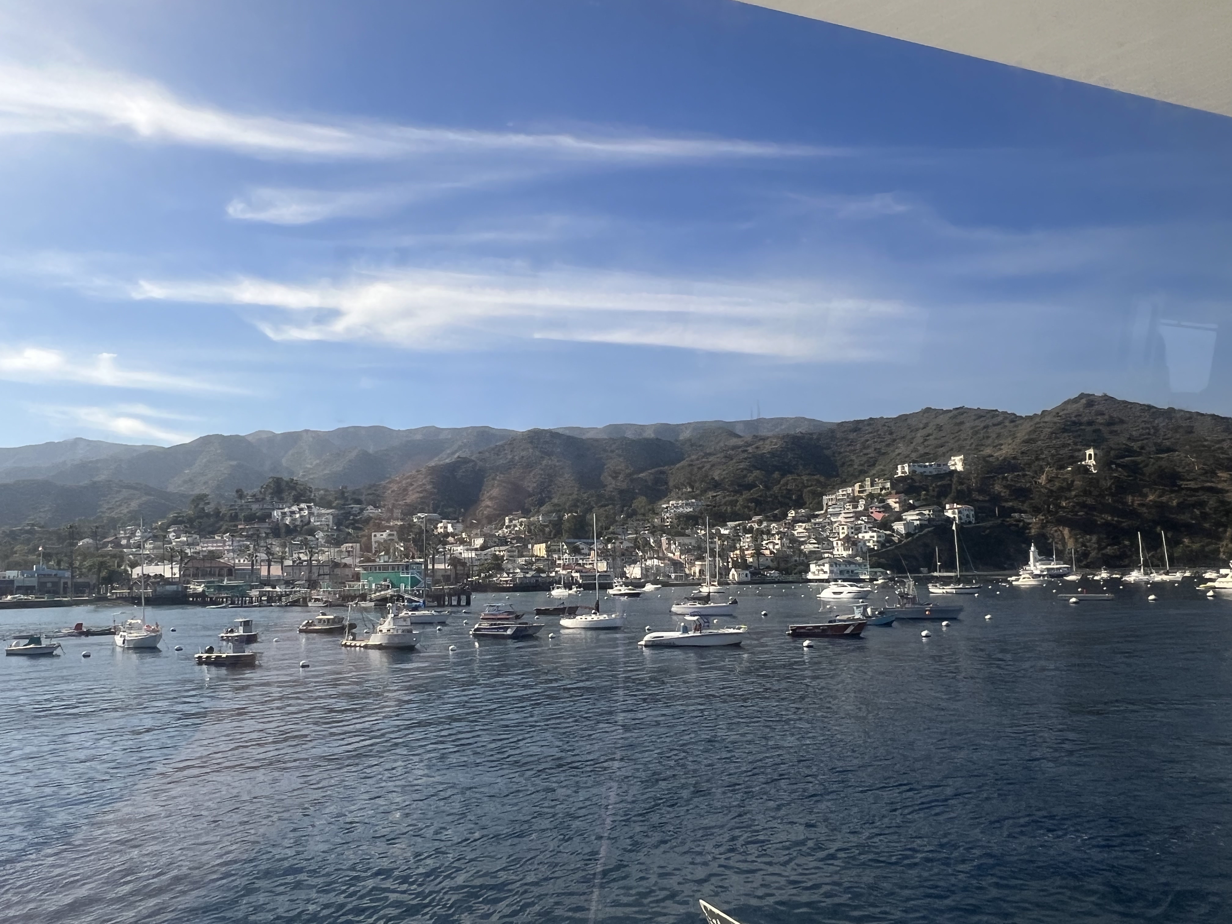
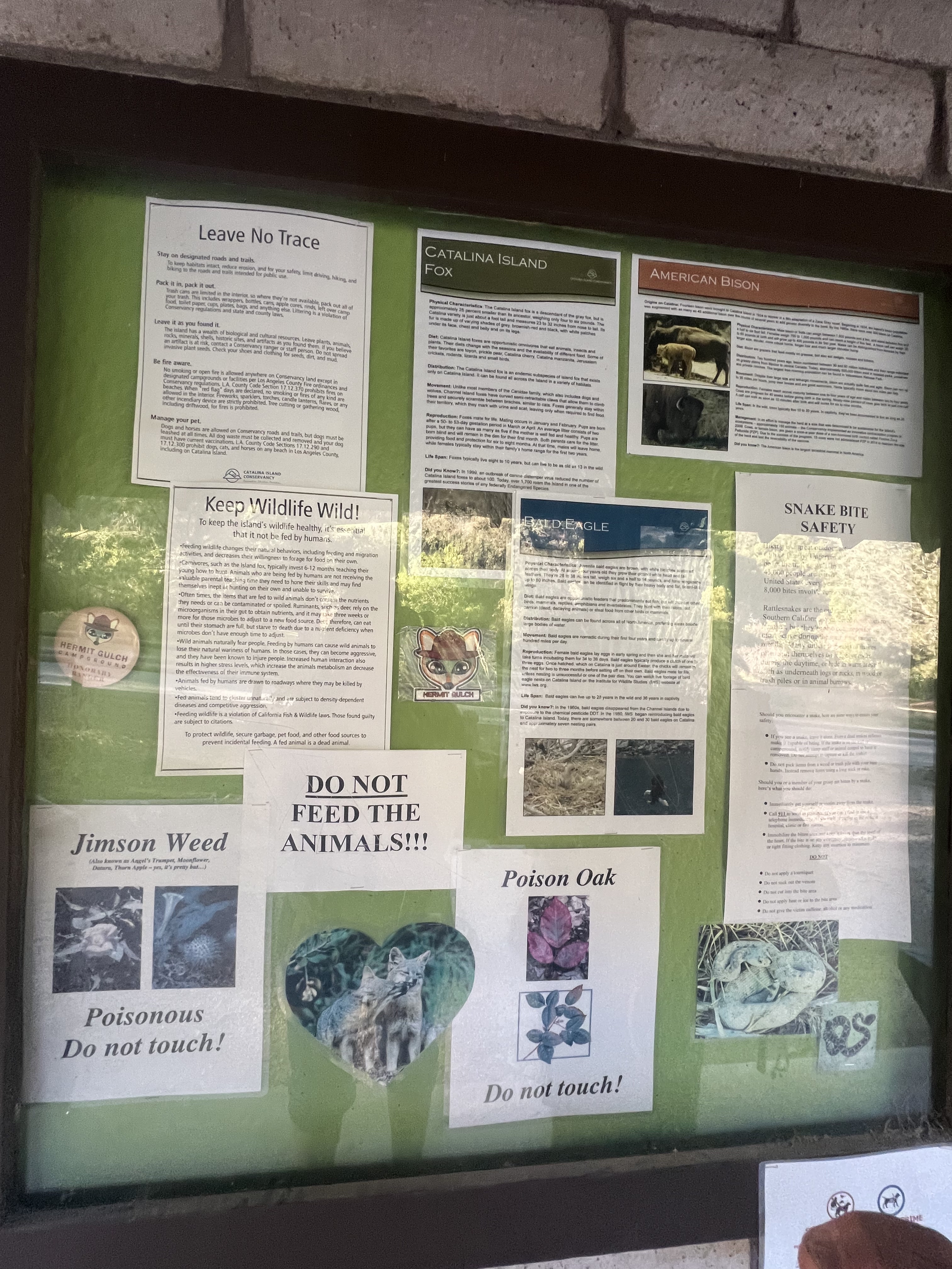
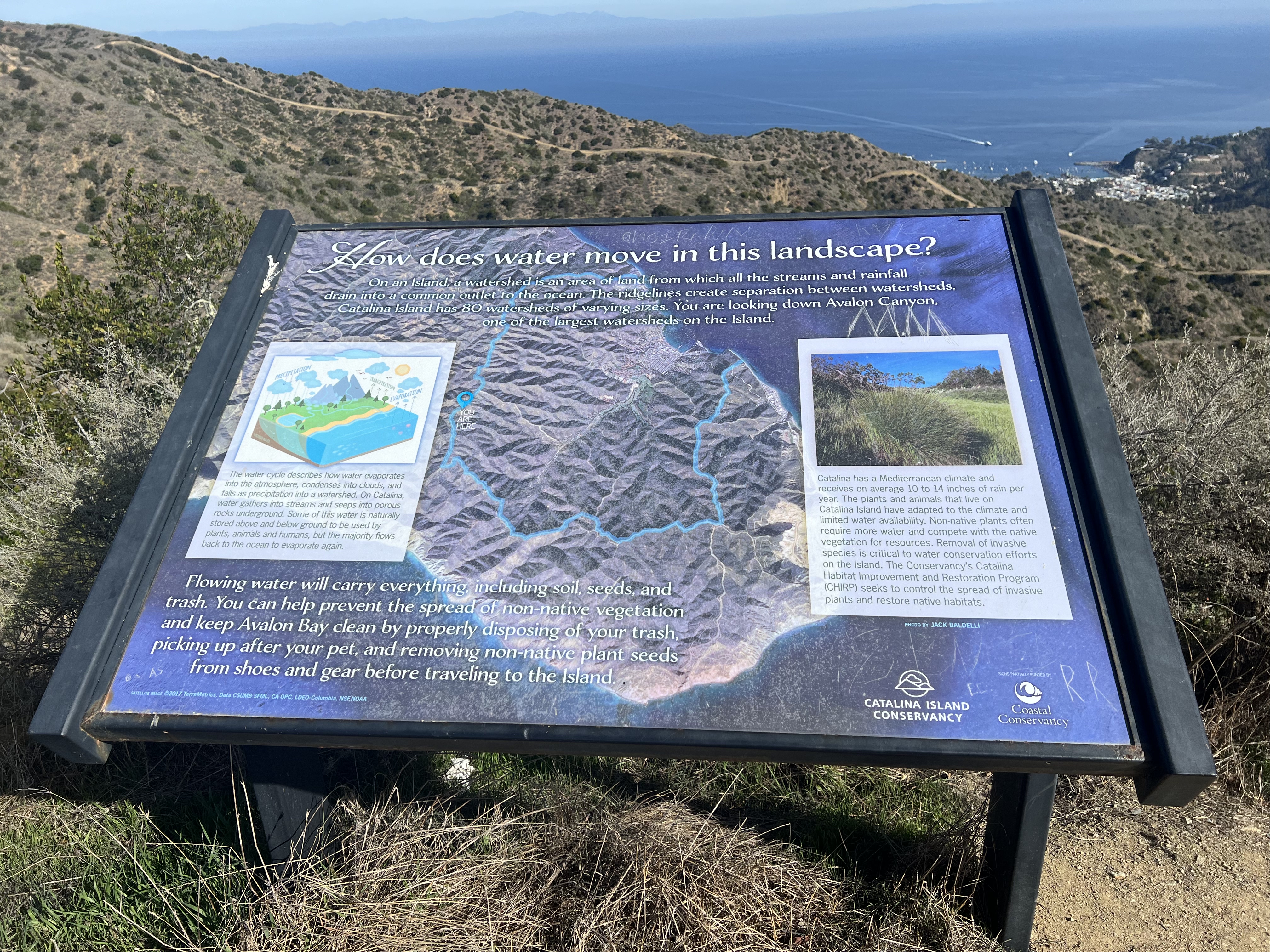
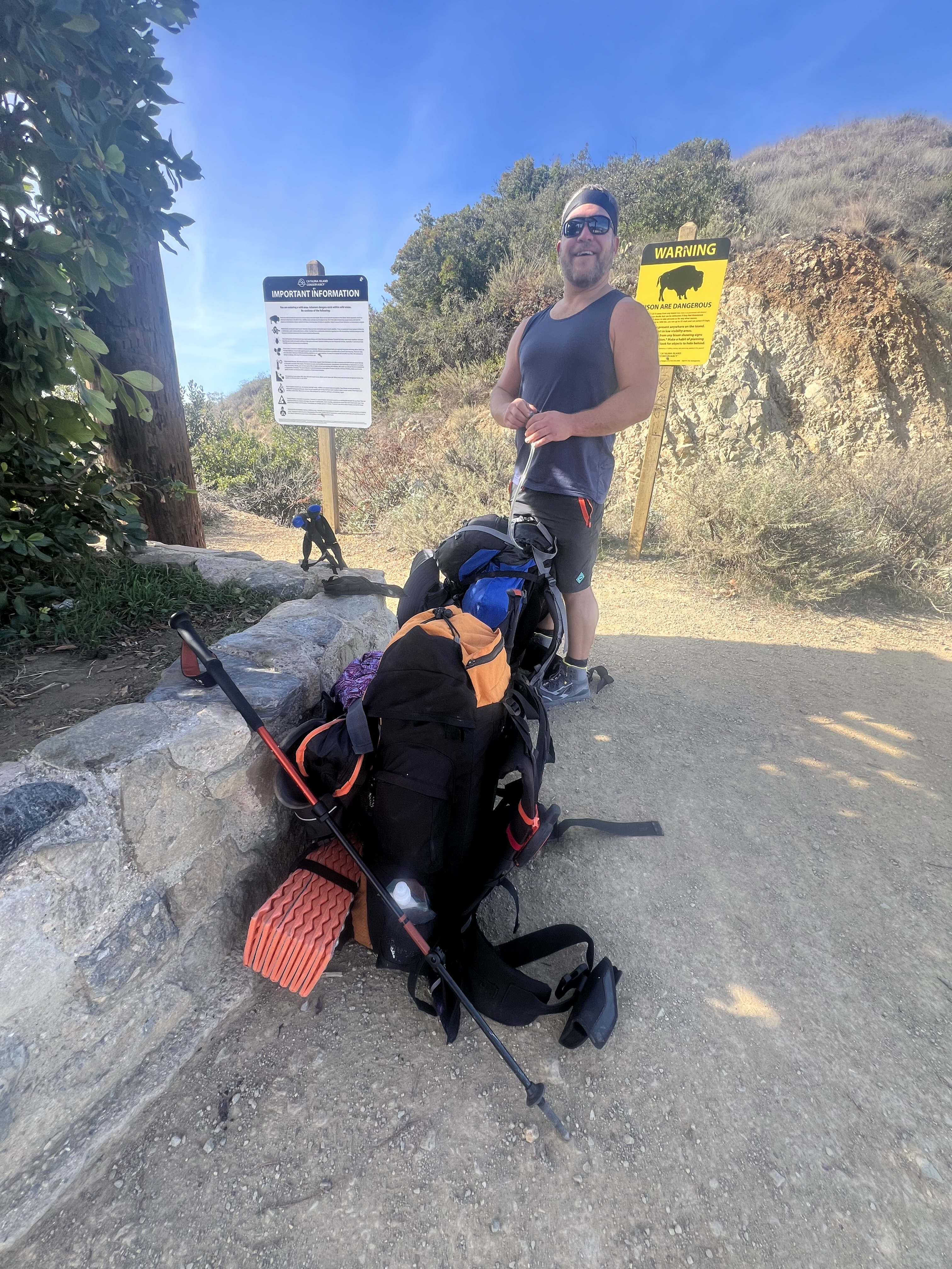
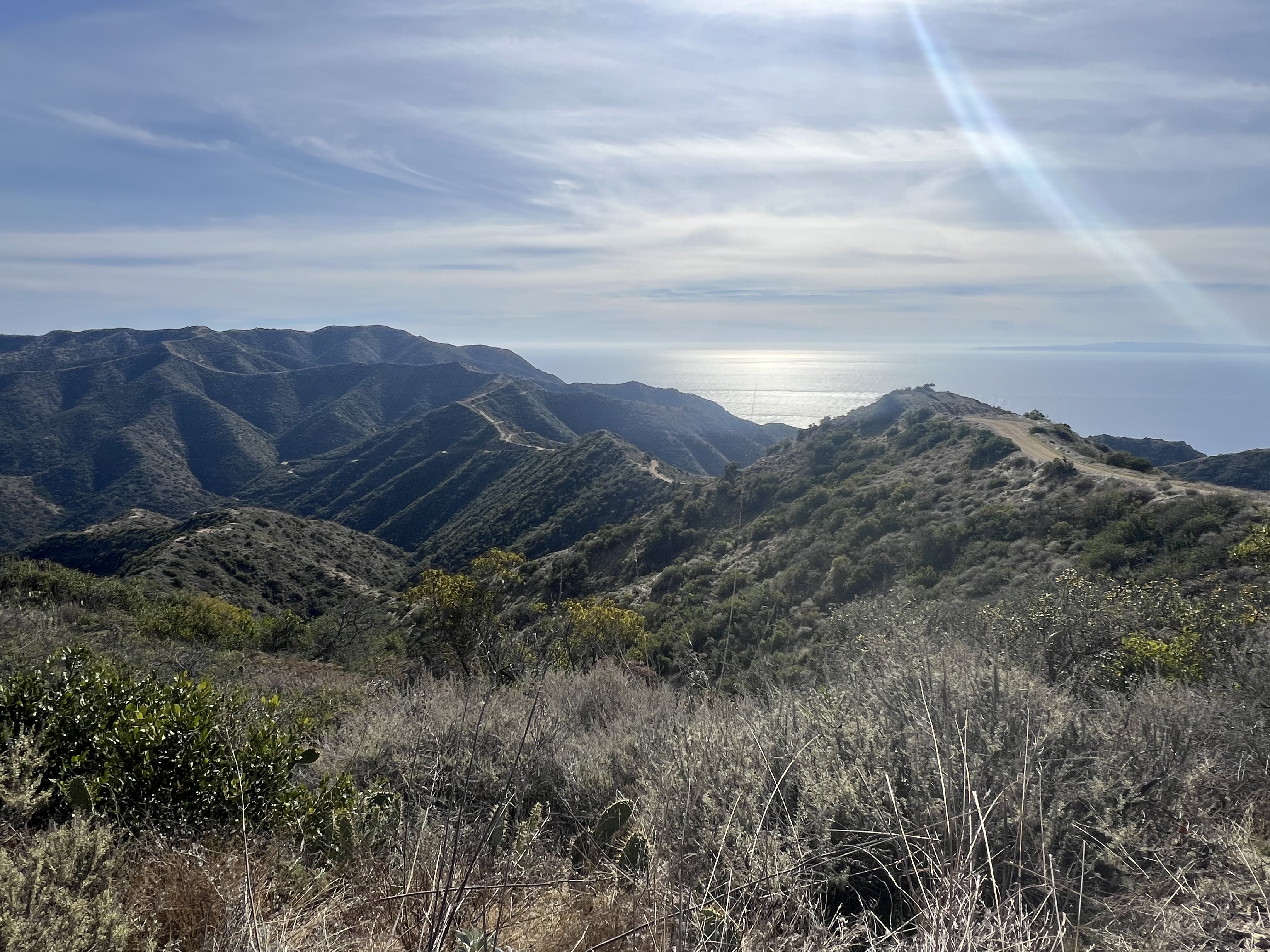
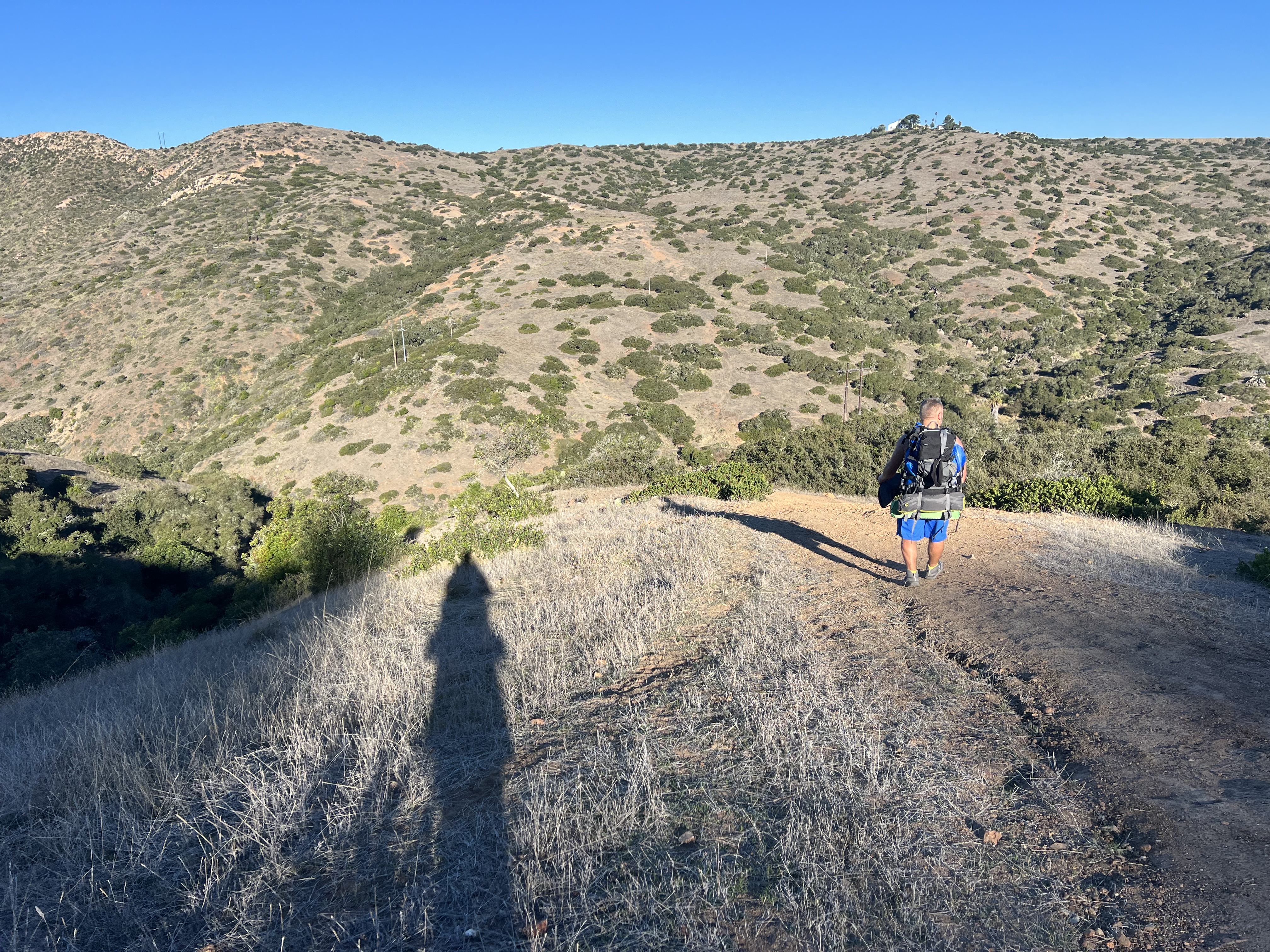
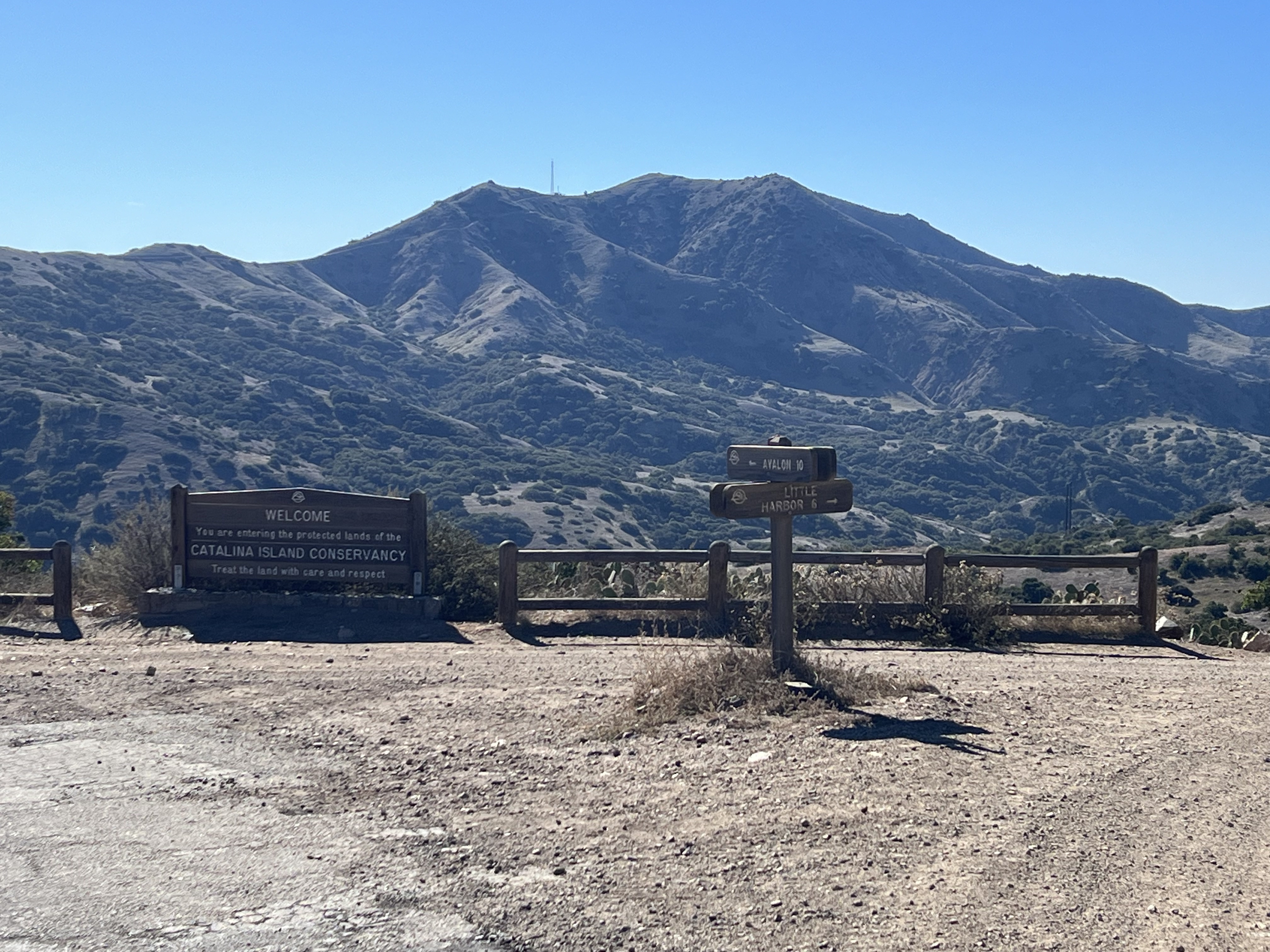
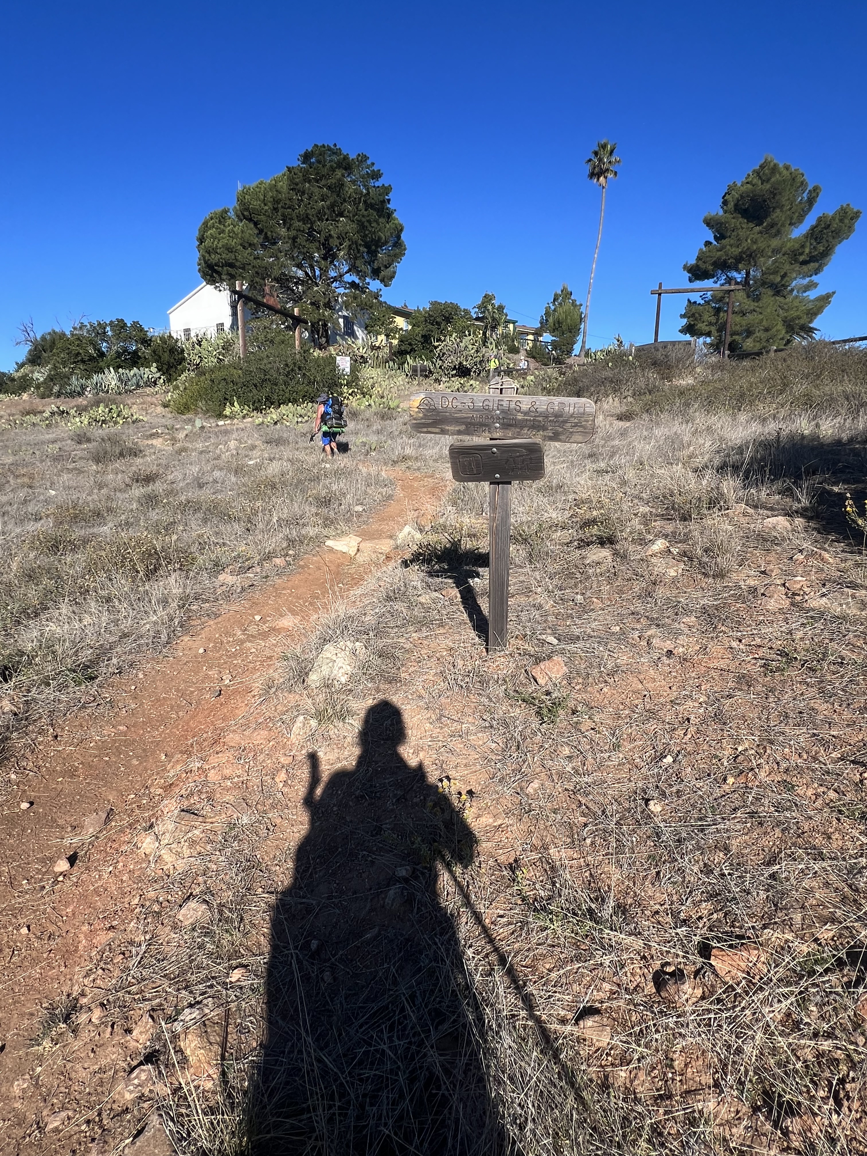
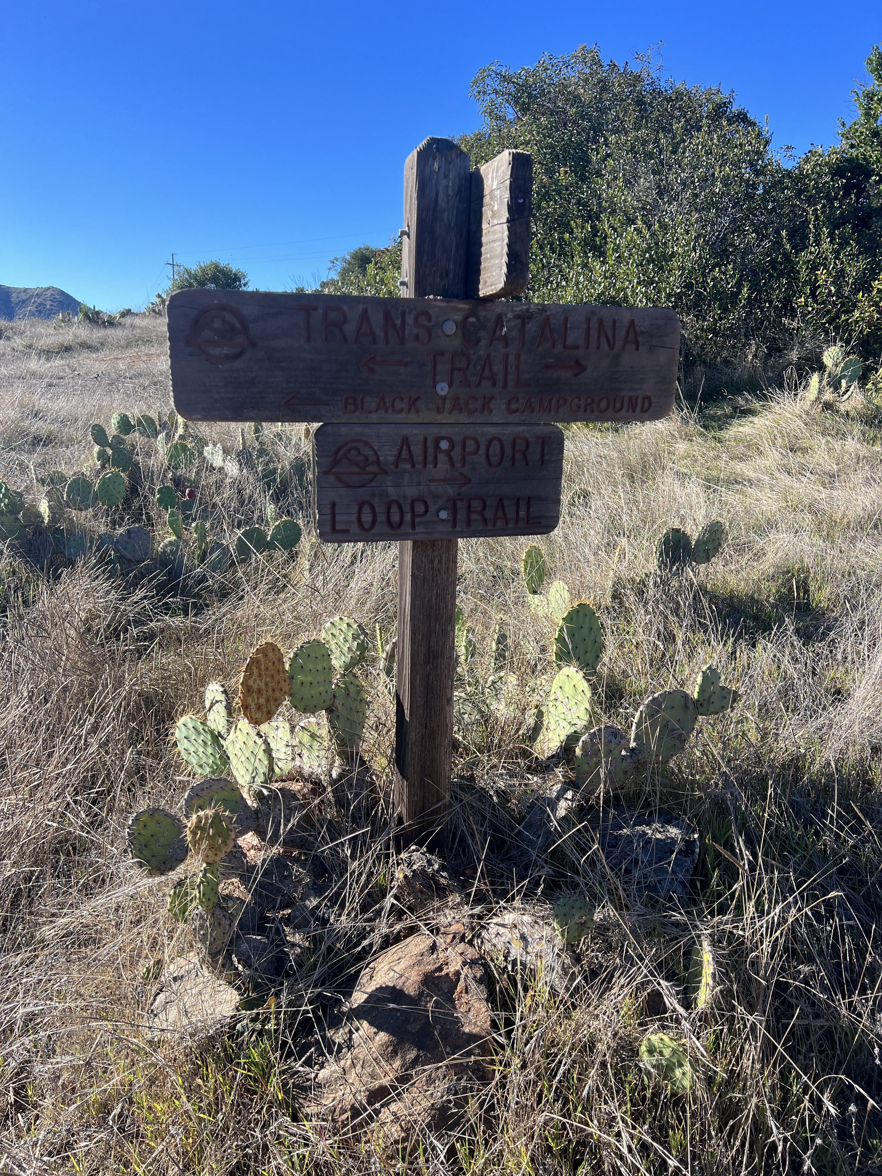
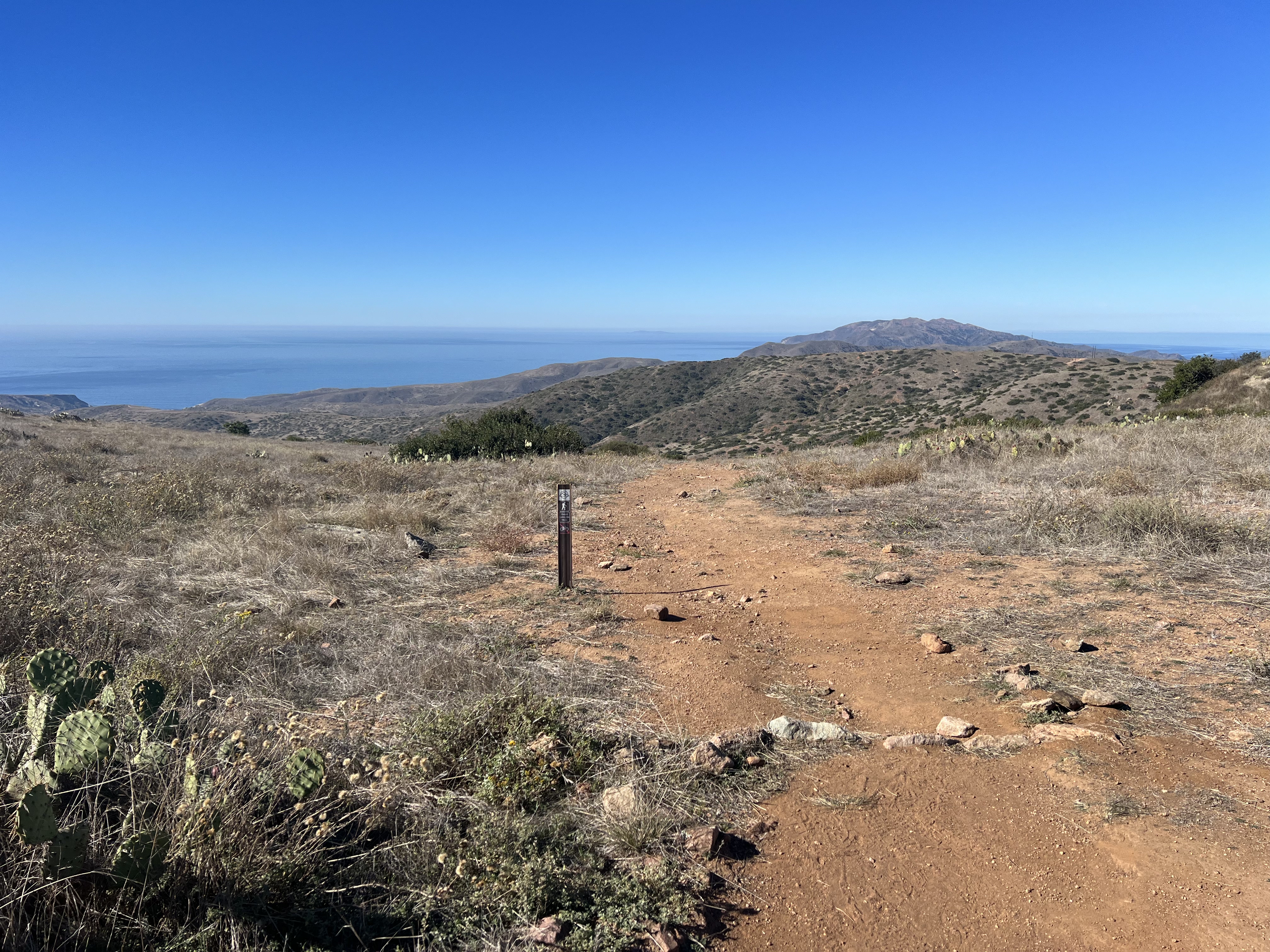
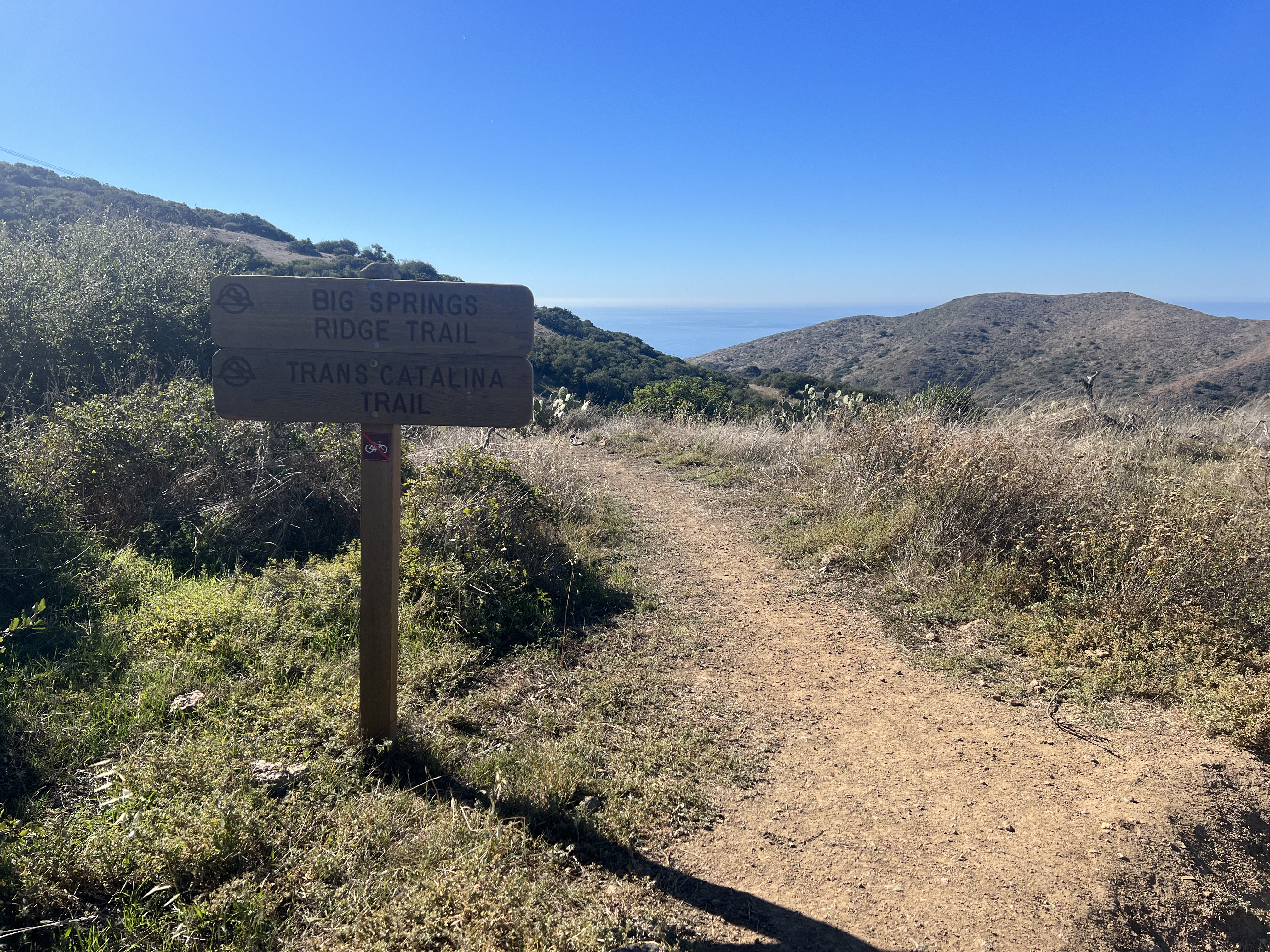
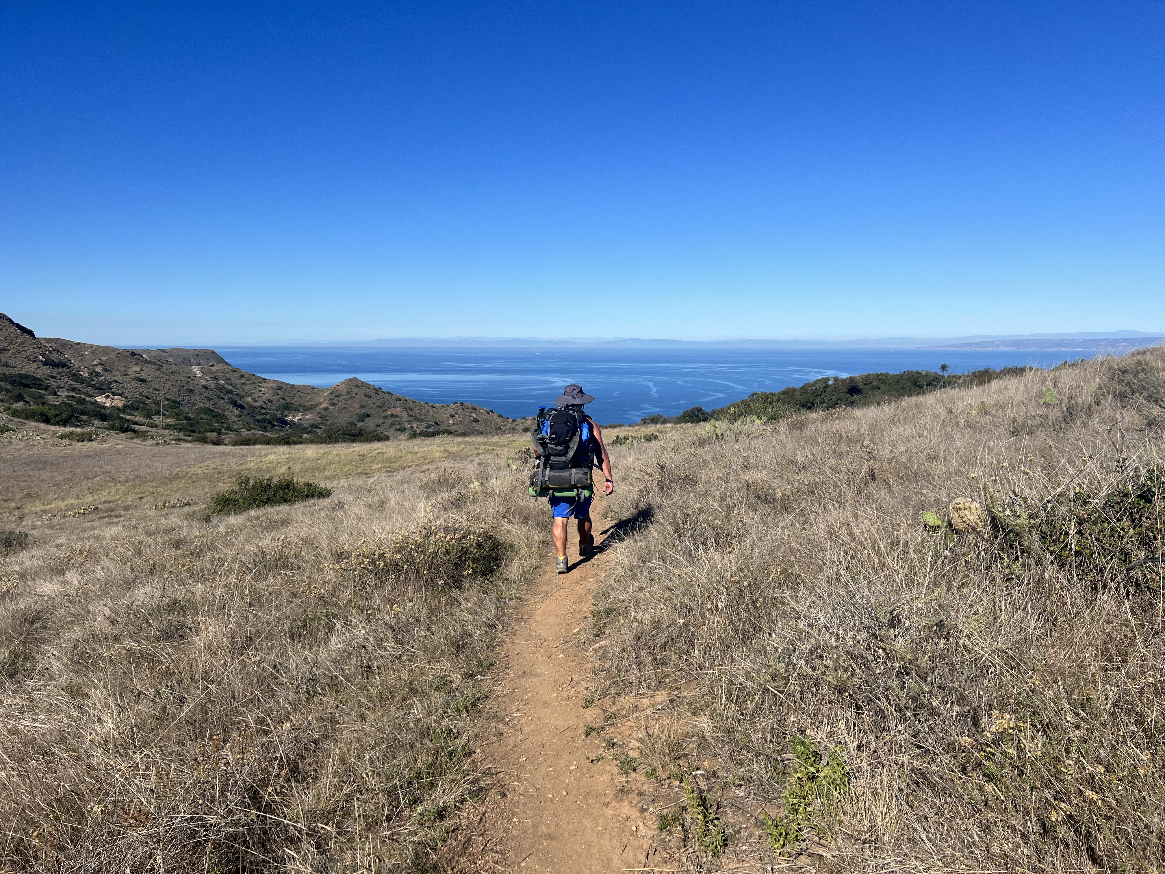
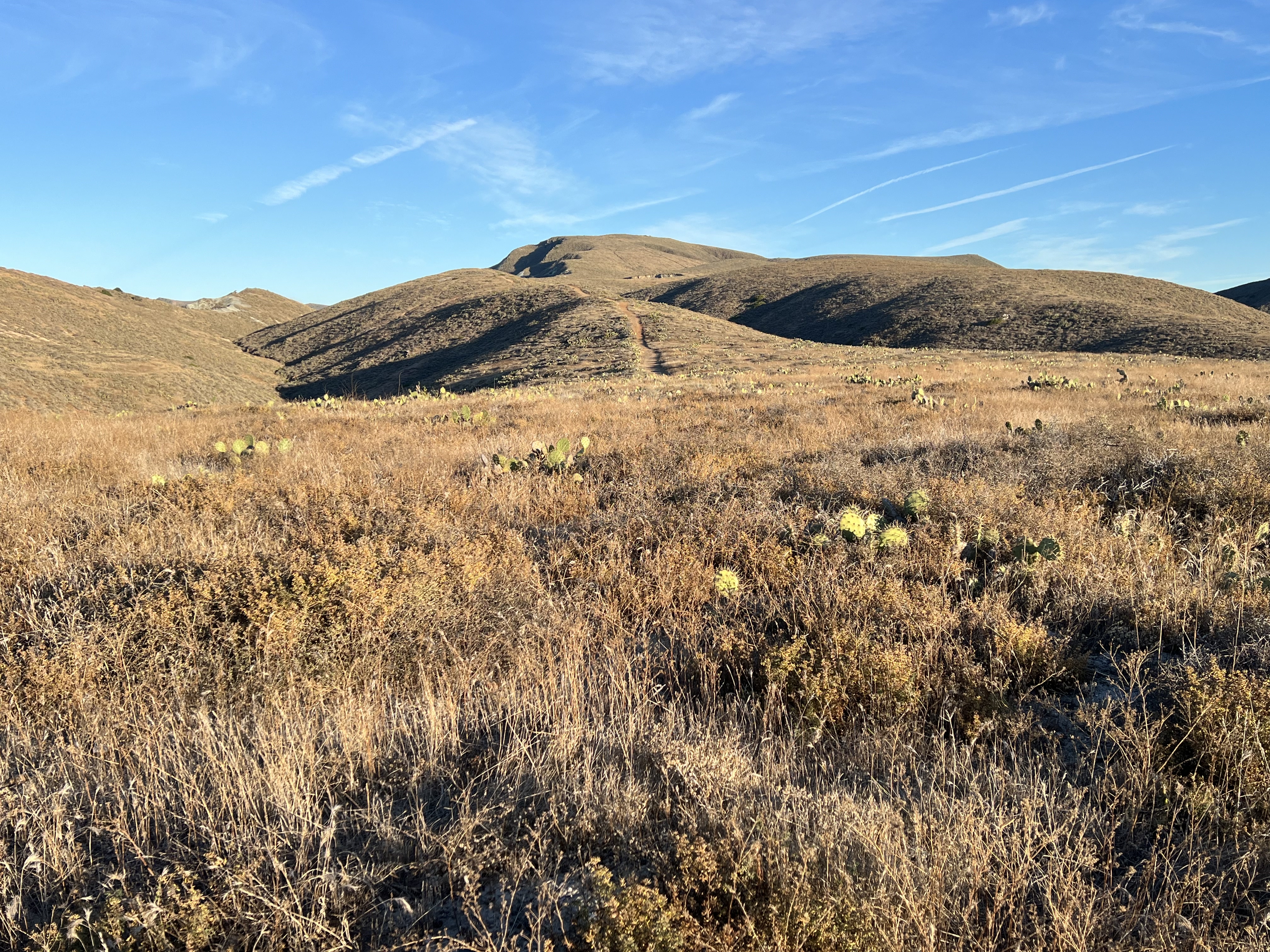
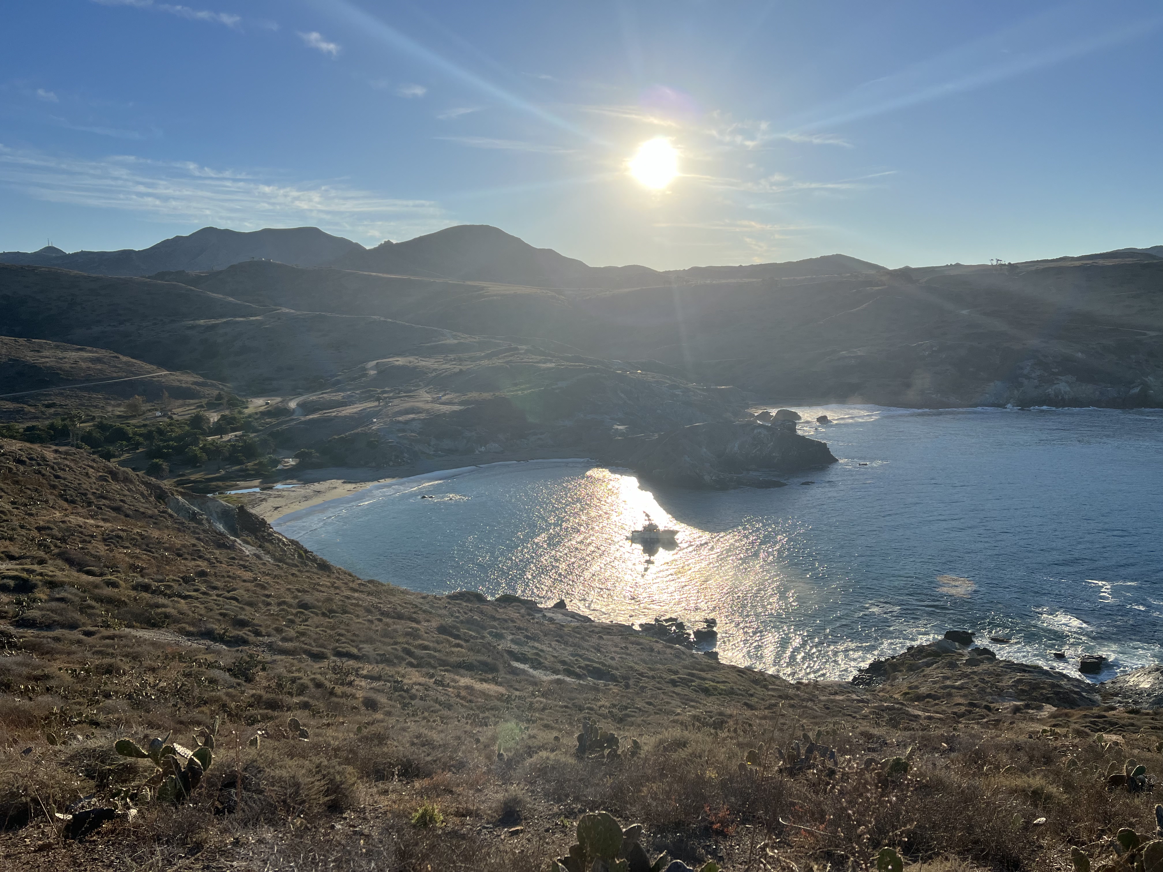
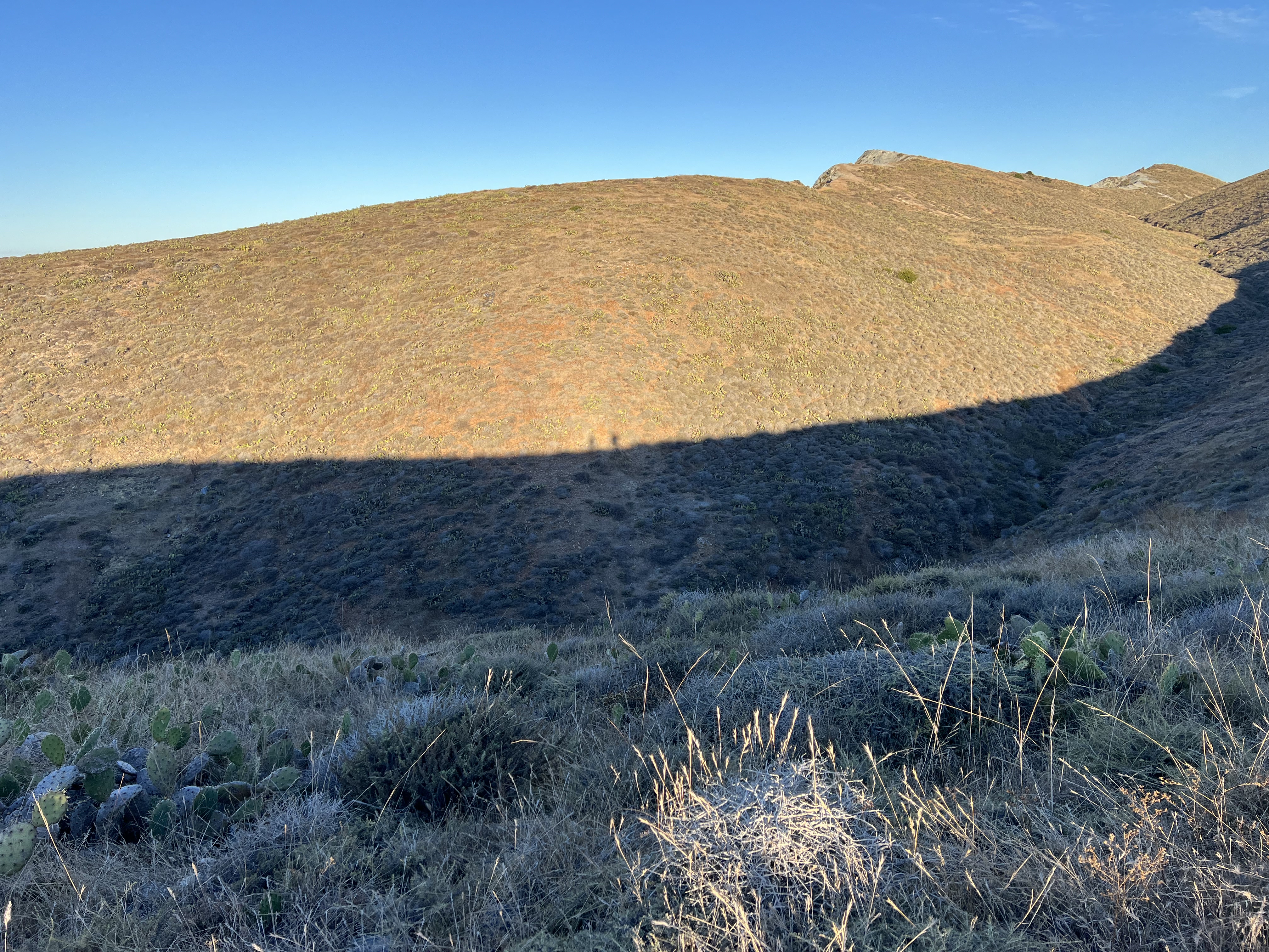
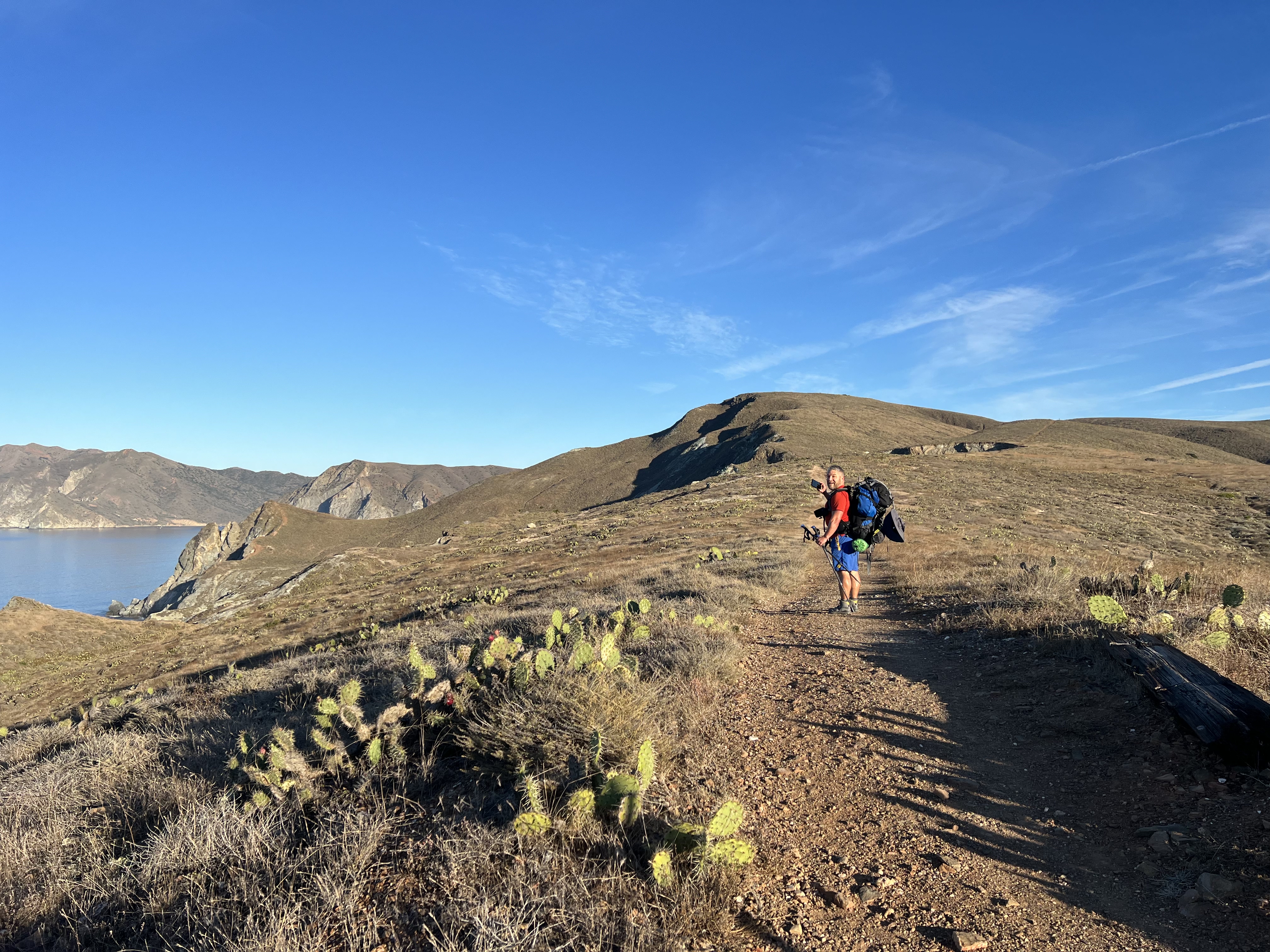
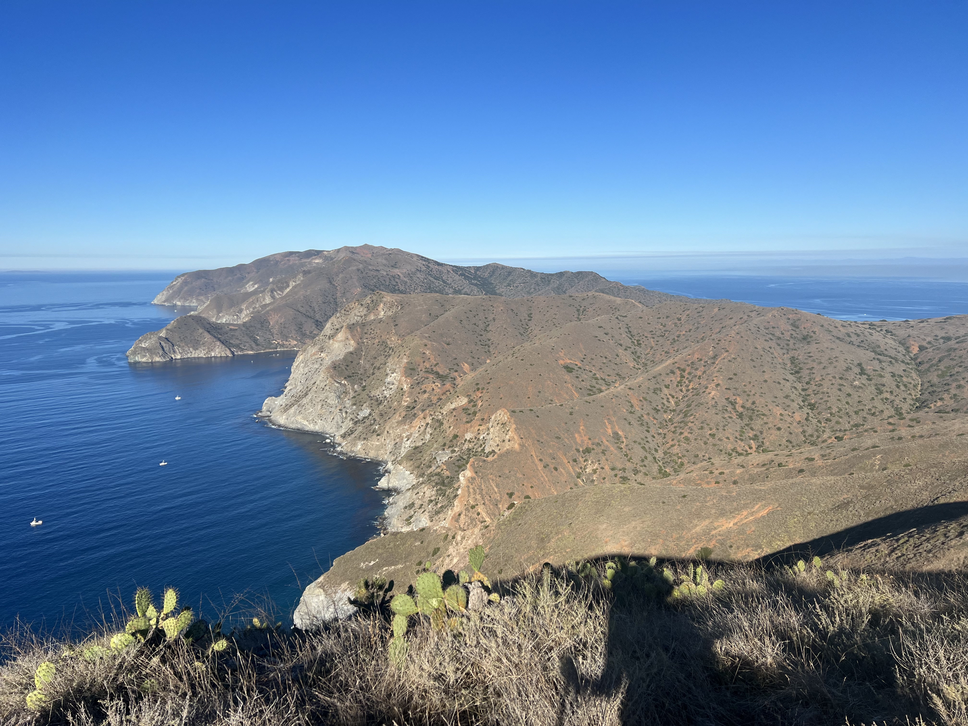
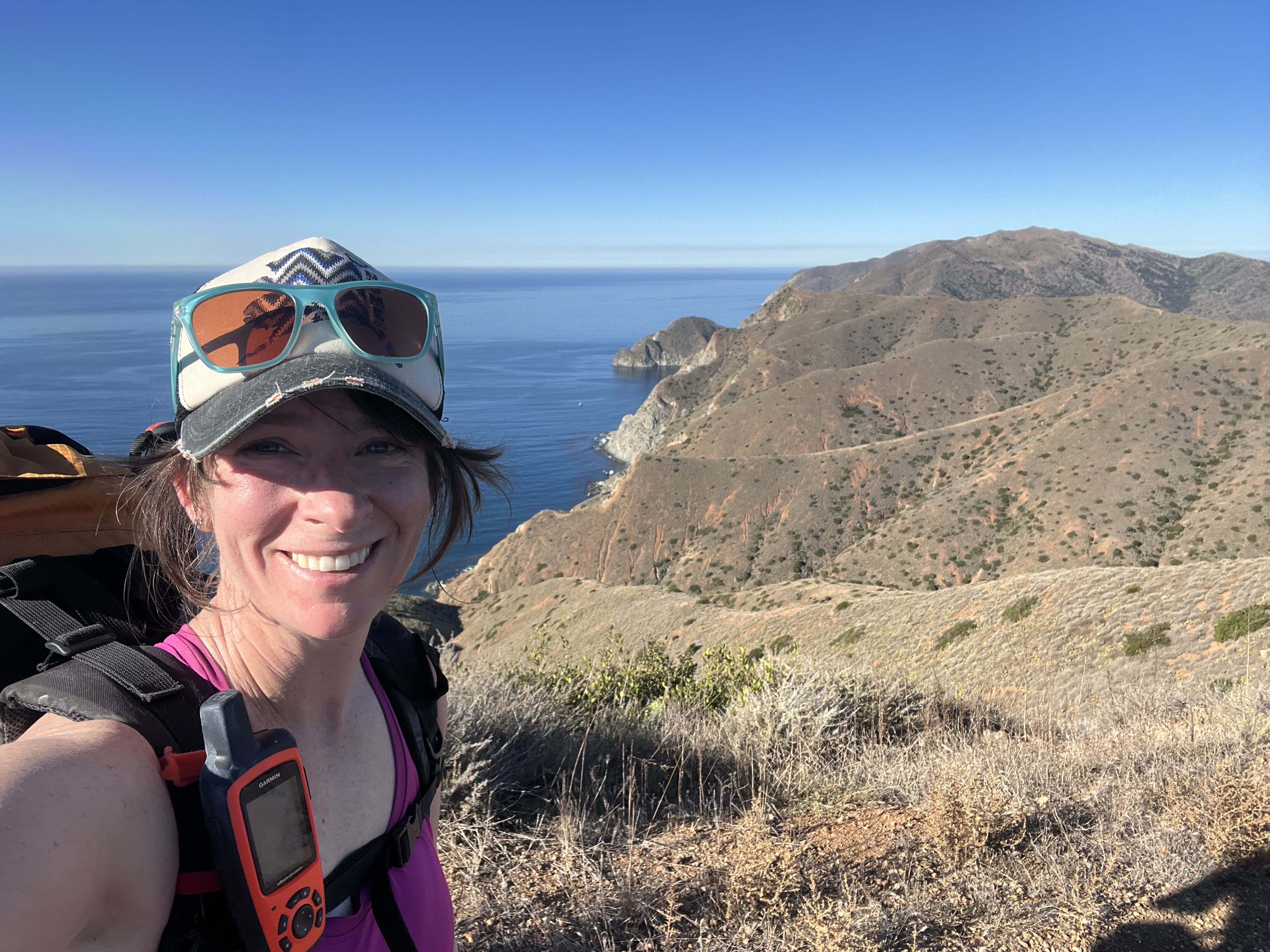
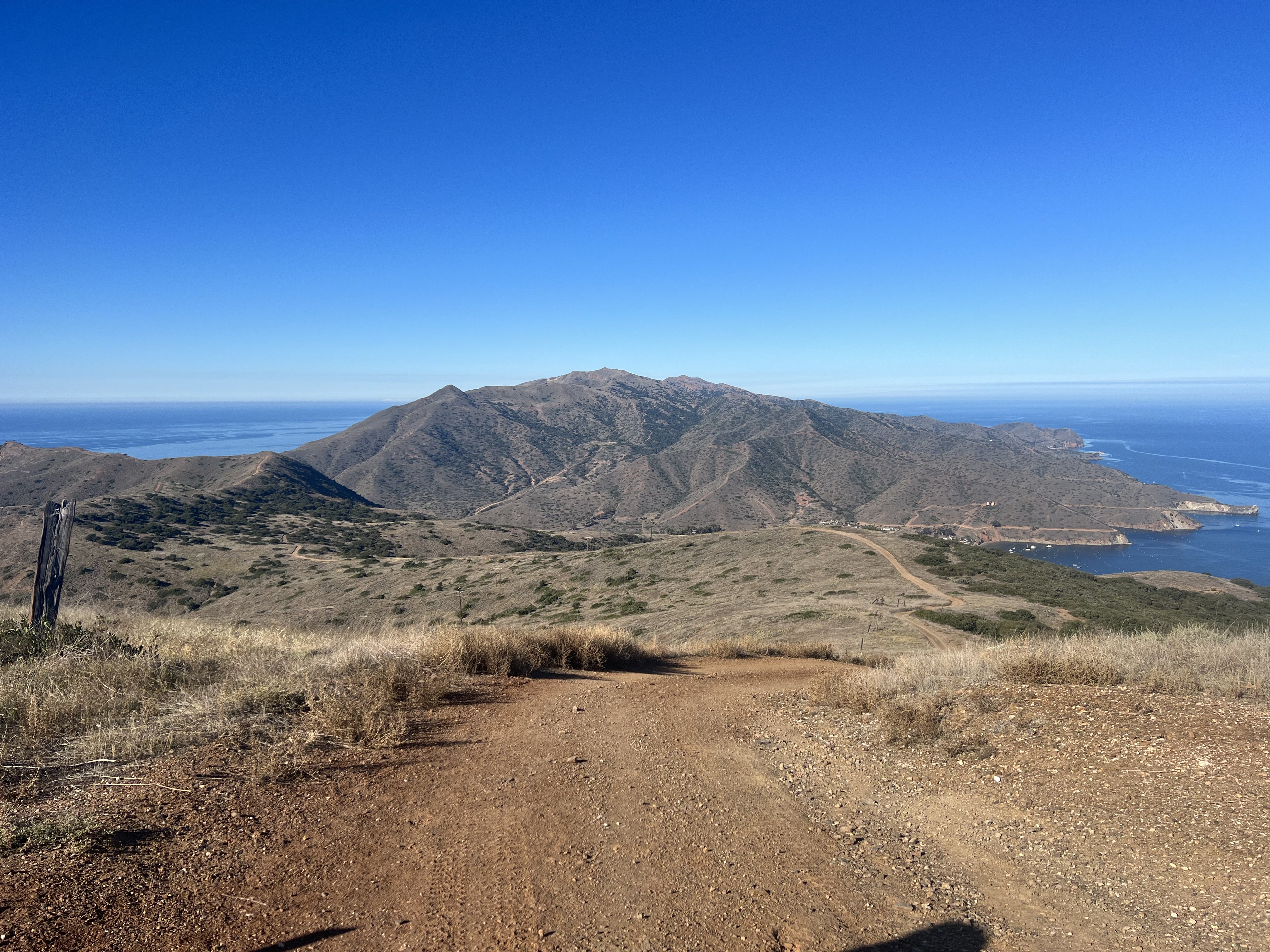
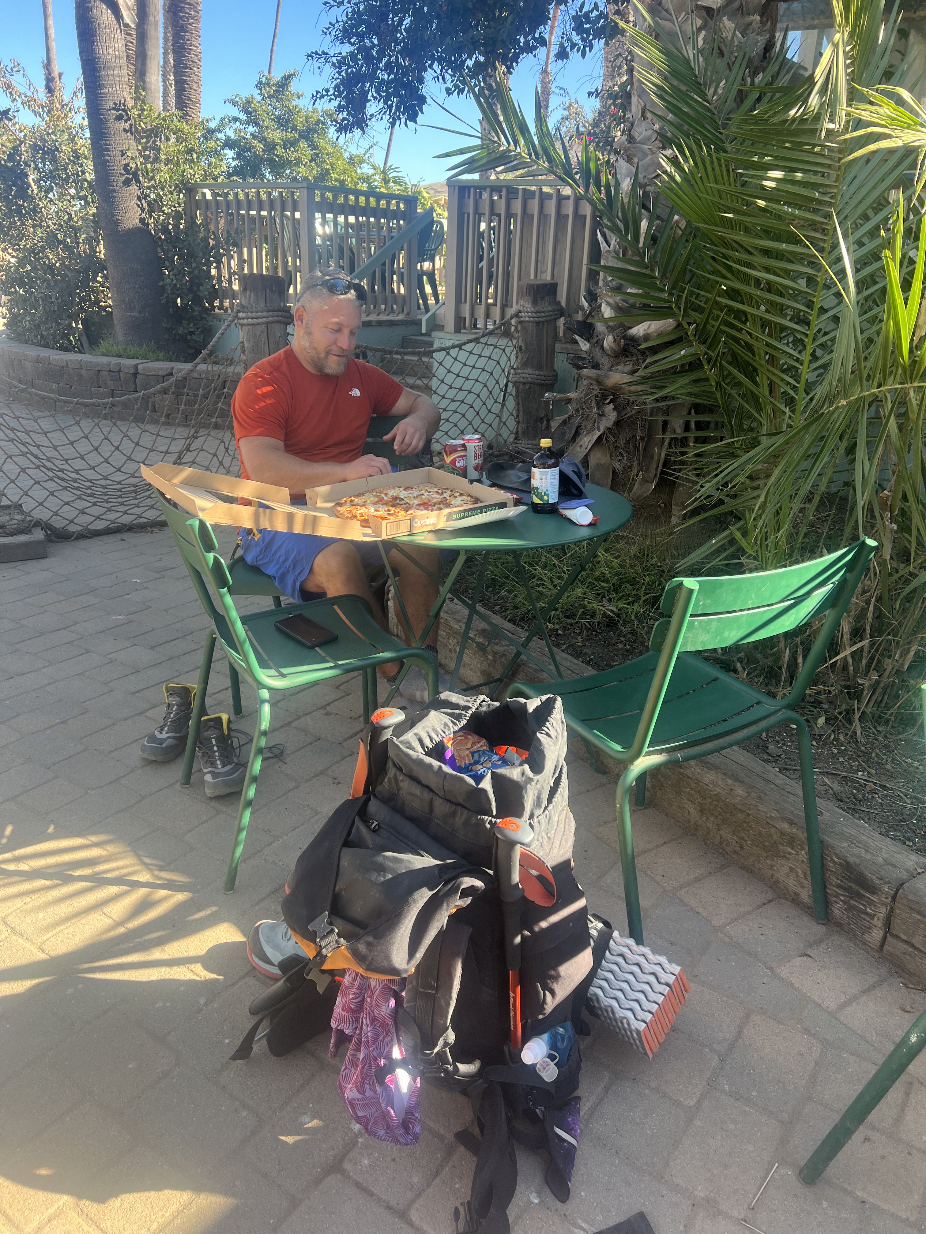
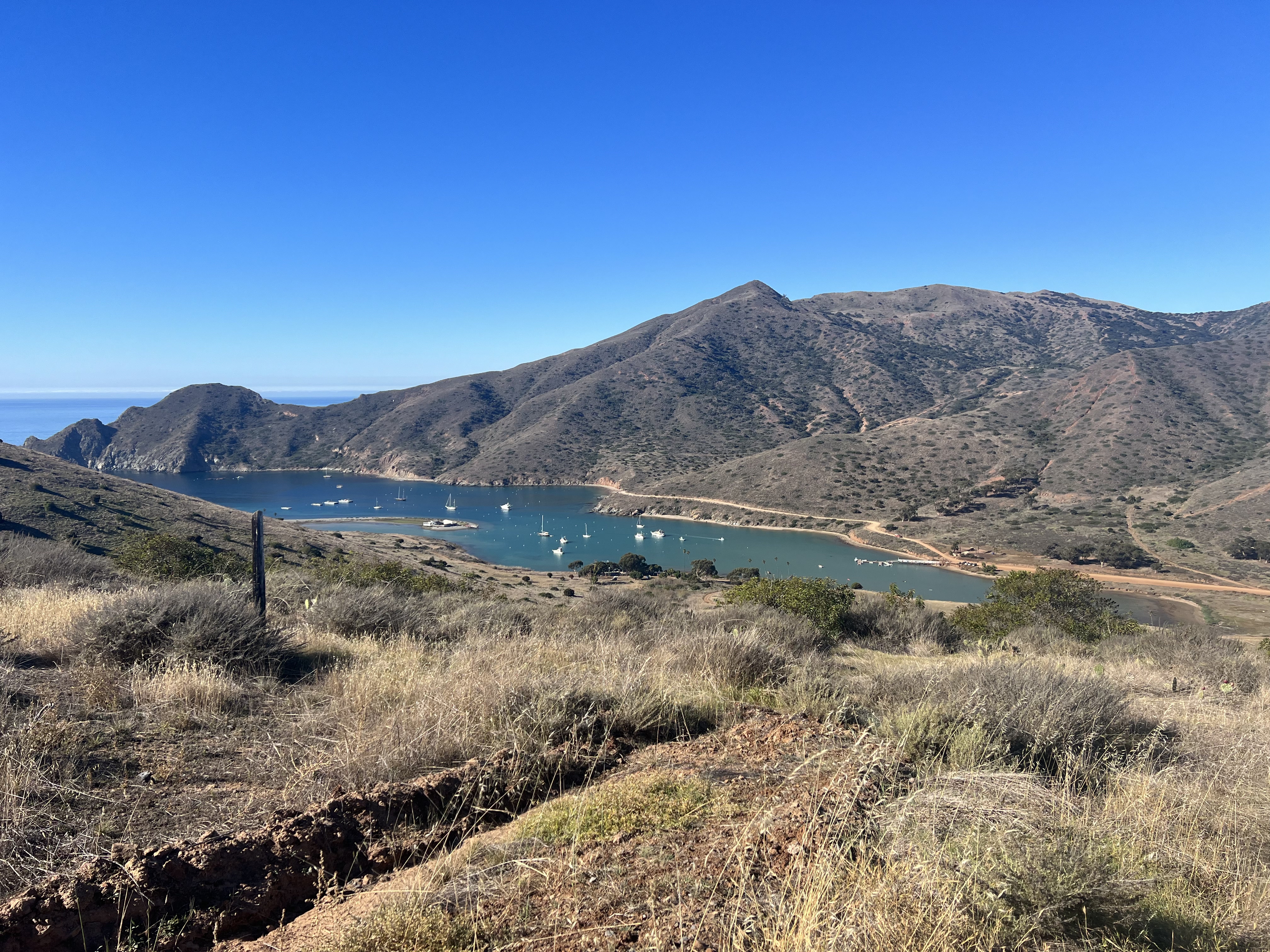
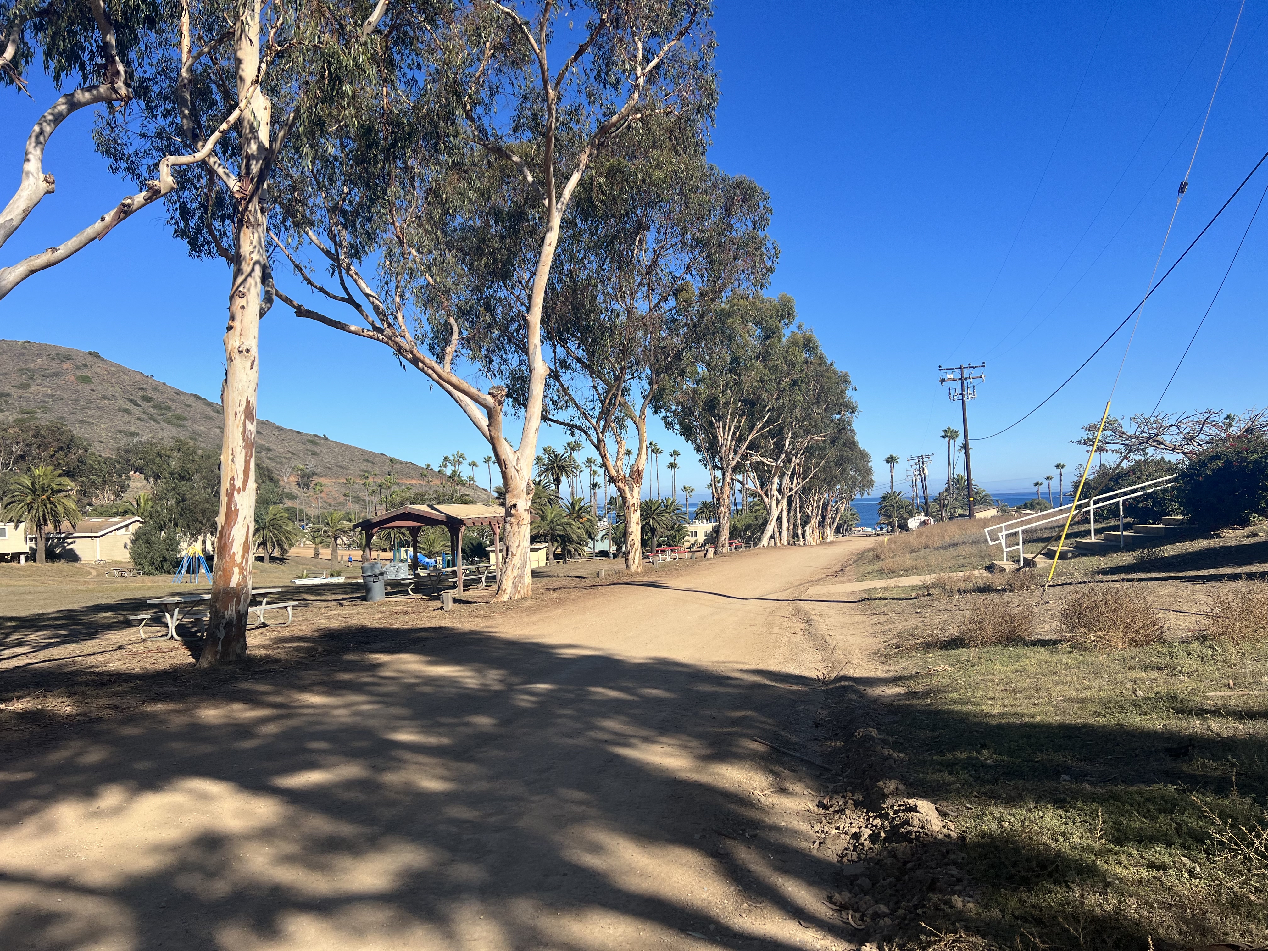
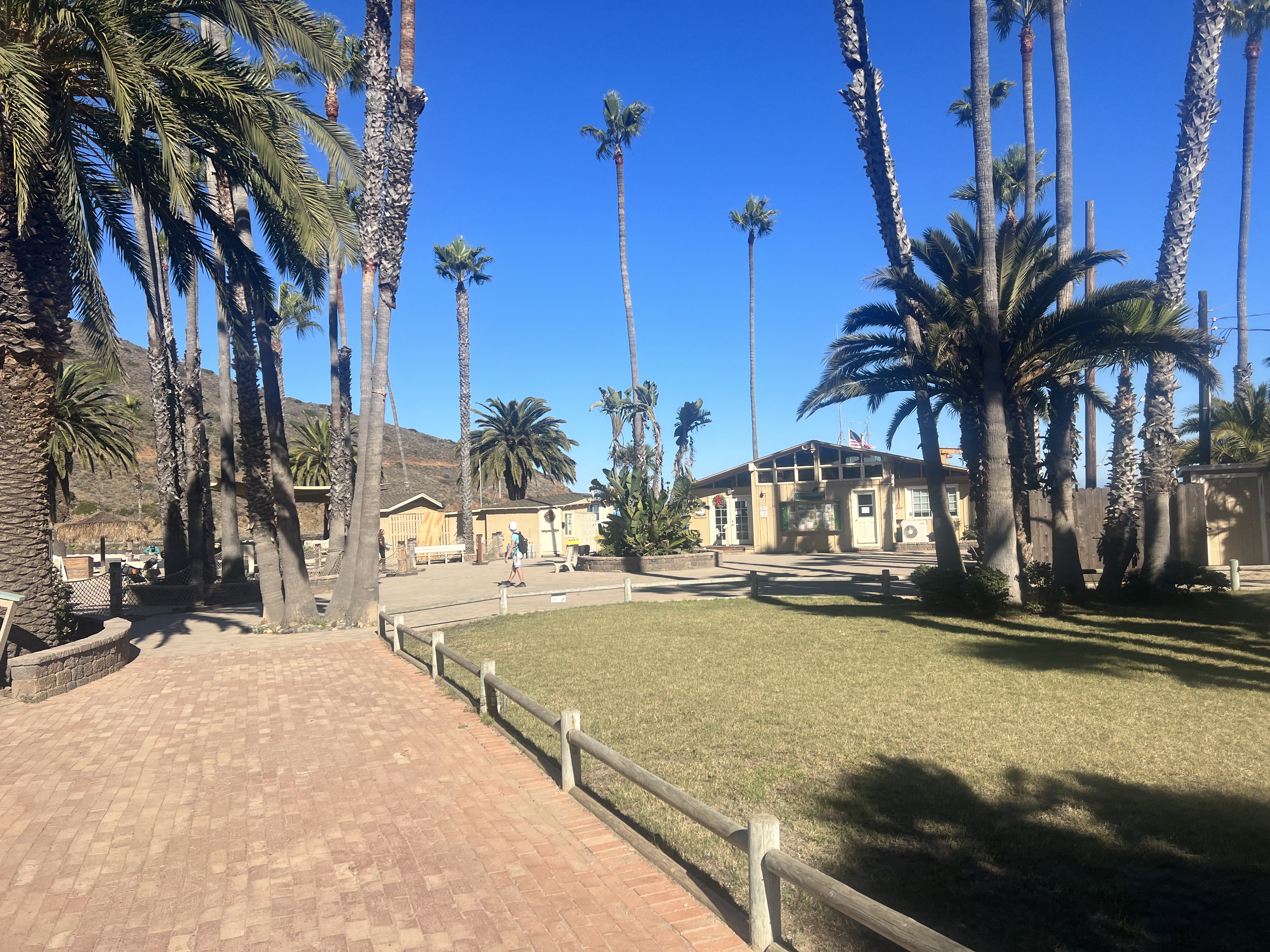
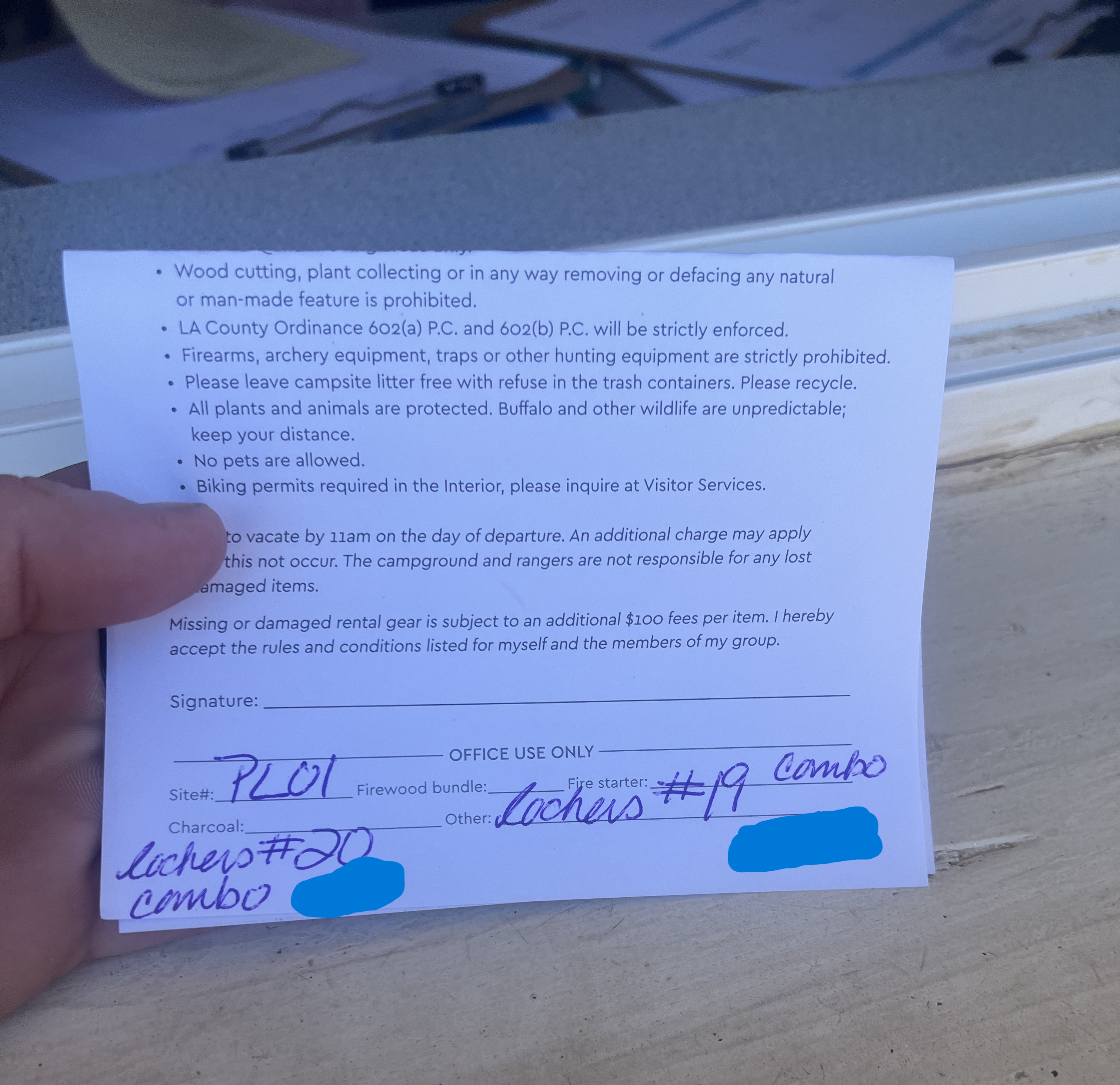
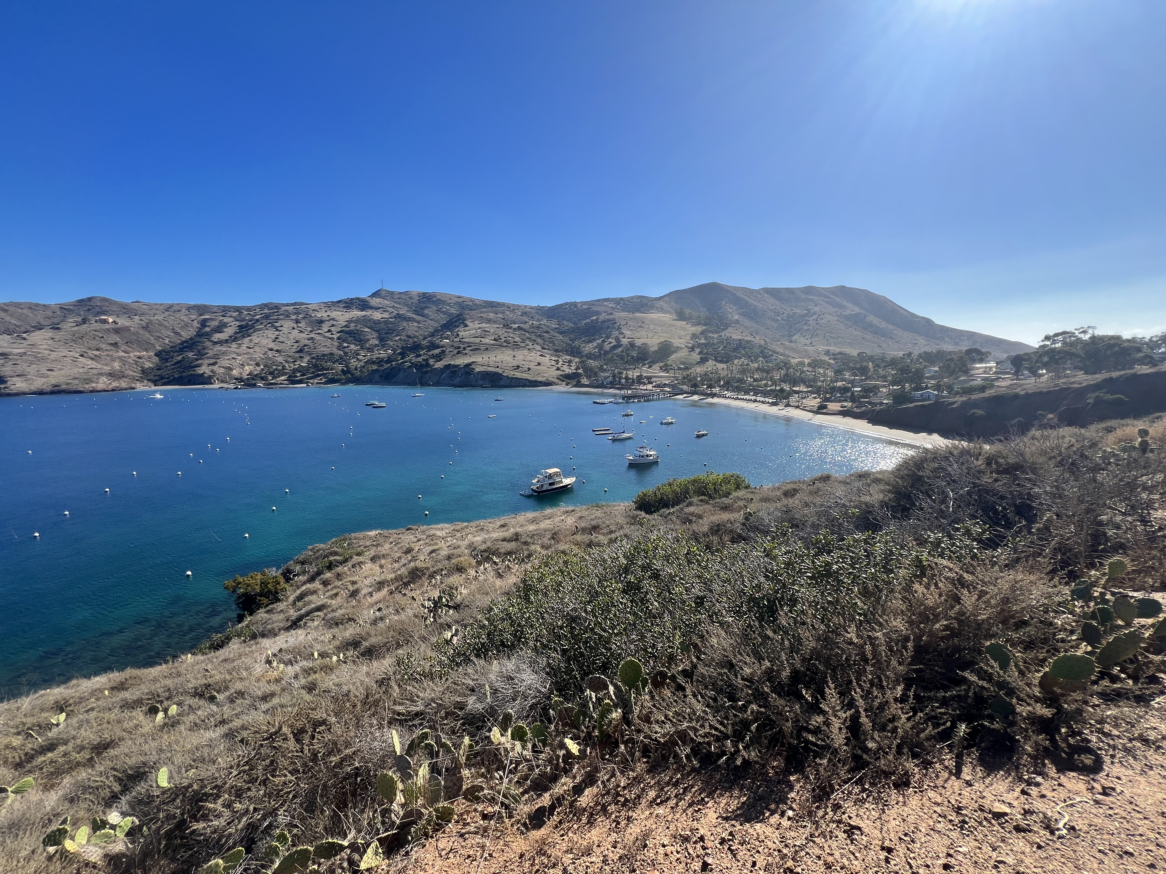
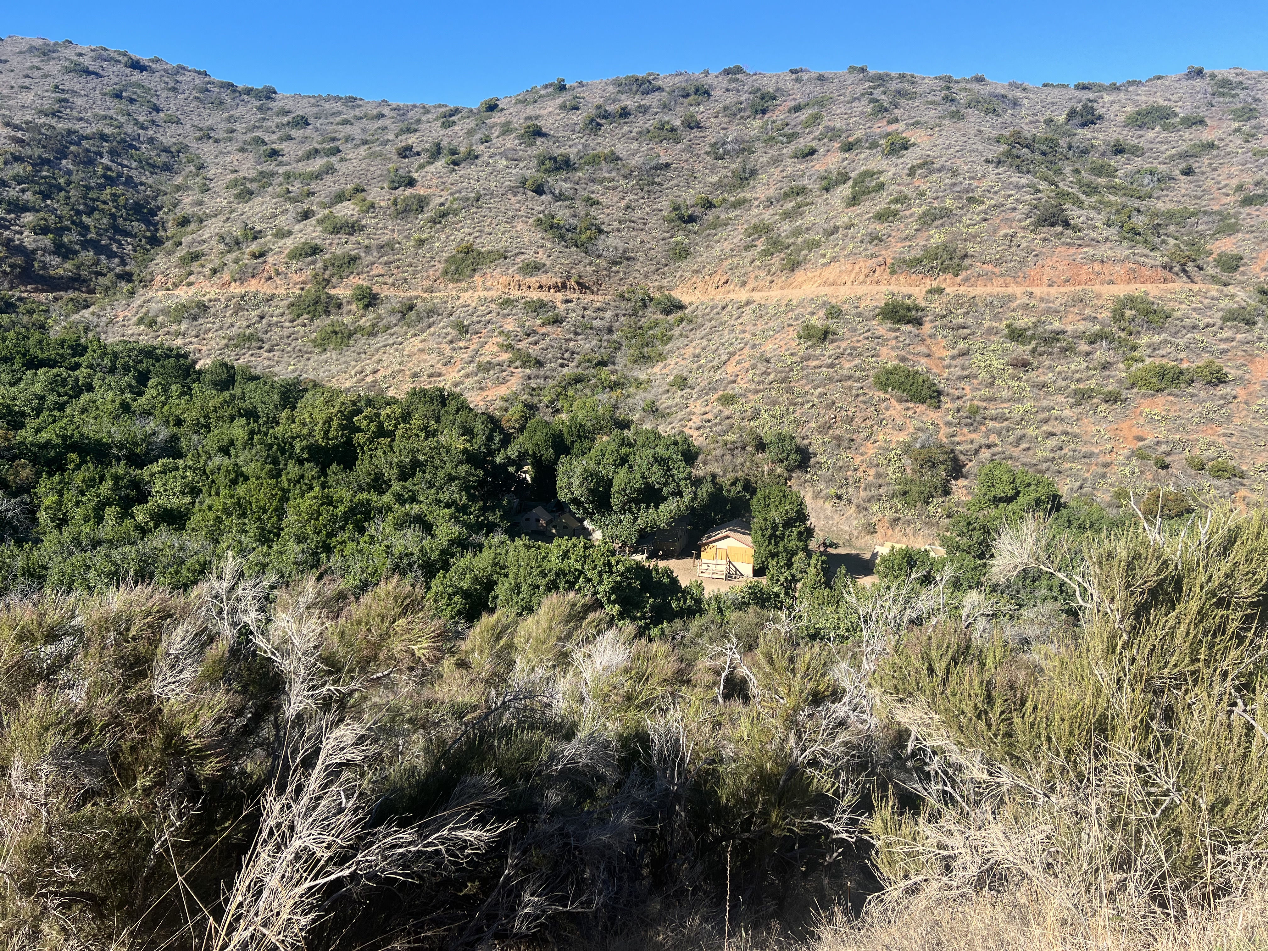
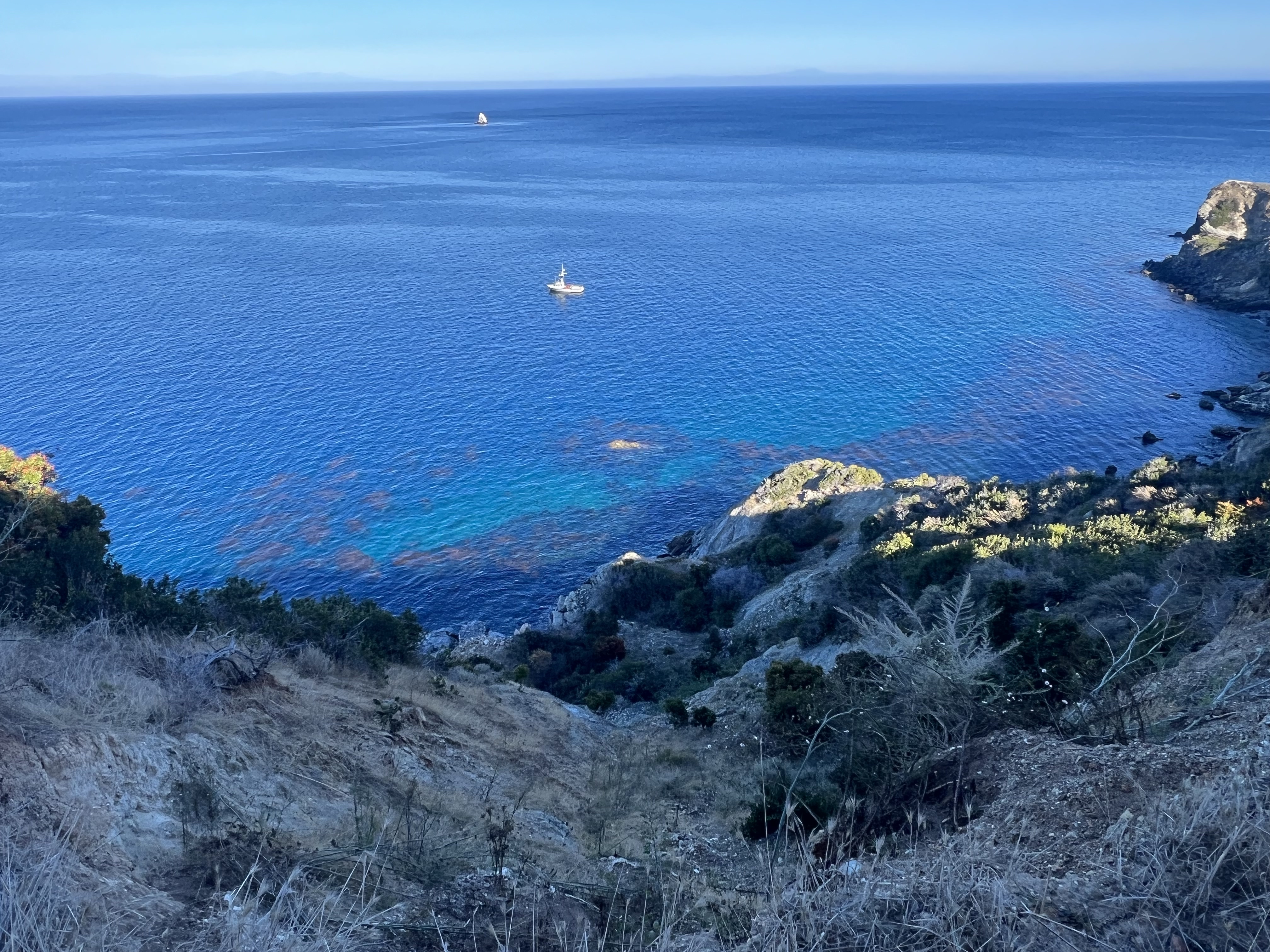
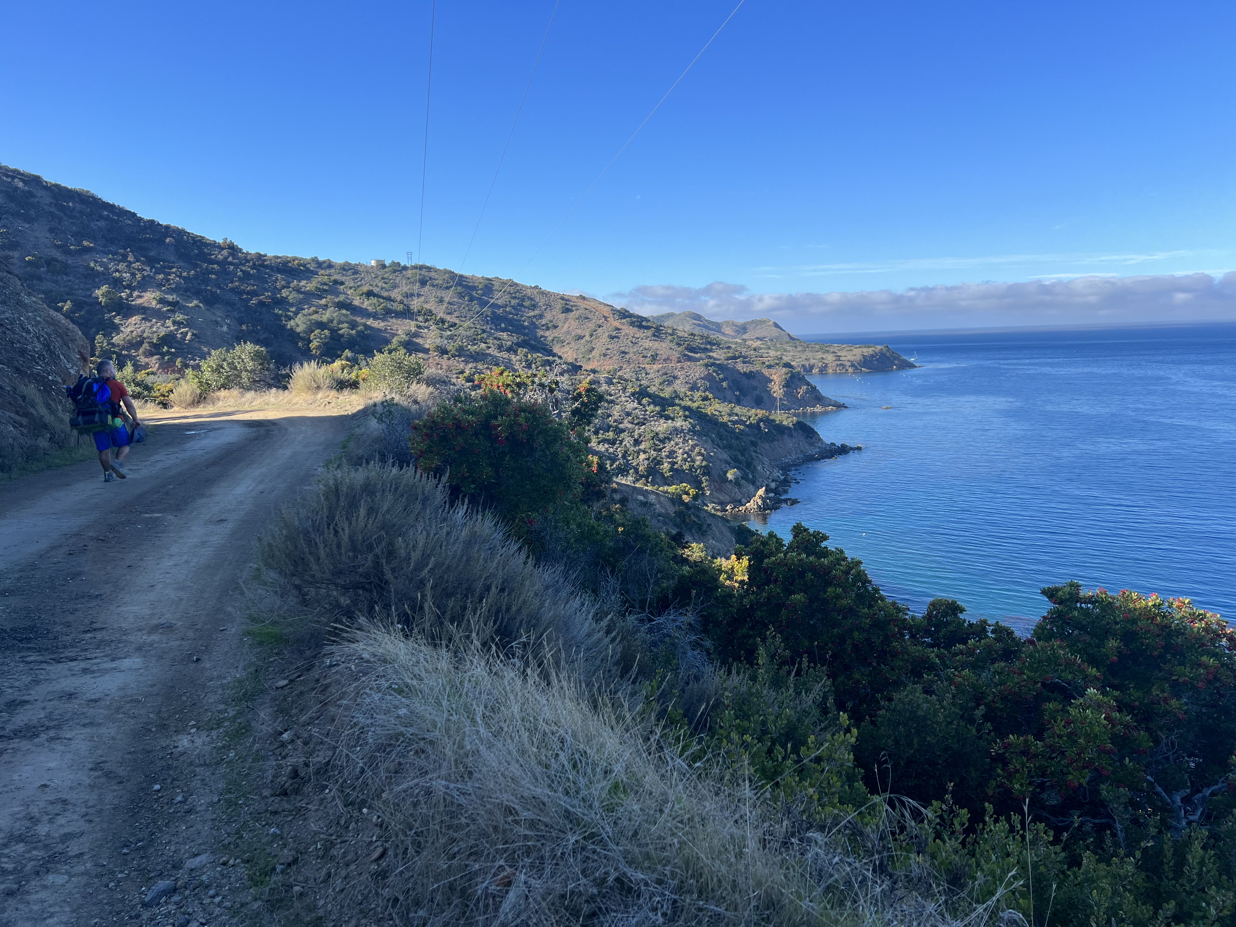
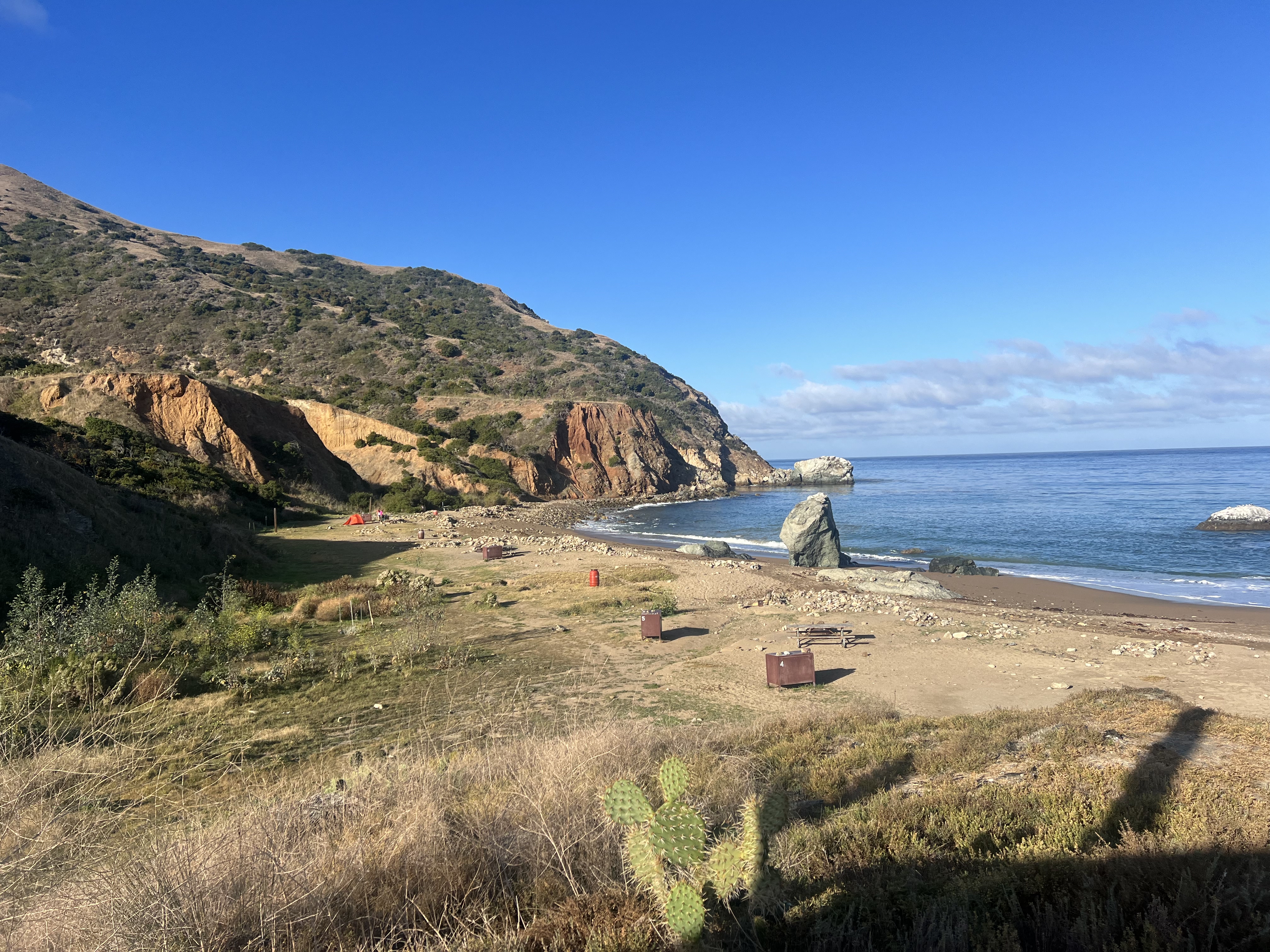
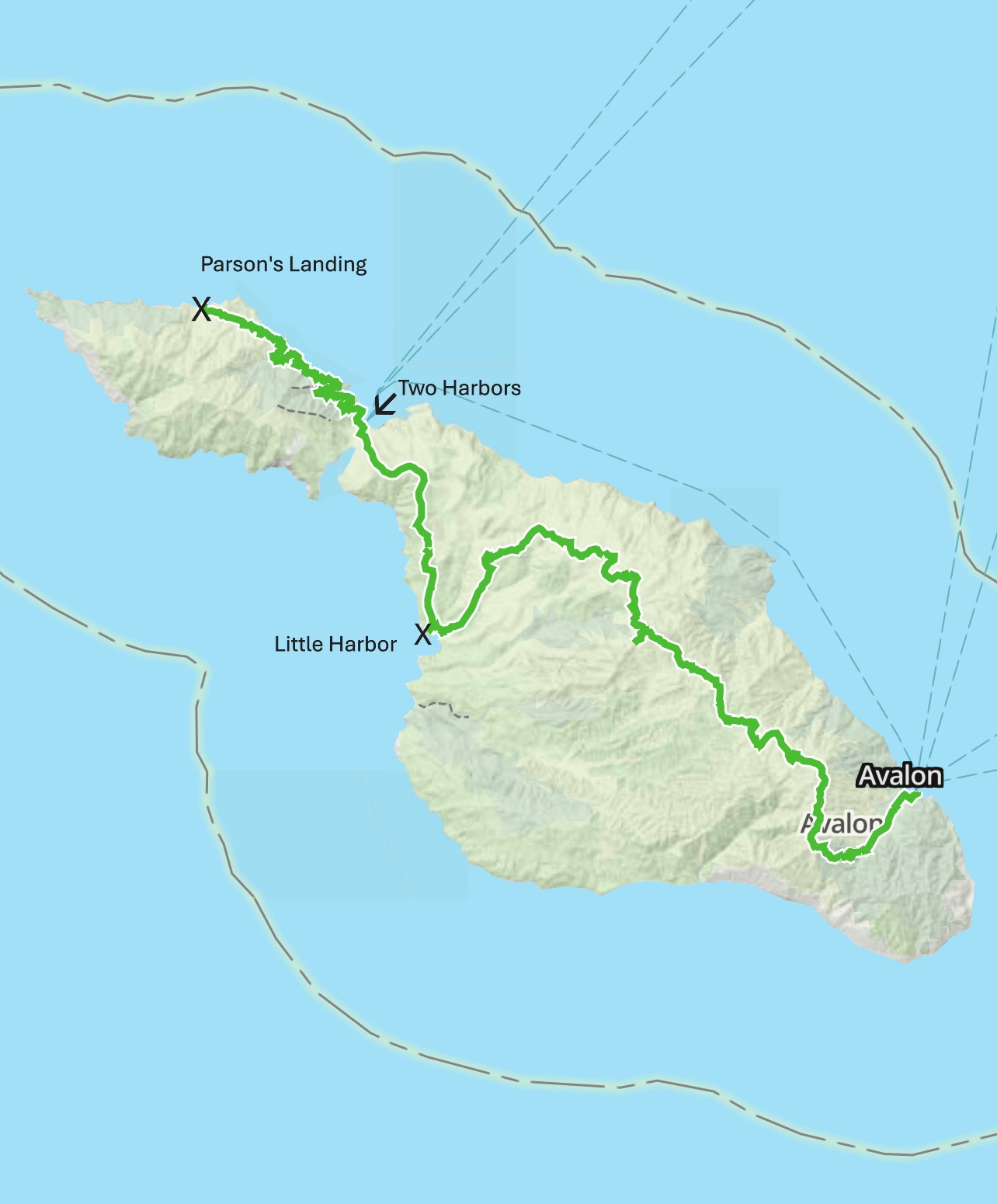
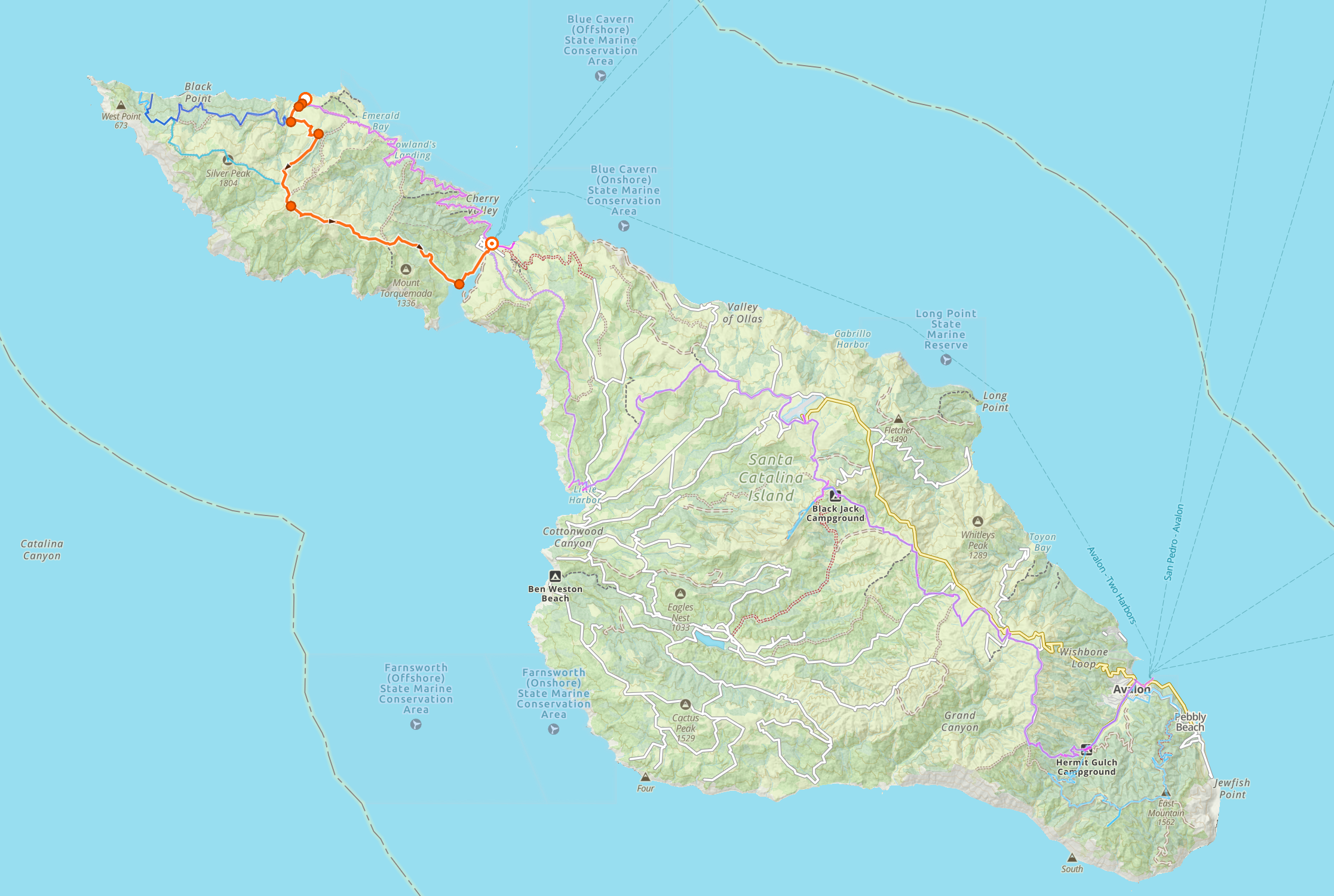
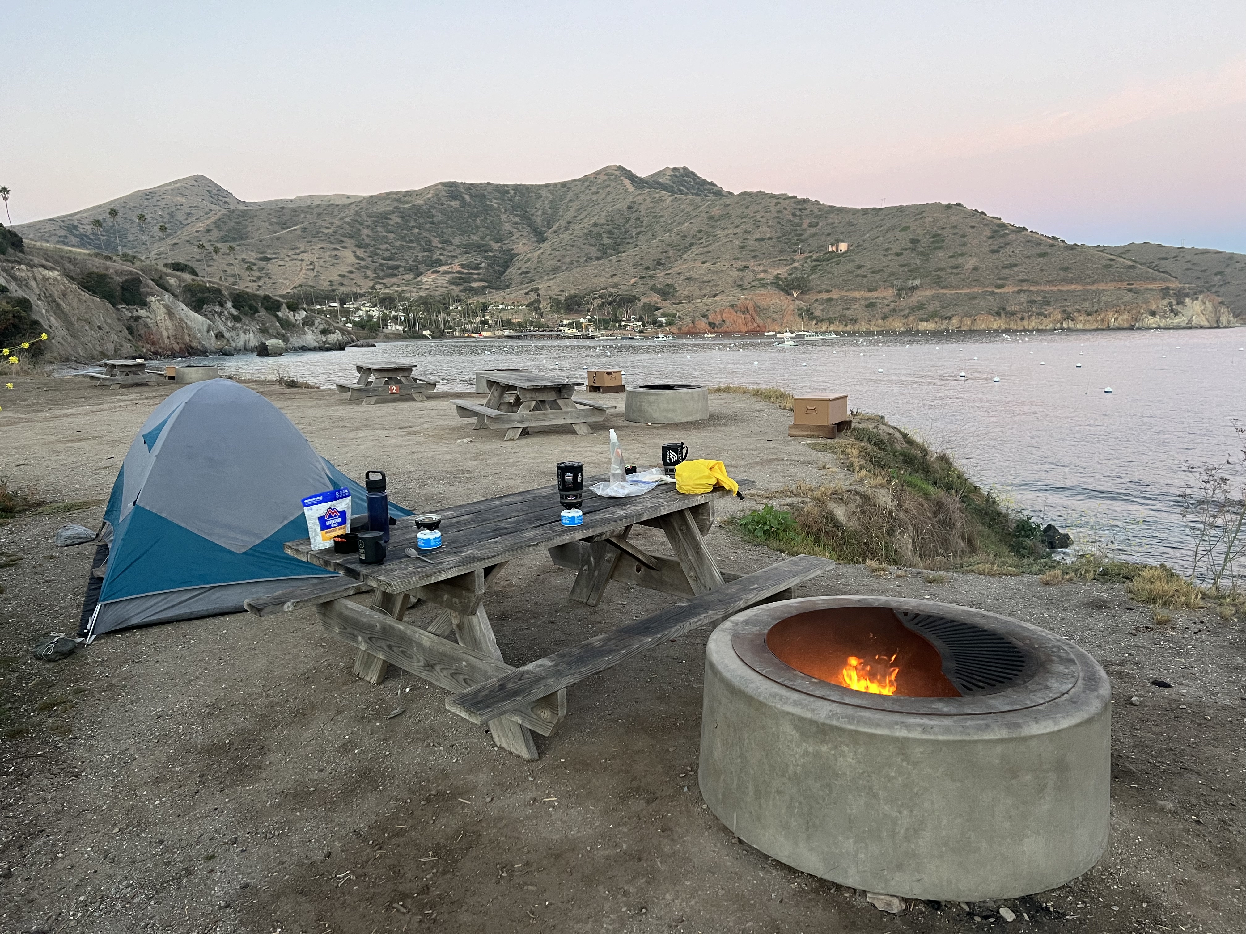
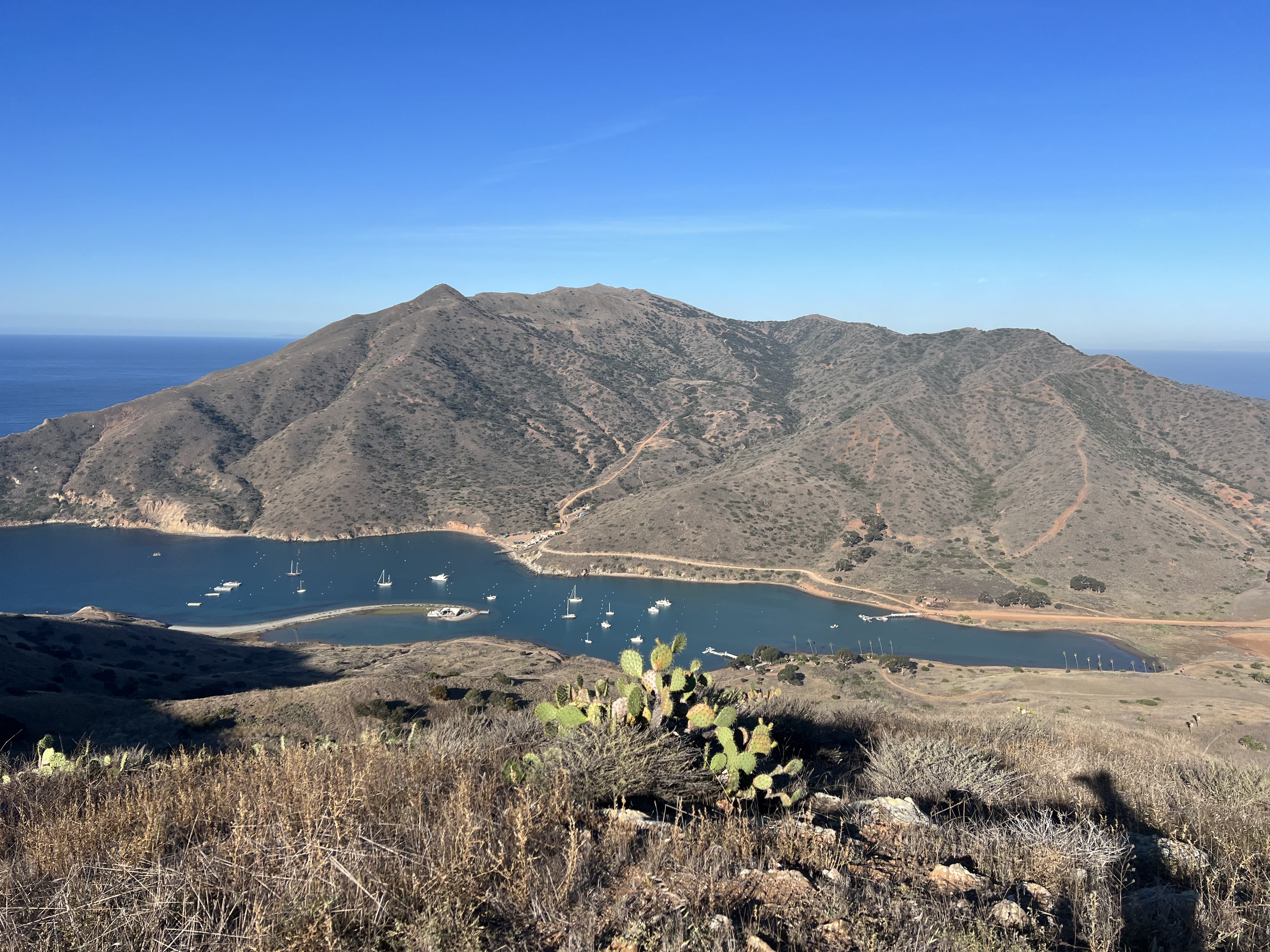
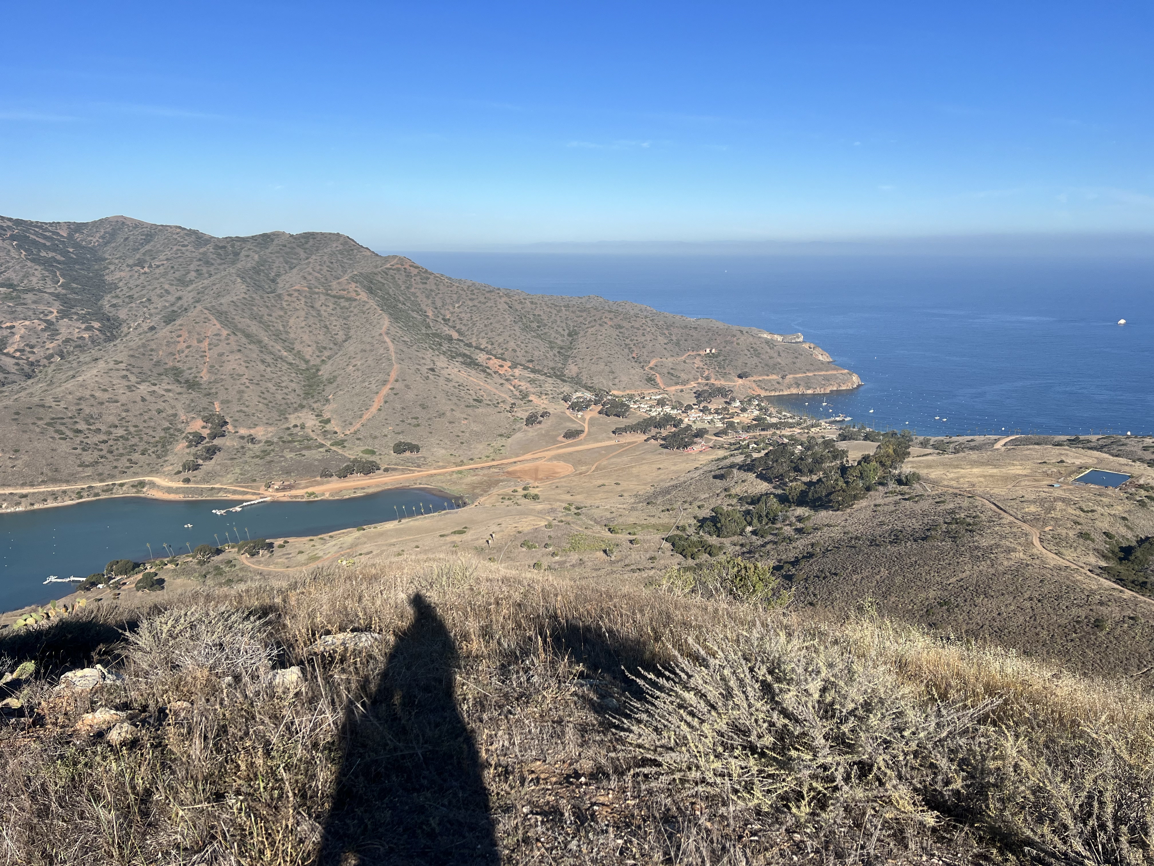
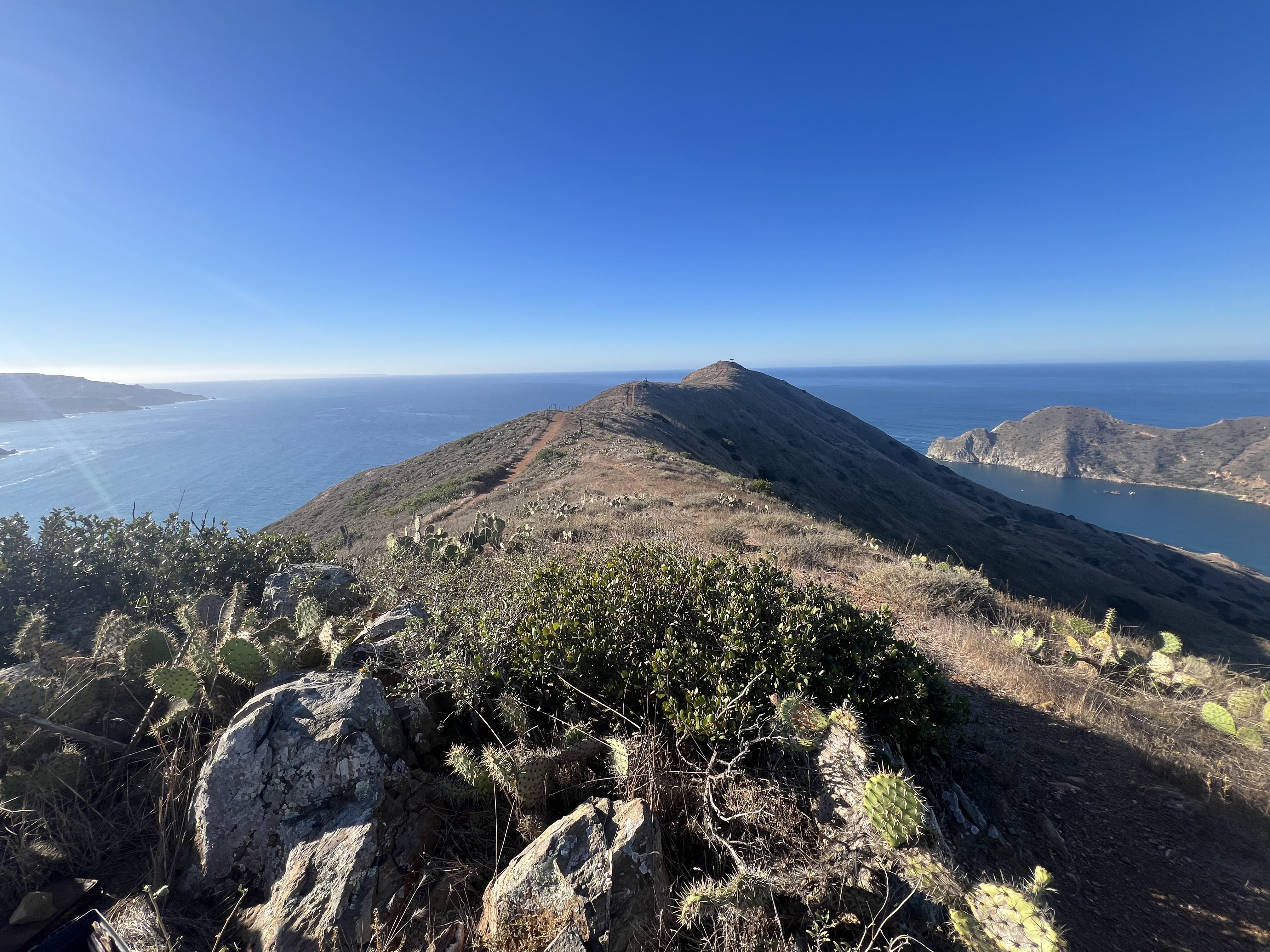
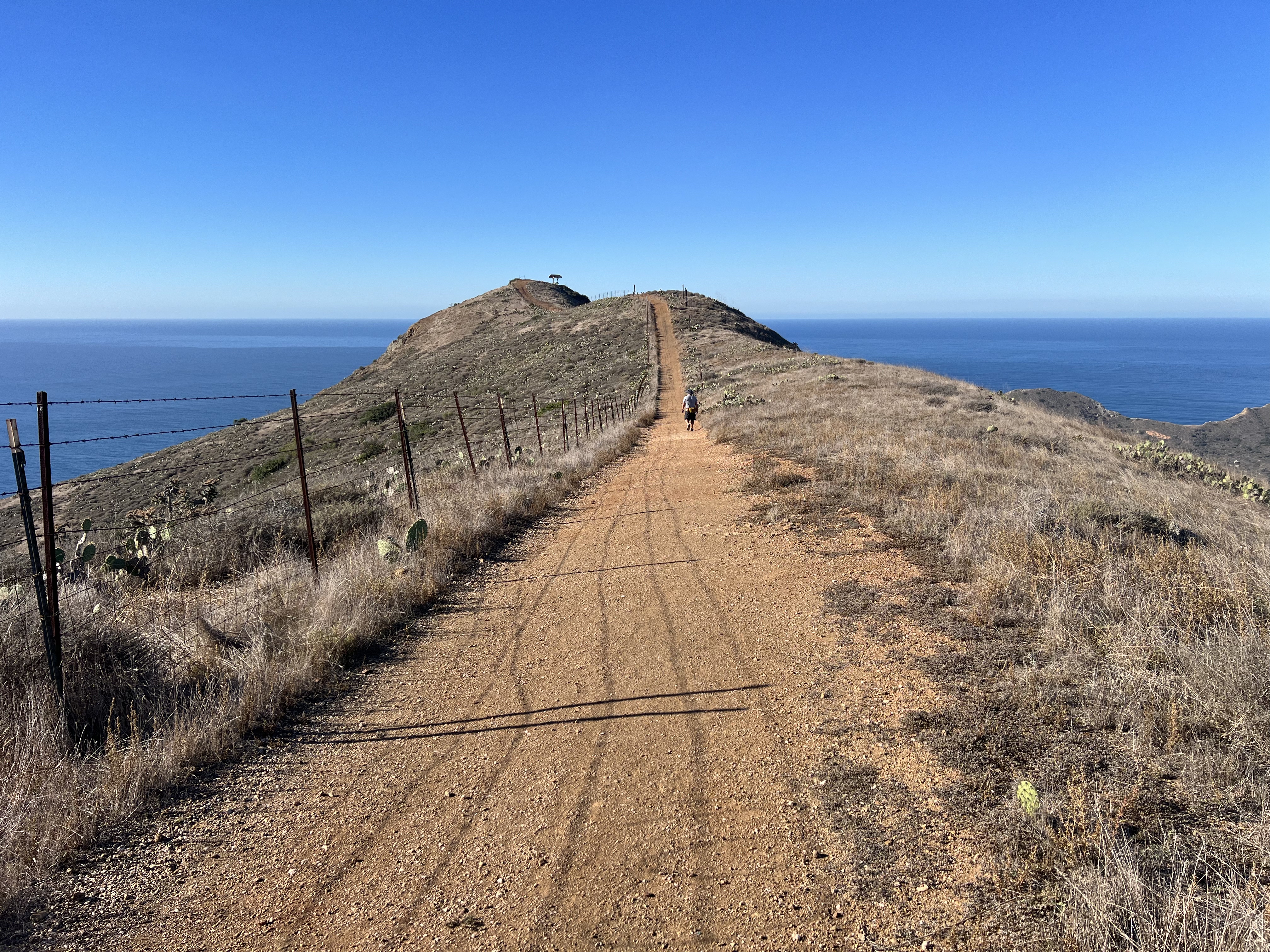
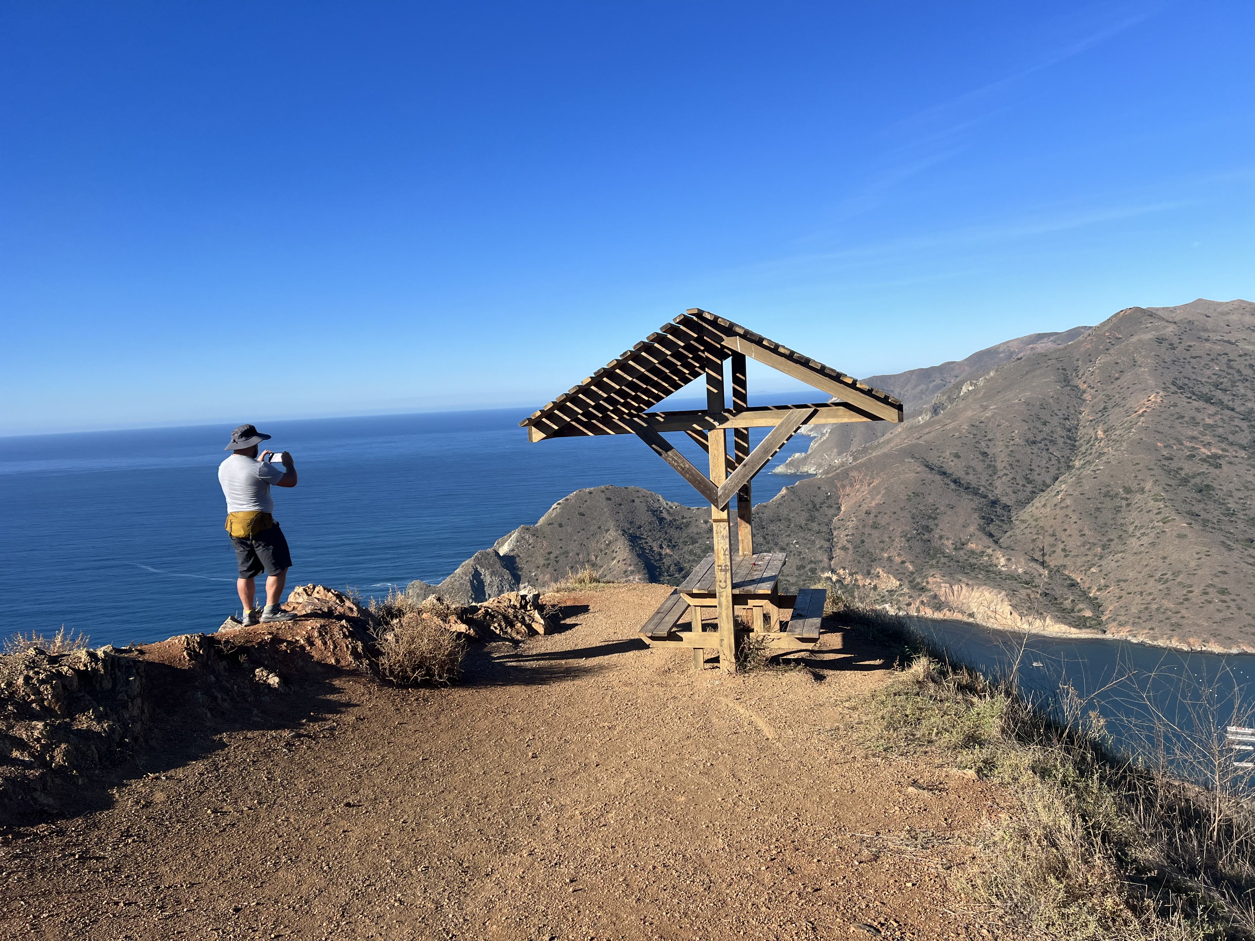
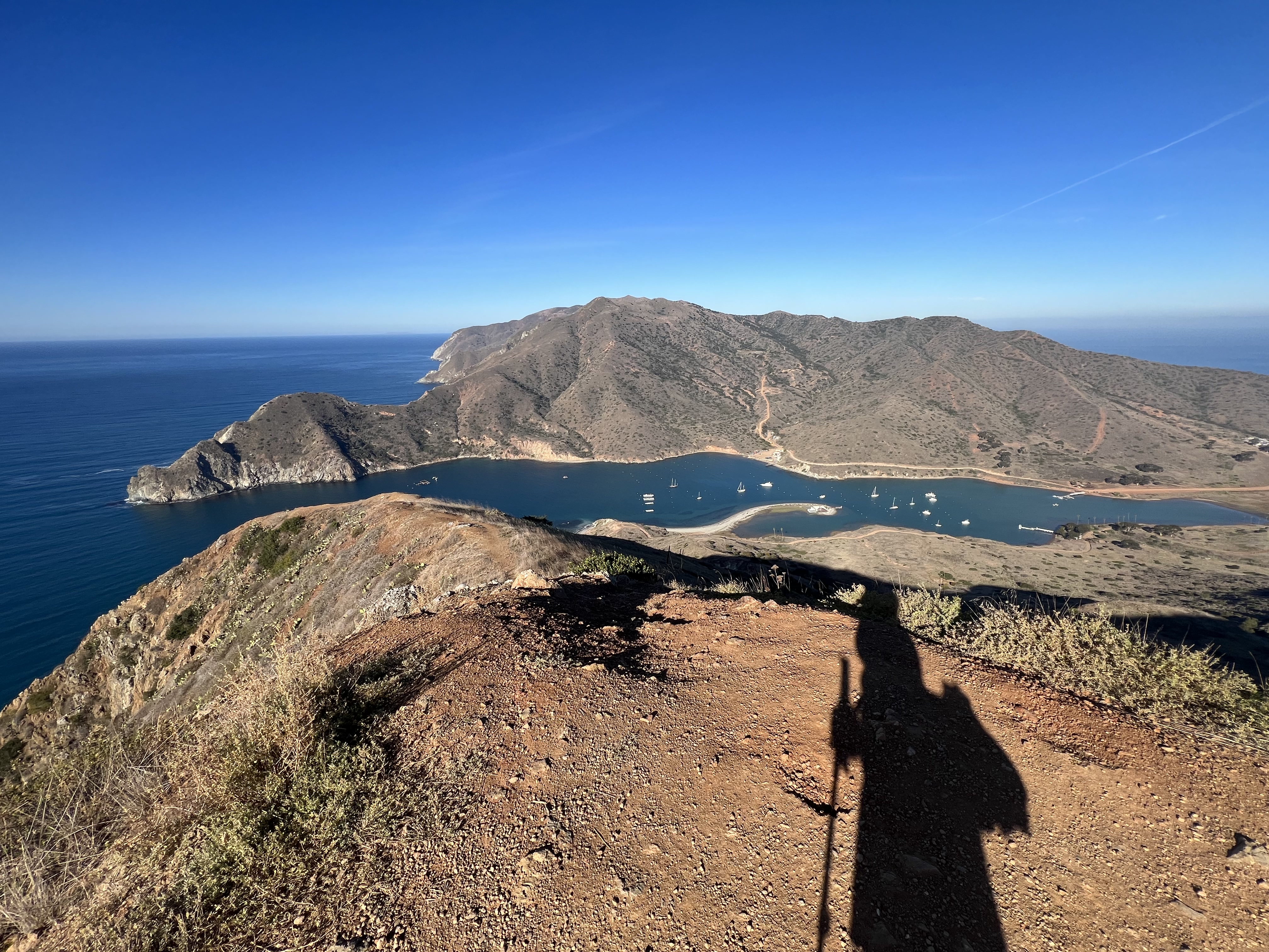
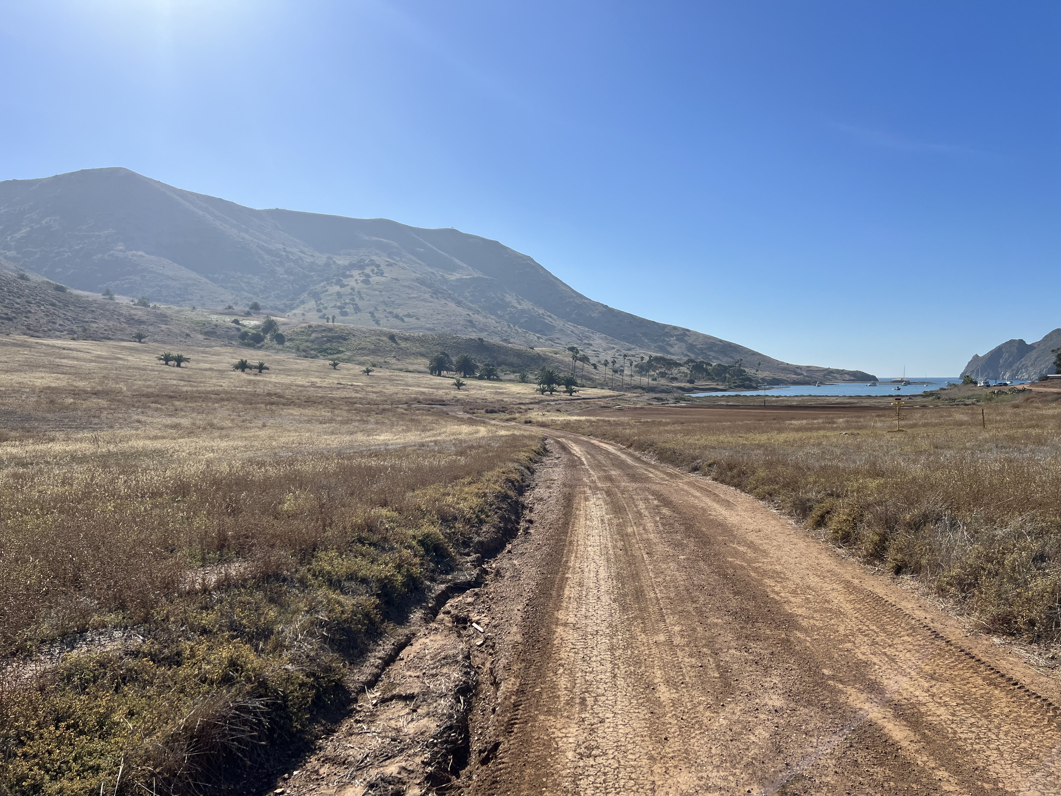
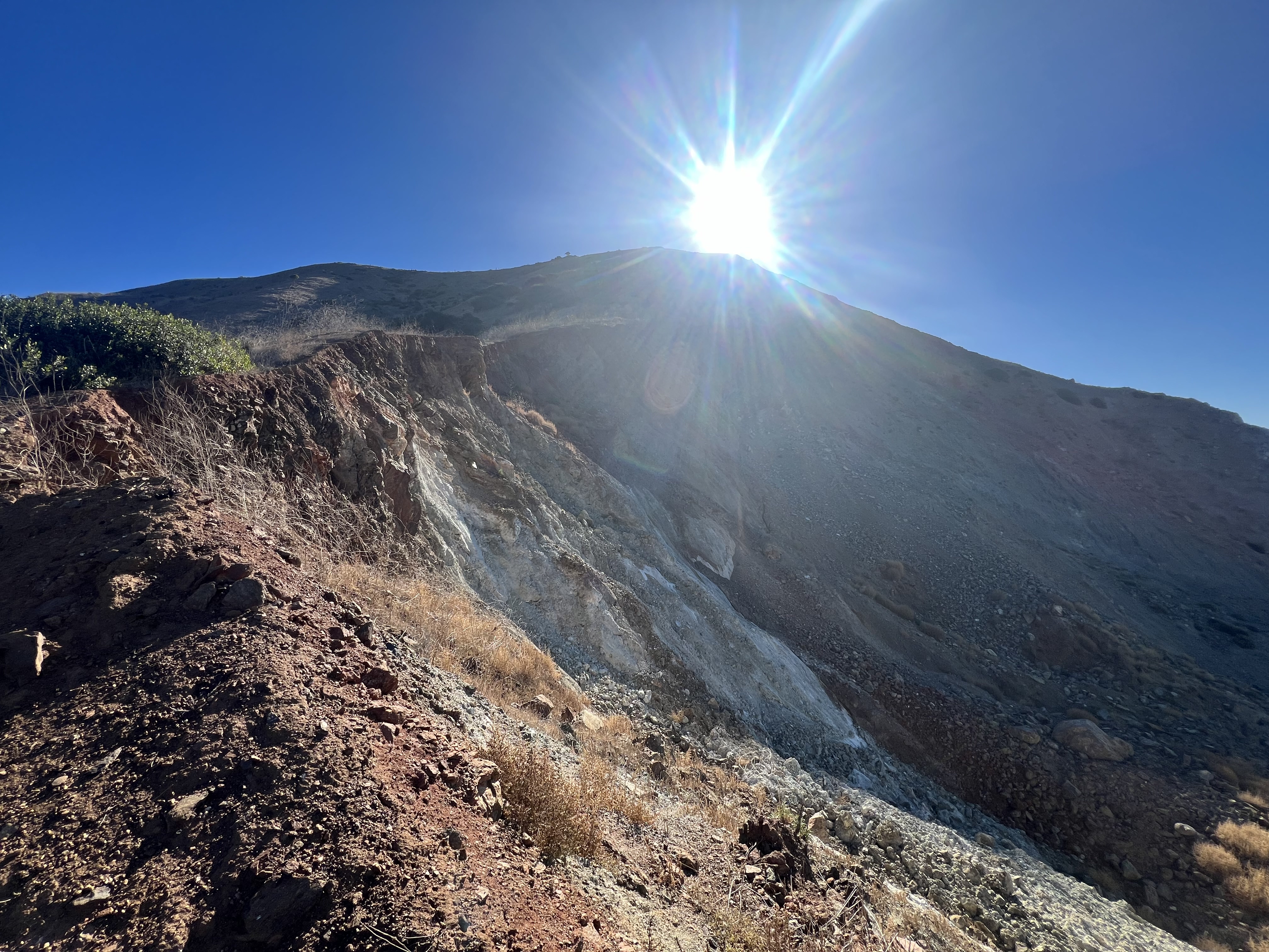
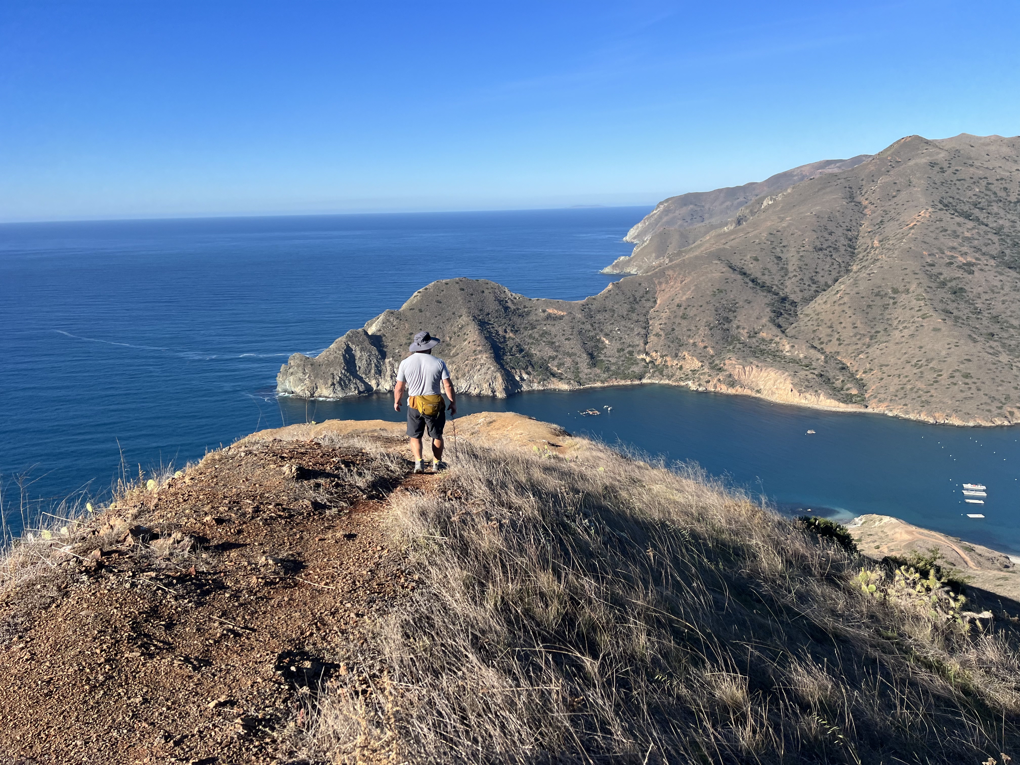
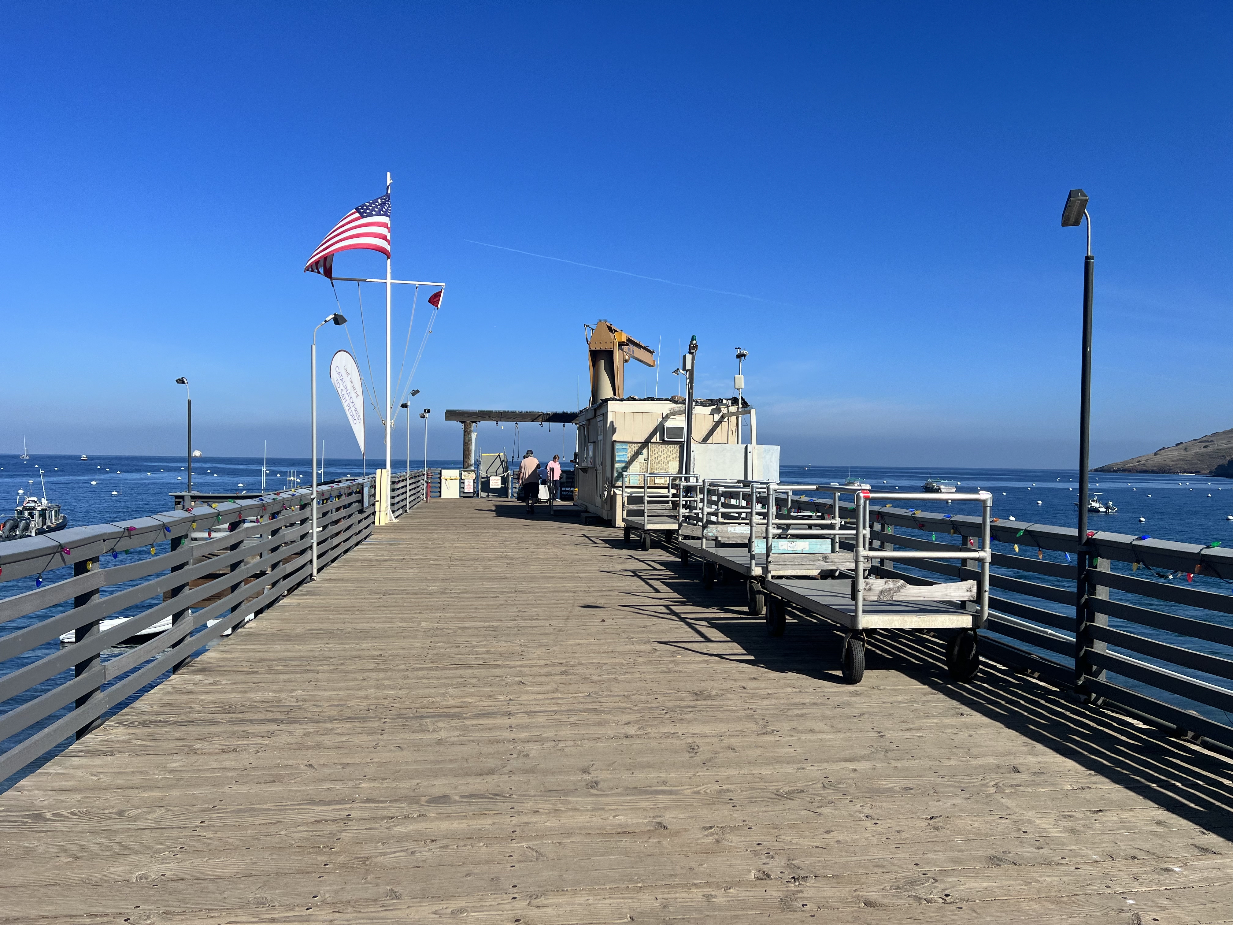
Catlina Island, California December 3 – 8, 2023 Total Mileage: 45 Total Elevation Gain: ~12,000′ Permits: Included with Campsite REservations The Plan It was summer 2023 and I was ready to make a plan for my next backpacking trip Outside of Alaska. The Kalalau Trail had traumatized me earlier that year, so I was looking…
January 26-29, 2025 NaPali Coast, Kauai, HI Mileage: 23 miles Out and Back Elevation Gain: ~6500′ Permits: Wiki Permits Rated by Backpacker Magazine as one the most dangerous hikes in the US and often considered one of the top 20 most dangerous hikes in the world, the Kalalau Trail is not for the faint of…
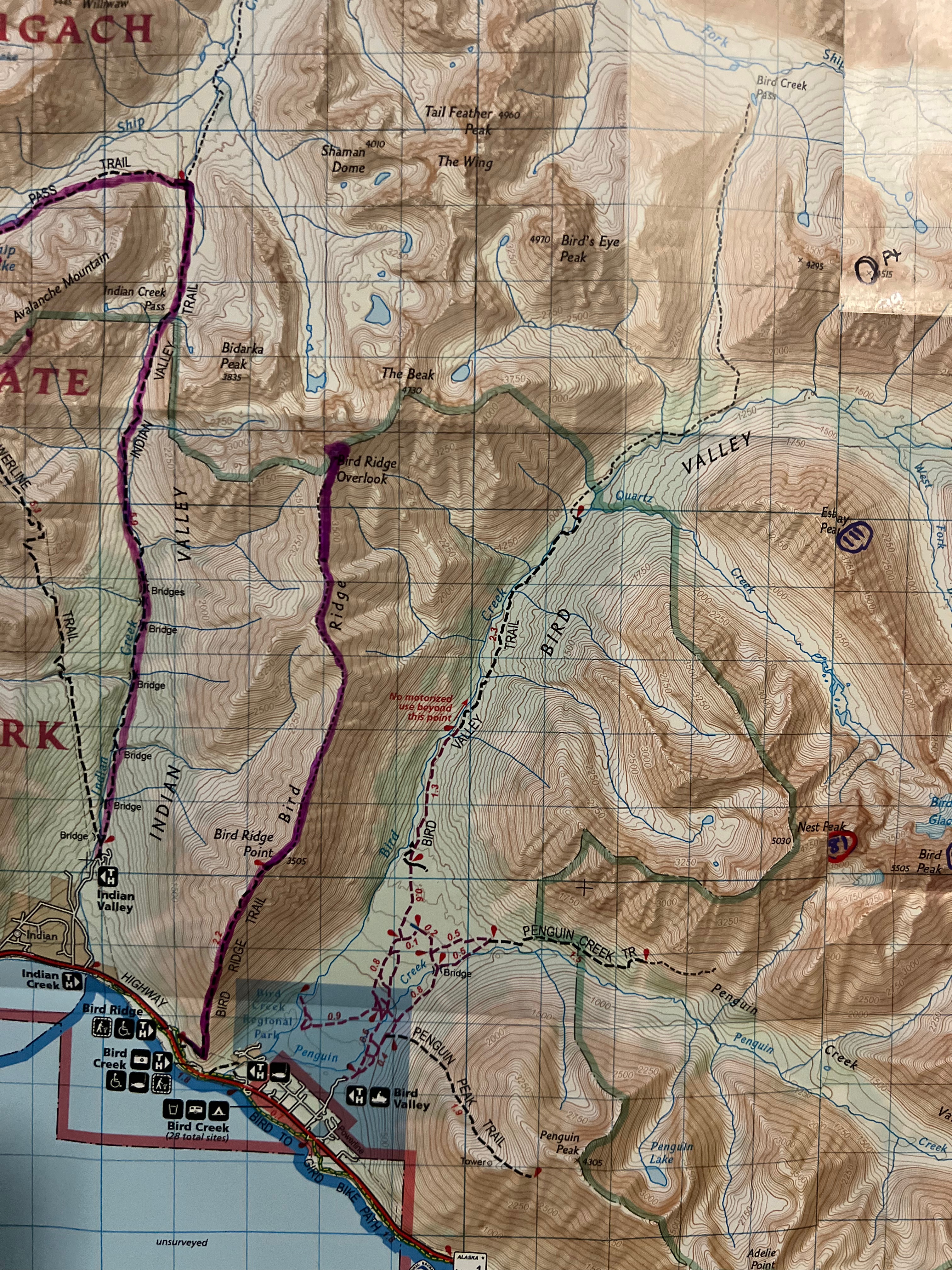
The 2024 Alaska State Fair had come and gone, a sure sign that the dark winter was going to be closing in soon. Even though it was another rainy summer and a very busy work season, I had crammed in as many hikes as I could and was hoping for at least one more big one. Jason and I decided to head down the Seward Highway to the Bird Ridge Trailhead to finish something we had started.
April 2024 – Failure
We had been there earlier this year, in April, but had turned around less than a tenth of a mile from the summit of Bird Point because of snow, high winds and, frankly, mostly laziness. Throughout the summer, we frequently talked about our silly decision to fail to summit this easy peak… while having coffee at our camp at Hanging Valley Lake, while walking up the saddle above Long Lake on our way to summit Koktoya, and while sitting around the fire at our bikepacking camp at Eklutna Lake… It continued to eat at us all summer.
Preferring to avoid busy trails, I had only been up to Bird Point once before, but the conditions couldn’t have been more different from the day we turned back.
August 2020 – My First Time
On August 20, 2020, during the height of the pandemic and the beginning of my peakbagging passion, I had snuck away from my home office to meet up with my friend, V, to hike to iconic Bird Point. It was one of those incredible summer days that makes you forget about winter. We were treated to a view of the bore tide rushing up Turnagain Arm during a break on the ascent to the ridge, and an incredible sunset on our way down. Pure perfection.
SePtember 2024 – BEyond the Point to Bird Ridge Overlook
As is my style, if I fail, I make the next goal ten times bigger. This time we wouldn’t just be summitting Bird Ridge Point, where most hikers turn around, we would be continuing on along the ridge for another 5 miles to the summit of Bird Ridge Overlook. I had been obsessively pouring over beta and maps of this hike since April, and it was finally time. We had an incredible weather window, and it was a go!
I picked up Jason and we chatted away excitedly as we drove to the trailhead. We had been looking forward to redemption all summer and today was finally the day. We were ready to put the embarrassment and self-loathing of our April failure aside forever with this hike.
By 830am, we were already ascending through the trees, taking some time to look over at Indianhouse Mountain (Jason had just climbed it a couple of weeks prior) and Penguin Peak (the Penguin Traverse is on our list for 2025). Although we had brought jackets, it felt more like July than September, and we were in t-shirts before we had even gone a mile.
Bird Point Trail to the ridge is fairly steep, a direct uphill climb, and within a mile and half and in less than an hour, we were above the trees and at the bench, a memorial to a young man who had been mauled and killed by a bear during a mountain race in 2017. We had a long day ahead, but spent a moment paying our respects and making sure our bear spray was handy.
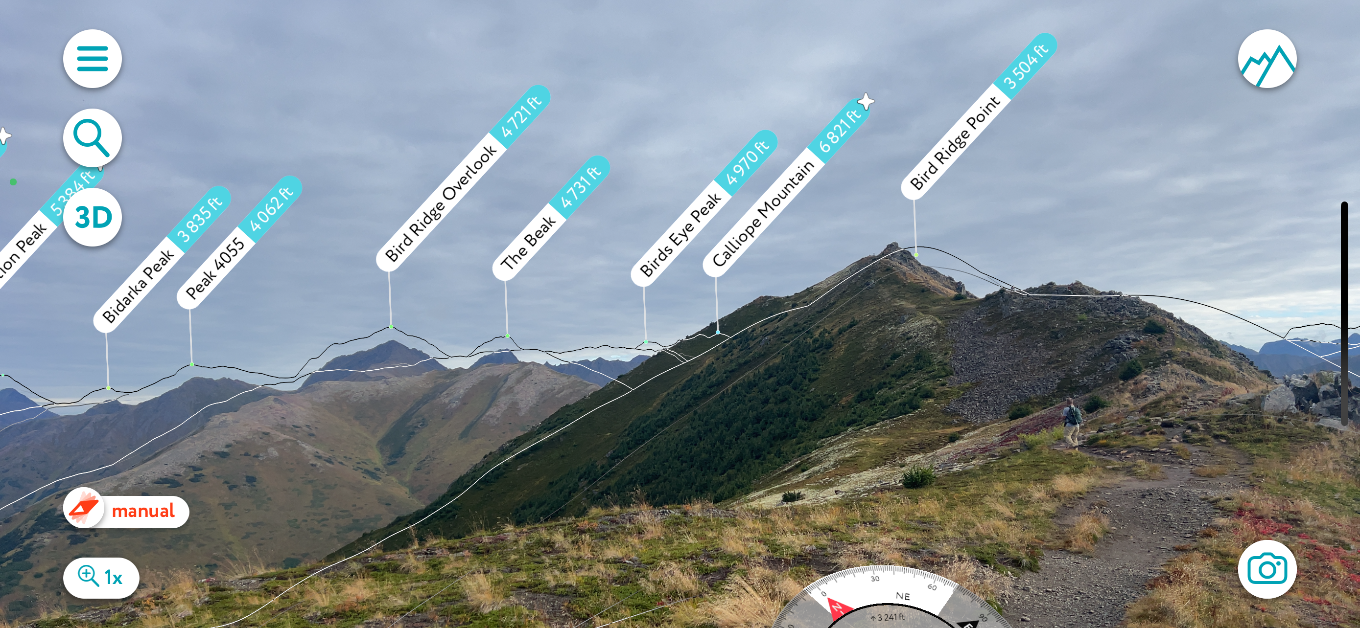
A half mile later we had reached the ridge, and although we were still a little less than half a mile from our first objective, the summit of Bird Ridge Point (3505′), we only had another 300′ to ascend to bag the first peak. The walking here was easy and comfortable, a big change from the snow covered, corniced, wind drifted trail we had trekked on in April. The weather on this day was pleasant and windless with some blue sky poking through high clouds.
Within two hours and 2.5 miles, we had reached the summit of Bird Point and a glance back towards Turnagain Arm, 3500′ below, made me appreciate the extent of the elevation gained. I don’t recall if we talked about our redemption, but I know we both felt much better now.
We continued along the ridge towards Bird Ridge Overlook, now visible about 4.5 miles in the distance. I was relieved to see that it appeared to be a “walk up” peak with gently sloping shoulders, the ridge meeting the mountain very close to its summit. I had read many trip reports and poured over topo maps so I had the impression it would be a relatively easy ascent, minus the long walk, but you never know until you go. From here, I could see that there was no extreme exposure or steep steps on the approach side of the summit, and I regretted not bringing my dog, Goose.
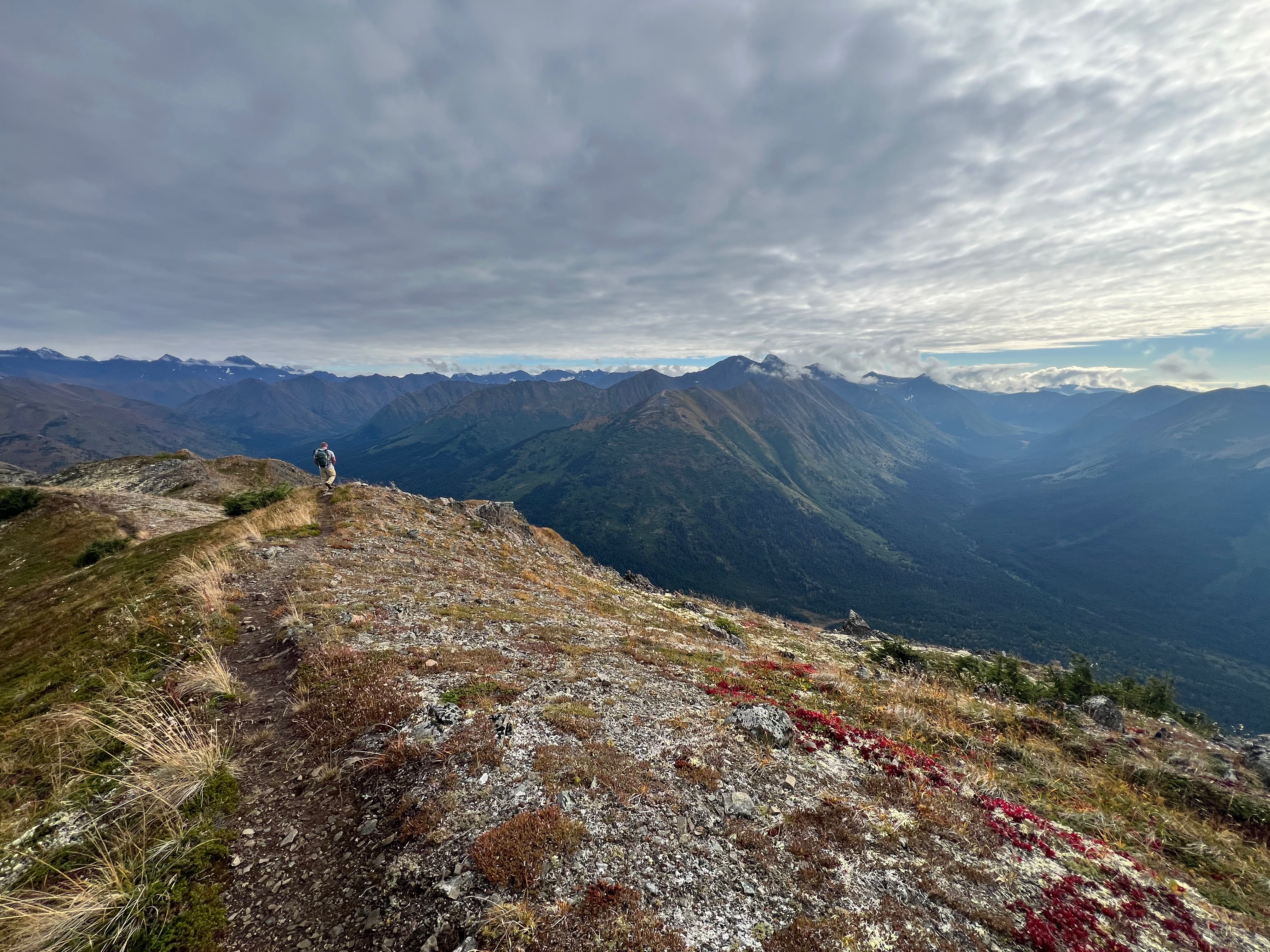
The trail beyond Bird Point is now one of my favorite hikes, an easy walk along the ridge that undulates gently up and down; tundra and rocks bordering the rarely used path. Besides one ~300′ “step” midway and the final section to the summit, it was gradual elevation gain, a truly gentle ridge.
I often had to jog to catch up with Jason after being hypnotized by the mountains surrounding us. I would imagine the tracks I would take up each mountain that I hadn’t yet summitted… North Yuyanq’Ch’ex, Homicide, South Powerline, Penguin, Nest, Esbay… and flashed back to memories of climbs I had done that I could now see from the perfect perspective… South Yuyanq’Ch’ex, The Ramp and Wedge, South Avalanche. I hadn’t set foot on any of the mountains to the east yet, but I would make sure that wouldn’t be the case by the end of the next season.
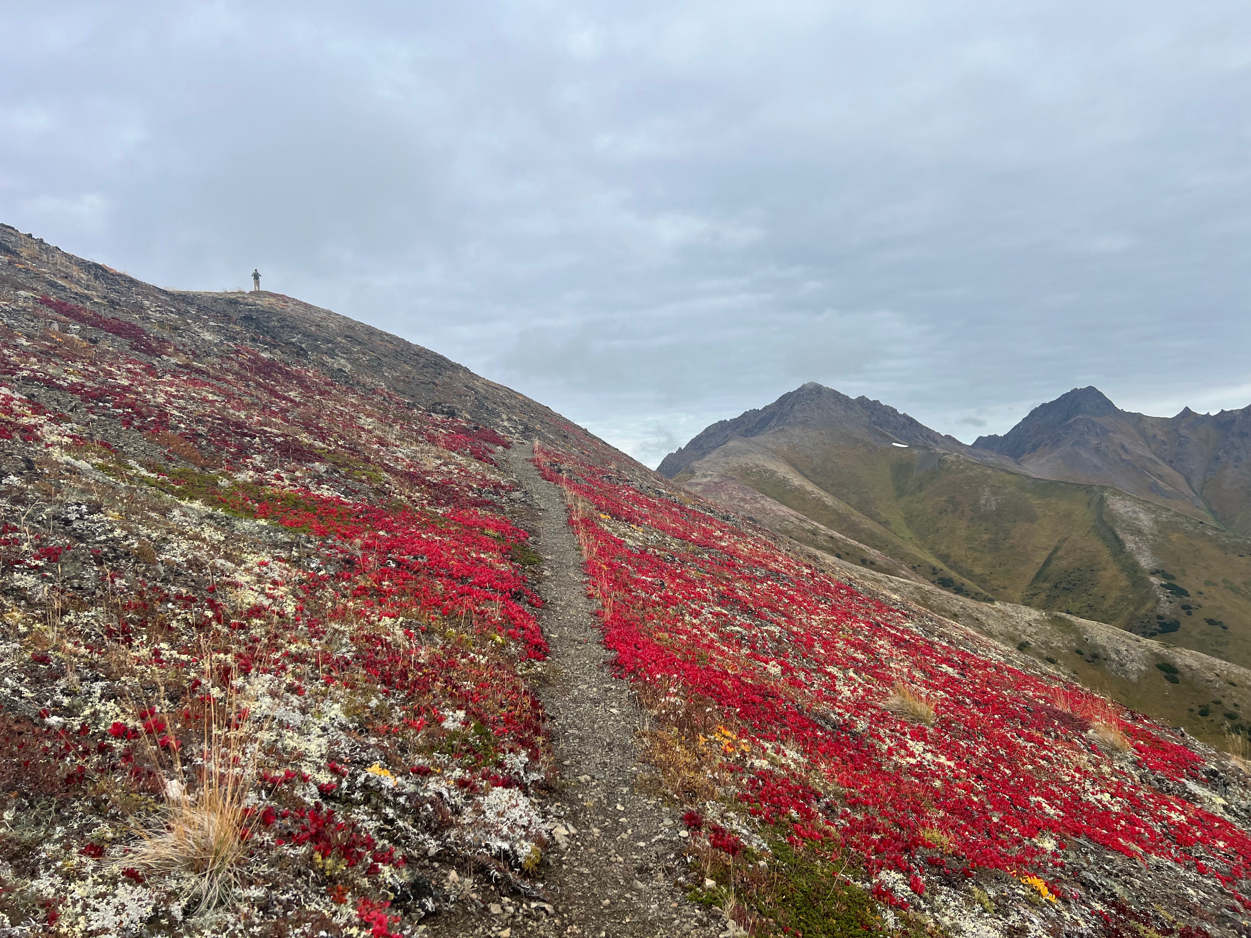
As the trail dropped just below the east ridge, just shy of ascending the midway “step,” we were treated to an explosion of color; vivid red, yellow and green tundra, a sure sign of the approaching winter, but also cementing this as a perfect fall hike.
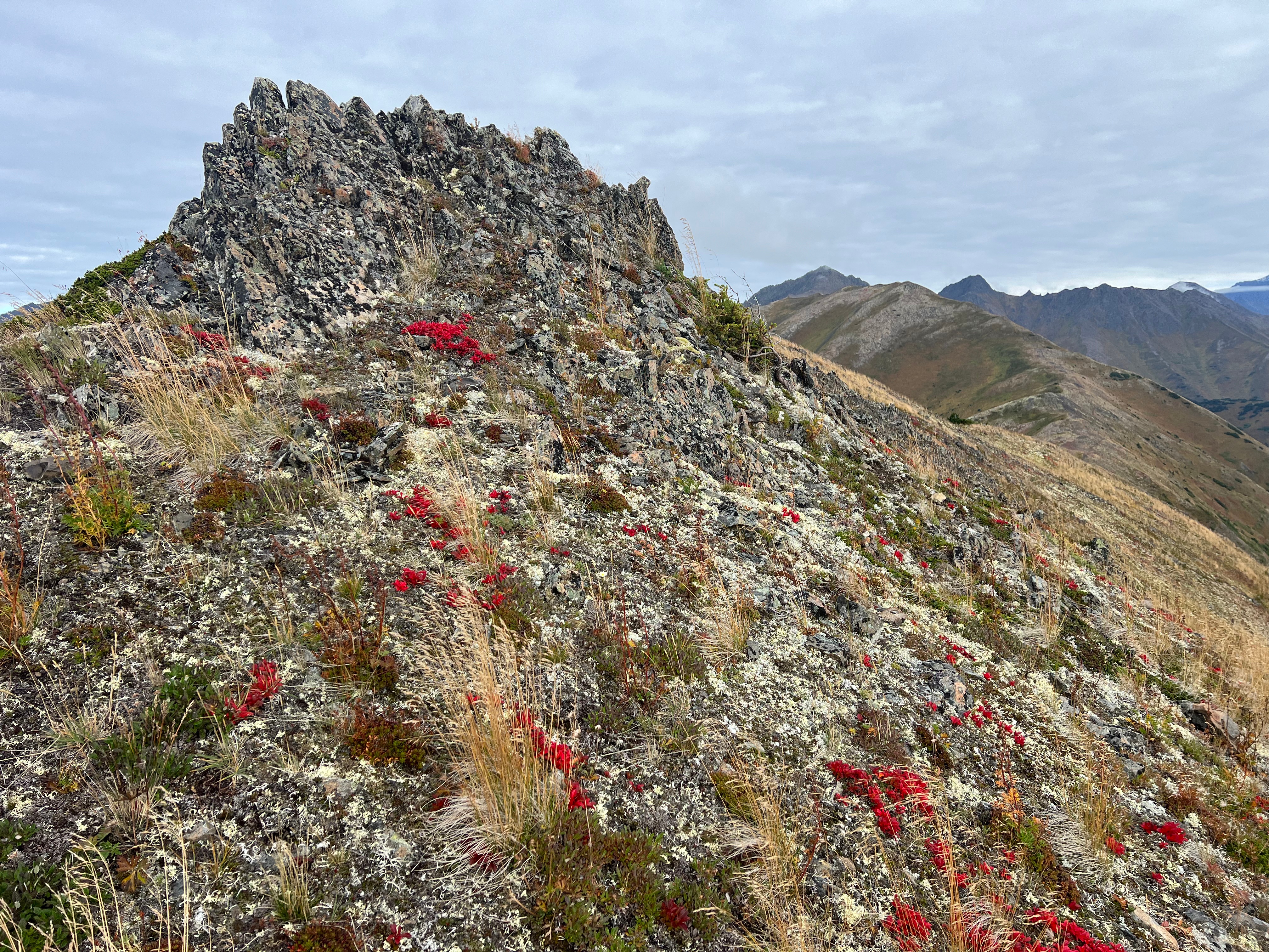
We climbed up an easy 300,’ following the bootpath that traversed just below the rocky top of the midway step. The vegetation turned to muted tones of red and yellow, the black alpine lichen and chossy rock now dominating the hillside. The last couple of miles to the summit of BRO was now completely visible, the path meandering along the east side of the ridge, one more patch of vivid red lichen to traverse before cutting below the summit towards the southeast ridge. Only a couple of small patches of snow were still hanging in there on the south facing slopes, a testament to the previous winter’s deep snowpack. Again, I regretted not bringing Goose… no one loves summer snow more than he does.
I continued to be mesmerized by the surrounding mountains, more peaks making themselves visible the further we walked, and before long we were traversing below the summit of BRO. As we reached the southeast ridge, we were stopped in our tracks by a pair of ravens who were very interested in us, circling and cawing. I noticed one of them had white tips on its wings and took a moment to appreciate being here at this moment and feeling gratitude that this unique raven had decided to pay us a visit.
I turned uphill, the path now gone, and picked my way through the rocks and patches of tundra for the last 400′ to the summit. Although there is no trail, ascending was quick and easy, a choose your own adventure to the top.
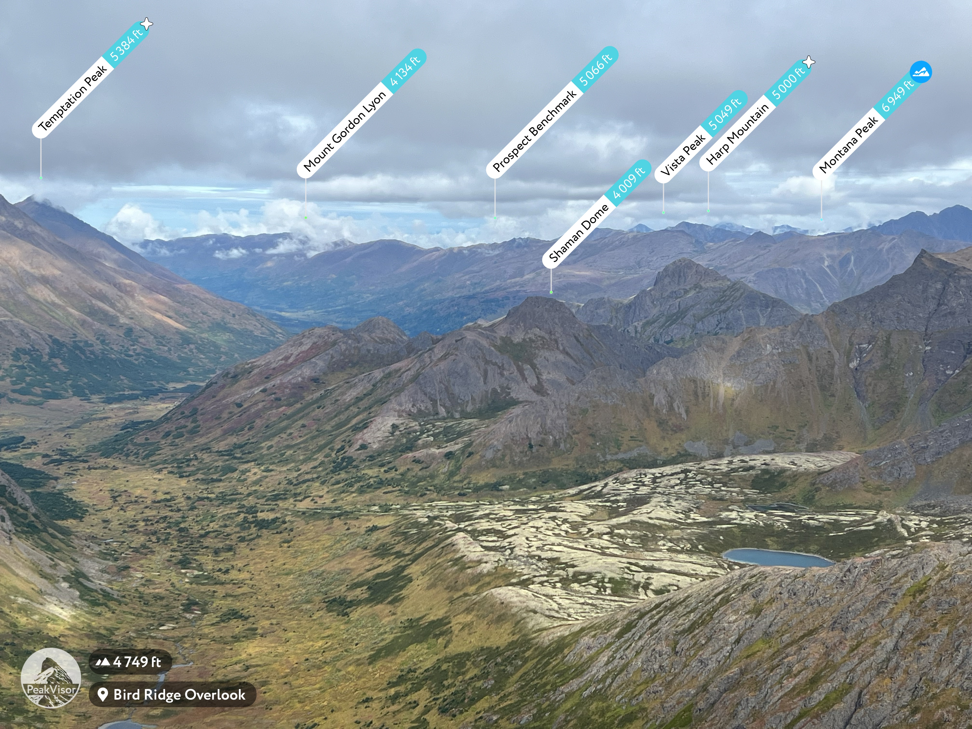
As I summitted Bird Ridge Overlook, I audibly gasped. The view was incredible, with much of the Chugach Range in view. Countless mountains I had climbed surrounded us and I geeked out, naming as many as I could, from South Yu to South Avalanche to Koktoya to Rendezvous/Triangle Ridge and even as far out as Harp, Eagle River Overlook and Vista Peak. To the northwest, I traced the route we had taken on my birthday hike a couple of years before; up The Wedge and The Ramp, down into Ship Lake, around the NE ridge of the Avalanches and into Ship Creek Valley, turning south towards Indian, the trail then disappearing behind the smaller mountains below us.
To the north, I looked down into a valley, protected by a long ridge to the west and a short ridge to the east. The summit of BRO drops off steeply on the north face and a large teal blue no-name lake glimmered below, smaller lakes dotting the valley. I planned out my 2026 birthday backpacking trip then and there, a trek into this rarely seen valley from Indian to make camp, a perfect base for day hikes up 4055, Bidarka, 3505, Shaman Dome, The Wing, 4300… as many as we could get. I hoped for nice weather the week of July 4, 2026.
Jason and I took turns getting photos standing on a high, rocky outcropping, with an incredible backdrop of the backside of the Front Range. Jason found the summit register, a small, black pvc tube filled with soaked paper and leaky pens. I settled for submitting to the Peakbagger electronic register and we tucked the pvc tube back under the rock where it was found.
A final look at my new favorite view and I turned back to the south, Bird Ridge looking welcoming, an easy walk back to the summit of Bird Point. We decided to descend directly down the south/southwest ridge instead of following our ascent route and it went nicely, joining back up with the trail less than half a mile from the summit.
As we strolled along, backtracking on our footprints from earlier in the day, the sun began to shine, and the blue sky became brighter through the high clouds. The reds of earlier were now even more incredibly bright, a technicolor dreamscape.
Upon our return to the “step,” we decided to follow the ridge to its high point, veering off from the sidehill trail we had taken on the way out. I looked back at BRO and the path we had taken as the slopes of the ridge became bathed in full sunshine. Turning back towards Turnagain, Bird Point became visible, the fully treed northwest slope indicative of its lower elevation, with an 1,110′ difference between the two peaks.
We descended the step and made excellent time back to Bird Point, more than 11 miles into our hike. As we began to run into other hikers, I was silently (and sometimes not so silently) feeling smug about our accomplishment, having made it further on the ridge than anyone else that day. I have no shame when it comes to being proud of achieving new summits, especially those that are beyond the well traveled trails.
As we descending the final couple of miles to the parking lot, the clouds began to return, although a god ray shone down on the low tide of Turnagain Arm. Entering the tree line, we both checked for our bear spray and began making mention of how sore our legs and feet were… the easy ridge had spoiled us, the steep descent became the biggest physical challenge of the day.
We finally reaching the paved pathway and, soon after, the truck. We both happily peeled off our shoes and socks for the relief of sandals and drove away with both redemption and future plans.
Although I had left my dog at home because I wasn’t sure what the trail was like, this one is great for dogs. No exposure until the very summit of BRO. Remember, though, it is a long hike and there are no water sources along the way. Carry plenty of water for yourself and your pup.
It is likely that there will be no other hikers beyond Bird Point and there is limited or no cell phone reception. Carry an InReach and know how to use it, especially if traveling alone.
Leave No Trace. Pick up any trash you may see along the way.
Day 6 – Cremation Canyon To South Kaibab Trailhead 6.5 Miles, +3600′ December 4, 2024 The choice to cowboy camp under the stars was a great one. I wasn’t bothered by any wildlife, and I was able to wake up every once in a while, to see how the night sky had spun. By 530am…
Day 5 – Cottonwood To Cremation canyon 12 Miles, -2000′, +1600′ December 3, 2024 I started the day by packing up my sleeping bag, pad and inflatable pillow while thinking about how my choice of sleeping gear had been perfect so far. I’ve had the same sleeping bag for over a decade, an absolute workhorse.…
Day 4 – Cottonwood Camp To North Rim and Back 13 Miles, +4000′, -2000′ December 2, 2024 It was a nice feeling to get out of bed and be able to walk normally again. I rose early, very excited for the day ahead, and quickly consumed my oatmeal and coffee. I knew the mice would…
Rainbow Peak is a fun, scrambly hike that starts at sea level and tops out at 3543.’ This one is big bang for your buck if you’re looking for an early season break-in hike or to level up your scrambling skills with minimal exposure and mostly low consequence terrain.
The summit ridge can be dangerous in icy or inclement conditions, as the southeast face is fairly exposed, and the northwest face can be avalanche prone or hardpack ice. A slip and fall on either side would not end well, although most of the ridge is wide and protected. Its best to go in the summer if you are nervous about heights or your ability to navigate on icy terrain.
Due to the loose rock and scree slopes and the steepness of some of the terrain, dogs should not be brought on this hike. I had made the mistake of bringing Goose back in 2021 and although he had no problem with the scramble sections, I did have to be careful of him kicking down large rocks on me or other hikers as we ascended the scree slopes to the summit ridge. I also almost had a heart attack when he stood right on top of the narrow, high point, all four paws seemingly balanced on one toe, a 300+’ drop below. Anyway, leave your dogs at home for this one.
I picked up Jason at 9am and we drove to the Rainbow Trailhead on the Seward Highway, a decent sized lot with a perfect view of the mountain. It was a little breezy near the highway, but we were soon in t shirts, heading northwest on the Turnagain Arm Trail on a mellow climb through the trees. We crossed Rainbow Creek and an unnamed creek, both spanned with stable bridges.
It didn’t take long to travel the 1.1 miles and 850′ to the Rainbow Trail intersection on the wide and nicely maintained trails, but that was about to change. The Rainbow Peak Trail is unmarked and is easily missed, so keep an eye out to your right for one of two rocky trails that seem to climb vertically into the trees. That’s your route.
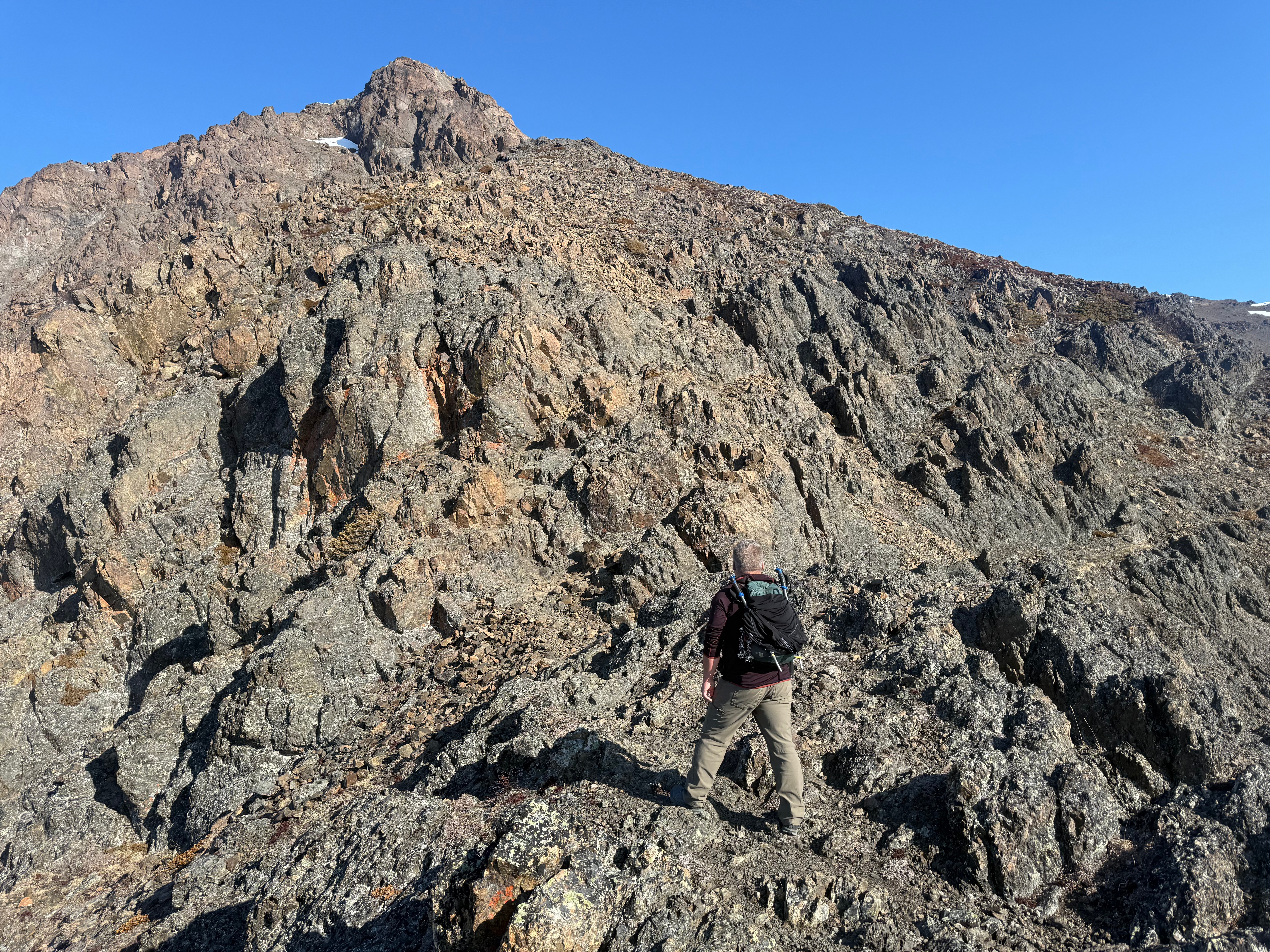
We immediately began climbing upward, using our hands to pull ourselves up on trees and when the trees turned to tundra, we gripped overhead rocks to continue to gain the elevation. The first “step” on the southeast ridge is about 3/10 of a mile long but gains another 850.’ The scrambling is fun and low consequence, mostly protected with little chance of a long fall, although it is important to remember that any fall can lead to major injury or worse.
We topped out onto a rocky, tundra covered plateau, which offers the first full view of the mountain from above tree line. The ramped summit, surrounded by rocky outcroppings and ridges running southwest and northeast, is neighbored by a large scree bowl to the northeast. We would be traversing under the summit to the right and then would ascend in a scree slope choose your own adventure route.
2/10 of a mile after reaching the plateau, we were once again scrambling up mini chimneys and along rocky outcroppings, sometimes choosing a more challenging route just for the fun of it. 3/10 of a mile and just shy of 700′ later, we were at the base of the summit blocks, beginning our traverse to the right (northeast) along a faint path.
Traversing below the summit and then the summit ridge, the slope to the right drops steeply to Rainbow Valley, sections of loose rocks and snow were interspersed with a solid and stable bootpath. Once we reached the first scree chute leading to the summit ridge, we sat down for a snack break and to take in the views of Turnagain Arm below and South Yuyanq’Ch’ex up to the left. Tortilla Chip Point taunted us from across the valley and we spoke of linking the entire ridge in a giant loop, from Rainbow to South Yu to Tortilla Chip.
The wind was starting to pick up and spindrift and blowing snow was a good indication we would be in 40+mph gusts, so we donned our warm layers and started directly up the chute to the ridgeline. There is also the option to continue on the traverse and ascend to the ridge anywhere along the scree bowl, but we opted for the direct route up.
We traveled with the awareness of rockfall, most likely caused by your partner, and staggered our routes up the last hundred or so feet to a small patch of snow that led to the ridge. As soon as we crested, the wind hit us like a freight train and we were immediately glad we had put on our gear before feeling the full force of the wind. One slip of the fingers and a nice jacket could be lost to the gales.
The ridge was covered in hardpacked snow, the northwest face of the mountain icy and white. A slip that direction would make for a long slide down. The southeast face falls away below a vertical dropoff to the screefield and I walked with effort to not be blown that direction by the violent gusts of wind. I could imagine how someone could be “blown off a mountain,” as is written about in the high-altitude mountaineering books that I consume with an insatiable appetite.
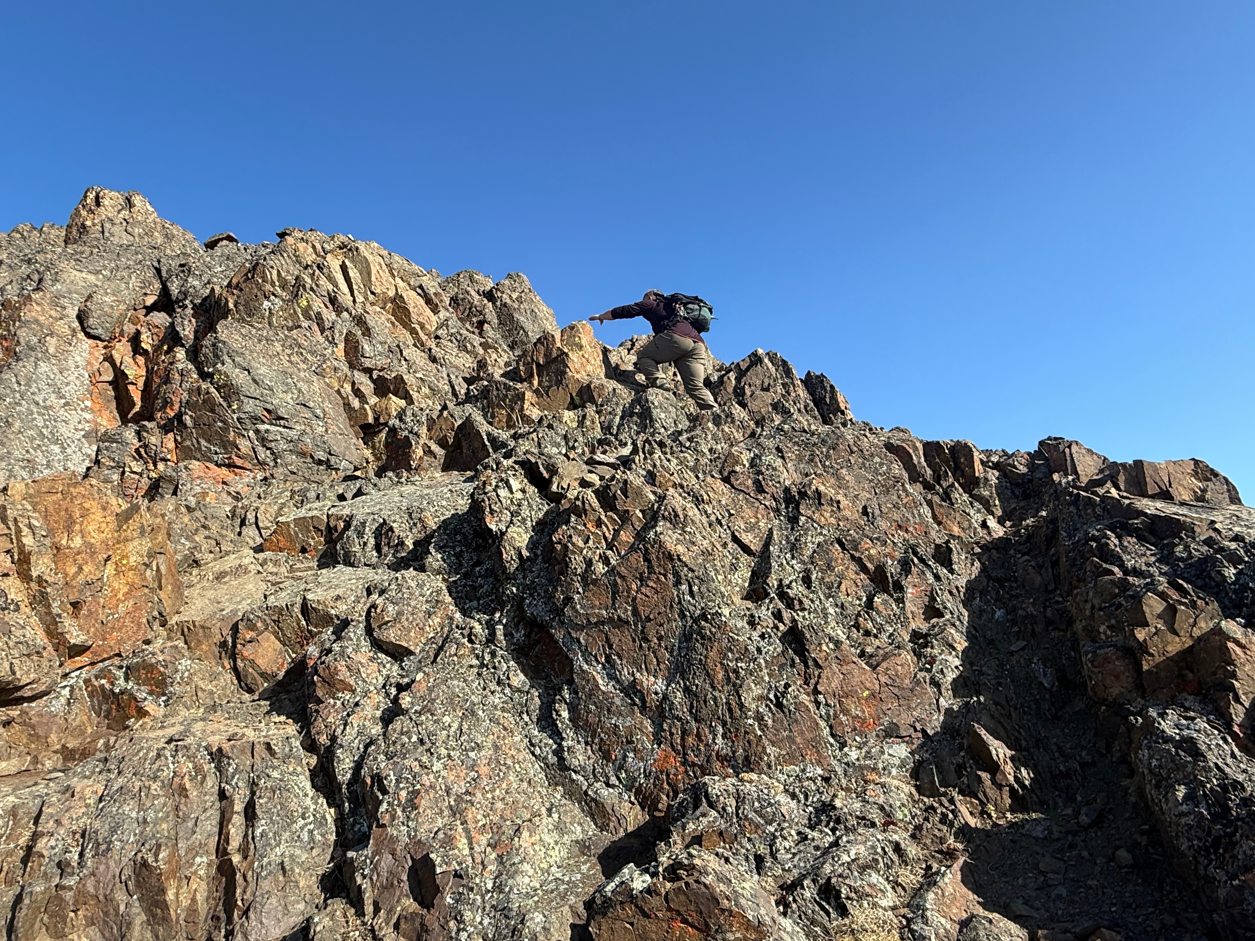
The footpath through the snow got icier and the wind go gustier, so I opted to stop for a second to put on my microspikes. Now feeling much better with some traction on my feet, I fought the wind and ascended to the summit block of Rainbow Peak. Jason was up on the rock with the highest prominence during a small reprieve from the wind and I hurried him to get down so I, too, could get a summit photo and then get out of there.
As soon as I climbed up, the strongest gust of wind of the day nearly blew me off the rock. I ducked down and held on until the gust passed over us, before sliding down off the high point, taking a photo of Jason and then hustling back down the ridge.
As soon as we were below the summit the winds relented a bit, and we decided to walk the half mile to the unnamed bump at the top of the far end of the scree field. The wide ridge makes for excellent walking with little elevation gain or loss to the unnamed bump. Just before the final ascent to the top of the bump, Jason realized he had lost his phone, likely below the summit of Rainbow, where the wind had calmed, and he had stripped a layer. I assured him we would find it, but first we would climb the last few feet of the bump.
Standing on this high point, we scoped out the ridge beyond, agreeing it looked doable and would be on our 2025 bucket list to encircle the entire Rainbow Valley on the ridge, but we would have to wait for the snow to melt out more before attempting it.
We turned back along the ridge and made it back to where we had stopped, Jason’s phone laying right where I thought it would be. A sign of relief and we were off… time to descend back down the scree slope and back to the high traverse. We picked a steep scree chute and started down one at a time to avoid kicking rocks down on each other. When Jason would get behind rocks for protection, I would start down the slope, and I assure you Jason was waiting longer for me than I was for him!
We sat down for a lunch break of sandwiches, Jason enjoying a homemade breakfast sandwich while I inhaled a gas station ham and cheese. We were once again completely protected from the wind and were able to enjoy the view again without being sandblasted with snow.
We took our time on the way down, my heel ripped had been ripped open by my ski boot on an outing a few days prior and was not doing well. I could feel my shoe getting lubricated with blood, streaming down through two layers of hydrocolloidal pads. I wasn’t limping, but I knew I would need a few days off to get it healed up.
Across the traverse, down the top step of scrambling, down the mini chimney, across the plateau, down the bottom step, down the ball bearing rock slope, finally getting spit out onto the wide and flat Turnagain Arm Trail. Still not having seen a bear, we made good time back to the truck, now surrounded by a dozen other vehicles.
Peeling off my socks and shoes, I slid my feet into my slippers for the long drive home, ready for a bath and a big dinner, thrilled to have revisited one of my favorite places after nearly 4 years of absence. We will be back again as soon as the ridges are snow free to accomplish what I am calling the Rainbow Cirque Traverse.
I dropped off Jason and drove home in silence, thinking about how lucky I am to experience these incredible mountains in the Chugach Range.
DO NOT BRING DOGS. They can be dangerous to other hikers, as there is a great deal of loose rock. The jagged rocks are tough on their feet, and you may end up with a dog with severe foot injuries. There is also some scrambling that many dogs may not be able to do. It’s best to just leave them home.
Be Bear Aware. This is prime bear country. Carry bear spray and make lots of noise .
Do not leave valuables in your vehicle at the trailhead.
Bring gloves, even during the summer. They can help prevent cuts and can aid in grip for scrambling.
Be aware of hikers below you and try not to kick rocks down on anyone. If you do, yell “rock!” to alert hikers below of the danger.
Day 3 – Rest Day December 1, 2024 It became apparent immediately after I woke up that I would be taking a rest day and saving my day hike to the North Rim for tomorrow. I unzipped my tent and tried to stand. The overpacking had finally caught up to me. My legs were locked…
Day 2 – Cremation to Cottonwood Camp 12 Miles, -1600′, +2000′ November 30, 2024 I woke before the daylight, rested and excited to see what was to come. As the pink clouds signaled the rising of the sun, I made some coffee and oatmeal and ate and drank as I broke down camp. There are…
Day 1 – South Kaibab Trailhead to Cremation Canyon 6.5 Miles, -3600′ November 29, 2024 The day had finally come! I had arrived in Phoenix the afternoon prior, picked up my rental car and drove north. I left the 80-degree heat and arrived in Flagstaff 3 and 1/2 hours later. I was now at an…
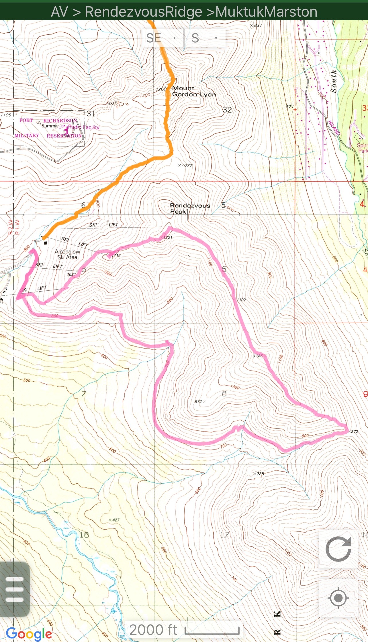
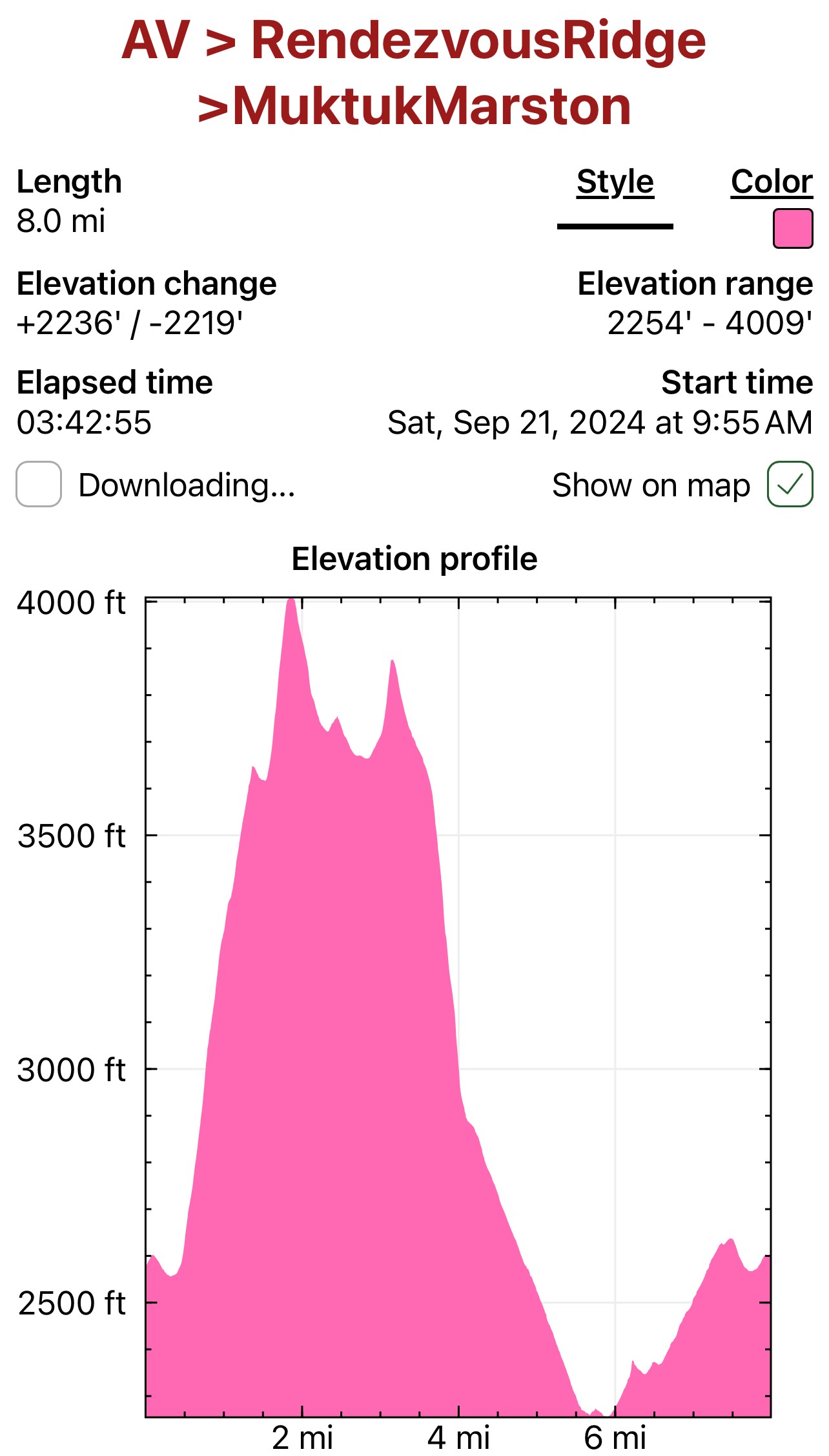
It’s now the end of March 2025, and as I start planning for this summer’s adventures, one of my top mellow day hikes is definitely the Rendezvous Ridge/Muktuk Marston Loop. Rendezvous Ridge has long been a popular and well-traveled ridge walk between Arctic Valley and South Fork Eagle River, but as of the end of 2023, the Muktuk Marston Trail was completed and offered hikers an opportunity for an 8-mile loop.
Muktuk Marston is wide and well-engineered, following the curves of the mountain about 1500′ below the ridgeline and 1,000′ above Ship Creek Valley, and offers an incredible opportunity for a fun, accessible loop, complete with some of the most incredible views of the area. No longer would a hiker need to out and back or have another vehicle to do a point to point.
I first explored this loop on October 3, 2023, not long after the Muktuk Marston Section construction was completed, so when I had a day off where I felt like I just wanted an easy ridge to walk, I decided to revisit this loop. Jason and I had started from the South Fork Trailhead the previous year, but I decided to eliminate about 700′ of climbing and nearly 5 miles of hiking and parked at Arctic Valley Ski Area.
It was one of those September days reminiscent of warmer months, and I was in a T shirt within minutes of leaving my truck. A short, flat, half mile walk brought me to the junction of the start of the Muktuk Marston and the trail leading up the ridge toward Peaks 1112 and 1221. I opted to complete the loop clockwise, so I turned left and started walking uphill.
The sun was already high in the sky as I started up towards Peak 1112 and the top of the ski area T-Bar. Climbing 1,000′ feet in a mile, I quickly ascended out of the vegetation and past the top of Chair 2, taking in the incredible views of Ship Creek Valley and many peaks that I had either already climbed or had on the “to-do” list.
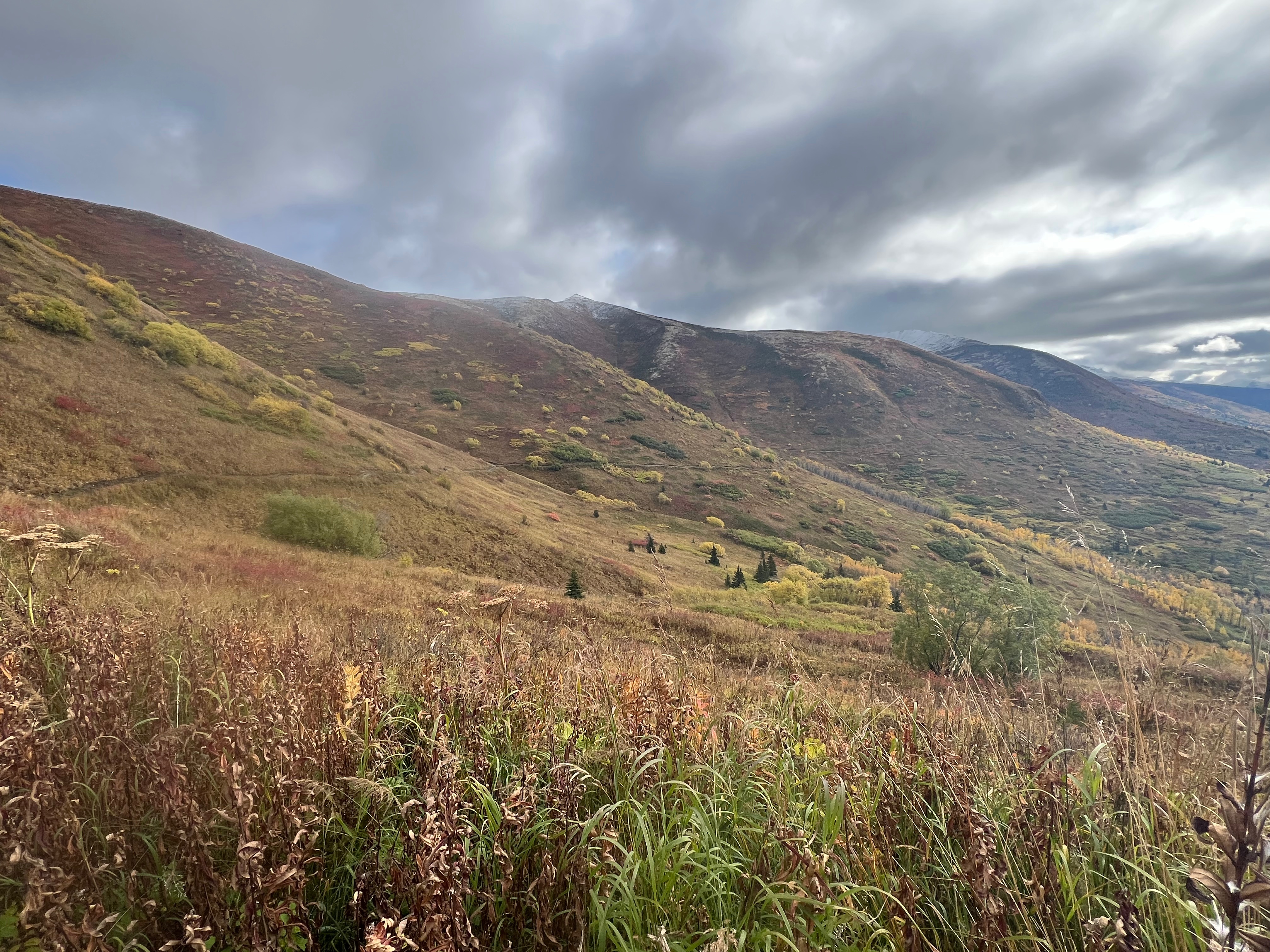
The entirety of Rendezvous Ridge was bathed in sunshine at first, including Peak 3891, a high point on the far end of the ridge, although the higher I climbed, the more the wispy clouds congealed into a ridgeline fog. Little did I know what an enormous gift this would end up giving me.
Peak 1112 is anticlimactic, although it is a great hike unto itself, offering a nice vantage point of not only the surround mountains and valleys, but also of the Nike Missile Site on the neighboring ridge, as well as the Anchorage Bowl and the string of Volcanoes across the inlet (Mt Spurr, Redoubt, Iliamna and sometimes Augustine).
Passing the T-Bar infrastructure, I continued another half mile and 400′ to the summit of Little Teton, its pointed, jagged rocks poking up through the tundra and patchy snow. The intersection with Rendezvous Ridge now visible, a worn footpath made even more prominent by the dusted snow bordering it. The clouds were thickening over Peak 3891, although I was still bathed in sunshine.
I made the short descent to the footpath and looked left (North) towards Rendezvous Peak. I had traversed this trail all the way over to Rendezvous and Mt Gordon Lyon the October previous and today was just a relaxing walk, so I turned right and began following the ridge towards Peak 3891 and Hunter Pass.
The clouds continued to thicken and as I walked through the dusting of wet snow, then suddenly they would open and let the sunshine through, soon closing in around me again. Along the mile from Little Teton to Peak 3891, this happened numerous times, the fog teasing me with views then quickly taking them away.
As I ascended the 200-ish feet to the summit of 3891, I climbed out of the clouds and into the sunshine. Turning around and looking towards Little Teton I was stunned! I hurried to get my camera out to capture something that is rare and fleeting… a Brocken Spectre with Glory Rings! A vivid mini rainbow, encircling my shadow that was cast down onto the slope of the mountain. In all of my time in the mountains, I had only experienced these phenomena twice before, and I can tell you it never gets old.
A couple walked up towards the summit as I was taking photos and I excitedly told them to quickly come up and see what I was seeing. They hustled up the last dozen feet to the summit and gasped in shock! They were able to get a couple of photos before the clouds dissipated and Brocken Spectre disappeared. We marveled at how lucky we were to have been at that place at that time, and then continued on our separate ways, them heading towards Little Teton and I soon dropping into Hunter Pass.
Over the next .8 miles I quickly descended the nearly 1,000 feet to Hunter Pass, a narrow saddle between Rendezvous Ridge and Peak 1213. I turned right and walked where the mountains meet; a rocky, but flat trail, bright fall vegetation bordering on either side. The trail soon becomes well engineered with easy footing, wrapping along the side of the mountain below Rendezvous Ridge and heading back towards Arctic Valley.
The Muktuk Marston Trail traverses the hillside for 3.5 miles with little elevation gain or loss, the excavation line still visible and unvegetated as evidence of the new construction. Many others had heard of this recently built trail and were out enjoying it on this glorious day. I took my time, not wanting to rush back to the parking lot… winter would soon arrive, and this trail would be inaccessible until spring, a prime location for winter danger with avalanche prone slopes above.
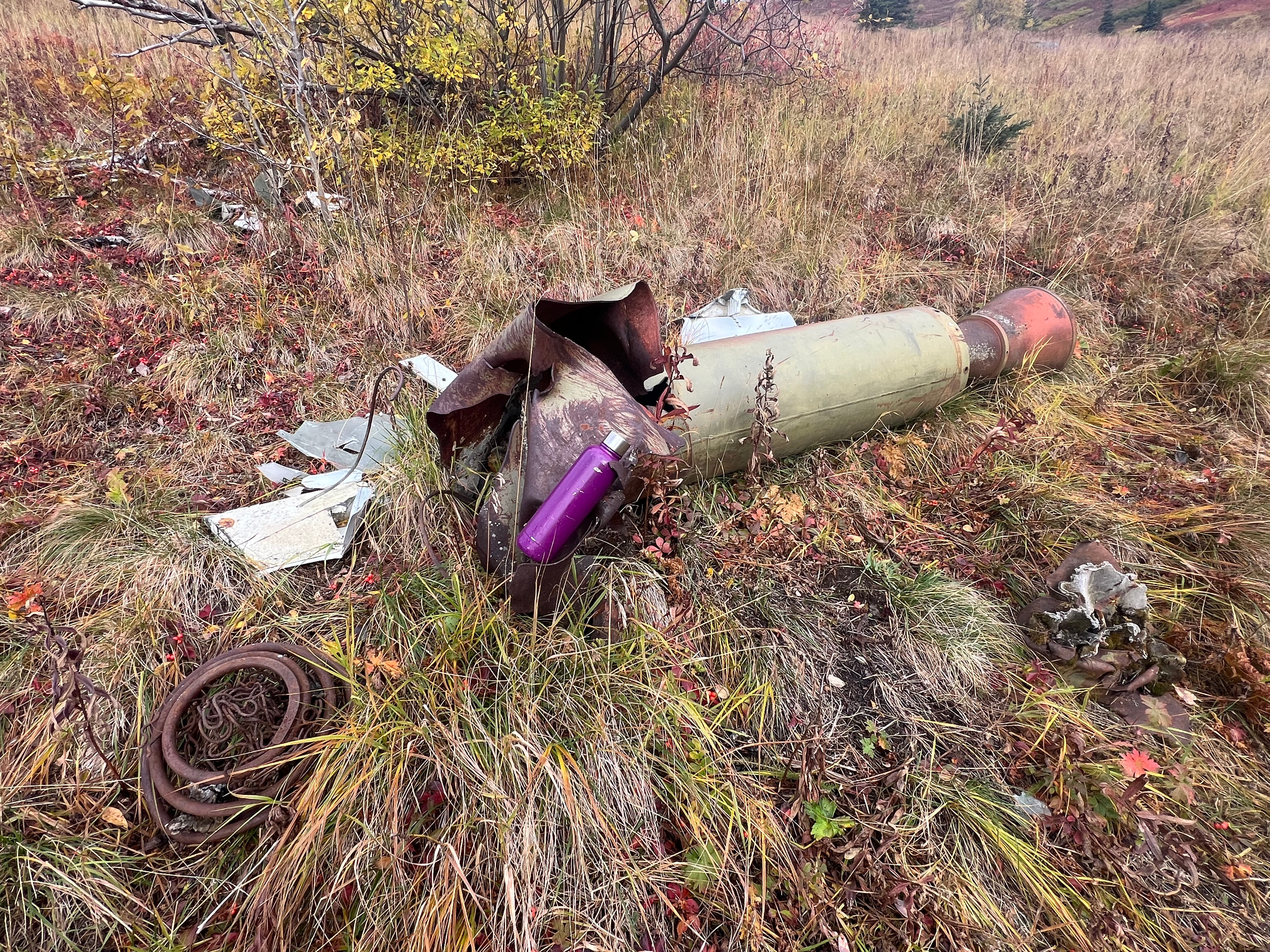
I sauntered along, picking the prolific, tart high bush cranberries and juicy crowberries for a snack, and soon came upon an old missile, a little way off the trail, its nose twisted and destroyed, parts and pieces scattered nearby. It surprised me that the military hadn’t cleaned up the debris, though I felt lucky to have found it to be able to see this interesting piece of history.
I looked back at the trail I had followed, a line across the middle of the mountain and up at the pointy summit of Peak 3891, Peak 1213 now far in the distance. Before long I could once again see the Anchorage Bowl and Cook Inlet. I soon returned to the intersection where I had started up the ridge earlier in the day. A short walk through the trees, I rounded the corner, and my truck was in view in the small parking area near the trailhead.
I peeled off my shoes and socks and donned my flip flops for the drive home, once again recentered after an incredible day in the mountains.
Just The Tips:
Be Bear Aware! Make noise and carry protection such as bear spray.
This is a great hike for dogs and kids. No dangerous exposure, mostly easy walking and a lot of views for minimal elevation gain.
Make a day of it! Rendezvous Ridge has many excellent picnic spots on the alpine tundra.
Stick to summertime travel unless you have avalanche education. Hunter Pass is notorious for slides. Even early in the season when the ridge is just covered with termination dust, the snow can be a foot or two deep (ask me how I know).
Do not attempt to traverse the Muktuk Marston Trail in the winter as it is below prime avalanche terrain.
This area is directly adjacent to the Nike Missile Site on Gordon Lyon Ridge. You very well may come across old ordnance in the form of twisted and destroyed missiles. The military advises that no one touch them.
You can also park at the South Fork Trailhead and do the loop from there. It adds about 700′ of gain and 3-5 miles (depending on if you take the switchbacks or the direct uphill track).
Arctic Valley Road is on JBER base property. At the time of publishing, the road gate to access the ski and hiking areas is open 6am to 10pm. Call JBER Range Control for most up to date information (907-384-6230). Don’t get locked in! If in doubt, access these trails from the South Fork Trailhead.
Rim-Rim-Rim and Cremation Canyon November 28-December 4, 2024 Planning and Preparation I have gotten into the habit of traveling Outside of Alaska every winter for a backpacking trip, and this year the Grand Canyon was calling. It had been a long summer of work and, frankly, the rain was getting to me. The high desert…
March 1, 2025 Mileage: 10.2 Miles Elevation Gain: 4000′ Chugach 120 #100 Chugach Front Range #18 Summit Elevation: 4491′ & 3480′ With the snow this winter being a bust, Jason and I decided to continue to up the mileage and elevation gain in preparation for a summer of big goals. I had yet to traverse…
February 26, 2025 Failed attempt on Nunanka and Kanchee Successful Snow Hawk Summit Mileage: 12.3 Miles Elevation Gain: 3309′ Chugach Front Range #27 Summit Elevation: 3245′ Permitting: JBer REcAccess Website Jason and I had lofty goals after seeing how little snow was up on McHugh and the neighboring mountains. We foolishly assumed this lack of…
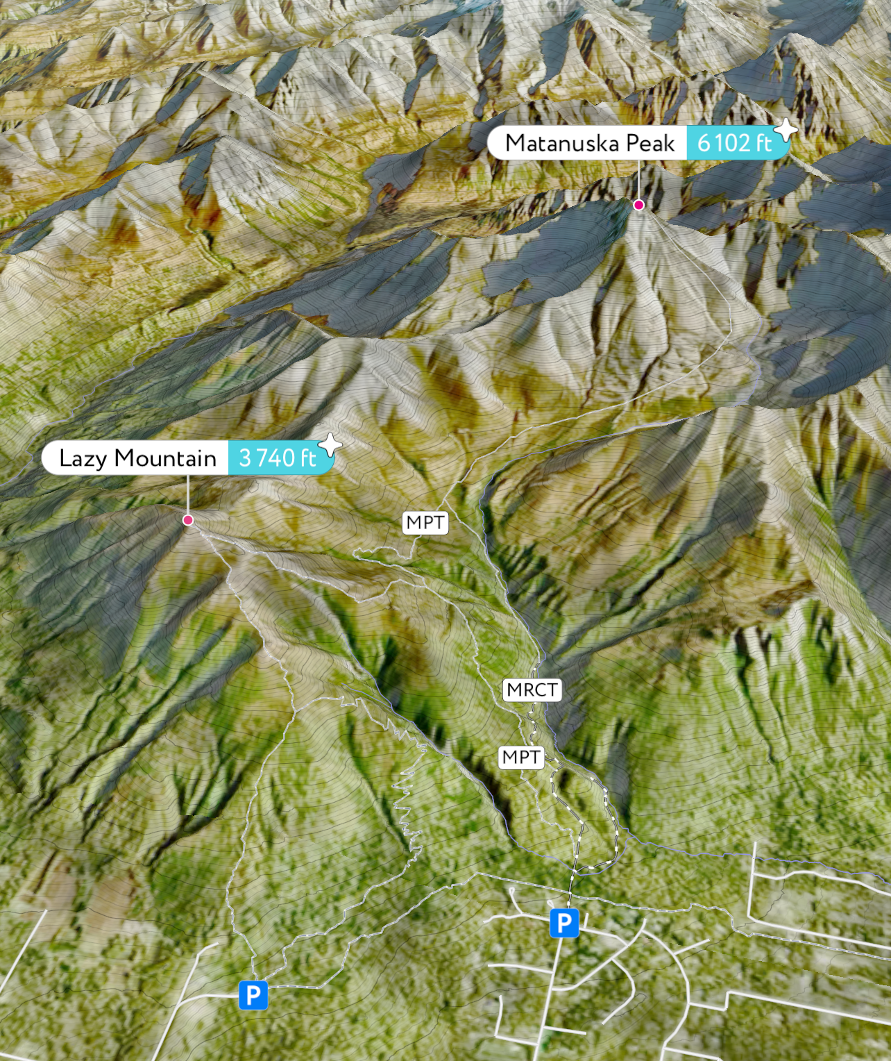
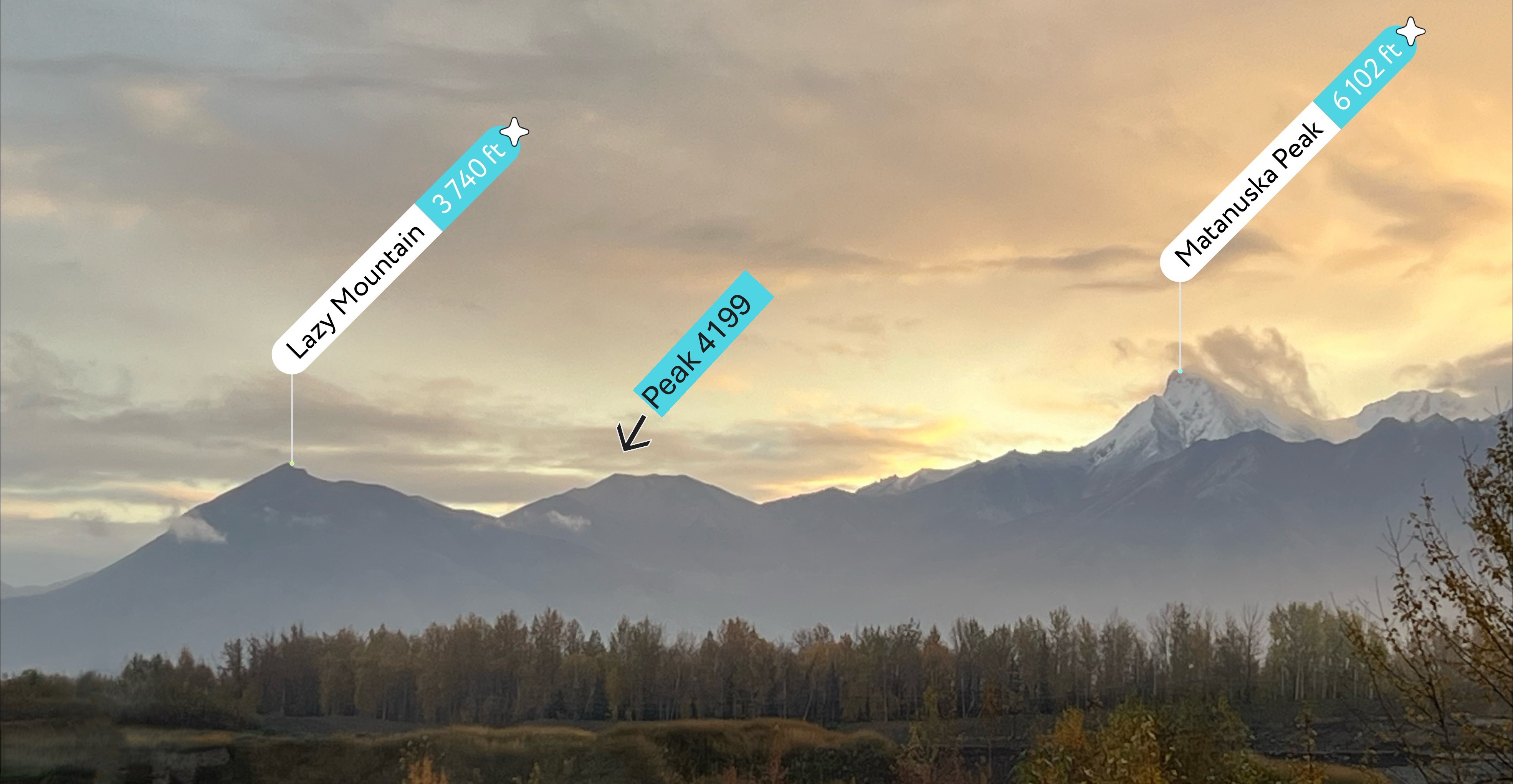
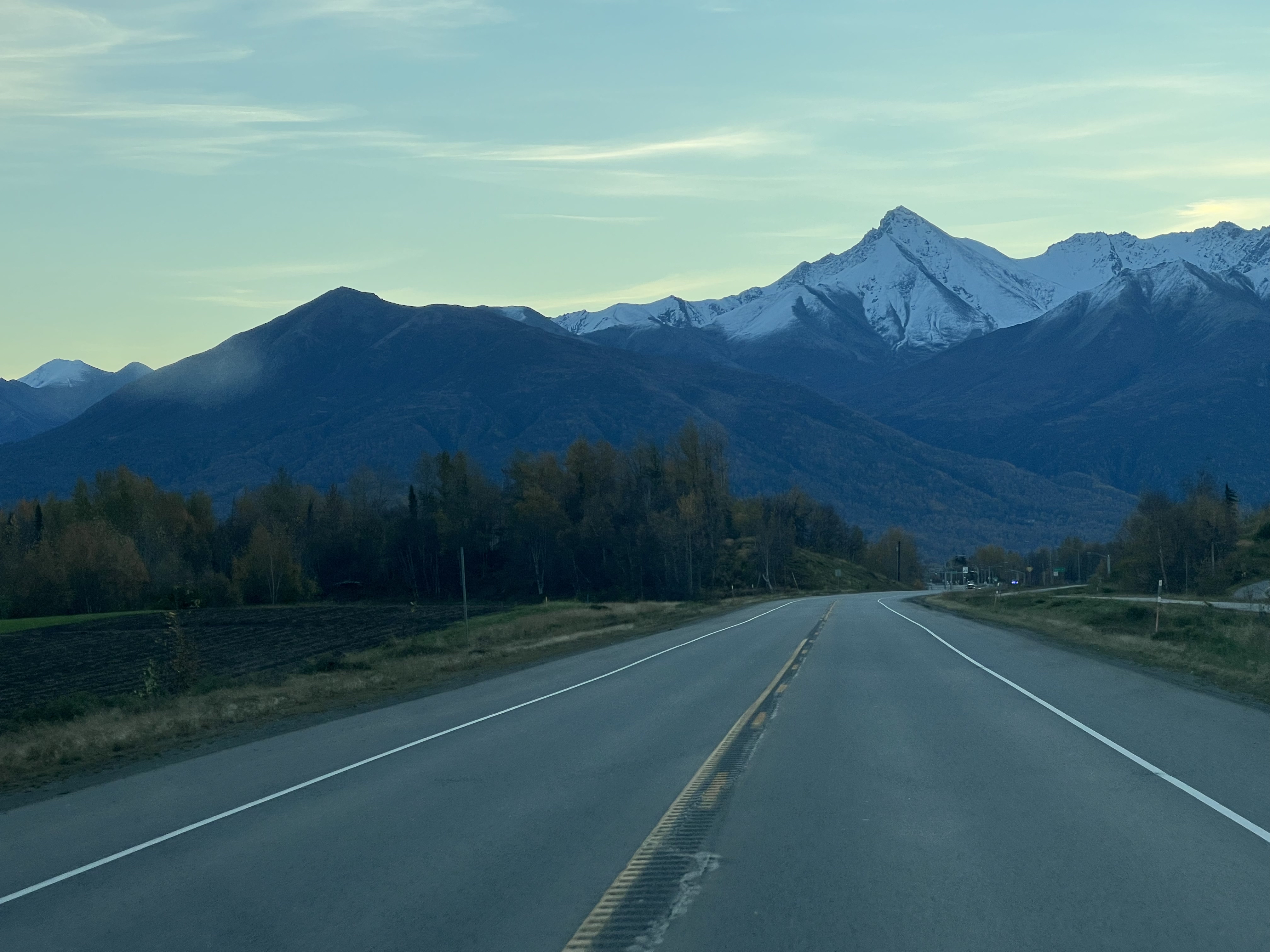
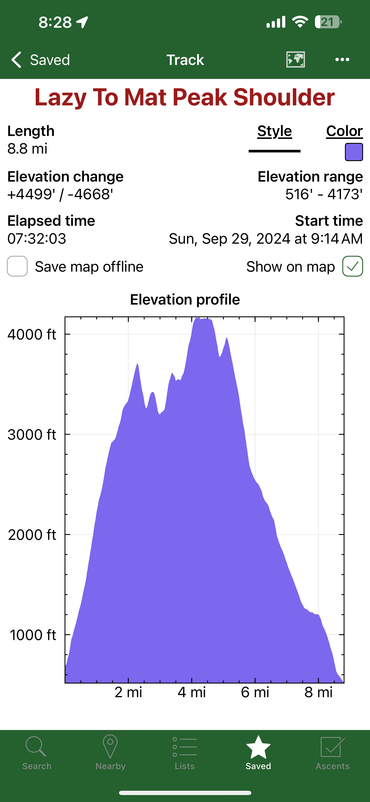
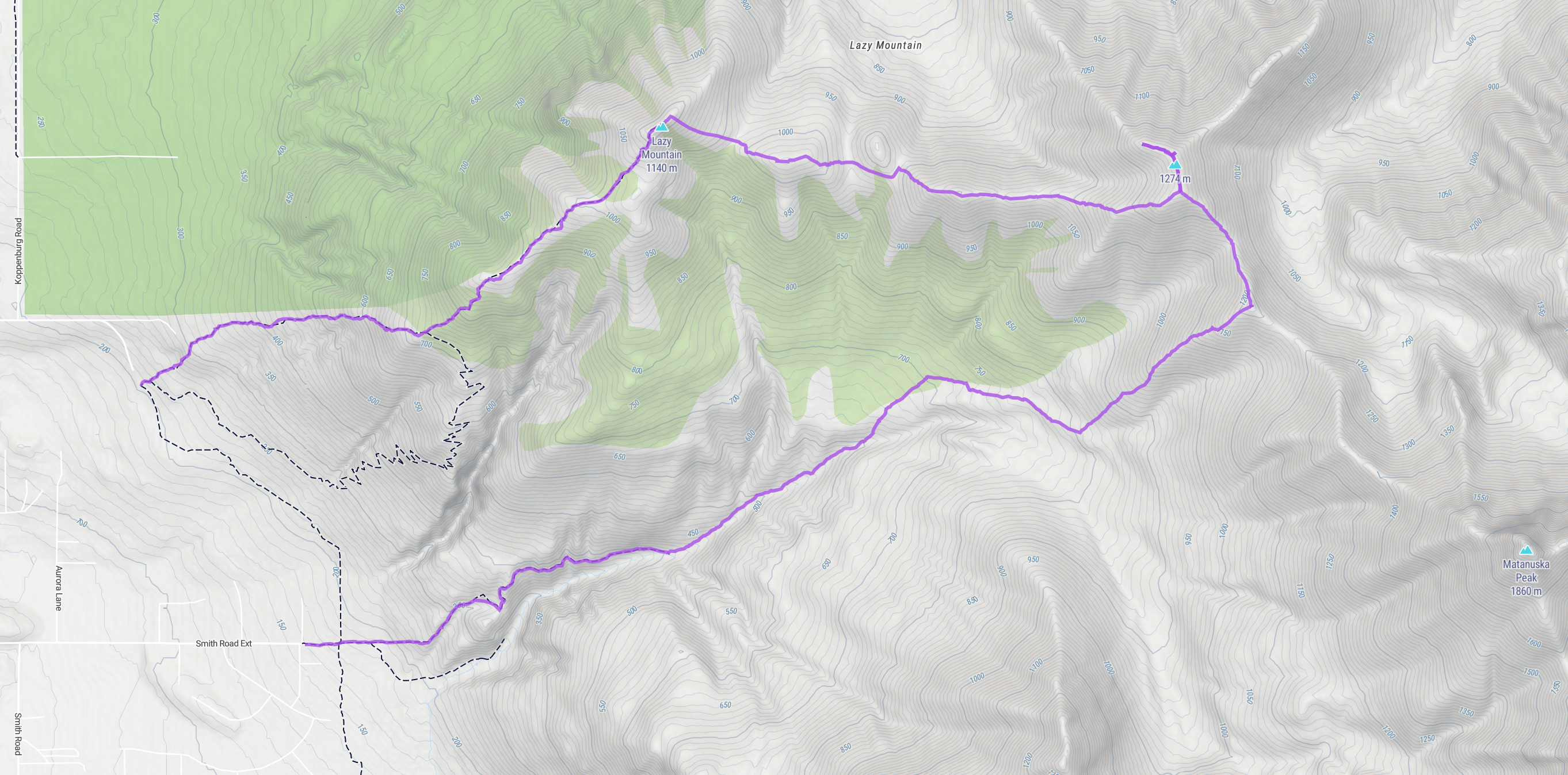
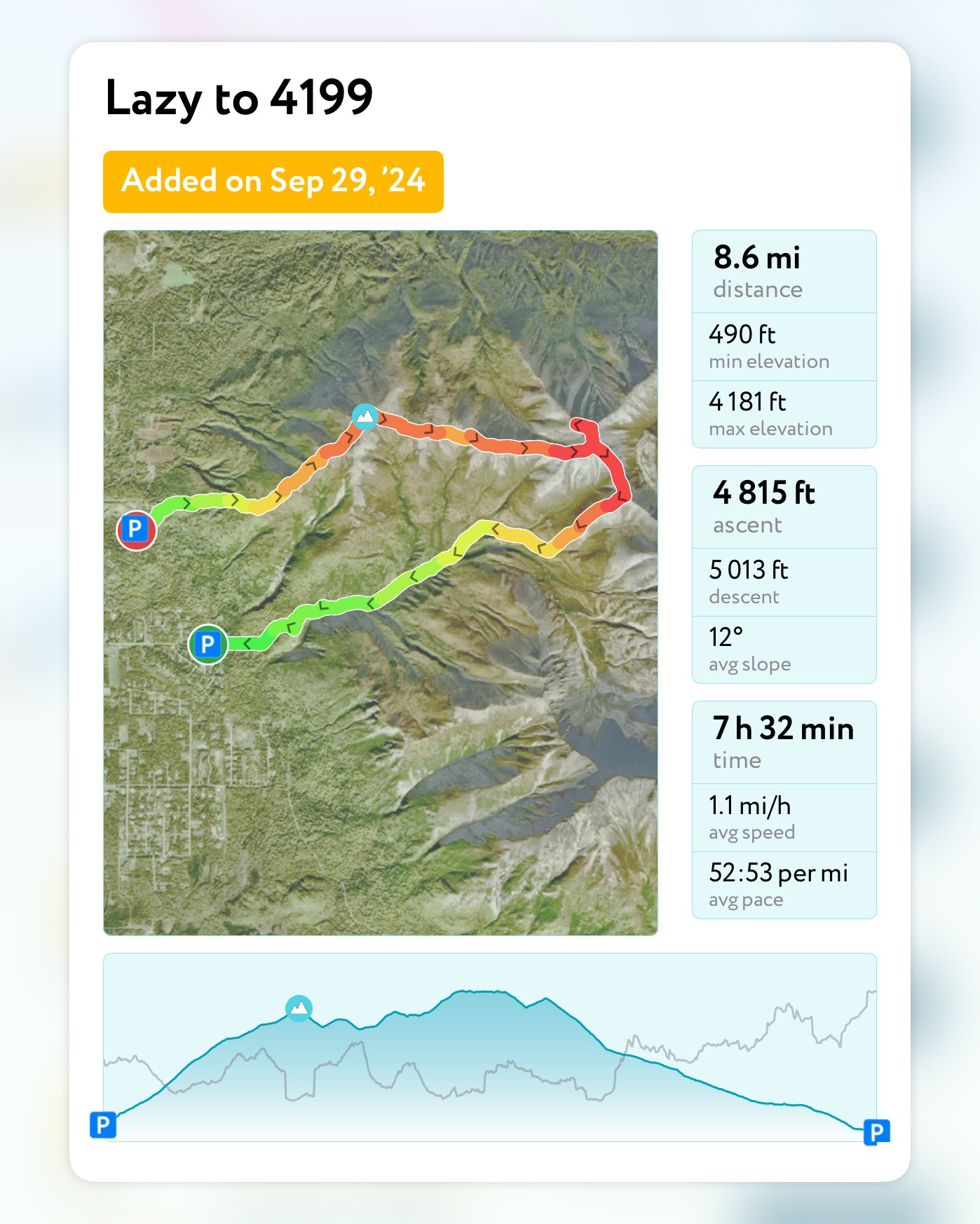
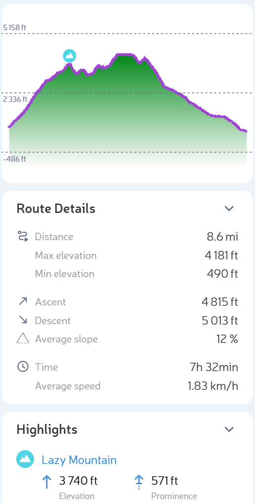
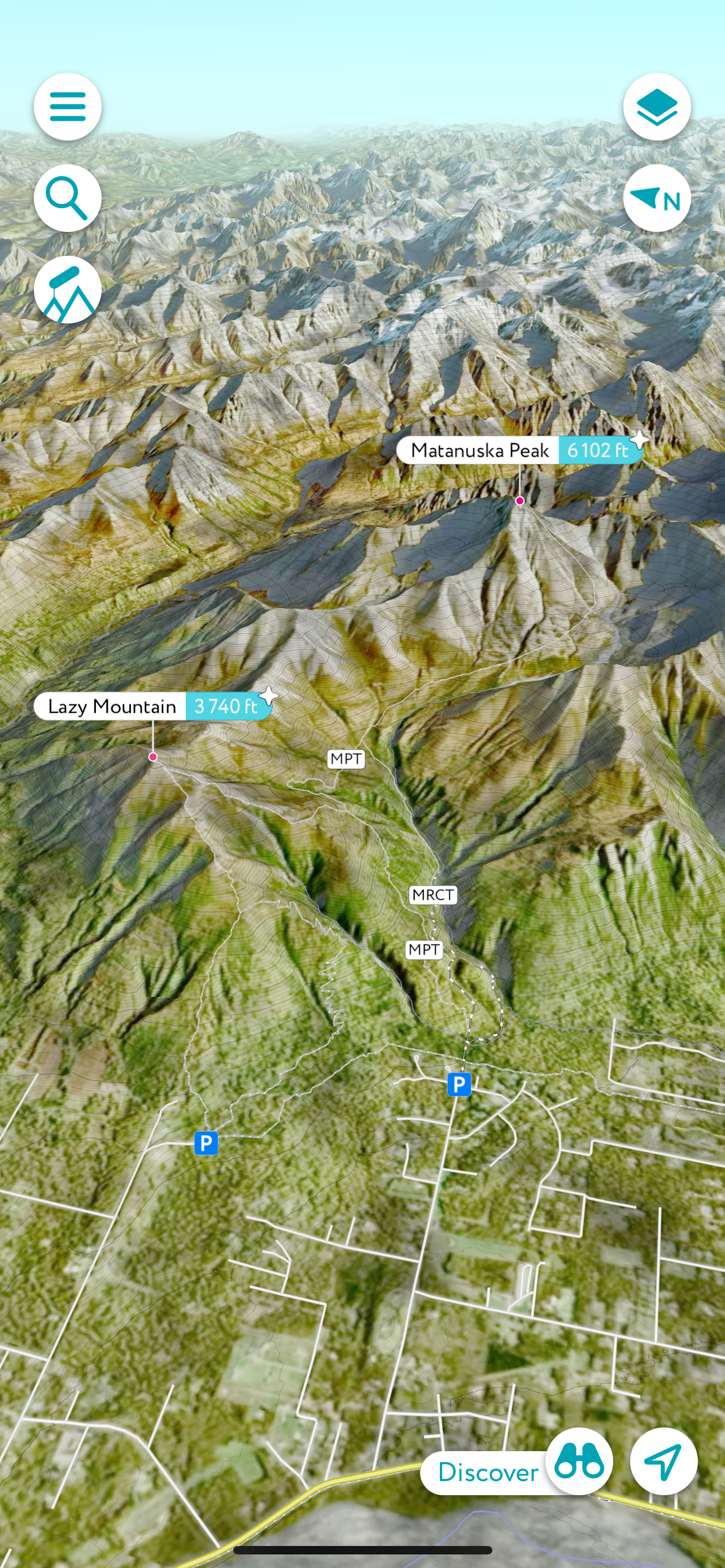
It was the second to last day of September, and the weather was holding out for one more low ridge traverse, though the termination dust had crept down close to the 4,000′ mark. I had been eyeing the ridgeline between Lazy and Matanuska Peaks for quite some time, and today was the day. I planned for a point-to-point hike, starting from the Lazy trailhead and ending at Smith Road, at the bottom of the McRoberts Trail.
Lazy Mountain is one of the most popular hikes in the Valley, one of the shorter peakbagging trips at 5.8 miles and just under 3,000′ of gain, but 99% of the people who achieve the summit simply turn around. Our goal was to summit Lazy then continue on to Peak 4199, named solely for its elevation; broad, hulking mountain on the undulating ridgeline that only sees a handful of footsteps every year.
I met with Jason and Josiah at the Lazy trailhead, ready to see some new ground. The day was sunny and so warm that Jason was shirtless by the time we had ascended the first 1,600.’ It always feels like the first mile is the most difficult, sometimes steep enough to tire even the most fit of hikers, but we made good time, being pushed by enthusiasm to see a new summit.
It felt like we teleported to the top of Lazy, past the turnoff for the Lazy Moose Trail, past the alders and into the treeless terrain, past the second picnic table, past the turnoff to the “Stonehenge” trail that leads down to the Mat Peak Trail, past the two rock outcroppings that mark the last half mile to the summit. By this point, Matanuska Peak and the ridgeline were in full view, Mat Peak covered in snow, though 4199 was mostly snow free.
Most people turn back at the flag, but I scrambled up the last 20,’ over the rocky, somewhat exposed block, hand over hand, until the summit widened out into the perfect lunch spot. We each picked a rock and looked out towards the ridgeline with Mat Peak, rising above. Cautious to not trip or slip off the back side of the summit, I took what, as I now go through them to pick the best for this website, feels to be a million photos of the route we were soon to be walking.
Wrapping up our lunch break, Jason and Josiah set off down the back side of Lazy, a scree chute that makes you feel like you might as well be walking on ball bearings. Of course, Jason and Josiah flew down the 400-some-odd feet to the foot of the next hump, an unnamed hill that I call 3451, while I slowly picked my way, trying not to fall on my ass.
Finally in the saddle, not having fallen on my ass, I looked back up at Lazy and the now much more precarious looking scree chute we had just descended. The well-defined, vertical scratch in the mountainside was evidence of others who had come before and, from this vantage point, definitely looks steeper than it is.
Standing in the saddle between Lazy and the next bump on the ridge, the guys were already making their way up the 200′ to the top. Although it only has a couple hundred feet of prominence and isn’t officially its own mountain, not even having an official name or entry in Peakbagger, 3451 is a fun climb unto itself. I had ascended it via Smith Road a couple of times over the years, trekking the 7 miles and 3,000′ RT to enjoy the abundant blueberries and people free zone.
At the top of 3451 I once again looked back at Lazy and noted that I had now connected the dots between these two points, another ridge section completed. Bright red patches of Bearberry plants dotted the hillsides, and the caribou tundra moss was dry and crunchy underfoot. We continued to follow the faint bootpath down from 3451, skirting a minor, 100′ prominence bump, finally beginning our ascent of Peak 4199.
A mile long approach from the saddle, the ridge gains nearly 1,000′ over a mile. A short, steep ascent before cresting a point, the bootpath then drops down 100′ before continuing up a long, gradual ascent to the broad summit of 4199. The shape of the mountain from this ridge is beautiful with its many curved shoulders falling off into the valley, and although it appears barren and gray, with splotches of black lichen and a dusting of snow, it felt welcoming.
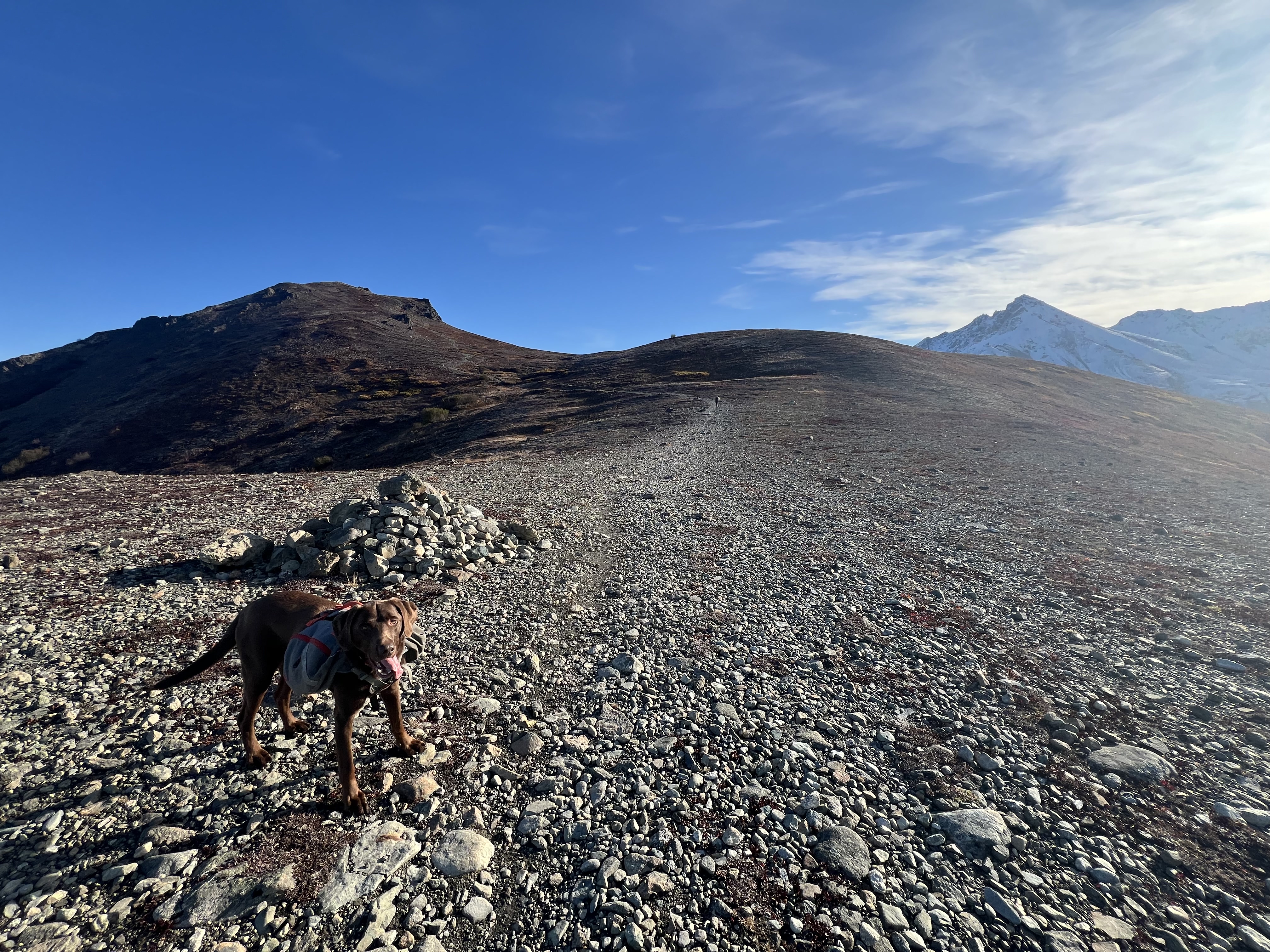
A wide summit ridge, the true summit is nondescript. An anticlimactic high point, merely a bump of rocks slightly higher than the rest of the high ground. We all separated for a bit and explored the top of the mountain, Jason heading north out to the end of the northeast ridge, Josiah out to the end of the northwest ridge, while I took more photos of the route from where we started on top of Lazy, now well below us, the bootpath barely visible. I, too, ventured out to the end of the northwest ridge, not able to resist more views of Lazy and Wolverine Valley to the north, already scoping out a new U-shaped ridge walk from Crag Peak.
The days were getting shorter and we all agreed it was time to move on, our goal of 4199 achieved, yet only halfway to where we were going. We descended the 500′ to the saddle between 4199 and another unnamed bump with an elevation 4015,’ the north side of Matanuska Peak now visible. A rarely glimpsed sight, and only visible from this ridge, we took in the impressive view of the high double cirque, carved by glaciers now long gone, though the evidence remains in the etched and sculpted landscape.
The ridgeline up to Matanuska Peak didn’t look that bad from where were standing, but having experienced the high scree chute on the southwest face the first time I climbed it due to a route-finding error on my part, I knew that it was steeper and much more dangerous than it looked. We talked about how we should try it next summer before the ridgeline was covered in snow.
At 4015 our ridge walk towards Mat Peak was at the end. Having negotiated a bit of snow, but not interested in continuing on to end up with wet feet, we followed the southwest ridge of 4015 down towards the valley and Mat Peak Trail. Not following an established route, we all picked our way down the slope, stopping frequently to pick the enormous and prolific blueberries growing all over the hillside. I had never tasted a more perfect berry and Goose agreed. He and I nibbled away at the sweet berries together.
Finally getting our fill of one of AKs superfoods, we finished making a path through the vibrantly colored shrubbery to the well-trodden Mat Peak Trail. We made quick work of the last 3 miles, opting to take the McRoberts Trail, a path less traveled than the parallelling Mat Peak Trail due to overgrowth during the prime summer months. We had no issues, the September frosts had caused significant die back of the vegetation and a comfortably clear path, although we did make sure to make plenty of noise to keep the bears away.
Before we knew it, we were at the Smith Road Trailhead, another ridge section completed, and two more goals added to the 2025 to-do list. This would be our last Alaska hike of 2024.
Just The Tips:
Lazy Mtn can be accessed via the Lazy Mtn Trailhead or the Smith Road Trailhead. There are many variations and trail options to consider when planning your route.
No parking pass is required at Smith Road Trailhead. A Mat-Su Borough parking pass is required for Lazy Mountain Trailhead.
Be Bear Aware! Especially on the McRoberts Trail.
Be Moose Aware! I have been charged on the Mat Peak Trail.
This is a very dog friendly hike with no significant exposure, except for right at the top of Lazy. Bring plenty of water for your pooch if it is a hot summer day as no water is available between the Lazy Mtn Trailhead and McRoberts Creek, a distance of more than 6 miles.
Don’t leave valuables in your vehicle at either trailhead. Lazy trailhead, in particular, has had reports of break-ins and vandals, although I have not yet experienced that in my nearly 20 years of hiking here.
If it is icy, microspikes are absoutely necessary for the first mile up from the Lazy Mtn trailhead.
February 22, 2025 Mileage: 5.9 Miles Elevation Gain: 2654′ Chugach 120 #103 Chugach Front Range #21 Summit Elevation: 4308′ Jason and I decided to hit up McHugh for mellow peak to see how our bodies were feeling after a long month of us both being sick. The lack of snow in the Front Range was…
I was going absolutely stir crazy. I hadn’t been camping since getting back from the Kalalau Trail at the end of January and I knew I was becoming unpleasant to everyone I interacted with. The forecast was looking great for the weekend with daytime temps high in the 30s and nighttime temps ranging from the teens to low 20s, and although a front would be moving in Sunday night, I would be back at home before that materialized.
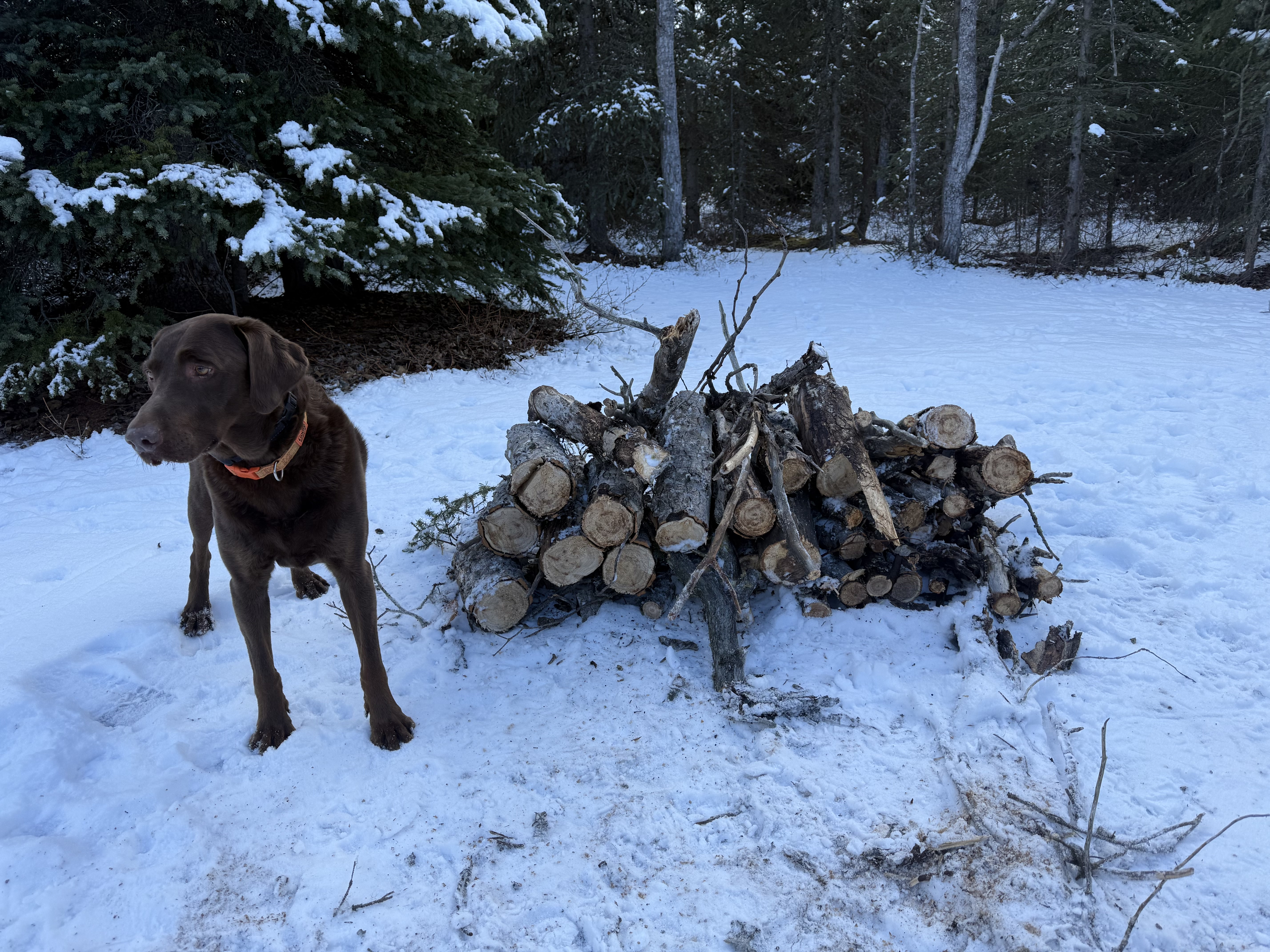
I thought about how I hadn’t been able to haul any firewood to stash in the woods for summer bikepacking trips, since the area hadn’t, and probably wouldn’t, open to snowmachines this winter due to lack of snow. I would make this a two-fer trip, get away to mentally reset and cut/stash some firewood for upcoming trips.
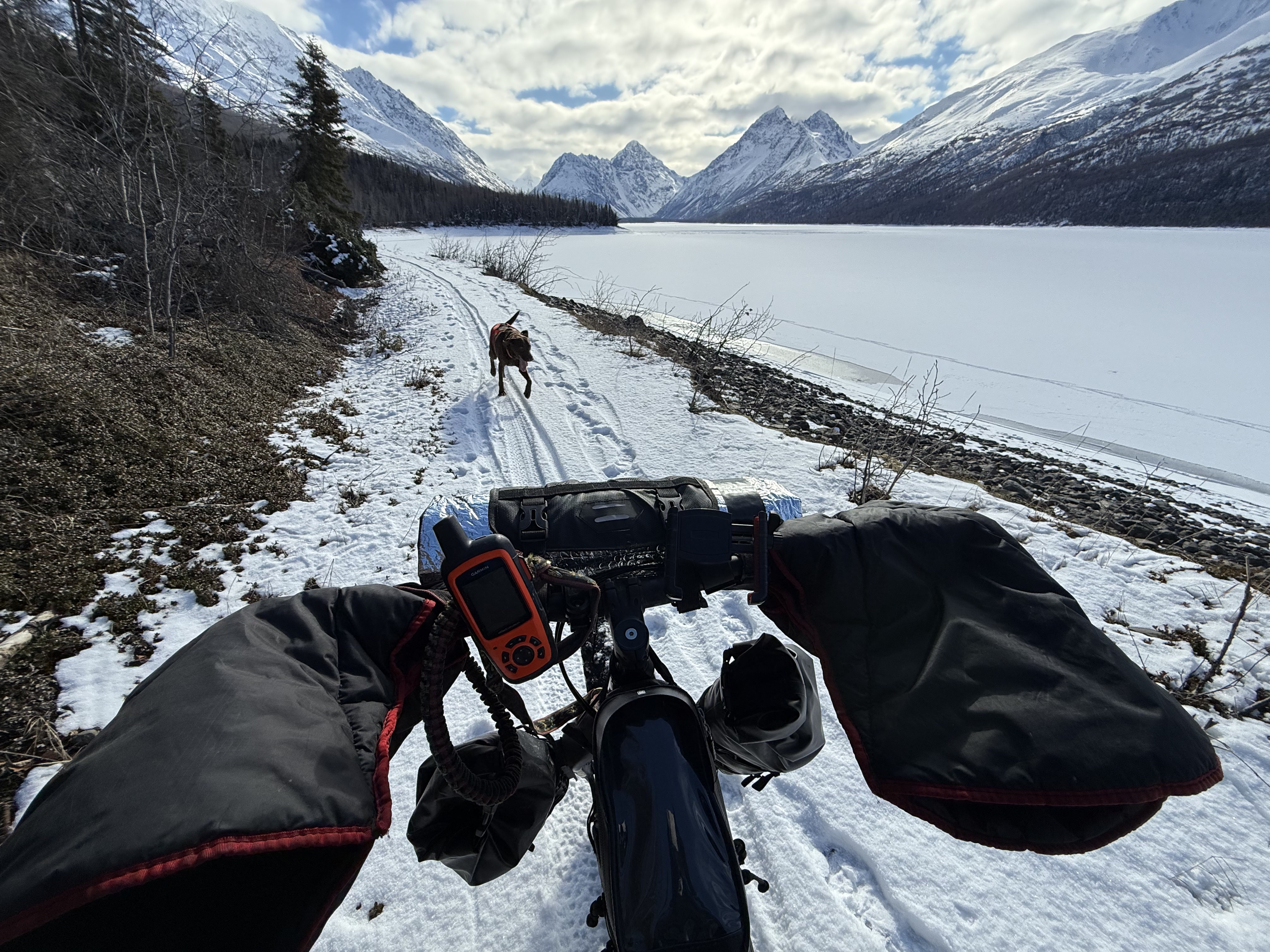
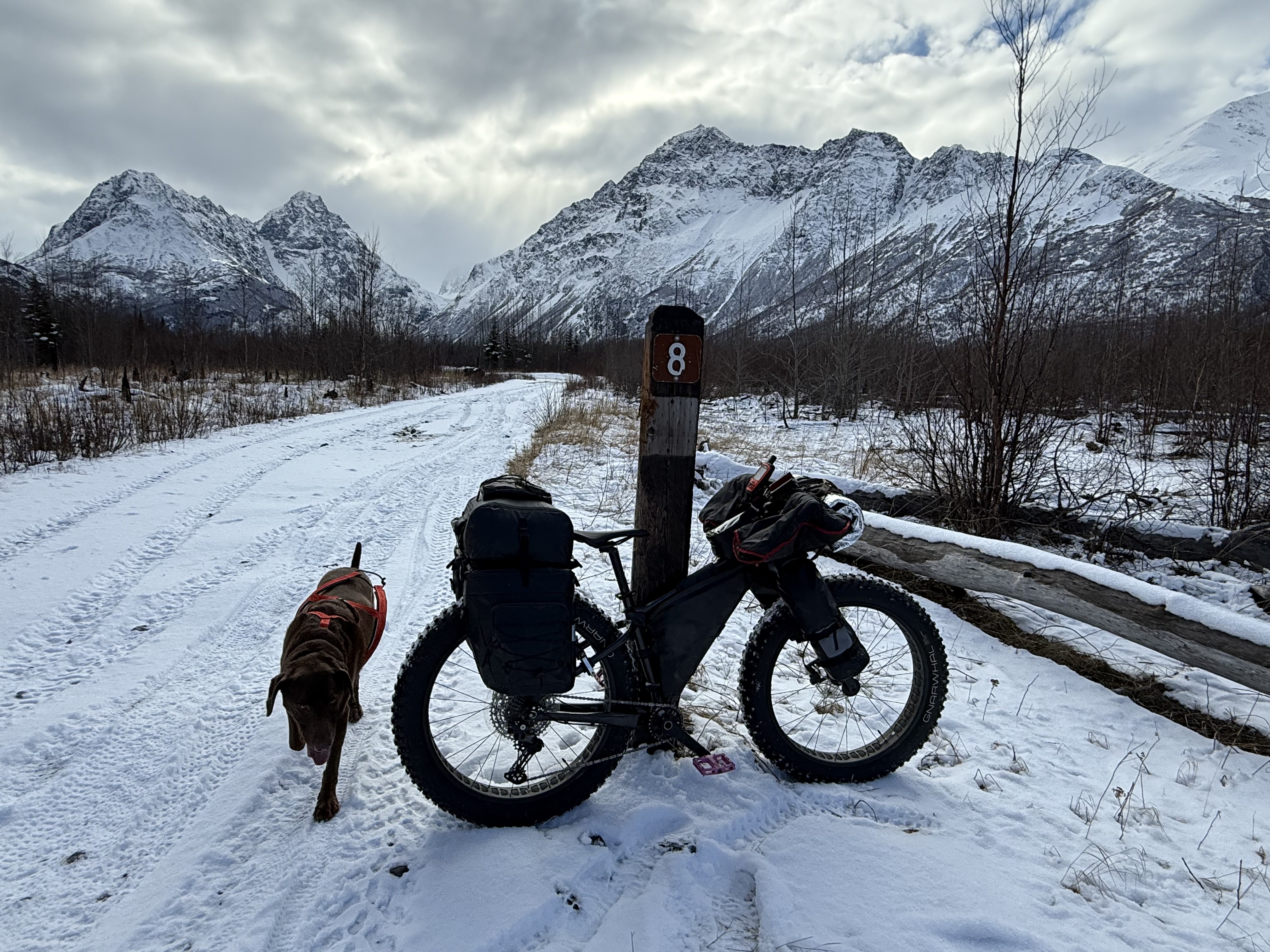
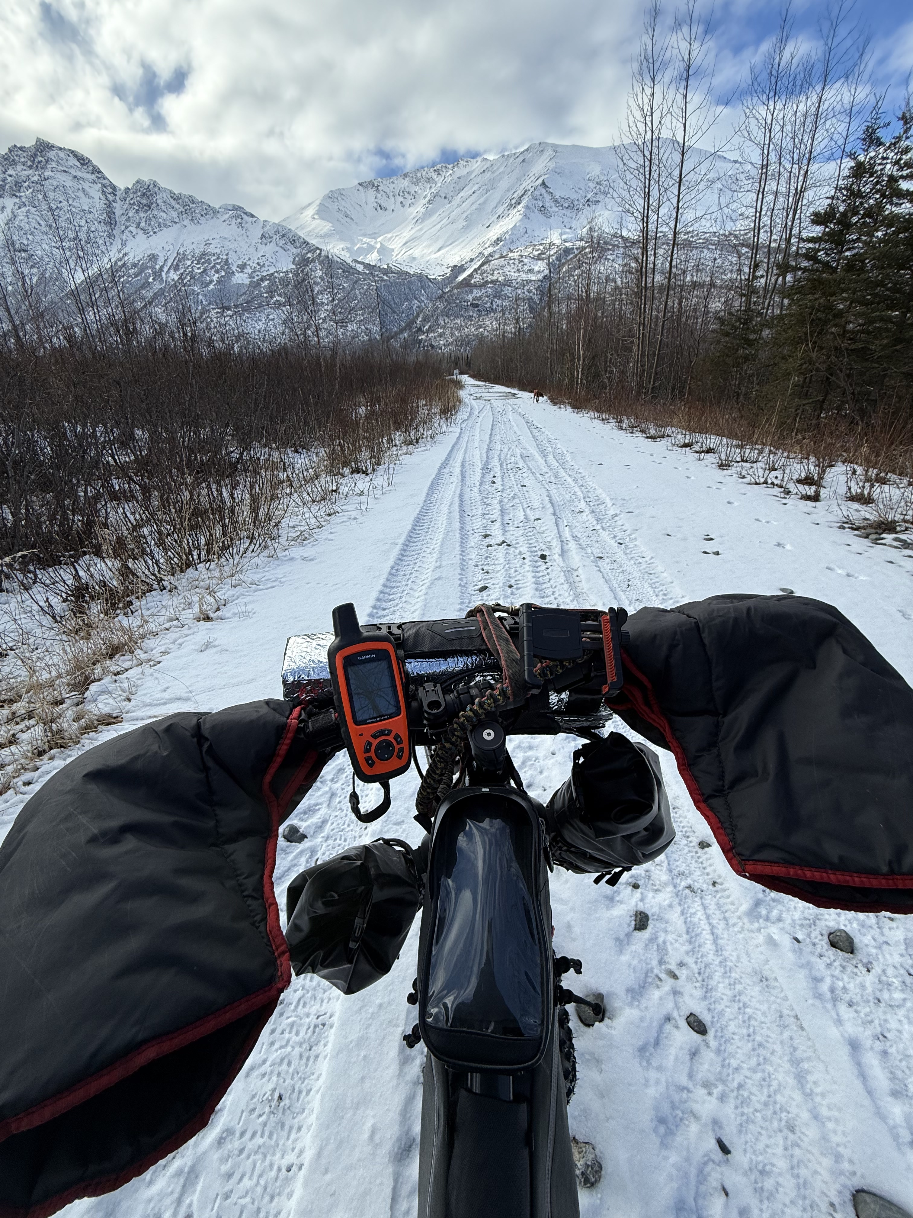
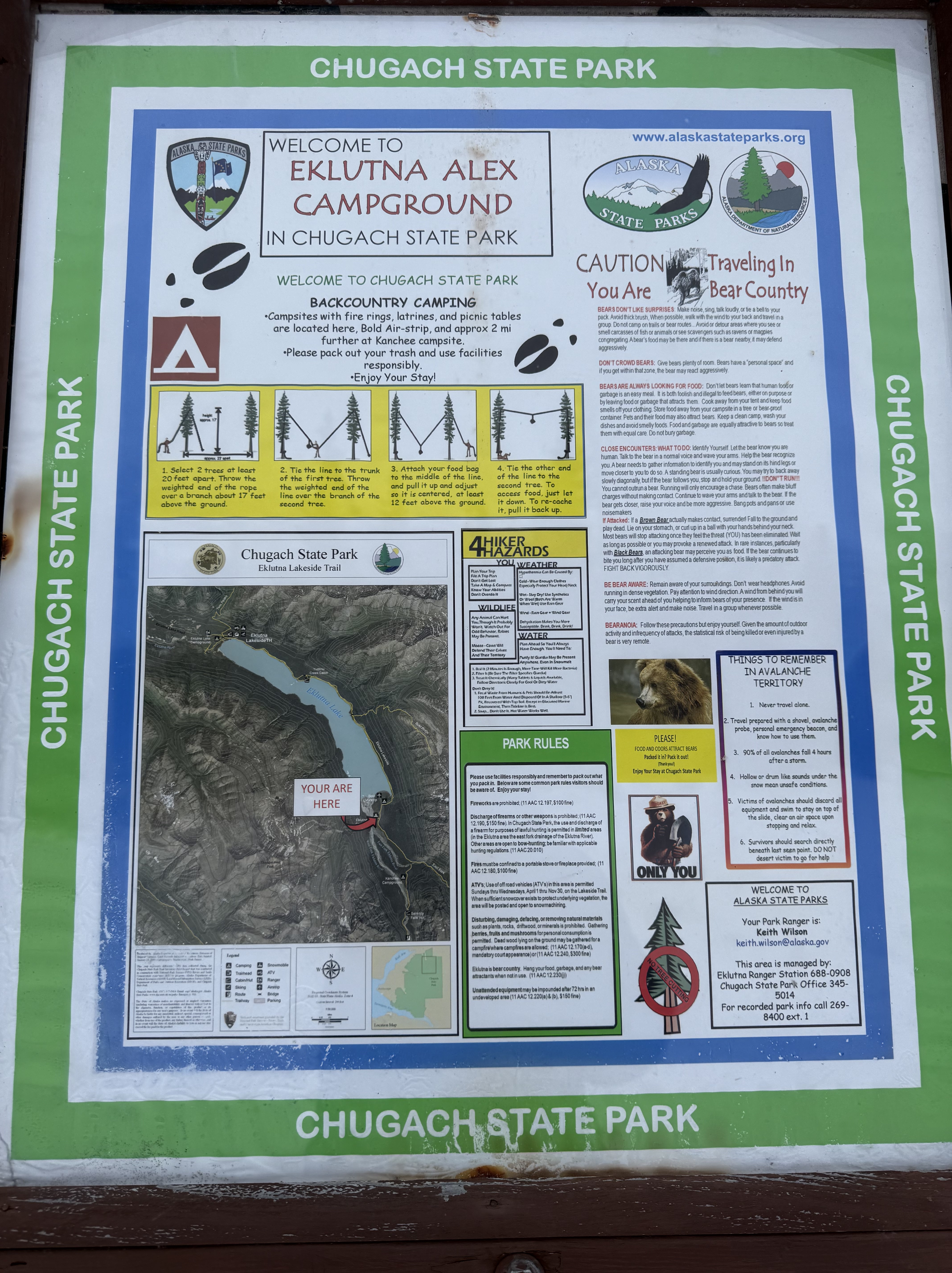
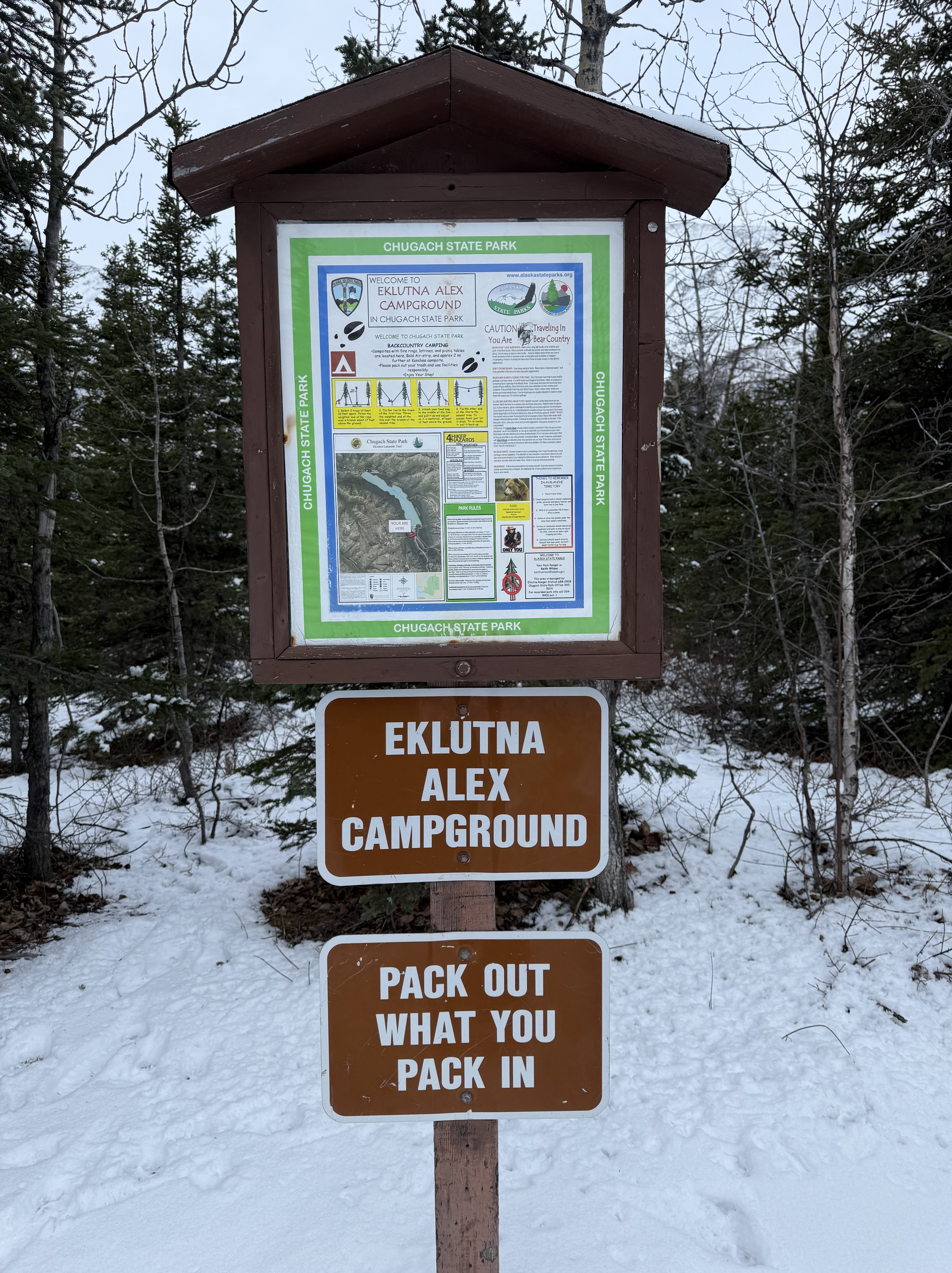
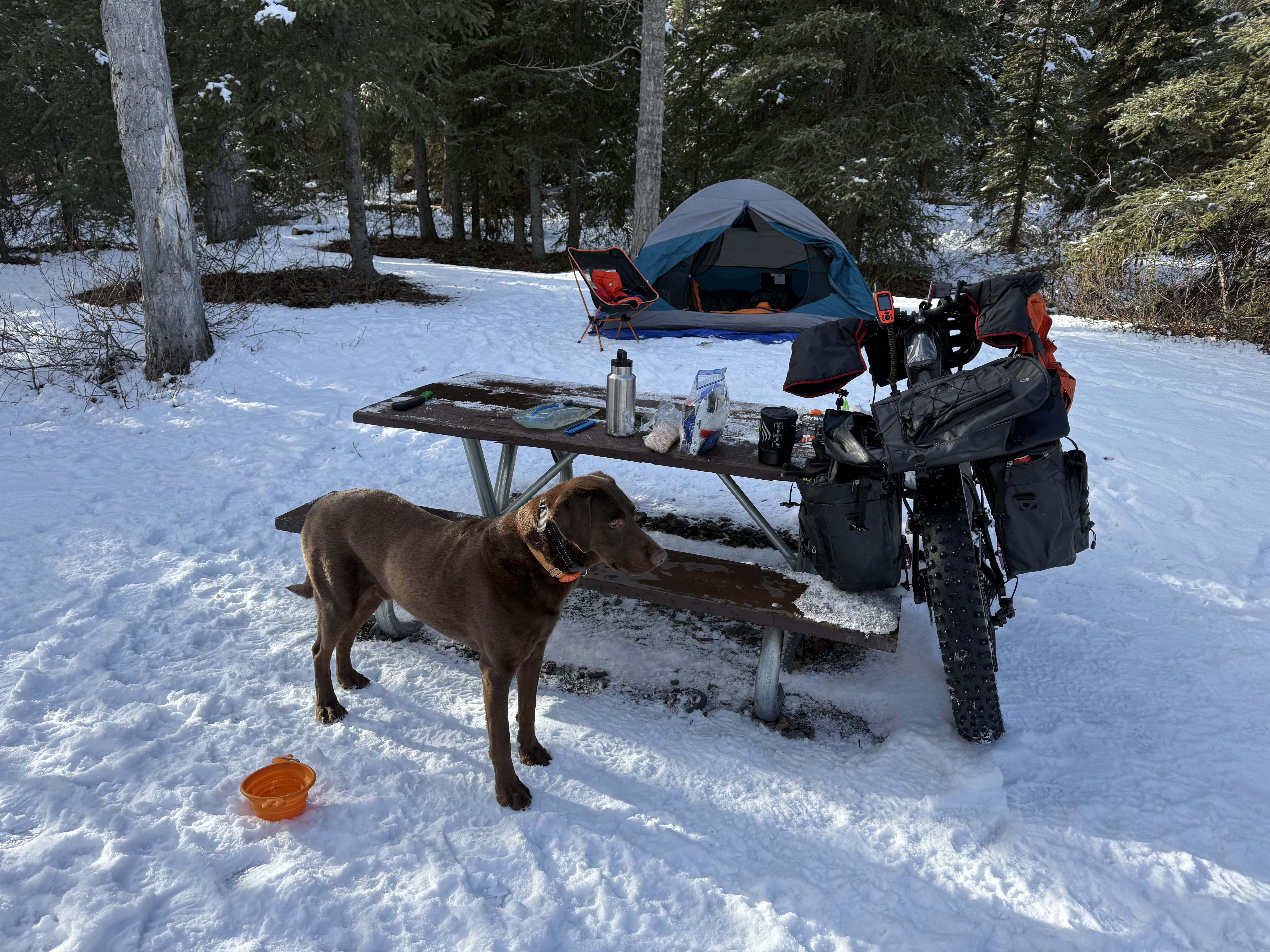
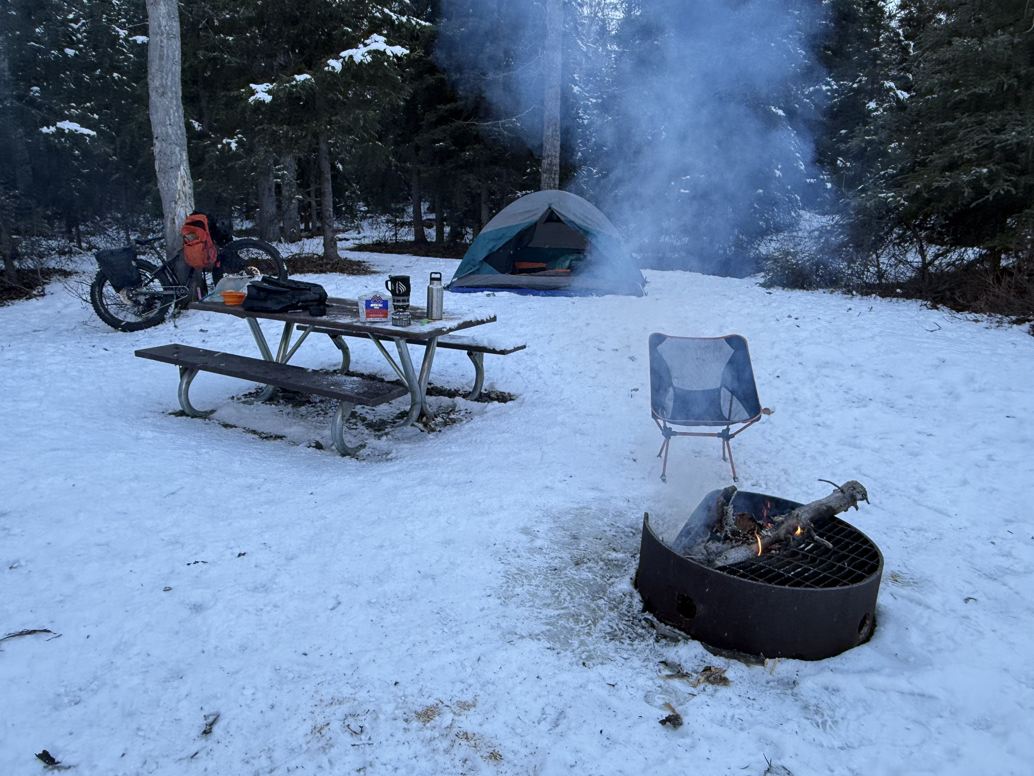
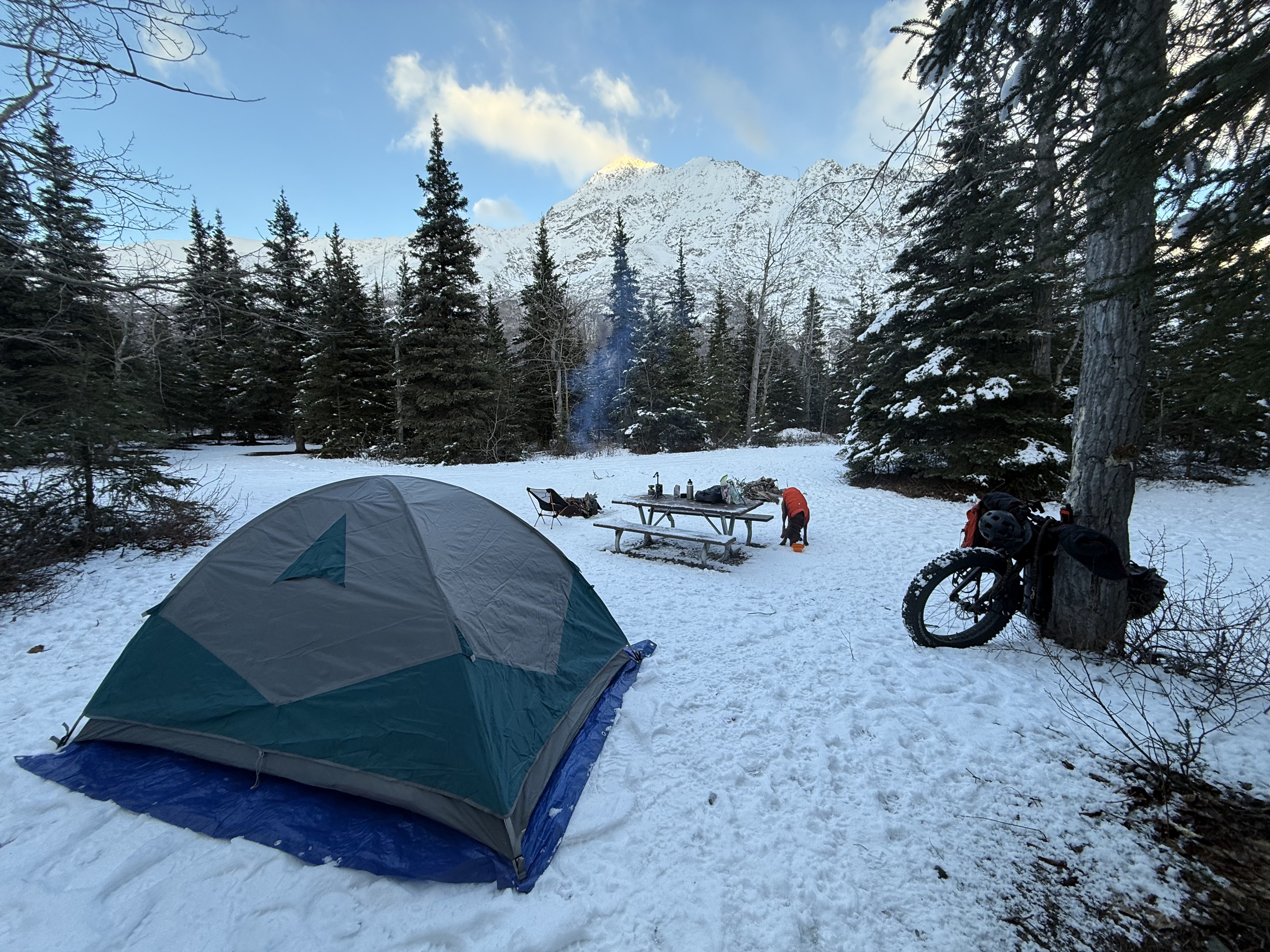
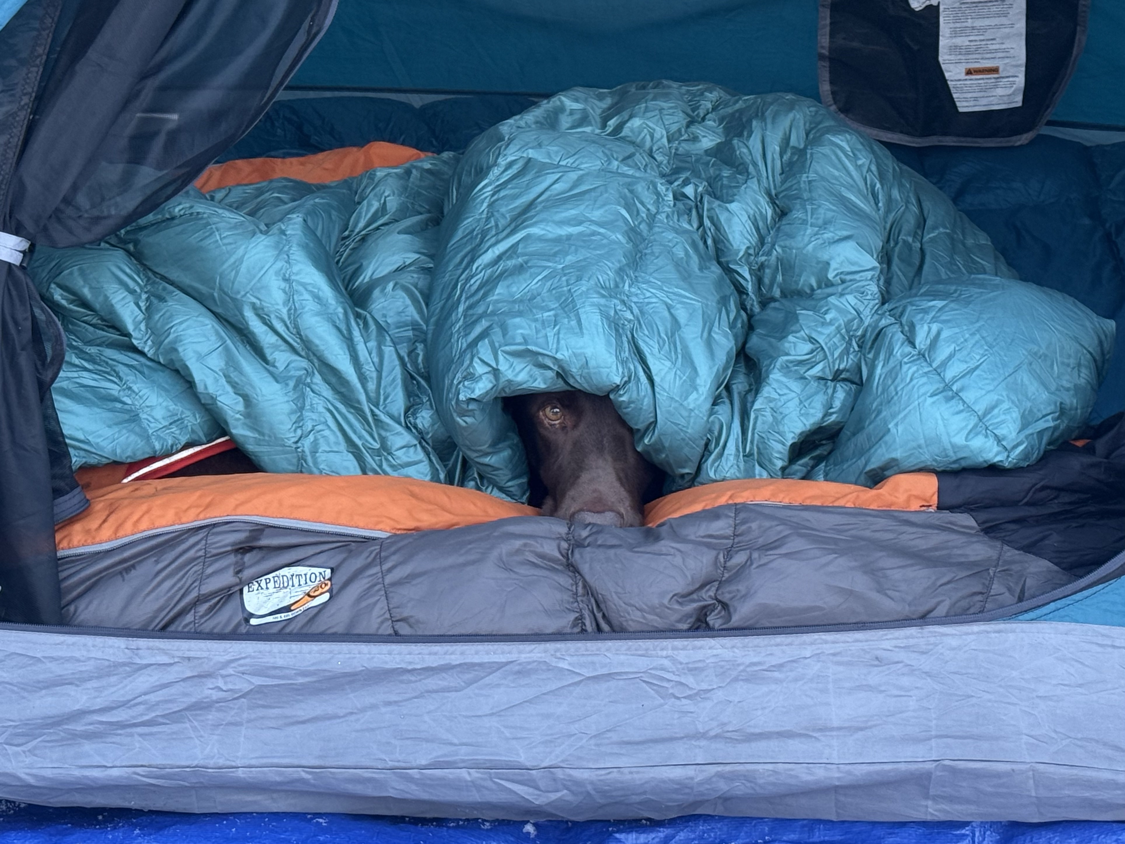
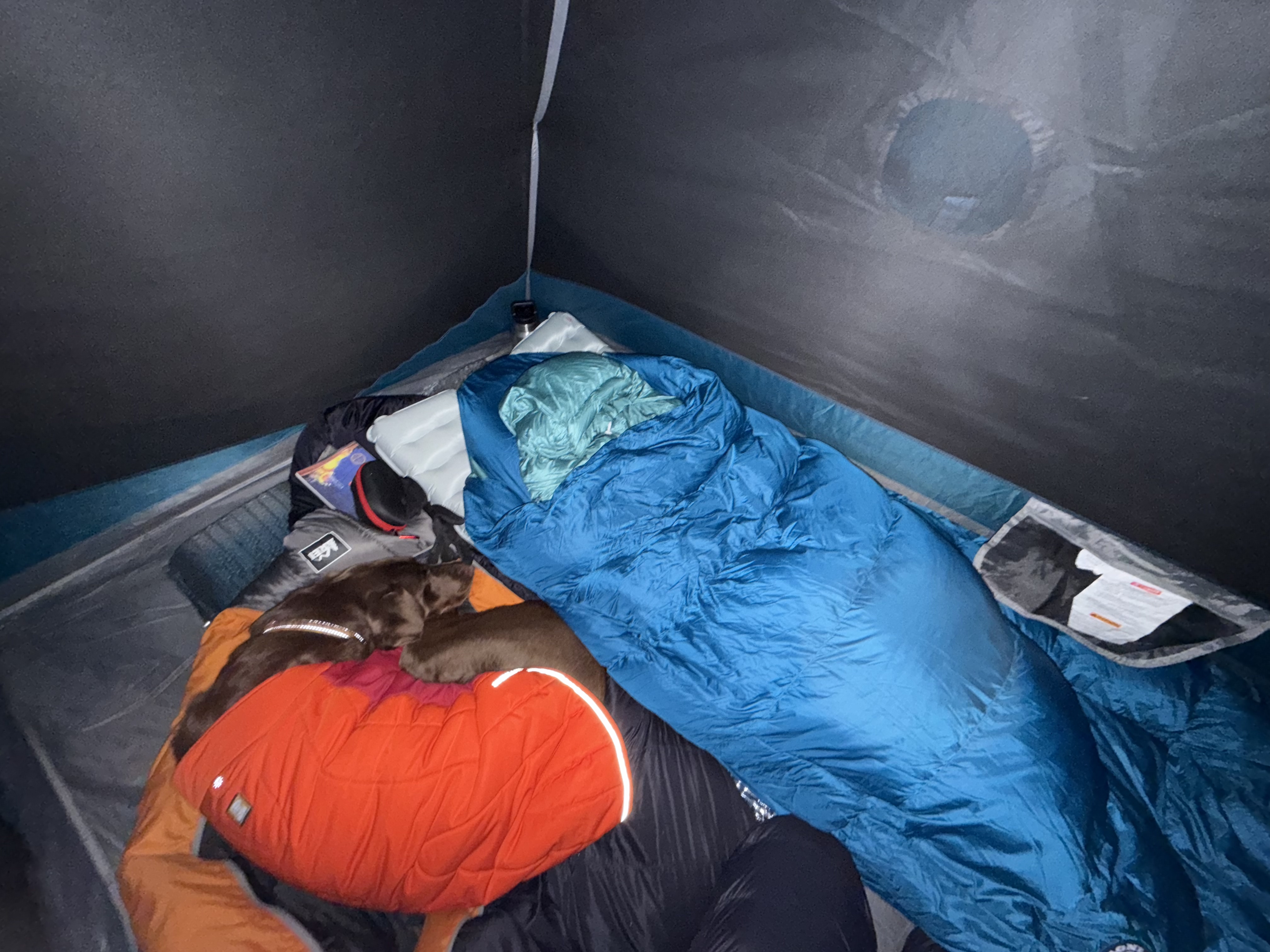
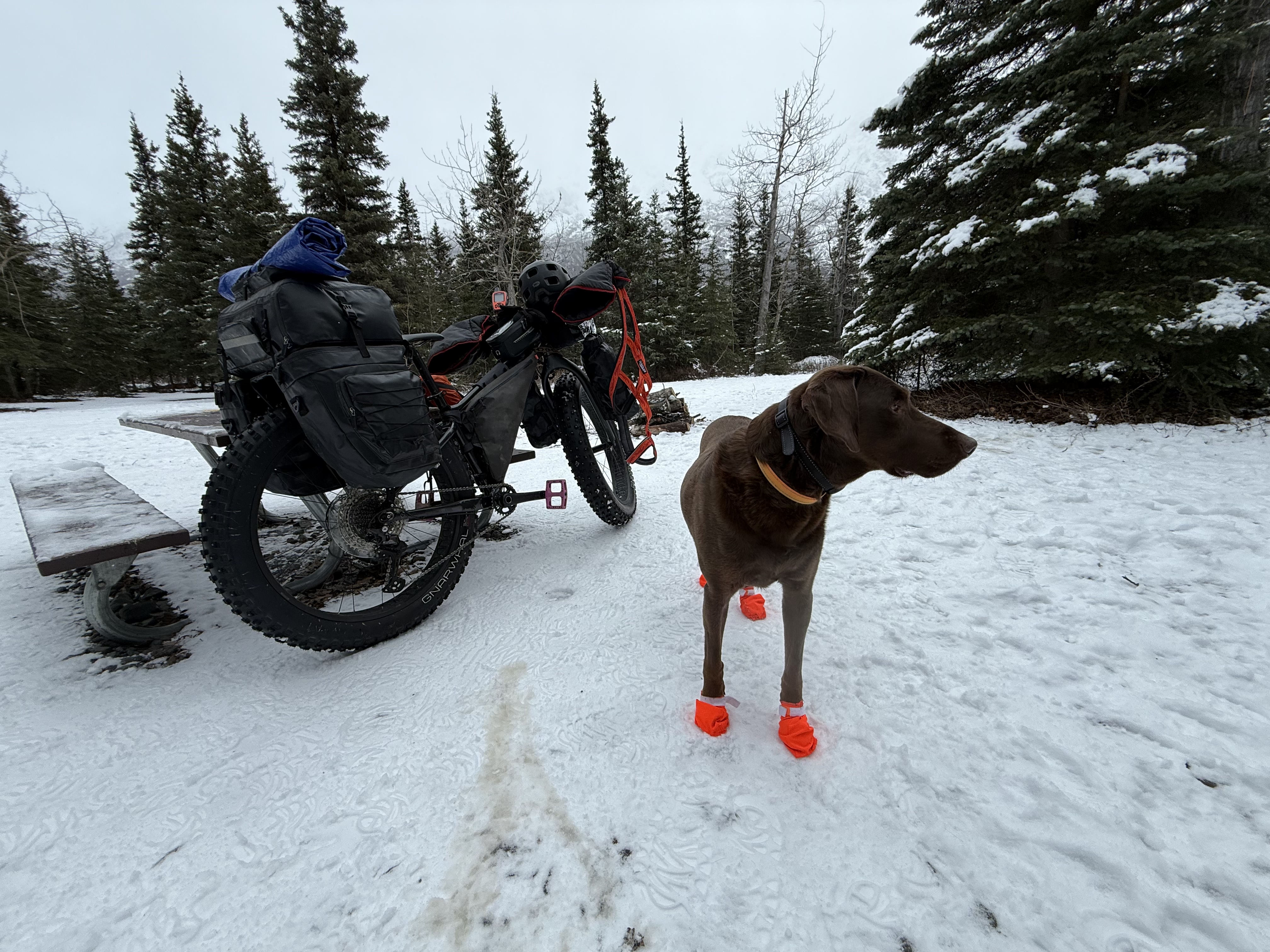
I called a couple of people to see if they were interested in joining me for a fat bike bikepacking trip to mile 8.5 on the Eklutna Lakeside, staying at a remote campground called Eklutna Alex. They were not. Over the years I’ve found that finding winter camping friends is not easy, but I didn’t mind. Honestly, I needed the alone time, and Goose would, of course, be joining me. I spend the last few evenings of the work week packing and prepping, installing a new rear rack on my fat bike, doing some basic maintenance, and collecting my gear, including a battery-operated mini saw.
Day 1
Eklutna LAke Trailhead → Eklutna Alex Campground
8.8 miles
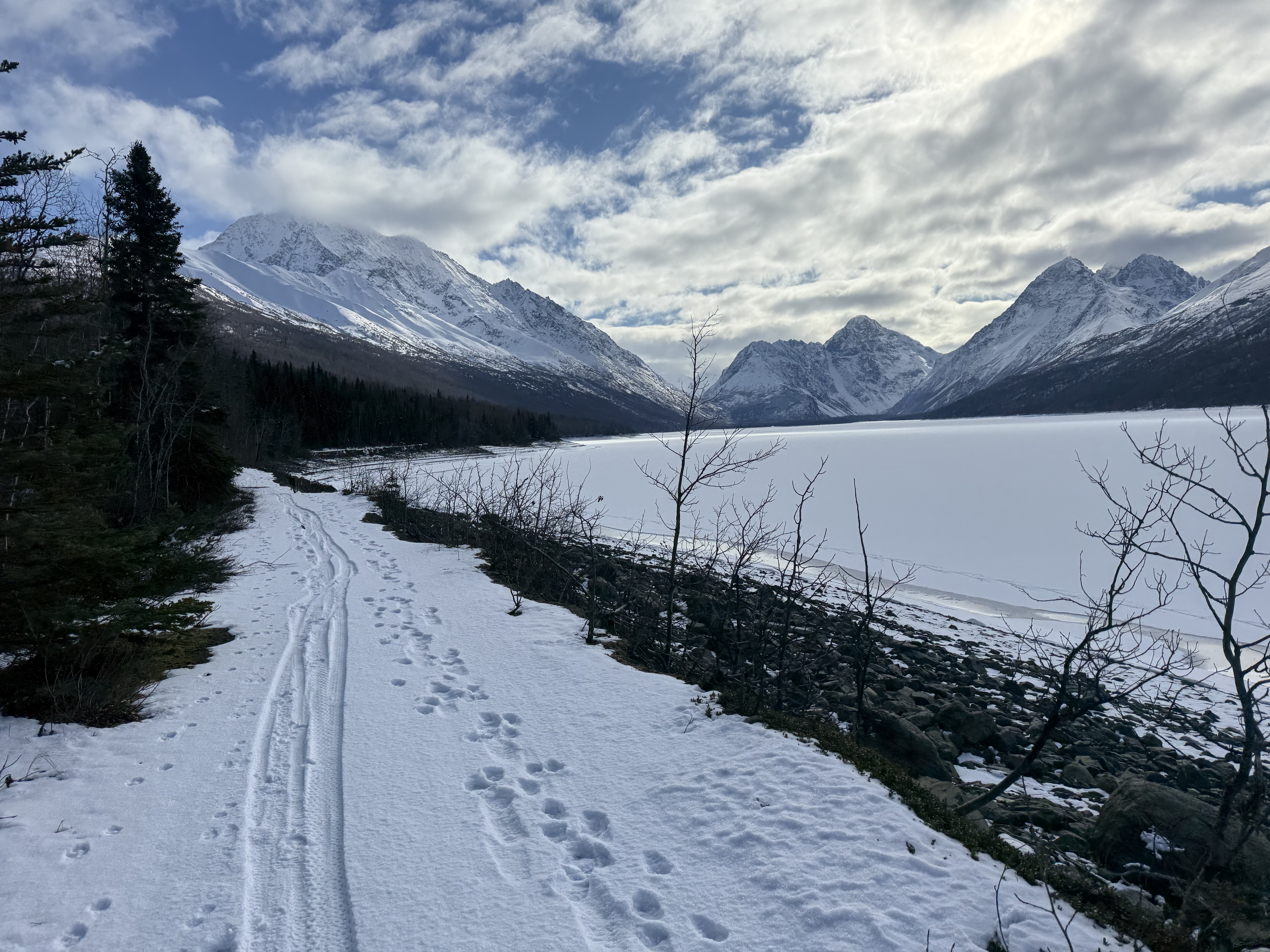
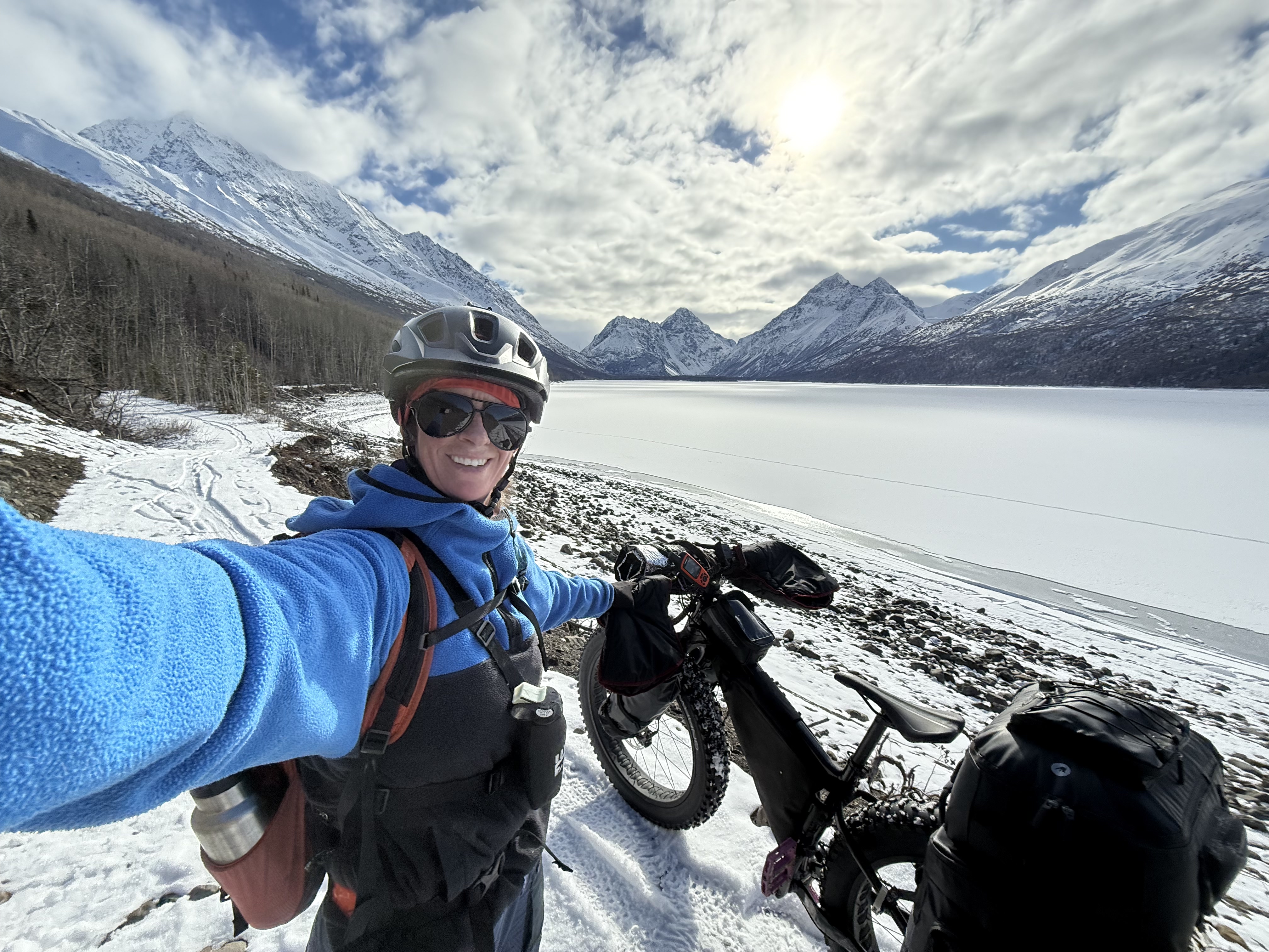
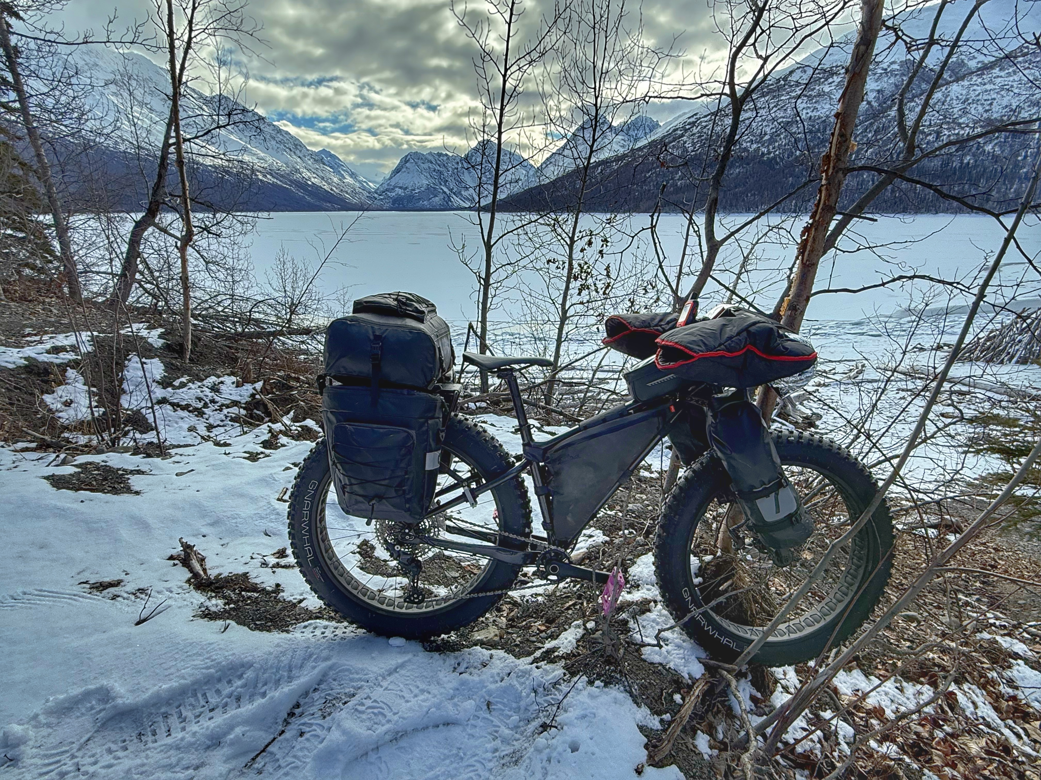
When I woke on Saturday morning, I tried to relax with some coffee and read a book, but my mind wouldn’t let me. I started moving earlier than planned, but it wouldn’t matter, I had plenty to do out there with cutting and stashing firewood. I was at the trailhead, bike all packed up by noon, and off we went, riding southeast towards the head of the lake.
It was a sight to behold. Goose was hooked by bunjee line to the front of my fat tire bike, pulling me down the trail at speeds I was sure were nearing 20mph. I tried to balance my loaded down bike while simultaneously one-handed filming. Bikepacking-joring. I unhooked Goose at the mile 1 marker post, and, although he seemed strong and eager, I didn’t want to tire him out early in a long run. Plus, I was getting cold moving so fast!
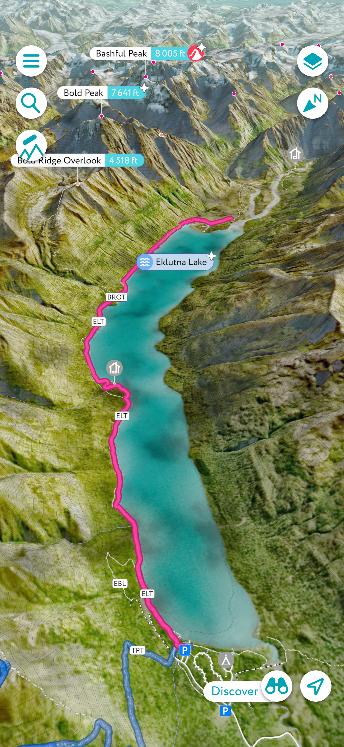
I moved much slower under my own power, but it was a good pace to be able to take in the views. Bold Peak, a 7600′ hulk of a mountain, The Mitre with its jagged shoulder, and The Watchman, a proper triangle of peak, dominated the skyline. Chugach State Park’s tallest peak, Bashful, is right behind Bold Peak, although hidden from the lakeside trail, thus far. In the distance I could see Bounty Peak and the start of a massive icefield.
The miles clicked by, two, three, four, until I came upon a couple walking along the trail. One of them happened to be a hiking acquaintance of mine, so after a few pleasantries and chatting about our trail clearing efforts after the last windstorm, I set out again, eager to reach the end of the lake. I rode past Bold Creek at mile 5 and decided to use the downhill momentum to get up the other side, so I didn’t take my usual break at the bridge.
The trail came to one of its many forks, and I took the pedestrian/bike trail to the right, soon riding along a shelf, a dozen or so feet above the beach below. This section used to be almost completely washed out, narrow and covered in rocks. It was always exciting to see if you could make it the quarter mile or so along the treacherous path, but now it had been widened, making for much easier riding, especially while hauling a load.
I still hadn’t seen any bear sign, just rabbit tracks and squirrels, so far. It was probably in the high 30s, just on the cusp of bear waking weather, so I kept my bear spray close, on a chest harness, for easy access just in case. We were approaching mile 7 and the end of the lake. There would be much less traffic out here and more likelihood to encounter wildlife.
A short hike-a-bike up the last hill next to the lake and there it was. The Eklutna Glacier. Although it has receded significantly over the past couple of decades and is difficult and dangerous to reach (I had almost been the victim of a land/snow slide the previous year), you can still catch a glimpse of it from the top of this hill if the weather is right.
Not far ahead, a small foot bridge spans a swampy area, the location offering stunning views of the massive mountains I had seen from further back on the lakeside trail. Just beyond the mile 8 marker at the footbridge, the trail sweeps to the southwest and Thunderbird Peak rises nearly 6,000′ from the Valley floor.
We were nearly there. Only a mile and half to go. This section of trail is notorious for being bumpy, the summer wheeler traffic efficient at churning up loose rocks and augering out deep puddles. Weaving my way through the obstructions, as much as I could, my seat was starting to become uncomfortable, and I was glad I wasn’t riding all the way to Kanchee at mile 11. I realized it had been months since I had been on my bike, and I was starting to feel it.
Just past the turnoff for Bold Airstrip, I looked down and saw tracks that were not from Goose. Much too large. I had seen wolf tracks out here the year prior and was sure these weren’t from a dog. Much too large and going only one direction. I wasn’t too nervous, as wolves rarely threaten humans; plus, there was plenty of small game out here for a wolf to eat. I was grateful for my alarm system of a dog, though. I could depend on him to let me know if anything came into camp.
As I was investigating the tracks, a large group rolled up behind me and I pointed out the wolf sign. A handful of them were from out of state, friends bringing them on a fat bike day ride into the wilderness. They pushed on, I waited until they were out of sight to continue on myself, hoping to avoid any other human interaction for the day.
But my plans were foiled. As I rounded a corner, the sign to mark Eklutna Alex Campground was in sight, but so were more than half a dozen bikers, milling around and taking a break. I passed them silently, taking a right into the campground and choosing a site with a perfect view of Bold Peak, an old frenemy of mine.
I turned on the noise cancelling in my ear buds to drown out the sounds of people and began clearing the picnic table of snow and ice. Unloading all of my gear, I laid it out and began to organize everything. My tent was set up quickly, I had brought my old Kelty, a sturdy shelter that I had used for years before purchasing my Big Agnes ultralight. The Kelty isn’t a winter tent, but robust enough to hold up to the mild conditions I would face.
I stashed all of my food and odiferous items, including toothpaste, deodorant and my stove into the campground bear locker, a large brown box with a bear proof latch. Although it is a unit to be shared amongst everyone at the campground, I was the only one there, so I had it all to myself.
Now that my camp was all set up and organized, I could get to the project at hand, wood cutting. I had brought my little 6″ Ryobi battery operated saw with two batteries, and a hand saw for backup. Previous campers had done a good job cleaning up the deadfall around the campground, so it took me a while to find any dead or downed trees. I had to walk a little ways into the woods, but was able to find some dried cottonwood, spruce and birch to add to my collection.
In a short hour, I had gone through both batteries and collected a large stack of wood, plenty to use some for a fire tonight and enough to stash for next trip. I got started with building a fire, quickly realizing I had forgotten to bring firestarter of any sort. The mini-Duraflame blocks being my go-to, I hadn’t even brought toilet paper, just wet wipes. Besides my book, I hadn’t brought any paper products at all, and I wasn’t going to burn The Great Gatsby, so I improvised.
Lighting up my Jetboil Stove, I held it under the kindling until a small fire ignited and started to take off. I gingerly fed it larger and larger dry sticks, and soon I had the perfect campfire going. *I’m sure that Jetboil wouldn’t approve of my actions, so I won’t recommend it. Heating up the canister can result in an explosion, leading to severe injury or death. *
Then I swear I hear a wolf howl. I stopped dead in my tracks and listened. An owl hooted. Then another one hooted to my right. Maybe it wasn’t a wolf howling and I just misheard it. Or maybe it was a wolf howling and an owl hooting. The owls continued to call to each other throughout the evening, getting louder and closer to camp. I wondered if these two were calling to find mates. It was that time of the year for owls. Maybe I had witnessed a new relationship forming with my ears.
Although I had carried a liter of hot water in my thermos for me and a liter in my water bladder for Goose, I had also brought a large canister of winter iso-gas, plenty to melt snow for water. All snow is different and will melt at different rates. This light sugar snow took 32 minutes and 8 scoopfuls of snow to get 25 ounces of water to a rolling boil. I added it to my dehydrated Buffalo Mac & Cheese and started the process again for a cup of coffee.
By 7pm both Goose and I were fed, Goose choosing to go to bed in the tent while I sat by the campfire, taking in the heat and the peace and quiet of being the only person for miles. The owls were still calling back and forth, now more clearly than ever. Mars and Jupiter were visible in the sky, Mars tucked up next to the bright, waxing gibbous moon.
I joined Goose in bed at 830, excited to try my new Big Agnes Roxy Ann 3N1 sleeping bag. Although it is a 30-degree bag and the temperatures were going to be down in the low 20s and possibly teens, I wanted to test out its limits. I wore my jacket and down pants to bed and let Goose have my -20 bag. If I got too cold, I’d just swap with him. I read a page and a half of The Great Gatsby before falling into a deep sleep.
Day 2
Eklutna Alex Campground → Eklutna Lake Trailhead
8.8 miles
I opened my eyes at 5am, just like I do every morning, except it was 6. The time change had happened overnight and now the sun wouldn’t be rising until 830am. Ridiculous. I went out to use the bathroom and noticed it was pretty cold, I’d wager to say teens. The moisture that is usually in the air in the 20s wasn’t there. I was pleasantly surprised I had stayed warm enough while testing out this new 30-degree bag, although, to be fair, I did still have my huge puffy jacket and down pants on.
I crawled back into my bag and forced myself back to sleep until it was light. I woke up, again, and marveled at my new sleeping bag and pad combo, the bag not only warm enough, but also getting my approval because of the way it attaches to my sleeping pad, preventing me from rolling off of it in the night. The pillow holder was a bonus. No more searching for my pillow in the dark. My Nemo Tensor All-Season pad was a winner. I had used it in the Grand Canyon, but this was my first time using it outside in Alaska. With it’s 5.4 R-Value and lightweight, compact attributes, I had finally found my perfect sleep system.
Once the sun came up, the temperature rose quickly, the sky clouded over enough to suggest snow was imminent. I finally exited my tent at 915, a very late start for me, but a well-deserved rest. I melted snow and made my breakfast and coffee, doing my typical go home day multi-tasking. It started to snow lightly.
I was packed and ready to go by 1030, although I had one more job to do before I could leave. I needed to find a spot to stash this leftover firewood. It would be enough for one night and I could add to it next time. It took me a little while to find the perfect spot, but three huge armfuls later I had hidden the wood as best as I could, hoping it would be there when I got back. Some of my wood from the year prior was still stashed in a different location. I figured it was unlikely someone would find both stacks.
I mounted my bike and winced at the pressure on my poor, bruised crotch bones, though it didn’t take long to get back into the swing of things, soon forgetting about any discomfort. I rode past the wolf tracks, past Bold Airstrip turnoff, past the footbridge and out onto the ledge next to the trail. I looked back towards the head of the Eklutna Valley, never tiring of the view. Though the clouds were still thick and ominous, consuming the mountains and glacier, I was moving out of the snow and clouds the closer I got to the trailhead.
An uneventful and relaxing ride back, I made good time, reaching the parking lot and loaded up by 1pm. As I drove down Eklutna Lake Road, I kept my phone on airplane mode and hung onto the silence that had made me sane again.
Flyover Video of Eklutna Alex Bikepacking Trip
Just The Tips:
Always carry some form of protection in the Alaska backcountry, even in the winter. Although bears are not often an issue during the winter months, moose and other wildlife can pose a threat in the right circumstances.
Remember that bear spray will freeze in cold temperatures and may become ineffective. I carry a small can of jogger fogger that will fit in my pocket to stay warm, and it has saved me from an aggressive moose. Firearms are permitted to be carried in this area. Refer to the hunting regulations manual for more information on harvesting in this area.
The Eklutna Lakeside Trail is shared motorized/non-motorized. Although there is a foot/bike only path closer to the lakeshore, the trail merges and shares the motorized trail intermittently. Once past mile 7.5, all traffic follows the same trail. Snowmachines are permitted once there is deemed to be adequate snow coverage (like this winter, sometimes there is not enough, and it doesn’t open at all for sleds). Four wheelers are only permitted Sunday-Wednesday, April 1 – November 30. A sign at the beginning of Eklutna Lake Road is updated with the status of the motorized trails.
Use the Bear Bins! Do not leave any food or odiferous items in your tent or unattended in camp, including your cooking stove, cups, cutlery, toothpaste, deodorant, etc. Alaska State Parks provides shared bear lockers at all three Eklutna Campgrounds: Eklutna Alex, Kanchee and Bold Airstrip.
These campgrounds are rarely used, although they are becoming more popular on holiday weekends. The only permit necessary is a daily or annual parking pass for State of AK Parks.
Leave No Trace! Please pack out what you pack in. And maybe spend 10 minutes walking around looking for micro trash that others may have missed.
Bring toilet paper. Although there are outhouses at Eklutna Alex and Kanchee (not sure about at the airstrip), there is rarely any adequate quantity of toilet paper, either because of use of the squirrels and mice. Better safe than sorry to bring your own roll.
Do Not attempt to travel out to the toe of the Eklutna Glacier without knowledge of glacier travel, or, at minimum, a helmet and an awareness of rockfall. As stated in the trip report, I had a close call myself with a large snow/landslide. Rockfall is common in the narrows leading to the toe of the glacier.
It was summer 2023 and I was ready to make a plan for my next backpacking trip Outside of Alaska. The Kalalau Trail had traumatized me earlier that year, so I was looking for something that would be a bit more mellow as far as danger goes, but with a good challenge of long-distance days and decent elevation gain. A friend suggested the Trans-Catalina Trail and as soon as I started to research, I knew this was the one.
I booked my flights and campsites immediately. I found the process to book campsites pretty straightforward (although it can take some rearranging of dates if you book three sites then your fourth one isn’t available for the day you wanted). I went into the reservation process with a flexible range of dates to ensure I was able to book the itinerary I wanted, and I found that December dates remained pretty wide open. (See “Just the Tips” at the end of this post for more advice on permitting or reach out to me for trip planning assistance).
Then it occurred to me that Jason might want to go. We had done plenty of trips together in Alaska, but we had never traveled Outside together. It didn’t take much convincing and he was in! I called the Catalina Island Company to add a person to my reservations, as well as additional stove fuel, firewood, and water locker at Parson’s. I paid the balance on the phone and received a receipt immediately. It was so nice to have a person answer the phone and help me with what could have been a tortuous process.
Travel DAy
Alaska → Los Angeles → Catalina Island → Hermit Gulch Campground
We left Alaska on a red eye, flying direct to LA, and touched down early morning. We had an Uber lined up to bring us to the Catalina Express Ferry at the Long Beach Port and got there in plenty of time to go through our gear and relax by the harbor. This sunny, warm weather was a far cry from snowy, cold Alaska. By noon we were on our way, watching dolphins race our boat, the catamaran comfortable even in choppy seas.
An hour and a half later we pulled into Avalon, and if you didn’t know it, you’d think you were in Greece, with architecture, climate and scenery reminiscent of the European latitude equivalent. Disembarking, we traded our flip flops for hiking shoes, as we had a two-mile hike to get to Hermit Gulch Campground, our first overnight on the TCT. We walked through town, a myriad of tourist gift shops and fine art galleries, and Jason found a wide brimmed hat to keep his face out of the sun.
Walking past a very bougie golf course and multi-million-dollar island cottages, we soon found ourselves entering a beautifully treed campground, almost completely devoid of other campers. We found our reserved site and set up quickly, our pre-ordered stove fuel would be available to us shortly; firewood was not offered as fires are prohibited at this campground. While waiting for the attendant at the supply kiosk, I read through the notice board, taking special note of the “Snake Bite Safety” flyer. At least Kalalau didn’t have snakes, although it was unlikely in this “cold” weather (mid-60’s), that they would be a bother to us.
Fueled up, we made ourselves dinner and coffee. I was eating my ramen and powdered potato favorite, AKA a Ramen Bomb, when the neighboring campers started making wild hand gestures and shushing us. I was so confused, until I looked behind me and saw a mule deer buck munching away on the grass. I knew there would be a lot of wildlife here, but didn’t expect to see it so soon!
We settled into our tents knowing we had a 9 mile hike the next day, not to mention we would be climbing up from sea level to the ridge that leads to Black Jack Campground, a +3,500′ day. Combine that with packs full of supplies for 4 more days on the trail and we both knew we needed a good night’s sleep. Unfortunately, neither of us got that.
Day 1
Hermit Gulch Campground → Black Jack Campground
9.2 Miles, +3,587′
We both woke up early, unable to stay in bed any longer. We both had underestimated how cold it could get here at night, and our light, 50 degree sleeping bags weren’t doing the trick. We were wearing every piece of clothing we had brought but still shivered throughout the night. Hot coffee and oatmeal warmed me up, as did the rising sun, and I knew I needed a backup plan in case this chill carried through to the higher and more northern campgrounds.
I found an empty trash can with a fresh contractor liner and permanently borrowed the trash bag to use as an emergency bivy sack. I figured, worst case scenario, the plastic trash bag would retain some body heat inside my sleeping bag. We weren’t turning back, but did have reservations about our sleeping bag choices and how comfortable or uncomfortable we would be for the next 4 nights.
We packed up and started up the trail. Literally up. Climbing 1500′ in under 2 miles with a full pack is always a chore, and it was starting to get hot at 930am. We talked about how being a little chilly would be nice (oh, the irony). In just over an hour, we reached the ridge, where our footpath turned into a rarely used dirt road. The island has a myriad of roads and trails, allowing for weeks of exploring, but our goal was Black Jack Campground, now 7.5 miles and +2,000′ to go. We could look down and see Avalon in the distance, now appearing just a tiny, quiet enclave and not a bustling tourist town.
Passing some Prickly Pear Cactuses, we decided to take a taste of the bright magenta fruit blooming out of the top. Struggling to pull the fruit off, the tiny spikes on were impossible to avoid and before long we had mini thorns in our fingers, our lips, and tongues. The fruit was delicious, but we were concerned about the tingling in our mouths, though it didn’t last long, and the tiny thorns were dissolved within an hour. (I later read that the best way to harvest the fruit is to burn off the tiny fruit thorns with a lighter. **Be very careful with any ignition source in this arid environment. Fires can start with just a spark and take off quickly.**)
At the Wrigley Reservoir, we dropped off the ridge and soon passed the Haypress Reservoir. Transitioning back and forth from dirt road to footpath, we ascended and descended small hills for the next 4 miles, Black Jack Mountain and its radio towers coming into view. One last 500′ climb in 8/10 of a mile and we would be at our campsite for our second night on the Trans-Catalina Trail, at Black Jack Campground.
Entering Black Jack just after 4pm, we found our site and dropped our gear. We immediately noticed that the views weren’t very impressive, as it sits in a protected nook between Black Jack Mountain and Mt Orizaba, the tallest peak on the Island at 2,096.’ The amenities of the campground are excellent, with pit toilets and running water. I had chosen a site on a lower plateau, to the south of the main portion of campground, and I would not do so again. Walking up and down the hill to get to the bathroom and water was a longer walk than necessary, and the location didn’t offer the views that I had hoped. The main campground is also lusher and more welcoming.
Another night, another Ramen Bomb, and I was ready to get into bed and read. Black Jack also doesn’t allow fires, but the next night in Little Harbor we would have firewood waiting for us. I didn’t make it far in my book before I fell into a deep sleep, not needing the trash bag to stay warm, but still wearing all of my clothes.
Day 2
Black JAck Campground → Little Harbor
9.1 Miles, +1,290′
The next morning, I woke well rested and not freezing, a beautiful pink and orange sunrise to welcome the day. Packed up and fed by 745am, we headed out with the intention of climbing Mt Orizabo, the tallest peak on the island. After only a quarter mile, we dropped our packs and turned west, away from the Trans-Catalina Trail and towards the small bump of a summit.
We assumed it would take us no longer than an hour to go up and down the couple miles and 700.’ We didn’t make it far before a gate and a fence blocked our path. Unsure of the legality of hopping or skirting the fence, and with the driver of the one jeep heading up treating us like crazy people for trying to summit this unimpressive knob of a hill, we decided it wasn’t worth it and returned to our bags and the TCT.
Today would be an exciting day! We were going to stop at Airport In the Sky, a small aircraft runway, with a hangar, cantina and gift shop. Our trail brought us through the familiar sage brush and cactus filled hills we had become accustomed too, so we were surprised when we dropped down into a small, tree shaded area, a nice break from the blazing California sun.
Arriving in AITS, we bought some memorabilia and a hearty lunch, washing it down with ice cold drinks. It was only 930am, but it was already very hot for us Alaskans. After charging up our electronics and walking through the outdoor museum, we hefted our packs onto our backs, now with some extra treats packed in, ready to see what was in store for us for the next 6 and half miles.
Leaving Airport In the Sky, our track took us from a northerly heading to a northeast route, turning southwest after 3 miles at the Big Springs Ridge Trail. Across the valley to the south, we could see a herd of a dozen or so Bison on the ridge, and to the west we could see the ocean. A descent of about 800′ and a little more than two miles was all that was between us and our beachside camp. We hustled our way down towards the sea and palm trees that became closer with each step. We were starting to get the views we came for!
We arrived at our camp at 2pm, plenty of time to settle in and then go for a swim. Our site was reserved at Little Harbor, which is a calm water area; the neighboring Shark Harbor being notorious for rockier, rougher water was not as appealing. I quickly donned my swimsuit, grabbed my camp chair, and headed down to the ocean, only steps away from our campsite. I spent an hour swimming and sitting on the beach, thoroughly enjoying this gorgeous place and wishing I had booked two nights here.
I used one of the outdoor cold showers to rinse off the salt, filled up my water bottles at the filling station, and went back to our camp to make dinner and coffee. A little fox was hanging around, hoping for scraps, and not at all afraid of us. We guarded our food with our lives.
Our pre-ordered bundles of wood and firestarter were waiting for us in our critter box and it didn’t take long to get a fire going as we were treated to a glorious sunset over the harbor. We stayed up for a while, making sure to use up all of our wood, before turning in for the night, now almost 20 miles from where we had disembarked from the ferry.
Day 3
Little Harbor → Two Harbors → Parson’s Landing via the Road
13.5 Miles, +3300′
The weather so far had been perfect and today was no different. The cold night we had experienced at Hermit Gulch was no longer the norm, and we slept comfortably, although a warmer sleeping bag wouldn’t be a bad idea during the winter months.
We were on the move by 7am, sad to leave this gorgeous beachfront property, but excited for our longest day of the trip, a 14 mile walk to Parson’s Landing. By all accounts, Parson’s is the nicest camp on the entire TCT, but I thought it would be hard to beat Little Harbor. We would get a nice, late morning, break in Two Harbors, just 5 miles north. The trail out of Little Harbor climbs gains 1500′ over the first 3 miles, before losing that same 1500′ over the almost 3 miles into Two Harbors.
Climbing up along the coast, we got an amazing view of Little Harbor and the rocky shore of Shark Harbor, before turning north to ascend the ridge. A small, covered picnic table (common to see at TCT viewpoints) welcomed us to the high point of the ridge at just over 1,200.’ We now had a full view of the north section of the island, split from the south by a narrow isthmus that literally separated two harbors. I looked back to the south and noticed a distinct difference in terrain, the south having more rolling hills, the north looking rugged with its intertwining ridges and lack of lowland.
After one last short 100′ climb to a knob, Two Harbor came into view. Within an hour we had descended the 1,500′ and were picking out a table outside of the general store, ordering a pizza and beer. They even had a couple of excellent N/A beers for me, now having survived over nine months without alcohol.
While waiting for our order, I walked over to the Visitor’s Services kiosk, a small building right on the pier where we would be catching the ferry home in a couple of days, and picked up our pre-arranged locker codes. The lockers at Parson’s would each contain a couple gallons of water, a bundle of firewood and firestarter. There is no water source at Parson’s or anywhere nearby, so it is imperative to pre-order these lockers.
We finished our meal and headed to the shower/laundry building, only a few steps away from the general store and Visitor’s Services and ditched some extra gear in the lockers. Today was going to be a long day and we would be returning to this quaint town the following afternoon. We jettisoned anything we didn’t need for the night and would pick it up upon our return.
Fed and rested, we set off an hour and a half after arriving, deciding to travel out to Parson’s via the West End Road. We would return via the mountain route the following day. It felt good to be a few pounds lighter for our last nearly 8 miles of the day. We walked past the harbor, many of the moorings abandoned for the winter, past giant kelp rising out the depths of the brilliant blue and turquoise water, past camps for Girl and Boy Scouts, one of which had been my now 60 something year old aunt, until we turned inland and uphill at Johonson’s Landing.
We were both surprised that West End Road has quite a bit of up and down as it travels along the northeast coast of the northern section of island. Passing between two small hills on a gradual incline, we soon reached a gate. Taking a look at our map, we knew we only had one more hill to climb before descending to Parson’s Landing, a short mile away.
The first view of any campground after a nearly 14-mile day is always an extraordinary sight, but this view particular would have been spectacular after just a short walk. We were soon at sea level, only a few hours after departing Two Harbors, a pit toilet building and the lockers welcoming us to Parson’s. Jason grabbed his gear out of the locker, but I would come back for my water and wood after I dropped my pack at camp. I had to use the facilities anyway and a short, unweighted walk would be a nice change from humping a heavy pack all day.
I had booked the campsite furthest to the east, a bit of a walk from the facilities, but with extra privacy, tucked into a small hamlet, rock walls rising up around us. Finishing off the day with a stunning sunset and a campfire, we talked about the trip so far, about how gorgeous this campsite is and about whether or not we would do the north loop to Starlight Beach the following day, or just head south, back to Two Harbors. We would see how we felt in the morning.
I once again slept comfortably, still wearing all of my clothes into my sleeping bag, a little sad that I hadn’t booked this campsite for two nights. I resolved to come back and stay here again.
Day 4
7.3 Miles, +2,183′
We were up early having coffee and breakfast with a flock of pelicans, ready to tackle the last leg of the trip. We were feeling good but were looking forward to a shower and restaurant meal after already traveling nearly 35 miles on foot. We decided to save the northern loop for next time. It would add almost 6 miles, not too bad of a distance, but we were not feeling the extra 2,000′ of elevation gain.
Not rushing to get moving, we packed and ate breakfast at a leisurely pace, finally donning our packs at 9am, a late start for us. The day, once again, was perfect, sunny and warm, though some clouds were hanging around high on the ridge up to which we were soon to ascend. Heading south on West End Road, we soon came to a sign for Fence Line Road, the intersection to our route across to the ridgeline trail that would take us back to Two Harbors and the northern loop to Starlight Beach. Immediately, we began to gain elevation at a steep grade, this “road” more of cat trail /fire line than an actually drivable road. Some of the hills were bordering on 45 degrees, a super steep grade for a “road”!
Relieved to have finally reached the Silver Peak ridgeline trail, we stopped at the covered picnic table for a short break. Silver Peak looked appealing for a quick side trip, but we decided to save the new views for when we came back to do the north loop. Reluctantly taking a left instead of a right, a sign indicated we were only 4.4 miles from Two Harbors.
We had already gained most of our elevation in the two hours we had been traveling, with only about 600′ to go before dropping back down to the isthmus. Though the patches of clouds persisted over the ridge, no precipitation occurred, and it was nice to have some shade during the hottest part of the day. We made sure to stand on the highest points of Granite Peak (1795′) and Oak Benchmark (1488′), just tiny bumps on top of this ridge.
We could look down to the northeast and see parts and pieces of West End Road and some of the camps we had passed the day before. The south portion of the island coming into view, Mt Orizaba rising prominently from the rolling hills. After taking a quick break at the Lobster Bay Overlook Trail Intersection, another covered picnic table providing shade, we began our descent, Catalina Harbor coming into view.
Within an hour we were back down at sea level, walking the road from Catalina Harbor across the narrow strip of land to the town of Two Harbors and our campsite at Two Harbors Campground, which was pretty much deserted except for our two tents. Showers, laundry and a big dinner at the Harbor Reef Restaurant rounded out the day before we sat around the campfire, talking about our experiences on the TCT and about our plans for returning in the future.
Go Home Day
4.2 Miles, +1,342′
The sea lions had made a racket all night long. Apparently, we weren’t far from their chosen rock. It didn’t matter much, though, as it added to the Catalina ambiance, where wildlife had been abundant. Over breakfast and coffee, we decided we wanted to stretch our legs, so we planned a short hike back down Banning House Road and to the Cat Harbor Overlook, hoping to make a loop of it by descending a northwest ridge to Ballast Point Road at Catalina Harbor. We would need to catch the ferry at noon, but that shouldn’t be a problem. We could make good time without heavy packs.
Before leaving I found a prickly pear fruit and decided to try this again. Although I didn’t know the burn trick yet, I was able to open the fruit and spoon it out without including any thorns. It was sublime; soft, sweet and juicy. Jason had been traumatized by our first attempt with this spiky fruit, but after much cajoling he relented and took a spoonful, agreeing that it was delicious.
At 8am we walked out of camp, through town, and followed our intended route up Banning House Road. Soon reaching the Cat Overlook trail, we found the word “Winded” woven into the fencing with pieces of barbed wire. Not feeling at all winded, we continued to the Cat Overlook, another covered picnic bench welcoming us.
After snapping some photos of the north and south ends of the island, we followed a faint path down towards Catalina Harbor. The face of the hill was crumbling away, so we skirted around the eroded slope before dropping onto Ballast Point Road, back at sea level, where we watched pelicans diving for food. By 1045am we were back at camp, packing up and hauling our gear over to check in for our ferry ride back to the mainland.
We boarded the catamaran and looked out towards West End Road, disbelieving that this trip was already over. It is always bittersweet to complete a journey, so much planning and effort involved, sights seen and experiences had, then one day it’s just over. I gazed out at the ocean, proud of our accomplishment and already thinking about what I would do when I returned.
Just The Tips:
You cannot drive to Catalina Island. You must take the Catalina Express. They have multiple ports of call depending on which part of the island you are going to/coming from. Do not wait until the last minute to book ferry tickets.
Between October 22 and March 31, note that the Catalina Express does not operate to or from Two Harbors on Tuesdays or Thursdays.
Campground reservations open online every year on January 1st at 12:00 AM pacific time for the upcoming year. January reservations can be made over the phone with Two Harbors Visitor Services starting December 1st.
Campsites are at the time of publishing, $42.25/night for the first person and $33 for each additional person up to the site limit.
MSR stove fuel, propane, firewood bundles, firestarter and water are available for pre-purchase and delivery to your site or assigned locker. This was an INCREDIBLE service! Each Parson’s locker comes with two gallons of water, as there is no water source here. There is also bag delivery service to some of the campgrounds if you’d rather hike without all of your gear.
It is very difficult to get reservations for Parson’s Landing from March thru November, but I recommend staying two nights, if you can! That will give you an opportunity for a day hike on the north loop to Starlight Beach (we didn’t get an opportunity to do this), as well as time to enjoy one of the most beautiful campgrounds I’ve ever been to.
When booking campsites, only input the date you plan to stay at the once specific site. Each campsite will require a new entry. For example, if you want to stay at Little Harbor November 3-4 and then Parson’s Landing November 4-6, you will input the Little Harbor dates, choose the site you want at LH then input the dates for Parson’s and choose the site. If you put your full trip dates in, the campsite will show the price for staying at that one site for the entire date range. If you need help with permitting, we offer trip planning services and can help!
I recommend hiking from Avalon → Black Jack → Little Harbor →Two Harbors (overnight here if you worry about making it 14 miles in one day) → Parson’s → Two Harbors. The views get better the further north you go, and Parson’s may only be rivaled in beauty by Little Harbor. You will end on a high note if you go South to North. (Take the ferry to Avalon from the mainland and back to the mainland from Two Harbors)
KEEP YOUR FOOD AND ODIFEROUS ITEMS IN THE PROVIDED CRITTER BOXES! The foxes are extremely bold and will walk right up to you to take food. Don’t turn your back for one second on them.
There are lockers available at Two Harbors if you want to ditch some gear before heading up to Parson’s. There is also a small general store (they have pizza!) and a shower/laundry facility. We utilized these amenities both on our way north, from Little Harbor to Parson’s, and upon our return from Parson’s to spend the night at Two Harbors before taking the ferry back to the mainland.
Two Harbors and Hermit Gulch have tent cabins available for $122/night (+$30 for each additional person). I probably would rent one if staying at Hermit Gulch again. They looked cozy and reminded me of my summer sleep away camp days now nearly 40 years removed.
Hermit Gulch does not show availability for camping mid-week (Wed-Thurs) during the winter months. If you would like to reserve a Hermit Gulch site midweek, November through March, call the office at 310-510-4205.