Postholing and Bushwhacking on Snutnadzeni (AKA Bear Point) Ridge: Peters Creek to Thunderbird Falls

April 15, 2025

Snutnadzeni Point: 3140′
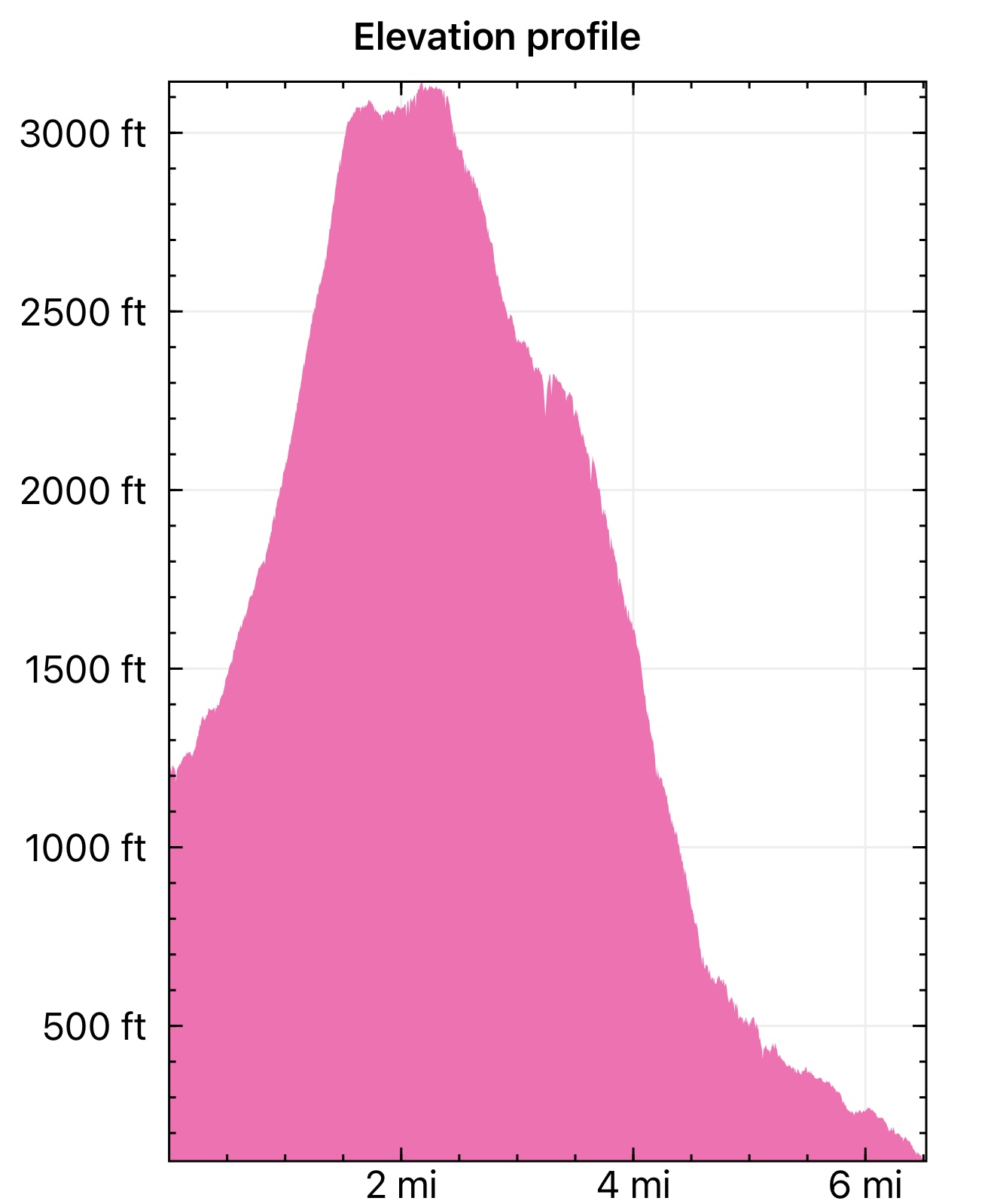
Total Mileage: 5.7 Miles
Total Elevation Gain: 2,057′
Permits: AK StatE PArks Annual Parking Pass

Just when we thought it was almost time to be back up in the big mountains, Mother Nature decided it was time for snow and wind. The ridges and peaks that had been close to being melted off were now blanketed in multiple feet of fresh snow, so we decided to do something new; something that we thought would be a walk in the park. It surely was not!

Earlier in the week, we had been hiking the ridge below POW, and while looking across the Valley at Bear Mountain, we did what we do best… planned an uncommon hike. The north ridge of the mountain looked totally doable, with almost no snow, and I was sure we could meet up with the trailhead at the top of the Thunderbird neighborhood. We decided that, on the next nice day, we would hike from Peters Creek, up Bear Mountain and down the north ridge to Thunderbird.

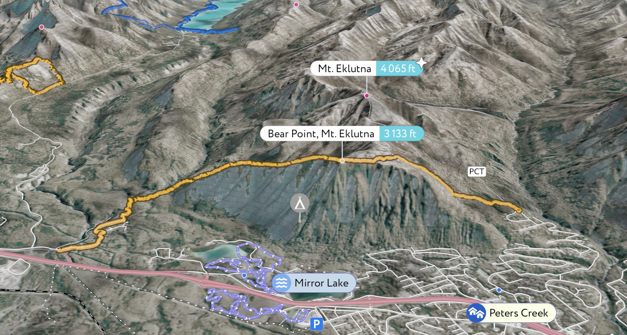
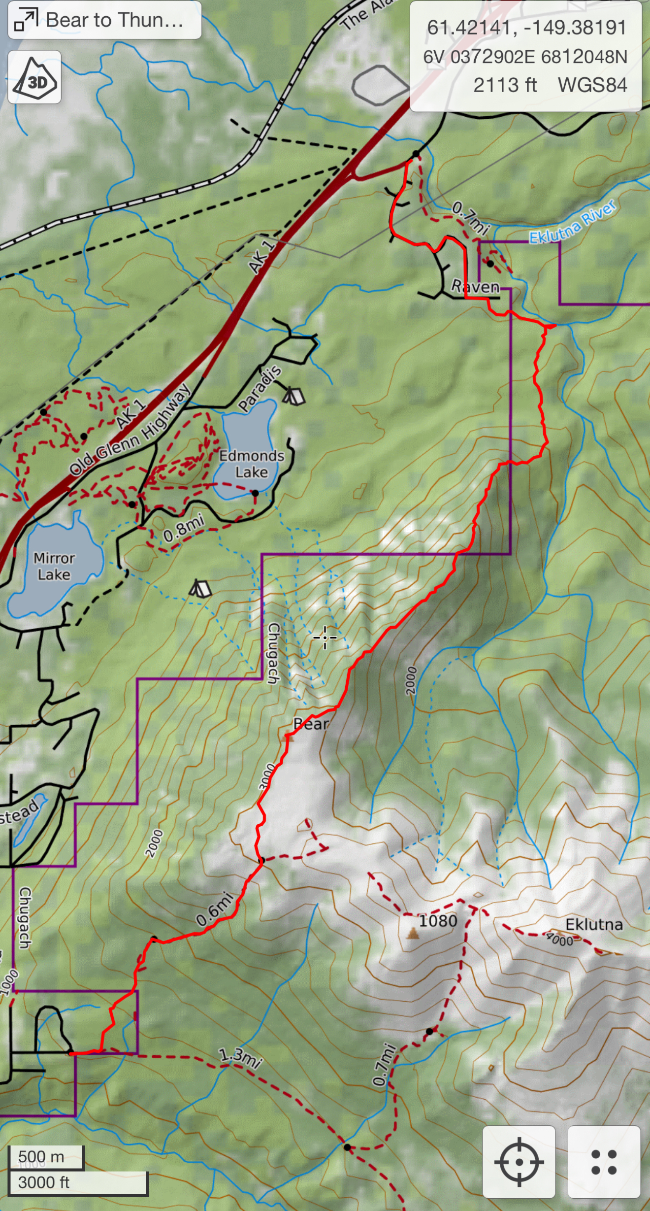
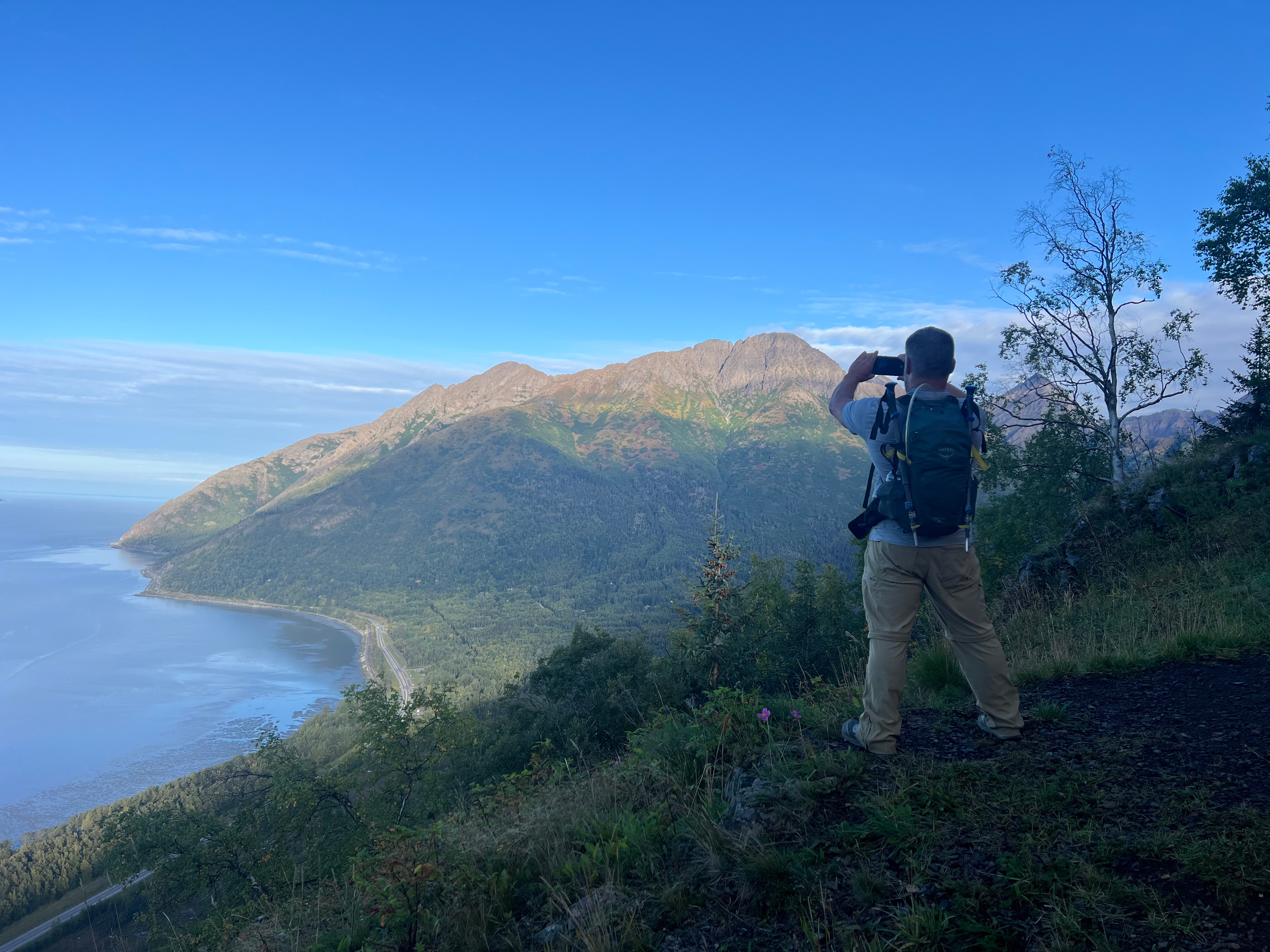
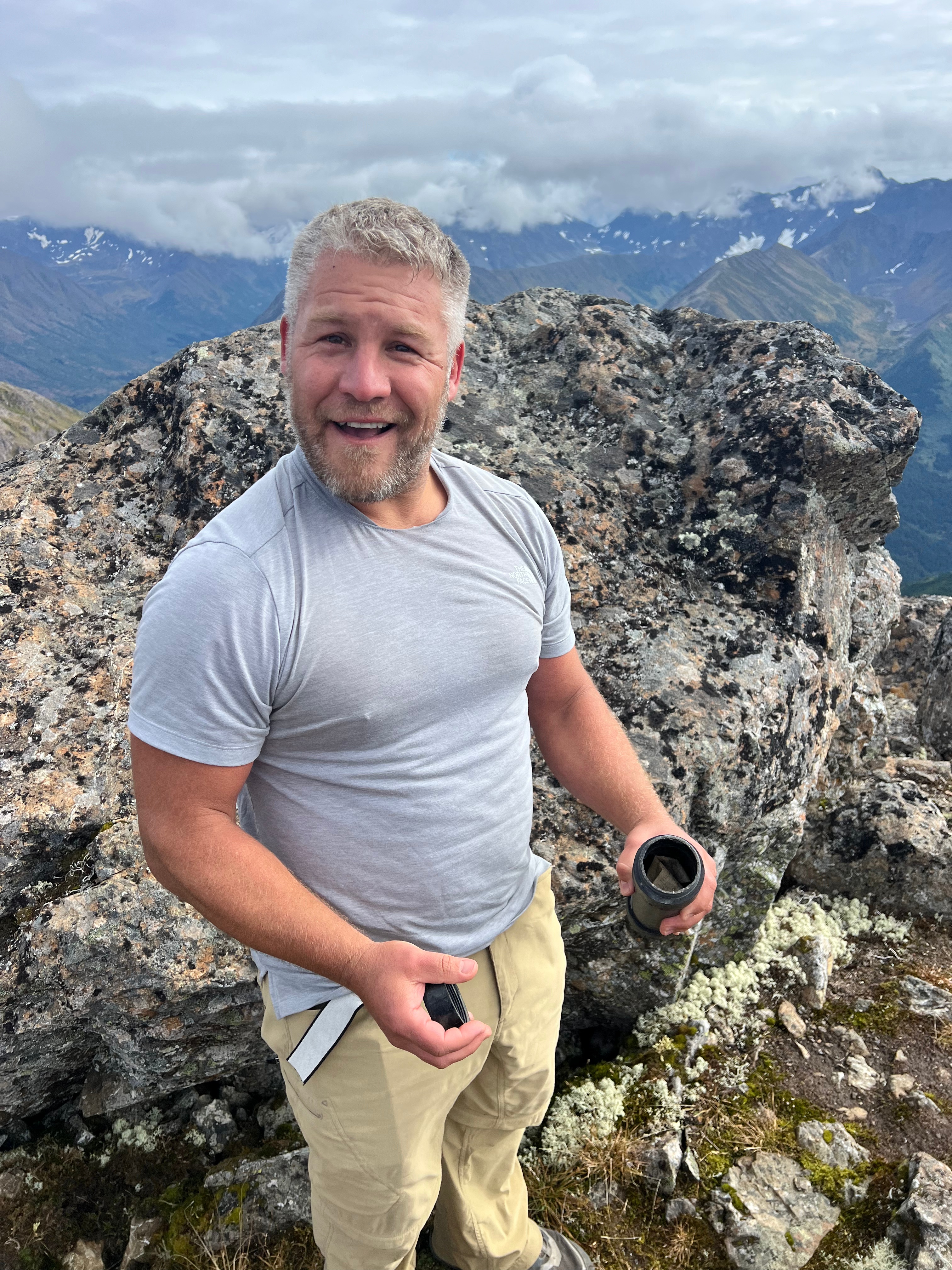
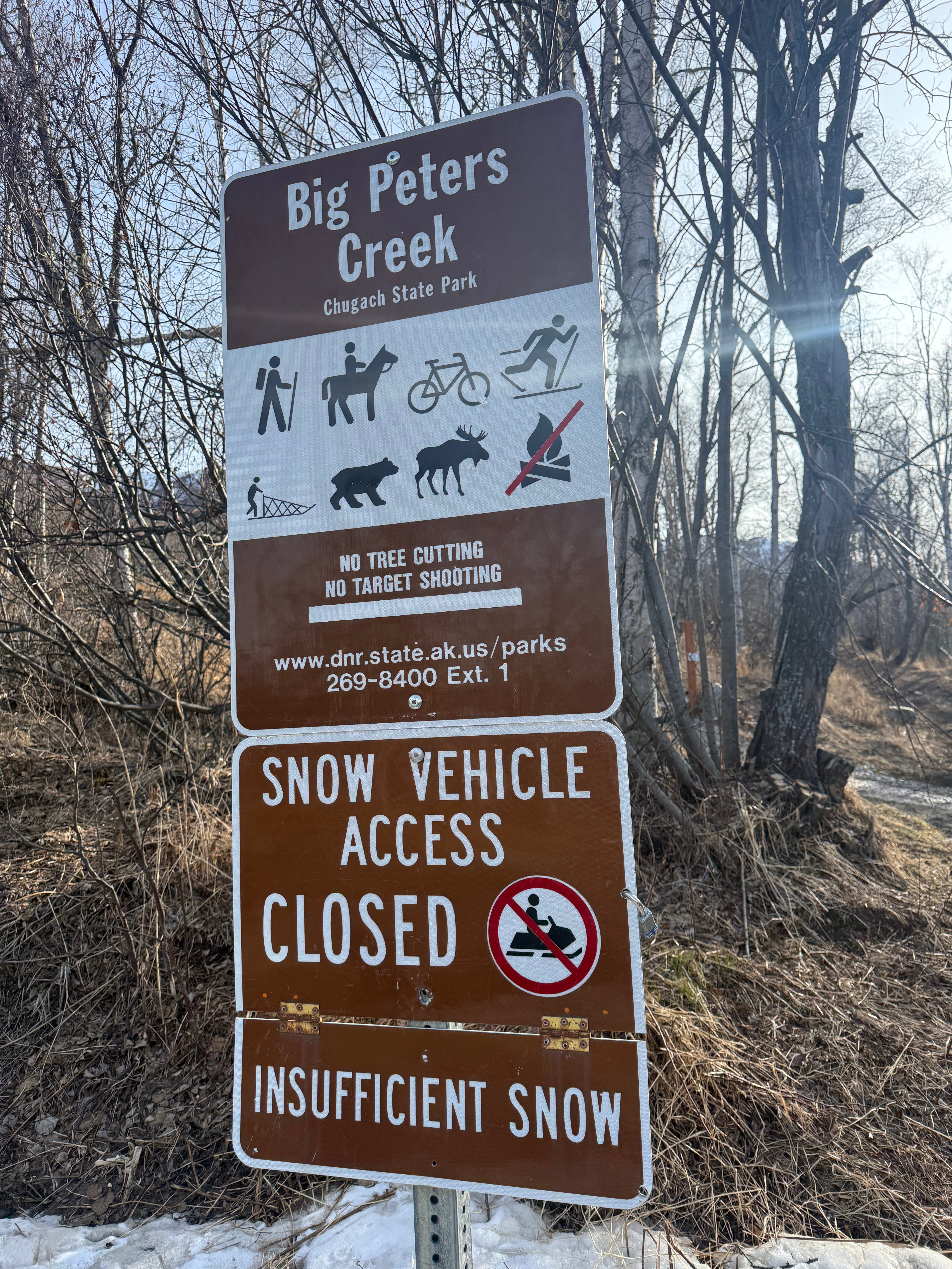
The weather finally cooperated and gave us a beautifully sunny and wind free day. This time, Jason didn’t forget his shoes, and we were both almost on time to meet at the Thunderbird Falls parking lot at 930am. Leaving Jason’s car, we headed towards the Peters Creek Trailhead.

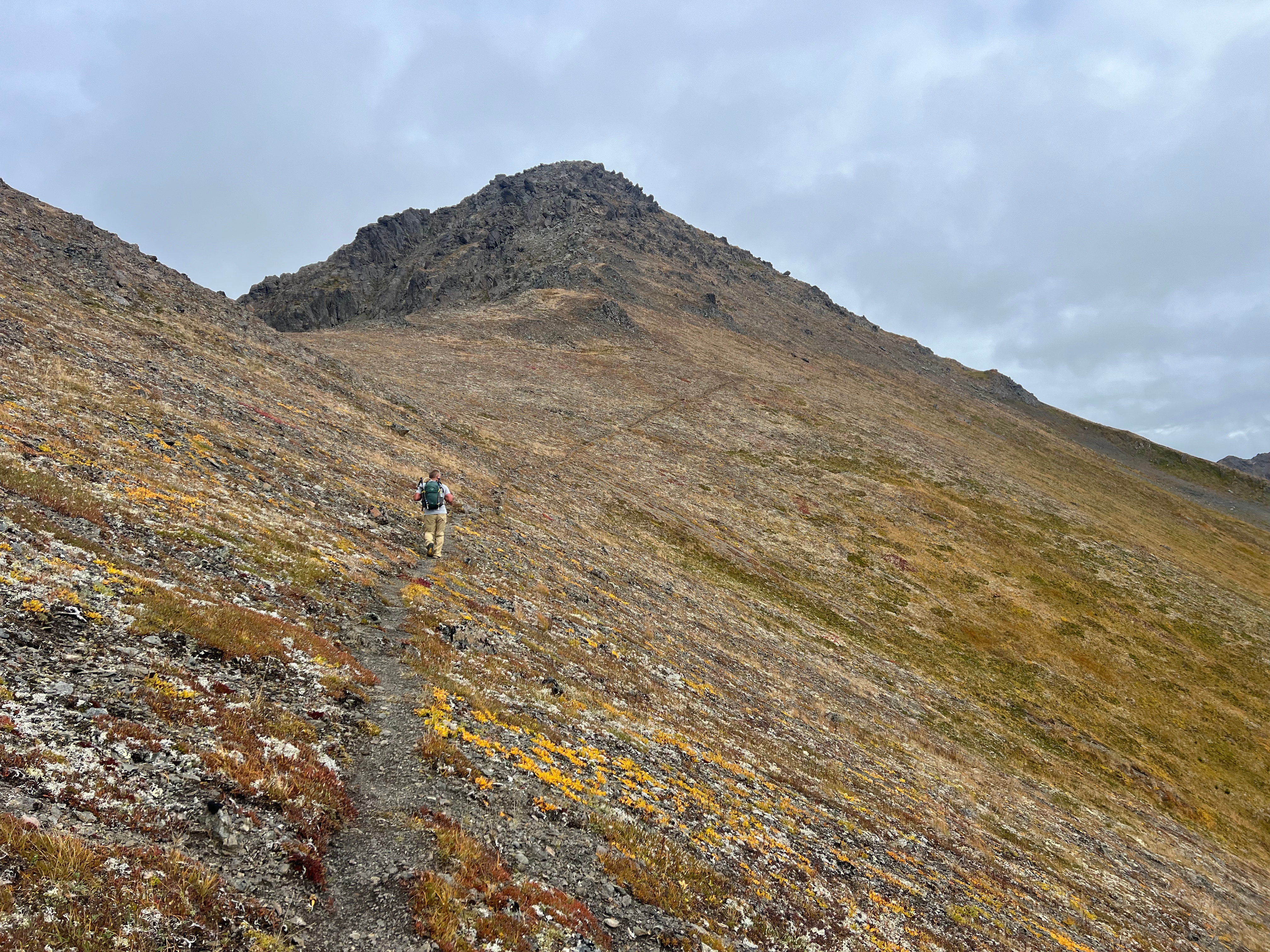
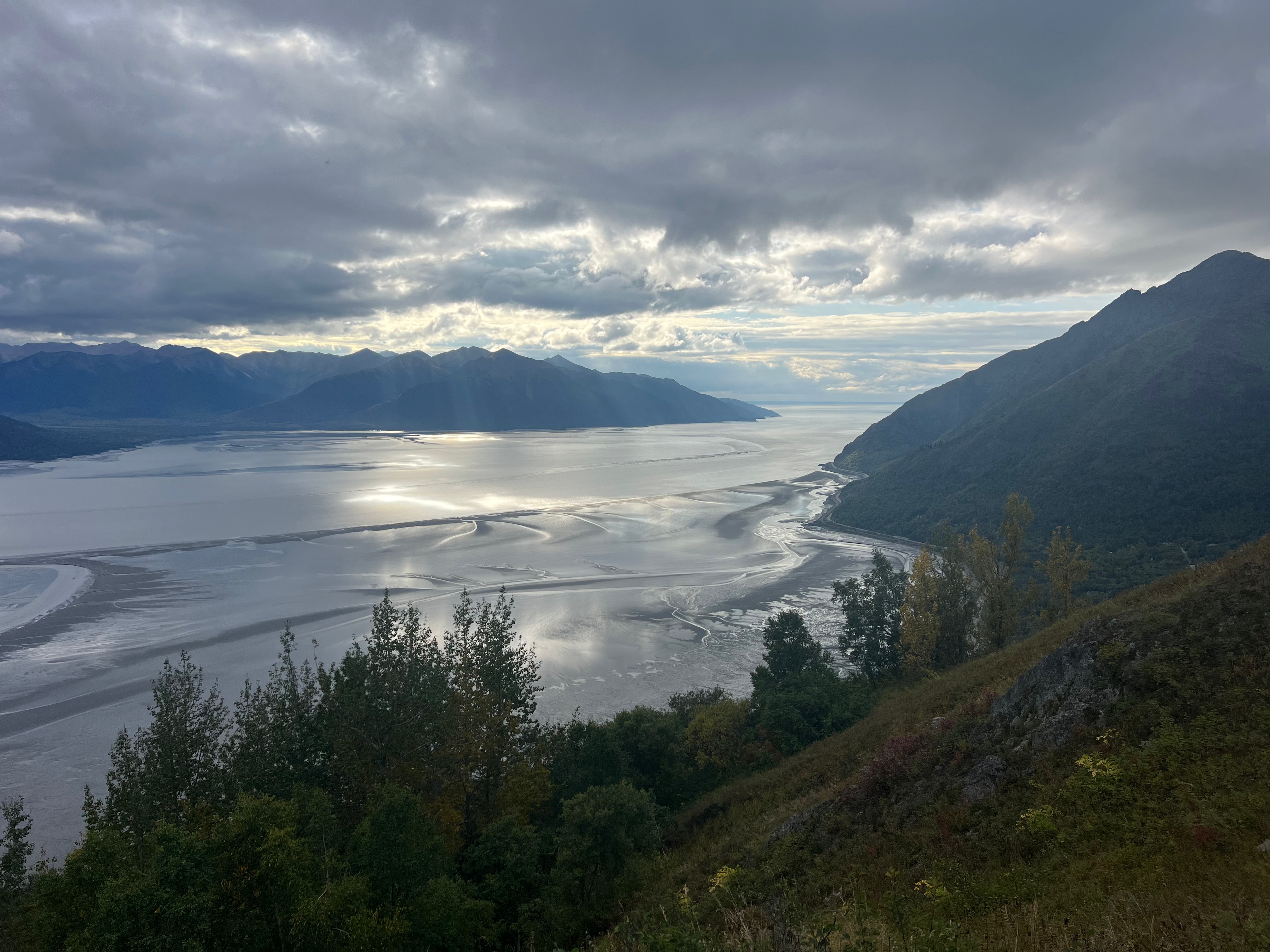
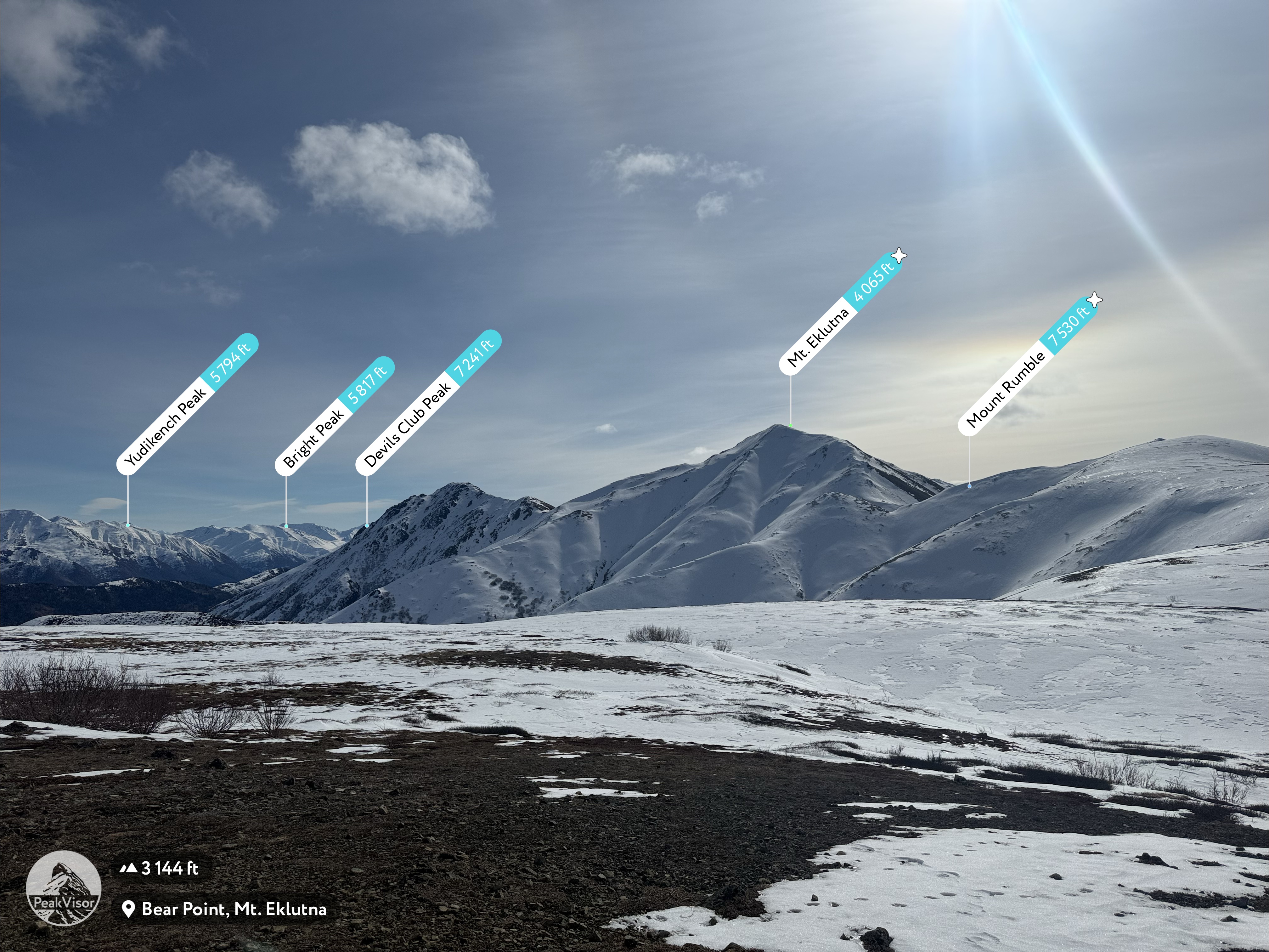
Bear Point is a well-known mountain, a hulking mass right next to the main (and only) highway between Anchorage and the Valley. The roadside, west face is steep and foreboding, numerous chutes cut into the massive wall, but the main ascent route is via the southwest face, a moderately steep, but not extremely challenging trail.

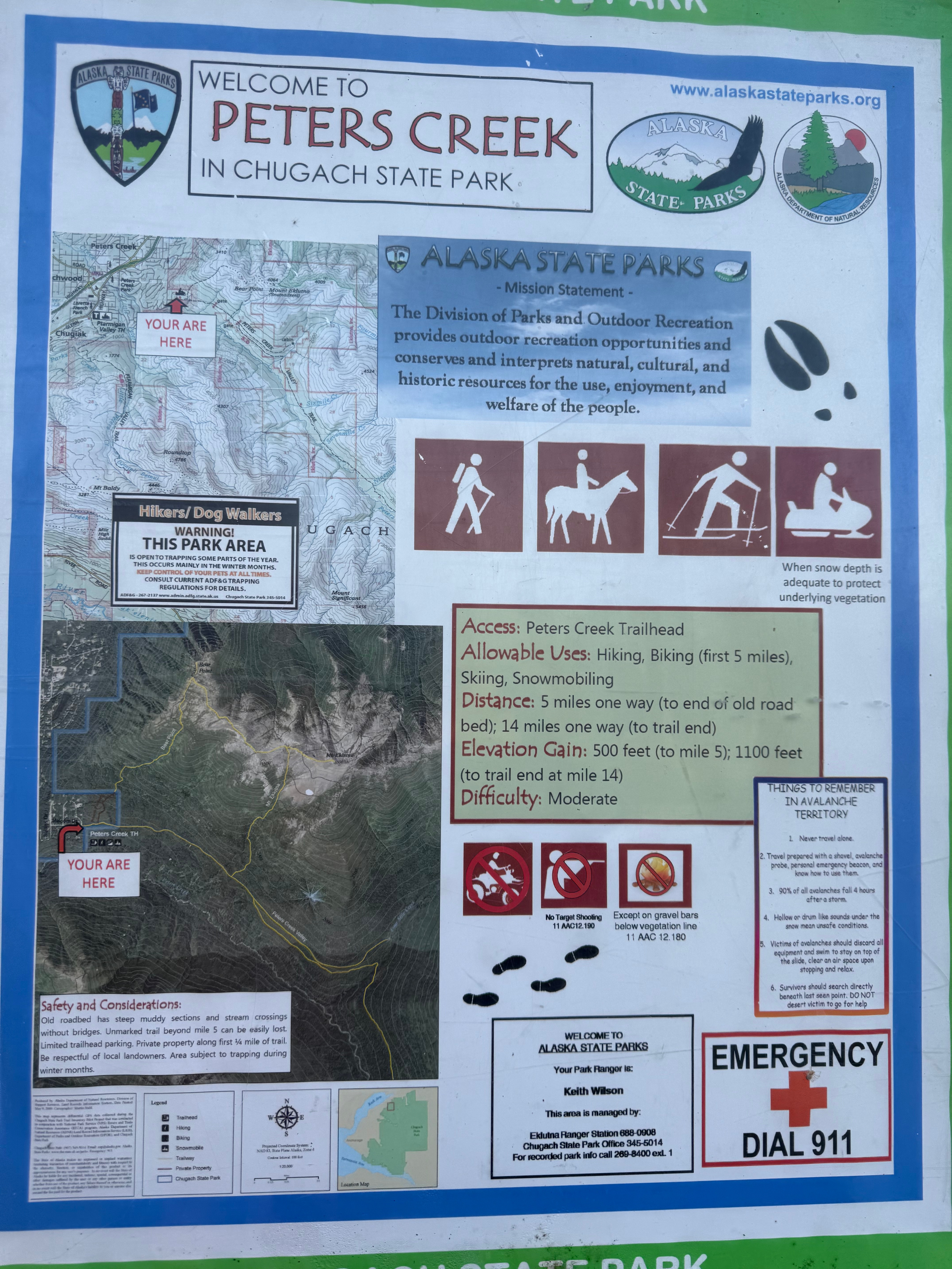
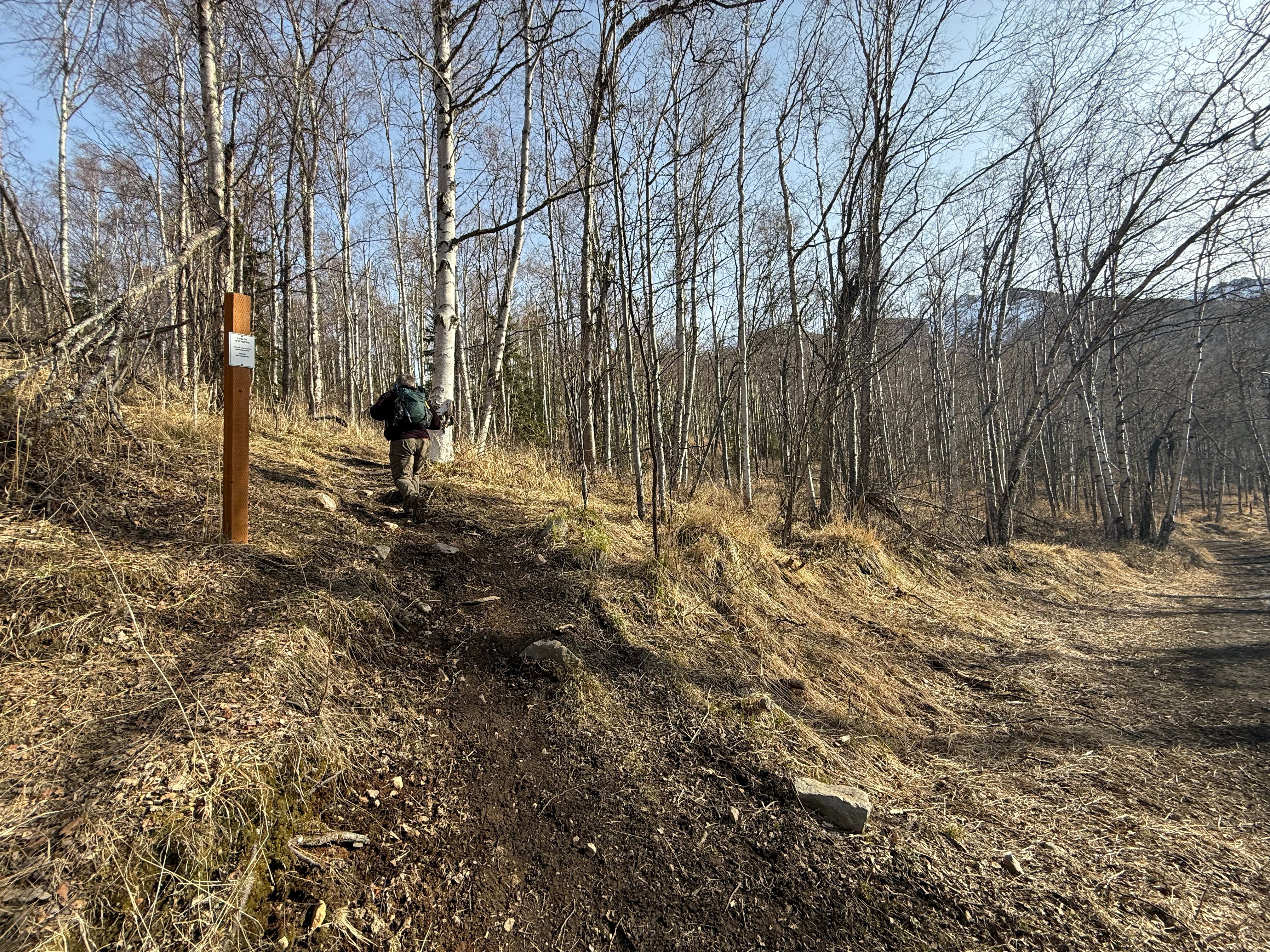
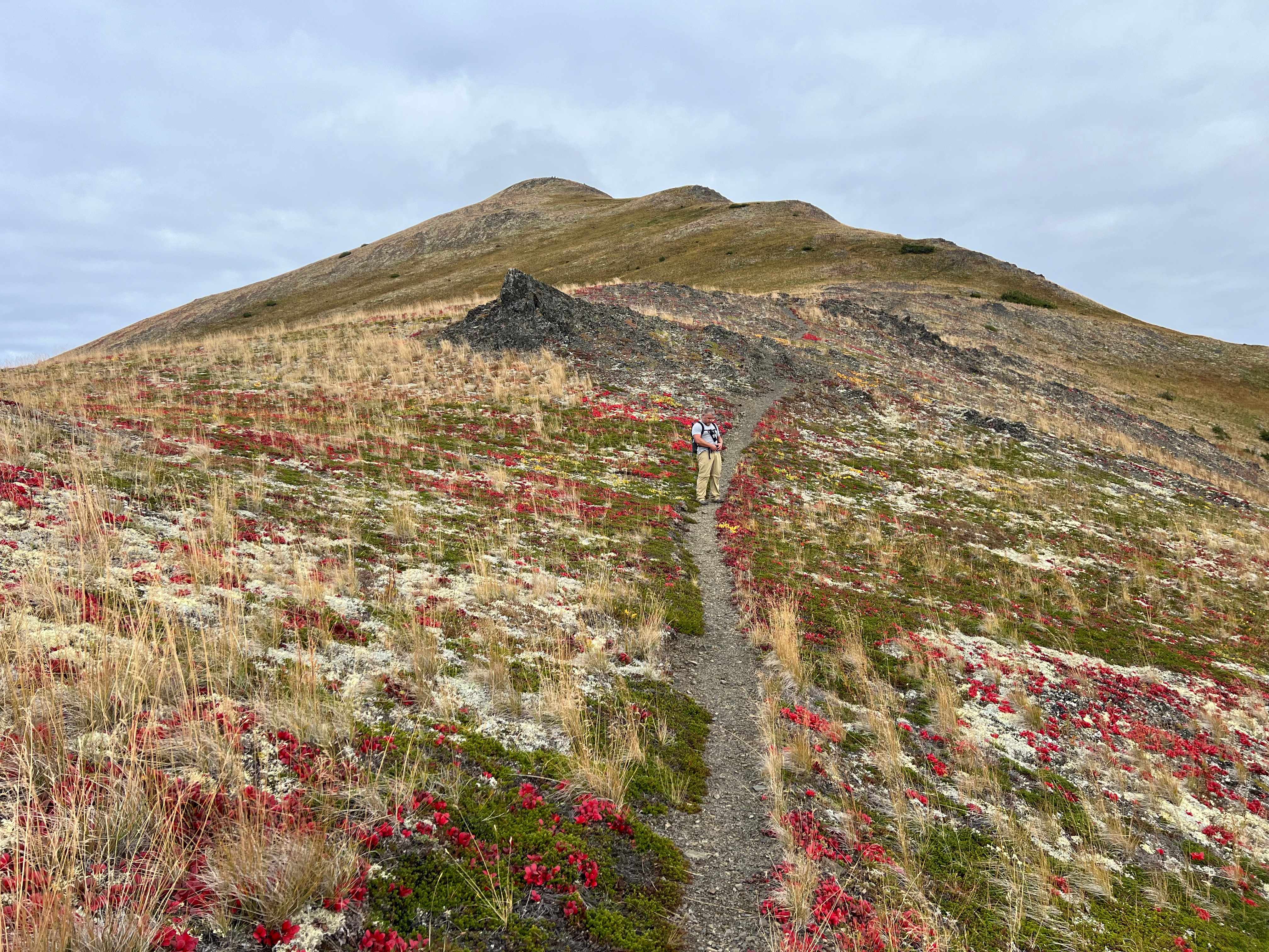
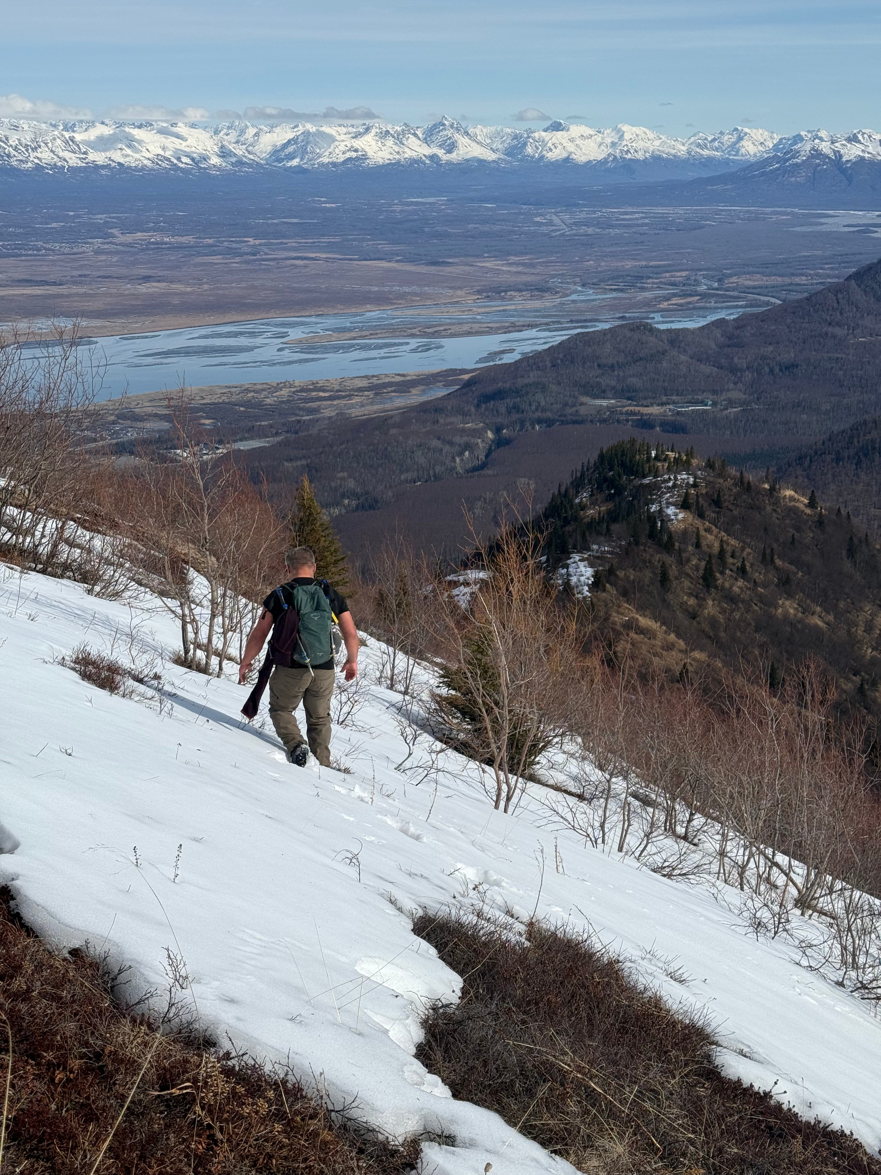
It didn’t take us long to climb the 1.5 miles and 1,800′ to the top, although we were very happy to have made it before the ice melted, when the trail would become a muddy mess.

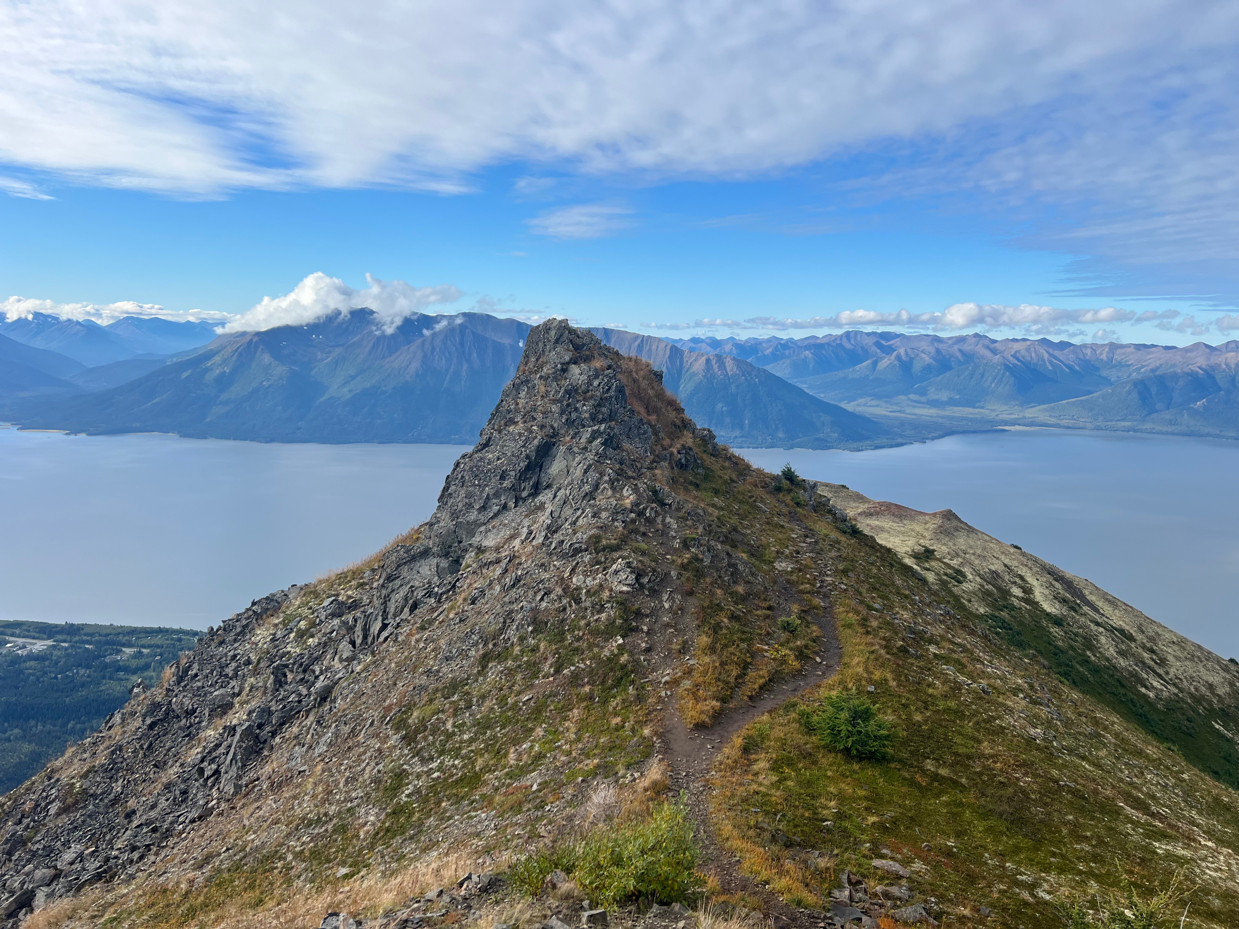
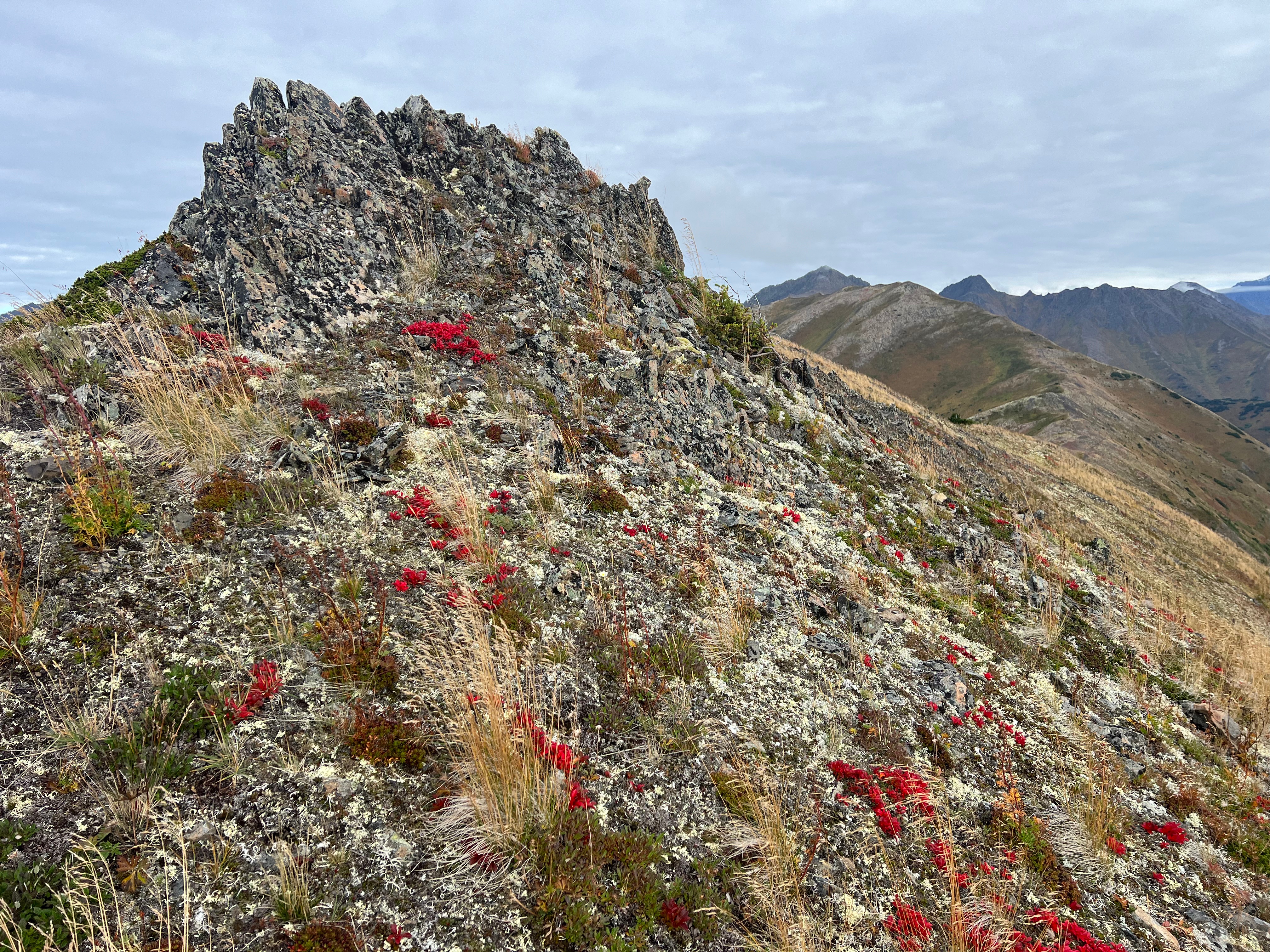
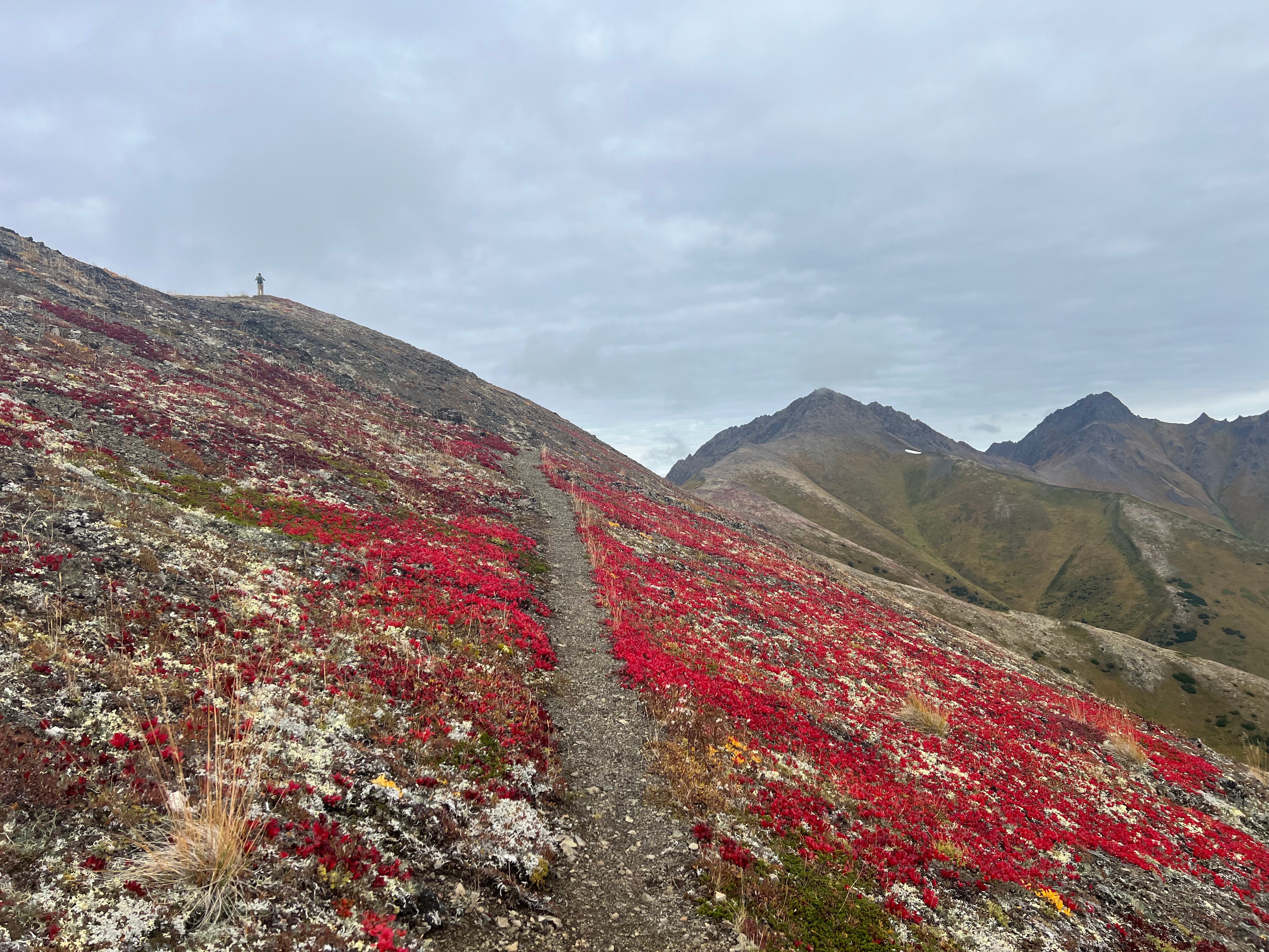
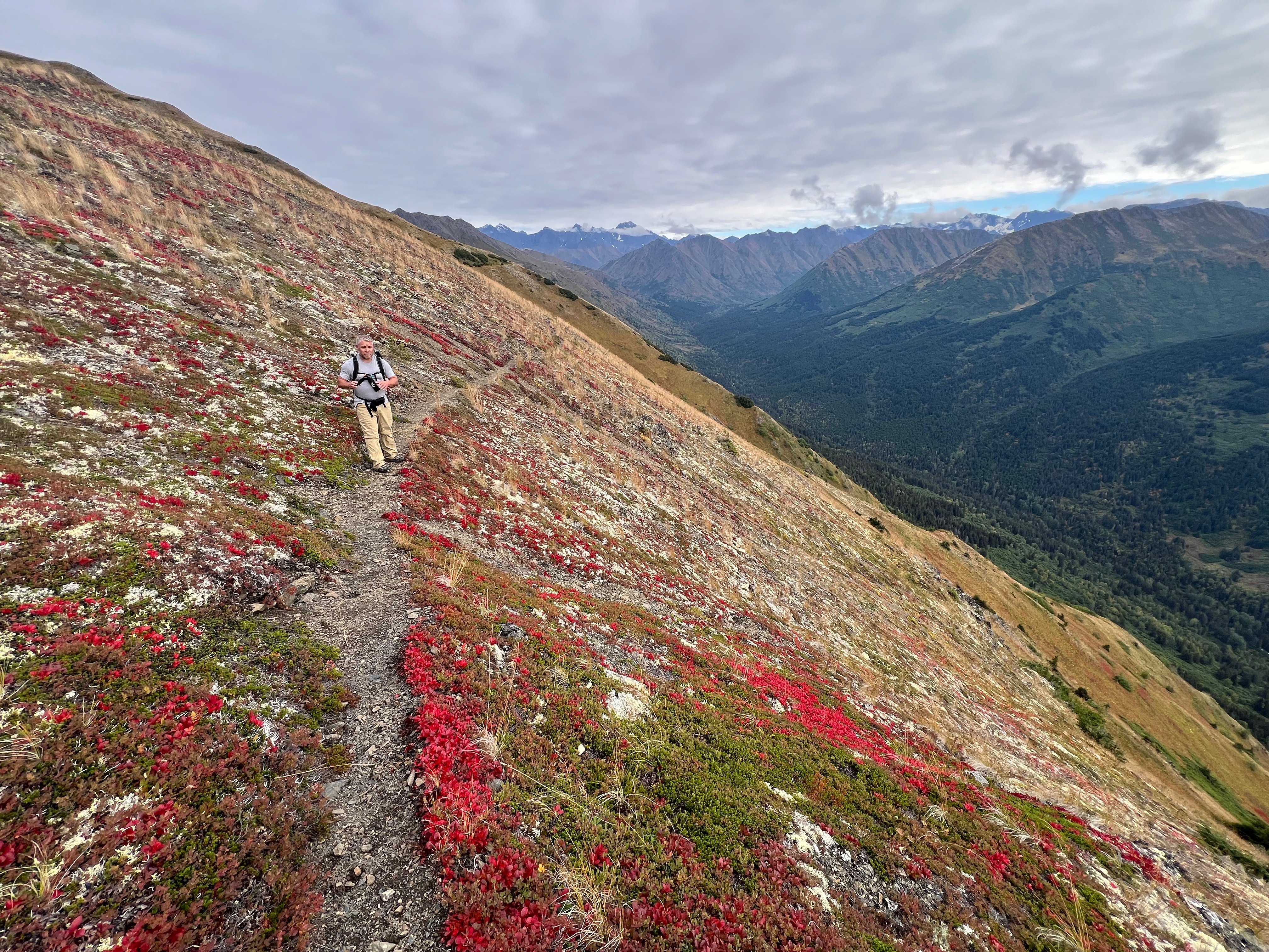
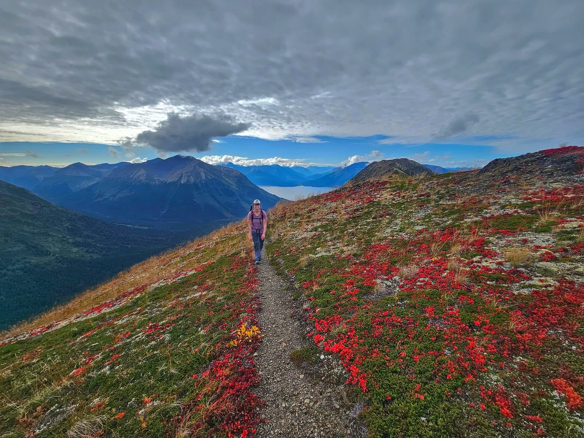
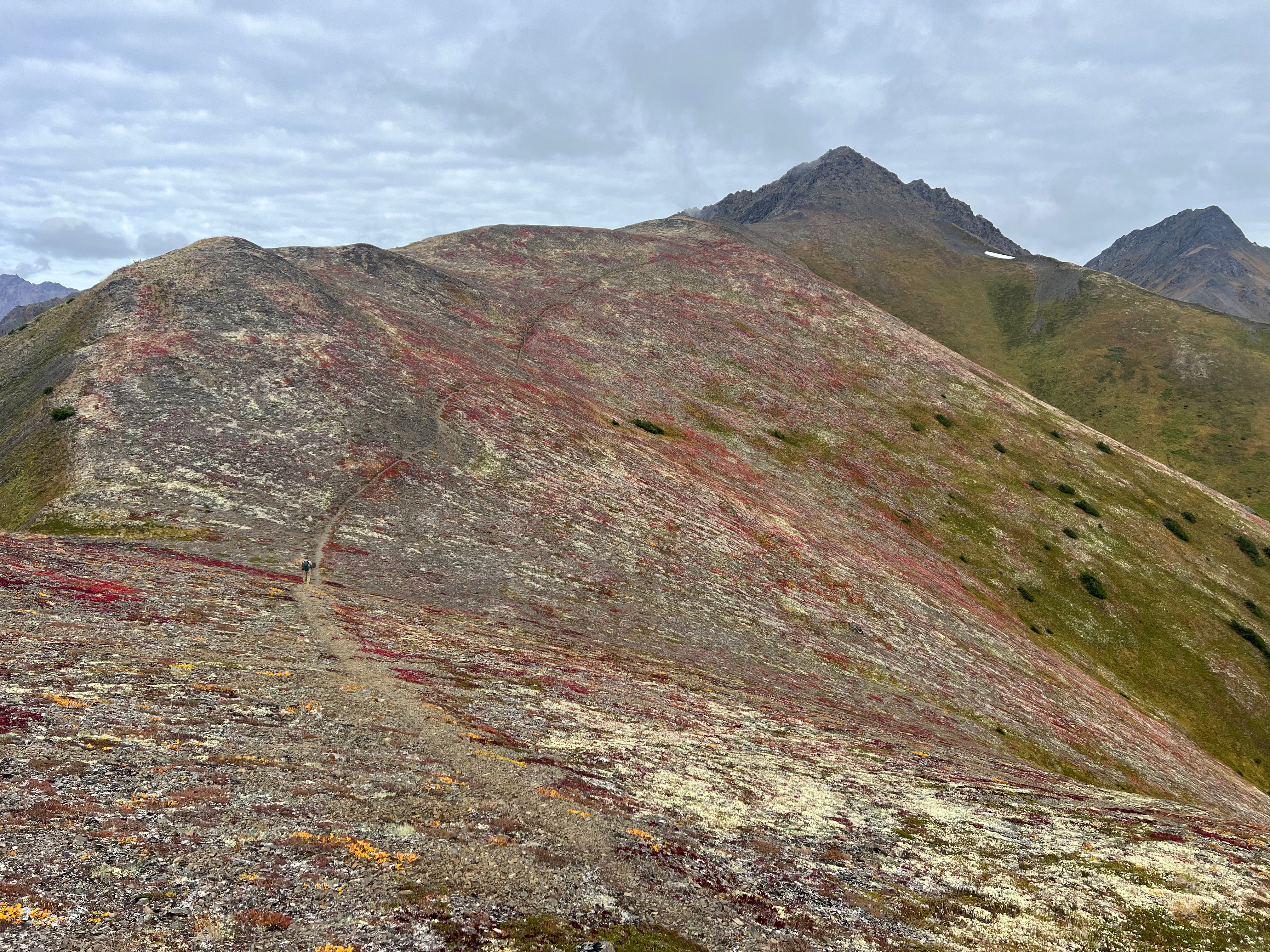
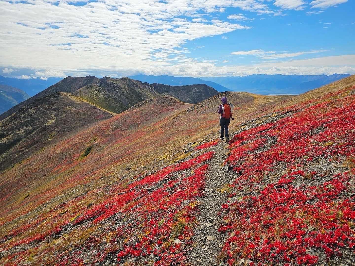
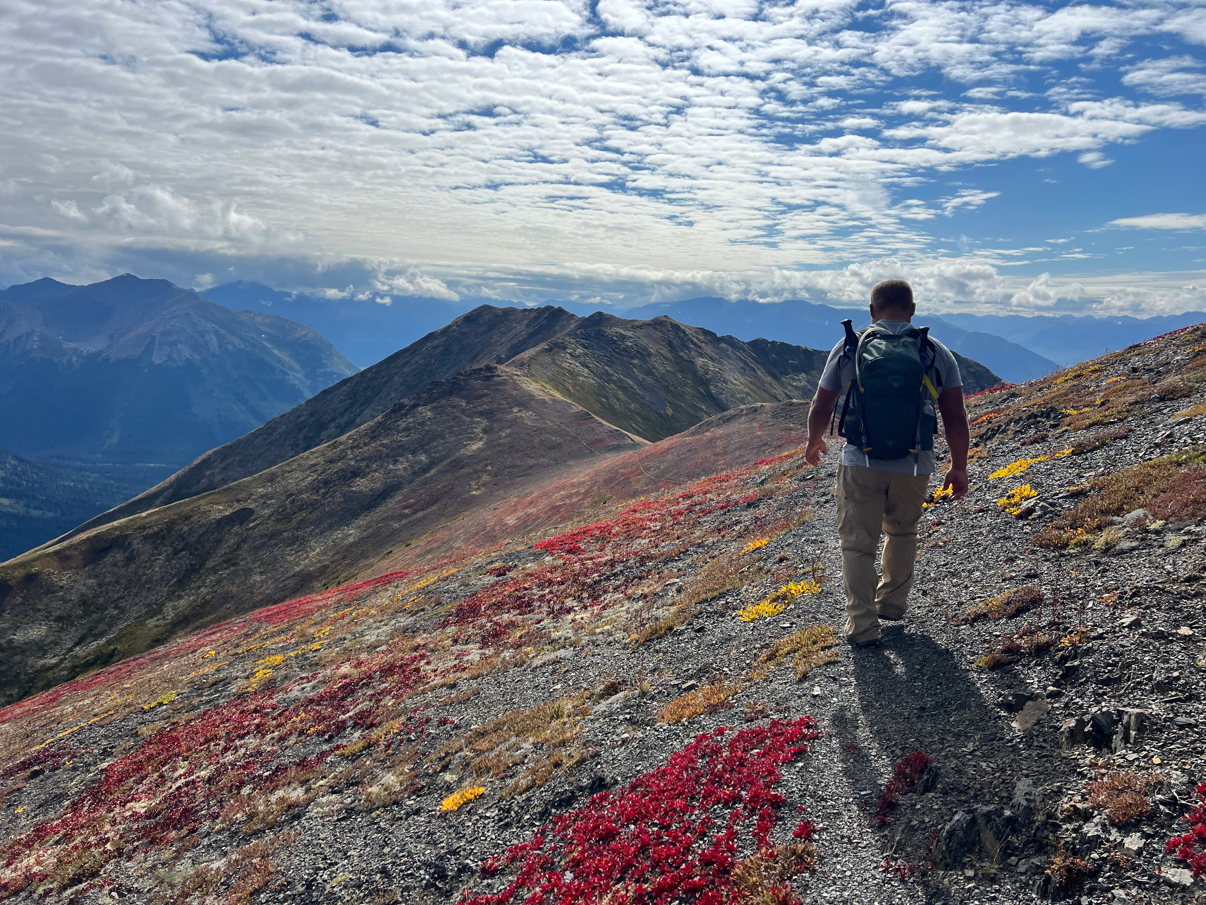
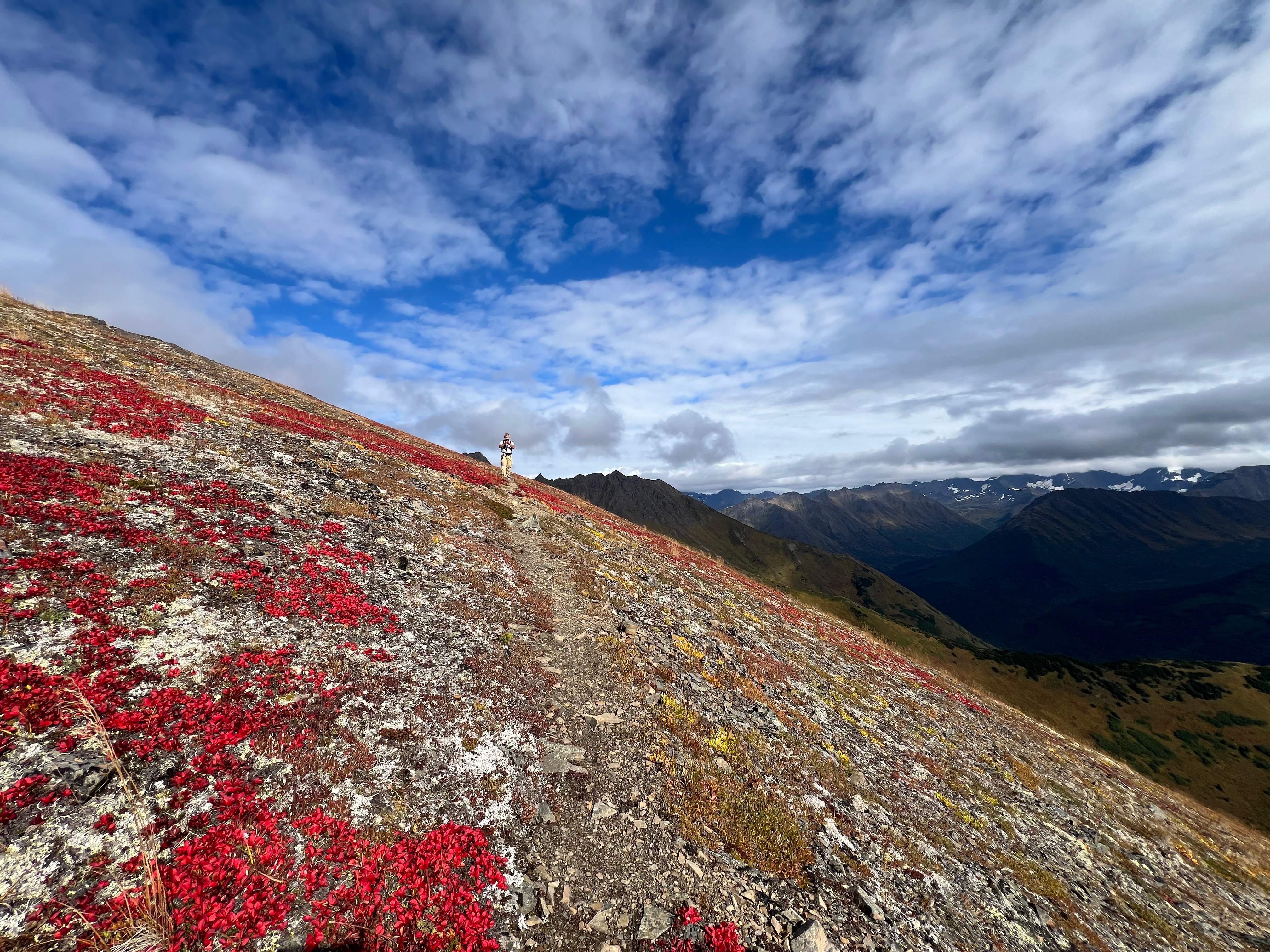
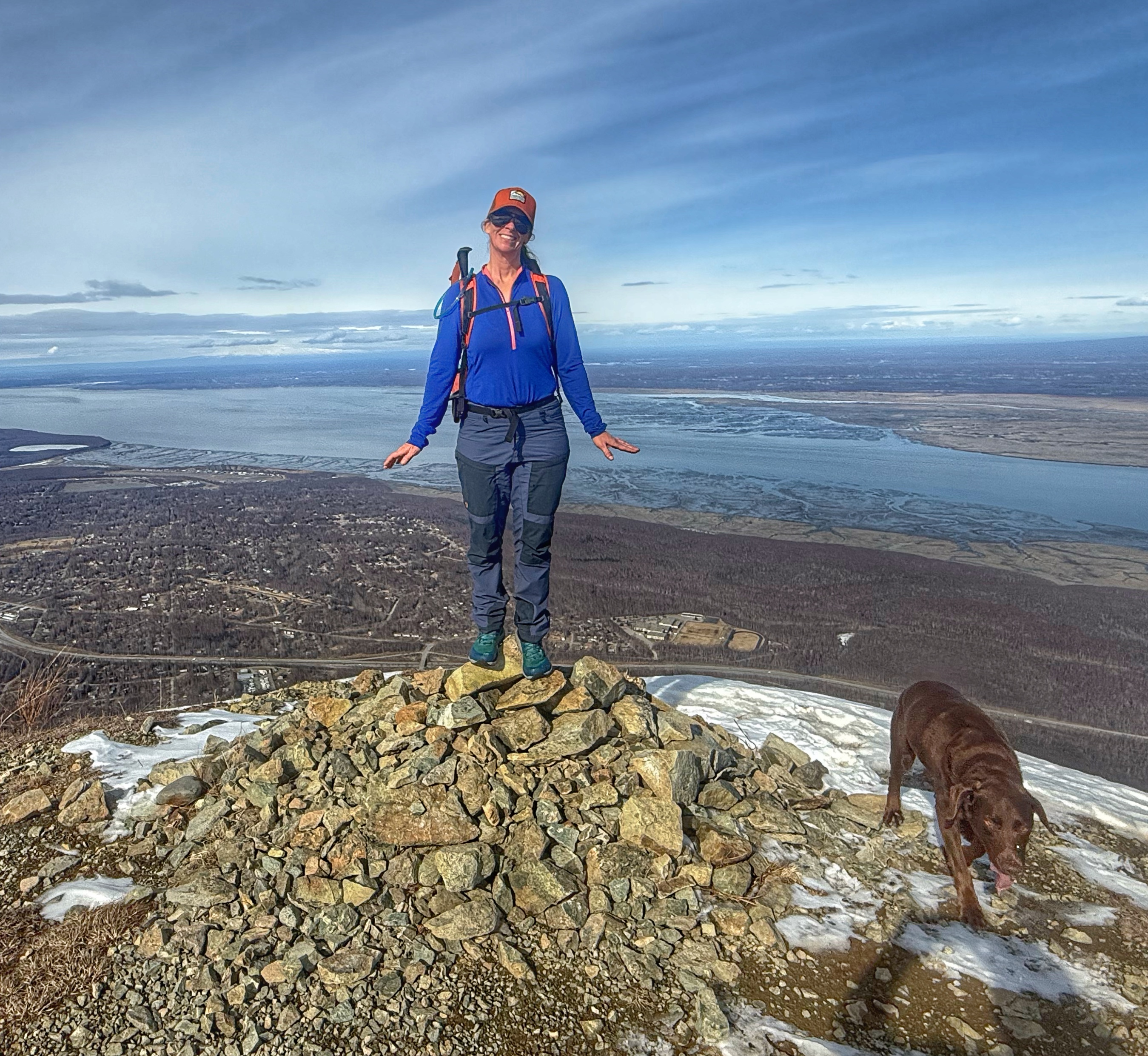
The top of the mountain is nothing like what the daily commuter sees from below, spreading out flat and broad, a field of patchy snow and tundra. In the fall, this entire area is covered in blueberries and blueberry pickers, but for now, we were alone, ceilinged by wispy clouds and a full circle sun dog.

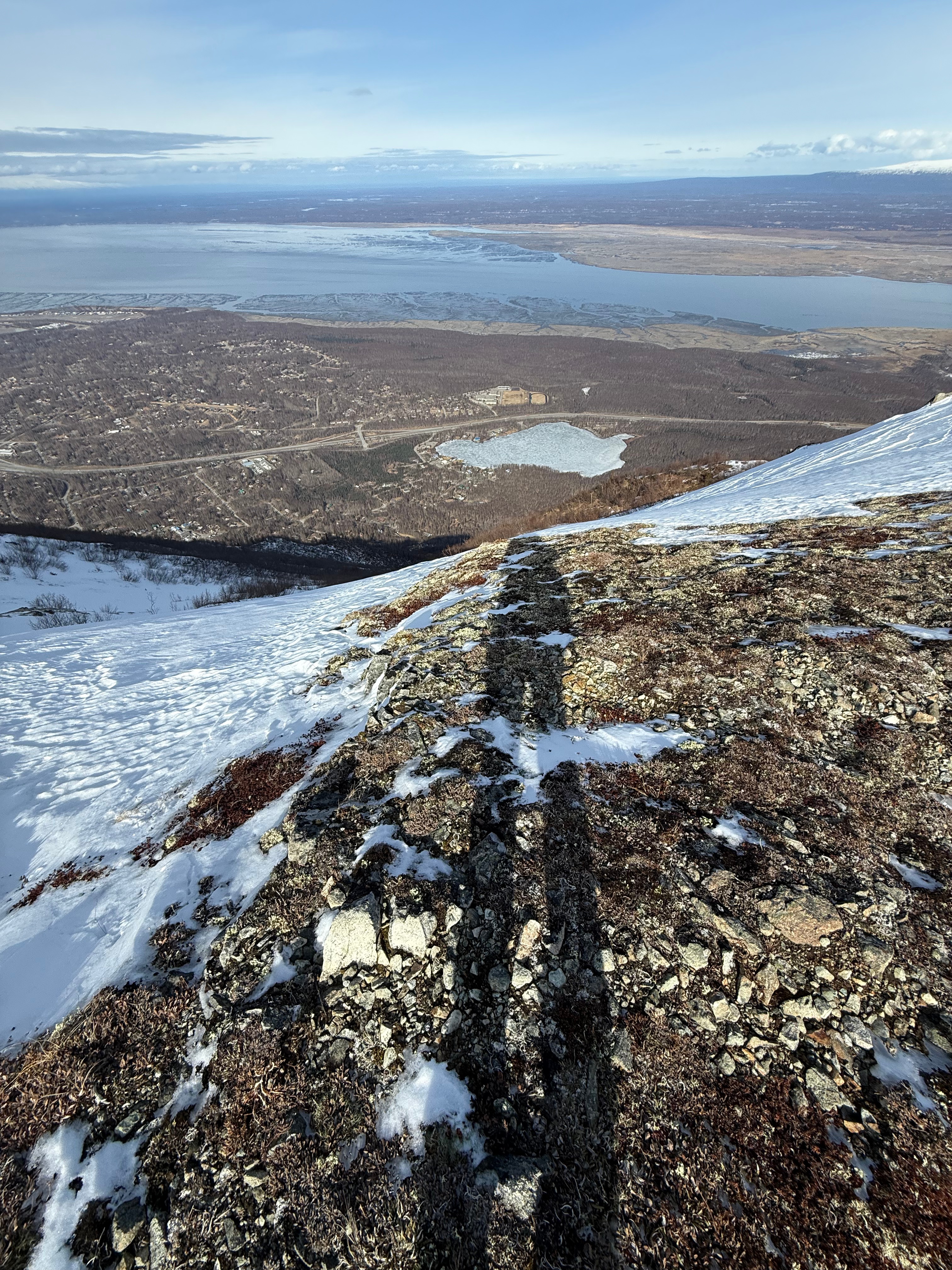
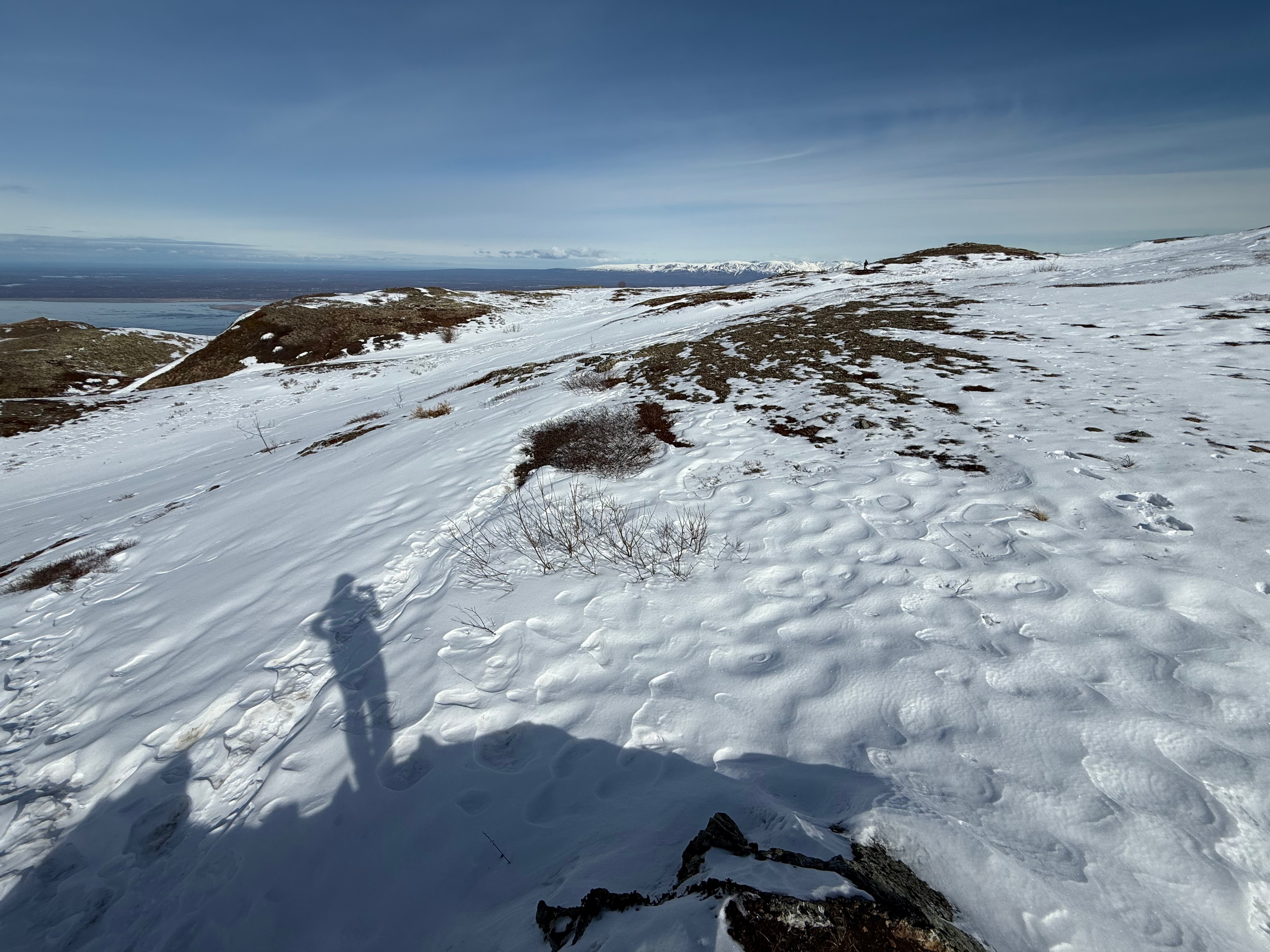
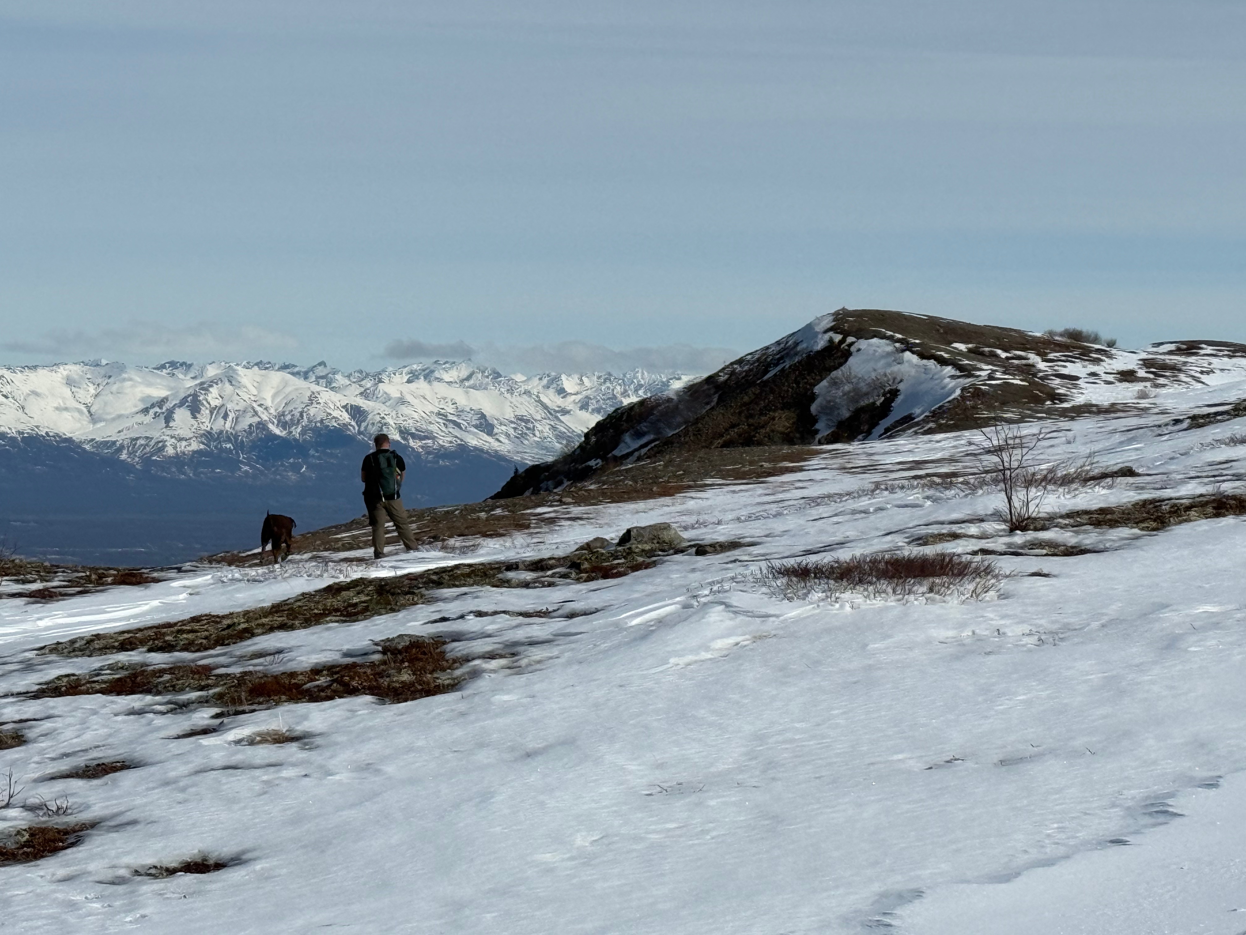
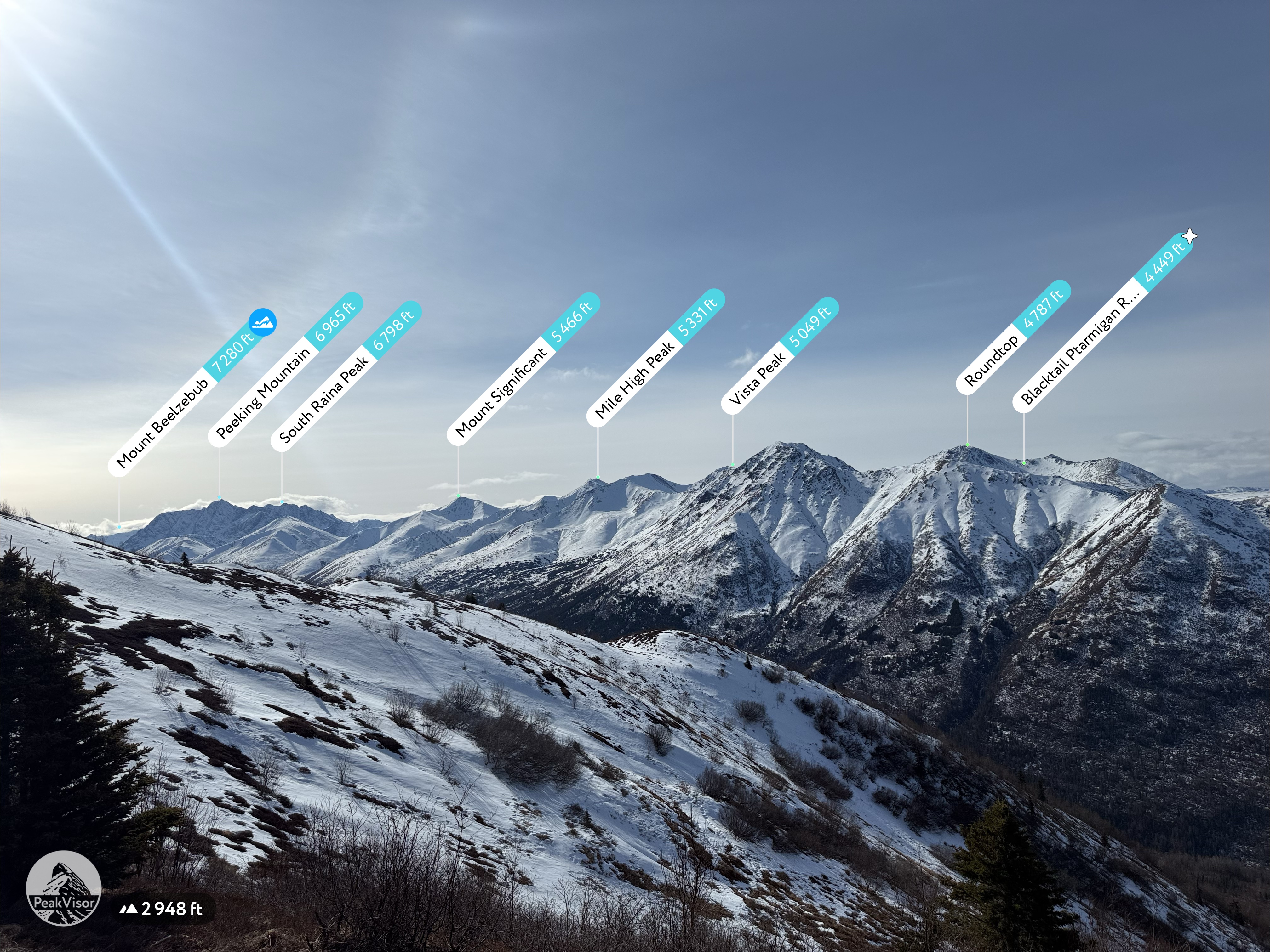
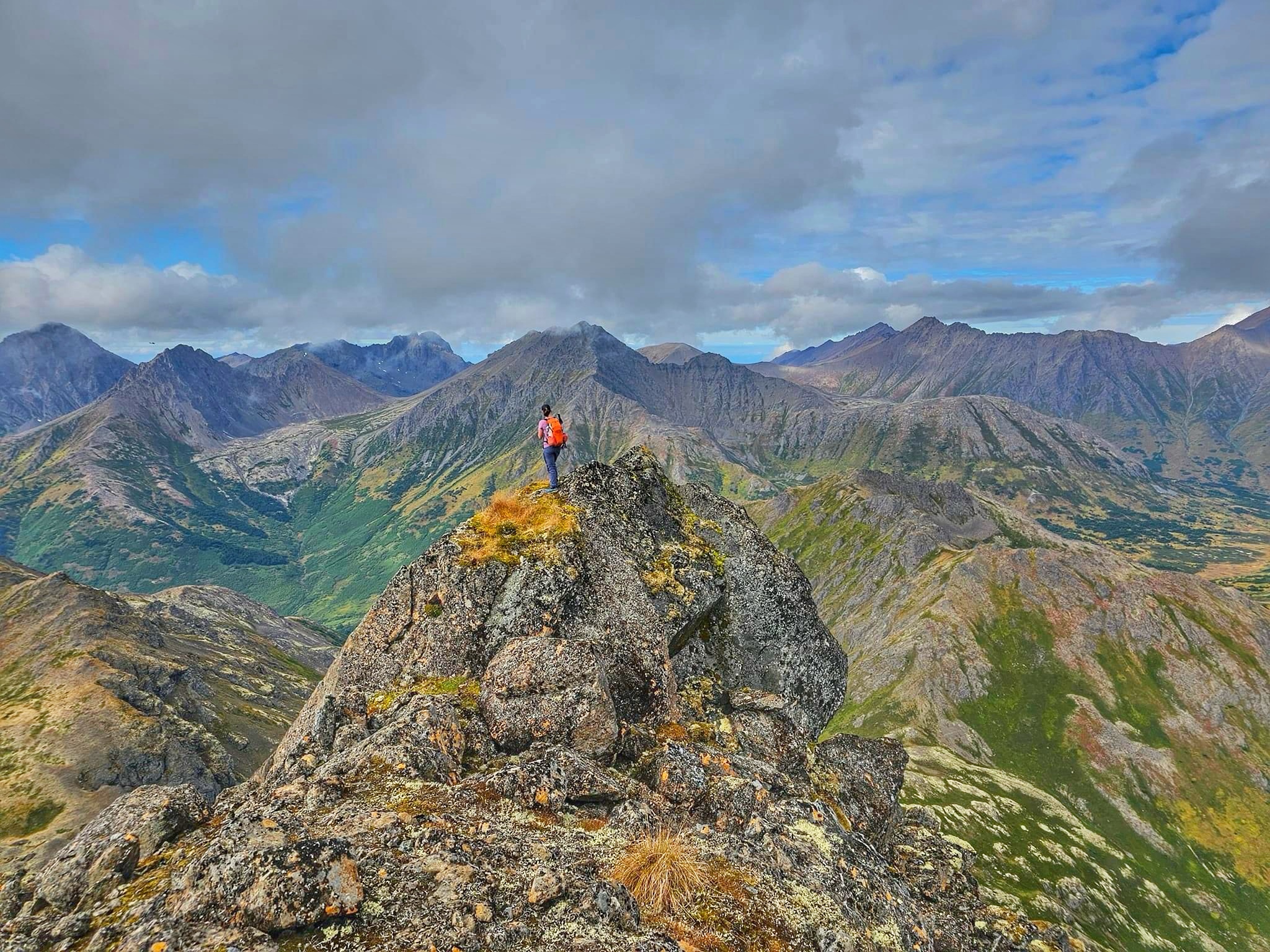
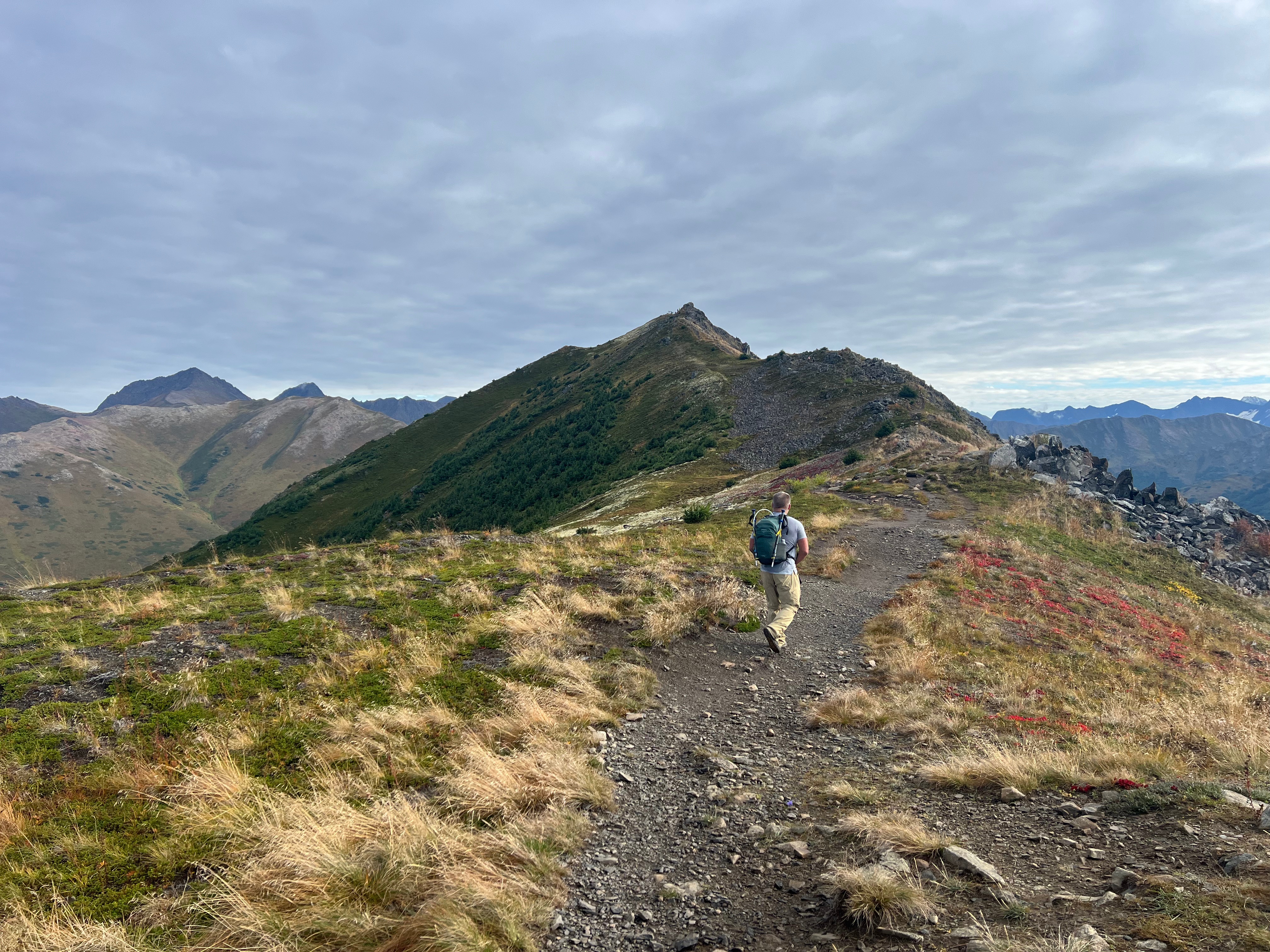
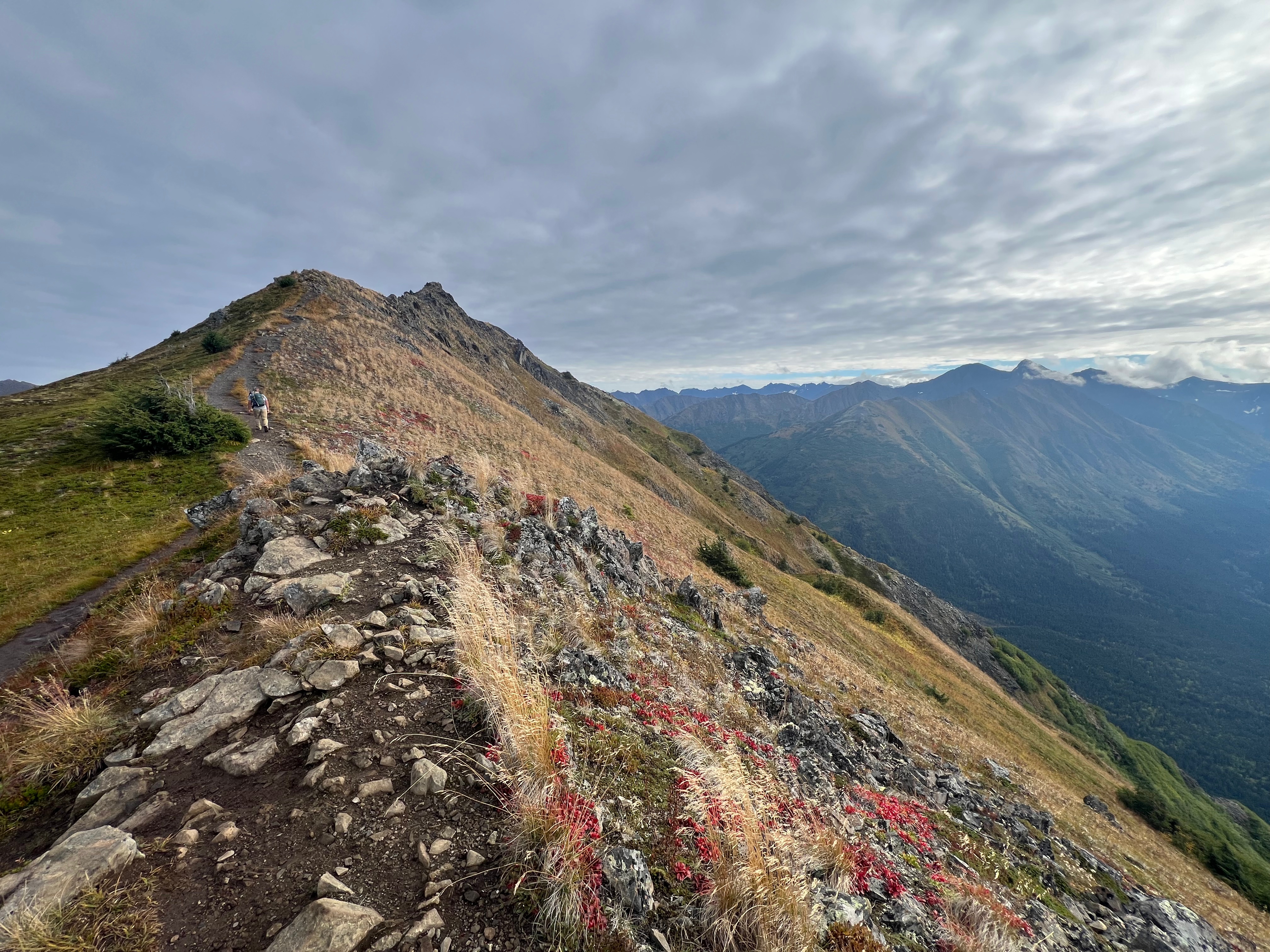
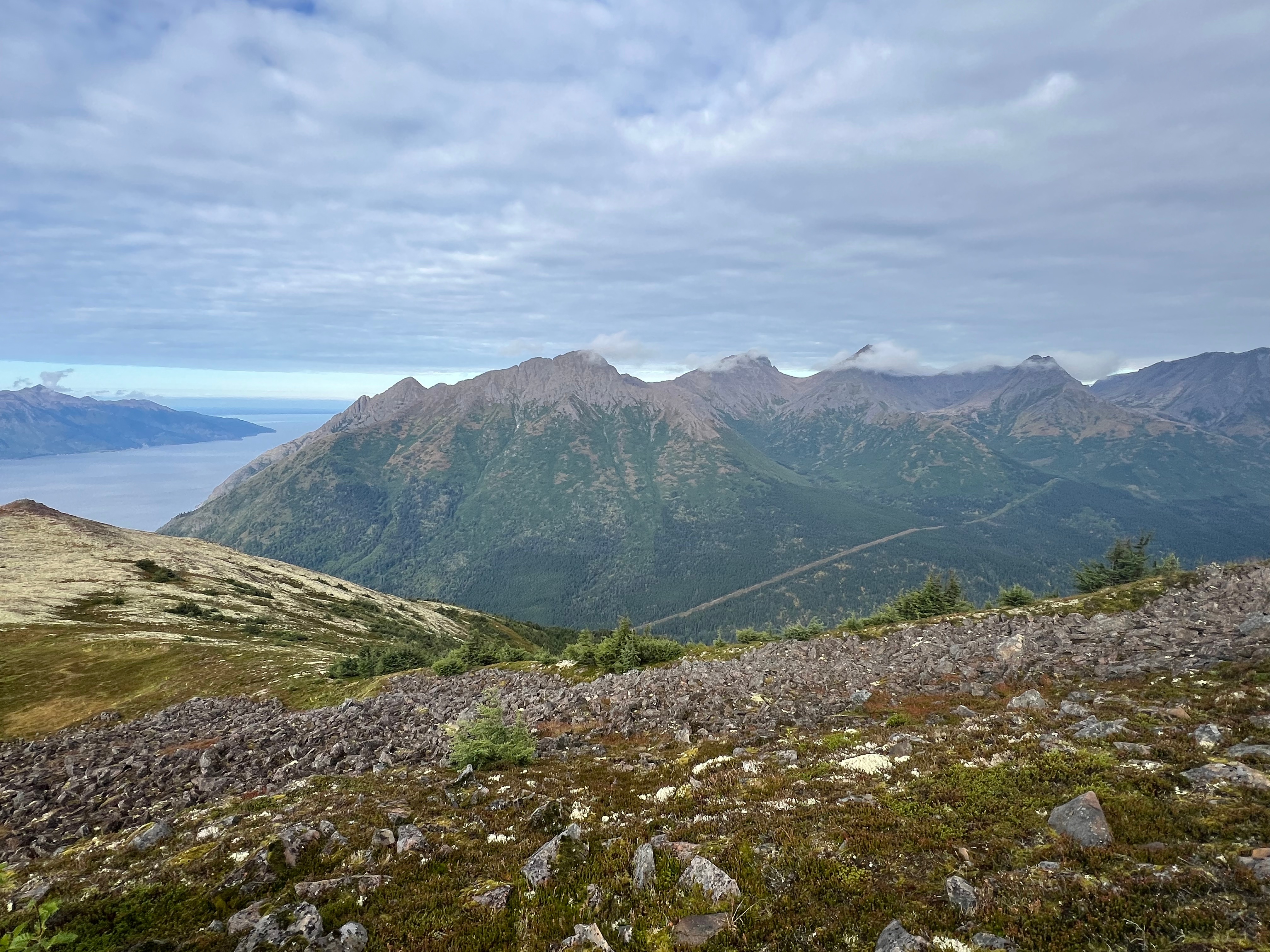
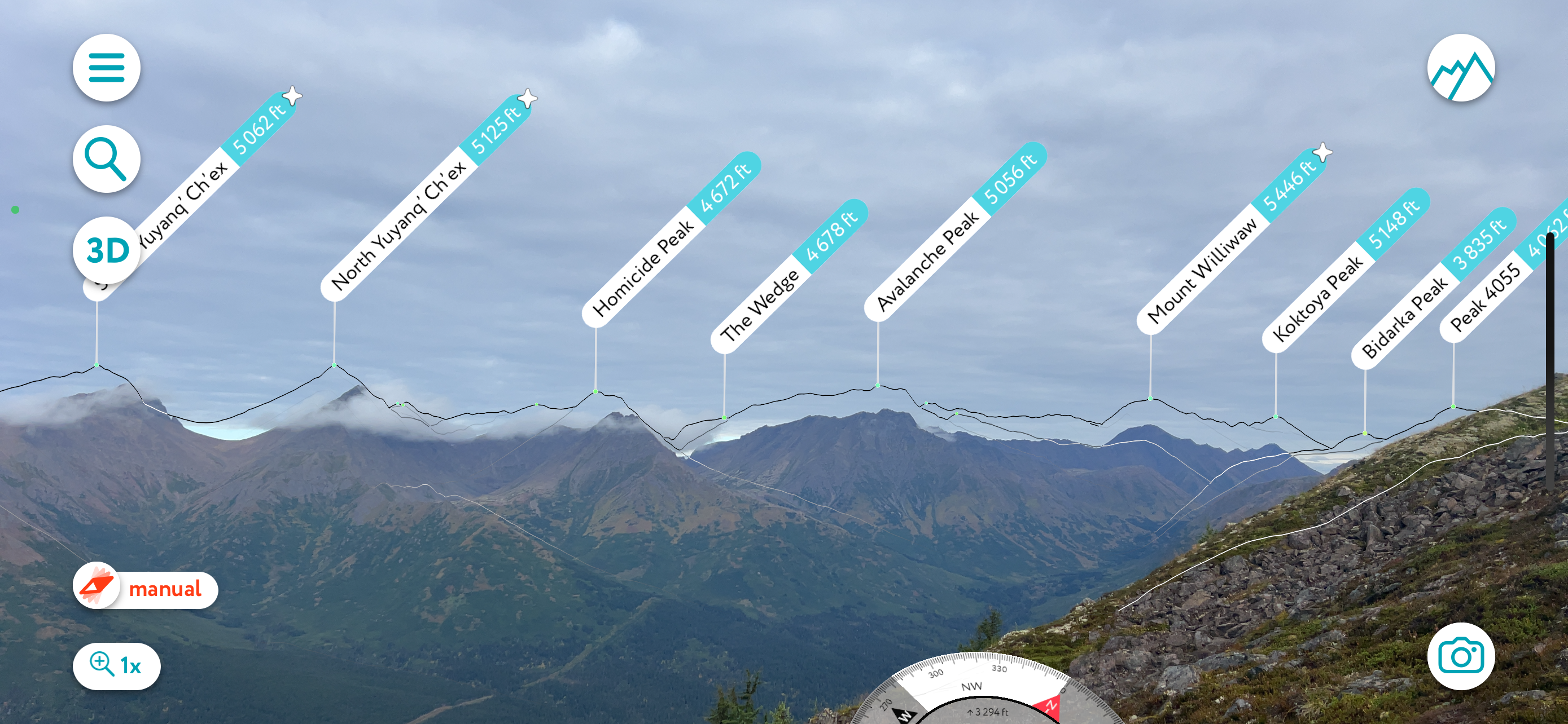
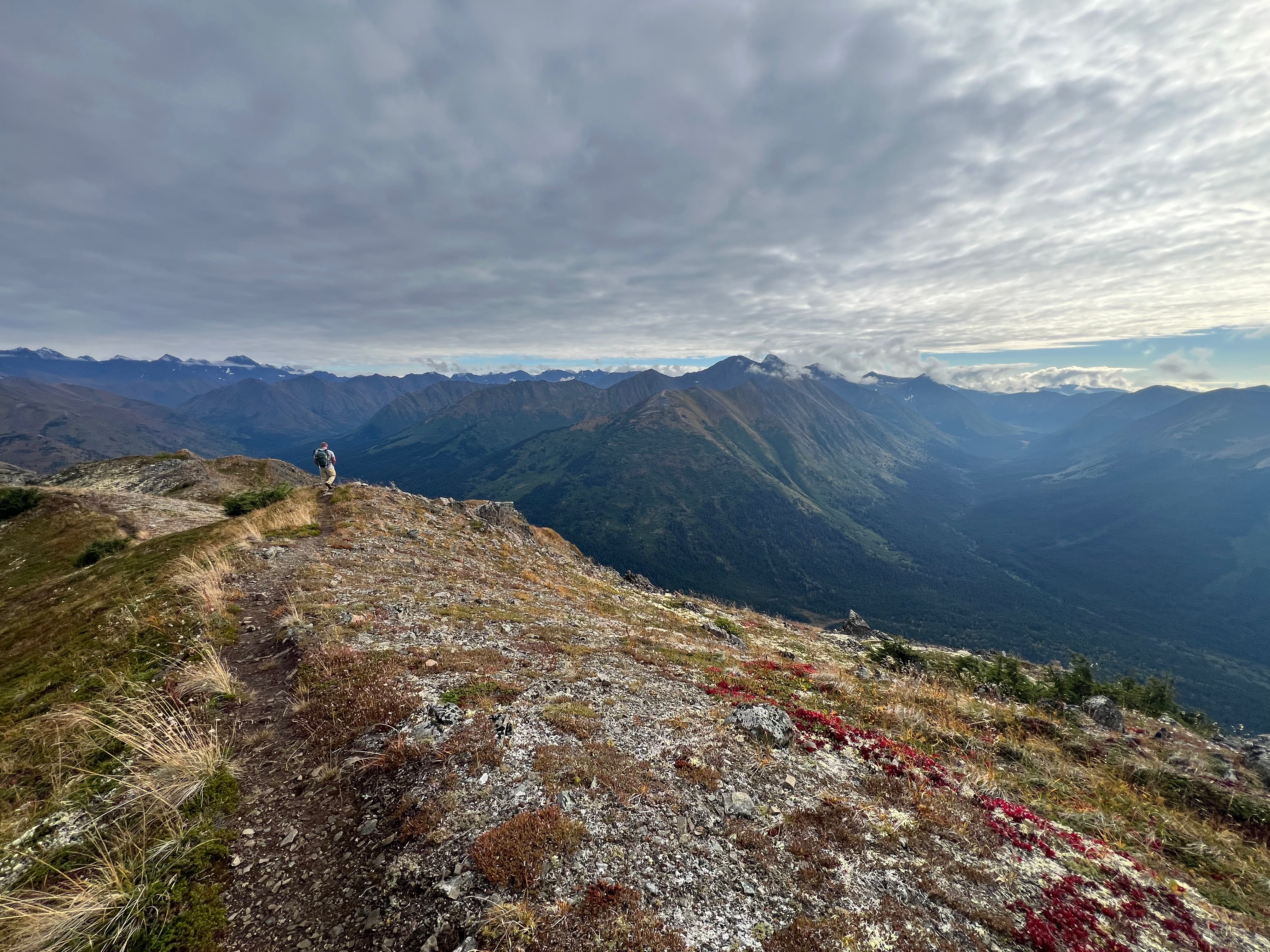
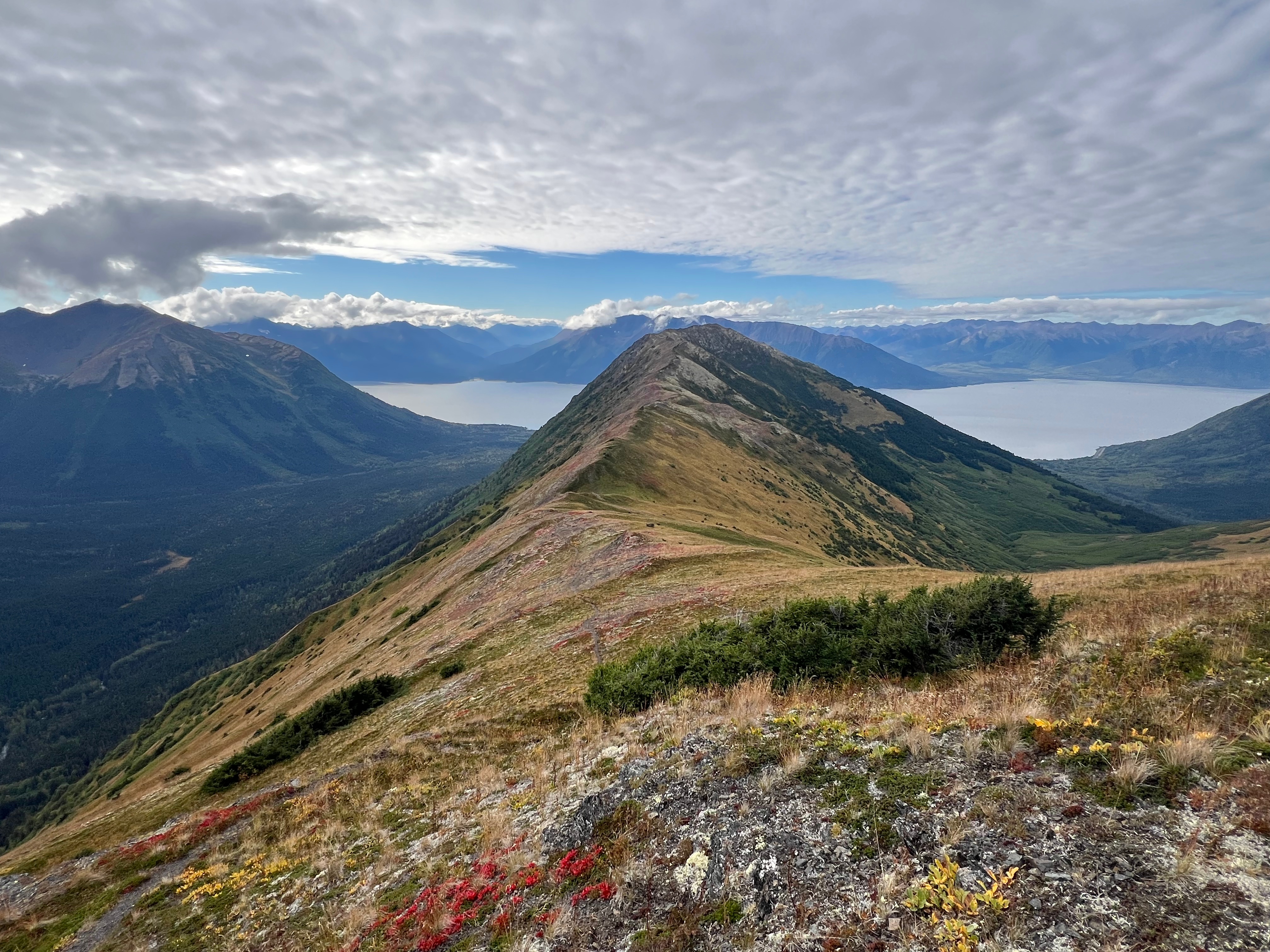
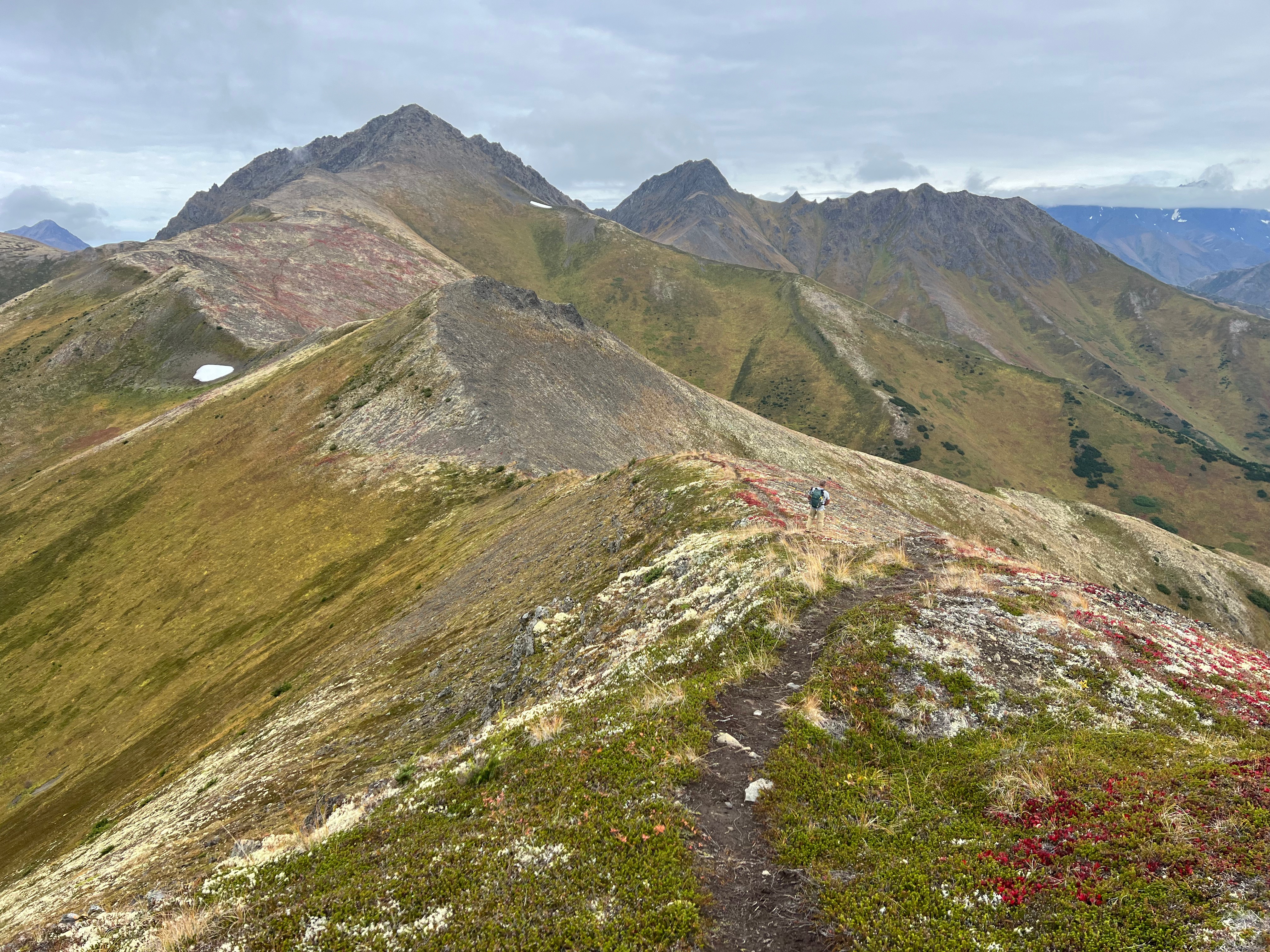
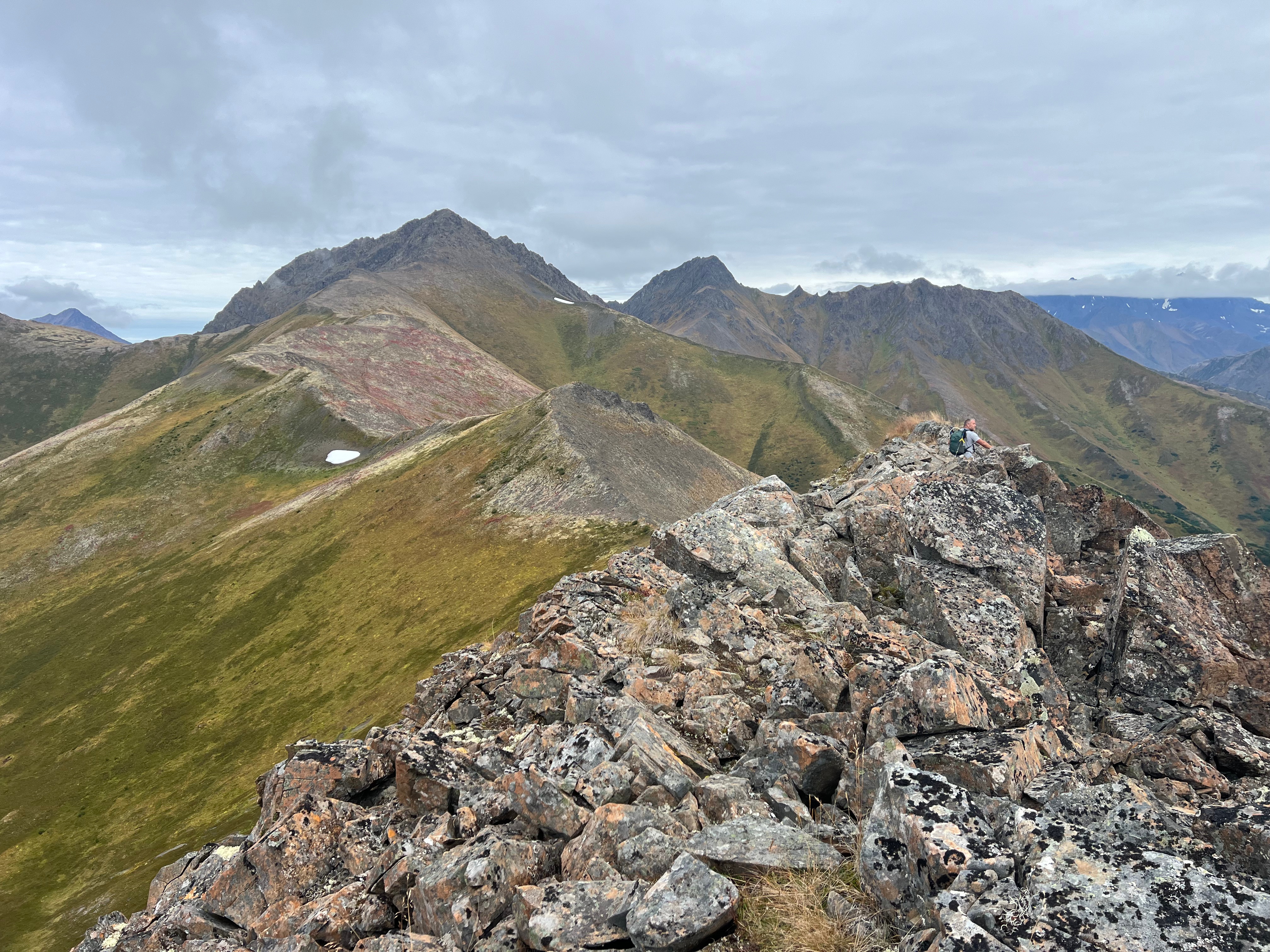
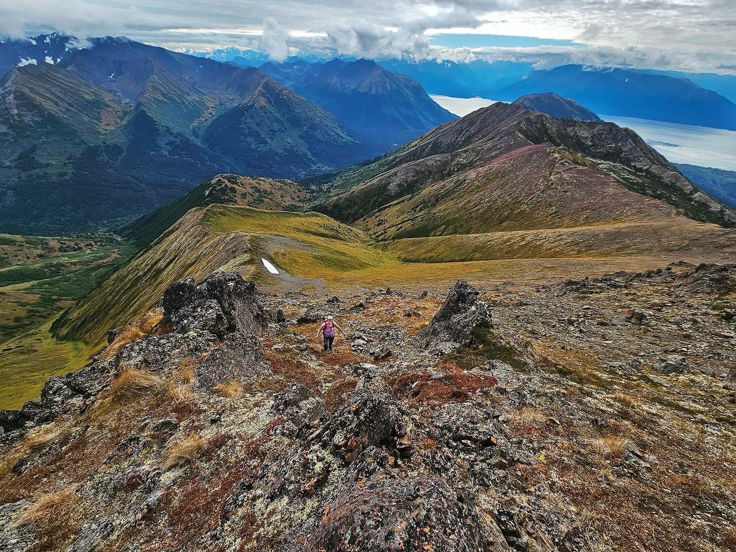
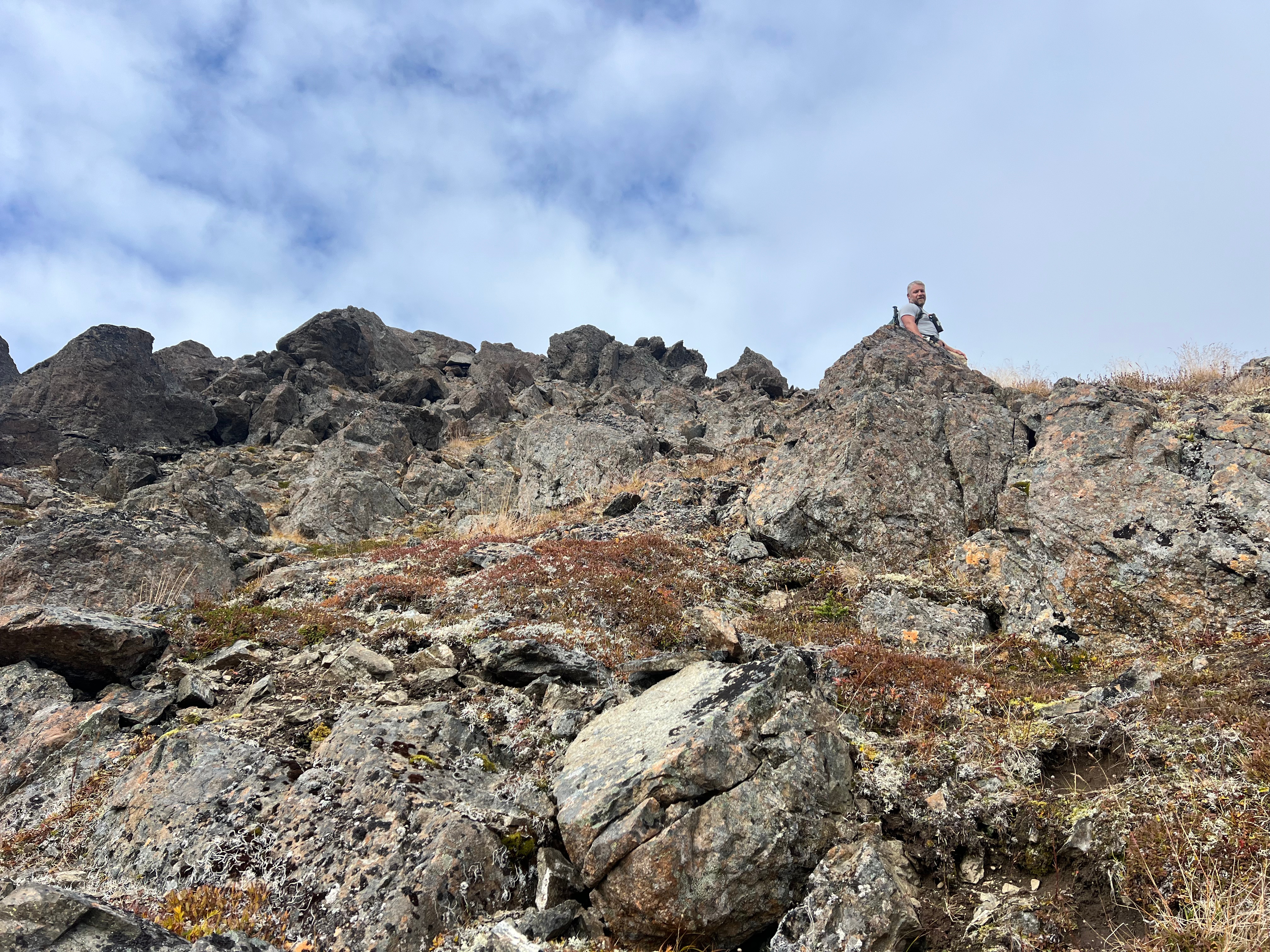
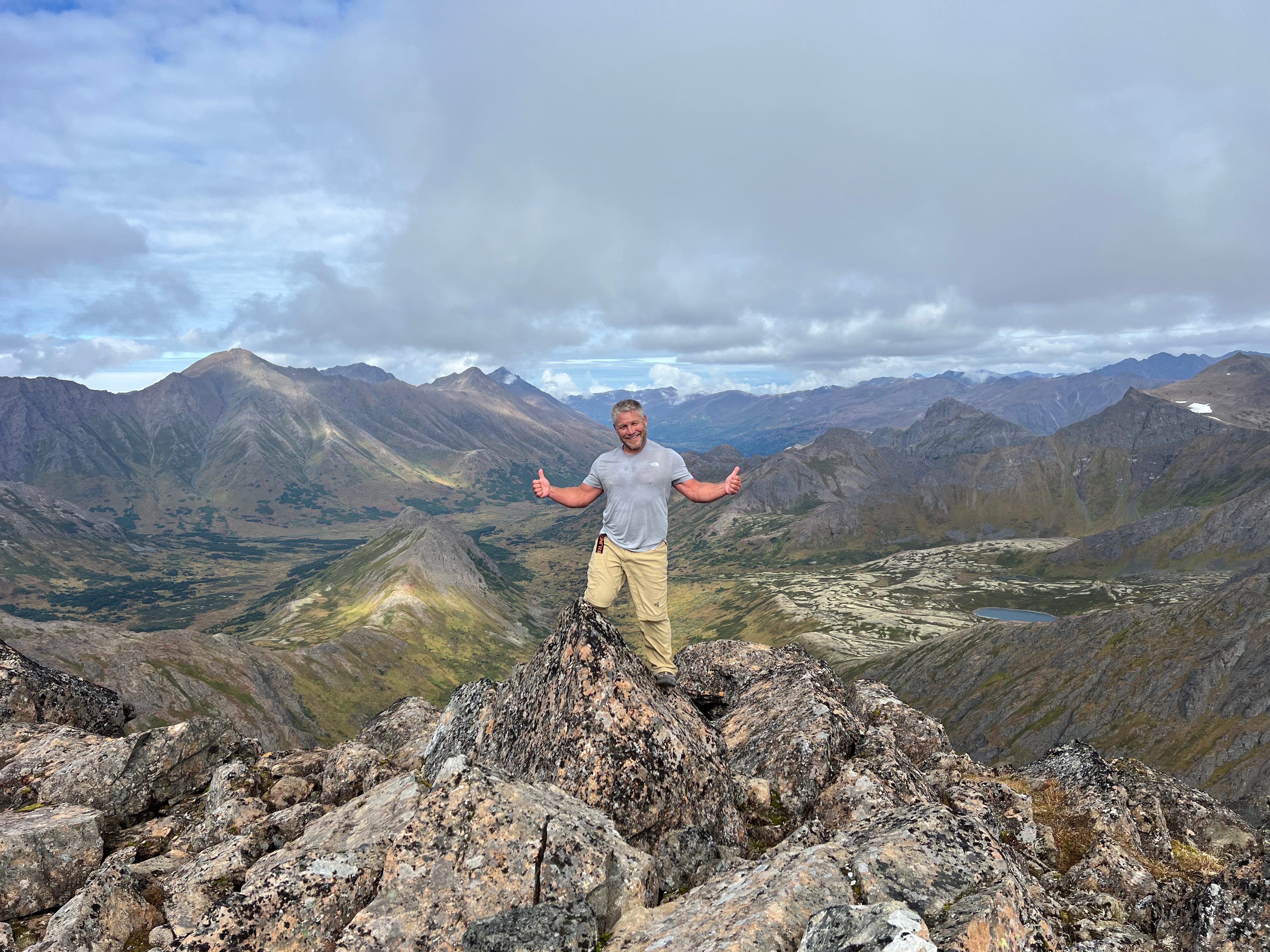
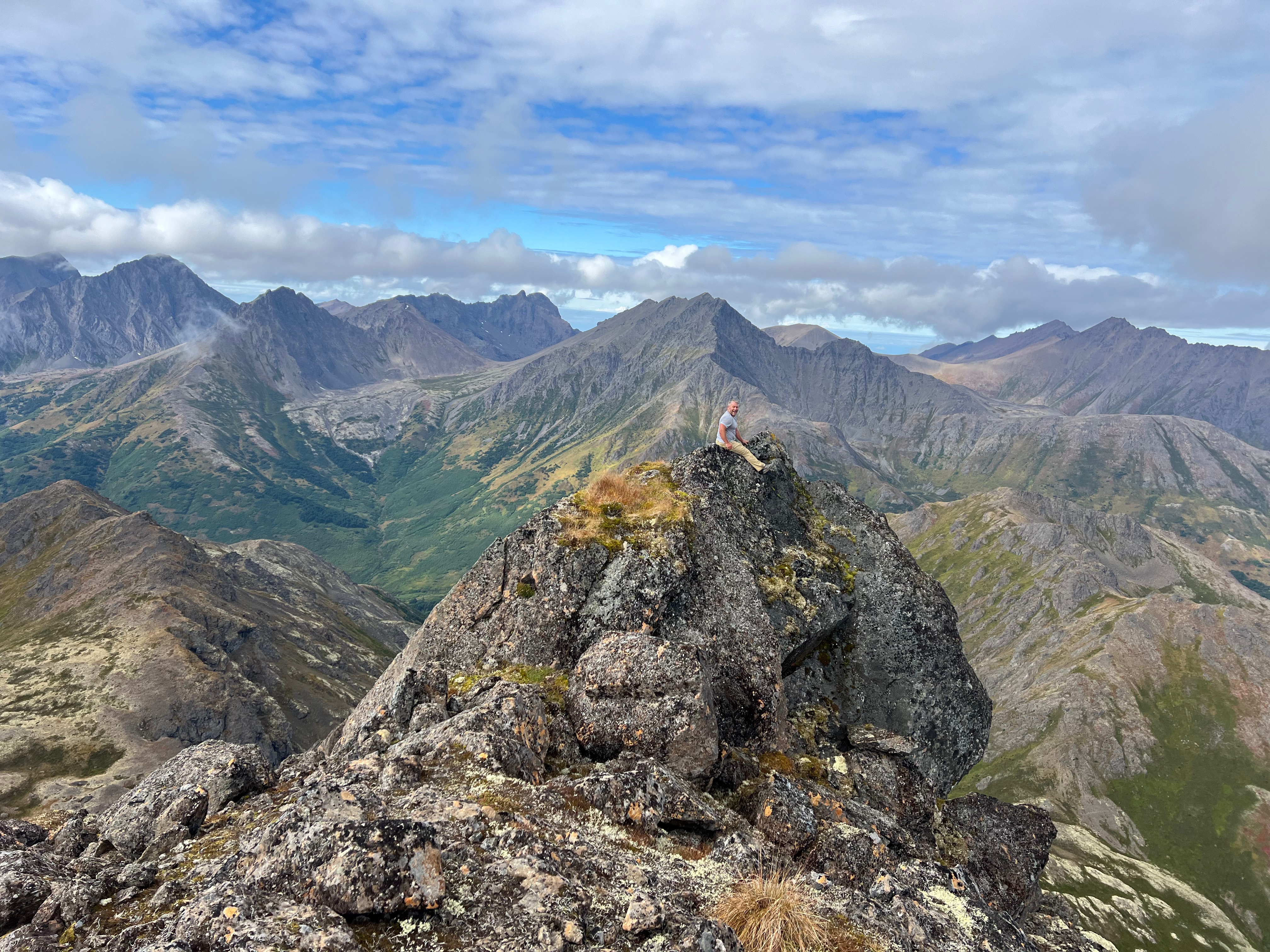
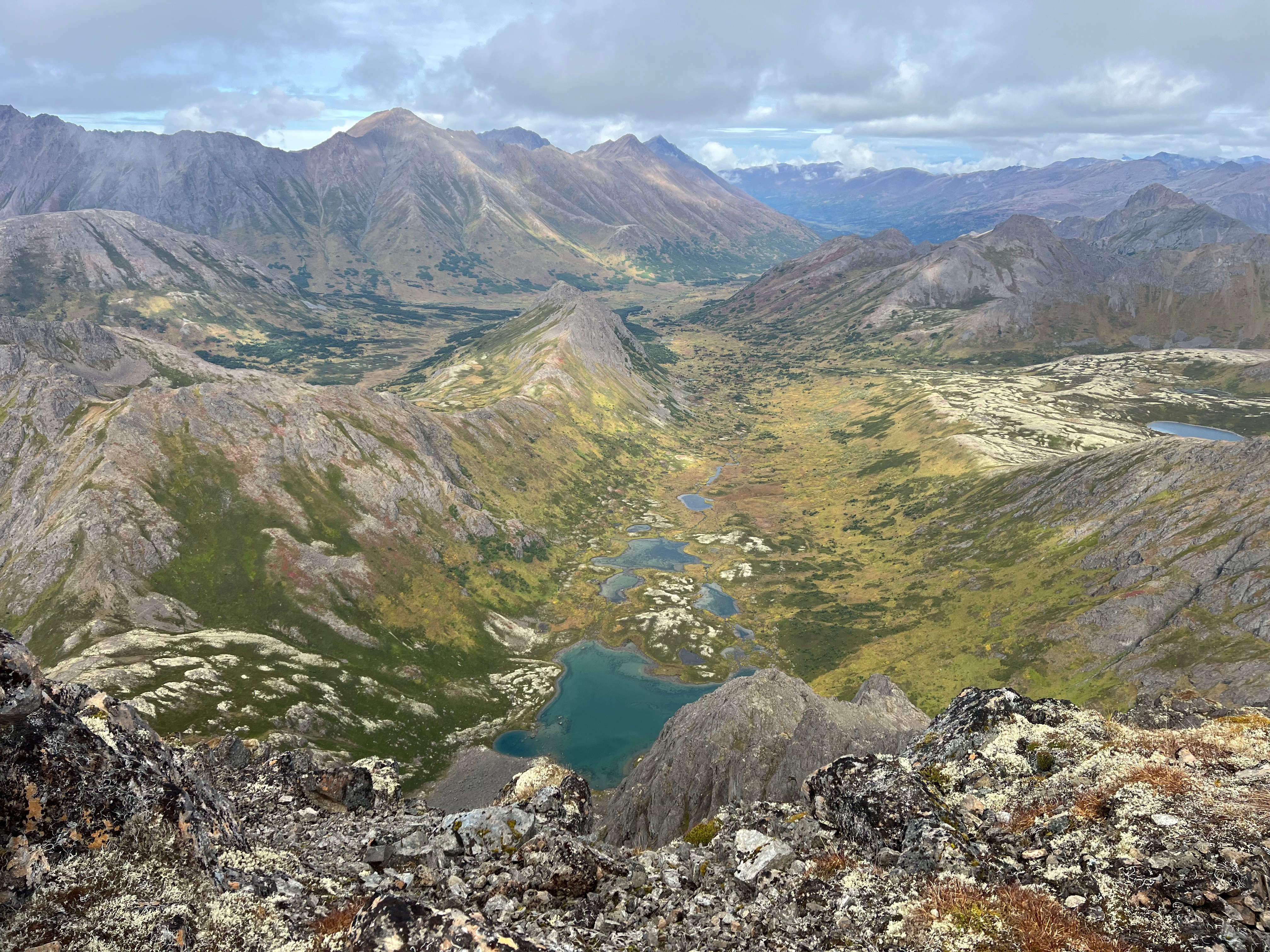
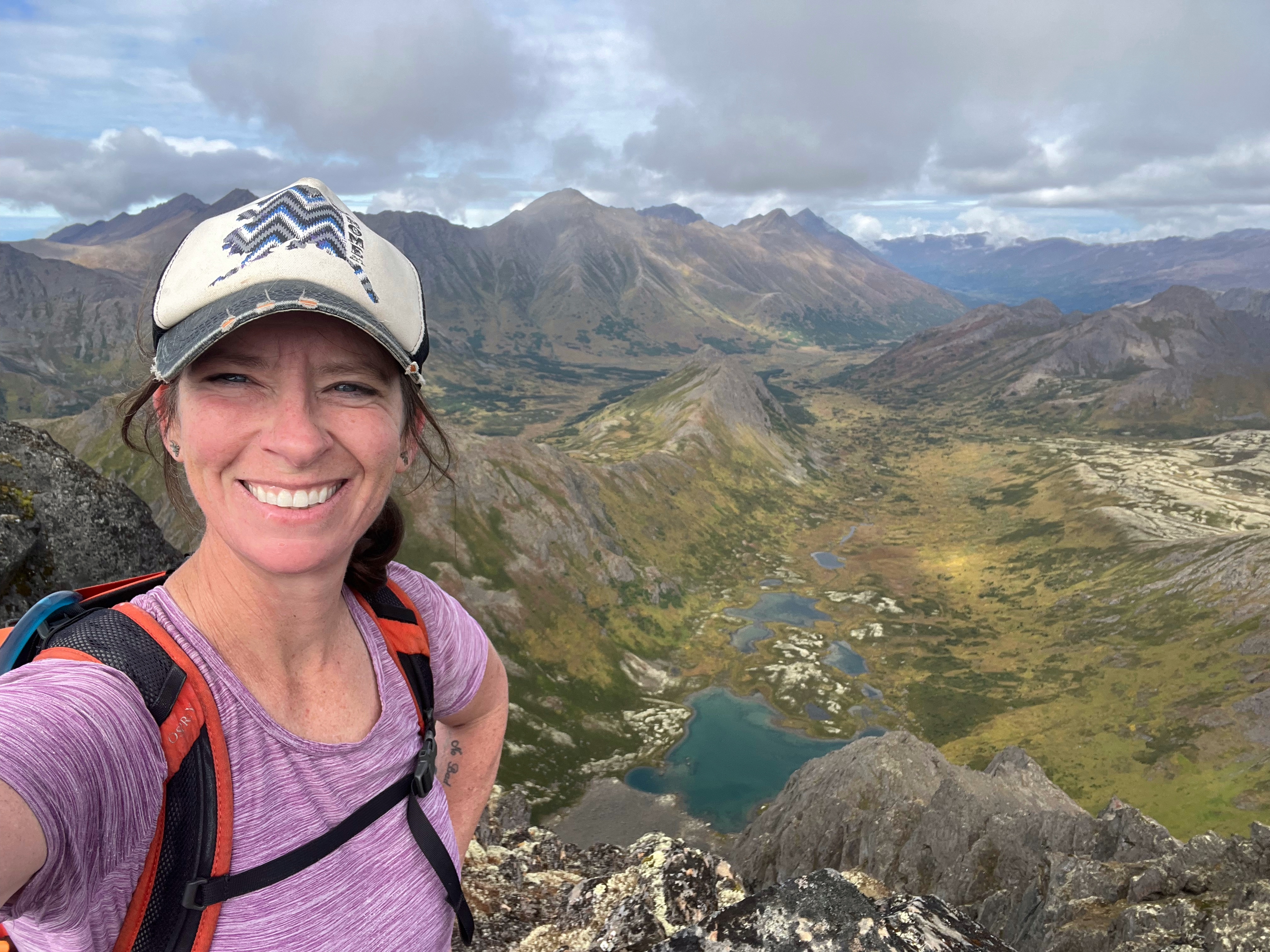
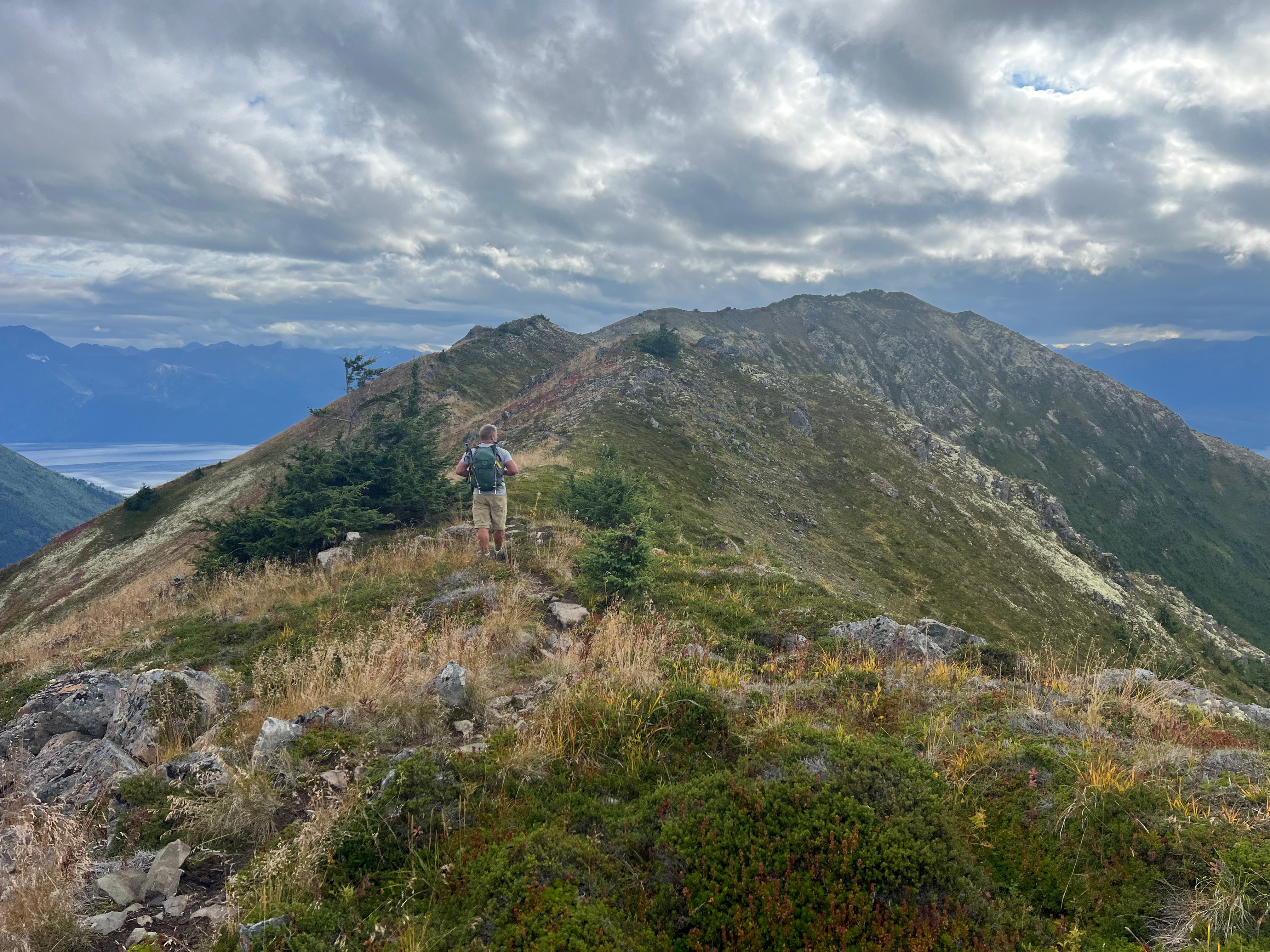
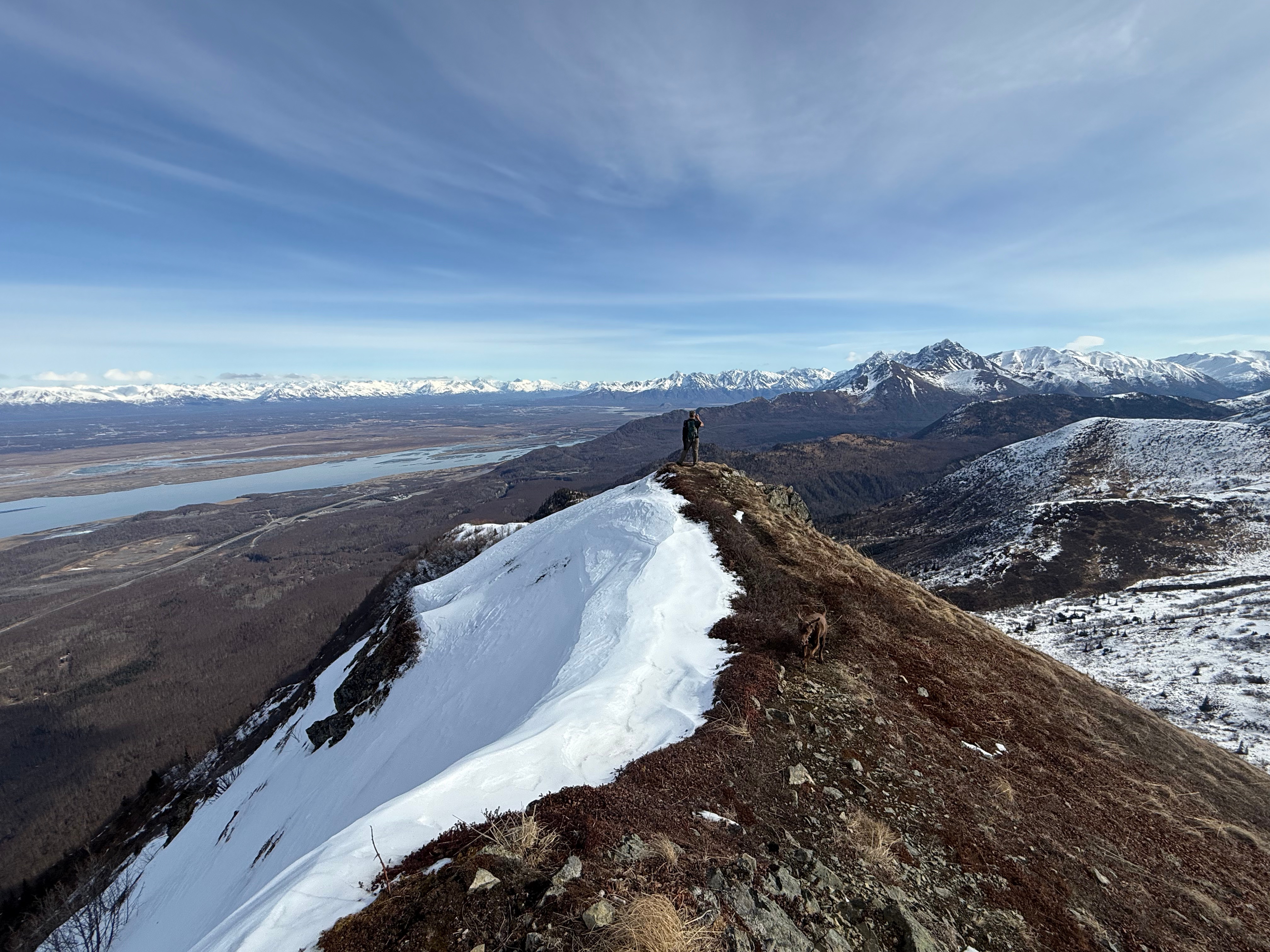
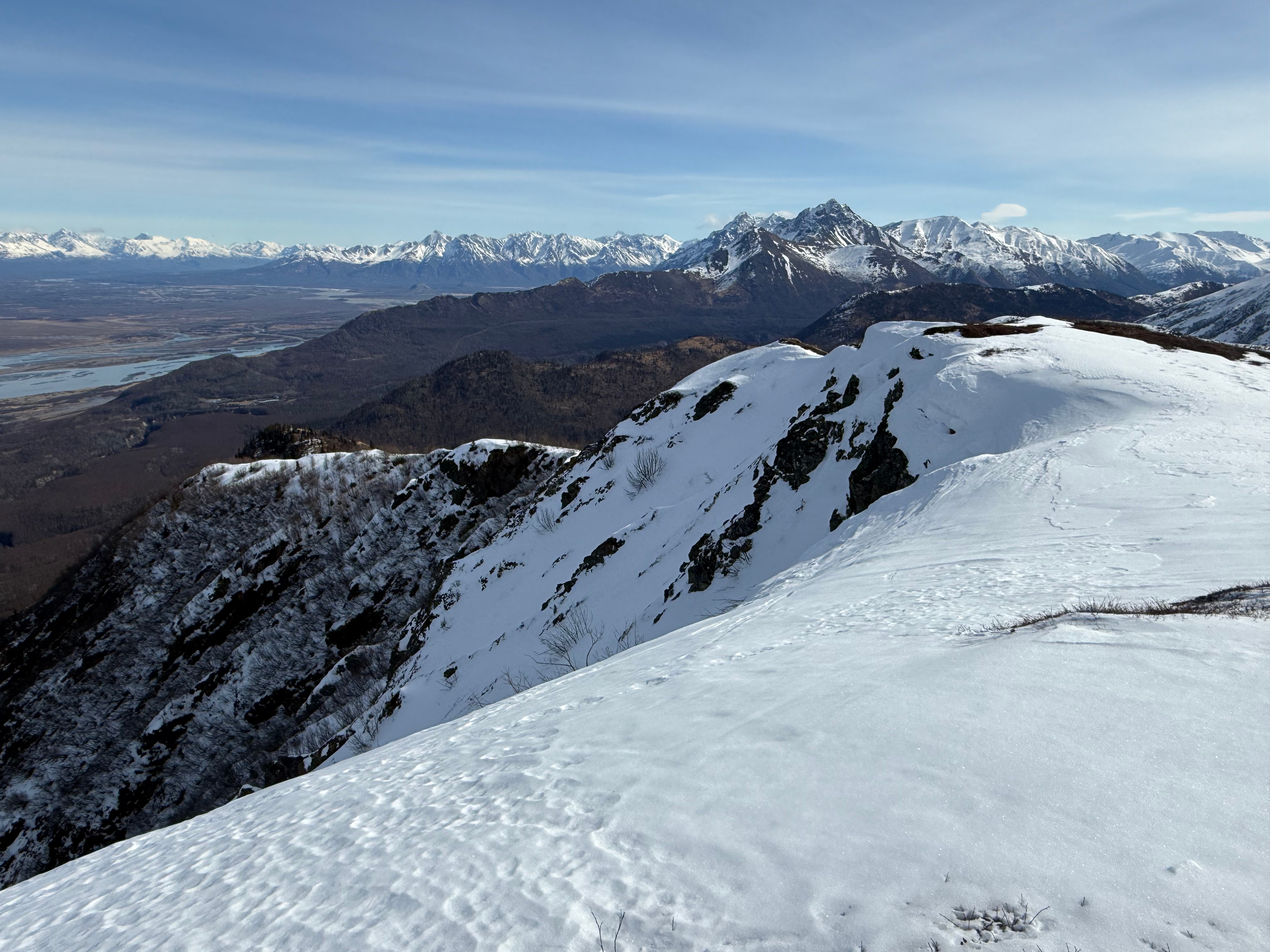
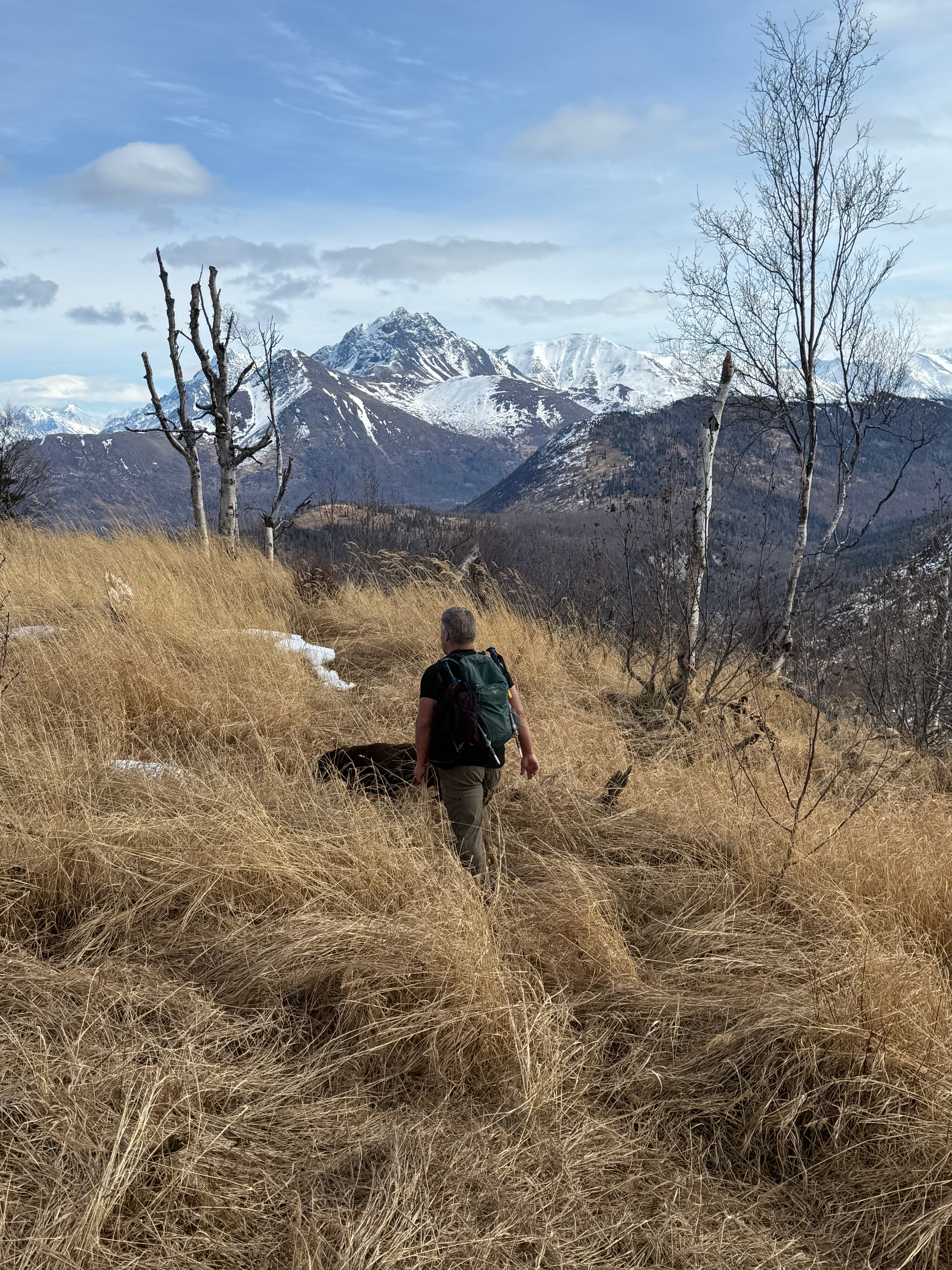
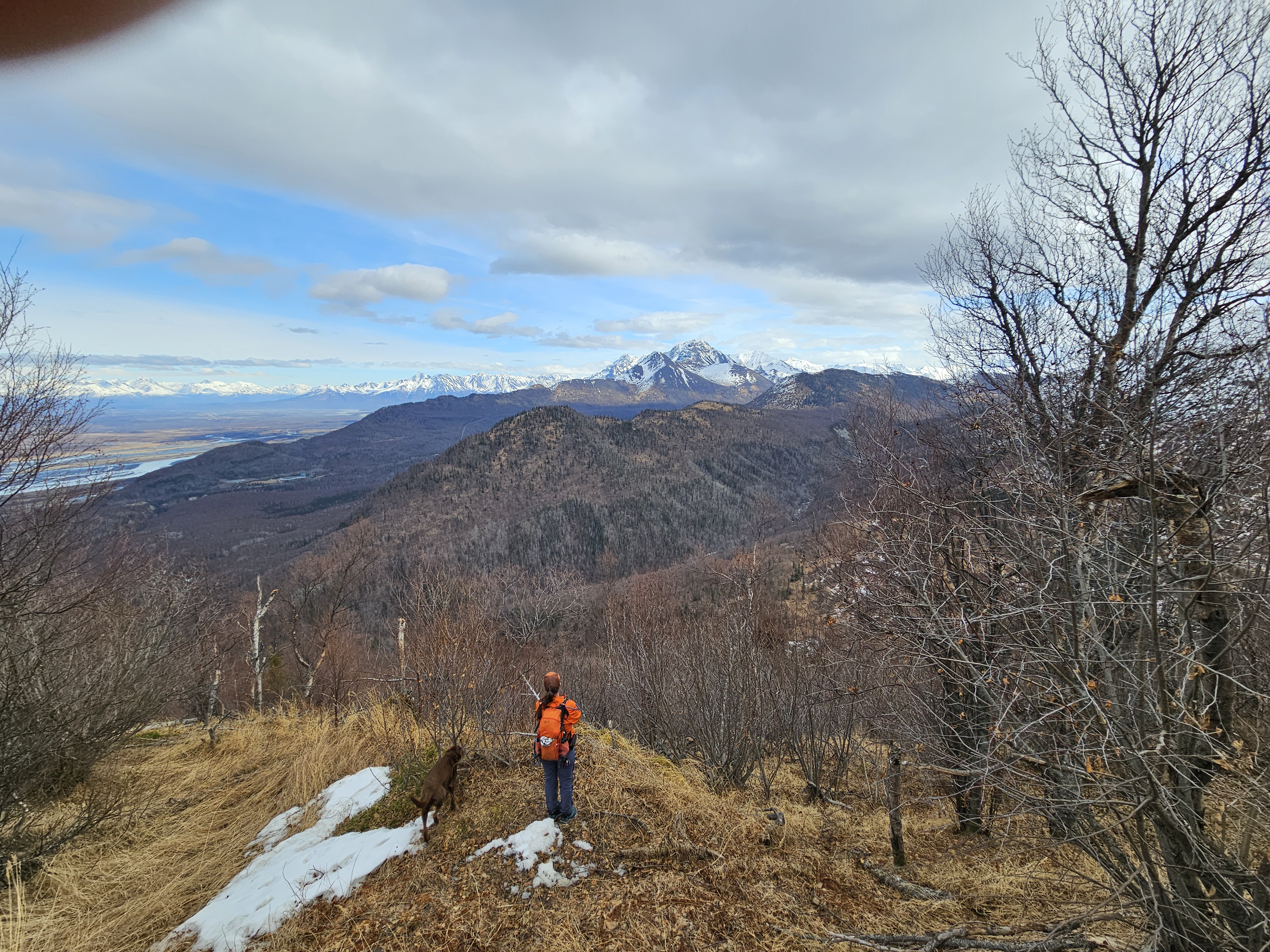
We walked along the top of the west face towards the true summit, half a mile and less than 100′ higher, while admiring the height of the vertical drop to our left. The summit of Snutnadzeni Point (AKA Bear) is anticlimactic, a small pile of rocks denoting the highest point, but the views make up for the bore of summit. Mirror and Edmonds Lakes are far below, and Chugiak just an ant colony in the distance.

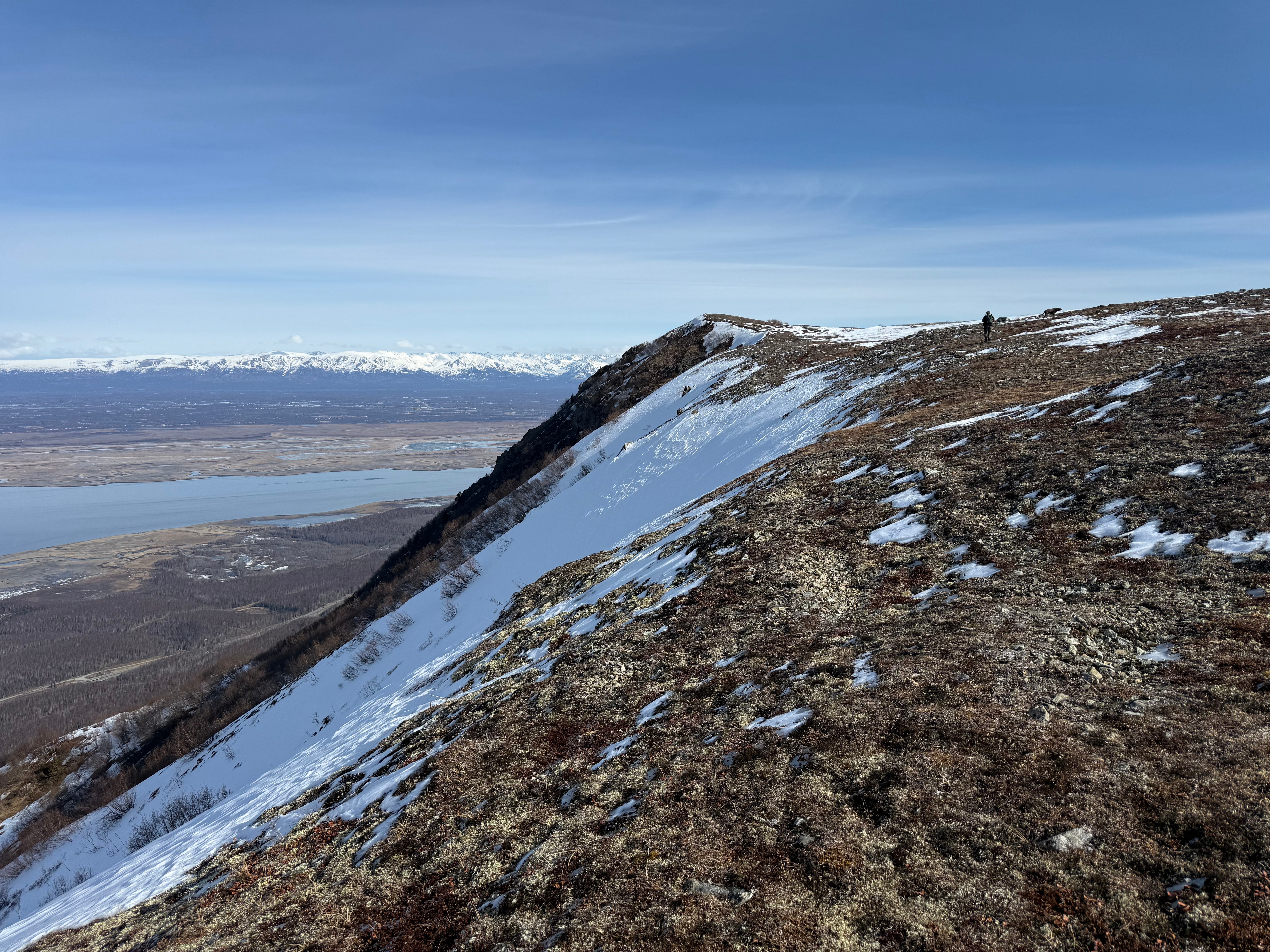
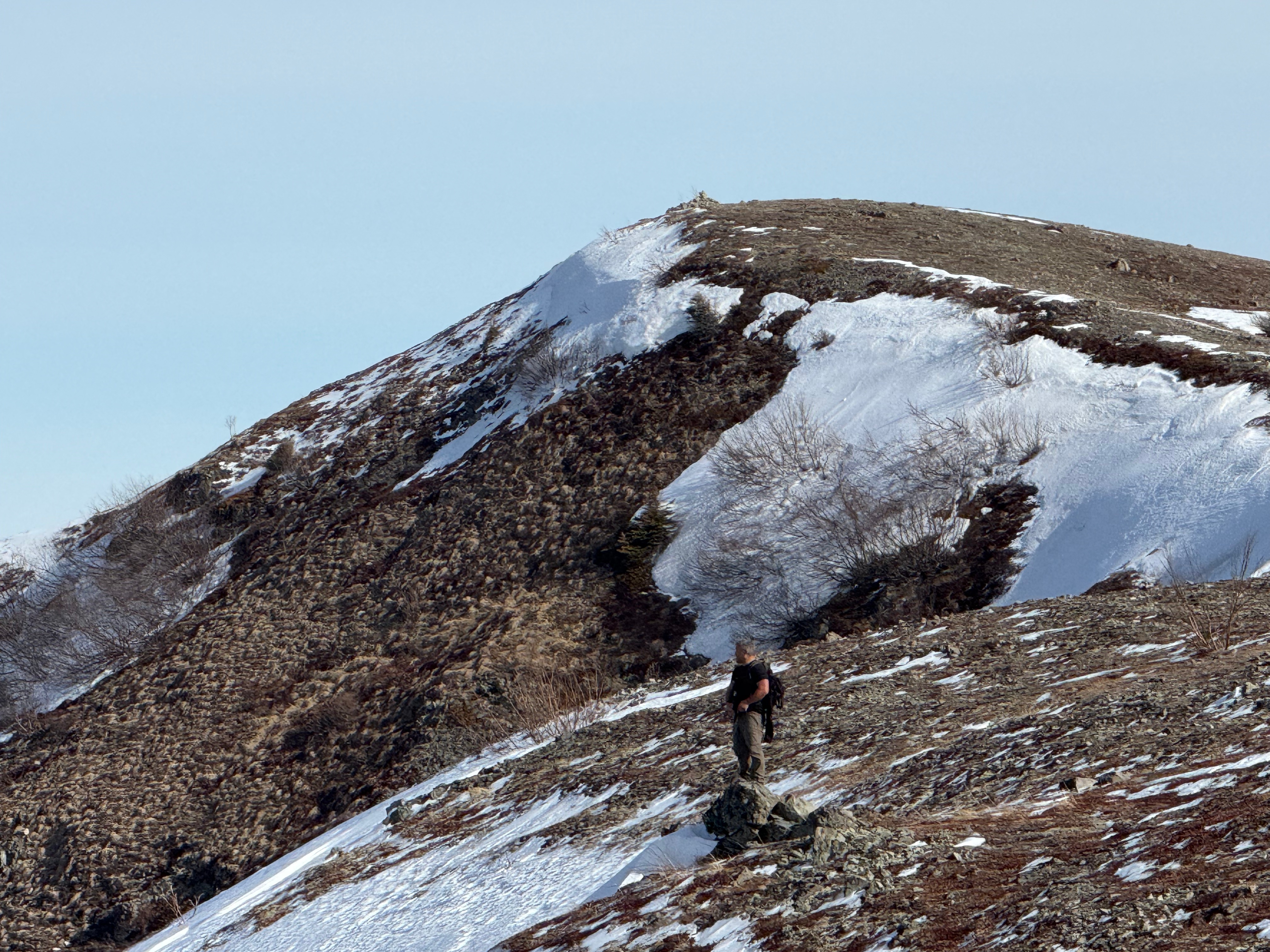
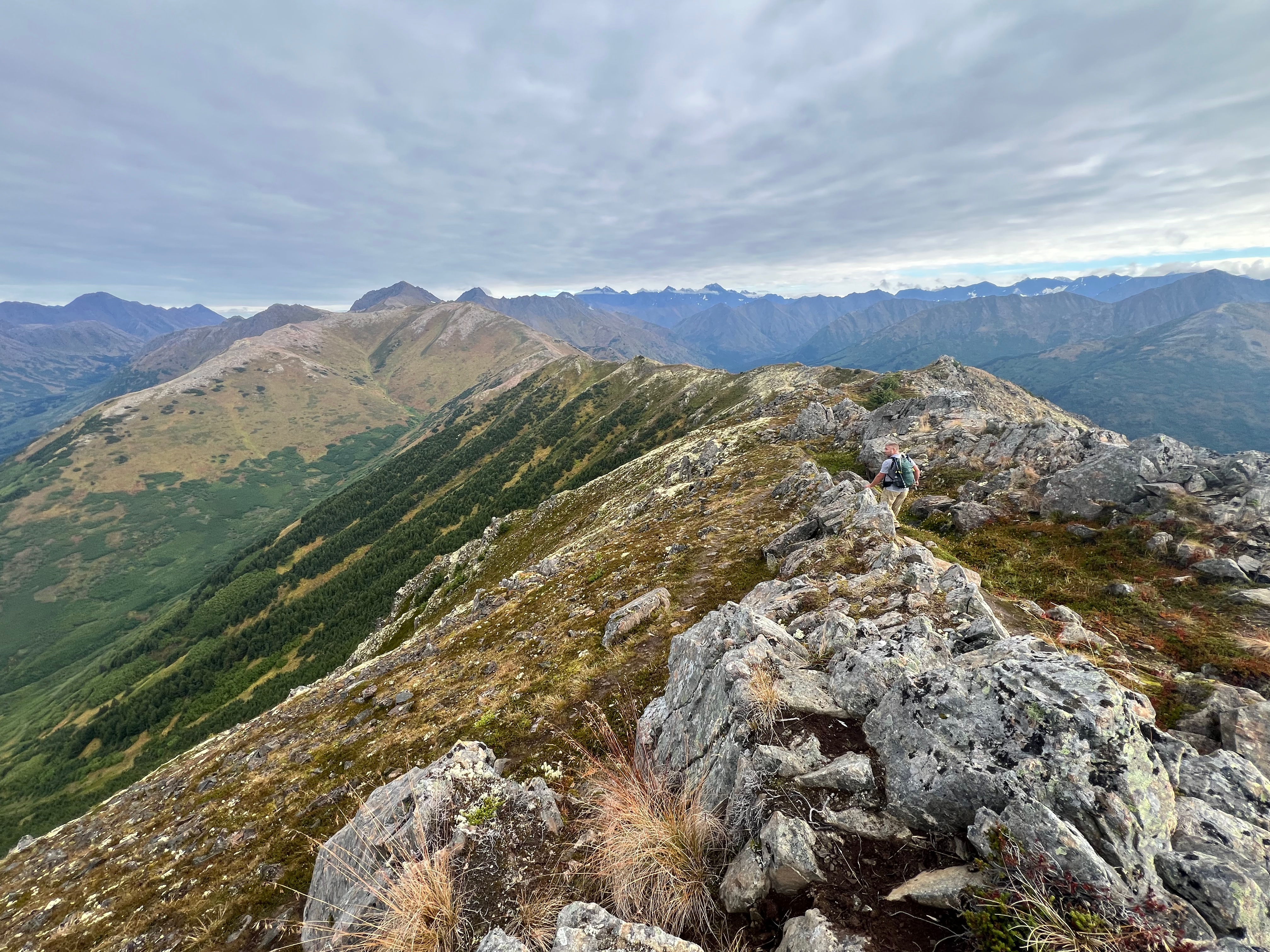
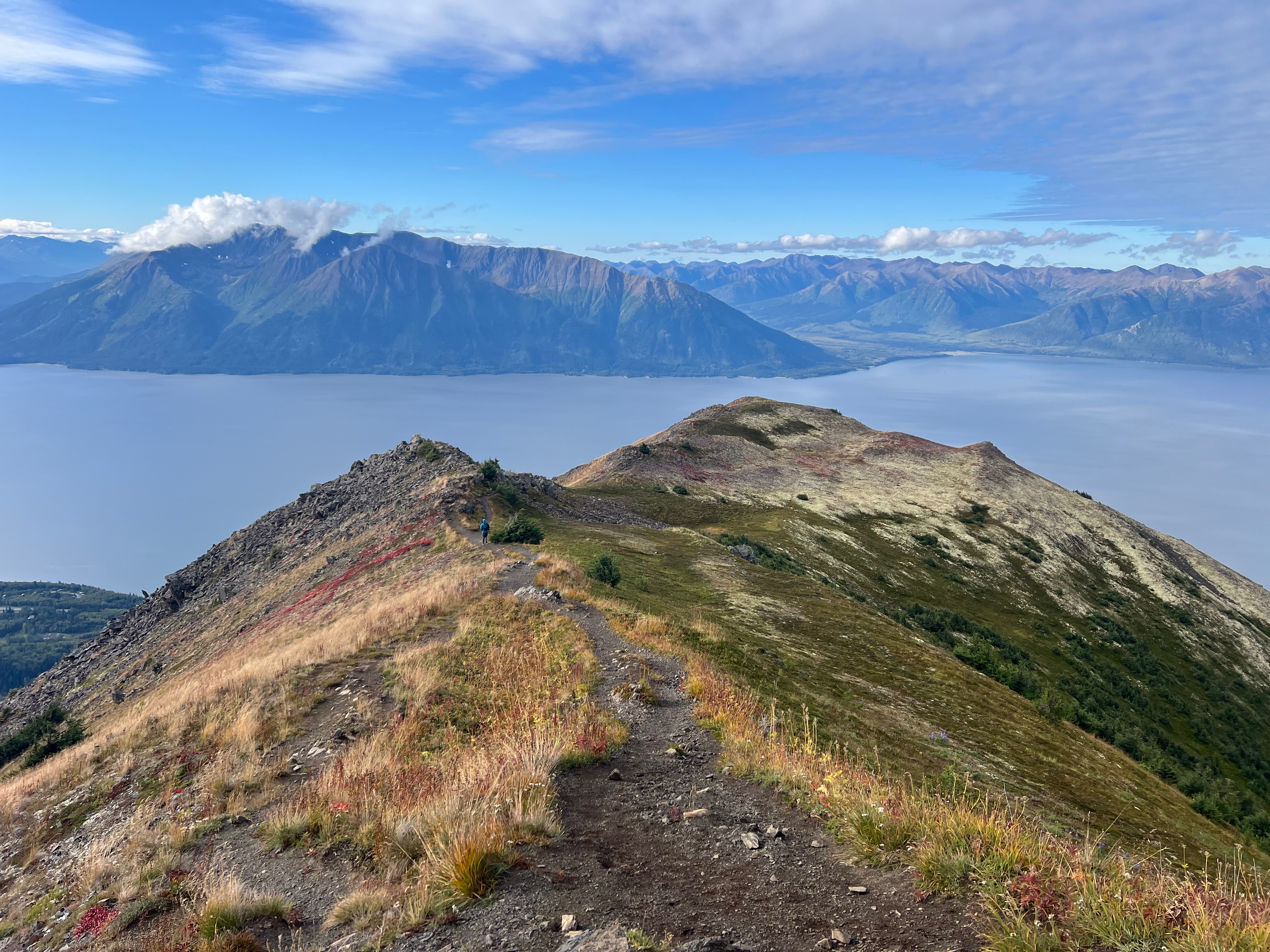
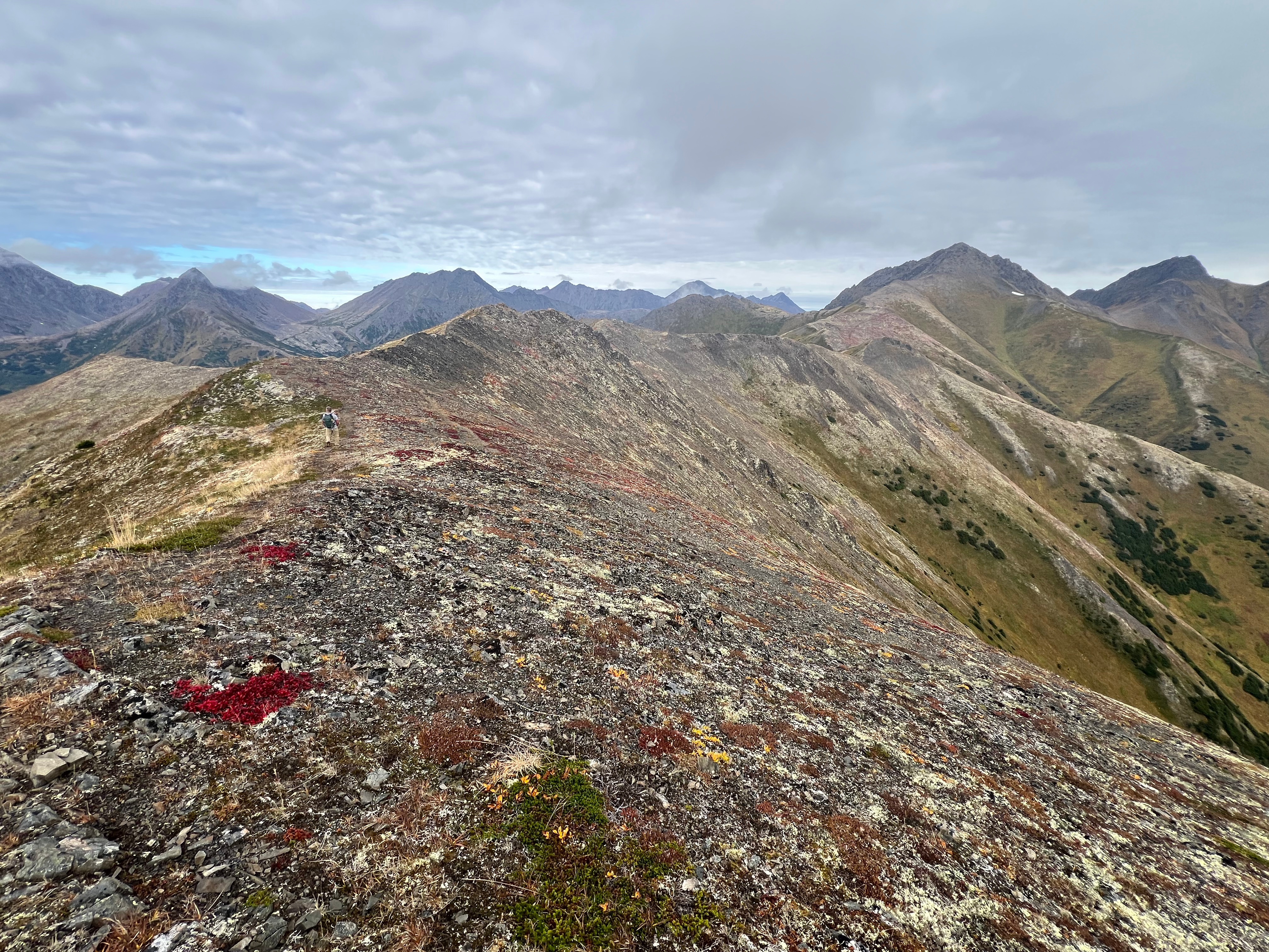
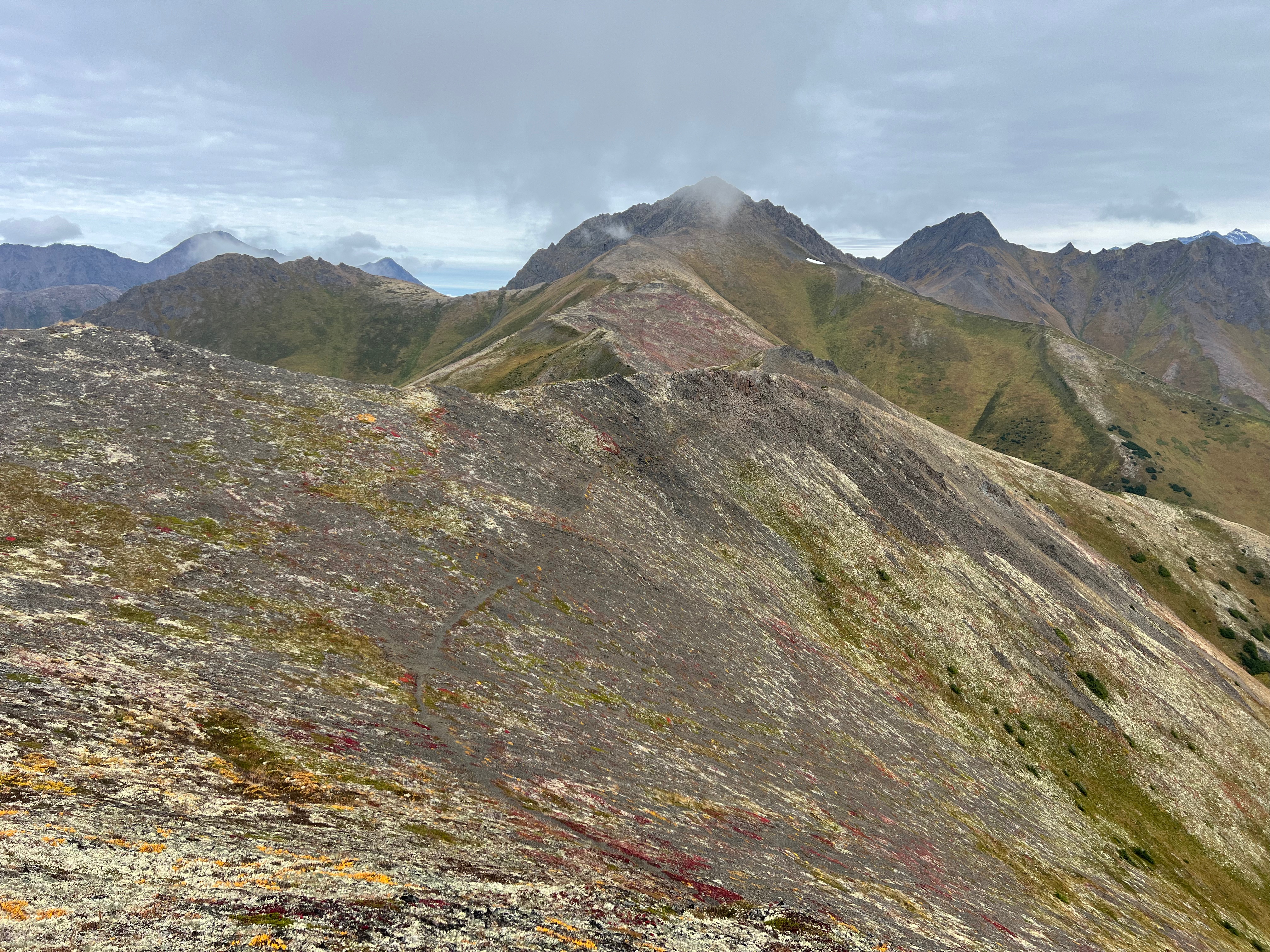
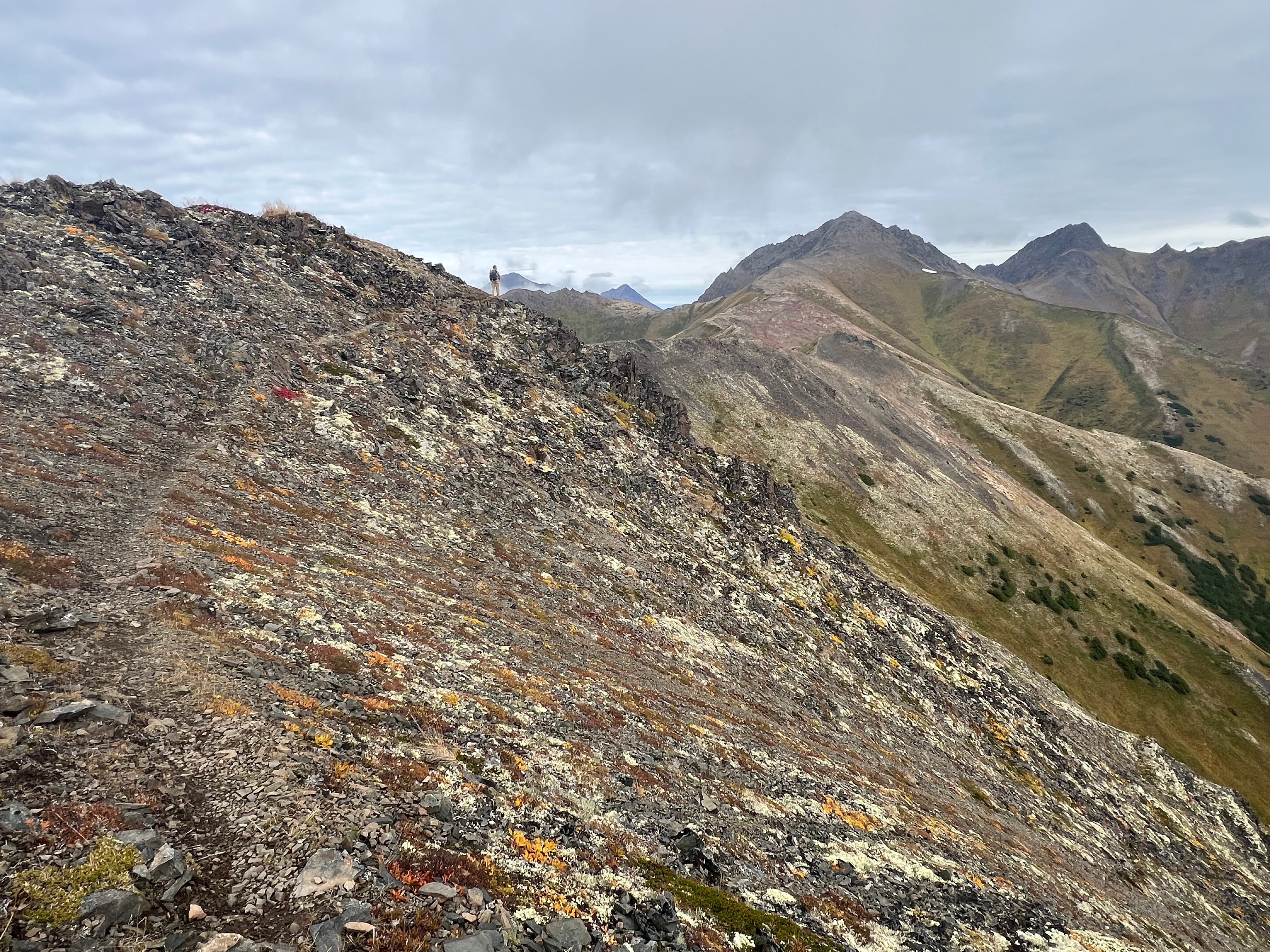
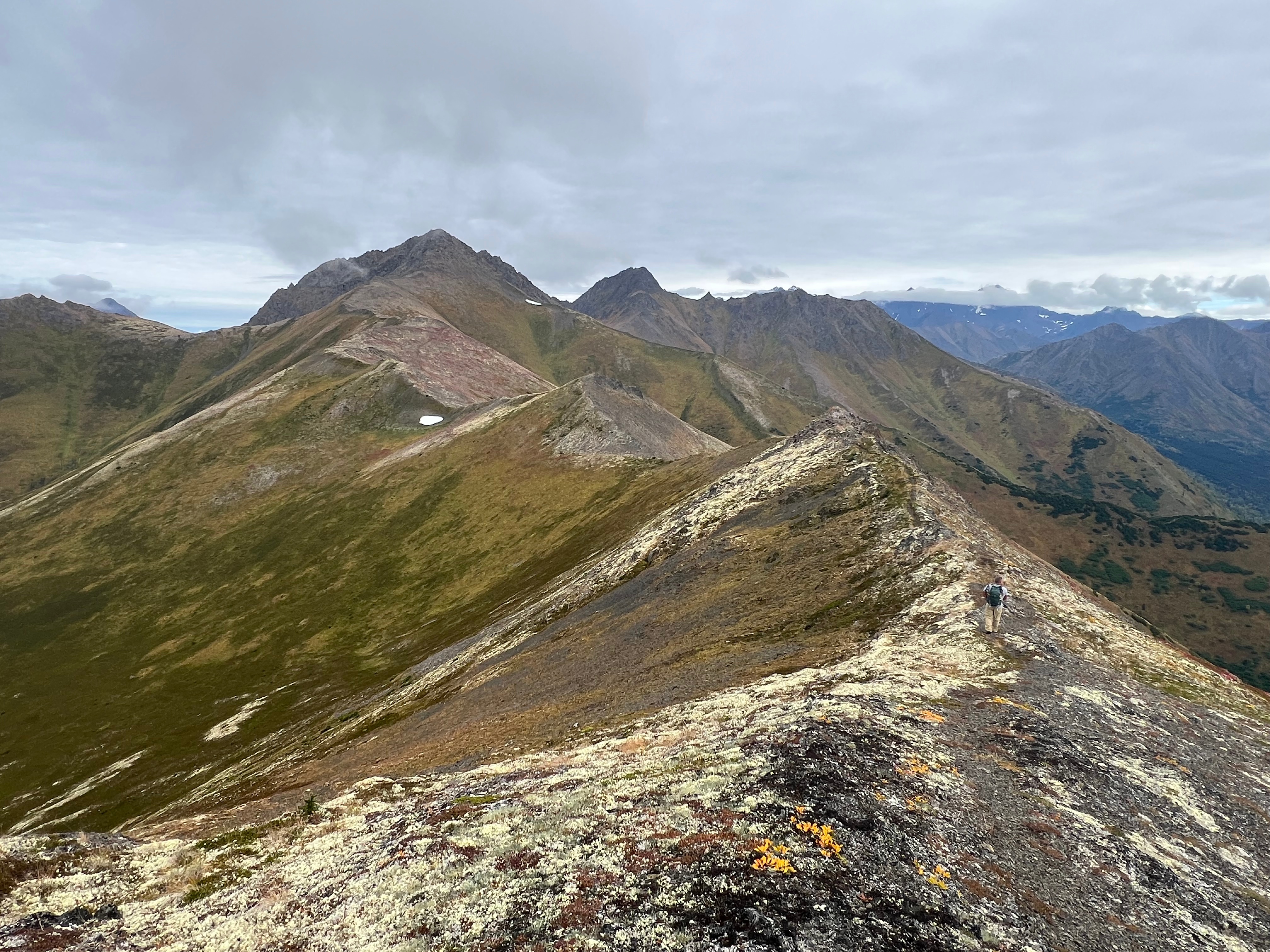
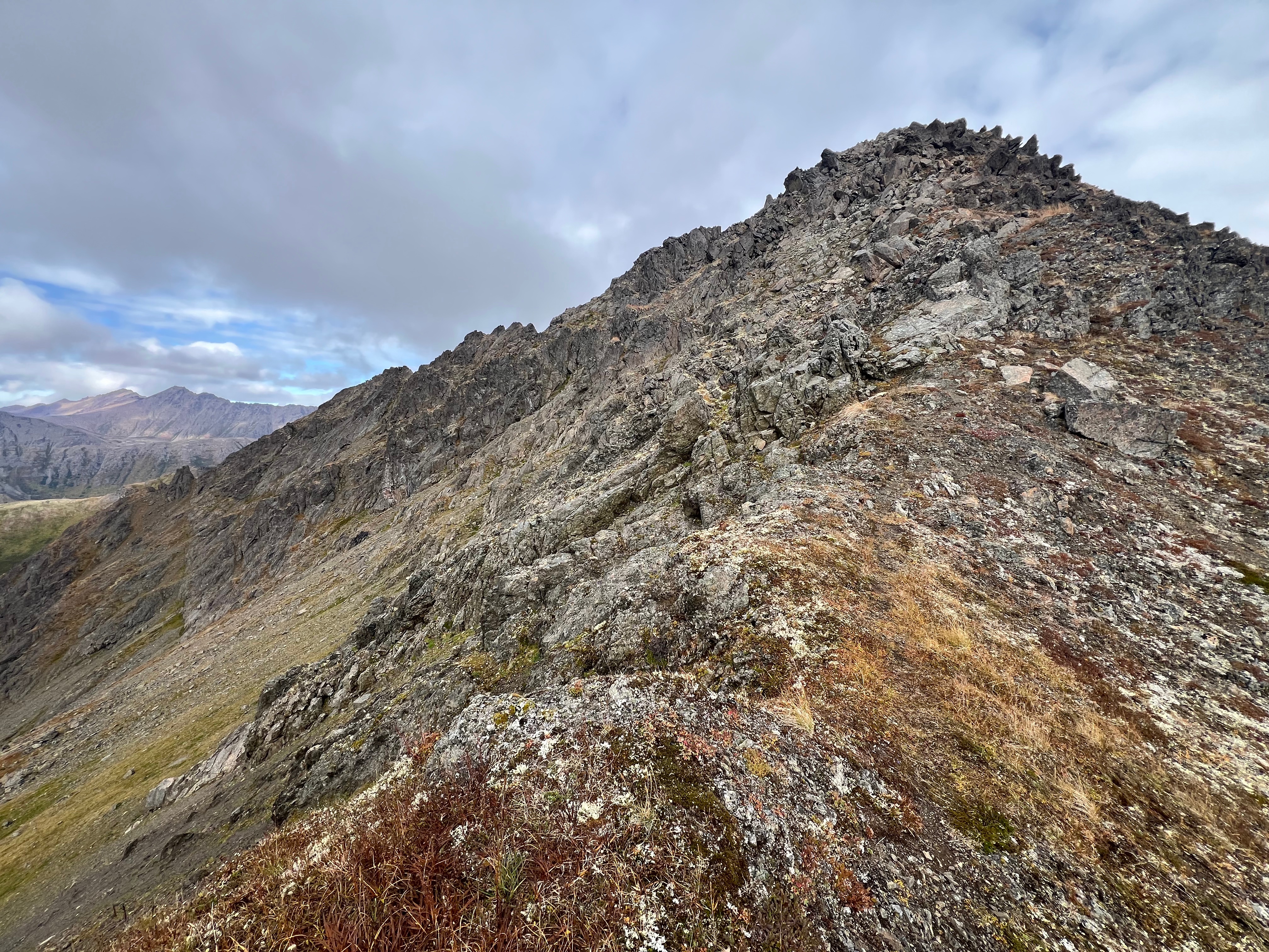
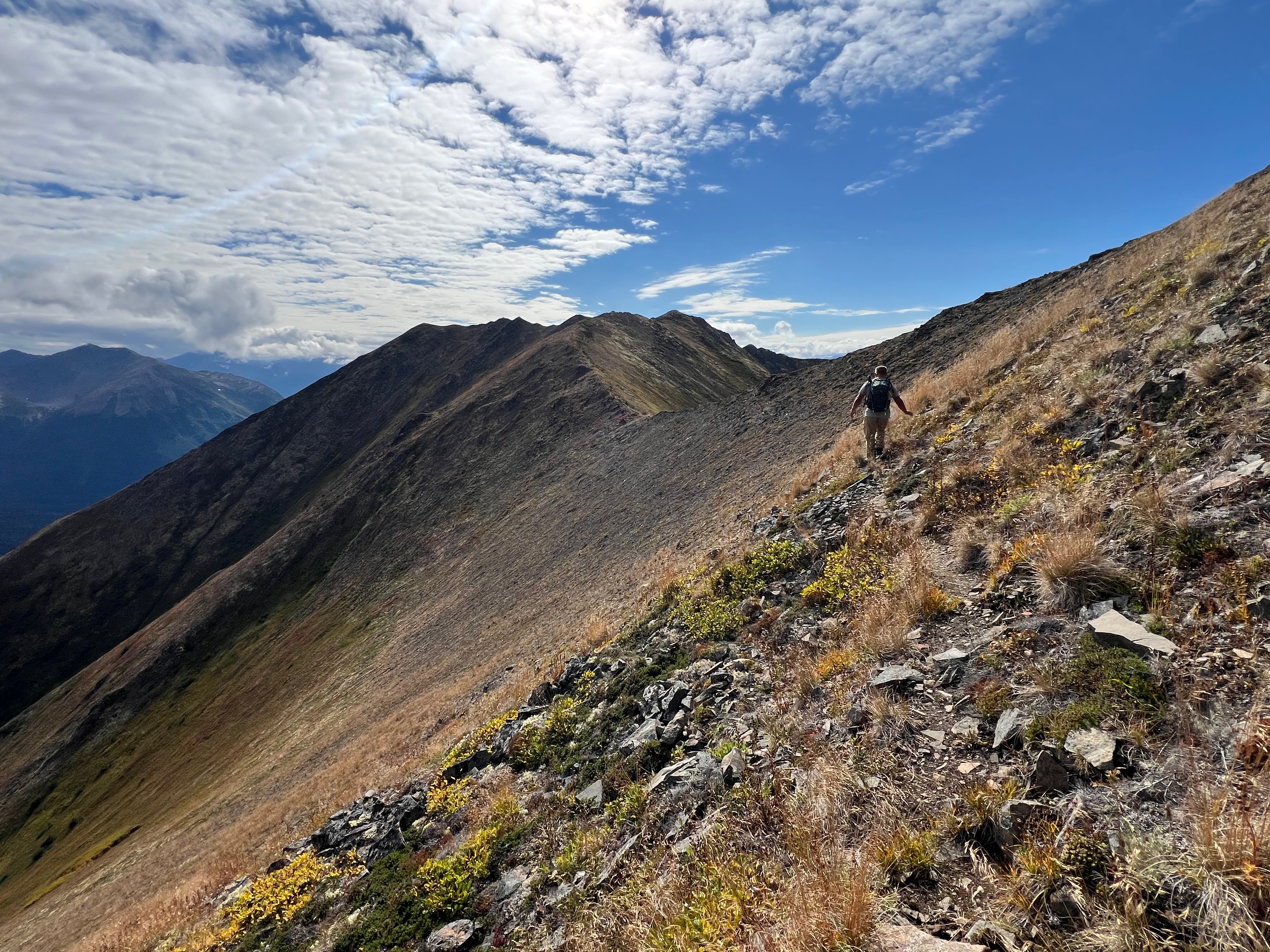
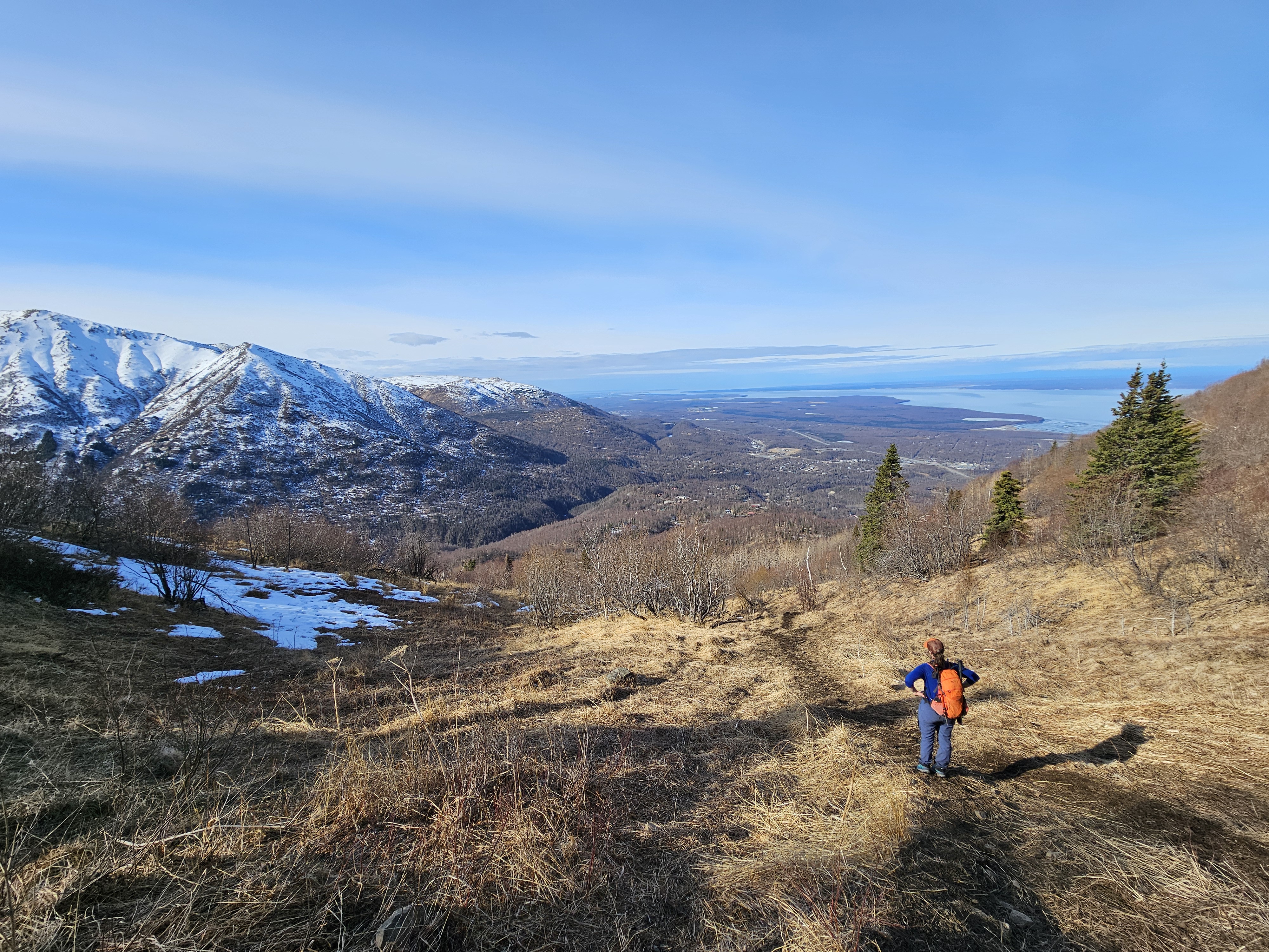
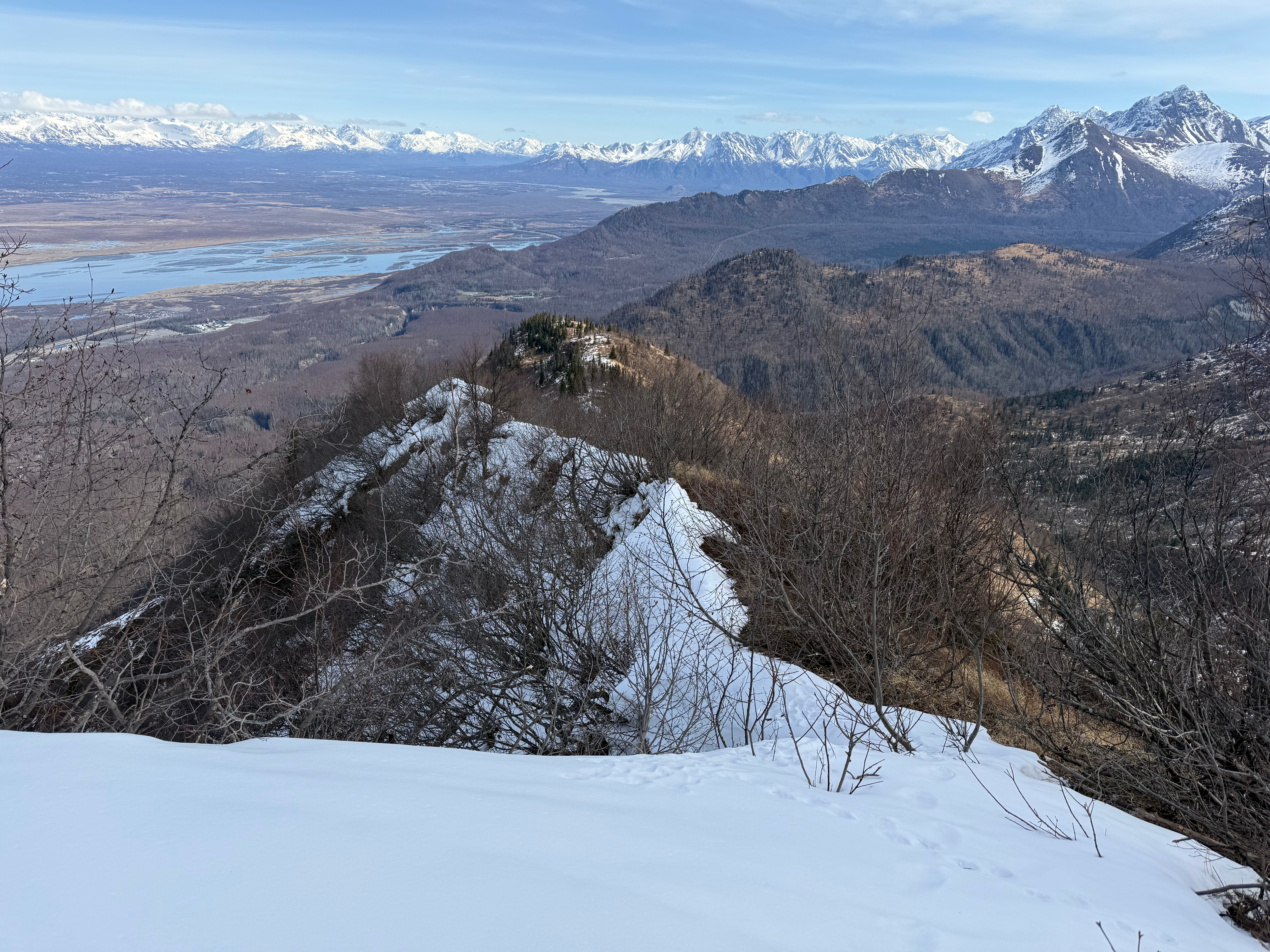
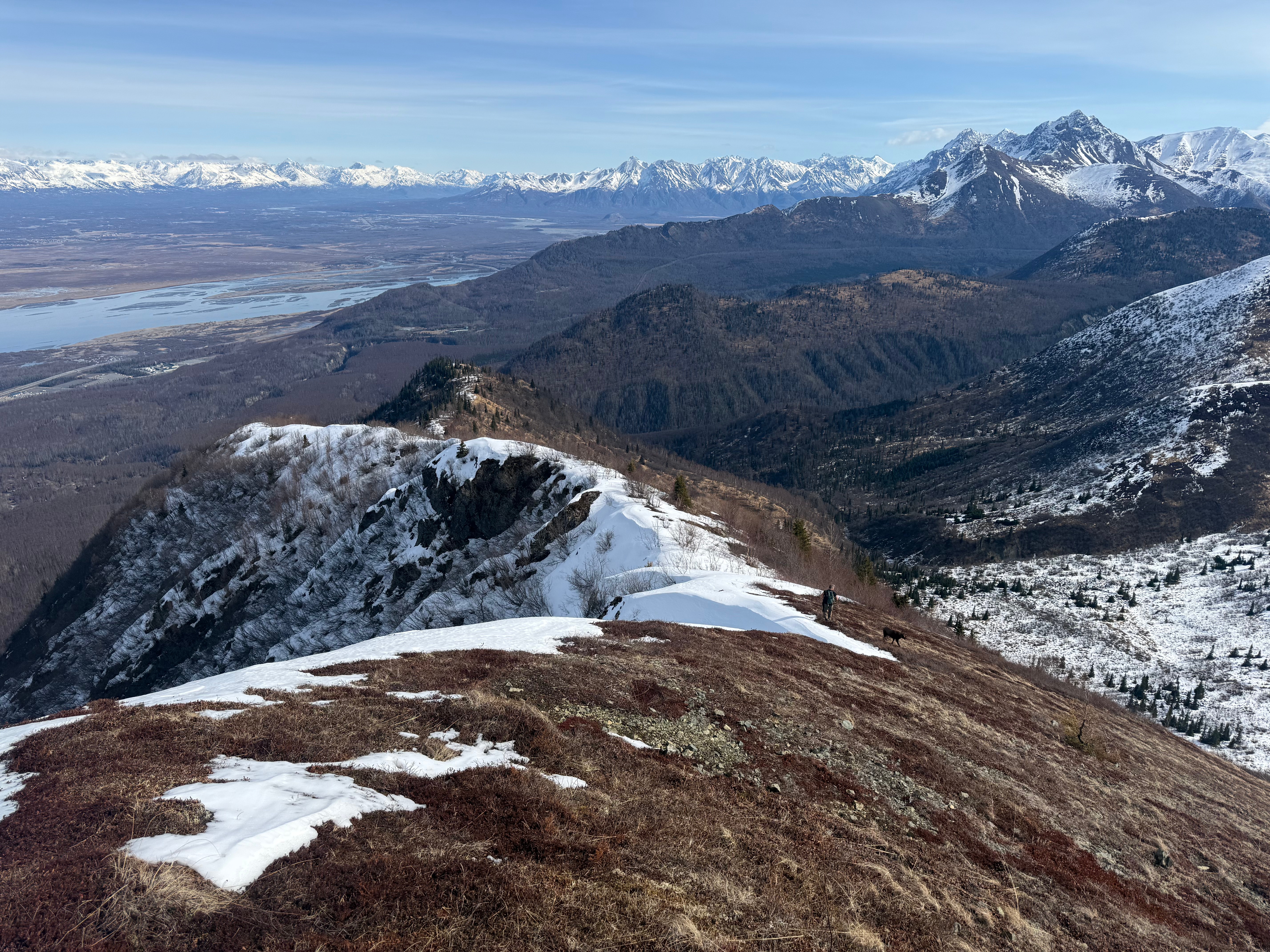
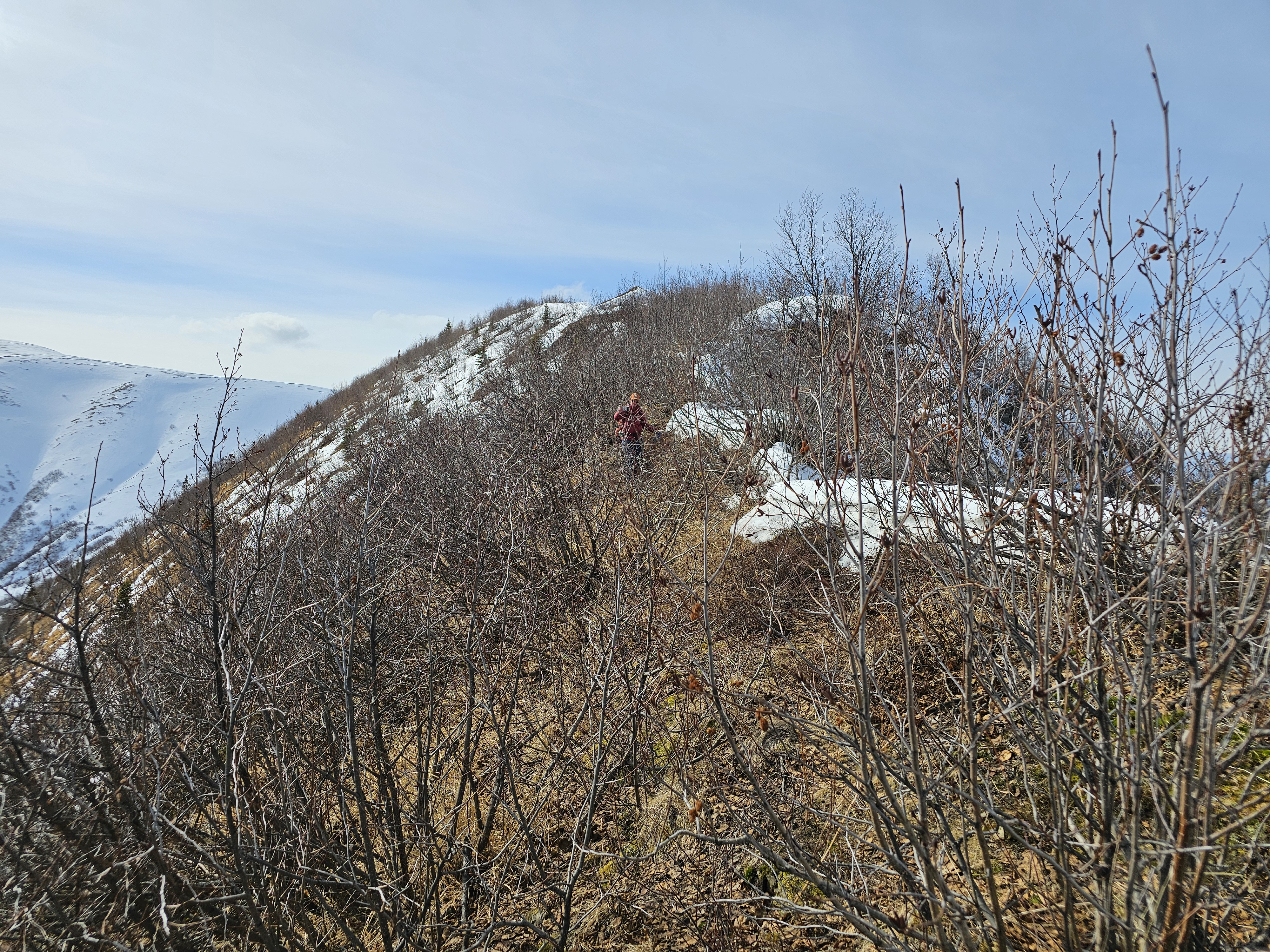
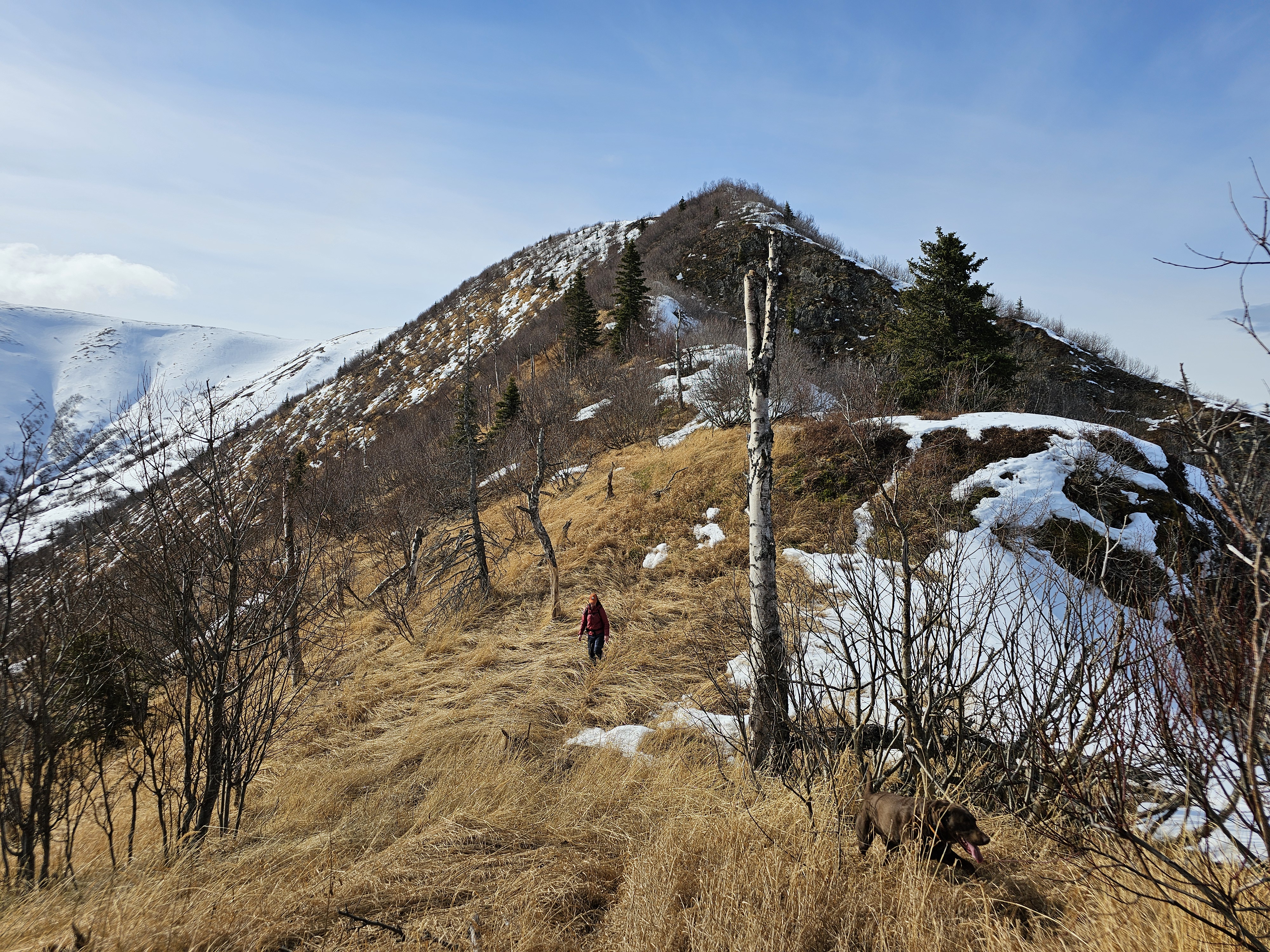
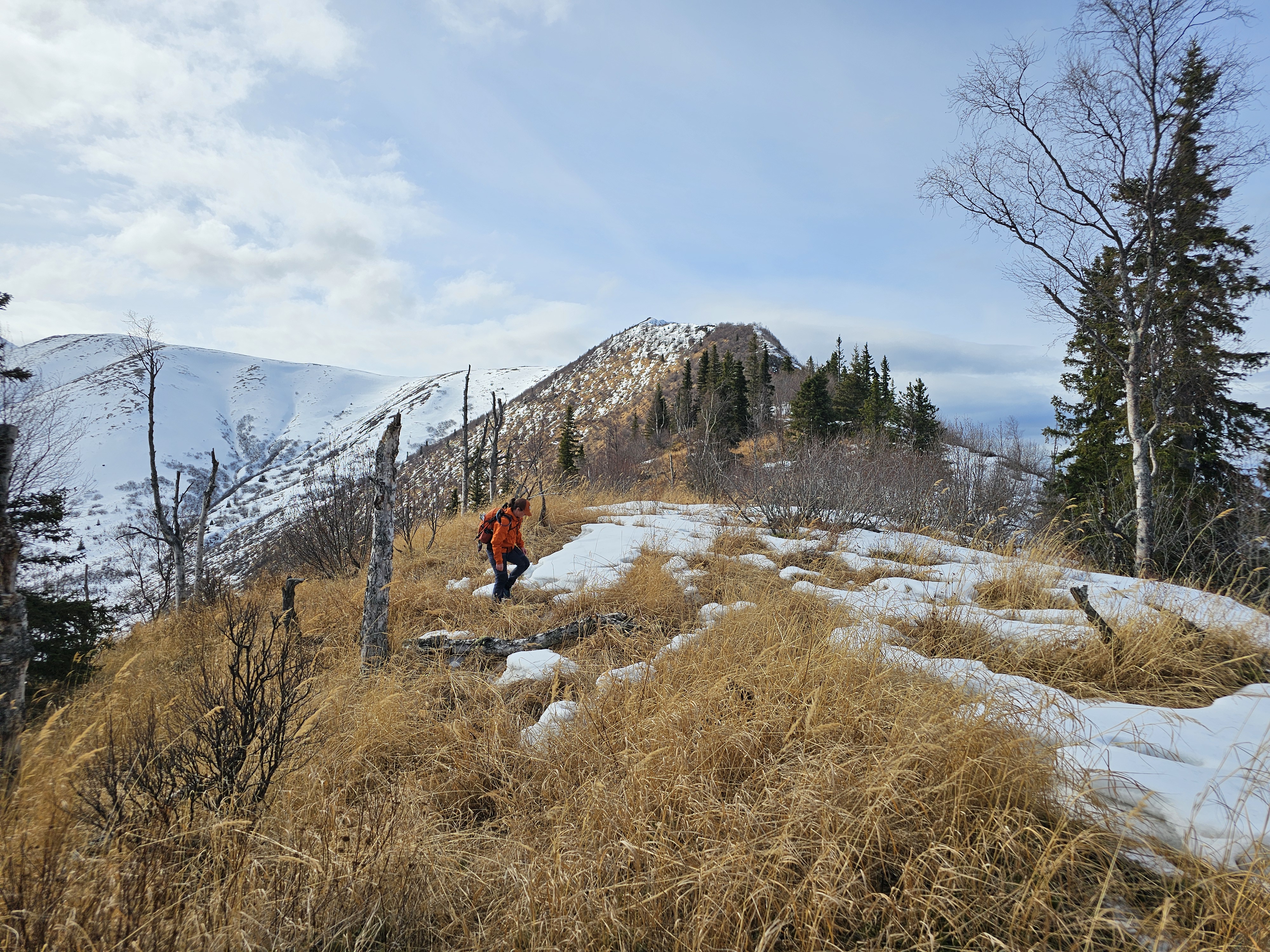
The ridgeline we would be following down towards Thunderbird looked promising from the summit, snow blanketing the west face, but the wide ridge looking relatively snow free. We set off into the unknown, recording some new tracks on our gps apps.

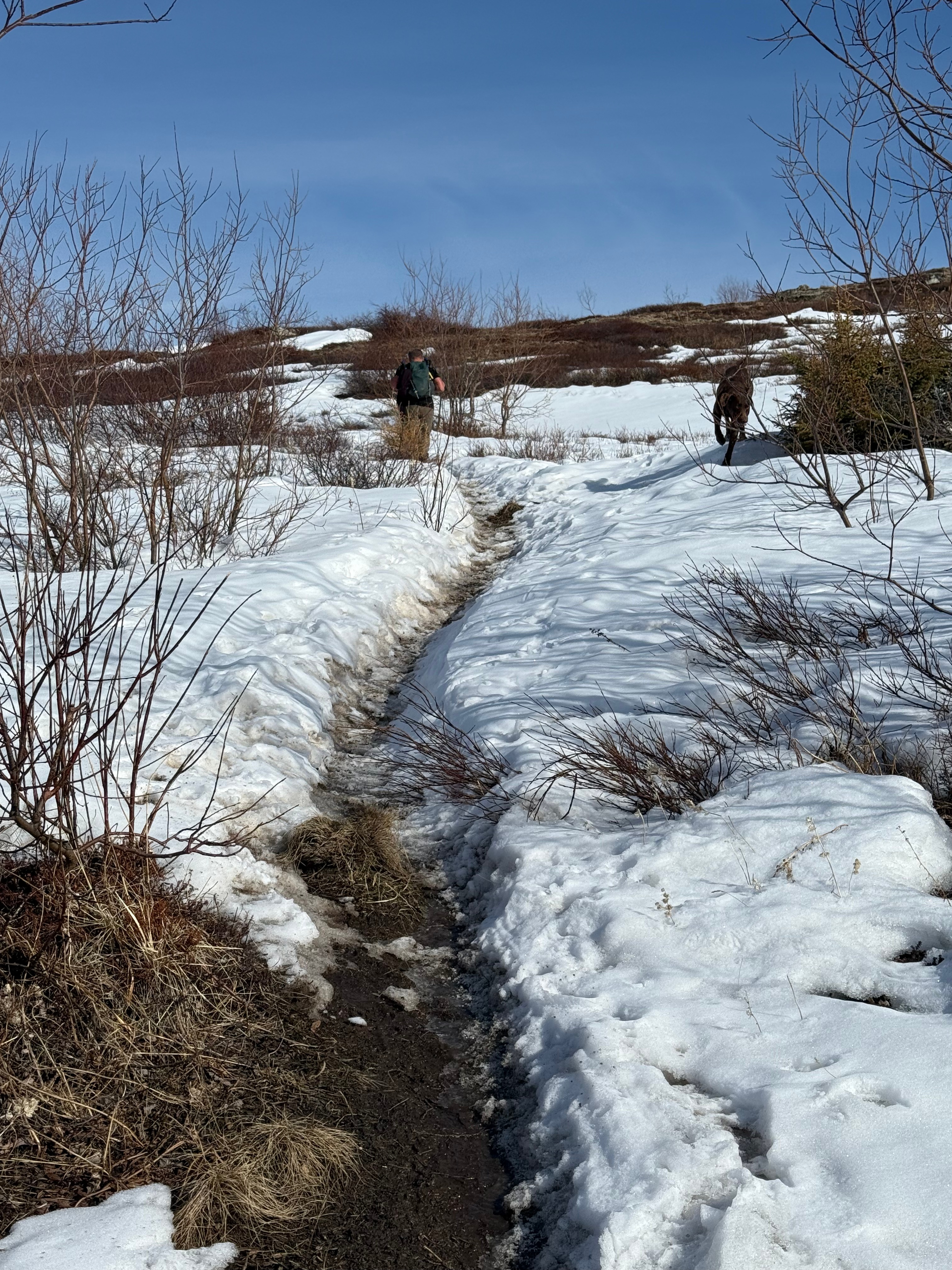
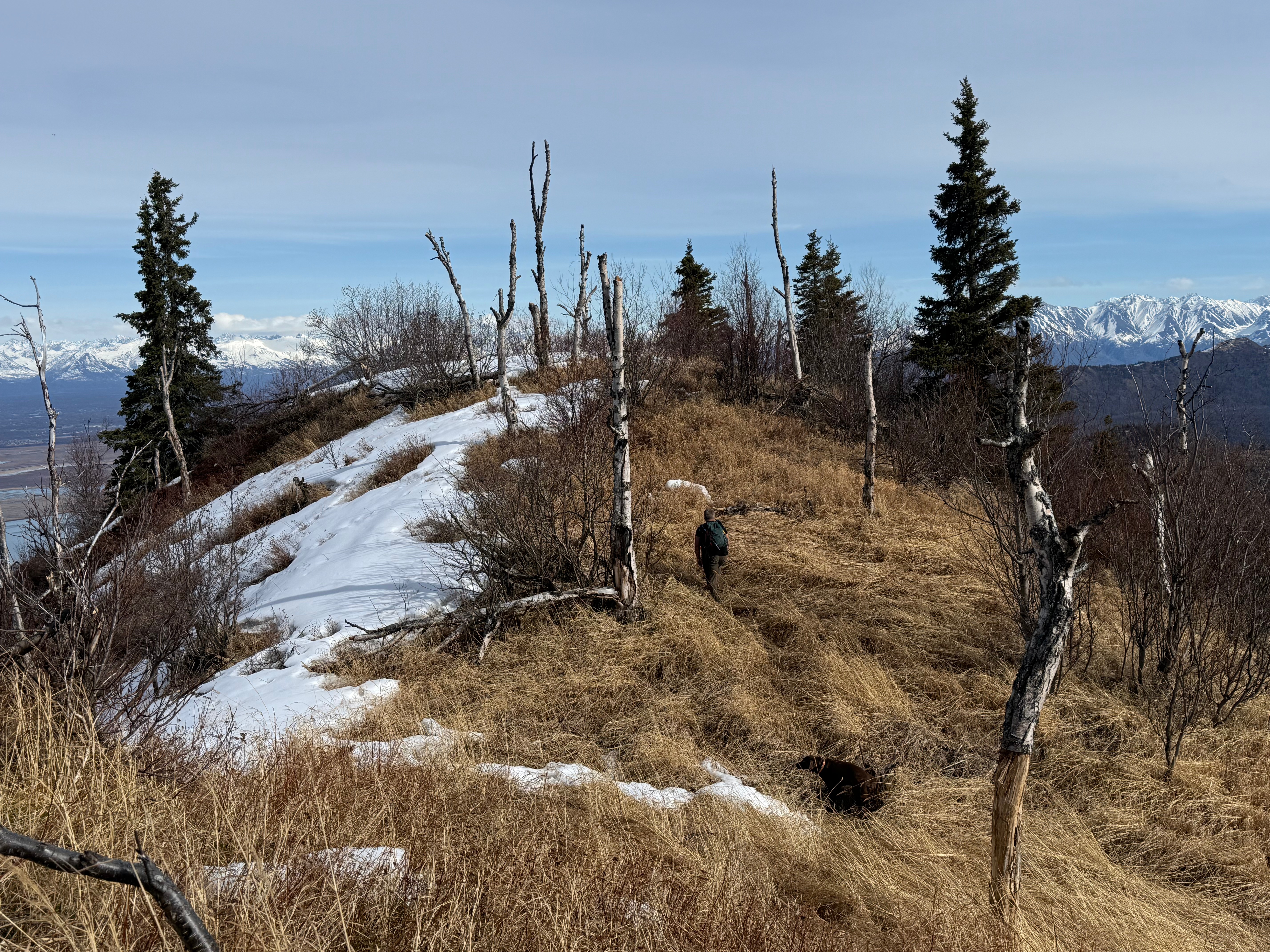
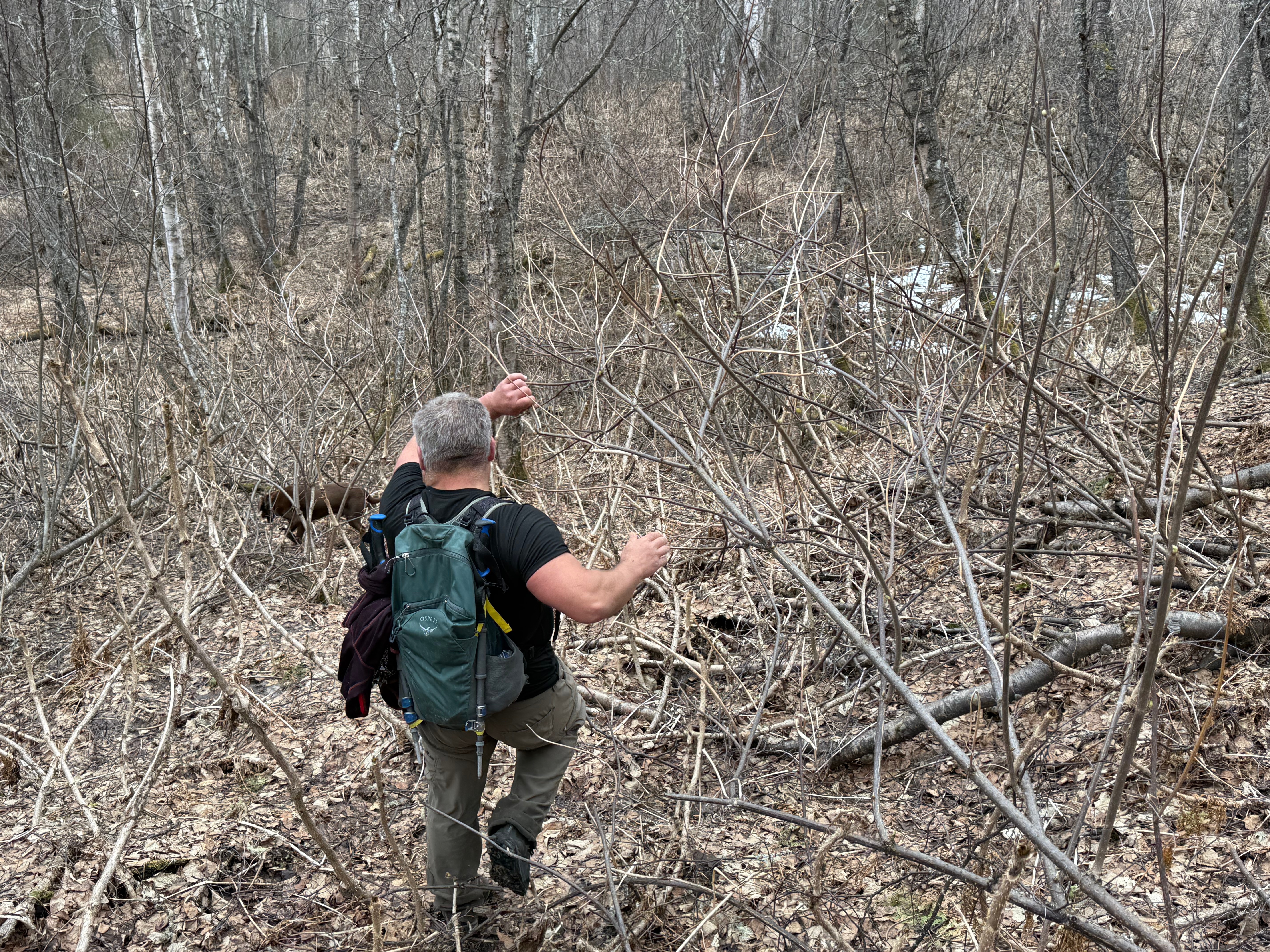
Initially, we had no issue with snow and enjoyed an easy tundra walk, but the conditions quickly changed as we descended to the north. The footpath disappeared and was replaced with waist deep, breakable crust snow. We floundered along, not willing to turn back and call this a failure. We could see the snow would peter out in less than half a mile, so we continued on.

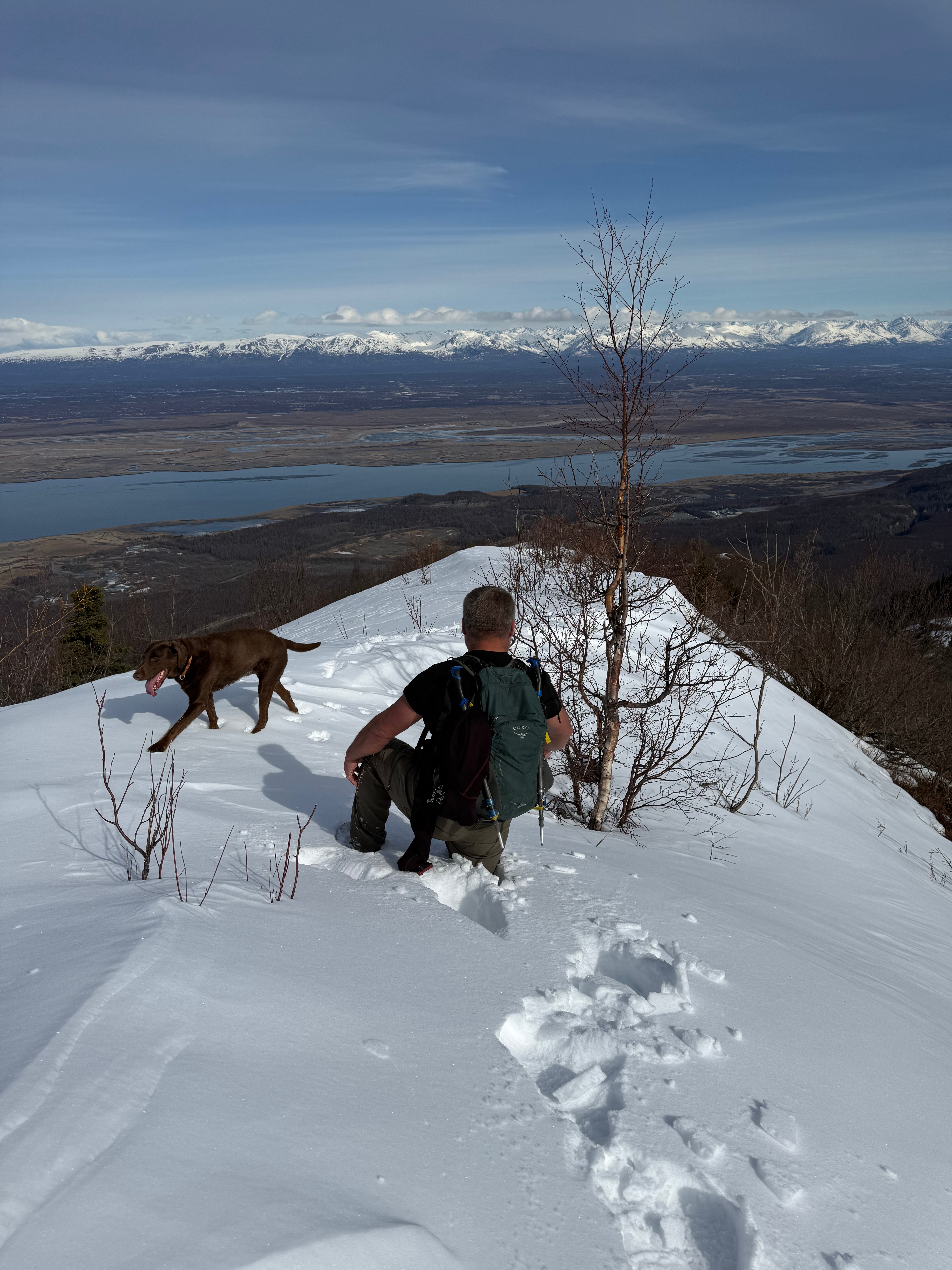
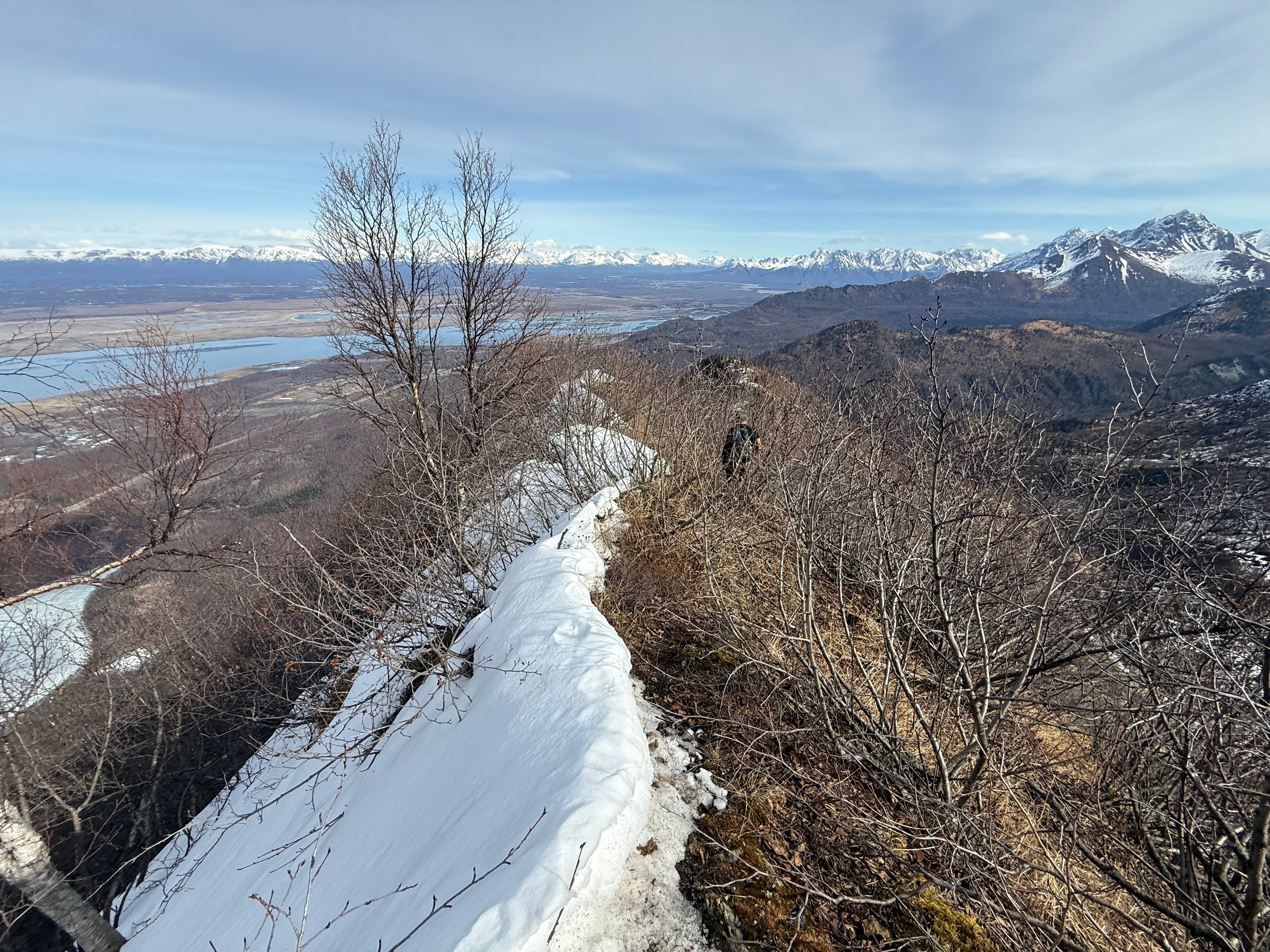
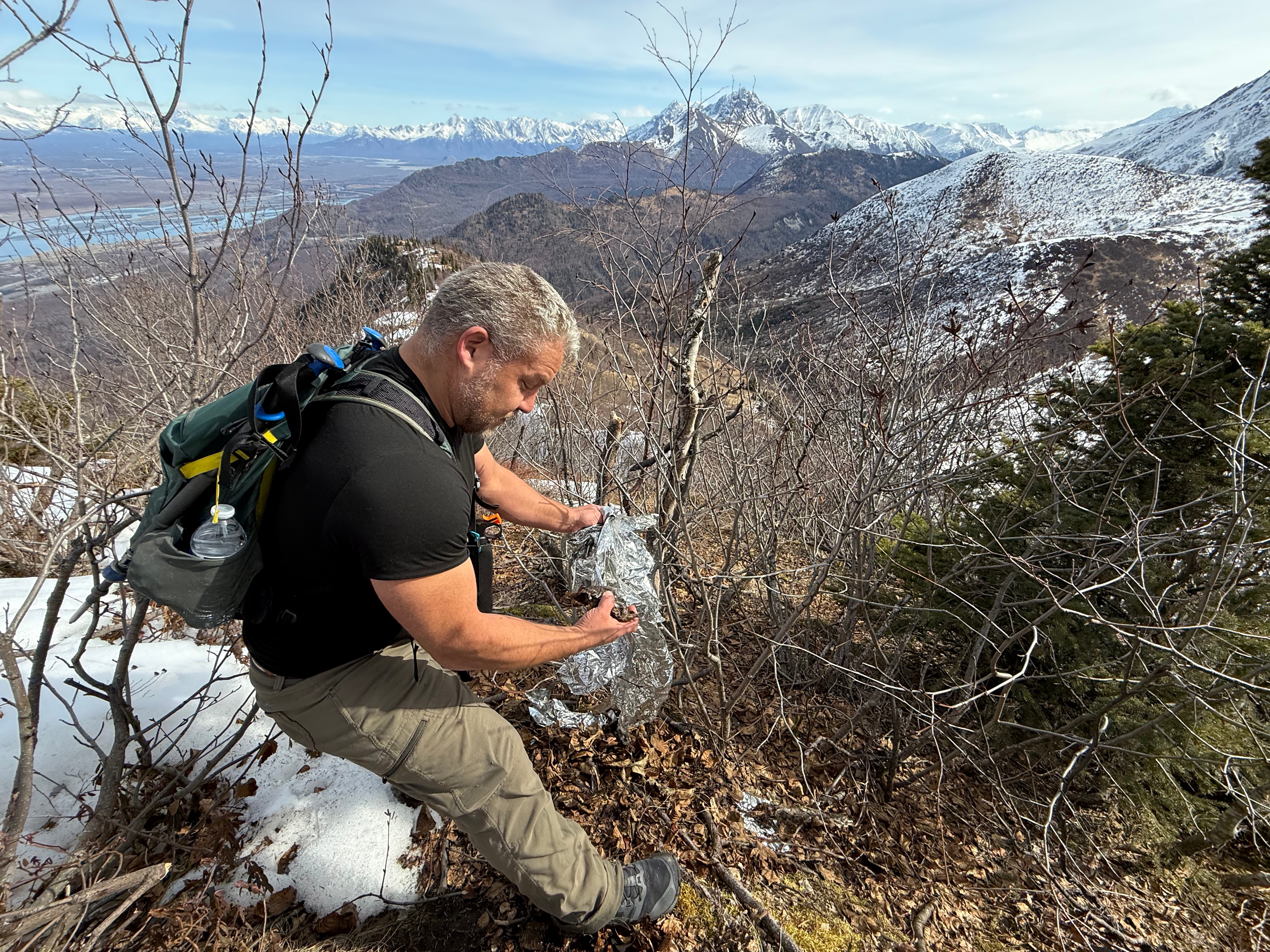
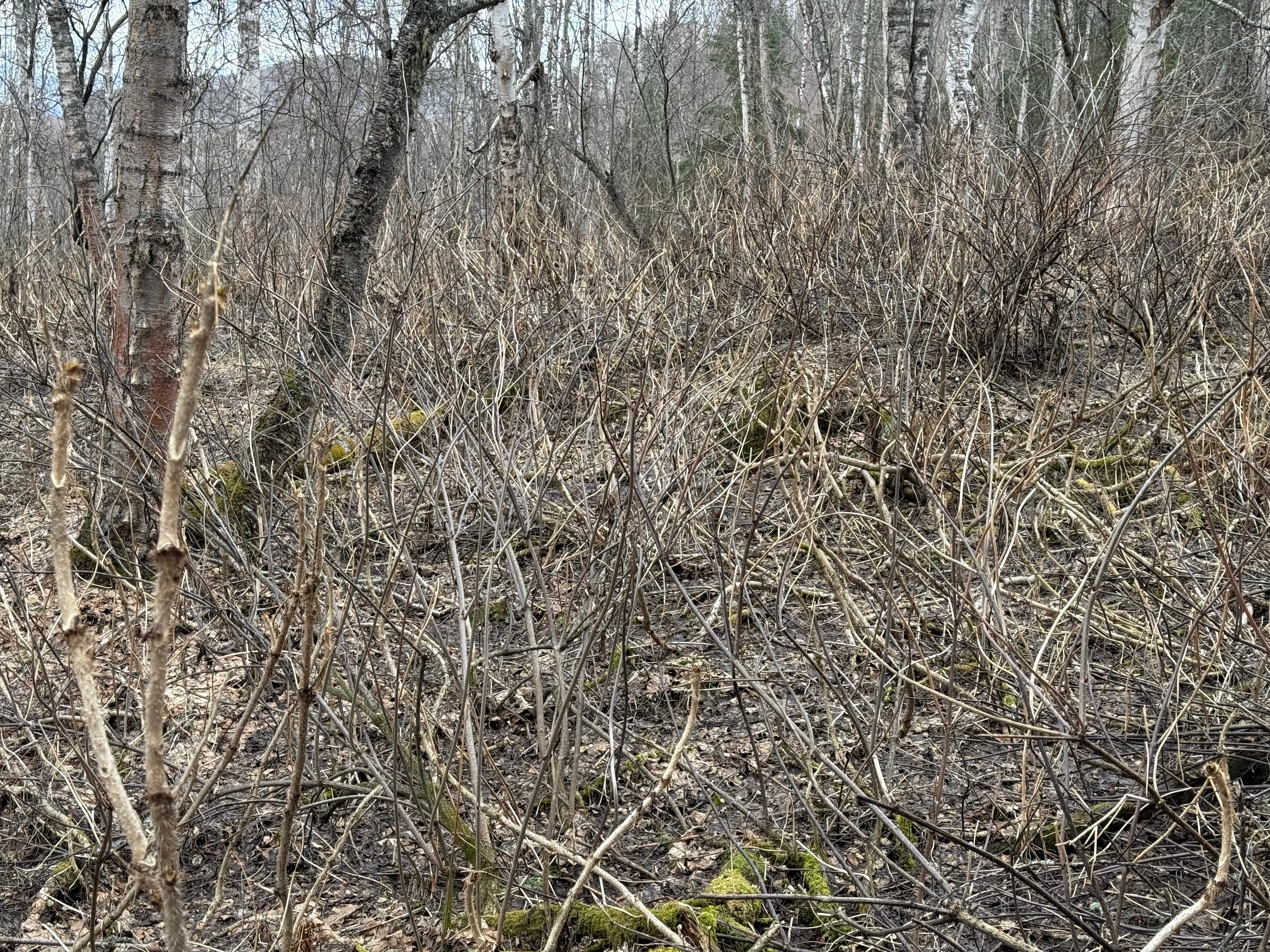
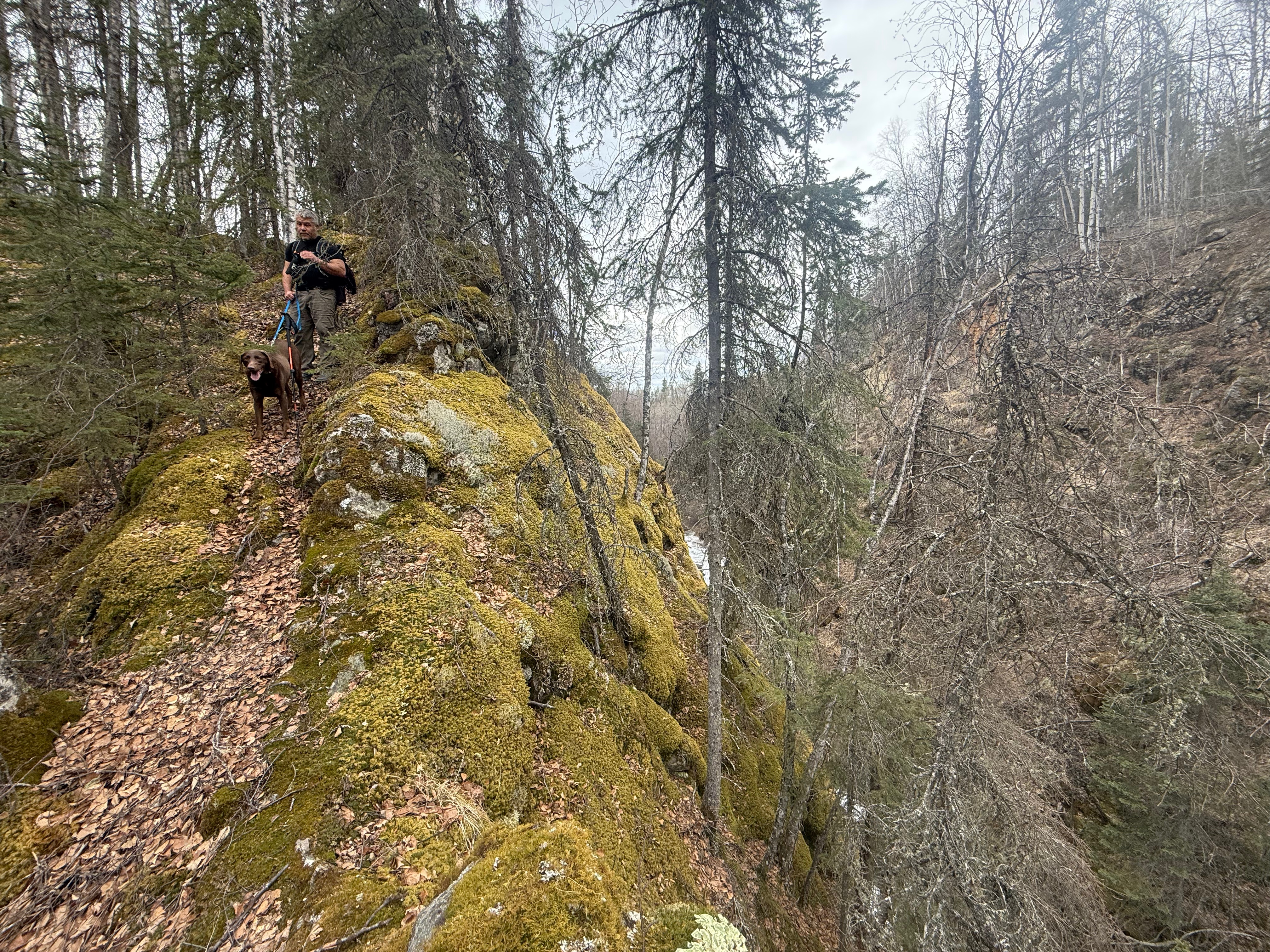
The deep snow turned to alders, the trail now completely gone, and it was obvious that no one had walked here in a very long time. Jason did find signs of humans, though, when he came across an emergency blanket and a hand warmer frozen to the ground amongst the alders. We wondered what had happened here and packed up the trash to haul out.

When the alders opened into grassy fields, we were relieved… until we took our first steps. The grass had grown and matted over many years, completely covering hidden leg breakers… downed trees. We gingerly picked our way through the grass minefield and only once did I fall into a hole and nearly cry from what would surely be a fine bruise on my shin.

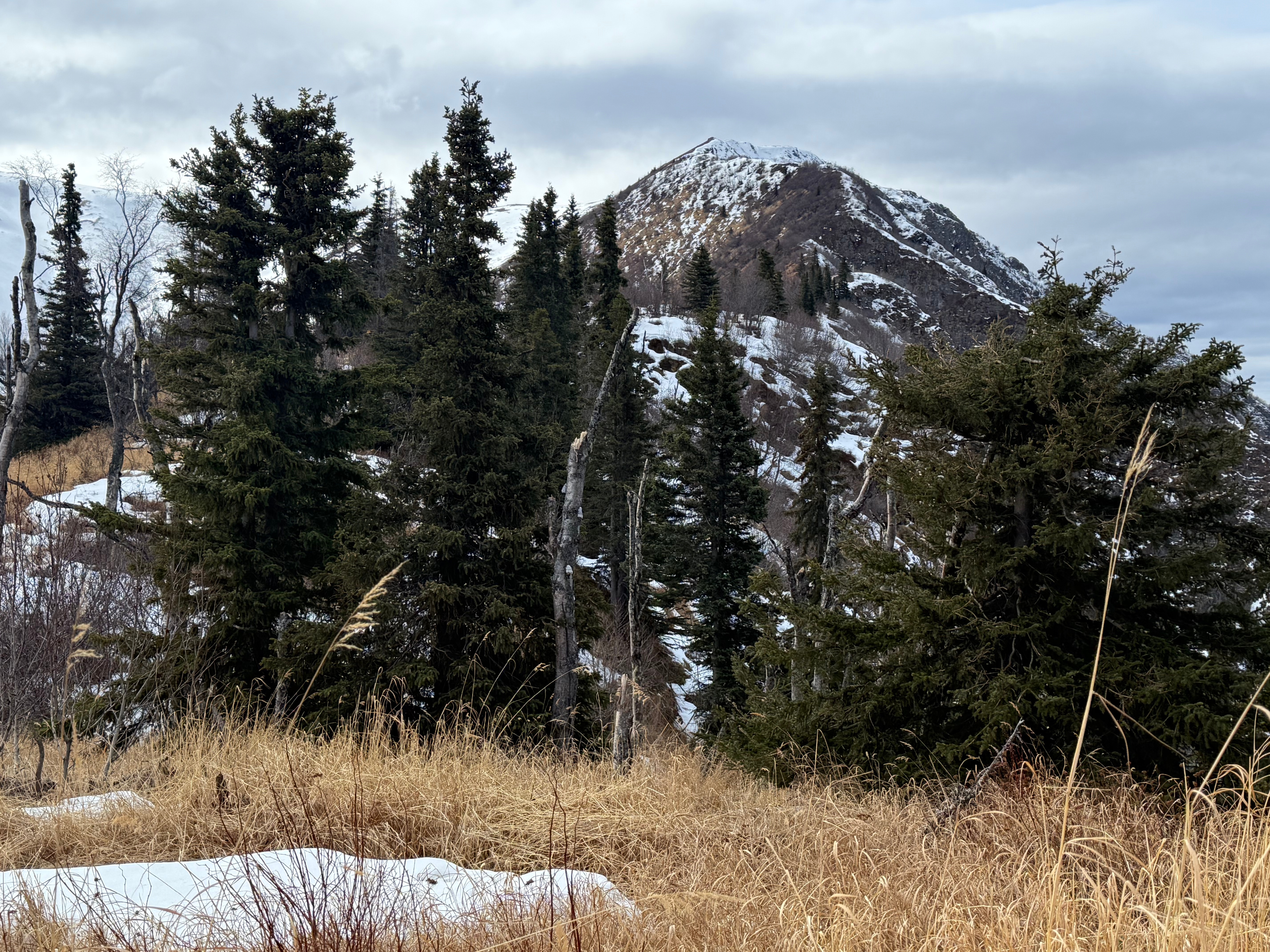
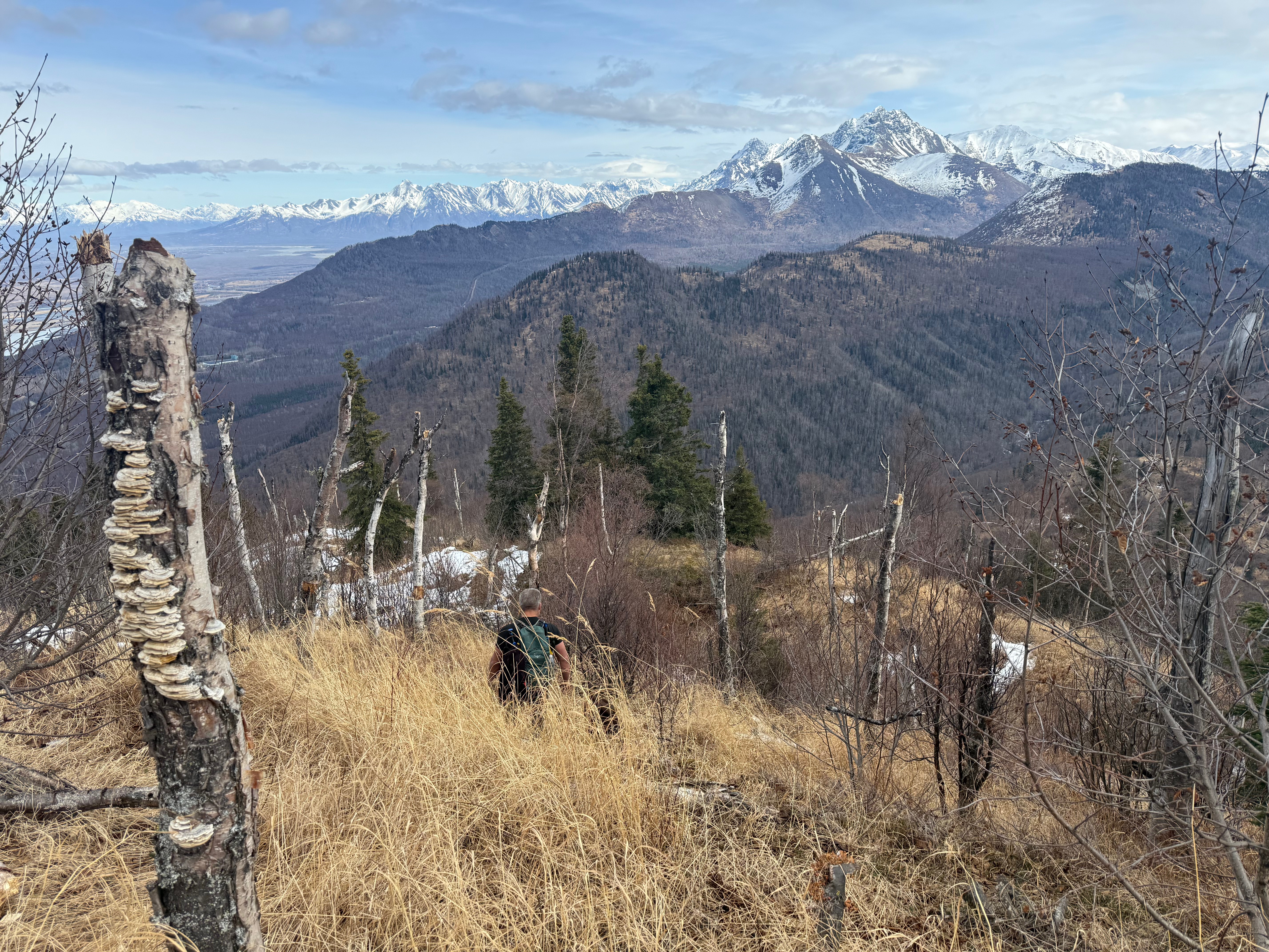
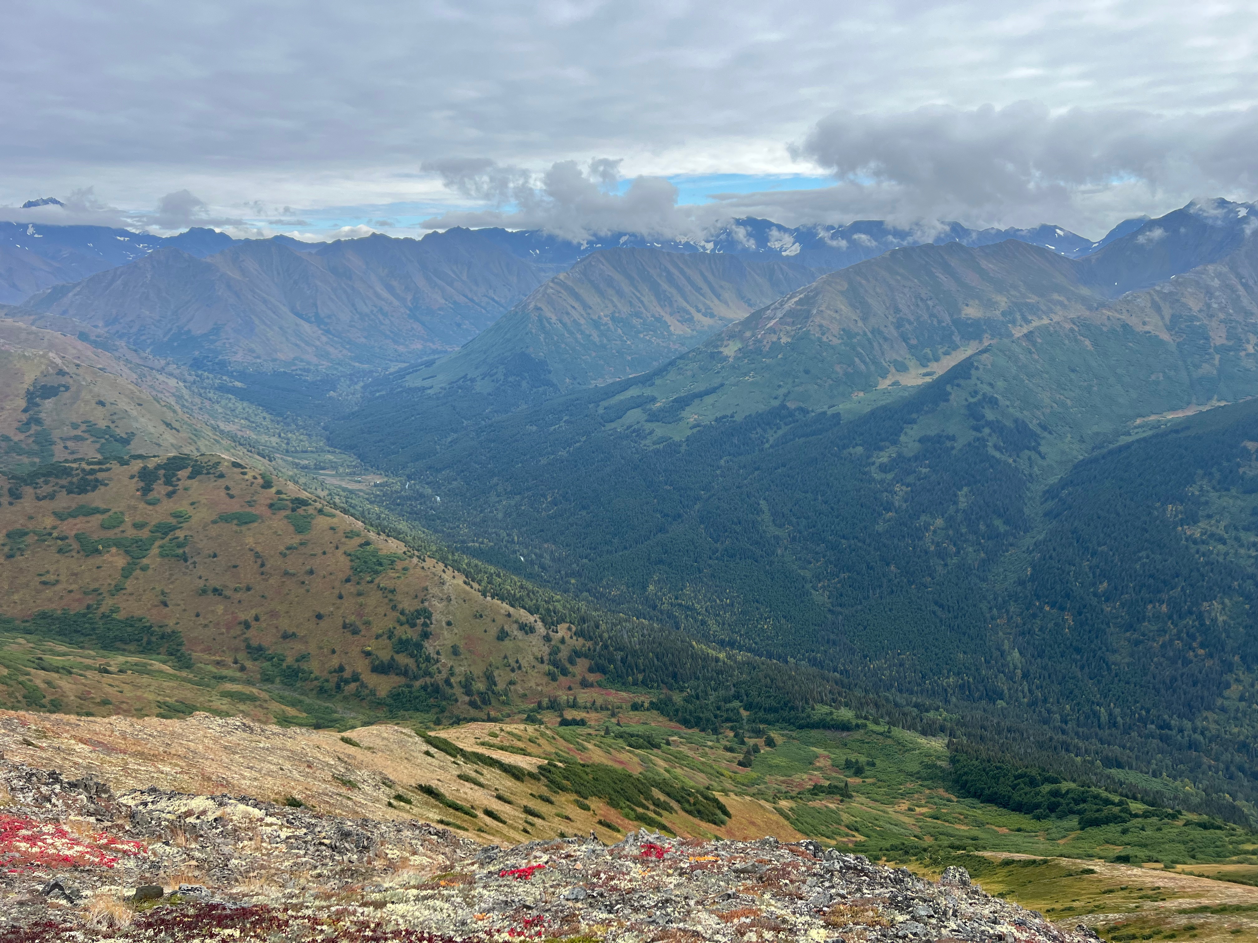
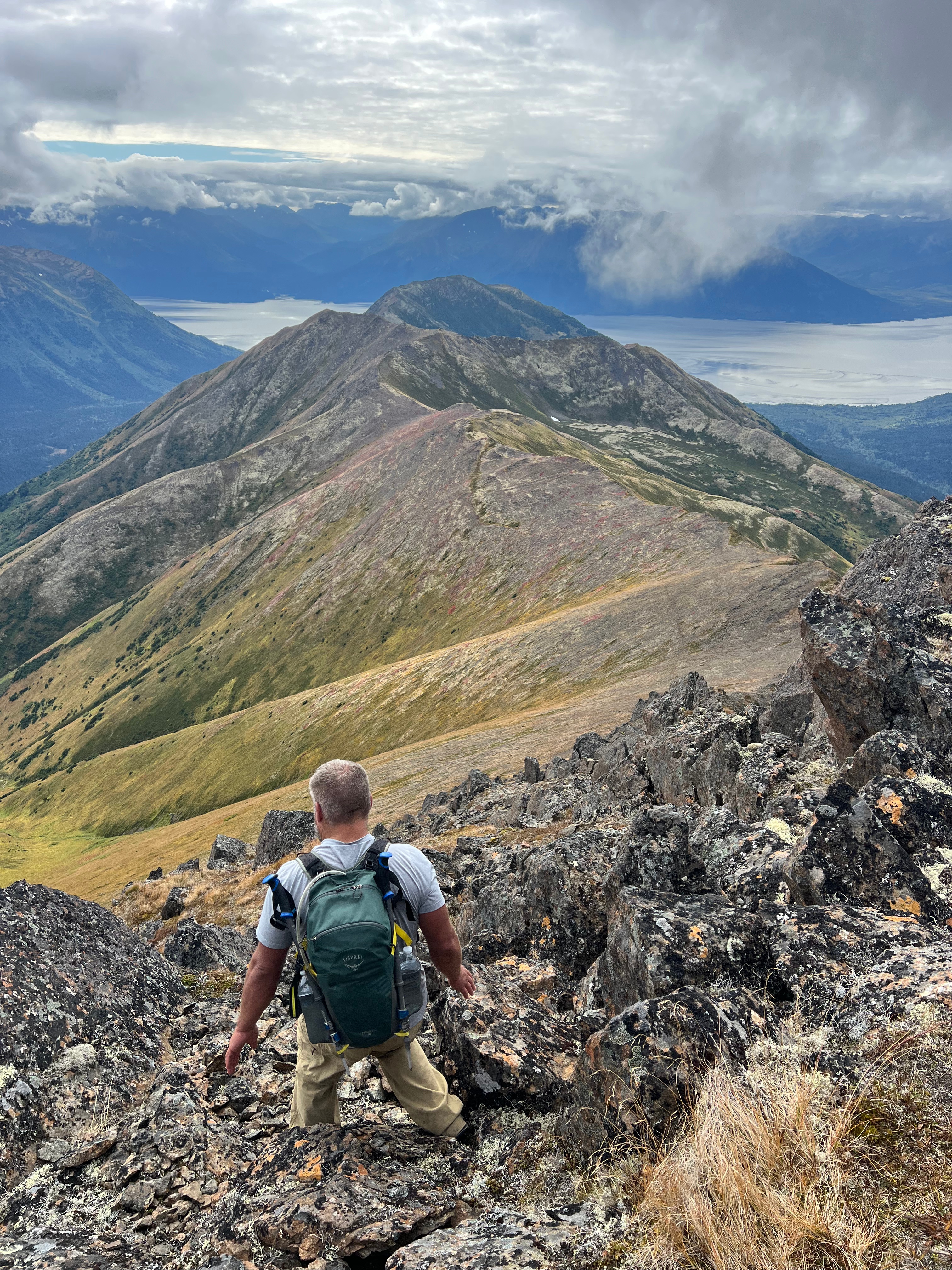
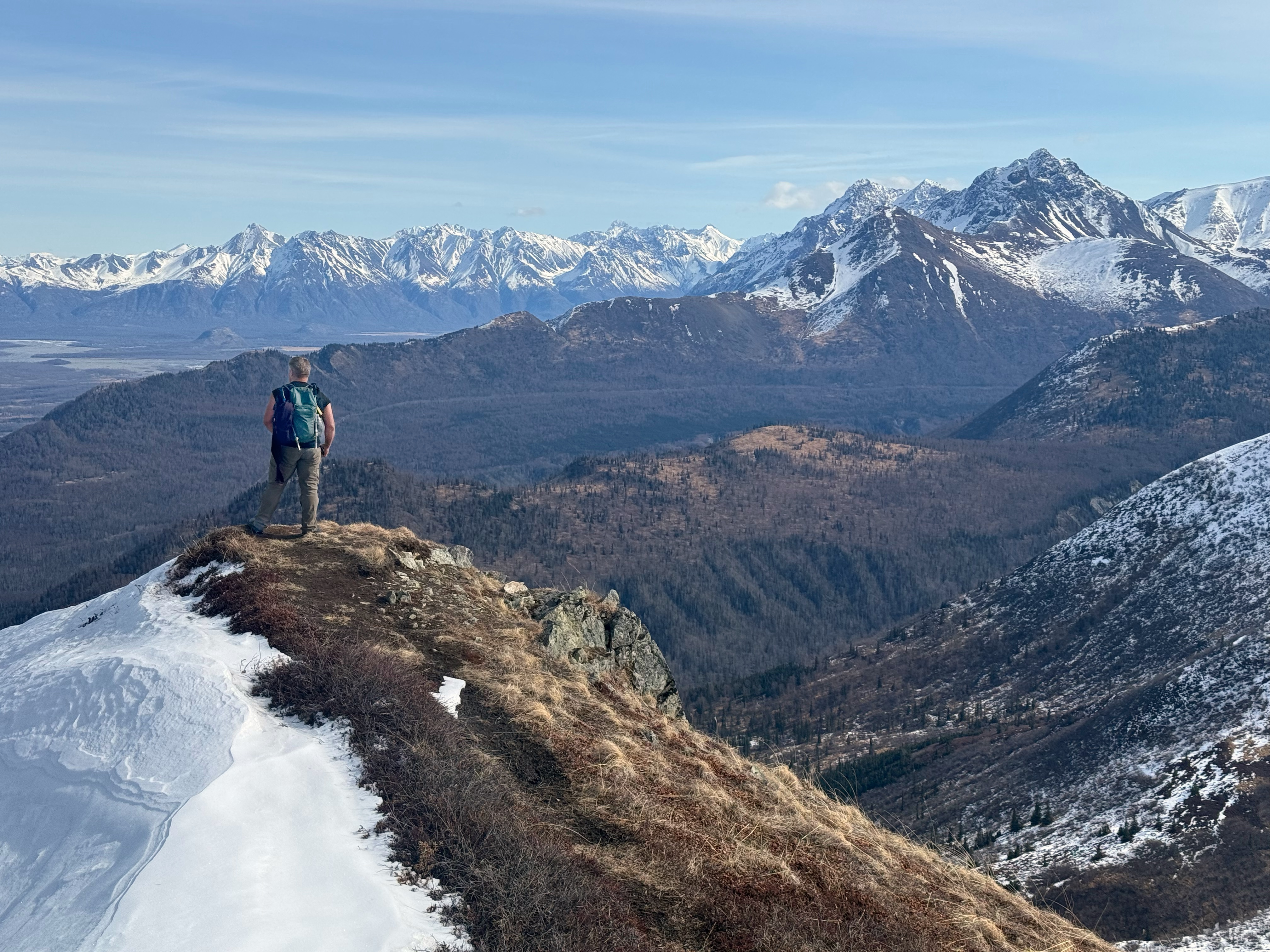
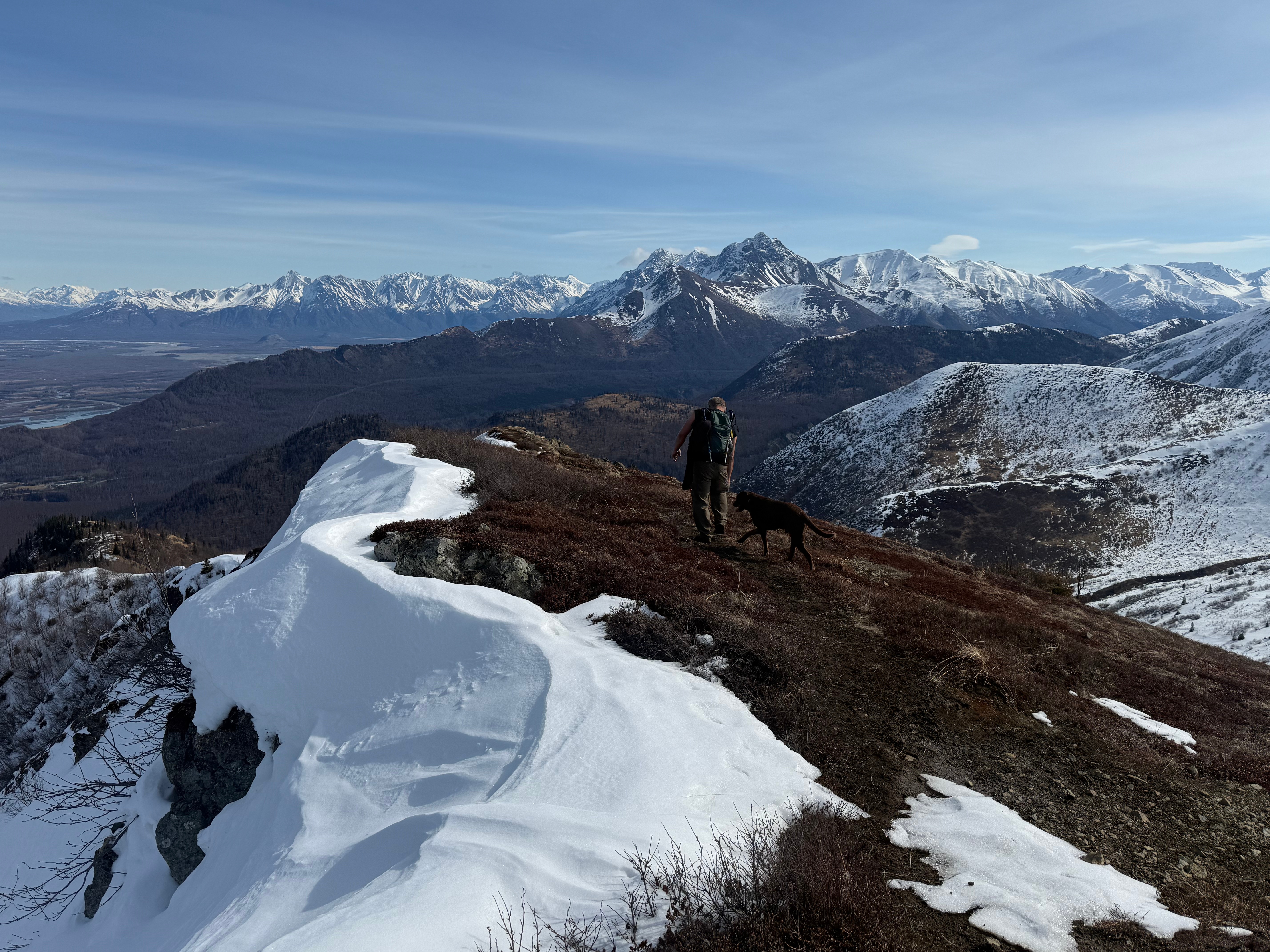
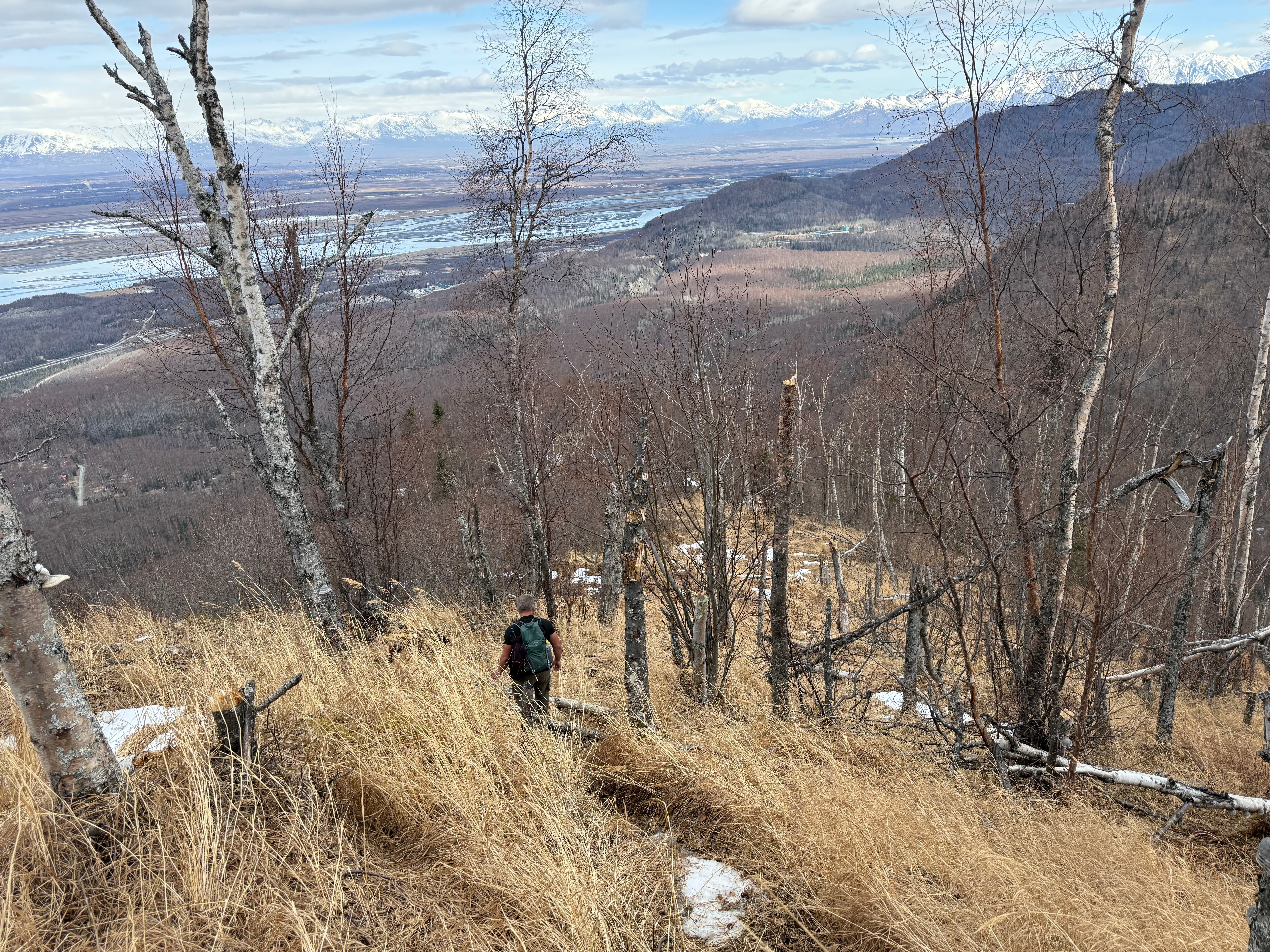
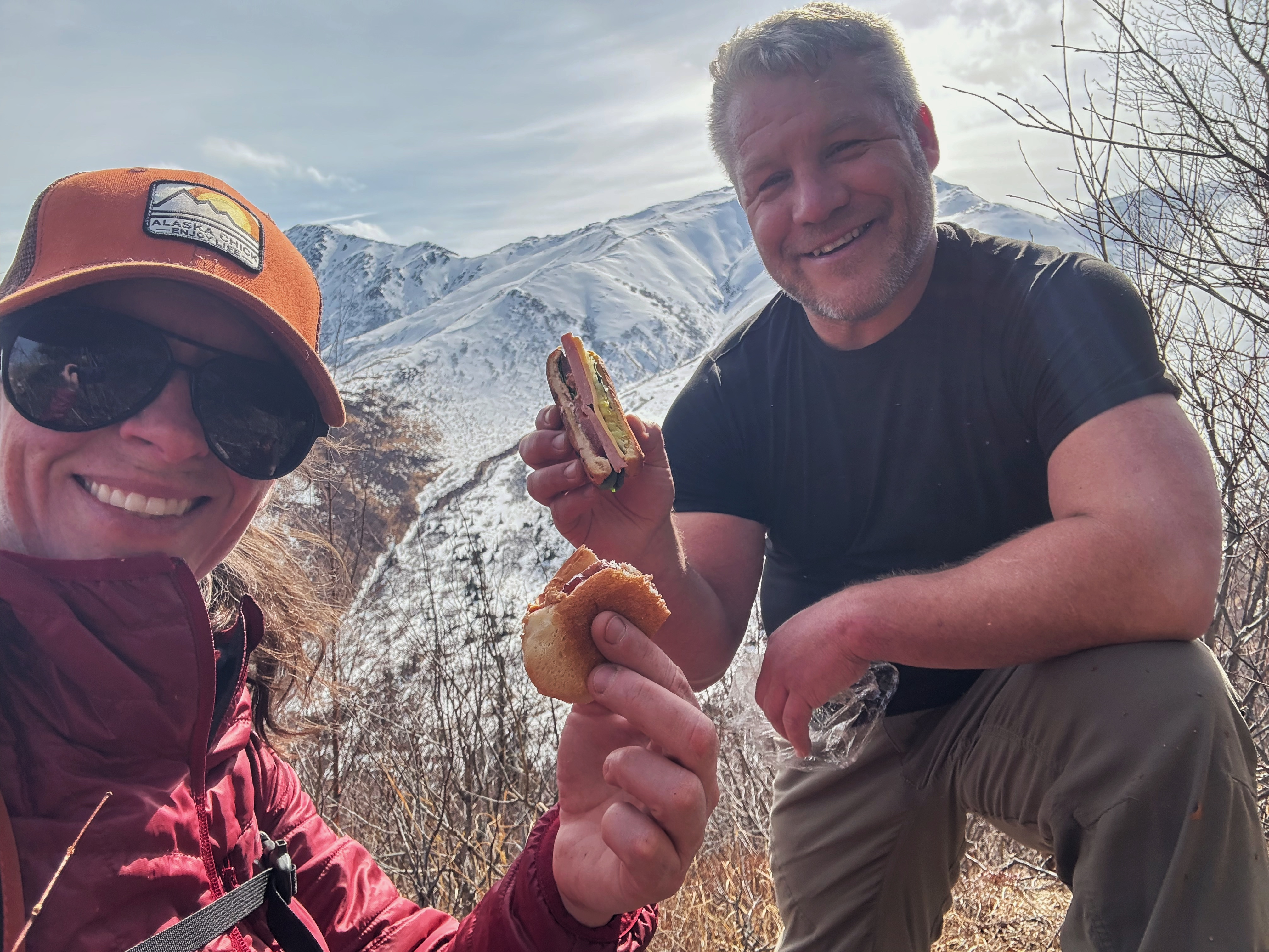
We desperately needed a lunch break and some time to regroup. Bushwhacking is both physically and emotionally draining and we were ready to sit down for a few minutes. We had an amazing view of Mt Eklutna and, my favorite, Peak 1222, while we ate our sandwiches, and soon we felt revived and ready to go.

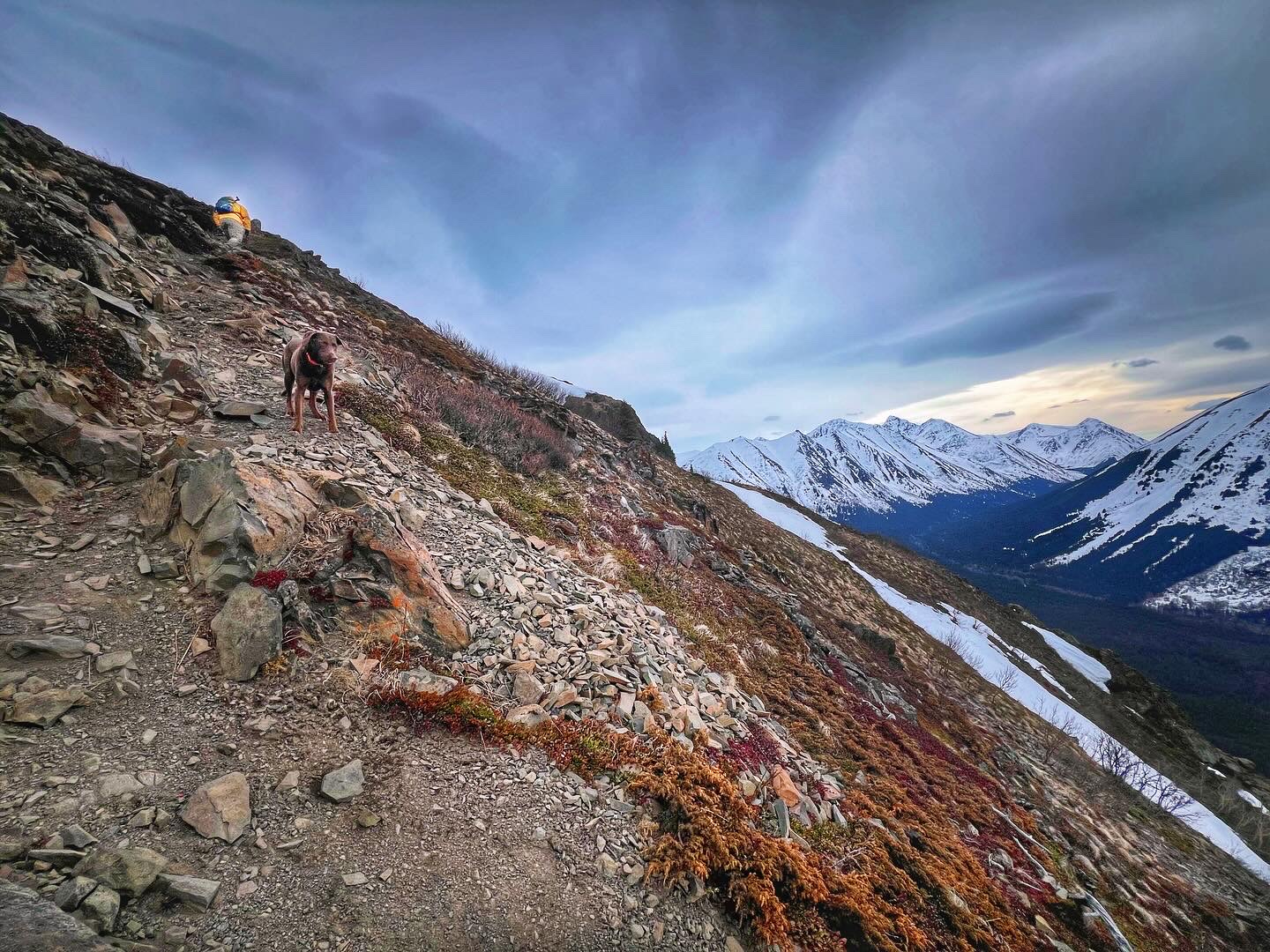
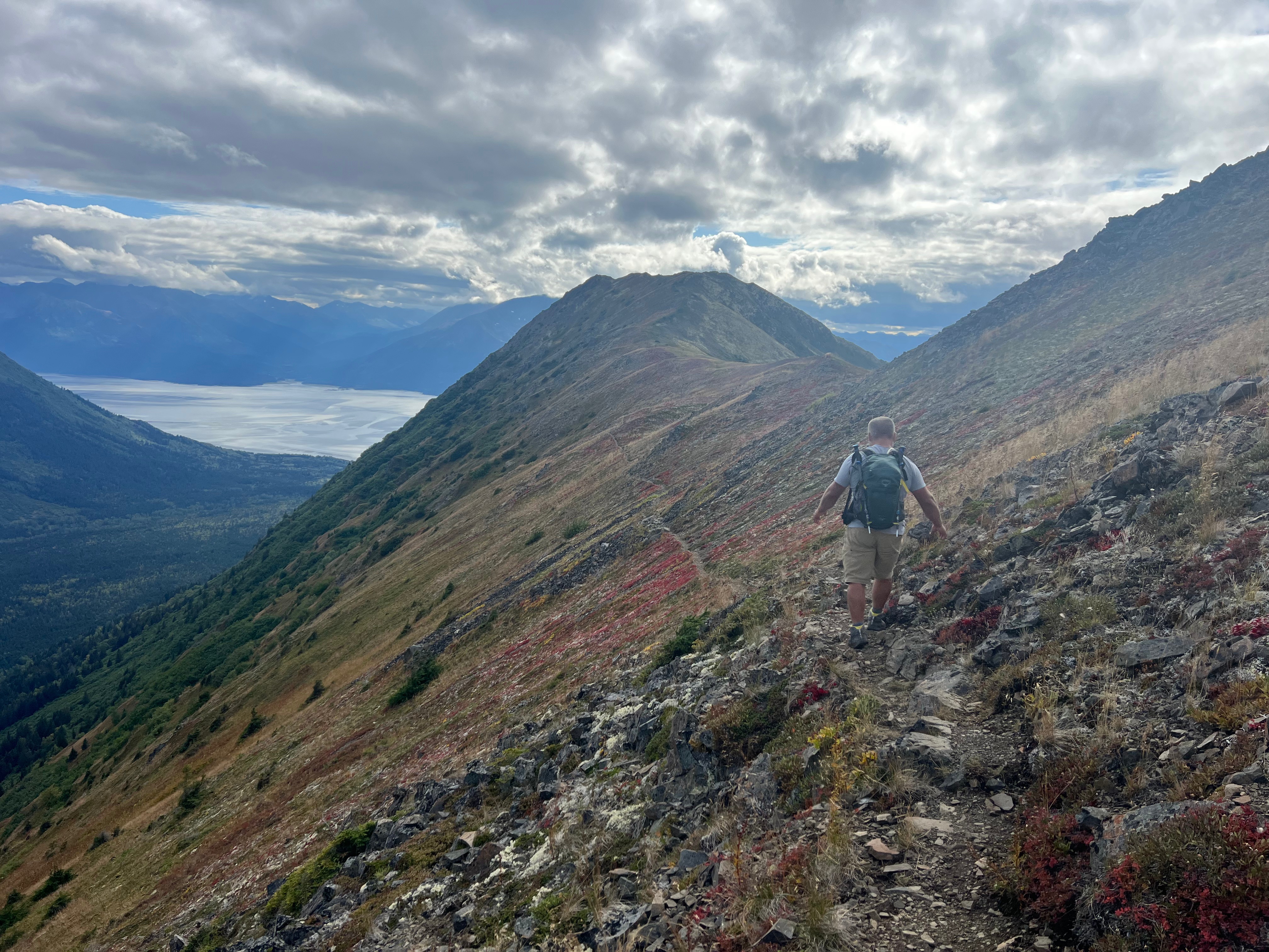
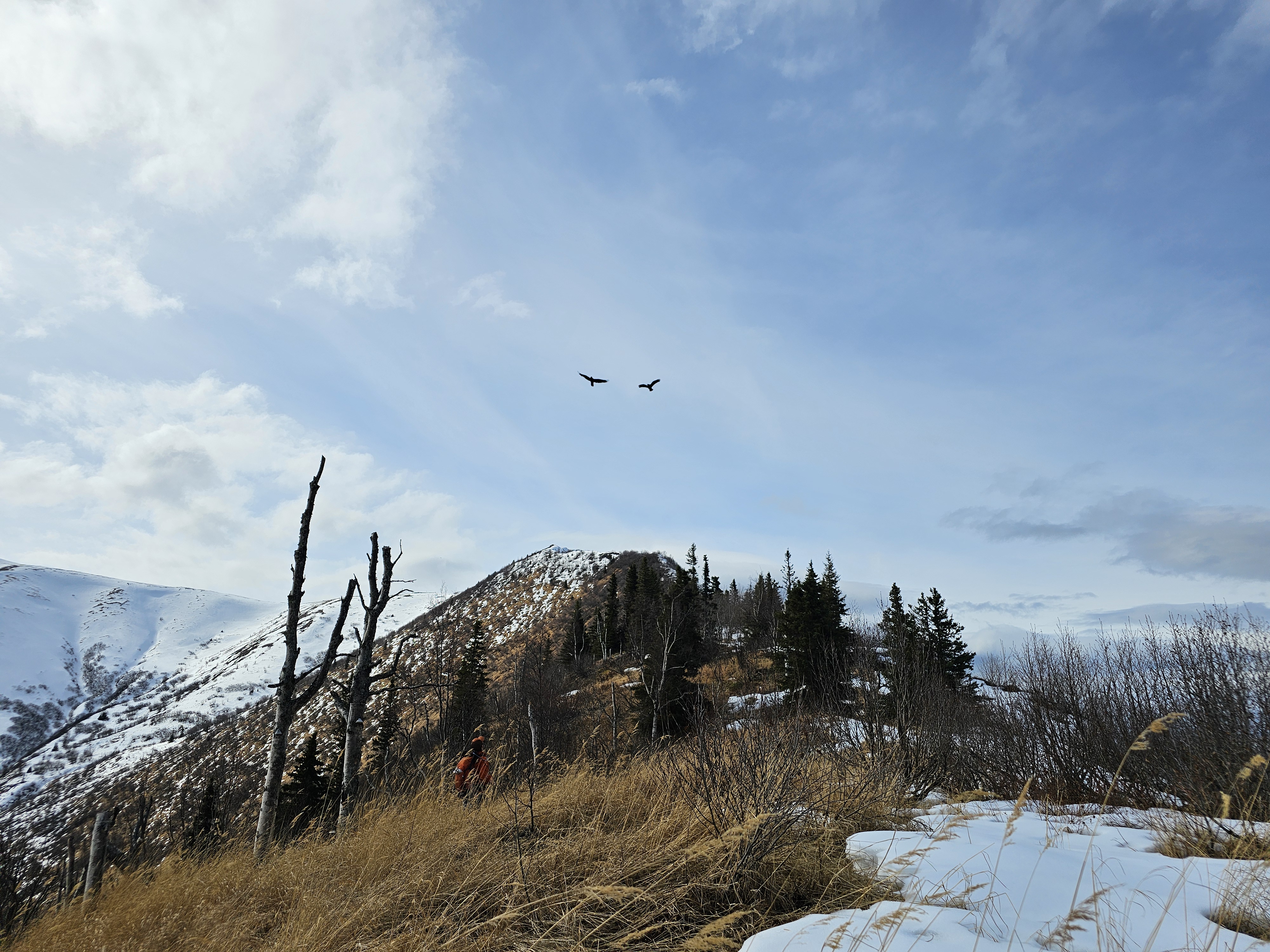
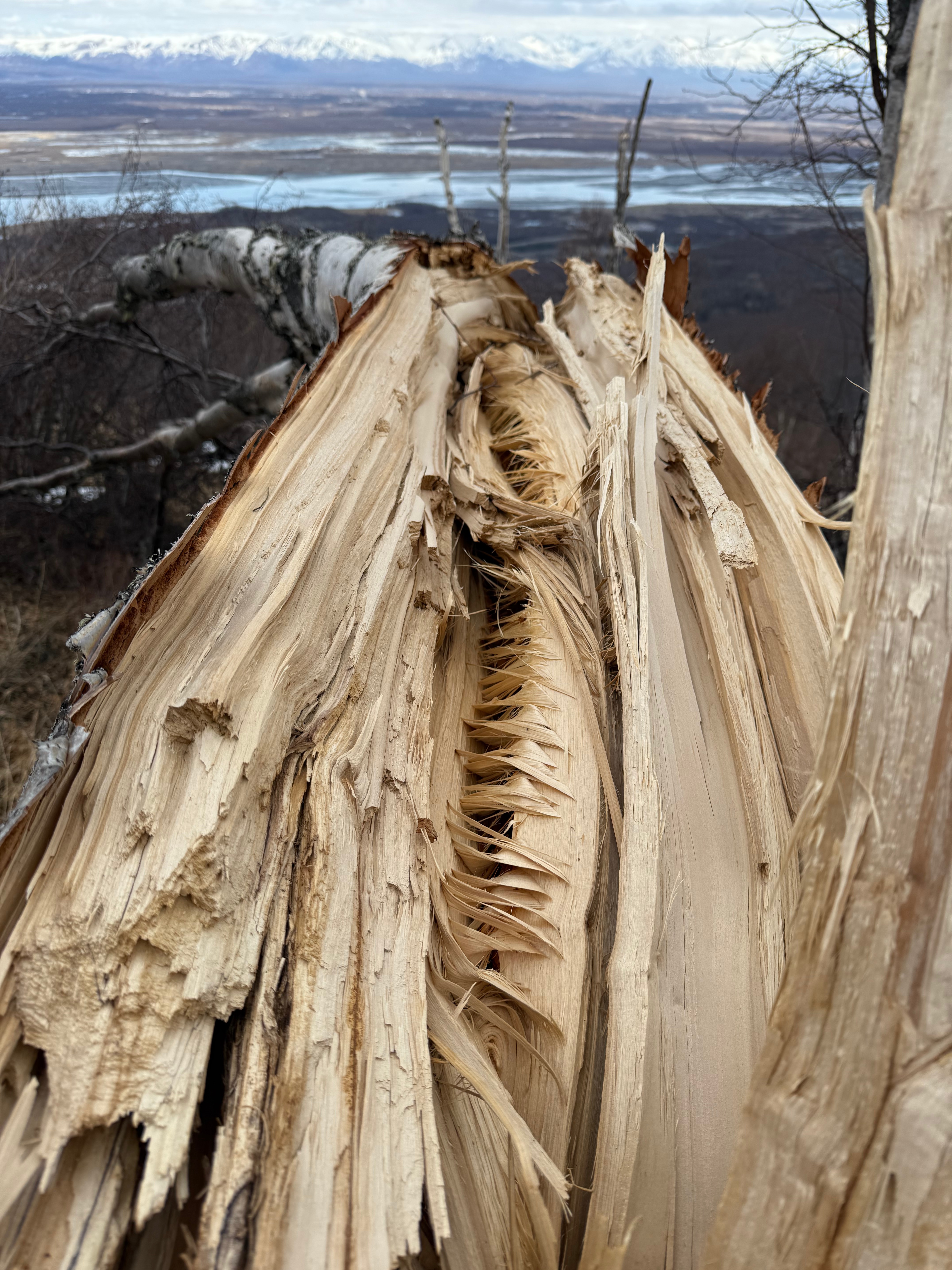
Onward we descended, alder bashing and crossing “danger grass.” Three eagles came to visit us, circling overhead, and we wondered if they were the same ones we had seen just a few days prior near POW. We began to notice that many trees, some multiple feet in circumference, had been blown down over the winter, in some areas nearly 40% of the trees were no longer standing. The new danger became widow makers, AKA dead heads. We gingerly chose our route over and around them to ensure we would not be killed by a silly mistake.

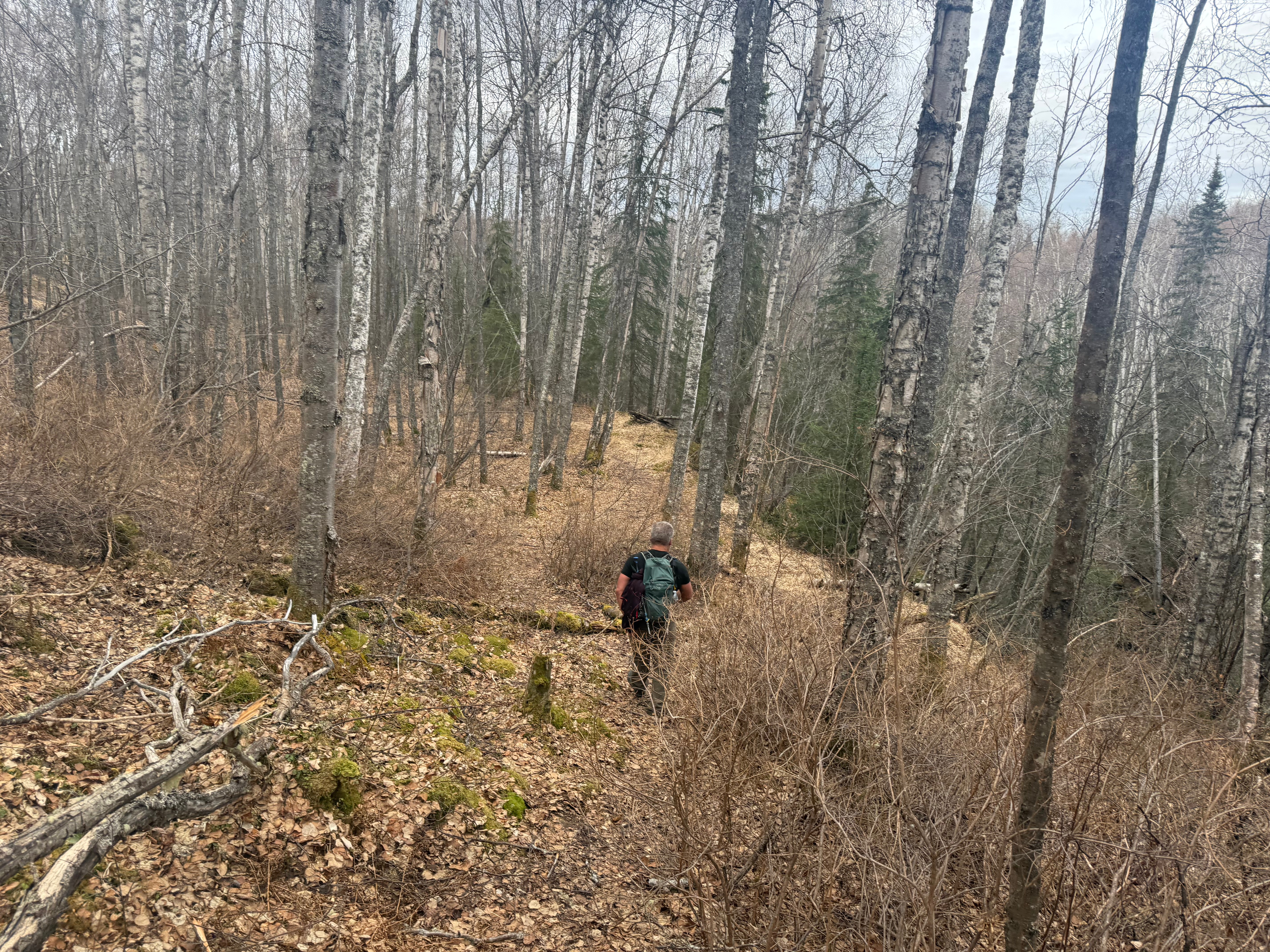
Just when we thought we had reached the end of the alder bashing and leg breaking grass, we came upon the last thing we wanted to see… Devil’s Club. Fields of it. We pushed on through, collecting thorns in our body, but grateful that we weren’t doing this in the middle of the summer. The dead, thorny branches are much easier to deal with than the fully blooming plant!

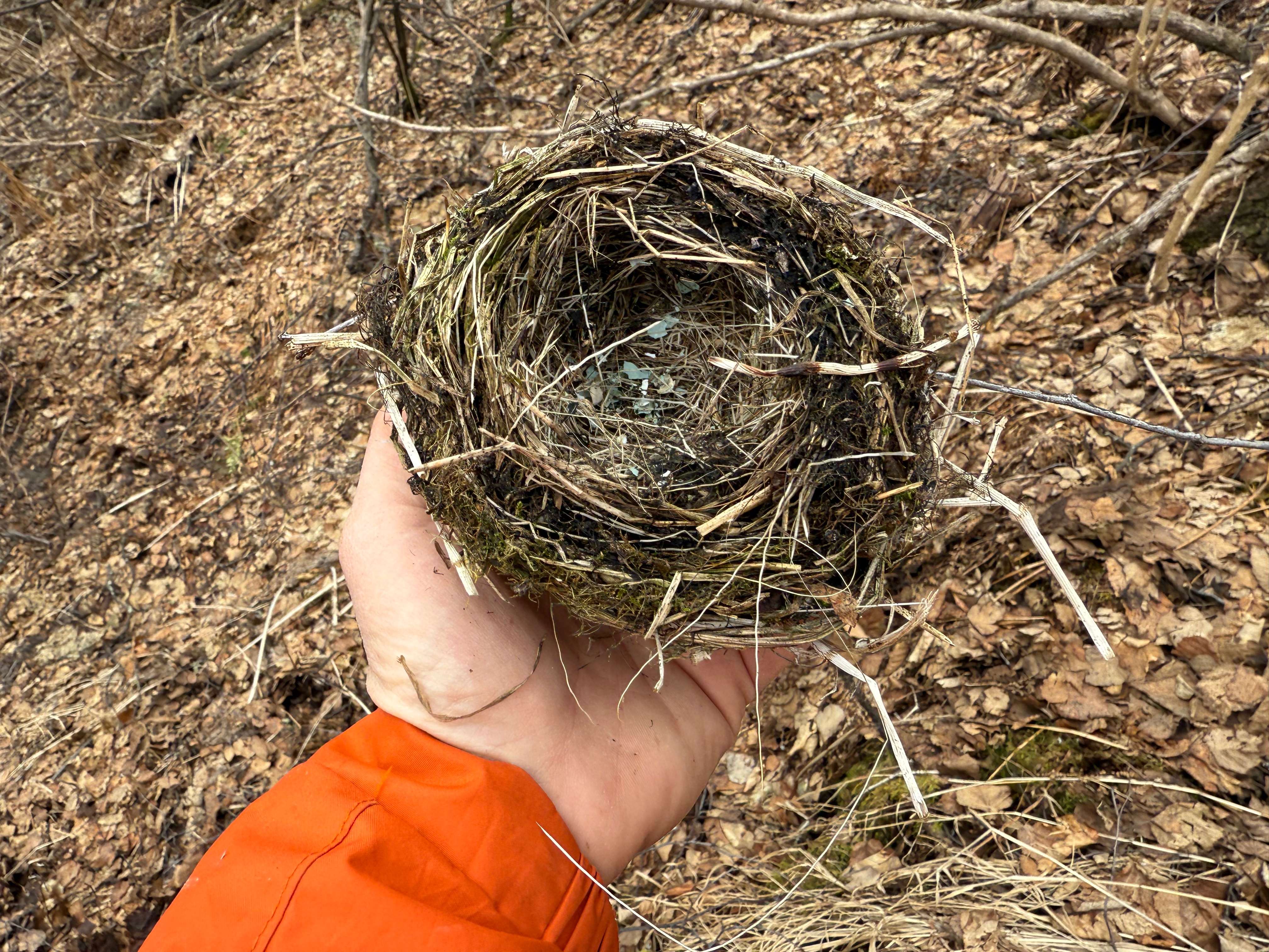
We were aiming directly for Thunderbird Creek, just bashing our way through anything in front of us, and somehow, I looked down at just the right time to see a bird’s nest sitting on the ground. Remnants of eggshells inside, I wondered if the babies were healthy and grown or if the wind or a predator had cut their existence short.

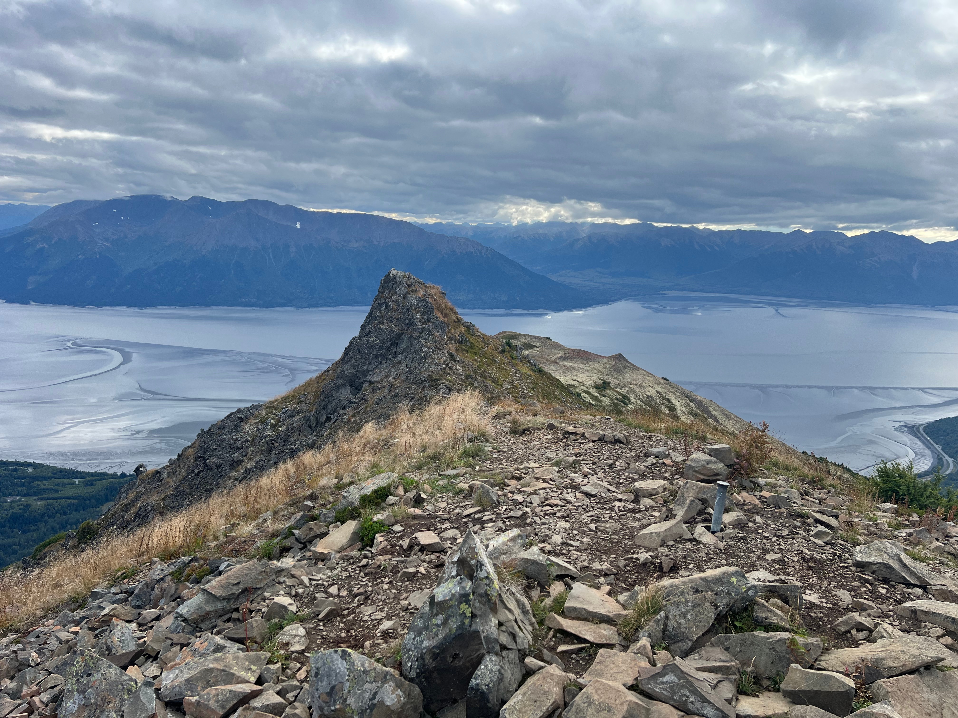
Suddenly, we came to a path, the one I had hoped would be there, and we took a right turn up towards Thunderbird Valley to do some recon for crossing on a future hike we had planned. Only a few hundred feet up the trail, we came to a narrow ridge leading to a point overlooking Thunderbird Creek. A sign marking “Trail’s End” made an obvious statement, as the point dropped off precipitously, more than 50′ down to the water.

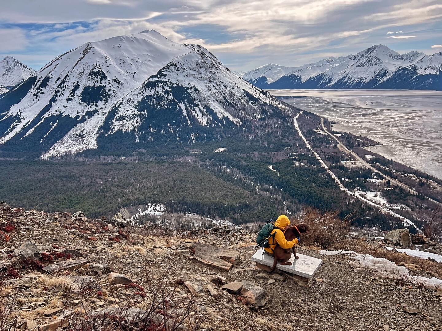
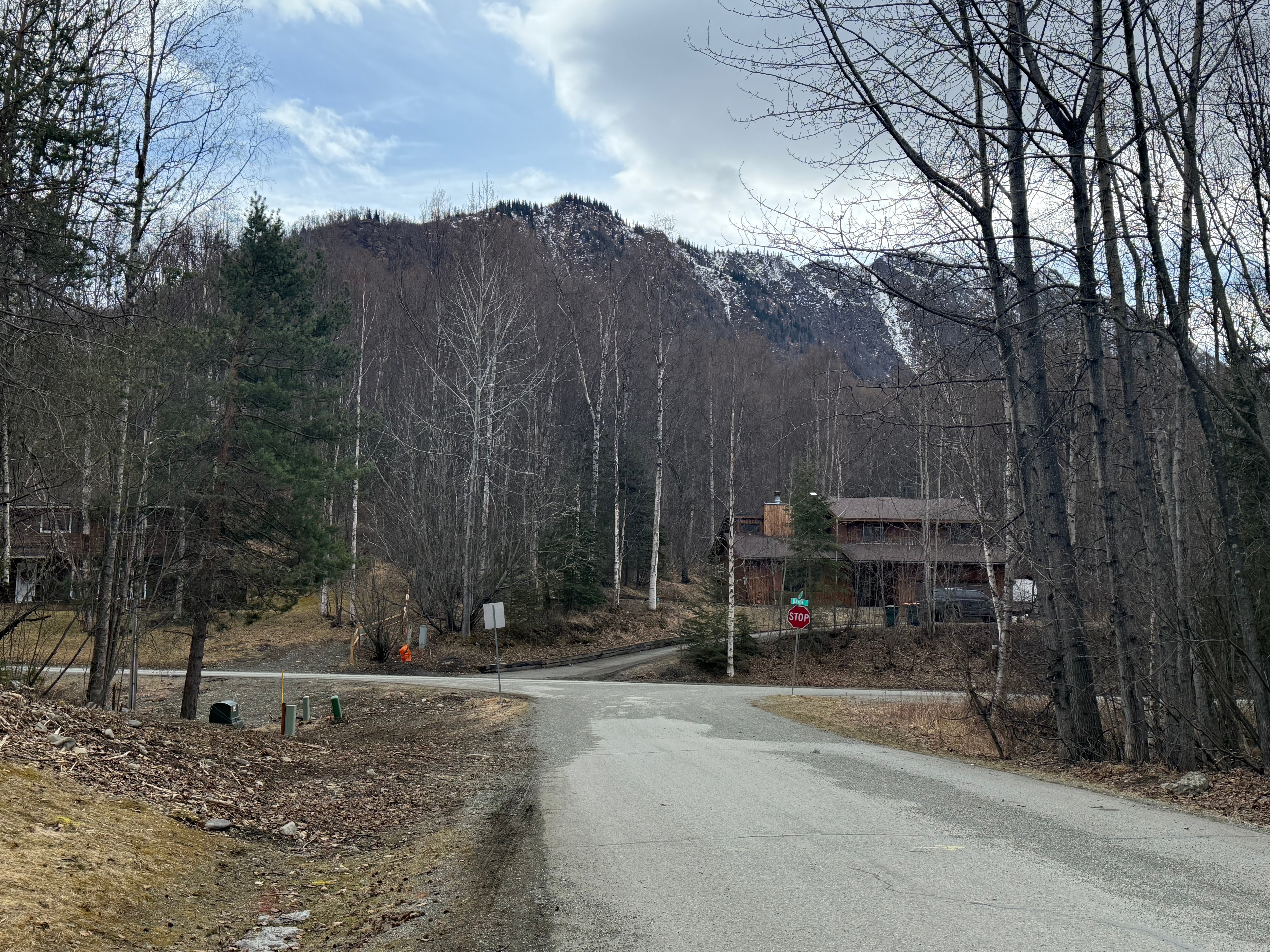
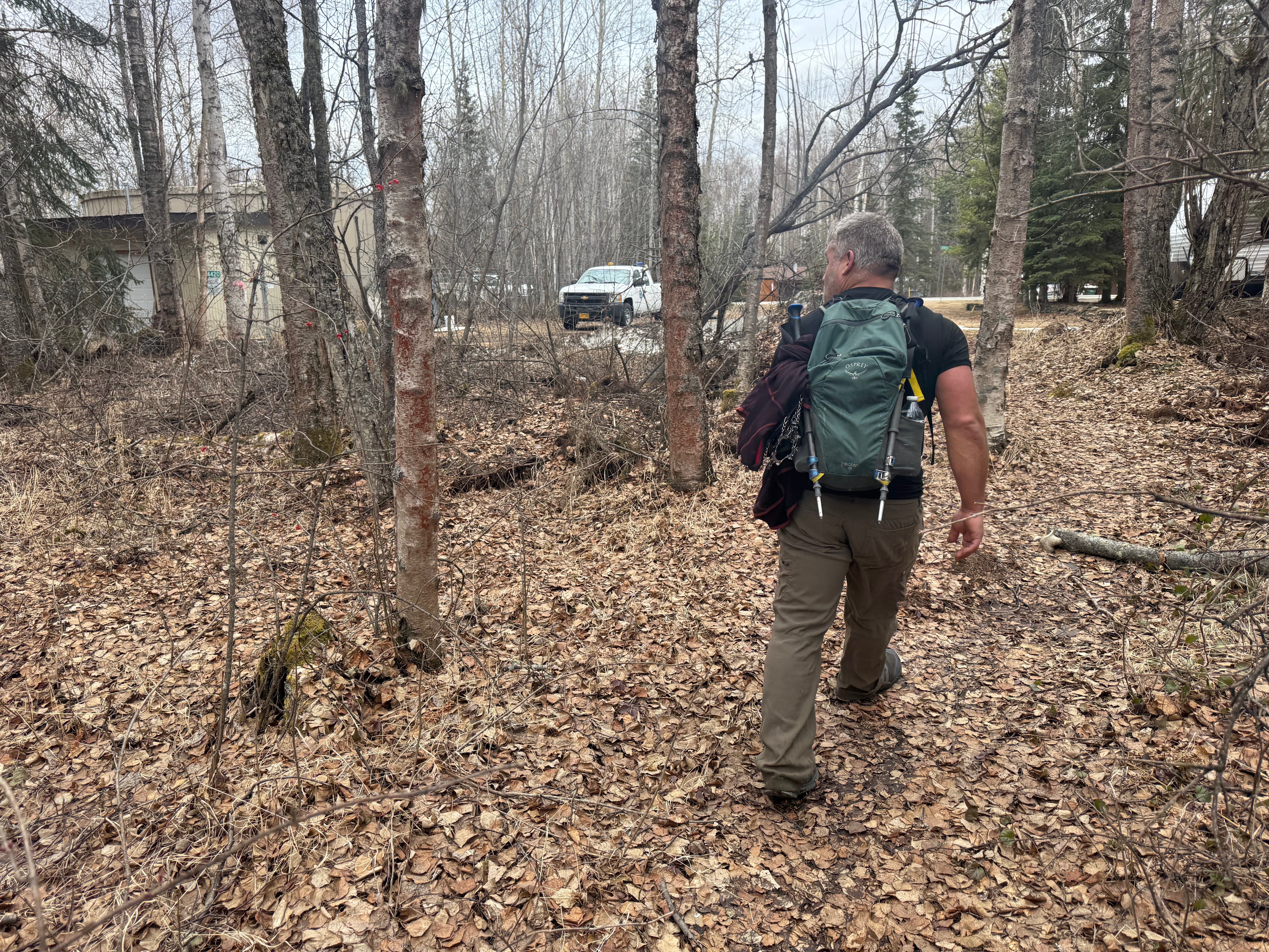
Backtracking along the trail, very grateful for an established footpath with no sharp or thorny sticks in the way, it only took a few minutes to travel the .3 miles to the trailhead on Raven Court in the Thunderbird neighborhood, and not much longer to reach the parking lot, another mile down the road. We looked back up the west face of Bear and laughed at how ignorant we were to think that would have been easy, and how happy we were to have filled in another ridgeline on the map.

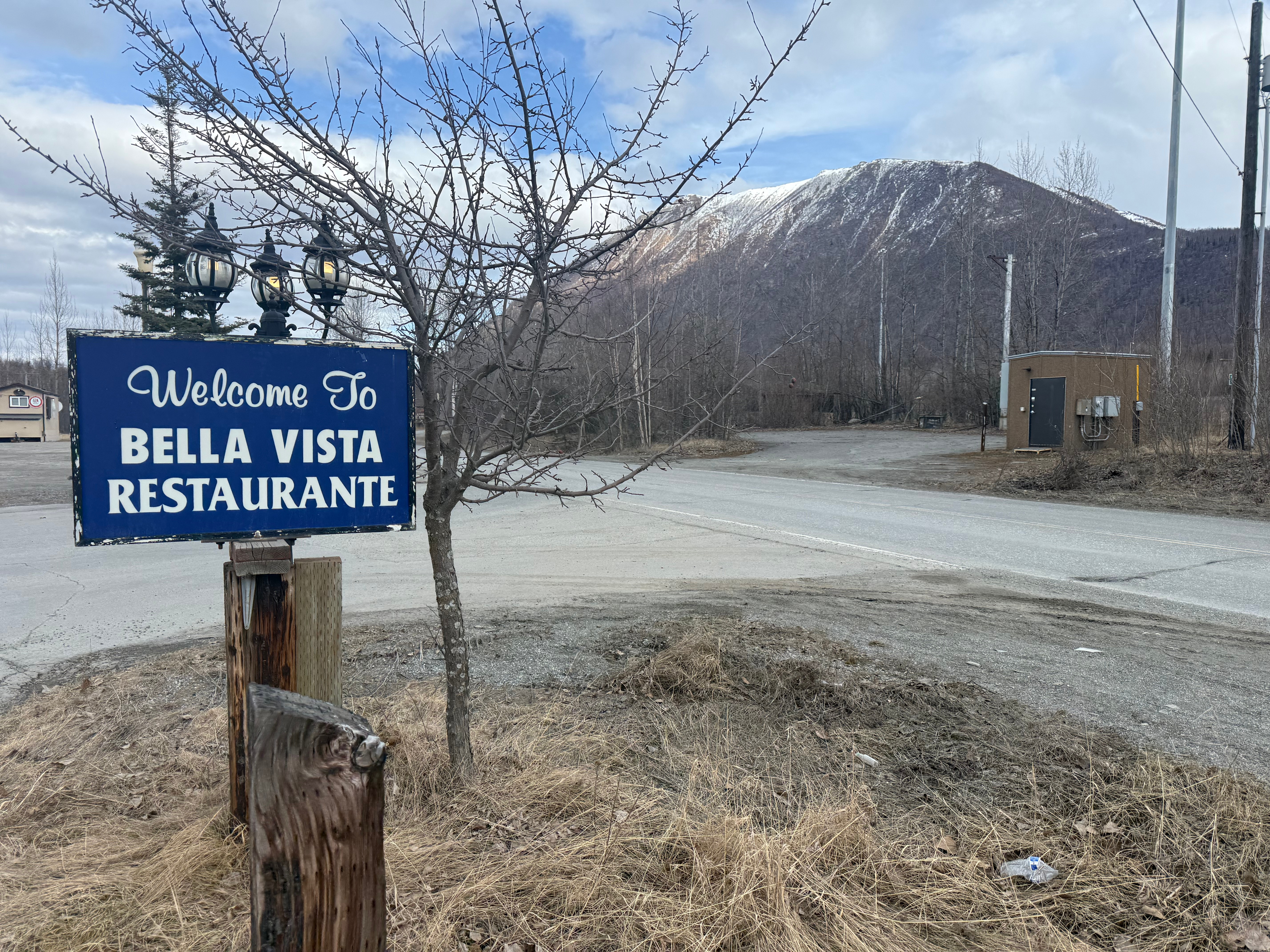
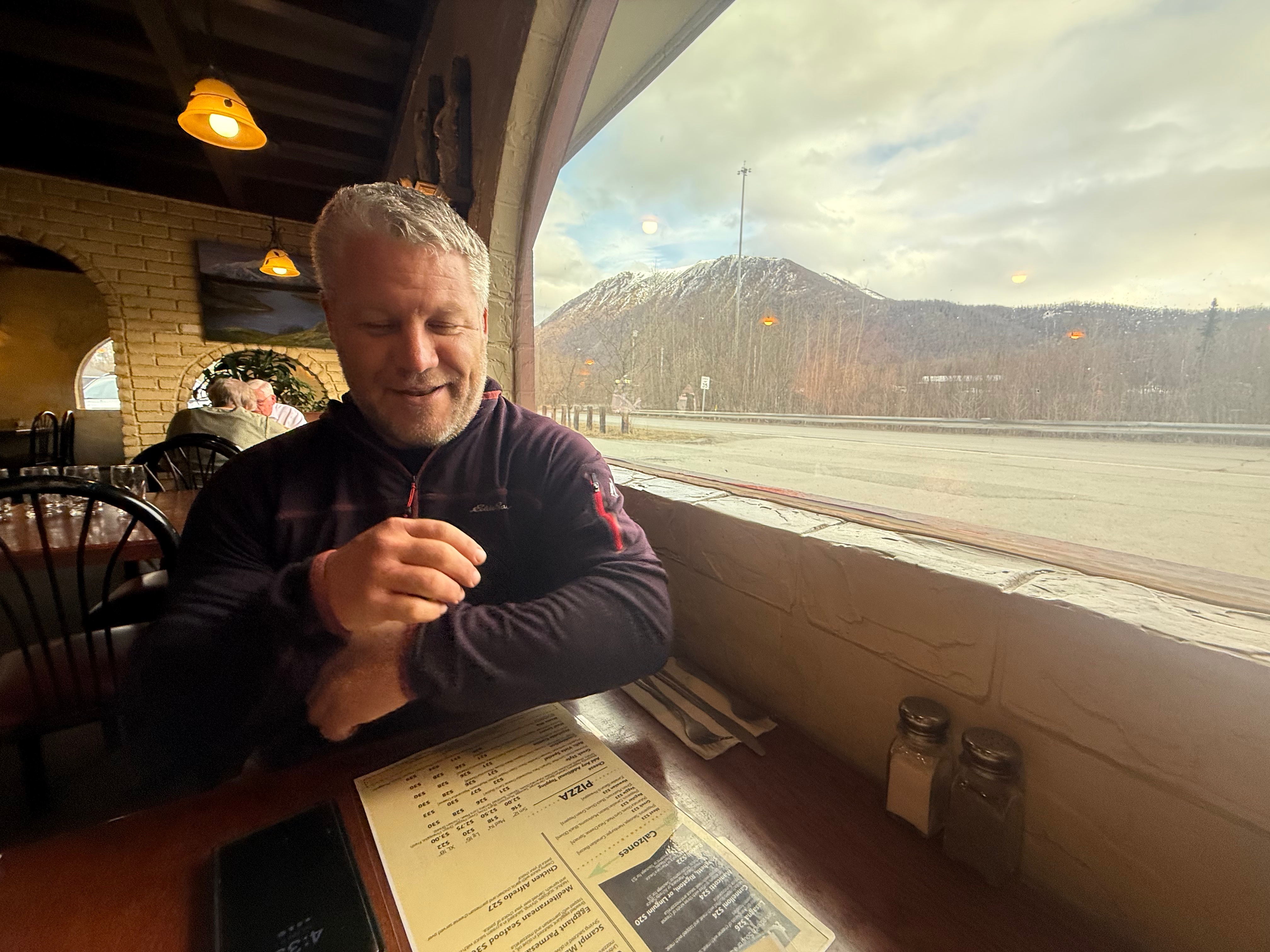
Jason drove me back up to the Peters Creek Trailhead to pick up my truck and then we celebrated with dinner at Bella Vista, seated with a perfect view of the mountain we had just traversed.

Just The Tips:

  1. Be Bear Aware. Carry bear spray and know how to use it.
  2. If you choose to follow the route mentioned above, be aware that there can be many variables depending on the season. Deep snow can persist into late spring and the bushwhacking can become impossible once the vegetation grows in. Be prepared to not have a trail to follow and rely on traditional navigation skills to find your way.
  3. Peters Creek Trail has both motorized access and trapping during the winter. Take care when hiking with pets along this corridor.
  4. Parking at the Peters Creek Trailhead is limited. Please respect the neighborhood and park in a way that does not restrict emergency vehicle access.
  5. The trail up to Bear Point can be very muddy or icy. Wear proper shoes/carry microspikes.

Snutnadzeni (AKA BEar Point) AllTrails & PEakbagger Links:

u003cbru003e

Where the Clouds Parted: A Knoya, Kanchee and Nunaka Ridge Walk

May 31, 2025 Knoya: 4600′ – FR #17 Kanchee: 4393′ – FR #20 Nunaka point: 3780′ Mileage: ~14 Miles Elevation Gain: ~5000′ The summer wasn’t summering, and I was suffering from a bout of springtime depression that only sunshine and warm weather could cure. I dragged myself to the Klutina Trailhead to meet Jason. We…

Chasing the Wind: A Long-Awaited Victory on Peak 1216 and Ship Creek Hill

April 26, 2025 Peak 1216 AKA 3990: 3990′ Ship Creek Hill: 3842′ (chugach Front Range Peak #24) Mileage: 15 Miles Elevation Gain: 5,700′ The majority of the Southcentral Alaska winter of 2024-25 was uncharacteristically warm and relatively snow free, but here we were in April, with record breaking snowfall around Anchorage. The ridges and peaks…

Beyond Bird Point and Into Technicolor Solitude: Bird Ridge Overlook

September 7, 2024
Mileage: 13.5 Miles
Elevation Gain: ~6700′
BRO (4625′) Chugach 120 #98
Bird PT (3505′) CHugach 120 #120
Permits: CSP Parking Fee

The 2024 Alaska State Fair had come and gone, a sure sign that the dark winter was going to be closing in soon. Even though it was another rainy summer and a very busy work season, I had crammed in as many hikes as I could and was hoping for at least one more big one. Jason and I decided to head down the Seward Highway to the Bird Ridge Trailhead to finish something we had started.

April 2024 – Failure

We had been there earlier this year, in April, but had turned around less than a tenth of a mile from the summit of Bird Point because of snow, high winds and, frankly, mostly laziness. Throughout the summer, we frequently talked about our silly decision to fail to summit this easy peak… while having coffee at our camp at Hanging Valley Lake, while walking up the saddle above Long Lake on our way to summit Koktoya, and while sitting around the fire at our bikepacking camp at Eklutna Lake… It continued to eat at us all summer.

Preferring to avoid busy trails, I had only been up to Bird Point once before, but the conditions couldn’t have been more different from the day we turned back.

August 2020 – My First Time

On August 20, 2020, during the height of the pandemic and the beginning of my peakbagging passion, I had snuck away from my home office to meet up with my friend, V, to hike to iconic Bird Point. It was one of those incredible summer days that makes you forget about winter. We were treated to a view of the bore tide rushing up Turnagain Arm during a break on the ascent to the ridge, and an incredible sunset on our way down. Pure perfection.

SePtember 2024 – BEyond the Point to Bird Ridge Overlook

As is my style, if I fail, I make the next goal ten times bigger. This time we wouldn’t just be summitting Bird Ridge Point, where most hikers turn around, we would be continuing on along the ridge for another 5 miles to the summit of Bird Ridge Overlook. I had been obsessively pouring over beta and maps of this hike since April, and it was finally time. We had an incredible weather window, and it was a go!

I picked up Jason and we chatted away excitedly as we drove to the trailhead. We had been looking forward to redemption all summer and today was finally the day. We were ready to put the embarrassment and self-loathing of our April failure aside forever with this hike.

By 830am, we were already ascending through the trees, taking some time to look over at Indianhouse Mountain (Jason had just climbed it a couple of weeks prior) and Penguin Peak (the Penguin Traverse is on our list for 2025). Although we had brought jackets, it felt more like July than September, and we were in t-shirts before we had even gone a mile.

Bird Point Trail to the ridge is fairly steep, a direct uphill climb, and within a mile and half and in less than an hour, we were above the trees and at the bench, a memorial to a young man who had been mauled and killed by a bear during a mountain race in 2017. We had a long day ahead, but spent a moment paying our respects and making sure our bear spray was handy.

A half mile later we had reached the ridge, and although we were still a little less than half a mile from our first objective, the summit of Bird Ridge Point (3505′), we only had another 300′ to ascend to bag the first peak. The walking here was easy and comfortable, a big change from the snow covered, corniced, wind drifted trail we had trekked on in April. The weather on this day was pleasant and windless with some blue sky poking through high clouds.

Within two hours and 2.5 miles, we had reached the summit of Bird Point and a glance back towards Turnagain Arm, 3500′ below, made me appreciate the extent of the elevation gained. I don’t recall if we talked about our redemption, but I know we both felt much better now.

We continued along the ridge towards Bird Ridge Overlook, now visible about 4.5 miles in the distance. I was relieved to see that it appeared to be a “walk up” peak with gently sloping shoulders, the ridge meeting the mountain very close to its summit. I had read many trip reports and poured over topo maps so I had the impression it would be a relatively easy ascent, minus the long walk, but you never know until you go. From here, I could see that there was no extreme exposure or steep steps on the approach side of the summit, and I regretted not bringing my dog, Goose.

The trail beyond Bird Point is now one of my favorite hikes, an easy walk along the ridge that undulates gently up and down; tundra and rocks bordering the rarely used path. Besides one ~300′ “step” midway and the final section to the summit, it was gradual elevation gain, a truly gentle ridge.

I often had to jog to catch up with Jason after being hypnotized by the mountains surrounding us. I would imagine the tracks I would take up each mountain that I hadn’t yet summitted… North Yuyanq’Ch’ex, Homicide, South Powerline, Penguin, Nest, Esbay… and flashed back to memories of climbs I had done that I could now see from the perfect perspective… South Yuyanq’Ch’ex, The Ramp and Wedge, South Avalanche. I hadn’t set foot on any of the mountains to the east yet, but I would make sure that wouldn’t be the case by the end of the next season.

As the trail dropped just below the east ridge, just shy of ascending the midway “step,” we were treated to an explosion of color; vivid red, yellow and green tundra, a sure sign of the approaching winter, but also cementing this as a perfect fall hike.

We climbed up an easy 300,’ following the bootpath that traversed just below the rocky top of the midway step. The vegetation turned to muted tones of red and yellow, the black alpine lichen and chossy rock now dominating the hillside. The last couple of miles to the summit of BRO was now completely visible, the path meandering along the east side of the ridge, one more patch of vivid red lichen to traverse before cutting below the summit towards the southeast ridge. Only a couple of small patches of snow were still hanging in there on the south facing slopes, a testament to the previous winter’s deep snowpack. Again, I regretted not bringing Goose… no one loves summer snow more than he does.

I continued to be mesmerized by the surrounding mountains, more peaks making themselves visible the further we walked, and before long we were traversing below the summit of BRO. As we reached the southeast ridge, we were stopped in our tracks by a pair of ravens who were very interested in us, circling and cawing. I noticed one of them had white tips on its wings and took a moment to appreciate being here at this moment and feeling gratitude that this unique raven had decided to pay us a visit.

I turned uphill, the path now gone, and picked my way through the rocks and patches of tundra for the last 400′ to the summit. Although there is no trail, ascending was quick and easy, a choose your own adventure to the top.

As I summitted Bird Ridge Overlook, I audibly gasped. The view was incredible, with much of the Chugach Range in view. Countless mountains I had climbed surrounded us and I geeked out, naming as many as I could, from South Yu to South Avalanche to Koktoya to Rendezvous/Triangle Ridge and even as far out as Harp, Eagle River Overlook and Vista Peak. To the northwest, I traced the route we had taken on my birthday hike a couple of years before; up The Wedge and The Ramp, down into Ship Lake, around the NE ridge of the Avalanches and into Ship Creek Valley, turning south towards Indian, the trail then disappearing behind the smaller mountains below us.

To the north, I looked down into a valley, protected by a long ridge to the west and a short ridge to the east. The summit of BRO drops off steeply on the north face and a large teal blue no-name lake glimmered below, smaller lakes dotting the valley. I planned out my 2026 birthday backpacking trip then and there, a trek into this rarely seen valley from Indian to make camp, a perfect base for day hikes up 4055, Bidarka, 3505, Shaman Dome, The Wing, 4300… as many as we could get. I hoped for nice weather the week of July 4, 2026.

Jason and I took turns getting photos standing on a high, rocky outcropping, with an incredible backdrop of the backside of the Front Range. Jason found the summit register, a small, black pvc tube filled with soaked paper and leaky pens. I settled for submitting to the Peakbagger electronic register and we tucked the pvc tube back under the rock where it was found.

A final look at my new favorite view and I turned back to the south, Bird Ridge looking welcoming, an easy walk back to the summit of Bird Point. We decided to descend directly down the south/southwest ridge instead of following our ascent route and it went nicely, joining back up with the trail less than half a mile from the summit.

As we strolled along, backtracking on our footprints from earlier in the day, the sun began to shine, and the blue sky became brighter through the high clouds. The reds of earlier were now even more incredibly bright, a technicolor dreamscape.

Upon our return to the “step,” we decided to follow the ridge to its high point, veering off from the sidehill trail we had taken on the way out. I looked back at BRO and the path we had taken as the slopes of the ridge became bathed in full sunshine. Turning back towards Turnagain, Bird Point became visible, the fully treed northwest slope indicative of its lower elevation, with an 1,110′ difference between the two peaks.

We descended the step and made excellent time back to Bird Point, more than 11 miles into our hike. As we began to run into other hikers, I was silently (and sometimes not so silently) feeling smug about our accomplishment, having made it further on the ridge than anyone else that day. I have no shame when it comes to being proud of achieving new summits, especially those that are beyond the well traveled trails.

As we descending the final couple of miles to the parking lot, the clouds began to return, although a god ray shone down on the low tide of Turnagain Arm. Entering the tree line, we both checked for our bear spray and began making mention of how sore our legs and feet were… the easy ridge had spoiled us, the steep descent became the biggest physical challenge of the day.

We finally reaching the paved pathway and, soon after, the truck. We both happily peeled off our shoes and socks for the relief of sandals and drove away with both redemption and future plans.

BRO/BRPT AllTrails and Peakbagger Links:

Just the Tips:

  1. Be Bear Aware. This is prime bear country. A young man was fatally mauled by a black bear during a running race in 2017. Take a moment to rest at the memorial bench located about halfway up to Bird Point. Carry bear spray and know how to use it.
  2. Although I had left my dog at home because I wasn’t sure what the trail was like, this one is great for dogs. No exposure until the very summit of BRO. Remember, though, it is a long hike and there are no water sources along the way. Carry plenty of water for yourself and your pup.
  3. It is likely that there will be no other hikers beyond Bird Point and there is limited or no cell phone reception. Carry an InReach and know how to use it, especially if traveling alone.
  4. Leave No Trace. Pick up any trash you may see along the way.

Recent Trip REports:

Misty Miles and Mountain Birds: A Storm King Scramble to Mitty Peak

April 20, 2025 Olympic NAtional Park, WA Mitty Peak 2674′ Mileage: 4.4 Miles RT Elevation Gain: 2400′ After 25 years, I finally had the opportunity to fly down to Seattle from Alaska to see one of my favorite bands of all time, Phish. I can’t travel without checking out a new hike, so I also…

Beyond Bird Point and Into Technicolor Solitude: Bird Ridge Overlook

September 7, 2024 Mileage: 13.5 Miles Elevation Gain: ~6700′ BRO (4625′) Chugach 120 #98 Bird PT (3505′) CHugach 120 #120 Permits: CSP Parking Fee The 2024 Alaska State Fair had come and gone, a sure sign that the dark winter was going to be closing in soon. Even though it was another rainy summer and…