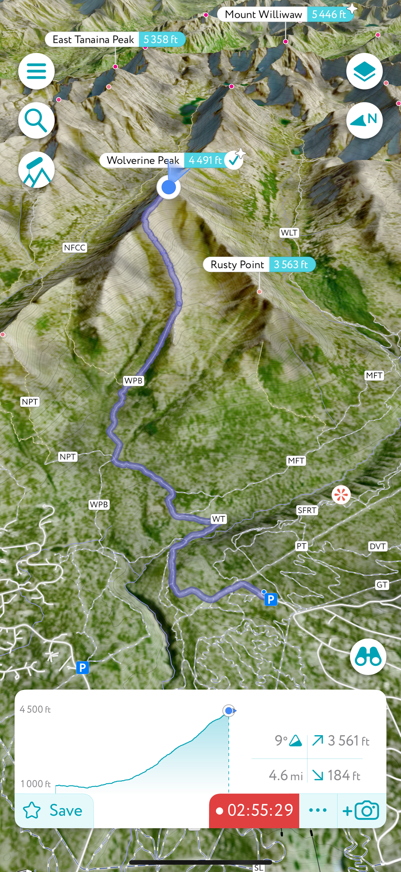
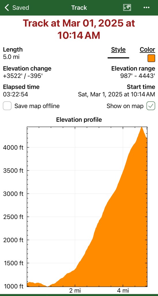
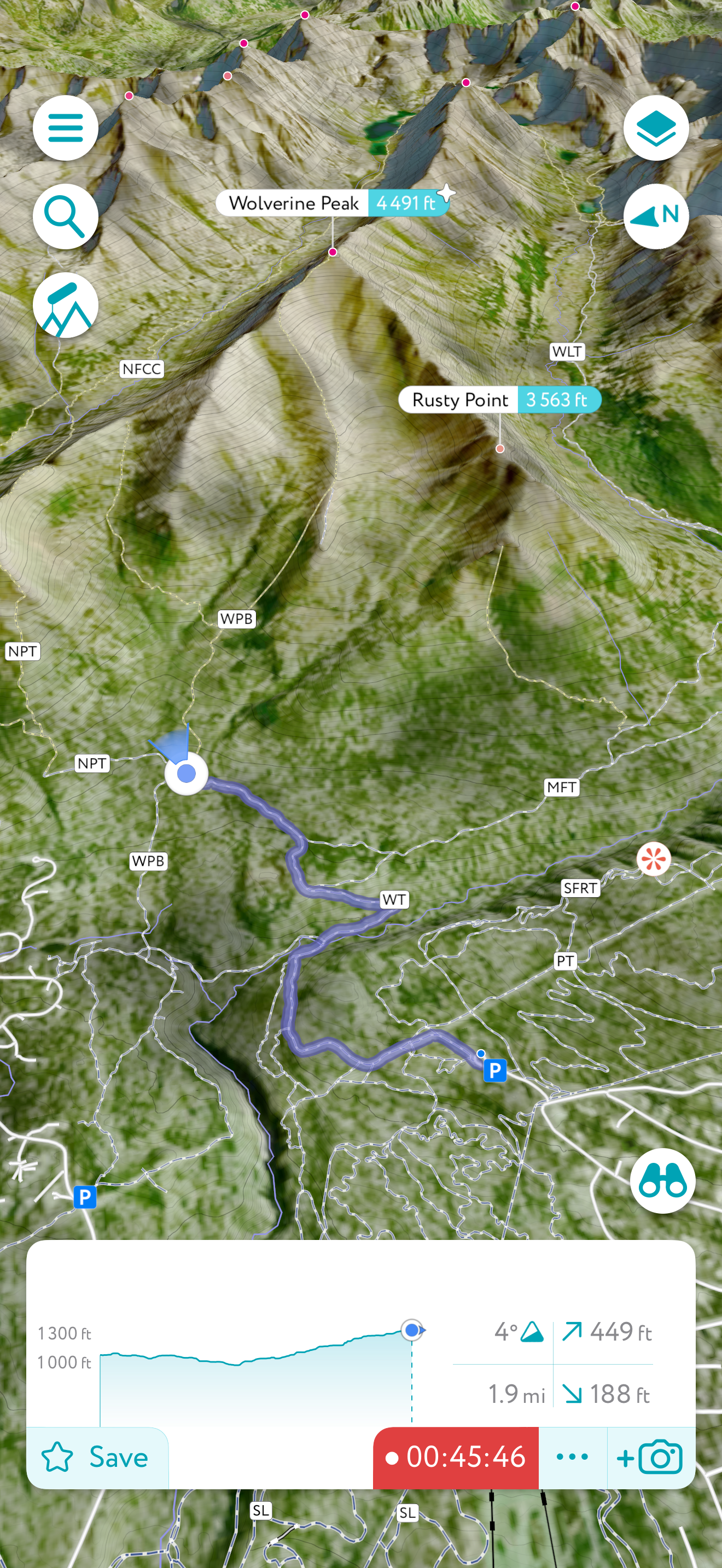
Wolverine and Rusty Point: Hanging out with the Dalls Sheep

March 1, 2025

Mileage: 10.2 Miles
Elevation Gain: 4000′
Chugach 120 #100
Chugach Front Range #18
Summit Elevation: 4491′ & 3480′

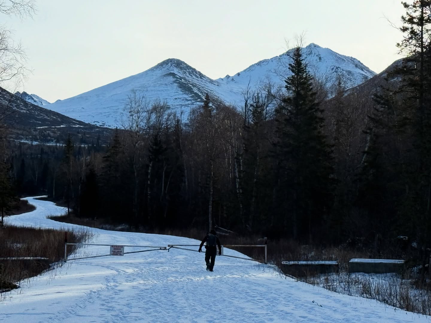
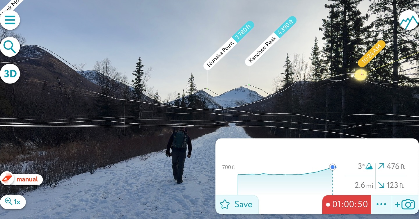
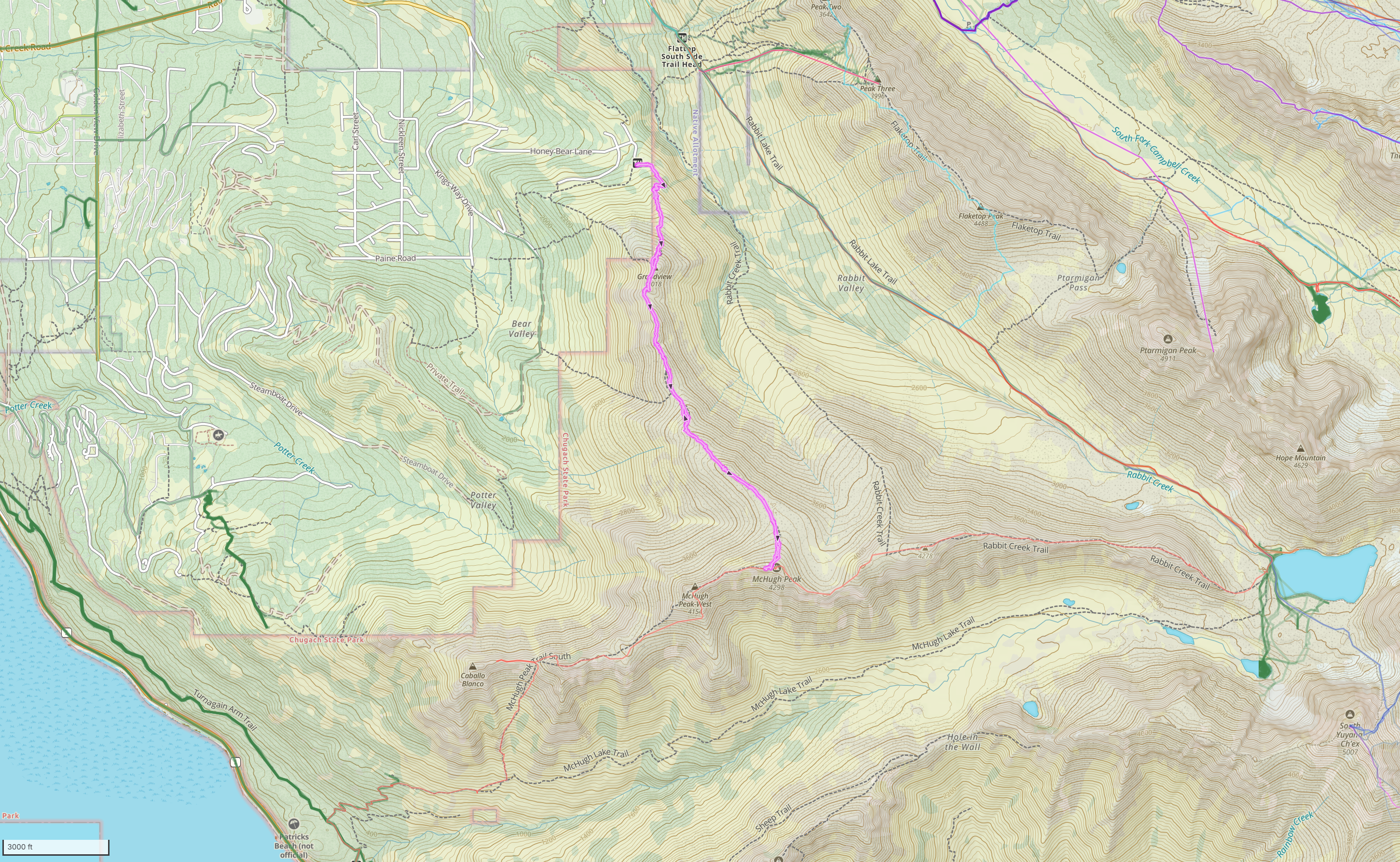
With the snow this winter being a bust, Jason and I decided to continue to up the mileage and elevation gain in preparation for a summer of big goals. I had yet to traverse the ridge between Wolverine and Rusty Point, so we decided to fill in that gap. The prospect heights parking lot was surprisingly empty for a Saturday, even mid-morning when we started up at 1030am.

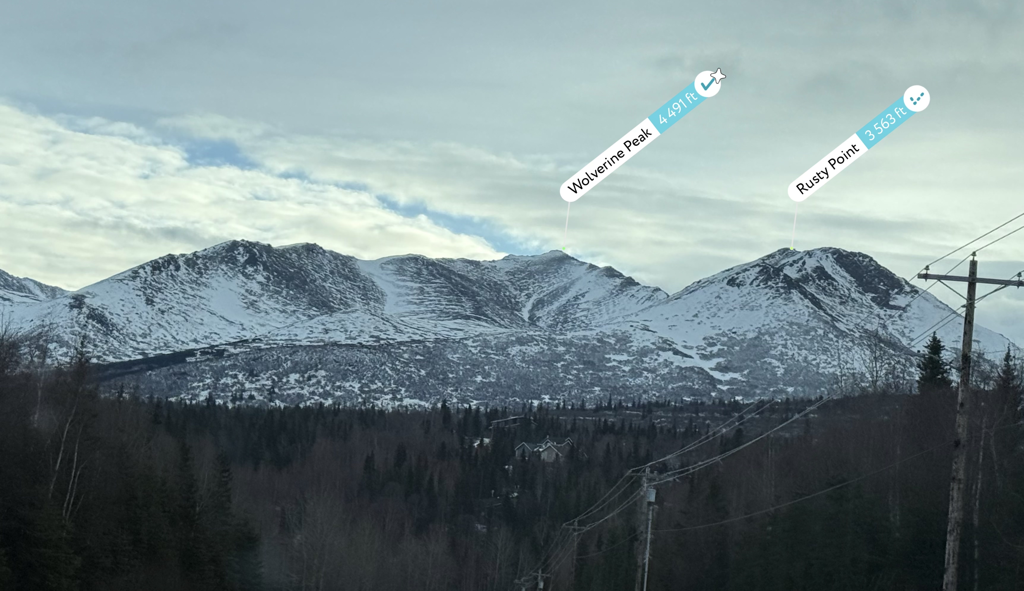
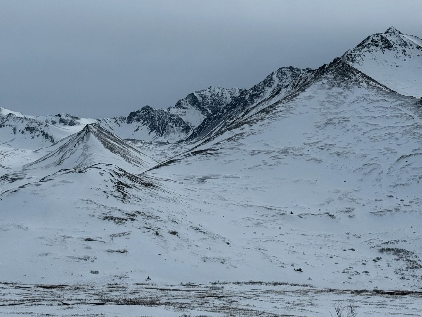
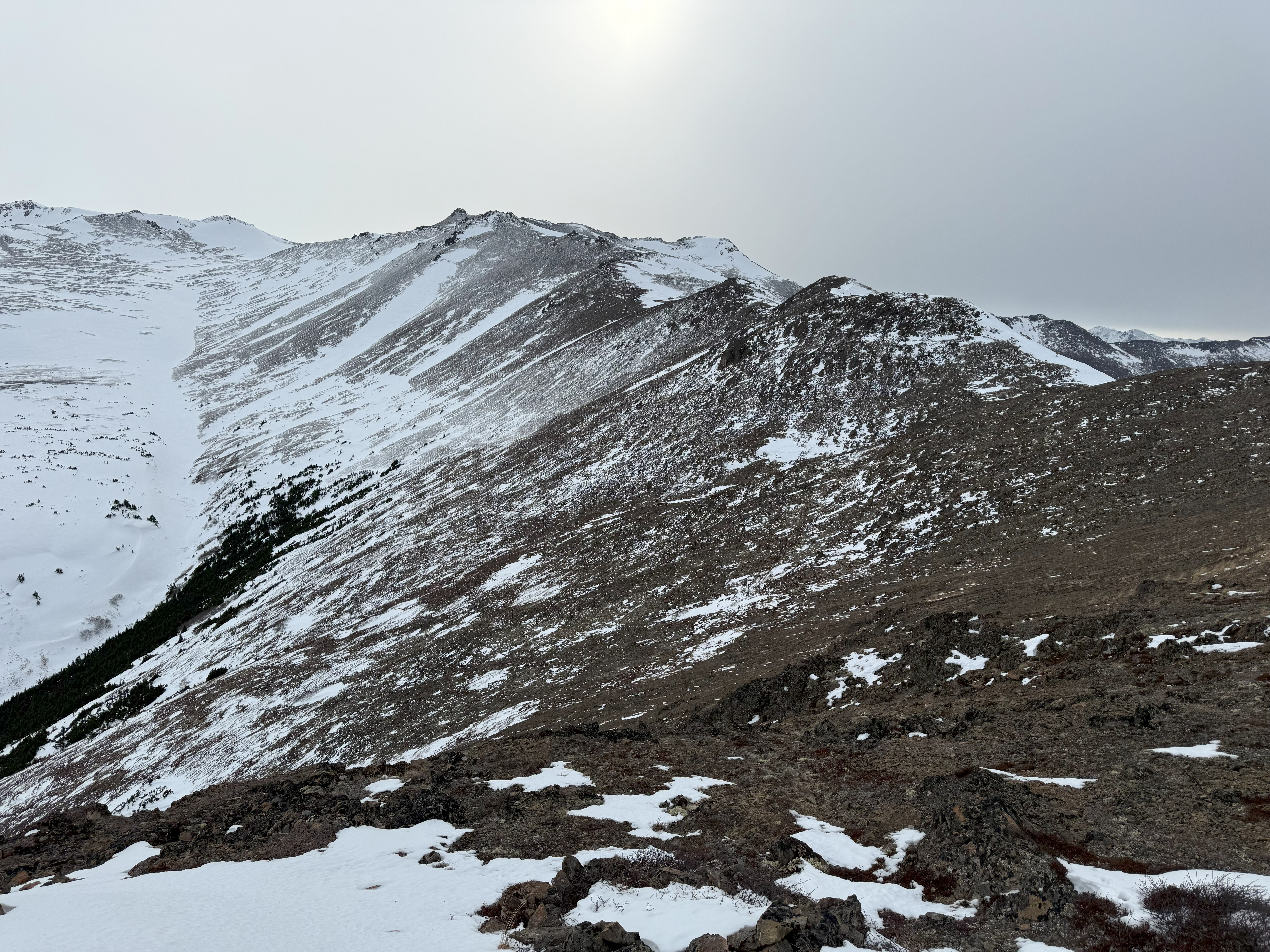
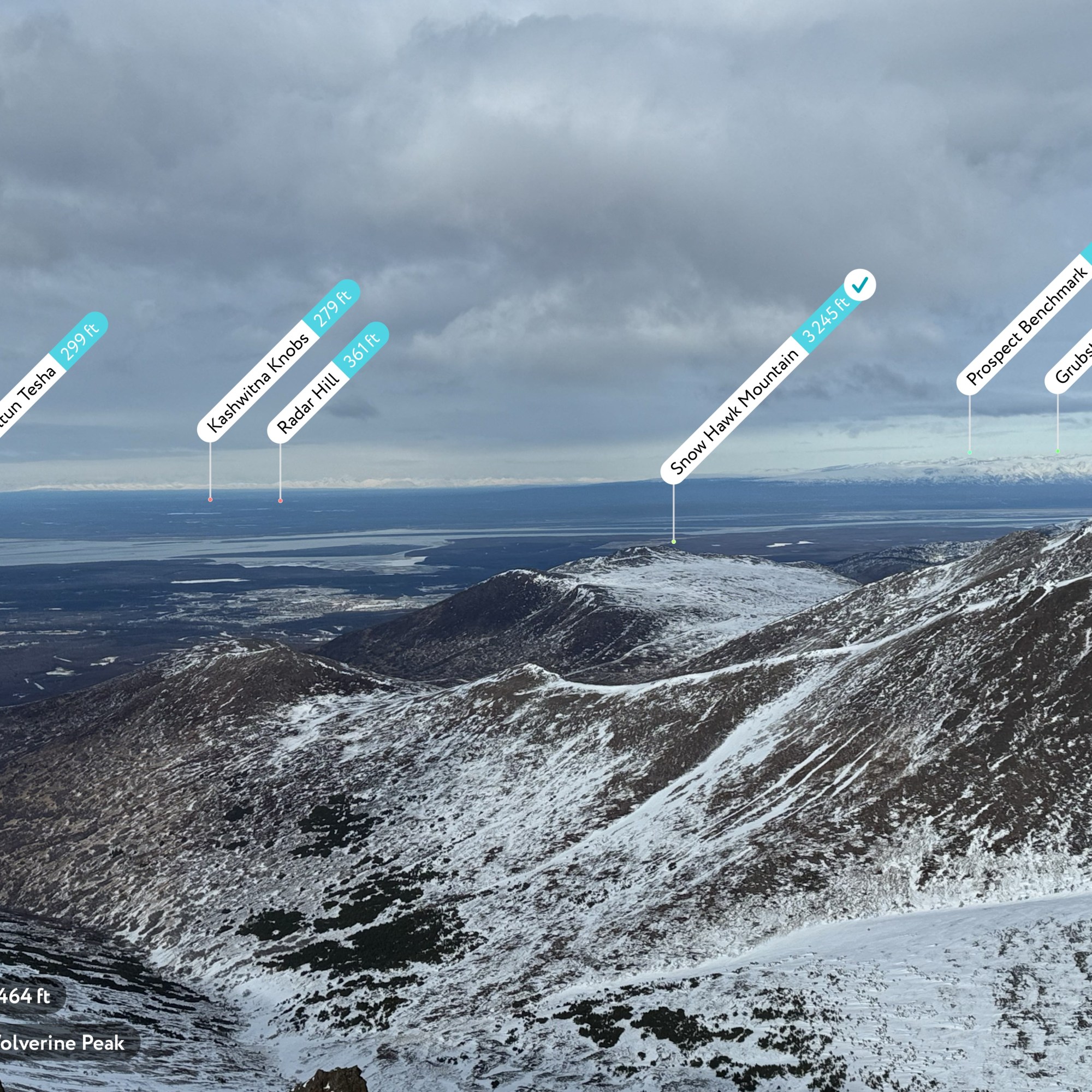
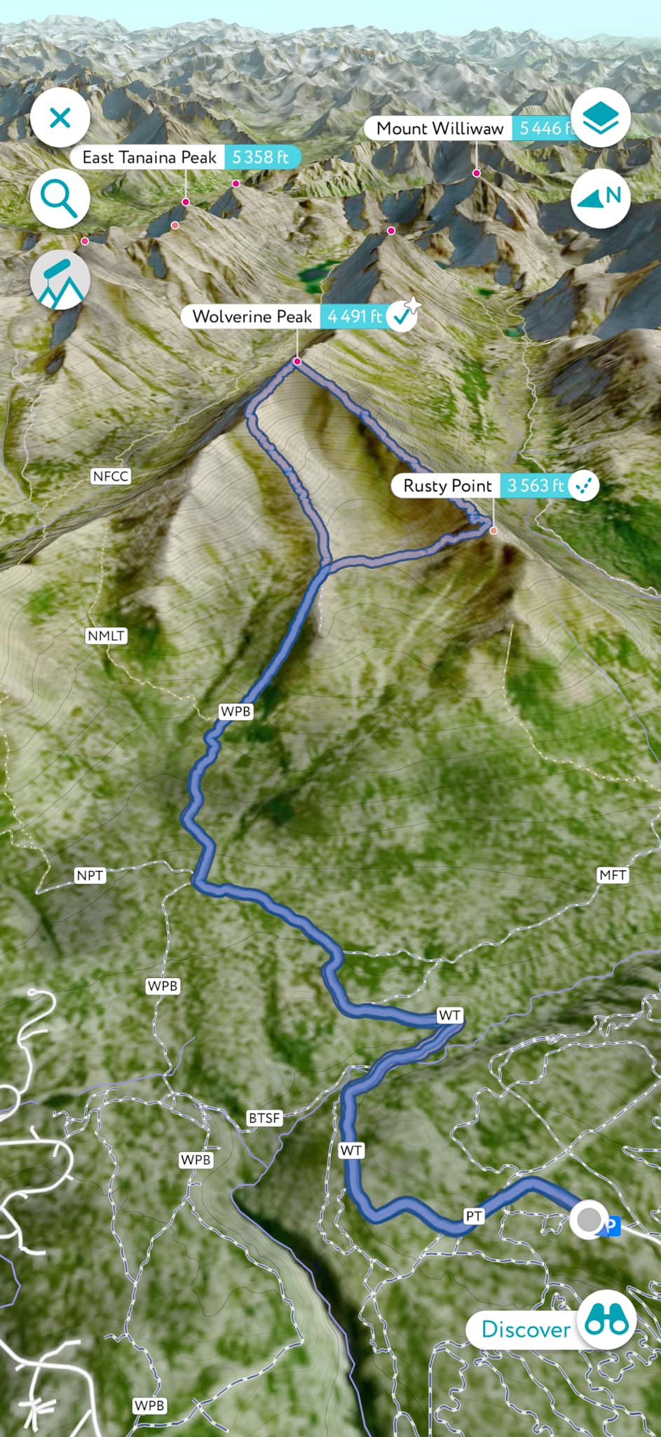
The massive bowl created between Wolverine and Rusty Point is a fixture view from Anchorage, Wolverine’s high point easily visible from just about anywhere in town. The approach is a long one, even without adding in the ridge to Rusty Point; round trip to Wolverine is 9 miles with a 3500′ elevation gain. During the summer, you can easily drop down the backside of the northwest ridge and connect Near Point and Long Lake Trail. You could do the same on the southwest ridge, dropping to Williwaw Lakes Trail. The east ridge is accessible from the summit and leads all the way to Mt Elliot, but this segment is reported to have some scrambling and infamous crumbling Chugach Choss. I have to yet to travel this ridge, but it is definitely on the list!

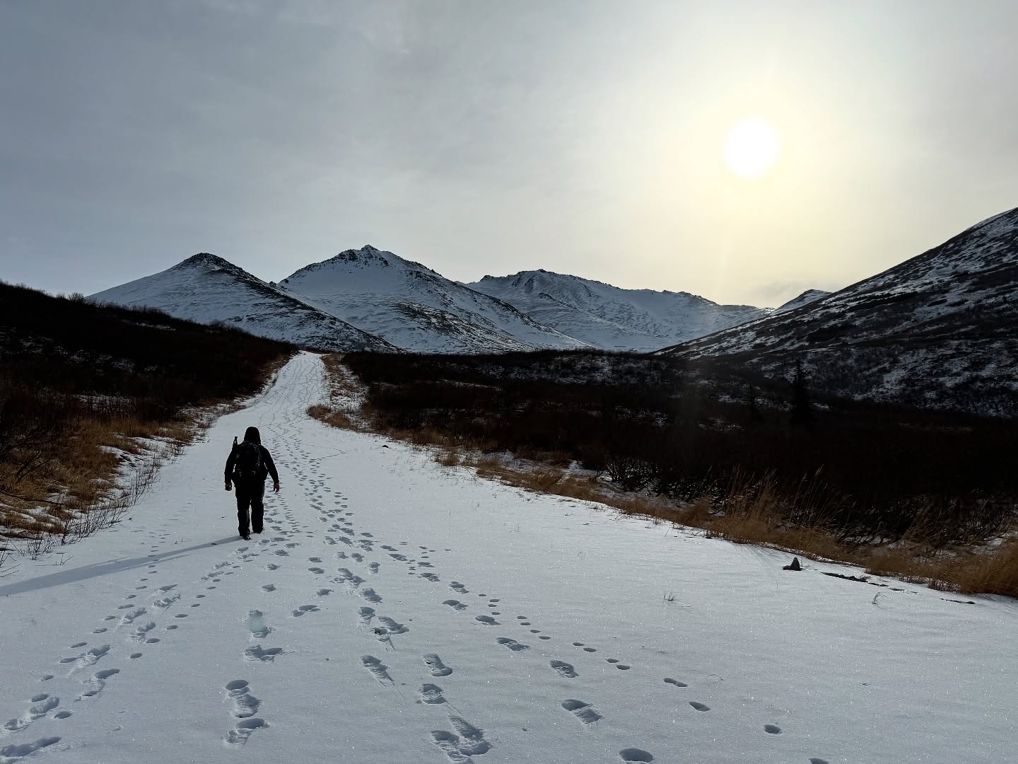
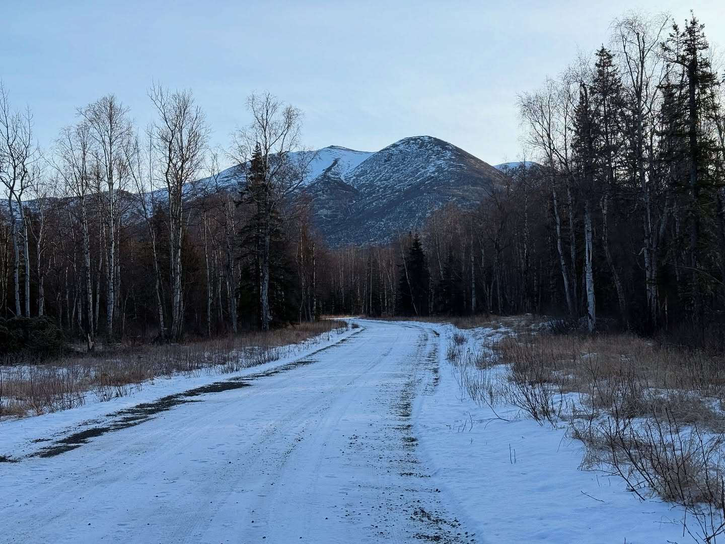
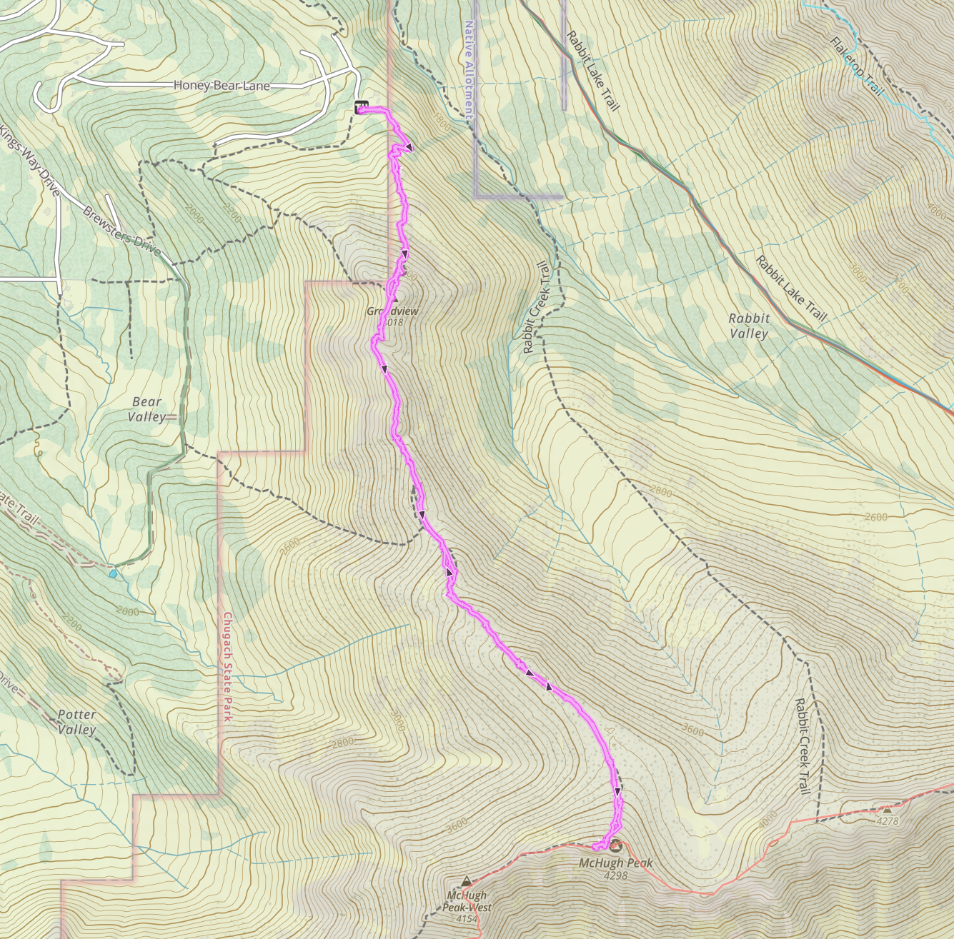
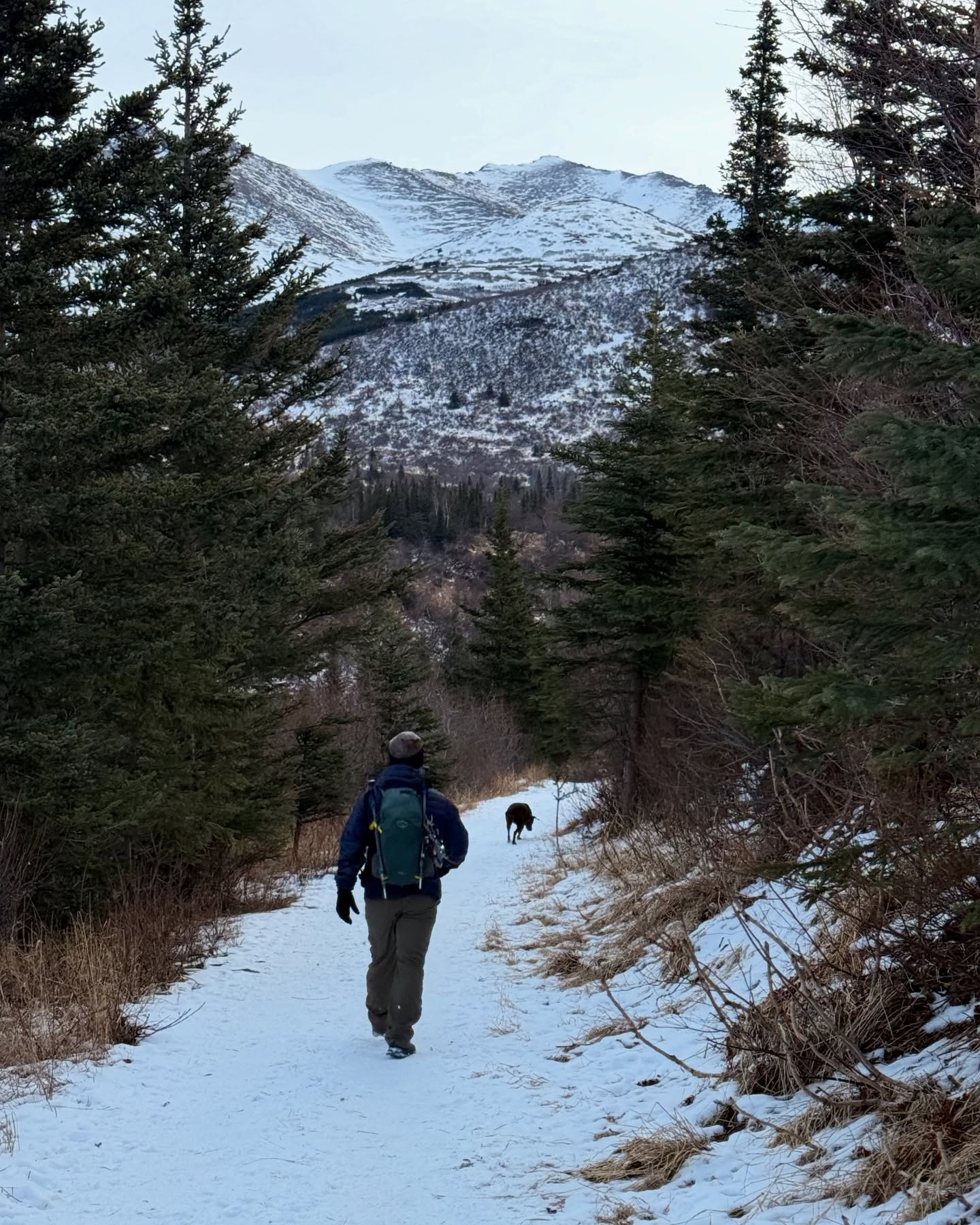
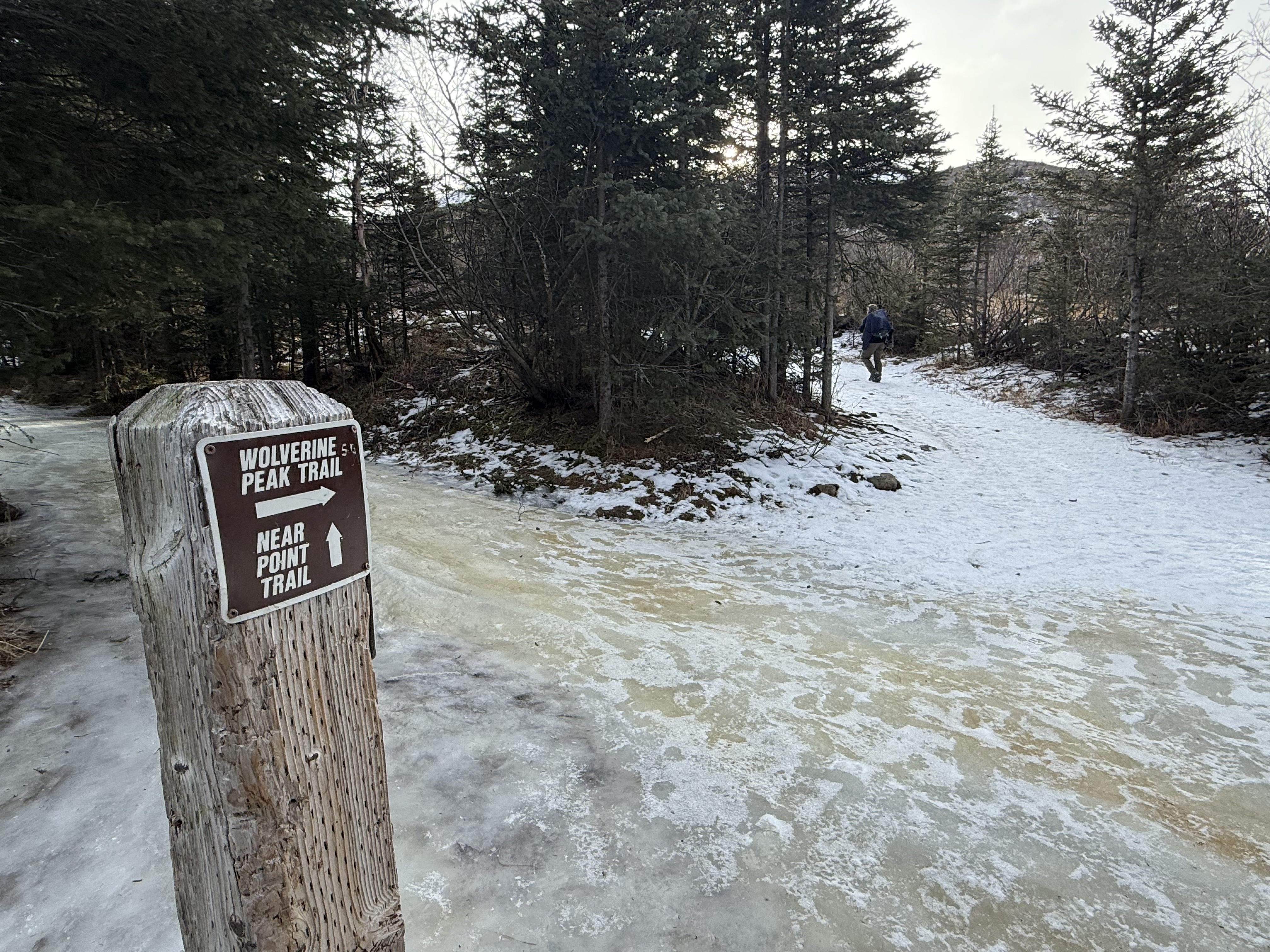
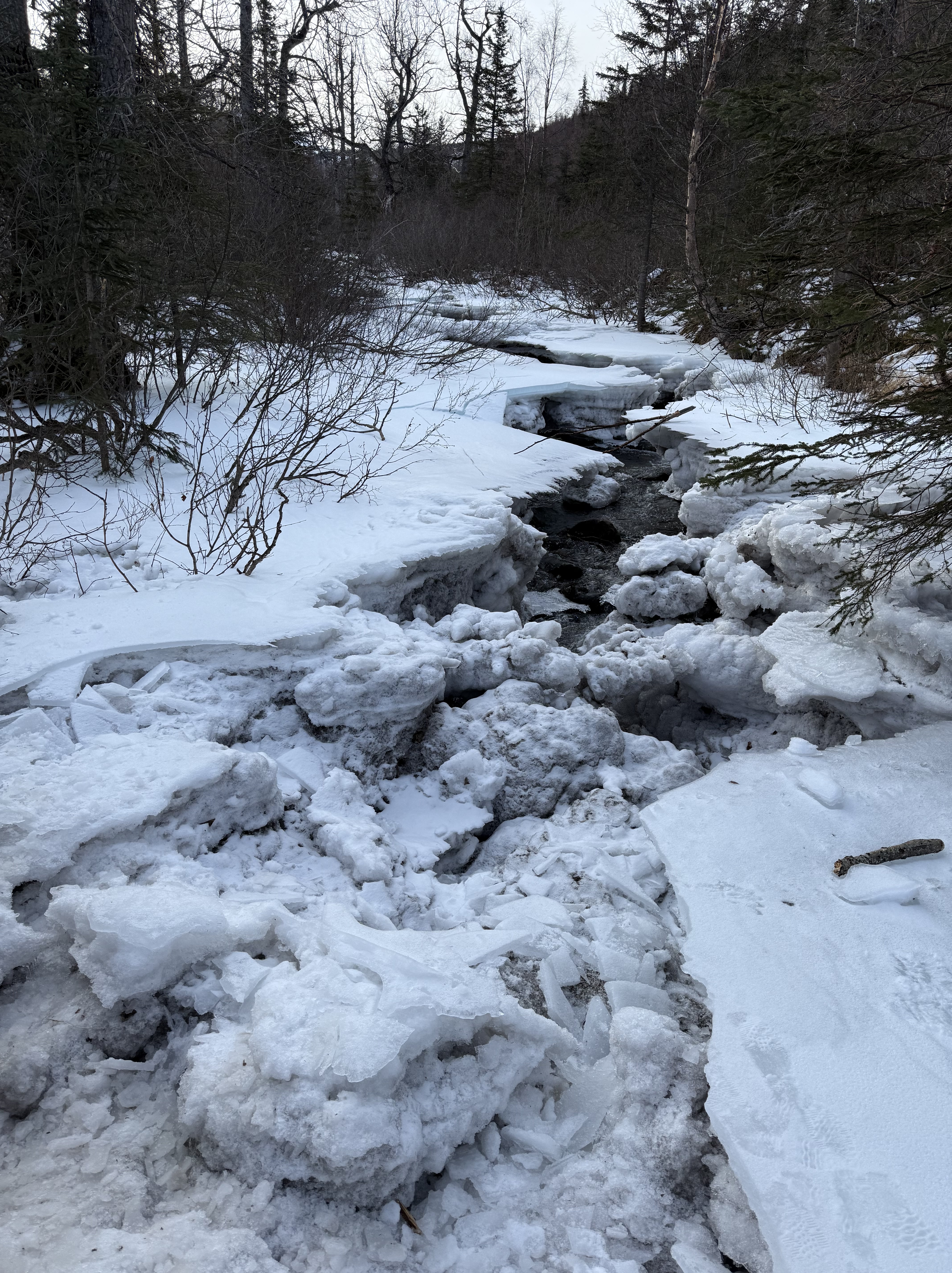
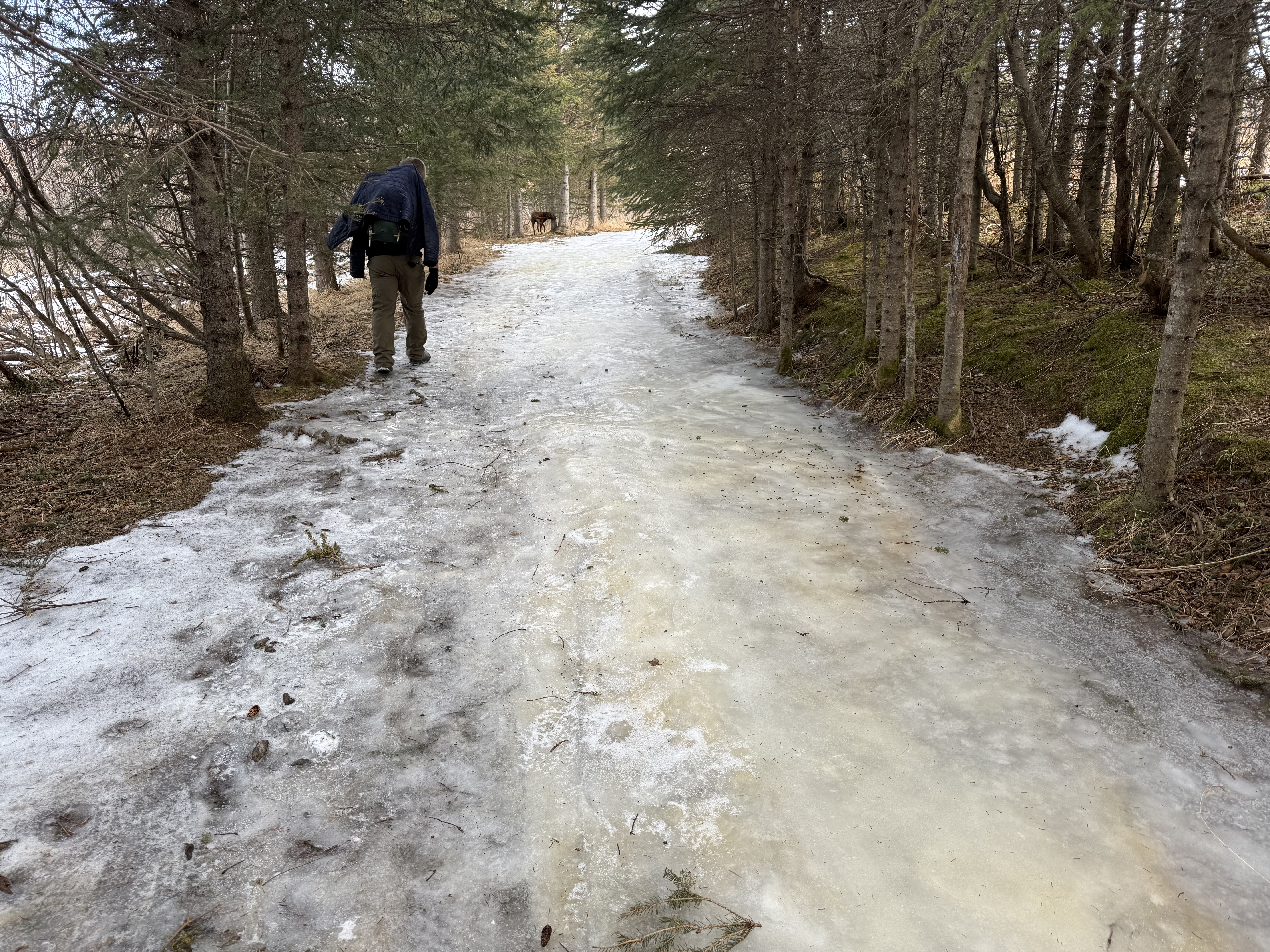
The first two miles wind along the South Fork of Campbell Creek, sometimes glaciated, but mostly packed snow. At the intersection with Near Point Trail and Basher Trailhead, there is a wooden post with signage directing Wolverine hikers to take a hard right.

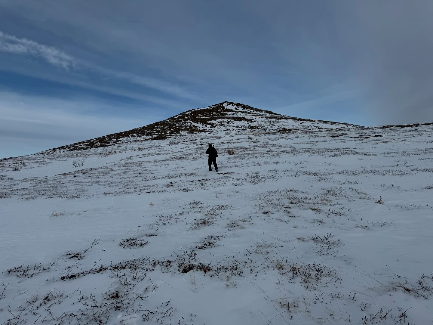
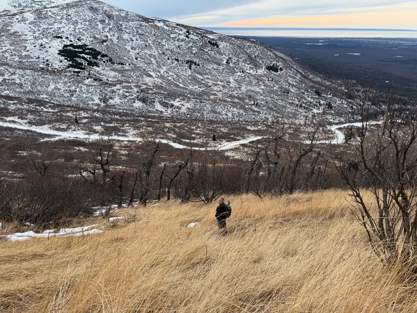
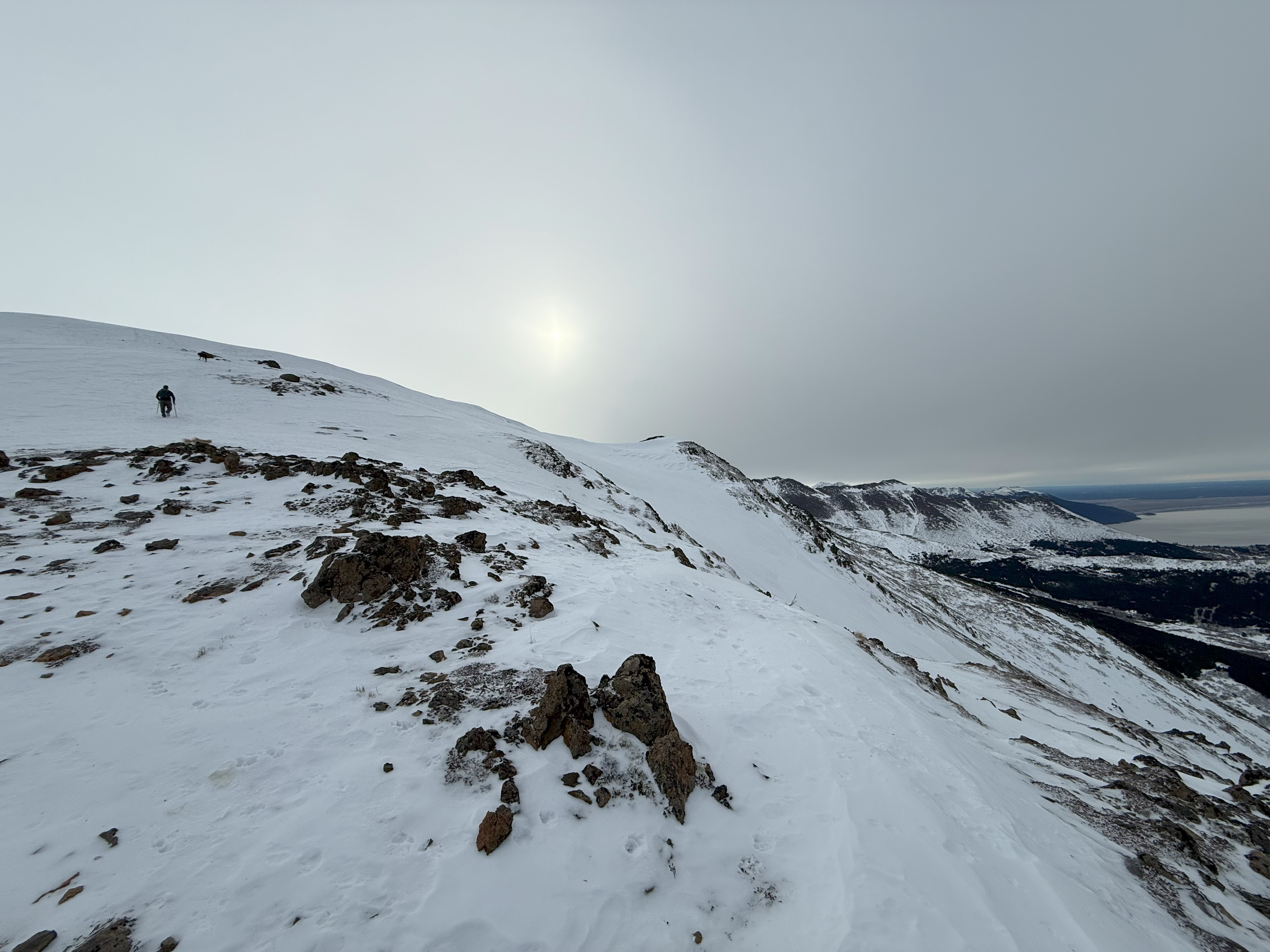
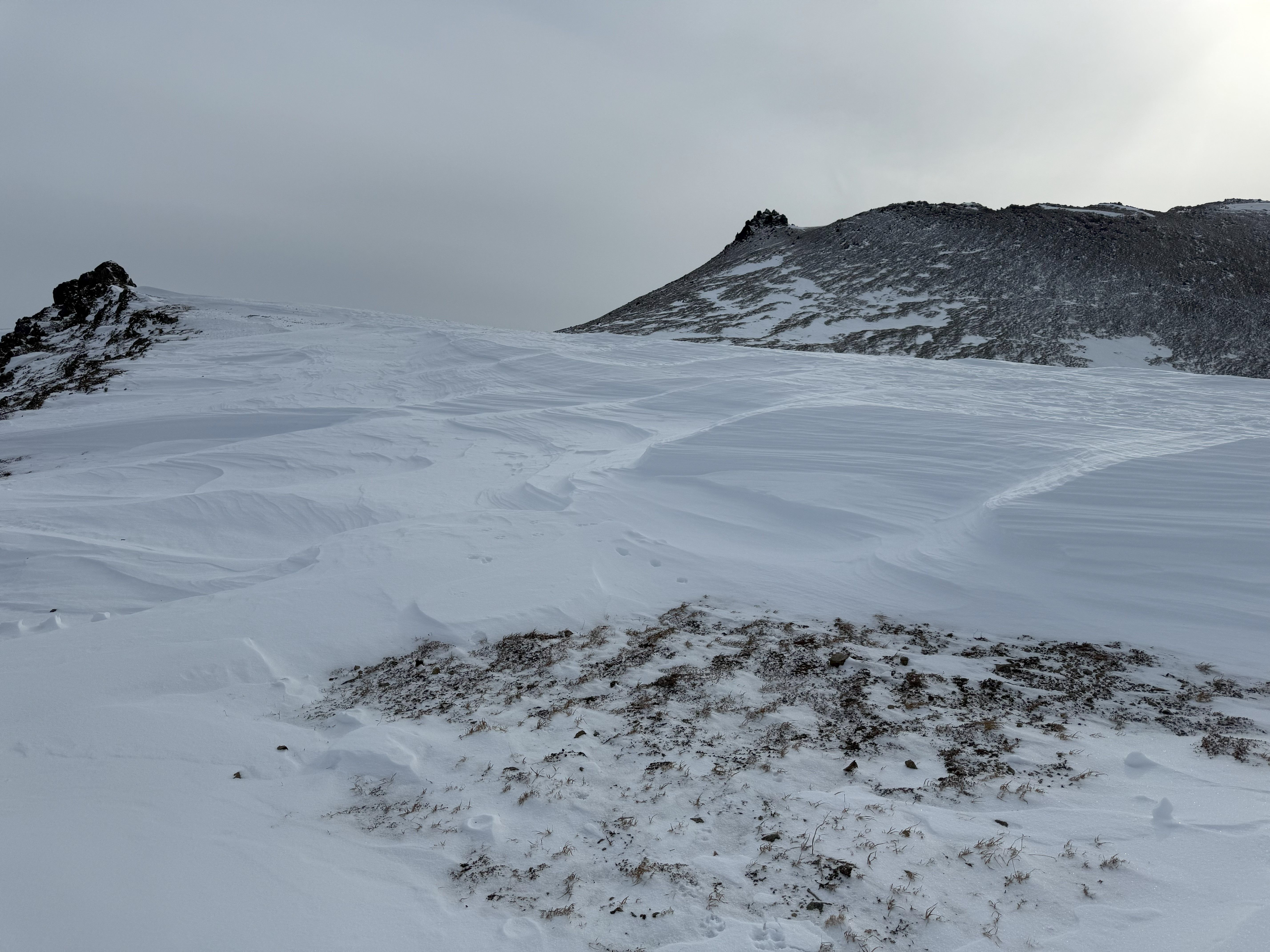
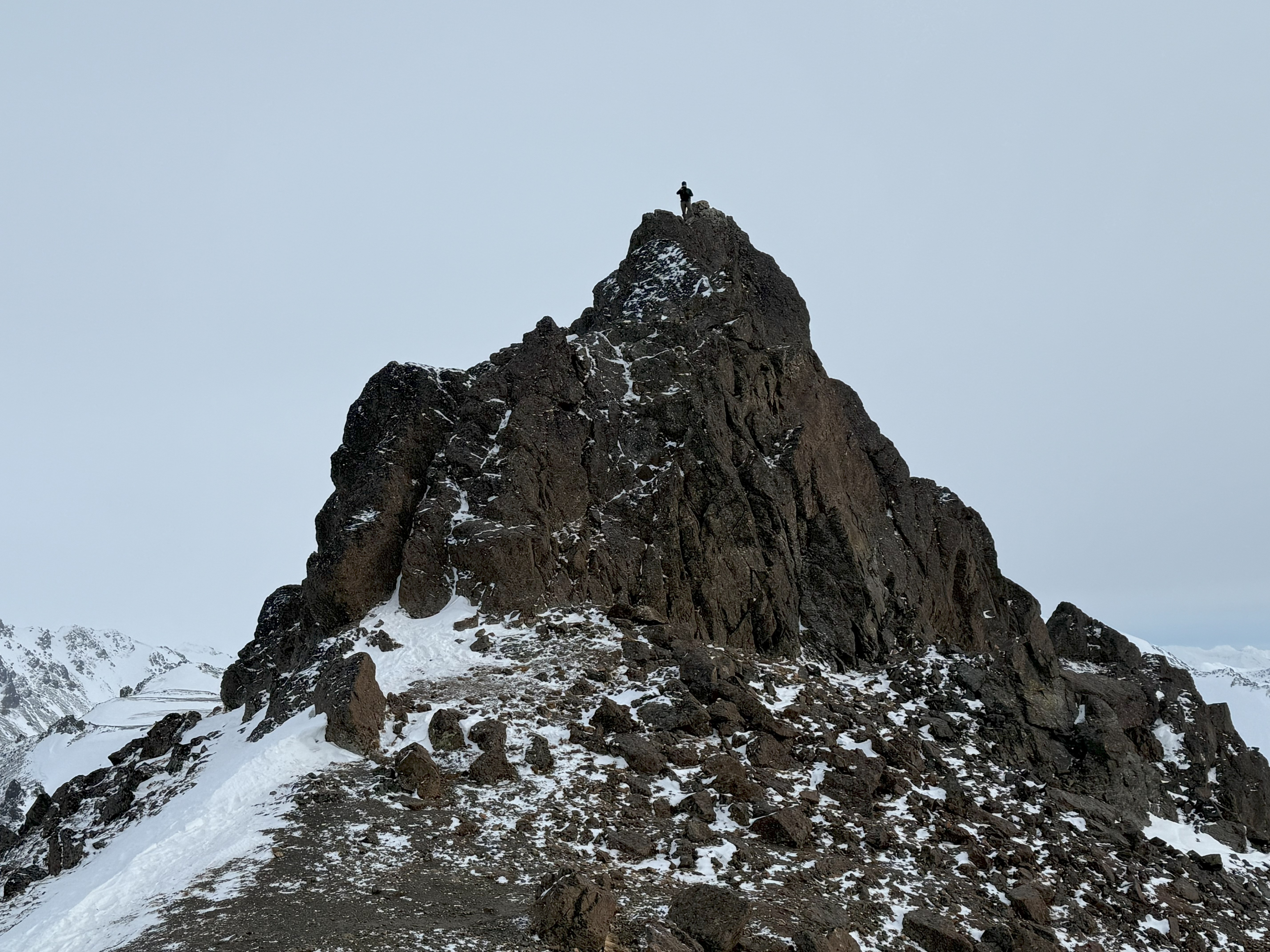
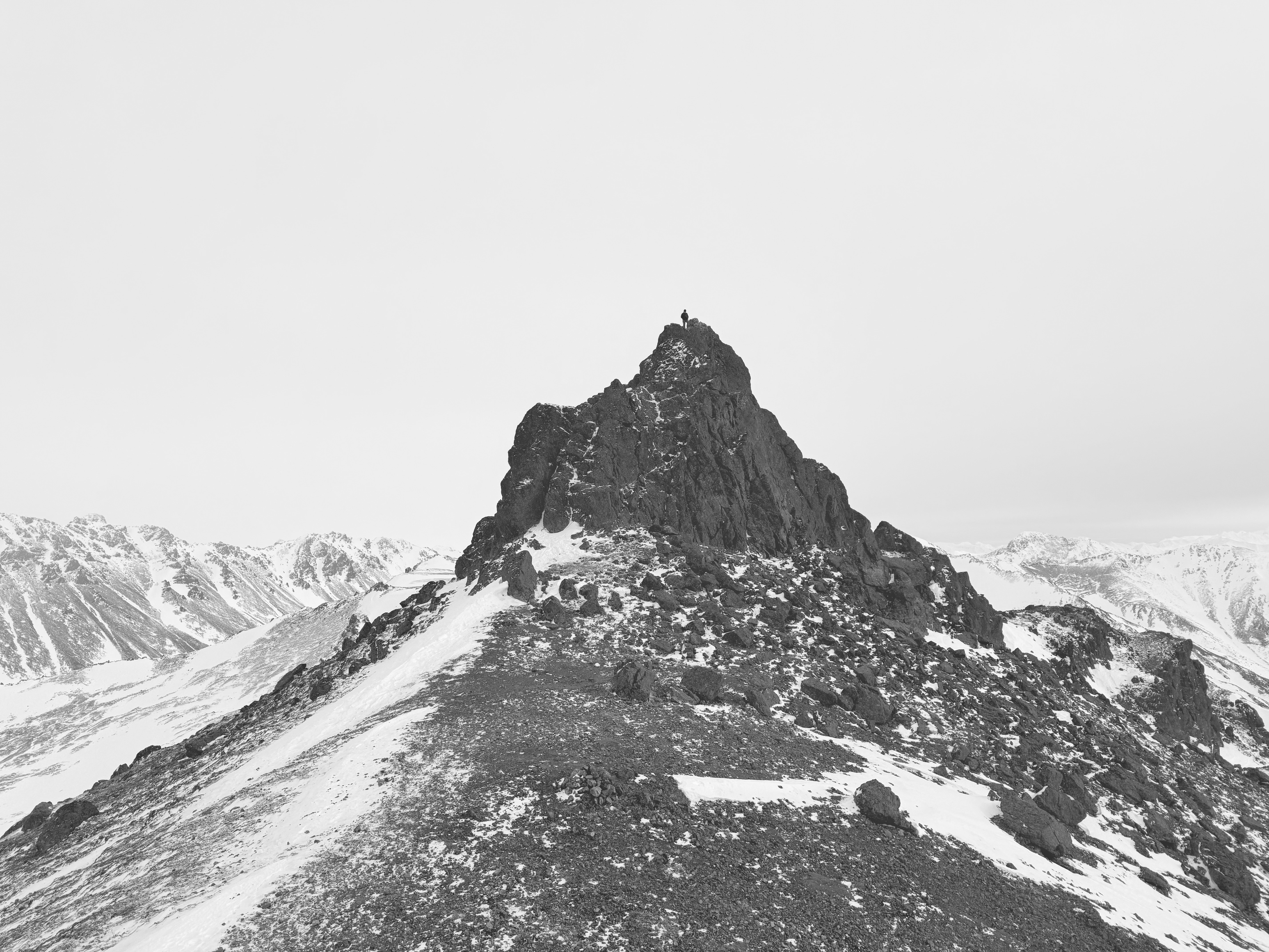
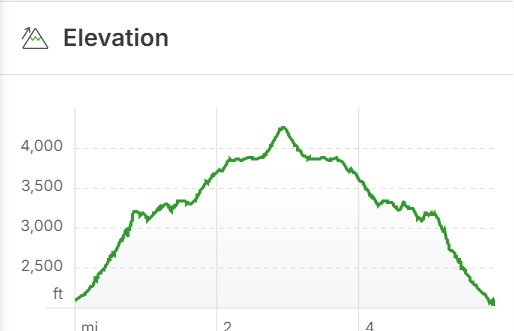
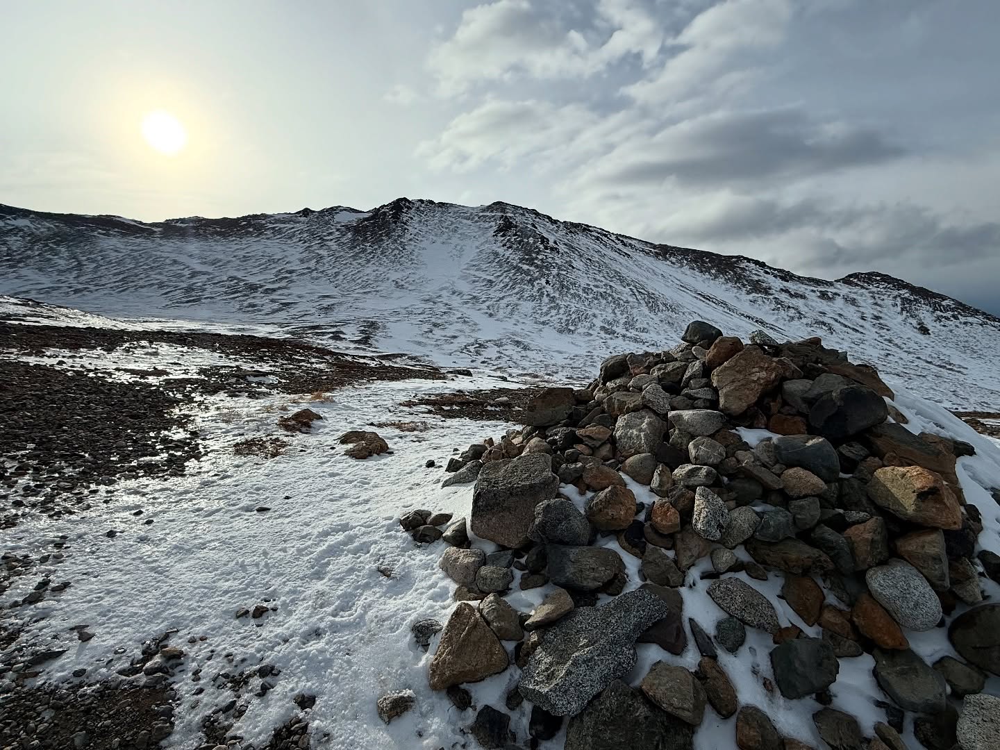
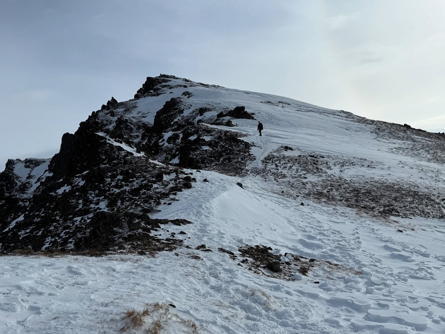
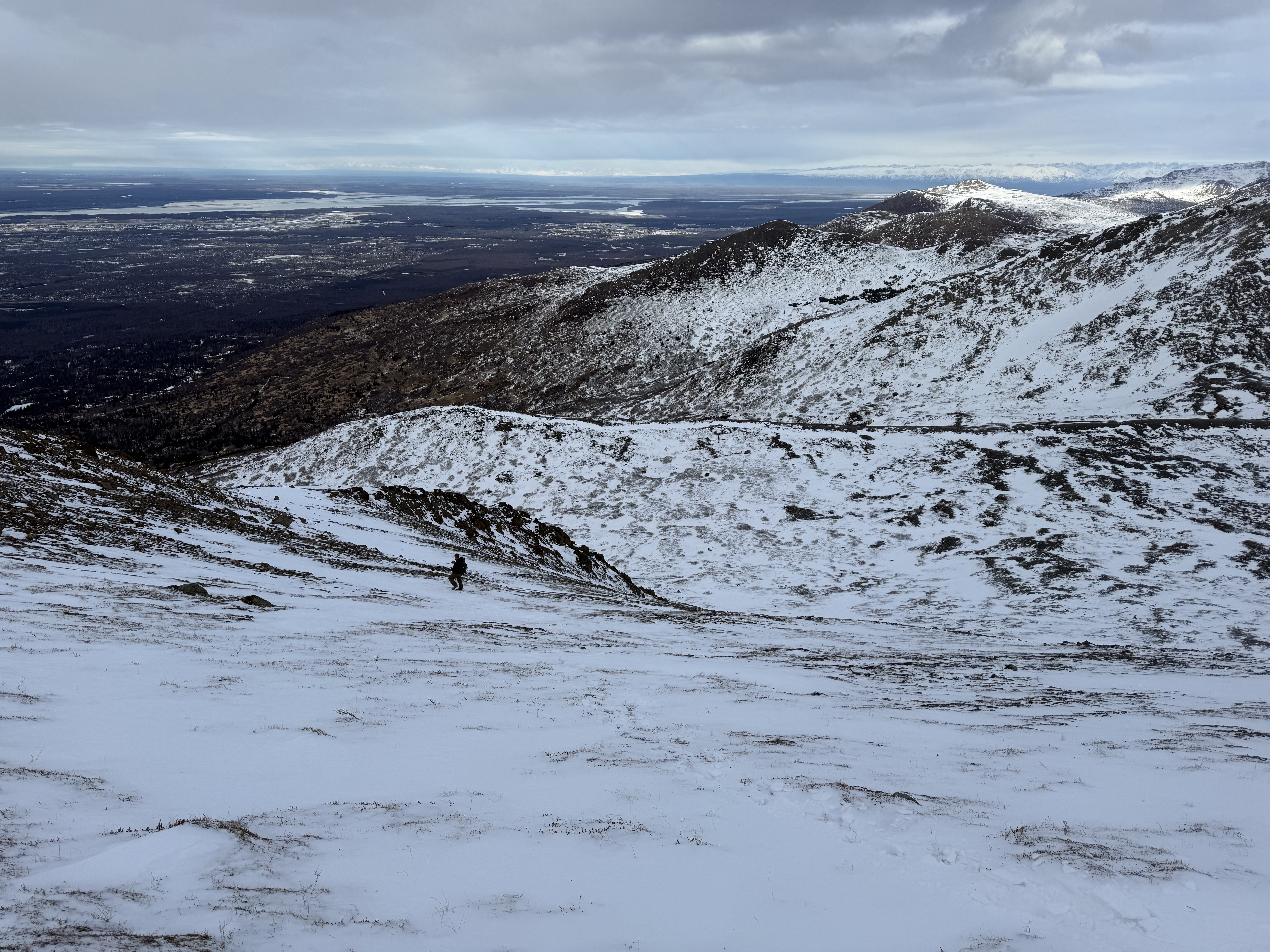
For mile and a quarter, the trail climbs 1,400′ out of the trees and up into alder country, this section notorious for holding punchy and/or crusty, icy snow. Microspikes come in handy on this stretch. Aiming for a low center ridge, this section of trail is relentless uphill and feels like the hardest part of the whole climb. The snow was like walking in mashed potatoes, hard to get a flat footing and a bit greasy, but the effort is worth it. We crested the low center ridge, rocky and windblown. A giant rock cairn welcomes you to the mountain.

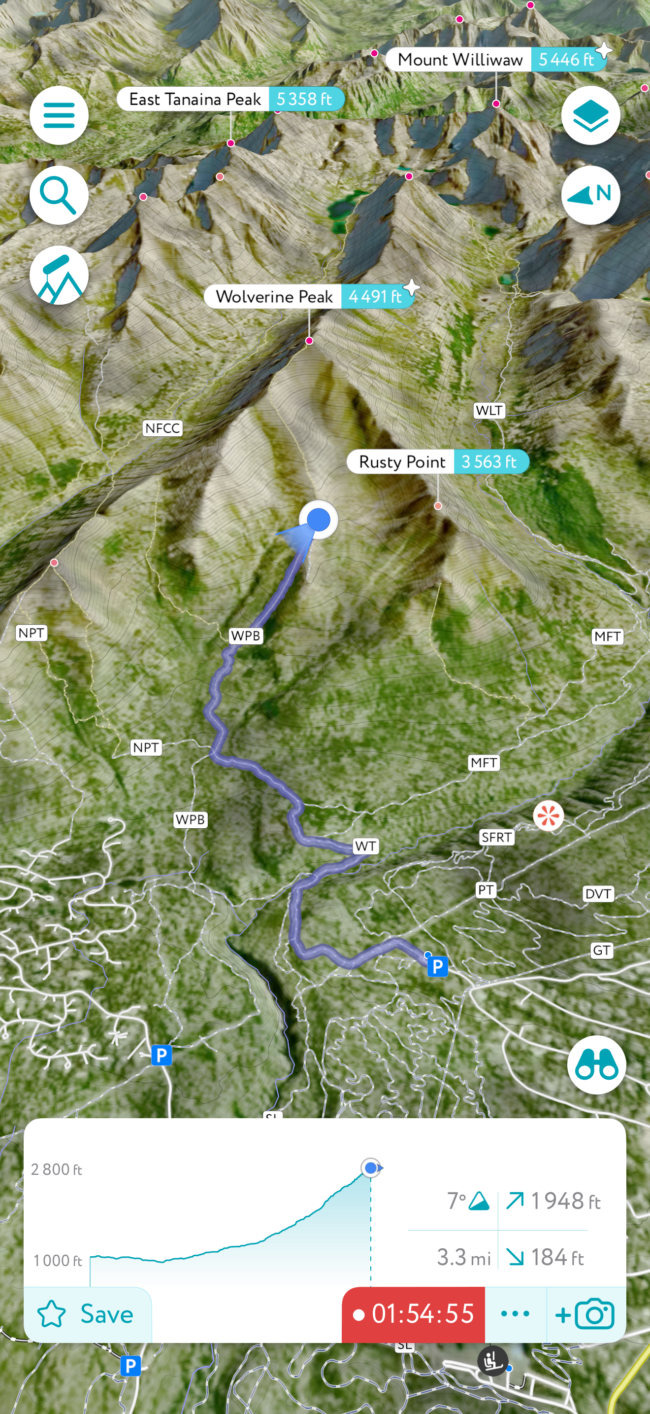
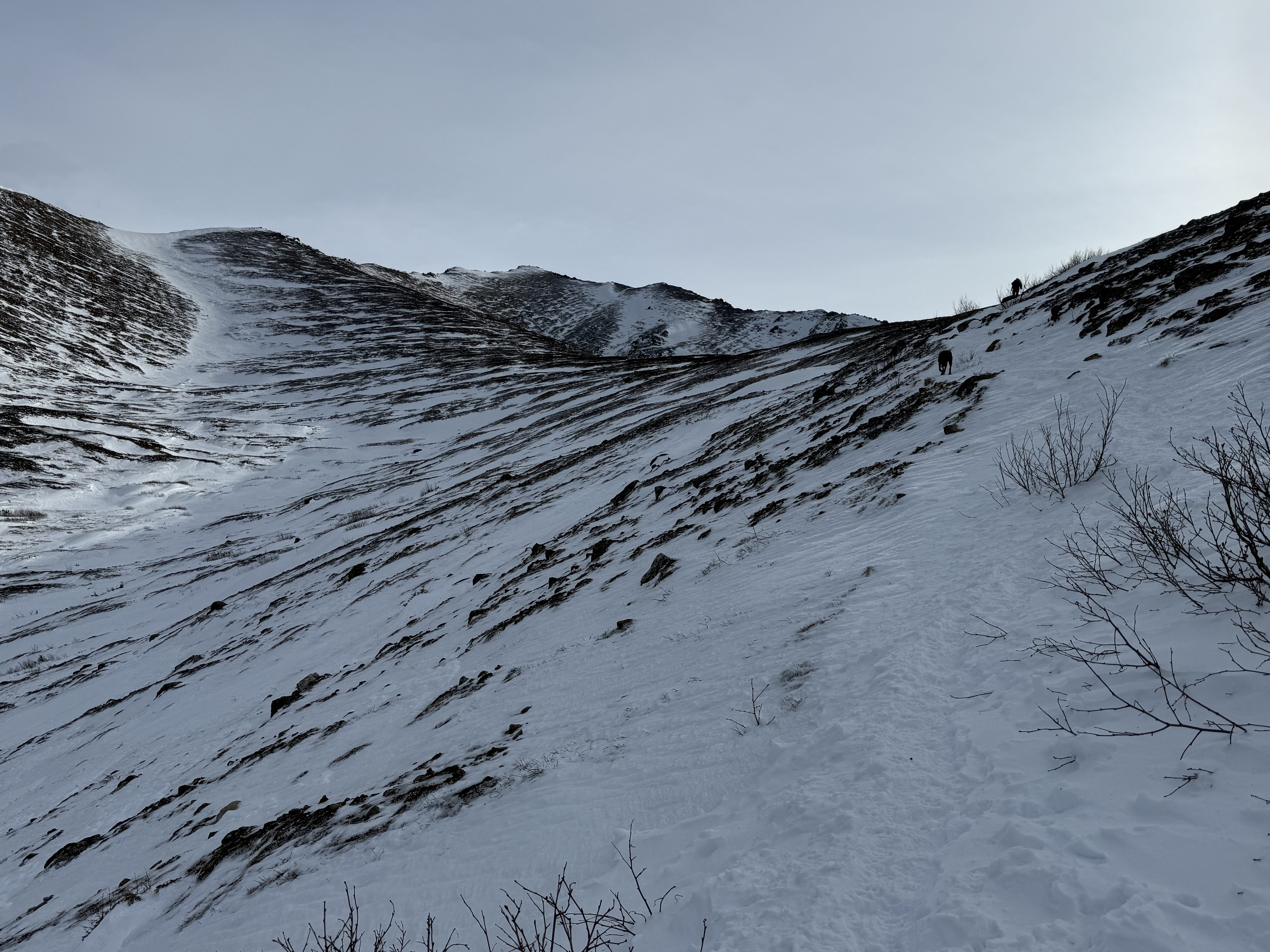
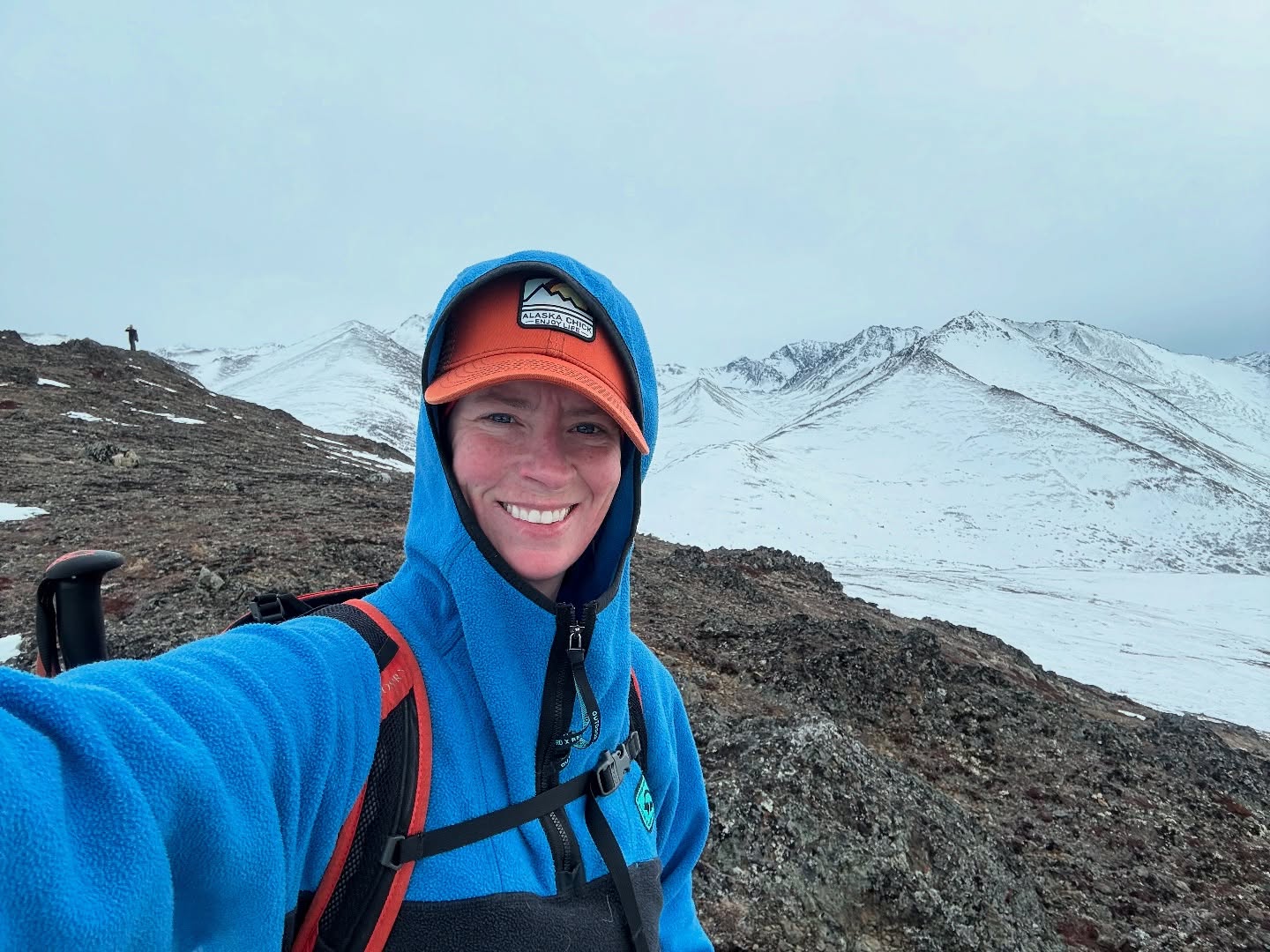
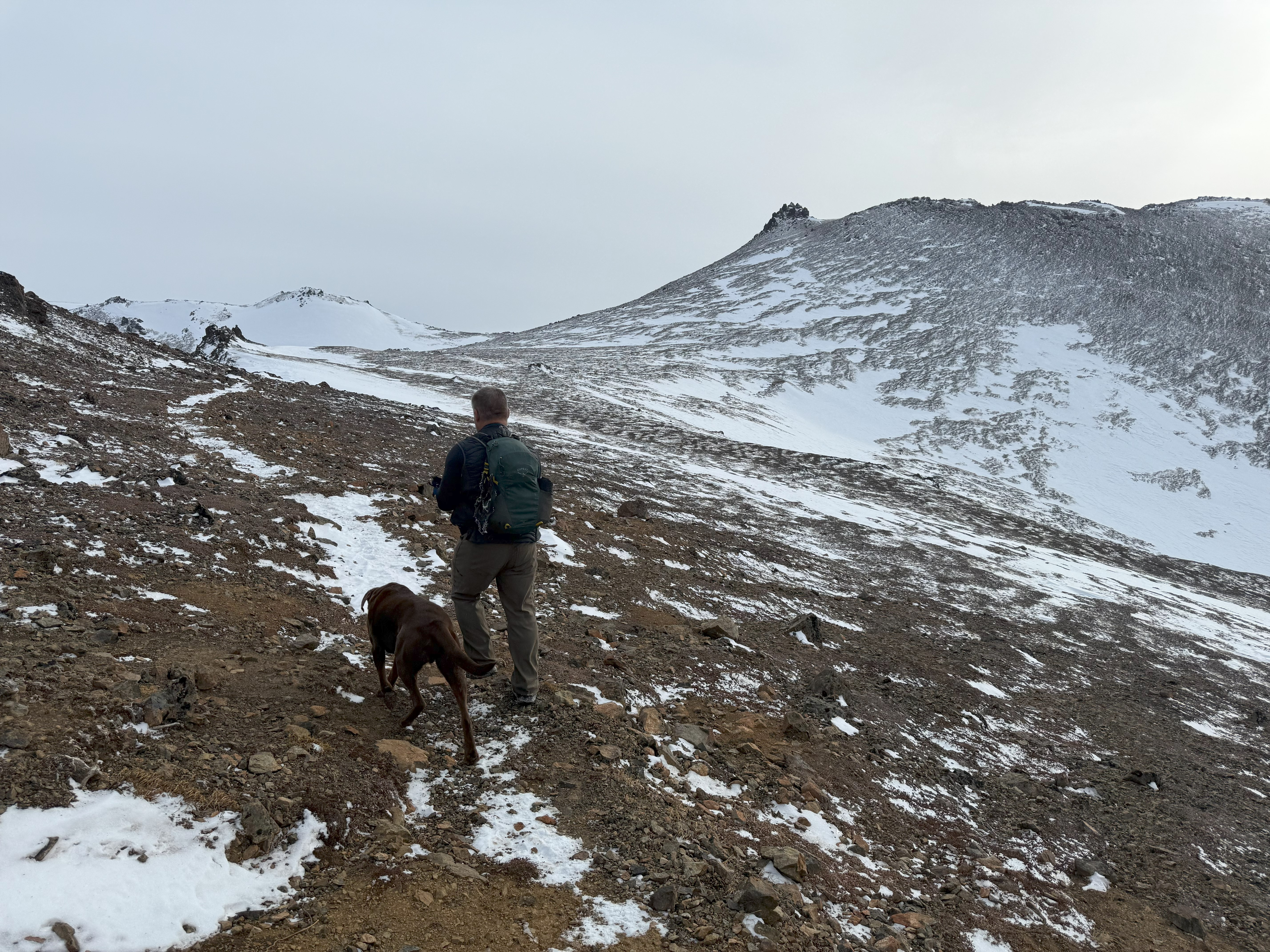
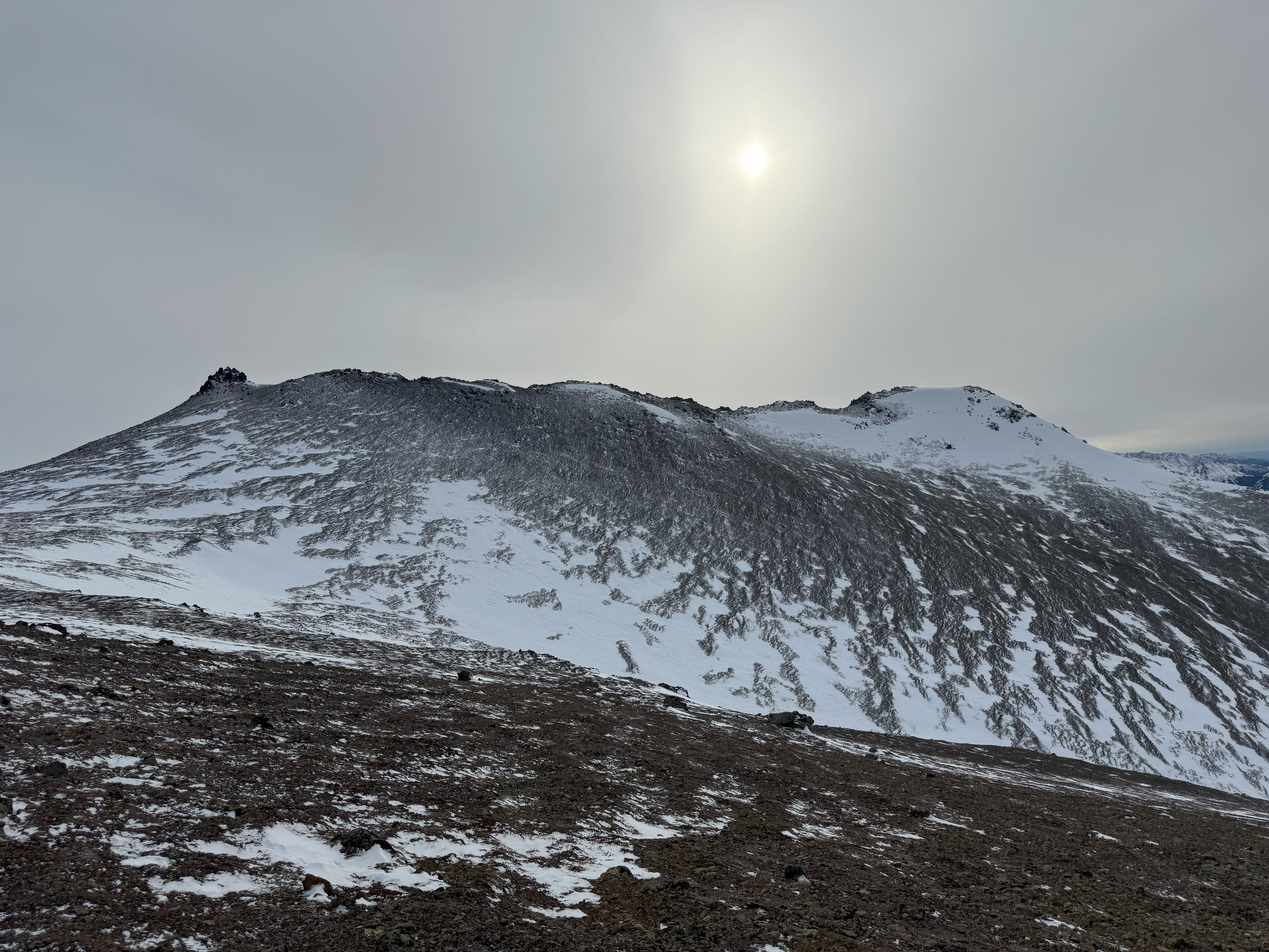
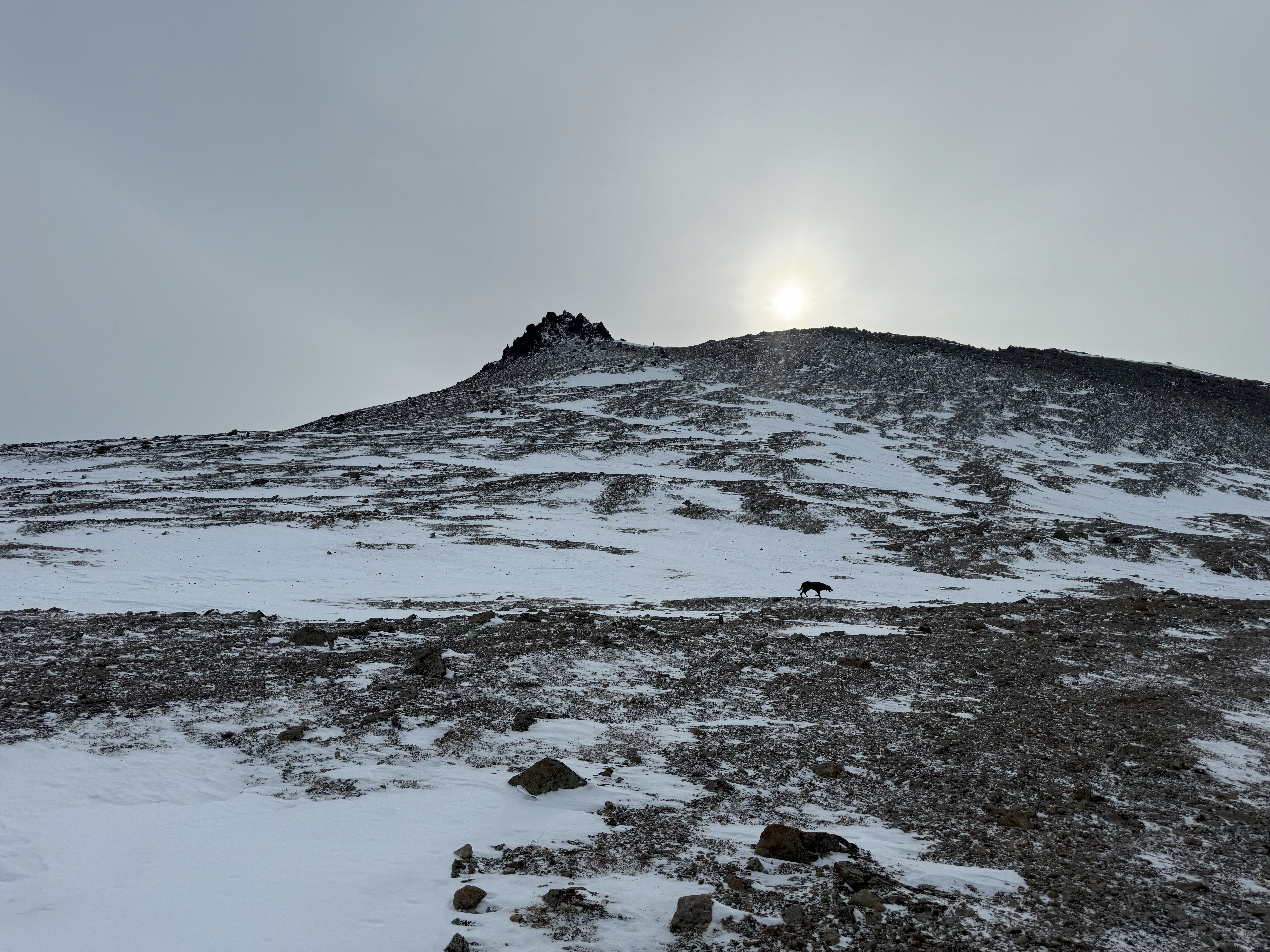
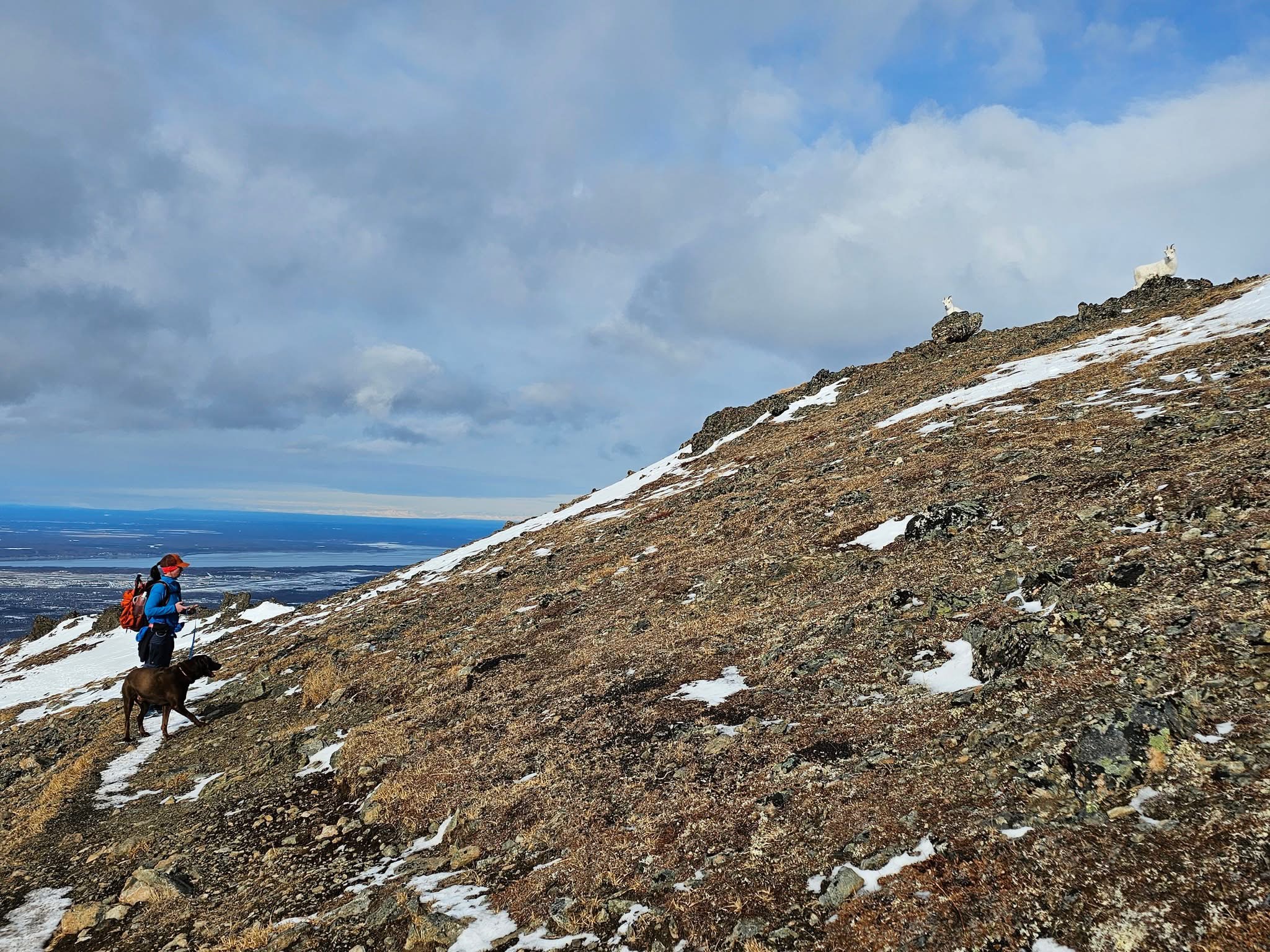
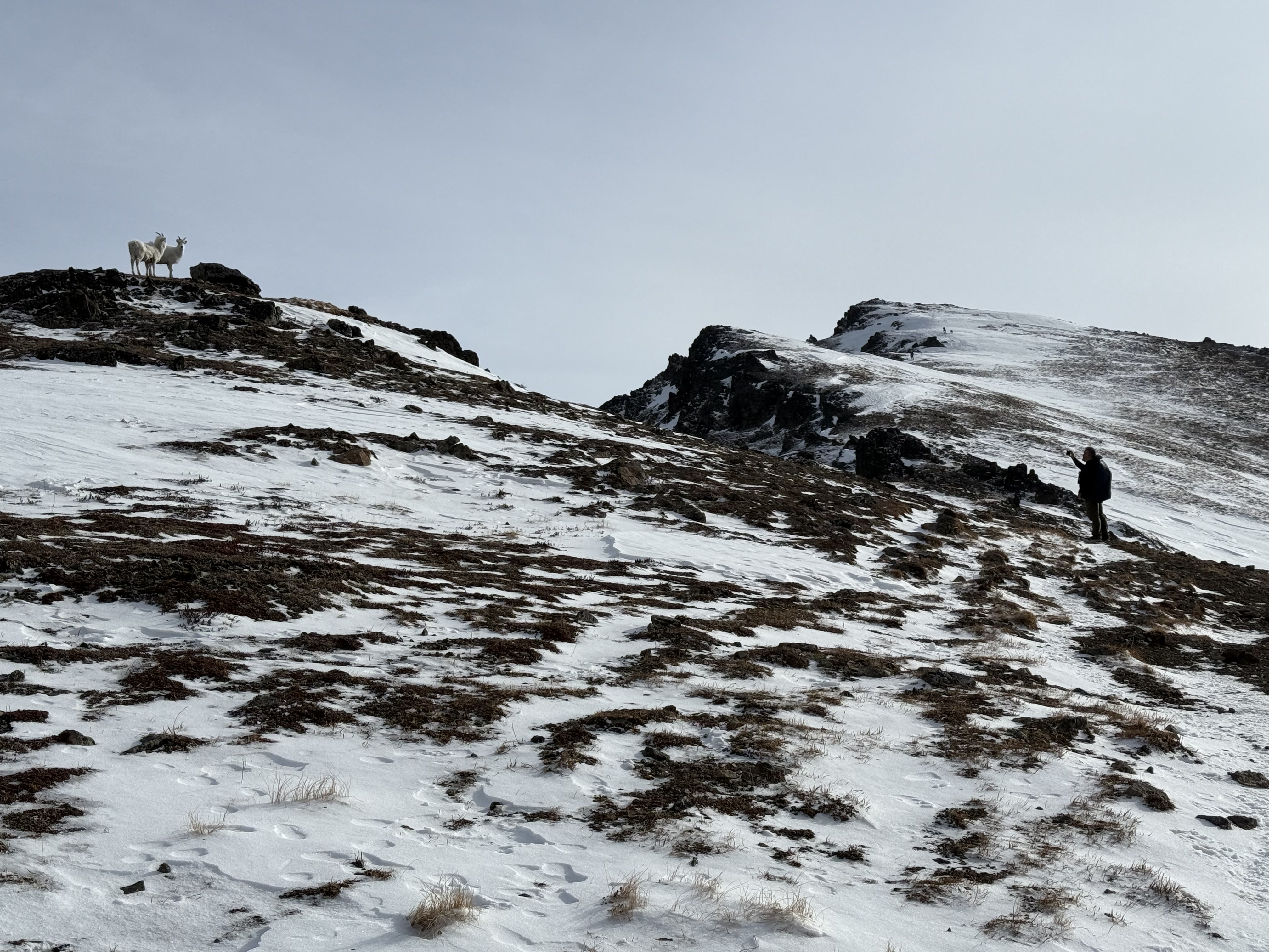
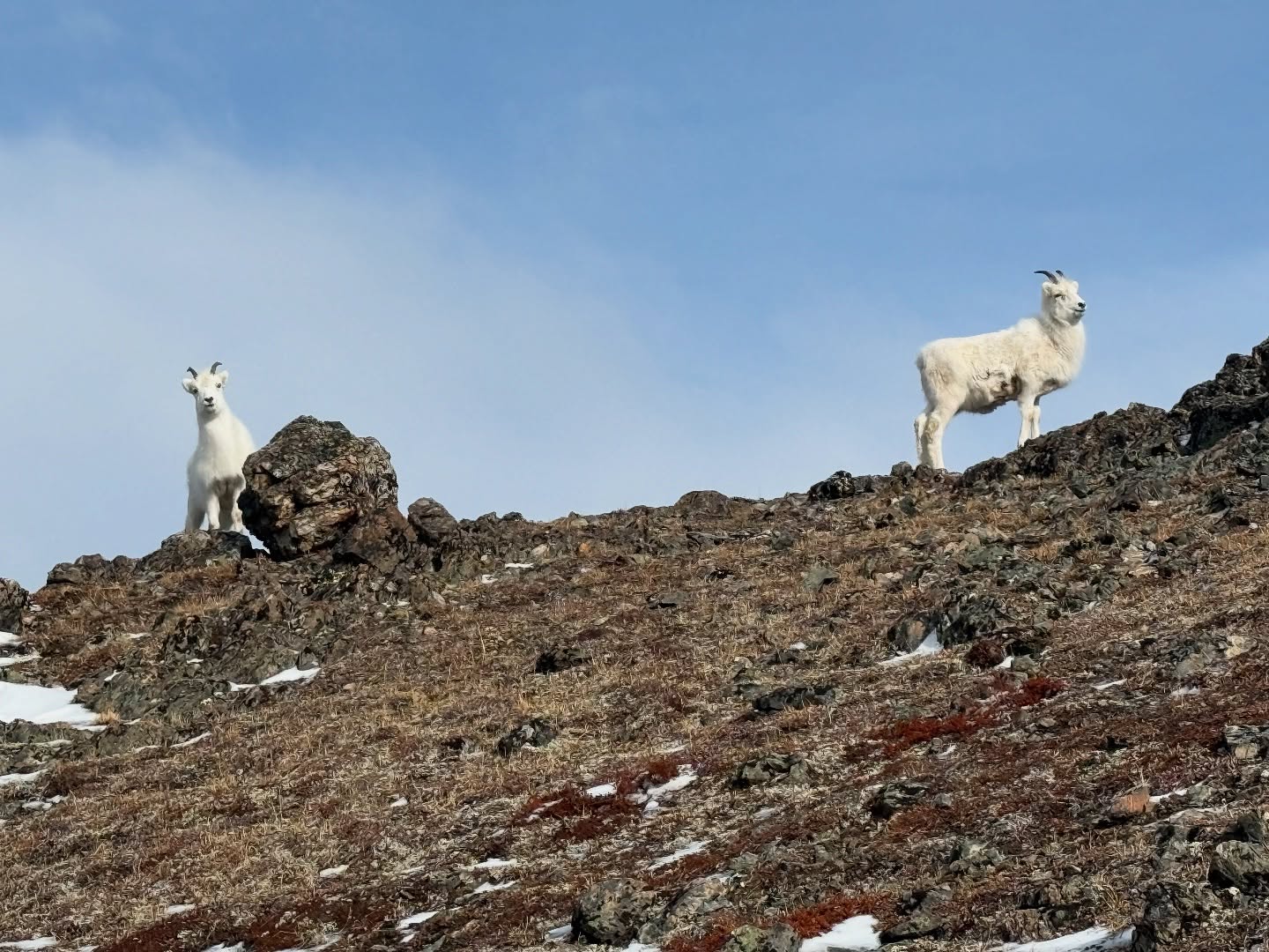
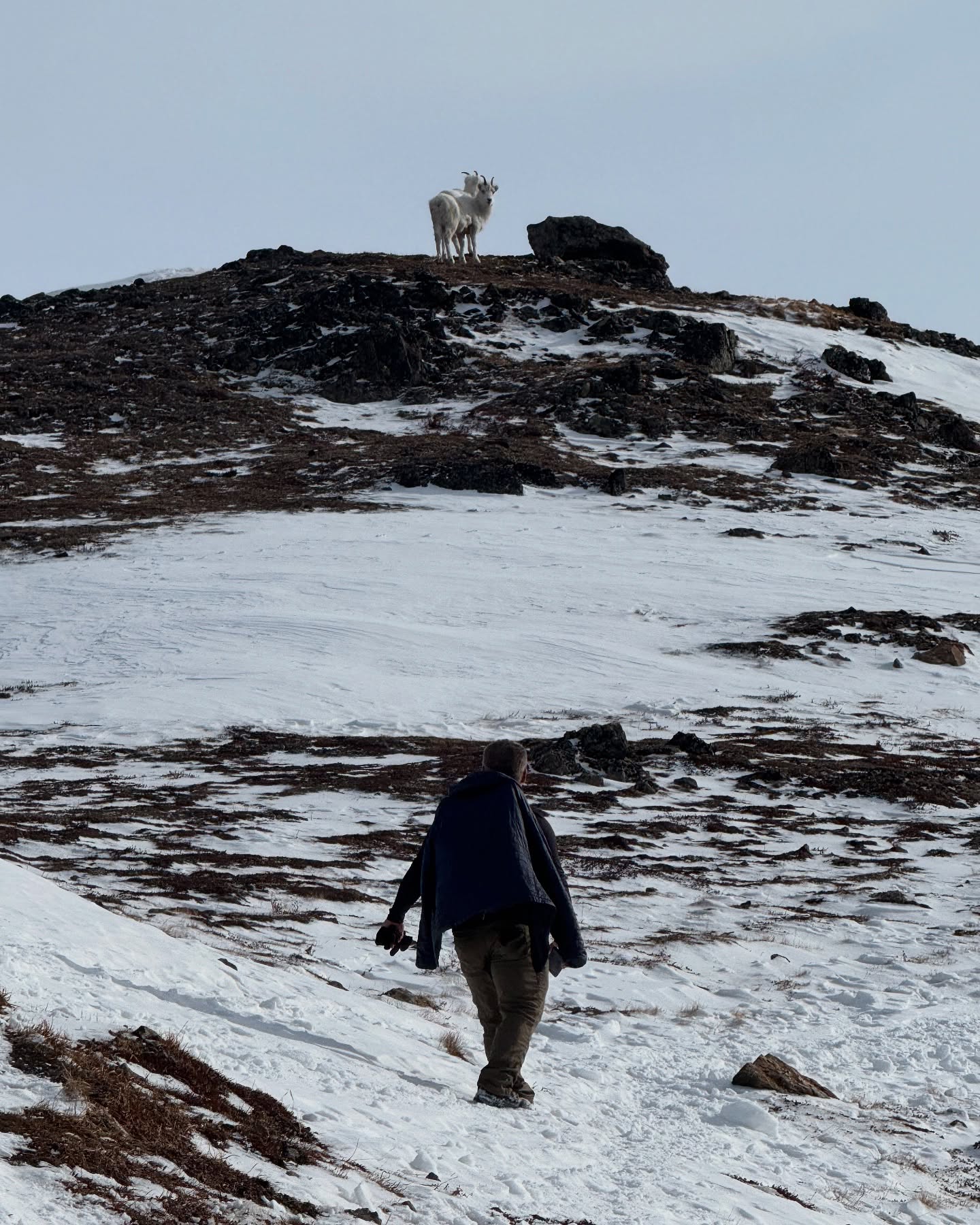
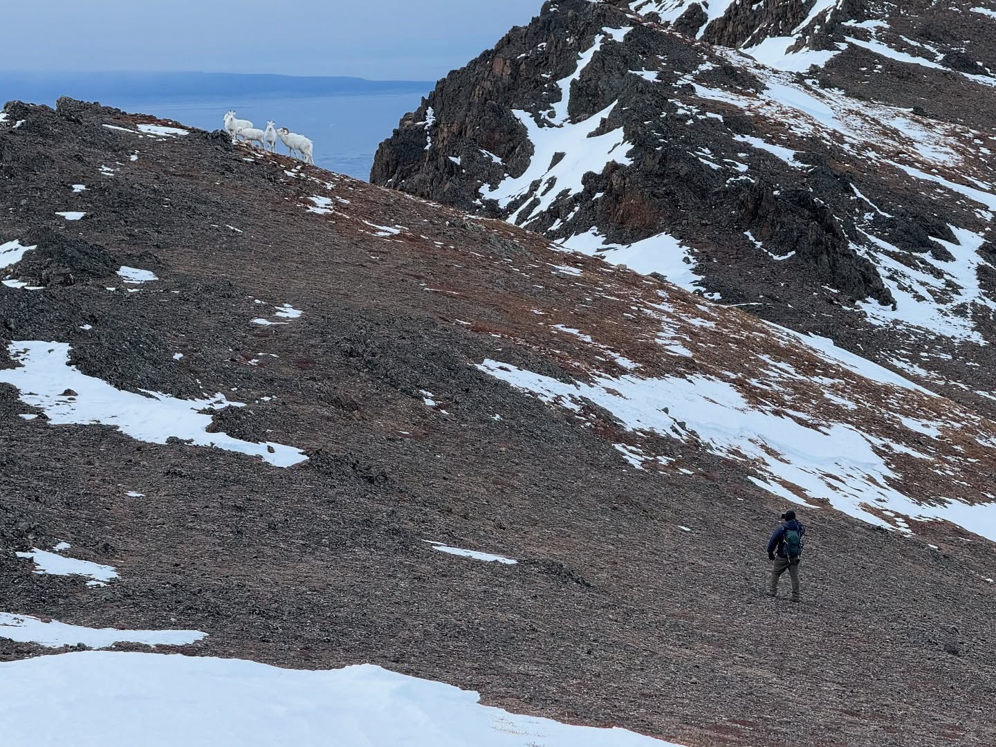
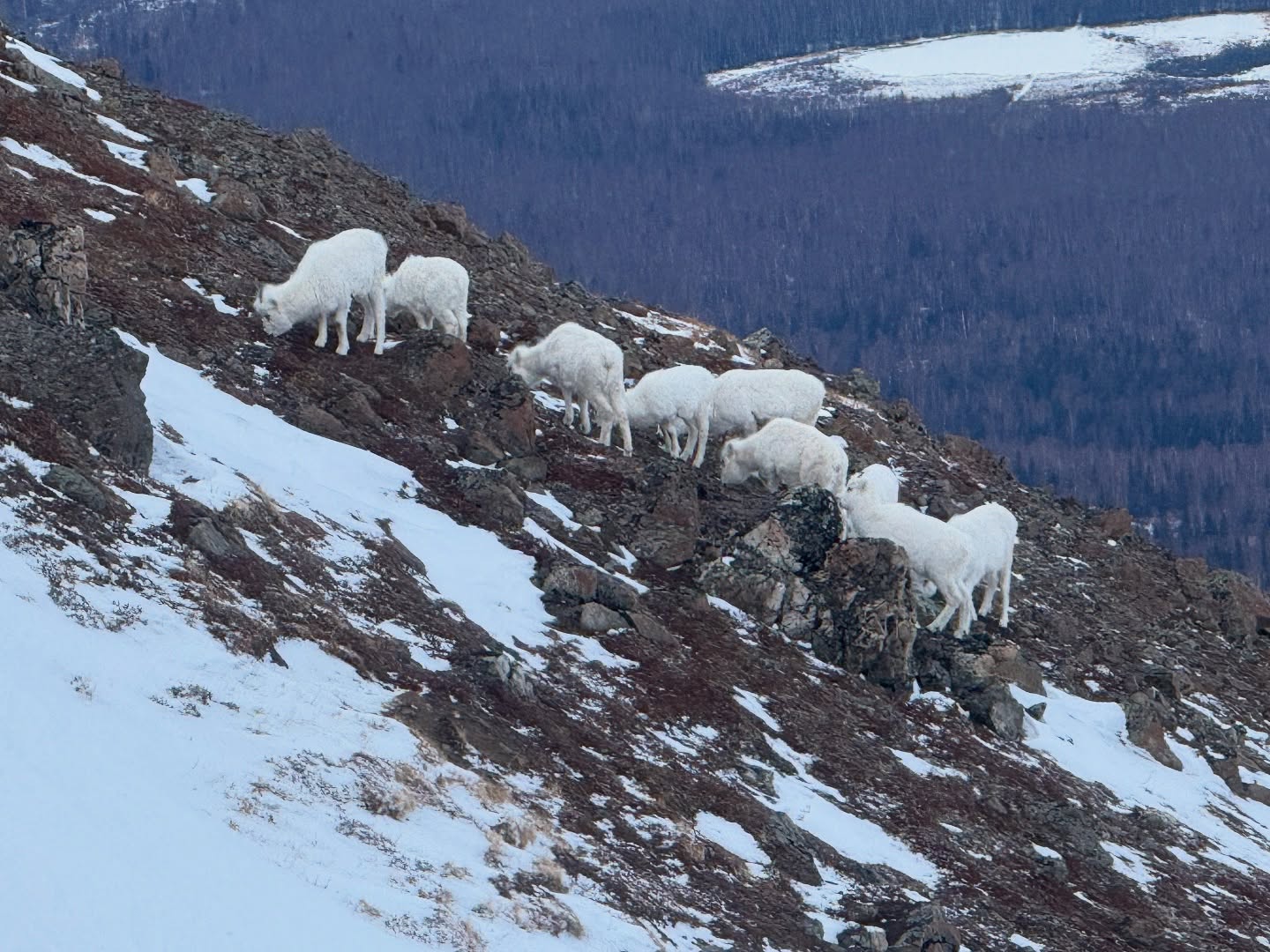
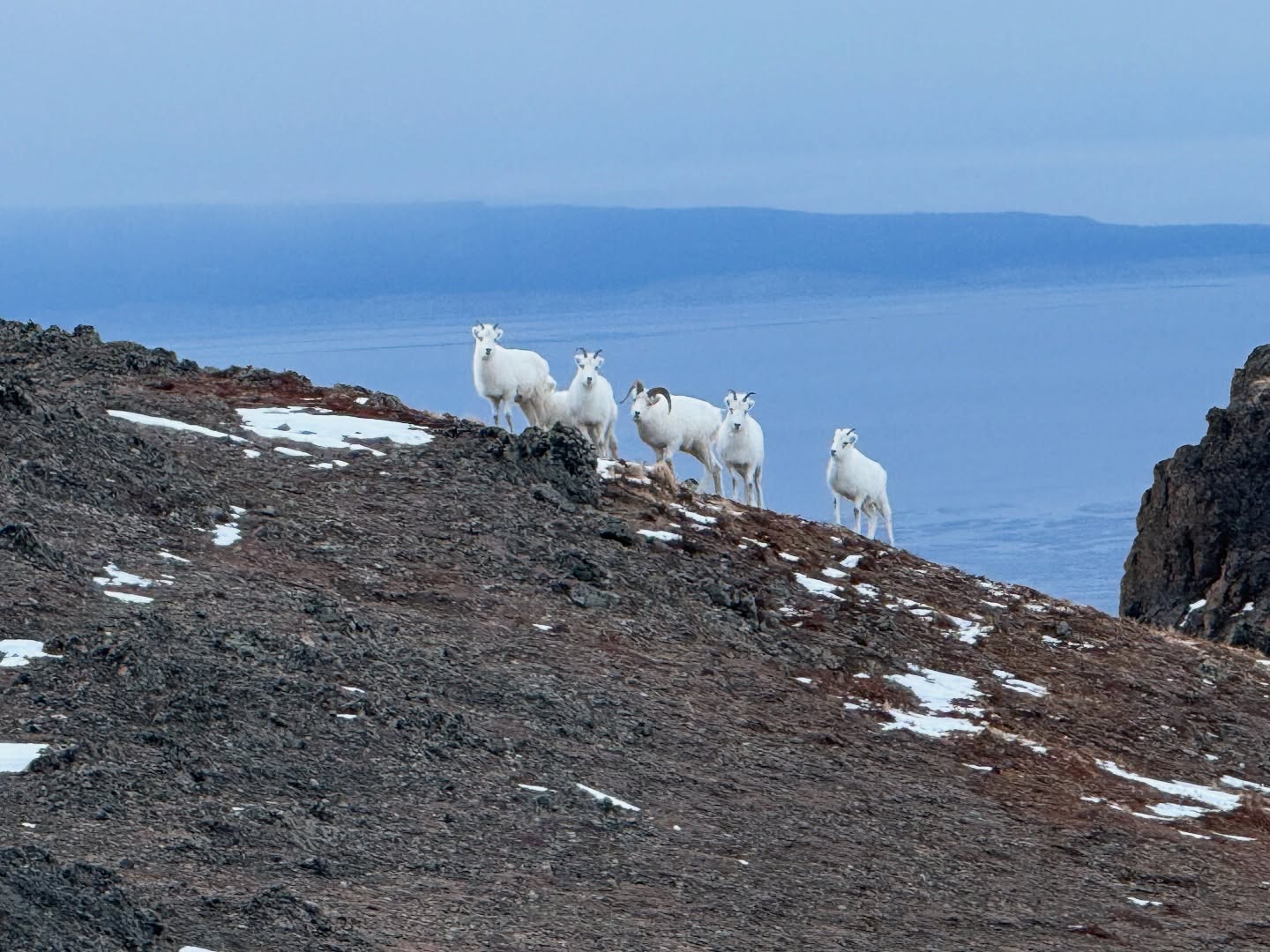
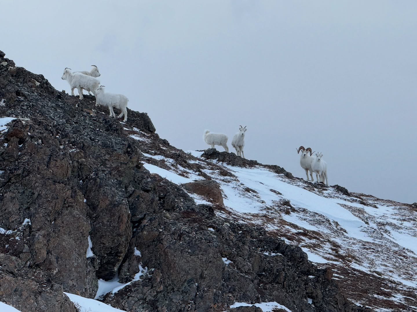
We took a short break, eating and drinking, before following the low ridge to the east, eventually ascending 1,100′ over a mile to the summit ridge. Windblown and relatively snow free, the ascent here was easier than our earlier uphill walk, and we made good time to the summit ridge. By now there was quite a bit of traffic on the route, as many trail Anchorage trail runners use this mountain for regular training trips, and one of the parties descending warned us of a collection of Dall’s Sheep not too far ahead. To avoid any conflict, I put Goose on a leash, and we continued on along the summit ridge, now only 400′ above us.

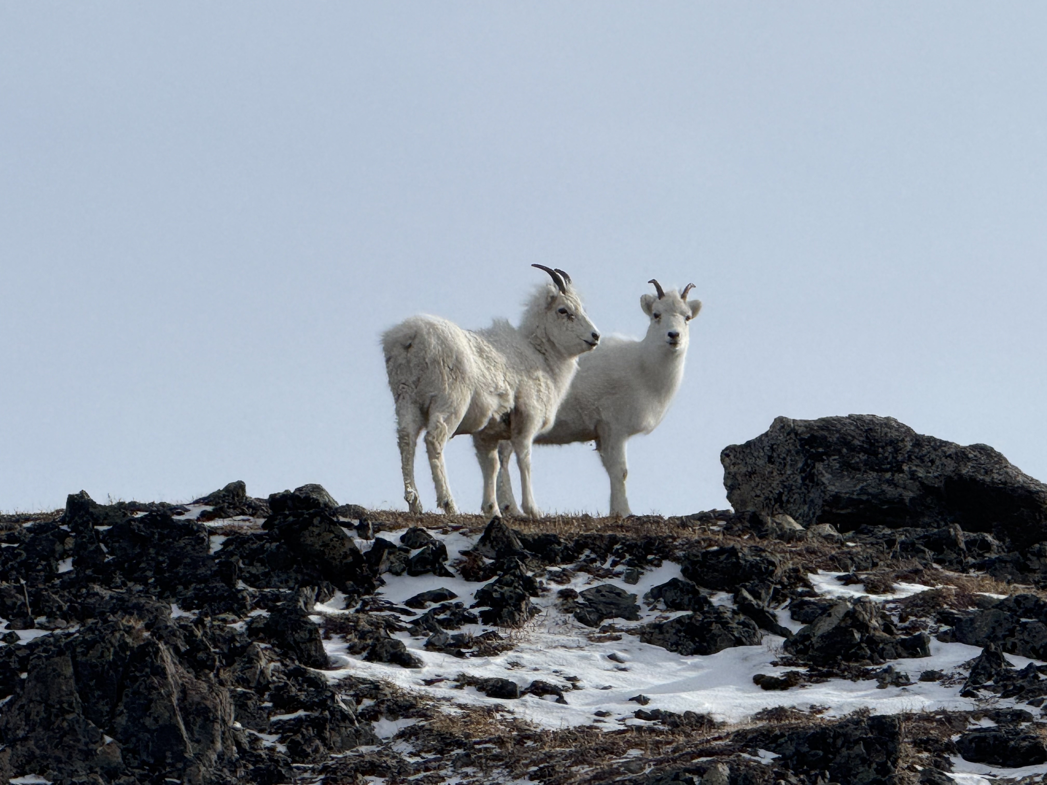
Sure enough, one then two sheep appeared on a high point on the ridge, inquisitive and unbothered by our presence. One was clean and bright white, while the other appeared to have just woken from a long winter’s nap, hair disheveled and discolored. The summit was so close, although a couple of lingering snow patches remained.

The snow conditions variable, either icy or punchy, I still hadn’t put on my spikes and mentioned to Jason I was going to do so for the last stretch, but it was too late… my feet slipped out from under me and went face first to the snow, my 2-liter water bottle slipping out of my pack side pouch. I watched in horror as the majority of my water started sliding down the icy slope. I usually clip it in but hadn’t this time. How could I be so careless! I held hope it would stop on a grass patch, but I wasn’t so lucky… I watch the water bottle skitter 1,000 feet down. No chance of recovering it today with the icy snow in the chute, but I promised myself to return and retrieve it in the near future.

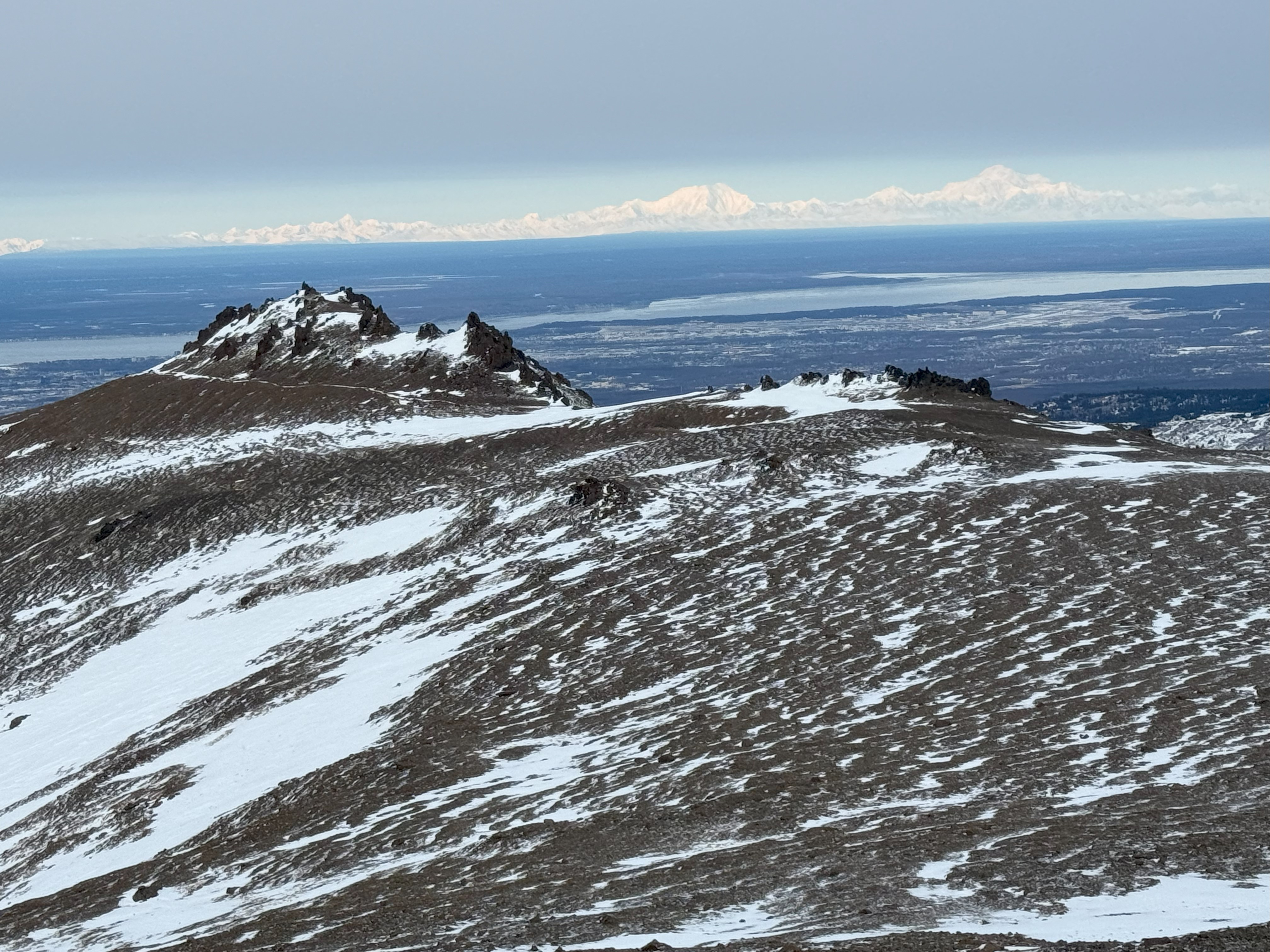
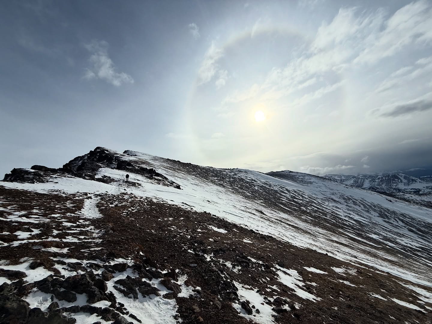
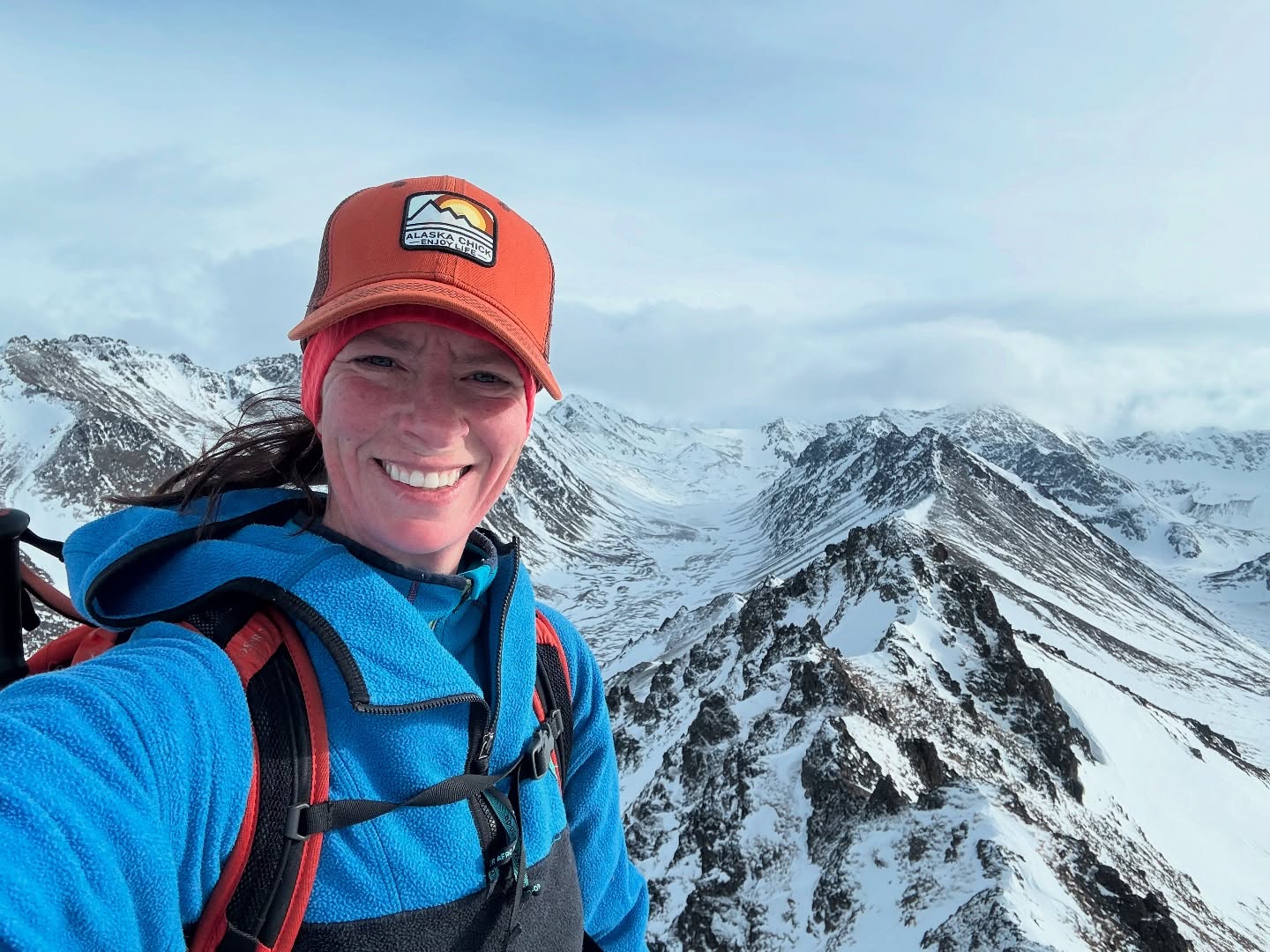
My frustration quickly turned to excitement as we crested the last snow patch and up to the summit of Wolverine. Views for days!!!!

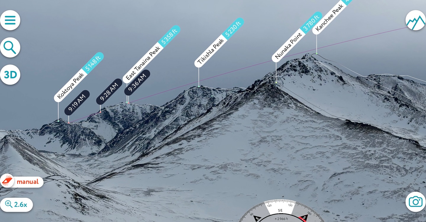
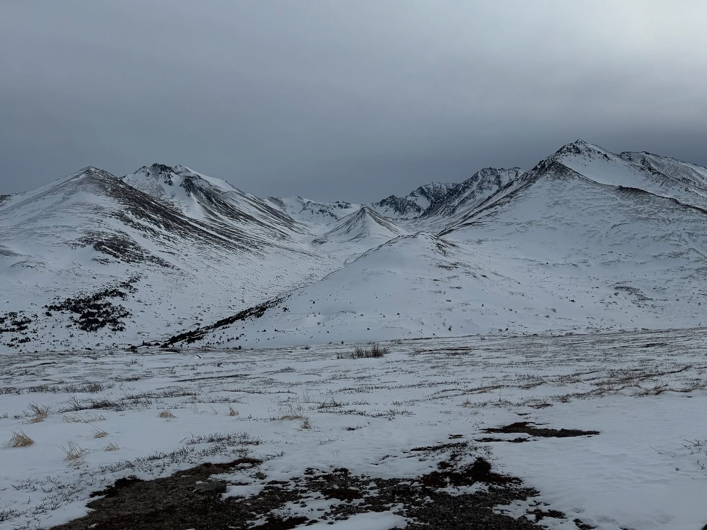
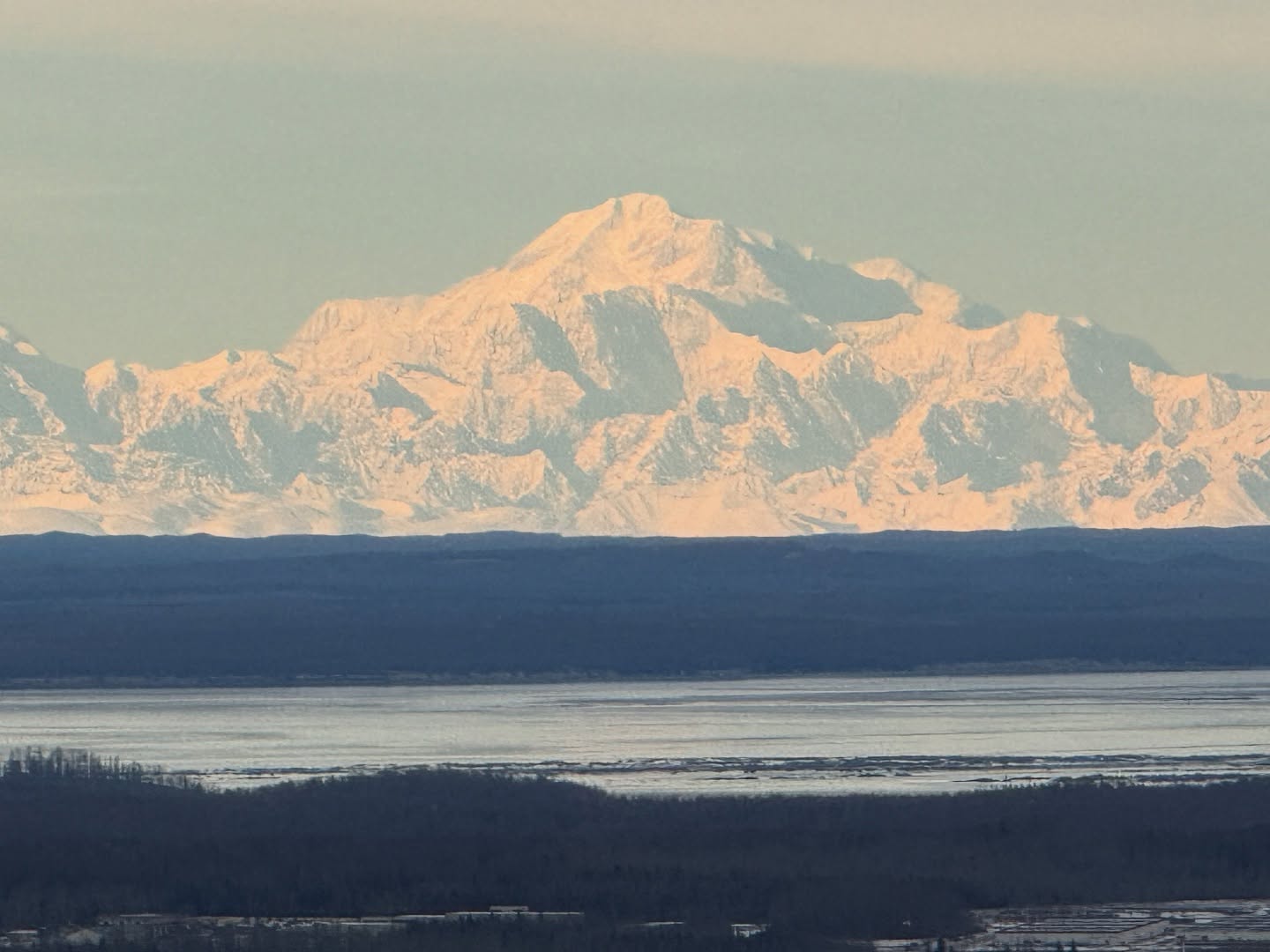
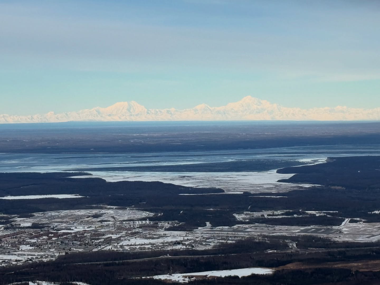
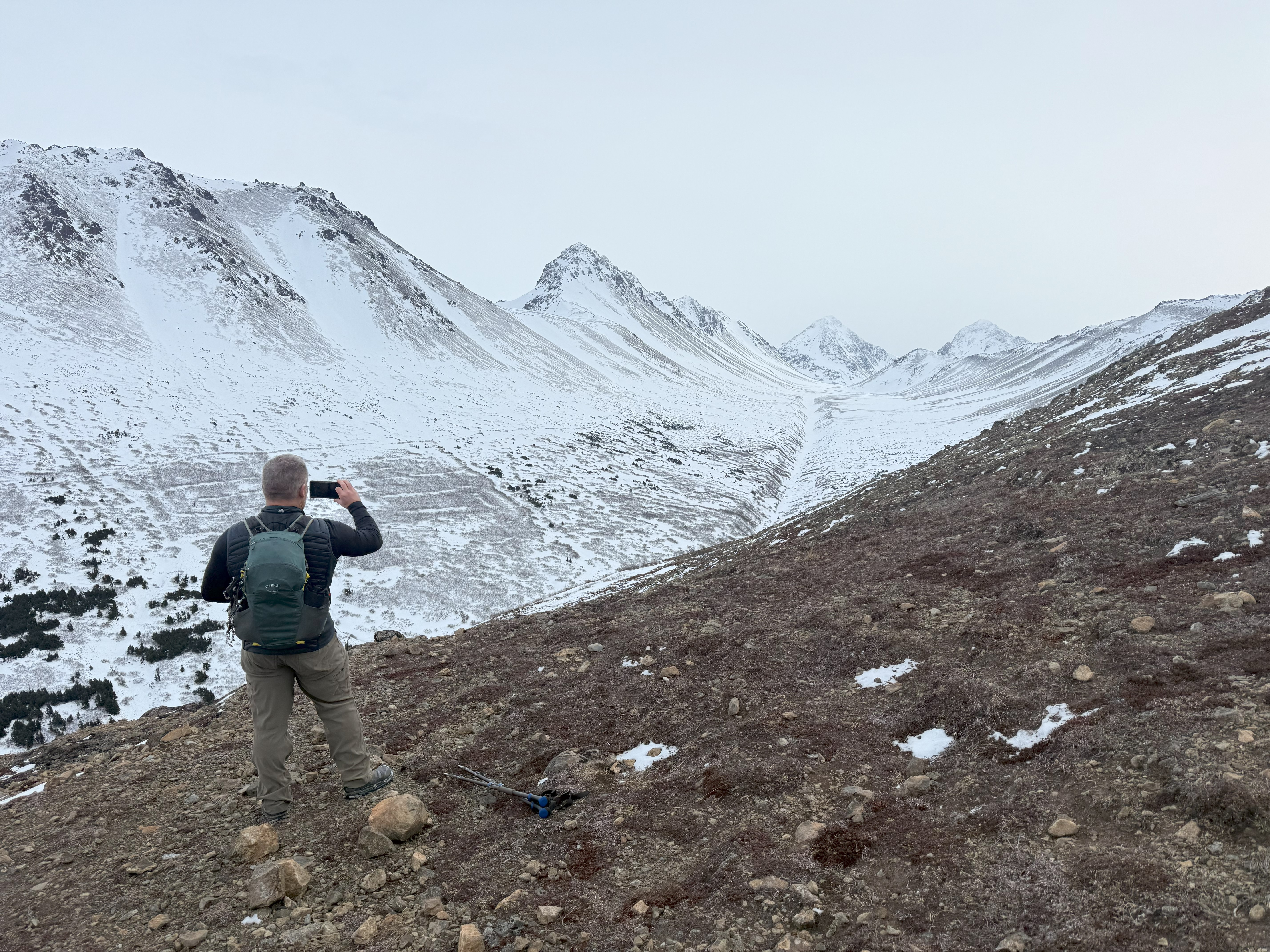
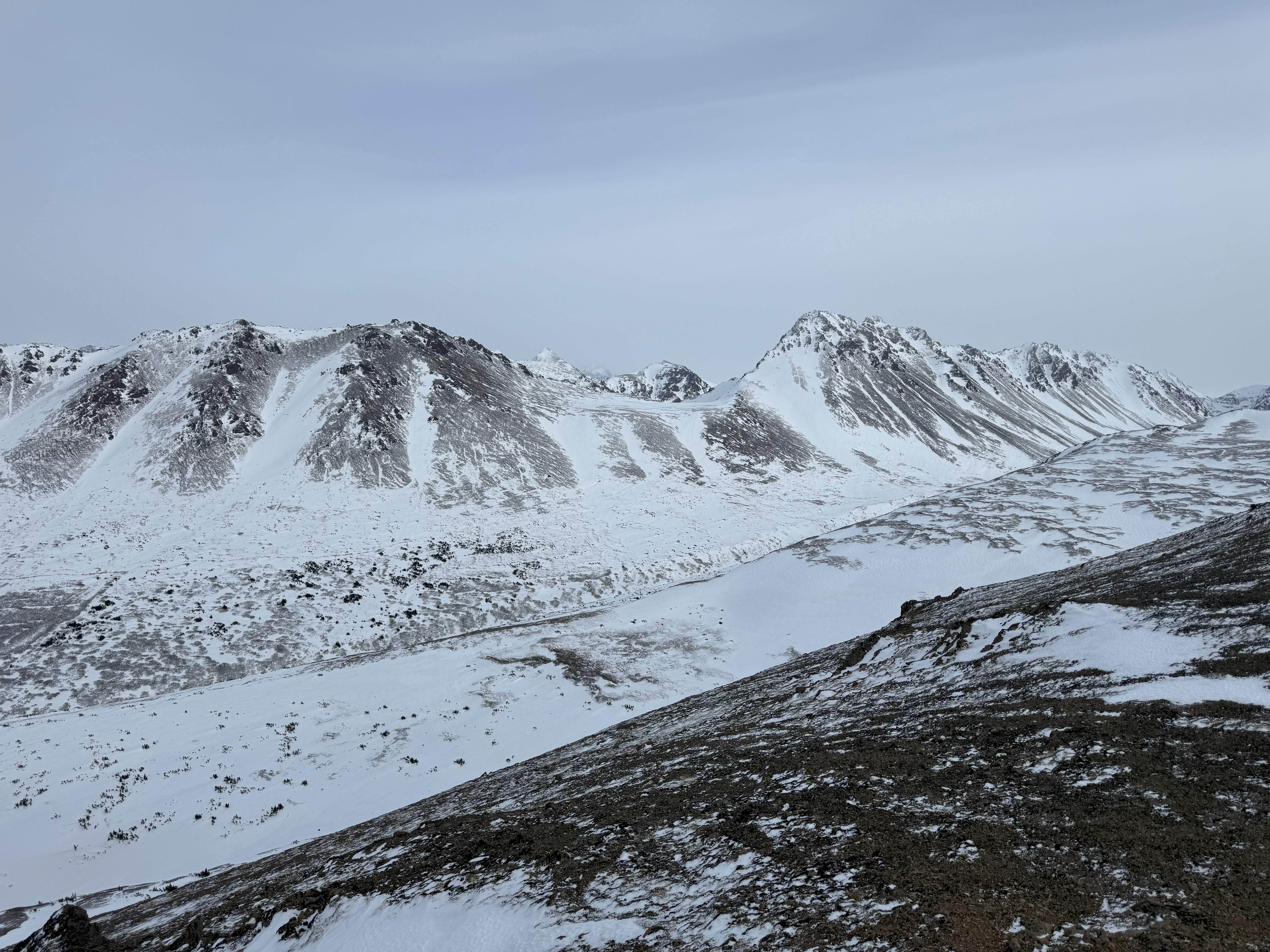
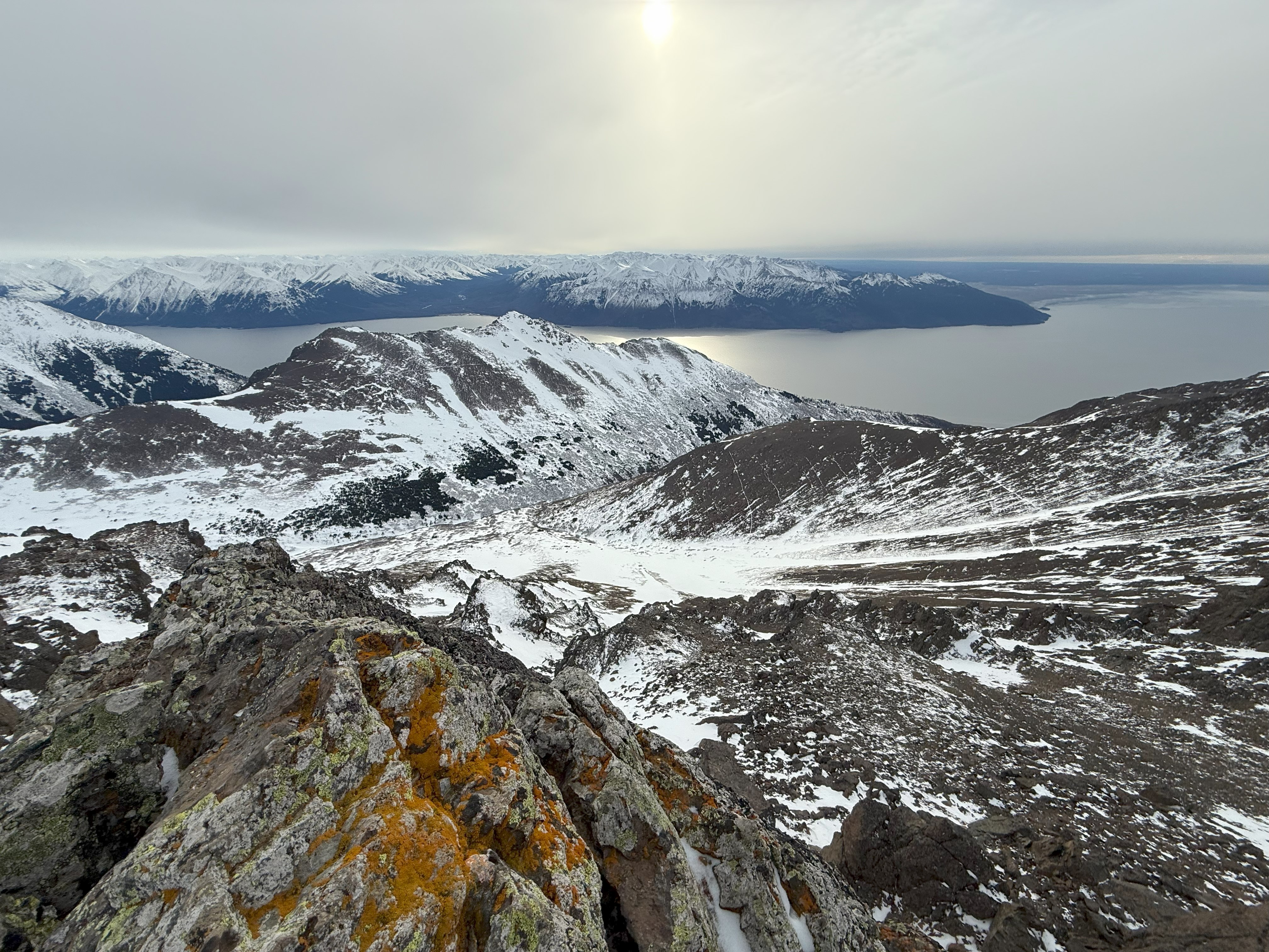
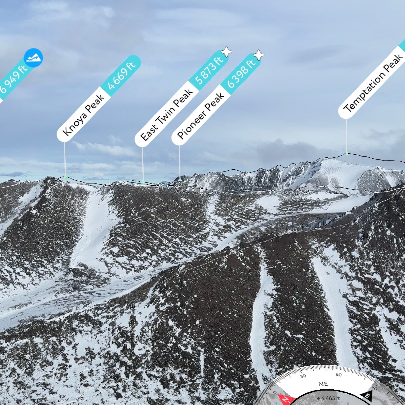
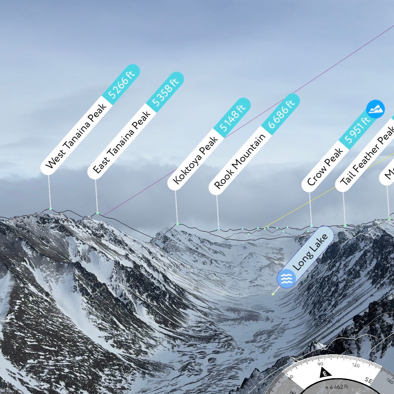
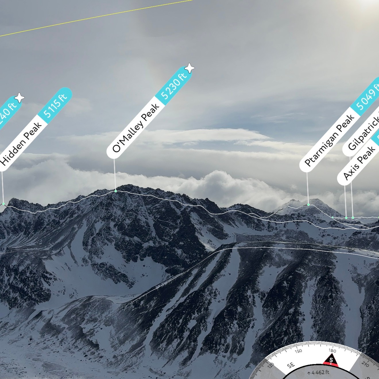
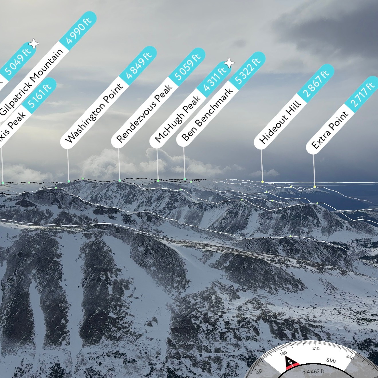
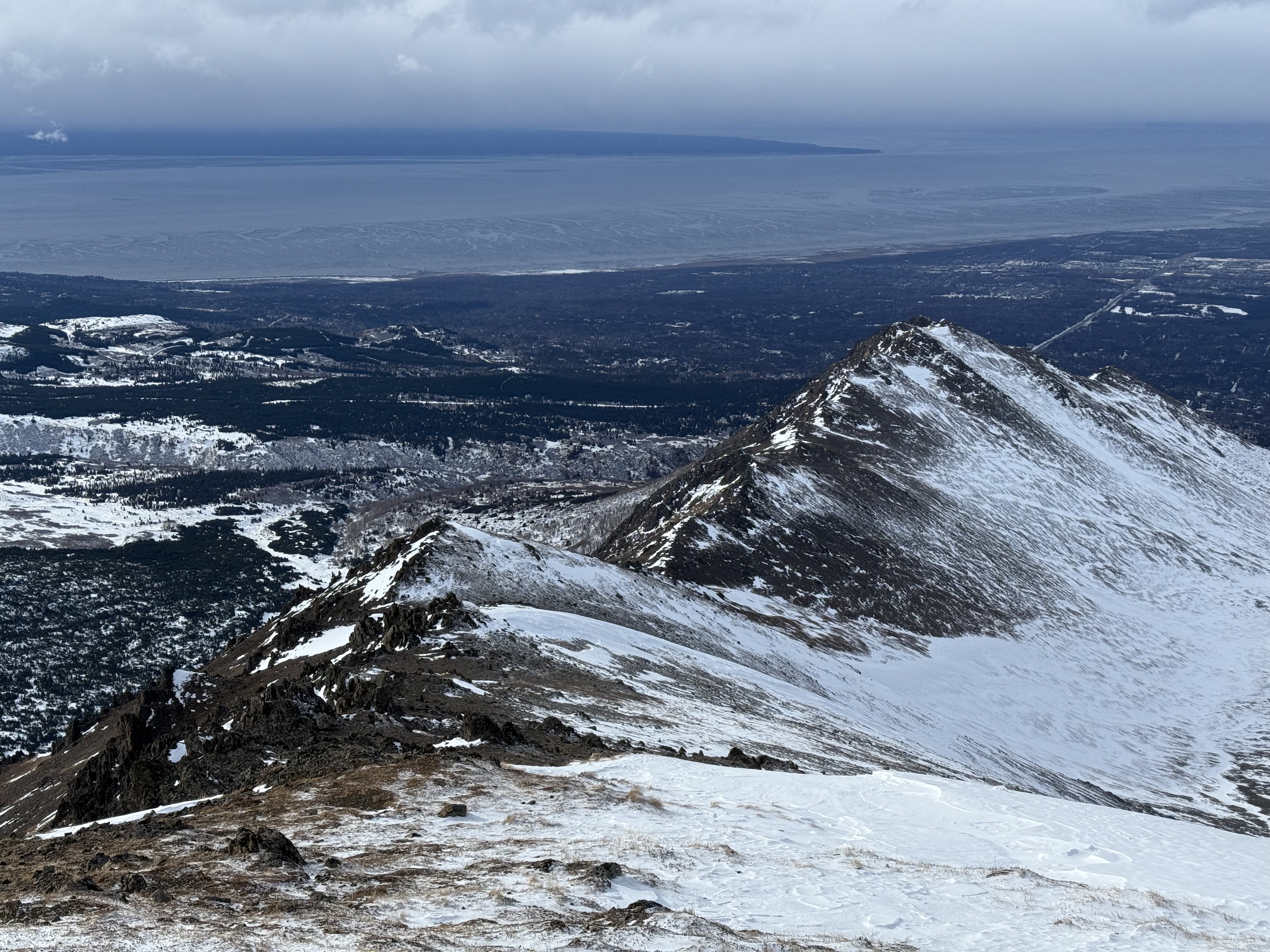
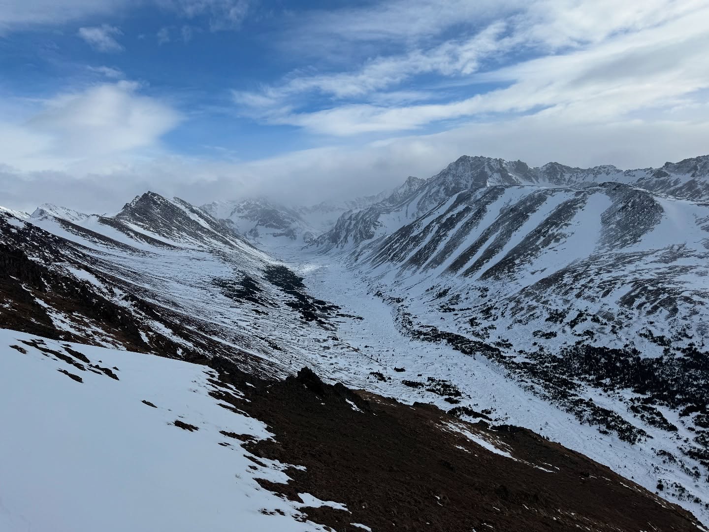
Wolverine has some of the best views from the front range of the Chugach Mountains, including almost the entire Long Lake to Williwaw traverse. Near Point, Snow Hawk, Kanchee, Knoya, Tikishla, West and East Tanaina, Koktoya, Williwaw, The Ramp, Hidden and O’Malley create a horseshoe around Wolverine and the east ridge to Mt Elliot. I reminisced about the ones I had climbed already and daydreamed about the ones I still had on my list. Although it was variably cloudy skies with patches of blue, we could identify peaks far in distance, beyond the Front Range.

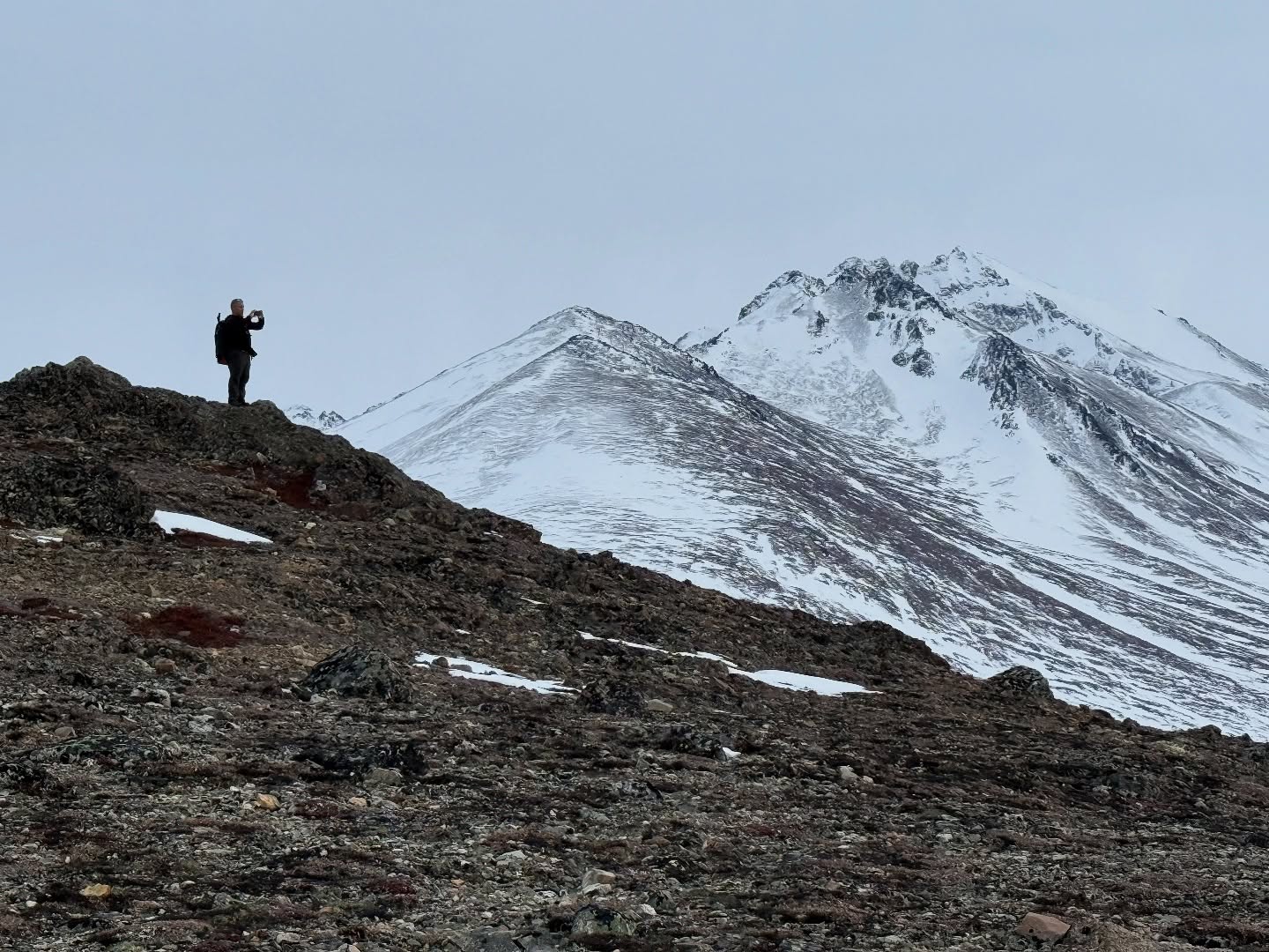
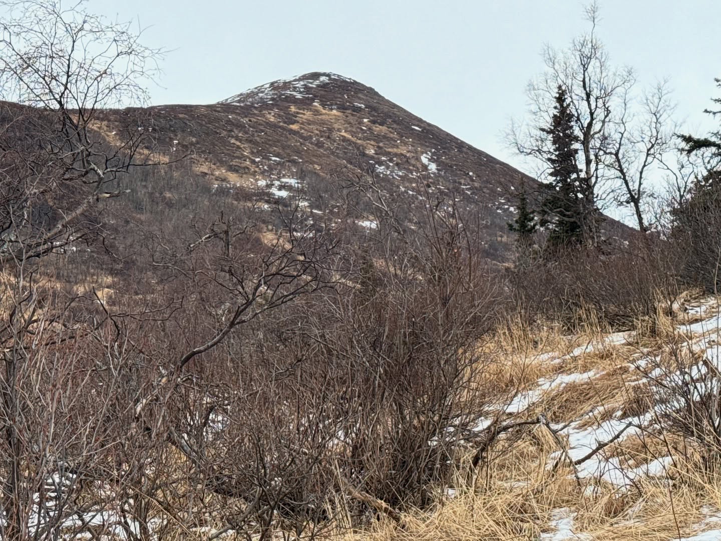
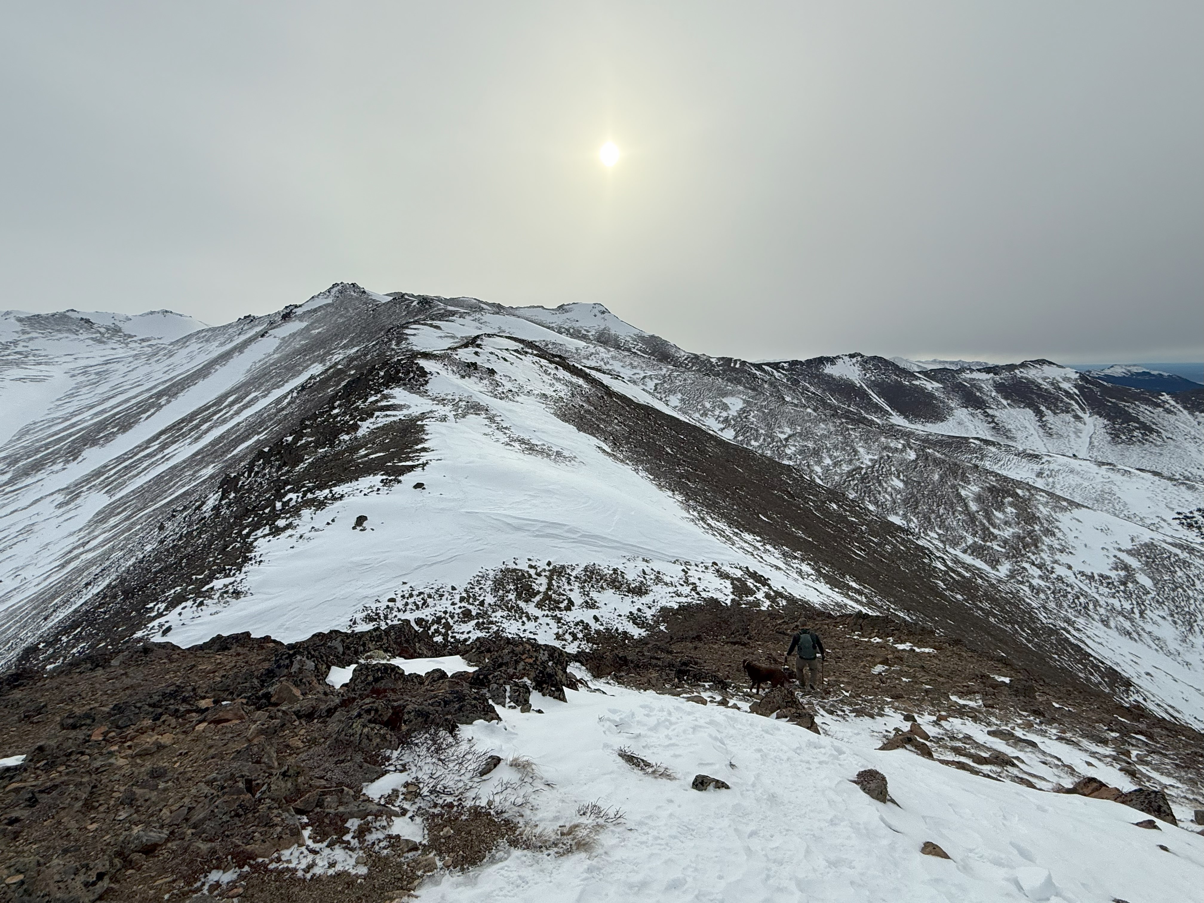
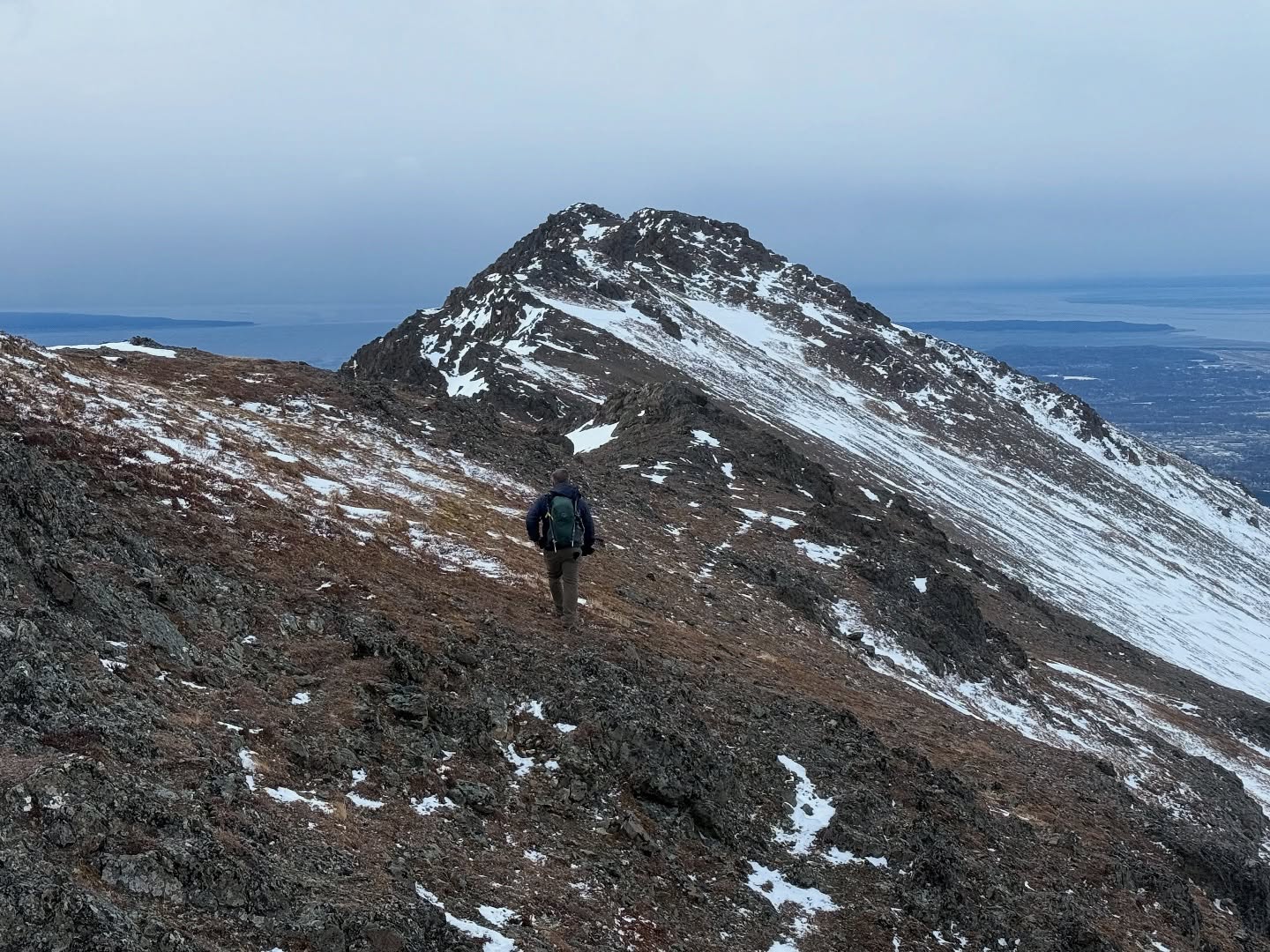
We had been relatively protected from the wind until we reached the summit, but upon summitting, the full force of 20-30mph gusts hit us from the South. We snapped some photos, added a layer and promptly headed down towards Rusty Point along the Southwest ridge. The walking was outstanding, with very little snow to navigate. I was shocked to not even find a faint boot path, although there were some old footprints in the small snow patches here and there.

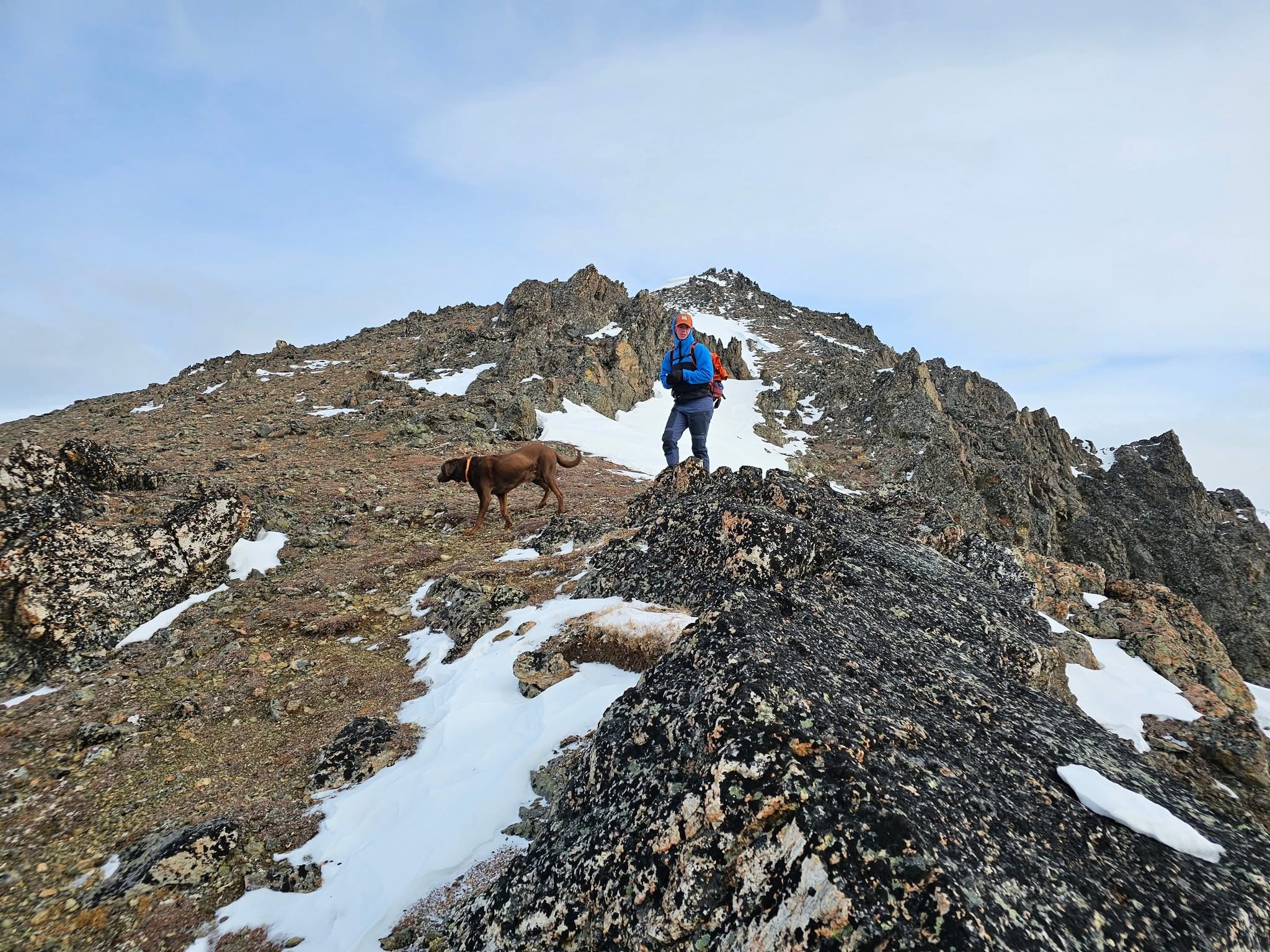
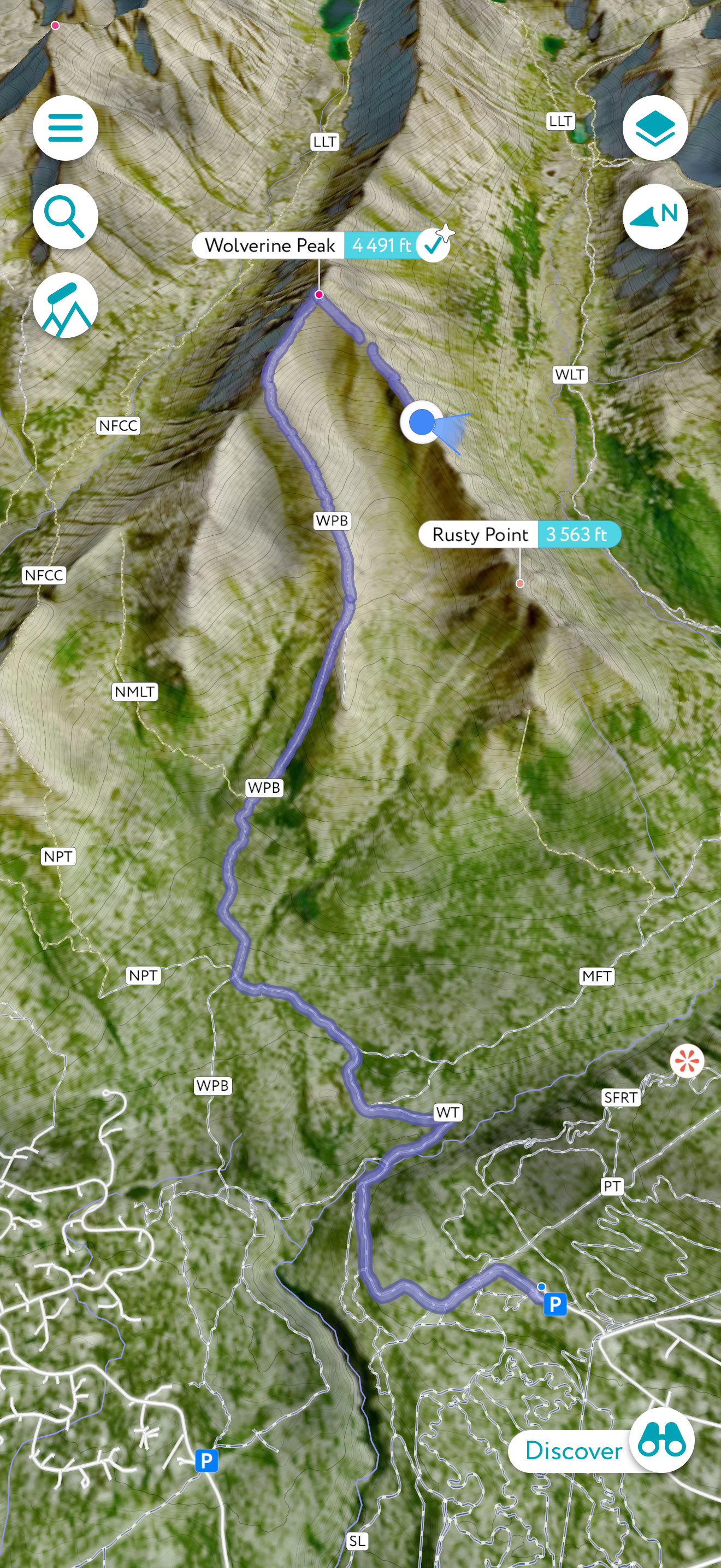
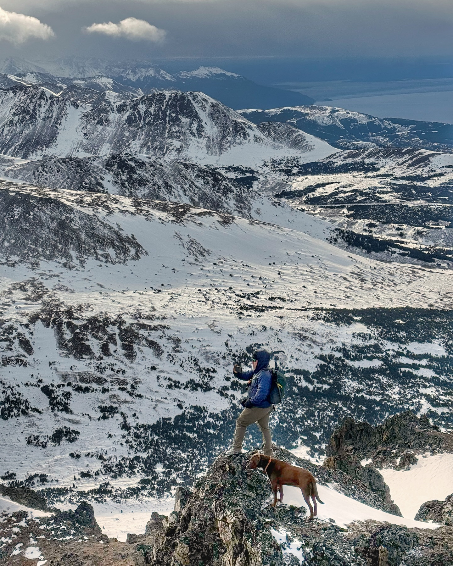
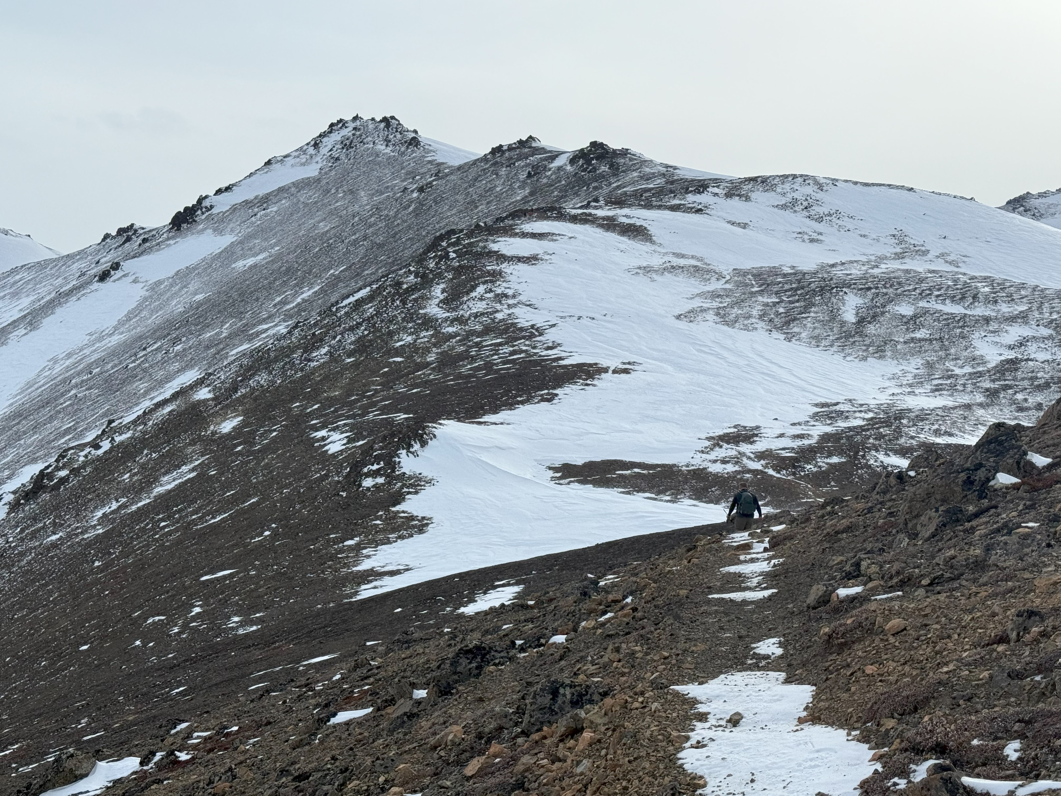
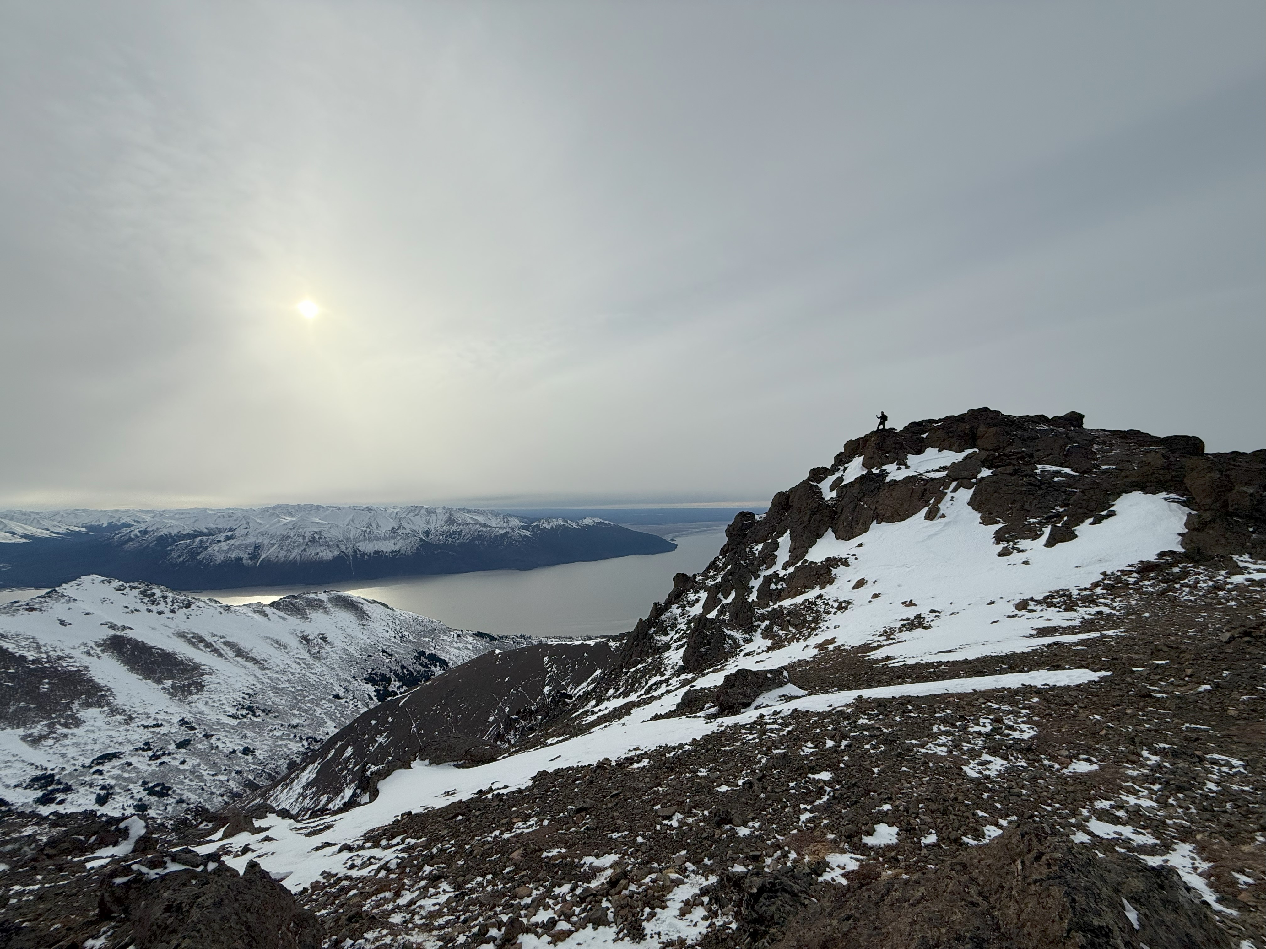
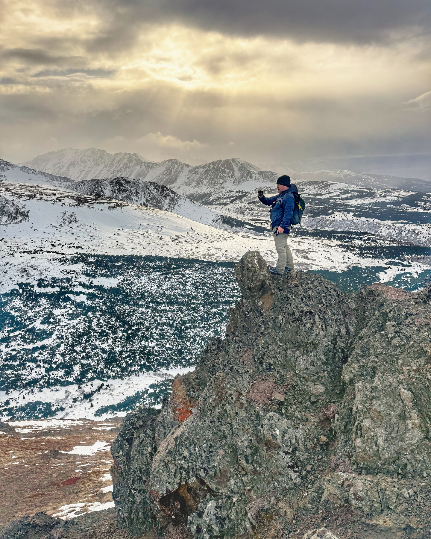
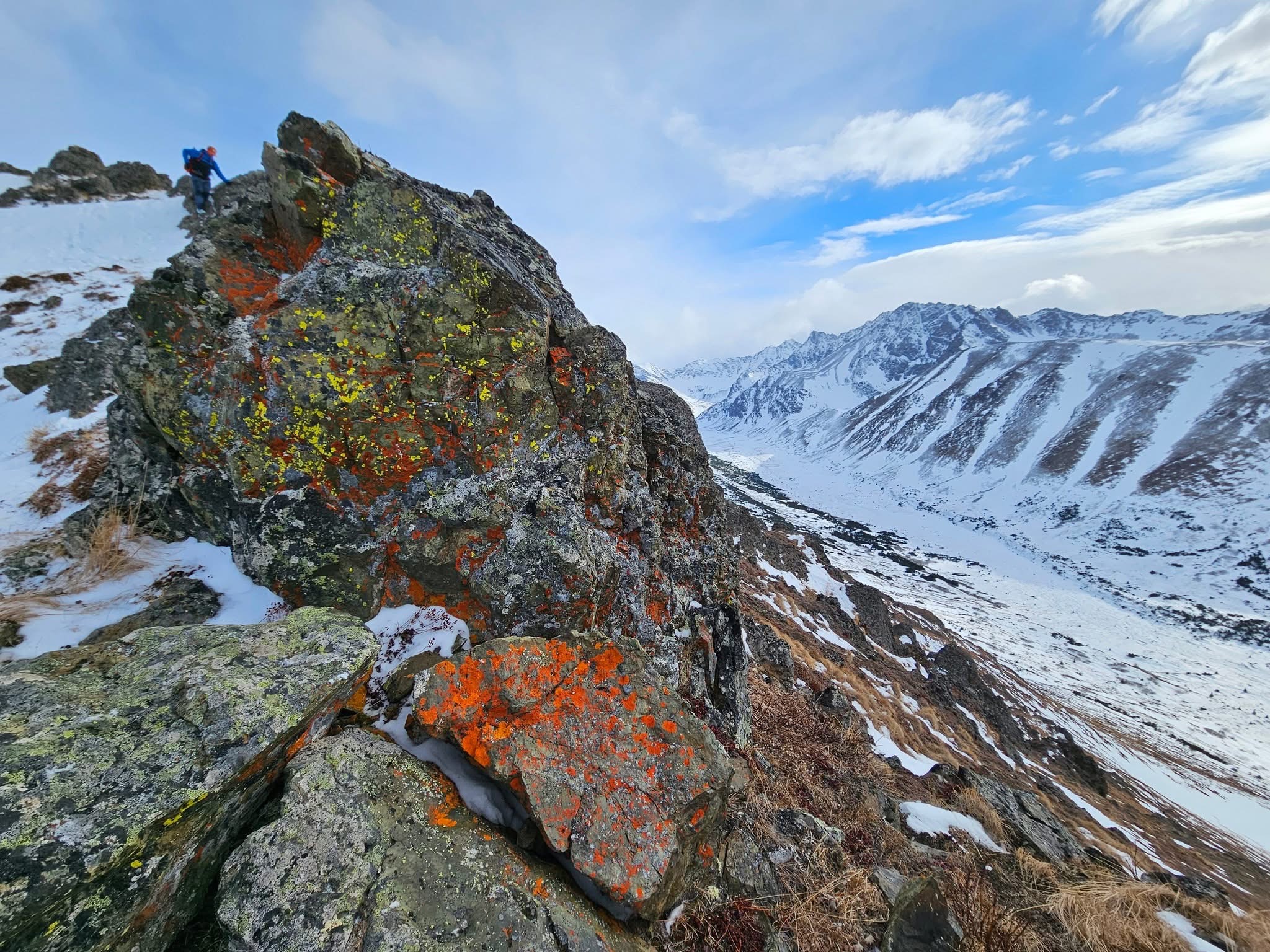
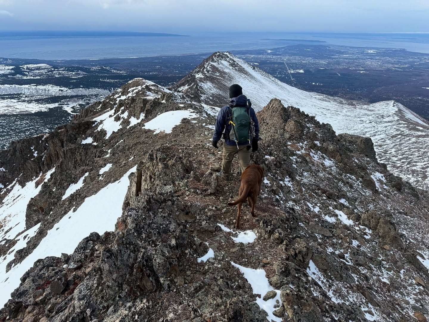
Although it seems like the backside of this ridge falls precipitously, it is actually very safe walking. From easy tundra walking to some very easy, low-exposure scrambling, this ridge is a pleasant 1.5 mile walk to Rusty Point. Overall, from Wolverine, we gained about 600′ of elevation, never once feeling the leg burn of the earlier ascent. Every rock outcropping we navigated around or over brought us to another herd of sheep, some with large rams directing their families away from us, some watching us inquisitively, some totally disinterested in our presence.

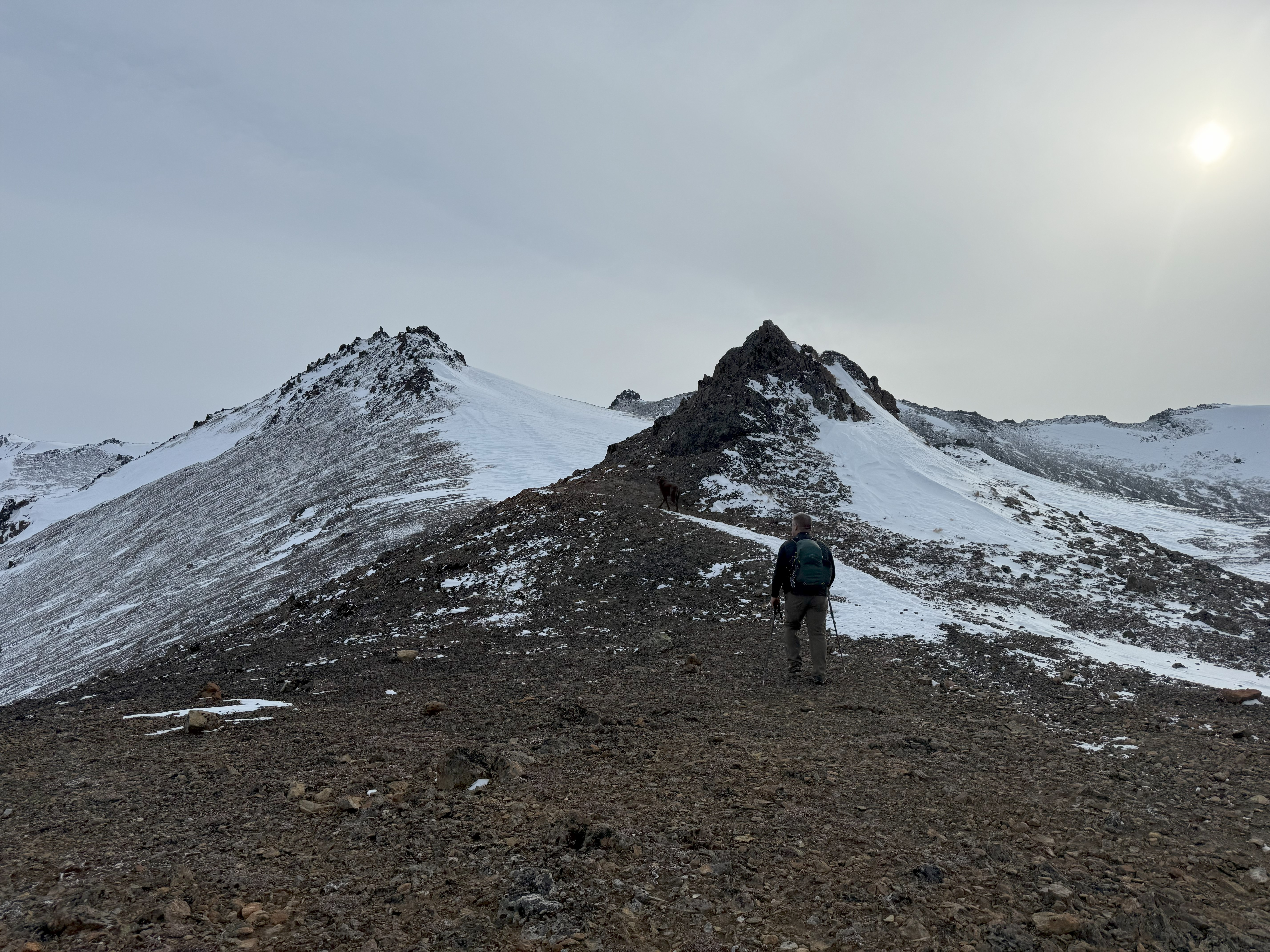
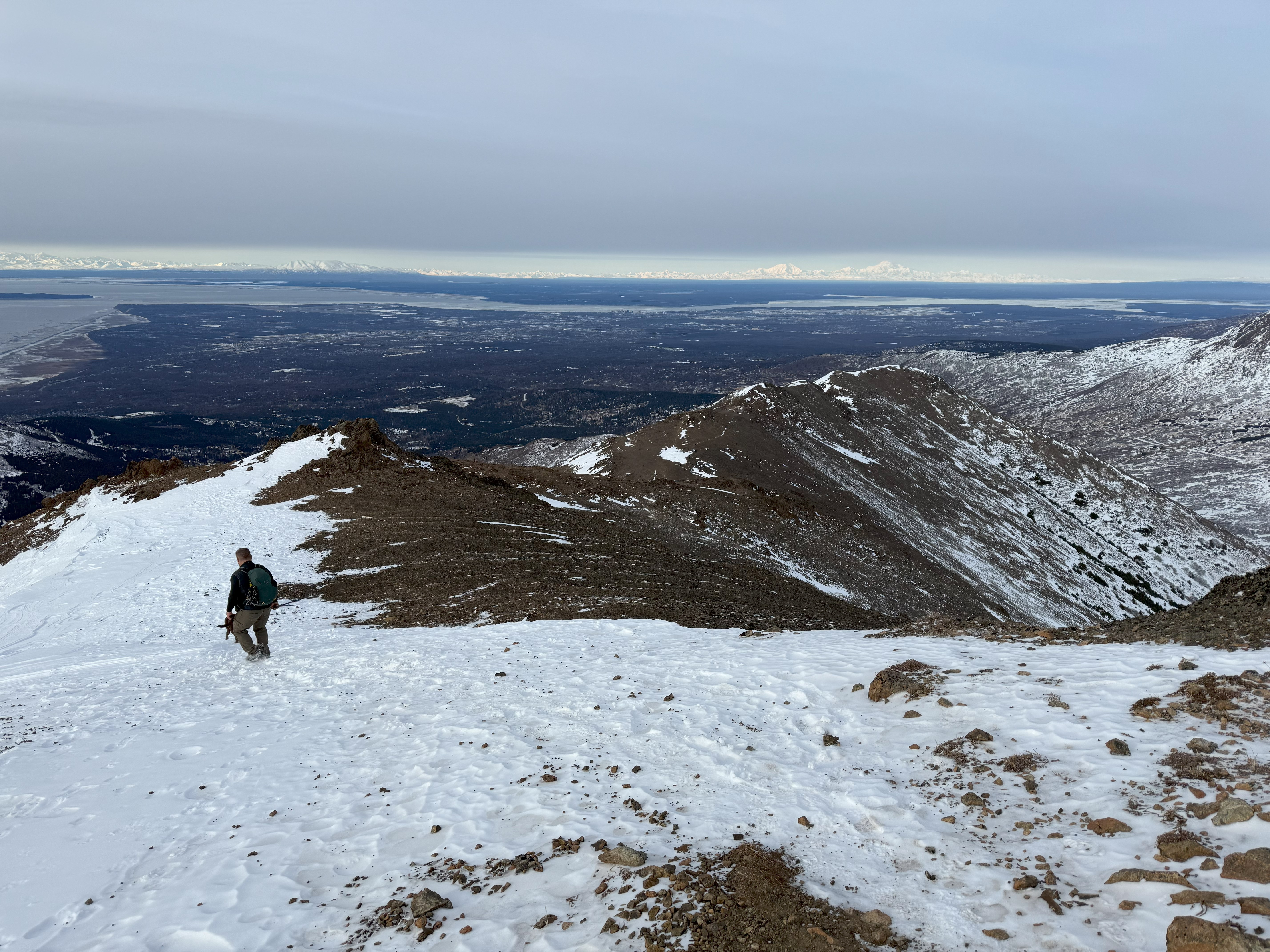
It didn’t take long to get to Rusty Point from Wolverine, and I wished that this ridge was longer, but the wind was starting to be a nuisance, so we decided it was time to complete this lollipop loop. We dropped down between Rusty’s two high points, a steep, snowy and icy face, Jason always quicker on the downhill made good time. I took my time navigating the slope, zigging and zagging along the ice until I found some good snow to plunge step directly down the hill. Before we knew it, we were on the center ridge again, looking back up at our most recent mountain accomplishment.

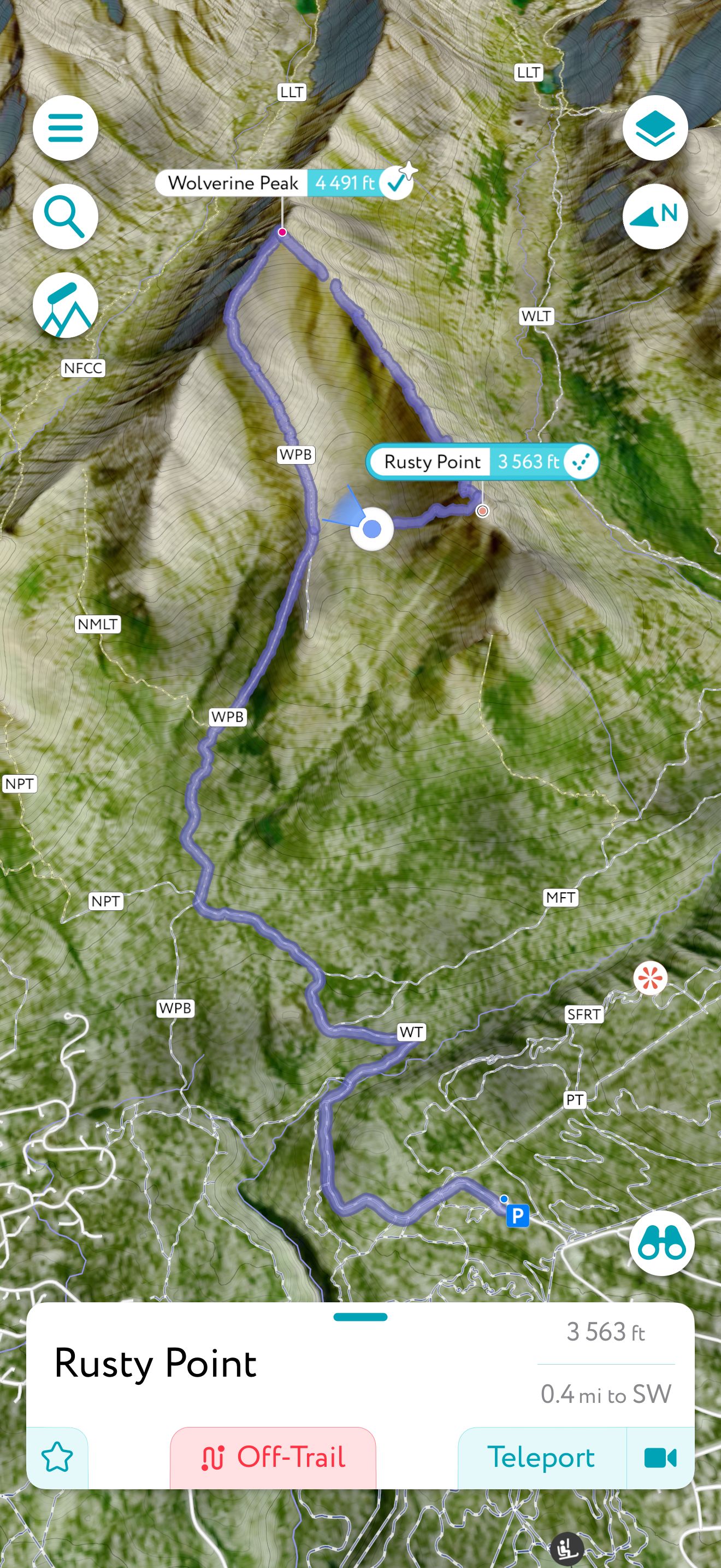
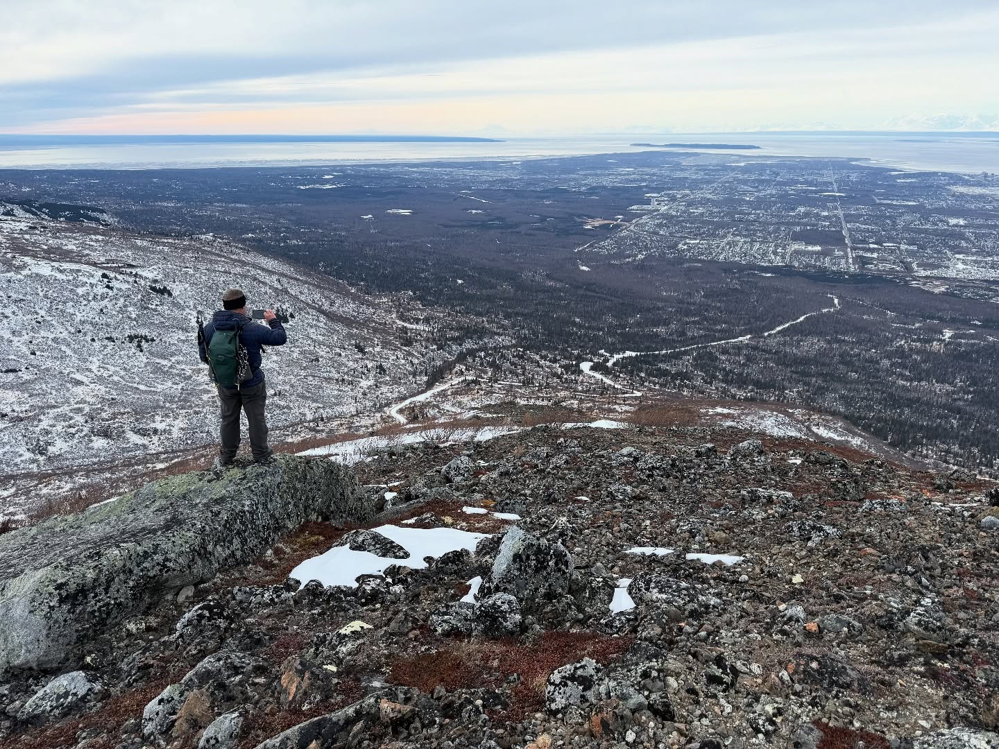
Connecting back to our ascent route, we made great time to the parking lot, where we determined that we had attained just over 4,000′ of elevation gain in 10.2 miles. Definitely a day to remember.

Just The Tips:

  1. Parking is usually available at Prospect Heights. Do not leave valuables in your vehicle.
  2. No permits are required for this area, but an Alaska State Parks parking pass is required for trailhead parking.
  3. Be Bear Aware. Carry bear spray. Bear bells are a nuisance to other hikers and have been deemed less effective than talking.
  4. Give wildlife a wide berth. Harassing wildlife is against the law. Sheep and moose can be aggressive. Sheep and goats are known to purposely kick rocks down onto hikers and moose will charge if provoked… sometime when not provoked.
  5. Wolverine is frequented by hikers throughout the year, but the area can still be prone to avalanches in the right conditions. Check the local avalanche forecasts before heading out.
  6. In the winter and spring, microspikes are highly recommended. The snow can be icy and dangerous on some of the steeper sections. A slip probably wouldn’t be fatal, but you could potentially slide for a long way and be injured.
  7. If you are unfamiliar with the area, it is good practice to download tracks and follow them. The trail system through here is expansive and it would be very easy to take a wrong turn.

Wolverine AllTrails and Peakbagger Links:

Sometimes you have to go with Plan C

February 26, 2025

Failed attempt on Nunanka and Kanchee
Successful Snow Hawk Summit
Mileage: 12.3 Miles
Elevation Gain: 3309′
Chugach Front Range #27
Summit Elevation: 3245′
Permitting: JBer REcAccess Website

Jason and I had lofty goals after seeing how little snow was up on McHugh and the neighboring mountains. We foolishly assumed this lack of snow was typical of the entire front range area and made a plan to bag Nunaka Point and Kanchee with a possibility for including Knoya and completing the whole cirque. Our Plan B included finding our way across Snow Hawk Valley to climb Ship Creek Peak.

We decided to take the Bulldog Trail to the new military road that winds up along the south side of Snow Hawk Peak. I had called the authorities on JBER and made sure it was ok to use the road, as it had been closed to foot traffic the previous summer; I was assured that it was no problem, as there was no training or work on the road happening this winter. I recommend calling the contact on RecAccess if you want to verify what is open or have any other questions about recreating on base. The officer was extremely friendly and very helpful.

Most of this area is on base, so it is very important to log into the JBER RecAccess Website to verify that the area you plan to travel is open, as they sometime will have live fire training or paratrooper jumps that could make traveling in those areas extremely dangerous. You must sign in and out of all areas and must check out by 11pm. There is no camping or overnight travel permitted. There is a $10 annual fee for backcountry recreators, and a 5-minute training video followed up with a short quiz. Failure to comply could result in prosecution or banishment from base property.

Once we were signed in, we left the Klutina parking lot, a little chilly at 25F, and headed out to the Bulldog Trail, a military training road. About a mile and a half later, we intersected with the Snow Hawk Peak fire road. Here you will find a gate and an unplowed road with plenty of foot travel through the ankle-deep snow. On a high snow year, this could be a very fun road ski.

After some gradual uphill walking, it gets steep in sections, particularly on the backside of Snow Hawk, where the road takes hard left to the northeast. As we crested the hill, the road became a slog fest with snow up to our knees. We opted to not struggle on further towards Ship Creek Hill, especially since the gulleys looked like they held quite a bit of snow, a no go without snowshoes or skis.

We turned our attention to our original goal, Nunaka and Kanchee. The ridge looked doable, with tundra and blueberry shrubs poking through thin snow, but upon first attempt to cross the low spot between the road and the ridge, we found waist deep snow, with no promise it would get any better soon.

It didn’t take us long to settle upon a Snow Hawk summit instead. There isn’t really a footpath… it’s a choose your own adventure type of mountain, where you just pick your way up the broad hillside to the summit. We scoped a line that looked like it had minimal snow and started up. It really became apparently how much snow was still back in this area when we encountered a hillside of crusty, untrustworthy snow. Some was stable enough to support our weight, but more often than not, we would suddenly break through, ankles and knees surprised even when our minds knew what was coming.

Eventually we made it the 800′ up from where we left the road and summited Snow Hawk Peak. We had traveled more than 7 miles and ascended 3000′. Pretty good hiking for February. The views from this underrated mountain are epic… The Chugach in a panorama behind us and Anchorage, the Alaska Range and the Talkeetna Mountains out front. We sat and ate lunch, enjoyed calm winds a nice break.

We decided to head down a ridge to the Southwest that would bring us back to the road, descending 1300′ in just over half a mile through brush, grass and jumbled deadfall. It was steep and very frustrating for me, but running into a treed porcupine was quite a treat!

We reached the road and made great time back to the trailhead. All in all, this approach is a couple of miles longer than parking at Stuckagain Heights and going over and back via The Dome, but having done that before, this cuts off the muddy bushwhacking through the Valley between the Dome and Snow Hawk Road.

It was bummer that our 3 main objectives weren’t attainable, but we were able to recon for some summer climbs and Snow Hawk has amazing views, so it wasn’t a complete bust of a day. The double digits miles and increasing elevation gain means we are well on our way to being in shape for some big traverses and peaks this summer!

Happy Trekking!

Just The Tips:

  1. Make sure to register on the JBER RecAccess website to obtain permits on days that the recreation areas are open. Open and Closed status can change without prior notice so be sure to check the map on the morning of your activity.
  2. All users must be signed out by 11pm. There is no camping on JBER land.
  3. Be Bear Aware. These areas are less traveled than other Front Range peaks and the wildlife is abundant. Carry bear spray and be bear aware.

Snow HAwk AllTrails and Peakbagger Links:

McHugh Peak: Elevation, Trails, and Breathtaking Views

February 22, 2025
Mileage: 5.9 Miles
Elevation Gain: 2654′
Chugach 120 #103
Chugach Front Range #21
Summit Elevation: 4308′

Jason and I decided to hit up McHugh for mellow peak to see how our bodies were feeling after a long month of us both being sick. The lack of snow in the Front Range was welcoming, as was the excellent weather (low 30s, partly sunny, no wind).

We decided to carpool instead of meeting up because of the extremely limited parking at the Honey Bear Trailhead. We arrived at about 1130 and were actually surprised one spot was still open out of the space for maybe 5 vehicles. The alternative is parking about a mile away or finding another place to hike.

The trail starts off with a climb of ~.8 mile and ~900′ of vertical gain to achieve the point labeled as “Turtle Point” on some maps and “Grandview” on others. Grandview was a fitting name for this day, with an incredible view of the Alaska Range, including Denali, Hunter and Foraker.

Climbing up to Grandview was a bit icy, but my microspikes did the trick. The view looking out towards Rabbit Lake is spectacular and McHugh Peak can be seen in the distance, at the end of the undulating North Ridge. McHugh is a massive mountain; not so much in height with the summit at only 4300′ but in sheer volume. It takes up a fair portion of the southwest corner of CSP and has multiple different ridges, traverse and approach options.

The portion of ridge beyond Grandview or Turtle Point has a couple of high passes, requiring descending maybe 100′ each time, with a total elevation gain of about 1750′ over the next 5.1 miles to the summit. The dips feel even smaller on the return unless you’ve had the plague for the last couple of weeks, then those 100′ ups feel a little worse.

After the two dips in elevation, the trail rises gradually over the next ~1.3 miles, eventually flattening out for half a mile before the final climb up to the base of the summit block. The last .3 miles gains ~500′ with the bootpath terminating on the ridge to the right of the summit block, a compact collection of fractured rock that rises only slightly above the ridge to the west and McHugh West Peak.

Climbing the summit block can be dangerous in icy conditions or if you are not comfortable with exposure and heights. The side opposite of the approach drops off precipitously and a mistake there would likely be your last slip and fall.

To climb to the top of the summit block, follow the bootpath around the approach side, bypassing the narrow crack that at first appears to be the way up. About halfway around, there will be a couple of wider chutes you can climb that have better footing.

The views from the top are breathtaking with Chugach Peaks in all directions. After years of hiking this range, I don’t usually need to use my PeakVisor App, but it is a great resource if you are trying to identify the peaks around you. I highly recommend adding this to your navigation apps.

McHugh has never been a disappointment and offers so much in terms of views and options that you could climb it more than half a dozen times and never take the exact same route.

Happy trekking!

Check out the YouTube Video below or Here.

Mchugh AllTrails and Peakbagger Links:

Recent Trip REports:

Where the Clouds Parted: A Knoya, Kanchee and Nunaka Ridge Walk

May 31, 2025 Knoya: 4600′ – FR #17 Kanchee: 4393′ – FR #20 Nunaka point: 3780′ Mileage: ~14 Miles Elevation Gain: ~5000′ The summer wasn’t summering, and I was suffering from a bout of springtime depression that only sunshine and warm weather could cure. I dragged myself to the Klutina Trailhead to meet Jason. We…

Chasing the Wind: A Long-Awaited Victory on Peak 1216 and Ship Creek Hill

April 26, 2025 Peak 1216 AKA 3990: 3990′ Ship Creek Hill: 3842′ (chugach Front Range Peak #24) Mileage: 15 Miles Elevation Gain: 5,700′ The majority of the Southcentral Alaska winter of 2024-25 was uncharacteristically warm and relatively snow free, but here we were in April, with record breaking snowfall around Anchorage. The ridges and peaks…