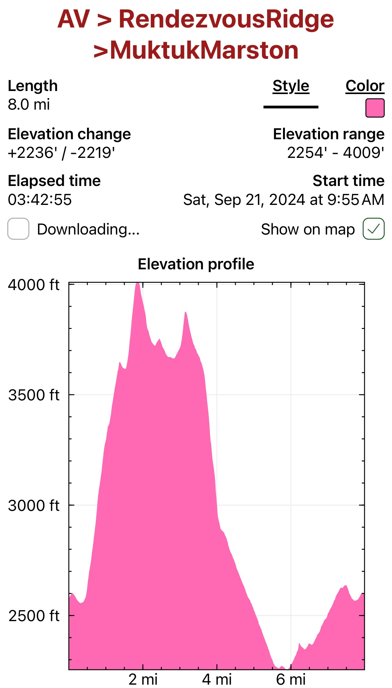
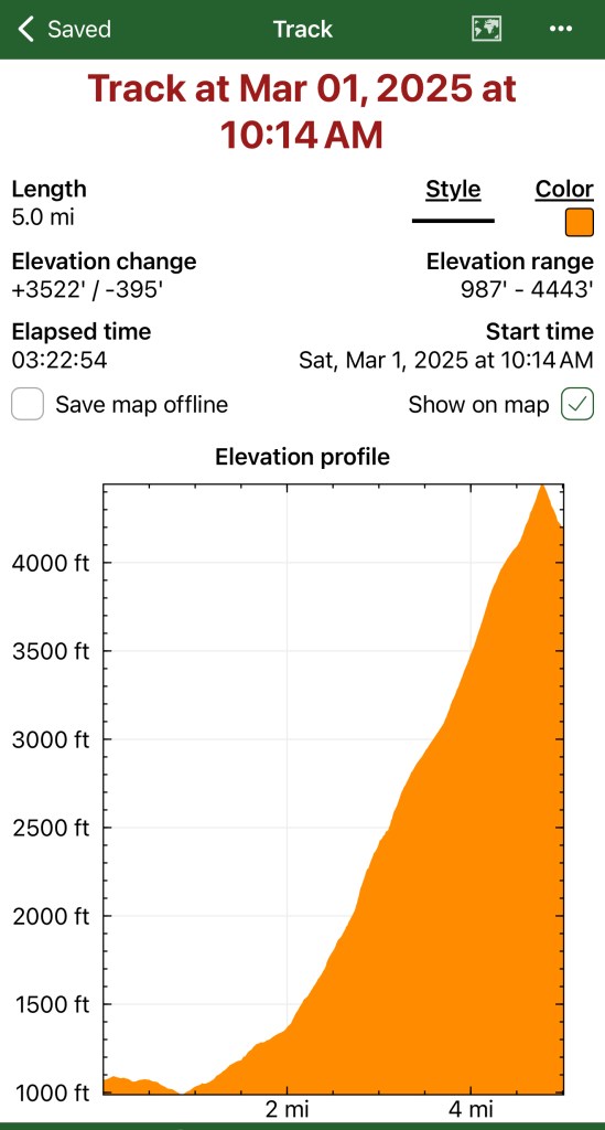
Brocken Spectres and Nike Missiles: Rendezvous Ridge → Muktuk Marston Loop

September 21, 2024

Mileage: 8 Miles

Elevation Gain: 2592′

Peak 1112 (3648′)
Little Teton (4006′)
Peak 3891 (3891′)

Permits: Arctic Valley PArking PAss or Membership Pass

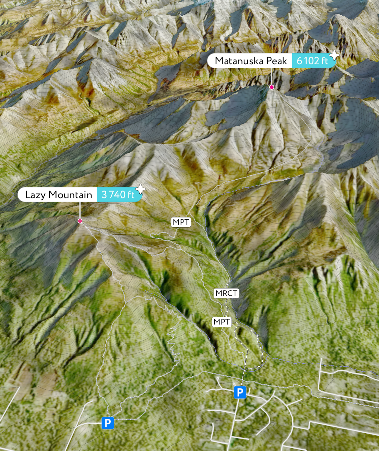
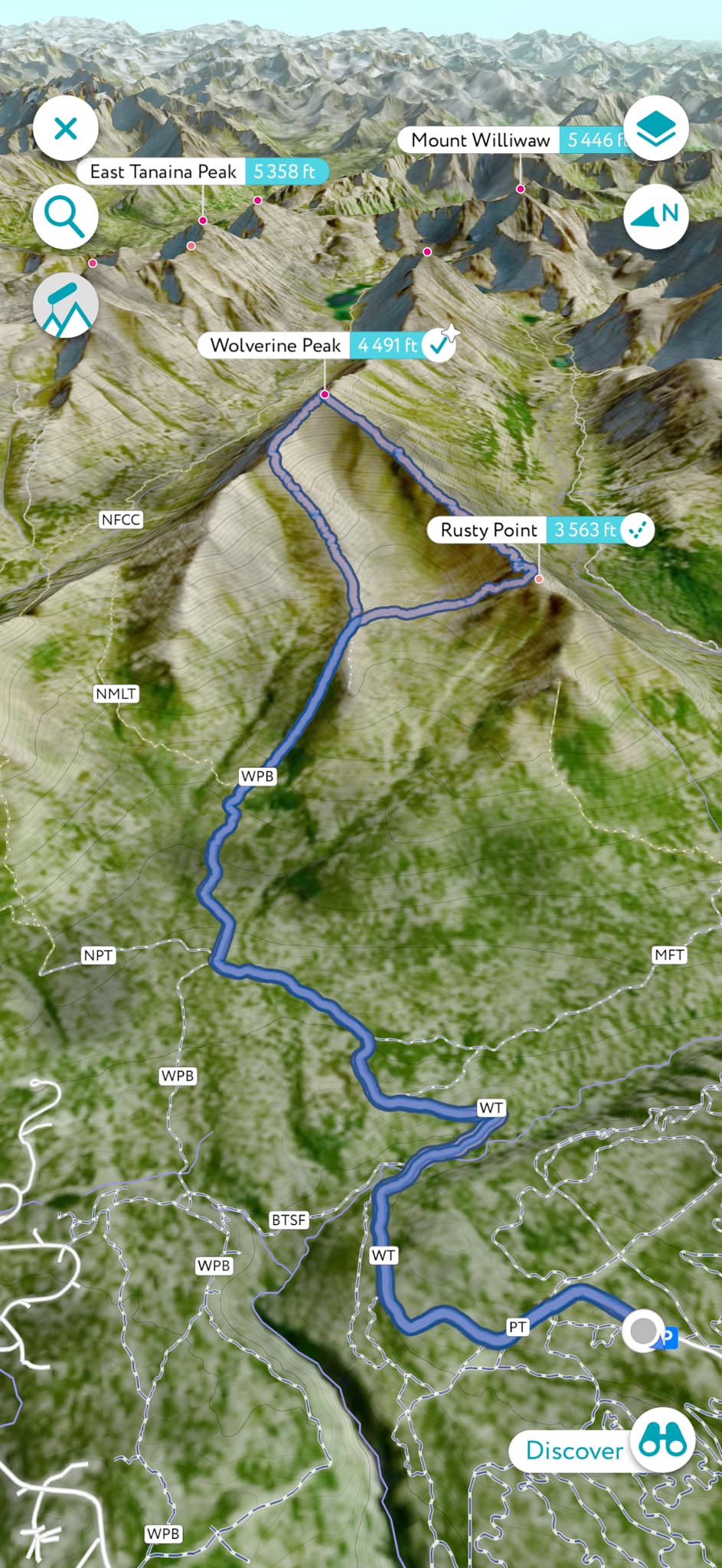
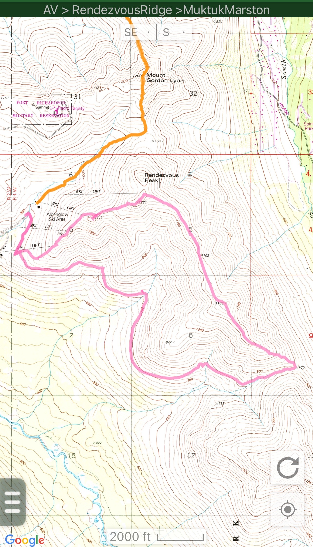
It’s now the end of March 2025, and as I start planning for this summer’s adventures, one of my top mellow day hikes is definitely the Rendezvous Ridge/Muktuk Marston Loop. Rendezvous Ridge has long been a popular and well-traveled ridge walk between Arctic Valley and South Fork Eagle River, but as of the end of 2023, the Muktuk Marston Trail was completed and offered hikers an opportunity for an 8-mile loop.

Muktuk Marston is wide and well-engineered, following the curves of the mountain about 1500′ below the ridgeline and 1,000′ above Ship Creek Valley, and offers an incredible opportunity for a fun, accessible loop, complete with some of the most incredible views of the area. No longer would a hiker need to out and back or have another vehicle to do a point to point.

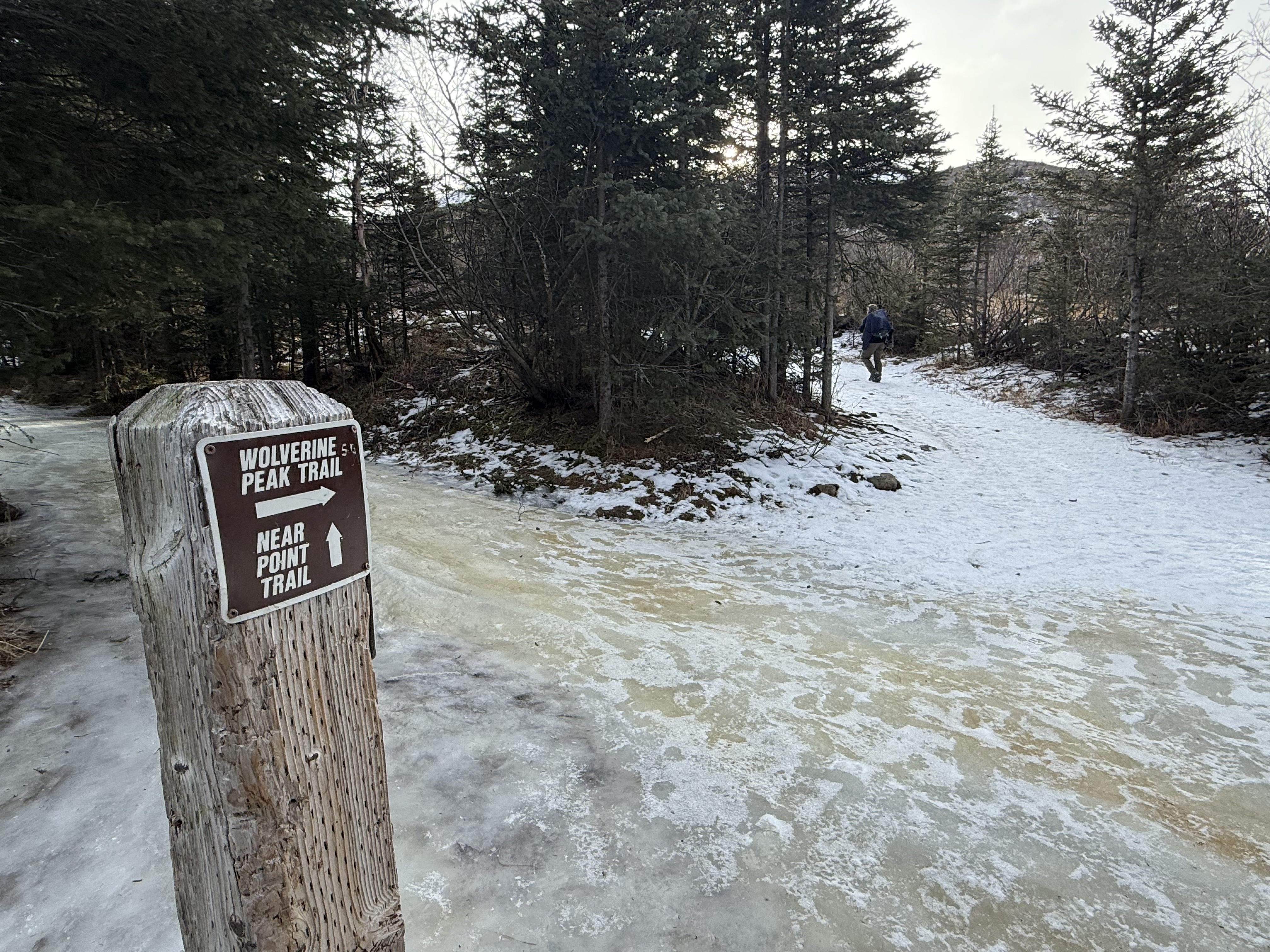
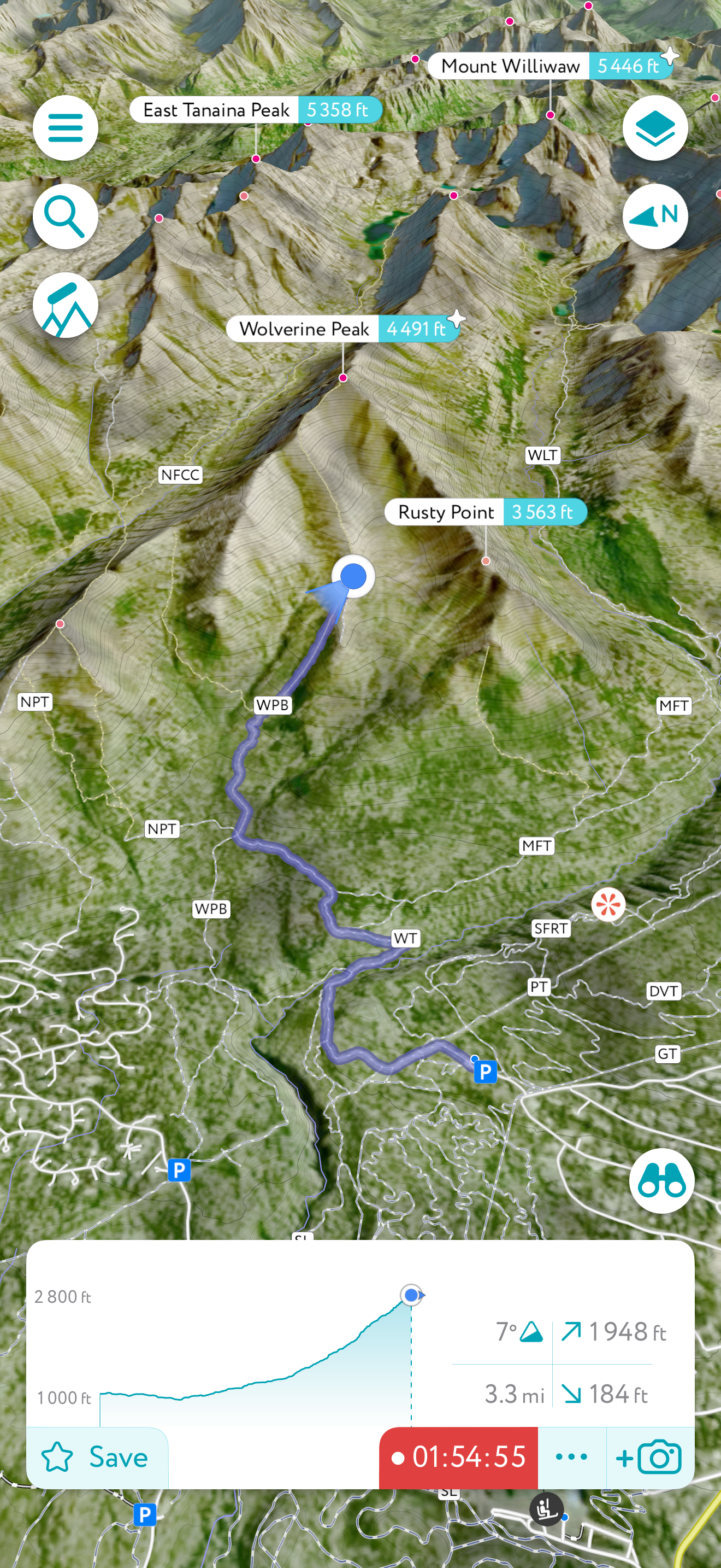
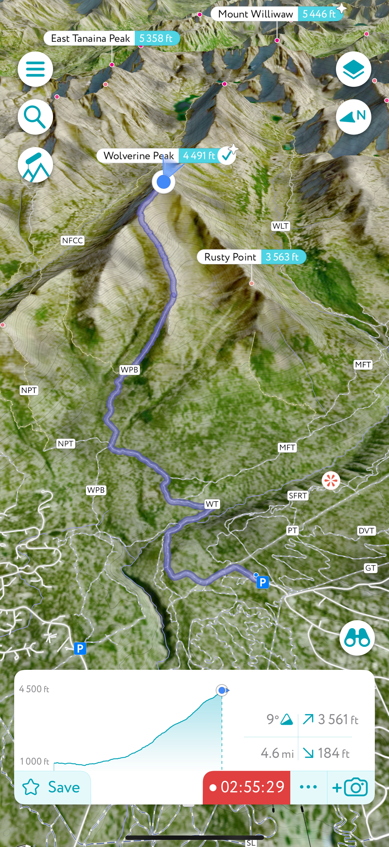
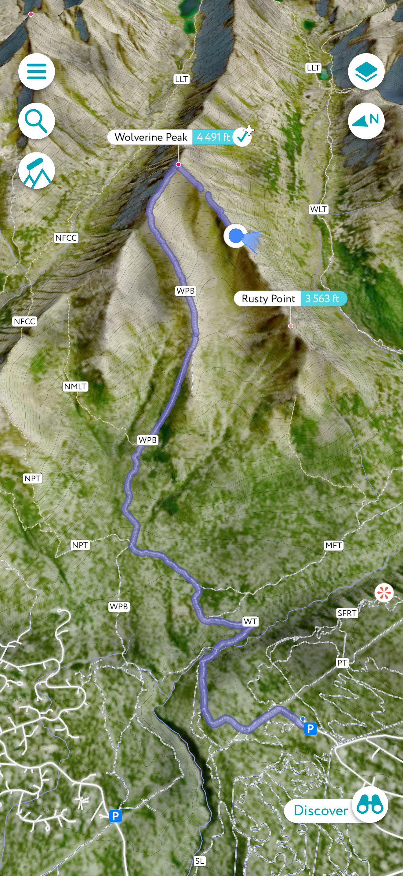
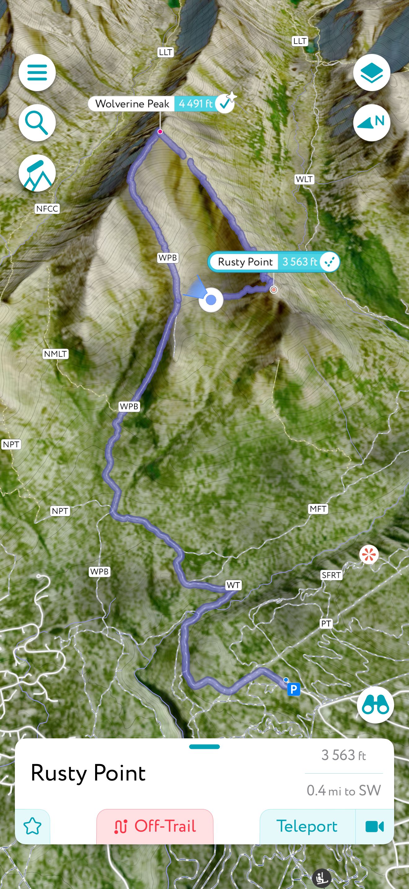
I first explored this loop on October 3, 2023, not long after the Muktuk Marston Section construction was completed, so when I had a day off where I felt like I just wanted an easy ridge to walk, I decided to revisit this loop. Jason and I had started from the South Fork Trailhead the previous year, but I decided to eliminate about 700′ of climbing and nearly 5 miles of hiking and parked at Arctic Valley Ski Area.

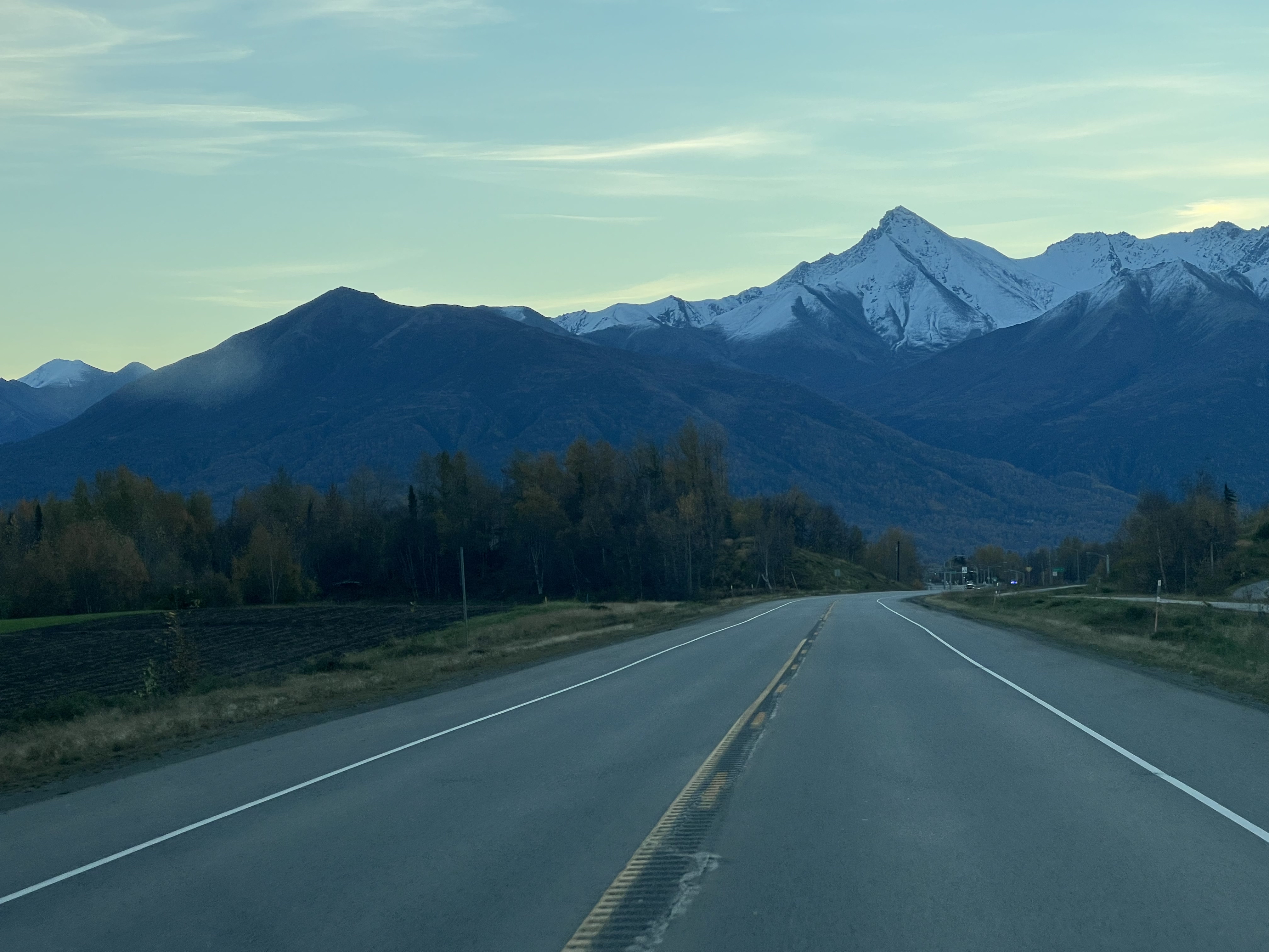
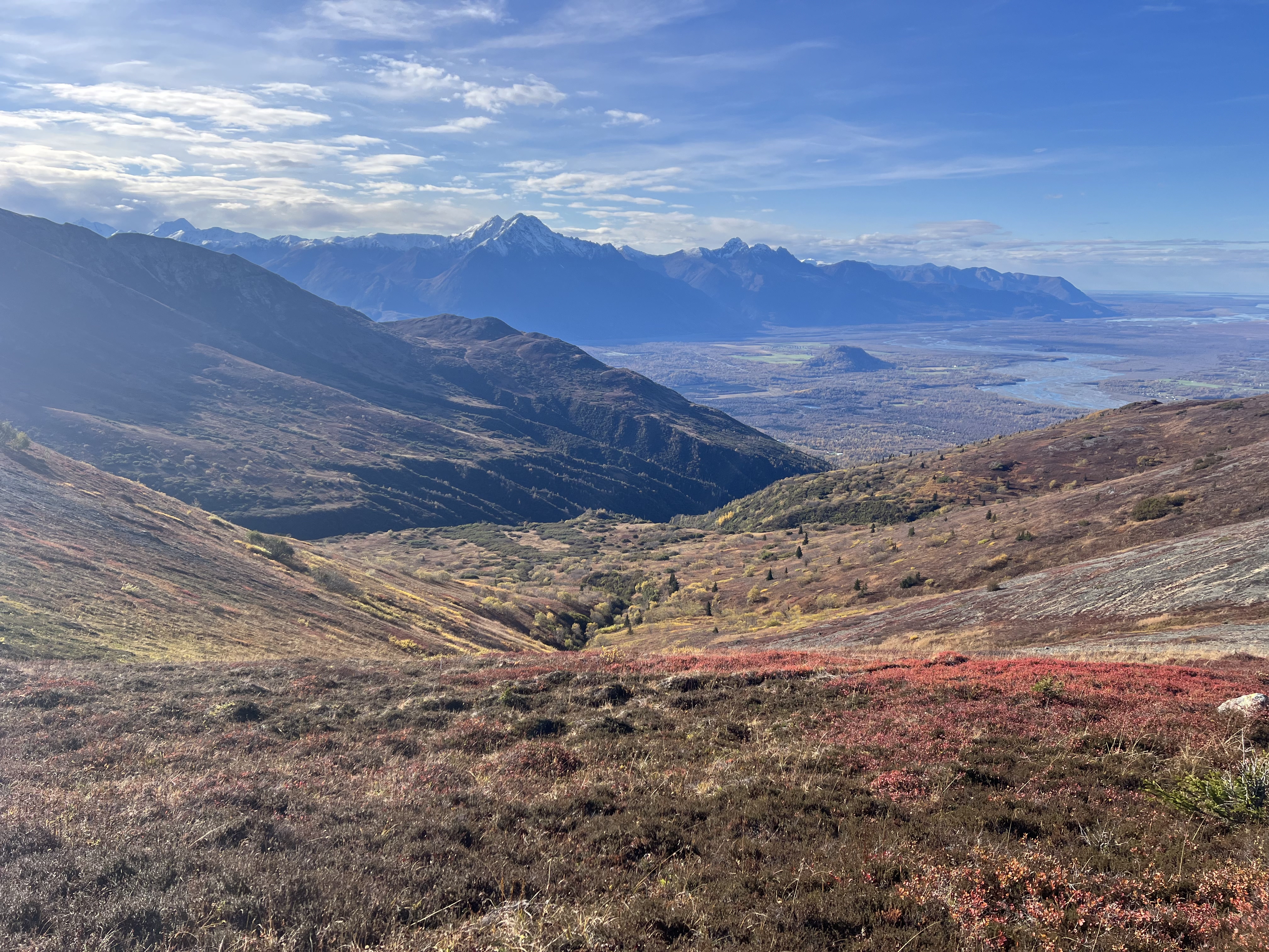
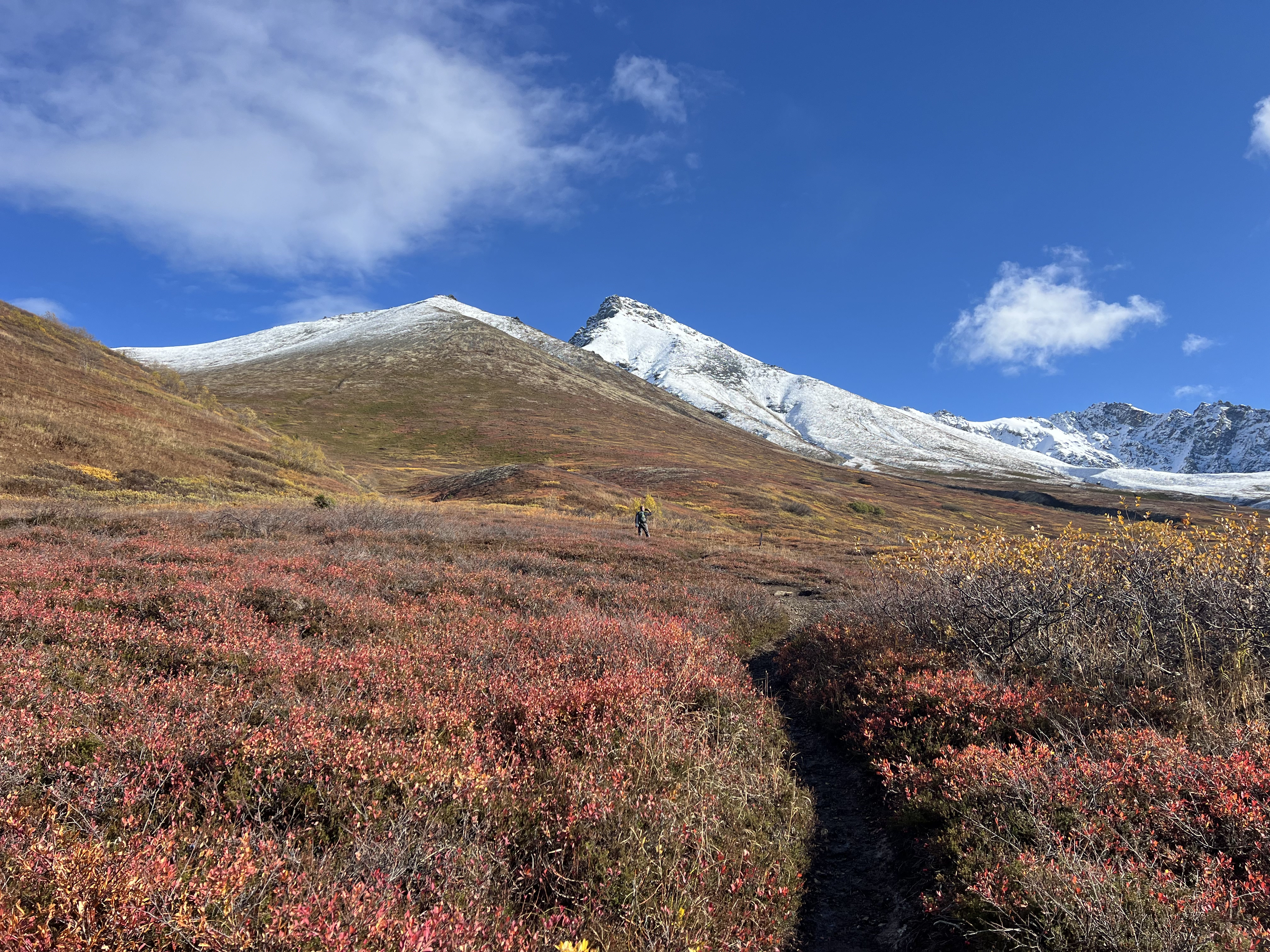
It was one of those September days reminiscent of warmer months, and I was in a T shirt within minutes of leaving my truck. A short, flat, half mile walk brought me to the junction of the start of the Muktuk Marston and the trail leading up the ridge toward Peaks 1112 and 1221. I opted to complete the loop clockwise, so I turned left and started walking uphill.

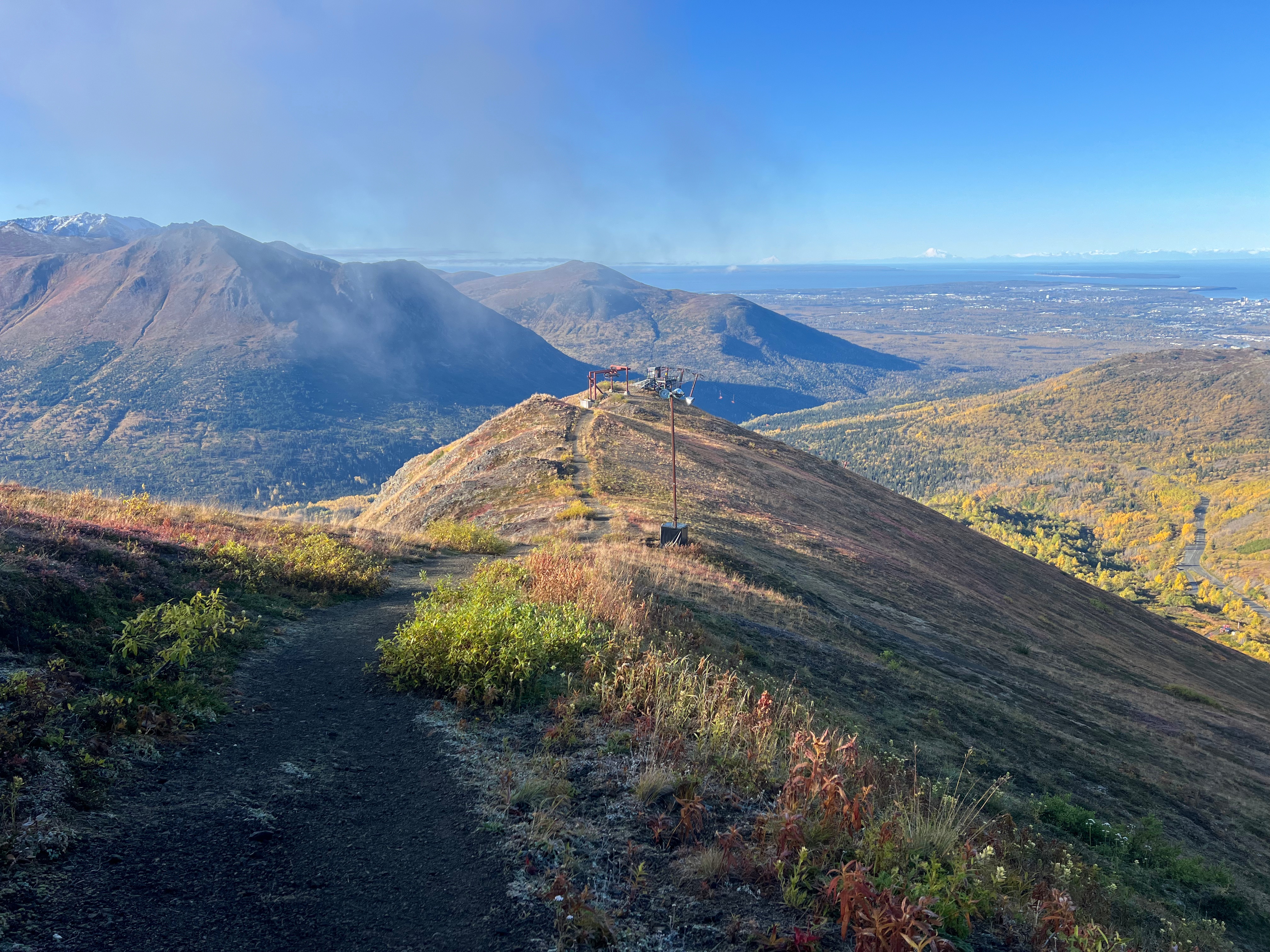
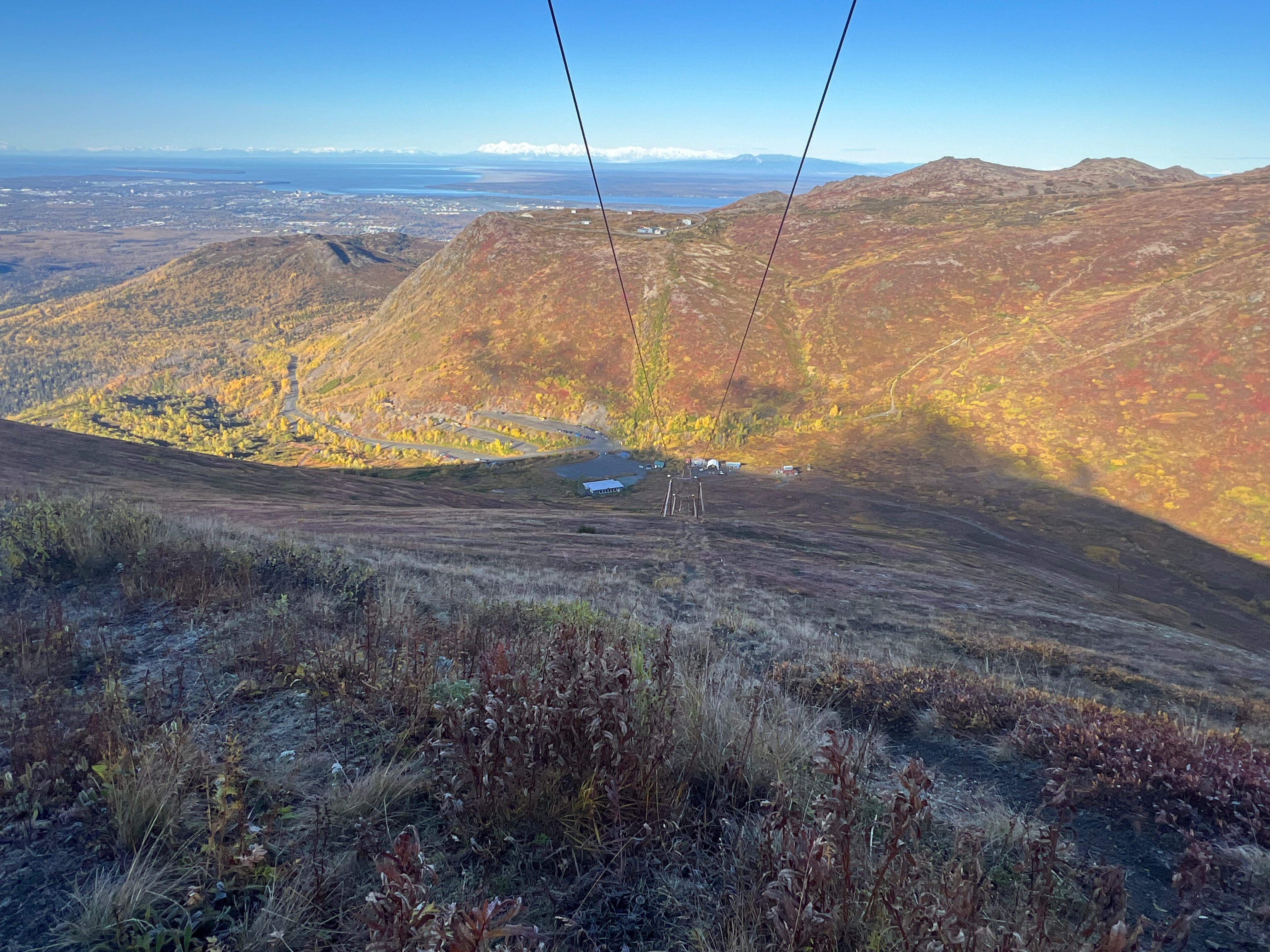
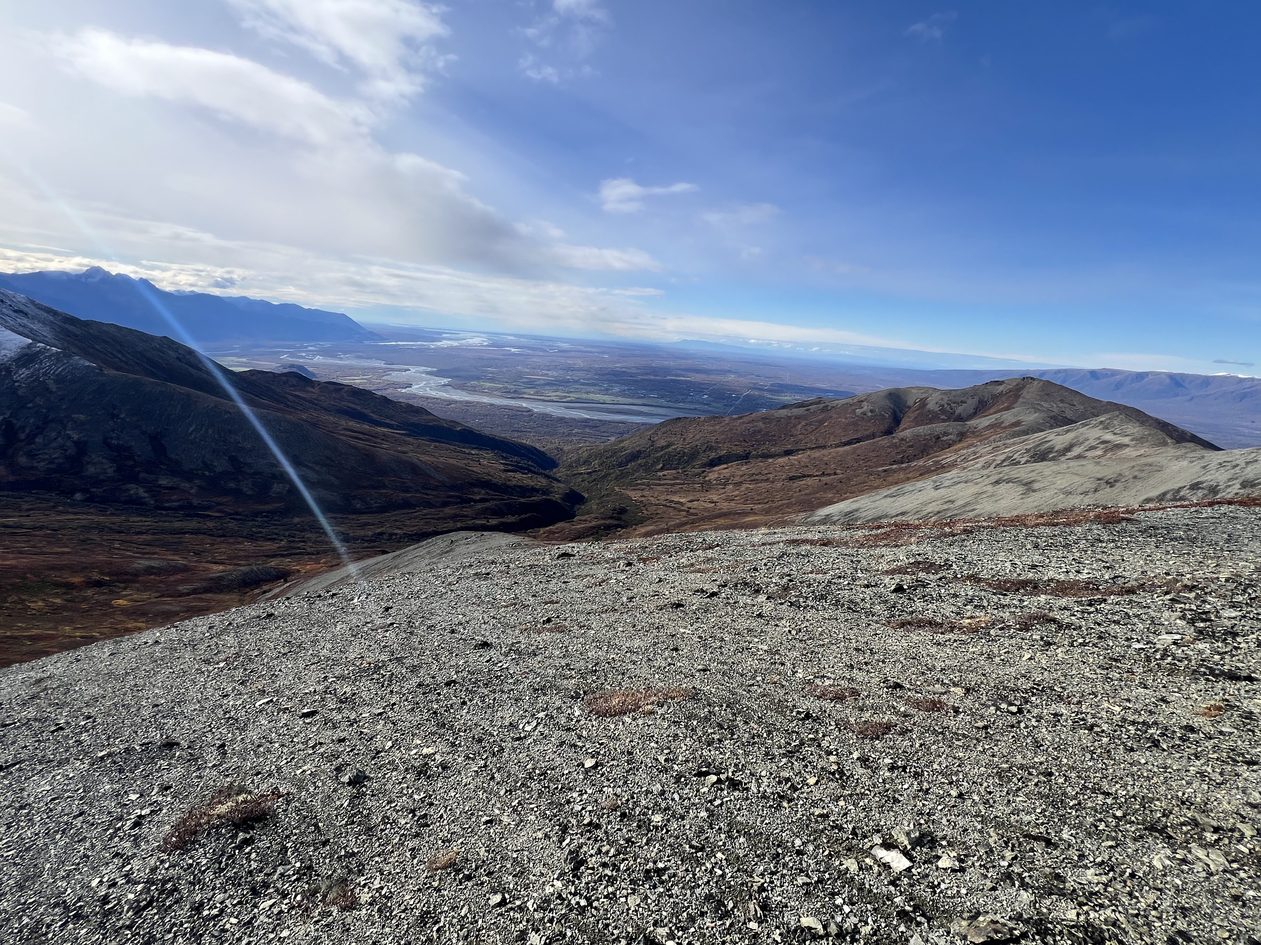
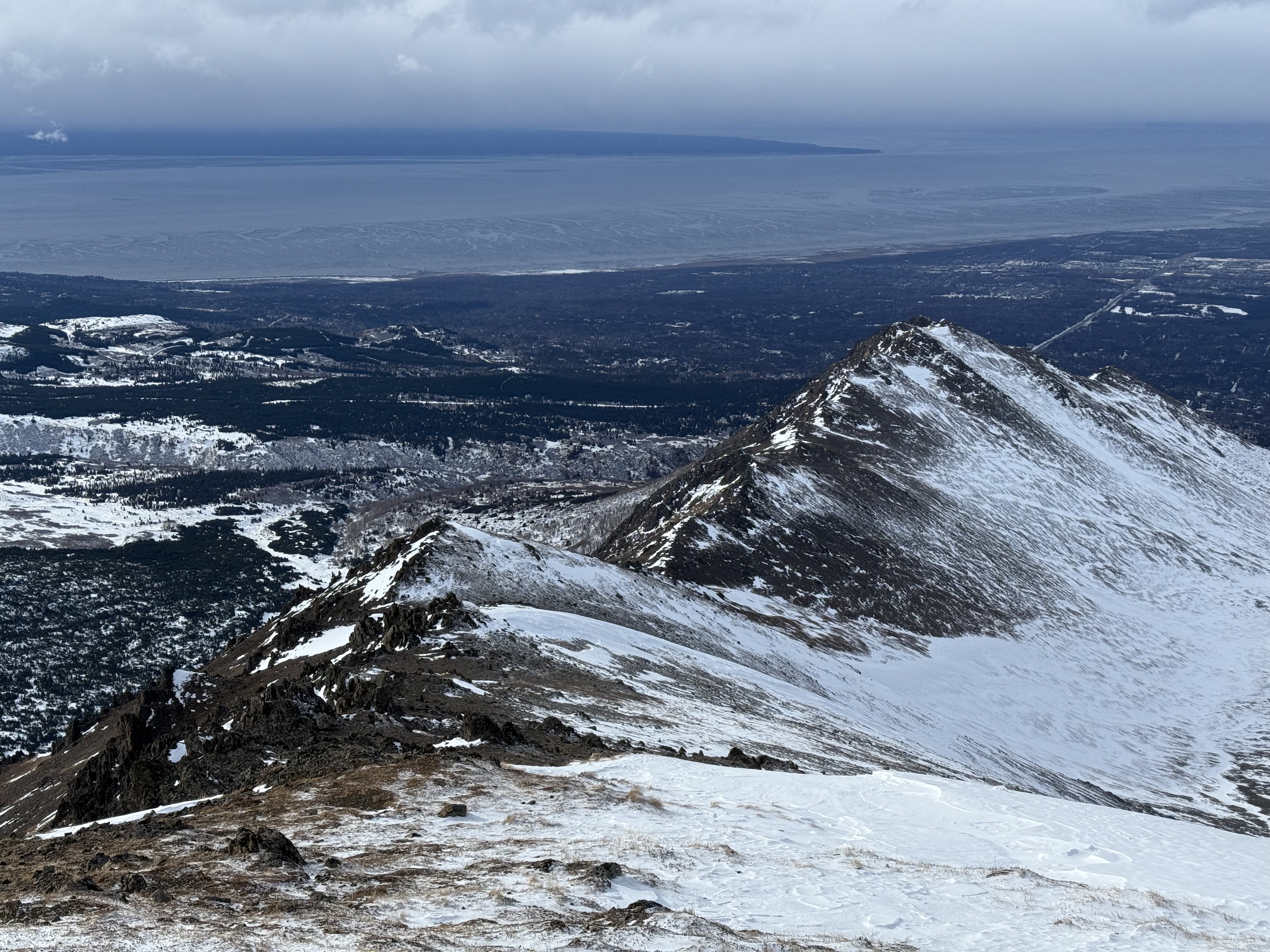
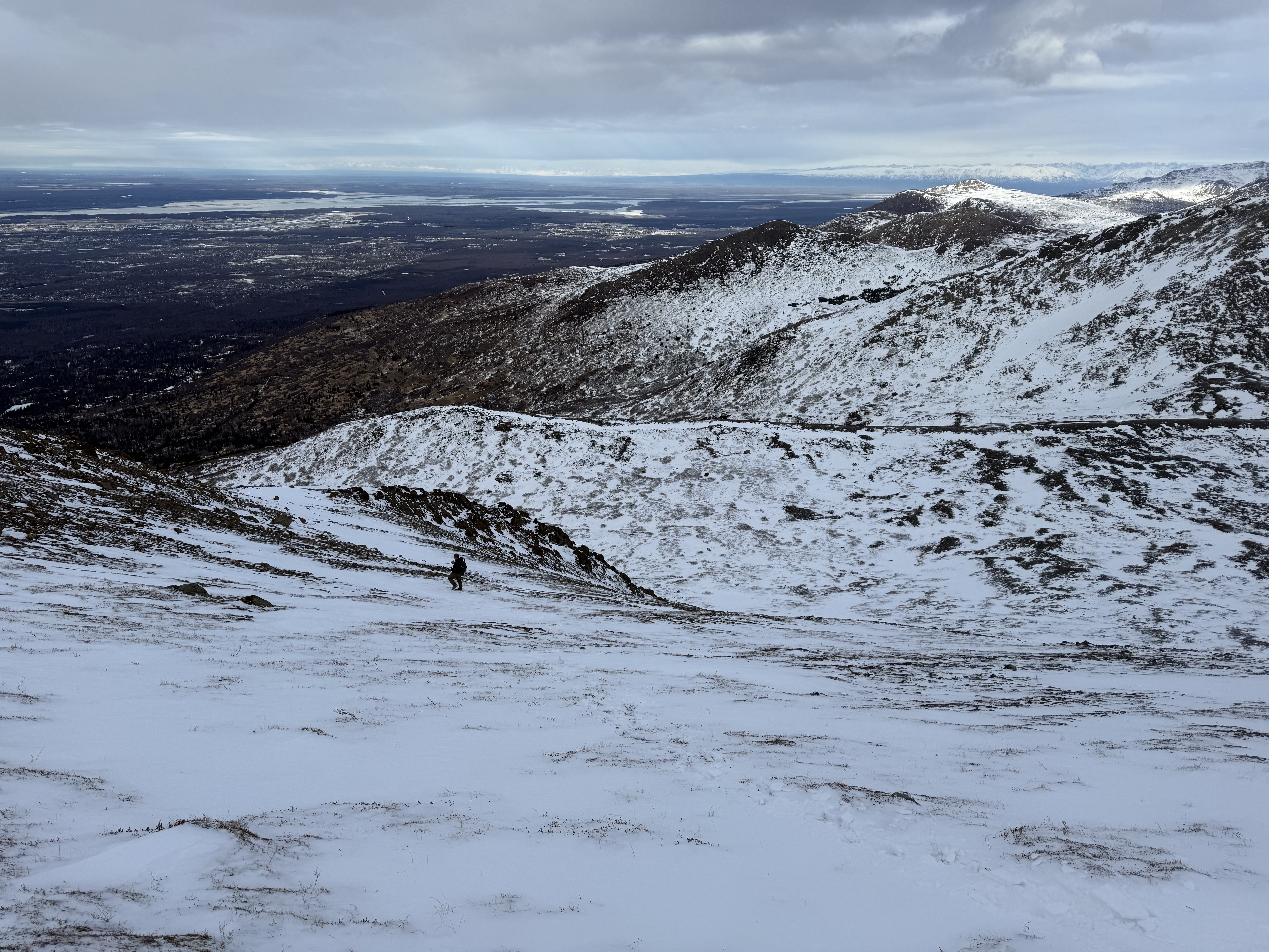
The sun was already high in the sky as I started up towards Peak 1112 and the top of the ski area T-Bar. Climbing 1,000′ feet in a mile, I quickly ascended out of the vegetation and past the top of Chair 2, taking in the incredible views of Ship Creek Valley and many peaks that I had either already climbed or had on the “to-do” list.

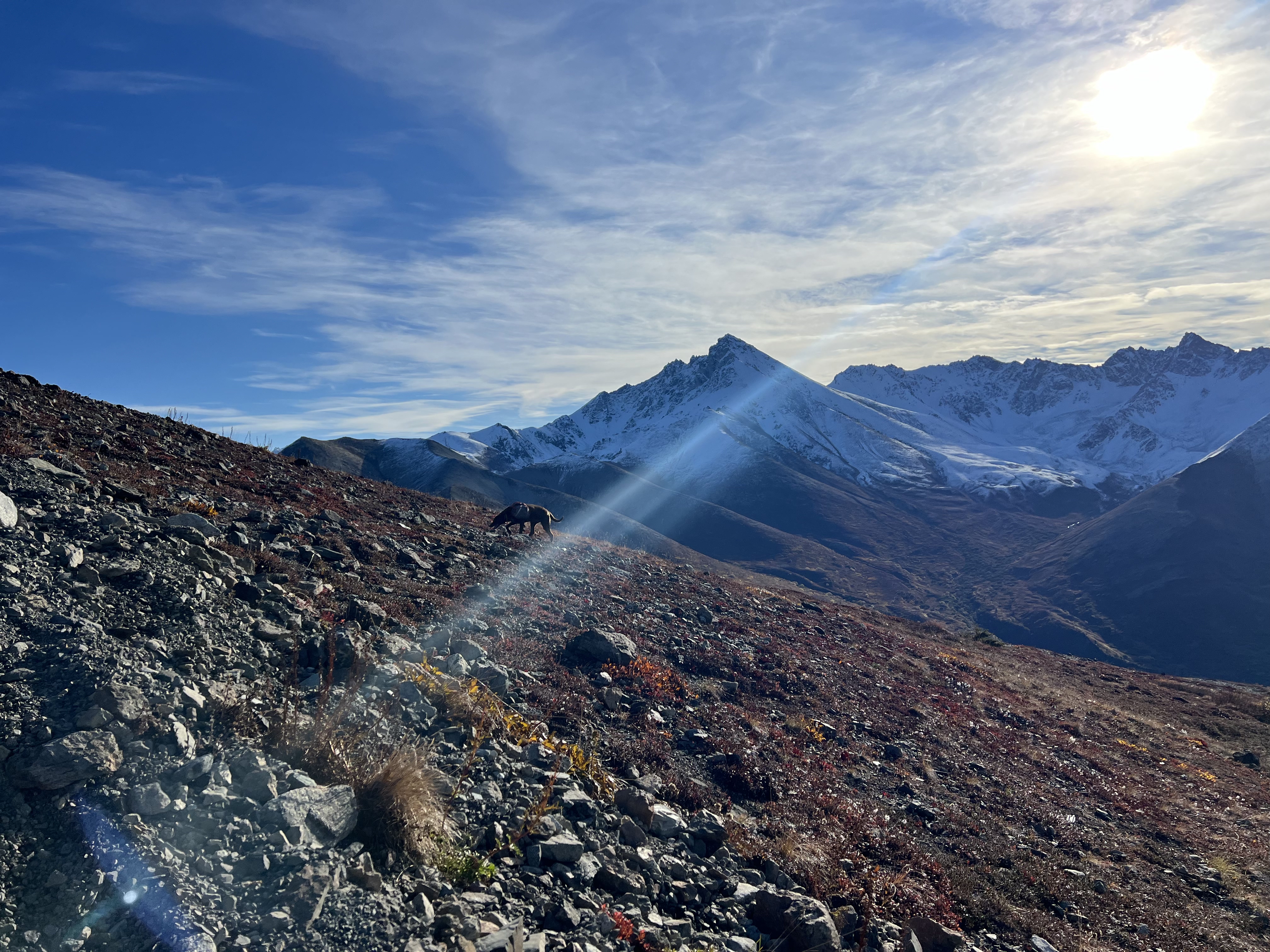
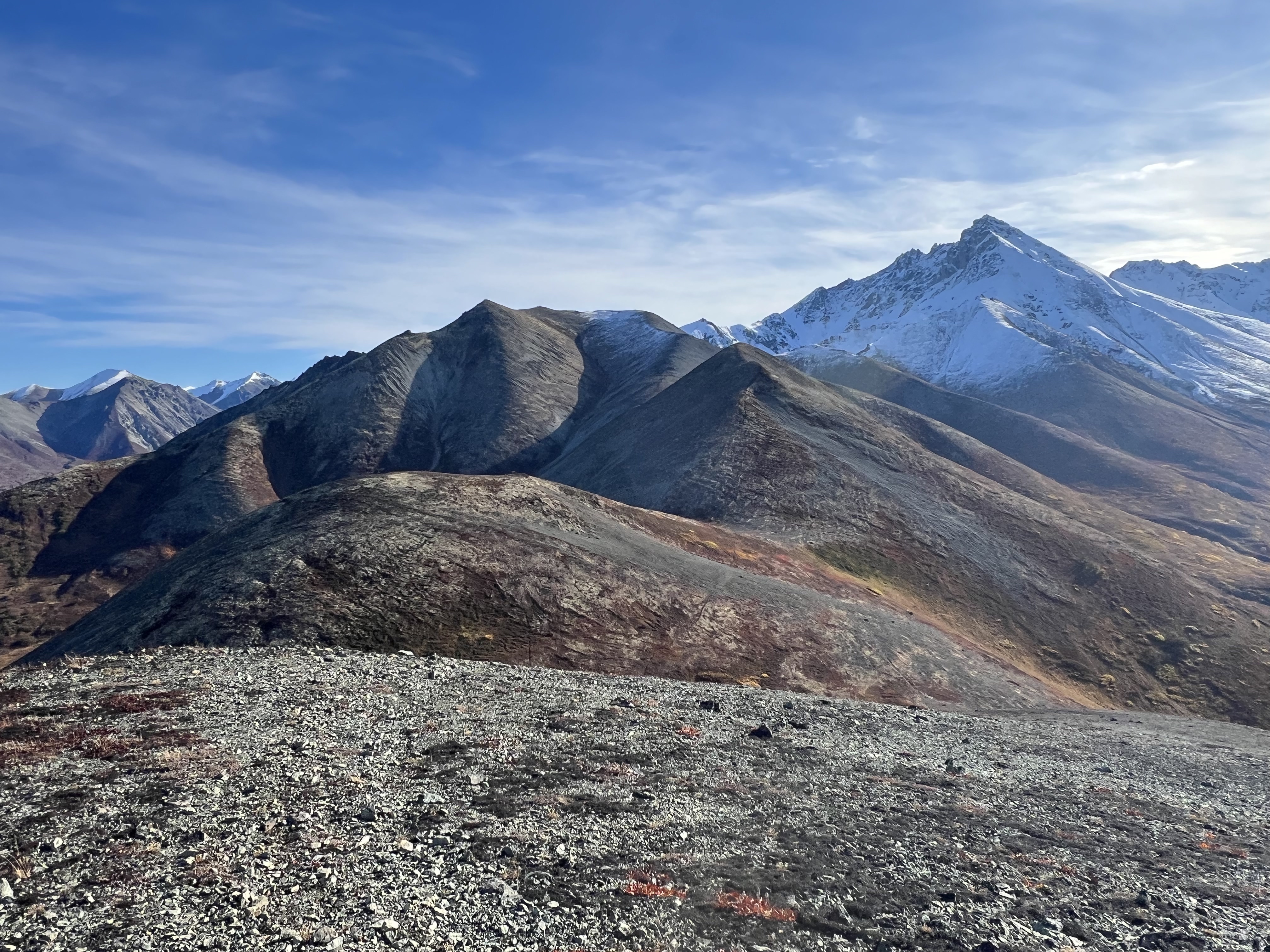
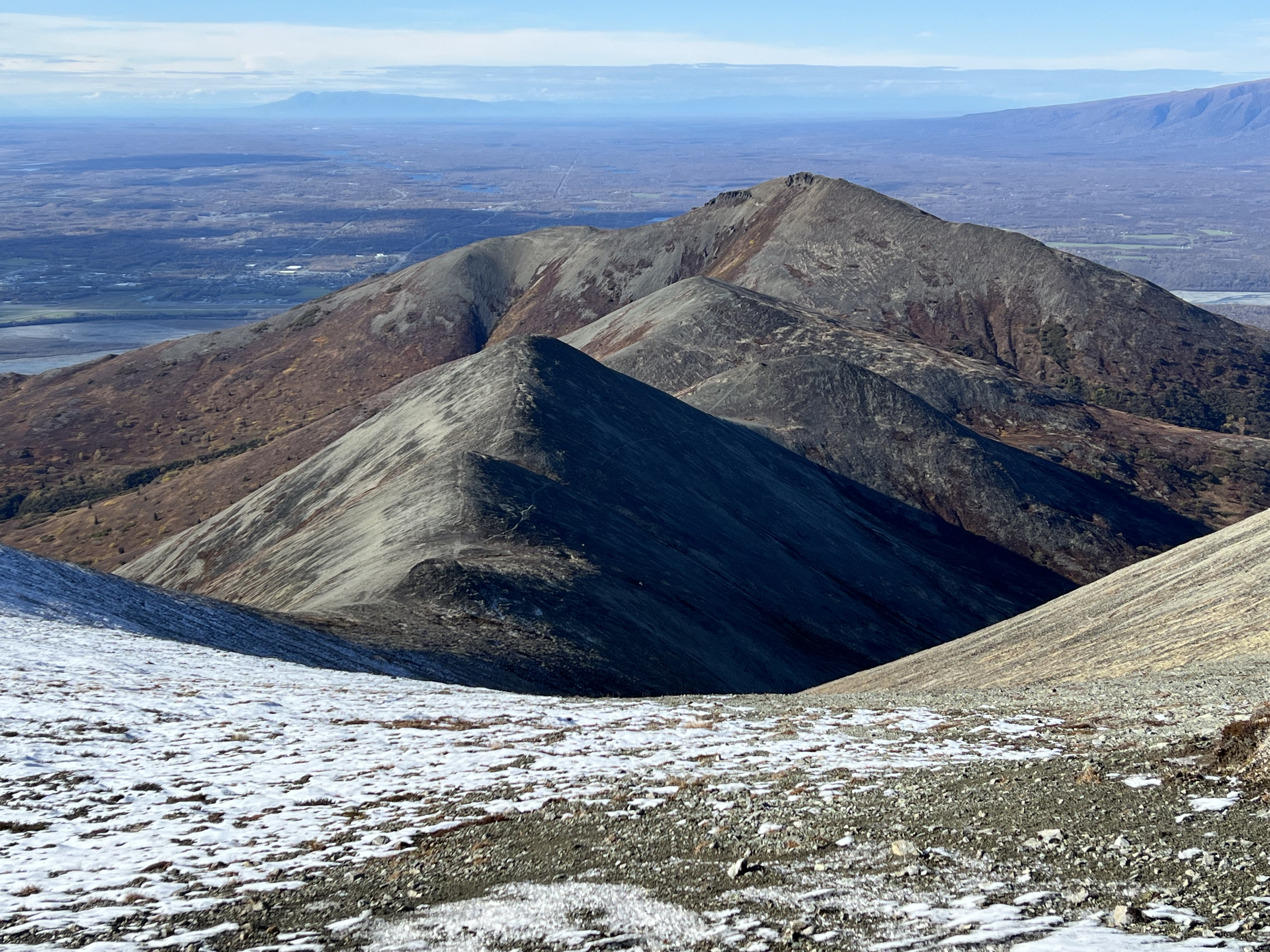
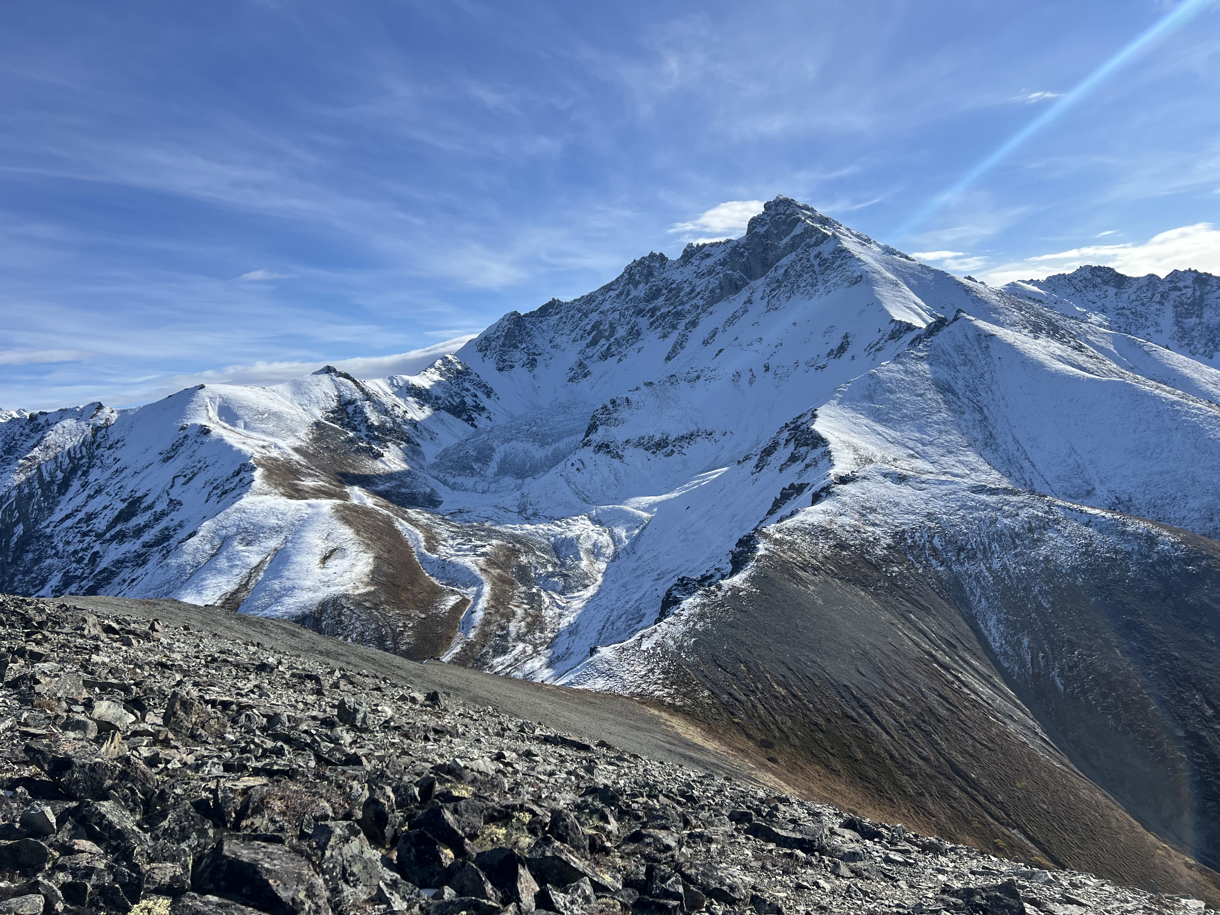
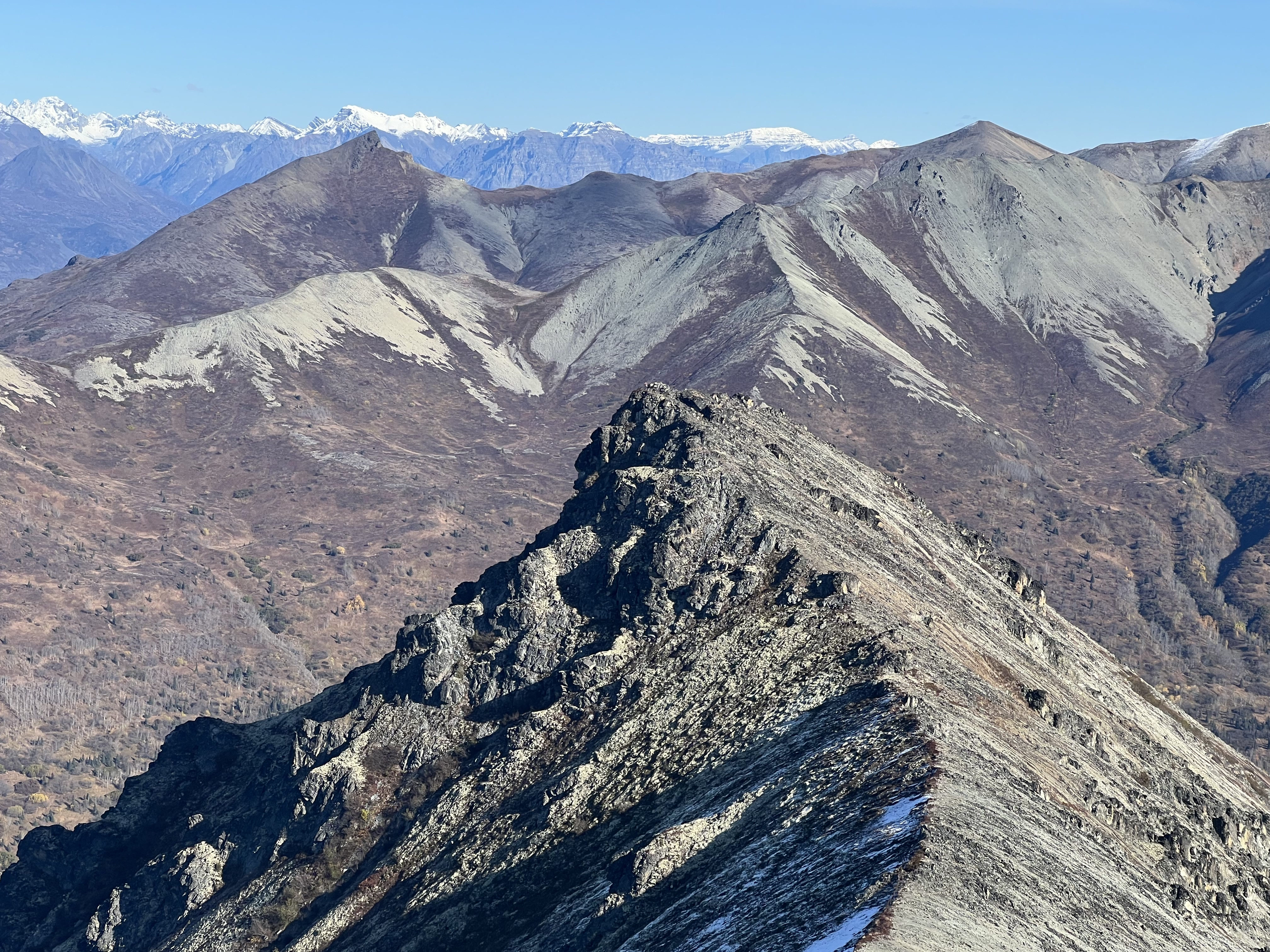
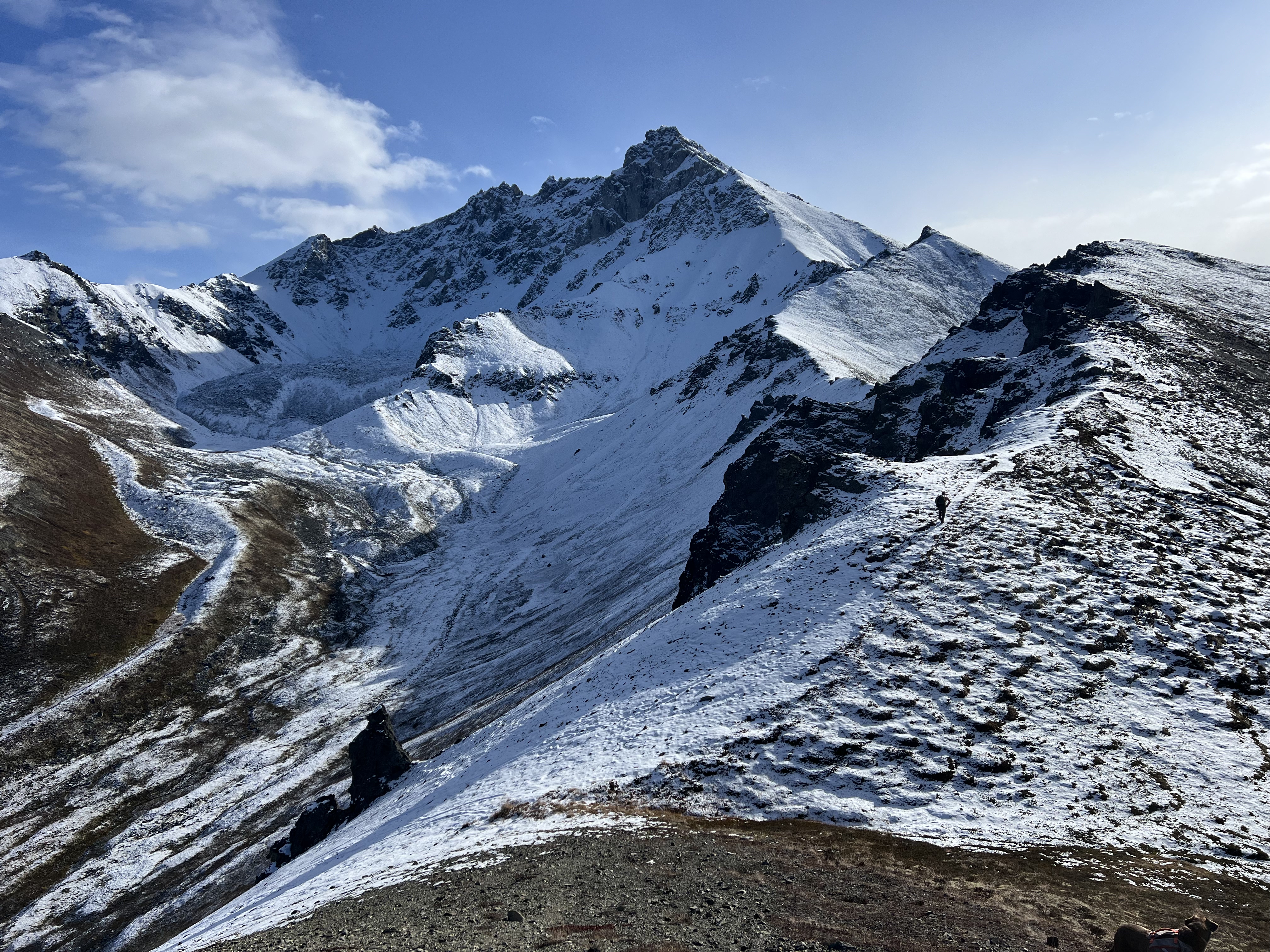
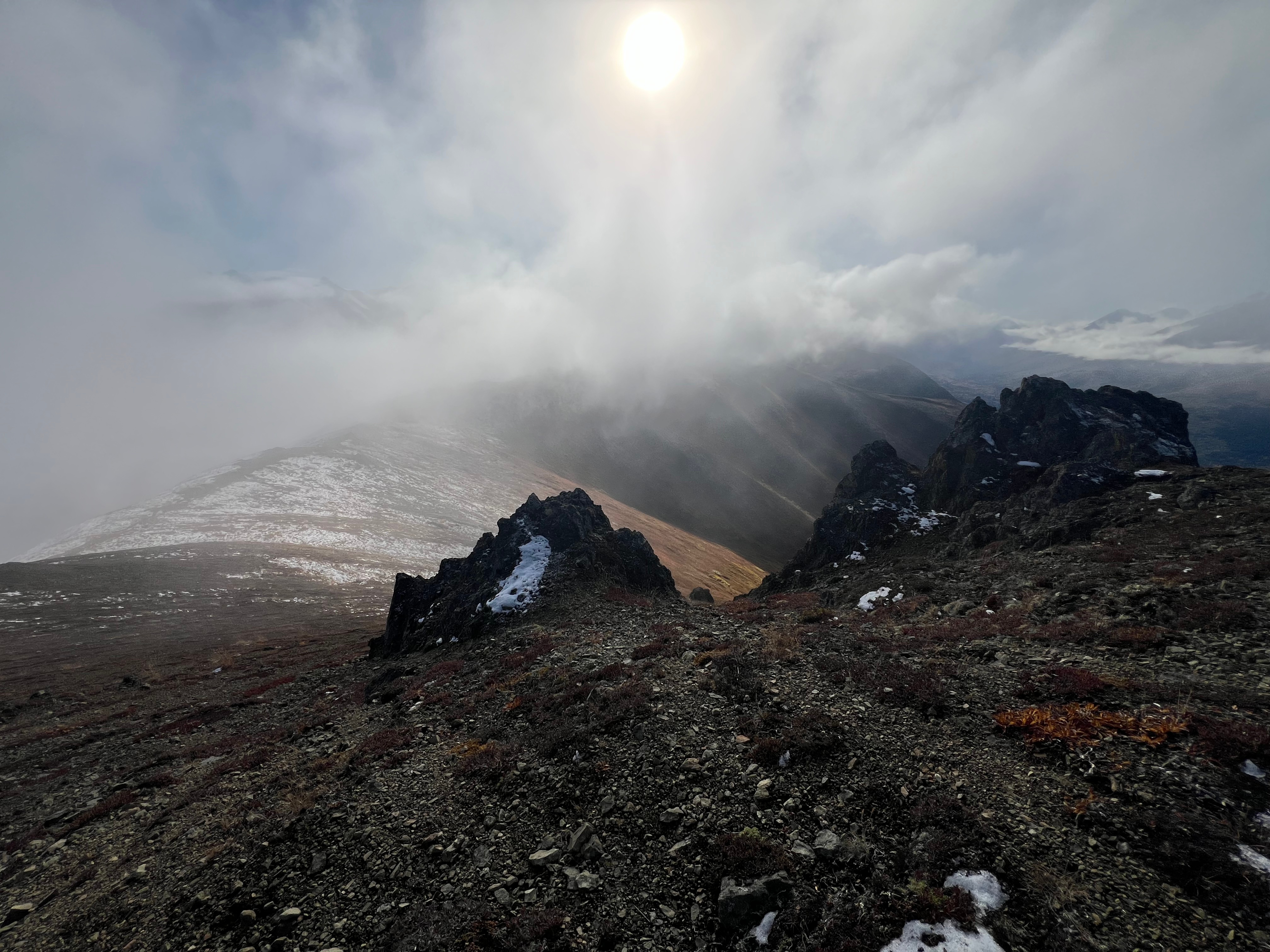
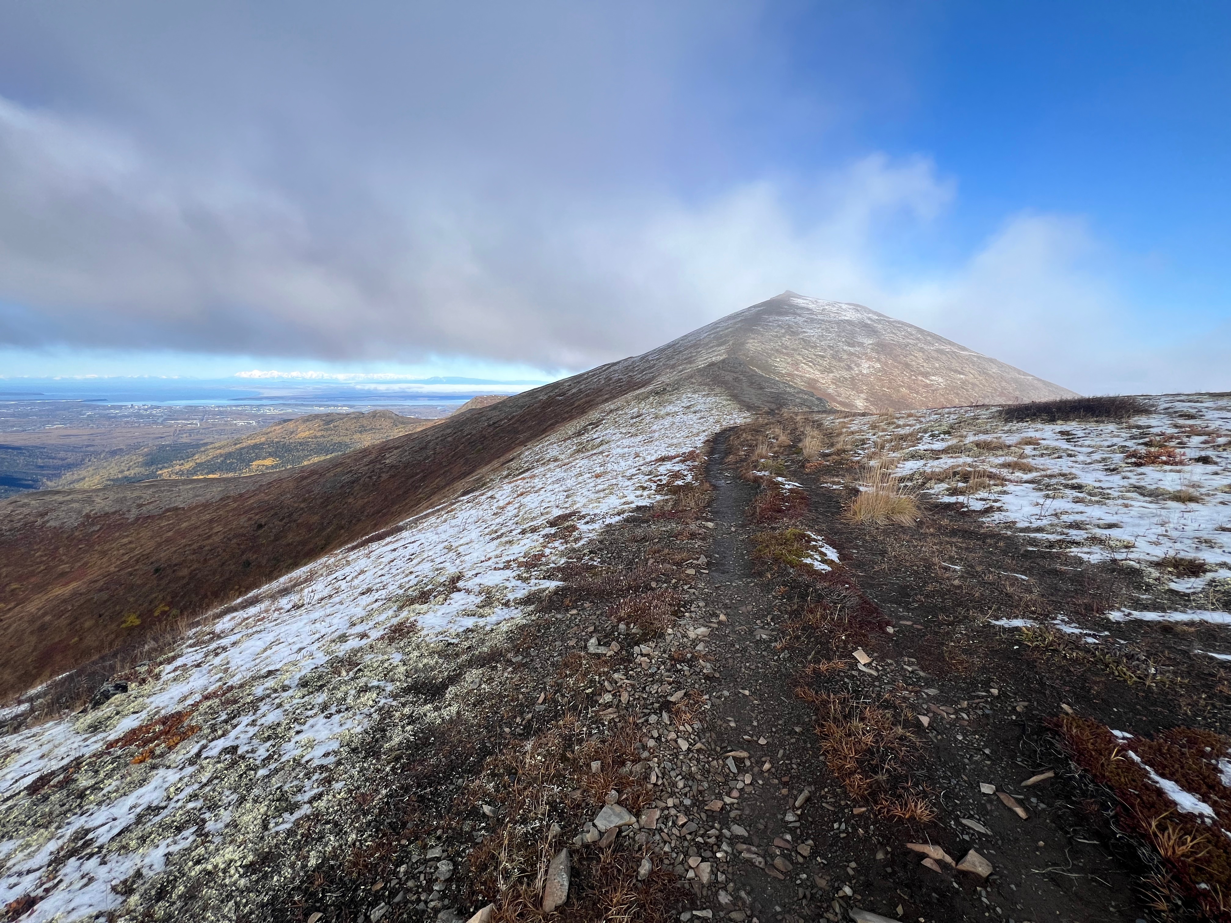
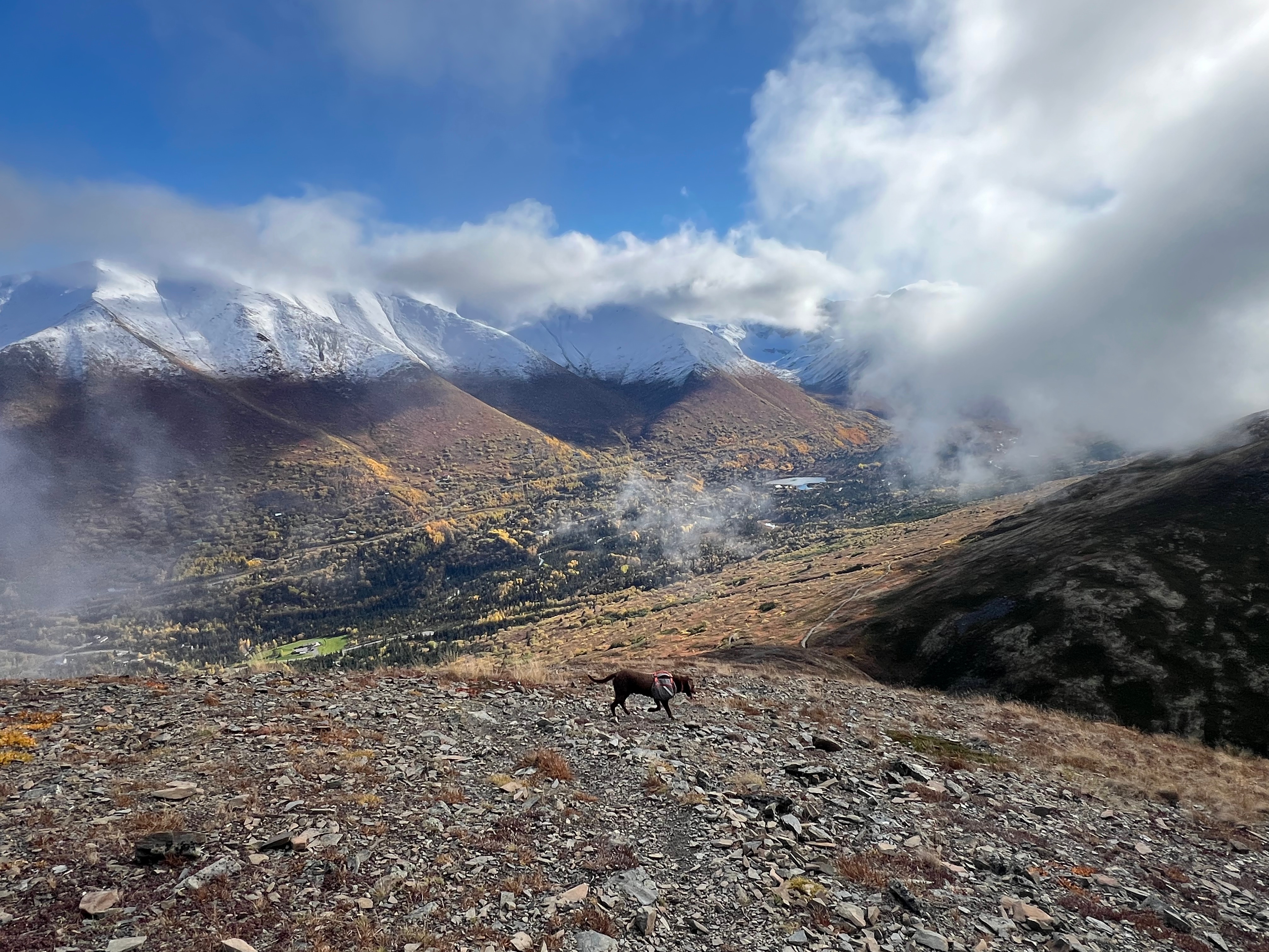
The entirety of Rendezvous Ridge was bathed in sunshine at first, including Peak 3891, a high point on the far end of the ridge, although the higher I climbed, the more the wispy clouds congealed into a ridgeline fog. Little did I know what an enormous gift this would end up giving me.

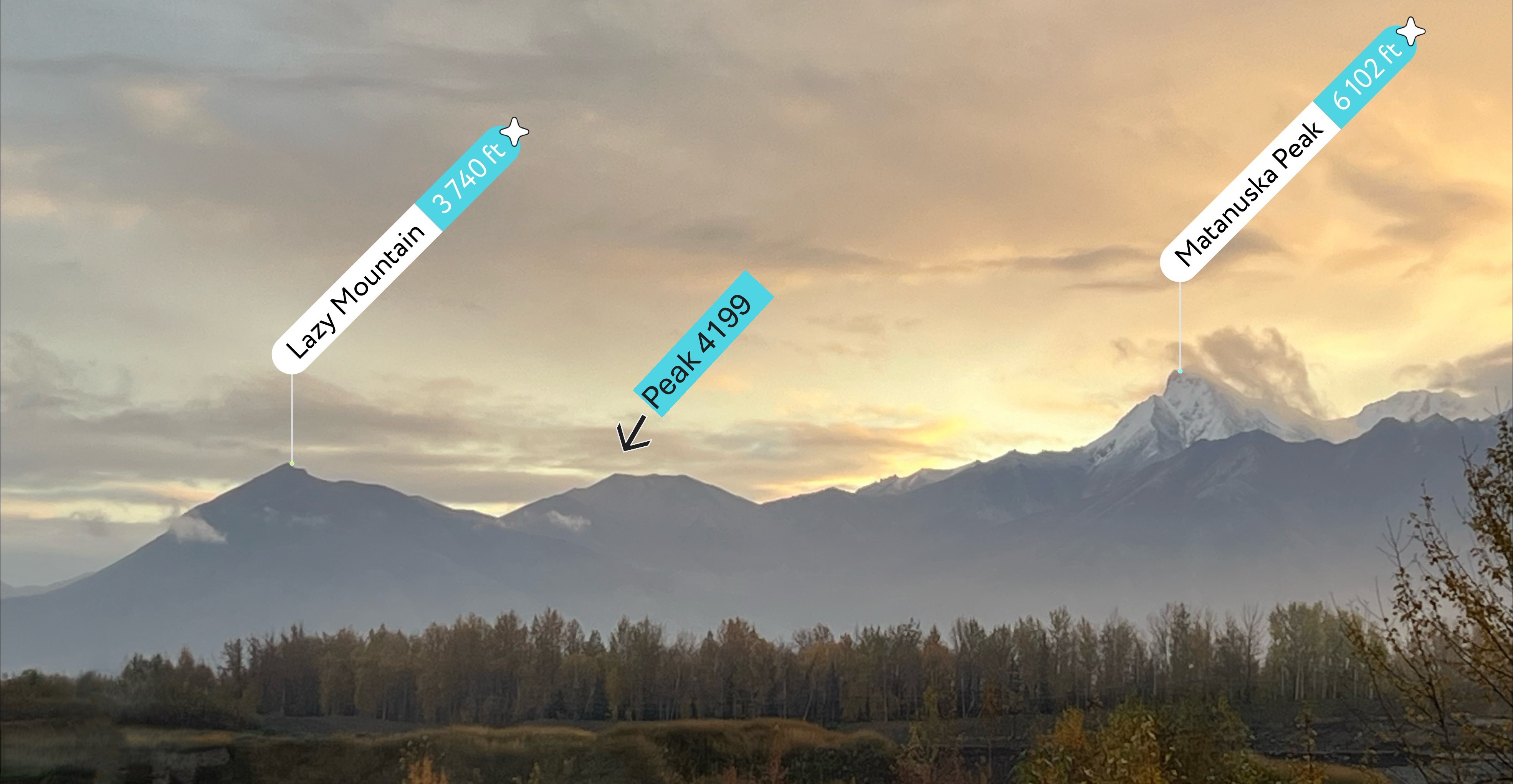
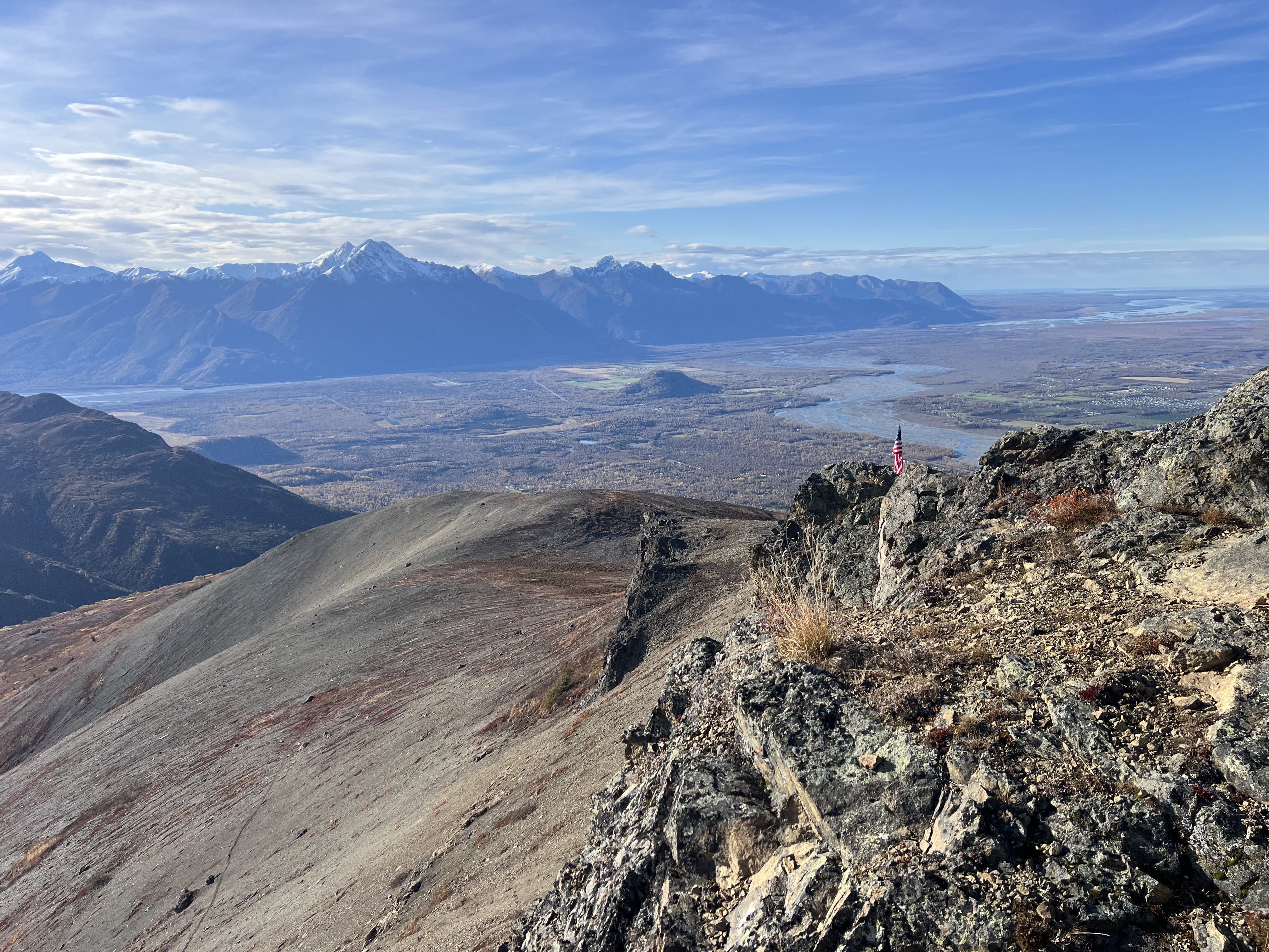
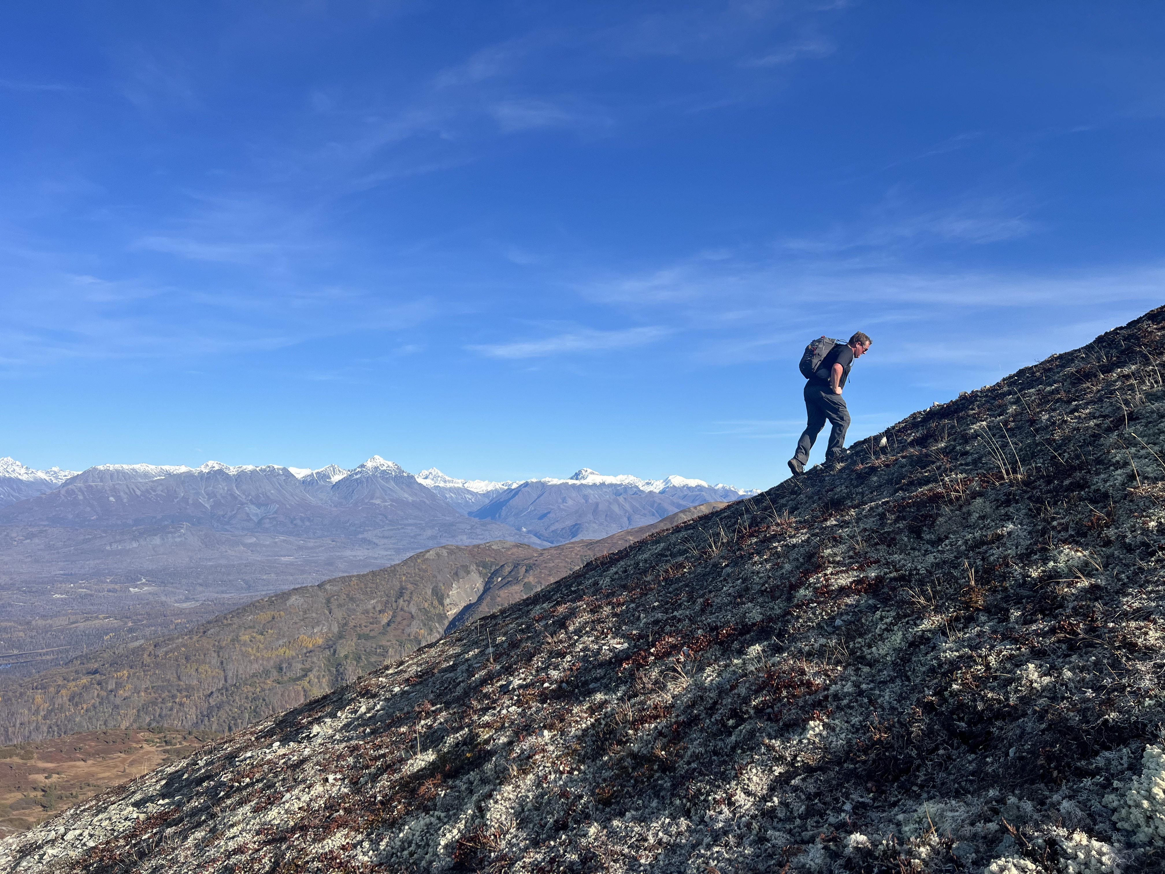
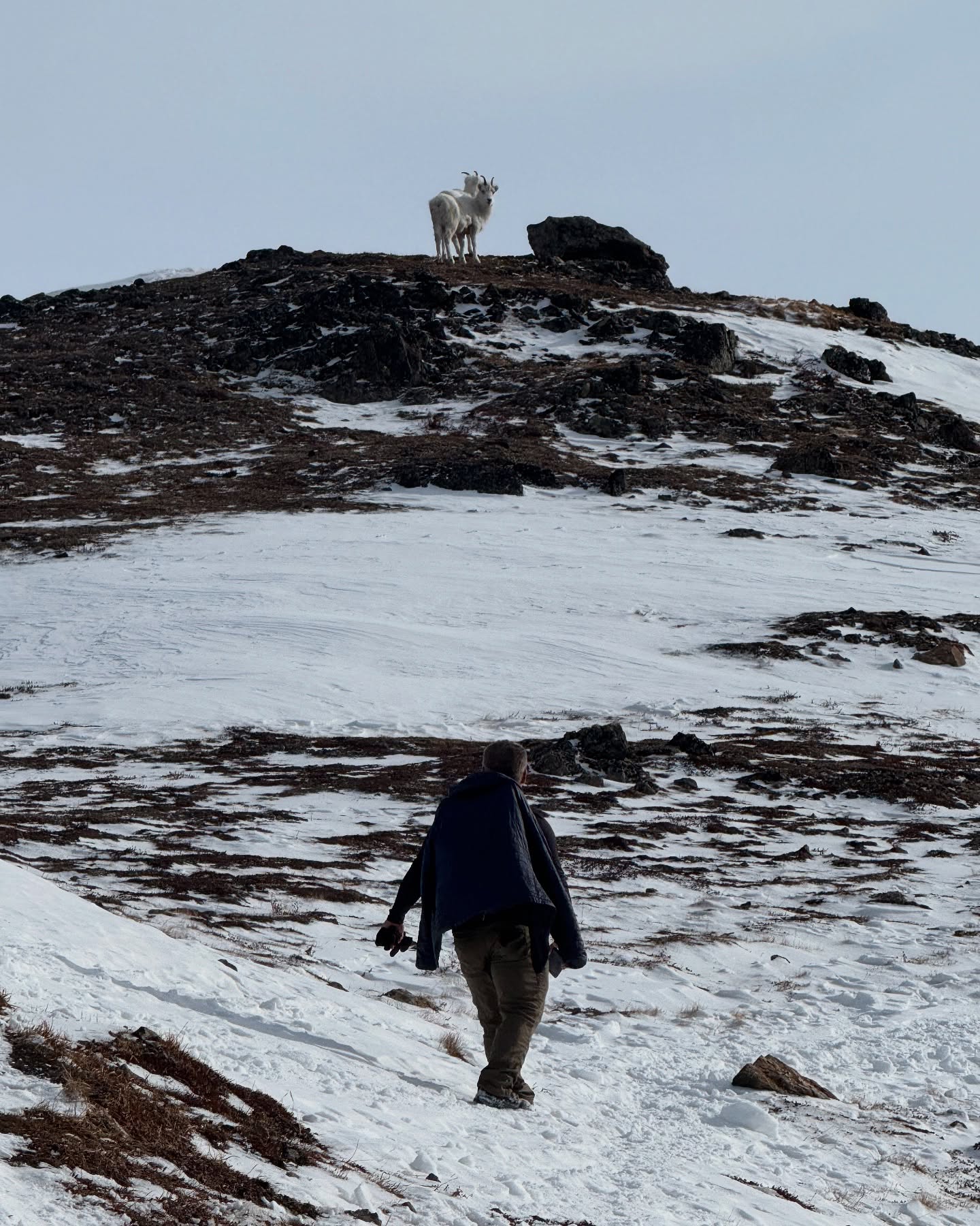
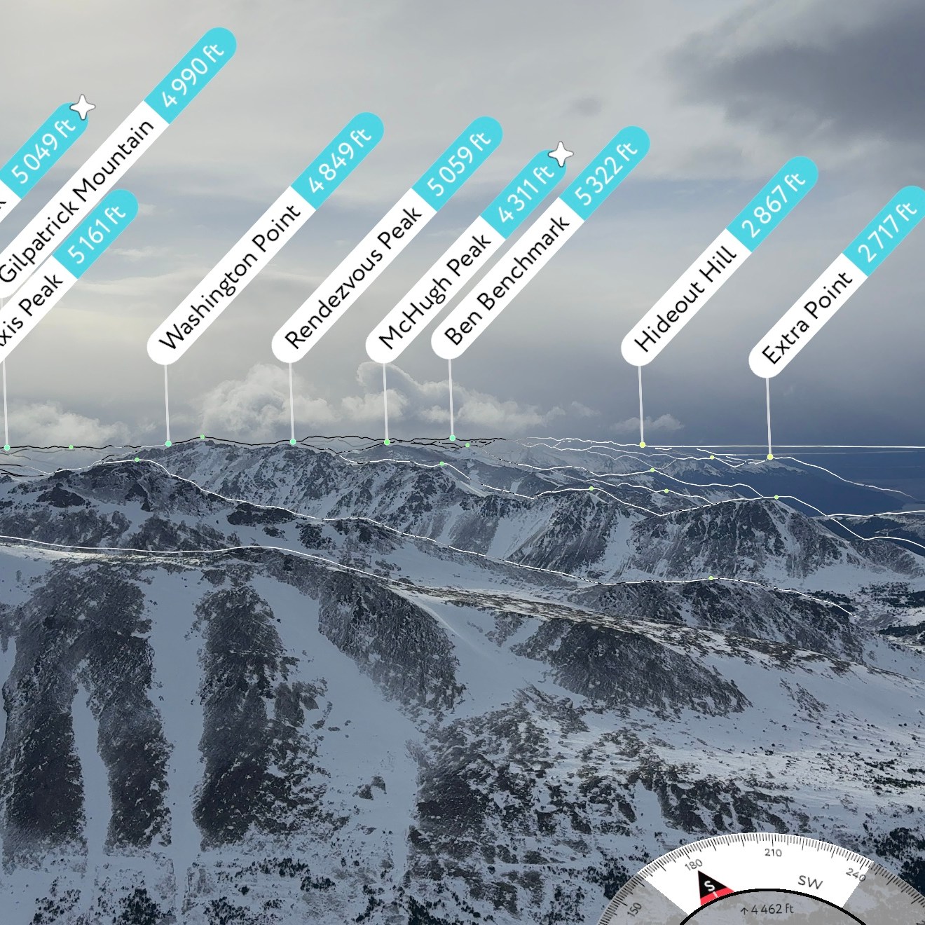
Peak 1112 is anticlimactic, although it is a great hike unto itself, offering a nice vantage point of not only the surround mountains and valleys, but also of the Nike Missile Site on the neighboring ridge, as well as the Anchorage Bowl and the string of Volcanoes across the inlet (Mt Spurr, Redoubt, Iliamna and sometimes Augustine).

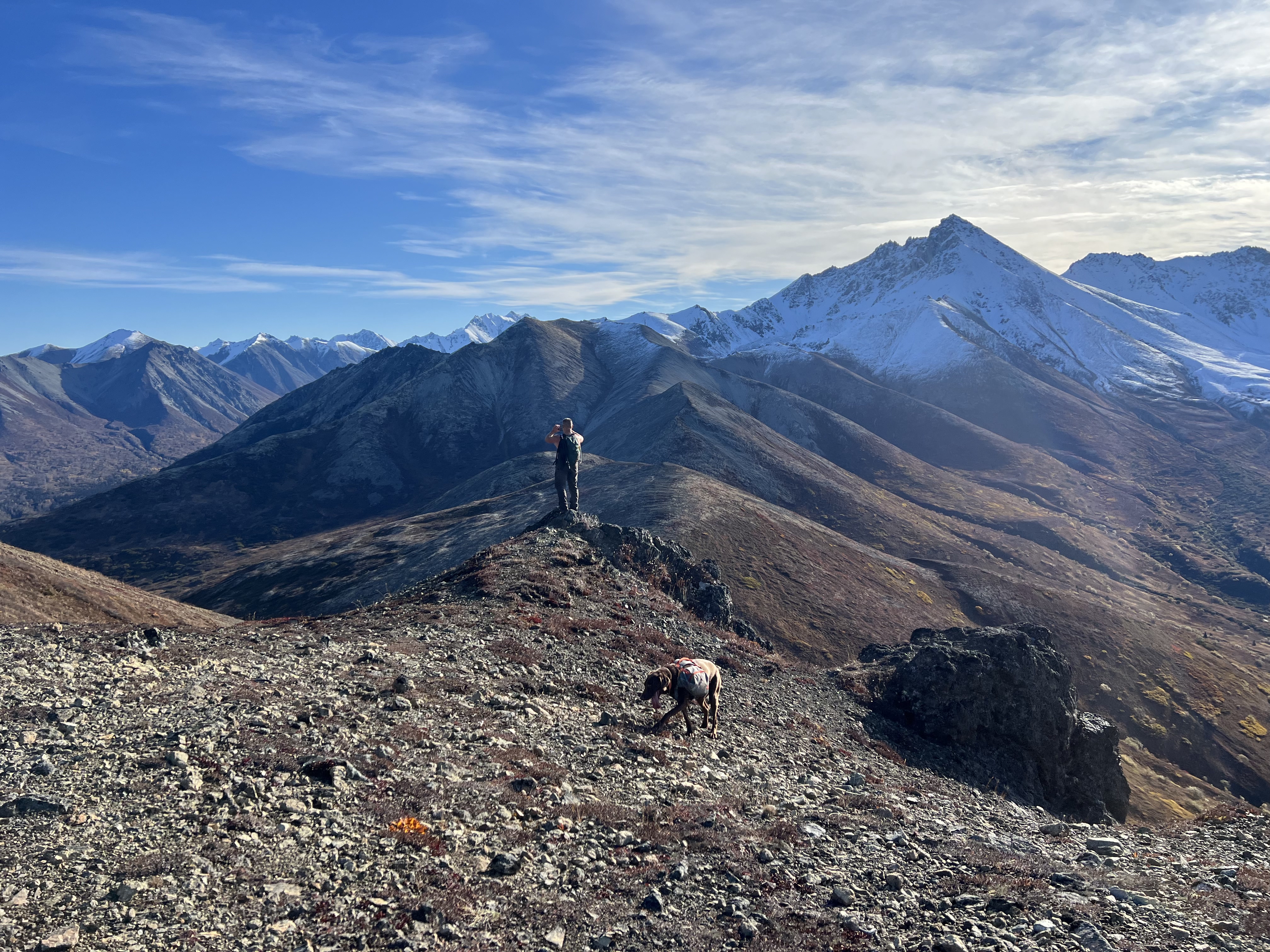
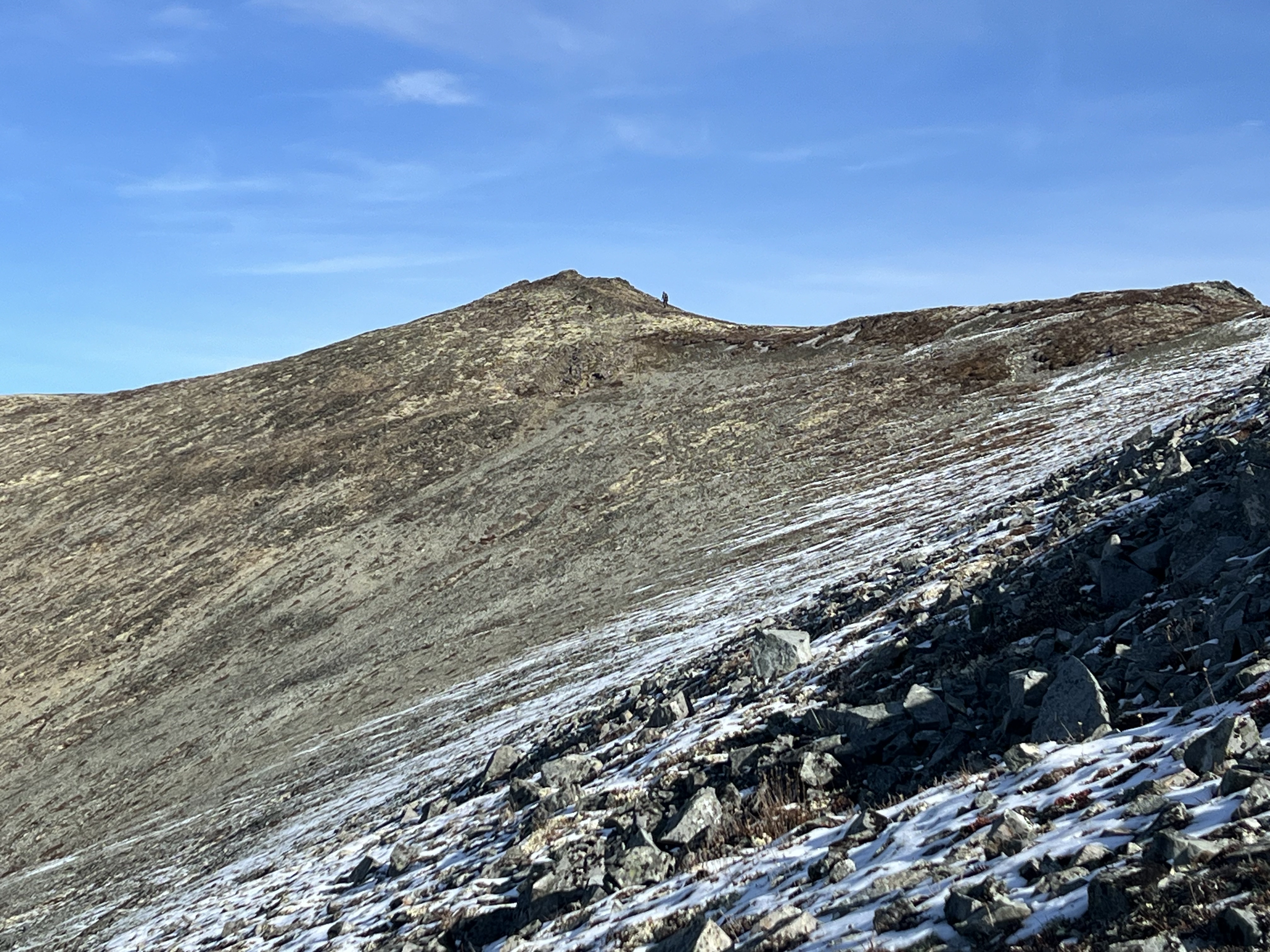
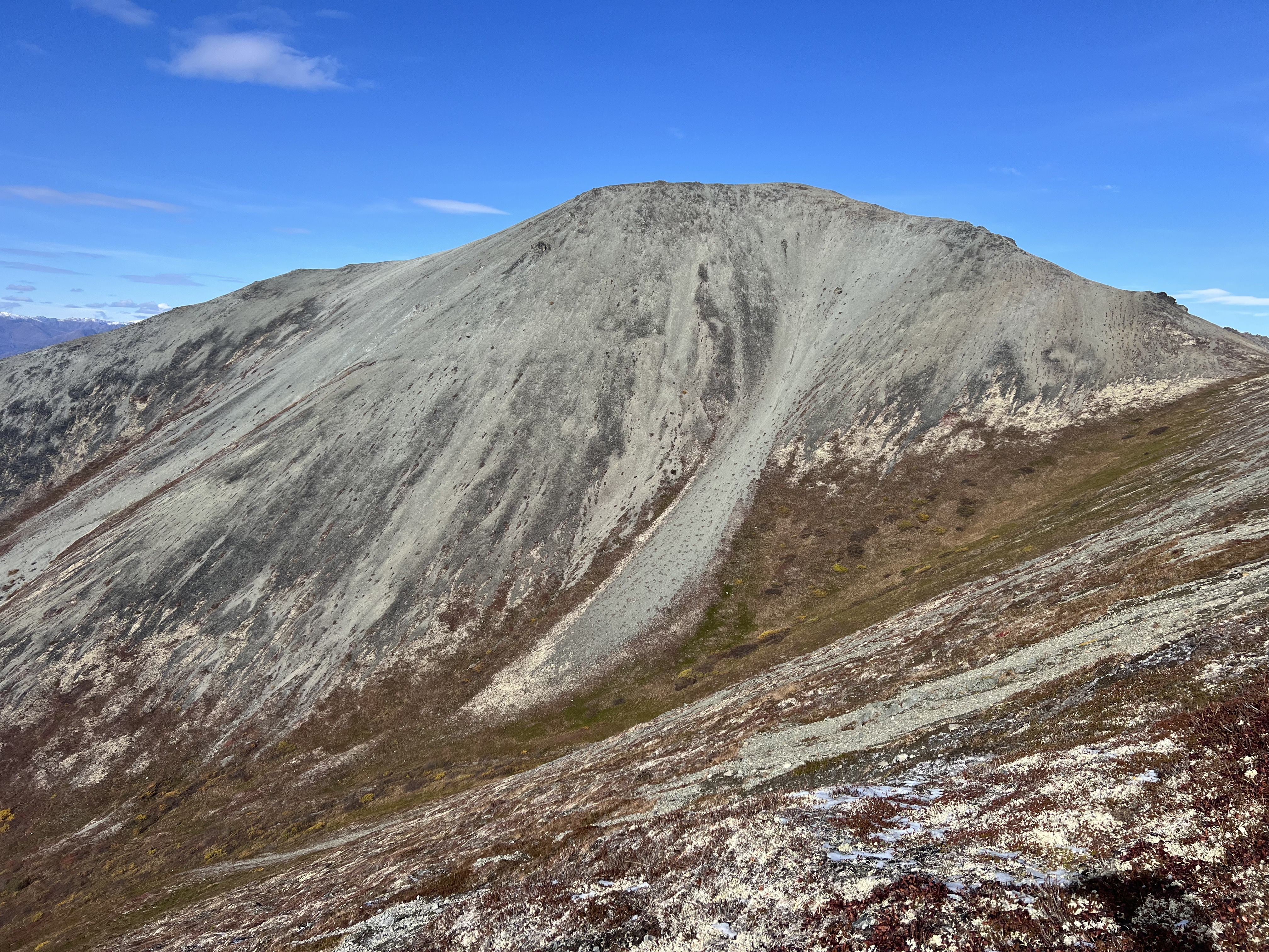
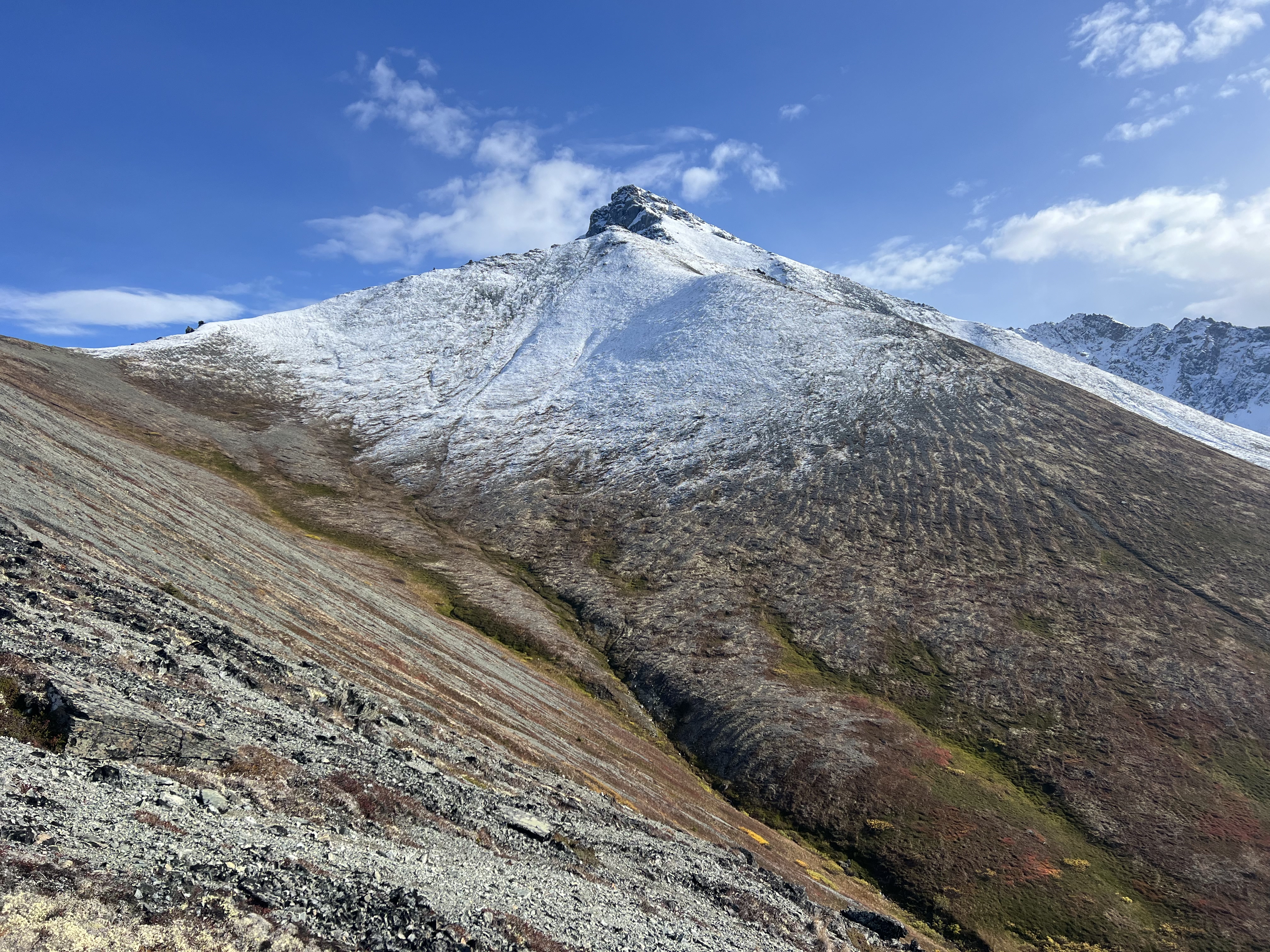
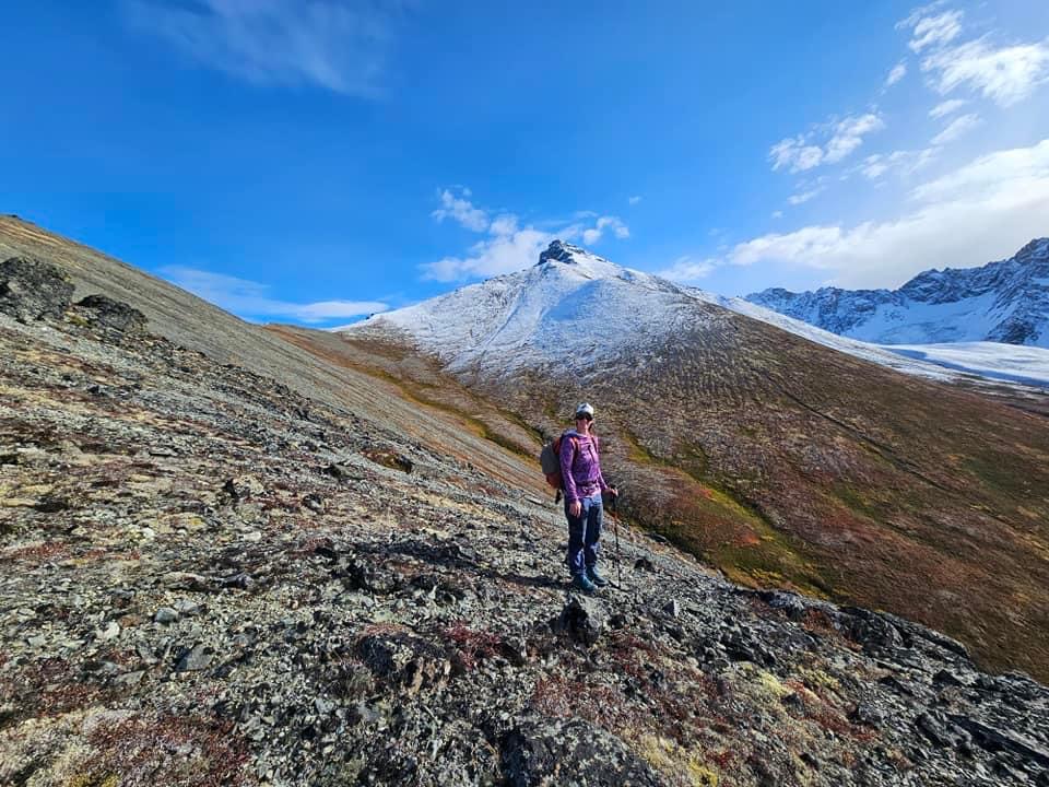
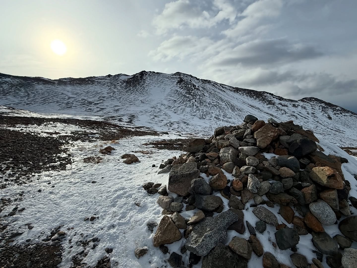
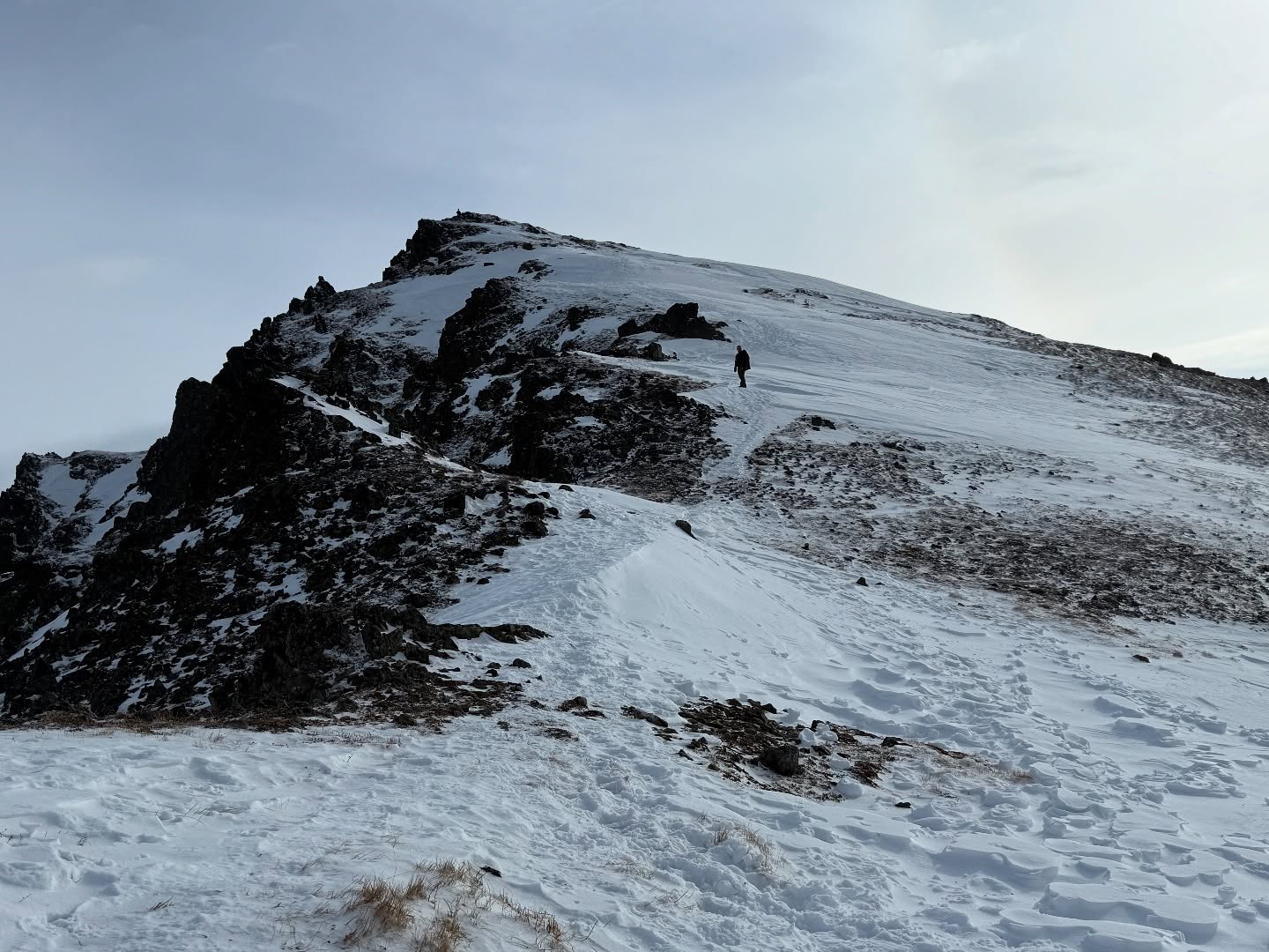
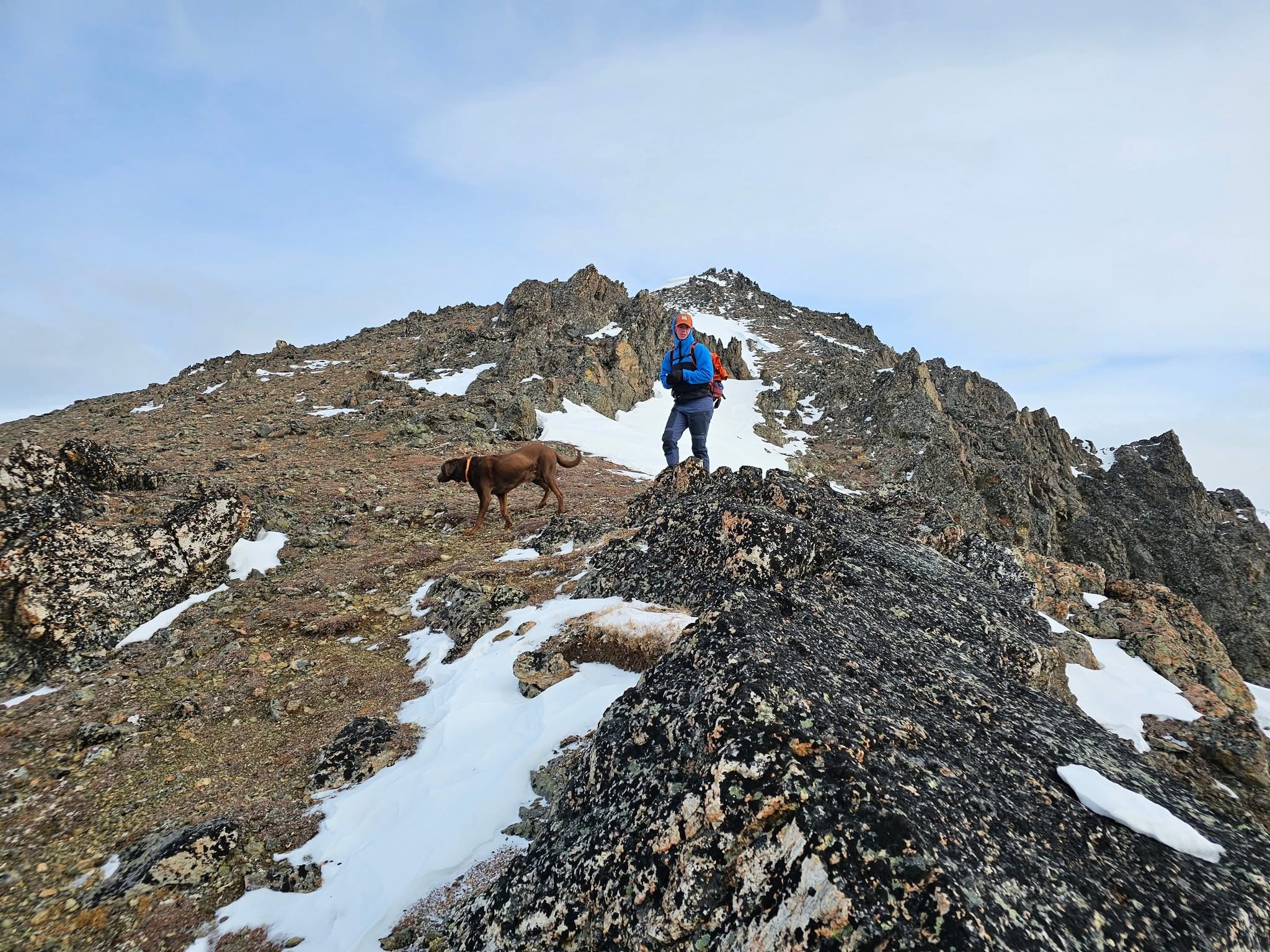
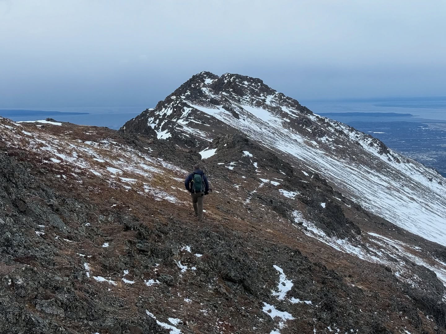
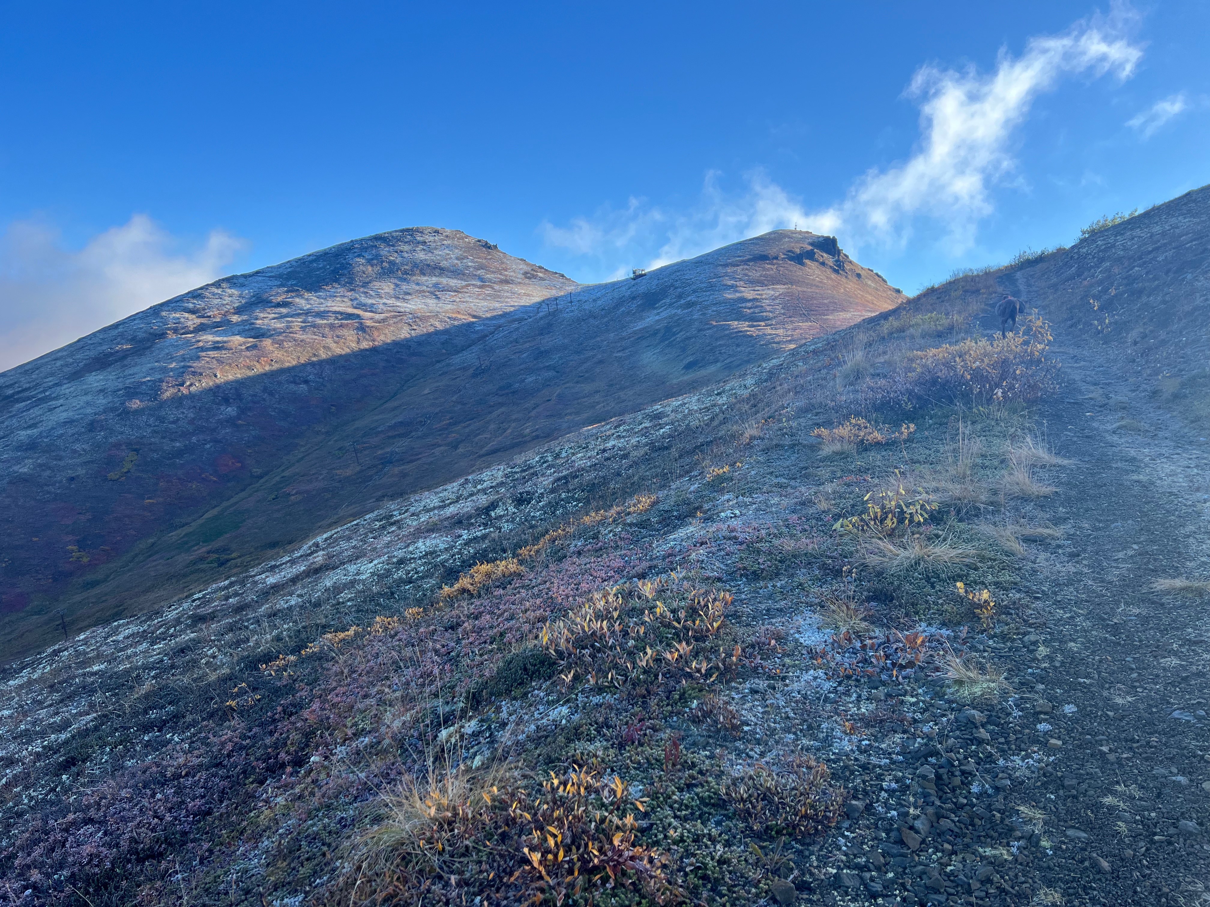
Passing the T-Bar infrastructure, I continued another half mile and 400′ to the summit of Little Teton, its pointed, jagged rocks poking up through the tundra and patchy snow. The intersection with Rendezvous Ridge now visible, a worn footpath made even more prominent by the dusted snow bordering it. The clouds were thickening over Peak 3891, although I was still bathed in sunshine.

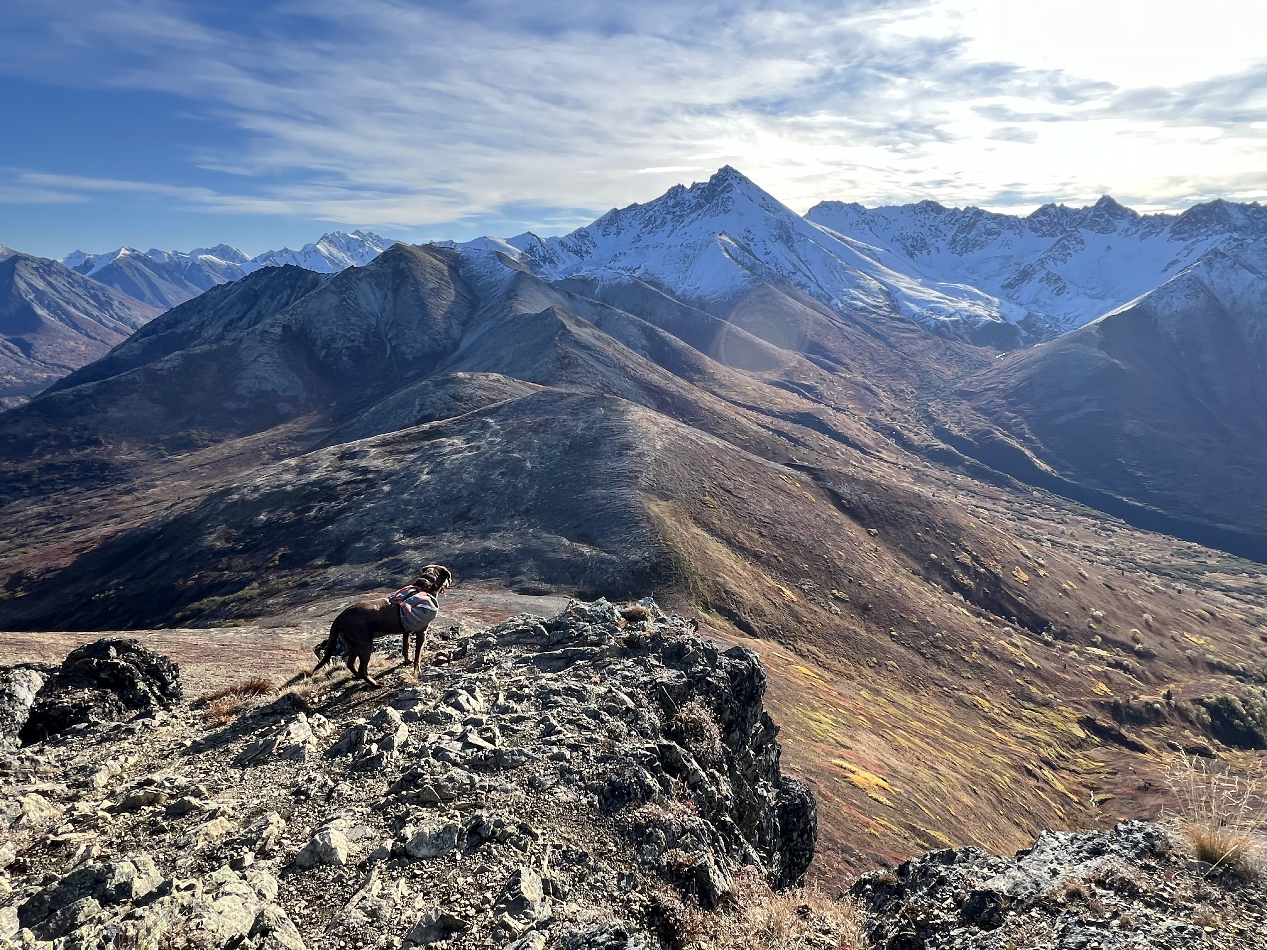
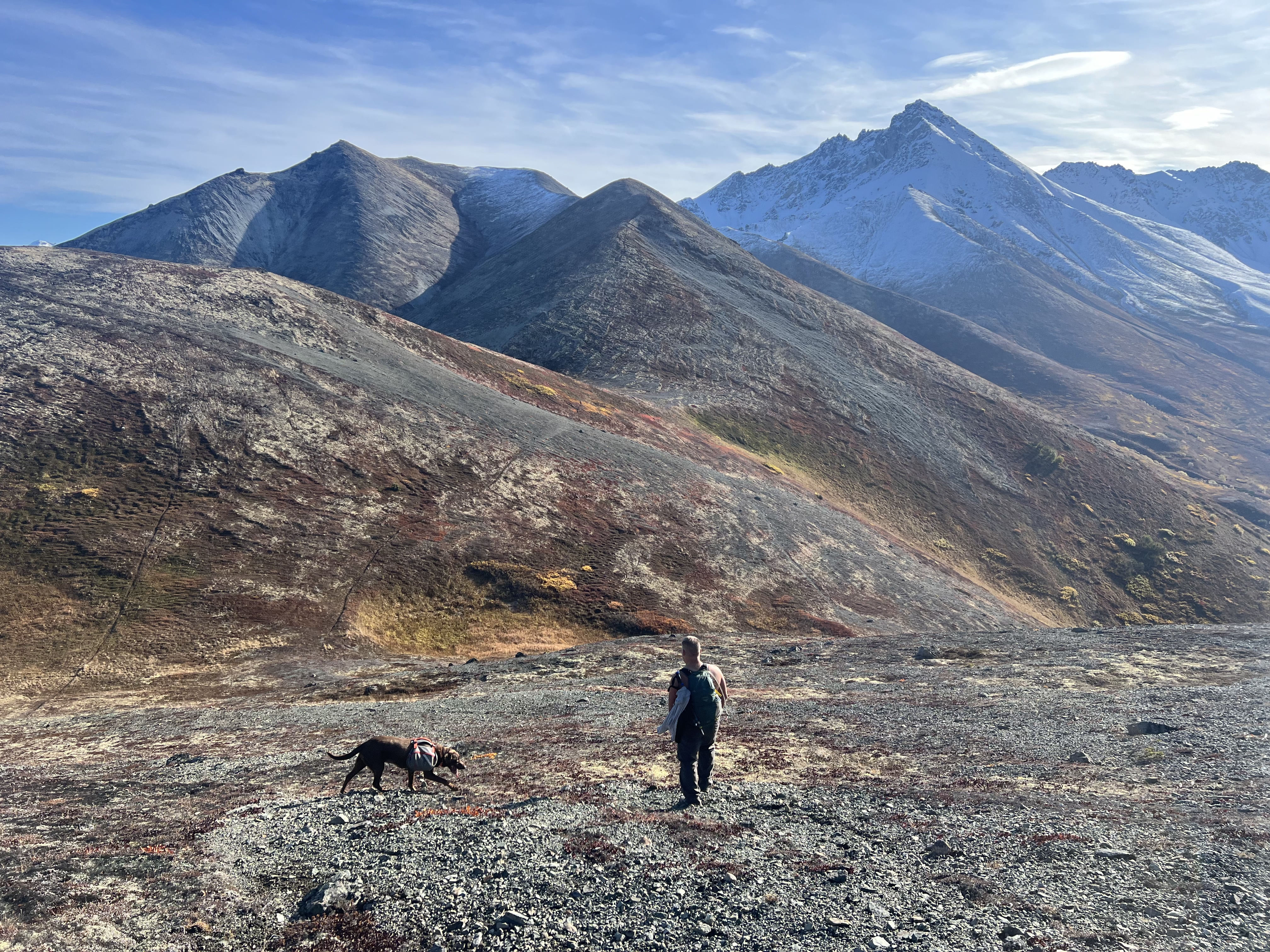
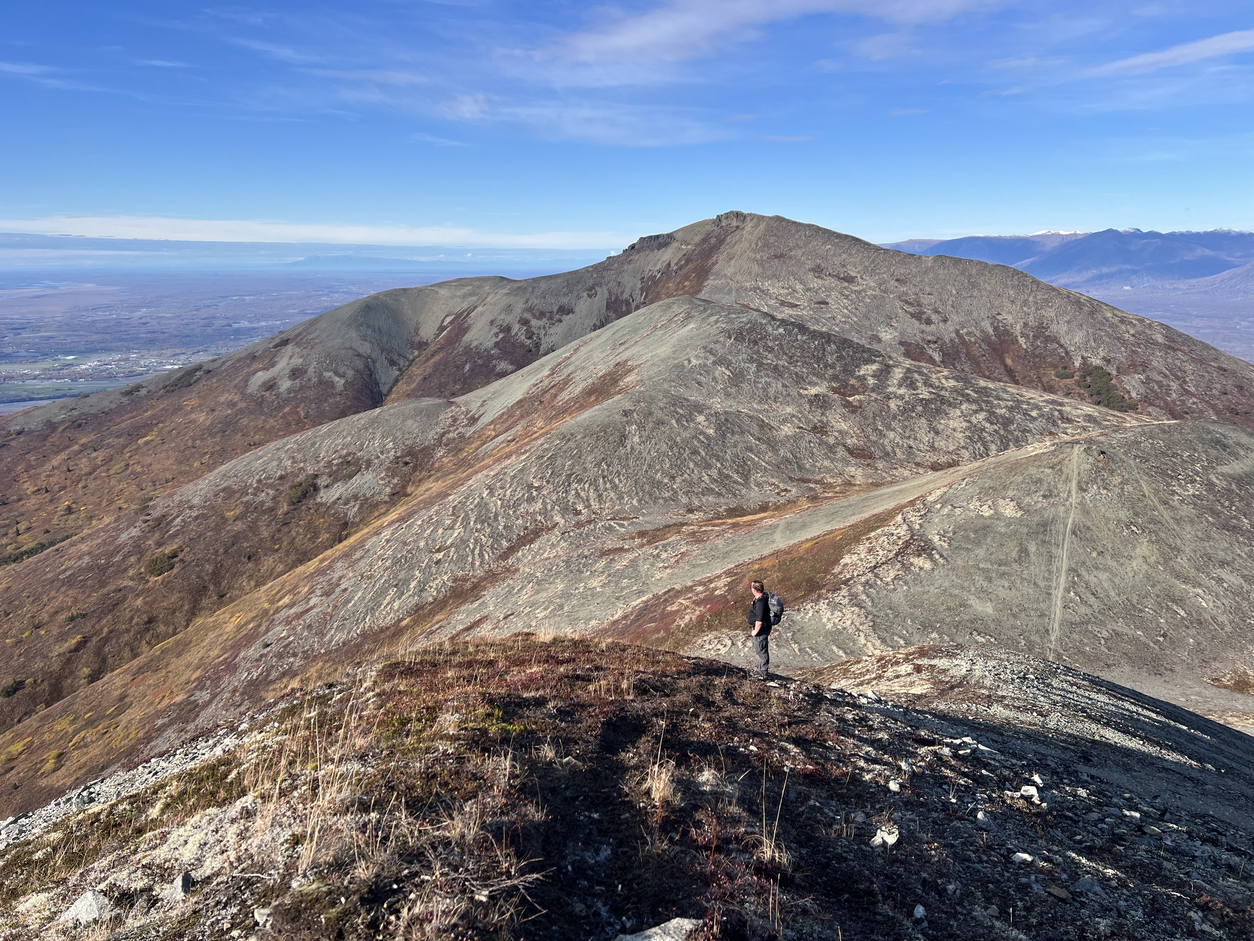
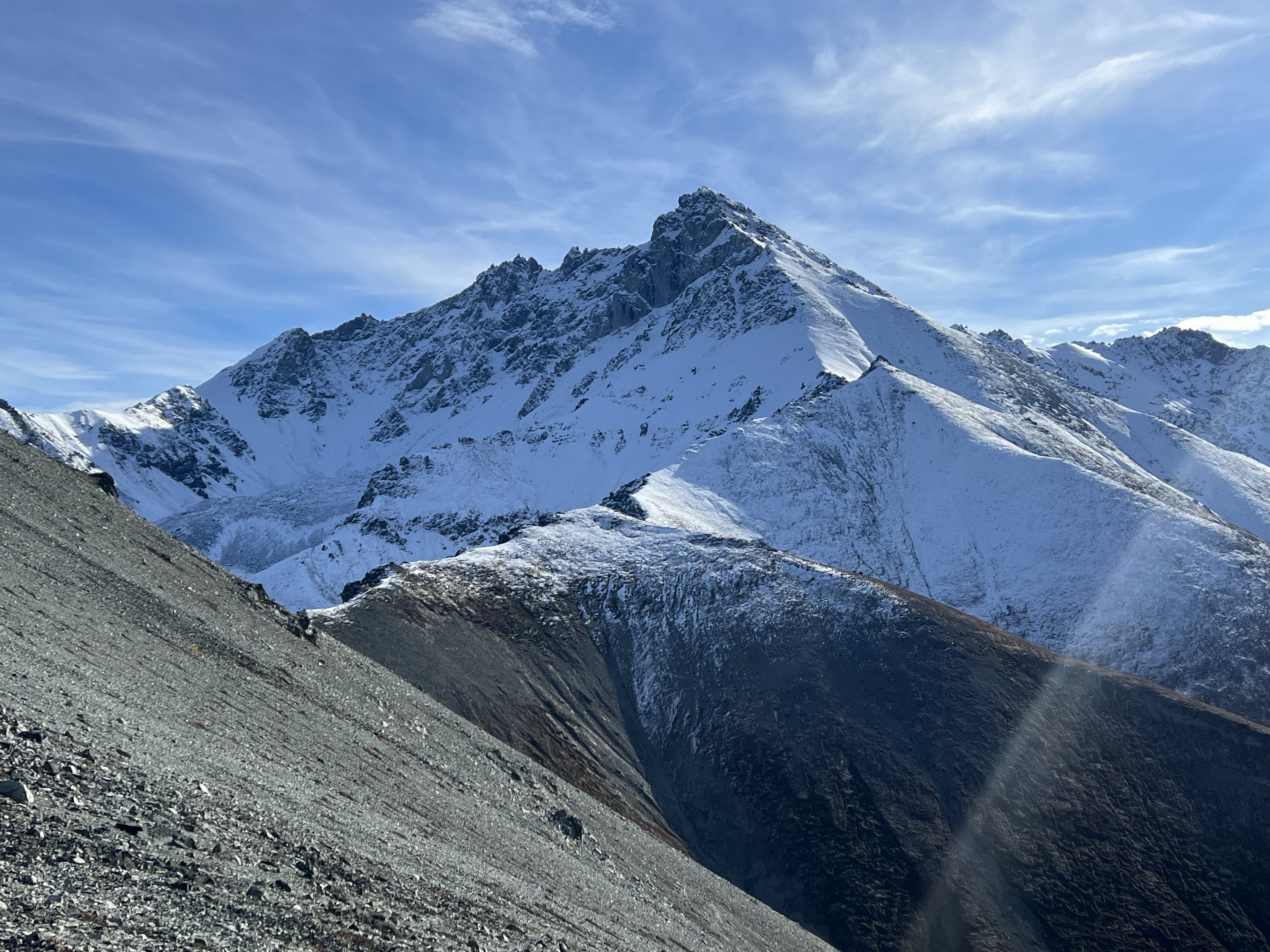
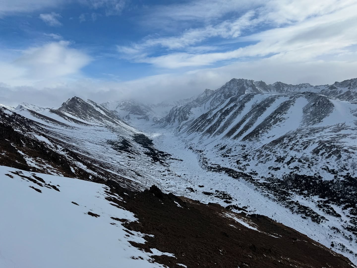
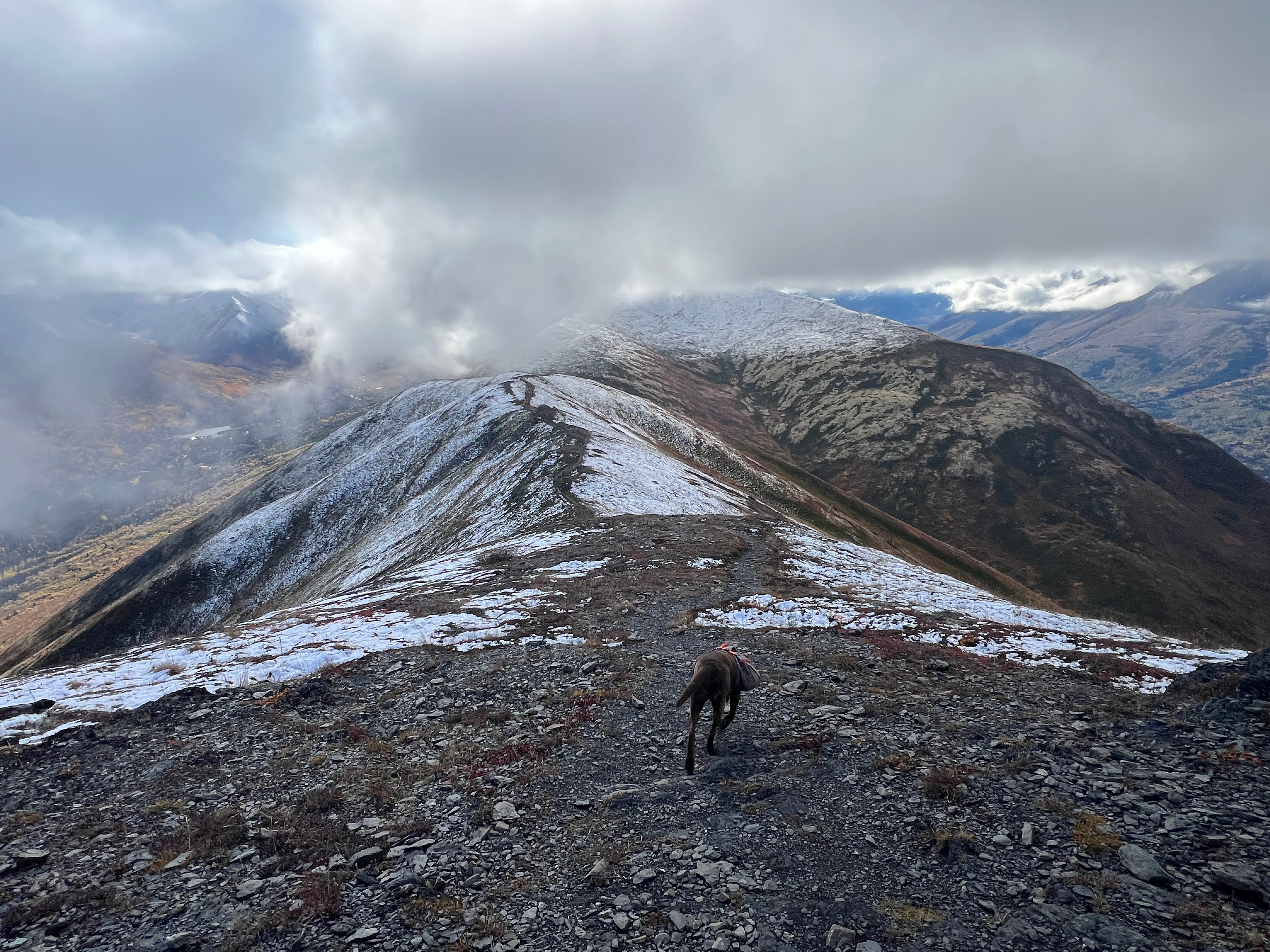
I made the short descent to the footpath and looked left (North) towards Rendezvous Peak. I had traversed this trail all the way over to Rendezvous and Mt Gordon Lyon the October previous and today was just a relaxing walk, so I turned right and began following the ridge towards Peak 3891 and Hunter Pass.

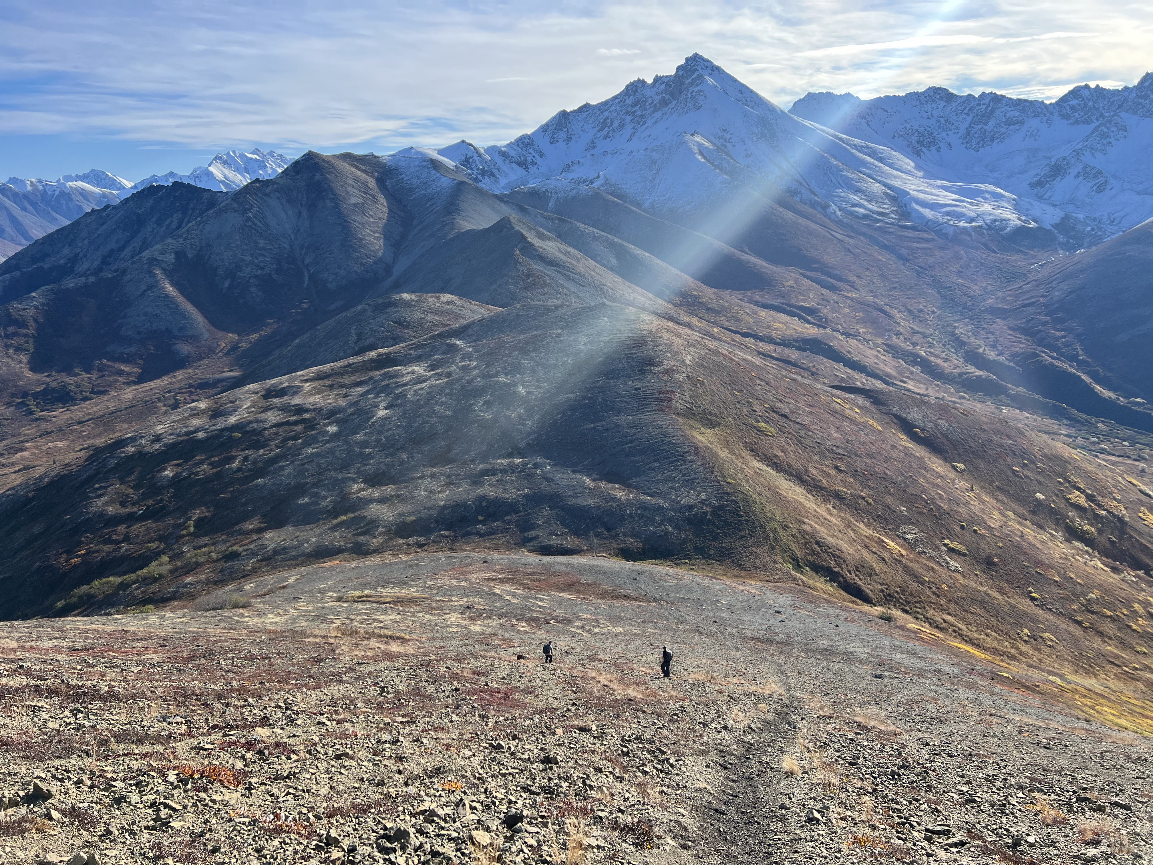
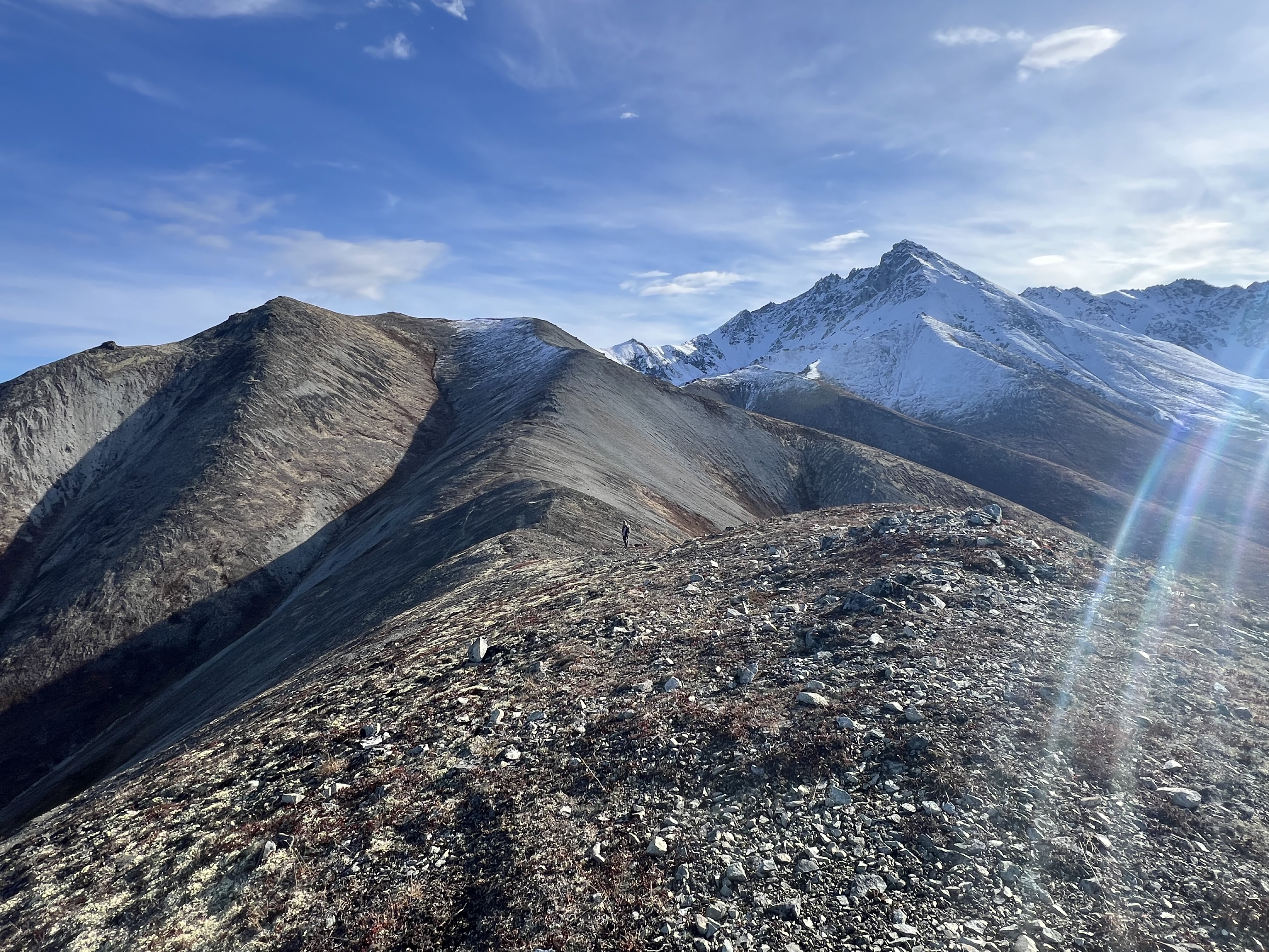
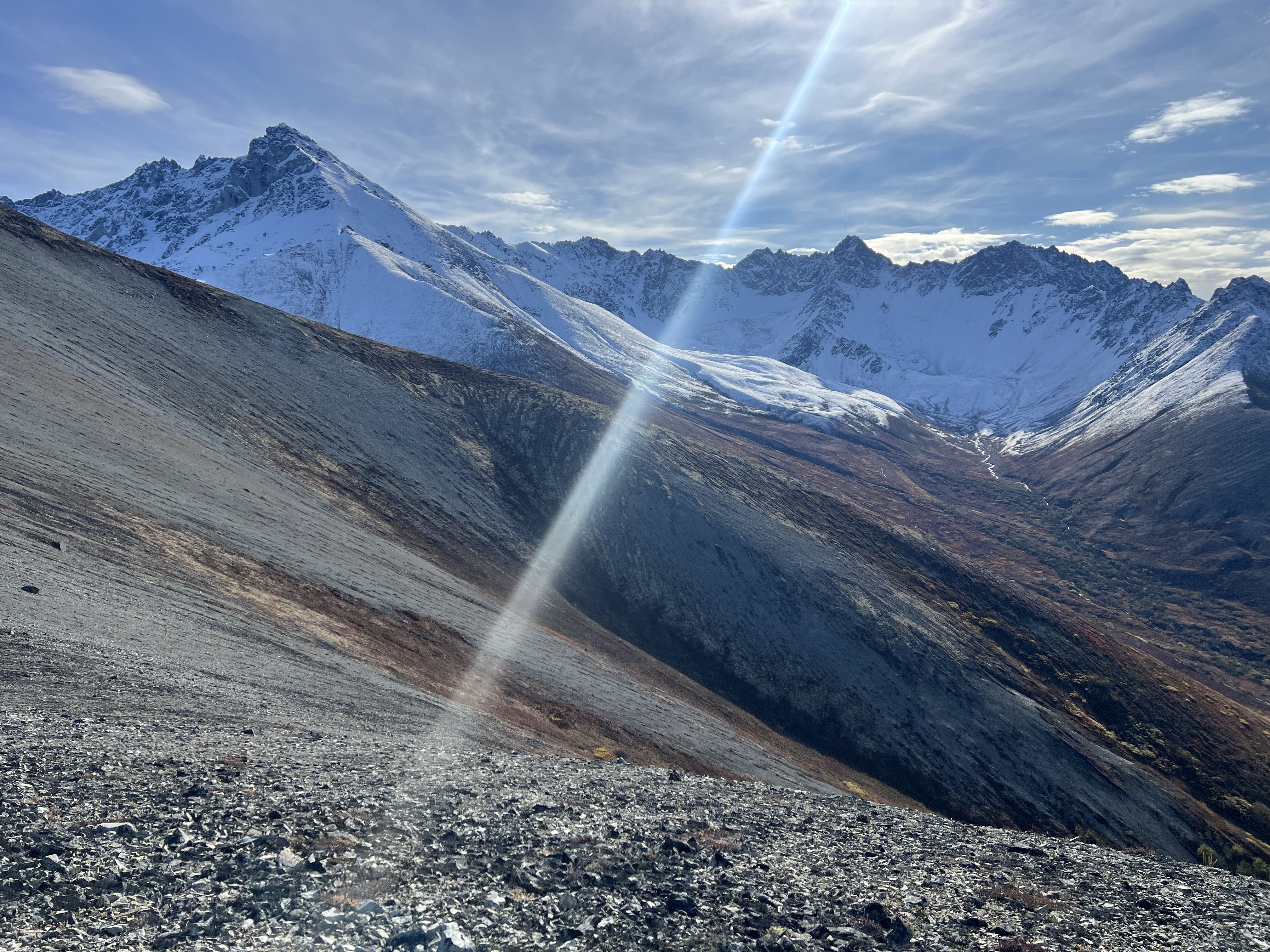
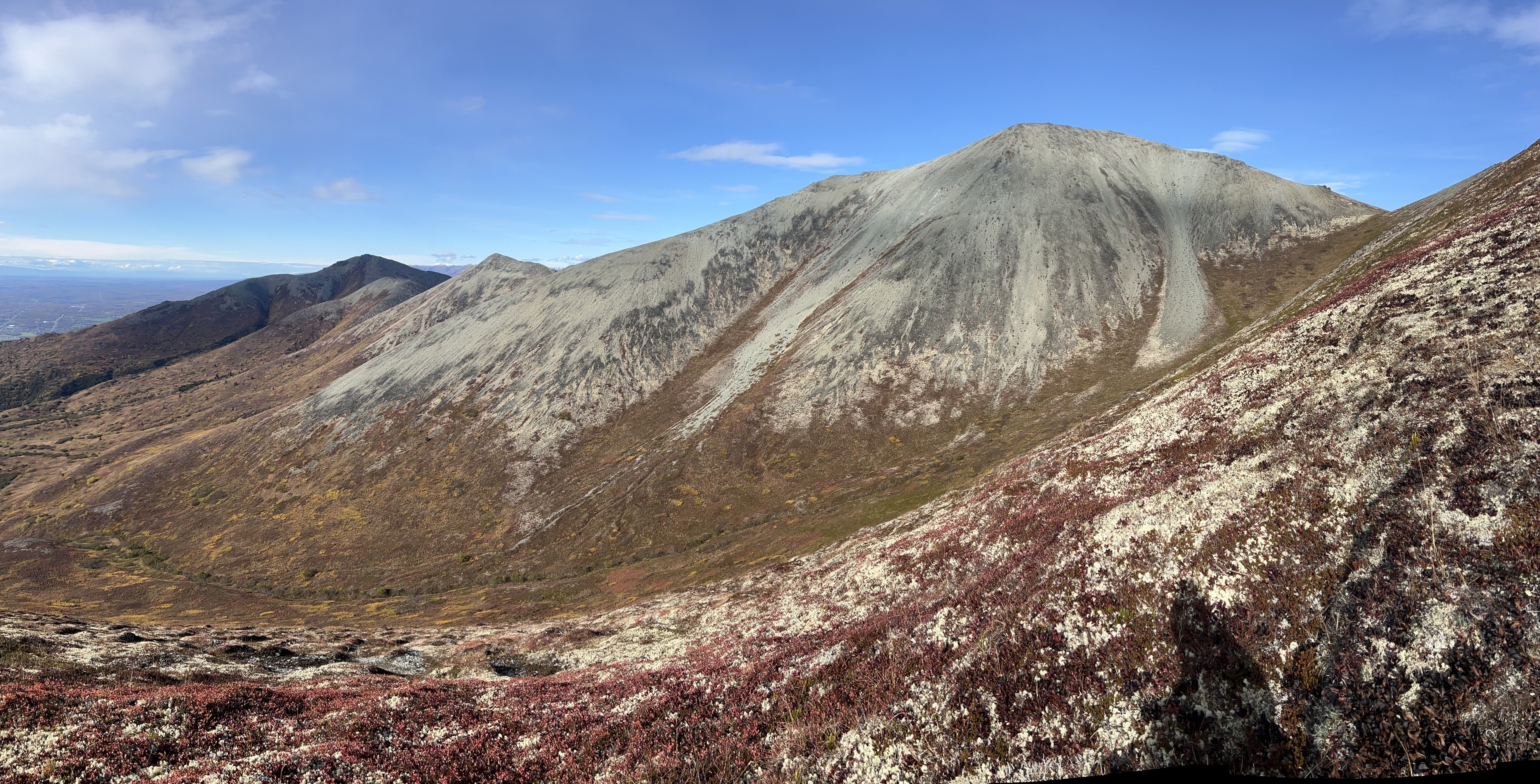
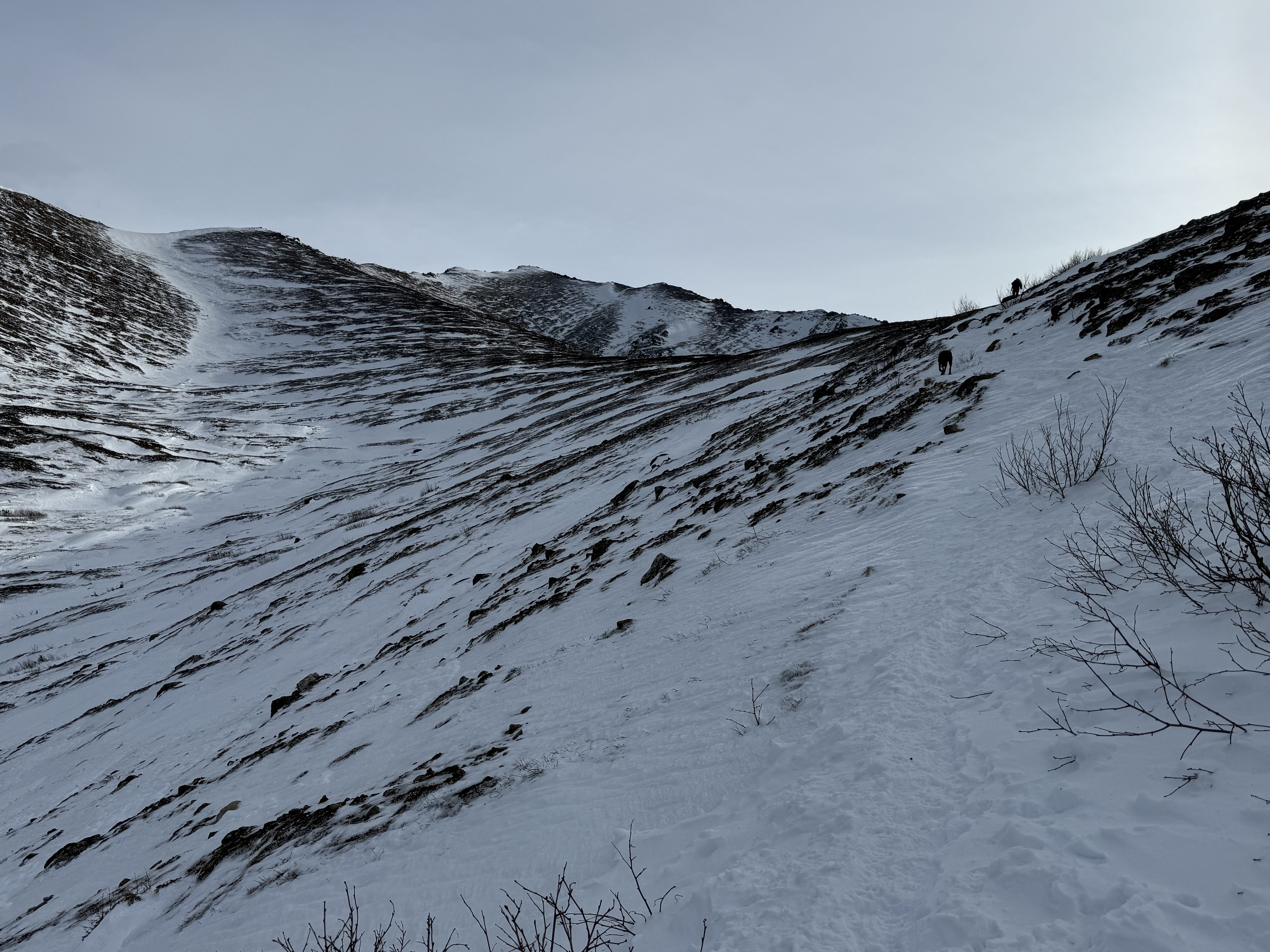
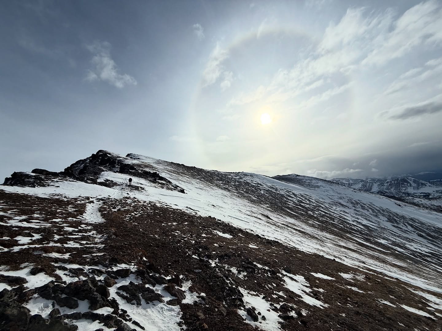
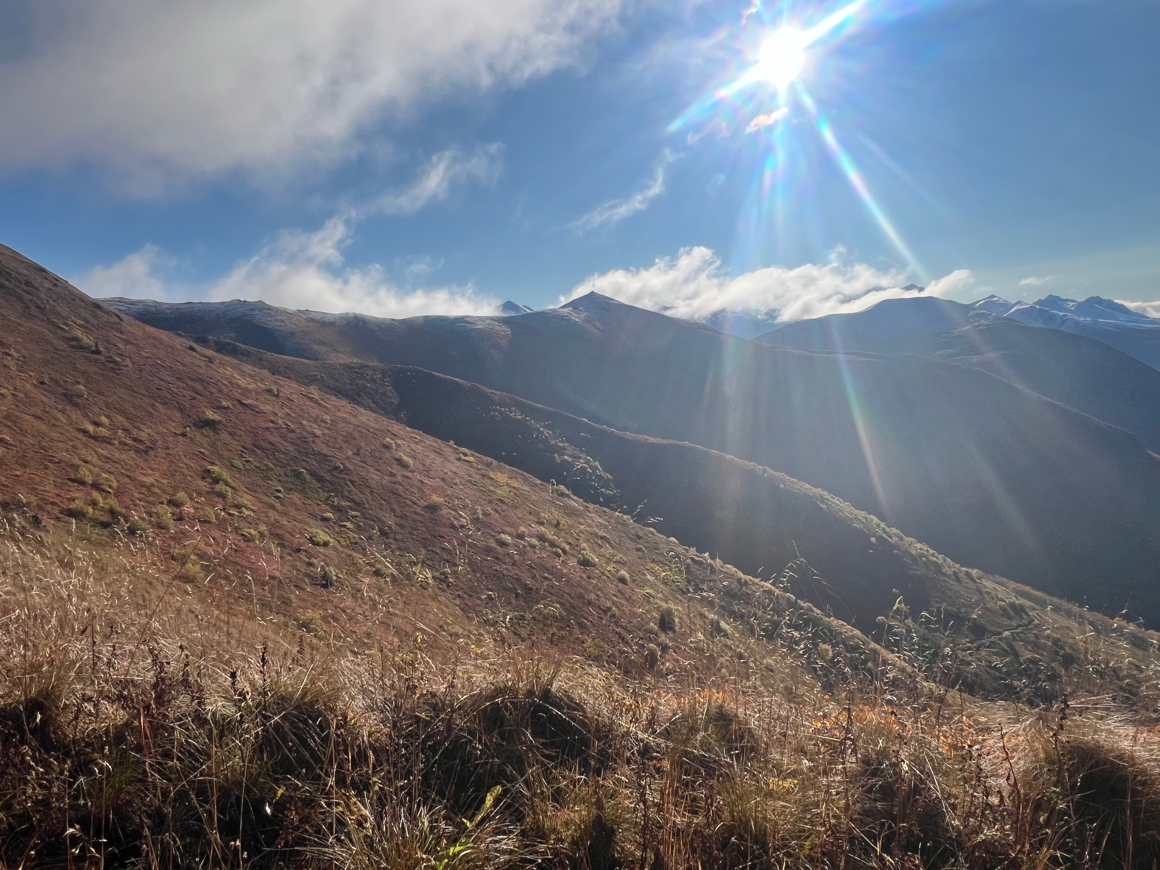
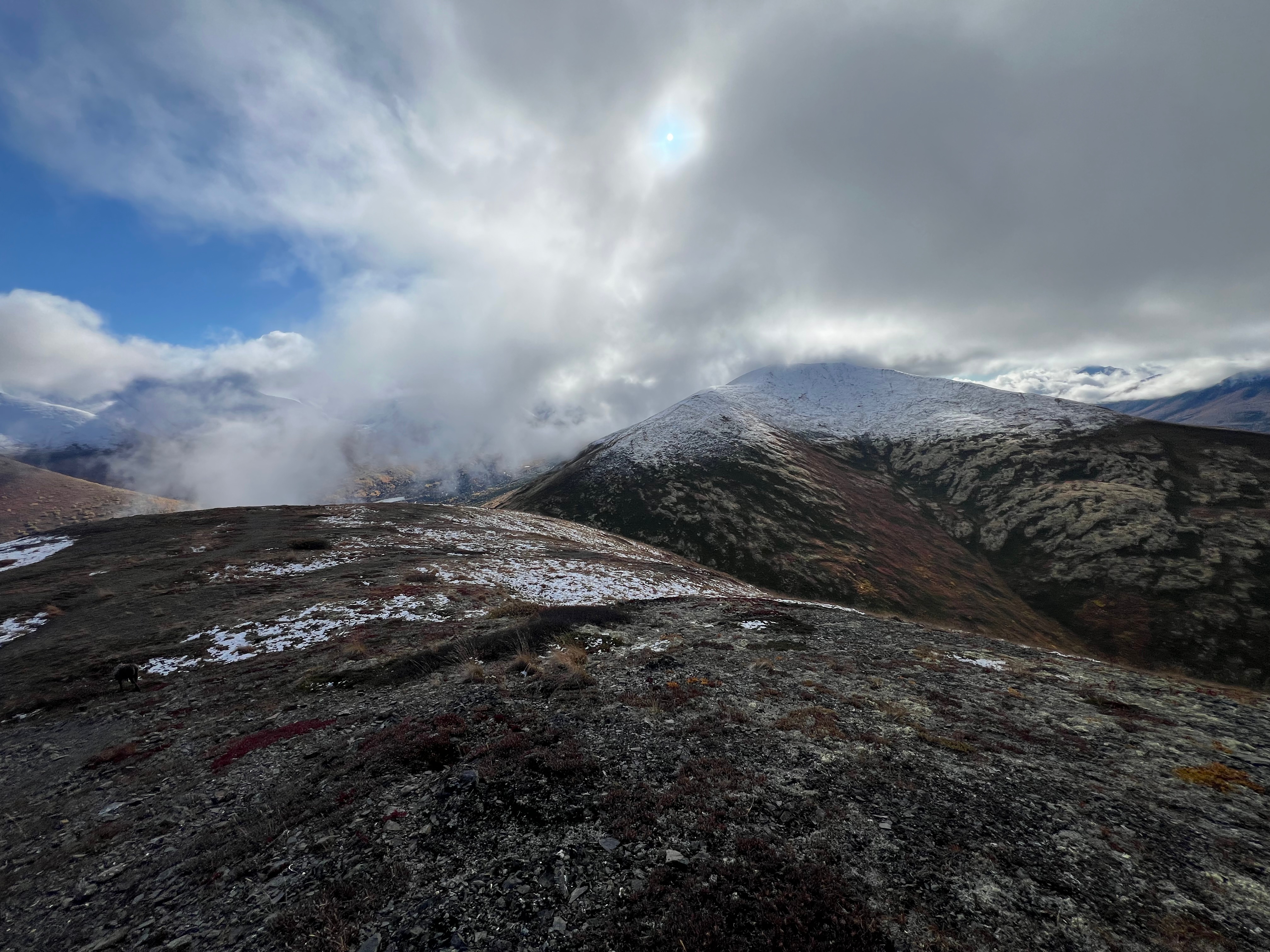
The clouds continued to thicken and as I walked through the dusting of wet snow, then suddenly they would open and let the sunshine through, soon closing in around me again. Along the mile from Little Teton to Peak 3891, this happened numerous times, the fog teasing me with views then quickly taking them away.

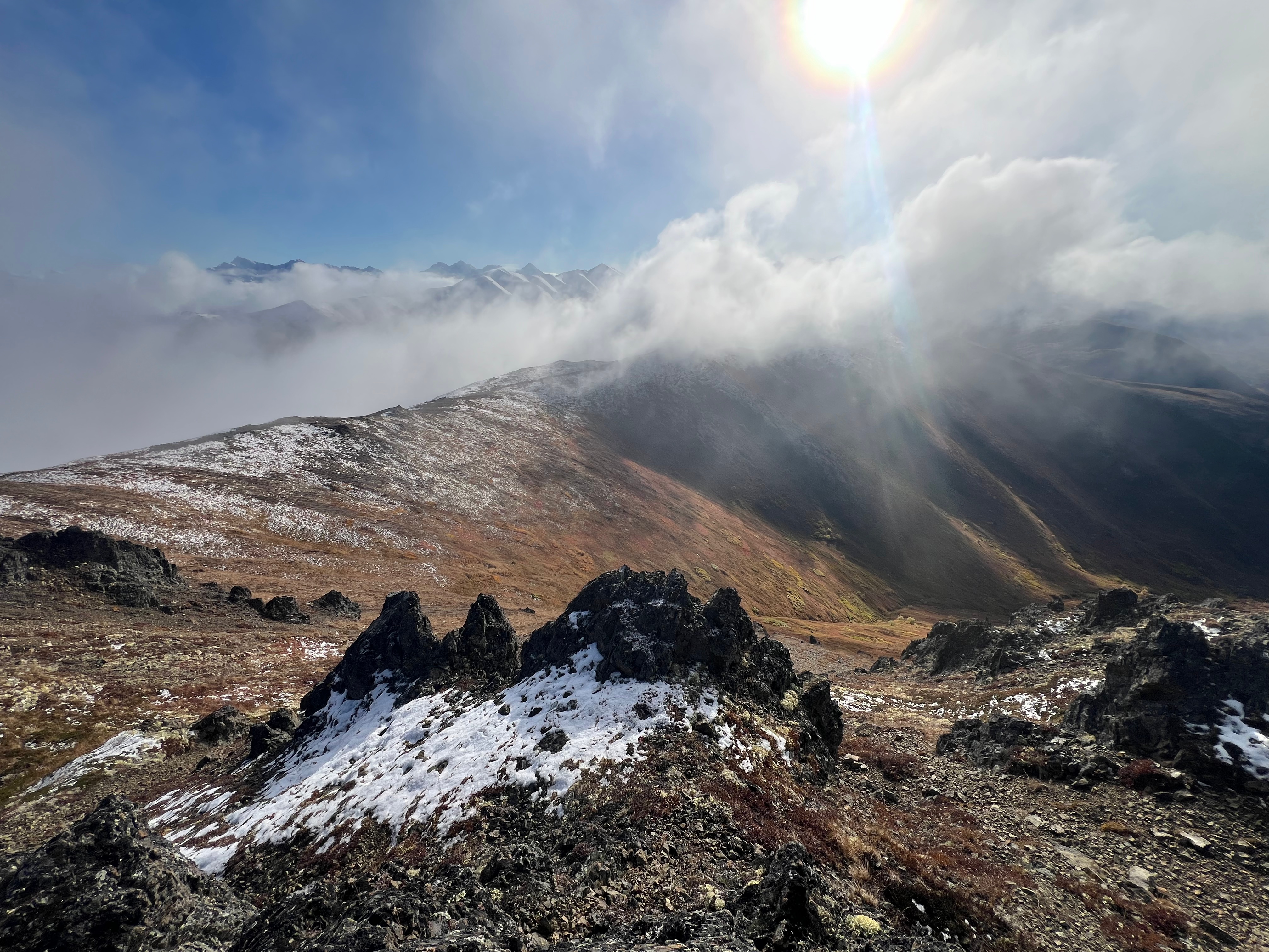
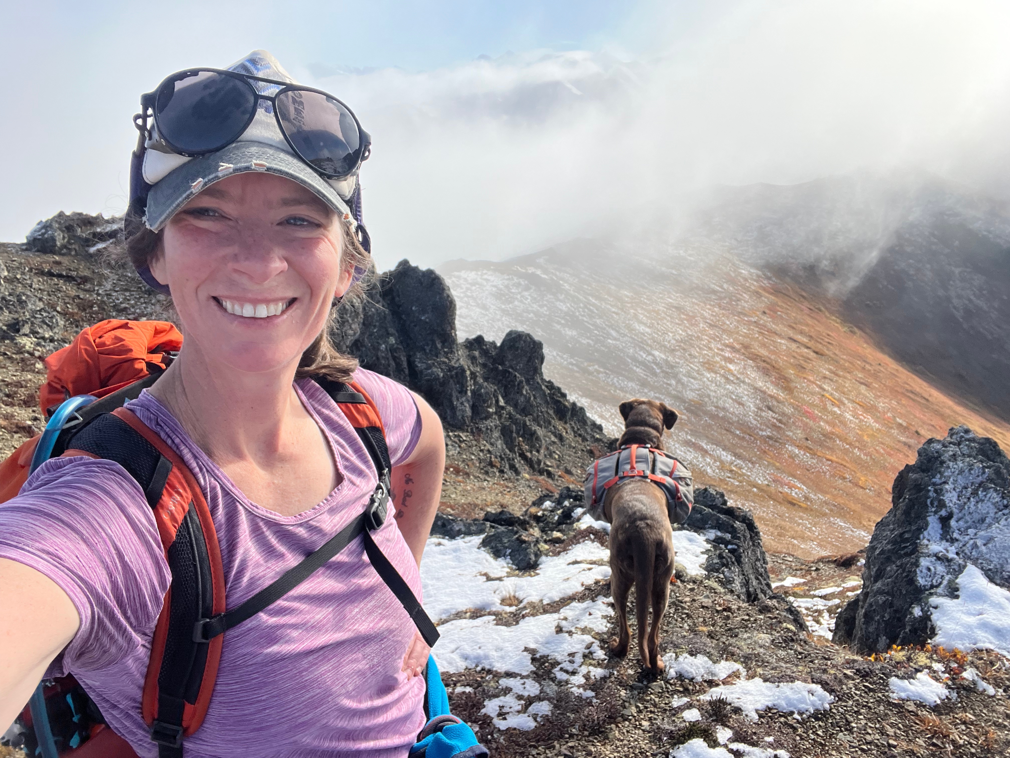
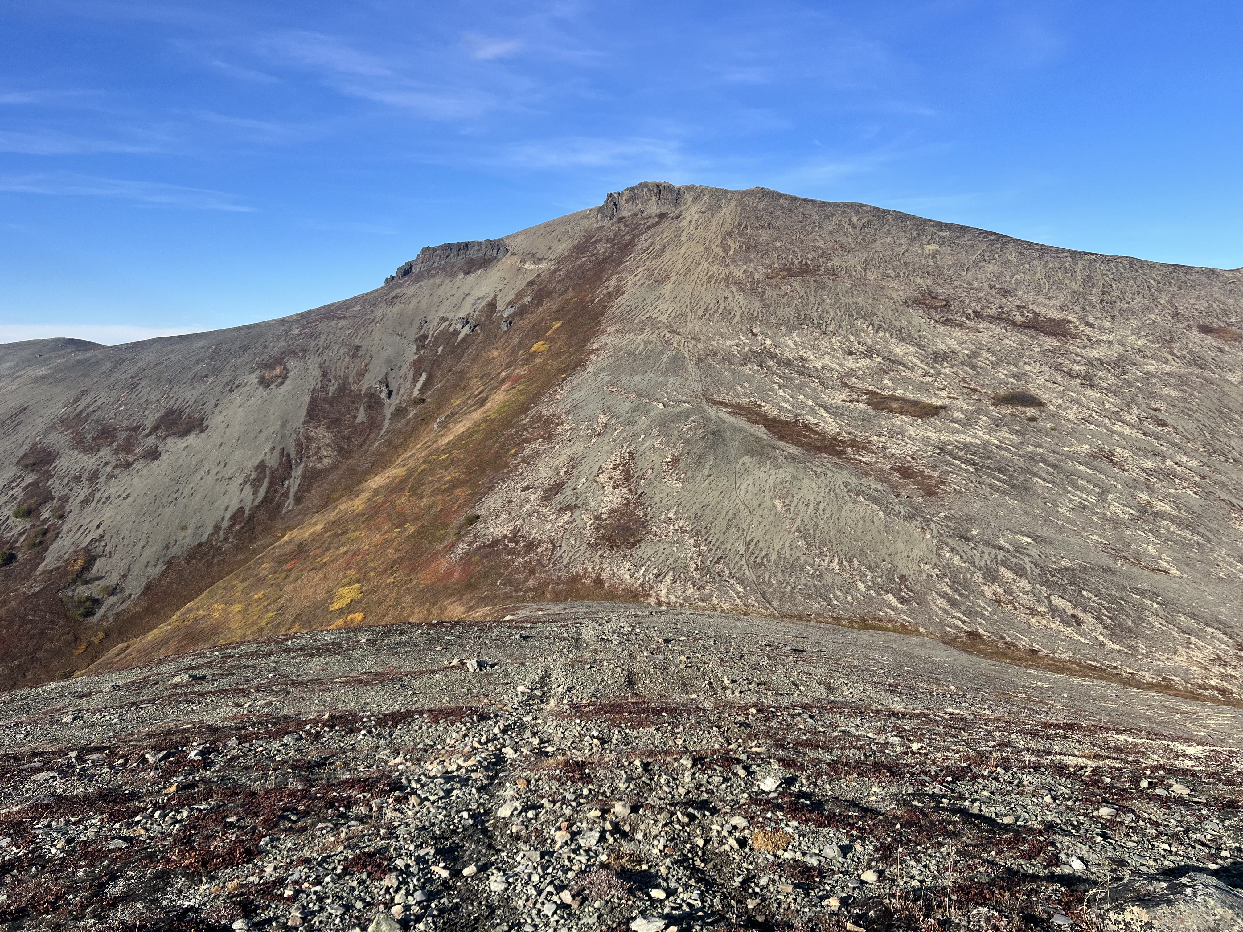
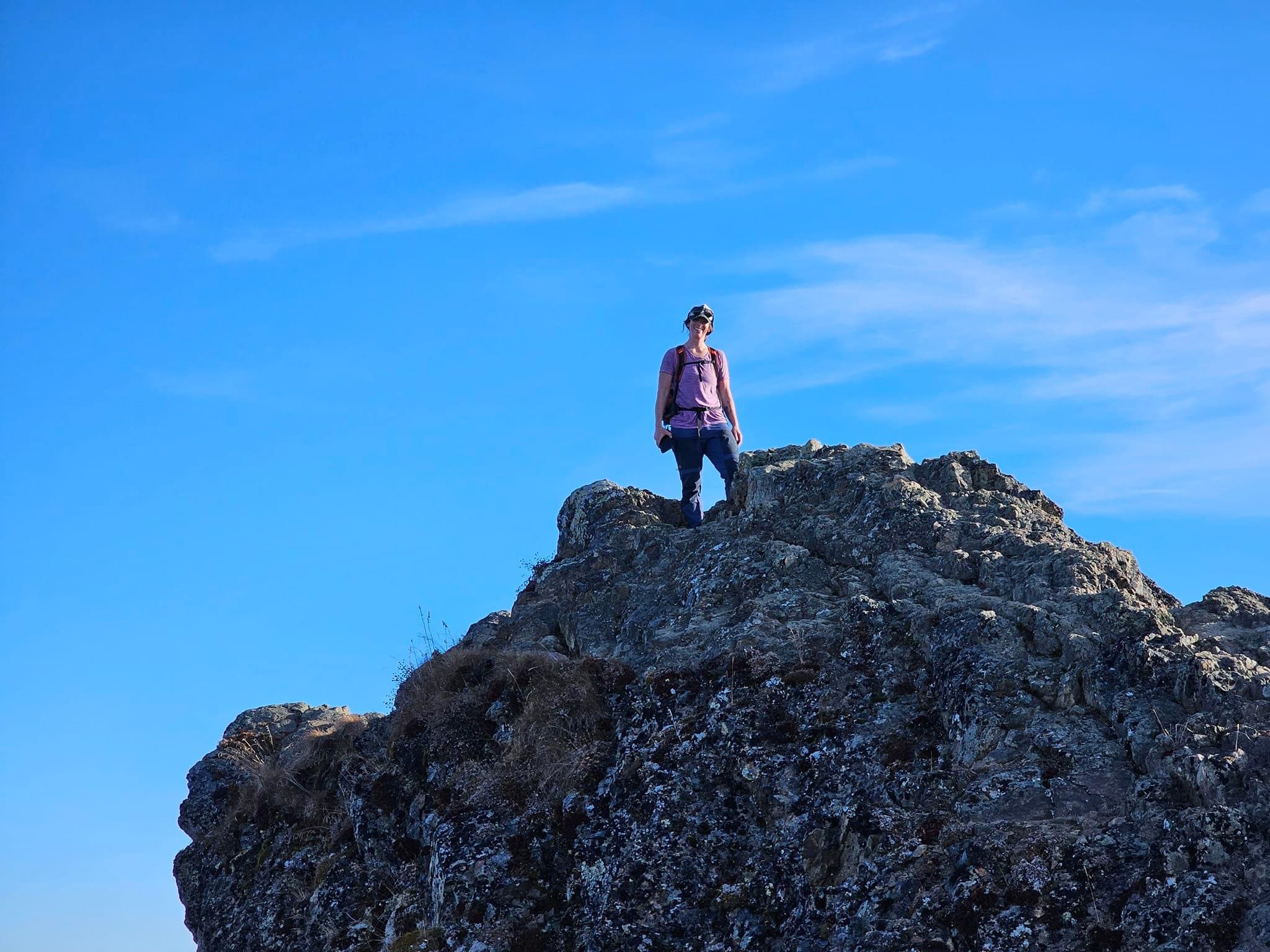
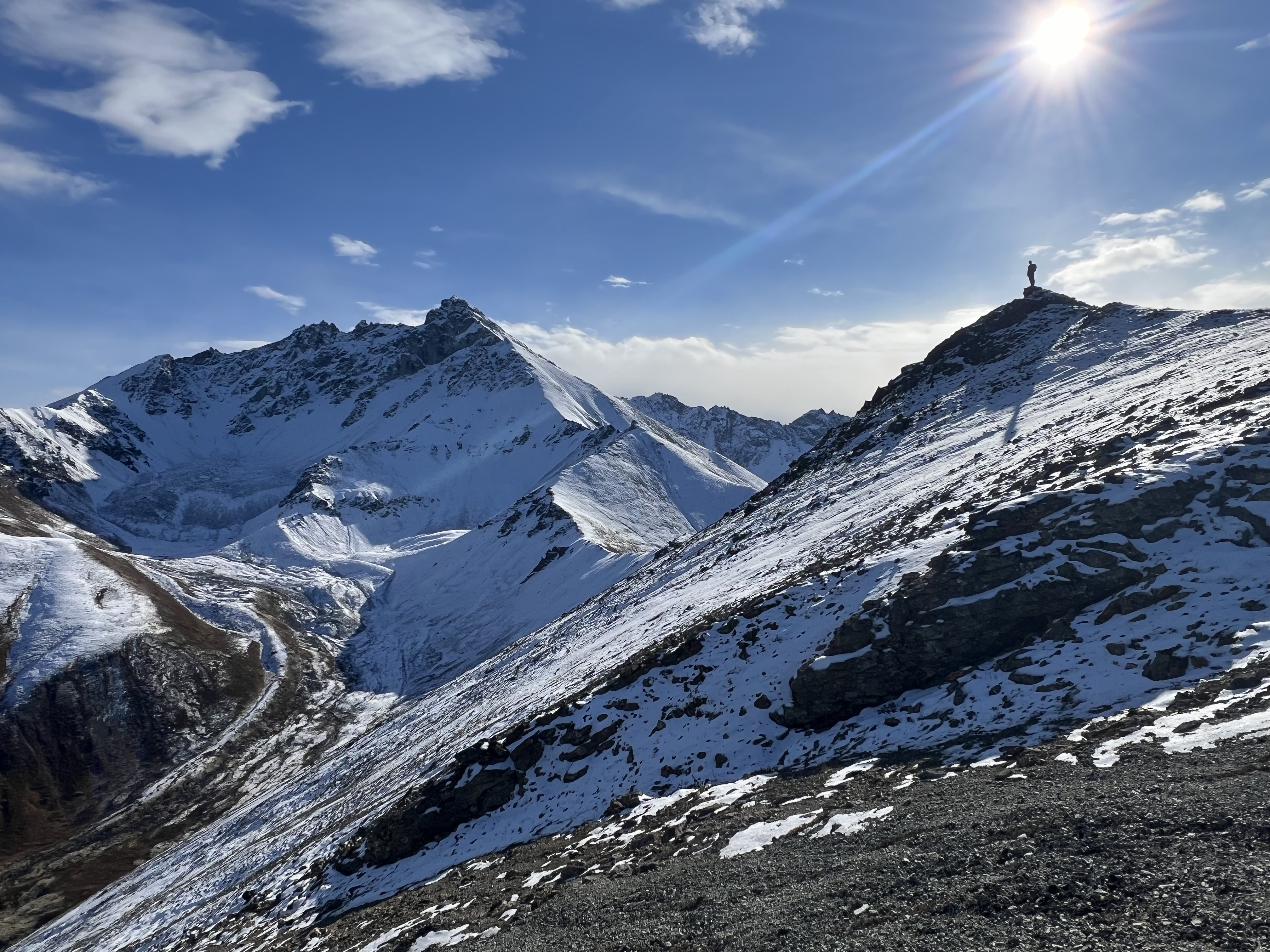
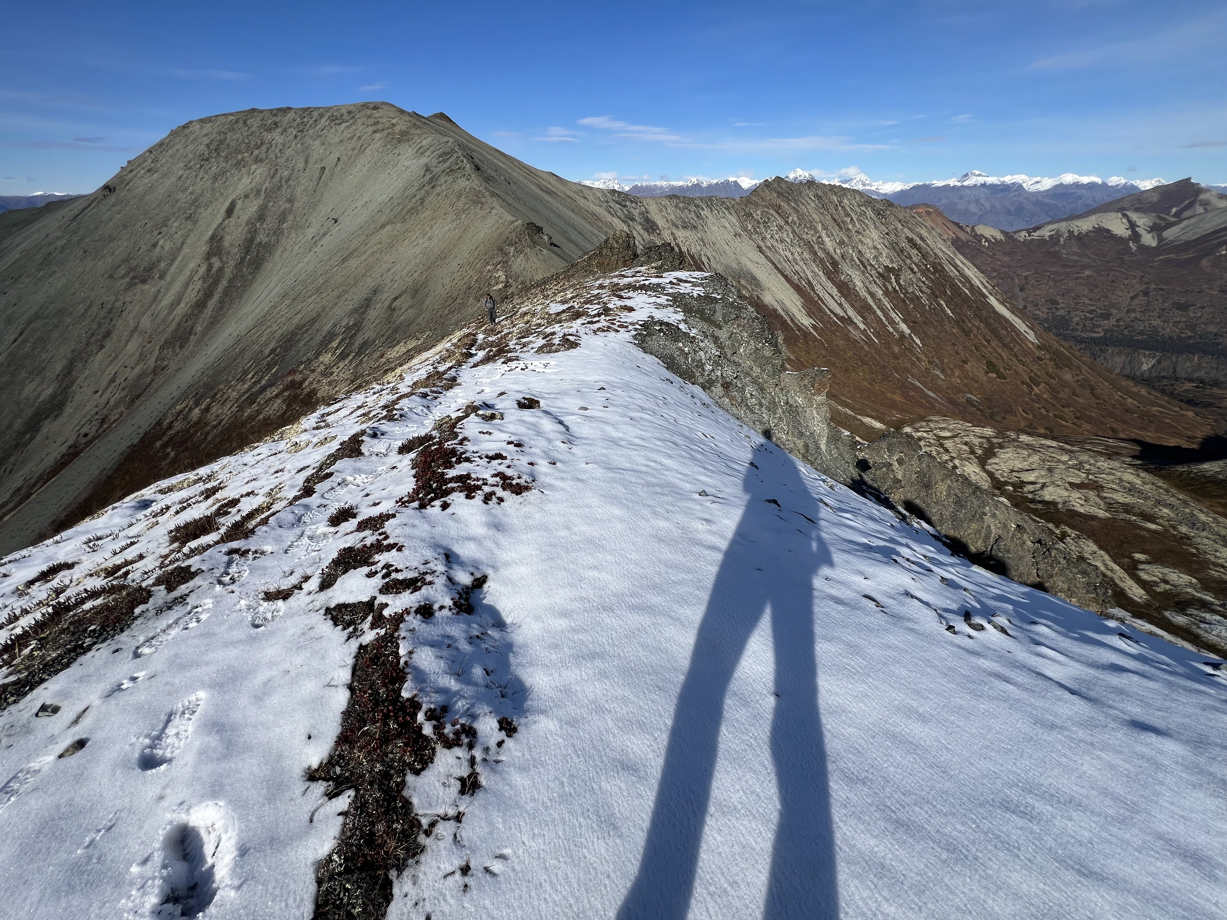
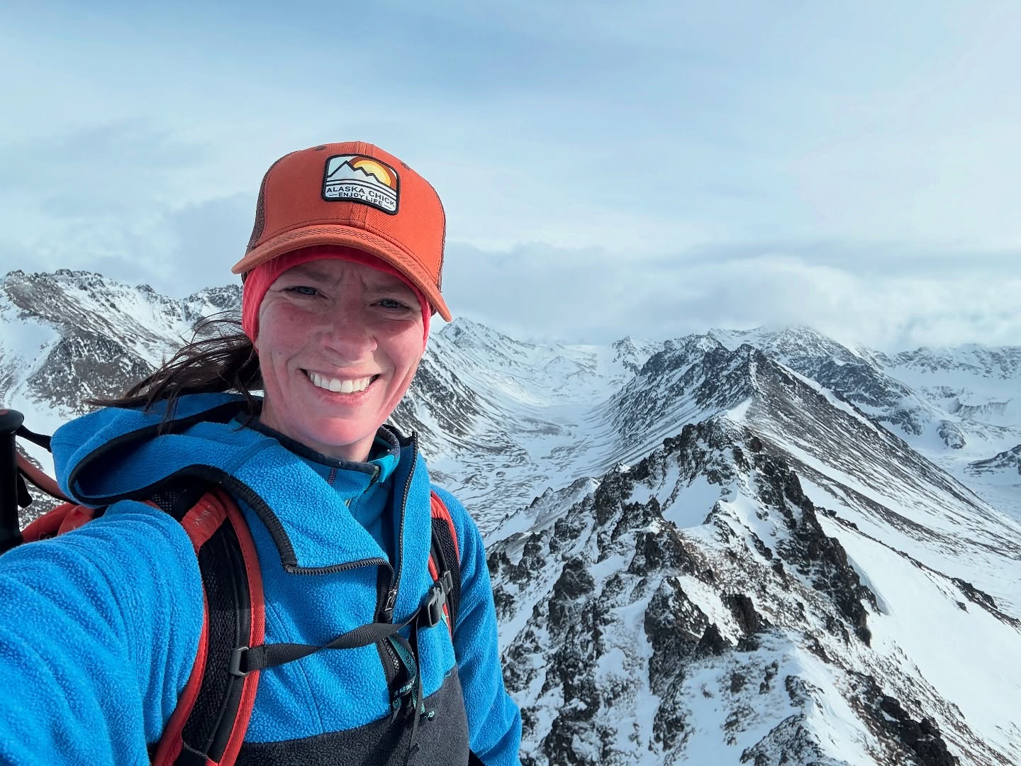
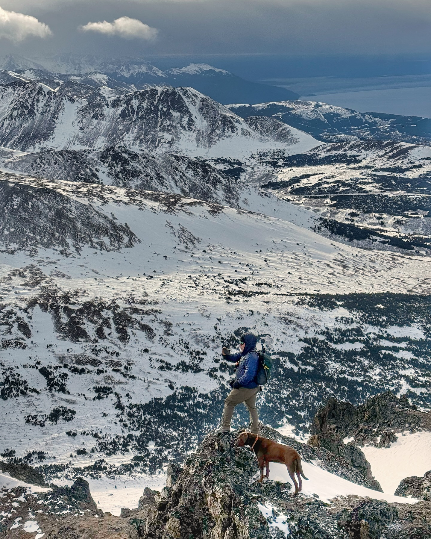
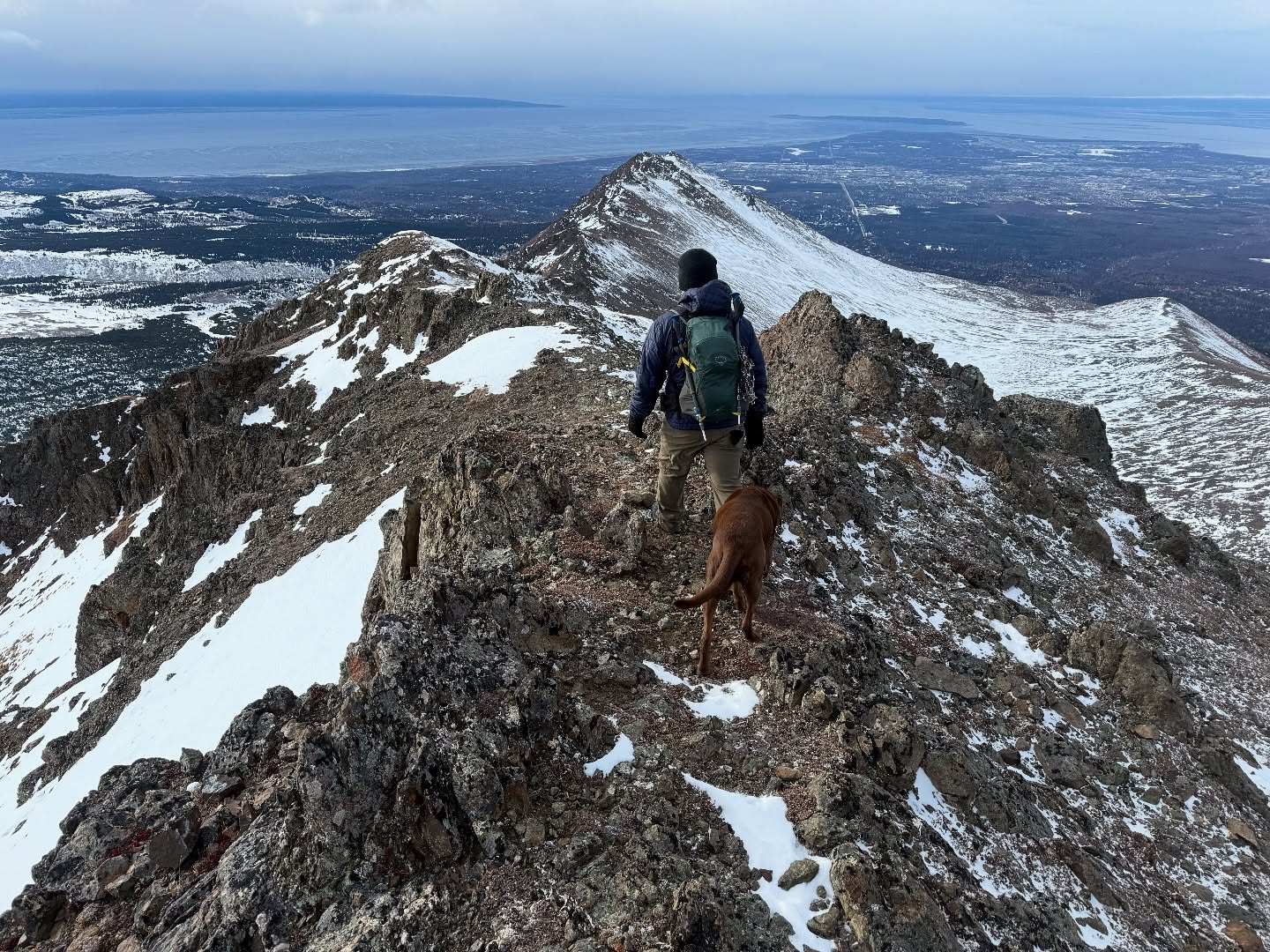
As I ascended the 200-ish feet to the summit of 3891, I climbed out of the clouds and into the sunshine. Turning around and looking towards Little Teton I was stunned! I hurried to get my camera out to capture something that is rare and fleeting… a Brocken Spectre with Glory Rings! A vivid mini rainbow, encircling my shadow that was cast down onto the slope of the mountain. In all of my time in the mountains, I had only experienced these phenomena twice before, and I can tell you it never gets old.

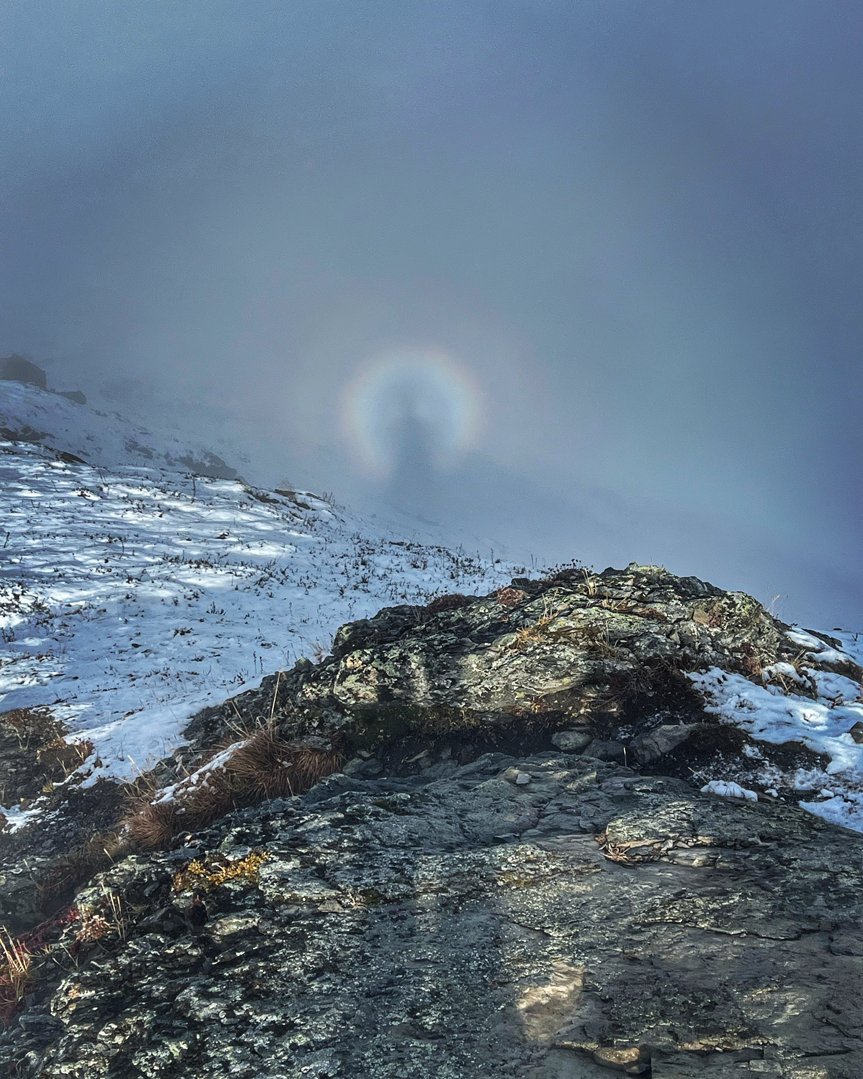
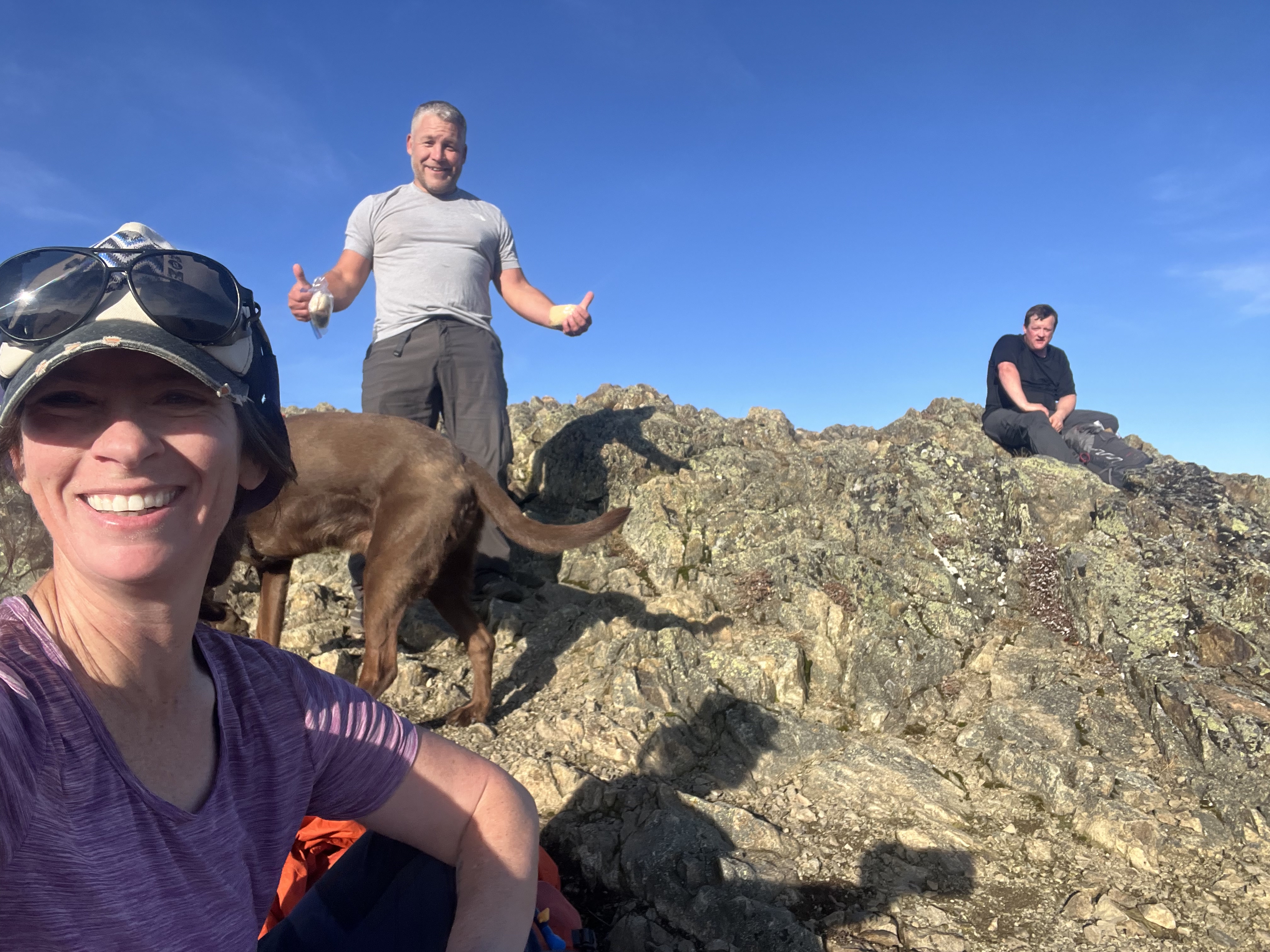
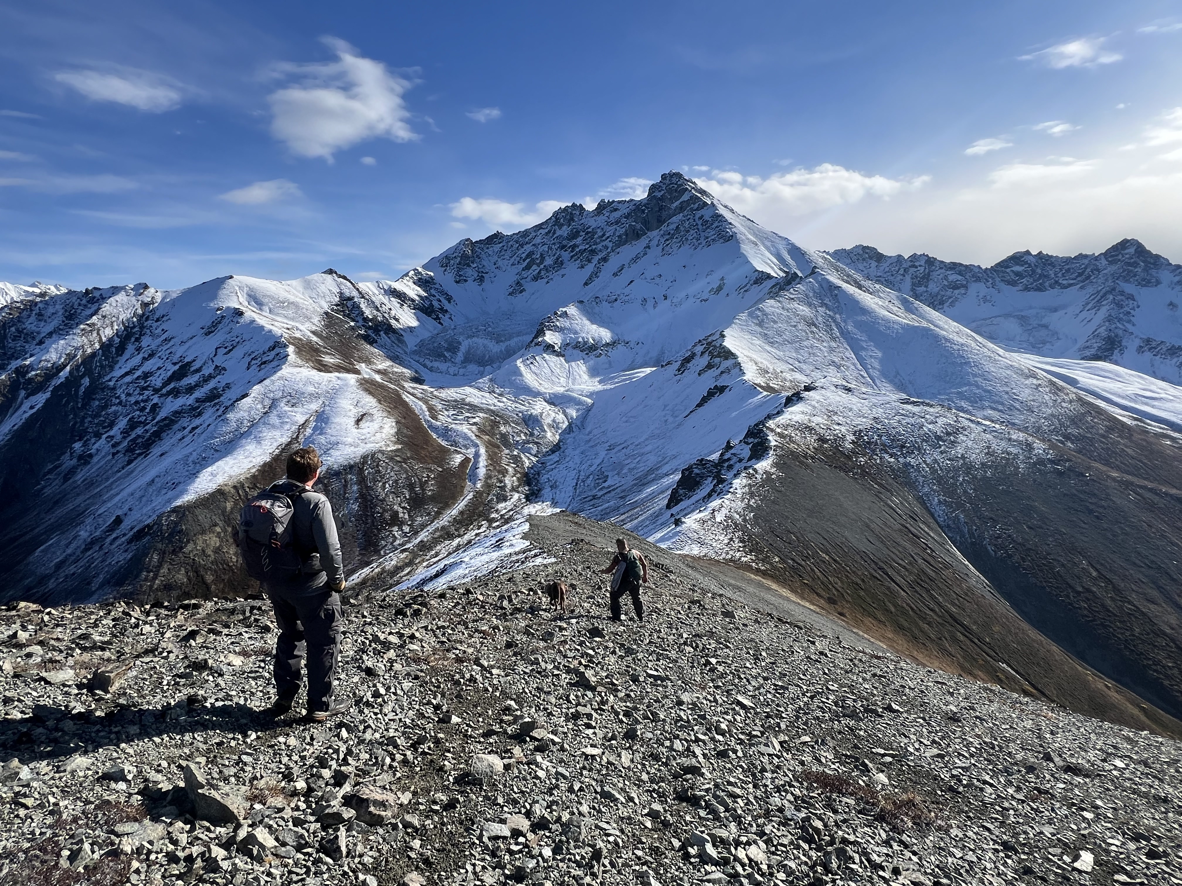
A couple walked up towards the summit as I was taking photos and I excitedly told them to quickly come up and see what I was seeing. They hustled up the last dozen feet to the summit and gasped in shock! They were able to get a couple of photos before the clouds dissipated and Brocken Spectre disappeared. We marveled at how lucky we were to have been at that place at that time, and then continued on our separate ways, them heading towards Little Teton and I soon dropping into Hunter Pass.

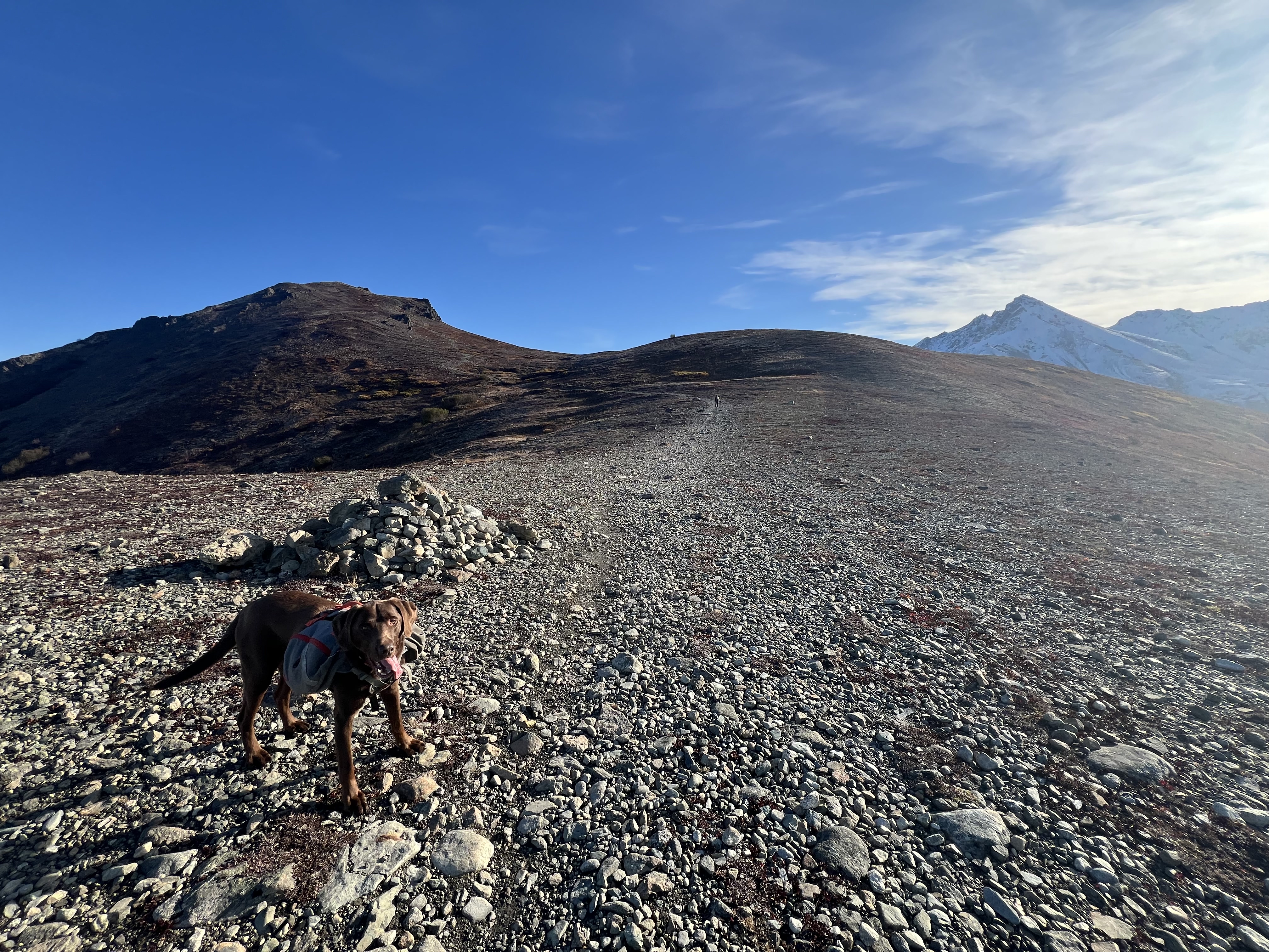
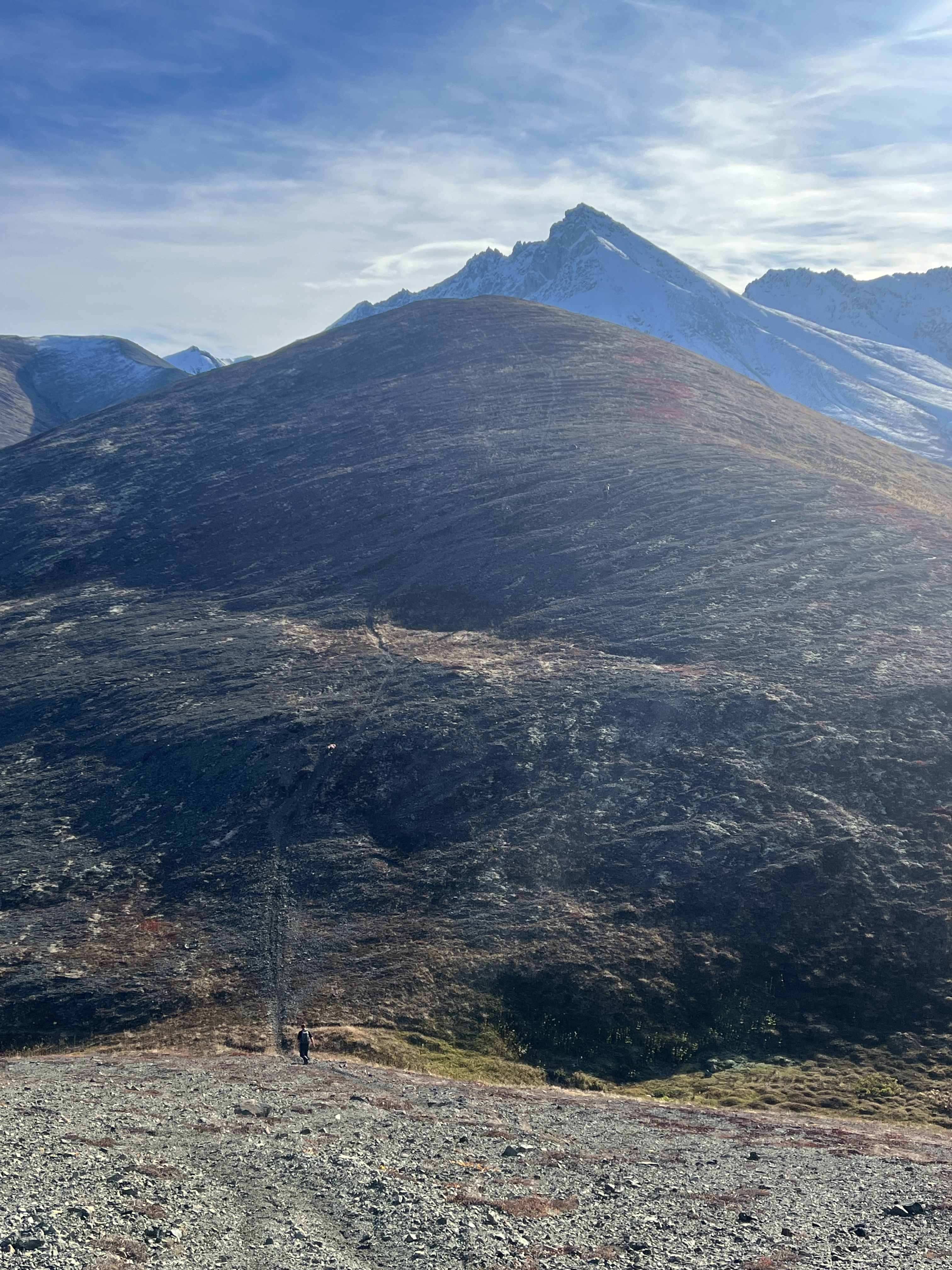
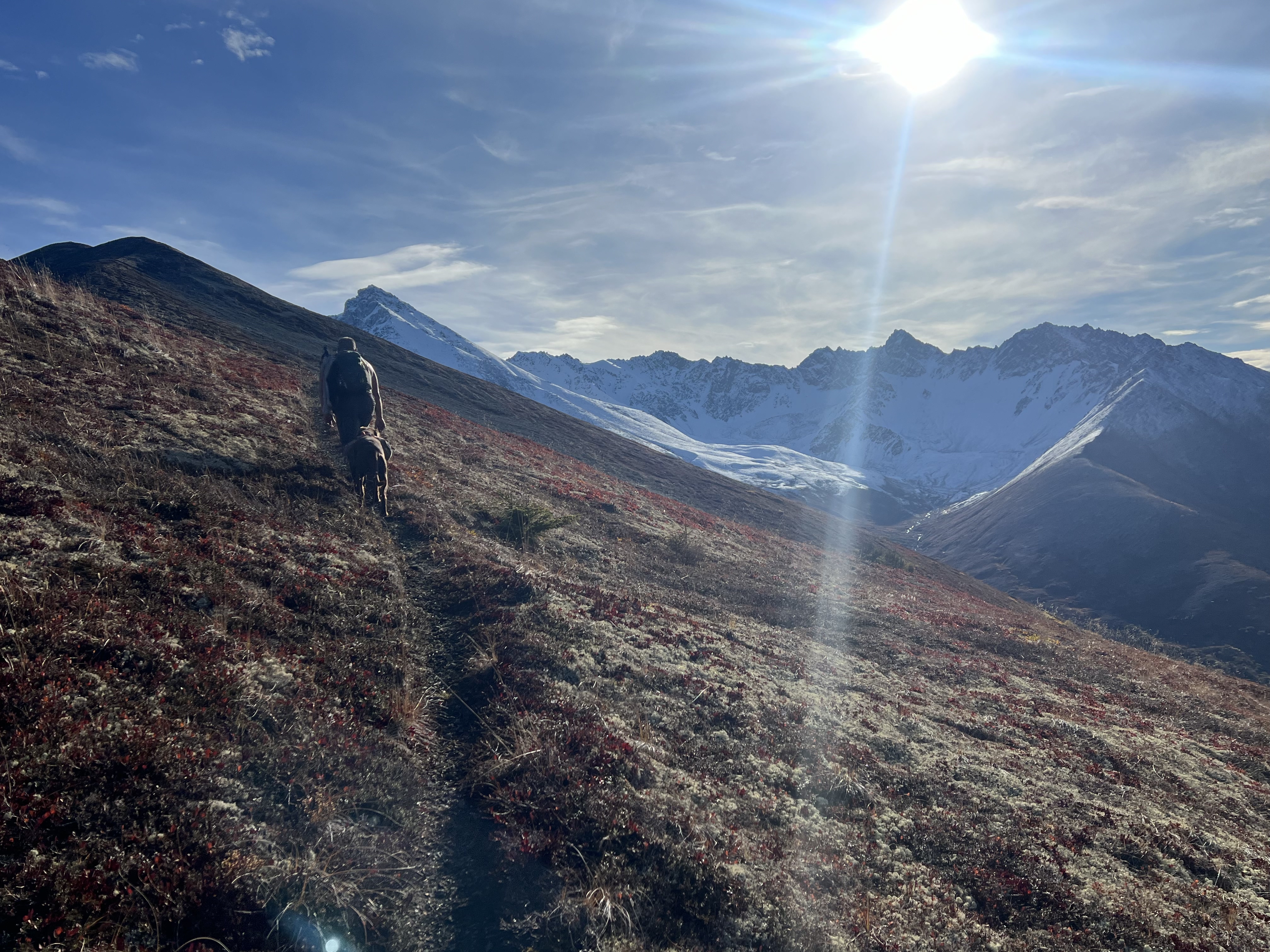
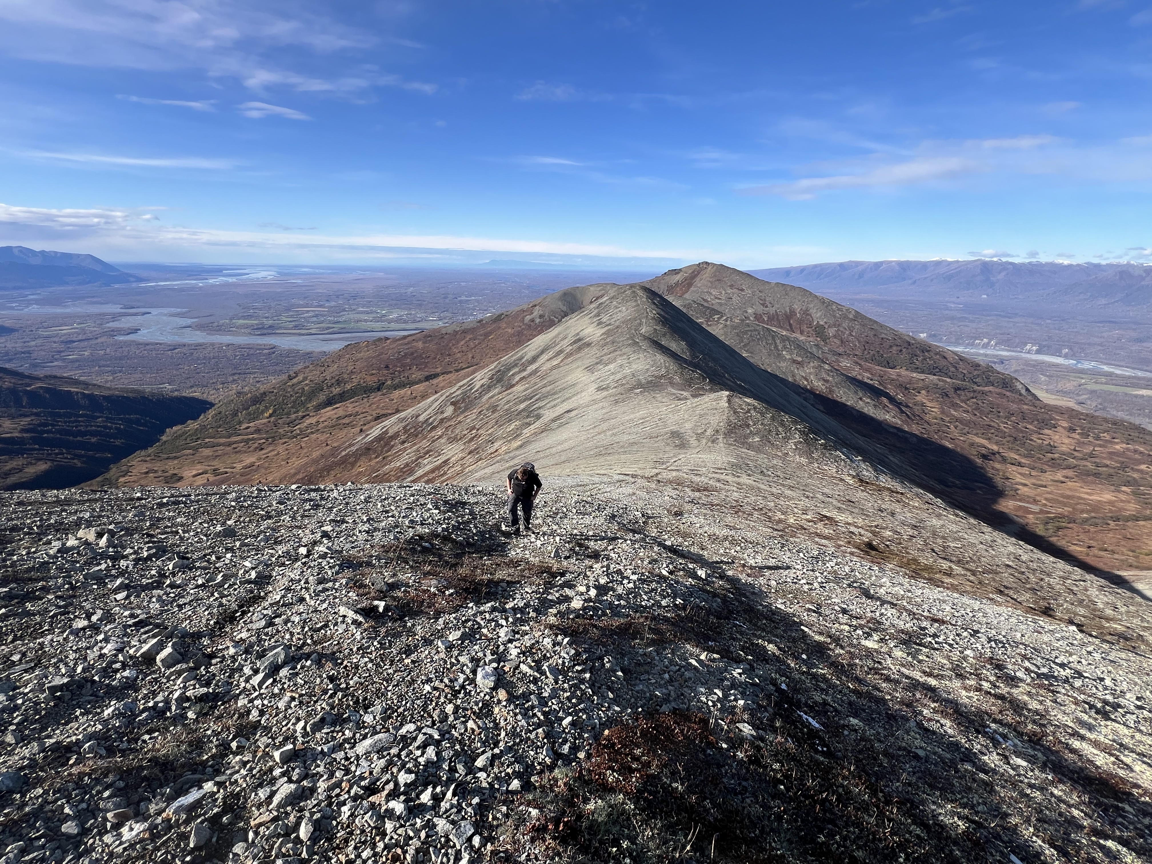
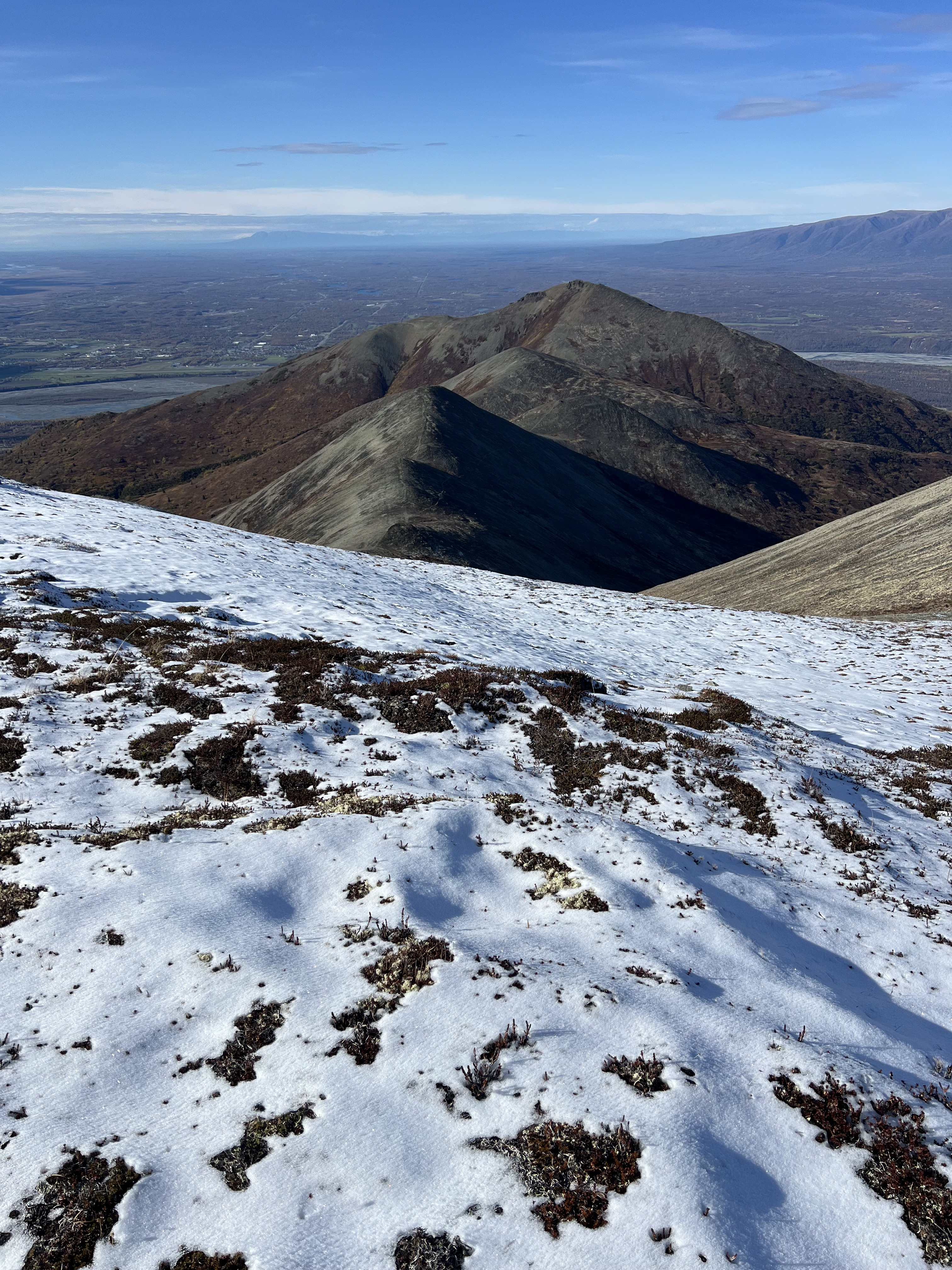
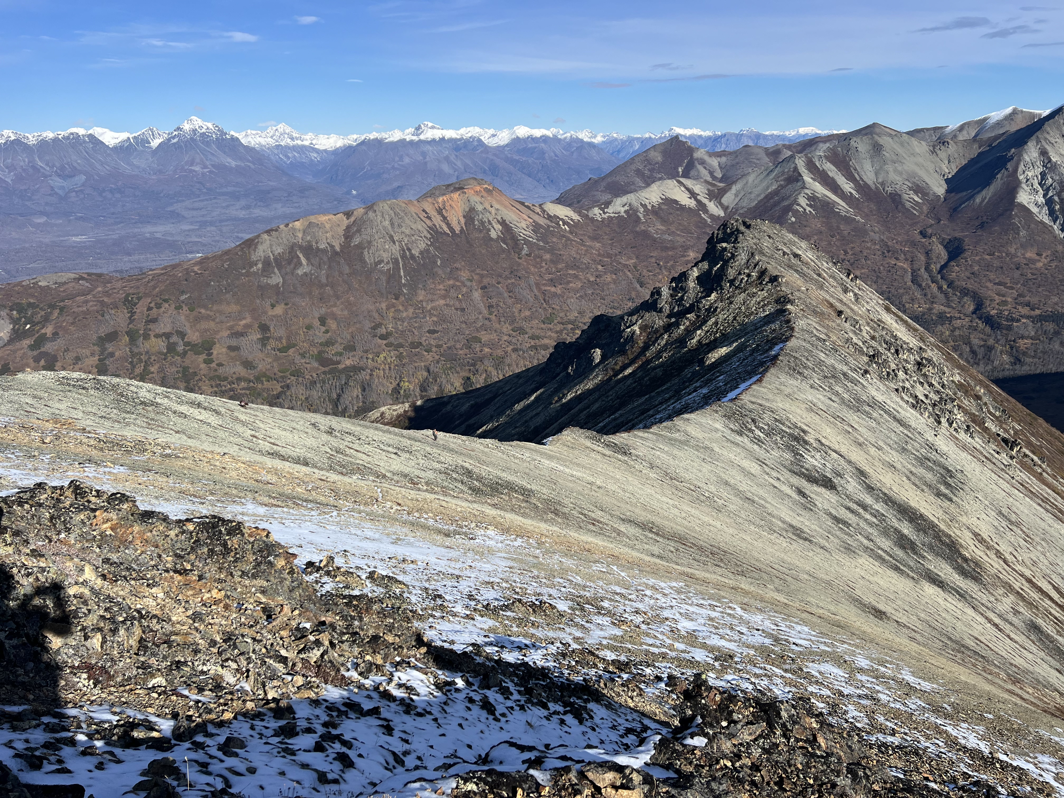
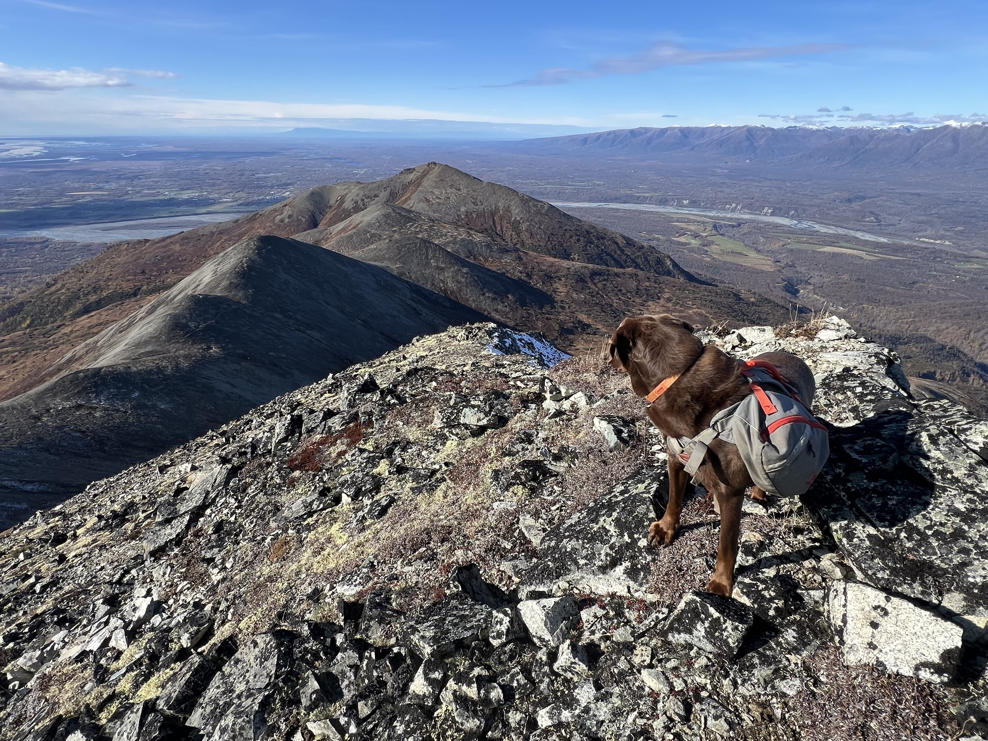
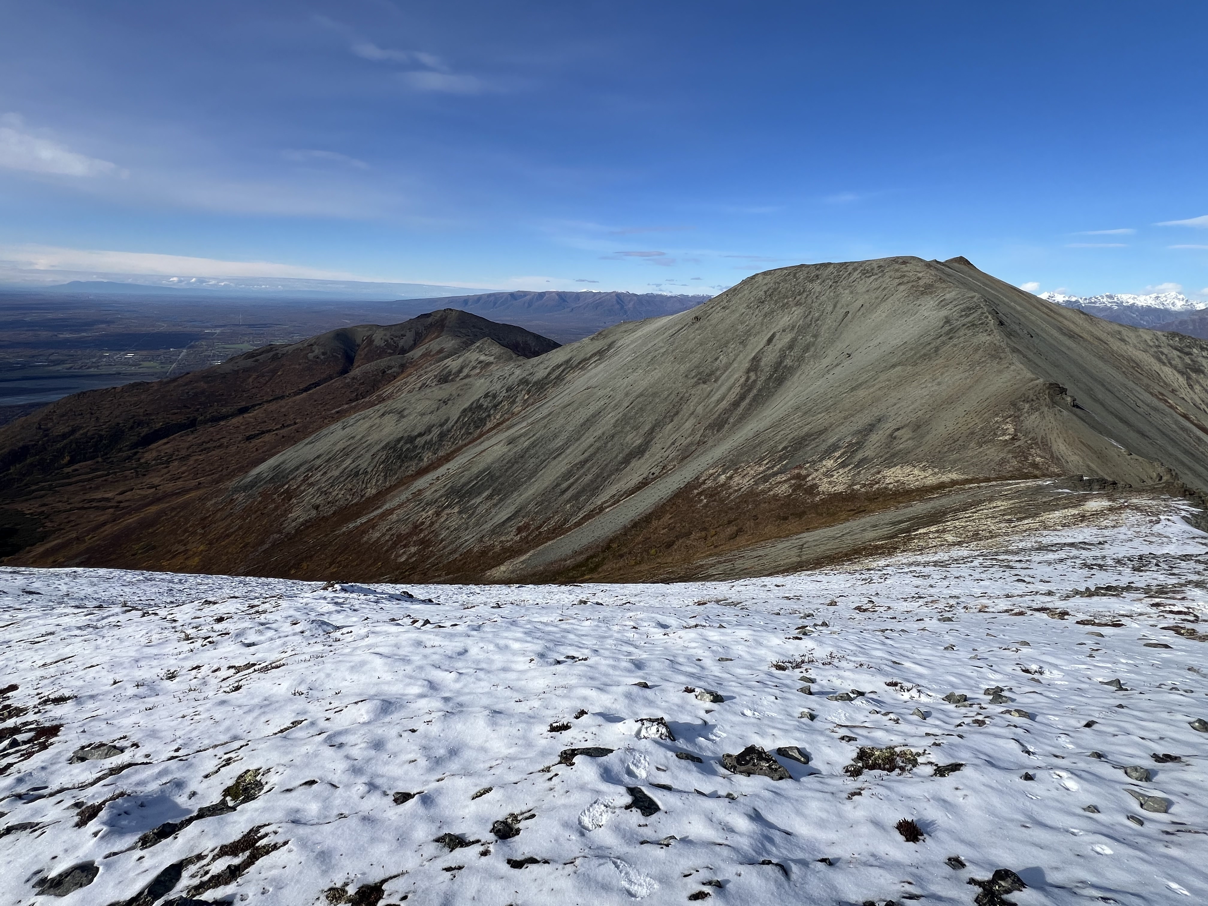
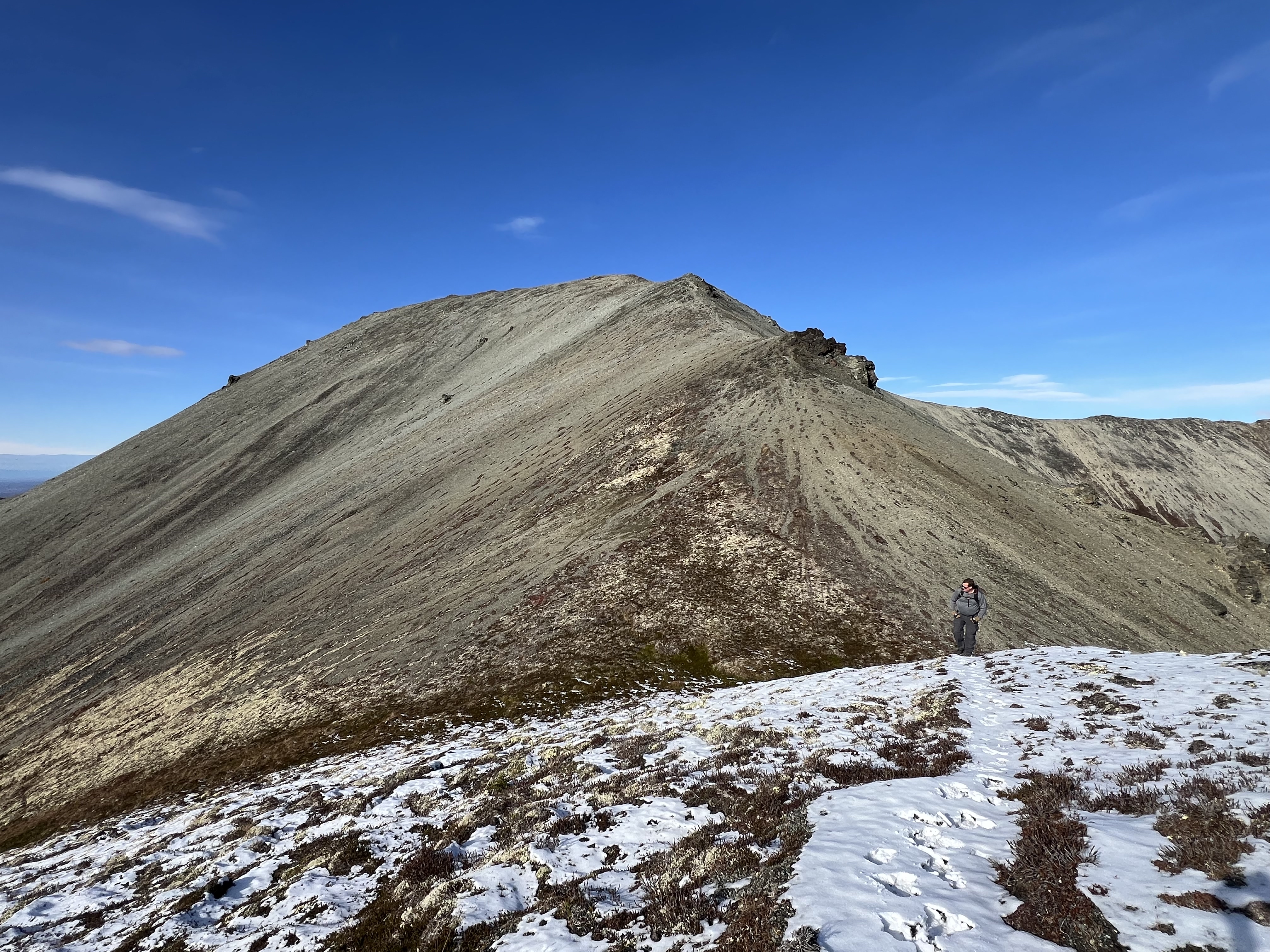
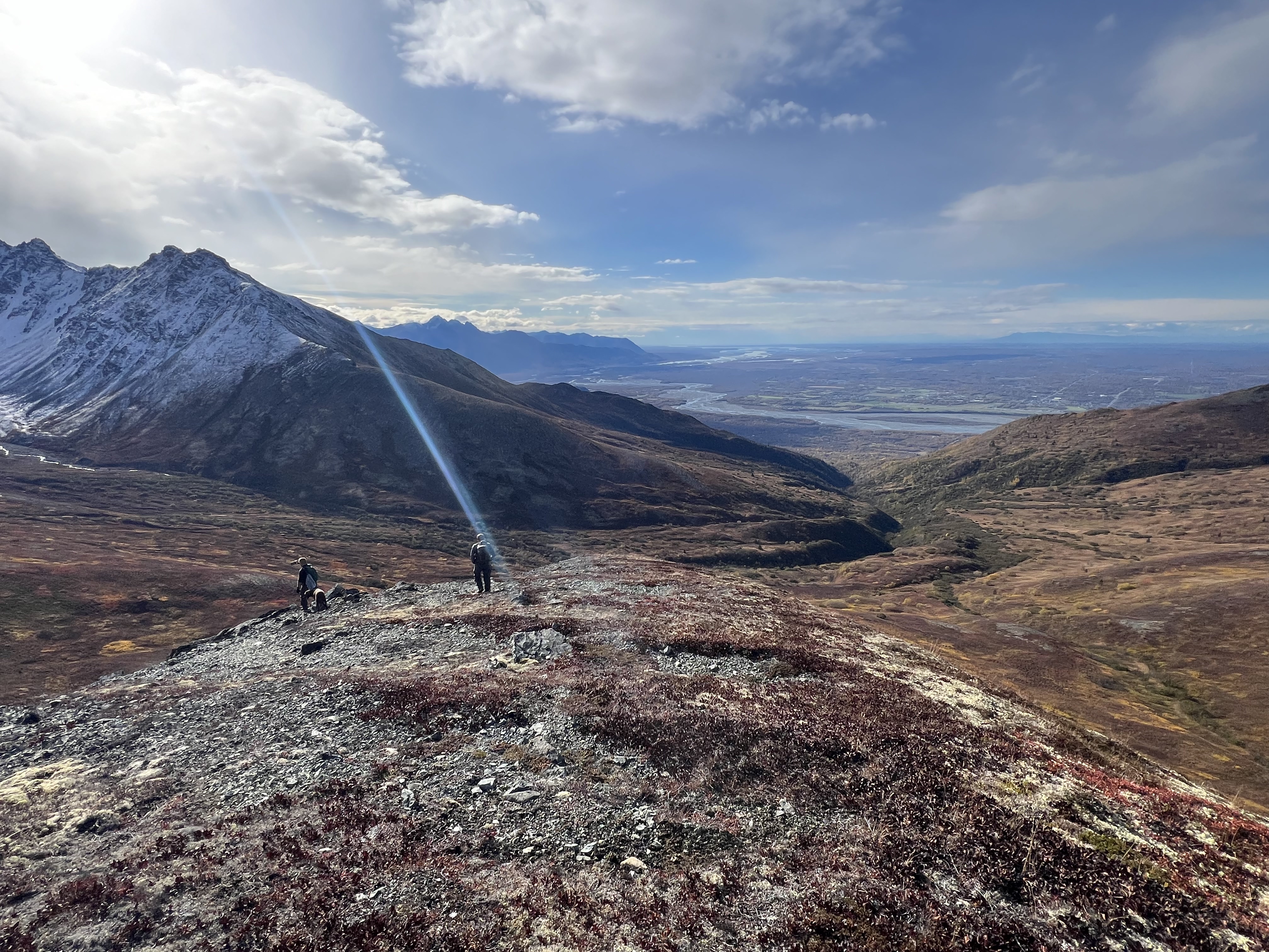
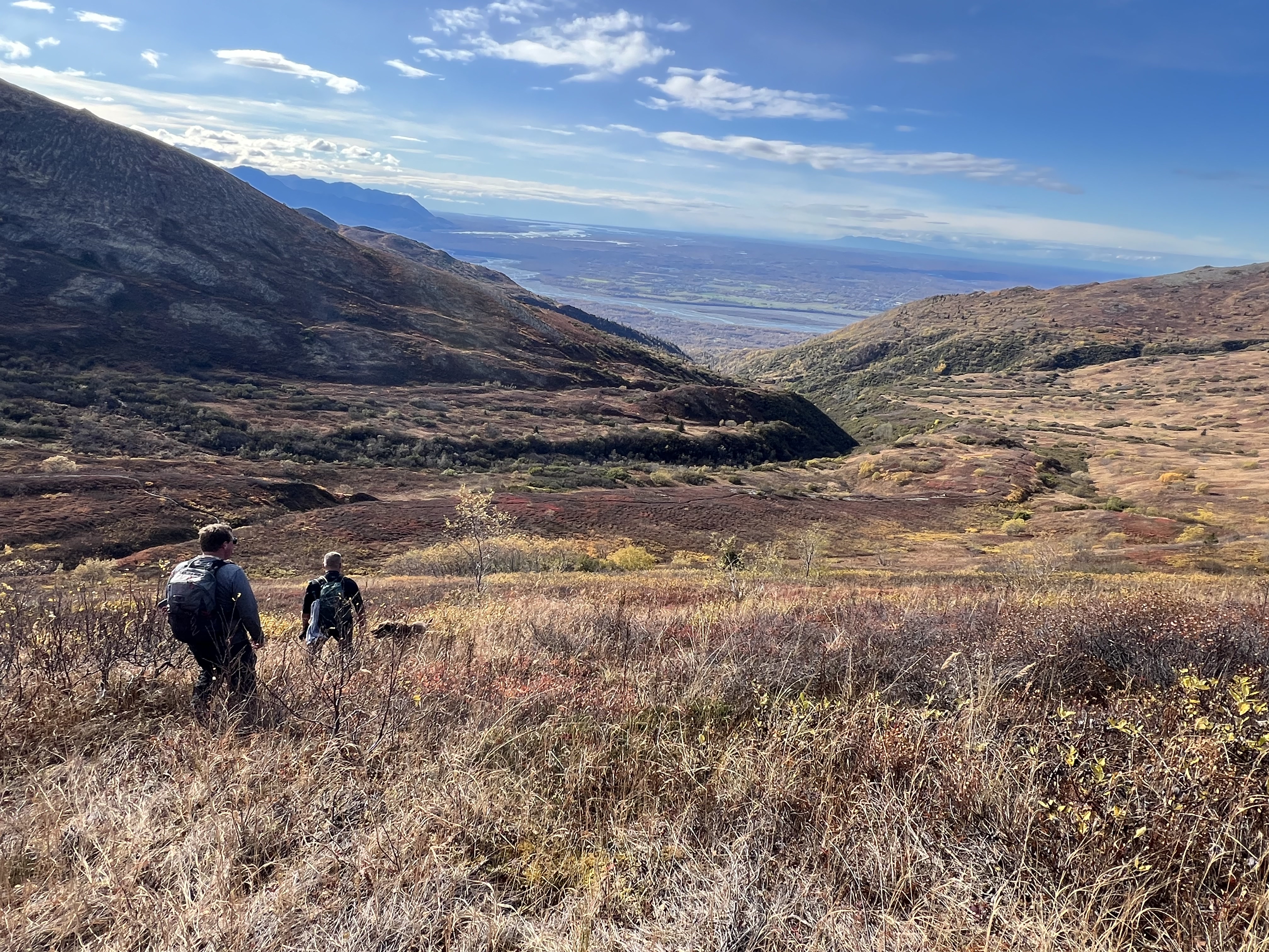
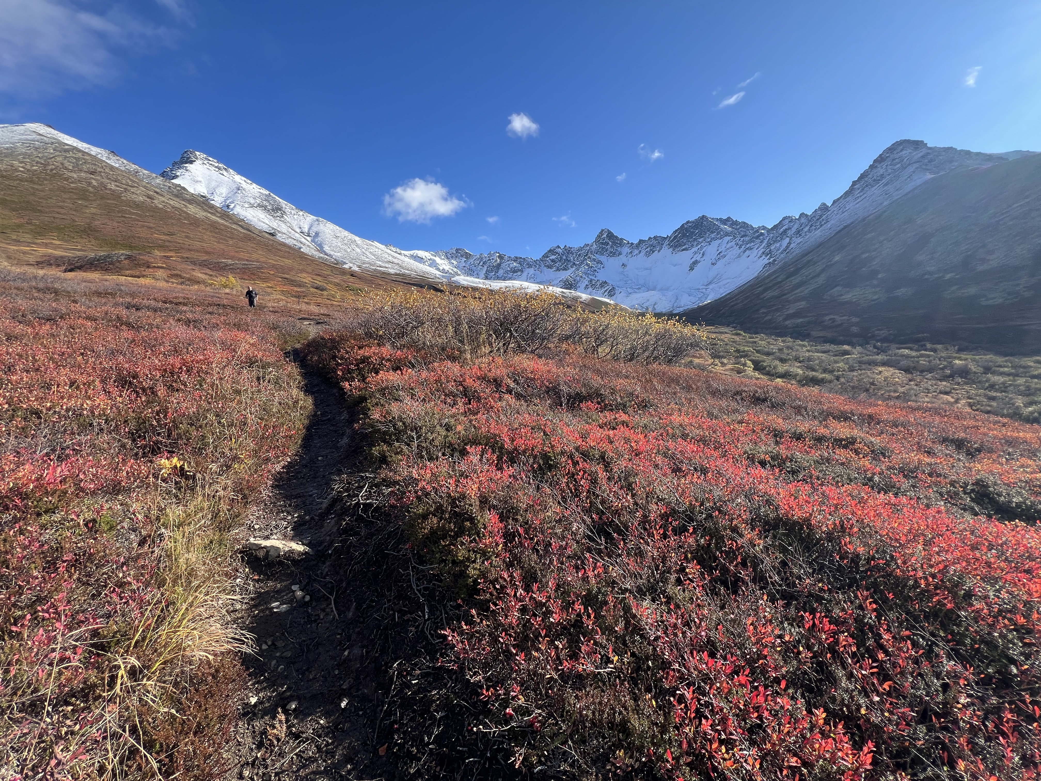
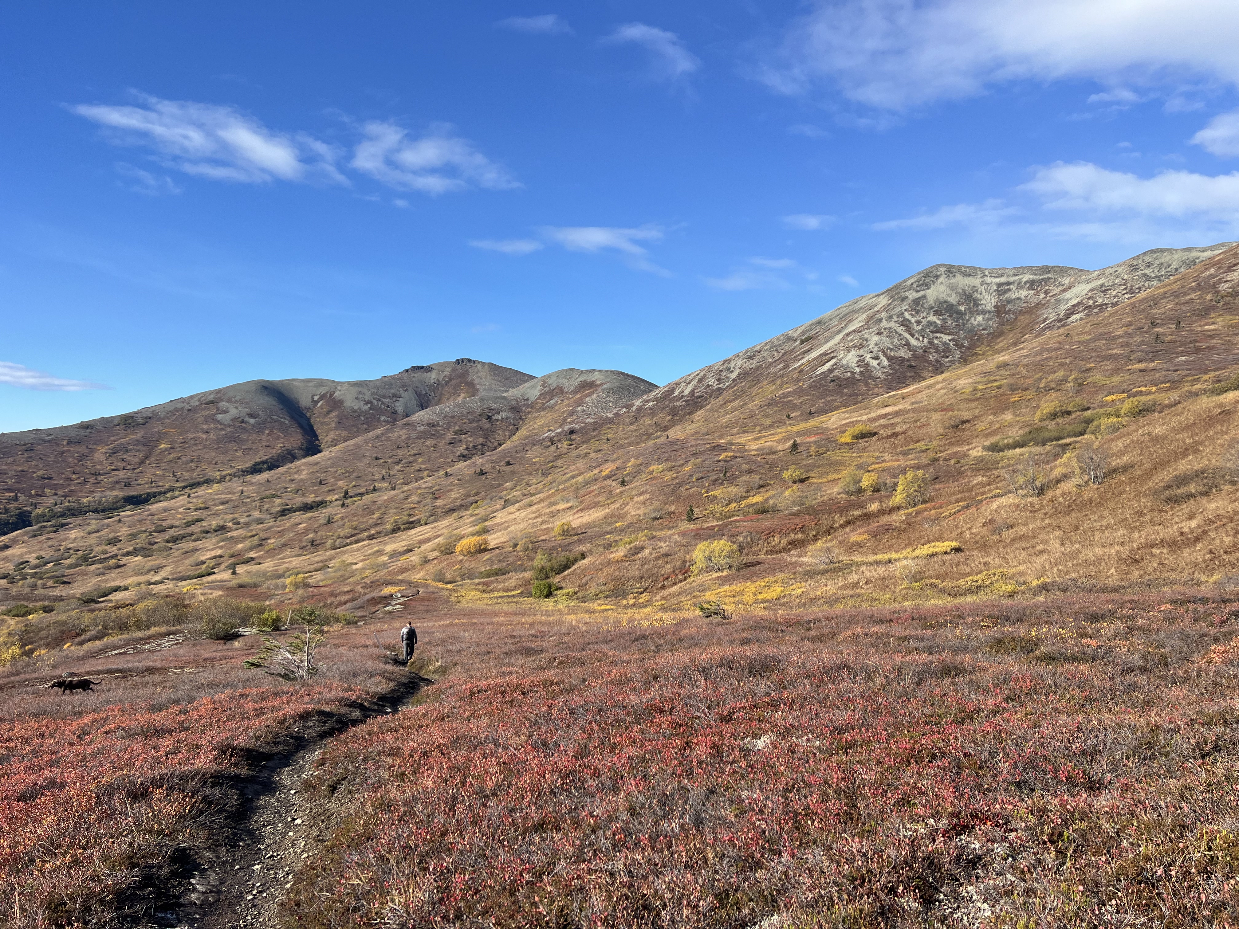
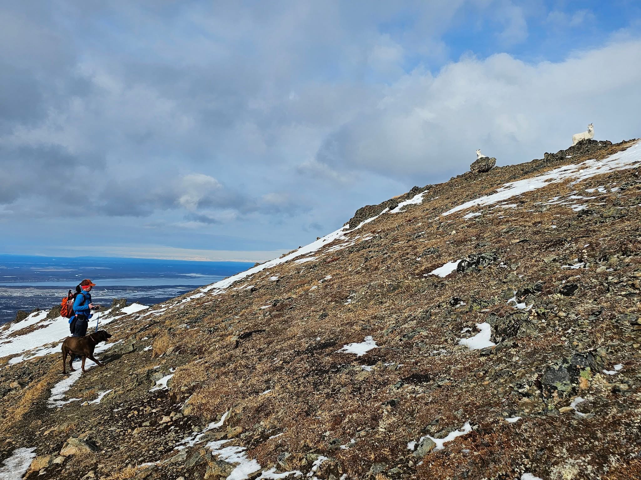
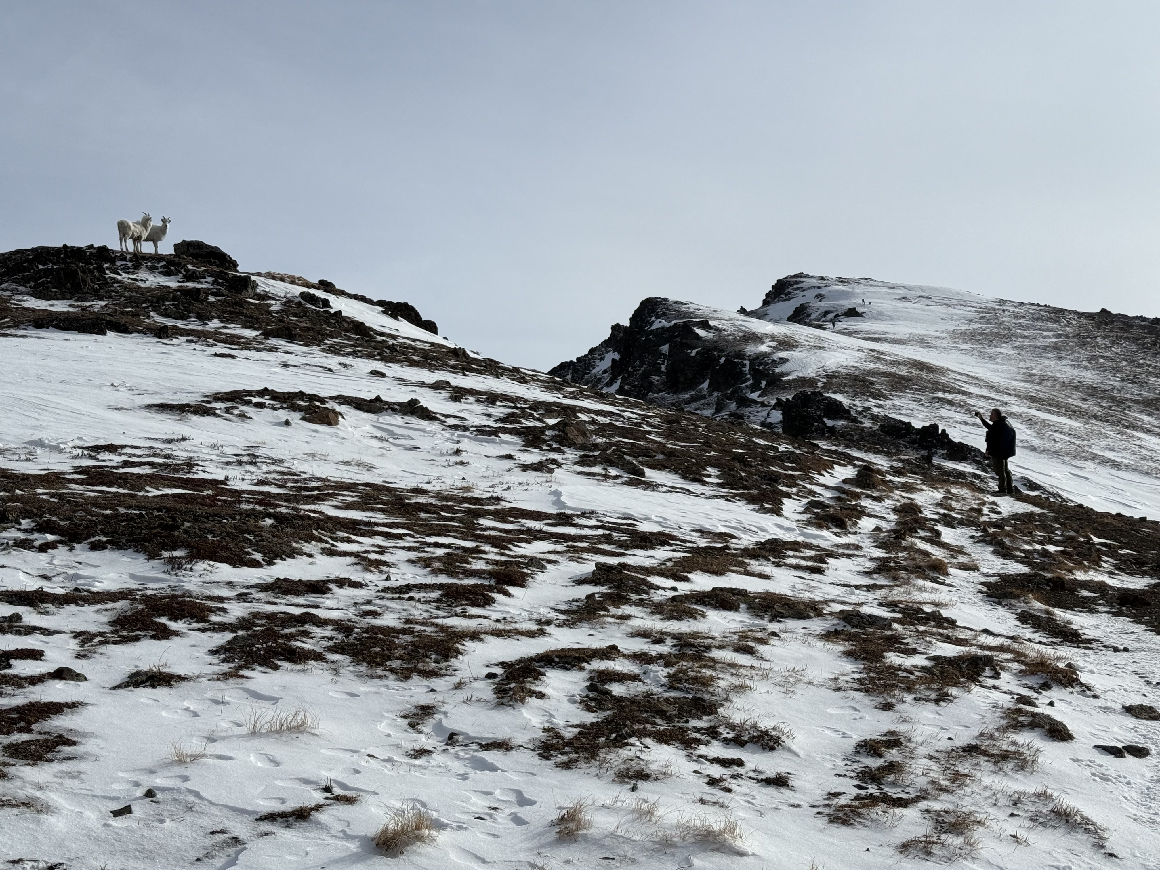
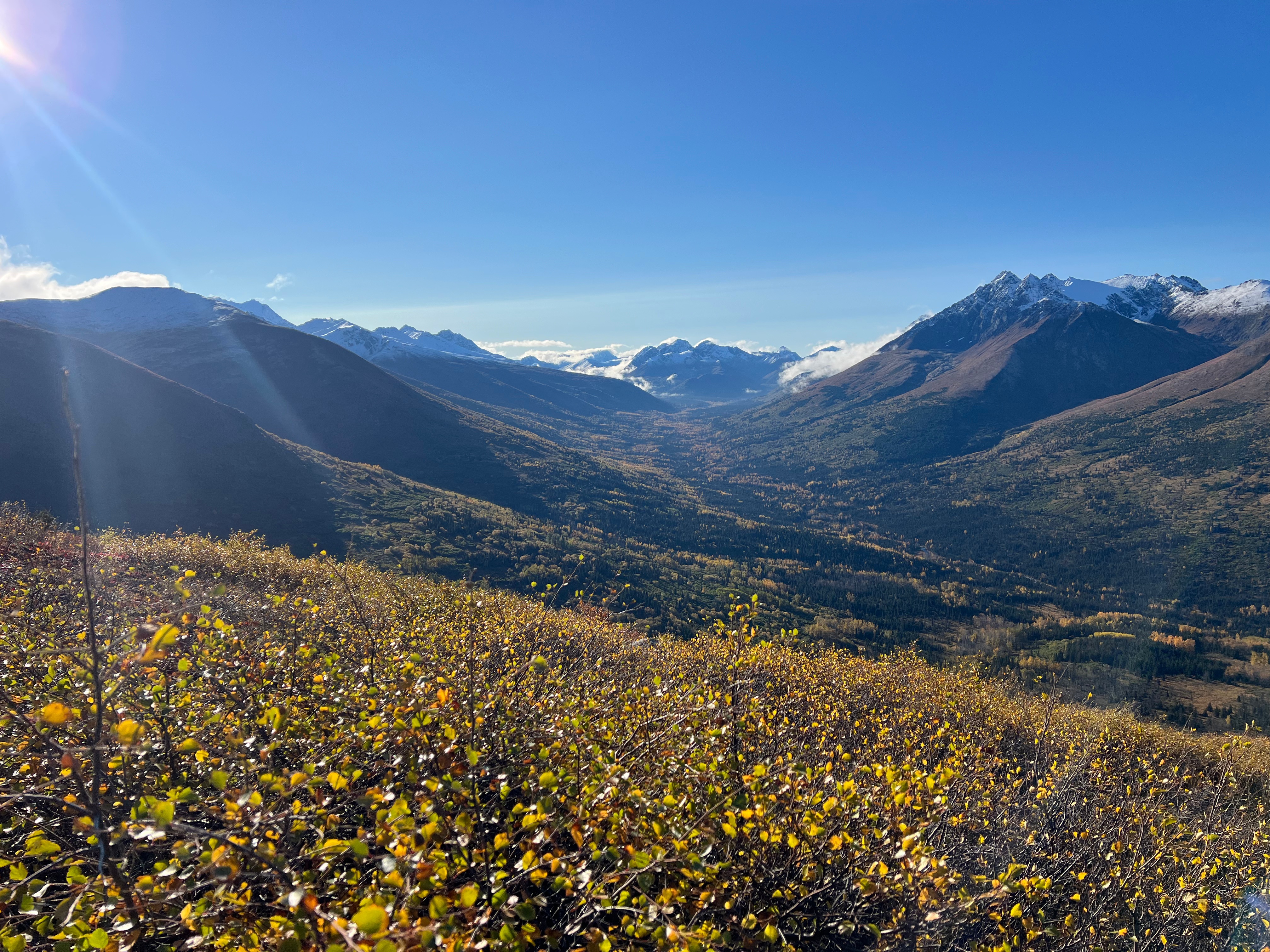
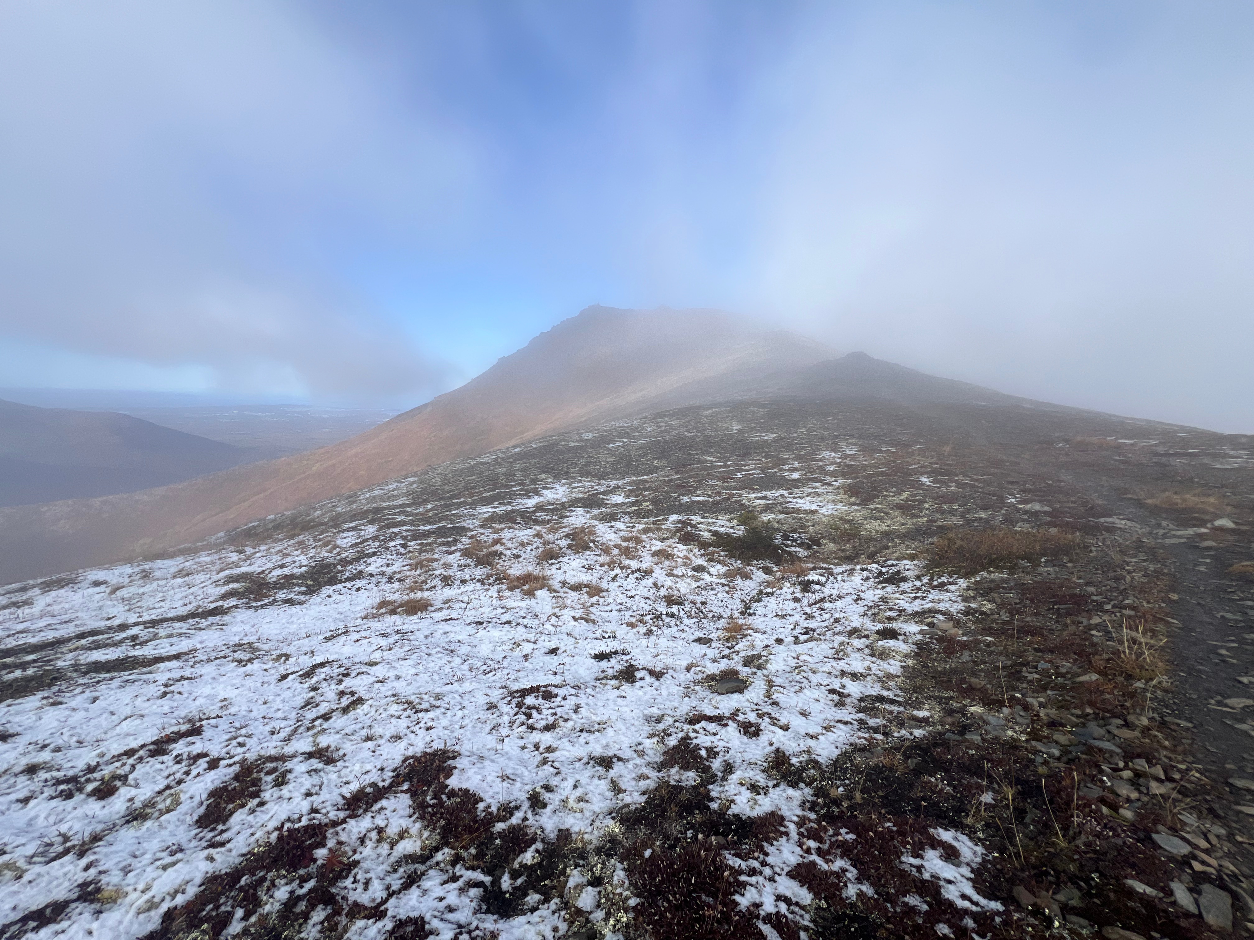
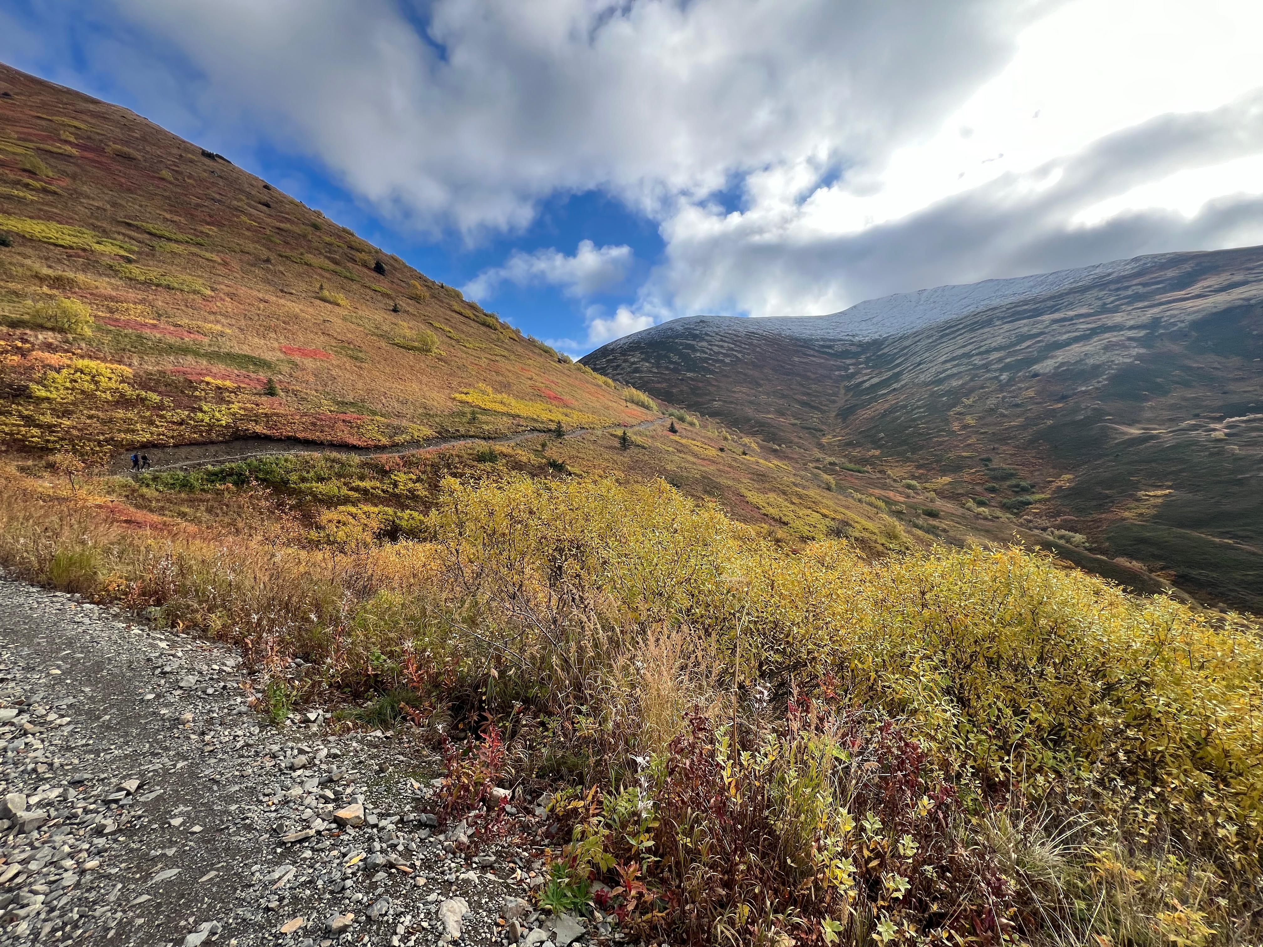
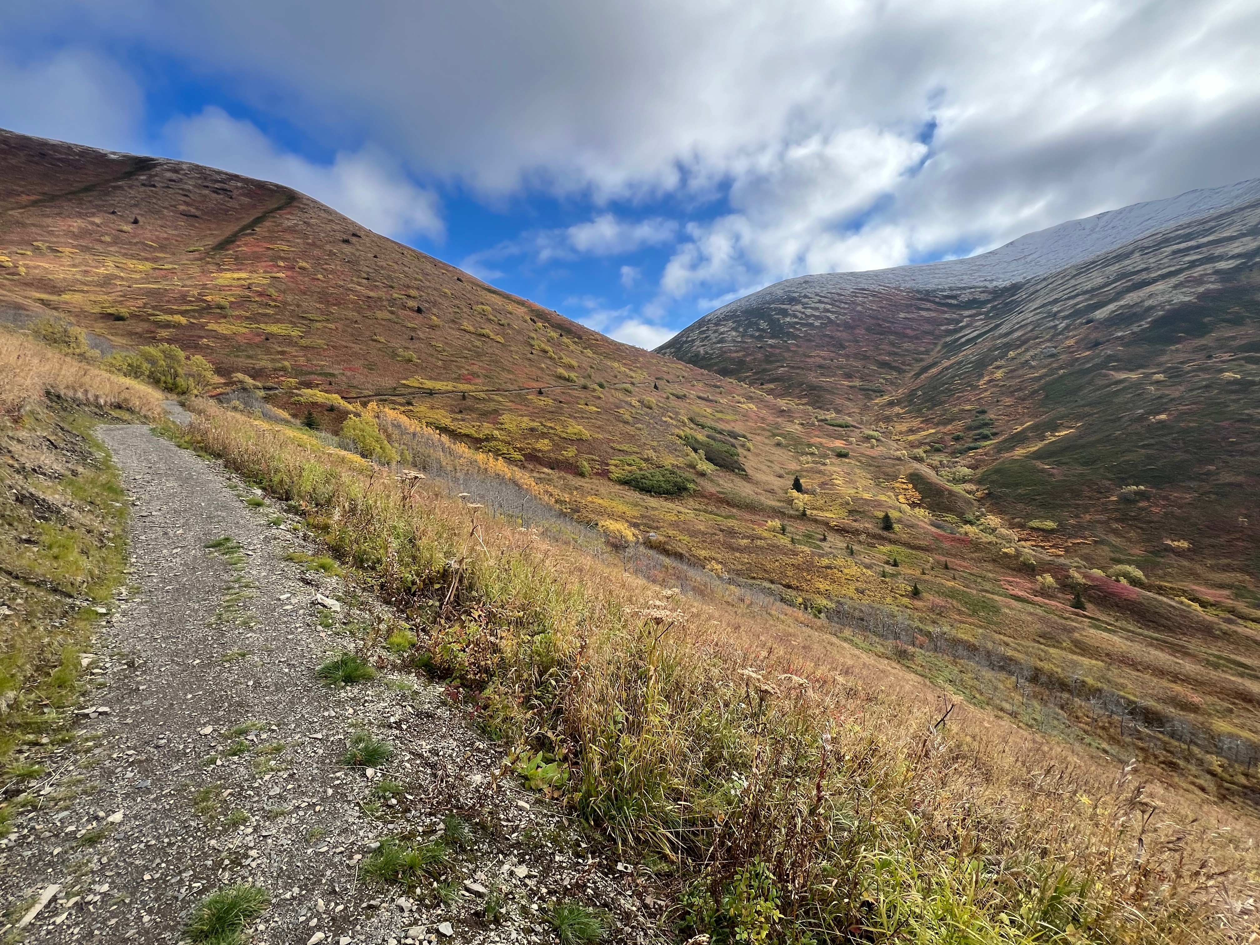
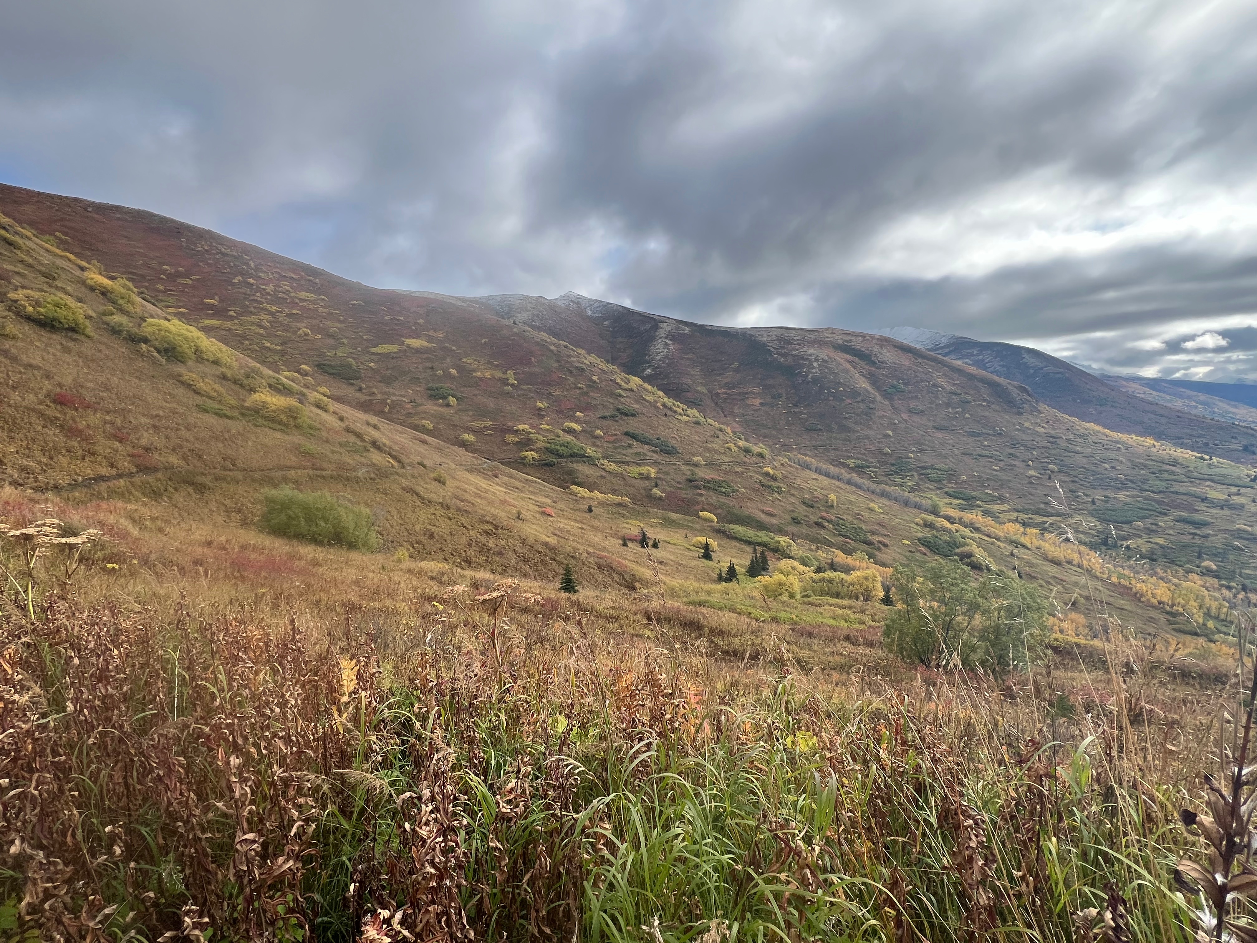
Over the next .8 miles I quickly descended the nearly 1,000 feet to Hunter Pass, a narrow saddle between Rendezvous Ridge and Peak 1213. I turned right and walked where the mountains meet; a rocky, but flat trail, bright fall vegetation bordering on either side. The trail soon becomes well engineered with easy footing, wrapping along the side of the mountain below Rendezvous Ridge and heading back towards Arctic Valley.

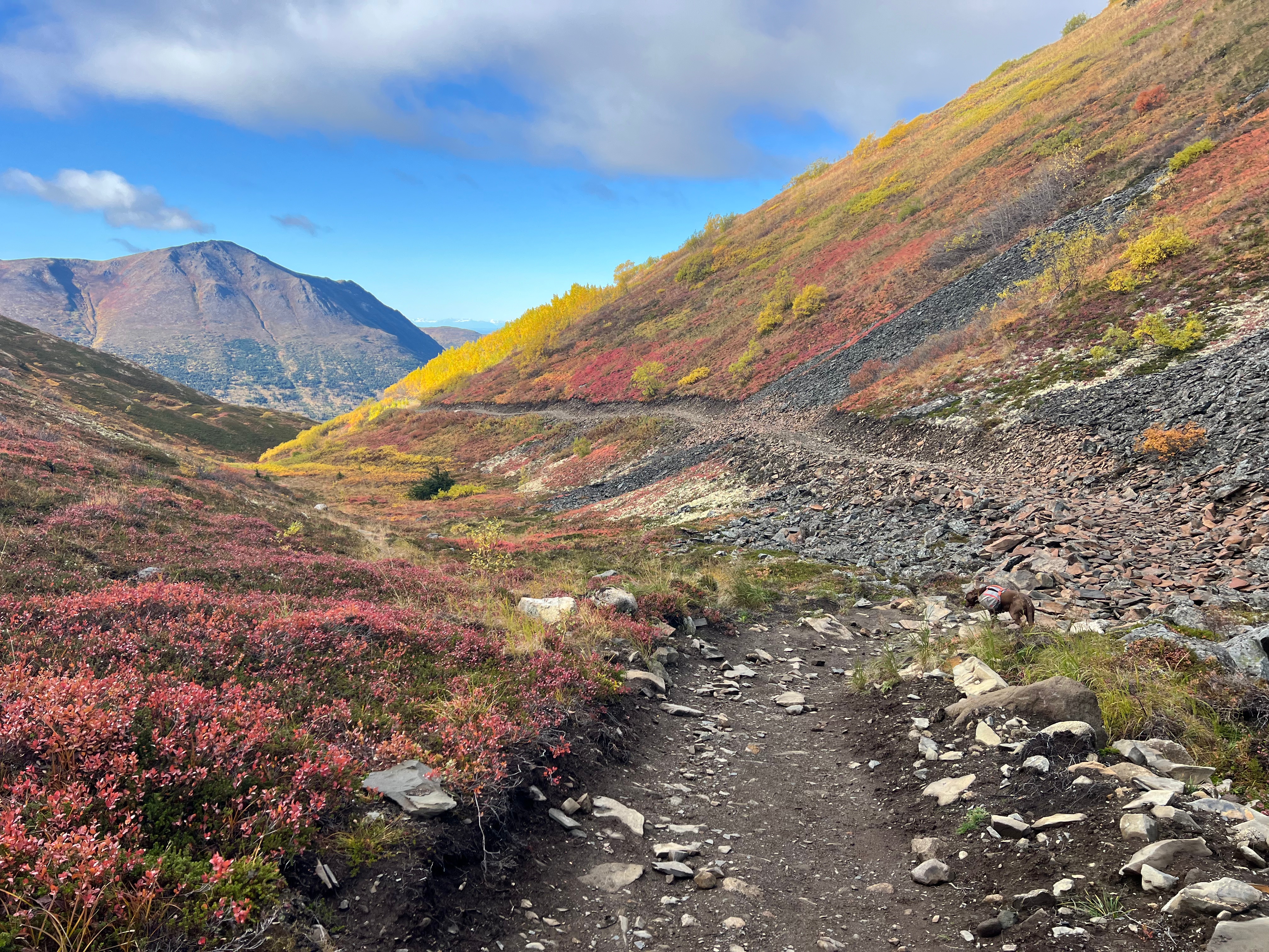
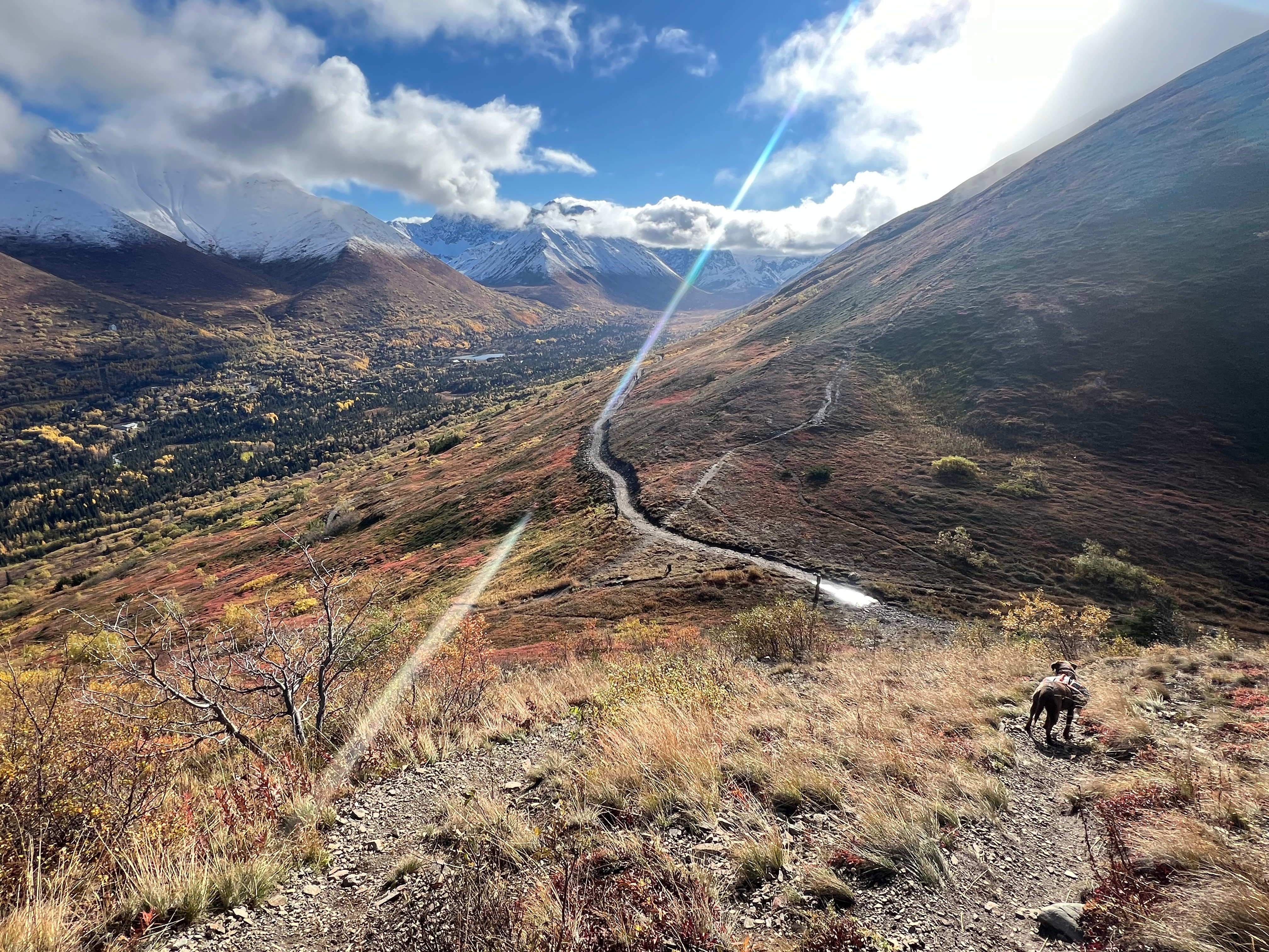
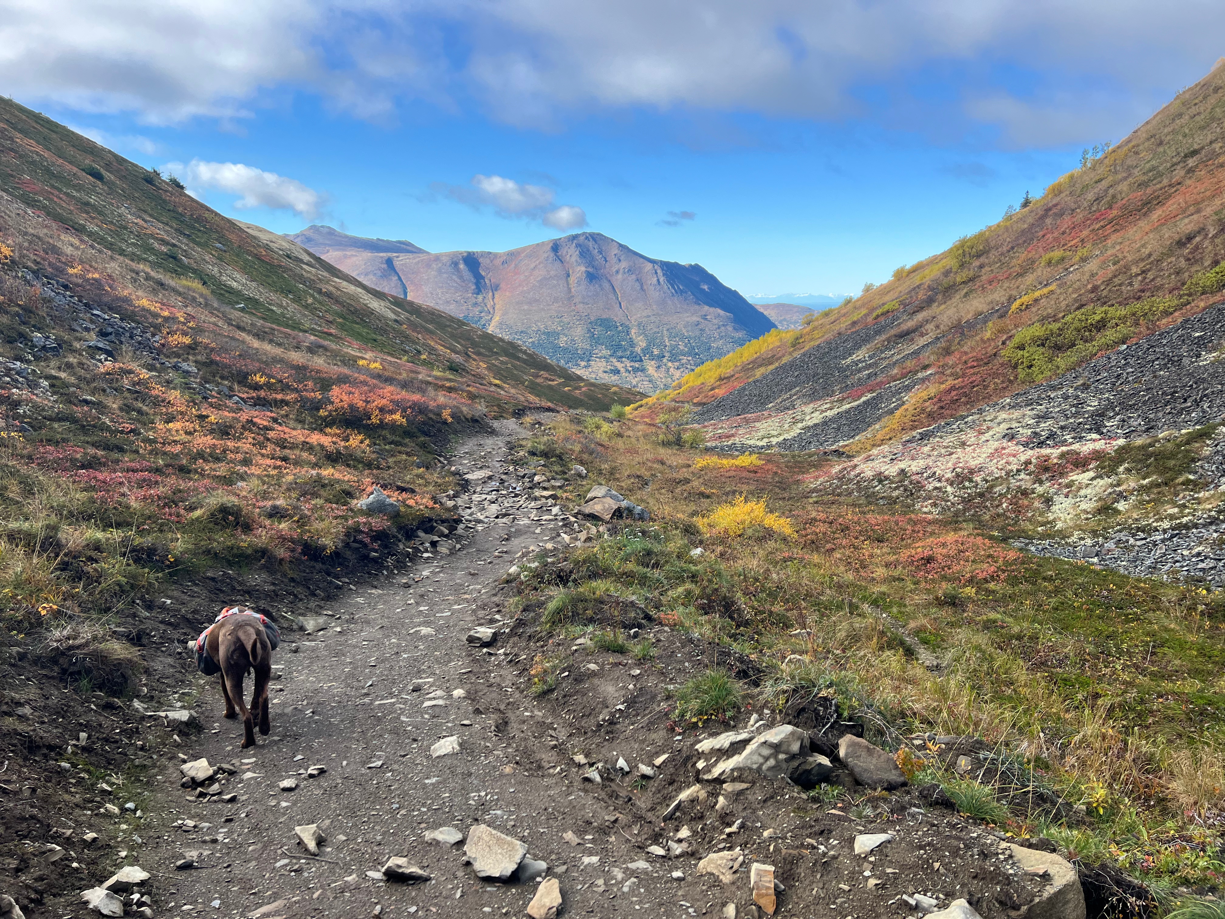
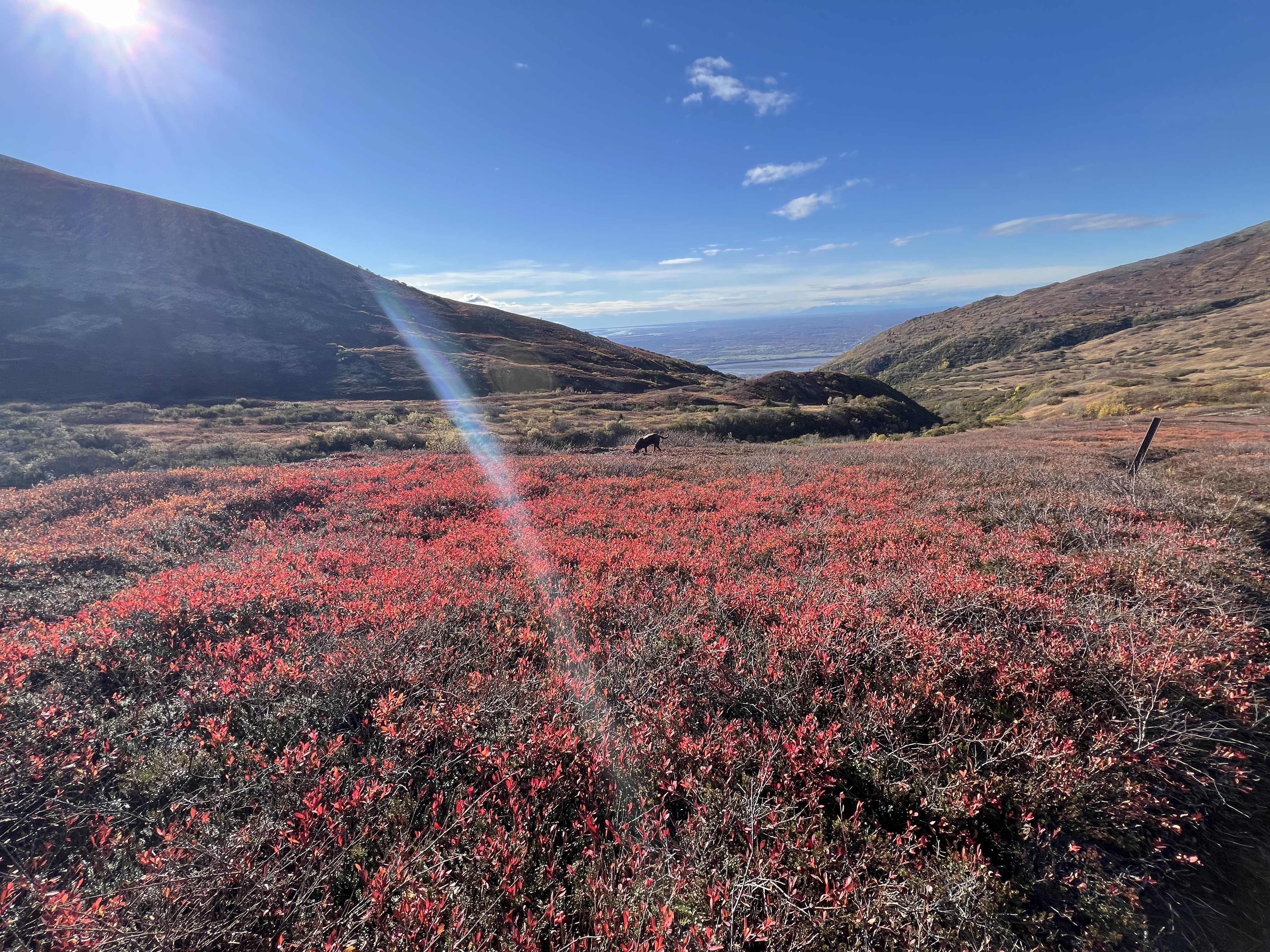
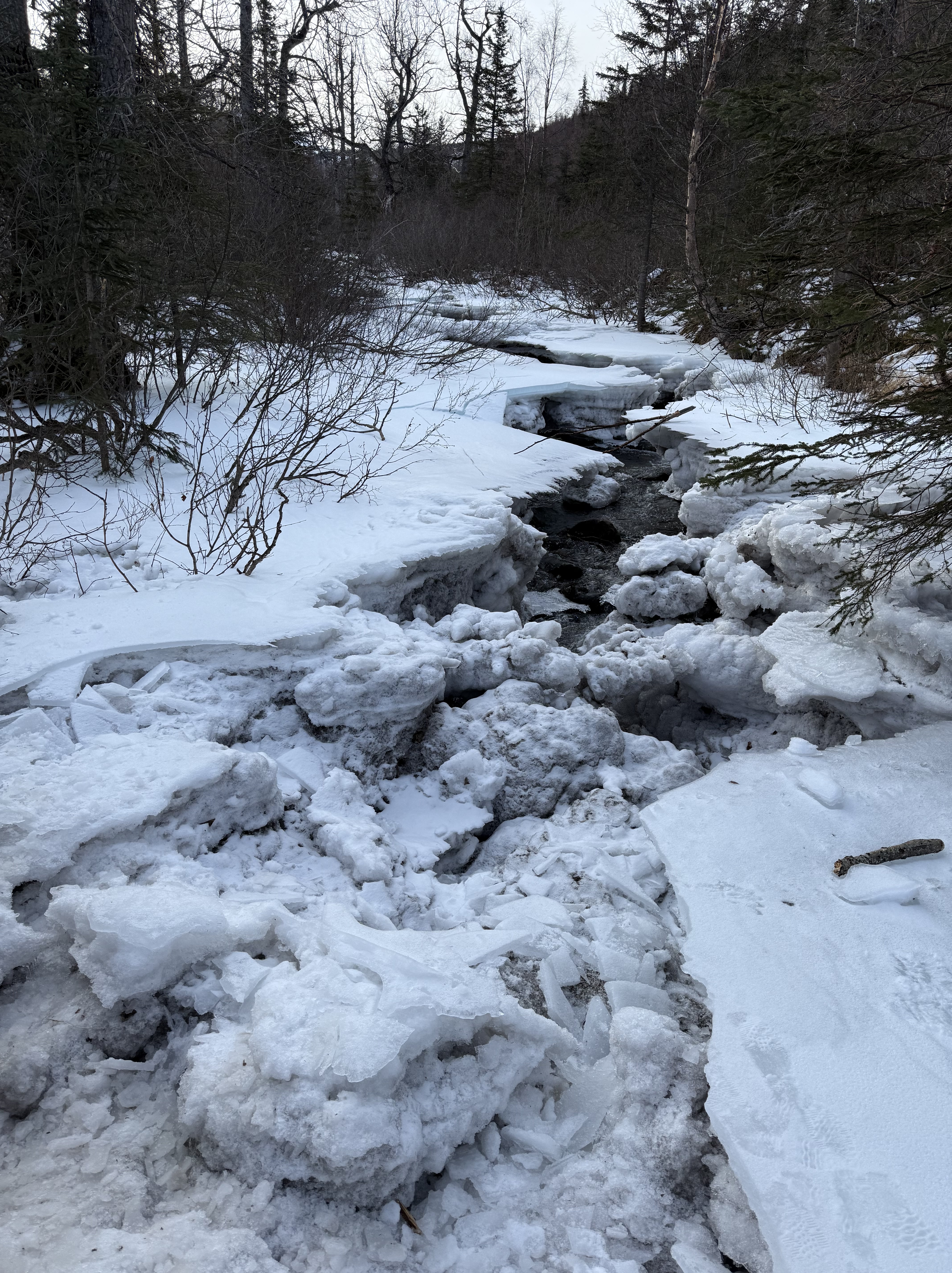
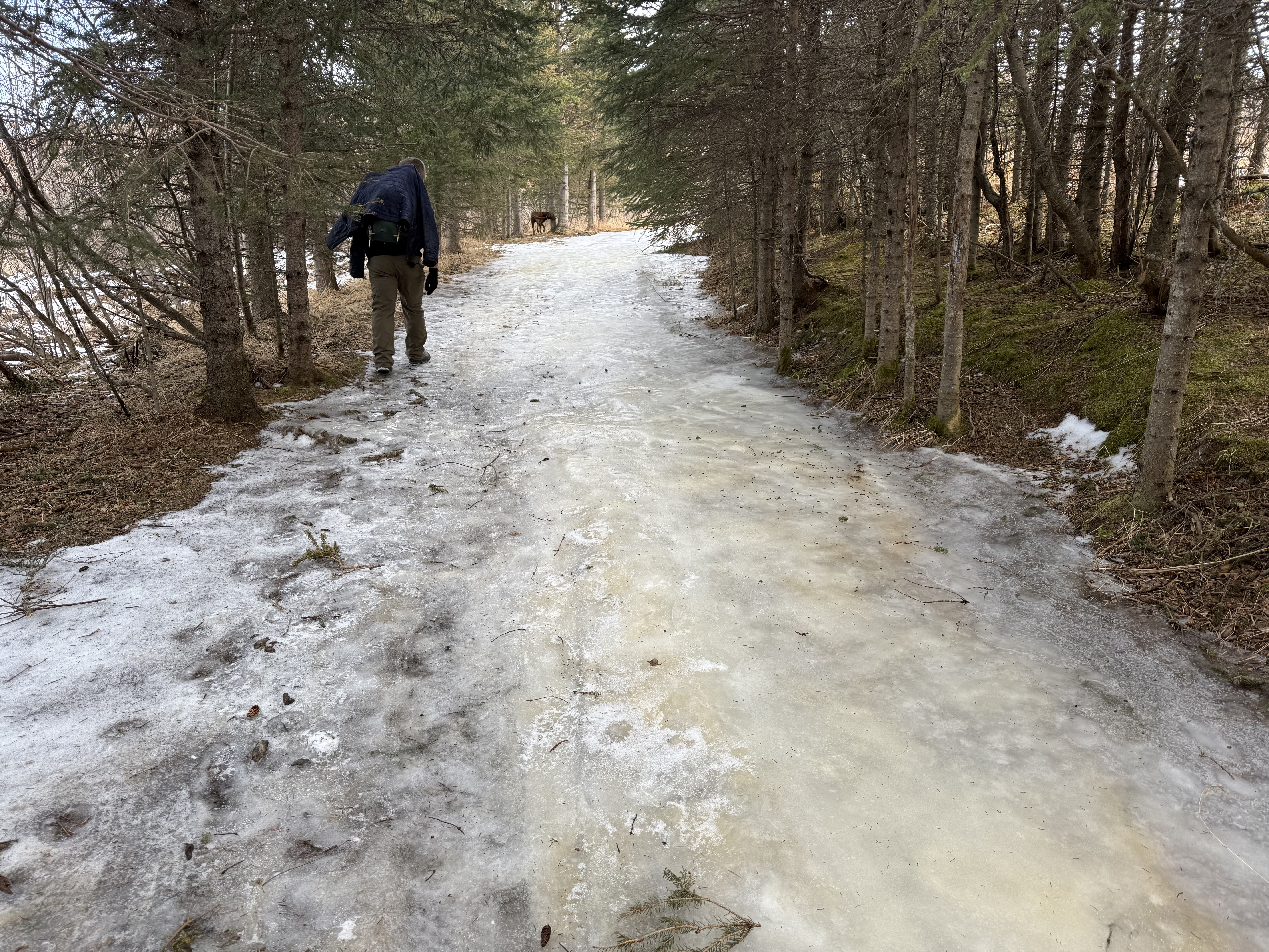
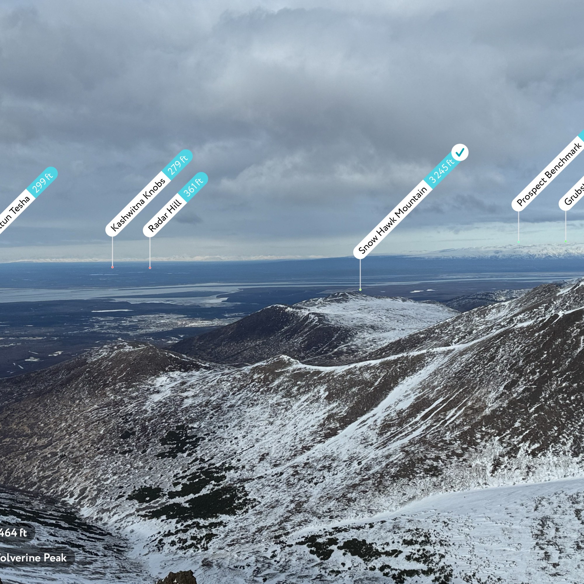
The Muktuk Marston Trail traverses the hillside for 3.5 miles with little elevation gain or loss, the excavation line still visible and unvegetated as evidence of the new construction. Many others had heard of this recently built trail and were out enjoying it on this glorious day. I took my time, not wanting to rush back to the parking lot… winter would soon arrive, and this trail would be inaccessible until spring, a prime location for winter danger with avalanche prone slopes above.

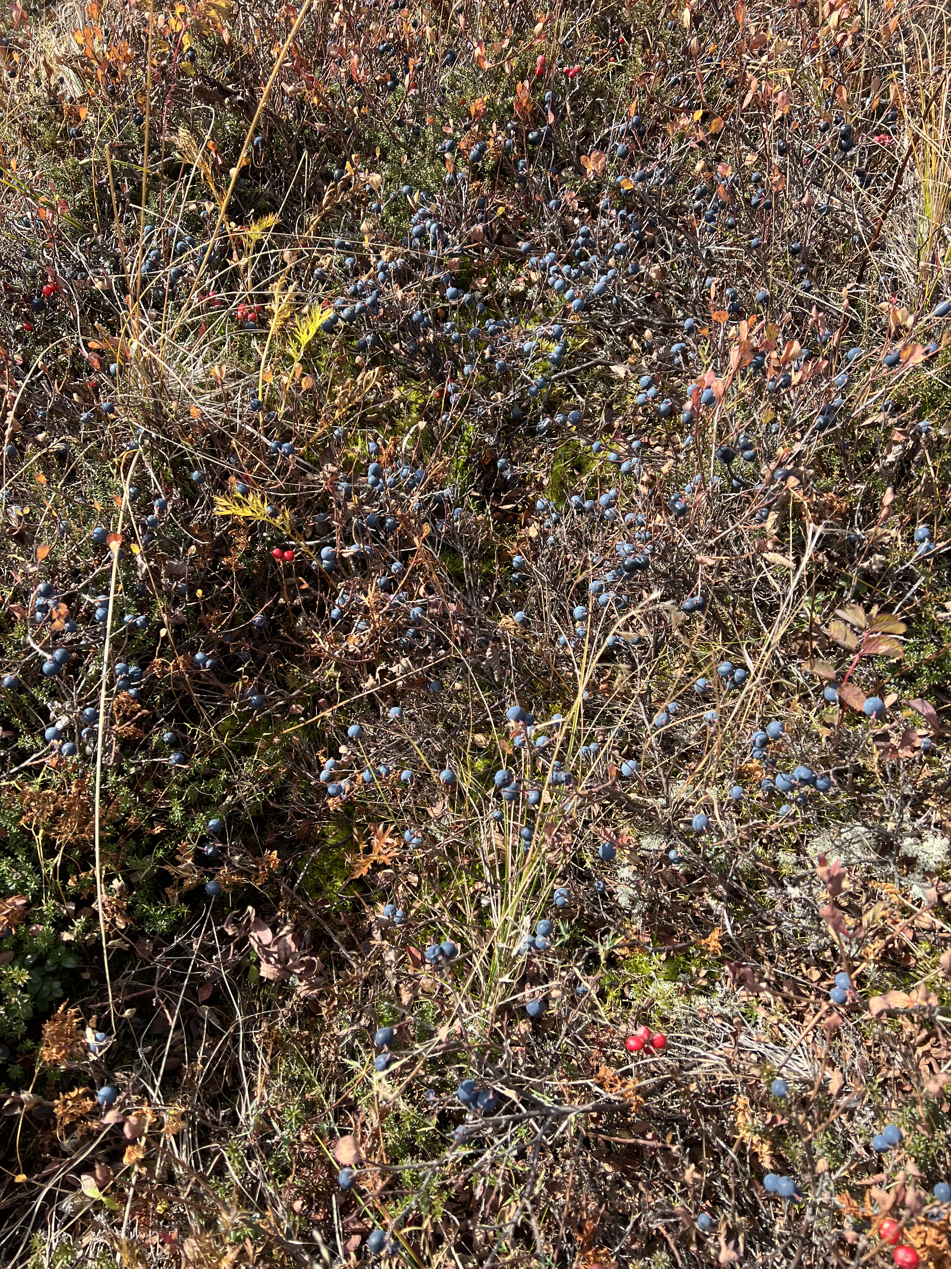
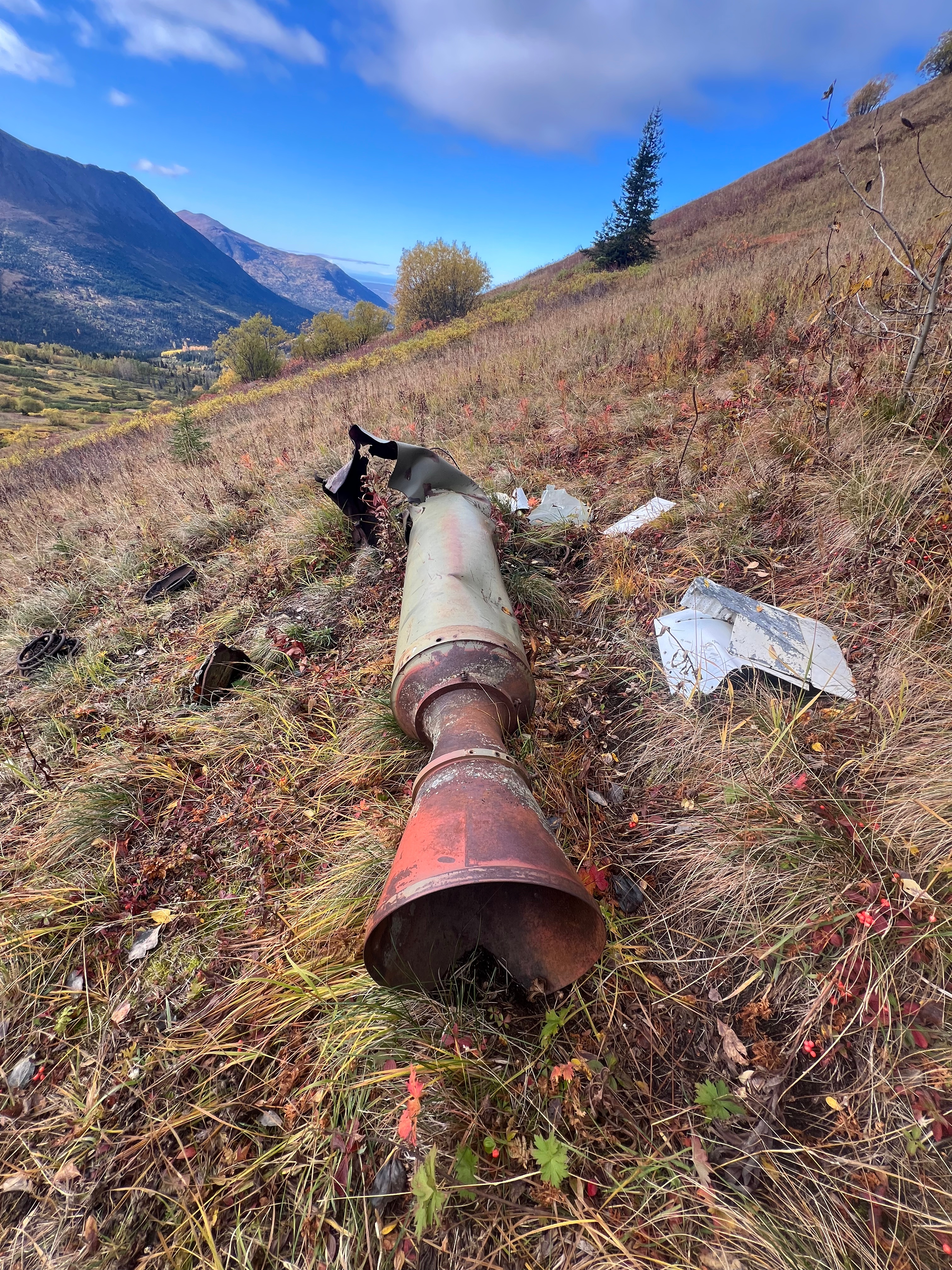
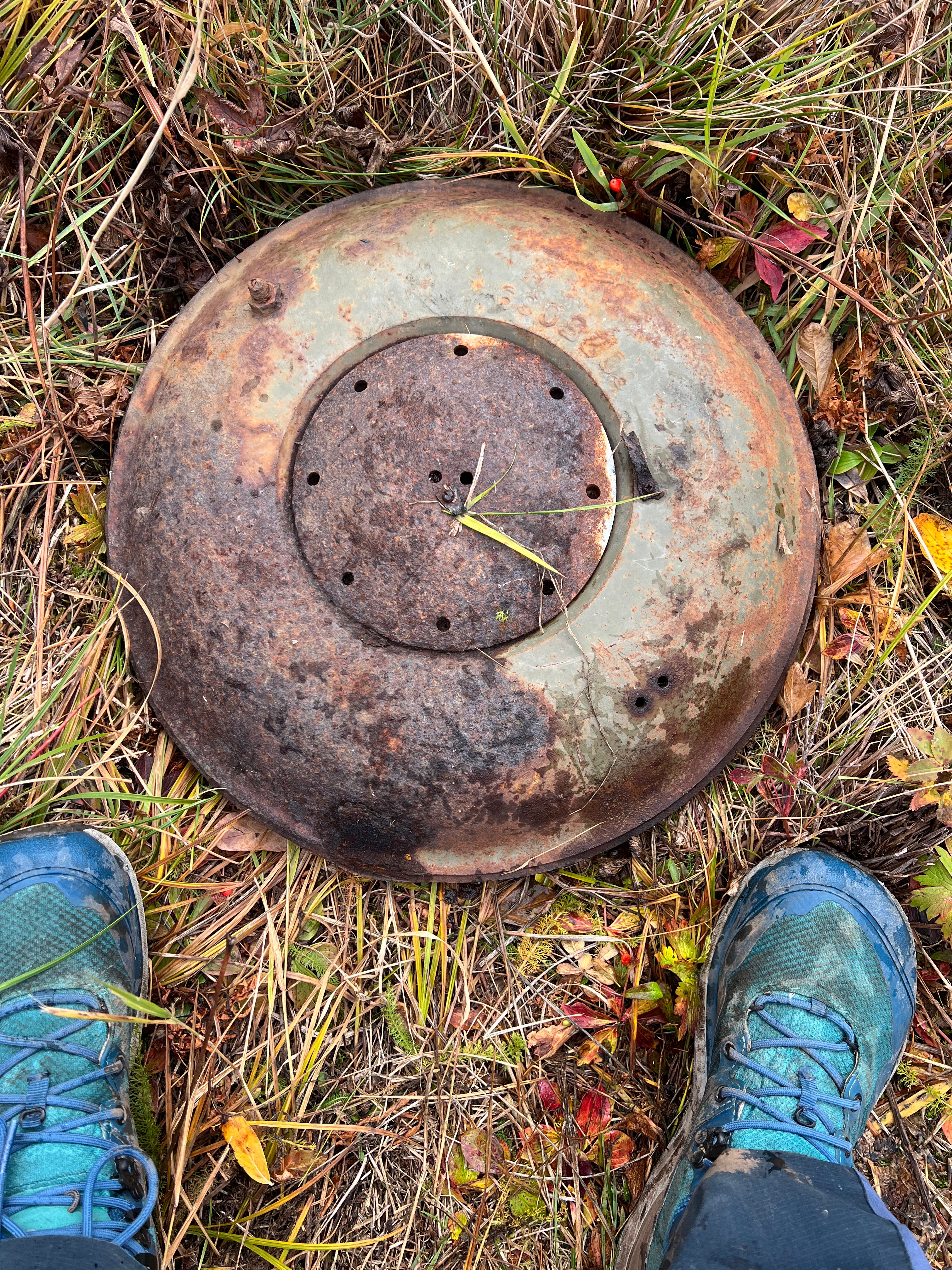
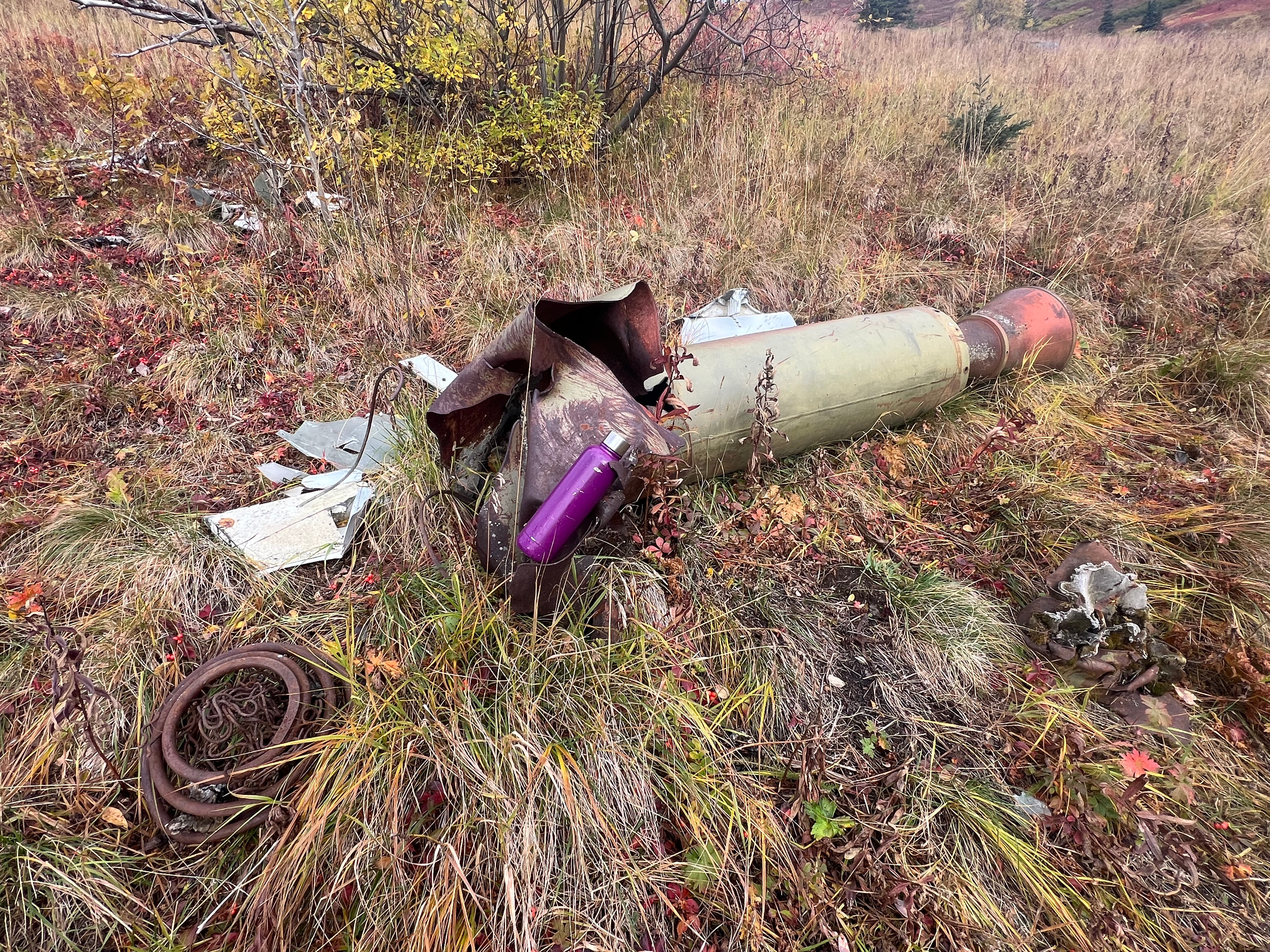
I sauntered along, picking the prolific, tart high bush cranberries and juicy crowberries for a snack, and soon came upon an old missile, a little way off the trail, its nose twisted and destroyed, parts and pieces scattered nearby. It surprised me that the military hadn’t cleaned up the debris, though I felt lucky to have found it to be able to see this interesting piece of history.

I looked back at the trail I had followed, a line across the middle of the mountain and up at the pointy summit of Peak 3891, Peak 1213 now far in the distance. Before long I could once again see the Anchorage Bowl and Cook Inlet. I soon returned to the intersection where I had started up the ridge earlier in the day. A short walk through the trees, I rounded the corner, and my truck was in view in the small parking area near the trailhead.

I peeled off my shoes and socks and donned my flip flops for the drive home, once again recentered after an incredible day in the mountains.

Just The Tips:

  • Be Bear Aware! Make noise and carry protection such as bear spray.
  • This is a great hike for dogs and kids. No dangerous exposure, mostly easy walking and a lot of views for minimal elevation gain.
  • Make a day of it! Rendezvous Ridge has many excellent picnic spots on the alpine tundra.
  • Stick to summertime travel unless you have avalanche education. Hunter Pass is notorious for slides. Even early in the season when the ridge is just covered with termination dust, the snow can be a foot or two deep (ask me how I know).
  • Do not attempt to traverse the Muktuk Marston Trail in the winter as it is below prime avalanche terrain.
  • This area is directly adjacent to the Nike Missile Site on Gordon Lyon Ridge. You very well may come across old ordnance in the form of twisted and destroyed missiles. The military advises that no one touch them.
  • You can also park at the South Fork Trailhead and do the loop from there. It adds about 700′ of gain and 3-5 miles (depending on if you take the switchbacks or the direct uphill track).
  • Arctic Valley has a $5 per day parking fee or you can get an annual membership for $35
  • Arctic Valley Road is on JBER base property. At the time of publishing, the road gate to access the ski and hiking areas is open 6am to 10pm. Call JBER Range Control for most up to date information (907-384-6230). Don’t get locked in! If in doubt, access these trails from the South Fork Trailhead.

AllTrails and Peakbagger Links:

Peak 1112 Peakbagger Page

Little Teton Peakbagger Page

Peak 3891 Peakbagger Page

REcent Trip Reports:

Where the Clouds Parted: A Knoya, Kanchee and Nunaka Ridge Walk

May 31, 2025 Knoya: 4600′ – FR #17 Kanchee: 4393′ – FR #20 Nunaka point: 3780′ Mileage: ~14 Miles Elevation Gain: ~5000′ The summer wasn’t summering, and I was suffering from a bout of springtime depression that only sunshine and warm weather could cure. I dragged myself to the Klutina Trailhead to meet Jason. We…

Chasing the Wind: A Long-Awaited Victory on Peak 1216 and Ship Creek Hill

April 26, 2025 Peak 1216 AKA 3990: 3990′ Ship Creek Hill: 3842′ (chugach Front Range Peak #24) Mileage: 15 Miles Elevation Gain: 5,700′ The majority of the Southcentral Alaska winter of 2024-25 was uncharacteristically warm and relatively snow free, but here we were in April, with record breaking snowfall around Anchorage. The ridges and peaks…

Racing the Termination Dust: A Fall Ridge Walk from Lazy Mtn to Peak 4199

September 29, 2024

Mileage: 8.6 Miles
Elevation Gain: 4815′
Lazy Mountain (3740′)
Peak 4199 (4199′)
Permits: Mat-SU Borough Parking Pass REquired at Lazy Trailhead

It was the second to last day of September, and the weather was holding out for one more low ridge traverse, though the termination dust had crept down close to the 4,000′ mark. I had been eyeing the ridgeline between Lazy and Matanuska Peaks for quite some time, and today was the day. I planned for a point-to-point hike, starting from the Lazy trailhead and ending at Smith Road, at the bottom of the McRoberts Trail.

Lazy Mountain is one of the most popular hikes in the Valley, one of the shorter peakbagging trips at 5.8 miles and just under 3,000′ of gain, but 99% of the people who achieve the summit simply turn around. Our goal was to summit Lazy then continue on to Peak 4199, named solely for its elevation; broad, hulking mountain on the undulating ridgeline that only sees a handful of footsteps every year.

I met with Jason and Josiah at the Lazy trailhead, ready to see some new ground. The day was sunny and so warm that Jason was shirtless by the time we had ascended the first 1,600.’ It always feels like the first mile is the most difficult, sometimes steep enough to tire even the most fit of hikers, but we made good time, being pushed by enthusiasm to see a new summit.

It felt like we teleported to the top of Lazy, past the turnoff for the Lazy Moose Trail, past the alders and into the treeless terrain, past the second picnic table, past the turnoff to the “Stonehenge” trail that leads down to the Mat Peak Trail, past the two rock outcroppings that mark the last half mile to the summit. By this point, Matanuska Peak and the ridgeline were in full view, Mat Peak covered in snow, though 4199 was mostly snow free.

Most people turn back at the flag, but I scrambled up the last 20,’ over the rocky, somewhat exposed block, hand over hand, until the summit widened out into the perfect lunch spot. We each picked a rock and looked out towards the ridgeline with Mat Peak, rising above. Cautious to not trip or slip off the back side of the summit, I took what, as I now go through them to pick the best for this website, feels to be a million photos of the route we were soon to be walking.

Wrapping up our lunch break, Jason and Josiah set off down the back side of Lazy, a scree chute that makes you feel like you might as well be walking on ball bearings. Of course, Jason and Josiah flew down the 400-some-odd feet to the foot of the next hump, an unnamed hill that I call 3451, while I slowly picked my way, trying not to fall on my ass.

Finally in the saddle, not having fallen on my ass, I looked back up at Lazy and the now much more precarious looking scree chute we had just descended. The well-defined, vertical scratch in the mountainside was evidence of others who had come before and, from this vantage point, definitely looks steeper than it is.

Standing in the saddle between Lazy and the next bump on the ridge, the guys were already making their way up the 200′ to the top. Although it only has a couple hundred feet of prominence and isn’t officially its own mountain, not even having an official name or entry in Peakbagger, 3451 is a fun climb unto itself. I had ascended it via Smith Road a couple of times over the years, trekking the 7 miles and 3,000′ RT to enjoy the abundant blueberries and people free zone.

At the top of 3451 I once again looked back at Lazy and noted that I had now connected the dots between these two points, another ridge section completed. Bright red patches of Bearberry plants dotted the hillsides, and the caribou tundra moss was dry and crunchy underfoot. We continued to follow the faint bootpath down from 3451, skirting a minor, 100′ prominence bump, finally beginning our ascent of Peak 4199.

A mile long approach from the saddle, the ridge gains nearly 1,000′ over a mile. A short, steep ascent before cresting a point, the bootpath then drops down 100′ before continuing up a long, gradual ascent to the broad summit of 4199. The shape of the mountain from this ridge is beautiful with its many curved shoulders falling off into the valley, and although it appears barren and gray, with splotches of black lichen and a dusting of snow, it felt welcoming.

A wide summit ridge, the true summit is nondescript. An anticlimactic high point, merely a bump of rocks slightly higher than the rest of the high ground. We all separated for a bit and explored the top of the mountain, Jason heading north out to the end of the northeast ridge, Josiah out to the end of the northwest ridge, while I took more photos of the route from where we started on top of Lazy, now well below us, the bootpath barely visible. I, too, ventured out to the end of the northwest ridge, not able to resist more views of Lazy and Wolverine Valley to the north, already scoping out a new U-shaped ridge walk from Crag Peak.

The days were getting shorter and we all agreed it was time to move on, our goal of 4199 achieved, yet only halfway to where we were going. We descended the 500′ to the saddle between 4199 and another unnamed bump with an elevation 4015,’ the north side of Matanuska Peak now visible. A rarely glimpsed sight, and only visible from this ridge, we took in the impressive view of the high double cirque, carved by glaciers now long gone, though the evidence remains in the etched and sculpted landscape.

The ridgeline up to Matanuska Peak didn’t look that bad from where were standing, but having experienced the high scree chute on the southwest face the first time I climbed it due to a route-finding error on my part, I knew that it was steeper and much more dangerous than it looked. We talked about how we should try it next summer before the ridgeline was covered in snow.

At 4015 our ridge walk towards Mat Peak was at the end. Having negotiated a bit of snow, but not interested in continuing on to end up with wet feet, we followed the southwest ridge of 4015 down towards the valley and Mat Peak Trail. Not following an established route, we all picked our way down the slope, stopping frequently to pick the enormous and prolific blueberries growing all over the hillside. I had never tasted a more perfect berry and Goose agreed. He and I nibbled away at the sweet berries together.

Finally getting our fill of one of AKs superfoods, we finished making a path through the vibrantly colored shrubbery to the well-trodden Mat Peak Trail. We made quick work of the last 3 miles, opting to take the McRoberts Trail, a path less traveled than the parallelling Mat Peak Trail due to overgrowth during the prime summer months. We had no issues, the September frosts had caused significant die back of the vegetation and a comfortably clear path, although we did make sure to make plenty of noise to keep the bears away.

Before we knew it, we were at the Smith Road Trailhead, another ridge section completed, and two more goals added to the 2025 to-do list. This would be our last Alaska hike of 2024.

Just The Tips:

  • Lazy Mtn can be accessed via the Lazy Mtn Trailhead or the Smith Road Trailhead. There are many variations and trail options to consider when planning your route.
  • No parking pass is required at Smith Road Trailhead. A Mat-Su Borough parking pass is required for Lazy Mountain Trailhead.
  • Be Bear Aware! Especially on the McRoberts Trail.
  • Be Moose Aware! I have been charged on the Mat Peak Trail.
  • This is a very dog friendly hike with no significant exposure, except for right at the top of Lazy. Bring plenty of water for your pooch if it is a hot summer day as no water is available between the Lazy Mtn Trailhead and McRoberts Creek, a distance of more than 6 miles.
  • Don’t leave valuables in your vehicle at either trailhead. Lazy trailhead, in particular, has had reports of break-ins and vandals, although I have not yet experienced that in my nearly 20 years of hiking here.
  • If it is icy, microspikes are absoutely necessary for the first mile up from the Lazy Mtn trailhead.

Lazy Mtn and Peak 4199 AllTrails and Peakbagger Links:

Lazy Mtn Peakbagger Page

Peak 4199 Peakbagger Page

REcent Trip Reports:

Misty Miles and Mountain Birds: A Storm King Scramble to Mitty Peak

April 20, 2025 Olympic NAtional Park, WA Mitty Peak 2674′ Mileage: 4.4 Miles RT Elevation Gain: 2400′ After 25 years, I finally had the opportunity to fly down to Seattle from Alaska to see one of my favorite bands of all time, Phish. I can’t travel without checking out a new hike, so I also…

Beyond Bird Point and Into Technicolor Solitude: Bird Ridge Overlook

September 7, 2024 Mileage: 13.5 Miles Elevation Gain: ~6700′ BRO (4625′) Chugach 120 #98 Bird PT (3505′) CHugach 120 #120 Permits: CSP Parking Fee The 2024 Alaska State Fair had come and gone, a sure sign that the dark winter was going to be closing in soon. Even though it was another rainy summer and…

Wolverine and Rusty Point: Hanging out with the Dalls Sheep

March 1, 2025

Mileage: 10.2 Miles
Elevation Gain: 4000′
Chugach 120 #100
Chugach Front Range #18
Summit Elevation: 4491′ & 3480′

With the snow this winter being a bust, Jason and I decided to continue to up the mileage and elevation gain in preparation for a summer of big goals. I had yet to traverse the ridge between Wolverine and Rusty Point, so we decided to fill in that gap. The prospect heights parking lot was surprisingly empty for a Saturday, even mid-morning when we started up at 1030am.

The massive bowl created between Wolverine and Rusty Point is a fixture view from Anchorage, Wolverine’s high point easily visible from just about anywhere in town. The approach is a long one, even without adding in the ridge to Rusty Point; round trip to Wolverine is 9 miles with a 3500′ elevation gain. During the summer, you can easily drop down the backside of the northwest ridge and connect Near Point and Long Lake Trail. You could do the same on the southwest ridge, dropping to Williwaw Lakes Trail. The east ridge is accessible from the summit and leads all the way to Mt Elliot, but this segment is reported to have some scrambling and infamous crumbling Chugach Choss. I have to yet to travel this ridge, but it is definitely on the list!

The first two miles wind along the South Fork of Campbell Creek, sometimes glaciated, but mostly packed snow. At the intersection with Near Point Trail and Basher Trailhead, there is a wooden post with signage directing Wolverine hikers to take a hard right.

For mile and a quarter, the trail climbs 1,400′ out of the trees and up into alder country, this section notorious for holding punchy and/or crusty, icy snow. Microspikes come in handy on this stretch. Aiming for a low center ridge, this section of trail is relentless uphill and feels like the hardest part of the whole climb. The snow was like walking in mashed potatoes, hard to get a flat footing and a bit greasy, but the effort is worth it. We crested the low center ridge, rocky and windblown. A giant rock cairn welcomes you to the mountain.

We took a short break, eating and drinking, before following the low ridge to the east, eventually ascending 1,100′ over a mile to the summit ridge. Windblown and relatively snow free, the ascent here was easier than our earlier uphill walk, and we made good time to the summit ridge. By now there was quite a bit of traffic on the route, as many trail Anchorage trail runners use this mountain for regular training trips, and one of the parties descending warned us of a collection of Dall’s Sheep not too far ahead. To avoid any conflict, I put Goose on a leash, and we continued on along the summit ridge, now only 400′ above us.

Sure enough, one then two sheep appeared on a high point on the ridge, inquisitive and unbothered by our presence. One was clean and bright white, while the other appeared to have just woken from a long winter’s nap, hair disheveled and discolored. The summit was so close, although a couple of lingering snow patches remained.

The snow conditions variable, either icy or punchy, I still hadn’t put on my spikes and mentioned to Jason I was going to do so for the last stretch, but it was too late… my feet slipped out from under me and went face first to the snow, my 2-liter water bottle slipping out of my pack side pouch. I watched in horror as the majority of my water started sliding down the icy slope. I usually clip it in but hadn’t this time. How could I be so careless! I held hope it would stop on a grass patch, but I wasn’t so lucky… I watch the water bottle skitter 1,000 feet down. No chance of recovering it today with the icy snow in the chute, but I promised myself to return and retrieve it in the near future.

My frustration quickly turned to excitement as we crested the last snow patch and up to the summit of Wolverine. Views for days!!!!

Wolverine has some of the best views from the front range of the Chugach Mountains, including almost the entire Long Lake to Williwaw traverse. Near Point, Snow Hawk, Kanchee, Knoya, Tikishla, West and East Tanaina, Koktoya, Williwaw, The Ramp, Hidden and O’Malley create a horseshoe around Wolverine and the east ridge to Mt Elliot. I reminisced about the ones I had climbed already and daydreamed about the ones I still had on my list. Although it was variably cloudy skies with patches of blue, we could identify peaks far in distance, beyond the Front Range.

We had been relatively protected from the wind until we reached the summit, but upon summitting, the full force of 20-30mph gusts hit us from the South. We snapped some photos, added a layer and promptly headed down towards Rusty Point along the Southwest ridge. The walking was outstanding, with very little snow to navigate. I was shocked to not even find a faint boot path, although there were some old footprints in the small snow patches here and there.

Although it seems like the backside of this ridge falls precipitously, it is actually very safe walking. From easy tundra walking to some very easy, low-exposure scrambling, this ridge is a pleasant 1.5 mile walk to Rusty Point. Overall, from Wolverine, we gained about 600′ of elevation, never once feeling the leg burn of the earlier ascent. Every rock outcropping we navigated around or over brought us to another herd of sheep, some with large rams directing their families away from us, some watching us inquisitively, some totally disinterested in our presence.

It didn’t take long to get to Rusty Point from Wolverine, and I wished that this ridge was longer, but the wind was starting to be a nuisance, so we decided it was time to complete this lollipop loop. We dropped down between Rusty’s two high points, a steep, snowy and icy face, Jason always quicker on the downhill made good time. I took my time navigating the slope, zigging and zagging along the ice until I found some good snow to plunge step directly down the hill. Before we knew it, we were on the center ridge again, looking back up at our most recent mountain accomplishment.

Connecting back to our ascent route, we made great time to the parking lot, where we determined that we had attained just over 4,000′ of elevation gain in 10.2 miles. Definitely a day to remember.

Just The Tips:

  1. Parking is usually available at Prospect Heights. Do not leave valuables in your vehicle.
  2. No permits are required for this area, but an Alaska State Parks parking pass is required for trailhead parking.
  3. Be Bear Aware. Carry bear spray. Bear bells are a nuisance to other hikers and have been deemed less effective than talking.
  4. Give wildlife a wide berth. Harassing wildlife is against the law. Sheep and moose can be aggressive. Sheep and goats are known to purposely kick rocks down onto hikers and moose will charge if provoked… sometime when not provoked.
  5. Wolverine is frequented by hikers throughout the year, but the area can still be prone to avalanches in the right conditions. Check the local avalanche forecasts before heading out.
  6. In the winter and spring, microspikes are highly recommended. The snow can be icy and dangerous on some of the steeper sections. A slip probably wouldn’t be fatal, but you could potentially slide for a long way and be injured.
  7. If you are unfamiliar with the area, it is good practice to download tracks and follow them. The trail system through here is expansive and it would be very easy to take a wrong turn.

Wolverine AllTrails and Peakbagger Links: