
April 26, 2025
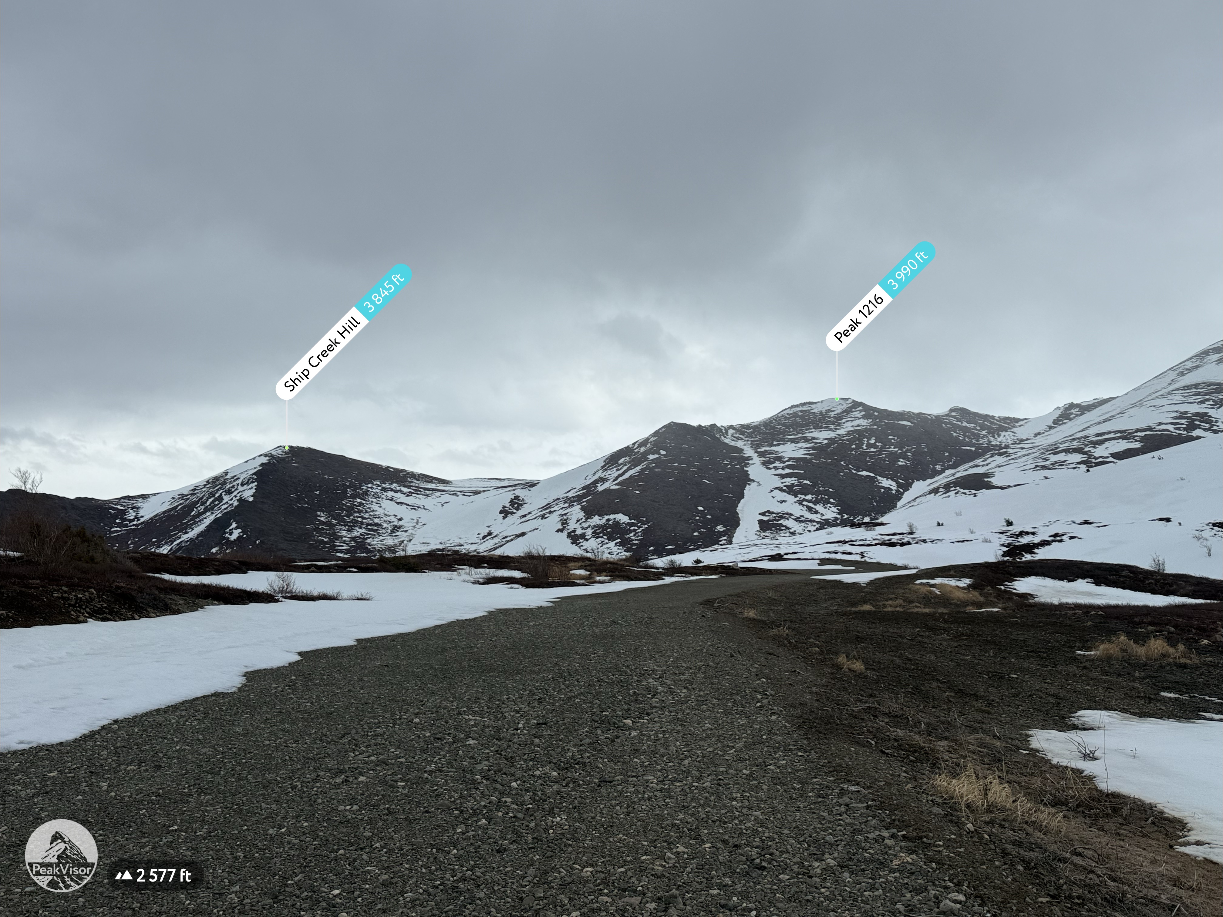
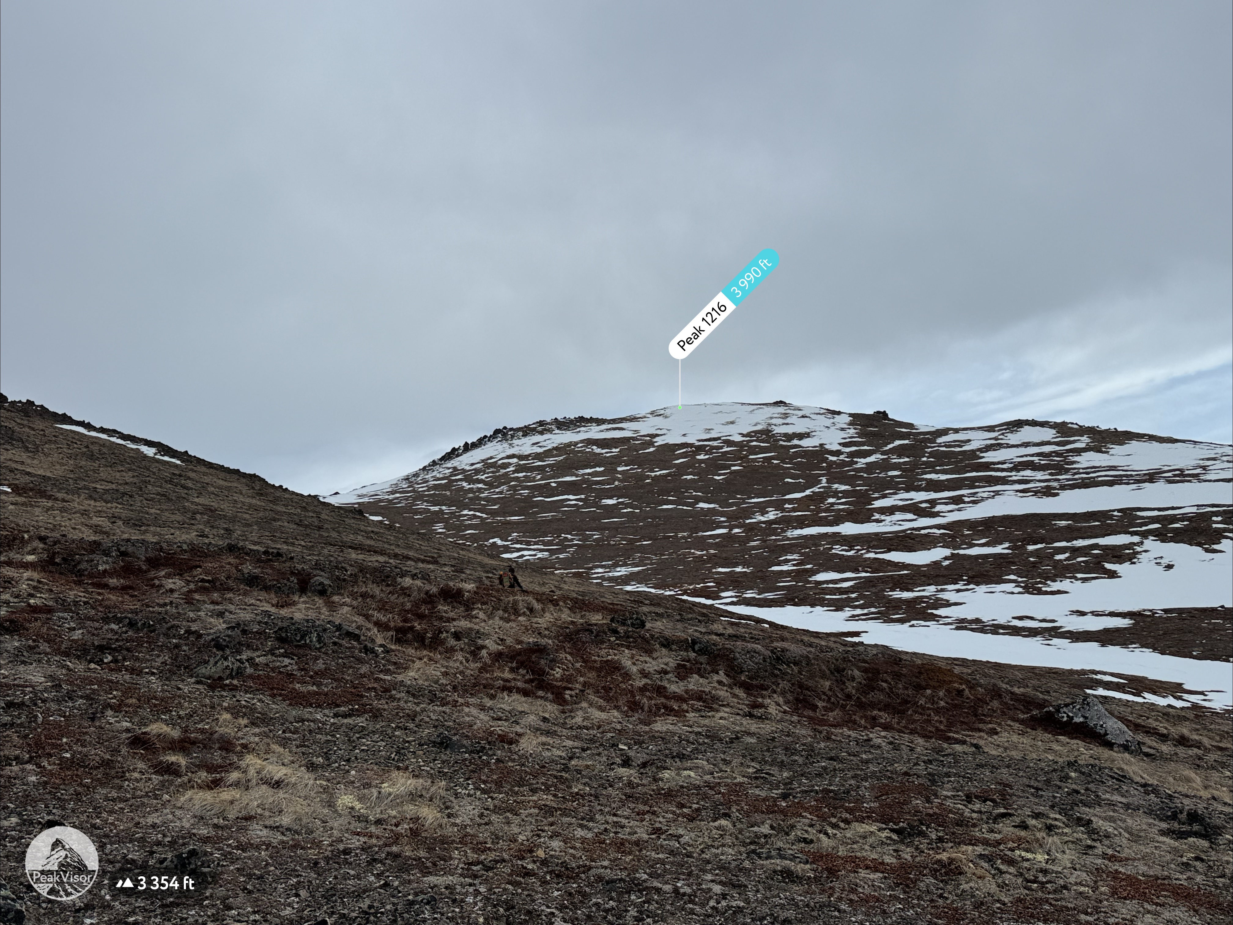
Peak 1216 AKA 3990: 3990′
Ship Creek Hill: 3842′
(chugach Front Range Peak #24)
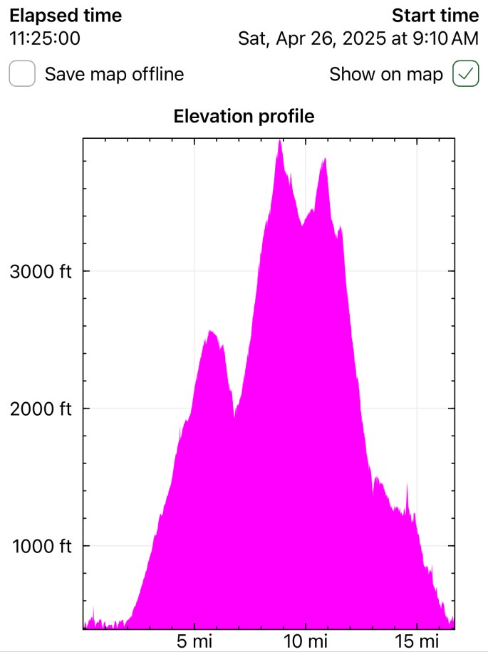
Mileage: 15 Miles
Elevation Gain: 5,700′
The majority of the Southcentral Alaska winter of 2024-25 was uncharacteristically warm and relatively snow free, but here we were in April, with record breaking snowfall around Anchorage. The ridges and peaks that were almost ready to be climbed were now blanketed in multiple feet of fresh snow. The avalanche danger had increased, and the Chugach turned into a hiker’s postholing hell.
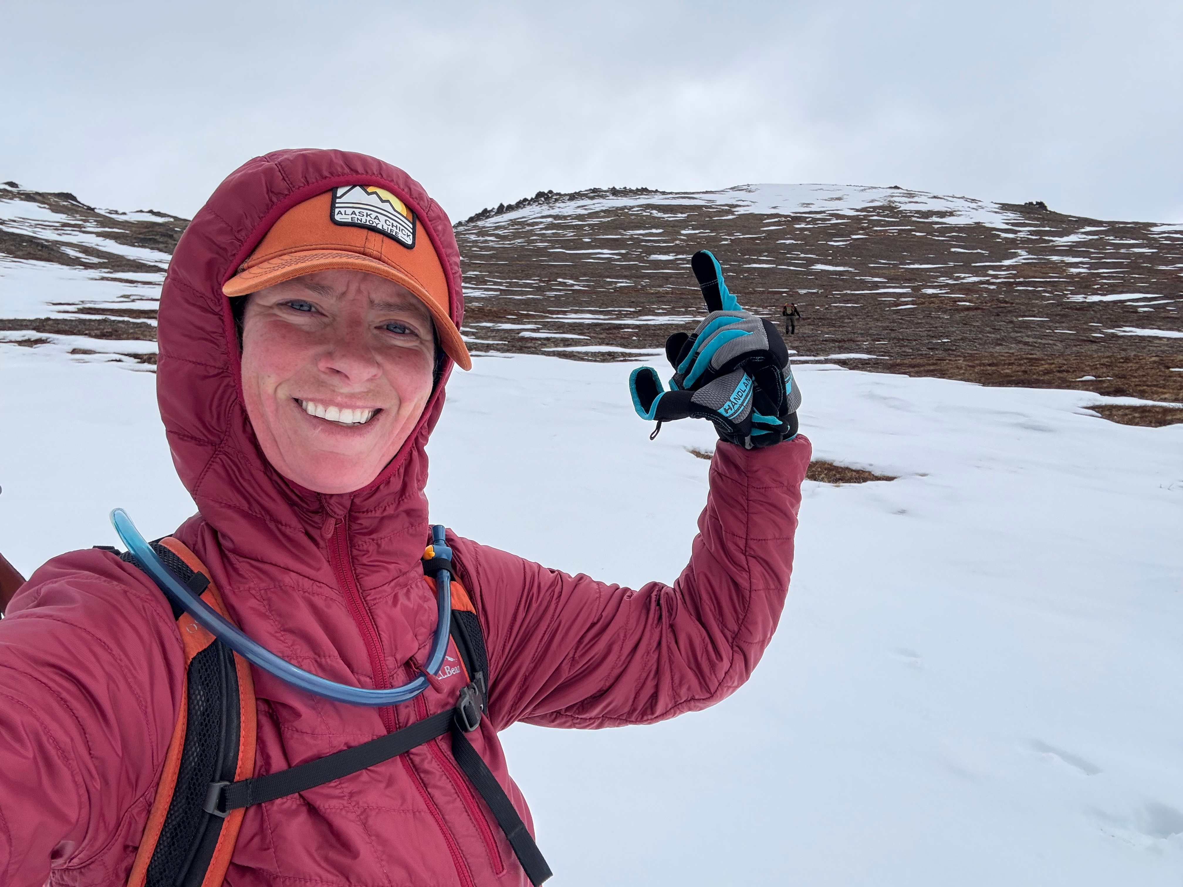
My adventure partner, Jason, and I had made a handful of successful peakbagging forays since February, but had also experienced firsthand how challenging it was in the enduring winter weather of the mountains. We had postholed through waist deep snow, dealt with 30+ mph winds and trudged through multiple snow squalls.

We had some big traverse goals for the summer and needed to keep moving, even when the weather was continuing to fight us. The winds were forecasted to be gusty for the weekend, but we figured it couldn’t be any worse than when we climbed Rainbow Peak, just the month prior.
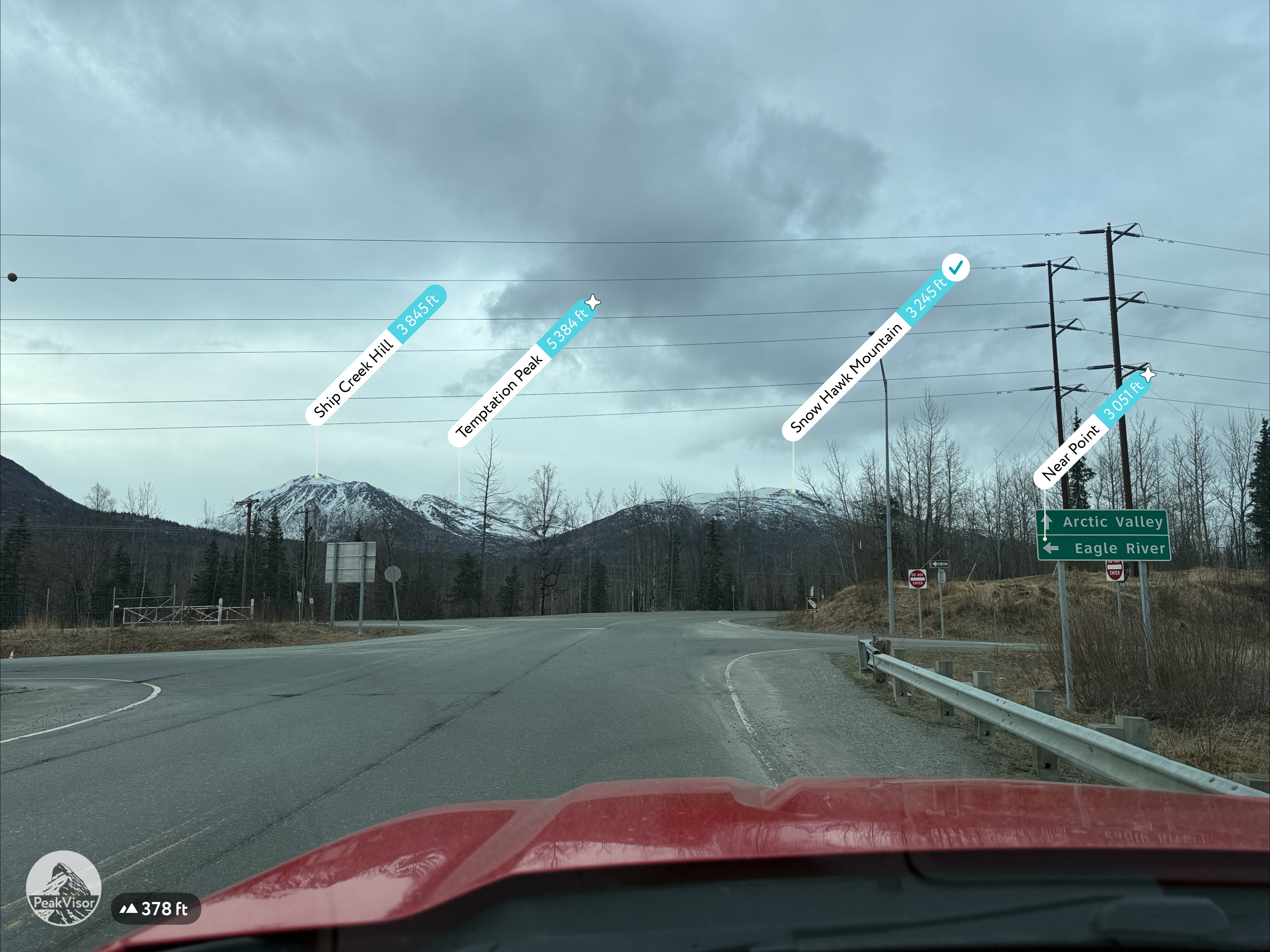
The only peak we hadn’t yet climbed that was not completely white just happened to be a mountain that had been obsessed with for the past couple of years. For some reason I was laser focused on marking Ship Creek Hill off my list… maybe because it is such a visible feature when driving north from Anchorage or maybe because I knew it was so rarely hiked due to a supposed schwackful trail up Snow Hawk Valley, or a long approach from The Dome or Snow Hawk Road.
Poor Jason never heard the end of it… when we were camped at Long Lake for my birthday (“we gotta do Ship Creek Hill”), when we were sitting out flash floods along the Kalalau Trail in Kauai (“I bet Ship Creek Hill would be fun”), and I think even as far back as when we walked the ridgeline from Triangle Peak to Mt Gordon Lyon (“There’s Ship Creek Hill. We have got to do that soon”).
We had made a pact that this year we would get up there, but it would have to be before the buds popped on the trees, since we had experienced more than enough bushwhacking in the last couple weeks on our Snutnadzeni (Bear Pt) Traverse and on our route finding forays to figure out how to cross Thunder Bird Creek.
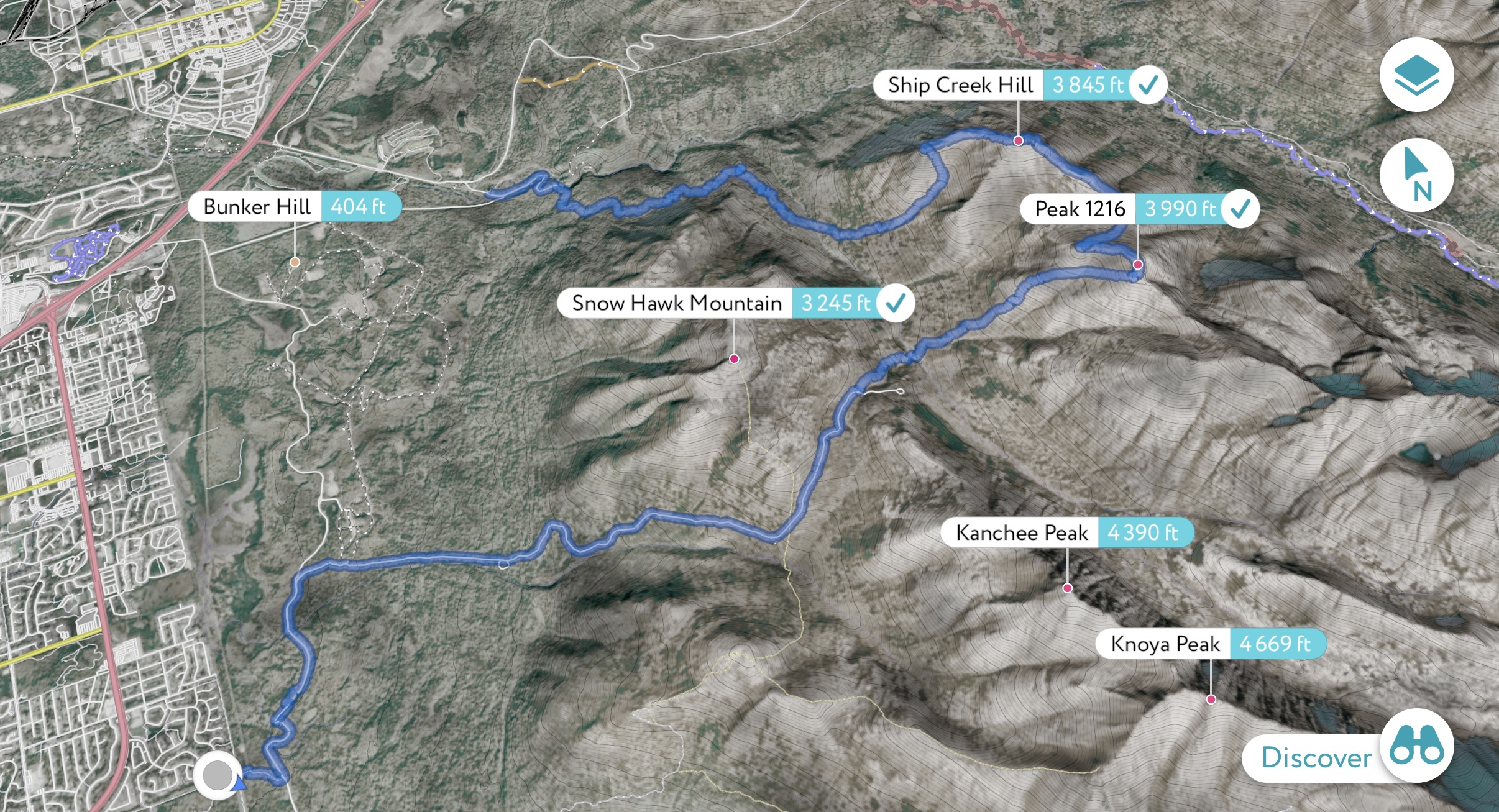
Snow Hawk Road was looking dry, the buds were just starting to appear, and we were on a mission to get in some substantial miles, so we decided to go for it the long way. We opted to go point to point, starting at Klutina Drive → Bulldog Trail → Snow Hawk Road → off trail across Snow Hawk Valley → up Peak 1216 → Ship Creek Hill → out via Snow Hawk Valley Trail.
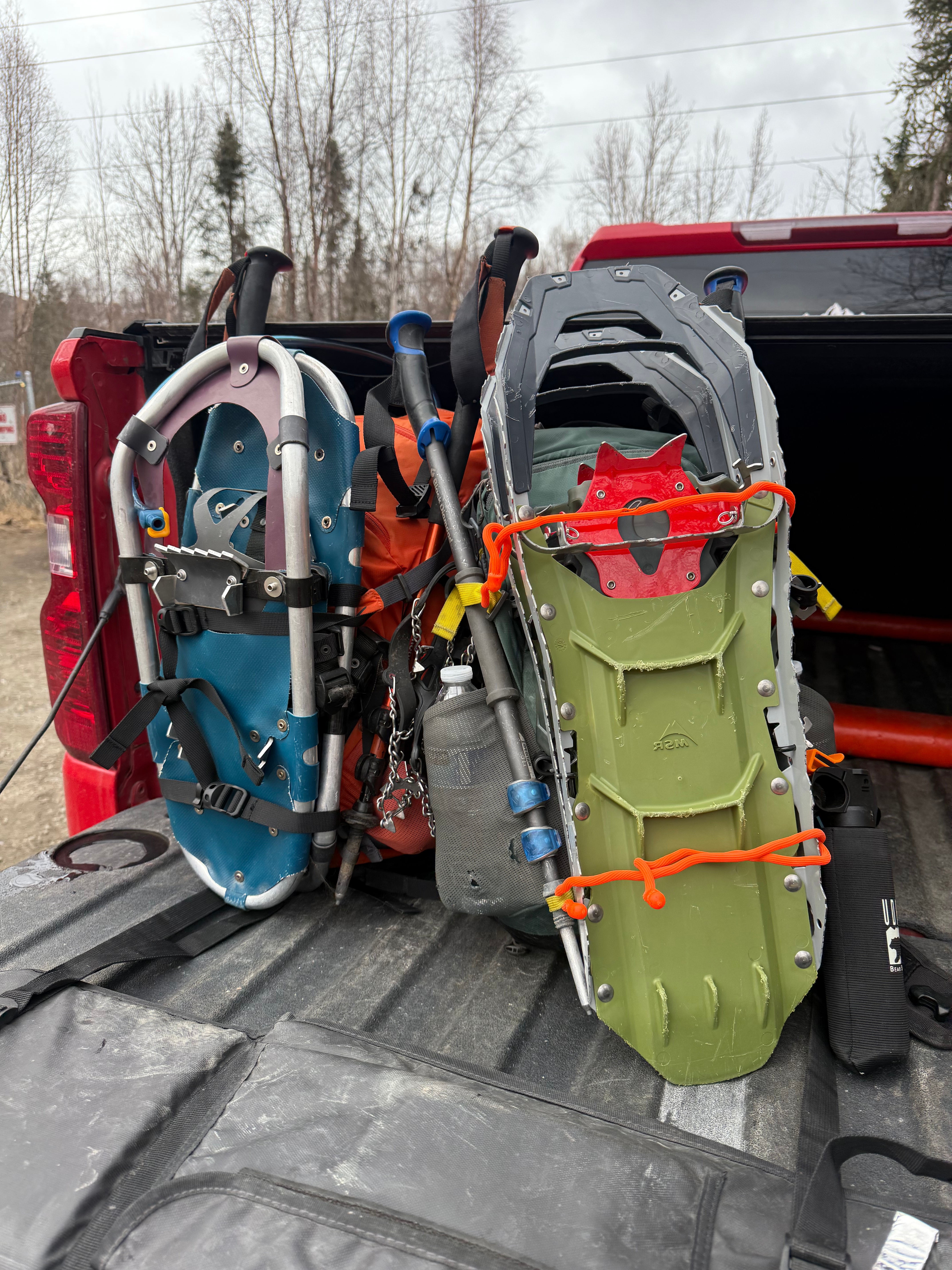
We had been skunked on Nunaka Point and on our backup plan of crossing Snow Hawk Valley exactly two months prior (to the day) due to chest deep snow. That day we hiked up to Snow Hawk Moutain, which, for the second time in a year, became an enjoyable and pleasant backup plan. Nothing was going to stop us this time, and when we had finished shuttling vehicles to the two trailheads, we strapped snowshoes and knee-high gaiters onto our packs and proceeded with a no quit attitude. Today would be the last day that I would obsessively bring up Ship Creek Hill and my intense desire to stand on its summit for the first time.
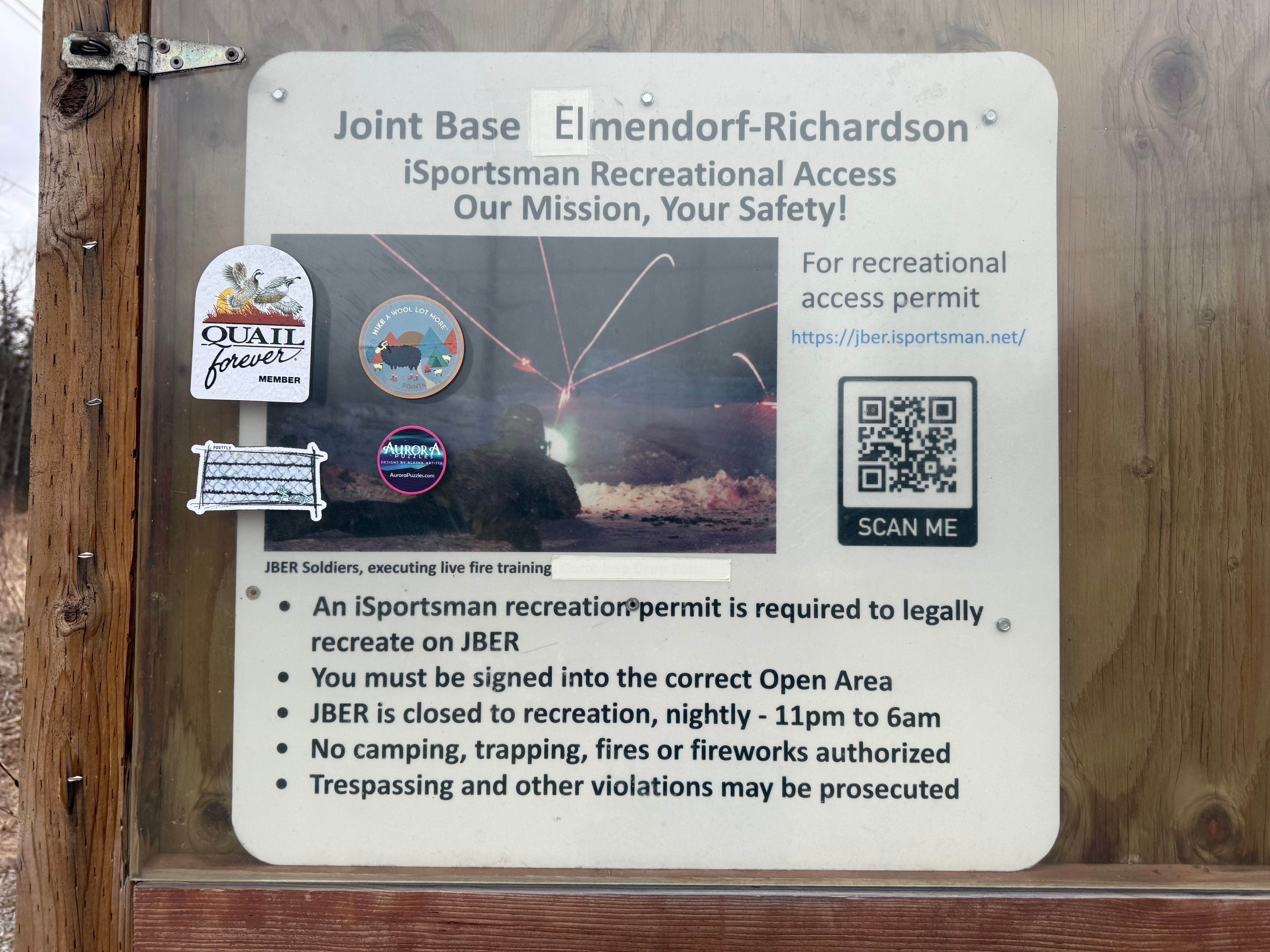
*I made sure we were checked into the correct open areas on JBERs RecAccess website (previously iSportsman). * The entirety of this hike is on military land and may be closed some or all days of the week for artillery or jump training. Not following this protocol or respecting the closures may result in severe injury, death, revocation of use privilege and/or prosecution for trespassing. There is no use allowed overnight (11pm-6am) so be sure to plan accordingly.
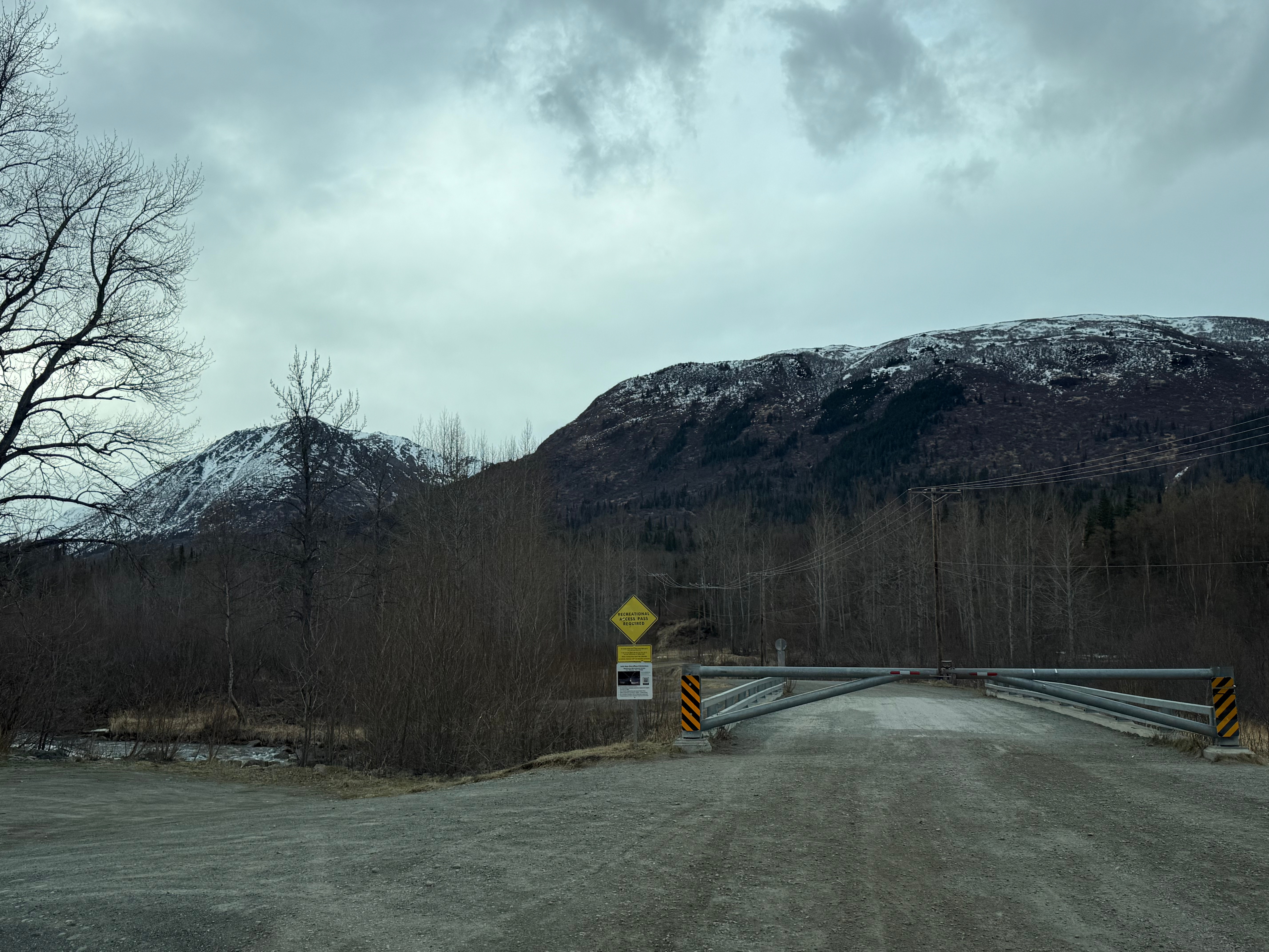
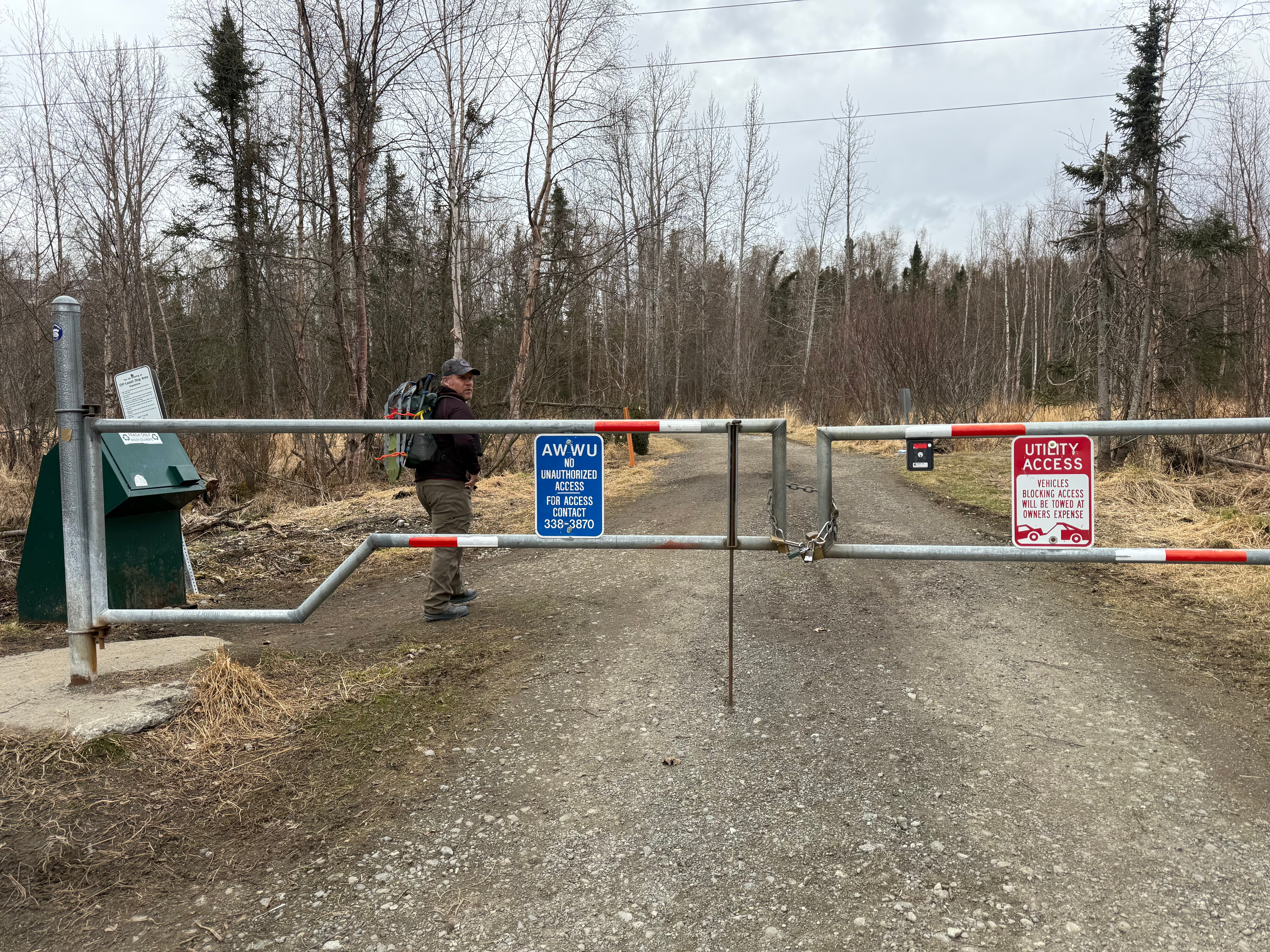
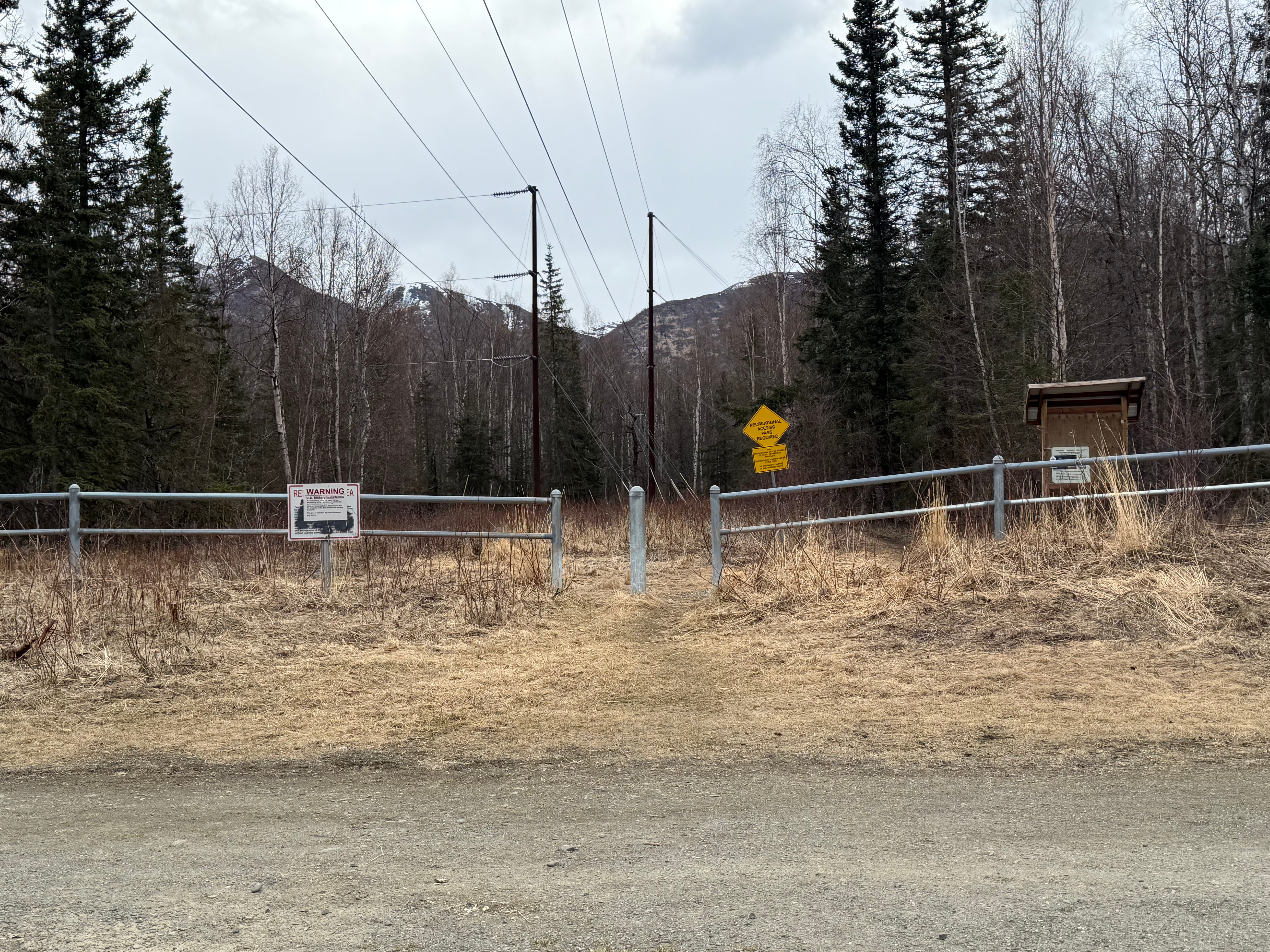
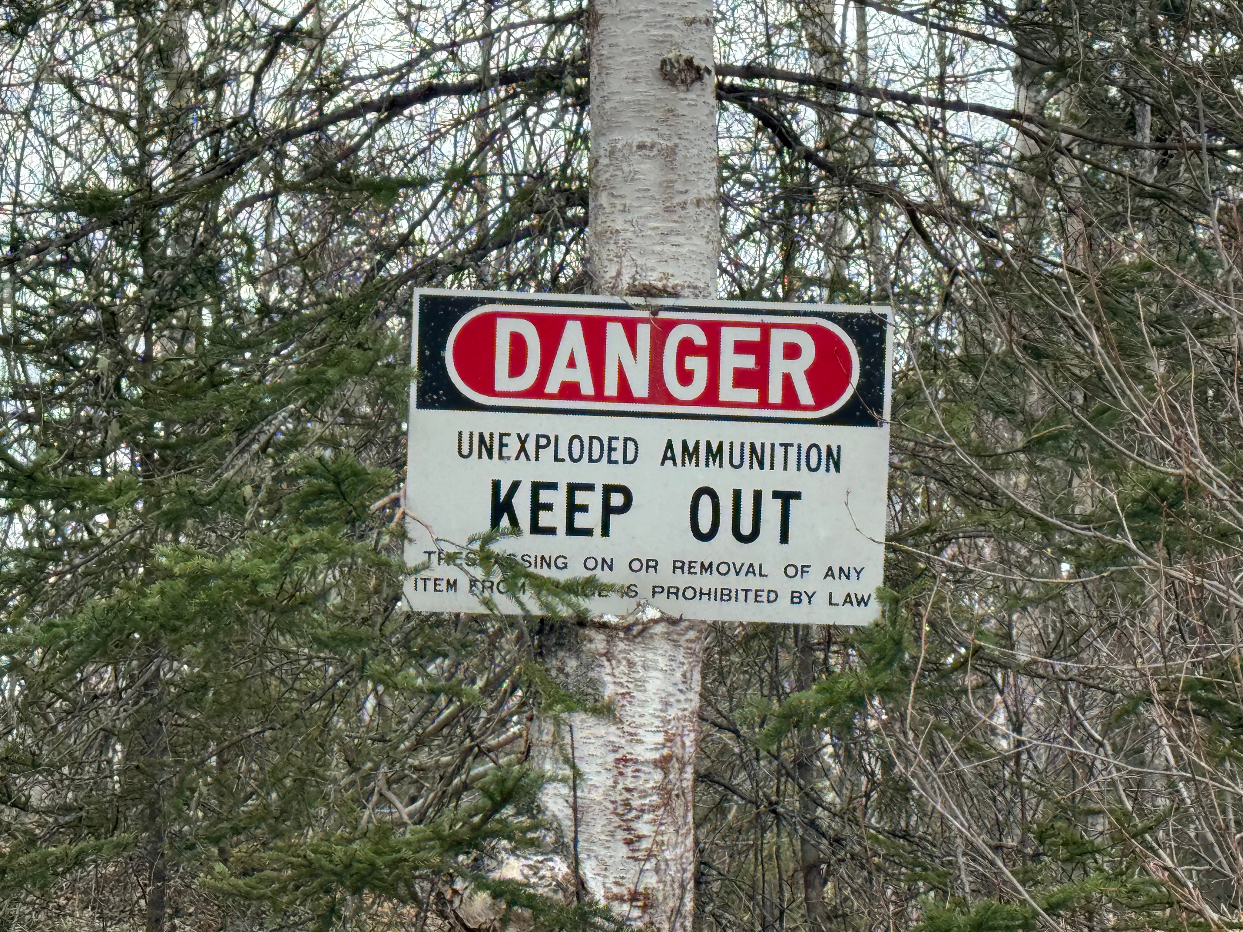
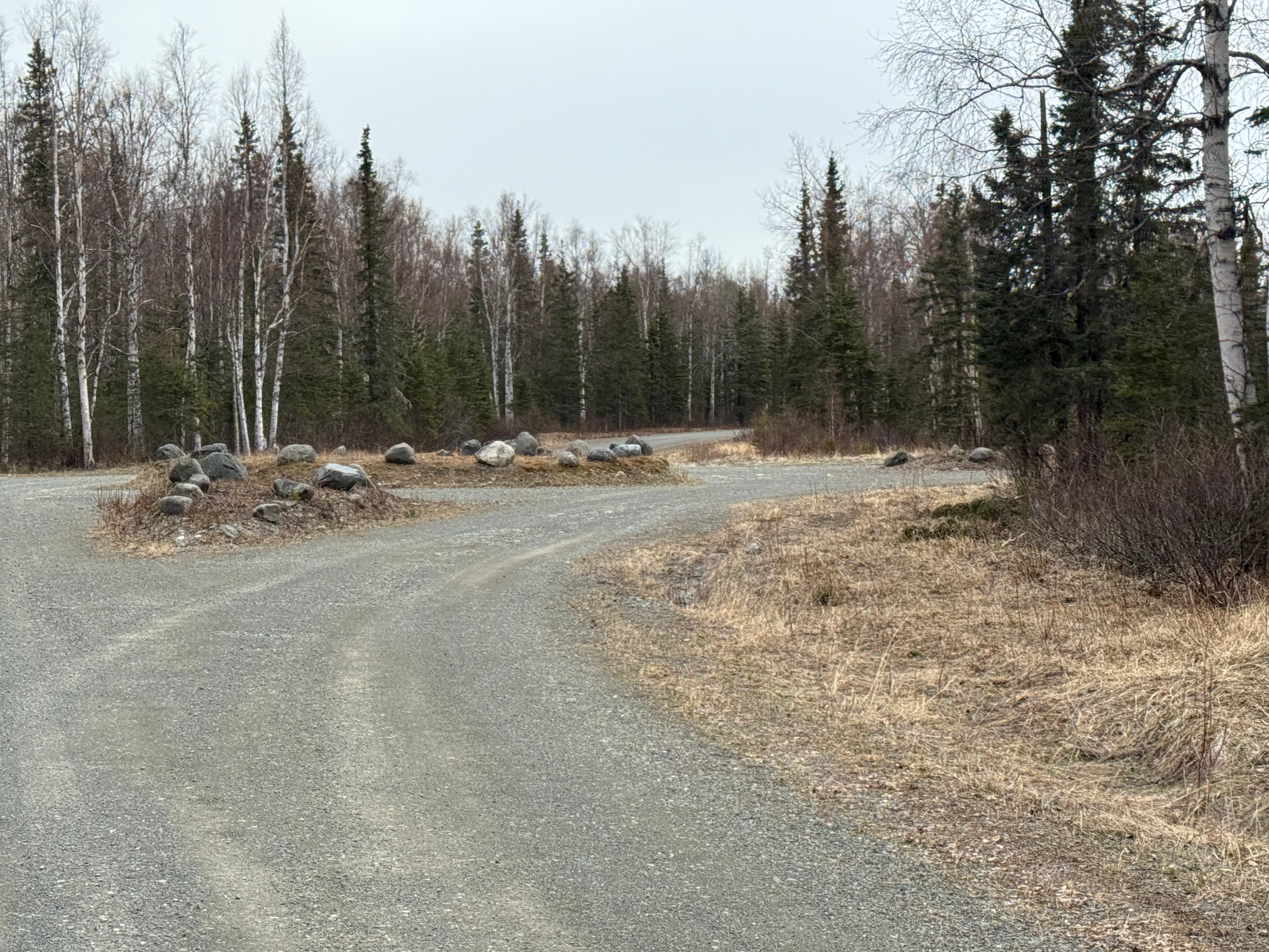
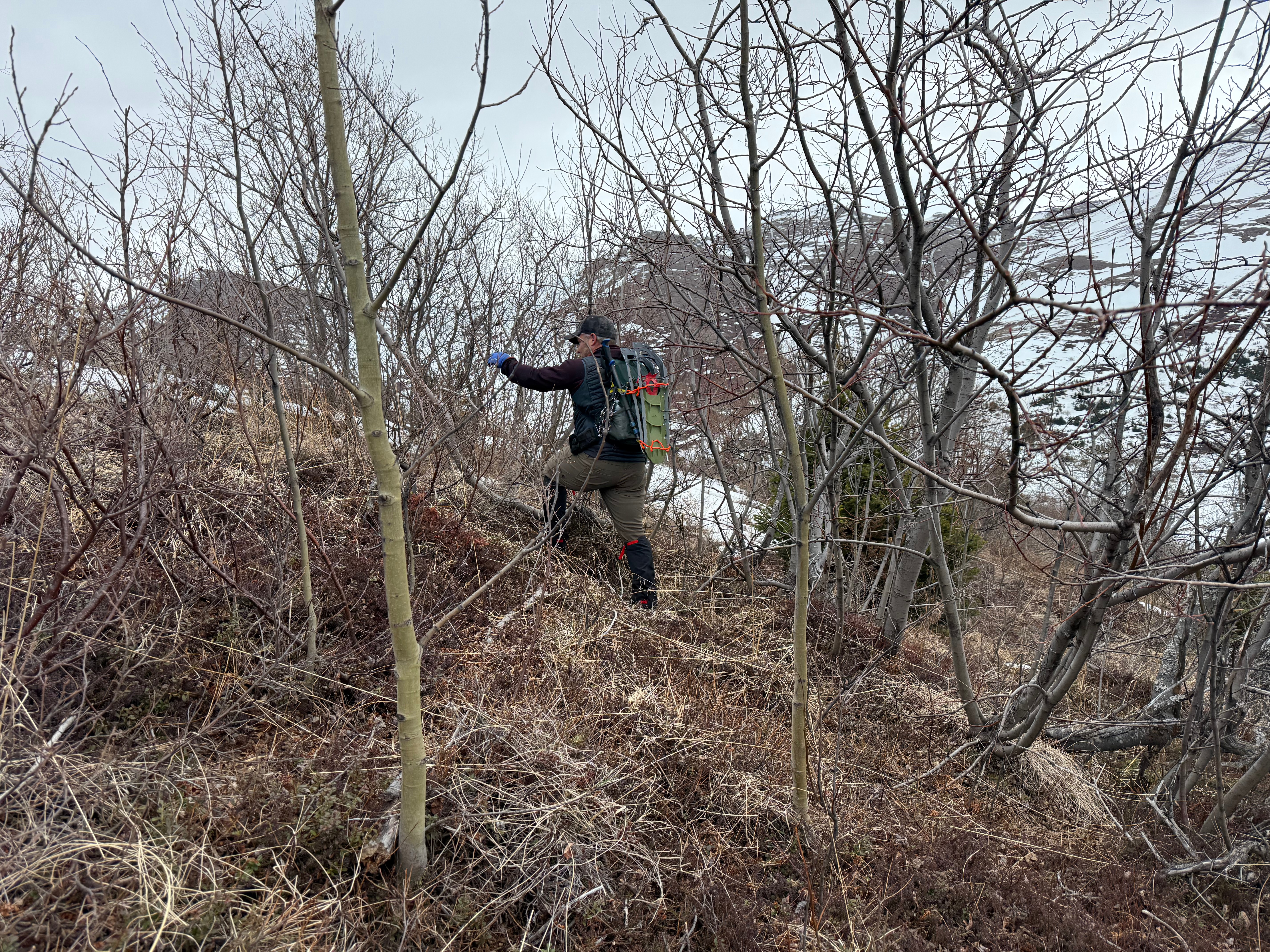
The Klutina Road trailhead is in a quiet neighborhood and no more than 2 vehicles fit in the designated parking zone. Please be respectful of neighbors and do not block the gate. We followed a narrow path for a little more than a quarter mile out to the Bulldog Trail where we turned left and followed it for about a mile and half. The Bulldog “Trail” is actually a wide road used by the military for access and training. Signs warning of unexploded ordinance warn of the danger of traveling off trail on military land.
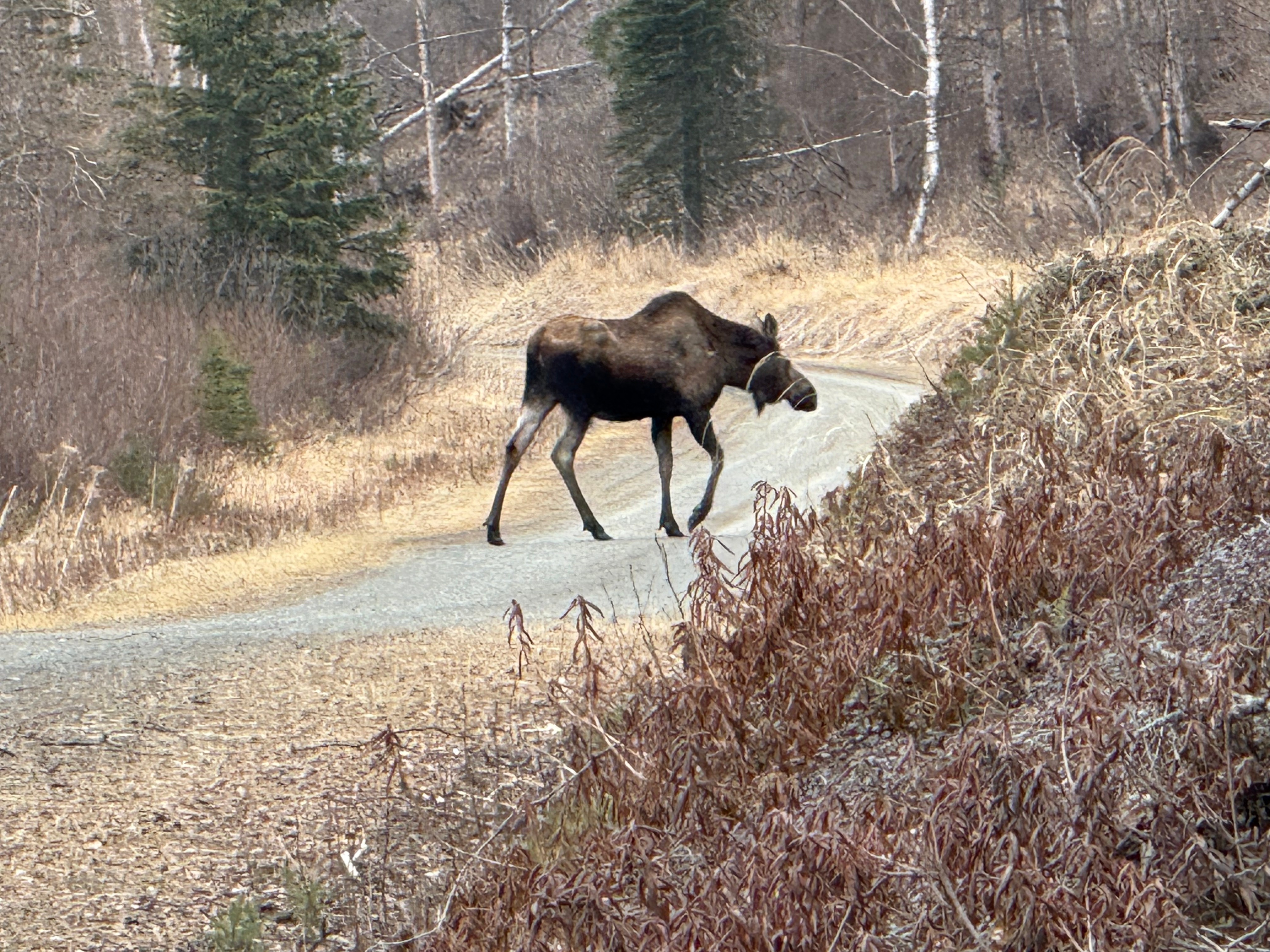
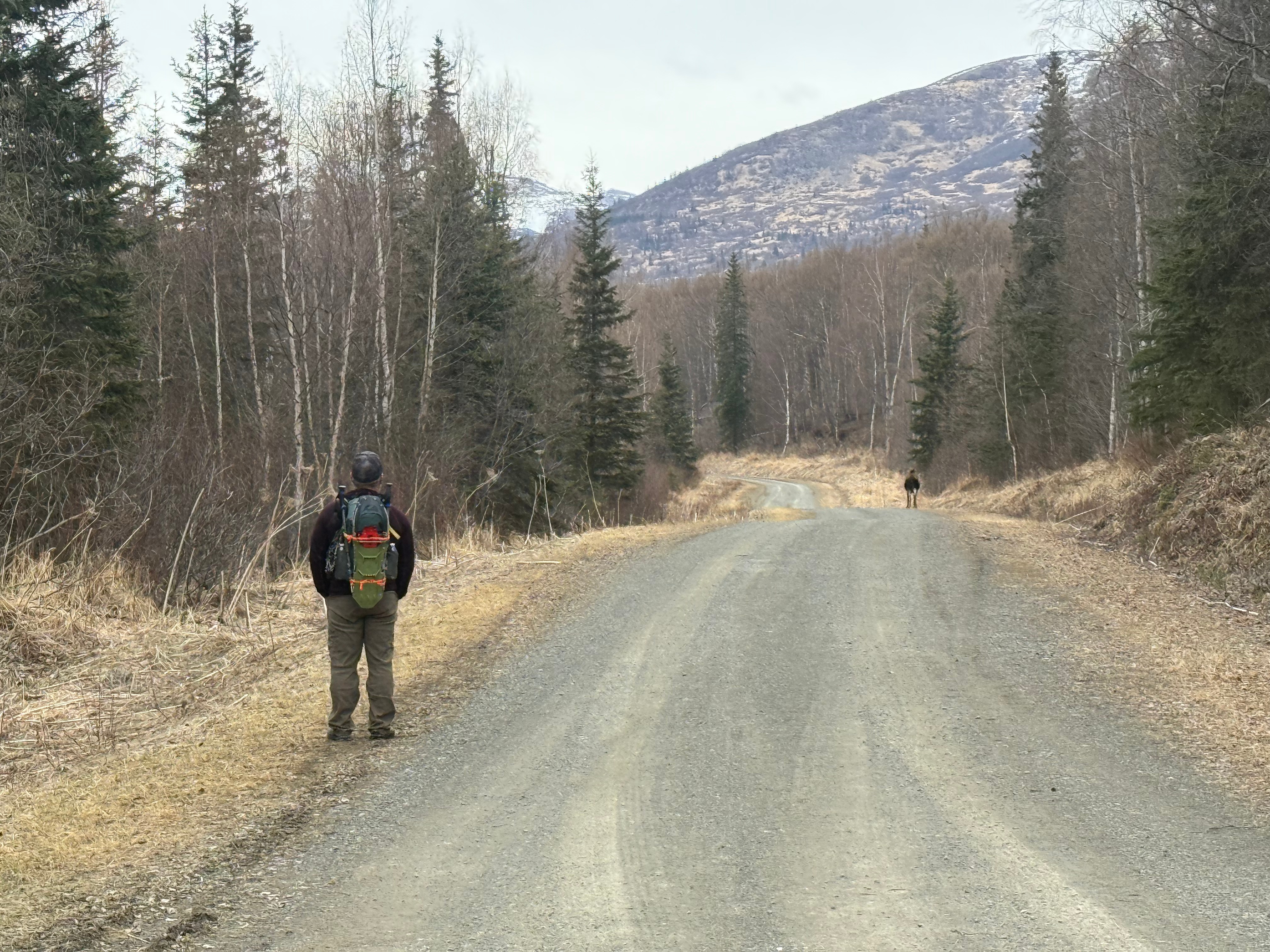
As luck would have it, we had to leave the road to avoid a not yet angry, but very large female moose. She didn’t chase us down and we weren’t blown up, so we took that as a good omen for the day.
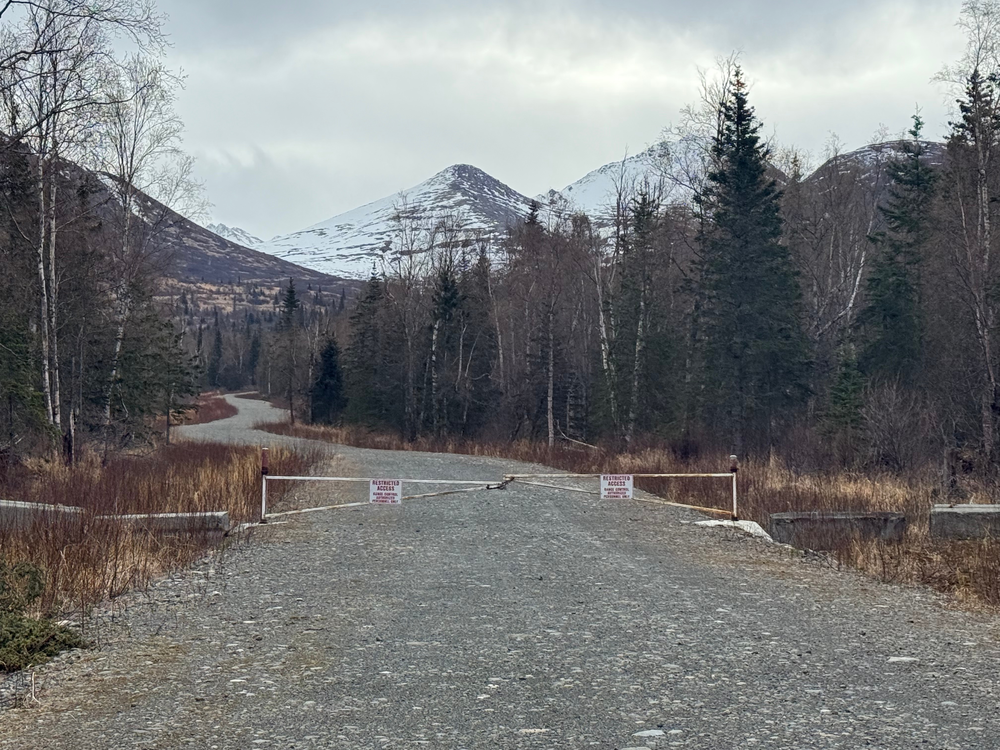
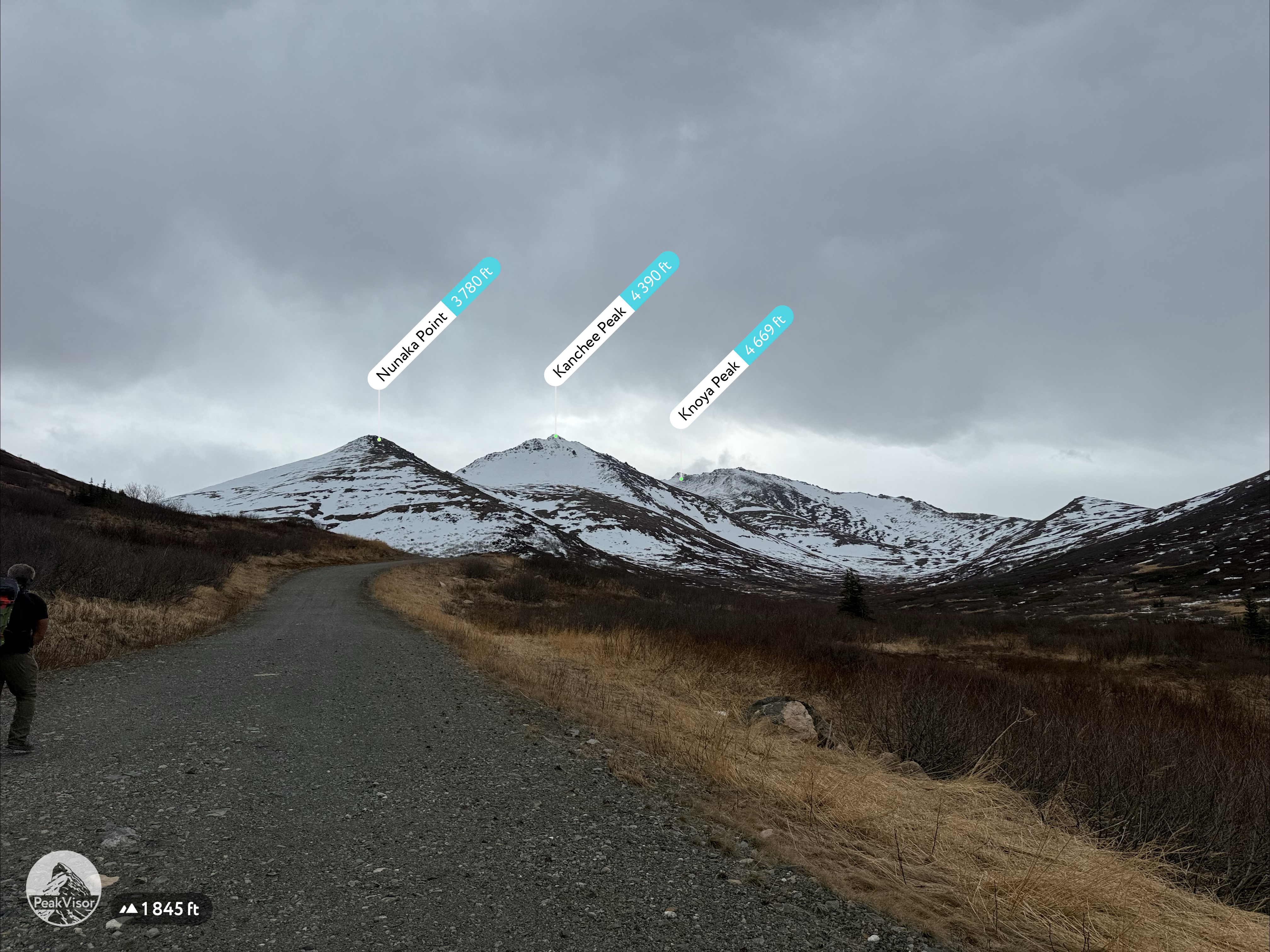
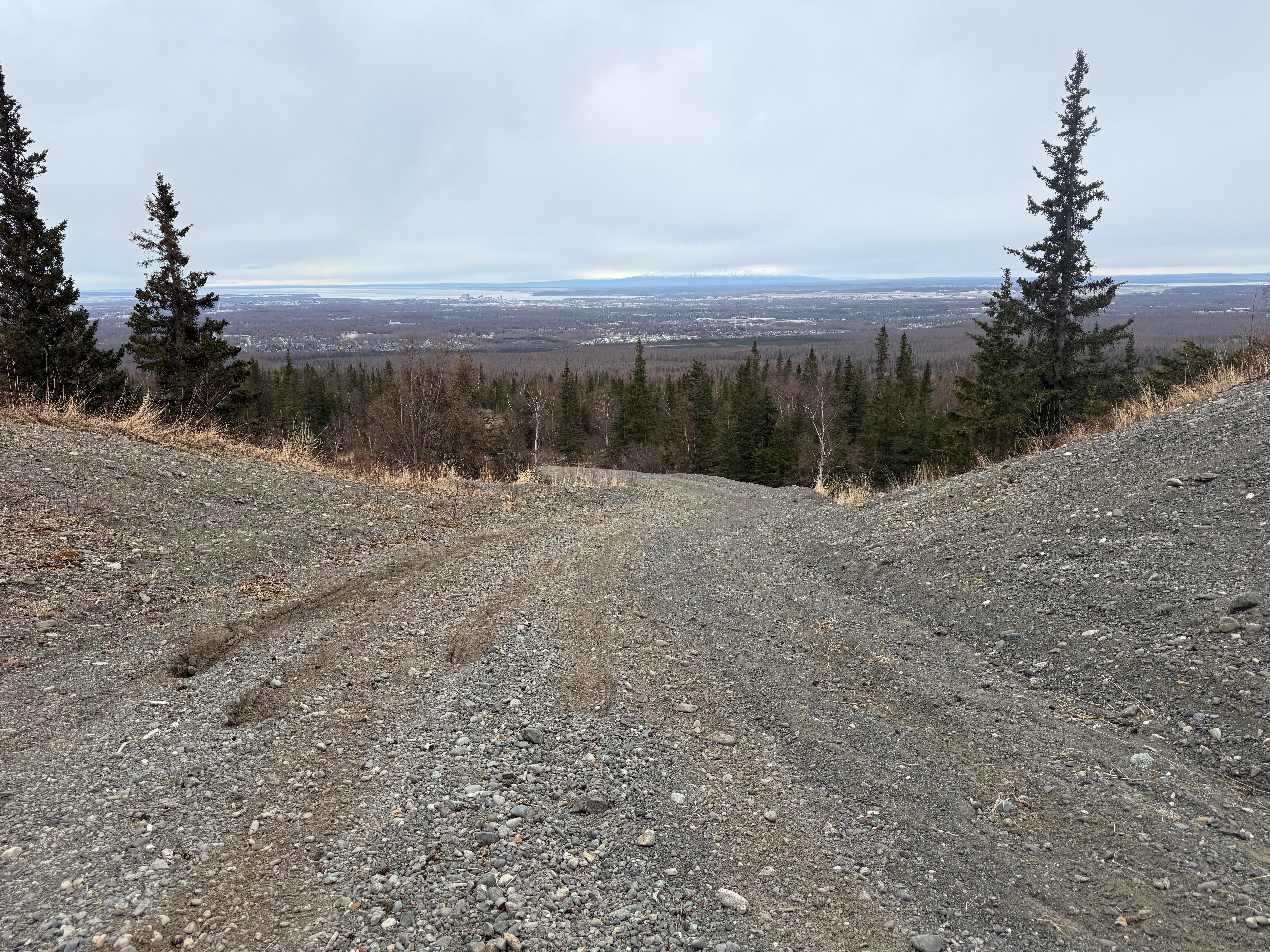
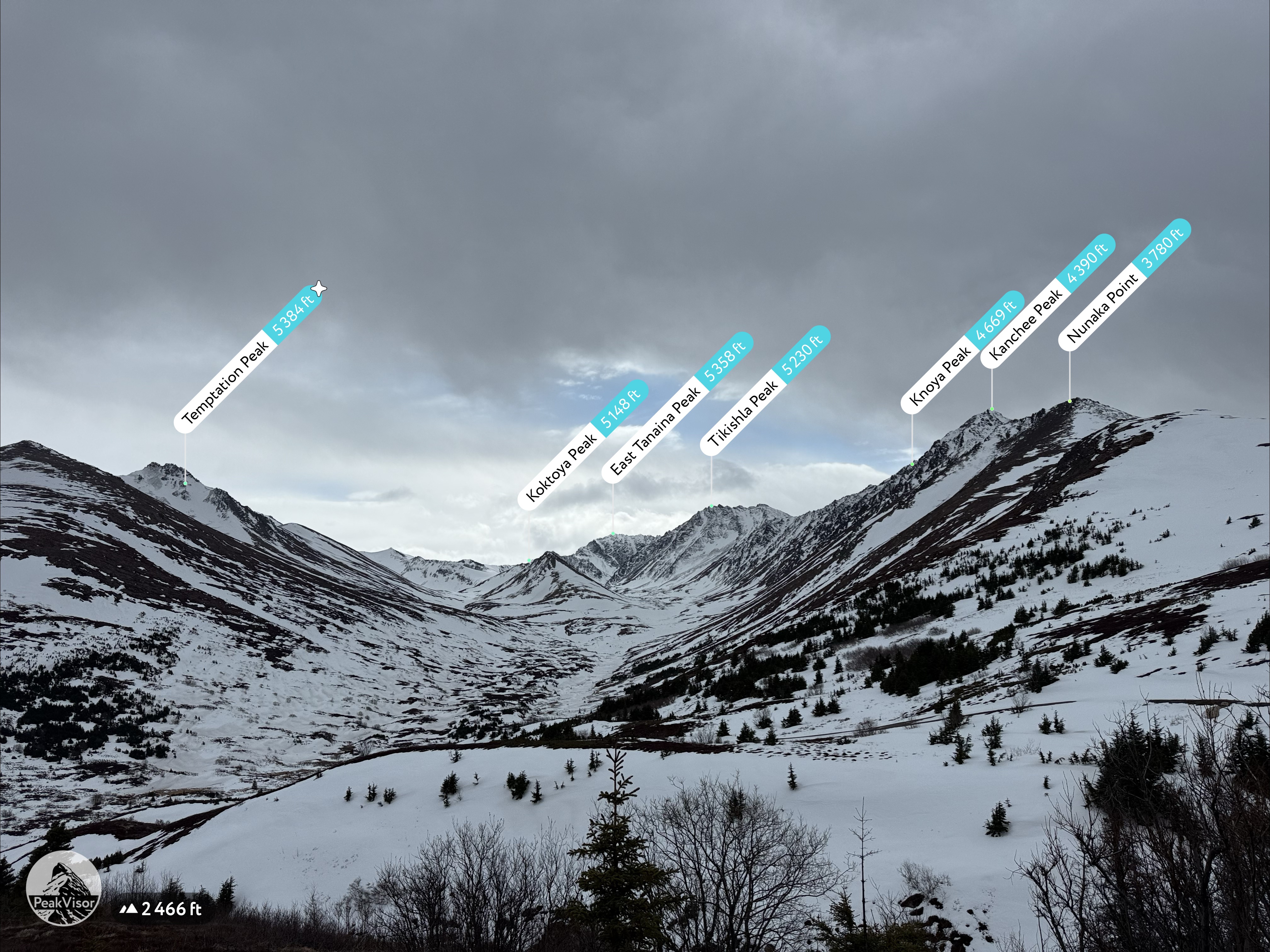
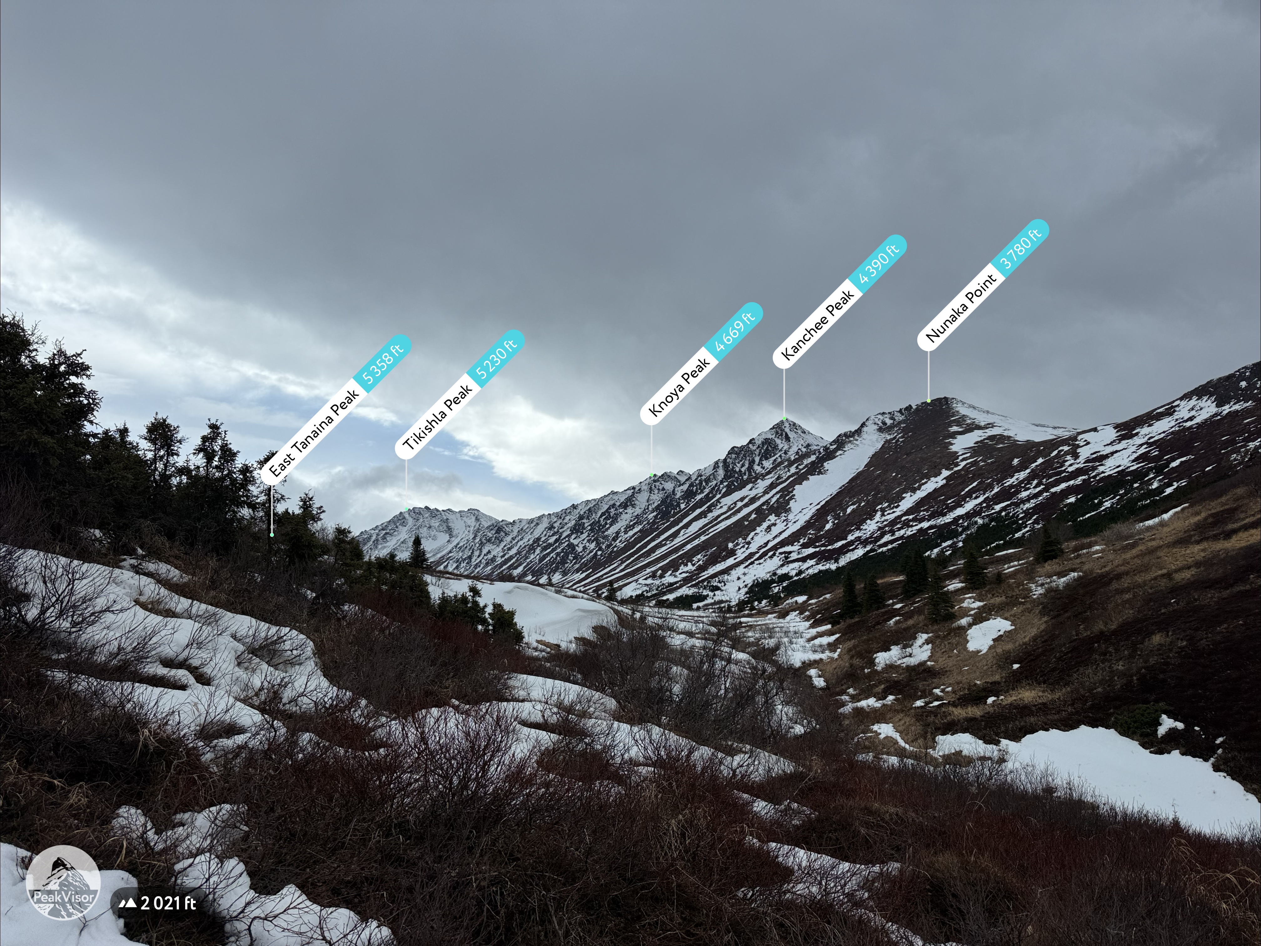
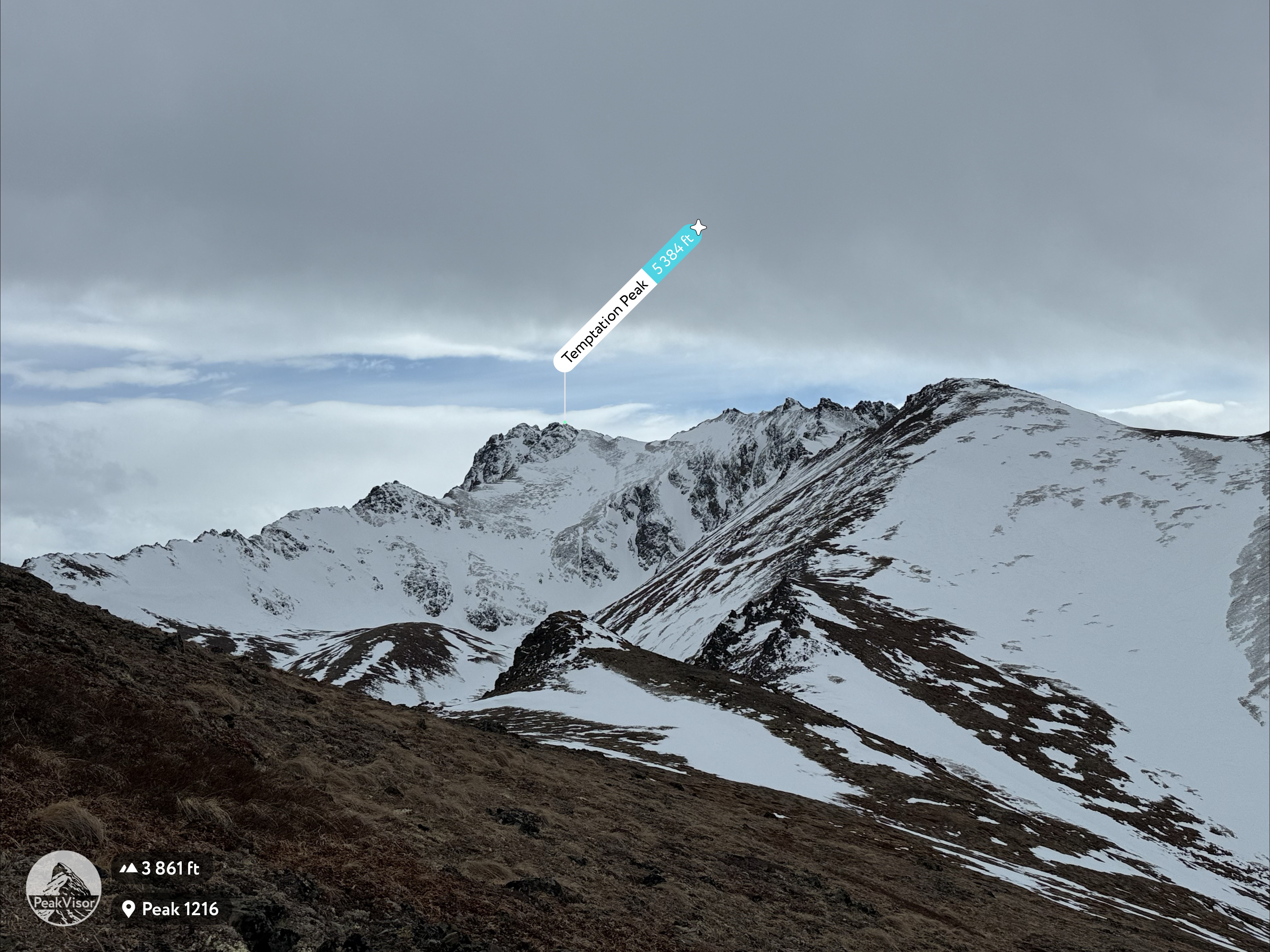
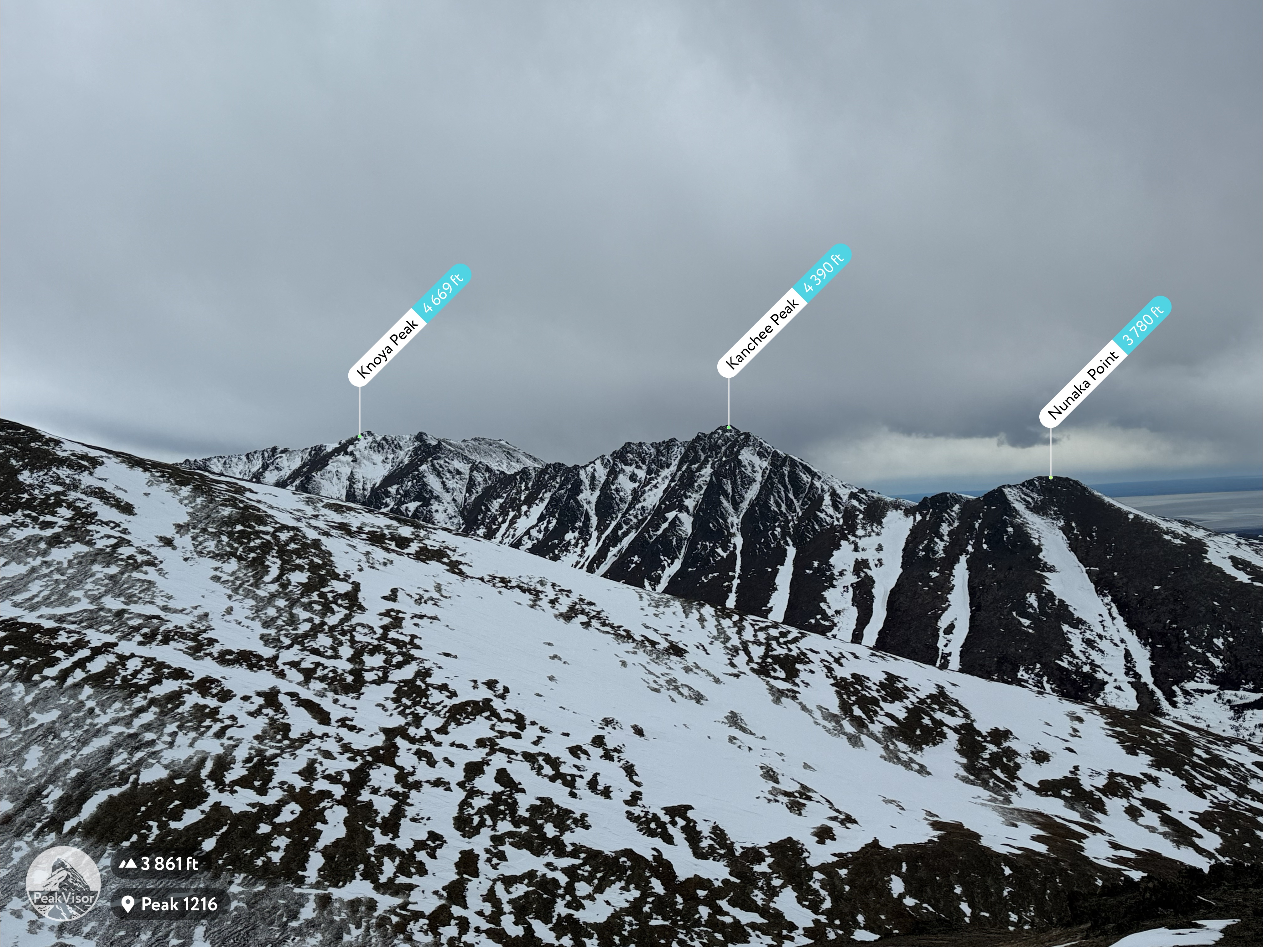
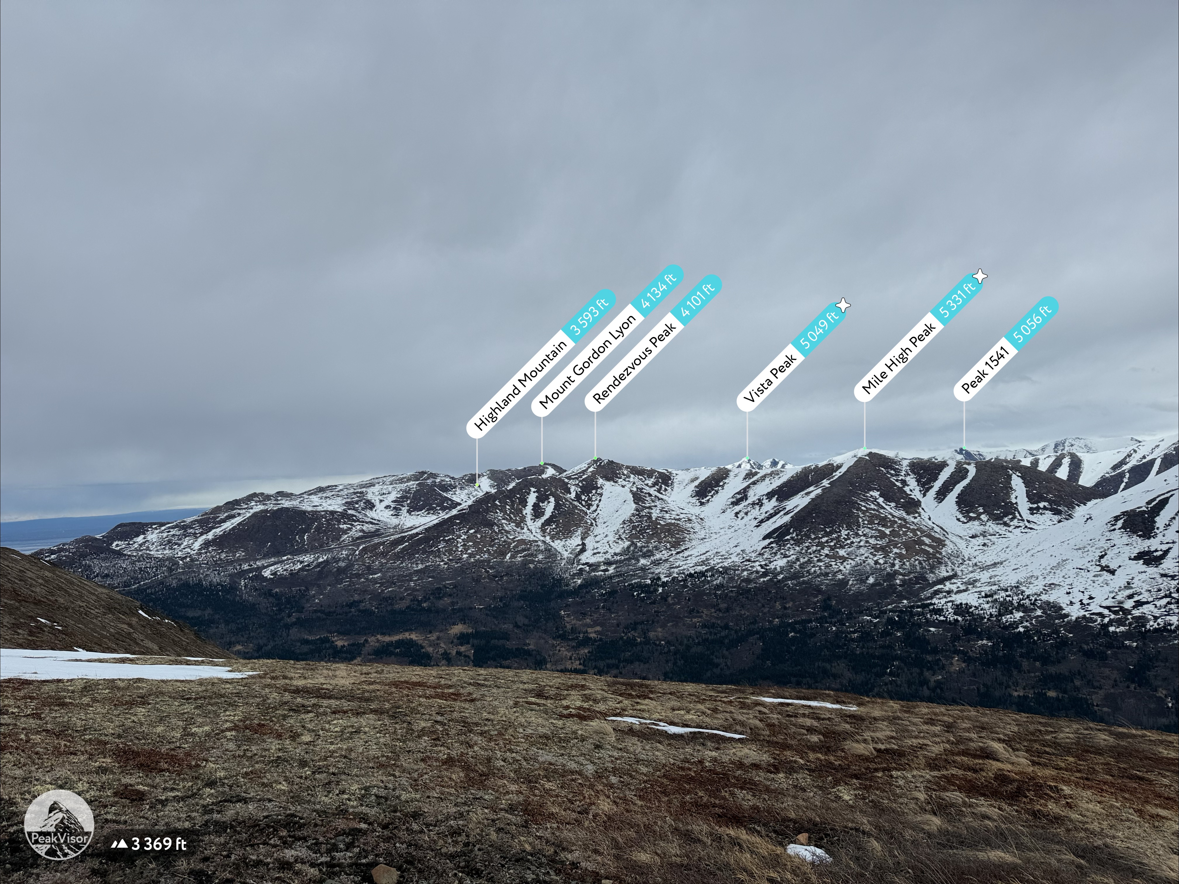
We came to the rudimentary roundabout and turned right, up the steep and winding Snow Hawk Road, which can be seen hugging the south side of Snow Hawk Mountain from the lowlands of the city of Anchorage. This road suddenly appeared on the mountainside back in 2020 and the access was restricted for years due to building and maintenance, but now, is a great alternative to climbing over The Dome to access the valley surrounded by Snow Hawk, Nunaka Point, Kanchee, Knoya and The Dome.
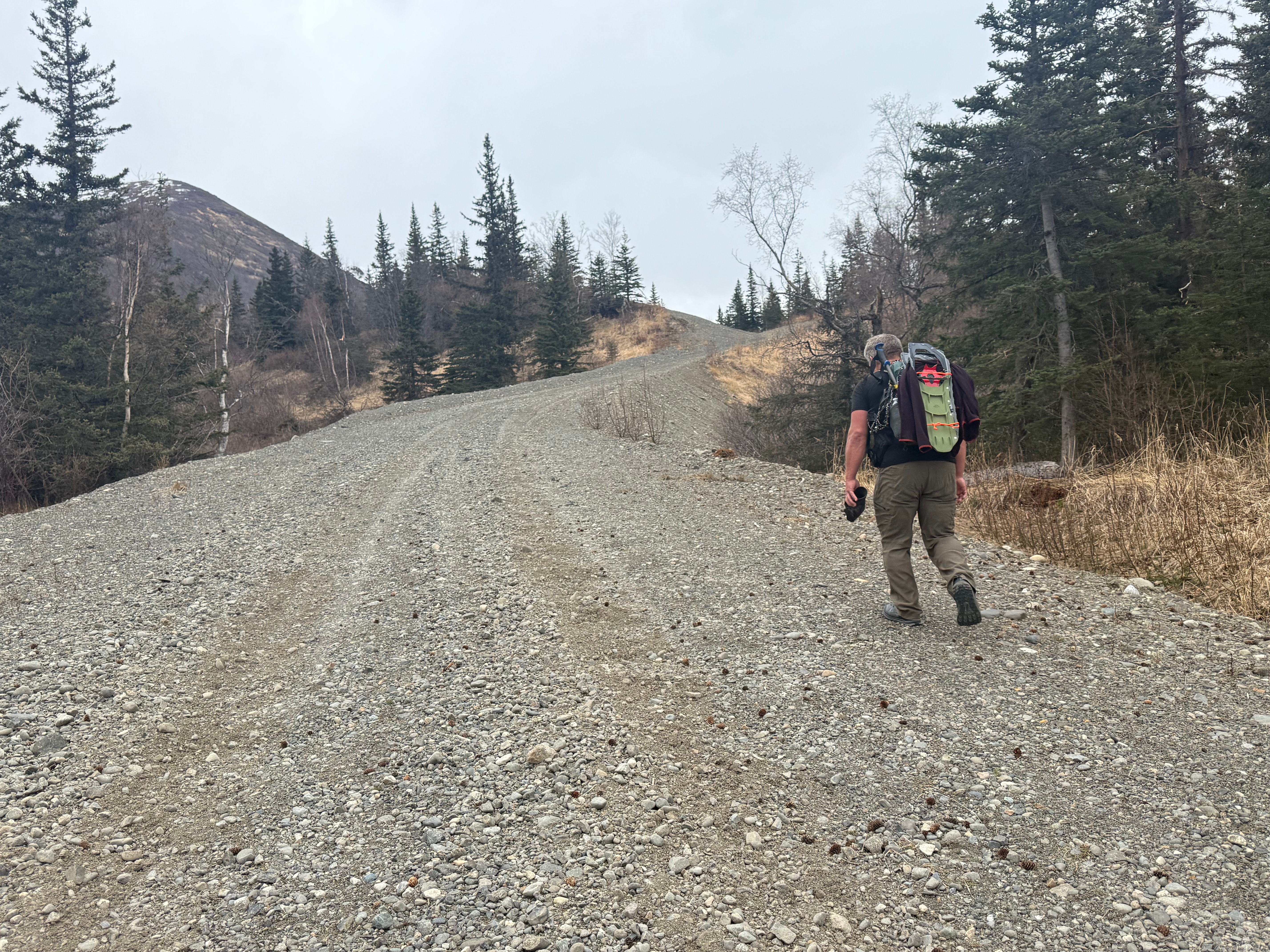
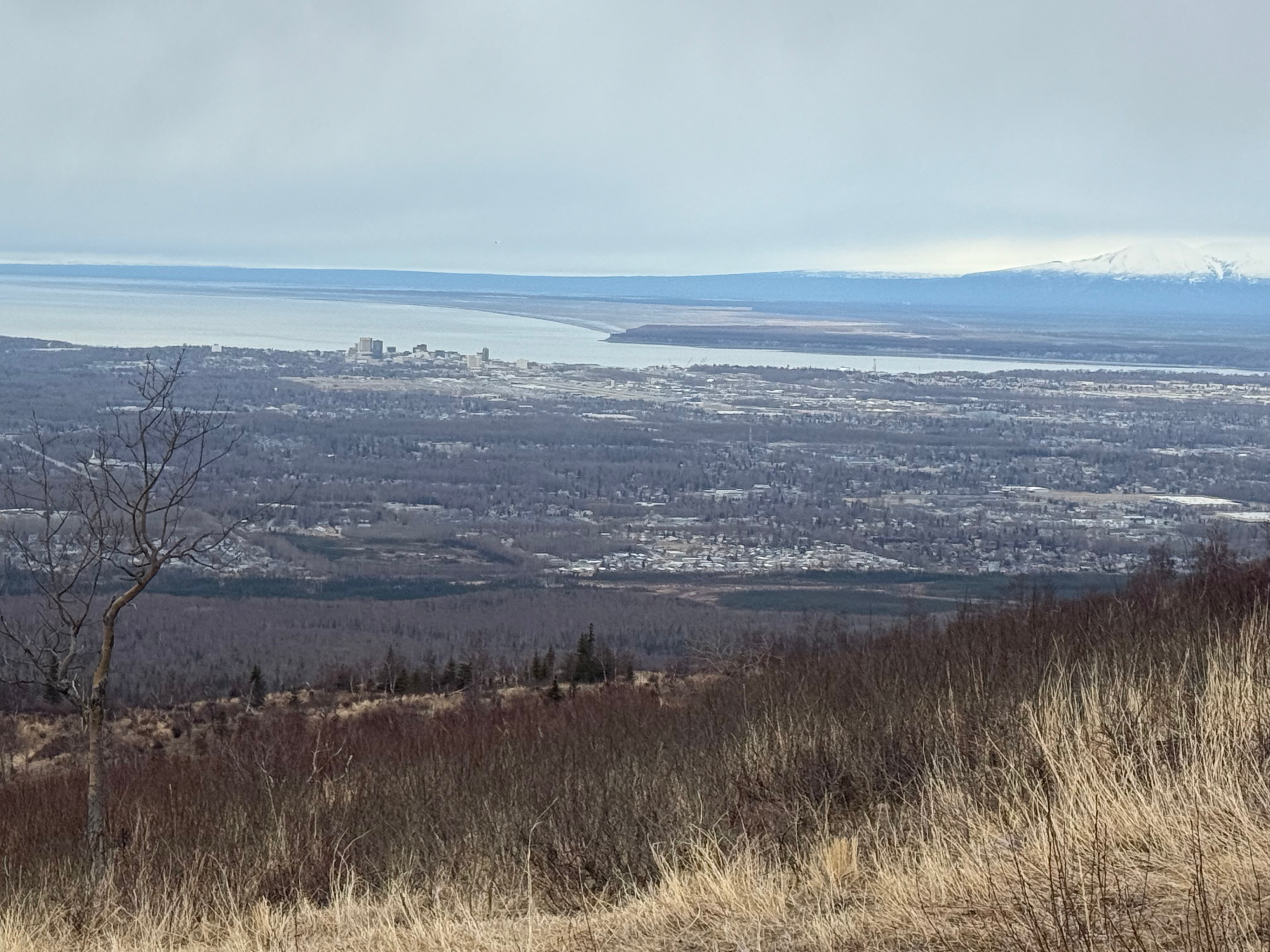
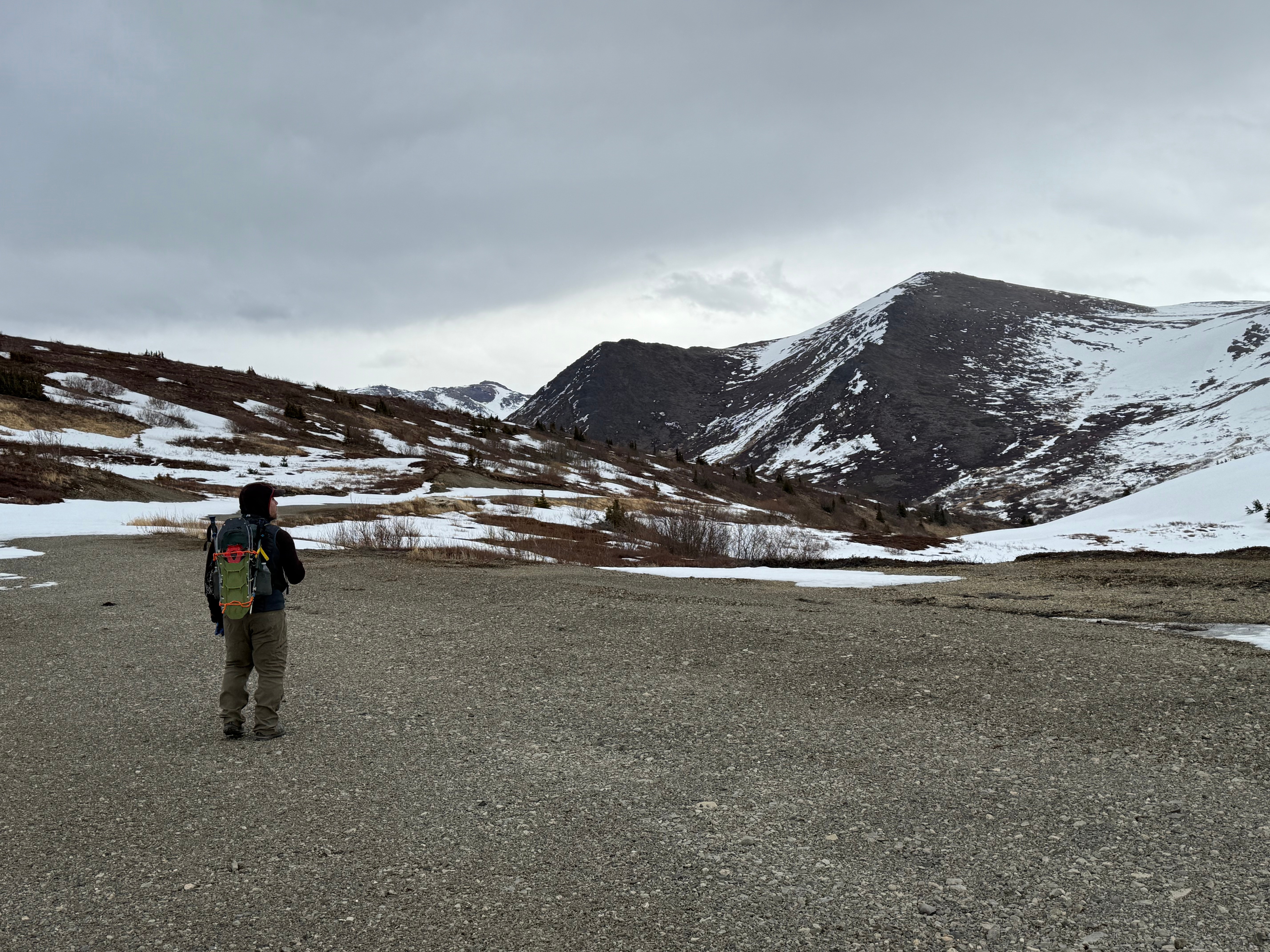
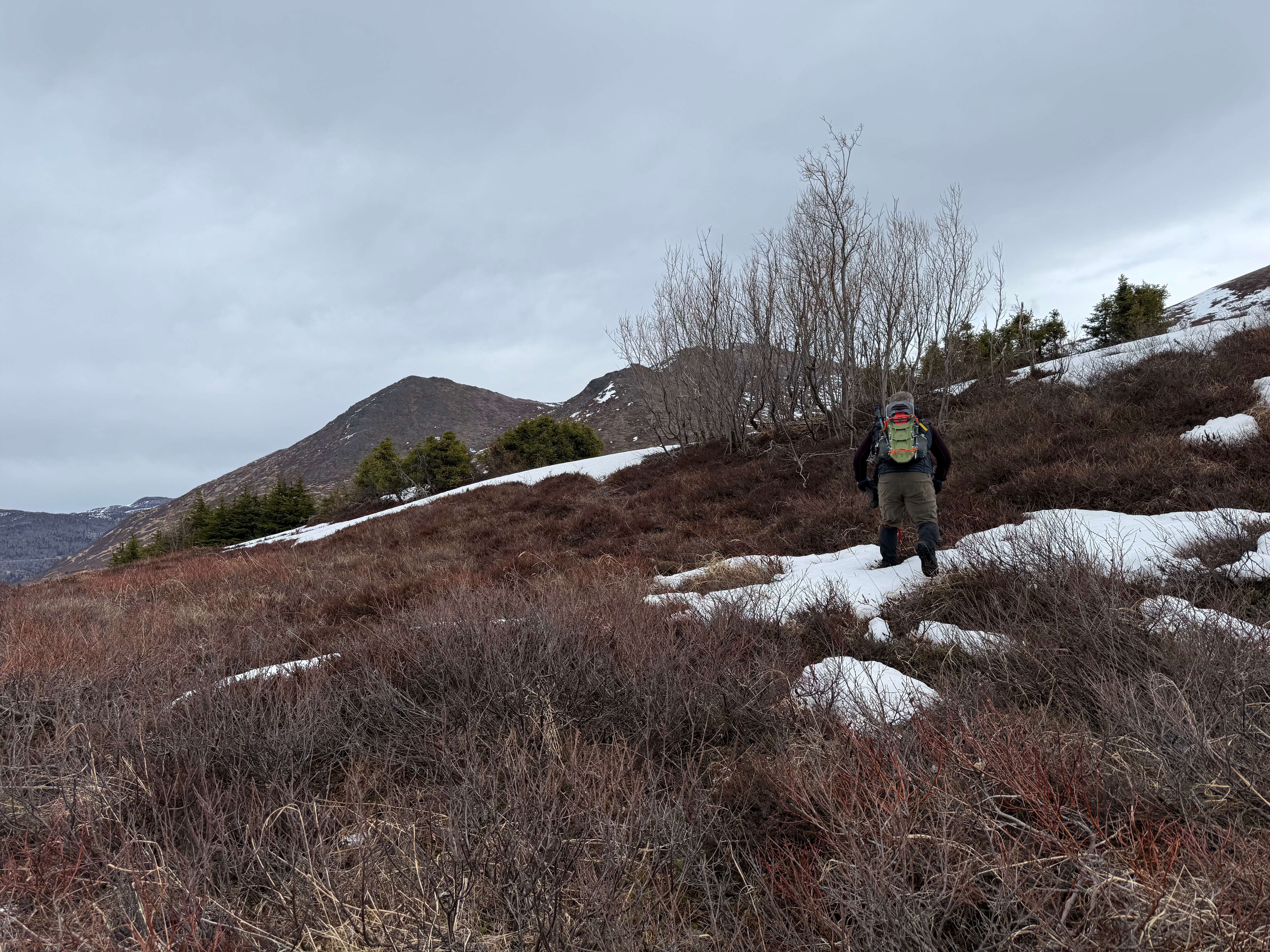
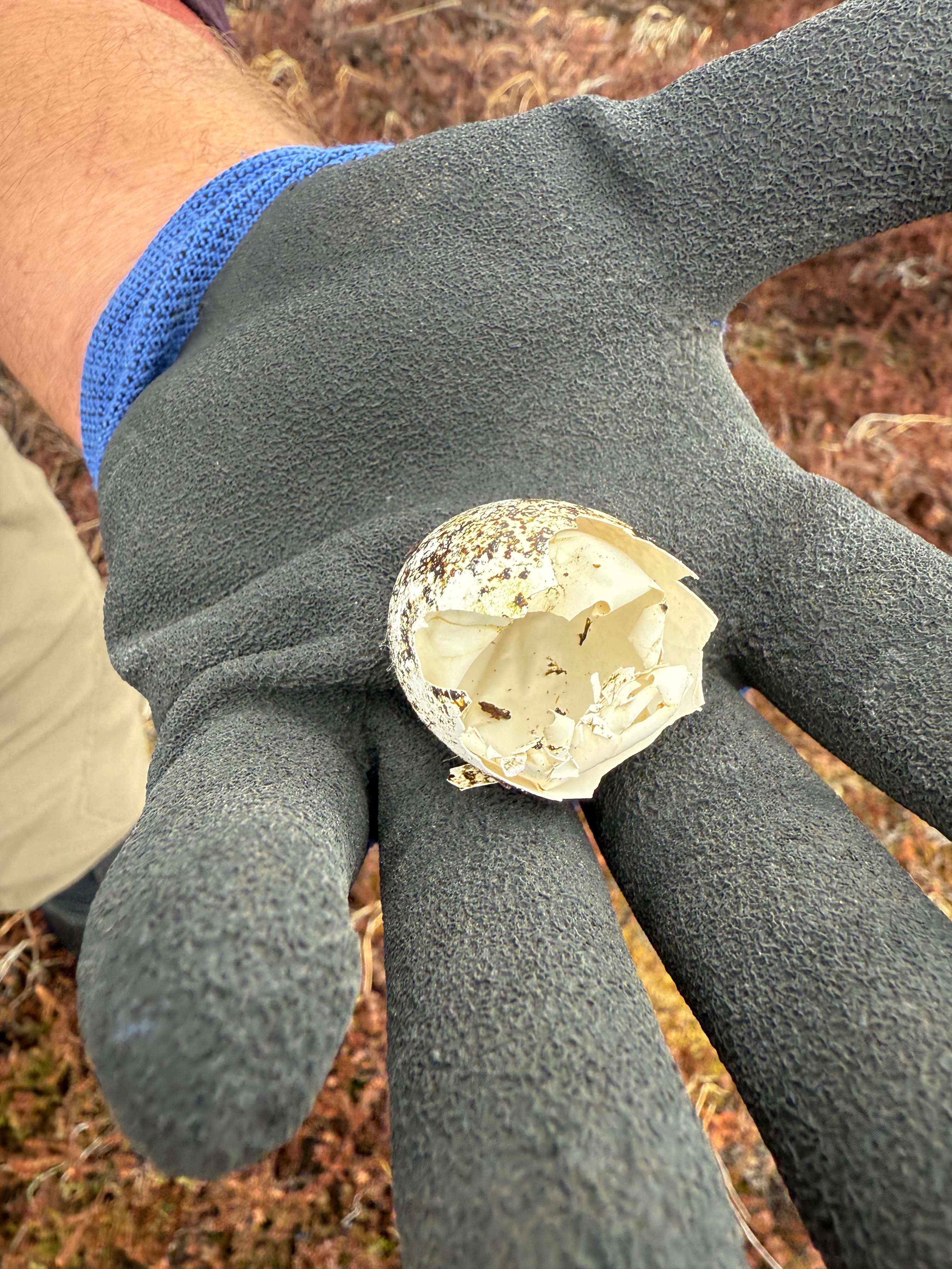
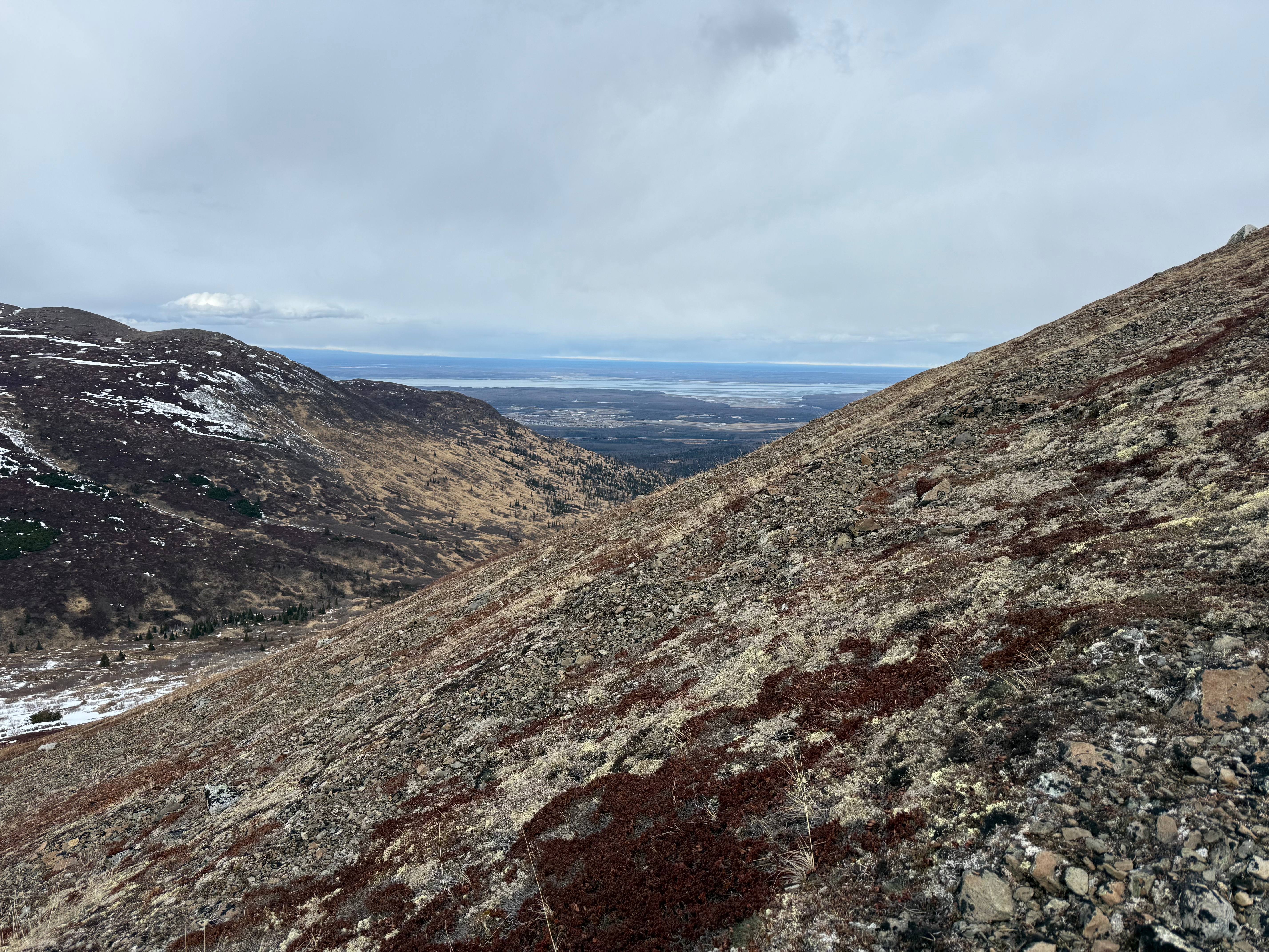
We trudged up the gravel road for a little more than 4 miles, ascending about 2300′ in the process. The tall buildings of downtown Anchorage were now only suitable for ants, and the small planes and helicopters (always helicopters… everywhere we go) were flying well below us. As it started to lightly snain, dozens of camouflaged ptarmigans made their gutteral, clucking courtship calls, sometimes visible as they flew toward a potential mate.
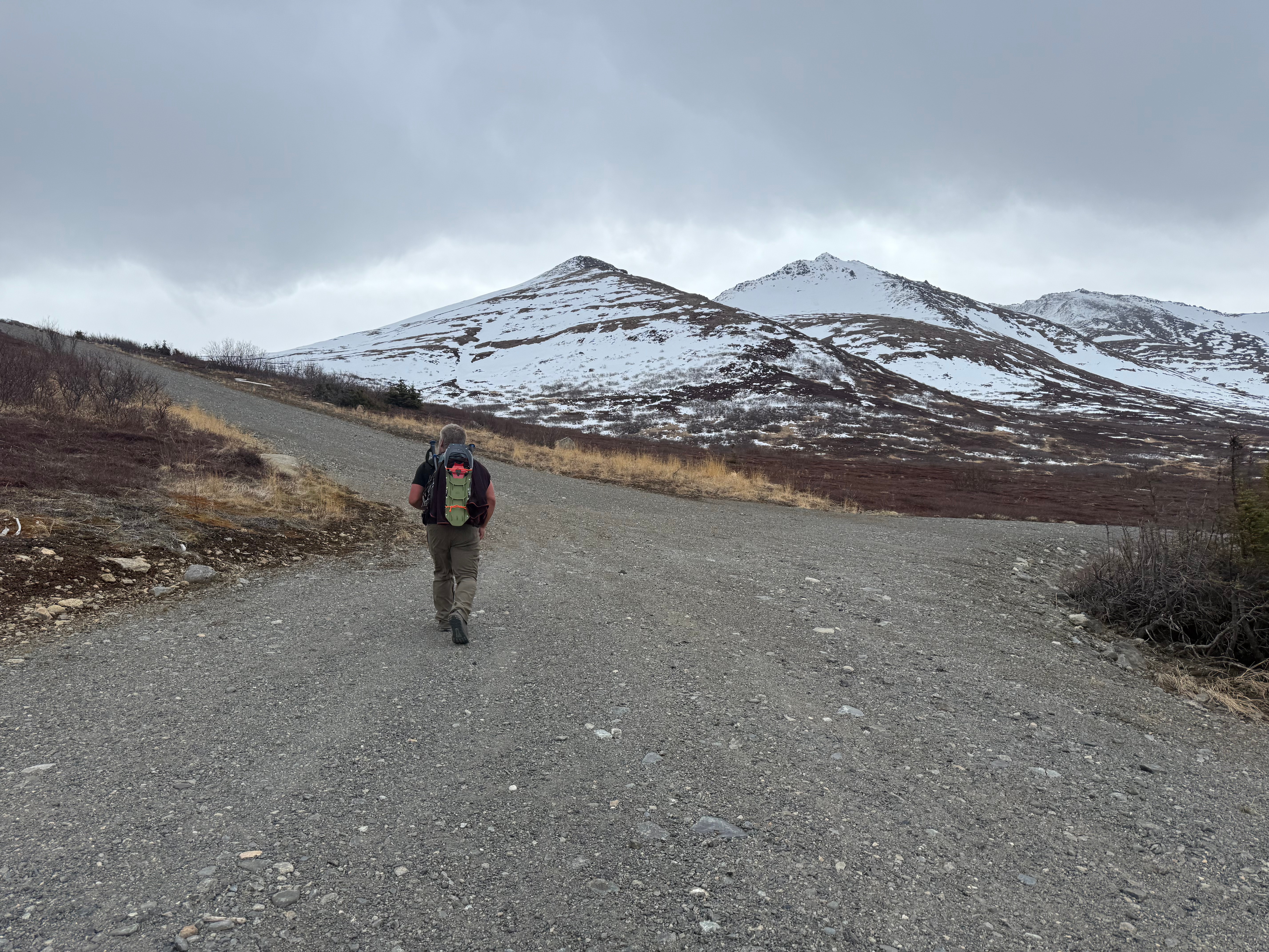

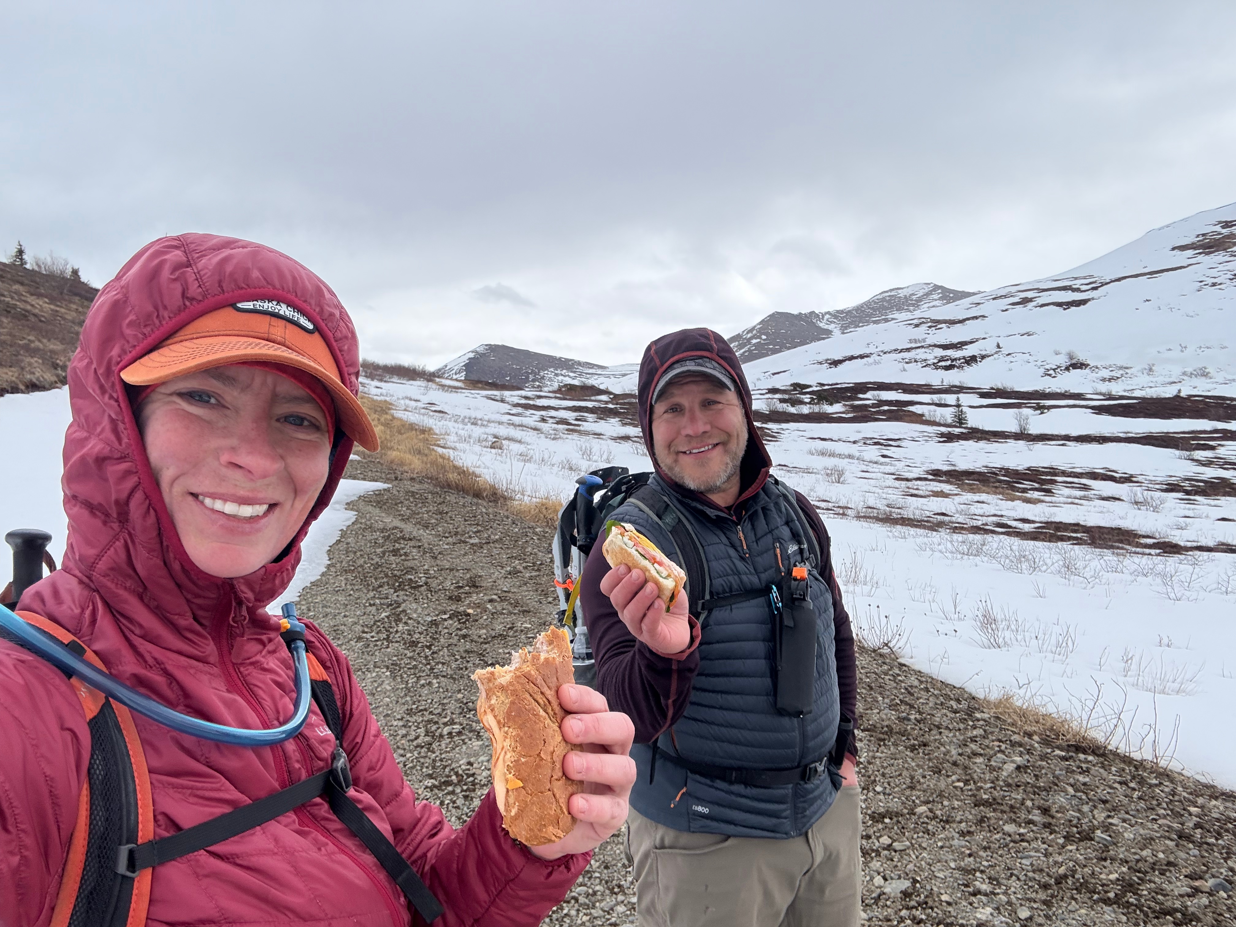
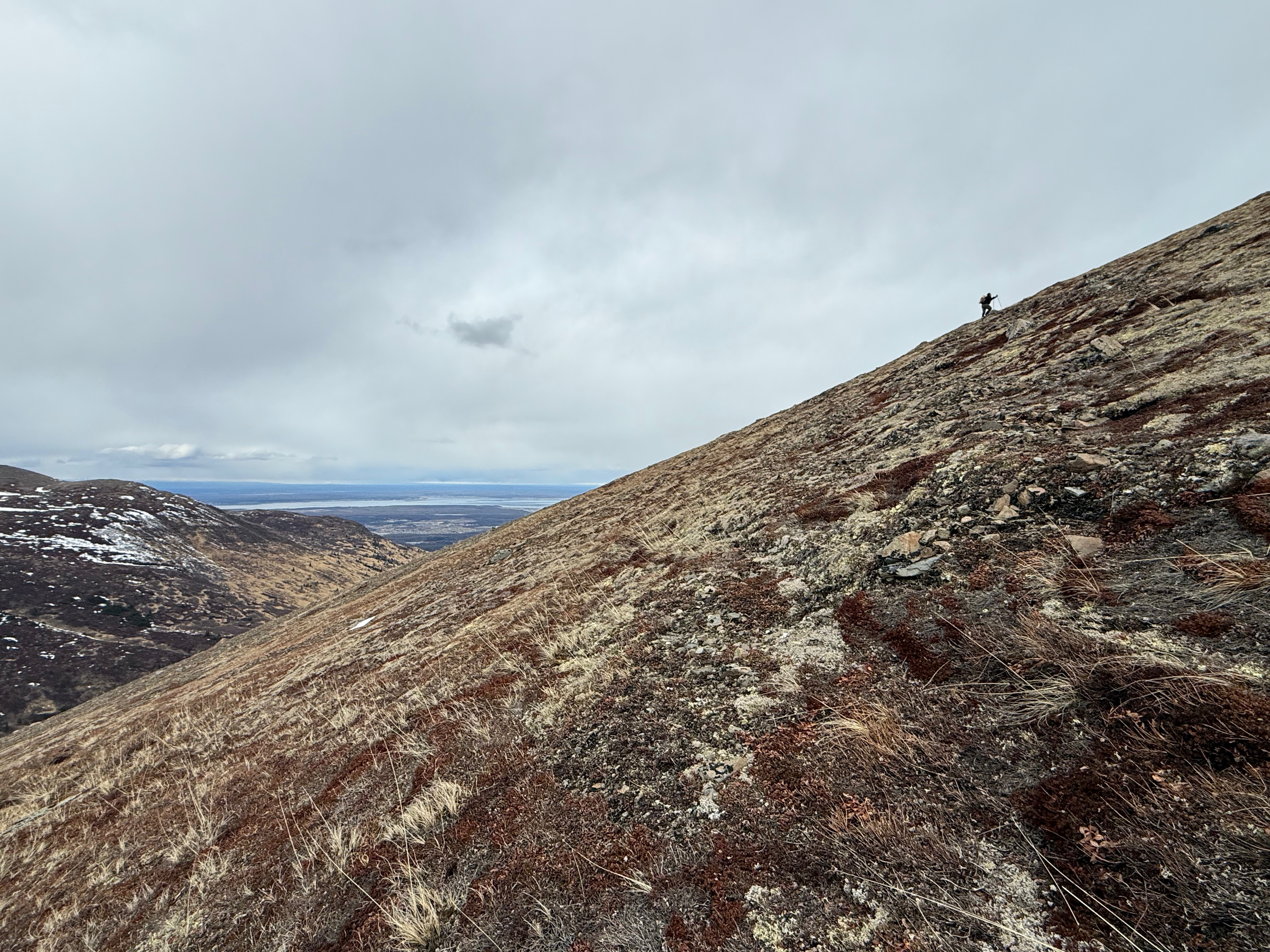
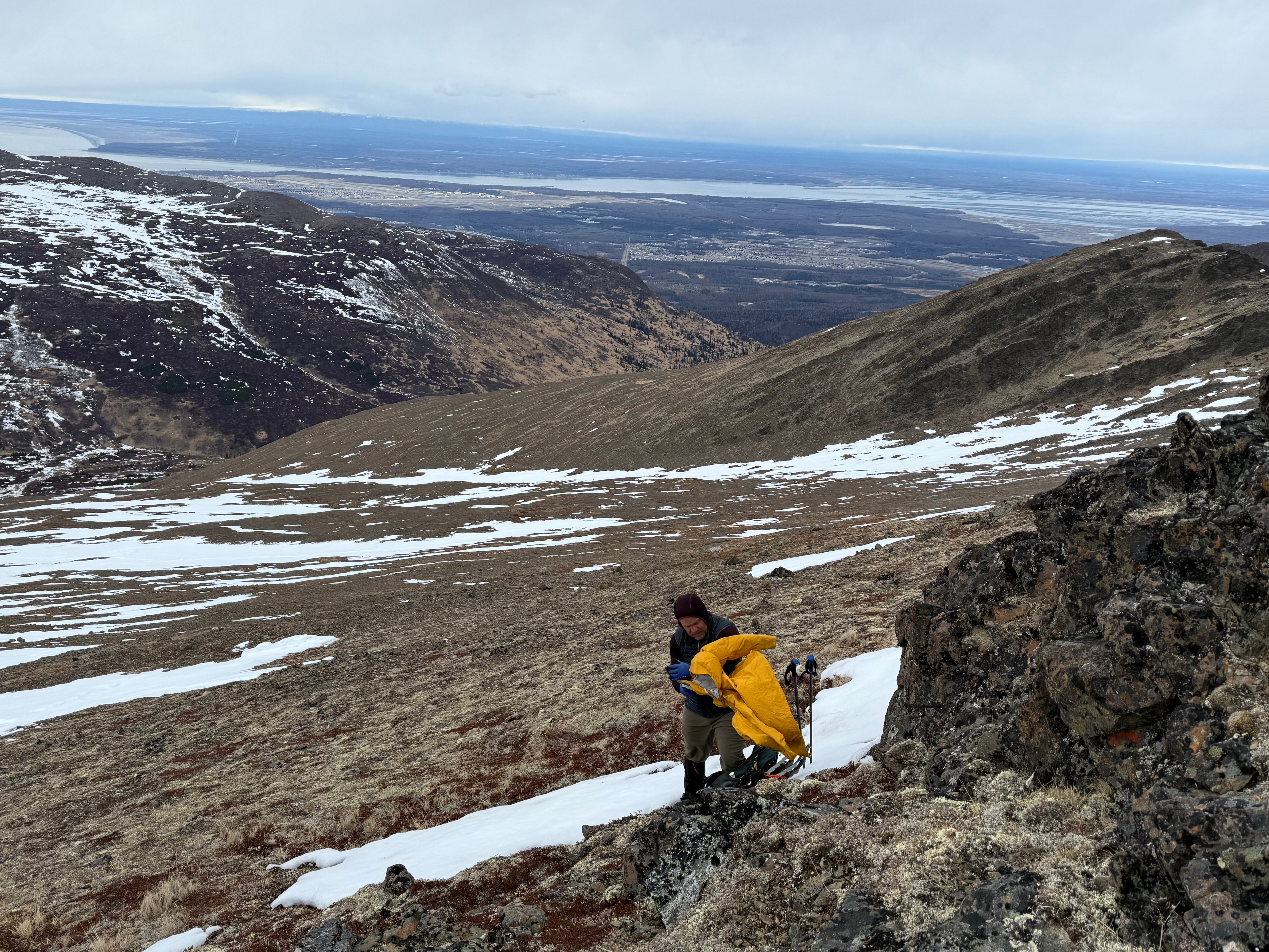
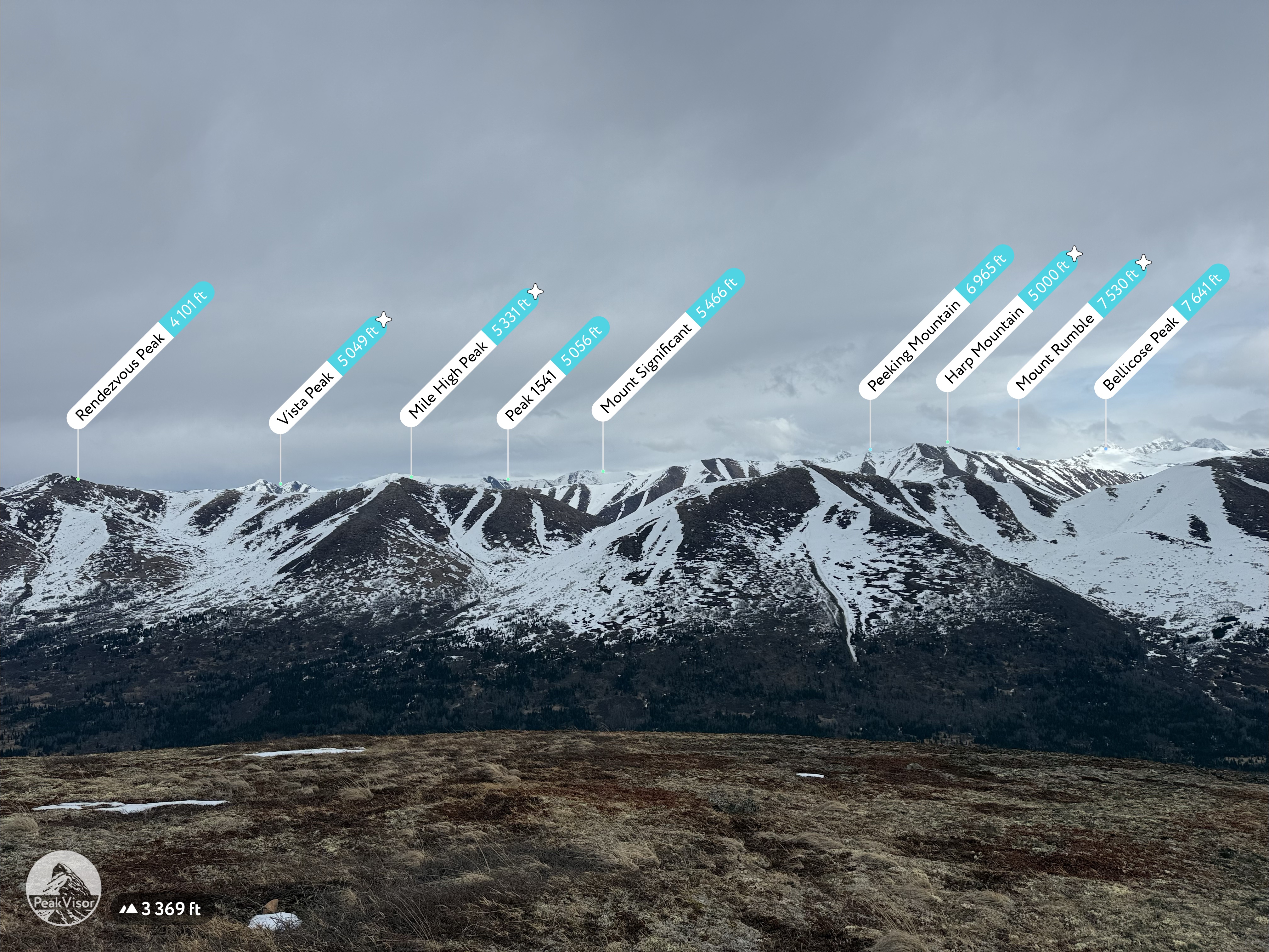
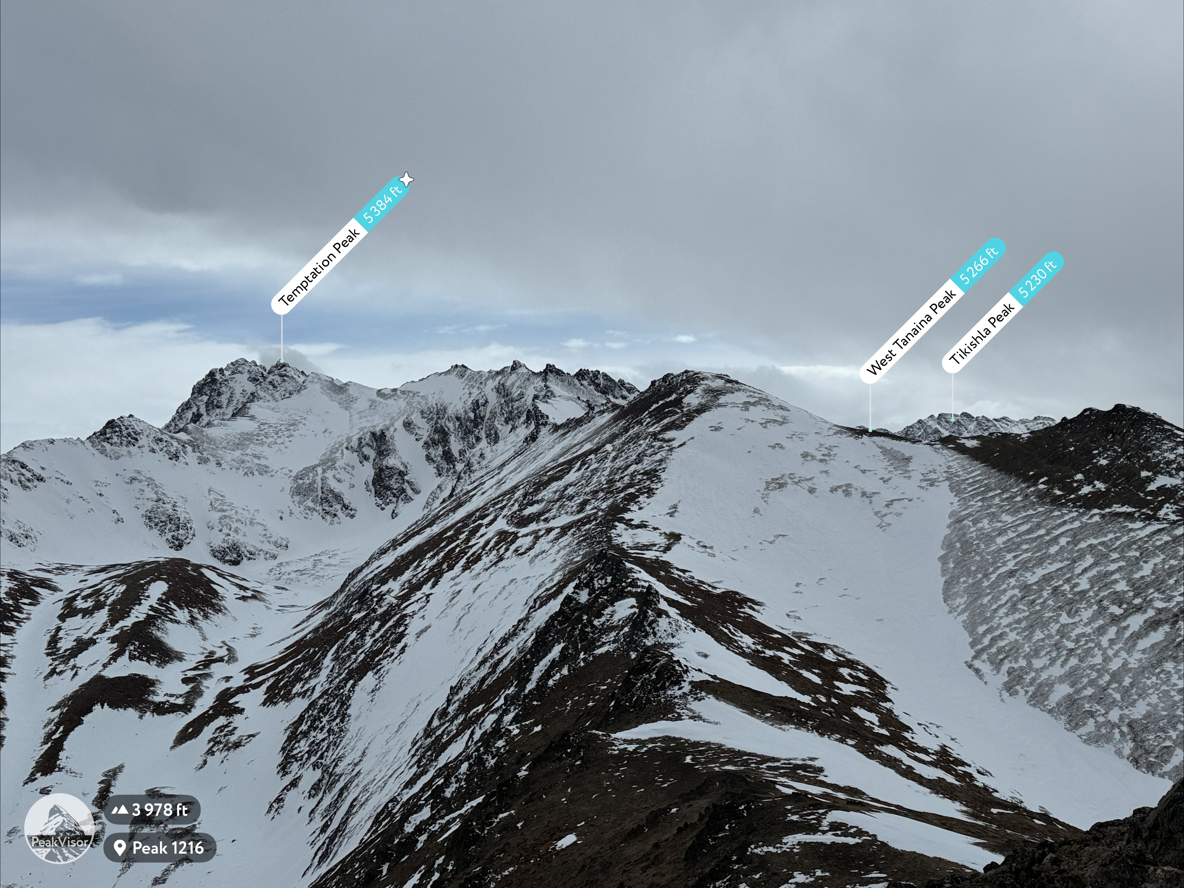
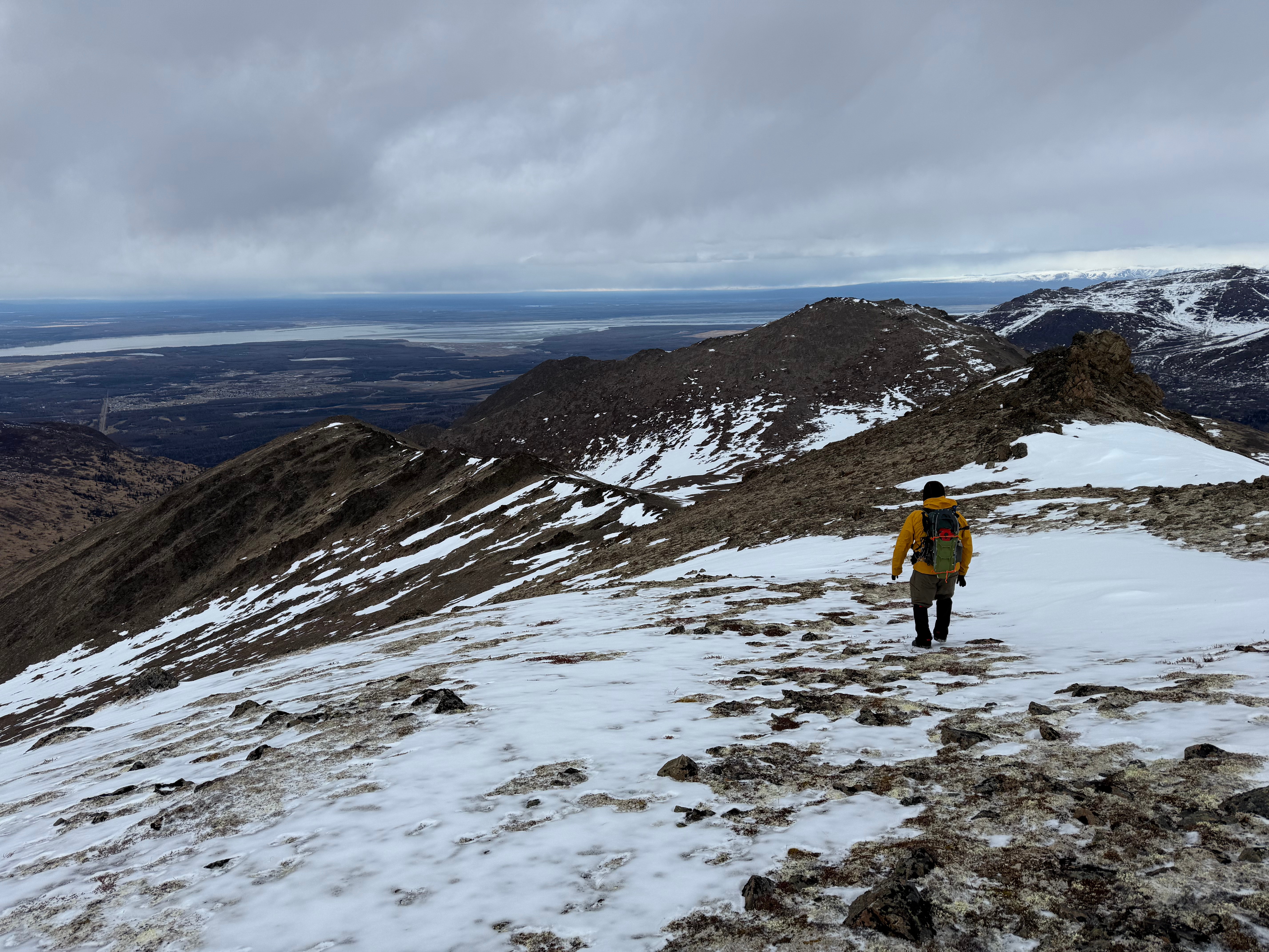
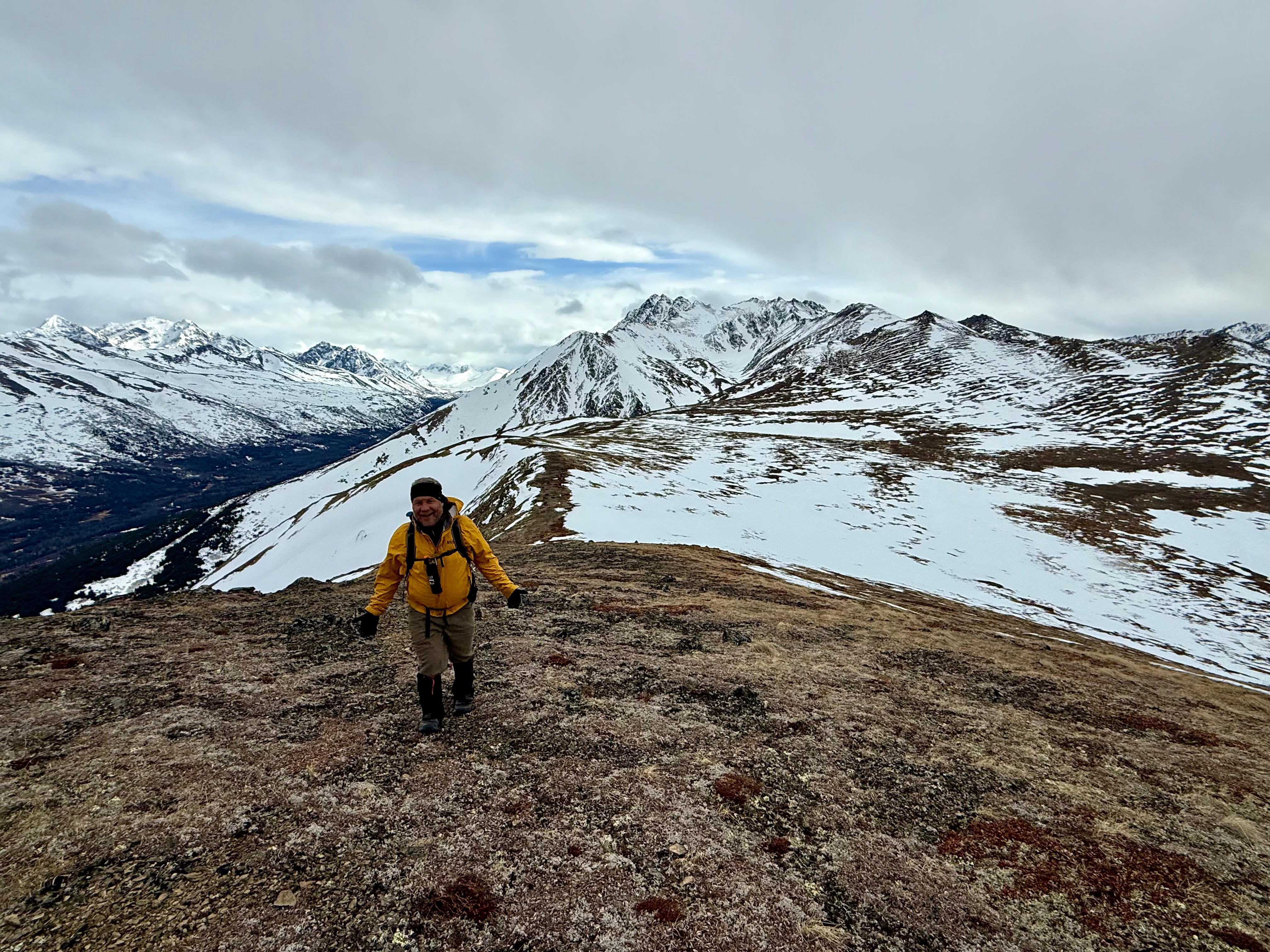
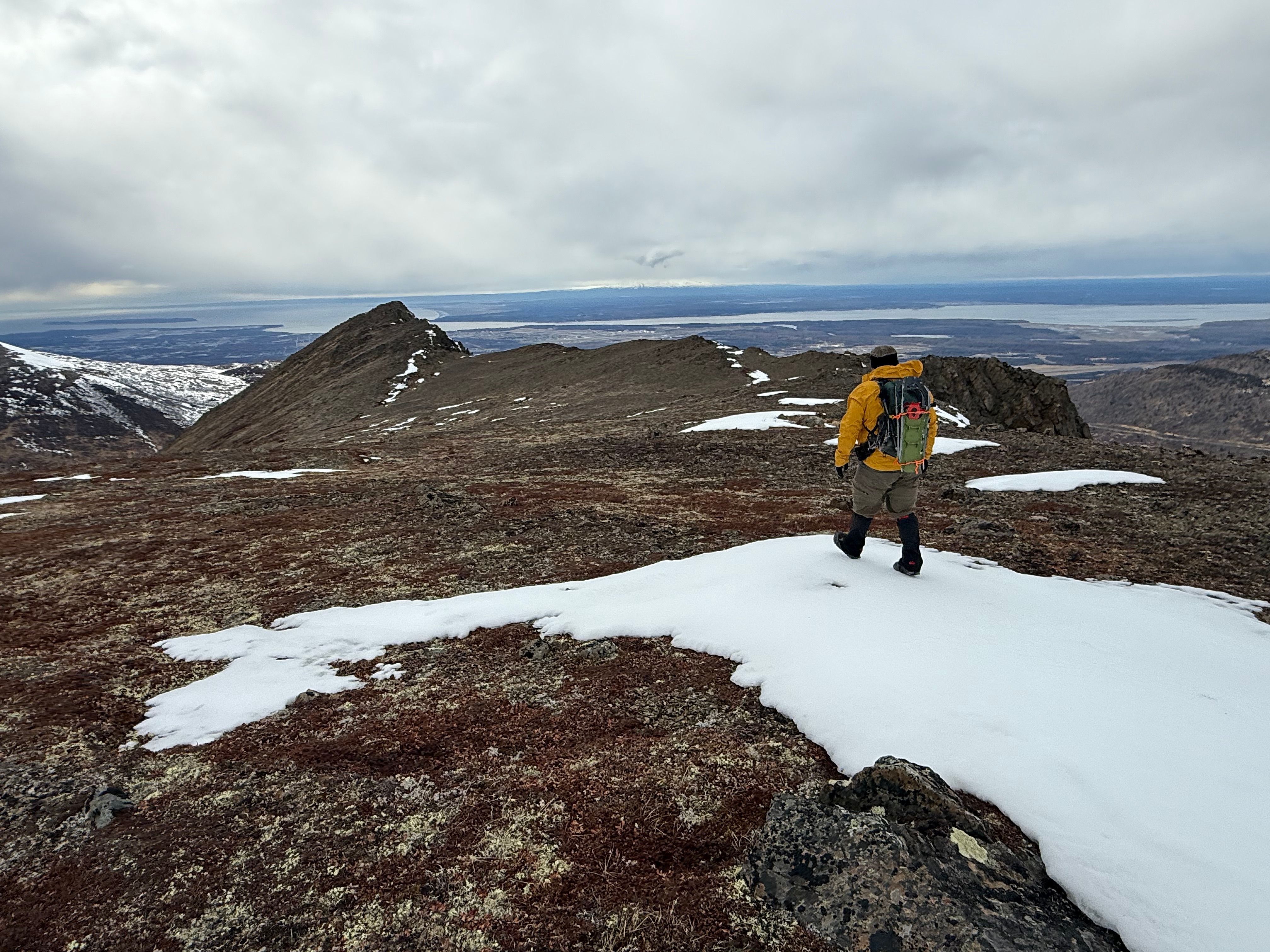
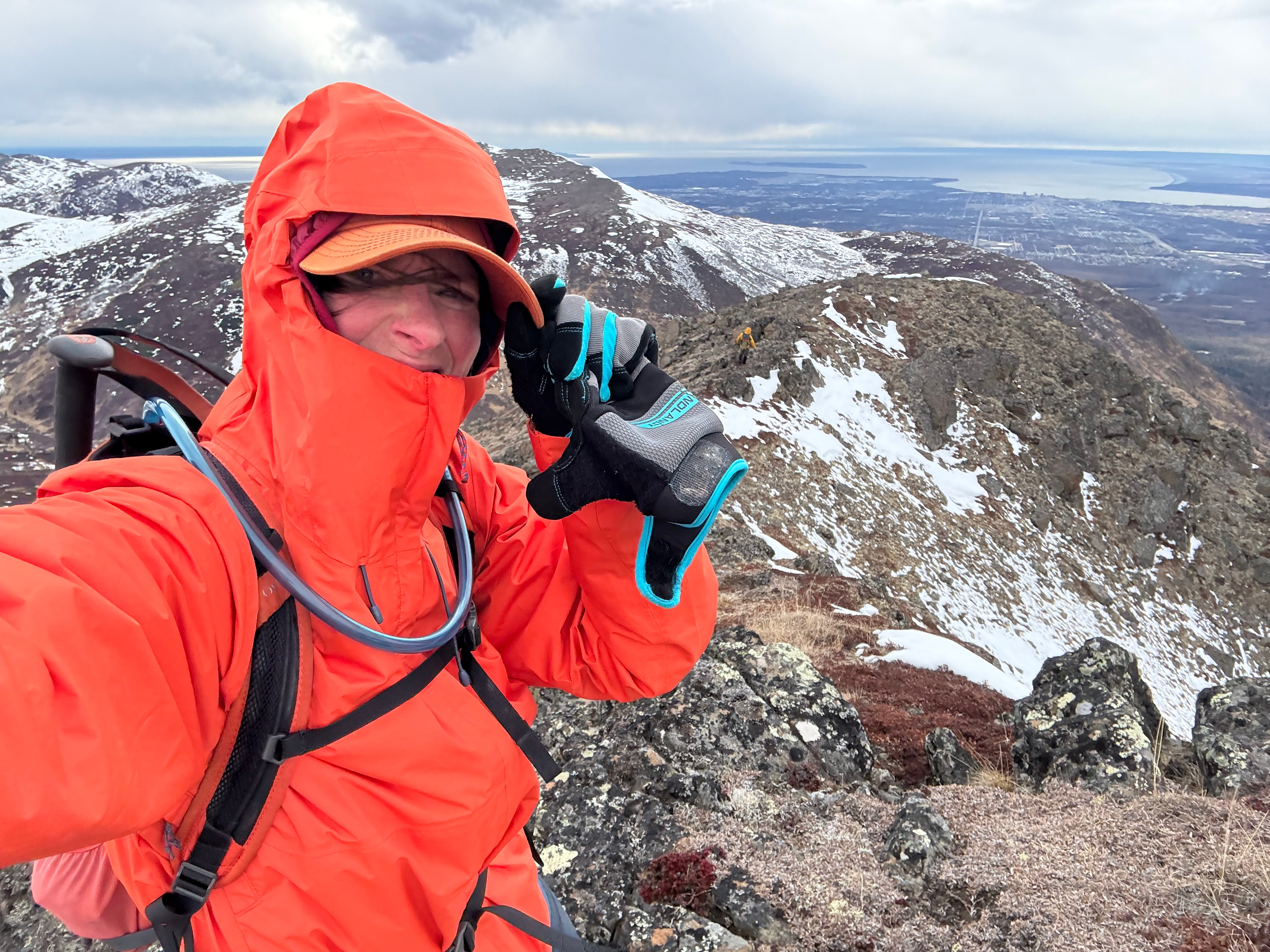
Rounding the corner on the back side of Snow Hawk Mountain, Ship Creek Hill and Peak 1216 came into view… and the wind appeared with them. We put on our warm gear, pulled out our sandwiches and pressed on, eager to see how much snow was still filling the valley between here and there. The wind continued to pick up… 20mph or more, a flashback to Rainbow, and we talked about skipping Peak 1216, quickly bagging SCH, and getting out of this wind sooner rather than later.

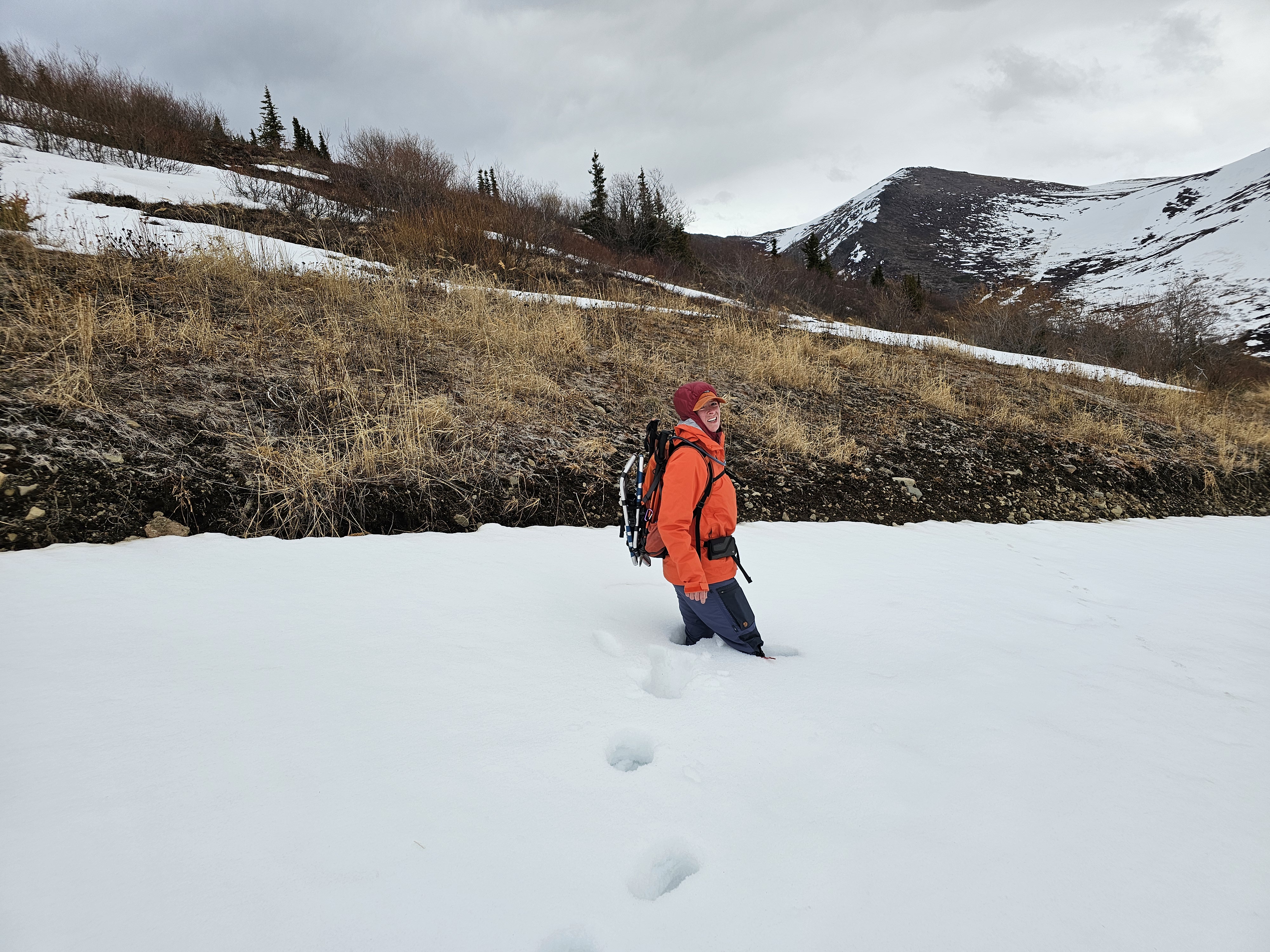
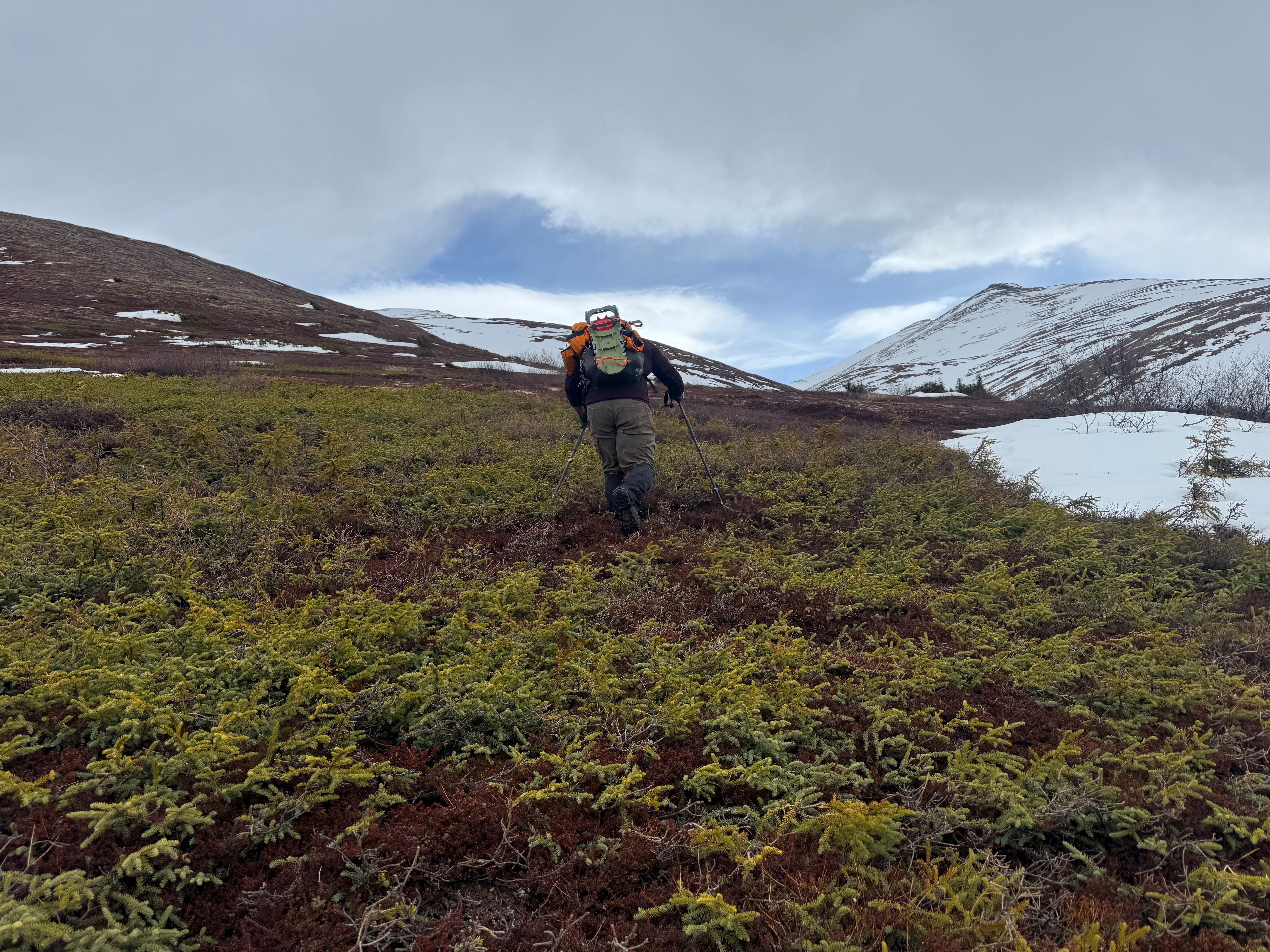
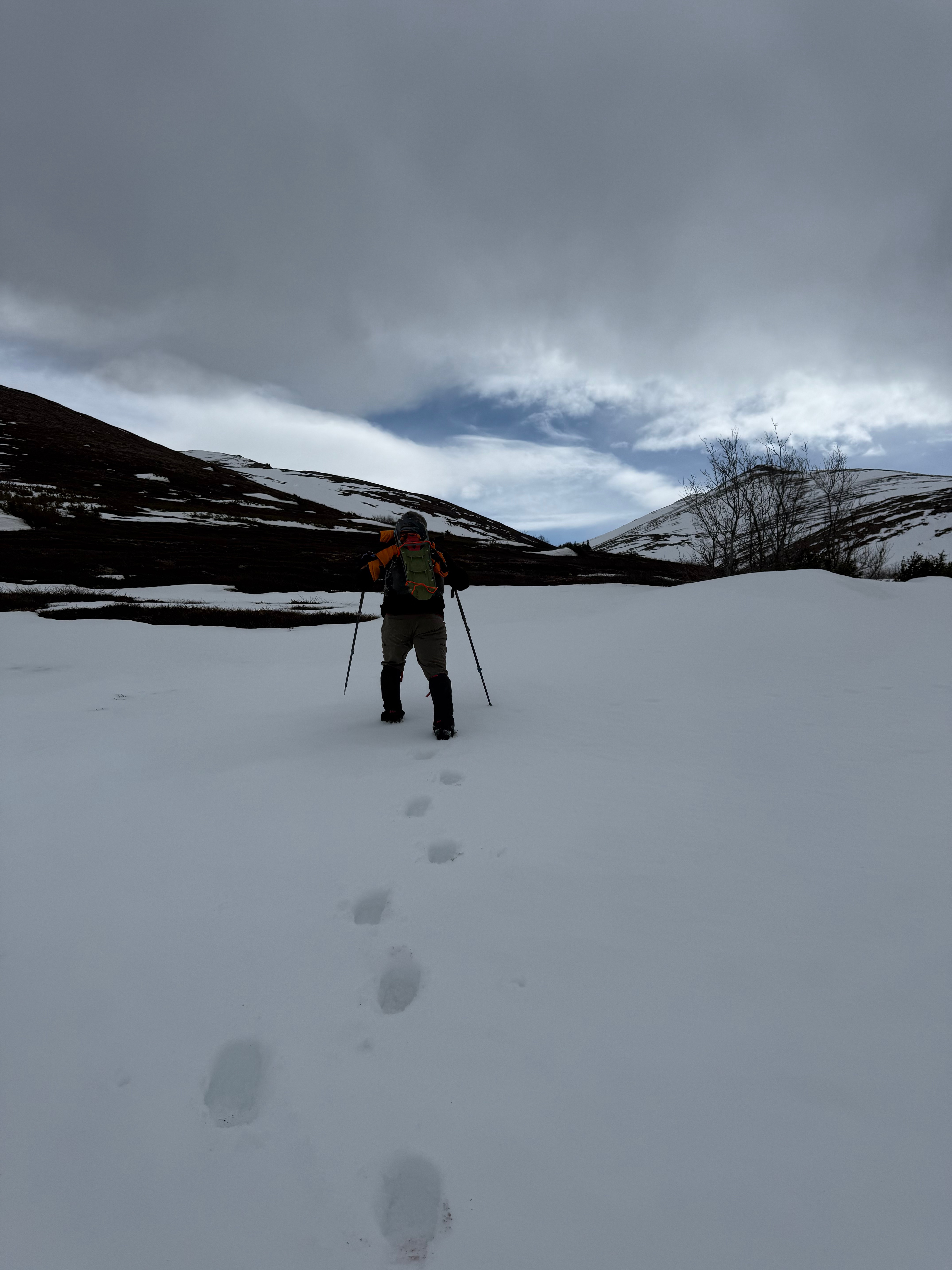
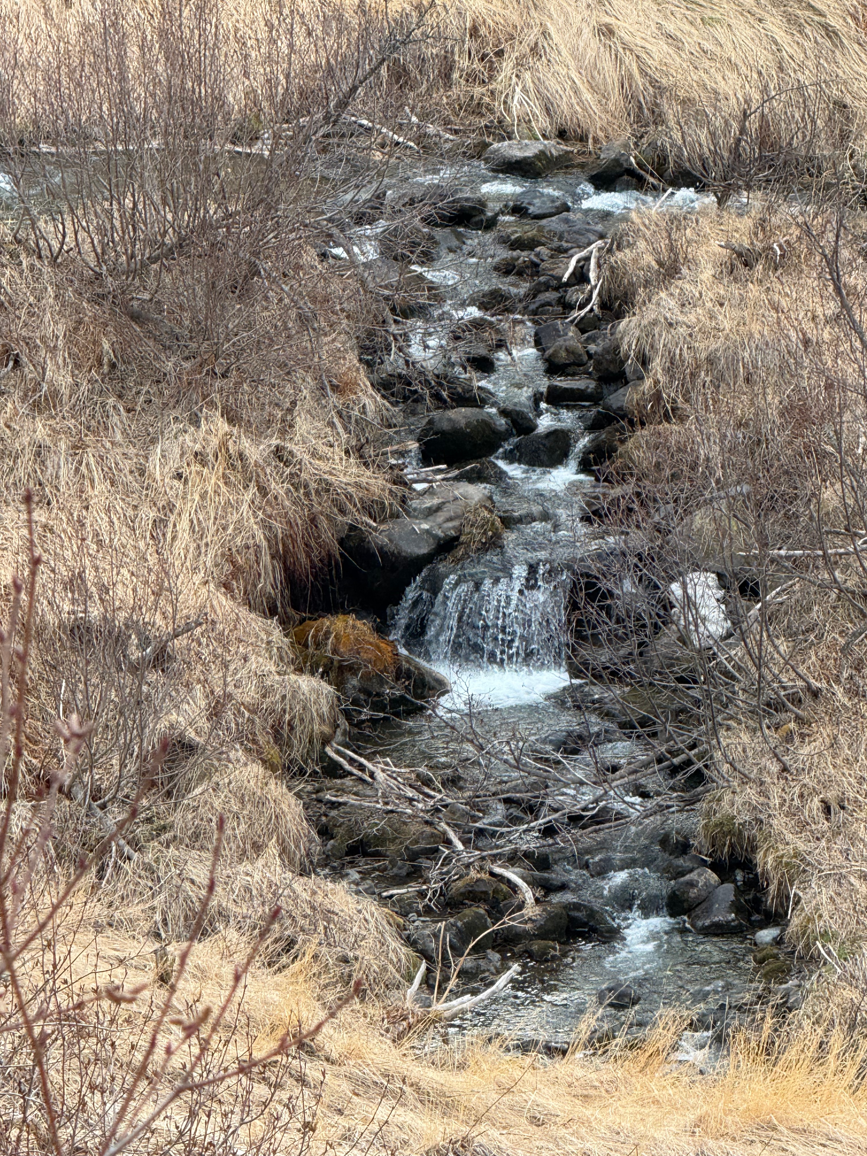
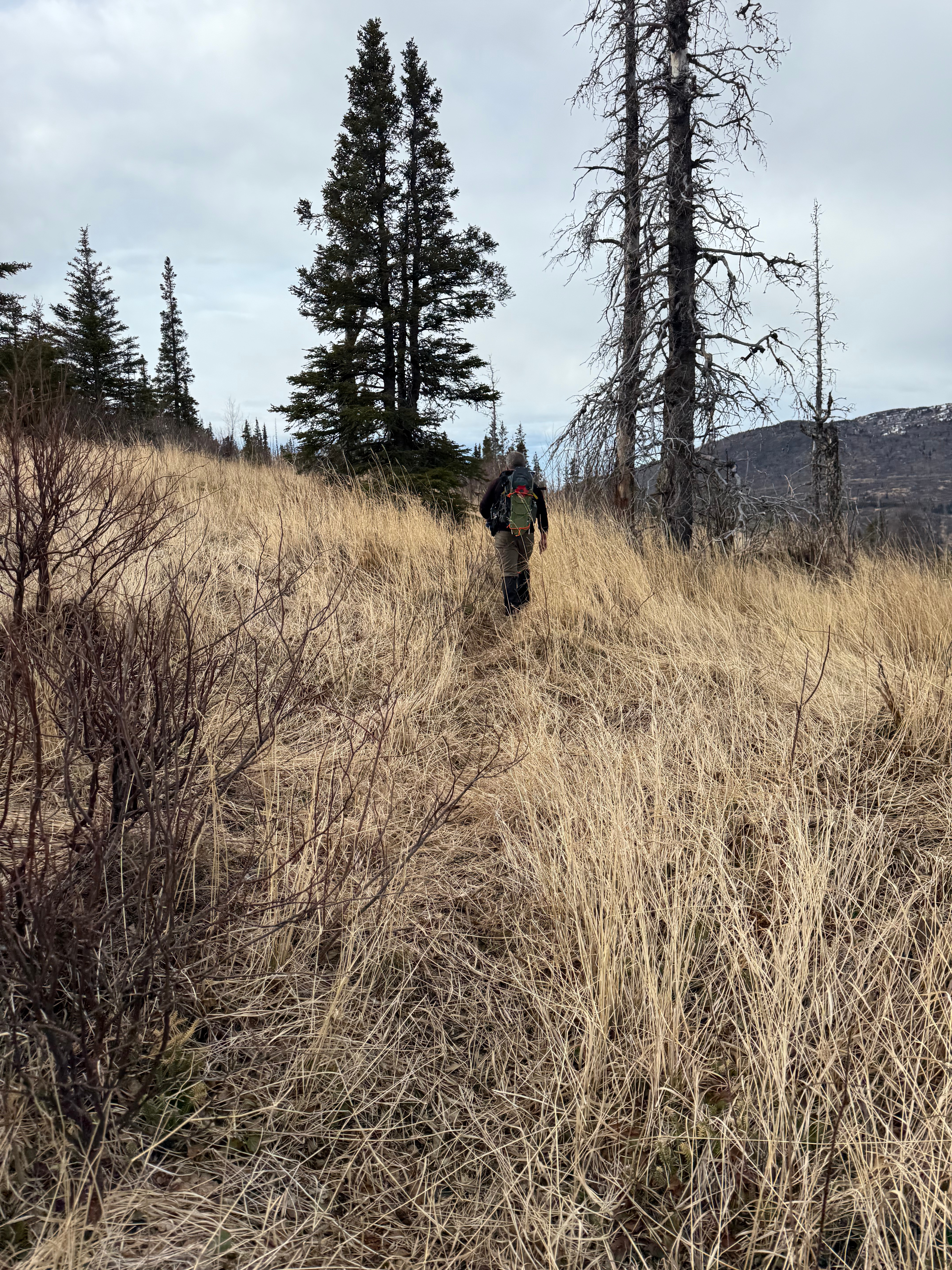
A short section of waist deep snow momentarily frustrated us, but the remainder of the walk down into Snow Hawk Valley turned out to be fairly pleasant.
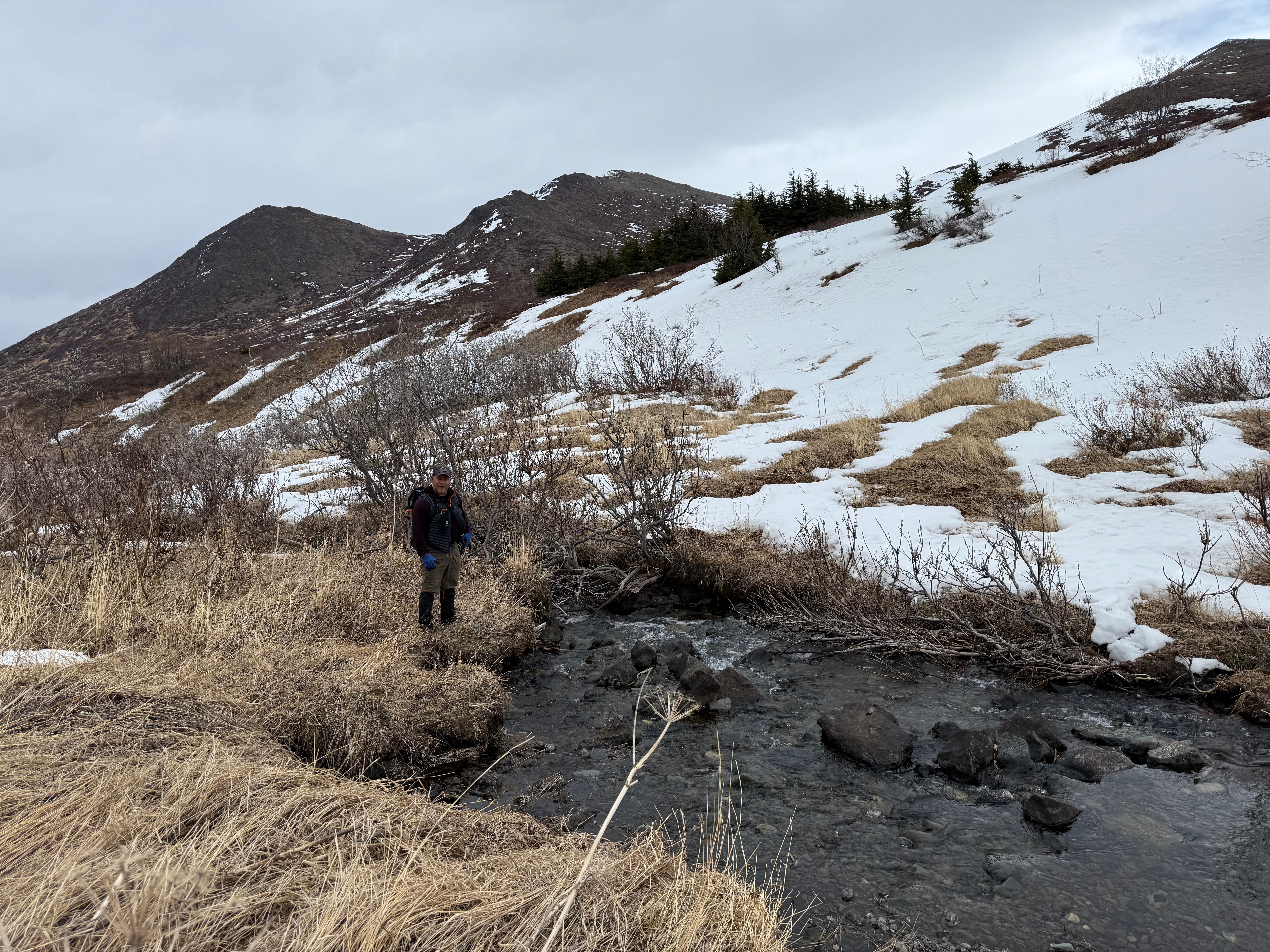
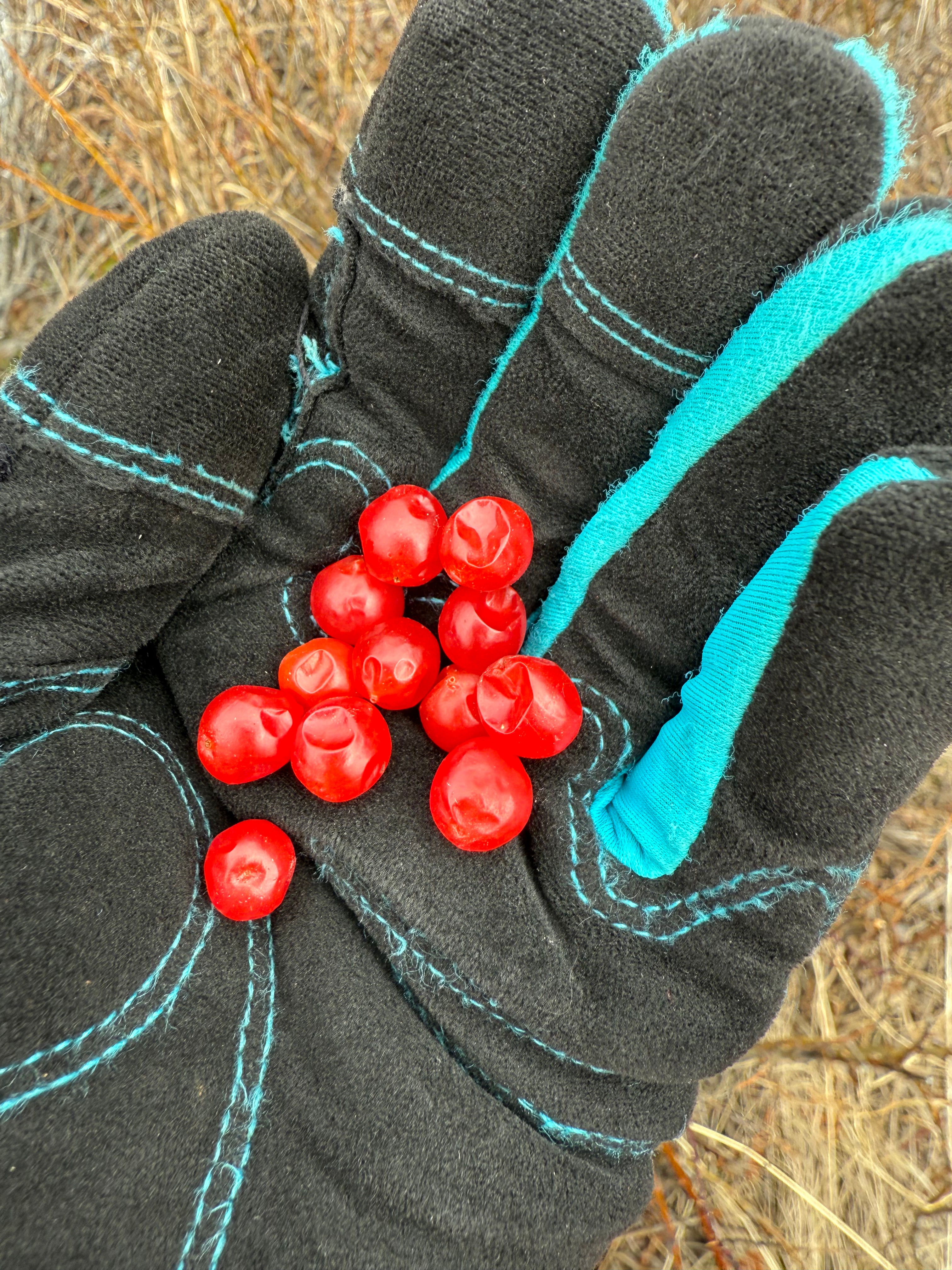
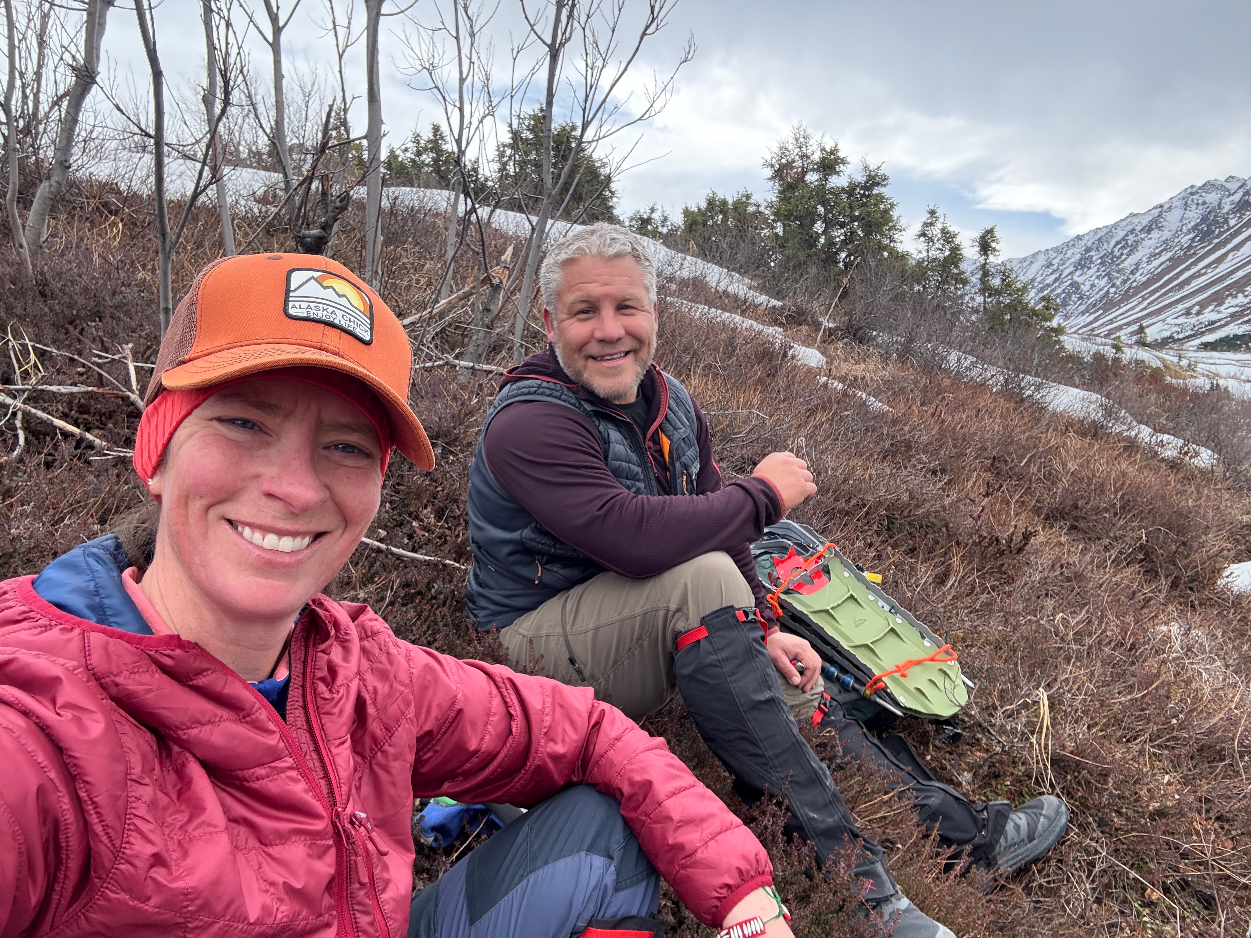
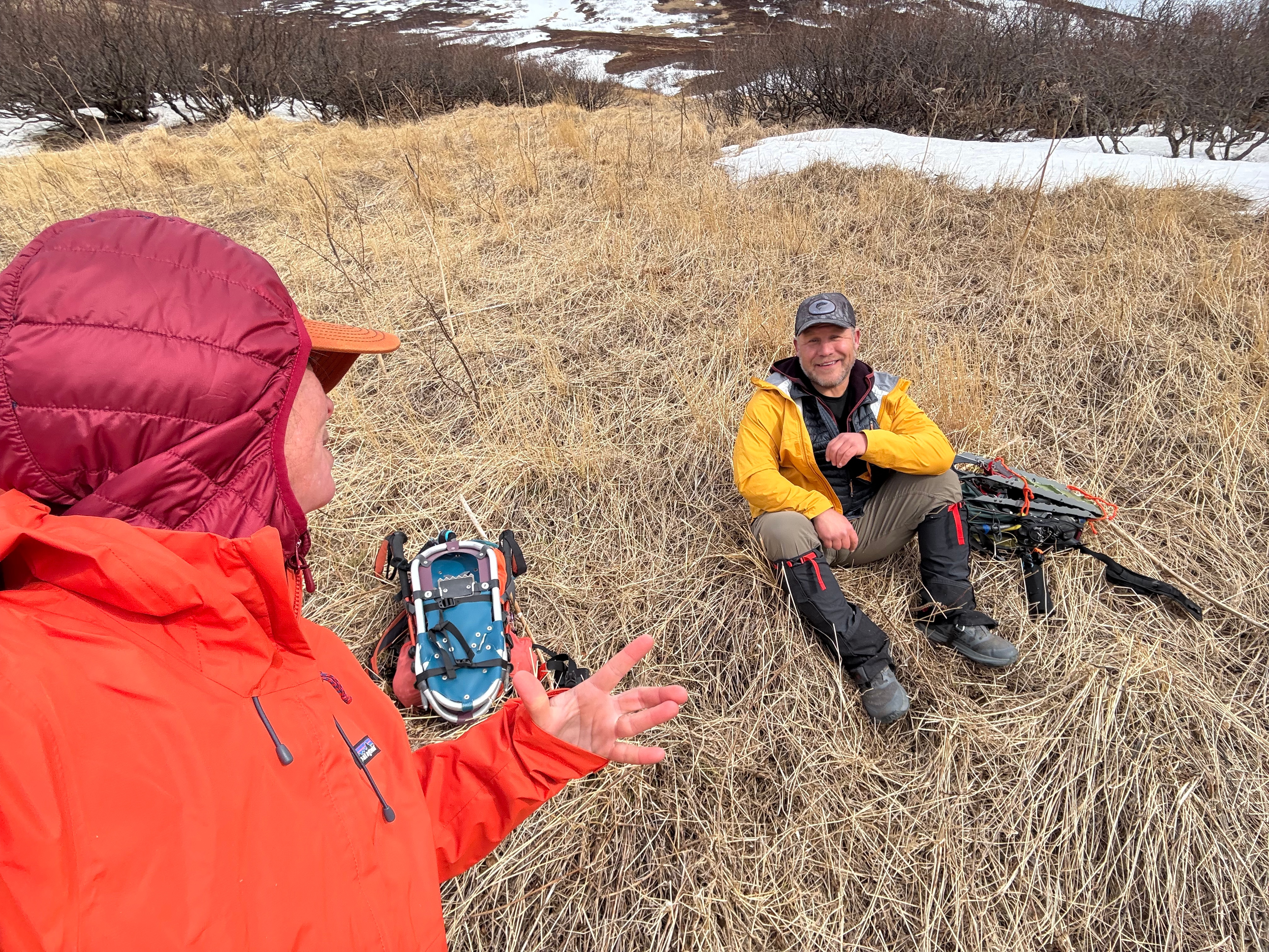
We picked our way down the grassy hill, finding more ptarmigan, some still delicious, overwintered, high bush cranberries and then Snow Hawk Creek, which was easily crossed with no wet feet. We were in the lee of the wind and opted for a sit-down break before heading up to what we were sure was going to be a gusty couple of hours.
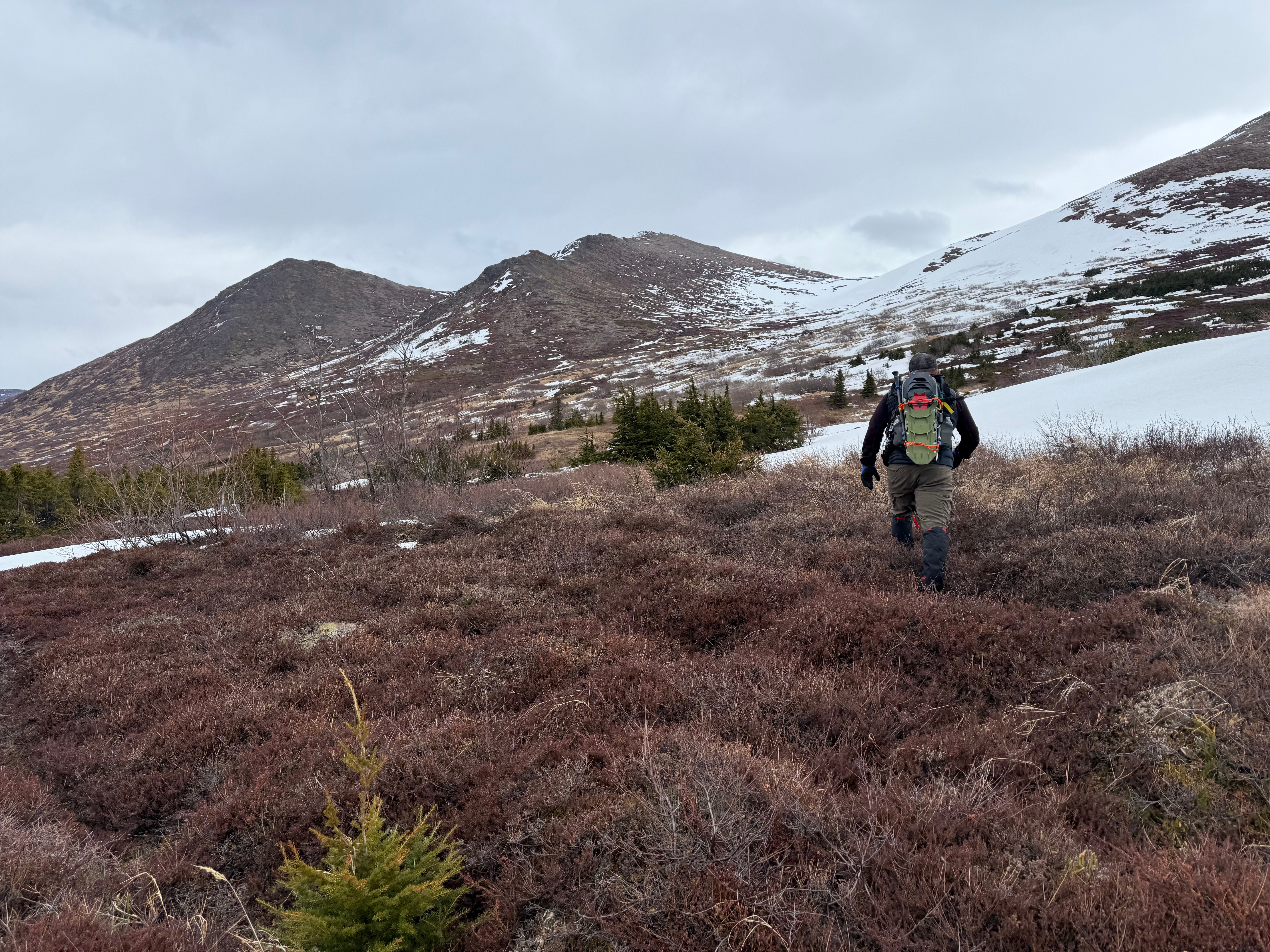

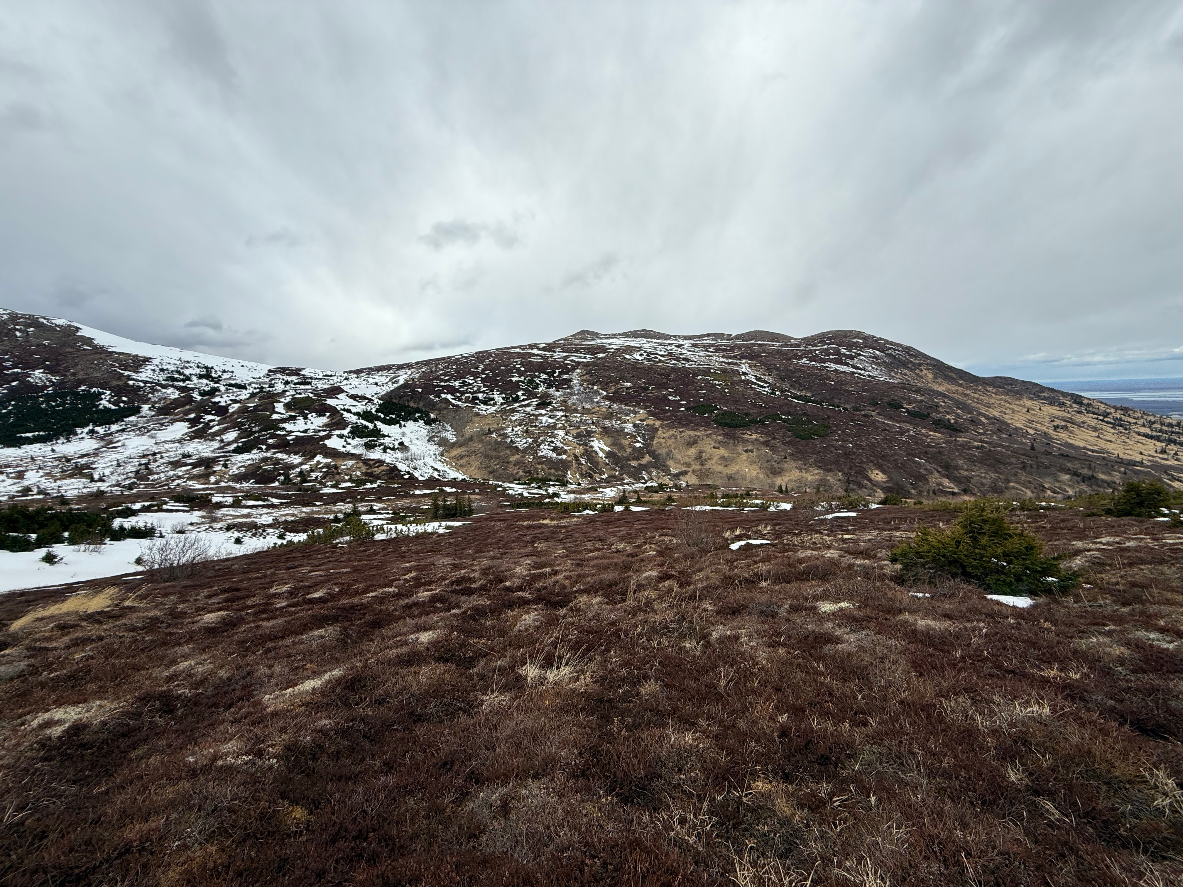
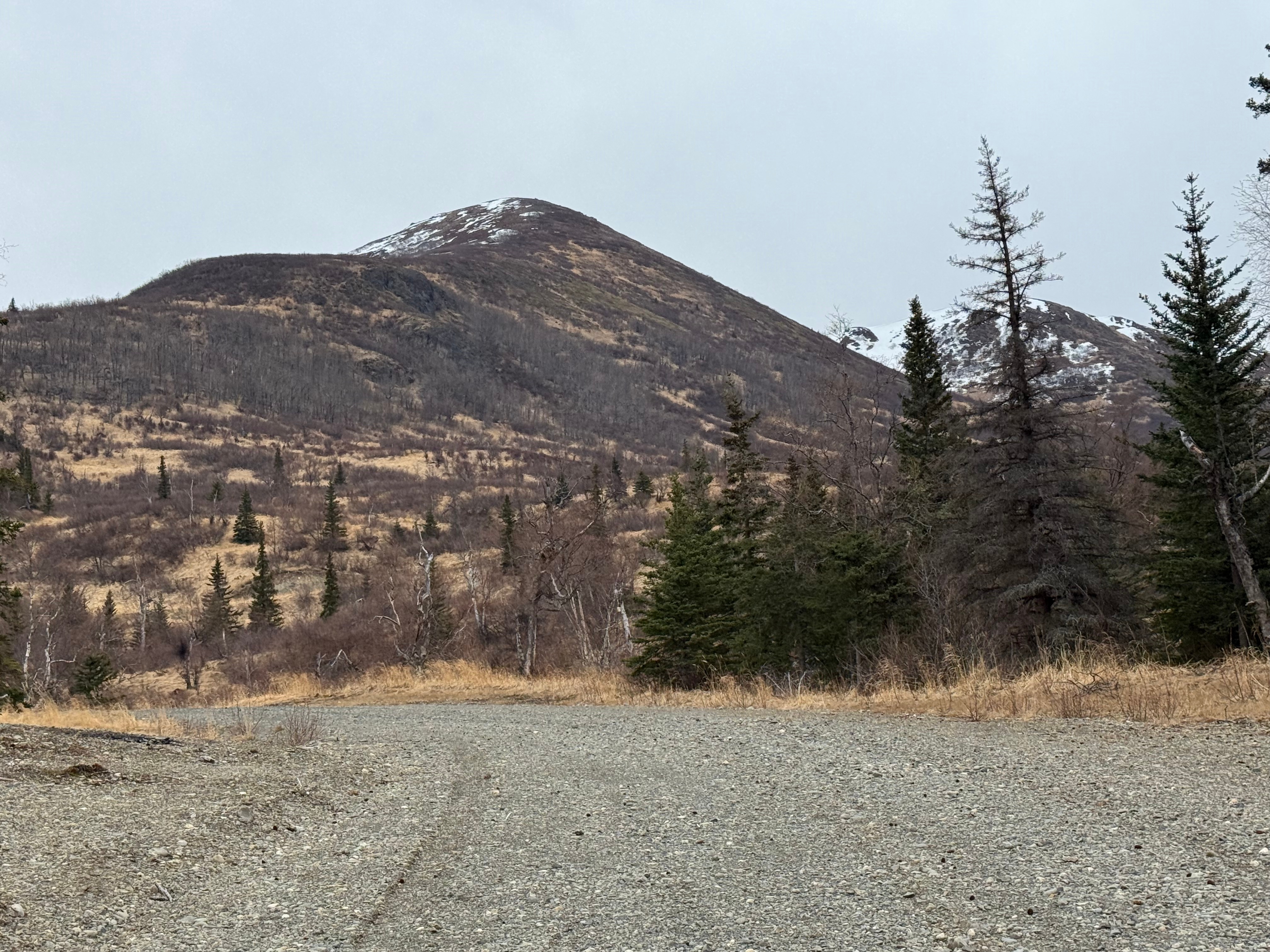
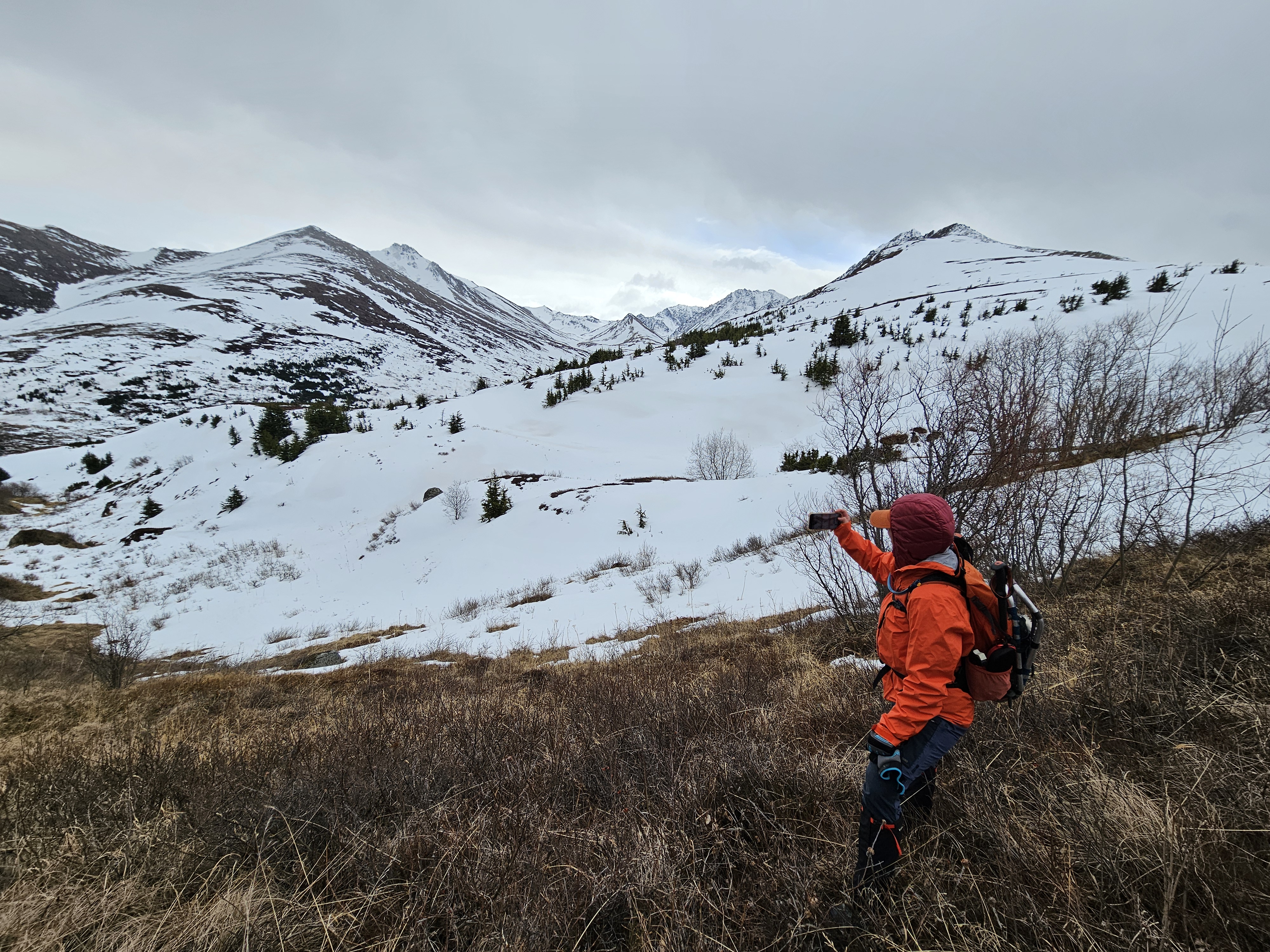
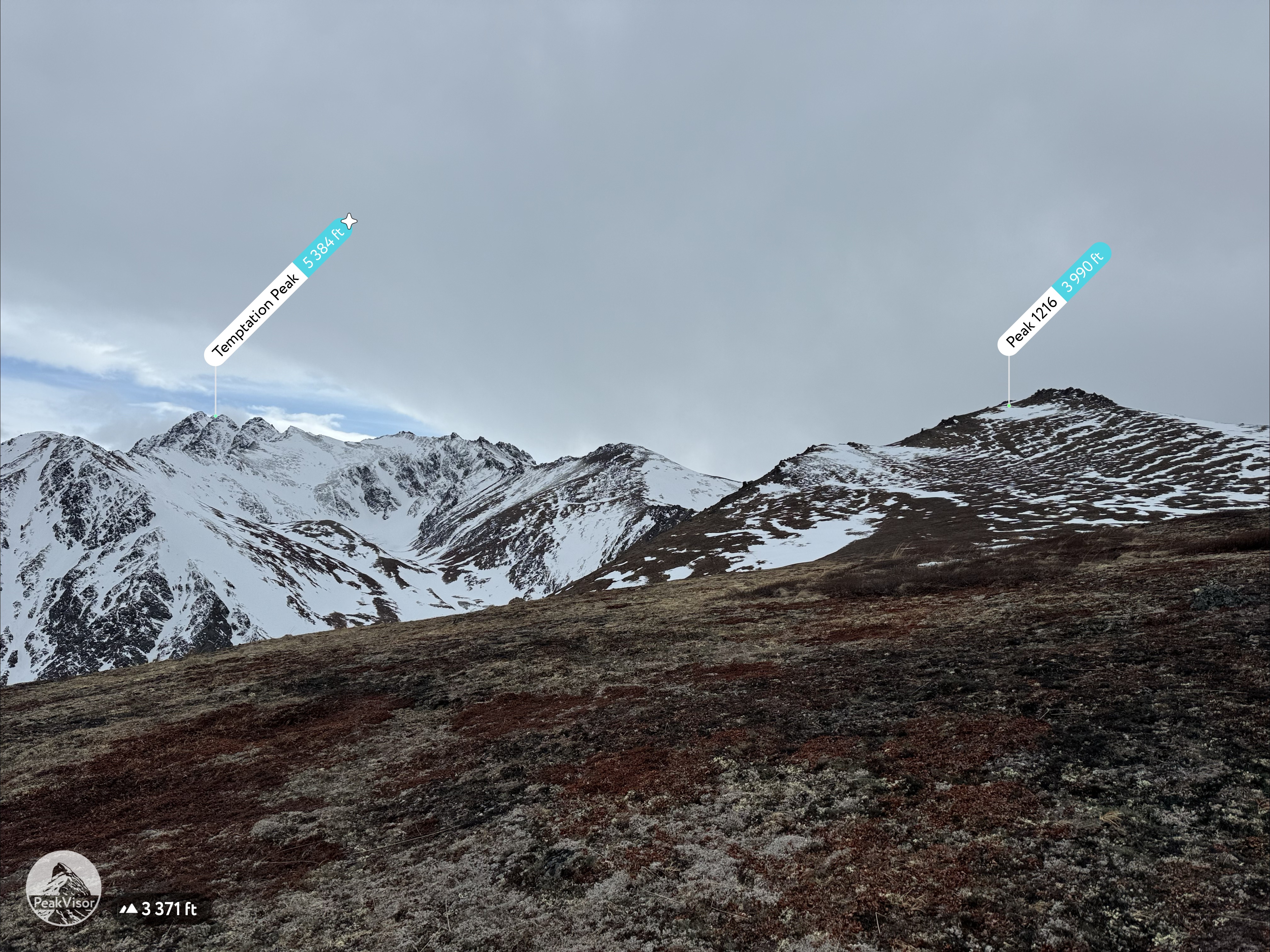
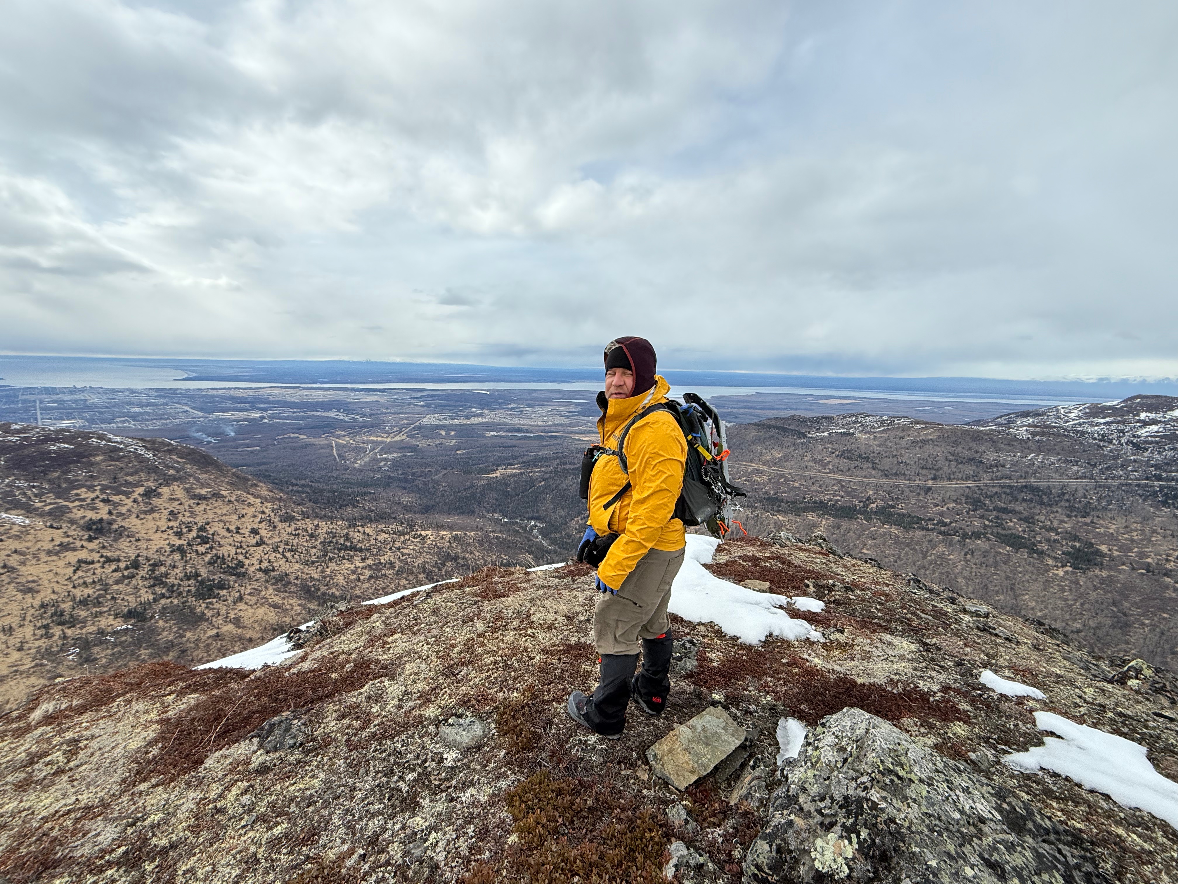
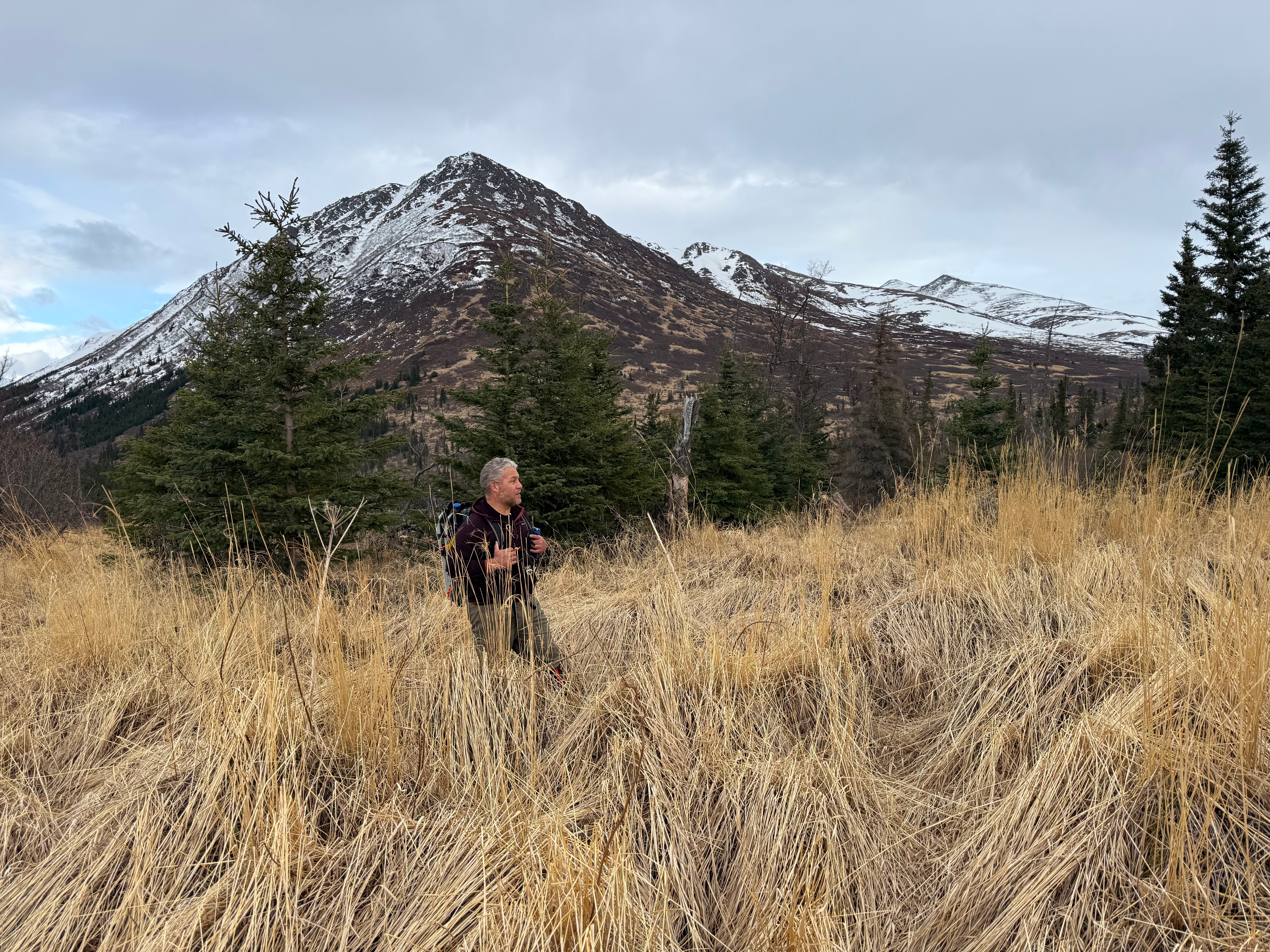
From here, Peak 1216 looked close and we decided it would be a travesty to not also tag the top of her. We had already traveled 6.5 miles and nearly 2400,’ but were feeling strong and were both excited to look down on Ship Creek Valley.
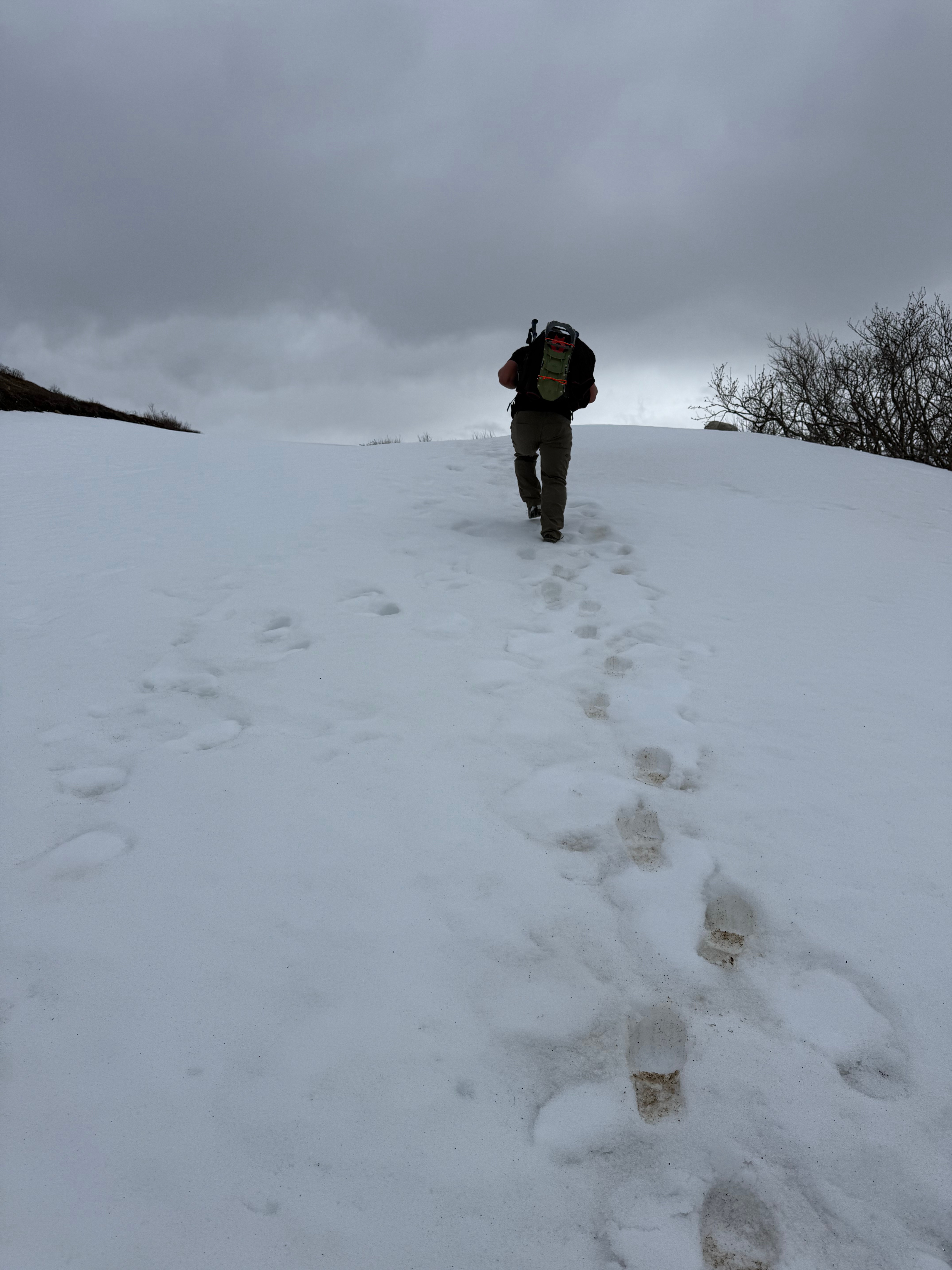
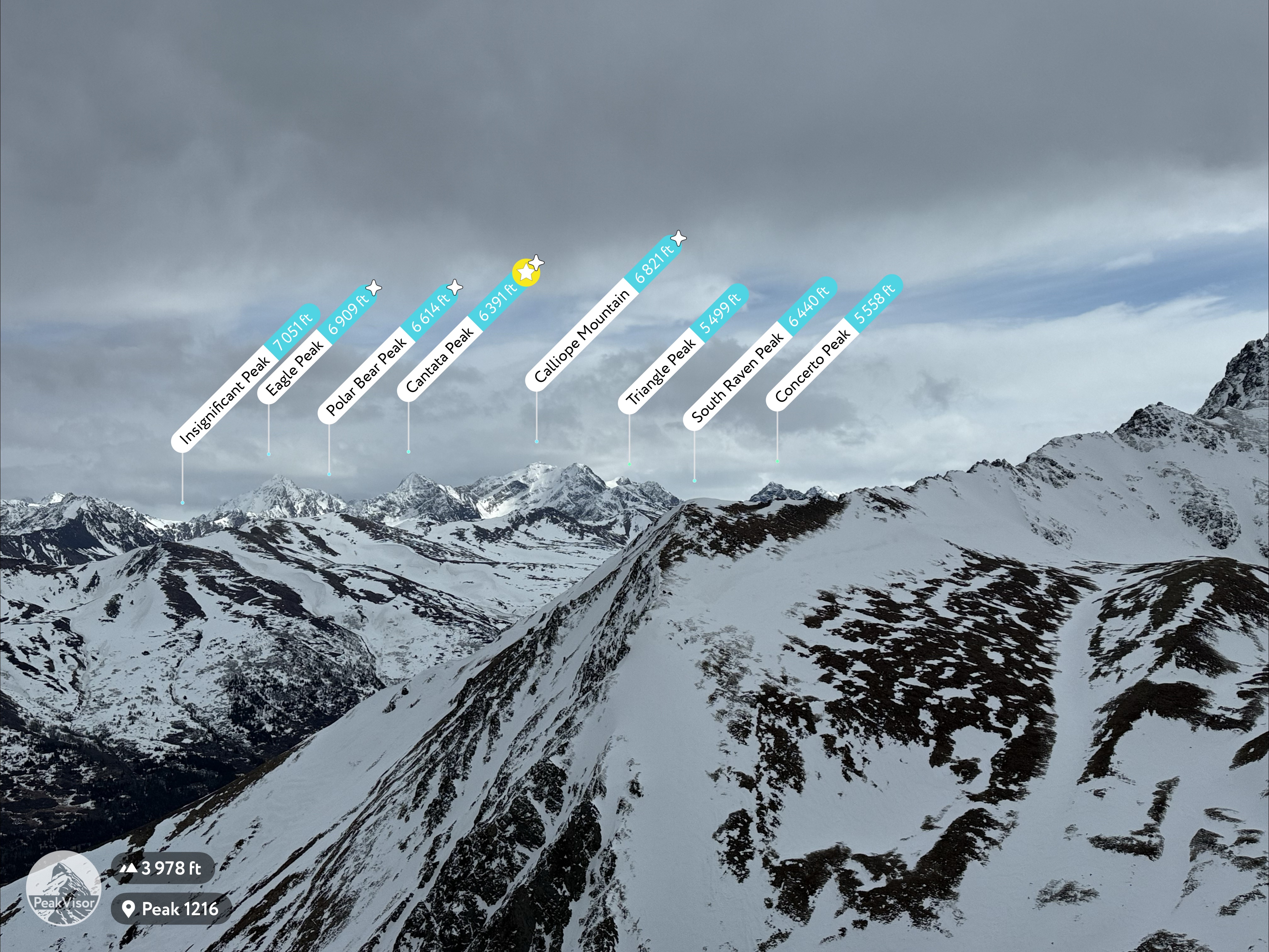
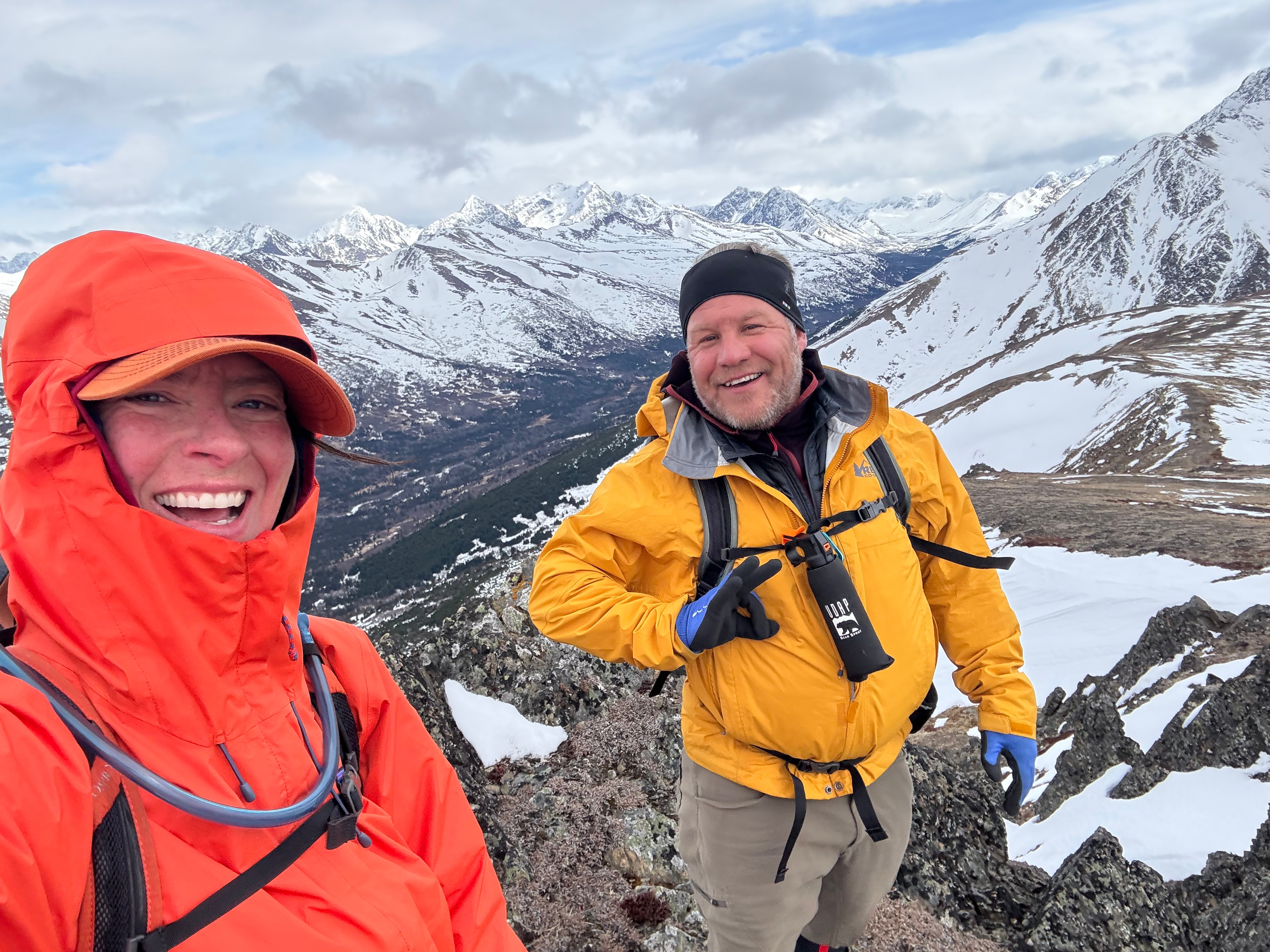
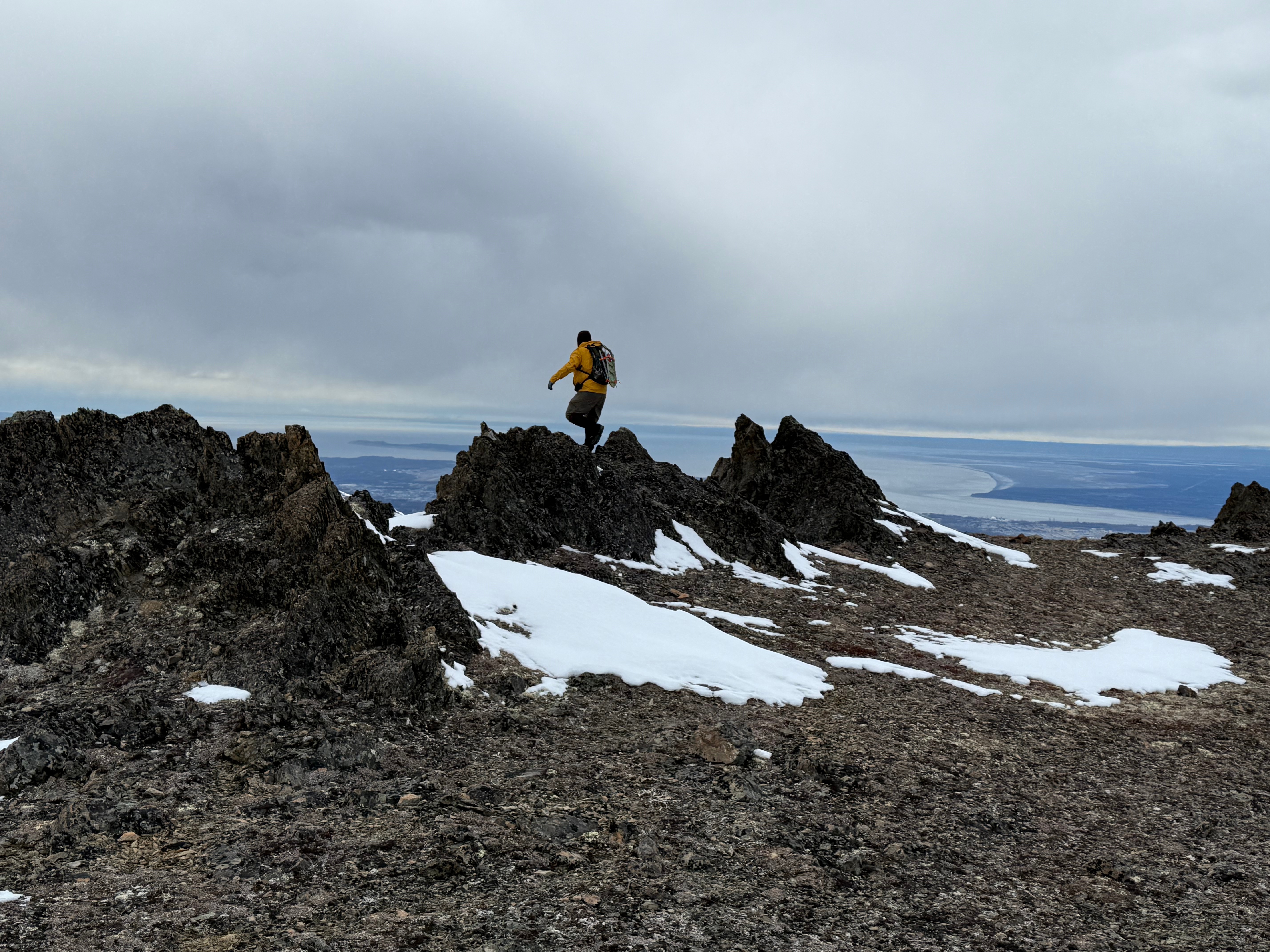
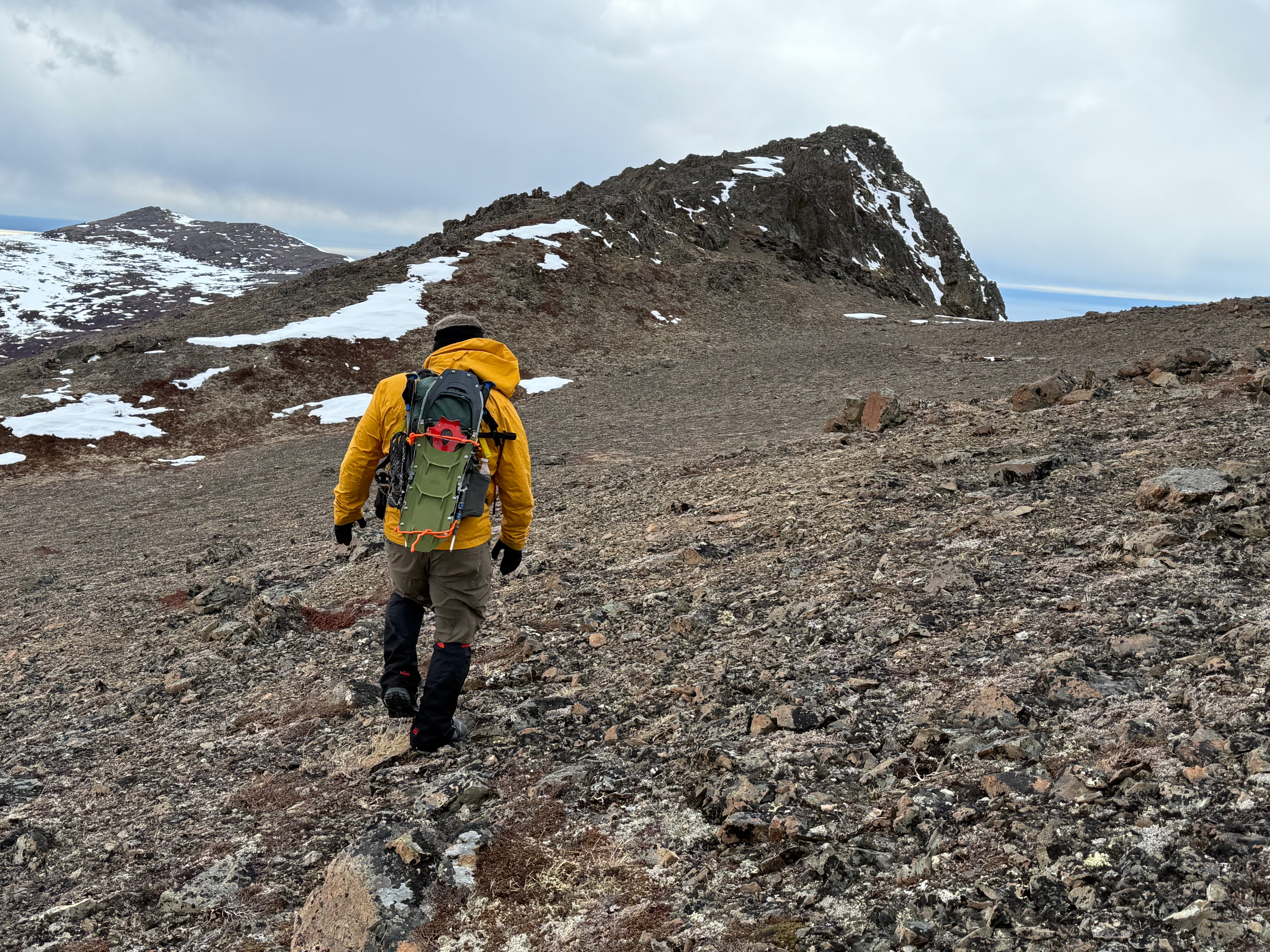
We ascended a mile and a half up grassy slopes dotted with patches of snow, low pine, and leafless trees. The wind returned, stronger than ever, and by the time we reached the rounded summit of Peak 1216, it was gusting more than 50mph. We were both thrilled to be there, but had a difficult time standing up, let alone taking in the view, so we got a couple of photos then hustled down the snow covered slope towards Ship Creek Hill.
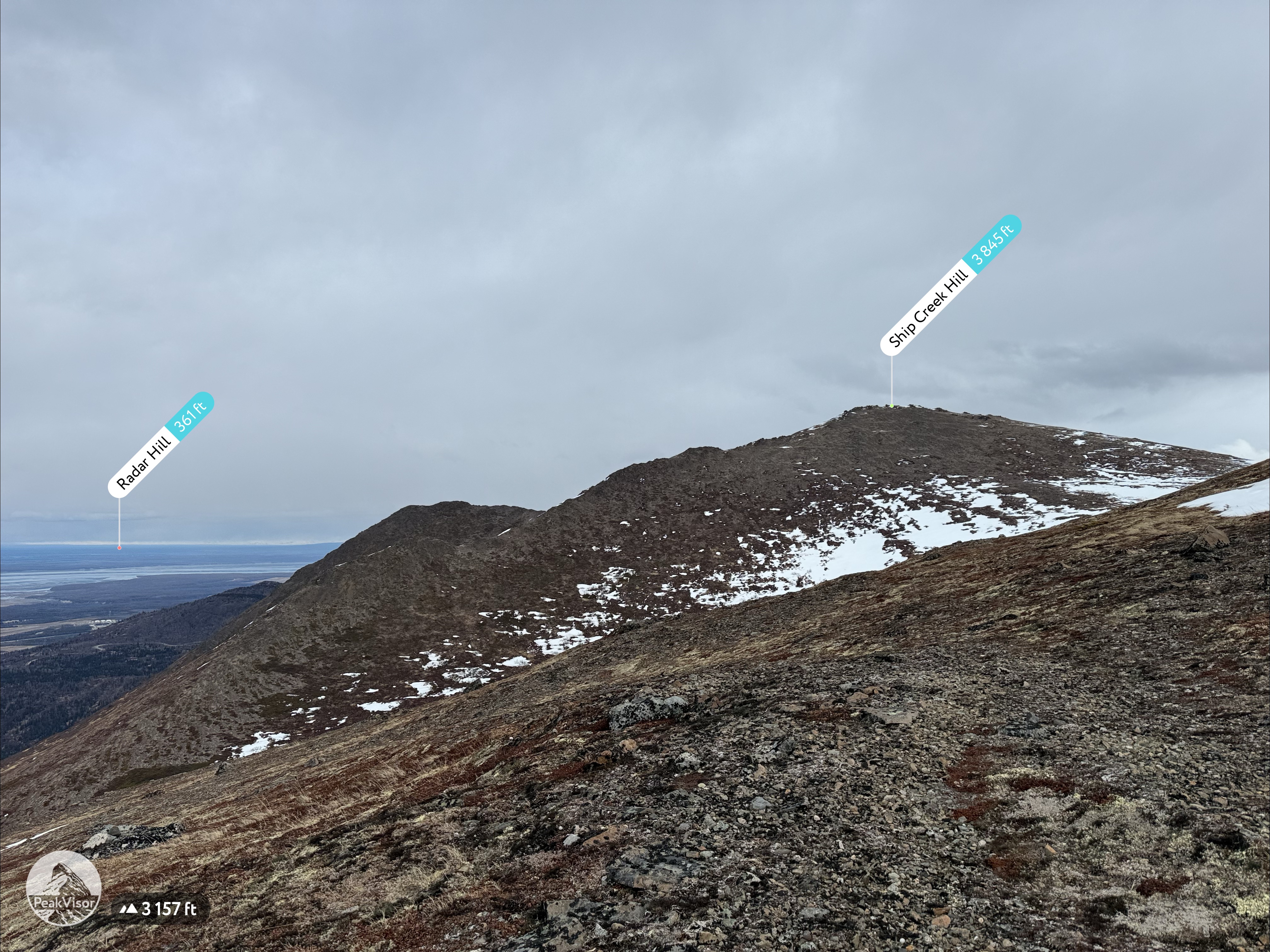
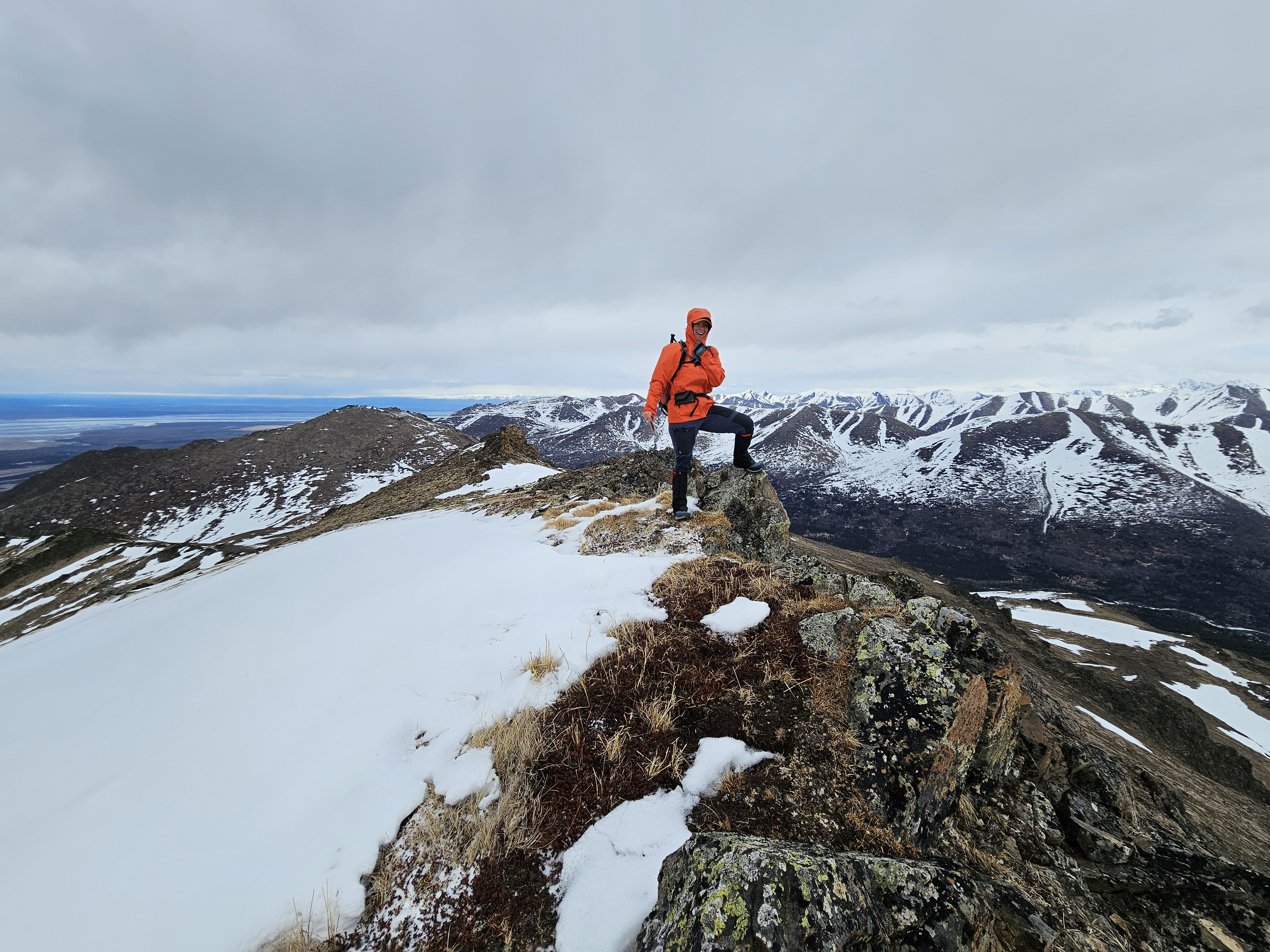

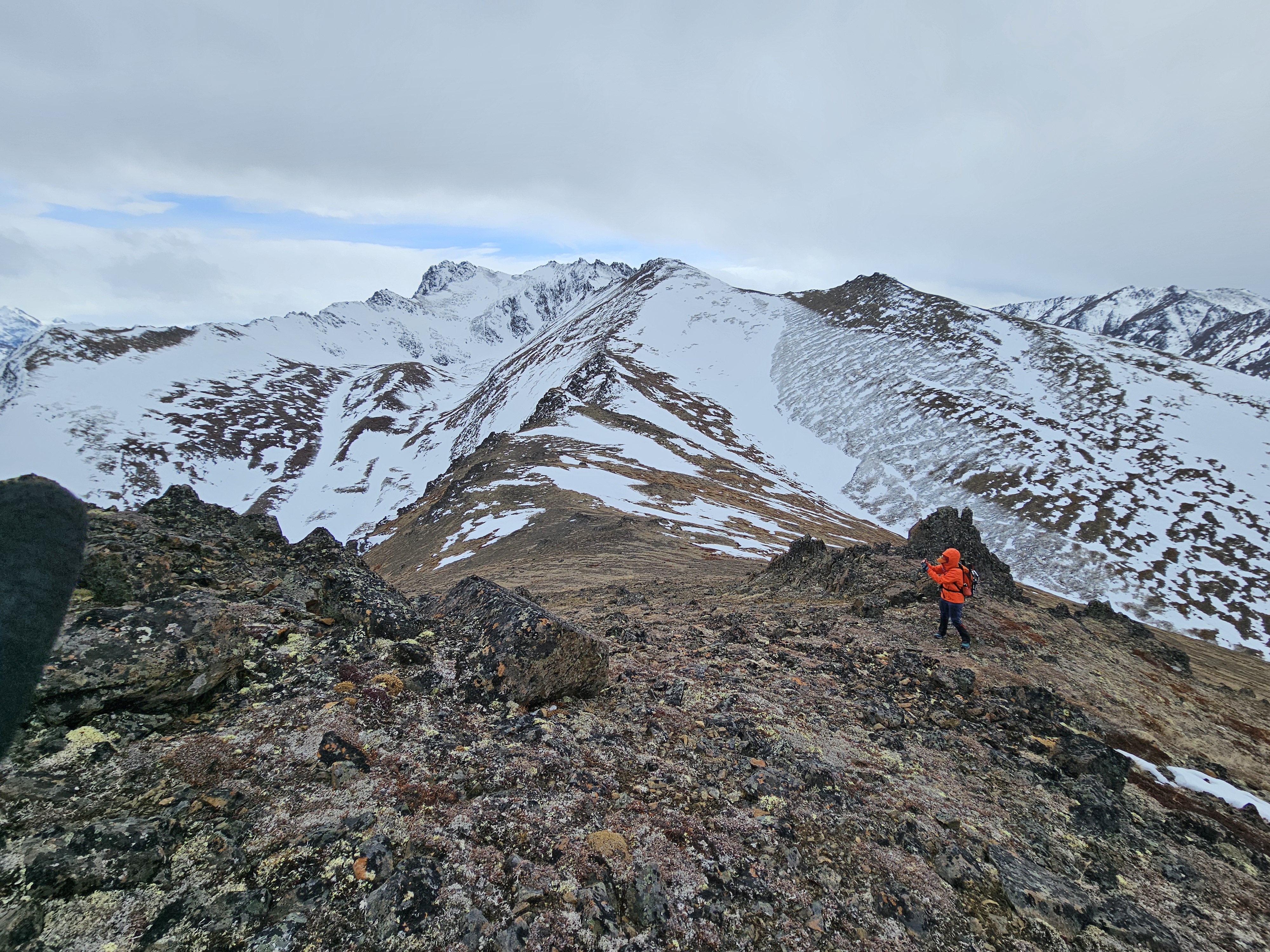
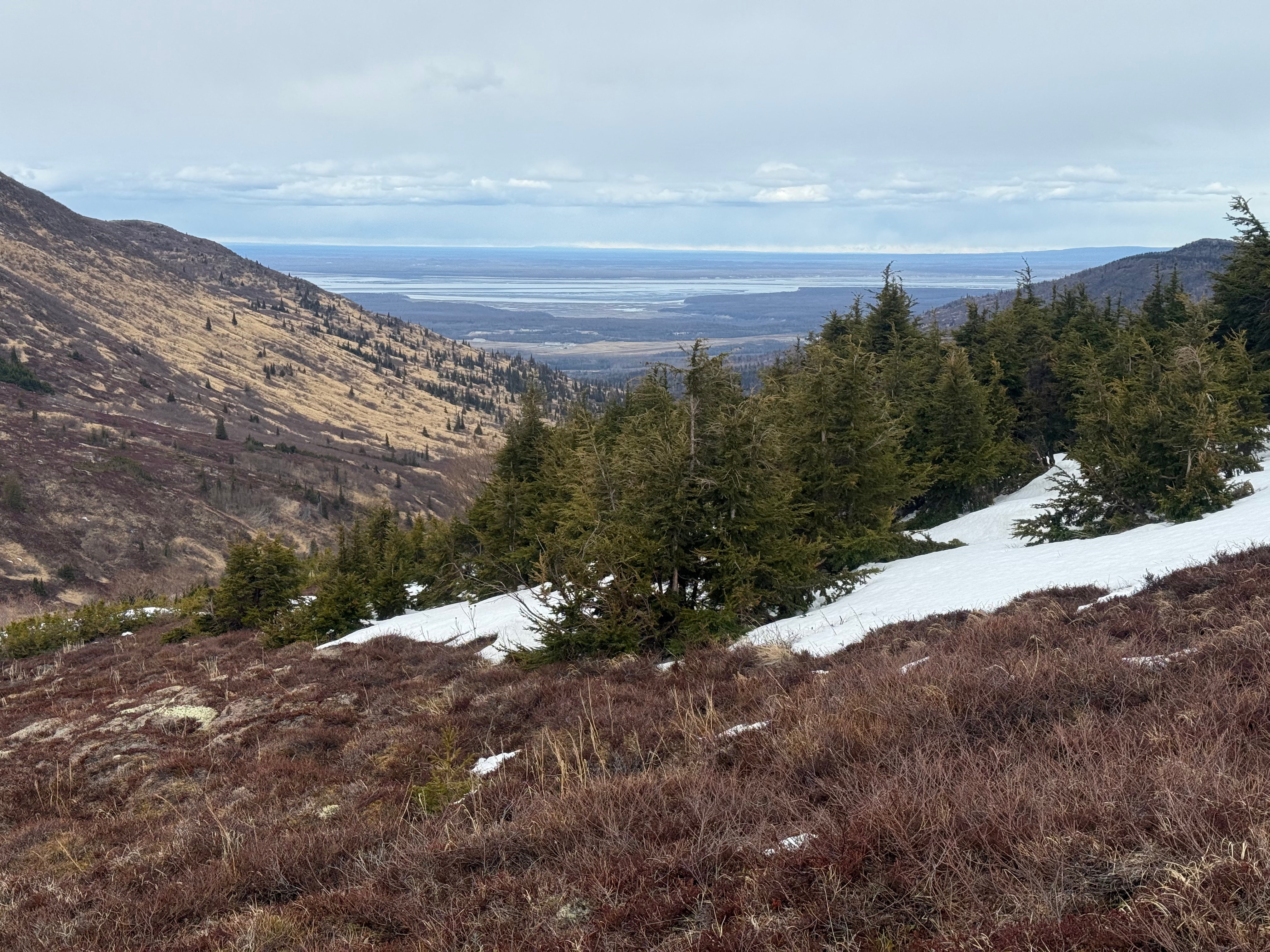
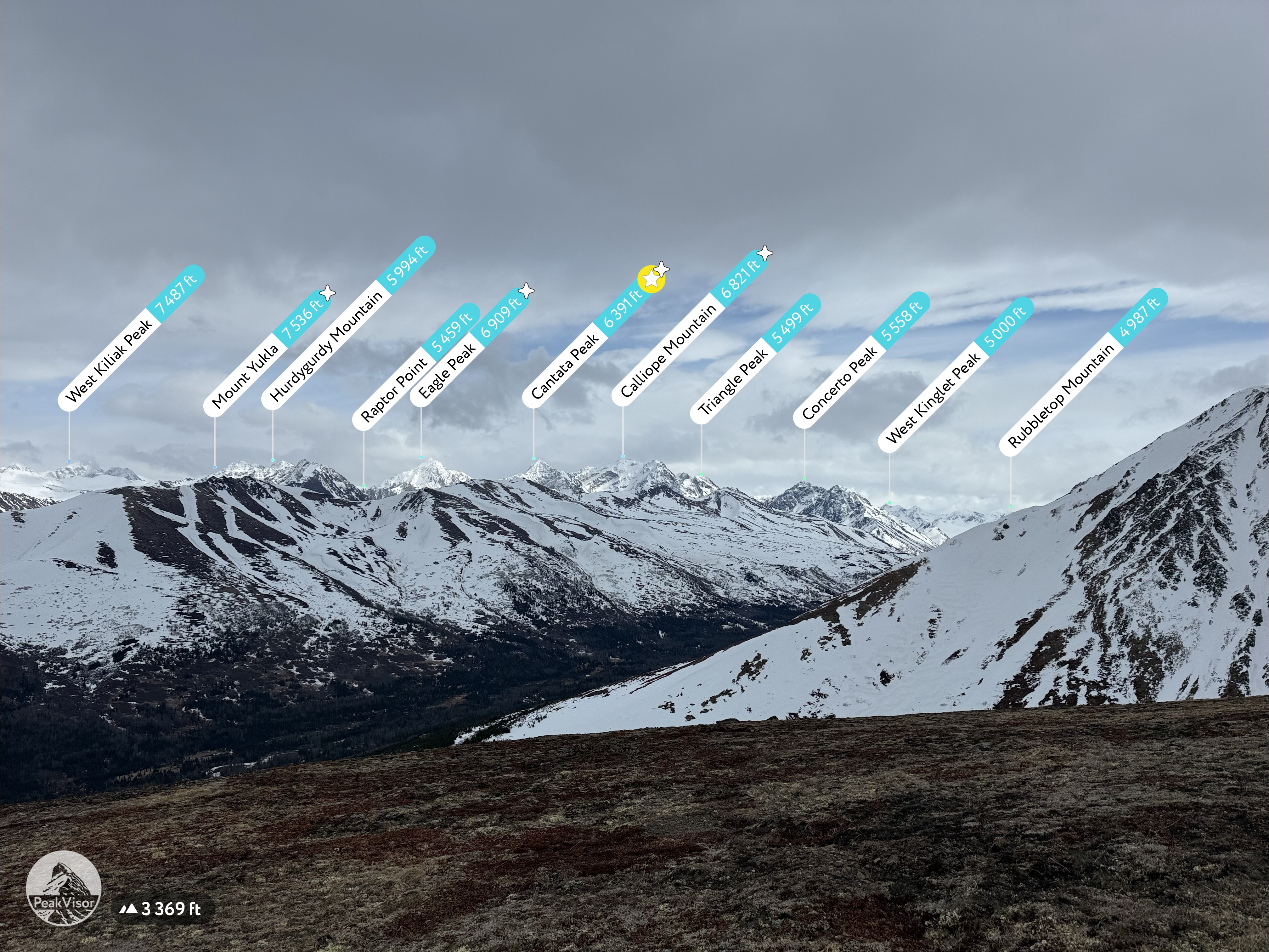
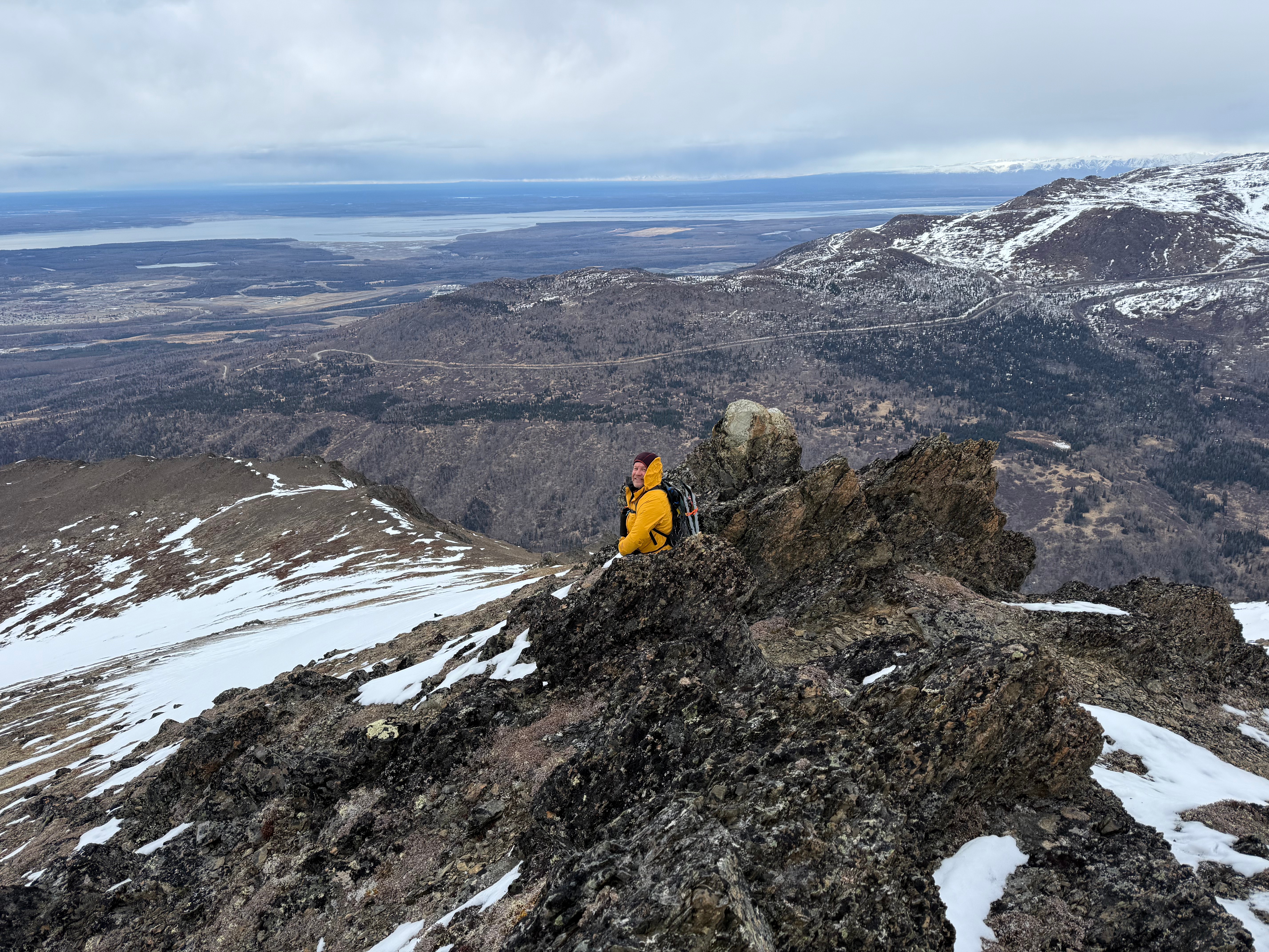
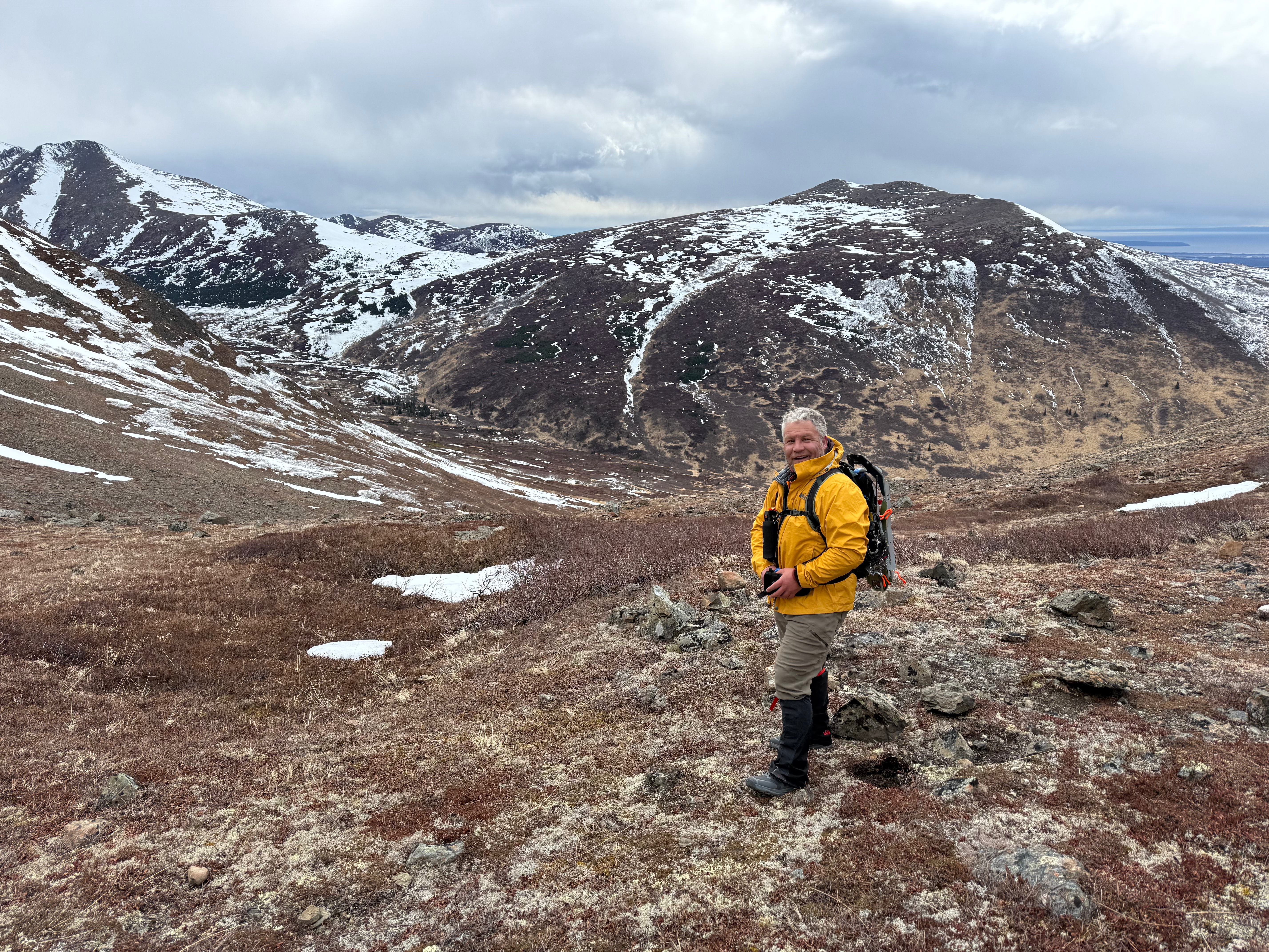
For a moment, we were protected from the wind and took a moment to look down on SC Valley and across the valley to the “our” ridge between Triangle and Arctic Valley. We had always been proud of connecting that entire ridge and now we were achieving another goal that felt just as good.
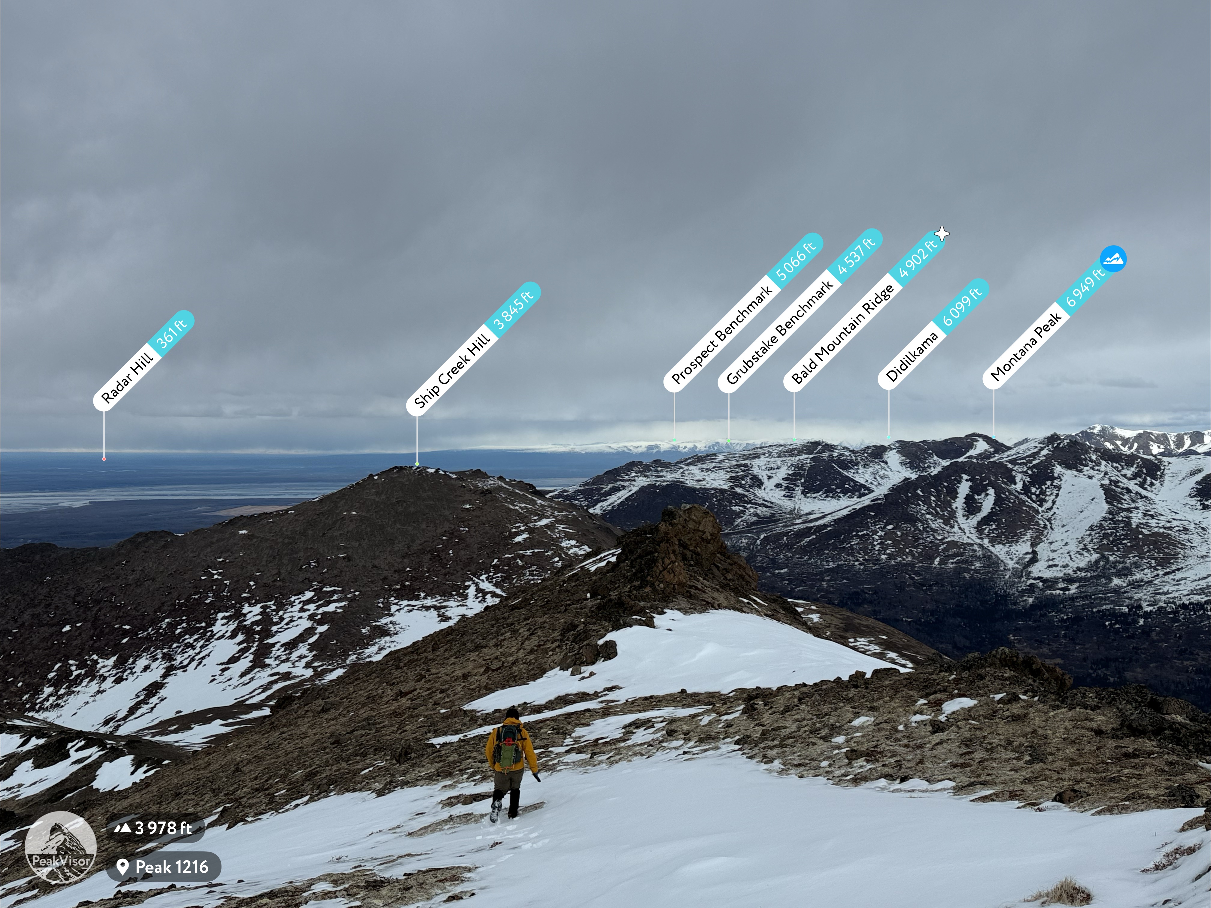
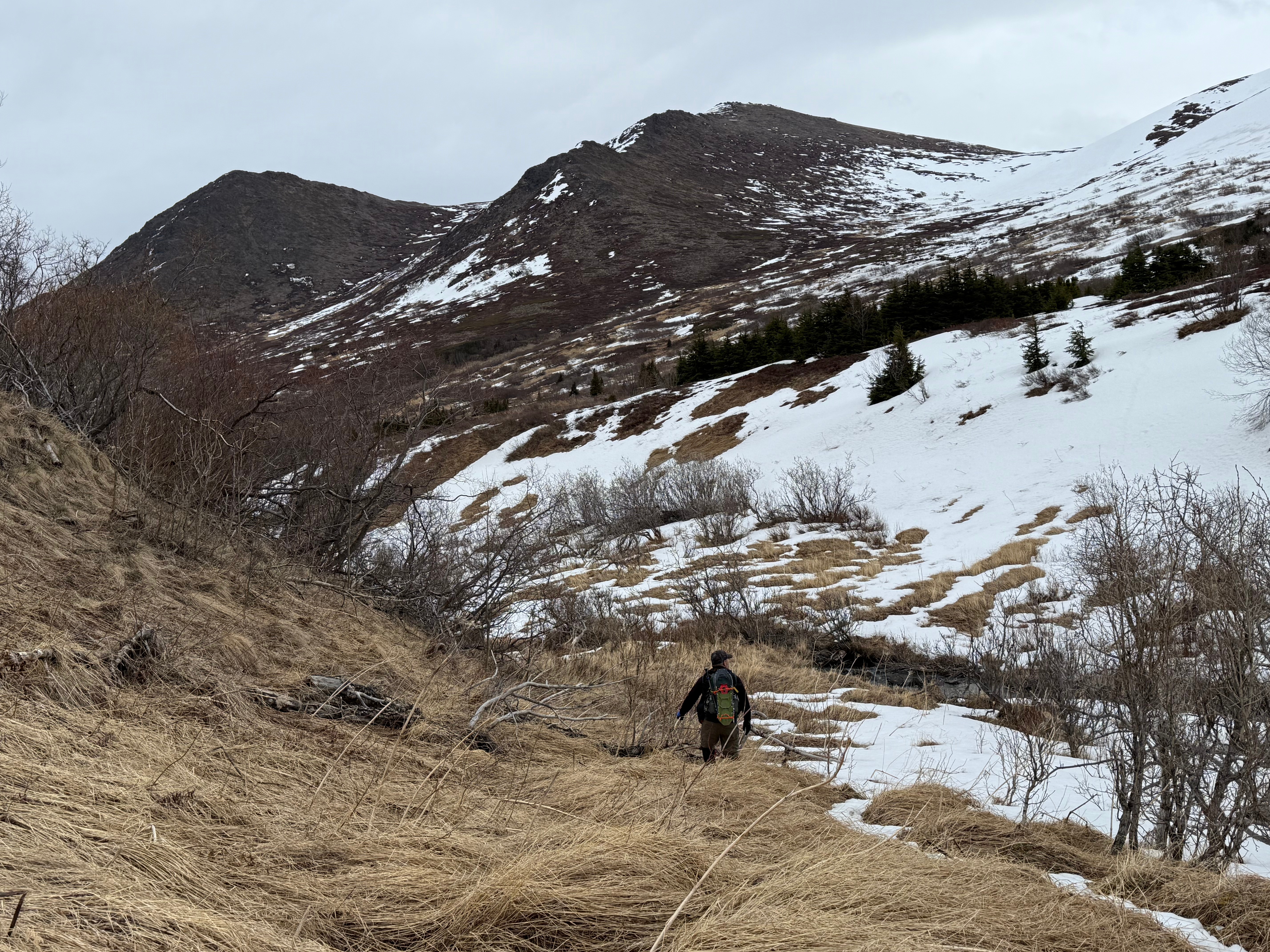
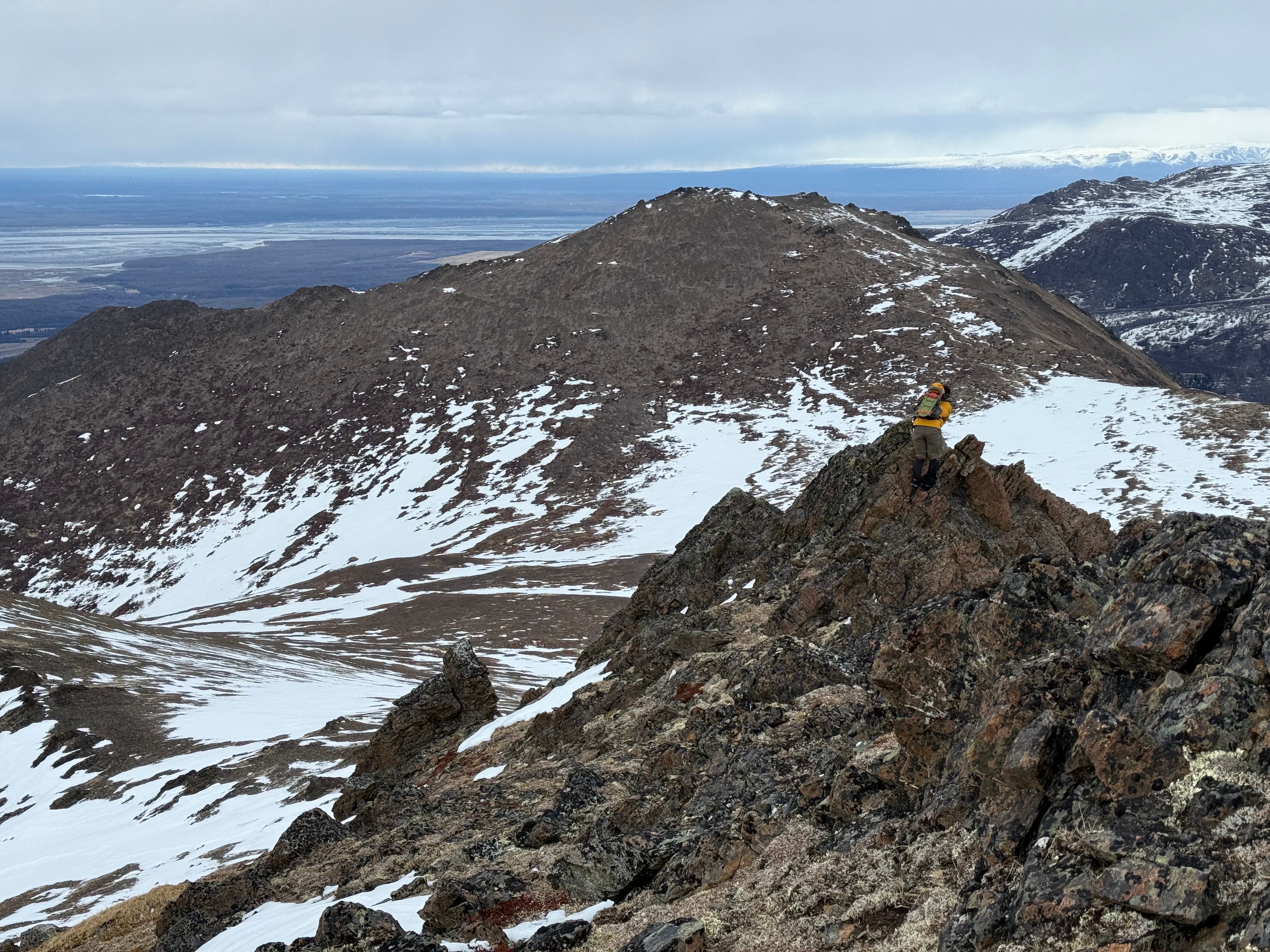
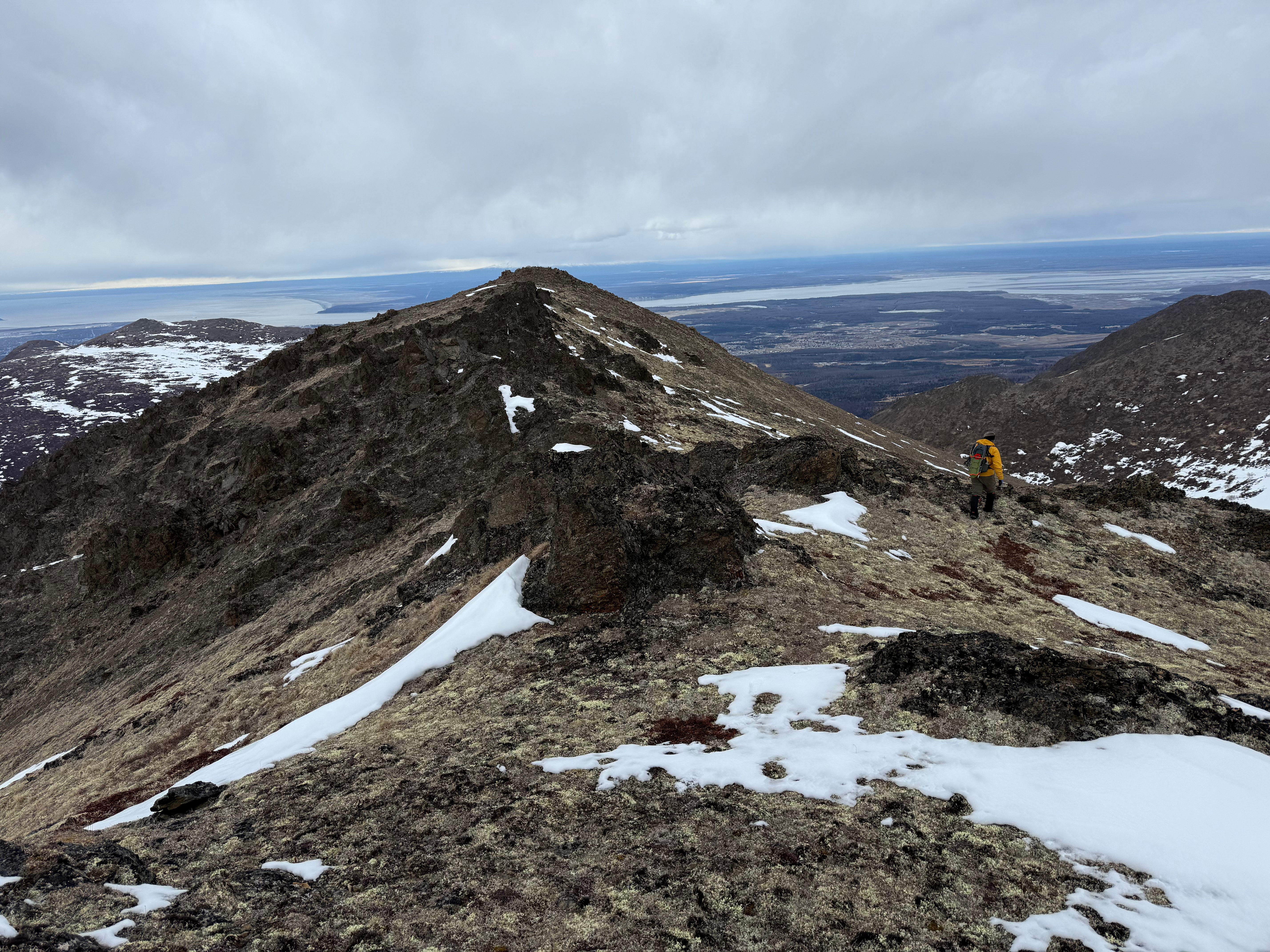
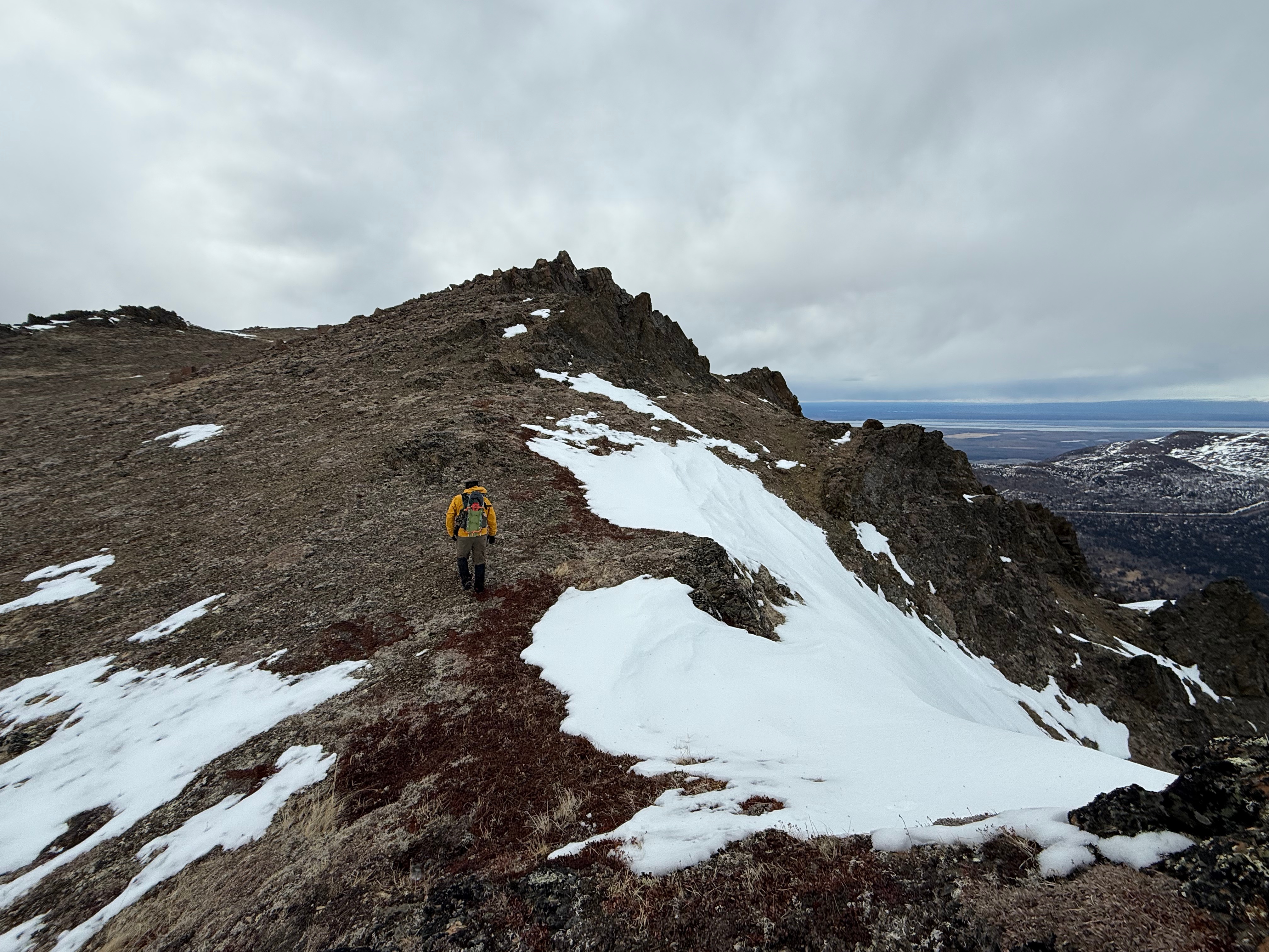
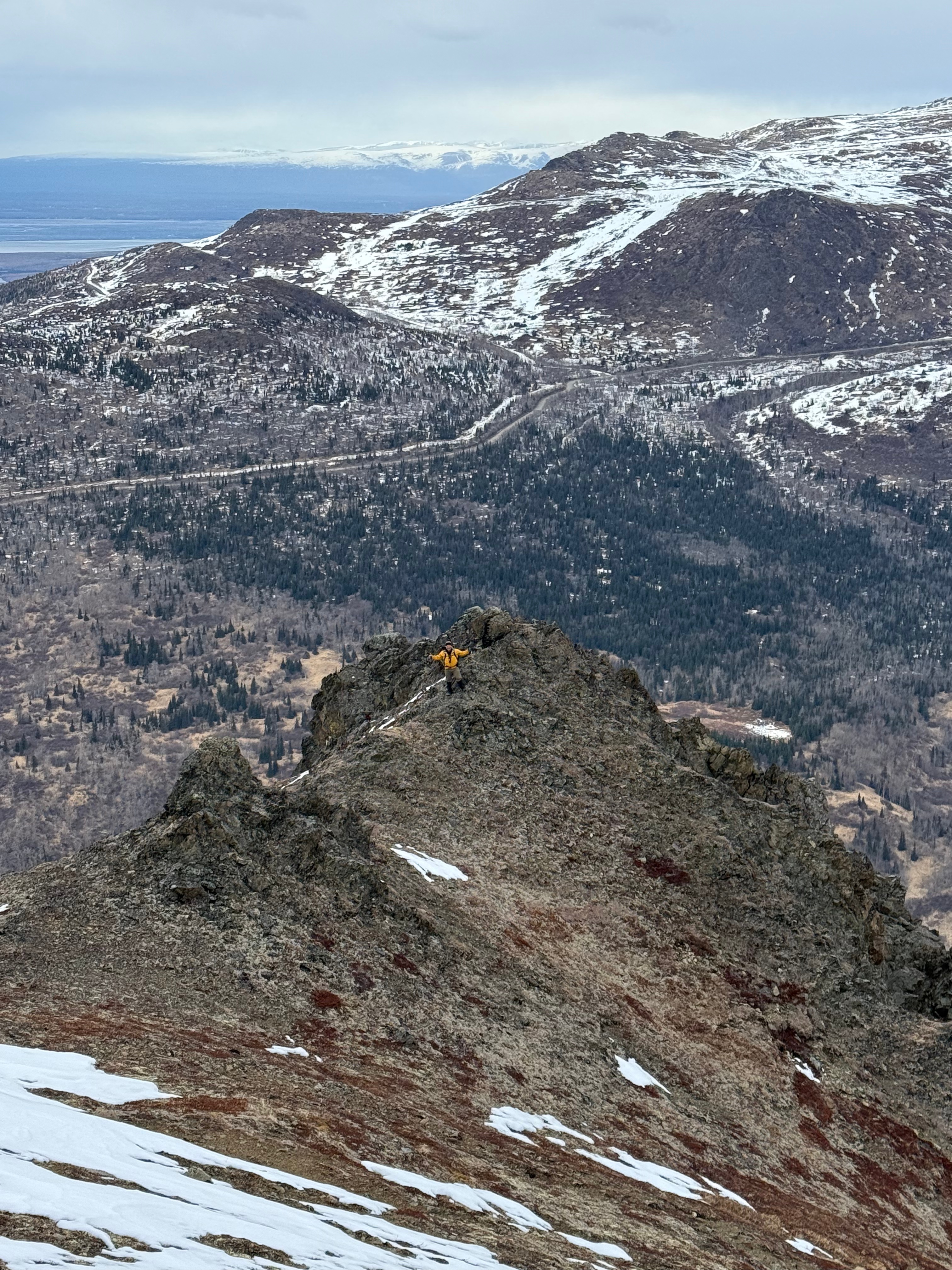
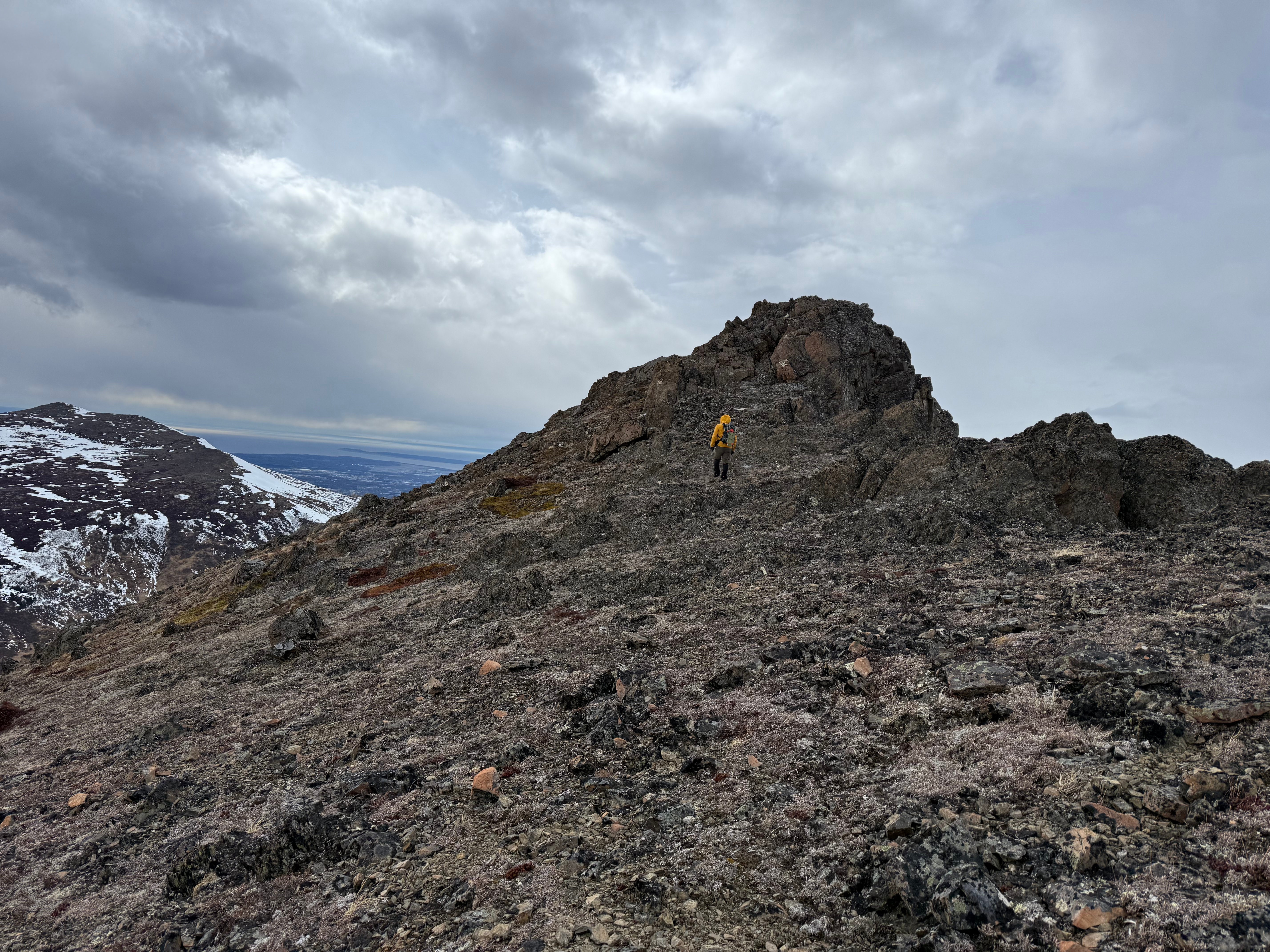
After quickly tagging the overlook point to the west of 1216, we continued towards SCH, walking along the broad, pathless ridge to what, from this perspective, looked like an anticlimactic mound. Arctic Valley road visible to my right, I climbed around on the myriad of mini summit blocks to ensure I had hit the actual high point.

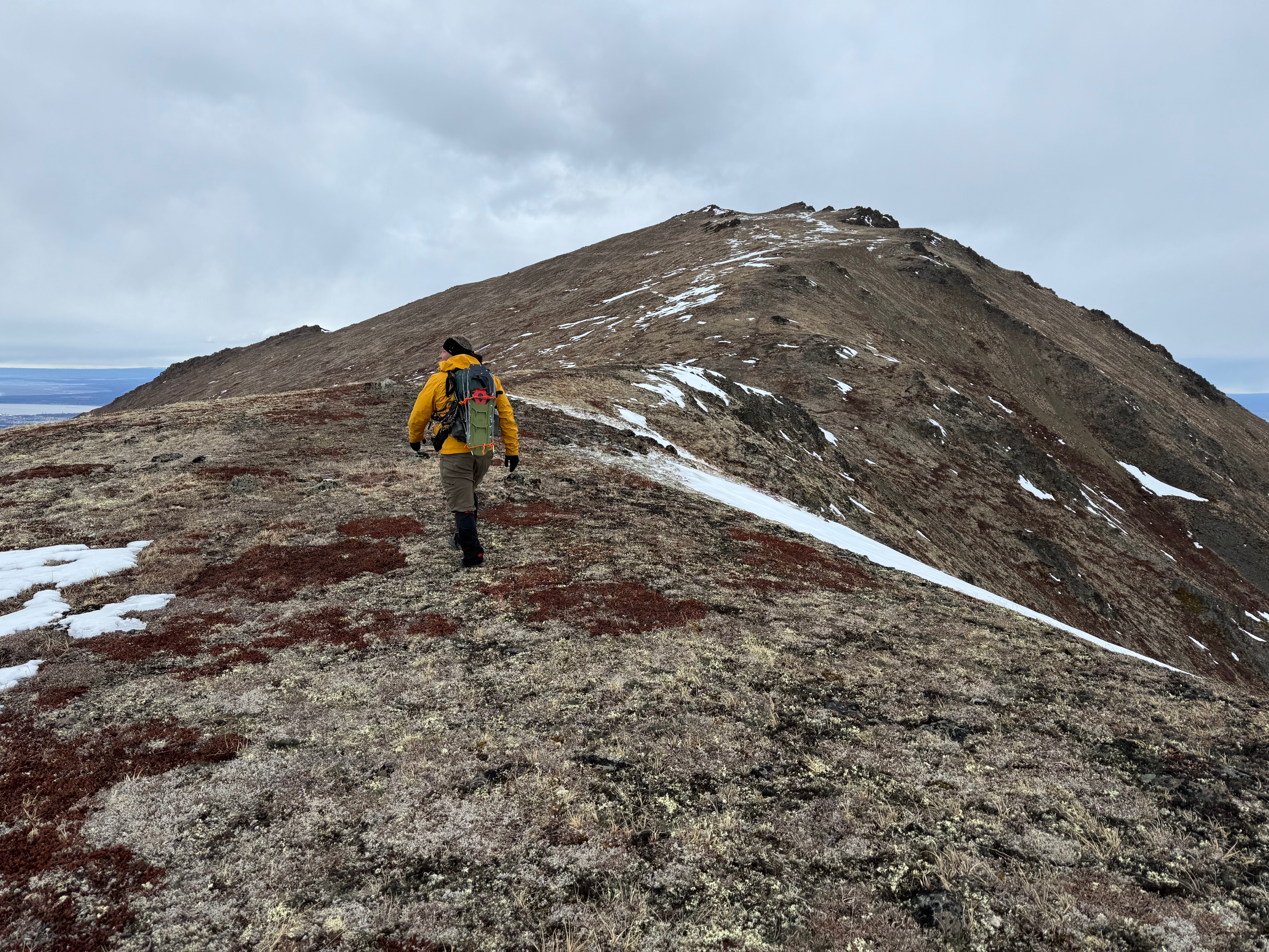

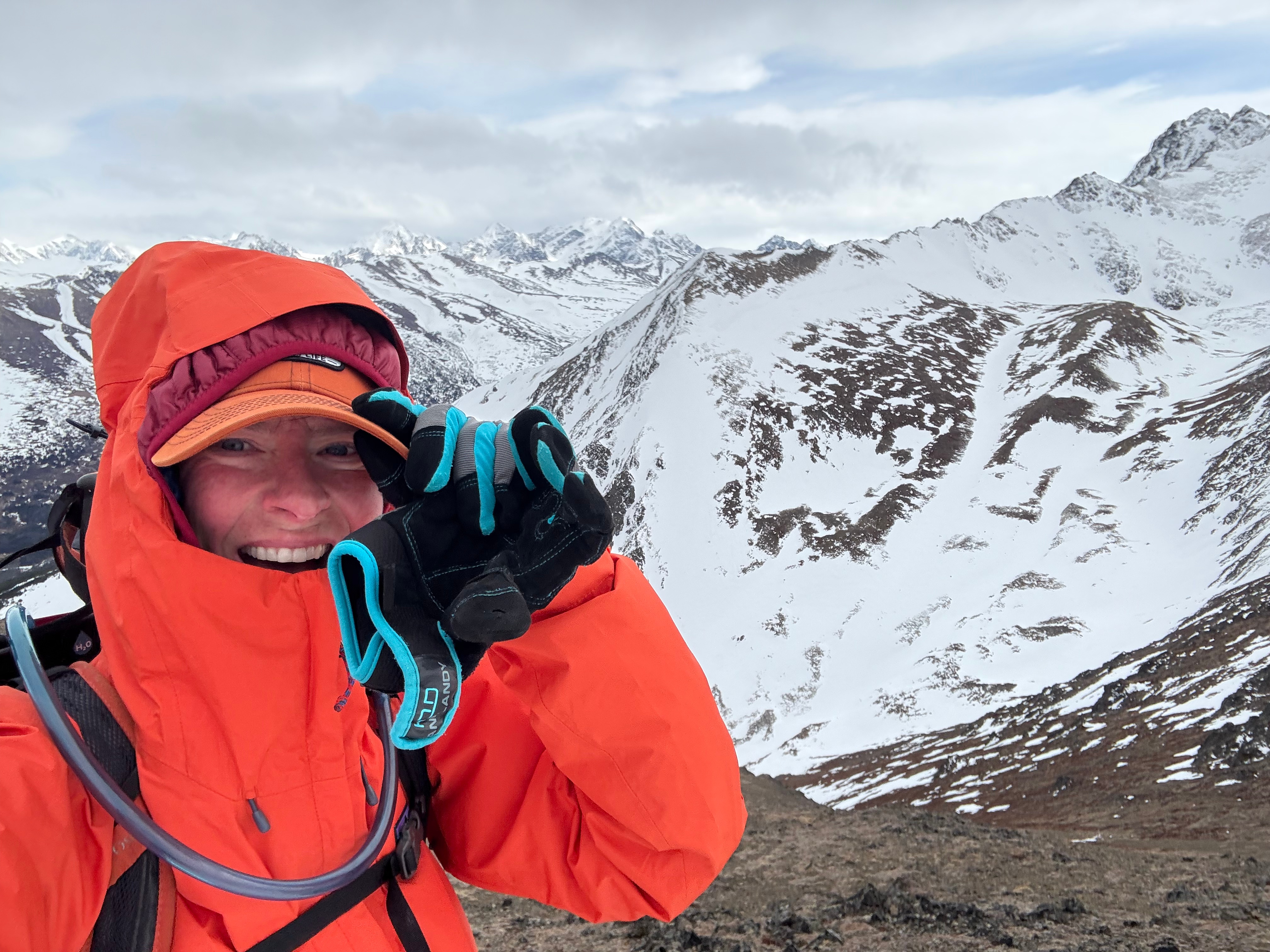
The wind was not letting up and I was being blown off my feet, but we weren’t letting up either.
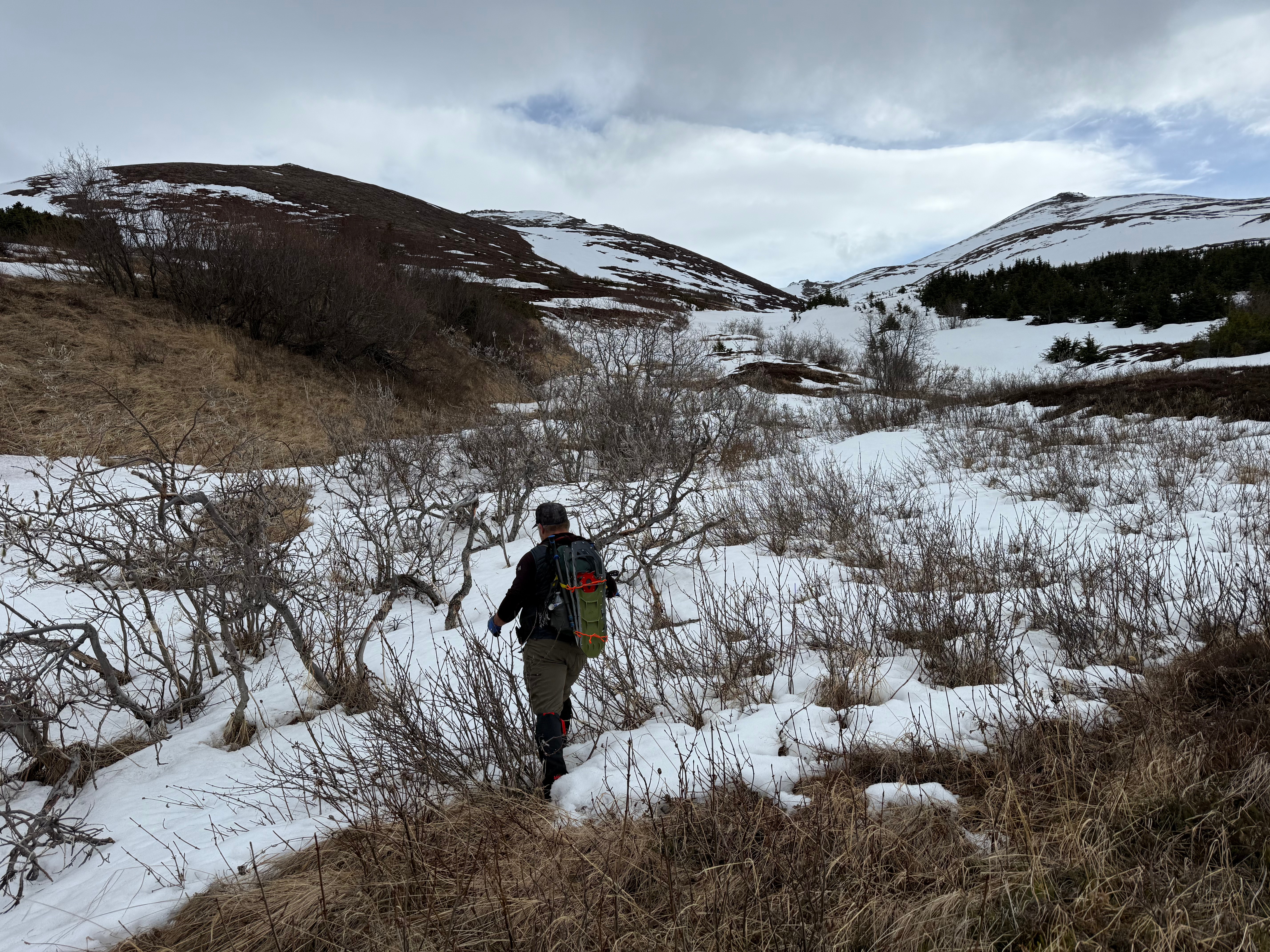
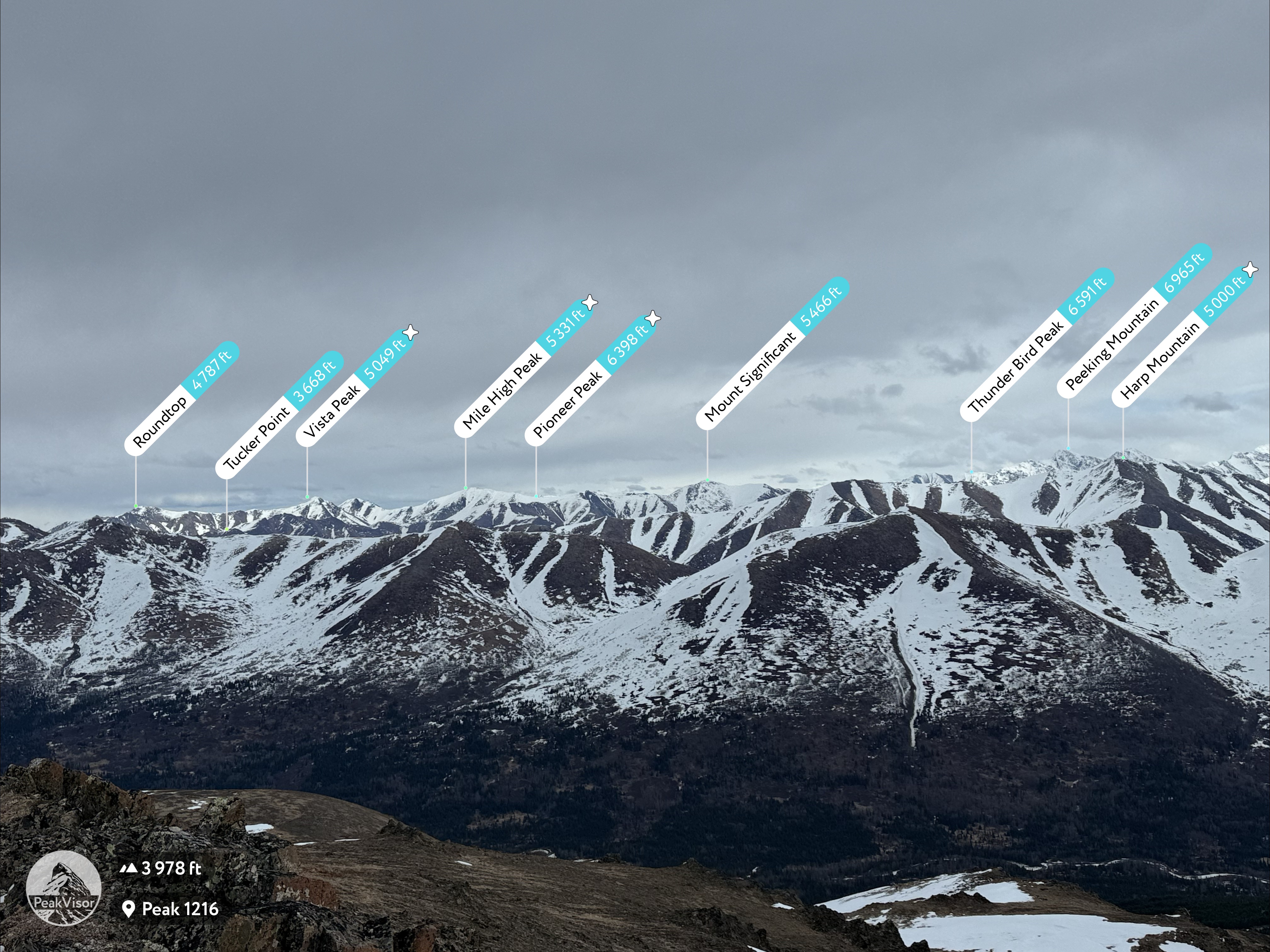
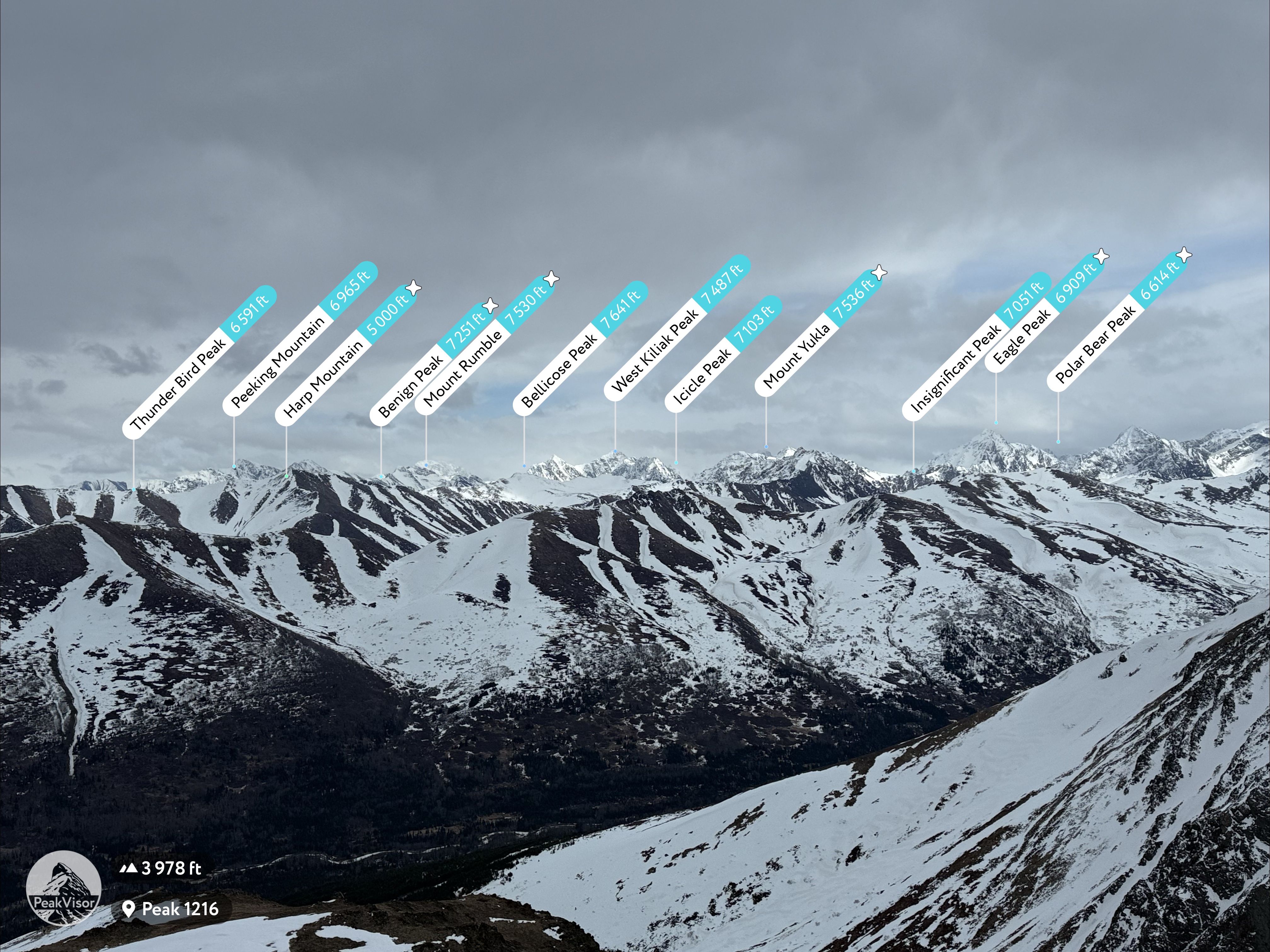
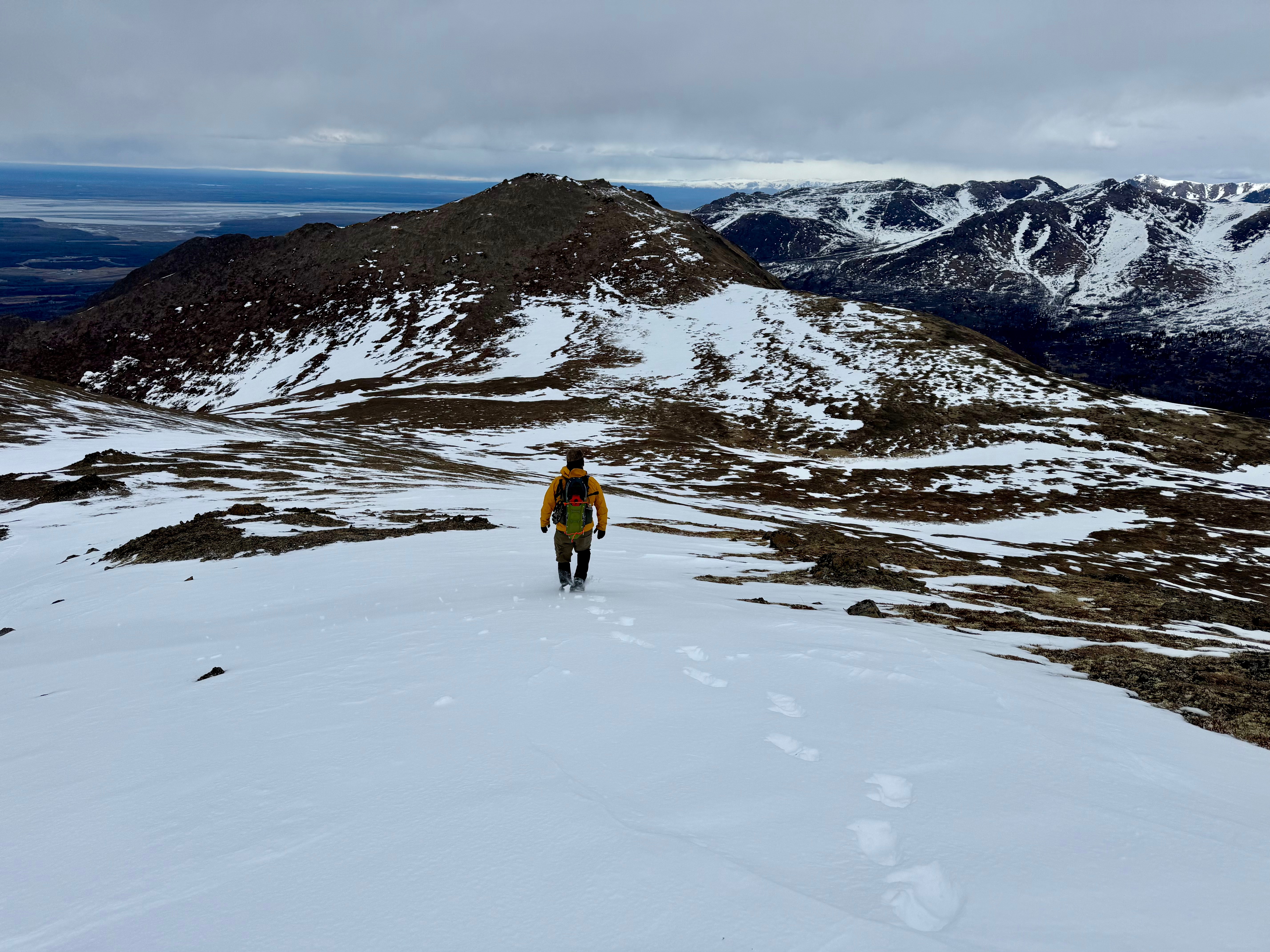
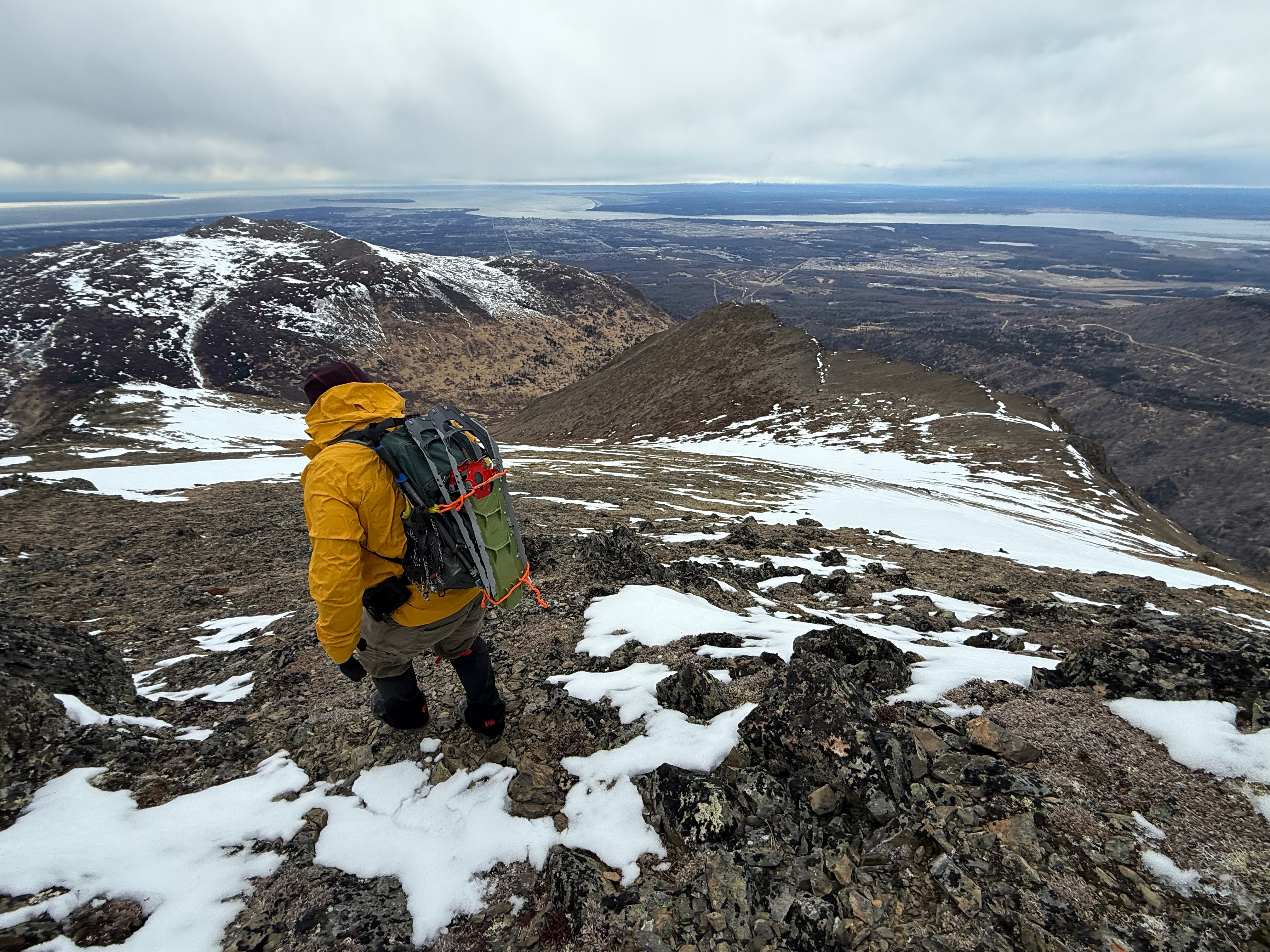
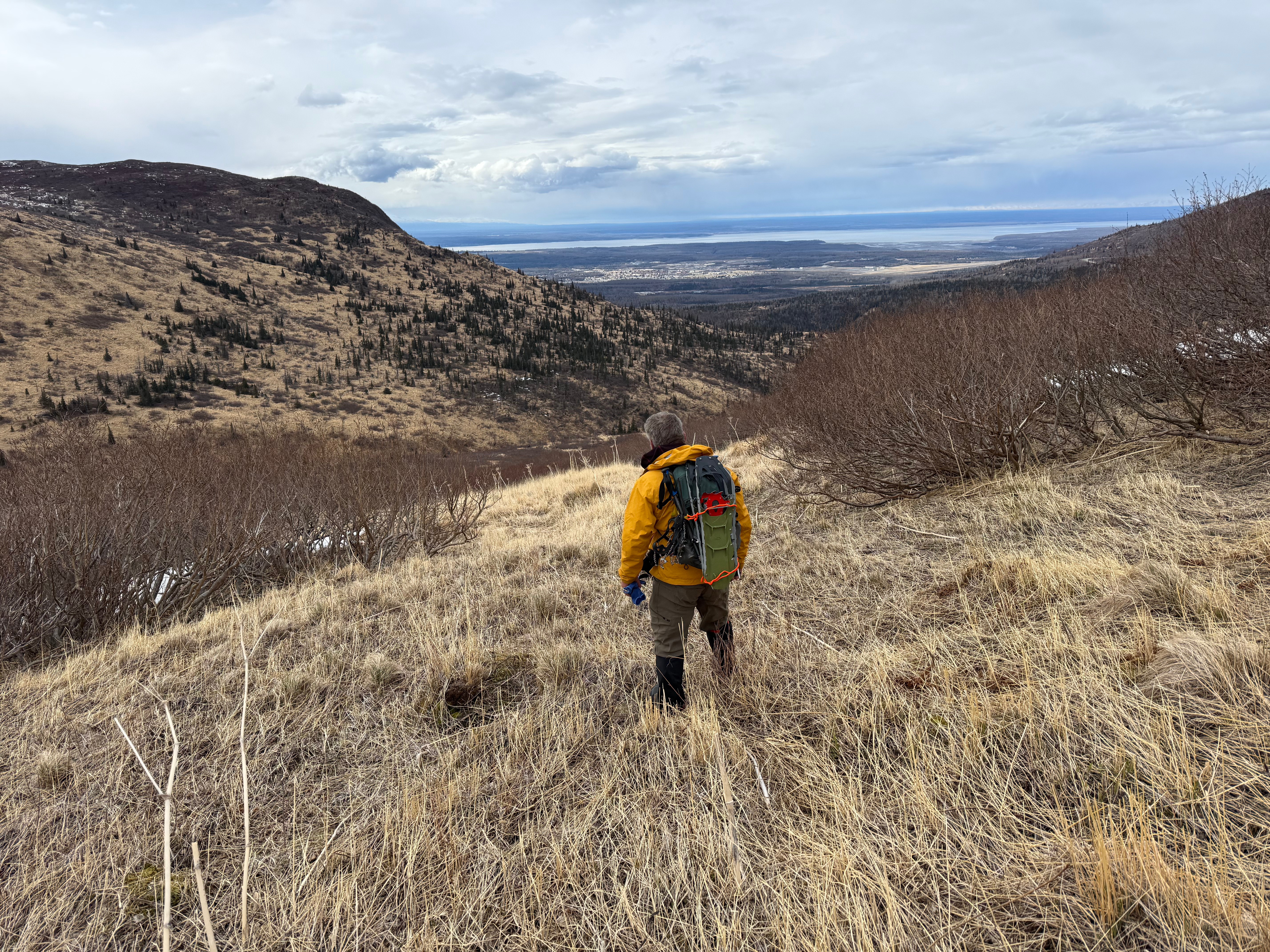
After bagging the two peaks, we aimed towards the last goal; a point at the far end of SC Hill’s western ridge. The weather was getting even worse and the wind was stronger than ever. After a moment of looking down on the Anchorage bowl, we both agreed it was time to get out of there and began descending directly down the steep, yet snow free, southern slope.

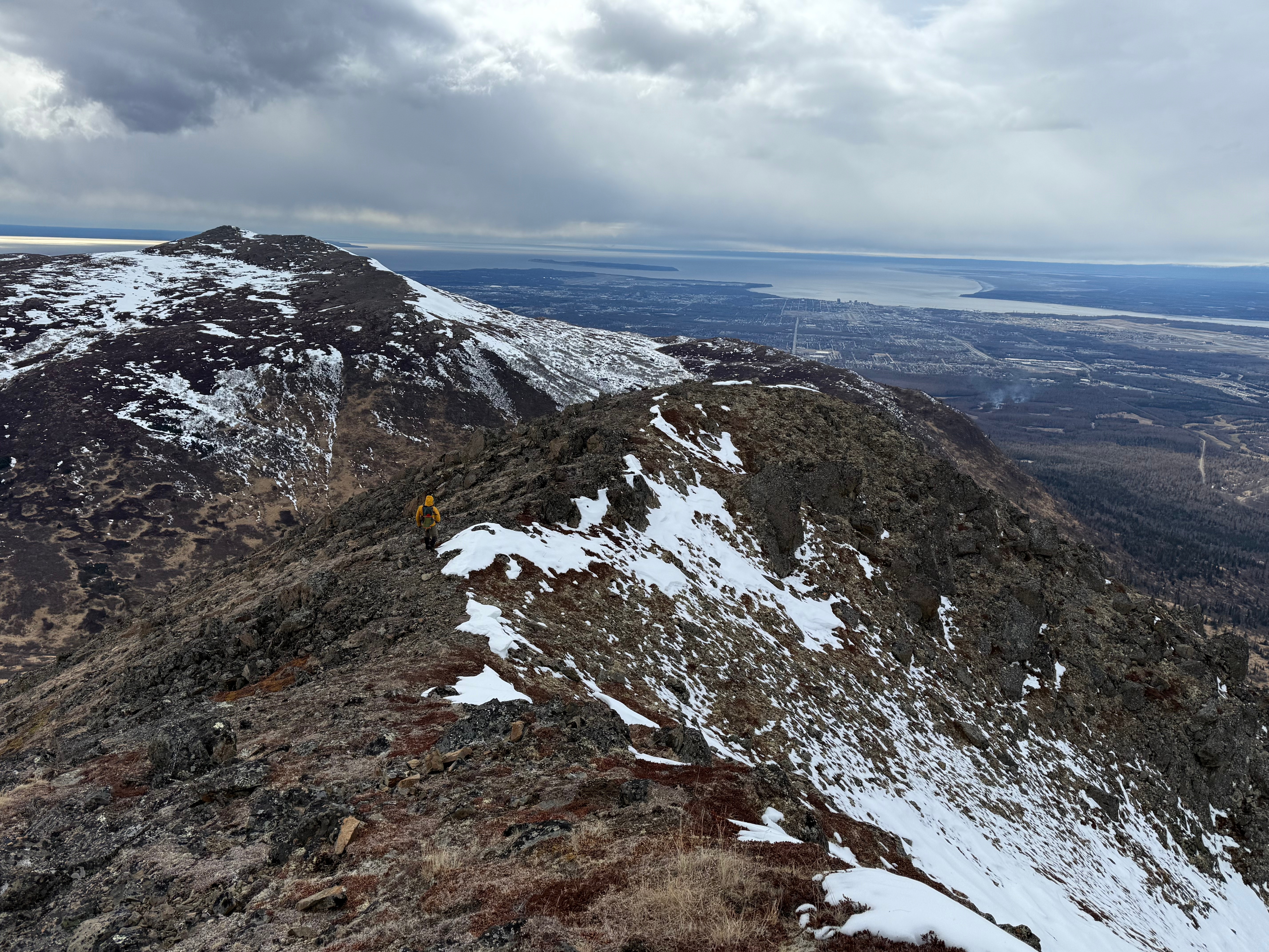
Now protected from the wind, tucked between the shoulders of SCH and 1216, we stopped for a snack break, now 11 miles into our day. As we rested, the sun began to burn through the clouds and although it never fully succeeded, the filtered rays warmed us up.
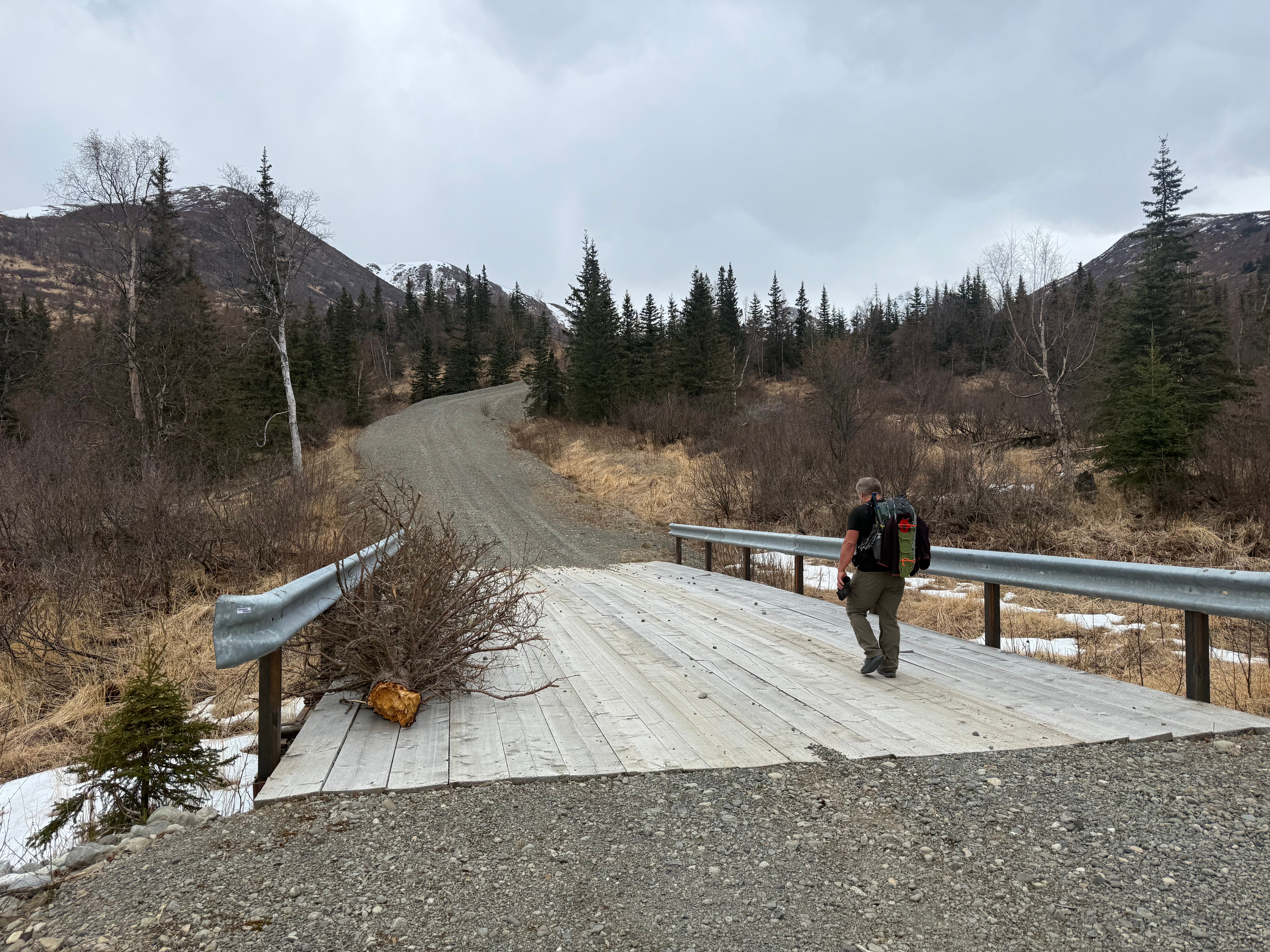
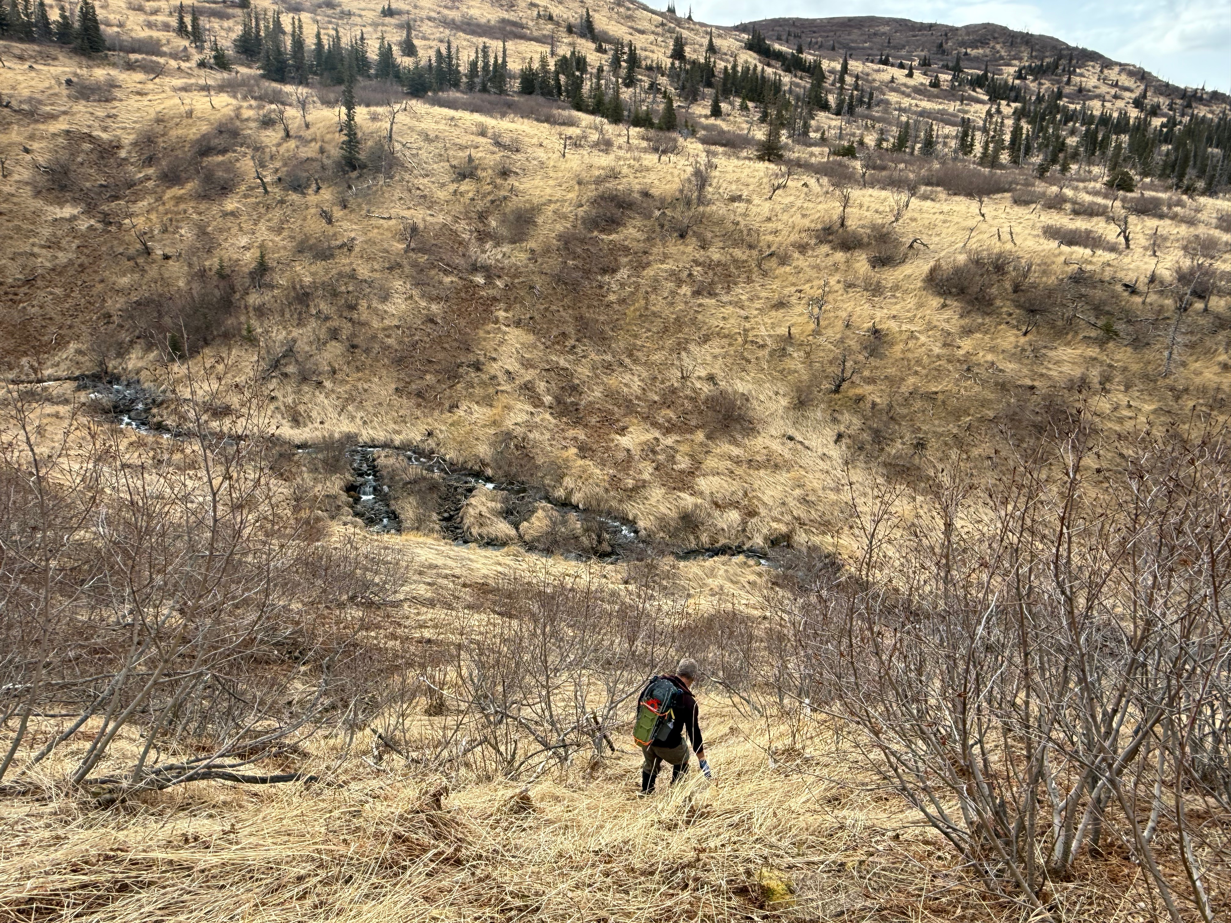
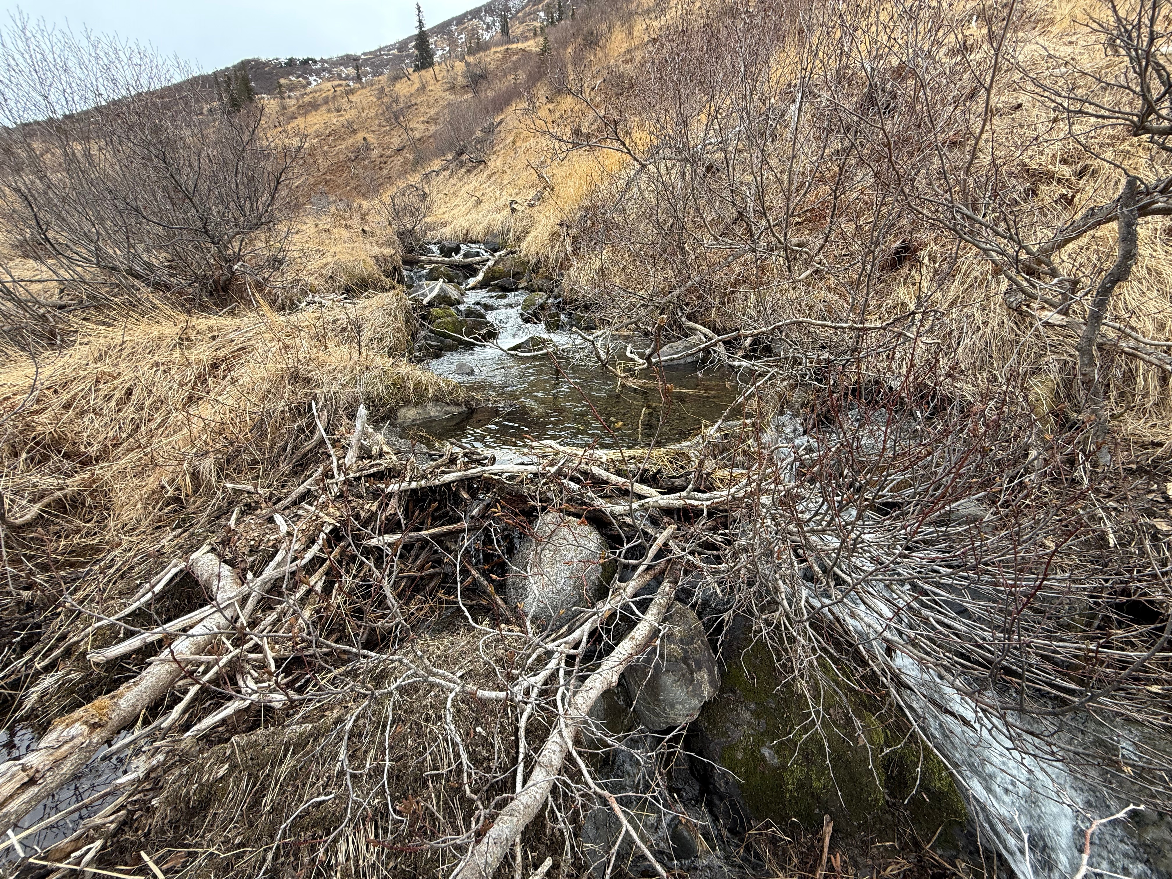
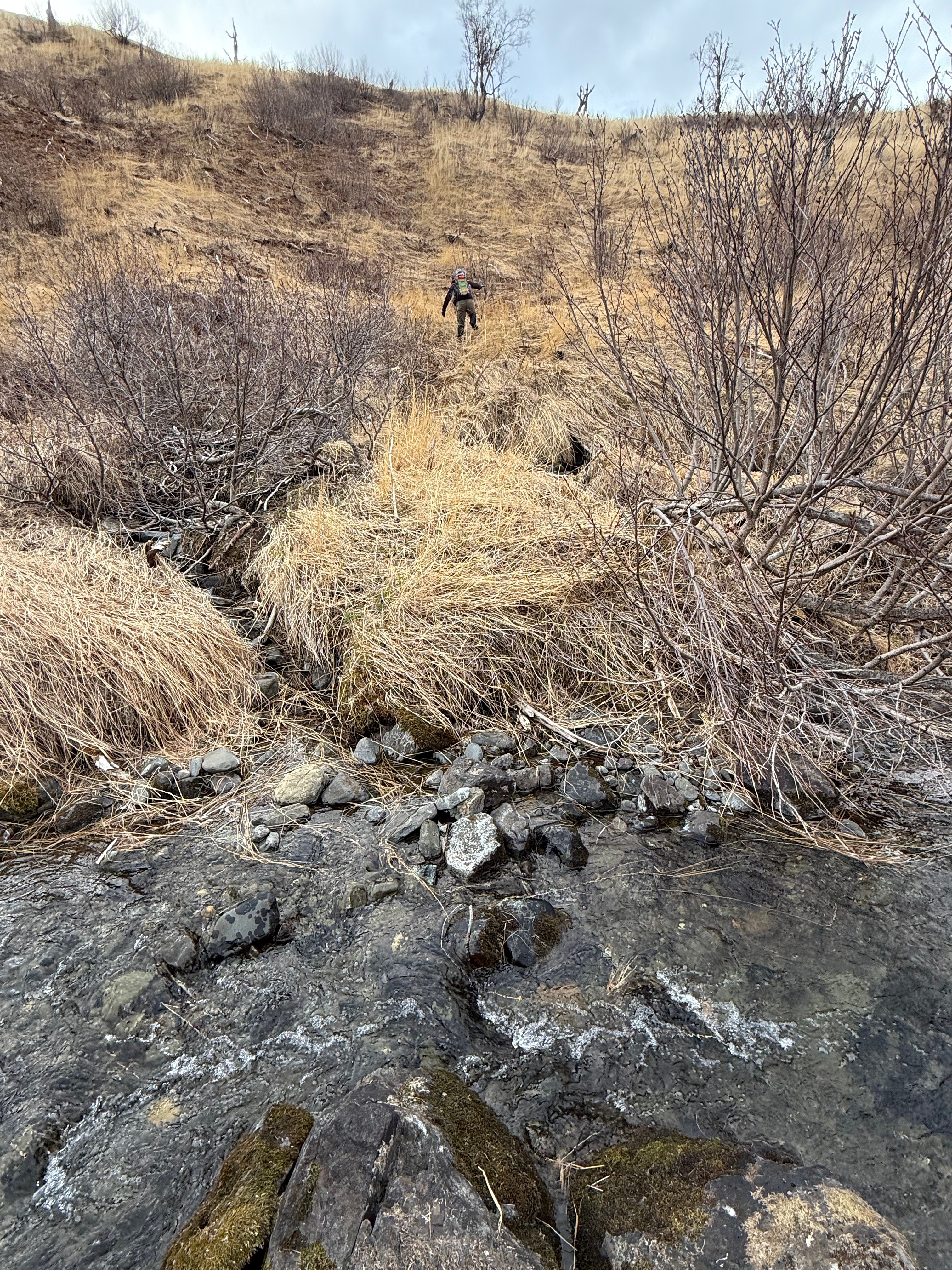
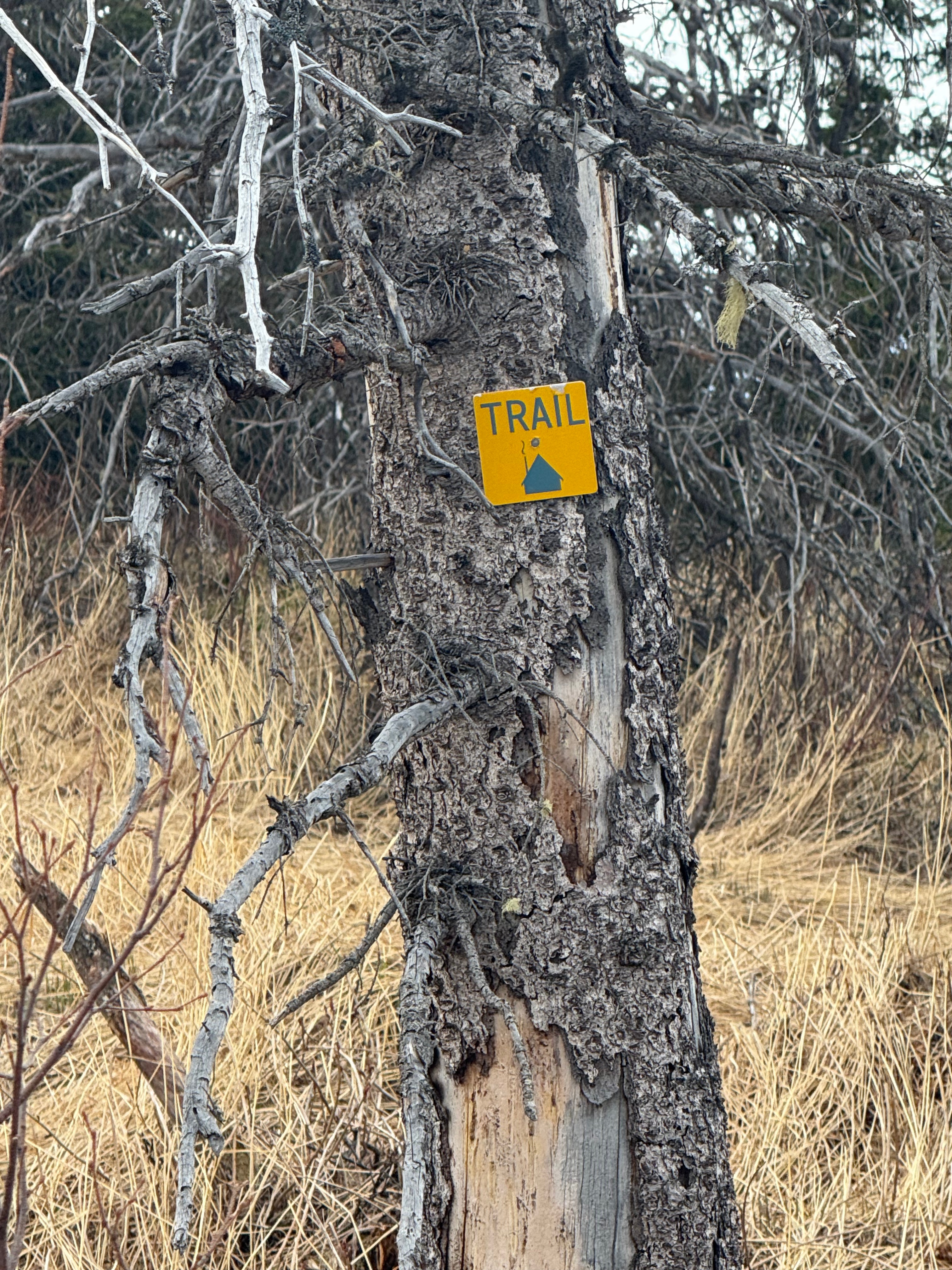
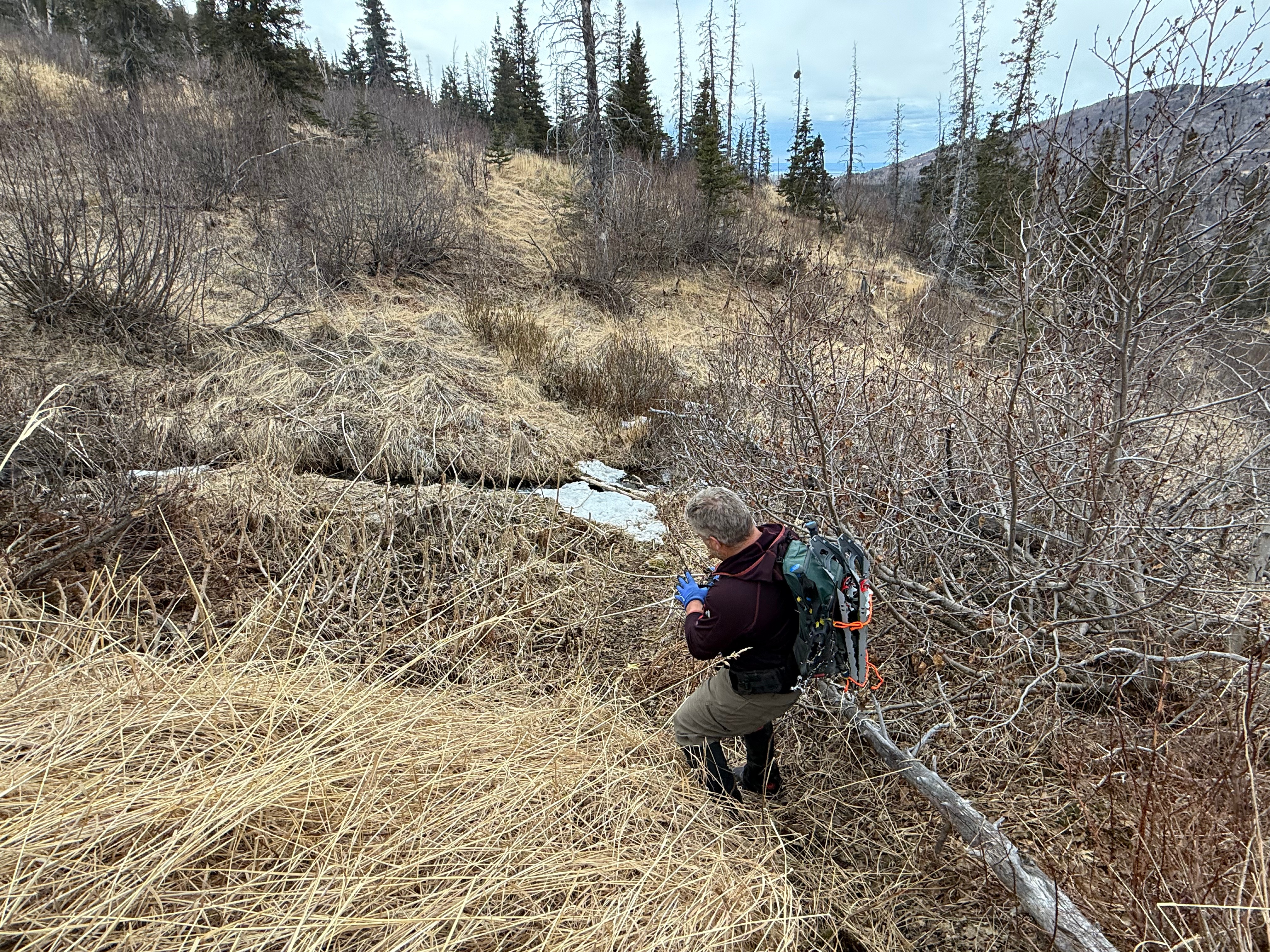
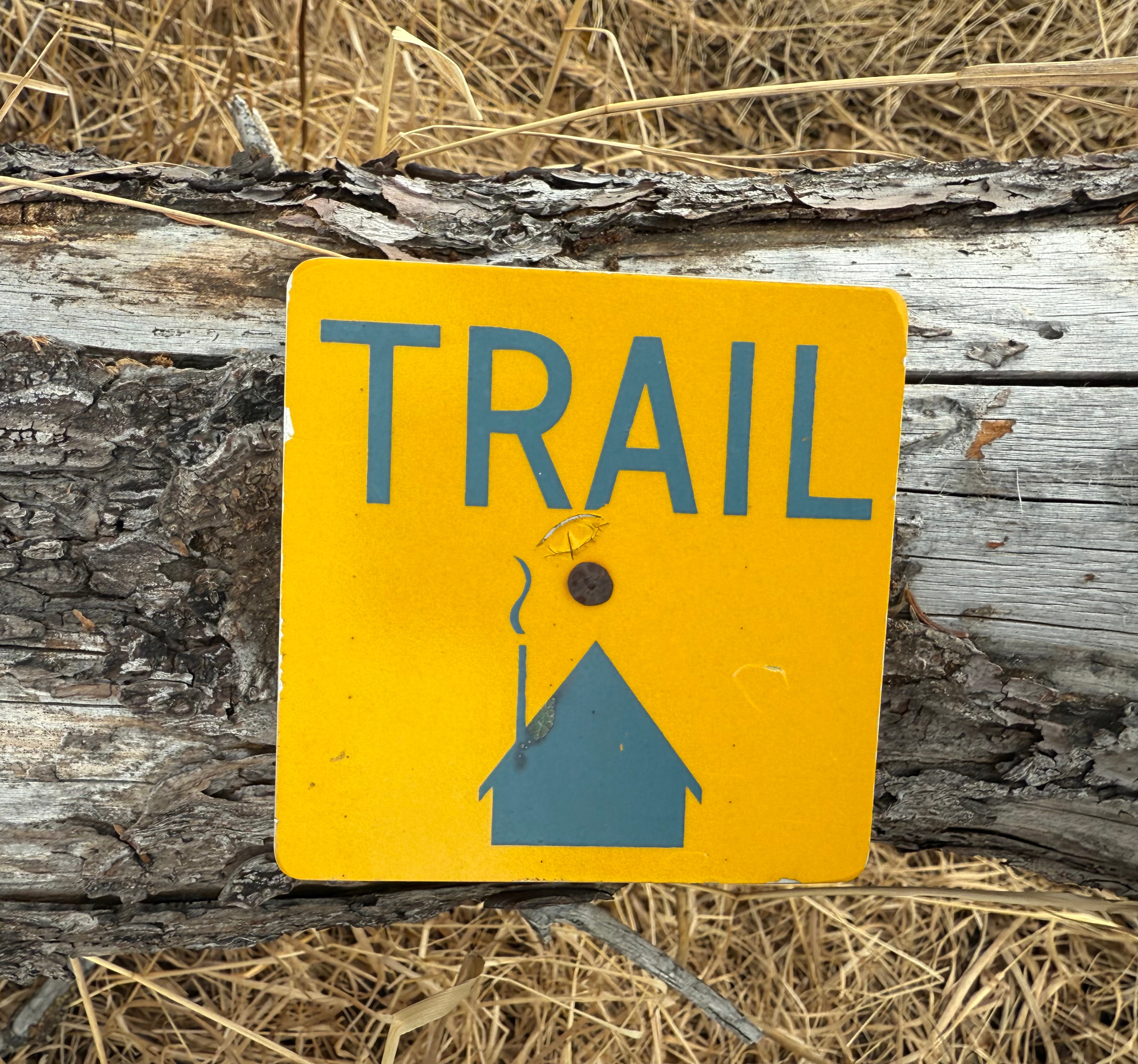
Knowing we still had what could be the most challenging section ahead, we packed up our gear and descended back down to the creek, a mile downstream from where we had crossed earlier in the day, and ascended a small, but steep, grassy slope. All I knew is that there was supposed to be some semblance of a trail, although very overgrown, that would lead us back to the Ship Creek bridge where Jason’s car was parked.
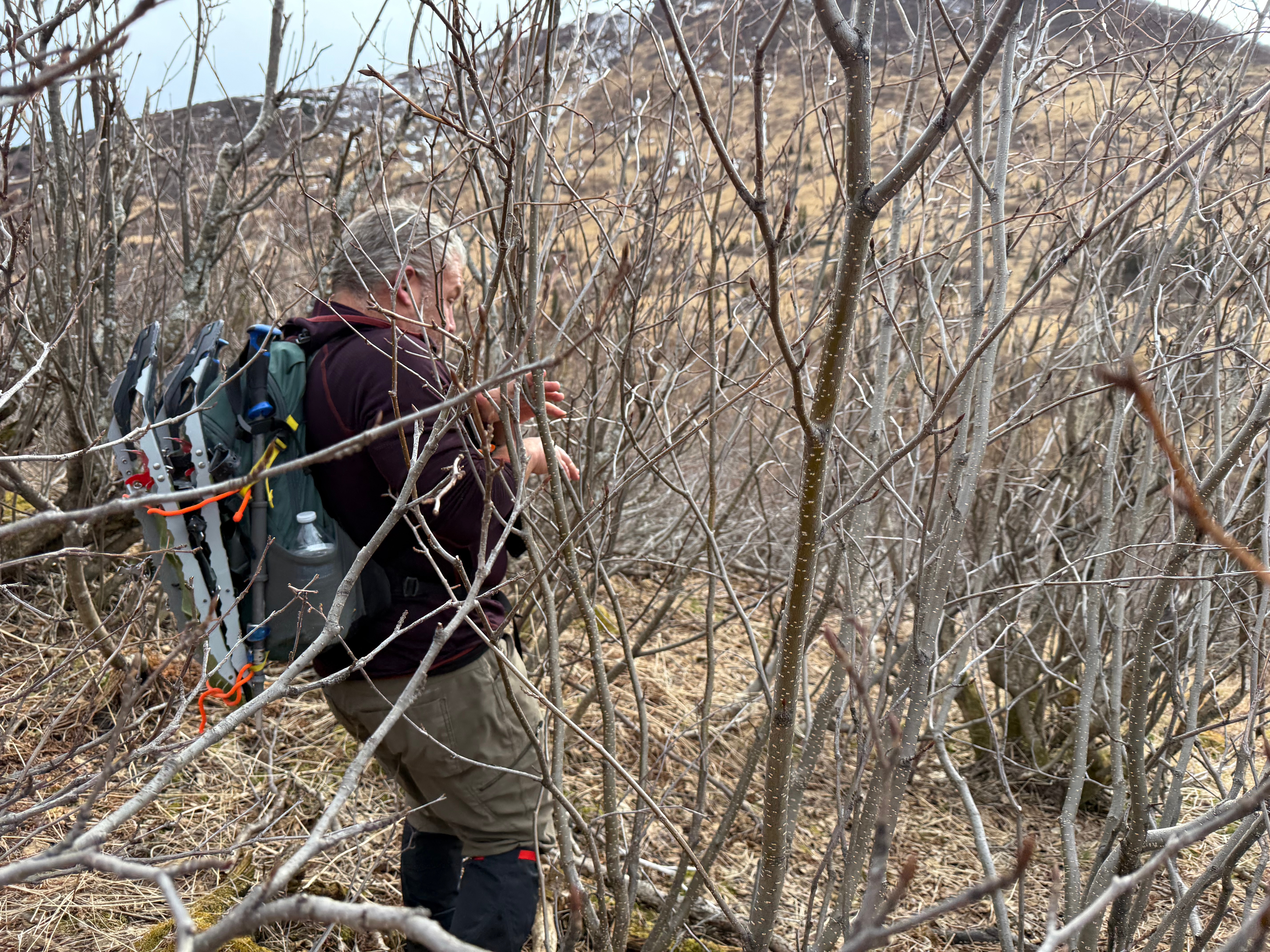
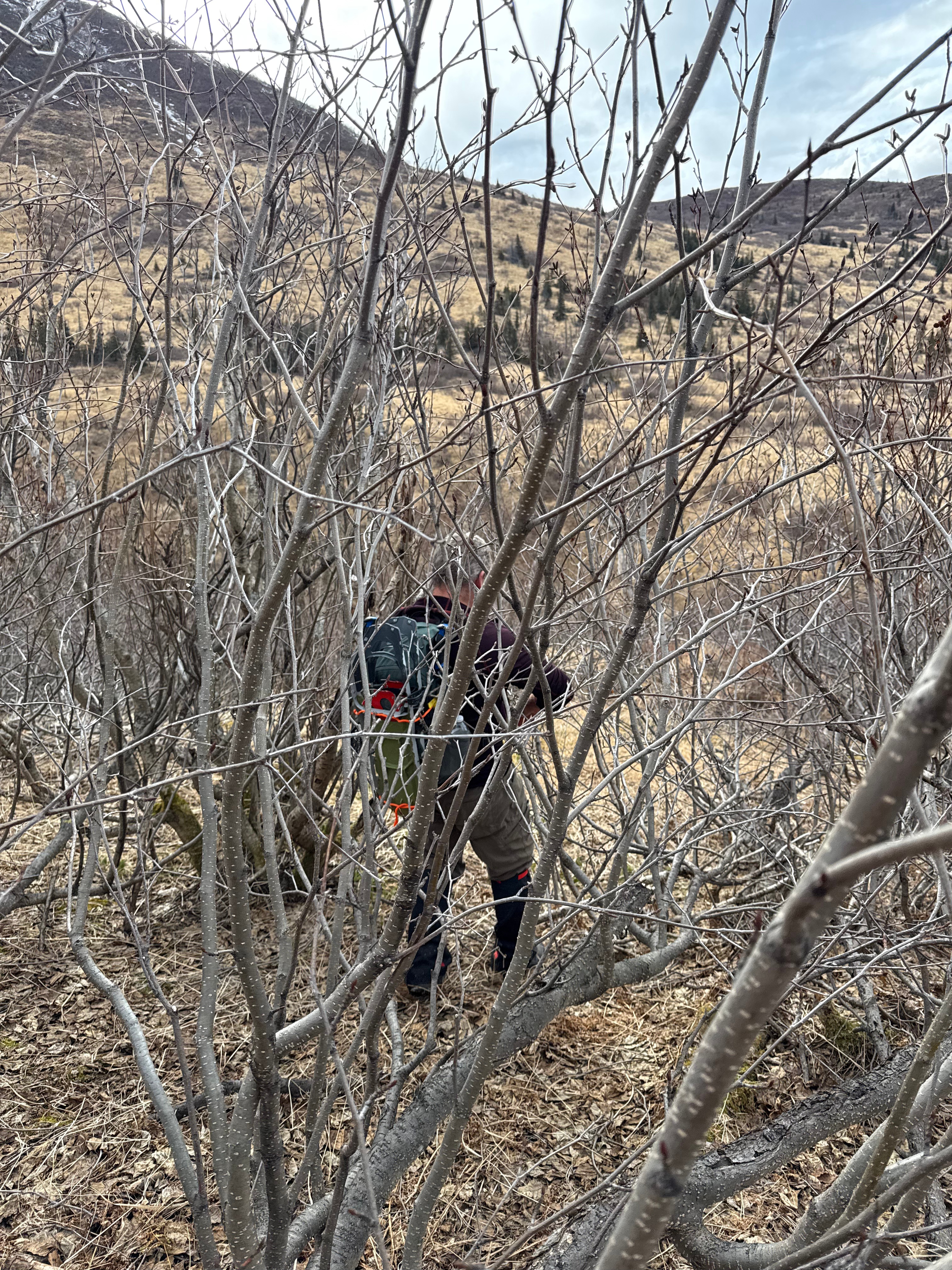
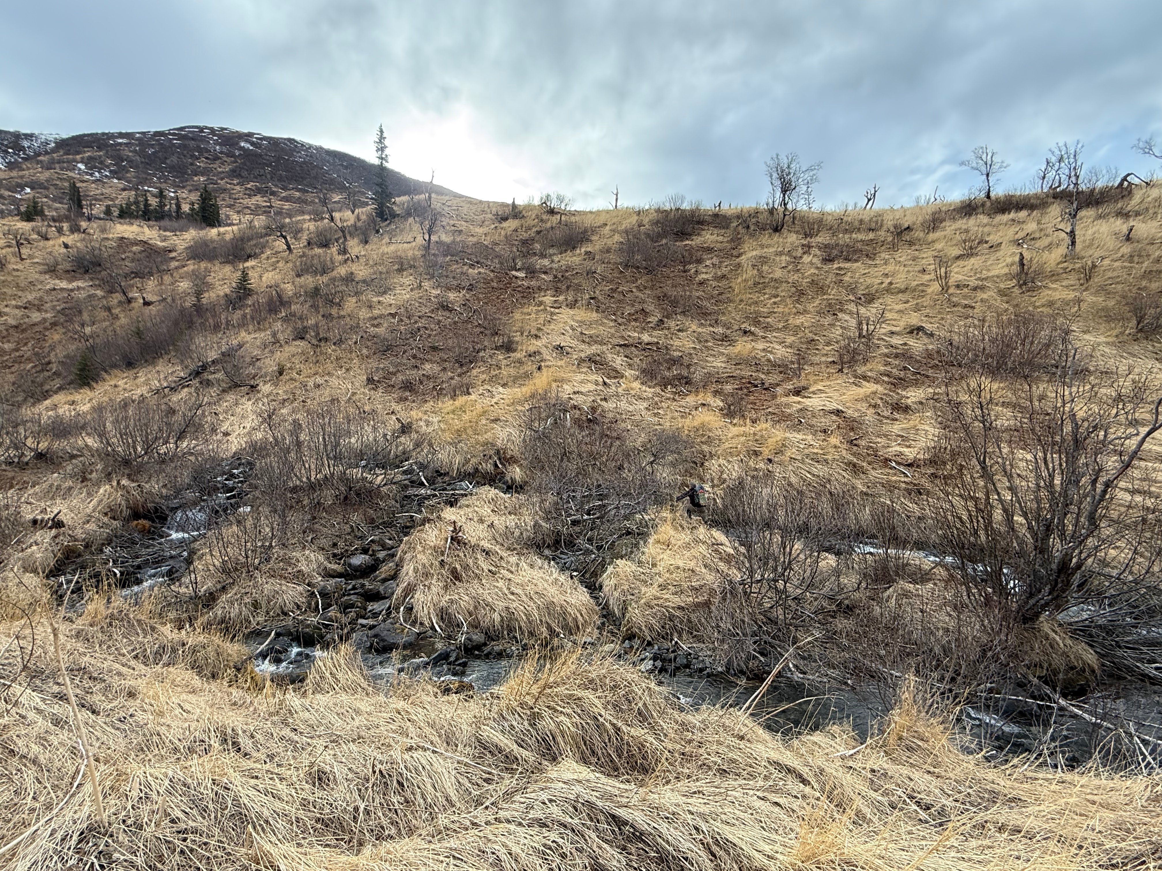
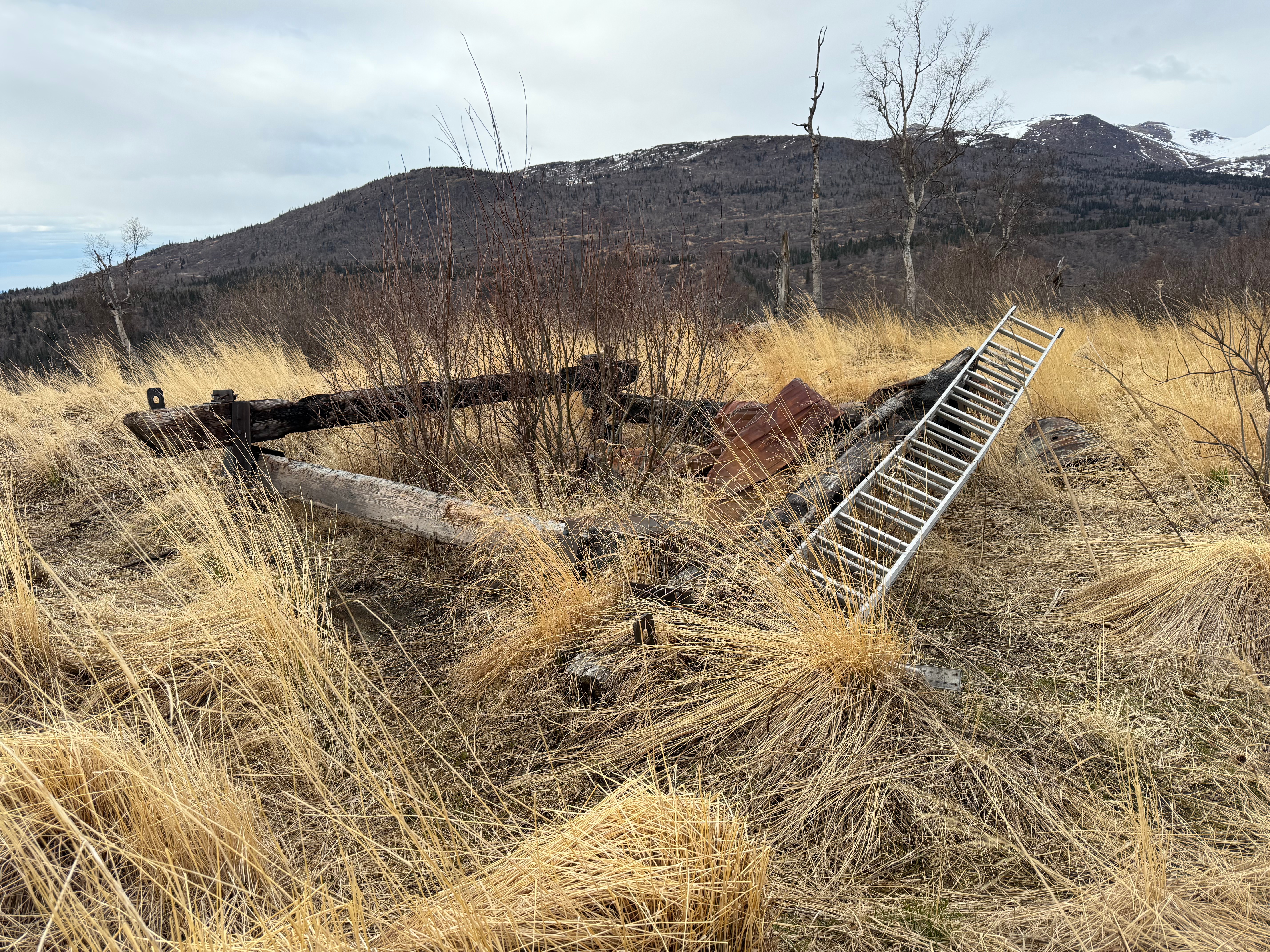
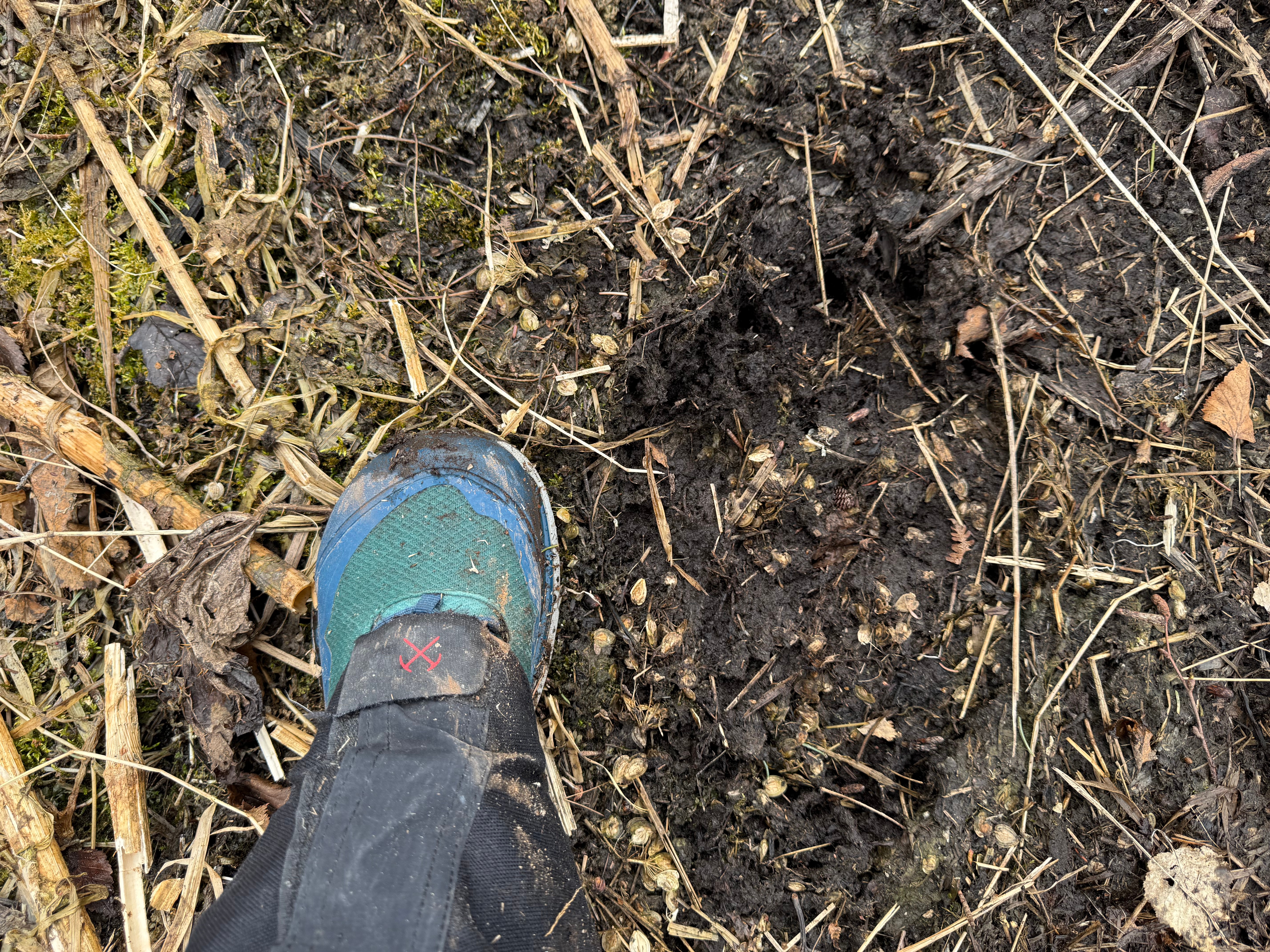
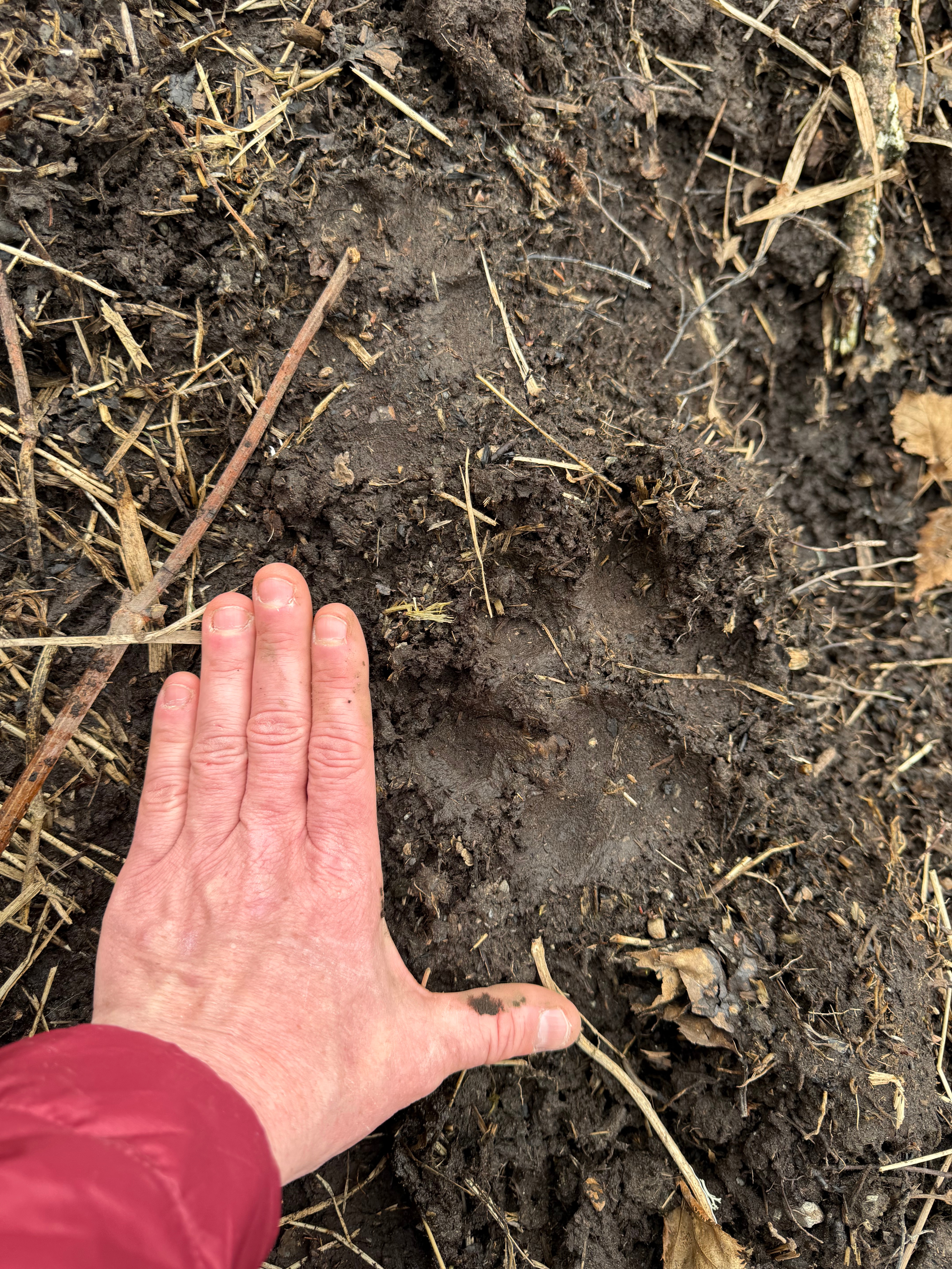
Snow Hawk Valley Trail is notorious for being overgrown and muddy, sometimes impossible to find, but our experience was quite the opposite. Very soon after reaching the top of the slope, Jason found a lightly worn footpath complete with trail markers. Although we had to climb over some deadfall and do some minor trail finding, it was a pleasant walk. We found an old, burned down cabin, and, in the small section of mud, the sizeable track of bears, wolf, coyote and moose.


The grass was laid down and dead and the leaves were not open; not even a bud in sight, and although I could imagine this trail being difficult to navigate in full bloom, it was nothing like the horror show that most people report. We weren’t lucky, we were smart to have planned to go before the leaves opened and I would recommend the same timing for anyone who wants to explore this area.
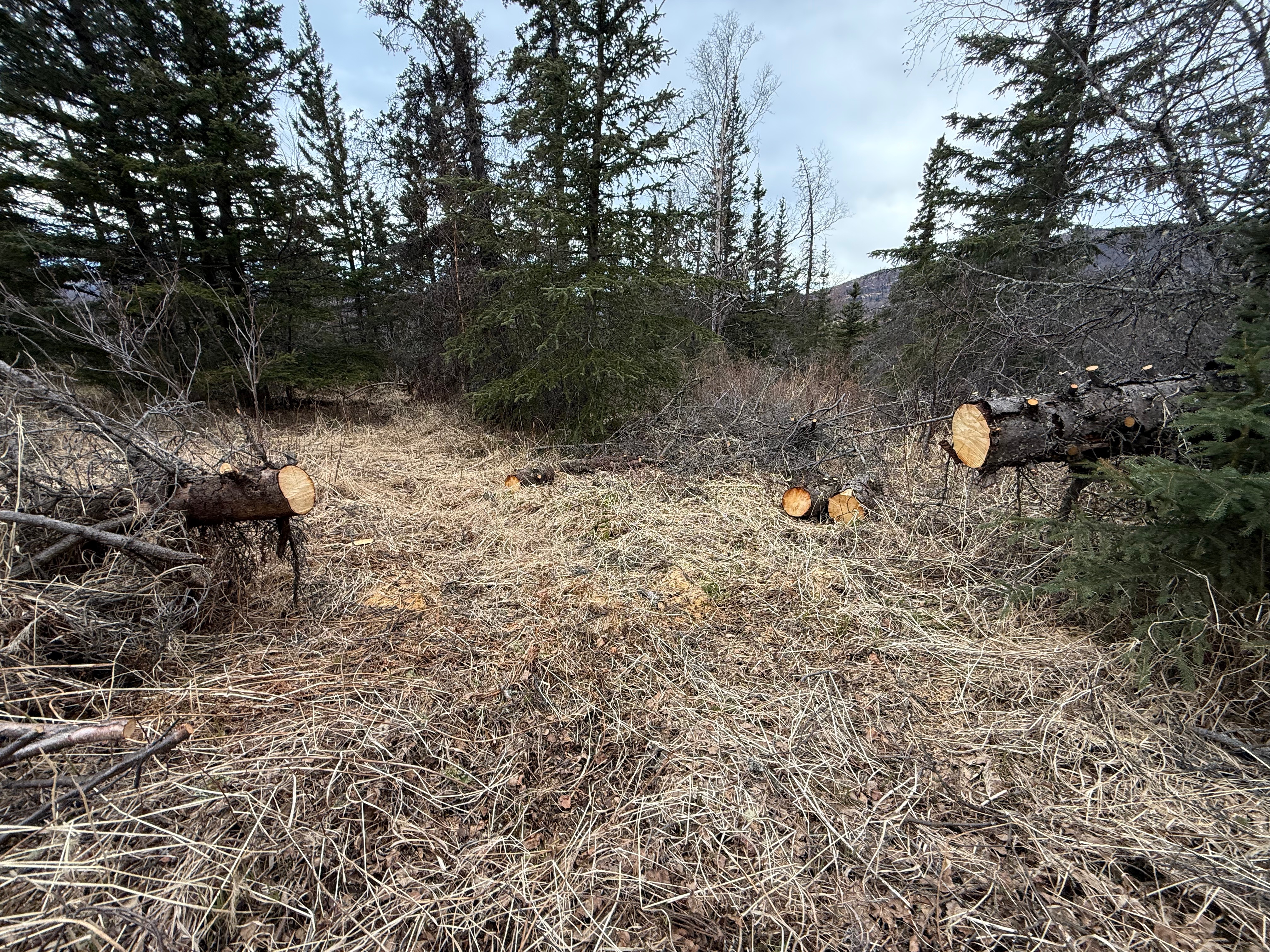
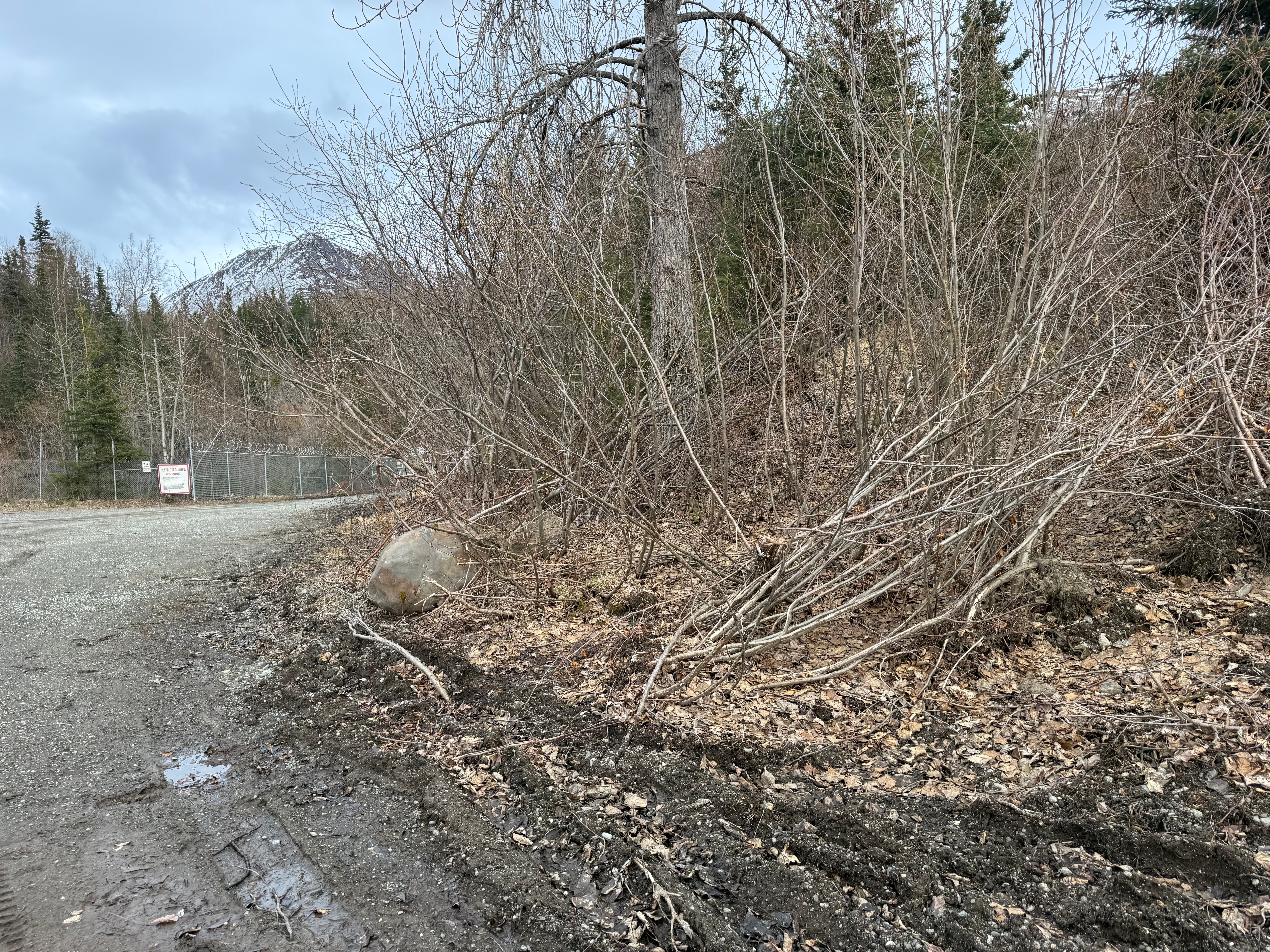
The last mile and a half were easy walking. Someone had come through with a chainsaw and cleared out the downed trees. Nearly 15 miles in, we were thrilled to not have to do anymore climbing or straddling. Suddenly, a chain link fence appeared meaning we were just above the Ship Creek Dam and, after a short bushwack through the alders, we were on Oilwell Road, only a mile from the parking lot.

Turning back for a look at SCH and the now obscured and camouflaged trailhead, I proudly acknowledged another goal met, and two more peaks climbed. Ship Creek bridge and then Jason’s car appeared like an oasis in the desert, and we sunk exhaustedly and victoriously into the car seats, already trying to decide what our next peak would be.
PEak 1216 and Ship Creek Hill Peakbagger Links:

Just the Tips:
- Make sure to check for open zones in JBER RecAccess. It is $10 annual for an account. Be sure to sign in before entering. Do not trespass or camp illegally or it could mean the end of access for those of us who respect the rules.
- If you are going up or down Snow Hawk Valley Trail, do so early or late in the season. It is reportedly very difficult to navigate in the middle of the summer.
- There is an insane amount of wildlife in this area. Carry bear spray and be bear/wolf/coyote/moose aware. Make lots of noise when traveling below tree line.
- There is no camping in this area. All recreators must be off of JBER land between 11pm and 6am.
- Do not touch anything that could possibly be military ordinance (bombs, shells, ammo, missiles, etc.). If you find anything that is potentially unexploded, report it to the JBER authorities.
Recent Trip REports:
Where the Clouds Parted: A Knoya, Kanchee and Nunaka Ridge Walk
May 31, 2025 Knoya: 4600′ – FR #17 Kanchee: 4393′ – FR #20 Nunaka point: 3780′ Mileage: ~14 Miles Elevation Gain: ~5000′ The summer wasn’t summering, and I was suffering from a bout of springtime depression that only sunshine and warm weather could cure. I dragged myself to the Klutina Trailhead to meet Jason. We…
Pedals, Peaks and Thunderstorms: Bike and Hike Mount Margaret in Denali National Park
May 25, 2025 Mount MArgaret: 5069′ Denali NAtional PArk Mileage: 4.6 Mile Bike/4.6 Mile Hike/4.6 Mile Bike Elevation Gain: 2,750′ This year’s annual mother/daughter camping trip in Denali National Park looked a little different from our normal stay at Riley Creek Campground. The Labor Day prior, we decided our next trip would be to Savage…
Misty Miles and Mountain Birds: A Storm King Scramble to Mitty Peak
April 20, 2025 Olympic NAtional Park, WA Mitty Peak 2674′ Mileage: 4.4 Miles RT Elevation Gain: 2400′ After 25 years, I finally had the opportunity to fly down to Seattle from Alaska to see one of my favorite bands of all time, Phish. I can’t travel without checking out a new hike, so I also…
