
March 31, 2025
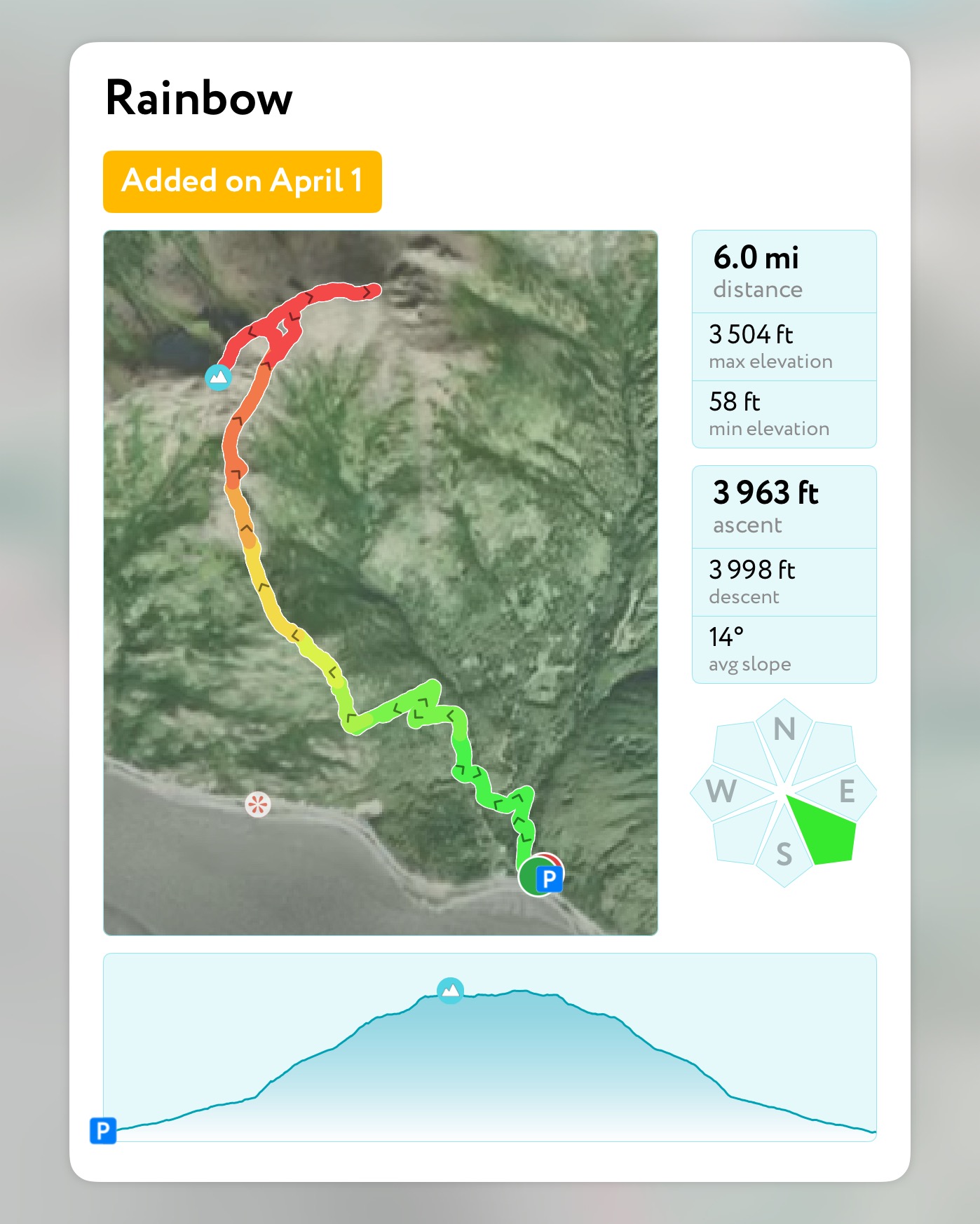
Mileage: 6.2 Miles
(Including Northeast Ridge to Unnamed Point)
Elevation Gain: 3700′
Chugach 120 #118
Chugach Front Range #25
Summit Elevation: 3543′
Rainbow Peak is a fun, scrambly hike that starts at sea level and tops out at 3543.’ This one is big bang for your buck if you’re looking for an early season break-in hike or to level up your scrambling skills with minimal exposure and mostly low consequence terrain.


The summit ridge can be dangerous in icy or inclement conditions, as the southeast face is fairly exposed, and the northwest face can be avalanche prone or hardpack ice. A slip and fall on either side would not end well, although most of the ridge is wide and protected. Its best to go in the summer if you are nervous about heights or your ability to navigate on icy terrain.
Due to the loose rock and scree slopes and the steepness of some of the terrain, dogs should not be brought on this hike. I had made the mistake of bringing Goose back in 2021 and although he had no problem with the scramble sections, I did have to be careful of him kicking down large rocks on me or other hikers as we ascended the scree slopes to the summit ridge. I also almost had a heart attack when he stood right on top of the narrow, high point, all four paws seemingly balanced on one toe, a 300+’ drop below. Anyway, leave your dogs at home for this one.
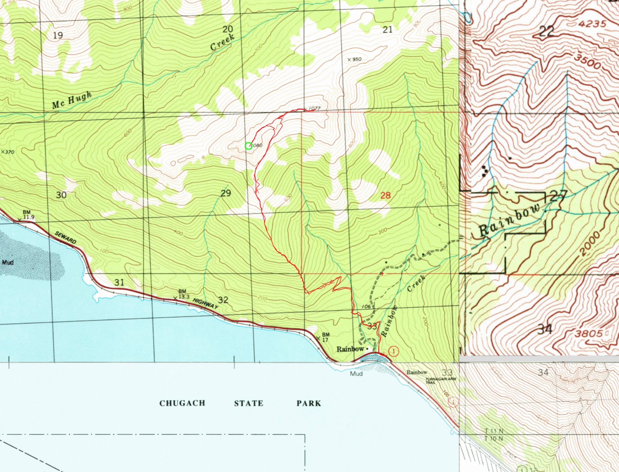
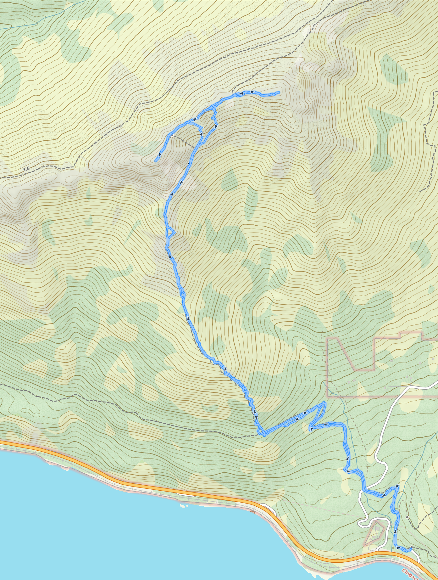
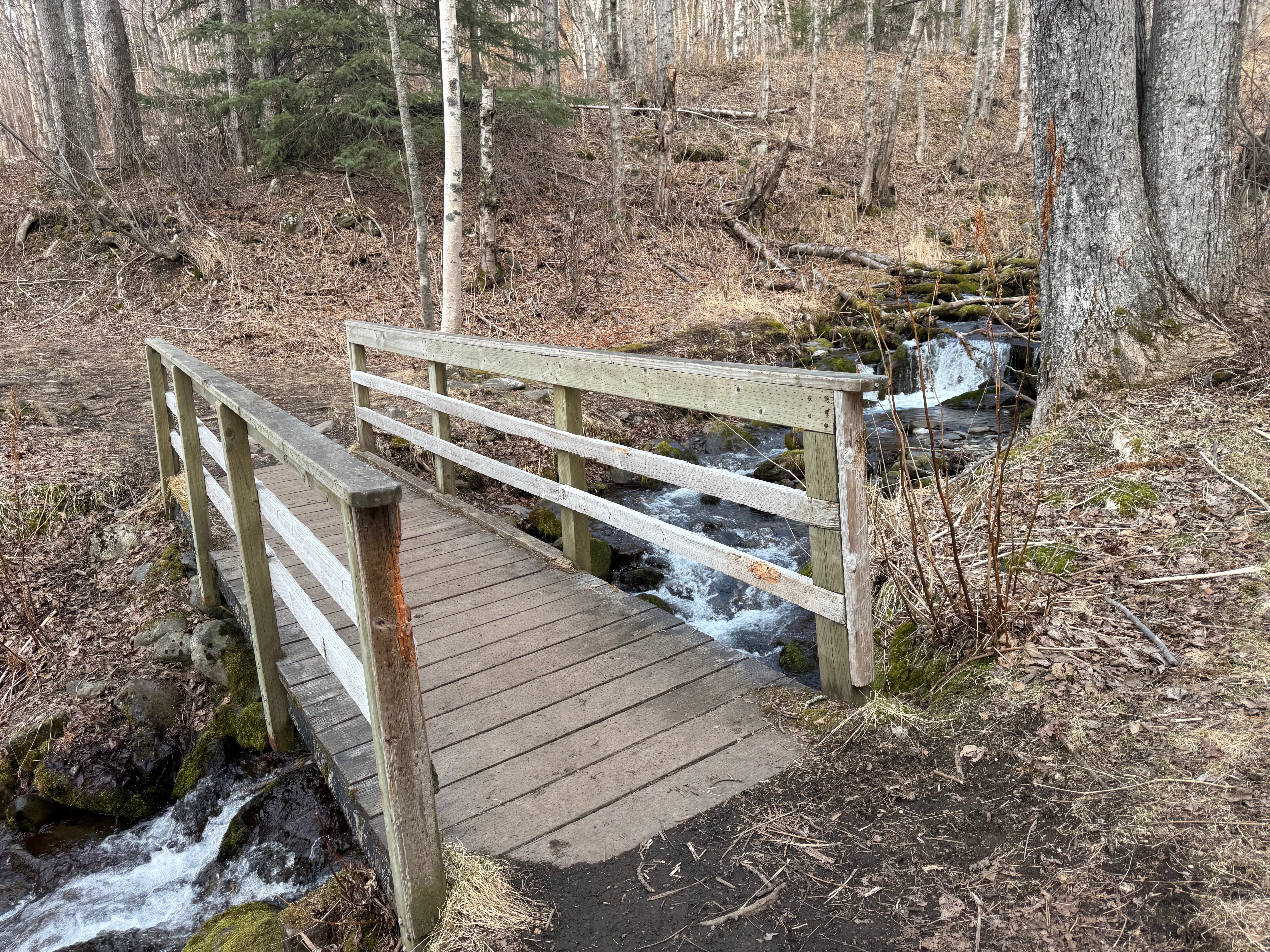
I picked up Jason at 9am and we drove to the Rainbow Trailhead on the Seward Highway, a decent sized lot with a perfect view of the mountain. It was a little breezy near the highway, but we were soon in t shirts, heading northwest on the Turnagain Arm Trail on a mellow climb through the trees. We crossed Rainbow Creek and an unnamed creek, both spanned with stable bridges.

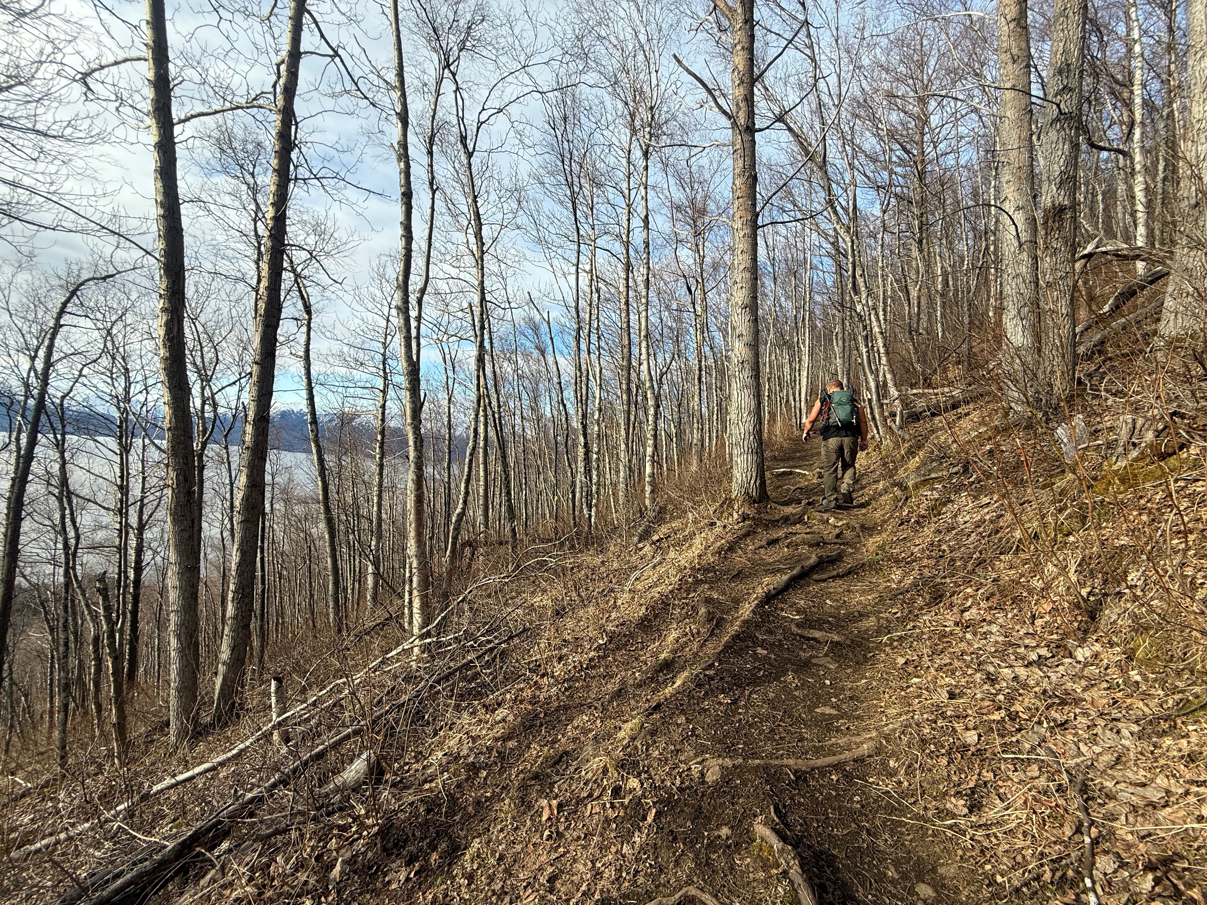
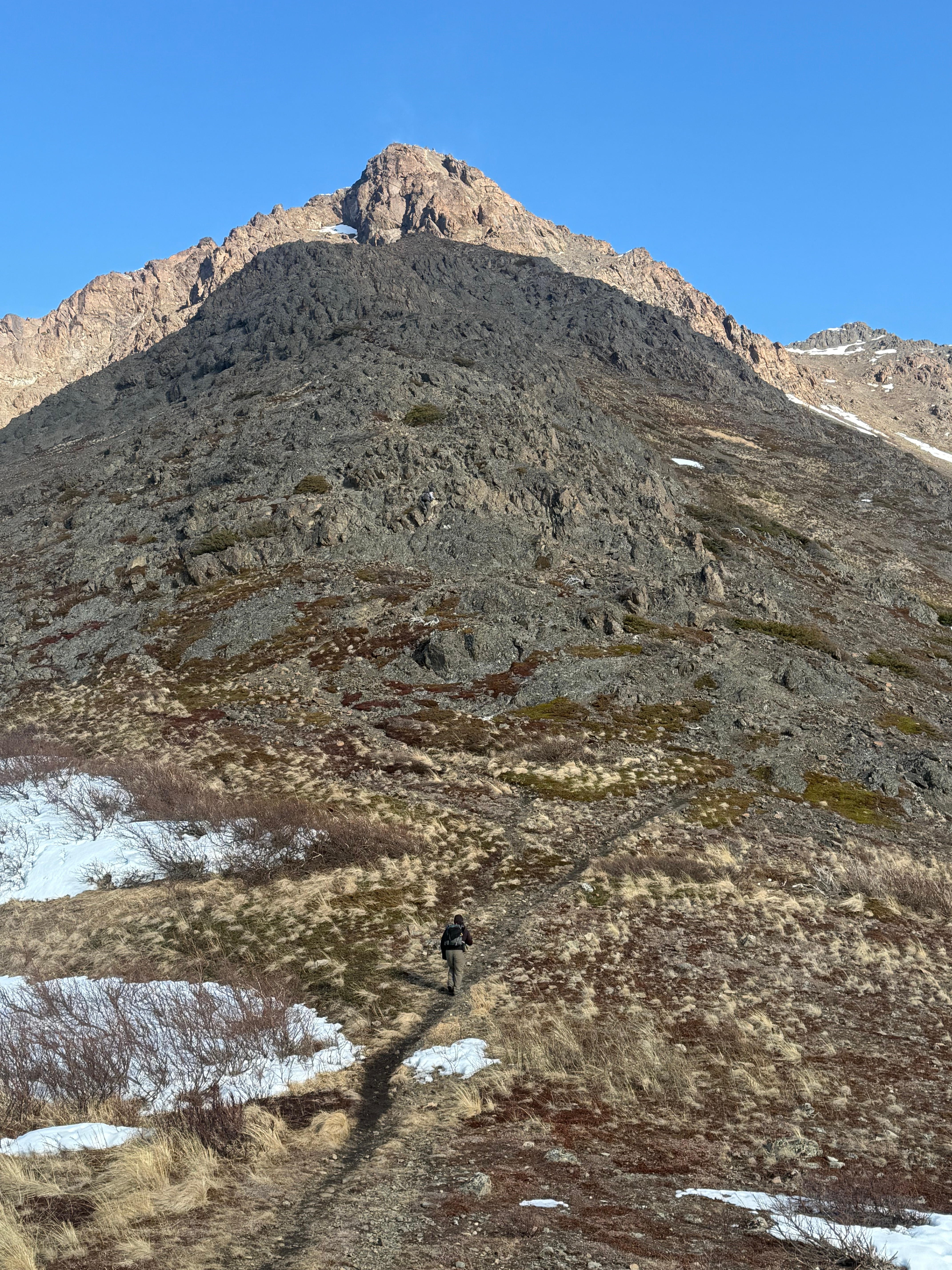
It didn’t take long to travel the 1.1 miles and 850′ to the Rainbow Trail intersection on the wide and nicely maintained trails, but that was about to change. The Rainbow Peak Trail is unmarked and is easily missed, so keep an eye out to your right for one of two rocky trails that seem to climb vertically into the trees. That’s your route.
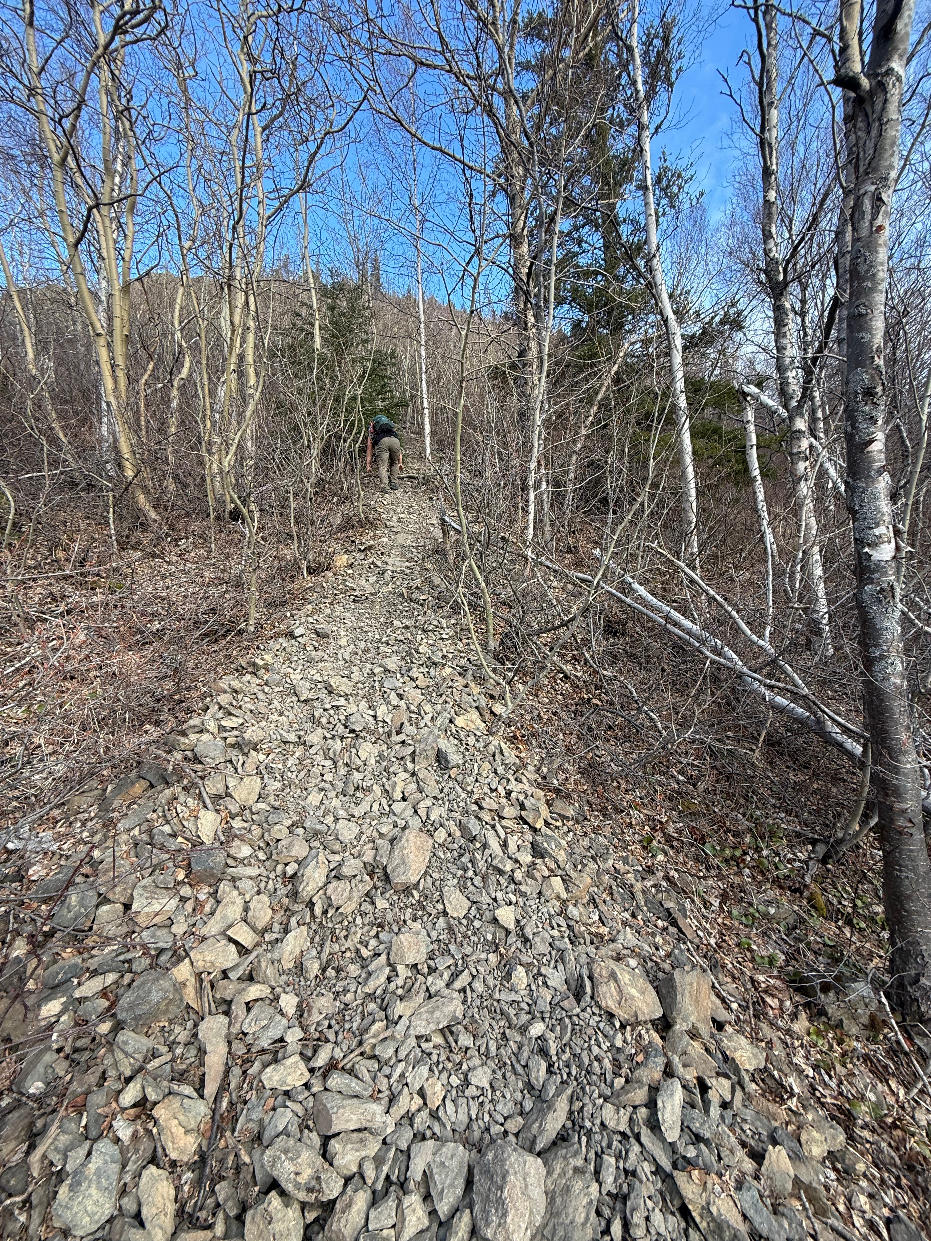
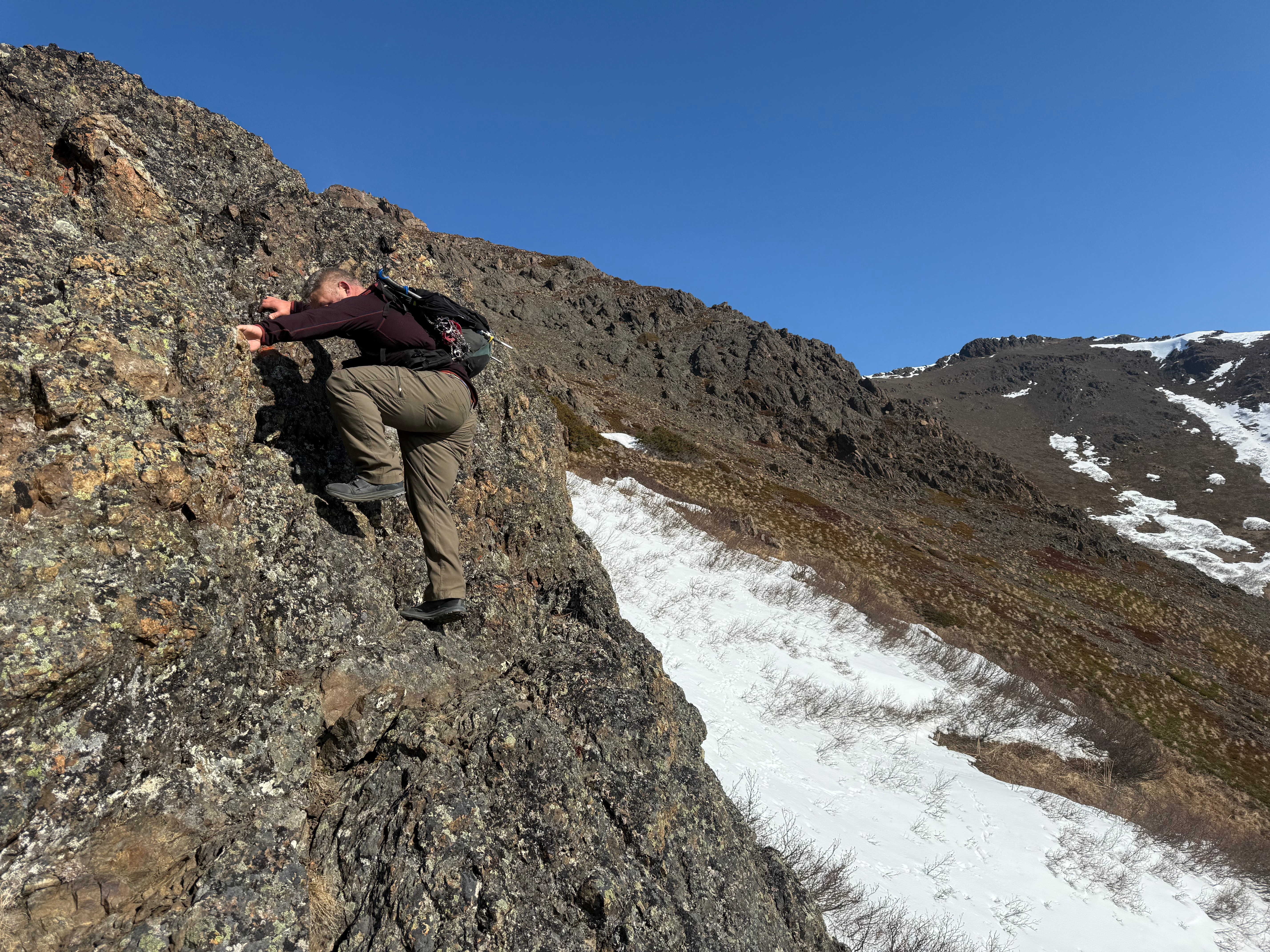
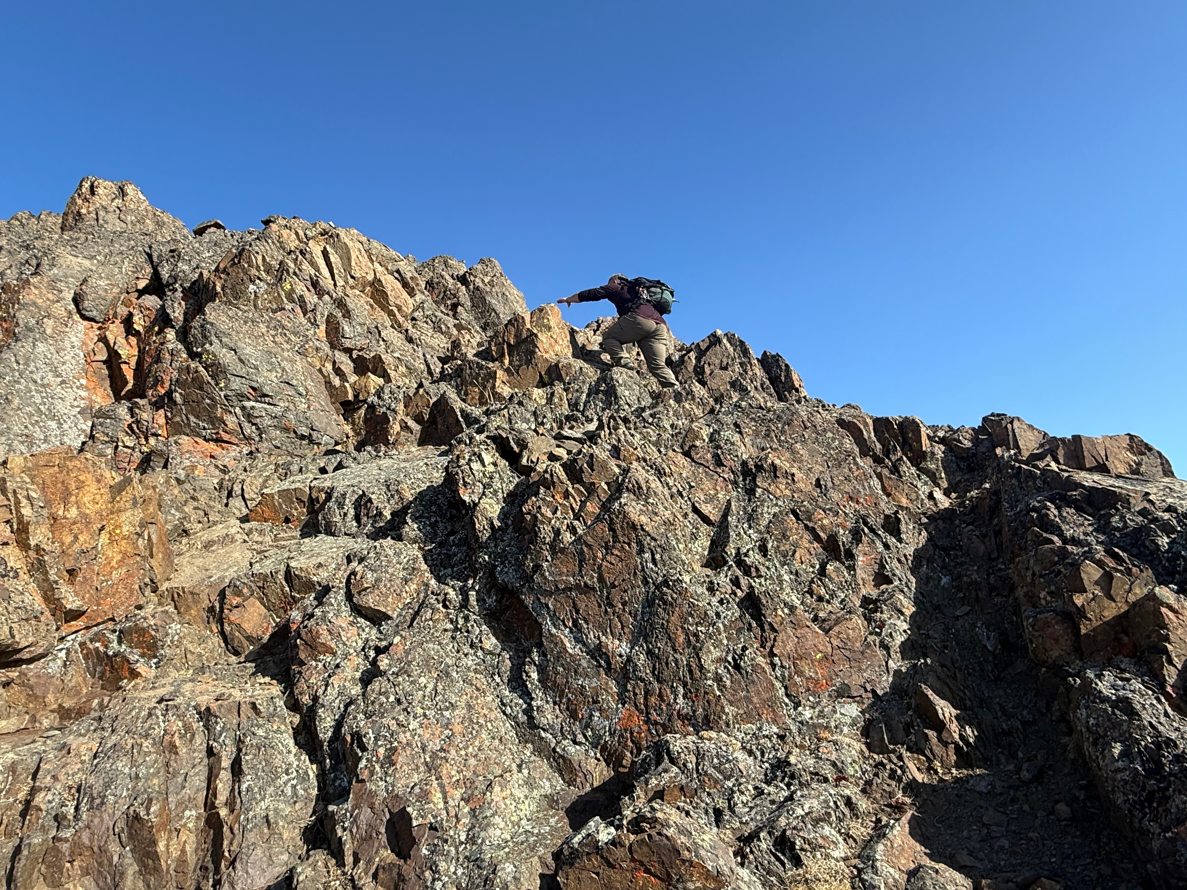
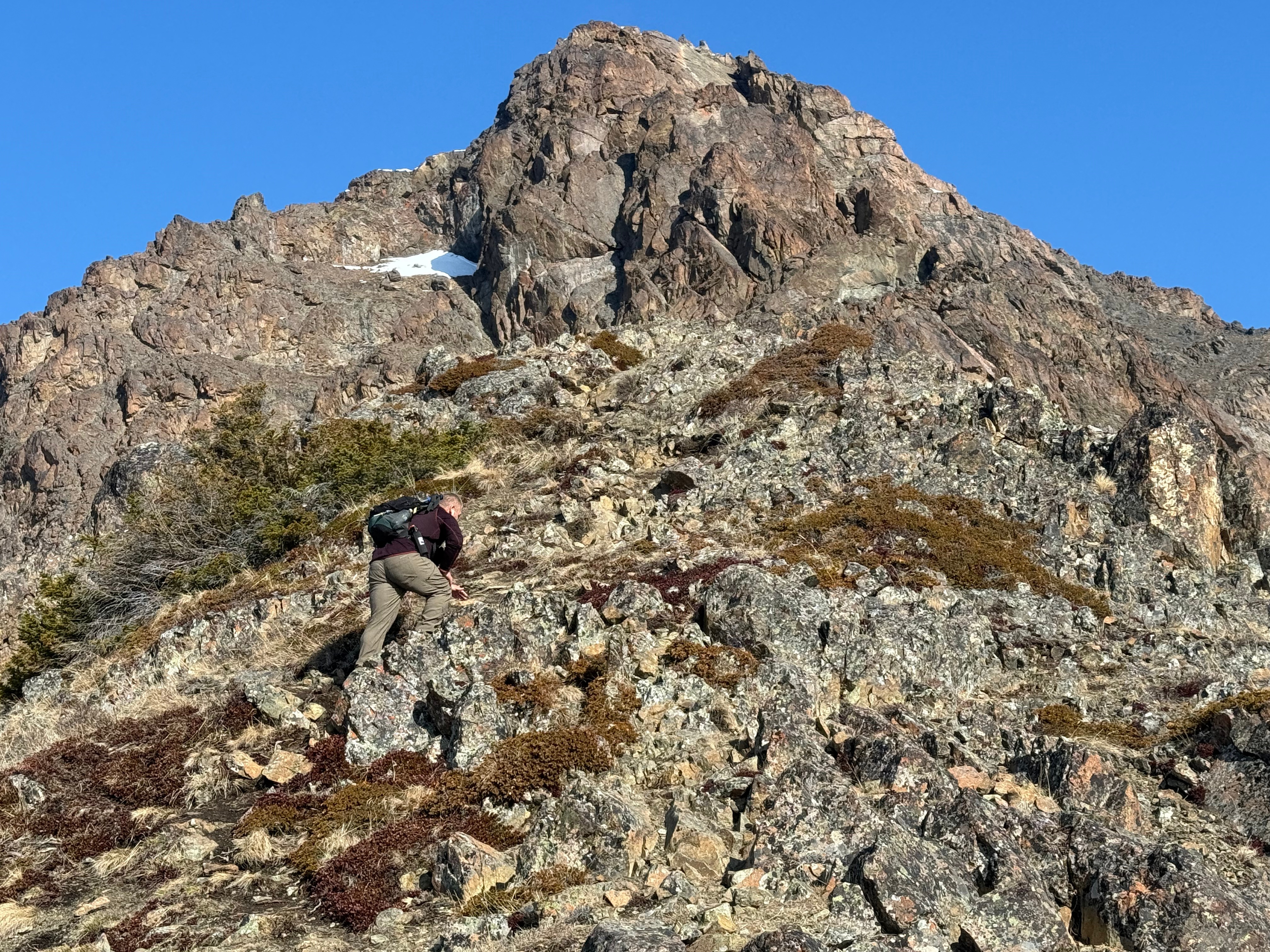
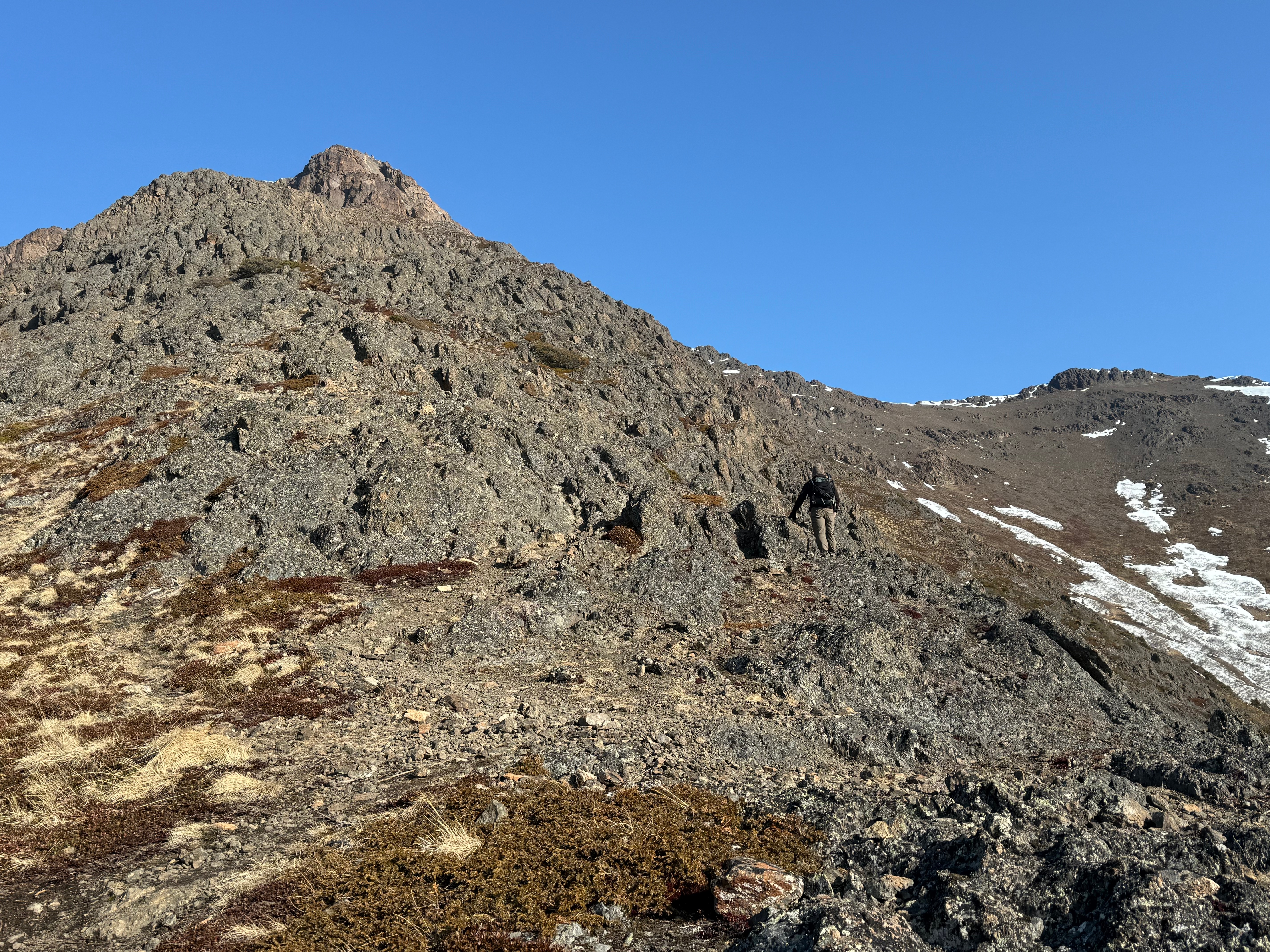
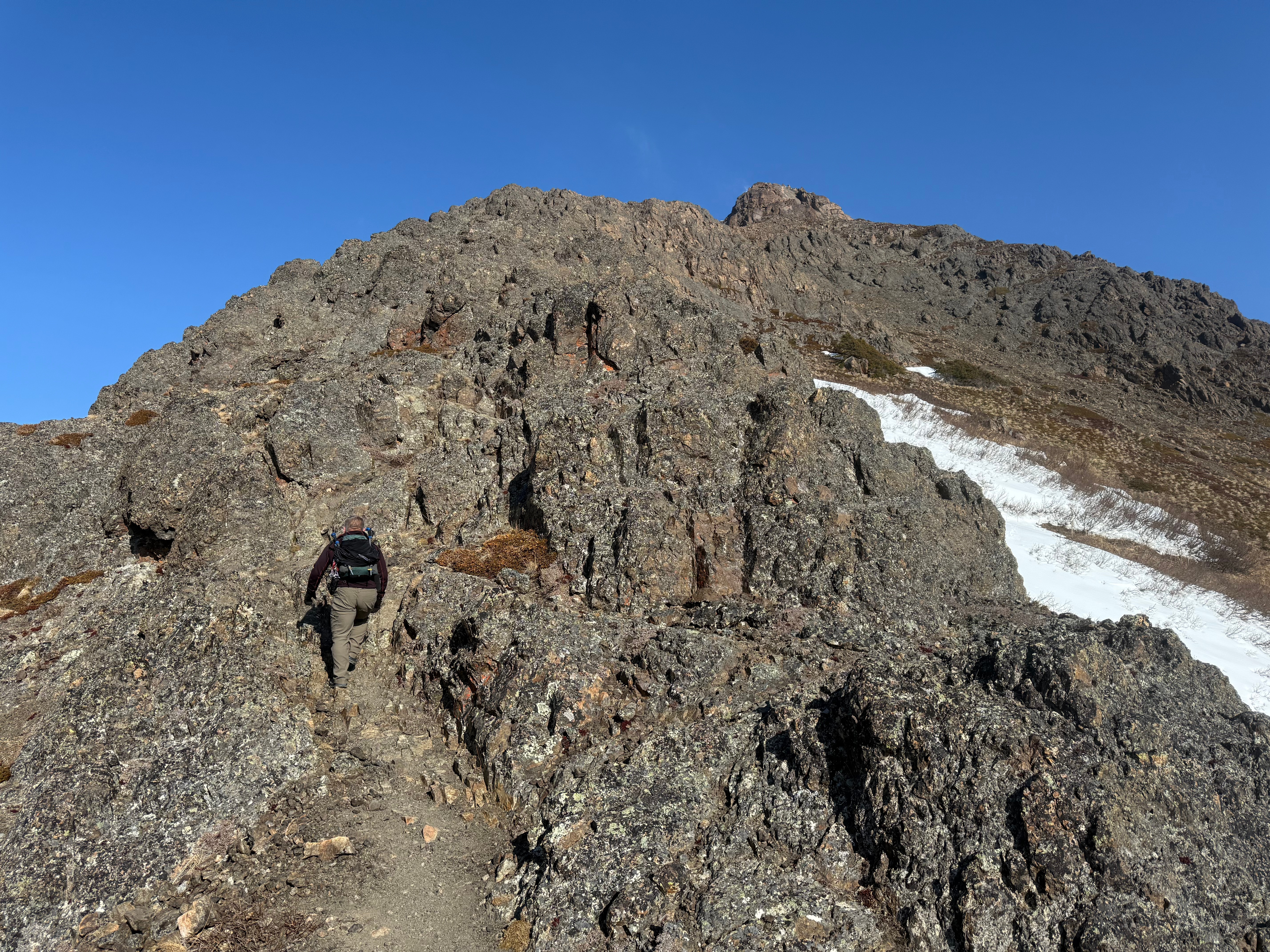
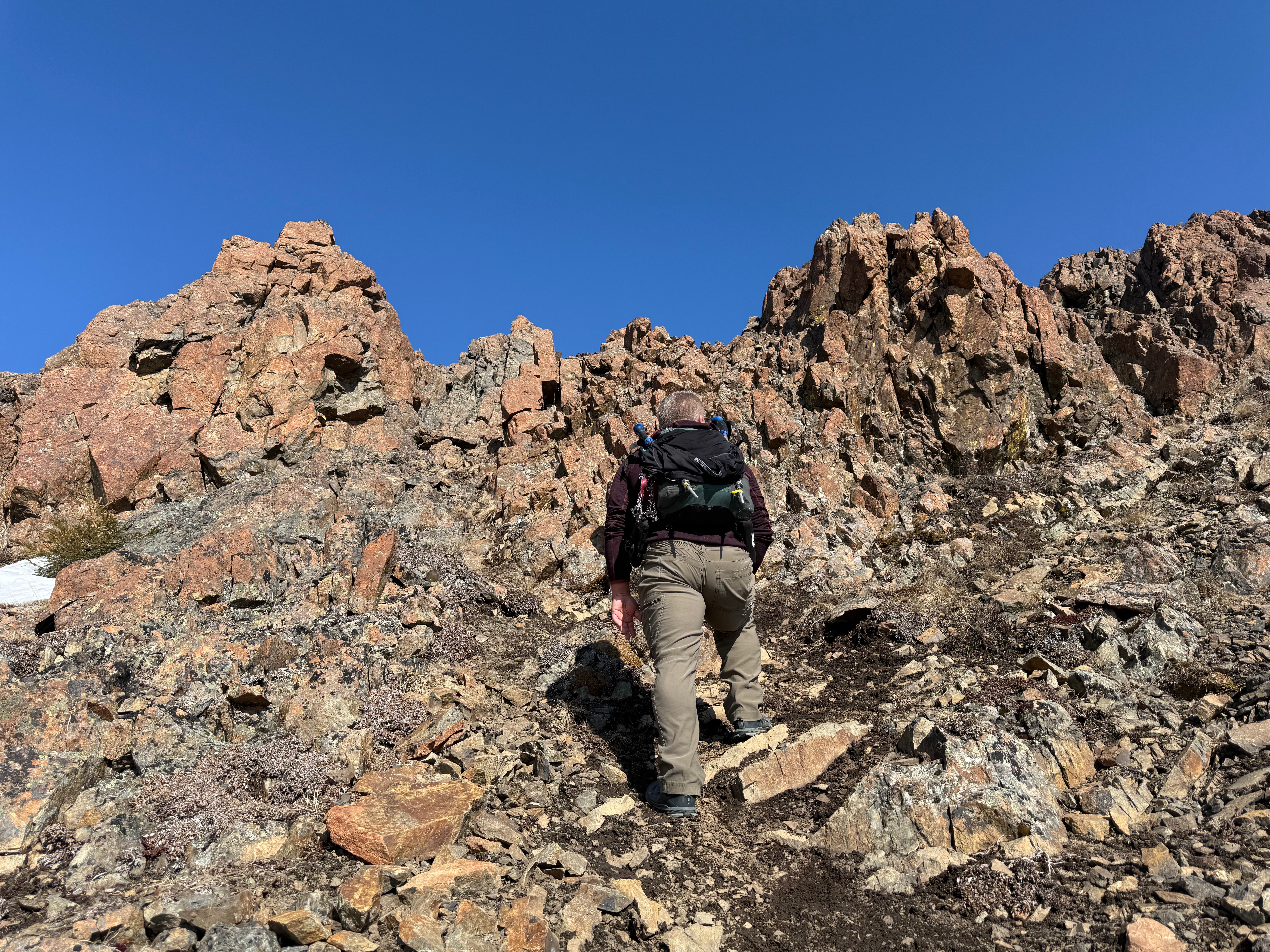
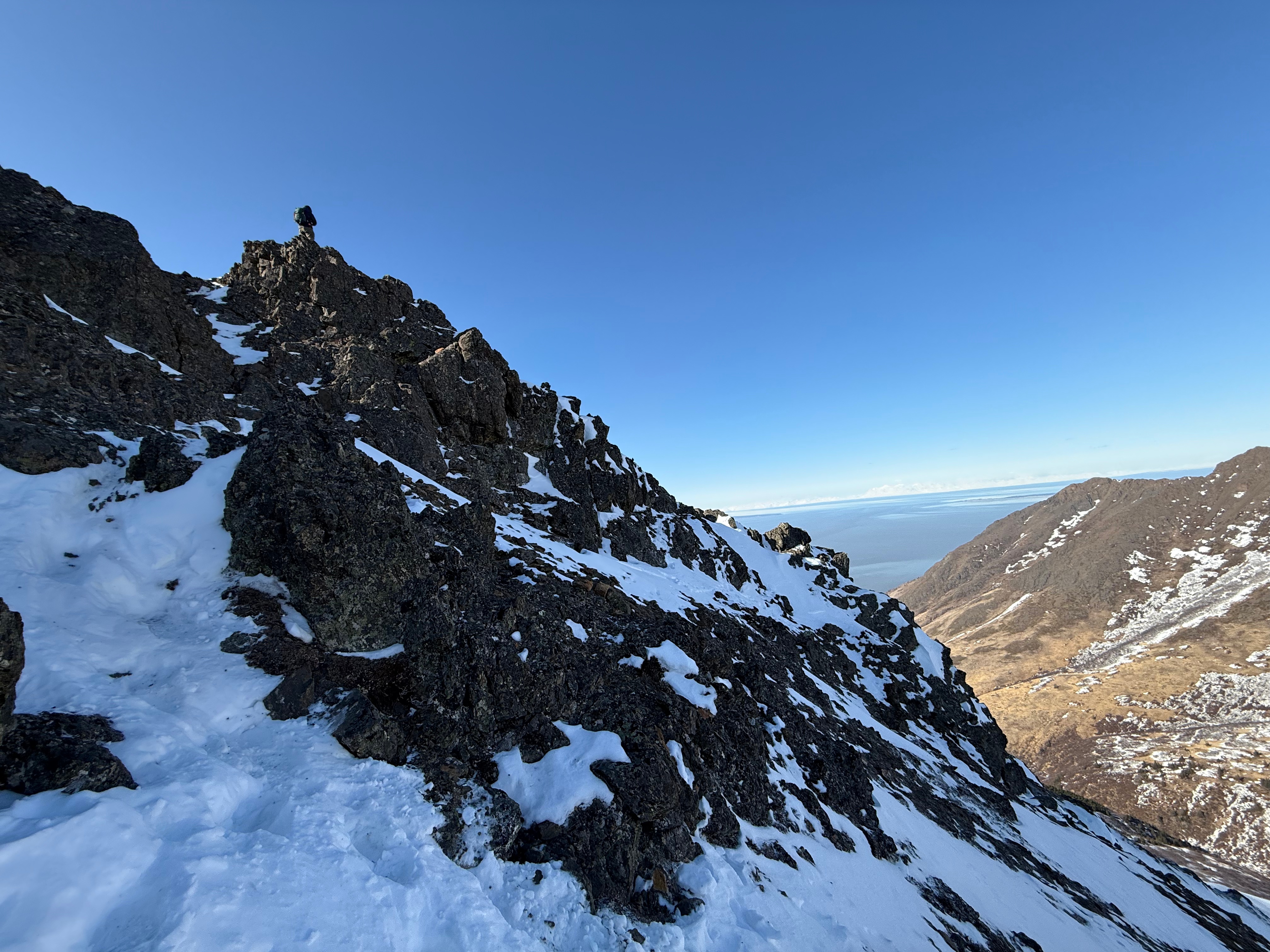
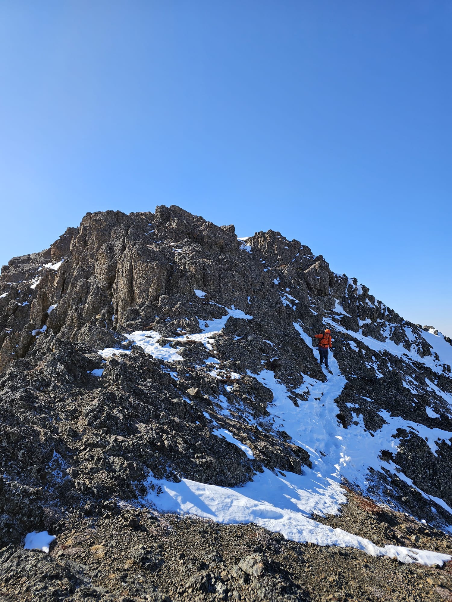
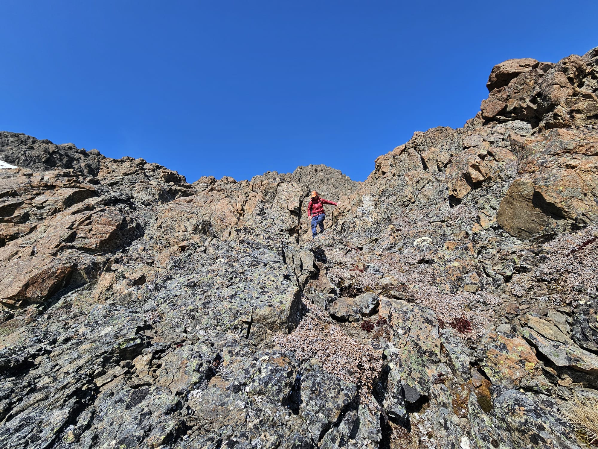
We immediately began climbing upward, using our hands to pull ourselves up on trees and when the trees turned to tundra, we gripped overhead rocks to continue to gain the elevation. The first “step” on the southeast ridge is about 3/10 of a mile long but gains another 850.’ The scrambling is fun and low consequence, mostly protected with little chance of a long fall, although it is important to remember that any fall can lead to major injury or worse.

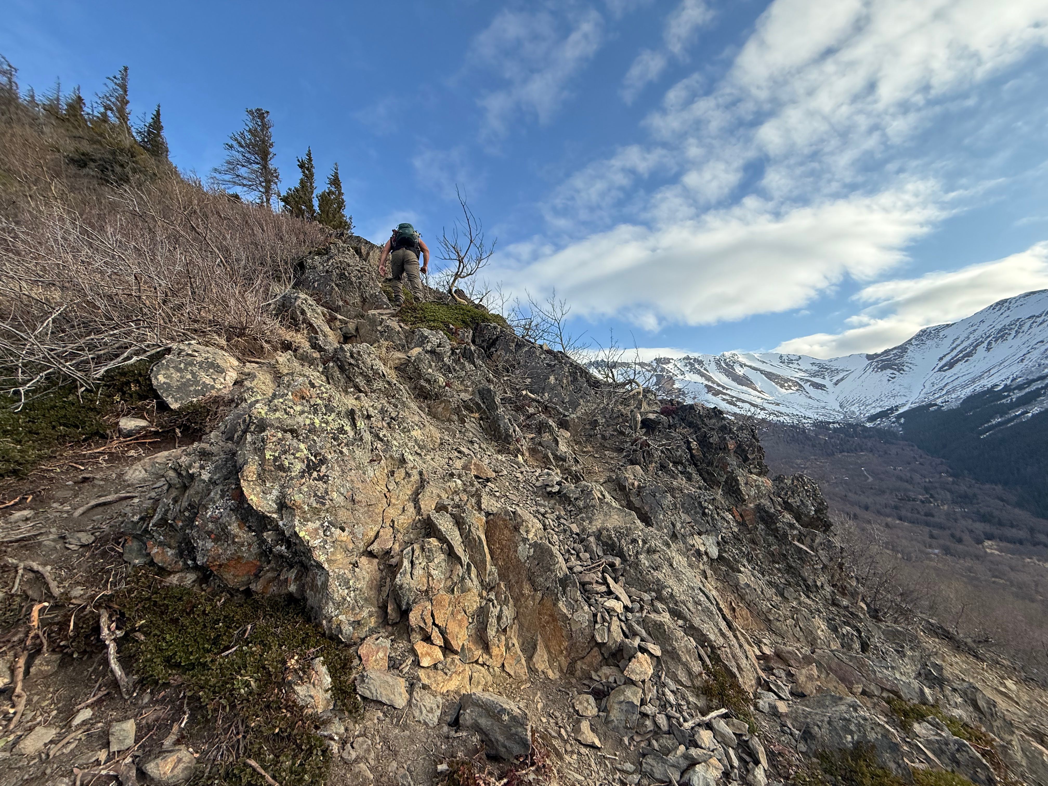

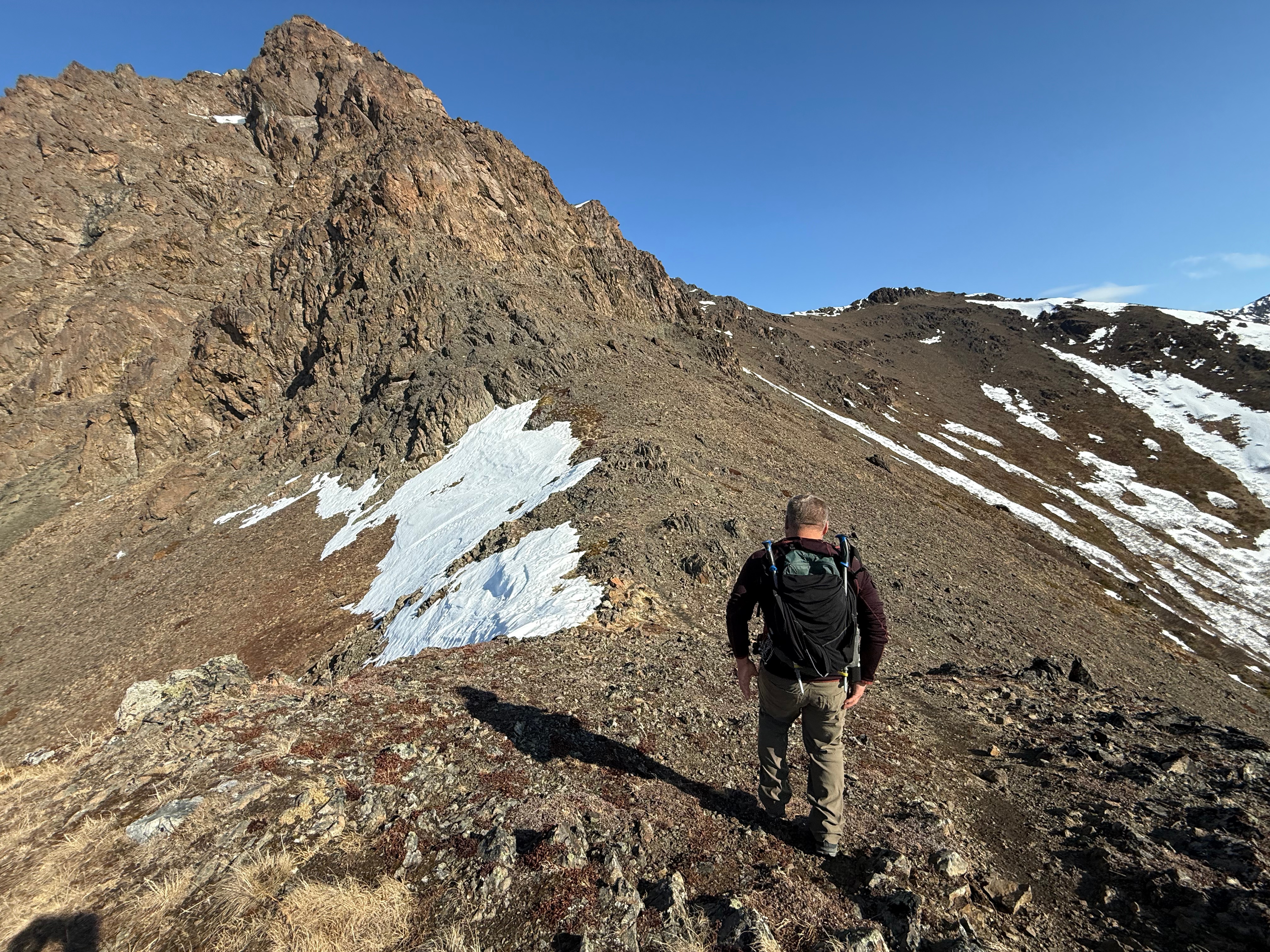
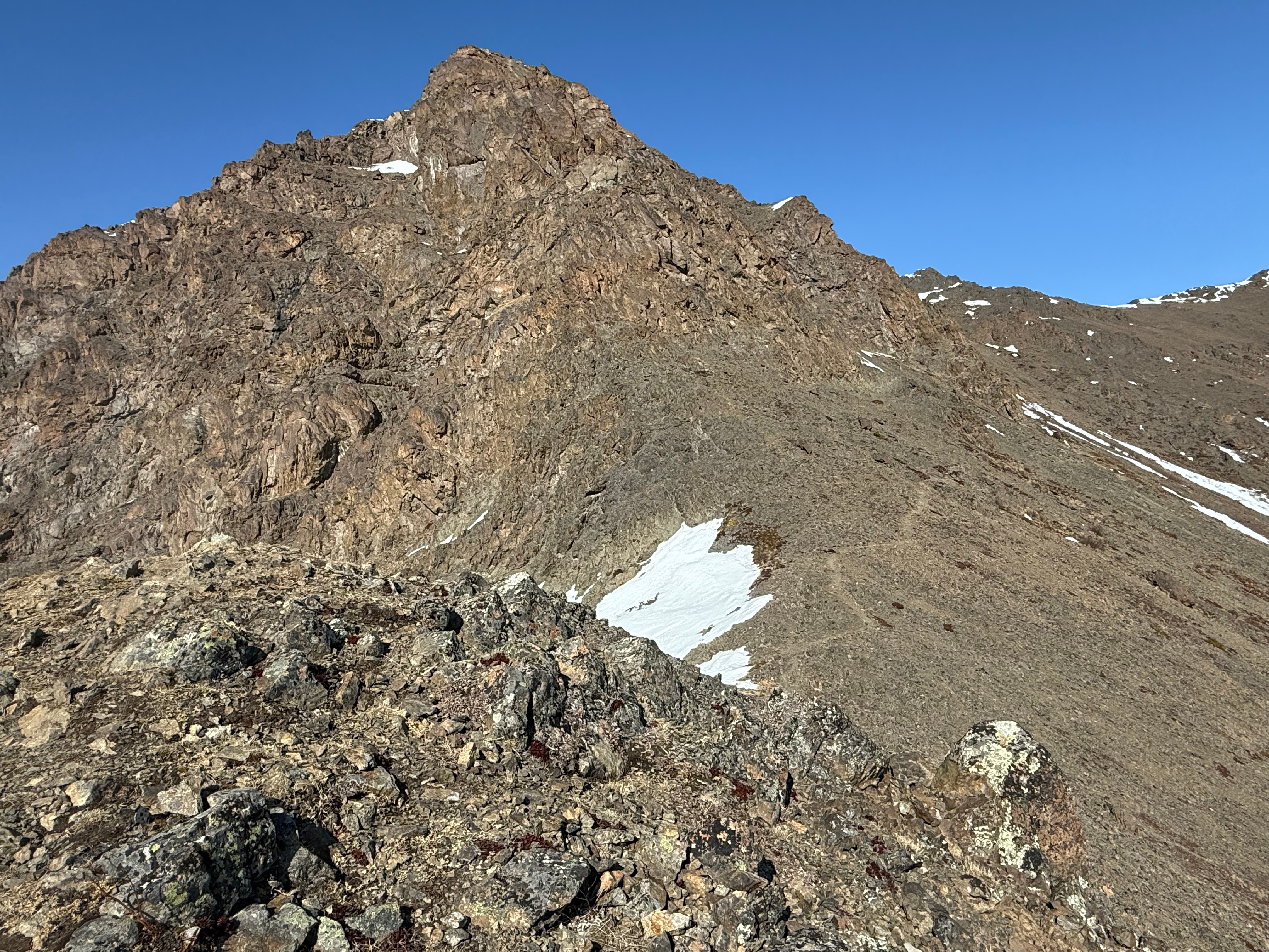
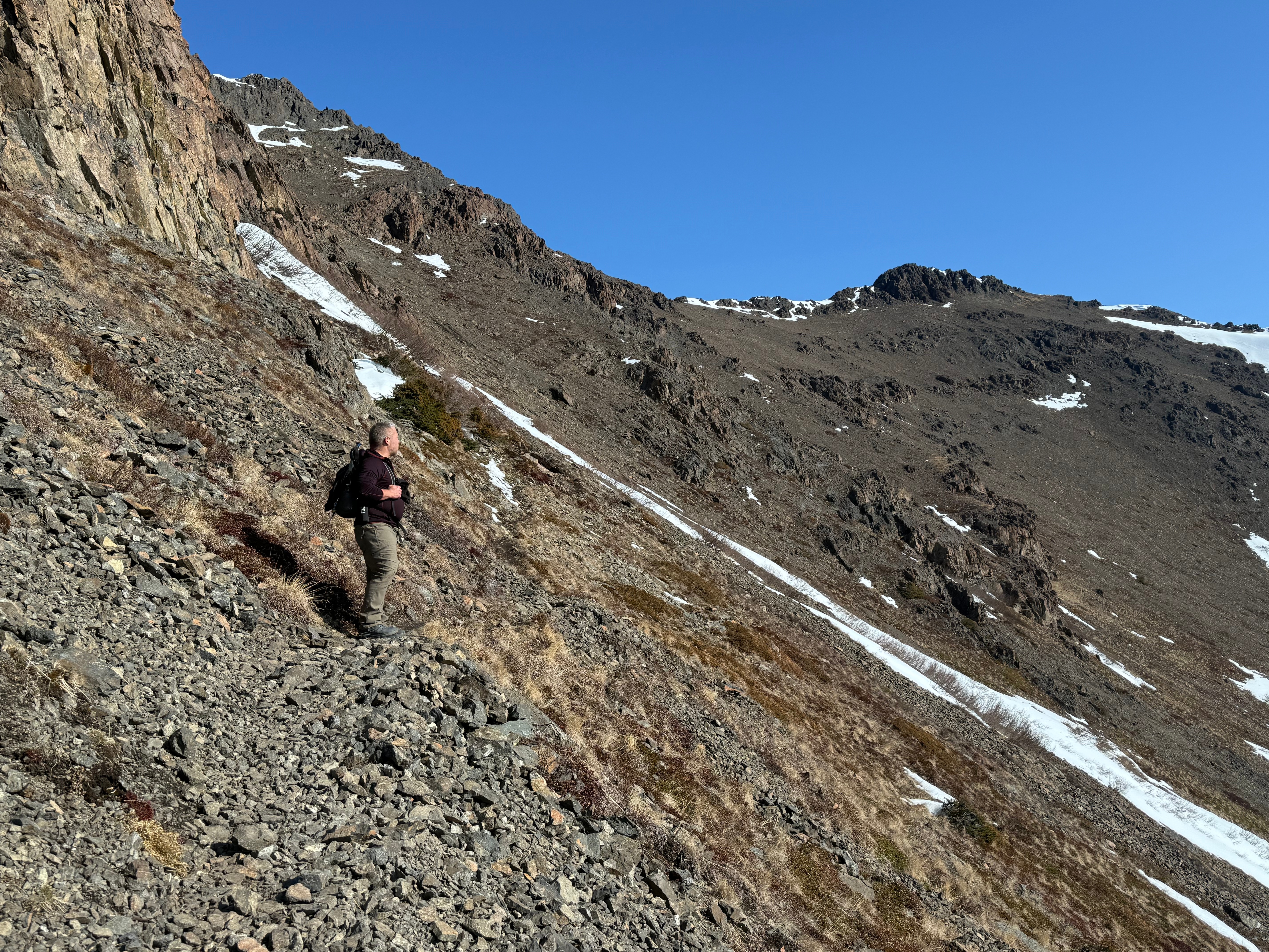
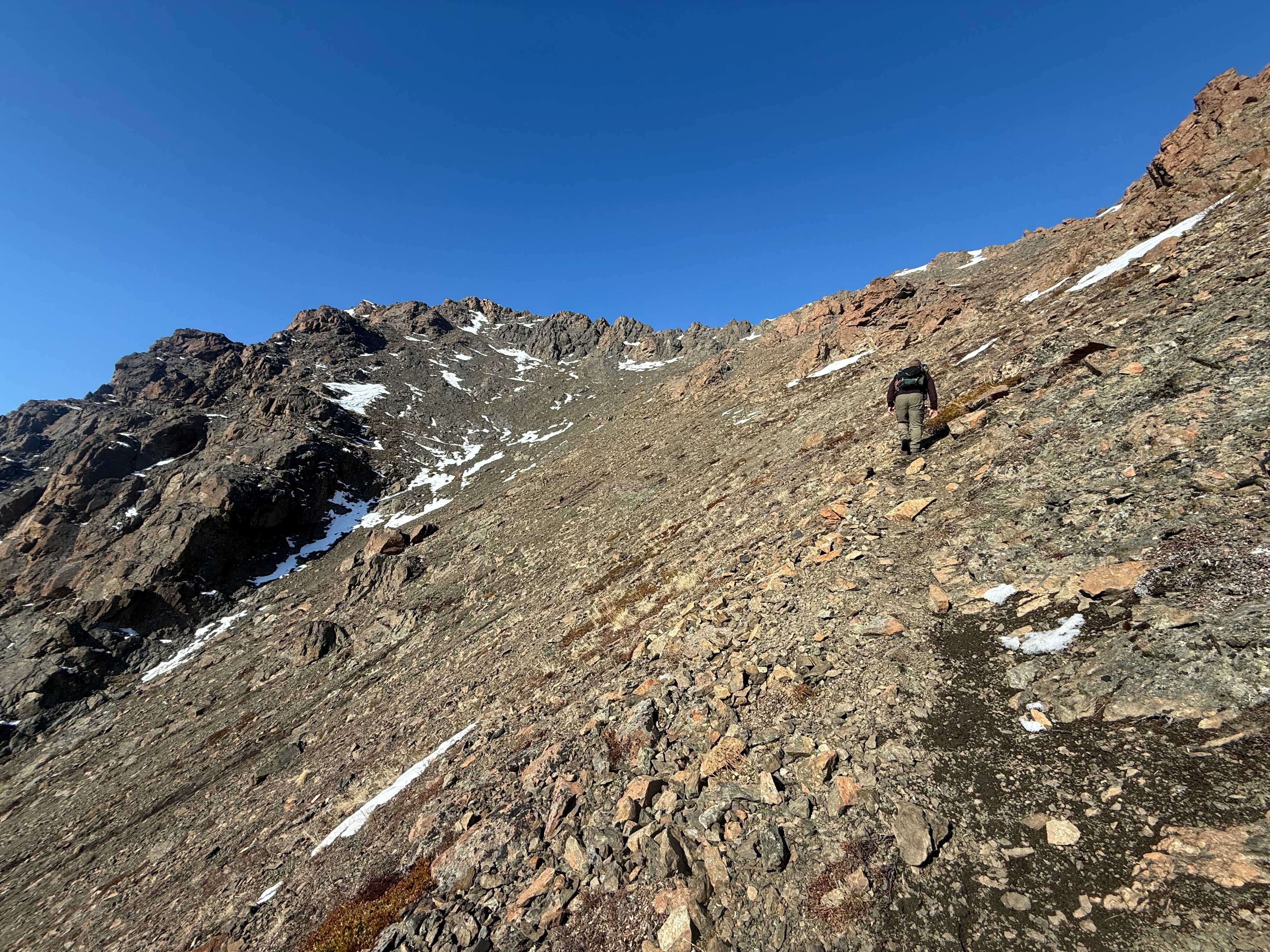
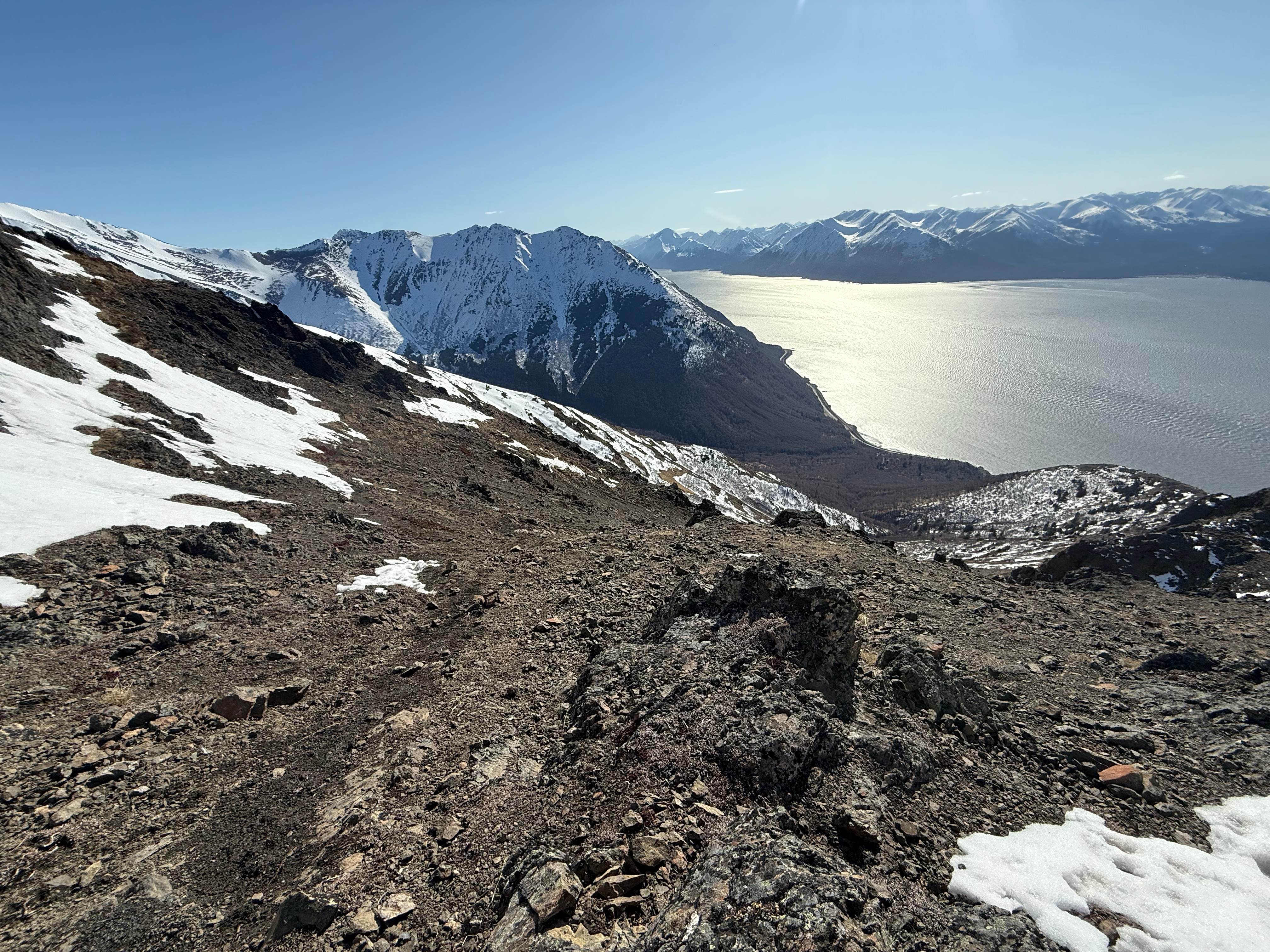
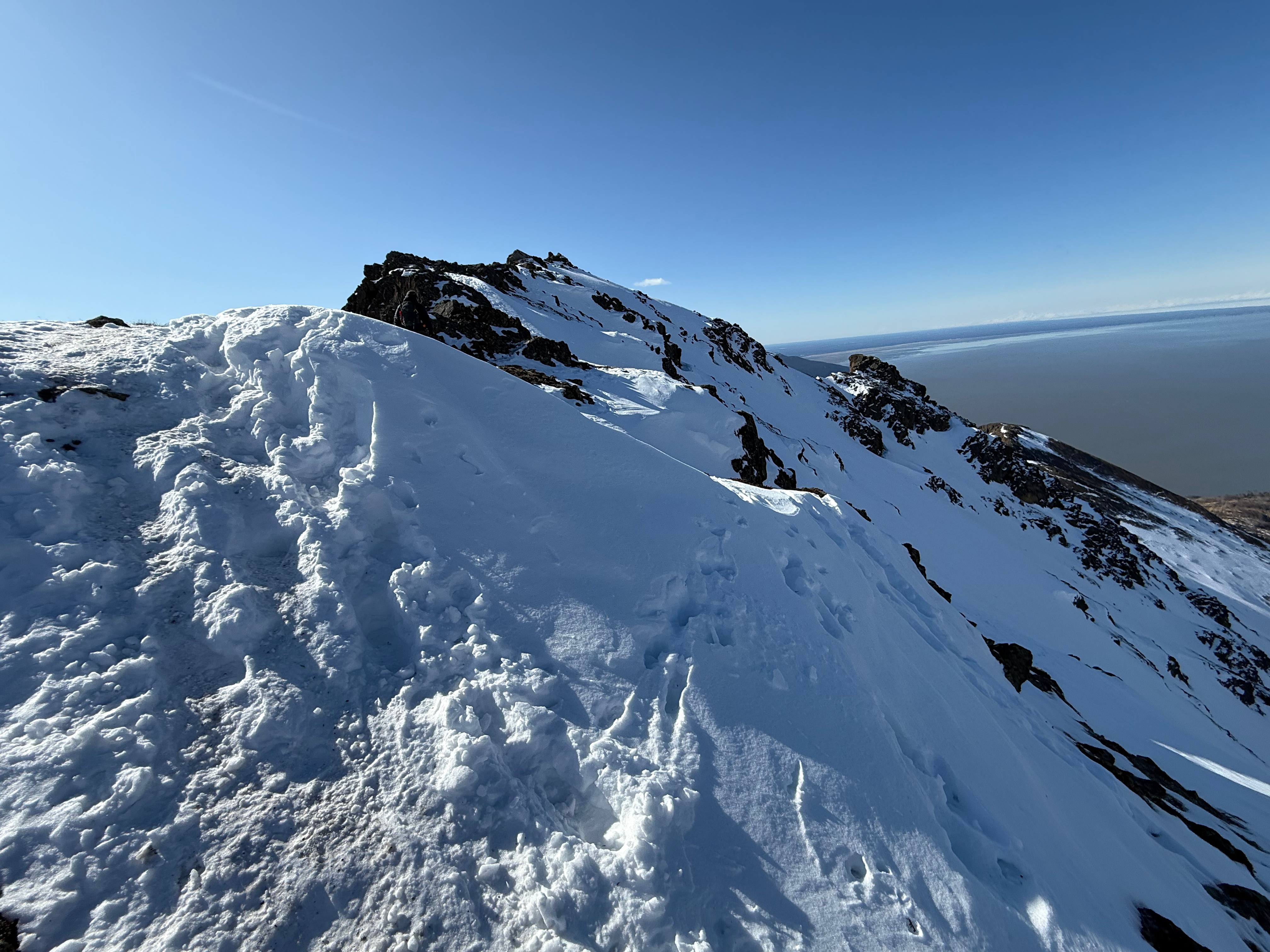
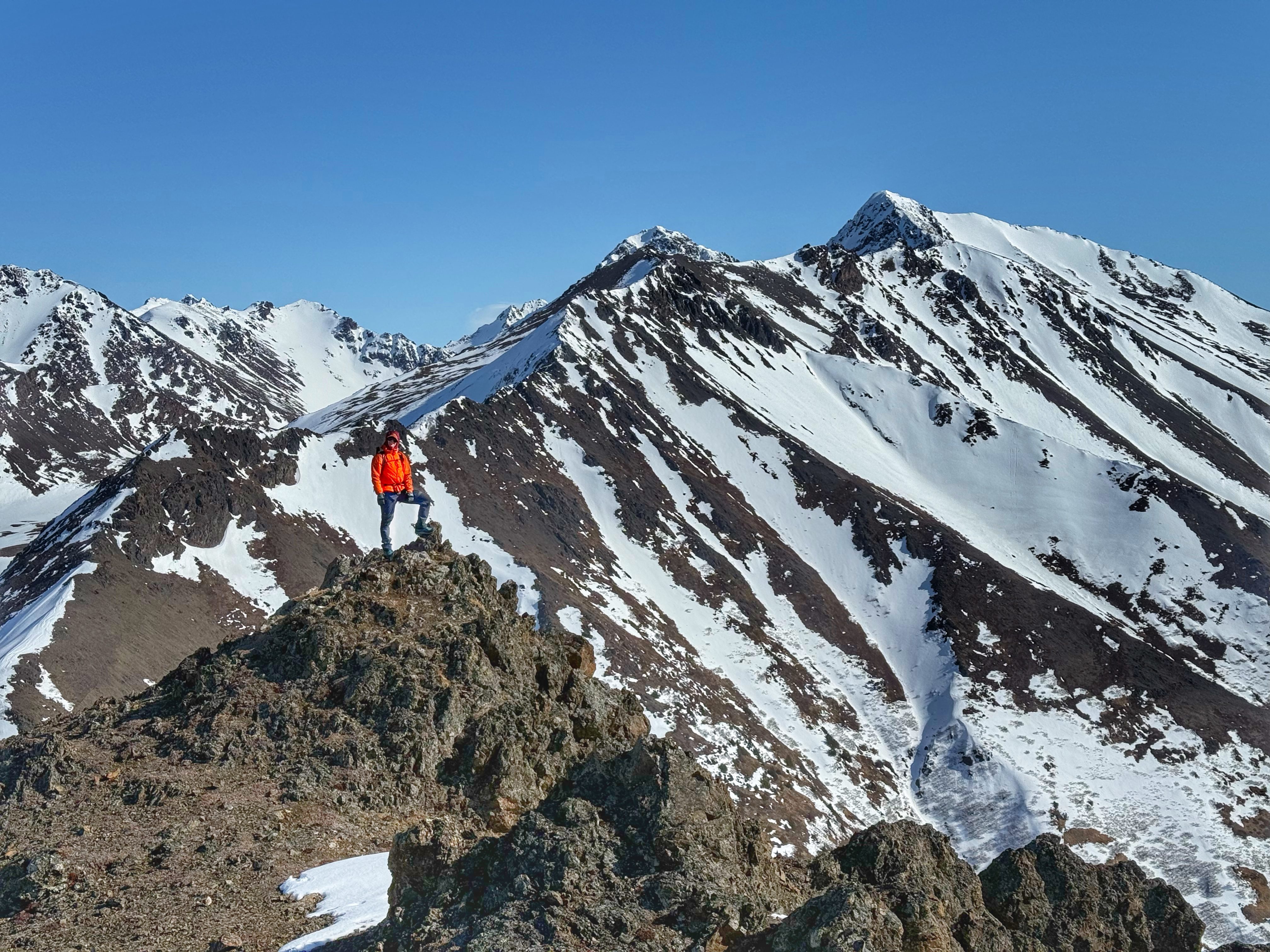
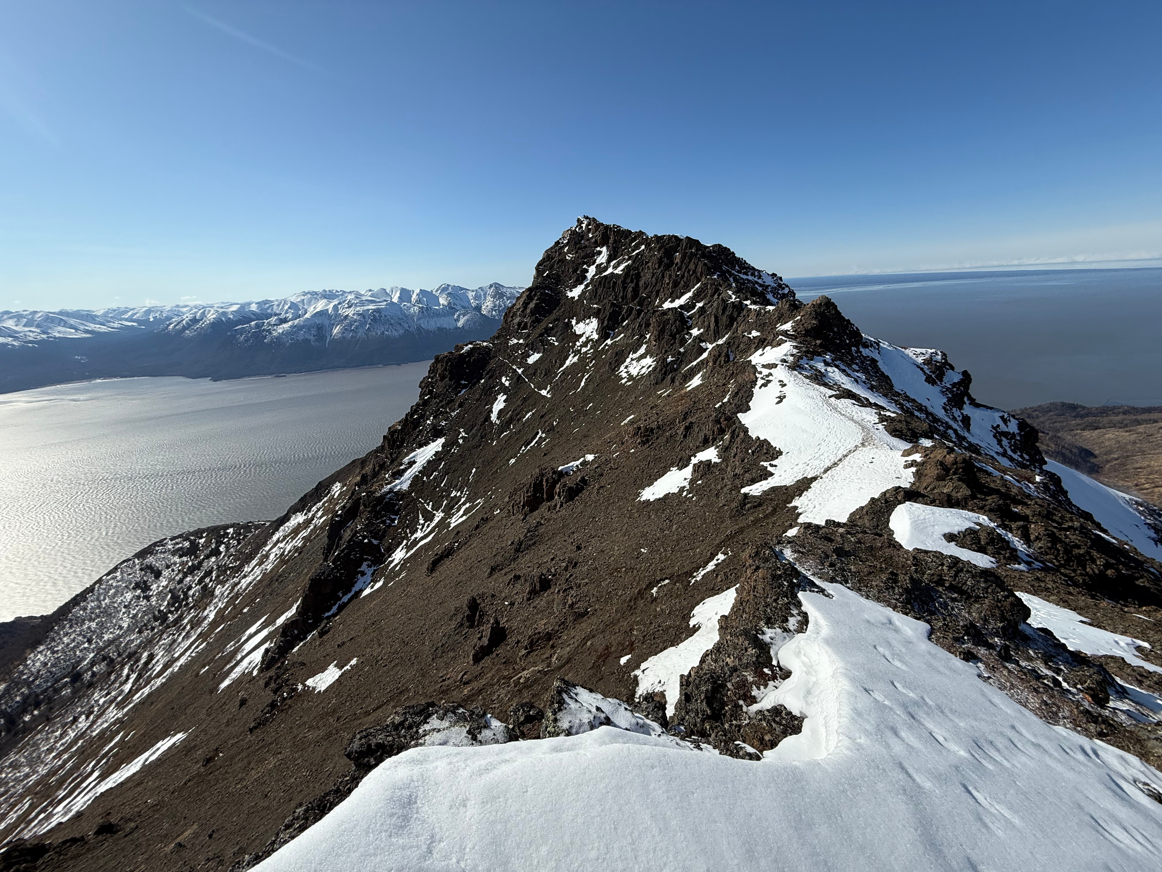
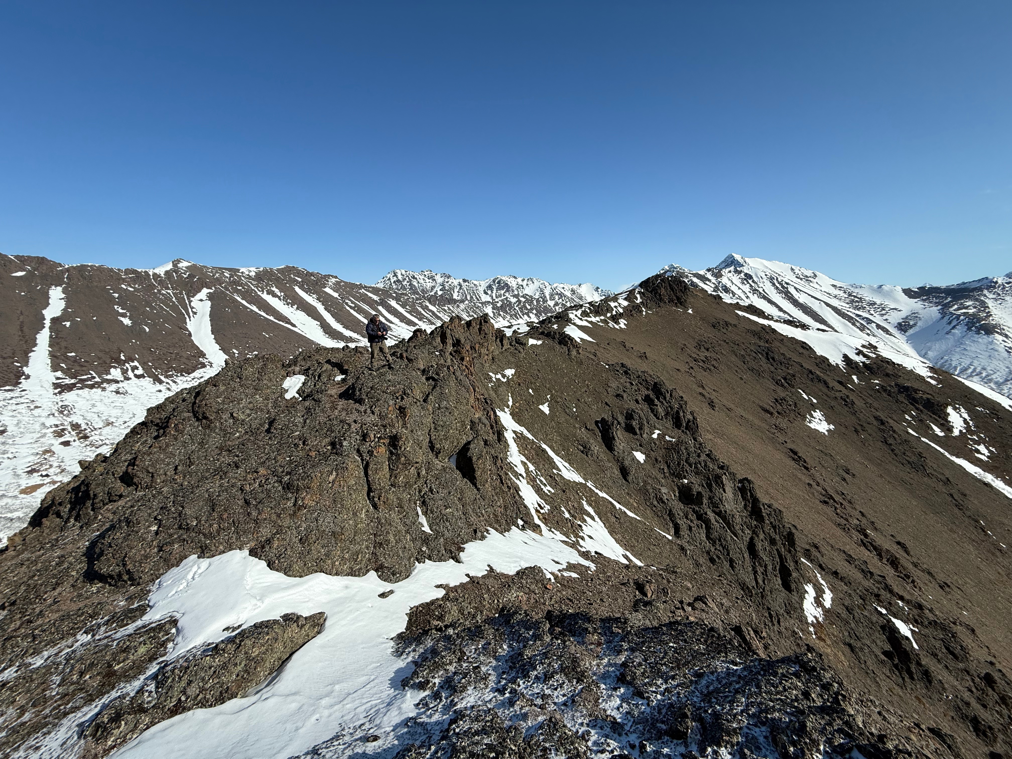
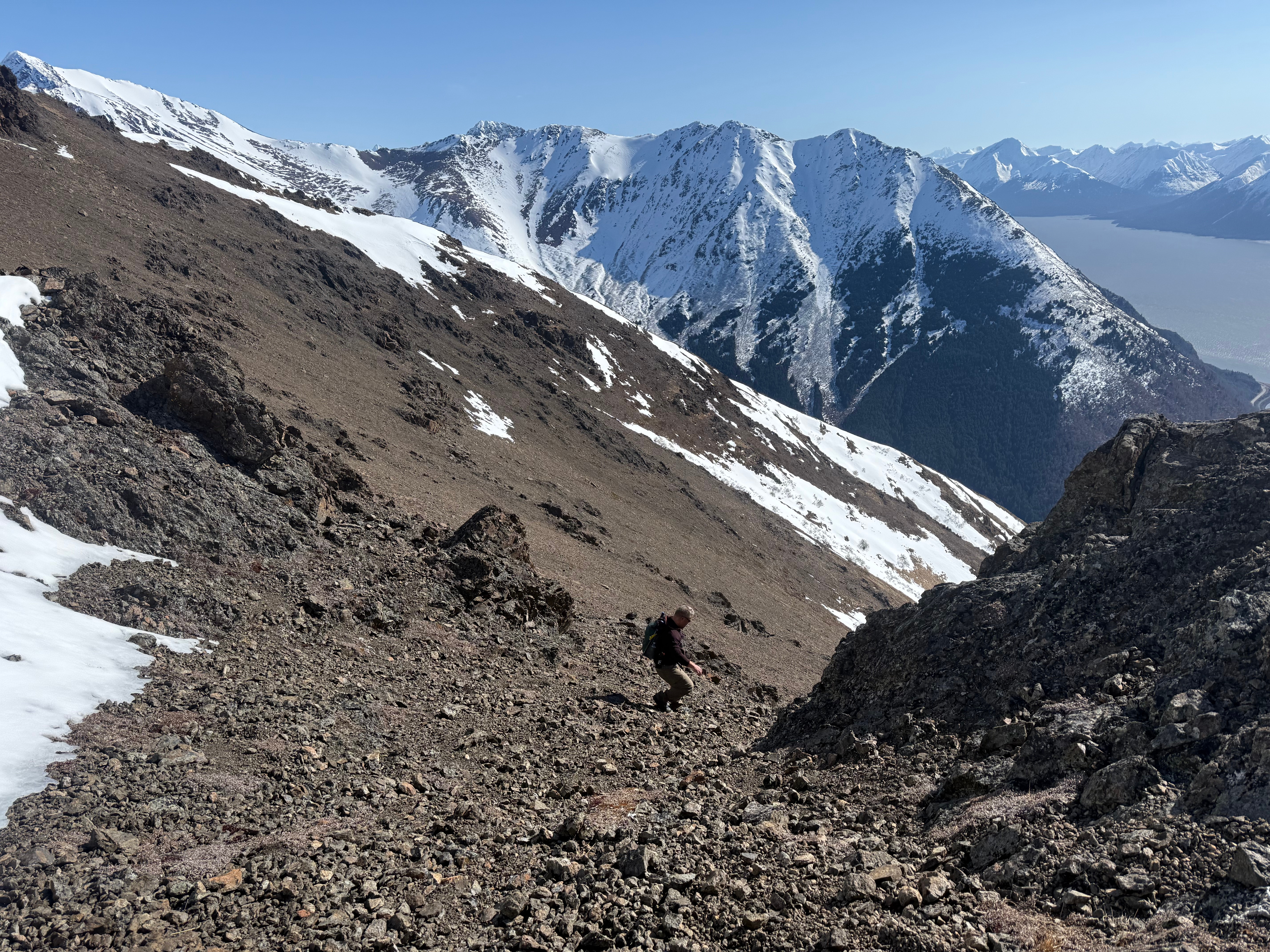
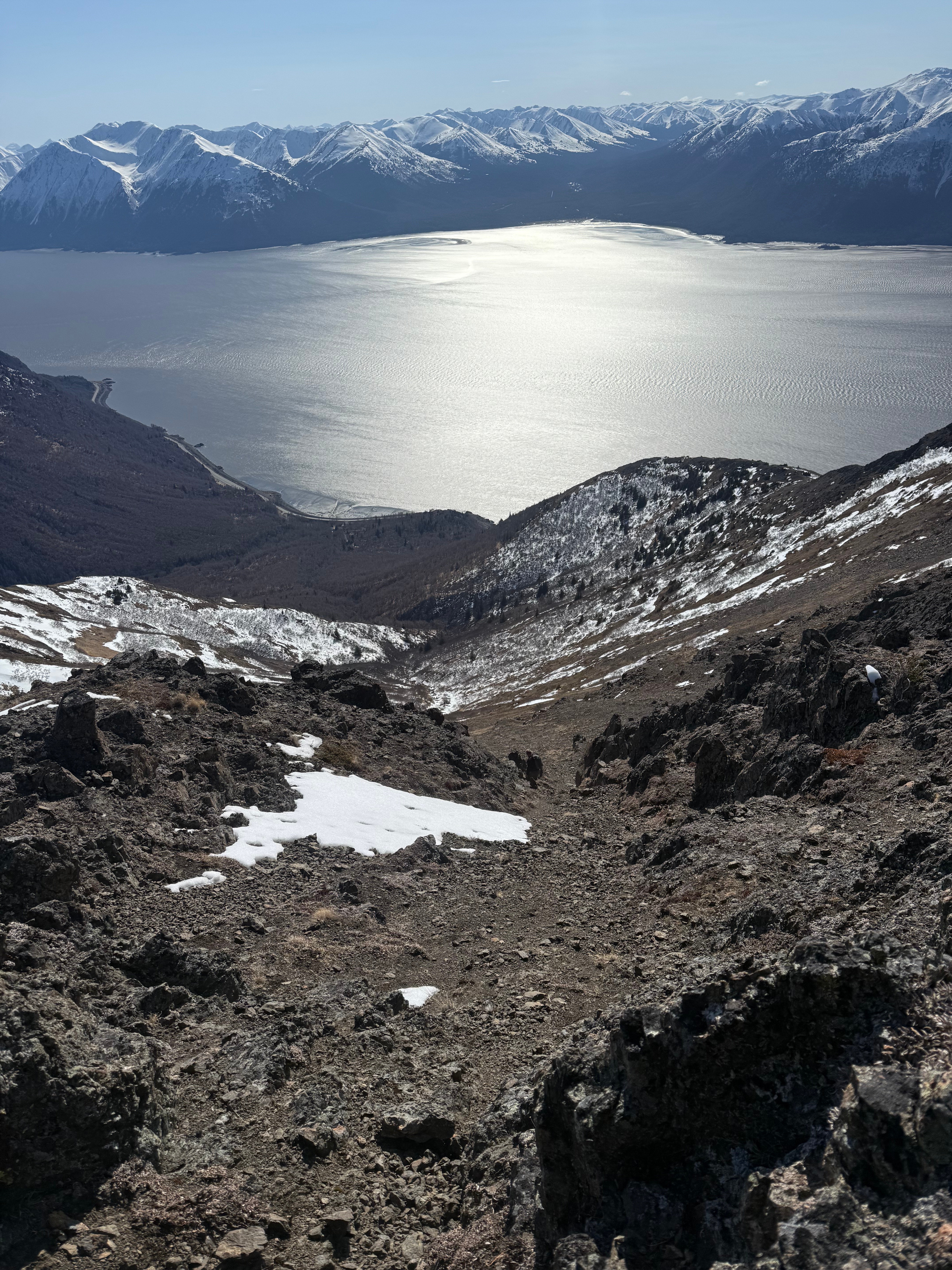
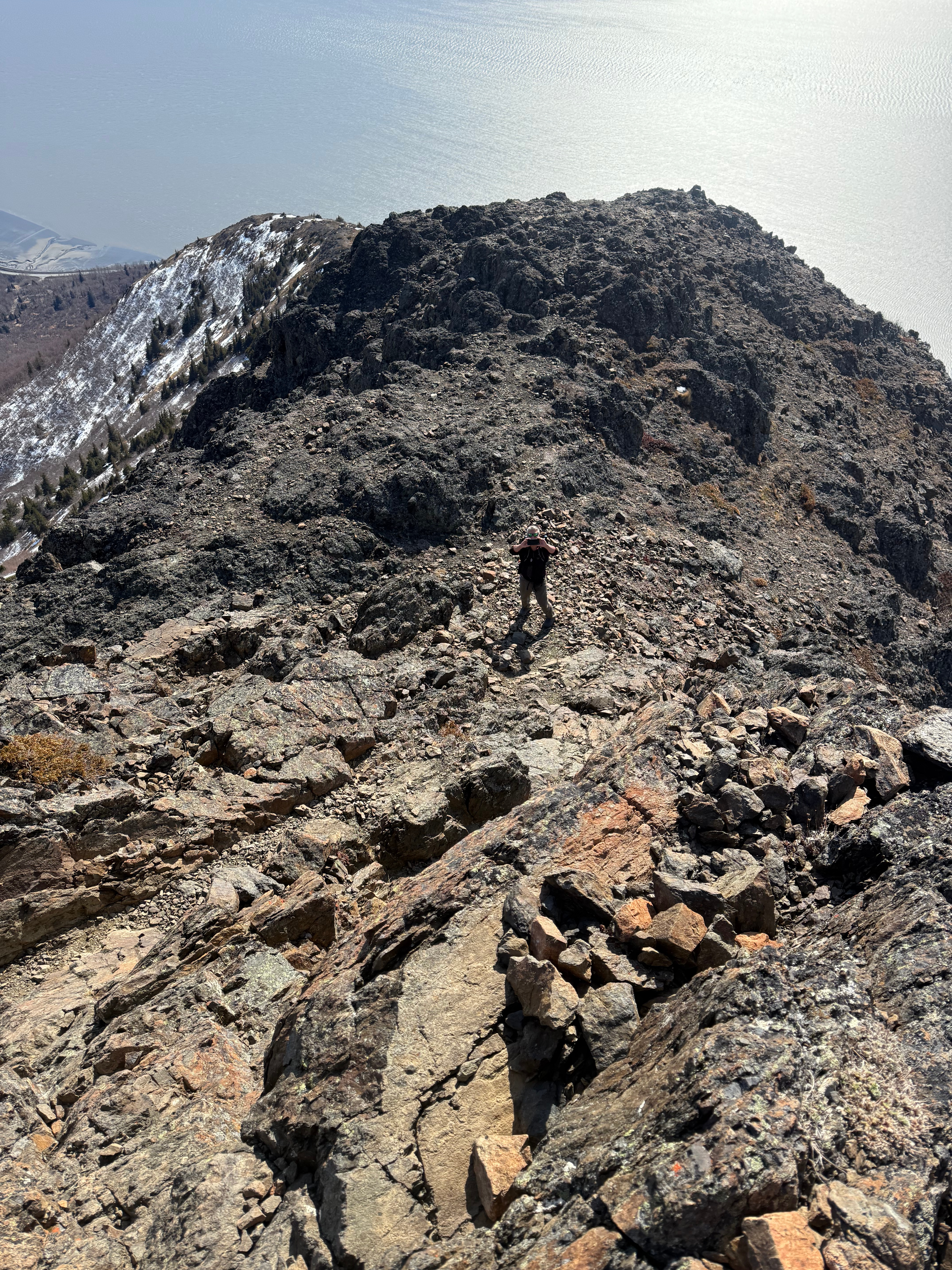
We topped out onto a rocky, tundra covered plateau, which offers the first full view of the mountain from above tree line. The ramped summit, surrounded by rocky outcroppings and ridges running southwest and northeast, is neighbored by a large scree bowl to the northeast. We would be traversing under the summit to the right and then would ascend in a scree slope choose your own adventure route.
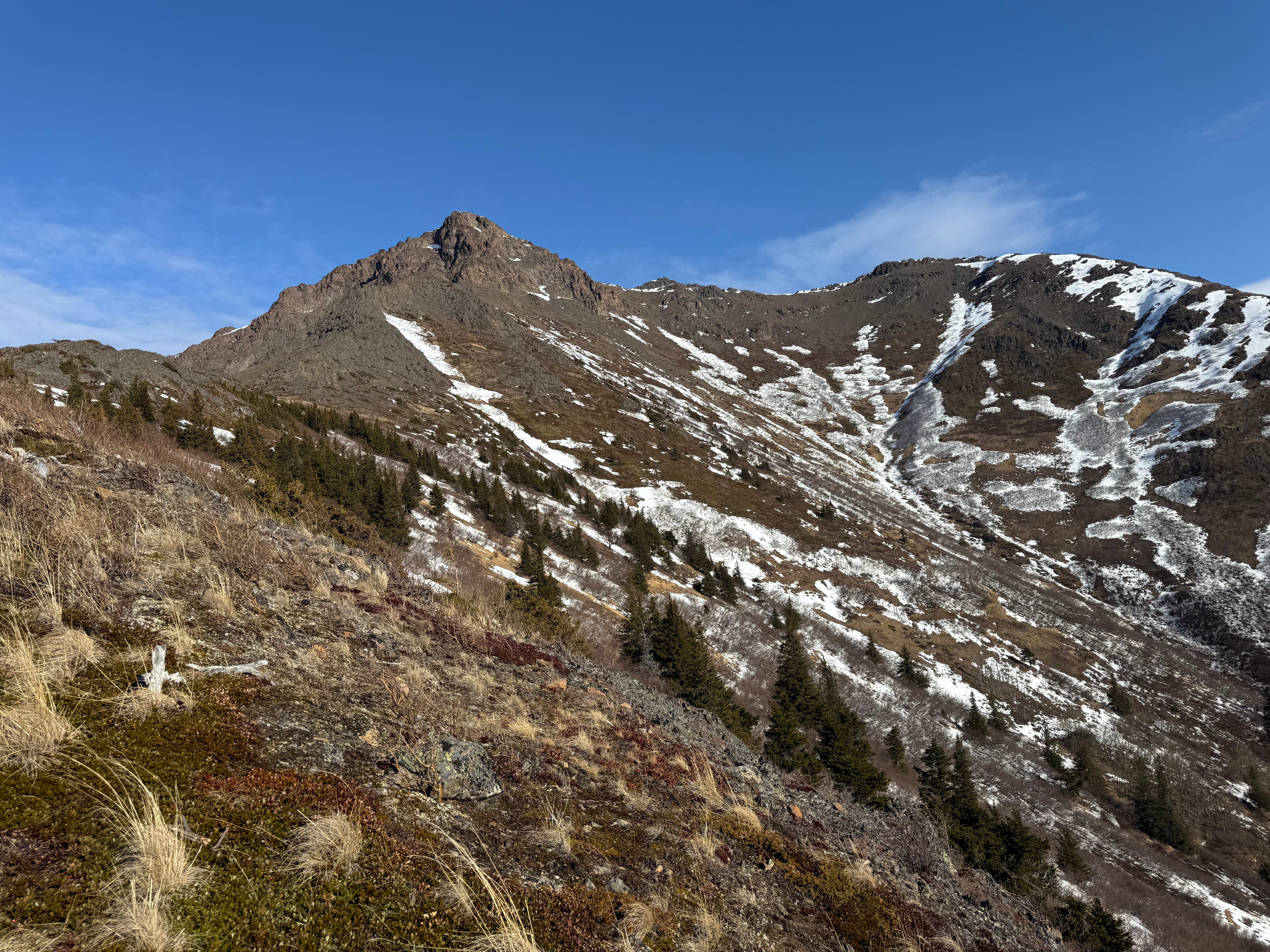
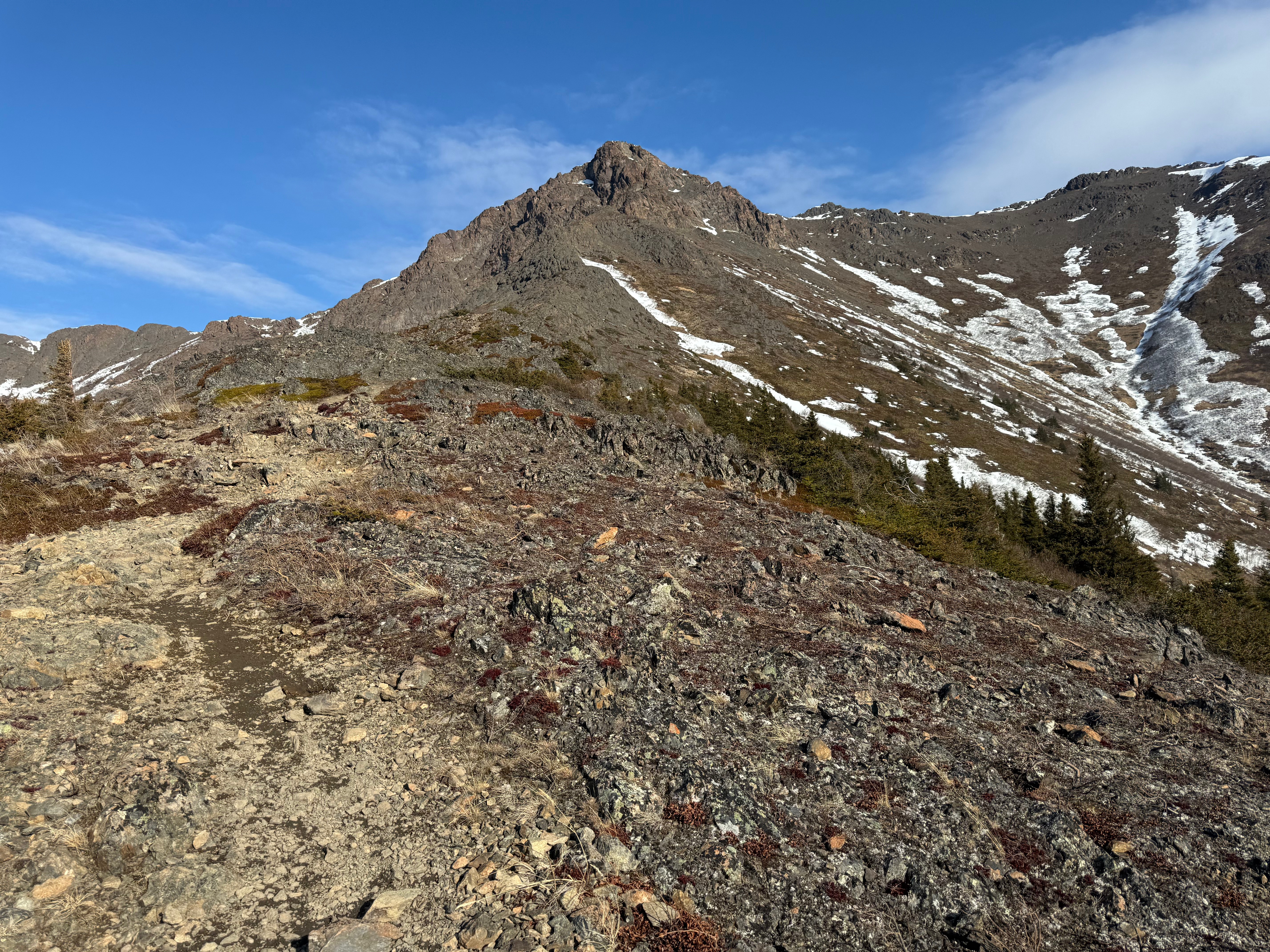
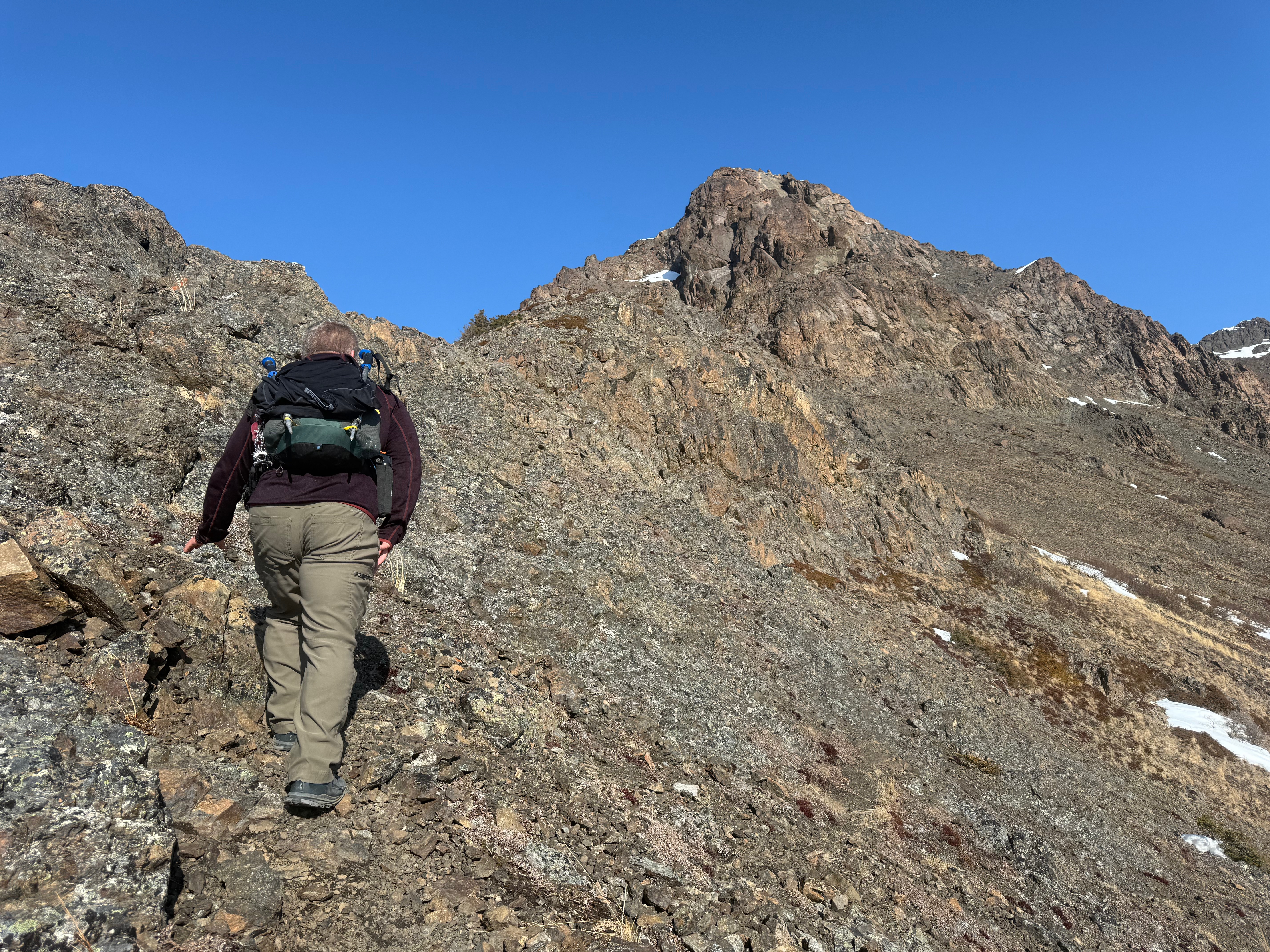
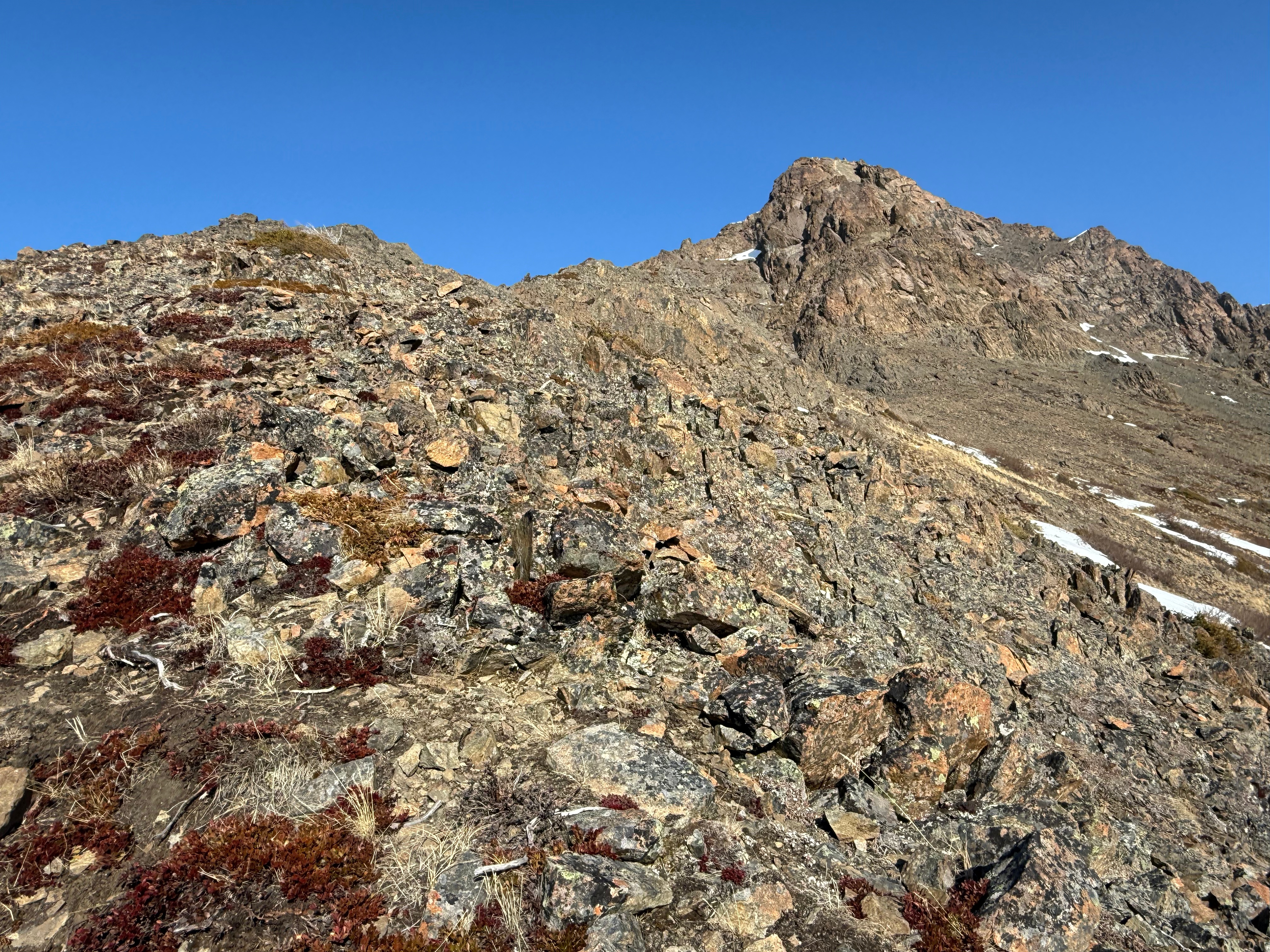
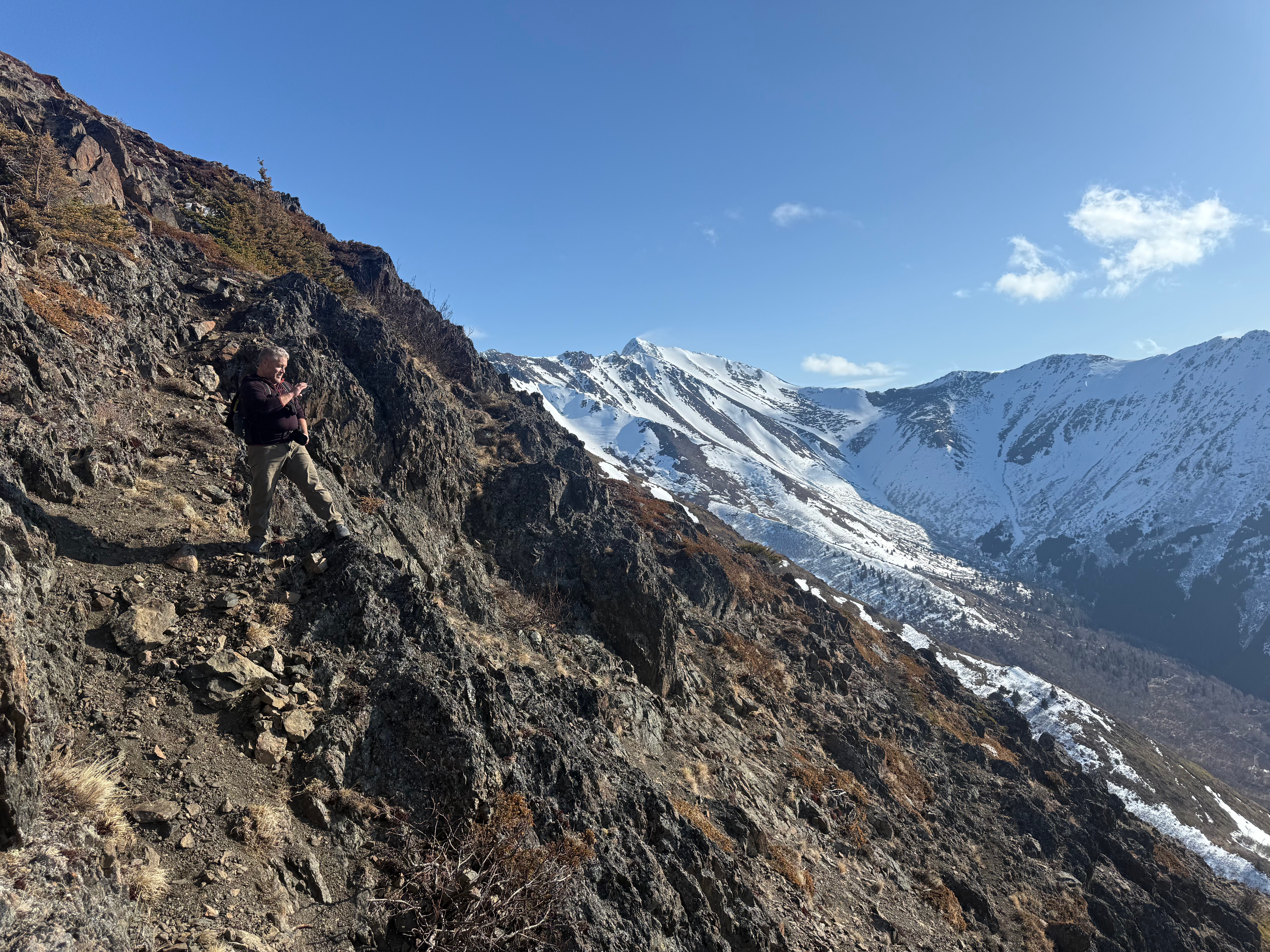

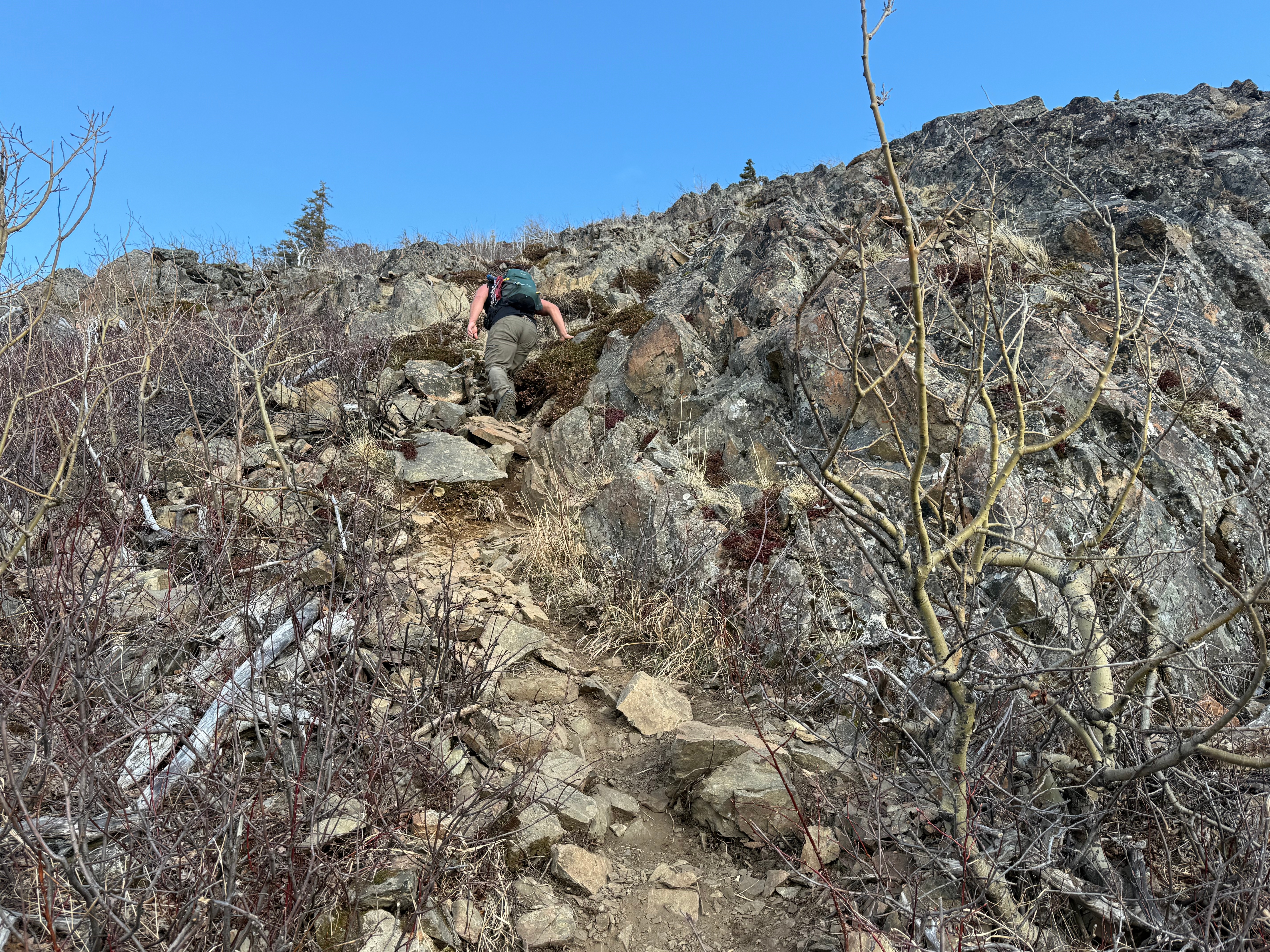
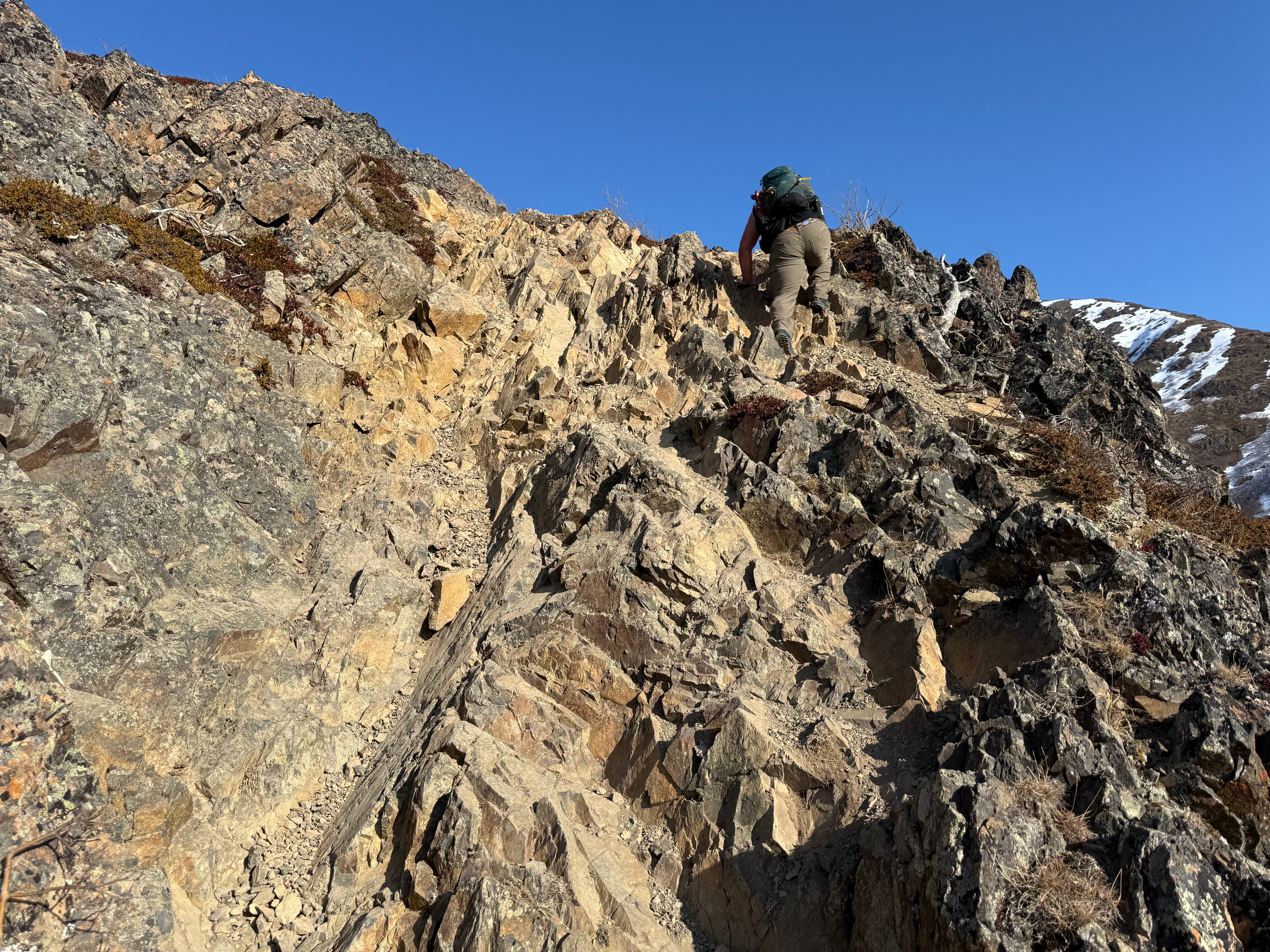
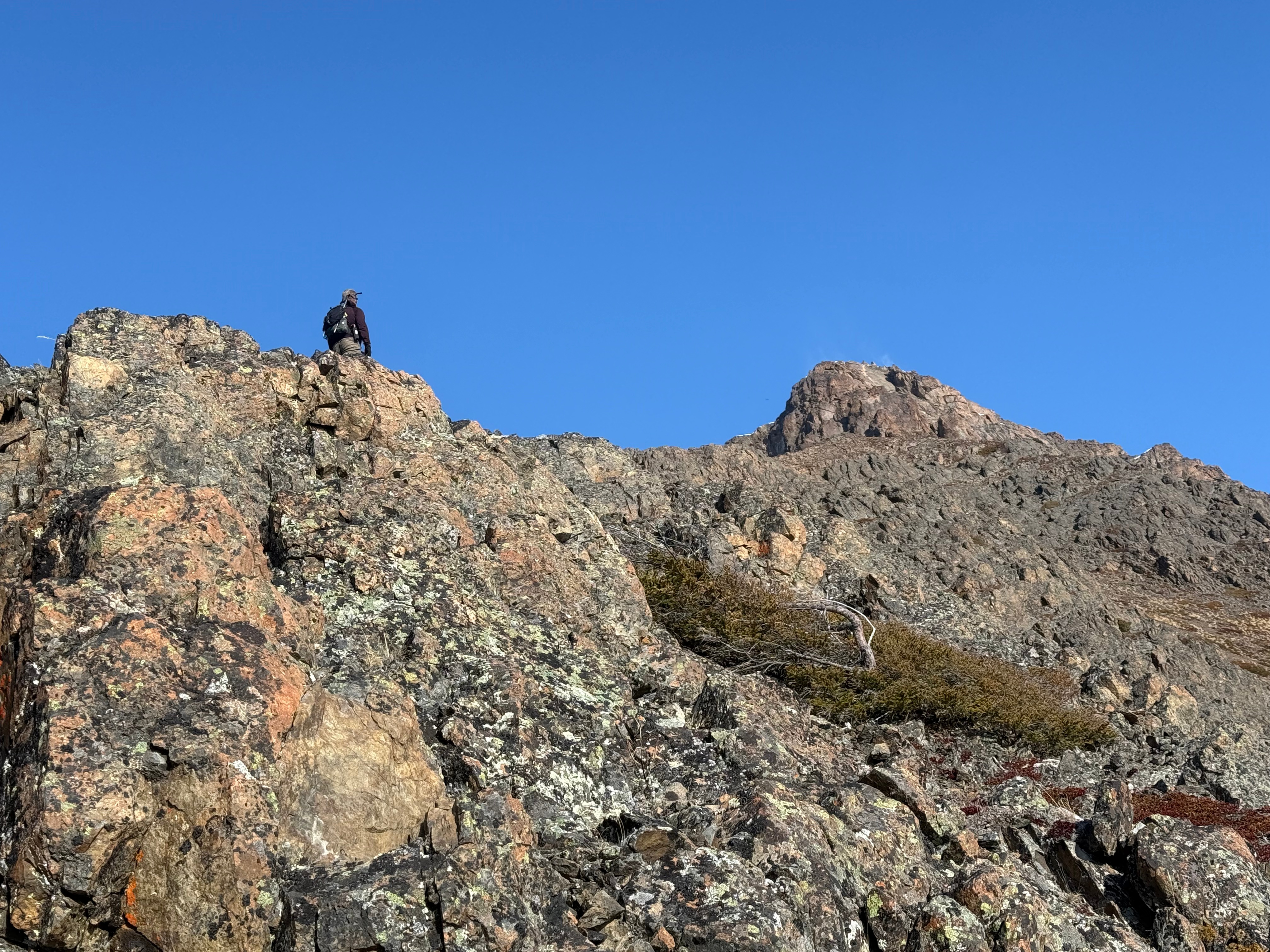
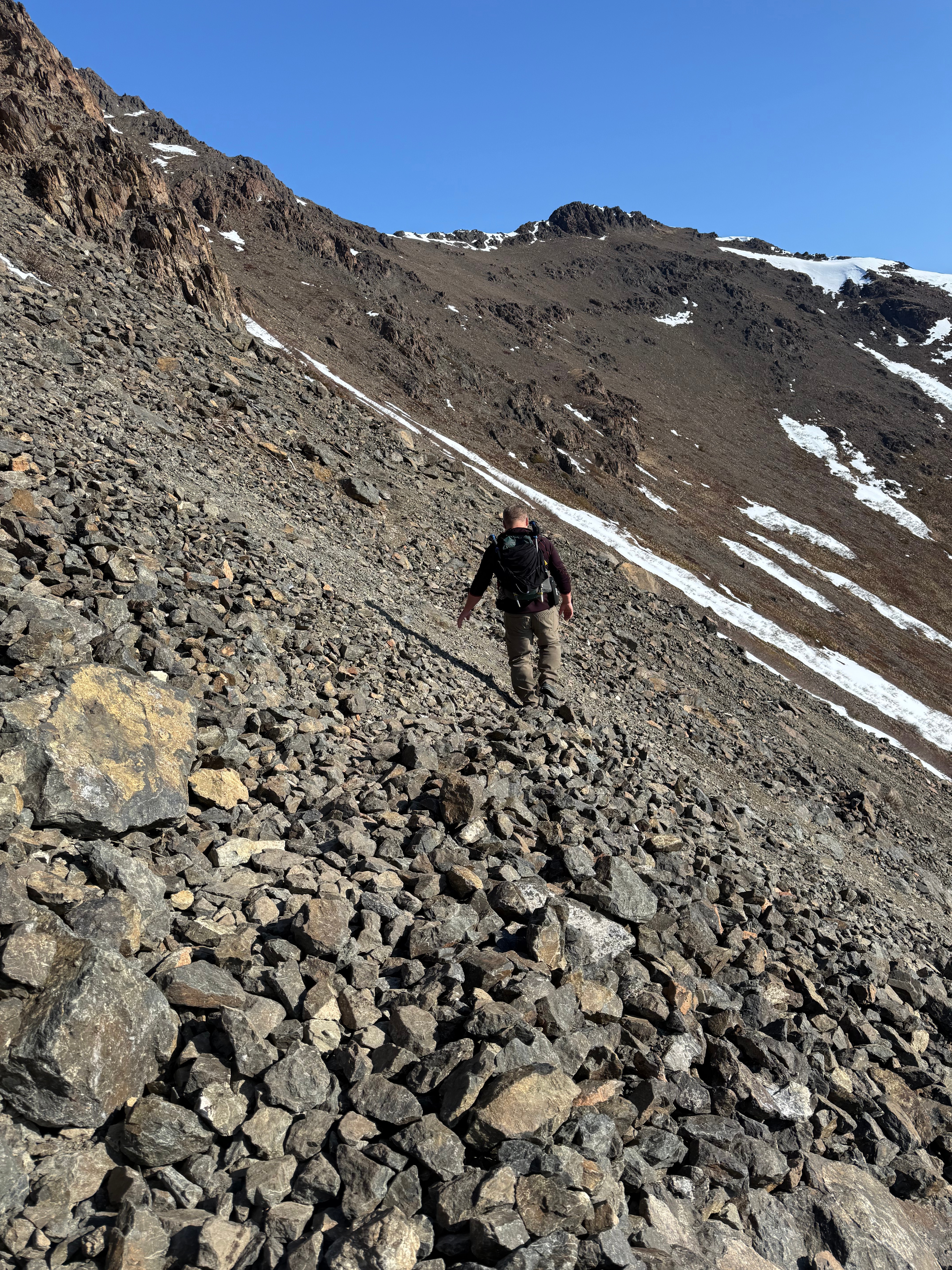
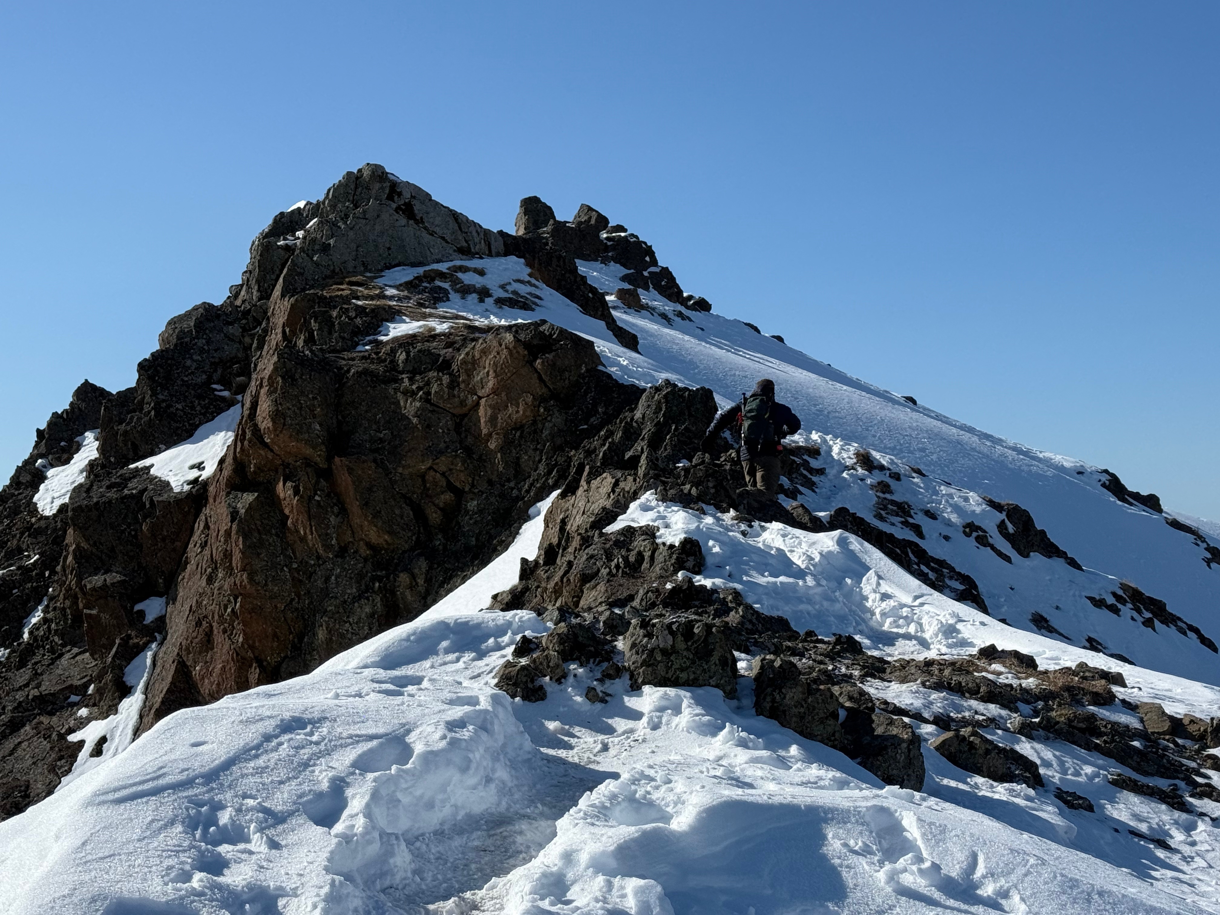
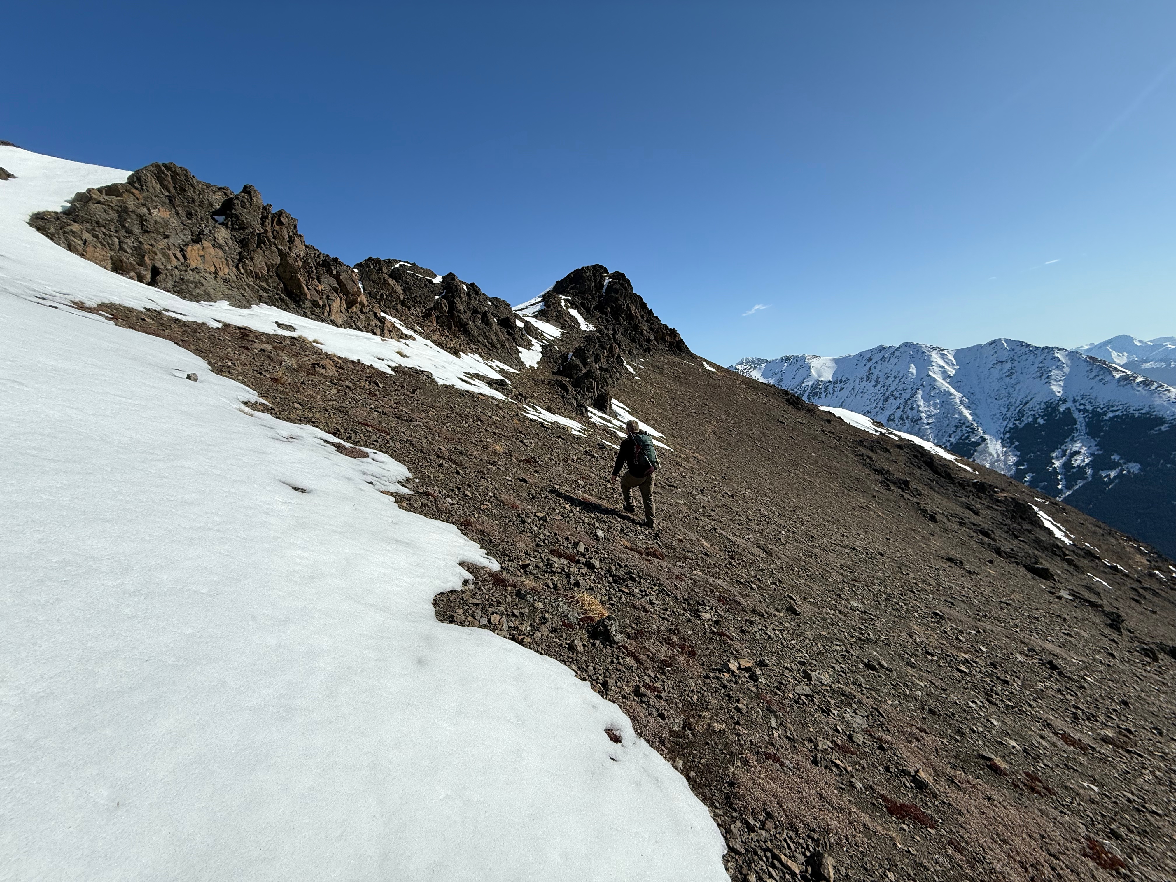
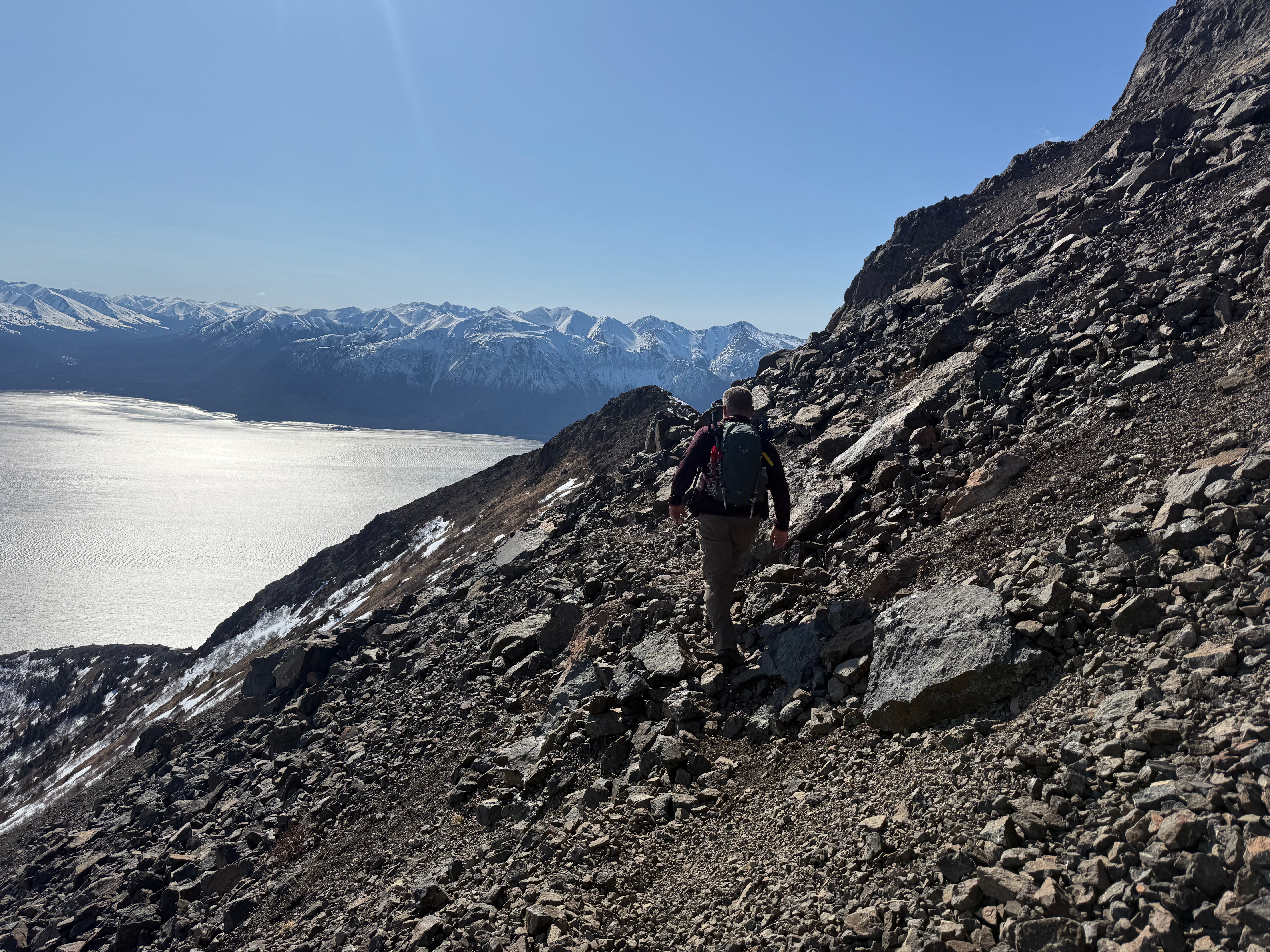
2/10 of a mile after reaching the plateau, we were once again scrambling up mini chimneys and along rocky outcroppings, sometimes choosing a more challenging route just for the fun of it. 3/10 of a mile and just shy of 700′ later, we were at the base of the summit blocks, beginning our traverse to the right (northeast) along a faint path.

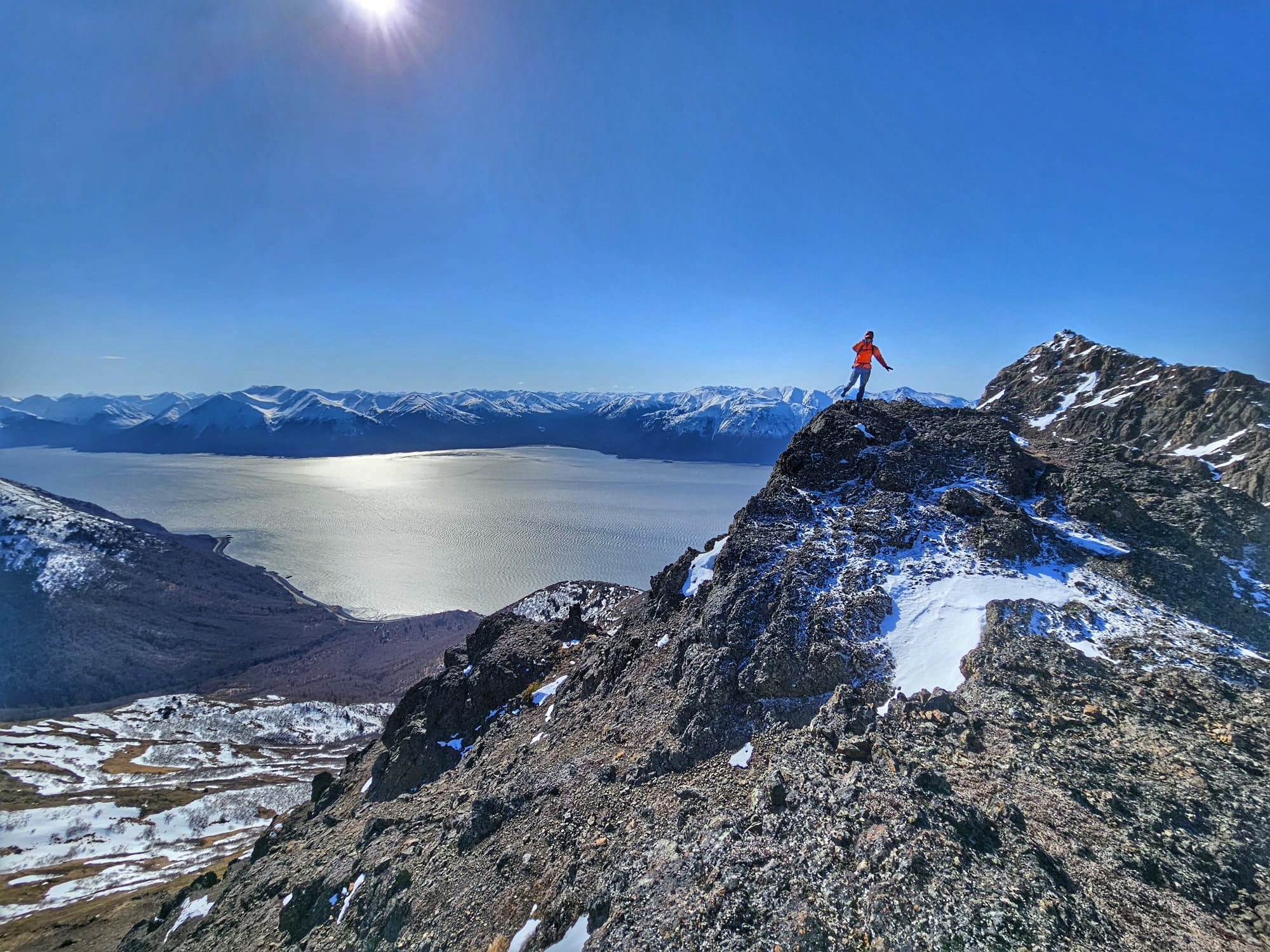

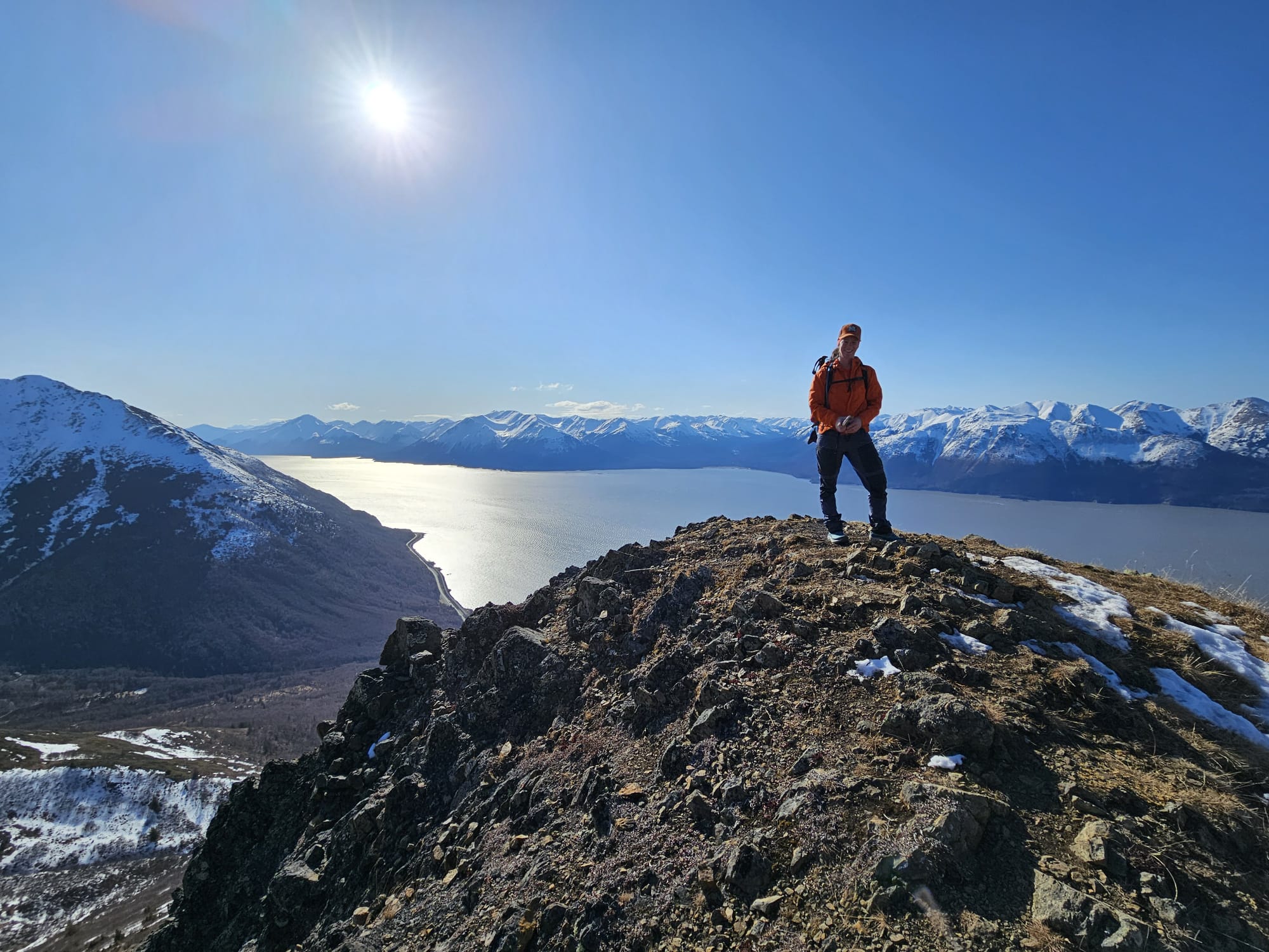
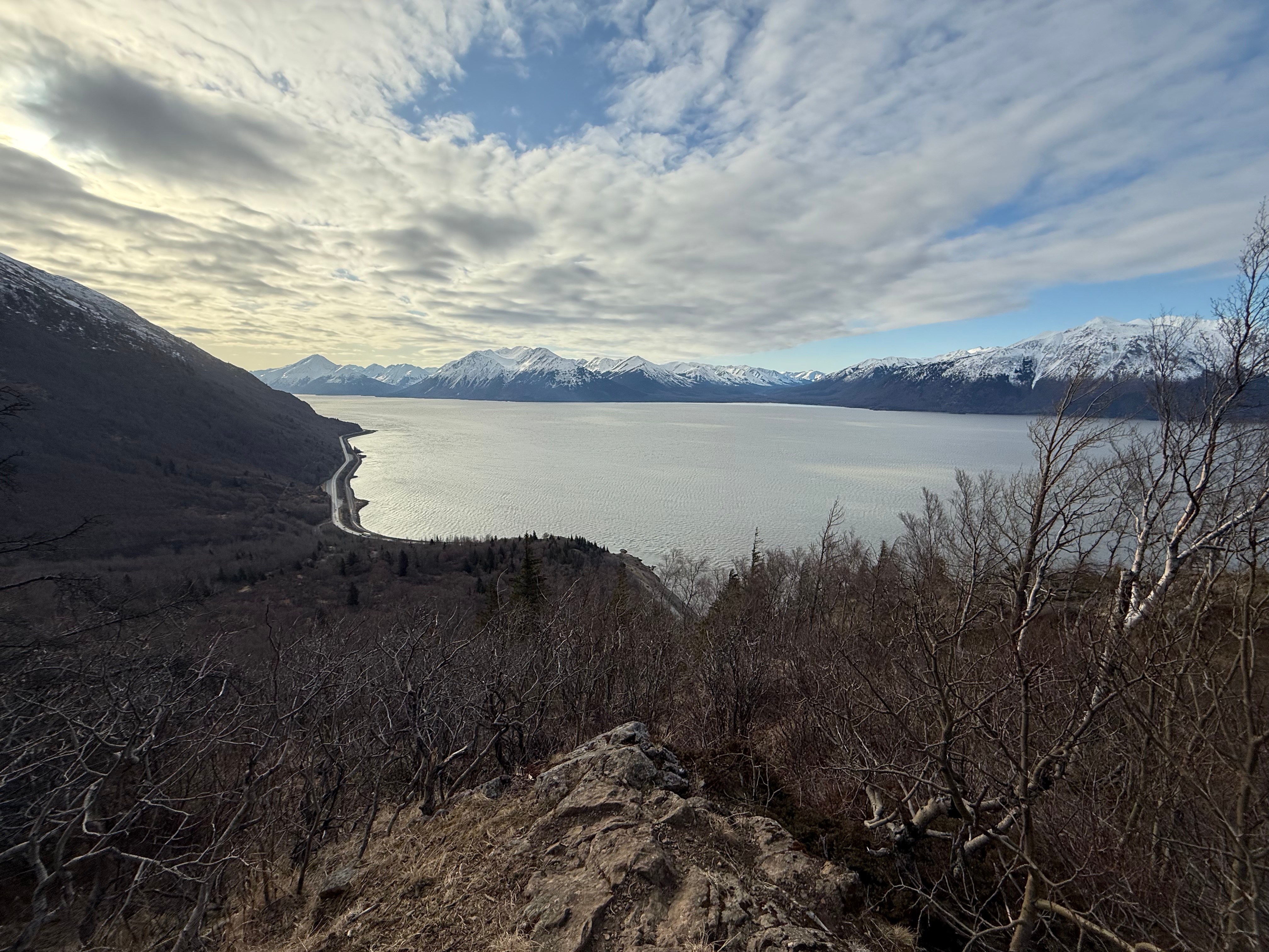
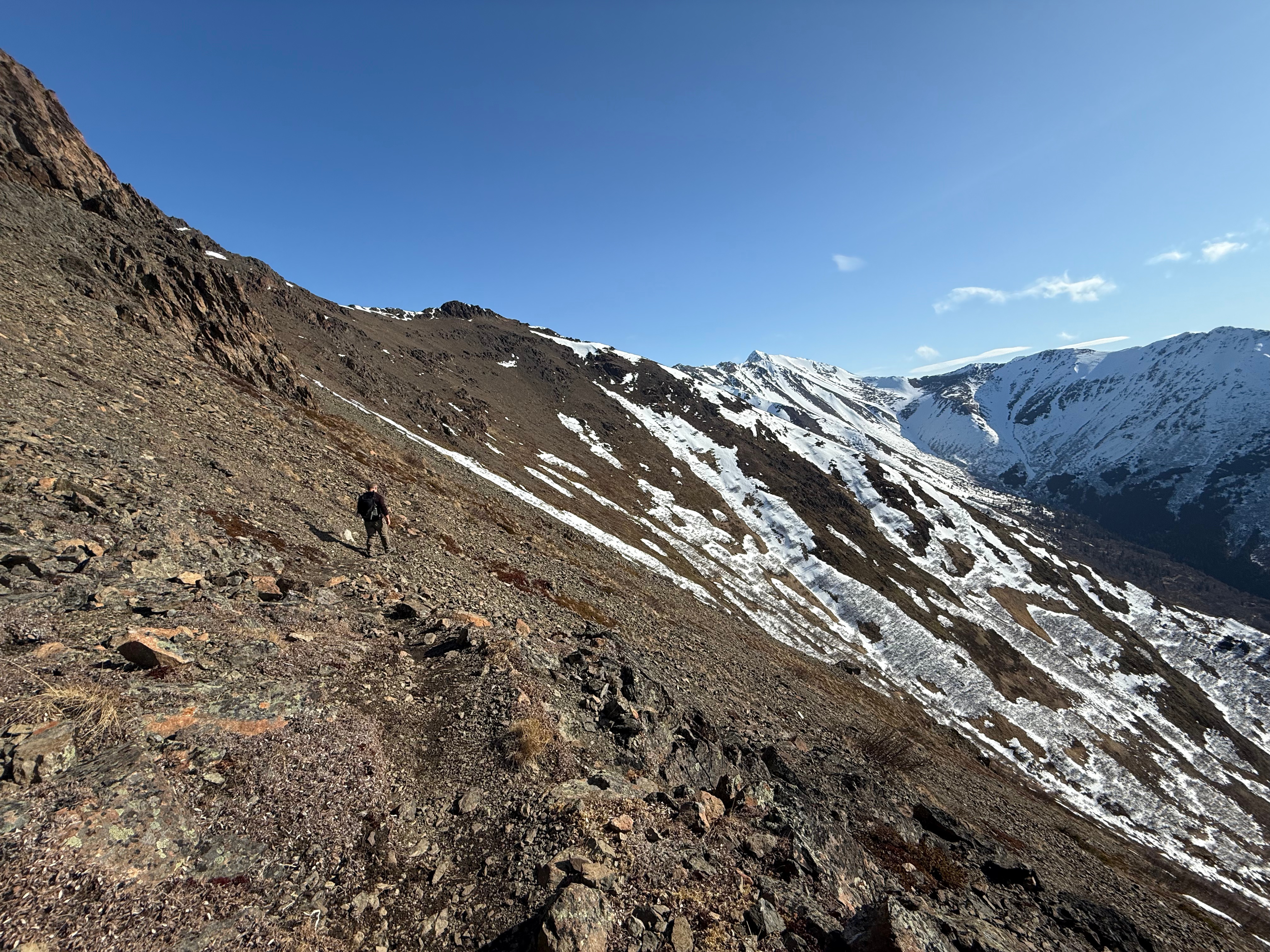
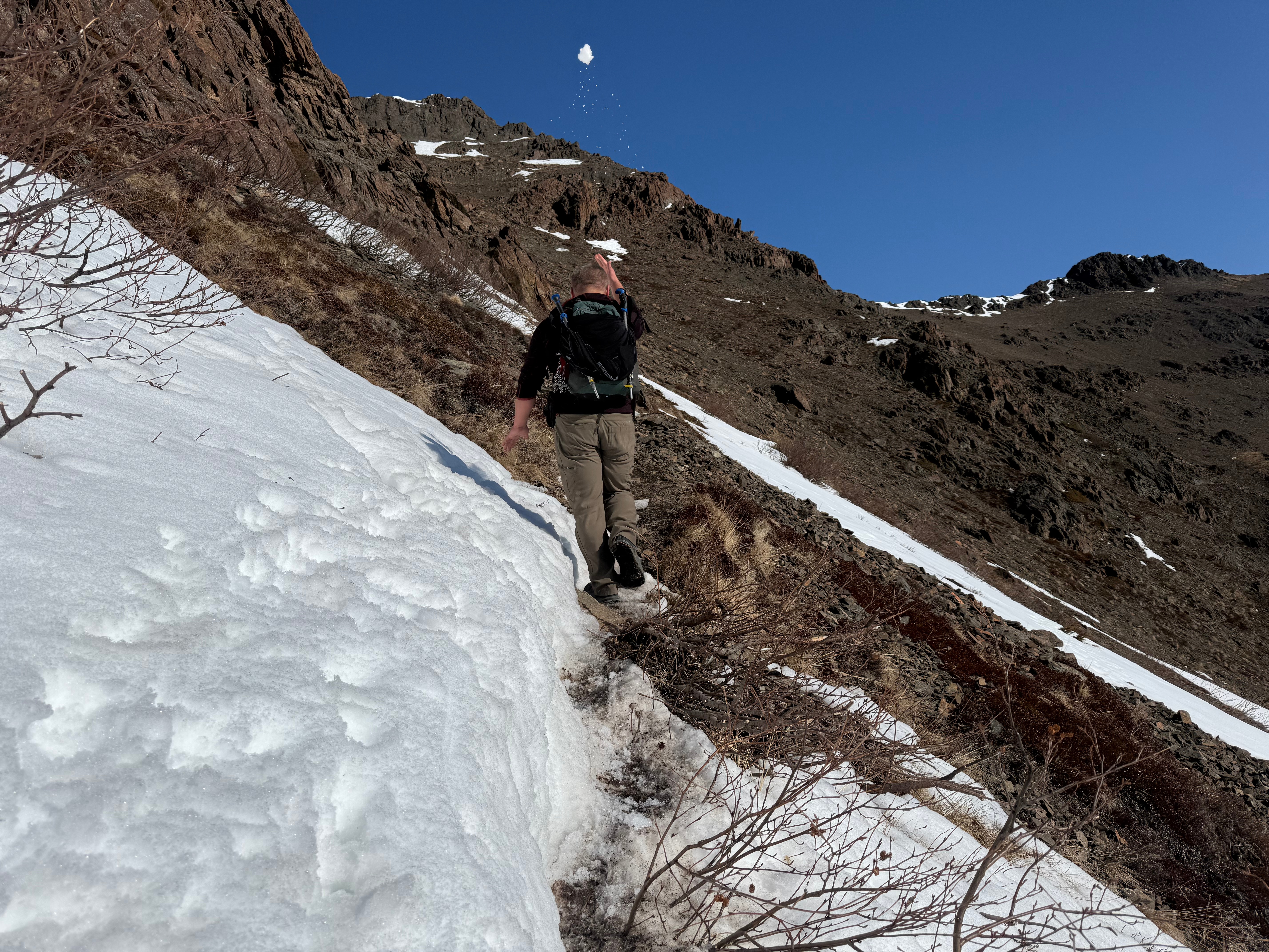
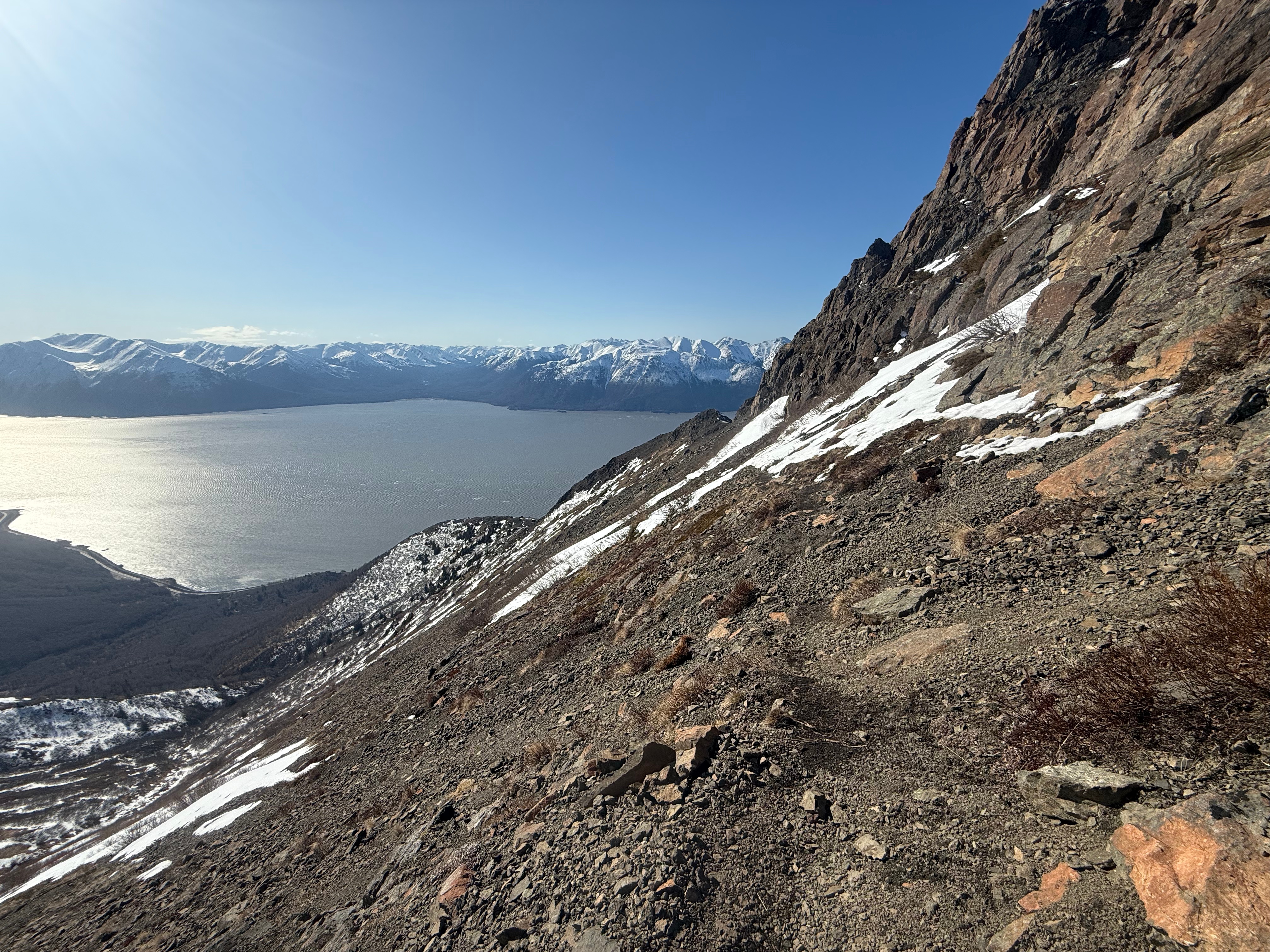
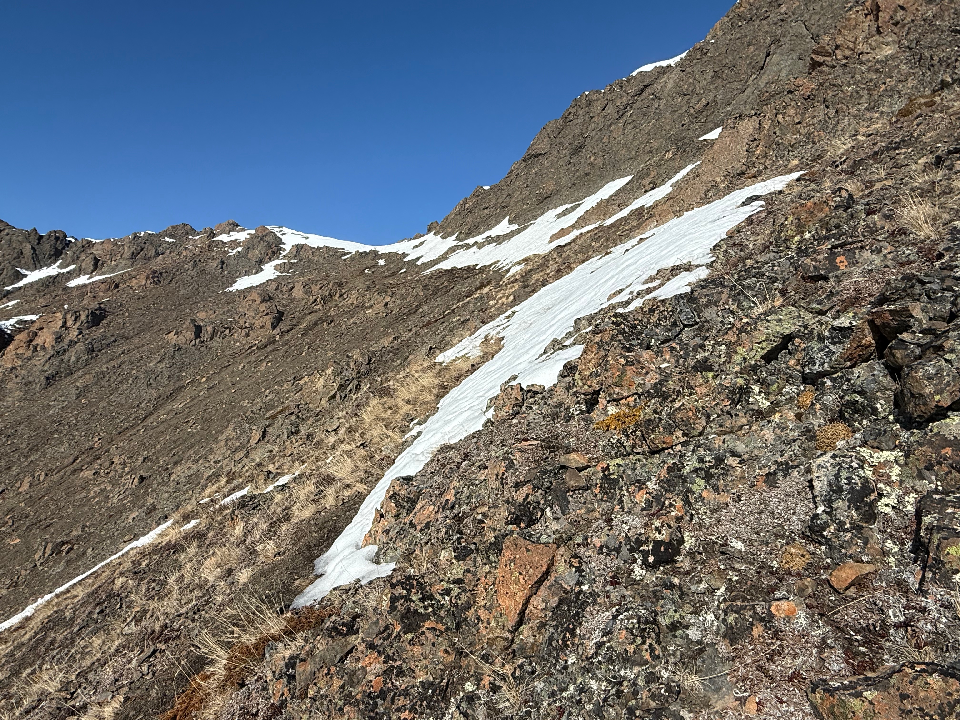
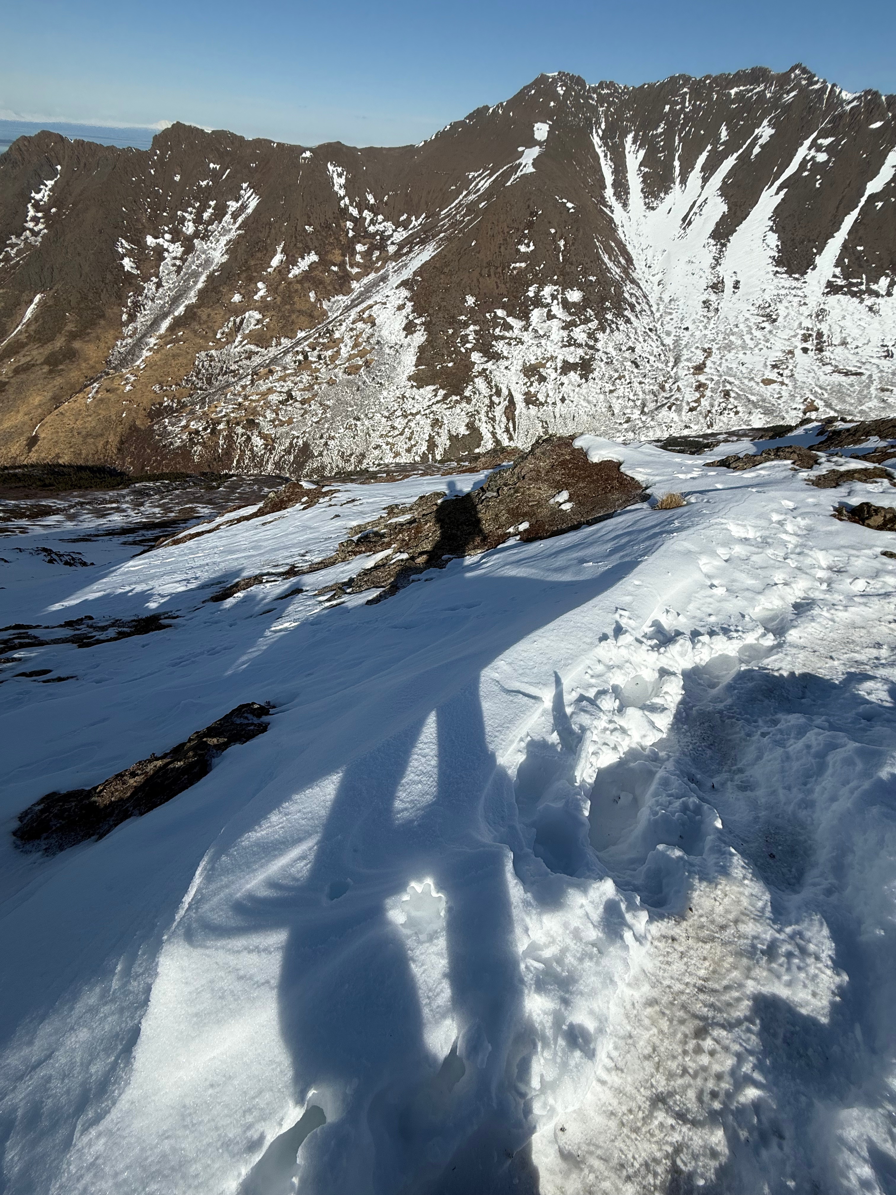
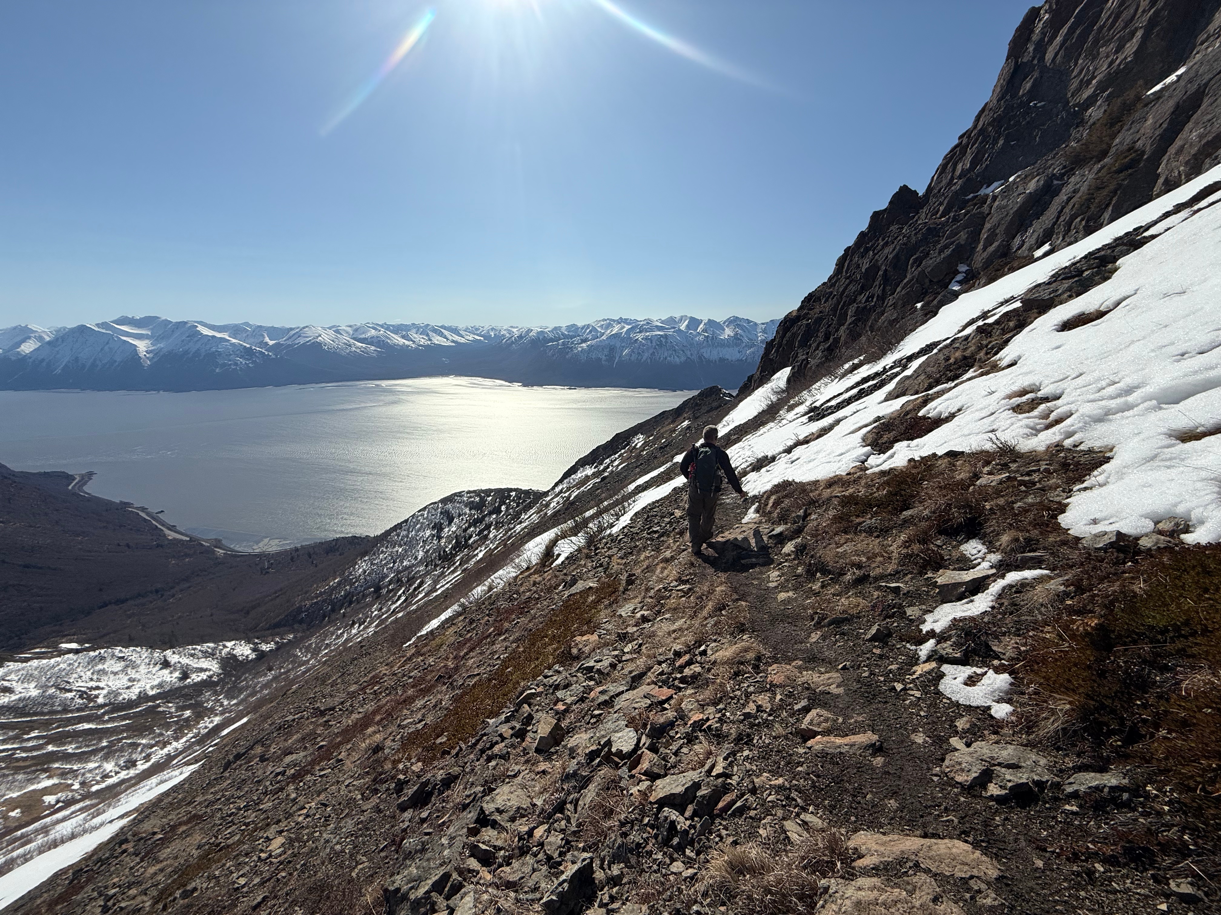
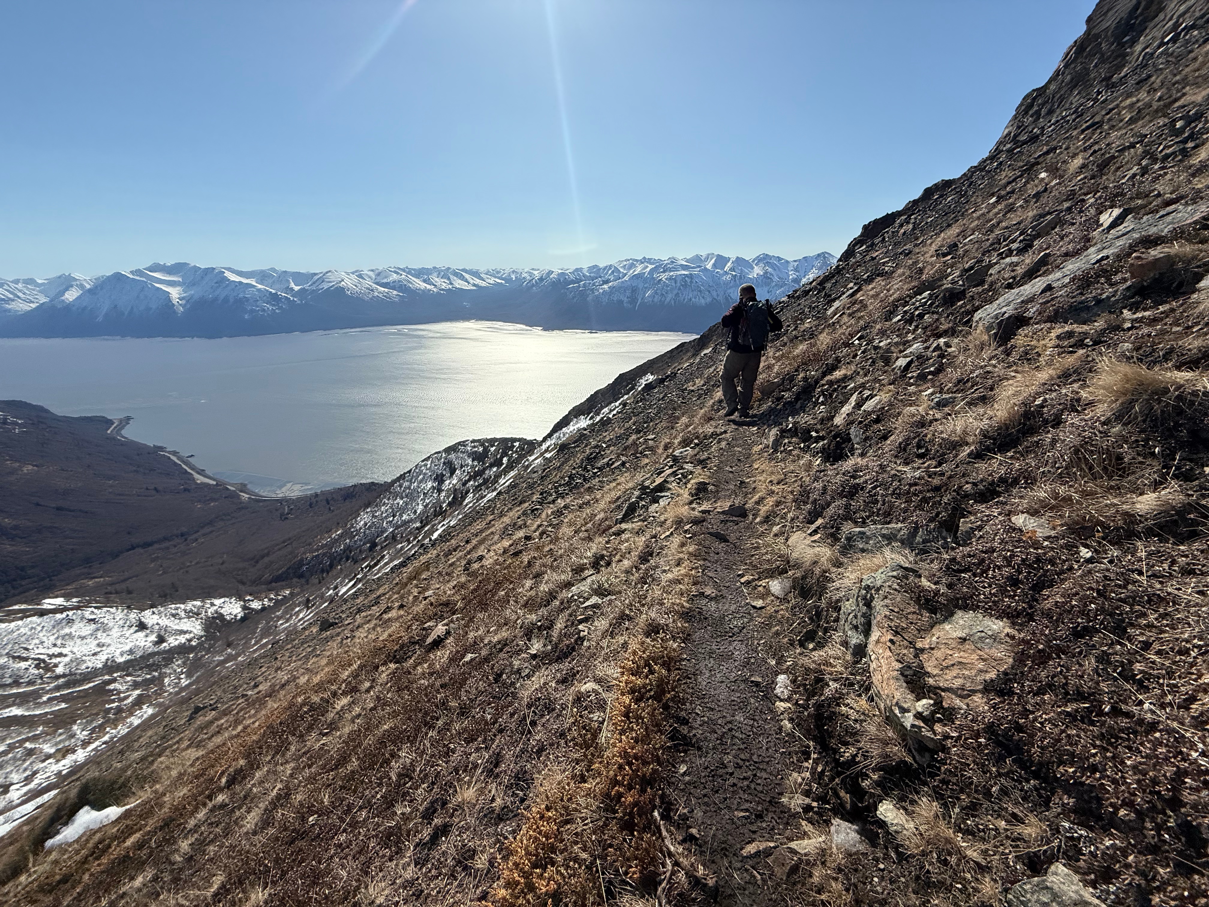
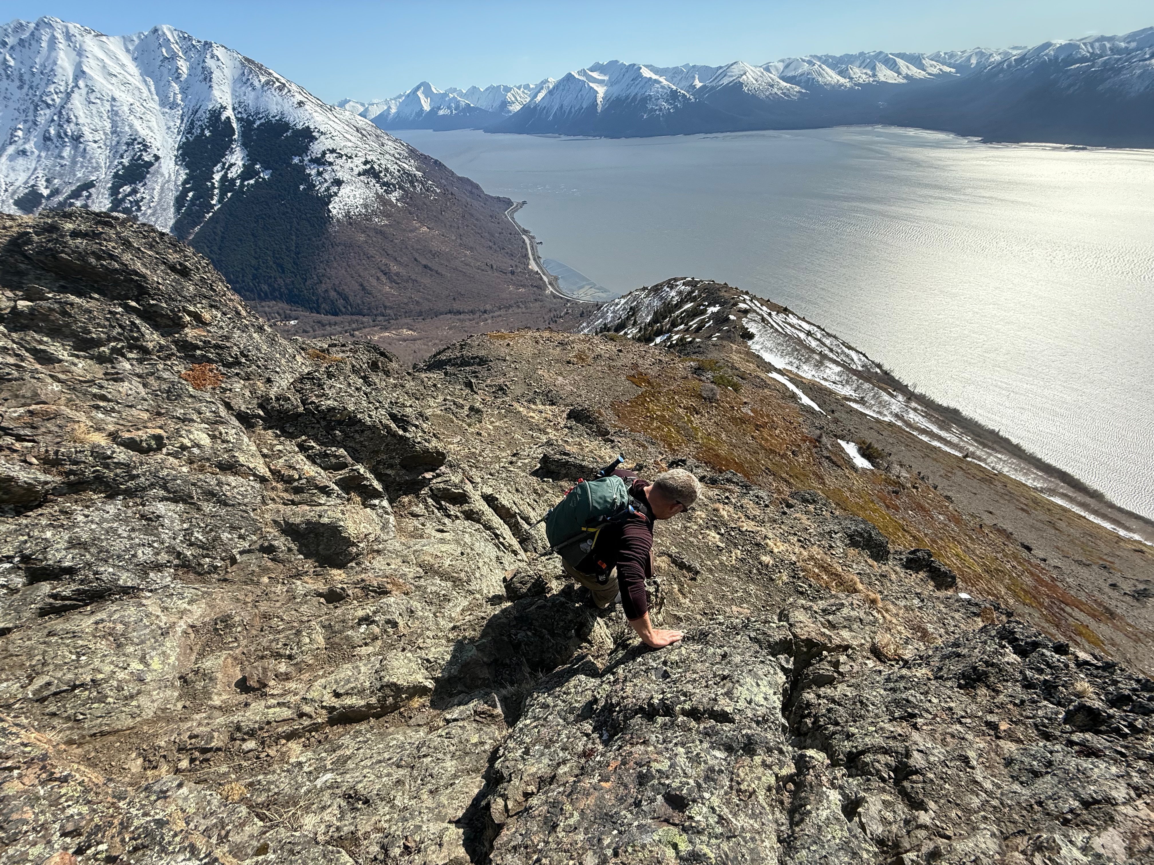
Traversing below the summit and then the summit ridge, the slope to the right drops steeply to Rainbow Valley, sections of loose rocks and snow were interspersed with a solid and stable bootpath. Once we reached the first scree chute leading to the summit ridge, we sat down for a snack break and to take in the views of Turnagain Arm below and South Yuyanq’Ch’ex up to the left. Tortilla Chip Point taunted us from across the valley and we spoke of linking the entire ridge in a giant loop, from Rainbow to South Yu to Tortilla Chip.


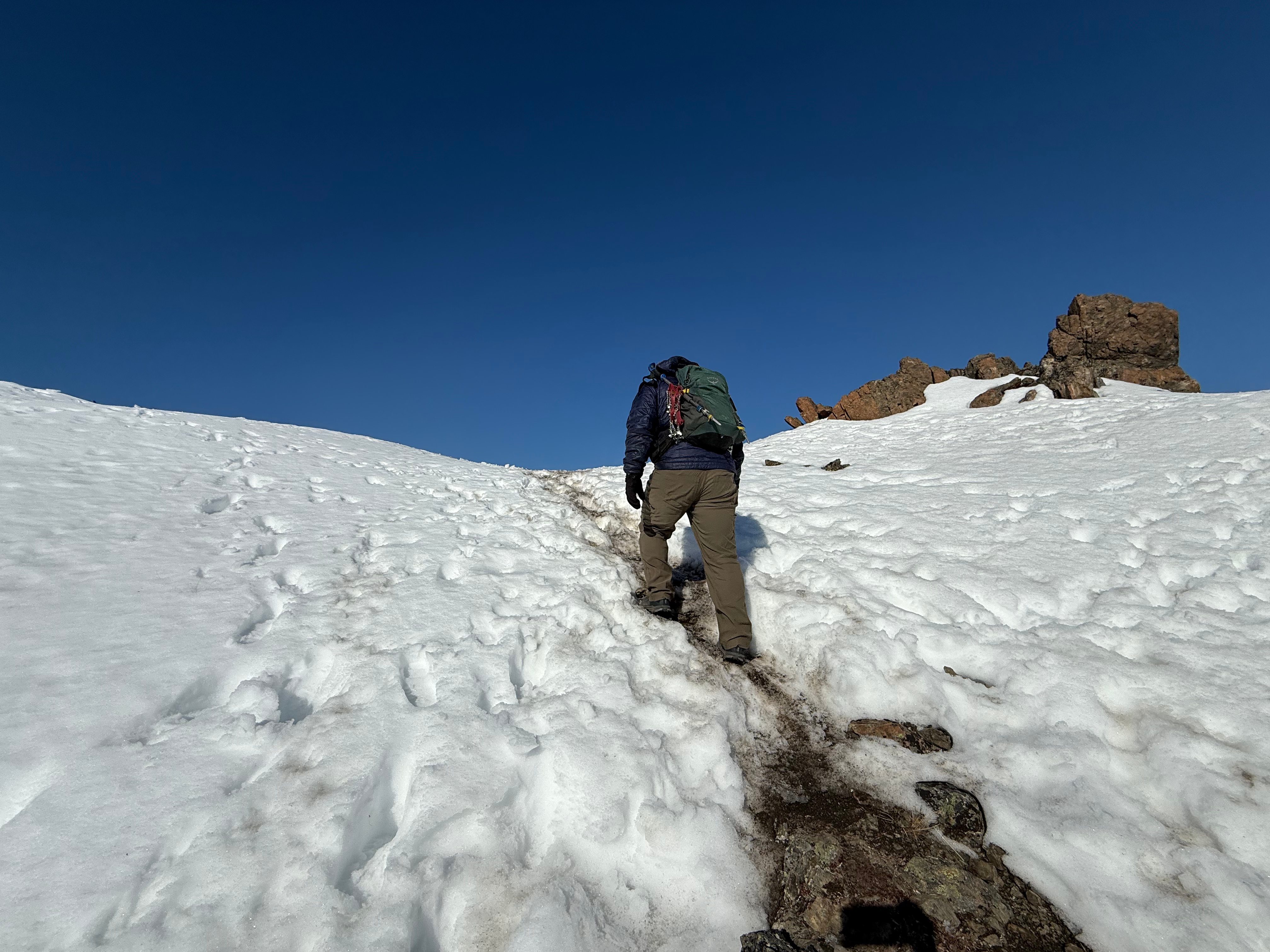
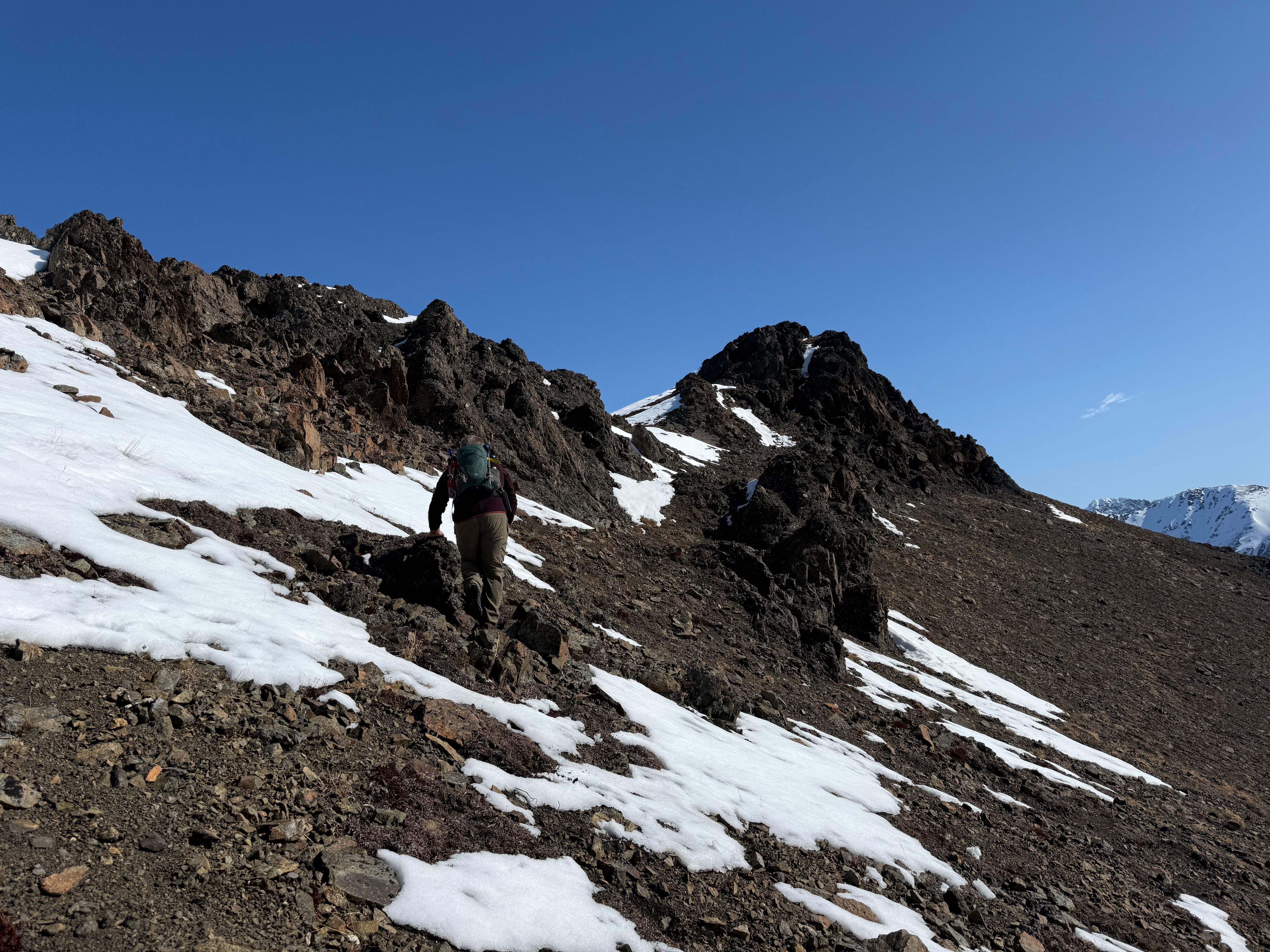
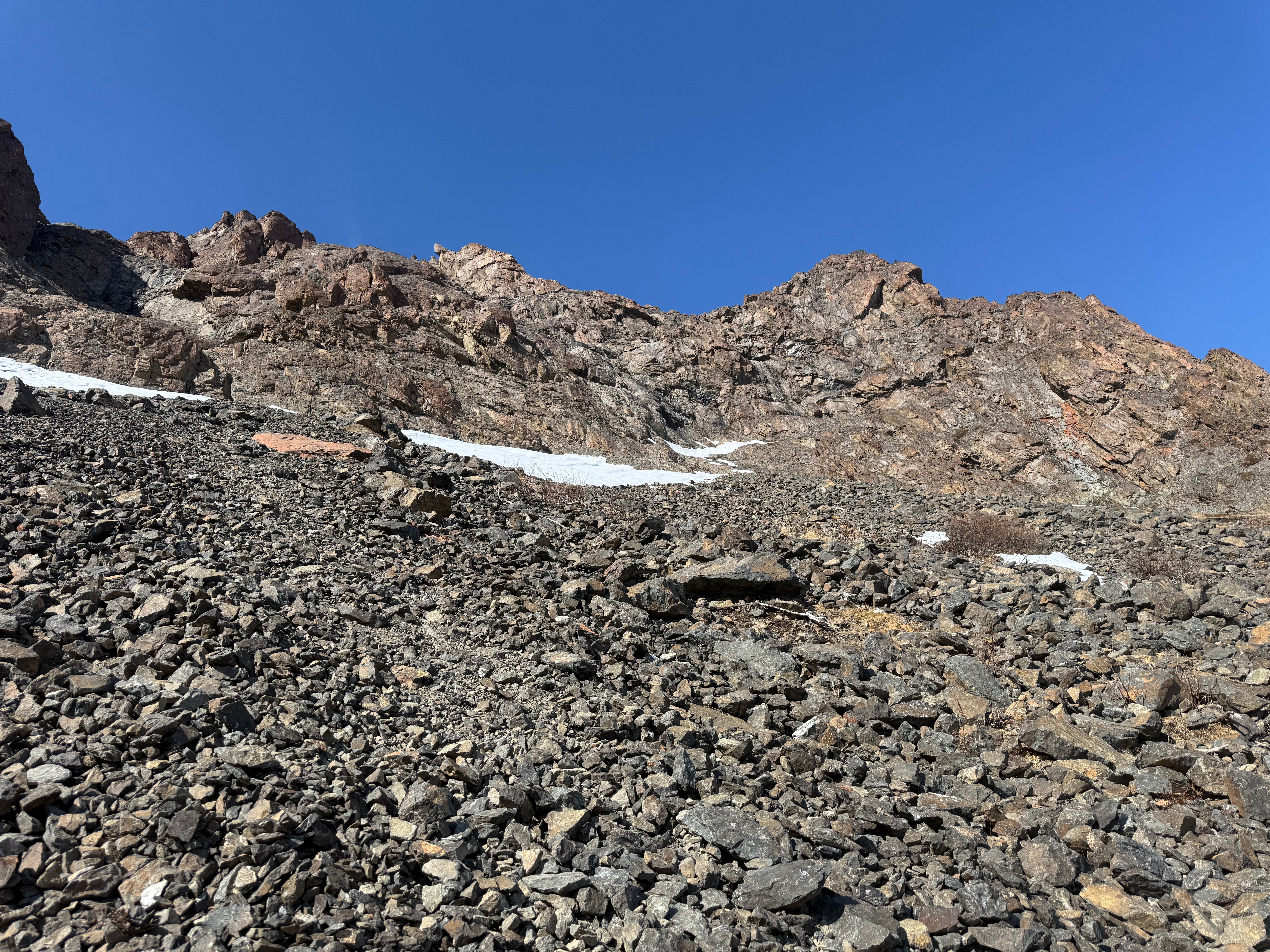
The wind was starting to pick up and spindrift and blowing snow was a good indication we would be in 40+mph gusts, so we donned our warm layers and started directly up the chute to the ridgeline. There is also the option to continue on the traverse and ascend to the ridge anywhere along the scree bowl, but we opted for the direct route up.

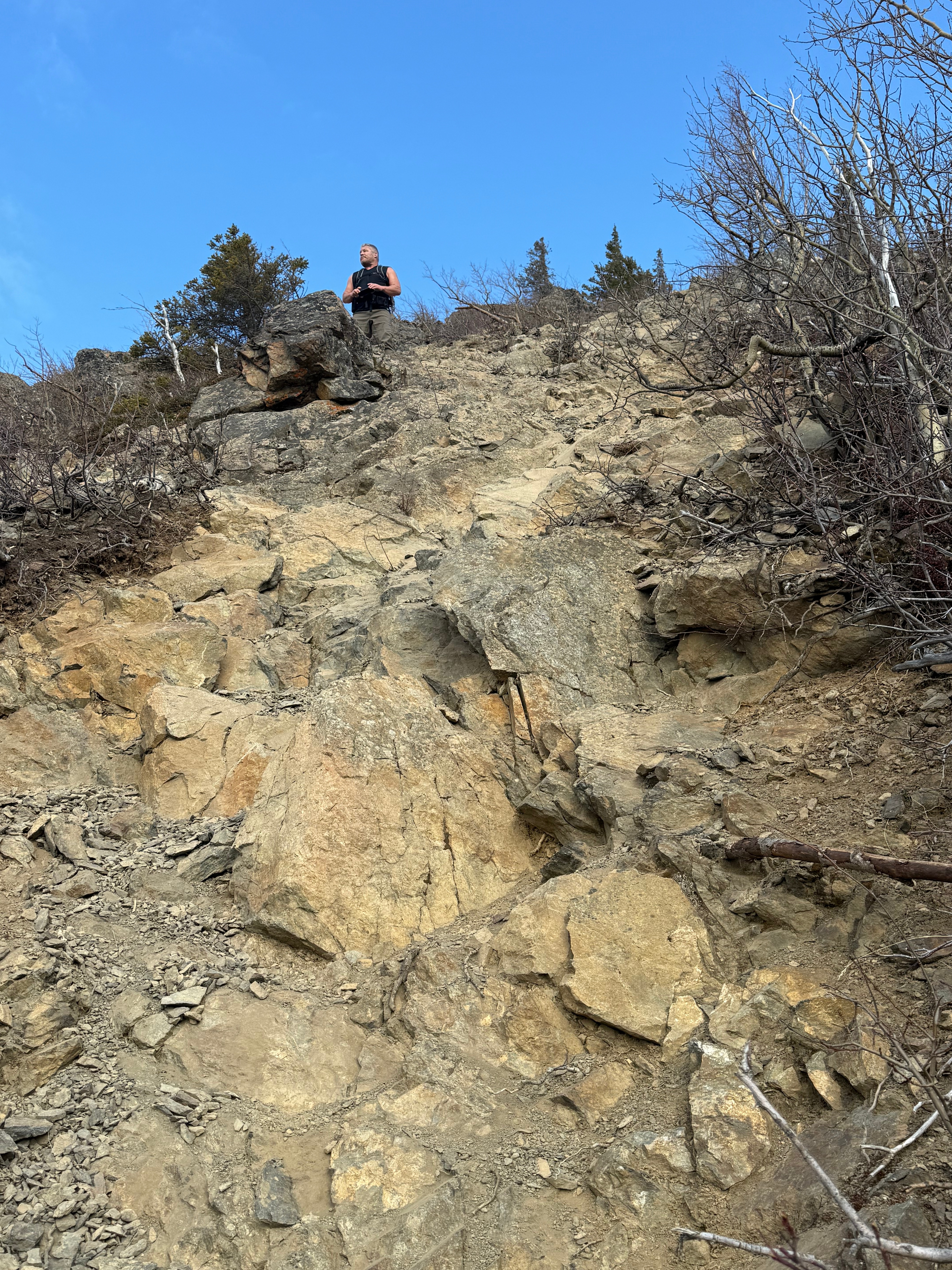
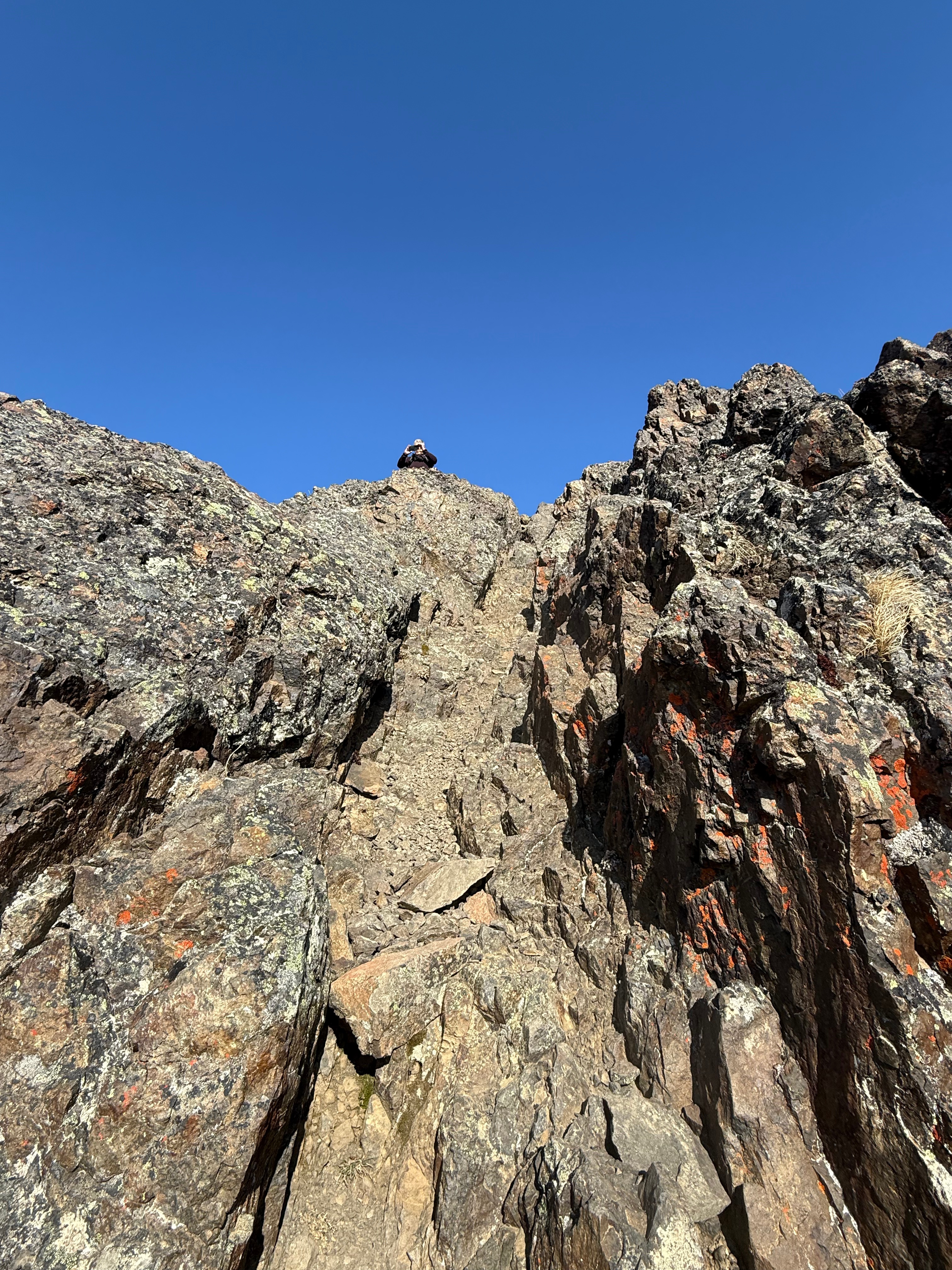
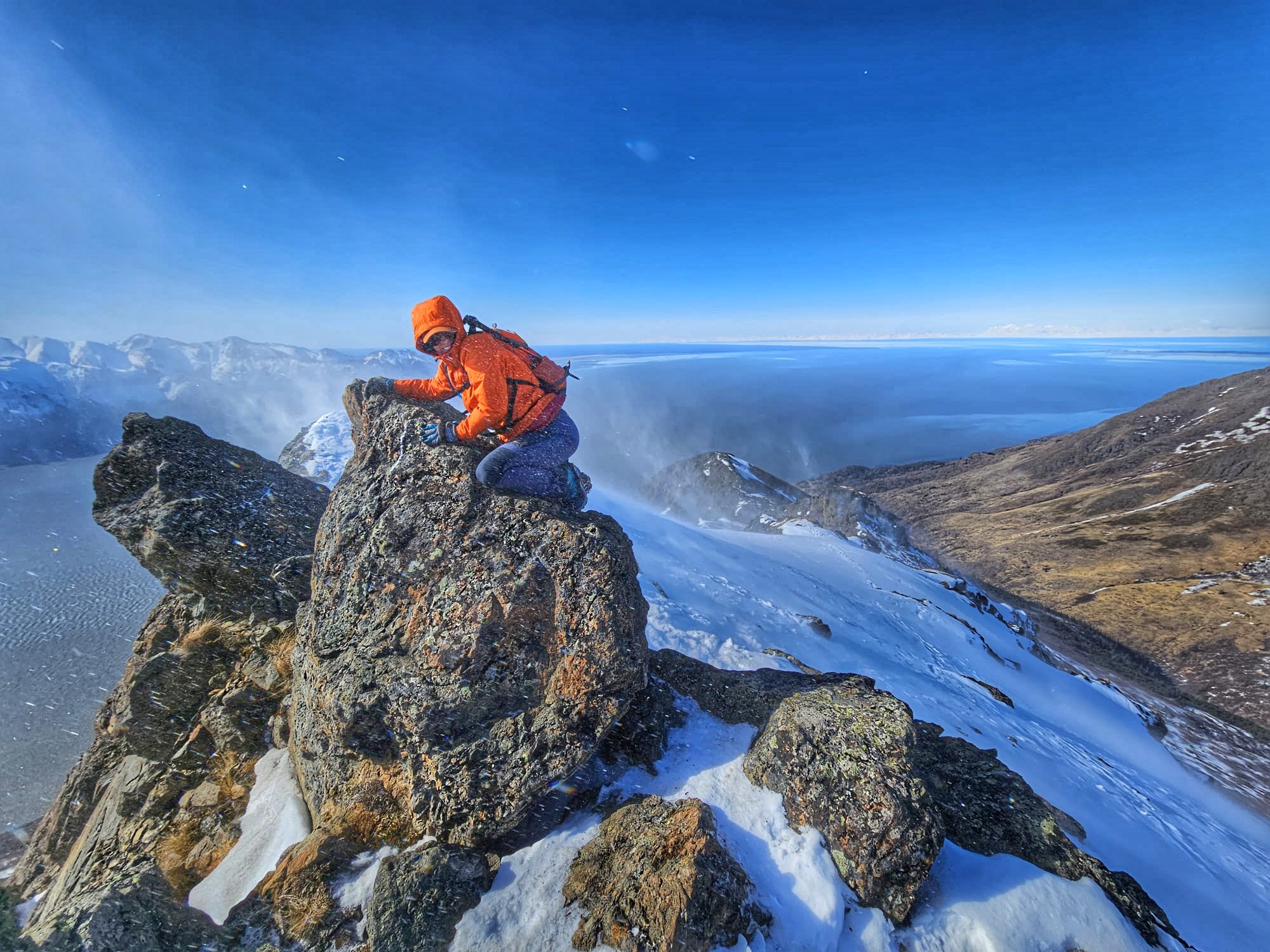
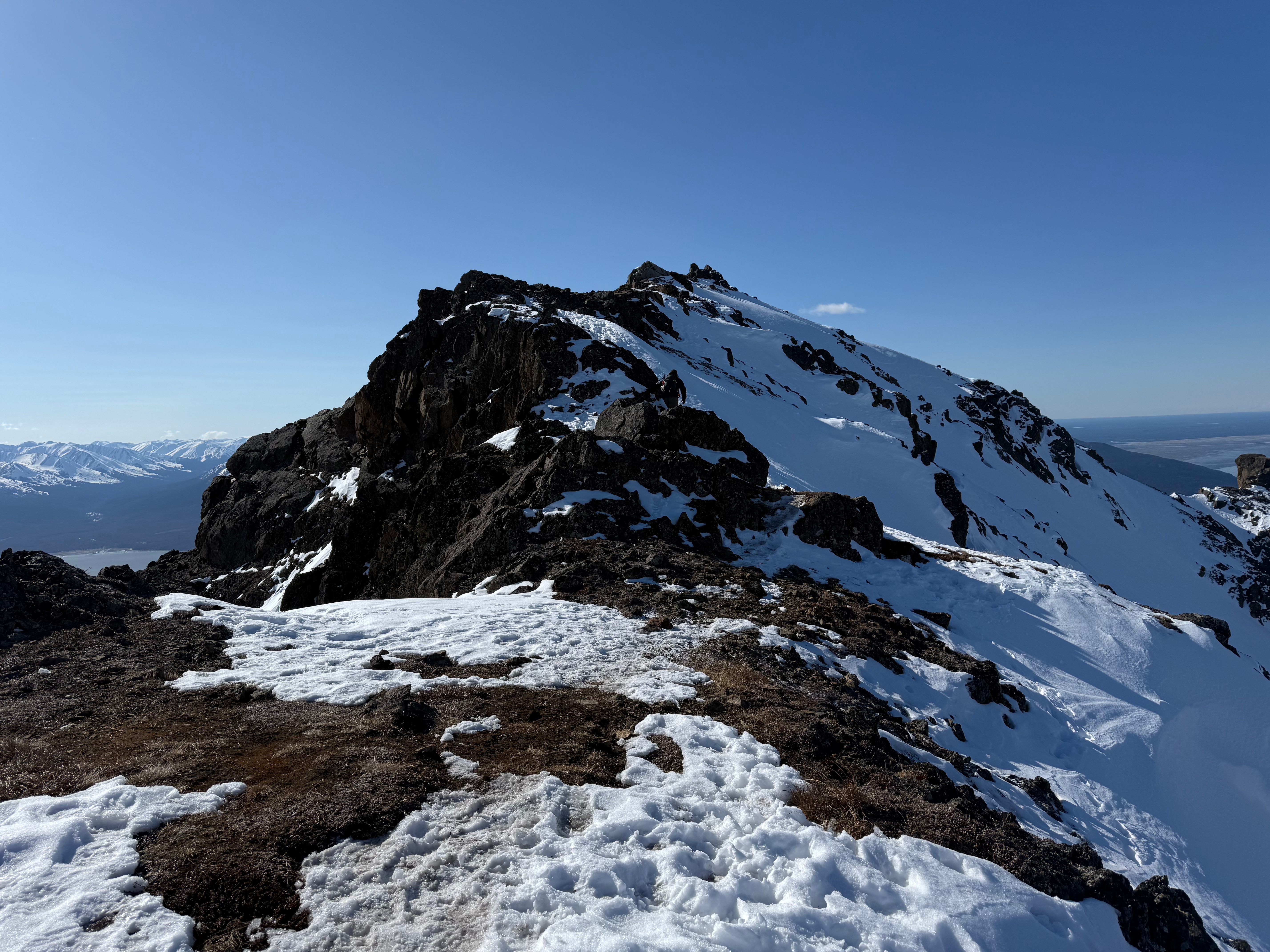
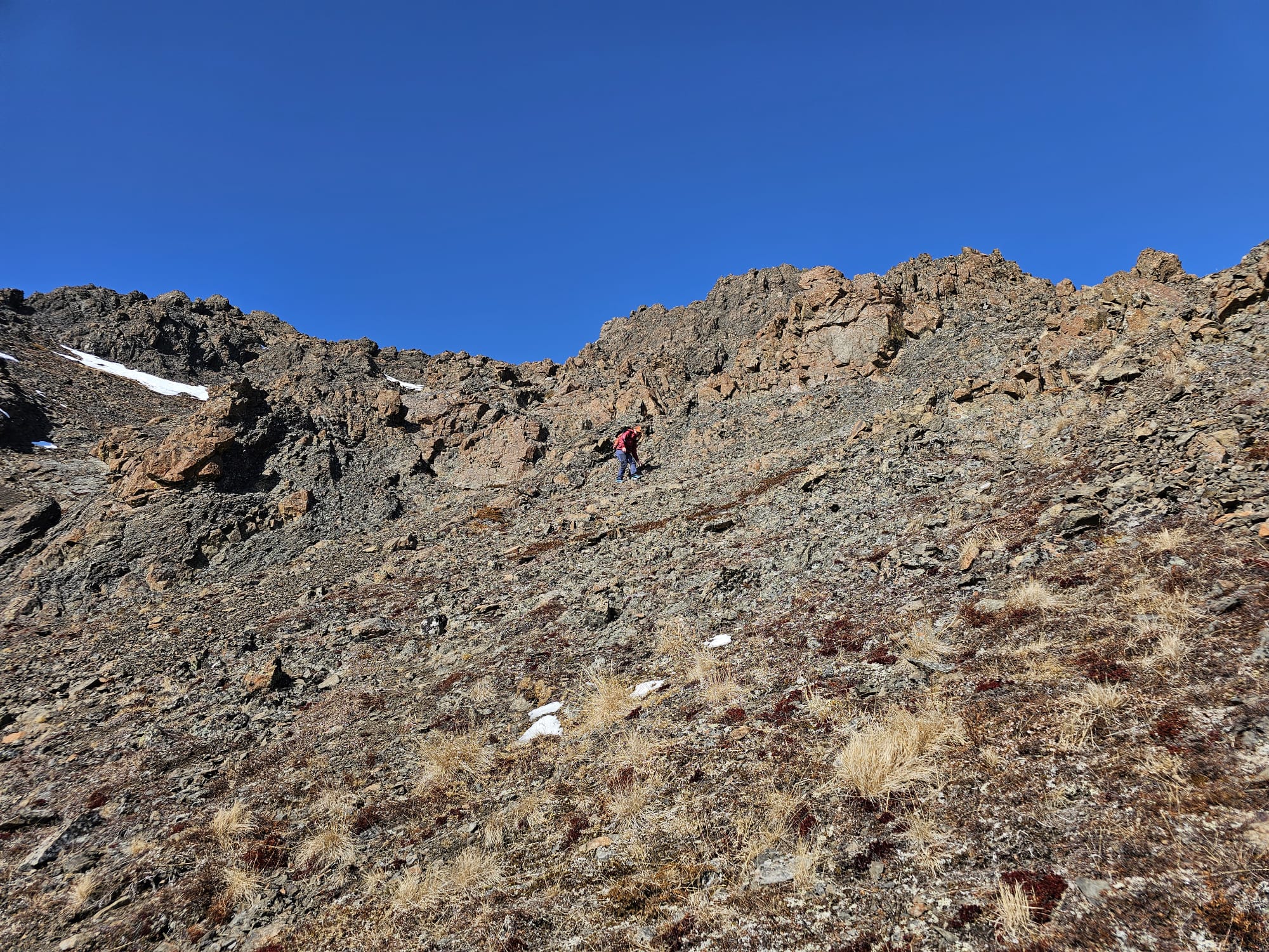
We traveled with the awareness of rockfall, most likely caused by your partner, and staggered our routes up the last hundred or so feet to a small patch of snow that led to the ridge. As soon as we crested, the wind hit us like a freight train and we were immediately glad we had put on our gear before feeling the full force of the wind. One slip of the fingers and a nice jacket could be lost to the gales.
The ridge was covered in hardpacked snow, the northwest face of the mountain icy and white. A slip that direction would make for a long slide down. The southeast face falls away below a vertical dropoff to the screefield and I walked with effort to not be blown that direction by the violent gusts of wind. I could imagine how someone could be “blown off a mountain,” as is written about in the high-altitude mountaineering books that I consume with an insatiable appetite.

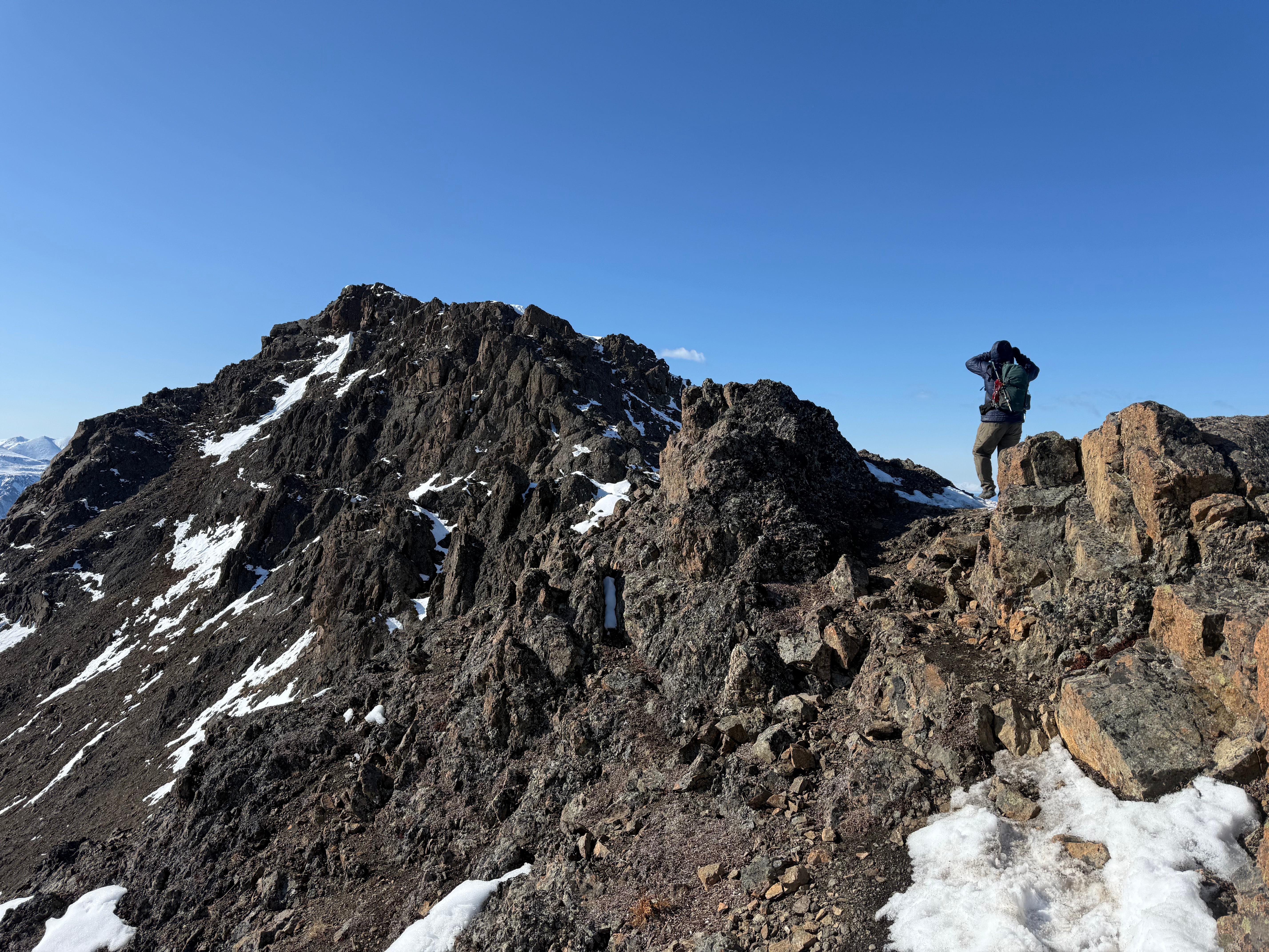
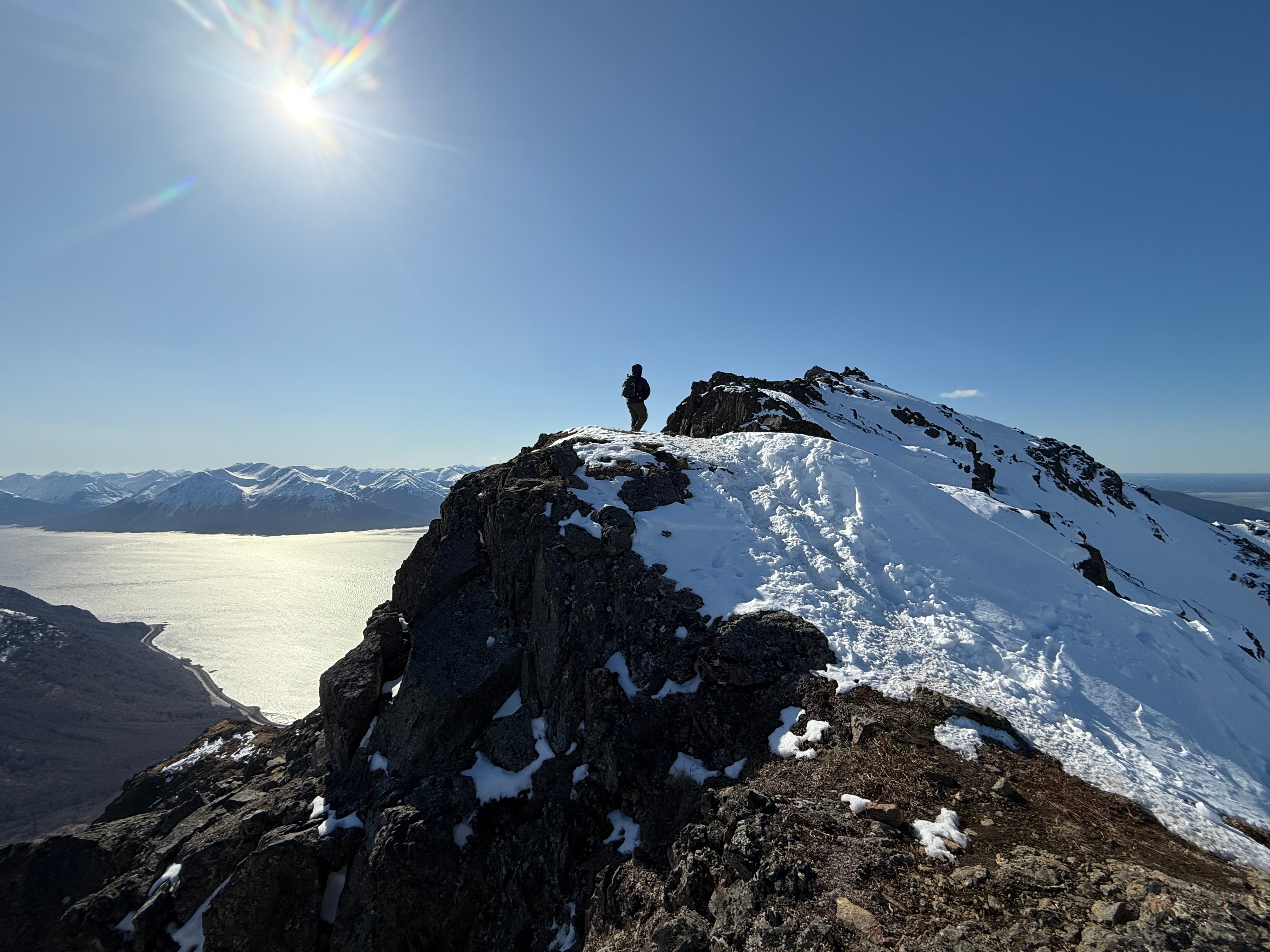
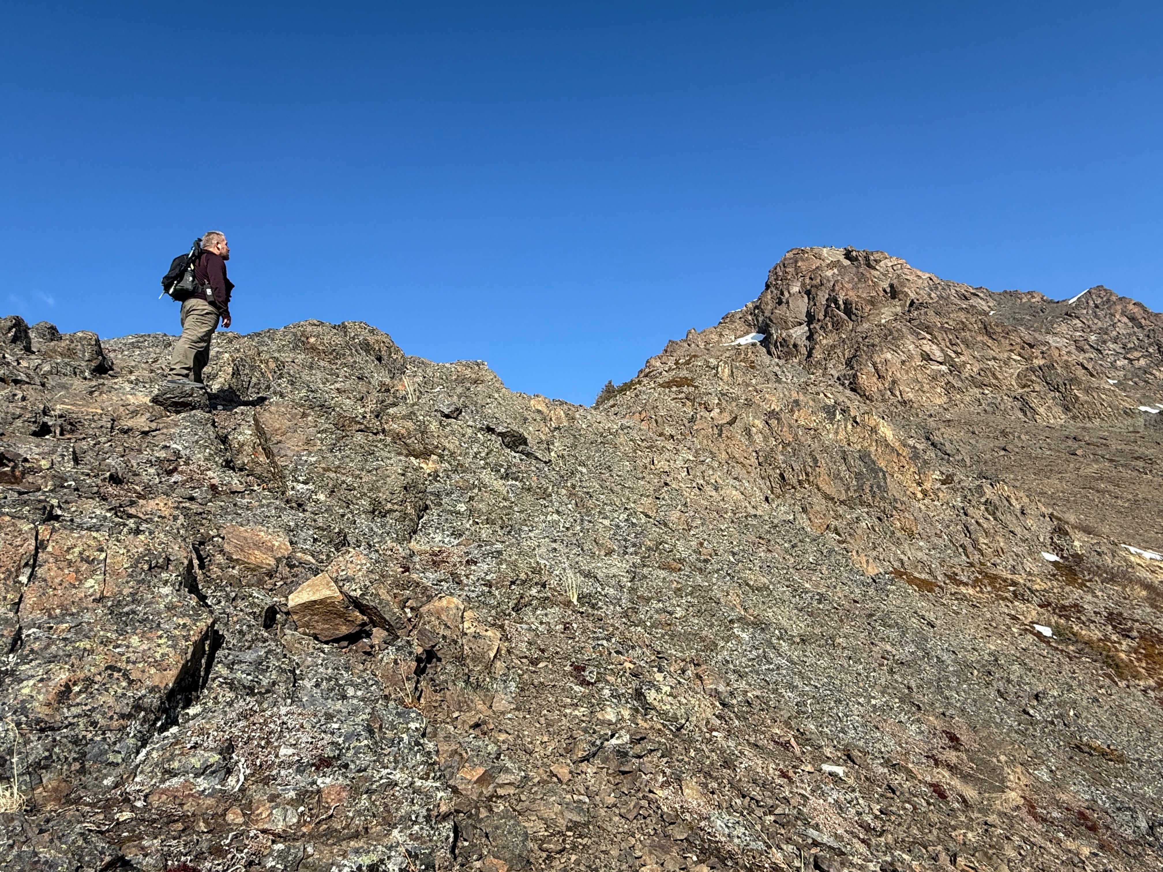
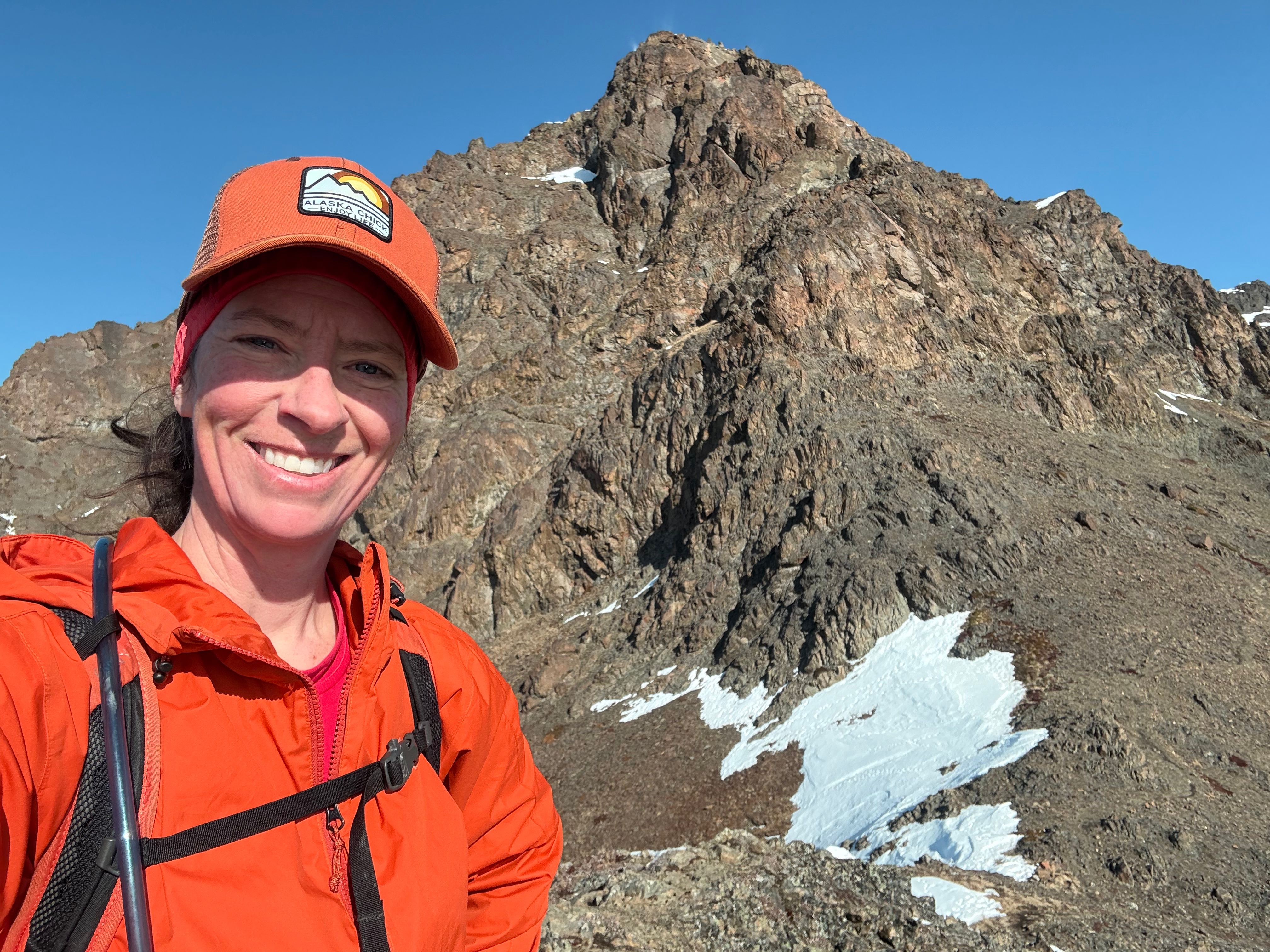
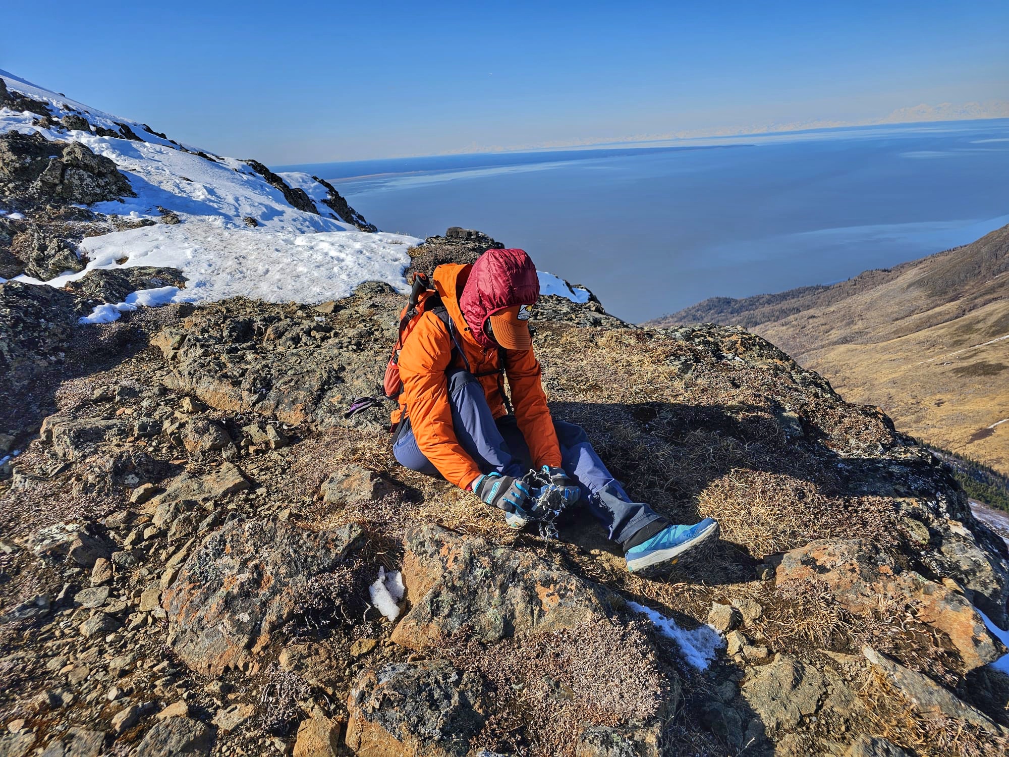
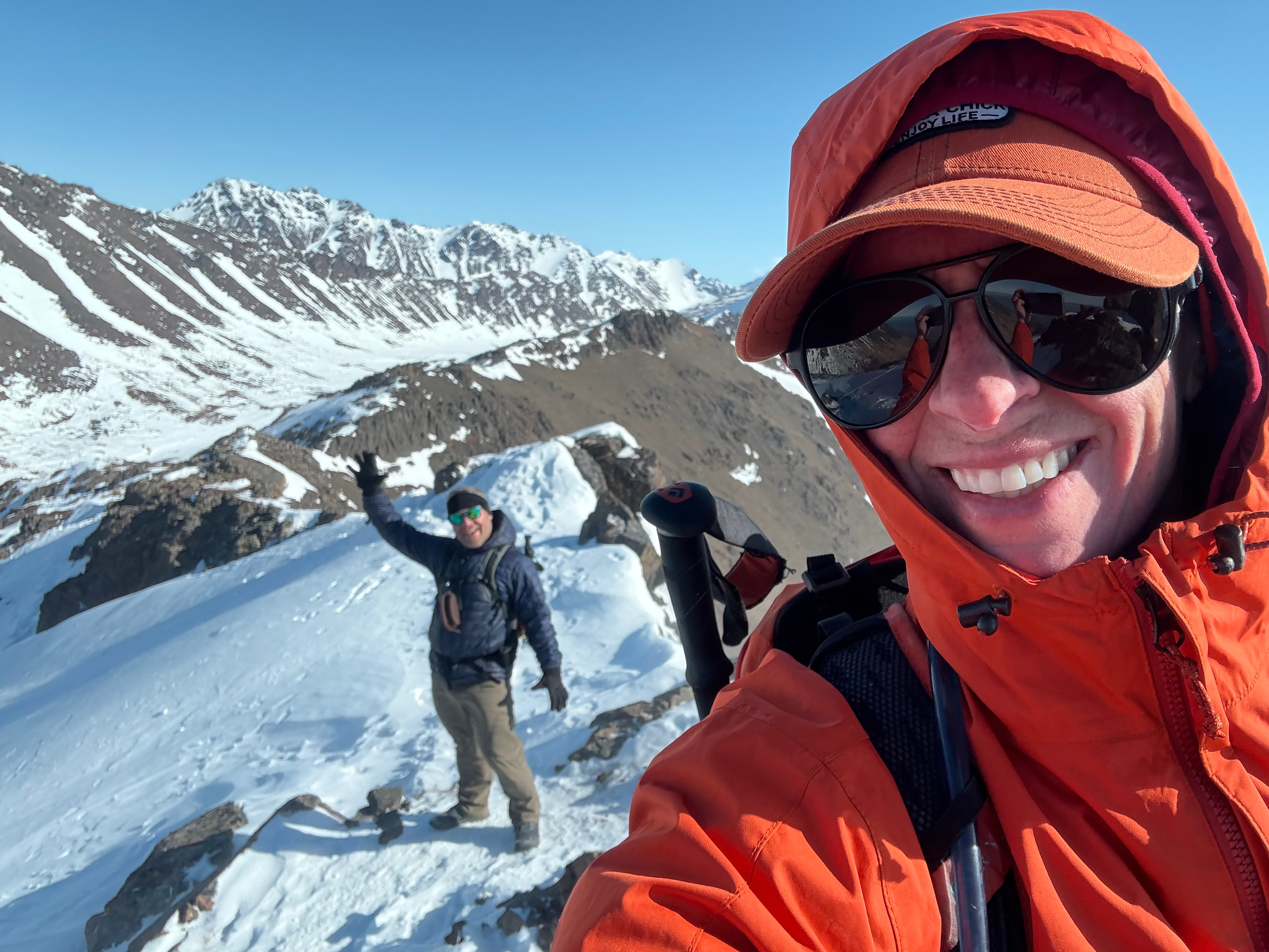
The footpath through the snow got icier and the wind go gustier, so I opted to stop for a second to put on my microspikes. Now feeling much better with some traction on my feet, I fought the wind and ascended to the summit block of Rainbow Peak. Jason was up on the rock with the highest prominence during a small reprieve from the wind and I hurried him to get down so I, too, could get a summit photo and then get out of there.
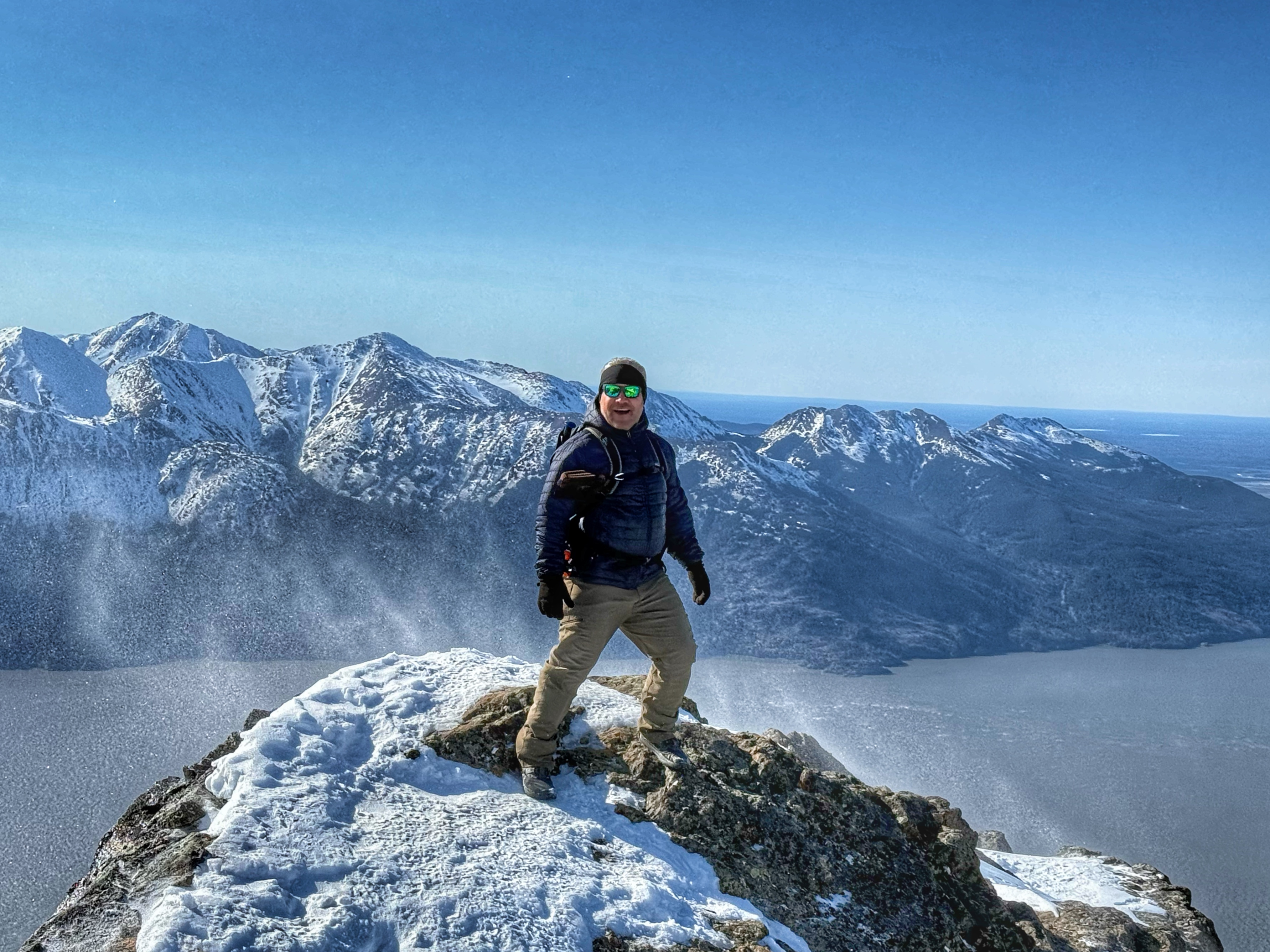
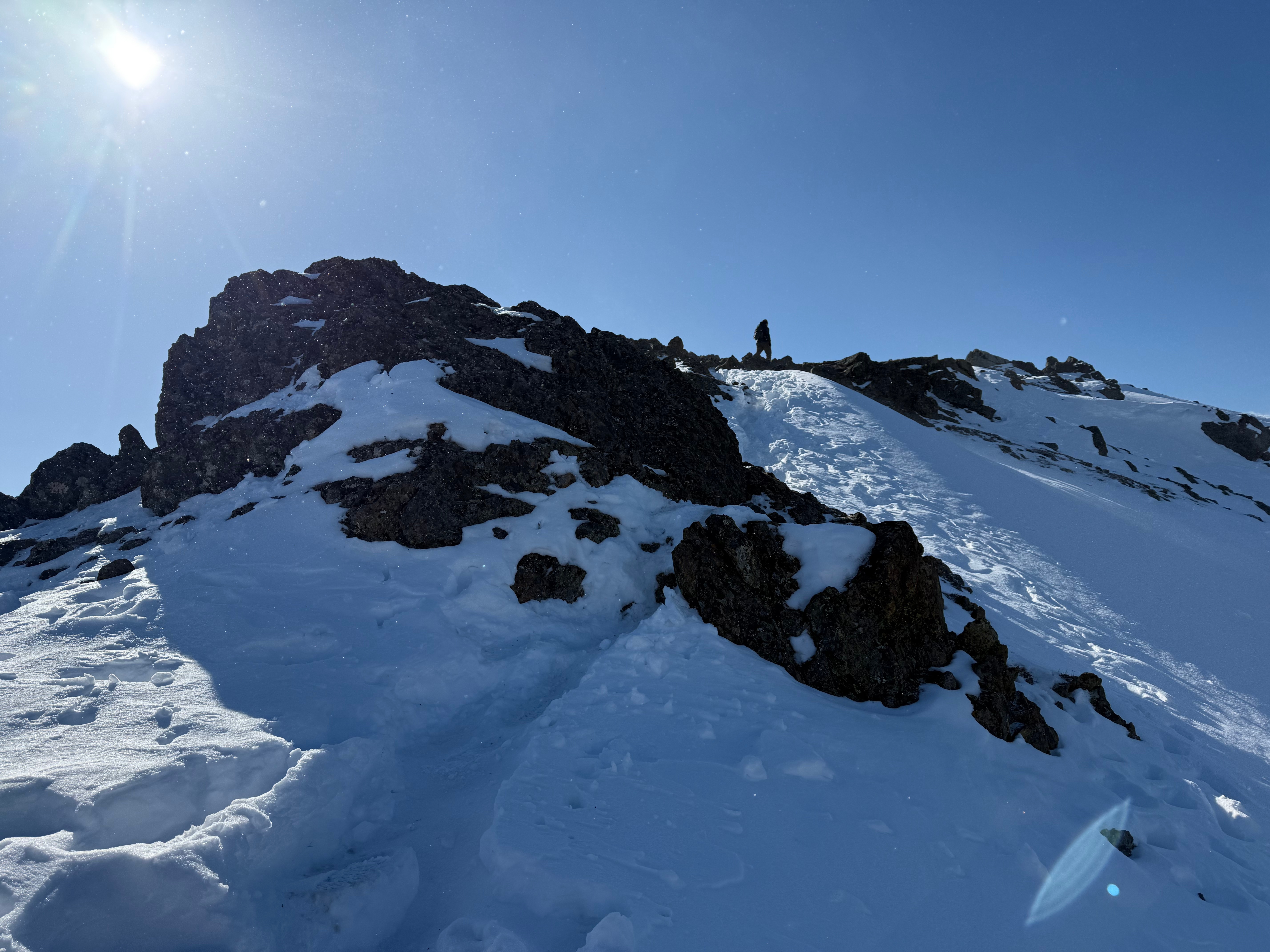
As soon as I climbed up, the strongest gust of wind of the day nearly blew me off the rock. I ducked down and held on until the gust passed over us, before sliding down off the high point, taking a photo of Jason and then hustling back down the ridge.
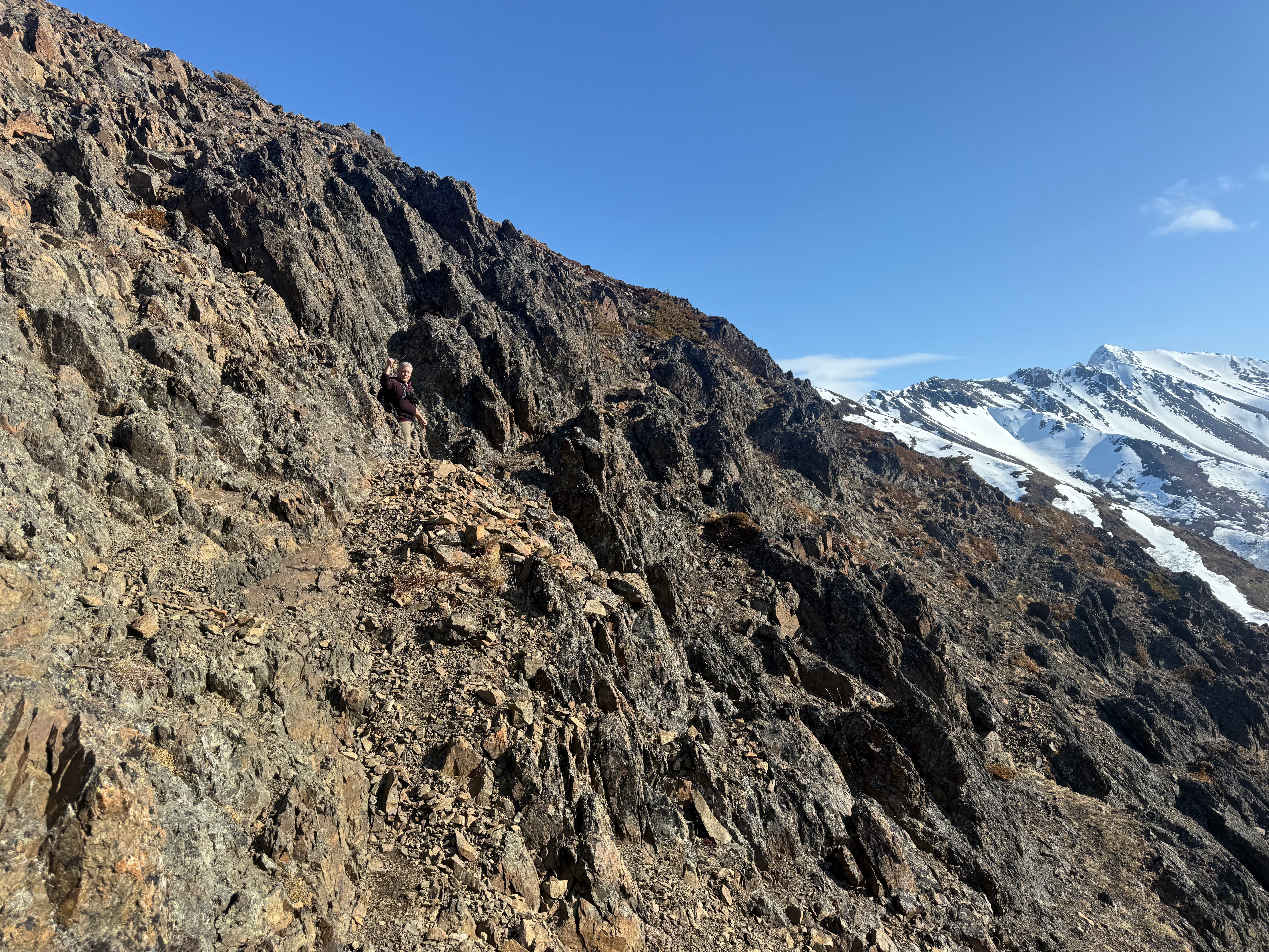
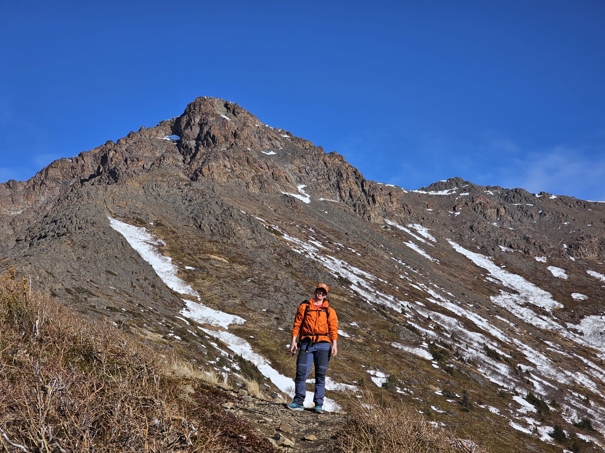
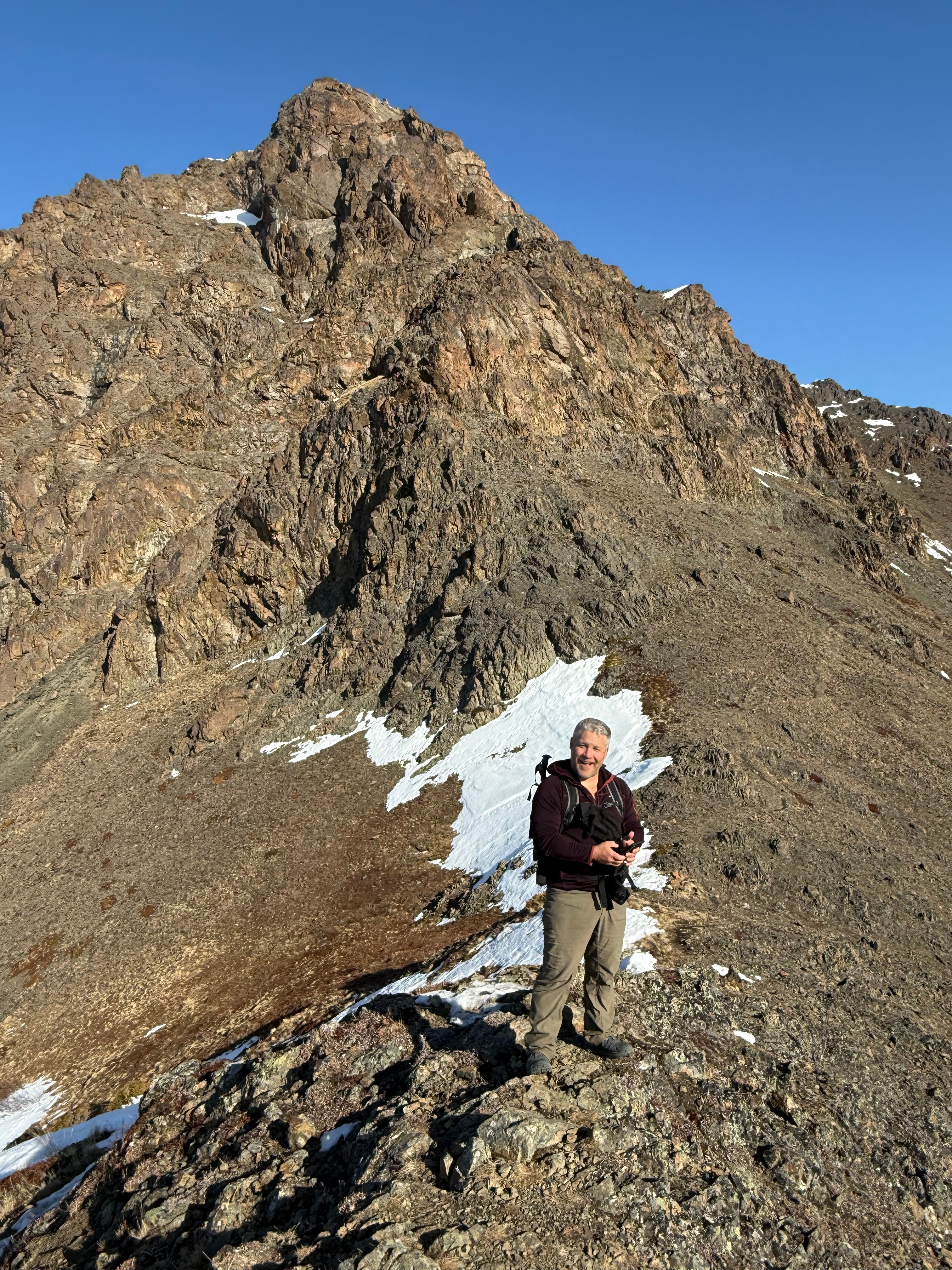
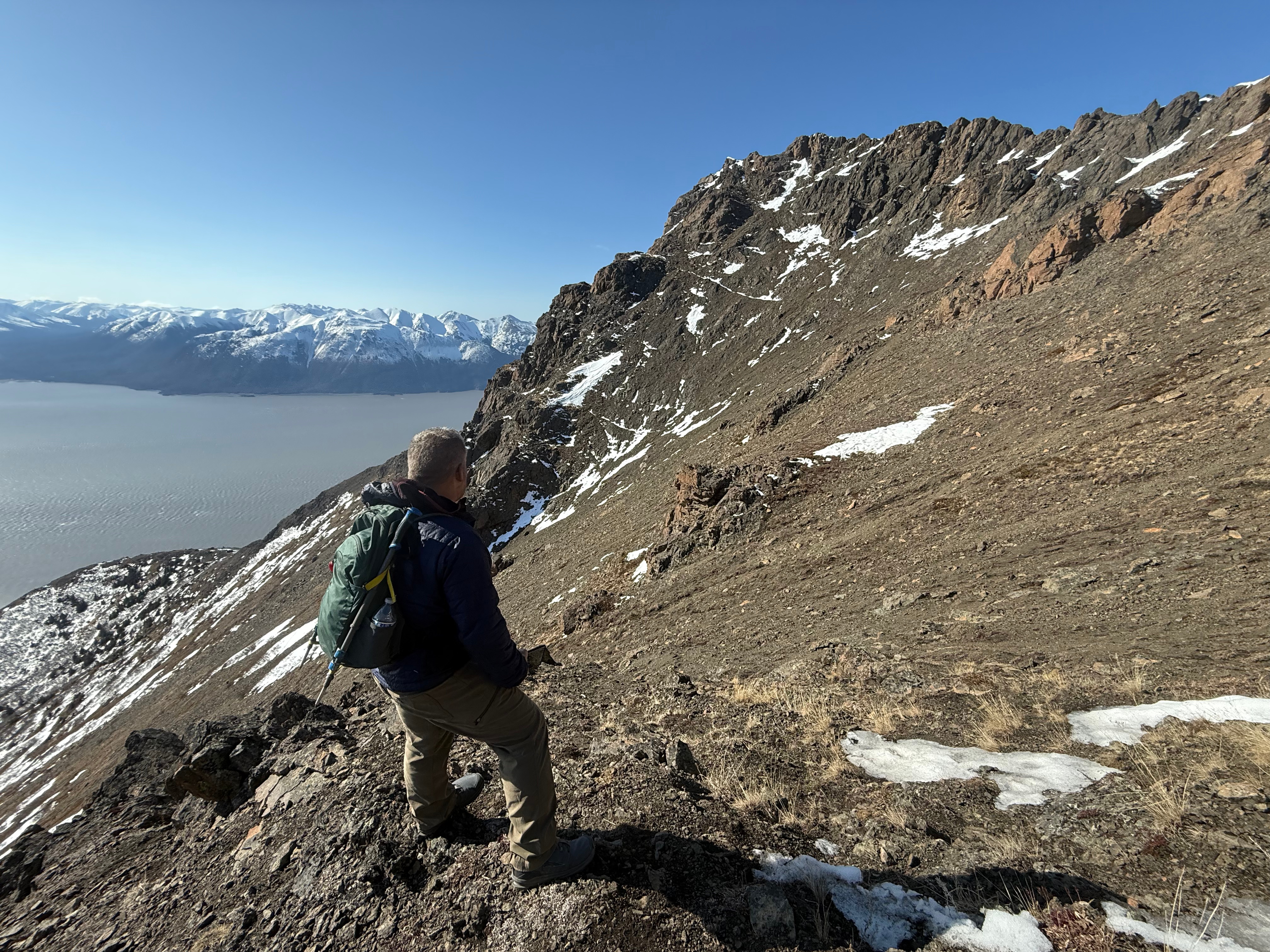
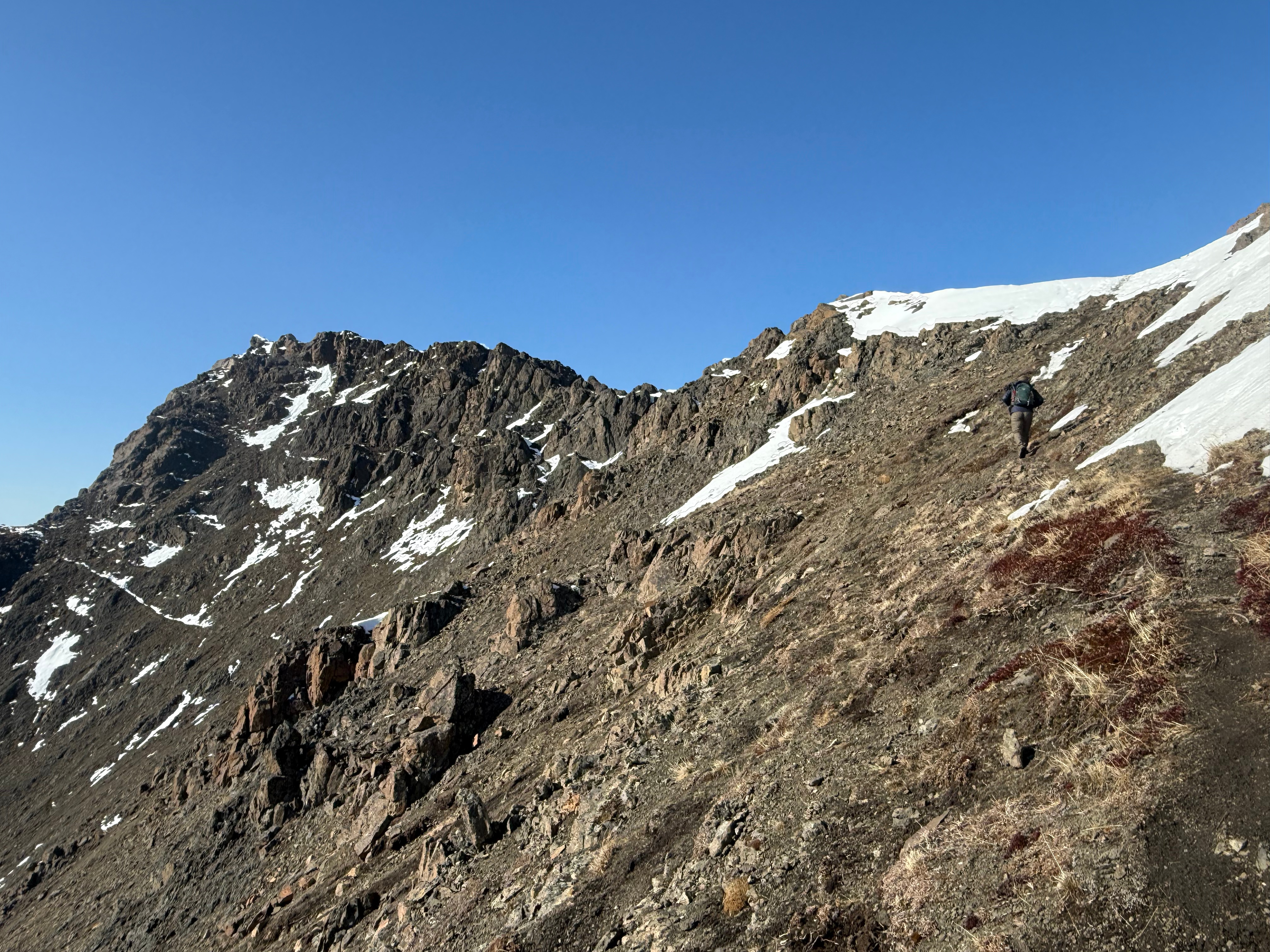
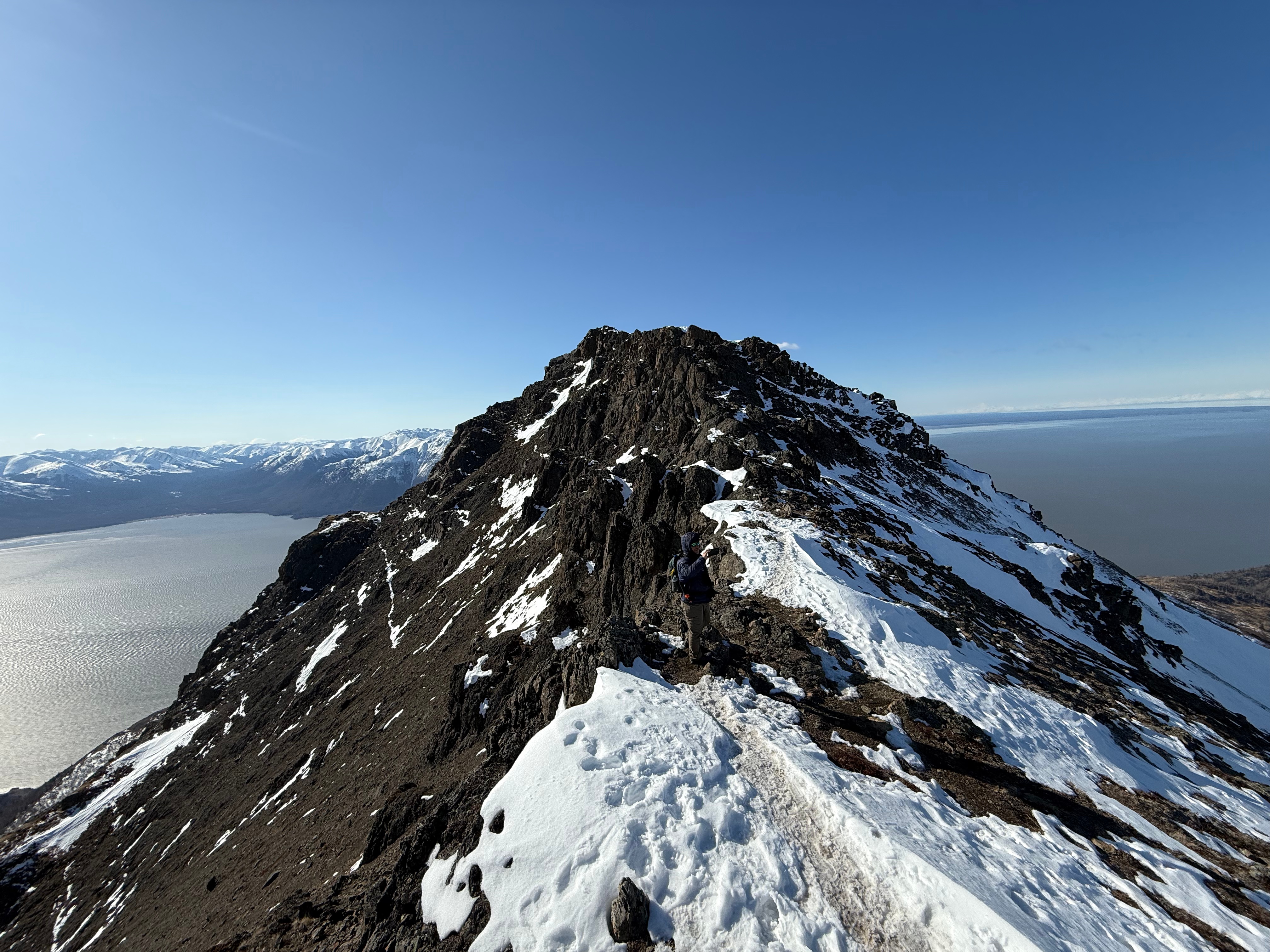
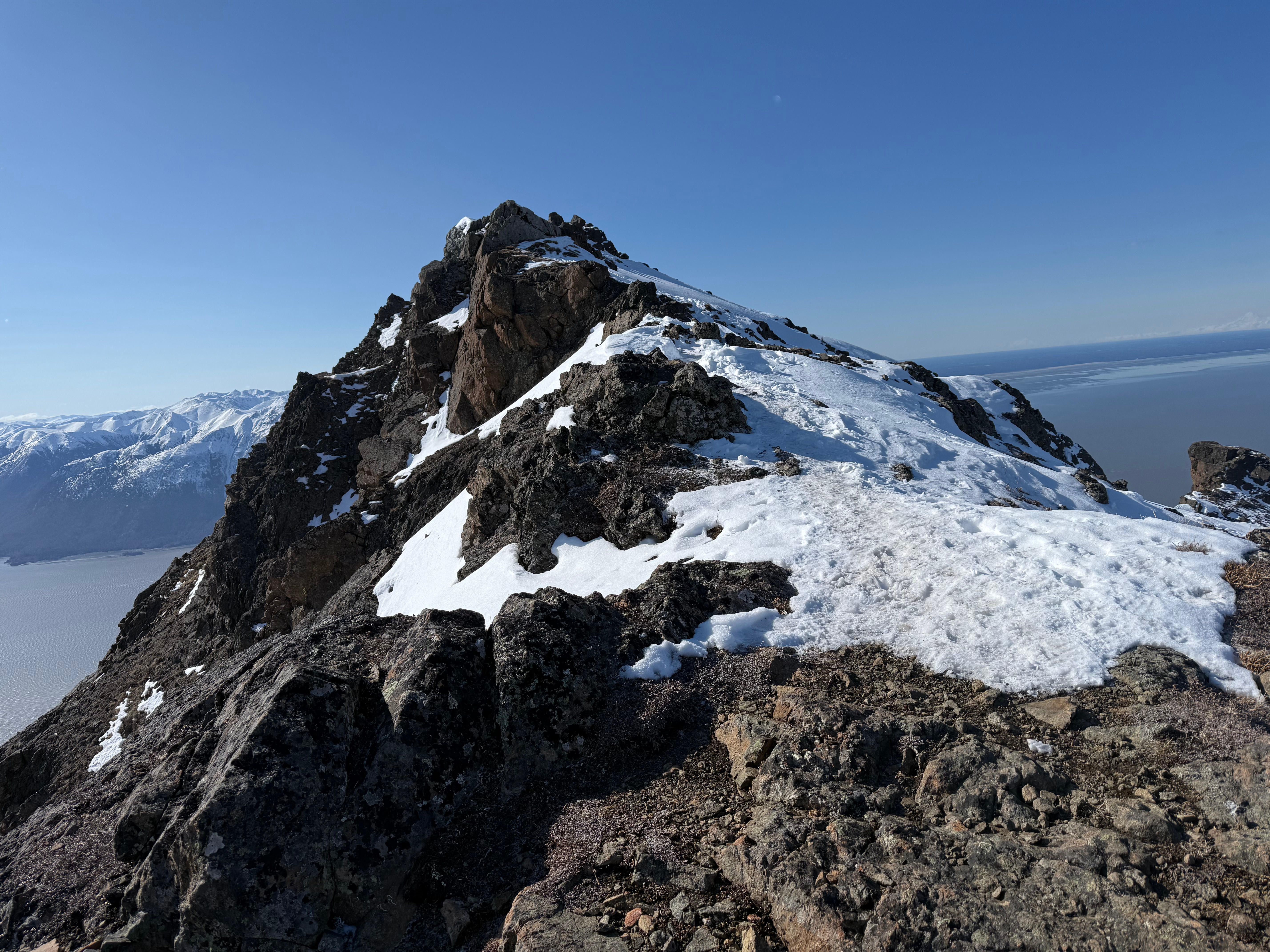
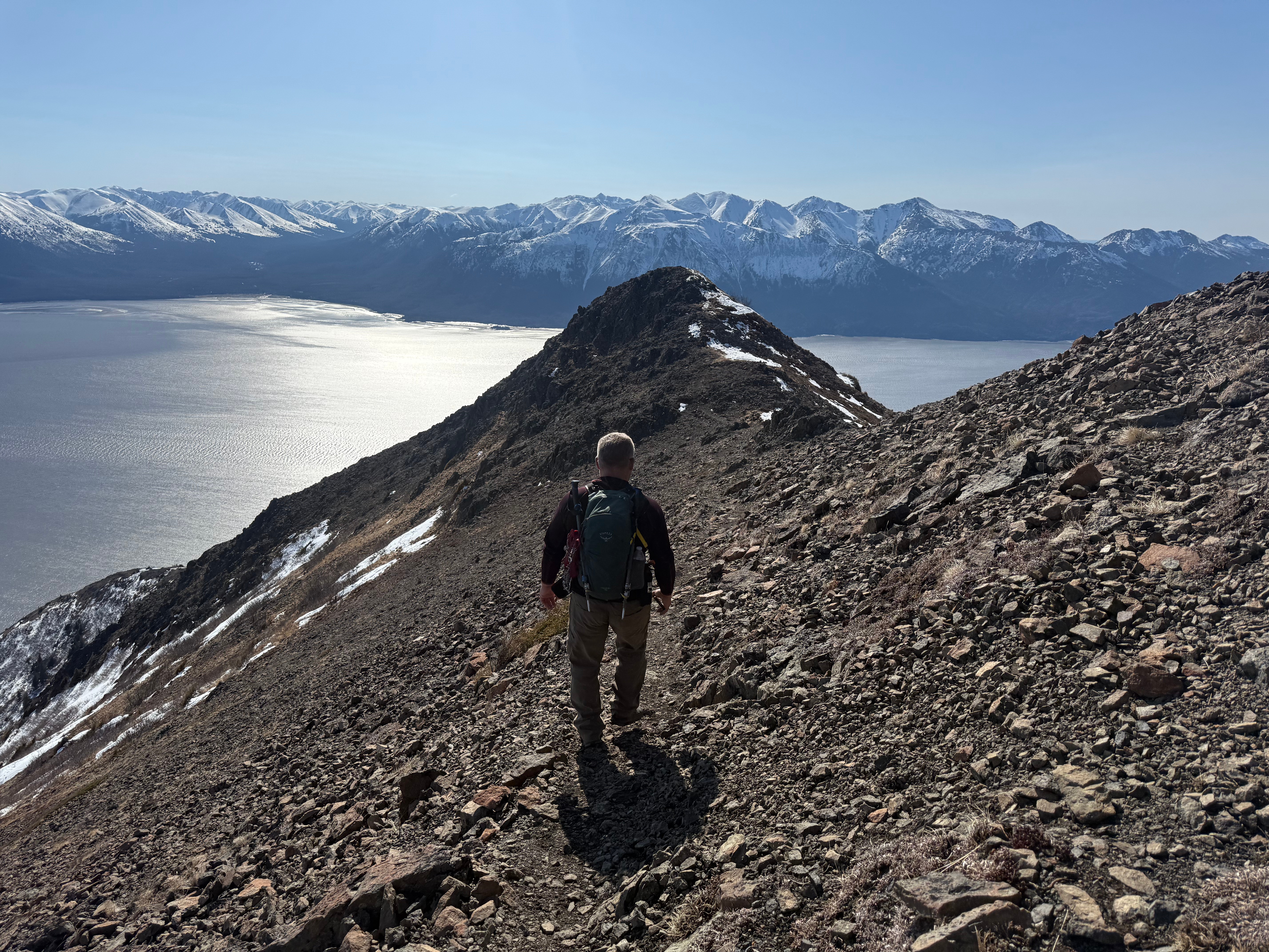
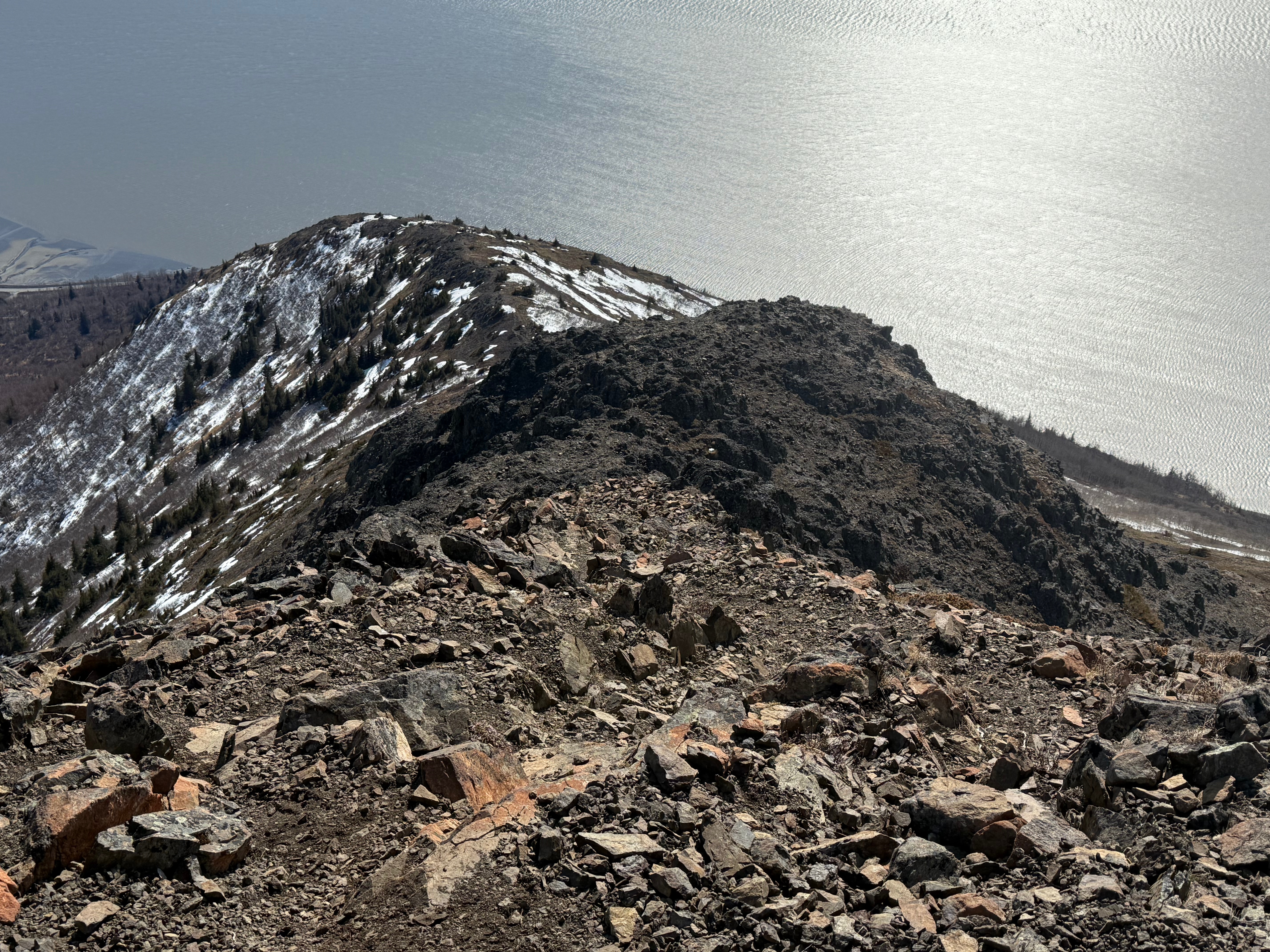
As soon as we were below the summit the winds relented a bit, and we decided to walk the half mile to the unnamed bump at the top of the far end of the scree field. The wide ridge makes for excellent walking with little elevation gain or loss to the unnamed bump. Just before the final ascent to the top of the bump, Jason realized he had lost his phone, likely below the summit of Rainbow, where the wind had calmed, and he had stripped a layer. I assured him we would find it, but first we would climb the last few feet of the bump.
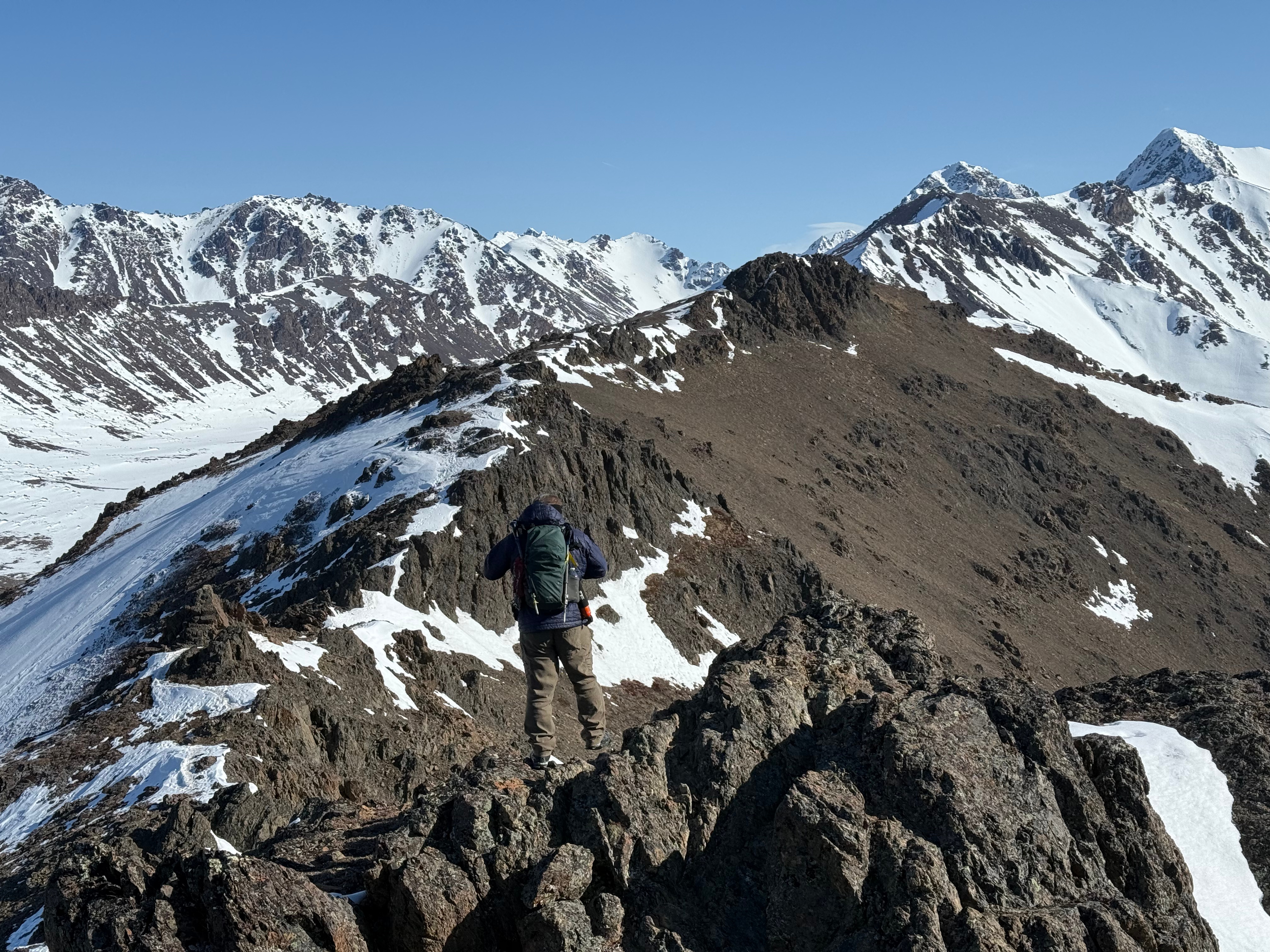


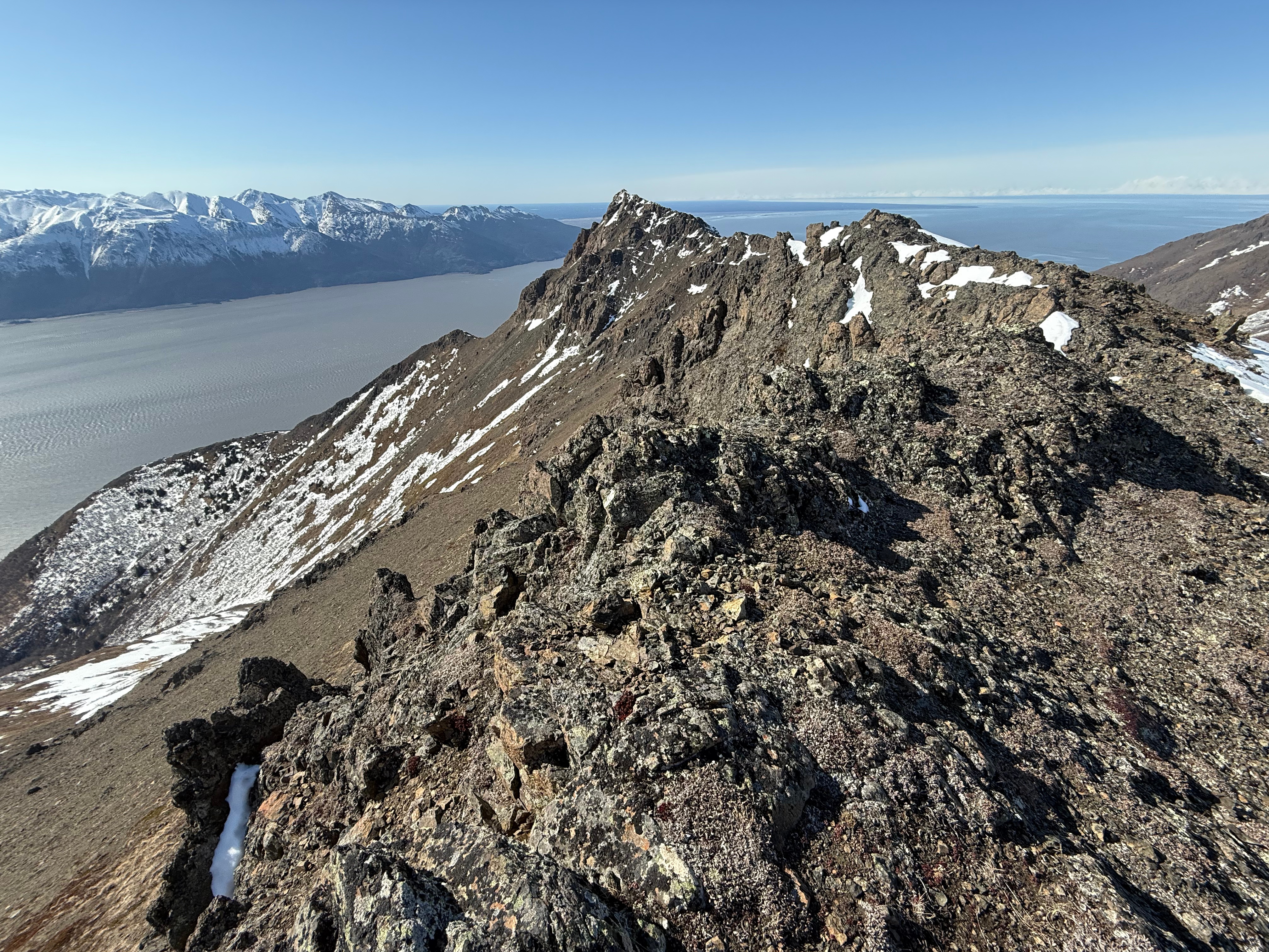
Standing on this high point, we scoped out the ridge beyond, agreeing it looked doable and would be on our 2025 bucket list to encircle the entire Rainbow Valley on the ridge, but we would have to wait for the snow to melt out more before attempting it.
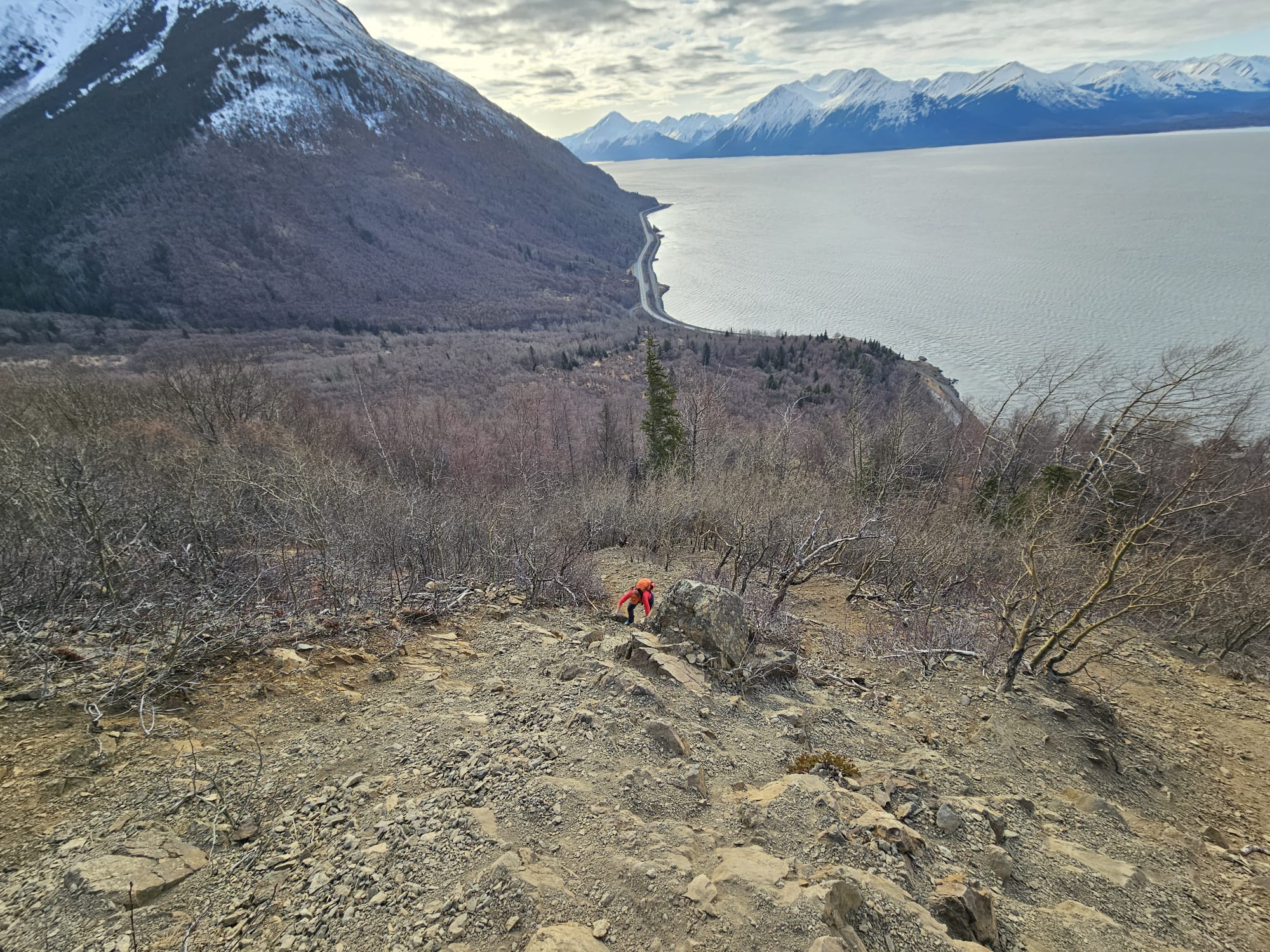
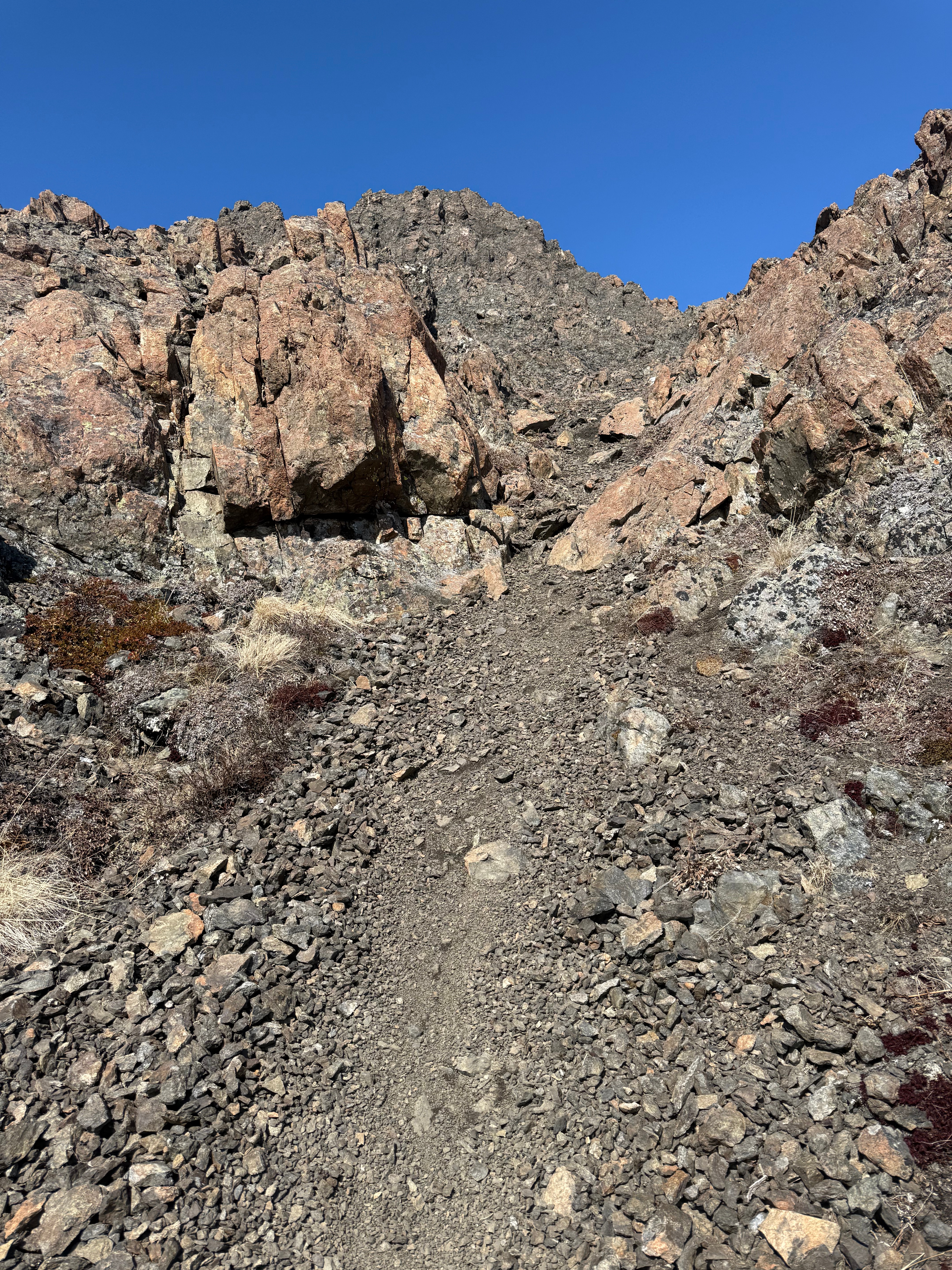
We turned back along the ridge and made it back to where we had stopped, Jason’s phone laying right where I thought it would be. A sign of relief and we were off… time to descend back down the scree slope and back to the high traverse. We picked a steep scree chute and started down one at a time to avoid kicking rocks down on each other. When Jason would get behind rocks for protection, I would start down the slope, and I assure you Jason was waiting longer for me than I was for him!

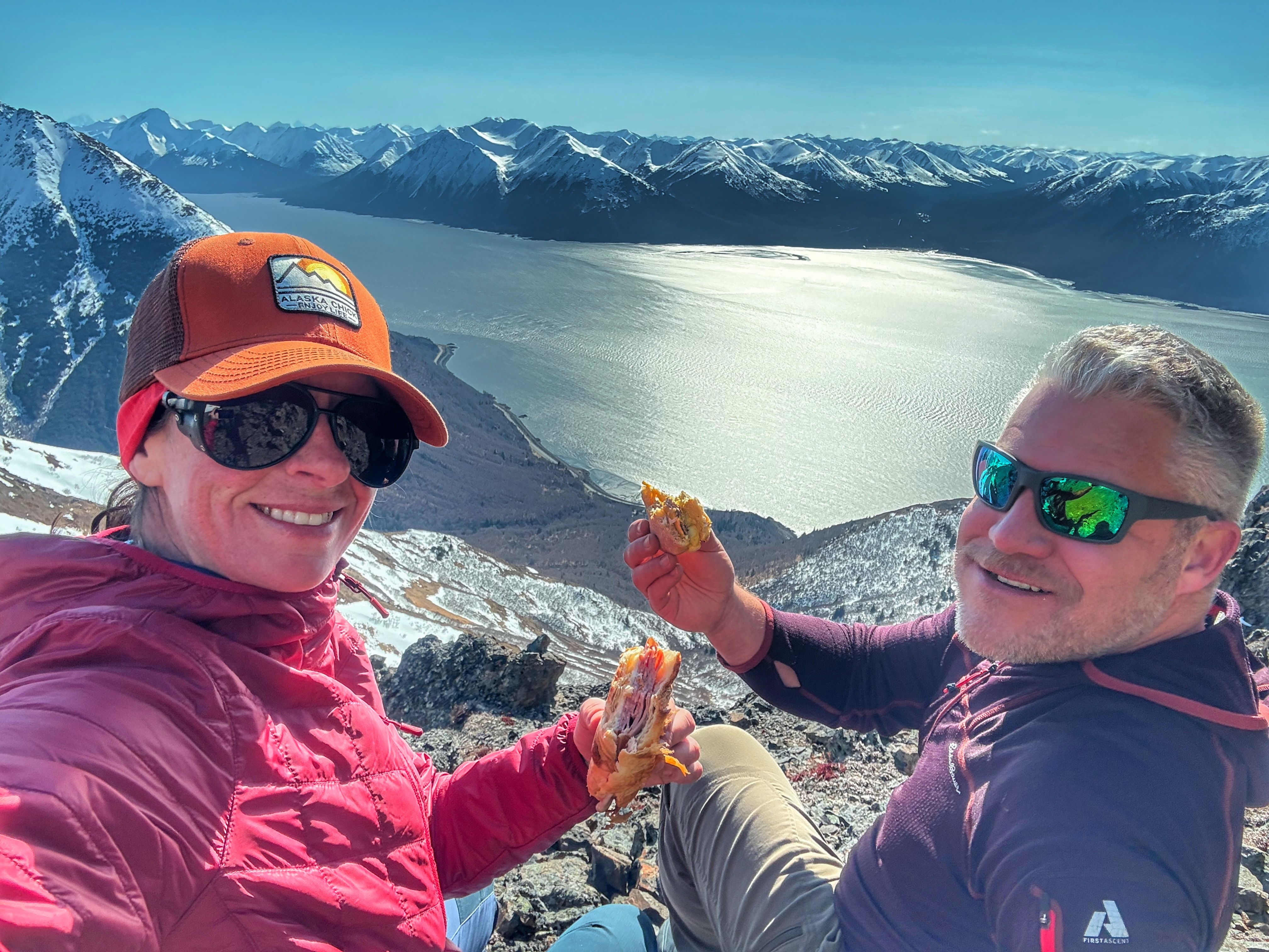
We sat down for a lunch break of sandwiches, Jason enjoying a homemade breakfast sandwich while I inhaled a gas station ham and cheese. We were once again completely protected from the wind and were able to enjoy the view again without being sandblasted with snow.
We took our time on the way down, my heel ripped had been ripped open by my ski boot on an outing a few days prior and was not doing well. I could feel my shoe getting lubricated with blood, streaming down through two layers of hydrocolloidal pads. I wasn’t limping, but I knew I would need a few days off to get it healed up.
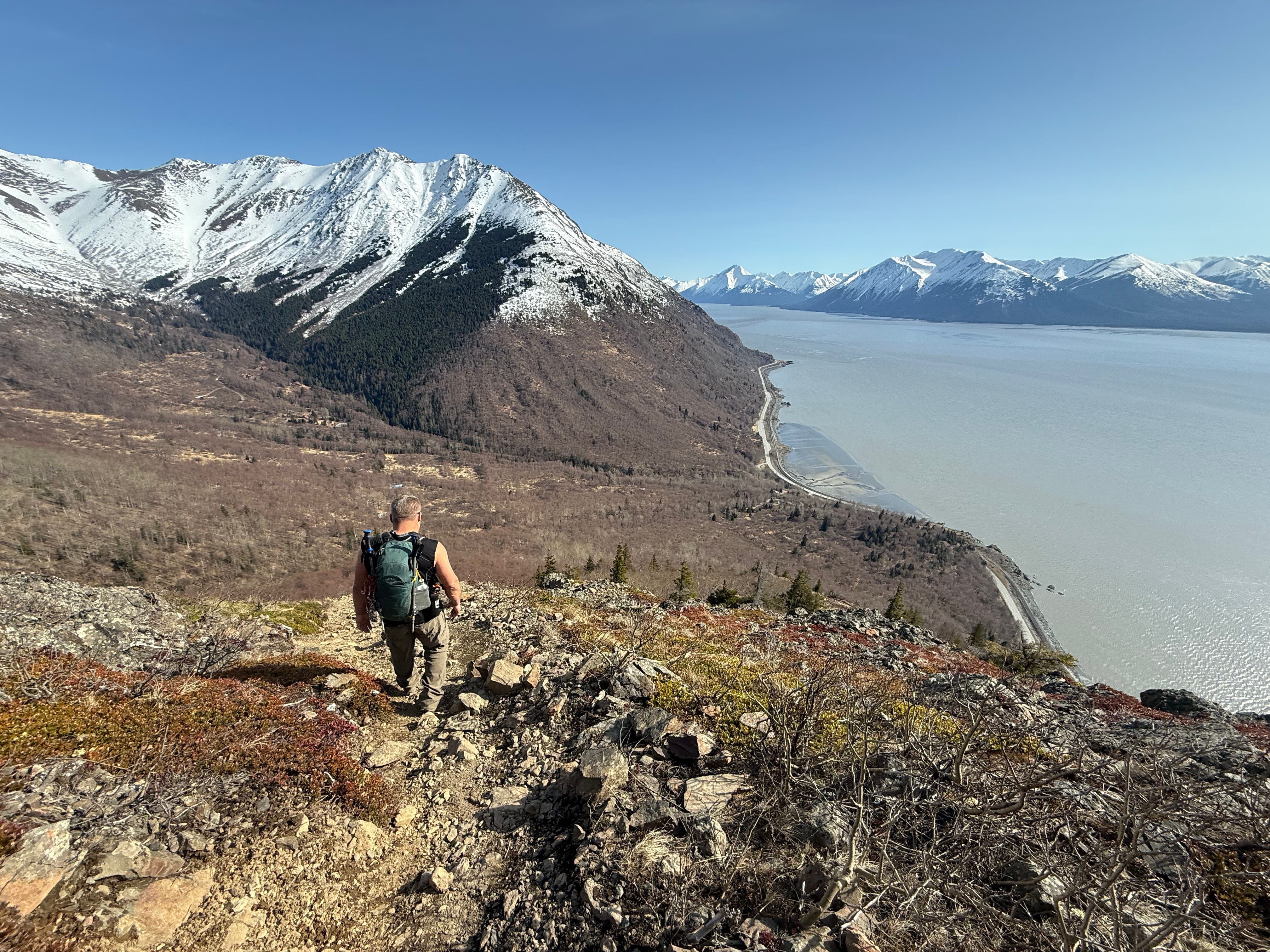
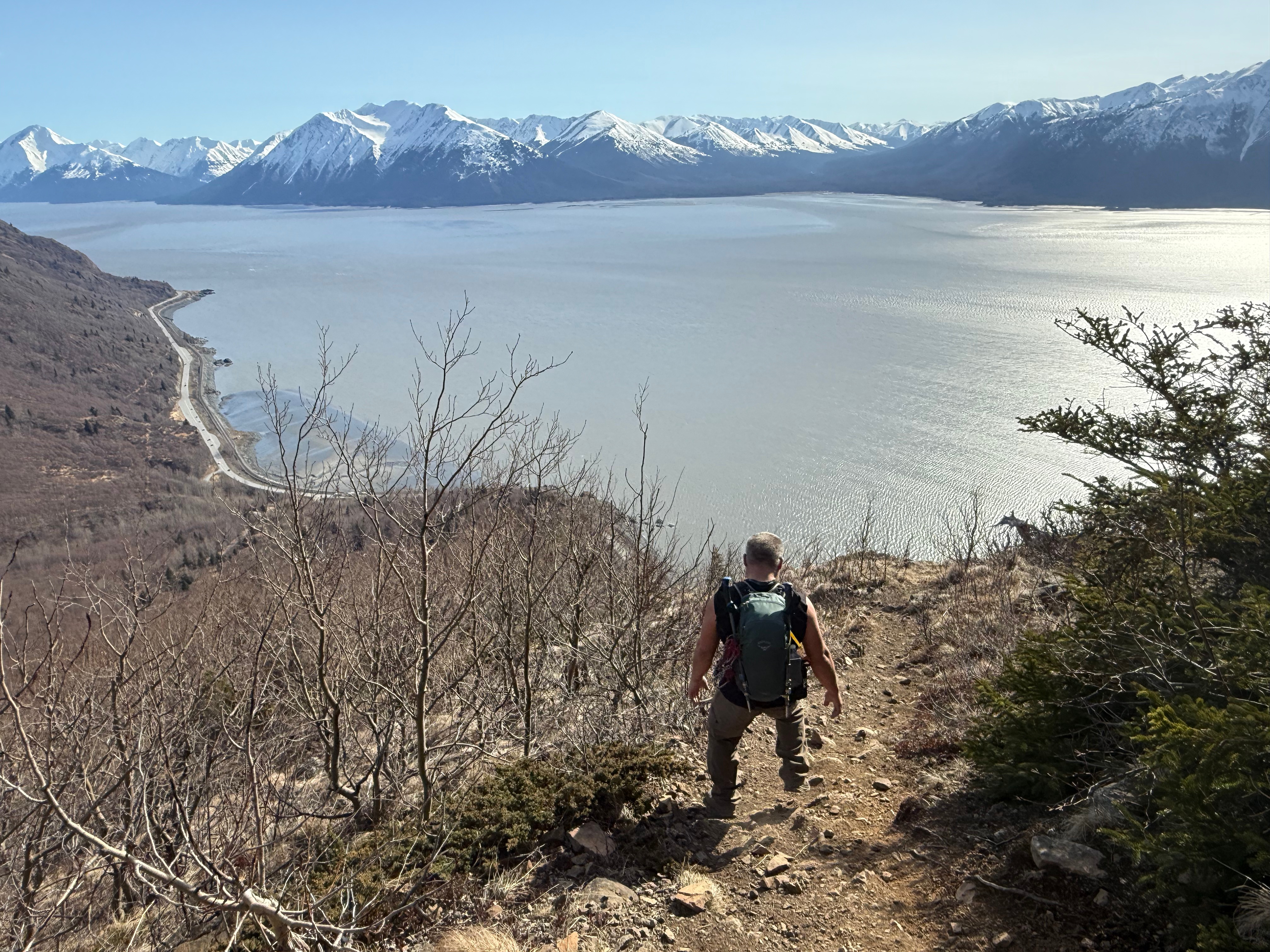
Across the traverse, down the top step of scrambling, down the mini chimney, across the plateau, down the bottom step, down the ball bearing rock slope, finally getting spit out onto the wide and flat Turnagain Arm Trail. Still not having seen a bear, we made good time back to the truck, now surrounded by a dozen other vehicles.


Peeling off my socks and shoes, I slid my feet into my slippers for the long drive home, ready for a bath and a big dinner, thrilled to have revisited one of my favorite places after nearly 4 years of absence. We will be back again as soon as the ridges are snow free to accomplish what I am calling the Rainbow Cirque Traverse.
I dropped off Jason and drove home in silence, thinking about how lucky I am to experience these incredible mountains in the Chugach Range.
Rainbow AllTrails and Peakbagger Links:


Just the Tips:
- DO NOT BRING DOGS. They can be dangerous to other hikers, as there is a great deal of loose rock. The jagged rocks are tough on their feet, and you may end up with a dog with severe foot injuries. There is also some scrambling that many dogs may not be able to do. It’s best to just leave them home.
- Be Bear Aware. This is prime bear country. Carry bear spray and make lots of noise .
- Do not leave valuables in your vehicle at the trailhead.
- Bring gloves, even during the summer. They can help prevent cuts and can aid in grip for scrambling.
- Be aware of hikers below you and try not to kick rocks down on anyone. If you do, yell “rock!” to alert hikers below of the danger.
Recent Trip REports:
Where the Clouds Parted: A Knoya, Kanchee and Nunaka Ridge Walk
May 31, 2025 Knoya: 4600′ – FR #17 Kanchee: 4393′ – FR #20 Nunaka point: 3780′ Mileage: ~14 Miles Elevation Gain: ~5000′ The summer wasn’t summering, and I was suffering from a bout of springtime depression that only sunshine and warm weather could cure. I dragged myself to the Klutina Trailhead to meet Jason. We…
Pedals, Peaks and Thunderstorms: Bike and Hike Mount Margaret in Denali National Park
May 25, 2025 Mount MArgaret: 5069′ Denali NAtional PArk Mileage: 4.6 Mile Bike/4.6 Mile Hike/4.6 Mile Bike Elevation Gain: 2,750′ This year’s annual mother/daughter camping trip in Denali National Park looked a little different from our normal stay at Riley Creek Campground. The Labor Day prior, we decided our next trip would be to Savage…
Chasing the Wind: A Long-Awaited Victory on Peak 1216 and Ship Creek Hill
April 26, 2025 Peak 1216 AKA 3990: 3990′ Ship Creek Hill: 3842′ (chugach Front Range Peak #24) Mileage: 15 Miles Elevation Gain: 5,700′ The majority of the Southcentral Alaska winter of 2024-25 was uncharacteristically warm and relatively snow free, but here we were in April, with record breaking snowfall around Anchorage. The ridges and peaks…

One thought on “Lost and Found on Rainbow Peak”