
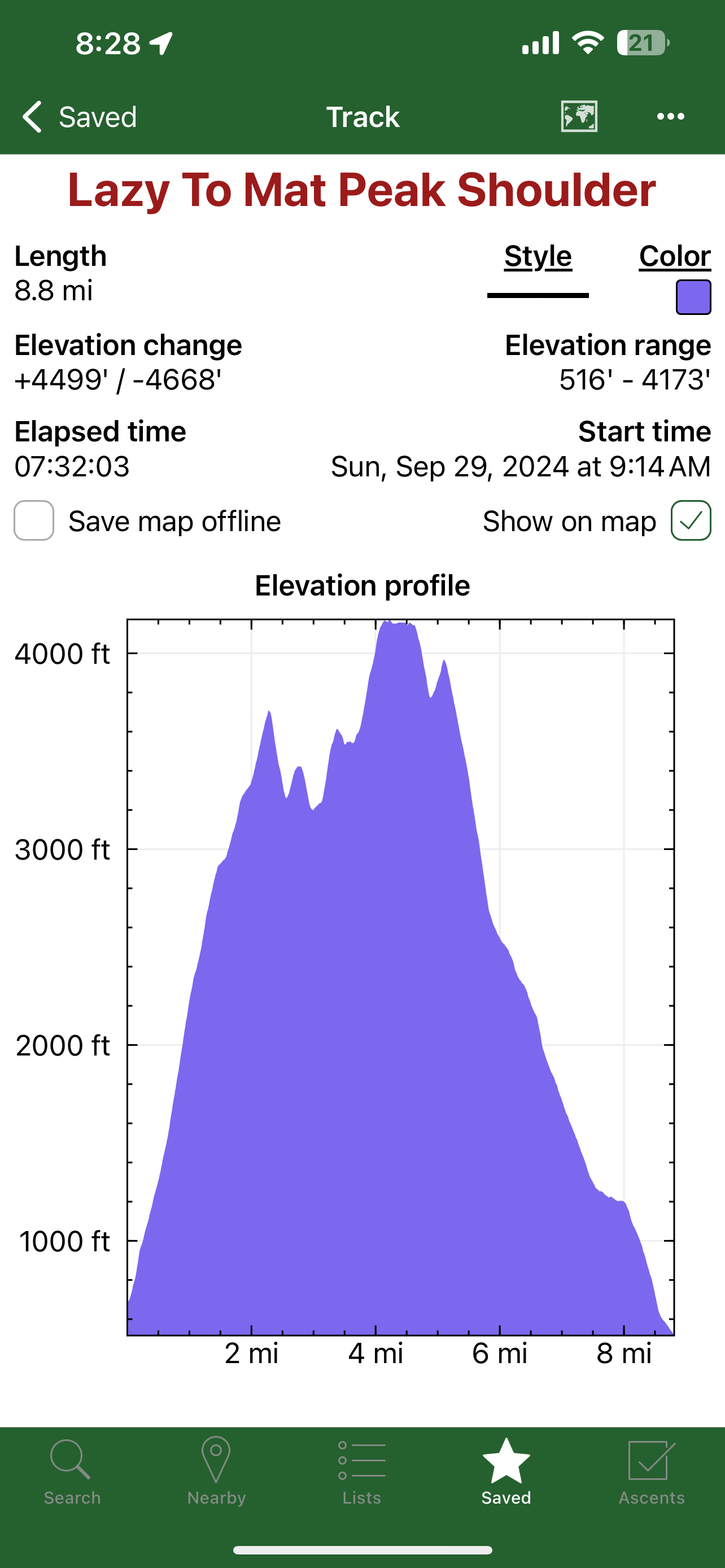
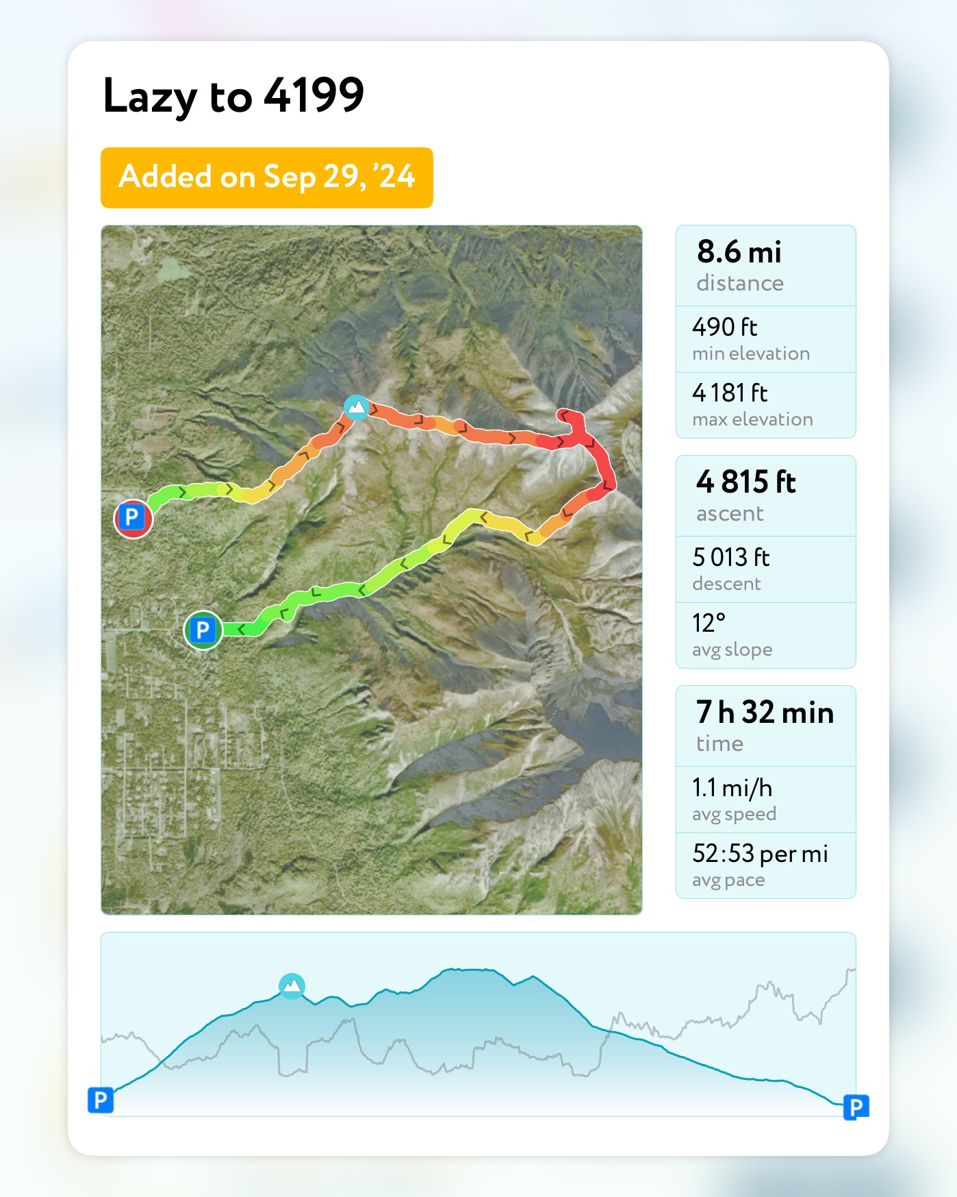
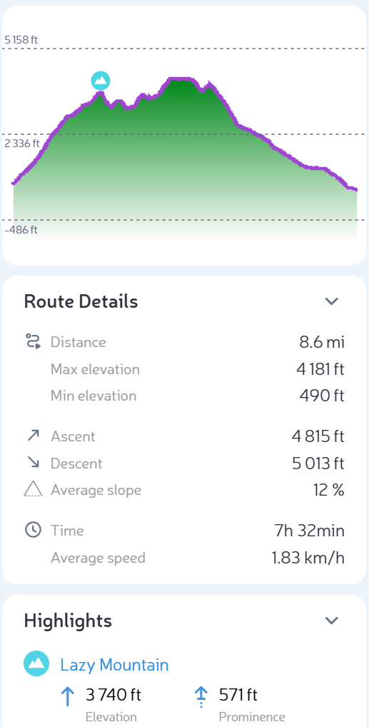
September 29, 2024
Mileage: 8.6 Miles
Elevation Gain: 4815′
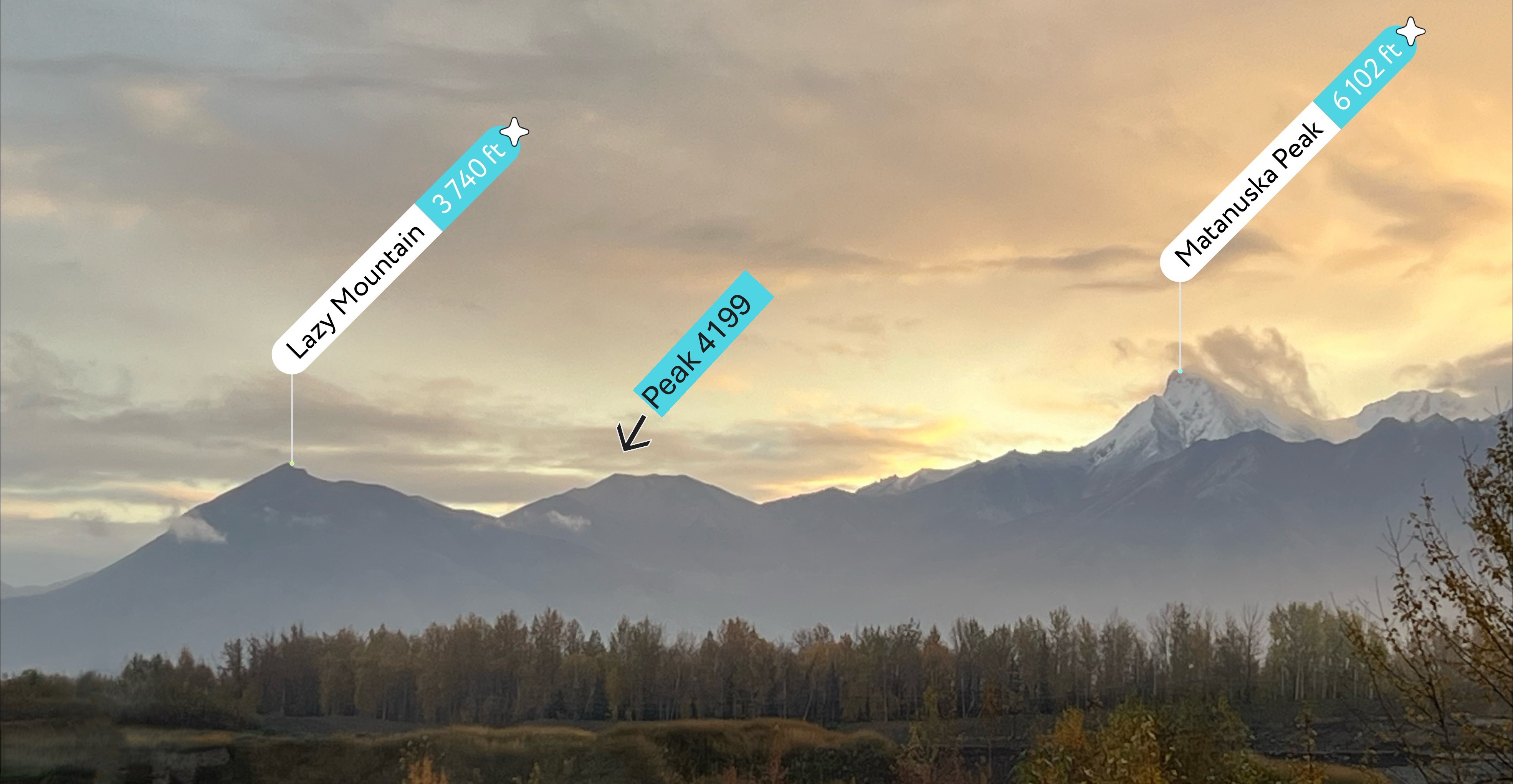
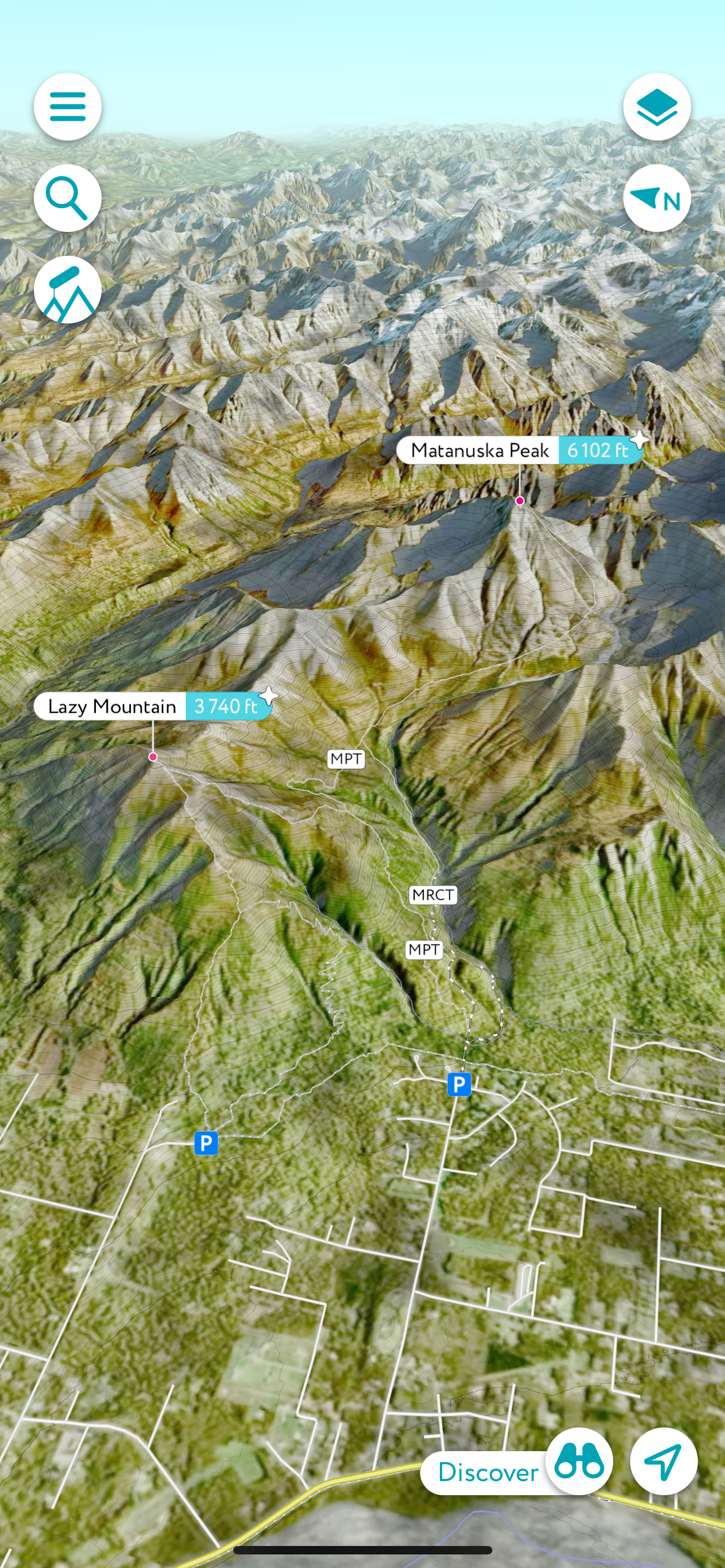
Lazy Mountain (3740′)
Peak 4199 (4199′)
Permits: Mat-SU Borough Parking Pass REquired at Lazy Trailhead
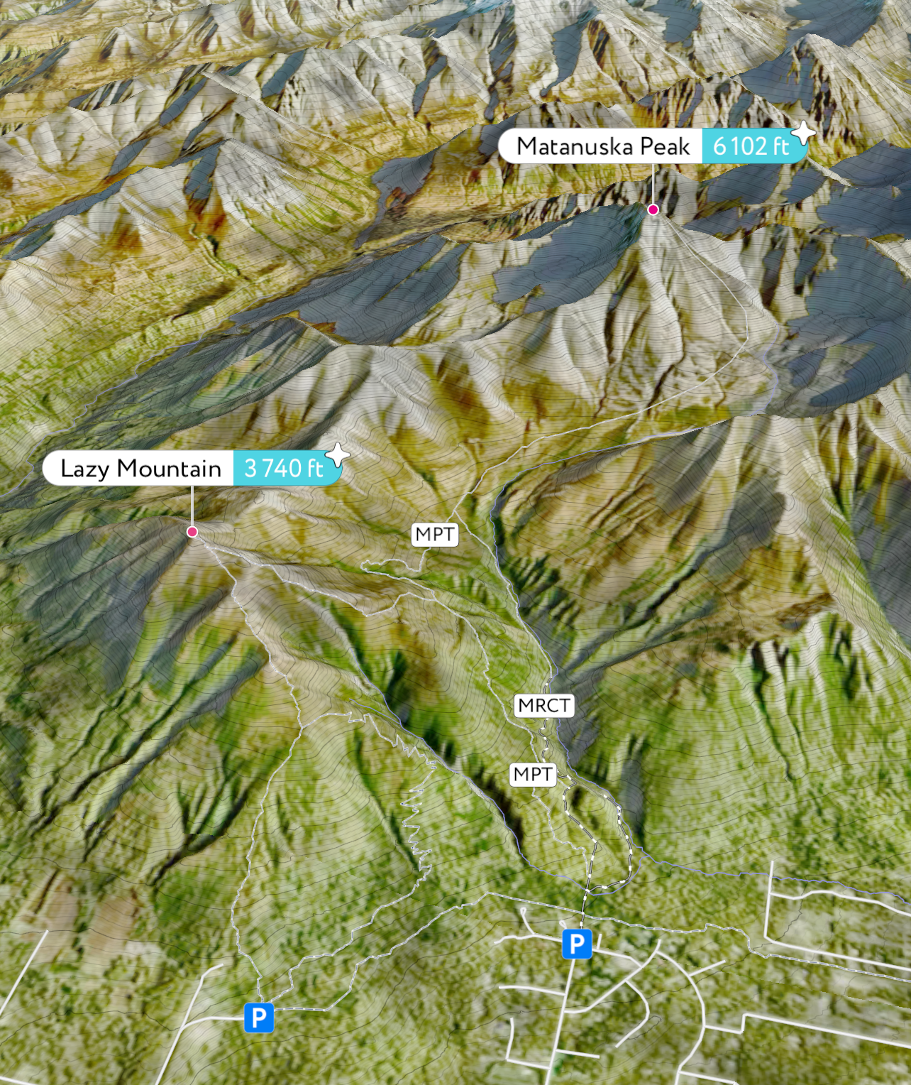
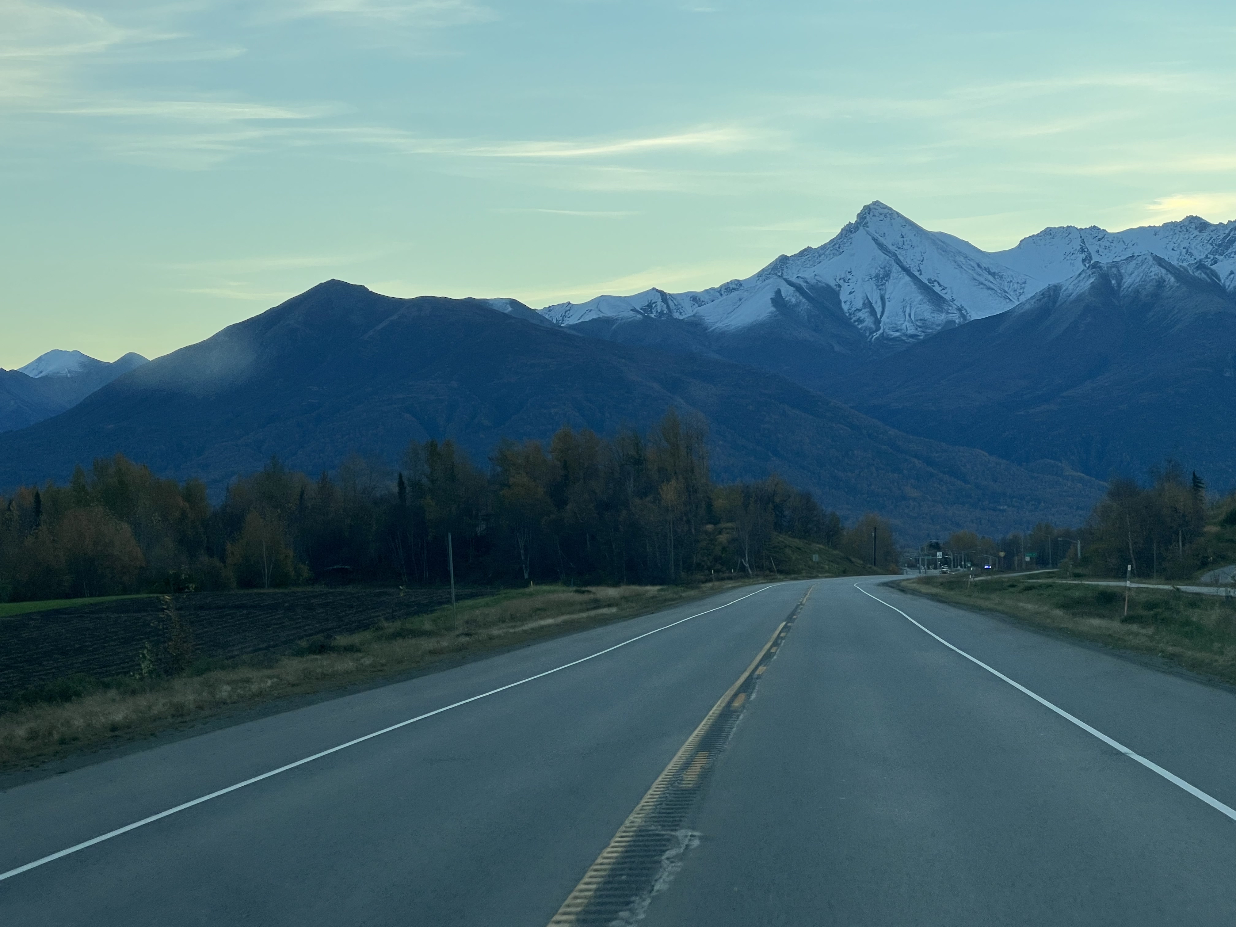
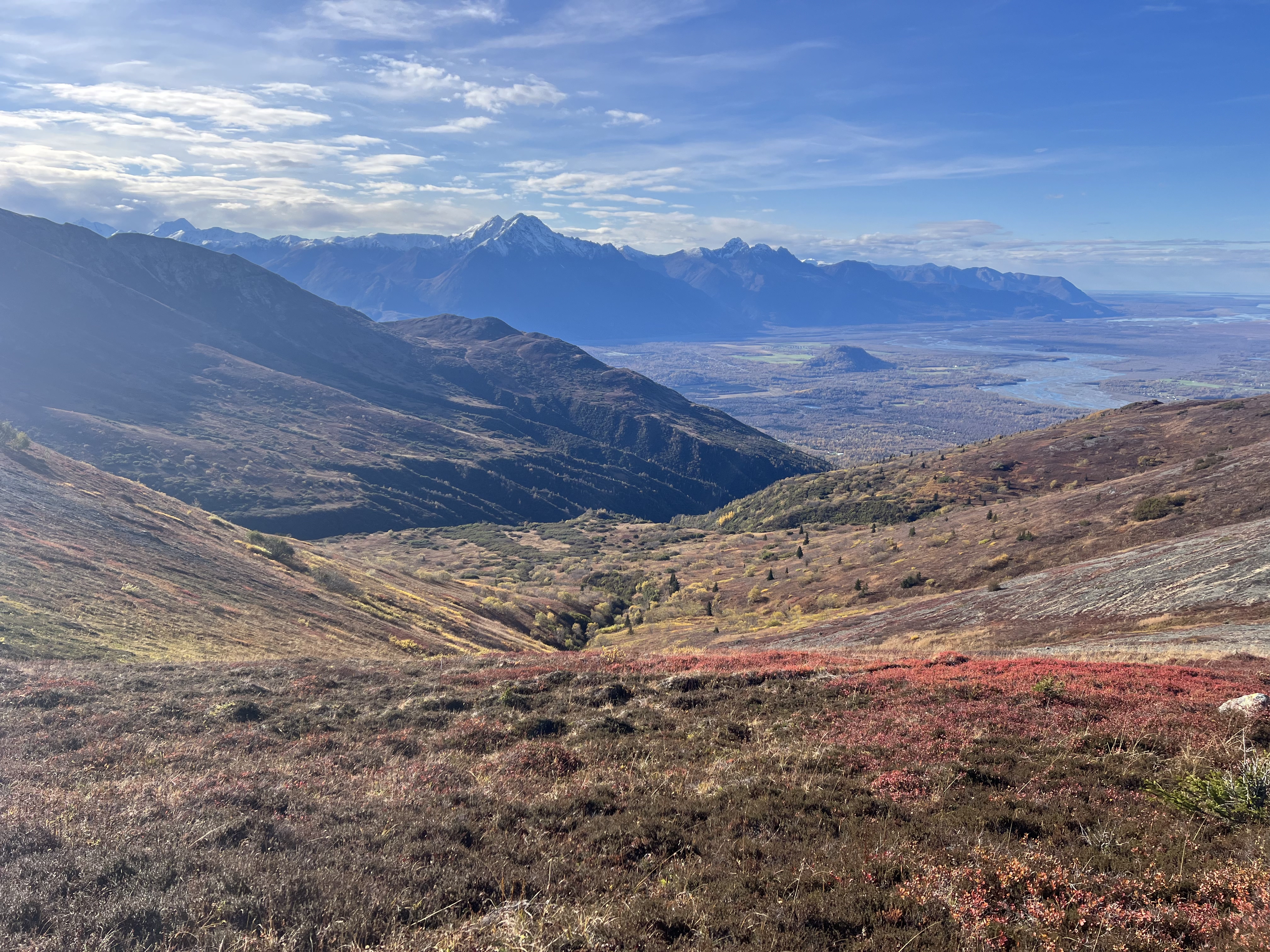
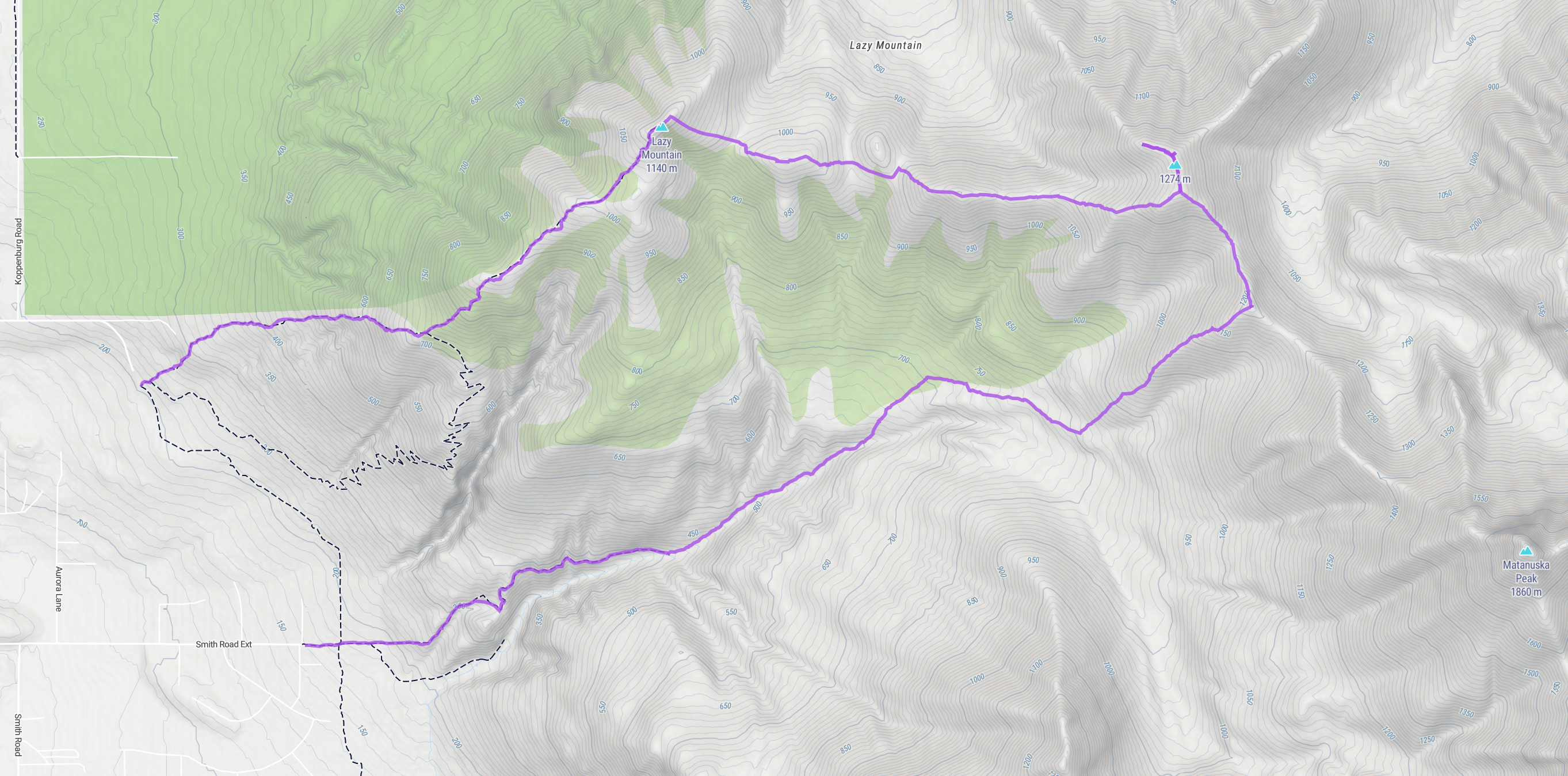
It was the second to last day of September, and the weather was holding out for one more low ridge traverse, though the termination dust had crept down close to the 4,000′ mark. I had been eyeing the ridgeline between Lazy and Matanuska Peaks for quite some time, and today was the day. I planned for a point-to-point hike, starting from the Lazy trailhead and ending at Smith Road, at the bottom of the McRoberts Trail.
Lazy Mountain is one of the most popular hikes in the Valley, one of the shorter peakbagging trips at 5.8 miles and just under 3,000′ of gain, but 99% of the people who achieve the summit simply turn around. Our goal was to summit Lazy then continue on to Peak 4199, named solely for its elevation; broad, hulking mountain on the undulating ridgeline that only sees a handful of footsteps every year.
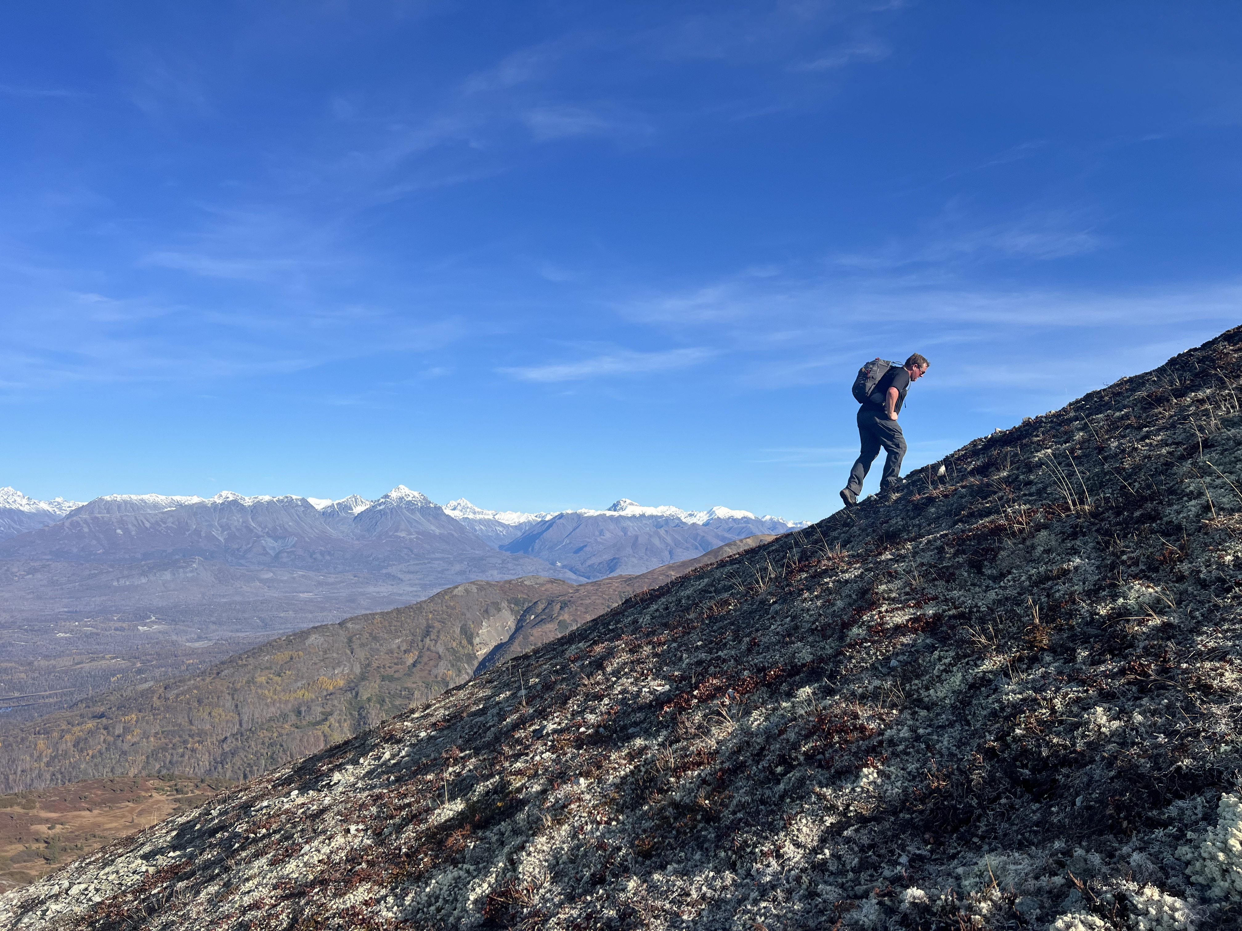
I met with Jason and Josiah at the Lazy trailhead, ready to see some new ground. The day was sunny and so warm that Jason was shirtless by the time we had ascended the first 1,600.’ It always feels like the first mile is the most difficult, sometimes steep enough to tire even the most fit of hikers, but we made good time, being pushed by enthusiasm to see a new summit.
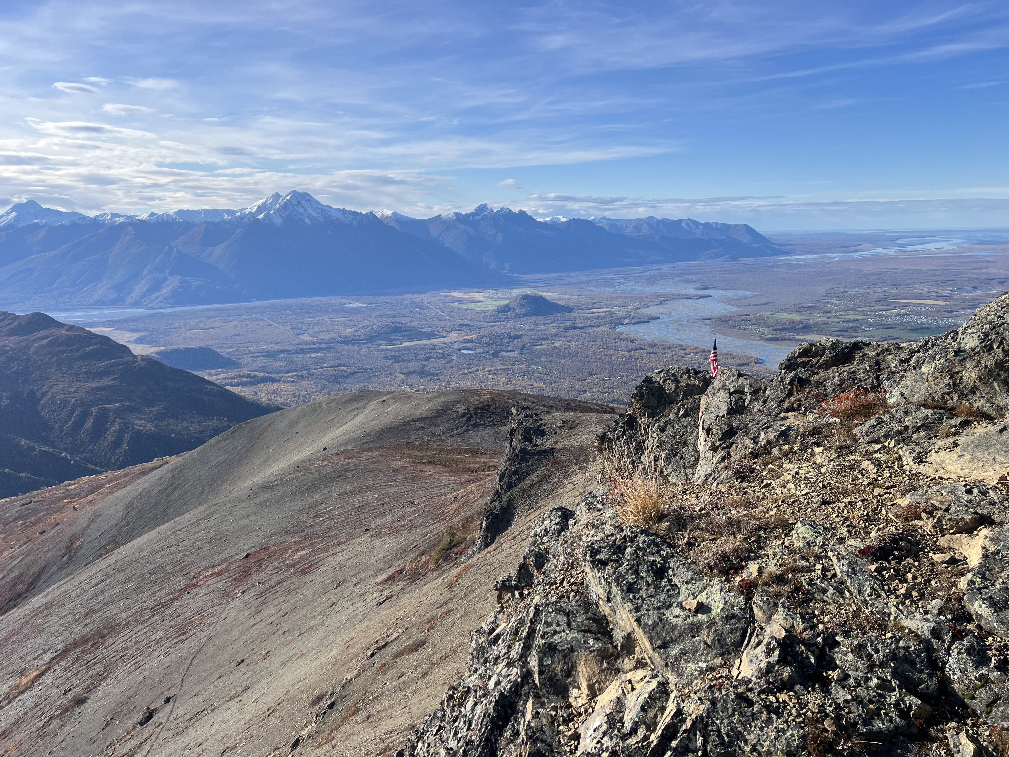
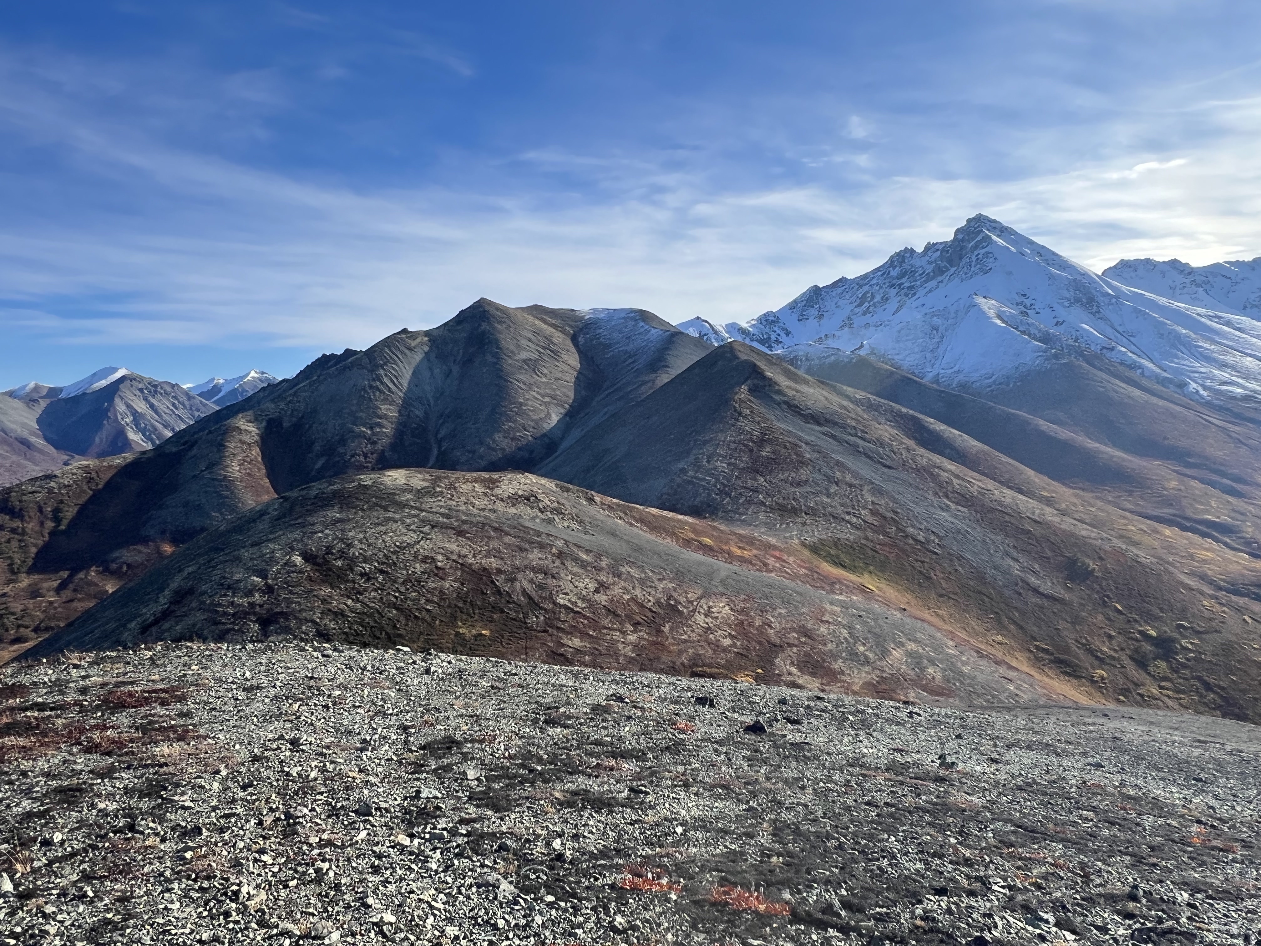
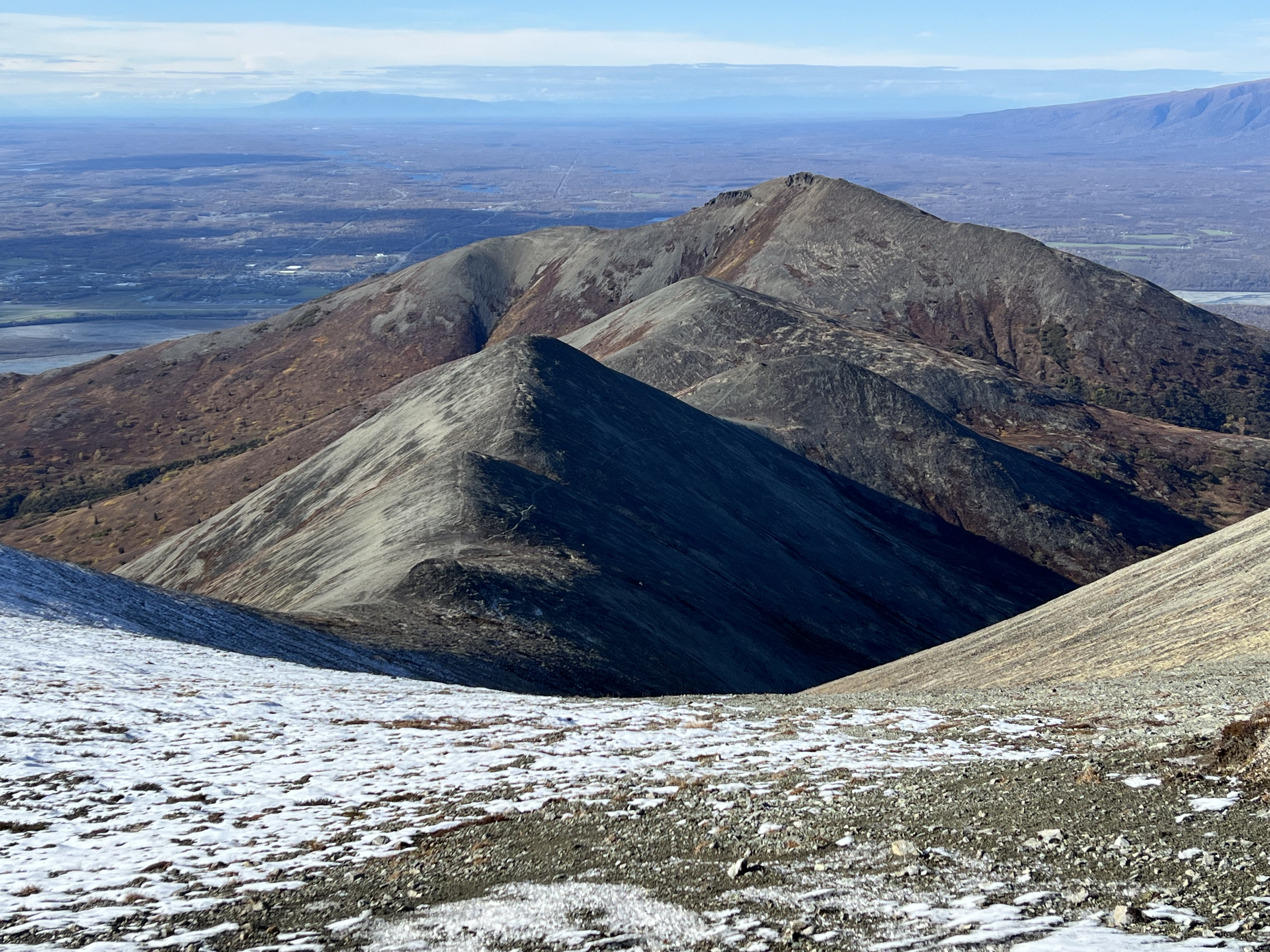
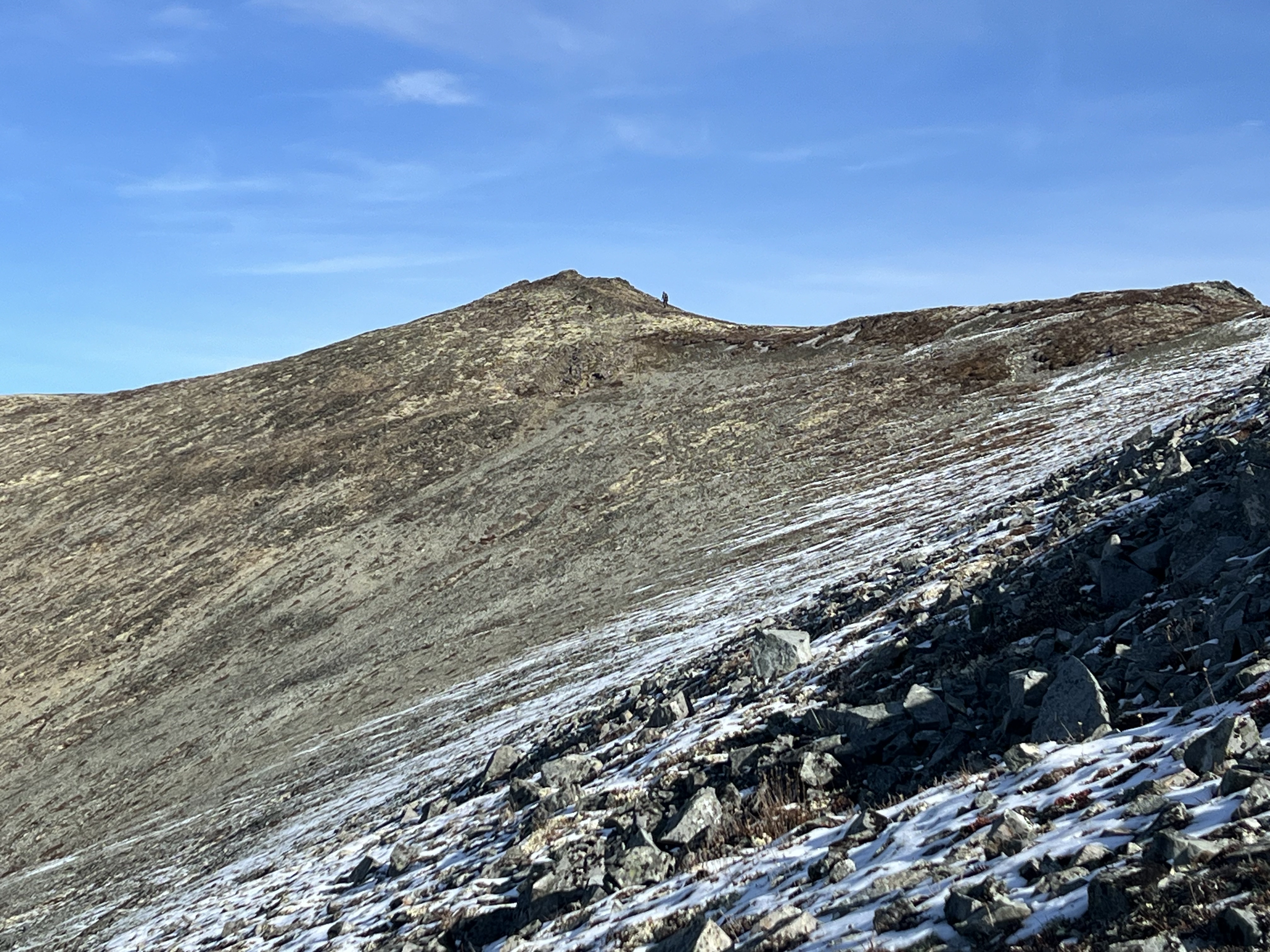
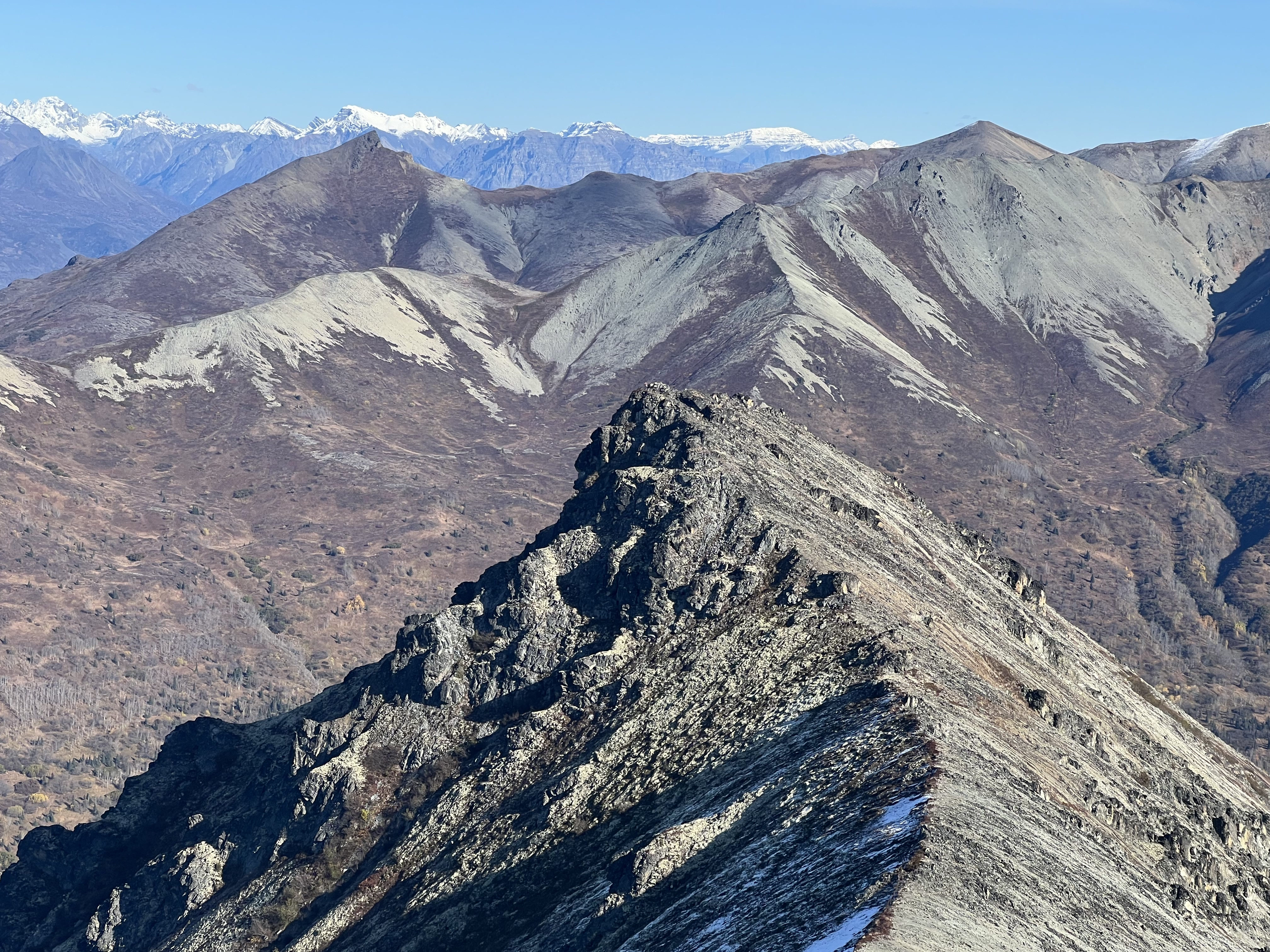
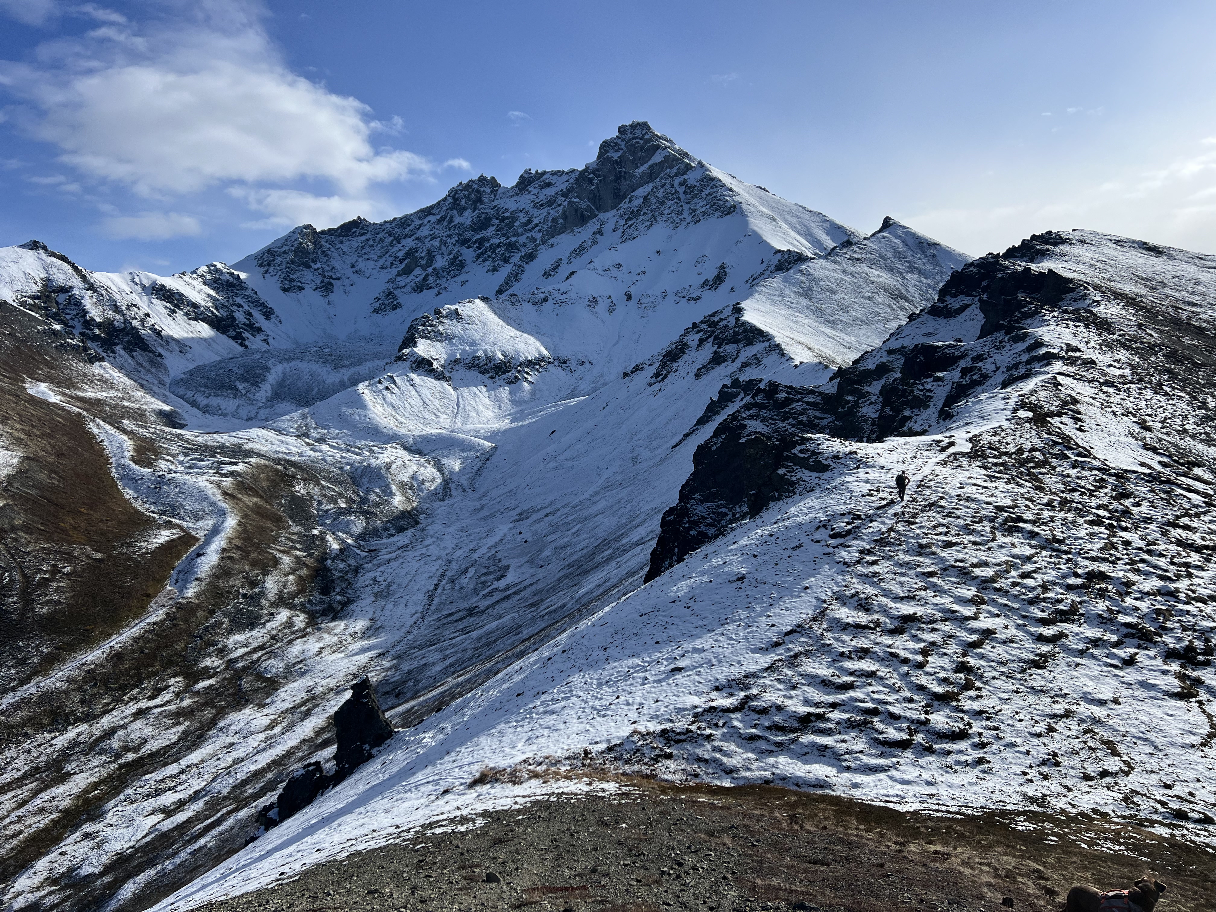
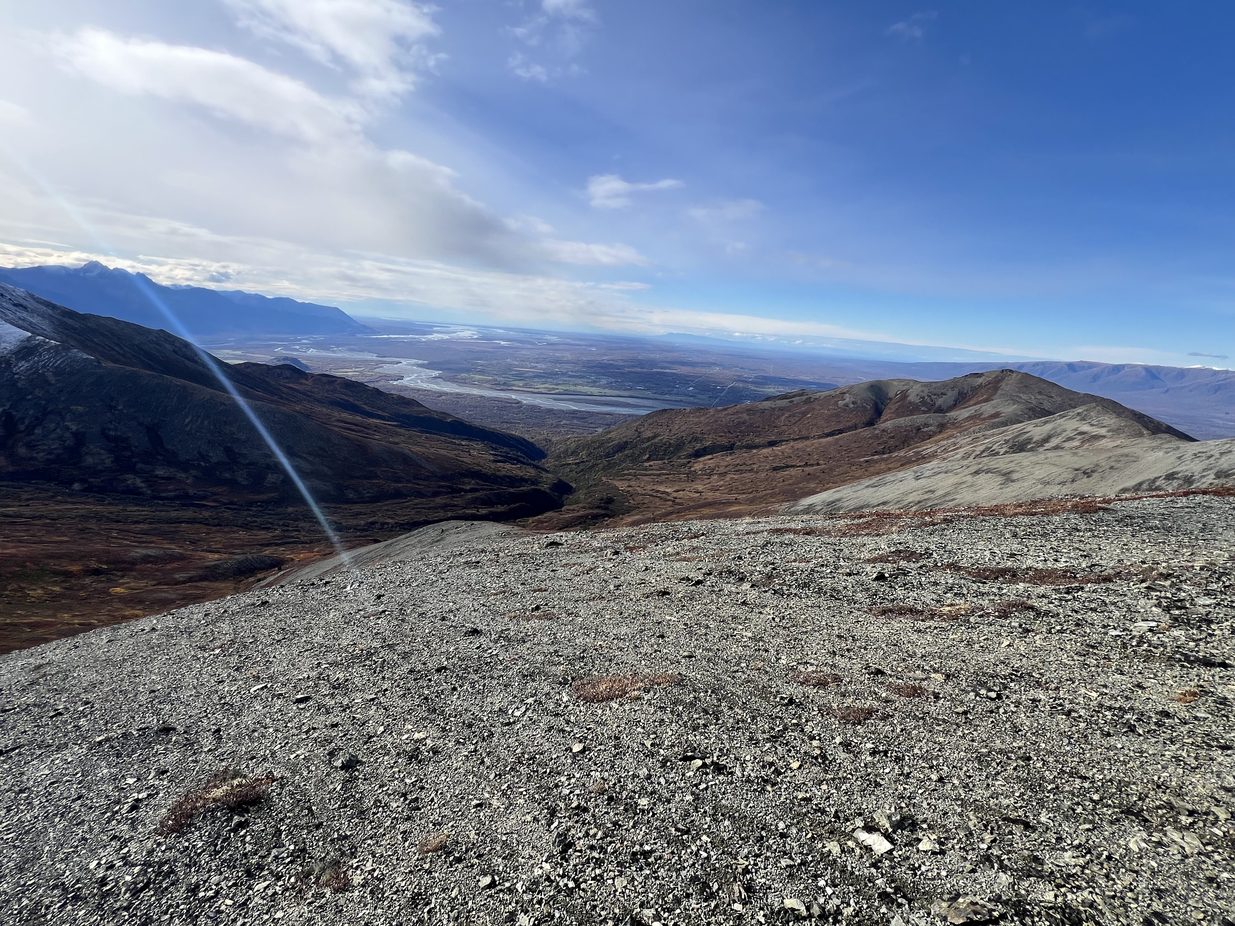
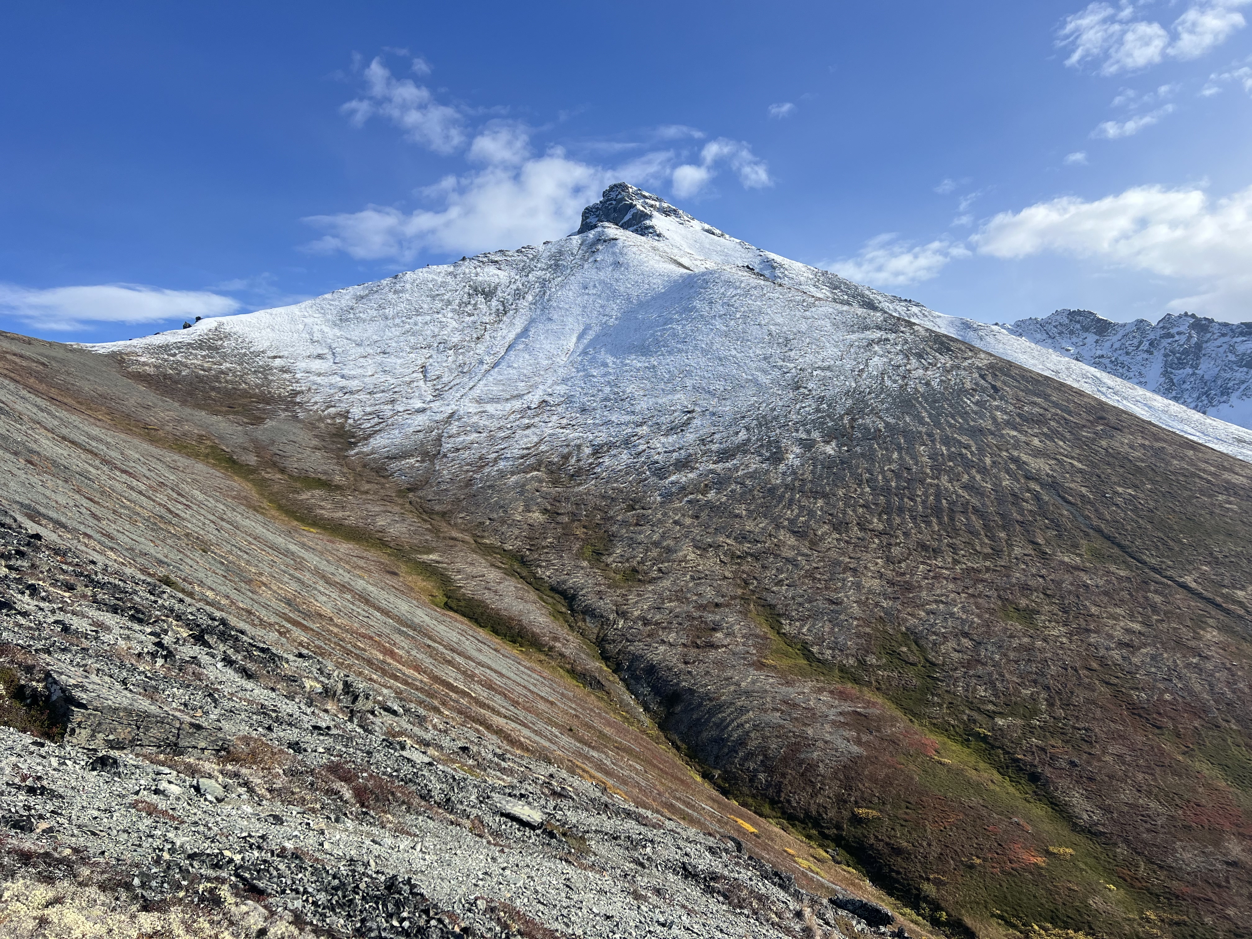
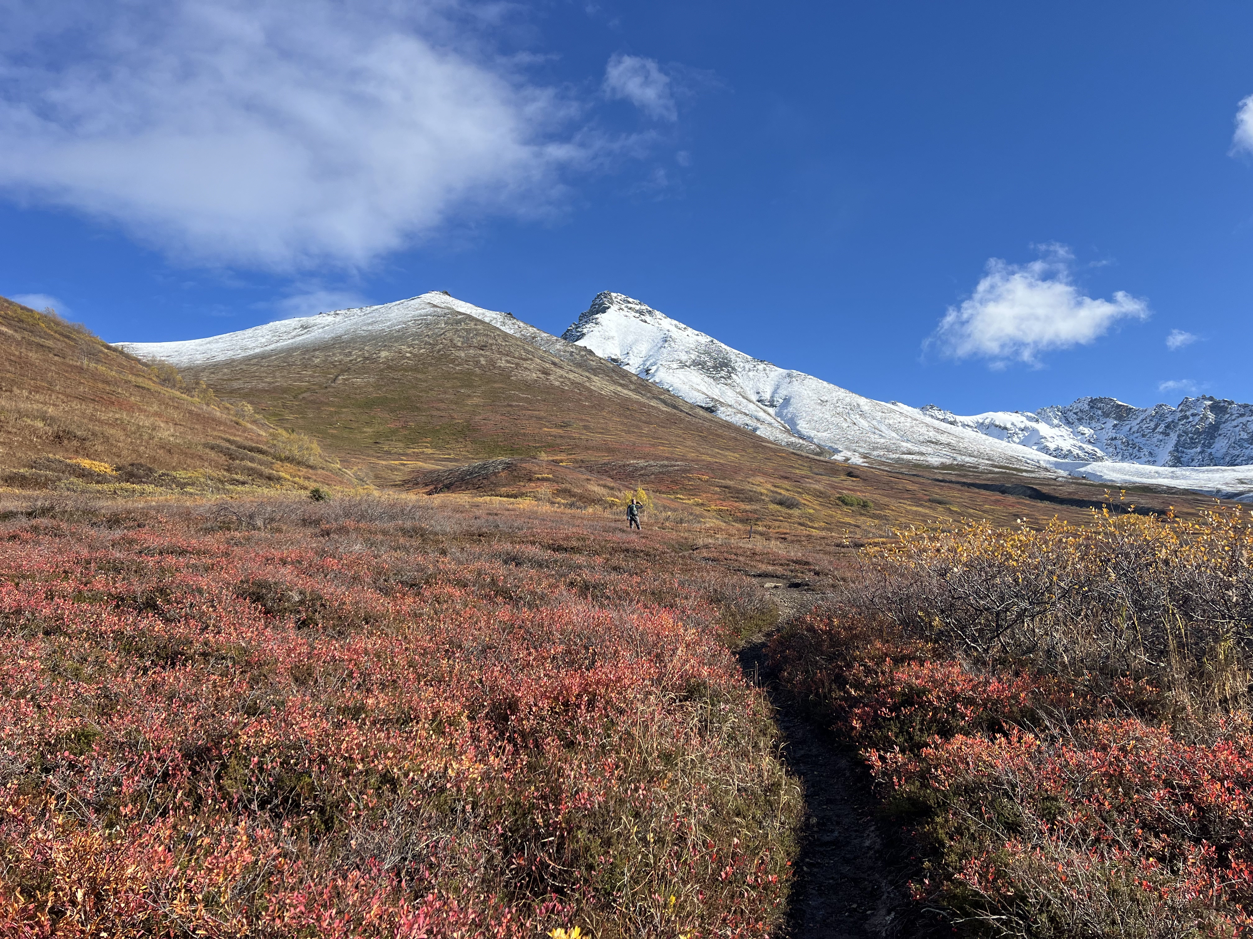
It felt like we teleported to the top of Lazy, past the turnoff for the Lazy Moose Trail, past the alders and into the treeless terrain, past the second picnic table, past the turnoff to the “Stonehenge” trail that leads down to the Mat Peak Trail, past the two rock outcroppings that mark the last half mile to the summit. By this point, Matanuska Peak and the ridgeline were in full view, Mat Peak covered in snow, though 4199 was mostly snow free.
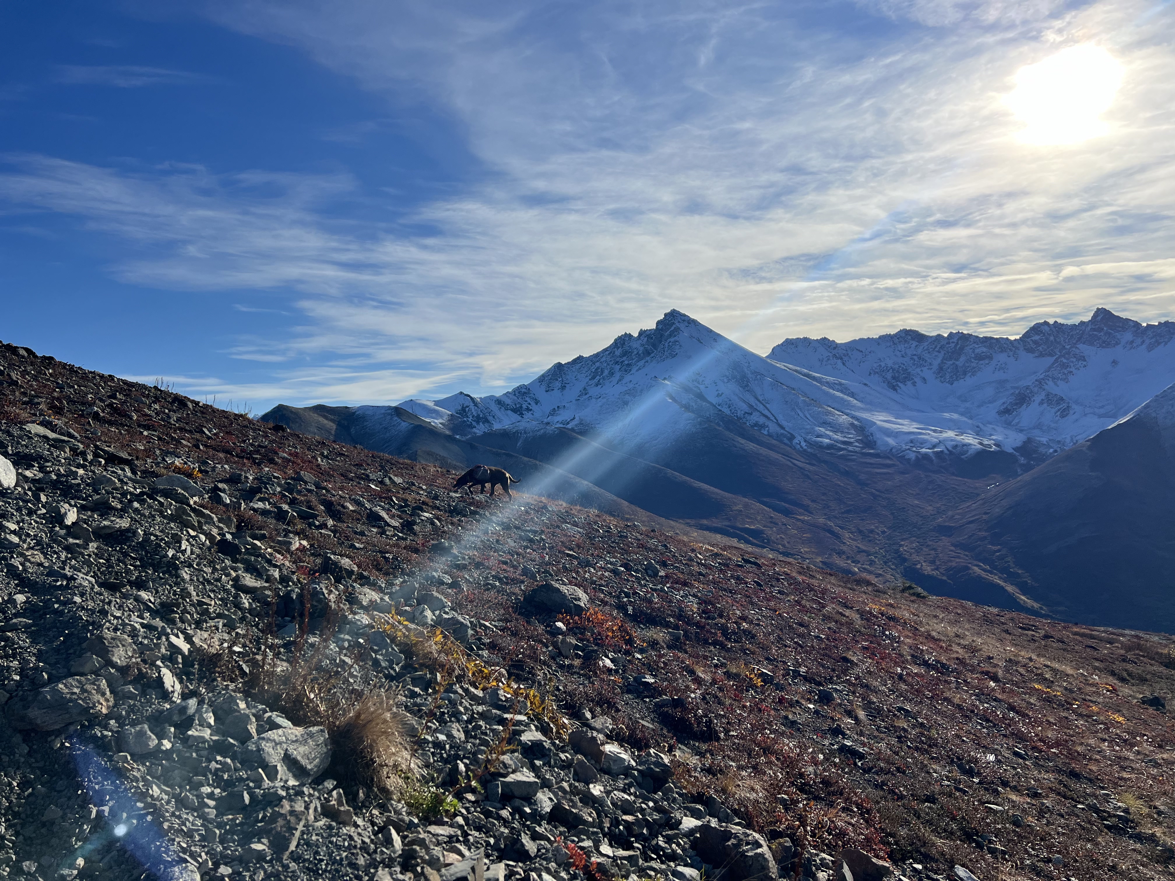
Most people turn back at the flag, but I scrambled up the last 20,’ over the rocky, somewhat exposed block, hand over hand, until the summit widened out into the perfect lunch spot. We each picked a rock and looked out towards the ridgeline with Mat Peak, rising above. Cautious to not trip or slip off the back side of the summit, I took what, as I now go through them to pick the best for this website, feels to be a million photos of the route we were soon to be walking.
Wrapping up our lunch break, Jason and Josiah set off down the back side of Lazy, a scree chute that makes you feel like you might as well be walking on ball bearings. Of course, Jason and Josiah flew down the 400-some-odd feet to the foot of the next hump, an unnamed hill that I call 3451, while I slowly picked my way, trying not to fall on my ass.
Finally in the saddle, not having fallen on my ass, I looked back up at Lazy and the now much more precarious looking scree chute we had just descended. The well-defined, vertical scratch in the mountainside was evidence of others who had come before and, from this vantage point, definitely looks steeper than it is.


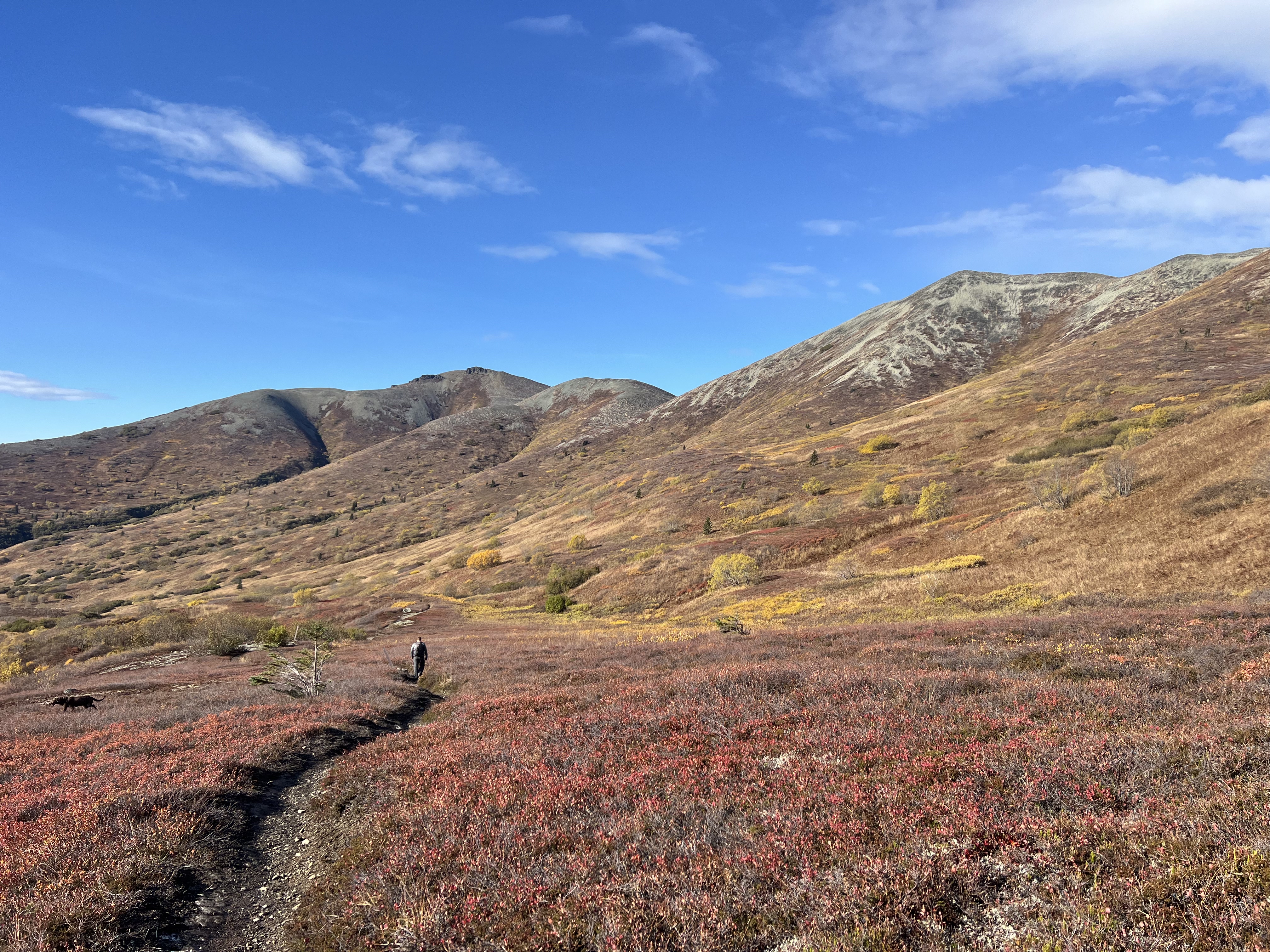
Standing in the saddle between Lazy and the next bump on the ridge, the guys were already making their way up the 200′ to the top. Although it only has a couple hundred feet of prominence and isn’t officially its own mountain, not even having an official name or entry in Peakbagger, 3451 is a fun climb unto itself. I had ascended it via Smith Road a couple of times over the years, trekking the 7 miles and 3,000′ RT to enjoy the abundant blueberries and people free zone.
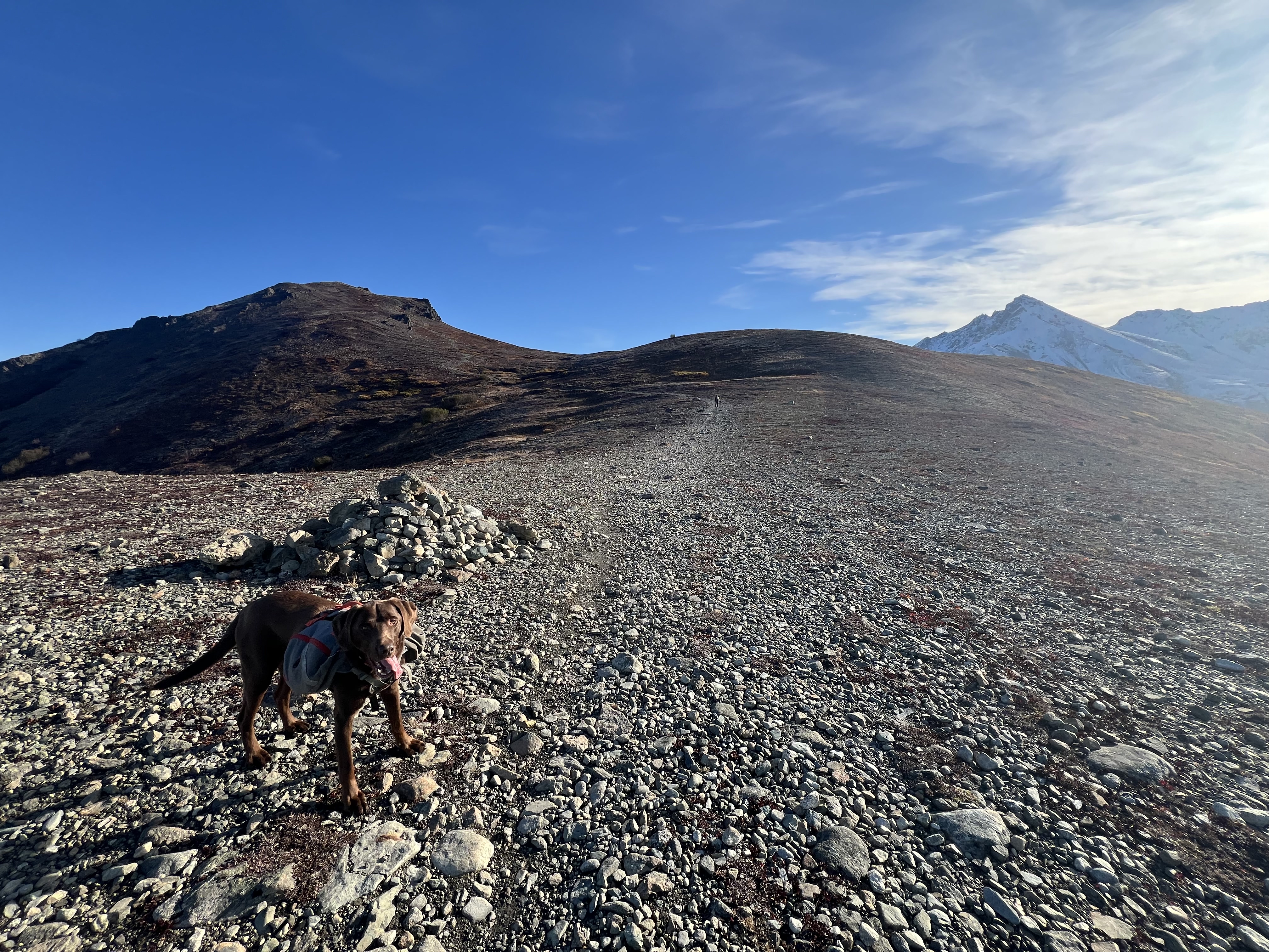
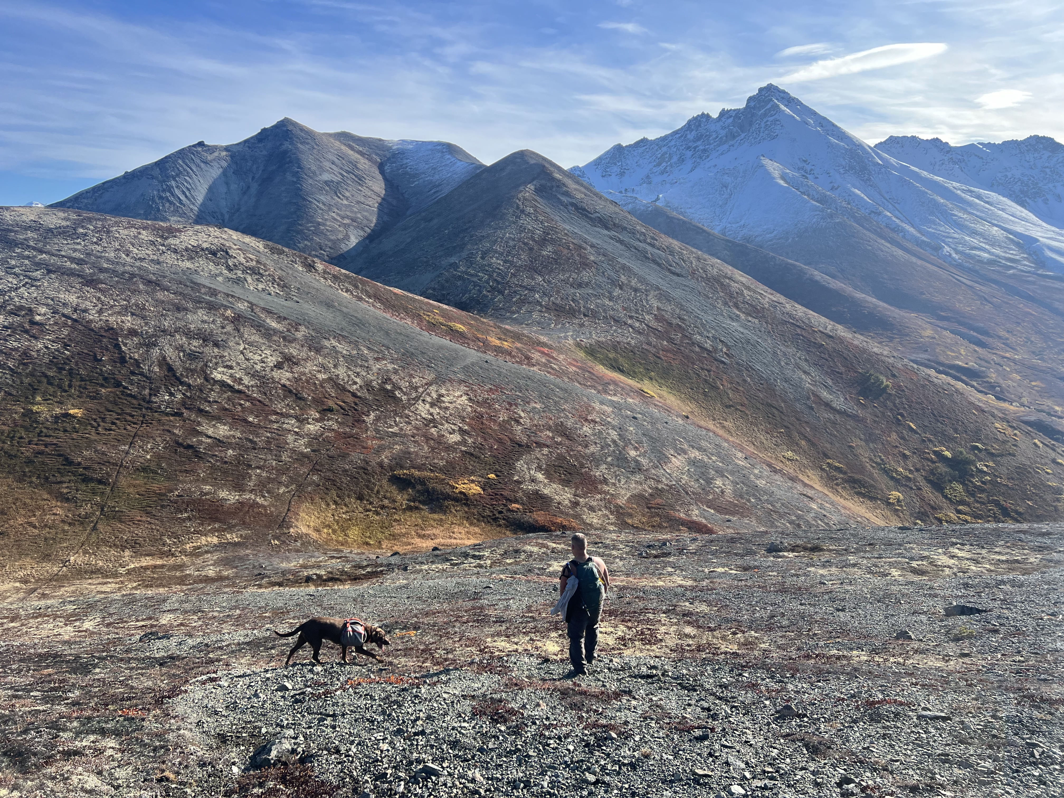
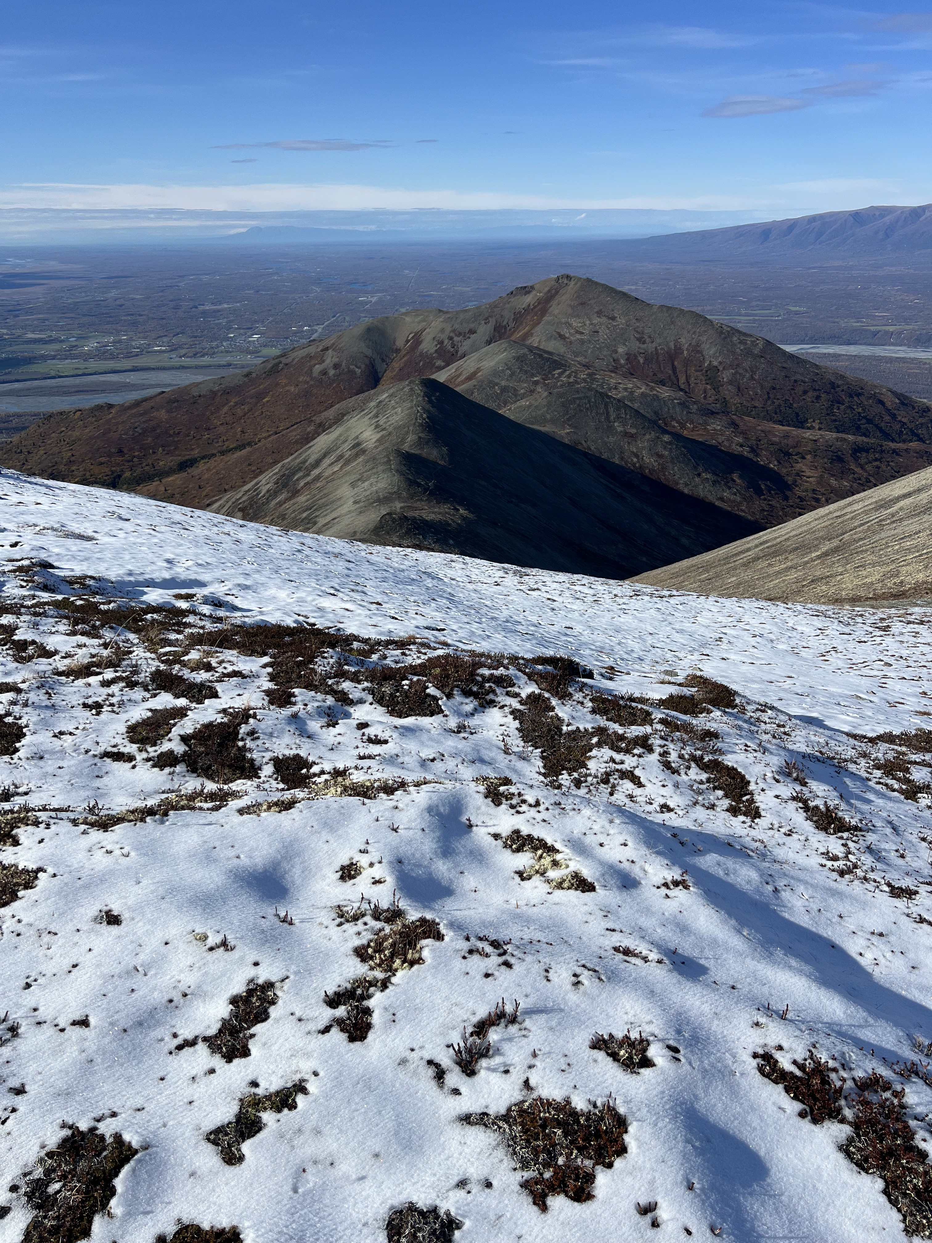
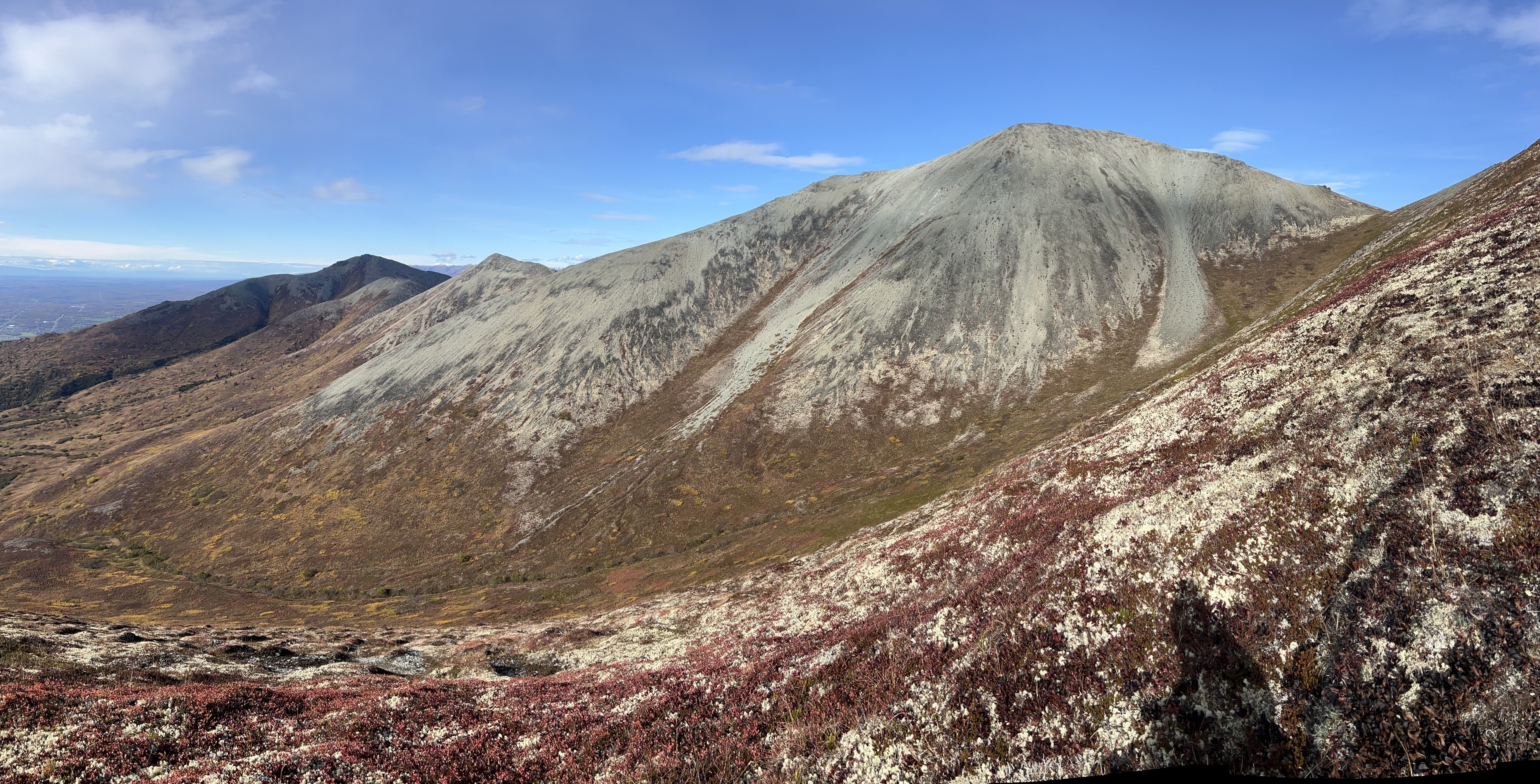
At the top of 3451 I once again looked back at Lazy and noted that I had now connected the dots between these two points, another ridge section completed. Bright red patches of Bearberry plants dotted the hillsides, and the caribou tundra moss was dry and crunchy underfoot. We continued to follow the faint bootpath down from 3451, skirting a minor, 100′ prominence bump, finally beginning our ascent of Peak 4199.
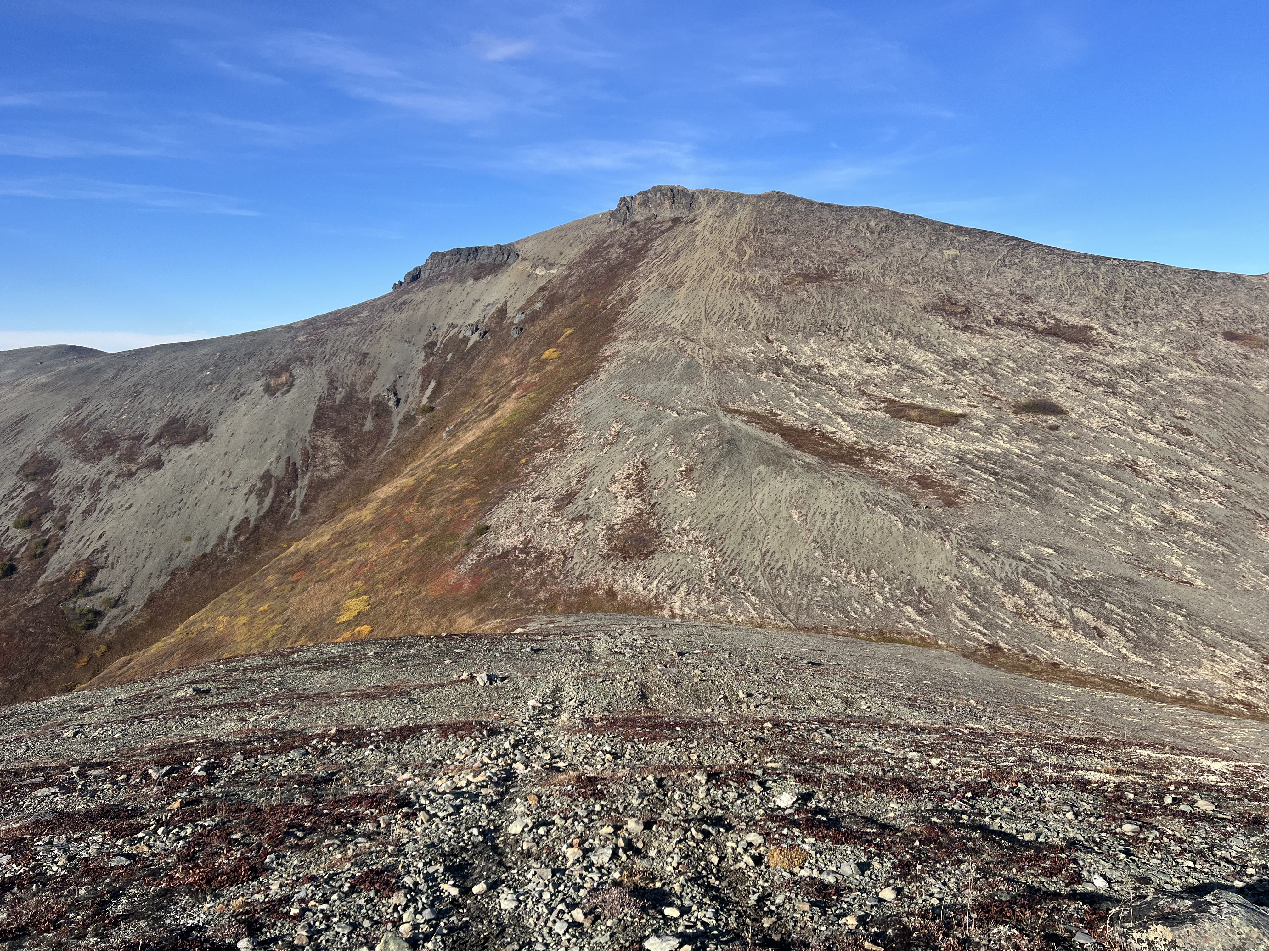
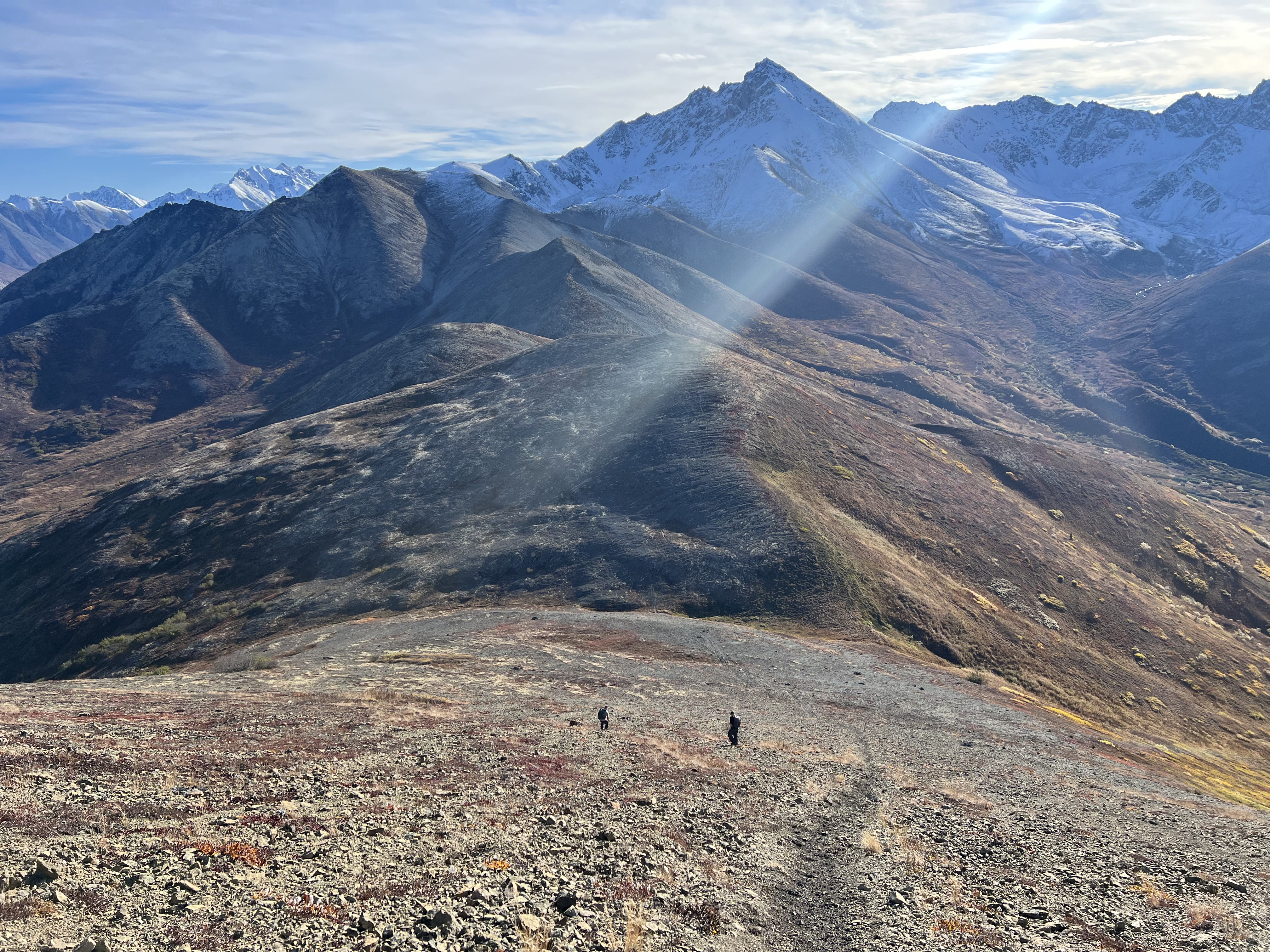
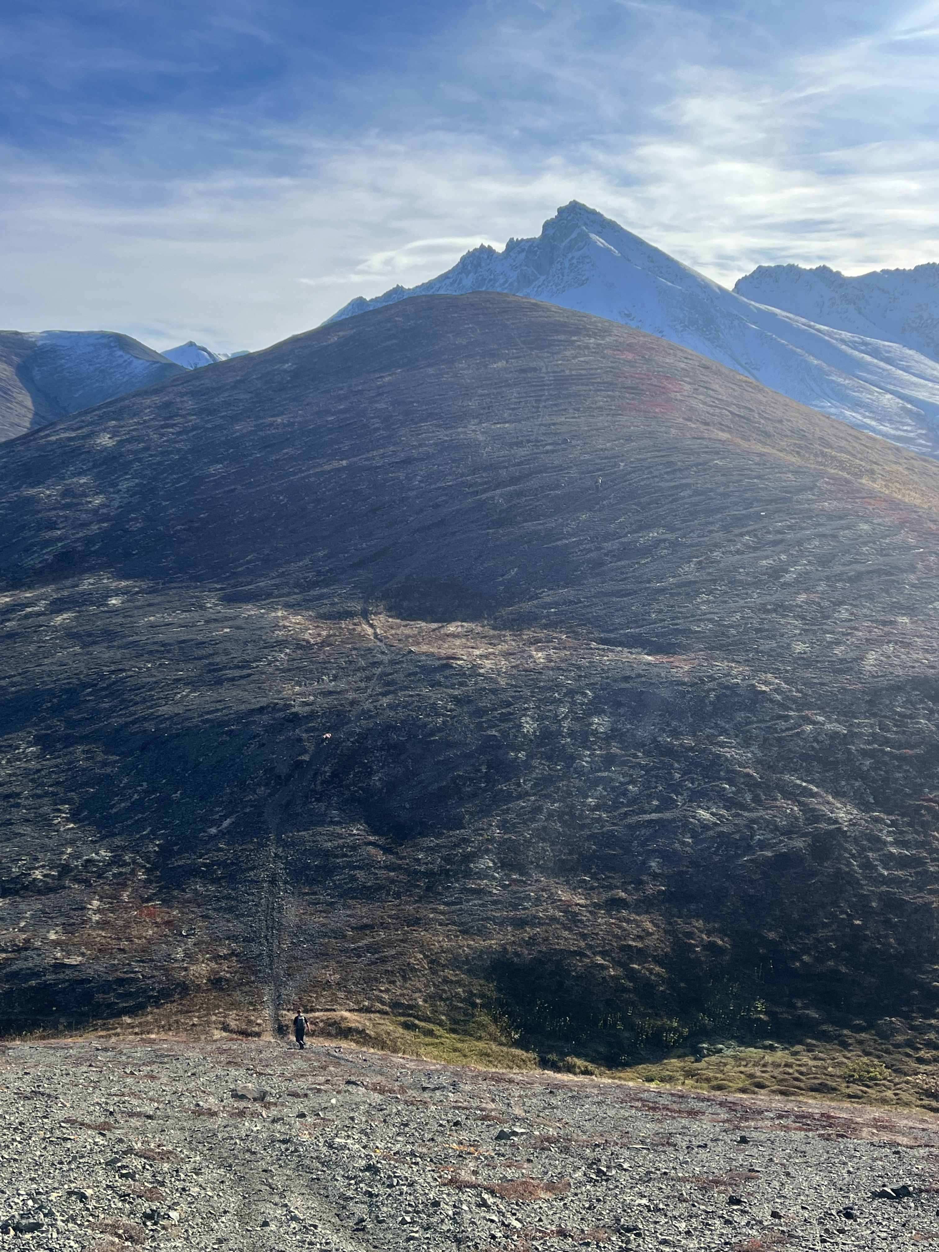
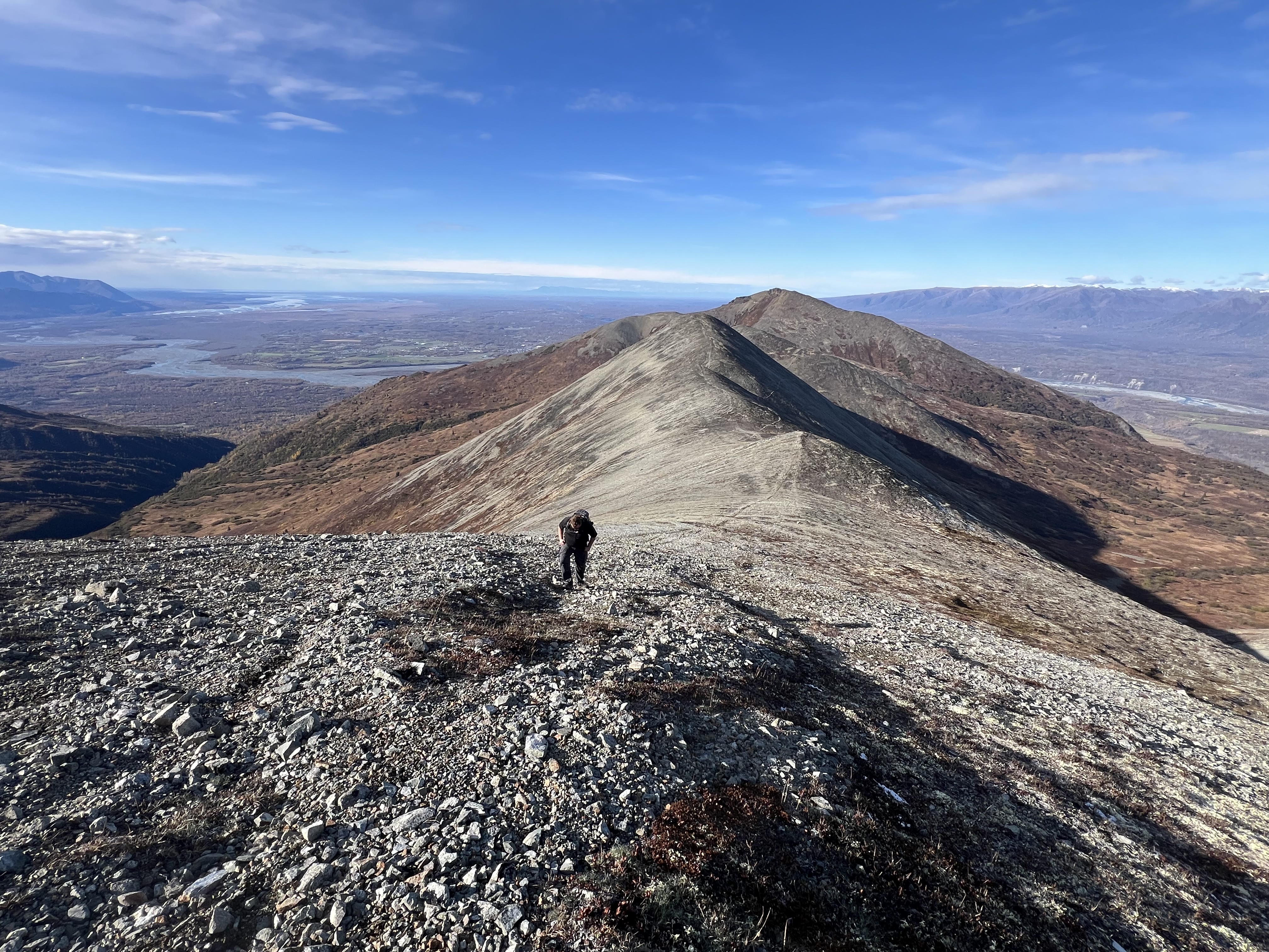
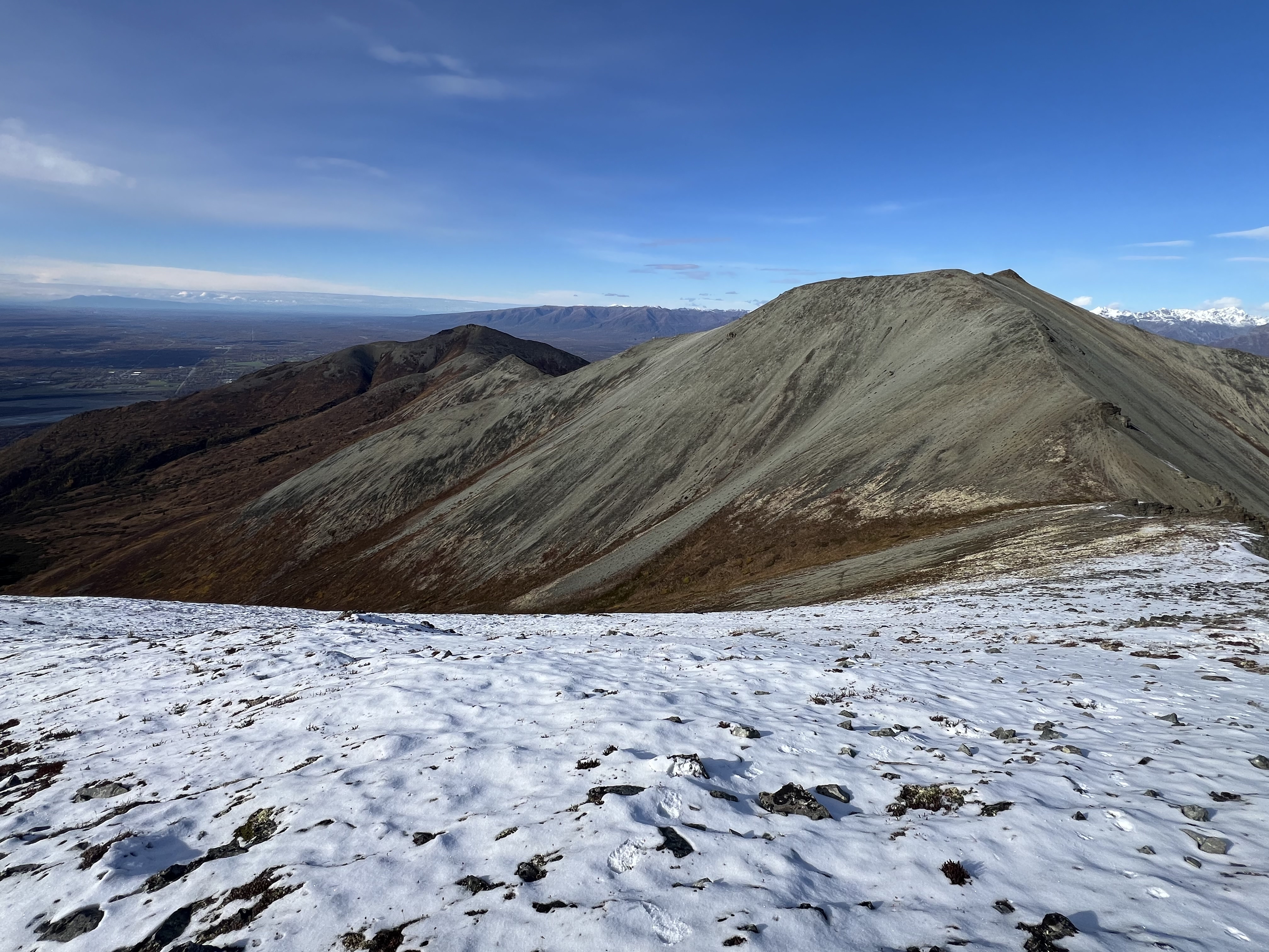
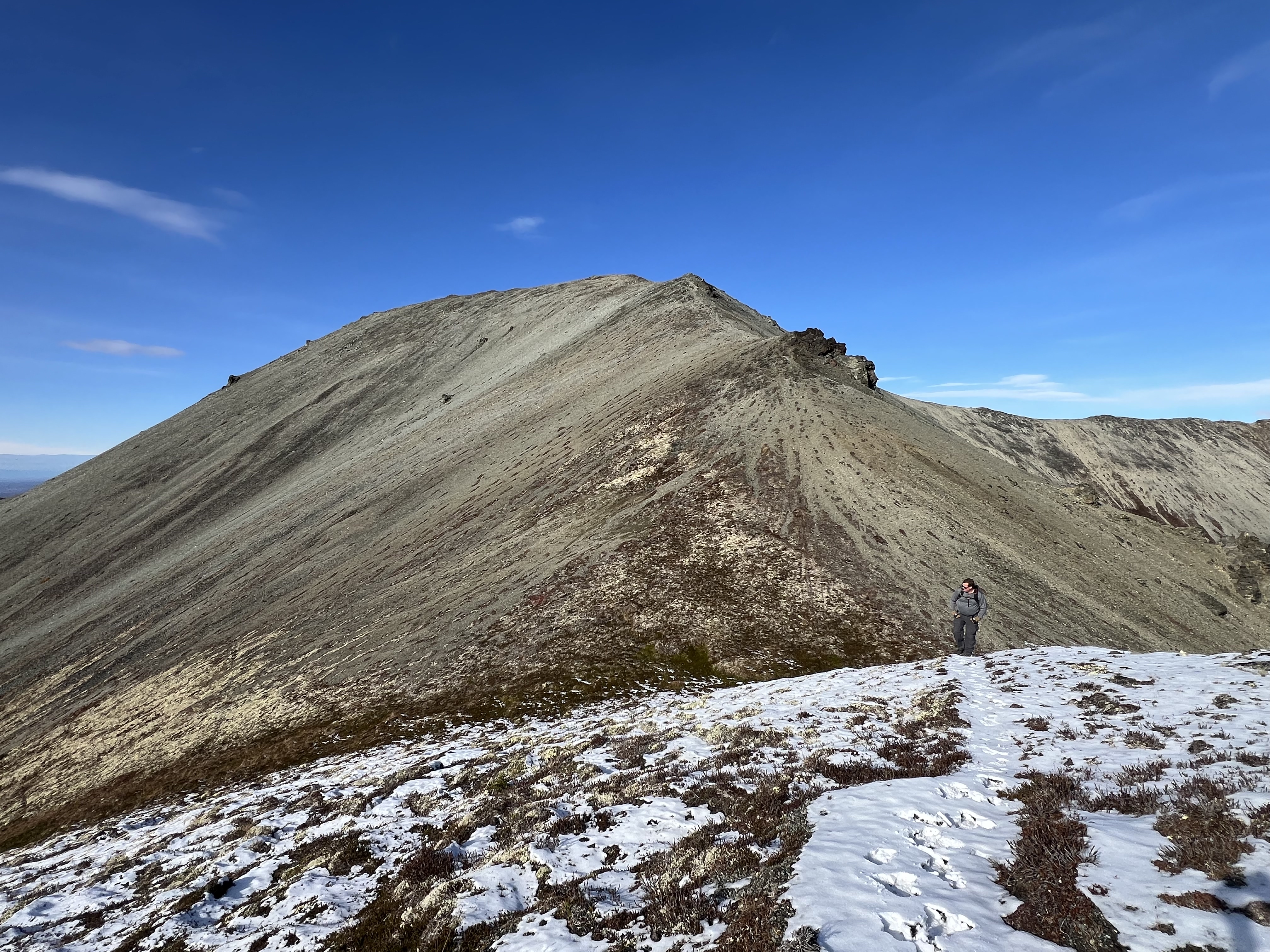
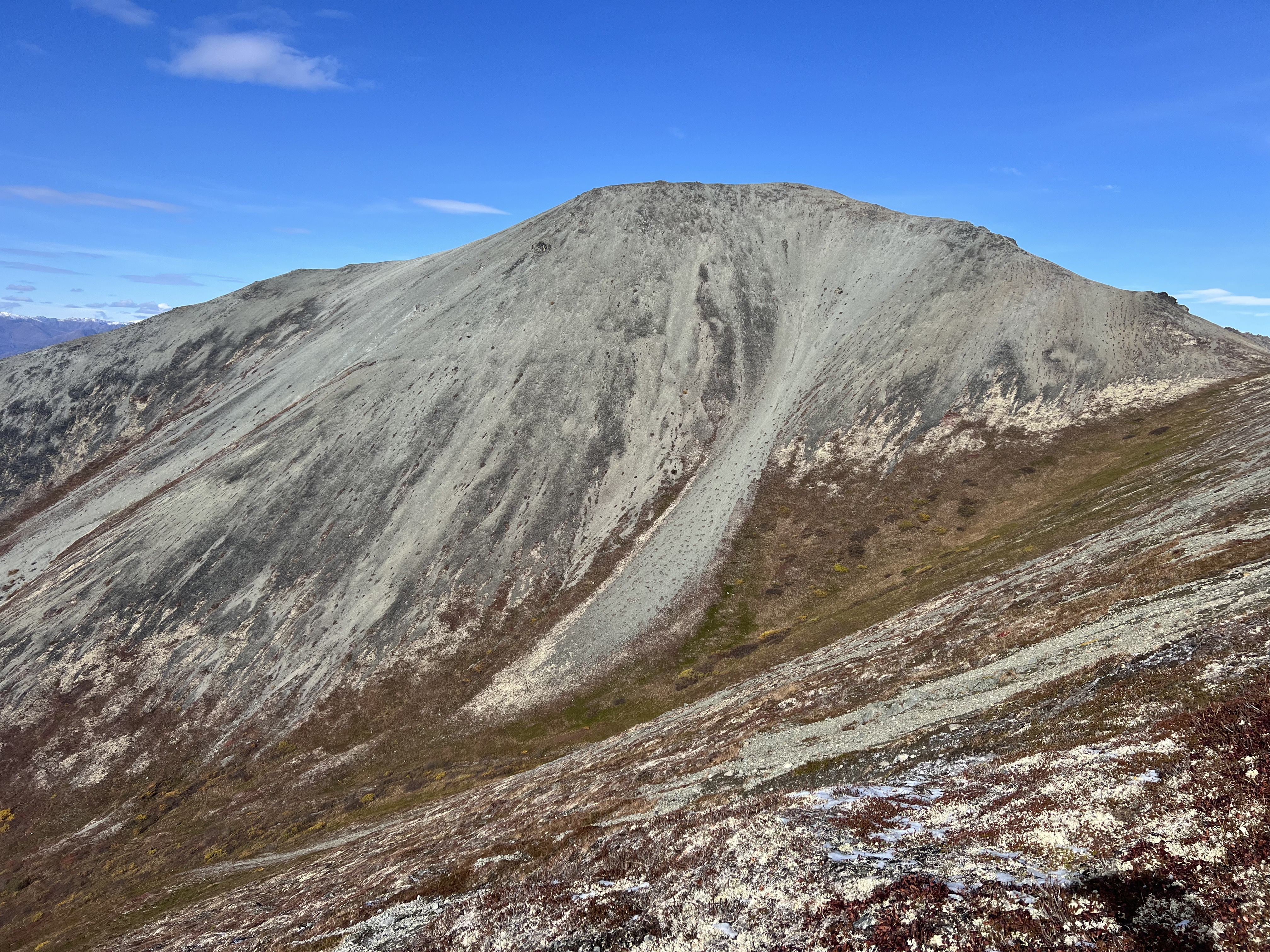
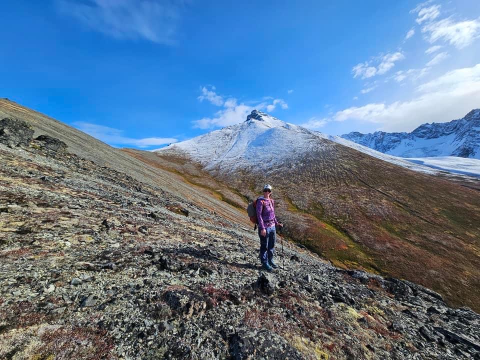
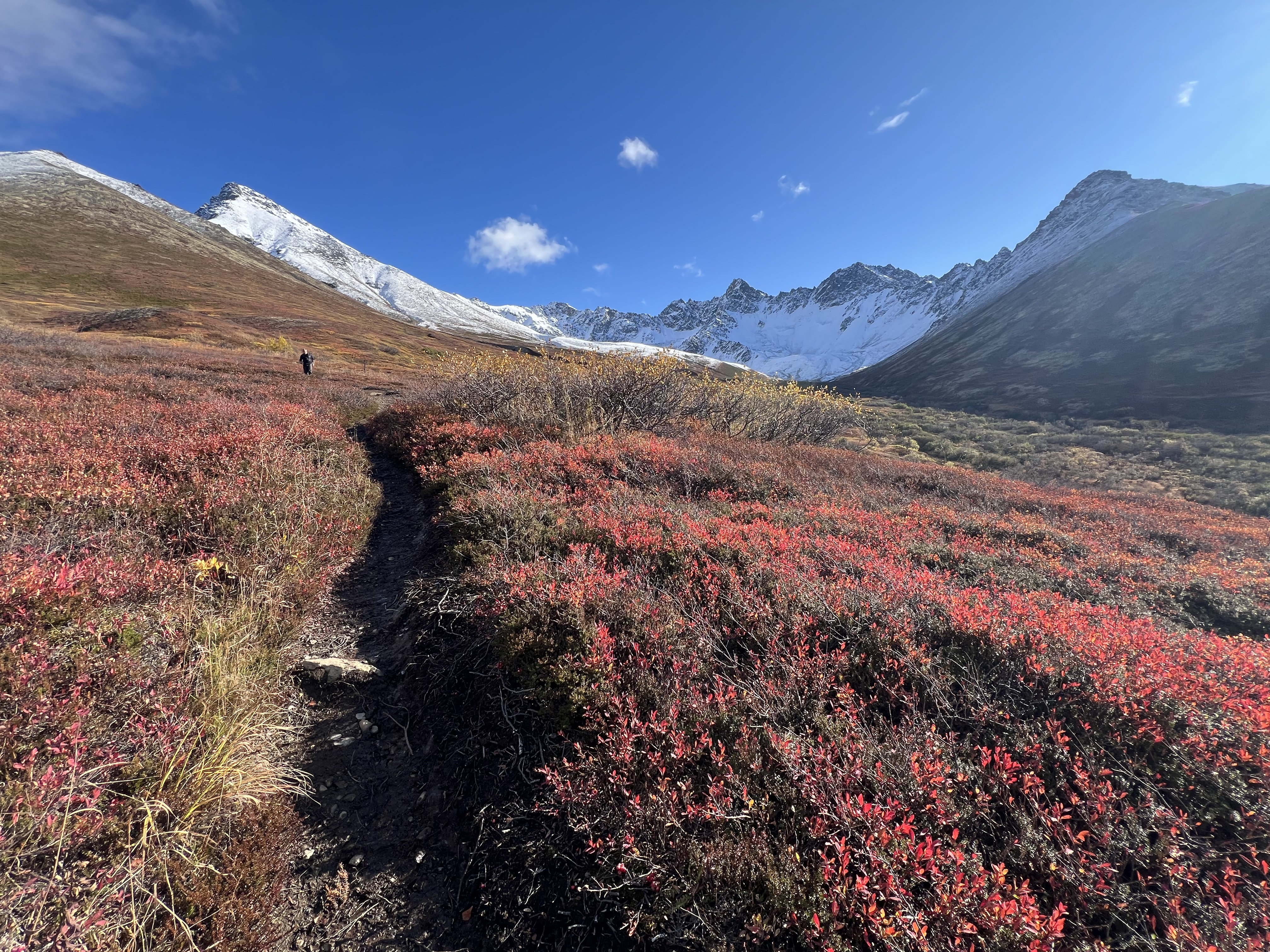
A mile long approach from the saddle, the ridge gains nearly 1,000′ over a mile. A short, steep ascent before cresting a point, the bootpath then drops down 100′ before continuing up a long, gradual ascent to the broad summit of 4199. The shape of the mountain from this ridge is beautiful with its many curved shoulders falling off into the valley, and although it appears barren and gray, with splotches of black lichen and a dusting of snow, it felt welcoming.

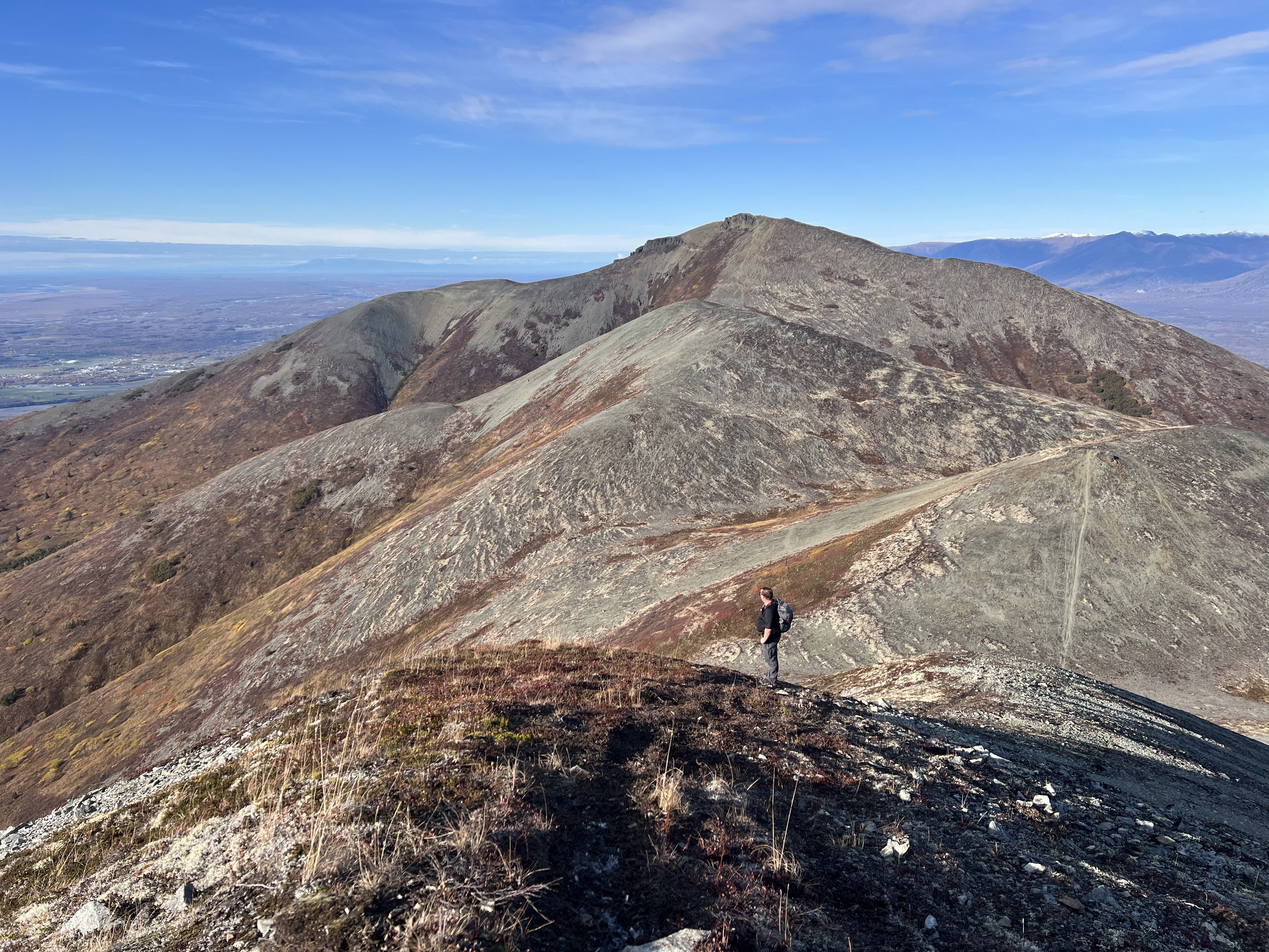
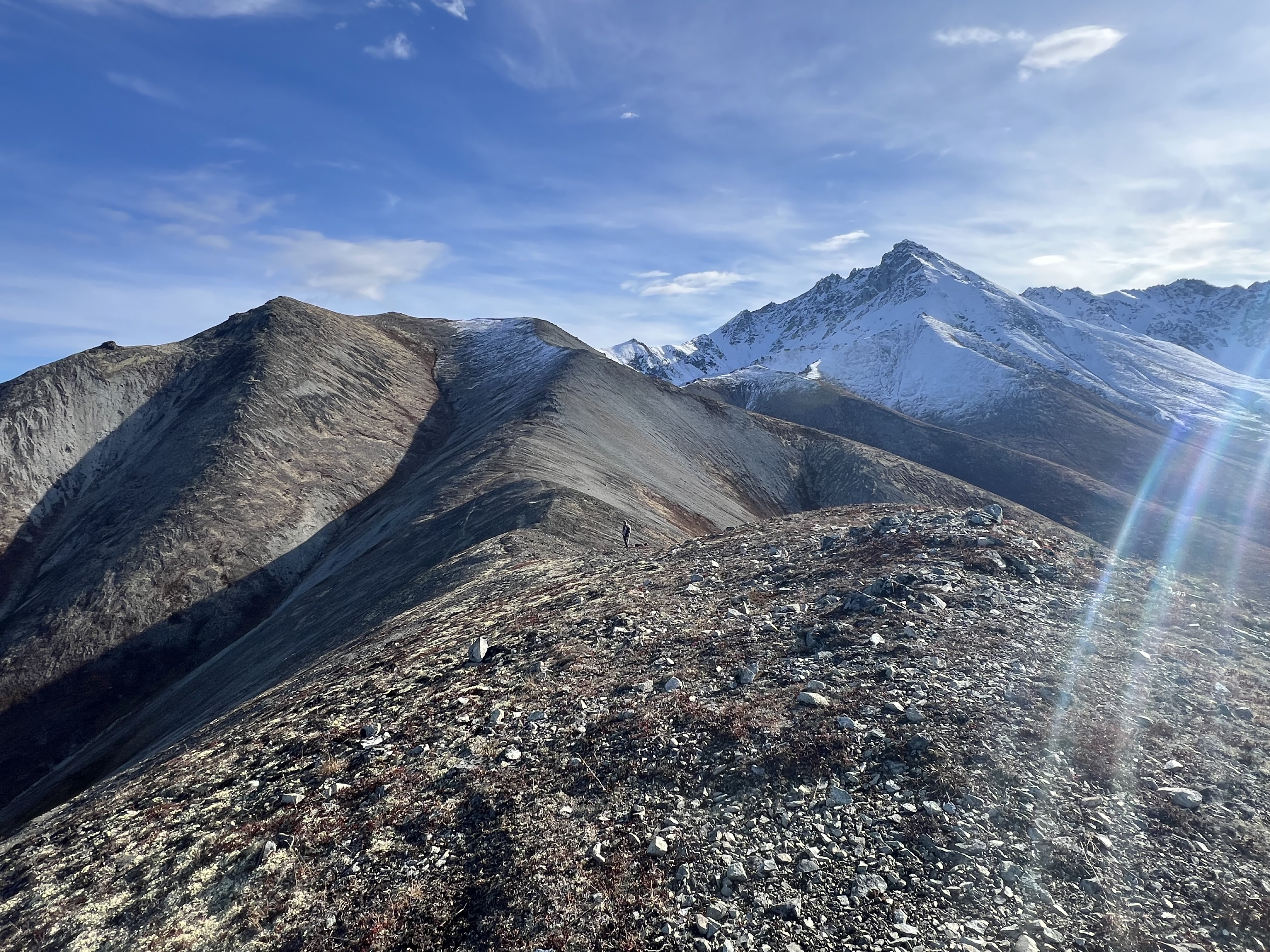
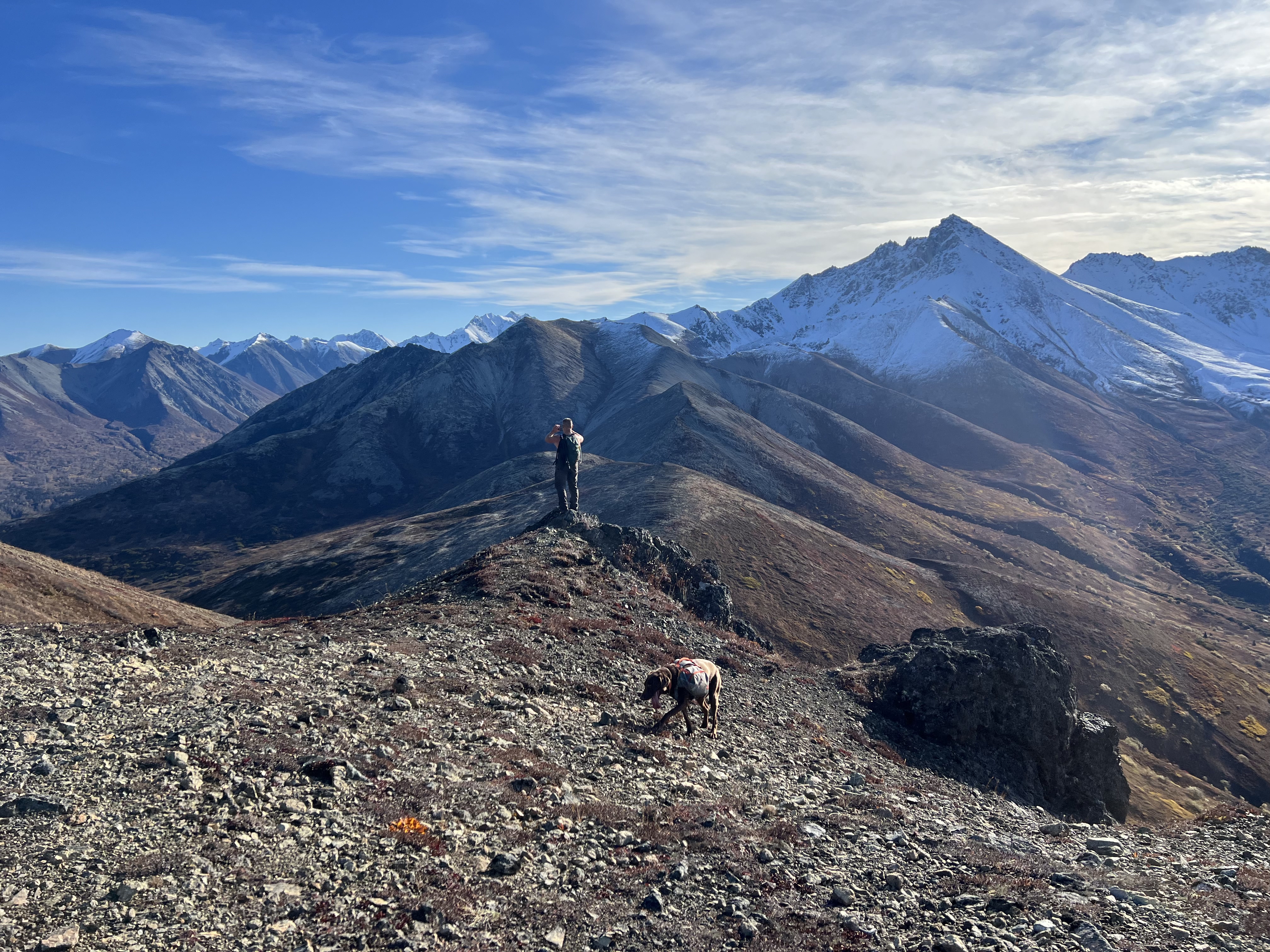
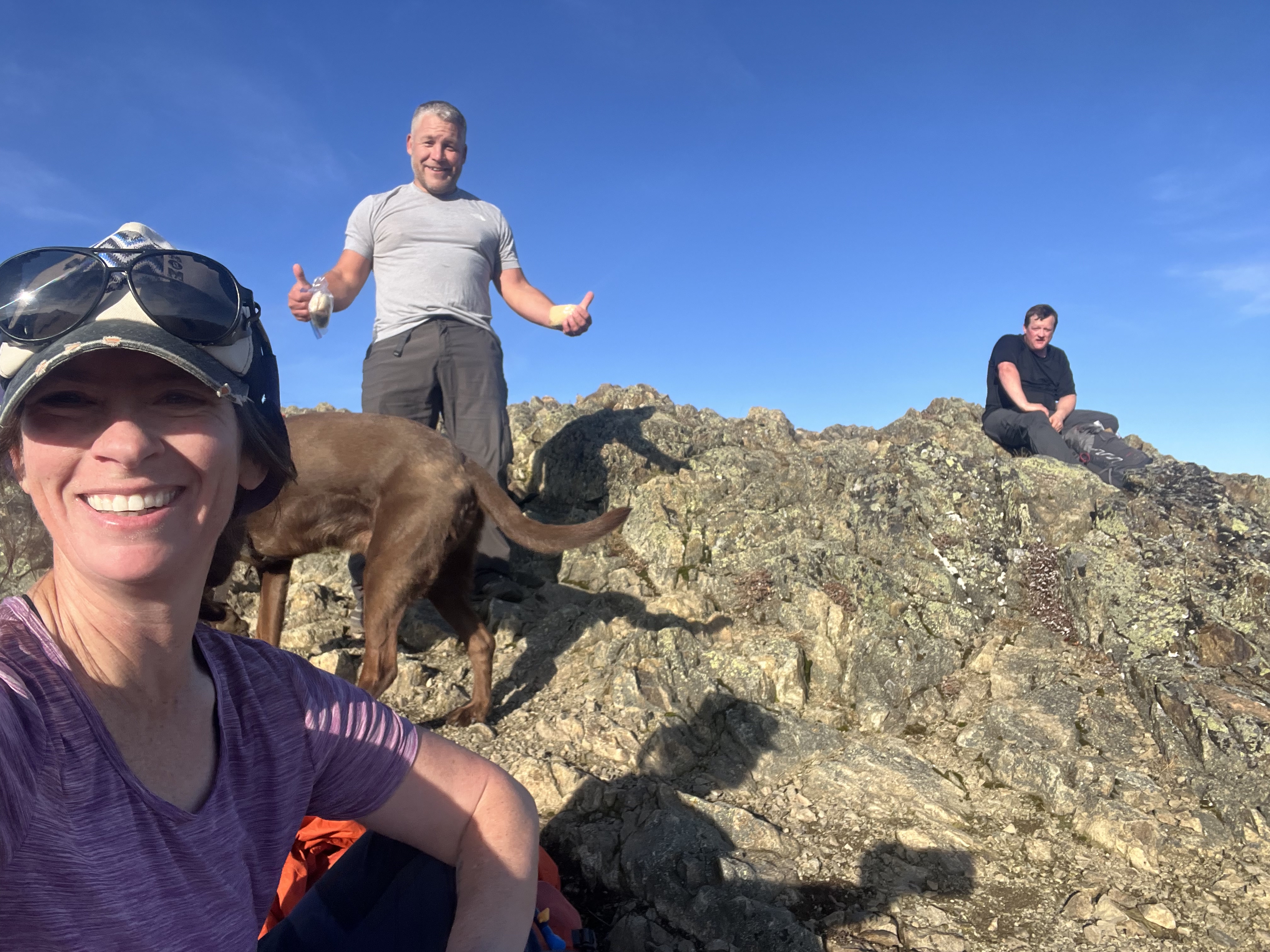
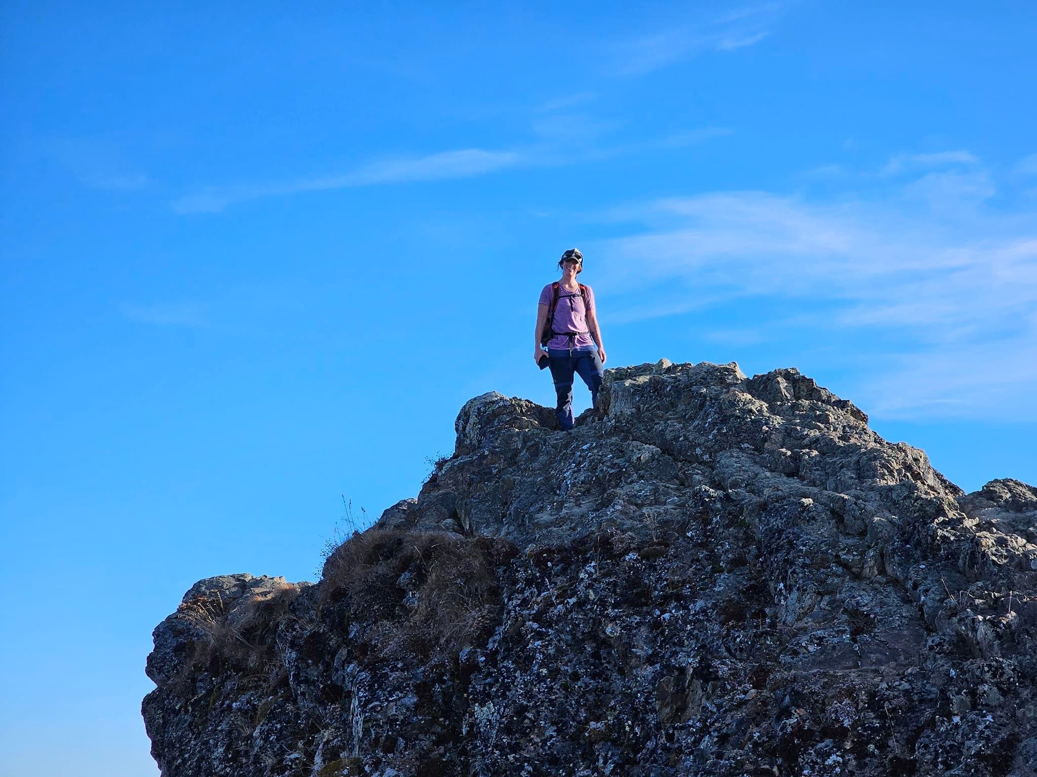
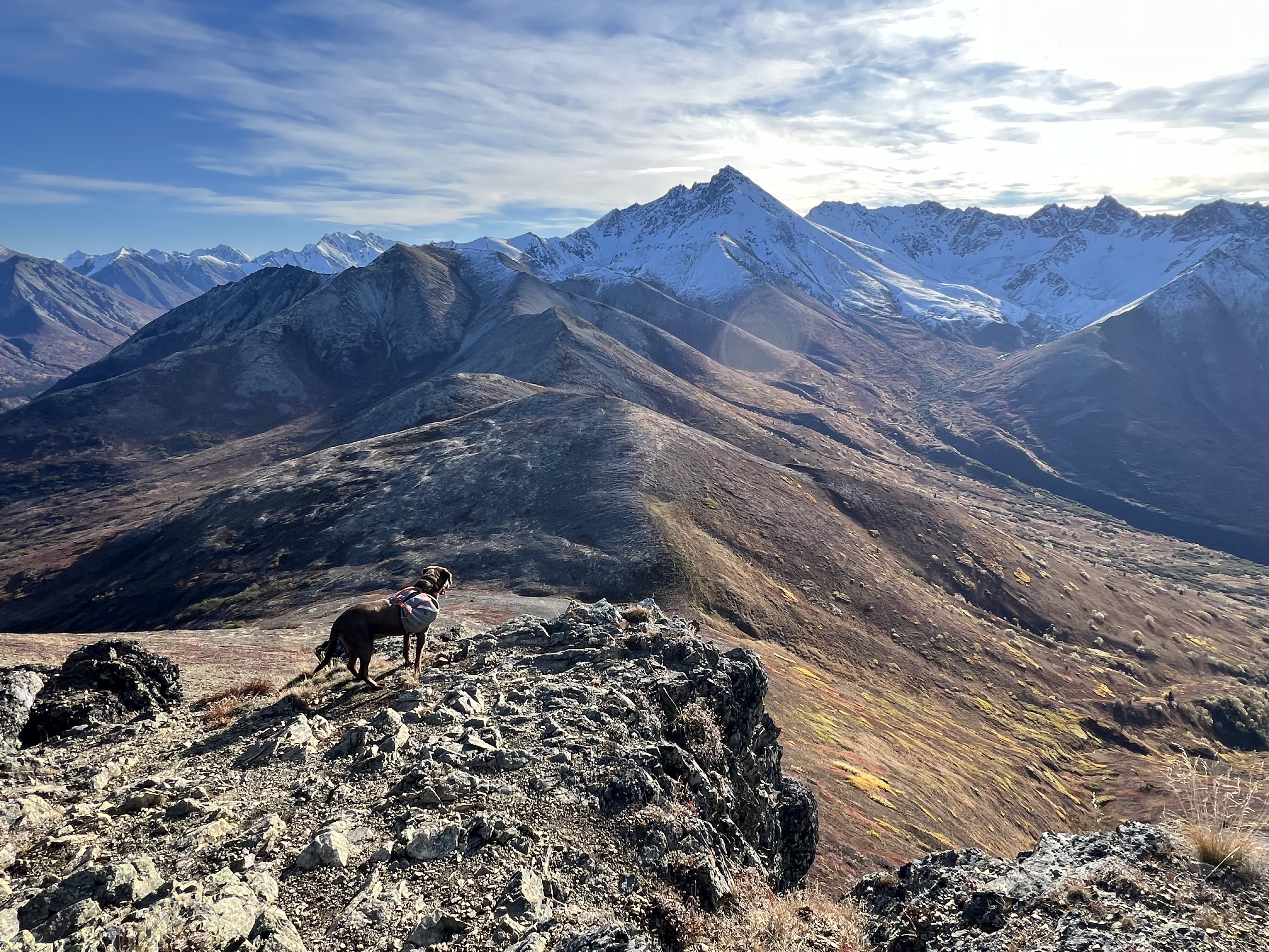
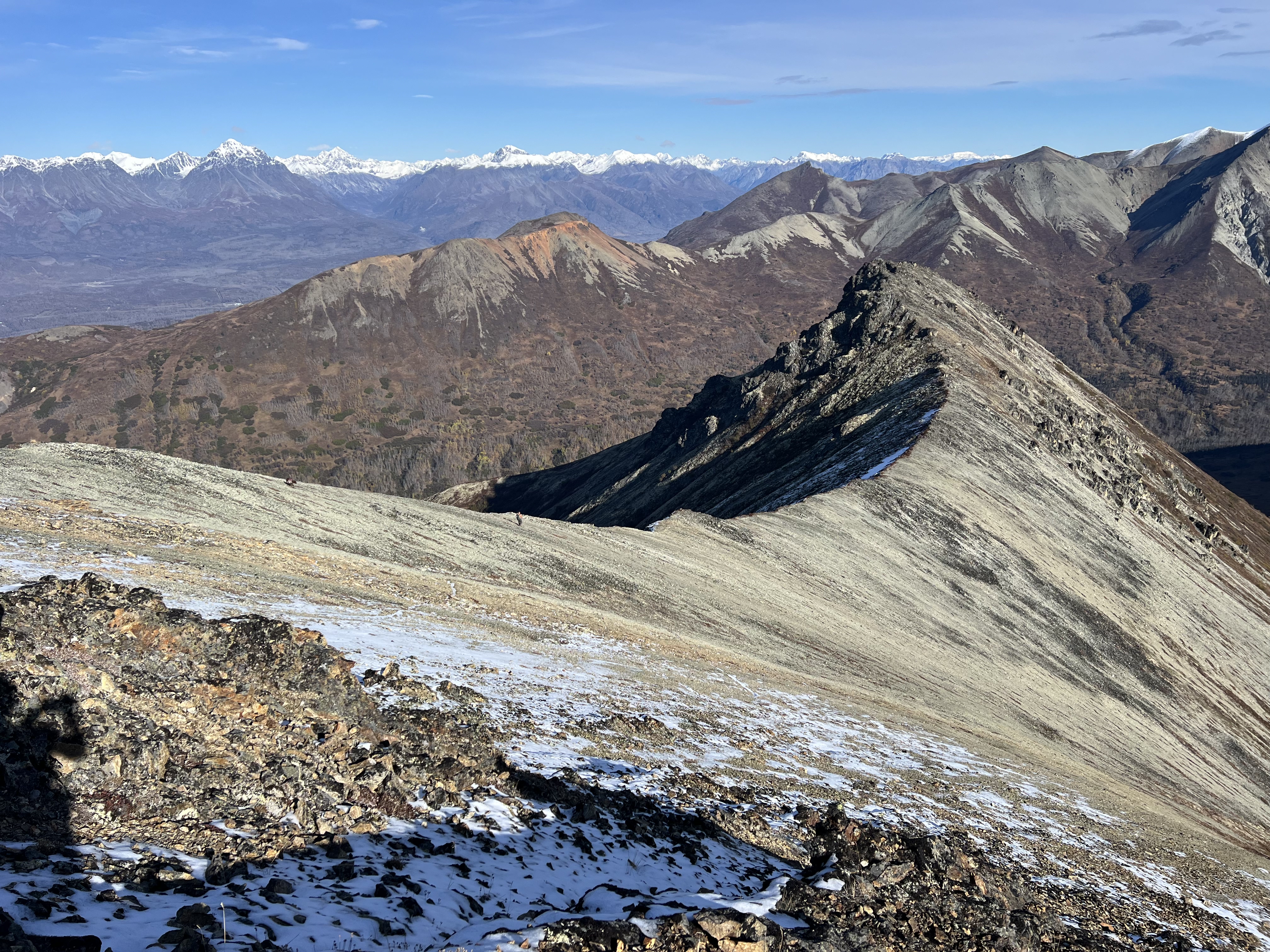
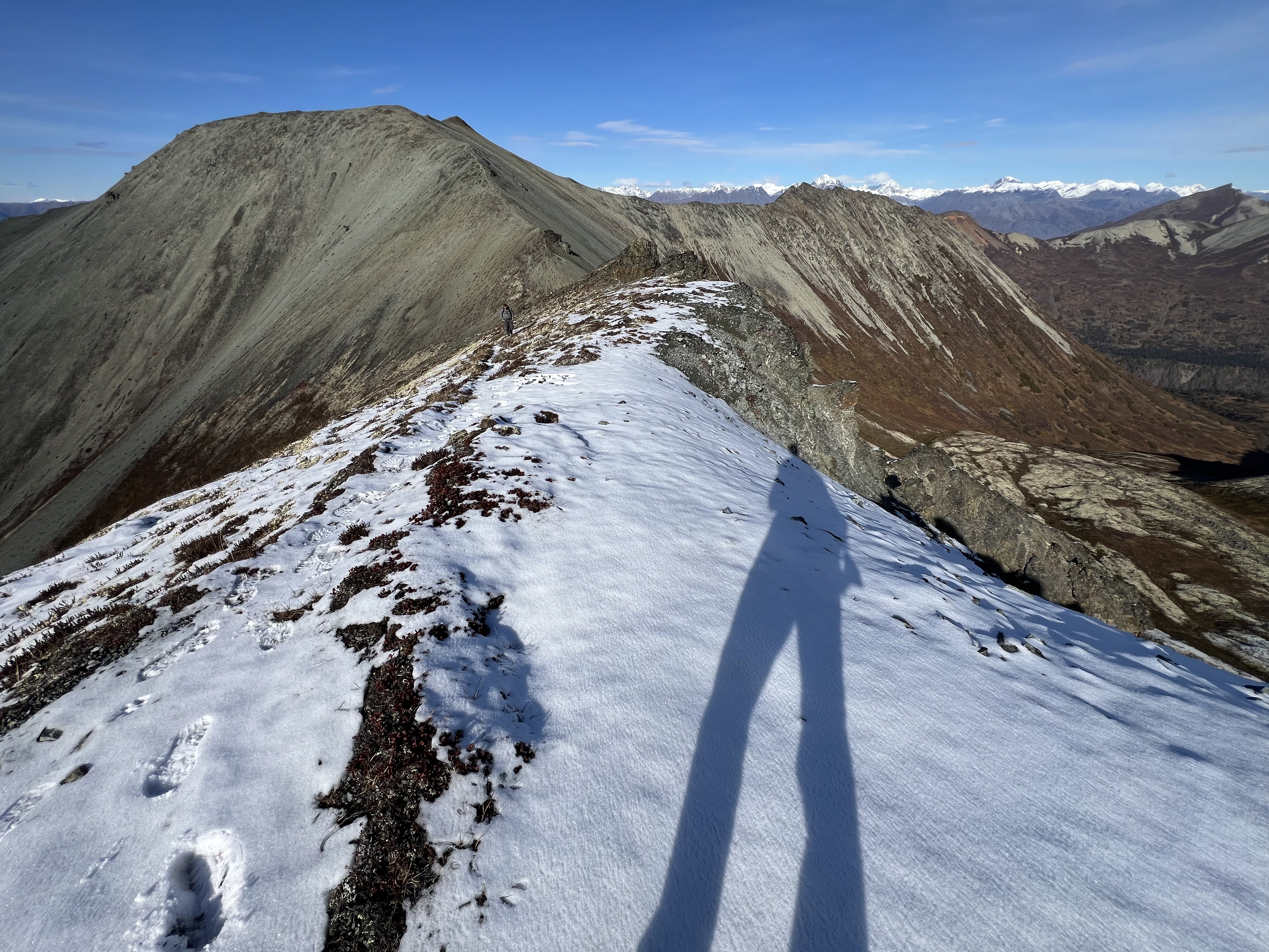
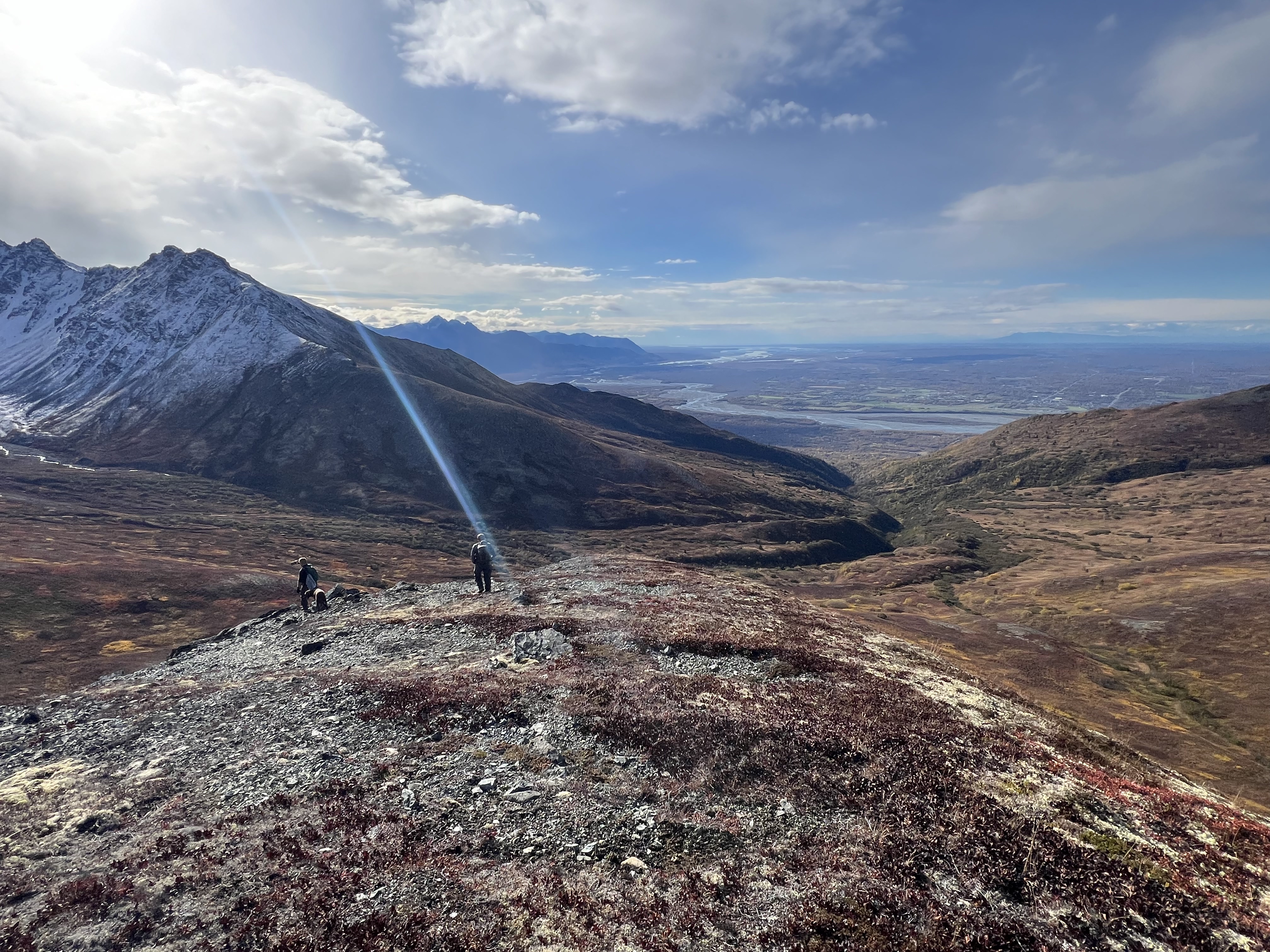
A wide summit ridge, the true summit is nondescript. An anticlimactic high point, merely a bump of rocks slightly higher than the rest of the high ground. We all separated for a bit and explored the top of the mountain, Jason heading north out to the end of the northeast ridge, Josiah out to the end of the northwest ridge, while I took more photos of the route from where we started on top of Lazy, now well below us, the bootpath barely visible. I, too, ventured out to the end of the northwest ridge, not able to resist more views of Lazy and Wolverine Valley to the north, already scoping out a new U-shaped ridge walk from Crag Peak.
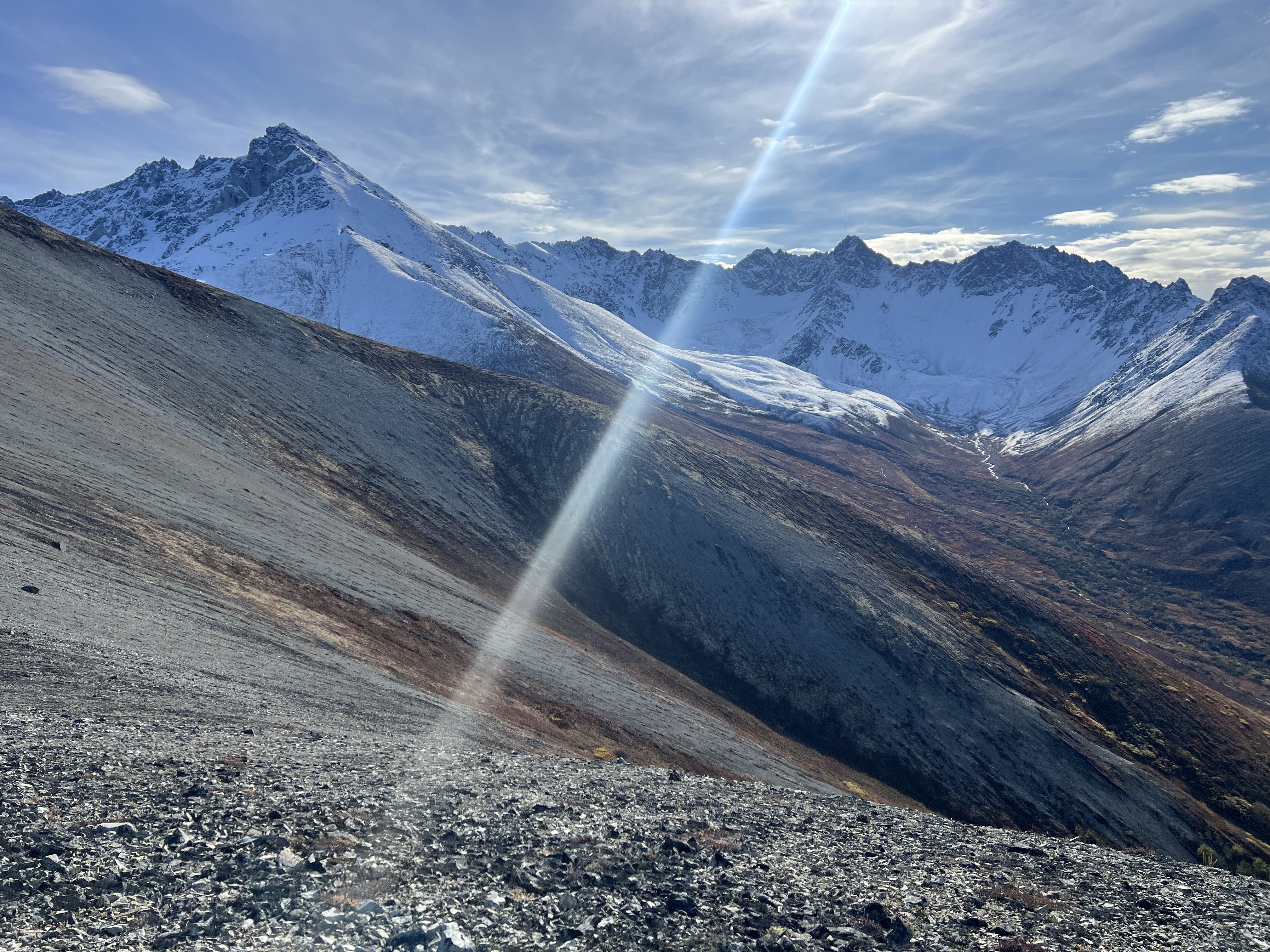
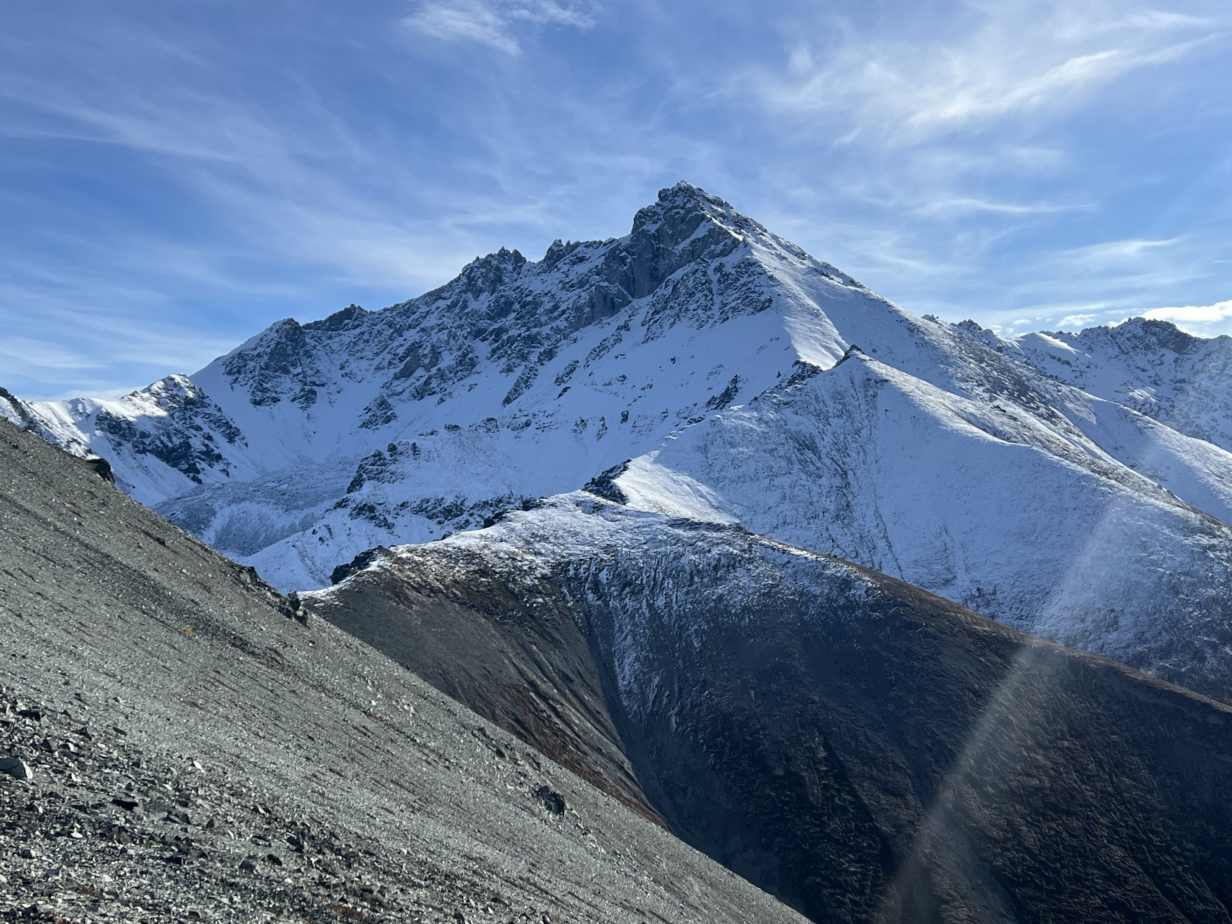
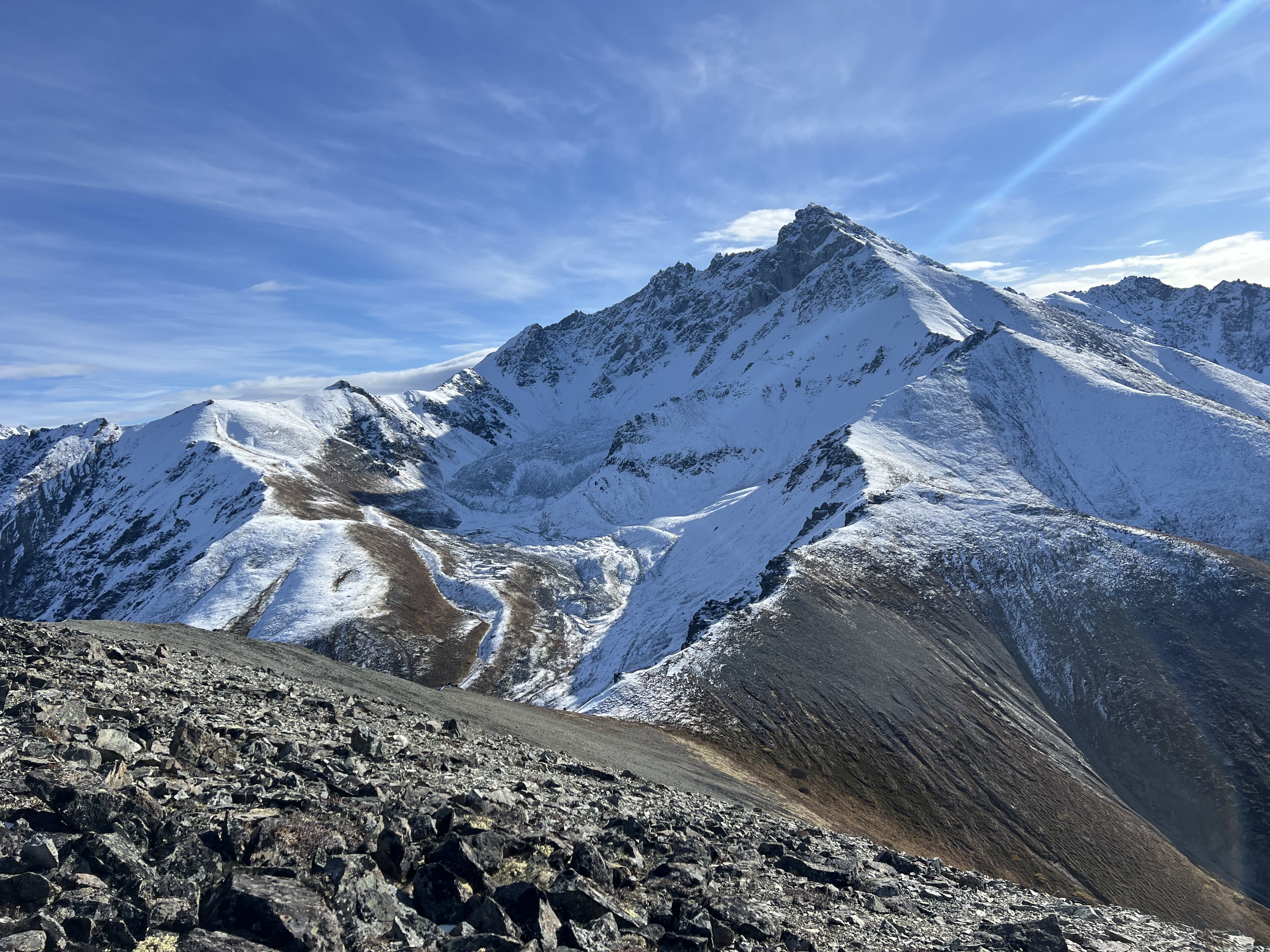

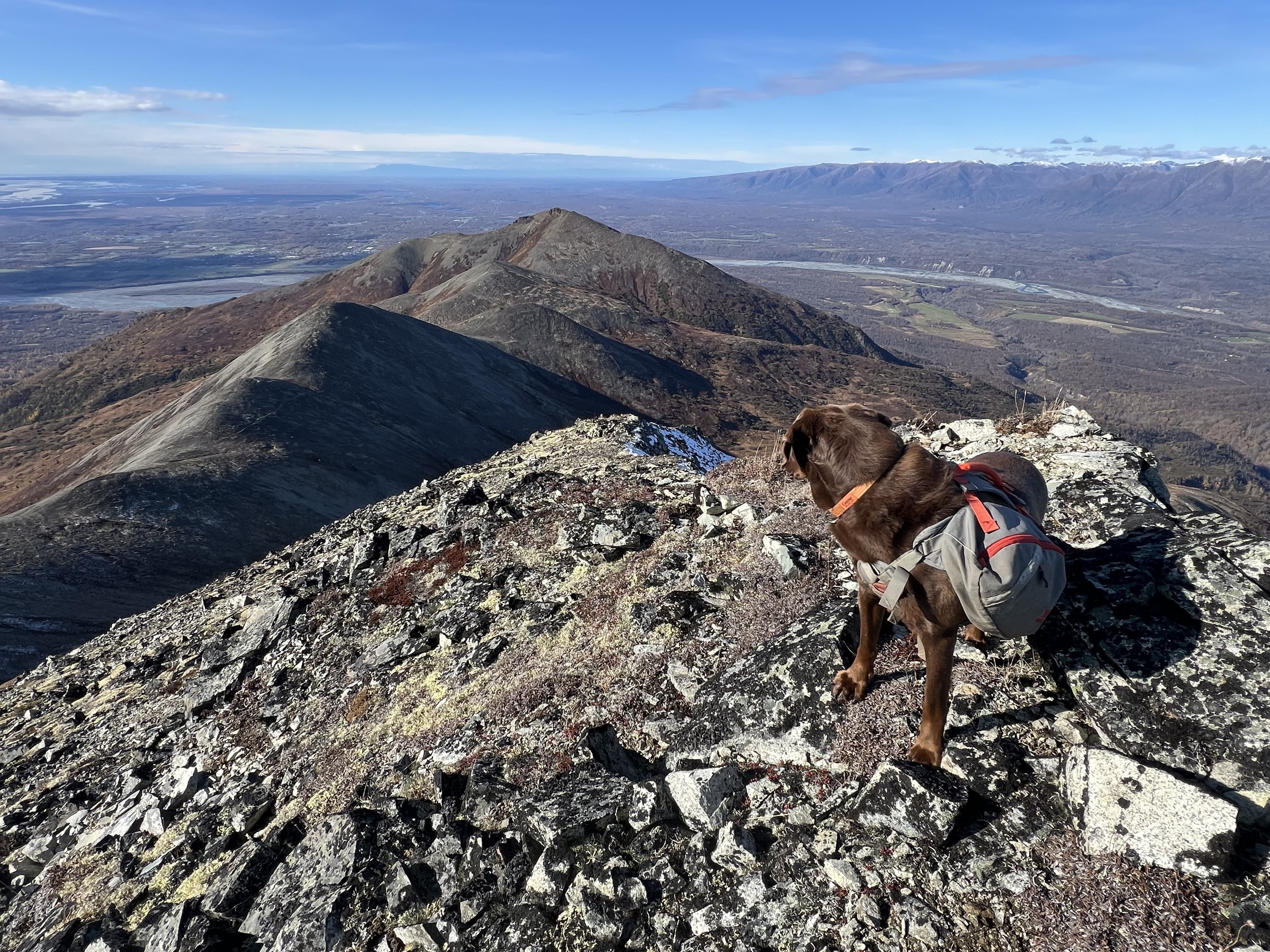
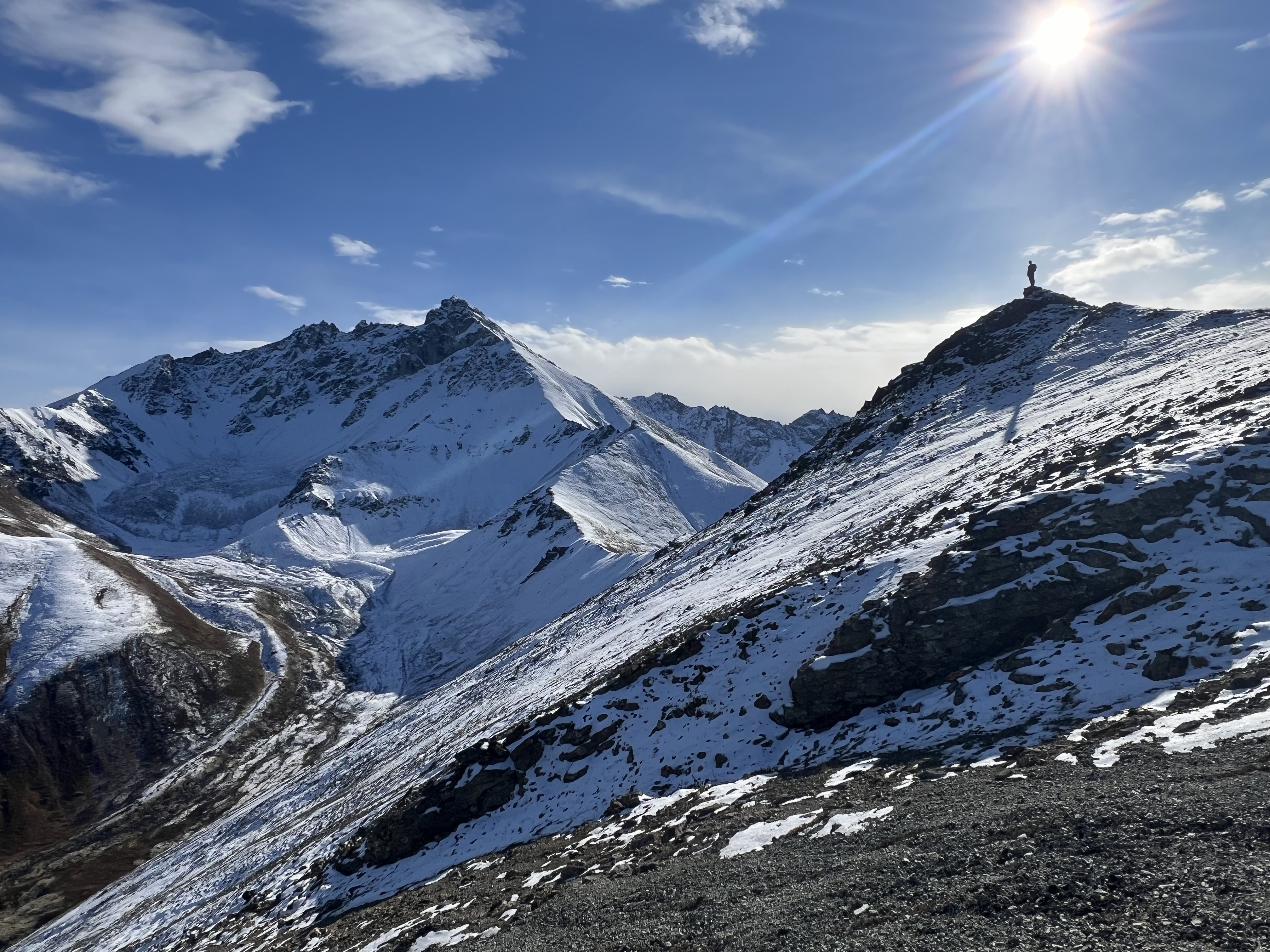
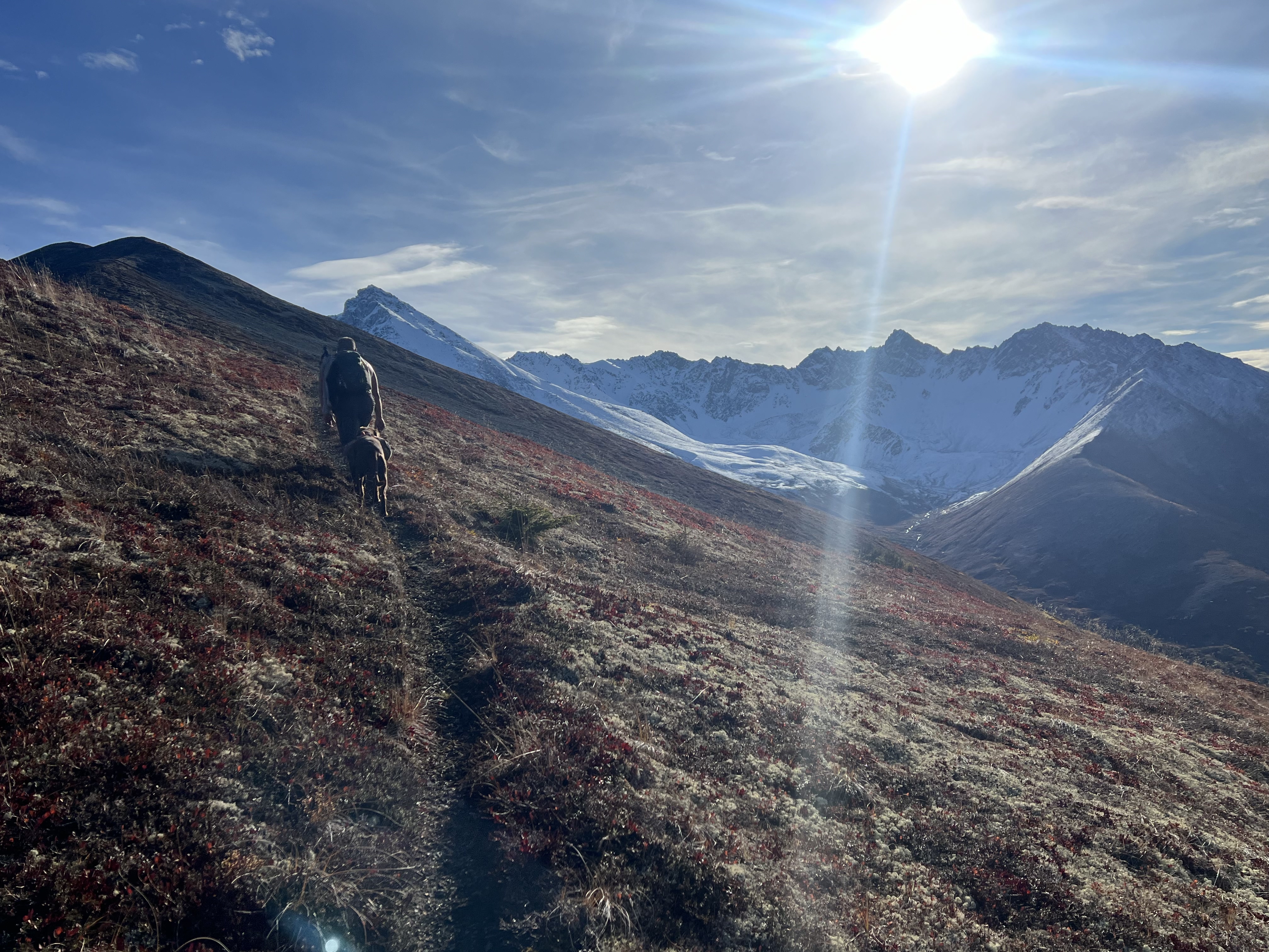
The days were getting shorter and we all agreed it was time to move on, our goal of 4199 achieved, yet only halfway to where we were going. We descended the 500′ to the saddle between 4199 and another unnamed bump with an elevation 4015,’ the north side of Matanuska Peak now visible. A rarely glimpsed sight, and only visible from this ridge, we took in the impressive view of the high double cirque, carved by glaciers now long gone, though the evidence remains in the etched and sculpted landscape.
The ridgeline up to Matanuska Peak didn’t look that bad from where were standing, but having experienced the high scree chute on the southwest face the first time I climbed it due to a route-finding error on my part, I knew that it was steeper and much more dangerous than it looked. We talked about how we should try it next summer before the ridgeline was covered in snow.
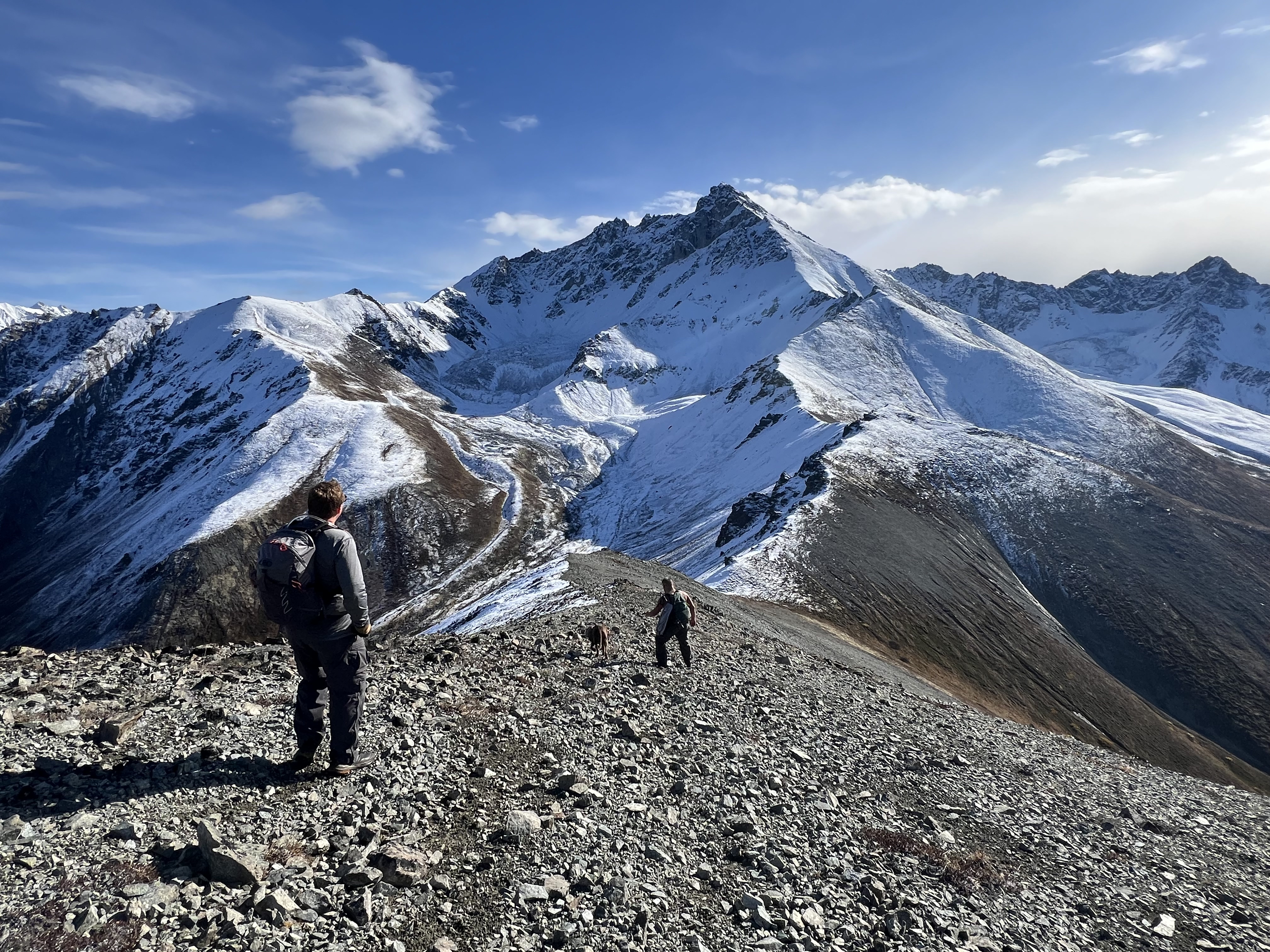
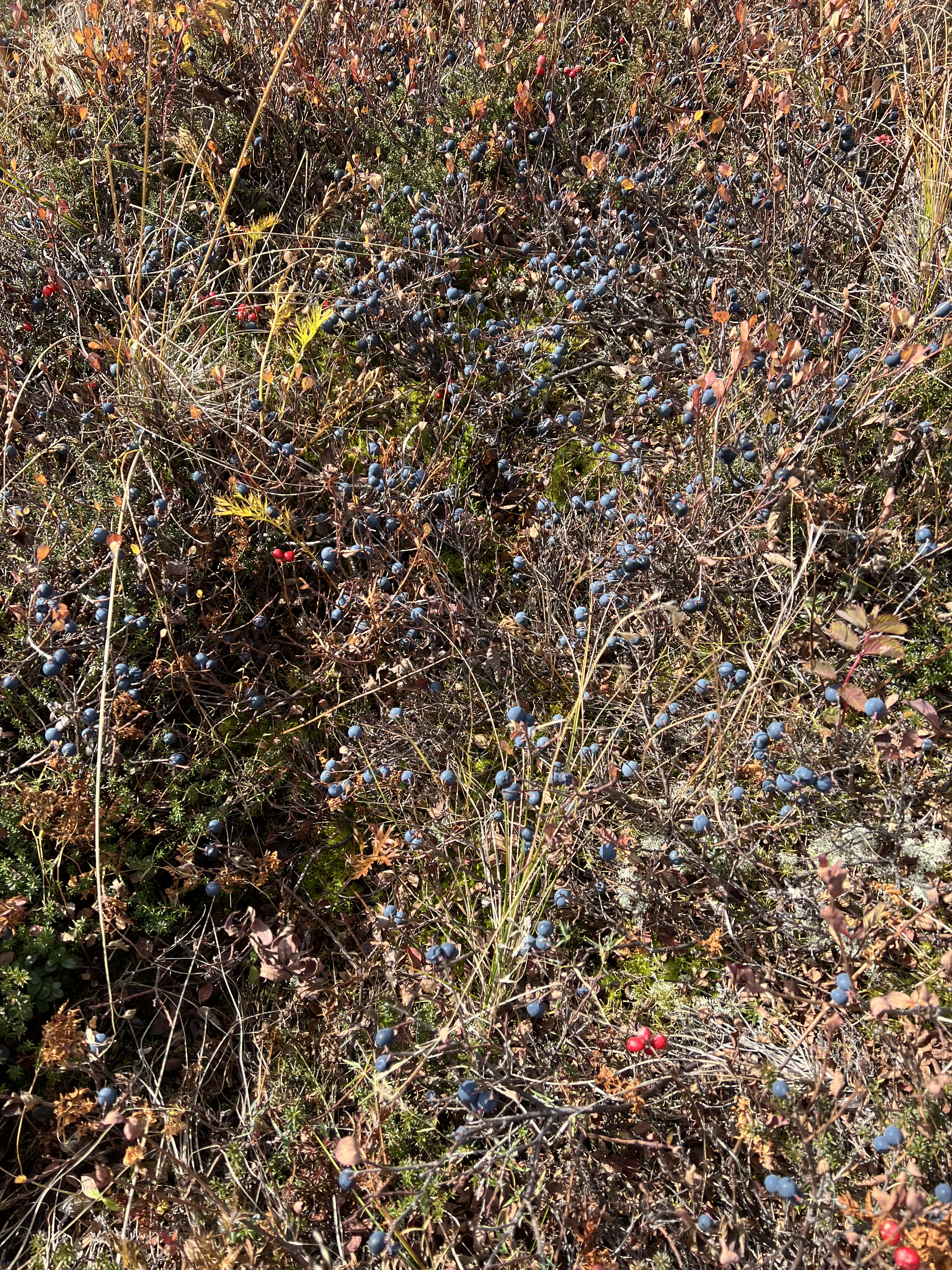
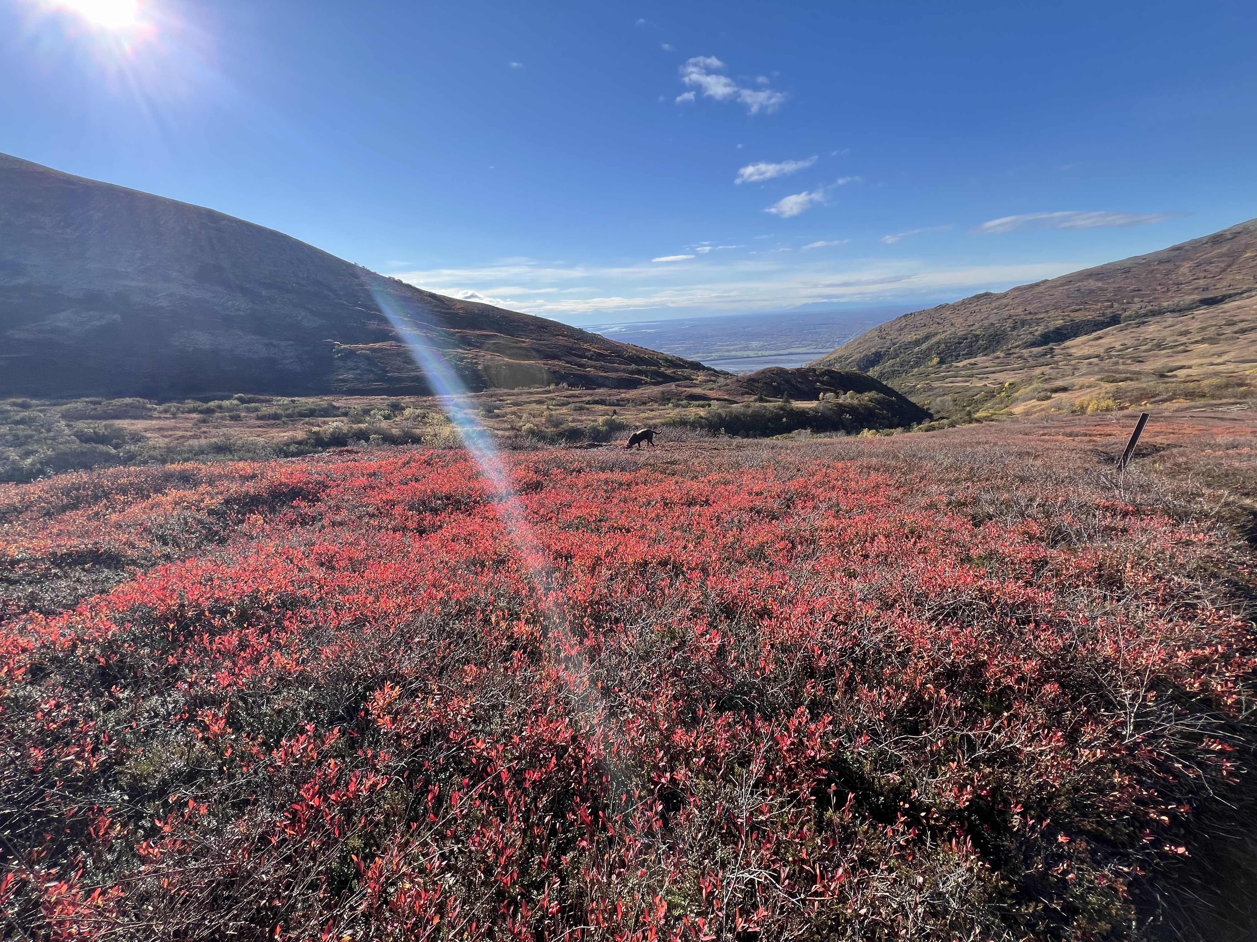
At 4015 our ridge walk towards Mat Peak was at the end. Having negotiated a bit of snow, but not interested in continuing on to end up with wet feet, we followed the southwest ridge of 4015 down towards the valley and Mat Peak Trail. Not following an established route, we all picked our way down the slope, stopping frequently to pick the enormous and prolific blueberries growing all over the hillside. I had never tasted a more perfect berry and Goose agreed. He and I nibbled away at the sweet berries together.
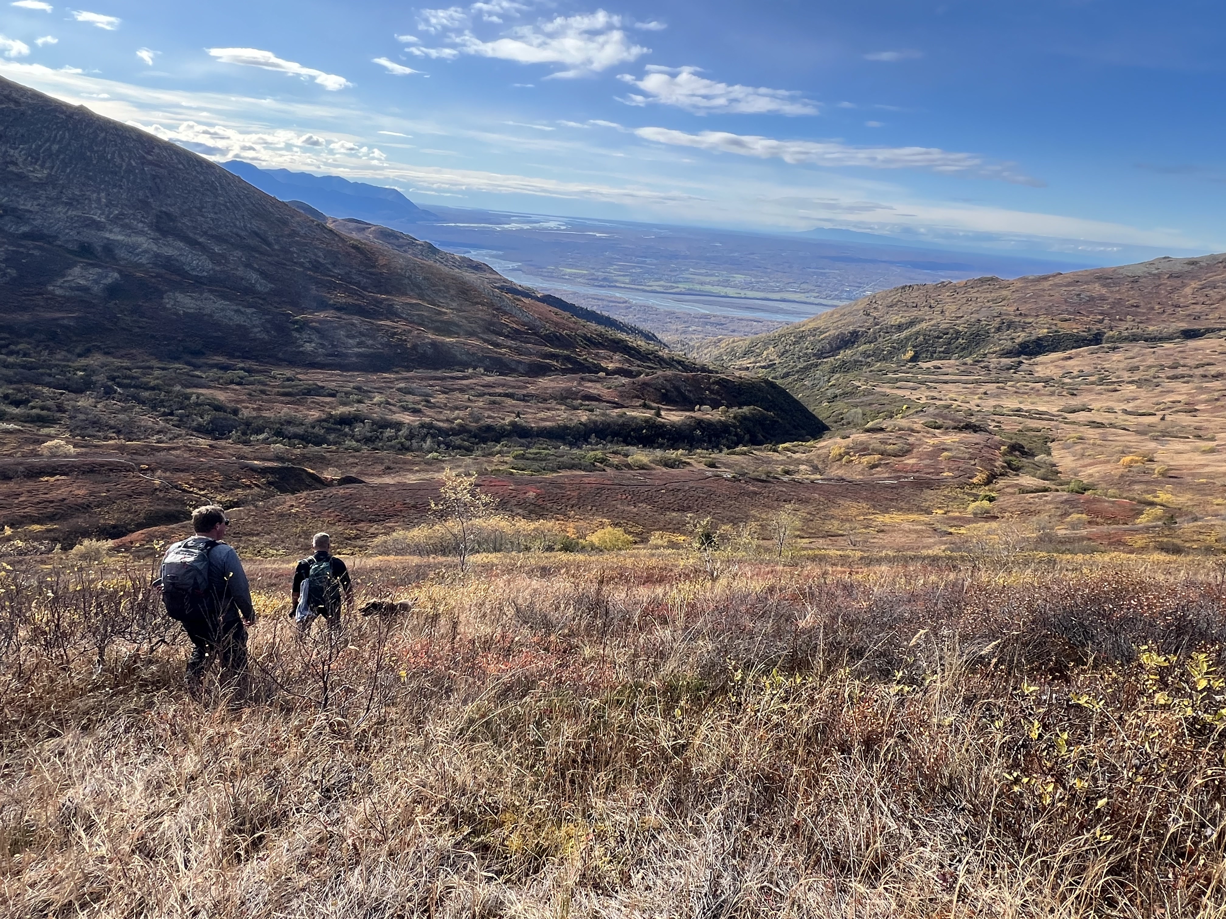
Finally getting our fill of one of AKs superfoods, we finished making a path through the vibrantly colored shrubbery to the well-trodden Mat Peak Trail. We made quick work of the last 3 miles, opting to take the McRoberts Trail, a path less traveled than the parallelling Mat Peak Trail due to overgrowth during the prime summer months. We had no issues, the September frosts had caused significant die back of the vegetation and a comfortably clear path, although we did make sure to make plenty of noise to keep the bears away.
Before we knew it, we were at the Smith Road Trailhead, another ridge section completed, and two more goals added to the 2025 to-do list. This would be our last Alaska hike of 2024.
Just The Tips:
- Lazy Mtn can be accessed via the Lazy Mtn Trailhead or the Smith Road Trailhead. There are many variations and trail options to consider when planning your route.
- No parking pass is required at Smith Road Trailhead. A Mat-Su Borough parking pass is required for Lazy Mountain Trailhead.
- Be Bear Aware! Especially on the McRoberts Trail.
- Be Moose Aware! I have been charged on the Mat Peak Trail.
- This is a very dog friendly hike with no significant exposure, except for right at the top of Lazy. Bring plenty of water for your pooch if it is a hot summer day as no water is available between the Lazy Mtn Trailhead and McRoberts Creek, a distance of more than 6 miles.
- Don’t leave valuables in your vehicle at either trailhead. Lazy trailhead, in particular, has had reports of break-ins and vandals, although I have not yet experienced that in my nearly 20 years of hiking here.
- If it is icy, microspikes are absoutely necessary for the first mile up from the Lazy Mtn trailhead.
Lazy Mtn and Peak 4199 AllTrails and Peakbagger Links:

Lazy Mtn Peakbagger Page

Peak 4199 Peakbagger Page
REcent Trip Reports:
Where the Clouds Parted: A Knoya, Kanchee and Nunaka Ridge Walk
May 31, 2025 Knoya: 4600′ – FR #17 Kanchee: 4393′ – FR #20 Nunaka point: 3780′ Mileage: ~14 Miles Elevation Gain: ~5000′ The summer wasn’t summering, and I was suffering from a bout of springtime depression that only sunshine and warm weather could cure. I dragged myself to the Klutina Trailhead to meet Jason. We…
Pedals, Peaks and Thunderstorms: Bike and Hike Mount Margaret in Denali National Park
May 25, 2025 Mount MArgaret: 5069′ Denali NAtional PArk Mileage: 4.6 Mile Bike/4.6 Mile Hike/4.6 Mile Bike Elevation Gain: 2,750′ This year’s annual mother/daughter camping trip in Denali National Park looked a little different from our normal stay at Riley Creek Campground. The Labor Day prior, we decided our next trip would be to Savage…
Chasing the Wind: A Long-Awaited Victory on Peak 1216 and Ship Creek Hill
April 26, 2025 Peak 1216 AKA 3990: 3990′ Ship Creek Hill: 3842′ (chugach Front Range Peak #24) Mileage: 15 Miles Elevation Gain: 5,700′ The majority of the Southcentral Alaska winter of 2024-25 was uncharacteristically warm and relatively snow free, but here we were in April, with record breaking snowfall around Anchorage. The ridges and peaks…
